Cultural Geography Scrapbook
Key
| Textual Feature | Appearance |
|---|---|
| Whitman's hand | blue double overline and underline |
| Highlighting | yellow background with top and bottom border |
| Paste-on | gray box with black borders |
| Laid in | white box with black borders |
| Erasure | white text with dark gray background |
| Overwritten | brown with strikethrough |
 [begin surface 2]
 [begin surface 3]
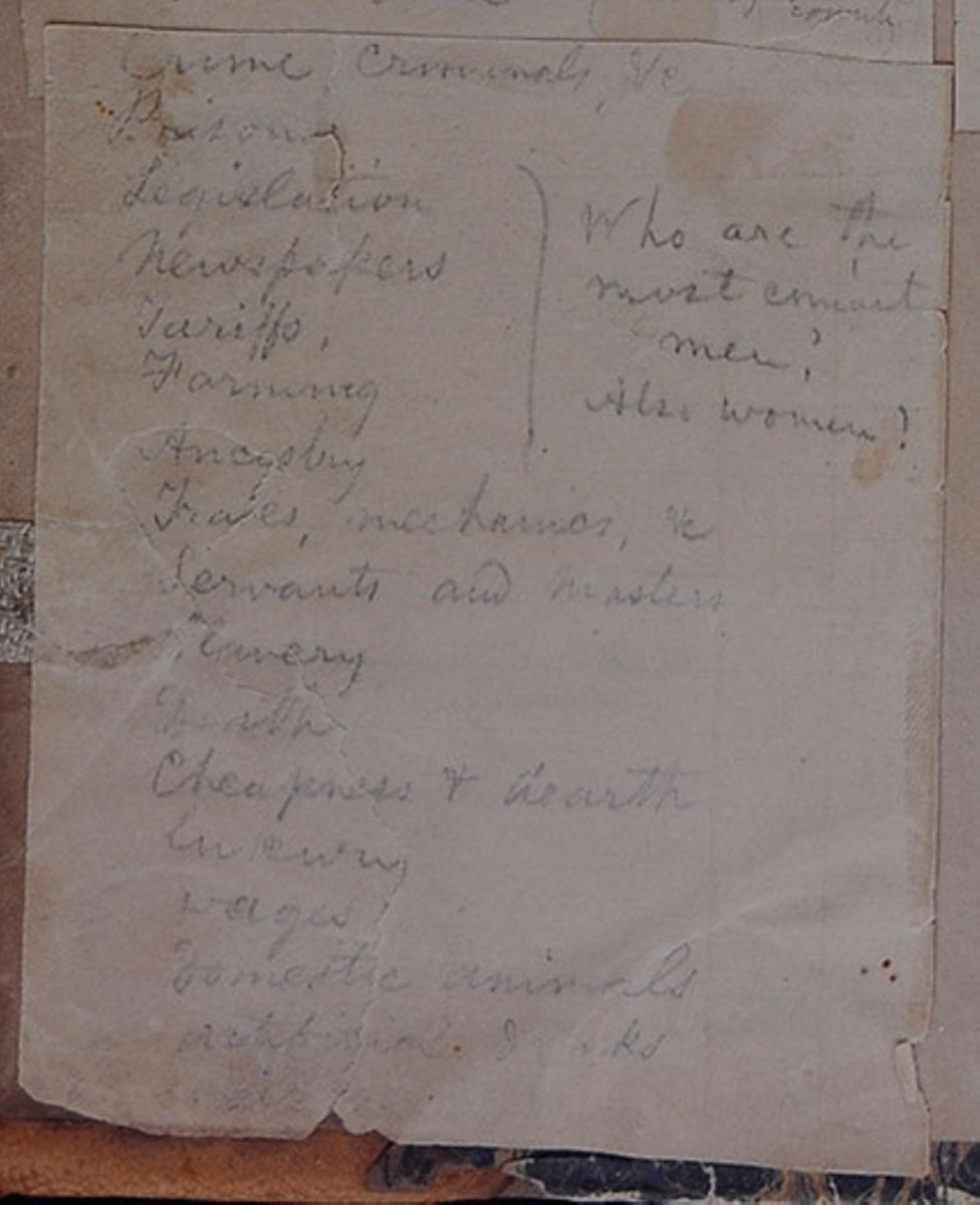
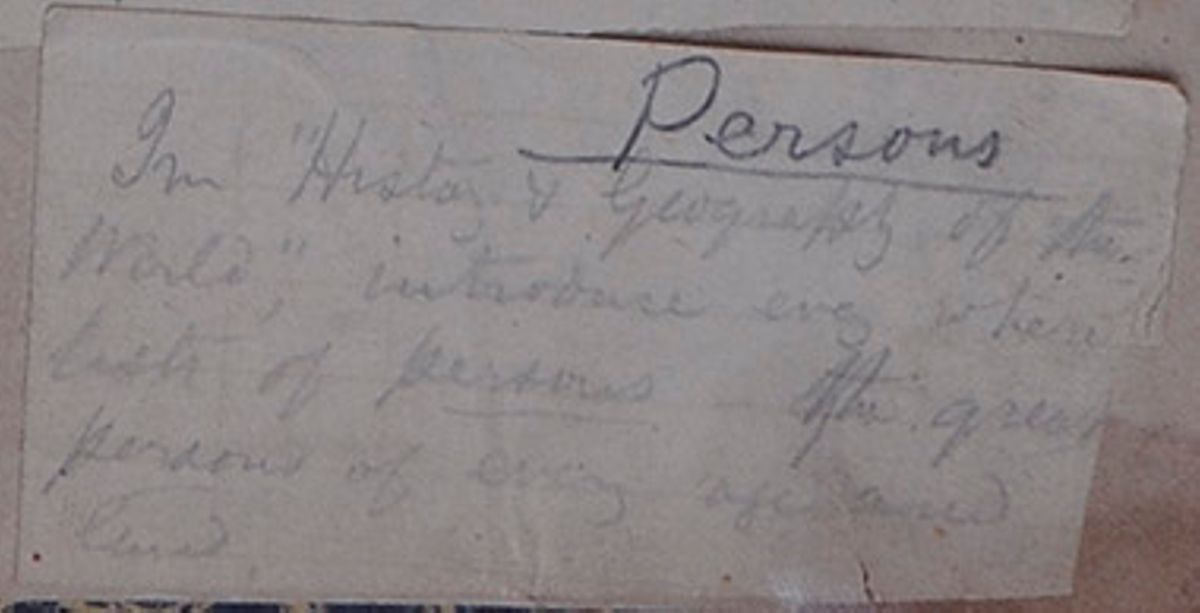
Persons
In "History & Geography of the World," introduce every where lists of persons—the great persons of every age and land.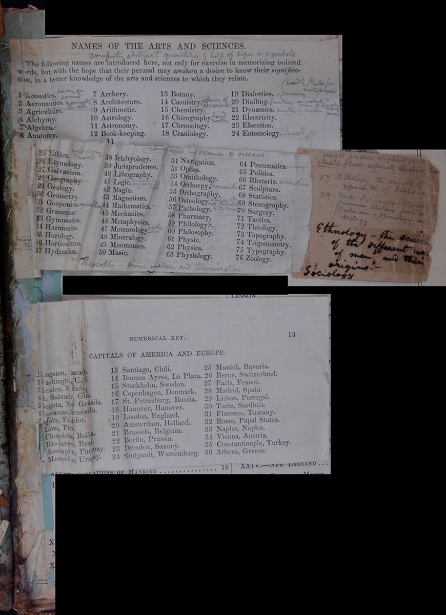 [begin surface 10]
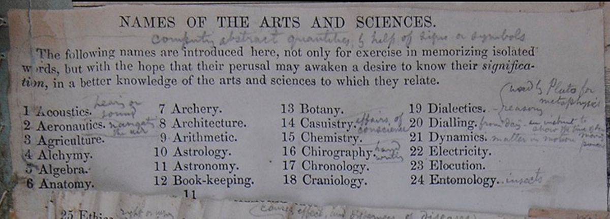
NAMES OF THE ARTS AND SCIENCES.
The following names are introduced here, not only for exercise in memorizing isolated words, but with the hope that their perusal may awaken a desire to know their signification, in a better knowledge of the arts and sciences to which they relate.
- 1 Acoustics.
- 2 Aeronautics.
- 3 Agriculture.
- 4 Alchymy.
- 5 Algebra.
- 6 Anatomy.
- 7 Archery.
- 8 Architecture.
- 9 Arithmetic.
- 10 Astrology.
- 11 Astronomy.
- 12 Book-keeping.
- 13 Botany.
- 14 Casuistry.
- 15 Chemistry.
- 16 Chirography.
- 17 Chronology.
- 18 Craniology.
- 19 Dialectics.
- 20 Dialling.
- 21 Dynamics.
- 22 Electricity.
- 23 Elocution.
- 24 Entomology.
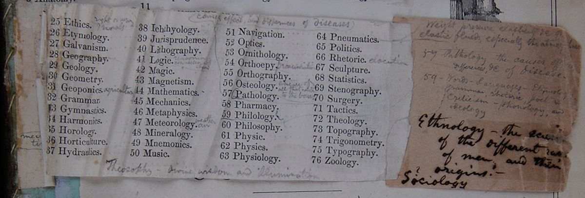
- 25 Ethics.
- 26 Etymology.
- 27 Galvanism.
- 28 Geography.
- 29 Geology.
- 30 Geometry.
- 31 Geoponics.
- 32 Grammar.
- 33 Gymnastics.
- 34 Harmonics.
- 35 Horology.
- 36 Horticulture.
- 37 Hydraulics.
- 38 Ichthyology.
- 39 Jurisprudence.
- 40 Lithography.
- 41 Logic.
- 42 Magic.
- 43 Magnetism.
- 44 Mathematics.
- 45 Mechanics.
- 46 Metaphysics.
- 47 Meteorology.
- 48 Mineralogy.
- 49 Mnemonics.
- 50 Music.
- 51 Navigation.
- 52 Optics.
- 53 Ornithology.
- 54 Ortheopy.
- 55 Orthography.
- 56 Osteology.
- 57 Pathology.
- 58 Pharmacy.
- 59 Philology.
- 60 Philosophy.
- 61 Physic.
- 62 Physics.
- 63 Physiology.
- 64 Pneumatics.
- 65 Politics.
- 66 Rhetoric.
- 67 Sculpture.
- 68 Statistics.
- 69 Stenography.
- 70 Surgery.
- 71 Tactics.
- 72 Theology.
- 73 Topography.
- 74 Trigonometry.
- 75 Typography.
- 76 Zoology.

- Ethnology—the science of the different races of men, and their origins.—
- ?Sociology
 [begin surface 15]
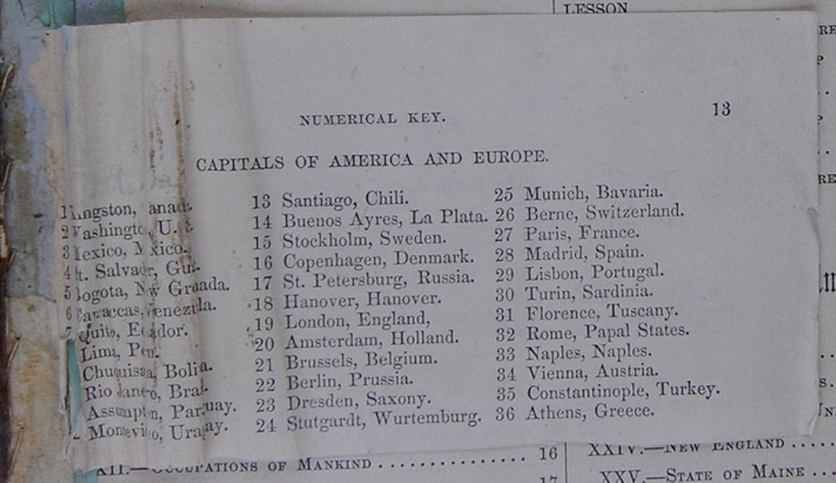
CAPITALS OF AMERICA AND EUROPE.
- 1 Kingston, Canada.
- 2 Washington, U.S.
- 3 Mexico, Mexico.
- 4 St. Salvador, Guat.
- 5 Bogota, New Grenada.
- 6 Caraccas, Venezuela.
- 7 Quito, Ecuador.
- [cutaway] Lima, Peru.
- [cutaway] Chuquisaca, Bolivia.
- [cutaway] Rio Janeiro, Brazil.
- [cutaway] Assumption, Paraguay.
- [cutaway] Montevideo, Uraguay.
- 13 Santiago, Chili.
- 14 Buenos Ayres, La Plata.
- 15 Stockholm, Sweden.
- 16 Copenhagen, Denmark.
- 17 St. Petersburg, Russia.
- 18 Hanover, Hanover.
- 19 London, England,
- 20 Amsterdam, Holland.
- 21 Brussels, Belgium.
- 22 Berlin, Prussia.
- 23 Dresden, Saxony.
- 24 Stutgardt, Wurtemburg.
- 25 Munich, Bavaria.
- 26 Berne, Switzerland.
- 27 Paris, France.
- 28 Madrid, Spain.
- 29 Lisbon, Portugal.
- 30 Turin, Sardinia.
- 31 Florence, Tuscany.
- 32 Rome, Papal States.
- 33 Naples, Naples.
- 34 Vienna, Austria.
- 35 Constantinople, Turkey.
- 36 Athens, Greece.
 Engraving of ruins
CONTENTS.
| [covered]N | PAGE |
| I.—GEOGRAPHY AND HISTORY | 9 |
| II.—SHAPE OF THE EARTH | 9 |
| [covered]II.—MOTIONS AND MAGNITUDE OF THE EARTH | 10 |
| IV.—GLOBES AND MAPS | 10 |
| V.—LATITUDES AND LONGITUDE, &c. | 10 |
| VI.—ZONES AND CLIMATES | 11 |
| [covered]II.—DIVISIONS OF THE LAND | 13 |
| [covered]III.—DIVISIONS OF THE WATER | 13 |
| IX.—NATURAL AND POLITICAL GEOGRAPHY | 14 |
| X.—GOVERNMENT | 15 |
| XI.—RELIGION | 15 |
| XII.—OCCUPATIONS OF MANKIND | 16 |
| [covered]III.—LANGUAGES OF MANKIND | 17 |
| XIV.—GEOGRAPHICAL OUTLINE | 18 |
| XV.—HISTORICAL OUTLINE | 18 |
| XVI.—DISPERSION OF MANKIND | 19 |
| LESSON | PAGE |
| XVII.—WESTERN HEMISPHERE | 20 |
| XVIII.—EXERCISES ON MAP OF WESTERN HEMISPHERE | 21 |
| XIX.—EXERCISES ON MAP OF EASTERN HEMISPHERE | 22 |
| XX.—EASTERN HEMISPHERE | 2[illegible] |
| XXI.—GENERAL VIEW | 25 |
| XXII.—THE UNITED STATES | 26 |
| XXIII.—HISTORY OF THE UNITED STATE[illegible] | 30 |
| XXIV.—NEW ENGLAND | 34 |
| XXV.—STATE OF MAINE | 36 |
| XXVI.—STATE OF NEW HAMPSHIRE | 38 |
| XXVII.—STATE OF VERMONT | 40 |
| XXVIII.—STATE OF MASSACHUSETTS | 42 |
| XXIX.—STATE OF RHODE ISLAND | 46 |
| XXX.—STATE OF CONNECTICUT | 48 |
| XXXI.—THE MIDDLE STATES | 50 |
| XXXII.—STATE OF NEW YORK | 52 |
 6
CONTENTS.
6
CONTENTS.
| LESSON | PAGE |
| XXXIII.—STATE OF NEW JERSEY | 56 |
| XXXIV.—STATE OF PENNSYLVANIA | 58 |
| XXXV.—STATE OF DELAWARE | 61 |
| XXXVI.—STATE OF MARYLAND | 62 |
| XXXVII.—DISTRICT OF COLUMBIA | 64 |
| XXXVIII.—THE SOUTHERN STATES | 67 |
| XXXIX.—STATE OF VIRGINIA | 68 |
| XL.—STATE OF NORTH CAROLINA | 73 |
| XLI.—STATE OF SOUTH CAROLINA | 75 |
| XLII.—STATE OF FLORIDA | 78 |
| XLIII.—STATE OF GEORGIA | 80 |
| XLIV.—STATE OF ALABAMA | 82 |
| XLV.—STATE OF MISSISSIPPI | 84 |
| XLVI.—STATE OF LOUISIANA | 85 |
| XLVII.—STATE OF TEXAS | 91 |
| XLVIII.—THE WESTERN STATES | 95 |
| XLIX.—STATE OF ARKANSAS | 97 |
| L.—STATE OF MISSOURI | 99 |
| LI.—STATE OF TENNESSEE | 101 |
| LII.—STATE OF KENTUCKY | 103 |
| LIII.—STATE OF OHIO | 106 |
| LIV.—STATE OF INDIANA | 109 |
| LV.—STATE OF ILLINOIS | 111 |
| LVI.—STATE OF MICHIGAN | 114 |
| LVII.—STATE OF WISCONSIN | 118 |
| LVIII.—STATE OF IOWA | 120 |
| LIX.—TERRITORIES—MINNESOTA | 123 |
| LX.—KANSAS AND NEBRASKA | 124 |
| LXI.—INDIAN TERRITORY | 125 |
| LXII.—TERRITORY OF NEW MEXICO | 127 |
| LXIII.—THE PACIFIC REGION | 129 |
| LXIV.—TERRITORY OF UTAH | 130 |
| LXV.—STATE OF CALIFORNIA | 131 |
| LXVI.—OREGON AND WASHINGTON | 134 |
| LXVII.—GENERAL VIEW OF THE U. STATES | 136 |
| LXVIII.—THE POLAR REGIONS | 138 |
| LXIX.—RUSSIAN AMERICA | 140 |
| LXX.—BRITISH AMERICA | 141 |
| LXXI.—NEW BRITAIN, CANADA, NEW BRUNSWICK, &c. | 143 |
| LXXII.—REPUBLIC OF MEXICO | 146 |
| LXXIII.—GUATIMALA, OR CENTRAL AMERICA | 150 |
| LESSON | PAGE |
| LXXIV.—WEST INDIES | 151 |
| LXXV.—VIEW OF SEPARATE ISLANDS | 152 |
| LXXVI.—DISCOVERIES OF COLUMBUS | 157 |
| LXXVII.—GENERAL VIEW | 159 |
| LXXVIII.—GUIANA | 161 |
| LXXIX.—VENEZUELA | 162 |
| LXXXX.—REPUBLIC OF NEW GRANADA | 163 |
| LXXXI.—REPUBLIC OF ECUADOR | 165 |
| LXXXII.—REPUBLIC OF PERU | 166 |
| LXXXIII.—REPUBLIC OF BOLIVIA | 167 |
| LXXXIV.—REPUBLIC OF CHILI | 168 |
| LXXXV.—PATAGONIA | 169 |
| LXXXVI.—BUENOS AYRES, OR THE ARGENTINE REPUBLIC | 170 |
| LXXXVII.—REPUBLIC OF URUGUAY | 171 |
| LXXXVIII.—REPUBLIC OF PARAGUAY | 172 |
| LXXXIX.—EMPIRE OF BRAZIL | 172 |
| XC.—THE ATLANTIC OCEAN | 174 |
| XCI.—GENERAL VIEW | 177 |
| XCII.—UNITED KINGDOM OF GREAT BRITAIN AND IRELAND | 187 |
| XCIII.—ENGLAND | 188 |
| XCIV.—WALES | 193 |
| XCV.—SCOTLAND | 194 |
| XCVI.—IRELAND | 197 |
| XCVII.—FRANCE | 199 |
| XCVIII.—SPAIN | 204 |
| XCIX.—PORTUGAL | 207 |
| C.—ITALY | 208 |
| CI.—GREECE | 214 |
| CII.—TURKEY | 217 |
| CIII.—EMPIRE OF AUSTRIA | 219 |
| CIV.—KINGDOM OF PRUSSIA | 222 |
| CV.—GERMANY | 223 |
 CONTENTS.
7
CONTENTS.
7
| [covered]VI.—SWITZERLAND | 226 |
| [covered]II.—BELGIUM | 227 |
| [covered]III.—HOLLAND | 228 |
| [covered]IX.—DENMARK | 229 |
| [covered]CX.—NORWAY, SWEDEN, AND LAPLAND | 231 |
| [covered]XI.—RUSSIA IN EUROPE | 232 |
| [covered]XII.—AFRICA. | 235 |
| [covered]III.—NORTHERN AFRICA | 236 |
| [covered]IV.—EGYPT AND NUBIA | 238 |
| [covered]V.—WESTERN AFRICA | 239 |
| [covered]VI.—CENTRAL AFRICA | 239 |
| [covered]II.—SOUTHERN AFRICA | 240 |
| [covered]II.—EASTERN AFRICA | 240 |
| [covered]X.—ISLANDS OF AFRICA | 241 |
| LESSON | PAGE |
| CXX.—ASIA | 243 |
| CXXI.—RUSSIA IN ASIA | 245 |
| CXXII.—TURKEY IN ASIA | 246 |
| CXXIII.—ARABIA | 251 |
| CXXIV.—PERSIA | 255 |
| CXXV.—AFGHANISTAN AND BELOOCHISTAN | 256 |
| CXXVI.—INDEPENDENT TARTARY | 257 |
| CXXVII.—HINDOSTAN, OR INDIA | 258 |
| CXXVIII.—FARTHER INDIA | 261 |
| CXXIX—CHINESE EMPIRE | 263 |
| CXXX.—EMPIRE OF JAPAN | 265 |
| CXXXI.—OCEANICA | 266 |
| CXXXII.—GENERAL VIEWS OF THE EARTH | 269 |
 8
8
PUBLISHERS' NOTICE.
THE object of this work is to furnish a Geographical and Historical View of the World in a condensed form, suited, as a Book of Reference, to the use of Families, Merchants, Editors, Travelers, and the great mass of general readers.
The Author is the oldest, and, universally acknowledged, one of the most entertaining and reliable Geographers and Historians now living. Under the name of Peter Parley he is very favorably known to the masses of society, and his writings are "Familiar in their mouths as household words." This is his last, best work, in which he gives, in connection with the Geography of the World, an interesting and authentic History of Every Important Event that has transpired from the Earliest Ages to the Present Time.
It contains 272 quarto pages, illustrated with 200 Engravings, and 80 Maps of divisions, sub-divisions, and cities, prepared expressly for this work, and given in connection with the text which they illustrate.
It gives valuable statistics of the different countries up to the present time, not elsewhere to be found.
It contains the last Census of the United States, attached separately to the Geography and History of Each State.
The whole matter is arranged in a convenient and systematic form, for easy reference, the headings of the different subjects being in large type, so as to immediately attract the eye.
It contains a Geographical Description of every country on the globe.
It gives a Historical Outline of every country, Ancient as well as Modern. It contains an Outline of the Ancient Geography of every country, illustrated by full Ancient Maps.
When the mind is filled with a geographical [cut away]tion of a country, a curiosity to know its histo[cut away]riably arises; and under the excitement the latter[cut away] with vivid interest. The impression is therefore [cut away] and likely to be durable; the history serving, b[cut away] associations, to rivet the geography more firmly [cut away] memory. When reading the geographical acc[cut away] Mesopotamia, for instance, to learn in the same [cut away]tion that this is the country where the descen[cut away] Noah dwelt—that here was the Tower of Ba[cut away] the confusion of Tongues—that here was the [cut away] Babylon, founded by Nimrod, embellished by Se[cut away] perfected by Nebuchadnezzar, and conquered b[cut away]ander, will certainly add an interest to the subj[cut away] tend to impress the facts permanently upon th[cut away] We are never satisfied with learning what a co[cut away] without knowing how it became what it is; w[cut away] look upon a scene but the inquiry arises, "What ha[cut away]pired there?"
It is believed that no work has ever before co[cut away] these advantages of numerous maps in immediate [cut away] with the description of countries to which they [cut away] with the union of History and Geography—and [cut away] topics systematically and conspicuously arranged [cut away]venient reference.
In the back part is a copious Index, containing [cut away] Geographical and Historical Names in the wor[cut away] the pages upon which they are respectively tre[cut away] placed directly opposite, and the names divided [cut away]cented, so as to form a systematic and accurat[cut away]graphical and Historical Pronouncing Dictionary.
It is, unquestionably, one of the most valuable [cut away] for the library that has ever been issued. It has r[cut away] the highest encomiums of scientific men in Eur[cut away] America, as well as the most flattering notices of the [cut away]
| 1. WESTERN HEMISPHERE (small) | 11 |
| 2. EASTERN HEMISPHERE (do.) | 12 |
| 3. WESTERN HEMISPHERE | 21 |
| 4. EASTERN HEMISPHERE | 22 |
| 5. NORTH AMERICA | 24 |
| 6. UNITED STATES (small) | 26 |
| 7. UNITED STATES | 28, 29 |
| 8. NEW ENGLAND | 34 |
| 9. STATE OF MAINE | 36 |
| 10. " NEW HAMPSHIRE | 38 |
| 11. " VERMONT | 40 |
| 12. " MASSACHUSETTS | 42 |
| 13. CITY OF BOSTON | 44 |
| 14. STATE OF RHODE ISLAND | 46 |
| 15. " CONNECTICUT | 48 |
| 16. MIDDLE STATES | 50 |
| 17. STATE OF NEW YORK | 52 |
| 18. CITY OF NEW YORK | 54 |
| 19. HUDSON RIVER | 55 |
| 20. STATE OF NEW JERSEY | 56 |
| 21. " PENNSYLVANIA | 58 |
| 22. CITY OF PHILADELPHIA | 60 |
| 23. STATES OF MARYLAND AND DELWARE | 61 |
| 24. CITY OF BALTIMORE | 63 |
| 25. DISTRICT OF COLUMBIA | 64 |
| 26. SOUTHERN STATES | 66 |
| 27. STATE OF VIRGINIA | 68 |
| 28. STATE OF NORTH CAROLINA | 73 |
| 29. " SOUTH CAROLINA | 75 |
| 30. " FLORIDA | 78 |
| 31. STATES OF GEORGIA AND ALABAMA | 80 |
| 32. " MISSISSIPPI AND LOUISIANA | 84 |
| 33. CITY OF NEW ORLEANS | 87 |
| 34. STATE OF TEXAS | 91 |
| 35. WESTERN STATES | 94 |
| 36. STATE OF ARKANSAS | 97 |
| 37. " MISSOURI | 99 |
| 38. " TENNESSEE | 101 |
| 39. " KENTUCKY | 103 |
| 40. " OHIO | 106 |
| 41. STATES OF INDIANA AND ILLINOIS | 109 |
| 42. STATE OF MICHIGAN | 114 |
| 43. " WISCONSIN | 118 |
| 44. " IOWA | 120 |
| 45. TERRITORIES IN THE VALLEY OF THE MISSISSIPPI | 122 |
| 46. OREGON AND CALIFORNIA | 129 |
| 47. CITY OF SAN FRANCISCO | 133 |
| 48. POLAR REGIONS | 138 |
| 49. NEW BRUNSWICK, CANADA, &c. | 143 |
| 50. CITY OF MONTREAL | 144 |
| 51. MEXICO, GUATIMALA, AND THE WEST INDIES | 146 |
| 52. CENTRAL AMERICA | 150 |
| 53. SOUTH AMERICA | 158 |
| 54. ATLANTIC OCEAN | 175 |
| 55. EUROPE | 176 |
| 56. THE WORLD AS KNOWN TO THE ANCIENTS | 181 |
| 57. BRITISH ISLES | 186 |
| 58. FRANCE | 199 |
| 59. SPAIN AND PORTUGAL | 204 |
| 60. ITALY | 208 |
| 61. ANCIENT ITALY | 209 |
| 62. ROMAN EMPIRE | 212 |
| 63. MEDITERRANEAN SEA | 213 |
| 64. MODERN GREECE | 214 |
| 65. ANCIENT GREECE | 215 |
| 66. CENTRAL EUROPE | 220 |
| 67. SWITZERLAND | 226 |
| 68. NORWAY, SWEDEN, AND DENMARK | 231 |
| 69. AFRICA | 234 |
| 70. ANCIENT AFRICA | 236 |
| 71. EGYPT | 238 |
| 72. ASIA | 242 |
| 73. TURKEY IN ASIA | 246 |
| 74. ASIA MINOR | 247 |
| 75. ASIA AS KNOWN TO THE ANCIENTS | 250 |
| 76. PERSIA, ARABIA, AFGHANISTAN, AND BELOOCHISTAN | 252 |
| 77. INDIA | 258 |
| 78. CHINA | 263 |
| 79. PACIFIC OCEAN | 266 |
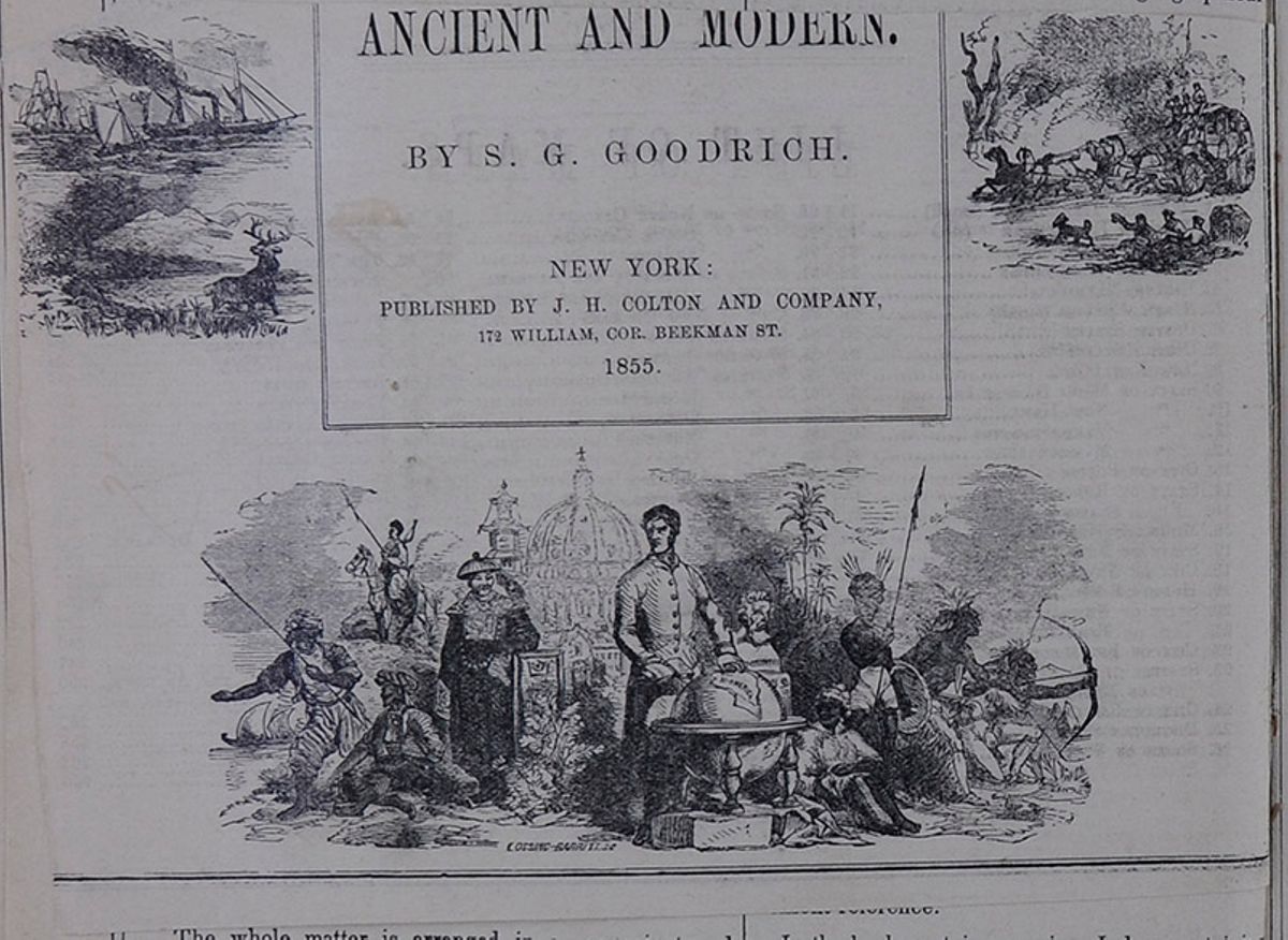
[cut away]ANCIENT AND MODERN
NEW YORK:PUBLISHED BY J. H. COLTON AND COMPANY,
172 WILLIAM, COR. BEEKMAN ST.
1855. A stagecoach being pulled by horses. A White-appearing man stands in front of a globe that prominently displays "N America" on its surface. He is surrounded by images representing a geographical and historical View of the World, both Ancient and Modern. Specifically, he stands in front of a modern American capitol building and an Asian pagoda. People of other ethnicities and races sit and stand near him. To his left, men who appear to be of Middle-Eastern wear turbans and gesture towards the sea. A man who appears to be Russian sits on a horse while wearing a cossack hat. A man who appears to be Asian wears traditional garb and white face paint. To his right are people who appear to be African and Native American, brandishing various weapons.
 INDEX AND PRONOUNCING DICTIONARY OF PROPER NAMES.
An index that provides a guide to the pronunciation of
proper names and corresponding page numbers.
[begin surface 26]
INDEX AND PRONOUNCING DICTIONARY OF PROPER NAMES.
An index that provides a guide to the pronunciation of
proper names and corresponding page numbers.
[begin surface 26]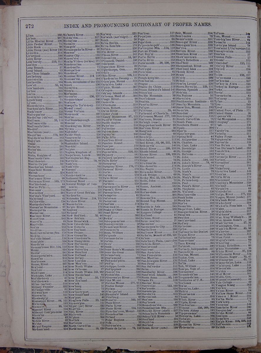 272
INDEX AND PRONOUNCING DICTIONARY OF
PROPER NAMES.
A continuation of the index that provides a guide to
the pronunciation of proper names and corresponding page
numbers.
272
INDEX AND PRONOUNCING DICTIONARY OF
PROPER NAMES.
A continuation of the index that provides a guide to
the pronunciation of proper names and corresponding page
numbers.
 GENERAL VIEWS OF THE EARTH.
269
GENERAL VIEWS OF THE EARTH.
269
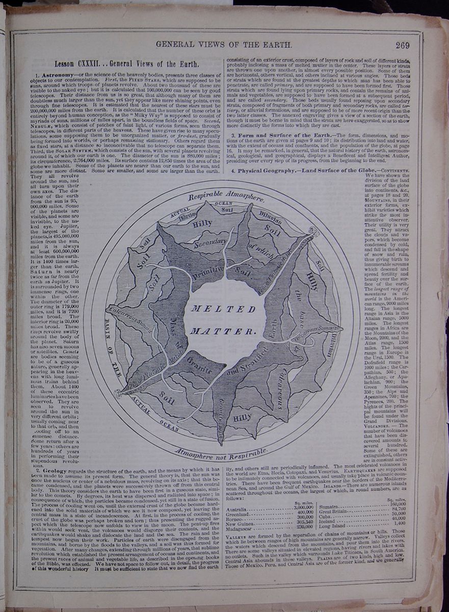
Lesson CXXXII... General Views of the Earth
1. Astronomy—or the science of the heavenly bodies, presents three classes of objects to our contemplation. First, the FIXED STARS, which are supposed to be suns, around which troops of planets revolve. About two thousand of these are visible to the naked eye; but it is calculated that 100,000,000 can be seen by good telescopes. Their distance from us is so great, that although many of them are doubtless much larger than the sun, yet they appear like mere shining points, even through fine telescopes. It is estimated that the nearest of these stars must be 200,000,000 miles from the earth. It is calculated that the number of these orbs is entirely beyond human conception, as the "Milky Way" is supposed to consist of myriads of suns, millions of miles apart, in the boundless fields of space. Second, NEBULÆ which consist of patches of faint light, of various forms, seen through telescopes, in different parts of the heavens. These have given rise to many speculations, some supposing them to be unorganized matter, or fire-dust, gradually being formed into worlds, or perhaps remaining stationary. Others regard them as fixed stars, at a distance so inconceivable that no telescope can separate them. Third, the SOLAR SYSTEM, which consists of the sun, with several planets revolving around it, of which our earth is one. The diameter of the sun is 880,000 miles; its circumference, 2,764,000 miles. Its surface contains 12,850 times the area of the globe we inhabit. Some of the planets are nearer than our earth to the sun, and some are more distant. Some are smaller, and some are larger than the earth. They all revolve around the sun, and all turn upon their own axes. The distance of the earth from the sun is 95,000,000 miles. Some of the planets are visible, and some are invisible, to the naked eye. Jupiter, the largest of the planets, is 495,080,000 miles from the sun, and it is always at least 600,000,000 miles from the earth. It is 1400 times larger than the earth. Saturn is nearly twice as far from the earth as Jupiter. It is surrounded by two immense rings, one within the other. The diameter of the outer ring is 179,000 miles and it is 7200 miles broad. The interior ring is 20,000 miles broad. These rings revolve swiftly around the body of the planet. Saturn has also seven moons or satellites. Comets are bodies seeming to be of a gaseous nature, generally appearing in the heavens with long luminous trains behind them. About 1400 of these eccentric luminaries have been observed. They are seen to revolve around the sun in very different orbits; usually coming near to that orb, and then [illegible]ooting off to an [illegible]mmense distance. Some return after a few years: others are hundreds of years in performing their stupendous revolutions.
Illustration showing the layers of the Earth and atmosphere.2. Geology regards the structure of the earth, and the means by which it has been made to assume its present form. The general theory is, that the sun was once the nucleus or center of a nebulous mass, revolving on its axis; that this became condensed, and the planets wore successively thrown off from this central body. This theory considers the earth to have been first in a gaseous state, similar to the comets. By degrees, its heat was dispersed and radiated into space; in consequence of which, the particles became condensed, yet still in a state of fusion. The process of cooling went on, until the external crust of the globe became hardened into the solid materials of which we see it now composed, yet leaving the central mass in a state of incandescence. At first, in the process of cooling, the crust of the globe was perhaps broken and torn; thus presenting the rugged aspect which the telescope now unfolds to view in the moon. The pent-up fires within would seek vent, the volcanoes would disgorge their contents, and the earthquakes would shake and dislocate the land and the sea. The rain and the tempest now began their work. Particles of earth were disengaged from the mountains, and borne by the floods to the valleys, and a soil was thus formed for vegetation. After many changes, extending through millions of years, that sublime revolution which established the present arrangement of oceans and continents, and the present races of animal and vegetable life, as described in the opening books of the Bible, was effected. We have not space to follow out, in detail, the progress of this wonderful history It must be sufficient to state that we now find the earth consisting of an exterior crust, composed of layers of rock and soil of different kinds, probably inclosing a mass of melted matter in the center. These layers or strata are thrown one upon another, in almost every possible position. Some of them are horizontal, others vertical, and others inclined at various angles. Those beds or strata which are found at the greatest depths to which man has been able to penetrate, are called primary, and are supposed to have been formed first. Those strata which are found lying upon primary rocks, and contain the remains of animals and vegetables, are supposed to have been formed at a subsequent period, and are called secondary. Those beds usually found reposing upon secondary strata, composed of fragments of both primary and secondary rocks, are called tertiary, or alluvial formations, and are supposed to bee of more recent origin than the two latter classes. The annexed engraving gives a view of a section of the earth, though it must be borne in mind that the strata are here exaggerated, so as to show more distinctly the forms into which they are cast.
3. Form and Surface of the Earth.—The form, dimensions, and motions of the earth are given at pages 9 and 10; its distribution into land and water, with the extent of oceans and continents, and the population of the globe, at page 16. It may be remarked, in general, that the natural history of the earth, astronomical, geological, and geographical, displays a Beneficent and Intelligent Author, presiding over every step of its progress, from the beginning to the end.
4. Physical Geography.—Land Surface of the
Globe.—CONTINENTS. We have shown the division of the land
surface of the globe into continents, &c., at pages 18 and
20. MOUNTAINS, in their exterior forms, exhibit varieties which
strike the most inattentive observer. Their utility is very
great. They attract the clouds and vapors, which become
condensed by cold, and fall in the shape of snow and rain, thus
giving birth to innumerable streams which descend and spread
fertility and beauty over the surface of the earth. The longest
range of mountains in the world is the American range, 9000
miles long. The longest range in Asia is the Altaian range, 5000
miles. The longest ranges in Africa are the Mountains of the
Moon, 2000, and the Atlas range, 1500 miles. The longest range
in Europe is the Ural, 1500. The Dofrafield range is 1000 miles;
the Carpathian, 500; the Alleghany, or Apalachian, 900; the
Green Mountains, 350; the Alps and Apennines, 700; the Pyrenees,
200. The hights of the principal mountains will be found under the
Grand Divisions. VOLCANOES.—The number of volcanoes that
have been discovered amounts to several hundred. Some of these
are extinguished, others are in constant activity, and others
still are periodically inflamed. The most celebrated volcanoes
in the world are Etna, Hecla , Cotopaxi, and Vesuvius. EARTHQUAKES are supposed to
be intimately connected with volcanoes, and usually take place
in volcanic countries. There have been frequent earthquakes near
the borders of the Mediterranean Sea, and around the Gulf of
Mexico. ISLANDS.—There are numerous islands scattered
throughout the oceans, the largest of which, in round numbers,
are as follows:
This table lists the largest islands in the world
and their surface areas in square miles. The islands
include: Australia, Greenland, Borneo, New Guinea,
Madagascar, Sumatra, Great Britain, Cuba, Iceland, and
Long Island.
VALLEYS are formed by the separation of chains of mountains or
hills. Those which lie between ranges of high mountains are
generally narrow. Valleys collect the waters which descend from
the mountains, and pour them into the rivers. There are some
valleys situated in elevated regions, having rivers and lakes
with no outlets. Such is the valley which surrounds Lake
Titicaca, in South America. Central Asia abounds in these
valleys. PLAINS are of two kinds, high and low. Those of Mexico,
Peru, and Central Asia are of the former kind, and are generally
[begin surface 28] 270
GENERAL VIEWS OF THE EARTH.
surrounded by a bulwark of mountains, which supports them. The
plains of Mexico are from 6 to 8000 feet high; those of Quito
are 12,000. Some of those in Chinese Tartary are probably as
elevated. The low plains consist, generally, of sand, gravel,
and shells. Such are those along the eastern part of our
Southern States, on the north of the Caspian Sea, and on the
south of the Baltic; the Delta of Egypt, the Valley of the
Amazon. DESERTS.—The most remarkable of these are Sahara, Cobi ,
and Atacama. There are extensive deserts also In Beloochistan,
Persia, Siberia, and Arabia. CAVERNS.—There are numerous
caverns or fissures in the earth, particularly in calcareous
regions. Most of these seem to owe their formation either to the
retiring or sinking of the earth. Some of them are of prodigious
extent. The depth of that near Castleton, in England, has not
been ascertained, though sounded by a line of 9600 feet. Near
Frederickshall, in Norway, there is a hole, into which, if
stones are thrown, they appear to be two minutes before they
reach the bottom; from which it is concluded that the depth is
up ward of 11,000 feet. The most curious caverns are those which
present crystals suspended from the roof, or lying on the
ground, assuming various fantastic forms, and often presenting
the images of animals and vegetables. The Grotto of Antiparos,
the Mammoth Cave of Kentucky, &c., are of this kind. When
lighted up by torches, they present scenes of inconceivable
splendor.
270
GENERAL VIEWS OF THE EARTH.
surrounded by a bulwark of mountains, which supports them. The
plains of Mexico are from 6 to 8000 feet high; those of Quito
are 12,000. Some of those in Chinese Tartary are probably as
elevated. The low plains consist, generally, of sand, gravel,
and shells. Such are those along the eastern part of our
Southern States, on the north of the Caspian Sea, and on the
south of the Baltic; the Delta of Egypt, the Valley of the
Amazon. DESERTS.—The most remarkable of these are Sahara, Cobi ,
and Atacama. There are extensive deserts also In Beloochistan,
Persia, Siberia, and Arabia. CAVERNS.—There are numerous
caverns or fissures in the earth, particularly in calcareous
regions. Most of these seem to owe their formation either to the
retiring or sinking of the earth. Some of them are of prodigious
extent. The depth of that near Castleton, in England, has not
been ascertained, though sounded by a line of 9600 feet. Near
Frederickshall, in Norway, there is a hole, into which, if
stones are thrown, they appear to be two minutes before they
reach the bottom; from which it is concluded that the depth is
up ward of 11,000 feet. The most curious caverns are those which
present crystals suspended from the roof, or lying on the
ground, assuming various fantastic forms, and often presenting
the images of animals and vegetables. The Grotto of Antiparos,
the Mammoth Cave of Kentucky, &c., are of this kind. When
lighted up by torches, they present scenes of inconceivable
splendor.
5. Water Surface of the Globe.—Oceans.—The Atlantic Ocean is noticed at page 175, and the Pacific at 266. The green tint of the ocean is supposed to be given by marine vegetables, with which the bottom of the deep is generally covered. The blue color of the ocean is but the reflection of the sky. The sparkling of the ocean in the night—which is often a most beautiful phenomenon—is caused by myriads of small sea-animals, diffused in the water, which emit a phosphoric light. The currents of the ocean, which are mainly from east to west, though often changed by the shape of the land by which they pass, are caused partly by the rotary motion of the earth, which leaves the fluid behind, near the equator, creating a movement contrary to that of the earth—i. e., from east to west; and partly also by evaporation of the water in the equatorial regions, and the supply which rushes in from the two poles. Eddies, Whirlpools, &c., are generally formed by rocks above or beneath the surface. The prevailing winds of the ocean are caused by the action of the sun, rarifying the air near the equator, and sending it upward, while the cold air rushes in from the north and south to fill its place. The currents of air, thus set in motion, are modified by the rotation of the earth, and various other causes. There is a considerable analogy between the origin of the winds and currents of the ocean, and doubtless these both act and react on each other. The saline property of the sea is owing to the quantity of salt diffused throughout the mineral masses of the earth. Water-spouts are caused by violent whirlwinds, which force up masses of the ocean, and whirl them about with violent agitation. They often prove fatal to ships at sea. TIDES.—Every twelve hours, the waters of the sea rise and fall along the shores, the average being from ten to twelve feet. Thus the tide ebbs and flows, throughout all oceans and most seas, twice in twenty-four hours. This extraordinary phenomenon is caused by the attraction of the moon, which, by the universal law of attraction, lifts the water as it passes over its surface. The attraction causes high tide, and the reaction low tide. SEAS are but parts of the great oceans, to which we attach different names. The following is the extent of some of the most prominent: This table lists the names and extent of some of the seas including" Chinese, Mediterranean, Caribbean, Okotsk, Black, Red, Baltic, and Irish. RIVERS have their origin in high grounds, and are caused by rains, the melting of snows, glaciers, &c. They are of the greatest service in scattering fertility along their borders, and furnishing the means of internal navigation to the countries through which they pass. Most of the great cities of the earth are situated upon rivers; and the thickest population is usually found in valleys, along their banks. The principal rivers will be found under the Grand Divisions of the Earth. The following table exhibits the largest river of each quarter of the globe: This table lists the longest rivers of each continent and their lengths including: the Mississippi, Amazon, Volga, Niger, and Yenesei rivers. CATARACTS.—Rivers, in their descent, often form cataracts or cascades, which are among the most beautiful objects in nature. The Cataract of Niagara exceeds all others in the quantity of water precipitated over its rocks; but there are many whose fall is much greater. The following is a list of some of the most famous: This table lists the most famous waterfalls in the world and includes their location and the length of the falls. The cataracts include: Favarnie, Fugloe, Staubbach, Tequendama, Montmorency, Cauterskill, Niagara, Shauffhausen, Cahoes, Tivoli, and St. Anthony. SPRINGS.—These are small reservoirs of water in the earth, which overflow, and are conducted by channels to some opening. Mineral springs are those which are impregnated with various substances, from the soil over which they flow. Many of them are highly medicinal. Among the most celebrated are those of Saratoga, in New York; the White Sulphur, in Virginia; those of Bristol, Bath, Tunbridge, and Cheltenham, In England; Spa, in Belgium; Carlsbad, in Germany, &c. Thermal springs are those which are heated, probably by some connection with volcanic materials. These are numerous in many countries; but the most celebrated are the Geysers, in Iceland.
6. The Three Kingdoms of Nature.—MINERALS.—The unorganized portion of the earth belongs to the Mineral Kingdom. This furnishes sustenance to vegetables, and vegetables are the chief nutriment of animals. Among the mineral treasures of the earth, coal is the most important. Next to that are the various metals, iron, lead, tin, copper, zinc, silver, and gold, all of which contribute to human civilization. VEGETABLES—The Empire of Vegetation embraces the whole globe, from pole to pole, and from the summit of mountains, where the lichen creeps over the hardest rocks, to the bottom of the ocean, where floating fields of plants rise unseen. Cold and heat, light and shade, fertile lands and pathless deserts—every place, every temperature, has its own kind of vegetation, which thrives and prospers there. There are plants which even ramify upon the dark vaults of mines, and upon the walls of the deepest caverns. Among the most important vegetables are grains, which furnish bread; cotton, which furnishes clothing; sugar, tea, coffee, and spices, which supply us with luxuries. Ships, as well as a large part of our houses and furniture, are built of vegetable materials. Directly or indirectly, all animal life depends upon vegetable products. ANIMALS.—The Animal Kingdom presents a vast and varied field. Every department of nature—the earth, air, and sea—is full of animated beings; some of them seeming nearly allied to vegetables and minerals. From these we may ascend in the scale, through an almost infinite series of existences, up to Man, who constitutes the highest in the animal kingdom. MAN.—The various original races or mankind may be reduced to five original races or types. The first is called the European race, and occupies Western Asia, Eastern and Northern Africa, Hindostan, and Europe, and embraces the white inhabitants of America. This race is sometimes called the Caucasian, it being imagined that it originated near the mountains of Caucasus. The principal nations embraced in this class are the Europeans and their American descendants, the Arabs, Moors, Turks, Hindoos, and Abyssinians. The second variety is the Tartar, or Mongolian, and includes all the nations in Asia east of the Ganges, excepting Malacca. It embraces, also, the Laplanders and Finns, in Europe, and the Esquimaux, from Behring's Straits to Greenland, in America. The third, or American variety, consists of the aborigines of the western continent. The fourth race is the Malay, comprehending the inhabitants of the peninsula of Malacca, and the islands of the Pacific Ocean, with the exception of New Holland, New Guinea, New Caledonia, and Van Dieman's Land. The fifth race is the Negro, which is spread over all Western and Southern Africa. It is found also upon the coasts of Madagascar, and occupies New Holland, Van Dieman's Land, New Caledonia, and New Guinea. Of these five races, the Caucasian deserves to be considered the first. Not only is the countenance more beautiful, but the intellectual and moral endowments of this race are of a higher character. Whenever they have met with the other races, they have ultimately prevailed. They have excelled all others in literature and the arts, and seem to have given birth to most of the valuable institutions of human society.
7. Political Geography.—GOVERNMENT.—By far the larger part of the governments in the world are monarchical, and more or less despotic. In Africa and Asia, nearly all the governments are despotisms. In Europe, there are a few republics. The other governments are monarchical, though many are limited by constitutions. They are now administered more mildly than in former times, and the influence of the people is every where becoming more and more felt and acknowledged. RELIGION.—The following is an estimate of the portions of the earth devoted to the several leading religious creeds of mankind: This table lists the religions of the world and the estimated number of people in each. The religions include: Pagans, Christians (and subdivisions of Christians), Mohammedans, and Jews. CITIES.—We have given a view of the principal cities of the world under the Five Grand Divisions. The following is a list of ten of the most celebrated: This table lists the names and populations of ten of the most celebrated cities. These cities include: London, Pekin, Jedo, Constantinople, Paris, Calcutta, Surat, Vienna, Cairo, and New York. AGRICULTURE.—This is the chief source whence the food and clothing of man are derived. Bread, meat, potatoes, fruits, for food, and flax, silk, wool, and cotton, for clothing, are all products of agriculture. It is supposed that the annual value of the agricultural products of the United States is about twelve hundred millions of dollars (see page 137). It is estimated that in the world there are: This table lists the estimated numbers of Human Beings, Domestic Sheep, Domestic Cattle, Domestic Swine, Domestic Horses, Asses, and Mules, and Domestic Goats in the world. If we consider that each day these are to be fed, chiefly by the agricultural industry of man, we shall have some faint conception of its extent and importance. MANUFACTURES.—It is supposed that the annual product of manufactures in the United States is nearly as great as that of agriculture. Fifty millions of nails are made and used every day, in the United States. A single cotton factory will spin a thread long enough to reach round the world, at the equator, in three hours. One hundred thousand pieces of calico, of thirty yards each, are produced every week in the United States. The cotton manufactures of Great Britain are of the annual value of one hundred and thirty millions of dollars, and the woolen manufactures two-thirds as much. These facts will give some imperfect idea of the amazing extent of this branch of human industry. RAILROADS AND CANALS.—Railroads, which have not existed for more than twenty-five years, are rapidly increasing in the United States, and in Europe. In other parts of the world, they are hardly begun (see pages 136 and 137: also articles England, Holland, &c.) COMMERCE is that process by which mankind exchange their surplus products for others which they need (see page 137). The following table gives a list of some of the exports or various countries:
- AFRICA—Gold, ivory, gums, hides, ostrich feathers, leather, fruits, &c.
- ARABIA—Coffee, aloes, myrrh, frankincense, gum-Arabic
- BELGIUM—Grain, flax, hops, woolens, linens, laces, various manufactures.
- BRITISH PROVINCES—Flour, furs, lumber, fish.
- CHINA—Tea, silks, nankeens, porcelain, articles of ivory and pearl.
- DENMARK—Grain, horses, cattle, beef, pork, butter, and cheese.
- FRANCE—Silks, woolens, linens, cottons, wine, brandy, porcelain, toys.
- GERMANY—Linens, grain, various manufactures of silver, copper, &c.
- GREAT BRITAIN—Woolens, cottons, linens, hardware, porcelain, &c.
- GREENLAND—Whale oil, whalebone, seal-skins.
- GUATIMALA—Logwood, mahogany, Indigo, cocoa.
- HINDOSTAN—Cottons, silks, rice, sugar, coffee, opium, indigo.
- HOLLAND—Fine linens, woolens, butter, cheese, various manufactures.
- ITALY—Silks, wines, grain, oil, fruits.
- IRELAND—Linen, beef, butter, tallow, hides, potatoes, barley, &c.
- JAPAN—Silk and cotton goods, Japan ware, porcelain.
- MEXICO—Gold, silver, logwood, cochineal, fruits.
- MADEIRA AND THE CANARIES—Wine, fruits.
- NEWFOUNDLAND—Codfish, seal-skins, seal-oil.
- PERSIA—Carpets, shawls, wine, silk, cotton, rice, rhubarb, guns, swords. &c.
- PERU—Silver, gold, Peruvian bark, mercury, sugar, cotton, fruits.
- RUSSIA—Hemp, iron, linen, grain, timber, furs, tallow, platina.
- SOUTH AMERICA—Sugar, cotton, tobacco, gold, diamonds, silver, copper, dye woods, indigo, cocoa.
- SPAIN AND PORTUGAL—Silks, wool, wine, oil, fruits, salt, &c.
- SWEDEN AND NORWAY—Iron, steel, copper, timber, fish.
- TURKEY—Grain, fruits, cotton, oil, wine, carpets, muslins, swords.
- WEST INDIES—Sugar, rum, molasses, coffee, spice, cotton, indigo, fruits.
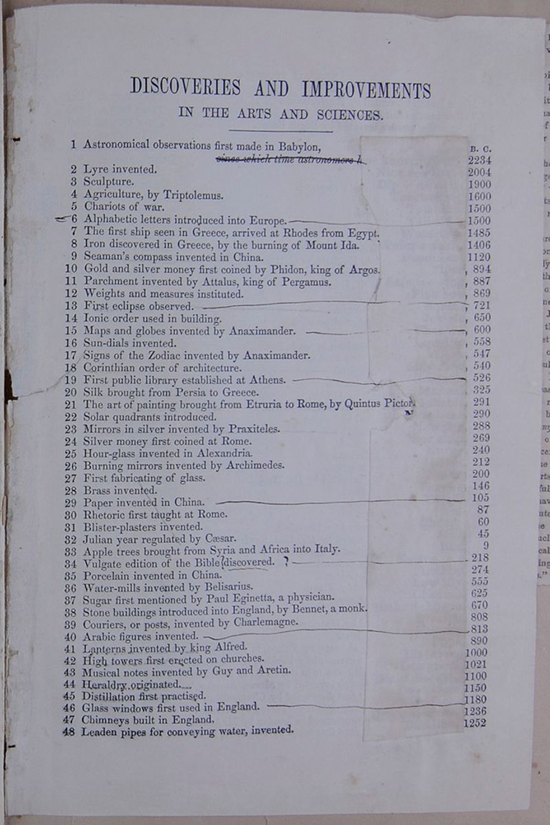
DISCOVERIES AND IMPROVEMENTS
IN THE ARTS AND SCIENCES.
| B.C. | ||||
| 1 | Astronomical observations first made in Babylon, |
|
2234 | |
| 2 | Lyre invented | [covered] | 2004 | |
| 3 | Sculpture | [covered] | 1900 | |
| 4 | Agriculture, by Triptolemus. | [covered] | 1600 | |
| 5 | Chariots of war. | [covered] | 1500 | |
| 6 | Alphabetic letters introduced into Europe.—————————— | [covered]—————————— | 1500 | |
| 7 | The first ship seen in Greece, arrived at Rhodes from Egypt. | [covered] | 1485 | |
| 8 | Iron discovered in Greece, by the burning of Mount Ida. | [covered] | 1406 | |
| 9 | Seaman's compass invented in China. | [covered] | 1120 | |
| 10 | Gold and silver money first coined by Phidon, king of Argos. | [covered] | 894 | |
| 11 | Parchment invented by Attalus, king of Pergamus. | [covered] | 887 | |
| 12 | Weights and measures instituted. | [covered] | 869 | |
| 13 | First eclipse observed.—————————— | [covered]—————————— | 721 | |
| 14 | Ionic order used in building. | [covered] | 650 | |
| 15 | Maps and globes invented by Anaximander.———————— | [covered]—————————— | 600 | |
| 16 | Sun-dials invented. | [covered] | 558 | |
| 17 | Signs of the Zodiac invented by Anaximander. | [covered] | 547 | |
| 18 | Corinthian order of architecture. | [covered] | 540 | |
| 19 | First public library established at Athens.—————————— | [covered]—————————— | 526 | |
| 20 | Silk brought from Persia to Greece. | [covered] | 325 | |
| 21 | The art of painting brought from Etruria to Rome, by Quintus Pictor | [covered] | 291 | |
| 22 | Solar quadrants introduced. | [covered] | 290 | |
| 23 | Mirrors in silver invented by Praxiteles. | [covered] | 288 | |
| 24 | Silver money first coined at Rome. | [covered] | 269 | |
| 25 | Hour-glass invented in Alexandria. | [covered] | 240 | |
| 26 | Burning mirrors invented by Archimedes. | [covered] | 212 | |
| 27 | First fabricating of glass. | [covered] | 200 | |
| 28 | Brass invented. | [covered] | 146 | |
| 29 | Paper invented in China.—————————— | [covered]—————————— | 105 | |
| 30 | Rhetoric first taught in Rome. | [covered] | 87 | |
| 31 | Blister-plasters invented. | [covered] | 60 | |
| 32 | Julian year regulated by Cæsar. | [covered] | 45 | |
| 33 | Apple trees brought from Syria and Africa into Italy. | [covered] | 9 | |
| 34 | Vulgate edition of the Bible ?discovered.? | [covered] | 218 | |
| 35 | Porcelain invented in China. | [covered] | 274 | |
| 36 | Water-mills invented by Belisarius. | [covered] | 555 | |
| 37 | Sugar first mentioned by Paul Eginetta, a physician. | [covered] | 625 | |
| 38 | Stone buildings introduced into England, by Bennet, a monk. | [covered] | 670 | |
| 39 | Couriers, or posts, invented by Charlemagne. | [covered] | 808 | |
| 40 | Arabic figures invented.—————————— | [covered]—————————— | 813 | |
| 41 | Lanterns invented by king Alfred. | [covered] | 890 | |
| 42 | High towers first erected on churches. | [covered] | 1000 | |
| 43 | Musical notes invented by Guy and Aretin. | [covered] | 1021 | |
| 44 | Heraldry originated. | [covered] | 1100 | |
| 45 | Distillation first practised. | [covered] | 1150 | |
| 46 | Glass windows first used in England.—————————— | [covered]—————————— | 1180 | |
| 47 | Chimneys built in England | [covered] | 1236 | |
| 48 | Leaden pipes for conveying water, invented. | [covered] | 1252 |
 46
MEMORIA TECHNICA.
46
MEMORIA TECHNICA.
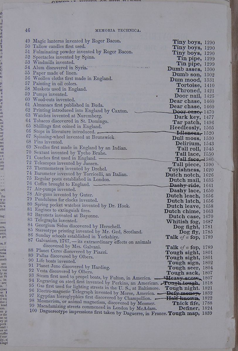
| 49 | Magic lanterns invented by Roger Bacon. | Tiny boys, | 1290 |
| 50 | Tallow candles first used. | Tiny boys, | 1290 |
| 51 | Fulminating powder invented by Roger Bacon. | Tiny boys, | 1290 |
| 52 | Spectacles invented by Spina. | Tin pipe, | 1299 |
| 53 | Windmills invented. | Tin pipe, | 1299 |
| 54 | Alum discovered in Syria. | Dumb asses, | 1300 |
| 55 | Paper made of linen. | Dumb son, | 1302 |
| 56 | Woollen cloths first made in England. | Dum mood, | 1331 |
| 57 | Painting in oil colors. | Tortoise, | 1410 |
| 58 | Muskets used in England. | Throned, | 1421 |
| 59 | Pumps invented. | Door nail, | 1425 |
| 60 | Wood-cuts invented. | Dear chase, | 1460 |
| 61 | Almanacs first published in Buda. | Dear chase, | 1460 |
| 62 | Printing introduced into England by Caxton.—————————— | Door case, | 1470 |
| 63 | Watches invented at Nuremberg. | Dark key, | 1477 |
| 64 | Tobacco discovered in St. Domingo. | Tar patch, | 1496 |
| 65 | Shillings first coined in England. | Heedlessly, | 1505 |
| 66 | Stops in literature introduced.—————————— | Idleness, | 1520 |
| 67 | Spinning-wheel invented at Brunswick | Dull moss, | 1530 |
| 68 | Pins invented. | Delirium, | 1543 |
| 69 | Needles first made in England by an Indian. | Tall roll, | 1545 |
| 70 | Sextant invented by Tycho Brahe. | Tall lace, | 1550 |
| 71 | Coaches first used in England.—————————— | Tall face, | 1580 |
| 72 | Telescopes invented by Jansen. | Tall piece, | 1590 |
| 73 | Thermometers invented by Drehel. | Toyishness, | 1620 |
| 74 | Barometer invented by Torricelli, an Italian. | Dutch notch, | 1626 |
| 75 | Regular posts established in London. | Dutch mail, | 1635 |
| 76 | Coffee brought to England.—————————— | Dashy ride, | 1641 |
| 77 | Air-pumps invented. | Dashy lace | 1650 |
| 78 | Air-guns invented by Guter. | Dutch leach | 1656 |
| 79 | Pendulums for clocks invented. | Dutch latch, | 1656 |
| 80 | Spring pocket watches invented by Dr. Hook. | Dutch leave, | 1658 |
| 81 | Engines to extinguish fires. | Dutch chime, | 1663 |
| 82 | Bayonets invented at Bayonne. | Dutch case, | 1670 |
| 83 | Telegraphs invented. | Whitish fog, | 1687 |
| 84 | Georgium Sidus discovered by Herschell. | Dog fight, | 1781 |
| 85 | Stereotype printing invented by Mr. Ged, Scotland. | Dog fly, | 1785 |
| 86 | Sunday schools established in Yorkshire. | Talk of a fop, | 1789 |
| 87 | Galvanism, 1767,—its extraordinary effects on animals discovered by Mrs. Galvani. | Talk of a fop, | 1789 |
| 88 | Planet Ceres discovered by Piazzi. | Tough sight, | 1801 |
| 89 | Pallas discovered by Olbers. | Tough sight, | 1801 |
| 90 | Life boats invented. | Tough sign, | 1802 |
| 91 | Planet Juno discovered by Harding. | Tough seer, | 1804 |
| 92 | Vesta discovered by Olbers. | Tough sack, | 1807 |
| 93 | Steam first used to propel boats, by Fulton, in America.—————————— | ❊Heavy scow, | 1807 |
| 94 | Engraving on steel first invented by Perkins, an American.—————————— | Tough tough, | 1818 |
| 95 | Gas first used for lighting streets in the U.S., at Baltimore. | Tough night, | 1821 |
| 96 | Electro-magnetic Telegraph invented by Morse, America.—————————— | Defy money, | 1832 |
| 97 | Egyptian hieroglyphics first discovered by Champollion.—————————— | Half known, | 1822 |
| 98 | Mesmerism, or animal magnetism, discovered by Mesmer. | Thick fife, | 1788 |
| 99 | Macadamizing streets commenced in London by McAdam. | Definer, | 1824 |
| 100 | Daguereotype impressions first taken by Daguerre, in France. | Tough map, | 1839 |
 [begin surface 32]
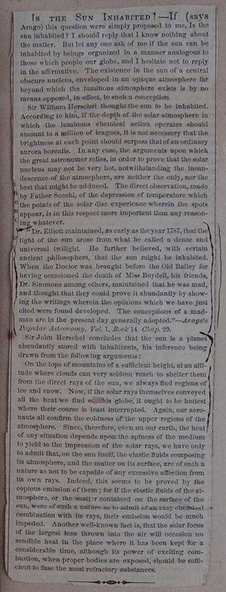
IS THE SUN INHABITED?—If (says Arago) this question were simply proposed to me, Is the sun inhabited? I should reply that I know nothing about the matter. But let any one ask of me if the sun can be inhabited by beings organized in a manner analogous to those which people our globe, and I hesitate not to reply in the affirmative. The existence in the sun of a central obscure nucleus, enveloped in an opaque atmosphere far beyond which the luminous atmosphere exists is by no means opposed, in effect, to such a conception.
Sir William Herschel thought the sun to be inhabited. According to him, if the depth of the solar atmosphere in which the luminous chemical action operates should amount to a million of leagues, it is not necessary that the brightness at each point should surpass that of an ordinary aurora borealis. In any case, the arguments upon which the great astronomer relies, in order to prove that the solar nucleus may not be very hot, notwithstanding the incandescence of the atmosphere, are neither the only, nor the best that might be adduced. The direct observation, made by Father Secchi, of the depression of temperature which the points of the solar disc experience wherein the spots appear, is in this respect more important than any reasoning whatever.
"Dr. Elliot maintained, as early as the year 1787, that the light of the sun arose from what he called a dense and universal twilight. He further believed, with certain ancient philosophers, that the sun might be inhabited. When the Doctor was brought before the Old Bailey for having occasioned the death of Miss Boydell, his friends, Dr. Simmons among others, maintained that he was mad, and thought that they could prove it abundantly by showing the writings wherein the opinions which we have just cited were found developed. The conceptions of a madman are in the present day generally adopted."—Arago's Popular Astronomy, Vol. 1, Book 14 Chap.29.
Sir John Herschel concludes that the sun is a planet abundantly stored with inhabitants, his inference being drawn from the following arguments:
On the tops of mountains of a sufficient height, at an altitude where clouds can very seldom reach to shelter them from the direct rays of the sun, we always find regions of ice and snow. Now, if the solar rays themselves conveyed all the heat we find o[covered]his globe, it aught to be hottest where their course is least interrupted. Again, our aeronauts all confirm the coldness of the upper regions of the atmosphere. Since, therefore, even on our earth, the heat of any situation depends upon the aptness of the medium to yield to the impression of the solar rays, we have only to admit that, on the sun itself, the elastic fluids composing its atmosphere, and the matter on its surface, are of such a nature as not to be capable of any excessive affection from its own rays. Indeed, this seems to be proved by the copious emission of them; for if the elastic fluids of the atmosphere, or the matter contained on the surface of the sun were of such a nature as to admit of an easy chemical combination with its rays, their emission would be much impeded. Another well-known fact is, that the solar focus of the largest lens thrown into the air will occasion no sensible heat in the place where it has been kept for a considerable time, although its power of exciting combustion, when proper bodies are exposed, should be sufficient to fuse the most refractory substances.
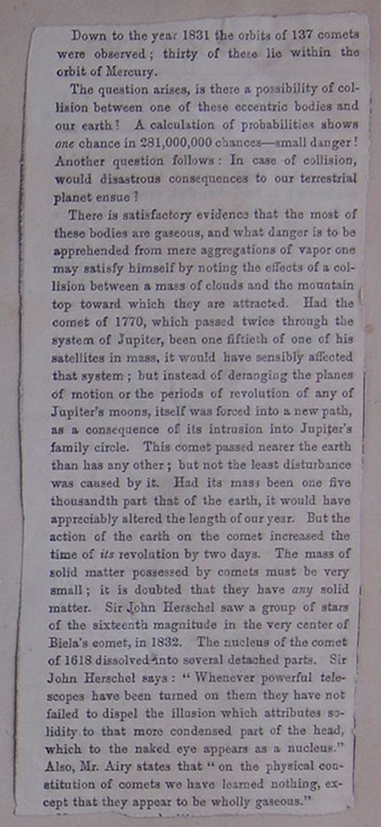
Down to the year 1831 the orbits of 137 comets were observed; thirty of these lie within the orbit of Mercury.
The question arises, is there a possibility of collision between one of these eccentric bodies and our earth? A calculation of probabilities shows one chance in 281,000,000 chances—small danger! Another question follows: In case of collision would disastrous consequences to our terrestrial planet ensue?
There is satisfactory evidence that the most of these bodies are gaseous, and what danger is to be apprehended from mere aggregations of vapor one may satisfy himself by noting the effects of a collision between a mass of clouds and the mountain top toward which they are attracted. Had the comet of 1770, which passed twice through the system of Jupiter, been one fiftieth of one of his satellites in mass, it would have sensibly affected that system; but instead of deranging the planes of motion or the periods of revolution of any of Jupiter's moons, itself was forced into a new path, as a consequence of its intrusion into Jupiter's family circle. This comet passed nearer the earth than has any other; but not the least disturbance was caused by it. Had its mass been one five thousandth part of the earth, it would have appreciably altered the length of our year. But the action of the earth on the comet increased the time of its revolution by two days. The mass of solid matter possessed by comets must be very small; it is doubted that they have any solid matter. Sir John Herschel saw a group of stars of the sixteenth magnitude in the very center of Biela's comet, in 1832. The nucleus of the comet of 1618 dissolved into several detached parts. Sir John Herschel says: "Whenever powerful telescopes have been turned on them they have not failed to dispel the illusion which attributes solidity to that more condensed part of the head, which to the naked eye appears as a nucleus." Also, Mr. Airy states that "on the physical constitution of comets we have learned nothing, except that they appear to be wholly gaseous."
[cutaway] [begin surface 34]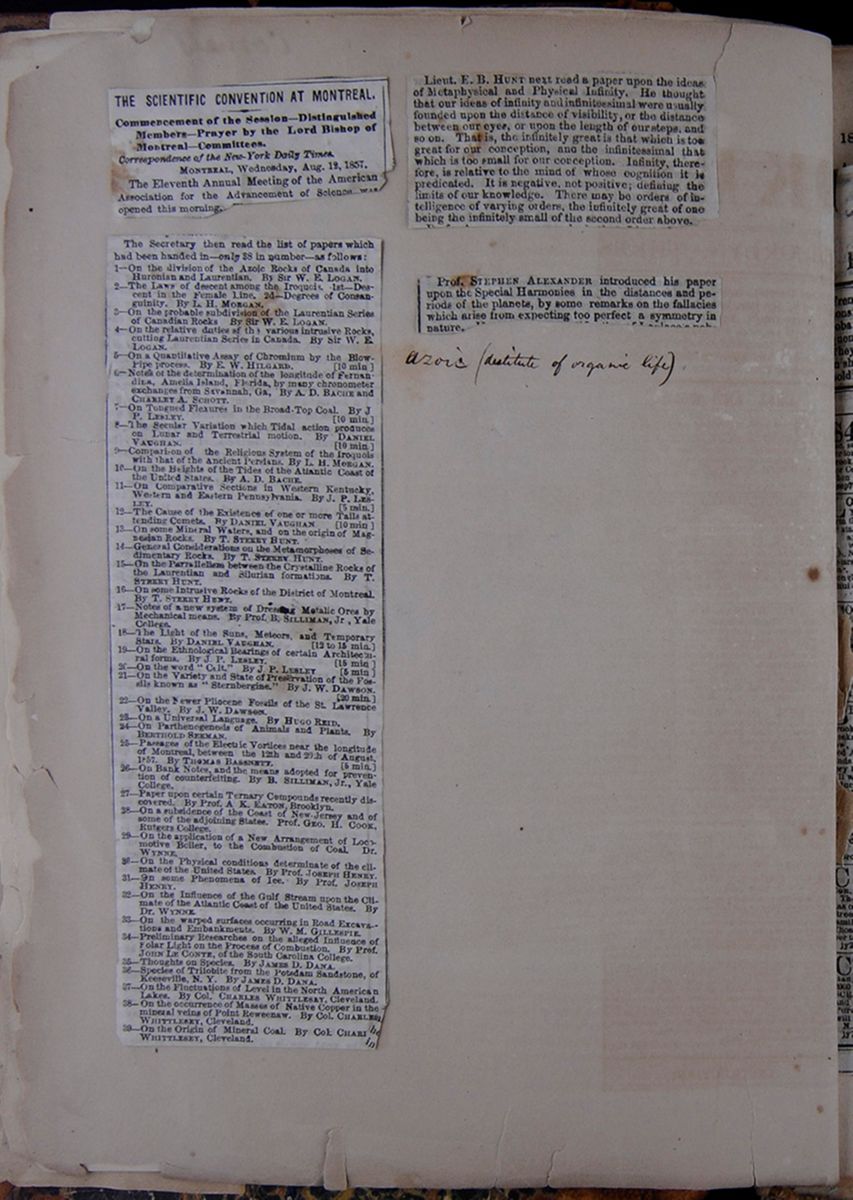 [begin surface 35]
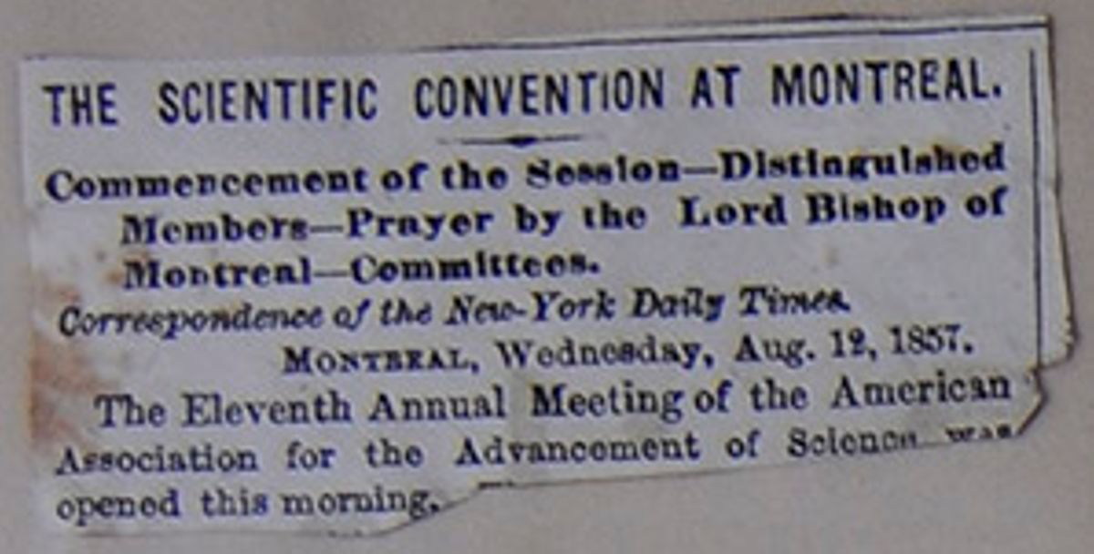
THE SCIENTIFIC CONVENTION AT MONTREAL.
Commencement of the Session—Distinguished Members—Prayer by the Lord Bishop of Montreal—Committees.
MONTREAL, Wednesday, August. 12, 1857.The Eleventh Annual Meeting of the American Association for the Advancement of science was opened this morning.
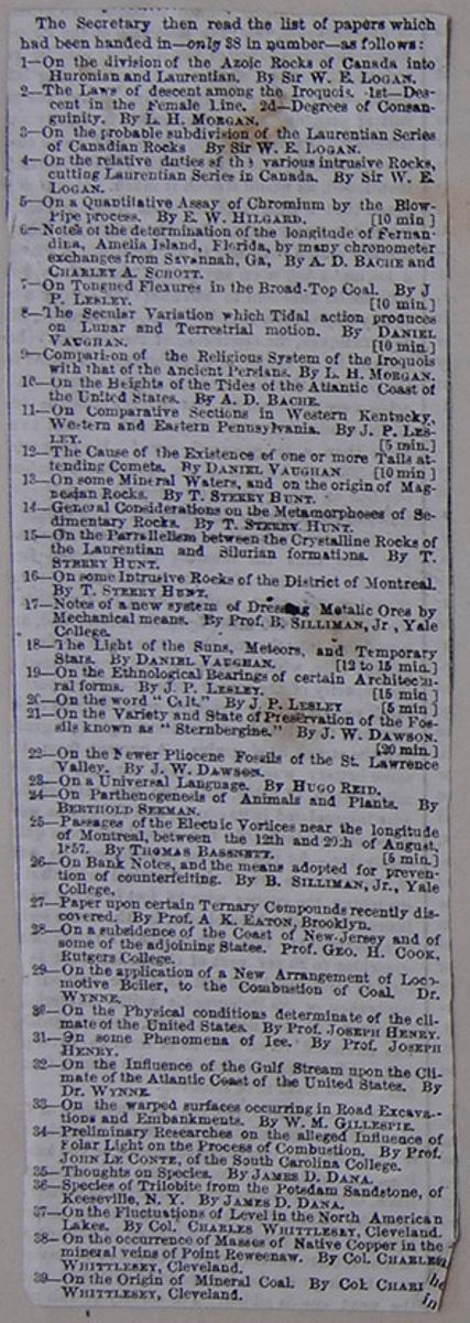
The Secretary then read the list of papers which had been handed in—only 38 in number—as follows:
- 1—On the division of the Azoic Rocks of Canada into Huronian and Laurentian. By Sir W. E. LOGAN.
- 2—The Laws of descent among the Iroquois. 1st—Descent in the Female Line. 2d.—Degrees of Consanguinity. By L.H. MORGAN.
- 3—On the probable subdivision of the Laurentian Series of the Canadian Rocks By Sir W.E. LOGAN.
- 4—On the relative duties of the various intrusive Rocks, cutting Laurentian Series in Canada. By Sir W. E. LOGAN.
- 5—On a Quantitative Assay of Chromium by the Blow-Pipe process. By E. W. HILGARD. [10 min]
- 6—Notes of the determination of the longitude of Fernandina, Amelia Island, Florida, by many chronometer exchanges from Savannah, Ga. By A. D. BACHE and CHARLEY A. SCHOTT.
- 7—On Tongued Flexures in the Broad-Top coal. By J P. Lesley. [10 min]
- 8—The Secular Variation which Tidal action produces on Lunar and Terrestrial motion. By DANIEL VAUGHAN. [10 min]
- 9—Comparison of the Religious System of the Iroquois with that of the Ancient Persians. By L. H. MORGAN
- 10—On the Heights of the Tides of the Atlantic Coast of the United States. By A. D. BACHE.
- 11—On Comparative Sections in Western Kentucky, Western and Eastern Pennsylvania. By J. P. LESLEY. [5 min]
- 12—The Cause of the Existence of one or more Tails attending Comets. By DANIEL VAUGHAN [10 min]
- 13—On some Mineral Waters, and on the origin of Magnesian Rocks. By T. STERRY HUNT.
- 14—General Considerations on the Metamorphoses of Sedimentary Rocks. By T. STERRY HUNT.
- 15—On the Parrallelism between the Crystalline Rocks of the Laurentian and Silurian formation. By T. STERRY HUNT.
- 16—On some Intrusive Rocks of the District of Montreal. By T. STERRY HUNT.
- 17—Notes on a new system of Dressing Metalic Ores by Mechanical means. By Prof. SILLIMAN, Jr, Yale College.
- 18—The Light of the Suns, Meteors, and Temporary Stars. By DANIEL VAUGHAN. [12 to 15 min.]
- 19—On the Ethnological Bearings of certain Architectural forms. By J. P. LESLEY. [15 min.]
- 20—On the word "C[illegible]lt" By J. P. LESLEY [5 min]
- 21—On the Variety and State of Preservation of the Fossils known as "Sternbergine." By J. W. DAWSON [20 min.]
- 22—On the Newer Pliocene Fossils of the St. Lawrence Valley. By J. W. DAWSON.
- 23—On a Universal Language. By HUGO REID.
- 24—On Parthenogenesis of Animals and Plants. By BERTHOLD SEEMAN.
- 25—Passages of the Electric Vortices near the longitude of Montreal, between the 12th and 20th of August, 1857. By THOMAS BASSNETT [5 min]
- 26—On Bank Notes, and the means adopted for prevention of counterfeiting. By B. SILLIMAN, Jr., Yale College.
- 27—Paper upon certain Ternary Compounds recently discovered. By Prof. A K. EATON, Brooklyn.
- 28—On a subsidence of the Coast of New Jersey and of some of the adjoining States. Prof. GEO. H. COOK, Rutgers College.
- 29—On the application of a New Arrangement of Locomotive Boiler, to the Combustion of Coal. Dr. WYNNE.
- 30—On the Physical conditions determinate of the climate of the United States. by Prof. JOSEPH HENRY.
- 31—On some Phenomena of Ice. By Prof. JOSEPH HENRY.
- 32—On the Influence of the Gulf Stream upon the Climate of the Atlantic Coast of the United States. By Dr. WYNNE.
- 33—On the warped surfaces occurring in Road Excavations and Embankments. By W. M. GILLESPIE.
- 34—Preliminary Researches on the alleged Influence of Solar Light on the Process of Combustion. By Prof. JOHN LE CONTE, of the South Carolina College.
- 35—Thoughts on Species. By JAMES D. DANA.
- 36—Species of Trilobite from Potsdam Sandstone, of Keeseville, N. Y. By JAMES D. DANA.
- 37—On the Fluctuations of Level in the North American Lakes. By Col. CHARLES WHITTLESEY, Cleveland.
- 38—On the occurrence of Masses of Native Copper in the mineral veins of Point Reweenaw. By Col. CHARLES WHITTLESEY, Cleveland.
- 39—On the Origin of Mineral Coal. By Col. CHARL[covered]WHITTLESEY, Cleveland.
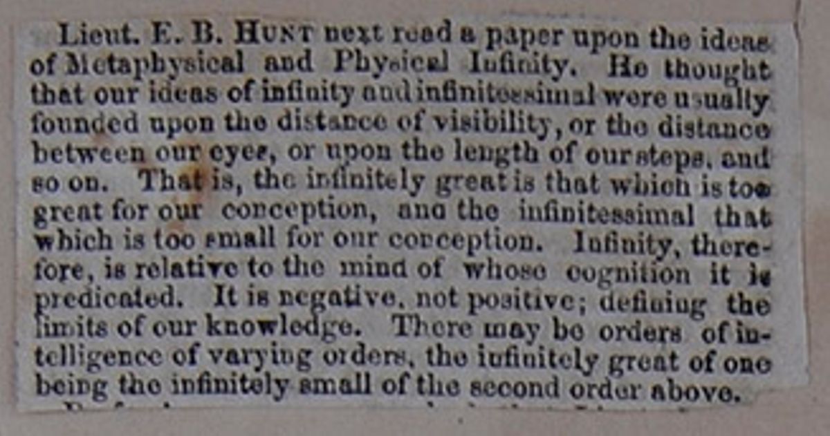
Lieut. E. B. HUNT next read a paper upon the ideas of Metaphysical and Physical Infinity. He thought that our ideas of infinity and infinitessimal were usually founded upon the distance of visibility, or the distance between our eyes or upon the length of our steps, and so on. That is, the infinitely great is that which is too great for our conception, and the infinitessimal that which is too small for our conception. Infinity, therefore, is relative to the mind of whose cognition it is predicated. It is negative, not positive; defining the limits of our knowledge. There may be orders of intelligence of varying orders, the infinitely great of one being the infinitely small of the second order above.
[cutaway]
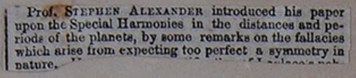
Prof. STEPHEN ALEXANDER introduced his paper upon the Special Harmonies in the distances and periods of the planets, by some remarks on the fallacies which arise from expecting too perfect a symmetry in nature. [cutaway]
 [begin surface 40]
Dr. Boynton's Second Lecture.
Dr. Boynton gave the second of his brilliant course of lectures last night, to another large audience, at the Atheneum, every seat being occupied, and the aisles and gallery crowded. He commenced the history of the earth's formation by showing that there was no discrepancy between Genesis and Geology. The earth was at first a melted mass of rock, produced by chemical action and condensation. Wherever there is a combination of different elements heat is produced. This melted mass, suspended in space, and surrounded by a cold atmosphere, began to cool and form an outer solid crust. This crust composed the granite rock, and was crystalized in cooling. When the earth was in this highly heated condition, the water now on its surface was driven off and existed in the form of vapor: hence the vapor would obscure the central mass and "darkness would be upon the face of the deep." As the earth cooled and formed a crust, this vapor condensed and formed the waters of the oceans. All bodies contract by cooling: the crust of the earth by cooling, contracted, forming wrinkles, producing elevations and depressions. This contraction was illustrated by a wand, which being held in both hands and bent like a bow, when one portion was pressed towards the centre an opposite elevation was produced. By this process and the pressure produced by this contraction on melted masses in the interior of the earth, these melted masses must find vent—hence the bursting out of volcanoes, and the elevation of continents and lands.
If we bury a thermometer fifty feet below the surface of the earth, the mercury will remain at the same point the year round, in winter and in summer, showing that the influence of the sun does not reach below that depth. If we carry the thermometer fifty feet lower, the mercury will rise one degree, and will rise in the same ratio for every fifty feet we go down. It can easily be calculate at what depth all known substances will melt. This would not exceed fifty miles. It was Dr. Boynton's own opinion that the crust did not exceed fifteen miles. It will thus be seen that the crust (or solid part) of the earth is exceedingly thin, in proportion to the size of the egg. With a crust so thin, constantly cooling and producing a pressure upon the interior masses, it is not strange that the bed of oceans should be elevated and form dry land, and continents should sink and form the beds of oceans. As to the depth of seas and oceans, in proportion to the general diameter of the earth, it was not more than would be the vapor left by breathing once on a metal globe 80 inches in diameter. Large mountains have been elevated in a single day, and whole cities have been sunk in the same space of time: The side of a volcanic mountain once broke away, and the liquid mass flowed out, forming a river twelve miles wide, which in its course melted down hills six hundred feet high and filling up valleys six hundred feet deep, and spreading over a surface of eleven hundred square miles.
On the Island of Owyhee there is a volcano now in active operation, the crater of which is three miles wide. In illustration of the subject, Dr. Boynton exhibited three beautiful paintings—the first of which was that of a volcano bursting from the water in the Mediterranean; the second was the same volcano with the fires gone out; the last was the great volcano of Owyhee. These were exceedingly beautiful, and elicited hearty applause from all present. The next lecture will be given tomorrow night.
Dr. Boynton's Sixth Lecture.
Dr. Boynton last night brought before his audience a portion of the geological history of the earth which inaugurated the birth of the Reptilian order. Having traced step by step each epoch in that history, until reaching the carboniferous period, he arrived at the markings by which the reptiles left their footprints in the new sand stone. In describing the differences between the inhabitants of land and sea at that period, by which the several orders exhibited some structural similarity to other orders by which they had been succeeded, the lecturer imparted to his explanations the same felicity of illustration as characterized his prevous elucidations. He showed how the fishes presented some peculiarities of organization superior to the reptiles by which they had been succeeded, and the reptiles some characteristics of formation superior to the fishes, and how the new red sand stone and the coal beds became the repositories respectively of the fossils of both orders, with the markings by which their history had been interpreted.
In presenting the progressive stages in this history of the realms of Nature, long before the earth was fit for the abode of man, the explanations by which the resources of comparative anatomy were brought to aid the description of geological formations and their adaptation from peculiarities of climate, &c., to the life they had to support, Dr. Boynton's familiarity with all the connecting branches of natural science brought to each the illustration reciprocally of the other. The history of the foot prints was made peculiarly interesting as showing from the impressions on the rocks the structure and proportions of the animals which had left the records of their habits and conformation where they may receive the interpretations of the naturalist, supplying to him the signs, in the absence of fossil remains, by which he is enabled to read their history.
The lecturer was particularly successful, we thought, in exposing the errors of Lamarkian theory, that each order of animals formed links in one chain of animated being, connecting the superior with the inferior, and making man the off-shoot of the monkey, by successive steps of development. In condemnation of this theory, the lecturer was properly emphatic as degrading the higher to the level of the lower species. He showed how each order was a separate act of creation, and not associated by any general resemblance or apparent similarity of organization, springing one from the other; while he was no less successful in elucidating the manner by which the Creator left no gap in the work—no blank in the diversified succession of the classes of animated being, but filled each space of creation with the creatures the best adapted to move within their peculiar spheres and occupy their appropriate geological period, drawing a line of obvious demarkation between the cold blooded and the warm-blooded animals.
The next lecture will be given on Saturday evening, which will embrace the history of the warm-blooded animals.
[begin surface 42]
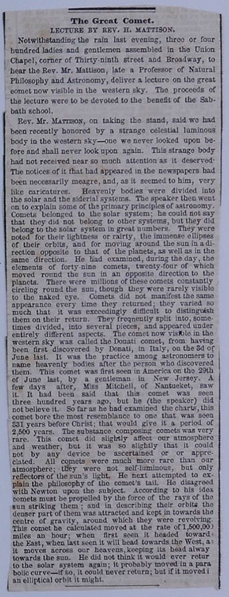
The Great Comet.
LECTURE BY REV. H. MATTISON.
Notwithstanding the rain last evening, three or four hundred ladies and gentlemen assembled in the Union Chapel, corner of Thirty-ninth street and Broadway, to hear the Rev. Mr. Mattison, late a Professor of Natural Philosophy and Astronomy, deliver a lecture on the great eomet now visible in the western sky. The proceeds of the lecture were to be devoted to the benefit of the Sabbath school.
Rev. Mr. MATTISON, on taking the stand, said we had been recently honored by a strange celestial luminous body in the western sky—one we never looked upon before and shall never look upon again. This strange body had not received near so much attention as it deserved. The notices of it that had appeared in the newspapers had been necessarily meagre, and, as it seemed to him, very like caricatures. Heavenly bodies were divided into the solar and the siderial systems. The speaker then went on to explain some of the primary principles of astronomy. Comets belonged to the solar system; he could not say that they did not belong to other systems, but they did belong to the solar system in great numbers. They were noted for their lightness or rairty , the immense ellipses of their orbits, and for moving around the sun in a direction opposite to that of the planets, as well as in the same direction. He had examined, during the day, the elements of forty-nine comets, twenty-four of which moved round the sun in an opposite direction to the planets. There were millions of these comets constantly circling round the sun, though they were rarely visible to the naked eye. Comets did not manifest the same appearance every time they returned; they varied so much that it was exceedingly difficult to distinguish them on their return. They frequently split into, sometimes divided, into several pieces, and appeared under entirely different aspects. The comet now visible in the western sky was called the Donati comet, from having been first discovered by Donati, in Italy on the 3d of June last. It was the practice among astronomers to name heavenly bodies after the person who discovered them. This comet was first seen in America on the 29th of June last, by a gentleman in New Jersey. A few days after, Miss Mitchell, of Nantucket, saw it. It had been said that this comet was seen three hundred years ago, but he (the speaker) did not believe it. So far as he had examined the charts, this comet bore the most resemblance to one that was seen 331 years before Christ; that would give it a period of 2,500 years. The substance composing comets was very rare. This comet did slightly affect our atmosphere and weather, but it was so slightly that it could not by any device be ascertained or or appreciated. All comets were much more rare than our atmosphere; they were not self-luminous, but only reflectors of the sun's light. He next attempted to explain the philosophy of the comet's tail. He disagreed with Newton upon the subject. According to his idea comets must be propelled by the force of the rays of the sun striking them; and in describing their orbits the denser part of them was attracted and kept in towards the centre of gravity, around which they were revolving. This comet he calculated moved at a rate of 1,500,000 miles an hour; when first seen it headed toward the East when last seen it will head towards the West, as it moves across our heavens, keeping its head alway[illegible] toward the sun. He did not think it would ever retur[illegible] to the solar system again; it probably moved in a parabolic curve—if so, it could never return; but if it moved i[illegible] an elliptical orbit it might.
[begin surface 44]
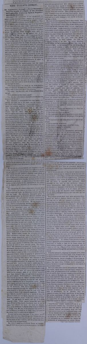
THE DONATI COMET.
Its Appearance through a Street Telescope—Sixpence worth of a Sight of the Celestial Stranger—The Cometary System Popularized for the Curious.
According to the calculations of the astronomers, the comet was last evening to have reached its culmunating point, and its tail to have attained its greatest length. The heavy looking cumbrous clouds which almost overspread the sky, and of which there was a strong reserve on the western horizon, were rather unfavorable for astronomical observations generally, and for an examination of the comet in particular. At least so thought the owner of the big telescope which occupies every night the most conspicious station on the eastern side of the Park, and which has reaped quite a pecuniary harvest for that same owner since the comet made its appearance. But fortune after all proved favorable, the clouds began to clear away as the night came on, and by seven o'clock the prospect was as bright as could be desired. There, amid a bright constellation of stars, the most prominent object among them all was the comet, with its tail lengthened out to its greatest extent, and becoming fainter and broader as it reached its extremity, till its dim and uncertain light faded away until it was lost in the darkness. It was, in fact, almost impossible to see the end of it, for there was no distincly defined line by which it could be marked by the eye, or even by the street telescope; but the astronomers doubtless know all about it, as they have fixed its exact length to a nicety.
Notwithstanding the announcement that the comet would have attained its greatest dimensions last evening, there were very few around the big telescope, and those few did not appear to be astronomically inclined. But if the telescope did not draw a large amount of custom, those who paid their sixpences had the full value of their money in the longer observations which they were enabled to enjoy. There were about seven persons altogether assembled around the instrument, and of these three, of whom the writer was one, paid the required amount for a view of the comet and as much of its tail as they could see through the glass.
"What is the price?" we asked, as we were about to take our stand on the small step ladder which places you within reach of the lower end of the telescope.
"Six cents," was the reply, and it was certainly cheap enough.
"Well, can you see the whole comet?"
"No; the glass only takes in the head—you can only see a portion of the tail."
Thus informed, we mounted the little step ladder, and placing our right eye to the glass, saw the nucleus of the comet, which looked like a fragmentary part of the moon, but with its brightness considerably diminished. The nucleus was surrounded with a still paler light, which seemed to the eye a dim reflection thrown out by itself. Only a portion of the tail was visible, and it was a very small portion, but the rest could be seen in instalments by raising the end of the telescope nearest to yourself. The view thus afforded was rather unsatisfactory, and the impression left on the minds of some was that the comet is a humbug so far as a sight through a street telescope is concerned. But it is worth sixpence after all; and if the charges were a quarter it would be a profitable investment. The flood of dim light which streams out from the nucleus and which forms the tail looks brighter than to the naked eye. No part of the comet shines with the brightness of the stars of the first magnitude, nor can it be properly said to have any brilliancy. The light of the nucleus is, as far as we have said, dimmer than that of the moon, but it is of that character—pale and cold. The curve was, perhaps, more distinctly marked than on any night since its first appearance. After all, however, we are decidedly of the opinion that its appearance to the unaided vision is far preferable to the view obtained of it through the telescope. With the naked eye you can take in its whole dimensions, while the glass gives it to you in some seven or eight instalments, of which one takes in the head, the tail making up the sum total. It has been suggested as a rather serious anomaly that although the comet rejoices in a tail, that caudal appendage has been denied to the dog star.
For the interesting scientific details which we possess on the subject of the comet, we are particularly indebted to two of our astronomers—Messrs. Mitchell and Bond.
We are told of its celestial latitude and longitude with precision, its distance from the earth and length of its tail, although some of our journals have, nevertheless, ventured upon statements and exhibited engraved maps which in this part of the globe, are utterly worthless. But the general character of these strange visitors and the opinions which the learned in our own day entertain of them we are left quite in the dark. A condensation of the latest speculations on this subject, for the gratification of the readers of the HERALD, may, therefore, be interesting at this moment.
The constitution of a comet, when entire, consists of the head or nucleus, the coma or envelope rings, and the tail. Some authorities make no distinction between the rings and the coma. The admirable description given us of the present comet by Professor Mitchell confirms this arrangement. He saw a nearly circular nebulous or luminous envelope of a diameter of 18,000 miles—almost nineteen times that of the moon. We can imagine, perhaps, what an overpowering spectacle an illuminated orb of such dimensions at the distance of the moon would present to our astonished eyes; and what the emotions of the inhabitants of the distant planets must be, if inhabited they are, when these terrific visiters blaze closely in their neighborhood. Lexell's comet, so called after a Russian astronomer, who made it his particular study and became its most attentive observer, though it was a discovery of a Frenchman of the name of Messier, was so completely attracted and disturbed when approaching Jupiter as to alter its path and remain for two elliptical revolutions longer in its vicinity than it otherwise would have done. Nor were the inhabitants of our own planet beyond the chance of a similar spectacle, when on the 1st of July, 1770, this comet was only distant 363 semi-diameters of the earth, or about six times the distance of the moon. Encke's comet crosses the terrestial orbit sixty times in a century, and may some day afford the world a terrific though magnificent sight of this description. Of the true nature of cometic bodies many differing opinions are entertained. Sir John Herschel regards them as masses of thin vapor, capable of reflecting solar rays from their internal as well as their external parts. This theory, which was absolutely necessary to explain the visible phenomena, was proved to be correct by the experiments of the astronomer Arago, with the polariscope, during the visit of Halley's comet in 1835. It is a curious fact that the discovery of Malus, called the polarity or polarization of light, has been made available in astronomy to determine whether a heavenly body shines with inherent or with borrowed light. This principle was applied to comets, and it was thus determined by Arago that they shone by borrowed light. And yet this vapor is a matter also, for it revolves in regular orbits, obeying the laws of attraction and of motion like the solid planets themselves. But though having this amount of density it is less than that of a summer cloud, for the latter will obscure the brightest stars while, on the contrary, stars of an inferior magnitude have been distinctly seen through both the nucleus and the tail of comets. Professor Mitchell, of Cincinnati, mentions that he has seen the faintest telescopic stars shining with undiminished brightness through the vast nebulous matter composing the tail of the present comet. Similar observations have also been made personally by Sir John Herschel, Olbers, Streve, Piazzi Bessel, and others. On the 7th of November, 1828, Streve saw a star of only the eleventh magnitude through the comet of Encke; and Sir John Hershell in 1825 saw through the head of a comet a cluster of stars of the sixteenth magnitude. We must, says Babinet, consider a comet as a species of dust, the grains of which are very much separated (très écartés), a material substance placed at the very confines of existence. Un peu moins de matière, says he, et la comète cessarait d'ètre. While comets themselves have thus been affected by the planets, the planets have in no instance been affected by them. All those old theories, then, of the existence of planets being owing to collisions of comets with the sun or the planets of his system, or such as Whiston put forth as those being the cause of the deluge, may be considered as exploded.
It is also well to notice that none of the comets previously observed have exhibited any well defined disc like solid bodies of the same magnitude and appearance, during the whole of their visibility, and the present one does not differ from its predecessors.
The tails of comets are of different forms, an explanation of which cannot yet be satisfactorily given in conformity with any natural laws with which we are acquainted. Sometimes they appear to be long, narrow lines of light, sometimes their widest part is between the nucleus and end, sometimes they resemble peacocks' tails, and one has been seen with six. Their colors vary also from palel vidness to fiery red, and from blue to green. Again, on the other hand, they appear without any tail, particularly such as is called telescopic, and visible to the eye, like that of Biela.
The heat of these wandering orbs is often intense. That of 1843, which has been described in the HERALD of the 1st instant, was computed to have been 47,000 times greater when near the sun, than any which is ever experienced in our torrid zone. It was twenty-four times greater than is necessary to melt crystal, and 2,000 times hotter than red hot iron; on the contrary, when it reached the other side of the solar sphere its temperature was reduced to about four times that of the torrid zone. It is also asserted that the tail, with the exceptions mentioned, is kept opposite the sun as it moves around it, so that the curve described by the end of the tail is immensely greater than that of the comet itself. As, for example, if the tail of the present comet is six millions of miles, the sweep or curve would be, if circular, eighteen millions. These tails are shot out with amazing force and rapidity. The one now visible was but about two or three degrees when it first appeared; it is now more than twenty. That belonging to the comet of 1680 extended itself in two days more than a hundred millions of miles.
The paths of comets are those produced by the lines of the intersection of a plane with the cone, elliptical when the curve returns to itself after having been drawn out in one direction, the parabolic where the carve partakes of the openness of the ellipse and the hyperbola, and the hyperbola, that most curious of all, which, through a curve, never returns to itself, but is protracted through all infinity. It is produced practically by cutting a cone with a plane parallel to the direction of its axis. Every young mathematical student must remember his surprise on being told of the possibility of drawing such a curve, and of there being the asymptotes, or lines of a hyperbola, always approaching and yet never meeting. And yet, this problem is capable of visible demonstration with a common piece of string. Some comets have actually been observed pursuing one of those endless lines, and are never expected to return. What imagination can contemplate the vastness of this idea, or of the system to which we belong and how absurd are those geologist who believe our own world has existed but 6,000 years! "The earth was at first without form and void," and so are these comets not yet arrested in their course after a destiny of years, the number of which defy all human calculation, and cannot be expressed in any amount of numerals to be found in any human arithmetic.
The periods of comets are determined by what are called their elements. These are:—
- 1. The longitude of their perihelion.
- 2. The longitude of the ascending nodes or points where the orbit of a planet intersects the ecliptic when going north.
- 3. The inclination of the plane of its orbit to that of the ecliptic.
- 4. The eccentricity of the orbit.
- 5. The length of the semi-major axis of the ellipse.
- 6. The time of passing the perihelion.
- 7. Motion direct or retrograde.
So perfect have become our astronomical instruments that these observations can all be accurately made. If the principles on which the astronomers work out their calculations were incorrect, then we should not be able to construct an almanac or an ephemeris, to foretell an eclipse or an occultation, to regulate our clocks or determine the position of a ship at sea, or reach with certainty a wished for port. We can afford to believe these astronomers, then, when they talk to us about comets, and regard observatories with profound interest. Thus it is with perfect confidence we accept the statement of Professor Mitchell, of Cincinnati, when he says that by micrometrical measurement he has ascertained that the distance form the centre of the ring of the present comet to its circumference when he observed it, was nine thousand miles. And here, if our space permitted, we might make some curious explanations of the [covered] necessary [cutaway]ters, distances and motions are computed. The periods of some of the comets, particularly such as have been lately discovered, have been so accurately determined that they reappear with remarkable precision at the expected moment.
One of the peculiarities of the tails of comets is their curvature, such as may be observed in the one now visible, giving it a sabre form, and the curve being towards the direction in which the body is proceeding. It is so in this instance. The comet is proceeding to the west and the curve is opposite and eastward. Their nearness to the sun, or the perihelion distance, varies considerably; their orbits do not partake of the direction or character of the planets, the inclination to the plane of the ecliptic is at all angles, and about half of them of the two hundred whose directions are known, have a retrograde motion—the case with the one now visible.
Those whose periods have been most accurately determined are Halley's, Encke's, Biela's and Faye's. The first was due in 1835, and appeared accordingly. The present one was supposed by Donati, the discoveror, to be identical with that of Fabricius or Charles V. But Babinet denies its identity, because that of Charles went to the east, and this goes to the west, and there is a difference of one hundred degrees in its perihelion. "it is no more to be compared with it," says he, "than the mail from Brest with that of Strasburg." Yet even he has been mistaken in relation to the time of its greatest brightness by at least a month. We are therefore led to believe that this is a new visiter, or else we may suppose that its motion, though elliptical, may be spiral also, as the moon's around the earth, which, when projected upon a map, is a succession of spirals like that of a cork screw when seen at an angle, or scollop edges joined together at each end with a loop. This theory we suggest, without, however, knowing how far it will hold water. It is a suggestion we make as the ink of the preceding paragraph grows dry. If it be objected that the cases are not parallel, we may reply that Herschel thought that the sun has motion, and is carrying with it all his train of planets towards the constellation Hercules. In addition to the periodical comets we have mentioned, there is another claimed to have been discovered in Naples in 1846, by Dr. Peters whom we have reason to suspect is the same astronomer who is mixed up with the difficulty of the Dudley Observatory, and was displaced through the instrumentality of Professor Gould.
From his ephemeris, assigning its probable orbit, it was to appear in twelve or fourteen years; if so, it may be one of the five discovered within the present year, and it is not a little singular that at a meeting of the American Association for the Advancement of Science, held at Philadelphia a few years since, Professor Gould eulogized Dr. Peters for his service and investigations in this branch of astronomical science.
There are some other curious circumstances relating to our subject, which want of time and space compels us to omit—such as a description of the catalogues of the observed comets; their immense number—supposed by some to be upwards of 20,000—the vibrations of their tails, sometimes distinctly observed, and which some persons think they have detected in the present one; and above all of their uses, the greatest puzzle perhaps of all. Professor Nicholl, of Glasgow, in his work on the Architecture of the Heavens, supposes they have some relation to the nebulosities which exist in remote systems; that they have their root in them, having some important part to play with some grand external scheme of matter, in a state of modification; by Dr. Brindley they are designed to restore the electric equilibrium of the planets. The various speculations of Halley, Arago, and Elie de Beaumont, in relation to the probably effect of a collision of a comet with the earth, have, on a former occasion been fully treated by us in the columns of the HERALD.
[begin surface 46]
COMETS: THEIR HISTORY AND HABITS.
Now that the memorable Comet of 1858 is making such a magnificent spectacle in the heavens, and will soon disappear, a brief account of some of the most famous of these apparitions, and the theories of distinguished philosophers respecting them, will, perhaps, be interesting.
In 1106 there appeared a splendid comet, visible in the daytime all over Europe. It presented the appearance of a fiery beam, stretching from the west toward the north-cast regions of the heavens. The comet of 1264, noticed alike by European and Chinese historians, and popularly believed to announce the death of Pope Urban IV., which really happened in October following, had a tail which stretched across more than half the visible heavens! It is supposed to have been identical with that of 1556, its return is not confidently looked for by astronomers. In 1402 were seen two of the most brilliant on record, one of which spread, after sunset, a magnificent tail 90° long. Both were visible by day. In 1456, the people of Europe were thrown into consternation by the appearance of a comet simultaneously with the fall of Constantinople before the Turks. Comet and Turk were deprecated together, and against the twain was launched the Pope's anathems. It exhibited a tail 60° long. To this comet, on its third subsequent reappearance in 1682, Halley give his name, by being the first to compute its elements. Its period of orbital revolution is some 75 years. The seventeenth century presents a fertile record of cometic phenomena. It 1618, appeared a stranger which surpassed in its train that of 12364, having at one time a tail which measured 101°! One appeared in 1652, which Bevelius describes as being of the size of a half-moon, though having a pale and dismal light. In 1668 another appeared, most brilliant in the south of Europe and in Brazil.
In 1680 came one of the most remarkable on record; and to it belongs the glory of having come under the God-like gaze of Newton, and of having furnished him with data for proving that the movements of comets depend upon the same principles as control the planets in their orbits. This body passed within 150,000 miles of the sun, and at a speed of 880,000 miles per hour! then swept off into space again toward its farther goal, 80,000,000,000, or according to other calculations, 400,000,000,000 miles distant!
in 1689 a comet shone which drew a train of light 68° degrees long. There are grounds for supposing this to be identical with that of 1843.
The eighteenth eentury was distinguished by two comets of remarkable aspect. In 1744, came into view one of the few recorded to have been seen in full sunshine. On the 1st of Feburuary , it was more brilliant than Sirius; on the 8th it equalled Jupiter; on the 1st of March, at 1 o'clock p. m., five hours after its perihelion passage, it was visible to the naked eye. Another in 1769 spanned the heavens with an immense train of light. The first comet of 1811 was remarkable for the length of time it remained visible. That of 1843 us regarded as on of the most wonderful of modern times. It was visible in Bologna, Italy, at noon, two diameters of the sun's disc east of the sun, while passing its perihelion, being then only 96,000 miles distant from that luminary, and its speed 366 miles per second, or 1,317,600 per hour; so, that in twelve minutes it must have passed over a space equal to the distance between the earth and its moon! When its distance from the sun allowed it to be visible after sunset, it presented an appearance of extraordinary magnificence, especially in tropical latitudes. Some astronomers have computed it to have a period of 3,767 years! In July, 1844, one appeared, which has been estimated to have a period of 100,000 years! In 1846, Biela's comet, which is one of the class of "comets of short period," revolving in about 6 2/3 years, startled observers by dividing itself in two, and so passing on its path out of sight! The estimated numbers of comets of which we have account, is upward of 600, nearly all of which are telescopic, and have no tails, though some have appeared with as many as six!
The fewness of their visits and the farness between, the enormous extent of the orbits of some of them, stretching, perhaps, far beyond the limits of our solar system, coming up from the unfathomed depths of space to gleam a few brief days in our sky, and then diving down again out of telescopic sight, on their long but swift journey, it may be to other planetary systems, never to be beheld again by the denizens of our earth, the wonderful tenuity of their substance, and the variety of the hypotheses which different philosophers have offered to account for the phenomena they present, make them an object of sublime interest to the astronomer.
Comets move, commonly, in elliptical orbits of great eccentricity—those of "short period" having their orbits within that of Neptune.
The star-gazer is ever on the lookout for these erratic strangers, poring over the open page, whose letters are worlds, peering, with his far-searching lenses, everywhere between the twinkling, constant little stars, too happy if some wayward little body come dancing into the field of this instrument, and make him its first discoverer. It grows rapidly, sailing out of one constellation into another, and gradually assumes, as it nears the sun, a sort of nebulous hood. This enveloping hood soon lengthens out behind it, forming a train of thin light, which is largest and brightest a little after the passage of the perihelion. This train is always on the side of the comet which is opposite to the sun—a generalization not made by European observers till the time of Appian, 1531, though understood among the Chinese as early as 871. The nucleus or head of a comet when viewed through a powerful glass has the appearance of an irresolvable nebula, or patch of fog, the lens having the effect to diffuse rather than define its outline. The rail has the same hazy character and is of inconceivable tenuity, the smallest telescopic star being visible through it without the slightest appreciable diminution of light, though, according to Herschel, the thickness of this cometic matter, in the comet of 1811, was 15,000,000 miles!
The tails of comets vary in length as seen from different places. That of 1680 had a train 60° long, as measured at Paris, and 90° at Constantinople. That of 1769 extended, on the 9th September, of 43° at London, 55° at Paris, 60° at the Isle of Bourbon, and 75° at Teneriffe—showing that the length of the tail depends on the state of the atmosphere. The length is often enormous—the comet of 1843 being estimated by Prof. Peirce to have a train streaming out 200,000,000 miles into space, or once and a half the distance of the sun from the earth! and all this formed in some three weeks.
The incalculable subtlety of the diffused cometic matter may be inferred from the fact that they have been sometimes known to pass within close proximity to planetary bodies without deranging the motions of the latter in the least perceptible degree. Bexell's comet of 1770 dashed into the midst of the system of Jupiter's satellites without at all affecting their movements. A curious calculation is recorded of Sir Isaac Newton, that if a globe of common atmospheric air, one inch in diameter, were expanded so as to have an equal degree of rarity with the air situated at an elevation of 4,000 miles above the earth's surface, "it would fill the whole planetary regions as far as the sphere of Saturn, and would extend a great deal further." Now, if this enormous extent of attenuated matter can be conceived to be endowed with luminous properties, whether from reflecting the sun's rays, or from its own inherent physical constitution, we can form, proximately, some sort of a realizing sense of the nature of the magnificent feather which now adorns the starry heavens. On this point the speculations of philosophers are interesting.
Before the time of Tycho Brahé European observers had not ventured to refer cometic apparitions to regions beyond the moon's orbit, and supposed them indeed to be substances generated within the earth's atmosphere. The Danish astronomer, however, from observations upon the comet of 1577, proved that these bodies move in orbits beyond the earth's satellite, and were therefore of permanent structure, and independent of the earth. From observing that comets, as the emerge from the depths of space, are nothing but mere specs of nebulosity, which is gradually prolonged into a train as they approach the sun, it was inferred that comets are, in their normal condition, spherical masses, like planets, and that their tails are due, in some unknown way, to the sun. Some early observers supposed the tail was owing to the passage of the sun's rays through the nebulosity of the head, producing an effect similar to what is seen when an beam of the sun pours through an aperture into a darkened room. The Cartesian school referred the effect to the refracting of light, in its passage from the comet to the eyes of the observer, through the celestial ether disseminated through space. If this theory be true, it has been significantly asked, why have the planets and fixed stars no tails? Mairan thought the effect proceeded from the same cause as that which produces the aurora borealis.
The illustrious astronomer, Kepler, who flourished early in the seventeenth century, was the first to offer a rational explanation of this phenomenon. He supposed that the constituent matter of the comet is broken by the action of the solar rays, and the lighter particles impelled to immense distances. Newton conjectured that, as the nebulous particles of the comet become heated by the sun, they communicate a portion of their heat to the contiguous particles of etherial fluid composing the sun's atmosphere. These particles so heated (by reflection, as it were), suffer a corresponding diminution of density, and are repelled from the sun, carrying them with them just as an upward current of air causes smoke to ascend. But all hypotheses must be vague where there are so few well-ascertained data. The great discoveries made of late in electrical forces promise to throw new light upon this profoundly interesting subject.
The close approach of some comets to the sun in their perihelion passage, as, for example, in the case of the great comet of 1843, before mentioned, and the immense distances to which they sometimes recede from him in their aphelia, immeasurable beyond the utmost known limits of our solar system, have led astronomers to infer that comets are subjected, in the course of their orbital revolution, to an amazing degree of heat and cold.
Newton calculated that the comet of 1680 was subjected, at its perihelion distance of 150,000 miles, to a degree of heat 2,000 times that of red-hot iron! While, according to Herschel, the comet of 1843, which passed within 96,000 miles of the sun, received, at its perihelion, an amount of heat equivalent to that of 47,000 suns blazing in our sky! It can scarcely be supposed that matter can be subjected to such a degree of heat without having its structure destroyed. Laplace availed himself of Black's beautiful discovery of latent heat to avoid this difficulty, and taught that when a body is passing from a liquid to a gaseous state, its particles, as they become successively volatilized, abstract from the body large quantities of calorie, and so serve to moderate the temperature of the condensed portion; and, conversely, that this latent calorie is given back by the volatilized matter in the course of its return to a liquid state. So that a comet, whether swinging in its orbit a few thousands of miles from its local source of heat and attraction, or many thousands of millions of miles distant, may preserve an approximate constancy of temperature under the operation of this beautiful law of compensation.
Astronomers often differ widely in their calculations of a comet upon its first appearance; and as, according to Prof. Norton, not more than one-half of all the comets which are recorded to have appeared during the last two thousand years have returned twice to their perihelia, it must be admitted that the amount of well-digested knowleege of their motions and physical constitution can be but small. This much, however, seems to be conceded— that they have an atmosphere, in which the nebulous matter of them floats as clouds do in ours; that the aggregate amount of matter they contain, compared with the least of the heavenly bodies known to us, is exceedingly small; that the tail is constituted of the subtlest portions of the cometic matter, diffused by solar agency; that their orbits are parabolic, or ellipses of great eccentricity; that they are liable to great changes in their periods of revolution, being sometimes made to revolve in orbits, with a quickened or retarded motion, by the attraction of foreign bodies into whose neighborhood they may pass in the course of their eccentric career; and, thus, that of the thousands of comets which are supposed to have our sun for a focus, all, except the half dozen of short periods, must ever elude the grasp of human calculation; and, finally, that some have appeared which will not probably ever revisit our earth! Well we may say, with the sweet Psalmist of Israel: "Whither shall I go from Thy spirit? or whither shall I feel from Thy presence? If I ascend up into heaven, Thou art there: if I make my bed in hell, behold Thou art there. If I take the wings of the morning, and dwell in the uttermost parts of the sea, even there shall Thy hand lead me, and Thy right hand shall hold me."
[begin surface 48]
ART. II.— The Physical Atlas; a Series of Maps and Notes illustrative of the Geographical Distribution of Natural Phenomena. By Alex. Keith Honston, F. R. G. S., F. G. S. Imperial Folio, 30 maps and 94 pp. Letter-press. London and Edinburgh, 1848.
2. The Physical Atlas of Natural Phenomena. Quarto edition. Part I. Reduced from the edition in Imperial Folio, for the use of colleges, Academies, and Families. London and Edinburgh, 1849.
The periodical literature of a people embodies very intelligibly the kind and extent of social and intellectual progress they have attained at the moment of its appearance. What the many read must accord in the main with the tastes and opinions of the many for the time; And as soon as tastes and opinions change, the hue and tone of periodical literature will change also. But it is only the lighter and more popular tastes of a nation which its periodical literature can be expected to reflect: we must look elsewhere for evidence of their solid acquirements, and of the nature, indeed, of their more permanent and established taste.
It is when a large and expensive work, like that now before us, issues from the press, that we can reasonably infer that the subject of which it treats has already taken hold of the public mind; and has obtained a place among the intellectual wants of the country in which it appears. And the inference will be strengthened where, as in the present instance, the larger work is attended by a humbler companion, fitted for the school and the schoolmaster. Such publications assume that the old and the young, the rick and the poor, are joining in demand.
In this point of view, British science has reason to congratulate herself on the appearance of these Physical Atlases, and may point to them with some degree of pride; for even abstruse departments of natural knowledge must have been popularised among us, before publishers could be encouraged to make the necessary efforts for rendering their beautiful results accessible to all. Inddeed, though Oxford and Cambridge have hitherto done but little for the advancement of this kind of knowledge, we are satisfied, from our own experience of other countries, that in no part of Europe are the sciences of observation so generally appreciated, and so widely diffused among the mass of ordinarily-educated people, as in our own.
The Physical Atlas of Mr. Keith Johnston comprises four series of maps: a geological series of ten maps; a meteorological series of five maps; a hydrographical series of six maps; and a phytological and zoological series of nine maps.
The first series contains four maps of the mountain systems and chains of Europe, Asia, and America; one of the glacier regions of the Alps; two of the most remarkable volcanic phenomena; one double map, representing the general geological structure of the globe; and two single maps, the special structure of the British Isles.
The second series consists of physical charts of the Atlantic, Indian, and Pacific Oceans; maps of the river systems of Europe, Asia, and America; and a tidal chart of the British Seas.
The third series represents the isothermal lines and lines of equal barometric pressure, in one map; the geographical distribution of hurricanes, typhoons, and other aërial disturbances, in a second; the polarising structure of the atmosphere in a third; and in two hyetographic maps, the general distribution of rain over the whole world, and its more special distribution over the surface of Europe.
The fourth series exhibits the geographical distribution of plants in general in one map, and that of the plants which serve as food for man in another; and that of the mammiferous, the carnivorous, and the ruminant animals respectively, in three maps; that of birds and reptiles, in two maps; and, in two more, the ethnography of Europe and that of the British Islands.
For the idea of these interesting maps we are indebted to the illustrious Humboldt; for the first execution of them to Professor Berghaus, of Berlin; and for the present improved, enlarged, and beautifully-executed Atlas to the hands and head of Mr. Keith Johnston, of Edinburgh.*
* Other works of this kind, more comprehensive in some senses, but of a more special kind, have been projected in other countries, but are almost all as yet unexecuted. Of these, the linear and shaded maps of criminal statistics by M. Guerry are an admirable example, and are now ready for the press. The one which embraces the widest range of subjects is the 'Administrative and Statistical Atlas of Belgiuim:' it is projected by the well known geographer of Brussels, M. Van der Maelen, in co-operation with the eminent statist M. Heuschling, to whom Belgian statistics are under so many obligations. Its title and proposed contents are as folows: —
'"Atlast Administratif et Statistique du Royaume de Belgique," dressé et publié en collaboration avec M. Xavier Heuschling, par Philippe Van der Maelen.
'Cet atlas se composera d'une série de cartes construites à l'échelle de 1 à 400,000 sur une feuille grand colombier. Chaque carte, comprenant toutes les communes du Royaume avec leur circonscription territoriale, sera consacrée à une branche spéciale de l'administration ou à une partie de la
[begin surface 50] 170
The Physical Atlas.
April,
170
The Physical Atlas.
April,
From a work so rich in information, and so varied in its materials, it is almost impossible to select and compress into a moderate compass any thing which will give the general reader a satisfactory idea of its character and contents. It is a merit which may justly be conceded to these thirty maps, that almost every one of them embodies the materials of many volumes—the results of long years of research—and exhibits the most valuable thoughts of the most distinguished men of the age, pictured visibly to the eye.
It might appear at first sight, and especially to the unlearned into whose hands the Atlas should come, as if the subjects illustrated in these maps had been taken at random out of the vast domain of natural knowledge, in order to form the book; as if the races of men and the distribution of birds and reptiles had no connexion whatever with geological strata and fossils, or with Alpine glaciers; as if the geographical distribution of plants, the polarisation of the atmosphere, and the tides, temperatures, storms, soundings, and currents of our seas and great oceans, were subjects wide apart from each other; as if the position and parallelism of mountain chains, or of active and extinct volcanoes, the distribution of typhoons, the course and limits of Indian hurricanes, the sources and directions of rivers, the regions which nourish the various plants on which we live, and the study of the races of men who, from time to time, have conquered and peopled the different parts of our own islands, were fields of research so discontiguous and remote, that even philosophers might long traverse them all without once meeting on any common ground.
But far different is the expectation of the eager scholar, who has once looked over Humboldt's ' Kosmos,' or Mrs. Somerville's 'Connection of the Sciences.' He enters on the examination of the various branches of natural knowledge in the well-grounded confidence that they will be found to constitute a harmonious WHOLE, closely cemented in all its parts. And though any work on the phenomena of nature which should embody even all we at present know would still exhibit many large gaps, yet the instructed eye will perceive a common unity pervading all, and points of connexion among the most distant and apparently discordant topics of which it treats. So a uniting thread may be traced through the varied subjects delineated in the maps of this Physical Atlas, and discussed in its letter-press;—a thread which untwists, as you follow it, into many strands, representing different trains of thought—any one of which will lead us from map to map in search of reasons for the new facts that successively strike us, and will bring us at last to the ethnographic series—to Man himself, and his varieties, as palpably and intimately concerned with the first of the topics, whatever that may be, with which we had set out.
We shall better succeed, we believe, in imparting to our readers some conception of the multifarious and yet singularly well digested information comprised in the present work, by asking them to accompany us in tracing a few of the connecting links which the series of maps thus presents to an intelligent student, than by any catalogue or specimens of their contents. We propose, therefore, to select a leading train of thought suggested by one of the earliest maps, and shall see how far, in following it out, the succeeding maps will furnish us with the materials necessary for our progress.
Turn, for example, to the first or geological series, and, among these, to that which represents the geology or palæontology of the British Isles, coloured under the direction of Professor Edward Forbes. How rich in obvious instruction,—how suggestive of interesting thought and inquiry, is this map! The various colours represent, not only the various rocky formations, but diversified mineral productions also, and different agricultural capabilities and tendencies. They indicate where great cities establish themselves, and why; what brings masses of people together in particular localities, of what special class this population is composed, and what are likely to be its moral and social dispositions; why one
statistique, d'après un système arrêté a l'avance. Ainsi il y aura une carte pour chacune des divisions communale et provinciale, judiciaire, ecclesiastique, militaire, etc.; des cartes historique et archéologique, hydrographique et orographique, météorologique et méicale, géologique, botanique, zoologique, agricole, forestière et minérale, industrielle et commerciale, financière, douanière, domaniale, electorale; des cartes pour les voies de communication, les postes et messageries, pour la population absolue et relative, par langues et dialectes, par cultes, par professions et conditions sociales, pour la mortalité et la reproduction, pour la bientfaisance, le paupérisme, la criminalité et les prisons, pour l'instruction publique, les sciences, les lettres et les arts. Un texte explicatif et descriptif, donné en marge, complétera les détails de chaque carte; les renseignement seront puisés aux meilleures sources et dans les documents les plus récents. En un mot, les auteurs se proposent d'appliquer à l'administration et à la statistique générale du pays, la pensées de Condorcet lorsqu'il prédit l'époque où l'état de nos connaissances ne pourra plus être exposé que dans des tableaux synoptiques.' What a mass of interesting information such a book would contain! but what dozen men are equal to the compilation of it? [begin surface 51] 1849
The Physical Atlas.
171
1849
The Physical Atlas.
171
manufacture takes root on this spot, and another on that; why here corn waves, or cattle fatten, or sheep crop the springing herbage; why here the rich proprietor and the wealthy farmer live together in comfort, and encourage each other in progressive improvement—why there husbandry is backward, the proprietor in difficulties, and the cultivator wasting life and means in a heartless struggle.
It must be well known to most of our readers that the black spots of varied extent and form, which here and there stand out like blots on the surface of a geological map of Great Britain, indicate the districts in which mineral fuel is found and is more or less extensively dug up. Upon such black spots, therefore, on whatever map they are seen, it is almost certain that a large population either already exists, or will spring up at some future period; that the employment of this population will be in mining for coal—in digging or smelting the ores of iron or copper or lead—in moulding and baking pottery—in fabricating machinery and other works in metal—in manufacturing glass, or alkali, or alum—in converting the raw cotton and wool and flax into woven and printed cloths of various texture—or in some of those many other arts which busy themselves with crude materials on a large scale, and which require much mechanical power at a cheap rate, to admit of their being economically carried on.
The natural reason for the growth of large towns and crowded populations, for a principal class at least, such as Swansea, Bristol, Merthyr-Tydvil, Nottingham, Wolverhampton, Birmingham, Sheffield, Leeds, Manchester, and Glasgow,—(since other considerations give importance to London, Liverpool, Dublin, Cork, Belfast, &c.,)—is to be found in the geological structure of the rocks on which the people live. And as long as crowded haunts are permitted to breed pestilence and immorality, an inspection of the map will enable us to pronounce also on the social and moral condition, actual or future, of the inhabitants—and to tell both in what way and to what extent they contribute to the general wealth and power of the state, and what care and provision of moral and intellectual superintendence ought to be assured to them in return.
Again, at the southern extremity of Lanarkshire, where it touches Dumfries, and is bordered by the still infant streams of the Nith and the Clyde, our map indicates a region of lead mines, the dwelling-place of a thoughtful, intelligent, book-loving, faithful, and steadfast people. Upon the Allan, and the Wear, and the Tees, in Northumberland and Durham and among the higher Yorkshire dales, there are similar mines, and a similar people: and so where Derby boasts its Peak and the country round Matlock likened to the Vale of Tempe, and in Flint and Devon, and in ancient mining Cornwall, where tin and copper have been followed deeper into the bowels of the earth than in any other part of the world. These seats of buried riches are at once visible upon the map; while to the instructed eye it also points out in them the home of a peculiar race of people—higher altogether in mental habits, in morals, and in enterprise, than what other and perhaps neighbouring spots are nourishing. And when on the geological maps of other countries similar colours present themselves, they tell of similar mineral accumulations, and of the probable existence, actual or future, of an equally ingenious, hardy, and persevering people.
Without dwelling further on the fund of thought, hidden, so to speak, beneath the varied colours of a geological map, we may at once assume, that the mineral riches which these colours intimate, prove likewise the existence of materials for exchange and exportation, either native and raw, or manufactured into various products of skilled labour. Such materials necessarily give rise to commercial intercourse with other countries, and to a demand for that varied knowledge of the resources of those countries, and of their coasts and seaports and rivers which the foreign merchant must possess, and that familiarity with the physical-history of the seas, which is indispensable to a navigator, and which the book before us embodies. Led by such reflections we might proceed to the other charts and maps of the Physical Atlas, and show how one train of thought connects each of them in succession with the geological map of the British Islands, from which we started:—how the meteorological and hydrographical series are rich in the kind of information which an educated seaman must delight to have before him, and how the entire phytological series forms a species of vade-mecum for the enlightened British merchant.
But we prefer to follow another train of thought, suggested by the palæontological map, which to our minds is more striking, and will, we think, prove both more interesting and more instructive to the reader. To the student of Agriculture in its largest sense, the colours of a geological map are especially instructive. They tell him the where and the wherefore, in reference to many of the most interesting questions which
[begin surface 52] 172
The Physical Atlas.
April,
172
The Physical Atlas.
April,
bear on rural progress and agricultural history.
In every country of Europe there are tracts of land which from the most remote antiquity have been more densely peopled than the surrounding regions. These are the districts which, on the arrival of the earliest settlers, were found in their natural state to be susceptible of easy and profitable arable culture. Soils easily laboured and moderately pervious to water invited the earliest husbandman, and with least toil yielded the heaviest crops of corn. Other tracts, again, have grown during all historic time a perennial herbage, where cattle graze or sheep fatten, which the plough has rarely violated, and seldom with a profit to the over-venturesome husbandman. On others, again, poverty prevails both in corn and cattle; with chilly fields or wind-obeying sands and penurious homesteads; and broad bands seen to cross whole kingdoms—sometimes naturally to separate them—on which even modern skill and enterprise have failed as yet to raise up vegetable luxuriance and rural plenty.
A geological map rightly understood indicates of itself where these several agricultural differences naturally exist: for the soils partake of the general characters of the rocks by the crumbling of which they are formed; and the colours of the map show the limits to which these several rocks extend.
In Great Britain generally, the old and new red sand-stones, and in Scotland the trap rocks also, have formed and generally sustain soils of easy culture, which have been subject to the plough for the longest period, and on which the most ancient villages and church towns exist. The long undulating stripe of lias clay, which winds with varying breadth and outline from the mouth of the Tees to Lyme Regis, and the Oxford clay and that of the Weald, are covered by soils too stubborn in their native state to yield at the proper seasons to the persuasions of the harrow and the ploughshare;—and accordingly experience has taught the farmer to leave them in perpetual grass. And if the eye be turned to the northern side of the Scottish border, a tract of country of a greyish tint is seen to stretch from St. Abb's Head on the east, to the Mull of Galloway on the west, characterised by poor soils and humbler farmers,—over which cold inky lochs and wide heaths, at not unfrequent intervals, arrest the traveller on his way.
A geological map, therefore, is an invaluable storehouse of agricultural information. These tints which variegate its surface express diversities of soil, inheriting different agricultural qualities; and these qualities determine the nature of the crops which can be the most profitably grown, the kind of improvement which is required, and the pecuniary outlay which is most likely to be repaid. And what makes this knowledge the more important, is the interesting fact, to which we have alluded,—that what is true of soils represented by a given colour in one country is generally true of those represented by the same colour in another. Thus the agricultural experience of a particular region, instead of having a merely local value, as men used to think, become incorporated with the common experience and knowledge of mankind. Other things being equal, the same colours indicate soils generically the same; the culture, which succeeds on them in one part of the world, ought to succeed in others; the same implements should be required, the same grains and roots grown, the same stock thrive, the same improvements be attempted; and, with equal skill and prudence, equal profits might be expected.
How simple and yet how large the views which the statesman may derive from the study of this branch of science! The agricultural resources and capabilities of the various countries of the globe are uncovered, as it were, to the eye; and with these, the springs of their past difficulties or greatness, their powers of actual resistance or endurance, their prospects in future time, their value as conquests or colonies.
Of such views, the most extensive and most comprehensive are to be obtained from the second chart of this series—the chart which exhibits the geological structure of the entire globe, according to the researches of M. Ami Boué.
There are some among us who of late years have delighted in holding up Russia and the United States, as objects of our political apprehension. When they learn to decipher the tints of the map of which we are speaking, they will probably think themselves entitled to draw from them still more alarming prognostications. Judging from the wealth and power which her small patch of blue has given to England, we may augur a lofty after-history to the empire of the Autocrat, as well as to our relatives beyond the Atlantic. But this lofty future England hopes to see and share; she does not fear it. Mental and moral culture are now inseparable, we think, from physical and material development; and we have the consolation of believing that the freaks of power in past ages will become impossible among our posterity.
We have said that, other things being equal,
[begin surface 53] 1849.
The Physical Atlas.
173
1849.
The Physical Atlas.
173
the colours of the geological map indicate certain almost universal agricultural truths. But many circumstances occur in nature to alter the conditions, and more or less effectually to modify the conclusions to which geological data alone would lead us. Among these, the most influential are the several elements which are comprehended under the general term of climate. We must turn our attention, therefore, to a few of these; and see how far and in what parts of the earth they interfere with our wider deductions.
British crops during the past harvest suffered from unseasonable, and, in some places, overwhelming rains. The fall of rain, therefore, is to be taken into account as an element of climate, which will always be likely to affect our reasonings on agricultural capabilities. Nothing is more certain than that the amount of rain and the seasons of its descent determine in a great degree the nature of the husbandry of every country. Of this the most complete and instructive illustrations are presented by the two rain maps which are comprised in the meteorological series of the Atlas.
Like the shadows of clouds scattered over an April sky, dark spots rest on various parts of the rain map of the world. The Indian islands, and China, and the shores of Hindostan, and the central zones of Africa and America, and our own Britain and Ireland, lie in the blackest shade. They are, in reality, the oftenest clouded over, and the most frequented by rain. The bright sunshine which rests on Northern Africa, and Central Asia, and on the shores of Mexico and Peru, tells of perpetual drought, and barrenness, and sand; while the dark riband which encircles the globe a few degrees north of the equator, is resonant with the fearful thunder of the tropical regions, accompanied by deluges of rain which rarely cease.
But from the rain map of the wide world, we willingly turn to that of Europe—and resume our thread of agricultural observation. On comparing the indications of productive capability which this map exhibits with those of the geological charts, we observe that in some places the two concur, while in others they are opposed. In some districts, which by their geological structure are naturally arable, the quantity of rain, the months in which it comes down, and the number of rainy days are all in favour of cereal culture; while in others the quantity of rain, or the season of its fall, is such as to condemn the country to pasture only, or to cover it with unprofitable bogs.
To those who interest themselves with the general advance of European agriculture, the lines and shadings of this map have much meaning. We have said that, generally speaking, similar colours on the geological maps of two countries indicate not only similar soils, but similar methods of improving them. Now improvement by drainage is a method which, in Great Britain and Ireland, is universally acknowledged to be of the first importance and of the most certain profit. We sometimes express our wonder, therefore, that the other nations of Europe are so slow in following our example. But the fall of rain, no less than the nature of the soil, is an element in every question concerning the necessity or propriety of drainage. Now the former of these elements is supplied by the map before us for every part of Europe; and it is satisfactory to learn from it that the experience of the British islands, and especially of the best cultivated parts of Scotland, is directly applicable to large portions of Europe, and supports the general expediency of thorough drainage wherever the nature of the soil would otherwise warrant an opinion in its favour.
But the temperature of the air in any particular place has also an important bearing upon the actual productiveness of its soil, whatever may be its mineral character, and however propitiously the rains may fall upon it. To study this point, we must turn to the lines of equal mean temperature, the isothermal lines of Humboldt, which are delineated on the first map of the meteorological series. To the numerous questions—historical, social, and sanatory—which the study of these lines and of the letter-press which accompanies them is fitted to suggest or answer, it would lead us from our immediate subject even to advert. That the land is permanently frozen in Labrador and Kamschatka, in a latitude as southerly as Dublin, while it annually thaws in Lapland, and suffers itself to be tilled and cropped almost to the North Cape, in the high latitude of seventy degrees; that in North-western America, in like manner, far within the Russian limits, the line of permanent ground frost bends northwards to the fifty-sixth, and in North-western Europe to the seventieth degree, while towards the South Pole it binds up every known spot of land south of sixty degrees :—these facts, besides their interest in other points of view, especially illustrate the value and necessity of a chart of isothermal lines to a clear understanding not only of the agricultural capabilities of a country, but also of the extent to which we ought to confide in the partial generalisations on the subject, to which other considerations may have predisposed us.
[begin surface 54] 175
The Physical Atlas.
April,
175
The Physical Atlas.
April,
narrow circular valleys surrounded by lofty walls, circus-like cauldrons which, as in Greece and a portion of Asia Minor, give individual local characters to the climate, in respect of warmth, moisture, frequency of winds and storms, and transparency of the atmosphere,'—and the numerous illustrations of such facts which they afford, are highly worthy of the attention of our readers. But we pass on to another less known and obvious, but very interesting, influence upon vegetable growth which others of these maps place before our eyes.
We are familiar with the effect of prevailing winds or currents of air in forwarding or retarding vegetation, in every part of the globe; and also with the modifying influence of large bodies of water on the climate of the adjoining land. But the special effect of currents of water, of those mighty sea rivers which in various directions traverse the Atlantic and Pacific oceans, is not so generally understood. In the physical charts of these oceans which the 'Atlas' contains, the course, extent or size, velocities and temperatures of these great sea rivers, are by shaded outlines and numerous notes made distinctly intelligible. We notice only two or three of the facts connected with them, which bear upon the subject of practical agriculture.
The Gulf Stream, as it is called, has been heard of by every one. Commencing to the south of the Cape of Good Hope, it crosses the southern Atlantic, enters the Caribbean Sea and the Gulf of Mexico, and by the Straits of the Bahamas rushes again eastward, at the rate of 40 to 100 miles a day, along the coast of America, and the banks of Newfoundland, till it strikes against the Spanish and French coasts, or, rushing further north among the Hebrides and the inlets of the Norwegian coast, finally loses itself in the Arctic Sea, and towards the shores of Spitzbergen.
The waters of this great river are warmer than those through which they flow—especially than those of the Northern Atlantic—by many degrees; and thus they carry warmth with them to whatever shores they come.
An inspection of the maps of isothermal lines, and of the geographical distribution of cultivated plants, will bring under the eye of the reader the remarkable curve which the isotherm of thirty degrees and the isothere of fifty take towards the North Cape; and will show him how the geographical limit of the growth of barley bends in like manner,—enabling the Laplanders to live and to cultivate grain, in a latitude which in every other region of the globe is subjected to undissolving frost. That the warmth borne towards this region by the ever-flowing gulf stream is one cause of this remarkable bend in the lines of warmth, and of the consequent extension of the limits of human habitation and of the growth of corn, shows what a close connexion may subsist between the most remote studies and pursuits; and how much the rewards even of skilful labour, and the value of whole regions of country may be dependant upon causes the least dreamt of or generally suspected. Stop the gulf stream, or turn it southward or westward, when it reaches the centre of the Northern Atlantic, and ice and unmelted snow would cover Lapland and Norway with a continuous glacier; and life and culture would disappear, not only on the western Scandinavian borders, but in all probability on the northern parts of our own island.
The mariner who first crossed the central Atlantic in search of a new world, was astonished when, on the 19th of September, 1492, he found himself in the midst of that great bank of sea-weed—the sea-weed meadow of Oviedo—the Sargasso Sea,* which, with a varying breadth of 100 to 300 miles, stretches over twenty-five degrees of latitude, covering 260,000 square miles of surface, like a huge floating garden, in which countless myriads of minute animals find food and shelter. Now, it is the eddy of the numerous sea rivers which collect in one spot, and the cold water of the Northern Atlantic mixing with the warm streams of the western and southern currents, which produce the temperature most fitted to promote the amazing development of vegetable and animal life. What becomes of the dead remains of this vast marine growth? Do they decompose as fast as they are produced? or do they accumulate into deposits of peculiar coal, destined to reward the researches of future geologists and engineers, when the Atlantic of our day has become the habitable land of an after time?
In the chart of the Pacific Ocean we are presented with another remarkable instance of the influence of sea rivers on vegetation. From the shores of South Victoria on the Antarctic continent, a stream of cold water, sixty degrees in width (the reader will recollect that in high latitudes the degrees of longitude are very narrow), drifts slowly along in a north-east and easterly direction across the southern Pacific, till it impinges upon the South American coast to the south
*Sargasso Sea of the Spanish and Portuguese, Kroos Zee of the Dutch, and Grassy Sea of the English navigators. [begin surface 55] 1849
The Physical Atlas.
177
1849
The Physical Atlas.
177
of Valparaiso. There it divides into two arms; one of which stretches south and east, doubles Cape Horn, and penetrates into the south-western Atlantic; the other flows first north-east and then north-west along the shores of Chili and Peru, carrying colder waters into the warm sea, and producing a colder air along the low plains which stretch from the shores of the Pacific to the base of the Andes. This current, discovered by Humboldt, and called after his name, lowers the temperature of the air about twelve degrees; while that of the water itself is sometimes as much as twenty-four degrees colder than that of the still waters of the ocean through which it runs. The cold air seriously affects the vegetation along the whole of this coast: at the same time, that the cold stream raises fogs and mists, which not only conceal the shores and perplex the navigator, but extend inland also, and materially modify the climate.
The beautiful and beneficent character of this modifying influence becomes not only apparent but most impressive, when we consider, as the rain map of the world shows us, that on the coast of Peru no rain ever falls; and that, like the desert Sahara, it ought therefore to be condemned to perpetual barrenness. But in consequence of the cold stream thus running along its borders, 'the atmosphere loses its transparency, and the sun is obscured for months together. The vapours at Lima are often so thick that the sun seen through them with the naked eye assumes the appearance of the moon's disk. They commence in the morning and extend over the plains in the form of refreshing fogs, which disappear soon after mid-day, and are followed by heavy dews which are precipitated during the night.' The morning mists and the evening dews thus supply the place of the absent rains; and the verdure which covers the plains is the offspring of a sea river. What a charming myth would the ancient poets have made out of this striking compensation!
We may here be indulged in a momentary digression, for the purpose of remarking the wonderful revolution which steam navigation is destined to accomplish in the commercial intercourse of this west coast of South America. To sail northwards with the current from Valparaiso to Callao, a distance of 1600 miles, occupies eight or nine, and from Callao to Guayaquil four or five days; while the return from Guayaquil to Callao occupies twenty-five days on an average, and to Valparaiso often several months. Steam already succeeds in returning to Callao, against wind and current, in five days—and to Valparaiso in about as many; and improved machinery will soon shorten the time still further. The means of maintaining an extensive steam navigation are also discovered to be abundant—the coast about Talca, to the south of Valparaiso, being described by Mr. Wheelwright as ' one entire mass of coal.' What a number of contrivances seem here to be heaped together to make amends for one original deprivation!
We have now adverted more or less fully to each series of the maps contained in the Physical Atlas; and trust we have shown how naturally the consideration of a single subject leads us from one to the other, and how large a fund of novel information bearing upon that subject is found awaiting us in every chart we turn to. But there is still one element of agricultural prosperity, no less influential than soil and climate, to which we have not yet adverted, but to which the last two maps in the Atlas forcibly draw our attention. This element is Man himself.
We confine our field of vision at present to Europe. Various countries of this quarter of the globe, possessing equal advantages of soil and climate—as favourably situated in respect of physical position, means of intercourse with other nations,settled government, public encouragement to agriculture, means of improvement of all kinds—are seen, nevertheless, to exhibit very unlike degrees of productiveness in the soil and of comfort and independence among those who till it, or who are directly supported by its produce.
Those who have not previously reflected on the importance of the human element, and the influence of variety of race in the development of the resources of a country, will discover in the two ethnographic maps materials for thought of a more curious and more serious nature than any we have yet considered. A general acquaintance with the actual condition of agriculture in the several kingdoms of Europe will enable the careful student of the first of these maps—the Ethnographic Map of Europe—to trace a not indistinct connexion between that condition and the colours by which the varieties of the human race who occupy these kingdoms are distinguished from each other.
The three great varieties—the Sclavonic, the Teutonic, and the Celtic—divide among them all the better parts of Western Europe; but the countries they respectively occupy exhibit very different degrees of agricultural prosperity. Portugal, Spain, France, Ireland, Wales, and the central
[begin surface 56] 180
The Physical Atlas.
April,
180
The Physical Atlas.
April,
the east coast confirms this observation. Along the Moray Frith and the shores of Caithness and Sutherland, the fathers and grandfathers of many of the leading practical farmers have been Lothian or Berwickshire men; and a strong blood relationship has made its way among the rural families of this whole coast line. No one who knows the transformation which the last fifty years have effected upon the appearance and productiveness of Sutherland, will deny that the blood of the cultivator, no less than that of the stock he rears, is a most important element in the value of the harvests which given soils in given climates are found to yield.
A feeling of agricultural rivalry, perhaps of jealousy, has of late years been awakened between the Lothian farmers in Scotland and the Lincolnshire farmers in England. The latter have been led to believe that as a body they are not second, either in skill or in visible progress, to the most famous of their Scottish brethren; and, without presuming to decide the point, we must allow to our southern neighbours a very large share of merit indeed. But if, as we have conjectured, the Danish element has something to do with the farming progress and energy of Lincolnshire, it may not be uninteresting to our Scottish friends of the east coast, to remind them that the Scandinavian includes the Danish element; and that thus similarity of blood may have had something to do in giving life and success to the rural exertions of both communities. Somewhat allied in race, they have been so in industry also; and, instead of conceiving any childish jealousy, they may well rejoice in each other's progress—as all reasonable Britons must rejoice in the growing prosperity of our Transatlantic cousins.
From other parts of our own island, and most strikingly from Ireland, we might adduce numerous instances of the way in which geological and ethnographic maps illustrate each other—how, on the one hand, the nature of the soil gradually leads to a change in the race of its inhabitants; and how, on the other hand, the race may gradually alter the natural characters of the soil as indicated by geology. We will adduce only one example of each of these consequences drawn from the same northern part of Britain to which we were just alluding.
The Orkney Islands in the Ethnographic Map are coloured of a pale green. Where King Haco ruled and died, there must be much Scandinavian blood; but the Celto-Gaelic is supposed to predominate in the present inhabitants. They differ, therefore, from the yellow-shaded northern coasts, in which the purer Teuton blood is found. But the Geological Map colours these islands dark brown; and their soils are consequently similar to those of the red land of which we have been speaking. The same general connexion, therefore, does not here exist between the rocks and the people which we met with in our journey from Berwick, with few interruptions, all the way to the county of Caithness. It is a curious fact, however, that the improvement of the means of communication—by mails, by steamers, and by railroads—between these islands and the different parts of the mainland is at this moment rapidly removing this apparent incongruity. The same temperament which deters the sons of the red soil from migrating across the Lammermuir hills, has hitherto confined them chiefly to the lower parts and to the mainland of Scotland. But it has recently come to their knowledge that the Orkney Islands, in many parts, bear a soil of similar kind, and equal in value, to that which their own forefathers have so long tilled, and far easier to cultivate than the low sea-side lands of Sutherland, which the gentlemen who hold their annual symposia at Golspie, have so triumphantly overcome. Migrations, therefore, are taking place to the Orkneys, under the recent facilities of steam. Farmers of purer Scandinavian descent, of stouter frames, and graver heads and heavier purses, are fast settling there; and are already reaping abundant harvests of corn where their Celtic predecessors had hitherto failed to bring out the capabilities of the soil. Thus future ethnologists will find it necessary to mingle in the successive maps of these islands more and more of the Scandinavian yellow with the Celtic blue—until the existing discord between soil and race shall have insensibly disappeared.
Another example presents the converse of all this. It is taken from the changes at present proceeding under the hands of the energetic population of Aberdeenshire. The geological tints of this county are generally unfavourable to great agricultural improvement. But the ancient Danish and other varieties of Teutons, whom different motives brought from time to time to settle on this coast, discovered sources of wealth in its rivers and harbours; and spreading inland along the banks of the Dee and the Don, and by the sides of their many tributary streams, and over the wider hollows which occur in the upper country and on the more fertile bases of its granitic hills, they long ago raised corn and cattle almost equal to those of their northern and southern neighbours.
[begin surface 57] 1849
The Physical Atlas.
181
1849
The Physical Atlas.
181
But the easier and more naturally fertile spots being now pre-occupied, they have allowed their patient energy—at first more slowly and reluctantly, but of late years fully and freely—to expand itself over the higher and less favoured adjoining lands.
The same thing has taken place to a greater or less extent throughout the inner borders of all the red land with which we have been brought in contact, along the confines which separate the Scandinavian from the Gaelo-Teutonic blood; and thus the reader, should he ever trace our footsteps through this country upon his own feet, must not expect to find the limits of race anywhere exactly bounded by purely geological divisions. But the less hospitable space over which the improving Teutonic influence has spread, is at the present time broader, perhaps, and more striking in Aberdeenshire than in any other part of the North. The agricultural efforts by which that county is now steadily advancing, are, indeed, very encouraging to the student of social progress. They exhibit the natural expansion of a persevering people; who, after having already occupied all the soil, the tillage of which was suitable to their habits, were driven to attempt the improvement of the less familiar and promising districts, on which the Celt had hitherto slumbered out his ill-provided and penurious life. Here, therefore, he sees a natural cause in operation, which will gradually destroy that clear connexion between the tints of the Geological and Ethnographic maps which we have found subsisting over so large an area at present.
But our limits warn us that we must here drop our agricultural thread. The line along which it has guided us, from the beginning of our Atlas to its close, has not only exhibited the vast amount of varied and attractive information which these maps have brought together; but it has enabled us to see how ample are the uses of natural science—how it abounds in grave thoughts, full of practical and moral bearing—how intimately all its branches are connected—and how impossible it is to follow out a train of thought originating in any one of them, without at the same time borrowing help and light from every other. There are few minds, like that of Humboldt, so naturally capacious and so marvellously trained, that, without foreign aid, they can take in at a glance the entire domain of natural knowledge; and view the universe in all its parts as one single and united whole. To more limited faculties, seeking for greater generalisation than we can compass of ourselves, an Atlas like the present is an invaluable help. And this, not merely because the mind is enlarged and enlightened and refreshed by such wide views, but because it is at the same time sustained and purified—and made more reverent of Him in whom the fulness of all knowledge dwells.
At the commencement of this article we presumed to hope that it was a fair inference, from the appearance of an atlas like the present, that natural knowledge was beginning to assume, among the public at large, a place more commensurate with its inherent importance, and with its bearings on some of the most interesting questions of social life. Under this impression we welcome with equal satisfaction the humbler Atlas, which the Messrs. Johnston are preparing for the use of schools, of which some of the maps are now before us.
Positive knowledge bearing on the pursuits and occupations of after life, and on the wants and mutual relations of the various classes of society, is the kind of information in which our schools have hitherto been most conspicuously deficient. But whatever the taste and the desire for it may be—and both the taste and the desire are becoming greater everyday—the machinery or tools for imparting it must be not only made ready, but be brought within the reach of all, before the most willing instructor can comply with the demands of an advancing age. In this point of view the School Physical Atlas* is a very seasonable contribution to our works on education.
Future legislators will probably wonder how those who guided the fortunes and diplomacy of nations could see their way through the intricate relations of the different countries of the world, without the knowledge which maps like the present will have made familiar to themselves: Future agriculturists will scarcely understand how their forefathers could have got on, without the lights which geology and physiology, and the study of temperatures and rain maps, and ocean currents and botanical geography, only can afford. And the reader of books will be surprised that men could pretend to run through such works as the 'Kosmos of Humboldt,' the 'Physical Geography of Mrs. Somerville,' or the 'Botanical Lectures of Schleiden'†, without having before
*We regret to find that the school series is not intended to include a geological map of the United Kingdom. By printing the colours from stone, as is done with the small Geological Map of France, coloured by Elie de Beaumont, it might be got up at a comparatively low price. †Die Pflanze und ihr Leben. Leipzig, 1848. VOL. LXXXIX. 13 [begin surface 58] 182
Taylor's Eve of Conquest.
April,
182
Taylor's Eve of Conquest.
April,
them a Physical Atlas and its well constructed maps. The time may come when such an Atlas will be as much a part of an ordinary library as a common Geographical Atlas is at the present day.
ART. III.—The Eve of the Conquest, and other Poems. By HENRY TAYLOR.
THE admirers of every poet whose enterprise, genius, and fortune have succeeded in producing that rare phænomenon, a long poem of sustained interest and sterling worth, are generally as ardent in their affection for his minor poems, as in their reverence for his more elaborate and more distinguished work. A volume of Milton will most probably open of itself somewhere near the Allegro or the Lycidas; and while Petrarca's 'Africa' (his 'magnum opus') reposes in oblivion, his sonnets, more relaxations, so trivial that the good Canonico saw no reason for not writing them in the vulgar tongue, live in the hearts of thousands, or at least in the more cordial part of their fancy.
It is not surprising that it should be so. A long poem, if conducted with a genius equal to the theme, has indeed its advantages, especially those of comprehending a larger sphere of interest, employing a greater number of the poetic faculties, and including more various elements in a richer harmony and ampler keeping. On the other hand, it is seldom conceived, as a whole, with the completeness which belongs to the design of a short poem; and that portion of it which did not enter into the original conception, is in danger of hanging about it with an awkwardness which betrays a prosaic origin. Again, no amount of executive skill can wholly atone for defects in the subject matter; and the subject of a composition of any length is apt to reveal, at the last moment, some inherent defect, as provoking as the black spot which sometimes comes out in the marble, when the statue is all but finished.
There are other advantages which belong exclusively to a short poem. It is rendered buoyant, by a fuller infusion of that essential poetry which pervades, rather as the regulating mind than the vivifying soul, a body of larger dimensions. The particular beauty which results from symmetry is most deeply felt, when the piece lies within so small a compass, that the grace of proportion is recognised by an immediate consciousness, and not merely detected by patient and progressive survey. In the case, too, of pieces, consisting of a few lines only, though they may not treat directly of a passage of human life, they, for the most part, will have been suggested by something experienced or observed, and thus touching nature at many points, will draw strength from frequent contact with its native soil; whereas a longer work, even though not abstract in its subject, joins thought on to thought and image to image, without remanding the poet to the common ground of reality; and being thus ' carved out of the carver's brain,' is apt, if not of first-rate excellence, to meet with a cold response from men, whose associations are different from those of the poet. It may be added, that short poems bring us more near to the poet:—And to impart and elicit sympathy is among the chief functions of those who may be called the brother-confessors of mankind. For, however devoid of egotism he may be, he must unavoidably present more aspects of his own many-sided being, when expatiating on many themes; and in many moods, than when engrossed by a single task. Their brevity also makes them more minutely known, and more familiarly remembered. They are small enough to be embraced: and if we cannot repose beneath them as under a tree, we can bear them in our breast like flowers.
Mr. Taylor's short poems are characterised by the same qualities which distinguish 'Philip Van Artevelde' and 'Edwin the Fair.' That robust strength which belongs to truth, and that noble grace which flows from strength when combined with poetic beauty, are exhibited in them not less distinctly than in the larger works by which his reputation has been established. Their subjects as well as their limits, for the most part, exclude Passion in its specific tragic form; but, on the other hand, they are wrought out with a more discriminating touch than his dramas. There is in them a majestic tenderness ennobled by severity; and, at the same time, a sweetness and mellowness, which are often missed in the best youthful poetry; and which come not till age has seasoned the instrument, as well as perfected the musician's skill. While not less faithful to nature, they have more affinities with art than their predecessors. Retaining the same peculiar temperament, light, firm, and vigorous (for true poetry has ever a cognisable temperament, as well as its special intellectual constitution), their moral sympathies are both loftier and wider, and respire a softer clime. To this we should add, that their structure is uniformly based
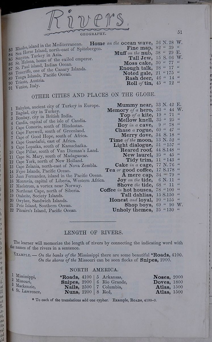
| 83 | Rhodes, island in the Mediterranean. | Home on the ocean wave, | 36 N. 28 W. |
| 84 | Sea Horse Island, north-east of Spitzbergen. | Fine map, | 82 " 39 " |
| 85 | Smyrna, Turkey in Asia. | Muff on the nub, | 38 " 29 E. |
| 86 | St. Helena, home of the exiled emperor. | Tall Jew, | 15 S. 06 W. |
| 87 | St. Paul island, Indian Ocean. | Moss cake, | 30 " 77 " |
| 88 | Teneriffe, one of the Canary Islands. | Enough talk, | 28 " 17 " |
| 89 | Tonga Islands, Pacific Ocean. | Noted gale, | 21 " 175 " |
| 90 | Trieste, Austria. | Rash deer, | 46 " 14 " |
| 91 | Venice, Italy. | Roll of tin, | 45 " 12 " |
| 1 | Babylon, ancient city of Turkey in Europe. | Mummy near, | 33 N. 42 E. |
| 2 | Bagdad, city in Turkey. | Memory of a hero, | 33 " 44 W. |
| 3 | Bombay, city in British India. | Top of a kite, | 19 " 71 " |
| 4 | Candia, capital of the isle of Candia. | Mellow knell, | 35 " 25 " |
| 5 | Cape Comorin, south of Hindostan | Boy in a cave, | 9 " 78 " |
| 6 | Cape Farewell, south of Greenland. | Chase a rogue, | 60 " 47 " |
| 7 | Cape of Good Hope, south of Africa. | Merry dove, | 34 S. 18 " |
| 8 | Cape Guardafui, east of Africa. | Time of the moon, | 13 N. 52 " |
| 9 | Cape Lopatka, south of Kamschatka. | Light dialogue, | 51 " 157 " |
| 10 | Cape Pillar, south of Van Deiman's Land. | Reared roof, | 44 S.148 " |
| 11 | Cape St. Mary, south of Madagascar. | New laurel, | 25 " 45 " |
| 12 | Cape York, north of New Holland. | Tidy trim, | 11 " 143 " |
| 13 | Cape Zelania, north-east of Nova Zembla. | Cake in a cage, | 77 N. 76 " |
| 14 | Fejee Islands, Pacific Ocean. | Tea or good coffee, | 17 S.178 " |
| 15 | Juan Fernandez, island in the Pacific Ocean. | A mere cap, | 34 " 79 " |
| 16 | Monrovia, capital of Liberia, Western Africa. | Joy on the tide, | 6 N. 11 " |
| 17 | Maelstrom, a vortex near Norway | Shove the tide, | 68 " 11 " |
| 18 | Northeast Cape, north of Siberia. | Coffee in hot houses, | 78 " 100 " |
| 19 | Otaheite, Society Islands. | Tall dahlias, | 15 S.150 " |
| 20 | Owyhee, Sandwich Islands. | Honest and loyal, | 20 " 155 " |
| 21 | Petz Island, Southern Ocean. | Shop boys, | 69 " 90 W. |
| 22 | Pitcairn's Island, Pacific Ocean. | Unholy themes, | 25 " 130 " |
LENGTH OF RIVERS.
The learner will memorize the length of rivers by connecting the indicating word with the names of the rivers in a sentence.
EXAMPLE.—On the banks of the Mississippi there are some beautiful ❊ Roads, 4100. On the shores of the Missouri can be seen the flocks of Snipes, 2900.| 1 | Mississippi, | ❊ Roads, | 4100 |
| 2 | Missouri, | Snipes, | 2900 |
| 3 | Mackenzie, | Nails, | 2500 |
| 4 | St. Lawrence, | Nuns, | 2200 |
| 5 | Arkansas, | Noses, | 2000 |
| 6 | Rio Grande, | Doves, | 1800 |
| 7 | Columbia, | Atlas, | 1500 |
| 8 | Red, | Atlas, | 1500 |
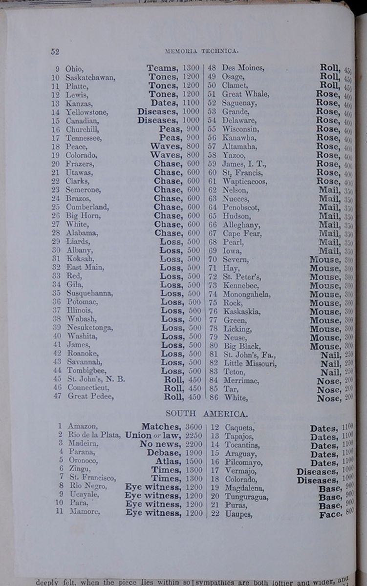 52
MEMORIA TECHNICA.
52
MEMORIA TECHNICA.
| 9 | Ohio, | Teams, | 1300 |
| 10 | Saskatchawan, | Tones, | 1200 |
| 11 | Platte, | Tones, | 1200 |
| 12 | Lewis, | Tones, | 1200 |
| 13 | Kanzas, | Dates, | 1100 |
| 14 | Yellowstone, | Diseases, | 1000 |
| 15 | Canadian, | Diseases, | 1000 |
| 16 | Churchill, | Peas, | 900 |
| 17 | Tennessee, | Peas, | 900 |
| 18 | Peace, | Waves, | 800 |
| 19 | Colorado, | Waves, | 800 |
| 20 | Frazers, | Chase, | 600 |
| 21 | Utawas, | Chase, | 600 |
| 22 | Clarks, | Chase, | 600 |
| 23 | Semerone, | Chase, | 600 |
| 24 | Brazos, | Chase, | 600 |
| 25 | Cumberland, | Chase, | 600 |
| 26 | Big Horn, | Chase, | 600 |
| 27 | White, | Chase, | 600 |
| 28 | Alabama, | Chase, | 600 |
| 29 | Liards, | Loss, | 500 |
| 30 | Albany, | Loss, | 500 |
| 31 | Koksah, | Loss, | 500 |
| 32 | East Main, | Loss, | 500 |
| 33 | Red, | Loss, | 500 |
| 34 | Gila, | Loss, | 500 |
| 35 | Susquehanna, | Loss, | 500 |
| 36 | Potomac, | Loss, | 500 |
| 37 | Illinois, | Loss, | 500 |
| 38 | Wabash, | Loss, | 500 |
| 39 | Nesuketonga, | Loss, | 500 |
| 40 | Washita, | Loss, | 500 |
| 41 | James, | Loss, | 500 |
| 42 | Roanoke, | Loss, | 500 |
| 43 | Savannah, | Loss, | 500 |
| 44 | Tombigbee, | Loss, | 500 |
| 45 | St. John's, N. B. | Roll, | 450 |
| 46 | Connecticut, | Roll, | 450 |
| 47 | Great Pedee, | Roll, | 450 |
| 48 | Des Moines, | Roll, | 450 |
| 49 | Osage, | Roll, | 450 |
| 50 | Clamet, | Roll, | 450 |
| 51 | Great Whale, | Rose, | 400 |
| 52 | Saguenay, | Rose, | 400 |
| 53 | Grande, | Rose, | 400 |
| 54 | Delaware, | Rose, | 400 |
| 55 | Wisconsin, | Rose, | 400 |
| 56 | Kanawha, | Rose, | 400 |
| 57 | Altamaha, | Rose, | 400 |
| 58 | Yazoo, | Rose, | 400 |
| 59 | James, I. T., | Rose, | 400 |
| 60 | St. Francis, | Rose, | 400 |
| 61 | Wapticacoos, | Rose, | 400 |
| 62 | Nelson, | Mail, | 350 |
| 63 | Nueces, | Mail, | 350 |
| 64 | Penobscot, | Mail, | 350 |
| 65 | Hudson, | Mail, | 350 |
| 66 | Alleghany, | Mail, | 350 |
| 67 | Cape Fear, | Mail, | 350 |
| 68 | Pearl, | Mail, | 350 |
| 69 | Iowa, | Mail, | 350 |
| 70 | Severn, | Mouse, | 300 |
| 71 | Hay, | Mouse, | 300 |
| 72 | St. Peter's, | Mouse, | 300 |
| 73 | Kennebec, | Mouse, | 300 |
| 74 | Monongahela, | Mouse, | 300 |
| 75 | Rock, | Mouse, | 300 |
| 76 | Kaskaskia, | Mouse, | 300 |
| 77 | Green, | Mouse, | 300 |
| 78 | Licking, | Mouse, | 300 |
| 79 | Neuse, | Mouse, | 300 |
| 80 | Big Black, | Mouse, | 300 |
| 81 | St. John's, Fa., | Nail, | 250 |
| 82 | Little Missouri, | Nail, | 250 |
| 83 | Teton, | Nail, | 250 |
| 84 | Merrimac, | Nose, | 200 |
| 85 | Tar, | Nose, | 200 |
| 86 | White, | Nose, | 200 |
| 1 | Amazon, | Matches, | 3600 |
| 2 | Rio de la Plata, | Union or law, | 2250 |
| 3 | Madeira, | No news, | 2200 |
| 4 | Parana, | Debase, | 1900 |
| 5 | Oronoco, | Atlas, | 1500 |
| 6 | Zingu, | Times, | 1300 |
| 7 | St. Francisco, | Times, | 1300 |
| 8 | Rio Negro, | Eye witness, | 1200 |
| 9 | Ucayale, | Eye witness, | 1200 |
| 10 | Para, | Eye witness, | 1200 |
| 11 | Mamare, | Eye witness, | 1200 |
| 12 | Caqueta, | Dates, | 1100 |
| 13 | Tapajos, | Dates, | 1100 |
| 14 | Tocantins, | Dates, | 1100 |
| 15 | Araguay, | Dates, | 1100 |
| 16 | Pilcomayo, | Dates, | 1100 |
| 17 | Vermajo, | Diseases, | 1000 |
| 18 | Colorado, | Diseases, | 1000 |
| 19 | Magdalena, | Base, | 900 |
| 20 | Tunguragua, | Base, | 900 |
| 21 | Puras, | Base, | 900 |
| 22 | Uaupes, | Face, | 800 |
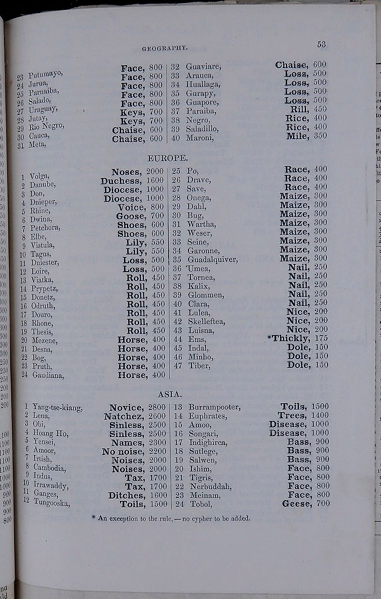 GEOGRAPHY.
53
GEOGRAPHY.
53
| 23 | Putumayo, | Face, | 800 |
| 24 | Jurua, | Face, | 800 |
| 25 | Parnaiba, | Face, | 800 |
| 26 | Salado, | Face, | 800 |
| 27 | Uruguay, | Face, | 800 |
| 28 | Jutay, | Keys, | 700 |
| 29 | Rio Negro, | Keys, | 700 |
| 30 | Cauca, | Chaise, | 600 |
| 31 | Meta, | Chaise, | 600 |
| 32 | Guaviare, | Chaise, | 600 |
| 33 | Arauca, | Loss, | 500 |
| 34 | Haullaga, | Loss, | 500 |
| 35 | Gurapy, | Loss, | 500 |
| 36 | Guapore, | Loss, | 500 |
| 37 | Paraiba, | Rill, | 450 |
| 38 | Negro, | Rice, | 400 |
| 39 | Saladillo, | Rice, | 400 |
| 40 | Maroni, | Mile, | 350 |
| 1 | Volga, | Noses, | 2000 |
| 2 | Danube, | Duchess, | 1600 |
| 3 | Don, | Diocese, | 1000 |
| 4 | Dnieper, | Diocese, | 1000 |
| 5 | Rhine, | Voice, | 800 |
| 6 | Dwina, | Goose, | 700 |
| 7 | Petchora, | Shoes, | 600 |
| 8 | Elbe, | Shoes, | 600 |
| 9 | Vistula, | Lily, | 550 |
| 10 | Tagus, | Lily, | 550 |
| 11 | Dniester, | Loss, | 500 |
| 12 | Loire, | Loss, | 500 |
| 13 | Viatka, | Roll, | 450 |
| 14 | Prypetz, | Roll, | 450 |
| 15 | Donetz, | Roll, | 450 |
| 16 | Odruth, | Roll, | 450 |
| 17 | Douro, | Roll, | 450 |
| 18 | Rhone, | Roll, | 450 |
| 19 | Thesis, | Roll, | 450 |
| 20 | Mezene, | Horse, | 400 |
| 21 | Desna, | Horse, | 400 |
| 22 | Bog, | Horse, | 400 |
| 23 | Pruth, | Horse, | 400 |
| 24 | Guadiana, | Horse, | 400 |
| 25 | Po, | Race, | 400 |
| 26 | Drave, | Race, | 400 |
| 27 | Save, | Race, | 400 |
| 28 | Onega, | Maize, | 300 |
| 29 | Dahl, | Maize, | 300 |
| 30 | Bug, | Maize, | 300 |
| 31 | Wartha, | Maize, | 300 |
| 32 | Weser, | Maize, | 300 |
| 33 | Seine, | Maize, | 300 |
| 24 | Garonne, | Maize, | 300 |
| 35 | Guadalquiver, | Maize, | 300 |
| 36 | Umea, | Nail, | 250 |
| 37 | Tornea, | Nail, | 250 |
| 38 | Kalix, | Nail, | 250 |
| 39 | Glommen, | Nail, | 250 |
| 40 | Clara, | Nail, | 250 |
| 41 | Lulea, | Nice, | 200 |
| 42 | Skelleftea, | Nice, | 200 |
| 43 | Luisna, | Nice, | 200 |
| 44 | Ems, | ❊ Thickly, | 175 |
| 45 | Indal, | Dole, | 150 |
| 46 | Minho, | Dole, | 150 |
| 47 | Tiber, | Dole, | 150 |
| 1 | Yang-tse-kiang, | Novice, | 2800 |
| 2 | Lena, | Natchez, | 2600 |
| 3 | Obi, | Sinless, | 2500 |
| 4 | Hoang Ho, | Sinless, | 2500 |
| 5 | Yensei, | Names, | 2300 |
| 6 | Amoor, | No noise, | 2200 |
| 7 | Irtish, | Noises, | 2000 |
| 8 | Cambodia, | Noises, | 2000 |
| 9 | Indus, | Tax, | 1700 |
| 10 | Irrawaddy, | Tax, | 1700 |
| 11 | Ganges, | Ditches, | 1600 |
| 12 | Tungooska, | Toils, | 1500 |
| 13 | Burrampooter, | Toils, | 1500 |
| 14 | Euphrates, | Trees, | 1400 |
| 15 | Amoo, | Disease, | 1000 |
| 16 | Songari, | Disease, | 1000 |
| 17 | Indighirca, | Bass, | 900 |
| 18 | Sutlege, | Bass, | 900 |
| 19 | Salwen, | Bass, | 900 |
| 20 | Ishim, | Face, | 800 |
| 21 | Tigris, | Face, | 800 |
| 22 | Nerbuddah, | Face, | 800 |
| 23 | Meinam, | Face, | 800 |
| 24 | Tobol, | Geese, | 700 |
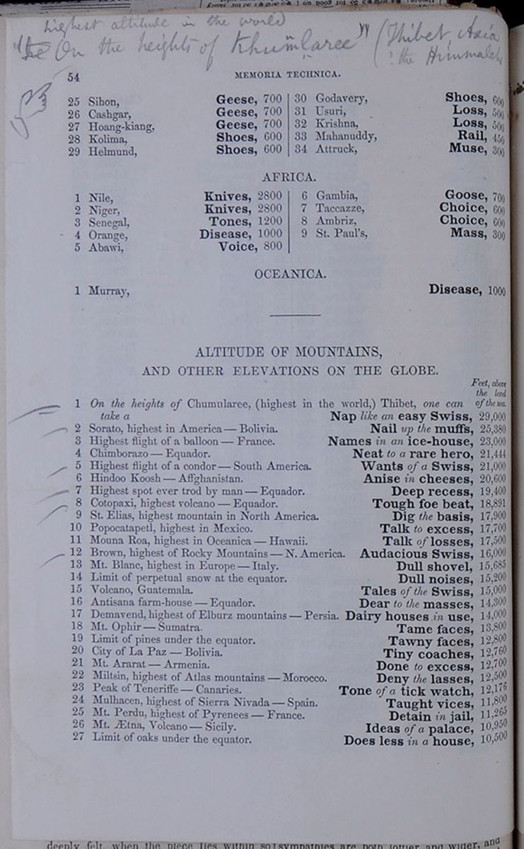 54
MEMORIA TECHNICA.
54
MEMORIA TECHNICA.
| 25 | Sihon, | Geese, | 700 |
| 26 | Cashgar, | Geese, | 700 |
| 27 | Hoang-kiang, | Geese, | 700 |
| 28 | Kolima, | Shoes, | 600 |
| 29 | Helmund, | Shoes, | 600 |
| 30 | Godavery, | Shoes, | 600 |
| 31 | Usuri, | Loss, | 500 |
| 32 | Krishna, | Loss, | 500 |
| 33 | Mahanuddy, | Rail, | 450 |
| 34 | Attruck, | Muse, | 300 |
| 1 | Nile, | Knives, | 2800 |
| 2 | Niger, | Knives, | 2800 |
| 3 | Senegal, | Tones, | 1200 |
| 4 | Orange, | Disease, | 1000 |
| 5 | Abawi, | Voice, | 800 |
| 6 | Gambia, | Goose, | 700 |
| 7 | Taccaze, | Choice, | 600 |
| 8 | Ambriz, | Choice, | 600 |
| 9 | St. Paul's, | Mass, | 300 |
| 1 | Murray, | Disease, | 1000 |
| Feet, above the level of the sea. | |||||
| 1 | On the heights of Chumularee, (highest in the world,) Thibet, one can take a | Nap like an easy Swiss, | 29,000 | ||
| 2 | Sorato, highest in America—Bolivia. | Nail up the muffs, | 25,380 | ||
| 3 | Highest flight of a balloon—France. | Names in an ice-house, | 23,000 | ||
| 4 | Chimborazo—Equador. | Neat to a rare hero, | 21,444 | ||
| 5 | Highest flight of a condor—South America. | Wants of a Swiss, | 21,000 | ||
| 6 | Hindoo Koosh—Affghanistan. | Anise in cheeses, | 20,600 | ||
| 7 | Highest spot ever trod by man—Equador. | Deep recess, | 19,400 | ||
| 8 | Cotopaxi, highest volcano—Equador. | Tough foe beat, | 18,891 | ||
| 9 | St. Elias, highest mountain in North America. | Dig the basis, | 17,900 | ||
| 10 | Popocatapetl, highest in Mexico. | Talk to excess, | 17,700 | ||
| 11 | Mouna Roa, highest in Oceanica—Hawaii. | Talk of losses, | 17,500 | ||
| 12 | Brown, highest of Rocky Mountains—N. America. | Audacious Swiss, | 16,000 | ||
| 13 | Mt. Blanc, highest in Europe—Italy. | Dull shovel, | 15,685 | ||
| 14 | Limit of perpetual snow at the equator. | Dull noises, | 15,200 | ||
| 15 | Volcano, Guatemala. | Tales of the Swiss, | 15,000 | ||
| 16 | Antisana farm-house—Equador. | Dear to the masses, | 14,300 | ||
| 17 | Demavend, highest of Elburz mountains—Persia. | Dairy houses in use, | 14,000 | ||
| 18 | Mt. Ophir—Sumatra. | Tame faces, | 13,800 | ||
| 19 | Limit of pines under the equator. | Tawny faces, | 12,800 | ||
| 20 | City of La Paz—Bolivia. | Tiny coaches, | 12,760 | ||
| 21 | Mt. Ararat—Armenia. | Done to excess, | 12,700 | ||
| 22 | Miltsin, highest of Atlas mountains—Spain. | Deny the lasses, | 12,500 | ||
| 23 | Peak of Teneriffe—Canaries. | Tone of a tick watch, | 12,176 | ||
| 24 | Mulhacen, highest of Sierra Nivada—Spain. | Taught vices, | 11,800 | ||
| 25 | Mt. Perdu, highest of Pyrenees—France. | Detain in jail, | 11,265 | ||
| 26 | Mt. Ætna, Volcano—Sicily. | Ideas of a palace, | 10,950 | ||
| 27 | Limit of oaks under the equator. | Does less in a house, | 10,500 |
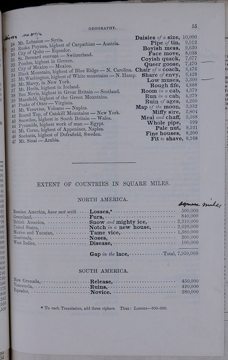 GEOGRAPHY.
55
GEOGRAPHY.
55
| 28 | Mt. Lebanon—Syria. | Daisies of a size, | 10,000 | ||
| 29 | Ruska Poyana, highest of Carpathian—Austria. | Pipe of tin, | 9,912 | ||
| 30 | City of Quito—Equador. | Boyish mess, | 9,630 | ||
| 31 | St. Bernard convent—Switzerland. | Face move, | 8,038 | ||
| 32 | Pendus, highest in Greece. | Coyish quack, | 7,677 | ||
| 33 | City of Mexico—Mexico. | Queer goose, | 7,470 | ||
| 34 | Black Mountain, highest of Blue Ridge—N. Carolina. | Chair of a coach, | 6,476 | ||
| 35 | Mt. Washington, highest of White mountains—N. Hamp. | Share of envy, | 6,428 | ||
| 36 | Mt. Marcy, in New York. | Low muses, | 5,300 | ||
| 37 | Mt. Hecla, highest in Iceland. | Rough fife, | 4,888 | ||
| 38 | Ben Nevis, highest in Great Britain—Scotland. | Room in a cab, | 4,379 | ||
| 39 | Mansfield, highest of the Green Mountains. | Run in a cab, | 4,279 | ||
| 40 | Peaks of Otter—Virginia, | Ruin of ages, | 4,260 | ||
| 41 | Mt. Vesuvius, Volcano—Naples. | Map of the moon, | 3,932 | ||
| 42 | Round Top, of the Catskill Mountains—New York. | Miffy sire, | 3,804 | ||
| 43 | Snowdon, highest in South Britain—Wales. | Meal and chaff, | 3,568 | ||
| 44 | Pyramids, highest work of man—Egypt. | Whole pipe, | 599 | ||
| 45 | Mt. Corno, highest of Appenines, Naples. | Pale nut, | 9,521 | ||
| 46 | Snegatta, highest of Dofrafield, Sweden. | Fine houses, | 8,200 | ||
| 47 | Mt. Sinai—Arabia. | Fit to shave, | 8,168 |
EXTENT OF COUNTRIES IN SQUARE MILES.
| square miles | ||
| Russian America, have met with | Losses, ❊ | 500,000 |
| Greenland, | Furs, | 840,000 |
| British America, | Snow and mighty ice, | 2,310,000 |
| United States, | Notch in a new house, | 2,620,000 |
| Mexico and Yucatan, | Tame vice, | 1,380,000 |
| Guatimala, | Noses, | 200,000 |
| West Indies, | Disease, | 100,000 |
| Gap in the lace, | Total, 7,950,000 |
| New Grenada, | Release, | 450,000 |
| Venezuela, | Ruins, | 420,000 |
| Equador, | Novice, | 280,000 |
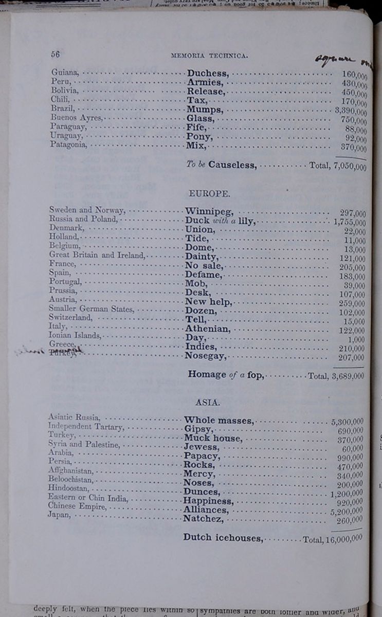 56
MEMORIA TECHNICA.
56
MEMORIA TECHNICA.
| square miles | ||
| Guiana, | Duchess, | 160,000 |
| Peru, | Armies | 430,000 |
| Bolivia, | Release, | 450,000 |
| Chili, | Tax, | 170,000 |
| Brazil, | Mumps, | 3,390,000 |
| Buenos Ayres, | Glass, | 750,000 |
| Paraguay | Fife, | 88,000 |
| Uraguay, | Pony, | 92,000 |
| Patagonia, | Mix, | 370,000 |
| To be Causeless, | Total, 7,050,000 |
| Sweden and Norway, | Winnipeg, | 297,000 |
| Russia and Poland, | Duck with a lily, | 1,755,000 |
| Denmark, | Union, | 22,000 |
| Holland, | Tide, | 11,000 |
| Belgium, | Dome, | 13,000 |
| Great Britain and Ireland, | Dainty, | 121,000 |
| France, | No sale, | 205,000 |
| Spain, | Defame, | 183,000 |
| Portugal, | Mob, | 39,000 |
| Prussia, | Desk, | 107,000 |
| Austria, | New help, | 259,000 |
| Smaller German States, | Dozen, | 102,000 |
| Switzerland | Tell, | 15,000 |
| Italy, | Athenian, | 122,000 |
| Ionian Islands, | Day, | 1,000 |
| Greece, | Indies, | 210,000 |
| Turkey, | Nosegay, | 207,000 |
| Homage of a fop, | Total, 3,689,000 |
| Asiatic Russia, | Whole masses, | 5,300,000 |
| Independent Tartary, | Gipsy, | 690,000 |
| Turkey, | Muck house, | 370,000 |
| Syria and Palestine, | Jewess, | 60,000 |
| Arabia, | Papacy, | 990,000 |
| Persia, | Rocks, | 470,000 |
| Affghanistan, | Mercy, | 340,000 |
| Beloochistan, | Noses, | 200,000 |
| Hindoostan, | Dunces, | 1,200,000 |
| Eastern or Chin India, | Happiness, | 920,000 |
| Chinese Empire, | Alliances, | 5,200,000 |
| Japan, | Natchez, | 260,000 |
| Dutch icehouses, | Total, 16,000,000 |
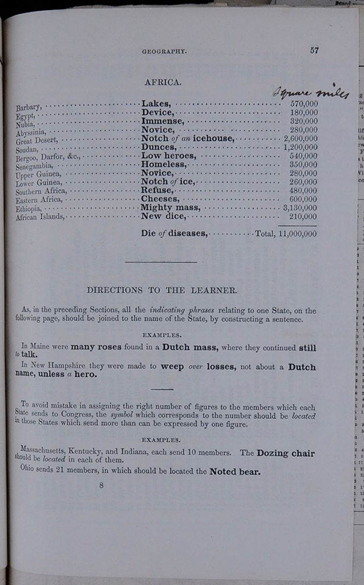 GEOGRAPHY.
57
GEOGRAPHY.
57
| square miles | ||
| Barbary, | Lakes, | 570,000 |
| Egypt, | Device, | 180,000 |
| Nubia | Immense, | 320,000 |
| Abyssinia, | Novice, | 280,000 |
| Great Desert, | Notch of an icehouse, | 2,600,000 |
| Soudan, | Dunces, | 1,200,000 |
| Bergoo, Darfor, &c., | Low heroes, | 540,000 |
| Senegambia, | Homeless, | 350,000 |
| Upper Guinea | Novice, | 280,000 |
| Lower Guinea, | Notch of ice, | 260,000 |
| Southern Africa, | Refuse, | 480,000 |
| Eastern Africa, | Cheeses, | 600,000 |
| Ethiopia, | Mighty mass, | 3,130,000 |
| African Islands, | New dice, | 210,000 |
| Die of diseases, | Total, 11,000,000 |
DIRECTIONS TO THE LEARNER.
As, in the preceding Sections, all the indicating phrases relating to one State, on the following page, should be joined to the name of the State, by constructing a sentence.
EXAMPLES.In Maine were many roses found in a Dutch mass, where they continued still to talk.
In New Hampshire they were made to weep over losses, not about a Dutch name, unless a hero.
To avoid mistake in assigning the right number of figures to the members which each state sends to Congress, the symbol which corresponds to the number should be located in those States which send more than can be expressed by one figure.
EXAMPLES.Massachusetts, Kentucky, and Indiana, each send 10 members. The Dozing chair should be located in each of them.
Ohio sends 21 members, in which should be located the Noted bear.
8 [begin surface 66]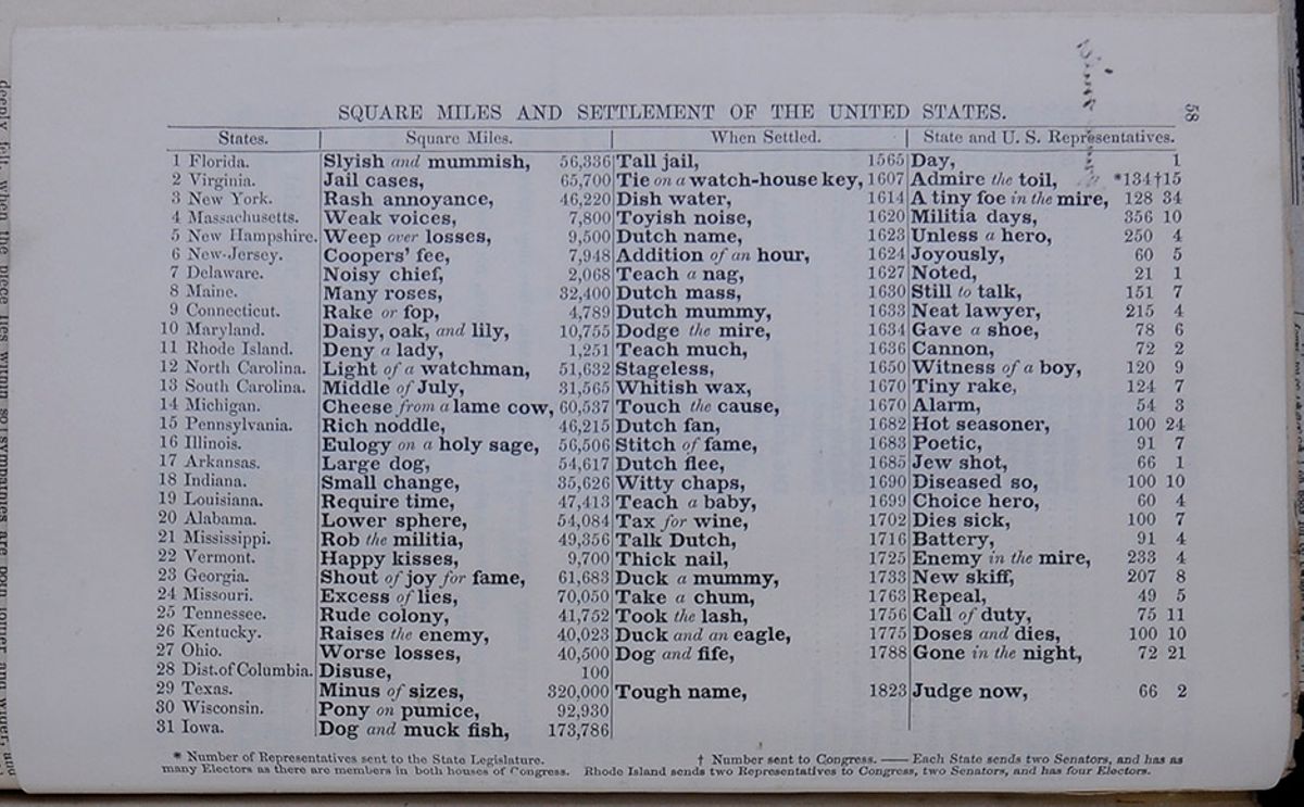 58
58
| States. | Square miles. | When Settled. | State and U.S. Representatives. | ||||
| 1 Florida. | Slyish and mummish, | 56,336 | Tall jail, | 1565 | Day. | 1 | |
| 2 Virginia. | Jail cases, | 65,700 | Tie on a watch-house key, | 1607 | Admire the toil, | ❊ 134 | † 15 |
| 3 New York. | Rash annoyance, | 46,220 | Dish water, | 1614 | A tiny foe in the mire, | 128 | 34 |
| 4 Massachusetts. | Weak voices, | 7,800 | Toyish noise, | 1620 | Militia days, | 356 | 10 |
| 5 New Hampshire. | Weep over losses, | 9,500 | Dutch name, | 1623 | Unless a hero, | 250 | 4 |
| 6 New Jersey. | Coopers' fee, | 7,948 | Addition of an hour, | 1624 | Joyously, | 60 | 5 |
| 7 Delaware. | Noisy chief, | 2,068 | Teach a nag, | 1627 | Noted, | 21 | 1 |
| 8 Maine. | Many roses, | 32,400 | Dutch mass, | 1630 | Still to talk, | 151 | 7 |
| 9 Connecticut. | Rake or fop, | 4,789 | Dutch mummy, | 1633 | Neat lawyer, | 215 | 4 |
| 10 Maryland. | Daisy, oak, and lily, | 10,755 | Dodge the mire, | 1634 | Gave a shoe, | 78 | 6 |
| 11 Rhode Island. | Deny a lady, | 1,251 | Teach much, | 1636 | Cannon, | 72 | 2 |
| 12 North Carolina. | Light of a watchman, | 51,632 | Stageless, | 1650 | Witness of a boy, | 120 | 9 |
| 13 South Carolina. | Middle of July, | 31,565 | Whitish wax, | 1670 | Tiny rake, | 124 | 7 |
| 14 Michigan. | Cheese from a lame cow, | 60,537 | Touch the cause, | 1670 | Alarm, | 54 | 3 |
| 15 Pennsylvania. | Rich noddle, | 46,215 | Dutch fan, | 1682 | Hot seasoner, | 100 | 24 |
| 16 Illinois. | Eulogy on a holy sage, | 56,506 | Stitch of fame, | 1683 | Poetic, | 91 | 7 |
| 17 Arkansas. | Large dog, | 54,617 | Dutch flee, | 1685 | Jew shot, | 66 | 1 |
| 18 Indiana. | Small change, | 35,626 | Witty chaps, | 1690 | Diseased so, | 100 | 10 |
| 19 Louisiana. | Require time, | 47,413 | Teach a baby, | 1699 | Choice hero, | 60 | 4 |
| 20 Alabama. | Lower sphere, | 54,084 | Tax for wine, | 1702 | Dies sick, | 100 | 7 |
| 21 Mississippi. | Rob the militia, | 49,356 | Talk Dutch, | 1716 | Battery, | 91 | 4 |
| 22 Vermont. | Happy kisses, | 9,700 | Thick nail, | 1725 | Enemy in the mire, | 233 | 4 |
| 23 Georgia. | Shout of joy for fame, | 61,683 | Duck a mummy, | 1733 | New skiff, | 207 | 8 |
| 24 Missouri. | Excess of lies, | 70,050 | Take a chum, | 1763 | Repeal, | 49 | 5 |
| 25 Tennessee. | Rude colony, | 41,752 | Took the lash, | 1756 | Call of duty, | 75 | 11 |
| 26 Kentucky. | Raises the enemy, | 40,023 | Duck and an eagle, | 1755 | Doses and dies, | 100 | 10 |
| 27 Ohio. | Worse losses, | 40,500 | Dog and fife, | 1788 | Gone in the night, | 72 | 21 |
| 28 Dist. of Columbia. | Disuse, | 100 | |||||
| 29 Texas. | Minus of sizes, | 320,000 | Tough name, | 1823 | Judge now, | 66 | 2 |
| 30 Wisconsin. | Pony on pumice, | 92,930 | |||||
| 31 Iowa. | Dog and muck fish, | 173,786 |
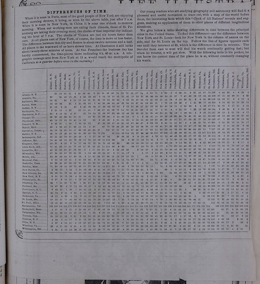
DIFFERENCES OF TIME.
When it is noon in Paris, most of the good people of New York are enjoying their morning dreams, it being, as is seen by the above table, just after 5 A.M. When it is noon in New York, in China it is near one o'clock to-morrow morning. When our working-men are eating their dinners, those of St. Petersburg are taking their evening meal, the clocks of that imperial city indicating the hour of 7 P.M. The clocks of Vienna are just six hours faster than ours. At all places east of New York, of course, the time is more or less faster. The difference between this city and Boston is about twelve minutes and a half. All places to the westward of us have slower time. At Charleston it still lacks about twenty-three minutes of noon. At San Francisco the business day has hardly commenced, the time-pieces there indicating 8 h. 45 m. A.M. A telegraphic message sent from New York at 12 M. Would reach the metropolis of California at a quarter before nine in the morning!
Our young readers who are studying geography and astronomy will find it a pleasant and useful recreation to trace out, with a map of the world before them, the interesting facts which this "Clock of All Nations" reveals and suggests, making an application of them to other places of different longitudinal situations.
We give below a table showing differences in time between the principal cities in the United States. To find this difference—say the difference between New York and St. Louis—look for New York in the column of names on the side, and for St. Louis on the top. Follow the line of figures opposite each one until they intersect at 65, which is the difference in time in minutes. The traveler from east to west will find his watch continually getting fast; but when he returns, it will get slow. With the following table in his pocket, he can know the correct time of the place he is at, without constantly changing his watch.
A table showing the difference in time between U.S. cities. [begin surface 68] [begin surface 69]
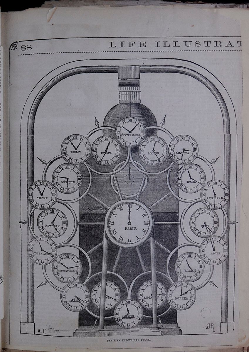 88
LIFE ILLUSTRAT[cutaway]
PARISIAN ELECTRICAL CLOCK.
[begin surface 70]
88
LIFE ILLUSTRAT[cutaway]
PARISIAN ELECTRICAL CLOCK.
[begin surface 70]
 [begin surface 72]
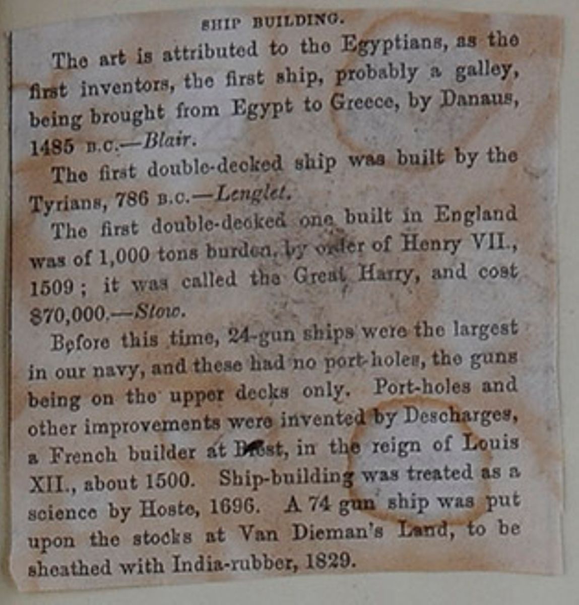
SHIP BUILDING.
The art is attributed to the Egyptians, as the first inventors, the first ship, probably a galley, being brought from Egypt to Greece, by Danaus, 1485 B.C.—Blair.
The first double-decked ship was built by the Tyrians, 786 B.C.—Lenglet.
The first double-decked one built in England was of 1,000 tons burden by order of Henry Vii., 1509; it was called the Great Harry and cost $70,000—Stow.
Before this time, 24-gun ships were the largest in our navy, and these had no port-holes, the guns being on the upper decks only. Port-holes and other improvements were invented by Descharges, a French builder in Brest, in the reign of Louis XII., about 1500. Ship-building was treated as a science by Hoste, 1696. A 74 gun ship was put upon the stocks at Van Dieman's Land, to be sheathed with India-rubber, 1829.
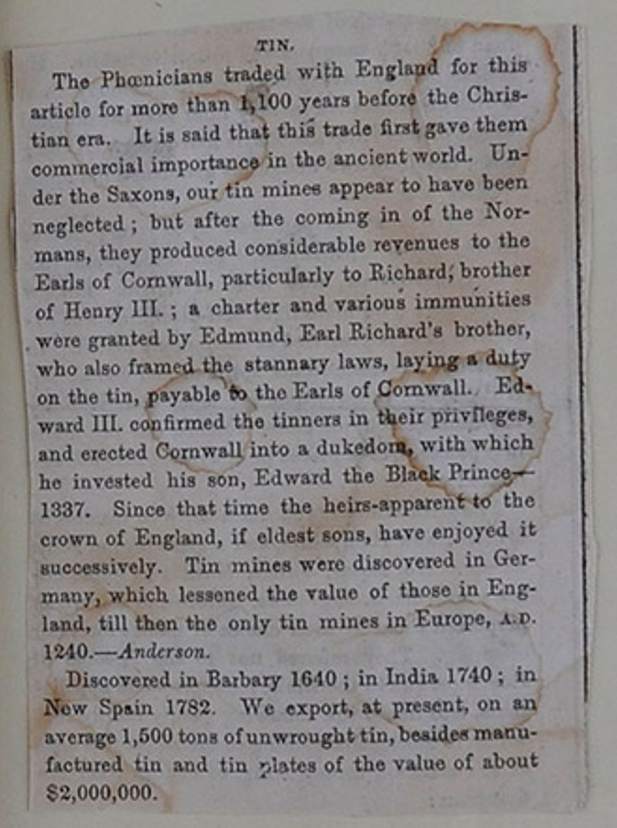
TIN.
The Phœnicians traded with England for this article for more than 1,100 years before the Christian era. It is said that this trade first gave them commercial importance in the ancient world. Under the Saxons, our tin mines appear to have been neglected; but after the coming in of the Normans, they produced considerable revenues to the Earls of Cornwall, particularly to Richard, brother of Henry III.; a charter and various immunities were granted by Edmund, Earl Richard's brother, who also framed the stannary laws, laying a duty on the tin, payable to the Earls of Cornwall. Edward III. confirmed the tinners in their privileges, and erected Cornwall into a dukedom, with which he invested his son, Edward the Black Prince—1337. Since that time, the heirs-apparent to the crown of England, if eldest sons, have enjoyed it successively. Tin mines were discovered in Germany, which lessened the value of those in England, till then the only tin mines in Europe, A.D. 1240.—Anderson.
Discovered in Barbary 1640; in India, 1740; in New Spain 1782. We export, at present, on an average, 1500 tons of unwrought tin, besides manufactured tin and tin plates of the value of about $2,000,000.
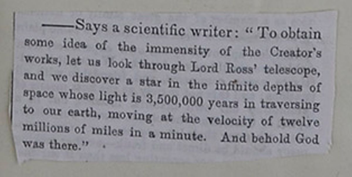
—Says a scientific writer: "To obtain some idea of the immensity of the Creator's works, let us look through Lord Ross' telescope, and we discover a star in the infinite depths of space whose light is 3,500,000 years in traversing to our earth, moving at the velocity of twelve millions of miles in a minute. And behold God was there."
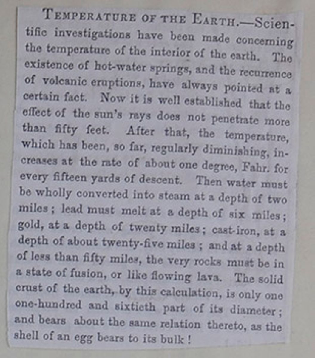
TEMPERATURE OF THE EARTH.—Scientific investigations have been made concerning the temperature of the interior of the earth. The existence of hot-water springs, and the recurrence of volcanic eruptions, have always pointed at a certain fact. Now it is well established that the effect of the sun's rays does not penetrate more than fifty feet. After that, the temperature, which has been, so far, regularly diminishing, increases at the rate of about one degree, Fahr. for every fifteen yards of descent. Then water must be wholly converted into steam at a depth of two miles; lead must melt at a depth of six miles; gold, at a depth of twenty miles; cast-iron, at a depth of about twenty-five miles; and at a depth of less than fifty miles, the very rocks must be in a state of fusion, or like flowing lava. The solid crust of the earth, by this calculation, is only one-hundred and sixtieth part of its diameter; and bears about the same relation thereto, as the shell of an egg bears to its bulk!
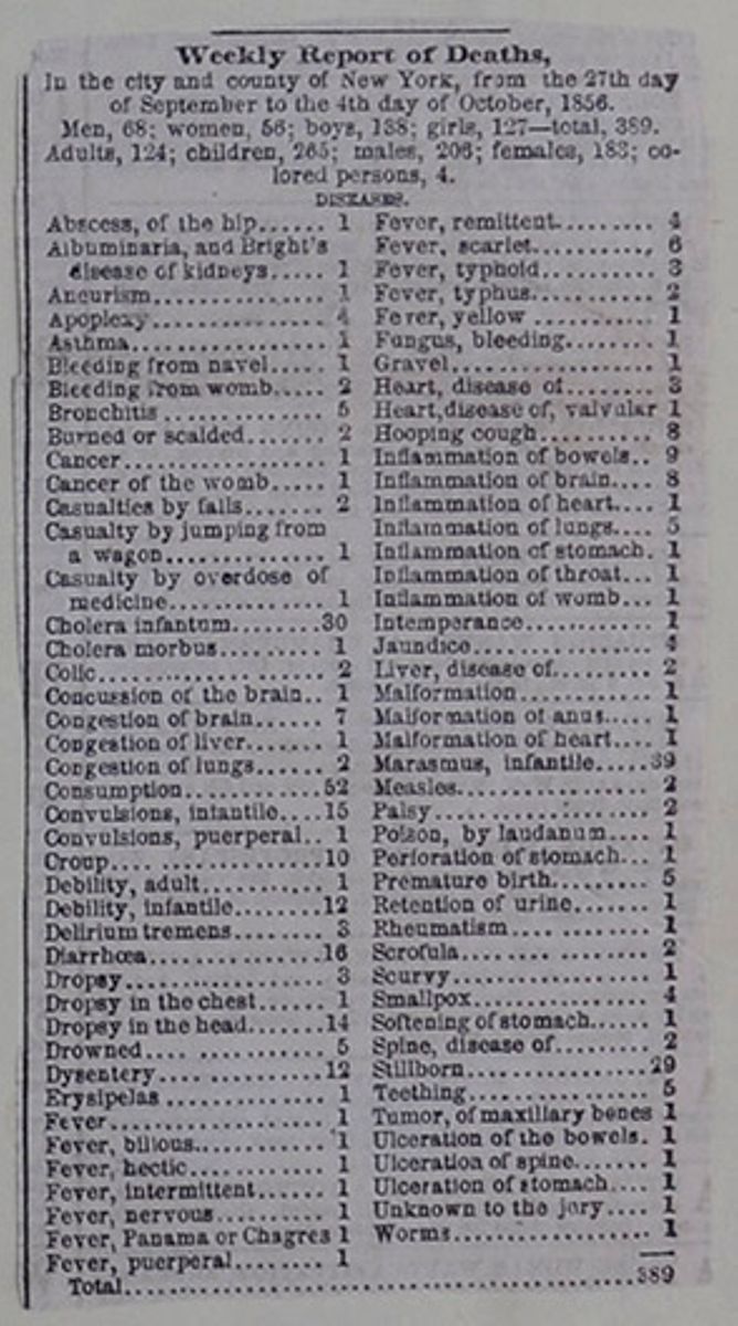
In the city and country of New York, from the 27th day of September to the 4th day of October, 1856. Men, 68; women, 56; boys, 138; girls 127—total, 389. Adults, 124; children, 265; males, 206; females, 183; colored persons, 4.
| Abscess, of the hip | 1 |
| Albuminaria, and Bright's disease of kidneys | 1 |
| Aneurism | 1 |
| Apoplexy | 4 |
| Asthma | 1 |
| Bleeding from navel | 1 |
| Bleeding from womb | 2 |
| Bronchitis | 5 |
| Burned or scalded | 5 |
| Cancer | 1 |
| Cancer of the womb | 1 |
| Casualties by falls | 2 |
| Casualty by jumping from a wagon | 1 |
| Casualty by overdose of medicine | 1 |
| Cholera infantum | 30 |
| Cholera morbus | 1 |
| Colic | 2 |
| Concussion of the brain | 1 |
| Congestion of brain | 7 |
| Congestion of liver | 1 |
| Congestion of lungs | 2 |
| Consumption | 52 |
| Convulsions, infantile | 1 |
| Convulsions, puerperal | 1 |
| Croup | 10 |
| Debility, adult | 1 |
| Debility, infantile | 12 |
| Delirium tremens | 3 |
| Diarrhœa | 16 |
| Dropsy | 3 |
| Dropsy in the chest | 1 |
| Dropsy in the head | 14 |
| Drowned | 5 |
| Dysentery | 12 |
| Erysipelas | 1 |
| Fever, bilious | 1 |
| Fever, hectic | 1 |
| Fever, nervous | 1 |
| Fever, Panama or Chagres | 1 |
| Fever, puerperal | 1 |
| Fever, remittent | 4 |
| Fever, scarlet | 6 |
| Fever, typhoid | 3 |
| Fever, typhus | 2 |
| Fever, yellow | 1 |
| Fungus, bleeding | 1 |
| Gravel | 1 |
| Heart, disease of | 3 |
| Heart, disease of, valvular | 1 |
| Hooping cough | 8 |
| Inflammation of bowels | 9 |
| Inflammation of brain | 8 |
| Inflammation of heart | 1 |
| Inflammation of lungs | 5 |
| Inflammation of stomach | 1 |
| Inflammation of throat | 1 |
| Inflammation of womb | 1 |
| Intemperance | 1 |
| Jaundice | 4 |
| Liver, disease of | 2 |
| Malformation | 1 |
| Malformation of anus | 1 |
| Malformation of heart | 1 |
| Marasmus, infantile | 39 |
| Measles | 2 |
| Palsy | 2 |
| Poison, by laudanum | 1 |
| Perforation of stomach | 1 |
| Premature birth | 5 |
| Retention of urine | 1 |
| Rheumatism | 1 |
| Scrofula | 2 |
| Scurvy | 1 |
| Smallpox | 4 |
| Softening of stomach | 1 |
| Spine, disease of | 2 |
| Stillborn | 29 |
| Teething | 5 |
| Tumor, of maxillary bones | 1 |
| Ulceration of the bowels | 1 |
| Ulceration of the spine | 1 |
| Ulceration of the stomach | 1 |
| Unknown to the jury | 1 |
| Worms | 1 |
| Total | 389 |
 [begin surface 78]
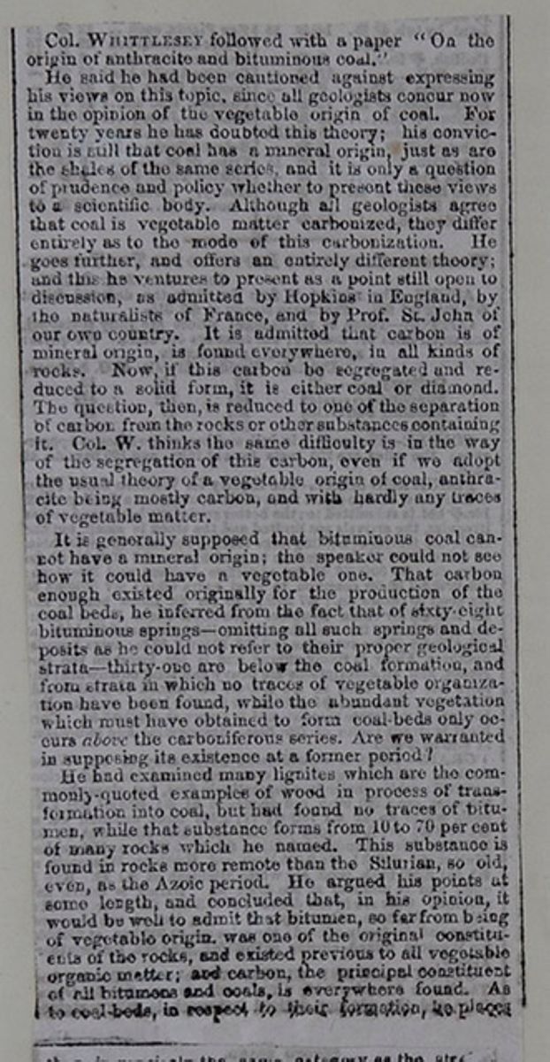
Col. WHITTLESEY followed with a paper "On the origin of anthracite and bituminous coal."
He said he had been cautioned against expressing his views on this topic, since all geologists concur now on the opinion of the vegetable origin of coal. For twenty years he has doubted this theory; his conviction is still that coal has a mineral origin, just as are the shales of the same series, and it is only a question of prudence and policy whether to present these views to a scientific body. Although all geologists agree that coal is vegetable matter carbonized, they differ entirely as to the mode of this carbonization. He goes further, and offers an entirely different theory; and this he ventures to present as a point still open to discussion, as admitted by Hopkins in England, by the naturalists of France, and by Prof. St. John of our own country. It is admitted that carbon is of mineral origin, is found everywhere, in all kinds of rocks. Now, if this carbon be segregated and reduced to a solid form, it is either coal or diamond. The question, then is reduced to one of the separation of carbon from the rocks or other substances containing it. Col. W. thinks the same difficulty is in the way of the segregation of this carbon, even if we adopt the usual theory of a vegetable origin of coal, anthracite being mostly carbon, and with hardly any traces of vegetable matter.
It is generally supposed that bituminous coal cannot have a mineral origin; the speaker could not see how it could have a vegetable one. That carbon enough existed originally for the production of the coal beds, he inferred from the fact that of sixty-eight bituminous springs—omitting all such springs and deposits as he could not refer to their proper geological strata—thirty-one are below the coal formation, and from strata in which no traces of vegetable organization have been found, while the abundant vegetation which must have obtained to form coal-beds only occurs above the carboniferous series. Are we warranted in supposing its existence at a former period?
He had examined many lignites which are the commonly-quoted examples of wood in process of transformation into coal, but had found no traces of bitumen, while that substance forms from 10 to 70 per cent of many rocks which he named. This substance is found in rocks more remote than the Silurian, so old, even, as the Azoic period. He argued his points at some length, and concluded that, in his opinion, it would be well to admit that bitumen, so far from being of vegetable origin. was one of the original constituents of the rocks, and existed previous to all vegetable organic matter; and carbon, the principal constituent of all bitumens and coals, is everywhere found. As to coal beds, in respect to their formation, he places
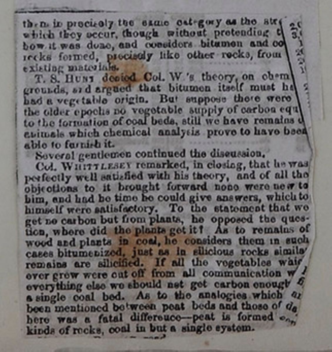
them in precisely the same category as the st[covered] which they occur, though without pretending t[covered]how it was done, and considers bitumen and co[covered]rocks formed, precisely like other rocks, from [covered] existing materials.
T. S. HUNT denied Col. W's theory on chem[covered] grounds, and argued that bitumen itself must ha[covered] had a vegetable origin. But suppose there were [covered] the older epochs no vegetable supply of carbon equ[covered] to the formation of coal beds, still we have remains [covered] animals which chemical analysis prove to have been able to furnish it.
Several gentlemen continued the discussion.
Col. WHITTLESEY remarked, in closing, that he was perfectly well satisfied with his theory, and of all the objections to it brought forward none were new to him, and had he time he could give answers which to himself were satisfactory. To the statement that we get no carbon but from plants, he opposed the question, where did the plants get it? As to remains of wood and plants in coal, he considers them in such cases bitumenized, just as in silicious rocks similar remains are silicified. If all the vegetables which ever grew were cut off from all communication w[covered] everything else we should not get carbon enough [covered] a single coal bed. As to the analogies which[covered] have mentioned between peat beds and those of [covered]here was a fatal difference—peat is formed [covered] kinds of rocks, coal in but a single system.[covered]
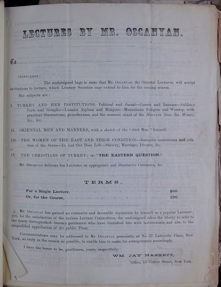
LECTURES BY MR. OSCANYAN.
To _____________ GENTLEMEN:The undersigned begs to state that Mr. OSCANYAN, the Oriental Lecturer, will accept invitations to lecture, which Literary Societies may extend to him for the coming season.
His subjects are:- I. TURKEY AND HER INSTITUTIONS, Political and Social—Courts and Bazaars—Sublime Porte and Seraglio—Lunatic Asylum and Mosques—Mussulman Religion and Worship, with practical illustrations, genuflexions, and the musical chant of the Muezzin from the Minaré, &c., &c.
- II. ORIENTAL MEN AND MANNERS, with a sketch of the "Sick Man" himself.
- III. THE WOMEN OF THE EAST AND THEIR CONDITION—Domestic institutions and relation of the Sexes—In and Out Door Life—Slavery, Marriage, Divorce, &c.
- IV. THE CHRISTIANS OF TURKEY; or, "THE EASTERN QUESTIONS."
| For a Single Lecture, | $60 |
| Or, for the Course, | 200 |
Mr. OSCANYAN has gained an extensive and favorable reputation for himself as a popular Lecturer; yet, for the satisfaction of the various Lecture Committees, the undersigned takes the liberty to refer to the many distinguished literary gentlemen who have furnished him with testimonials, and also to the unqualified approbation of the public Press.
Communications may be addressed to Mr. OSCANYAN personally, at No. 37 Lafayette Place, New York, as early in the season as possible, to enable him to make his arrangements accordingly.
I have the honor to be, gentlemen, yours, respectfully,
WM. JAY HASKETT, Office, 15 Centre Street, New York. [begin surface 81]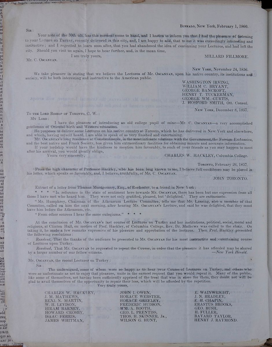 BUFFALO, New York, February 1, 1860.
SIR:
BUFFALO, New York, February 1, 1860.
SIR:
Your note of the 30th ult. has this moment come to hand, and I hasten to inform you that I had the pleasure of listening to your Lecture on Turkey, recently delivered in this city, and, I am happy to add, that to me it was exceedingly interesting and instructive; and I regretted to learn soon after, that you had abandoned the idea of continuing your Lectures, and had left the city. Should you visit us again, I hope to hear further, and, in the mean time,
I am truly yours, MILLARD FILLMORE Mr. C. OSCANYAN. NEW YORK, November 24, 1856We take pleasure in stating that we believe the Lectures of Mr. OSCANYAN, upon his native country, its institutions, and society, will be both interesting and instructive to the American public.
- WASHINGTON IRVING,
- WILLIAM C. BRYANT,
- GEORGE BANCROFT,
- HENRY T. TUCKERMAN,
- GEORGE WM. CURTIS,
- J. HOSFORD SMITH, Ott. Consul.
I have the pleasure of introducing an old college pupil of mine—Mr. C. OSCANYAN—a very accomplished gentleman of Oriental birth and Western education.
He proposes to deliver some Lectures on his native country at Toronto, which he has delivered in New York and elsewhere, and which, having myself heard, I am able to speak of as very finished and entertaining.
Mr. OSCANYAN's long residence at Constantinople, in the most intimate relations with the Government, the Foreign Embassies, and the best native and Frank Society, has given him extraordinary facilities for obtaining minute and accurate information.
If your lordship would have the kindness to mention him favorably, to such of your friends as you may happen to meet after his arrival, you would greatly oblige,
Yours very sincerely, CHARLES W. HACKLEY, Columbia College. TORONTO, February 26, 1857From the high character of Professor Hackley, who has been long known to me, I believe full confidence may be placed in his letter which speaks so favorably, and I believe, truthfully, of Mr. C. OSCANYAN.
JOHN TORONTO. Extract of a letter from Thomas Montgomery, Esq., of Rochester, to a friend in New York:* * * "In reference to the state of sentiment here towards Mr. OSCANYAN, there has been but one expression from all those I have met who heard him. They were not only gratified, please, but 'delighted.' They are enthusiastic.
"Mr. Humphrey, Chairman of the Athenæum Lecture Committee tells me that Mr. Lansing, also a member of that Commttee , called on him the next morning, after hearing Mr. OSCANYAN's Lecture, and said he was delighted, that they must have him before the Athenæum, etc.
"From all other sources I hear the same eulogiums." * * *
At the conclusion of Mr. OSCANYAN's last course of Lectures on Turkey and her institutions, political, social, moral and religious, at Clinton Hall, on motion of Prof. Hackley, of Columbia College, Rev. Dr. Mathews was called to the chair. On taking it, he made a few remarks expressive of his pleasure and approbation of the lectures. Then Prof. Hackley presented the following resolutions:
Resolved, That the thanks of the audience be presented to Mr. OSCANYAN for his most instructive and entertaining course of Lectures upon Turkey.
Resolved, That Mr. OSCANYAN be requested to repeat the Course, in order that the pleasure it has afforded may be shared by a larger number of our fellow citizens.
—The New York Herald Mr. OSCANYAN, the recent Lecturer on Turkey: SIR:The undersigned, some of whom were so happy as to hear your Course of Lectures on Turkey, and others who were so unfortunate as not to enjoy that pleasure, unite in the earnest request that you would repeat it. Many of the public, like some of themselves, not having been sufficiently apprised of the treat that was in store for them, they doubt not will be glad to avail themselves of the opportunity to repair their loss, which will be afforded by the repetition.
Very truly yours,- CHARLES W. HACKLEY,
- J. M. MATHEWS,
- BENJ. N. MARTIN,
- W. H. LEVISON,
- HIRAM BARNEY,
- HOWARD CROSBY,
- ISAAC FERRIS,
- JAMES WHITMAN,
- JOHN I. OWENS,
- HORACE WEBSTER,
- HORACE GREELEY,
- FREDERIC HUDSON,
- WM. A BOOTH,
- GEO. L. PRETISS,
- THOS. H. SKINNER, JR.,
- WILSON G. HUNT,
- E. WAINWRIGHT,
- J. N. BRADLEY,
- E. H. CHAPIN,
- ERASTUS BROOKS,
- GEO. BUSH,
- H. FULLER,
- BAYARD TAYLOR,
- HENRY J. RAYMOND.
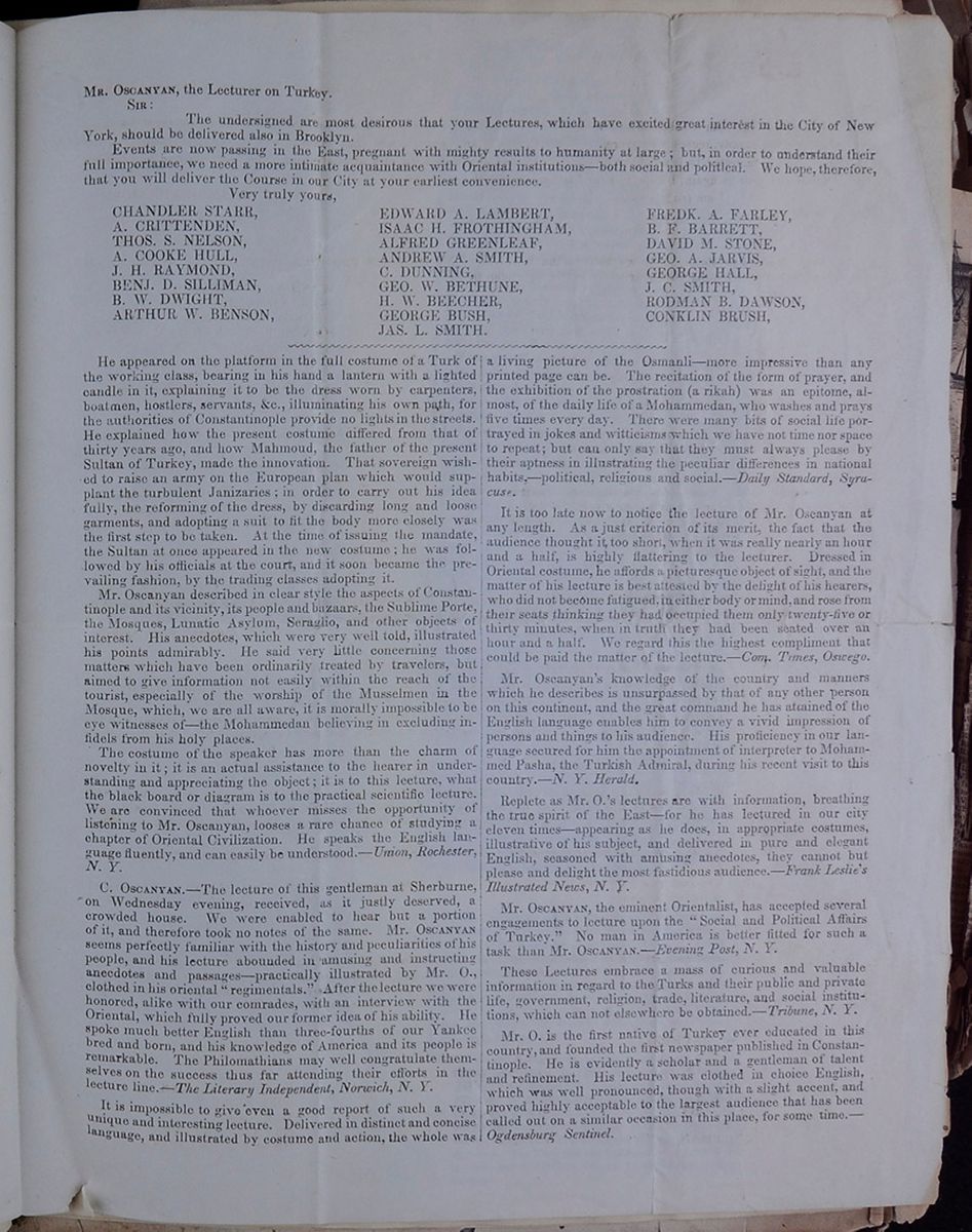 MR. OSCANYAN, the Lecturer on Turkey.
SIR:
MR. OSCANYAN, the Lecturer on Turkey.
SIR:
The undersigned are most desirous that your Lectures, which have excited great interest in the City of New York, should be delivered also in Brooklyn.
Events now are passing in the East, pregnant with might results to humanity at large; but, in order to understand their full importance, we will need a more intimate acquaintance with Oriental institutions—both social and political. We hope, therefore, that you will deliver the Course in our City at your earliest convenience.
Very truly yours,- CHANDLER STARR,
- A. CRITTENDEN,
- A. COOKE HULL,
- J. H. RAYMOND,
- BENJ. D. SILLIMAN,
- B. W. DWIGHT,
- ARTHUR W. BENSON,
- EDWARD A. LAMBERT,
- ISAAC H. FROTHINGHAM,
- ALFRED GREENLEAF,
- ANDREW A. SMITH,
- C. DUNNING,
- GEO. W. W. BETHUNE,
- H. W. BEECHER,
- GEORGE BUSH,
- FREDK. A. FARLEY,
- B. F. BARRETT,
- DAVID M. STONE,
- GEO. A. JARVIS,
- GEORGE HALL,
- J. C. SMITH,
- RODMAN B. DAWSON,
- CONKLIN BRUSH,
- JAS. L. SMITH.
He appeared on the platform in the full costume of a Turk of the working class, bearing in his hand a lantern with a lighted candle in it, explaining it to be the dress worn by carpenters, boatmen, hostlers, servants, &c., illuminating his own path, for the authorities of Constantinople provide no lights in the streets. He explained how the present costume differed from that of thirty years ago, and how Mahmoud, the father of the present Sultan of Turkey, made the innovation. That sovereign wished to raise an army on the European plan which would supplant the turbulent Janizaries; in order to carry out his idea fully, the reforming of the dress, by discarding long and loose garments, and adopting a suit to fit the body more closely was the first step to be taken. At the time of issuing the mandate, the Sultan at once appeared in the new costume; he was followed by his officials at the court, and it soon became the prevailing fashion, by the trading classes adopting it.
Mr. Oscanyan described in clear style the aspects of Constantinople and its vicinity, its people and bazaars, the Sublime Porte, the Mosques, Lunatic Asylum, Seraglio, and other objects of interest. His anecdotes, which were very well told, illustrated his points admirably. He said very little concerning those matters which have been ordinarily treated by travelers, but aimed to give information not easily within the reach of the tourist, especially of the worship of the Musselmen in the Mosque, which, we are all aware, it is morally impossible to be eye witness of—the Mohammedan believing in excluding infidels form his holy places.
The costume of the speaker has more than the charm of novelty in it; it is an actual assistance to the hearer in understanding and appreciating the object; it is to this lecture, what the black board or diagram is to the practical scientific lecture. We are convinced that whoever misses the opportunity of listening to Mr. Oscanyan, looses a rare chance of studying a chapter of Oriental Civilization. He speaks the English language fluently, and can be easily understood.—Union, Rochester, N. Y.
C. OSCANYAN.—The lecture of this gentleman at Sherburne on Wednesday evening, received, as it justly deserved, a crowded house. We were enabled to hear but a portion of it, and therefore took no notes of the same. Mr. OSCANYAN seems perfectly familiar with the history and peculiarities of his people, and his lecture abounded in amusing and instructing anecdotes and passages—practically illustrated by Mr. O., clothed in his oriental "regimentals." After the lecture we were honored, alike with our comrades, with an interview with the Oriental, which fully proved our former idea of his ability. He spoke much better English than three-fourths of our Yankee bred and born, and his knowledge of America and its people is remarkable. The Philomathians may well congratulate themselves on the success thus far attending their efforts in the lecture line.—The Literary Independent, Norwich, N. Y.
It is impossible to give even a good report of such a very unique and interesting lecture. Delivered in distinct and concise language, and illustrated by costume and action the whole was a living picture of the Osmanli—more impressive than any printed page can be. The recitation of the form of prayer, and the exhibition of the prostration (a rikah) was an epitome, almost, of the daily life of a Mohammedan, who washes and prays five times every day. There were many bits of social life portrayed in jokes and witticisms which we have not time nor space to repeat; but can only say that they must always please by their aptness in illustrating the peculiar differences in national habits,—political, religious and social.—Daily Standard, Syracuse.
It is too late now to notice the lecture of Mr. Oscanyan at any length. As a just criterion of its merit, the fact that the audience thought it too short, when it was really near an hour and a half, is highly flattering to the lecturer. Dressed in Oriental costume, he affords a picturesque object of sight, and the matter of his lecture is best attested by the delight of his hearers, who did not become fatigued, in either body or mind, and rose from their seats thinking they had occupied them only twenty-five or thirty minutes, when in truth they had been seated over an hour and a half. We regard this the highest compliment that could be paid the matter of the lecture.—Com. Times, Oswego
Mr. Oscanyan's knowledge of the country and manners which he describes is unsurpassed by that of any other person on this continent, and the great command he has attained of the English language enables him to convey a vivid impression of persons and things to his audience. His proficiency in our language secured for him the appointment of interpreter to Mohammed Pasha, the Turkish Admiral, during his recent visit to this country.—N. Y. Herald.
Replete as Mr. O.'s lectures are with information, breathing the true spirit of the East—for he has lectured in our city eleven times—appearing as he does, in appropriate costumes, illustrative of his subject, and delivered in pure and elegant English, seasoned with amusing anecdotes, they cannot but please and delight the most fastidious audience.—Frank Leslie's Illustrated News, N. Y.
Mr. OSCANYAN, the eminent Orientalist, has accepted several engagements to lecture upon the "Social and Political Affairs of Turkey." No man in America is better fitted for such a task than Mr. OSCANYAN.—Evening Post, N. Y.
These Lectures embrace a mass of curious and valuable information in regard to the Turks and their public and private life, government, religion, trade, literature, and social institutions, which can not elsewhere be obtained.—Tribune, N. Y.
Mr. O. is the first native of Turkey ever educated in this country, and founded the first newspaper published in Constantinople. He is evidently a scholar and a gentleman of talent and refinement. His lecture was clothed in choice English, which was well pronounced, though with a slight accent, and proved highly acceptable to the largest audience that has been called out on a similar occasion in this place, for some time.—Ogdensburg Sentinel.
[begin surface 83] [begin surface 84]
 [begin surface 85]
SCENES ON THE OCEAN FLOOR.—Besides the countless varieties of the fucus, the bottom of the sea is overgrown with the curled, deep purple leaves of the sea-lettuce, with large porous lichens, and many branched hollow algæ, full of life and motion in their rosy little bladders, thickly set with ever moving tiny arms. These plants form submarine forests, growing one into another, in apparently lawless order: here interlacing their branches, there forming bowers and long avenues, at one time thriving abundantly, till the thicket seems impenetrable then again leaving large openings between wold and wold, where smaller plants form a beautiful pink turf. There a thousand hues and tinges shine and glitter in each changing light. In the indulgence of their luxurious growth, the fuci especially seem to gratify every whim and freak. Creeping close to the ground, or sending long-stretched arms, crowned with waving plumes, up to the blessed light of heaven, they form pale-green sea-groves where there is neither moon or star, or rise up nearer to the surface, to be transcendently rich and gorgeous in brightest green and purple. And, through this dream-like scene playing in all the colors of the rainbow, and deep under the hollow, briny ocean, there sail and chase each other merrily gaily-painted mollusks and bright shining fishes. Snails of every shape creep slowly along the stems, while huge, gray-haired seals hang with their enormous tusks on large, tall trees. There is a gigantic Dugong, the siren of the ancients, the side long shark with his leaden eyes, the thick-haired sea-leopard, and the sluggish turtle.. Look how these strange, ill-shapen forms, which ever keep their dreamless sleep far down in the gloomy deep, stir themselves from time to time! See how they drive each other from their rich pastures, how they seem to awaken in storms, rising like islands from beneath, and snorting through the angry spray! Perhaps they graze peacefully in the unbroken cool of the ocean's deep bed, when lo! a hungry shark comes slyly, silently around that grove; its glassy eyes shine ghost-like with a yellow sheen, and seek their prey. The sea dog first becomes aware of his dreaded enemy, and seeks refuge in the thickest recesses of the fungus forest. In an instant the whole scene changes. The oyster closes its shell with a clap, and throws itself into the deep below; the turtle conceals head and feet under her impenetrable armor, and sinks slowly downward; the playful little fish disappear in the branches of the marocystis; lobsters hide under the thick, clumsily shapen roots, and the young walrus alone turns boldly round, and faces the intruder with his sharp pointed teeth. The battle commences; both seek the forest; their flas become entangled in the closely interwoven branches; at last the more agile shark succeeds in wounding his adversary's side. Despairing of life, the bleeding walrus tries to conceal his last agony in the woods, but, blinded by pain and blood, he fastens himself among the branches, and soon falls an easy prey to the shark, who greedily devours him.—Putnam's Magazine.
ORIGIN OF COAL.—Dr. David Dale Owen, in a recent lecture at Vincennes upon Agricultural Chemistry, incidentally alludes to the origin of coal. The Doctor is not a believer in the theory of the vegetable origin of coal, but, in the language of the Gazette, is an advocate of the more modern and rational idea that coal is the condensation or the solidification of the vast volumes of the carbonic gases that surrounded the world before the temperature of the earth and its atmosphere had been reduced to a condition to support animal life—into vegetables and woods and the condensation of them into those vast store-houses of fuel—or coal strata—for the future use of man, that prepared the earth first for the rougher animals, and finally for a habitation for man. This is undoubtedly the true theory, and most beautifully illustrates the beneficent providence of the Creator, who transformed the most fatal substance to man's existence in the early periods of the world, to be one of his chiefest blessings in the maturer ages of the earth, when man should be fitted for and need its use. And thus are all apparent evils upon earth made in His infinite providence, the basis of great good to this subjects of the Divine government. In reference to manuring, the Doctor remarked: "The idea of manuring land from the atmosphere was novel to some, who were surprised to learn that the ammonia deposited by the rain on each acre of land, in a year, was sufficient with is accessories to produce two tons of vegetable matter. This explained the difference between rain and irrigation to the plants. The importance of preserving the ammonia of manures, by covering them from the action of the air, and carrying the drainage from them into cisterns to be carried in a liquid over the land, was made very evident to the farmer."
ARCTIC ADVENTURES BY SEA AND LAND. Edited by EPES SARGENT. 12 mo., pp. 480. Boston: Phillips, Sampson, & Co.
The commencement of Arctic exploration, according to Mr. Sargent, dates from an earlier period than is usually supposed. It seems to be established by the researches of northern antiquaries that Newfoundland, Greenland, and several parts of the American coast, were visited by the Scandinavians in the ninth and tenth centuries. Within two centuries from that time these daring sea-rovers made their way to the seventy-second degree of latitude, and set up stones with Runic inscriptions dated 1135 on the islands in Baffin's Bay where they were discovered in 1824. The colonists on the eastern coast of this bay kept up intercourse with Europe until 1406, when it was interrupted by the accumulation of ice. In the year 1380 voyagers from the south of Europe were attracted toward those dreary regions, and two Venetian navigators named Teni brought home accounts of what they had there seen, not knowing that the Scandinavians had preceded them by three centuries.
It was not till the reign of Henry VI., that the enterprise of British navigators was directed to a quarter in which they have since won such brilliant renown, although without achieving the main object of their ambition. In 1497, the younger Cabot landed at Labrador, eighteen months before Columbus saw the mainland of tropical America. In a further attempt to reach the pole, he sailed up to 67 ½° of north latitude. Sir Hugh Willoughby, Frobisher, Sir Humphrey Gilbert, Davis, Hudson, and other English and Russian navigators, successively enlarged the limits of research until in 1743 the British Parliament offered a reward of twenty thousand pounds to any any one who should sail to the north-west by way of Hudson's Strait. After the ineffectual attempt to reach the North Pole by Capt. Phipps in 1773, and by Capt. Cook in 1776, there was a cessation of Arctic enterprises for many years; when in 1816 it was reported by the Greenland whalers that the sea was clearer of ice than any former time within their knowledge. This gave a new impulse to the spirit of research, and in 1818 the first expedition of Ross and Parry was dispatched for the discovery of the North-West Passage. At the same time, Buchan and Franklin were intrusted with the command of an expedition to the North Pole, and after almost incredible perils returned in the Autumn of the same year. In 1819 Capt. Parry sailed at the head of a new expedition, commencing the career of northern discovery, which has given such prominence to his name among modern navigators. From that time the progress of Arctic research has become familiar to most intelligent readers. It has been signalized by the spirit of adventure, the heroic courage and the wonderful power of endurance exhibited by the explorers, rather than by its positive results in the interests of science or of commerce. [cutaway]
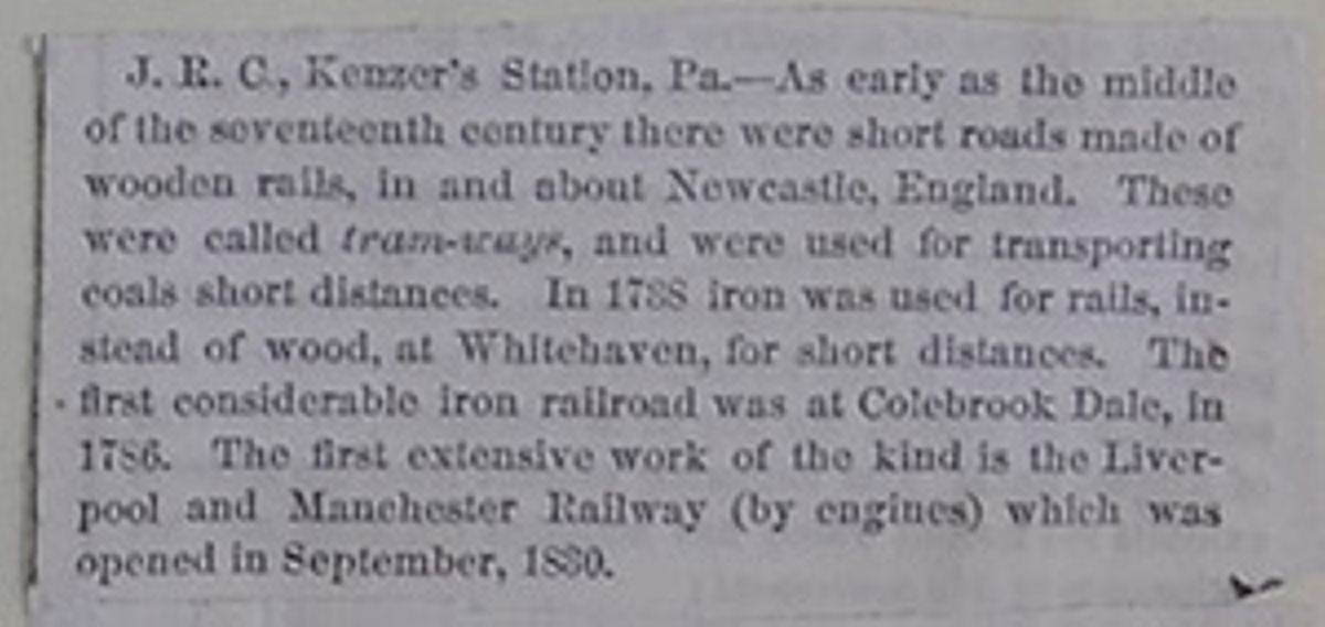
J. R. C., Kenzer's Station, Pa.—As early as the middle of the seventeenth century there were short roads made of wooden rails, in and about Newcastle, England. These were called tram-ways, and were used for transporting coals short distances. In 1738 iron was used for rails, instead of wood, at Whitehaven, for short distances. The first considerable iron railroad was at Colebrook Dale, in 1786. The first extensive work of the kind is the Liverpool and Manchester Railway (by engines) which was opened in September, 1830.
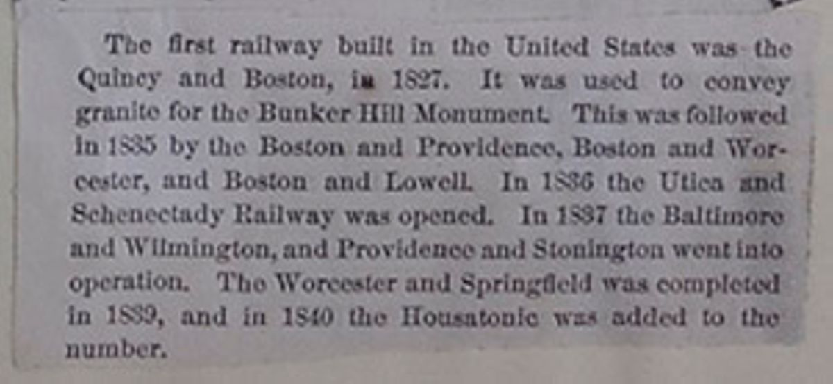
The first railway built in the United States was the Quincy and Boston, in 1827. It was used to convey granite for the Bunker Hill Monument. This was followed in 1835 by the Boston and Providence, Boston and Worcester, and Boston and Lowell. In 1836 the Utica and Schenectady Railway was opened. In 1837 the Baltimore and Wilmington, and Providence and Stonington went into operation. The Worcester and Springfield was completed in 1839, and in 1840 the Housatonic was added to the number.
 [begin surface 91]
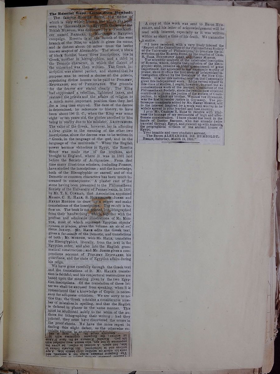 [begin surface 92]
The Rosettat Stone—Letter from Humbodt .
The famous Rosetta Stone, the name of which is very widely known, and which has been seen by thousands in the Egyptian Gallery of the British Museum, was discovered by a French officer named BASSARD, in NAPOLEON's Egyptian campaign. Rosetta is at the mouth of the west branch of the Nile, to which it gives its name, and is distant about 36 miles from the better known seaport of Alexandria. The stone, a block of black Sienite, bears three inscriptions, one in Greek, another in hieroglyphics, and a third in the Demotic character, in which the dialect of the unlearned was then written. The Greek inscription was almost perfect, and showed that is purpose was to record a decree of the priests, appointing divine honors to be paid to PTOLEMY, EPIPHANES, son of PHILOPATOR. The grounds for the decree are stated clearly: The King had suppressed a rebellion, lightened taxes, and restored the priests and the affairs of religion to a much more important position than they had for a long time enjoyed. The date of the decree is determined, by reference to history, to have been about 196 B. C., when the King was some eight or ten years old, the glories ascribed to him being in reality due to his minister, ARISTOMENES. The value of the Greek, however, lay in affording a clear guide to the meaning of the other two inscriptions, since the decree was to be written in "Greek, in the language of the god, and in the language of the multitude." When the English power became victorious in Egypt, the Rosetta Stone was made one of the trophies, and brought to England, where it was in 1802 laid before the Society of Antiquaries. From that time many illustrious scholars, including PORSON, have studied the inscriptions; and the knowledge, both of the Hieroglyphic or sacred, and of the Demotic or common characters has been much increased in consequence. A plaster cast of the stone having been presented to the Philomathean Society of the University of Pennsylvania, in 1856, by Mr. T. K. CONRAD, that Association appointed Messrs. C. R. HALE, S. HUNTINGTON JONES and HENRY MORTON to draw up a report and make translations of the inscriptions. The result is before us. The book is not printed, but lithographed from their handwriting; which together with the profuse and admirable illustrations of Mr. MORTON, most of which represent Egyptian objects usages or places, gives the volume of an air of curious luxury. Mr. HALE edits the Greek text, gives a fac-simile of the Demotic, and translations of both; Mr. MORTON, with Mr. HALE, translates the Hieroglyphics, literally from the text in the Egyptian order, and also into the English grammatical construction; and Mr. JONES gives a compendious account of PTOLEMY EPHIPHANES, his guardians, and the state of Egyptian affairs during his reign.
We have gone carefully through the Greek text and the translations of it. Mr. HALE's translation is faithful, and his conjectural restorations are based upon the meaning given by the two Egyptian inscriptions. Of the translation of these latter we shall be excused from speaking, when it is remembered that a knowledge of Coptic is necessary for adequate criticism. We are sorry to notice that the Greek contains a considerable number of mistakes in spelling, and that the English is defaced in places in the same manner. This must be attributed solely to the whim of the authors for lithographing their writing; had they printed, they must have discovered the errors in the proof-sheets. We have the more regret in finding this slight defect, as the otherwise exquisite volume is so plainly a labor of love, and the intelligence and study brought to bear on their subject make it a tenfold pity that the authors should leave manuscript slips to be thus perpetuated.
The translation of the Demotic text is, we believe, the first complete one published; and the whole essay is the first thing of the kind ever issued in this country. The labor and judgment of Messrs. HALE & MORTON leads us to hope that they will investigate the subject more thoroughly, and become distinguished in a branch of study for which they evidently have strong inclination.

A copy of this work was sent to Baron HUMBOLDT, and his letter of acknowledgement will be read with interest, especially as it was written within so short a time of his death. We transcribe it entire.
"I have received with a very lively interest the 'Report of the Committee of the Philomathean Society of the University of Philadelphia,' to translate the inscription on the Rosetta Stone, by the reunion of CHAS. R. HALE, HUNTINGTON JONES, and HENRY MORTON.
The scientific analysis of the celebrated inscription of Rosetta, which, despite the confusion of the hieroglyphic style, remains an historic monument of great importance, has appeared to me especially worthy of praise, since it offers the first essay at independent investigation offered by the literature of the New Continent. It is for this national relation that I especially greet this independent work. Little versed myself in this class of studies, I ought, however, to greet the so conscientious work of the learned Committee of the Philomathean Society, since the results now obtained contribute to prove the justice of the system of Champollion, to which my brother, WILLIAM VON HUMBOLDT, was the first to render justice in Germany. The picturesque ornaments added by Mr. HENRY MORTON, add to the interest inspired by a work well worthy to be widely spread in your learned and free country.
I pray Mr. CHARLES R. HALE to receive with kindness the homage of my sentiments of high and affectionate consideration. I have placed the book in the hands of Doctor BRUGSCH, who has already twice traveled through Egypt, and cleared up with sagacity, the geographical division of the ancient homes of Egypt.
Your humble and very obedient servant,
The Baron ALEXANDER DE HUMBOLDT. BERLIN, Saturday, March 12, 1859."
 [begin surface 95]
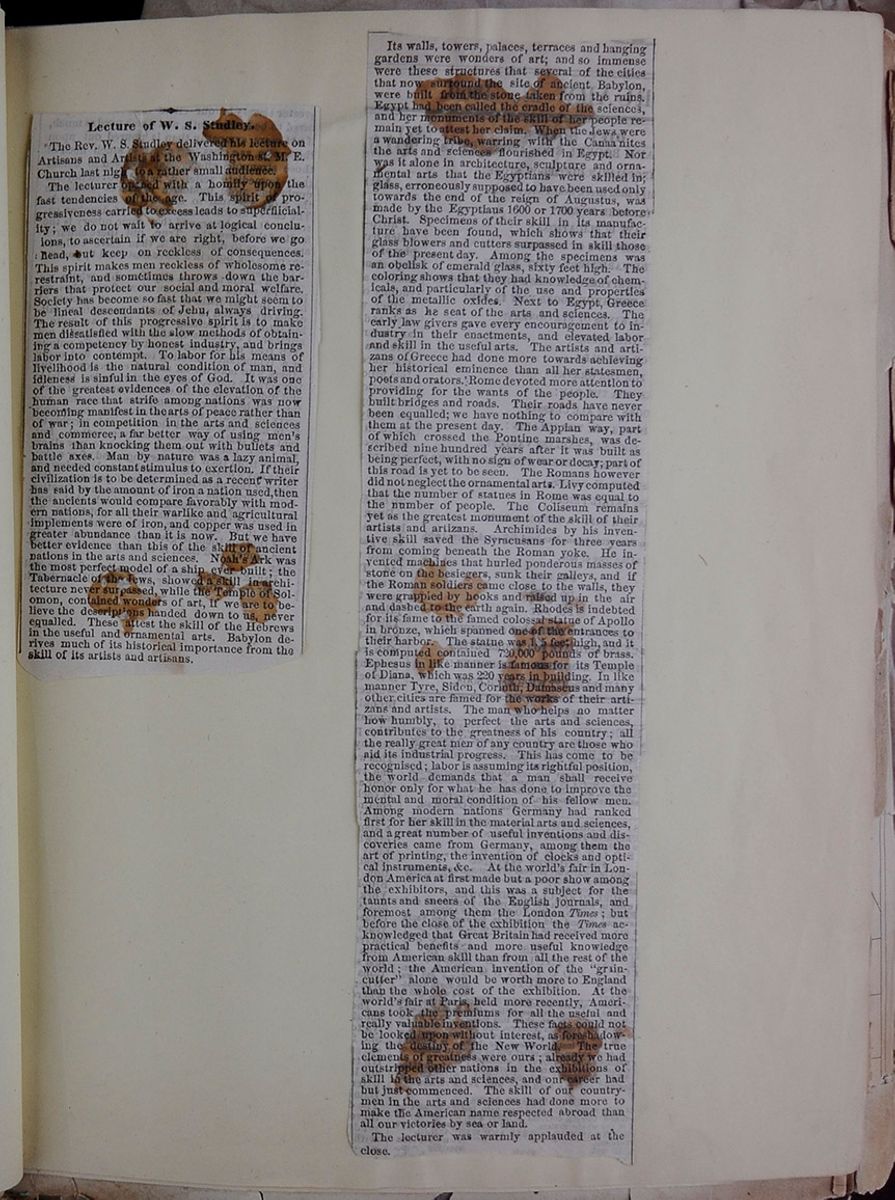 [begin surface 96]
Lecture of W. S. Studley.
The Rev. W. S. Studley delivered his lecture on Artisans and Artists at the Washington st. M. E. Church last night to a rather small audience.
The lecturer opened with a homily upon the fast tendencies of the age. This spirit of progressiveness carried to excess leads to superfiiciality ; we do not wait to arrive at logical conclusions, to ascertain if we are right, before we go ahead, but keep on reckless of consequences. This spirit makes men reckless of wholesome re-restraint, and sometimes throws down the barriers that protect our social and moral welfare. Society has become so fast that we might seem to be lineal descendants of Jehu, and always driving. The result of this progressive spirit is to make men dissatisfied with the slow methods of obtaining a competency by honest industry, and brings labor into contempt. To labor for his means of livelihood is the natural condition of man, and idleness is sinful in the eyes of God. It was one of the greatest evidences of the elevation of the human race that strife among nations was now becoming manifest in the arts of peace rather than of war; in competition in the arts and sciences and commerce, a far better way of using men's brains than knocking them out with bullets and battle axes. Man by nature was a lazy animal, and needed constant stimulus to exertion. If their civilization is to be determined as a recent writer has said by the amount of iron a nation used, then the ancients would compare favorably with modern nations, for all their warlike and agricultural implements were of iron, and copper was used in greater abundance than it is now. But we have better evidence than this of the skill of ancient nations in the arts and sciences. Noah's Ark was the most perfect model of a ship ever built; the Tabernacle of the Jews, showed a skill in architecture never surpassed, while the Temple of Solomon, contained wonders of art, if we are to believe the descriptions handed down to us, never equalled. These attest the skill of the Hebrews in the useful and ornamental arts. Babylon derives much of its historical importance from the skill of its artists and artisans.

Its walls, towers, palaces, terraces and hanging gardens were wonders of art; and so immense were the structures that several of the cities that now surround the site of ancient Babylon, were built from the stone taken from the ruins. Egypt had been called the cradle of the sciences, and her monuments of skill of her people remain yet to attest her claim. When the Jews were a wandering tribe, warring with the Canaanites the arts and sciences flourished in Egypt. Nor was it alone in architecture, sculpture and ornamental arts that the Egyptians were skilled in; glass, erroneously supposed to have been used only towards the end of the reign of Augustus, was made by the Egyptians 1600 or 1700 years before Christ. Specimens of their skill in its manufacture have been found, which shows that their glass blowers and cutters surpassed in skill those of the present day. Among the specimens was an obelisk of emerald glass, sixty feet high. The coloring shows that they had knowledge of chemicals, and particularly of the use and properties of the metallic oxides. Next to Egypt, Greece ranks as he seat of the arts and sciences. The early law givers gave every encouragement to industry in their enactments, and elevated labor and skill in the useful arts. The artists and artizans of Greece had done more towards achieving her historical eminence than all her statesmen, poets and orators. Rome devoted more attention to providing for the wants of the people. They built bridges and roads. Their roads have never been equalled; we have nothing to compare with them at the present day. The Appian way, part of which crossed the Pontine marshes, was described nine hundred years after it was built as being perfect, with no sign of wear or decay; part of this road is yet to be seen. The Romans however did not neglect the ornamental arts. Livy computed that the number of statues in Rome was equal to the number of people. The Coliseum remains yet as the greatest monument of the skill of their artists and artizans. Archimides by his inventive skill saved the Syracusans for three years from coming beneath the Roman yoke. He invented machines that hurled ponderous masses of stone on the besiegers, sunk their galleys, and if the Roman soldiers came close to the walls, they were grappled by hooks and raised up in the air and dashed to the earth again. Rhodes is indebted for its fame to the famed colossal statue of Apollo in bronze, which spanned one of the entrances to their harbor. The statue was 1[covered]5 feet high, and it is computed contained 720,000 pounds of brass. Ephesus in like manner is famous for its Temple of Diana, which was 220 years in building. In like manner Tyre, Sidon, Cornith, Damascus and many other cities are famed for the works of their artizans and artists. The man who helps no matter how humbly, to perfect the arts and sciences, contributes to the greatness of his country; all the really great men of any country are those who aid its industrial progress. This has come to be recognised; labor is assuming its rightful position, the world demands that a man shall receive honor only for what he has done to improve the mental and moral condition of his fellow men. Among modern nations Germany had ranked first for her skill in the material arts and sciences, and a great number of useful inventions and discoveries came from Germany, among them the art of printing, the invention of clocks and optical instruments, &c. At the world's fair in London America at first made but a poor show among the exhibitors, and this was a subject for the taunts and sneers of the English journals, and foremost among them the London Times; but before the close of the exhibition the Times acknowledged that Great Britain had received more practical benefits and more useful knowledge from American skill than from all the rest of the world; the American invention of the "grain-cutter" alone would be worth more to England than the whole cost of the exhibition. At the world's fair at Paris, held more recently, Americans took the premiums for all the useful and really valuable inventions. These facts could not be looked upon without interest, as foreshadowing the destiny of the New World. The true elements of greatness were ours; already we had outstripped other nations in the exhibitions of skill in the arts and sciences, and our career had but just commenced. The skill of our countrymen in the arts and sciences had done more to make the American names respected abroad than all our victories by sea or land.
The lecturer was warmly applauded at the close.
 [begin surface 99]
 [begin surface 100]
 [begin surface 101]
 [begin surface 102]
 [begin surface 103]
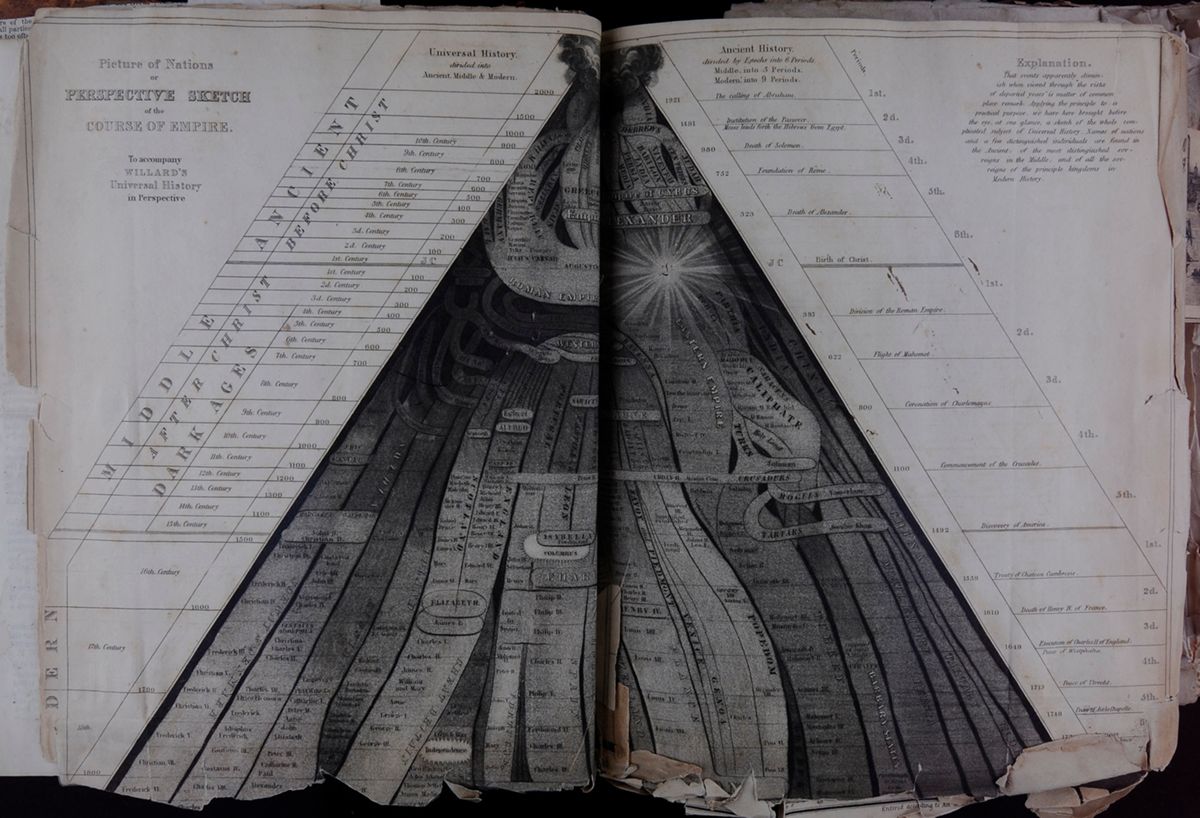 [begin surface 105]
Picture of Nations or PERSPECTIVE SKETCH of the COURSE
OF EMPIRE. To accompany WILLARD'S Universal History in
Perspective.
[begin surface 106]
[begin surface 105]
Picture of Nations or PERSPECTIVE SKETCH of the COURSE
OF EMPIRE. To accompany WILLARD'S Universal History in
Perspective.
[begin surface 106] [begin surface 107]
 McK
McK
| N | ||
| W | Centre | E |
| E | ||
| S |
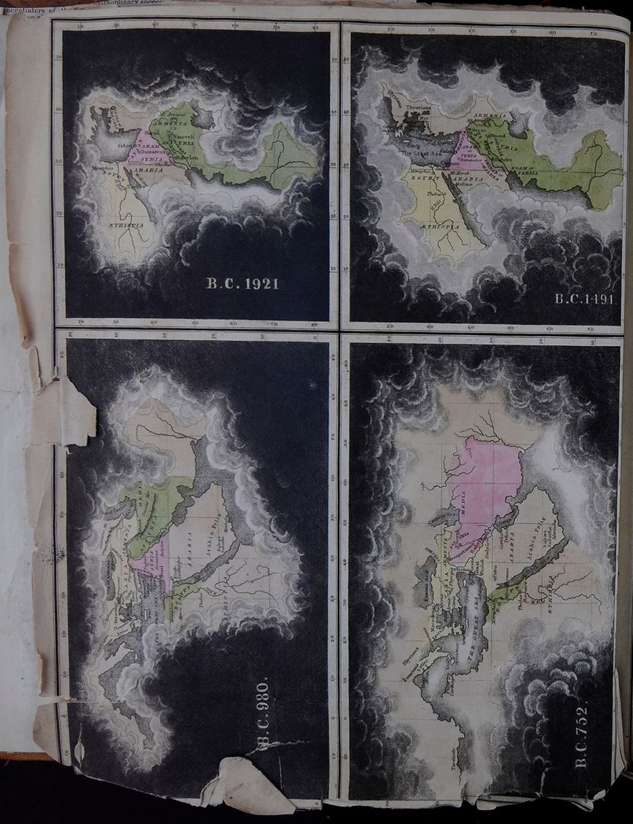 B. C. 1921
Conceptual-historical maps of the Judeo-Christian known world.
B. C. 1491.
Conceptual-historical maps of the Judeo-Christian known world.
B. C. 980.
Conceptual-historical maps of the Judeo-Christian known world.
B. C. 752.
Conceptual-historical maps of the Judeo-Christian known world.
[begin surface 109]
B. C. 1921
Conceptual-historical maps of the Judeo-Christian known world.
B. C. 1491.
Conceptual-historical maps of the Judeo-Christian known world.
B. C. 980.
Conceptual-historical maps of the Judeo-Christian known world.
B. C. 752.
Conceptual-historical maps of the Judeo-Christian known world.
[begin surface 109]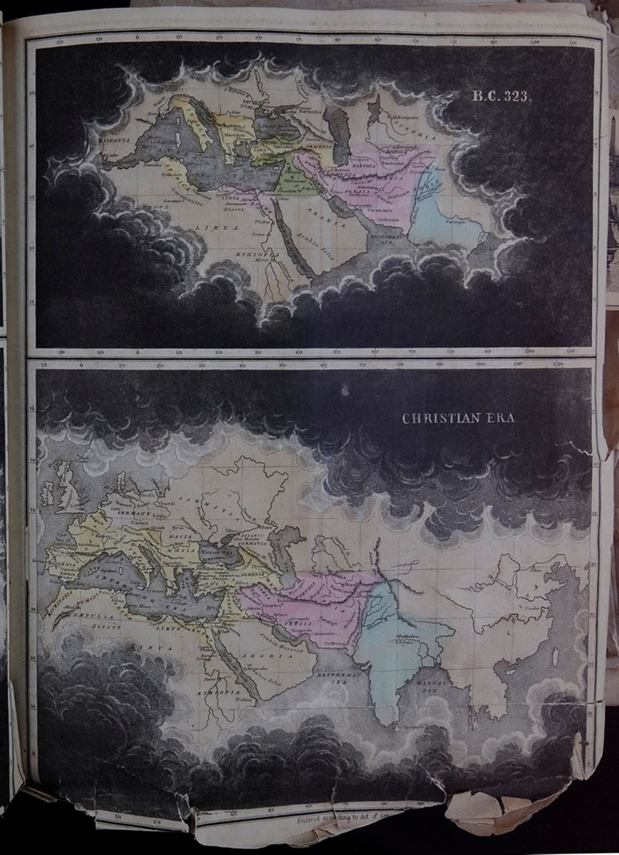 B. C. 323.
CHRISTIAN ERA
[begin surface 110]
B. C. 323.
CHRISTIAN ERA
[begin surface 110] Ink marks and the word "Horace" written inside a
box
[begin surface 111]
Ink marks and the word "Horace" written inside a
box
[begin surface 111] Ink marks and a few cursive words written in
pen.
[begin surface 112]
Ink marks and a few cursive words written in
pen.
[begin surface 112]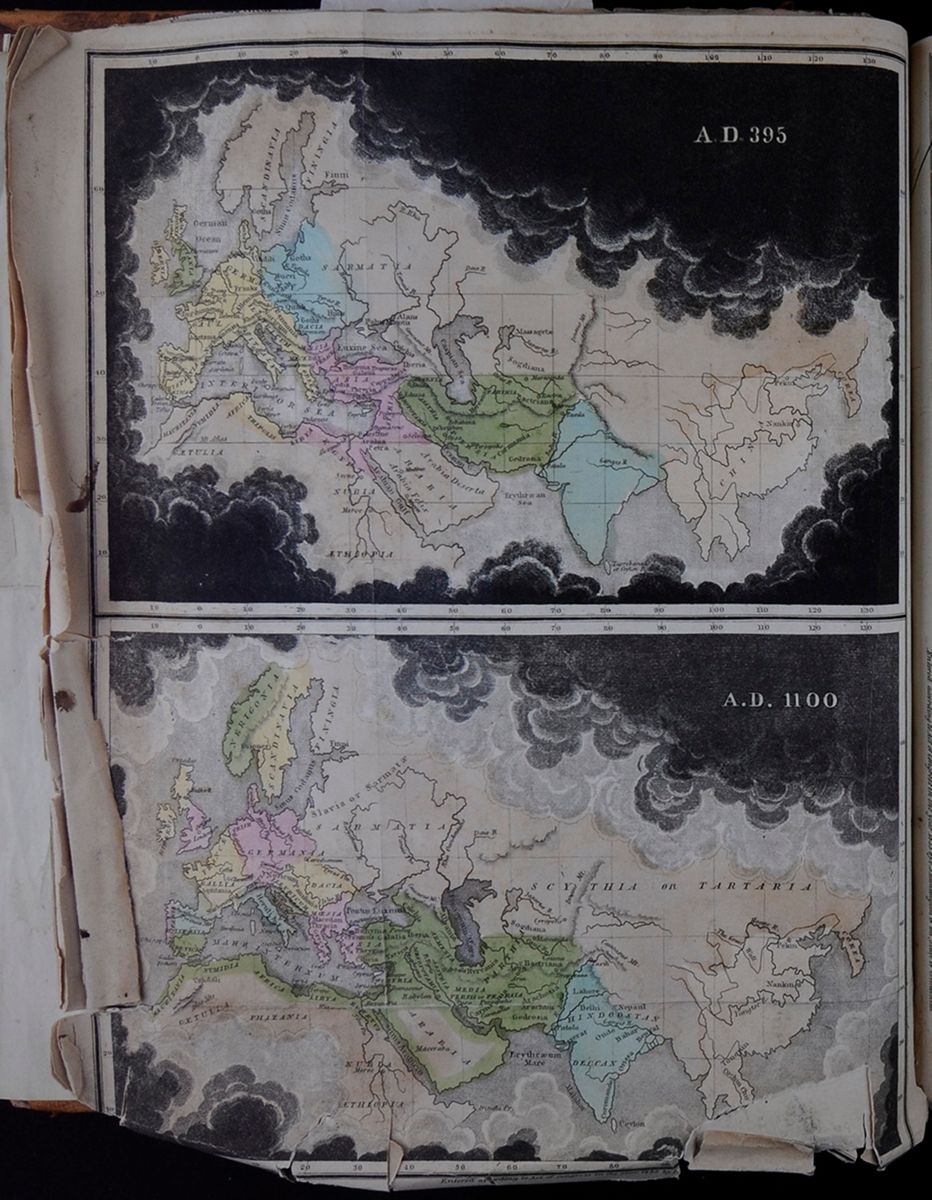 A. D. 395
A map of what is present-day Europe, the Middle East,
Asia, and the northern portion of Africa.
A.D. 1100
A map of what is present-day Europe, the Middle East,
Asia, and the northern portion of Africa.
[begin surface 113]
A. D. 395
A map of what is present-day Europe, the Middle East,
Asia, and the northern portion of Africa.
A.D. 1100
A map of what is present-day Europe, the Middle East,
Asia, and the northern portion of Africa.
[begin surface 113]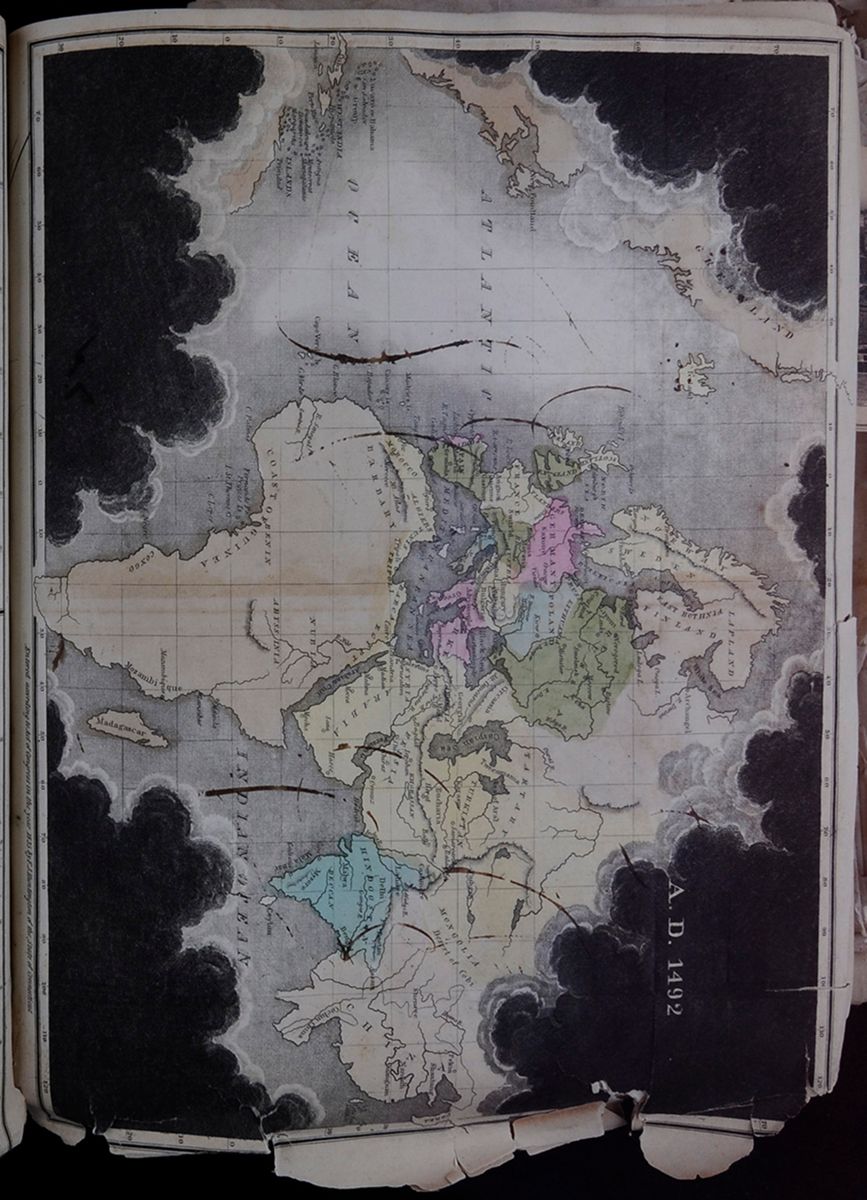 A.D. 1492
A map of what is present-day Europe, the Middle East,
Asia, and Africa.
[begin surface 114]
A.D. 1492
A map of what is present-day Europe, the Middle East,
Asia, and Africa.
[begin surface 114] [begin surface 115]
 [begin surface 116]
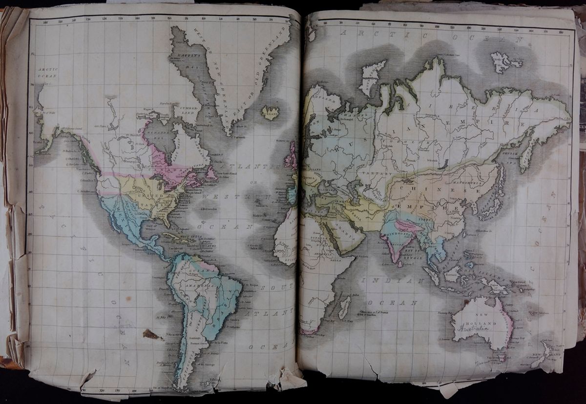 [begin surface 117]
Map of the World. This two-page spread shows a map of the Earth in a Mercator projection. Parts of the continents are colored in. Whitman added handwriting to this map, as well, adding "Australia" and "Tasmania". He also circled something small over the "O" in "Western Ocean."
[begin surface 118]
[begin surface 117]
Map of the World. This two-page spread shows a map of the Earth in a Mercator projection. Parts of the continents are colored in. Whitman added handwriting to this map, as well, adding "Australia" and "Tasmania". He also circled something small over the "O" in "Western Ocean."
[begin surface 118] McKenzie
Sketch of the back half of a horse
McKenzie
Sketch of the back half of a horse
 [begin surface 120]
THE LECTURE SEASON.
Physiology of the Earth,
THIRD AND CONCLUDING LECTURE OF DR. DOREMUS.
Dr. Doremus delivered his concluding lecture on the physiology of the earth, at the Institute last evening. The previous lectures were devoted to an explanation of the relationship between the earth and the other members of our solar system, and also of the different elements of our globe to each other. The lecture last evening was on the relationship between these elements and animal life, including the high nature of man. First the atmosphere was explained and the proportion of its constituents; four-fifths being Nitrogen, which is only useful to dilate the Oxygen, which makes up one-fifth of the atmosphere. The other constituent is Carbonic Acid, of which there is about one to four parts in every ten thousand. It is essential to the life of plants.
It was only within a century that the nature of the atmosphere had been discovered by Priestly. It was formerly believed that man had the power of resisting decomposing forces while he lived, but when he died they had full power over his frame; while the fact is that the frame is being dissolued by every respiration into aeriform matter; the waste being supplied by food and air. The lecturer then referred to the primitive atmosphere of the earth when the gigantic growths of vegetation took place which have since become coal, and how they absorbed the excess of carbon and rendered the earth fit for the habitation of man. The necessity of a nice adjustment of the constituents of the atmosphere to human life, and the fatal consequences of an excess of carbon were fearfully exemplified in the Black Hole of Calcutta, where 140 or 150 people were confined in the same room for a night and all died except 30, who soon after died of disease.
The rain washed down the carbonic acid and ammonia and other matters which were in the atmosphere, (where they would be injurious to life if present in any great quantities,) to the plants which they fed. The importance of water was recognised by the Greeks who called it the Oinon Catholicon or universal wine. It has dissolvent powers upon which our life, in a great degree depends. We know that our bones are similar in the matter they are composed of to the rocks, and this happens by the water dissolving portions of these rocks and in that dilucent condition it enters the system. The rocks are all metallic, but they do not occur in a purely metallic state, but as oxides, or in combination with acids, as salts. If they were in the pure metallic state they would be almost useless; for a mass of copper on the shore of Lake Superior of 40 feet long, 30 high and 8 deep, was many years ago pronounced useless, because it could only be reduced to small quantities by chipping it with chisels or cutting instruments, and the labor would exceed its value.
But as oxides they can be easily fused and moulded into any form. The lecturer then proceeded to show the influence of heat and light on vegetation: plants at the pole, where the sun shines continually for months, the flowers bud and blossom, and produce fruit in two or three weeks; while in the temperate latitudes they require as many months. In the equitorial regions there is the highest development of vegetable and animal life, but the lowest standard of intellect and morals. Plants are limited to particular zones, some blooming only at the north, others only in the tropics, and others in the

temperate zones; and so of animals; but man can adapt himself to any latitude. The highest order of animals, those which imitate man's actions, such as the orang outang, the chimpanzee or monkey, never attempt to handle fire.
The sun, as the great dispenser of light and heat, was adored by the ancients. The earth is not always the same distance from the sun; but as laid down in the law of Kepler, it revolves around the sun in an ellipse, and we are sometimes three millions of miles nearer the sun than at other times. Why the earth is not warmer when nearest the sun is explained by several interesting phenomena, to wit: the great portion of the land on the earth's surface being crowded to the north, and the land absorbes more heat during the day, and radiates more at night than the water; it heats and cools more readily; and this accounts also for the fact that the interior of a country is more under the extremes of heat and cold than the seabord: and also the more rapid revolution of the earth, while near the sun.
We cannot follow the lecturer through his interesting illustrations, in which the effect of climate on the human race was depicted; the first or hunter condition being the lowest developement and society, then the shepherd nomadic life, then as the tribes migrated to the south, the agricultural phase; followed by commerce and succeeded by enervating luxury; until new inroads of hardy barbarians from the north which inforced vigor into countries they devastated. The earth seemed to have been formed for the westward march of civilization; the descent of the Asiatic tribes to Europe, and their final transfer to America, whose geography seemed to demand its settlement by Europeans. Had the Andes and Rocky Mountains been placed along the Atlantic shore then we should have to look to China for settlers.
The physical geography of this country emphatically declares that it is intended for one people. If we could root up the Andes and Rocky Mountains and plant them east and west, then we might talk of a northern and southern nation. He then reviewed the effect of climate and geography on man's spiritual nature; the tribes inhabiting prolific regions demanding a visible physical god; then the Greeks and Romans coming up to the conception of intellectual gods; and finally the Christian world acknowledging a god not only of power but of love, not only to be regarded with fear, but with affection.
 [begin surface 123]
 [begin surface 124]
 [begin surface 125]
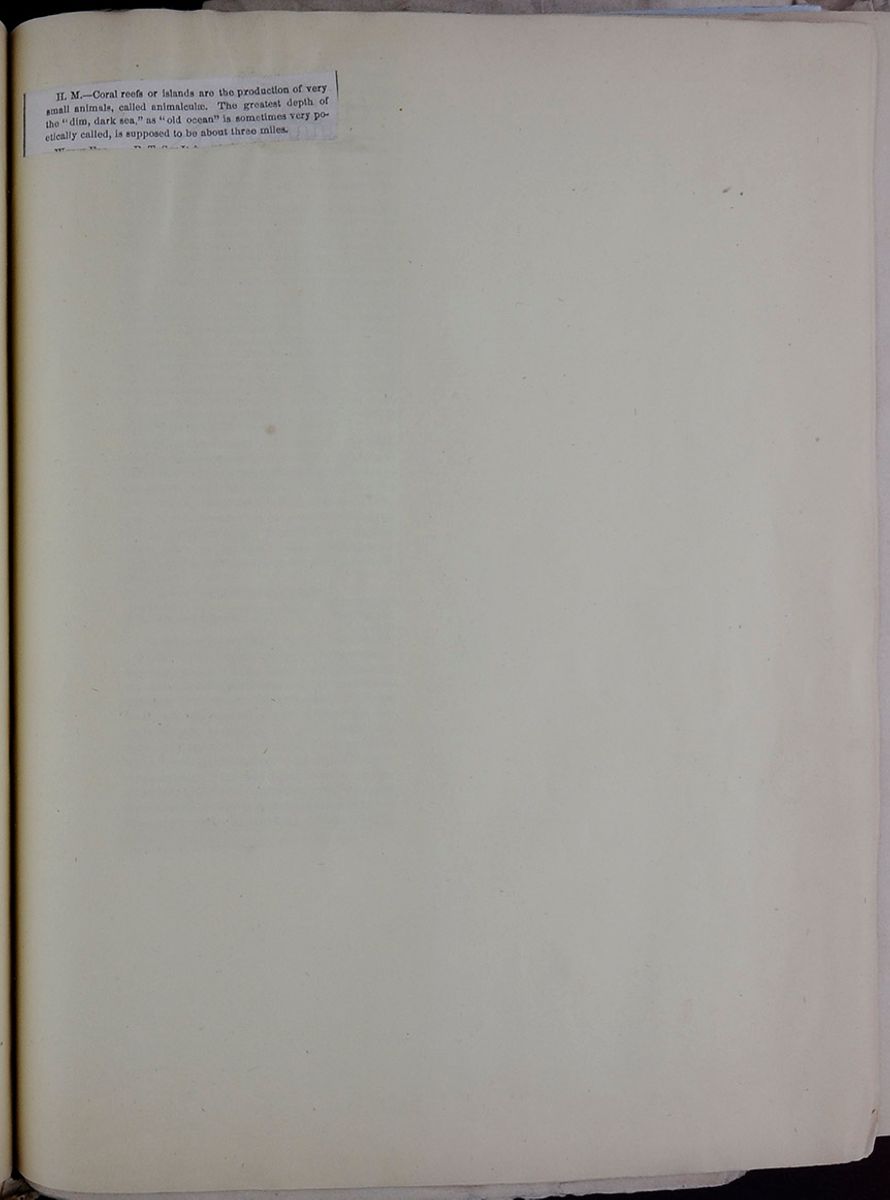 [begin surface 126]
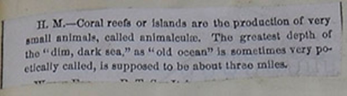
H. M.—Coral reefs or islands are the production of very small animals, called animalculæ. The greatest depth of the "dim, dark sea," as "old ocean" is sometimes very poetically called, is supposed to be about three miles.
[cutaway] [begin surface 128]
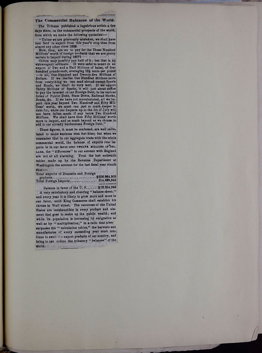 [begin surface 129]
The Commercial Balances of the World.
The Tribune published a lugubrious article a few days since, on the commercial prospects of the world, from which we make the following quotation:—
"Unless we are grievously mistaken, we shall have less food to export from this year's crop than from almost any other since 1836.
How, then, are we to pay for the Three Hundred Millions' worth of foreign products that we are pretty certain to import during 1857?
Cotton may possibly pay half of it; but that is an extravagant estimate. It were safer to count on an export of Two and a Half Millions of bales, of four hundred pounds each, averaging 12½ cents per pound—in all, One Hundred and Twenty five Millions of Dollars. If we realize One Hundred Millions more from everything we can send abroad except Specie and Bonds, we shall do very well. If we export Thirty Millions of Specie, it will just about suffice to pay the interest on our Foreign Debt, in its various forms of Public Debt, State Debts, Railroad Stocks, Bonds, &c. If we have not miscalculated, all we import this year beyond Two Hundred and Fifty Millions' worth, we must run just so much deeper in debt for; while our Imports up to the 1st of July will not have fallen much if any below Two Hundred Millions. We shall have then Fifty Millions' worth more to import, and as much beyond as we choose to add to our already burdensome Foreign Debt."
These figures, it must be confessed, are well calculated to make business men feel blue; but when we remember that in our aggregate trade with the whole commercial world, the balance of exports over imports is in our favor over TWELVE MILLIONS OF DOLLARS, the "differences" in our account with England are not at all alarming. From the last authentic tables made up by the Revenue Department at Washington the account for the last fiscal year stands thus:—
| Total exports of Domestic and Foreign products | $326,964,908 |
| Total Foreign Imports | 314,639,942 |
| Balance in favor of the U. S. | $12,324,966 |
A very satisfactory and cheering "balance sheet;" and every year it is likely to grow more and more in our favor, until King Commerce shall establish his throne in Wall street. The resources of the United States are inexhaustible in every product and element that goes to make up the public wealth; and while its population is increasing by emigration as well as by "multiplication," in a ration that alway[cutaway] surpasses the "calculation tables," the harvests and manufactures of every succeeding year must continue to swell the export products of our country, and bring to our coffers the tributary "balances" of the world.
 [begin surface 131]
 [begin surface 132]
 [begin surface 133]
 [begin surface 134]
 [begin surface 135]
 [begin surface 136]
 [begin surface 137]
 [begin surface 138]
 [begin surface 139]
which a certain check would be placed on the abuse of privilege.
The same reasons do not apply to the provision in regard to the previous residence of the parties within the district. On the contrary, it seems very necessary to prevent the sudden irruption of a couple into the district of the Registrar, for no purpose but that of marriage—and for this reason, among others, that if parties resident at a distance, and utterly unknown to the neighbourhood before or afterwards, were entitled to use the Register, the benefit of its publicity would be, to a great extent, neutralized, and it would not afford the necessary protection against double marriages.
We had intended to close these remarks by an account of the proposed system of Registration of Births, Deaths, and Marriages, and the machinery contemplated by the statute. But our limits are already exhausted. We shall onl[illegible] observe in leaving the subject, that we hope that both the details and the principles of these measures will be extensively and thoroughly canvassed. There may perhaps be various points of expression, arrangement, or enactment, in which they admit of improvement. We are not without the hope that our next County Meetings, and General Assemblies, will be found quietly canvassing the details of a great national question, with a single and patriotic desire for the social welfare of the people, unterrified by the shadows of coming assessments, or the bugbear of the imagined influence of dissent. It is a subject on which both classes are well entitled to be heard, and to have their deliberate and temperate opinions considered with attention and respect. But if they sink the influence they should possess, in unreasoning and ignorant clamour, they cannot wonder, if stranded by the passing current of public opinion and enlightened legislation, they find their remonstrances fall unheeded on the wearied ears of public men, and their narrow conceptions turned into weapons against them, by those who wish their downfal.
IN the history of Astronomical Discovery there shine no brighter names than those of Sir William and Sir John Herschel—the father and the son. It is rare that the intellectual mantle of the parent lights upon the child. By no culture, however skilful, and no anxieties, however earnest, can we transmit to our successors the qualities or the capacities of the mind. The eagle eye, the active limb, the giant frame, and the "form divine,"—the gifts of our mortal being, are frequently conveyed by natural descent, and may be numbered even among the rights of primogeniture; but the higher developments of reason and fancy, the bright coruscations of the soul, have never been ranked among the claims or the accidents of birth. The gifts of fortune which we inherit or acquire, have been placed more immediately at our disposal, and in many cases have been handed down unimpaired to distant generations; but Providence has reserved for its own distribution, those transcendental powers which give omnipotence to genius, and constitute its possessor the high priest of nature, or the vicegerent of Heaven. In a destiny so lofty, the father and the son have been rarely associated; and in the very few cases in which a joint commission has been issued to them, it has generally been to work in different spheres, or at different levels. In the universe of mind, the phenomenon of a double star is more rare than its prototype in the firmament, and when it does appear we watch its phases and its mutations with a corresponding interest. The case of the two Herschels is a remarkable one, and may appear an exception to our general law. The father, however, was not called to the survey of the heavens till he had passed the middle period of life, and it was but a just arrangement, that the son, in his youth and manhood, should continue and complete the labours of his sire. The records of Astronomy do not emblazon a more glorious day than that, in which the semidiurnal arc of the father was succeeded by the semidiurnal arc of the son. No sooner had the evening luminary disappeared amid the gorgeous magnificence of the west, than the morning star arose, bright and cloudless in its appointed course.
It has long been a subject of regret to the astronomical world, that in our language no extended account has yet been published of the life and discoveries of Sir William Herschel. With the exception of a short Biographical Memoir, * and a popular abstract of his astronomical observations on
* Edinburgh Philosophical Journal, April, 1823, Vol. VIII., pp. 209-226. [begin surface 140] 266
Sir John Herschel's Astronomical
Observations.
Feb.
266
Sir John Herschel's Astronomical
Observations.
Feb.
and by means of a micrometer for taking the angle of position, described at the end of the paper, he obtained measures of its angle of position with the same fixed star. Although M. Messier, to whom Mr. Herschel communicated his observations, and who had with some difficulty observed it, speaks of it in his reply as a star or a comet, yet neither of them suspected it to be a planet. Mr. Herschel, indeed, himself speaks of it as "a moving star, which he was happy to surrender to the care of the Astronomer Royal and others."
Before the close of the year 1781, Mr. Herschel, in a letter to Sir Joseph Banks, announced to the Royal Society, that, "by the observations of the most eminent astronomers in Europe, the new star which he had the honour of pointing out to them in March, 1781, is a primary planet of our Solar System;" and in gratitude to his Majesty George III., "to whose unlimited bounty he owed everything," he gave it the name of the GEORGIUM SIDUS, a compliment which astronomers in every part of the world have refused to pay. La Lande, and others, gave it the more appropriate name of Herschel; but the uniformity of astronomical nomenclature demanded another name, and the appellation of Uranus, sanctioned by more recent discussions, was given to the new planet.
This important discovery, by which the limits of the Solar System were extended to nearly double their former amount, was hailed by the astronomers of every country, and the highest expectations were formed of the future labours of Mr. Herschel. The Royal Society of London elected him a Fellow of their body. His Majesty George III. did himself the honour of granting him a salary of £300 a year, so as to enable him to devote his time to astronomical research; and all the scientific bodies in Europe successively admitted him into the list of their members.
With the fine telescopes in his possession, Mr. Herschel began, in October, 1781, to make a series of observations on the light, diameter, and magnitude of the new planet; and in his paper on this subject read at the Royal Society on the 7th December, 1782, he described the dark and lucid disc and periphery micrometers by which these observations were made. With this apparatus, by means of which one eye, looking into the telescope, throws the magnified image of a planet or comet upon, or near, lucid discs seen by the other eye, he found the diameter of the Georgium Sidus to be four seconds; and from the distance of the planet from the Sun, as calculated and sent to him by La Lande (18˙913—that of the Earth being 1), he found its diameter to be 4˙454 times that of the earth.
The researches of Mr. Herschel on the Parallax of the Fixed Stars, which we have already mentioned, were chiefly of a speculative nature, and the result of them was published in the Philosophical Transactions for 1782. The method first pointed out by Galileo, and followed by Flamstead and Bradley, of measuring the zenith distances of two stars, was regarded by Mr. Herschel as liable to various sources of error; and he was of opinion that though Bradley regarded the maximum parallax as not exceeding 1", yet "the stars of the first magnitude might still have a parallax of several seconds." The method which he substituted, and which had been originally suggested by Galileo, in his Systema Cosmicum, consisted in employing two stars as near to each other as possible, and differing as much in magnitude as could be found, and determining their exact place at the two opposite points of the earth's annual orbit. The parallax of the stars was then to be computed by a theory founded on probabilities, and involving the two postulates: 1. That the stars are, "one with another, about the size of the sun; and, 2. That the difference of their apparent magnitudes is owing to their different distances;" so that a star of the second, third, or fourth magnitude is two, three, or four times as far off as one of the first. This method, ingenious as it is, has not led to any results on which confidence can be placed. The postulates which it involves were contrary to all analogy, and have been completely disproved by the only measures of parallax which have been recently obtained. But, like many other speculations, the attempt to prove or to apply them led to results more important than those which they directly contemplated. In searching for double stars suitable for his purpose, Mr. Herschel was led to the formation of those magnificent catalogues of double stars by which he enriched astronomy, and those interesting results respecting the movements and periods of binary systems, which now form the most interesting portion of sidereal astronomy.
To us who are in possession of the researches on double stars, which we owe to Mr. Herschel and his son, to Sir James South and M. Struve, it is interesting to mark the first steps in this great inquiry. "I took pains," says Mr. Herschel, "to find out what double stars have been recorded by astronomers; but my situation permitted me not to consult extensive libraries, nor indeed was it very
[begin surface 141] 1848.
Sir John Herschel's Astronomical
Observations.
267
1848.
Sir John Herschel's Astronomical
Observations.
267
material. For as I intended to view the heavens myself, Nature—that great volume—appeared to me to contain the best catalogue upon this occasion. However, I remembered that the star in the head of Castor, that in the breast of the Virgin, and the first star in Aries, had been mentioned by Cassini as double stars. I also found that the nebula in Orion was marked in Huygens' Systema Saturnium as containing seven stars, three of which (now known to be four) are very near together. With this small stock I began, and, in the course of a few years' observations, have collected the stars contained in my catalogue. I find, with great pleasure, that a very excellent observer (Mr. Pigott) has also, though unknown to me, met with three of those stars that will be found in my catalogue; and upon this occasion, I also beg leave to observe, that the Astronomer-Royal showed me, among other objects, a Hercules as a double-star, which he had discovered some years ago. The Rev. Mr. Hornsby also, in a conversation on the subject of the stars that have a proper motion, mentioned π Bootis as a double star. It is a little hard upon young astronomers to be obliged to discover over again what has already been discovered. However, the pleasure that attended the view when I first saw these stars, has made some amends for not knowing they had been seen before me." *
Mr. Herschel's first Catalogue of Double Stars was read at the Royal Society on the 10th January, 1787. It contains 269 double stars, 227 of which had not been noticed by any other person. It gives the comparative size of the stars, their colour, their distances (as measured by a Lamp Micrometer, † exhibiting two movable lights, with whose distance seen by the unassisted eye the distance of the stars seen in the telescope was compared), their angle of position, and the dates of the observation. The catalogue, which is divided into six classes, contains not only double stars, but also those that are triple, double-double, quadruple, double-triple, and multiple.
Mr. Herschel had now removed to Datchet, near Windsor, where he carried on his observations under the immediate patronage of the King, with new zeal and corresponding success. Towards the end of 1782, he completed his interesting paper—"On the proper motion of the Sun and the Solar System, with an account of several changes that have happened among the fixed stars since the time of Mr. Flamstead." In this paper, he notices, 1. The stars that have been lost, or undergone some capital change since Flamstead’s time; 2. Those that have changed their magnitude; 3. Those that have newly become visible; and the results which he obtained were drawn from a review of all the stars in Flamstead's catalogue, as far as the 12th magnitude, "to the amount of a great many thousands of stars." Those changes which arise from a proper motion of the star, and a variation of magnitude, he suspects may be owing to every star in the heavens being more or less in motion; some, especially in slow motions, arising from their revolving around a large opaque body,—the stars undergoing occasional occultation, or presenting to us large spots in their rotatory movements. Hence he is led to believe, what Tobias Mayer had previously maintained, that the Sun and Solar System have analogous motions, and are advancing to a certain part of the heavens; and he found that this part was in the constellation Hercules, near the star λ, or a point somewhat further to the north.
Having finished in the year 1783, a very good twenty-feet reflector, with a large aperture, he employed it in studying the remarkable luminous spots at the pole of the planet Mars; and he published the results of his observations in the Philosophical Transactions of 1784. By means of these spots, he found that the axis of Mars was inclined to the ecliptic 59° 42', and that its node was in 17° 47' of Pisces, and he determined the ratio of its polar and equatorial diameters to be as 15 to 16.
Towards the end of 1784, Mr. Herschel completed a second catalogue, containing 434 double stars; and in June, 1784, and February, 1785, he communicated to the Royal Society two papers "On the Construction of the Heavens." By means of his twenty feet telescope, with an aperture of 18 7-10 inches, and placed meridionally, he resolved into stars the nebulæ discovered by Messier and Mechain, and also part of the Milky Way; and he discovered no fewer than 466 new nebulae and clusters of stars, which were not within the reach of the best common telescopes then in use. In pursuing these observations, he was led to the remarkable speculation, founded wholly on optical considerations, that as the Milky Way "seemed to encompass the whole heavens," it might be regarded as an immense cluster of stars; and that our sun, with his system of planets, was in all probability placed within it, but "perhaps not in the very centre of its thickness." In order to determine the sun's place in this sidereal stratum, he gauged the heavens, or ascer-
* After his catalogue was in the possession of the Rogay Society, Mr. Herschel received the fourth volume of the Acta Academiæ Theodoro-Palatinæ, containing a paper by Tobias Mayer, giving "a pretty large list of double stars," some of which were the same with those in his catalogue, while 31 were not contained in it. † Described in the Philosophical Transactions, 1872, p. 163. [begin surface 142] 270
Sir John Herschel's Astronomical
Observations.
Feb.
270
Sir John Herschel's Astronomical
Observations.
Feb.
image of every considerable star became triangular, throwing out long flaming caustics at the angles. Having on one occasion supported the speculum simply against a flat-board, at an elevation of about 45°, he found that its performance was tolerably good; but on stretching a thin pack-thread vertically down the middle of the board, so as to bring the weight of the metal to rest upon this thread, the images of stars were lengthened horizontally "to a preposterous extent, and all distinct vision utterly destroyed by the division of the mirror into two lobes, each retaining something of its parabolic figure, separated by a vertical band in a state of distortion, and of no figure at all!" The method which Sir John found the best was the following:—Between the mirror and the back of the case he interposed 6 or 8 folds of thick woollen baize, or blanketing, of uniform thickness and texture, stitched together at their edges. The metal, when laid flat on this bed, was shaken so as to be concentric with the rim of the case, and two supports, composed of several strips of similar baize, were introduced so as to occupy about 30° each, and to leave an arc of about 40° unoccupied opposite the point which was to be the lowermost in the tube. When the case is raised into an inclined position, and slightly shaken, the mirror takes its own free bearing on these supports, and preserves its figure. It is essential, however, to the successful application of this method that many thicknesses of the baize or blanket should be employed, by which only the effect of flexure in the wooden back itself of the case can be eliminated." As the woollen fibres, however, lose their elasticity, the baize should be occasionally taken out, and beaten or shaken up. ✺
In conducting his observations with these fine instruments, Sir John Herschel observed several curious optical effects, arising from peculiar conditions of the atmosphere, incident to the climate of the Cape. In the hot season, from October to March, but particularly during the latter months of that season, "the nights are for the most part superb" at a few miles' distance from the mountains; but occasionally during the excessive heat and dryness of the sandy plains, the "optical tranquillity of the air" is greatly disturbed. In some cases the images of the stars are violently dilated into nebular balls or puffs of upwards of 15´ in diameter. At the end of March, 1834, for example, when Saturn and γ Virginis were both in the field of the 20 feet reflector, "it could not have been told which was the planet and which the star." On other occasions, the stars form "soft, quiet, round pellets of 3´ or 4´ diameter, resembling planetary nebulæ, and quite unlike the spurious discs which they present when not defined. In other cases, these pellets are seen to arise "from an infinitely rapid vibratory movement of the central point in all possible directions," the luminous discs presenting singular phenomena when thrown out of focus, by pushing the eye-piece further in or pulling it further out than its principal focus. *
In the cooler months, from May to October, and especially in June and July, the state of the air is habitually good, and after heavy rains have ceased for a day or two, the tranquillity of the image and the sharpness of vision, is such, that hardly any limit is set to magnifying power, but that which arises from the aberration of the specula. On occasions like these, optical phenomena of extraordinary splendour are produced by viewing a bright star through diaphragms of card-board or zinc, pierced in regular patterns of circular holes by machinery. These phenomena, arising from the interferences of the intromitted rays, and produced less perfectly in a moderate state of the air, surprise and delight every person that sees them. A result of a more valuable kind is obtained when the aperture of the telescope has the form of an equilateral triangle, the centre of which coincides with the centre of the speculum. When close double stars are viewed with the telescope, having a diaphragm of this form, the discs of the two stars which are exact circles, are reduced to about a third of their size, and have a clearness and perfection almost incredible. These discs, however, are accompanied with six luminous radiations running from them at angles of 60°, forming perfectly straight, delicate, brilliant lines, like brightly illuminated threads, running far out beyond the field of view, and, what is singular, capable of being followed like real appendages to the star long after the star itself has left the field. Another optical phenomenon, arising from a peculiar condition of the atmosphere, is described by Sir John Herschel as a "nebulous haze." The effect of it is to encircle every star, of the 9th magnitude and upwards,
*When Sir John adopted this very simple plan, he was ignorant of the very ingenious method by which Lord Rosse affords an equable support to a large speculum, and which we have already described in this Journal, Vol. II. * Sir John supposes that these phenomena may be produced by ascending and descending currents of hot and cold air rotating spirally. [begin surface 143] 1848.
Sir John Herschel's Astronomical
Observations.
267
1848.
Sir John Herschel's Astronomical
Observations.
267
with a faint sphere of light of an extent proportioned to the brightness of the star. This phenomenon presents itself very suddenly in a perfectly clear sky, free from the slightest suspicion of cloud, and disappears as suddenly, lasting sometimes only for one or two minutes. Sir John Herschel states that similar nebular affections occur in our English climate, but with much less frequency and suddenness in their appearance and disappearance. He at first suspected that the phenomena arose from dew upon the eye-piece, but repeated examination satisfied him that its origin was really atmospheric. In studying the polarization of the atmosphere, the writer of this article has had occasion frequently to observe what appears to be the result of the same cause. When the sky was of a fine blue colour, and free from clouds, and the degree of polarization, as indicated by the Polarimeter, ✺ very great, a sudden change frequently took place without any apparent cause; sometimes near the horizon and not at considerable altitudes, and sometimes at considerable altitudes and not near the horizon. On some occasions the effect was limited in its extent, and of a temporary kind. When it was not temporary, it showed itself in a diminution of the blue tint of the sky, which is invariably accompanied with a diminished polarization, and the whiteness of the sky often increased till clouds were produced, terminating in rain. The cause of these phenomena was doubtless a sudden secretion of aqueous vapour, sometimes local and of a limited extent, and quickly re-absorbed; and at other times general, and terminating in a change of weather. When a cloud passed over a track of perfectly blue sky, without occasioning any perceptible diminution of tint, the polarization of the part of the sky over which it passed was always diminished, owing, no doubt, to its having left in its path a quantity of aqueous vapour.
The description of phenomena, and the tabulated observations contained in the interesting volume now before us, occupy seven chapters, extending over 450 closely printed pages, and are illustrated with seventeen beautifully executed plates, some of which are of a very great size. The valuable contents of these different chapters would doubtless have appeared in a series of unconnected memoirs in the Transactions of the Royal or Astronomical Societies, and
with illustrations very inferior, both in number and quality, had it not been for the munificence of his Grace the late Duke of Northumberland, who destined a large sum for their publication as a single and separate work. This very amiable and public-spirited nobleman, to whom the Observatory at Cambridge owes the gift of the splendid Northumberland achromatic telescope, through which the new planet Neptune was first seen, did not live to witness the final fulfilment of his noble and generous design; but the present Duke, the worthy heir of the titles and the fortune of that distinguished nobleman, carried out, in the fullest manner, the liberal intentions of his lamented brother, and thus added another claim to those which, as Lord Prudhoe, he had already earned, upon the gratitude and esteem of the literary and scientific world.
The following are the subjects which are treated in the volume under our notice:—
Chap. I. On the nebulæ and clusters of stars in the southern hemisphere.
II. On the double stars of the southern hemisphere.
III. Of astrometry, or the numerical expression of the apparent magnitude of stars.
IV. Of the distribution of stars, and of the constitution of the galaxy, or Milky Way, in the southern hemisphere.
V. Observations of Halley's Comet, with remarks on its physical condition, and that of comets in general.
VI. Observations on the Satellites of Saturn.
VII. Observations on the Solar spots.
In the first chapter, on Nebulæ and Clusters of Stars, occupying 164 pages, our author proceeds, after some introductory and explanatory remarks, to give detailed descriptions and monographs of some of the more remarkable of the nebulæ. As some of these nebulae are visible in Europe, and are all objects of singular interest, we shall lay before our readers a very brief notice of the most important of them.
A table showing the "Right Ascension," "North Polar Distance" and "No. of Stars laid down in the drawing" of 7 nebulae.No. 1. This remarkable nebula, which is a nebular line, with the figure of a horseshoe at each end of it, has been observed and drawn by Mr. Mason, and American astronomer, and Mr. Lamont, a native of
*For an account of the polarization of the atmosphere, the reader is referred to Johnston and Berghaus's Physical Atlas, Part VII., and London and Edinburgh Philosophical Magazine, December, 1847. Vol. XXXI, pp. 444-445. VOL. VII. 18 [begin surface 144] 278
Sir John Herschel's Astronomical
Observations.
Feb.
278
Sir John Herschel's Astronomical
Observations.
Feb.
possible so to view them." Our author was always satisfied of the reality of this phenomenon at the moment of observation, though the conviction was not permanent, the idea of an illusion arising from physiological causes having subsequently arisen. Sir John has, however, given the right ascension and north polar distance of 37 points of the heavens where this whiteness, or "stippling of the ground of the sky" was seen or suspected. In like manner, he has given the places of the points where the ground of the sky is perfectly dark or black, and "certainly devoid of any such stippling or nebulous phenomenon.
On the 25th of October, 1837, Sir John was fortunate enough to obtain a view of the anxiously expected comet of Dr. Halley, and in his fifth chapter, occupying 21 pages, and constituting, in our opinion, one of the most interesting portions of his work, he has given his observations on this singular member of the solar system, illustrating them with thirteen beautiful drawings of it, and adding some curious speculations on its physical condition, and on that of comets in general. On the 29th October, its appearance was most singular, and such as he had never observed in any previous comet. Its nucleus small, bright, and highly condensed, was shielded or capped on the side next the sun by a vivid but narrow crescent of nebulous light, the front of which presented an outline nearly circular, with an amplitude of about 90° from horn to horn. Within this was situated the nucleus, but at a distance behind the front or vertex of the crescent, considerably less than its versed sine. ✺ On the 1st of November, it had the common appearance of a comet, with its nucleus and slightly diverging tail; but on the 26th January, after its return from the sun, it had assumed a most surprising and totally new appearance. Its head was sharply terminated, like a ground glass-lamp shade; and within this head was seen "a vividly luminous nucleus," like “a miniature comet, having a nucleus head and tail of its own, perfectly distinct, and considerably exceeding in intensity of light the nebulous head." As the comet rose higher, a minute bright point, never greater than 4ʺ, and like a small star, was distinctly perceived, and this point Sir John calls the nucleus. On the 25th January, the following measures were taken:—
Diameter of the comet's head in R Ascension, 229ʺ.4 13h 38m Distance of the nucleus from the vertex, 118ʺ.3 Diameter of the head in Declination, 237ʺ.3 14h 15mUpon repeating these observations in the "strong morning twilight," the results were—
Diameter of the head in R. Ascension, 196ʺ.7 16h 25m Diameter of the head in Declination, 252" 16 29The deficiency in this second measure of the head obviously arose from the effect of twilight; but we can only account for the increase in declination by concluding "that the change was real, and that the comet was actually increasing in dimensions with such rapidity that it might almost be said to be seen to grow!" M. Valz had pointed out the increase in the dimensions of comets as they receded from the sun, but an increase in the ratio of 5 to 6, and in so short an interval, must be regarded as a different phenomenon. On the 26th, the nucleus appeared as a star of the 10th magnitude, furred and nebulous; and the dimensions of the comet had greatly increased, the diameter in right ascension being 309ʺ, and in declination 329ʺ, so that the total bulk of the comet, exclusive of the coma, had greatly more than doubled in 24 hours. On the 28th January, upon looking through the 20 feet reflector, Sir John exclaims—"Most astonishing! The coma is all but gone, but there are long irregular nebulous tails in various directions." The nucleus is now no longer a dim misty speck, but a sharp brilliant point. I cannot, however, raise a well-defined disc on it." "It is like a planetary nebula, a little hazy at the edges, 2ʺ or 2½ʺ in diameter." "I now see a sharp, all but planetary disc, diameter fully 1½ʺ, quite distinct from the haze about it. It is like one of Jupiter's satellites in a thick fog of hazy light." "I can hardly doubt," Sir John adds, "that the comet was fairly evaporated in perihelio by the sun's heat, and resolved into transparent vapour, and is now in process of rapid condensation and re-precipitation on the nucleus." The comet resumed its former size on the 29th, and afterwards gradually disappeared as it receded from the sun. Sir John notices the following points as especially remarkable:—
1st. The astonishingly rapid dilatation of its visible dimensions.
2d. The preservation of the same geometrical form of the dilated and dilating envelope.
3d. The rapid disappearance of the coma; and
* There is no doubt Mr. Cooper's Fan, and M. Arago's "Sector." The tail was obliterated by the twilight, and subsequently appeared. [begin surface 145] 1848.
Sir John Herschel's Astronomical
Observations.
279
1848.
Sir John Herschel's Astronomical
Observations.
279
4th. The increase in the density and relative brightness of the nucleus.
Our limits will not permit us to discuss the speculative views which these phenomena have suggested to our author. He rejects the hypothesis of Valz, that the volume of the comet is directly proportional to its distance from the sun. He maintains that the laws of gravitation are insufficient to account for such a form of equilibrium as that of the comet, which was paraboloidal, and that such a form, as one of equilibrium, is inconceivable without the admission of repulsive as well as of attractive forces. "But if we admit," he adds, "the matter of the tail to be at once repelled from the sun and attracted by the nucleus, it no longer presents any difficulty." In order to obtain the repulsive power, Sir John hazards a theory which supposes the sun to be permanently charged with electricity. The cometic matters vaporized by the sun's heat, in perihelio, the two electricities separated by vaporization, the nucleus becoming negative and the tail positive, and the electricity of the sun directing the tail, in the same manner as a positively electrified body would an elongated non-conducting body, having one end positively, and the other negatively excited. The separation of Biela's comet into two, travelling side by side, like the Siamese twins, presents a new difficulty which it would not be easy to explain. But here we are beyond our depth; and rather than admit Electricity as an agent residing in every sun and acting upon every system, we remain content with the humbler supposition that the rays of the sun may, in the exercise of their chemical and physical influences, find some ingredients in the tails of comets, upon which, by their joint action, they may generate forces capable of producing the phenomena which we have been considering. If we once admit Magnetism and Electricity as agents in our Sidereal systems, the Mesmerists and Phrenologists will form an alliance with the Astrologer, and again desecrate with their sorceries those hallowed regions on which the wizard and the conjuror have long ceased to tread. *
The elements and perturbations of the sixth satellite of Saturn having been elaborately investigated by Bessel, and very little being known respecting the rest, Sir John Herschel availed himself of his advantageous position at the Cape, to make a series of observations on these interesting bodies. Our readers are no doubt aware that after the fourth satellite had been discovered by Huygens in 1655, Cassini discovered the fifth in 1671, and the first, second, and third, in 1684. Sir W. Herschel discovered, in 1780, the sixth and seventh nearer the planet than the rest, the seventh being the nearest. As this nomenclature was very unsatisfactory, many astronomers named them by given numbers corresponding to their distances from the planet; and Sir John Herschel has proposed to distinguish them by a series of heathen names, as in the following table:
This table lists the names of the satellites of Saturn, their order from the planet, their original order, the discover and date, and the names given to them by Sir J. Herschel.Although it would be difficult to banish from our Solar System the names of the heathen gods by which the primary planets are distinguished, yet we must enter our protest against the admission of a brood of demigods. The nomenclature in the first column of the preceding Table is doubtless the proper one, and the adoption of it can be attended with no more inconvenience than we are accustomed to in analogous matters. If the houses of a street are numbered before it is completed, the numbers must be changed whenever a new house is placed on a vacant area. If it is proper or necessary to give names to the secondary planets, our mythological knowledge must be more extensively put in requisition, for we cannot allow the planet Saturn to have a monopoly of the gods. We must find names for the four satellites of Jupiter, and Uranus; and Neptune will make a similar and a heavy demand upon Lemprière.
Sir John Herschel concludes his work with a Seventh chapter, containing Observations on the Solar Spots, and conjectures respecting their cause. The figures of the spots, of which he has given us thirteen in a very interesting plate, were delineated from
*Our astronomical readers will be gratified to learn the M. Leverrier has found that the periodical comets of 1770 and 1844 are two different bodies; that two of the comets of Faye, Vico, and Lexell, passed close to Jupiter; and that all of these comets, now permanently attached to our system, have come into it and been detained by the action of Jupiter and other bodies. M. Leverrier proves that the comets of Faye and Lexell have been in our system for at least a century, and have come a dozen of times near the earth without being observed. The comet of 1844 he proves to be the same as that of 1678, which has travelled into our system from the depths of infinite space, and been fixed among us centuries ago. It will revisit us in 1849. [begin surface 146] 286
The Hampden Controversy.
Feb.
286
The Hampden Controversy.
Feb.
infinitesimal arc of that immeasurable circle in which it is destined to revolve. It is as if the traveller or naturalist, equipped for the survey of nature's beauties and wonders, had been limited only to a Sabbath's journey. Some mountain tops might rise to his view as he creeps along, and some peaks might disappear beyond the horizon which he leaves behind; but had the first man surveyed the constellation Hercules, to which our system is advancing, it would have seemed to him as remote as it will appear to the last of our race.
In the contemplation of the infinite in number and in magnitude, the mind ever fails us. We stand appalled before the mighty spectre of boundless space, and faltering reason sinks under the load of its bursting conceptions. But placed, as we are, on the great locomotive of our system, destined surely to complete at least one round of its ethereal course, and learning that we can make no apparent advance on our sidereal journey, we pant with new ardour for that distant bourne which we constantly approach without the possibility of reaching it. In feeling this disappointment, and patiently bearing it, let us endeavour to realize the great truth from which it flows. It cannot occupy our mind without exalting and improving it. It cannot take its place among our acquirements without hallowing and ennobling them. Though now but a truth to be received, it may yet become a principle of action, and though now veiled by a cloud, it may yet be a lamp to our feet and a light to our ways. Whom God made after his own image, he will not retain in perpetual darkness. What man's reason has made known, man will be permitted to see and to understand. "He that bindeth the sweet influences of the Pleiades, and looseth the bands of Orion, and quieteth Arcturus with his sons," will in His own time "discover deep things out of darkness," and "reveal the ordinances of heaven."
IT has been the good or ill fortune of Dr. Hampden to be the occasion of a controversy, now of some twelve years' standing, in which the real merits of the question at issue form almost the only subject, ecclesiastical or academic, that has not been canvassed. The Oxford convocation of graduates,—its constitution,—the veto of the proctors on its proceedings,—its legal competency to pass a vote of censure on a theological professor, excluding him from the board for naming university preachers,—the moral weight or technical value of such a sentence,—the bearing upon it of another Act, six years later, making the same professor member of another board, the amount of confirmation implied in the refusal, at a still later period, to rescind the original censure;—then, coming down to the present time, the relation in which the judgment of a University stands, or ought to stand, to the practical matter of church-preferment,—the act of the Crown, or its advisers, in appointing to a bishopric a man under an alleged University ban as a heretic,—the propriety of the remonstrance of certain of the bishops,—the force of a congé d'élire,—the terror of a premunire,—the position of a dean and chapter refusing to concur in choosing the Queen's presentee,—the effect of a protest by the dean and an individual canon against the choice, as regards the chance of martyrdom,—the functions of the Archi-episcopal Court for confirming the bishop's election,—the claim of objectors to be heard against the confirmation,—and now, lastly, the jurisdiction of the Court of Queen's Bench amid this chaos of confused forms and laws:—such are a few of the interesting points raised in this edifying controversy,—not to mention the infinite personalities of imputed motives and suspected ends on all sides; while to this hour, the main original inquiry,—Is the worthy Doctor, around whom so great a dust has been gathered, a heretic or a true man?—remains substantially where it was in 1836, when all this stir began.
We have no intention of entering upon this inquiry in the present article. We regard it as an inquiry of the last importance, affecting not only Dr. Hampden’s personal reputation for orthodoxy; but the general condition and tendency of the learned theology of our day. It is an inquiry, also, of no small difficulty, and on this account, as well as from a sense of its vast importance, we would desire to devote more time and space to it than we can now command.
these chapters shall be re-written. Sincerely do we hope that the assured success of this fine production may encourage others to favour the public with equally full and elaborate Dissertations on particular Scripture subjects, this being a department in which our English Biblical literature is wofully deficient.
NINEVAH, or the dwelling of Ninus, was the metropolis of the great Assyrian Empire, the residence of a long line of illustrious princes, and once the largest and most populous city in the world. We learn from the book of Genesis that Asshur, one of the sons of Shem, "went forth" from the land of Shinar, and built Nineveh; but we hear nothing more of it in the sacred writings till Jonah, its inspired missionary, describes it as "a great city," an "exceeding great city of three days' journey," and which required him to take "a day's journey" before he reached the spot from which he was to predict its overthrow. The immense population of this great metropolis is also clearly indicated by the prophet. It contained "more than six score thousand (120,000) persons that could not discern between their right hand and their left hand," and must therefore have contained a population of nearly 600,000.
Although the Ninevites repented at the preaching of Jonah, and were for a while spared, yet the prophet Nahum was, a short time afterwards, commissioned to declare "the burden of Nineveh,"—to announce the destruction of the city, and the downfal of the Assyrian Empire. He describes it as a city with many strongholds, and many gates with bars,—her merchants as multiplied above the stars of heaven,—her inhabitants and princes numerous as the locusts, and the " store and glory" of her "pleasant furniture" as endless. "This is the rejoicing city," says Zephaniah, "that dwelt carelessly, that said in her heart, I am, and there is none besides me: how is she become a desolation, a place for beasts to lie down in!"
These predictions were literally fulfilled by the destruction of the city in the year 606 B.C., by the combined armies of Cyaxares, King of Persia and Media, and Nabopolassar, who was either King of Babylon, or, as Mr. Layard thinks, the Assyrian governor of the city. "He that dasheth in pieces came up before her face;" "the gates of her land were set wide open unto her enemies;" "fire devoured her bars," and "herself;" "the noise of the whip, and of the rattling of the wheels, and of the prancing horses, and of the jumping chariots," resounded in her "broad ways;" "the gates of the river were opened, and the palace dissolved;" "there was no end of the corpses of the slain;" "the spoil of silver and the spoil of gold" were "taken;" "and the voice of her messengers was no more heard;" "the nations saw her nakedness, and the kingdoms her shame;" "Nineveh was laid waste;" "she was made a desolation, and dry like a wilderness."
The account of Nineveh as given by profane historians, the details of its destruction, and its present condition as observed by modern travellers, confirm in a most remarkable manner the statements of the ancient prophets. Its walls are described by profane writers as a hundred feet high, sixty miles in circumference, and defended by 1500 towers, each of which was 200 feet in height. Diodorus Siculus informs us that the city was destroyed partly by water and partly by fire, and that many talents of gold and silver preserved from the flames were carried to Ecbatana. Lucian, a native of Samosata near the Euphrates, who flourished in the second century, (between A.D. 90 and A.D. 180,) informs us that Nineveh had utterly perished,—that not a vestige of it remained, and that no one could even point out the place which it occupied.
During the eighteen centuries which have elapsed since the time of Lucian, Nineveh was known only in its name. Its very ruins had disappeared; and while the traveller and the antiquary were investigating the remains of Greek and Roman grandeur, and the geologist was ranging over the globe to discover and disinter the fossil remains of the primeval world, no inquiry was made after the Nineveh and Babylon of Holy Writ, and no pilgrimage undertaken to search for the buried palaces of the Assyrian kings. Huge mounds, seemingly composed of earth and rubbish, had long ago attracted the notice of travellers in Assyria
[begin surface 148] 112
Layard's Nineveh and its
Remains.
May,
112
Layard's Nineveh and its
Remains.
May,
and Babylonia, and were conjectured to be the remains of their mighty capitals. A vitrified mass of brickwork, Birs Nimroud, rising out of the accumulated rubbish of centuries, was believed to be the tower of Babel. The temple of Belus, according to Herodotus, and other mounds in the neighbourhood, were supposed to be the hanging gardens and marvellous structures attributed to the two Queens, Semiramis and Nitocris; but the difficulty of reaching these localities, though it excited the curiosity of the antiquarian, prevented the traveller from ever paying them a passing visit. The presumed site of the Assyrian metropolis had excited still deeper interest than that of Babylonia. The enormous mounds on the left bank of the Tigris, opposite the modern city of Mosul on the right bank, had been noticed by several travellers; and the traditional tomb of Jonah on the top of one of the mounds, gave probability to the supposition that it marked the site of Nineveh; but notwithstanding this probability, Mr. Macdonald Kinnear, who examined these mounds, was disposed to believe that they were the site of a Roman camp of the time of Hadrian!
It is to the late Mr. Rich, the East India Company's resident at Baghdad, that we owe the first investigation of Assyrian remains. The results of his first examination of the ruins of Babylon near Hillah, which he made in May 1812, with a dissertation on the topography of ancient Babylon, were first published at Vienna in Von Hammer's Oriental Journal, entitled Mines de l'Orient, and this work was afterwards reprinted in England in 1815, under the title of Memoir on the Ruins of Babylon. He found the ruins to consist of mounds of earth, formed by the decomposition of buildings, channelled and furrowed by the weather, and having their surface strewed with pieces of brick, bitumen, and pottery. The grand mass of these ruins is 1100 yards long, 800 yards broad, 50 or 60 feet high, and of a quadrantal form. The next grand heap, of nearly a square form, is 700 yards long, and nearly 100 broad. It is the most interesting portion, according to Mr. Rich, of the ruins of Babylon, every vestige of it indicating its superiority to the rest. In the winding caverns and subterranean passages within are found walls of burnt bricks laid in mortar, with fragments of vessels; and Mr. Rich obtained a sepulchral earthenware urn, with human bones near it, which pulverized with the touch. The other remarkable objects examined by Mr. Rich were the Kasr or Palace, * consisting of several walls
and piers, three different perspective views of which have been published by the author. A mile to the north of the Kasr, and fully five miles from Hillah, is the Mujelibe, which Petro della Valle, and after him Major Rennel, determines to have been the tower of Belus. It is of an oblong, irregular shape. The elevation of the highest angle is 141 feet, the average length of its four sides being about 185 yards. In digging out the earth for a passage in the northern part, Mr. Rich discovered near the top a wooden coffin, containing a skeleton in high preservation. A brass bird outside the coffin, and an inside brass ornament were found; and a little further on was found the skeleton of a child. There were no ruins on the eastern side of the river. Mr. Rich then visited the Birs Nimroud, "the most stupendous and surprising mass of all the remains of Babylon, situated in the desert about six miles to the south-west of Hillah." It is an oblong mound, 762 yards in circumference, having on its summit a solid pile of brick, 37 feet high and 28 broad, perforated by small square holes disposed in rhomboids, and having vitrified masses on its summit. The mound is itself a ruin, channelled and strewed with fragments of all sorts. There is some reason to believe with Niebuhr and Mr. Rich, that Birs Nimroud, "which is pretty nearly in the state in which Alexander saw it," was the tower of Belus, described by Herodotus. *
In Mr. Rich's Second Memoir on Babylon, published in 1818, he gives a slight notice of the ruins of Nineveh. He speaks of the rectangular inclosure opposite Mosul as answering to the palace of Nineveh. Its sides correspond to the cardinal points of the compass, the western, one of the largest, facing the river. Its boundary, resembling a low embankment of rubbish, "has attached to it and its line, † at several places, mounds of greater size and solidity." The village of Nebbi Yunus, where they show Jonah's tomb, is built on the mound at the southwest angle. The largest mound situated near the centre of the western face, is supposed to be the monument of Ninus, and is called by the natives Koyunjik Tepe, the
* Major Rennet considers this building as "subsequent to Old Babylon, but before the time of Islam." *Fire-burnt, sun-dried bricks, bitumen, mortar and clay, were the materials used in the buildings of Babylon. † Mr. Rich has given four views of the Mujelibe, and four of Birs Nimroud. These views have been republished in Buckingham's Travels in Mesopotamia. Major Rennel considers the Mujelibe as the tower of Belus, an opinion ably controverted by Mr. Rich in his "Second Memoir on Babylon." [begin surface 149] 1849.
Layard's Nineveh and its
Remains.
113
1849.
Layard's Nineveh and its
Remains.
113
village of Koyunjik being built at its northeast extremity. It has the shape of a truncated pyramid, and is 178 feet high, 1850 feet long on its summit from east to west, and 1847 from north to south. An immense block of stone, sculptured with the figures of men and animals, was found a "short time ago" in one of the mounds on the north face of it.
"So remarkable," says Mr. Rich, "was this fragment of antiquity, that even Turkish apathy was roused, and the Pasha and most of the principal people of Mosul came out to see it. One of the spectators particularly recollected among the sculptures on this stone * the figure of a man on horseback, with a long lance in his hand, followed by a great many others on foot. The stone was soon afterwards cut into small pieces for repairing the buildings of Mosul, and this inestimable specimen of the arts and manners of the earliest ages irrecoverably lost.' †
In the year 1820, Mr. Rich paid his fourth visit to Mosul. Having been obliged, for the benefit of his health, to visit Kurdistan, he returned to Baghdad by way of Mosul, and employed the few weeks he was able to spend in that city in examining the mounds on the opposite bank of the river. In passing through the area of Nineveh, on the 31st of October, he observed marks of a double wall, "the walls on the east having become quite a concretion of pebbles, like the natural hills," though large hewn stones are frequently dug out of them. The stormy weather having abated, he began his examination of the ruins on the 8th November, crossing the Tigris where it was about two fathom deep, and 400 feet wide. At the village of Nebbi Yunus, he found various pieces of gypsum, with inscriptions in the cuneiform or arrow-headed character, one of which, now in the British Museum, was covered with writing. Another appeared to be part of the wall of a passage "said to reach far into the mound." A third, apparently in its original position, is part of a wall plastered with mud. "I doubt not," says Mr. Rich, "but many other antiquities might be found in this mound, but the greater part of it is thickly covered with a labyrinth of small houses, and it is only on the repairing or falling down of these that such things are discovered."
After visiting the tomb of Jonah, consisting of several dark, narrow, and vaulted ancient passages, surmounted by a mosque, he examined the area of Nineveh, which, at a rough guess, he makes from one and a half to two miles broad, and four miles long, stretching a short way south of Nebbi Yunus. The mound of Koyunjik is 43 feet high, and 7691 in circuit. A fragment of pottery with cuneiform writing was discovered in his presence, and on the south side of the inclosure were found huge stones laid in layers of bitumen and lime mortar. There was also found at Nebbi Yunus a square stone slab, with an extremely perfect cuneiform inscription. After a careful survey of the locality, * Mr. Rich again came to the conclusion at which he had previously arrived, that the present inclosure formed only part of a great city, and was probably either the citadel or royal precincts, an opinion which is in harmony with the descriptions of Strabo and Diodorus Siculus. † Although Mr. Rich lived four months on the site of Nineveh, he made no attempt to excavate the mound, and hence all the antiquities which he did collect, including those from Babylon, would not occupy a cube of three feet.
Such was the meagre information which we possessed in 1844 of the site of Nineveh, and of the sculptures and arts of Assyria. Mr. Layard, indeed, had at an earlier period trodden this consecrated ground, and made some attempts to disinter its antiquities. After wandering through Asia Minor and Syria, in 1839 and 1840, he completed his pilgrimage by repairing to the remains of Nineveh and Babylon. On the 10th April 1840, he entered Mosul, and visited the extensive ruins on the left bank of the Tigris, including the great mounds of Koyunjik and Nebbi Yunus. He explored, in company with Mr. Ainsworth, the mound of Kalah Sherghat, a vast ruin on the Tigris, 50 miles below its junction with the Zab. On his way thither, and near the Arab village of Hammun Ali, he saw the vestiges of an ancient city. From an artificial eminence, he observed over a line of lofty mounds one of a pyramidical form rising high above the rest. "This was the pyramid which Xenophon had described, and near which the ten thousand had encamped;
* "A grey stone, the height of two men, dug from a spot above the surface of the ground."—Rich's Narrative, &c., vol. ii. p. 39. † In an Appendix to his Second Memoir, Mr. Rich has given a description illustrated with three large plates of antiquities and inscriptions from Babylon.—Pp. 47-58. * The results of this survey are given in a very accurate Plan of the Ruins of Nineveh. † We must refer our readers for a minute account of Mr. Rich's survey of Nineveh to his Narrative of a Residence in Koordistan, edited by his Widow, vol. ii. chap. xiii. xiv. See also Journal of the Royal Geographical Society, 1836, vol. vi. p. 361. VOL. XI. 8 [begin surface 150] 114
Layard's Nineveh and its
Remains.
May,
114
Layard's Nineveh and its
Remains.
May,
the ruins around it were those which the Greek General saw twenty-two centuries before, and which were even then the remains of an ancient city." In the vast mass of shapeless ruins at Kalah Sherghat, he discovered a few fragments of pottery and inscribed bricks, but he sought in vain for figures carved in black stone, which, according to a tradition among the Arabs, existed among the ruins. Mr. Layard was particularly struck with the contrast between these ruins and those which he had left behind him in Asia Minor or Syria, and he has presented to us this contrast in the following beautiful passage:—
"The graceful column rising above the thick foliage of the myrtle, the ilex, and the oleander; the gradines of the amphitheatre covering the gentle slope, and overlooking the dark blue waters of a lake-like bay; the richly-carved cornice or capital half-hidden by the luxuriant herbage; are replaced by the stern shapeless mound rising like a hill from the scorched plain, the fragments of pottery, and the stupendous mass of brickwork occasionally laid bare by the winter rains. He has left the land where nature is still lovely, where, in his mind's eye, he can rebuild the temple or the theatre, half-doubting whether they would have made a more grateful impression upon the senses than the ruin before him. Those of whose works they are the remains, unlike the Roman and Greek, have left no visible traces of their civilisation, or of their arts: their influence has long since passed away. The more he conjectures, the more vague his results appear. The scene around is worthy of the ruin he is contemplating; desolation meets desolation: a feeling of awe succeeds to wonder; for there is nothing to relieve the mind, to lead to hope, or to tell of what has gone by. These huge mounds of Assyria made a deeper impression upon me, gave rise to more serious thought and more earnest reflection, than the temples of Balbec or the theatres of Ionia."—Vol. i. pp. 6, 7.
Mr. Layard again saw and examined the ruins of Nimroud, when descending the Tigris on a raft in the middle of April. Amid the flowers of every hue with which the spring rains had enamelled the mound and the adjacent meadows, he found "a few fragments of bricks, pottery, and alabaster, upon which might be traced the well-defined edges of the cuneiform character." From the base of the mound there stretched a long line of consecutive narrow mounds, which retained the appearance of walls or ramparts, and formed a vast quadrangle. A great dam here crosses the Tigris, which flows over it in a formidable cataract. It consists of huge stones squared and united by cramps of iron, and was intended to furnish water to the innumerable canals which are spread like network over the country. These dams, which greatly impeded the fleets of Alexander, were even in his time looked upon as the works of an ancient nation. The curiosity of Mr. Layard was highly excited by the contemplation of these ancient remains, and "from that time he formed the design of thoroughly examining, whenever it might be in his power, these singular ruins."
When Mr. Layard again visited Mosul, in the summer of 1842, on his way to Constantinople, he found that M. Botta, a nephew of the historian of Italy, had, since his former visit, been appointed French Consul in that city, and had commenced excavations in the great mound of Koyunjik. These excavations were very limited in extent, and had at that time yielded but a few fragments of brick and alabaster, containing a few letters in the cuneiform or arrow-headed character. M. Botta, however, was not discouraged. While continuing his excavations in the same mound, a peasant from the village of Khorsabad, about four or five hours distant from Mosul, happened to visit the spot, and advised the Consul to try the mound on which his own village, of 50 or 60 hovels, was built. M. Botta sent an agent, with one or two workmen, who, on sinking a well, came upon the top of a wall, which, upon digging deeper, they found to consist of sculptured slabs of gypsum. He hastened to the village, and upon cutting a wider trench in the direction of the wall, he found that he had opened a chamber connected with others, and formed of slabs of gypsum, covered with sculptured representations of battles, sieges, and similar events. At the end of six months, he had explored no fewer than six chambers or halls, some of which were very large, and seen 459 feet of bas-reliefs, between which were cut numerous inscriptions in the cuneiform character, proving that the building belonged to a period which preceded the conquest of Alexander. In this manner had M. Botta discovered an Assyrian building, the first, probably, as Mr. Layard remarks, which had been exposed to the view of man since the fall of the Assyrian Empire. As the edifice thus explored had been destroyed by fire, the slabs of gypsum, had reduced to lime by the intense heat, fell rapidly to pieces on exposure to the air. No precaution, says Mr. Layard, could arrest their rapid decay; and it was to be feared that this wonderful monument had only been uncovered to complete its ruin. The records of victories and triumphs which had long attested the power, and swelled the pride, of the Assyrian kings, and had resisted the ravages of ages, were now passing away
[begin surface 151] 1849.
Layard's Nineveh and its
Remains.
115
1849.
Layard's Nineveh and its
Remains.
115
for ever. They could scarcely be held together until an inexperienced pencil should secure an imperfect evidence of their former existence. Almost all that was first discovered thus speedily disappeared, and the same fate has befallen nearly everything subsequently found at Khorsabad.
When M. Botta's means were exhausted, he transmitted copies of the sculptures and inscriptions to his friend M. Mohl, the celebrated oriental scholar, who laid them before the Academy of Inscriptions and Belles Lettres in Paris. * This learned body took a deep interest in the subject, and induced the Minister of the Interior, M. Duchatel, to make a grant from the public funds to carry on the excavations at Khorsabad. M. Eugene Flandin, a skilful draftsman, whose talents and zeal had been displayed in his travels in Persia, was sent as an auxiliary to the Consul, and on his arrival at Mosul, a system of effectual research was instantly adopted. M. Botta purchased the whole village of Khorsabad for a certain number of piastres from the Chapter of Arbela, to whom it belonged. The Pasha, however, threw difficulties in the way; but in consequence of his death, and the delay in appointing his successor, the French antiquaries pursued their inquiries with ardour and success. Fifteen chambers, many of which were from 111 to 115 feet in length, were explored. The sculptures occupy tablets of marble from 6½ to 10 feet wide, covering the brick walls to the height of 10 feet. In some of the galleries these tablets form two belts, each 3½ feet high, containing figures 3 feet 3 inches in height. Cuneiform inscriptions occupy the space between these two belts. The relief of the figures is proportional to their size, which is occasionally such as to reach from the bottom to the top of the marble slab. These figures compose processions of kings, priests, nobles, and warriors, extending to the length of 1300 feet along the whole façades. Battle-pieces, festivals, captive cities, and the torture and execution of prisoners, are all represented with admirable skill and spirit, and in the highest style of art. The principal gates of entrance are surmounted by gigantic winged bulls, with human heads, crowned with a huge tiara, small lions having been chained at the feet of the bulls. M. Flandin has noticed it as remarkable, that the lion is never represented at liberty, but always in chains; and it deserves also to be remarked, that there are no inscriptions at Khorsabad on the external façades of the buildings. He, therefore, with much probability, refers these sculptures, and the palace which they adorn, to the second and last dynasty of the Assyrian kings, whose names occur in the sacred writings. Mr. Layard was among the first persons who were made acquainted with these researches of M. Botta, who liberally allowed him to see his letters and drawings as they passed through Constantinople; and during the whole period of his excavations, he not only sent Mr. Layard his descriptions, but copies of the inscriptions, without exacting any promise as to the use he might make of them. M. Botta's excavations were completed early in 1845; and having secured many excellent specimens of Assyrian sculpture, he returned to Europe with a rich collection of inscriptions, now lodged in Paris.
Mr. Layard was among the first to form an opinion of the age and origin of the remarkable palace discovered by M. Botta; and in three letters, published in the Malta Times, he stated the general grounds upon which he founded his views. Thus informed on the subject, and impressed with the importance of pursuing these researches, Mr. Layard was anxious to devote himself to the task. If Khorsabad did not represent ancient Nineveh, and if the edifice discovered there had been one of its palaces, other buildings, more vast and magnificent, must exist nearer the seat of government, on the banks of the Tigris. Occupied with this conviction, Mr. Layard's thoughts reverted to the ruins at Nimroud, and the traditions with which they were associated. In the autumn of 1845, Sir Stratford Canning had mentioned to him his willingness to bear for a limited time the expenses of excavations in Assyria, and it is to this generous and noble action of our ambassador that we owe that noble collection of Assyrian antiquities which Mr. Layard has succeeded in transmitting to the British Museum.
Furnished with letters of introduction to the authorities at Mosul, Mr. Layard left Constantinople in the middle of October 1845, "crossed the Mountains of Pontus, and the great Steppes of the Usun Yilak, as fast as post-horses could carry him, descended the high lands into the valley of the Tigris, galloped over the vast plains of Assyria, and reached Mosul in twelve days." Having paid his respects to the Governor, Mohammed Pasha, and secretly procured
* M. Botta was at the first vacancy nominated a corresponding member of the Academy of Inscriptions and Belles Lettres. His letters were read at the sittings of April, June, July, August, September, and October 1843, and January 1844. See Mémoires de l'Institut Royale de France. Acad. des Inscript. et Belles Lettres, 1845. Tom. xiv. pp. 27, 28. [begin surface 152] 116
Layard's Nineveh and its
Remains.
May,
116
Layard's Nineveh and its
Remains.
May,
a few tools, and engaged a mason, he left Mosul on the 8th November, and accompanied by Mr. Ross, a British merchant in Mosul, his own Cawass, and a servant, he descended the Tigris to Nimroud in five hours, and at sunset reached the Arab village of Naifa. Awad, a Sheikh of the Jehesh, in whose house he lodged, entered his service, and speedily engaged six Arabs to assist in the excavations. In the principal mound, only twenty minutes' walk from the village, about 1800 feet long, 900 broad, and 65 high, supposed to be the pyramid of Xenophon, they found fragments with cuneiform inscriptions, and in the course of the morning ten large slabs forming a square were uncovered, forming the top of a chamber, with an entrance at the north-west corner, where a slab was wanting. Cuneiform inscriptions occupied the centre of all the slabs, which were in the highest preservation. Digging into the side of the mound, the workmen came immediately to a wall having similar inscriptions, but the slabs had been exposed to intense heat, and were so cracked and reduced to lime, that they threatened to fall to pieces. The labours of this first day's work were highly encouraging, and strengthened with five Turcomans, who had been attracted by the prospect of regular wages, the party began the work of the second day. Inscribed slabs, ivory ornaments, with traces of gilding, among which was a male figure in long robes, walls branching out at different angles, and a great accumulation of charcoal, proving the destruction of one of the buildings by fire, were the amount of this day's labour. During the continuance of the excavations for other three days, several inscriptions were uncovered, but no sculptures. Scattered fragments of gold-leaf had induced the workmen to believe that Mr. Layard was in search of gold, and even his head-workman, Awad, had arrived at the same conclusion. "O Bey," said he, "here is the gold sure enough, and, please God, we shall find it all in a few days. Only don't say anything about it to these Arabs, for they are asses, and cannot hold their tongues. The matter will come to the ears of the Pasha." The Sheikh was at once disappointed and surprised when Mr. Layard presented him with the golden treasure he had collected, and assured him that he might retain " all such as he might hereafter discover."
As the experiment of excavation had been successfully tried, Mr. Layard galloped to Mosul in order to acquaint the Pasha, Keritli Oglu, (the son of the Cretan), with the nature and object of his researches. This extortioner by law had one eye and one ear, was short and fat, deeply indented with the small-pox, uncouth in gestures, and harsh in voice. He revived old and forgotten impositions, and he "particularly insisted on dish pararsi, (tooth-money)—a compensation levied upon all villages in which a man of such rank is entertained, for the wear and tear of his teeth in masticating the food he condescends to receive from the inhabitants." The population were in a state of terror and despair, and hopes were expressed and reports whispered, that the tyrant was to be deposed. These murmurs had reached his ears, and he fell upon a plan to test the feeling of the people.
"He was suddenly taken ill one afternoon, and was carried to his harem almost lifeless. On the following morning the palace was closed, and the attendants answered inquiries by mysterious motions, which could only be interpreted in one fashion. The doubts of the Mosuleans gradually gave way to general rejoicings; but at midday his Excellency, who had posted his spies all over the town, appeared in perfect health in the market-place. His vengeance fell principally upon those who possessed property, and had hitherto escaped his rapacity. They were seized and stripped on the plea that they had spread reports detrimental to his authority."—Vol. i. p. 20.
It was to such a man that Mr. Layard had now to appeal. The report of hidden treasure had induced the fanatical Cadi and some of the principal inhabitants to endeavour to raise a riot, which was to end in the demolition of the British Consulate, and other acts of violence. Under these circumstances, Mr. Layard waited on the Pasha, and congratulated him on his speedy recovery—a compliment which he received with a grim smile of satisfaction. The Pasha then introduced the subject of the Cadi:—" 'Does that ill-conditioned fellow,' said he, 'think that he has Sheriff Pasha (his immediate predecessor) to deal with, that he must be planning a riot in the town? When I was at Siwas, the Ulema tried to excite the people because I encroached on a burying-ground. But I made them eat dirt! Wallah! I took every grave-stone and built up the castle walls with them.' He pretended at first to be ignorant of the excavations at Nimroud; but subsequently thinking that he would convict me of prevarication in my answers to his questions as to the amount of treasure discovered, pulled out of his writing-tray a scrap of paper as dingy as that produced by Awad, in which was also preserved an almost invisible particle of gold-leaf. These, he said, had been brought to him by the commander of the irregular
[begin surface 153] 1849.
Layard's Nineveh and its
Remains.
117
1849.
Layard's Nineveh and its
Remains.
117
troops stationed at Selamiyah, who had been watching my proceedings. I suggested that he should name an agent to be present as long as I worked at Nimroud, to take charge of all the precious metals that might be discovered."
No objection having been made to the continuance of the excavations, Mr. Layard rode daily from his new residence at Selamiyah, a distance of three miles, to superintend the work. Two fine bas-relief sculptures were now discovered, one representing war-chariots, with warriors, and richly caparisoned horses; and another, the siege of a castle or walled city, with warriors, some on the turrets discharging arrows and stones, and others ascending a ladder placed against the walls. While meditating upon this interesting discovery, Daoud Agha, the commander of the irregulars, brought orders from Mosul to stop the excavations, by threatening the workmen. Mr. Layard rode off early next morning to Mosul to expostulate with the Pasha, who, pretending surprise, disclaimed having given any orders, and directed his secretary to write an order to the commander of the irregulars to assist rather than obstruct him. Mr. Layard requested this letter to be sent to him before he left Mosul; but the Pasha, on the ground that he was unwilling to detain him, promised to forward it in the evening. On his arrival at Selamiyah, Mr. Layard informed Daoud Agha of the success of his visit; but the commander returned to him at midnight with the news, that a horseman had just brought him the most stringent orders, that on no account was he to permit the excavations to be continued. Confounded with this intelligence, Mr. Layard visited the Pasha next day, and received the following explanation of his conduct:—
" 'It was with deep regret,' said the Pasha, 'I learned after your departure yesterday, that the mound in which you are digging had been used as a burying-ground by the Mussulmans, and was covered with their graves. Now you are aware that, by the law, it is forbidden to disturb a tomb; and the Cadi and Mufti have already made representations to me on the subject.' 'In the first place,' replied I, 'I can state that no graves have been disturbed; in the second, after the wise and firm politico which your Excellency exhibited at Siwas, grave-stones would present no difficulty.' * * * 'No,' added he, 'I cannot allow you to proceed; you are my dearest and most intimate friend: if anything happens to you, what grief should I not suffer! Your life is more valuable than old stones; besides, the responsibility would fall on my head.' "—Vol. i. p. 44.
Mr. Layard pretended to acquiesce in this decision, and requested that a Cawass of his own might be sent with him to Nimroud, in order to have the sculptures already uncovered drawn, and the inscriptions copied. The Pasha's Cawass was readily induced to countenance the employment of a few workmen to guard the sculptures during the day. With regard to the graves that had been disturbed, Daoud Agha confessed that he had been ordered to make graves on the mound, and that his troops had for two nights been bringing stones from distant villages for that purpose. "We have destroyed," said he, "more real tombs of the true believers in making sham ones, than you could have defiled between the Zab and Selamiyah. We have killed our horses and ourselves in carrying these accursed stones." Continuing to employ a few men to open trenches by way of experiment, several gigantic figures, uninjured by fire, were discovered, a crouching lion rudely carved in basalt, and a pair of gigantic winged bulls, without the head and half the wings. On the back of these slabs, 14 feet long, on which these animals had been carved in high relief, were inscriptions in large and well cut characters. A pair of winged lions without the heads, admirably designed and carefully executed, were also discovered, and a human figure nine feet high. These sculptures were left in situ, the upper part only having been examined.
Having now no doubt of the existence of vast edifices in the interior of the mound of Nimroud, Mr. Layard urged on Sir Stratford Canning the necessity of a firman order from the Porte, to prevent his proceedings from being interfered with. He covered over the sculptures, and withdrew from Nimroud, leaving an agent at Selamiyah. On entering Mosul on the 18th December, he found the population rejoicing at the dismissal of Keritli Oglu, and the appointment of Ishmael Pasha as his successor. Owing to the state of the weather, the continuance of the excavations was impossible, and Mr. Layard proceeded to Baghdad, which he reached on the 24th December, in order to consult Major Rawlinson, and make arrangements for the removal of the sculptures at a future period. On his return to Mosul early in January, the new Pasha gave him every assistance and protection. His agent at Nimroud had not been idle. The counterfeit graves had been removed, and also others which possessed more claim to respect. Mr. Layard satisfied the Arabs, that as the bodies were not turned towards Mecca, they could not be those of true believers.
The Cadi of Mosul again contrived to interrupt the excavation. He alleged that Mr. Layard was carrying off treasure, and trying
[begin surface 154] 118
Layard's Nineveh and its
Remains.
May,
118
Layard's Nineveh and its
Remains.
May,
to prove by the inscriptions that the Franks once held the country. The Mufti took up the same ground, and complained to the Pasha, who requested him to suspend his operations for a short time. Still, however, he made fresh experiments with only a few men to avoid notice. He discovered two human figures about the natural size, in bas-relief, and with the freshness of a recent work. All their parts were entire. The figures were back to back with wings, and an inscription ran across the sculptures. He now recognised at once whence many of the sculptures of the S. W. buildings had been brought, and it was evident, he thought, that he had at length discovered the earliest palace in Nimroud. In the N. W. palace he discovered an eagle-headed figure, of a very singular form, furnished with wings, and clothed in long robes. On all these figures paint could be distinctly seen, particularly on the hair, beard, eyes, and sandals, and the slabs were such that they could be easily packed and transported.
When Mr. Layard was returning to the mound on the morning after these discoveries, he saw two Arabs on their mares approaching him at the top of their speed. "Hasten, O Bey," they exclaimed, " Hasten to the diggers, for they have found Nimroud himself!"
"On reaching the ruins," says Mr. Layard, " I descended and found the workmen, who had already seen me as I approached, standing near a heap of baskets and cloaks. Whilst Awad advanced and asked for a present to celebrate the occasion, the Arabs withdrew the screen they had so hastily constructed, and disclosed an enormous human head sculptured in full out of the alabaster of the country. They had uncovered the upper part of a figure, the remainder of which was still buried in the earth. I saw at once that the head must have belonged to a winged lion or bull, similar to those of Khorsabad or Persepolis. It was in admirable preservation. The expression was calm yet majestic, and the outline of the features showed a freedom and knowledge of art scarcely to be looked for in the works of so remote a period. The cap had three horns, and, unlike that of the human-headed bulls hitherto found in Assyria, was rounded and without ornament at the top.
"I was not surprised that the Arabs had been amazed and terrified at this apparition. It required no stretch of imagination to conjure up the most strange fancies. This gigantic head, blanched with age, thus rising from the bowels of the earth, might well have belonged to one of those fearful beings which are pictured in the traditions of the country, as appearing to mortals, slowly ascending from the regions below. One of the workmen, on catching the first glimpse of the monster, had thrown down his basket and run off to Mosul as fast as his legs could carry him. I learned this with regret, as I anticipated the consequences.
"Whilst I was superintending the removal of the earth which still clung to the sculpture, and giving directions for the continuation of the work, a noise of horsemen was heard, and presently Abd-ur-rahman, * followed by half his tribe, appeared on the edge of the trench. As soon as the two Arabs had reached the tents, and published the wonders they had seen, every one mounted his mare and rode to the mound, to satisfy himself of the truth of these inconceivable reports. When they beheld the head they all cried together, 'There is no God but God, and Mahommed is his prophet!' It was some time before the sheikh could be prevailed upon to descend into the pit, and convince himself that the image he saw was of stone. 'This is not the work of men's hands,' exclaimed he, 'but of those infidel giants of whom the Prophet, peace be with him! has said, that they were higher than the tallest date tree; this is one of the idols which Noah, peace be with him! cursed before the flood.' In this opinion, the result of a careful examination, all the bystanders concurred.
"I now ordered a trench to be dug due south from the head, in the expectation of finding a corresponding figure, and before nightfall reached the object of my search, about twelve feet deep."—Vol. i. pp. 65-67.
Having engaged two or three men to sleep near the sculptures, Mr. Layard celebrated the day's discovery by a slaughter of sheep, and by a dance, which was kept up during the greater part of the night. Mosul was thrown into commotion by the news. Nimroud was declared by the terrified Arabs to have appeared, and the Cadi, the Mufti, and the Ulema, complained to the Pasha that these excavations were contrary to the Koran. The Pasha requested the excavations to be discontinued till the sensation in the town had subsided. Two men, however, were allowed to dig leisurely, and before the end of March two additional and magnificent specimens of Assyrian art, in perfect preservation, were secured, namely, a second pair of winged human-headed lions, about twelve feet in length and height. Cuneiform inscriptions, in which not a character was wanting, covered all the parts of the slab that were not occupied by the figure.
"I used to contemplate," says Mr. Layard, "for hours these mysterious emblems, and muse over their intent and history. What more noble forms could have ushered the people into the temple of their Gods? What more sublime, images could have been borrowed from nature by men, who sought, unaided by the light of revealed
*The Sheikh of the Abou Salman Arabs, whom Mr. Layard had propitiated by a friendly visit and presents. [begin surface 155] 1849.
Layard's Nineveh and its
Remains.
119
1849.
Layard's Nineveh and its
Remains.
119
religion, to embody their conception of the wisdom, power, and ubiquity of a supreme being? They could find no better type of intellect and knowledge than the head of the man; of strength, than the body of the lion; of rapidity of motion, than the wing of the bird. These winged human-headed lions were not idle creations, the offspring of mere fancy; their meaning was written upon them. They had awed and instructed races which flourished 3000 years ago. Through the portals which they guarded, kings, priests, and warriors had borne sacrifices to their altars long before the wisdom of the East had penetrated to Greece, and had furnished its mythology with symbols long recognised by the Assyrian votaries. They may have been buried, and their existence may have been unknown before the foundation of the Eternal City. For twenty-five centuries they had been hidden from the eye of man, and they now stood forth once more in their ancient majesty. But how changed was the scene around them! The luxury and civilisation of a mighty nation had given place to the wretchedness and ignorance of a few half-barbarous tribes. The wealth of temples, and the riches of great cities, had been succeeded by ruins and shapeless heaps of earth. Above the spacious hall in which they stood the plough had passed and the corn now waved. Egypt has monuments no less ancient and no less wonderful, but they have stood forth for ages to testify her early power and renown, whilst those before me had but now appeared to bear witness, in the words of the Prophet, that once 'the Assyrian was a Cedar in Lebanon, with fair branches and with a shadowing shroud of high stature; and his top was among the thick boughs * * * his height was exalted above all the trees of the field, and his boughs were multiplied, and his branches became long, because of the multitude of waters when he shot forth. All the fowls of heaven made their nests in his boughs, and under his branches did all the beasts of the field bring forth their young, and under his shadow dwelt all great nations;' for now is 'Nineveh a desolation and dry like a wilderness, and flocks lie down in the midst of her: All the beasts of the nations, both the cormorant and bittern, lodge in the upper lintels of it; their voice sings in the windows; and desolation is in the thresholds.' " * —Vol. i. pp. 69-71.
After paying a visit to the celebrated ruins of Al Hather, which have been described by Dr. Ross † and Mr. Ainsworth, ‡ Mr. Layard returned to Mosul to resume his operations. As several of the principal Christian families were anxious to see the sculptures, Mr. Layard wished to gratify their curiosity by giving them a ball and supper before the summer heat had commenced. The French and English consuls, and their ladies, joined the party, and a general invitation was given to all the Arabs of the district, men and women. The Pasha lent his white pavilions, which were pitched near the river, on a broad lawn, carpeted with flowers, for the accommodation of the ladies and the reception of the Sheikhs; and black tents were provided for some of the guests, and the attendants of the kitchen. In the centre of the group of tents an open space was left for dancing and other exhibitions. The Sheikh Abd-ur-rahman arrived early, magnificently dressed, on his tall white mare, and surrounded by horsemen, carrying spears tipt with tufts of ostrich feathers. A Kurdish band of music accompanied Mr. Layard to meet the Sheikh, whose attendants urged their mares to the top of their speed, engaging in mimic war, and filling the air with their wild war-cry, which was almost drowned by the Kurds, who belaboured their drums and blew their pipes with redoubled energy. The other Sheikhs, with their women and children, came on foot. The wife and daughters of Abd-ur-rahman, mounted on mares, and surrounded by their slaves and hand-maidens, next appeared. When they had dismounted at the entrance of the ladies' tents, they were entertained with sweetmeats, parched peas, and lettuces, while the assembled crowd, male and female, enjoyed the more solid fare of fourteen sheep that were roasted and boiled for the occasion. The dinner was succeeded by dancing, and Mr. Rassam persuaded some of the women to join the debké, the dance of the Arabs, compounded of shuffling steps, twisting attitudes, and stamping, yelling, and jumping. Sword-dances, by warriors of different tribes, were performed; but as the excitement increased with the music, the bystanders were obliged to replace the swords of the performers with stout staves, with which they belaboured one another unmercifully, each successful hit being applauded by the male war-cry and the female tahlehl of the tribe to which the one who dealt it belonged. This féte, which was kept up by moonlight till an early hour, was returned by Abd-ur-rahman, who entertained the Franks next day with debkés and sword-dances. The Sheikh insisted upon Mr. Layard joining with him in leading off a dance, in which they were accompanied by some five hundred warriors and Arab women.
Fortunately for Mr. Layard, a new Governor, Tahyar Pasha, courteous to Europeans, and well-informed in literature and history, came to Mosul; but his means being very limited, he was not able to carry on the excavations as he wished. A small but effective body of workmen, however, continued to excavate, and the result of
* Ezekiel xxxi. 3, and Zephaniah ii. 13,14. † Journal of the Royal Geographical Society, 1839, vol. ix. p. 443. ‡Travels. [begin surface 156] 120
Layard's Nineveh and its
Remains.
May,
120
Layard's Nineveh and its
Remains.
May,
their labour was the winged human-headed bull, whose head had been previously found, sixteen copper lions, varying from a foot to an inch in size, and three interesting slabs, now in England, exhibiting the front of the lion and the bull, which, from "the art displayed in the treatment and composition, the correct and effective delineation of the man and animal, the spirit of the grouping, and its extraordinary preservation, is probably the finest specimen of Assyrian art in existence."
At this time, a vizirial letter arrived, procured by Sir Stratford Canning, authorizing the excavations and the removal of the sculptures. Mr. Layard received it when on a gazelle-hunting excursion with Abd-ur-rahman, and he "read by the light of a small camel-dung fire the document which secured to the British nation the records of Nineveh, and a collection of the earliest monuments of Assyrian art." Pecuniary resources, however, were still wanting for extensive excavations; but the zeal of Mr. Layard compensated the parsimony of England. He now opened trenches in the great mound of Koyunjik, which travellers had supposed to mark the true site of Nineveh. The French consul claimed the ruins as French property; but as the claim was not recognised, he and Mr. Layard excavated in different directions for about a month, without much success. The sculptures and inscriptions, however, enabled Mr. Layard to assert with some confidence, that the building to which they belonged was contemporary with that of Khorsabad, and of a more recent epoch than the most ancient palace of Nimroud. After inspecting and covering up for future examination a number of sculptured slabs discovered at Nimroud, Mr. Layard employed himself in packing and transporting to Bombay, by the way of Bagdad, such sculptures as could be moved with the means at his disposal. Steam-vessels having failed in their attempt to ascend the Tigris, Mr. Layard was obliged to float them down to Bagdad on rafts formed of inflated skins and beams of poplar wood. During the operation of packing and transporting the sculptures to the river, which was done by buffalo carts, belonging to the Pasha, the Pasha himself, accompanied by a large body of regular and irregular troops with three guns, paid a visit to Mr. Layard, who entertained this large company for two days, the Pasha's tents being pitched on an island in the Tigris. His Excellency was as much astonished at the sculptures as the Arabs, and the gigantic human-headed lion terrified as well as amazed his Osmanli followers.
Mr. Layard's health compelled him to renounce for awhile his labours at Nimroud, and as he required a cooler climate, he determined to visit the Tiyari mountains, inhabited by the Chaldæan or Nestorian Christians, and to return in September to resume his labours under a cooler sky. After visiting the French excavations at Khorsabad, on his way to the mountains, he passed through the town of Amadiyah, the limit of the authority of the Pasha of Mosul, and reached the village of Asheetha, where he was hospitably received by Yakoub the Rais or chief, and rapturously welcomed by the Chaldæans whom he had employed at Nimroud. This, and all the other villages of the Chaldæan Christians, with the exception of Zaweetha, had been destroyed in 1843 by the ruthless Beder Khan Bey, who massacred in cold blood nearly 10,000 of the inhabitants, and carried off as slaves large numbers of girls and children. * Yakoub, who had witnessed all the scenes of bloodshed in the Tiyari, having been continually with Beder Khan Bey as a hostage, pointed out to Mr. Layard the places where they were perpetrated. When at Lizan on the Zab, without an inhabitable house, the travellers were obliged to spread their carpets amongst the tombs in the graveyard of a roofless church, slowly rising from its ruins, and "the first edifice in the village to be rebuilt." Mr. Layard was induced to visit the scene of one of the most terrible incidents of the massacre, to which he was conducted by an active mountaineer, and he has given us the following account of it:—
"Emerging from the gardens, we found ourselves at the foot of an almost perpendicular detritus of loose stones, terminated about one thousand feet above us by a wall of lofty rocks. Up this ascent we toiled for above an hour, sometimes clinging to small shrubs, at others crawling on our hands and knees; crossing the gullies to secure a footing, or carried down by the stones which we put in motion. We soon saw evidences
* Through the noble exertions of Sir Stratford Canning, the greater number of these captives were released. He advanced even a considerable sum for their liberation. Mr. Rassam likewise obtained the release of many slaves, and maintained at his own expense, and for several months, not only the Nestorian patriarch, but many hundreds of the Chaldæans who had escaped from the massacre. Dr. Grant, the American missionary, who endeavoured to prove that the Chaldæans were the lost ten tribes of Israel—(see The Nestorians, by Asahel Grant, M.D. London, 1841)—fell a victim to his humane zeal for the fugitives. His house in Mosul was filled with them. He clothed and fed them; and he died of typhus fever, caught during his attendance upon those who, from their sufferings and want of food, had brought that disease to Mosul. [begin surface 157] 1849.
Layard's Nineveh and its
Remains.
121
1849.
Layard's Nineveh and its
Remains.
121
of the slaughter. At first, a solitary skull rolling down with the rubbish; then, heaps of blanched bones; further up, fragments of rotten garments. As we advanced, these remains became more frequent; skeletons almost entire still hung to the dwarf shrubs. I was soon compelled to renounce an attempt to count them. As we approached the wall of rock, the declivity became covered with bones, mingled with the long plaited tresses of the women, shreds of discoloured linen, and well-worn shoes. There were skulls of all ages, from the child unborn to the toothless old man. We could not avoid treading on the bones as we advanced, and rolling them with the loose stones into the valley below. 'This is nothing,' exclaimed my guide, who observed me gazing with wonder on these miserable heaps; 'they are but the remains of those that were thrown from above, or sought to escape the sword by jumping from the rock. Follow me.' He sprung upon a ledge running along the precipice that rose before us, and clambered along the face of the mountain overhanging the Zab, now scarcely visible at our feet. I followed him as well as I was able, to some distance; but when the ledge became scarcely broader than my hand, and frequently disappeared for three or four feet altogether, I could no longer advance. The Tiyari, who had easily surmounted these difficulties, returned to assist me, but in vain. I was compelled to return, after catching a glimpse of an open recess or platform covered with human remains.
"When the fugitives who had escaped from Asheetha spread the news of the massacre through the valley of Lizan, the inhabitants of the villages around collected such part of their property as they could carry, and took refuge on the platform I have just described, and on the rock above, hoping thus to escape the notice of the Kurds, or to be able to defend against any numbers a place almost inaccessible. Women and young children as well as men concealed themselves in a spot which the mountain goat could scarcely reach. Beder Khan Bey was not long in discovering their retreat, but being unable to force it, he surrounded the place with his men, and waited till they should be compelled to yield. The weather was hot and sultry; the Christians had brought but small supplies of water and provisions; after three days the first began to fail them, and they offered to capitulate. The terms proposed by Beder Khan Bey, and ratified by an oath on the Koran, were the surrender of their arms and property. The Kurds were then admitted to the platform. After they had taken the arms from their prisoners they commenced an indiscriminate slaughter, until weary of using their weapons, they hurled the few survivors from the rocks to the Zab below. Out of nearly 1000 souls who are said to have congregated here, only one escaped."—Vol. i. pp. 188-191.
On his way to Tkoma, Mr. Layard visited Raola, where the chief subject of conversation was the threatened invasion of Tkoma by Beder Khan Bey. At the village of Birijai he visited the church, in which he saw among the MSS. many ancient rituals, forms of prayer, and versions of the Scriptures; the Acts of the Apostles and the Epistles on vellum; and a fine copy of the Gospels, Acts, and Epistles also on vellum, entire, with numerous illuminations, written in the year of the Seleucidæ 1552, an era which commenced in October 312 before Christ. On Sunday morning Mr. Layard was roused at dawn to attend church. The ceremonies were short and simple. Two priests officiated in white surplices: a portion of Scripture was read and explained by the principal priest in the dialect of the mountains, as the Chaldæan of the books is understood by few. The prayers were chaunted by his companion, the congregation kneeling or standing, and joining in the responses. The people used the sign of the cross when entering, and bowed at the name of Christ. The sacrament was administered to all present—men, women, and children partaking of the bread and wine. Mr. Layard's companion received it also, and they seemed to feel hurt at his declining to take it, until he stated that he did not refuse from any religious prejudice. The congregation then embraced each other at the close of the service. "I could not but contrast," says Mr. Layard, "these simple and primitive rites, with the senseless mummery and degrading forms adopted by the converted Chaldæans of the plains—the unadorned and imageless walls with the hideous pictures and monstrous deformities which encumber the churches of Mosul."
One of the Meleks of the tribe came to Birijai to welcome Mr. Layard to Tkoma Gowaia, the principal village of the district, containing 160 houses. When they reached the church they found the whole tribe assembled there in consultation on the defence of their village against the threatened invasion of the Kurds. A deputation was sent off to the Pasha of Mosul to implore his protection and aid. At the deserted and ruined village of Chonba, in the valley of the Zab, Mr. Layard's party could not find a roof under which they could pass the night, and they were obliged to spread their carpets under a cluster of walnut trees, on the very same spot where Beder Khan Bey had pitched his tent after the great massacre, and where he received Melek Ismail, the chief of the Tiyari, when he was delivered a prisoner into his hands. Yakoub, who was present at the surrender of this Christian hero, thus described the event:—
"After performing prodigies of valour, and heading his people in their defence of the pass which led into the upper districts, Melek Ismail, his thigh broken by a musket-ball, was carried by a few followers to a cavern in a secluded ravine, where he might have escaped the search
[begin surface 158] 122
Layard's Nineveh and its
Remains.
May,
122
Layard's Nineveh and its
Remains.
May,
of his enemies, had not a woman, to save her life, betrayed his retreat. He was dragged down the mountain with savage exultation, and brought before Beder Khan Bey. Here he fell upon the ground. 'Wherefore does the infidel sit before me?' exclaimed the ferocious chief, who had seen his broken limb, 'and what dog is this that has dared to shed the blood of true believers?' 'O Mir,' replied Melek Ismail, still undaunted, and partly raising himself, 'this arm has taken the lives of nearly twenty Kurds, and had God spared me, as many more would have fallen by it.' Beder Khan Bey rose and walked to the Zab, making a sign to his attendants that they should bring the Melek to him. By his direction they held the Christian chief over the river, and, severing his head from his body with a dagger, cast them into the stream. All the family of the Melek had distinguished themselves at the time of the invasion by their courage. His sister, standing by his side, slew four men before she fell mortally wounded."—Vol. i. pp. 219, 220.
On his return to Mosul, Mr. Layard visited the Rock Sculptures at Malthayiah. The sculptures are Assyrian, contemporary with the Kings of Khorsabad and Koyunjik. They consist of four tablets of bas-relief cut in the rock, and on each tablet are nine figures in the act of adoring three divinities. He visited also Alkosh, a considerable Roman Catholic valley, containing the tomb of the prophet Nahum the Alkoshite.
Although Tahyar Pasha, the governor of Mosul, had attempted to avert the calamity, yet a few days after Mr. Layard had reached Mosul, Beder Khan Bey marched his ferocious Kurds against Tkoma, massacring in cold blood men, women, and children. Three hundred women and children flying into Baz were killed in the pass; and nearly half the population fell victims to the fanaticism of the Mohammedan murderer. The Porte was roused to a sense of its duty by these atrocious deeds. Osman Pasha was sent against the rebellious Kurd, who, after suffering two signal defeats, took refuge in a mountain fortress, and obtained too favourable terms of capitulation. He was brought to Constantinople, and subsequently sent to the island of Candia;—a very inadequate punishment for rebellion and murder.
Mr. Layard has devoted an interesting chapter to an account of the origin, history, and doctrines of the Chaldæan or Nestorian Christians. This primitive sect of the Christian Church has for nearly seventeen centuries maintained the purity of their faith, and the simplicity of their worship, uncontaminated by the superstitions of the Church of Rome; and it is not easy to assign a reason why so little sympathy has been extended to them by the Protestant Churches of Europe. They deny the doctrine of purgatory; they refuse to the Virgin the titles and exaggerated veneration given her by the Romish and Eastern Churches. They deny the supremacy of the Pope; the absolute celibacy of the whole clergy; and the doctrine of transubstantiation. They neither worship images nor exhibit them; and they admit the Nicene Creed to its fullest extent. They observe the Sabbath strictly, and give the bread and wine of the Sacrament to persons of all ages.
"The Protestants of America," says Mr. Layard, "have for some time past taken a deep interest in the Chaldeans. Their missionaries have opened schools in and around Oroomiah. A printing press has been established, and several works, including the Scriptures, have already been issued in the vernacular language of the people, and printed in a character peculiar to them. Their labours have, I believe, been successful. Although members of the Independent Church, they profess to avoid any interference with the Ecclesiastical system of the Chaldeans; admitting, I am informed, that Episcopacy is the form of Church government best suited to a sect circumstanced as the Chaldeans are.
"It is to be hoped that the establishment of the authority of the Sultan in the Mountains, and the removal of several of the most fanatical and bloodthirsty of the Kurdish chiefs, will enable the Chaldeans to profess their faith without hinderance or restraint; and that freed from all fears of fresh aggression, they may, by their activity and industry, restore fresh prosperity to their mountain districts. As the only remnant of a great nation, every one must feel an interest in their history and condition, and our sympathies cannot but be excited in favour of a long persecuted people, who have merited the title of 'the Protestants of Asia.'"—Vol. i. pp. 267, 268.
A few days after Mr. Layard returned to Mosul, he and Mr. Rassam, the British Vice-Consul, received an invitation to the great periodical feast of the Yezidis, or " Worshippers of the Devil;" a designation which they have acquired either from their respect or their terror for the evil principle. Keritli Oglu, the late Pasha, had seized by treachery, as he supposed, their head or High Priest, Sheikh Nasr, but the Sheikh had artfully substituted in his place the second in authority, who was carried prisoner to Mosul. The substitute having borne with resignation the torture and imprisonment intended for Sheikh Nasr, was released by Mr. Rassam, on the advance of a considerable sum of money, which the Yezidis faithfully repaid out of the produce of their fields. Mr. Rassam was unable to avail himself of the invitation, but Mr. Layard, anxious to clear up the mystery which hung over their worship and tenets, repaired with the dragoman of the Vice-Consulate, Hodja
[begin surface 159] 1849.
Layard's Nineveh and its
Remains.
123
1849.
Layard's Nineveh and its
Remains.
123
Toma, to Baadri, the residence of Hussein Bey, the political chief of the Yezidis. Baadri is situated at the foot of the range of hills about five miles to the north of Ain Sifni. He was met near the village by Hussein Bey, a handsome and richly dressed youth, about 18 years of age, and by the priests and principal inhabitants on foot. Having breakfasted in Hussein's Salamlik, or reception-room, he was left during the heat of the day to his siesta. In the afternoon, he was awakened by the shrill cry of the women, which generally announces same happy event. The Sheikh himself entered soon afterwards, and announced the birth of an heir. "The child is yours," he said. "He is our first-born, and he will grow up under your shadow. Let him receive his name from you, and be hereafter under your protection." Mr. Layard was at first perplexed by the request that he should "stand godfather to a devil-worshipper's baby;" but with the sagacity which distinguishes him, he suggested, in a neat Oriental speech, the name of the child's grandfather Ali Bey, and accompanied it with a few gold coins to be sewed to the cap of the infant. Presents from the mother, and an invitation to the Harem, to see the females of the family, indicated the gratitude of all parties. The festival took place next day; and men and women purified themselves by oblations, before repairing to the tomb of their saint Sheikh Adi. The tomb stands in a narrow valley, with only one outlet. It is surrounded with buildings, inhabited by certain members of the priesthood and their families, who are chosen to watch over the sacred precincts; and low buildings are erected for the accommodation of pilgrims and pedlars during the festivities. Gigantic trees throw their shade over the open space, and streams of fresh water are conducted round the buildings.
The assembly having sat till nearly midday at the door of the tomb, the High Priest rose, and was followed by Mr. Layard into the outer court filled with pilgrims. The stores of travelling merchants were spread on the ground. Many coloured handkerchiefs and cotton stuffs hung from the trees. Dried fruits in heaps loaded the pavement, attracting the notice of groups of children. The High Priest was respectfully saluted as he passed, and he and Hussein Bey and Mr. Layard placed themselves on the slab surrounding a fountain by the road side, listening to the music of pipes and tambourines, mixed with the hum of human voices, sounding through the valley.
"I never beheld," says Mr. Layard, "a more picturesque or animated scene. Long lines of pilgrims toiled up the avenue. There was the swarthy inhabitant of the Sinjar, with his long black locks, his piercing eye, and regular features—his white robes floating in the wind, and his unwieldy matchlock thrown over his shoulder. Then followed the more wealthy families of the Kochers—the wandering tribes who live in tents in the plains, and among the hills of ancient Adiabene; the men in gay jackets and variegated turbans, with fantastic arms in their girdles; the women richly clad in silk antaris; their hair braided in many tresses, falling down their backs, and adorned with wild flowers; their foreheads almost concealed by gold and silver coins, and engraved stones hanging round their necks. Next would appear a poverty-stricken family from a village of the Mosul district; the women clad in white, pale and care-worn, bending under the weight of their children; the men urging on the heavily laden donkey. Similar groups descended from the hills. Repeated discharges of fire-arms announced to those below the arrival of every new party.
"All turned to the fountains before proceeding to their allotted station, and laying their arms on the ground kissed the hands of Sheikh Nasr, Hussein Bey, and myself. After saluting the assembled priests, they continued their way up the sides of the mountains, and chose some wide-spreading-oak or the roof of a building, for a resting place during their sojourn in the valley. They then spread their carpets, and lighting fires with dry branches and twigs, busied themselves in preparing their food. There was scarcely a tree without its colony."—Vol. i. pp. 284-286.
Dancing and music, vocal and instrumental, followed the salutation of the priests. Anxious spectators occupied every spot from which the dancers could be seen, and the branches above were bending under clusters of boys, the manœuvres of one of whom gave rise to an amusing incident, which throws some light on the extraordinary superstitions of the sect.
"The boy had fixed himself to the very end of a weak bough which was immediately above us, and threatened every moment to break under the weight. As I looked up I saw the impending danger, and made an effort by an appeal to the chief to avert it. 'If that young Sheit—' I exclaimed, about to use an epithet generally given in the East to such adventurous youths; * I checked myself immediately, but it was already too late; half the dreaded word had escaped. The effect was instantaneons; a look of horror seized those who were near enough to overhear me; it was quickly communicated to those beyond. The pleasant smile which usually played upon the fine features of the young Bey gave way to a serious and angry expression. I lamented that
* "The term Sheitan (equivalent to Satan) is usually applied in the East to a clever, cunning, or daring fellow." [begin surface 160] 124
Layard's Nineveh and its
Remains.
May,
124
Layard's Nineveh and its
Remains.
May,
I had thus unwillingly wounded the feelings of my hosts, and was at a loss to know how I could make atonement for my indiscretion—doubting whether an apology to the evil principle or to the chief was expected. I endeavoured, however, to make them understand without venturing upon any observations which might have brought me into greater difficulties, that I regretted what had passed; but it was some time before the group resumed their composure and indulged in their previous merriment."—Vol. i. pp. 286, 287.
As the twilight faded, the Fakirs, or servants of the tomb, issued from the tomb to fill and trim the lamps on the walls of the court-yard, and in the different buildings, and even in isolated rocks, and the hollow trunks of trees. As the priests advanced, the crowds passed their right hands through the flames, and rubbed their right eye-brow, and that of the children, with the part purified by the sacred element. About an hour after sunset, the Fakirs were sent to Mr. Layard from the kitchen of the holy edifice with platters of boiled rice, roast meat, and fruit. The night scene, and the true character of the rites of the Yezidis, is thus given by our author:—
"As night advanced, those who had assembled—they must now have amounted to nearly 5000 persons—lighted torches which they carried with them, as they wandered through the forest. The effect was magical. The varied groups could be faintly distinguished through the darkness; men hurrying to and fro; women with their children seated on the house-tops, and crowds gathering round the pedlars who exposed their wares for sale in the court-yard. Thousands of lights were reflected in the fountains and streams, glimmered amongst the foliage of the trees, and danced in the distance. As I was gazing on this extraordinary scene, the hum of human voices was suddenly hushed, and a strain, solemn and melancholy, arose from the valley. It resembled some majestic chant which years before I had listened to in a distant land. Music so pathetic and so sweet I had never before heard in the East. The voices of men and women were blended in harmony with the soft notes of many flutes. At measured intervals the song was broken by the loud clash of cymbals and tambourines; and those who were without the precincts of the tomb then joined in the melody.
"I hastened to the sanctuary, and found Sheikh Nasr surrounded by the priests, seated in the inner court. The place was lighted up by torches and lamps, which threw a soft light over the white walls of the tomb and green foliage of the arbour. The Sheikhs in their white turbans and robes, all venerable men with long grey beards, were ranged on one side; on the opposite, seated on the stones, were about 30 Cawals, (one of the principal orders of the priesthood,) in their motley dresses of black and white—each performing on a tambourine or a flute. Around stood the Fakirs, in their dark garments; and the women of the orders of the priesthood, also arrayed in pure white. No others were admitted within the walls of the court.
"The same slow and solemn strain lasted for near an hour. A part of it was called 'Makam Azerat Esau,' or the Song of the Angel Jesus. It was sung by the Sheikhs, the Cawals, and the women, and occasionally by those without. I could not catch the words, nor could I prevail upon any of those present to repeat them to me. They were in Arabic, and as few of the Yezidis can speak or pronounce that language, they were not intelligible even to the experienced ear of Hodja Toma. The tambourines, which were struck simultaneously, only interrupted at intervals the song of the priests. As the time quickened they broke in more frequently. The chant gradually gave way to a lively melody, which, increasing in measure, was finally lost in a confusion of sounds. The tambourines were beaten with extraordinary energy; the flutes poured forth a rapid flood of notes; the voices were raised to the highest pitch; the men outside joined in the cry, whilst the women made the rocks resound with the shrill tahleel. The musicians, giving way to the excitement, threw their instruments into the air, and strained their limbs into every variety of contortion, until they fell exhausted to the ground. I never heard a more frightful yell than that which rose in the valley. It was midnight. The time and place were well suited to the occasion; and I gazed with wonder upon the extraordinary scene around me. Thus were probably celebrated ages ago the mysterious rites of the Corybantes, when they met in some consecrated grove. I did not marvel that such wild ceremonies had given rise to those stories of unhallowed rights and obscene mysteries which have rendered the name of Yezidi an abomination in the East. Notwithstanding the uncontrollable excitement which appeared to prevail among all present, there were no indecent gestures or unseemly ceremonies. When the musicians and singers were exhausted, the noise suddenly died away; the various groups resumed their previous cheerfulness, and again wandered through the valley, or seated themselves under the trees."—Vol. i. pp. 290-293.
On the second day of the festival the same ceremonies were repeated, and towards the evening of that day about 7000 persons had assembled. During the three days that Mr. Layard remained at Sheikh Adi he wandered over the valley and surrounding mountains, talking with the various groups of pilgrims, and listening to their tales of oppression and bloodshed.
Although we have no doubt of the truth of Mr. Layard's opinion that Sheikh Adi is not the scene of the orgies attributed to the Yezidis, because the whole valley is held sacred, and no acts permitted within its sacred precincts which the Jewish law has declared impure, yet we cannot believe that "stories" can be entirely without foundation "which have rendered the name of the Yezidis an abomination throughout the East." Mr. Layard acknowledges that they
[begin surface 161] 1849.
Layard's Nineveh and its
Remains.
125
1849.
Layard's Nineveh and its
Remains.
125
are very suspicious of strangers, and fearful of betraying the secrets of their faith; and he admits, that some ceremony took place before he joined the assembly at the tomb, at which no strangers can be present, nor could he learn its nature from the Cawals.
The religion of this singular people is "a strange mixture of Sabæanism, Christianity, and Mohammedanism, with a tincture of the doctrines of the Gnostics and Manichæans." They recognise one supreme being, but do not appear to offer any direct prayer or sacrifice to him. It does not appear that they actually worship the devil. The name of the evil spirit is never mentioned, and the allusion to it by others is said to have been expiated by death. They avoid every expression resembling in sound the name of Satan, or the word for " accursed." They eschew Shat, a river, and even Keitan, a thread, as resembling Sheitan, the devil. When they do speak of him it is with reverence, as Melek Taous, King Peacock, and they have a bronze or copper figure of a bird (called Melek Taous) which they preserve as a symbol, not as an idol, and which is always kept by the Great Sheikh, and carried with him. They regard Satan as the chief of the angelic host, suffering punishment for rebellion against the Divine will, but all powerful, and hereafter to be restored. Inferior to him in might and wisdom are seven archangels. Christ they regard as a good angel, who took the human form and ascended to heaven without being crucified. They reverence the Old Testament, and do not reject either the New Testament or the Koran. They look for the second coming of Christ. They appear to have no religious observances on marriage, and the number of wives is not limited. The Sheikh, when he ascertains that there is mutual consent, marries the party, and a ring is given to the bride. They have four orders of priesthood —the Pirs or saints, the Sheikhs, who watch over the tomb of Sheikh Adi, the Cawals or preachers, and the Fakirs, who perform menial offices; and, what is unexampled in the East, all these offices are hereditary, and descend to females, who, when they enjoy them, are treated with the same consideration as the men.
Tahyar Pasha having planned an expedition into the Sinjar, Mr. Layard returned to Mosul, and accompanied the governor on his almost royal progress. The Yezidis of Mirkan, who had suffered from the extortions and cruelties of former Pashas, refused to meet him, and declared their intention of defending their village. The Pasha's troops soon entered and plundered the village, murdered the decrepit old men and women who could not escape, and burned it to the ground. The Yezidis took refuge in a narrow gorge, abounding in caverns and isolated rocks. After several days' hard fighting in which many of the Pasha's troops were killed, the Yezidis retreated during the night, by a pathway known only to themselves.
Anxious to renew the excavations, Mr. Layard took leave of the Pasha, and found on his return to Mosul letters from England, informing him that Sir Stratford Canning had presented the sculptures discovered in Assyria to the British nation, and that Government had granted funds to the British Museum for carrying on the researches commenced at Nimroud and elsewhere. Although this grant was small, and inferior to that made to M. Botta for the excavations at Khorsabad, yet Mr. Layard resolved to turn it to the best account, and was obliged to undertake the multifarious occupations of draughtsman, of cast-taker, sculpture-packer, and overseer of workmen. By the end of October he began to excavate, with a body of Arabs,—fifty Nestorian Chaldæans, who brought their wives and families,—a skilful marble-cutter,—a carpenter,—a few men from Mosul, and his three servants. The success of his operations was proportional to the strength of his establishment. A great number of beautifully executed bas-reliefs were discovered. They represented the wars of the King who stands gorgeously attired in a chariot drawn by three horses richly caparisoned. Behind him are three chariots with warriors and archers, and in several places are introduced groups of men slaying the enemy. The return after victory, the procession to the Royal castle, the siege of a town, the reception of captives, the crossing of a river, the embarkation of chariots and troops, are all finely represented in these interesting antiquities. Mr. Layard also found the remains of iron armour almost decomposed, and also remains of copper armour, and iron inlaid with copper. A perfect helmet, which immediately fell to pieces, and which is represented in the bas-reliefs, was discovered, together with vases of the finest alabaster, and vessels of baked clay;—but particularly a vase in glass, of elegant shape and admirable workmanship, bearing the title of the Khorsabad King.
In the centre of the mound where the pair of gigantic winged bulls, formerly mentioned, were found, the workmen disinterred an obelisk of black marble, about seven feet high. It was flat at the top, which was cut into three gradines. It contained on its four sides twenty small bas-reliefs, and above, below, and between them, was an inscription of 210 lines. It was in a state of high preservation,
[begin surface 162] 126
Layard's Nineveh and its
Remains.
May,
126
Layard's Nineveh and its
Remains.
May,
the figures sharp and well-defined, and not a character of the inscription wanting. Mr. Layard conjectures that it was commemorative of the conquest of India, or some country far east of Assyria. In the southeast corner of the mound a pair of winged lions, with a pair of crouching sphinxes between them, were discovered. The fire which destroyed the building had raged here with extraordinary fury. The sphinxes, which were about five feet in height and length, were almost reduced to lime; and Mr. Layard had just made drawings of them, when they fell to pieces. In the south-east corner, the highest part of the mound, the workmen came upon the lid of an earthen sarcophagus, five feet long, but very narrow. The skeleton was well preserved, but fell to pieces when exposed to the air. The body had been doubled up when forced into it. Another, like a dish-cover, and scarcely four feet long, was found near the first. Neither of the skulls could be preserved, as they crumbled into dust when touched.
Mr. Layard had, early in December, collected a sufficient number of bas-reliefs to load another raft; but in consequence of the Arabs of the desert having stolen the spars, skins, and mats which he had collected for the purpose, it was not till the 25th of the month that he had the satisfaction of seeing a raft, bearing twenty-three cases, in one of which was the obelisk, floating down the Tigris to Baghdad.
In the second volume of this interesting work, Mr. Layard completes in four chapters the fourteen which contain the account of his excavations and his journeys to the hills—the remaining, and by far the largest part of the volume, being devoted to a dissertation of seven chapters, treating of the materials for the history of Assyria, the architecture, the arts, the costume, the military system, the private life, and the religion of the Assyrians.
Tahyar Pasha died of a broken heart, in consequence of having been led, by the false representations of his officers, to attack and plunder a friendly tribe. This event, however, did not interfere with the proceedings of Mr. Layard. After Christmas he resumed his labours in the north-west palace, where the sculptures had not suffered from fire. He had at this time discovered only eight chambers, but before the end of April he had explored almost the whole building, and had opened twenty-eight chambers cased with alabaster slabs. In addition to the usual bas-reliefs of warlike and triumphant kings, winged female deities, gigantic eagle-headed winged figures, and a curious representation of the Assyrian Venus, Mylitta, or Astarte, in a questionable position, he obtained a number of ivory ornaments of considerable beauty, and furnishing important evidence respecting the epoch at which the building was destroyed. When these ivories were uncovered, they were in such a state of decomposition, and adhered so firmly to the soil, that Mr. Layard spent hours lying on the ground, trying to separate them with his penknife from the surrounding rubbish. The ivory came off in flakes. Many valuable specimens were thus lost; but those which were brought to England have been admirably restored by a process of singular ingenuity, suggested, we think, as we have heard Mr. Layard say, by Dr. Buckland. The gelatinous matter which cemented, as it were, the particles of ivory, had been dissolved and removed; and by the re-absorption of gelatine dissolved in water, they have recovered the consistency and appearance of fresh ivory, and may be handled without the risk of injuring them!
"The most interesting of these ivories," says Mr. Layard, "are the remains of two small tablets, (nine inches long by six high,) one nearly entire, the other much injured. Upon them are represented two sitting figures, holding in one hand the Egyptian sceptre or symbol of power. Between them is a cartouche containing a name or words in hieroglyphics, and surmounted by a feather or plume, such as is found in monuments of the eighteenth and subsequent dynasties of Egypt. The chairs in which the figures are seated, the robes of the figures themselves, the hieroglyphics in the cartouche, and the feather above it, were enamelled with a blue substance, (horizontal strips of opaque blue glass, with a few bars in green,) let into the ivory; and the whole ground of the tablet, as well as the cartouche, and part of the figures, was originally gilded—remains of the gold leaf still adhering to them."—Vol. ii. pp. 9, 10.
Mr. Birch has, in a learned Paper published in the Transactions of the Royal Society of Literature, (new series,) endeavoured to fix the age of these ivories, "by their artistic style, by their philological peculiarities, and by the political relations between Egypt and Syria." He regards them as not purely Egyptian, but closely resembling Egyptian workmanship; and he considers them as of the age of the 22d or Bubastite dynasty, or about 980 B. C. *
In excavating in the centre of the mound to the south of the great winged bulls, Mr. Layard found a tomb, five feet long, and eighteen inches broad, built of bricks, and covered with a slab of alabaster. The
*See Mr. Layard's Work, vol. ii. pp. 205, 420. [begin surface 163] 1849.
Layard's Nineveh and its
Remains.
127
1849.
Layard's Nineveh and its
Remains.
127
skull and large bones of the skeleton were entire, and near the right shoulder were three earthen vessels. In the dust round the skeleton were parts of a necklace, beads of opaque coloured glass, agate, cornelian, and amethyst. A small crouching lion of lapis-lazuli was also found. The vases and ornaments were Egyptian in their character. Many other tombs were found containing vases, mirrors, spears, and beads. Having removed the contents of the tombs, the remains of a building were discovered five feet beneath them. The slabs, containing both sculptures and inscriptions, were scattered about without order. After nearly twenty tombs had been removed from a space about fifty feet square, the uncovered ruins had a singular aspect: above 100 slabs, packed in rows, leant against each other, like slabs in a stone-cutter's yard. As the Assyrians carved these slabs after they were placed, it was evident that this collection of them had been moved from their original position, or that the central building had been destroyed to supply materials for the construction of this edifice. The slabs were placed in a regular series according to the sculptures upon them, which were chiefly battles and sieges. To the south of the centre building two gigantic figures were discovered, similar to those discovered to the north.
"But here were tombs over the ruins. The edifice had perished; and in the earth and rubbish accumulated above its remains, a people, whose funeral vases and ornaments were identical in form and material with those found in the catacombs of Egypt, had buried their dead. What race, then, occupied the country after the destruction of the Assyrian palaces? At what period were these tombs made? What antiquity did their presence assign to the buildings beneath them? These are questions which I am yet unable to answer, and which must be left undecided until the origin and age of the contents of the tombs can be satisfactorily determined."—Vol. ii. pp. 19, 20.
In the south-west palace were found gigantic-winged bulls, lions with human heads, and double crouching sphinxes. All the walls had been exposed to fire, the slabs being cracked, and nearly reduced to lime. Amid a mass of charred wood and charcoal, and beneath a fallen slab, part of a beam of wood, apparently mulberry, was found in good preservation—the only portion of entire wood as yet discovered in the Assyrian ruins.
The principal burying-place of the people who occupied the country after the destruction of the oldest of the palaces, was on the south-east, or highest corner of the mound. Many tombs were here discovered, resembling dish-covers, and containing silver ornaments, lachrymatories, and small alabaster bottles. The skeletons, though at first entire, crumbled to pieces. Two skulls alone have been preserved. The remains of a building were discovered beneath the tombs, containing seven chambers. There were no traces of inscriptions upon the slabs, nor remains of colour upon the plastered walls.
On the eastern face of the mound a singular discovery was made. The wall which surrounded the lower buildings, built of sun-dried bricks, was nearly fifty feet thick, and, buried in its centre, about fifteen feet below the surface of the platform, the workmen found a small vaulted chamber, built of baked bricks. Its height and width were about ten feet. The arch was constructed on the well-known principle of vaulted roofs, the bricks being placed side-ways, and probably sustained by a wooden centering till the vault was finished. The greater part of the rubbish which piled this chamber was a kind of slag. The sides of the bricks which formed the arched roof and walls were almost vitrified. The chamber, indeed, had the appearance of a large furnace for making glass, or for fusing metal. As there was no access to this chamber from without, it must have been used before the upper part of the wall was built.
Although several trenches were opened in other parts of the mound, disclosing pavements, slabs, and articles in copper, yet the ruins were very inadequately explored, as Mr. Layard, from the smallness of the sum placed at his disposal, could not pursue his researches to the extent that he desired. He has, therefore, as he himself observes, "left a great part of the Mount of Nimroud to be explored by those who may hereafter succeed him in the examination of the ruins of Assyria."
The twelfth chapter of the work is occupied with an account of the excavations undertaken at Kalah Sherghat, (on the Tigris, about half a degree south of Nimroud,) and principally at the west side of the mound. A mutilated sitting figure, in black basalt, the only specimen existing of an entire Assyrian figure, had been uncovered before Mr. Layard arrived, a cuneiform inscription occupying the three sides of the square block on which the figure sat. He found upon it the names of the king's father (the builder of the most ancient palace of Nimroud) and of his grandfather; and an Arab having brought him a brick bearing a short legend, which "contained the three names entire, he was thus enabled to fix the comparative
[begin surface 164] 128
Layard's Nineveh and its
Remains.
May,
128
Layard's Nineveh and its
Remains.
May,
epoch of the newly-discovered ruins." "At no time," says Mr. Layard, "did I feel the value of the genealogical lists on the different monuments at Nimroud more than when exploring other remains in Assyria. They enabled me to ascertain the comparative date of every edifice and rock-tablet with which I became acquainted, and to fix the style of art of each period." Several tombs like those found at Nimroud, and containing bones, &c., were discovered near the ruins, and above these ancient tombs were graves of more recent date, some of them, indeed, belonging to the tribes which had, a few days before, encamped among the ruins. The principal ruin here is a large mound, surmounted by a cone or pyramid, which rises nearly in the centre of the north side of the great platform. It is one of the largest in Assyria, being about 4685 yards in circuit. It is a stupendous structure, not inferior in magnitude and extent to any other artificial mound in Assyria. Its height is unequal, and its sides perpendicular, rising, in some places, nearly 100 feet above the plain. Mr. Layard does not venture to identify the city with Cholah, one of the four primitive cities mentioned in Genesis, or the Ur of Abraham, which existed in the time of Ammianus Marcellinus. Mr. Ainsworth considers Kalah Sherghat as the Ur of the Persians and Chaldæans; but as Ammianus Marcellinus does not mention Hatra after but before Ur, Mr. Layard regards Mr. Ainsworth's argument in favour of the identification of the latter city with Kalah Sherghat as scarcely tenable. *
Upon his return to Mosul, Mr. Layard made preparations for removing the sculptures to Baghdad. The trustees of the British Museum had wisely determined that the larger sculptures should not be sawn in pieces like the pair of bulls sent to France from Khorsabad. The winged bull and the lion were to remain covered over with earth till a favourable opportunity should occur for transporting them entire. Unwilling, however, to leave behind him the very finest specimen of Assyrian art which he had discovered, Mr. Layard resolved upon attempting the removal and embarkation of two of the smallest bulls and lions, and the best preserved of the thirteen pairs of those
gigantic sculptures which had been disinterred. A strong cart of mulberry was accordingly constructed, and a pair of strong iron axles purchased, which had been used by M. Botta. This cart was an object of wonder to all classes at Mosul; and its passage, by the aid of a pair of buffaloes, across the frail bridge of boats at Mosul, was an exciting spectacle. The bulk of the huge slabs was diminished by cutting away as much as possible from the back of them; and, in order to convey the bull from the river to the cart, a trench 200 feet long, 15 feet wide, and 20 feet deep, required to be cut. With ropes from Aleppo, hawsers from Baghdad, and blocks and jack-screws from the steamers of the Euphrates expedition, Mr. Layard began to remove the bull on the 18th of March. A large number of Abou Salman Arabs, with their Sheikh, attended by a body of horsemen, and the inhabitants of Haifa and Nimroud, aided Mr. Layard's Arabs and Nestorians on this momentous occasion. The lowering of the bull from its place, which is represented in a beautiful frontispiece to the first volume, was the most difficult part of the operation. The mass descended gradually amidst the intense anxiety of the spectators. The Arabs, half-frantic with excitement, raised their war-cry amid the drums and pipes of the Kurdish musicians; and almost naked, with their long hair floating in the wind, they indulged in the wildest postures and gesticulations as they clung to the ropes, their enthusiasm being increased by the incessant screams, and the ear-piercing tahleel of the women.
"The bull once in motion," says Mr. Layard, "it was no longer possible to obtain a hearing. The loudest cries I could produce were buried in the heap of discordant sounds. Neither the hippopotamus-hide whip of the Cowasses, nor the bricks and clods of earth with which I endeavoured to draw attention from some of the most noisy of the group, were of any avail. Away went the bull, steady enough as long as supported by the props behind; but as it came nearer to the rollers, the beams could no longer be used. The cable and ropes stretched more and more. Dry from the climate, as they felt the strain, they creaked and threw out dust. Water was thrown over them, but in vain, for they all broke together when the sculpture was within four or five feet of the rollers. The bull was precipitated to the ground. Those who held the ropes, thus suddenly released, followed its example, and were rolling one over the other in the dust. A sudden silence succeeded to the clamour. I rushed into the trenches, prepared to find the bull in many pieces. It would be difficult to describe my satisfaction, when I saw it lying precisely where I wished to place it, and uninjured! The Arabs no sooner got on their
* See " Notes of an excursion to Kalah Sherkat, the Ur of the Persians, and to the ruins of Al Hadhr, the Hutra of the Chaldees, and Hatra of the Romans." By WILLIAM AINSWORTH, Esq., in the Journal of the Royal Geographical Society, vol. xi. pp. 1-21. This excursion was performed in April 1840, in company with Mr. Layard, Mr. Mitford, and Mr. Rassam, the English Vice-Consul. [begin surface 165] 1849.
Layard's Nineveh and its
Remains.
129
1849.
Layard's Nineveh and its
Remains.
129
legs again, than seeing the result of the accident, they darted out of the trenches, and seizing by the hands the women who were looking on, formed a large circle, and yelling their war-cry with redoubled energy, commenced a most mad dance. The musicians exerted themselves to the utmost; but their music was drowned by the cries of the dancers. Even Abd-ur-rahman shared in the excitement, and throwing his cloak to one of the attendants, insisted upon leading off the Debké."—Vol. ii. pp. 82, 83.
The fortunate descent of the bull was signalized by feasting and dancing; and on the following day it was conveyed as far as the ruins of the former village of Nimroud, where it stuck in one of the deep pits in which the villagers deposit their winter stores. Here it remained during the night, watched by a party of Arabs, who were attacked by some adventurous Bedouins, who had coveted the ropes, mats, and felts in which the bull was enveloped. The thieves, however, were beaten off; and the bull, when raised out of the pit, was dragged in triumph to within a few hundred yards of the river,—an interesting scene which is well represented in the frontispiece to the second volume. The lion was removed more easily, though it took two days to reach the river; and with the aid of the Sheikh Abd-ur-rahman and his Arabs, the sculptures were placed on rafts floated by 600 skins.
After the departure of the lion and bull, Mr. Layard opened a deep trench or well in the high conical mound or pyramid, the whole mass of which he found to be built of sun-dried bricks. He supposes, that being originally cased with stone, or coloured baked bricks, it may have been raised over the tomb of some monarch, or intended as a watch-tower. There were no traces of an interior chamber. "It is possible, however," as Mr. Layard says, "that this may prove to be the very pyramid raised above the remains of the founder of the city by the Assyrian Queen, the 'Busta Nini,' under which may still be found some traces of the sepulchre of the great King." On the edge of the ruins were found two enormous winged bulls, 17 feet high, which had fallen from their place. Mr. Layard now began to bury the numerous sculptures which he was obliged to leave, in conformity with the instructions he received from the British Museum.
Mr. Layard concludes his thirteenth chapter with an interesting recapitulation of six pages, in which he endeavours to conduct the reader through the ruins of the principal edifice, and to convey to him some idea of the excavated halls and chambers as they appeared when fully explored. As our limits will not permit us to make such a long extract, we must try, in the space of one page, to present our readers with its essence. As we approach the mound not a trace of ruins is to be seen; a broad and parched platform alone meets the eye. By a flight of rudely cut steps, we descend about twenty feet into the principal trench, and suddenly find ourselves between a pair of colossal lions, winged and human-headed, and forming a portal. Leaving behind us a small chamber, in which the sculptures are rudely designed and executed, we pass from between the lions into the principal hall. On both sides of us are sculptured gigantic winged figures, eagle-headed and human-headed, with mysterious symbols in their hands. To the left is another portal, formed by winged lions. One of them has fallen across the entrance, and there is just room to creep beneath it. Beyond this portal is a winged figure and two slabs, with almost effaced bas-reliefs. Further on there are no traces of a wall. The opposite side of the hall has also disappeared, and we only see a high wall of earth, which we discover to be a solid structure built of bricks of unbaked clay, scarcely to be distinguished from the soil. Slabs of alabaster fallen from their original position have been raised, and we tread in the midst of a maze of small bas-reliefs representing chariots, horsemen, battles, and sieges. Having walked about 100 feet among these monuments, we reach another door-way, formed by gigantic winged bulls in yellow limestone. One is entire; the great human head of the other is at our feet, and its body broken in pieces. Without entering the building to which this portal leads, we see, as we pass on, another winged figure, apparently presenting a flower to the winged bull, and adjoining it eight fine bas-reliefs, representing the king hunting and triumphing over the lion and the wild bull, and also the siege of the castle with the battering ram. We are now at the end of the hall, and before us is an elaborate sculpture,—two kings standing beneath the emblem of the Supreme Deity, and attended by winged figures. Between them is the sacred tree. In front of this bas-relief is the great stone platform on which the Assyrian throne may have stood. Issuing through a fourth outlet from the hall, between another pair of lions, we are stopped by a deep ravine, to the north of which towers above us the lofty pyramid. On walls near this ravine are seen various figures of tribute-bearing captives and monkeys; and lying on its very edge are two enormous bulls, and two winged figures above 14 feet high. Returning to the yellow bulls, we
VOL. XI. 9 [begin surface 166] 130
Layard's Nineveh and its
Remains.
May,
130
Layard's Nineveh and its
Remains.
May,
pass between them into a large chamber, surrounded by eagle-headed figures, having at one end a door-way guarded by two priests, and in the centre another portal with winged bulls. Whichever way we turn we are in the midst of a nest of rooms, and would soon lose ourselves. As the rubbish has been placed in the centre of the chambers, the excavations consist of a number of narrow passages, panelled on one side with slabs of alabaster, and shut in on the other by a high wall of earth, in which a broken vase or a painted brick may be seen. Other entrances, formed by winged lions, lead us into new chambers, containing fresh objects which at once surprise and interest us. Emerging from the buried palace by a trench opposite to that by which we entered, we are again upon the level platform. "We are half-inclined to believe that we have dreamed a dream, or have been listening to some tale of eastern romance." "Some," says our author, "who may hereafter tread on the spot when the grass again grows over the ruins of the Assyrian palaces, may indeed suspect that I have been relating a vision."
The country round Nimroud having become dangerous from the incursions of the Arabs, and a small sum of money being still in his hands, Mr. Layard devoted it to an examination of the ruins opposite Mosul, especially the great mound of Koyunjik. Slabs had from time immemorial been taken from this mound for building materials, or to be burnt for lime, and a bas-relief had been some years ago discovered during a search after stones for a bridge across the Tigris. Beneath Jonah's tomb and the village there was reason to expect remains of considerable importance, which had only been preserved by the superincumbent property. The French consul had excavated this mound unsuccessfully, but Mr. Layard had now discovered from experience the proper method of examination. In building a palace the Assyrians first constructed a platform or solid compact mass of sun-dried bricks, about 30 or 40 feet high. Upon this they reared their fabric, and when it was destroyed the ruins remained on the platform, half-covered by the upper walls and roof, and covered in course of time by the dust and sand of the summer winds. The first step in excavation, therefore, is to reach the brick platform, and open trenches on the same level, and in every direction. The platform here was 20 feet deep, and the wall first discovered was the side of a chamber, with an entrance formed by winged bulls, leading into a second hall. In the course of a month nine chambers, the largest of which was 130 feet long and 30 wide, were explored,—similar to those of Nimroud and Khorsabad. The bas-reliefs, however, were larger, being about 10 feet high and 8½ wide, and the winged human-headed bulls, forming the entrance, about 15 feet square. The inscriptions were not numerous. The name of the king was the son of the builder of Khorsabad. The sculptures were generally of the same character as those described—the conquests and triumphs of the Assyrian king. One of them, however, was uncommon. It was a sea-piece, representing vessels filled with warriors, leaving a castle on the sea-shore. Mr. Layard regards this sculpture as recording an Assyrian conquest of Tyre.
"This," says Mr. Layard, " was the extent of my discoveries at Koyunjik. The ruins were evidently those of a palace of great extent and magnificence. From the size of the slabs, and the number of the figures, the walls, when entire and painted, as they no doubt originally were, must have been of considerable beauty, and the dimensions of the chambers must have added greatly to the general effect. At that time the palace rose above the river, which swept round the foot of the mound. Then also the edifice now covered by the village of Nebbi Yunus, stood entire above the stream, and the whole quadrangle was surrounded by lofty walls cased with stone, their towers adorned with sculptured alabaster, and their gateways formed by colossal bulls. The position of the ruins proves that at one time this was one of the most important parts of Nineveh; and the magnificence of the remains shews that the edifices must have been founded by one of the greatest of the Assyrian monarchs."—Vol. ii. pp. 138, 139.
Mr. Ross has more recently pursued these excavations at the desire of the Trustees of the British Museum. He has found that there were more buildings than one on the platform, and in addition to many bas-reliefs divided in the centre by bands of inscriptions, he has discovered a monument of considerable interest, supposed to have been an Assyrian tomb.
Having covered up the sculptures which he could not remove, and transported to Busrah the valuable results of his labours, Mr. Layard left Mosul and returned to England, to receive the applause and gratitude of the public, aud we trust the more substantial rewards which a distinguished scholar is entitled to expect from his Sovereign,—rewards which he never fails to receive in every other country but ours. The Governments of France and England have a right to complete the researches which they have so successfully begun, and we earnestly hope that neither penurious cabinets, nor empty exchequers, nor civil broils, will
[begin surface 167] 1849.
Layard's Nineveh and its
Remains.
131
1849.
Layard's Nineveh and its
Remains.
131
prevent them from advancing ample funds to rescue from barbaric hands and fanatical hearts the magnificent remains which still lie deep in the plains of Mesopotamia.
Having given a history of his excavations, and a description of the discoveries to which they lead, Mr. Layard has devoted the second part of his work, consisting of seven chapters, to an inquiry into the history, the civilisation, the manners, and the arts of the ancient Assyrians. These chapters, which are illustrated by a large number of admirably executed woodcuts, exhibit much learning and ingenuity, and considering how limited and incomplete were his materials, Mr. Layard's dissertation will be perused with deep interest by the philosophical as well as the general reader, while the pious student will ponder with delight over the numerous illustrations and confirmations of the descriptions and statements of the Old Testament Scriptures. We regret that our too narrow limits will not allow us to make extracts from this portion of Mr. Layard's volumes. We shall merely indicate the more important conclusions at which he has arrived. From the concurring testimony of Scripture and Herodotus, 606 B. C. is the date of the conquest of Nineveh by Cyaxares. The buildings must, therefore, be assigned to an epoch preceding 634 B. C., as the Scyths had held Assyria 28 years before that era. Two written characters were in use among the Assyrians, the cuneiform or arrow-headed, which has been so successfully studied by Major Rawlinson, and which, like the hieroglyphics of Egypt, is read from left to right—and the cursive or hieratic, which, like the Hebrew and Arabic, runs from right to left. It is not known which of these two modes of writing is the more ancient, but it is probable that simple perpendicular, and horizontal lines preceded rounded forms. The cuneiform writing has been classed by Major Rawlinson into Assyro-Babylonian, Primitive Babylonian, Medo-Assyrian, Assyrian and Elymæan. Mr. Layard suggests the substitution of early and later Assyrian, for Assyrian and Medo-Assyrian, and he thinks it may be asserted with confidence, that the most ancient hitherto discovered is the Assyrian.
The earliest records of the Assyrians were cut on the walls of temples, palaces, or the smooth faces of rock. The most common mode was on prepared bricks, tiles, * or cylinders of clay, baked after the inscription was impressed. The letters on the Babylonian bricks have been stamped, and perhaps some of those on the Assyrian ones, but it is more probable that they were cut with a sharp instrument of iron. * Major Rawlinson found traces of varnish on the surface of the rock at Behistan, intended doubtless to preserve the tablet with its inscription.
After discussing the various dates of the different buildings, Mr. Layard concludes that the first palace could not have been founded later than 900 years B. C. He considers 1100 or 1200 B. C. as the date of the most ancient palace, according to the most moderate calculation, though he thinks it probable that it is much more ancient. The following are the dates of the principal events of Assyrian history, according to Clinton. †
This table describes the dates of principal events of Assyrian history.Mr. Layard concludes, in general—
1. That there were at least two distinct periods of Assyrian history, great changes having taken place between the building of the first palace at Nimroud, and that of the edifices at Khorsabnd and Koyunjik.
2. That the names of the kings prove a lapse even of some centuries between the earliest and the latest of those edifices.
3. That there was a close connexion with Egypt, either by conquest or friendly intercourse, between the dates of these edifices.
4. That the earlier palaces of Nimroud were in ruins and buried before the foundation of the later; and,
5. That two distinct dynasties existed in Assyria, and that an Assyrian monarchy was founded about 2000 years before Christ.
As the details of Assyrian architecture, of the arts of painting and sculpture, of the arms, costumes, and military instruments of the Assyrians, of their private life, and religious rites, are too minute to admit of our giving any general account of them, we must refer our readers to the remaining chapters of the work.
Although our author has given many specimens of the sculptures of Nineveh in his first work, yet it is only from the second—
* Ezekiel iv. 1. * Job xix. 23, 24. † Fasti Hellenici, quoted by Mr Layard. [begin surface 168] 132
Layard's Nineveh and its
Remains.
May,
132
Layard's Nineveh and its
Remains.
May,
THE MONUMENTS OF NINEVEH, that we can form an adequate idea of their beauty and magnificence. We have waited till the last hour, in the hope of being able to give our readers some account of this remarkable volume; but though we have been disappointed in not having an opportunity of examining in succession its Hundred Plates, yet having seen in Mr. Layard's possession many of the original drawings, and a great number of the Plates, we can assure our readers of their surpassing beauty, and of their superiority in style and execution to other works of the same class. Mr. Layard's skill as an artist is as strikingly displayed in this volume, as his powers as a writer in his descriptive work. The minuteness of detail which characterizes the Nineveh Sculptures is given with an accuracy and a richness of effect which cannot fail to excite universal admiration.
Such is a brief account of the discoveries of Mr. Layard, and of the two works in which they are embodied and immortalized. Had they been merely the production of a traveller, describing countries and races which every person might visit, and antiquities which every person could see, they would have been studied with deep interest, and would have commanded our admiration of the talents, and learning, and character of their author. The chapters in which he narrates his visit to the Chaldæan Christians, to the Yezidis, and to the different Arab tribes, might have been expanded into an interesting work, even if the ruins of Nineveh had never been mentioned; but forming as they do instructive and amusing episodes,—resting-places, as it were, for the reader's mind, when tired, perchance, by the minutiæ of archæological details, or roused by the successive display of the gigantic remains of a mighty empire, and a primæval age,—the whole work cannot fail to be regarded as one of the most interesting and important that the present century has produced. It is not often that we meet, in the field of literature or science, with high talent, and profound learning, combined with a generous philanthropy, a native modesty, and an elevated tone of moral and religious feeling. Within the volumes which we have been analyzing, our readers will doubtless find ample evidence that their author possesses these estimable qualities; and having had the privilege of personally knowing Mr. Layard, we can gratify them by the assurance that they will have formed a correct estimate of the living man.
The position which our author now occupies in the literary world as a traveller, an antiquary, a scholar, and a vigorous and eloquent writer, has, as such a position usually does, excited an ardent desire, on the part of the public, to know something of his early history, and of the circumstances under which his mind was prepared for such arduous achievements. We are glad to be able to satisfy, to a certain extent, this laudable curiosity. Mr. Layard is descended from a noble Protestant French family, whose representative fled from his native country at the revocation of the Edict of Nantes. His father, who was the son of the Reverend Dr. Layard, Dean of Bristol, filled a high civil office in Ceylon, between the years 1820 and 1830, and took a great interest in the circulation of the Scriptures among heathen nations. He was a man of considerable classical learning, and of refined tastes. During the youth of his son, he lived at Florence, where our young antiquary had free access to the stores of the Pitti Palace and of the Tribune. He thus became familiar from his infancy with the language of Tuscany, and formed his taste for the fine arts and literature, upon the models of painting and sculpture amid which he lived, and in the rich libraries which he frequented. In this manner did he add a thorough knowledge of modern languages to a competent one of those of ancient Greece and Rome. Here also did Mr. Layard acquire, without knowing be acquired it, a power over his pencil, which long lay dormant, and which was called forth, if not summoned into existence, by the appalling sight of slabs with the noblest sculptures and the finest inscriptions, crumbling into dust before his eyes. No draughtsman had been provided to help him, and had he not instantly determined to arrest by the quickness of his eye, and the magic of his pencil, those fleeting forms which were about to disappear for ever, many of the finest remains of ancient art would have been irrecoverably lost.
When Mr. Layard returned from Italy to his native country, he was urged to choose the profession of the law by a relative, who held out to him considerable inducements to make such a choice. Persuaded to follow this advice, he entered with his usual ardour upon the studies which it required. His aspiring mind, however, refused to be fettered by the drudgery of so inactive a profession. His thirst for knowledge, his love of adventure, and his foreign tastes and habits, conspired against law, and led him, after a brief apprenticeship, to follow the native bias of his mind. He accordingly left England with no very definite object, in the summer of 1839, and, accompanied by a friend, he
[begin surface 169] 1849.
Layard's Nineveh and its
Remains.
133
1849.
Layard's Nineveh and its
Remains.
133
visited Russia and several of the Northern kingdoms. Having sojourned for some time in Germany, and several of the States on the Danube, he made himself master of the German language, and of several of the dialects of Transylvania. From Dalmatia he passed into Montenegro, where he remained a considerable time, assisting an able and active young chief in ameliorating the condition of his semi-barbarous subjects. Travelling through Albania and Romelia, where he met with numerous adventures, he arrived at Constantinople about the end of 1839. Here he made arrangements for visiting Asia Minor and different countries in the East; and he spent some years in these interesting regions, adopting the costume, and leading the life, of an Arab of the Desert, and acquiring a thorough knowledge of the manners and languages of Turkey and Arabia. In 1840 or 1841, Mr. Layard transmitted to the Royal Geographical Society, an Itinerary from Constantinople to Aleppo, which does not seem to have been published; and in the eleventh volume of the Journal of that Society, we have an account of the journey which he performed with Mr. Ainsworth in April 1840. He travelled in Persia in the same year, and he projected a journey for the purpose of examining Susa, and some other places of interest in the Bactyari mountains, to which Major Rawlinson had drawn the attention of the Geographical Society. With this view, he left Ispahan in the middle of September, in company with Schiffeer Khan, a Baktyari chief; and having crossed the highest part of the great chain of Mungasht, he visited the ruins of Manjinik, which are of considerable extent, and resemble those of the Sassanian cities. He visited also the ruins in the plain of Mel Amir, and he copied some of the cuneiform inscriptions. The sculptures on the four tablets adjoining the natural cave, two colossal figures on which represent priests of the Magi, appear to be of ancient date. In crossing the hills to Susan, he was attacked by a tribe of Dinarunis, and robbed of his watch, compass, and other articles; but having complained to the Chief, and insisted on the return of every missing article, he received back the whole of his property. It had been his practice to traverse these mountains quite alone, and he was never attacked or insulted, except upon this occasion, when the country was in a state of war. He found scarcely any remains at Susan to indicate the site of a large city. The tomb of Daniel is a comparatively modern building of rough stones,—(it is said to be of mud in another place),—and containing two apartments. In 1842 and 1843, Mr. Layard seems to have spent a considerable time in the province of Kuzistan, an elaborate description of which he communicated through Lord Aberdeen to the Royal Geographical Society. *
It was during these various journeys that Mr. Layard prepared himself for the great task to which his life and talents were to be devoted. In his wanderings through Asia Minor and Syria he had scarcely left a spot untrodden which tradition hallowed, or a ruin unexamined, which was consecrated by history. His companion shared his feelings and his zeal. Unmindful of danger, they rode alone with no other protection than their arms. They tended their own horses, and mixing with the people they acquired their manners and their language.
"I look back," says our author, "with feelings of grateful delight to those happy days, when, free and unheeded, we left at dawn the humble cottage or cheerful tent, and lingering as we listed, unconscious of distance and of the hour, found ourselves, as the sun went down, under some hoary ruin, tenanted by the wandering Arab, or in some crumbling village still bearing a well known name. No experienced dragoman measured our distances and appointed our stations. We were honoured by no conversation with Pashas, nor did we seek any civilities from Governors. We neither drew tears nor curses from villagers by seizing their horses or provisions; their welcome was sincere! their scanty fare was placed before us; we ate, and came and went in peace. I had traversed Asia Minor and Syria, visiting the ancient seats of civilization, and the spots which Religion had made holy. I now felt an irresistible desire to penetrate to the regions beyond the Euphrates, to which history and tradition point as the birth-place of the Wisdom of the West."—Vol. i. p. 1.
With these feelings Mr. Layard looked to the banks of the Tigris, and he longed to dispel the mysterious darkness which hung over Assyria and Babylonia. We have already given an account of his preliminary visits to Mosul,—of his inspection of the
* Journal of the Geographical Society, 1840, vol. xvi. pp. 1-106. In describing the tribes of Mamessini, Mr. Layard mentions the following extraordinary act of cruelty committed by that barbarous eunuch, the Mo'tammid, upon the followers of Wali Khan, the legitimate chief of the Mamessini:—" He built a lofty tower of living men; they were placed horizontally one above another, and closely united together with mortar and cement, their heads being left exposed. Some of these unfortunate beings lived several days, and I have been informed that a negro did not die till the tenth day. Those who could eat were supplied with bread and water by the inhabitants of Shiraz, at the gate of which this tower was built. It still exists, an evidence of the utter callousness to cruelty of a Persian invested with power."—A Description of the Province of Kuzistan, p. 26, note. [begin surface 170] 134
Layard's Nineveh and its
Remains.
May,
134
Layard's Nineveh and its
Remains.
May,
ruins of Nimroud and Koyunjik, and of his interview with Sir Stratford Canning at Constantinople, when on his way to England. This eminent individual immediately discovered and appreciated the character and talents of Mr. Layard. His knowledge of the East and of its manners and languages recommended him in a peculiar manner to the notice of our ambassador, who persuaded him to remain with the embassy, and employed him on many important occasions. Sir Stratford took a deep interest in the excavations made by the French Consul, and he permitted and aided Mr. Layard in carrying on those interesting researches which we have already described.
During Mr. Layard's stay in England he suffered severely from the monthly recurrence of an aguish fever, caught in the damp apartments which he was obliged to inhabit at Nimroud; but notwithstanding this indisposition, so unfavourable to intellectual pursuits, he prepared for the press, during his short stay in England, the two works under our notice, and for the trustees of the British Museum a volume of Inscriptions in the cuneiform character, which we trust will soon be published and submitted to the scrutiny of European scholars.
We cannot close Mr. Layard's volumes without giving expression to the feelings which they have excited, and recording our opinion of the vast importance of his discoveries. To the Scripture student, who looks back with an eager interest to the early epochs of his faith, obscured by the mists of truthless legends, and the exaggerations of profane history, and who has studied these events but in the flickering light of prophetic inspiration, the contemplation of Nineveh in its ruins must be a source of inexhaustible delight. In its utter destruction, rendered visible only in its fragments and in its dust, he recognises the inspiration of the prophet that pronounced its doom; and in the crumbling remains which have been preserved inviolate, till the world was wise enough to appreciate them, he sees a step in the great tide of advancing knowledge which is to disclose to our race the hitherto invisible glories of infinite space, and the apparently inaccessible mysteries of primæval time. Already has the disinterment of ancient life carried us back to the cycles of the past—to study the catastrophes and the creations by which the earth was prepared for the reception of man. The relics of those mysterious times have been embalmed and preserved amid the desolations of flood and of fire, and we at present know more of the structures of organic life which preceded the creation of man, than of those of the early period of our own current cycle. The antiquary, however, is now rivalling the geologist, and the buried relics of even the most ancient age will doubtless be gradually recovered from their subterranean abode. Hillocks leap'd On what were chambers, arch crush'd, column strown In fragments, choked-up vaults and frescoes steep'd In subterranean damps, where the owl peep'd Deeming it midnight; Temples, baths, or halls, are now surrendering their contents, or telling the story of their birth. From the mounds of Babylon, as from those of Nineveh, we shall yet recover her monuments, and indite her annals of idolatry and crime; and even the antediluvian age may yield to the scrutiny of another century the scanty materials of her history, and the pristine monuments of her skill. The first city—the city of Enoch, may yet be surveyed, in stone or in dust, beneath some nameless heap, where the Armenian shepherd now feeds his flocks; and the brass and iron utensils of Tubal-cain may yet exhibit to us the infant ingenuity of our race. The planks of Gopher-wood which floated Noah over the universe of waters may yet rise from the flanks or the base of Ararat in lignite or in coal; and the first altar—that which Noah "builded " to his Maker and Preserver, may yet be thrown up from its burying-place by the mighty earthquakes that shake the plain of Araxes.
But while we thus hail the light which the future is to throw upon the past, let us not shut our eyes against the radiance which the past throws upon the future. If the "cedar of Lebanon," with "fallen branches" and broken boughs, has been cut off from "the land," let "the trees of the field" take warning lest they also be "delivered unto death." If Nineveh, "full of lies and robbery," has been devoured by fire—if God "made its grave," "because it was vile," what will be the fate of the "bloody cities" of modern times that are deaf to the preaching of a greater than Jonah, and "turn not from the violence that is in their hands!" The history of empires promulgates the stern and immutable decree that the most powerful of them must fall. From this sentence there has been hitherto no respite; and in the characters of princes, and nations, and men, we can discover no reasons for its repeal.
To a more serene and distant future, however, the anxious spirit looks forward with less dismay. It longs for "the wings of a dove, that it may flee away and be at
[begin surface 171] 1849.
Layard's Nineveh and its
Remains.
135
1849.
Layard's Nineveh and its
Remains.
135
rest." Beyond the convulsions of Nature's elements;—out of the reach of human passions;—undisturbed by the ferocious will of man, and unstained by his bloody deeds, the eye of faith descries a city which cannot be moved—the goal of the sage—the resting-place of the pilgrim—the tabernacle of the saints. The tree of life is not sculptured upon its walls—nor the deeds of its King emblazoned upon its marbles. No manacled slave excites the sympathy of the triumphant throng. Its ransomed captives shine in white robes—kings and priests unto God. From this azure bourne man seeks not to return. The globe of earth—the cradle of his race, beyond which the child of suffering and crime has but seldom looked—now looms in his horizon, a minute and twinkling star,—the community of worlds to which it belongs stands out in all its magnitude and glory, and in the Unfathomable Infinite he sees, in their full development, the mighty attributes of wisdom, benevolence, and power.
THE history of the Papacy constitutes a large portion of the history of Modern Europe; and in all its various aspects, and in all its different departments, it is invested with peculiar interest. For a period of about a thousand years, the history of the Papacy is virtually the history of Christianity; and for a longer period it has embraced many of the events and influences that bore most powerfully and extensively upon the interests of literature, civilisation, and general politics, as well as of religion and morality. The history of the rise and progress of the papacy presents a singularly interesting subject of contemplation, and is fitted to suggest many important and useful lessons. That a succession of men in one place, calling themselves ministers of Christ, and professing to act in his name and for the accomplishment of his purposes, should have succeeded in getting themselves recognised over nearly all Christendom as the vice-gerents of Christ on earth, and the monarchs of his whole Church, and that they should not only have become temporal princes, but should also have claimed the right, and acquired the power, of disposing of crowns and kingdoms, must appear very extraordinary to any one who has formed his views of the ends of Christ's mission, and of the constitution and objects of His kingdom, from the statements of the New Testament. And, independently altogether of the bearing of this subject upon theological discussions and religious interests, the history of the Papacy, as a mere series of events, viewed in connexion with their causes and their consequences, exhibits a great deal that is fitted to occupy and to interest the historian and the philosopher. In former times the history of the Papacy was very fully discussed as an important branch of the controversy between Protestants and Romanists; Protestants professing to find in the history of the Church of Rome a great deal to refute the Romish interpretation of our Saviour's promises concerning his Church, and of the claims which the Romish See had been long accustomed to put forth; and Romanists endeavouring to defend themselves as well as they could against the blows aimed at them from this quarter. The leading Popish positions connected with this subject are these—1st, That Christ's statements and promises concerning his Church necessarily imply that there should always exist upon earth, in unbroken succession, a wide-spread, easily recognisable, society, which should always maintain in perfect purity the doctrines which he and his apostles taught, and the ordinances which they established; and, 2d, That, in point of fact, all this has been fully realized and exhibited in the Church of Rome. Protestants, on the other hand, contend—1st, That Christ's promises do not necessarily imply the continued and permanent existence of such a society; 2d, That, in point of fact, no such society can be traced in unbroken succession in any one part of the Christian world; and, 3d, That this character does not apply to the Papacy or the Church of Rome. In accordance with their fundamental principles, Protestants establish these positions by an appeal to Scripture, by fairly investigating the meaning of its statements, and by bringing all the doctrines and transactions which the history of the Church presents to be tried by the written Word. But they can produce a great deal from the mere history of the Papacy which, even independently of Scripture, tends greatly to confirm these conclusions, and to overturn the claims of the Church of Rome to the possession of the qualities of unity, sanctity, catholicity, and apostolicity, which Romanists
[begin surface 172] 136
On the Temporal Sovereignty of the
Pope.
May,
136
On the Temporal Sovereignty of the
Pope.
May,
usually put forth as the distinguishing marks of the true Church. An honest investigation of the history of the Church is conclusively fatal to the pretensions of the Church of Rome to the possession of these qualities. It affords abundant materials to prove, that the Church of Rome has varied greatly in different ages in its doctrines, government, and worship; that it has always been, and still is, characterized by a want of internal unity on some subjects of importance; that it has been pre-eminently distinguished for a long succession of ages by its want of sanctity, by its unscrupulous prosecution of its own selfish interests as distinguished from the legitimate objects of a Church of Christ, and its unprincipled violation of the laws of God and man in the promotion of these interests; and, lastly, that its present system of doctrine, government, and worship was not that which was taught and established by the apostles. The proof of this last position from the history of the Church, as distinguished from the proof of it from a direct comparison of the present doctrines and practices of the Church of Rome with statements of Scripture, consists of the evidence which Protestants have adduced, that some of the Romish doctrines and practices were first broached and introduced into the Church at a certain specified time, and that others, the precise origin of which cannot, from want of materials, be so clearly traced and so certainly established, were unknown in the Church at a particular specified period, and are thus cut off from all connexion with the teaching of the apostles. It was the conclusive establishment of these positions, and especially the impossibility of disputing them amid the light thrown upon the subject by the profound historical investigations which have of late been prosecuted upon the Continent, that led to the invention, by Moehler and De Maistre, of the Theory of Development, which has been so fully unfolded by Mr. Newman. This theory is in substance just an ingenious evasion of the proper direct historical argument, for it is chiefly employed as a substitute for the proof which formerly Romanists felt themselves bound to produce, that their present system of doctrines and practices had been handed down from apostolic times, and for the answers which they admitted they were bound to furnish to the historical evidence adduced by Protestants, that many of these doctrines and practices were the inventions of later ages.
But many of the investigations which have of late been prosecuted on the Continent in connexion with the history of the Church of Rome and the Middle Ages, have not been exclusively directed to controversial purposes, to the object of affording materials for settling the theological questions which are agitated between Protestants and Romanists. The subject has been investigated fully, and in some instances fairly and impartially, in its merely historical as distinguished from its theological aspects, in its bearing upon literature and the fine arts, upon the progress of society, upon civilisation and government. The impartiality exhibited in the investigation of these topics, in connexion with the history of the Papacy and the Middle Ages, is to be found indeed chiefly in writers who have borne the name of Protestants, and the cause of this is partly, that not a few bear that name who know and care nothing about Protestantism in its religious or theological sense, but principally, that honest and intelligent Protestants know that these topics have no real bearing upon the theological questions at issue between them and the Church of Rome, and are therefore under no temptation to conceal or misrepresent the testimony of history regarding them. It may be true that the Papacy has on some occasions rendered services to the cause of literature and the fine arts, has contributed to the progress of civilisation and the establishment of good government; but though all this were proved, and though nothing could be established under these heads to counterbalance the services rendered, so far as concerned the temporal welfare of men and the improvement of society, this would not afford a proof, and not even a presumption, that Popery was the religion of Christ and his apostles, or that the bishops of Rome are authorized to rule the universal Church as the successors of Peter and the vicars of Christ.
Romanists, however, have diligently and skilfully employed these various topics, and the admissions of Protestant writers concerning them, to prepossess men's minds in favour of the doctrines and practices of Popery as a religious and theological system and in favour of the claims of the Bishops of Rome to universal supremacy, and there can be no reasonable doubt that this is one of the means by which they have succeeded in the present day in securing a large measure of favour and countenance for Popery and the Papacy, from men who, though calling themselves Protestants, know nothing of what Protestantism is, or of what are the grounds on which it rests.
The leading objects to which the labours of Romish writers upon the Continent are now usually directed in the department of historical investigation, are to explain away
 [begin surface 174]
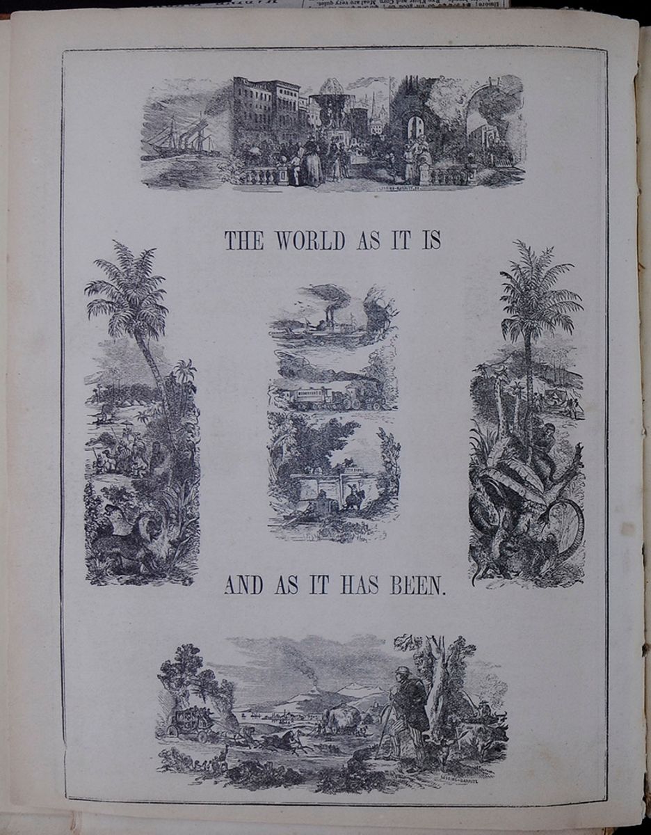
THE WORLD AS IT IS AND AS IT HAS BEEN.
This features three landscape-orientation drawings stacked on top of one another. The first is a steamship with flags and a tugboat on a large body of water. The second is a train traveling along a path with lots of foliage. The third and last is a riverboat preparing to navigate a lock with the help of a guide boat and a man on horseback. This portrait-orientation engraving centers on a thin, tall palm tree surrounded at its base by various leaves. Behind the tree is a distinctive mountain and a group of men carrying another, presumably royal, man on a palanquin. Near the tree are two giraffes and a friendly monkey preparing to scale the tree's trunk. In front of the tree, a snake menaces a deer that rests in the tree's shade. This landscape-orientation engraving shows an explorer looking on a bustling scene. In his line of sight is a carriage being pulled by four galloping horses, as well as a cart stacked high with hay being pulled by two horses. Further in the distance is a village settlement, and even further a small volcano emitting a cloud of smoke. Next to the explorer is a man tending oxen, and a dog is by the explorer's feet, looking away from the scene. [begin surface 175]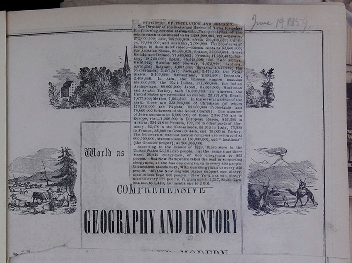 [begin surface 176]
STATISTICS OF POPULATION AND RELIGION.
The Director of the Statistical Bureau of Berlin furnishes the following curious statement:—The population of the whole earth is estimated to be 1,288,000,000, viz:—Europe, 272,000,000; Asia, 755,000,000; Africa, 200,000,000; America, 59,000,000; and Australia, 2,000,000. The population of Europe is thus subdivided:—Russia contains 62,000,000; the Austrian States, 36,398,620; France, 36,039,954; Great Britain and Ireland, 27,488,853; Prussia, 17,089,407; Turkey, 18,740,000; Spain, 15,518,008; the Two Sicilies, 8 616,922; Sweden and Norway, 5,072,820; Sardinia, 4,976,034; Belgium, 4,607,066; Bavaria, 4,547,239; the Netherlands, 3,487,617; Portugal, 3,471,199; the Papal States, 3,100,000; Switzerland, 2,494,500; Denmark, 2,468,648. In Asia, the Chinese empire contains 400,000,000; the East Indies, 171,000,000; the Indian Archipelago, 80,000,000; Japan, 35,000,000; Hindostan and Asiatic Turkey, each 15,000,000. In America the United States are computed to contain 23,191,876; Brazil, 7,677,800; Mexico, 7,661,520. In the several nations of the earth there are 335,000,000 of Christians, (of whom 170,000,000 are Papists, 89,000,000 Protestants, and 76,000,000 followers of the Greek Church.) The number of Jews amounts to 5,000,000; of these 2,890,750 are in Europe, viz:—1,250,000 in European Russia, 853,304 in Austria, 234,248 in Prussia; 192,176 in other parts of Germany, 62,470 in the Netherlands, 33,953 in Italy, 73,995 in France, 86,000 in Great Britain, and 70,000 in Turkey. The followers of various Asiatic religions are estimated at 600,000,000, Mahomedans at 160,000,000, and “heathens” (the Gentiles proper), at 200,000,000.
According to the census of 1850, there were in the United States 23,191,876 people. At the same time there were 26,842 clergymen, or one clergyman to 863 people. But New Hampshire takes the lead in supporting clergymen, as she has one clergyman to every 490 people. Connecticut stands next, with one clergyman to every 526 people. All the New England States support one clergyman to less than 600 people. New York has one clergyman to every 722 people, Virginia one to 1,317, South Carolina one to 1,410, Louisiana one to 3 000.
World as [covered]COMPREHENSIVE GEOGRAPHY AND HISTORY [cutaway]
Engraving of two men, one riding a camel, with a volcano in the background.
THE YEAR 1855, BY
J. H. COLTON & CO.,
IN THE CLERK'S OFFICE OF THE DISTRICT COURT
OF THE UNITED STATES FOR THE SOUTHERN
DISTRICT OF NEW YORK.
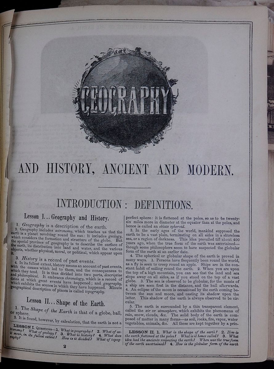
GEOGRAPHY AND HISTORY, ANCIENT AND MODERN.
INTRODUCTION: DEFINITIONS.
Lesson I... Geography and History.
1. Geography is a description of the earth.
2. Geography includes astronomy, which teaches us that the earth is a planet revolving round the sun: it includes geology, which considers the formation and structure of the globe. But the special province of geography is to describe the surface of the earth, its distribution into land and water, and the various objects, whether physical, moral, or political, which appear upon it.
History is a record of past events.
4. In its fullest extent, history means an account of past events, with the causes which led to them, and the consequences to which they tend. It is thus divided into two parts, descriptive and philosophical. It embraces chronology, which is a record of dates at which great events have happened; and geography, which exhibits the scenes in which they have happened. Minute geographical description of places is called topography.
Lesson II... Shape of the Earth.
1. The Shape of the Earth is that of a globe, ball, or sphere.
2. It is found, however, by calculation, that the earth is not a perfect sphere: it is flattened at the poles, so as to be twenty-six miles more in diameter at the equator than at the poles, and hence is called an oblate spheroid.
3. In the early ages of the world, mankind supposed the earth to be a vast plain, terminating on all sides in a shoreless sea, or a region of darkness. This idea prevailed till about 400 years ago, when the true form of the earth was ascertained—though some philosophers seem to have suspected the globular form of the earth at an earlier date.
4. The spherical or globular shape of the earth is proved in many ways. 1. Persons have frequently been round the world, as a fly is seen to creep round an apple. Ships are in the constant habit of sailing round the earth. 2. When you are upon the top of a high mountain, you can see that the land and sea slope away on all sides, as if you stood on the top of a vast globe. 3. The sea is observed to be globular, for the masts of a ship are seen first in the distance, and the hull afterwards. 4. An eclipse of the moon is occasioned by the earth coming between the sun and moon, and casting its shadow upon the latter. This shadow of the earth is always observed to be circular.
5. The earth is surrounded by a thin transparent element, called the air or atmosphere, which exhibits the phenomena of rain, snow, clouds, &c. The solid body of the earth is composed of matter in many forms—as soil, rocks, fire, vapor, water vegetables, animals, &c. All these are kept together by a principle
LESSON I. QUESTIONS—1. What is geography? 2. What of astronomy? What of geology? 3. What is history? 4. What does it mean, in its fullest extent? How is it divided? What of topography?
LESSON II. 1. What is the shape of the earth? 2. How is the earth flattened at the poles? What is it hence called? 3. What idea had the ancients respecting the earth? When was the true form of the earth ascertained? 4. How is the globular form of the earth
2 [begin surface 179]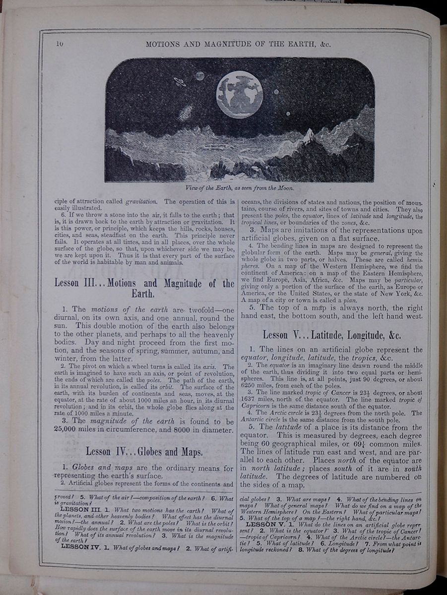 10
MOTIONS AND MAGNITUDE OF THE
EARTH, &c.
View of the Earth, as seen from the
Moon.
10
MOTIONS AND MAGNITUDE OF THE
EARTH, &c.
View of the Earth, as seen from the
Moon.
of attraction called gravitation. The operation of this is easily illustrated.
6. If we throw a stone into the air, it falls to the earth; that is, it is drawn back to the earth by attraction or gravitation. It is this power, or principle, which keeps the hills, rocks, houses, cities, and seas, steadfast on the earth. This principle never fails. It operates at all times, and in all places, over the whole surface of the globe, so that, upon whichever side we may be, we are kept upon it. Thus it is that every part of the surface of the world is habitable by man and animals.
Lesson III... Motions and Magnitude of the Earth.
1. The motions of the earth are twofold—one diurnal, on its own axis, and one annual, round the sun. This double motion of the earth also belongs to the other planets, and perhaps to all the heavenly bodies. Day and night proceed from the first motion, and the seasons of spring, summer, autumn, and winter, from the latter.
2. The pivot on which a wheel turns is called its axis. The earth is imagined to have such an axis, or point of revolution, the ends of which are called the poles. The path of the earth, in its annual revolution, is called its orbit. The surface of the earth, with its burden of continents and seas, moves, at the equator, at the rate of about 1000 miles an hour, in its diurnal revolution; and in its orbit, the whole globe flies along at the rate of 1000 miles a minute.
3. The magnitude of the earth is found to be 25,000 miles in circumference, and 8000 in diameter.
Lesson IV... Globes and Maps.
1. Globes and maps are the ordinary means for representing the earth's surface.
2. Artificial globes represent the forms of the continents and oceans, the divisions of states and nations, the position of mountains, course of rivers, and sites of towns and cities. They also present the poles, the equator, lines of latitude and longitude, the tropical lines, or boundaries of the zones, &c.
3. Maps are imitations of the representations upon artificial globes, given on a flat surface.
4. The bending lines in maps are designed to represent the globular form of the earth. Maps may be general, giving the whole globe in two parts, or halves. These are called hemispheres. On a map of the Western Hemisphere, we find the continent of America: on a map of the Eastern Hemisphere, we find Europe, Asia, Africa, &c. Maps may be particular, giving only a portion of the surface of the earth, as Europe or America, or the United States, or the state of New York, &c. A map of a city or town is called a plan.
5. The top of a map is always north, the right hand east, the bottom south, and the left hand west.
Lesson V... Latitude, Longitude, &c.
1. The lines on an artificial globe represent the equator, longitude, latitude, the tropics, &c.
2. The equator is an imaginary line drawn round the middle of the earth, thus dividing it into two equal parts or hemispheres. This line is, at all points, just 90 degrees, or about 6250 miles, from each of the poles.
3. The line marked tropic of Cancer is 23 1/2 degrees, or about 1637 miles, north of the equator. The line marked tropic of Capricorn is the same distance south of the equator.
4. The Arctic circle is 23½ degrees from the north pole. The Antartic circle is the same distance from the south pole.
5. The latitude of a place is its distance from the equator. This is measured by degrees, each degree being 60 geographical miles, or 69¼ common miles. The lines of latitude run east and west, and are parallel to each other. Places north of the equator are in north latitude; places south of it are in south latitude. The degrees of latitude are numbered on the sides of a map.
proved? 5. What of the air?—composition of the earth? 6. What is gravitation?
LESSON III. 1. What two motions has the earth? What of the planets, and other heavenly bodies? What effect has the diurnal motion?—the annual? 2. What are the poles? What is the orbit? How rapidly does the surface of the earth move in its diurnal revolution? What of its annual revolution? 3. What is the magnitude of the earth?
LESSON IV. 1. What of globes and maps? 2. What of artificial globes? 3. What are maps? 4. What of the bending lines on maps? What of general maps? What do we find on a map of the Western Hemisphere? On the Eastern? What of particular maps? 5. What of the top of a map?—the right hand, &c.?
LESSON V. 1. What do the lines on an artificial globe represent? 2. What is the equator? 3. What of the tropic of Cancer?—tropic of Capricorn? 4. What of the Arctic circle?—the Antarctic? 5. What of latitude? 6. Longitude? 7. From what point is longitude reckoned? 8. What of the degrees of longitude?
[begin surface 180]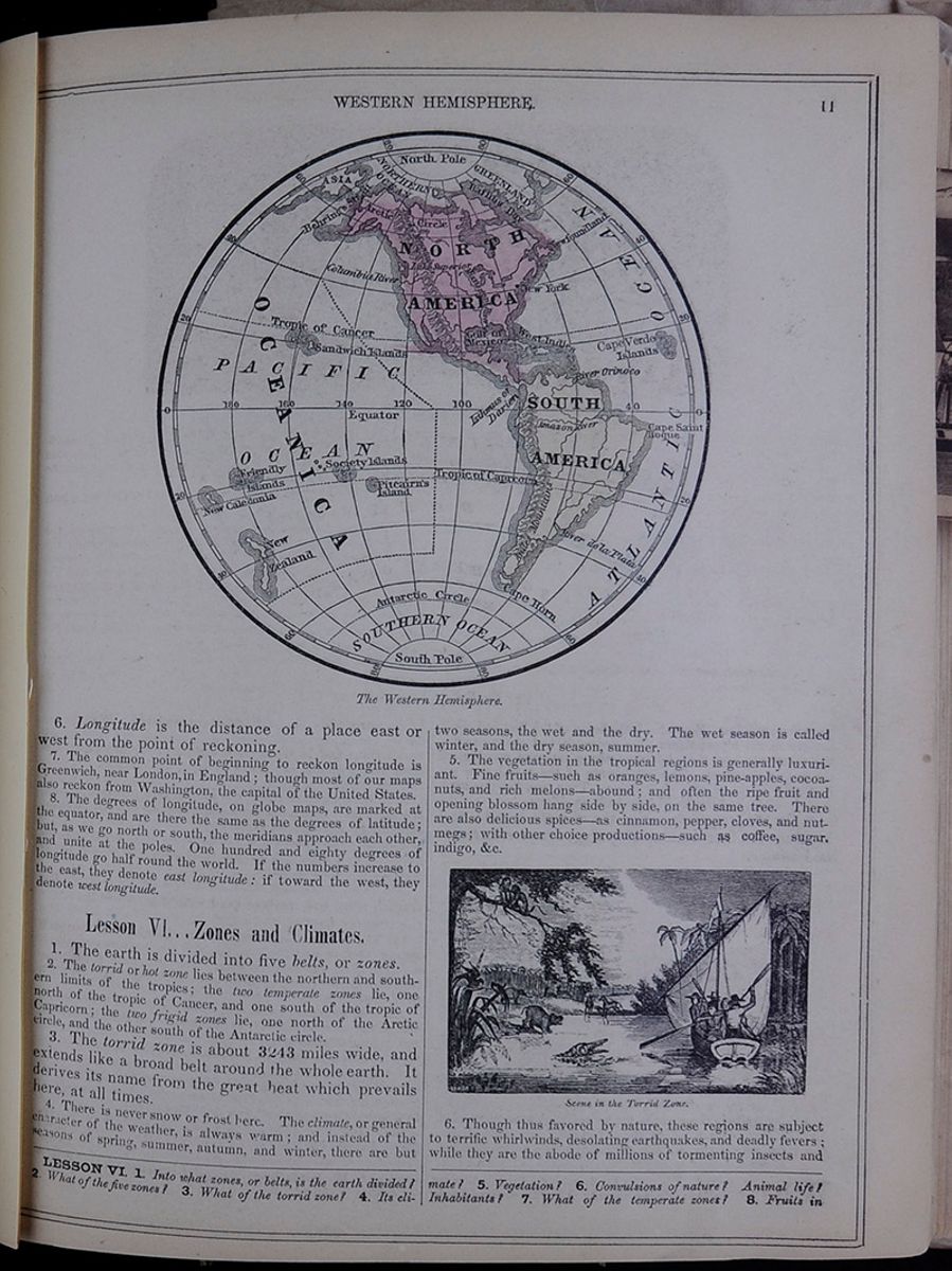 WESTERN HEMISPHERE.
11
The Western Hemisphere.
WESTERN HEMISPHERE.
11
The Western Hemisphere.
6. Longitude is the distance of a place east or west from the point of reckoning.
7. The common point of beginning to reckon longitude is Greenwich, near London, in England; though most of our maps also reckon from Washington, the capital of the United States.
8. The degrees of longitude, on globe maps, are marked at the equator, and are there the same as the degrees of latitude; but, as we go north or south, the meridians approach each other, and unite at the poles. One hundred and eighty degrees of longitude go half round the world. If the numbers increase to the east, they denote east longitude: if toward the west, they denote west longitude.
Lesson VI... Zones and Climates.
1. The earth is divided into five belts, or zones. 2. The torrid or hot zone lies between the northern and southern limits of the tropics; the two temperate zones lie, one north of the tropic of Cancer, and one south of the tropic of Capricorn; the two frigid zones lie, one north of the Arctic circle, and the other south of the Antarctic circle.
3. The torrid zone is about 3243 miles wide, and extends like a broad belt around the whole earth. It derives its name from the great heat which prevails here, at all times. 4. There is never snow or frost here. The climate, or general character of the weather, is always warm; and instead of the seasons of spring, summer, autumn, and winter, there are but two seasons, the wet and the dry. The wet season is called winter, and the dry season, summer.
5. The vegetation in the tropical regions is generally luxuriant. Fine fruits—such as oranges, lemons, pine-apples, cocoa-nuts, and rich melons—abound; and often the ripe fruit and opening blossom hang side by side, on the same tree. There are also delicious spices—as cinnamon, pepper, cloves, and nutmegs; with other choice productions—such as coffee, sugar, indigo, &c.
Scene in the Torrid Zone.6. Though thus favored by nature, these regions are subject to terrific whirlwinds, desolating earthquakes, and deadly fevers; while they are the abode of millions of tormenting insects and
LESSON VI. 1. Into what zones, or belts, is the earth divided? 2. What of the five zones? 3. What of the torrid zone? 4. Its climate? 5. Vegetation? 6. Convulsions of nature? Animal life? Inhabitants? 7. What of the temperate zones? 8. Fruits in
[begin surface 181]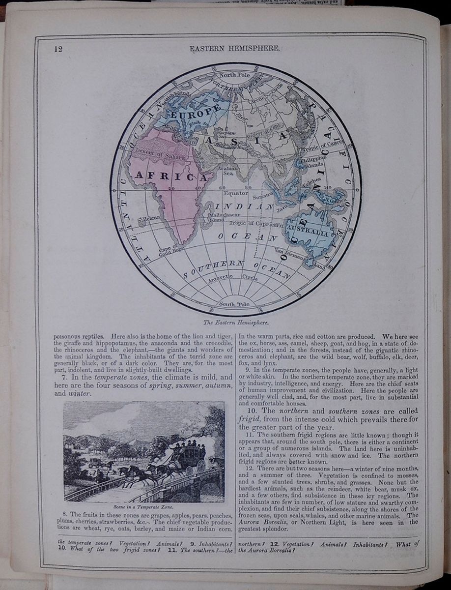 12
EASTERN HEMISPHERE.
The Eastern Hemisphere.
12
EASTERN HEMISPHERE.
The Eastern Hemisphere.
poisonous reptiles. Here also is the home of the lion and tiger, the giraffe and hippopotamus, the anaconda and the crocodile, the rhinoceros and the elephant.—the giants and wonders of the animal kingdom. The inhabitants of the torrid zone are generally black, or of a dark color. They are, for the most part, indolent and live in slightly-built dwellings.
7. In the temperate zones, the climate is mild, and here are the four seasons of spring, summer, autumn, and winter.
Scene in a Temperate Zone.8. The fruits in these zones are grapes, apples, pears, peaches, plums, cherries, strawberries, &c. The chief vegetable productions are wheat, rye, oats, barley, and maize or Indian corn. In the warm parts, rice and cotton are produced. We here see the ox, horse, ass, camel, sheep, goat, and hog, in a state of domestication; and in the forests, instead of the gigantic rhinoceros and elephant, are the wild boar, wolf, buffalo, elk, deer, fox, and lynx.
9. In the temperate zones, the people have, generally, a light or white skin. In the northern temperate zone, they are marked by industry, intelligence, and energy. Here are the chief seats of human improvement and civilization. Here the people are generally well clad, and, for the most part, live in substantial and comfortable houses.
10. The northern and southern zones are called frigid, from the intense cold which prevails there for the greater part of the year.
11. The southern frigid regions are little known; though it appears that, around the south pole, there is either a continent or a group of numerous islands. The land here is uninhabited, and always covered with snow and ice. The northern frigid regions are better known.
12. There are but two seasons here—a winter of nine months, and a summer of three. Vegetation is confined to mosses, and a few stunted trees, shrubs, and grasses. None but the hardiest animals, such as the reindeer, white bear, musk ox, and a few others, find subsistence in these icy regions. The inhabitants are few in number, of low stature and swarthy complexion, and find their chief subsistence, along the shores of the frozen seas, upon seals, whales, and other marine animals. The Aurora Borealis, or Northern Light, is here seen in the greatest splendor.
the temperate zone? Vegetation? Animals? 9. Inhabitants? 10. What of the two frigid zones? 11. The southern?—the northern? 12. Vegetation? Animals? Inhabitants? What of the Aurora Borealis?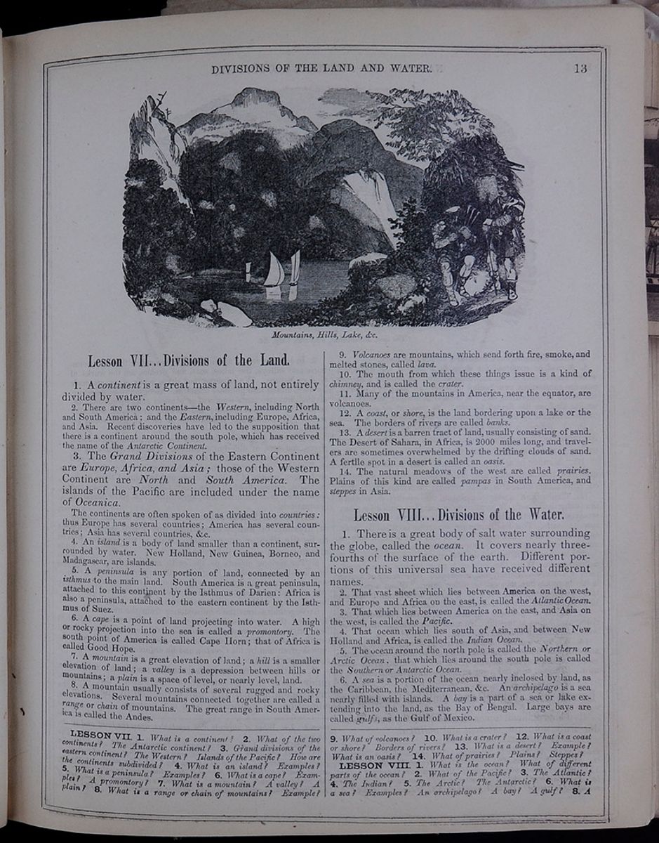 DIVISIONS OF THE LAND AND
WATER.
13
DIVISIONS OF THE LAND AND
WATER.
13
Lesson VII... Divisions of the Land.
1. A continent is a great mass of land, not entirely divided by water.
2. There are two continents—the Western, including North and South America; and the Eastern, including Europe, Africa, and Asia. Recent discoveries have led to the supposition that there is a continent around the south pole, which has received the name of the Antarctic Continent.
3. The Grand Divisions of the Eastern Continent are Europe, Africa, and Asia; those of the Western Continent are North and South America. The islands of the Pacific are included under the name of Oceanica.
The continents are often spoken of as divided into countries: thus Europe has several countries; America has several countries; Asia has several countries, &c.
4. An island is a body of land smaller than a continent, surrounded by water. New Holland, New Guinea, Borneo, and Madagascar, are islands.
5. A peninsula is any portion of land, connected by an isthmus to the main land. South America is a great peninsula, attached to this continent by the Isthmus of Darien: Africa is also a peninsula, attached to the eastern continent by the Isthmus of Suez.
6. A cape is a point of land projecting into water. A high or rocky projection into the sea is called a promontory. The south point of America is called Cape Horn; that of Africa is called Good Hope. 7. A mountain is a great elevation of land; a hill is a smaller elevation of land; a valley is a depression between hills or mountains; a plain is a space of level, or nearly level, land.
8. A mountain usually consists of several rugged and rocky elevations. Several mountains connected together are called a range or chain of mountains. The great range in South America is called the Andes.
9. Volcanoes are mountains, which send forth fire, smoke, and melted stones, called lava.
10. The mouth from which these things issue is a kind of chimney, and is called the crater.
11. Many of the mountains in America, near the equator, are volcanoes.
12. A coast, or shore, is the land bordering upon a lake or the sea. The borders of rivers are called banks.
13. A desert is a barren tract of land, usually consisting of sand. The Desert of Sahara, in Africa, is 2000 miles long, and travelers are sometimes overwhelmed by the drifting clouds of sand. A fertile spot in a desert is called an oasis.
14. The natural meadows of the west are called prairies. Plains of this kind are called pampas in South America, and steppes in Asia.
Lesson VIII... Divisions of the Water.
1. There is a great body of salt water surrounding the globe, called the ocean. It covers nearly three- fourths of the surface of the earth. Different portions of this universal sea have received different names.
2. That vast sheet which lies between America on the west, and Europe and Africa on the east, is called the Atlantic Ocean.
3. That which lies between America on the east, and Asia on the west, is called the Pacific.
4. That ocean which lies south of Asia, and between New Holland and Africa, is called the Indian Ocean.
5. The ocean around the north pole is called the Northern or Arctic Ocean, that which lies around the south pole is called the Southern or Antarctic Ocean.
6. A sea is a portion of the ocean nearly inclosed by land, as the Caribbean, the Mediterranean, &c. An archipelago is a sea nearly filled with islands. A bay is a part of a sea or lake extending into the land, as the Bay of Bengal. Large bays are called gulfs, as the Gulf of Mexico.
LESSON VII. 1. What is a continent? 2. What of the two continents? The Antarctic continent? 3. Grand divisions of the eastern continent? The Western? Islands of the Pacific? How are the continents subdivided? 4. What is an island? Examples? 5. What is a peninsula? Examples? 6. What is a cape? Examples? A promontory? 7. What is a mountain? A valley? A plain? 8. What is a range or chain of mountains? Example? 9. What of volcanoes? 10. What is a crater? 12. What is a coast or shore? Borders of rivers? 13. What is a desert? Example? What is an oasis? 14. What of prairies? Plains? Steppes?
LESSON VIII. 1. What is the ocean? What of different parts of the ocean? 2. What of the Pacific? 3. The Atlantic? 4. The Indian? 5. The Arctic? The Antarctic? 6. What is a sea? Examples? An archipelago? A bay? A gulf? 8. A
[begin surface 183]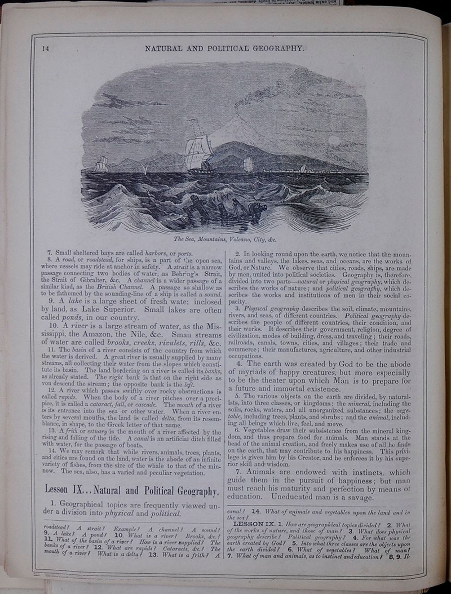 14
NATURAL AND POLITICAL
GEOGRAPHY.
The Sea, Mountains, Volcano, City,
&c.
14
NATURAL AND POLITICAL
GEOGRAPHY.
The Sea, Mountains, Volcano, City,
&c.
7. Small sheltered bays are called harbors, or ports.
8. A road, or roadstead, for ships, is a part of the open sea, where vessels may ride at anchor in safety. A strait is a narrow passage connecting two bodies of water, as Behring's Strait, the Strait of Gibralter, &c. A channel is a wider passage of a similar kind, as the British Channel. A passage so shallow as to be fathomed by the sounding-line of a ship is called a sound.
9. A lake is a large sheet of fresh water inclosed by land, as Lake Superior. Small lakes are often called ponds, in our country.
10. A river is a large stream of water, as the Mississippi, the Amazon, the Nile, &c. Small streams of water are called brooks, creeks, rivulets, rills, &c.
11. The basin of a river consists of the country from which the water is derived. A great river is usually supplied by many streams, all collecting their water from the slopes which constitute its basin. The land bordering on a river is called its banks, as already stated. The right bank is that on the right side as you descend the stream; the opposite bank is the left.
12. A river which passes swiftly over rocky obstructions is called rapids. When the body of a river pitches over a precipice, it is called a cataract, fall, or cascade. The mouth of a river is its entrance into the sea or other water. When a river enters by several mouths, the land is called delta, from its resemblance, in shape, to the Greek letter of that name.
13. A frith or estuary is the mouth of a river affected by the rising and falling of the tide. A canal is an artificial ditch filled with water, for the passage of boats.
14. We may remark that while rivers, animals, trees, plants, and cities are found on the land, water is the abode of an infinite variety of fishes, from the size of the whale to that of the minnow. The sea, also, has a varied and peculiar vegetation.
Lesson IX... Natural and Political Geography.
1. Geographical topics are frequently viewed under a division into physical and political.
2. In looking round upon the earth, we notice that the mountains and valleys, the lakes, seas, and oceans, are the works of God, or Nature. We observe that cities, roads, ships, are made by men, united into political societies. Geography is, therefore, divided into two parts—natural or physical geography, which describes the works of nature; and political geography, which describes the works and institutions of men in their social capacity.
3. Physical geography describes the soil, climate, mountains, rivers, and seas, of different countries. Political geography describes the people of different countries, their condition, and their works. It describes their government, religion, degree of civilization, modes of building, dress, and traveling; their roads, railroads, canals, towns, cities, and villages; their trade and commerce; their manufactures, agriculture, and other industrial occupations.
4. The earth was created by God to be the abode of myriads of happy creatures, but more especially to be the theater upon which Man is to prepare for a future and immortal existence.
5. The various objects on the earth are divided, by naturalists, into three classes, or kingdoms: the mineral, including the soils, rocks, waters, and all unorganized substances; the vegetable, including trees, plants, and shrubs; and the animal, including all beings which live, feel, and move.
6. Vegetables draw their subsistence from the mineral kingdom, and thus prepare food for animals. Man stands at the head of the animal creation, and freely makes use of all he finds on the earth, that may contribute to his happiness. This privilege is given him by his Creator, and he enforces it by his superior skill and wisdom.
7. Animals are endowed with instincts, which guide them in the pursuit of happiness; but man must reach his maturity and perfection by means of education. Uneducated man is a savage.
roadstead? A strait? Example? A channel? A sound? 9. A lake? A pond? 10. What is a river? Brooks, &c.? 11. What of the basin of a river? How is a river supplied? The banks of a river? 12. What are rapids? Cataracts, &c.? The mouth of a river? What is a delta? 13. What is a frith? A canal? 14. What of animals and vegetables upon the land and in the sea?
LESSON IX. 1. How are geographical topics divided? 2. What of the works of nature, and those of man? 3. What does physical geography describe? Political geography? 4. For what was the earth created by God? 5. Into what three classes are the objects upon the earth divided? 6. What of vegetables? What of man? 7. What of man and animals, as to instinct and education? 8, 9. Illustrate
[begin surface 184]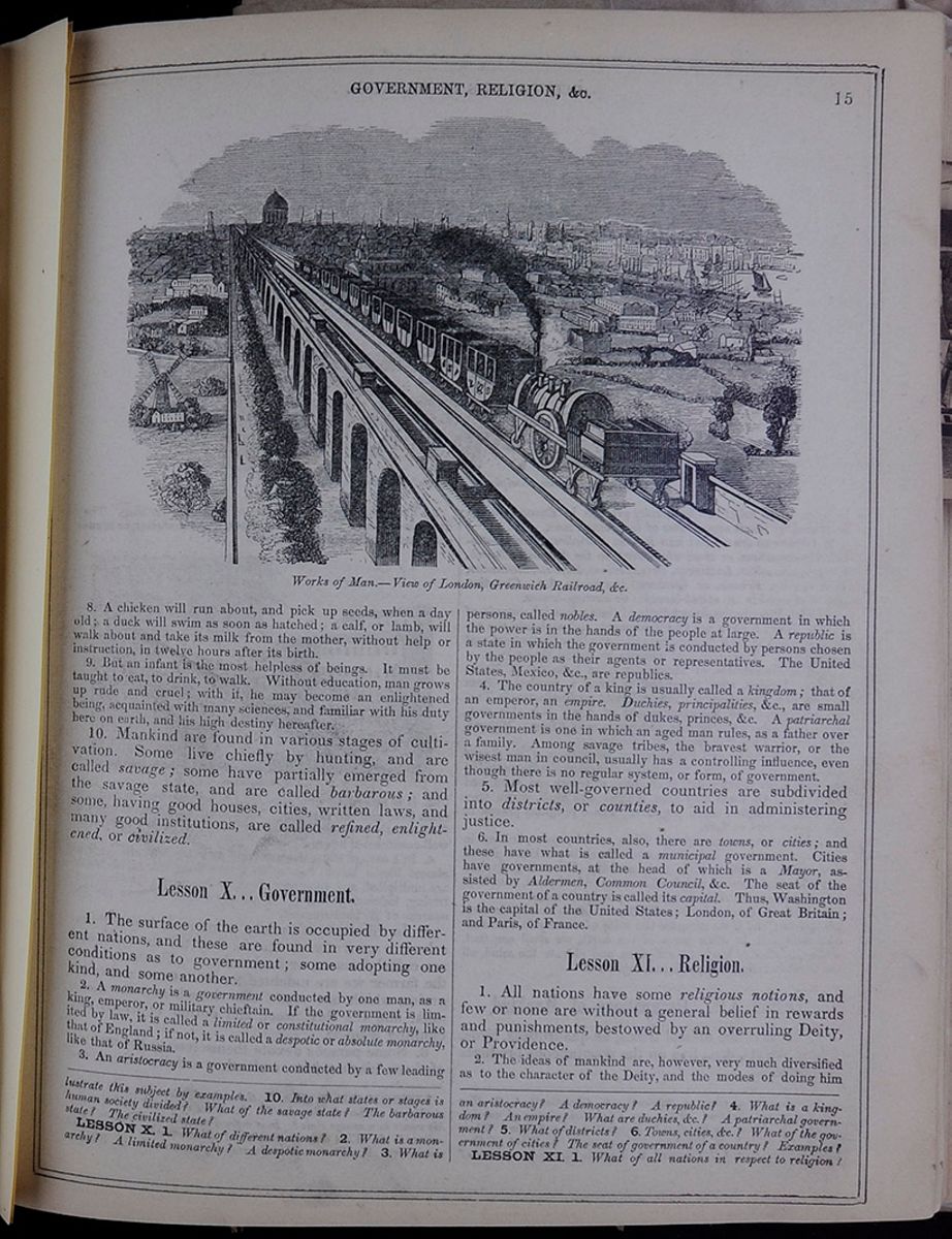 GOVERNMENT, RELIGION,
&c.
15
Works of Man.—View of London, Greenwich
Railroad, &c.
GOVERNMENT, RELIGION,
&c.
15
Works of Man.—View of London, Greenwich
Railroad, &c.
8. A chicken will run about, and pick up seeds, when a day old; a duck will swim as soon as hatched; a calf, or lamb, will walk about and take its milk from the mother, without help or instruction; in twelve hours after its birth.
9. But an infant is the most helpless of beings. It must be taught to eat, to drink, to walk. Without education, man grows up rude and cruel; with it, he may become an enlightened being, acquainted with many sciences, and familiar with his duty here on earth, and his high destiny hereafter.
10. Mankind are found in various stages of cultivation. Some live chiefly by hunting, and are called savage; some have partially emerged from the savage state, and are called barbarous; and some, having good houses, cities, written laws, and many good institutions, are called refined, enlightened, or civilized.
Lesson X... Government.
1. The surface of the earth is occupied by different nations, and these are found in very different conditions as to government; some adopting one kind, and some another.
2. A monarchy is a government conducted by one man, as a king, emperor, or military chieftain. If the government is limited by law, it is called a limited or constitutional monarchy, like that of England; if not, it is called a despotic or absolute monarchy, like that of Russia.
3. An aristocracy is a government conducted by a few leading persons, called nobles. A democracy is a government in which the power is in the hands of the people at large. A republic is a state in which the government is conducted by persons chosen by the people as their agents or representatives. The United States, Mexico, &c. are republics.
4. The country of a king is usually called a kingdom; that of an emperor, an empire. Duchies, principalities, &c., are small governments in the hands of dukes, princes, &c. A patriarchal government is one in which an aged man rules, as a father over a family. Among savage tribes, the bravest warrior, or the wisest man in council, usually has a controlling influence, even though there is no regular system, or form, of government.
5. Most well-governed countries are subdivided into districts, or counties, to aid in administering justice.
6. In most countries, also, there are towns, or cities; and these have what is called a municipal government. Cities have governments, at the head of which is a Mayor, assisted by Aldermen, Common Council, &c. The seat of the government of a country is called its capital. Thus, Washington is the capital of the United States; London, of Great Britain; and Paris, of France.
Lesson XI... Religion.
1. All nations have some religious notions, and few or none are without a general belief in rewards and punishments, bestowed by an overruling Deity, or Providence.
2. The ideas of mankind are, however, very much diversified as to the character of the Deity, and the modes of doing him
this subject by examples. 10. Into what states or stages is human society divided? What of the savage state? The barbarous state? The civilized state? LESSON X. 1. What of different nations? 2. What is a monarchy? A limited monarchy? A despotic monarchy? 3. What is an aristocracy? A democracy? A republic? 4. What is a kingdom? An empire? What are duchies, &c? A patriarchal government? 5. What of districts? 6. Towns, cities, &.? What of the government of cities? The seat of government of a country? Examples?
LESSON XI. 1. What of all nations in respect to religion?
[begin surface 185]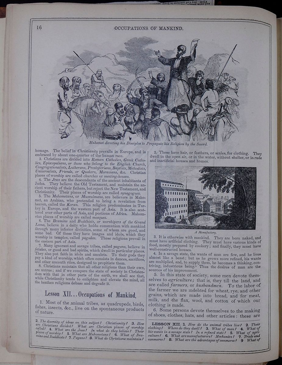 16
OCCUPATIONS OF MANKIND.
Mahomet directing his Disciples to Propagate
his Religion by the Sword.
16
OCCUPATIONS OF MANKIND.
Mahomet directing his Disciples to Propagate
his Religion by the Sword.
homage. The belief in Christianity prevails in Europe, and is embraced by about one-quarter of the human race.
3. Christians are divided into Roman Catholics, Greek Catholics, Episcopalians, or those who belong to the English Church, Congregationalists, Lutherans, Presbyterians, Baptists, Methodists, Universalists, Friends, or Quakers, Moravians, &c. Christian places of worship are called churches or meeting-houses.
4. The Jews are the descendants of the ancient inhabitants of Judea. They believe the Old Testament, and maintain the ancient worship of their fathers, but reject the New Testament, and Christianity. Their places of worship are called synagogues.
5. The Mahometans, or Mussulmans, are believers in Mahomet, an Arabian, who pretended to bring a revelation from heaven, called the Koran. This religion predominates in Turkey in Europe, and the western part of Asia. It is also scattered over other parts of Asia, and portions of Africa. Mahometan places of worship are called mosques.
6. The Bramins and Buddhists, or worshipers of the Grand Lama, believe in a deity who holds communion with mankind through many inferior divinities, some of whom are good, and some bad. Of these they have images and idols, which they worship in temples, called pagodas. These religions prevail in the eastern part of Asia.
7. Many ignorant and savage tribes, called pagans, believe in fetishes, or good and bad spirits, which dwell in particular places. They also put faith in idols and amulets. To their gods they pay a kind of worship, which often consists in dances, sacrifices, and other uncouth rites, designed to propitiate them.
8. Christians maintain that all other religions than their own, are untrue; and if we compare the state of society in Christendom with that in other parts of the earth, we shall see that, while Christianity tends to enlighten and elevate the mind, all the heathen religions debase and degrade it.
Lesson XII... Occupations of Mankind.
1. Most of the animal tribes, as quadrupeds, birds, fishes, insects, &c., live on the spontaneous products of nature.
2. These have hair, or feathers, or scales, for clothing. They dwell in the open air, or in the water, without shelter, or in rude and inartificial houses and homes.
A Manufactory.3. It is otherwise with mankind. They are born naked, and must have artificial clothing. They must have various kinds of food, mostly prepared by cookery; and finally, they must have well-constructed houses.
4. In a savage state, the wants of man are few, and he lives almost like a beast; but as he grows more refined, his wants are multiplied, and, to supply them, he becomes a thinking, contriving, industrious being. Thus the desires of man are the sources of his improvement.
5. In this state of society, some men devote themselves to agriculture; that is, they till the land, and are called farmers, or husbandmen. To the labor of the farmer we are indebted for wheat, rye, and other grains, which are made into bread, and for meat, milk, and the flax, wool, and cotton of which our clothing is made.
6. Some persons devote themselves to the making of shoes, clothes, hats, and other articles: these are
2. The diversity of ideas on this subject? Christianity? 3. How are Christians divided? What are Christian places of worship called? 4. What are the Jews? In what do they believe? Their places of worship? 5. What are Mahometans? 6. What of Bramins and Buddhists? 7. Pagans? 8. What do Christians maintain?
LESSON XII. 1. How do the animal tribes live? 2. Their clothing? Where do they dwell? 3. What of man? I. What of his wants in a savage state? In a refined state? 5. What of agriculture? 6. What are manufacturers? Mechanics? 7. Trade and commerce? 8. What are the advantages of commerce? 9 What of
 [begin surface 187]
 [begin surface 188]
 [begin surface 189]
 [begin surface 190]
 [begin surface 191]
 [begin surface 192]
 [begin surface 193]
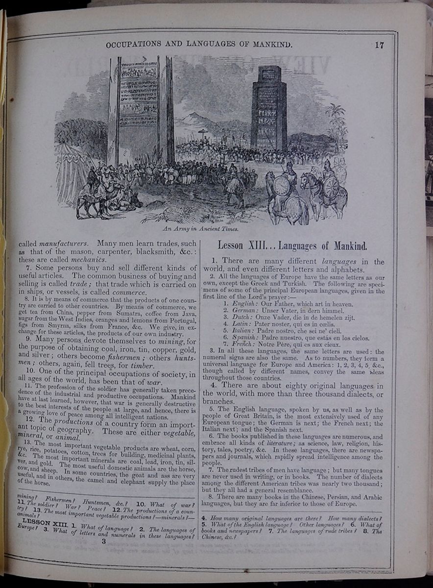 OCCUPATIONS AND LANGUAGES OF
MANKIND.
17
An Army in Ancient Times.
OCCUPATIONS AND LANGUAGES OF
MANKIND.
17
An Army in Ancient Times.
called manufacturers. Many men learn trades, such as that of the mason, carpenter, blacksmith, &c.: these are called mechanics.
7. Some persons buy and sell different kinds of useful articles. The common business of buying and selling is called trade; that trade which is carried on in ships, or vessels, is called commerce.
8. It is by means of commerce that the products of one country are carried to other countries. By means of commerce, we get tea from China, pepper from Sumatra, coffee from Java, sugar from the West Indies, oranges and lemons from Portugal, figs from Smyrna, silks from France, &c. We give, in exchange for these articles, the products of our own industry.
9. Many persons devote themselves to mining, for the purpose of obtaining coal, iron, tin, copper, gold, and silver; others become fishermen; others huntsmen; others, again, fell trees, for timber.
10. One of the principal occupations of society, in all ages of the world, has been that of war.
11. The profession of the soldier has generally taken precedence of the industrial and productive occupations. Mankind have at last learned, however, that war is generally destructive to the best interests of the people at large, and hence, there is a growing love of peace among all intelligent nations.
12. The productions of a country form an important topic of geography. These are either vegetable, mineral, or animal.
13. The most important vegetable products are wheat, corn, rye, rice, potatoes, cotton, trees for building, medicinal plants, &c. The most important minerals are coal, lead, iron, tin, silver, and gold. The most useful domestic animals are the horse, cow, and sheep. In some countries, the goat and ass are very useful, and in others, the camel and elephant supply the place of the horse.
Lesson XIII... Languages of Mankind.
1. There are many different languages in the world, and even different letters and alphabets.
2. All the languages of Europe have the same letters as our own, except the Greek and Turkish. The following are specimens of some of the principal European languages, given in the first line of the Lord's prayer:—
- 1. English: Our Father, which art in heaven.
- 2. German: Unser Vater, in dem himmel.
- 3. Dutch: Onze Vader, die in de hemelen zijt.
- 4. Latin: Pater noster, qui es in cœlis.
- 5. Italian: Padre nostro, che sei ne' cieli.
- 6. Spanish: Padre nuestro, que estás en los cielos.
- 7. French: Notre Père, qui es aux cieux.
3. In all these languages, the same letters are used: the numeral signs are also the same. As to numbers, they form a universal language for Europe and America: 1, 2, 3, 4, 5, &c., though called by different names, convey the same ideas throughout those countries.
4. There are about eighty original languages in the world, with more than three thousand dialects, or branches.
5. The English language, spoken by us, as well as by the people of Great Britain, is the most extensively used of any European tongue; the German is next; the French next; the Italian next; and the Spanish next.
6. The books published in these languages are numerous, and embrace all kinds of literature; as science, law, religion, history, tales, poetry, &c. In these languages, there are newspapers and journals, which rapidly spread intelligence among the people.
7. The rudest tribes of men have language; but many tongues are never used in writing, or in books. The number of dialects among the different American tribes was nearly two thousand; but they all had a general resemblance.
8. There are many books in the Chinese, Persian, and Arabic languages, but they are far inferior to those of Europe.
mining? Fishermen? Huntsmen, &c.? 10. What of war? 11. The soldier? War? Peace? 12. The productions of a country? 13. The most important vegetable productions?—minerals?—animals?
LESSON XIII 1. What of language? 2. The languages of Europe? 3. What of letters and numerals in these languages? 4. How many original languages are there? How many dialects? 5. What of the English language? Other languages? 6. What of books and newspapers? 7. The languages of rude tribes? 8. The Chinese, &c.?
3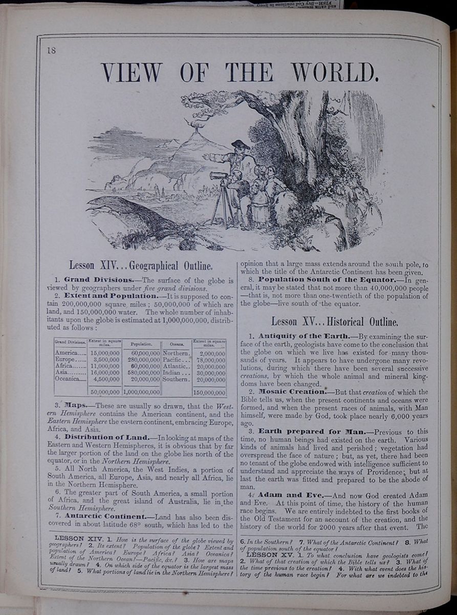 18
18
VIEW OF THE WORLD.
Engraving of a man and a group of children looking through a telescope at a landscape.LESSON XIV... GEOGRAPHICAL OUTLINE.
1. Grand Divisions—The surface of the globe is viewed by geographers under five grand divisions.
2. Extent and Population.—It is supposed to contain 200,000,000 square miles; 50,000,000 of which are land, and 150,000,000 water. The whole number of inhabitants upon the globe is estimated at 1,000,000,000 distributed as follows:
This table lists the extent in square miles and populations of America, Europe, Africa, Asia, and Oceanica, and includes the extent in square miles of the following oceans: Northern, Pacific, Atlantic, Indian, and Southern.3. Maps.—These are usually so drawn, that the Western Hemisphere contains the American continent, and the Eastern Hemisphere the eastern continent, embracing Europe, Africa, and Asia.
4. Distribution of Land.—In looking at maps of the Eastern and Western Hemispheres, it is obvious that by far the larger portion of the land on the globe lies north of the equator, or in the Northern Hemisphere.
5. All North America, the West Indies, a portion of South America, all Europe, Asia, and nearly all Africa, lie in the Northern Hemisphere.
6. The greater part of South America, a small portion of Africa, and the great island of Australia, lie in the Southern Hemisphere.
7. Antarctic Continent.—Land has also been discovered in about latitude 68° south, which has led to the opinion that a large mass extends around the south pole, to which the title of the Antarctic Continent has been given.
8. Population South of the Equator.—In general, it may be stated that not more than 40,000,000 people—that is, not more than one-twentieth of the population of the globe—live south of the equator.
Lesson XV... Historical Outline.
1. Antiquity of the Earth.—By examining the surface of the earth, geologists have come to the conclusion that the globe on which we live has existed for many thousands of years. It appears to have undergone many revolutions, during which there have been several successive creations, by which the whole animal and mineral kingdoms have been changed.
2. Mosaic Creation.—But that creation of which the Bible tells us, when the present continents and oceans were formed, and when the present races of animals, with Man himself, were made by God, took place nearly 6,000 years ago.
3. Earth prepared for Man.—Previous to this time, no human beings had existed on the earth. Various kinds of animals had lived and perished; vegetation had overspread the face of nature; but, as yet, there had been no tenant of the globe endowed with intelligence sufficient to understand and appreciate the ways of Providence: but at last the earth was fitted and prepared to be the abode of man.
4. Adam and Eve.—And now God created Adam and Eve. At this point of time, the history of the human race begins. We are entirely indebted to the first books of the Old Testament for an account of the creation, and the history of the world for 2000 years after that event. The
LESSON XIV. 1. How is the surface of the globe viewed by geographers? 2. Its extent? Population of the globe? Extent and population of America? Europe? Africa? Asia? Oceanica? Extent of the Northern Ocean?—Pacific, &c.? 3. How are maps usually drawn? 4. On which side of the equator is the largest mass of land? 5. What portions of land lie in the Northern Hemisphere? 6. In the Southern? 7. What of the Antarctic Continent? 8. What of population south of the equator?
LESSON XV. 1. To what conclusion have geologists come? 2. What of that creation of which the Bible tells us? 3. What of the time previous to the creation? 4. With what event does the history of the human race begin? For what are we indebted to the
[begin surface 196]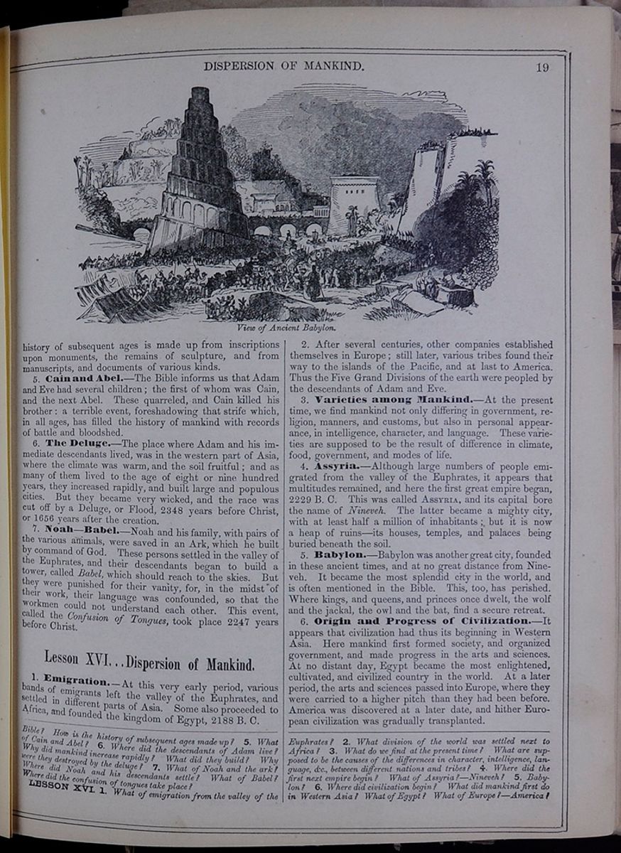 DISPERSION OF MANKIND.
19
View of Ancient Babylon.
DISPERSION OF MANKIND.
19
View of Ancient Babylon.
history of subsequent ages is made up from inscriptions upon monuments, the remains of sculpture, and from manuscripts, and documents of various kinds.
5. Cain and Abel.—The Bible informs us that Adam and Eve had several children; the first of whom was Cain, and the next Abel. These quarreled, and Cain killed his brother: a terrible event, foreshadowing that strife which, in all ages, has filled the history of mankind with records of battle and bloodshed.
6. The Deluge.—The place where Adam and his immediate descendants lived, was in the western part of Asia, where the climate was warm, and the soil fruitful; and as many of them lived to the age of eight or nine hundred years, they increased rapidly, and built large and populous cities. But they became very wicked, and the race was cut off by a Deluge, or Flood, 2348 years before Christ, or 1656 years after the creation.
7. Noah—Babel.—Noah and his family, with pairs of the various animals, were saved in an Ark, which he built by command of God. These persons settled in the valley of the Euphrates, and their descendants began to build a tower, called Babel, which should reach to the skies. But they were punished for their vanity, for, in the midst of their work, their language was confounded, so that the workmen could not understand each other. This event, called the Confusion of Tongues, took place 2247 years before Christ.
Lesson XVI...Dispersion of Mankind.
1. Emigration.—At this very early period, various bands of emigrants left the valley of the Euphrates, and settled in different parts of Asia. Some also proceeded to Africa, and founded the kingdom of Egypt, 2188 B. C.
2. After several centuries, other companies established themselves in Europe; still later, various tribes found their way to the islands of the Pacific, and at last to America. Thus the Five Grand Divisions of the earth were peopled by the descendants of Adam and Eve.
3. Varieties among mankind.—At the present time, we find mankind not only differing in government, religion, manners, and customs, but also in personal appearance, in intelligence, character, and language. These varieties are supposed to be the result of difference in climate, food, government, and modes of life.
4. Assyria.—Although large numbers of people emigrated from the valley of the Euphrates, it appears that multitudes remained, and here the first great empire began, 2229 B. C. This was called ASSYRIA, and its capital bore the name of Nineveh. The latter became a mighty city, with at least half a million of inhabitants; but it is now a heap of ruins—its houses, temples, and palaces being buried beneath the soil.
5. Babylon.—Babylon was another great city, founded in these ancient times, and at no great distance from Nineveh. It became the most splendid city in the world, and is often mentioned in the Bible. This, too, has perished. Where kings, and queens, and princes once dwelt, the wolf and the jackal, the owl and the bat, find a secure retreat.
6. Origin and Progress of Civilization.—It appears that civilization had thus its beginning in Western Asia. Here mankind first formed society, and organized government, and made progress in the arts and sciences. At no distant day, Egypt became the most enlightened, cultivated, and civilized country in the world. At a later period, the arts and sciences passed into Europe, where they were carried to a higher pitch than they had been before. America was discovered at a later date, and hither European civilization was gradually transplanted.
Bible? How is the history of subsequent ages made up? 5. What of Cain and Abel? 6. Where did the descendants of Adam live? Why did mankind increase rapidly? What did they build? Why were they destroyed by the deluge? 7. What of Noah and the ark? Where did Noah and his descendants settle? What of Babel? Where did the confusion of tongues take place?
LESSON XVI. 1. What of emigration from the valley of the Euphrates? 2. What division of the world was settled next to Africa? 3. What do we find at the present time? What are supposed to be the causes of the differences in character, intelligence, language, &c., between different nations and tribes? 4. Where did the first next empire begin? What of Assyria?—Nineveh? 5. Babylon? 6. Where did civilization begin? What did mankind first do in Western Asia? What of Egypt? What of Europe?—America?
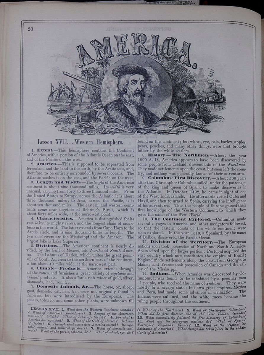 20
An image of Christopher Columbus in front of a
background with ships, trees, and a sword with the word
"AMERICA." written above the image and a banner with the
words "CHRISTOPHER COLUMBUS, 1492" written beneath
it.
20
An image of Christopher Columbus in front of a
background with ships, trees, and a sword with the word
"AMERICA." written above the image and a banner with the
words "CHRISTOPHER COLUMBUS, 1492" written beneath
it.
Lesson XVII... Western Hemisphere.
1. Extent.—This hemisphere contains the Continent of America, with a portion of the Atlantic Ocean on the east, and of the Pacific on the west.
2. America.—This is supposed to be separated from Greenland and the land to the north, by the Arctic seas, and, therefore, to be entirely surrounded by several oceans. The Atlantic washes it on the east, and the Pacific on the west.
3. Length and Width.—The length of the American continent is about nine thousand miles. Its width is very unequal, varying from forty to three thousand miles. From the United States to Europe, across the Atlantic, it is about three thousand miles; to Asia, across the Pacific, it is about ten thousand miles. The eastern and western continents come near together at Behring's Strait, which is about forty miles wide, at the narrowest point.
4. Characteristics.—America is distinguished for its vast lakes, its mighty rivers, and the longest chain of mountains in the world. The latter extends from Cape Horn to the Arctic circle, and is nine thousand miles in length. The two chief rivers are the Mississippi and the Amazon. The largest lake is Lake Superior.
5. Divisions.—The American continent is nearly divided, by the Gulf of Mexico, into North and South America. The Isthmus of Darien, which unites the great peninsula of South America to the northern part of the continent, is but about 40 miles wide, at the narrowest part.
6. Climate—Products.—America extends through all the zones, and furnishes a great variety of vegetable and animal products. It also affords rich mines of gold, silver, diamonds, lead, iron, &c.
7. Domestic Animals, &c.—The horse, ox, sheep, goat, domestic cat, hen, &c., were not originally found in America, but were introduced by the Europeans. The potato, tobacco, and some other plants, were unknown till found on this continent; but wheat, rye, oats, barley, apples, pears, peaches, and many other things, were first brought hither by the white settlers.
8. History—The Northmen.—About the year 1000 A. D., America appears to have been discovered by some people from Iceland, descendants of the Northmen. They made settlements upon the coast, but soon left the country, and nothing was generally known of their adventures.
9. Columbus' First Discovery.—About 500 years after this, Christopher Columbus sailed, under the patronage of the king and queen of Spain, to make discoveries in the Atlantic. In October, 1492, he came in sight of one of the West India Islands. He afterwards visited Cuba and Hayti, and then returned to Spain, carrying the intelligence of his adventures. Thus the people of Europe gained their first knowledge of the Western Continent, to which they gave the name of the New World.
10. The Continent Explored.—Columbus made several voyages to America, and other navigators followed, so that the eastern coasts of the whole continent were soon explored. In the year 1513, a Spaniard, by the name of Balboa, discovered the Pacific Ocean.
11. Division of the Territory.—The European nations soon took possession of North and South America. Spain seized upon the larger portion; Portugal acquired the vast country which now constitutes the empire of Brazil; England made settlements along the coast, from Georgia to Maine; and France took possession of Canada and the valley of the Mississippi.
12. Indians.—When America was discovered by Columbus, it was found to be inhabited by a peculiar race of people, who received the name of Indians. They were mostly in a savage state; but two great empires, Mexico and Peru, had made some advances in civilization. The Indians were subdued, and the white races became the ruling people throughout the continent.
LESSON XVII. 1. What does the Western Continent contain? 2. What of America? Boundaries? 3. Length of the American continent? Width? What of Behring's Strait? 4. For what is America distinguished? 5. What of the Gulf of Mexico? Isthmus of Darien? 6. Through what zones does America extend? Its vegetable, animal, and mineral products? 7. What of domestic animals? What of the potato, tobacco, &c.? What of wheat, rye, &c.? 8. What of the Northmen? 9. What of Christopher Columbus? When did he first discover one of the West Indian islands? 10. What immediately followed the first discovery of Columbus? 11. What did the European nations do? What of Spain? Portugal? England? France? 12. What of the original inhabitants of America? What change has taken place in the inhabitants of America?
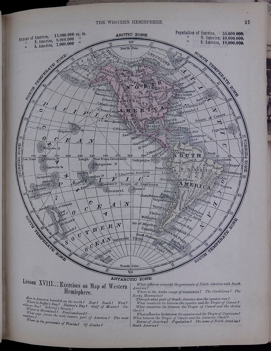 THE WESTERN HEMISPHERE.
21
Map of the Western Hemisphere including climate zones
as well as populations and areas of continents.
THE WESTERN HEMISPHERE.
21
Map of the Western Hemisphere including climate zones
as well as populations and areas of continents.
- Extent of America, 15,000,000 sq. m.
- " N. America, 8,000,000 "
- " S. America, 7,000,000 "
- Population of America, 55,000,000.
- " N. America, 40,000,000.
- " S. America, 18,000,000.
Lesson XVIII... Exercises on Map of Western Hemisphere.
How is America bounded on the north? East? South? West?
Where is Baffin's Bay? Hudson's Bay? Gulf of Mexico? Caribbean Sea? Behring's Straits? Where is Greenland? Newfoundland?
What cape forms the most eastern part of America? The most southern?
Where is the peninsula of Florida? Of Alaska?
What isthmus connects the peninsula of North America with South America?
Where is the Andes range of mountains? The Cordilleras? The Rocky Mountains?
Through what part of South America does the equator run?
What countries lie between the equator and the Tropic of Cancer?
What countries lie between the Tropic of Cancer and the Arctic Circle?
What countries lie between the equator and the Tropic of Capricorn? What between the Tropic of Cancer and the Antarctic Circle?
Extent of America? Population? The same of North America? South America?
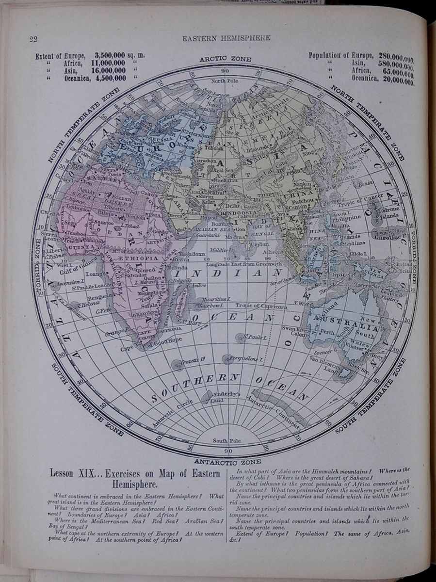 22
EASTERN HEMISPHERE
Map of the Eastern Hemisphere including climate
zones as well as populations and areas of
continents.
22
EASTERN HEMISPHERE
Map of the Eastern Hemisphere including climate
zones as well as populations and areas of
continents.
- Extent of Europe, 3,500,000 sq. m.
- " Africa, 11,000,000 "
- " Asia, 16,000,000 "
- " Oceanica, 4,500,000 "
- Population of Europe, 280,000,000.
- " Asia, 580,000,000.
- " Africa, 65,000,000.
- " Oceanica, 20,000,000.
Lesson XIX... Exercises on Map of Eastern Hemisphere.
What continent is embraced in the Eastern Hemisphere? What great island is in the Eastern Hemisphere?
What three grand divisions are embraced in the Eastern Continent? Boundaries of Europe? Asia? Africa?
Where is the Mediterranean Sea? Red Sea? Arabian Sea? Bay of Bengal?
What cape at the northern extremity of Europe? At the western point of Africa? At the southern point of Africa?
In what part of Asia are the Himmaleh mountains? Where is the desert of Cobi? Where is the great desert of Sahara?
By what isthmus is the great peninsula of Africa connected with the continent? What two peninsulas form the southern part of Asia?
Name the principal countries and islands which lie within the torrid zone.
Name the principal countries and islands which lie within the north temperate zone.
Name the principal countries and islands which lie within the south temperate zone.
Extent of Europe? Population? The same of Africa, Asia, &c.?
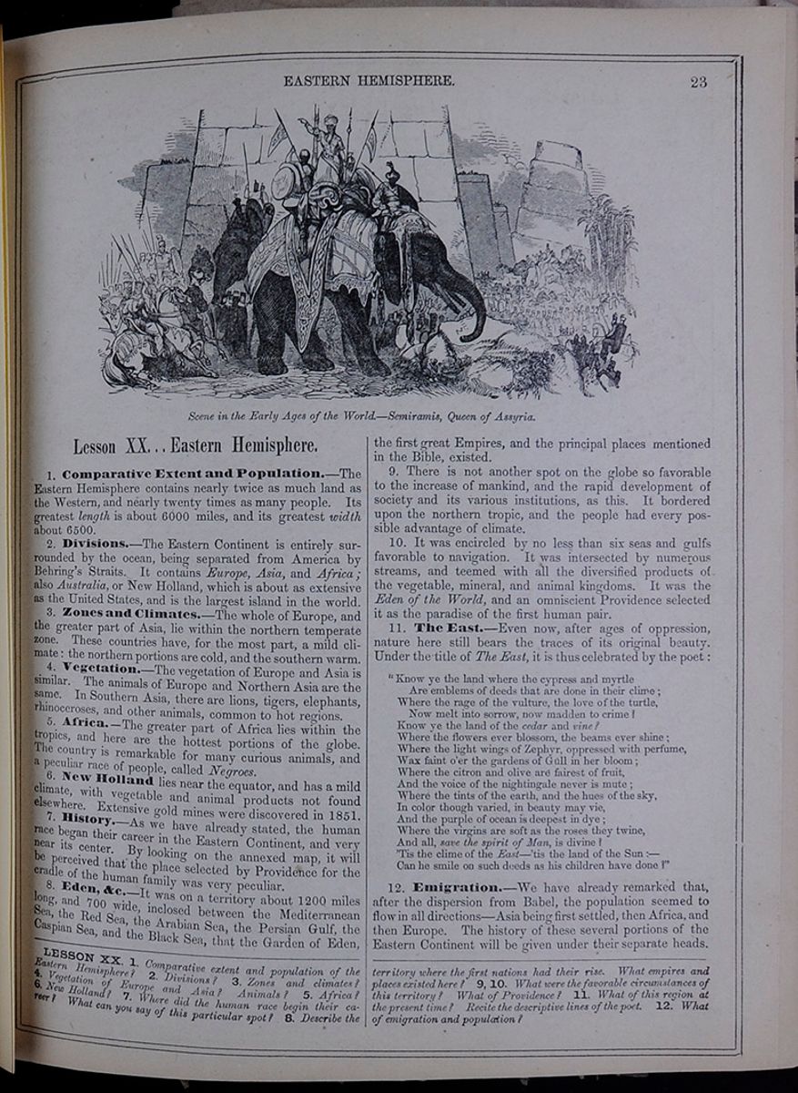 EASTERN HEMISHPERE.
23
Scene in the Early Ages of the
World.—Semiramis, Queen of Assyria.
Image of Queen Semiramis standing on an elephant in
front of a crowd.
EASTERN HEMISHPERE.
23
Scene in the Early Ages of the
World.—Semiramis, Queen of Assyria.
Image of Queen Semiramis standing on an elephant in
front of a crowd.
Lesson XX... Eastern Hemisphere.
1. Comparative Extent and Population.—The Eastern Hemisphere contains nearly twice as much land as the Western, and nearly twenty times as many people. Its greatest length is about 6000 miles, and its greatest width about 6500.
2. Divisions.—The Eastern Continent is entirely surrounded by the ocean, being separated from America by Behring's Straits. It contains Europe, Asia, and Africa; also Australia, or New Holland, which is about as extensive as the United States, and is the largest island in the world.
3. Zones and Climates.—The whole of Europe, and the greater part of Asia, lie within the northern temperate zone. These countries have, for the most part, a mild climate: the northern portions are cold, and the southern warm.
4. Vegetation.—The vegetation of Europe and Asia is similar. The animals of Europe and Northern Asia are the same. In Southern Asia, there are lions, tigers, elephants, rhinoceroses, and other animals, common to hot regions.
5. Africa.—The greater part of Africa lies within the tropics, and here are the hottest portions of the globe. The country is remarkable for many curious animals, and a peculiar race of people, called Negroes.
6. New Holland lies near the equator, and has a mild climate, with vegetable and animal products not found elsewhere. Extensive gold mines were discovered in 1851.
7. History.—As we have already stated, the human race began their career in the Eastern Continent, and very near its center. By looking on the annexed map, it will be perceived that the place selected by Providence for the cradle of the human family was very peculiar.
8. Eden, &c.—It was on a territory about 1200 miles long, and 700 wide, inclosed between the Mediterranean Sea, the Red Sea, the Arabian Sea, the Persian Gulf, the Caspian Sea, and the Black Sea, that the Garden of Eden, the first great Empires, and the principal places mentioned in the Bible, existed.
9. There is not another spot on the globe so favorable to the increase of mankind, and the rapid development of society and its various institutions, as this. It bordered upon the northern tropic, and the people had every possible advantage of climate.
10. It was encircled by no less than six seas and gulfs favorable to navigation. It was intersected by numerous streams, and teemed with all the diversified products of the vegetable, mineral, and animal kingdoms. It was the Eden of the World, and an omniscient Providence selected it as the paradise of the first human pair.
11. The East.—Even now, after ages of oppression, nature here still bears the traces of its original beauty. Under the title of The East, it is thus celebrated by the poet: "Know ye the land where the cypress and myrtle Are emblems of deeds that are done in their clime; Where the rage of the vulture, the love of the turtle, Now melt into sorrow, now madden to crime? Know ye the land of the cedar and vine? Where the flowers ever blossom, the beams ever shine; Where the light wings of Zephyr, oppressed with perfume, Wax faint o'er the gardens of Gall in her bloom; Where the citron and olive are fairest of fruit, And the voice of the nightingale never is mute; Where the tints of the earth, and the hues of the sky, In color though varied, in beauty may vie, And the purple of ocean is deepest in dye; Where the virgins are soft as the roses they twine, And all, save the spirit of Man, is divine? 'Tis the clime of the East—'tis the land of the Sun :— Can he smile on such deeds as his children have done?"
12. Emigration.—We have already remarked that, after the dispersion from Babel, the population seemed to flow in all directions—Asia being first settled, then Africa, and then Europe. The history of these several portions of the Eastern Continent will be given under their separate heads.
LESSON XX. 1. Comparative extent and population of the Eastern Hemisphere? 2. Divisions? 3. Zones and climates? 4. Vegetation of Europe and Asia? Animals? 5. Africa? 6. New Holland? 7. Where did the human race begin their career? What can you say of this particular spot? 8. Describe the territory where the first nations had their rise. What empires and places existed here? 9, 10. What were the favorable circumstances of this territory? What of Providence? 11. What of this region at the present time? Recite the descriptive lines of the poet. 12. What of emigration and population?
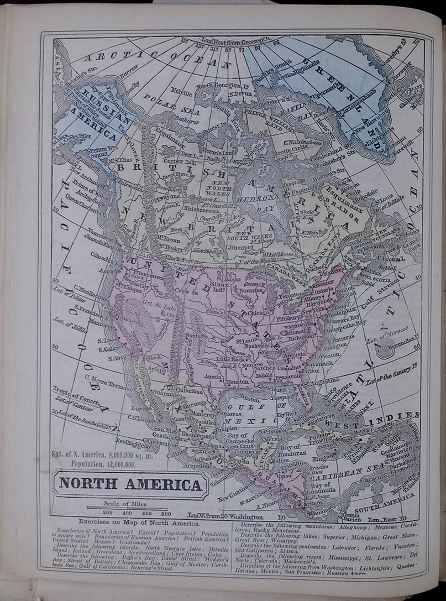 NORTH AMERICA
Ext. of N. America, 8,000,000 sq. m.
Population, 42,000.000.
NORTH AMERICA
Ext. of N. America, 8,000,000 sq. m.
Population, 42,000.000.
Exercises on Map of North America
Boundaries of North America? Extent? Population? Population to square mile? Boundaries of Russian America? British America? United States? Mexico? Guatimala?
Describe the following islands; North Georgia Isle; Melville Island; Iceland; Greenland; Newfoundland; Cape Breton; Cuba.
Describe the following; Baffin's Bay; Davis' Straight; Hudson's Bay; Strait of Bellisle; Chesapeake Bay; Gulf of Mexico; Caribbean Sea; Gulf of California; Behring's Strait.
Describe the following mountains: Alleghany; Mexican Cordilleras; Rocky Mountains.
Describe the following lakes: Superior; Michigan; Great Slave, Great Bear; Winnipeg.
Describe the following peninsulas: Labrador; Florida; Yucatan; Old California; Alaska.
Describe the following rivers: Mississippi; St. Lawrence; Del Norte; Colorado; Mackenzie's.
Direction of the following from Washington; Lichtenfels; Quebec[illegible] Havana; Mexico; San Francisco; Russian Amer[illegible]
 25
25
NORTH AMERICA.
Lesson XXI... General View.
1. Characteristics.—The coasts of North America are very irregular, and are indented by vast gulfs and bays. It contains the largest lake, the longest river, the most sublime cataract, and the finest valley in the world.
2. Mountains.—The Mexican Cordilleras and the Rocky Mountains are one continuous chain. The loftiest peak of the former, Popocatepetl, in Mexico, is volcanic. It is continually burning, though for several centuries it has ejected from its crater only smoke and ashes.
3. Volcanoes.—Several other peaks of the Cordilleras are also volcanoes. Orizaba, the height of which is 17,370 feet, burns only at intervals. Jorullo, near Mexico, is of recent origin, having been first thrown up in 1759. This mountain ejects flame and ashes.
4. Rocky Mountains.—These run nearly north and south, from 200 to 700 miles distance from the Pacific. They cross the U. States, having the territories of California and Oregon on the west. The loftiest peak is Brown Mountain.
5. Pacific Range.—There is a broken and irregular range along the border of the Pacific, called Snowy Mountains. Mount Saint Elias is one of this range, and is the loftiest peak in North America.
6. Apalachian Chain.—This lies in the United States, and passes under various names, which will be noticed hereafter.
The following are the greatest heights of various ranges: This table lists the height of the highest peak in the following mountain ranges: Mexican Cordilleras, Rocky Mountains, White Mountains, and Snowy Mountains.
7. Valleys.—The two largest valleys in North America are those of the Mississippi and the St. Lawrence. The former is one of the most prolific regions on the globe.
8. Rivers.—The Mississippi, measuring from the source of the Missouri, which may be considered its head stream, is the longest river in the world. Several other rivers of North America are longer than any in Europe. This table lists the lengths of several North American Rivers including: the Mississippi, Missouri, Mackenzie's, St. Lawrence, Arkansas, Rio del Norte, Columbia, and Red rivers.
9. Lakes—Cataract.—North America is renowned for its great lakes. The largest, Lake Superior, is about one-third part as extensive as the kingdom of Great Britain and Ireland. Between lakes Erie and Ontario is the sublime cataract of Niagara. This table lists the extent in square miles of the following lakes: Great Bear, Great Slave, Winnipeg, Superior, Huron, Michigan, Erie, and Ontario.
10. Islands.—Greenland is now ascertained to be an island. It is more than 1400 miles long, and is probably the largest island in the world, except New Holland; but we do not know how far it extends to the north. Iceland, lying near to Greenland, is considered as belonging to Europe, though it is much nearer to America, and physically belongs to this continent. This table includes the extent in square miles of the following islands: Greenland, Cuba, Newfoundland, Hayti and Vancouver's.
11. Climate and Vegetation.—North America embraces every climate, and contains a great variety of vegetable productions. It may be remarked that it is colder along the Atlantic coast, by about six degrees, than on the opposite shore, along the borders of Europe.
12. Animals and Minerals.—Among the principal native animals are the musk ox, white bear, and silver fox, of the polar regions. In the temperate parts are the bison, and several species of bear, deer, &c. In the southern portions are alligators, and a variety of poisonous serpents. Most kinds of minerals are also abundant in North America.
13. Political Divisions.—The northern portions of North America belong to Denmark, Russia, and Great Britain; the central portion to the United States; and the southern to various nations. The West Indies lie between North and South America, but we shall include them in our view of the former. This table lists the political divisions of North America, including Greenland, Danish America, Russian America, British America, United States, Mexico, Guatimala and West Indies.
14. Inhabitants.—The inhabitants of North America consist of the white descendants of different European nations, Negroes, Indians, and mixed races. The white races are everywhere the governing people, except among the wild tribes of Indians, and in the Island of Hayti, where the people are chiefly of African descent, and have an independent government. These races are thus distributed: This table includes the populations of races of North America.
15. History—English Discoveries.—South America was discovered by Columbus, in 1498, but North America was discovered the year previous, along the coast of Labrador, by John and Sebastian Cabot, two Italians sent out by the king of England, Henry VII. The next year, Sebastian discovered Virginia; and in 1517, he entered one of the straits which leads into Hudson's Bay.
16. Spanish Discoveries.—Ponce de Leon, a Spaniard, discovered Florida in 1512; Yucatan was discovered by Fernandez de Cordova, in 1517; and Mexico, by Grijalva, in 1518. De Soto discovered the Mississippi in 1542.
17. French Discoveries.—Verranzi, a Florentine, sent out by Francis I., touched along the coast, in 1524, from North Carolina to Rhode Island. He afterwards proceeded to Newfoundland, and explored its shores. In 1534–5, James Cartier entered the gulf and river St. Lawrence, giving them their present name. He passed up as far as Montreal, and took possession of the country in the name of the king of France.
18. Possessions of the French, English, and Spaniards.—These discoveries, with others which followed, became the foundation of the several claims of these nations to territories in North America.
LESSON XXI. 1. Characteristics of North America? 2. Mountains? 3. Volcanoes? 4. Rocky Mountains? 5. Pacific Range? 6. Apalachian Chain? 7. Valleys? 8. Rivers? 9. Lakes? Cataract? 10. Islands? 11. Climate and Vegetation? 12. Animals? Minerals? 13. Political Divisions? 14. Inhabitants? 15. English discoveries? 16. Spanish discoveries? 17. French Discoveries? 18. Possessions of the French, English, and Spaniards?
4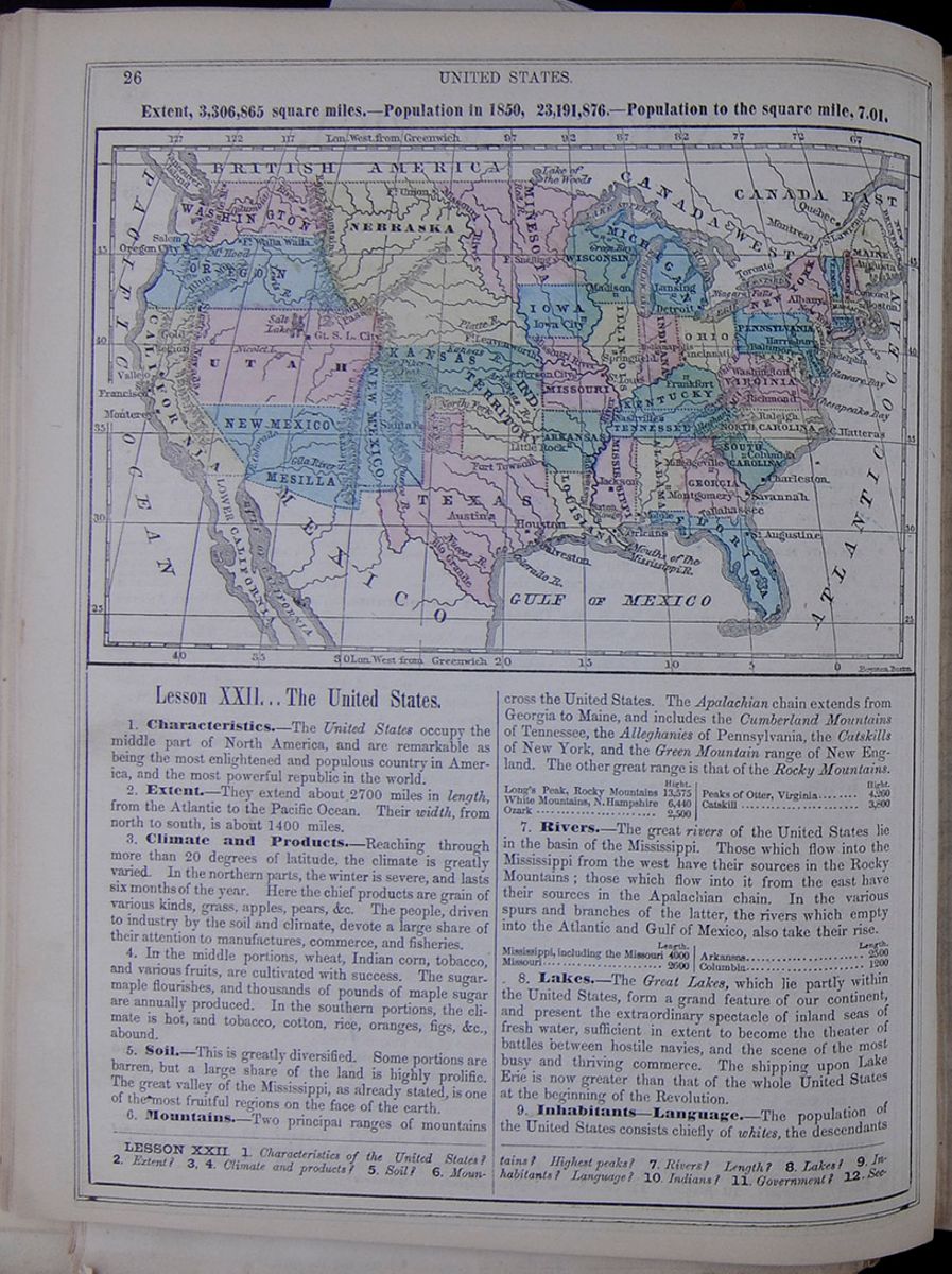 26
UNITED STATES.
Extent, 3,306,865 miles.—Population in
1850, 23,191,876.—Population to the square
mile, 7.01.
Map of the United States.
26
UNITED STATES.
Extent, 3,306,865 miles.—Population in
1850, 23,191,876.—Population to the square
mile, 7.01.
Map of the United States.
Lesson XXII... The United States.
1. Characteristics.—The United States occupy the middle part of North America, and are remarkable as being the most enlightened and populous country in America, and the most powerful republic in the world.
2. Extent.—They extend about 2700 miles in length, from the Atlantic to the Pacific Ocean. Their width, from north to south, is about 1400 miles.
3. Climate and Products.—Reaching through more than 20 degrees of latitude, the climate is greatly varied. In the northern parts, the winter is severe, and lasts six months of the year. Here the chief products are grain of various kinds, grass, apples, pears, &c. The people, driven to industry by the soil and climate, devote a large share of their attention to manufactures, commerce, and fisheries.
4. In the middle portions, wheat, Indian corn, tobacco, and various fruits, are cultivated with success. The sugar-maple flourishes, and thousands of pounds of maple sugar are annually produced. In the southern portions, the climate is hot, and tobacco, cotton, rice, oranges, figs, &c., abound.
5. Soil.—This is greatly diversified. Some portions are barren, but a large share of the land is highly prolific. The great valley of the Mississippi, as already stated, is one of the most fruitful regions on the face of the earth.
6. Mountains.—Two principal ranges of mountains cross the United States. The Apalachian chain extends from Georgia to Maine, and includes the Cumberland Mountains of Tennessee, the Alleghanies of Pennsylvania, the Catskills of New York, and the Green Mountain range of New England. The other great range is that of the Rocky Mountains. This table lists the height of the following United States mountain ranges: Rocky Mountains, White Mountains, Ozark, Peaks of Otter, Virginia, and Catskill.
7. Rivers.—The great rivers of the United States lie in the basin of the Mississippi. Those which flow into the Mississippi from the west have their sources in the Rocky Mountains; those which flow into it from the east have their sources in the Apalachian chain. In the various spurs and branches of the latter, the rivers which empty into the Atlantic and Gulf of Mexico, also take their rise. This table lists the lengths of the following United States rivers: Mississippi, Missouri, Arkansas, Columbia.
8. Lakes.—The Great Lakes, which lie partly within the United States, form a grand feature of our continent, and present the extraordinary spectacle of inland seas of fresh water, sufficient in extent to become the theater of battles between hostile navies, and the scene of the most busy and thriving commerce. The shipping upon Lake Erie is now greater than that of the whole United States at the beginning of the Revolution.
9. Inhabitants—Language.—The population of the United States consists chiefly of whites, the descendants
LESSON XXII 1. Characteristics of the United States? 2. Extent? 3, 4. Climate and products? 5. Soil? 6. Mountains? Highest peaks? 7. Rivers? Length? 8. Lakes? 9. Inhabitants? Language? 10. Indians? 11. Government? 12.Sections?
[begin surface 204] UNITED STATES.
27
UNITED STATES.
27
of Europeans; the remainder are Indians and Negroes. The whites are chiefly of English descent, and the English language is nearly universal. The white settlements extend from the Atlantic to a considerable distance west of the Mississippi. The negroes are about three millions in number, and the larger part are slaves.
10. Indians.—The Indians are greatly reduced from their original population, and probably do not exceed four hundred thousand. There are few of them east of the Mississippi; but in the Western Territories they are numerous. Some of them have partly adopted the habits of civilized life, but many of them still make hunting and war their chief pursuits.
11. Government.—The government of the United States is a Federal Republic—that is, one general republic, formed of about thirty smaller republics.
12. Division into Four Sections.—Though the United States are generally viewed under four sections, as the Eastern, Middle, Western, and Southern, yet this is only an arrangement for the convenience of geographical description.
13. The Separate States.—Each of the United States is a republic, and has a distinct government, consisting of a Governor, Senate, and House of Representatives. These make local laws for the several states, and attend to their local interests. All the officers of the state and general governments are, directly or indirectly, chosen by the people.
14. Officers of the General Government.—The General Government of the United States consists of a President, Senate, and House of Representatives, who govern the United States, so far as their national interests are concerned.
15. Their Powers and Duties.—They manage affairs with foreign nations; make peace and war; control the army and navy; regulate commerce; sustain the post-office establishment, &c. The powers of the government are laid down in a document called the Federal Constitution, because it unites, or leagues, several distinct states, or republics, into one grand republic.
16. Religion.—All religions are tolerated in the United States, and every person is at liberty to worship God according to the dictates of his conscience. The most numerous persuasions are the Baptists, Methodists, Presbyterians, and Congregationalists. There are also many Roman Catholics, Episcopalians, Universalists, Lutherans, Moravians, &c., to which may now be added the new sect called Mormons.
17. Industrial Pursuits.—The leading occupation of the people of the United States is agriculture. The Southern and Western States are chiefly agricultural. The Middle States are largely concerned in agriculture, manufactures, and commerce. Manufactures and commerce form leading pursuits in New England, though agriculture and the fisheries are considerable sources of wealth.
18. Capital of the United States.—The seat of the general government is at Washington. This city is in the District of Columbia, between Maryland and Virginia. Congress, consisting of the Senate and House of Representatives, meets here every winter, to make laws.
19. Cities.—The following is a list of the chief cities of the United States, with their population: This table lists the populations of the following United States cities: New York, Philadelphia, Baltimore, Boston, New Orleans, Cincinnati, St. Louis, and Lowell.
20. Distances from Washington: This table lists the distance from Washington in miles of the following cities: New York, Augusta, New Orleans, Austin, Astoria, Quebec, Havana, and San Francisco.
21. Steam Navigation.—The great lakes and numerous rivers of this country afford immense advantages for internal navigation. Steam navigation, which was first practised in the United States, is carried to a higher degree of perfection here than elsewhere.
22. Internal Improvements.—Canals are numerous, and lines of railroad cross the country in every direction. The National Road, built by the general government, extends from Cumberland, in Maryland, westward, crossing the states of Pennsylvania, Ohio, and Indiana, to Missouri. Lines of magnetic telegraphs extend through the whole length of the country, from Maine to New Orleans.
23. Physical Sections.—From a general view of the United States, as presented by the large map, pages 28 and 29, we perceive that it is divided into three physical sections—the Atlantic Slope, the Pacific Slope, and the Great Central Valley of the Mississippi.
24. Atlantic Slope.—This is a narrow tract two or three hundred miles in width, having the Atlantic on the east, and the Apalachian chain on the west. Toward the sea, this territory is generally low and level; toward the mountains, it becomes elevated into hills and ridges. The whole tract is crossed by short rivers rising in the high lands, and pouring their waters into the Atlantic, or the Gulf of Mexico.
25. Pacific Slope.—This is bounded by the Pacific on the west, and the Rocky Mountains on the east. It is divided into two sections by a range of mountains running north and south, about 150 miles from the coast. The chief rivers of this region are the Colorado, which empties into the Gulf of California, with the San Joaquin, Sacramento, and Columbia, which empty into the Pacific.
26. The Mississippi Valley.—This contains nearly two-thirds of the territory of the United States; it is one of the most fertile tracts in the world, and is supposed to be capable of sustaining a population of 500,000,000. The whole of the Mississippi, the largest river in the world, lies within this valley, and four of its tributaries would be ranked among the largest streams in Europe.
27. Education.—This great instrument of human improvement is highly appreciated, and National Education is regarded, in all the states, as an object of the first consideration. In the single state of New York, there are nearly 11,000 common schools. At the same time, it may be remarked that colleges and higher seminaries are more numerous here than in any other country in the world.
28. Progressive Population.—The population of the United States doubles in about twenty-five years. In 1776, when our Declaration of Independence was made, we had three millions; in 1850, we had 23 millions; in 1900, we shall probably have 75 millions—a population beyond that of any other government, save that of China.
13. Separate states? 14. Officers of the general government? 15. Their powers and duties? 16. Religion? 17. Industrial pursuits? 18. Capital of the United States? 19. Cities? 20. Distances from Washington? 21. Steam Navigation? 22. Internal improvements? 23. What of three physical sections? 24. The Atlantic Slope? 25. The Pacific Slope? 26. Mississippi Valley? Mississippi River? 27. Education? 28. Progressive population?
[begin surface 205]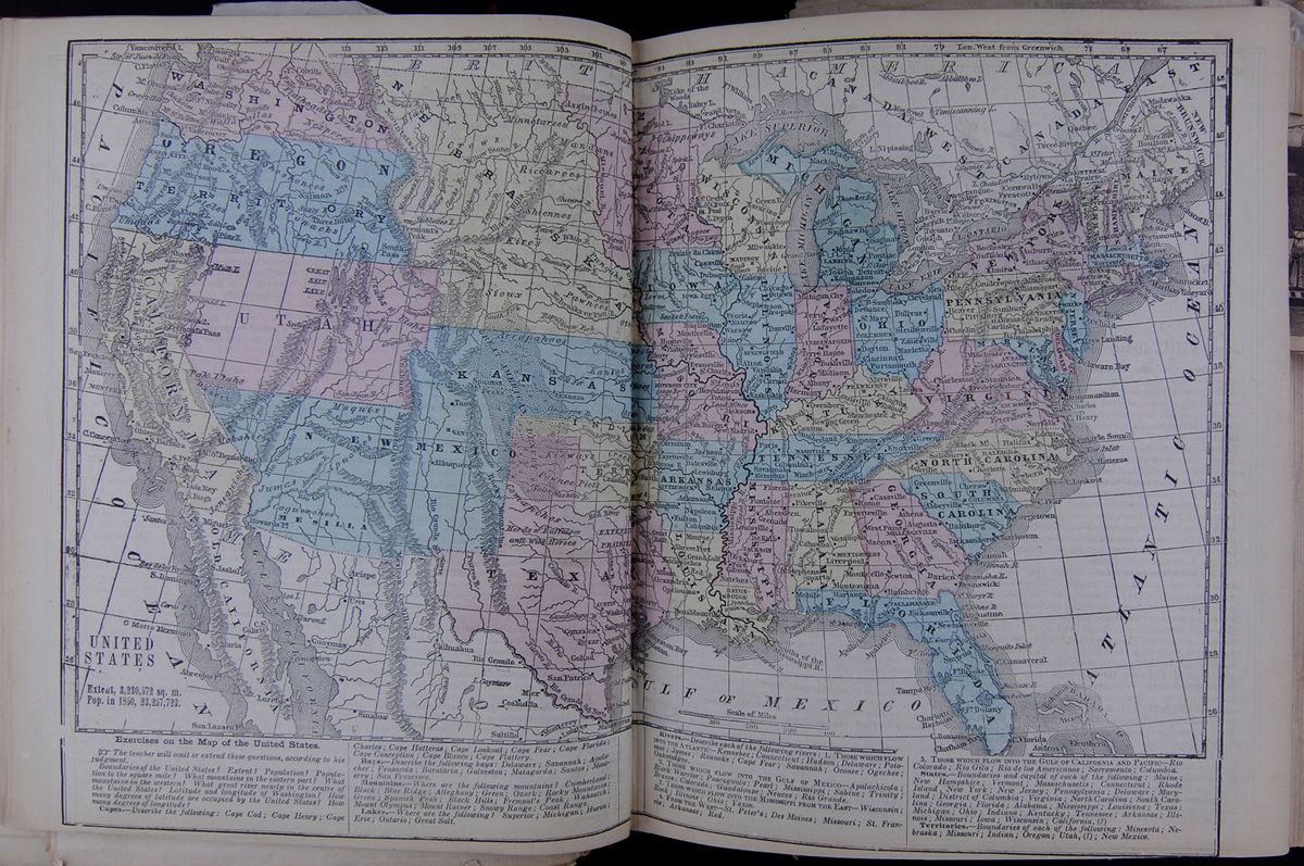
 UNITED STATES
Map of the United states including mountains,
rivers, etc.
Exercises on the Map of the United States
UNITED STATES
Map of the United states including mountains,
rivers, etc.
Exercises on the Map of the United States
☞The teacher will omit or extend these questions, according to his judgment.
Boundaries of the United States? Extent? Population? Population to the square mile? What mountains in the eastern part? What mountains in the western? What great river nearly in the centre of the United States? Latitude and longitude of Washington? How many degrees of latitude are occupied by the United States? How many degrees of longitude?
Capes.—Describe the following: Cape Cod; Cape Henry; Cape Charles; Cape Hatteras; Cape Lookout; Cape Fear; Cape Florida; Cape Conception; Cape Blanco; Cape Flattery.
Bays.—Describe the following bays: Delaware; Savannah; Apalachee; Pensacola; Burataria; Galveston; Matagorda; Santos; Monterey; San Francisco.
Mountains.—Where are the following mountains? Cumberland; Black; Blue Ridge; Alleghany; Green; Ozark; Rocky Mountains; Green; Spanish Peak; Black Hills; Fremont's Peak; Wahsatch; Mount Olympus; Mount Rainer; Snowy Range; Coast Range.
Lakes.—Where are the following? Superior; Michigan; Huron; Erie; Ontario; Great Salt.
Rivers.—Describe each of the following rivers: 1. THOSE WHICH FLOW INTO THE ATLANTIC—Kennebec; Connecticut; Hudson; Delaware; Potomac; James; Roanoke; Cape Fear; Savannah; Oconee; Ogechee; Oakmulgee.
2. THOSE WHICH FLOW INTO THE GULF OF MEXICO—Apalachicola; Black Warrior; Pascagoula; Pearl; Mississippi; Sabine; Trinity; Brazos; Colorado; Guadaloupe; Neuces; Rio Grande.
3. THOSE WHICH FLOW INTO THE MISSISSIPPI FROM THE EAST—Wisconsin; Rock; Illinois; Ohio; Yazoo.
FROM THE WEST—St. Peter's; Des Moines; Missouri; St. Francis; Arkansas; Red.
5. THOSE WHICH FLOW INTO THE GULF OF CALIFORNIA AND PACIFIC—Rio Colorado; Rio Gila; Rio de los Americanos; Sacramento; Columbia.
States.—Boundaries and capital of each of the following: Maine; New Hampshire; Vermont; Massachusetts; Connecticut; Rhode Island; New York; New Jersey; Pennsylvania; Delaware; Maryland; District of Columbia; Virginia; North Carolina; South Carolina; Georgia; Florida; Alabama, Mississippi; Louisiana; Texas; Michigan; Ohio; Indiana; Kentucky; Tennessee; Arkansas; Illinois; Missouri; Iowa; Wisconsin; California, (?)
Territories.—Boundaries of each of the following: Minesota; Nebraska; Missouri; Indian; Oregon; Utah, (?); New Mexico.
 30
HISTORY OF THE UNITED
STATES.
Emigration of Roger Williams to Rhode
Island.
30
HISTORY OF THE UNITED
STATES.
Emigration of Roger Williams to Rhode
Island.
Lesson XXIII... History of the United States.
1. Origin of the United States.—The United States had their origin in thirteen English colonies, which combined, in 1775, against the mother country, and, after a war of eight years, achieved their independence. The first overt act of this war was the battle of Lexington—a skirmish between the people of Lexington and Concord, in Massachusetts, and the British troops stationed at Boston, who marched to these places to destroy some military stores. The war which followed, and the various acts connected with it, are called, in American history, the Revolution.
2. Discoveries and Settlements of the Northmen.—It is generally believed that about the year 1000 A. D., certain maritime adventurers from Norway and Sweden, called Northmen, discovered the coasts of North America, and made settlements in Massachusetts and Rhode Island. These were, however, abandoned after two or three years, and were never known in Europe, or were entirely forgotten, in the time of Columbus.
3. Modern Discoveries.—In the year 1498, Sebastian Cabot, an Italian, in the employ of England, discovered Virginia. In 1524, Verrazani, also an Italian, sent out by France, discovered the coast of North Carolina. Here he landed, and had some interviews with the natives. He landed also near New York and at Newport. In 1528, Narvaez, a Spaniard, discovered and took possession of Florida, in behalf of the king of Spain. The Hudson river was discovered in 1609, by Henry Hudson, an English navigator, sent hither by some Dutch speculators.
4. Settlements.—Various attempts were made to effect settlements in this quarter, but they all proved unsuccessful till 1607. At that time, about 100 persons arrived from England, and founded the colony of Virginia. This was the first English settlement within the present United States. New York was settled by the Dutch in 1614; Massachusetts by the Puritans, in 1620; Rhode Island by Roger Williams, in 1636; and Connecticut about the same time. Georgia, the last of the thirteen colonies, was settled in 1732. The particular history of each of these will be found under their several heads.
5. Foundation of the Settlements.—The foundation of these English settlements was a claim made by King James I. of England, founded upon the discoveries of Sebastian Cabot and others, to the whole territory from Halifax to Florida. The settlement of the Dutch at New York was deemed a violation of this right, and accordingly that colony was taken by the British in 1664, and remained in their possession, excepting for a short space in 1673.
6. The French and Indian War.—It will be remembered that the French had possessed themselves of the whole country from the Gulf of St. Lawrence to the Great Lakes. Their colonies here were very important, and they began to extend them southward, so as to occupy the great valley of the Mississippi. This roused the jealousy of the English, and in 1754 a war broke out, which was chiefly carried on along the boundary, between the French and English settlements. For several years, the contest was fierce and bloody. Both parties employed Indian warriors, who inflicted the most terrible barbarities upon the people along the northern borders of Maine, New Hampshire, and New York. Hundreds of villages were laid in ashes, and thousands were killed or carried into captivity. Many were subjected to the most cruel tortures.
7. Surrender of the French Colonies.—At length, in the year 1759, the English, under the command of Gen. Wolfe, scaled the rocky hights of Quebec at night, and the next day captured that city, after a bloody conflict with the French army. Soon after, the other portions of the country submitted, and, by the peace of 1763, the French possessions in North America were finally ceded to the British. Thus they became possessed of the greater part of that immense territory now called British America.
8. Causes of the Revolution.—About the year 1764, the British government began to impose severe and oppressive taxes upon the English colonies. The people remonstrated, and sent petitions both to the parliament and king, but without effect. As the people grew restless,
LESSON XXIII. 1. What of the origin of the United States? Battle of Lexington? The Revolution? 2. What of the discoveries and settlements of the Northmen? 3. More modern discoveries? 4. What of settlements? 5. Foundation of these settlements? 6. What of the old French and Indian war? 7. Surrender of the French colonies? 8. What of the causes of the Revolution? 9. What of throwing
[begin surface 207]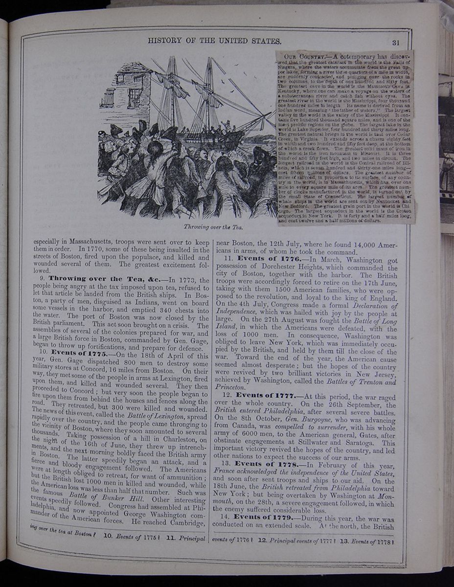 HISTORY OF THE UNITED
STATES.
31
Throwing over the Tea.
Image of the Boston Tea Party.
[begin surface 208]
HISTORY OF THE UNITED
STATES.
31
Throwing over the Tea.
Image of the Boston Tea Party.
[begin surface 208]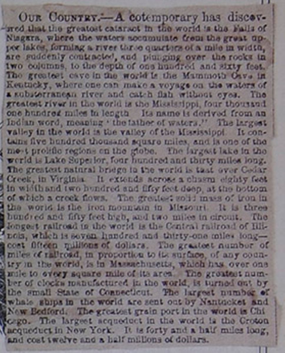
OUR COUNTRY.—A cotemporary has discovered that the greatest cataract in the world is the Falls of Niagara, where the waters accumulate from the great upper lakes, forming a river three quarters of a mile in width, are suddenly contracted, and plunging over the rocks in two columns, to the depth of one hundred and sixty feet. The greatest cave in the world is the Mammoth Cave in Kentucky, where one can make a voyage on the waters of a substerranean river and catch fish without eyes. The greatest river in the world is the Mississippi, four thousand one hundred miles in length Its name is derived from an Indian word meaning "the father of waters." The largest valley in the world is the valley of the Mississippi. It contains five hundred thousand square miles, and is one of the most prolific regions on the globe. The largest lake in the world is Lake Superior, four hundred and thirty miles long. The greatest natural bridge in the world is that over Cedar Creek, in Virginia. It extends across a chasm eighty feet in width and two hundred and fifty feet deep, at the bottom of which a creek flows. The greatest solid mass of iron in the world is the iron mountain in Missouri. It is three hundred and fifty feet high, and two miles in circuit. The longest railroad in the world is the Central railroad of Illinois, which is seven hundred and thirty-one miles long—cost fifteen millions of dollars. The greatest number of miles of railroad, in proportion to its surface, of any country in the world is in Massachusetts, which has over one mile to every square mile of its area. The greatest number of clocks manufactured in the world is turned out by the small state of Connecticut. The largest number of whale ships in the world are sent out by Nantucket and New Bedford. The greatest grain port in the world is Chicago. The largest acqueduct in the world is the Croton acqueduct in New York. It is forty and a half miles long, and cost twelve and a half millions of dollars.
especially in Massachusetts, troops were sent over to keep them in order. In 1770, some of these being insulted in the streets of Boston, fired upon the populace, and killed and wounded several of them. The greatest excitement followed.
9. Throwing over the Tea, &c.—In 1773, the people being angry at the tax imposed upon tea, refused to let that article be landed from the British ships. In Boston, a party of men, disguised as Indians, went on board some vessels in the harbor, and emptied 340 chests into the water. The port of Boston was now closed by the British parliament. This act soon brought on a crisis. The assemblies of several of the colonies prepared for war, and a large British force in Boston, commanded by Gen. Gage, began to throw up fortifications, and prepare for defence.
10. Events of 1775.—On the 18th of April of this year, Gen. Gage dispatched 800 men to destroy some military stores at Concord, 16 miles from Boston. On their way, they met some of the people in arms at Lexington, fired upon them, and killed and wounded several. They then proceeded to Concord; but very soon the people began to fire upon them from behind the houses and fences along the road. They retreated, but 300 were killed and wounded. The news of this event, called the Battle of Lexington, spread rapidly over the country, and the people came thronging to the vicinity of Boston, where they soon amounted to several thousands. Taking possession of a hill in Charleston, on the night of the 16th of June, they threw up intrenchments, and the next morning boldly faced the British army in Boston. The latter speedily began an attack, and a fierce and bloody engagement followed. The Americans were at length obliged to retreat, for want of ammunition; but the British lost 1000 men in killed and wounded, while the American loss was less than half that number. Such was the famous Battle of Bunker Hill. Other interesting events speedily followed. Congress had assembled at Philadelphia, and now appointed George Washington commander of the American forces. He reached Cambridge, near Boston, the 12th July, where he found 14,000 Americans in arms, of whom he took the command.
11. Events of 1776.—In March, Washington got possession of Dorchester Heights, which commanded the city of Boston, together with the harbor. The British troops were accordingly forced to retire on the 17th June, taking with them 1500 American families, who were opposed to the revolution, and loyal to the king of England. On the 4th July, Congress made a formal Declaration of Independence, which was hailed with joy by the people at large. On the 27th August was fought the Battle of Long Island, in which the Americans were defeated, with the loss of 1000 men. In consequence, Washington was obliged to leave New York, which was immediately occupied by the British, and held by them till the close of the war. Toward the end of the year, the American cause seemed almost desperate; but the hopes of the country were revived by two brilliant victories in New Jersey, achieved by Washington, called the Battles of Trenton and Princeton.
12. Events of 1777.—At this period, the war raged over the whole country. On the 26th September, the British entered Philadelphia, after several severe battles. On the 8th October, Gen. Burgoyne, who was advancing from Canada, was compelled to surrender, with his whole army of 6000 men, to the American general, Gates, after obstinate engagements at Stillwater and Saratoga. This important victory revived the hopes of the country, and led other nations to expect the success of our arms.
13. Events of 1778.—In February of this year, France acknowledged the independence of the United States, and soon after sent troops and ships to our aid. On the 18th June, the British retreated from Philadelphia toward New York; but being overtaken by Washington at Monmouth, on the 28th, a severe engagement followed, in which the enemy suffered considerable loss.
14. Events of 1779.—During this year, the war was conducted on an extended scale. At the north, the British
over the tea at Boston? 10. Events of 1775? 11. Principal events of 1776? 12. Principal events of 1777? 13. Events of 1778?
[begin surface 209] 32
HISTORY OF THE UNITED
STATES.
32
HISTORY OF THE UNITED
STATES.
troops were chiefly occupied in burning towns and villages, and other petty enterprises. At the south, in Georgia and Carolina, various actions took place, but none of a decisive character. The Indians in Western New York, called the Six Nations, having made themselves very troublesome, were attacked by Gen. Sullivan. Forty villages were burnt, and 150,000 bushels of corn were destroyed. By these means, these savages were reduced to a state of submission. The French fleet, under Count d'Estaing, made various movements at sea, but with no special advantage to the American cause. Spain declared war against Great Britain, and, united with France, made most formidable demonstrations against that country. The English, however, met the emergency with extraordinary energy, and seemed fully equal to the crisis.
15. Events of 1780.—This was a year of important and stirring occurrences. The British army was largely increased, and thus enabled to carry on its operations with great vigor. Gen. Clinton, leaving New York for the command of the southern army, laid siege to Charleston, defended by Gen. Lincoln, and captured that city, May 12th. The war in the south was actively sustained by bands of American patriots, under Sumter, Marion, and others; but defeat and disappointment attended our cause. At this gloomy period, Benedict Arnold, a general who had fought bravely in our service, having the command of a strong fort at West Point, on the Hudson river, turned traitor to his country, and sought to deliver it into the hands of the British. The plot was discovered, and Arnold fled. He received about 50,000 dollars and a General's commission from the British, for his treason; but shame and ignominy attended him ever after. Even the British hated and despised him. Major André, a brave young Englishman, who negotiated the business with Arnold, was taken and executed as a spy. On the whole, the year 1780 may be regarded as the gloomiest and most disheartening year of the Revolutionary War.
16. Events of 1781.—Early in this year, the prospects of our country brightened. Gen. Greene, at the head of our southern forces, performed a series of remarkable manœuvres, very annoying and destructive to the enemy. At last, Gen. Cornwallis, the British commander, moved northward, and took his station at Yorktown, in Virginia. Washington, with the northern army, suddenly marched southward, in conjunction with a large body of French troops. Cornwallis was speedily encompassed by these forces and the French fleet under the Count de Grasse. Thus hemmed in on all sides, the British general made a brave defence; but on the 19th October, finding his redoubts demolished, and every hope of retreat cut off, he surrendered with his whole army of 7000 men. This event was decisive of the war, for the British people had become weary of the contest, and the government felt the necessity of putting an end to a struggle which had cost them immense blood and treasure, and now offered little hope of success.
17. Events of 1782–3.—After the surrender of Cornwallis, there was little fighting on either side. In November, 1782, preliminary articles were signed at Paris between the agents of Great Britain and America; and on the 3d September of the same year, a definite treaty of peace was made between England, France, Spain, Holland, and the United States; the latter being now recognized as a free, sovereign, and independent nation.
18. The Constitution—1783 to 1789.—During the war, Congress had been constantly in session. This body consisted of delegates from the several states. They acted under a constitution, called the Articles of Confederation. When the war was over, and new interests sprung up, this system was found imperfect and insufficient. A convention was therefore called, which met at Philadelphia, in May, 1787, and, after a session of four months, they framed and recommended to the people the present excellent Constitution. This was adopted by a majority of the states, and under it, George Washington was elected first President of the Union.
19. Washington's Administration—1789 to 1797.—The first Congress under the new constitution met at New York on the 4th March, 1789, and on the 30th April, Washington took the prescribed oath of office. The new government went at once into easy and successful operation. Washington displayed, as president, more fully those great virtues and abilities which had marked his military life, and he was consequently re-elected at the end of four years. During his administration, the restless Indians along our borders were reduced to submission, treaties were formed with foreign nations, the machinery of our government was organized and perfected, and society at large, emerging from the state of poverty, anxiety, and chaos induced by the war, was brought to a state of order, prosperity, and peace. The love and pride of country, called patriotism, grew up under the fostering care of Washington, and it has continued, undiminished, to the present day.
20. Adams' Administration—1797 to 1801.—John Adams, of Quincy, Mass., a lawyer of great ability, a member of the Continental Congress, and an able and eloquent supporter of the American cause through the whole Revolution, was elected president, and took the oath of office, March 4th, 1797. The French Revolution had broken out the same year that Washington became president. It produced immense excitement throughout the civilized world; and as the French had aided us in our struggle for liberty, the people of this country ardently sympathized with a movement which seemed to promise the blessings of liberty to France. But the revolution there took an unfortunate turn; bad men seized the power, and our own country experienced serious embarrassments from that quarter. A war seemed inevitable, and preparations for it were made by Congress; but, happily, the crisis passed without a resort to arms. In December, 1799, after a short illness, Washington died, and the whole country mourned for him. He is still remembered under the endearing title of the Father of his Country. In the year 1800, the seat of government was removed from Philadelphia to Washington, which has since been the capital of the United States.
21. Jefferson's Administration—1801 to 1809.—Thomas Jefferson, of Virginia, who had been a leader in the Revolution, and vice-president under Mr. Adams, was elected president, and took the oath of office, March 4, 1801. In April, 1803, an immense territory, called Louisiana, was purchased of France for $15,000,000. In July, 1804, Gen. Alexander Hamilton, of New York, was killed, in a duel, by Col. Burr, also of that city. Both these men
14. Events of 1779? 15. Events of 1780? 16. Events of 1781? 17. Events of 1782–3? 18. What of Congress? The Confederation? The present constitution? 19. What of Washington's administration? 20. Adams' administration? 21. What of Jeffer-
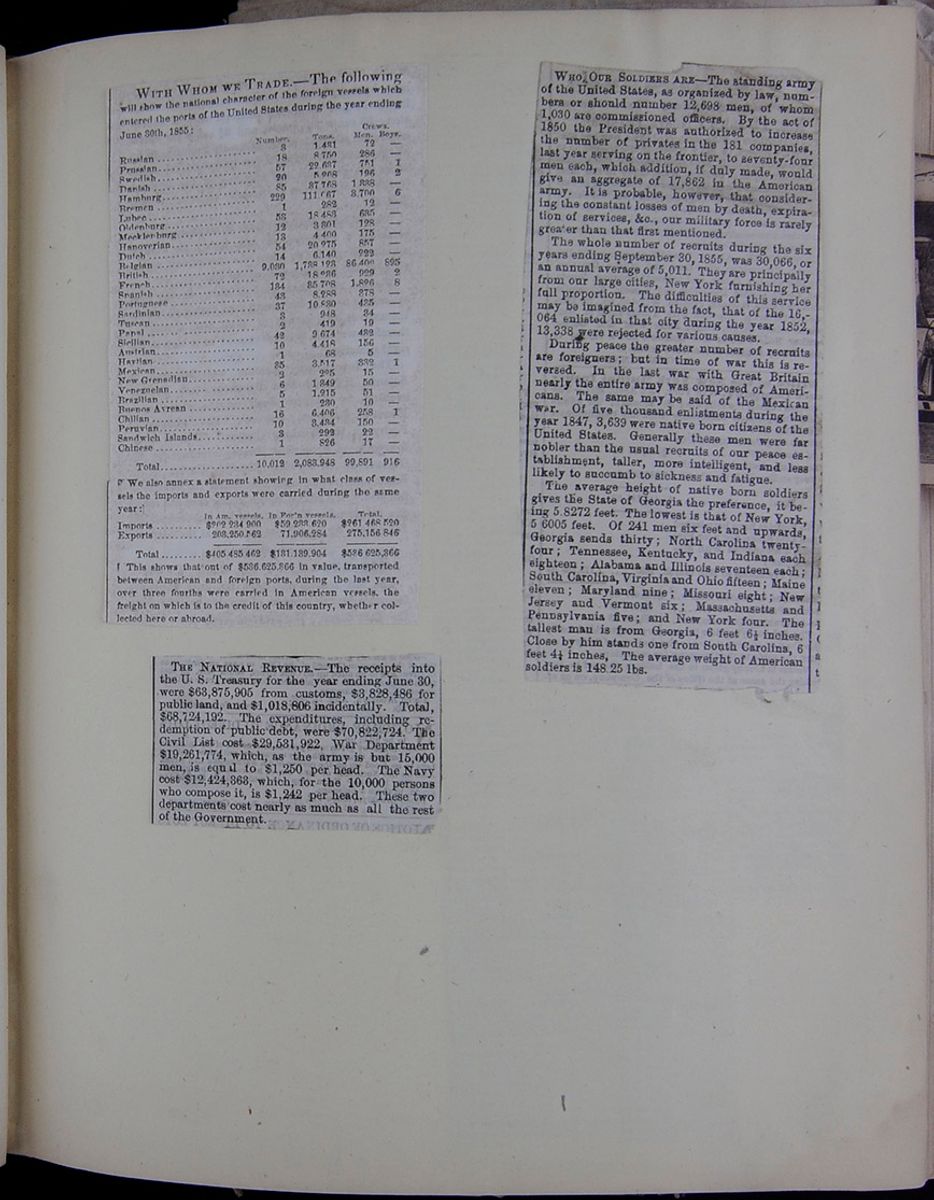 [begin surface 211]
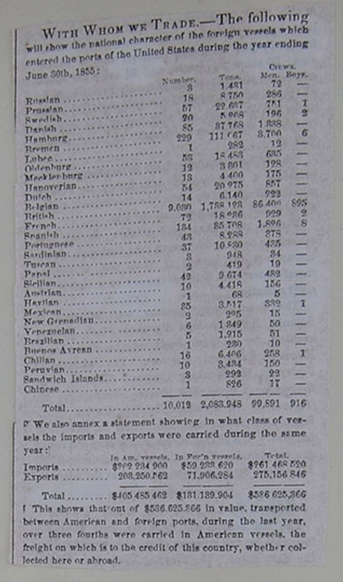
WITH WHOM WE TRADE.—The following will show the national character of the foreign vessels which entered the ports of the United States during the year ending June 30th, 1855:
| Crews. | ||||
| Number. | Tons. | Men. | Boys. | |
| Russian | 3 | 1 481 | 72 | — |
| Prussian | 18 | 8 750 | 286 | — |
| Swedish | 57 | 22 637 | 751 | 1 |
| Danish | 20 | 5 208 | 196 | 2 |
| Hamburg | 85 | 37 768 | 1 888 | — |
| Bremen | 229 | 111 067 | 3 700 | 6 |
| Lubec | 1 | 282 | 12 | — |
| Oldenburg | 53 | 18 488 | 685 | — |
| Mecklenburg | 12 | 3 301 | 128 | — |
| Hanoverian | 13 | 4 400 | 175 | — |
| Dutch | 54 | 20 275 | 857 | — |
| Belgian | 14 | 6 140 | 222 | — |
| British | 9,030 | 1,788 123 | 86 400 | 895 |
| French | 72 | 18 286 | 929 | 2 |
| Spanish | 134 | 35 708 | 1 826 | 8 |
| Portuguese | 43 | 8 288 | 378 | — |
| Sardinian | 37 | 10 830 | 435 | — |
| Tuscan | 3 | 948 | 34 | — |
| Papal | 2 | 419 | 19 | — |
| Sicilian | 42 | 9 674 | 482 | — |
| Austrian | 10 | 4 418 | 156 | — |
| Haytian | 1 | 68 | 5 | — |
| Mexican | 35 | 3.517 | 332 | 1 |
| New Grenadian | 2 | 225 | 15 | — |
| Venezuelan | 6 | 1 349 | 50 | — |
| Brazilian | 5 | 1.215 | 51 | — |
| Buenos Ayrean | 1 | 230 | 10 | — |
| Chilian | 16 | 6.406 | 258 | 1 |
| Peruvian | 10 | 3.434 | 150 | — |
| Sandwich Islands | 3 | 292 | 22 | — |
| Chinese | 1 | 826 | 17 | — |
| Total | 10,012 | 2,083,948 | 99,891 | 916 |
We also annex a statement showing in what class of vessels the imports and exports were carried during the same year:
| In Am. vessels. | In For'n vessels. | Total | |
| Imports | $202 234 900 | $59 288 620 | $261 468 520 |
| Exports | 203,250,562 | 71,906,284 | 275,156 846 |
| Total | $405 485 462 | $131,139,904 | $536 625,366 |
This shows that out of $536,625,366 in value, transported between American and foreign ports, during the last year, over three fourths were carried in American vessels, the freight on which is to the credit of this country, whether collected here or abroad.
[begin surface 212]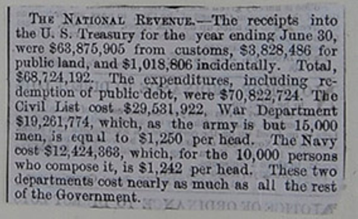
THE NATIONAL REVENUE.—The receipts into the U. S. Treasury for the year ending June 30, were $63,875,905 from customs, $3,828,486 for public land, and $1,018,806 incidentally. Total, $68,724,192. The expenditures, including redemption of public debt, were $70,822,724. The Civil List cost $29,531,922, War Department $19,261,774, which, as the army is but 15,000 men, is equal to $1,250 per head. The Navy cost $12,424,363, which, for the 10,000 persons who compose it, is $1,242 per head. These two departments cost nearly as much as all the rest of the Government.
[begin surface 213]
WHO OUR SOLDIERS ARE—The standing army of the United States, as organized by law, numbers or should number 12,698 men, of whom 1,030 are commissioned officers. By the act of 1850 the President was authorized to increase the number of privates in the 181 companies, last year serving on the frontier, to seventy-four men each, which addition, if duly made, would give an aggregate of 17,862 in the American army. It is probable, however, that considering the constant losses of men by death, expiration of services, &c., our military force is rarely greater than that first mentioned.
The whole number of recruits during the six years ending September 30, 1855, was 30,066, or an annual average of 5,011. They are principally from our large cities, New York furnishing her full proportion. The difficulties of this service may be imagined from the fact, that of the 16,064 enlisted in that city during the year 1852, 13,338 were rejected for various causes.
During peace the greater number of recruits are foreigners; but in time of war this is reversed. In the last war with Great Britain nearly the entire army was composed of Americans. The same may be said of the Mexican war. Of five thousand enlistments during the year 1847, 3,639 were native born citizens of the United States. Generally these men were far nobler than the usual recruits of our peace establishment, taller, more intelligent, and less likely to succumb to sickness and fatigue.
The average height of native born soldiers gives the State of Georgia the preference, it being 5.8272 feet. The lowest is that of New York, 5.6005 feet. Of 241 men six feet and upwards, Georgia sends thirty; North Carolina twenty-four; Tennessee, Kentucky, and Indiana each eighteen; Alabama and Illinois seventeen each; South Carolina, Virginia and Ohio fifteen; Maine eleven; Maryland nine; Missouri eight; New Jersey and Vermont six; Massachusetts and Pennsylvania five; and New York four. The tallest man is from Georgia 6 feet 6½ inches. Close by him stands one from South Carolina, 6 feet 4½ inches, The average weight of American soldiers is 148.25 lbs.
[begin surface 214] [begin surface 215]
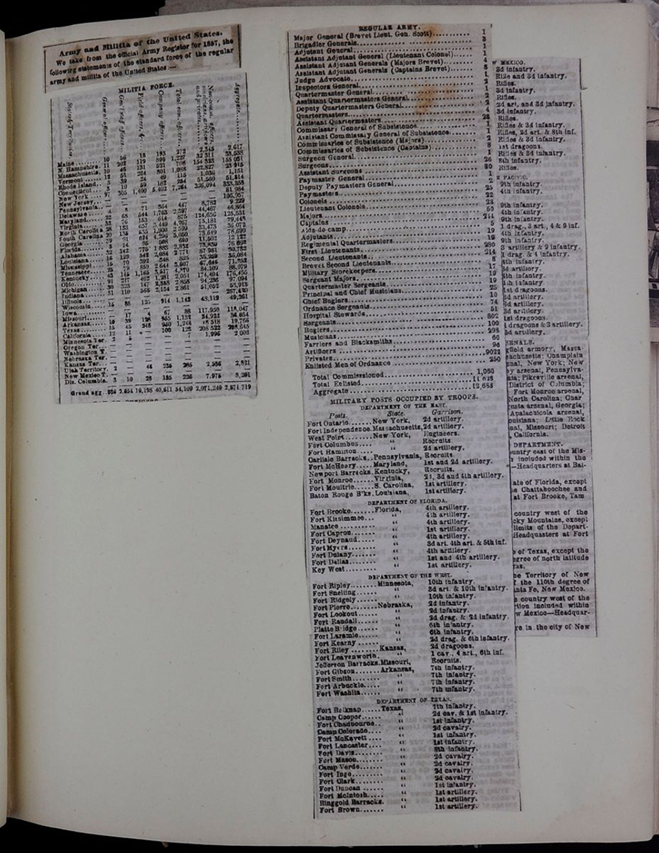 [begin surface 216]
Army and Militia of the United States,
We take from the official Army Register for 1857, the following statements of the standard force of the regular army and militia of the United States:—
[begin surface 217]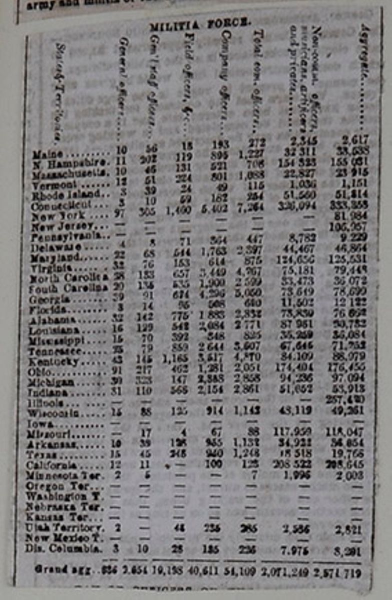
MILITIA FORCE
| States & Territories. | General officers. | Gen'l staff officers. | Field officers, &c. | Company officers. | Total com. officers. | Non-comm. officers, musicians, artificers and privates. | Aggregate. |
| Maine | 10 | 56 | 13 | 193 | 272 | 2,345 | 2,617 |
| N. Hampshire | 11 | 202 | 119 | 985 | 1,227 | 31 311 | 33,538 |
| Massachusetts | 10 | 45 | 131 | 521 | 708 | 154 323 | 155 031 |
| Vermont | 12 | 51 | 224 | 301 | 1,088 | 22,827 | 23 915 |
| Rhode Island | 3 | 39 | 24 | 49 | 115 | 1,036 | 1,151 |
| Connecticut | 3 | 10 | 59 | 182 | 254 | 51,560 | 51,314 |
| New York | 97 | 305 | 1,460 | 5,402 | 7,264 | 326,094 | 333,358 |
| New Jersey | — | — | — | — | — | — | 81,984 |
| Pennsylvania | — | — | — | — | — | — | 106,957 |
| Delaware | 4 | 8 | 71 | 364 | 447 | 8,782 | 9,229 |
| Maryland | 22 | 68 | 544 | 1,763 | 2,397 | 44,467 | 46,864 |
| Virginia | 32 | 76 | 153 | 614 | 875 | 124,656 | 125,531 |
| North Carolina | 28 | 133 | 657 | 3,449 | 4,267 | 75,181 | 79,448 |
| South Carolina | 20 | 135 | 535 | 1,909 | 2 599 | 33,473 | 26 072 |
| Georgia | 39 | 91 | 624 | 4,296 | 5,050 | 73,619 | 78,699 |
| Florida | 3 | 14 | 95 | 508 | 620 | 11,502 | 12 122 |
| Alabama | 32 | 142 | 775 | 1 883 | 2,832 | 73,830 | 76 662 |
| Louisiana | 16 | 129 | 542 | 2,084 | 2 771 | 87 951 | 90,732 |
| Mississippi | 15 | 70 | 392 | 348 | 825 | 35,259 | 36,084 |
| Tennessee | 25 | 79 | 859 | 2 644 | 3,607 | 67,645 | 71,252 |
| Kentucky | 43 | 145 | 1,165 | 3,517 | 4,870 | 84,109 | 88,979 |
| Ohio | 91 | 217 | 462 | 1,281 | 2,051 | 174,404 | 176,455 |
| Michigan | 30 | 323 | 147 | 2,388 | 2,858 | 94,236 | 97,094 |
| Indiana | 31 | 110 | 566 | 2,154 | 2,861 | 51,052 | 53,913 |
| Illinois | — | — | — | — | — | — | 257,420 |
| Wisconsin | 15 | 88 | 125 | 914 | 1,142 | 48,119 | 49,261 |
| Iowa | — | — | — | — | — | — | — |
| Missouri | — | 17 | 4 | 67 | 88 | 117,959 | 118,047 |
| Arkansas | 10 | 39 | 128 | 955 | 1,132 | 34,922 | 36,654 |
| Texas | 15 | 45 | 245 | 940 | 1,248 | 18 518 | 19,766 |
| California | 12 | 11 | — | 100 | 125 | 208 522 | 208,645 |
| Minnesota Ter. | 2 | 5 | — | — | 7 | 1,996 | 2,003 |
| Oregon Ter. | — | — | — | — | — | — | — |
| Washington T. | — | — | — | — | — | — | — |
| Nebraska Ter. | — | — | — | — | — | — | — |
| Kansas Ter. | — | — | — | — | — | — | — |
| Utah Territory | 2 | — | 45 | 235 | 285 | 2,536 | 2,821 |
| New Mexico T. | — | — | — | — | — | — | — |
| Dis. Columbia | 3 | 10 | 28 | 135 | 226 | 7,975 | 3,281 |
| Grand agg. | 636 | 2,654 | 19,198 | 40,611 | 54,109 | 2,071,249 | 2,571,719 |
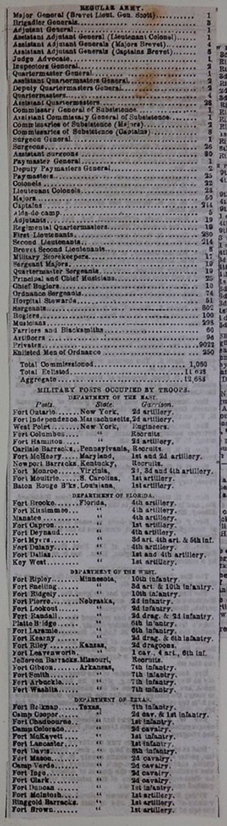
REGULAR ARMY.
| Major General (Brevet Lieut. Gen. Scott) | 1 |
| Brigadier Generals | 3 |
| Adjutant General | 1 |
| Assistant Adjutant General (Lieutenant Colonel) | 1 |
| Assistant Adjutant Generals (Majors Brevet) | 4 |
| Assistant Adjutant Generals (Captains Brevet) | 5 |
| Judge Advocate | 1 |
| Inspectors General | 2 |
| Quartermaster General | 1 |
| Assistant Quartermasters General | 2 |
| Deputy Quartermasters General | 2 |
| Quartermasters | 4 |
| Assistant Quartermasters | 28 |
| Commissary General of Subsistence | 1 |
| Commissaries of Subsistence (Majors) | 2 |
| Commissaries of Subsistence (Captains) | 8 |
| Surgeon General | 1 |
| Surgeons | 26 |
| Assistant Surgeons | 80 |
| Paymaster General | 1 |
| Deputy Paymasters General | 2 |
| Paymasters | 25 |
| Colonels | 32 |
| Lieutenant Colonels | 23 |
| Majors | 50 |
| Captains | 244 |
| Aids-de-camp | 5 |
| Adjutants | 19 |
| Regimental Quartermasters | 19 |
| First Lieutenants | 280 |
| Second Lieutenants | 214 |
| Brevet Second Lieutenants | 8 |
| Military Storekeepers | 17 |
| Sergeant Majors | 19 |
| Quartermaster Sergeants | 19 |
| Principal and Chief Musicians | 25 |
| Chief Buglers | 10 |
| Ordnance Sergeants | 74 |
| Hospital Stewards | 51 |
| Sergeants | 802 |
| Buglers | 100 |
| Musicians | 298 |
| Farriers and Blacksmiths | 60 |
| Artificers | 96 |
| Privates | 9022 |
| Enlisted Men of Ordnance | 250 |
| Total Commisssioned | 1,060 |
| Total Enlisted | 11,628 |
| Aggregate | 12,688 |
MILITARY POSTS OCCUPIED BY TROOPS.
| Posts. | State. | Garrison. |
| Fort Ontario. | New York, | 2d artillery. |
| Fort Independence. | Massachusetts, | 2d artillery. |
| West Point. | New York, | Engineers. |
| Fort Columbus. | " | Recruits. |
| Fort Hamilton. | " | 2d artillery. |
| Carlisle Barracks. | Pennsylvania, | Recruits. |
| Fort McHenry. | Maryland, | 1st and 2d artillery. |
| Newport Barracks. | Kentucky, | Recruits. |
| Fort Monroe. | Virginia, | 2d, 3d and 4th artillery. |
| Fort Moultrie. | S. Carolina, | 1st artillery. |
| Baton Rouge B'ks. | Louisiana, | 1st artillery. |
| Fort Brooke. | Florida, | 4th artillery. |
| Fort Kissimmee. | " | 4th artillery. |
| Manatee. | " | 4th artillery. |
| Fort Capron. | " | 1st artillery. |
| Fort Deynaud. | " | 4th artillery. |
| Fort Myers. | " | 3d art. 4th art. & 5th inf. |
| Fort Dulany. | " | 4th artillery. |
| Fort Dallas. | " | 1st and 4th artillery. |
| Key West. | " | 1st artillery. |
| Fort Ripley. | Minnesota, | 10th infantry. |
| Fort Snelling. | " | 3d art. & 10th infantry. |
| Fort Ridgely. | " | 10th infantry. |
| Fort Pierre. | Nebraska, | 2d infantry. |
| Fort Lookout. | " | 2d infantry. |
| Fort Randall. | " | 2d drag. & 3d infantry. |
| Platte Bridge. | " | 6th infantry. |
| Fort Laramie. | " | 6th infantry. |
| Fort Kearny. | " | 2d drag. & 6th infantry. |
| Fort Riley. | Kansas, | 2d dragoons. |
| Fort Leavenworth. | " | 1 cav., 4 art., 6th inf. |
| Jefferson Barracks. | Missouri, | Recruits. |
| Fort Gibson. | Arkansas, | 7th infantry. |
| Fort Smith. | " | 7th infantry. |
| Fort Arbuckle. | " | 7th infantry. |
| Fort Washita. | " | 7th infantry. |
| Fort Belknap. | Texas, | 7th infantry. |
| Camp Cooper. | " | 2d cav. & 1st infantry. |
| Fort Chadbourne. | " | 1st infantry. |
| Camp Colorado. | " | 2d cavalry. |
| Fort McKavett. | " | 1st infantry. |
| Fort Lancaster. | " | 1st infantry. |
| Fort Davis. | " | 8th infantry. |
| Fort Mason. | " | 2d cavalry. |
| Camp Verde. | " | 2d cavalry |
| Fort Inge. | " | 2d cavalry. |
| Fort Clark. | " | 2d cavalry. |
| Fort Duncan. | " | 1st infantry. |
| Fort McIntosh. | " | 1st artillery. |
| Ringgold Barracks. | " | 1st artillery. |
| Fort Brown. | " | 1st artillery. |
 [begin surface 220]
| FortMassachusetts. | New Mexico, | 3d infantry. |
| Cantonm't B'gwin,. | " | Rifle and 3d infantry. |
| Fort Union........ | " | Rifles. |
| Fort Marcy........ | " | 3d infantry. |
| Camp n'r Hatch's R | " | Rifles. |
| Fort Defiance...... | " | 2d art and 3d infantry. |
| Albuquerque...... | " | 3d infantry. |
| Los Lunas........ | " | Rifles. |
| Fort Craig......... | " | Rifles & 3d infantry. |
| Fort Stanton...... | " | Rifles, 2d art. & 8th inf. |
| Fort Thorn........ | " | Rifles & 3d infantry. |
| Tucson...... | " | 1st dragoons. |
| Fort Fillmore...... | " | Rifles & 3d infantry. |
| Fort Bliss...... | " | 8th infantry. |
| San Elisario...... | " | 8th infantry. |
| Bellingham Bay... | Wash. Ter., | 9th infantry. |
| Port Townsend.... | " | 4th infantry. |
| Camp on Muckie | ||
| Shute Prairie.... | " | 9th infantry. |
| Fort Steilacoom.... | " | 4th infantry. |
| Fort Simcoe....... | " | 9th infantry. |
| Fort Walla Walla.. | " | 1 drag., art, 4 & 9 inf. |
| Fort Vancouver... | " | 4th infantry. |
| Fort Cascades..... | " | 9th infantry. |
| Fort Dalles....... | Oregon. | 3 artillery & 9 infantry. |
| Fort Yamhill...... | " | 1 drag. & 4th infantry. |
| Fort Hoskies...... | " | 4th inf. |
| Umpqua City...... | " | 3d artillery |
| Fort Jones........ | California, | 4th inf. |
| Fort Humboldt.... | " | 4th inf. |
| Fort Reading...... | " | 1st dragoons. |
| Benicia Barracks.. | " | 3d artillery. |
| Presido S. Francisco | " | 3d artillery. |
| Fort Muller........ | " | 3d artillery. |
| Fort Tejon..... .. | " | 1st dragoons. |
| Mission of S. Diego. | " | 1 dragoons & 3 artillery. |
| Fort Yuma........ | " | 3d artillery. |
ARMORIES AND ARSENALS.
Kennebec arsenal, Maine; Springfield armory, Massachusetts; Watertown arsenal, Massachusetts; Champlain arsenal, Vermont; Watervliet arsenal, New York; New York arsenal, New York; Allegheny arsenal, Pennsylvania; Frankford arsenal, Pennsylvania; Pikesville arsenal, Maryland; Washington arsenal, District of Columbia; Harper's Ferry armory, Virginia; Fort Monroe arsenal, Virginia; North Carolina arsenal, North Carolina; Charleston arsenal, South Carolina; Augusta arsenal, Georgia; Mount Vernon arsenal, Alabama; Apalachicola arsenal, Florida; Baton Rouge arsenal, Louisiana; Little Rock arsenal, Arkansas; St. Louis arsenal, Missouri; Detroit arsenal, Michigan; Benicia arsenal, California.
MILITARY GEOGRAPHICAL DEPARTMENT.
DEPARTMENT OF THE EAST—The country east of the Mississippi river, except that portion included within the limits of the Department of Florida—Headquarters at Baltimore, Md.
DEPARTMENT OF FLORIDA.—The State of Florida, except that portion of it lying west of the Chattahoochee and Apalachicola rivers—Headquarters at Fort Brooke, Tampa Bay, Florida.
DEPARTMENT OF THE WEST.—The country west of the Mississippi river, and east of the Rocky Mountains, except that portion included within the limits of the Department of Texas and New Mexi o—Headquarters at Fort Leavenworth, Kansas Territory.
DEPARTMENT OF TEXAS.—The State of Texas, except the country north of the thirty third degree of north latitude—Headquarters at San Antonio, Texas.
DEPARTMENT OF NEW MEXICO.—The Territory of New Mexico, except the country west of the 110th degree of west longitude—Headquarters at Santa Fe, New Mexico.
DEPARTMENT OF THE PACIFIC.—The country west of the Rocky Mountains, except that portion included within the limits of the Department of New Mexico—Headquarters at Benicia, California.
The headquarters of the army are in the city of New York.
[begin surface 221] [begin surface 222]
 [begin surface 223]
 [begin surface 224]
 [begin surface 225]
 [begin surface 226]
 [begin surface 227]
 [begin surface 228]
 [begin surface 229]
 [begin surface 230]
 [begin surface 231]
 [begin surface 232]
 [begin surface 233]
were eminent, and Burr was at the time vice-president of the United States. At the end of his first term, Jefferson was re-elected to the presidency. Several other interesting events took place during this period, but we have not space to enumerate them. It may be proper to say, however, that France and England being at war, they adopted measures injurious to our commerce, which induced Congress to lay an embargo, December 22d, 1807, upon all shipping in our ports. This was soon taken off, and an act of commercial non-intercourse with France and England was passed.
22. Madison's Administration—1809 to 1817.—James Madison, an eminent lawyer and statesman of Virginia, became president of the United States on 4th March, 1809. The difficulties with France and England continued. Gen. Harrison, who had been sent to subdue the Indians of the west, was violently attacked on the 7th November, 1811, by a large body of savage warriors. The contest was fierce and bloody, but the Americans at last prevailed. Both parties suffered severe loss. This conflict is called the Battle of Tippecanoe, from the little river upon whose banks it was fought. On the 18th June, 1812, Congress declared war against Great Britain. The chief events of this contest took place along our northern border. Many battles were fought, but without decisive advantage on either side. At sea, our little navy achieved a series of the most brilliant victories. The British fleets were captured both on Lake Champlain and Lake Erie. On January 8, 1815, Gen. Jackson having command of the American army at New Orleans, repulsed 12,000 British troops, led on by Gen. Packenham, in an attack upon that city. The loss of the British was nearly 2000 men, with the first and second officers in command. The loss of the Americans was seven killed and six wounded. Previous to this event—that is, on the 24th December, 1814—a treaty of peace had been signed by the American and British commissioners, at the city of Ghent, in Holland. The news of this had not been received in New Orleans when the battle there was fought. Immediately after the war with Great Britain, our government deemed it necessary to send a squadron into the Mediterranean, to chastise Algiers and the other Barbary states, who had committed piracies upon our commerce. Under the command of Decatur, this force speedily brought Algiers, Tunis, and Tripoli to terms of submission, and obtained payment of large sums of money for violations of neutrality during the war with England.
23. Monroe's Administration—1817 to 1825.—James Monroe, of Virginia, became president, March 4, 1817. During his administration of eight years, the Seminole Indians, who had committed depredations, were subdued. In 1819, Florida was obtained by treaty from Spain. A number of states were admitted into the Union. La Fayette, a brave and generous Frenchman, who had served in our armies during the Revolution, revisited our country in 1824, and was everywhere received with acclamations of welcome by the people. The country, recovering from the disasters of the war, was restored to the blessings of peace and prosperity.
24. J. Q. Adams' Administration—1825 to 1829.—John Quincy Adams, of Massachusetts, son of the former president, and a distinguished statesman, became president, March 4th, 1825. On the 4th July, 1826, the fiftieth anniversary of American independence, both John Adams and Thomas Jefferson died. No great national event occurred during this administration.
25. Jackson's Administration—1829 to 1837.—John Quincy Adams and his father both failed of a second election. With these exceptions, all the other presidents had been re-elected, and served for eight years. Gen. Jackson was chosen president for his high military services, and took the oath of office March 4, 1829. His administration was distinguished by hostility to the United States Bank, which had existed for forty years. A new charter was refused, and it terminated in 1836. Opposition to the existing tariff arose in the south, and, headed by J. C. Calhoun, of South Carolina, the principles of nullification were adopted, by which a single state claimed the right to nullify and set aside the laws of the United States. This difficulty was pacified, February 12, 1833, by the celebrated Compromise bill introduced by Henry Clay, of Kentucky, by which a gradual reduction of duties was provided for. A formidable war with the Seminoles commenced in 1835, which was not terminated till 1842. This contest was attended with the loss of many valuable lives, and a cost to the country of forty millions of dollars.
26. Van Buren's Administration—1837 to 1841.—Martin Van Buren, of New York, became president, March 4th, 1837. His administration was distinguished by the continuance and close of the Seminole war, and by great commercial embarrassments.
27. Harrison and Tyler's Administration—1841 to 1845.—William Henry Harrison, of Ohio, became president, March 4, 1841. At the end of a month, he died, and the vice-president, John Tyler, of Virginia, succeeded him. During his term of office, a serious difficulty took place in Rhode Island, called Dorr's Rebellion, which was, however, appeased by the adoption of a new constitution. The boundary of Maine, which had been long in dispute, was settled by treaty, negotiated at Washington, by Lord Ashburton, on the part of Great Britain, and Mr. Webster, Secretary of State, on the part of the United States. In February, 1845, Texas was annexed to the Union, and the next year became a state.
28. Polk's Administration—1845 to 1849.—James K. Polk, of Tennessee, became president, March 4, 1845. The great event of his administration was the war with Mexico, which commenced in 1846, and ended in 1848. During this war, Gen. Taylor distinguished himself by several brilliant victories; and the extensive territories of New Mexico and California were ceded to the United States. During this administration, the boundary of the Oregon territory was settled.
29. Taylor and Fillmore's Administration—1849 to 1853.—Gen. Zachary Taylor, of Mississippi, became president, March 4, 1849. He, dying on the 9th July, 1850, Millard Fillmore, of New York, vice-president, succeeded him. During this administration, California was admitted, and New Mexico and Utah were erected into territories. Both these presidents were devoted patriots.
30. Pierce's Administration—1853 to 1857.—Franklin Pierce, of New Hampshire, became president March 4th, 1853. Nebraska and Kansas territories formed.
son's administration? 22. What of Madison's administration? 23. What of Monroe's administration? 24. What of J. Q. Adams' administration? 25. Jackson's administration? 26. Van Buren's administration? 27. What of Harrison and Tyler's administration? 28. What of Polk's administration? 29. Taylor's administration? 30. Pierce's administration?
5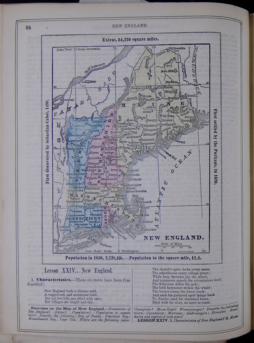 34
NEW ENGLAND.
NEW ENGLAND.
Extent, 64,230 square miles.
First discovered by Sebastian Cabot,
1498.
First settled by the Puritans, in 1620.
Population in 1850, 2,728,116.—Population to
the square mile, 42.4.
A map of New England.
34
NEW ENGLAND.
NEW ENGLAND.
Extent, 64,230 square miles.
First discovered by Sebastian Cabot,
1498.
First settled by the Puritans, in 1620.
Population in 1850, 2,728,116.—Population to
the square mile, 42.4.
A map of New England.
Lesson XXIV... New England.
1. Characteristics.—These six states have been thus described: New England hath a climate cold, A rugged soil, and mountains bold; But yet her hills are tilled with care; Her villages are bright and fair; The church's spire decks every scene, The schoolhouse every village green; While busy factories ply the wheel, And commerce speeds the adventurous keel. The fisherman defies the gale; The bold harpooner strikes the whale; The hunter roams the forest track; And each has gathered spoil brings back To Yankee land, his cherished home, Blest with his store, no more to roam.
Exercises on the Map of New England.—Boundaries of New England? Extent? Population? Population to square mile? Describe the following: Bay of Fundy; Penobscot Bay; Massachusetts Bay; Cape Cod. Where are the following lakes: Champlain? Moose Head? Winnipiseogee? Describe the following rivers: Connecticut: Merrimac; Androscoggin; Kennebec. Boundaries and capital of each state?
Lesson XXIV. 1. Characteristics of New England? 2. Mountains?
[begin surface 235] NEW ENGLAND.
35
NEW ENGLAND.
35
2. Mountains.—These states are crossed, along the western boundary, by the Green Mountain range. Mount Washington, in New Hampshire, one of the White Mountains, is six thousand four hundred feet high, and is the loftiest peak in this quarter of the United States.
3. Face of the Country.—This is greatly diversified. In the interior it is mountainous, with narrow vales between. The land along the sea-shore presents an irregular surface of hills and ridges, with flats of moderate extent. The numerous lakes and ponds of New England form a charming feature in the scenery.
4. Soil and Climate.—Much of the soil is good, yet it requires diligent cultivation in order to obtain fair crops. The climate is severe, and it is necessary to make careful preparation for the long winters. The indifference of the soil, and the severity of the climate, have compelled the people to be industrious, frugal, and enterprising.
5. The following are the principal rivers: This table lists the principal rivers of New England and their lengths including: Connecticut, Kennebec, Penobscot, Androscoggin, and Housatonic.
6. Industry and Enterprise.—The coast is indented with numerous harbors, and the inhabitants have been, therefore, invited to maritime enterprises. They are largely engaged in the cod, mackerel, and whale fisheries, and their commerce is very extensive. Their manufactures, too, are numerous, and on a liberal scale. Even the granite of their hills, and the ice formed upon their lakes, are extensively exported. Thus industry has conquered the obstacles of nature and climate, and scattered wealth and plenty over a region of comparative sterility.
7. Political Divisions.—The political divisions of New England are as follows:
- State of Maine
- " " New Hampshire,
- " " Vermont,
- State of Massachusetts
- " " Rhode Island,
- " " Connecticut.
8. Products.—The leading product of agriculture in New England is grass for grazing and hay; besides this, wheat, Indian corn, oats, barley, potatoes, &c., are produced in considerable quantities. Horses, cattle, sheep, and hogs, are raised in great numbers. The chief fruits are apples, pears, peaches, plums, strawberries, currants, &c.
9. Chief Towns.—Boston, standing at the head of Boston bay, is the commercial metropolis of New England, and its ships are found on every sea of the globe. It is also the great mart of the country for domestic manufactures, as cotton goods, woolens, shoes, boots, &c. Numerous railroads branch off in every direction, and facilitate its intercourse with different parts of the country. New Bedford and Nantucket are the chief places engaged in the whale fisheries. Lowell is renowned for its manufactures.
10. The population of the chief towns is as follows: This table lists the population of major towns in New England in the years 1840 and 1850. These cities include: Boston, Lowell, Providence, New Haven, Portland, Hartford, Concord, Augusta, Montpelier, and Manchester, N. H.
11. The following is a table of distances from Boston: This table lists the distance in miles of the following cities from Boston: Quebec, Montreal, Houlton, Calais, Bangor, Augusta, Portland, Concord, Montpelier, Hartford, New Haven, and Providence.
12. Education.—New England has long been celebrated for its colleges and schools. Every person has the means of obtaining a good English education; and very few natives of the soil can be found, who are not able to read and write with facility.
13. Morality and Religion.—The people of this section are, in a high degree, moral and religious. Meeting-houses and churches are numerous, and the Sabbath is strictly observed. Charitable societies of various kinds are common, and lyceums for lectures and public instruction are found in the principal towns, and in many villages. The temperance societies have done much towards checking the baneful use of intoxicating drinks.
14. Villages and Cultivation.—Though the natural aspect of New England is rough and forbidding, industry and taste have dotted it over with cheerful and thriving towns and villages. Its hill-sides and valleys are enriched by cultivation, and the traveler can hardly find in any land a people living in a state of equal comfort. If there are not many who are very rich, there are few who are poor.
15. History—The Puritans.—The history of New England affords many passages of deep interest. It was first settled by some English people called Puritans, who fled hither from religious persecution. They landed at Plymouth, December 22, 1620, and thus laid the foundation of what has since become the state of Massachusetts.
16. Connecticut and Rhode Island.—The first settlements in Connecticut were made by emigrants from Massachusetts, in 1636. Roger Williams, a Baptist minister, made the first settlement in Rhode Island, in this year. The other portions of New England became gradually occupied, chiefly by people from England, or by the descendants of the earlier settlers in this quarter.
17. Indian Wars.—For a time, the colonists were at peace with the Indians; but at length war broke out. On several occasions, the colonists came near being exterminated. In 1675, a celebrated chief, named Philip, stirred up the savage tribes, and for three years a bloody contest was maintained. But the white people at last prevailed, and the Indians gradually disappeared from the land of their fathers.
18. Revolutionary War.—A century after Philip's war, the Revolution commenced with the battle of Lexington, and the celebrated contest on Bunker Hill followed, June 17, 1775. Throughout the conflict with Great Britain, which lasted eight years, and which resulted in the independence of the United States, the people of New England bore an active and important part.
19. Settlement of other States.—The inhabitants of New England have also largely contributed to the settlement of the more western states. A considerable part of New York, Ohio, Indiana, and Illinois were first occupied by people from Connecticut and Massachusetts.
20. Manners and Customs.—The people of these six states are almost wholly of English descent. Their manners and customs are essentially English, though a tinge of Puritanism still lingers among them. The term Yankee, which appears, originally, to have been an imitation of the Indian's Yangees (English), is, in this country, applied to the people of New England. In Europe, all our people are designated by this title.
3. Face of the country? 4. Soil and climate? 5. Principal rivers? 6. Industry and enterprise? 7. Political divisions? 8. Products? 9. Chief towns? 10. Population of chief towns? 11. Distances from Boston? 12. Education? 13. Morality and religion? 14. Villages and cultivation? 15. The Puritans? Their landing at Plymouth? 16. Connecticut and Rhode Island? 17. Indian wars? 18. Revolutionary war? 19. Settlement of other states? 20. Manners and customs of New England?
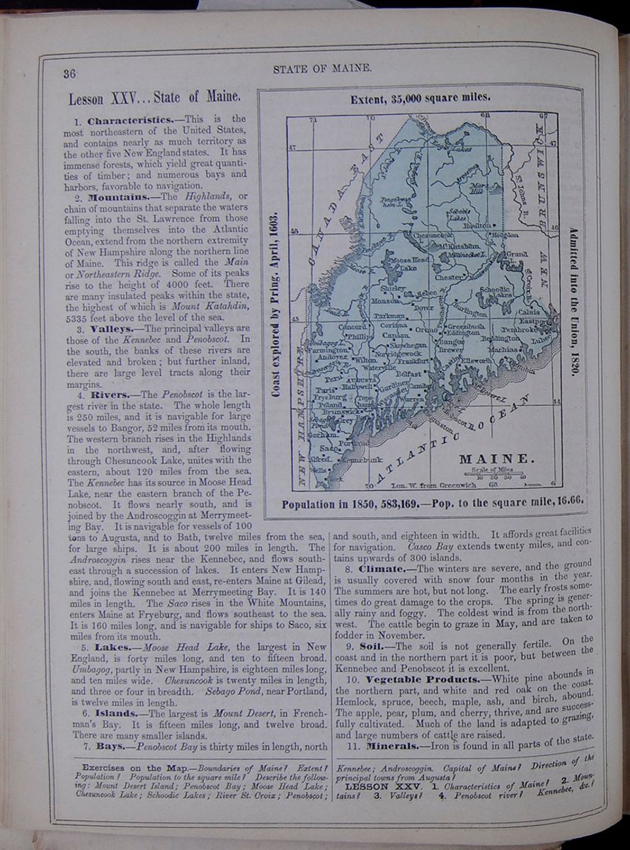 36
STATE OF MAINE.
36
STATE OF MAINE.
Lesson XXV... State of Maine.
MAINE. Extent, 35,000 square miles. Coast explored by Pring, April, 1603. Admitted into the Union, 1820. Population in 1850, 583,169.—Pop. to the square mile, 16.66. A map of Maine.1. Characteristics.—This is the most northeastern of the United States, and contains nearly as much territory as the other five New England states. It has immense forests, which yield great quantities of timber; and numerous bays and harbors, favorable to navigation.
2. Mountains.—The Highlands, or chain of mountains that separate the waters falling into the St. Lawrence from those emptying themselves into the Atlantic Ocean, extend from the northern extremity of New Hampshire along the northern line of Maine. This ridge is called the Main or Northeastern Ridge. Some of its peaks rise to the height of 4000 feet. There are many insulated peaks within the state, the highest of which is Mount Katahdin, 5335 feet above the level of the sea.
3. Valleys.—The principal valleys are those of the Kennebec and Penobscot. In the south, the banks of these rivers are elevated and broken; but further inland, there are large level tracts along their margins.
4. Rivers.—The Penobscot is the largest river in the state. The whole length is 250 miles, and it is navigable for large vessels to Bangor, 52 miles from its mouth. The western branch rises in the Highlands in the northwest, and, after flowing through Chesuncook Lake, unites with the eastern, about 120 miles from the sea. The Kennebec has its source in Moose Head Lake, near the eastern branch of the Penobscot. It flows nearly south, and is joined by the Androscoggin at Merrymeeting Bay. It is navigable for vessels of 100 tons to Augusta, and to Bath, twelve miles from the sea, for large ships. It is about 200 miles in length. The Androscoggin rises near the Kennebec, and flows southeast through a succession of lakes. It enters New Hampshire, and, flowing south and east, re-enters Maine at Gilead, and joins the Kennebec at Merrymeeting Bay. It is 140 miles in length. The Saco rises in the White Mountains, enters Maine at Fryeburg, and flows southeast to the sea. It is 160 miles long, and is navigable for ships to Saco, six miles from its mouth.
5. Lakes.—Moose Head Lake, the largest in New England, is forty miles long, and ten to fifteen broad. Umbagog, partly in New Hampshire, is eighteen miles long, and ten miles wide. Chesuncook is twenty miles in length, and three or four in breadth. Sebago Pond, near Portland, is twelve miles in length.
6. Islands.—The largest is Mount Desert, in Frenchman's Bay. It is fifteen miles long, and twelve broad. There are many smaller islands.
7. Bays.—Penobscot Bay is thirty miles in length, north
and south, and eighteen in width. It affords great facilities for navigation. Casco Bay extends twenty miles, and contains upwards of 300 islands.
8. Climate.—The winters are severe, and the ground is usually covered with snow four months in the year. The summers are hot, but not long. The early frosts sometimes do great damage to the crops. The spring is generally rainy and foggy. The coldest wind is from the north-west. The cattle begin to graze in May, and are taken to fodder in November.
9. Soil.—The soil is not generally fertile. On the coast and in the northern part it is poor, but between the Kennebec and Penobscot it is excellent.
10. Vegetable Products.—White pine abounds in the northern part, and white and red oak on the coast. Hemlock, spruce, beech, maple, ash, and birch, abound. The apple, pear, plum, and cherry, thrive, and are successfully cultivated. Much of the land is adapted to grazing, and large numbers of cattle are raised.
11. Minerals.—Iron is found in all parts of the state.
Exercises on the Map.—Boundaries of Maine? Extent? Population? Population to the square mile? Describe the following: Mount Desert Island; Penobscot Bay; Moose Head Lake; Chesuncook Lake; Schoodic Lakes; River St. Croix; Penobscot; Kennebec; Androscoggin. Capital of Maine? Direction of the principal towns from Augusta?
LESSON XXV. 1. Characteristics of Maine? 2. Mountains? 3. Valleys? 4. Penobscot river? Kennebec, &c.?
[begin surface 237]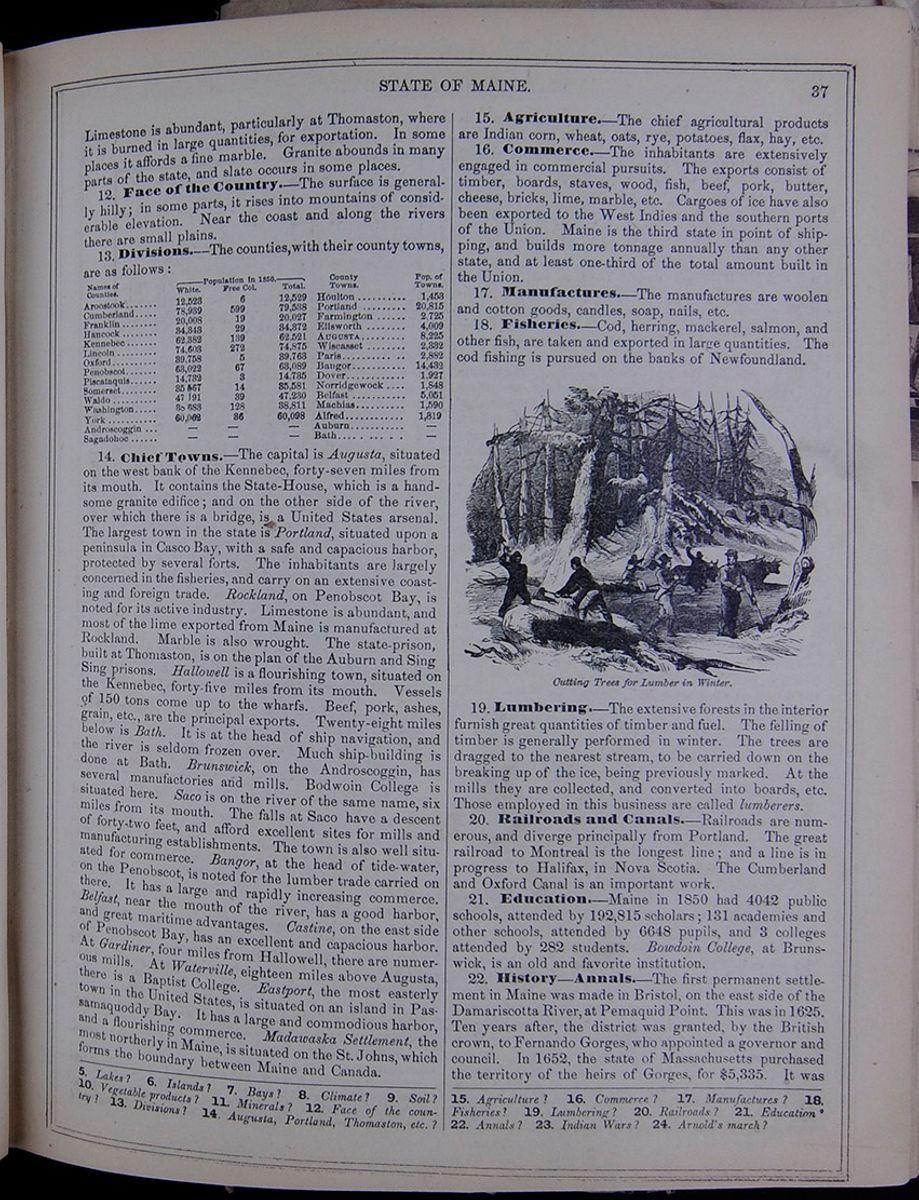 STATE OF MAINE.
37
STATE OF MAINE.
37
Limestone is abundant, particularly at Thomaston, where it is burned in large quantities, for exportation. In some places it affords a fine marble. Granite abounds in many parts of the state, and slate occurs in some places.
12. Face of the Country.—The surface is generally hilly; in some parts, it rises into mountains of considerable elevation. Near the coast and along the rivers there are small plains.
13. Divisions.—The counties with their county towns, are as follows: This table lists the counties of Maine with their populations in 1850 and includes a column for the major town in each county and the town's population. The county population is divided into the following categories: White, Free Colored, and Total.
14. Chief Towns.—The capital is Augusta, situated on the west bank of the Kennebec, forty-seven miles from its mouth. It contains the State-House, which is a handsome granite edifice; and on the other side of the river, over which there is a bridge, is a United States arsenal. The largest town in the state is Portland, situated upon a peninsula in Casco Bay, with a safe and capacious harbor, protected by several forts. The inhabitants are largely concerned in the fisheries, and carry on an extensive coasting and foreign trade. Thomaston, on Penobscot Bay, is noted for its active industry. Limestone is abundant, and most of the lime exported from Maine is manufactured at Thomaston. Marble is also wrought. A state-prison has been built here on the plan of the Auburn and Sing Sing prisons. Hallowell is a flourishing town, situated on the Kennebec, forty-five miles from its mouth. Vessels of 150 tons come up to the wharfs. Beef, pork, ashes, grain, etc., are the principal exports. Twenty-eight miles below is Bath. It is at the head of ship navigation, and the river is seldom frozen over. Much ship-building is done at Bath. Brunswick, on the Androscoggin, has several manufactories and mills. Bodwoin College is situated here. Saco is on the river of the same name, six miles from its mouth. The falls at Saco have a descent of forty-two feet, and afford excellent sites for mills and manufacturing establishments. The town is also well situated for commerce. Bangor, at the head of tide-water, on the Penobscot, is noted for the lumber trade carried on there. It has a large and rapidly increasing commerce. Belfast, near the mouth of the river, has a good harbor, and great maritime advantages. Castine, on the east side of Penobscot Bay, has an excellent and capacious harbor. At Gardiner, four miles from Hallowell, there are numerous mills. At Waterville, eighteen miles above Augusta, there is a Baptist College. Eastport, the most easterly town in the United States, is situated on an island in Passamaquoddy Bay. It has a large and commodious harbor, and a flourishing commerce. Madawaska Settlement, the most northerly in Maine, is situated on the St. Johns, which forms the boundary between Maine and Canada.
15. Agriculture.—The chief agricultural products are Indian corn, wheat, oats, rye, potatoes, flax, hay, etc.
16. Commerce.—The inhabitants are extensively engaged in commercial pursuits. The exports consist of timber, boards, staves, wood, fish, beef, pork, butter, cheese, bricks, lime, marble, etc. Cargoes of ice have also been exported to the West Indies and the southern ports of the Union. Maine is the third state in point of shipping, and builds more tonnage annually than any other state, and at least one-third of the total amount built in the Union.
17. Manufactures.—The manufactures are woolen and cotton goods, candles, soap, nails, etc.
18. Fisheries.—Cod, herring, mackerel, salmon, and other fish, are taken and exported in large quantities. The cod fishing is pursued on the banks of Newfoundland.
Cutting Trees for Lumber in Winter. Image of men cutting and hauling trees for lumber.19. Lumbering.—The extensive forests in the interior furnish great quantities of timber and fuel. The felling of timber is generally performed in winter. The trees are dragged to the nearest stream, to be carried down on the breaking up of the ice, being previously marked. At the mills they are collected, and converted into boards, etc. Those employed in this business are called lumberers.
20. Railroads and Canals.—Railroads are numerous, and diverge principally from Portland. The great railroad to Montreal is the longest line; and a line is in progress to Halifax, in Nova Scotia. The Cumberland and Oxford Canal is an important work.
21. Education.—Maine in 1850 had 4042 public schools, attended by 192,815 scholars; 131 academies and other schools, attended by 6648 pupils, and 3 colleges attended by 282 students. Bowdoin College, at Brunswick, is an old and favorite institution.
22. History—Annals.—The first permanent settlement in Maine was made in Bristol, on the east side of the Damariscotta River, at Pemaquid Point. This was in 1625. Ten years after, the district was granted, by the British crown, to Fernando Gorges, who appointed a governor and council. In 1652, the state of Massachusetts purchased the territory of the heirs of Gorges, for $5,335. It was
5. Lakes? 6. Islands? 7. Bays? 8. Climate? 9. Soil? 10. Vegetable products? 11. Minerals? 12. Face of the country? 13. Divisions? 14. Augusta, Portland, Thomaston, etc.? 15. Agriculture? 16. Commerce? 17. Manufactures? 18. Fisheries? 19. Lumbering? 20. Railroads? 21. Education? 22. Annals? 23. Indian Wars? 24. Arnold's march?
[begin surface 238]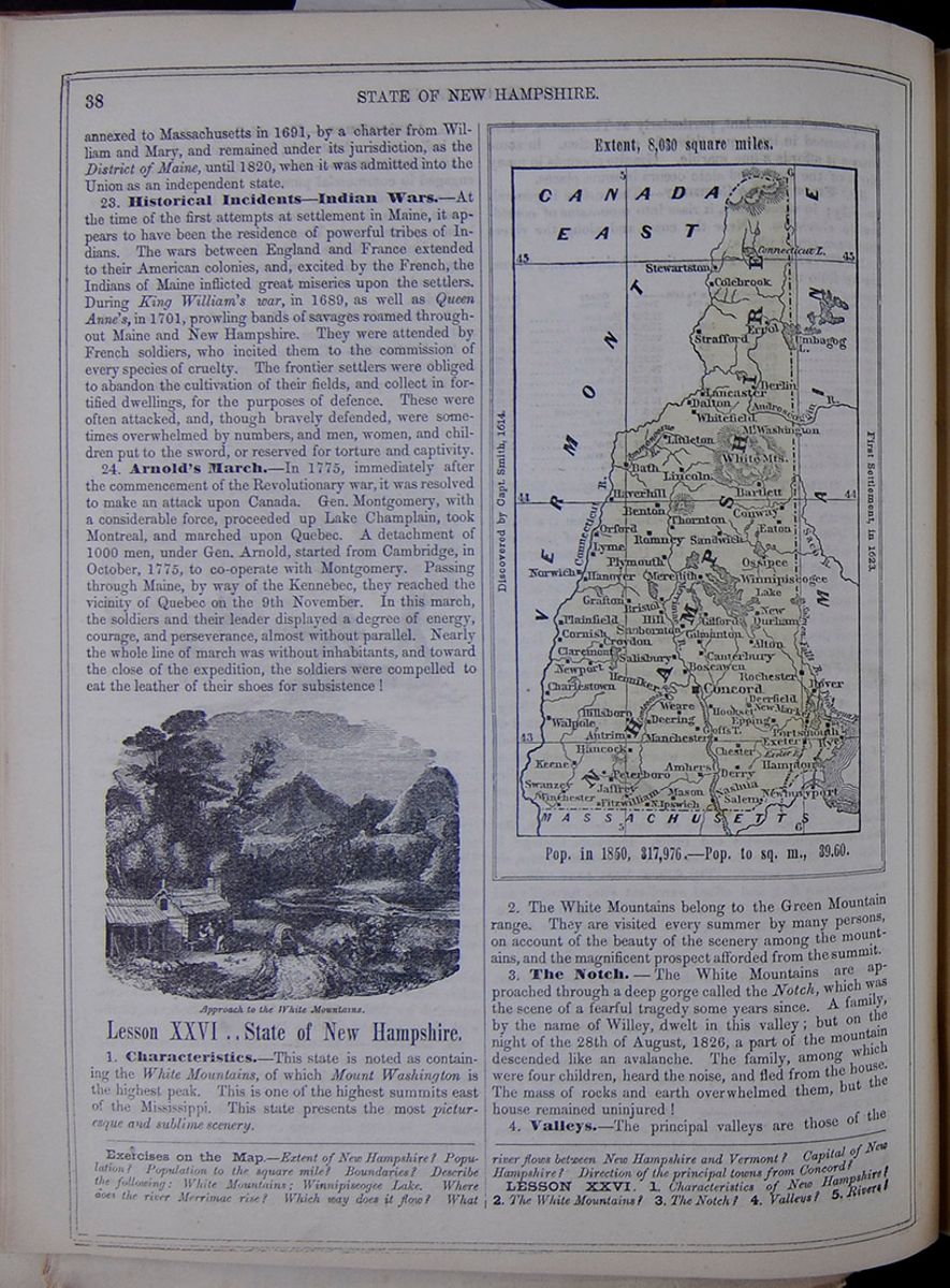 38
STATE OF NEW HAMPSHIRE.
38
STATE OF NEW HAMPSHIRE.
annexed to Massachusetts in 1691, by a charter from William and Mary, and remained under its jurisdiction, as the District of Maine, until 1820, when it was admitted into the Union as an independent state.
23. Historical Incidents—Indian Wars.—At the time of the first attempts at settlement in Maine, it appears to have been the residence of powerful tribes of Indians. The wars between England and France extended to their American colonies, and, excited by the French, the Indians of Maine inflicted great miseries upon the settlers. During King William's war, in 1689, as well as Queen Anne's, in 1701, prowling bands of savages roamed throughout Maine and New Hampshire. They were attended by French soldiers, who incited them to the commission of every species of cruelty. The frontier settlers were obliged to abandon the cultivation of their fields, and collect in fortified dwellings, for the purposes of defence. These were often attacked, and, though bravely defended, were sometimes overwhelmed by numbers, and men, women, and children put to the sword, or reserved for torture and captivity.
24. Arnold's March.—In 1775, immediately after the commencement of the Revolutionary war, it was resolved to make an attack upon Canada. Gen. Montgomery, with a considerable force, proceeded up Lake Champlain, took Montreal, and marched upon Quebec. A detachment of 1000 men, under Gen. Arnold, started from Cambridge, in October, 1775, to co-operate with Montgomery. Passing through Maine, by way of the Kennebec, they reached the vicinity of Quebec on the 9th November. In this march, the soldiers and their leader displayed a degree of energy, courage, and perseverance, almost without parallel. Nearly the whole line of march was without inhabitants, and toward the close of the expedition, the soldiers were compelled to eat the leather of their shoes for subsistence!
Approach to the White Mountains. An image of a cabin by a road with mountains in the background.Lesson XXVI .. State of New Hampshire.
1. Characteristics.—This state is noted as containing the White Mountains, of which Mount Washington is the highest peak. This is one of the highest summits east of the Mississippi. This state presents the most picturesque and sublime scenery.
Map of New Hampshire. Extent, 8,030 square miles. Discovered by Capt. Smith, 1614. First Settlement, in 1623. Pop. in 1850, 317,976.—Pop. to the sq. m., 39.60.2. The White Mountains belong to the Green Mountain range. They are visited every summer by many persons, on account of the beauty of the scenery among the mountains, and the magnificent prospect afforded from the summit.
3. The Notch.—The White Mountains are approached through a deep gorge called the Notch, which was the scene of a fearful tragedy some years since. A family, by the name of Willey, dwelt in this valley; but on the night of the 28th of August, 1826, a part of the mountain descended like an avalanche. The family, among which were four children, heard the noise, and fled from the house. The mass of rocks and earth overwhelmed them, but the house remained uninjured!
4. Valleys.—The principal valleys are those of the
Exercises on the Map.—Extent of New Hampshire? Population? Population to the square mile? Boundaries? Describe the following: White Mountains; Winnipiseogee Lake. Where does the river Merrimac rise? Which way does it flow? What river flows between New Hampshire and Vermont? Capital of New Hampshire? Direction of the principal towns from Concord?
LESSON XXVI. 1. Characteristics of New Hampshire? 2. The White Mountains? 3. The Notch? 4. Valleys? 5. Rivers?
[begin surface 239] STATE OF NEW HAMPSHIRE.
39
STATE OF NEW HAMPSHIRE.
39
Connecticut and Merrimac. The Connecticut valley is the most extensive and fertile in New England. It is 300 miles long, and from five to fifty miles wide. The valley of the Merrimac consists of sandy plains, covered with pines.
5. Rivers.—The Connecticut rises in Lower Canada, and runs south to Long Island Sound, separating New Hampshire from Vermont, and passing through Massachusetts and Connecticut. It is 450 miles in length, and navigable for ships to Hartford. The Merrimac rises in New Hampshire, and flows southeast to the sea. Length, 200 miles. It is navigable for boats to Concord—forty miles.
6. Lakes.—The largest is Lake Winnipiseogee, twenty-three miles in length, and from two to ten in width. It is 472 feet above the sea level. It is celebrated for its charming scenery. Lakes Squam and Ossipee are smaller, and are situated to the north. They are covered with islands.
7. Islands.—The Isles of Shoals are a cluster of barren rocks rising above the water. They lie off the mouth of the Piscataqua River, eight miles from the shore. The inhabitants, about 200, gain a living by the cod fishery.
8. Climate.—The winters are severe. The ground is generally covered with snow in November, which continues upon the hills till the beginning of May. Sleighing generally lasts four months in the year. The spring is rainy.
9. Soil.—The best lands are on the borders of the rivers, which occasionally overflow their banks. The high lands are generally well adapted to pasturage.
10. Vegetable Products.—Among the trees are the oak, maple, beech, hemlock, and pine, in the mountains; and the elm, cherry, ash, poplar, and locust, in the plains and valleys. The white pine is sometimes 200 feet in height, and its trunk six feet in diameter.
11. Minerals.—Granite, suitable for building, is found in all parts of the state. New Hampshire is often called the "Granite State." Copper and iron, both of excellent quality, are found at Franconia. Plumbago, or black-lead, has been discovered at Bristol. Soapstone and limestone are found in several places in the state.
12. Face of the Country.—With the exception of a low tract along the coast, twenty or thirty miles in width, the state is covered with hills and valleys. New Hampshire is the most mountainous state in the Union, and has been called the "Switzerland of America."
13. Divisions.—The state is divided as follows: This table lists the counties of New Hampshire with their populations in 1850 and includes a column for the major town in each county and the town's population. The county population is divided into the following categories: White, Free Colored, and Total.
14. Natural Curiosities.—The Notch, which has been already mentioned, is a deep ravine, two miles in length. In the narrowest point, it is twenty-two feet wide. The Saco River passes through it. Near Franconia is a peak, called the Profile Mountain, 1000 feet high. A side view exhibits the gigantic profile of a human face.
15. Chief Towns.—Concord, the seat of government, is situated upon the Merrimac, forty-five miles from Portsmouth. It contains the state-house, state-prison, courthouse, and several banks. Much of the trade of the upper country centers in Concord, from which boat navigation extends through Merrimac River and Middlesex Canal to Boston. There are two bridges across the Merrimac, here. Portsmouth, the largest town in the state, is situated near the mouth of the Piscataqua, three miles from the ocean. It is the only seaport in the state. The harbor is one of the best in the world, and is accessible to vessels of the largest size. It is naturally strong, and is protected by several forts. In the river, there is a United States Navy-yard. Dover, noted for its manufactures, is situated upon the Cocheco, ten miles from Portsmouth. The river is here navigable for vessels of eighty tons. Nashua is a large manufacturing town on the Merrimac, near the southern boundary of the state. Manchester, also noted for its manufactures, is situated upon the Merrimac, twenty-one miles south of Concord. Great Falls, a village on Salmon Falls River, has several cotton and woolen mills. Exeter, on the river of the same name, which affords excellent mill sites, has several manufactories. Hanover, on the Connecticut, is the seat of Dartmouth College.
16. Agriculture.—This state is chiefly agricultural. Indian corn, wheat, rye, oats, grass, etc., are produced in large quantities. Many cattle, hogs, sheep, etc., are raised. Apples, pears, plums, and cherries are abundant.
17. Commerce.—The commerce of New Hampshire is confined to the single port of Portsmouth. The exports are lumber, provisions, cattle, flax-seed, etc.
18. Manufactures.—There are several extensive manufacturing establishments at Great Falls, on Salmon Falls River; Nashua and Manchester, on the Merrimac; and Dover and Exeter, on branches of the Piscataqua River.
19. Fisheries.—New Hampshire has only eighteen miles of sea-coast, and but few harbors; but there is considerable fishing from Portsmouth and the Isle of Shoals.
20. Lumbering.—The business of lumbering is carried on to a considerable extent in this state, though it has greatly diminished within a few years.
21. Education.—In 1850 there were in the state 2381 public schools, attended by 75,643 scholars; 107 academies, attended by 5321 pupils, and 1 college, attended by 273 students. Dartmouth College is one of the oldest and best institutions of America.
22. Railroads.—New Hampshire has a large number of railroads connecting the manufacturing towns with Concord, Portsmouth, and Boston; and besides these it has lines passing through the state to Canada and the great West. The Middlesex Canal is partly within this state.
23. History—Annals.—New Hampshire was first granted to Fernando Gorges, in 1622. The first settlement was made at Dover, during the following year. It came voluntarily under the jurisdiction of Massachusetts in 1641, but was made a separate province, by act of Charles II., in 1679. It was several times afterward connected with Massachusetts, until 1741, at which time it assumed an independent position, which it has since held without interruption. The history of New Hampshire is similar to that of Maine, in respect to Indian hostilities.
6. Lakes? 7. Islands? 8. Climate? 9. Soil? 10. Vegetable products? 11. Minerals? 12. Face of the country? 13. Divisions? 14. Natural Curiosities? 15. Chief towns?—Concord, Portsmouth, Dover, etc.? 16. Agriculture? 17. Commerce? 18. Manufactures? 19. Fisheries? 20. Lumbering? 21. Education? 22. Railroads? 23. Annals? Indian hostilities?
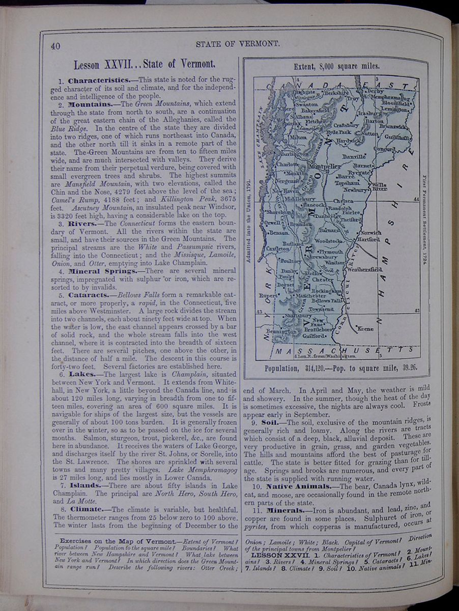 40
STATE OF VERMONT.
40
STATE OF VERMONT.
Lesson XXVII... State of Vermont.
1. Characteristics.—This state is noted for the rugged character of its soil and climate, and for the independence and intelligence of the people.
2. Mountains.—The Green Mountains, which extend through the state from north to south, are a continuation of the great eastern chain of the Alleghanies, called the Blue Ridge. In the centre of the state they are divided into two ridges, one of which runs northeast into Canada, and the other north till it sinks in a remote part of the state. The Green Mountains are from ten to fifteen miles wide, and are much intersected with valleys. They derive their name from their perpetual verdure, being covered with small evergreen trees and shrubs. The highest summits are Mansfield Mountain, with two elevations, called the Chin and the Nose, 4279 feet above the level of the sea; Camel's Rump, 4188 feet; and Killington Peak, 3675 feet. Ascutney Mountain, an insulated peak near Windsor, is 3320 feet high, having a considerable lake on the top.
3. Rivers.—The Connecticut forms the eastern boundary of Vermont. All the rivers within the state are small, and have their sources in the Green Mountains. The principal streams are the White and Passumpsic rivers, falling into the Connecticut; and the Missisque, Lamoile, Onion, and Otter, emptying into Lake Champlain.
4. Mineral Springs.—There are several mineral springs, impregnated with sulphur or iron, which are resorted to by invalids.
5. Cataracts.—Bellows Falls form a remarkable cataract, or more properly, a rapid, in the Connecticut, five miles above Westminster. A large rock divides the stream into two channels, each about ninety feet wide at top. When the water is low, the east channel appears crossed by a bar of solid rock, and the whole stream falls into the west channel, where it is contracted into the breadth of sixteen feet. There are several pitches, one above the other, in the distance of half a mile. The descent in this course is forty-two feet. Several factories are established here.
6. Lakes.—The largest lake is Champlain, situated between New York and Vermont. It extends from Whitehall, in New York, a little beyond the Canada line, and is about 120 miles long, varying in breadth from one to fifteen miles, covering an area of 600 square miles. It is navigable for ships of the largest size, but the vessels are generally of about 100 tons burden. It is generally frozen over in the winter, so as to be passed on the ice for several months. Salmon, sturgeon, trout, pickerel, &c., are found here in abundance. It receives the waters of Lake George, and discharges itself by the river St. Johns, or Sorelle, into the St. Lawrence. The shores are sprinkled with several towns and many pretty villages. Lake Memphramagog is 27 miles long, and lies mostly in Lower Canada.
7. Islands.—There are about fifty islands in Lake Champlain. The principal are North Hero, South Hero, and La Motte.
8. Climate.—The climate is variable, but healthful. The thermometer ranges from 25 below zero to 100 above. The winter lasts from the beginning of December to the
Map of Vermont Extent, 8,000 square miles. Admitted into the Union, 1791. First Permanent Settlement, 1724. Population, 314,120.—Pop. to square mile, 39.26.end of March. In April and May, the weather is mild and showery. In the summer, though the heat of the day is sometimes excessive, the nights are always cool. Frosts appear early in September.
9. Soil.—The soil, exclusive of the mountain ridges, is generally rich and loamy. Along the rivers are tracts which consist of a deep, black, alluvial deposit. These are very productive in grain, grass, and garden vegetables. The hills and mountains afford the best of pasturage for cattle. The state is better fitted for grazing than for tillage. Springs and brooks are numerous, and every part of the state is supplied with running water.
10. Native Animals.—The bear, Canada lynx, wildcat, and moose, are occasionally found in the remote northern parts of the state.
11. Minerals.—Iron is abundant, and lead, zinc, and copper are found in some places. Sulphuret of iron, or pyrites, from which copperas is manufactured, occurs at
Exercises on the Map of Vermont.—Extent of Vermont? Population? Population to the square mile? Boundaries? What river between New Hampshire and Vermont? What lake between New York and Vermont? In which direction does the Green Mountain range run? Describe the following rivers: Otter Creek; Onion; Lamoile; White; Black. Capital of Vermont? Direction of the principal towns from Montpelier?
LESSON XXVII. 1. Characteristics of Vermont? 2. Mountains? 3. Rivers? 4. Mineral Springs? 5. Cataracts? 6. Lakes? 7. Islands? 8. Climate? 9. Soil? 10. Native animals? 11. Min-
 [begin surface 242]
 [begin surface 243]
 [begin surface 244]
 [begin surface 245]
 [begin surface 246]
 [begin surface 247]
 [begin surface 248]
 [begin surface 249]
 [begin surface 250]
 [begin surface 251]
 [begin surface 252]
 [begin surface 253]
 [begin surface 254]
 [begin surface 255]
 [begin surface 256]
 [begin surface 257]
Strafford and Shrewsbury. Marble of good quality abounds. Oil-stone and slate-stone are found at Burlington.
12. Face of the Country.—The surface is generally uneven and diversified. The land slopes from the Green Mountains to Connecticut River and Lake Champlain. There are numerous plains upon the banks of the rivers.
13. Divisions.—These are as follows: This table lists the counties of Vermont with their populations in 1850 and includes a column for the major town in each county and the town's population. The county population is divided into the following categories: White, Free Colored, and Total.
14. Chief Towns.—Montpelier, the capital of the state, is situated in Washington county, near the center of the state. It contains the state-house, court-house, jail, academy, bank, &c. It lies at the confluence of the two head branches of the Onion River. Burlington is situated on Lake Champlain, near the mouth of the Onion. It is the principal commercial place on the lake, and is a port of entry for foreign shipping. It contains the University of Vermont and a court-house. Middlebury is situated on Otter Creek, and contains a college and court-house. Bennington, near the southwest corner of the state, is noted for a victory gained there by Gen. Stark over the British troops, August 16, 1777. Rutland, in the county of the same name, is pleasantly situated on Otter Creek, near its source. It contains the county buildings, &c. Brattleborough, celebrated for its fine scenery, is a large and growing town on the Connecticut, near the southeast corner of the state. Windsor is a beautiful town on the Connecticut.
15. Canals and Railroads.—There are a number of short canals along Connecticut River, and several important railroads have recently been constructed.
16. Agriculture.—Agriculture and grazing are the chief employments. Wheat, Indian corn, rye, oats, &c., are raised. Butter, beef, and cheese are largely produced. Wool is a staple product, and maple-sugar is produced in considerable quantities. Cattle, sheep, and horses abound.
17. Commerce.—This state has no sea-board. Lake Champlain affords facilities for trade between Vermont, New York, and Canada. Horses, cattle, and sheep are exported in great numbers. Iron, maple-sugar, pot and pearl ashes, lumber, marble, beef, pork, and cheese, are among the exports.
18. Manufactures.—These are not extensive, though iron, cotton, and wool are wrought to some extent. Fabrics of linen and woolen are produced in families. Copperas is made at Strafford, in Shrewsbury.
19. Education.—Common schools are general in the towns, and there are numerous academies. There are colleges at Middlebury and Burlington, and a university at Norwich. It is supposed that the average of education is higher in Vermont than in any other state.
20. History—Annals.—Vermont was first explored by the French from Canada, but the first settlement was made at Fort Dummer, by emigration from Massachusetts. The jurisdiction of the territory was in dispute for many years. From 1741 to 1764, New Hampshire claimed it, and granted many townships to proprietors. New York also claimed it, and obtained a grant of it from the British Parliament in 1764. These conflicting claims produced great difficulties. When the Revolutionary war commenced, Congress dared not admit Vermont to the confederacy, through fear of offending New Hampshire and New York; but the inhabitants were determined to be independent, and the British hoped to be able to detach them from the American cause. Vermont had a difficult part to perform; but her sagacious leaders managed to quiet the British, while the colony furnished efficient aid to the Revolution—thus saving themselves from attack. In 1790, New York was induced, by the payment of $30,000, to withdraw her claims; and in 1791, Vermont was admitted into the Union.
21. Battle of Bennington.—As Gen. Burgoyne was marching southward, in 1778, with his army of 7000 men, he found himself, on reaching Fort Edward, much straitened for supplies. He therefore dispatched Col. Baum, with 500 men, to seize a quantity of stores which the Americans had collected at Bennington, thirty-five miles southeast of Fort Edward. These were met by Col. Stark and a regiment of New Hampshire militia. A fierce battle ensued, and the British were entirely defeated. A reinforcement sent to their aid was the next day cut to pieces. These events, called the Battle of Bennington, took place on the 16th and 17th August. They greatly embarrassed the operations of Burgoyne, and were one of the main causes of his defeat and surrender in the following October.
22. Ethan Allen.—All the New England colonies, except Vermont, were settled by Puritans, or their immediate descendants. Vermont had a different origin. Many of its first inhabitants were daring, bold, and reckless men, similar to those which have peopled Texas. Of these, Ethan Allen, a native of Connecticut, was a strong example. He was of gigantic stature, and a courage often proceeding to rashness. When the news of the battle of Lexington had spread through the country, Ethan Allen and Benedict Arnold led a number of volunteers from Connecticut and Vermont, and suddenly seized the important fortresses of Ticonderoga and Crown Point, May, 1775. So unexpected was the attack upon the former place, that the Americans found the commander in bed. As Allen appeared before him, and demanded the surrender of the fort, "By what authority do you demand it?" said the officer. "In the name," replied Allen, "of the great Jehovah and the Continental Congress." Allen was afterward taken in a rash attack upon Montreal, and carried to England. According to a popular rumor, he was kept in confinement, and made a spectacle for the curiosity of gazers. One of them threw a nail at him, and he bit it in two. After the war, he wrote a kind of bible, called the "Oracles of Reason." In allusion to these circumstances, Hopkins, the satirical poet of Connecticut, thus spoke of him: "Lo! Allen, 'scaped from British jails, His tushes broke by biting nails, Appears in hyperborean skies To tell the world the Bible lies," &c.
erals? 12. Face of the country? 13. Divisions? 14. Chief towns? 15. Canals and railroads? 16. Agriculture? 17. Commerce? 18. Manufactures? 19. Education? 20. Annals? 21. Battle of Bennington? 22. Ethan Allen?
6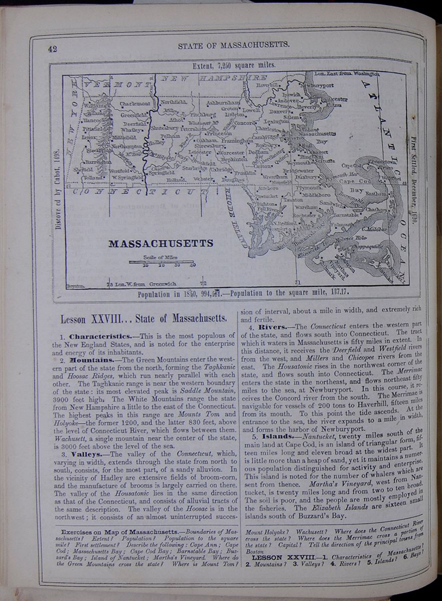 42
STATE OF MASSACHUSETTS.
Map of Massachusetts
MASSACHUSETTS
Extent, 7,250 square miles.
Discovered by Cabot, 1498.
First Settled, December, 1620.
Population in 1850, 994,514.—Population to
the square mile, 137.17.
42
STATE OF MASSACHUSETTS.
Map of Massachusetts
MASSACHUSETTS
Extent, 7,250 square miles.
Discovered by Cabot, 1498.
First Settled, December, 1620.
Population in 1850, 994,514.—Population to
the square mile, 137.17.
Lesson XXVIII... State of Massachusetts.
1. Characteristics.—This is the most populous of the New England States, and is noted for the enterprise and energy of its inhabitants.
2. Mountains.—The Green Mountains enter the western part of the state from the north, forming the Taghkanic and Hoosac Ridges, which run nearly parallel with each other. The Taghkanic range is near the western boundary of the state: its most elevated peak is Saddle Mountain, 3900 feet high. The White Mountains range the state from New Hampshire a little to the east of the Connecticut. The highest peaks in this range are Mounts Tom and Holyoke—the former 1200, and the latter 830 feet, above the level of Connecticut River, which flows between them. Wachusett, a single mountain near the center of the state, is 3000 feet above the level of the sea.
3. Valleys.—The valley of the Connecticut, which, varying in width, extends through the state from north to south, consists, for the most part, of a sandy alluvion. In the vicinity of Hadley are extensive fields of broom-corn, and the manufacture of brooms is largely carried on there. The valley of the Housatonic lies in the same direction as that of the Connecticut, and consists of alluvial tracts of the same description. The valley of the Hoosac is in the northwest; it consists of an almost uninterrupted succession of interval, about a mile in width, and extremely rich and fertile.
4. Rivers.—The Connecticut enters the western part of the state, and flows south into Connecticut. The tract which it waters in Massachusetts is fifty miles in extent. In this distance, it receives the Deerfield and Westfield rivers from the west, and Millers and Chicopee rivers from the east. The Housatonic rises in the northwest corner of the state, and flows south into Connecticut. The Merrimac enters the state in the northeast, and flows northeast fifty miles to the sea, at Newburyport. In this course, it receives the Concord river from the south. The Merrimac is navigable for vessels of 200 tons to Haverhill, fifteen miles from its mouth. To this point the tide ascends. At the entrance to the sea, the river expands to a mile in width, and forms the harbor of Newburyport.
5. Islands.—Nantucket, twenty miles south of the main land at Cape Cod, is an island of triangular form, fifteen miles long and eleven broad at the widest part. It is little more than a heap of sand, yet it maintains a numerous population distinguished for activity and enterprise. This island is noted for the number of whalers which are sent from thence. Martha's Vineyard, west from Nantucket, is twenty miles long and from two to ten broad. The soil is poor, and the people are mostly employed in the fisheries. The Elizabeth Islands are sixteen small islands south of Buzzard's Bay.
Exercises on Map of Massachusetts.—Boundaries of Massachusetts? Extent? Population? Population to the square mile? First settlement? Describe the following: Cape Ann; Cape Cod; Massachusetts Bay; Cape Cod Bay; Barnstable Bay; Buzzard's Bay; Island of Nantucket; Martha's Vineyard. Where do the Green Mountains cross the state? Where is Mount Tom? Mount Holyoke? Wachusett? Where does the Connecticut River cross the state? Where does the Merrimac cross a portion of the state? Capital? Tell the direction of the principal towns from Boston
LESSON XXVIII.—1. Characteristics of Massachusetts? 2. Mountains? 3. Valleys? 4. Rivers? 5. Islands? 6. Bays?
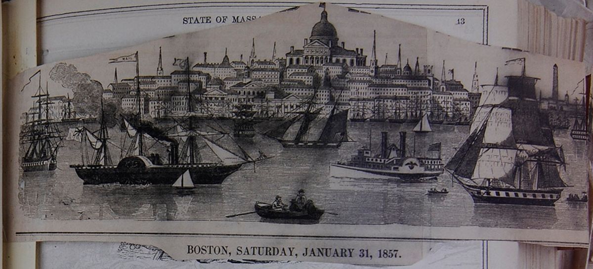 Masthead image of Ballou’s Pictorial, with image of Boston from its harbor.
BOSTON,
SATURDAY, JANUARY 31,1857.
[begin surface 260]
Masthead image of Ballou’s Pictorial, with image of Boston from its harbor.
BOSTON,
SATURDAY, JANUARY 31,1857.
[begin surface 260]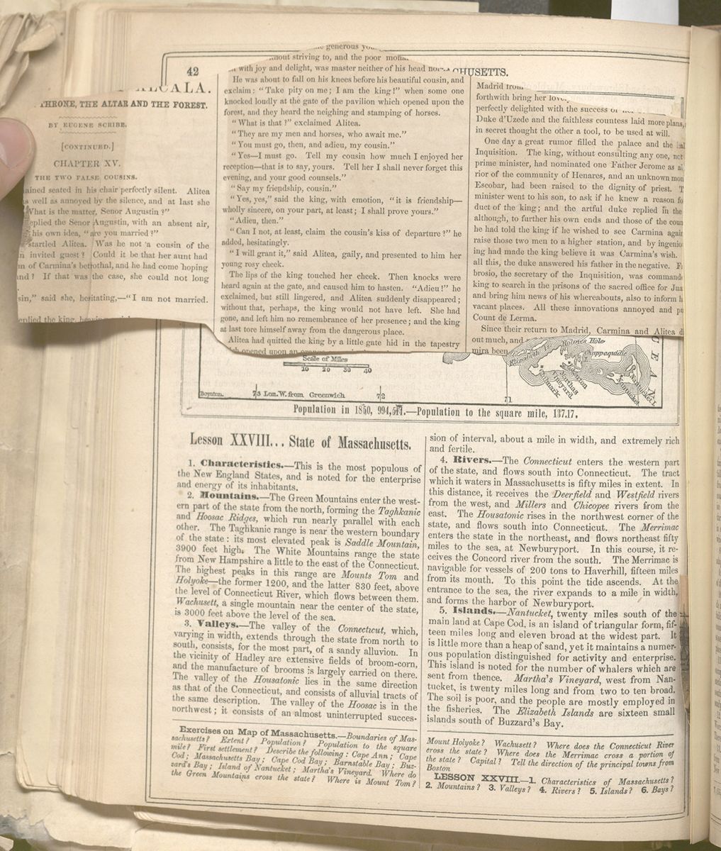
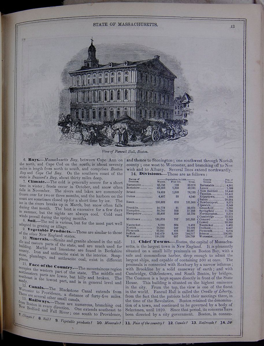
6. Bays.—Massachusetts Bay, between Cape Ann on the north, and Cape Cod on the south, is about seventy miles in length from north to south, and comprises Boston Bay and Cape Cod Bay. On the southern coast of the state is Buzzard's Bay, about thirty miles deep.
7. Climate.—The cold is generally severe for a short time in winter; frosts occur in October, and snow often falls in November. The rivers and lakes are commonly frozen over for two or three months, and the harbors on the coast are sometimes closed up for a short time by ice. The ice in the rivers breaks up in March, but snow often falls during that month. The heat is excessive for a few days in summer, but the nights are always cool. Cold east winds prevail during the spring months.
8. Soil.—The soil is various, but for the most part well adapted to grazing or tillage.
9. Vegetable Products.—These are similar to those of the other New England states.
10. Minerals.—Sienite and granite abound in the middle and eastern parts of the state, and are much used for building. Marble and limestone are found in Berkshire county. Iron and anthracite exist in the interior. Soapstone, plumbago, and anthracite coal, exist in different places.
11. Face of the Country.—The mountainous region occupies the western part of the state. The middle and northeastern parts are lower, but hilly and broken. The southeast is the lowest part, and is in general level and sandy.
12. Canals.—The Blackstone Canal extends from Worcester to Providence, a distance of forty-five miles. There are several other small canals.
13. Railways.—These are numerous, branching out from Boston in every direction. One extends southeast to New Bedford and Fall River; one south to Providence, and thence to Stonington; one southwest through Norfolk county; one west to Worcester, and branching off to Norwich and to Albany. Several lines extend northwardly.
14. Divisions.—These are as follows: This table lists the counties of Massachusetts with their populations in 1850 and includes a column for the major town in each county and the town's population. The county population is divided into the following categories: White, Free Colored, and Total.
15. Chief Towns.—Boston, the capital of Massachusetts, is the largest town in New England. It is pleasantly situated on a small hilly peninsula on Boston Bay, with a safe and commodious harbor, deep enough to admit the largest ships, and capable of containing 500 at once. The peninsula is connected with Roxbury by a narrow isthmus; with Brookline by a solid causeway of earth; and with Cambridge, Charlestown, and South Boston, by bridges. The Common is a large square directly in front of the State House. This building is situated on the highest eminence in the city. From the top, the view is one of the finest in the world. Faneuil Hall is called the Cradle of Liberty, from the fact that the patriots held their meetings there, in the time of the Revolution. Boston retained the denomination of a town, and continued to be governed by a body of Selectmen, until 1820. Since that period, its concerns have been directed by a city government. Boston, in connection
7. Climate? 8. Soil? 9. Vegetable products? 10. Minerals? 11. Face of the country? 12. Canals? 13. Railroads? 14. Divisions?
[begin surface 262]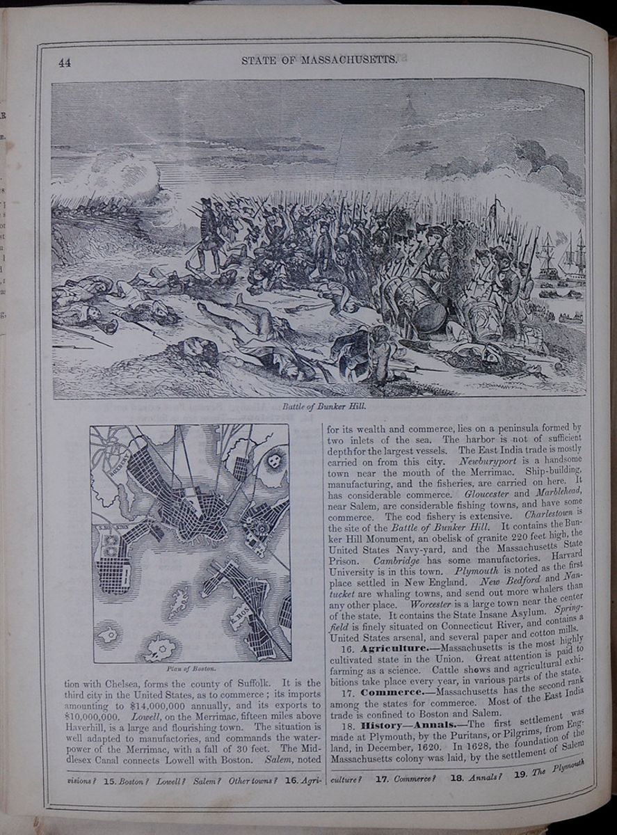 44
STATE OF MASSACHUSETTS.
Battle of Bunker Hill.
Image of Revolutionary War soldiers in
battle.
Plan of Boston.
Image of the city plan of Boston.
44
STATE OF MASSACHUSETTS.
Battle of Bunker Hill.
Image of Revolutionary War soldiers in
battle.
Plan of Boston.
Image of the city plan of Boston.
with Chelsea, forms the county of Suffolk. It is the third city in the United States, as to commerce; its imports amounting to $14,000,000 annually, and its exports to $10,000,000. Lowell, on the Merrimac, fifteen miles above Haverhill, is a large and flourishing town. The situation is well adapted to manufactories, and commands the waterpower of the Merrimac, with a fall of 30 feet. The Middlesex Canal connects Lowell with Boston. Salem, noted for its wealth and commerce, lies on a peninsula formed by two inlets of the sea. The harbor is not of sufficient depth for the largest vessels. The East India trade is mostly carried on from this city. Newburyport is a handsome town near the mouth of the Merrimac. Ship-building, manufacturing, and the fisheries, are carried on here. It has considerable commerce. Gloucester and Marblehead, near Salem, are considerable fishing towns, and have some commerce. The cod fishery is extensive. Charlestown is the site of the Battle of Bunker Hill. It contains the Bunker Hill Monument, an obelisk of granite 220 feet high, the United States Navy-yard, and the Massachusetts State Prison. Cambridge has some manufactories. Harvard University is in this town. Plymouth is noted as the first place settled in New England. New Bedford and Nantucket are whaling towns, and send out more whalers than any other place. Worcester is a large town near the center of the state. It contains the State Insane Asylum. Springfield is finely situated on Connecticut River, and contains a United States arsenal, and several paper and cotton mills.
16. Agriculture.—Massachusetts is the most highly cultivated state in the Union. Great attention is paid to farming as a science. Cattle shows and agricultural exhibitions take place every year, in various parts of the state.
17. Commerce.—Massachusetts has the second rank among the states for commerce. Most of the East India trade is confined to Boston and Salem.
18. History—Annals.—The first settlement was made at Plymouth, by the Puritans, or Pilgrims, from England, in December, 1620. In 1628, the foundation of the Massachusetts colony was laid, by the settlement of Salem
15. Boston? Lowell? Salem? Other towns? 16. Agriculture? 17. Commerce? 18. Annals? 19. The Plymouth
[begin surface 263]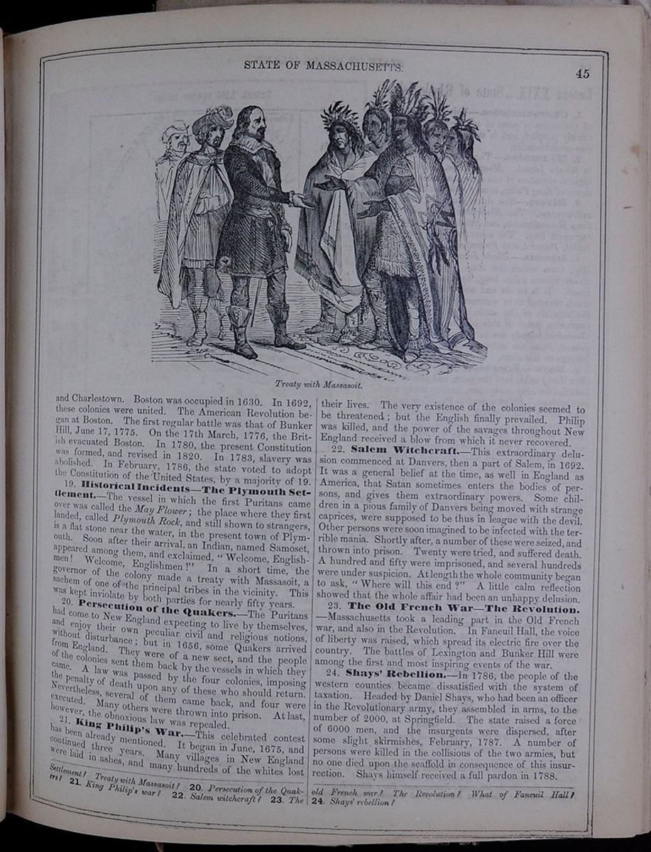 STATE OF MASSACHUSETTS.
45
Treaty with Massasoit.
Engraving of Massasoit (Wampanoag) treating with Plymouth Colony leaders.
STATE OF MASSACHUSETTS.
45
Treaty with Massasoit.
Engraving of Massasoit (Wampanoag) treating with Plymouth Colony leaders.
and Charlestown. Boston was occupied in 1630. In 1692, these colonies were united. The American Revolution began at Boston. The first regular battle was that of Bunker Hill, June 17, 1775. On the 17th March, 1776, the British evacuated Boston. In 1780, the present Constitution was formed, and revised in 1820. In 1783, slavery was abolished. In February, 1786, the state voted to adopt the Constitution of the United States, by a majority of 19.
19. Historical Incidents—The Plymouth Settlement.—The vessel in which the first Puritans came over was called the May Flower; the place where they first landed, called Plymouth Rock, and still shown to strangers, is a flat stone near the water, in the present town of Plymouth. Soon after their arrival, an Indian, named Samoset, appeared among them, and exclaimed, "Welcome, Englishmen! Welcome, Englishmen!" In a short time, the governor of the colony made a treaty with Massasoit, a sachem of one of the principal tribes in the vicinity. This was kept inviolate by both parties for nearly fifty years.
20. Persecution of the Quakers.—The Puritans had come to New England expecting to live by themselves, and enjoy their own peculiar civil and religious notions, without disturbance; but in 1656, some Quakers arrived from England. They were of a new sect, and the people of the colonies sent them back by the vessels in which they came. A law was passed by the four colonies, imposing the penalty of death upon any of these who should return. Nevertheless, several of them came back, and four were executed. Many others were thrown into prison. At last, however, the obnoxious law was repealed.
21. King Philip's War.—This celebrated contest has been already mentioned. It began in June, 1675, and continued three years. Many villages in New England were laid in ashes, and many hundreds of the whites lost their lives. The very existence of the colonies seemed to be threatened; but the English finally prevailed. Philip was killed, and the power of the savages throughout New England received a blow from which it never recovered.
22. Salem Witchcraft.—This extraordinary delusion commenced at Danvers, then a part of Salem, in 1692. It was a general belief at the time, as well in England as America, that Satan sometimes enters the bodies of persons, and gives them extraordinary powers. Some children in a pious family of Danvers being moved with strange caprices, were supposed to be thus in league with the devil. Other persons were soon imagined to be infected with the terrible mania. Shortly after, a number of these were seized, and thrown into prison. Twenty were tried, and suffered death. A hundred and fifty were imprisoned, and several hundreds were under suspicion. At length the whole community began to ask, "Where will this end?" A little calm reflection showed that the whole affair had been an unhappy delusion.
23. The Old French War—The Revolution.—Massachusetts took a leading part in the Old French war, and also in the Revolution. In Faneuil Hall, the voice of liberty was raised, which spread its electric fire over the country. The battles of Lexington and Bunker Hill were among the first and most inspiring events of the war.
24. Shays' Rebellion.—In 1786, the people of the western counties became dissatisfied with the system of taxation. Headed by Daniel Shays, who had been an officer in the Revolutionary army, they assembled in arms, to the number of 2000, at Springfield. The state raised a force of 6000 men, and the insurgents were dispersed, after some slight skirmishes, February, 1787. A number of persons were killed in the collisions of the two armies, but no one died upon the scaffold in consequence of this insurrection. Shays himself received a full pardon in 1788.
Settlement? Treaty with Massasoit? 20. Persecution of the Quakers? 21. King Philip's war? 22. Salem witchcraft? 23. The old French war? The Revolution? What of Faneuil Hall? 24. Shays' rebellion?
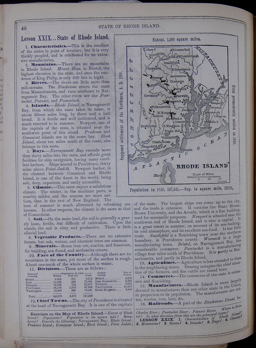 46
STATE OF RHODE ISLAND.
46
STATE OF RHODE ISLAND.
Lesson XXIX... State of Rhode Island.
1. Characteristics.—This is the smallest of the states in point of territory, but it is very thickly peopled, and is celebrated for its extensive manufactories.
2. Mountains.—There are no mountains in Rhode Island. Mount Hope, in Bristol, the highest elevation in the state, and once the residence of King Philip, is only 300 feet in hight.
3. Rivers.—The rivers are little more than mill-streams. The Blackstone enters the State from Massachusetts, and runs southeast to Narragansett Bay. The other rivers are the Pawtucket, Patuxet, and Pawcatuck.
4. Islands.—Rhode Island, in Narragansett Bay, from which the state takes its name, is about fifteen miles long, by three and a half broad. It is fertile and well cultivated, and is much resorted to in summer. Newport, one of the capitals of the state, is situated near the southwest point of this island. Prudence and Conanicut islands are in the same bay. Block Island, about ten miles south of the coast, also belongs to this state.
5. Bays.—Narragansett Bay extends more than thirty miles into the state, and affords great facilities for ship navigation, having many excellent harbors. Ships ascend to Providence, thirty miles above Point Judith. Newport harbor, in the channel between Conanicut and Rhode Island, is one of the finest in the world, being safe, deep, capacious, and easily accessible.
6. Climate.—This state enjoys a salubrious climate. The winter, in the maritime parts, is sensibly milder, and the seasons are more uniform, than in the rest of New England. The heat of summer is much alleviated by refreshing sea breezes. In other respects, the climate is the same as that of Connecticut.
7. Soil.—On the main-land, the soil is generally a gravely loam, fertile, but difficult of cultivation. Upon the islands, the soil is slaty and productive. There is little alluvial land.
8. Vegetable Products.—There are no extensive forests, but oak, walnut, and chestnut trees are common.
9. Minerals.—Some iron ore, marble, and freestone, for building, are found, and anthracite occurs.
10. Face of the Country.—Although there are no mountains in the state, yet most of the surface is rough. About one-tenth of the whole surface is water.
11. Divisions.—These are as follows: This table lists the counties of Rhode Island with their populations in 1850 and includes a column for the major town in each county and the town's population. The county population is divided into the following categories: White, Free Colored, and Total.
12. Chief Towns.—The city of Providence is situated at the head of Narragansett Bay. It is one of the capitals of the state. Map of Rhode Island. RHODE ISLAND Extent 1,200 square miles. Supposed settlement of the Northmen, A. D. 1000. First permanently settled in 1636. Population in 1850, 147,545.—Pop. to square mile, 122.95. The largest ships can come up to the city, and the trade is extensive. It contains the State House, Brown University, and the Arcade, which is a fine building, used for mercantile purposes. Newport is situated near the southwest end of Rhode Island, and is also a capital. It is a great resort in summer, on account of its sea-bathing, its cool atmosphere, and its excellent sea-food. It has little trade. Smithfield is a flourishing town near the northern boundary, in Providence county. Warwick is a large manufacturing town. Bristol, on Narragansett Bay, has considerable commerce. Pawtucket is a manufacturing village four miles north of Providence. It is partly in Massachusetts, and partly in Rhode Island.
13. Agriculture.—Agriculture is less attended to than in the neighboring states. Grazing occupies the chief attention of the farmers, and fine cattle are raised here.
14. Commerce.—The commerce of the state is extensive and flourishing.
15. Manufactures.—Rhode Island is more largely devoted to manufactures than any other state in the Union, in proportion to its population. The manufactures are cotton, woolen, iron, lace, &c.
16. Railroads.—A part of the Blackstone Canal, between
Exercises on the Map of Rhode Island.—Extent of Rhode Island? Population? Population to the square mile? Boundaries? Describe the following: Narragansett Bay; Rhode Island; Prudence Island; Conanicut Island; Block Island; Point Judith; Charles River; Pawtucket River; Patuxet River. Where is Bristol? In what direction from this are the principal towns?
LESSON XXIX. 1. Characteristics of Rhode Island? 2. Mountains? 3. Rivers? 4. Islands? 5. Bays? 6. Climate?
[begin surface 265]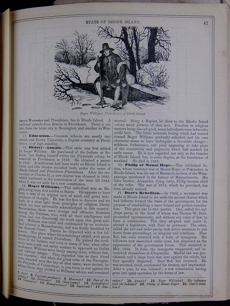 STATE OF RHODE ISLAND.
47
Roger Williams, First Settler of Rhode
Island.
An image of Roger Williams sitting on a fallen tree
in the winter.
STATE OF RHODE ISLAND.
47
Roger Williams, First Settler of Rhode
Island.
An image of Roger Williams sitting on a fallen tree
in the winter.
Worcester and Providence, lies in Rhode Island. A railroad extends from Boston to Providence. There is one also from the latter city to Stonington, and another to Worcester.
17. Education.—Common schools are nearly universal, and Brown University, a Baptist seminary at Providence, is of high standing.
18. History—Annals.—This state was first settled by Roger Williams. He purchased of the Indians at Sekonk; but finding himself within the Plymouth colony, he removed to Providence, in 1636. He obtained a patent in 1644. A settlement had been made on Rhode Island in 1638, and this charter included both, under the name of Rhode Island and Providence Plantations. After the restoration of Charles II., a new charter was obtained in 1663, which continued as the constitution of the state till 1844, when it was set aside by a new constitution.
19. Roger Williams.—This individual was an English clergyman, first settled at Salem. He appears to have been a man of an original turn of mind, and great independence of thought. He was the first to discover and set forth in a clear light those principles of religious liberty which are now universally acknowledged in this country. Nevertheless, these were strange and offensive doctrines among the Puritans, who, with all their intelligence and virtue, had not discovered the truth upon this great subject. Williams was tried and condemned by an ecclesiastical tribunal in Massachusetts, and was finally banished by the General Court. Thence he departed with a few followers. The place where his wanderings ended, with pious thanksgiving, he named Providence. He gained the confidence of the Indians, and even in times of war, when other white men could not safely venture to approach an Indian settlement, Williams went freely among them, without fear, and without danger. They regarded him as their friend and counselor; and when the great tribe of the Narragansetts, situated near the bay of that name, were invited, by the Pequods, of Connecticut, to join them in war against the whites there, they yielded to Williams' advice, and remained neutral. Being a Baptist, he drew to the Rhode Island colony many persons of that sect. Freedom in religious matters being also adopted, many individuals were induced to settle here. The bitter sectarian feeling which had existed toward Roger Williams gradually subsided, and his own character seems to have undergone a favorable change—mildness, forbearance, and piety appearing to take place of the eccentricity and pugnacity which had marked his early career. He is now regarded not only as the founder of Rhode Island, but, in some degree, as the benefactor of mankind. He died in 1683.
20. Philip of Mount Hope.—This celebrated Indian, whose residence was at Mount Hope, or Pokonoket, in Rhode Island, was the son of Massasoit, sachem of the Wampanoags, mentioned in the history of Massachusetts. His elder brother, Alexander, dying early, Philip became chief of the tribe. The war of 1675, which he provoked, has been already noticed.
21. Dorr's Rebellion.—In 1842, a movement was made in Rhode Island to set aside the ancient charter which had hitherto formed the basis of the government, for the purpose of establishing a more formal and perfect constitution. This gave rise to two parties. One, called the suffrage party, at the head of whom was Thomas W. Dorr, proceeded spontaneously, and without any rules of law, to form a constitution. This they adopted, and, under it, elected a legislature, with Dorr as governor. The other, called the law and order party, took active measures to put down these proceedings, as irregular and rebellious. Dorr fled, but soon returned with a body of insurgents. His followers now assembled under arms, but dispersed on the appearance of the government forces. This occurred in May, 1844. In June, the insurgents reappeared, and intrenched themselves at Chepatchet. Martial law was proclaimed, and a large force was sent against the rebels, but they speedily dispersed. Dorr fled, but returned. He was arrested, tried, condemned for treason, and imprisoned. After a year, he was released; a new constitution having gone into quiet operation by the forms of law.
7. Soil? 8. Vegetable products? 9. Minerals? 10. Face of the country? 11. Divisions? 12. Chief towns? 13. Agriculture? 14. Commerce? 15. Manufactures? 16. Railroads? 17. Education? 18. Annals? 19. Roger Williams? His influence with the Indians? 20. Philip of Mount Hope? 21. Dorr's rebellion?
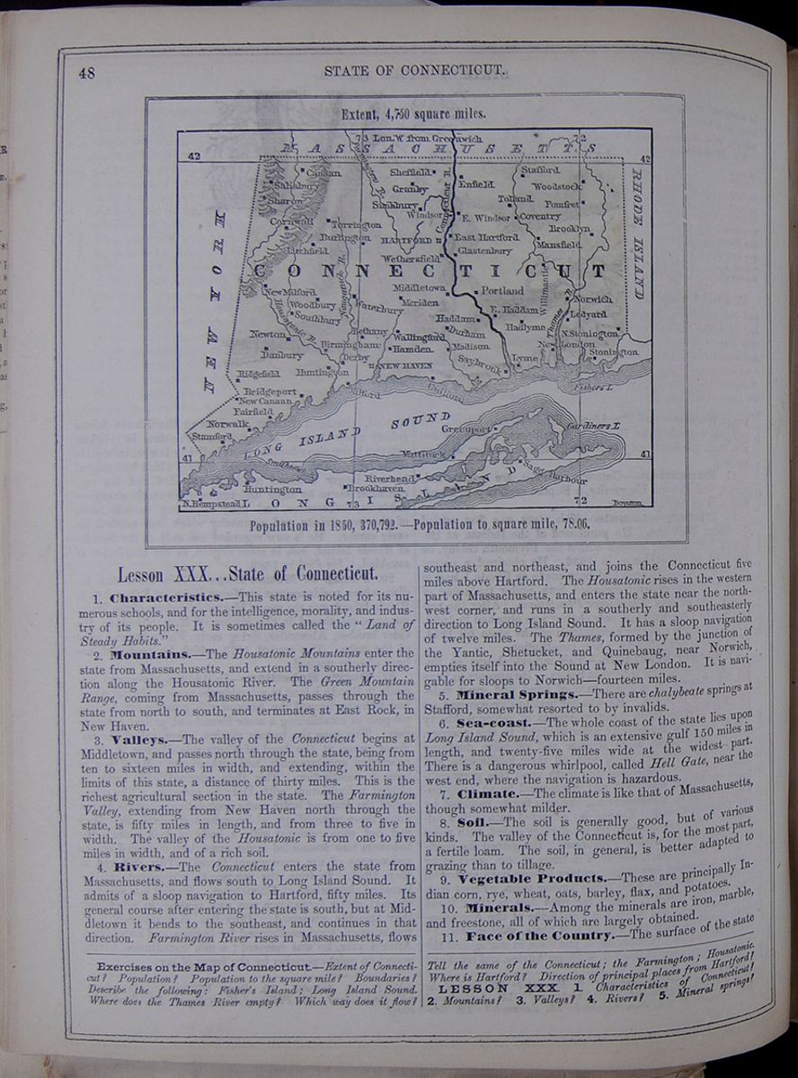 48
STATE OF CONNECTICUT.
Map of the state of Connecticut.
Extent, 4,750 square miles.
Population in 1850, 370,792.—Population to
square mile, 78.06.
48
STATE OF CONNECTICUT.
Map of the state of Connecticut.
Extent, 4,750 square miles.
Population in 1850, 370,792.—Population to
square mile, 78.06.
Lesson XXX... State of Connecticut.
1. Characteristics.—This state is noted for its numerous schools, and for the intelligence, morality, and industry of its people. It is sometimes called the "Land of Steady Habits."
2. Mountains.—The Housatonic Mountains enter the state from Massachusetts, and extend in a southerly direction along the Housatonic River. The Green Mountain Range, coming from Massachusetts, passes through the state from north to south, and terminates at East Rock, in New Haven.
3. Valleys.—The valley of the Connecticut begins at Middletown, and passes north through the state, being from ten to sixteen miles in width, and extending, within the limits of this state, a distance of thirty miles. This is the richest agricultural section in the state. The Farmington Valley, extending from New Haven north through the state, is fifty miles in length, and from three to five in width. The valley of the Housatonic is from one to five miles in width, and of a rich soil.
4. Rivers.—The Connecticut enters the state from Massachusetts, and flows south to Long Island Sound. It admits of a sloop navigation to Hartford, fifty miles. Its general course after entering the state is south, but at Middletown it bends to the southeast, and continues in that direction. Farmington River rises in Massachusetts, flows southeast and northeast, and joins the Connecticut five miles above Hartford. The Housatonic rises in the western part of Massachusetts, and enters the state near the northwest corner, and runs in a southerly and southeasterly direction to Long Island Sound. It has a sloop navigation of twelve miles. The Thames, formed by the junction of the Yantic, Shetucket, and Quinebaug, near Norwich, empties itself into the Sound at New London. It is navigable for sloops to Norwich—fourteen miles.
5. Mineral Springs.—There are chalybeate springs at Stafford, somewhat resorted to by invalids.
6. Sea-coast.—The whole coast of the state lies upon Long Island Sound, which is an extensive gulf 150 miles in length, and twenty-five miles wide at the widest part. There is a dangerous whirlpool, called Hell Gate, near the west end, where the navigation is hazardous.
7. Climate.—The climate is like that of Massachusetts, though somewhat milder.
8. Soil.—The soil is generally good, but of various kinds. The valley of the Connecticut is, for the most part, a fertile loam. The soil, in general, is better adapted to grazing than to tillage.
9. Vegetable Products.—These are principally Indian corn, rye, wheat, oats, barley, flax, and potatoes.
10. Minerals.—Among the minerals are iron, marble, and freestone, all of which are largely obtained.
11. Face of the Country.—The surface of the state
Exercises on the Map of Connecticut.—Extent of Connecticut? Population? Population to the square mile? Boundaries? Describe the following: Fisher's Island; Long Island Sound. Where does the Thames River empty? Which way does it flow? Tell the same of the Connecticut; the Farmington; Housatonic. Where is Hartford? Direction of principal places from Hartford?
LESSON XXX. 1. Characteristics of Connecticut? 2. Mountains? 3. Valleys? 4. Rivers? 5. Mineral springs?
[begin surface 267]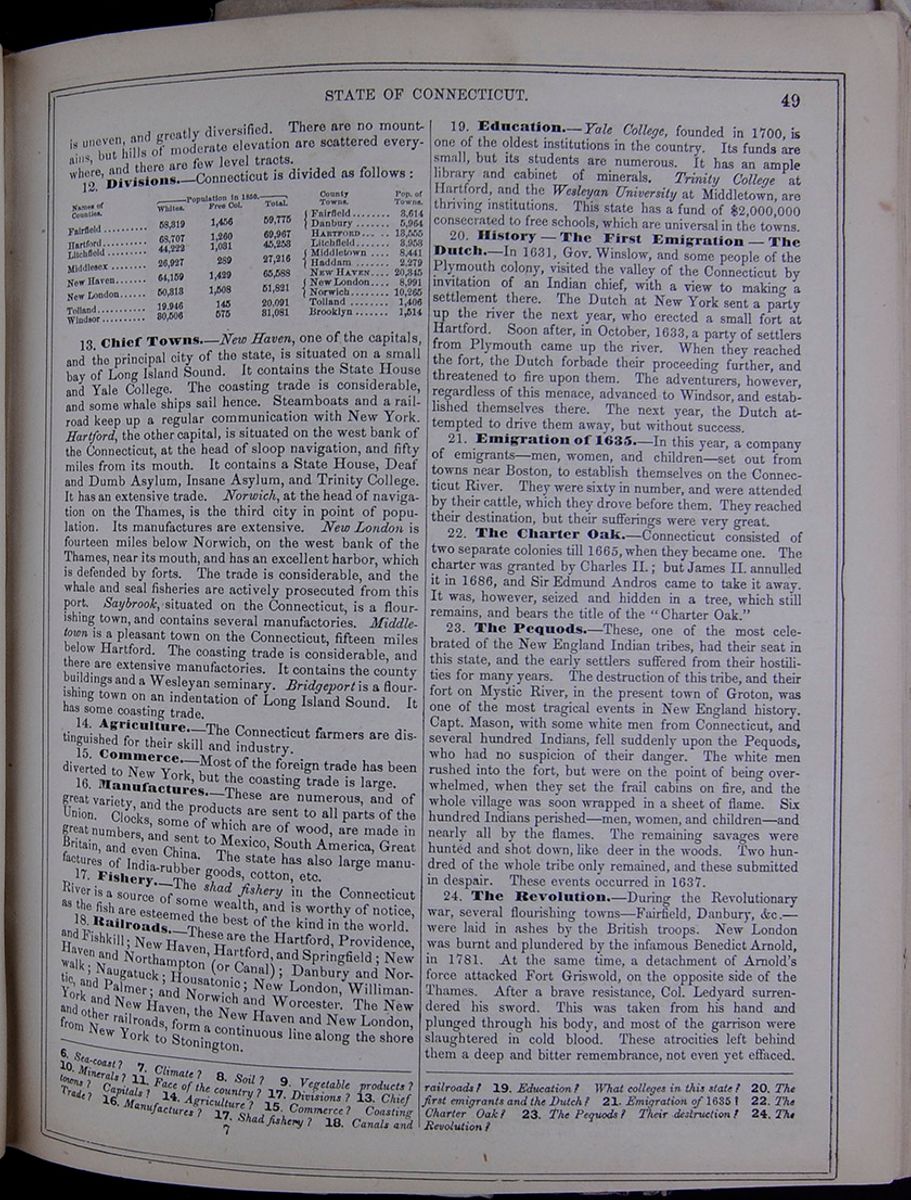 STATE OF CONNECTICUT.
49
STATE OF CONNECTICUT.
49
is uneven, and greatly diversified. There are no mountains, but hills of moderate elevation are scattered everywhere, and there are few level tracts.
12. Divisions.—Connecticut is divided as follows: This table lists the counties of Connecticut with their populations in 1850 and includes a column for the major town in each county and the town's population. The county population is divided into the following categories: White, Free Colored, and Total.
13. Chief Towns.—New Haven, one of the capitals, and the principal city of the state, is situated on a small bay of Long Island Sound. It contains the State House and Yale College. The coasting trade is considerable, and some whale ships sail hence. Steamboats and a railroad keep up a regular communication with New York. Hartford, the other capital, is situated on the west bank of the Connecticut, at the head of sloop navigation, and fifty miles from its mouth. It contains a State House, Deaf and Dumb Asylum, Insane Asylum, and Trinity College. It has an extensive trade. Norwich, at the head of navigation on the Thames, is the third city in point of population. Its manufactures are extensive. New London is fourteen miles below Norwich, on the west bank of the Thames, near its mouth, and has an excellent harbor, which is defended by forts. The trade is considerable, and the whale and seal fisheries are actively prosecuted from this port. Saybrook, situated on the Connecticut, is a flourishing town, and contains several manufactories. Middletown is a pleasant town on the Connecticut, fifteen miles below Hartford. The coasting trade is considerable, and there are extensive manufactories. It contains the county buildings and a Wesleyan seminary. Bridgeport is a flourishing town on an indentation of Long Island Sound. It has some coasting trade.
14. Agriculture.—The Connecticut farmers are distinguished for their skill and industry.
15. Commerce.—Most of the foreign trade has been diverted to New York, but the coasting trade is large.
16. Manufactures.—These are numerous, and of great variety, and the products are sent to all parts of the Union. Clocks, some of which are of wood, are made in great numbers, and sent to Mexico, South America, Great Britain, and even China. The state has also large manufactures of India-rubber goods, cotton, etc.
17. Fishery.—The shad fishery in the Connecticut River is a source of some wealth, and is worthy of notice, as the fish are esteemed the best of the kind in the world.
18. Railroads—These are the Hartford, Providence, and Fishkill; New Haven, Hartford, and Springfield; New Haven and Northampton (or Canal); Danbury and Norwalk; Naugatuck; Housatonic; New London, Willimantic, and Palmer; and Norwich and Worcester. The New York and New Haven, the New Haven and New London, and other railroads, form a continuous line along the shore from New York to Stonington.
19. Education.—Yale College, founded in 1700, is one of the oldest institutions in the country. Its funds are small, but its students are numerous. It has an ample library and cabinet of minerals. Trinity College at Hartford, and the Wesleyan University at Middletown, are thriving institutions. This state has a fund of $2,000,000 consecrated to free schools, which are universal in the towns.
20. History—The First Emigration—The Dutch.—In 1631, Gov. Winslow, and some people of the Plymouth colony, visited the valley of the Connecticut by invitation of an Indian chief, with a view to making a settlement there. The Dutch at New York sent a party up the river the next year, who erected a small fort at Hartford. Soon after, in October, 1633, a party of settlers from Plymouth came up the river. When they reached the fort, the Dutch forbade their proceeding further, and threatened to fire upon them. The adventurers, however, regardless of this menace, advanced to Windsor, and established themselves there. The next year, the Dutch attempted to drive them away, but without success.
21. Emigration of 1635.—In this year, a company of emigrants—men, women, and children—set out from towns near Boston, to establish themselves on the Connecticut River. They were sixty in number, and were attended by their cattle, which they drove before them. They reached their destination, but their sufferings were very great.
22. The Charter Oak.—Connecticut consisted of two separate colonies till 1665, when they became one. The charter was granted by Charles II.; but James II. annulled it in 1686, and Sir Edmund Andros came to take it away. It was, however, seized and hidden in a tree, which still remains, and bears the title of the "Charter Oak."
23. The Pequods.—These, one of the most celebrated of the New England Indian tribes, had their seat in this state, and the early settlers suffered from their hostilities for many years. The destruction of this tribe, and their fort on Mystic River, in the present town of Groton, was one of the most tragical events in New England history. Capt. Mason, with some white men from Connecticut, and several hundred Indians, fell suddenly upon the Pequods, who had no suspicion of their danger. The white men rushed into the fort, but were on the point of being overwhelmed, when they set the frail cabins on fire, and the whole village was soon wrapped in a sheet of flame. Six hundred Indians perished—men, women, and children—and nearly all by the flames. The remaining savages were hunted and shot down, like deer in the woods. Two hundred of the whole tribe only remained, and these submitted in despair. These events occurred in 1637.
24. The Revolution.—During the Revolutionary war, several flourishing towns—Fairfield, Danbury, &c.—were laid in ashes by the British troops. New London was burnt and plundered by the infamous Benedict Arnold, in 1781. At the same time, a detachment of Arnold's force attacked Fort Griswold, on the opposite side of the Thames. After a brave resistance, Col. Ledyard surrendered his sword. This was taken from his hand and plunged through his body, and most of the garrison were slaughtered in cold blood. These atrocities left behind them a deep and bitter remembrance, not even yet effaced.
6. Sea-coast? 7. Climate? 8. Soil? 9. Vegetable products? 10. Minerals? 13. Face of the country? 17. Divisions? 13. Chief towns? Capitals? 14. Agriculture? 15. Commerce? Coasting Trade? 16. Manufactures? 17. Shad fishery? 18. Canals and railroads? 19. Education? What colleges in this state? 20. The first emigrants and the Dutch? 21. Emigration of 1635? 22. The Charter Oak? 23. The Pequods? Their destruction? 24. The Revolution?
7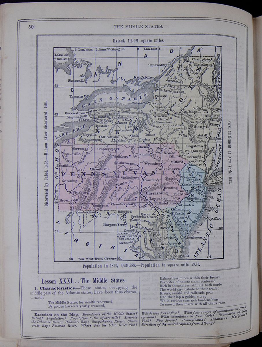 50
THE MIDDLE STATES.
A map including New York, Pennsylvania, New Jersey,
Delaware, Maryland, and parts of Virginia and
Ohio.
Extent, 113,021 square miles.
Discovered by Cabot, 1498.—Hudson River
discovered, 1609.
First Settlement at New York, 1613.
Population in 1850, 6,624,988.—Population to
square mile, 58.61.
50
THE MIDDLE STATES.
A map including New York, Pennsylvania, New Jersey,
Delaware, Maryland, and parts of Virginia and
Ohio.
Extent, 113,021 square miles.
Discovered by Cabot, 1498.—Hudson River
discovered, 1609.
First Settlement at New York, 1613.
Population in 1850, 6,624,988.—Population to
square mile, 58.61.
Lesson XXXI... The Middle States.
1. Characteristics.—These states, occupying the middle part of the Atlantic states, have been thus characterized: The Middle States, for wealth renowned, By golden harvests yearly crowned, Exhaustless mines within their breast, Favorites of nature stand confessed! Rich in themselves, still art hath made The world pay tribute to their trade: Rivers, Canals, and railroads pour Into their lap a golden store; While various seas rich burdens bear, To crowd their marts with all that's rare.
Exercises on the Map.—Boundaries of the Middle States? Extent? Population? Population to the square mile? Describe the Delaware River; Delaware Bay; Susquehanna River; Chesapeake Bay; Potomac River. Where does the Ohio River rise? Which way does it flow? What four ranges of mountains in Pennsylvania? What mountains in New York? Boundaries of New York? New Jersey? Pennsylvania? Delaware? Maryland? Direction of the several capitals from Albany?
[begin surface 269] THE MIDDLE STATES.
51
THE MIDDLE STATES.
51
2. Mountains.—These states exhibit the most extensive mountain tracts to be found in the eastern portion of the Union. The Alleghanies, which extend to a width of two hundred miles, in Pennsylvania, and the Catskill Mountains, in New York, both of which belong to the great Apalachian chain, are the most remarkable portions. This table lists the heights of the highest peaks of mountain ranges in the region.
3. Valleys.—The great streams have generally rocky banks, with little interval land; but here and there, extensive valleys occur. The broadest is that of the Hudson, which, in one part of its course, is forty miles wide.
4. Rivers.—The rivers of this region, especially the Hudson, the Delaware, and the Susquehanna, afford peculiar facilities for carrying the products to markets of the great commercial cities. New York, Philadelphia, and Baltimore become their depositories. This table lists the lengths of the Hudson, Delaware, Susquehanna, and Potomac rivers.
5. Lakes.—The great lakes Ontario and Erie, which form the northern boundary of the Middle States, constitute an important feature in their physical geography, and largely contribute to their commercial advantages. The small lakes of New York give an additional charm to the scenery of that state, and afford some advantages for navigation.
6. Sea-coast.—This is mostly low, sandy, and level. The principal bays are Raritan, Chesapeake, and Delaware. The latter, fifty miles from its mouth, expands into a bay from ten to thirty miles wide, the navigation of which is rendered somewhat difficult by shoals. Chesapeake Bay, or the estuary of the Susquehanna, is a broad, deep basin, 185 miles in length.
7. Vegetable Products.—The original vegetation of this region is greatly diversified. The soil and climate are peculiarly fitted to all kinds of grain. Wheat here attains its greatest perfection. Apples, peaches, pears, and grapes are abundant, and of the best quality.
8. Animals.—The bear, wolf, moose, and wild turkey are found in the north. In the mountainous tracts of Pennsylvania, the common deer is abundant. The cougar, or panther, raccoon, opossum, pinnated grouse, ruffed grouse, and quail, are also common in some parts.
9. Minerals.—Iron, coal, and marble are the chief minerals. The beds of these are inexhaustible.
10. Climate.—This section enjoys a climate somewhat milder than that of New England; the central portion, being elevated 2000 feet above the level of the sea, experiences severe cold during the winter.
11. Soil.—With such an extent and diversity of surface, there must be every variety. A large portion is extremely fertile, yet there are large tracts which are unproductive. Only a small portion of the territory is under cultivation.
12. Face of the Country.—Toward the sea, the land is a low alluvial level, indented by shallow inlets. Further inland, the country rises into hills and mountains. West of these, the country again sinks into swelling table-lands and valleys. On the whole, the surface of the Middle States is greatly diversified.
13. Divisions.—These are as follows: This table lists the capitals of the States in the Middle State region including New York, New Jersey, Pennsylvania, Delaware, Maryland, and the District of Columbia.
14. Industry.—Agriculture is the chief employment, and is conducted on a grand scale. The commerce is also very extensive, of which the three great cities of New York, Philadelphia, and Baltimore are striking evidence. These have not only a great foreign commerce, but a vast trade with the interior, facilitated by numerous canals and railroads. The manufactures are varied and extensive. Mining, especially for coal and iron, is carried on upon a large scale.
15. Canals and Railroads.—No part of the Union presents more extensive and numerous canals and railroads than the Middle States. These, in connection with the navigable waters, afford extraordinary facilities for travel and transportation.
16. Cities.—The great cities of this region are as follows: This table lists the cities of New York, Brooklyn, Philadelphia, and Baltimore with their populations in the years 1840 and 1850.
17. Distances from New York: This table lists distance from New York of the following cities: Albany, Troy, Ogdensburg, Rochester, Buffalo, Niagara Falls, Trenton, N. J., Newark, Philadelphia, Harrisburg, Pittsburgh, Dover, Wilmington, Del., Baltimore, Annapolis, and Washington.
18. Inhabitants.—The Middle States were settled by people from different countries—England, Holland, Germany, Denmark, and Sweden. From this circumstance, the population has always been more mixed than in New England. Those of English descent are, however, by far the largest class. In some villages, the original language, manners, and customs of the settlers are to be found, with little modification by time and circumstances. In Pennsylvania, there are large masses of Germans, and for these there are almanacs, newspapers, political documents, Bibles, &c., printed in the German language. Still, the English generally prevails.
19. History—The Revolution.—The Middle States were the chief theater of action during the Revolutionary war. New York was captured by the British in the autumn of 1776, and they did not leave it till November 25th, 1783. This city was the residence of the British commander-in-chief, and the center of all the military operations throughout the country.
20. Congress.—Philadelphia was also in the possession of the British from September 26th, 1777, till the 18th of June, 1778. Congress assembled at Philadelphia till it was threatened by the British, in the summer of 1777. After the war, New York was, for a time, the seat of government; and then Philadelphia, till it was removed to Washington, in 1800.
21. Washington.—Washington occupied stations upon the Hudson, and in New Jersey and Pennsylvania, for several years; and his most celebrated displays of generalship took place in battles and skirmishes within the three states of New York, New Jersey, and Pennsylvania.
LESSON XXXI. 1. Characteristics of the Middle States? 2. Mountains? 3. Valleys? 4. Rivers? 5. Lakes? 6. Sea-coast? 7. Vegetable products? 8. Animals? 9. Minerals? 10. Climate? 11. Soil? 12. Face of the country? 13. Divisions? 4. Industry? 15. Canals and railroads? 16. Cities? 17. Distances from New York? 18. Inhabitants? 19. New York during the Revolution? 20. Congress? Where did it assemble? 21. Washington?
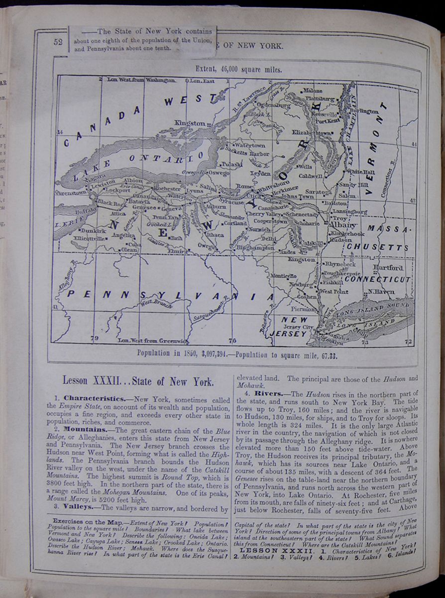 52
[covered]E OF NEW
YORK.
[begin surface 271]
52
[covered]E OF NEW
YORK.
[begin surface 271]
——The State of New York contains about one eighth of the population of the Union, and Pennsylvania about one tenth.
Lesson XXXII... State of New York.
1. Characteristics.—New York, sometimes called the Empire State, on account of its wealth and population, occupies a fine region, and exceeds every other state in population, riches, and commerce.
2. Mountains.—The great eastern chain of the Blue Ridge, or Alleghanies, enters this state from New Jersey and Pennsylvania. The New Jersey branch crosses the Hudson near West Point, forming what is called the Highlands. The Pennsylvania branch bounds the Hudson River valley on the west, under the name of the Catskill Mountains. The highest summit is Round Top, which is 3800 feet high. In the northern part of the state, there is a range called the Mohegan Mountains. One of its peaks, Mount Marcy, is 5200 feet high.
3. Valleys.—The valleys are narrow, and bordered by elevated land. The principal are those of the Hudson and Mohawk.
4. Rivers.—The Hudson rises in the northern part of the state, and runs south to New York Bay. The tide flows up to Troy, 160 miles; and the river is navigable to Hudson, 130 miles, for ships, and to Troy for sloops. Its whole length is 324 miles. It is the only large Atlantic river in the country, the navigation of which is not closed by its passage through the Alleghany ridge. It is nowhere elevated more than 150 feet above tide-water. Above Troy, the Hudson receives its principal tributary, the Mohawk, which has its sources near Lake Ontario, and a course of about 135 miles, with a descent of 364 feet. The Genesee rises on the table-land near the northern boundary of Pennsylvania, and runs north across the western part of New York, into Lake Ontario. At Rochester, five miles from its mouth, are falls of ninety-six feet; and at Carthage, just below Rochester, falls of seventy-five feet. Above
Exercises on the Map.—Extent of New York? Population? Population to the square mile? Boundaries? What lake between Vermont and New York? Describe the following: Oneida Lake; Owasco Lake; Cayuga Lake; Seneca Lake; Crooked Lake; Ontario. Describe the Hudson River; Mohawk. Where does the Susquehanna River rise? In what part of the state is the Erie Canal? Capital of the state? In what part of the state is the city of New York? Direction of some of the principal towns from Albany? What island at the southeastern part of the state? What Sound separates this from Connecticut? Where are the Catskill Mountains?
LESSON XXXII. 1. Characteristics of New York? 2. Mountains? 3. Valleys? 4. Rivers? 5. Lakes? 6. Islands?
[begin surface 272]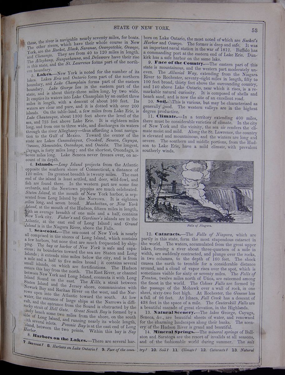 STATE OF NEW YORK.
53
STATE OF NEW YORK.
53
these, the river is navigable nearly seventy miles, for boats. The other rivers, which have their whole course in New York, are the Racket, Black, Saranac, Oswegatchie, Oswego, and Chenango. They are from 40 to 120 miles in length. The Alleghany, Susquehanna, and Delaware have their rise in this state, and the St. Lawrence forms part of the northern boundary.
5. Lakes.—New York is noted for the number of its lakes. Lakes Erie and Ontario form part of the northern boundary, and Lake Champlain forms part of the eastern boundary. Lake George lies in the eastern part of the state, and is about thirty-three miles long, by two wide. It empties its waters into Lake Champlain by an outlet three miles in length, with a descent of about 160 feet. Its waters are clear and pure, and it is dotted with over 200 islands. On the table-land, a few miles from Lake Erie, is Lake Chautauque, about 1300 feet above the level of the sea, and 725 feet above Lake Erie. It is eighteen miles long, and from one to three wide, and discharges its waters through the river Alleghany—thus affording a boat navigation to the Gulf of Mexico. Toward the center of the state are Lakes Canandaigua, Crooked, Seneca, Cayuga, Owasco, Skeneateles, Onondaga, and Oneida. The longest, Cayuga, is forty miles long; and the shortest, Onondaga, is seven miles long. Lake Seneca never freezes over, on account of its depth.
6. Islands.—Long Island projects from the Atlantic opposite the southern shore of Connecticut, a distance of 120 miles. Its greatest breadth is twenty miles. The east end of the island is least settled, and deer, wild-fowl, and fish are found there. In the western part are some fine orchards, and the Newtown pippins are much celebrated. Staten Island, at the mouth of New York harbor, is separated from Long Island by the Narrows. It is eighteen miles long, and seven broad. Manhattan, or New York Island, at the mouth of the Hudson, fifteen miles in length, with an average breadth of one mile and a half, contains New York city. Fisher's and Gardiner's islands are in the Atlantic, at the east end of Long Island; and Grand Island is in the Niagara River, above the Falls.
7. Sea-coast.—The sea-coast of New York is nearly all comprised in the shores of Long Island, which contains a few harbors, but none that are much frequented by shipping. The bay or harbor of New York is safe and capacious; its boundaries toward the sea are Staten and Long Islands; it extends nine miles below the city, and is from a mile and a half to five miles broad; it contains several small islands, on which are fortifications. The Hudson enters this bay from the north. The East River, or channel between New York and Long Island, connects it with Long Island Sound on the east. The Kills, a strait between Staten Island and the Jersey shore, communicates with Newark Bay and Raritan River on the west, and the Narrows open into the Atlantic toward the south. At low water, the entrance of large ships at the Narrows is difficult, and the entrance from the Sound is obstructed by the rocky strait of Hell Gate. Great South Bay is formed by a sandy beach some two miles from the shore, on the south side of Long Island, and running nearly its whole length, with several inlets. Peconic Bay is at the east end of Long Island, between the two points. Within this bay is Sag Harbor.
8. Harbors on the Lakes.—There are several harbors on Lake Ontario, the most noted of which are Socket's Harbor and Oswego. The former is deep and safe. It was an important naval station in the war of 1812. Buffalo has a commanding port at the eastern end of Lake Erie. Dunkirk has a safe harbor on the same lake.
9. Face of the Country.—The eastern part of this state is mountainous, and the western part moderately uneven. The Alluvial Way, extending from the Niagara River to Rochester, seventy-eight miles in length, fifty to 100 feet broad, thirty feet above the surrounding country, and 140 above Lake Ontario, near which it rises, is a remarkable natural curiosity. It is composed of shells and beach sand, and is now the site of an excellent road.
10. Soil.—This is various, but may be characterized as generally good. The western valleys are in the highest degree productive.
11. Climate.—In a territory extending 400 miles, there must be considerable varieties of climate. In the city of New York and the vicinity, the sea air renders the climate moist and mild. Along the St. Lawrence, the country is elevated and mountainous, and the winters are long and severe. The southern and middle portions, from the Hudson to Lake Erie, have a mild climate, with prevalent southerly winds.
Falls of Niagara. Image of Niagara Falls.12. Cataracts.—The Falls of Niagara, which are partly in this state, form the most stupendous cataract in the world. The waters, accumulated from the great upper lakes, forming a river about three-quarters of a mile in width, are suddenly contracted, and plunge over the rocks, in two columns, to the depth of 160 feet. The shock causes the earth to tremble for a considerable distance around, and a cloud of vapor rises over the spot, which is sometimes visible for sixty or seventy miles. The Falls of Trenton, twelve miles north of Utica, are esteemed among the finest in the world. The Cohoes Falls are formed by the passage of the Mohawk over a wall of rock, in one sheet, sixty-two feet high. At Rochester, the Genesee has a fall of 96 feet. At Ithaca, Fall Creek has a descent of 438 feet in the space of a mile. The Cauterskill Falls are a beautiful cascade of great elevation, in the Highlands.
13. Natural Scenery.—The lakes George, Cayuga, Seneca, &c., are beautiful sheets of water, and renowned for the charming landscapes along their banks. The scenery of the Hudson River is grand and beautiful.
14. Mineral Springs.—The mineral springs of Ballston and Saratoga are the resort of invalids at all seasons, and of the fashionable world during summer. The salt
7. Sea-coast? 8. Harbors on Lake Ontario? 9. Face of the country? 10. Soil? 11. Climate? 12. Cataracts? 13. Natural
[begin surface 273]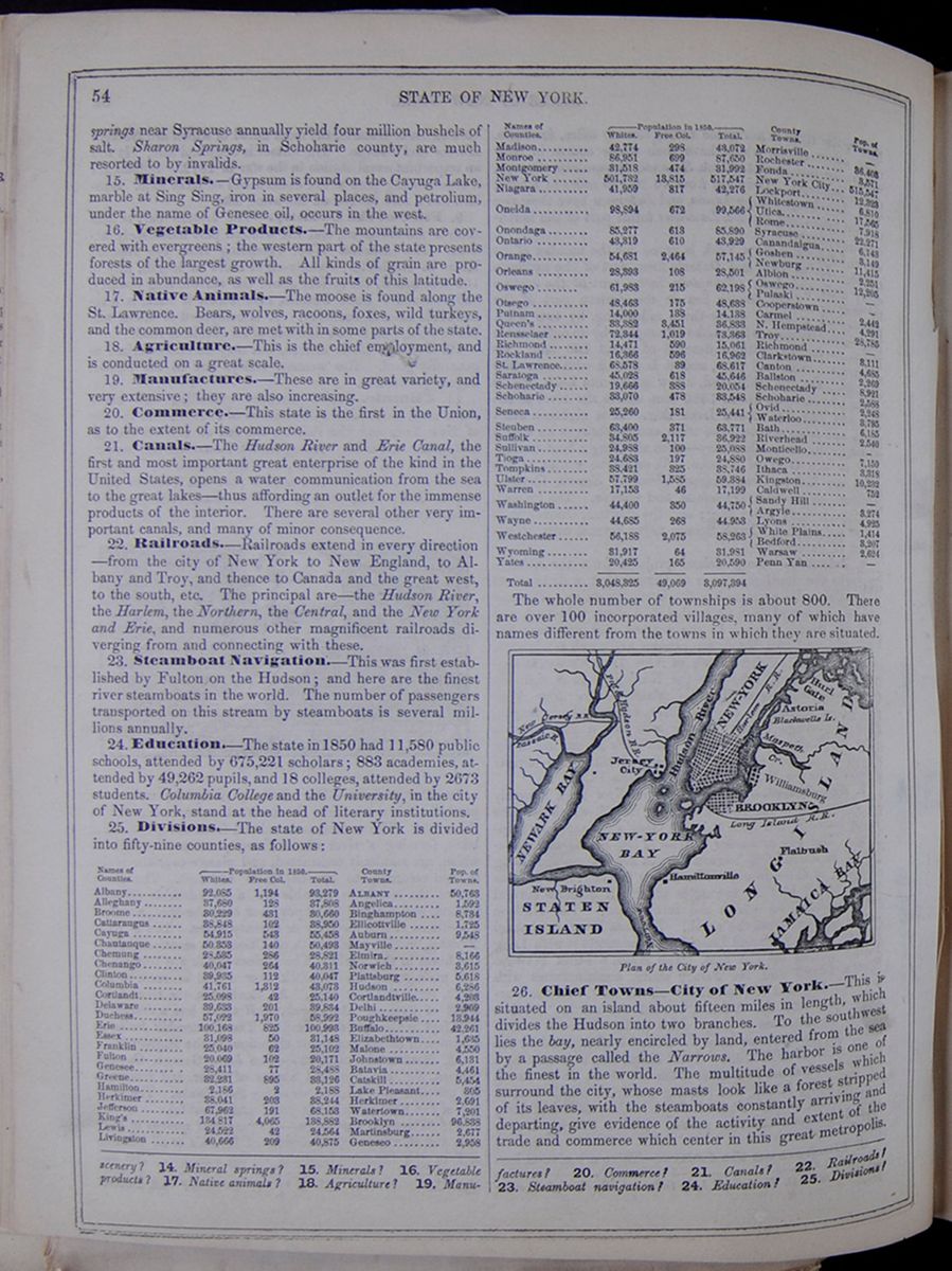 54
STATE OF NEW YORK.
54
STATE OF NEW YORK.
springs near Syracuse annually yield four million bushels of salt. Sharon Springs, in Schoharie county, are much resorted to by invalids.
15. Minerals.—Gypsum is found on the Cayuga Lake, marble at Sing Sing, iron in several places, and petrolium, under the name of Genesee oil, occurs in the west.
16. Vegetable Products.—The mountains are covered with evergreens; the western part of the state presents forests of the largest growth. All kinds of grain are produced in abundance, as well as the fruits of this latitude.
17. Native Animals.—The moose is found along the St. Lawrence. Bears, wolves, racoons, foxes, wild turkeys, and the common deer, are met with in some parts of the state.
18. Agriculture.—This is the chief employment, and is conducted on a great scale.
19. Manufactures.—These are in great variety, and very extensive; they are also increasing.
20. Commerce.—This state is the first in the Union, as to the extent of its commerce.
21. Canals.—The Hudson River and Erie Canal, the first and most important great enterprise of the kind in the United States, opens a water communication from the sea to the great lakes—thus affording an outlet for the immense products of the interior. There are several other very important canals, and many of minor consequence.
22. Railroads.—Railroads extend in every direction—from the city of New York to New England, to Albany and Troy, and thence to Canada and the great west, to the south, etc. The principal are—the Hudson River, the Harlem, the Northern, the Central, and the New York and Erie, and numerous other magnificent railroads diverging from and connecting with these.
23. Steamboat Navigation.—This was first established by Fulton on the Hudson; and here are the finest river steamboats in the world. The number of passengers transported on this stream by steamboats is several millions annually.
24. Education.—The state in 1850 had 11,580 public schools, attended by 675,221 scholars; 883 academies, attended by 49,262 pupils, and 18 colleges, attended by 2673 students. Columbia College and the University, in the city of New York, stand at the head of literary institutions.
25. Divisions.—The state of New York is divided into fifty-nine counties, as follows: This table lists the counties of New York with their populations in 1850 and includes a column for the major town in each county and the town's population. The county population is divided into the following categories: White, Free Colored, and Total. The whole number of townships is about 800. There are over 100 incorporated villages, many of which have names different from towns in which they are situated.
Image of the city plan of New York City. Plan of the City of New York.26. Chief Towns—City of New York.—This is situated on an island about fifteen miles in length, which divides the Hudson into two branches. To the southwest lies the bay, nearly encircled by land, entered from the sea by a passage called the Narrows. The harbor is one of the finest in the world. The multitude of vessels which surround the city, whose masts look like a forest stripped of its leaves, with the steamboats constantly arriving and departing, give evidence of the activity and extent of the trade and commerce which center in this great metropolis.
scenery? 14. Mineral springs? 15. Minerals? 16. Vegetable products? 17. Native animals? 18. Agriculture? 19. Manufactures? 20. Commerce? 21. Canals? 22. Railroads? 23. Steamboat navigation? 24. Education? 25. Divisions?
[begin surface 274]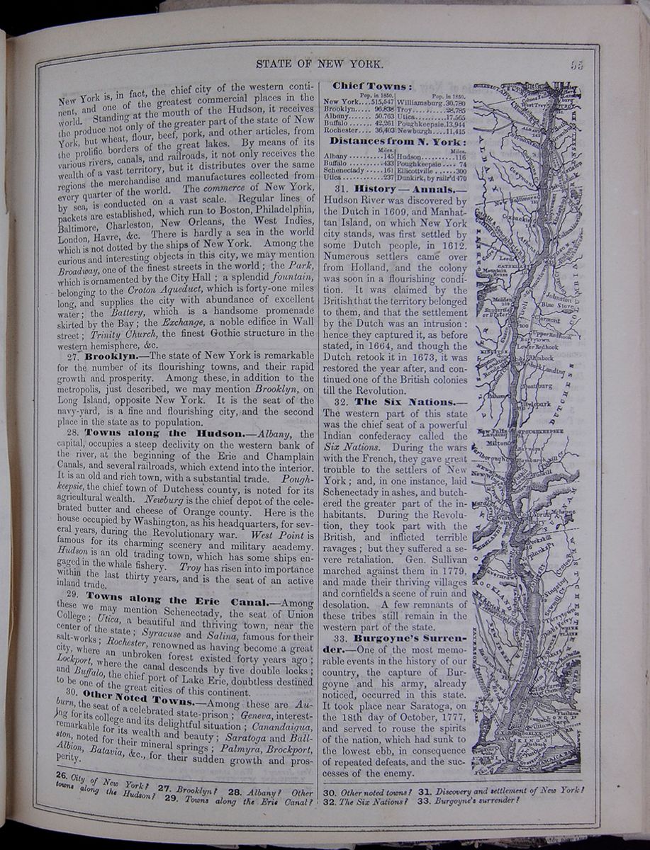 STATE OF NEW YORK.
55
STATE OF NEW YORK.
55
New York is, in fact, the chief city of the western continent, and one of the greatest commercial places in the world. Standing at the mouth of the Hudson, it receives the produce not only of the greater part of the state of New York, but wheat, flour, beef, pork, and other articles, from the prolific borders of the great lakes. By means of its various rivers, canals, and railroads, it not only receives the wealth of a vast territory, but it distributes over the same regions the merchandise and manufactures collected from every quarter of the world. The commerce of New York, by sea, is conducted on a vast scale. Regular lines of packets are established, which run to Boston, Philadelphia, Baltimore, Charleston, New Orleans, the West Indies, London, Havre, &c. There is hardly a sea in the world which is not dotted by the ships of New York. Among the curious and interesting objects in this city, we may mention Broadway, one of the finest streets in the world; the Park, which is ornamented by the City Hall; a splendid fountain, belonging to the Croton Aqueduct, which is forty-one miles long, and supplies the city with abundance of excellent water; the Battery, which is a handsome promenade skirted by the Bay; the Exchange, a noble edifice in Wall street; Trinity Church, the finest Gothic structure in the western hemisphere, &c.
27. Brooklyn.—The state of New York is remarkable for the number of its flourishing towns, and their rapid growth and prosperity. Among these, in addition to the metropolis, just described, we may mention Brooklyn, on Long Island, opposite New York. It is the seat of the navy-yard, is a fine and flourishing city, and the second place in the state as to population.
28. Towns along the Hudson.—Albany, the capital, occupies a steep declivity on the western bank of the river, at the beginning of the Erie and Champlain Canals, and several railroads, which extend into the interior. It is an old and rich town, with a substantial trade. Poughkeepsie, the chief town of Dutchess county, is noted for its agricultural wealth. Newburg is the chief depot of the celebrated butter and cheese of Orange county. Here is the house occupied by Washington, as his headquarters, for several years, during the Revolutionary war. West Point is famous for its charming scenery and military academy. Hudson is an old trading town, which has some ships engaged in the whale fishery. Troy has risen into importance within the last thirty years, and is the seat of an active inland trade.
29. Towns along the Erie Canal.—Among these we may mention Schenectady, the seat of Union College; Utica, a beautiful and thriving town, near the center of the state; Syracuse and Salina, famous for their salt-works; Rochester, renowned as having become a great city, where an unbroken forest existed forty years ago; Lockport, where the canal descends by five double locks; and Buffalo, the chief port of Lake Erie, doubtless destined to be one of the great cities of this continent.
30. Other Noted Towns.—Among these are Auburn, the seat of a celebrated state-prison; Geneva, interesting for its college and its delightful situation; Canandaigua, remarkable for its wealth and beauty; Saratoga and Ballston, noted for their mineral springs; Palmyra, Brockport, Albion, Batavia, &c., for their sudden growth and prosperity.
Chief Towns: This table lists population in 1850 of the following cities: New York, Brooklyn, Albany, Buffalo, Rochester, Williamsburg, Troy, Utica, Poughkeepsie, and Newburgh.
Distances from N. York: This table lists distance from New York of the following cities: Albany, Buffalo, Schenectady, Utica, Hudson, Poughkeepsie, Ellicottville, and Dunkirk.
31. History—Annals.—Hudson River was discovered by the Dutch in 1609, and Manhattan Island, on which New York city stands, was first settled by some Dutch people, in 1612. Numerous settlers came over from Holland, and the colony was soon in a flourishing condition. It was claimed by the British that the territory belonged to them, and that the settlement by the Dutch was an intrusion: hence they captured it, as before stated, in 1664, and though the Dutch retook it in 1673, it was restored the year after, and continued one of the British colonies till the Revolution.
32. The Six Nations.—The western part of this state was the chief seat of a powerful Indian confederacy called the Six Nations. During the wars with the French, they gave great trouble to the settlers of New York; and, in one instance, laid Schenectady in ashes, and butchered the greater part of the inhabitants. During the Revolution, they took part with the British, and inflicted terrible ravages; but they suffered a severe retaliation. Gen. Sullivan marched against them in 1779, and made their thriving villages and cornfields a scene of ruin and desolation. A few remnants of these tribes still remain in the western part of the state.
33. Burgoyne's Surrender.—One of the most memorable events in the history of our country, the capture of Burgoyne and his army, already noticed, occurred in this state. It took place near Saratoga, on the 18th day of October, 1777, and served to rouse the spirits of the nation, which had sunk to the lowest ebb, in consequence of repeated defeats, and the successes of the enemy.
Narrow map of the Hudson river and the towns and regions immediately bordering it.26. City of New York? 27. Brooklyn? 28. Albany? Other towns along the Hudson? 29. Towns along the Erie Canal? 30. Other noted towns? 31. Discovery and settlement of New York? 32. The Six Nations? 33. Burgoyne's surrender?
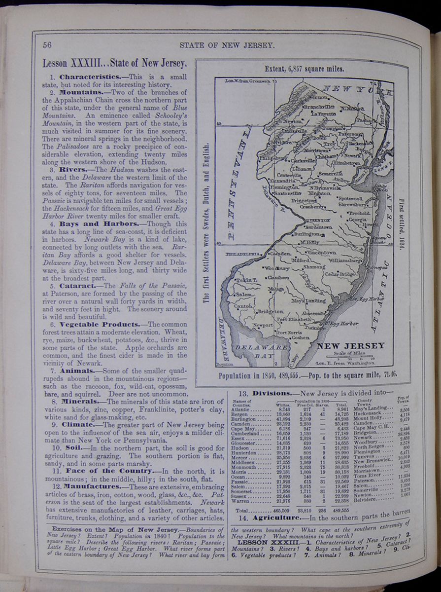 56
STATE OF NEW JERSEY.
56
STATE OF NEW JERSEY.
Lesson XXXIII... State of New Jersey.
1. Characteristics.—This is a small state, but noted for its interesting history.
2. Mountains.—Two of the branches of the Appalachian Chain cross the northern part of this state, under the general name of Blue Mountains. An eminence called Schooley's Mountain, in the western part of the state, is much visited in summer for its fine scenery. There are mineral springs in the neighborhood. The Palisadoes are a rocky precipice of considerable elevation, extending twenty miles along the western shore of the Hudson.
3. Rivers.—The Hudson washes the eastern, and the Delaware the western limit of the state. The Raritan affords navigation for vessels of eighty tons, for seventeen miles. The Passaic is navigable ten miles for small vessels; the Hackensack for fifteen miles, and Great Egg Harbor River twenty miles for smaller craft.
4. Bays and Harbors.—Though this state has a long line of sea-coast, it is deficient in harbors. Newark Bay is a kind of lake, connected by long outlets with the sea. Raritan Bay affords a good shelter for vessels. Delaware Bay, between New Jersey and Delaware, is sixty-five miles long, and thirty wide at the broadest part.
5. Cataract.—The Falls of the Passaic, at Paterson, are formed by the passing of the river over a natural wall forty yards in width, and seventy feet in hight. The scenery around is wild and beautiful.
6. Vegetable Products.—The common forest trees attain a moderate elevation. Wheat, rye, maize, buckwheat, potatoes, &c., thrive in some parts of the state. Apple orchards are common, and the finest cider is made in the vicinity of Newark.
7. Animals.—Some of the smaller quadrupeds abound in the mountainous regions—such as the raccoon, fox, wild-cat, opossum, hare, and squirrel. Deer are not uncommon.
8. Minerals.—The minerals of this state are iron of various kinds, zinc, copper, Franklinite, potter's clay, white sand for glass-making, etc.
9. Climate.—The greater part of New Jersey being open to the influence of the sea air, enjoys a milder climate than New York or Pennsylvania.
10. Soil.—In the northern part, the soil is good for agriculture and grazing. The southern portion is flat, sandy, and in some parts marshy.
11. Face of the Country.—In the north, it is mountainous; in the middle, hilly; in the south, flat.
12. Manufactures.—These are extensive, embracing articles of brass, iron, cotton, wood, glass, &c., &c. Paterson is the seat of the largest establishments. Newark has extensive manufactories of leather, carriages, hats, furniture, trunks, clothing, and a variety of other articles.
Map of New Jersey. NEW JERSEY Extent, 6,857 square miles. The first settlers were Swedes, Dutch and English. First settled, 1624. Population in 1850, 489,555.—Pop. to the square mile, 71.46.Divisions.—New Jersey is divided into— This table lists the counties of New Jersey with their populations in 1850 and includes a column for the major town in each county and the town's population. The county population is divided into the following categories: White, Free Colored, Slaves, and Total.
14. Agriculture.—In the southern parts the barren
Exercises on the Map of New Jersey.—Boundaries of New Jersey? Extent? Population in 1840? Population to the square mile? Describe the following rivers: Raritan; Passaic; Little Egg Harbor; Great Egg Harbor. What river forms part of the eastern boundary of New Jersey? What river and bay form the western boundary? What cape at the southern extremity of New Jersey? What mountains in the north?
LESSON XXXIII.—1. Characteristics of New Jersey? 2. Mountains? 3. Rivers? 4. Bays and harbors? 5. Cataract? 6. Vegetable products? 7. Animals? 8. Minerals? 9. Climate?
 [begin surface 277]
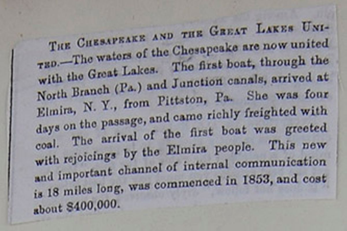
THE CHESAPEAKE AND THE GREAT LAKES UNITED.—The waters of the Chesapeake are now united with the Great Lakes. The first boat, through the North Branch (Pa.) and Junction canals arrived at Elmira, N. Y., from Pittston, Pa. She was four days on the passage, and came richly freighted with coal. The arrival of the first boat was greeted with rejoicings by the Elmira people. This new and important channel of internal communication is 18 miles long, was commenced in 1853, and cost about $400,000.
[begin surface 278]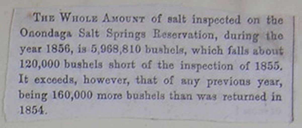
THE WHOLE AMOUNT of salt inspected on the Onondaga Salt Springs Reservation, during the year 1856, is 5,968,810 bushels, which falls about 120,000 bushels short of the inspection of 1855. It exceeds, however, that of any previous year, being 160,000 more bushels than was returned in 1854.
[begin surface 279] [begin surface 280]
 [begin surface 281]
 [begin surface 282]
 [begin surface 283]
 [begin surface 284]
 [begin surface 285]
 [begin surface 286]
 [begin surface 287]
 [begin surface 288]
 [begin surface 289]
 [begin surface 290]
 [begin surface 291]
 [begin surface 292]
 [begin surface 293]
 [begin surface 294]
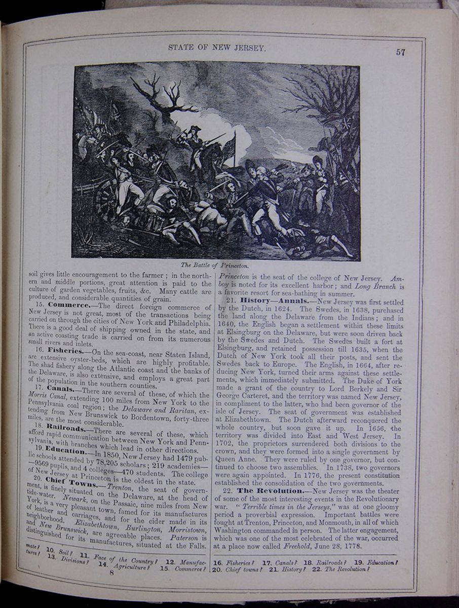
soil gives little encouragement to the farmer; in the northern and middle portions, great attention is paid to the culture of garden vegetables, fruits, &c. Many cattle are produced, and considerable quantities of grain.
15. Commerce.—The direct foreign commerce of New Jersey is not great, most of the transactions being carried on through the cities of New York and Philadelphia. There is a good deal of shipping owned in the state, and an active coasting trade is carried on from its numerous small rivers and inlets.
16. Fisheries.—On the sea-coast, near Staten Island, are extensive oyster-beds, which are highly profitable. The shad fishery along the Atlantic coast and the banks of the Delaware, is also extensive, and employs a great part of the population in the southern counties.
17. Canals.—There are several of these, of which the Morris Canal, extending 100 miles from New York to the Pennsylvania coal region; the Delaware and Raritan, extending from New Brunswick to Bordentown, forty-three miles, are the most considerable.
18. Railroads.—There are several of these, which afford rapid communication between New York and Pennsylvania, with branches which lead in other directions.
19. Education.—In 1850, New Jersey had 1479 public schools attended by 78,205 scholars; 219 academies—9569 pupils, and 4 colleges—470 students. The college of New Jersey at Princeton is the oldest in the state.
20. Chief Towns.—Trenton, the seat of government, is finely situated on the Delaware, at the head of tide-water. Newark, on the Passaic, nine miles from New York, is a very pleasant town, famed for its manufactures of leather and carriages, and for the cider made in its neighborhood. Elizabethtown, Burlington, Morristown, and New Brunswick, are agreeable places. Paterson is distinguished for its manufactures, situated at the Falls. Princeton is the seat of the college of New Jersey. Amboy is noted for its excellent harbor; and Long Branch is a favorite resort for sea-bathing in summer.
21. History—Annals.—New Jersey was first settled by the Dutch, in 1624. The Swedes, in 1638, purchased the land along the Delaware from the Indians; and in 1640, the English began a settlement within these limits at Elsingburg on the Delaware, but were soon driven back by the Swedes and Dutch. The Swedes built a fort at Elsingburg, and retained possession till 1635, when the Dutch of New York took all their posts, and sent the Swedes back to Europe. The English, in 1664, after reducing New York, turned their arms against these settlements, which immediately submitted. The Duke of York made a grant of the country to Lord Berkely and Sir George Carteret, and the territory was named New Jersey, in compliment to the latter, who had been governor of the isle of Jersey. The seat of government was established at Elizabethtown. The Dutch afterward reconquered the whole country, but soon gave it up. In 1656, the territory was divided into East and West Jersey. In 1702, the proprietors surrendered both divisions to the crown, and they were formed into a single government by Queen Anne. They were ruled by one governor, but continued to choose two assemblies. In 1738, two governors were again appointed. In 1776, the present constitution established the consolidation of the two governments.
22. The Revolution.—New Jersey was the theater of some of the most interesting events in the Revolutionary war. "Terrible times in the Jerseys" was at one gloomy period a proverbial expression. Important battles were fought at Trenton, Princeton, and Monmouth, in all of which Washington commanded in person. The latter engagement, which was one of the most celebrated of the war, occurred at a place now called Freehold, June 28, 1778.
10. Soil? 11. Face of the Country? 12. Manufactures? 13. Divisions? 14. Agriculture? 15. Commerce? 16. Fisheries? 17. Canals? 18. Railroads? 19. Education? 20. Chief towns? 21. History? 22. The Revolution?
8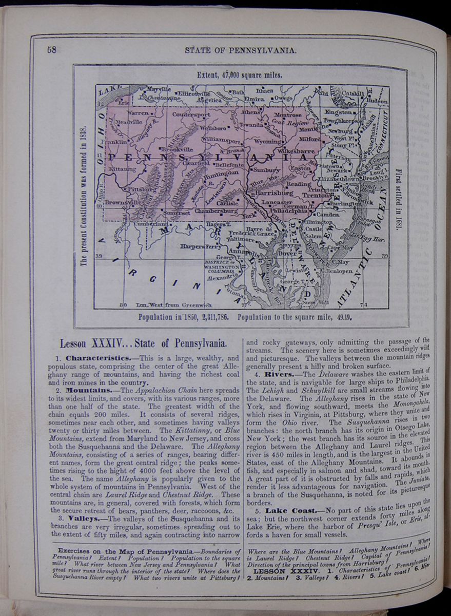 58
STATE OF PENNSYLVANIA.
Map of Pennsylvania.
Extent, 47,000 square miles.
The present Constitution was formed in
1838.
First settled in 1681.
Population in 1850, 2,311,786. Population to the
square mile, 49.19.
58
STATE OF PENNSYLVANIA.
Map of Pennsylvania.
Extent, 47,000 square miles.
The present Constitution was formed in
1838.
First settled in 1681.
Population in 1850, 2,311,786. Population to the
square mile, 49.19.
Lesson XXXIV... State of Pennsylvania.
1. Characteristics.—This is a large, wealthy, and populous state, comprising the center of the great Alleghany range of mountains, and having the richest coal and iron mines in the country.
2. Mountains.—The Appalachian Chain here spreads to its widest limits, and covers, with its various ranges, more than one half of the state. The greatest width of the chain equals 200 miles. It consists of several ridges, sometimes near each other, and sometimes having valleys twenty or thirty miles between. The Kittatinny, or Blue Mountains, extend from Maryland to New Jersey, and cross both the Susquehanna and the Delaware. The Alleghany Mountains, consisting of a series of ranges, bearing different names, form the great central ridge; the peaks sometimes rising to the hight of 4000 feet above the level of the sea. The name Alleghany is popularly given to the whole system of mountains in Pennsylvania. West of the central chain are Laurel Ridge and Chestnut Ridge. These mountains are, in general, covered with forests, which form the secure retreat of bears, panthers, deer, raccoons, &c.
3. Valleys.—The valleys of the Susquehanna and its branches are very irregular, sometimes spreading out to the extent of fifty miles, and again contracting into narrow and rocky gateways, only admitting the passage of the streams. The scenery here is sometimes exceedingly wild and picturesque. The valleys between the mountain ridges generally present a hilly and broken surface.
4. Rivers.—The Delaware washes the eastern limit of the state, and is navigable for large ships to Philadelphia. The Lehigh and Schuylkill are small streams flowing into the Delaware. The Alleghany rises in the state of New York, and flowing southward, meets the Monongahela, which rises in Virginia, at Pittsburg, where they unite and form the Ohio river. The Susquehanna rises in two branches: the north branch has its origin in Otsego Lake, New York; the west branch has its source in the elevated region between the Alleghany and Laurel ridges. This river is 450 miles in length, and is the largest in the United States, east of the Alleghany Mountains. It abounds in fish, and especially in salmon and shad, toward its mouth. A great part of it is obstructed by falls and rapids, which render it less advantageous for navigation. The Juniata, a branch of the Susquehanna, is noted for its picturesque borders.
5. Lake Coast.—No part of this state lies upon the sea; but the northwest corner extends forty miles along Lake Erie, where the harbor of Presqu' Isle, or Erie, affords a haven for small vessels.
Exercises on the Map of Pennsylvania.—Boundaries of Pennsylvania? Extent? Population? Population to the square mile? What river between New Jersey and Pennsylvania? What great river runs through the interior of the state? Where does the Susquehanna River empty? What two rivers unite at Pittsburg? Where are the Blue Mountains? Alleghany Mountains? Where is Laurel Ridge? Chestnut Ridge? Capital of Pennsylvania? Direction of the principal towns from Harrisburg?
LESSON XXXIV. 1. Characteristics of Pennsylvania? 2. Mountains? 3. Valleys? 4. Rivers? 5. Lake coast? 6. Mineral
[begin surface 296]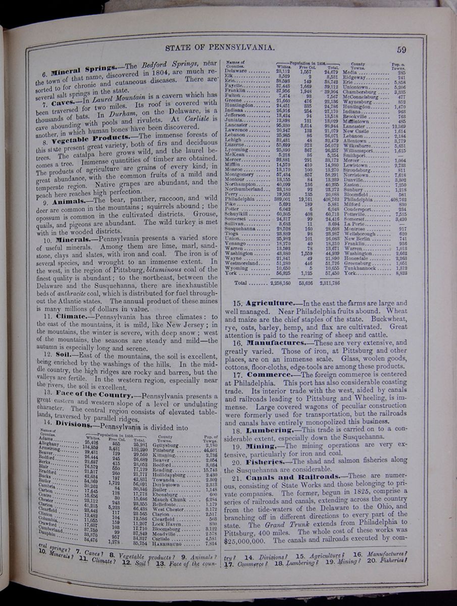 STATE OF PENNSYLVANIA.
59
STATE OF PENNSYLVANIA.
59
6. Mineral Springs.—The Bedford Springs, near the town of that name, discovered in 1804, are much resorted to for chronic and cutaneous diseases. There are several salt springs in the state.
7. Caves.—In Laurel Mountain is a cavern which has been traversed for two miles. Its roof is covered with thousands of bats. In Durham, on the Delaware, is a cave abounding with pools and rivulets. At Carlisle is another, in which human bones have been discovered.
8. Vegetable Products.—The immense forests of this state present great variety, both of firs and deciduous trees. The catalpa here grows wild, and the laurel becomes a tree. Immense quantities of timber are obtained. The products of agriculture are grains of every kind, in great abundance, with the common fruits of a mild and temperate region. Native grapes are abundant, and the peach here reaches high perfection.
9. Animals.—The bear, panther, raccoon, and wild deer are common in the mountains; squirrels abound; the opossum is common in the cultivated districts. Grouse, quails, and pigeons are abundant. The wild turkey is met with in the wooded districts.
10. Minerals.—Pennsylvania presents a varied store of useful minerals. Among them are lime, marl, sandstone, clays and slates, with iron and coal. The iron is of several species, and wrought to an immense extent. In the west, in the region of Pittsburg, bituminous coal of the finest quality is abundant; to the northeast, between the Delaware and the Susquehanna, there are inexhaustible beds of anthracite coal, which is distributed for fuel throughout the Atlantic states. The annual product of these mines is many millions of dollars in value.
11. Climate.—Pennsylvania has three climates: to the east of the mountains, it is mild, like New Jersey; in the mountains, the winter is severe, with deep snow; west of the mountains, the seasons are steady and mild—the autumn is especially long and serene.
12. Soil.—East of the mountains, the soil is excellent, being enriched by the washings of the hills. In the middle country, the high ridges are rocky and barren, but the valleys are fertile. In the western region, especially near the rivers, the soil is excellent.
13. Face of the Country.—Pennsylvania presents a great eastern and western slope of a level or undulating character. The central region consists of elevated table-lands, traversed by parallel ridges.
14. Divisions.—Pennsylvania is divided into This table lists the counties of Pennsylvania with their populations in 1850 and includes a column for the major town in each county and the town's population. The county population is divided into the following categories: White, Free Colored, and Total.
15. Agriculture.—In the east the farms are large and well managed. Near Philadelphia fruits abound. Wheat and maize are the chief staples of the state. Buckwheat, rye, oats, barley, hemp, and flax are cultivated. Great attention is paid to the rearing of sheep and cattle.
16. Manufactures.—These are very extensive, and greatly varied. Those of iron, at Pittsburg and other places, are on an immense scale. Glass, woolen goods, cottons, floor-cloths, edge-tools are among these products.
17. Commerce.—The foreign commerce is centered at Philadelphia. This port has also considerable coasting trade. Its interior trade with the west, aided by canals and railroads leading to Pittsburg and Wheeling, is immense. Large covered wagons of peculiar construction were formerly used for transportation, but the railroads and canals have entirely monopolized this business.
18. Lumbering.—This trade is carried on to a considerable extent, especially down the Susquehanna.
19. Mining.—The mining operations are very extensive, particularly for iron and coal.
20. Fisheries.—The shad and salmon fisheries along the Susquehanna are considerable.
21. Canals and Railroads.—These are numerous, consisting of State Works and those belonging to private companies. The former, begun in 1825, comprise a series of railroads and canals, extending across the country from the tide-waters of the Delaware to the Ohio, and branching off in different directions to every part of the state. The Grand Trunk extends from Philadelphia to Pittsburg, 400 miles. The whole cost of these works was $25,000,000. The canals and railroads executed by companies
springs? 7. Caves? 8. Vegetable products? 9. Animals? 10. Minerals? 11. Climate? 12. Soil? 13. Face of the country? 14. Divisions? 15. Agriculture? 16. Manufactures? 17. Commerce? 18. Lumbering? 19. Mining? 20. Fisheries?
[begin surface 297]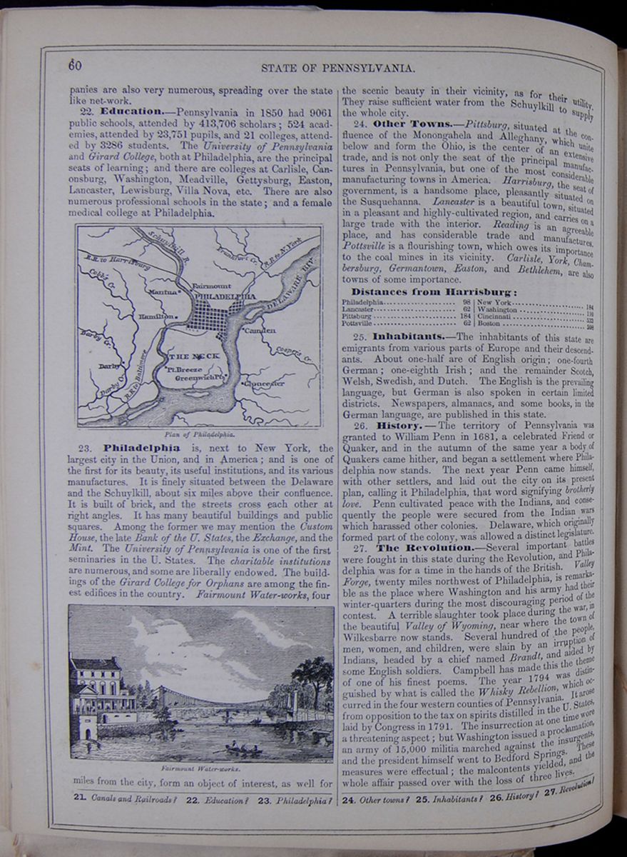 60
STATE OF PENNSYLVANIA.
60
STATE OF PENNSYLVANIA.
are also very numerous, spreading over the state like net-work.
22. Education—Pennsylvania in 1850 had 9061 public schools, attended by 413,706 scholars; 524 academies, attended by 23,751 pupils, and 21 colleges, attended by 3286 students. The University of Pennsylvania and Girard College, both at Philadelphia, are the principal seats of learning; and there are colleges at Carlisle, Canonsburg, Washington, Meadville, Gettysburg, Easton, Lancaster, Lewisburg, Villa Nova, etc. There are also numerous professional schools in the state; and a female medical college at Philadelphia.
Plan of Philadelphia. Image of the city plan of Philadelphia.23. Philadelphia is, next to New York, the largest city in the Union, and in America; and is one of the first for its beauty, its useful institutions, and its various manufactures. It is finely situated between the Delaware and the Schuylkill, about six miles above their confluence. It is built of brick, and the streets cross each other at right angles. It has many beautiful buildings and public squares. Among the former we may mention the Custom House, the late Bank of the U. States, the Exchange, and the Mint. The University of Pennsylvania is one of the first seminaries in the U. States. The charitable institutions are numerous, and some are liberally endowed. The buildings of the Girard College for Orphans are among the finest edifices in the country. Fairmount Water-works. An image of a river, building, and a bridge. Fairmount Water-works, four miles from the city, form an object of interest, as well for the scenic beauty in their vicinity, as for their utility. They raise sufficient water from the Schuylkill to supply the whole city.
24. Other Towns.—Pittsburg, situated at the confluence of the Monongahela and Alleghany, which unite below and form the Ohio, is the center of an extensive trade, and is not only the seat of the principal manufactures in Pennsylvania, but one of the most considerable manufacturing towns in America. Harrisburg, the seat of government, is a handsome place, pleasantly situated on the Susquehanna. Lancaster is a beautiful town, situated in a pleasant and highly-cultivated region, and carries on a large trade with the interior. Reading is an agreeable place, and has considerable trade and manufactures. Pottsville is a flourishing town, which owes its importance to the coal mines in its vicinity. Carlisle, York, Chambersburg, Germantown, Easton, and Bethlehem, are also towns of some importance.
Distances from Harrisburg: This table lists the distances from Harrisburg of the following cities: Philadelphia, Lancaster, Pittsburg, Pottsville, New York, Washington, Cincinnati, and Boston.
25. Inhabitants.—The inhabitants of this state are emigrants from various parts of Europe and their descendants. About one-half are of English origin; one-fourth German; one-eighth Irish; and the remainder Scotch, Welsh, Swedish, and Dutch. The English is the prevailing language, but German is also spoken in certain limited districts. Newspapers, almanacs, and some books, in the German language, are published in this state.
26. History.—The territory of Pennsylvania was granted to William Penn in 1681, a celebrated Friend or Quaker, and in the autumn of the same year a body of Quakers came hither, and began a settlement where Philadelphia now stands. The next year Penn came himself, with other settlers, and laid out the city on its present plan, calling it Philadelphia, that word signifying brotherly love. Penn cultivated peace with the Indians, and consequently the people were secured from the Indian wars which harassed other colonies. Delaware, which originally formed part of the colony, was allowed a distinct legislature.
27. The Revolution.—Several important battles were fought in this state during the Revolution, and Philadelphia was for a time in the hands of the British. Valley Forge, twenty miles northwest of Philadelphia, is remarkable as the place where Washington and his army had their winter-quarters during the most discouraging period of the contest. A terrible slaughter took place during the war, in the beautiful Valley of Wyoming, near where the town of Wilkesbarre now stands. Several hundred of the people, men, women, and children, were slain by an irruption of Indians, headed by a chief named Brandt, and aided by some English soldiers. Campbell has made this the theme of one of his finest poems. The year 1794 was distinguished by what is called the Whisky Rebellion, which occurred in the four western counties of Pennsylvania. It arose from opposition to the tax on spirits distilled in the U. States, laid by Congress in 1791. The insurrection at one time wore a threatening aspect; but Washington issued a proclamation, an army of 15,000 militia marched against the insurgents, and the president himself went to Bedford Springs. These measures were effectual; the malcontents yielded, and the whole affair passed over with the loss of three lives.
21. Canals and Railroads? 22. Education? 23. Philadelphia? 24. Other towns? 25. Inhabitants? 26. History? 27. Revolution?
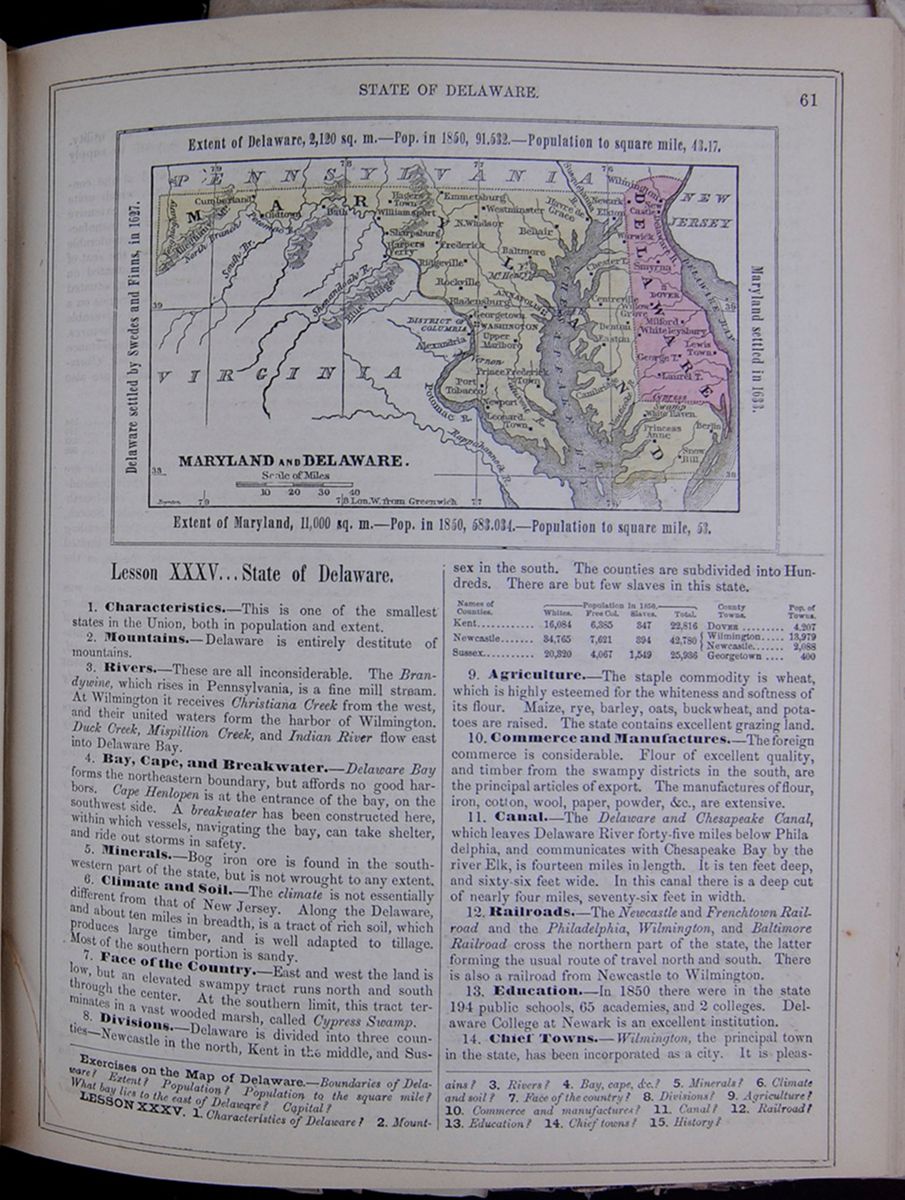 STATE OF DELAWARE.
61
Map of Maryland and Delaware.
MARYLAND AND DELAWARE.
Extent of Delaware, 2,120 sq. m.—Pop. in
1850, 91,532.—Population to square mile,
43.17.
Delaware settled by Swedes and Finns, in
1627.
Maryland settled in 1633.
Extent of Maryland, 11,000 sq. m.—Pop. in
1850, 583,034.—Population to square mile,
53.
STATE OF DELAWARE.
61
Map of Maryland and Delaware.
MARYLAND AND DELAWARE.
Extent of Delaware, 2,120 sq. m.—Pop. in
1850, 91,532.—Population to square mile,
43.17.
Delaware settled by Swedes and Finns, in
1627.
Maryland settled in 1633.
Extent of Maryland, 11,000 sq. m.—Pop. in
1850, 583,034.—Population to square mile,
53.
Lesson XXXV... State of Delaware.
1. Characteristics.—This is one of the smallest states in the Union, both in population and extent.
2. Mountains.—Delaware is entirely destitute of mountains.
3. Rivers.—These are all inconsiderable. The Brandywine, which rises in Pennsylvania, is a fine mill stream. At Wilmington it receives Christiana Creek from the west, and their united waters form the harbor of Wilmington. Duck Creek, Mispillion Creek, and Indian River flow east into Delaware Bay.
4. Bay, Cape, and Breakwater.—Delaware Bay forms the northeastern boundary, but affords no good harbors. Cape Henlopen is at the entrance of the bay, on the southwest side. A breakwater has been constructed here, within which vessels, navigating the bay, can take shelter, and ride out storms in safety.
5. Minerals.—Bog iron ore is found in the southwestern part of the state, but is not wrought to any extent.
6. Climate and Soil.—The climate is not essentially different from that of New Jersey. Along the Delaware, and about ten miles in breadth, is a tract of rich soil, which produces large timber, and is well adapted to tillage. Most of the southern portion is sandy.
7. Face of the Country.—East and west the land is low, but an elevated swampy tract runs north and south through the center. At the southern limit, this tract terminates in a vast wooded marsh, called Cypress Swamp.
8. Divisions.—Delaware is divided into three counties—Newcastle in the north, Kent in the middle, and Sussex in the south. The counties are subdivided into Hundreds. There are but few slaves in this state. This table lists the counties of Delaware with their populations in 1850 and includes a column for the major town in each county and the town's population. The county population is divided into the following categories: White, Free Colored, Slaves, and Total.
9. Agriculture.—The staple commodity is wheat, which is highly esteemed for the whiteness and softness of its flour. Maize, rye, barley, oats, buckwheat, and potatoes are raised. The state contains excellent grazing land.
10. Commerce and Manufactures.—The foreign commerce is considerable. Flour of excellent quality, and timber from the swampy districts in the south, are the principal articles of export. The manufactures of flour, iron, cotton, wool, paper, powder, &c., are extensive.
11. Canal.—The Delaware and Chesapeake Canal, which leaves Delaware River forty-five miles below Philadelphia, and communicates with Chesapeake Bay by the river Elk, is fourteen miles in length. It is ten feet deep, and sixty-six feet wide. In this canal there is a deep cut of nearly four miles seventy-six feet in width.
12. Railroads.—The Newcastle and Frenchtown Railroad and the Philadelphia, Wilmington, and Baltimore Railroad cross the northern part of the state, the latter forming the usual route of travel north and south. There is also a railroad from Newcastle to Wilmington.
13. Education.—In 1850 there were in the state 194 public schools, 65 academies, and 2 colleges. Delaware College at Newark is an excellent institution.
14. Chief Towns.—Wilmington, the principal town in the state, has been incorporated as a city. It is pleasantly
Exercises on the Map of Delaware.—Boundaries of Delaware? Extent? Population? Population to the square mile? What bay lies to the east of Delaware? Capital?
LESSON XXXV. 1. Characteristics of Delaware? 2. Mountains? 3. Rivers? 4. Bay, cape, &c.? 5. Minerals? 6. Climate and soil? 7. Face of the country? 8. Divisions? 9. Agriculture? 10. Commerce and manufactures? 11. Canal? 12. Railroad? 13. Education? 14. Chief towns? 15. History?
[begin surface 299]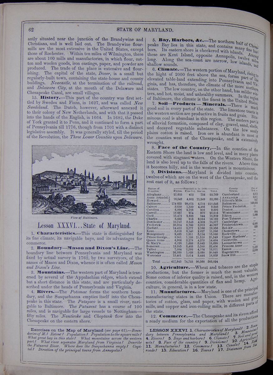 62
STATE OF MARYLAND.
62
STATE OF MARYLAND.
situated near the junction of the Brandywine and Christiana, and is well laid out. The Brandywine flour-mills are the most extensive in the United States, except those of Rochester. Within ten miles of Wilmington, there are about 100 mills and manufactories, in which flour, cotton and woolen goods, iron castings, paper, and powder are produced. The trade of the place is extensive and flourishing. The capital of the state, Dover, is a small but regularly-built town, containing the state-house and county buildings. Newcastle, at the termination of the railroad, and Delaware City, at the mouth of the Delaware and Chesapeake Canal, are small villages.
15. History.—This part of the country was first settled by Swedes and Finns, in 1627, and was called New Swedeland. The Dutch, however, afterward annexed it to their colony of New Netherlands, and with that it passed into the hands of the English, in 1664. In 1682, the Duke of York granted it to Penn, and it continued to form a part of Pennsylvania till 1776, though from 1701 with a distinct legislative assembly. It was generally styled, till the period of the Revolution, the Three Lower Counties upon Delaware. View of Baltimore. Image of ships on the water with a city in the background.
Lesson XXXVI... State of Maryland.
1. Characteristics.—This state is distinguished for its fine climate, its navigable bays, and its advantages for commerce.
2. Boundary—Mason and Dixon's Line.—The boundary line between Pennsylvania and Maryland was fixed by actual survey in 1762, by two surveyors, of the names of Mason and Dixon, whence it is often called Mason and Dixon's Line.
3. Mountains.—The western part of Maryland is traversed by several of the Appalachian ridges, which extend but a short distance in this state, and are particularly described under the heads of Pennsylvania and Virginia.
4. Rivers.—The Potomac forms the southern boundary, and the Susquehanna empties itself into the Chesapeake in this state. The Patapsco is a small river, navigable to Baltimore. The Patuxent has a course of 100 miles, and is navigable for large vessels to Nottingham—fifty miles. The Nanticoke and Choptank flow into the Chesapeake on the eastern shore.
5. Bay, Harbors, &c.—The northern half of Chesapeake Bay lies in this state, and contains many fine harbors. Its eastern shore is checkered with islands. Among these are Kent Island, opposite Annapolis, twelve miles long. Along the sea-coast are narrow, low islands, and shallow sounds.
6. Climate.—The western portion of Maryland, rising to the hight of 2000 feet above the sea, forms part of the elevated table-land extending into Pennsylvania and Virginia, and has, therefore, the climate of the more northern states. The low country, on the other hand, has milder winters, and hot, moist, and unhealthy summers. In the region of Baltimore, the climate is the finest in the United States.
7. Soil—Products—Minerals.—There is much good soil in every part of the state. The limestone tracts in the western section are productive in fruits and grain. Bituminous coal is abundant in this region. The eastern part is of alluvial formation, composed of clay, gravel, sand, shells, and decayed vegetable substances. On the low sandy plains cotton is raised. Iron ore is abundant in most of the counties west of the Chesapeake, and is extensively wrought.
8. Face of the Country.—In the counties of the Eastern Shore the land is low and level, and in many places covered with stagnant waters. On the Western Shore, the land is also level up to the falls of the rivers. Above these it becomes hilly, and in the western part is mountainous.
9. Divisions.—Maryland is divided into counties, twelve of which are on the west of the Chesapeake, and the rest east of it, as follows: This table lists the counties of Maryland with their populations in 1850 and includes a column for the major town in each county and the town's population. The county population is divided into the following categories: White, Free Colored, Slaves, and Total.
10. Agriculture.—Wheat and tobacco are the staple productions, but the former is much the most valuable. Some cotton of inferior quality is raised, and, in the western counties, considerable quantities of flax and hemp. Agriculture, in general, is in a low state.
11. Manufactures.—Maryland is one of the principal manufacturing states in the Union. There are manufactories of cotton, glass, and paper, with woolen and grist mills, and copper and iron-rolling mills, in different parts of the state.
12. Commerce.—The Chesapeake and its rivers afford a ready medium for the exportation of all the productions
Exercises on the Map of Maryland (see page 61).—Boundaries of M.? Extent? Population? Population to the square mile? What great bay in this state? What mountains across the western part? What river separates Maryland from Virginia? Describe the Patuxent River. Where does the Susquehanna empty? Capital? Direction of the principal towns from Annapolis?
LESSON XXXVI. 1. Characteristics of Maryland? 2. Boundary between Pennsylvania and Maryland? 3. Mountains? 4. Rivers? 5. Bays and harbors? 6. Climate? 7. Soil and products? 8. Face of the country? 9. Divisions? 10. Agriculture? 11. Manufactures? 12. Commerce? 13. Canals? 14. Railroads? 15. Education? 16. Towns? 17. Distances from Baltimore?
[begin surface 300]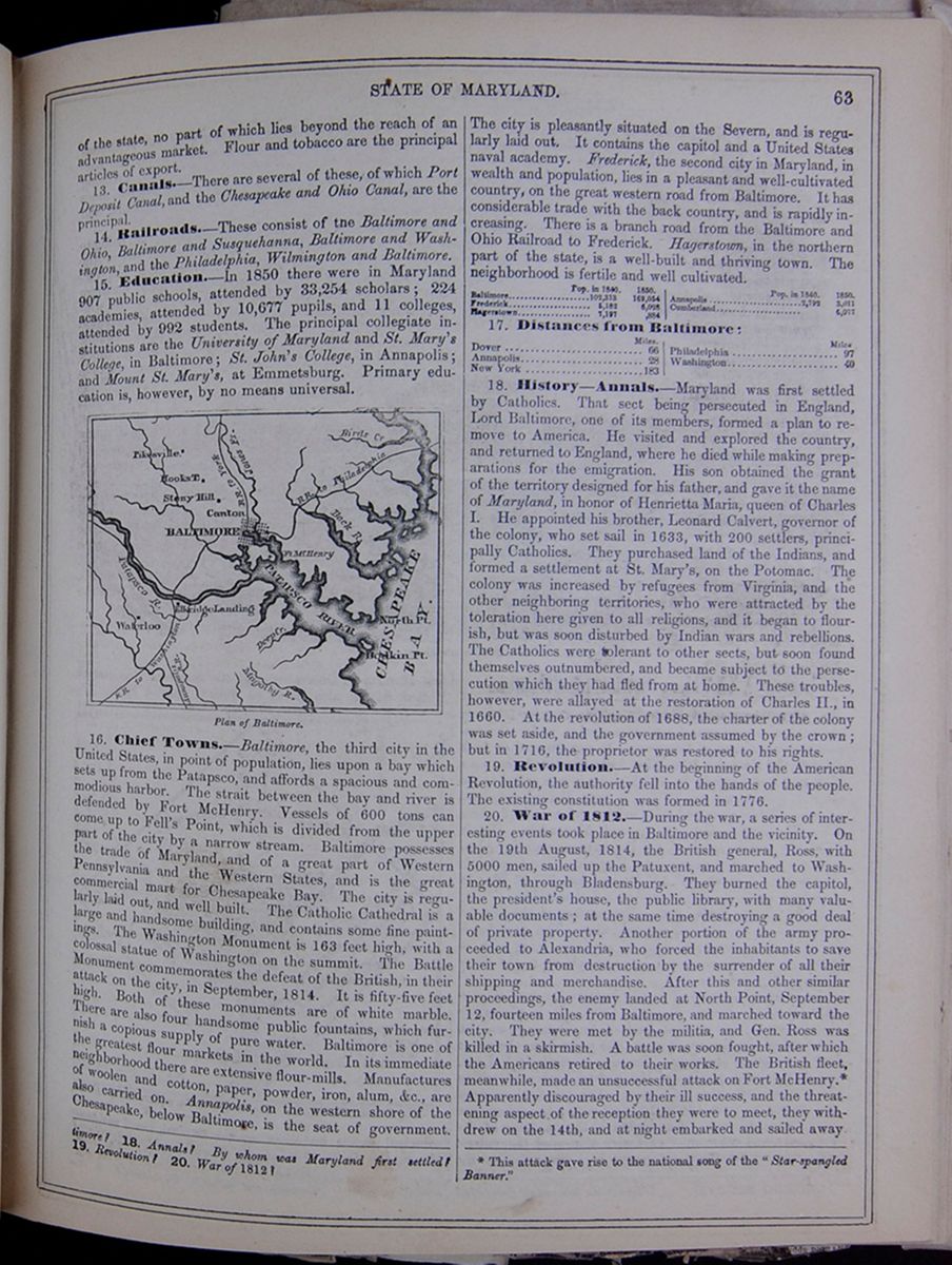 STATE OF MARYLAND.
63
STATE OF MARYLAND.
63
of the state, no part of which lies beyond the reach of an advantageous market. Flour and tobacco are the principal articles of export.
13. Canals.—There are several of these, of which Port Deposit Canal, and the Chesapeake and Ohio Canal, are the principal.
14. Railroads.—These consist of the Baltimore and Ohio, Baltimore and Susquehanna, Baltimore and Washington, and the Philadelphia, Wilmington and Baltimore.
15. Education.—In 1850 there were in Maryland 907 public schools, attended by 33,254 scholars; 224 academies, attended by 10,677 pupils, and 11 colleges, attended by 992 students. The principal collegiate institutions are the University of Maryland and St. Mary's College, in Baltimore; St. John's College, in Annapolis; Mount St. Mary's, at Emmetsburg. Primary education is, however, by no means universal.
Plan of Baltimore. Image of the city plan of Baltimore.16. Chief Towns.—Baltimore, the third city in the United States, in point of population, lies upon a bay which sets up from the Patapsco, and affords a spacious and commodious harbor. The strait between the bay and river is defended by Fort McHenry. Vessels of 600 tons can come up to Fell's Point, which is divided from the upper part of the city by a narrow stream. Baltimore possesses the trade of Maryland, and of a great part of Western Pennsylvania and the Western States, and is the great commercial mart for Chesapeake Bay. The city is regularly laid out, and well built. The Catholic Cathedral is a large and handsome building, and contains some fine paintings. The Washington Monument is 163 feet high, with a colossal statue of Washington on the summit. The Battle Monument commemorates the defeat of the British, in their attack on the city, in September, 1814. It is fifty-five feet high. Both of these monuments are of white marble. There are also four handsome public fountains, which furnish a copious supply of pure water. Baltimore is one of the greatest flour markets in the world. In its immediate neighborhood there are extensive flour-mills. Manufactures of woolen and cotton, paper, powder, iron, alum, &c., are also carried on. Annapolis, on the western shore of the Chesapeake, below Baltimore, is the seat of government. The city is pleasantly situated on the Severn, and is regularly laid out. It contains the capitol and a United States naval academy. Frederick, the second city in Maryland, in wealth and population, lies in a pleasant and well-cultivated country, on the great western road from Baltimore. It has considerable trade with the back country, and is rapidly increasing. There is a branch road from the Baltimore and Ohio Railroad to Frederick. Hagerstown, in the northern part of the state, is a well-built and thriving town. The neighborhood is fertile and well cultivated. This table lists the populations in 1840 and 1850 of the following cities: Baltimore, Frederick, Hagerstown, Annapolis, and Cumberland.
17. Distances from Baltimore: This table lists distance from Baltimore of the following cities: Dover, Annapolis, New York, Philadelphia, and Washington.
18. History—Annals.—Maryland was first settled by Catholics. That sect being persecuted in England, Lord Baltimore, one of its members, formed a plan to remove to America. He visited and explored the country, and returned to England, where he died while making preparations for the emigration. His son obtained the grant of the territory designed for his father, and gave it the name of Maryland, in honor of Henrietta Maria, queen of Charles I. He appointed his brother, Leonard Calvert, governor of the colony, who set sail in 1633, with 200 settlers, principally Catholics. They purchased land of the Indians, and formed a settlement at St. Mary's, on the Potomac. The colony was increased by refugees from Virginia, and the other neighboring territories, who were attracted by the toleration here given to all religions, and it began to flourish, but was soon disturbed by Indian wars and rebellions. The Catholics were tolerant to other sects, but soon found themselves outnumbered, and became subject to the persecution which they had fled from at home. These troubles, however, were allayed at the restoration of Charles II., in 1660. At the revolution of 1688, the charter of the colony was set aside, and the government assumed by the crown; but in 1716, the proprietor was restored to his rights.
19. Revolution.—At the beginning of the American Revolution, the authority fell into the hands of the people. The existing constitution was formed in 1776.
20. War of 1812.—During the war, a series of interesting events took place in Baltimore and the vicinity. On the 19th August, 1814, the British general, Ross, with 5000 men, sailed up the Patuxent, and marched to Washington, through Bladensburg. They burned the capitol, the president's house, the public library, with many valuable documents; at the same time destroying a good deal of private property. Another portion of the army proceeded to Alexandria, who forced the inhabitants to save their town from destruction by the surrender of all their shipping and merchandise. After this and other similar proceedings, the enemy landed at North Point, September 12, fourteen miles from Baltimore, and marched toward the city. They were met by the militia, and Gen. Ross was killed in a skirmish. A battle was soon fought, after which the Americans retired to their works. The British fleet, meanwhile, made an unsuccessful attack on Fort McHenry. * Apparently discouraged by their ill success, and the threatening aspect of the reception they were to meet, they withdrew on the 14th, and at night embarked and sailed away.
18. Annals? By whom was Maryland first settled? 19. Revolution? 20. War of 1812? * This attack gave rise to the national song of the "Star-spangled Banner."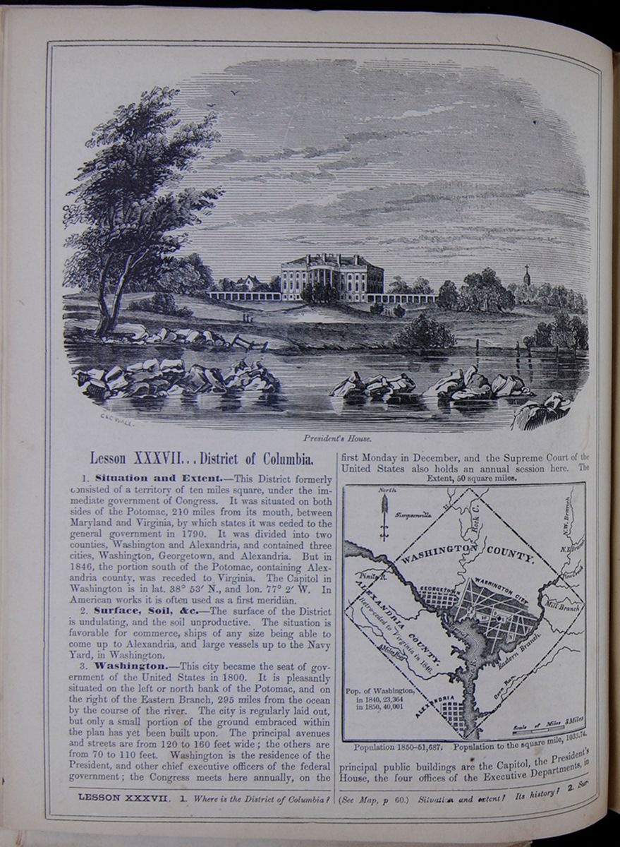 President's House.
Image of the White House from a
distance.
President's House.
Image of the White House from a
distance.
Lesson XXXVII... District of Columbia.
1. Situation and Extent.—This District formerly consisted of a territory of ten miles square, under the immediate government of Congress. It was situated on both sides of the Potomac, 210 miles from its mouth, between Maryland and Virginia, by which states it was ceded to the general government in 1790. It was divided into two counties, Washington and Alexandria, and contained three cities, Washington, Georgetown, and Alexandria. But in 1846, the portion south of the Potomac, containing Alexandria county, was receded to Virginia. The Capitol in Washington is in lat. 38° 53´ N., and lon. 77° 2´ W. In American works it is often used as a first meridian.
2. Surface, Soil, &c.—The surface of the District is undulating, and the soil unproductive. The situation is favorable for commerce, ships of any size being able to come up to Alexandria, and large vessels up to the Navy Yard, in Washington.
3. Washington.—This city became the seat of government of the United States in 1800. It is pleasantly situated on the left or north bank of the Potomac, and on the right of the Eastern Branch, 295 miles from the ocean by the course of the river. The city is regularly laid out, but only a small portion of the ground embraced within the plan has yet been built upon. The principal avenues and streets are from 120 to 160 feet wide; the others are from 70 to 110 feet. Washington is the residence of the President, and other chief executive officers of the federal government; the Congress meets here annually, on the first Monday in December, and the Supreme Court of the United States also holds an annual session here. A Map of Washington County. Pop. of Washington, in 1840, 23,364 in 1850, 40,001 Extent, 50 square miles. Population 1850—51,687.; Population to the square mile, 1033.74. The principal public buildings are the Capitol, the President's House, the four offices of the Executive Departments, in
LESSON XXXVII. 1. Where is the District of Columbia? (See Map, p 60.) Situation and extent? Its history? 2. Surface
 [begin surface 303]
 [begin surface 304]
 [begin surface 305]
 [begin surface 306]
 [begin surface 307]
 [begin surface 308]
 [begin surface 309]
 [begin surface 310]
 [begin surface 311]
 [begin surface 312]
 [begin surface 313]
 [begin surface 314]
 [begin surface 315]
 [begin surface 316]
 [begin surface 317]
 [begin surface 318]
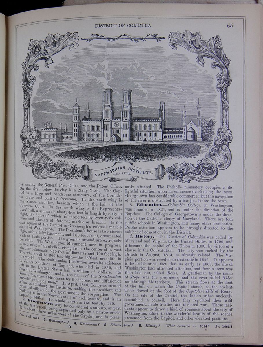
its vicinity, the General Post Office, and the Patent Office. On the river below the city is a Navy Yard. The Capitol is a large and handsome structure, of the Corinthian order, and built of freestone. In the north wing is the Senate chamber, beneath which is the hall of the Supreme Court. In the south wing, is the Representatives' hall, a semicircle ninety-five feet in length by sixty in hight, the dome of which is supported by twenty-six columns and pilasters of Potomac marble or breccia. In the east square of the Capitol is Greenough's colossal marble statue of Washington. The President's house is two stories high, with a lofty basement, and 180 feet front, ornamented with an Ionic portico. The grounds around are extremely beautiful. The Washington Monument, now in progress, is to consist of an obelisk, rising from the center of a vast circular colonnade, 250 feet in diameter and 100 feet high. The whole will be 600 feet high—the loftiest monolith in the world. The Smithsonian Institution owes its existence to James Smithson, of England, who died in 1835, and left to the United States halt a million of dollars, "to found at Washington, under the name of the Smithsonian Institution, an establishment for the increase and diffusion of knowledge among men." In April, 1846, Congress created a law establishing this Institute, making the president and principal officers of the government the corporation. The building is in the Norman style of architecture, and is an imposing edifice. Its whole length is 450 feet, by 140.
4. Georgetown may be considered a suburb, or part of the metropolis, being separated only by a narrow creek. It is about three miles west of the Capitol, and is pleasantly situated. The Catholic monastery occupies a delightful situation, upon an eminence overlooking the town. Georgetown has considerable commerce; but the navigation of the river is obstructed by a bar just below the town.
5. Education.—Columbia College, in Washington, was founded in 1821, and is under the direction of the Baptists. The College of Georgetown is under the direction of the Catholic clergy of Maryland. There are four public schools in Washington, and many other seminaries. Public attention appears to be strongly directed to the subject of education, in the District.
6. History.—The District of Columbia was ceded by Maryland and Virginia to the United States in 1790, and it became the capital of the Union in 1800, by virtue of a clause in the Constitution. The city was sacked by the British in August, 1814, as already related. The Virginia portion was receded to that state in 1846. It appears to be an historical fact that as early as 1663, the site of Washington had attracted attention, and here a town was then laid out, called Rome. A gentleman by the name of Pope was the proprietor, and the river called Tiber ran through his territory. This stream flows at the foot of the hill on which the Capitol stands, as the ancient Tiber flowed at the foot of the Capitoline Hill of Rome. On the site of the Capitol, the Indian tribes anciently assembled in council. Here they regulated their wild government, made treaties, and declared war. These incidents appear to throw a kind of romance about the city of Washington, added to the wonderful beauty of the scenes presented from the Capitol, and other elevated positions.
face and soil? 3. Washington? 4. Georgetown? 5 Education? 6. History? What occurred in 1814? In 1663?
9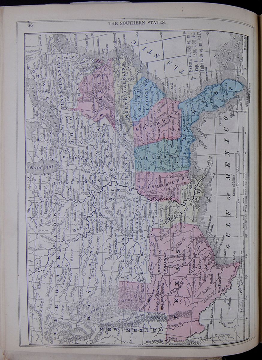 66
THE SOUTHERN STATES.
A Map of the southern states in which are highlighted Texas, Louisiana, Mississippi, Alabama, Florida, Georgia, South Carolina, North Carolina, Virginia.
Extent, 716,859 sq. m.; Pop. in 1850, 6,061,140.;
Inhab. to sq. m., 8.457
[begin surface 320]
66
THE SOUTHERN STATES.
A Map of the southern states in which are highlighted Texas, Louisiana, Mississippi, Alabama, Florida, Georgia, South Carolina, North Carolina, Virginia.
Extent, 716,859 sq. m.; Pop. in 1850, 6,061,140.;
Inhab. to sq. m., 8.457
[begin surface 320]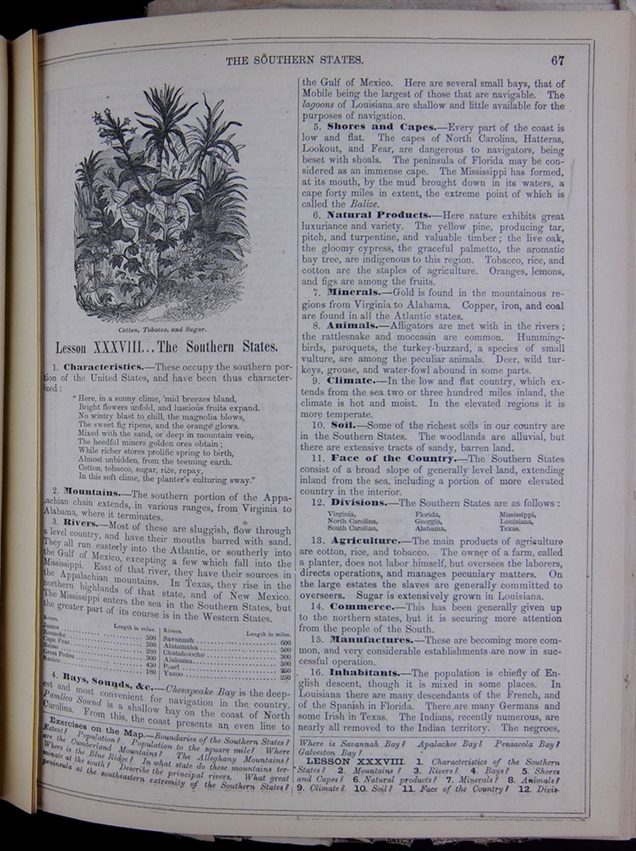 THE SOUTHERN STATES.
67
Cotton, Tobacco, and Sugar.
THE SOUTHERN STATES.
67
Cotton, Tobacco, and Sugar.
Lesson XXXVIII... The Southern States.
1. Characteristics.—These occupy the southern portion of the United States, and have been thus characterized: "Here, in a sunny clime, 'mid breezes bland, Bright flowers unfold, and luscious fruits expand. No wintry blast to chill, the magnolia blows, The sweet fig ripens, and the orange glows. Mixed with the sand, or deep in mountain vein, The heedful miners golden ores obtain; While richer stores prolific spring to birth, Almost unbidden, from the teeming earth. Cotton, tobacco, sugar, rice, repay, In this soft clime, the planter's culturing sway."
2. Mountains.—The southern portion of the Appalachian chain extends, in various ranges, from Virginia to Alabama, where it terminates.
3. Rivers.—Most of these are sluggish, flow through a level country, and have their mouths barred with sand. They all run easterly into the Atlantic, or southerly into the Gulf of Mexico, excepting a few which fall into the Mississippi. East of that river, they have their sources in the Appalachian mountains. In Texas, they rise in the northern highlands of that state, and of New Mexico. The Mississippi enters the sea in the Southern States, but the greater part of its course is in the Western States. This table lists the lengths of the following rivers: James, Roanoke, Cape Fear, Neuse, Great Pedee, Santee, Savannah, Altamaha, Chattahoochee, Alabama, Pearl, and Yazoo.
4. Bays, Sounds, &c.—Chesapeake Bay is the deepest and most convenient for navigation in the country. Pamlico Sound is a shallow bay on the coast of North Carolina. From this, the coast presents an even line to the Gulf of Mexico. Here are several small bays, that of Mobile being the largest of those that are navigable. The lagoons of Louisiana are shallow and little available, for the purposes of navigation.
5. Shores and Capes.—Every part of the coast is low and flat. The capes of North Carolina, Hatteras, Lookout, and Fear, are dangerous to navigators, being beset with shoals. The peninsula of Florida may be considered as an immense cape. The Mississippi has formed, at its mouth, by the mud brought down in its waters, a cape forty miles in extent, the extreme point of which is called the Balize.
6. Natural Products.—Here nature exhibits great luxuriance and variety. The yellow pine, producing tar, pitch, and turpentine, and valuable timber; the live oak, the gloomy cypress, the graceful palmetto, the aromatic bay tree, are indigenous to this region. Tobacco, rice, and cotton are the staples of agriculture. Oranges, lemons, and figs are among the fruits.
7. Minerals.—Gold is found in the mountainous regions from Virginia to Alabama. Copper, iron, and coal are found in all the Atlantic states.
8. Animals.—Alligators are met with in the rivers; the rattlesnake and moccasin are common. Hummingbirds, paroquets, the turkey-buzzard, a species of small vulture, are among the peculiar animals. Deer, wild turkeys, grouse, and water-fowl abound in some parts.
9. Climate.—In the low and flat country, which extends from the sea two or three hundred miles inland, the climate is hot and moist. In the elevated regions it is more temperate.
10. Soil.—Some of the richest soils in our country are in the Southern States. The woodlands are alluvial, but there are extensive tracts of sandy, barren land.
11. Face of the Country.—The Southern States consist of a broad slope of generally level land, extending inland from the sea, including a portion of more elevated country in the interior.
12. Divisions.—The Southern States are as follows:
- Virginia,
- North Carolina,
- South Carolina,
- Florida,
- Georgia,
- Alabama,
- Mississippi,
- Louisiana,
- Texas.
13. Agriculture.—The main products of agriculture are cotton, rice, and tobacco. The owner of a farm, called a planter, does not labor himself, but oversees the laborers, directs operations, and manages pecuniary matters. On the large estates the slaves are generally committed to overseers. Sugar is extensively grown in Louisiana.
14. Commerce.—This has been generally given up to the northern states, but it is securing more attention from the people of the South.
15. Manufactures.—These are becoming more common, and very considerable establishments are now in successful operation.
16. Inhabitants.—The population is chiefly of English descent, though it is mixed in some places. In Louisiana there are many descendants of the French, and of the Spanish in Florida. There are many Germans and some Irish in Texas. The Indians, recently numerous, are nearly all removed to the Indian territory. The negroes,
Exercises on the Map.—Boundaries of the Southern States? Extent? Population? Population to the square mile? Where are the Cumberland Mountains? The Alleghany Mountains? Where is the Blue Ridge? In what state do these mountains terminate at the south? Describe the principal rivers. What great peninsula at the southeastern extremity of the Southern States? Where is Savannah Bay? Apalachee Bay? Pensacola Bay? Galveston Bay?
LESSON XXXVIII. 1. Characteristics of the Southern States? 2. Mountains? 3. Rivers? 4. Bays? 5. Shores and Capes? 6. Natural products? 7. Minerals? 8. Animals? 9. Climate? 10. Soil? 11. Face of the Country? 12. Divisions?
[begin surface 321] 68
[covered]
VIRGINIA.
[begin surface 322]
68
[covered]
VIRGINIA.
[begin surface 322]
——The Fincastle Valley Whig says that Samuel Harriston, of Pittsylvania County, is the richest man in Virginia. He owns 1,700 slaves, and they increase at the rate of 100 a year. He is said to be worth $5,000,000.
who form two-fifths of the population, are a separate caste, and mostly held in slavery.
17. Slaves.—These are, in general, humanely treated. Some laws relating to them are severe, but many of these are not enforced. Marriages are rarely any thing more than connections subsisting during pleasure. Their amusements are few—chiefly music and dancing. Slavery is hereditary; the servitude of the mother determining that of the child. A slave cannot make contracts, hold property, commence a suit, or testify against a white. Harsh treatment of a slave on the part of an owner is generally deemed an offence against good manners as well as morality.
18. Food.—Rice is much used. Hominy—a preparation of maize, coarsely broken and boiled—yams, sweet potatoes, and the tomato, are favorite vegetables. The Irish potato is little raised. Bacon is the principal meat. Whisky is the most common spirituous drink.
19. Manners and Customs.—Agriculture is the chief employment, the farms being large, and having the name of plantations. There are few villages, or towns—the people living in a scattered manner over the country. Hospitality and generosity are among the favorable traits of the Southern character.
20. Diseases.—Bilious and intermittent fevers are common in the low countries in summer, from Virginia to Texas.
21. Education.—Education has received little attention in the Southern States. The children of the higher classes are chiefly sent to the North for instruction. The scattered state of population renders a system of common schools difficult, and the poorer classes of whites have few advantages of education. Instructing the slaves is forbidden by law, though public opinion, in certain places, tolerates its violation to some extent.
22. The chief towns are as follows . This table lists the population in 1850 and the distance from Washington of the following cities: Richmond, Norfolk, Portsmouth, Raleigh, Wilmington, Charleston, Columbia, Savannah, Milledgeville, Augusta, Tallahassee, Tuscaloosa, Mobile, Jackson, Natchez, and New Orleans.
23. History—Annals.—The states from Virginia to Florida, were English colonies; Florida was obtained from Spain in 1820. Alabama was originally part of Georgia. Mississippi at first belonged to French Louisiana; afterward it came to Great Britain, then to Spain, and in 1798, to the United States. Louisiana was purchased of the French in 1803; and Texas, formerly a province of Mexico, was annexed to the United States in 1845.
24. Revolution.—Some of the most stirring events of the Revolutionary war occurred in Virginia and the Carolinas. The details of these will be found under the separate states.
Lesson XXXIX... State of Virginia.
1. Characteristics.—Virginia is a large and populous state, noted as being the first of the English settlements in the limits of the United States, and hence often called the Old Dominion.
2. Mountains.—Virginia is traversed by the several Appalachian chains, which have been already described as stretching through Pennsylvania. 1. Southeast Mountain, broken by the Potomac at the conical peak called the Sugar Loaf, enters Virginia in Loudon county, and leaves it in Henry county, at a distance of from fifteen to twenty miles eastward of the Blue Ridge. 2. The Blue Ridge is broken by the Potomac, at Harper's Ferry, and traverses the state in a line of about 200 miles, separating it into the two great divisions of Eastern and Western Virginia. The Peaks of Otter, in this chain, are the highest summits of the Appalachian system, southwest of the Delaware, rising to a hight of
13. Agriculture? 14. Commerce? 15. Manufactures? 16. Inhabitants? 17. Slaves? 18. Food? 19. Manners and Customs? 20. Diseases? 21. Education? 22. Towns? 23. Annals? 24. Revolution?
Exercises on the Map of Virginia.—Extent of Virginia? Population? Population to the square mile? Boundaries? In which direction do the Alleghany Mountains cross this state? Blue Ridge? What great bay lies partly in Virginia? Describe the principal rivers.
LESSON XXXIX. 1. Characteristics of Virginia? 2. Mountains?
[begin surface 323]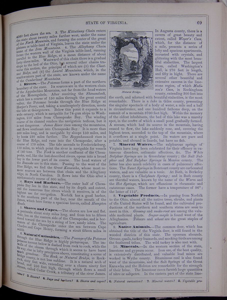 STATE OF VIRGINIA.
69
STATE OF VIRGINIA.
69
4260 feet above the sea. 3. The Kittatinny Chain enters the state about twenty miles further west, under the name of the North Mountain, and forming the center of the great plateau or table-land of Virginia, leaves the state under the name of the Iron Mountains. 4. The Alleghany Chain forms the western wall of the Virginia table-land, running parallel to the Blue Ridge, at a mean distance of about forty-three miles. Westward of this chain there is a gradual slope to the bed of the Ohio, but several other chains traverse this section, the principal of which are (5) the Chestnut Ridge, and (6) the Laurel Mountains, which, in the southwestern part of the state, are known under the name of the Cumberland Mountains.
3. Rivers.—The Potomac forms a part of the northern boundary of the state. Its sources are in the western chain of the Appalachian Mountains, not far from the headwaters of the Monongahela. After receiving the Shenandoah, which has a course of 150 miles through the great central valley, the Potomac breaks through the Blue Ridge at Harper's Ferry, and, taking a southeasterly direction, meets the tide at Georgetown. Below this point it expands to a wide estuary, which is navigable for 74-gun ships to Washington, 210 miles from Chesapeake Bay. The winding course of its channel renders the navigation tedious, but it is not dangerous. James River rises among the mountains, and flows southeast into Chesapeake Bay. It is more than 500 miles long, and is navigable by sloops 150 miles, and by boats 230 miles further. The Rappahannock rises in the Blue Ridge, and runs into the Chesapeake, after a course of 170 miles. The tide ascends to Fredericksburg, 110 miles, to which point the river is navigable for vessels of 140 tons. The York is another confluent of the Chesapeake, and, like the last-described rivers, opens into a broad bay in the lower part of its course. The head waters of the Roanoke are in this state. Passing to the west of the Blue Ridge, we find the Great Kanawha, whose most remote sources are between that chain and the Alleghany ridge, in North Carolina. It flows into the Ohio after a northwesterly course of 300 miles.
4. Bays and Harbors.—The outer half of Chesapeake Bay lies in this state, and by its depth and extent, and the numerous fine rivers which it receives, is of the highest use for navigation. Norfolk has a good harbor, in the southern part of the bay, near the mouth of the James, which here forms a spacious haven, called Hampton Roads.
5. Shores and Capes.—The shores are low and flat. A peninsula about sixty miles long, and from ten to fifteen wide, lies on the eastern side of the Chesapeake, and is bordered toward the sea by a string of low, sandy islets. The waters of the Chesapeake enter the sea between Cape Charles and Cape Henry, forming a strait fifteen miles in width.
6. Natural Curiosities.—The Passage of the Potomac through the Blue Ridge is highly picturesque. The impetuous torrent below is dashed from rock to rock, while the walls of the chasm through which it seems to have burst its way, rise in lofty precipices above, constituting a scene of much grandeur. The Rock, or Natural Bridge, in Rockbridge county, is not less sublime. It is a natural arch of rock, sixty feet wide, extending over a chasm ninety feet broad, and 250 feet high, through which flows a small stream, called Cedar Creek, a tributary of the river James.
Natural Bridge. An image of a natural bridge.In Augusta county, there is a cavern of great beauty and extent, called Weyer's Cave, which, for the distance of a mile, presents a series of lofty and spacious apartments, incrusted with crystals, and glittering with the most beautiful stalactites. The largest room, called Washington's Hall, is 270 feet in length, and fifty in hight. There are several other beautiful and extensive caverns in the limestone region, of which Madison's Cave, in Rockingham county, extending 300 feet into the earth, and adorned with beautiful stalactites, is the most remarkable. There is a lake in Giles county, presenting the singular spectacle of a body of water, a mile and a half in circumference, and one hundred fathoms deep, on the summit of a mountain 3700 feet high. Within the memory of the oldest inhabitants, the bed of this lake was a marshy spot, in the centre of which a small pond gradually formed. A stream, which had its source in the mountain, having ceased to flow, the lake suddenly rose, and, covering the highest trees, ascended to the top of the mountain, where it overflows at a single point. Its waters are pure and potable, and abound in lizards, but have no fish.
7. Mineral Waters.—The sulphurous springs of Virginia have long been celebrated for their efficacy in cutaneous disorders, asthmatic affections, &c. The White Sulphur Springs are in Greenbriar county; the Salt Sulphur and Red Sulphur Springs in Monroe county. The latter has also much celebrity in cases of pulmonary affections. The Sweet Springs in Botetourt county are carbonated waters, and are valuable as a tonic. At Bath, in Berkeley county, there is a Chalybeate Spring; and in Bath county are thermal waters, known by the name of the Warm and the Hot Springs, which are efficacious in rheumatic and cutaneous cases. The former have a temperature of 90°; the latter of 112°.
8. Vegetable Products.—In passing from Norfolk to the Ohio, almost all the native trees, shrubs, and plants of the United States will be found, and the cultivated productions of the northern and southern states are seen to meet in this. Ginseng and snake-root are among the valuable medicinal plants. Sugar-maple is found west of the Alleghanies. Tobacco and wheat are the great staples of agriculture.
9. Native Animals.—The common deer, which has obtained the title of the Virginia deer, is still found in the wooded districts of this state. The opossum abounds. Grouse, quails, turkey-buzzards, and mocking-birds are among the feathered tribes. The wild turkey is also met with.
10. Minerals.—In the western section of the state, limestone and gypsum occur. Iron ore, of the best quality, is extensively distributed, and valuable lead mines are worked in Wythe county. Bituminous coal is also found west of the mountains, and the Salt Springs of the Great Kanawha and the Holston are remarkable for the strength of their brine. The limestone caves furnish large quantities of nitre or saltpetre. In the eastern part of the state limestone
3. Rivers? 4. Bays and harbors? 5. Shores and capes? 6. Natural curiosities? 7. Mineral waters? 8. Vegetable products?
[begin surface 324]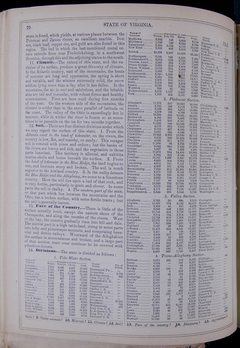 70
STATE OF VIRGINIA.
70
STATE OF VIRGINIA.
is found, which yields, at various places between the Potomac and James rivers, an excellent marble. Iron ore, black lead, copper ore, and gold are also found in this region. The bed in which the last-mentioned metal occurs extends from near Fredericksburg, in a southwest direction, through this and the adjoining states to the south.
11. Climate.—The extent of this state, and the varieties of its surface, produce a great diversity of climate. In the Atlantic country, east of the mountains, the heats of summer are long and oppressive, the spring is short and variable, and the winters extremely mild, the snow seldom lying more than a day after it has fallen. In the mountains, the air is cool and salubrious, and the inhabitants are tall and muscular, with robust forms and healthy countenances. Fires are here used during five months of the year. On the western side of the mountains, the climate is colder than in the same parallel of latitude on the coast. The valley of the Ohio is exceedingly hot in summer, while in winter the river is frozen so as sometimes to be passable on the ice for two months together.
12. Soil.—There are four distinct divisions under which we may regard the surface of this state. 1. From the Atlantic coast to the head of tidewater, on the rivers, the country is low, flat, and marshy, or sandy. This meager soil is covered with pines and cedars; but the banks of the rivers are loamy and rich, and the vegetation in those parts luxuriant. This territory is alluvial, and exhibits marine shells and bones beneath the surface. 2. From the head of tidewater to the Blue Ridge, the land begins to rise, and becomes stony and broken. The soil is much superior to the lowland country. 3. In the valley between the Blue Ridge and the Alleghany, we come to a limestone country. Here the soil lies upon a bed of that rock, and is very fertile, particularly in grain and clover. In some parts the soil is chalky. 4. The western part of the state, or that part which lies between the mountains and the Ohio, has a broken surface, with some fertile tracts; but the soil is generally barren.
13. Face of the Country.—There is little of the surface actually level, except the eastern shore of the Chesapeake, and along the mouths of the rivers. West of the bay, the country gradually rises into hill and dale. The central part is a high table-land, rising in some parts into lofty and picturesque summits, and comprising beautiful and fertile valleys. Westward of the Alleghanies the surface is mountainous and broken, and a large part of that section must ever continue to be covered with primitive forests.
14. Divisions.—The state is divided as follows:
Table showing the population of counties and their major towns, listing populations as White, Free Colored, Slaves, and Total9. Native animals? 10. Minerals? 11. Climate? 12. Soil? 13. Face of the country? 14. Divisions? 15. Agriculture?
THE OYSTER BEDS AND OYSTER BUSINESS OF VIRGINIA.—Tide water Virginia contains in its bays, rivers and creeks not less than 2,000 square miles or 1,280,000 acres of oyster beds. Allowing one tenth of a bushel to every square yard, we have upon the jus publicum of our State 619,520,000 bushels of oysters. Those who are ignorant of the subject have no conception of the trade in these bivalves—the extensive fleet of vessels and army of persons engaged in their taking, transporting, &c. Not less than 100,000 tuns of shipping are annually employed in the trade, and at the lowest estimate twenty millions of bushels are taken every year from the rocks and beds, eighteen millions of which are carried outside the boundaries of our State.
It is known that 275 vessels, varying in capacity from 400 to 4,000 bushels and employing 725 men, are employed in the oyster trade of Baltimore. In Fairhaven 80 vessels, varying in capacity from 2,000 to 7,000 bushels, were owned in 1856, which were exclusively employed in this trade, beside a large number which were chartered by its inhabitants during the busy season. It is estimated that nearly 100 vessels in this trade are now owned at the port. The very large number of vessels owned in Boston, New-York and Philadelphia, for this trade, are not known. Six years ago a captain informs us that he knew of 60 in New-York city. Boston is known to have at least 40 vessels. Providence, New-London, Bridgeport, and New-Bedford each own ten sail at least of large vessels, and other smaller places, on Long Island, and elsewhere, own many others. We may assert, without fear of contradiction, that 100,000 tuns of shipping are now employed in the oyster trade.
It is exceedingly difficult to get at the quantity of oysters taken to the different ports from Virginia; but from numberless inquiries in every direction, we are justified in affirming (and we speak within bounds) that 4,000,000 bushels are carried annually from our State to Fairhaven; 4,000,000 to New-York City and vicinity; 2,000,000 to Boston; 2,000,000 to Philadelphia; 2,000,000 (not including those from the Maryland beds) to Baltimore; 3,000,000 to Providence, Bridgeport, New-London, New-Bedford and elsewhere, and 1,000,000 to the South, making a grand aggregate of 18,000,000.
[Norfolk Argus, Jan. 23. [begin surface 326]
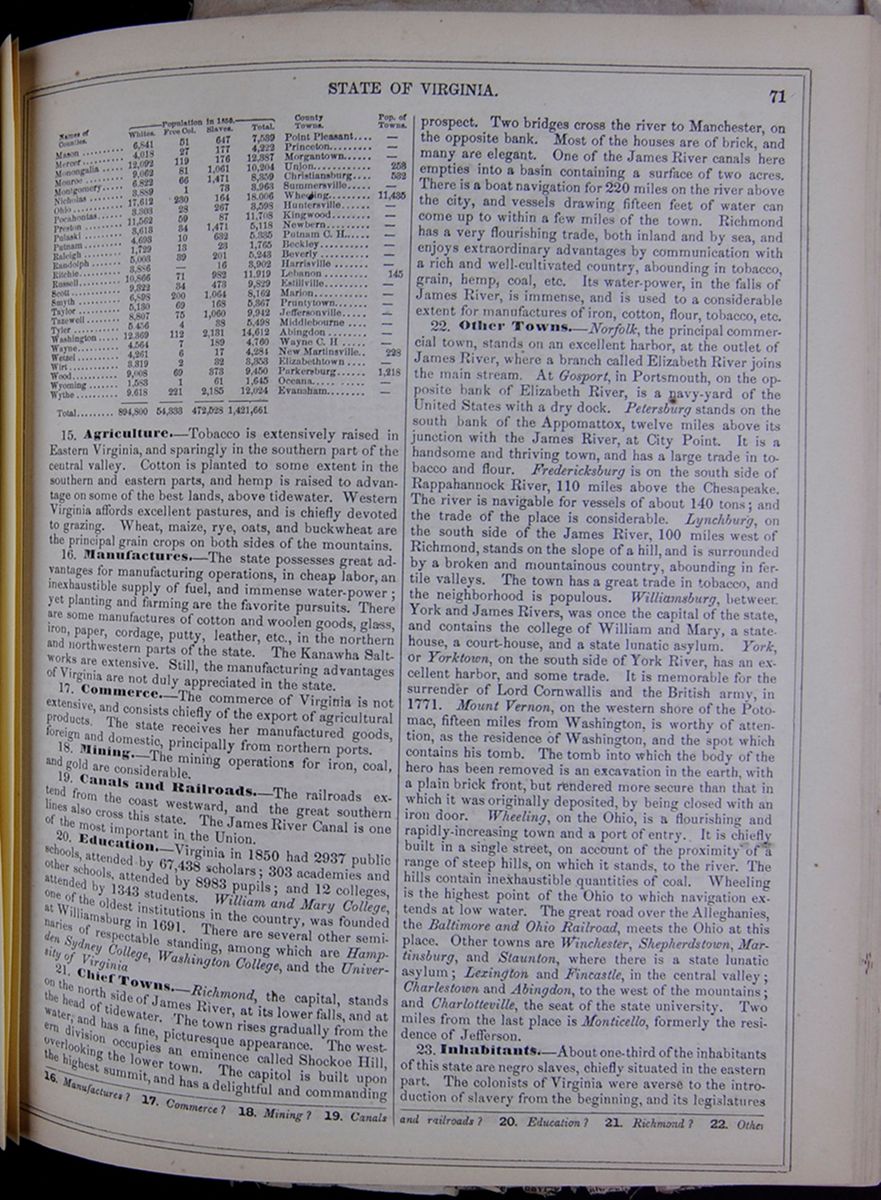
15. Agriculture.—Tobacco is extensively raised in Eastern Virginia, and sparingly in the southern part of the central valley. Cotton is planted to some extent in the southern and eastern parts, and hemp is raised to advantage on some of the best lands, above tidewater. Western Virginia affords excellent pastures, and is chiefly devoted to grazing. Wheat, maize, rye, oats, and buckwheat are the principal grain crops on both sides of the mountains.
16. Manufactures.—The state possesses great advantages for manufacturing operations, in cheap labor, an inexhaustible supply of fuel, and immense water-power; yet planting and farming are the favorite pursuits. There are some manufactures of cotton and woolen goods, glass, iron, paper, cordage, putty, leather, etc., in the northern and northwestern parts of the state. The Kanawha Saltworks are extensive. Still, the manufacturing advantages of Virginia are not duly appreciated in the state.
17. Commerce.—The commerce of Virginia is not extensive, and consists chiefly of the export of agricultural products. The state receives her manufactured goods, foreign and domestic, principally from northern ports.
18. Mining.—The mining operations for iron, coal, and gold are considerable.
19. Canals and Railroads.—The railroads extend from the coast westward, and the great southern lines also cross this state. The James River Canal is one of the most important in the Union.
20. Education.—Virginia in 1850 had 2937 public schools, attended by 67,438 scholars; 303 academies and other schools, attended by 8983 pupils; and 12 colleges, attended by 1343 students. William and Mary College, one of the oldest institutions in the country, was founded at Williamsburg in 1691. There are several other seminaries of respectable standing, among which are Hampden Sydney College, Washington College, and the University of Virginia
21. Chief Towns.—Richmond, the capital, stands on the north side of James River, at its lower falls, and at the head of tidewater. The town rises gradually from the water, and has a fine, picturesque appearance. The western division occupies an eminence called Shockoe Hill, overlooking the lower town. The capitol is built upon the highest summit, and has a delightful and commanding prospect. Two bridges cross the river to Manchester, on the opposite bank. Most of the houses are of brick, and many are elegant. One of the James River canals here empties into a basin containing a surface of two acres. There is a boat navigation for 220 miles on the river above the city, and vessels drawing fifteen feet of water can come up to within a few miles of the town. Richmond has a very flourishing trade, both inland and by sea, and enjoys extraordinary advantages by communication with a rich and well-cultivated country, abounding in tobacco, grain, hemp, coal, etc. Its water-power, in the falls of James River, is immense, and is used to a considerable extent for manufactures of iron, cotton, flour, tobacco, etc.
22. Other Towns.—Norfolk, the principal commercial town, stands on an excellent harbor, at the outlet of James River, where a branch called Elizabeth River joins the main stream. At Gosport, in Portsmouth, on the opposite bank of Elizabeth River, is a navy-yard of the United States with a dry dock. Petersburg stands on the south bank of the Appomattox, twelve miles above its junction with the James River, at City Point. It is a handsome and thriving town, and has a large trade in tobacco and flour. Fredericksburg is on the south side of Rappahannock River, 110 miles above the Chesapeake. The river is navigable for vessels of about 140 tons; and the trade of the place is considerable. Lynchburg, on the south side of the James River, 100 miles west of Richmond, stands on the slope of a hill, and is surrounded by a broken and mountainous country, abounding in fertile valleys. The town has a great trade in tobacco, and the neighborhood is populous. Williamsburg, between York and James Rivers, was once the capital of the state, and contains the college of William and Mary, a statehouse, a court-house, and a state lunatic asylum. York; or Yorktown, on the south side of York River, has an excellent harbor, and some trade. It is memorable for the surrender of Lord Cornwallis and the British army, in 1771. Mount Vernon, on the western shore of the Potomac, fifteen miles from Washington, is worthy of attention, as the residence of Washington, and the spot which contains his tomb. The tomb into which the body of the hero has been removed is an excavation in the earth, with a plain brick front, but rendered more secure than that in which it was originally deposited, by being closed with an iron door. Wheeling, on the Ohio, is a flourishing and rapidly-increasing town and a port of entry. It is chiefly built in a single street, on account of the proximity of a range of steep hills, on which it stands, to the river. The hills contain inexhaustible quantities of coal. Wheeling is the highest point of the Ohio to which navigation extends at low water. The great road over the Alleghanies, the Baltimore and Ohio Railroad, meets the Ohio at this place. Other towns are Winchester, Shepherdstown, Martinsburg, and Staunton, where there is a state lunatic asylum; Lexington and Fincastle, in the central valley; Charlestown and Abingdon, to the west of the mountains; and Charlotteville, the seat of the state university. Two miles from the last place is Monticello, formerly the residence of Jefferson.
23. Inhabitants.—About one-third of the inhabitants of this state are negro slaves, chiefly situated in the eastern part. The colonists of Virginia were averse to the introduction of slavery from the beginning, and its legislatures
16. Manufactures? 17. Commerce? 18. Mining? 19. Canals and railroads? 20. Education? 21. Richmond? 22. Other
[begin surface 328]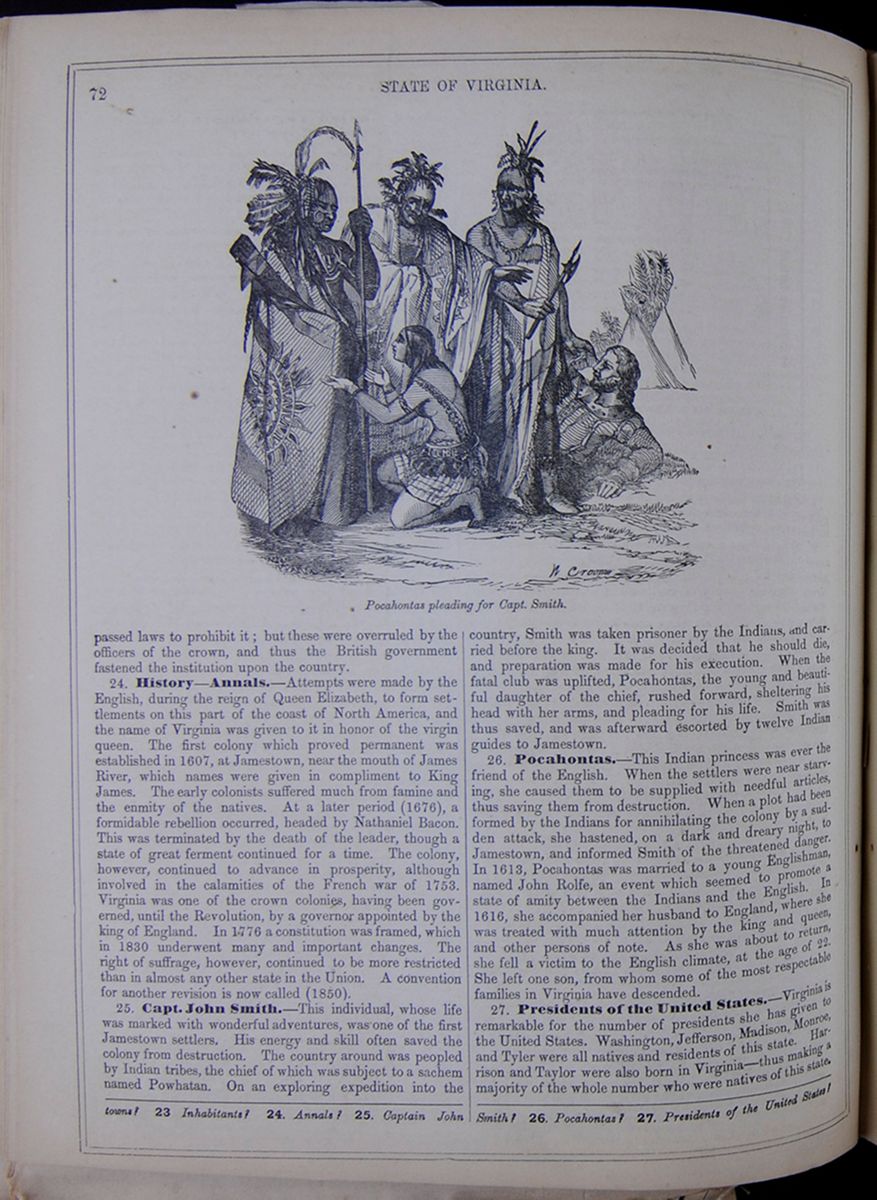 72
STATE OF VIRGINIA.
Pocahontas pleading for Capt. Smith.
72
STATE OF VIRGINIA.
Pocahontas pleading for Capt. Smith.
passed laws to prohibit it; but these were overruled by the officers of the crown, and thus the British government fastened the institution upon the country.
24. History—Annals.—Attempts were made by the English, during the reign of Queen Elizabeth, to form settlements on this part of the coast of North America, and the name of Virginia was given to it in honor of the virgin queen. The first colony which proved permanent was established in 1607, at Jamestown, near the mouth of James River, which names were given in compliment to King James. The early colonists suffered much from famine and the enmity of the natives. At a later period (1676), a formidable rebellion occurred, headed by Nathaniel Bacon. This was terminated by the death of the leader, though a state of great ferment continued for a time. The colony, however, continued to advance in prosperity, although involved in the calamities of the French war of 1753. Virginia was one of the crown colonies, having been governed, until the Revolution, by a governor appointed by the king of England. In 1776 a constitution was framed, which in 1830 underwent many and important changes. The right of suffrage, however, continued to be more restricted than in almost any other state in the Union. A convention for another revision is now called (1850).
25. Capt. John Smith.—This individual, whose life was marked with wonderful adventures, was one of the first Jamestown settlers. His energy and skill often saved the colony from destruction. The country around was peopled by Indian tribes, the chief of which was subject to a sachem named Powhatan. On an exploring expedition into the country, Smith was taken prisoner by the Indians, and carried before the king. It was decided that he should die, and preparation was made for his execution. When the fatal club was uplifted, Pocahontas, the young and beautiful daughter of the chief, rushed forward, sheltering his head with her arms, and pleading for his life. Smith was thus saved, and was afterward escorted by twelve Indian guides to Jamestown.
26. Pocahontas.—This Indian princess was ever the friend of the English. When the settlers were near starving, she caused them to be supplied with needful articles, thus saving them from destruction. When a plot had been formed by the Indians for annihilating the colony by a sudden attack, she hastened, on a dark and dreary night, to Jamestown, and informed Smith of the threatened danger. In 1613, Pocahontas was married to a young Englishman, named John Rolfe, an event which seemed to promote a state of amity between the Indians and the English. In 1616, she accompanied her husband to England, where she was treated with much attention by the king and queen, and other persons of note. As she was about to return, she fell a victim to the English climate, at the age of 22. She left one son, from whom some of the most respectable families in Virginia have descended.
27. Presidents of the United States.—Virginia is remarkable for the number of presidents she has given to the United States. Washington, Jefferson, Madison, Monroe, and Tyler were all natives and residents of this state. Harrison and Taylor were also born in Virginia—thus making a majority of the whole number who were natives of this state.
towns? 23 Inhabitants? 24. Annals? 25. Captain John Smith? 26. Pocahontas? 27. Presidents of the United States?
 [begin surface 330]
THE SOUTHERN STATES OF THE NORTH AMERICAN UNION.
From The London Daily News. JACKSON, Mississippi, Dec. 6.Accidents will occur in the best-regulated families, and rain will come in the best climates in the world, as I have had convincing proof within the last ten days. To be weather-bound anywhere is bad, uncomfortable, tantalising; but to be weather-bound in an inn—and that an American inn in a country-town—is a position which might rouse the gods into impatience. For travelers in most parts of Europe the weather has ceased to have any importance, and for travelers in most parts of the United States, it is likewise a matter of no great moment; but, in some of the Southwestern States—and Mississippi is among the number—it still retains its ancient supremacy. There are some places out of which there are only two ways of getting—in a stage-coach or on horseback; and either of these, when once the rainy season has set in, is attended with horrors that have been unknown in England for one hundred years or more. The stage in this part of the world is unlike its English prototype only in the lowness of its center of gravity and the absence of outside seats. It is about as comfortable, and fully as well horsed, but instead of resting on wheel springs, it is slung on leather straps. It can hardly be called a vehicle. A brig, or a sloop, or a schooner, or a bark, or a "craft" of some sort, would be a much more appropriate appellation. It rolls and pitches and tosses, heaves and lurches, heels over and is taken aback, is thrown on its beam-ends, and, in a word, goes through every description of maritime motions and maneuvers. It travels day and night, sometimes with four horses, often with six, along tracks through the forest which no road-maker save Dame Nature has ever touched—over ruts and holes, and ravines, and through torrents and swamps, and across broken plank bridges and corduroy causeways, and through oceans of mud. It is either upset on a hillside, or breaks down through a bridge, or sticks fast in a quagmire, or is carried away by a torrent, or run away with by horses, at least once in the twenty-four hours, or, rather, once in every trip let the trip be long or short. Men talk of it in bar-rooms, as boatmen in a fishing village talk of craft that have been caught at sea in a gale. They make guesses as to what has happened to it "this time," feeling assured that something or other must have happened to it. Passengers, when they get to their journey's end, tell tales of the road which in England, would make men's blood run cold, but here hardly call forth a passing remark. Long walks on foot, knee-deep in mud, through forests in pitchy darkness; the rush of angry streams through the interior of the vehicle: yawning ravines revealed by flashes of lightning, just as the off-wheels graze the brink; the horrible gloom of swamps on which muddy waters run to and fro in the light of a stormy moon, wiping out all trace of road or bridge, and leaving the luckless Jehu, and more luckless traveler, to the dubious instincts of the horses—all these and more, are incidents of nightly occurrence and daily narrative In no country in which the distances to be traversed were not so enormous, and in which restlessness and love of locomotion were not so prevalent as in America, would stage-coaches, under existing circumstances, have ever been thought of. In the Southern States they combine every danger and désagrément known in traveling, and are only tolerable for their tolerable speed and the partial protection they afford against rain When Winter has once plowed up the roads, they become merely a mockery, a delusion and a snare. The passenger is almost invariably obliged to walk in precisely those parts of the road in which he would pay any sum in reason for a conveyance, and has to perform, in addition, the disagreeable duty of hauling them out of the mud every time they stick fast. Horseback is, after all, that mode of progression which, in the season of heavy rains and long nights, alone suits the rover in the South, who does not want, or cannot have, a railway. It enables a man to choose his own road and his own stopping-places, and nearly bid defiance to mud and torrent. The horse is never upset, never rolls, or pitches, or heaves, or sticks fast. But he is a dear animal out here. He costs double the price one pays for him in England. The sum you lay down for a stout cob would send you to the meet in the old country on a hunter that would do you credit. Cotton—almighty, omnipresent, omnivorous, all-absorbing cotton
—seems to cherish the direst antipathy to the noblest race and the best blood, whether in men or animals. Horses and the Caucasian species flee before it; mules and negroes follow in its track, watch over it, cherish it, and live by it. Mules do all the farm-work in the cotton States. Planters rely on them alone for the cultivation of their crops. The horse, they say is too tender, too delicate and high-spirited to be the fellow-worker or the slave of the negro. The heavy hand and rough ways of the latter would soon quench his fire and dry up his strength. The mule, on the contrary, is too tough and too hardy to be easily broken down. He toils in the cotton-plow, and "hauls" the bales, miles and miles, over roads that might daunt a whipper-in—impervious to abuse, and unflinching under blows and hard work. "Man." said a small farmer to me, in Holmes County, "was not complete without woman, and I guess mules were made to be the helpmates o' niggers." However this may be, in most of the Southern States, little or no attention is given to horse-breeding. Any one who raises "stock" to any extent raises hybrids, as requiring less care, and meeting with a readier market. The best mares are devoted to this purpose. But, in point of fact, nearly all the horses and mules to be found in Alabama, Mississippi and Louisiana are brought by jobbers, every Autumn and Winter, from Tennessee and Kentucky, who drive them, in great herds, from town to town, and county to county, and dispose of them along the road, at the various plantations. The prices they ask and get are enormous. A horse that would sell for £20 in England, is considered cheap at £50. Mules of no great size and no great power bring £40 and upward, and they, as well as the negroes, are becoming dearer every year. They general result is, that the saddle-horses are degenerating. Each generation of planters is less and less of a riding generation. There is no open country to hunt over and when they undertake a journey, if they do not like the stage, they generally prefer driving in a buggy to sitting in a saddle. The breed of horses most in favor are heavy-quartered, heavy-shouldered, thick necked, low-bred, but strong roadsters great at dead pull and brilliant in deep mud. Your delicate-limbed English blood would make a sorry figure going through a clearing or over a corduroy road. "But handsome is that handsome does." Cotton and the turf have no manner of affinity.
I must protest, as far as my personal experience goes against at the notion generally current on the other side of the water, that travelers in this country are apt to be baited by impertinent curiosity. As far as I have seen, in no country in the world so thinly settled, and in which a traveler is still, in some sort, a book which his entertainer has the right to read, could a reserved man's reserve be more rigidly respected. You come and go, in the most out-of-the-way place, pass idle, listless dogs in small towns, where every man knows, or thinks he ought to know, every other man for two hundred miles around; you may be strangely dressed strange in voice, in accent, or in manner, but no one ever pretends to feel enough curiosity about you to be unable to conceal it. Your genuine Southerner is too independent and too proud to manifest much interest in other people's concerns. Remain silent and you may sit silent in the most crowded bar-room, as long as you please. Be communicative, and you will find your communications received in a quiet, calm way which accepts freely what is given, but seeks for no more. But I have never witnessed the slightest attempt made to pump any man who did not choose to be pumped. I am certain I could not have ridden three hundred miles through an agricultural district in England, and met with so little rudeness or incivility, and so much positive civility, as I have met with here. You find no deference paid to you because you are better-dressed or carry more marks of wealth about you than the person you happen to be speaking to, but civility is not the less welcome for that. In England, unless known to somebody, you are generally treated as nobody.
Here all distinctions of wealth and station are wiped out utterly by the grand fact that no "gentleman," that is, no free citizen, can refuse to fight another gentleman if a "difficulty" should arise between them, or, in other words, if one or other should see fit to take offence upon the ground of any difference in means or social position. Society, as constituted south of Mason and Dixon's Line, establishes rigid equality of all men before the revolver. Certainly, if dueling be tolerable under any circumstances, it is tolerable under a code of this sort, which recognizes no ground of exemption from its sanguinary requirements. One of the worst features in old Europe lies in the fact that the gentil-homme may inflict the last insult upon a roturier, and afterward refuse to afford him the only means by which, in the eyes of both, the stain may be wiped out, simply on the ground of these differences of caste. In the absence of anything which can be called "society," with its etiquette, its amenities, its softening,
 [begin surface 333]
 [begin surface 334]
civilising influences—in the absence of all polish, manner, refinement of that nameless, indefinable something, whether fear of the law or of public opinion, or the influence of education, which in England makes most people quiet and inoffensive in their demeanor toward one another, there can be no question the revolver, in the South-western States, has, to some extent, been a civilizing agent. It has taught lessons if not of politeness at least of forbearance, which rude settlers in the wilderness were not likely to have learnt in any other way. In a country in which the law neither can nor will interfere to settle or prevent private quarrels, they must needs be settled by violent means. We hear a great deal of the sanguinary nature of these "difficulties;" but we hear nothing, because we know nothing, of the innumerable disorders, brutalities, and outrages, which, in a country where the police is powerless, except against thieves, must, of necessity, be committed, were it not known that each man carries about him the means of protecting and avenging himself. I suppose roads so well adapted for the robbery of travelers never existed as the roads in the greater part of Mississippi, and yet such a thing as a highway robbery is never heard of. She has still a prouder boast to make. The raggedest, shabbiest, meanest-looking man in the whole community may enter any hotel or place of public resort, and feel as much at his ease, as certain of being put by every one on a footing of equality, of being treated by every one with as much consideration, of receiving as much attention as if he were in his own log-cabin, or as if he drove to the door in a buggy and pair. Whether this be owing to the fact that any one who slighted him would certainly be obliged to fight him, or not, the spectacle is one not to be witnessed in any other country that I know of. I doubt very much if such unadulterated republicanism is to be met with in any of the Northern States. However the wealthy planters may think or write of the "mean whites," [illegible]hey take uncommon good care, at least in this part of the Union, not to show it in their manner toward them.
In their own houses, in entertaining strangers, the small farmers have an amount of self-possession, and even dignity of manner, which men of a corresponding class in Europe never display, and which, in fact, could only be displayed in a country in which differences of rank are unknown. The master of the house takes his place at the head of the table, and says grace, let the fare and the appointments be what they may, with as grand an air as if it were a full-dress dinner-party. They are nearly all more or less what the evangelical world calls "pious," and are divided pretty equally between two sects—the Methodists and Baptists. Itinerant preachers, carrying all their worldly goods in their saddle-bags, pass and repass in all directions every week, and hold forth sometimes in log-chapels, in fine weather in the open air, in case of necessity anywhere. As far as I have been able to observe, however, cant or technical jargon forms a large part of what the audience carries away from these gatherings I have heard respectable men swear roundly, define for what reasons—some of them often, to our notions, atrociously trifling—they would shoot a man down, and the next minute break out into a religious strain with an unction and fervor quite bewildering for one to whom this inconsistency is new. I was sitting before the fire in a farm house some evenings ago, in company with a group of travelers, like myself, overtaken by the storm, when the conversation, as conversation always does in these parts, turned upon negroes, and each declared whether he would or would not kill a slave attempting to escape, if there were no other way to prevent his flight. All were agreed in thinking it proper, under such circumstances, to pepper him with small shot, but one proclaimed, with an oath, that he would shoot him dead on the spot. To my great amusement, I found, in the course of the evening afterward, that this was the most pious man of the party in his talk. He and a heartbroken-looking old woman, who occupied the chimney-corner and was returning, way-worn and disappointed, with her family from Texas, poured out Scriptural consolation to one another for an hour together, his being intermingled with observations addressed to the assemblage generally, in a slightly different tone, upon the price of the land, of mules, of slaves, cotton, and such like. What surprised me in the matter was not that he should be a hypocrite, because hypocrites are plenty in all climes and in all sects, but that he should take so little pains to conceal his hypocrisy, and that his mixture of slang and cant, of pious precepts with tap-room morality, should appear to excite neither astonishment nor disgust among his auditory. This union of puritanical strictness in doctrine with rowdyish laxity in language and behavior, is very common.
The merits of the various preachers form almost as prominent a subject of discussion as the merits of rival politicians, and the good and bad points of the leaders are sometimes discussed with great heat. There is a preacher in the northern part of this State, one of whose sermons, as I was assured, having come under the notice of Mr. Macaulay, the historian, that gentleman pronounced it, emphatically, to be the most finished
piece of English composition he had ever read. Stories of this sort about England and Englishmen are generally told with so much positiveness that there is no use in denying or questioning them. The same man from whom I got the above—and he was a man of standing in his district—likewise communicated a little episode in the life of an "illustrious personage," with which your readers are probably not familiar, nor, I venture to assert, is the Court newsman. It appears that when Mr. John Van Buren—son of the Van Buren of transatlantic celebrity—had the good or evil fortune to represent the United States at St. James's, he proved a little too captivating in the eyes of her Majesty the Queen, who began to reciprocate the passion which she had already inspired in the breast of the bewitching John. The case was a hard one, but the tale is old. State necessities, etiquette, public opinion, John's comparatively lowly origin, and, in short, a thousand and one little impossibilities, forbade the unhappy lover to look for more than sighs and tears, and remembrance. John was recalled in due course; the Queen became the bride of another, and her quondam adorer pines still in bachelorhood over his blighted hopes, for which reason he is known in these parts by the sobriquet of "Prince John;" and it is firmly believed that it is only the stupid mediæval prejudices of a corrupt Court which have hindered him from sharing a throne. The notions about England prevalent among the planters, owing no doubt to the smaller amount of communication with the mother country, though the Anglo-Saxon race is in no part of America so pure as in the Southern States, are often bizarre enough in their way. Most of the farmers are firmly persuaded that Prince Albert is the leading political personage in the State, and does most of the work of Government. "The lords" are currently believed to make the laws, which are supposed to bear very stringently upon the "commoners." One old gentleman told us he was quite sure he couldn't bear to live under our Queen, as he "expected" she would always be "ordering him about:" nor should he very much like to pay a visit to England, because he thought the police would seize on him on landing and make him tell his business. Great surprise was frequently expressed at my assertion that I believed more real liberty was enjoyed in England than here, because in England a man was protected against the tyranny of his neighbors while here he was at their mercy. No matter what length of time I spent in proving my case, I generally found my eloquence was expended in vain. That a man can be as free in the old world as here, is a proposition which sounds to them outrageously absurd. I sometimes ventured to touch upon the custom which prevails here, of expelling, by Lynch law, from the State men who have given utterance to Abolitionist sentiments, in illustration of my argument; and I am glad to say I invariably found that it silenced the readiest and most violent. The only answer to this I found to be declamation upon the horrors that might result from slave rebellion. The fact is, I imagine, that while every man in the country feels it to be necessary to the safety of the existing state of things to prohibit, absolutely and completely, all discussion as to the right of the masters to their slaves, no one likes to establish a censorship of the press by statutable enactment. This would be rather too close an imitation of absolutism. As long as it is only the "mob" or "the public" that maltreat a man for free speech, the credit of the State is saved, while slave property is secured, as "the mob" and "the public" are two booies who have neither character to lose, memory to dishonor, nor history to sully. There is no more disagreeable and embarrassing police duty in despotic countries than that of gagging the press. The Emperor of Austria would, I have no doubt, be only too glad if deputations of "citizens" were to wait upon all persons guilty of uttering sentiments hostile to his government—guilty for instance, of questioning his right to dispose freely of the lives and fortunes of his subjects, and give them twenty-four hours to quit the country. If he could only bring about this state of things, he might safely come before the world as the sworn friend of free speech, and say it was the mob, the uncontrolable, unreasoning mob who stopped men's mouths.
There is in the South, nevertheless, I think, a larger amount of kindly feeling toward England than in the North, except among the cultivated portion of the New-Englanders. There immigrates yearly into the Northern States a large mass of England-haters, Irish and foreign, who growl, howl, and lie against Great Britain as long as their lungs last them. Very few if any of that class make their way into slave territory. The old race, as it landed in Virginia and Carolina, is here still tolerably pure from foreign adulteration, and looks back to the mother country still with much pride and a good deal of affection. Every name one hears is a good old English name, and I have not met an honest farmer yet who was not gratified to learn that his cognomen was a common one on the other side of the water, and who was not visibly delighted to be able to tell which of his ancestors it was who first set foot on the soil of the New World, English born and English bred. And, moreover, I have sat at no fireside without being assured by a thousand tokens that I was all the more [cutaway]
 [begin surface 337]
 [begin surface 338]
 [begin surface 339]
 [begin surface 340]
 [begin surface 341]
 [begin surface 342]
 [begin surface 343]
 [begin surface 344]
 [begin surface 345]
 [begin surface 346]
 [begin surface 347]
 [begin surface 348]
 [begin surface 349]
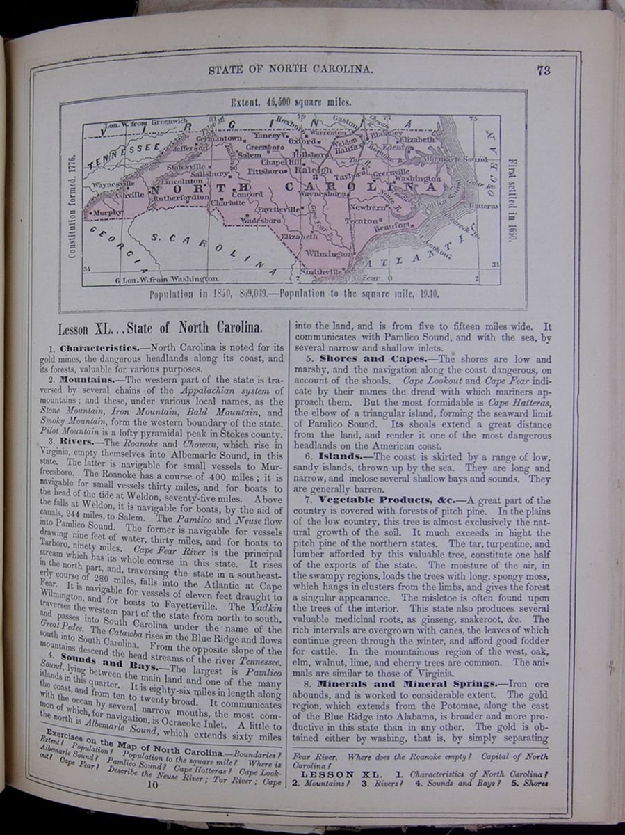
Lesson XL... State of North Carolina.
1. Characteristics.—North Carolina is noted for its gold mines, the dangerous headlands along its coast, and its forests, valuable for various purposes.
2. Mountains.—The western part of the state is traversed by several chains of the Appalachian system of mountains; and these, under various local names, as the Stone Mountain, Iron Mountain, Bald Mountain, and Smoky Mountain, form the western boundary of the state. Pilot Mountain is a lofty pyramidal peak in Stokes county.
3. Rivers.—The Roanoke and Chowan, which rise in Virginia, empty themselves into Albemarle Sound, in this state. The latter is navigable for small vessels to Murfreesboro. The Roanoke has a course of 400 miles; it is navigable for small vessels thirty miles, and for boats to the head of the tide at Weldon, seventy-five miles. Above the falls at Weldon, it is navigable for boats, by the aid of canals, 244 miles, to Salem. The Pamlico and Neuse flow into Pamlico Sound. The former is navigable for vessels drawing nine feet of water, thirty miles, and for boats to Tarboro, ninety miles. Cape Fear River is the principal stream which has its whole course in this state. It rises in the north part, and, traversing the state in a southeasterly course of 280 miles, falls into the Atlantic at Cape Fear. It is navigable for vessels of eleven feet draught to Wilmington, and for boats to Fayetteville. The Yadkin traverses the western part of the state from north to south, and passes into South Carolina under the name of the Great Pedee. The Catawba rises in the Blue Ridge and flows south into South Carolina. From the opposite slope of the mountains descend the head streams of the river Tennessee.
4. Sounds and Bays.—The largest is Pamlico Sound, lying between the main land and one of the many islands in this quarter. It is eighty-six miles in length along the coast, and from ten to twenty broad. It communicates with the ocean by several narrow mouths, the most common of which, for navigation, is Ocracoke Inlet. A little to the north is Albemarle Sound, which extends sixty miles into the land, and is from five to fifteen miles wide. It communicates with Pamlico Sound, and with the sea, by several narrow and shallow inlets.
5. Shores and Capes.—The shores are low and marshy, and the navigation along the coast dangerous, on account of the shoals. Cape Lookout and Cape Fear indicate by their names the dread with which mariners approach them. But the most formidable is Cape Hatteras, the elbow of a triangular island, forming the seaward limit of Pamlico Sound. Its shoals extend a great distance from the land, and render it one of the most dangerous headlands on the American coast.
6. Islands.—The coast is skirted by a range of low, sandy islands, thrown up by the sea. They are long and narrow, and inclose several shallow bays and sounds. They are generally barren.
7. Vegetable Products, &c.—A great part of the country is covered with forests of pitch pine. In the plains of the low country, this tree is almost exclusively the natural growth of the soil. It much exceeds in hight the pitch pine of the northern states. The tar, turpentine, and lumber afforded by this valuable tree, constitute one half of the exports of the state. The moisture of the air, in the swampy regions, loads the trees with long, spongy moss, which hangs in clusters from the limbs, and gives the forest a singular appearance. The misletoe is often found upon the trees of the interior. This state also produces several valuable medicinal roots, as ginseng, snakeroot, &c. The rich intervals are overgrown with canes, the leaves of which continue green through the winter, and afford good fodder for cattle. In the mountainous region of the west, oak, elm, walnut, lime, and cherry trees are common. The animals are similar to those of Virginia.
8. Minerals and Mineral Springs.—Iron ore abounds, and is worked to considerable extent. The gold region, which extends from the Potomac, along the east of the Blue Ridge into Alabama, is broader and more productive in this state than in any other. The gold is obtained either by washing, that is, by simply separating
Exercises on the Map of North Carolina.—Boundaries? Extent? Population? Population to the square mile? Where is Albemarle Sound? Pamlico Sound? Cape Hatteras? Cape Lookout? Cape Fear? Describe the Neuse River; Tar River; Cape Fear River. Where does the Roanoke empty? Capital of North Carolina?
LESSON XL. 1. Characteristics of North Carolina? 2. Mountains? 3. Rivers? 4. Sounds and Bays? 5. Shores
10 [begin surface 350] 74
STATE OF NORTH CAROLINA.
74
STATE OF NORTH CAROLINA.
native gold from the sand in which it is found, or from mines. There are thermal waters in Buncombe county which are said to cure rheumatism and paralysis.
9. Climate.—The climate partakes of the diversified character of the surface. The mountainous region, or western plateau, experiences much of the rigor of the winters of the more northern states, though less long and not so severe. The air in this and the lower midland region is pure and healthy, and the summer heats are tempered by cool nights. But in the low country, the summers are hot and sultry, and the air is rendered unhealthy by the exhalations of the marshes and stagnant waters.
10. Soil.—In the level country, generally, the soil is poor and sandy, with large swampy tracts. The banks of some of the rivers are tolerably fertile, and there are some glades of moist land possessing a black, fruitful soil. West of the hilly country the soil is good.
11. Swamps.—The Great Dismal Swamp lies in the northeastern part of the state, and extends into Virginia. It is thirty miles in length, and ten in breadth, and covers an extent of 150,000 acres; the soil is marshy, and the whole tract is overgrown with pine, juniper, and cypress trees, with white and red oak in the drier parts. In the center, on the Virginia side, is Lake Drummond, fifteen miles in circuit. Many parts of the swamps are impervious to man, from the thickness of the woods and bushes. A canal is carried through it from Norfolk to Albemarle Sound. Between Albemarle and Pamlico Sound is another, called Alligator, or Little Dismal Swamp, which also has a lake in the center.
12. Face of the Country.—The eastern part of the state, for a distance of about sixty miles from the sea, is a low plain covered with swamps, indented by numerous shallow inlets from the ocean, and traversed by sluggish streams, which the low and level surface allows to spread out into broad basins. To this maritime belt succeeds a fine undulating country, irrigated with fresh, running waters, and presenting a surface agreeably diversified with hills and valleys. The western part of the state is an elevated table-land, rising to a general elevation of about 1800 feet above the level of the sea, independently of the mountainous summits, which rise much higher.
13. Divisions.—North Carolina is divided as follows:
This table lists the counties of North Carolina with their populations in 1850 and includes a column for the major town in each county and the town's population. The county population is divided into the following categories: White, Free Colored, Slaves, and Total.14. Agriculture.—The great diversity of climate produces a corresponding variety of productions. The eastern lowlands yield rice, cotton, and indigo; here, also, the fig-tree begins to appear. In the more elevated region, the northern grains and fruits thrive; wheat, Indian corn, etc., with tobacco, and hemp, apples, pears, peaches, sweet potatoes, and yams.
15. Manufactures.—There are some manufactures of wool, iron, and cotton: the latter are increasing.
16. Commerce.—Most of the produce of the country has been exported by the way of Charleston, South Carolina. Besides the agricultural productions above mentioned, naval stores, or tar, pitch, and turpentine, are exported in large quantities. The principal port of the state is Wilmington.
17. Lumbering.—This is carried on to a great extent for the purpose of taking to market the yellow pine, which is highly esteemed for its beauty and durability.
18. Mining.—The operations of mining are chiefly confined to the collecting of gold. Copper, iron, and coal are also obtained to a considerable extent.
19. Canals and Railroads.—There are several short canals, of which the Dismal Swamp Canal, partly in Virginia, is the most important. The Great Southern Railroad passes through this state, and there are several other lines penetrating the interior, and connecting with those of the neighboring states.
and Capes? 6. Islands? 7. Vegetable products? 8. Minerals and Mineral springs? 9. Climate? 10. Soil? 11. Swamps? 12. Face of the country? 13. Divisions? 14. Agriculture? 15. Manufactures? 16. Commerce? 17. Lumbering? 18. Mining?
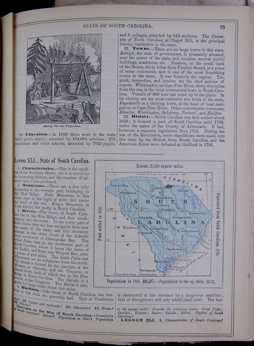
20. Education.—In 1850 there were in the state 2657 public schools, attended by 104,095 scholars; 272 academies and other schools, attended by 7822 pupils, and 5 colleges, attended by 513 students. The University of North Carolina, at Chapel Hill, is the principal literary institution in the state.
21. Towns.—There are no large towns in this state. Raleigh, the seat of government, is pleasantly situated, near the center of the state, and contains several public buildings, academies, etc. Newbern, on the south bank of the Neuse, thirty miles from Pamlico Sound, is a place of some commerce, and is one of the most flourishing towns in the state. It was formerly the capital. Tar, pitch, turpentine, and lumber are the chief articles of export. Wilmington, on Cape Fear River, thirty-five miles from the sea, is the most commercial town in North Carolina. Vessels of 300 tons can come up to the place. In its vicinity are the most extensive rice fields in the state. Fayetteville is a thriving town, at the head of boat navigation, on Cape Fear River. Other considerable towns are Edenton, Washington, Salisbury, Tarboro', and Halifax.
22. History.—North Carolina was first settled about 1650; it formed a part of South Carolina until 1729, under the name of the County of Albemarle. It had, however, a separate legislature from 1715. During the war of the Revolution, some expeditions were made into this state by the British, from South Carolina, and the American forces were defeated at Guilford in 1781.
Lesson XLI... State of South Carolina.
1. Characteristics.—This is the smallest of the Southern States, yet it is noted for its interesting history, and the number of talented men it has produced.
2. Mountains.—There are a few lofty mountains in the western part, belonging to the Blue Ridge. Table Mountain, in this chain, rises to the hight of 4000 feet above the level of the sea. King's Mountain, in York district, lies partly in North Carolina.
3. Rivers.—The rivers of South Carolina rise in the Blue Ridge, and flow south-easterly into the ocean. In the lower part of their course they are less navigable than near the center of the state, and this character belongs to the other rivers of the Atlantic slope, southwest of Chesapeake Bay. The Great Pedee rises in the northwest part of North Carolina, where it bears the name of the Yadkin, and flows into Winyaw Bay, after a course of 450 miles. The Little Pedee and Waccamaw are its tributaries from the north. The Santee is formed by the junction of the Wateree, or Catawba, and the Congaree, or Broad rivers, both of which rise in the Blue Ridge in North Carolina. The Saluda is a branch of the Congaree. The Edisto is navigable for large boats about 100 miles.
4. Harbors.—Like those of North Carolina, the harbors of this state are generally bad. That of Charleston
Map of South Carolina. Extent, 28,000 square miles. First settled in 1680. Separated from North Carolina, 1729. Population in 1850, 668,507.—Population to the sq. mile, 23.87.is obstructed at the entrance by a dangerous sand-bar; that of Georgetown will only admit small craft. The harbor
19. Canals and railroads? 20. Education? 21. Towns? 22. History?
Exercises on the Map of South Carolina.—Boundaries of South Carolina? Extent? Population in 1840? Population to the square mile? Describe the following rivers: Great Pedee; Lynches; Wateree; Santee; Saluda; Edisto. Capital of South Carolina?
LESSON XLI. 1. Characteristics of South Carolina?
[begin surface 352]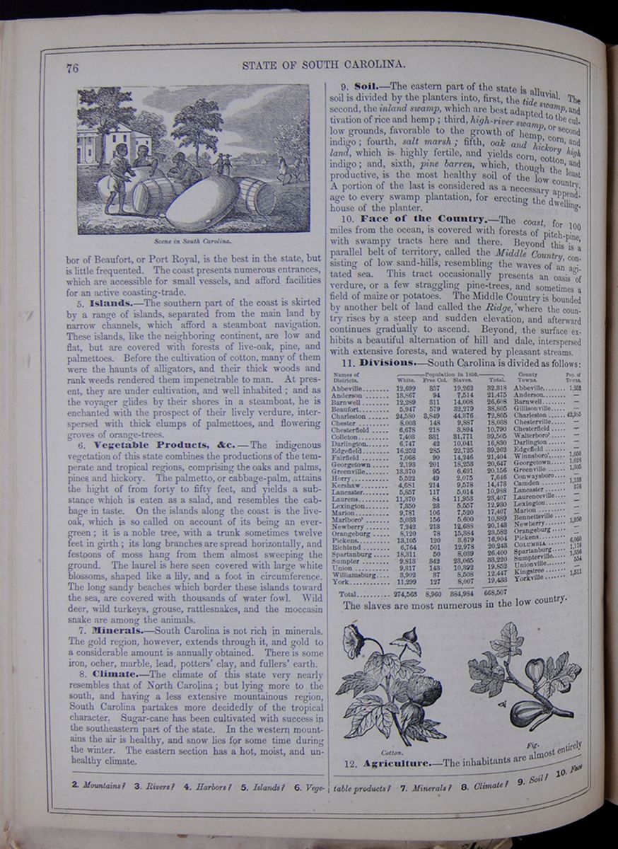 76
STATE OF SOUTH CAROLINA.
Scene in South Carolina
In this small illustration, three young men who
appear to be African-American (likely enslaved) talk
while leaning on large barrels and bags in front of a
plantation-style home. Behind them there is a scene
comprised of a poised horse, a couple out for a stroll,
and several trees.
76
STATE OF SOUTH CAROLINA.
Scene in South Carolina
In this small illustration, three young men who
appear to be African-American (likely enslaved) talk
while leaning on large barrels and bags in front of a
plantation-style home. Behind them there is a scene
comprised of a poised horse, a couple out for a stroll,
and several trees.
of Beaufort, or Port Royal, is the best in the state, but is little frequented. The coast presents numerous entrances, which are accessible for small vessels, and afford facilities for an active coasting-trade.
5. Islands.—The southern part of the coast is skirted by a range of islands, separated from the main land by narrow channels, which afford a steamboat navigation. These islands, like the neighboring continent, are low and flat, but are covered with forests of live-oak, pine, and palmettoes. Before the cultivation of cotton, many of them were the haunts of alligators, and their thick woods and rank weeds rendered them impenetrable to man. At present, they are under cultivation, and well inhabited; and as the voyager glides by their shores in a steamboat, he is enchanted with the prospect of their lively verdure, interspersed with thick clumps of palmettoes, and flowering groves of orange-trees.
6. Vegetable Products, &c.—The indigenous vegetation of this state combines the productions of the temperate and tropical regions, comprising the oaks and palms, pines and hickory. The palmetto, or cabbage-palm, attains the hight of from forty to fifty feet, and yields a substance which is eaten as a salad, and resembles the cabbage in taste. On the islands along the coast is the live-oak, which is so called on account of its being an evergreen; it is a noble tree, with a trunk sometimes twelve feet in girth; its long branches are spread horizontally, and festoons of moss hang from them almost sweeping the ground. The laurel is here seen covered with large white blossoms, shaped like a lily, and a foot in circumference. The long sandy beaches which border these islands toward the sea, are covered with thousands of water fowl. Wild deer, wild turkeys, grouse, rattlesnakes, and the moccasin snake are among the animals.
7. Minerals.—South Carolina is not rich in minerals. The gold region, however, extends through it, and gold to a considerable amount is annually obtained. There is some iron, ocher, marble, lead, potters' clay, and fullers' earth.
8. Climate.—The climate of this state very nearly resembles that of North Carolina; but lying more to the south, and having a less extensive mountainous region, South Carolina partakes more decidedly of the tropical character. Sugar-cane has been cultivated with success in the southeastern part of the state. In the western mountains the air is healthy, and snow lies for some time during the winter. The eastern section has a hot, moist, and unhealthy climate.
9. Soil.—The eastern part of the state is alluvial. The soil is divided by the planters into, first, the tide swamp, and second, the inland swamp, which are best adapted to the cultivation of rice and hemp; third, high-river swamp, or second low grounds, favorable to the growth of hemp, corn, and indigo; fourth, salt marsh; fifth, oak and hickory high land, which is highly fertile, and yields corn, cotton, and indigo; and, sixth, pine barren, which, though the least productive, is the most healthy soil of the low country. A portion of the last is considered as a necessary appendage to every swamp plantation, for erecting the dwelling-house of the planter.
10. Face of the Country.—The coast, for 100 miles from the ocean, is covered with forests of pitch-pine, with swampy tracts here and there. Beyond this is a parallel belt of territory, called the Middle Country, consisting of low sand-hills, resembling the waves of an agitated sea. This tract occasionally presents an oasis of verdure, or a few straggling pine-trees, and sometimes a field of maize or potatoes. The Middle Country is bounded by another belt of land called the Ridge, where the country rises by a steep and sudden elevation, and afterward continues gradually to ascend. Beyond, the surface exhibits a beautiful alternation of hill and dale, interspersed with extensive forests, and watered by pleasant streams.
11. Divisions.—South Carolina is divided as follows: This table lists the districts of South Carolina with their populations in 1850 and includes a column for the major town in each district and the town's population. The district population is divided into the following categories: White, Free Colored, Slaves, and Total. The slaves are most numerous in the low country.
Cotton. Image of the cotton plant. Fig. Image of a fig growing on a branch.12. Agriculture.—The inhabitants are almost entirely
2. Mountains? 3. Rivers? 4. Harbors? 5. Islands? 6. Vegetable products? 7. Minerals? 8. Climate? 9. Soil? 10. Face
[begin surface 353] STATE OF SOUTH CAROLINA.
77
STATE OF SOUTH CAROLINA.
77
occupied with agriculture. Cotton and rice are the staple commodities, and are exported in large quantities. Indigo and tobacco thrive well. The cultivation of maize and other corn is little attended to, and considerable quantities of flour are imported for consumption. Other productions are apples, pears, peaches, figs, olives, oranges, yams, sweet potatoes, &c.
13. Manufactures.—These are yet in their infancy. Cotton manufactures are begun, and are likely to increase. There are also manufactures of wool, iron, &c., on a small scale.
14. Commerce.—The exportation of cotton and rice forms the principal branch of the commerce of the state, which is chiefly in the hands of the people of the northern states. Charleston is well situated for foreign commerce, and there is a growing interest in the subject.
15. Canals and Railroads.—The length of railroad completed is about 600 miles, and there are others in progress. The canals are of local importance only.
16. Education.—There are two colleges in this state; South Carolina College, at Columbia, and Charleston College, in Charleston. Several other institutions are styled colleges, but they are nothing more than respectable schools. There are also several academies. The Medical College of South Carolina is in Charleston; and there is a Presbyterian Theological Seminary at Columbia, a Lutheran at Lexington, and a Baptist in Sumter district. The state has for a number of years made an annual grant toward the support of free schools, but they are not efficient or general.
17. Charleston.—The city of Charleston, the second city in the Southern States, is situated at the confluence of the rivers Ashley and Cooper, six miles from the ocean. The harbor is commodious, and has two entrances, the deepest of which admits vessels of sixteen feet draft. Sullivan's Island, at the mouth of the harbor, is a pleasant summer resort. The harbor is defended by Fort Moultrie, on Sullivan's Island, and by Forts Pinkney and Johnson. The city is regularly laid out and handsomely built, and the vicinity is adorned with numerous plantations in a high state of cultivation. It is much healthier than the surrounding country, and the planters from the low country, and wealthy West Indians, come here to spend the summer. It is also resorted to by people from the north, as a pleasant winter residence. Many of the houses are handsome, and are furnished with piazzas; the grounds are often adorned with flowering plants and ornamental shrubs. The squares are shaded with the pride of China, and the gardens with orange-trees. The commerce of the city is extensive.
18. Other Towns.—Columbia, the seat of government, stands on the Congaree, near the center of the state, and occupies an elevated plain, sloping gently on every side. Georgetown, at the head of a bay formed by the junction of the Great Pedee, Waccamaw, and two or three other streams, is thirteen miles from the sea, and has considerable commerce. Beaufort, on the island of Port Royal, is a pleasant town, with a healthy situation, and good harbor; but it has little commerce. Camden, on the Wateree, enjoys a portion of the interior trade, but is chiefly remarkable for the battles fought in its neighborhood during the revolution.
19. History—Annals.—North and South Carolina were originally embraced under the general term of the Carolinas. There were several separate settlements or colonies, but all were under the superintendence of the same board of proprietors until 1729, when they were finally separated. From this period, they were under two distinct royal governments. North Carolina was settled by emigrants from Virginia between 1640 and 1650. Other settlements were made at different places. In 1669 a constitution, formed by John Locke, and modeled after the English constitution, was established over the two Carolinas. It was, however, unsuited to the condition of the people, and never went into full operation. In 1677, disturbances took place in North Carolina, and a feverish state continued for several years, at one period breaking out into open rebellion. The colony, however, continued to prosper. The Indians, who had been numerous and powerful, were gradually reduced to comparative insignificance. In 1711, however, the Tuscaroras and Corees made a formidable attack upon the scattered settlements, killing one hundred and thirty persons in a single night. The combined forces of North and South Carolina at length besieged them, in 1713, in their fort. They surrendered, and 800 prisoners were taken. The Corees remained in the country, and dwindled into insignificance. The Tuscaroras migrated to northern New York, allied themselves to the Five Nations, and became the sixth of that celebrated confederacy. The first permanent settlement in South Carolina was made at Oyster Point, in 1680, which grew up into the present city of Charleston. Wars with the Indians followed, and many of the latter were captured and sold in the West Indies as slaves. In 1684, some Scotch emigrants settled at Port Royal; in 1686, a large number of persecuted French Huguenots established themselves in different parts of the colony. About this period, the people rebelled against Governor Colleton, who was impeached and banished. In 1693, the Fundamental Constitution, framed by Locke, was abolished, and a more republican government established. In 1702, an expedition was sent against the Spaniards at St. Augustine, which involved the colony in a debt of $26,000, and led to the first issue of paper money in the Carolinas. In 1704 and 1715, there were serious troubles with the Indians. At the latter date, there was a general revolt of the tribes from Cape Fear River to the Alabama, headed by the Yamassees. The frontier settlements were desolated, and Port Royal was abandoned. Governor Craven marched against the enemy, and defeated them in a bloody battle upon the banks of the Salkehatchie. This terminated the war, the Yamassees retiring to Florida.
20. Revolutionary War.—In 1780 and 1781, South Carolina became the theater of military operations, and was overrun by the British forces. May 11, 1780, Charleston was captured by the English, who also defeated the American troops at Camden, August 16th, and were in turn worsted in the action of King's Mountain, October 7th. In the following campaign, the Americans were successful at the Cowpens, January 17th, and at Eutaw Springs, in September, and the hostile forces soon after evacuated the state. They marched northward, and were captured at Yorktown, with Cornwallis. The present constitution of South Carolina was formed in 1790. It has been since twice amended.
of the country? 11. Divisions? 12. Agriculture? 13. Manufactures? 14. Commerce? 15. Canals and railroads? 16. Education? 17. Charleston? 18. Other towns? 19. Annals? 20. Revolutionary War?
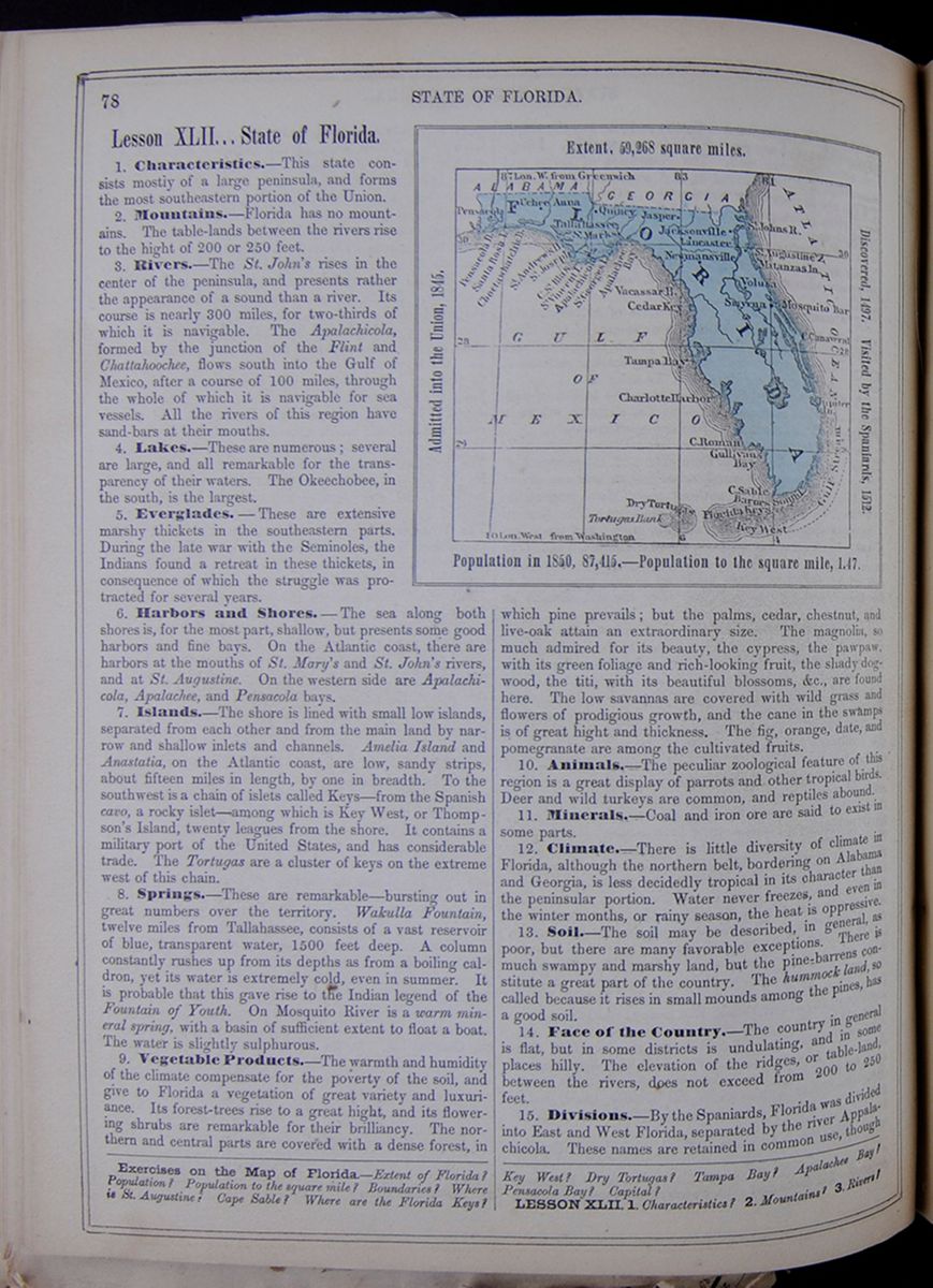 78
STATE OF FLORIDA.
78
STATE OF FLORIDA.
Lesson XLII... State of Florida.
1. Characteristics.—This state consists mostly of a large peninsula, and forms the most southeastern portion of the Union.
2. Mountains.—Florida has no mountains. The table-lands between the rivers rise to the hight of 200 or 250 feet.
3. Rivers.—The St. John's rises in the center of the peninsula, and presents rather the appearance of a sound than a river. Its course is nearly 300 miles, for two-thirds of which it is navigable. The Apalachicola, formed by the junction of the Flint and Chattahoochee, flows south into the Gulf of Mexico, after a course of 100 miles, through the whole of which it is navigable for sea vessels. All the rivers of this region have sand-bars at their mouths.
4. Lakes.—These are numerous; several are large, and all remarkable for the transparency of their waters. The Okeechobee, in the south, is the largest.
5. Everglades.—These are extensive marshy thickets in the southeastern parts. During the late war with the Seminoles, the Indians found a retreat in these thickets, in consequence of which the struggle was protracted for several years.
6. Harbors and Shores.—The sea along both shores is, for the most part, shallow, but presents some good harbors and fine bays. On the Atlantic coast, there are harbors at the mouths of St. Mary's and St. John's rivers, and at St. Augustine. On the western side are Apalachicola, Apalachee, and Pensacola bays.
7. Islands.—The shore is lined with small low islands, separated from each other and from the main land by narrow and shallow inlets and channels. Amelia Island and Anastatia, on the Atlantic coast, are low, sandy strips, about fifteen miles in length, by one in breadth. To the southwest is a chain of islets called Keys—from the Spanish cavo, a rocky islet—among which is Key West, or Thompson's Island, twenty leagues from the shore. It contains a military port of the United States, and has considerable trade. The Tortugas are a cluster of keys on the extreme west of this chain.
8. Springs.—These are remarkable—bursting out in great numbers over the territory. Wakulla Fountain, twelve miles from Tallahassee, consists of a vast reservoir of blue, transparent water, 1500 feet deep. A column constantly rushes up from its depths as from a boiling caldron, yet its water is extremely cold, even in summer. It is probable that this gave rise to the Indian legend of the Fountain of Youth. On Mosquito River is a warm mineral spring, with a basin of sufficient extent to float a boat. The water is slightly sulphurous.
9. Vegetable Products.—The warmth and humidity of the climate compensate for the poverty of the soil, and give to Florida a vegetation of great variety and luxuriance. Its forest-trees rise to a great hight, and its flowering shrubs are remarkable for their brilliancy. The northern and central parts are covered with a dense forest, in Map of Florida. Extent, 59,268 square miles. Admitted into the Union, 1845. Discovered, 1497. Visited by the Spaniards, 1512. Population in 1850, 87,415.—Population to the square mile, 1.47. which pine prevails; but the palms, cedar, chestnut, and live-oak attain an extraordinary size. The magnolia, so much admired for its beauty, the cypress, the pawpaw, with its green foliage and rich-looking fruit, the shady dogwood, the titi, with its beautiful blossoms, &c., are found here. The low savannas are covered with wild grass and flowers of prodigious growth, and the cane in the swamps is of great hight and thickness. The fig, orange, date, and pomegranate are among the cultivated fruits.
10. Animals.—The peculiar zoological feature of this region is a great display of parrots and other tropical birds. Deer and wild turkeys are common, and reptiles abound.
11. Minerals.—Coal and iron ore are said to exist in some parts.
12. Climate.—There is little diversity of climate in Florida, although the northern belt, bordering on Alabama and Georgia, is less decidedly tropical in its character than the peninsular portion. Water never freezes, and even in the winter months, or rainy season, the heat is oppressive.
13. Soil.—The soil may be described, in general, as poor, but there are many favorable exceptions. There is much swampy and marshy land, but the pine-barrens constitute a great part of the country. The hummock land, so called because it rises in small mounds among the pines, has a good soil.
14. Face of the Country.—The country in general is flat, but in some districts is undulating, and in some places hilly. The elevation of the ridges, or table-land, between the rivers, does not exceed from 200 to 250 feet.
15. Divisions.—By the Spaniards, Florida was divided into East and West Florida, separated by the river Appalachicola. These names are retained in common use, though
Exercises on the Map of Florida.—Extent of Florida? Population? Population to the square mile? Boundaries? Where is St. Augustine? Cape Sable? Where are the Florida Keys? Key West? Dry Tortugas? Tampa Bay? Apalachee Bay? Pensacola Bay? Capital?
LESSON XLII. 1. Characteristics? 2. Mountains? 3. Rivers?
[begin surface 355] STATE OF FLORIDA.
79
STATE OF FLORIDA.
79
the political division has ceased to exist. The state is divided into counties, as follows: This table lists the counties of Florida with their populations in 1850 and includes a column for the major town in each county and the town's population. The county population is divided into the following categories: White, Free Colored, Slaves, and Total.
16. Agriculture.—The greater portion of the country is yet in a state of nature. The articles of culture are maize, sweet potatoes, rice, sugar-cane, tobacco, cotton, and indigo. The land in many places is especially fitted for the cultivation of the cane. The olive flourishes and bears well. Of fruits, the orange, fig, peach, pomegranate, and lemon flourish. The cultivation of coffee, Sisal hemp, New Zealand flax, etc., have been introduced, and will probably succeed.
17. Towns.—The richest is St. Augustine, an old Spanish town; and having been founded in 1564, is the oldest town in the United States. It stands on the Atlantic coast, and is regularly built, but the streets are very narrow. The houses are constructed of a soft stone, formed by a concretion of shells, and are in the Spanish style. They are generally two stories high, with thick plastered walls, and have balconies and piazzas. Connected with most of them are beautiful gardens. The town is surrounded by a ditch, and fortified by bastions, and the castle of St. Mark. The soil in the neighborhood of St. Augustine is sandy, yet the country is beautiful, producing orange, lemon, and date trees. The climate here is delightful, and hence St. Augustine is resorted to as a winter residence for invalids afflicted with pulmonary complaints. Pensacola is the chief town in West Florida. It stands at the bottom of a large bay, and occupies a gentle acclivity. Here is a United States naval station. Tallahassee, in Middle Florida, is the seat of government, and has been incorporated as a city. St. Marks, on the Gulf, is a small seaport in the neighborhood. The village of Quincy, in the same quarter, but further inland, is a flourishing place.
18. History—Annals.—The history of Florida presents scenes of the highest and most romantic interest. It was seen by Cabot in 1497, but he did not land upon the coast. In 1512, Juan Ponce de Leon, a veteran Spanish soldier, and former governor of the island of Porto Rico, fitted out three ships, and proceeded northward on a voyage of discovery. He went to the Bahamas, and afterward to the coast, to which he gave the name of Florida, on account of the blooming appearance of the shrubs and trees. In this expedition, De Leon everywhere sought anxiously for a spring called the Fountain of Youth, said to have the power to remove age, and give back the vigor and freshness of early life. Strange as it may appear, the belief in such a fountain existing in this quarter was general, even among learned men in Spain. De Leon explored the coasts of Florida from St. Augustine to the Tortugas, or Tortoise Islands, at the southern point. It need not be said that the chief object of his pursuit was not attained. He returned to Porto Rico, but revisited Florida a few years after. Becoming involved in a conflict with the natives, many of his followers were killed, and he was himself mortally wounded. In 1526, Phainphilio de Narvaez was sent hither as governor of Florida, being accompanied with 300 men. He took formal possession in behalf of the king of Spain—the territory at that time including Florida and a strip along the Gulf, to the river Penuco, in Mexico. Striking into the country in search of gold, which then filled the dreams of the Spaniards, the adventurers wandered for a long period through swamps and forests, being often attacked by the savages, who swarmed in these regions. Having lost one-third of their number, they reached the coast, near the bay of Apalachee, where they built five boats, and embarked for the West Indies. Narvaez and nearly the whole crew perished in a storm. Four of the party escaped, and, after wandering westward, finally reached Mexico. The fate of Ferdinand de Soto, who visited this country in 1539, with a splendid retinue, was even more melancholy, but his history must be reserved for our account of Louisiana. The French Protestants made settlements on the coast of Florida, near St. Augustine, the Spaniards having abandoned the country. They called it Carolina, from their king, Charles IX. Both of these names were at first applied to the whole Atlantic coast, but in process of time became restricted to narrower limits. The Spaniards destroyed the French colony in 1564, under circumstances of great atrocity. They built St. Augustine in 1565, and afterward retained possession of the country. The colony was involved in wars with Carolina in 1702, and with Georgia in 1740. In 1763, it was ceded to Great Britain, in exchange for Havana, in Cuba, which had been captured by the English. In 1783, it was restored to Spain, by whom, in 1820, it was ceded to the United States.
19. Seminole War.—Previous to this last event, the remnants of various tribes of Indians had collected here, under the name of Seminoles, or runaways. These became troublesome, and, incited by two Englishmen, named Arbuthnot and Ambrister, came to open war in 1818. Gen. Jackson, commander of the American forces, marched into Florida and subdued the savages, the two Englishmen being executed, according to the verdict of a court-martial. In 1835, the war was renewed, and continued till 1842. The savages, sheltered in the everglades, maintained the struggle with great pertinacity. Their chief, named Osceola, was taken, and died in 1838, in the hands of his captors. This contest cost the United States many valuable lives, and an expenditure of forty millions of dollars. Though conquered, these Indians have continued to be restive; but all except a small band have emigrated. Florida became a territory in 1822, and in 1845 it was admitted into the Union.
4. Lakes? 5. Everglades? 6. Harbors and shores? 7. Islands? 8. Springs? 9. Vegetable products? 10. Animals? 11. Minerals? 12. Climate? 13. Soil? 14. Face of the country? 15. Divisions? 16. Agriculture? 17. Towns? 18. History? 19. Seminole war?
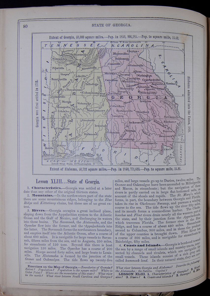 80
STATE OF GEORGIA.
Map of Georgia and Alabama.
Extent of Georgia, 58,000 square miles.—Pop.
in 1850, 906,185.—Pop. to square mile,
15.62.
Georgia was first settled in 1733.
Alabama admitted into the Union, 1819.
Extent of Alabama, 50,722 square miles.—Pop.
in 1850, 771,623.—Pop. to square mile,
15.21.
80
STATE OF GEORGIA.
Map of Georgia and Alabama.
Extent of Georgia, 58,000 square miles.—Pop.
in 1850, 906,185.—Pop. to square mile,
15.62.
Georgia was first settled in 1733.
Alabama admitted into the Union, 1819.
Extent of Alabama, 50,722 square miles.—Pop.
in 1850, 771,623.—Pop. to square mile,
15.21.
Lesson XLIII... State of Georgia.
1. Characteristics.—Georgia was settled at a later date than any other of the original thirteen states.
2. Mountains.—In the northwestern part of the state there are some mountainous ridges, belonging to the Blue Ridge and Kittatinny chains, but these are of no great extent.
3. Rivers.—Georgia occupies a great inclined plane, sloping down from the Appalachian system to the Atlantic Ocean and the Gulf of Mexico, and discharging its waters into those basins. The Savannah, the Alatamaha, and the Ogeechee flow into the former, and the Appalachicola into the latter. The Savannah forms the northeastern boundary, and empties itself into the Atlantic Ocean, after a course of about 600 miles. It is navigable for large vessels to Savannah, fifteen miles from the sea, and to Augusta, 250 miles, for steamboats of 150 tons. Beyond this there is boat navigation 150 miles. The Ogeechee has a course of 200 miles. Sloops ascend forty miles, and large boats to Louisville. The Alatamaha is formed by the junction of the Oconee and Oakmulgee. The tide flows up twenty-five miles, and large vessels go up to Darien, twelve miles. The Oconee and Oakmulgee have been ascended to Milledgeville and Macon, in steamboats; but the navigation of these rivers is partly carried on in large flat-bottomed rafts, on account of the shoals and rapids. The St. Mary's, which forms, in part, the boundary between Georgia and Florida, takes its rise in Okefenoco Swamp, and pursues a winding course to the sea. The tide flows up the river fifty miles, and its mouth forms a commodious harbor. The Chattahoochee and Flint rivers drain nearly all the western part of the state, and by their junction form the Appalachicola, which traverses Florida. The former rises in the Blue Ridge, and has a course of about 450 miles. Steamboats ascend to Columbus, 300 miles, and in these the produce of the upper counties is brought down. Flint River has a course of 300 miles, and is navigable for steamboats to Bainbridge, fifty miles.
4. Coasts and Islands.—Georgia is bordered toward the sea by a range of small islands and marshy tracts, intersected by channels and rivulets, which are navigable for small vessels. These islands consist of a rich gray soil, called hummock land. In their natural state, they are cov-
Exercises on the Map of Georgia.—Boundaries of Georgia? Extent? Population? Population to the square mile? Where is Cedar Point? Where are the mountains of this state? What river in the north? What river between South Carolina and Georgia? What river between Georgia and Alabama? Describe the following: the Alatamaha; the Satilla. Capital?
LESSON XLIII. 1. Characteristics of Georgia? 2. Mountains? 3. Rivers? 4. Coasts and islands? 5. Swamps? 6. Min-
 [begin surface 358]
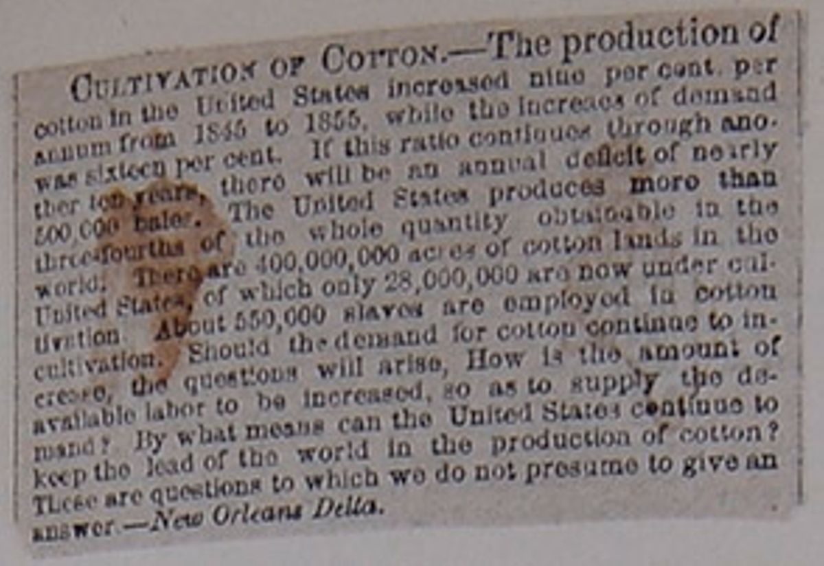
CULTIVATION OF COTTON.—The production of cotton in the United States increased nine per cent per annum from 1845 to 1855, while the increase of demand was sixteen per cent. If this ratio continues through another ten years, there will be an annual deficit of nearly 500,000 bales. The United States produces more than three-fourths of the whole quantity obtainable in the world. There are 400,000,000 acres of cotton lands in the United States, of which only 28,000,000 are now under cultivation. About 550,000 slaves are employed in cotton cultivation. Should the demand for cotton continue to increase, the questions will arise, How is the amount of available labor to be increased, so as to supply the demand? By what means can the United States continue to keep the lead of the world in the production of cotton? These are questions to which we do not presume to give an answer.—New Orleans Delta.
 [begin surface 360]
 [begin surface 361]
 [begin surface 362]
 [begin surface 363]
 [begin surface 364]
 [begin surface 365]
 [begin surface 366]
 [begin surface 367]
 [begin surface 368]
 [begin surface 369]
 [begin surface 370]
 [begin surface 371]
 [begin surface 372]
 [begin surface 373]
 [begin surface 374]
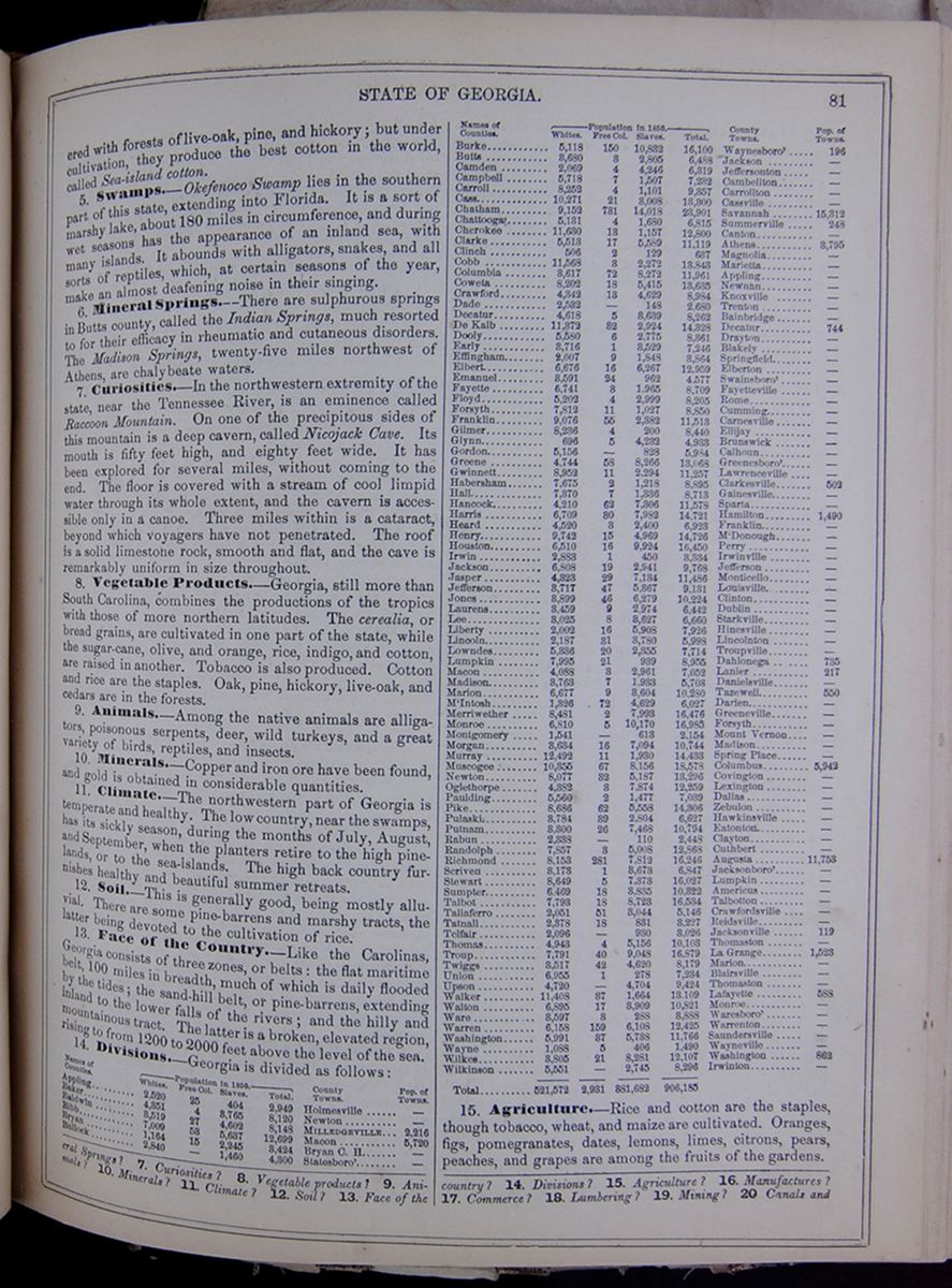
ered with forests of live-oak, pine, and hickory; but under cultivation, they produce the best cotton in the world, called Sea-island cotton.
5. Swamps.—Okefenoco Swamp lies in the southern part of this state, extending into Florida. It is a sort of marshy lake, about 180 miles in circumference, and during wet seasons has the appearance of an inland sea, with many islands. It abounds with alligators, snakes, and all sorts of reptiles, which, at certain seasons of the year, make an almost deafening noise in their singing.
6. Mineral Springs.—There are sulphurous springs in Butts county, called the Indian Springs, much resorted to for their efficacy in rheumatic and cutaneous disorders. The Madison Springs, twenty-five miles northwest of Athens, are chalybeate waters.
7. Curiosities.—In the northwestern extremity of the state, near the Tennessee River, is an eminence called Raccoon Mountain. On one of the precipitous sides of this mountain is a deep cavern, called Nicojack Cave. Its mouth is fifty feet high, and eighty feet wide. It has been explored for several miles, without coming to the end. The floor is covered with a stream of cool limpid water through its whole extent, and the cavern is accessible only in a canoe. Three miles within is a cataract, beyond which voyagers have not penetrated. The roof is a solid limestone rock, smooth and flat, and the cave is remarkably uniform in size throughout.
8. Vegetable Products.—Georgia, still more than South Carolina, combines the productions of the tropics with those of more northern latitudes. The cerealia, or bread grains, are cultivated in one part of the state, while the sugar-cane, olive, and orange, rice, indigo, and cotton, are raised in another. Tobacco is also produced. Cotton and rice are the staples. Oak, pine, hickory, live-oak, and cedars are in the forests.
9. Animals.—Among the native animals are alligators, poisonous serpents, deer, wild turkeys, and a great variety of birds, reptiles, and insects.
10. Minerals.—Copper and iron ore have been found, and gold is obtained in considerable quantities.
11. Climate.—The northwestern part of Georgia is temperate and healthy. The low country, near the swamps, has its sickly season, during the months of July, August, and September, when the planters retire to the high pine-lands, or to the sea-islands. The high back country furnishes healthy and beautiful summer retreats.
12. Soil.—This is generally good, being mostly alluvial. There are some pine-barrens and marshy tracts, the latter being devoted to the cultivation of rice.
13. Face of the Country.—Like the Carolinas, Georgia consists of three zones, or belts: the flat maritime belt, 100 miles in breadth, much of which is daily flooded by the tides; the sand-hill belt, or pine-barrens, extending inland to the lower falls of the rivers; and the hilly and mountainous tract. The latter is a broken, elevated region, rising to from 1200 to 2000 feet above the level of the sea.
14. Divisions.—Georgia is divided as follows: This table lists the counties of Georgia with their populations in 1850 and includes a column for the major town in each county and the town's population. The county population is divided into the following categories: White, Free Colored, Slaves, and Total.
15. Agriculture.—Rice and cotton are the staples though tobacco, wheat, and maize are cultivated. Oranges, figs, pomegranates, dates, lemons, limes, citrons, pears, peaches, and grapes are among the fruits of the gardens.
eral Springs? 7. Curiosities? 8. Vegetable products? 9. Animals? 10. Minerals? 11. Climate? 12. Soil? 13. Face of the country? 14. Divisions? 15. Agriculture? 16. Manufactures? 17. Commerce? 18. Lumbering? 19. Mining? 20. Canals and
[begin surface 375] 82
STATE OF ALABAMA.
82
STATE OF ALABAMA.
16. Manufactures.—Georgia has somewhat extensive manufactures of iron and cotton. The latter have been recently introduced, and are increasing.
17. Commerce.—The commerce of this state is chiefly carried on by northern vessels, and consists of the exportation of its agricultural products.
18. Lumbering.—This is carried on to some extent.
19. Mining.—The mining operations are confined to the production of copper, iron, and gold.
20. Canals and Railroads.—There are some short canals; and railroads are more extensive than in any other southern state.
21. Education.—In 1850 there were in Georgia 1251 public schools, attended by 32,705 scholars; 219 academies and other schools, attended by 9059 pupils; and 13 colleges, attended by 1535 students. The principal collegiate institution is the University of Georgia, at Athens; and the colleges at Milledgeville, Oxford, Penfield, and Macon. At Augusta there is a flourishing medical school.
22. Chief Towns.—The city of Savannah, on the river of the same name, fifteen miles from the ocean, is regularly laid out, with wide streets and squares, which are ornamented with the China tree. It is the chief commercial town of the state, and most of the imports and exports pass through this port. The entrance of the river is defended by two forts on Tybee Island, which lies at its mouth. The city of Augusta, the interior emporium of the state, stands on the Savannah, at the head of steamboat navigation. It receives immense quantities of cotton, tobacco, and other produce, which is taken down the river, or on the railroad, to Savannah. Milledgeville, the capital, is pleasantly situated on the Oconee, at the head of steamboat navigation. Macon is a flourishing town on the Ockmulgee. Columbus is a thriving town at the Falls of the Chattahoochee, 430 miles from Appalachicola Bay. Steamboats run from here to New Orleans. Darien lies near the mouth of the Alatamaha, and Athens, on the Oconee, ninety miles northwest of Augusta.
23. Indians.—This state was the site of several Indian tribes, or nations, at the time of the discovery of the country. These had made some advances in civilization. In more modern times, the tribe of Cherokees, consisting of about 12,000 individuals, occupied the northern country in connection with the Creek Indians, who extended into Alabama. Under the guidance of missionaries, the former adopted the customs of civilized life. They had a regular republican government. New Echota was their seat of government, and here was a printing-press and newspaper, the alphabet having been invented by a native of the tribe. The fine lands of these Indians provoked the cupidity of the whites, and, after various difficulties, they were all removed to the Indian territory.
24. History—Annals.—Georgia was the last settled of the Atlantic states. The charter under which the colony was founded was granted in 1732, by George II., in honor of whom it received its name. Savannah was settled in the following year by a body of colonists under the direction of Gen. Oglethorpe. The country was repeatedly invaded, about the year 1740, by the Spaniards, who were then in possession of Florida. In 1752, the proprietary government was abolished, and Georgia became a royal colony. In 1763 the colony was extended southward from the Alatamaha to the St. Mary's—the present boundary. Savannah was taken by the British in 1778, and evacuated in 1782. The present constitution of Georgia was formed in 1793, and amended in 1839.
Lesson XLIV... State of Alabama.
1. Characteristics.—Alabama is an extensive, fertile, and flourishing state.
2. Mountains.—The northern part of the state contains the southern extremity of the Kittatinny chain, which enters it from the northwest angle of Georgia. It is here merely a range of broken, precipitous hills, in which rise the head branches of the river Mobile.
3. Rivers.—The Gulf of Mexico is the basin into which all the waters of this state, except a small portion in the north, are drained. The principal river is the Mobile, which receives the Alabama and other streams as tributaries, and terminates its course in the bay of the same name, through two principal mouths—the Tensaw and the Mobile. Sea-vessels go up to St. Stephens, on the Tombigbee, and to Claiborne, on the Alabama, and steamboats ascend to a considerable distance above. The Chattahoochee, on the eastern border, and the Tennessee, in the north, receive no considerable tributaries from Alabama. On the whole, the rivers of this state afford great facilities for internal steam navigation.
4. Bay.—This state has only about sixty miles of sea-coast, in which is comprised Mobile Bay, or the estuary of the river Mobile. It extends about thirty miles in-land, and communicates with Pascagoula Sound, by a shallow strait, through which steamboats and small sail-vessels are navigated, by an inland chain of lakes and sounds, to New Orleans.
5. Natural Products.—The natural productions of the soil are similar to those of Georgia.
6. Minerals.—Coal, salt, and iron abound in the central region, and in the northeast gold has been obtained. Other valuable minerals exist in various parts.
7. Climate.—The northern part has an elevation of 2000 feet above the low maritime tract, producing a corresponding diversity of climate in the two regions. But even in Northern Alabama, the rivers are rarely frozen over, and the southern part of the state can hardly be said to have a winter. The heats of summer in the latter section are allayed by the sea breezes, and the climate, in general, is healthy, except upon the low moist grounds.
8. Soil.—Along the streams are tracts of very productive alluvion, bordering on interval or hummock land. The interval land is of inferior quality, and the pine-barrens, which comprise a large portion of the surface, are sterile.
9. Face of the Country.—The surface in the north is mountainous and broken, and in the center undulating. As we approach nearer the sea, we find a belt of low, level land, from fifty to sixty miles in breadth, containing extensive swamps, and in many places subject to inundations.
railroads? 21. Education? 22. Towns? 23. Indians? 24. History?
Exercises on the Map of Alabama (see page 80).—Boundaries of Alabama? Extent? Population? Population to the square mile? What river between Alabama and Georgia? Describe the following rivers: Alabama; Tombigbee. Capital of Alabama? Direction of the following places from Montgomery: St. Stephens; Marion; Pikeville; Decatur.
LESSON XLIV. 1. Characteristics of Alabama? 2. Mountains? 3. Rivers? 4. Bay? 5. Natural products? 6. Minerals?
[begin surface 376]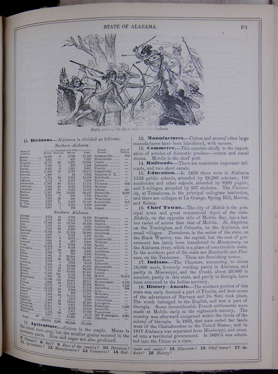 STATE OF ALABAMA.
83
Early wars of the Spaniards with the
Indians.
STATE OF ALABAMA.
83
Early wars of the Spaniards with the
Indians.
10. Divisions.—Alabama is divided as follows: This table lists the counties of Alabama with their populations in 1850 and includes a column for the major town in each county and the town's population. The county population is divided into the following categories: White, Free Colored, Slaves, and Total.
11. Agriculture.—Cotton is the staple. Maize is the usual corn crop, but the smaller grains succeed in the northern parts. Rice and sugar are also produced.
12. Manufactures.—Cotton and several other large manufactures have been introduced, with success.
13. Commerce.—This consists chiefly in the exportation of articles of domestic produce—cotton and naval stores. Mobile is the chief port.
14. Railroads.—There are numerous important railroads, and two short canals.
15. Education.—In 1850 there were in Alabama 1152 public schools, attended by 28,380 scholars; 106 academies and other schools, attended by 8290 pupils; and 5 colleges, attended by 567 students. The University, at Tuscaloosa, is the principal collegiate institution, and there are colleges at La Grange, Spring Hill, Marion, and Selma.
16. Chief Towns.—The city of Mobile is the principal town and great commercial depot of the state. Blakely, on the opposite side of Mobile Bay, has a harbor easier of access than that of Mobile. St. Stephens, on the Tombigbee, and Cahawba, on the Alabama, are small villages. Tuscaloosa, in the center of the state, on the Black Warrior, was the capital, but the seat of government has lately been transferred to Montgomery, on the Alabama river, which is a place of considerable trade. In the northern part of the state are Huntsville and Florence, on the Tennessee. These are flourishing towns.
17. Indians.—The Choctaws, amounting to about 16,000 souls, formerly residing partly in Alabama, and partly in Mississippi, and the Creeks, about 20,000 in number, partly in this state, and partly in Georgia, have been removed to the Indian territory.
18. History—Annals.—The southern portion of this state was early deemed a part of Florida, and here some of the adventures of Narvaez and De Soto took place. The north belonged to the English, and was a part of Georgia. Some inconsiderable French settlements were made at Mobile early in the eighteenth century. The country was afterward comprised within the limits of the colony of Georgia. In 1802, that state ceded her lands west of the Chattahoochee to the United States; and in 1817 Alabama was separated from Mississippi, and erected into a territorial government. In 1820 it was admitted into the Union as a state.
7. Climate? 8. Soil? 9. Face of the country? 10. Divisions? 11. Agriculture? 12. Manufactures? 13. Commerce? 14. Railroads and canals? 15. Education? 16. Chief towns? 17. Indians? 18. History?
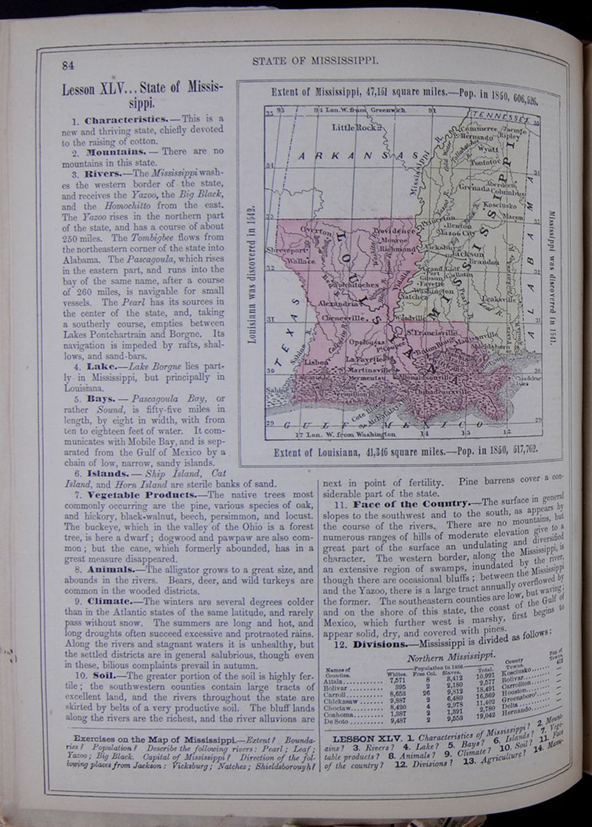 84
STATE OF MISSISSIPPI.
84
STATE OF MISSISSIPPI.
Lesson XLV... State of Mississippi.
1. Characteristics.—This is a new and thriving state, chiefly devoted to the raising of cotton.
2. Mountains.—There are no mountains in this state.
3. Rivers.—The Mississippi washes the western border of the state, and receives the Yazoo, the Big Black, and the Homochitto from the east. The Yazoo rises in the northern part of the state, and has a course of about 250 miles. The Tombigbee flows from the northeastern corner of the state into Alabama. The Pascagoula, which rises in the eastern part, and runs into the bay of the same name, after a course of 260 miles, is navigable for small vessels. The Pearl has its sources in the center of the state, and, taking a southerly course, empties between Lakes Pontchartrain and Borgne. Its navigation is impeded by rafts, shallows, and sand-bars.
4. Lake.—Lake Borgne lies partly in Mississippi, but principally in Louisiana.
5. Bays.—Pascagoula Bay, or rather Sound, is fifty-five miles in length, by eight in width, with from ten to eighteen feet of water. It communicates with Mobile Bay, and is separated from the Gulf of Mexico by a chain of low, narrow, sandy islands.
6. Islands.—Ship Island, Cat Island, and Horn Island are sterile banks of sand.
7. Vegetable Products.—The native trees most commonly occurring are the pine, various species of oak, and hickory, black-walnut, beech, persimmon, and locust. The buckeye, which in the valley of the Ohio is a forest tree, is here a dwarf; dogwood and pawpaw are also common; but the cane, which formerly abounded, has in a great measure disappeared.
8. Animals.—The alligator grows to a great size, and abounds in the rivers. Bears, deer, and wild turkeys are common in the wooded districts.
9. Climate.—The winters are several degrees colder than in the Atlantic states of the same latitude, and rarely pass without snow. The summers are long and hot, and long droughts often succeed excessive and protracted rains. Along the rivers and stagnant waters it is unhealthy, but the settled districts are in general salubrious, though even in these, bilious complaints prevail in autumn.
10. Soil.—The greater portion of the soil is highly fertile; the southwestern counties contain large tracts of excellent land, and the rivers throughout the state are skirted by belts of a very productive soil. The bluff lands along the rivers are the richest, and the river alluvions are Map of Louisiana and Mississippi. Exent of Mississippi, 47,151 square miles.—Pop. in 1850, 606,526. Louisiana was first discovered in 1542. Mississippi was first discovered in 1541. Extent of Louisiana, 41,346 square miles.—Pop. in 1850, 517,762. next in point of fertility. Pine barrens cover a considerable part of the state.
11. Face of the Country.—The surface in general slopes to the southwest and to the south, as appears by the course of the rivers. There are no mountains, but numerous ranges of hills of moderate elevation give to a great part of the surface an undulating and diversified character. The western border, along the Mississippi, is an extensive region of swamps, inundated by the river, though there are occasional bluffs; between the Mississippi and the Yazoo, there is a large tract annually overflowed by the former. The southeastern counties are low, but waving; and on the shore of this state, the coast of the Gulf of Mexico, which further west is marshy, first begins to appear solid, dry, and covered with pines.
12. Divisions.—Mississippi is divided as follows: This table lists the counties of Northern and Southern Mississippi with their populations in 1850 and includes a column for the major town in each county and the town's population. The county population is divided into the following categories: White, Free Colored, Slaves, and Total.
Exercises on the Map of Mississippi.—Extent? Boundaries? Population? Describe the following rivers: Pearl; Leaf; Yazoo; Big Black. Capital of Mississippi? Direction of the following places from Jackson: Vicksburg; Natchez; Shieldsborouyh?
LESSON XLV. 1. Characteristics of Mississippi? 2. Mountains? 3. Rivers? 4. Lake? 5. Bays? 6. Islands? 7. Vegetable products? 8. Animals? 9. Climate? 10. Soil? 11. Face of the country? 12. Divisions? 13. Agriculture? 14. Manufactures?
[begin surface 378]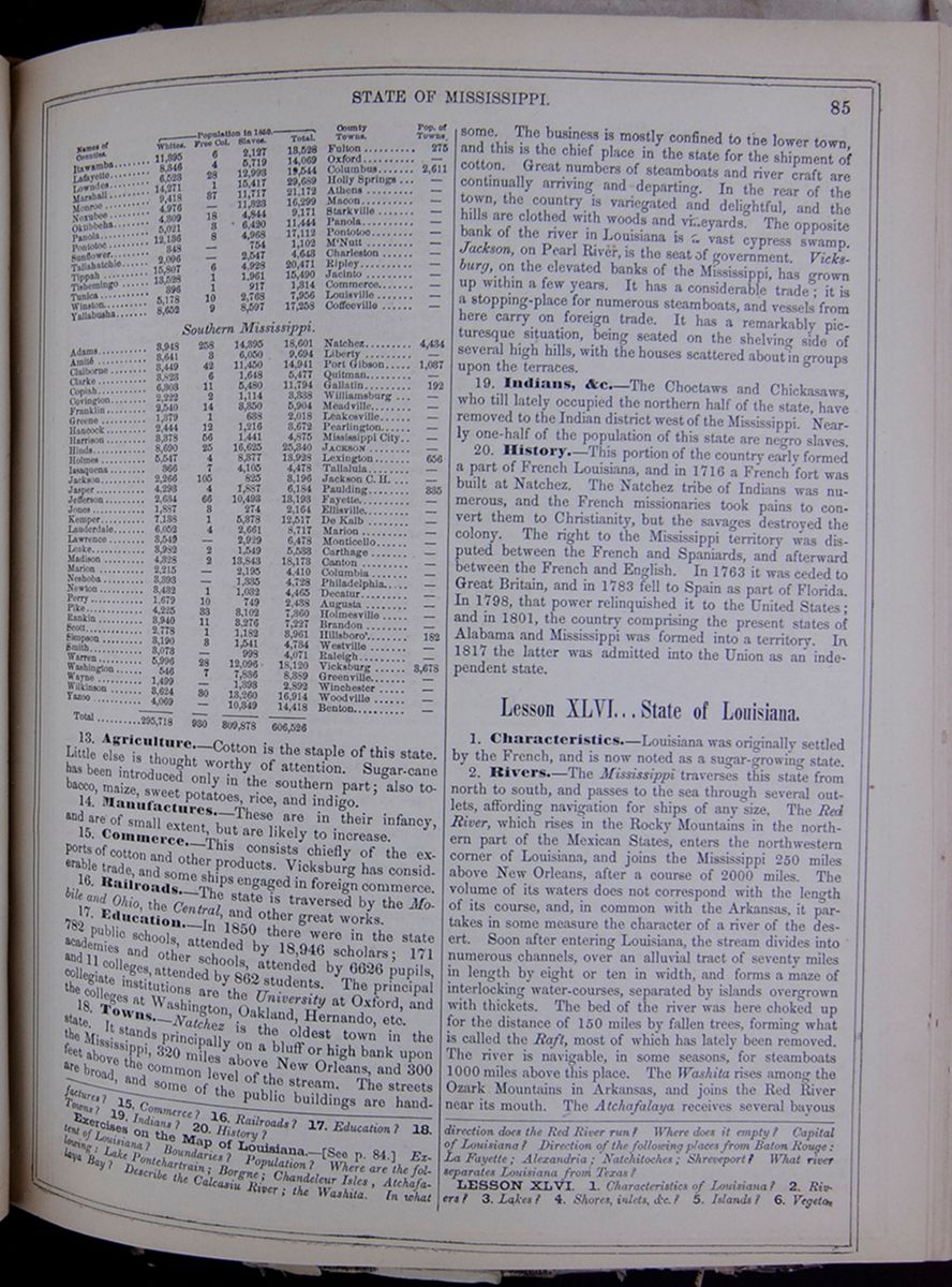 STATE OF MISSISSIPPI.
85
Continuation of table from previous page.
STATE OF MISSISSIPPI.
85
Continuation of table from previous page.
13. Agriculture.—Cotton is the staple of this state. Little else is thought worthy of attention. Sugar-cane has been introduced only in the southern part; also tobacco, maize, sweet potatoes, rice, and indigo.
14. Manufactures.—These are in their infancy, and are of small extent, but are likely to increase.
15. Commerce.—This consists chiefly of the exports of cotton and other products. Vicksburg has considerable trade, and some ships engaged in foreign commerce.
16. Railroads.—The state is traversed by the Mobile and Ohio, the Central, and other great works.
17. Education.—In 1850 there were in the state 782 public schools, attended by 18,946 scholars; 171 academies and other schools, attended by 6626 pupils, and 11 colleges, attended by 862 students. The principal collegiate institutions are the University at Oxford, and the colleges at Washington, Oakland, Hernando, etc.
18. Towns.—Natchez is the oldest town in the state. It stands principally on a bluff or high bank upon the Mississippi, 320 miles above New Orleans, and 300 feet above the common level of the stream. The streets are broad, and some of the public buildings are handsome. The business is mostly confined to the lower town, and this is the chief place in the state for the shipment of cotton. Great numbers of steamboats and river craft are continually arriving and departing. In the rear of the town, the country is variegated and delightful, and the hills are clothed with woods and vineyards. The opposite bank of the river in Louisiana is a vast cypress swamp. Jackson, on Pearl River, is the seat of government. Vicksburg, on the elevated banks of the Mississippi, has grown up within a few years. It has a considerable trade; it is a stopping-place for numerous steamboats, and vessels from here carry on foreign trade. It has a remarkably picturesque situation, being seated on the shelving side of several high hills, with the houses scattered about in groups upon the terraces.
19. Indians, &c.—The Choctaws and Chickasaws, who till lately occupied the northern half of the state, have removed to the Indian district west of the Mississippi. Nearly one-half of the population of this state are negro slaves.
20. History.—This portion of the country early formed a part of French Louisiana, and in 1716 a French fort was built at Natchez. The Natchez tribe of Indians was numerous, and the French missionaries took pains to convert them to Christianity, but the savages destroyed the colony. The right to the Mississippi territory was disputed between the French and Spaniards, and afterward between the French and English. In 1763 it was ceded to Great Britain, and in 1783 fell to Spain as part of Florida. In 1798, that power relinquished it to the United States; and in 1801, the country comprising the present states of Alabama and Mississippi was formed into a territory. In 1817 the latter was admitted into the Union as an independent state.
Lesson XLVI... State of Louisiana.
1. Characteristics.—Louisiana was originally settled by the French, and is now noted as a sugar-growing state.
2. Rivers.—The Mississippi traverses this state from north to south, and passes to the sea through several outlets, affording navigation for ships of any size. The Red River, which rises in the Rocky Mountains in the northern part of the Mexican States, enters the northwestern corner of Louisiana, and joins the Mississippi 250 miles above New Orleans, after a course of 2000 miles. The volume of its waters does not correspond with the length of its course, and, in common with the Arkansas, it partakes in some measure the character of a river of the desert. Soon after entering Louisiana, the stream divides into numerous channels, over an alluvial tract of seventy miles in length by eight or ten in width, and forms a maze of interlocking water-courses, separated by islands overgrown with thickets. The bed of the river was here choked up for the distance of 150 miles by fallen trees, forming what is called the Raft, most of which has lately been removed. The river is navigable, in some seasons, for steamboats 1000 miles above this place. The Washita rises among the Ozark Mountains in Arkansas, and joins the Red River near its mouth. The Atchafalaya receives several bayous
15. Commerce? 16. Railroads? 17. Education? 18. Towns? 19. Indians? 20. History?
Exercises on the Map of Louisiana.—[See p. 84.] Extent of Louisiana? Boundaries? Population? Where are the following: Lake Pontchartrain; Borgne; Chandeleur Isles, Atchafalaya Bay? Describe the Calcasiu River; the Washita. In what direction does the Red River run? Where does it empty? Capital of Louisiana? Direction of the following places from Baton Rouge: La Fayette; Alexandria; Natchitoches; Shreveport? What river separates Louisiana from Texas?
LESSON XLVI. 1. Characteristics of Louisiana? 2. Rivers? 3. Lakes? 4. Shores, inlets &c.? 5. Islands? 6. Vegetable
[begin surface 379] 86
STATE OF LOUISIANA.
86
STATE OF LOUISIANA.
or outlets from the Red River and the Mississippi, and empties itself into the bay of the same name. A raft, formed in the bed of this river by the accumulation of floating trees and mud, obstructs its navigation. The Teche, which rises in the prairies of Opelousas, joins the Atchafalaya on the western side; vessels of seven feet draught ascend it to New Iberia, above 100 miles. The Plaquemine and Lafourche are mouths of the Mississippi. The Iberville is the upper mouth of that stream on the left, and joins the Amite at Galveston, from which place it is navigable for sloops. The Sabine rises in the Mexican provinces, and formed the western boundary of the United States prior to the annexation of Texas.
3. Lakes.—In the northwestern part of the state there is a series of lakes, formed in the valley of the Red River by the overflowing of that stream. When the water is high, it sets back and fills these reservoirs, which are nearly drained again during the dry season. Similar appearances are presented along the Mississippi and its outlets. Lakes Maurepas and Pontchartrain are shallow bodies of water, connected with each other, and with Lake Borgne, by narrow channels. Lake Pontchartrain is forty-five miles in length, with a mean breadth of about twelve miles. Lakes Sabine, Calcasiu, and Mermentau, are similar sheets of water, formed by the expanding of the rivers of the same names. The term lagoon is a more appropriate designation of these bodies of water.
4. Shores, Inlets, &c.—The shores of the Gulf of Mexico are here generally low, and bordered by wide marshes. The whole coast is intersected by a chain of bays and inlets, connected with each other by a thousand tortuous channels, generally shallow, and of difficult navigation. Vermilion, Cote Blanche, Barataria, and Atchafalaya Bays are the largest, but are of little service for shipping. What is called Lake Borgne is properly a bay, communicating with Lake Pontchartrain by the straits or passes of the Rigolets and Chef Menteur. It is important as affording an inland navigation to New Orleans.
5. Islands.—The Chandeleur Islands lie on the eastern coast. They are little more than heaps of sand covered with pine forests, yet some of them are cultivated. West of the Mississippi are many others, scattered along the coast. Here is the island of Barataria, formerly noted as the resort of pirates: it lies in a bay which receives the waters of a lake of the same name. The soil of these islands is generally rich. They are covered with thick groves of live-oak and other trees, and harbor multitudes of deer, turkeys, and other wild game. Most of them are low and level, but others rise from the flat surface around them, in abrupt eminences of 100 feet in hight. There are some very fertile islands in the Mississippi.
6. Vegetable Products.—The pine, live-oak, cotton-wood, hickory, and oak, are among the forest trees. In some places the timber is very heavy, with impenetrable thickets of cane and shrubbery. The cotton-plant grows six feet high, with stalks as large as a man's arm. It bears large, yellowish blossoms, presenting a brilliant appearance. The cotton is formed from the cup of the flower, and is the down which envelops the seed.
7. Animals.—The alligator abounds in the lakes and bayous. Deer, panthers, wild turkeys, and immense quantities of sea-fowl are found in different parts. Parroquets, humming-birds, and various birds of rich plumage enliven the forests. The inspiring song of the mocking-bird is heard in almost every thicket.
8. Climate.—What has been said of the climate of Mississippi is, in general, applicable to that of this state. In the low and wet districts the summers are unhealthy, and these parts are often visited by the yellow fever; but a large part of the state is healthy. The climate in winter is more severe than in the same latitude on the Atlantic coast, and the streams and ponds are sometimes frozen over. In the southern parts, however, it is very mild.
9. Soil.—A great part of the surface of this state is periodically overflowed by the waters of the Mississippi. This immense alluvial tract embraces soil of various descriptions, which may be arranged into four classes. The first, which is thought to embrace two-thirds of the whole, is covered with heavy timber, and an almost impenetrable undergrowth of cane and other shrubbery. This portion is quickly drained as the river retires into its natural channels; it has a soil of the greatest fertility. The second class consists of cypress swamps. These are basins, or depressions of the surface, from which there is no natural outlet, and which, being filled with water by the floods, remain covered with it until the water is evaporated or absorbed by the earth. These, by draining, might become excellent rice-fields. The third class embraces the sea-marsh, a belt of land partially covered by common tides, and subject to inundation from the high waters of the Gulf during the equinoctial gales; it is generally without timber. The soil in some parts is clayey, and in others, as black as ink, and cracks by the heat of the sun into fissures wide enough to admit a man's arm. The fourth class consists of small bodies of prairie lands, dispersed in different parts of the alluvial territory. These spots are elevated, and without timber, but of great fertility. The pine woods have generally a poor soil. The interval lands upon the rivers, or bottoms, as they are universally termed in the Western States, are almost always rich. On the Red River, the soil includes a portion of salt, and is of a dark-red color, from its containing oxide of iron. A proportion of the larger prairies are second-rate land; and some of them are sterile. The richest tract in the state is a narrow belt called the Coast, lying along the Mississippi on both sides, and extending from 150 miles above New Orleans to forty miles below. It is from one to two miles wide, and lies below the level of the river in ordinary inundations. It is defended from the river by a dike or levee, six or eight feet in hight, and sufficiently wide for a highway. The whole of this tract is under cultivation, and produces the richest crops of sugar. The levee is liable to break away, and great damage is sometimes done by the flooding of the country. A break in the levee is called a crevasse.
10. Face of the Country.—This state has no mountains. The land is low, and in general level, with some hilly ranges, of little elevation, in the western part, and numerous basins or depressions of the soil. The great Delta of the Mississippi, amounting to one-fourth part of the state, has, in general, an elevation of not more than ten feet above the Gulf, and is annually inundated by the spring floods. A great part of the delta is composed of sea-marsh, which also forms the whole southern coast to the Sabine, and which, through its whole extent, is subject to inundations by the high tides. North of this marsh spreads out the vast level of the prairies, which is but
products? 7. Animals? 8. Climate? 9. Soil? 10. Face of the country? 11. Divisions? 12. Agriculture? 13. Commerce?
[begin surface 380]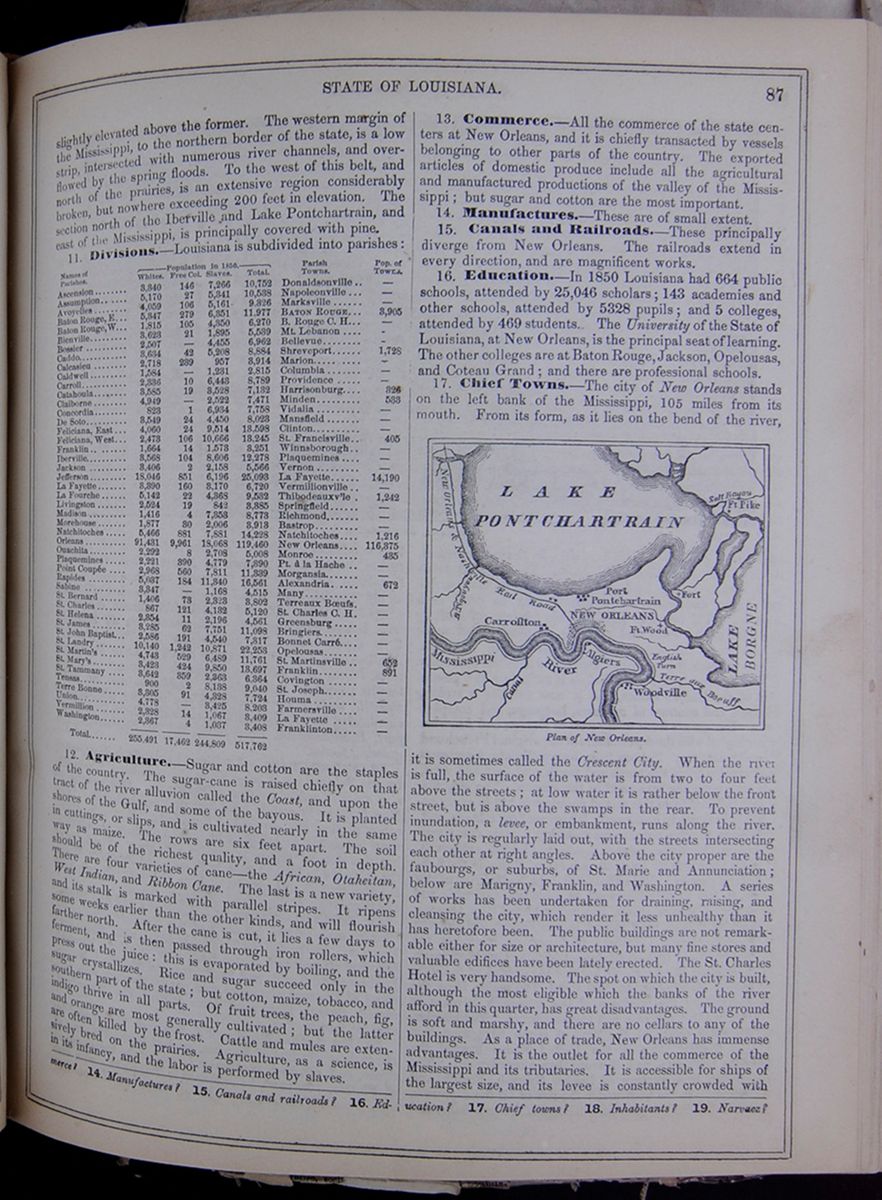 STATE OF LOUISIANA.
87
STATE OF LOUISIANA.
87
slightly elevated above the former. The western margin of the Mississippi, to the northern border of the state, is a low strip, intersected with numerous river channels, and overflowed by the spring floods. To the west of this belt, and north of the prairies, is an extensive region considerably broken, but nowhere exceeding 200 feet in elevation. The section north of the Iberville and Lake Pontchartrain, and east of the Mississippi, is principally covered with pine.
11. Divisions.—Louisiana is subdivided into parishes: This table lists the parishes of Louisiana with their populations in 1850 and includes a column for the major town in each parish and the town's population. The parish population is divided into the following categories: White, Free Colored, Slaves, and Total.
12. Agriculture.—Sugar and cotton are the staples of the country. The sugar-cane is raised chiefly on that tract of the river alluvion called the Coast, and upon the shores of the Gulf, and some of the bayous. It is planted in cuttings, or slips, and is cultivated nearly in the same way as maize. The rows are six feet apart. The soil should be of the richest quality, and a foot in depth. There are four varieties of cane—the African, Otaheitan, West Indian, and Ribbon Cane. The last is a new variety, and its stalk is marked with parallel stripes. It ripens some weeks earlier than the other kinds, and will flourish farther north. After the cane is cut, it lies a few days to ferment, and is then passed through iron rollers, which press out the juice: this is evaporated by boiling, and the sugar crystallizes. Rice and sugar succeed only in the southern part of the state; but cotton, maize, tobacco, and indigo thrive in all parts. Of fruit trees, the peach, fig, and orange are most generally cultivated; but the latter are often killed by the frost. Cattle and mules are extensively bred on the prairies. Agriculture, as a science, is in its infancy, and the labor is performed by slaves.
13. Commerce.—All the commerce of the state centers at New Orleans, and it is chiefly transacted by vessels belonging to other parts of the country. The exported articles of domestic produce include all the agricultural and manufactured productions of the valley of the Mississippi; but sugar and cotton are the most important.
14. Manufactures.—These are of small extent.
15. Canals and Railroads.—These principally diverge from New Orleans. The railroads extend in every direction, and are magnificent works.
16. Education.—In 1850 Louisiana had 664 public schools, attended by 25,046 scholars; 143 academies and other schools, attended by 5328 pupils; and 5 colleges, attended by 469 students. The University of the State of Louisiana, at New Orleans, is the principal seat of learning. The other colleges are at Baton Rouge, Jackson, Opelousas, and Coteau Grand; and there are professional schools.
17. Chief Towns.—The city of New Orleans stands on the left bank of the Mississippi, 105 miles from its mouth. From its form, as it lies on the bend of the river, Plan of New Orleans. Image of the city plan of New Orleans. it is sometimes called the Crescent City. When the river is full, the surface of the water is from two to four feet above the streets; at low water it is rather below the front street, but is above the swamps in the rear. To prevent inundation, a levee, or embankment, runs along the river. The city is regularly laid out, with the streets intersecting each other at right angles. Above the city proper are the faubourgs, or suburbs, of St. Marie and Annunciation; below are Marigny, Franklin, and Washington. A series of works has been undertaken for draining, raising, and cleansing the city, which render it less unhealthy than it has heretofore been. The public buildings are not remarkable either for size or architecture, but many fine stores and valuable edifices have been lately erected. The St. Charles Hotel is very handsome. The spot on which the city is built, although the most eligible which the banks of the river afford in this quarter, has great disadvantages. The ground is soft and marshy, and there are no cellars to any of the buildings. As a place of trade, New Orleans has immense advantages. It is the outlet for all the commerce of the Mississippi and its tributaries. It is accessible for ships of the largest size, and its levee is constantly crowded with
14. Manufactures? 15. Canals and railroads? 16. Education? 17. Chief towns? 18. Inhabitants? 19. Narvaez?
[begin surface 381]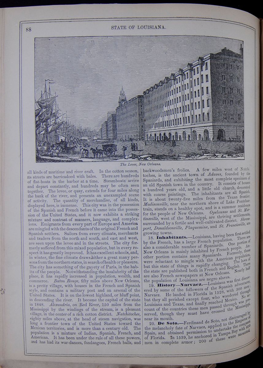 88
STATE OF LOUISIANA.
The Levee, New Orleans.
88
STATE OF LOUISIANA.
The Levee, New Orleans.
all kinds of maritime and river craft. In the cotton season, its streets are barricadoed with bales. There are hundreds of flat-boats in the harbor at a time. Steamboats arrive and depart constantly, and hundreds may be often seen together. The levee, or quay, extends for four miles along the bank of the river, and presents an unexampled scene of activity. The quantity of merchandise, of all kinds, displayed here, is immense. This city was in the possession of the Spanish and French before it came into the possession of the United States, and it now exhibits a striking mixture and contrast of manners, language, and complexions. Emigrants from every part of Europe and America are mingled with the descendants of the original French and Spanish settlers. Sailors from every climate, merchants and traders from the north and south, and east and west, are seen upon the levee and in the streets. The city formerly suffered from this mixed population, but in every respect it has greatly improved. It has excellent schools, and, in winter, the fine climate draws hither a great many persons from the northern states, in search of health or pleasure. The city has something of the gayety of Paris, in the habits of the people. Notwithstanding the insalubrity of the place, it has rapidly increased in population, wealth, and commerce. Baton Rouge, fifty miles above New Orleans, is a pretty village, with houses in the French and Spanish style, and contains a military post and an arsenal of the United States. It is on the lowest highland, or bluff point, in descending the river. It became the capital of the state in 1848. Alexandria, on Red River, 150 miles from the Mississippi by the windings of the stream, is a pleasant village, in the center of a rich cotton district. Natchitoches, eighty miles above, at the head of steam navigation, was long a frontier town of the United States toward the Mexican territories, and is more than a century old. The population is a mixture of Indian, Spanish, French, and American. It has been under the rule of all these powers, and has had its war-dances, fandangoes, French balls, and backwoodsmen's frolics. A few miles west of Natchitoches, is the ancient town of Adaves, founded by the Spaniards, and exhibiting the most complete specimen of an old Spanish town in the country. It consists of houses a hundred years old, and a little old church, decorated with coarse paintings. The inhabitants are all Spanish. It is about twenty-five miles from the Texan frontier. Madisonville, near the northern shore of Lake Pontchartrain, stands on a healthy spot, and is a summer residence for the people of New Orleans. Opelousas and St. Martinsville, west of the Mississippi, are thriving settlements, surrounded by a fertile and well-cultivated district. Shreveport, Donaldsonville, Plaquemine, and St. Francisville, are growing towns.
18. Inhabitants.—Louisiana, having been first settled by the French, has a large French population. There are also a considerable number of Spaniards. One portion of New Orleans is mainly inhabited by French people. Another portion contains many Spaniards. Formerly, these were reluctant to mingle with the American population, but this state of things is rapidly changing. The laws of the state are published both in French and English. There are also French newspapers at New Orleans. Nearly half the population of Louisiana are negro slaves.
19. History—Narvaez.—Louisiana was first discovered by some of the followers of the Spanish adventurer, Narvaez. He landed in Florida in 1528, with 300 men; but they all perished except four, who wandered through Louisiana and Texas, and finally reached Mexico. No account of the countries these men passed through was preserved, though they must have crossed the Mississippi, near its mouth.
20. De Soto.—Ferdinand de Soto, not discouraged by the melancholy fate of Narvaez, applied to the Emperor of Spain, and obtained permission to undertake the conquest of Florida. In 1539, he anchored in Tampa Bay with 600 men in complete armor; 200 of these were mounted.
 [begin surface 383]
 [begin surface 384]
 [begin surface 385]
 [begin surface 386]
 [begin surface 387]
 [begin surface 388]
 [begin surface 389]
 [begin surface 390]
 [begin surface 391]
 [begin surface 392]
 [begin surface 393]
 [begin surface 394]
 [begin surface 395]
 [begin surface 396]
 [begin surface 397]
 [begin surface 398]
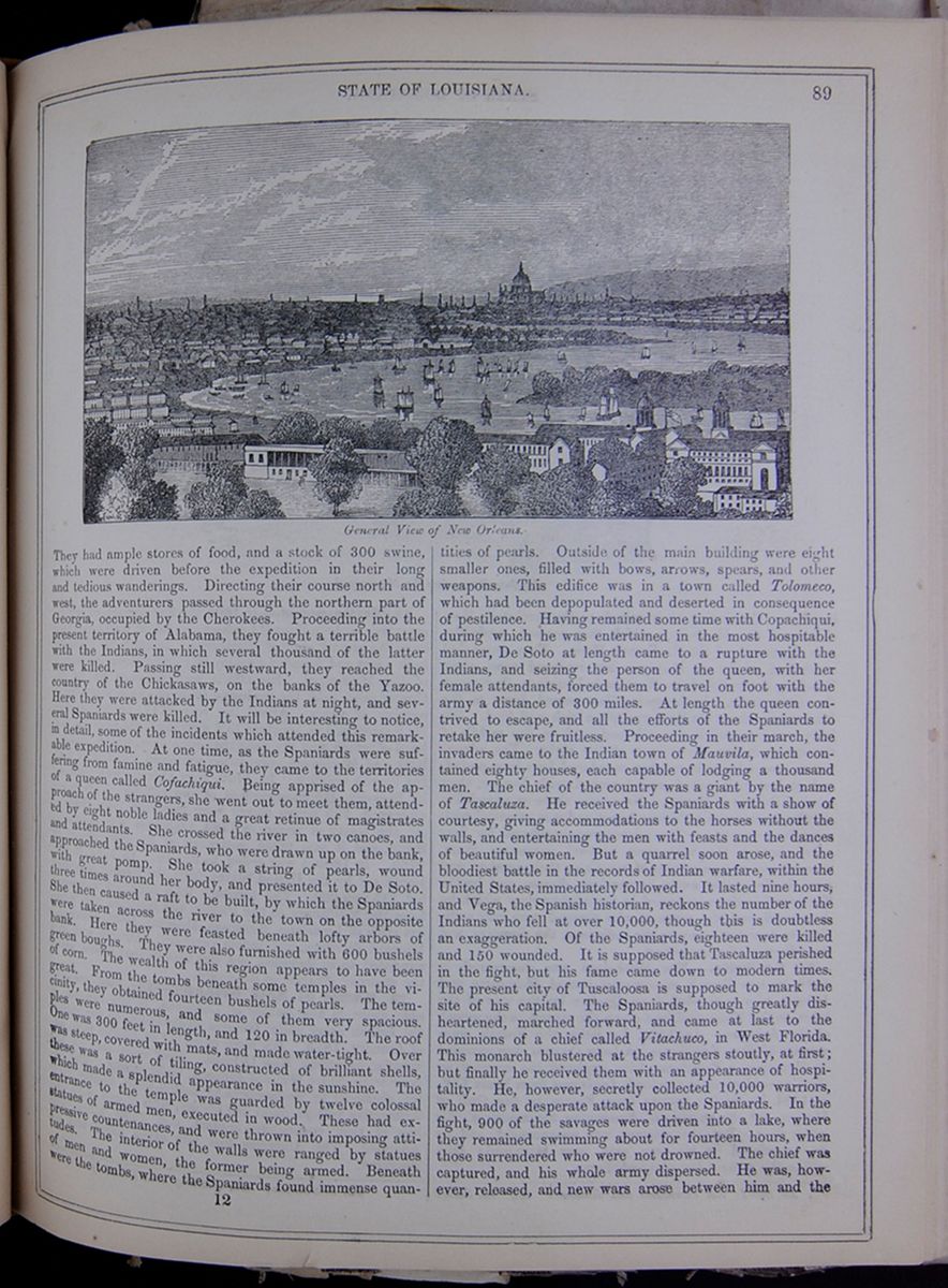
They had ample stores of food, and a stock of 300 swine, which were driven before the expedition in their long and tedious wanderings. Directing their course north and west, the adventurers passed through the northern part of Georgia, occupied by the Cherokees. Proceeding into the present territory of Alabama, they fought a terrible battle with the Indians, in which several thousand of the latter were killed. Passing still westward, they reached the country of the Chickasaws, on the banks of the Yazoo. Here they were attacked by the Indians at night, and several Spaniards were killed. It will be interesting to notice, in detail, some of the incidents which attended this remarkable expedition. At one time, as the Spaniards were suffering from famine and fatigue, they came to the territories of a queen called Cofachiqui. Being apprised of the approach of the strangers, she went out to meet them, attended by eight noble ladies and a great retinue of magistrates and attendants. She crossed the river in two canoes, and approached the Spaniards, who were drawn up on the bank, with great pomp. She took a string of pearls, wound three times around her body, and presented it to De Soto. She then caused a raft to be built, by which the Spaniards were taken across the river to the town on the opposite bank. Here they were feasted beneath lofty arbors of green boughs. They were also furnished with 600 bushels of corn. The wealth of this region appears to have been great. From the tombs beneath some temples in the vicinity, they obtained fourteen bushels of pearls. The temples were numerous, and some of them very spacious. One was 300 feet in length, and 120 in breadth. The roof was steep, covered with mats, and made water-tight. Over these was a sort of tiling, constructed of brilliant shells, which made a splendid appearance in the sunshine. The entrance to the temple was guarded by twelve colossal statues of armed men, executed in wood. These had expressive countenances, and were thrown into imposing attitudes. The interior of the walls were ranged by statues of men and women, the former being armed. Beneath were the tombs, where the Spaniards found immense quantities of pearls. Outside of the main building were eight smaller ones, filled with bows, arrows, spears, and other weapons. This edifice was in a town called Tolomeco, which had been depopulated and deserted in consequence of pestilence. Having remained some time with Copachiqui, during which he was entertained in the most hospitable manner, De Soto at length came to a rupture with the Indians, and seizing the person of the queen, with her female attendants, forced them to travel on foot with the army a distance of 300 miles. At length the queen contrived to escape, and all the efforts of the Spaniards to retake her were fruitless. Proceeding in their march, the invaders came to the Indian town of Mauvila, which contained eighty houses, each capable of lodging a thousand men. The chief of the country was a giant by the name of Tascaluza. He received the Spaniards with a show of courtesy, giving accommodations to the horses without the walls, and entertaining the men with feasts and the dances of beautiful women. But a quarrel soon arose, and the bloodiest battle in the records of Indian warfare, within the United States, immediately followed. It lasted nine hours, and Vega, the Spanish historian, reckons the number of the Indians who fell at over 10,000, though this is doubtless an exaggeration. Of the Spaniards, eighteen were killed and 150 wounded. It is supposed that Tascaluza perished in the fight, but his fame came down to modern times. The present city of Tuscaloosa is supposed to mark the site of his capital. The Spaniards, though greatly disheartened, marched forward, and came at last to the dominions of a chief called Vitachuco, in West Florida. This monarch blustered at the strangers stoutly, at first; but finally he received them with an appearance of hospitality. He, however, secretly collected 10,000 warriors, who made a desperate attack upon the Spaniards. In the fight, 900 of the savages were driven into a lake, where they remained swimming about for fourteen hours, when those surrendered who were not drowned. The chief was captured, and his whole army dispersed. He was, however, released, and new wars arose between him and the
12 [begin surface 399]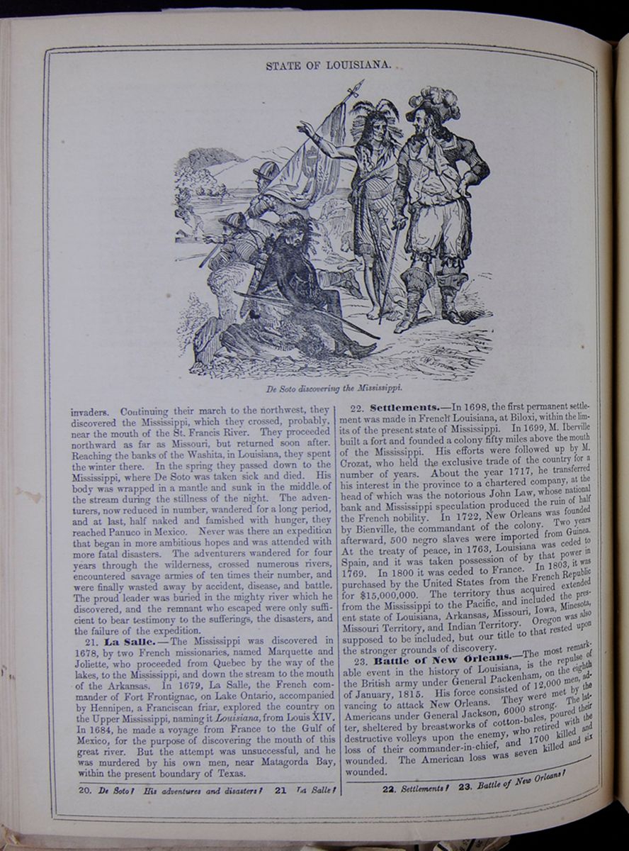 STATE OF LOUISIANA.
De Soto discovering the Mississippi.
STATE OF LOUISIANA.
De Soto discovering the Mississippi.
invaders. Continuing their march to the northwest, they discovered the Mississippi, which they crossed, probably, near the mouth of the St. Francis River. They proceeded northward as far as Missouri, but returned soon after. Reaching the banks of the Washita, in Louisiana, they spent the winter there. In the spring they passed down to the Mississippi, where De Soto was taken sick and died. His body was wrapped in a mantle and sunk in the middle of the stream during the stillness of the night. The adventurers, now reduced in number, wandered for a long period, and at last, half naked and famished with hunger, they reached Panuco in Mexico. Never was there an expedition that began in more ambitious hopes and was attended with more fatal disasters. The adventurers wandered for four years through the wilderness, crossed numerous rivers, encountered savage armies of ten times their number, and were finally wasted away by accident, disease, and battle. The proud leader was buried in the mighty river which he discovered, and the remnant who escaped were only sufficient to bear testimony to the sufferings, the disasters, and the failure of the expedition.
21. La Salle.—The Mississippi was discovered in 1678, by two French missionaries, named Marquette and Joliette, who proceeded from Quebec by the way of the lakes, to the Mississippi, and down the stream to the mouth of the Arkansas. In 1679, La Salle, the French commander of Fort Frontignac, on Lake Ontario, accompanied by Hennipen, a Franciscan friar, explored the country on the Upper Mississippi, naming it Louisiana, from Louis XIV. In 1684, he made a voyage from France to the Gulf of Mexico, for the purpose of discovering the mouth of this great river. But the attempt was unsuccessful, and he was murdered by his own men, near Matagorda Bay, within the present boundary of Texas.
22. Settlements.—In 1698, the first permanent settlement was made in French Louisiana, at Biloxi, within the limits of the present state of Mississippi. In 1699, M. Iberville built a fort and founded a colony fifty miles above the mouth of the Mississippi. His efforts were followed up by M. Crozat, who held the exclusive trade of the country for a number of years. About the year 1717, he transferred his interest in the province to a chartered company, at the head of which was the notorious John Law, whose national bank and Mississippi speculation produced the ruin of half the French nobility. In 1722, New Orleans was founded by Bienville, the commandant of the colony. Two years afterward, 500 negro slaves were imported from Guinea. At the treaty of peace, in 1763, Louisiana was ceded to Spain, and it was taken possession of by that power in 1769. In 1800 it was ceded to France. In 1803, it was purchased by the United States from the French Republic for $15,000,000. The territory thus acquired extended from the Mississippi to the Pacific, and included the present state of Louisiana, Arkansas, Missouri, Iowa, Minesota, Missouri Territory, and Indian Territory. Oregon was also supposed to be included, but our title to that rested upon the stronger grounds of discovery.
23. Battle of New Orleans.—The most remarkable event in the history of Louisiana, is the repulse of the British army under General Packenham, on the eighth of January, 1815. His force consisted of 12,000 men, advancing to attack New Orleans. They were met by the Americans under General Jackson, 6000 strong. The latter, sheltered by breastworks of cotton-bales, poured their destructive volleys upon the enemy, who retired with the loss of their commander-in-chief, and 1700 killed and wounded. The American loss was seven killed and six wounded.
20. De Soto? His adventures and disasters? 21. La Salle? 22. Settlements? 23. Battle of New Orleans?
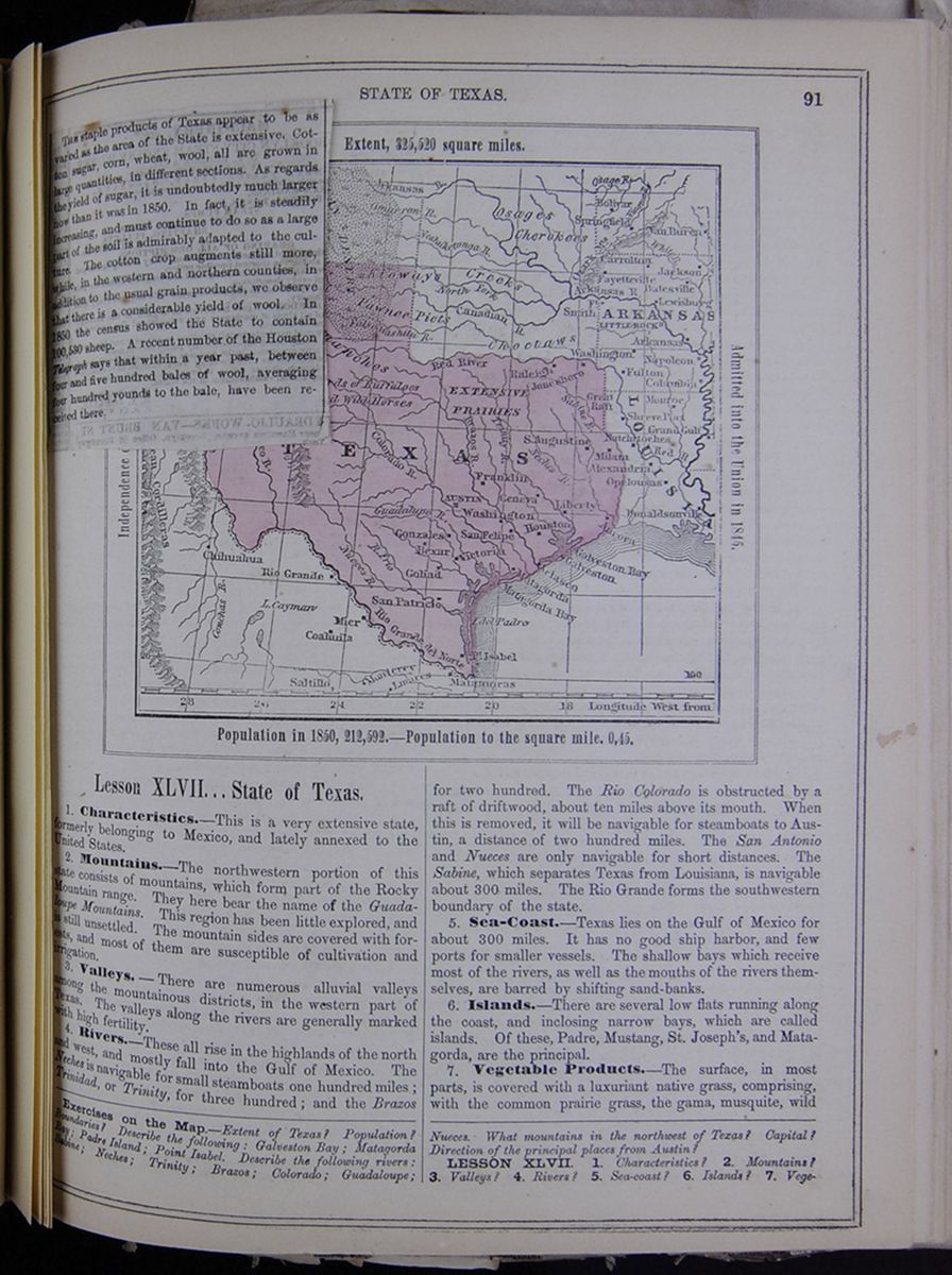
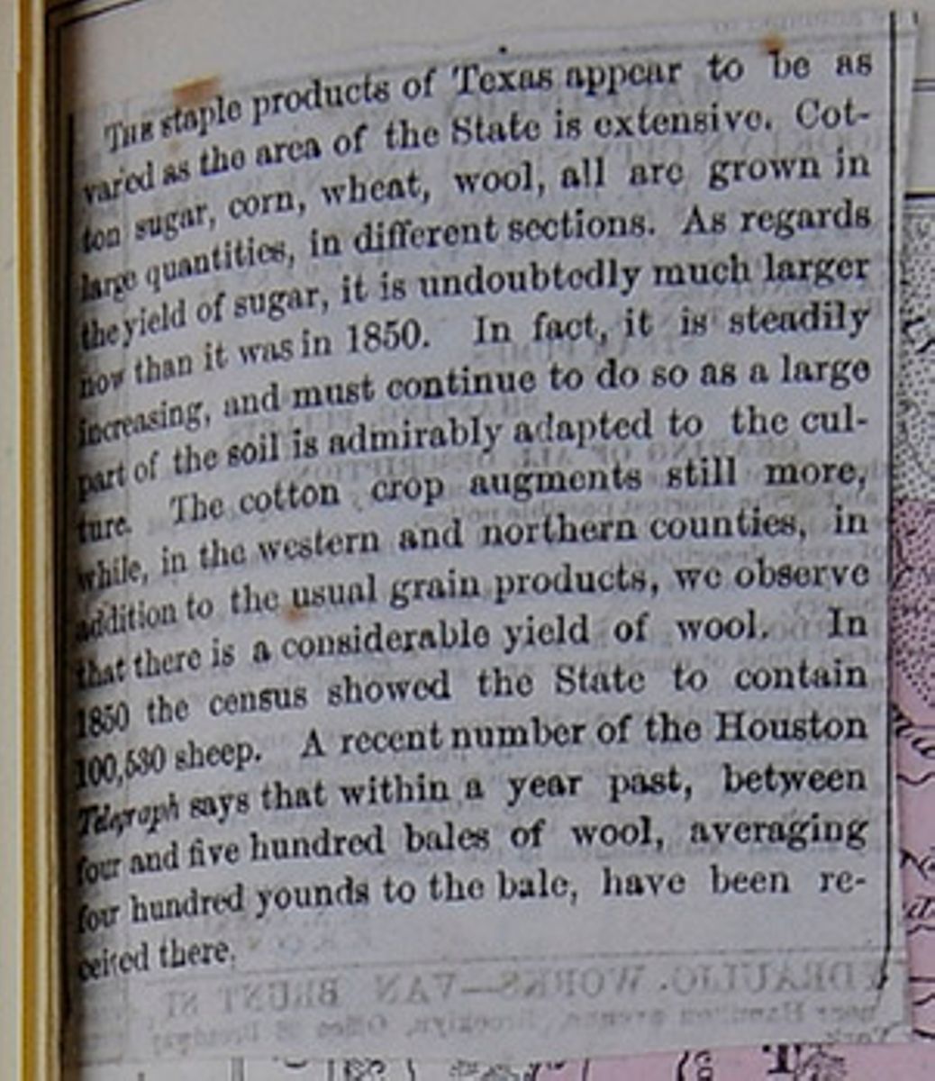
THE staple products of Texas appear to be as varied as the area of the State is extensive. Cotton sugar, corn, wheat, wool, all are grown in large quantities, in different sections. As regards the yield of sugar, it is undoubtedly much larger now than it was in 1850. In fact, it is steadily increasing, and must continue to do so as a large part of the soil is admirably adapted to the culture. The cotton crop augments still more, while, in the western and northern counties, in addition to the usual grain products, we observe that there is a considerable yield of wool. In 1850 the census showed the State to contain 100,530 sheep. A recent number of the Houston Telegraph says that within a year past, between four and five hundred bales of wool, averaging four hundred younds to the bale, have been received there.
[begin surface 402]
Lesson XLVII... State of Texas.
1. Characteristics.—This is a very extensive state, formerly belonging to Mexico, and lately annexed to the United States.
2. Mountains.—The northwestern portion of this state consists of mountains, which form part of the Rocky Mountain range. They here bear the name of the Guadaloupe Mountains. This region has been little explored, and is still unsettled. The mountain sides are covered with forests, and most of them are susceptible of cultivation and irrigation.
3. Valleys.—There are numerous alluvial valleys among the mountainous districts, in the western part of Texas. The valleys along the rivers are generally marked with high fertility.
4. Rivers.—These all rise in the highlands of the north and west, and mostly fall into the Gulf of Mexico. The Neches is navigable for small steamboats one hundred miles; Trinidad, or Trinity, for three hundred; and the Brazos for two hundred. The Rio Colorado is obstructed by a raft of driftwood, about ten miles above its mouth. When this is removed, it will be navigable for steamboats to Austin, a distance of two hundred miles. The San Antonio and Nueces are only navigable for short distances. The Sabine, which separates Texas from Louisiana, is navigable about 300 miles. The Rio Grande forms the southwestern boundary of the state.
5. Sea-Coast.—Texas lies on the Gulf of Mexico for about 300 miles. It has no good ship harbor, and few ports for smaller vessels. The shallow bays which receive most of the rivers, as well as the mouths of the rivers themselves, are barred by shifting sand-banks.
6. Islands.—There are several low flats running along the coast, and inclosing narrow bays, which are called islands. Of these, Padre, Mustang, St. Joseph's, and Matagorda, are the principal.
7. Vegetable Products.—The surface, in most parts, is covered with a luxuriant native grass, comprising, with the common prairie grass, the gama, musquite, wild
Exercises on the Map.—Extent of Texas? Population? Boundaries? Describe the following: Galveston Bay; Matagorda Bay; Padre Island; Point Isabel. Describe the following rivers: Sabine; Neches; Trinity; Brazos; Colorado; Guadaloupe; Nueces. What mountains in the northwest of Texas? Capital? Direction of the principal places from Austin?
LESSON XLVII. 1. Characteristics? 2. Mountains? 3. Valleys? 4. Rivers? 5. Sea-coast? 6. Islands? 7. Vegetable
[begin surface 403]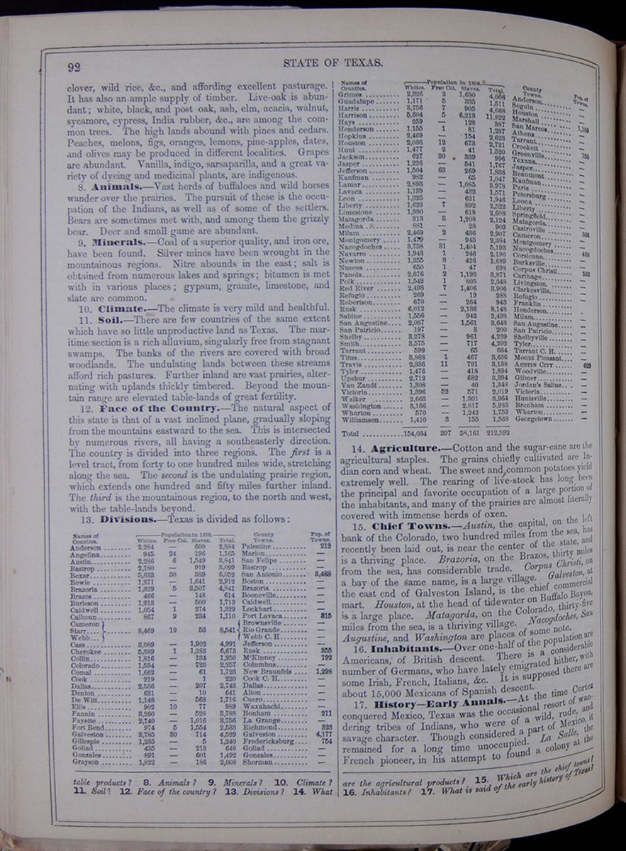 92
STATE OF TEXAS.
92
STATE OF TEXAS.
clover, wild rice, &c., and affording excellent pasturage. It has also an ample supply of timber. Live-oak is abundant; white, black, and post oak, ash, elm, acacia, walnut, sycamore, cypress, India rubber, &c, are among the common trees. The high lands abound with pines and cedars. Peaches, melons, figs, oranges, lemons, pine-apples, dates, and olives may be produced in different localities. Grapes are abundant. Vanilla, indigo, sarsaparilla, and a great variety of dyeing and medicinal plants, are indigenous.
8. Animals.—Vast herds of buffaloes and wild horses wander over the prairies. The pursuit of these is the occupation of the Indians, as well as of some of the settlers. Bears are sometimes met with, and among them the grizzly bear. Deer and small game are abundant.
9. Minerals.—Coal of a superior quality, and iron ore, have been found. Silver mines have been wrought in the mountainous regions. Nitre abounds in the east; salt is obtained from numerous lakes and springs; bitumen is met with in various places; gypsum, granite, limestone, and slate are common.
10. Climate.—The climate is very mild and healthful.
11. Soil.—There are few countries of the same extent which have so little unproductive land as Texas. The maritime section is a rich alluvium, singularly free from stagnant swamps. The banks of the rivers are covered with broad woodlands. The undulating lands between these streams afford rich pastures. Further inland are vast prairies, alternating with uplands thickly timbered. Beyond the mountain range are elevated table-lands of great fertility.
12. Face of the Country.—The natural aspect of this state is that of a vast inclined plane, gradually sloping from the mountains eastward to the sea. This is intersected by numerous rivers, all having a southeasterly direction. The country is divided into three regions. The first is a level tract, from forty to one hundred miles wide, stretching along the sea. The second is the undulating prairie region, which extends one hundred and fifty miles further inland. The third is the mountainous region, to the north and west, with the table-lands beyond.
13. Divisions.—Texas is divided as follows: This table lists the counties of Texas with their populations in 1850 and includes a column for the major town in each county and the town's population. The county population is divided into the following categories: White, Free Colored, Slaves, and Total.
14. Agriculture.—Cotton and the sugar-cane are the agricultural staples. The grains chiefly cultivated are Indian corn and wheat. The sweet and common potatoes yield extremely well. The rearing of live-stock has long been the principal and favorite occupation of a large portion of the inhabitants, and many of the prairies are almost literally covered with immense herds of oxen.
15. Chief Towns.—Austin, the capital, on the left bank of the Colorado, two hundred miles from the sea, has recently been laid out, is near the center of the state, and is a thriving place. Brazoria, on the Brazos, thirty miles from the sea, has considerable trade. Corpus Christi, on a bay of the same name, is a large village. Galveston, at the east end of Galveston Island, is the chief commercial mart. Houston, at the head of tidewater on Buffalo Bayou, is a large place. Matagorda, on the Colorado, thirty-five miles from the sea, is a thriving village. Nacogdoches, San Augustine, and Washington are places of some note.
16. Inhabitants.—Over one-half of the population are Americans, of British descent. There is a considerable number of Germans, who have lately emigrated hither, with some Irish, French, Italians, &c. It is supposed there are about 15,000 Mexicans of Spanish descent.
17. History—Early Annals.—At the time Cortez conquered Mexico, Texas was the occasional resort of wandering tribes of Indians, who were of a wild, rude, and savage character. Though considered a part of Mexico, it remained for a long time unoccupied. La Salle, the French pioneer, in his attempt to found a colony at the
products? 8. Animals? 9. Minerals? 10. Climate? 11. Soil? 12. Face of the country? 13. Divisions? 14. What are the agricultural products? 15. Which are the chief towns? 16. Inhabitants? 17. What is said of the early history of Texas?
[begin surface 404] STATE OF TEXAS.
93
STATE OF TEXAS.
93
mouth of the Mississippi, missed his reckoning, and landed, in 1685, at the head of Matagorda Bay. Here he built a fort; but two years after, he departed, and was shot by one of his own men, as we have already stated. His fort was demolished by the Indians. Small settlements were made in the territory both by the Spanish and French, and rival claims to the country were maintained by them. In 1681, the Spaniards established a military post at Bejar. In 1719, a colony of people from the Canary Isles was seated here. The province was at that time called the New Phillippines, and several missions and presidios, or military posts, existed in different quarters. At this period, the claim of Spain to the country seems to have been pretty well established, and the population was considerable. The missionary establishments consisted of massive stone fortresses, with churches decorated with statues and paintings, and having enormous bells. The ruins of some of these formidable structures still remain in Texas, and are striking objects in a country otherwise so little marked by the works and institutions of man. At the outbreak of the Mexican revolution in 1810, owing to the plundering habits of the Camanches and other tribes, and the narrow policy of the Spanish government, the population of Texas had diminished.
18. Attempt at Independence.—In 1812, a party of about two hundred Americans from the southwestern states, with three hundred French, Spaniards, and Italians, commanded by a Mexican patriot, named Gutierez, crossed the Sabine, and took possession of Goliad. They were attacked by the royalist forces, and several battles followed, in which the invaders were victorious. Disgusted with the conduct of some of the Mexican leaders, a large part of the Americans withdrew. Gutierez was removed from the command, and the dissatisfied troops returned. In a conflict with the royalist army under Toledo, the Mexican allies deserted in a cowardly manner, and left the Americans to meet the conflict with ten times their number. Most of these were killed, and those who escaped from the battlefield were principally slain. Thus ended, in total defeat, this first attempt at Texan independence.
19. Stephen F. Austin.—In 1821, new and more successful attempts at colonization in Texas were commenced, and consequently the population was rapidly increased. The leading pioneer in this movement was Stephen F. Austin, of Durham, Connecticut, whose father had obtained permission to plant a colony here. His active exertions were successful, and he may be almost considered the father of Texas. In 1824, Mexico, now an independent republic, established Coahuila and Texas as one of its states. A period of tranquillity followed; but in 1826, a movement was made at Nacogdoches to throw off the Mexican yoke. A republic of the name of Fredonia was proclaimed; a band of Cherokees was engaged to assist the insurgents; but these turned against their allies, and the insurrection was speedily suppressed.
20. War of Independence.—In the progress of events, a spirit of dissatisfaction with the Mexican government grew up in Texas. This was hightened by the usurpations of Santa Anna, who had become president of Mexico. In 1835, the Texans began to prepare for war. In November of that year, they made an open declaration of their intention to resist the parent state. A provisional government was formed, and Samuel Houston was appointed commander of the Texan army. In December following, an army of five hundred Texans besieged the strong fortress of Bexar, defended by 1300 Spaniards and Mexicans, commanded by Gen. Cos. In the course of a few days, the fort was taken, the Mexicans being permitted to retire. In a short time, not a Mexican soldier was to be found east of the Rio Grande. On the 2d of March, 1835, a convention of delegates met at Washington, on the Brazos, and made a formal declaration of independence. Previous to this, Santa Anna had invaded the country in person. Goliad was invested, and Bexar, defended by one hundred and fifty Texans, was surrounded by four thousand men. The attack commenced, and was continued for several days. The defense of the little band within the Alamo was worthy of Leonidas and his Spartans. They kept the enemy at bay for a long time, but a general assault was made on the 6th of March. The Texans fought on till only seven of their number were left. These were cut down when the place was carried, no quarter being given. Only two persons survived—a woman and a negro servant. Among the slain, surrounded by a heap of those who had fallen by his powerful hand, was David Crockett, of Tennessee, a man celebrated for his eccentric wit and generous independence of character. It is supposed that the Mexican loss was 1500. Col. Fannin, with 275 men, attempted to retreat from Goliad on the 17th. Being surrounded by a large Mexican force, with a number of Indian allies, he threw his men into a hollow square, and defended himself nearly a whole day, killing 500 of the enemy. During the night, the Texans threw up breastworks; but the Mexicans had received a reinforcement of 500 men: they were therefore obliged to capitulate, on condition of being regarded as prisoners of war. Having been marched to Goliad, they were inhumanly treated, and soon after they were shot, by order of Santa Anna, including some other troops, making 400 in all. This melancholy tragedy, which has stamped the name of Santa Anna with infamy, and even stained the Mexican annals, occurred on the 27th March.
21. Battle of San Jacinto.—Flushed with victory, and confident of success, Santa Anna pursued the Texan army, now commanded by Gen. Houston. The latter retreated until he reached the San Jacinto. Here he paused, having 783 men. The enemy advanced, amounting to 1600. On the 21st April, the Texans began the attack. Holding their fire till they reached the enemy's lines, they raised the war-cry, "Remember the Alamo!" and, with the phrensy of revenge, threw themselves upon the enemy's works. In fifteen minutes, they were in entire possession of their camp. The whole Mexican army was either killed, wounded, or taken prisoners. Santa Anna was taken the next day, alone, unarmed, and disguised. He was permitted to go to the United States, where he had an interview with Gen. Jackson. He returned to Mexico, having previously stipulated with Gen. Houston to favor the cause of Texan independence. This, however, he did not fulfil, and the war against Texas was continued.
22. Independence—Annexation.—Meantime, the independence of that state was recognized by the United States, England, and France. In 1844, negotiations were entered into for the annexation of Texas to the United Spates. In February of the next year, a joint resolution was passed by Congress in favor of that measure, and it soon after was admitted into the Union.
18. Attempt at independence? 19. Stephen F. Austin? 20. War of independence? 21. Battle of San Jacinto? 22. Annexation?
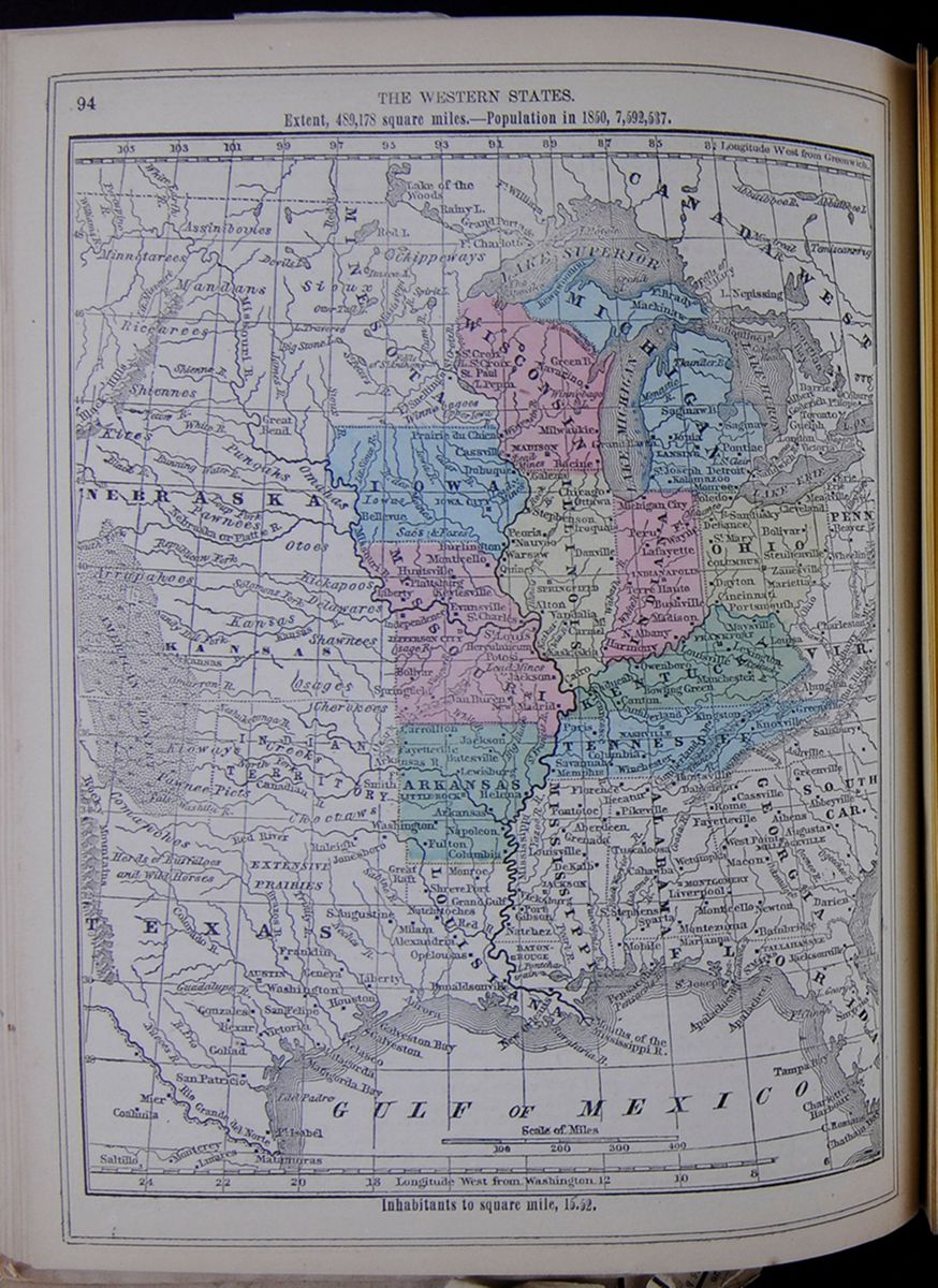 94
THE WESTERN STATES.
Map of the Western States highlighting Iowa,
Missouri, Arkansas, Tennessee, Kentucky, Illinois,
Wisconsin, Michigan, Indiana, and Ohio. The map also
includes Nebraska, Kansas, Texas, Louisiana,
Mississippi, Alabama, Georgia, and parts of Florida,
South Carolina, Virginia, Pennsylvania, and
Canada.
Extent, 489,178 square miles.—Population in
1850, 7,592,537.
Inhabitants to square mile, 15.52.
[begin surface 406]
94
THE WESTERN STATES.
Map of the Western States highlighting Iowa,
Missouri, Arkansas, Tennessee, Kentucky, Illinois,
Wisconsin, Michigan, Indiana, and Ohio. The map also
includes Nebraska, Kansas, Texas, Louisiana,
Mississippi, Alabama, Georgia, and parts of Florida,
South Carolina, Virginia, Pennsylvania, and
Canada.
Extent, 489,178 square miles.—Population in
1850, 7,592,537.
Inhabitants to square mile, 15.52.
[begin surface 406]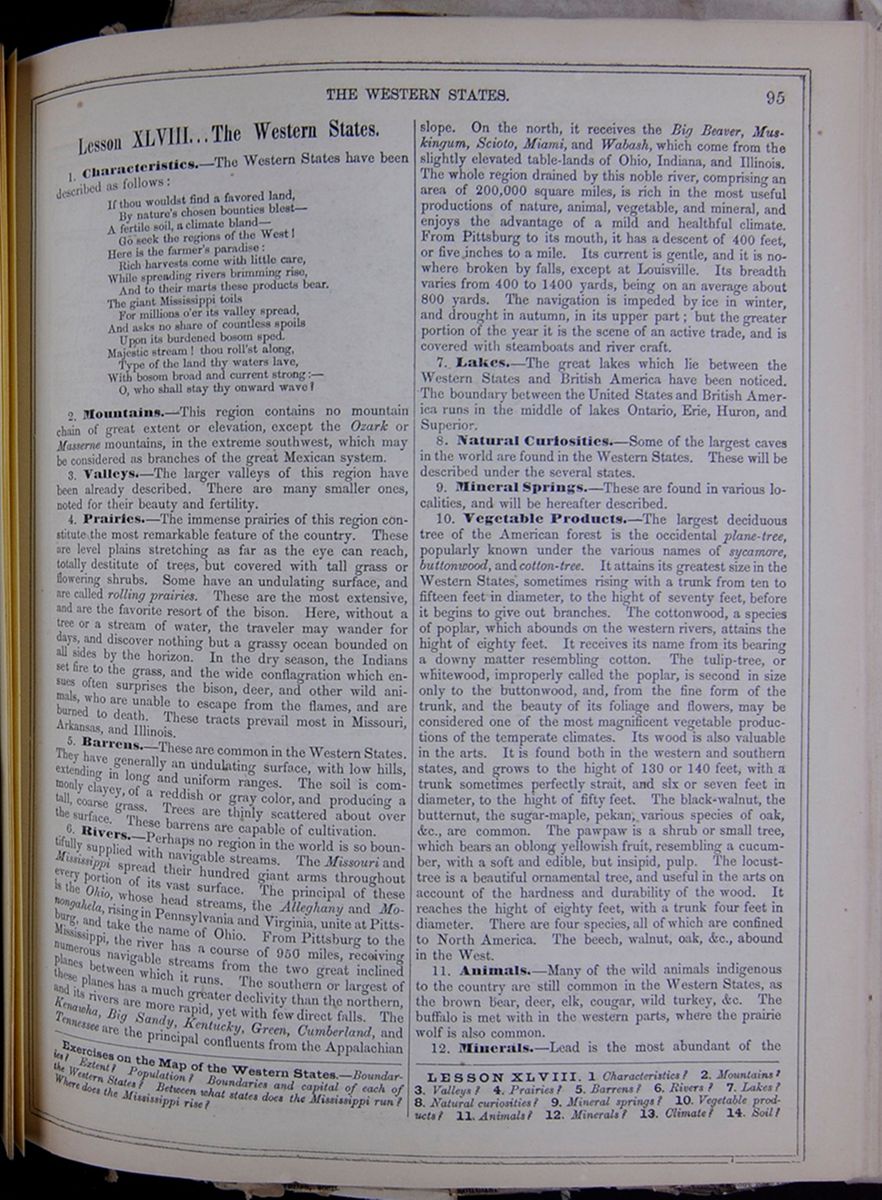 THE WESTERN STATES.
95
THE WESTERN STATES.
95
Lesson XLVIII... The Western States.
1. Characteristics.—The Western States have been described as follows: If thou wouldst find a favored land, By nature's chosen bounties blest— A fertile soil, a climate bland— Go seek the regions of the West! Here is the farmer's paradise: Rich harvests come with little care, While spreading rivers brimming rise, And to their marts these products bear. The giant Mississippi toils For millions o'er its valley spread, And asks no share of countless spoils Upon its burdened bosom sped. Majestic stream! thou roll'st along, Type of the land thy waters lave, With bosom broad and current strong:— O, who shall stay thy onward wave?
2. Mountains.—This region contains no mountain chain of great extent or elevation, except the Ozark or Masserne mountains, in the extreme southwest, which may be considered as branches of the great Mexican system.
3. Valleys.—The larger valleys of this region have been already described. There are many smaller ones, noted for their beauty and fertility.
4. Prairies.—The immense prairies of this region constitute the most remarkable feature of the country. These are level plains stretching as far as the eye can reach, totally destitute of trees, but covered with tall grass or flowering shrubs. Some have an undulating surface, and are called rolling prairies. These are the most extensive, and are the favorite resort of the bison. Here, without a tree or a stream of water, the traveler may wander for days, and discover nothing but a grassy ocean bounded on all sides by the horizon. In the dry season, the Indians set fire to the grass, and the wide conflagration which ensues often surprises the bison, deer, and other wild animals, who are unable to escape from the flames, and are burned to death. These tracts prevail most in Missouri, Arkansas, and Illinois.
5. Barrens.—These are common in the Western States. They have generally an undulating surface, with low hills, extending in long and uniform ranges. The soil is commonly clayey, of a reddish or gray color, and producing a tall, coarse grass. Trees are thinly scattered about over the surface. These barrens are capable of cultivation.
6. Rivers.—Perhaps no region in the world is so bountifully supplied with navigable streams. The Missouri and Mississippi spread their hundred giant arms throughout every portion of its vast surface. The principal of these is the Ohio, whose head streams, the Alleghany and Monongahela, rising in Pennsylvania and Virginia, unite at Pittsburg, and take the name of Ohio. From Pittsburg to the Mississippi, the river has a course of 950 miles, receiving numerous navigable streams from the two great inclined planes between which it runs. The southern or largest of these planes has a much greater declivity than the northern, and its rivers are more rapid, yet with few direct falls. The Kenawha, Big Sandy, Kentucky, Green, Cumberland, and Tennessee are the principal confluents from the Appalachian slope. On the north, it receives the Big Beaver, Muskingum, Scioto, Miami, and Wabash, which come from the slightly elevated table-lands of Ohio, Indiana, and Illinois. The whole region drained by this noble river, comprising an area of 200,000 square miles, is rich in the most useful productions of nature, animal, vegetable, and mineral, and enjoys the advantage of a mild and healthful climate. From Pittsburg to its mouth, it has a descent of 400 feet, or five inches to a mile. Its current is gentle, and it is nowhere broken by falls, except at Louisville. Its breadth varies from 400 to 1400 yards, being on an average about 800 yards. The navigation is impeded by ice in winter, and drought in autumn, in its upper part; but the greater portion of the year it is the scene of an active trade, and is covered with steamboats and river craft.
7. Lakes.—The great lakes which lie between the Western States and British America have been noticed. The boundary between the United States and British America runs in the middle of lakes Ontario, Erie, Huron, and Superior.
8. Natural Curiosities.—Some of the largest caves in the world are found in the Western States. These will be described under the several states.
9. Mineral Springs.—These are found in various localities, and will be hereafter described.
10. Vegetable Products.—The largest deciduous tree of the American forest is the occidental plane-tree, popularly known under the various names of sycamore, buttonwood, and cotton-tree. It attains its greatest size in the Western States, sometimes rising with a trunk from ten to fifteen feet in diameter, to the hight of seventy feet, before it begins to give out branches. The cottonwood, a species of poplar, which abounds on the western rivers, attains the hight of eighty feet. It receives its name from its bearing a downy matter resembling cotton. The tulip-tree, or whitewood, improperly called the poplar, is second in size only to the buttonwood, and, from the fine form of the trunk, and the beauty of its foliage and flowers, may be considered one of the most magnificent vegetable productions of the temperate climates. Its wood is also valuable in the arts. It is found both in the western and southern states, and grows to the hight of 130 or 140 feet, with a trunk sometimes perfectly strait, and six or seven feet in diameter, to the hight of fifty feet. The black-walnut, the butternut, the sugar-maple, pekan, various species of oak, &c., are common. The pawpaw is a shrub or small tree, which bears an oblong yellowish fruit, resembling a cucumber, with a soft and edible, but insipid, pulp. The locust-tree is a beautiful ornamental tree, and useful in the arts on account of the hardness and durability of the wood. It reaches the hight of eighty feet, with a trunk four feet in diameter. There are four species, all of which are confined to North America. The beech, walnut, oak, &c., abound in the West.
11. Animals.—Many of the wild animals indigenous to the country are still common in the Western States, as the brown bear, deer, elk, cougar, wild turkey, &c. The buffalo is met with in the western parts, where the prairie wolf is also common.
12. Minerals.—Lead is the most abundant of the
Exercises on the Map of the Western States.—Boundaries? Extent? Population? Boundaries and capital of each of the Western States? Between what states does the Mississippi run? Where does the Mississippi rise?
LESSON XLVIII. 1. Characteristics? 2. Mountains? 3. Valleys? 4. Prairies? 5. Barrens? 6. Rivers? 7. Lakes? 8. Natural curiosities? 9. Mineral springs? 10. Vegetable products? 11. Animals? 12. Minerals? 13. Climate? 14. Soil?
[begin surface 407]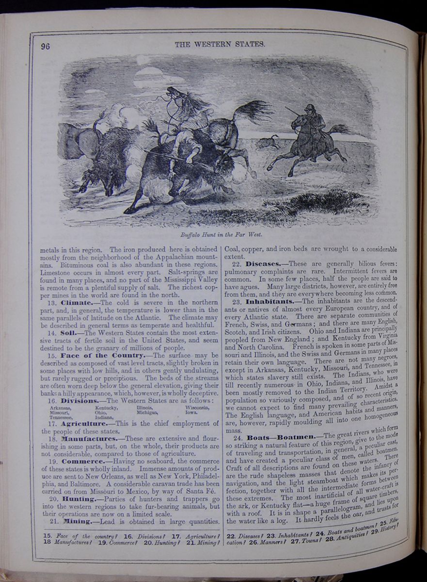 96
THE WESTERN STATES.
Buffalo Hunt in the Far West.
96
THE WESTERN STATES.
Buffalo Hunt in the Far West.
metals in this region. The iron produced here is obtained mostly from the neighborhood of the Appalachian mountains. Bituminous coal is also abundant in these regions. Limestone occurs in almost every part. Salt-springs are found in many places, and no part of the Mississippi Valley is remote from a plentiful supply of salt. The richest copper mines in the world are found in the north.
13. Climate.—The cold is severe in the northern part, and, in general, the temperature is lower than in the same parallels of latitude on the Atlantic. The climate may be described in general terms as temperate and healthful.
14. Soil.—The Western States contain the most extensive tracts of fertile soil in the United States, and seem destined to be the granary of millions of people.
15. Face of the Country.—The surface may be described as composed of vast level tracts, slightly broken in some places with low hills, and in others gently undulating, but rarely rugged or precipitous. The beds of the streams are often worn deep below the general elevation, giving their banks a hilly appearance, which, however, is wholly deceptive.
16. Divisions.—The Western States are as follows:
- Arkansas,
- Missouri,
- Tennessee,
- Kentucky,
- Ohio,
- Indiana,
- Illinois,
- Michigan,
- Wisconsin,
- Iowa.
17. Agriculture.—This is the chief employment of the people of these states.
18. Manufactures.—These are extensive and flourishing in some parts, but, on the whole, their products are not considerable, compared to those of agriculture.
19. Commerce.—Having no seaboard, the commerce of these states is wholly inland. Immense amounts of produce are sent to New Orleans, as well as New York, Philadelphia, and Baltimore. A considerable caravan trade has been carried on from Missouri to Mexico, by way of Santa Fé.
20. Hunting.—Parties of hunters and trappers go into the western regions to take fur-bearing animals, but their operations are now on a limited scale.
21. Mining.—Lead is obtained in large quantities. Coal, copper, and iron beds are wrought to a considerable extent.
22. Diseases.—These are generally bilious fevers: pulmonary complaints are rare. Intermittent fevers are common. In some few places, half the people are said to have agues. Many large districts, however, are entirely free from them, and they are everywhere becoming less common.
23. Inhabitants.—The inhabitants are the descendants or natives of almost every European country, and of every Atlantic state. There are separate communities of French, Swiss, and Germans; and there are many English, Scotch, and Irish citizens. Ohio and Indiana are principally peopled from New England; and Kentucky from Virginia and North Carolina. French is spoken in some parts of Missouri and Illinois, and the Swiss and Germans in many places retain their own language. There are not many negroes, except in Arkansas, Kentucky, Missouri, and Tennessee, in which states slavery still exists. The Indians, who were till recently numerous in Ohio, Indiana, and Illinois, have been mostly removed to the Indian Territory. Amidst a population so variously composed, and of so recent origin, we cannot expect to find many prevailing characteristics. The English language, and American habits and manners, are, however, rapidly moulding all into one homogeneous mass.
24. Boats—Boatmen.—The great rivers which form so striking a natural feature of this region, give to the mode of traveling and transportation, in general, a peculiar cast, and have created a peculiar class of men, called boatmen. Craft of all descriptions are found on these waters. There are the rude shapeless masses that denote the infancy of navigation, and the light steamboat which makes its perfection, together with all the intermediate forms between these extremes. The most inartificial of all water-craft is the ark, or Kentucky flat—a huge frame of square timbers, with a roof. It is in shape a parallelogram, and lies upon the water like a log. It hardly feels the oar, and trusts for
15. Face of the country? 16. Divisions? 17. Agriculture? 18 Manufactures? 19. Commerce? 20. Hunting? 21. Mining? 22. Diseases? 23. Inhabitants? 24. Boats and boatmen? 25. Education? 26. Manners? 27. Towns? 28. Antiquities? 29. History?
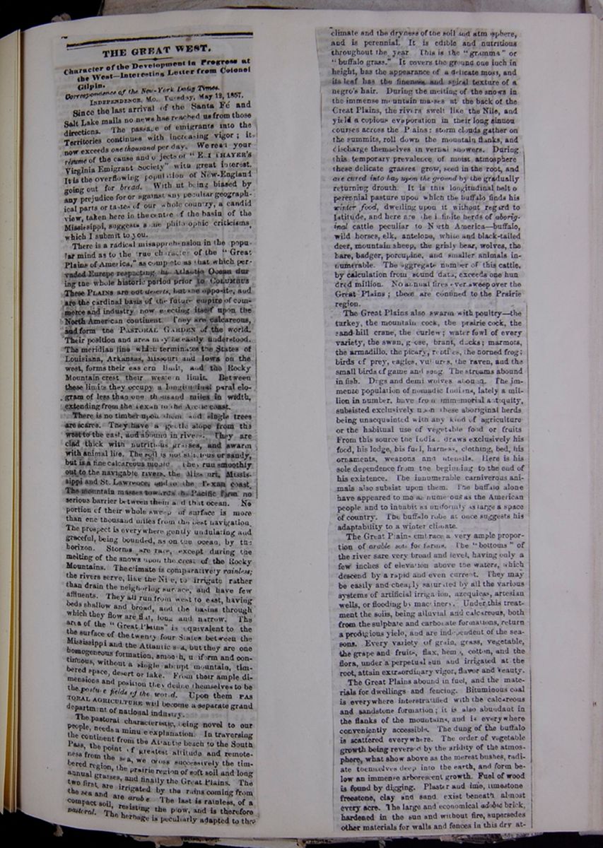 [begin surface 409]
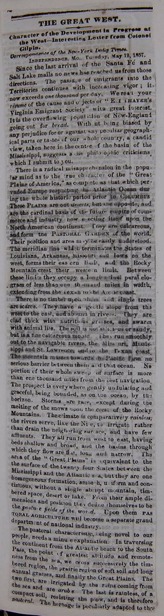
THE GREAT WEST.
Character of the Development In Progress at the West—Interesting Letter from Colonel Gilpin.
INDEPENDENCE, Mo. Tuesday, May 12,1857.Since the last arrival of the Santa Fé and Salt Lake mails no news has reached us from those directions. The passage of emigrants into the Territories continues with increasing vigor; it now exceeds one thousand per day. We read your résume of the cause and objects of "ELI THAYER'S Virginia Emigrant Society" with great interest. It is the overflowing population of New-England going out for bread. Without being biased by any prejudice for or against any peculiar geographical parts or tastes of our whole country, a candid view, taken here in the centre of the basin of the Mississippi, suggests some philosophic criticisms, which I submit to you.
There is a radical misapprehension in the popular mind as to the true character of the "Great Plains of America," as complete as that which pervaded Europe respecting the Atlantic Ocean during the whole historic period prior to the COLUMBUS These PLAINS are not deserts, but the opposite, and are the cardinal basis of the future empire of commerce and industry now erecting itself upon the North American continent. They are calcareous and form the PASTORAL GARDEN of the world. Their position and area may be easily understood. The meridian line which terminates the States of Louisiana, Arkansas, Missouri and Iowa on the west, forms their eastern limit, and the Rocky Mountain crest their western limit. Between these limits they occupy a longitudinal parallelogram of less than one thousand miles in width, extending from the Texan to the Arctic coast.
There is no timber upon them and single trees are scarce. They have a gentle slope from the west to the east, and abound in rivers. They are clad thick with nutritious grasses, and swarm with animal life. The soil is not s[illegible]icious or sandy, but is a fine calcareous mould. They run smoothly out to the navigable rivers, the Missouri, Mississippi and St. Lawrence, and to the Texan coast. The mountain masses towards the Pacific form no serious barrier between them and that ocean. No portion of their whole sweep of surface is more than one thousand miles from the best navigation. The prospect is everywhere gently undulating and graceful, being bounded, as on the ocean, by the horizon. Storms are rare, except during the melting of the snows upon the crest of the Rocky Mountains. The climate is comparatively rainless; the rivers serve, like the Nile to irrigate rather than drain the neighboring surface, and have few affluents. They all run form west to east, having beds shallow and broad, and the basins through which they flow are flat, long and narrow. The area of the "Great Plains" is equivalent to the surface of the twenty four States between the Mississippi and the Atlantic se, but they are one homogeneous formation, smooth, uniform and continuous, without a single abrupt mountain, timbered space, desert or lake. From their ample dimensions and position they define themselves to be the pasture fields of the world. Upon them PASTORAL AGRICULTURE will become a separate grand department of national industry.
The pastoral characteristic, being novel to our people, needs a minute explanation. In traversing the continent from the Atlantic beach to the South Pass, the point of greatest altitude and remoteness from the sea, we cross successively the timbered region, the prairie region of soft soils and long annual grasses, and finally the Great Plains. The two first are irrigated by the rains coming from the sea and are arable. The last is rainless, of a compact soil, resisting the plow, and is therefore pastoral. The herbage is peculiarly adapted to the
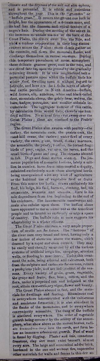
climate and the dryness of the soil and atmosphere, and is perennial. It is edible and nutritious throughout the year. This is the "gramma" or "buffalo grass." It covers the ground one inch in height, has the appearance of a delicate moss, and its leaf has the fineness and spiral texture of a negro's hair. During the melting of the snows in the immense mountain masses at the back of the Great Plains, the rivers swelt like the Nile, and yield a copious evaporation in their long sinuous courses across the Plains: storm clouds gather on the summits, roll down the mountain flanks and discharge themselves in vernal showers. During this temporary prevalence of moist atmosphere these delicate grasses grow, seed in the root, and are cured into hay upon the ground by the gradually returning drouth. It is this longitudinal belt of perennial pasture upon which the buffalo finds his winter food, dwelling upon it without regard to the latitude, and here are the infinite herds of aboriginal cattle peculiar to North America—buffalo, wild horses, elk, antelope, white and black-tailed deer, mountain sheep, the grisly bear, wolves, the hare, badger, porcupine, and smaller animals innumerable. The aggregate number of this cattle by calculation from sound data, exceeds one hundred million. No annual fires ever sweep over the Great Plains; these are confined to the Prairie region.
The Great Plains also swarm with poultry—the turkey, the mountain cock, the prairie cock, the sand-hill crane, the curlew; water fowl of every variety, the swan, goose, brant, ducks; marmots, the armadillo, the picary, reptiles, the horned frog; birds of prey, eagles, vultures, the raven, and the small birds of game and song. The streams abound in fish. Dogs and demi wolves abound. The immense population of nomadic Indians, lately a million in number, have from immemorial antiquity, subsisted exclusively upon these aboriginal herds being unacquainted with any kind of agriculture or the habitual use of vegetable food or fruits. From this source the Indian draws exclusively his food, his lodge, his fuel, harness, clothing, bed, his ornaments, weapons and utensils. Here is his sole dependence from the beginning to the end of his existence. The innumerable carniverous animals also subsist upon them. The buffalo alone have appeared to me as numerous as the American people, and to inhabit as uniformly as large a space of the country. The buffalo robe at once suggests his adaptability to a winter climate.
The Great Plains embrace a very ample proportion of arable soil for farms. The "bottoms" of the rivers are very broad and level, having only a few inches of elevation above the waters, which descend by a rapid and even current. They may be easily and cheaply saturated by all the various systems of artificial irrigation, azequieas, artesian wells, or flooding by machinery. Under this treatment the soils, being alluvial and calcareous, both from the sulphate and carbonate formations, return a prodigious yield, and are independent of the seasons. Every variety of grain, grass, vegetable, the grape and fruits, flax, hemp, cotton, and the flora, under a perpetual sun and irrigated at the root, attain extraordinary vigor, flavor and beauty.
The Great Plains abound in fuel, and the materials for dwellings and fencing. Bituminous coal is everywhere interstratified with the calcareous and sandstone formation; it is also abundant in the flanks of the mountains, and is everywhere conveniently accessible. The order of vegetable growth being reversed by the aridity of the atmosphere, what show above as the merest bushes, radiate themselves deep into the earth, and form below an immense arborescent growth. Fuel of wood is found by digging. Plaster and lime, limestone freestone, clay and sand exist beneath almost every acre. The large and economical adobie brick, hardened in the sun and without fire, supersedes other materials for walls and fences in this dry atmosphere,
 [begin surface 412]
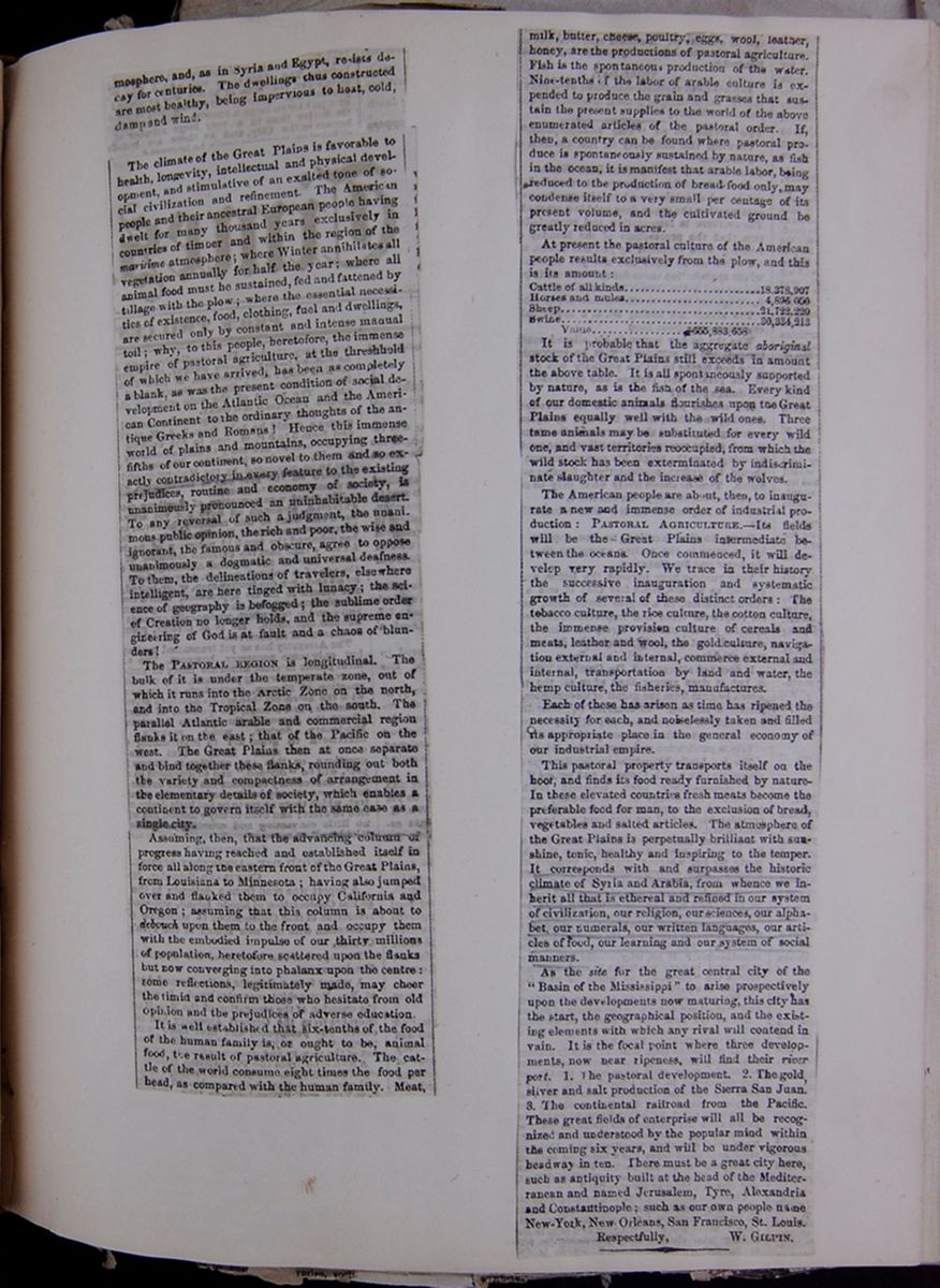 [begin surface 413]
and, as in Syria and Egypt, resists decay for centuries. The dwellings thus constructed are most healthy, being impervious to heat, cold, damp and wind.
The climate of the Great Plains is favorable to health, longevity, intellectual and physical development, and stimulative of an exalted tone of social civilization and refinement. The American people and their ancestral European people having dwelt for many thousand years exclusively in countries of timber and within region of the maritime atmosphere; where Winter annihilates all vegetation annually for half the year; where all animal food must be sustained, fed and fattened by tillage with the plow; where the essential necessities of existence, food, clothing, fuel and dwellings, are secured only by constant and intense manual toil; why, to this people, heretofore, the immense empire of pastoral agriculture, at the threshhold of which we have arrived, has been as completely a blank, as was the present condition of social development on the Atlantic Ocean and the American Continent to the ordinary thoughts of the antique Greeks and Romans! Hence this immense world of plains and mountains, occupying three-fifths of our continent, so novel to them and so exactly contradictory in every feature to the existing prejudices, routine and economy of society, is unanimously pronounced an uninhabitable desert. To any reversal of such a judgement, the unanimous public opinion, the rich and poor, the wise and ignorant, the famous and obscure, agree to oppose unanimously a dogmatic and universal deafness. To them, the delineations of travelers, elsewhere intelligent, are here tinged with lunacy; the science of geography is befogged; the sublime order of Creation no longer holds, and the supreme engineering of God is at fault and a chaos of blunders!
The PASTORAL REGION is longitudinal. The bulk of it is under the temperate zone, out of which it runs into the Arctic Zone on the north, and into the Tropical Zone on the south. The parallel Atlantic arable and commercial region flanks it on the east; that of the Pacific on the west. The Great Plains then at once separate and bind together these flanks, rounding out both the variety and compactness of arrangement in the elementary details of society, which enables a continent to govern itself with the same ease as a single city.
Assuming, then, that the advancing column of progress having reached and established itself in force all along the eastern front of the Great Plains, from Louisiana to Minnesota; having also jumped over and flanked them to occupy California and Oregon; assuming that this column is about to debouch upon them to the front and occupy them with the embodied impulse of our thirty millions of population, heretofore scattered upon the flanks but now converging into phalanx upon the centre: some reflections, legitimately made, may cheer the timid and confirm those who hesitate from old opinion and the prejudices of adverse education.
It is well established that six-tenths of the food of the human family is, or ought to be, animal food, the result of pastoral agriculture. The cattle of the world consume eight times the food per head, as compared with the human family. Meat,
milk, butter, cheese, poultry, eggs, wool, leather, honey, are the productions of pastoral agriculture. Fish is the spontaneous production of the water. Nine-tenths of the labor of arable culture is expended to produce the great and grasses that sustain the present supplies to the world of the above enumerated articles of the pastoral order. If, then, a country can be found where pastoral produce is spontaneously sustained by nature, as fish in the ocean, it is manifest that arable labor, being reduced to the production of bread-food only, may condense itself to a very small per centage of its present volume, and the cultivated ground be greatly reduced in acres.
At present the pastoral culture of the American people results exclusively from the plow, and this is its amount:
- Cattle of all kinds.......................18,378,907
- Horses and mules....................... 4,896,050
- Sheep.........................................21,722,220
- Swine.........................................30,334,213
- Value....................$655,883,658
It is probable that the aggregate aboriginal stock of the Great Plains still exceeds in amount the above table. It is all spontaneously supported by nature, as is the fish of the sea. Every kind of our domestic animals flourishes upon the Great Plains equally well with the wild ones. Three tame animals may be substituted for every wild one, and vast territories reoccupied, from which the wild stock has been exterminated by indiscriminate slaughter and the increase of the wolves.
The American people are about, then, to inaugurate a new and immense order of industrial production: PASTORAL AGRICULTURE.—Its fields will be the Great Plains intermediate between the oceans. Once commenced, it will develop very rapidly. We trace in their history the successive inauguration and systematic growth of several of these distinct orders: The tobacco culture, the rice culture, the cotton culture, the immense provision culture of cereals and meats, leather and wool, the gold culture, navigation external and internal, commerce external and internal, transportation by land and water, the hemp culture, the fisheries, manufactures.
Each of these has arisen as time has ripened the necessity for each, and noiselessly taken and filled its appropriate place in the general economy of our industrial empire.
This pastoral property transports itself on the hoof, and finds its food ready furnished by nature-In these elevated countries fresh meats become the preferable food for man, to the exclusion of bread, vegetables and salted articles. The atmosphere of the Great Plains is perpetually brilliant with sunshine, tonic, healthy and inspiring to the temper. It corresponds with and surpasses the historic climate of Syria and Arabia, from whence we inherit all that is ethereal and refined in our system of civilization, our religion, our sciences, our alphabet, our numerals, our written languages, our articles of food, our learning and our system of social manners.
As the site for the great central city of the "Basin of the Mississippi" to arise prospectively upon the developments now maturing, this city has the start, the geographical position, and the existing elements with which any rival will contend in vain. It is now the focal point where three developments, now near ripeness, will find their river port. 1. The pastoral development. 2. The gold, silver and salt production of the Sierra San Juan. 3. The continental railroad from the Pacific. These great fields of enterprise will all be recognized and understood by the popular mind within the coming six years, and will be under vigorous headway in ten. There must be a great city here, such as antiquity built at the head of the Mediterranean and named Jerusalem, Tyre, Alexandria, and Constantinople; such as our own people name New-York, New Orleans, San Francisco, St. Louis.
 [begin surface 417]
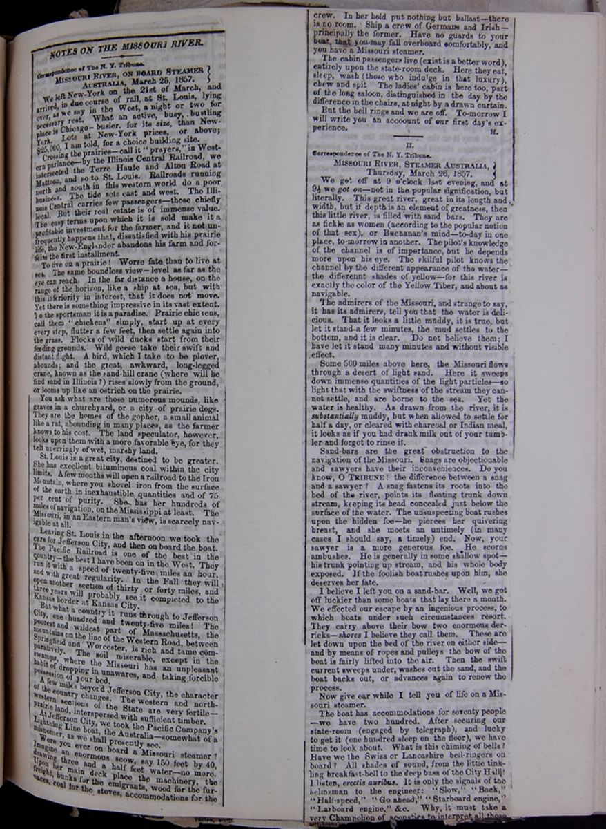 [begin surface 418]
NOTES ON THE MISSOURI RIVER.
MISSOURI RIVER, ON BOARD STEAMER AUSTRALIA, March 25, 1857.We left New-York on the 21st of March, and arrived, in due course of rail, at St. Louis, lying over, as we say in the West, a night or two for necessary rest. What an active, busy, bustling place is Chicago—busier, for its size, than New-York. Lots at New-York prices, or above; $25,000, I am told, for a choice building site.
Crossing the prairies—call it "prayers," in Western parlance—by the Illinois Central Railroad, we intersected the Terre Haute and Alton Road at Mattoon, and so to St. Louis. Railroads running north and south in this western world do a poor business. The tide sets east and west. The Illinois Central carries few passengers—those chiefly local. But their real estate is of immense value. The easy terms upon which it is sold make it a profitable investment for the farmer, and it not unfrequently happens that, dissatisfied with his prairie life, the New-Englander abandons his farm and forfeits the first installment.
To live on a prairie! Worse fate than to live at sea. The same boundless view—level as far as the eye can reach. In the far distance a house, on the range of the horizon, like a ship at sea, but with this inferiority in interest, that it does not move. Yet there is something impressive in its vast extent. To the sportsman it is a paradise. Prairie chickens, call them "chickens" simply, start up at every every step, flutter a few feet, then settle again into the grass. Flocks of wild ducks start from their feeding grounds. Wild geese take their swift and distant flight. A bird, which I take to be plover, abounds; and the great, awkward, long-legged crane, known as the sand-hill crane (where will he find sand in Illinois?) rises slowly from the ground, or looms up like an ostrich on the prairie.
You ask what are those numerous mounds, like graves in a churchyard, or a city of prairie dogs. They are the homes of the gopher, a small animal like a rat, abounding in many places, as the farmer knows to his cost. The land speculator, however, looks upon them with a more favorable eye, for they tell unerringly of wet, marshy land.
St. Louis is a great city, destined to be greater. She has excellent bituminous coal within the city limits. A few months will open a railroad to the Iron Mountain, where you shovel iron from the surface of the earth in inexhaustible quantities and of 75 per cent of purity. She has her hundreds of miles of navigation, on the Mississippi at least. The Missouri, in an Eastern man's view, is scarcely navigable at all.
Leaving St. Louis in the afternoon we took the cars for Jefferson City, and then on board the boat. The Pacific Railroad is one of the best in the country—the best I have been on in the West. They run it with a speed of twenty-five miles an hour, and with great regularity. In the Fall they will open another section of thirty or forty miles, and three years will probably see it completed to the Kansas border at Kansas City.
But what a country it runs through to Jefferson City, on hundred and twenty-five miles! The poorest and wildest part of Massachusetts, the mountains on the line of the Western Road, between Springfield and Worcester, is rich and tame comparatively. The soil miserable, except in the swamps, where the Missouri has an unpleasant habit of dropping in unawares, and taking forcible possession of your bed.
A few miles beyond Jefferson City, the character of the country changes. The western and north-western sections of the State are very fertile—prairie land, interspersed with sufficient timber.
At Jefferson City, we took the Pacific Company's Lightning Line boat, the Australia—somewhat of a misnomer, as we shall presently see.
Were you ever on board a Missouri steamer? Imagine an enormous scow, say 150 feet by 40, drawing three and a half feet water—no more. Upon her main deck place the machinery, the freight, bunks for the emigrants, wood for the furnaces, coal for the stoves, accommodations for the
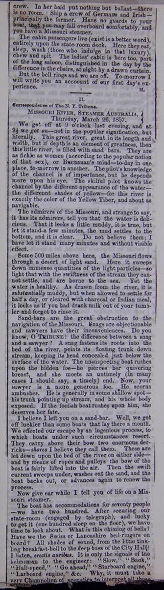
crew. In her hold put nothing but ballast—there is no room. Ship a crew of Germans and Irish—principally the former. Have no guards to your boat, that you may fall overboard comfortably, and you have a Missouri steamer.
The cabin passengers live (exist is a better word), entirely upon the state-room deck. Here they eat, sleep, wash (those who indulge in that luxury), chew and spit. The ladies' cabin is here too, part of the long saloon, distinguished in the day by the difference in the chairs, at night by a drawn curtain.
But the bell rings and we are off. To-morrow I will write you an accoount of our first day's experience.
H.II.
MISSOURI RIVER, STEAMER AUSTRALIA, Thursday, March 26, 1857.We got off at 9 o'clock last evening, and at 9½ we got on—not in the popular signification, but literally. This great river, great in its length and width, but if depth is an element of greatness, then this little river, is filled with sand bars. They are as fickle as women (according to the popular notion of that sex), or Buchanan's mind—to-day in one place, to-morrow in another. The pilot's knowledge of the channel is of importance, but he depends more upon his eye. The skilful pilot knows the channel by the different appearance of the water—the differennt shades of yellow—for this river is exactly the color of the Yellow Tiber, and about as navigable.
The admirers of the Missouri, and strange to say, it has its admirers, tell you that the water is delicious. That it looks a little muddy, it is true, but let it stand a few minutes, and the mud settles to the bottom, and it is clear. Do no believe them; I have let it stand many minutes and without visible effect.
Some 500 miles above her, the Missouri flows through a desert of light sand. Here it sweeps down immense quantities of the light particles—so light that with the swiftness of the stream they cannot settle, and are borne to the sea. Yet the water is healthy. As drawn from the river, it is substantially muddy, but when allowed to settle for half a day, or cleared with charcoal and Indian meal, it looks as if you had drank milk out of your tumbler and forgot to rinse it.
Sand-bars are the great obstruction to the navigation of the Missouri. Snags are objectionable and sawyers have their inconveniences. Do you know, O TRIBUNE! the difference between a snag and a sawyer? A snag fastens its roots into the bed of the river, points its floating trunk down the stream, keeping its head concealed just below the surface of the water. The unsuspecting boat rushes upon the hidden foe—he pierces her quivering breast, and she meets an untimely (in many cases I should say, a timely) end. Now, your sawyer is a more generous foe. He scorns ambushes. He is generally in some shallow spot—his trunk pointing up stream, and his whole body exposed. If the foolish boat rushes upon him, she deserves her fate.
I believe I left you on a sand-bar. Well, we got off luckier than some boats that lay there a month. We effected our escape by an ingenious process to which boats under such circumstances resort. They carry above their bow two enormous derricks—shores I believe they call them. These are let down upon the bed of the river on either side—and by means of ropes and pulleys, the bow of the boat is fairly lifted into the air. Then the swift current sweeps under, washes out the sand, and the boat backs out, or advances again to renew the process.
Now give ear while I tell you of life on a Missouri steamer.
The boat has accommodations for seventy people—we have two hundred. After securing our state-room (engaged by telegraph), and lucky to get it (one hundred sleep on the floor), we have time to look about. What is this chiming of bells? Have we the Swiss or Lancashire bell-ringers on board? All shades of sound, from the little tinkling breakfast-bell to the deep bass of the City Hall! I listen, erectis auribus. It is only the signals of the helmsman to the engineer: "Slow," "Back," "Half-speed," "Go ahead," "Starboard engine," "Larboard engine," &c. Why, it must take a very Champolion of acoustics to interpret all those sounds. [cutaway]
 [begin surface 421]
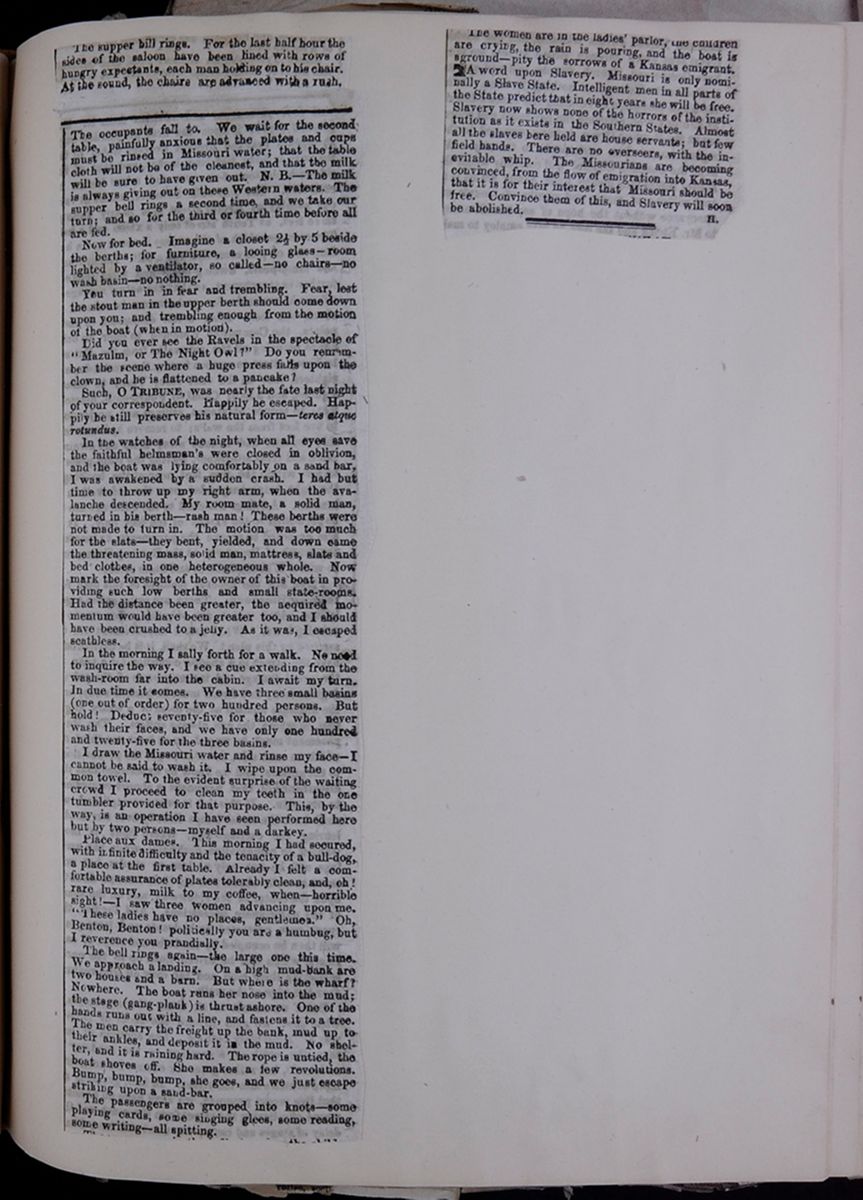 [begin surface 422]
The supper bill rings. For the last half hour the sides of the saloon have been lined with rows of hungry expectants, each man holding on to his chair. At the sound, the chairs are advanced with a rush.
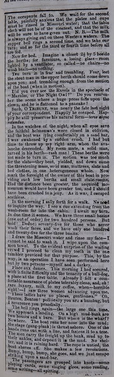
The occupants fall to. We wait for the second table, painfully anxious that the plates and cups must be rinsed in Missouri water; that the table cloth will not be of the cleanest, and that the milk will be sure to have given out. N. B.—The milk is always giving out on these Western waters. The supper bell rings a second time, and we take our turn; and so for the third or fourth time before all are fed.
Now for bed. Imagine a closet 2½ by 5 beside the berths; for furniture, a looing glass—room lighted by a ventilator, so called—no chairs—no wash basin—no nothing.
You turn in fear and trembling. Fear, lest the stout man in the upper berth should come down upon you; and trembling enough from the motion of the boat (when in motion).
Did you ever see the Ravels in the spectacle of "Mazulm, or The Night Owl?" Do you remember the scene where a huge press falls upon the clown, and he is flattened to a pancake?
Such, O TRIBUNE, was nearly the fate last night of your correspondent. Happily he escaped. Happily he still preserves his natural form—teres atque rotundus.
In the watches of the night, when all eyes save the faithful helmsman's were closed in oblivion, and the boat was lying comfortably on a sand bar, I was awakened by a sudden crash. I had but time to throw up my right arm, when the avalanche descended. My room mate, a solid man, turned in his berth—rash man! These berths were not made to turn in. The motion was too much for the slats—they bent, yielded, and down came the threatening mass, solid man, mattress, slats and bed clothes, in one heterogeneous whole. Now mark the foresight of the owner of this boat in providing such low berths and small state-rooms. Had the distance been greater, the acquired momentum would have been greater too, and I should have been crushed to a jelly. As it was, I escaped scathless.
In the morning I sally forth for a walk. No need to inquire the way. I see a cue extending from the wash-room far into the cabin. I await my turn. In due time it comes. We have three small basins (one out of order) for two hundred persons. But hold! Deduc; seventy-five for those who never wash their faces, and we have only one hundred and twenty-five for the three basins.
I draw the Missouri water and rinse my face—I cannot be said to wash it. I wipe upon the common towel. To the evident surprise of the waiting crowd I proceed to clean my teeth in the one tumbler provided for that purpose. This, by the way, is an operation I have seen performed here but by two persons—myself and a darkey.
Place aux dames. This morning I had secured, with infinite difficulty and the tenacity of a bull-dog, a place at the first table. Already I felt a comfortable assurance of plates tolerably clean, and oh! rare luxury, milk to my coffee, when—horrible sight!—I saw three women advancing upon me. "These ladies have no places, gentlemen." Oh, Benton, Benton! politically you are a humbug, but I reverence you prandially.
The bell rings again—the large one this time. We approach a landing. On a high mud-bank are two houses and a barn. But where is the wharf? Nowhere. The boat runs her nose into the mud; the stage (gang-plank) is thrust ashore. One of the hands runs out with a line, and fastens it to a tree. The men carry the freight up the bank, mud up to their ankles, and deposit it in the mud. No shelter, and it is raining hard. The rope is untied, the boat shoves off. She makes a few revolutions. Bump, bump, bump, she goes, and we just escape striking upon a sand-bar.
The passengers are grouped into knots—some playing cards, some singing glees, some reading, some writing—all spitting.
[cutaway]
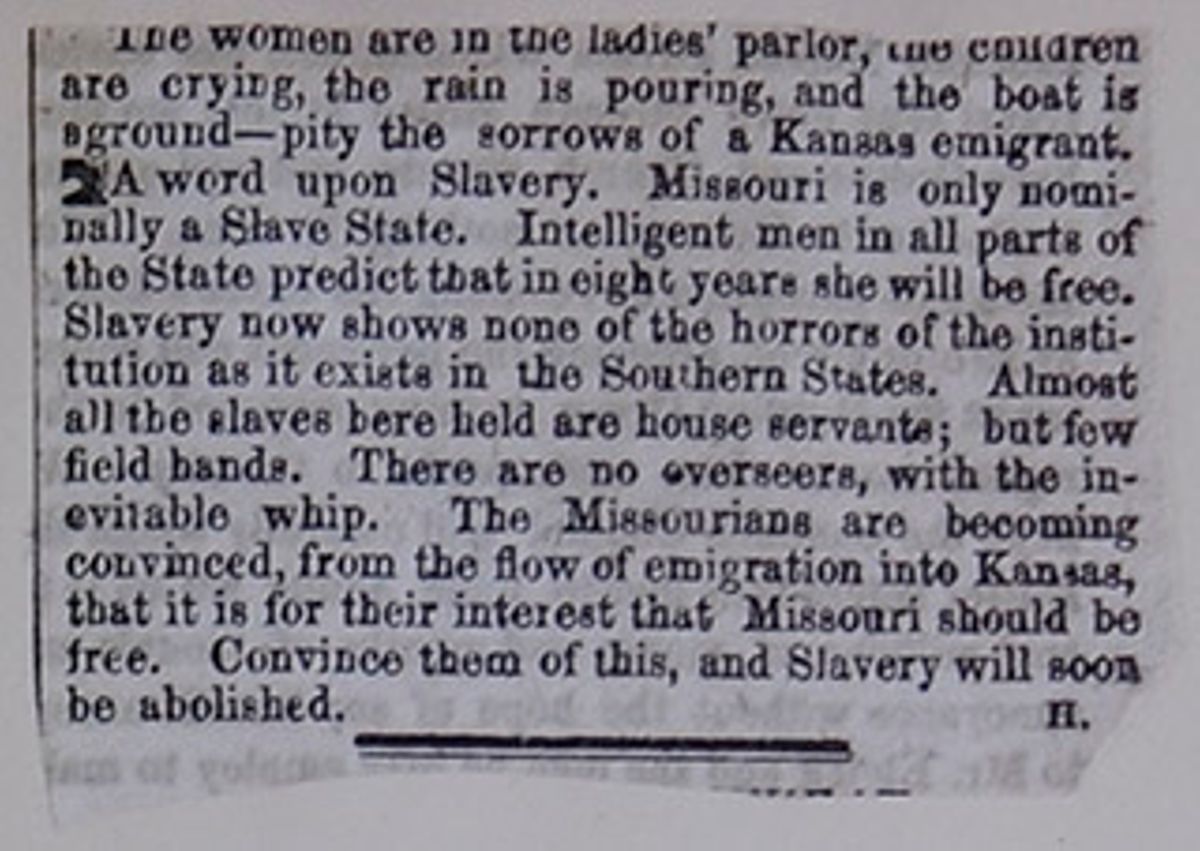
The women are in the ladies' parlor, the children are crying, the rain is pouring, and the boat is aground—pity the sorrows of a Kansas emigrant.
A word upon Slavery. Missouri is only nominally a Slave State. Intelligent men in all parts of the State predict that in eight years she will be free. Slavery now shows none of the horrors of the institution as it exists in the Southern States. Almost all the slaves here held are house servants; but few field hands. There are no overseers, with the inevitable whip. The Missourians are becoming convinced, from the flow of emigration into Kansas, that it is for their interest that Missouri should be free. Convince them of this, and Slavery will soon be abolished.
 [begin surface 426]
 [begin surface 427]
Three hundred thousand dollars have been appropriated by Congress for a wagon road from Fort Kearney, in Nebraska, via the South Pass of the Rocky Mountains, to the eastern boundary of California via Honey Lake. This I notice under the HERALD'S Washington News of the 9th ult. This is the first connecting link between the Atlantic and Pacific coasts. Under an act of Congress of about one year ago an appropriation of some $50,000 was obtained for a road from Omaha City to Fort Kearney, which, although poorly done, has been surveyed and laid out. The road mentioned in this last bill, from Fort Kearney to California, is therefore but a continuation of that road. It is for the north side of the Platte river.
The distance from this place to Fort Kearney is about 210 miles, with the Elkhorn, Loupe Fork and Wood rivers to cross, besides a number of creeks. The distance from Fort Kearney to the Boiling Springs, near the boundary line of California, is about 1.300 miles further. The HERALD's Washington report has the bill read via Honey Lake. There is no such lake, if I recollect aright, and my impression is it if intended to read Humboldt Lake, (a name familiar to every overland traveller.) Of course, from the South pass, the road is intended to pass Salt Lake City, or what would be more practicable, around the north side of the lake, thence direct to Humboldt Lake, &c. This road (if the appropriation be carefully expended) will be of much value to the settlers of Nebraska and Utah Territories. Yet it lacks another bill to render it complete, viz: a generous disposal of Uncle Samuel's powder and lead, dealt out by his soldiery amongst the numerous warlike tribes of Indians who infest the country through which the road runs. It needs less of Grandmother Manypenny's presents, and more hard knocks, to keep them in a respectable state of subjection, so that the road may be more generally and fearlessly travelled.
[cutaway]
 [begin surface 429]
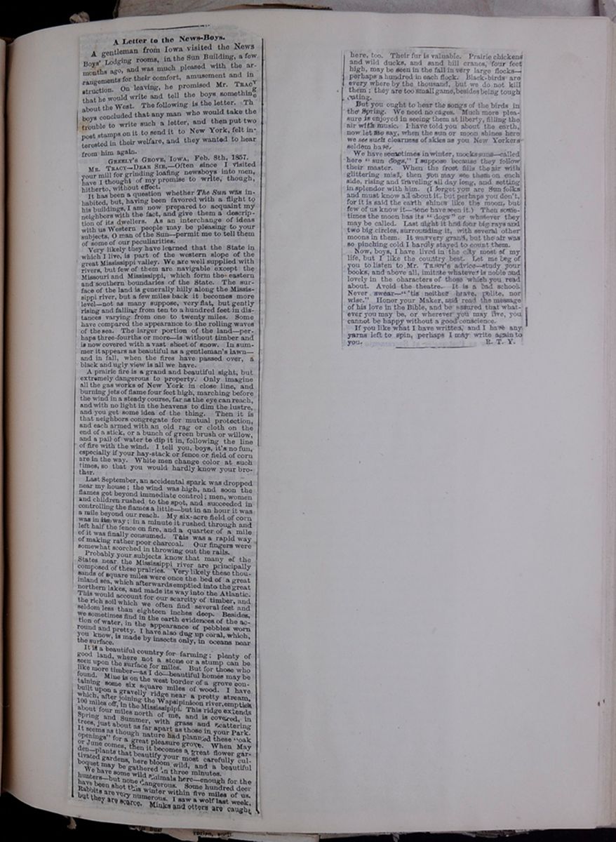 [begin surface 430]
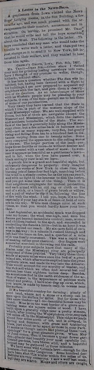
A Letter to the News-Boys.
A gentleman from Iowa visited the News Boys' Lodging rooms, in the Sun Building, a few months ago, and was much pleased with the arrangements for their comfort, amusement and instruction. On leaving, he promised Mr. TRACY that he would write and tell the boys something about the West. The following is the letter. Th boys concluded that any man who would take the trouble to write such a letter, and then put two post stamps on it to send it to New York, felt interested in their welfare, and they wanted to hear from him again.
MR. TRACY—DEAR SIR,—Often since I visited your mill for grinding loafing newsboys into men, have I thought of my promise to write, though, hitherto, without effect.
It has been a question whether The Sun was inhabited, but, having been favored with a flight to his buildings, I am now prepared to acquaint my neighbors with the fact, and give them a description of its dwellers. As an interchange of ideas with us Western people may be pleasing to your subjects, O man of the Sun—permit me to tell them of some of our peculiarities.
Very likely they have learned that the State in which I live, is part of the western slope of the great Mississippi valley. We are well supplied with rivers, but few of them are navigable except the Missouri and Mississippi, which form the eastern and southern boundaries of the State. The surface of the land is generally hilly along the Mississippi river, but a few miles back it becomes more level—not as many suppose, very flat, but gently rising and falling from ten to a hundred feet in distance varying from one to twenty miles. Some have compared the appearance to the rolling waves of the sea. The larger portion of the land—perhaps three-fourths or more—is without timber and is now covered with a vast sheet of snow. In summer it appears as beautiful as a gentleman's lawn—and in fall, when the fires have passed over, a black and ugly view is all we have.
A prairie fire is a grand and beautiful sight, but extremely dangerous to property. Only imagine all the gas works of New York in a close line, and burning jest of flame four feet high, marching before the wind in a steady course, far as the eye can reach, and with no light in the heavens to dim the lustre, and you get some idea of the thing. Then it is that neighbors congregate for mutual protection and each armed with an old rag or cloth on the end of a stick, or a bunch of green brush or willow, and a pail of water to dip it in, following the line of fire with the wind. I tell you, boys, it's no fun, especially if your hay-stack or fence or field of corn are in the way. White men change color at such times, so that you would hardly know your brother.
Last September, an accidental spark was dropped near my house; the wind was high, and soon the flames got beyond immediate control; men, women and children rushed to the spot, and succeeded in controlling the flames a little—but in an hour it was a mile beyond our reach. My six-acre field of corn was in its way; in a minute it rushed through and left half the fence on fire, and a quarter of a mile of it was finally consumed. This was a rapid way of making rather poor charcoal. Our fingers were somewhat scorched in throwing out the rails.
Probably your subjects know that many of the States near the Mississippi river are principally composed of these prairies. Very likely these thousands of square miles were once the bed of a great inland sea, which afterwards emptied into the great northern lakes, and made its way into the Atlantic. This would account for our scarcity of timber, and the rich soil we often find several feet and seldom less than eighteen inches deep. Besides, we sometimes find in the earth evidences of the action of water, in the appearance of pebbles worn round and pretty. I have also dug up coral, which, you know, is made by insects only, in oceans near the surface.
It is a beautiful country for farming; plenty of good land, where not a stone or a stump can be seen upon the surface for miles. But for those who like more timber—as I do—beautiful homes may be found. Mine is on the west border of a grove containing some six square miles of wood. I have built upon a gravelly ridge near a pretty stream, which, after joining the Wapsipinicon river, empties 100 miles off, in the Mississipipi . This ridge extends about four miles north of me, and is covered, in Spring and Summer, with grass and scattering trees, just about as far apart as those in your Park. It seems as though nature had planned these "oak openings" for a great pleasure grove. When May or June comes, then it becomes a great flower garden—plants that beautify your most carefully cultivated gardens, here bloom wild, and a beautiful boquet may be gathered in three minutes.
We have some wild animals here—enough for the hunters—but none dangerous. Some hundred deer have been shot this winter within five miles of us. Rabbits are very numerous. I saw a wolf last week, but they are scarce. Minks and otters are caught

here, too. Their fur is valuable. Prairie chickens and wild ducks, and sand hill cranes, four feet high, may be seen in the fall in very large flocks—perhaps a hundred in each flock. Black-birds are every where by the thousand, but we do not kill them; they are too small game, besides being tough eating.
But you ought to hear the songs of the birds in the Spring. We need no cages. Much more pleasure is enjoyed in seeing them at liberty, filling the air with music. I have told you about the earth, now let me say, when the sun or moon shines here we see such clearness of skies as you New Yorkers seldom have.
We have sometimes in winter, mocks suns—called here "sun dogs," I suppose because they follow their master. When the frost fills the air with glittering mist, then you may see them on each side, rising and traveling all day long, and setting in splendor with him. (I forget you are Sun folks and must know all about it, but perhaps you don't, for it is said the earth shines like the moon, but few of us know it—none have seen it.) Then sometimes the moon has its "dogs" or whatever they may be called. Last night it had four big rays and two big circles, surrounding it, with several other moons in them. It was very grand, but the air was so pinching cold I hardly stayed to count them.
Now boys, I have lived in the city most of my life, but I like the country best. Let me beg for you to listen to Mr. TRACY's advice—study your books, and above all imitate whatever is noble and lovely in the characters of those which you read about. Avoid the theatre. It is a bad school. Never swear—" 'tis neither brave, polite, nor wise." Honor your Maker, and read the message of his love in the Bible, and be assured that whatever you may be, or wherever you may live, you cannot be happy without a good conscience.
If you like what I have written, and I have any yarns left to spin, perhaps I may write again to you.
 [begin surface 433]
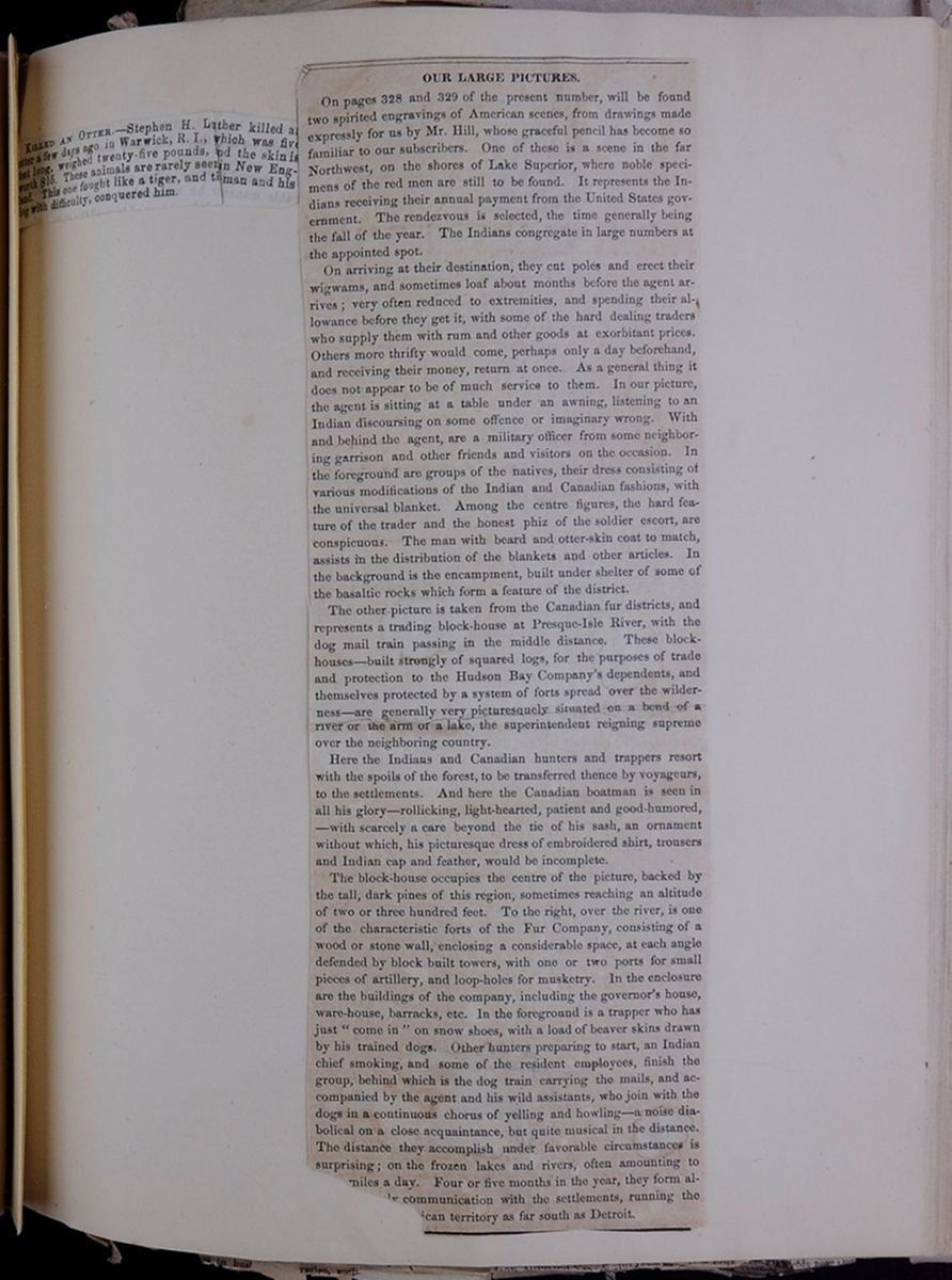 [begin surface 434]
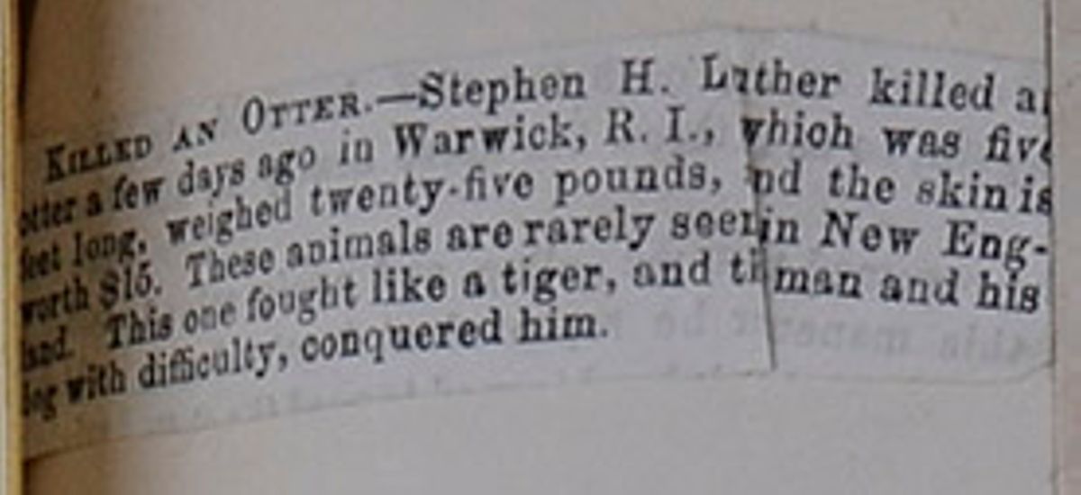
KILLED AN OTTER.—Stephen H. Luther killed a[covered] otter a few days ago in Warwick R. I., which was five feet long, weighed twenty-five pounds, and the skin is worth $15. These animals are rarely seen in New England. This one fought like a tiger, and the man and his dog with difficulty, conquered him.
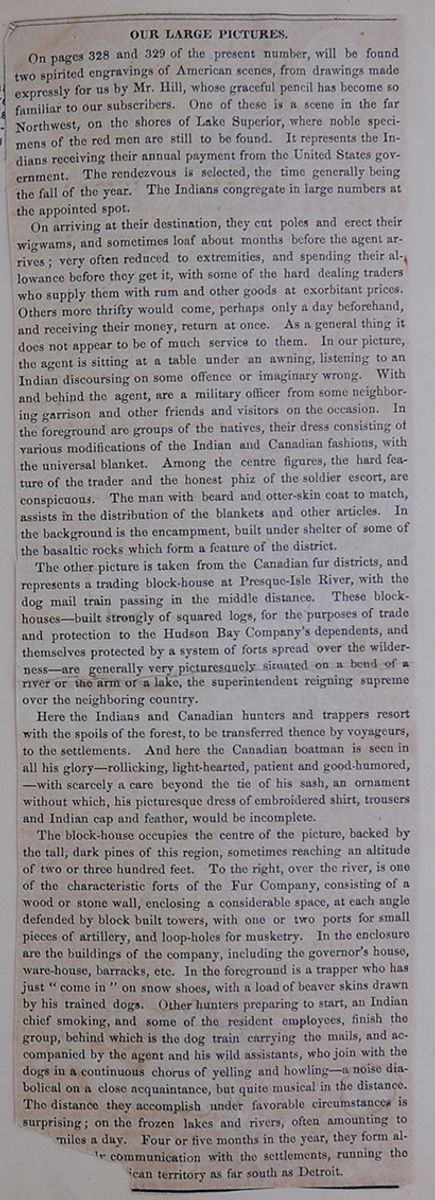
OUR LARGE PICTURES.
On pages 328 and 329 of the present number, will be found two spirited engravings of American scenes, from drawings made expressly for us by Mr. Hill, whose graceful pencil has become so familiar with our subscribers. One of these is a scene in the far Northwest, on the shores of Lake Superior, where noble specimens of the red man are still to be found. It represents the Indians receiving their annual payment from the United States government. The rendezvous is selected, the time generally being the fall of the year. The Indians congregate in large numbers at the appointed spot.
On arriving at their destination, they cut poles and erect their wigwams, and sometimes loaf about months before the agent arrives; very often reduced to extremities, and spending their allowance before they get it, with some of the hard dealing traders who supply them with rum and other goods at exorbitant prices. Others more thrifty would come, perhaps only a day beforehand, and receiving their money, return at once. As a general thing it does not appear to be of much service to them. In our picture, the agent is sitting at a table under an awning, listening to an Indian discoursing on some offence or imaginary wrong. With and behind the agent, are a military officer from some neighboring garrison and other friends and visitors on the occasion. In the foreground are groups of the natives, their dress consisting of various modifications of the Indian and Canadian fashions, with the universal blanket. Among the centre figures, the hard feature of the trader and the honest phiz of the soldier escort, are conspicuous. The man with beard and otter-skin coat to match, assists in the distribution of the blankets and other articles. In the background is the encampment, built under shelter of some of the basaltic rocks which form a feature of the district.
The other picture is taken from the Canadian fur districts, and represents a trading block-house at Presque-Isle River, with the dog mail train passing in the middle distance. These block-houses—built strongly of squared logs, for the purposes of trade and protection to the Hudson Bay Company's dependents, and themselves protected by a system of forts spread over the wilderness—are generally very picturesquely situated on a bend of a river or the arm of a lake, the superintendent reigning supreme over the neighboring country.
Here the Indians and Canadian hunters and trappers resort with spoils of the forest, to be transferred thence by voyageurs to the settlements. And here the Canadian boatman is seen in all his glory—rollicking, lighthearted, patient and good-humored,—with scarcely a care beyond the tie of his sash, an ornament without which, his picturesque dress of embroidered shirt, trousers, and Indian cap and feather, would be incomplete.
The block-house occupies the centre of the picture backed by the tall, dark pines of this region, sometimes reaching an altitude of two or three hundred feet. To the right, over the river, is one of the characteristic forts of the Fur Company, consisting of a wood or stone wall, enclosing a considerable space, at each angle defended by block built towers, with one or two ports for small pieces of artillery, and loop-holes for musketry. In the enclosure are the buildings of the company, including the governor's house, ware-house, barracks, etc. In the foreground is a trapper who has just "come in" on snow shoes, with a load of beaver skins drawn behind his trained dogs. Other hunters preparing to start, an Indian chief smoking, and some of the resident employees, finish the group, behind which is the dog train carrying the mails, and accompanied by the agent and his wild assistants, who join with the dogs in a continuous chorus of yelling and howling—a noise diabolical on a close acquaintance, but quite musical in the distance. The distance they accomplish under favorable circumstances is surprising; on the frozen lakes and river, often amounting to [cutaway]miles a day. Four or five months in the year, they form al[cutaway] communication with the settlements, running the[cutaway]ican territory as far south as Detroit.
 [begin surface 437]
motion mainly to the current. It is fifteen feet wide, from fifty to eighty feet long, and carries from 200 to 400 barrels. These arks are often filled with the goods and families of emigrants, and contain even the carriages and domestic animals. They are also used for shops of various kinds of goods, which are sold at the different towns, and some of them are fitted up as the workshops of artificers. There are also keelboats, and barges, which are light and well built; skiffs, that will carry from two persons to five tons; "dug-outs," or pirogues, made of hollowed logs, and other vessels, for which language has no name, and the sea no parallel. Since the use of steamboats, many of the other craft have disappeared, and the number of river boatmen has been diminished by many thousands.
25. Education.—All that is practicable is done for education in these states. The importance of the subject is properly estimated by the state legislatures, and the number of native inhabitants who cannot read or write is not large. A common education is within the reach of nearly all.
26. Manners and Customs.—The use of the rifle is carried to the greatest perfection. Hospitality, generosity, and rude courtesy are characteristics of the people. The men are distinguished for their skill and daring as soldiers. Athletic sports are chiefly in vogue. Camp meetings are held on a great scale, and draw together large numbers of people. The political orators perform circuits, in which they meet each other face to face, setting forth their views before the assembled freemen. Barbecues are feasts somewhat in the Indian fashion, where animals are roasted whole; several hundreds sometimes partaking of the entertainment. The wild, free habits of the west have given rise to a style of humor which becomes amusing, from its extravagance. A number of pithy commonplaces, such as " Go ahead," "Waking up the wrong passenger," "Barking up the wrong tree," &c., had their origin here. These have passed into general use, and are even transplanted to England.
27. Towns.—The chief towns of the Western States are as follows, with their distances from Cincinnati: Table listing the population in 1840, population in 1850 and distance from Cincinnati of the following cities: Cincinnati, Ohio, Louisville, Ky., Milwaukee, Wis., Chicago, Ill., Nashville, Tenn., St. Louis, Mo., and Indianapolis, Ia.
28. Antiquities.—There are numerous remains of antiquity in the Western States, which are supposed to have been the work of populous tribes who preceded the present races of Indians. These consist of mounds and inclosures of various forms. They are found at a number of places in Ohio, Illinois, and other parts. Very extensive works of this kind are also found in Mississippi. The mounds were probably used as burial-places, and the inclosures for military purposes.
29. History.—The first discovery within the Western States was made by De Soto and his party, in 1541, who went as far north as New Madrid, in Missouri. The first settlements were those of the French, in the region of the northern lakes, and down the Mississippi. Tennessee was settled in 1765, Kentucky in 1770, and Ohio soon after. The history of the states will be given under their heads.
Lesson XLIX... State of Arkansas.
1. Characteristics.—This is a new state, with a fine climate, and a small population.
2. Mountains.—The Ozark chain crosses the northwestern part of this state, being here called the Black Mountains. The whole range is sometimes called the Masserne Mountains, though this term is applied to a branch which extends eastwardly nearly to the Missouri River. These mountains have been little explored. Some of the elevations are said to be 2000 feet in hight. Near the southwest part of the state is a detached elevation, called Mt. Prairie.
3. Valleys.—There are several valleys of great beauty in this state, especially that of the Arkansas and Washita rivers.
4. Rivers.—The Arkansas, one of the greatest tributaries of the Mississippi, traverses this state from northwest to southeast. It rises in the Rocky Mountains, and, pursuing a southeast course, empties into the Mississippi four hundred miles above the mouth of the Red River. It is remarkable for the regularity of its curves, and the beauty of the young cotton-wood groves that spring up on the hillocks along its border. In the spring floods, steamboats can ascend it nearly to the mountains. White River has its sources in the Black Mountains, which separate its waters from those of the Arkansas. Flowing east, it receives the Black River; after which its course is southerly. Map of Arkansas Extent, 52,198 square miles. Admitted into the Union, 1836. Visited by De Soto in 1541. Population in 1850, 209,897.—Pop. to the square mile, 4.02. Near its mouth, it separates into two branches—one joining the Arkansas, the other the Mississippi. The Washita
Exercises on the Map of Arkansas.—Extent of Arkansas? Population? Population to the square mile? Boundaries? In which direction does the Arkansas River flow in this state? Where does it empty? In which direction does the White River run? Capital of Arkansas? Where is Columbia? Smithville? Ozark?
LESSON XLIX. 1. Characteristics? 2. Mountains? 3. Valleys?
13 [begin surface 438] 98
STATE OF ARKANSAS.
98
STATE OF ARKANSAS.
is a noble river, flowing through a fertile and beautiful region. The Cache, St. Francis, and Bartholomew are smaller streams. The Red River crosses the southwestern corner of the state. It is here obstructed by accumulations of driftwood and fallen trees, called rafts.
5. Prairies.—A great part of the surface of this state consists of prairies. One of these is ninety miles in length.
6. Mineral Springs.—Sixty miles north of Little Rock are the Hot Springs, much resorted to. There are also sulphur and chalybeate springs, beneficial in certain diseases.
7. Vegetable Products.—The common forest trees of the Western States are found here. The bottom-lands are heavily timbered. The beech is abundant. In many places, the hills are covered with red cedars and savines. Grapes and whortleberries, in high perfection, abound. Cotton flourishes in the southern part, and grains in the north.
8. Animals.—Wild animals abound, such as the deer, elk, otter, badger, beaver, rabbit, gopher, raccoon, wildcat, cougar, wolf, bear, wild-geese, turkeys, quail, grouse, ducks, &c. The buffalo is becoming scarce.
9. Minerals.—Iron-ore, gypsum, limestone, anthracite, and other coal appear to be abundant. Near the Washita is a quarry of oil-stone. Salt occurs in saline tracts, extending across the state from north to south. Here is a salt prairie, which is covered for miles with pure crystallized salt, five or six inches deep. Vast masses of sea-shells are found, which are burnt and used for lime.
10. Climate.—This is variable. At the north it resembles that of Missouri; at the south, it is like that of Louisiana. The shores of the Arkansas, as far up as Little Rock, are unhealthy. Great tracts, on all sides, are covered with sleeping lakes, and stagnant bayous. The country in these parts is a dead level, and the waters of the heavy rains, which sometimes last for four weeks together, cannot be drained off. The prairie country is more healthy, and the elevated regions of the northwest are highly salubrious.
11. Soil.—This is of all qualities, from the best to the most sterile. Along the White River, the St. Francis, and the Washita, there are highly productive tracts of land. The soil of the prairies is not, in general, fertile. A considerable portion of the state consists of unproductive land.
12. Face of the Country.—For some distance up the Arkansas and White River the country is an extensive, heavily-timbered, and deeply-inundated swamp. Along the banks of the Mississippi, also, there is an almost continued flooded forest. In the interior there are vast plains or prairies, and sterile ridges.
13. Agriculture.—Cotton is the staple, but it is an uncertain crop in the northern counties. Wheat does well in the high country; maize and sweet potatoes in the rich lands; rye and barley everywhere. Peaches are excellent and abundant.
14. Divisions.—These are as follows: This table lists the counties of Arkansas with their populations in 1850 and includes a column for the major town in each county and the town's population. The county population is divided into the following categories: White, Free Colored, Slaves, and Total.
15. Manufactures.—These are of small extent, but increasing. The domestic manufactures are considerable.
16. Commerce.—This is almost confined to the export of agricultural products to New Orleans; yet the state has great advantages for trade, and this is increasing.
17. Education.—In 1850 Arkansas had 353 public schools, attended by 8493 scholars; 90 academies and other schools, attended by 2407 pupils; and 3 colleges, attended by 150 students. The colleges are all under Roman Catholic influence.
18. Inhabitants.—The people are chiefly emigrants from the southern and western states. There are some descendants of the ancient French settlers.
19. Chief Towns.—Little Rock, on the south bank of the Arkansas, and 300 miles from its mouth, is the seat of government It is situated on a bluff, nearly two hundred feet above the river, and is regularly laid out, having been first settled in 1820. Arkansas is an ancient French settlement, the inhabitants of which are mostly descendants of French and Indians. Columbia and Helena, on the Mississippi, Batesville, on White River, Fayetteville, in the northwestern part of the state, and Fulton, on the Red River, are considerable and growing places.
20. History.—The first white men who visited the country must have been De Soto and his band, who passed up and down the Mississippi in 1541. The French had some small settlements here, soon after their occupation of the country below. Arkansas was a part of the Louisiana purchase. It was made a separate territory in 1819, and was admitted into the Union in 1836.
4. Rivers? 5. Prairies? 6. Mineral springs? 7. Vegetable products? 8. Animals? 9. Minerals? 10. Climate? 11. Soil? 12. Face of the country? 13. Agriculture? 14. Divisions? 15. Manufactures? 16. Commerce? 17. Education? 18. Inhabitants? 19. Chief towns? 20. History? When was Arkansas admitted into the Union?
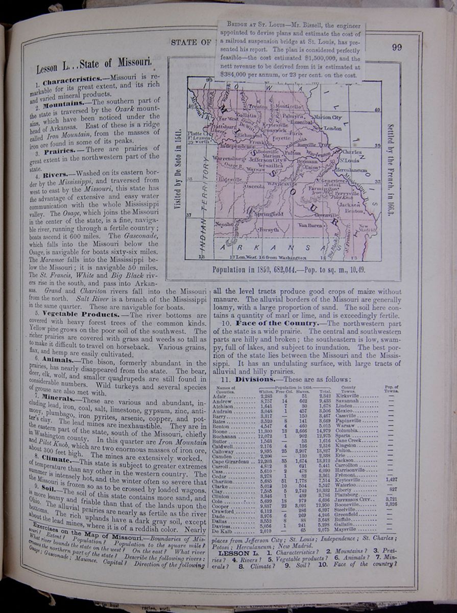 STATE OF [covered]
99
STATE OF [covered]
99
Lesson L... State of Missouri.
1. Characteristics.—Missouri is remarkable for its great extent, and its rich and varied mineral products.
2. Mountains.—The southern part of the state is traversed by the Ozark mountains, which have been noticed under the head of Arkansas. East of these is a ridge called Iron Mountain, from the masses of iron ore found in some of its peaks. 8. Prairies.—There are prairies of great extent in the northwestern part of the state.
4. Rivers.—Washed on its eastern border by the Mississippi, and traversed from west to east by the Missouri, this state has the advantage of extensive and easy water communication with the whole Mississippi valley. The Osage, which joins the Missouri in the center of the state, is a fine, navigable river, running through a fertile country; boats ascend it 600 miles. The Gasconade, which falls into the Missouri below the Osage, is navigable for boats sixty-six miles. The Maramec falls into the Mississippi below the Missouri; it is navigable 50 miles. The St. Francis, White and Big Black rivers rise in the south, and pass into Arkansas. Grand and Chariton rivers fall into the Missouri from the north. Salt River is a branch of the Mississippi in the same quarter. These are navigable for boats.
5. Vegetable Products.—The river bottoms are covered with heavy forest trees of the common kinds. Yellow pine grows on the poor soil of the southwest. The richer prairies are covered with grass and weeds so tall as to make it difficult to travel on horseback. Various grains, flax, and hemp are easily cultivated.
6. Animals.—The bison, formerly abundant in the prairies, has nearly disappeared from the state. The bear, deer, elk, wolf, and smaller quadrupeds are still found in considerable numbers. Wild turkeys and several species of grouse are also met with.
7. Minerals.—These are various and abundant, including lead, iron, coal, salt, limestone, gypsum, zinc, antimony, plumbago, iron pyrites, arsenic, copper, and potter's clay. The lead mines are inexhaustible. They are in the eastern part of the state, south of the Missouri, chiefly in Washington county. In this quarter are Iron Mountain and Pilot Knob, which are two enormous masses of iron ore, about 300 feet high. The mines are extensively worked.
8. Climate.—This state is subject to greater extremes of temperature than any other in the western country. The summer is intensely hot, and the winter often so severe that the Missouri is frozen so as to be crossed by loaded wagons.
9. Soil.—The soil of this state contains more sand, and
is more loamy and friable than that of the lands upon the
Ohio. The alluvial prairies are nearly as fertile as the
river bottoms. The rich uplands have a dark gray soil,
except about the lead mines, where it is of a reddish color.
Nearly
[begin surface 440]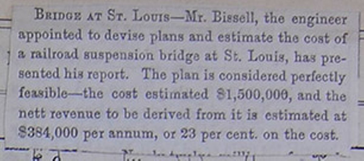
10. Face of the Country.—The northwestern part of the state is a wide prairie. The central and southwestern parts are hilly and broken; the southeastern is low, swampy, full of lakes, and subject to inundation. The best portion of the state lies between the Missouri and the Mississippi. It has an undulating surface, with large tracts of alluvial and hilly prairies.
11. Divisions.—These are as follows: This table lists the counties of Missouri with their populations in 1850 and includes a column for the major town in each county and the town's population. The county population is divided into the following categories: White, Free Colored, Slaves, and Total.
Exercises on the Map of Missouri.—Boundaries of Missouri? Extent? Population? Population to the square mile? What river bounds the state on the west? On the east? What river crosses the northern part of the state? Describe the following rivers: Osage; Gasconade; Maumce. Capital? Direction of the following places from Jefferson City; St. Louis; Independence; St. Charles; Potosi: Herculaneum; New Madrid.
LESSON L. 1. Characteristics? 2. Mountains? 3. Prairies? 4. Rivers? 5. Vegetable products? 6. Animals? 7. Minerals? 8. Climate? 9. Soil? 10. Face of the country?
[begin surface 441]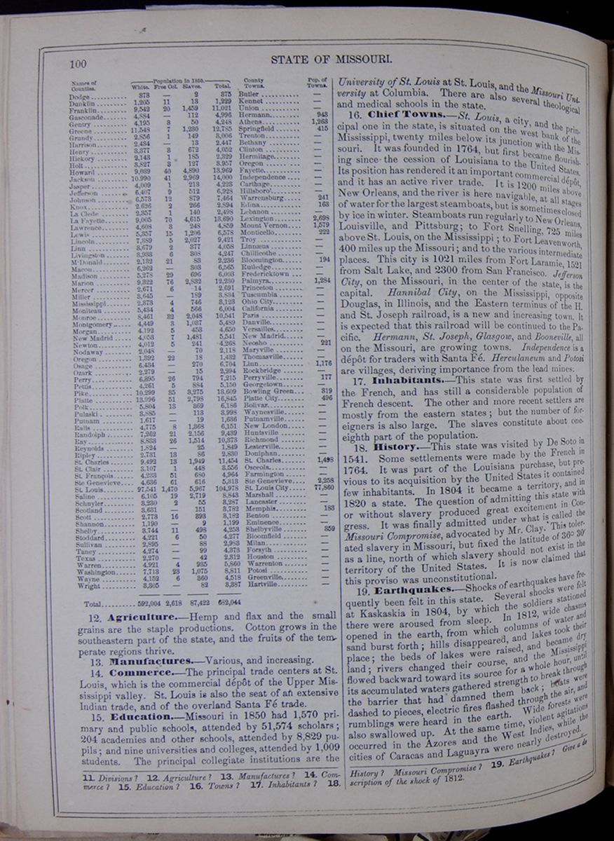 100
STATE OF MISSOURI.
100
STATE OF MISSOURI.
Continuation of table listing the counties of Missouri with their populations in 1850 and includes a column for the major town in each county and the town's population. The county population is divided into the following categories: White, Free Colored, Slaves, and Total.
12. Agriculture.—Hemp and flax and the small grains are the staple productions. Cotton grows in the southeastern part of the state, and the fruits of the temperate regions thrive.
13. Manufactures.—Various, and increasing.
14. Commerce.—The principal trade centers at St. Louis, which is the commercial depth of the Upper Mississippi valley. St. Louis is also the seat of an extensive Indian trade, and of the overland Santa Fé trade.
15. Education.—Missouri in 1850 had 1,570 primary and public schools, attended by 51,574 scholars; 204 academies and other schools, attended by 8,829 pupils; and nine universities and colleges, attended by 1,009 students. The principal collegiate institutions are the University of St. Louis at St. Louis, and the Missouri University at Columbia. There are also several theological and medical schools in the state.
16. Chief Towns.—St. Louis, a city, and the principal one in the state, is situated on the west bank of the Mississippi, twenty miles below its junction with the Missouri. It was founded in 1764, but first became flourishing since the cession of Louisiana to the United States. Its position has rendered it an important commercial dépôt, and it has an active river trade. It is 1200 miles above New Orleans, and the river is here navigable, at all stages of water for the largest steamboats, but is sometimes closed by ice in winter. Steamboats run regularly to New Orleans, Louisville, and Pittsburg; to Fort Snelling, 725 miles above St. Louis, on the Mississippi; to Fort Leavenworth, 400 miles up the Missouri; and to the various intermediate places. This city is 1021 miles from Fort Laramie, 1521 from Salt Lake, and 2300 from San Francisco. Jefferson City, on the Missouri, in the center of the state, is the capital. Hannibal City, on the Mississippi, opposite Douglas, in Illinois, and the Eastern terminus of the H. and St. Joseph railroad, is a new and increasing town. It is expected that this railroad will be continued to the Pacific. Hermann, St. Joseph, Glasgow, and Booneville, all on the Missouri, are growing towns. Independence is a dépôt for traders with Santa Fé. Herculaneum and Potosi are villages, deriving importance from the lead mines.
17. Inhabitants.—This state was first settled by the French, and has still a considerable population of French descent. The other and more recent settlers are mostly from the eastern states; but the number of foreigners is also large. The slaves constitute about one-eighth part of the population.
18. History.—This state was visited by De Soto in 1541. Some settlements were made by the French in 1764. It was part of the Louisiana purchase, but previous to its acquisition by the United States it contained few inhabitants. In 1804 it became a territory, and in 1820 a state. The question of admitting this state with or without slavery produced great excitement in Congress. It was finally admitted under what is called the Missouri Compromise, advocated by Mr. Clay. This tolerated slavery in Missouri, but fixed the latitude of 36° 30´ as a line, north of which slavery should not exist in the territory of the United States. It is now claimed that this proviso was unconstitutional.
19. Earthquakes.—Shocks of earthquakes have frequently been felt in this state. Several shocks were felt at Kaskaskia in 1804, by which the soldiers stationed there were aroused from sleep. In 1812, wide chasms opened in the earth, from which columns of water and sand burst forth; hills disappeared, and lakes took their place; the beds of lakes were raised, and became dry land; rivers changed their course, and the Mississippi flowed backward toward its source for a whole hour, until its accumulated waters gathered strength to break through the barrier that had damned them back; boats were dashed to pieces, electric fires flashed through the air, and rumblings were heard in the earth. Wide forests were also swallowed up. At the same time, violent agitations occurred in the Azores and the West Indies, while the cities of Caracas and Laguayra were nearly destroyed.
11. Divisions? 12. Agriculture? 13. Manufactures? 14. Commerce? 15. Education? 16. Towns? 17. Inhabitants? 18. History? Missouri Compromise? 19. Earthquakes? Give a description of the shock of 1812.
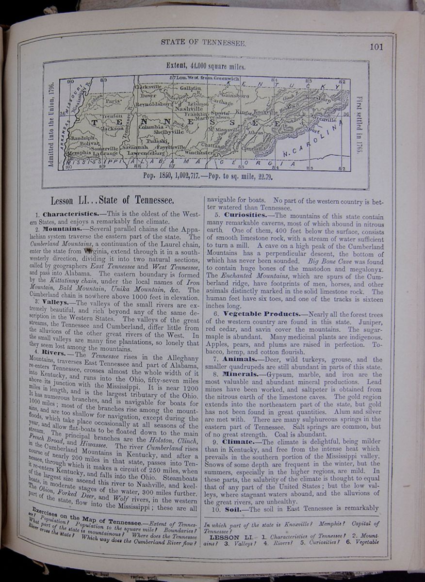 STATE OF TENNESSEE.
101
Map of Tennessee.
Extent, 44,000 square miles.
Admitted into the Union, 1796.
First settled in 1765.
Pop. 1850, 1,002,717.—Pop. to sq. mile,
22.79.
STATE OF TENNESSEE.
101
Map of Tennessee.
Extent, 44,000 square miles.
Admitted into the Union, 1796.
First settled in 1765.
Pop. 1850, 1,002,717.—Pop. to sq. mile,
22.79.
Lesson LI... State of Tennessee.
1. Characteristics.—This is the oldest of the Western States, and enjoys a remarkably fine climate.
2. Mountains.—Several parallel chains of the Appalachian system traverse the eastern part of the state. The Cumberland Mountains, a continuation of the Laurel chain, enter the state from Virginia, extend through it in a south-westerly direction, dividing it into two natural sections, called by geographers East Tennessee and West Tennessee, and pass into Alabama. The eastern boundary is formed by the Kittatinny chain, under the local names of Iron Mountain, Bald Mountain, Unika Mountain, &c. The Cumberland chain is nowhere above 1000 feet in elevation.
3. Valleys.—The valleys of the small rivers are extremely beautiful, and rich beyond any of the same description in the Western States. The valleys of the great streams, the Tennessee and Cumberland, differ little from the alluvions of the other great rivers of the West. In the small valleys are many fine plantations, so lonely that they seem lost among the mountains.
4. Rivers.—The Tennessee rises in the Alleghany Mountains, traverses East Tennessee and part of Alabama, re-enters Tennessee, crosses almost the whole width of it into Kentucky, and runs into the Ohio, fifty-seven miles above its junction with the Mississippi. It is near 1200 miles in length, and is the largest tributary of the Ohio. It has numerous branches, and is navigable for boats for 1000 miles; most of the branches rise among the mountains, and are too shallow for navigation, except during the floods, which take place occasionally at all seasons of the year, and allow flat-boats to be floated down to the main stream. The principal branches are the Holston, Clinch, French Broad, and Hiwassee. The river Cumberland rises in the Cumberland Mountains in Kentucky, and after a course of nearly 200 miles in that state, passes into Tennessee, through which it makes a circuit of 250 miles, when it re-enters Kentucky, and falls into the Ohio. Steamboats of the largest size ascend this river to Nashville, and keel-boats, in moderate stages of the water, 300 miles further. The Obion, Forked Deer, and Wolf rivers, in the western part of the state, flow into the Mississippi; these are all navigable for boats. No part of the western country is better watered than Tennessee.
5. Curiosities.—The mountains of this state contain many remarkable caverns, most of which abound in nitrous earth. One of them, 400 feet below the surface, consists of smooth limestone rock, with a stream of water sufficient to turn a mill. A cave on a high peak of the Cumberland Mountains has a perpendicular descent, the bottom of which has never been sounded. Big Bone Cave was found to contain huge bones of the mastodon and megalonyx. The Enchanted Mountains, which are spurs of the Cumberland ridge, have footprints of men, horses, and other animals distinctly marked in the solid limestone rock. The human feet have six toes, and one of the tracks is sixteen inches long.
6. Vegetable Products.—Nearly all the forest trees of the western country are found in this state. Juniper, red cedar, and savin cover the mountains. The sugar-maple is abundant. Many medicinal plants are indigenous. Apples, pears, and plums are raised in perfection. Tobacco, hemp, and cotton flourish.
7. Animals.—Deer, wild turkeys, grouse, and the smaller quadrupeds are still abundant in parts of this state.
8. Minerals.—Gypsum, marble, and iron are the most valuable and abundant mineral productions. Lead mines have been worked, and saltpeter is obtained from the nitrous earth of the limestone caves. The gold region extends into the northeastern part of the state, but gold has not been found in great quantities. Alum and silver are met with. There are many sulphureous springs in the eastern part of Tennessee. Salt springs are common, but of no great strength. Coal is abundant.
9. Climate.—The climate is delightful, being milder than in Kentucky, and free from the intense heat which prevails in the southern portion of the Mississippi valley. Snows of some depth are frequent in the winter, but the summers, especially in the higher regions, are mild. In these parts, the salubrity of the climate is thought to equal that of any part of the United States; but the low valleys, where stagnant waters abound, and the alluvions of the great rivers, are unhealthy.
10. Soil.—The soil in East Tennessee is remarkably
Exercises on the Map of Tennessee.—Extent of Tennessee? Population to the square mile? Boundaries? What part of the state is mountainous? Where does the Tennessee River cross the state? Which way does the Cumberland River flow? In which part of the state is Knoxville? Memphis? Capital of Tennessee?
LESSON LI. 1. Characteristics of Tennessee? 2. Mountains? 3. Valleys? 4. Rivers? 5. Curiosities? 6. Vegetable
[begin surface 443]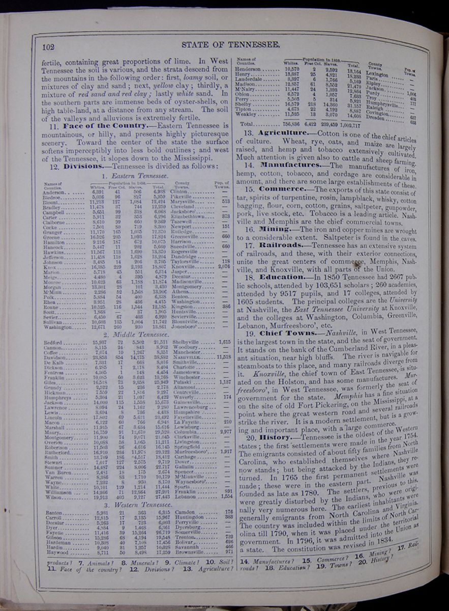 102
STATE OF TENNESSEE.
102
STATE OF TENNESSEE.
fertile, containing great proportions of lime. In West Tennessee the soil is various, and the strata descend from the mountains in the following order: first, loamy soil, or mixtures of clay and sand; next, yellow clay; thirdly, a mixture of red sand and red clay; lastly white sand. In the southern parts are immense beds of oyster-shells, on high table-land, at a distance from any stream. The soil of the valleys and alluvions is extremely fertile.
11. Face of the Country.—Eastern Tennessee is mountainous, or hilly, and presents highly picturesque scenery. Toward the center of the state the surface softens imperceptibly into less bold outlines; and west of the Tennessee, it slopes down to the Mississippi.
12. Divisions.—Tennessee is divided as follows: This table lists the counties of Tennessee with their populations in 1850 and includes a column for the major town in each county and the town's population. The county population is divided into the following categories: White, Free Colored, Slaves, and Total. The table is further divided into the following regions: Eastern Tennessee, Middle Tennessee, and Western Tennessee.
13. Agriculture.—Cotton is one of the chief articles of culture. Wheat, rye, oats, and maize are largely raised, and hemp and tobacco extensively cultivated. Much attention is given also to cattle and sheep farming.
14. Manufactures.—The manufactures of iron, hemp, cotton, tobacco, and cordage are considerable in amount, and there are some large establishments of these.
15. Commerce.—The exports of this state consist of tar, spirits of turpentine, rosin, lampblack, whisky, cotton bagging, flour, corn, cotton, grains, saltpeter, gunpowder, pork, live stock, etc. Tobacco is a leading article. Nashville and Memphis are the chief commercial towns.
16. Mining.—The iron and copper mines are wrought to a considerable extent. Saltpeter is found in the caves.
17. Railroads.—Tennessee has an extensive system of railroads, and these, with their exterior connections, unite the great centers of commerce, Memphis, Nashville, and Knoxville, with all parts of the Union.
18. Education.—In 1850 Tennessee had 2667 public schools, attended by 103,651 scholars; 260 academies, attended by 9517 pupils, and 17 colleges, attended by 1605 students. The principal colleges are the University at Nashville, the East Tennessee University at Knoxville, and the colleges at Washington, Columbia, Greenville, Lebanon, Murfreesboro', etc.
19. Chief Towns.—Nashville, in West Tennessee, is the largest town in the state, and the seat of government. It stands on the bank of the Cumberland River, in a pleasant situation, near high bluffs. The river is navigable for steamboats to this place, and many railroads diverge from it. Knoxville, the chief town of East Tennessee, is situated on the Holston, and has some manufactures. Murfreesboro', in West Tennessee, was formerly the seat of government for the state. Memphis has a fine situation on the site of old Fort Pickering, on the Mississippi, at a point where the great western road and several railroads strike the river. It is a modern settlement, but is a growing and important place, with a large commerce.
20. History.—Tennessee is the oldest of the Western states; the first settlements were made in the year 1754. The emigrants consisted of about fifty families from North Carolina, who established themselves where Nashville now stands; but being attacked by the Indians, they returned. In 1765 the first permanent settlements were made; these were in the eastern part. Nashville was founded as late as 1780. The settlers, previous to this, were greatly disturbed by the Indians, who were originally very numerous here. The earliest inhabitants were generally emigrants from North Carolina and Virginia. The country was included within the limits of North Carolina till 1790, when it was placed under the territorial government. In 1796, it was admitted into the Union as a state. The constitution was revised in 1834.
products? 7. Animals? 8. Minerals? 9. Climate? 10. Soil? 11. Face of the country? 12. Divisions? 13. Agriculture? 14. Manufactures? 15. Commerce? 16. Mining? 17. Railroads? 18. Education? 19. Towns? 20. History?
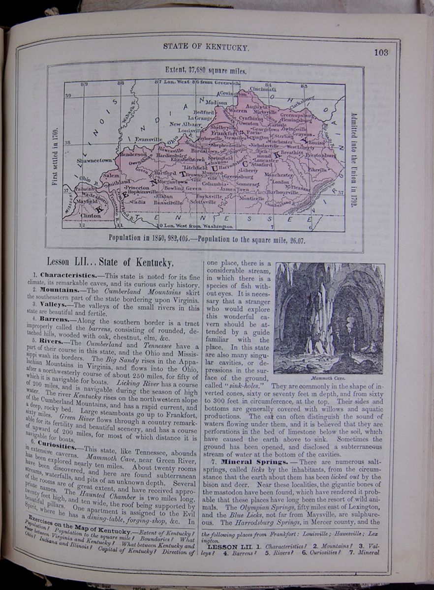 STATE OF KENTUCKY.
103
Map of Kentucky.
Extent, 37,680 square miles.
First settled in 1769.
Admitted into the Union in 1792.
Population in 1850, 982,405.—Population to
the square mile, 26.07.
STATE OF KENTUCKY.
103
Map of Kentucky.
Extent, 37,680 square miles.
First settled in 1769.
Admitted into the Union in 1792.
Population in 1850, 982,405.—Population to
the square mile, 26.07.
Lesson LII... State of Kentucky.
1. Characteristics.—This state is noted for its fine climate, its remarkable caves, and its curious early history.
2. Mountains.—The Cumberland Mountains skirt the southeastern part of the state bordering upon Virginia.
3. Valleys.—The valleys of the small rivers in this state are beautiful and fertile.
4. Barrens.—Along the southern border is a tract improperly called the barrens, consisting of rounded, detached hills, wooded with oak, chestnut, elm, &c.
5. Rivers.—The Cumberland and Tennessee have a part of their course in this state, and the Ohio and Mississippi wash its borders. The Big Sandy rises in the Appalachian Mountains in Virginia, and flows into the Ohio, after a northwesterly course of about 250 miles, for fifty of which it is navigable for boats. Licking River has a course of 200 miles, and is navigable during the season of high water. The river Kentucky rises on the northwestern slope of the Cumberland Mountains, and has a rapid current, and a deep, rocky bed. Large steamboats go up to Frankfort, sixty miles. Green River flows through a country remarkable for its fertility and beautiful scenery, and has a course of upward of 200 miles, for most of which distance it is navigable for boats.
6. Curiosities.—This state, like Tennessee, abounds in extensive caverns. Mammoth Cave, near Green River, has been explored nearly ten miles. About twenty rooms have been discovered, and here are found subterranean streams, waterfalls, and pits of an unknown depth. Several of the rooms are of great extent, and have received appropriate names. The Haunted Chamber is two miles long, twenty feet high, and ten wide, the roof being supported by beautiful pillars. One apartment is assigned to the Evil Spirit, where he has a dining-table, forging-shop, &c. In one place, there is a considerable stream, in which there is a species of fish without eyes. It is necessary that a stranger who would explore this wonderful cavern should be attended by a guide familiar with the place. In this state are also many singular cavities, or depressions in the surface of the ground, An image of Mammoth Cave. Mammoth Cave called "sink-holes." They are commonly in the shape of inverted cones, sixty or seventy feet in depth, and from sixty to 300 feet in circumference, at the top. Their sides and bottoms are generally covered with willows and aquatic productions. The ear can often distinguish the sound of waters flowing under them, and it is believed that they are perforations in the bed of limestone below the soil, which have caused the earth above to sink. Sometimes the ground has been opened, and disclosed a subterraneous stream of water at the bottom of the cavities.
7. Mineral Springs.—There are numerous salt-springs, called licks by the inhabitants, from the circumstance that the earth about them has been licked out by the bison and deer. Near these localities, the gigantic bones of the mastodon have been found, which have rendered it probable that these places have long been the resort of wild animals. The Olympian Springs, fifty miles east of Lexington, and the Blue Licks, not far from Maysville, are sulphureous. The Harrodsburg Springs, in Mercer county, and the
Exercises on the Map of Kentucky.—Extent of Kentucky? Population? Population to the square mile? Boundaries? What river between Virginia and Kentucky? What between Kentucky and Ohio? Indiana and Illinois? Capital of Kentucky? Direction of the following places from Frankfort: Louisville; Hawesville; Lexington.
LESSON LII. 1. Characteristics? 2. Mountains? 3. Valleys? 4. Barrens? 5. Rivers? 6. Curiosities? 7. Mineral
[begin surface 445]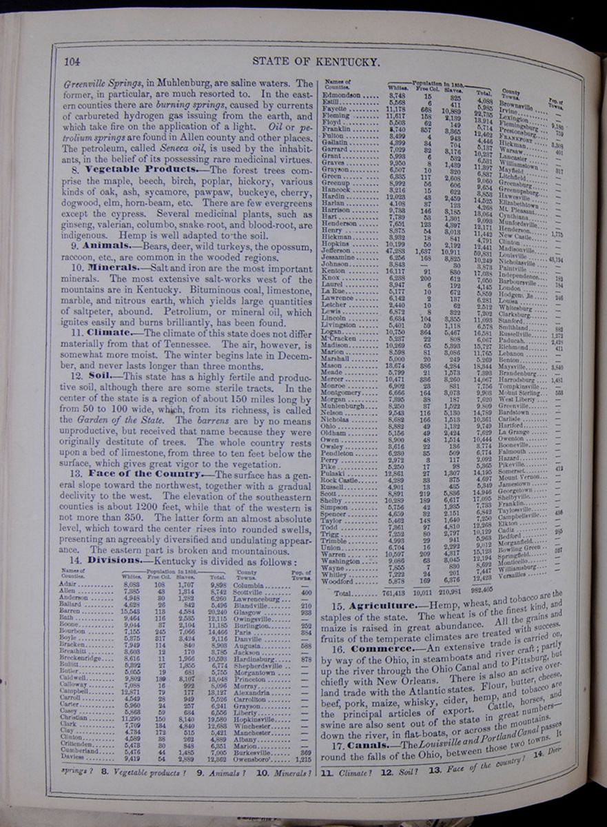 104
STATE OF KENTUCKY.
104
STATE OF KENTUCKY.
Greenville Springs, in Muhlenburg, are saline waters. The former, in particular, are much resorted to. In the eastern counties there are burning springs, caused by currents of carbureted hydrogen gas issuing from the earth, and which take fire on the application of a light. Oil or petrolium springs are found in Allen county and other places. The petroleum, called Seneca oil, is used by the inhabitants, in the belief of its possessing rare medicinal virtues.
8. Vegetable Products.—The forest trees comprise the maple, beech, birch, poplar, hickory, various kinds of oak, ash, sycamore, pawpaw, buckeye, cherry, dogwood, elm, horn-beam, etc. There are few evergreens except the cypress. Several medicinal plants, such as ginseng, valerian, columbo, snake root, and blood-root, are indigenous. Hemp is well adapted to the soil.
9. Animals.—Bears, deer, wild turkeys, the opossum, raccoon, etc., are common in the wooded regions.
10. Minerals.—Salt and iron are the most important minerals. The most extensive salt-works west of the mountains are in Kentucky. Bituminous coal, limestone, marble, and nitrous earth, which yields large quantities of saltpeter, abound. Petrolium, or mineral oil, which ignites easily and burns brilliantly, has been found.
11. Climate.—The climate of this state does not differ materially from that of Tennessee. The air, however, is somewhat more moist. The winter begins late in December, and never lasts longer than three months.
12. Soil.—This state has a highly fertile and productive soil, although there are some sterile tracts. In the center of the state is a region of about 150 miles long by from 50 to 100 wide, which, from its richness, is called the Garden of the State. The barrens are by no means unproductive, but received that name because they were originally destitute of trees. The whole country rests upon a bed of limestone, from three to ten feet below the surface, which gives great vigor to the vegetation.
13. Face of the Country.—The surface has a general slope toward the northwest, together with a gradual declivity to the west. The elevation of the southeastern counties is about 1200 feet, while that of the western is not more than 350. The latter form an almost absolute level, which toward the center rises into rounded swells, presenting an agreeably diversified and undulating appearance. The eastern part is broken and mountainous.
14. Divisions.—Kentucky is divided as follows: This table lists the counties of Kentucky with their populations in 1850 and includes a column for the major town in each county and the town's population. The county population is divided into the following categories: White, Free Colored, Slaves, and Total.
15. Agriculture.—Hemp, wheat, and tobacco are the staples of the state. The wheat is of the finest kind, and maize is raised in great abundance. All the grains and fruits of the temperate climates are treated with success.
16. Commerce.—An extensive trade is carried on, by way of the Ohio, in steamboats and river craft; partly up the river through the Ohio Canal and to Pittsburg, but chiefly with New Orleans. There is also an active overland trade with the Atlantic states. Flour, butter, cheese, beef, pork, maize, whisky, cider, hemp, and tobacco are the principal articles of export. Cattle, horses, and swine are also sent out of the state in great numbers—down the river, in flat-boats, or across the mountains.
springs? 8. Vegetable products? 9. Animals? 10. Minerals? 11. Climate? 12. Soil? 13. Face of the country? 14. Divisions?
[begin surface 446] STATE OF KENTUCKY.
105
STATE OF KENTUCKY.
105
is two miles and a half in length, and admits the passage of steamboats of the largest size. Most of it is cut through a solid rock of limestone. It overcomes a fall of twenty-four feet in the river. There are other important canals.
18. Railroads.—A fine system of railroads is planned for this state; but as yet only a small portion of their aggregate length has been built. With few exceptions they extend north and south between the towns on the Ohio river and the southern slates. The lines completed are the Louisville and Lexington Railroad, the Lexington and Frankford, the Covington and Lexington, the Maysville and Lexington, the Mobile and Ohio, and some others.
19. Manufactures.—Kentucky has become a considerable manufacturing state. Cotton and woolen goods, cordage, glass, and iron, are the principal articles.
20. Inhabitants.—The inhabitants are principally descended from the Virginians, who first settled the country. The courtesy and dignity of the Virginian, blent with the more dashing qualities of the hunter and woodsman, have formed in Kentucky a peculiar and agreeable style of manners. Frankness, bravery, enterprise, and hospitality are characteristic of the Kentuckian. The most favorable example of western manners is to be found here, and it is the more important, as it appears to be the standard from which western society copies its refinement.
21 Education.—In 1850 Kentucky had 2234 public schools, attended by 71,429 scholars; 330 academies, attended by 12,712 pupils; and 15 colleges, attended by 1873 students. Transylvania University, at Lexington, is one of the most important seminaries in the western states. Cumberland College, at Princeton, is patronized by the Cumberland Presbyterians; Center College, at Danville, by the Presbyterians; St. Joseph's, at Bardstown, by the Roman Catholics; Augusta College, at Augusta, by the Methodists; and Georgetown College, at Georgetown, by the Baptists.
22. Chief Towns.—The city of Louisville stands on the southern bank of the Ohio, about a quarter of a mile above the principal declivity of the falls. A stream called Beargrass Creek falls into the river above the town, and affords a harbor for the steamboats and river craft. The site of the city is a gently sloping plain. The principal streets run parallel with the Ohio, and command a fine view of the opposite shore. The main street is a mile in length, compactly built, and has many fine buildings. The town has considerable manufactures of cordage, bagging, &c., and a great commerce by way of the river. Lexington is the oldest town in the state, and was for many years the seat of government. It stands in a beautiful spot, in the center of the richest tract in the state. The principal street is a mile and a quarter in length, spacious, and well-paved. The buildings are much superior, in size and elegance, to those of the other towns in the state, and may compare with those of the Atlantic country. The Transylvania University is established here. The town has manufactories of woolen, cotton, cordage, paper, &c. The general appearance of the town is neat, and the neighborhood is adorned with many handsome villas, and finely ornamented rural mansions. Maysville, on the Ohio, a considerable distance above Louisville, opens a narrow bottom below the mouth of Limestone Creek, which affords a harbor for boats. It is a thriving town, and enjoys both the river and inland trade. It has manufactories of glass and other articles. Frankfort is the seat of government. It stands on the east bank of the Kentucky, sixty miles above its entrance into the Ohio, and occupies a deep valley. The state-house is built of rough marble, taken from quarries in the deep limestone banks of the river. Here is also the state penitentiary. A chain bridge crosses the river. Vessels designed for the sea have been built here, and floated down the river to New Orleans. Newport and Covington are two small towns on the Ohio, divided by Licking River. They are directly opposite Cincinnati, and may be considered as suburbs of that city. Newport has an arsenal of the United States. These towns exhibit a beautiful appearance from the hills north of Cincinnati. At Hawesville, on the Ohio, cannel coal is found in large quantities.
23. History.—This state was originally a part of Virginia, and was first settled by the celebrated Daniel Boone, and others, in 1769. In 1790 it was separated from Virginia, and admitted into the Union in 1792. The present constitution was adopted in 1799. It was revised in 1849.
24. Col. Boone.—The history of this individual deserves particular notice. Long after Virginia was settled, Kentucky remained unexplored, occupied, however, by numerous Indians, who found a kind of paradise amid its forests, filled with the bison, deer, bear, wild turkey, and other species of game. In 1769, Boone went with three other persons to visit this region. Two of his companions were killed, and the other returned, leaving him alone in the wilderness. After a time, he went back to his family, who lived on the banks of the Yadkin, in North Carolina. He was an eccentric man, and preferred the wild woods to meadows and wheat-fields. Accordingly, he determined to return to Kentucky; and in 1773, went there with fifty families beside his own, and forty men. These penetrated into the forests, and made the first settlement in Kentucky. Other settlers continued to arrive, and the population thus gradually increased. In 1775, Boone assisted in building a fort at a place which was called Boonesborough, and, when completed, he removed his family thither. Two years after, he sustained two formidable sieges from the Indians, whom he repulsed. In the following year, he was taken by the savages while hunting, and carried to Detroit. He escaped, and at last returned to his family. Again the fort was invested by Indians and Canadian Frenchmen, four hundred and fifty strong. Boone, with fifty men, held out, and finally the assailants withdrew. During the Revolutionary war the inhabitants were much distressed by the Indians, who took part with the British, and committed every species of cruelty upon the defenceless settlers. They were severely punished, however, in 1778, by Gen. Clarke, who marched against them with a body of soldiers, and laid their country waste. From this time they became less hostile, and the white people lived in greater security. After this, the settlements flourished. The fruitful soil, the mild climate, and beautiful rivers of this region drew people to it from all parts of the country. Col. Boone himself, deprived of his estate by a lawsuit, returned to his former hunting life. He spent much of his time alone in the woods, subsisting upon wild deer, which he killed with his rifle. He lived to a great age, and, when a gray-haired old man, was still attached to the mode of life which he had preferred in earlier days. He died within the state of Missouri, Sept., 1822.
15. Agriculture? 16. Commerce? 17. Canals? 18. Railroads? 19. Manufactures? 20. Inhabitants? 21. Education? 22. Chief towns? 23. History? 24. Col. Boone? What of his first visit to Kentucky?
14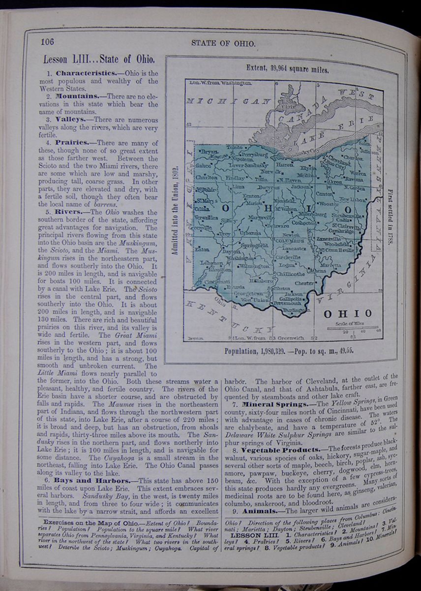 106
STATE OF OHIO.
106
STATE OF OHIO.
Lesson LIII... State of Ohio.
1. Characteristics.—Ohio is the most populous and wealthy of the Western States.
2. Mountains.—There are no elevations in this state which bear the name of mountains.
3. Valleys.—There are numerous valleys along the rivers, which are very fertile.
4. Prairies.—There are many of these, though none of so great extent as those farther west. Between the Scioto and the two Miami rivers, there are some which are low and marshy, producing tall, coarse grass. In other parts, they are elevated and dry, with a fertile soil, though they often bear the local name of barrens.
5. Rivers.—The Ohio washes the southern border of the state, affording great advantages for navigation. The principal rivers flowing from this state into the Ohio basin are the Muskingum, the Scioto, and the Miami. The Muskingum rises in the northeastern part, and flows southerly into the Ohio. It is 200 miles in length, and is navigable for boats 100 miles. It is connected by a canal with Lake Erie. The Scioto rises in the central part, and flows southerly into the Ohio. It is about 200 miles in length, and is navigable 130 miles. There are rich and beautiful prairies on this river, and its valley is wide and fertile. The Great Miami rises in the western part, and flows southerly to the Ohio; it is about 100 miles in length, and has a strong, but smooth and unbroken current. The Little Miami flows nearly parallel to the former, into the Ohio. Both these streams water a pleasant, healthy, and fertile country. The rivers of the Erie basin have a shorter course, and are obstructed by falls and rapids. The Maumee rises in the northeastern part of Indiana, and flows through the northwestern part of this state, into Lake Erie, after a course of 220 miles; it is broad and deep, but has an obstruction, from shoals and rapids, thirty-three miles above its mouth. The Sandusky rises in the northern part, and flows northerly into Lake Erie; it is 100 miles in length, and is navigable for some distance. The Cuyahoga is a small stream in the northeast, falling into Lake Erie. The Ohio Canal passes along its valley to the lake.
6. Bays and Harbors.—This state has above 150 miles of coast upon Lake Erie. This extent embraces several harbors. Sandusky Bay, in the west, is twenty miles in length, and from three to four wide; it communicates with the lake by a narrow strait, and affords an excellent Map of Ohio. OHIO. Extent, 39,964 square miles. Admitted into the Union, 1802. First settled in 1788. Population, 1,980,329.—Pop. to the sq. m., 49.55. harbor. The harbor of Cleveland, at the outlet of the Ohio Canal, and that of Ashtabula, farther east, are frequented by steamboats and other lake craft.
7. Mineral Springs.—The Yellow Springs, in Green county, sixty-four miles north of Cincinnati, have been used with advantage in cases of chronic disease. The waters are chalybeate, and have a temperature of 52°. The Delaware White Sulphur Springs are similar to the sulphur springs of Virginia.
8. Vegetable Products.—The forests produce black-walnut, various species of oaks, hickory, sugar-maple, and several other sorts of maple, beech, birch, poplar, ash, sycamore, pawpaw, buckeye, cherry, dogwood, elm, horn-beam, &c. With the exception of a few cypress-trees, this state produces hardly any evergreens. Many sorts of medicinal roots are to be found here, as ginseng, valerian, columbo, snakeroot, and bloodroot.
9. Animals.—The larger wild animals are considerably
Exercises on the Map of Ohio.—Extent of Ohio? Boundaries? Population? Population to the square mile? What river separates Ohio from Pennsylvania, Virginia, and Kentucky? What river in the northwest part of the state? What two rivers in the southwest? Describe the Scioto; Muskingum; Cuyahoga. Capital of Ohio? Direction to the following places from Columbia: Cincinnati; Marietta; Dayton; Steubenville; Cleveland?
LESSON LIII. 1. Characteristics? 2. Mountains? 3. Valleys? 4. Prairies? 5. Rivers? 6. Bays and Harbors? 7. Mineral springs? 8. Vegetable products? 9. Animals? 10. Minerals?
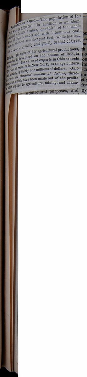 [begin surface 449]
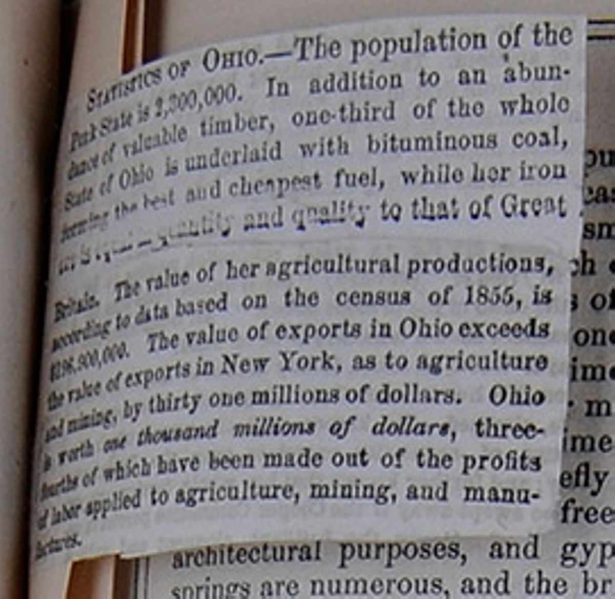
STATISTICS OF OHIO.—The population of the Pork State is 2,300,000. In addition to an abundance of valuable timber, one-third of the whole State of Ohio is underlaid with bituminous coal, forming the best and cheapest fuel, while her iron ore is equal in quantity and quality to that of Great Britain. The value of her agricultural productions, according to the data based on the census of 1855, is $196,900,000. The value of exports in Ohio exceeds the value of exports in New York, as to agriculture and mining, by thirty one millions of dollars. Ohio is worth one thousand millions of dollars, three-fourths of which have been made out of the profits of labor supplied to agriculture, mining, and manufactures.
[begin surface 450]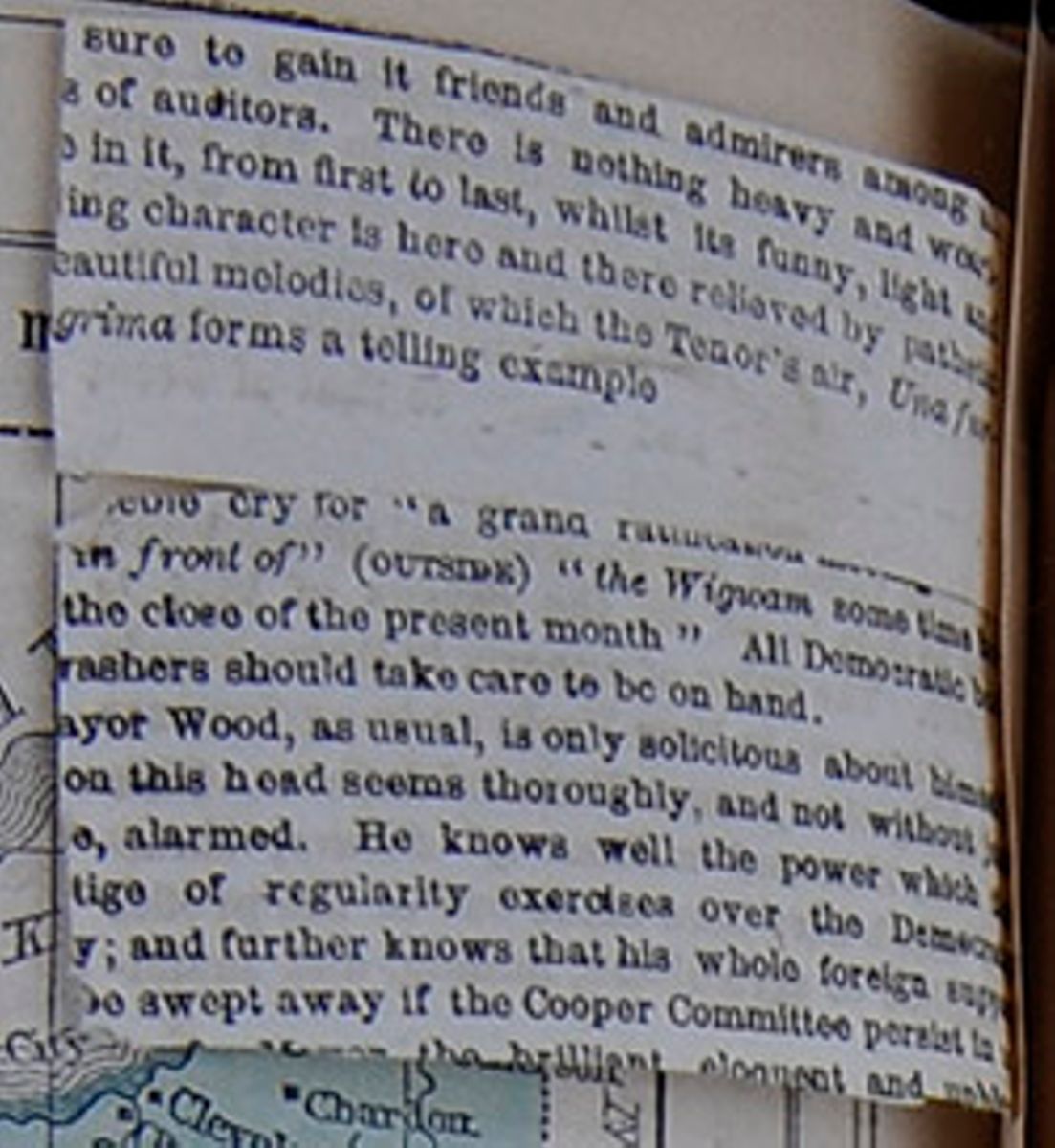
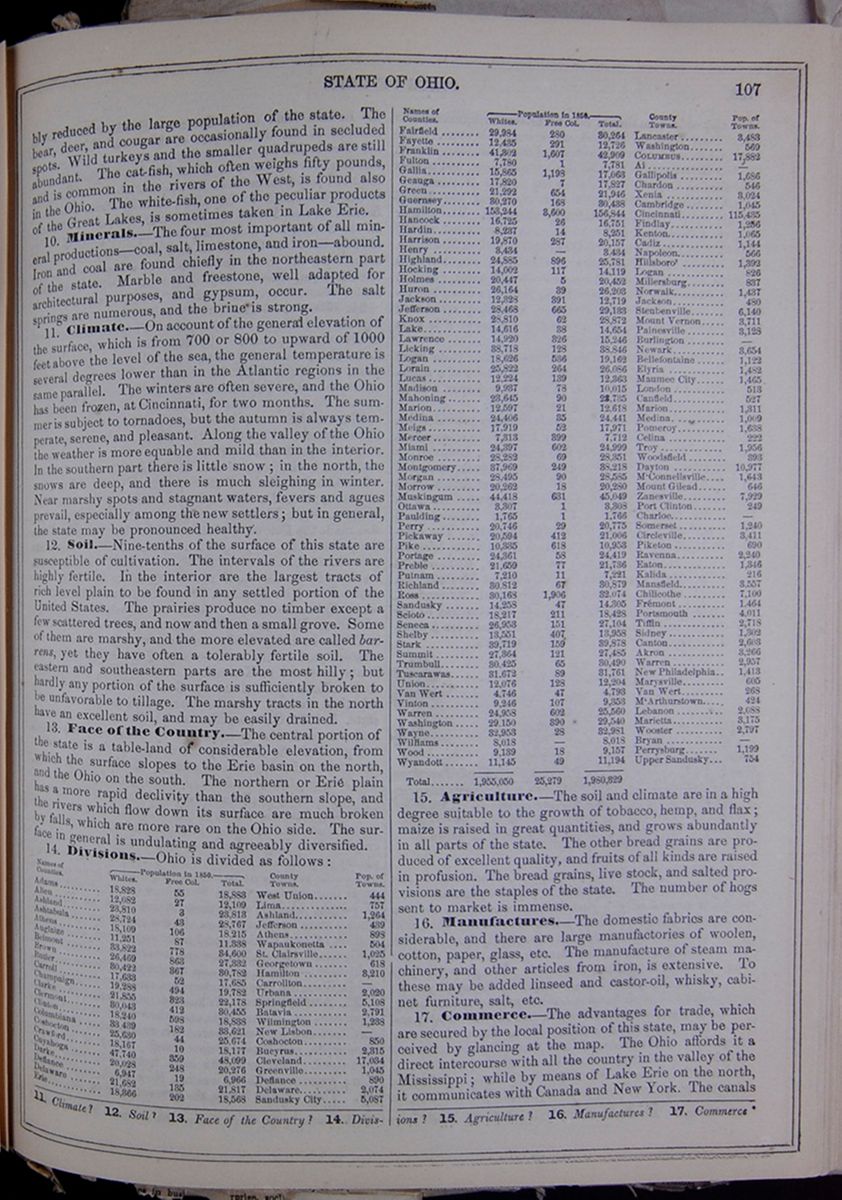
reduced by the large population of the state. The bear, deer, and cougar are occasionally found in secluded spots. Wild turkeys and the smaller quadrupeds are still abundant. The cat-fish, which often weighs fifty pounds, and is common in the rivers of the West, is found also in the Ohio. The white-fish, one of the peculiar products of the Great Lakes, is sometimes taken in Lake Erie.
10. Minerals.—The four most important of all mineral productions—coal, salt, limestone, and iron—abound. Iron and coal are found chiefly in the northeastern part of the state. Marble and freestone, well adapted for architectural purposes, and gypsum, occur. The salt springs are numerous, and the brine is strong.
11. Climate.—On account of the general elevation of the surface, which is from 700 or 800 to upward of 1000 feet above the level of the sea, the general temperature is several degrees lower than in the Atlantic regions in the same parallel. The winters are often severe, and the Ohio has been frozen, at Cincinnati, for two months. The summer is subject to tornadoes, but the autumn is always temperate, serene, and pleasant. Along the valley of the Ohio the weather is more equable and mild than in the interior. In the southern part there is little snow; in the north, the snows are deep, and there is much sleighing in winter. Near marshy spots and stagnant waters, fevers and agues prevail, especially among the new settlers; but in general, the state may be pronounced healthy.
12. Soil.—Nine-tenths of the surface of this state are susceptible of cultivation. The intervals of the rivers are highly fertile. In the interior are the largest tracts of rich level plain to be found in any settled portion of the United States. The prairies produce no timber except a few scattered trees, and now and then a small grove. Some of them are marshy, and the more elevated are called barrens, yet they have often a tolerably fertile soil. The eastern and southeastern parts are the most hilly; but hardly any portion of the surface is sufficiently broken to be unfavorable to tillage. The marshy tracts in the north have an excellent soil, and may be easily drained.
13. Face of the Country.—The central portion of the state is a table-land of considerable elevation, from which the surface slopes to the Erie basin on the north, and the Ohio on the south. The northern or Erie plain has a more rapid declivity than the southern slope, and the rivers which flow down its surface are much broken by falls, which are more rare on the Ohio side. The surface in general is undulating and agreeably diversified.
14. Divisions.—Ohio is divided as follows: This table lists the counties of Ohio with their populations in 1850 and includes a column for the major town in each county and the town's population. The county population is divided into the following categories: White, Free Colored, and Total.
15. Agriculture.—The soil and climate are in a high degree suitable to the growth of tobacco, hemp, and flax; maize is raised in great quantities, and grows abundantly in all parts of the state. The other bread grains are produced of excellent quality, and fruits of all kinds are raised in profusion. The bread grains, live stock, and salted provisions are the staples of the state. The number of hogs sent to market is immense.
16. Manufactures.—The domestic fabrics are considerable, and there are large manufactories of woolen, cotton, paper, glass, etc. The manufacture of steam machinery, and other articles from iron, is extensive. To these may be added linseed and castor-oil, whisky, cabinet furniture, salt, etc.
17. Commerce.—The advantages for trade, which are secured by the local position of this state, may be perceived by glancing at the map. The Ohio affords it a direct intercourse with all the country in the valley of the Mississippi; while by means of Lake Erie on the north, it communicates with Canada and New York. The canals
11. Climate? 12. Soil? 13. Face of the Country? 14. Divisions? 15. Agriculture? 16. Manufactures? 17. Commerce
[begin surface 452] 108
STATE OF OHIO.
108
STATE OF OHIO.
and railroads complete a line of internal communication from New York to New Orleans through this state. Ohio enjoys the most active commerce of all the Western States.
18. Mining.—Coal and iron are abundant, and so near the surface as hardly to require the process of mining.
19. Canals.—The Ohio and Erie and the Miami canals have been constructed by the state. The former begins at Cleveland, and terminates at Portsmouth on the Ohio; length, including several navigable feeders, 334 miles. The Miami Canal, beginning at Cincinnati, runs north to Toledo, about 250 miles. There are other important canals.
20. Railroads.—Magnificent railroads cross and recross the state in every direction, furnishing rapid and easy communication, and connecting on every side with the great exterior lines of travel.
21. Inhabitants.—The settlers of this state were mainly from New England, and society is here of a somewhat New England character. There is, however, a large foreign population, principally in the cities.
22. Education.—Education is liberally provided for. In 1850 Ohio had 11,661 primary and public schools, attended by 484,153 scholars; 206 academies, attended by 15,052 pupils; and 26 colleges and universities, attended by 3,621 students. The Ohio University, at Athens, was founded in 1804; the Miami University, at Oxford, in 1809; the Ohio Wesleyan University, at Delaware, in 1844; and the Cleveland University, in 1852. The principal colleges are—Franklin at New Athens, the Western Reserve at Hudson, Kenyon at Gambier, Granville at Granville, Oberlin at Oberlin, Marietta at Marietta, St. Xavier at Cincinnati, and Wittenburg at Springfield. Theological and medical departments are attached to the universities and principal colleges; and there are a number of separate medical and divinity schools.
View of Cincinnati. An image of boats with the city of Cincinnati in the background, and men with a pile of timber in the foreground.23. Chief Towns.—The city of Cincinnati is the principal town in the state, and, in point of population and business, second only to New Orleans among the western cities. It is situated on the north bank of the Ohio, 500 miles west of Washington. It it regularly laid out with broad, straight streets, intersecting each other at right angles, and is, in general, well built. The growth of this city has, perhaps, never been surpassed in rapidity. Its commerce and manufactures are extensive and increasing. Numerous steamboats have been built at Cincinnati; and river and canal craft crowd its waters. Its trade is very extensive. The schools are numerous and respectable, and considerable printing is done here. Fulton, a suburb of Cincinnati, is a large manufacturing village. Columbus, the seat of government, is in the center of the state, on the eastern bank of the Scioto. Steubenville is finely situated in the eastern part of the state. Lower down the river is Marietta, in a delightful country. Portsmouth stands above the junction of the Ohio and Scioto, and has acquired importance from its position at the termination of the Ohio Canal. In the north, on Lake Erie, Cleveland, Sandusky, and Toledo are important places. Chilicothe, on the Scioto, is a flourishing manufacturing town. Circleville, between Columbus and Chilicothe, derives its name from the numerous remains of ancient works, in a circular form, which occupied its site. Dayton, at which center numerous railroads, has large manufactures.
24. History.—The territory belonging to Ohio, including that of Indiana, was claimed by Virginia as embraced in her original patent. The northwestern portion, along Lake Erie, containing what was called the Western Reserve, was claimed by Connecticut. Virginia ceded her territory to the United States in 1787, reserving a small portion for the payment of some state debts. The Connecticut claims were finally extinguished in 1800. The French preferred a title to this whole territory, but they made no permanent settlements in Ohio. The country remained in the possession of the Indians till April 7, 1788, when General Rufus Putnam, with a party from New England, planted a little colony at the mouth of the Muskingum, where Marietta now stands. Another settlement was made the following year, at Columbia, six miles above the present city of Cincinnati. Some French emigrants established themselves at Gallipolis in 1791. Settlements were made at Cleveland and Conneaut in 1796, by emigrants from New England. The country was much disturbed by Indian hostilities. After the disastrous campaign of General Harmar, in 1790, and that of General St. Clair in 1791—he being finally defeated, with great loss, in the western part of the state—many of the affrighted inhabitants removed to Kentucky. But in 1795, the savages were effectually subdued by General Wayne, and from this time we may date the unexampled prosperity of the state. In 1781, Ohio, together with Indiana, etc., was placed under a territorial government by Congress; the whole being called the Territory Northwest of the Ohio. The first territorial legislature met at Cincinnati, in 1799. For a long period the fame of this region for richness of soil and amenity of climate drew multitudes of adventurers from the Atlantic country. In 1802, Ohio was erected into a state and admitted into the Union. In 1816, the crops of New England were cut off, and the most extraordinary impulse was given to emigration. Not only families, but whole villages departed for this land of promise. The great thoroughfares to the west were crowded with troops of people, loaded with their entire stock of furniture. Thus a state but sixty years old has grown up with a population of two millions, and a metropolis of 115,000 inhabitants. Here, also, are the marks of civilization and refinement—canals, railroads, telegraphs, schools, colleges, public libraries, lyceums, churches, and the printing-press!
25. Antiquities.—When this state was first visited, numerous artificial mounds, and other works appearing like fortifications, were discovered where Marietta, Chilicothe, Circleville, and Newark now stand. Most of these are destroyed. Similar works have been discovered in the more western states, in western New York, and Wisconsin. They existed before the present race of Indians.
18. Mining? 19. Canals? 20. Railroads? 21. Inhabitants? 22. Education? 23. Chief Towns? 24. History? 25. Antiquities?
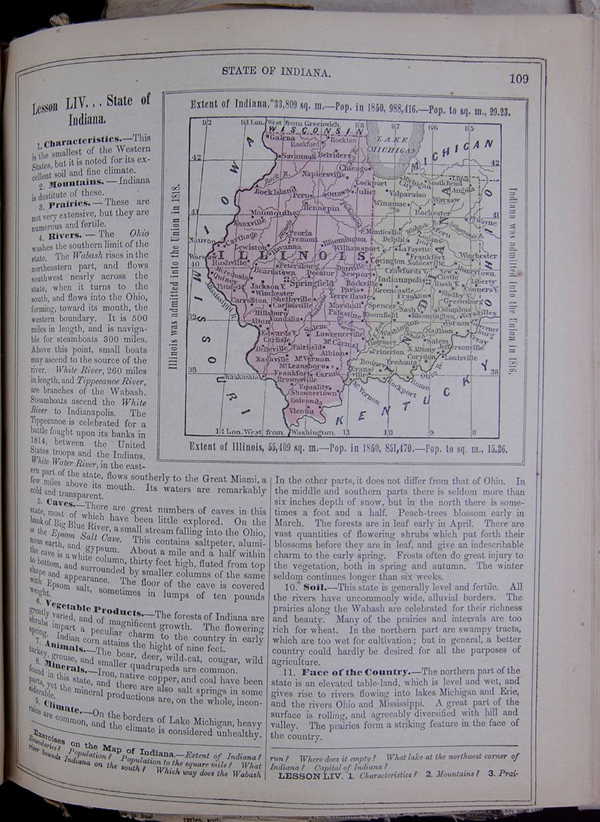 STATE OF INDIANA.
109
STATE OF INDIANA.
109
Lesson LIV... State of Indiana.
1. Characteristics.—This is the smallest of the Western States, but it is noted for its excellent soil and fine climate.
2. Mountains.—Indiana is destitute of these.
3. Prairies.—These are not very extensive, but they are numerous and fertile.
4. Rivers.—The Ohio washes the southern limit of the state. The Wabash rises in the northeastern part, and flows southwest nearly across the state, when it turns to the south, and flows into the Ohio, forming, toward its mouth, the western boundary. It is 500 miles in length, and is navigable for steamboats 300 miles. Above this point, small boats may ascend to the source of the river. White River, 260 miles in length, and Tippecanoe River, are branches of the Wabash. Steamboats ascend the White River to Indianapolis. The Tippecanoe is celebrated for a battle fought upon its banks in 1814, between the United States troops and the Indians. White Water River, in the eastern part of the state, flows southerly to the Great Miami, a few miles above its mouth. Its waters are remarkably cold and transparent.
5. Caves.—There are great numbers of caves in this state, most of which have been little explored. On the bank of Big Blue River, a small stream falling into the Ohio, is the Epsom Salt Cave. This contains saltpeter, aluminous earth, and gypsum. About a mile and a half within the cave is a white column, thirty feet high, fluted from top to bottom, and surrounded by smaller columns of the same shape and appearance. The floor of the cave is covered with Epsom salt, sometimes in lumps of ten pounds weight.
6. Vegetable Products.—The forests of Indiana are greatly varied, and of magnificent growth. The flowering shrubs impart a peculiar charm to the country in early spring. Indian corn attains the hight of nine feet.
7. Animals.—The bear, deer, wild-cat, cougar, wild turkey, grouse, and smaller quadrupeds are common.
8. Minerals.—Iron, native copper, and coal have been found in this state, and there are also salt springs in some parts, yet the mineral productions are, on the whole, inconsiderable.
9. Climate.—On the borders of Lake Michigan, heavy rains are common, and the climate is considered unhealthy. Map of Illinois and Indiana. Extent of Indiana, 33,809 sq. m.—Pop. in 1850, 988,416.—Pop. to sq. m., 29.23. Illinois was admitted into the Union in 1818. Indiana was admitted into the Union in 1816. Extent of Illinois, 55,409 sq. m.—Pop. in 1850, 851,470.—Pop. to sq. m., 15.36, In the other parts it does not differ from that of Ohio. In the middle and southern parts there is seldom more than six inches depth of snow, but in the north there is sometimes a foot and a half. Peach-trees blossom early in March. The forests are in leaf early in April. There are vast quantities of flowering shrubs which put forth their blossoms before they are in leaf, and give an indescribable charm to the early spring. Frosts often do great injury to the vegetation, both in spring and autumn. The winter seldom continues longer than six weeks.
10. Soil.—This state is generally level and fertile. All the rivers have uncommonly wide, alluvial borders. The prairies along the Wabash are celebrated for their richness and beauty. Many of the prairies and intervals are too rich for wheat. In the northern part are swampy tracts, which are too wet for cultivation; but in general, a better country could hardly be desired for all the purposes of agriculture.
11. Face of the Country.—The northern part of the state is an elevated table-land, which is level and wet, and gives rise to rivers flowing into lakes Michigan and Erie, and the rivers Ohio and Mississippi. A great part of the surface is rolling, and agreeably diversified with hill and valley. The prairies form a striking feature in the face of the country.
Exercises on the Map of Indiana.—Extent of Indiana? Boundaries? Population? Population to the square mile? What river bounds Indiana on the south? Which way does the Wabash run? Where does it empty? What lake at the northwest corner of Indiana? Capital of Indiana?
LESSON LIV. 1. Characteristics? 2. Mountains? 3. Prairies?
[begin surface 454] 110
STATE OF INDIANA.
110
STATE OF INDIANA.
12. Divisions.—Indiana is divided as follows: This table lists the counties of Indiana with their populations in 1850 and includes a column for the major town in each county and the town's population. The county population is divided into the following categories: White, Free Colored, and Total.
13. Agriculture.—The articles of culture are similar to those of Ohio. The vineyards at Vevay are nourishing and profitable. The Cape or blue grape, and the Madeira grape, have been principally cultivated. Recently, the American grapes have grown into esteem: they are thought to produce better wine, and to be more easy of culture.
14. Manufactures.—These are rapidly growing up in variety and importance. Machinery is largely manufactured, and there are many other large interests in operation.
15. Commerce.—The exports are chiefly agricultural products; and the imports, groceries, dry-goods, and other merchandise.
16. Canals and Railroads.—These have been undertaken on a large scale, and numerous useful and important works of the kind are in operation.
17. Education.—In 1850 Indiana had 4822 public schools, attended by 161,500 scholars; 131 academies, attended by 6185 pupils, and 11 colleges, attended by 1069 students. The principal collegiate institutions are the State University at Bloomington, the Indiana Ashbury University at Greencastle, the Hanover College at Hanover, the Wabash College at Crawfordsville, and there are several professional schools in the state.
18. Chief Towns.—Indianapolis, in the center of the state, on the White River, is the seat of government. Vincennes is an old French town, and is pleasantly situated in a delightful region, 150 miles from the mouth of the Wabash. New Albany, just below Louisville, is the largest town in the state, and has already become an important commercial and manufacturing place. Madison ranks third in population. Vevay, chiefly settled by Swiss, who have extensive vineyards; and New Harmony, founded by a German society, who held their property in common. In 1824, it was bought by Robert Owen, of Lanark, Scotland, who wished to introduce into practice here his new principles of the social system—perfect equality, and the abolition of the obligations of marriage. His scheme failed, and his followers were dispersed; but the village is now a flourishing place. Fort Wayne, on the Maumee, Lafayette and Logansport, on the upper part of the Wabash, and Lawrenceburg, on the Ohio, are thriving towns.
19. History—Annals.—This territory, as well as that of Illinois, was explored by Marquette, the French traveler, in 1673, and was therefore claimed by France. It was subsequently claimed also by Virginia, and was included in her deed of cession to the United States, in 1787. It continued unoccupied till the early part of the seventeenth century, when the French, in pursuance of their plan for extending settlements southward to the Lower Mississippi, made settlements there. The first was at Vincennes, in 1730. At the peace between England and France, in 1763, this country came into the possession of the English, who however made no attempt to settle it for a long period. During the Revolutionary war, the people of Vincennes took part with the Americans, in consequence of which, after the struggle, our government made them a grant of land in the vicinity.
20. Indian Wars, etc.—In 1787, the United Stales took possession of Vincennes, and erected a fort on the opposite bank of the river, as a defense against the savages, who were now formidable from their numbers, and dangerous from their hostility. At this period, the inhabitants
4. Rivers? 5. Caves? 6. Vegetable products? 7. Animals? 8. Minerals? 9. Climate? 10. Soil? 11. Face of the country? 12. Divisions? 13. Agriculture?14. Manufactures? 15. Commerce? 16. Canals and railroads? 17. Education?
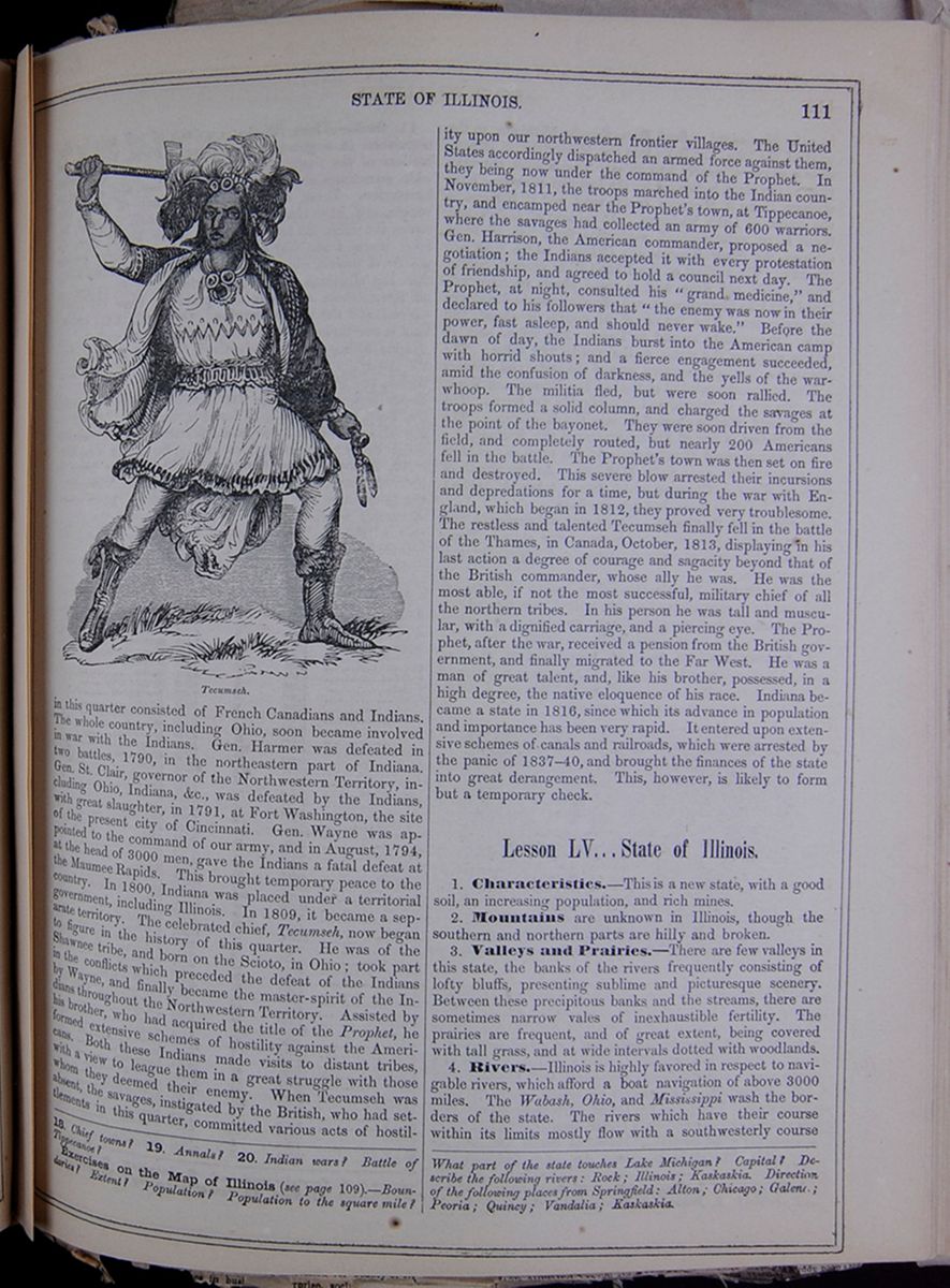
in this quarter consisted of French Canadians and Indians. The whole country, including Ohio, soon became involved in war with the Indians. Gen. Harmer was defeated in two battles, 1790, in the northeastern part of Indiana. Gen. St. Clair, governor of the Northwestern Territory, including Ohio, Indiana, &c., was defeated by the Indians, with great slaughter, in 1791, at Fort Washington, the site of the present city of Cincinnati. Gen. Wayne was appointed to the command of our army, and in August, 1794, at the head of 3000 men, gave the Indians a fatal defeat at the Maumee Rapids. This brought temporary peace to the country. In 1800, Indiana was placed under a territorial government, including Illinois. In 1809, it became a separate territory. The celebrated chief, Tecumseh, now began to figure in the history of this quarter. He was of the Shawnee tribe, and born on the Scioto, in Ohio; took part in the conflicts which preceded the defeat of the Indians by Wayne, and finally became the master-spirit of the Indians throughout the Northwestern Territory. Assisted by his brother, who had acquired the title of the Prophet, he formed extensive schemes of hostility against the Americans. Both these Indians made visits to distant tribes, with a view to league them in a great struggle with those whom they deemed their enemy. When Tecumseh was absent, the savages, instigated by the British, who had settlements in this quarter, committed various acts of hostility upon our northwestern frontier villages. The United States accordingly dispatched an armed force against them, they being now under the command of the Prophet. In November, 1811, the troops marched into the Indian country, and encamped near the Prophet's town, at Tippecanoe, where the savages had collected an army of 600 warriors. Gen. Harrison, the American commander, proposed a negotiation; the Indians accepted it with every protestation of friendship, and agreed to hold a council next day. The Prophet, at night, consulted his "grand medicine," and declared to his followers that "the enemy was now in their power, fast asleep, and should never wake." Before the dawn of day, the Indians burst into the American camp with horrid shouts; and a fierce engagement succeeded, amid the confusion of darkness, and the yells of the war-whoop. The militia fled, but were soon rallied. The troops formed a solid column, and charged the savages at the point of the bayonet. They were soon driven from the field, and completely routed, but nearly 200 Americans fell in the battle. The Prophet's town was then set on fire and destroyed. This severe blow arrested their incursions and depredations for a time, but during the war with England, which began in 1812, they proved very troublesome. The restless and talented Tecumseh finally fell in the battle of the Thames, in Canada, October, 1813, displaying in his last action a degree of courage and sagacity beyond that of the British commander, whose ally he was. He was the most able, if not the most successful, military chief of all the northern tribes. In his person he was tall and muscular, with a dignified carriage, and a piercing eye. The Prophet, after the war, received a pension from the British government, and finally migrated to the Far West. He was a man of great talent, and, like his brother, possessed, in a high degree, the native eloquence of his race. Indiana became a state in 1816, since which its advance in population and importance has been very rapid. It entered upon extensive schemes of canals and railroads, which were arrested by the panic of 1837–40, and brought the finances of the state into great derangement. This, however, is likely to form but a temporary check.
Lesson LV... State of Illinois.
1. Characteristics.—This is a new state, with a good soil, an increasing population, and rich mines.
2. Mountains are unknown in Illinois, though the southern and northern parts are hilly and broken.
3. Valleys and Prairies.—There are few valleys in this state, the banks of the rivers frequently consisting of lofty bluffs, presenting sublime and picturesque scenery. Between these precipitous banks and the streams, there are sometimes narrow vales of inexhaustible fertility. The prairies are frequent, and of great extent, being covered with tall grass, and at wide intervals dotted with woodlands.
4. Rivers.—Illinois is highly favored in respect to navigable rivers, which afford a boat navigation of above 3000 miles. The Wabash, Ohio, and Mississippi wash the borders of the state. The rivers which have their course within its limits mostly flow with a southwesterly course
18. Chief towns? 19. Annals? 20. Indian wars? Battle of Tippecanoe?
Exercises on the Map of Illinois (see page 109).—Boundaries? Extent? Population? Population to the square mile? What part of the state touches Lake Michigan? Capital? Describe the following rivers: Rock; Illinois; Kaskaskia. Direction of the following places from Springfield: Alton; Chicago; Galena; Peoria; Quincy; Vandalia; Kaskaskia.
[begin surface 456]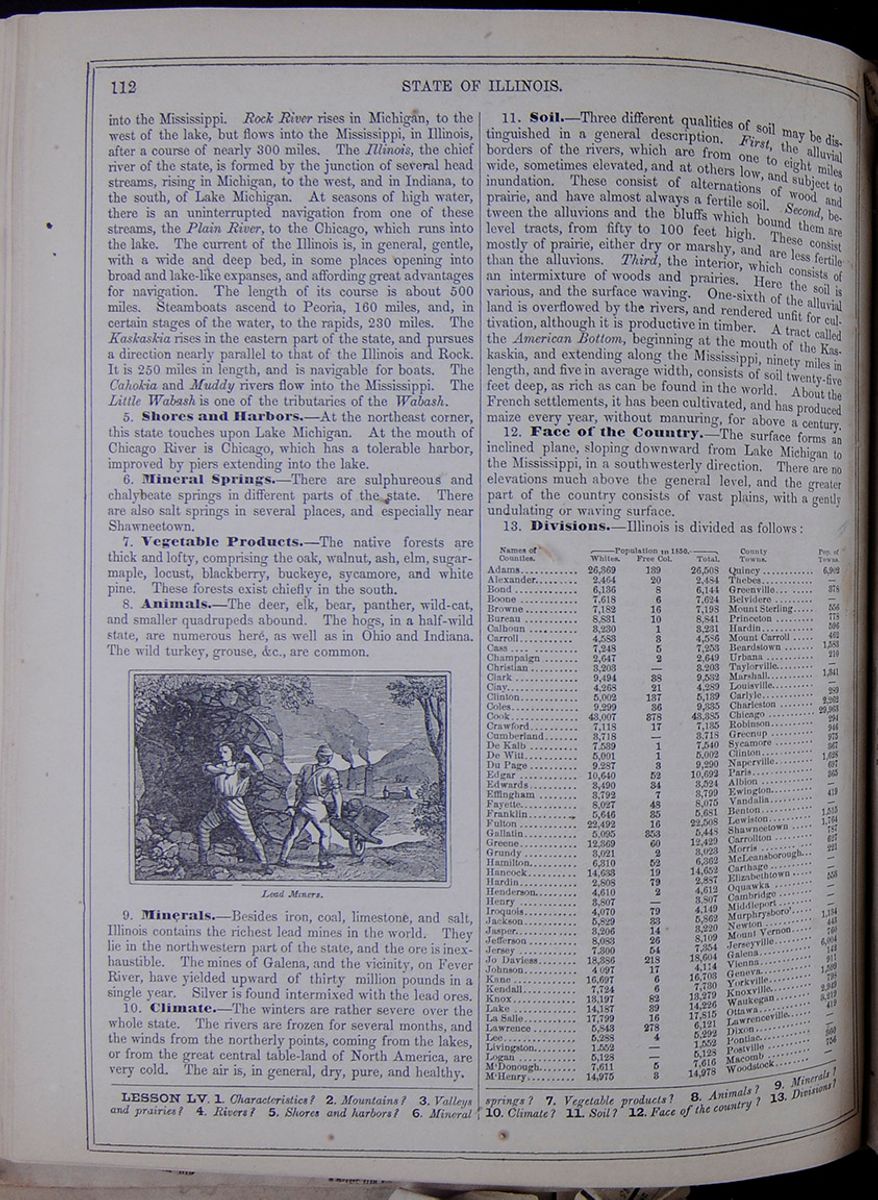 112
STATE OF ILLINOIS.
112
STATE OF ILLINOIS.
into the Mississippi. Rock River rises in Michigan, to the west of the lake, but flows into the Mississippi, in Illinois, after a course of nearly 300 miles. The Illinois, the chief river of the state, is formed by the junction of several head streams, rising in Michigan, to the west, and in Indiana, to the south, of Lake Michigan. At seasons of high water, there is an uninterrupted navigation from one of these streams, the Plain River, to the Chicago, which runs into the lake. The current of the Illinois is, in general, gentle, with a wide and deep bed, in some places opening into broad and lake-like expanses, and affording great advantages for navigation. The length of its course is about 500 miles. Steamboats ascend to Peoria, 160 miles, and, in certain stages of the water, to the rapids, 230 miles. The Kaskaskia rises in the eastern part of the state, and pursues a direction nearly parallel to that of the Illinois and Rock. It is 250 miles in length, and is navigable for boats. The Cahokia and Muddy rivers flow into the Mississippi. The Little Wabash is one of the tributaries of the Wabash.
5. Shores and Harbors.—At the northeast corner, this state touches upon Lake Michigan. At the mouth of Chicago River is Chicago, which has a tolerable harbor, improved by piers extending into the lake.
6. Mineral Springs.—There are sulphureous and chalybeate springs in different parts of the state. There are also salt springs in several places, and especially near Shawneetown.
7. Vegetable Products.—The native forests are thick and lofty, comprising the oak, walnut, ash, elm, sugar- maple, locust, blackberry, buckeye, sycamore, and white pine. These forests exist chiefly in the south.
8. Animals.—The deer, elk, bear, panther, wild-cat, and smaller quadrupeds abound. The hogs, in a half-wild state, are numerous here, as well as in Ohio and Indiana. The wild turkey, grouse, &c., are common. Lead Miners.
9. Minerals.—Besides iron, coal, limestone, and salt, Illinois contains the richest lead mines in the world. They lie in the northwestern part of the state, and the ore is inexhaustible. The mines of Galena, and the vicinity, on Fever River, have yielded upward of thirty million pounds in a single year. Silver is found intermixed with the lead ores.
10. Climate.—The winters are rather severe over the whole state. The rivers are frozen for several months, and the winds from the northerly points, coming from the lakes, or from the great central table-land of North America, are very cold. The air is, in general, dry, pure, and healthy.
11. Soil.—Three different qualities of soil may be distinguished in a general description. First, the alluvial borders of the rivers, which are from one to eight miles wide, sometimes elevated, and at others low, and subject to inundation. These consist of alternations of wood and prairie, and have almost always a fertile soil. Second, between the alluvions and the bluffs which bound them are level tracts, from fifty to 100 feet high. These consist mostly of prairie, either dry or marshy, and are less fertile than the alluvions. Third, the interior, which consists of an intermixture of woods and prairies. Here the soil is various, and the surface waving. One-sixth of the alluvial land is overflowed by the rivers, and rendered unfit for cultivation, although it is productive in timber. A tract called the American Bottom, beginning at the mouth of the Kaskaskia, and extending along the Mississippi, ninety miles in length, and five in average width, consists of soil twenty-five feet deep, as rich as can be found in the world. About the French settlements, it has been cultivated, and has produced maize every year, without manuring, for above a century.
12. Face of the Country.—The surface forms an inclined plane, sloping downward from Lake Michigan to the Mississippi, in a southwesterly direction. There are no elevations much above the general level, and the greater part of the country consists of vast plains, with a gently undulating or waving surface.
13. Divisions.—Illinois is divided as follows: This table lists the counties of Illinois with their populations in 1850 and includes a column for the major town in each county and the town's population. The county population is divided into the following categories: White, Free Colored, and Total.
LESSON LV. 1. Characteristics? 2. Mountains? 3. Valleys and prairies? 4. Rivers? 5. Shores and harbors? 6. Mineral springs? 7. Vegetable products? 8. Animals? 9. Minerals? 10. Climate? 11. Soil? 12. Face of the country? 13. Divisions?
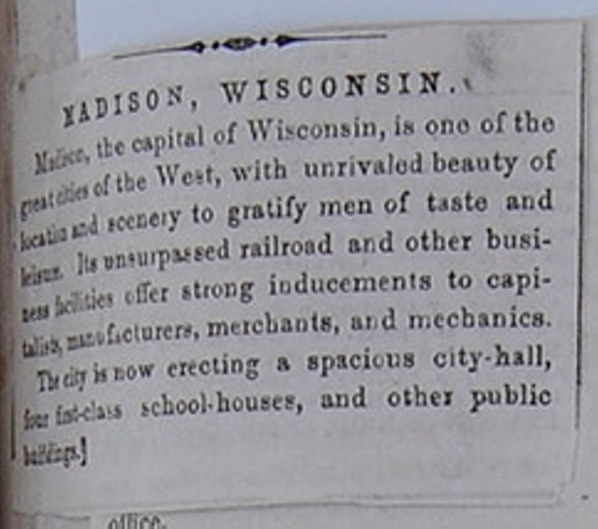
MADISON, WISCONSIN.
Madison, the capital of Wisconsin, is one of the great cities of the West, with unrivaled beauty of location and scenery to gratify men of taste and leisure. Its unsurpassed railroad and other business facilities offer strong inducements to capitalists, manufacturers, merchants, and mechanics.
The city is now erecting a spacious city-hall, four first-class school-houses, and other public buildings.
[begin surface 459]
The State Legislature, at its last session, made a large appropriation for the enlargement of the State House, the erection of a State Lunatic Asylum, and to complete the State University Buildings on the magnificent plan heretofore adopted. Congress has made an appropriation for the erection of a United States Court-House and Post-Office; and made the latter a distributing office.
RAILROADS.—Four separate railroads will be completed to this place the coming year, and will erect expensive buildings for their convenience and business.
LOCAL IMPROVEMENTS.—In addition to all these, there are now being erected churches, stores, private residences, etc., most of which are built of the beautiful cream-colored stone from the Madison quarries.
These improvements will give employment to hundreds of mechanics and laborers, at a point where they will find a healthy location for a home, educational, and other advantages unsurpassed.
Not a competing city to limit its growth for forty miles in any direction, and in the center of the most fertile country in the Union, which is being rapidly developed.—Wisconsin Journal.
[begin surface 461]
[cutaway]ITS CAPITAL.—The people of [cutaway]"Badger State" observe with pride and satisfaction their [cutaway]iful Capital awakening to a sense of the great advantages [cutaway]th which it is endowed by nature, and to the activities of a [cutaway]season. The Legislature, just adjourned, has appropriated [cutaway]00,000 for the present year to the enlargement of the Capitol building, has authorized the Regents of the University to erect their main edifice at a cost of $40,000; Congress has just appropriated $50,000 to build a United States Court-House and Post Office (making this a distribution office), and the completion of the churches, model school buildings, new City Hall, &c., with the cost of depots and railroads in the immediate vicinity, will bring up the outlay for public purposes in the year 1857 very nearly to $1,000,000.
Already the sound of the builder's hammer is heard, workmen are in great demand, the city avenues are lined with heavily loaded teams, bringing in materials for construction, or the rich produce of its agricultural surroundings. The stranger, walking the paved and gas-lighted streets of Madison, learns with astonishment that twenty years ago the first pioneer's cabin was built in these openings, and wonders if the thousands who will this Spring be seeking a new home from which they can overlook the field of their children's future activities—which shall combine present business advantages with the religious, educational and social privileges they are reluctant to leave—are aware of the rank this place must inevitably take among the prosperous and beautiful cities of the West.
Travelers have borne abundant testimony to its exceeding beauty of situation, the varied delights it offers to the lovers of nature and out-door amusements, its excellent hotels, and such matters of interest as are revealed at a passing glance; invalids have gratefully witnessed to the salubrity of the "Four Lake Region," pure, dry atmosphere and equal temperature; but few are aware now much it offers to the seeker of a permanent home, to Farmers, Capitalists, Merchants, Manufacturers, Mechanics and Artisans of all kinds; to Professional men, Politicians, men with families to educate, and to those who would return from active life to watch the progress of the age in the quietude of a rural residence.
Madison has its Female Seminary, Academy, Mercantile College, and State University, the latter amply endowed with an annual income of nearly $30,000, derived from interest upon invested funds, and offering a thorough education in Literature, Theoretical and Applied Science, free of cost.
Nearly every denomination of Christians are here represented in an able Ministry and flourishing Church. It supports three daily, six weekly, and two monthly Papers and Magazines, provides through its Institute for Popular Lectures; and, last, but not least, it is the seat of the Historical Society and all the principal Libraries of the State.
All the comforts of life are abundant and cheap, nature having supplied a healthful, bracing air, the purest water and ice, and an inexhaustible supply of the finest building stone, and the different railroads conveying to it the produce of a rich country, and the various luxuries of the world.
Its elevated position and diversified surface give the freest possible scope for the development of individual taste in architecture and landscape-gardening, for rural homes, with incomparable views of lake, woodland and prairie, within easy distances of the centers of business and trade, while the remoter environs afford delightful localities for small market-farms and gardens, the products of which will always command remunerative prices in town.
The rapid growth and great future prosperity of Madison is certain. Situated half way between Lake Michigan and the Mississippi, the converging point of four great lines of railroad, the "Milwaukee and Mississippi," "Milwaukee, Watertown and Madison," East and West, connecting the Lakes with the Mississippi River; the La Crosse and Land Grant Roads running from Madison to Lake St. Croix and Lake Superior, Northward and Westward. Of twenty-five different wagon roads, of seventeen mall and stage routes, there is no point in the State so readily accessible, while by Telegraph it is in hourly connection with all parts of the Union and Canada. The completion of the Watertown and Madison Railroad will bring near the great timbered regions of the State. Iron from Dodge County, coal from Ohio and Illinois, can then be afforded at a reduction from the present prices of from thirty to fifty per cent.
Already the most populous city in the West, these rapidly accumulating sources of prosperity must inevitable develop in it an immense amount of mechanical, manufacturing and business enterprise. During the next two or three years the increase of warehouses, machine shops, depots, &c., must become very extensive. No point of competition exists within eighty miles, and the country of which it is the geographical center, nearly as large as Rhode Island, contains 850,000 acress of arable land (equal to the support of half a million souls), which is not held by spectators, but by residents, who are willing to sell on easy terms to actual settlers.
Madison affords great advantages to capitalists, the laws allowing 12 per cent as legal interest, and constant opportunities occurring for loaning money on good security, at large profits, to mechanics, manufacturers and agriculturists, who are safely and prosperously engaged in developing and increasing the resources of the West. Also to persons desiring correct information respecting investments in School or Government Lands in Wisconsin, Minnesota or Iowa, or in Railroads, Bank Stocks, Mortgages, &c., in City, County or State. Great inducements are offered to farmers in the excellence and cheapness of the neighboring lands, and the certainty of a ready profitable market.
Madison has hitherto doubled its population, upon an average once in two and a half years, and even allowing its future growth [covered]o be at a slower rate it will amount to 20,000 in 1860, and to [covered]etween 30,000 and 40,000 in 1885. The county seat of Dan County the capital of Wisconsin, unrivalled for beauty of sit[cutaway]es in busi[cutaway]rprise, soci[cutaway]
[begin surface 463]
14. Agriculture.—The chief agricultural productions are maize, wheat, potatoes, hemp, flax, and tobacco. The cultivation of the castor-oil bean has been introduced, and considerable quantities of oil are made. Thousands of swine are raised without expense. The system of agriculture is, in general, rather rude and unskilful.
15. Manufactures.—There are numerous iron foundries, several cotton manufactories, and numerous steam flour and saw-mills. Large quantities of flour are made and exported. The domestic manufactures are considerable, and manufactures, generally, are increasing. The manufacture of railroad cars is carried on in Chicago.
16. Commerce.—Chicago, on Lake Michigan; Alton, on the Mississippi; and Galena, on Fever River, are the chief commercial places. The first is the most flourishing port west of Buffalo. Other places on the rivers and Illinois Canal have also considerable commerce; and the internal trade of the state is extensive.
17. Lumbering.—This is carried on to some extent upon the lake, and on the rivers.
18. Mining.—The operations in mining for lead are very extensive, especially at Galena and the vicinity.
19. Canals and Railroads.—This state has an extensive system of railroads, crossing and re-crossing, and connecting with the lines of the neighboring states. A canal connects Chicago and Peru, and furnishes, by way of the Illinois River, communication with the Mississippi.
20. Inhabitants.—This state has been mostly settled by emigrants from the other states, though many persons from Ireland, Germany, and other parts of the continent, have more recently established themselves here.
21. Education.—In 1850 Illinois had 4050 public schools, with 4252 teachers, and 125,790 scholars; 81 academies and other schools, with 154 teachers, and 4179 pupils; and 6 colleges, with 35 teachers and 442 students. Illinois College, at Jacksonville, was founded in 1829. Chicago, Alton, Lebanon, and Galesbury are also the seats of colleges.
22. Chief Towns.—There is but one large town in this new but growing state. Springfield is the capital. Kaskaskia, on the river of the same name, is an old French town. While the French held possession of the country, it was populous, and the seat of government, and contained a college of Jesuits. After the war of the Revolution it declined, but lately it has begun to revive. Cahokia is another ancient French settlement on the Mississippi. It is nearly as old as Kaskaskia. Belleville, in the same neighborhood, is a new and flourishing town. Shawneetown, on the Ohio, is the largest place in the state, upon the river. Galena, in the northwest, on Fever River, is the center of the lead district. Alton, on the Mississippi, and Chicago, on Lake Michigan, are favorably situated for trade. The latter is an important place. It extends along the lake shore for a mile, being sufficiently elevated to escape ordinary floods. It has an artificial harbor, which is thronged with steamboats and other vessels.
23. History.—This country was explored by Marquette, in 1673. In 1720, the French, from Canada, made settlements at Kaskaskia and Cahokia, where their descendants are still found, though these establishments did not become politically important. At the treaty of Paris, in 1763, this country came into the possession of Great Britain. This state formed a part of the region which, in 1789, was placed under a territorial government, with the title of the Western Territory. In 1800, that part comprising Indiana and Illinois was made a distinct territory. In 1809, Illinois was made a separate territory, and in 1818 it was admitted into the Union as an independent state.
24. Indian War.—In 1832, the frontiers of the United States experienced the ravages of an Indian war, in which Black Hawk, a warrior of the Sacs and Foxes, was leader. It commenced in a dispute about a hive of wild bees, but soon spread terror among the settlers for hundreds of miles. The savages assembled their warriors, and the governor of Illinois called out a brigade of militia, which joined the American forces under Gen. Atkinson, amounting, in all, to 3000 men. Meanwhile, the Indians ravaged the mining districts of Michigan, and defeated some small bodies of American troops. Finding the American army advancing upon him, Black Hawk retreated toward the Mississippi. At last, in July, 1832, he was attacked by an advanced guard of the Americans, as he was about to cross the Wisconsin, forty miles from Fort Winnebago, and his army totally defeated. He escaped, but, after a time, he gave himself up. He was kindly treated, and was taken to Washington, where he had an interview with President Jackson, April, 1833. In 1837, he again visited the Atlantic states, in company with the celebrated Keokuk, Red Jacket, and other chiefs. They were received with ceremony at New York, Boston, and other places, and seemed amazed at the power of the whites. From this time, Black Hawk was friendly to the whites, and died at his residence on the Des Moines, October 3, 1838.
14. Agriculture? 15. Manufactures? 16. Commerce? 17. Lumbering? 18. Mining? 19. Canals and railroads? 20. Inhabitants? 21. Education? 22. Chief towns? 23. History? When was Illinois admitted into the Union? 24. Indian War?
15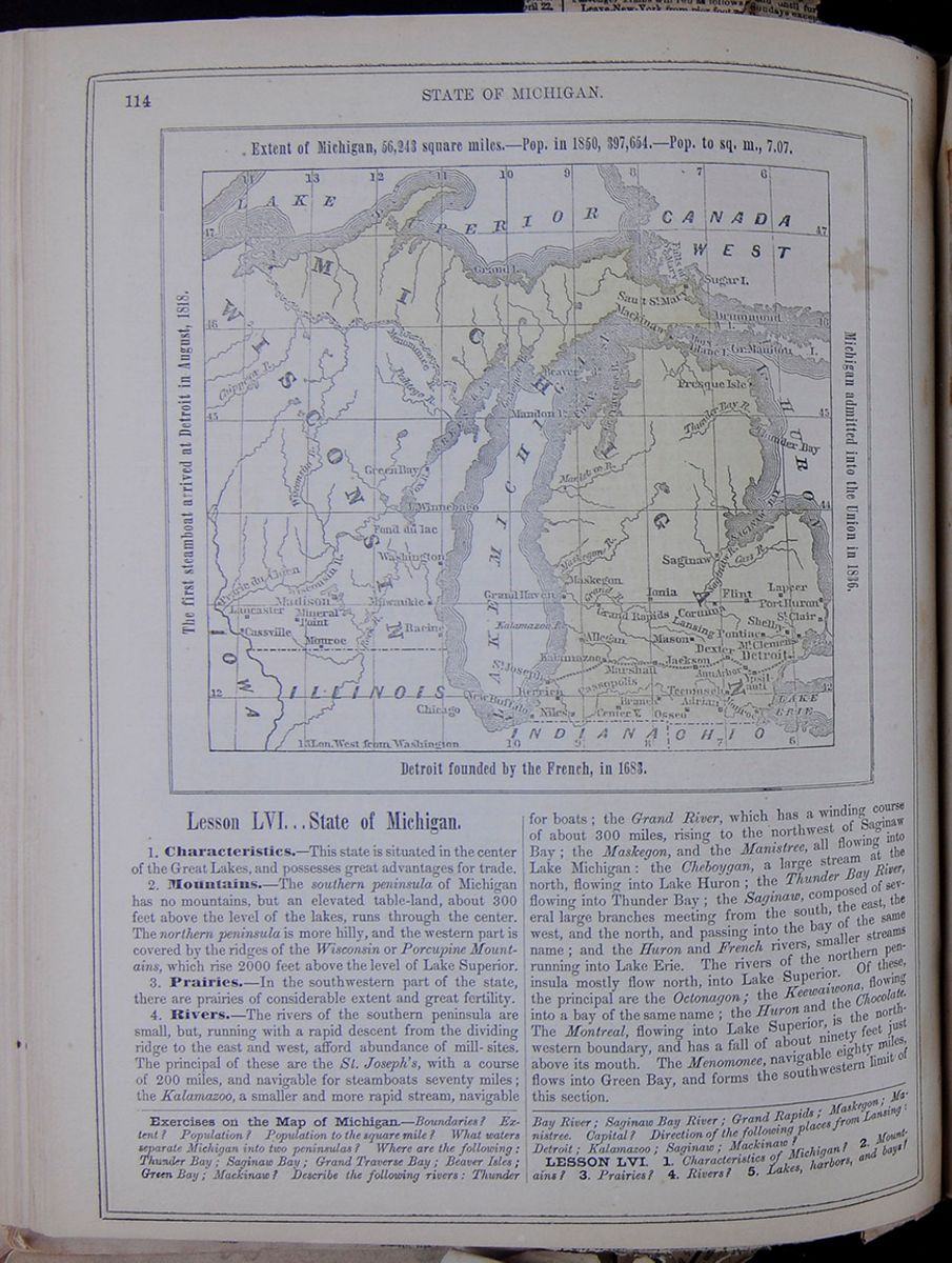 114
STATE OF MICHIGAN.
Map of Michigan.
Extent of Michigan, 56,243 square miles.—Pop.
in 1850, 397,654.—Pop. to sq. m., 7.07.
The first steamboat arrived at Detroit in August,
1818.
Michigan admitted into the Union in 1836.
Detroit founded by the French, in 1683.
114
STATE OF MICHIGAN.
Map of Michigan.
Extent of Michigan, 56,243 square miles.—Pop.
in 1850, 397,654.—Pop. to sq. m., 7.07.
The first steamboat arrived at Detroit in August,
1818.
Michigan admitted into the Union in 1836.
Detroit founded by the French, in 1683.
Lesson LVI... State of Michigan.
1. Characteristics.—This state is situated in the center of the Great Lakes, and possesses great advantages for trade.
2. Mountains.—The southern peninsula of Michigan has no mountains, but an elevated table-land, about 300 feet above the level of the lakes, runs through the center. The northern peninsula is more hilly, and the western part is covered by the ridges of the Wisconsin or Porcupine Mountains, which rise 2000 feet above the level of Lake Superior.
3. Prairies.—In the southwestern part of the state, there are prairies of considerable extent and great fertility.
4. Rivers.—The rivers of the southern peninsula are small, but, running with a rapid descent from the dividing ridge to the east and west, afford abundance of mill-sites. The principal of these are the St. Joseph's, with a course of 200 miles, and navigable for steamboats seventy miles; the Kalamazoo, a smaller and more rapid stream, navigable for boats; the Grand River, which has a winding course of about 300 miles, rising to the northwest of Saginaw Bay; the Maskegon, and the Manistree, all flowing into Lake Michigan: the Cheboygan, a large stream at the north, flowing into Lake Huron; the Thunder Bay River, flowing into Thunder Bay; the Saginaw, composed of several large branches meeting from the south, the east, the west, and the north, and passing into the bay of the same name; and the Huron and French rivers, smaller streams running into Lake Erie. The rivers of the northern peninsula mostly flow north, into Lake Superior. Of these, the principal are the Octonagon; the Keewaiwona, flowing into a bay of the same name; the Huron and the Chocolate. The Montreal, flowing into Lake Superior, is the north-western boundary, and has a fall of about ninety feet just above its mouth. The Menomonee, navigable eighty miles, flows into Green Bay, and forms the southwestern limit of this section.
Exercises on the Map of Michigan.—Boundaries? Extent? Population? Population to the square mile? What waters separate Michigan into tow peninsulas? Where are the following: Thunder Bay; Saginaw Bay; Grand Traverse Bay; Beaver Isles; Green Bay; Mackinaw? Describe the following rivers: Thunder Bay River; Saginaw Bay River; Grand Rapids; Maskegon; Manistree. Capital? Direction of the following places from Lansing: Detroit; Kalamazoo; Saginaw; Mackinaw?
LESSON LVI. 1. Characteristics of Michigan? 2. Mountains? 3. Prairies? 4. Rivers? 5. Lakes, harbors, and bays?
[begin surface 465]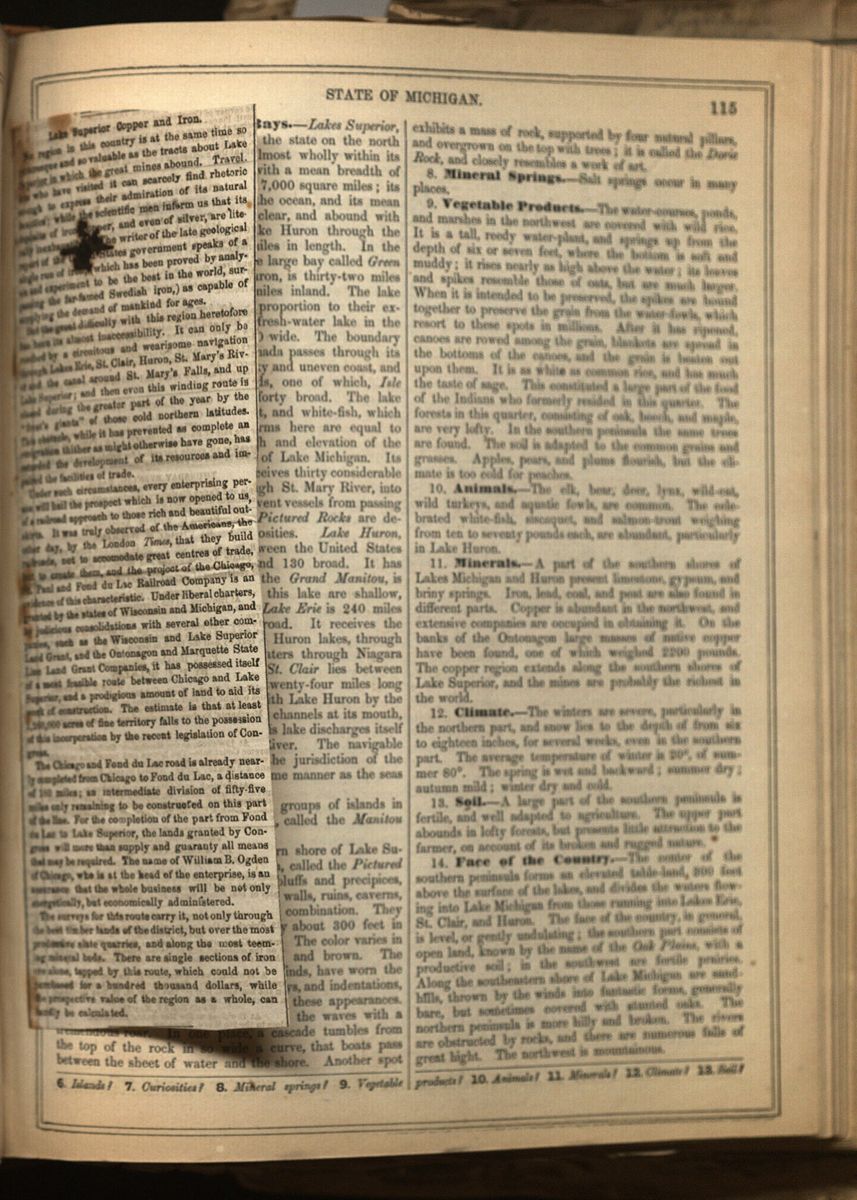 [begin surface 466]
Lake Superior Copper and Iron.
No region in this country is at the same time so picturesque and so valuable as the tracts about Lake Superior in which the great mines abound. Travellers who have visited it can scarcely find rhetoric enough to express their admiration of its natural beauties; while the scientific men inform us that its deposits of iron[illegible]copper, and even of silver, are literally inexhaustib[illegible]The writer of the late geological report of the U[illegible]d States government speaks of a single run of iron, (which has been proved by analysis and experiment to be the best in the world, surpassing the far-famed Swedish iron,) as capable of supplying the demand of mankind for ages.
But the great difficulty with this region heretofore has been its almost inaccessibility. It can only be reached by a circuitous and wearisome navigation through Lakes Erie, St. Clair, Huron, St. Mary's River and the canal around St. Mary's Falls, and up Lake Superior; and then even this winding route is closed during the greater part of the year by the "frost's giants" of those cold northern latitudes. This obstacle, while it has prevented as complete an emigration thither as might otherwise have gone, has retarded the development of its resources and impaired the facilities of trade.
Under such circumstances, every enterprising person will hail the prospect which is now opened to us, of a railroad approach to those rich and beautiful out-skirts. It was truly observed of the Americans, the other day, by the London Times, that they build railroads, not to accomodate great centres of trade, but to create them, and the project of the Chicago, St. Paul and Fond du Lac Railroad Company is an evidence of this characteristic. Under liberal charters, granted by the states of Wisconsin and Michigan, and by judicious consolidations with several other companies, such as the Wisconsin and Lake Superior Land Grate, and the Ontonagon and Marquette State Line Land Grant Companies, it has possessed itself of a most feasible route between Chicago and Lake Superior, and a prodigious amount of land to aid its work of construction. The estimate is that at least 1,260,000 acres of fine territory falls to the possession of this incorporation by the recent legislation of Congress.
The Chicago and Fond du Lac road is already nearly completed from Chicago to Fond du Lac, a distance of 180 miles; an intermediate division of fifty-five miles only remaining to be constructed on this part of the line. For the completion of the part from Fond du Lac to Lake Superior, the lands granted by Congress will more than supply and guaranty all means that may be required. The name of William B. Ogden of Chicago, who is at the head of the enterprise, is an assurance that the whole business will be not only energetically, but economically administered.
The surveys for this route carry it, not only through the best timber lands of the district, but over the most productive slate quarries, and along the most teeming mineral beds. There are single sections of iron ore alone, tapped by this route, which could not be purchased for a hundred thousand dollars, while the prospective value of the region as a whole, can hardly be calculated.
[begin surface 467]
5. Lakes, Harbors, and Bays.—Lakes Superior, Huron, St. Clair, and Erie bound the state on the north and east. Lake Michigan lies almost wholly within its limits. It is 360 miles in length, with a mean breadth of sixty miles, and covers an area of 17,000 square miles; its surface is 600 feet above that of the ocean, and its mean depth 900 feet. Its waters are clear, and abound with fish. It discharges itself into Lake Huron through the Straits of Michilimacinac, forty miles in length. In the northwestern part of the lake is the large bay called Green Bay. Saginaw Bay, on Lake Huron, is thirty-two miles wide, and extends about sixty miles inland. The lake shores afford few good harbors in proportion to their extent. Lake Superior, the largest fresh-water lake in the world, is 380 miles long and 130 wide. The boundary between the United States and Canada passes through its center. It is surrounded by a rocky and uneven coast, and contains many considerable islands, one of which, Isle Royal, is forty miles wide and forty broad. The lake abounds in sturgeon, salmon-trout, and white-fish, which are extensively caught. The storms here are equal to those of the Atlantic. The depth and elevation of the lake are nearly the same as those of Lake Michigan. Its waters are remarkably clear; it receives thirty considerable rivers, and discharges itself, through St. Mary River, into Lake Huron. The rapids here prevent vessels from passing into it from Lake Huron. The Pictured Rocks are described under the head of curiosities. Lake Huron, through which the boundary between the United States and Canada runs, is 218 miles and 130 broad. It has numerous islands; one of them, the Grand Manitou, is eighty miles long. The borders of this lake are shallow, but it is very deep in the center. Lake Erie is 240 miles long, and from thirty to sixty broad. It receives the waters of Superior, Michigan, and Huron lakes, through Detroit River, and discharges its waters through Niagara River, into Lake Ontario. Lake St. Clair lies between Lake Huron and Lake Erie; it is twenty-four miles long and thirty wide. It is connected with Lake Huron by the River St. Clair, which consists of six channels at its mouth, only one of which is navigable. This lake discharges itself into Lake Erie through Detroit River. The navigable waters of these lakes are under the jurisdiction of the United States government, in the same manner as the seas along our coasts. (See map, p. 28.)
6. Islands.—There are several groups of islands in the northern part of Lake Michigan, called the Manitou Isles, Fox Isles, and Beaver Isles.
7. Curiosities.—The southeastern shore of Lake Superior exhibits a singular phenomenon, called the Pictured Rocks. They are a series of lofty bluffs and precipices, exhibiting the appearance of towering walls, ruins, caverns, waterfalls, &c., in every variety of combination. They extend twelve miles, and are generally about 300 feet in hight, and often overhang the water. The color varies in shades of black, yellow, red, white, and brown. The waves, driven by the violent north winds, have worn the rocky shores into numerous caverns, bays, and indentations, which increase the romantic effect of these appearances. In some places, these caverns receive the waves with a tremendous roar. In one place, a cascade tumbles from the top of the rock in so wide a curve, that boats pass between the sheet of water and the shore. Another spot exhibits a mass of rock, supported by four natural pillars, and overgrown on the top with trees; it is called the Doric Rock, and closely resembles a work of art.
8. Mineral Springs.—Salt springs occur in many places.
9. Vegetable Products.—The water-courses, ponds, and marshes in the northwest are covered with wild rice. It is a tall, reedy water-plant, and springs up from the depth of six or seven feet, where the bottom is soft and muddy; it rises nearly as high above the water; its leaves and spikes resemble those of oats, but are much larger. When it is intended to be preserved, the spikes are bound together to preserve the grain from the water-fowls, which resort to these spots in millions. After it has ripened, canoes are rowed among the grain, blankets are spread in the bottoms of the canoes, and the grain is beaten out upon them. It is as white as common rice, and has much the taste of sage. This constituted a large part of the food of the Indians who formerly resided in this quarter. The forests in this quarter, consisting of oak, beech, and maple, are very lofty. In the southern peninsula the same trees are found. The soil is adapted to the common grains and grasses. Apples, pears, and plums flourish, but the climate is too cold for peaches.
10. Animals.—The elk, bear, deer, lynx, wild-cat, wild turkeys, and aquatic fowls, are common. The celebrated white-fish, siscaquet, and salmon-trout weighing from ten to seventy pounds each, are abundant, particularly in Lake Huron.
11. Minerals.—A part of the southern shores of Lakes Michigan and Huron present limestone, gypsum, and briny springs. Iron, lead, coal, and peat are also found in different parts. Copper is abundant in the northwest, and extensive companies are occupied in obtaining it. On the banks of the Ontonagon large masses of native copper have been found, one of which weighed 2200 pounds. The copper region extends along the southern shores of Lake Superior, and the mines are probably the richest in the world.
12. Climate.—The winters are severe, particularly in the northern part, and snow lies to the depth of from six to eighteen inches, for several weeks, even in the southern part. The average temperature of winter is 20°, of summer 80°. The spring is wet and backward; summer dry; autumn mild; winter dry and cold.
13. Soil.—A large part of the southern peninsula is fertile, and well adapted to agriculture. The upper part abounds in lofty forests, but presents little attraction to the farmer, on account of its broken and rugged nature.
14. Face of the Country.—The center of the southern peninsula forms an elevated table-land, 300 feet above the surface of the lakes, and divides the waters flowing into Lake Michigan from those running into Lakes Erie, St. Clair, and Huron. The face of the country, in general, is level, or gently undulating; the southern part consists of open land, known by the name of the Oak Plains, with a productive soil; in the southwest are fertile prairies. Along the southeastern shore of Lake Michigan are sand-hills, thrown by the winds into fantastic forms, generally bare, but sometimes covered with stunted oaks. The northern peninsula is more hilly and broken. The rivers are obstructed by rocks, and there are numerous falls of great hight. The northwest is mountainous.
6. Islands? 7. Curiosities? 8. Mineral springs? 9. Vegetable products? 10. Animals? 11. Minerals? 12. Climate? 13. Soil?
[begin surface 468]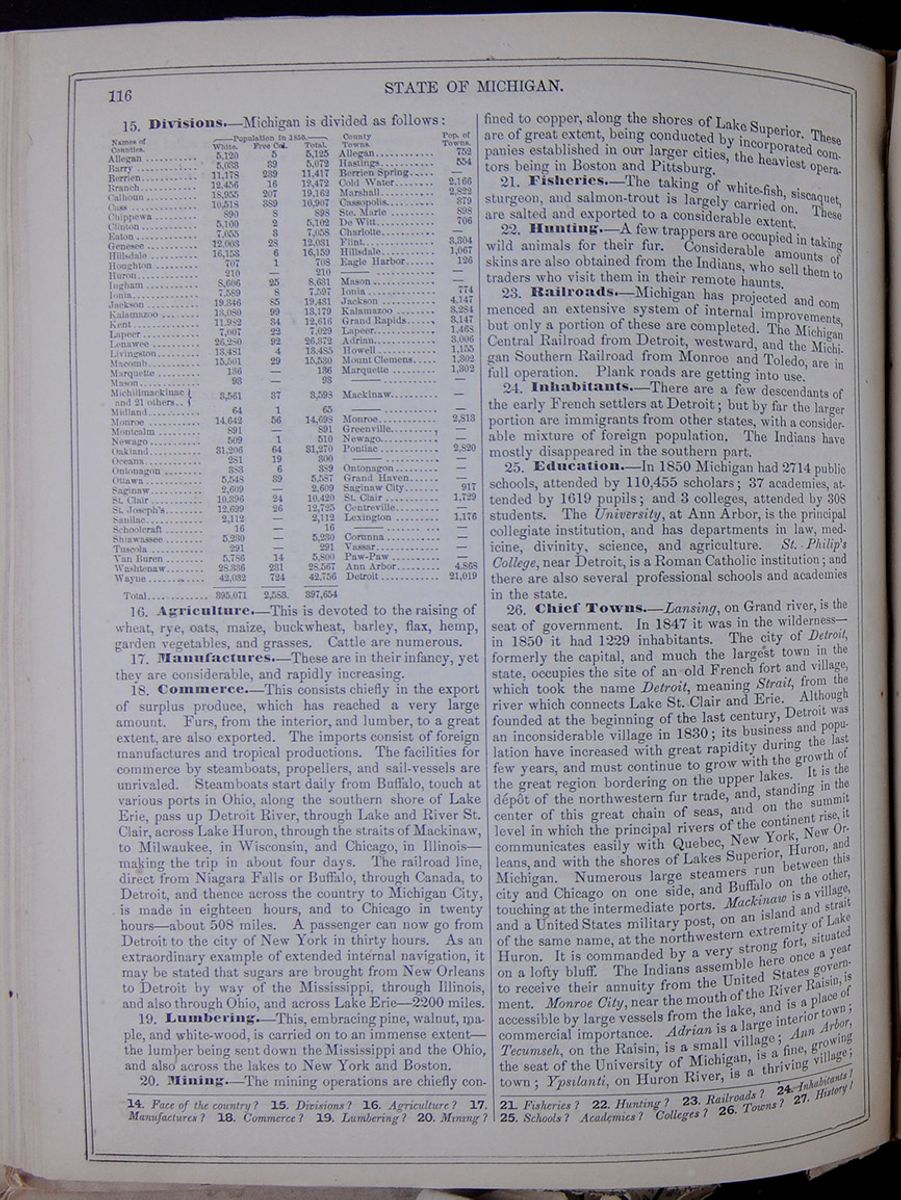 116
STATE OF MICHIGAN.
116
STATE OF MICHIGAN.
15. Divisions.—Michigan is divided as follows: This table lists the counties of Michigan with their populations in 1850 and includes a column for the major town in each county and the town's population. The county population is divided into the following categories: White, Free Colored, and Total.
16. Agriculture.—This is devoted to the raising of wheat, rye, oats, maize, buckwheat, barley, flax, hemp, garden vegetables, and grasses. Cattle are numerous.
17. Manufactures.—These are in their infancy, yet they are considerable, and rapidly increasing.
18. Commerce.—This consists chiefly in the export of surplus produce, which has reached a very large amount. Furs, from the interior, and lumber, to a great extent, are also exported. The imports consist of foreign manufactures and tropical productions. The facilities for commerce by steamboats, propellers, and sail-vessels are unrivaled. Steamboats start daily from Buffalo, touch at various ports in Ohio, along the southern shore of Lake Erie, pass up Detroit River, through Lake and River St. Clair, across Lake Huron, through the straits of Mackinaw, to Milwaukee, in Wisconsin, and Chicago, in Illinois—making the trip in about four days. The railroad line, direct from Niagara Falls or Buffalo, through Canada, to Detroit, and thence across the country to Michigan City, is made in eighteen hours, and to Chicago in twenty hours—about 508 miles. A passenger can now go from Detroit to the city of New York in thirty hours. As an extraordinary example of extended internal navigation, it may be stated that sugars are brought from New Orleans to Detroit by way of the Mississippi, through Illinois, and also through Ohio, and across Lake Erie—2200 miles.
19. Lumbering.—This, embracing pine, walnut, maple, and white-wood, is carried on to an immense extent—the lumber being sent down the Mississippi and the Ohio, and also across the lakes to New York and Boston.
20. Mining.—The mining operations are chiefly confined to copper, along the shores of Lake Superior. These are of great extent, being conducted by incorporated companies established in our larger cities, the heaviest operators being in Boston and Pittsburg.
21. Fisheries.—The taking of white-fish, siscaquet, sturgeon, and salmon-trout is largely carried on. These are salted and exported to a considerable extent.
22. Hunting.—A few trappers are occupied in taking wild animals for their fur. Considerable amounts of skins are also obtained from the Indians, who sell them to traders who visit them in their remote haunts.
23. Railroads.—Michigan has projected and commenced an extensive system of internal improvements, but only a portion of these are completed. The Michigan Central Railroad from Detroit, westward, and the Michigan Southern Railroad from Monroe and Toledo, are in full operation. Plank roads are getting into use.
24. Inhabitants.—There are a few descendants of the early French settlers at Detroit; but by far the larger portion are immigrants from other states, with a considerable mixture of foreign population. The Indians have mostly disappeared in the southern part.
25. Education.—In 1850 Michigan had 2714 public schools, attended by 110,455 scholars; 37 academies, attended by 1619 pupils; and 3 colleges, attended by 308 students. The University, at Ann Arbor, is the principal collegiate institution, and has departments in law, medicine, divinity, science, and agriculture. St. Philip's College, near Detroit, is a Roman Catholic institution; and there are also several professional schools and academies in the state.
26. Chief Towns.—Lansing, on Grand river, is the seat of government. In 1847 it was in the wilderness—in 1850 it had 1229 inhabitants. The city of Detroit, formerly the capital, and much the largest town in the state, occupies the site of an old French fort and village, which took the name Detroit, meaning Strait, from the river which connects Lake St. Clair and Erie. Although founded at the beginning of the last century, Detroit was an inconsiderable village in 1830; its business and population have increased with great rapidity during the last few years, and must continue to grow with the growth of the great region bordering on the upper lakes. It is the dépôt of the northwestern fur trade, and, standing in the center of this great chain of seas, and on the summit level in which the principal rivers of the continent rise, it communicates easily with Quebec, New York, New Orleans, and with the shores of Lakes Superior, Huron, and Michigan. Numerous large steamers run between this city and Chicago on one side, and Buffalo on the other, touching at the intermediate ports. Mackinaw is a village, and a United States military post, on an island and strait of the same name, at the northwestern extremity of Lake Huron. It is commanded by a very strong fort, situated on a lofty bluff. The Indians assemble here once a year to receive their annuity from the United States government. Monroe City, near the mouth of the River Raisin, is accessible by large vessels from the lake, and is a place of commercial importance. Adrian is a large interior town; Tecumseh, on the Raisin, is a small village; Ann Arbor, the seat of the University of Michigan, is a fine, growing town; Ypsilanti, on Huron River, is a thriving village;
14. Face of the country? 15. Divisions? 16. Agriculture? 17. Manufactures? 18. Commerce? 19. Lumbering? 20. Mining? 21. Fisheries? 22. Hunting? 23. Railroads? 24. Inhabitants? 25. Schools? Academies? Colleges? 26. Towns? 27. History?
[begin surface 469]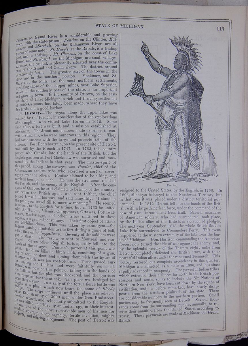 STATE OF MICHIGAN.
117
STATE OF MICHIGAN.
117
Jackson, on Grand River, is a considerable and growing town, with the state-prison; Pontiac, on the Clinton, Kalamazoo and Marshall, on the Kalamazoo River, are all places of some note; St. Mary's, at the Rapids, is a trading post, and is thriving; Mt. Clemens, on the coast of Lake Huron, and St. Joseph, on the Michigan, are small villages. Lansing, the capital, is pleasantly situated near the confluence of the Grand and Cedar rivers. The district around is extremely fertile. The greater part of the towns in the state are in the southern portion. Mackinaw, and St. Mary's at the Falls, are the most northern settlements, excepting those of the copper mines, near Lake Superior. Niles, in the southerly part of the state, is an important and growing town. In the county of Ottowa, on the eastern shore of Lake Michigan, a rich and thriving settlement of 3000 Germans has lately been made, where they have fine lands and a good harbor.
27. History.—The region along the upper lakes was claimed by the French, in consideration of the explorations of Champlain, who visited Lake Huron in 1615. Some time after, a fort was built, and a mission established at Mackinaw. The Jesuit missionaries made exertions to convert the Indians, who were numerous in this region. They had some success with the large and powerful tribe of the Hurons. Fort Pontchartrain, on the present site of Detroit, was built by the French in 1747. In 1763, this country passed, with Canada, into the hands of the British, but the English garrison at Fort Mackinaw was surprised and massacred by the Indians in that year. The master-spirit of this period, among the savages, was Pontiac, chief of the Ottawas, an ancient tribe who exercised a sort of sovereignty over the others. Pontiac claimed to be a king, and received homage as such. He was the strenuous friend of the French, and the enemy of the English. After the conquest of Quebec, he still claimed to be king of the country, and when the British agent was sent thither, the chief placed himself in his way, and said haughtily, "I stand in the path you travel till to-morrow morning," He seemed to submit to the English for a time, but in 1763 he united with the Hurons, Miamis, Chippeways, Ottawas, Pottawattamies, Mississanges, and other tribes scattered in these regions, in a general conspiracy. Their first object of attack was Michilimacinac. This was taken by stratagem—the Indians gaining admission to the fort during a game of ball, which they called baggatiway. Seventy of the soldiers were put to death. The rest were sent to Montreal, and ransomed. Eleven other English forts speedily fell into the hands of the savages. Pontiac's power at this point was great. He drew bills on birch bark, consisting of a gun, bag of corn, or deer, and signing them with the figure of an otter, which was his coat-of-arms. These passed current among the Indians, and were faithfully redeemed. Detroit was now on the point of falling into the hands of the Indians, but the plot was discovered, and the garrison were prepared for the attack. The place was besieged for more than a year. In a sally of the fort, a fierce battle was fought at a place which now bears the name of Bloody Bridge. The siege continued until the place was relieved by an English army of 3000 men, under Gen. Bradstreet. Pontiac retired, and reluctantly submitted to the English. He was killed in 1767, by an Indian spy, in their interest. He was one of the most remarkable men of his race for resolute courage, deep sagacity, fertile invention, mighty projects, and stirring eloquence. The post of Detroit was Pontiac. resigned to the United States, by the English, in 1796. In 1805, Michigan belonged to the Northwest Territory, but in that year it was placed under a distinct territorial government. In 1812 Detroit fell into the hands of the British, with a large American force, under the command of the cowardly and incompetent Gen. Hull. Several massacres of American soldiers, who had surrendered, took place, by the Indian allies of the British, in violation of pledges. The next year, September, 1813, the whole British fleet on Lake Erie surrendered to Commodore Perry. This event happened at the western extremity of the lake, near the limits of Michigan. Gen. Harrison, commanding the American forces, now turned the tide of war against the enemy, and, by the splendid victory of the Thames, eighty miles from Detroit, completely defeated the British army, with their powerful Indian allies, under the renowned Tecumseh. This victory restored our complete ascendency in this quarter. Michigan was admitted as a state in 1836, and has since rapidly advanced in prosperity. The powerful Indian tribes which extended their alliances far north in the British possessions, and south, so as to include the Six Nations of Northern New York, have been cut down by the scythe of civilization, and, as before remarked, have nearly disappeared from the southern peninsula of this state. There are considerable numbers in the northern portion. Small parties may be frequently seen at Detroit. Several thousands come from the surrounding regions, annually, to receive their annuities from the United States, according to treaty. These payments are made at Mackinaw and Grand Rapids.
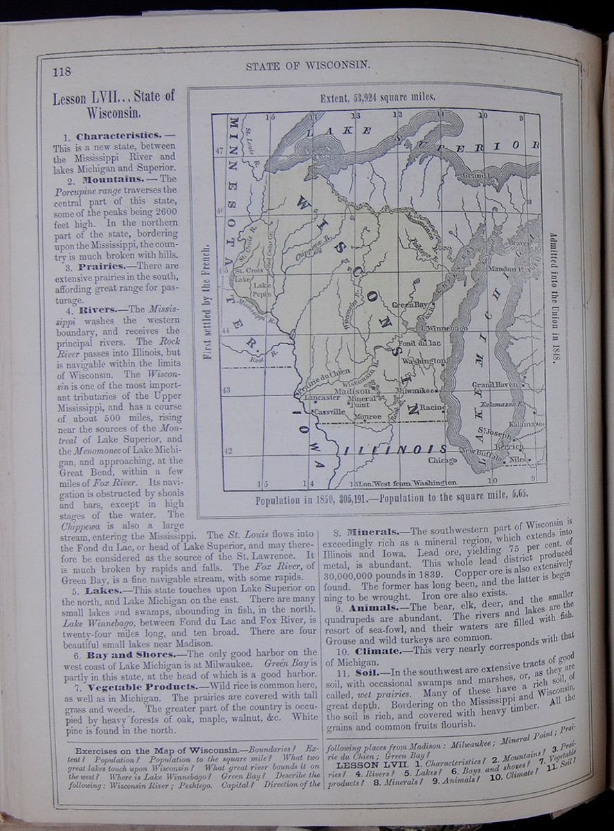 118
STATE OF WISCONSIN.
118
STATE OF WISCONSIN.
Lesson LVII... State of Wisconsin.
1. Characteristics.—This is a new state, between the Mississippi River and lakes Michigan and Superior.
2. Mountains.—The Porcupine range traverses the central part of this state, some of the peaks being 2600 feet high. In the northern part of the state, bordering upon the Mississippi, the country is much broken with hills.
3. Prairies.—There are extensive prairies in the south, affording great range for pasturage.
4. Rivers.—The Mississippi washes the western boundary, and receives the principal rivers. The Rock River passes into Illinois, but is navigable within the limits of Wisconsin. The Wisconsin is one of the most important tributaries of the Upper Mississippi, and has a course of about 500 miles, rising near the sources of the Montreal of Lake Superior, and the Menomonee of Lake Michigan, and approaching, at the Great Bend, within a few miles of Fox River. Its navigation is obstructed by shoals and bars, except in high stages of the water. The Chippewa is also a large stream, entering the Mississippi. The St. Louis flows into the Fond du Lac, or head of Lake Superior, and may therefore be considered as the source of the St. Lawrence. It is much broken by rapids and falls. The Fox River, of Green Bay, is a fine navigable stream, with some rapids.
5. Lakes.—This state touches upon Lake Superior on the north, and Lake Michigan on the east. There are many small lakes and swamps, abounding in fish, in the north. Lake Winnebago, between Fond du Lac and Fox River, is twenty-four miles long, and ten broad. There are four beautiful small lakes near Madison.
6. Bay and Shores.—The only good harbor on the west coast of Lake Michigan is at Milwaukee. Green Bay is partly in this state, at the head of which is a good harbor.
7. Vegetable Products.—Wild rice is common here, as well as in Michigan. The prairies are covered with tall grass and weeds. The greater part of the country is occupied by heavy forests of oak, maple, walnut, &c. White pine is found in the north.
Map of Wisconsin. Extent, 53,924 square miles. First settled by the French. Admitted into the Union in 1848. Population in 1850, 305,191.—Population to the square mile, 5.65.8. Minerals.—The southwestern part of Wisconsin is exceedingly rich as a mineral region, which extends into Illinois and Iowa. Lead ore, yielding 75 per cent, of metal, is abundant. This whole lead district produced 30,000,000 pounds in 1839. Copper ore is also extensively found. The former has long been, and the latter is beginning to be wrought. Iron ore also exists.
9. Animals.—The bear, elk, deer, and the smaller quadrupeds are abundant. The rivers and lakes are the resort of sea-fowl, and their waters are filled with fish. Grouse and wild turkeys are common.
10. Climate.—This very nearly corresponds with that of Michigan.
11. Soil.—In the southwest are extensive tracts of good soil, with occasional swamps and marshes, or, as they are called, wet prairies. Many of these have a rich soil, of great depth. Bordering on the Mississippi and Wisconsin, the soil is rich, and covered with heavy timber. All the grains and common fruits flourish.
Exercises on the Map of Wisconsin.—Boundaries? Extent? Population? Population to the square mile? What two great lakes touch upon Wisconsin? What great river bounds it on the west? Where is Lake Winnebago? Green Bay? Describe the following: Wisconsin River; Peshtego. Capital? Direction of the following places from Madison: Milwaukee; Mineral Point; Prairie du Chien; Green Bay?
LESSON LVII. 1. Characteristics? 2. Mountains? 3. Prairies? 4. Rivers? 5. Lakes? 6. Bays and shores? 7. Vegetable products? 8. Minerals? 9. Animals? 10. Climate? 11. Soil?
[begin surface 471]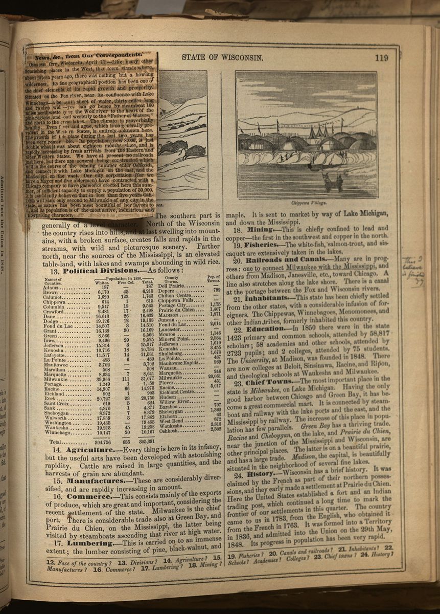 [begin surface 472]
News, &c., from Our Correspondents.
OSHKOSH CITY, Wisconsin, April 11.—Like many other flourishing places in the West, this town stands where about fifteen years ago, there was nothing but a howling wilderness. Its fine geographical position has been one of the chief elements of its rapid growth and prosperity. Situated on the Fox river, near its confluence with Lake Winnebago—a beautiful sheet of water, thirty miles long and twelve wid[illegible]—you can go hence by steamboat 160 miles northwesterly up the Wolf river to the heart of the pine regions, and southwesterly to the "Father of Waters," and north to the Great lakes. The climate is proverbially healthy. Even fever and ague, which is so generally prevalent in the Western States, is entirely unknown here. The growth of this place during the last two years has been very remarkable. Its population, now 8,000, is just double what it was about eighteen months since, and is rapidly increasing by fresh arrivals from the Eastern and older Western States. We have at present no railroads just here, but there are several being constructed which will in the course of the coming summer enter Oshkosh, and connect it with Lake Michigan on the east, and the Mississippi on the west. Our city corporation (for we have a Mayor and five alderman) have contracted with a Chicago company to have gasworks erected here this summer, of sufficient capacity to supply a population of 30,000. It is confidently believed that in less than five years Oshkosh will rank only second to Milwaukie of any city in the state, as nature has been most bountiful of her favors to it, and its population is of the most active, industrious and enterprising character.
[begin surface 473]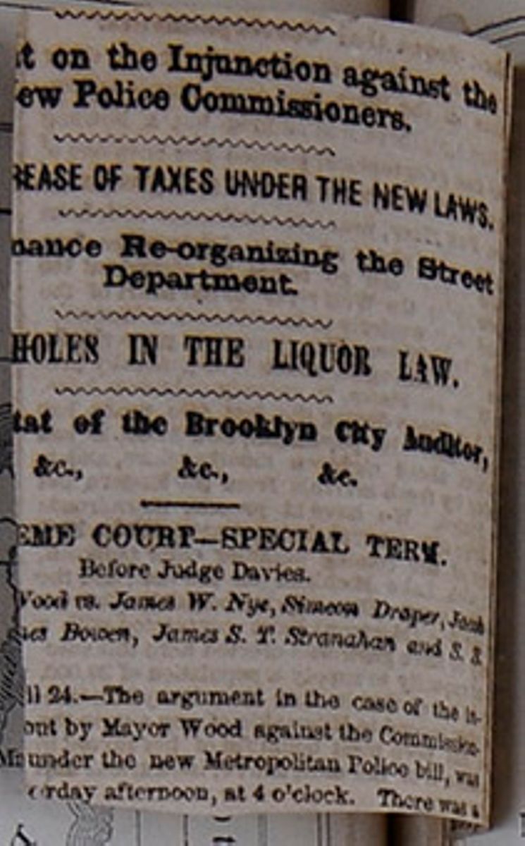
12. Face of the Country.—The southern part is generally of a level character. North of the Wisconsin the country rises into hills, and at last swelling into mountains, with a broken surface, creates falls and rapids in the streams, with wild and picturesque scenery. Farther north, near the sources of the Mississippi, is an elevated table-land, with lakes and swamps abounding in wild rice.
13. Political Divisions.—As follows: This table lists the counties of Wisconsin with their populations in 1850 and includes a column for the major town in each county and the town's population. The county population is divided into the following categories: White, Free Colored, and Total.
14. Agriculture.—Every thing is here in its infancy, but the useful arts have been developed with astonishing rapidity. Cattle are raised in large quantities, and the harvests of grain are abundant.
15. Manufactures.—These are considerably diversified, and are rapidly increasing in amount.
16. Commerce.—This consists mainly of the exports of produce, which are great and important, considering the recent settlement of the state. Milwaukee is the chief port. There is considerable trade also at Green Bay, and Prairie du Chien, on the Mississippi, the latter being visited by steamboats ascending that river at high water.
17. Lumbering.—This is carried on to an immense extent; the lumber consisting of pine, black-walnut, and maple. It is sent to market by way of Lake Michigan, and down the Mississippi.
18. Mining.—This is chiefly confined to lead and copper—the first in the southwest and copper in the north.
19. Fisheries.—The white-fish, salmon-trout, and siscaquet are extensively taken in the lakes.
20. Railroads and Canals.—Many are in progress: one to connect Milwaukee with the Mississippi, and others from Madison, Janesville, etc., toward Chicago. A line also stretches along the lake shore. There is a canal at the portage between the Fox and Wisconsin rivers.
21. Inhabitants.—This state has been chiefly settled from the other states, with a considerable infusion of foreigners. The Chippewas, Winnebagoes, Menomonees, and other Indian tribes, formerly inhabited this country.
22. Education.—In 1850 there were in the state 1423 primary and common schools, attended by 58,817 scholars; 58 academies and other schools, attended by 2723 pupils; and 2 colleges, attended by 75 students. The University, at Madison, was founded in 1848. There are now colleges at Beloit, Sinsinawa, Racine, and Ripon, and theological schools at Waukesha and Milwaukee.
23. Chief Towns.—The most important place in the state is Milwaukee, on Lake Michigan. Having the only good harbor between Chicago and Green Bay, it has become a great commercial mart. It is connected by steamboat and railway with the lake ports and the east, and the Mississippi by railway. The increase of this place in population has few parallels. Green Bay has a thriving trade. Racine and Cheboygan, on the lake, and Prairie du Chien, near the junction of the Mississippi and Wisconsin, are other principal places. The latter is on a beautiful prairie, and has a large trade. Madison, the capital, is beautifully situated in the neighborhood of several fine lakes.
24. History.—Wisconsin has a brief history. It was claimed by the French as part of their northern possessions, and they early made a settlement at Prairie du Chien. Here the United States established a fort and an Indian trading post, which continued a long time to mark the frontier of our settlements in this quarter. The country came to us in 1783, from the English, who obtained it from the French in 1763. It was formed into a Territory in 1836, and admitted into the Union on the 29th May, 1848. Its progress in population has been very rapid.
12. Face of the country? 13. Divisions? 14. Agriculture? 15. Manufactures? 16. Commerce? 17. Lumbering? 18. Mining? 19. Fisheries? 20. Canals and railroads? 21. Inhabitants? 22. Schools? Academies? Colleges? 23. Chief towns? 24. History?
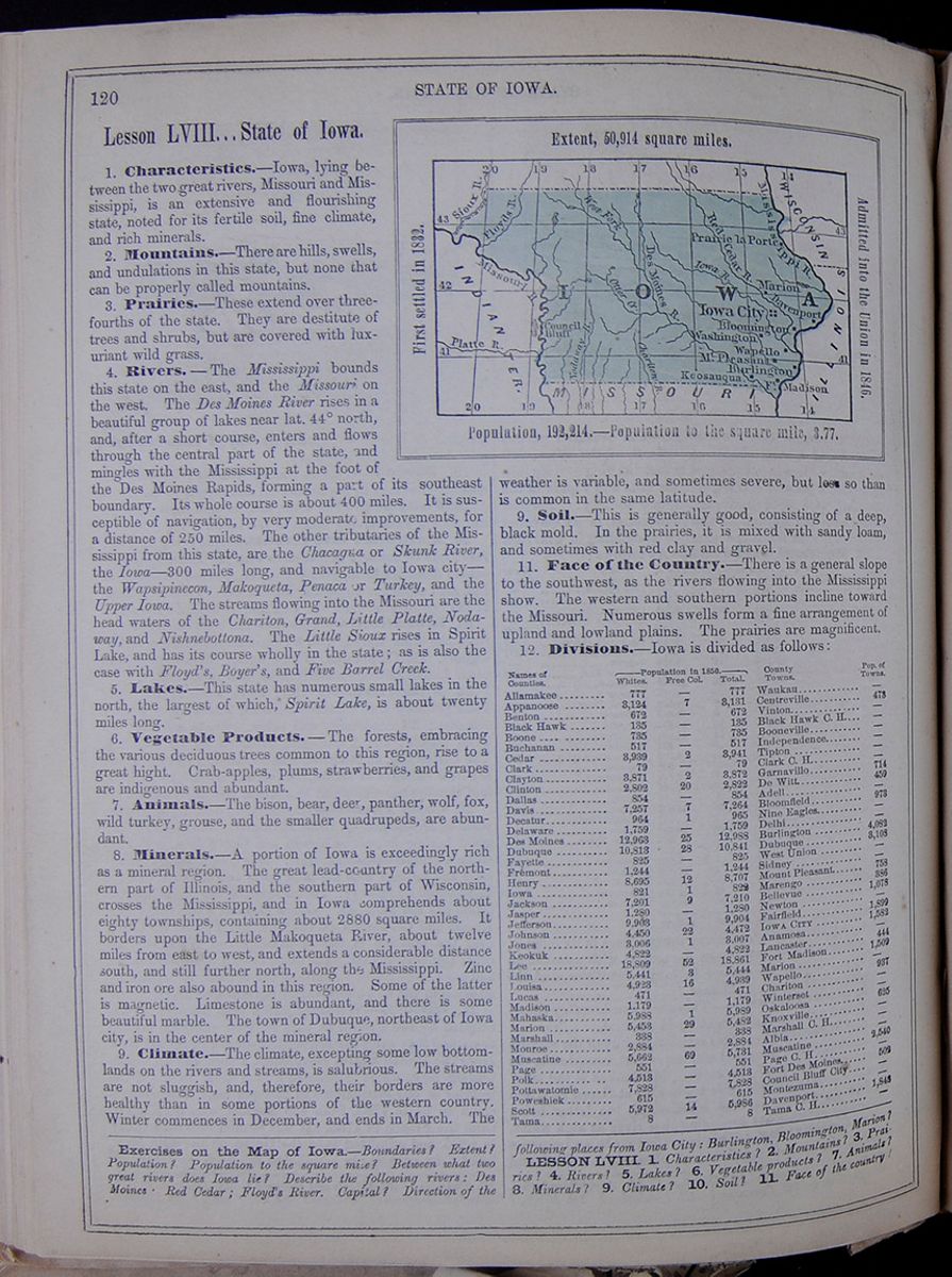 120
STATE OF IOWA.
120
STATE OF IOWA.
Lesson LVIII... State of Iowa.
1. Characteristics.—Iowa, lying between the two great rivers, Missouri and Mississippi, is an extensive and flourishing state, noted for its fertile soil, fine climate, and rich minerals.
2. Mountains.—There are hills, swells, and undulations in this state, but none that can be properly called mountains.
3. Prairies.—These extend over three-fourths of the state. They are destitute of trees and shrubs, but are covered with luxuriant wild grass.
4. Rivers.—The Mississippi bounds this state on the east, and the Missouri on the west. The Des Moines River rises in a beautiful group of lakes near lat. 44° north, and, after a short course, enters and flows through the central part of the state, and mingles with the Mississippi at the foot of the Des Moines Rapids, forming a part of its southeast boundary. Its whole course is about 400 miles. It is susceptible of navigation, by very moderate improvements, for a distance of 250 miles. The other tributaries of the Mississippi from this state, are the Chacagua or Skunk River, the Iowa—300 miles long, and navigable to Iowa city—the Wapsipinecon, Makoqueta, Penaca or Turkey, and the Upper Iowa. The streams flowing into the Missouri are the head waters of the Chariton, Grand, Little Platte, Nodaway, and Nishnebottona. The Little Sioux rises in Spirit Lake, and has its course wholly in the state; as is also the case with Floyd's, Boyer's, and Five Barrel Creek.
5. Lakes.—This state has numerous small lakes in the north, the largest of which, Spirit Lake, is about twenty miles long.
6. Vegetable Products.—The forests, embracing the various deciduous trees common to this region, rise to a great hight. Crab-apples, plums, strawberries, and grapes are indigenous and abundant.
7. Animals.—The bison, bear, deer, panther, wolf, fox, wild turkey, grouse, and the smaller quadrupeds, are abundant.
8. Minerals.—A portion of Iowa is exceedingly rich as a mineral region. The great lead-country of the northern part of Illinois, and the southern part of Wisconsin, crosses the Mississippi, and in Iowa comprehends about eighty townships, containing about 2880 square miles. It borders upon the Little Makoqueta River, about twelve miles from east to west, and extends a considerable distance south, and still further north, along the Mississippi. Zinc and iron ore also abound in this region. Some of the latter is magnetic. Limestone is abundant, and there is some beautiful marble. The town of Dubuque, northeast of Iowa city, is in the center of the mineral region.
9. Climate.—The climate, excepting some low bottom-lands on the rivers and streams, is salubrious. The streams are not sluggish, and, therefore, their borders are more healthy than in some portions of the western country. Winter commences in December, and ends in March. The Map of Iowa. Extent, 50,914 square miles. First settled in 1882. Admitted into the Union in 1846. Population, 192,214.—Population to the square mile, 3.77. weather is variable, and sometimes severe, but less so than is common in the same latitude.
9. Soil.—This is generally good, consisting of a deep, black mold. In the prairies, it is mixed with sandy loam, and sometimes with red clay and gravel.
11. Face of the Country.—There is a general slope to the southwest, as the rivers flowing into the Mississippi show. The western and southern portions incline toward the Missouri. Numerous swells form a fine arrangement of upland and lowland plains. The prairies are magnificent.
12. Divisions.—Iowa is divided as follows: This table lists the counties of Iowa with their populations in 1850 and includes a column for the major town in each county and the town's population. The county population is divided into the following categories: White, Free Colored, and Total.
Exercises on the Map of Iowa.—Boundaries? Extent? Population? Population to the square mile? Between what two great rivers does Iowa lie? Describe the following rivers: Des Moines; Red Cedar; Floyd's River. Capital? Direction of the following places from Iowa City: Burlington, Bloomington, Marion?
LESSON LVIII. 1. Characteristics? 2. Mountains? 3. Prairies? 4. Rivers? 5. Lakes? 6. Vegetable products? 7. Animals? 8. Minerals? 9. Climate? 10. Soil? 11. Face of the country?
 [begin surface 476]
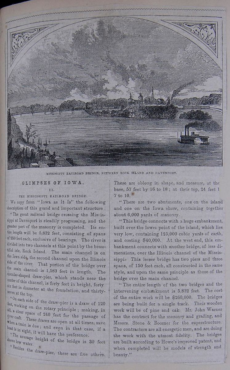
GLIMPSES OF IOWA.
III.
THE MISSISSIPPI RAILROAD BRIDGE.
We copy from "Iowa as It Is" the following description of this grand and important structure:
"The great railroad bridge crossing the Mississippi at Davenport is steadily progressing, and the greater part of the masonry is completed. Its entire length will be 5,832 feet, consisting of spans of 250 feet each, exclusive of bearings. The river is divided into two channels at this point by the beautiful isle, Rock Island. The main channel is upon the Illinois side of the river. That portion of the bridge over the main channel is 1,583 feet in length. The circular-shaped draw-pier, which stands near the center of this channel, is forty feet in height, forty six feet in diameter at the foundation, and thirty-seven at the top.
"On each side of the draw-pier is a draw of 120 feet, working on the rotary principle; making in all a clear space of 240 feet for the passage of river craft. These draws are open at all times, save when a train is due; and even in that case, if a boat is in sight, it will have the preference.
"The average height of the bridge is 30 feet above low water.
Besides the draw-pier, there are five others. These are oblong in shape, and measure, at the base, 57 feet by 16 to 18; at their top, 24 feet b[cutaway] 7 to 10.
"There are two abutments, one on the island and one on the Iowa shore, containing together about 6,000 yards of masonry.
"This bridge connects with a huge embankment, built over the lower point of the island, which lies very low, containing 125,000 cubic yards of earth, and costing $40,000. At the west end, this embankment connects with another bridge, of less dimensions, over the Illinois channel of the Mississippi. This lesser bridge has two piers and three spans, of 150 feet each, all constructed in the same style, and upon the same principle as those of the bridge over the main channel.
"The entire length of the two bridges and the intervening embankment is 5,832 feet. The cost of the entire work will be $260,000. The bridges are being built for a single track. Their wooden work will be of pine and oak. Mr. John Warner has the contract for the masonry and grading, and Messrs. Stone & Boomer for the superstructure. The contractors are all energetic men, and are doing the work with the utmost fidelity. The bridges are built according to Howe's improved patent, and when completed will be models of strength and beauty."
[begin surface 477]
 [begin surface 479]
 [begin surface 480]
 [begin surface 481]
 [begin surface 482]
 [begin surface 483]
 [begin surface 484]
 [begin surface 485]
 [begin surface 486]
 [begin surface 487]
 [begin surface 488]
 [begin surface 489]
 [begin surface 490]
 [begin surface 491]
 [begin surface 492]
 [begin surface 493]
 [begin surface 494]
 [begin surface 495]
 [begin surface 496]
 [begin surface 497]
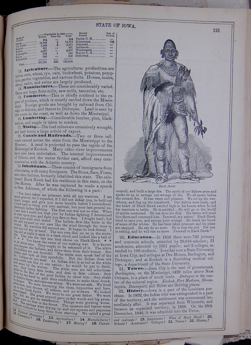
Continuation of table listing the counties of Iowa with their populations in 1850, including a column for the major town in each county and the town's population.
13. Agriculture.—The agricultural productions are Indian corn, wheat, rye, oats, buckwheat, potatoes, pumpkins, garden vegetables, and various fruits. Horses, mules, sheep, cattle, and swine are largely produced.
14. Manufactures.—These are considerably varied. There are large flour-mills, saw-mills, tanneries, etc.
15. Commerce.—This is chiefly confined to the export of produce, which is mostly carried down the Mississippi. Foreign goods are brought by railroad from Chicago to Galena, and thence to Dubuque. Lead is sent by this route to the coast, as well as down the Mississippi.
16. Lumbering.—Considerable lumber, pine, black-walnut, and maple is taken to market.
17. Mining.—The lead mines are extensively wrought, and lead forms a large article of export.
18. Canals and Railroads.—Two or three railroads extend across the state from the Mississippi to the Missouri. A canal is projected to pass the rapids of the Mississippi at Keokuk. Many other river improvements have also been undertaken. The internal improvements of Illinois, and the states further east, afford easy communication with the Atlantic country.
19. Inhabitants.—These consist of immigrants from other states, with many foreigners. The Sioux, Sacs, Foxes, and other Indians, formerly inhabited this state. The celebrated Black Hawk had his residence in this state, on the Des Moines. After he was captured he made a speech to Gen. Atkinson, of which the following is a part: "You have taken me prisoner, with all my warriors. I am much grieved, for I expected, if I did not defeat you, to hold out much longer, and give you more trouble before I surrendered. I tried hard to bring you into ambush, but your last general understands Indian fighting. The first one was not so wise. When I saw that I could not beat you by Indian fighting, I determined to rush upon you, and fight you face to face. I fought hard; but your guns were well aimed. The bullets flew like birds in the air and whizzed by our ears like the wind through the trees in winter. My warriors fell around me. It began to look dismal. I saw my evil day at hand. The sun rose dim on us in the morning, and at night it sank in a dark cloud, and looked like a ball of fire. That was the last sun that shone on Black Hawk. ❊ ❊ ❊ ❊ ❊ You know the cause of our making war. It is known to all white men. They ought to be ashamed of it. The white men despise the Indians, and drive them from their homes. But the Indians are not deceitful. The white men speak bad of the Indian, and look at him spitefully. But the Indian does not lie: Indians do not steal. An Indian who is as bad as the white men could not live in our nation; he would be put to death, and eaten by the wolves. The white men are bad schoolmasters: they carry false looks, and deal in false actions; they smile in the face of the poor Indian to cheat him; they shake them by the hand to gain their confidence, to make them drunk, to deceive them, and ruin our wives. We were not safe. We lived in danger. We were becoming like them, hypocrites and liars, adulterers, lazy drones, all talkers, and no workers. We looked up to the Great Spirit. We went to our great father. We were encouraged. His great council gave us fair words and big promises; but we got no satisfaction. Things were growing worse. There were no deer in the forest. The opossum and beaver were fled. The springs were drying up, and our squaws and papooses without victuals to keep them from starving. We called a great Black Hawk. council, and built a large fire. The spirit of our fathers arose and spoke to us, to avenge our wrongs or die. We all spoke before the council fire. It was warm and pleasant. We set up the war-whoop, and dug up the tomahawk. Our knives were ready, and the heart of Black Hawk swelled high in his bosom when he led his warriors to battle. He is satisfied. He will go to the world of spirits contented. He has done his duty. His father will meet him there and commend him. Farewell, my nation! Black Hawk tried to save you, and avenge your wrongs. He drank the blood of some of the whites. He has been taken prisoner, and his plans are stopped. He can do no more. He is near his end. His sun is setting, and he will rise no more. Farewell to Black Hawk."
20. Education.—In 1850 there were 742 primary and common schools, attended by 29,616 scholars; 31 academies, attended by 1051 pupils; and 2 colleges, attended by 100 students. Iowa has now a State University at Iowa City, and colleges at Des Moines, Burlington, and Dubuque; and at Keokuk is a flourishing medical college, a department of the State University.
21. Towns—Iowa City is the seat of government. Burlington, on the Mississippi, 1429 miles above New Orleans, is a place of much trade. Dubuque is the center of the mineral region. Keokuk, Fort Madison, Bloomington, Davenport, and Salem are thriving places.
22. History.—Iowa is a part of the Louisiana purchase. In 1832, the Indian title was extinguished in a part of the territory, and the settlement was commenced immediately after. It was separated from Wisconsin, and became an organized territory, in 1838. On the 28th December, 1846, it was admitted into the Union.
12. Political Divisions? 13. Agriculture? 14. Manufactures? 15. Commerce? 16. Lumbering? 17. Mining? 18. Canals and railroads? 19. Inhabitants? What of Black Hawk? 20. Schools? Academies? Colleges? 21. Towns? 22. History?
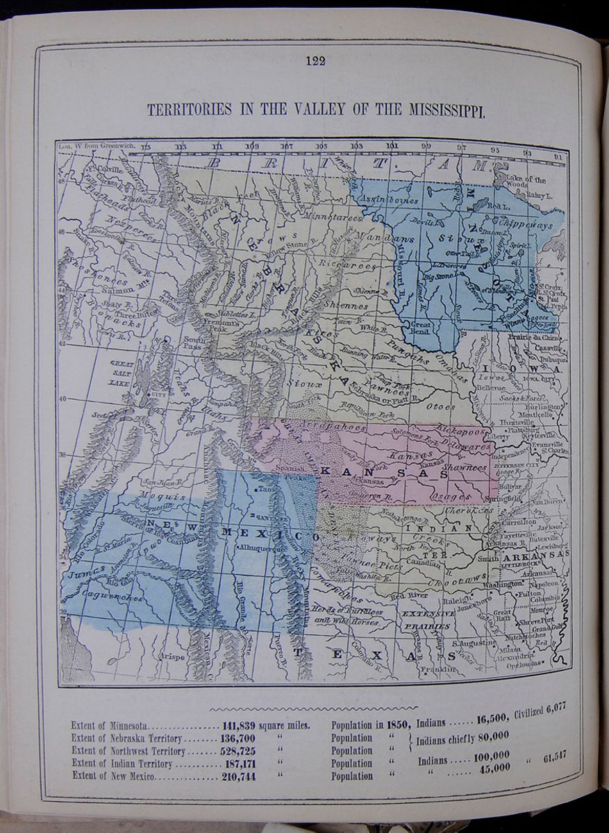 122
TERRITORIES IN THE VALLEY OF THE
MISSISSIPPI.
Map of the following Mississippi Valley
Territories: New Mexico, Indian Territory (now Oklahoma),
Kansas, Nebraska, and Minnesota.
122
TERRITORIES IN THE VALLEY OF THE
MISSISSIPPI.
Map of the following Mississippi Valley
Territories: New Mexico, Indian Territory (now Oklahoma),
Kansas, Nebraska, and Minnesota.
| Extent of Minnesota | 141,839 square miles. | Population in 1850, | Indians | 16500, | Civilized | 6,077 |
| Extent of Nebraska Territory | 136,700 " | Population " | Indians chiefly | 80,000 | ||
| Extent of Northwest Territory | 528,725 " | Population " | ||||
| Extent of Indian Territory | 187,171 " | Population " | Indians | 100,000 | ||
| Extent of New Mexico | 210,744 " | Population " | " | 45,000 | " | 61,547 |
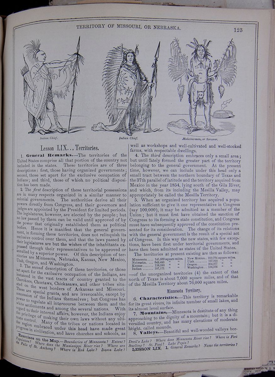 TERRITORY OF MISSOURI, OR
NEBRASKA.
123
Indian Chief.
Indian Chief.
Medicine-man, or Sorcerer.
TERRITORY OF MISSOURI, OR
NEBRASKA.
123
Indian Chief.
Indian Chief.
Medicine-man, or Sorcerer.
Lesson LIX... Territories.
1. General Remarks.—The territories of the United States comprise all that portion of the country not included in the states. These territories are of three descriptions: first, those having organized governments; second, those set apart for the exclusive occupation of Indians; and third, those of which no political disposition has been made.
2. The first description of these territorial possessions are in many respects organized in a similar manner to colonial governments. The authorities derive all their powers directly from Congress, and their governors and judges are appointed by the President for limited periods. The legislatures, however, are elected by the people; but no law passed by them can be valid until approved of by the power that originally established them as political bodies. Hence it is manifest that the general government, in forming these territories, does not relinquish its exclusive control over them, and that the laws passed by their legislatures are but the wishes of the inhabitants expressed through their representatives to be approved or annulled by a superior power. Of this description of territories are Minnesota, Nebraska, Kansas, New Mexico, Utah, Oregon, and Washington.
3. The second description of these territories, or those set apart for the exclusive occupation of the Indians, are instanced in the vast tracts of country granted to the Cherokees, Choctaws, Chickasaws, and other tribes situated on the west borders of Arkansas and Missouri. These are special grants, and are irrevocable, except by concession of the Indians themselves; but Congress has power to regulate all intercourse between them and the white settlements and among the several nations. With regard to their internal affairs, however, the Indians enjoy the privilege of making their own laws without any ultimate control. Many of the tribes or nations located in the region embraced under this head have made great progress in civilization, and have churches and schools, as well as workshops and well-cultivated and well-stocked farms, with respectable dwellings.
4. The third description embraces only a small area; but until lately formed the greater part of the territory belonging to the general government. At the present time, however, we can include under this head only a small tract between the northern boundary of Texas and the 37th parallel of latitude and the territory acquired from Mexico in the year 1854, lying south of the Gila River, and which, from its including the Mesilla Valley, may appropriately be called the Mesilla Territory.
5. When an organized territory has acquired a population sufficient to give it one representative in Congress (say 100,000), it may be admitted as a member of the Union; but it must first have obtained the sanction of Congress to its forming a state constitution, and Congress must have subsequently approved of the constitution presented for its consideration. The change of its relations with the general government is the result of a special act of Congress. In this way the new states, with few exceptions, have been first under territorial governments, and have then been admitted as states of the United States. The territories at present existing are then as follows: Table showing the extent in square miles of the following territories: Minnesota, Nebraska, Kansas, Indian, New Mexico, Utah, Oregon, and Washington. —of the unorganized territories (4) the extent of that north of Texas is about 7,000 square miles, and of that of the Mesilla Territory about 76,000 square miles.
Minnesota Territory.
6. Characteristics.—This territory is remarkable for its great rivers, its infinite number of small lakes, and its almost level surface.
7. Mountains.—Minnesota is destitute of any thing approaching to the dignity of a mountain; but it is a diversified country, and has many elevations of moderate height, called mounds.
8. Valleys.—Beautiful and well-wooded valleys border
Exercises on the Map.—Boundaries of Minnesota? Extent? Population? Where does the Mississippi River rise? Where are the Falls of St. Anthony? Where is Red Lake? Itasca Lake? Devil's Lake? Where does Minnesota River rise? Where is Fort Snelling? St. Paul? Lake Pepin?
LESSON LIX. 1. General Remarks? Name the territories?
[begin surface 500]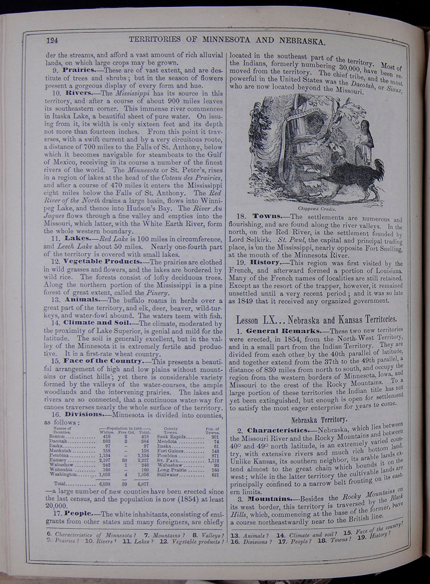 124
TERRITORIES OF MINNESOTA AND
NEBRASKA.
124
TERRITORIES OF MINNESOTA AND
NEBRASKA.
the streams, and afford a vast amount of rich alluvial lands, on which large crops may be grown.
9. Prairies.—These are of vast extent, and are destitute of trees and shrubs; but in the season of flowers present a gorgeous display of every form and hue.
10. Rivers.—The Mississippi has its source in this territory, and after a course of about 900 miles leaves its southeastern corner. This immense river commences in Itaska Lake, a beautiful sheet of pure water. On issuing from it, its width is only sixteen feet and its depth not more than fourteen inches. From this point it traverses, with a swift current and by a very circuitous route, a distance of 700 miles to the Falls of St. Anthony, below which it becomes navigable for steamboats to the Gulf of Mexico, receiving in its course a number of the finest rivers of the world. The Minnesota or St. Peter's, rises in a region of lakes at the head of the, Coteau des Prairies, and after a course of 470 miles it enters the Mississippi eight miles below the Falls of St. Anthony. The Red River of the North drains a large basin, flows into Winnipeg Lake, and thence into Hudson's Bay. The River Au Jaques flows through a fine valley and empties into the Missouri, which latter, with the White Earth River, form the whole western boundary.
11. Lakes.—Red Lake is 100 miles in circumference, and Leech Lake about 50 miles. Nearly one-fourth part of the territory is covered with small lakes.
12. Vegetable Products.—The prairies are clothed in wild grasses and flowers, and the lakes are bordered by wild rice. The forests consist of lofty deciduous trees. Along the northern portion of the Mississippi is a pine forest of great extent, called the Pinery.
13. Animals.—The buffalo roams in herds over great part of the territory, and elk, deer, beaver, wild-turkeys, and water-fowl abound. The waters teem with fish.
14. Climate and Soil.—The climate, moderated by the proximity of Lake Superior, is genial and mild for the latitude. The soil is generally excellent, but in the valley of the Minnesota it is extremely fertile and productive. It is a first-rate wheat country.
15. Face of the Country.—This presents a beautiful arrangement of high and low plains without mountains or distinct hills; yet there is considerable variety formed by the valleys of the water-courses, the ample woodlands and the intervening prairies. The lakes and rivers are so connected, that a continuous water-way for canoes traverses nearly the whole surface of the territory.
16. Divisions.—Minnesota is divided into counties, as follows: This table lists the counties of Minnesota with their populations in 1850 and includes a column for the major town in each county and the town's population. The county population is divided into the following categories: White, Free Colored, and Total. —a large number of new counties have been erected since the last census, and the population is now (1854) at least 20,000.
17. People.—The white inhabitants, consisting of emigrants from other states and many foreigners, are chiefly located in the southeast part of the territory. Most of the Indians, formerly numbering 30,000, have been removed from the territory. The chief tribe, and the most powerful in the United States was the Dacotah, or Sioux, who are now located beyond the Missouri.
Chippewa Cradle.18. Towns.—The settlements are numerous and flourishing, and are found along the river valleys. In the north, on the Red River, is the settlement founded by Lord Selkirk. St. Paul, the capital and principal trading place, is on the Mississippi, nearly opposite Fort Snelling, at the mouth of the Minnesota River.
19. History.—This region was first visited by the French, and afterward formed a portion of Louisiana. Many of the French names of localities are still retained. Except as the resort of the trapper, however, it remained unsettled until a very recent period; and it was so late 1849 that it received any organized government.
Lesson LX... Nebraska and Kansas Territories.
1. General Remarks.—These two new territories were erected, in 1854, from the North-West Territory, and in a small part from the Indian Territory. They are divided from each other by the 40th parallel of latitude, and together extend from the 37th to the 49th parallel, a distance of 830 miles from north to south, and occupy the region from the western borders of Minnesota, Iowa, and Missouri to the crest of the Rocky Mountains. To a large portion of these territories the Indian title has not yet been extinguished, but enough is open for settlement to satisfy the most eager enterprise for years to come.
Nebraska Territory.
2. Characteristics.—Nebraska, which lies between the Missouri River and the Rocky Mountains and between 40° and 49° north latitude, is an extremely varied country, with extensive rivers and much rich bottom land. Unlike Kansas, its southern neighbor, its arable lands extend almost to the great chain which bounds it on the west; while in the latter territory the cultivable lands are principally confined to a narrow belt fronting on its eastern limits.
3. Mountains.—Besides the Rocky Mountains on its west border, this territory is traversed by the Black Hills, which, commencing at the base of the former, have a course northeastwardly near to the British line.
6. Characteristics of Minnesota? 7. Mountains? 8. Valleys? 9. Prairies? 10. Rivers? 11. Lakes? 12. Vegetable products? 13. Animals? 14. Climate and soil? 15. Face of the country? 16. Divisions? 17. People? 18. Towns? 19. History?
[begin surface 501]
It is likely that during the present Session of Congress three new States will be added to the Union—Minnesota, Oregon and Kansas; for before the end of the Session Kansas, we take it, will come in, though precisely how or under what constitution is still a matter of doubt. In place of these three Territories erected into States, three new Territories will present themselves as candidates for organization, namely Dacotah, Carson's Valley, which aspires to call itself Columbus, and Arizonia.
Dacotah, including that part of Minnesota Territory not embraced in the State, may no doubt be properly organized as a Territory, but the claims of the other two candidates are a good deal more questionable. Carson's Valley on the east slope of the Sierra Nevada has hitherto been a sort of debatable land between California and Utah. Till recently it has been chiefly inhabited by Mormon immigrants. They have lately moved back to Salt Lake or the neighborhood, upon the summons of Brigham Young to the Saints to concentrate for the defense of that holy city, but their places have been supplied by other settlers. These settlers wish to disconnect themselves from Utah, at the same time they do not seem to like much better the idea of a connection with California. Hence their scheme for being erected into a distinct Territory. Their isolated situation, separated as they are from Utah by deserts, and from California by mountains, gives them a certain claim to a government of their own. The objection is the small extent of land capable of cultivation.
The case of Arizonia, including the Territory on the Gila, is very similar. Its wide separation from the inhabited parts of New-Mexico would seem to point to a political separation. But there is the same objection to erecting it into a Territory as in the case of Carson's Valley. Arizonia, however, may get some help from the idea that Slavery may be smuggled in there.
 TERRITORY OF KANSAS AND THE
INDIAN TERRITORY.
125
TERRITORY OF KANSAS AND THE
INDIAN TERRITORY.
125
4. Valleys.—Among the mountains there are numerous valleys, which, though small, are beautiful and fertile. The values of the Missouri, Yellow Stone, and Nebraska are well wooded, and afford excellent farm lands. The mountain valleys are rich in Alpine scenery, and will form excellent sheep pastures.
5. Prairies.—These are very extensive, and occupy principally a zone of 50 to 100 miles west of the Missouri River, and there are wide elevated plains between the Black Hills and Rocky Mountains.
6. Rivers.—The Missouri and its great tributary, the Yellow Stone, rise within this territory from the Rocky Mountains, and first pursuing a course northeasterly, unite near the northern extremity of the Black Hills, and from that point the stream has a southerly course along the eastern boundary of the territory. Innumerable affluents feed these rivers from both right and left. The Nebraska or Platte rises from the same mountains, but from a more southerly region, and has a course almost directly east to the Missouri, which it joins in latitude 41°.
7. Inhabitants.—The whole territory is still in possession of the Indians. The hunter alone has ventured into the country, or at most it may have been visited by a party of excursionists. There are, however, no white settlements; and so distant is even its eastern frontier from the states, that many years must elapse before it can receive a settled or reputable population.
8. History.—This territory is part of Louisiana as purchased from France, and still remains a wilderness. It was organized under its present name by Act of Congress in 1854, and a governor, administrative officers, and judges have already been appointed to await the arrival of a future population and legislature!
Kansas Territory.
9. Characteristics.—The eastern part of this territory alone is cultivable, and that only for 100 to 150 miles from the frontier. Westward the land is a desert.
10. Mountains.—The Rocky Mountains, which lie on the western border, present several lofty culminations, and are the sources of large rivers flowing both to the east, west, and south. On the hills is an abundance of timber. The scenery is very fine, and often of wild and terrible grandeur.
11. Valleys.—There are a few fertile valleys on the eastern base of the Rocky Mountains; others, again, are desolate and barren, destitute of fuel or building material, and almost inaccessible. The river valleys are many of them very rich and very productive.
12. Rivers.—The territory is watered by the Kansas and its tributaries. In the extreme west the southern fork of the Nebraska has its rise, and thence passes into Nebraska. The Arkansas River drains the southern section. These rivers are partially navigable for river craft.
13. Climate, Soils, Products, etc.—The climate is colder than in the states, and subject to storms from the north; but it is not so ungenial as to interfere with outdoor labor. The soils along the eastern belt are rich and productive; but one grand difficulty is the scarcity of timber away from the rivers. Away beyond this eastern belt the lands are worthless; and hence it is on this alone that population will aggregate. The farm productions will be the same as in Iowa.
14. Desert.—An immense tract, called the Great American Desert, extends along the eastern part of the Rocky Mountains, from the Nebraska Territory to Texas, a length of nearly 600 miles. Its width varies from one to two hundred miles. The soil of this is arid, sterile sand, almost destitute of trees, and even shrubs. Vast tracts consist of bare rocks, gravel, or sand, presenting a few cactuses, grape-vines, and other plants. Nearly the whole region is either destitute of water a part of the year, or presents the exhausted traveler only a brackish and bitter draught. Many parts are whitened by saline efflorescence. It is unsusceptible of cultivation, yet in the rainy season it is traversed by full streams, and there are occasional patches which afford pasturage for herds of bison, droves of wild horses, and other animals. These spots are the resort of the Indians in pursuit of game.
15. Inhabitants.—The Indians possess all the good lands, and little remunerative space is left for the white settler. Before the passage of the territorial act it is probable that there were not within Kansas a hundred white persons. Since then immigration, according to all accounts, has been rapid—too rapid for success. Yet it is possible that lands may be found to give encouragement to settlers; and if so, much anticipated suffering will be avoided. It is not probable, however, that many will seek such a wilderness while so much fine land is open to settlement in Iowa and Missouri as at present.
16. History.—This territory, like Nebraska, was a portion of old French Louisiana, and until lately has been unoccupied, save by the Indians. Events, however, have directed the people to its settlement, and among these may be mentioned the project of a road through it to California, and the desire of the south to reclaim the territory to slavery. The first is a legitimate object of enterprise; but as to the latter there is a diversity of opinion. It was erected into a territory by the same act as Nebraska, and may ultimately enter the Union either as a slave or free state, as the inhabitants may will.
Lesson LXI... Indian Territory.
1. Characteristics.—This vast tract is set apart by the United States as the permanent home of certain Indian tribes and nations, who have been removed hither by the General Government.
2. Mountains.—The southeastern corner of this tract is traversed by the Ozark range. From this point westward, the country presents a series of slightly undulating plains, gradually ascending toward the Rocky Mountains.
3. Prairies.—The eastern part of the territory consists of fertile prairies, the rivers being skirted by forests.
4. Rivers.—The Indian Territory is bountifully supplied with water for navigation and irrigation, and especially is this the case in the central and eastern districts. The Arkansas rises in the Rocky Mountains, near the head
Exercises on the Map.—What line is the boundary between Kansas and Nebraska? Boundaries of Nebraska? Where does the Missouri River rise? Where the Yellow Stone? Where the Nebraska? What mountains bound Nebraska on the west? What hills are found in Nebraska? Boundaries of Kansas? What large rivers in Kansas? Where does the Nebraska River rise?
Lesson LX. 1. General remarks? 2. Characteristics of Nebraska? Where situated? 3. Mountains? 4. Valleys? 5. Prairies? 6. Rivers? 7. Inhabitants? 8. History? 9. Characteristics of Kansas? 10. Mountains? 11. Valleys? 12. Rivers? 13. Climate? Soil? Products? 14. What desert is in this territory? 15. Inhabitants? 16. History?
[begin surface 504]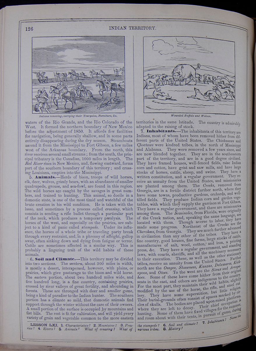 126
INDIAN TERRITORY.
Indians removing, carrying their Tent-poles,
Furniture, &c.
Wounded Buffalo and Wolves.
126
INDIAN TERRITORY.
Indians removing, carrying their Tent-poles,
Furniture, &c.
Wounded Buffalo and Wolves.
waters of the Rio Grande, and the Rio Colorado of the West. It formed the northern boundary of New Mexico before the adjustment of 1850. It affords few facilities for navigation, being generally shallow, and in some parts entirely disappearing during the dry season. Steamboats ascend it from the Mississippi to Fort Gibson, a few miles west of the Arkansas boundary. From the north, this river receives several small streams; from the south, the principal tributary is the Canadian, 1000 miles in length. The Red River rises in New Mexico, and, flowing eastward, forms part of the southern boundary of this territory; and crossing Louisiana, empties into the Mississippi.
5. Animals.—Herds of bison, troops of wild horses, elk, deer, wolves, grizzly bears, with an abundance of smaller quadrupeds, grouse, and sea-fowl, are found in this region. The wild horses are caught by the savages in great numbers, and trained to hunting. This animal, so docile in a domestic state, is one of the most timid and watchful of the brute creation in his wild condition. He is taken with the lasso, and sometimes by a process called creasing, which consists in sending a rifle bullet through a particular part of the neck, which produces a temporary paralysis. The horses of the west, and especially on the prairies, are subject to a kind of panic called stampede. Under its influence, the horses of a whole tribe or traveling party break through every restraint, and, in a phrensy of affright, gallop away, often sinking down and dying from fatigue or terror. Cattle are sometimes affected in a similar way. This is probably a lingering trait of the wild habits of these animals.
6. Soil and Climate.—This territory may be divided into two sections. The western, about 300 miles in width, is mostly a desert, interspersed, however, with plains, or prairies, which give pasturage to the bison and wild horse. The eastern portion, about two hundred miles wide, and five hundred long, is a fine country, containing prairies, crossed by river valleys of great fertility, and abounding in forests. These are thronged with deer and smaller game, being a kind of paradise to the Indian hunter. The southern portion has a climate so mild, that domestic animals find support through the winter without the care of their owners. A small portion of the surface is occupied by mountains and flat hills. The rest is fit for cultivation, and will yield every variety of grain and vegetable common to the more eastern territories in the same latitude. The country is admirably adapted to the raising of stock.
7. Inhabitants.—The inhabitants of this territory are Indians, most of whom have been removed hither from different parts of the United States. The Chickasaws and Choctaws were kindred tribes, in the north of Mississippi and Alabama. They were removed a few years since, and are now blended together. They are in the southeastern part of the territory, and are in a good degree civilized. They have framed houses, well-fenced fields, raise Indian corn and cotton, have grist and saw mills, and have large stocks of horses, cattle, sheep, and swine. They have a written constitution, and a regular government. They receive an annuity from the United States, and missionaries are planted among them. The Creeks, removed from Georgia, are in a fertile district further north, where they have some towns, productive gardens, orchards, and well-tilled fields. They produce Indian corn and garden vegetables, with which they supply the garrison at Fort Gibson. They have a regular government, and there are missionaries among them. The Seminoles, from Florida, were originally of the Creek nation, and, speaking the same language, are located with them. Though averse to labor, they have made some progress. Northeast of the Creeks are the Cherokees, from Georgia. They are much further advanced in civilization than any other of the tribes. They have a fine country, good houses, fine farms, large stocks of cattle, manufactures of salt, wool, cotton, and iron, a printing press, &c. They have a regular government, and standing laws, with courts, sheriffs, and all the machinery necessary to their execution. These, as well as the other stationary tribes, receive an annuity from the United States. Further north are the Osages, Shawnees, Kanzas, Delawares, Kickapoos, and Otoes. To the west are the Sioux and Arrapahoes. Some of these have come hither from their original seats in the east, and others are indigenous to the country. For the most part, they maintain their wild habits, slightly modified by the use of the horse, the rifle, and steel cutlery. They have some superstition, but little religion. Their burial-grounds often consist of spaces marked by circles of skulls. The bodies are placed upon raised platforms, where they are left to decay. Their chief occupation is hunting. Some of them have fixed villages for the summer, and roam about with their tents, in pursuit of game, during
LESSON LXI. 1. Characteristics? 2. Mountains? 3. Prairies? 4. Rivers? 5. Animals? What of creasing? What of the stampede? 6. Soil and climate? 7. Inhabitants? Name the various tribes. 8. History?
[begin surface 505]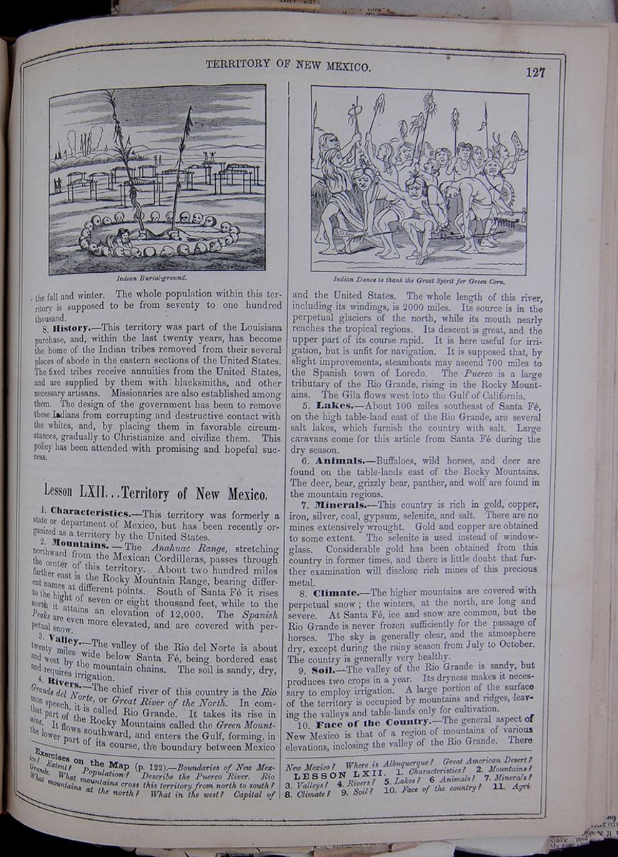 TERRITORY OF NEW MEXICO.
127
Indian Burial-ground.
Indian Dance to thank the Great Spirit for Green
Corn.
TERRITORY OF NEW MEXICO.
127
Indian Burial-ground.
Indian Dance to thank the Great Spirit for Green
Corn.
the fall and winter. The whole population within this territory is supposed to be from seventy to one hundred thousand.
8. History.—This territory was part of the Louisiana purchase, and, within the last twenty years, has become the home of the Indian tribes removed from their several places of abode in the eastern sections of the United States. The fixed tribes receive annuities from the United States, and are supplied by them with blacksmiths, and other necessary artisans. Missionaries are also established among them. The design of the government has been to remove these Indians from corrupting and destructive contact with the whites, and, by placing them in favorable circumstances, gradually to Christianize and civilize them. This policy has been attended with promising and hopeful success.
Lesson LXII... Territory of New Mexico.
1. Characteristics.—This territory was formerly a state or department of Mexico, but has been recently organized as a territory by the United States.
2. Mountains.—The Anahuac Range, stretching northward from the Mexican Cordilleras, passes through the center of this territory. About two hundred miles further east is the Rocky Mountain Range, bearing different names at different points. South of Santa Fé it rises to the hight of seven or eight thousand feet, while to the north it attains an elevation of 12,000. The Spanish Peaks are even more elevated, and are covered with perpetual snow.
3. Valley.—The valley of the Rio del Norte is about twenty miles wide below Santa Fé, being bordered east and west by the mountain chains. The soil is sandy, dry, and requires irrigation.
4. Rivers.—The chief river of this country is the Rio Grande del Norte, or Great River of the North. In common speech, it is called Rio Grande. It takes its rise in that part of the Rocky Mountains called the Green Mountains. It flows southward, and enters the Gulf, forming, in the lower part of its course, the boundary between Mexico and the United States. The whole length of this river, including its windings, is 2000 miles. Its source is in the perpetual glaciers of the north, while its mouth nearly reaches the tropical regions. Its descent is great, and the upper part of its course rapid. It is here useful for irrigation, but is unfit for navigation. It is supposed that, by slight improvements, steamboats may ascend 700 miles to the Spanish town of Loredo. The Puerco is a large tributary of the Rio Grande, rising in the Rocky Mountains. The Gila flows west into the Gulf of California.
5. Lakes.—About 100 miles southeast of Santa Fé, on the high table-land east of the Rio Grande, are several salt lakes, which furnish the country with salt. Large caravans come for this article from Santa Fé during the dry season.
6. Animals.—Buffaloes, wild horses, and deer are found on the table-lands east of the Rocky Mountains. The deer, bear, grizzly bear, panther, and wolf are found in the mountain regions.
7. Minerals.—This country is rich in gold, copper, iron, silver, coal, gypsum, selenite, and salt. There are no mines extensively wrought. Gold and copper are obtained to some extent. The selenite is used instead of window-glass. Considerable gold has been obtained from this country in former times, and there is little doubt that further examination will disclose rich mines of this precious metal.
8. Climate.—The higher mountains are covered with perpetual snow; the winters, at the north, are long and severe. At Santa Fé, ice and snow are common, but the Rio Grande is never frozen sufficiently for the passage of horses. The sky is generally clear, and the atmosphere dry, except during the rainy season from July to October. The country is generally very healthy.
9. Soil.—The valley of the Rio Grande is sandy, but produces two crops in a year. Its dryness makes it necessary to employ irrigation. A large portion of the surface of the territory is occupied by mountains and ridges, leaving the valleys and table-lands only for cultivation.
10. Face of the Country.—The general aspect of New Mexico is that of a region of mountains of various elevations, inclosing the valley of the Rio Grande. There
Exercises on the Map (p. 122.)—Boundaries of New Mexico? Extent? Population? Describe the Puerco River. Rio Grande. What mountains cross this territory from north to south? What mountains at the north? What in the west? Capital of New Mexico? Where is Albuquerque? Great American Desert?
LESSON LXII. 1. Characteristics? 2. Mountains? 3. Valleys? 4. Rivers? 5. Lakes? 6. Animals? 7. Minerals? 8. Climate? 9. Soil? 10. Face of the country? 11. Agriculture
[begin surface 506]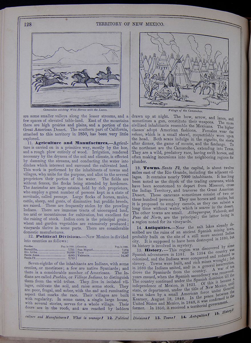 128
TERRITORY OF NEW MEXICO.
Camanches catching Wild Horses with the Lasso.
128
TERRITORY OF NEW MEXICO.
Camanches catching Wild Horses with the Lasso.
are some smaller valleys along the lesser streams, and a few spaces of elevated table-land. East of the mountains there are high prairies and plains, and a portion of the Great American Desert. The southern part of California, attached to this territory in 1850, has been very little explored.
11. Agriculture and Manufactures.—Agriculture is carried on in a primitive way, mostly by the hoe, and a rough plow entirely of wood. Irrigation, rendered necessary by the dryness of the soil and climate, is effected by damming the streams, and conducting the water into ditches which intersect and surround the cultivated land. This work is performed by the inhabitants of towns and villages, who unite for the purpose, and allot to the several proprietors their portion of the water. The fields are without fences, the flocks being attended by herdsmen. The haciendas are large estates held by rich proprietors, who employ a great number of persons kept in a state of servitude, called peonage. Large flocks of horses, mules, cattle, sheep, and goats, of diminutive but prolific breeds, are raised. These are frequently stolen by the prowling Indians. There are immense tracts of unoccupied land, too arid or mountainous for cultivation, but excellent for the raising of stock. Indian corn is the principal grain; wheat and garden vegetables are extensively produced; vineyards thrive in some parts. There are considerable domestic manufactures.
12. Political Divisions.—New Mexico is divided into counties as follows: Table listing the population (in 1850) of the following counties of New Mexico: Bernalillo, Rio Ariba, Santa Anna, Santa Fé, San Miguel, Taos, and Valencia. Seven-eighths of the inhabitants are Indians, with some Creoles, or mestizoes; a few are native Spaniards; and there is a considerable number of Americans. The Indians are called Pueblos, or Village Indians, to distinguish them from the wild tribes. They live in isolated villages, cultivate the soil, and raise some stock. They are poor, frugal, and sober, with the sad and ruminating aspect that marks the race. Their villages are built with regularity. In some cases, a single large house, with several stories, serves for a whole village. Their doors are in the roofs, and are reached by ladders Village of the Camanches. drawn up at night. The bow, arrow, and lance, and sometimes a gun, constitute their weapons. The more civilized inhabitants resemble the Mexicans. The higher classes adopt American fashions. Females wear the reboso, which is a small shawl, coquettishly worn upon the head. Both sexes indulge in the cigarito, the siesta after dinner, the game of monte, and the fandango. To the northeast are the Camanches, extending into Texas. They are a wild, predatory race, having swift horses, and often making incursions into the neighboring regions for plunder.
13. Towns. Santa Fé, the capital, is about twelve miles east of the Rio Grande, including the adjacent villages. It contains nearly 7000 inhabitants. It has long been noted as the dépôt of the trading caravans, which have been accustomed to depart from Missouri, cross the Indian Territory, and traverse the Great American Desert. These caravans sometimes consist of two or three hundred persons. They use horses and mules, but it is proposed to employ camels, as they can subsist a long time without water, which is scarce in the desert. The other towns are small. Albuquerque, Valverde, and Paso del Norte, are the principal; the latter being in a region noted for its vineyards.
14. Antiquities.—Near the salt lakes already described are the ruins of an ancient Spanish mining town, probably built on the site of a still more ancient Indian city. It is supposed to have been destroyed in 1680, but its history is involved in mystery.
15. History.—This region was discovered by some Spanish adventurers in 1581. In 1594 the country was colonized, and the Indians were conquered and reduced to slavery. Towns were built, and rich mines wrought; but in 1680 the Indians united, and in a general insurrection, drove the Spaniards from the country. A war of ten years ensued, when the Spanish ascendency was recovered. The country continued under the Spanish dominion till the independence of Mexico, in 1821. Of this it became a state, or department, under the title of New Mexico, until it was taken by a small American force under General Kearney, August 18, 1846. In the peace between the United States and Mexico, in 1848, it was confirmed to the former. In 1850, it received a territorial government.
and Manufactures? What is peonage? 12. Political Divisions? 13. Towns? 14. Antiquities? 15. History?
[begin surface 507]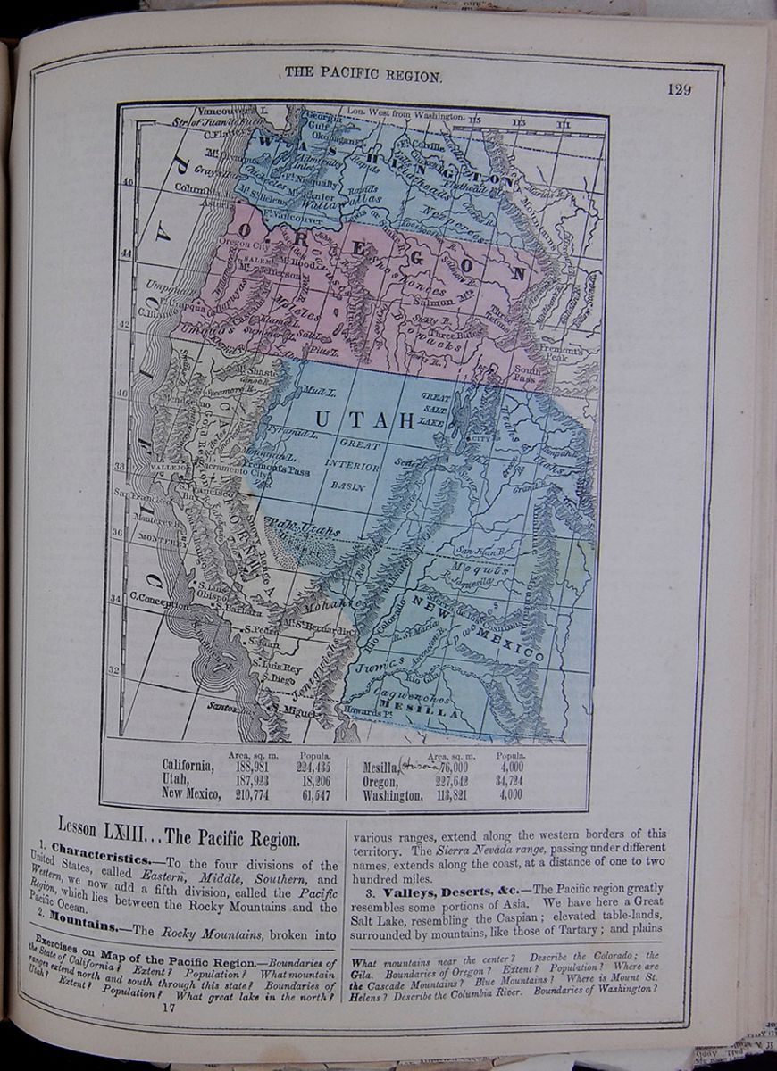 THE PACIFIC REGION.
129
Map of the territories of Washington, Oregon,
California, Utah, New Mexico, and Mesilla.
THE PACIFIC REGION.
129
Map of the territories of Washington, Oregon,
California, Utah, New Mexico, and Mesilla.
| Area, sq. m. | Popula. | |
| California, | 188,891 | 224,435 |
| Utah, | 187,923 | 18,206 |
| New Mexico, | 210,774 | 61,547 |
| Area, sq. m. | Popula. | |
| Mesilla, (Arizonia) | 76,000 | 4,000 |
| Oregon, | 227,642 | 34,724 |
| Washington, | 113,821 | 4,000 |
Lesson LXIII... The Pacific Region.
1. Characteristics.—To the four divisions of the United States, called Eastern, Middle, Southern, and Western, we now add a fifth division, called the Pacific Region, which lies between the Rocky Mountains and the Pacific Ocean.
2. Mountains.—The Rocky Mountains, broken into various ranges, extend along the western borders of this territory. The Sierra Nevada range, passing under different names, extends along the coast, at a distance of one to two hundred miles.
3. Valleys, Deserts, &c.—The Pacific region greatly resembles some portions of Asia. We have here a Great Salt Lake, resembling the Caspian; elevated table-lands, surrounded by mountains, like those of Tartary; and plains
Exercises on Map of the Pacific Region.—Boundaries of the State of California? Extent? Population? What mountain ranges extend north and south through this state? Boundaries of Utah? Extent? Population? What great lake in the north? What mountains near the center? Describe the Colorado; the Gila. Boundaries of Oregon? Extent? Population? Where are the Cascade Mountains? Blue Mountains? Where is Mount St. Helens? Describe the Columbia River. Boundaries of Washington?
17 [begin surface 508] 130
THE PACIFIC REGION.
130
THE PACIFIC REGION.
and deserts broken by mountain ridges, like those of Persia. There are three extensive valleys: the Great Basin, in the center; the Valley of the Colorado, at the south; and the Valley of the Columbia, at the north. There are many smaller ones, among which is that of the Sacramento and San Joaquin, 500 miles in length. In general, there is a striking aspect of irregularity, contrast, and grandeur about the Pacific slope. It embraces the loftiest mountain peaks in the United States, their tops crowned with perpetual snow, looking down upon deserts scorched by the summer sun; volcanic fires bursting from cones of eternal ice; valleys of unbounded fertility, and large spaces of desolate rock, gravel, or sand; mighty rivers of fresh water finding their way to the ocean; salt lakes imprisoned between rocky, barren, and impassable wastes; with ridges of everlasting sterility, yet sparkling with gold, quicksilver, and other minerals. A most interesting feature of the country is, that it has a coast of 1000 miles on the Pacific, and thus opens to our commerce the boundless shores of that great Ocean.
4. Rivers.—The Colorado and Columbia, each about 1500 miles long, are the great streams of this region.
5. Divisions.—The Pacific region includes the Territories of Utah and Oregon and the State of California.
6. Inhabitants.—The whole white population of this region, probably, does not exceed 250,000. There is a great number of Indian tribes scattered over the territory, most of them in a savage state. Their population is, probably, much less than that of the whites.
7. History.—Utah and California constitute the greater part of what the Spaniards called Alta or Upper California, and which came to the United States during the late Mexican war. Oregon was claimed by us as part of the Louisiana purchase; but our right to it rested also upon the grounds of previous discovery.
Lesson LXIV.. Territory of Utah.
1. Characteristics.—This territory was formerly a part of California, and has been lately settled by the Mormons.
2. Mountains.—The Rocky Mountains bound this territory on the northern part of the eastern line, separating it from Nebraska territory; and the Sierra Nevada mountains separate it from the state of California on the northern part of the western line. These mountains are here of sufficient elevation to be perpetually crowned with snow. Two ranges of mountains cross this territory in a northeasterly and southwesterly direction, but they are little known. The eastern range is called Wahsatch River Mountains, and the western Humboldt River Mountains.
3. Valley.—A remarkable feature of this territory is a vast extent of country called the Great Basin. It consists of an elevated valley, nearly 2000 miles in circuit. The southern portion of it is a dry, sandy desert, thinly inhabited by savages. It has never been explored or fully described by any traveler. It is 4000 or 5000 feet above the level of the sea, and shut in by mountains on all sides. The Wahsatch and Humboldt mountains cross it in two ranges, attaining an elevation of 5000 feet above the level of the country. Their lower sides are covered with forests. Numerous small streams have their origin in the mountains around and within the basin, which descend and are lost in the desert, or received into small lakes. There are also in this wide valley some spots capable of cultivation. To the east and north around the Great Salt Lake is a territory of great beauty and fertility; to the west it is more sterile.
4. Rivers.—The chief river in this region is the Rio Colorado, which rises in Oregon among the Rocky Mountains, bearing the name of the Green river till its union with the Jaquesila, where the combined streams take the name of Colorado. The thirty-seventh parallel of north latitude forms the southern boundary of the territory, and separates Utah from New Mexico.
5. Lakes.—The Great Salt Lake is a remarkable feature of this region. Its shape is irregular, and it incloses numerous islands. It is supposed to be about 70 miles in length. It is intensely salt, and so shallow as to afford small facilities for navigation. The western shore consists of level plains of deep soft mud, traversed by rills of salt and sulphur water. These plains are destitute of vegetation, except small shrubs, which are covered with particles of salt, shining in the sun; curious optical illusions are here presented, arising from mirage, which distorts objects in a most grotesque manner. Fresh water and grass are here to be seen only once in the space of 100 miles. In one place is a field of solid salt, incrusted upon the mud, so as to bear up mules, like ice. The lake has no outlet. The Utah River, or Jordan, as the Mormons call it, is a small stream connecting Utah Lake with the Great Salt Lake. Utah Lake is of fresh water, 35 miles long, and receives numerous bold fresh-water streams from the mountains, though a large formation of rock-salt is found imbedded in clay on its southeastern borders. These lakes are about 4000 feet above the level of the sea, and drain an area of 12,000 square miles. A great part of the region around the lakes in dry seasons is incrusted with salt. Utah Lake, as well as the streams that flow into it, abound in fish, which furnish a large part of the food of the Utah Indians. It appears that there are numerous small lakes scattered over the territory of Utah, but we have no exact account of them.
6. Vegetable Products.—We are too little acquainted with this region to give a particular account of its vegetable productions. In general, they are similar to those of the eastern country in the same latitudes.
7. Animals.—It is understood that there is abundance of game in this country, consisting of deer, bears, and smaller quadrupeds, with numerous water-fowl.
8. Climate.—We have no accurate report of the climate over the whole of this territory. In the region of the Great Lake, the winters are long and severe. In lat. 40° it is colder than at Philadelphia. The winter begins in November; snow falls upon the plains to the depth of several inches as late as March. In the mountainous regions, a little further north, snow accumulates to the depth of fifty feet during the winter!
9. Face of the Country.—This presents three regions; first, the Great Basin already described, containing a desert of burning sand, snow-capped mountains belted with verdure at the base, and a few fertile spots flanking the rivers; second, the high broken table-lands, and mountainous ridges in the center; and, third, the great
LESSON LXIII. 1. Characteristics? 2. Mountains? 3. Valleys and Deserts? 4. Rivers? 5. Divisions? 6. Inhabitants? 7 History?
LESSON LXIV. 1. Characteristics? 2. Mountains? 3. Valleys? Rivers? 5. Lakes? What of the Great Salt Lake? Utah Lake? 6. Vegetable products? 7. Animals? 8. Climate?
valley of the streams which forms the Colorado. The southern part of the territory is a rugged plain.
10. Divisions.—Utah is divided into counties, as follows: Table listing the populations (in 1853) of the following counties in Utah: Salt Lake City, Salt Lake, Utah, Juab, San Pete, Millard, Iron, Toole, Davis, and Weber. —the total population in 1850 was 11,380.
11. Inhabitants.—This territory is inhabited by small bands of Indians, most of whom obtain a poor subsistence by hunting and fishing. The chief tribe is that of the Utahs in the northeast, who have given name to the territory. The white inhabitants consist chiefly of the Mormons, who removed hither in 1848. This sect had its origin in 1830, in one Joe Smith, of Palmyra, New York. He pretended to have found some gold plates with inscriptions, which he translated by miraculous aid. Thus was produced the Book of Mormon, which is the Bible of the sect. They built a temple at Kirtland, in Ohio, but removed to Michigan, afterwards to Missouri, and then to Illinois, being driven from these places by the inhabitants. In the latter state they had a city called Nauvoo, with a temple of immense extent, and a population of 10,000 people, gathered from Europe and America. Being persecuted here, they set out for Oregon and California; but being attracted by the country around the Great Lake, they settled there, and in 1850 numbered nearly 12,000. They are building a city, twelve miles in circumference, between the two lakes. They are erecting a vast temple of stone. The houses are of brick. This place has already 6,000 inhabitants. There are several settlements along the river Jordan. They have commenced agriculture, and raise 75 bushels of wheat to the acre. Potatoes and the smaller grains flourish; but the climate is too cold for Indian corn. There is little rain, and irrigation is required. They have numerous flour and saw mills in operation, wrought by the mountain streams. In some places there is plenty of choice timber. The climate is extremely healthy. In 1850, Congress erected the territory into a separate government. All sects are tolerated. They are said to be a moral, industrious, and thriving people. The sect is supposed to number 100,000, in different parts of America and Europe; and as the city of the Great Salt Lake is the Jerusalem, or Mecca, of the entire body, it is likely to be rapidly increased by the emigration of its members hither. The route from the Western States to Oregon and California, by way of the South Pass, runs about 60 miles north of the Mormon city; but a route can be taken which leads somewhat nearer to that place. The people supply fresh mules, oxen, and provisions to the emigrants. The road from Independence to the western side of the Rocky Mountains is good, and immense numbers have passed over it. The large parties of emigrants usually travel about 15 miles a day. For 500 miles along the prairie country, buffalo meat can be obtained in abundance. The Mormons have established ferries over the Platte and Green rivers.
12. History.—The territory of Utah formed a part of Upper California, which came into our possession during the late war with Mexico. At first it was called Deseret, but this name was changed for Utah. The territorial government was established in 1850.
Lesson LXV... State of California.
1. Characteristics.—This is a new state, lying on the Pacific Ocean, and is celebrated for its gold mines.
2. Mountains.—The great mountain feature of this region is the Sierra Nevada, signifying Snowy Mountains, their tops being always crowned with snow. It consists of several nearly parallel ridges, and forms part of the great chain which rises in the peninsula of California, and extends along the coast to Russian America—a distance of 3000 miles. It is remarkable for its length, its proximity and parallelism to the sea-coast, its great elevation—often more lofty than the Rocky Mountains—and its many volcanic peaks reaching into the region of perpetual snow. Rising singly, like pyramids from heavily timbered plateaux, to the hight of from fourteen to seventeen thousand feet above the sea, it has a character distinguished from every other portion of the United States. The range in this quarter being about 150 miles from the ocean, receives the warm winds charged with vapor, which, sweeping across the Pacific Ocean, precipitate their accumulated moisture in fertilizing rains and snows upon its western flank, and leave cold and dry winds to pass on to the east. Hence the characteristic differences of the two regions—mildness, fertility, and a superb vegetable kingdom on the western side, with comparative barrenness and cold on the eastern.
3. Valleys.—The country through which the Sacramento and San Joaquin flow, may be considered as one valley, 500 miles long, and from twenty to sixty wide. The Sacramento Valley is divided into Upper and Lower. This division is strongly marked. The upper valley is 100 miles long, heavily timbered, and, rising 1000 feet above the lower valley, has a cold climate. It contains strips of arable land, and is deemed capable of settlement. At the head of the lower valley is Shaste Peak, rising, at the forks of the river, to the hight of 14,000 feet, its summit glittering with snow, and visible, down the valley, a distance of 140 miles. The river here descends, in rapids, 2000 feet in twenty miles. The lower valley consists of rolling land rising gradually at the mountain bases. In this valley the principal settlements have been made, and here is the great center of the gold region. The Valley of the San Joaquin is about 250 miles long, and sixty broad. It presents a variety of soil, the eastern side being exceedingly fertile, and well-wooded with oaks and other trees. Here are many spots highly attractive for their rich soil and scenic beauty.
4. Rivers.—The chief rivers of this state are the Sacramento and the San Joaquin. The former rises in the mountainous region of the north, and flows southward three hundred miles. The latter rises in the mountains of the south, and flows northward about the same distance, where it meets the Sacramento, and they enter the Bay of Suisun together. They receive numerous streams from the mountains, some of which are navigable for a short distance. The principal tributaries of the Sacramento are as follows:—The American River, with its several forks, entering above Sacramento City; Feather River, of which the Bear and Yuba are branches; and the Butte, Chico, Deer, Mill, and Antelope. All these enter the Sacramento from the east. The Cosumnes, Mokelumnes, Calaberas, Stanislaus, Tuolumnes, and Mariposa enter the San Joaquin from the east.
9. Face of the country? 10. Population? 11. Inhabitants? 12. History?
LESSON LXV. 1. Characteristics? 2. Mountains? 3. Valleys?
[begin surface 510] [begin surface 511]
According to the "State Register," an invaluable work recently issued from the press, California contains 507,067 inhabitants.

It is stated the present population of California, based on the assessors' reports, is 597,000. Of this number 332,250 are Americans, 65,500 Indians, 38,400 Chinese, 15,000 French, 15,000 Mexicans, 10,000 Germans, 10,000 Irish, 2,000 English and 4,000 negroes. This estimate, as far as the European population is concerned, is certainly far below their actual number.
5. Lakes.—There are numerous small lakes, some of which disappear during the dry season. The Tule Lakes, receiving the sources of the San Joaquin, appear to be the most considerable. The Gold Lake, spoken of as the site of rich gold mines, is rather the dry bed of a former lake than one existing at present.
6. Bays, Harbors, Shores, &c.—This state extends along the Pacific coast, a distance of nearly 600 miles—Conception at the south, and Mendocino at the north, are the two principal capes. Near the southern shore is the small group of the Santa Barbara Islands. The bay of San Francisco is thirty-five miles wide, and seventy long. Its entrance is between a gap in the mountains, which come down in bold precipices to the shore. It is divided by straits and projecting points into three parts, the two northern being called San Pablo and Suisun Bays. On entering, it seems like a lake of deep water, extending north and south between parallel ranges of mountains. A few elevated rocky islands diversify its surface. Immediately around the shores are rolling lands, broken by hills, and spotted with wooded ranges. Behind this space are the mountain peaks, some of them rising to the hight of 4000 feet. At the southern point is San José, the ancient capital. On a headland projecting eastward, on the southern side of the entrance to the bay, is the city of San Francisco. Its harbor is one of the finest in the world—capable of receiving the navy of an empire. Taken in connection with the fertile and beautiful bay around, and the boundless Pacific, it is one of the most important and interesting commercial points in the world. The other principal bay on this coast is that of Monterey.
7. Vegetable Products.—These appear to be greatly diversified. In the valley of the Sacramento and the Joaquin there are forests of oak and other deciduous trees. Cypress and other evergreens are described as existing in various parts. It appears that the country naturally yields the products common to this latitude in the more eastern portions of the United States.
8. Animals.—Bears, deer, and panthers are mentioned as belonging to this country. There is a great variety of water-fowl along the coast.
9. Minerals.—California is chiefly renowned for its mineral treasures. The gold region is on the eastern side of the valley of the Sacramento. The gold was first discovered here by a mechanic, named James W. Marshall, in 1848. This led to an examination by several Mormon laborers, and the result was a discovery of grains of gold in the soil, resembling, in form, the small scales of fishes. The story was rapidly spread over Europe and America, and vast numbers rushed to the spot. San Francisco was suddenly swelled to a large town, and the mountain slopes and ravines along the Sacramento valley were thronged with thousands of eager diggers in the soil. Not only grains of the precious metal were discovered, but pieces of all sizes, either pure or blent with quartz, sometimes weighing six or eight pounds, and valued at several thousand dollars. Vessels and steamboats crowded up the rivers, tents were pitched, villages and towns sprung up, and the whole country around became the theater of intense excitement and activity. Further explorations took place; gold was found in other localities, leading to the belief that it exists abundantly in various places along the Sierra Nevada, from
4. Rivers? 5. Lakes? 6. Bays? 7. Vegetable Products? 8. Animals? 9. Minerals? 10.Climate? 11. Soil? 12. Agriculture?
[begin surface 513]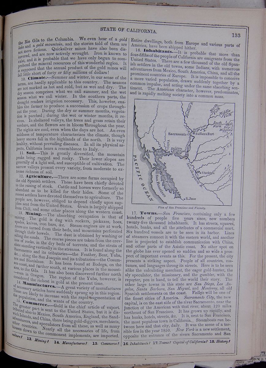 STATE OF CALIFORNIA.
133
STATE OF CALIFORNIA.
133
the Rio Gila to the Columbia. We even hear of a gold lake and a gold mountain, and the stories told of them are not mere fictions. Quicksilver mines have also been discovered, and are now actively wrought. Iron is known to exist, and it is probable that we have only begun to comprehend the mineral resources of this wonderful region. It is supposed that the annual product of the gold mines will fall little short of forty or fifty millions of dollars!
10. Climate.—Summer and winter, in our sense of the terms, are hardly applicable to this country. The seasons are not marked as hot and cold, but as wet and dry. The dry season comprises what we call summer, and the wet season what we call winter. In the southern parts, the drought renders irrigation necessary. This, however, enables the farmer to produce a succession of crops throughout the year. During the dry or summer months, vegetation is parched; during the wet or winter months, it revives. In sheltered valleys, the trees and grass retain their verdure, and the flowers are in bloom throughout the year. The nights are cool, even when the days are hot. An even mildness of temperature characterizes the climate, though heavy snows fall in the highlands of the north. It is very healthy, without prevailing diseases. In all its physical aspects, California bears a resemblance to Italy.
11. Soil.—This is greatly diversified, the mountain peaks being rugged and rocky. Their lower slopes are generally of a light soil, and susceptible of cultivation. The narrow valleys present every variety, from moderate to extreme richness of soil.
12. Agriculture.—There are some farms occupied by the old Spanish settlers. These have been chiefly devoted to the raising of stock. Cattle and horses were formerly so abundant as to be killed for their hides. Some of the recent settlers have devoted themselves to agriculture. The people are, however, obliged to depend chiefly upon supplies sent from the United States. Grain is largely shipped from Chili, and some other places along the western coast.
13. Mining.—The absorbing occupation is that of mining. The gold is dug with rockers, pickaxes, hoes, spades, knives, iron bars, &c. Steam-engines are at work, rivers are turned from their beds, and mountains perforated through their bowels. The dust is obtained by washing or sifting the sands. The coarse pieces are taken from the crevices of rocks, in the dry beds of torrents, and the strata of slate standing vertically in the streams. It is found along the Sacramento and its tributaries—the Feather, Bear, Yuba, &c.; along the San Joaquin and its tributaries—the Cosumnes and Stanislaus. It has been found at Bodega, on the sea-coast, and further south, at various places in the mountains, to the Gila. It has also been discovered further north—even in Oregon. The region of the Yuba, however, is considered the richest in gold at the present time.
14. Manufactures.—A great variety of manufactures of necessary articles have suddenly sprung up in this region. These are likely to increase with the rapid augmentation of the population, and the wants of the country.
15. Commerce.—Gold is the chief article of export. The greater part is sent to the United States, but it is distributed also to Mexico, South America, England, the Sandwich Islands, and China, there being gold-diggers, merchants, adventurers, and speculators from all these, as well as many other countries. Nearly all the necessaries of life, from houses down to the commonest implements, are imported. Entire dwellings, both from' Europe and various parts of America, have been shipped hither.
16. Inhabitants.—It is probable that more than four-fifths of the people of California are emigrants from the United States. There are a few thousand of the old Spanish settlers in the old towns, some Indians, with numerous adventurers from Mexico, South America, China, and all the prominent countries of Europe. It is impossible to conceive a more varied population, drawn suddenly together by a common impulse, and acting under the same absorbing sentiment. The American character, however, predominates, and is rapidly melting society into a common mass.
Map of San Francisco and surrounding area. Plan of San Francisco and Vicinity.17. Towns.—San Francisco, containing only a few hundreds of people five years since, now numbers twenty-five thousand inhabitants. It has streets, squares, hotels, banks, and all the attributes of a commercial mart. Six hundred vessels are to be seen in its harbor. Lines of steamers connect it with the eastern world, and another line is projected to establish communication with China, and other parts of the Asiatic coast. No other spot on the globe has ever opened so sudden and so wide a prospect of important events as this. For the present, the city presents a striking aspect. People of all countries, costumes, and languages throng its streets. Here is to be seen alike the calculating merchant, the eager gold-hunter, the sly speculator, the missionary, and the gambler, with the reporter, pen in hand, to tell the world their story. The other large towns in this state are San Diego, Los Angelos, Santa Barbara, San Miguel, and Monterey, all old Spanish settlements on the coast. Vallejo will be one of the finest cities of America. Sacramento City, the new capital, is on the east side of the river Sacramento, near the junction of the American with that river, about 120 miles northeast of San Francisco. It has grown up rapidly, and has banks, hotels, streets, &c. It is, next to San Francisco, the most populous town in California. Steamboats run between here and that city, daily. It was the scene of a terrible fire in the year 1850. New York is a new settlement, opposite the entrance of the rivers Sacramento and San
13. Mining? 14. Manufactures? 15. Commerce? 16. Inhabitants? 17. Towns? Capital of California? 18. History?
[begin surface 514] 134
TERRITORY OF OREGON.
134
TERRITORY OF OREGON.
Joaquin into Suisun Bay. Stockton is a growing town on the east side of the San Joaquin, a few miles north of the Stanislaus. Sonoma and St. Louis are settlements on a small stream flowing into San Pablo Bay. New Helvetia lies a few miles northeast of Sacramento. There are a fort and United States troops at this place. Fremont is on the south side of the Sacramento, opposite the mouth of the Feather River. Vernon is a thriving place on the Feather River, about twenty miles northeast of Sacramento. Marysville is a thriving village, at the junction of the Yuba with the Feather River, eighty miles northeast of Sacramento. Small steamboats come up to this place. Here is a rendezvous for miners, and here may be seen all the articles necessary for their support and equipment—tents, mining tools, ready-made clothing, spirits, beef, pork, flour, &c. From this point the miners proceed on foot, their baggage being carried by mules. Rose's Bar, twenty-five miles above Marysville, is on the Yuba, and here are rich diggings. The country is mountainous—the banks of the rivers below, to Suisun Bay, being low and waving, with mountain ranges at a distance. Foster's Bar, thirty miles higher up the river; Goodwin's Bar, thirty miles further; and Downieville, eight miles beyond—making 250 miles northeast of San Francisco—are all settlements at favorable points for mining. Downieville is a considerable village, and on the ridges and ravines around several thousand miners are at work, from May to August—the dry season. The snows sometimes rest on the mountains here, and obstruct the diggings till June. There are many other towns and villages springing up. The Mariposa district is noted for its gold mixed with quartz.
18. History—The present state of California occupies but a small portion of the whole region called California, under the Spaniards. Some missions and trading posts were early established here, but, in general, it may be remarked that this territory received little attention from the Spanish government, for a long period after their acquisition of the country by the conquests of Cortez in 1523. A few settlements were made upon the coast during the eighteenth century. Some of these grew into small commercial ports, and a few farmers settled here and there in the interior, especially upon the plains at the south, toward the Colorado. In 1846, the country was taken possession of by the United States forces, and, at the close of the Mexican war, in 1848, it was confirmed to the United States. Immediately after the discovery of the gold mines in that year, the population increased with unexampled rapidity. The inhabitants soon discovered the necessity of regular government. In 1849, a convention assembled, which formed a constitution, whose admirable provisions excited the applause of the civilized world. This was immediately ratified by the people, and in 1850 California was admitted as a state into the Federal Union.
Lesson LXVI... Oregon and Washington.
1. Characteristics.—These territories occupy the northwestern corner of the Union, and lie between the Rocky Mountains and the Pacific Ocean.
2. Mountains.—The Rocky Mountains, separating these territories from that of Nebraska, here consist of several parallel ridges, with chains shooting off east and west, with lofty plains at their base. A range less elevated, called the Blue Mountains, extends north and south nearly through the center of the territory. The Sierra Nevada range here takes the name of Cascade Mountains. These are from 100 to 150 miles from the Pacific, their tops rising in regular cones to the hight of 13,000 or 14,000 feet.
3. Valleys.—The principal valley is that of the Columbia. The various head streams and tributaries pass through rather rugged regions, but are occasionally bordered by narrow, fertile plains.
4. Rivers.—The principal river of the region, and the largest that enters into the Pacific, is the Columbia. It rises in the Rocky Mountains, at a short distance from the source of the Missouri. Its upper course is rapid, and frequently broken by falls. Its whole length is 1500 miles. It is navigable 120 miles for vessels of twelve feet draught, though obstructed by numerous sand-bars. Twenty miles from its mouth, its width is greatly increased. The Lewis River, its main tributary, also rises in the Rocky Mountains, and flowing in a very circuitous route to the northwest, empties into the Columbia. It affords little facility for navigation, on account of its frequent rapids. Another branch of the Columbia rises further north, in the British Territory, about latitude 50°. The Willamette is a considerable stream, rising in the Cascade Mountains; flowing northward, it empties into the Columbia. This river has many other tributaries, but none of great extent.
5. Lakes.—There are many small lakes, especially in the mountains, connected with the head-waters of the rivers. There are also small sheets of water spread over the country, which greatly add to its picturesque beauty.
6. Shores, Harbors, &c.—At the southwestern corner of the territory is Cape Blanco, and at the northwestern, Cape Flattery. Gray's Harbor is small, but it admits vessels of ten feet draught. The entrance to the Columbia is obstructed by sand-bars, and these are said to be increasing. The Clatsop, or South Channel, has lately been explored, and promises a good entrance. There are several fine harbors within the Straits of Juan de Fuca. The tide has here a rise and fall of eighteen feet. The whole Pacific line of coast measures nearly 400 miles.
7. Vegetable Products.—These do not appear to differ materially from those in corresponding latitudes, to the east. The forests, consisting of the various deciduous trees, rise to a great elevation, and particular trees attain the hight of 200 feet. Pines, furs, spruce, arbor-vitæ, and cedar are among the evergreens. The oak, ash, poplar, maple, willow, and cherry are mentioned among the common forest trees. Thickets of hazel, roses, &c, abound.
8. Animals.—There is abundance of game, such as the elk, deer, antelope, black and grizzly bear, wolves, foxes, muskrats, martins, beavers, &c. On the rolling prairies of the middle section there is no game. In the eastern part, the buffalo is met with. The fur-bearing animals are rapidly diminishing, being slaughtered by the hunters and trappers. In the spring and autumn, immense flocks of wild-fowl are seen upon the rivers and along the shores. Fishes abound in the rivers and sounds, including the salmon, salmon-trout, sturgeon, cod, carp, sole, flounders, perch, herring, lamprey-eels, with crabs, clams, oysters, muscles, &c. The Indians subsist almost wholly upon fish. Whales are found along the coast, and the Indians often capture them at the mouth of the Straits of Juan de Fuca.
LESSON LXVI. 1. Characteristics? 2. Mountains? 3 Valleys? 4. Rivers? 5. Lakes? 6. Shores, harbors, &c.?
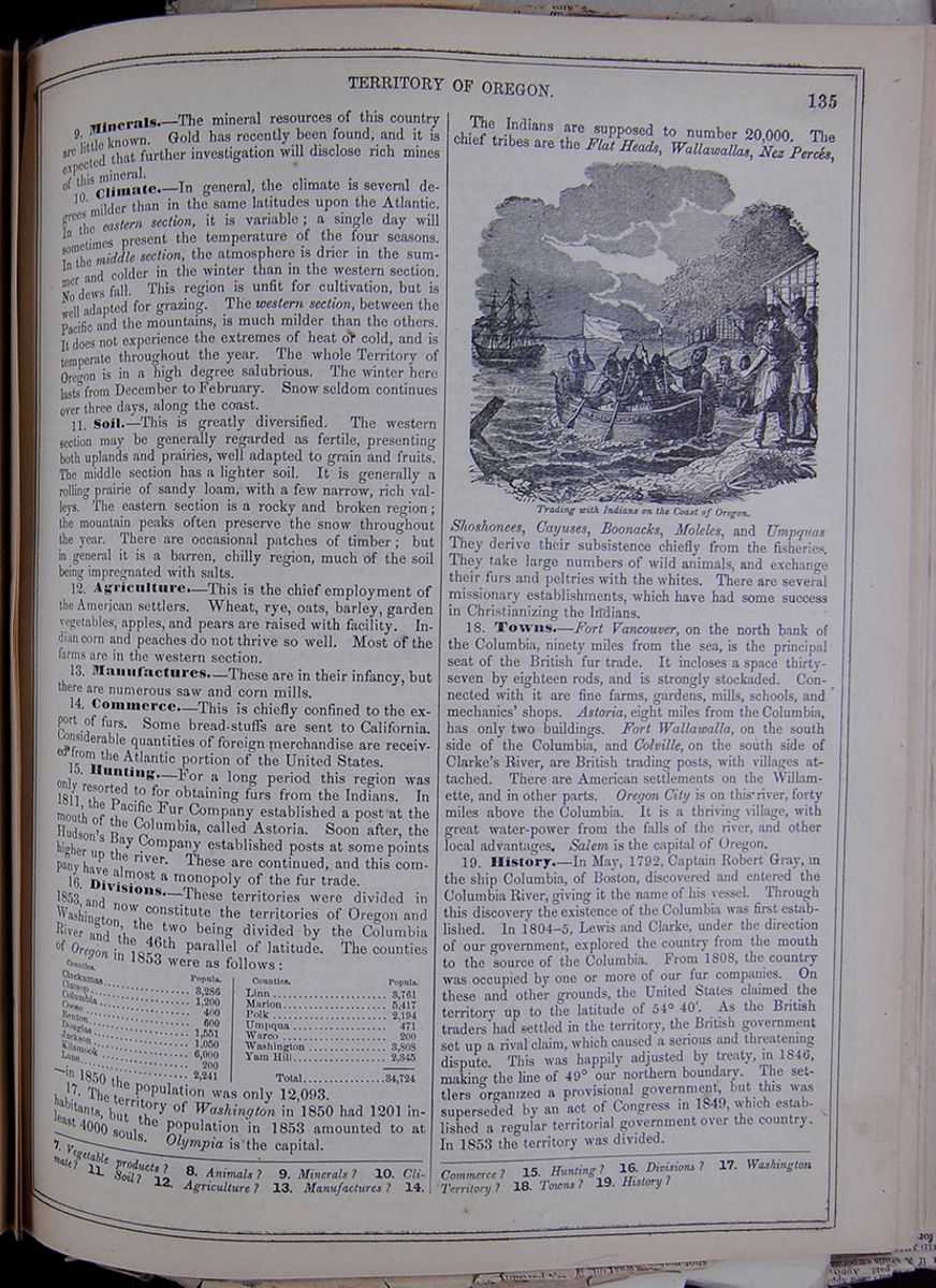
9. Minerals.—The mineral resources of this country are little known. Gold has recently been found, and it is expected that further investigation will disclose rich mines of this mineral.
10. Climate.—In general, the climate is several degrees milder than in the same latitudes upon the Atlantic. In the eastern section, it is variable; a single day will sometimes present the temperature of the four seasons. In the middle section, the atmosphere is drier in the summer and colder in the winter than in the western section. No dews fall. This region is unfit for cultivation, but is well adapted for grazing. The western section, between the Pacific and the mountains, is much milder than the others. It does not experience the extremes of heat or cold, and is temperate throughout the year. The whole Territory of Oregon is in a high degree salubrious. The winter here lasts from December to February. Snow seldom continues over three days, along the coast.
11. Soil.—This is greatly diversified. The western section may be generally regarded as fertile, presenting both uplands and prairies, well adapted to grain and fruits. The middle section has a lighter soil. It is generally a rolling prairie of sandy loam, with a few narrow, rich valleys. The eastern section is a rocky and broken region; the mountain peaks often preserve the snow throughout the year. There are occasional patches of timber; but in general it is a barren, chilly region, much of the soil being impregnated with salts.
12. Agriculture.—This is the chief employment of the American settlers. Wheat, rye, oats, barley, garden vegetables, apples, and pears are raised with facility. Indian corn and peaches do not thrive so well. Most of the farms are in the western section.
13. Manufactures.—These are in their infancy, but there are numerous saw and corn mills.
14. Commerce.—This is chiefly confined to the export of furs. Some bread-stuffs are sent to California. Considerable quantities of foreign merchandise are received from the Atlantic portion of the United States.
15. Hunting.—For a long period this region was only resorted to for obtaining furs from the Indians. In 1811, the Pacific Fur Company established a post at the mouth of the Columbia, called Astoria. Soon after, the Hudson's Bay Company established posts at some points higher up the river. These are continued, and this company have almost a monopoly of the fur trade.
16. Divisions.—These territories were divided in 1853, and now constitute the territories of Oregon and Washington, the two being divided by the Columbia River and the 46th parallel of latitude. The counties of Oregon in 1853 were as follows: This table lists the counties of Oregon along with their populations in 1853. —in 1850 the population was only 12,093.
17. The territory of Washington in 1850 had 1201 inhabitants, but the population in 1853 amounted to at least 4000 souls. Olympia is the capital. The Indians are supposed to number 20,000. The chief tribes are the Flat Heads, Wallawallas, Nez Percés, Trading with Indians on the Coast of Oregon. Shoshonees, Cayuses, Boonacks, Moleles, and Umpquas They derive their subsistence chiefly from the fisheries. They take large numbers of wild animals, and exchange their furs and peltries with the whites. There are several missionary establishments, which have had some success in Christianizing the Indians.
18. Towns.—Fort Vancouver, on the north bank of the Columbia, ninety miles from the sea, is the principal seat of the British fur trade. It incloses a space thirty-seven by eighteen rods, and is strongly stockaded. Connected with it are fine farms, gardens, mills, schools, and mechanics' shops. Astoria, eight miles from the Columbia, has only two buildings. Fort Wallawalla, on the south side of the Columbia, and Colville, on the south side of Clarke's River, are British trading posts, with villages attached. There are American settlements on the Willamette, and in other parts. Oregon City is on this river, forty miles above the Columbia. It is a thriving village, with great water-power from the falls of the river, and other local advantages. Salem is the capital of Oregon.
19. History.—In May, 1792, Captain Robert Gray, in the ship Columbia, of Boston, discovered and entered the Columbia River, giving it the name of his vessel. Through this discovery the existence of the Columbia was first established. In 1804–5, Lewis and Clarke, under the direction of our government, explored the country from the mouth to the source of the Columbia. From 1808, the country was occupied by one or more of our fur companies. On these and other grounds, the United States claimed the territory up to the latitude of 54° 40´. As the British traders had settled in the territory, the British government set up a rival claim, which caused a serious and threatening dispute. This was happily adjusted by treaty, in 1846, making the line of 49° our northern boundary. The settlers organized a provisional government, but this was superseded by an act of Congress in 1849, which established a regular territorial government over the country. In 1853 the territory was divided.
7. Vegetable products? 8. Animals? 9. Minerals? 10. Climate? 11. Soil? 12. Agriculture? 13. Manufactures? 14. Commerce? 15. Hunting? 16. Divisions? 17. Washington Territory? 18. Towns? 19. History?
 136
GENERAL VIEWS OF THE UNITED
STATES.
136
GENERAL VIEWS OF THE UNITED
STATES.
Lesson LXVII. General Views of the United States.
1. Territory of the United States.—The territory of the United States, which is now estimated at three million two hundred thousand square miles, has been derived from various sources. The thirteen English colonies which united in the Revolutionary war, held nearly the same territories which they now possess, as states. Besides these, Virginia laid claim, by virtue of her charter, to an undefined tract to the west, including Kentucky, and what was afterward called the Northwestern Territory—embracing Ohio, Indiana, Illinois, Michigan, and Wisconsin. These latter claims she ceded to the United States in 1787, making a small reservation of lands in Ohio, for the payment of certain state debts. Tennessee was originally a part of North Carolina. Alabama was mostly included in the original patent of Georgia. Maine was a part of the State of Massachusetts. Thus the whole of the present territory of the United States east of the river Mississippi, excepting only the State of Florida and the whole Gulf coast came to us as the possessions of the original thirteen English colonies. Florida and part of Alabama and Mississippi were ceded to us by Spain in 1819, as compensation for spoliations upon our commerce. The Louisiana purchase, made in 1803, gave us the whole tract lying between the Mississippi River and the Rocky Mountains, including the States of Louisiana, Arkansas, Missouri, and Iowa, with the contiguous territories of Minnesota, Nebraska and Kansas, and the Indian. Texas was obtained by the annexation treaty of 1845; Oregon, by discovery and occupation; California, Utah, and New Mexico, by treaty with Mexico, in 1848.
2. Progress of the United States.—The ratio of increase, hitherto, seems to show that our population doubles once in 25 years, as elsewhere stated. In 1790, we had 3,929,827 inhab.; in 1800, 5,305,941; in 1810, 7,239,814; in 1820, 9,638,191; in 1830, 12,866,020; in 1840, 17,062,566. The census of 1850 shows a population of 23,194,876, and we shall probably continue an equal increase, as emigration and the general causes of progress in population were never more active than at present. Taking these facts as the basis of calculation, it seems probable that the population of the United States will reach a hundred millions before the close of the present century. "Our present population," says Mr. Rantoul, in his Concord oration, 1850, "is nine times that of the day of the Concord fight, April 18, 1775, and a continuance of the same ratio for the same period, to the year 1925, will extend the blessings of the Union over more than 200,000,000 souls. Our present wealth is more than forty times that of the colonies seventy-five years ago. The annual income of the nation is at least twenty-five times as great as it was then. Of the great element of power over physical nature, coal, our production is now greater than that of the world seventy-five years ago. Of iron, the chief instrument with which man subdues nature to his purposes, our product is greater than that of all the world seventy-five years ago. Of gold, the other main sinew of war, and the negotiator of the exchanges of peace, we produce more than the rest of the world now does. Our cotton manufactories exceed those of the whole world seventy-five years ago. Our tonnage exceeds that of the world seventy-five years since. It will soon surpass that of the British Empire; and, in a few years, much short of three-quarters of a century, it will far surpass that of the rest of the world. We have more printing-presses in operation, and more printed volumes in the hands of our people, than the whole world had on the day of the Concord fight. More newspapers are printed in the city of Boston every day than the whole world then produced. Since that day, America has produced the steamboat, and adopted the locomotive; and there are more steam-engines employed in Massachusetts than were then used in the rest of the world."
3. Army, Navy, &c.—The army of the United States includes 8867 men; and the navy comprises forty large and forty smaller vessels of war. The annual revenue of the government is about $50,000,000, chiefly derived from customs on imported goods. Two-fifths of the expenses of the government are for the army and navy. Our national debt is about $45,000,000. The tonnage of the United States is now larger (viz., 3,535,000 tons) than that of any other nation, except G. Britain, which has 4,360,000 tons.
4. Railroads.—In the U. States are 18,000 miles of railroad. About 2,800 miles are in New York; 1,300 in Pennsylvania; 1,200 in Georgia; 1,400 in Massachusetts; 960 in Virginia; 600 in Maine. There is an uninterrupted line from Waterville, Me., to Montgomery, Ala., 1,900 miles, passing through all the principal cities. There are two lines from New York to Lake Erie: one by way of Albany, to Buffalo, and one by way of Piermont, to Dunkirk.
5. Telegraphs.—There are about 26,000 miles of telegraph in the United States: 15,000 conducted on Morse's plan, and 11,000 on those of House and Bain.
6. Canals.—The aggregate length of canals is 4500 miles. The principal are these: This table lists principle canals and their lengths in miles. These canals include: Erie, Champlain, Delaware and Hudson, Morris, Pennsylvania, Chesapeake and Ohio, Miami, Ohio and Erie, Wabash and Erie, and Illinois.
6. Distances from New York— This table lists the distance in miles from New York to the following locations: Havana, New Orleans, Chagres, San Francisco, via C. Horn, Cape of Good Hope, Cape Horn, Cairo (Egypt), Athens (Greece), Liberia, Rome, Algiers, Bremen, Lima, Liverpool, Iceland, Greenland, Havre, and Southampton.
8. Religious Denominations. This table lists the following religious denominations as well as the number of churches, number of Ministers, and number of members of each: Baptists, Methodists, Presbyterians, Congregationalists, Episcopalians, Lutherans, German Reformed, Reformed Dutch, Universalists, Unitarians, Christians, and Catholics.
LESSON LXVII. 1. Territory of the United States. 2. Progress of the United States? Give some instances of this. 3. Army, navy, &c.? 4. Railroads? 5. Telegraphs? 6. Canals? 7. Distances from New York? 8. Religious denominations?
[begin surface 517]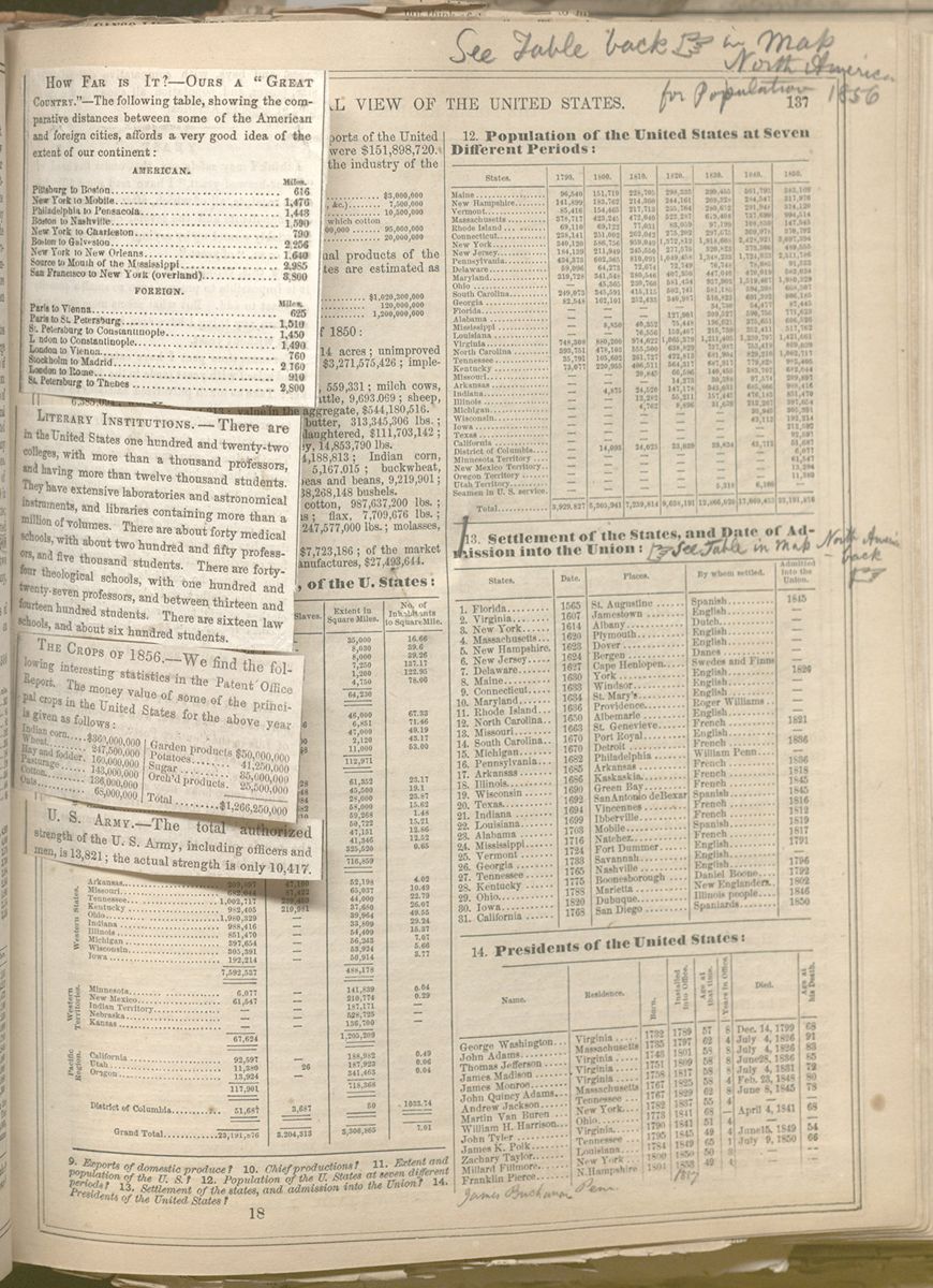 [begin surface 518]
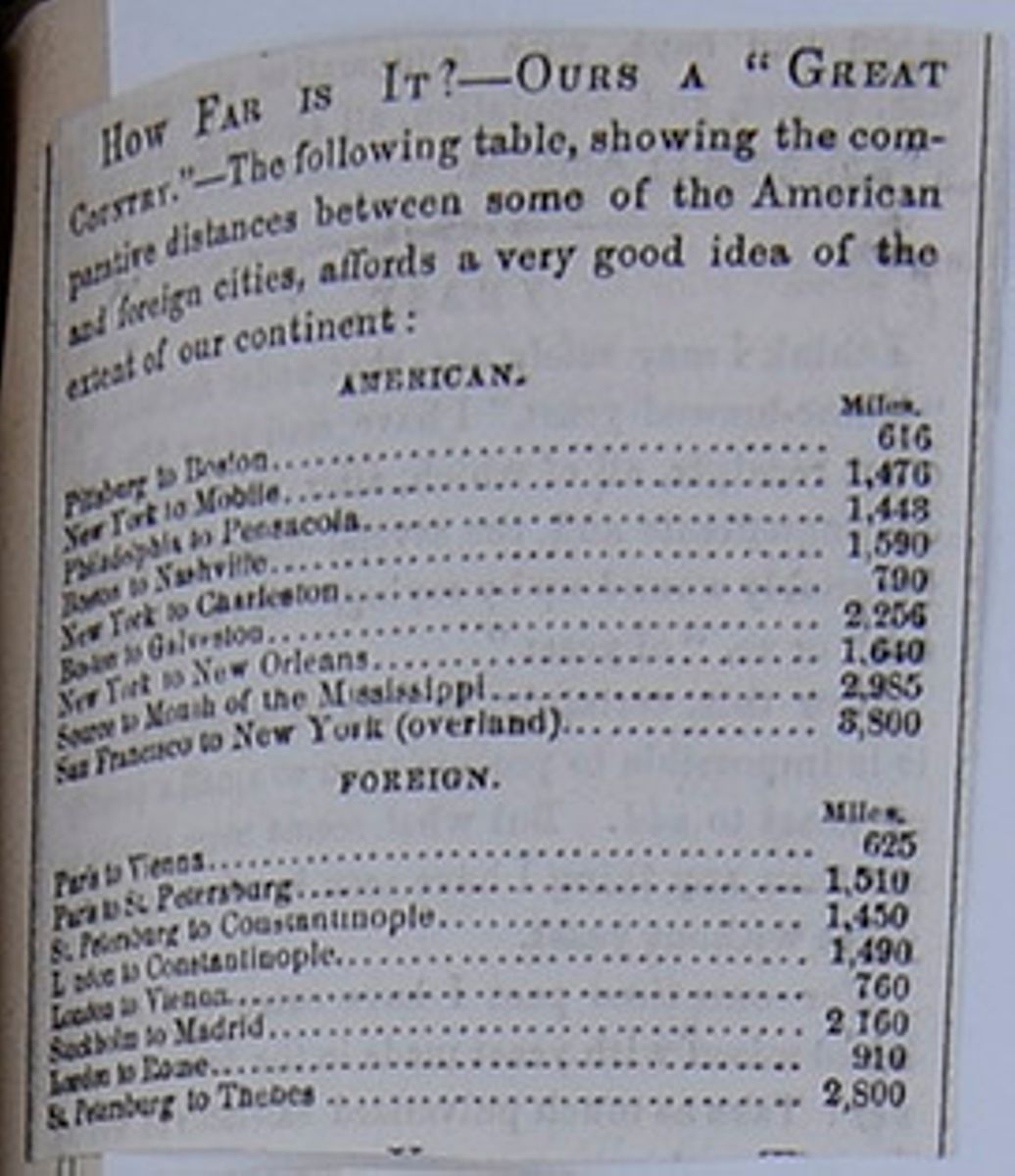
HOW FAR IS IT? —OURS A "GREAT COUNTRY."—The following table, showing the comparative distances between some of the American and foreign cities, affords a very good idea of the extent of our continent:
| Miles. | |
| Pittsburg to Boston | 616 |
| New York to Mobile | 1,476 |
| Philadelphia to Pensacola | 1,443 |
| Boston to Nashville | 1,590 |
| New York to Charleston | 790 |
| Boston to Galveston | 2,256 |
| New York to New Orleans | 1,640 |
| Source to Mouth of the Mississippi | 2,985 |
| San Francisco to New York (overland) | 3,800 |
| Miles. | |
| Paris to Vienna | 625 |
| Paris to St. Petersburg | 1,510 |
| St. Petersburg to Constantinople | 1,450 |
| London to Constantinople | 1,490 |
| London to Vienna | 760 |
| Stockholm to Madrid | 2,160 |
| London to Rome | 910 |
| St. Petersburg to Thebes | 2,800 |
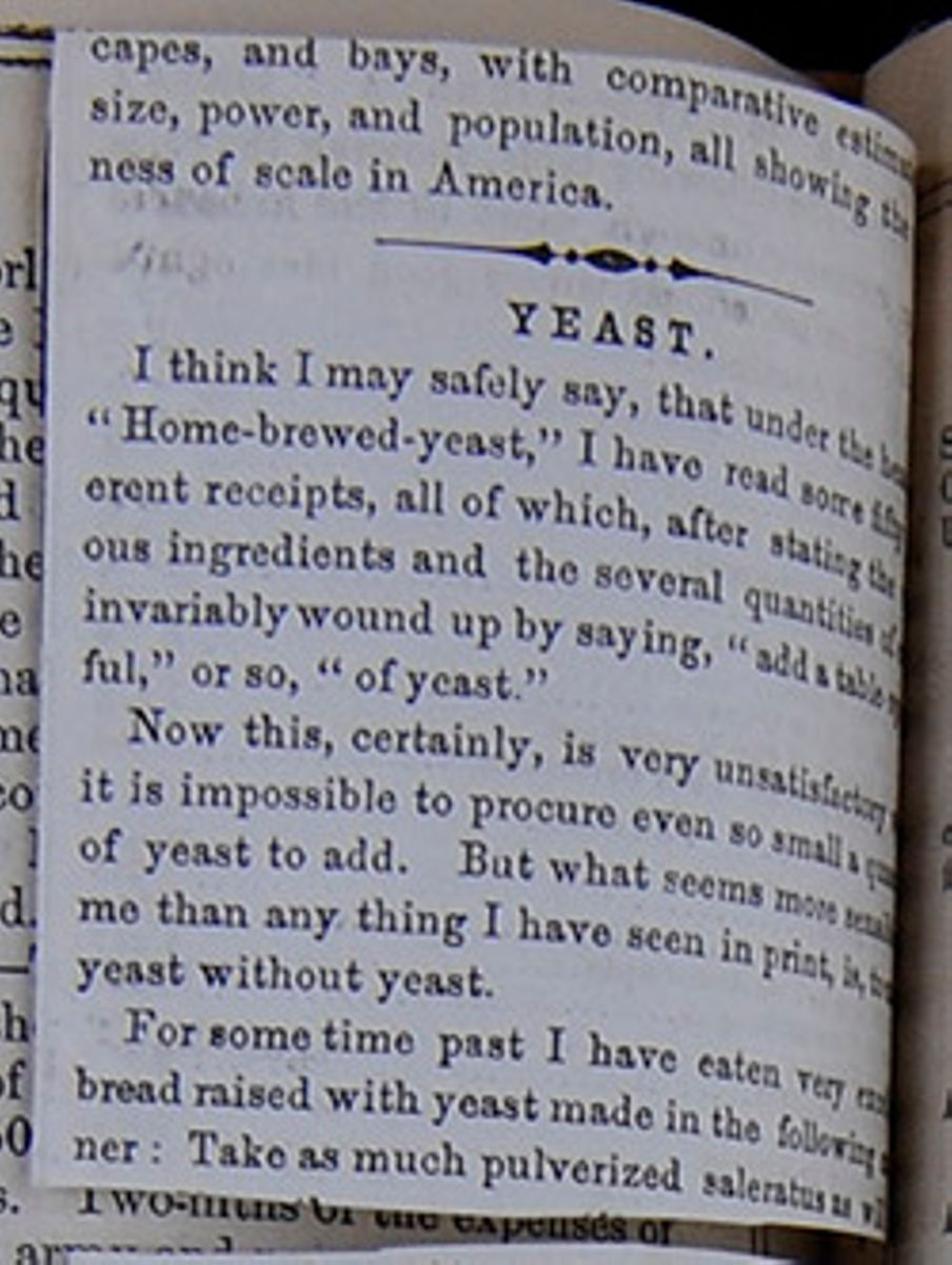
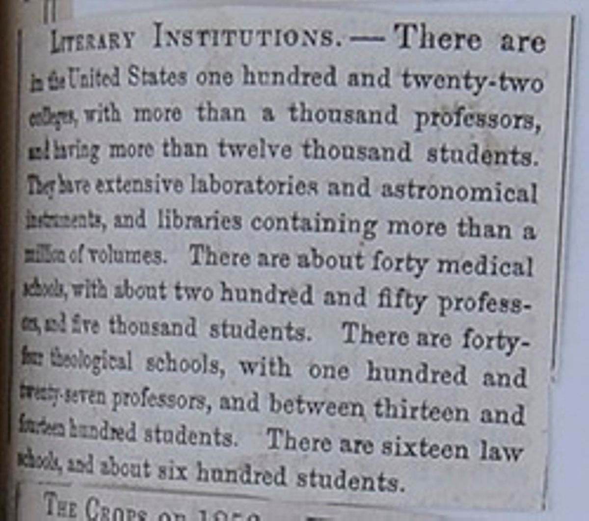
LITERARY INSTITUTIONS.—There are in the United States one hundred and twenty-two colleges, with more than a thousand professors, and having more than twelve thousand students. They have extensive laboratories and astronomical instruments, and libraries containing more than a million of volumes. There are about forty medical schools, with about two hundred and fifty professors, and five thousand students. There are forty-four theological schools, with one hundred and twenty-seven professors, and between thirteen and fourteen hundred students. There are sixteen law schools, and about six hundred students.
[begin surface 521]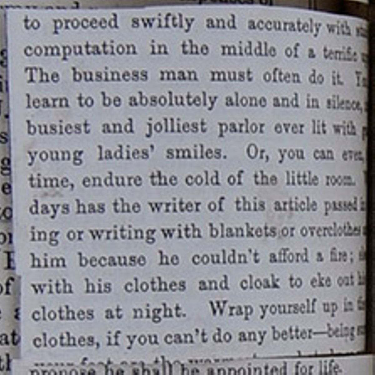
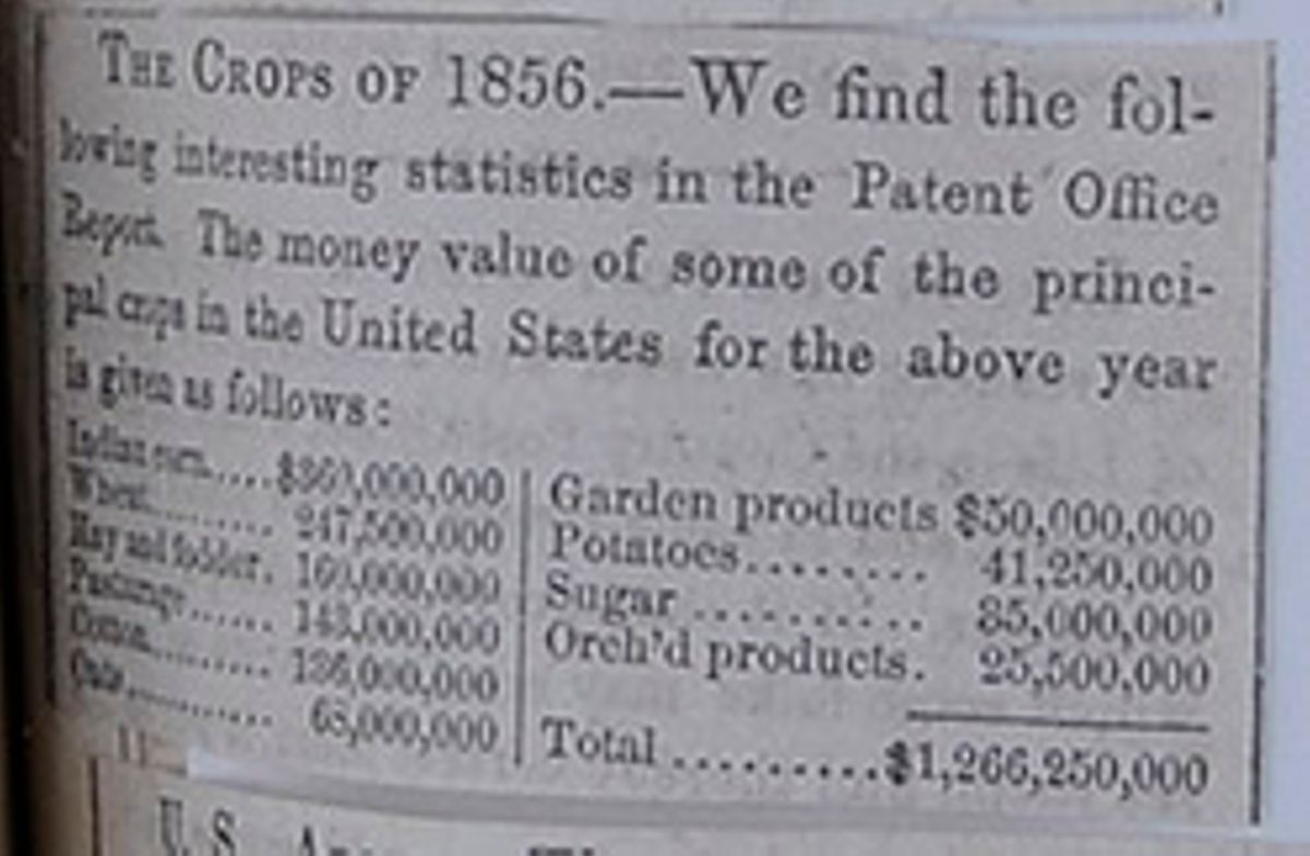
THE CROPS OF 1856.—We find the following interesting statistics in the Patent Office Report. The money value of some of the principal crops in the United States for the above year is given as follows:
| Indian corn | $360,000,000 |
| Wheat | 247,500,000 |
| Hay and fodder | 160,000,000 |
| Pasturage | 143,000,000 |
| Cotton | 136,000,000 |
| Oats | 68,000,000 |
| Garden products | $50,000,000 |
| Potatoes | 41,250,000 |
| Sugar | 35,000,000 |
| Orch'd products | 25,500,000 |
| Total | $1,266,250,000 |
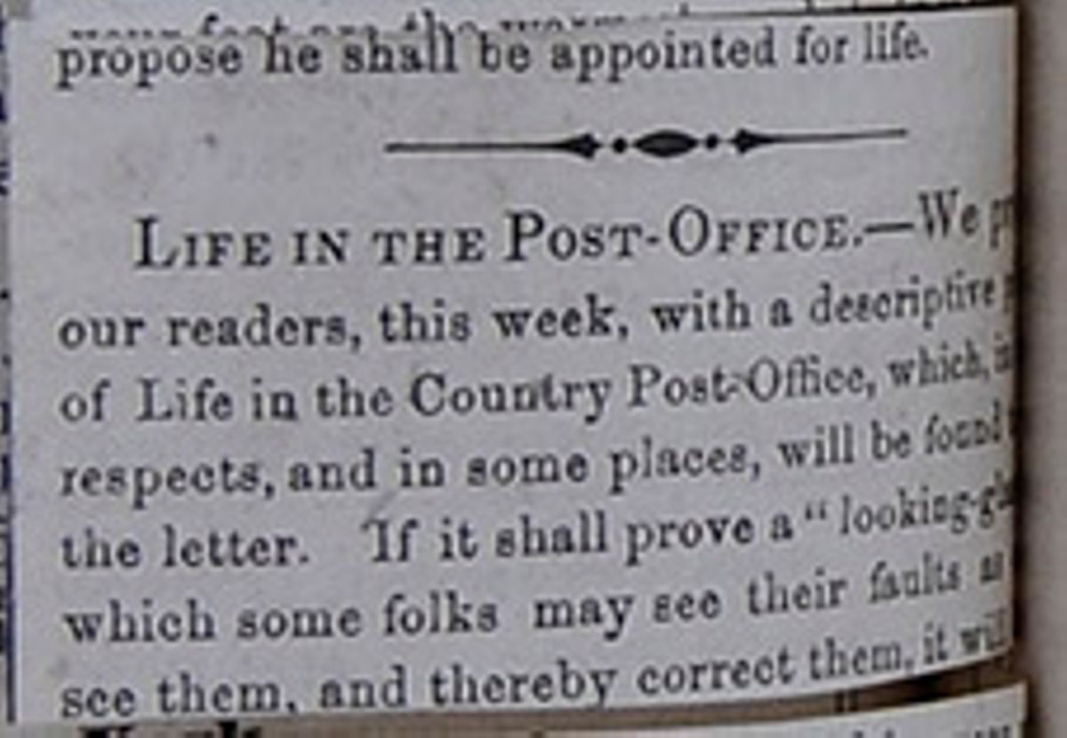 [begin surface 524]
U. S. ARMY.—The total authorized strength of the U. S. Army, including officers and men, is 13,821; the actual strength is only 10,417.
[begin surface 525]
9. Exports.—The total amount of the exports of the United States in 1850, was $178,138,318; the imports were $151,898,720. Of the exports $136,946,912 were products of the industry of the United States, some of which were as follows:
| Products of the sea | $3,000,000 |
| Products of the forest (lumber, timber, pitch, turpentine, furs &c.) | 7,500,000 |
| Animal products (meat, butter, cheese, wool, &c.) | 10,500,000 |
| Vegetable products (corn, wheat, potatoes, apples, &c, &c.) of which cotton amounted to about $72,000,000 and tobacco to about $10,000,000 | 95,000,000 |
| Manufactured articles | 20,000,000 |
10. Chief Productions.—The annual products of the chief branches of industry in the United States are estimated as follows:
| Manufactures | $1,020,300,000 |
| Mines | 120,000,000 |
| Agriculture | 1,200,000,000 |
The following are taken from the census of 1850:
- Farms, &c.—Land under cultivation, 113,032,614 acres; unimproved land, 180,528,000 acres; cash value of farms, $3,271,575,426; implements and machinery, $151,587,638.
- Live Stock.—Horses, 4,336,719; asses and mules, 559,331; milch cows, 6,385,094; working oxen, 1,700,744; other cattle, 9,693,069; sheep, 21,723,220; swine, 30,354,213; value in the aggregate, $544,180,516.
- Animal Products.—Wool, 52,516,959 lbs.; butter, 313,345,306 lbs.; cheese, 105,535,893 lbs.; value of animals slaughtered, $111,703,142; silk cocoons, 10,843 lbs.; beeswax and honey, 14,853,790 lbs.
- Food Crops.—Wheat, 100,485,944; rye, 14,188,813; Indian corn, 592,071,104; oats, 146,584,179; barley, 5,167,015; buckwheat, 8,956,912 bushels, rice, 215,313,497 lbs.; peas and beans, 9,219,901; Irish potatoes. 65,797,896, sweet potatoes, 38,268,148 bushels.
- Other Crops.—Tobacco, 199,752,655 lbs.; cotton, 987,637,200 lbs.; hay, 13,838,462 tons; hemp, 34,871 tons; flax, 7,709,676 lbs.; maple sugar, 34,253,436 lbs.; cane sugar, 247,577,000 lbs.; molasses, 12,700,896 gallons; wine, 221,249 gallons.
- Value of the Products.—Of the orchard, $7,723,186; of the market gardens $5,280,030; and of home-made manufactures, $27,493,644.
| Population. | No. of Slaves. | Extent in Square Miles. | No. of Inhabitants to Square Mile. | |
| New England States. | ||||
| Maine | 583,169 | — | 35,000 | 16.66 |
| New Hampshire | 317,976 | — | 8,030 | 39.6 |
| Vermont | 314,120 | — | 8,000 | 39.26 |
| Massachusetts | 994,514 | — | 7,250 | 137.17 |
| Rhode Island | 147,545 | — | 1,200 | 122.95 |
| Connecticut | 370,792 | — | 4,750 | 78.06 |
| 2,728,116 | 64,230 | |||
| Middle States. | ||||
| New York | 3,097,394 | — | 46,000 | 67.33 |
| New Jersey | 489,555 | 236 | 6,851 | 71.46 |
| Pennsylvania | 2,311,786 | — | 47,000 | 49.19 |
| Delaware | 91,532 | 2,290 | 2,120 | 43.17 |
| Maryland | 583,034 | 90,368; | 11,000 | 53.00 |
| 6,573,301 | 112,971 | |||
| Southern States. | ||||
| Virginia | 1,421,661 | 472,528 | 61,352 | 23.17 |
| North Carolina | 869,039 | 288,548 | 45,500 | 19.1 |
| South Carolina | 668,507 | 384,984 | 28,000 | 23.87 |
| Georgia | 906,185 | 381,682 | 58,000 | 15.62 |
| Florida | 87,445 | 39,310 | 59,268 | 1.48 |
| Alabama | 771,623 | 342,844 | 50,722 | 15.21 |
| Mississippi | 606,526 | 309,878 | 47,151 | 12,86 |
| Louisiana | 517,762 | 244,809 | 41,346 | 12.52 |
| Texas | 212,592 | 58,161 | 325,520 | 0.65 |
| 6,061,340 | 716,859 | |||
| Western States. | ||||
| Arkansas | 209,897 | 47,100 | 51,198 | 4.02 |
| Missouri | 682,044 | 87,422 | 65,037 | 10.49 |
| Tennessee | 1,002,717 | 239,459 | 44,000 | 22.79 |
| Kentucky | 982,405 | 210,981 | 37,680 | 26.07 |
| Ohio | 1,980,329 | — | 39,964 | 49.55 |
| Indiana | 988,416 | — | 33,809 | 29.24 |
| Illinois | 851,470 | — | 54,409 | 15.37 |
| Michigan | 397,654 | — | 56,243 | 7.07 |
| Wisconsin | 305,391 | — | 53,924 | 5.66 |
| Iowa | 192,214 | — | 50,914 | 3.77 |
| 7,592,537 | 488,178 | |||
| Western Territories. | ||||
| Minnesota | 6.077 | — | 141,839 | 0.04 |
| New Mexico | 61,547 | — | 210,774 | 0.29 |
| Indian Territory | — | — | 187,171 | — |
| Nebraska | — | — | 528,725 | — |
| Kansas | — | — | 136,700 | — |
| 67,624 | 1,205,209 | |||
| Pacific Region. | ||||
| California | 92,597 | — | 188,982 | 0.49 |
| Utah | 11,380 | 26 | 187,923 | 0.06 |
| Oregon | 13,924 | — | 341,463 | 0.04 |
| 117,901 | 718,368 | |||
| District of Columbia | 51,687 | 3,687 | 50 | 1033.74 |
| Grand Total | 23,191,876 | 3,204,313 | 3,306,865 | 7.01 |
| States. | 1799. | 1800. | 1810. | 1820. | 1830. | 1840. | 1850. |
| Maine | 96,540 | 151,719 | 228,705 | 298,335 | 399,455 | 501,793 | 583,169 |
| New Hampshire | 141,899 | 183,762 | 214,360 | 244,161 | 269,328 | 284,547 | 317,976 |
| Vermont | 85,416 | 154,465 | 217,713 | 235,764 | 280,652 | 291,948 | 314,120 |
| Massachusetts | 378,717 | 423,245 | 472,040 | 523,287 | 610,408 | 737,699 | 997,514 |
| Rhode Island | 69,110 | 69,122 | 77,031 | 83,059 | 97,199 | 108,830 | 147,545 |
| Connecticut | 238,141 | 251,002 | 262,042 | 275,202 | 297,675 | 309,978 | 370,792 |
| New York | 340,120 | 586,756 | 959,049 | 1,372,812 | 1,918,608 | 2,428,921 | 3,097,394 |
| New Jersey | 184,139 | 211,949 | 245,550 | 277,575 | 320,823 | 373,306 | 489,555 |
| Pennsylvania | 434,373 | 602,365 | 810,091 | 1,049,458 | 1,348,233 | 1,724,033 | 2,311,786 |
| Delaware | 59,096 | 64,273 | 72,674 | 72,749 | 76,748 | 78,085 | 91,532 |
| Maryland | 319,728 | 341,548 | 380,546 | 407,350 | 447,040 | 470,019 | 583,034 |
| Ohio | — | 45,365 | 230,760 | 581,434 | 937,903 | 1,519,467 | 1,980,329 |
| South Carolina | 249,073 | 345,591 | 415,115 | 502,741 | 581,185 | 594,398 | 668,507 |
| Georgia | 82,548 | 162,101 | 252,433 | 340,987 | 516,823 | 691,392 | 906,185 |
| Florida | — | — | — | — | 34,760 | 54,477 | 87,445 |
| Alabama | — | — | — | 127,901 | 309,527 | 520,756 | 771,623 |
| Mississippi | — | 8,850 | 40,352 | 75,448 | 136,621 | 375,651 | 606,526 |
| Louisiana | — | — | 76,556 | 153,407 | 215,739 | 352,411 | 517,762 |
| Virginia | 748,308 | 880,200 | 974,622 | 1,065,379 | 1,211,405 | 1,239,797 | 1,421,661 |
| North Carolina | 393,751 | 478,103 | 555,500 | 638,827 | 737,987 | 753,419 | 869,039 |
| Tennessee | 35,791 | 105,602 | 261,727 | 422,813 | 681,904 | 829,210 | 1,002,717 |
| Kentucky | 73,077 | 220,955 | 406,511 | 564,317 | 687,917 | 779,828 | 982,405 |
| Missouri | — | — | 20,845 | 66,586 | 140,455 | 383,702 | 382,044 |
| Arkansas | — | — | — | 14,273 | 30,388 | 97,574 | 209,987 |
| Indiana | — | 4,875 | 24,520 | 147,178 | 343,031 | 385,866 | 988,416 |
| Illinois | — | — | 12,282 | 55,211 | 157,445 | 476,183 | 851,470 |
| Michigan | — | — | 4,762 | 8,896 | 31,639 | 212,267 | 397,654 |
| Wisconsin | — | — | — | — | — | 30,945 | 305,391 |
| Iowa | — | — | — | — | — | 43,112 | 192,214 |
| Texas | — | — | — | — | — | — | 212,597 |
| California | — | — | — | — | — | — | 92,597 |
| District of Columbia | — | 14,875 | 24,520 | 147,178 | 343,031 | 685,866 | 988,416 |
| Minnesota Territory | — | — | — | — | — | — | 6,077 |
| New Mexico Territory | — | — | — | — | — | — | 61,547 |
| Oregon Territory | — | — | — | — | — | — | 13,294 |
| Utah Territory | — | — | — | — | — | — | 11,380 |
| Seamen in the U. S. service | — | — | — | — | 5,318 | 6,100 | — |
| Total | 3,929,827 | 5,305,941 | 7,239,814 | 9,638,191 | 12,866,020 | 17,069,453 | 23,191,876 |
| States. | Dates. | Places. | By whom settled. | Admitted into the Union. |
| 1. Florida | 1565 | St. Augustine | Spanish | 1845 |
| 2. Virginia | 1607 | Jamestown | English | — |
| 3. New York | 1614 | Albany | Dutch | — |
| 4. Massachusetts | 1620 | Plymouth | English | — |
| 5. New Hampshire | 1623 | Dover | English | — |
| 6. New Jersey | 1624 | Bergen | Danes | — |
| 7. Delaware | 1627 | Cape Henlopen | Swedes and Finns | — |
| 8. Maine | 1630 | York | English | 1820 |
| 9. Connecticut | 1633 | Windsor | English | — |
| 10. Maryland | 1634 | St. Mary's | English | — |
| 11. Rhode Island | 1636 | Providence | Roger Williams | — |
| 12. North Carolina | 1650 | Albemarle | English | — |
| 13. Missouri | 1663 | St. Genevieve | French | 1836 |
| 14. South Carolina | 1670 | Port Royal | English | — |
| 15. Michigan | 1670 | Detroit | French | 1836 |
| 16. Pennsylvania | 1862 | Philadelphia | William Penn | — |
| 17. Arkansas | 1685 | Arkansas | French | 1836 |
| 18. Illinois | 1686 | Kaskaskia | French | 1818 |
| 19. Wisconsin | 1690 | Green Bay | French | 1845 |
| 20. Texas | 1692 | San Antonio de Bexar | Spanish | 1845 |
| 21. Indiana | 1694 | Vincennes | French | 1816 |
| 22. Louisiana | 1699 | Ibberville | French | 1812 |
| 23. Alabama | 1703 | Mobile | Spanish | 1819 |
| 24. Mississippi | 1716 | Natchez | French | 1817 |
| 25. Vermont | 1724 | Fort Dummer | English | 1791 |
| 26. Georgia | 1733 | Savannah | English | — |
| 27. Tennessee | 1765 | Nashville | English | 1796 |
| 28. Kentucky | 1775 | Boonesborough | Daniel Boone | 1792 |
| 29. Ohio | 1788 | Marietta | New Englanders | 1802 |
| 30. Iowa | 1820 | Dubuque | Illinois people | 1846 |
| 31. California | 1768 | San Diego | Spaniards | 1850 |
| Name. | Residence. | Born. | Installed into Office. | Age at that time. | Years in Office. | Died. | Age at his Death. |
| George Washington | Virginia | 1732 | 1789 | 57 | 8 | Dec. 14, 1799 | 68 |
| John Adams | Massachusetts | 1735 | 1797 | 62 | 4 | July 4, 1826 | 91 |
| Thomas Jefferson | Virginia | 1743 | 1801 | 58 | 8 | July 4, 1826 | 83 |
| James Madison | Virginia | 1751 | 1809 | 58 | 8 | June 28, 1836 | 85 |
| James Monroe | Virginia | 1758 | 1817 | 58 | 8 | July 4, 1831 | 72 |
| John Quincy Adams | Massachusetts | 1767 | 1825 | 58 | 4 | Feb. 23, 1848 | 80 |
| Andrew Jackson | Tennessee | 1767 | 1829 | 62 | 8 | June 8, 1845 | 78 |
| Martin Van Buren | New York | 1782 | 1837 | 55 | 4 | — | — |
| William H. Harrison | Ohio | 1773 | 1841 | 68 | — | April 4, 1841 | 68 |
| John Tyler | Virginia | 1790 | 1841 | 51 | 4 | — | — |
| James K. Polk | Tennessee | 1795 | 1845 | 49 | 4 | June 15, 1849 | 54 |
| Zachary Taylor | Louisiana | 1784 | 1849 | 65 | 1 | July 9, 1850 | 66 |
| Millard Fillmore | New York | 1800 | 1850 | 50 | 3 | — | — |
| Franklin Pierce | N. Hampshire | 1804 | 1853 | 49 | 4 | — | — |
| James Buchanan | Penn. | 1817 |
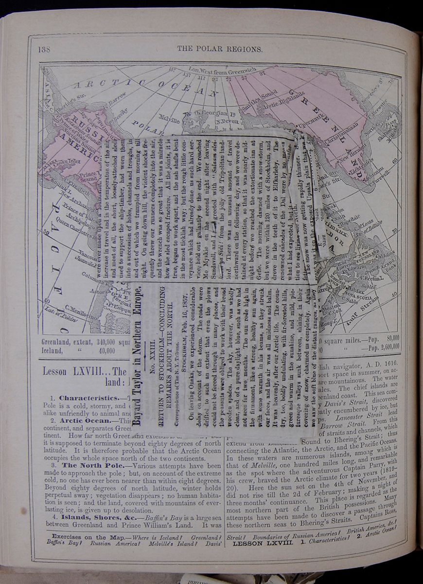
Bayard Taylor in Northern Europe.
No. XXIII.
RETURN TO STOCKHOLM—CONCLUDING REMARKS ABOUT THE NORTH.
STOCKHOLM, Feb. 16, 1857.On leaving Onska, we experienced considerable delay on account of the storm, the roads were drifted to such an extent that even the plows could not be forced through in many places, and the peasants were obliged to work with their broad wooden spades. The sky, however, was wholly clear, and of a pure daylight blue, such as we had not seen for two months. The sun rode high in the firmament, like a strong, healthy sun again, with some warmth in his beams, as they struck our faces, and the air was all mildness and balm. It was heavenly, after our Arctic life. The country, too, boldly undulating, with fir-forested hills, green and warm in the sunshine, and mild, picturesque valleys sunk between, shining in their covering of snow, charmed us completely. Again we saw the soft blue of the distant ranges, as they melted away behind each other, suggesting space, and light, and warmth. Give me daylight and sunshine, after all! Our Arctic trip seems like a long, long night, full of splendid dreams, but yet night and not day.
On the road, we bought a quantity of the linen handkerchiefs of the country, at prices varying from 25 to 40 cents apiece, according to the size and quality. The bedding, everywhere along the road, is of home-made linen, and I do not recollect an instance where it has not been brought out, fresh and sweet from the press for us. In this, as in all other household arrangements the people are very tidy and cleanly, though a little deficient as regards their own persons. Their clothing, however, is of a healthy, substantial character, and the women consult comfort rather than ornament. Many of them wear cloth pantaloons under their petticoats, which, therefore, they are able to gather under their arms in wading through snow-drifts. I have not seen a low-necked dress or thin shoe north of Stockholm.
"The damsel who trips at daybreak
Is shod
like a mountaineer;"
yet a sensible man would sooner take a damsel to wife than any delicate Cinderella of the ballroom. I protest I lose all patience when I think of the habits of our American women, especially our country girls. If ever the Saxon race does deteriorate on our side of the Atlantic, as some ethnologists, anticipate, it will be wholly their fault.
We stopped for the night at Höruäs, and had a charming ride the next day among the hills and along the inlets of the Gulf. The same bold, picturesque scenery, which had appeared so dark and forbidding to us on our way north, now, under the spring-like sky, cheered and inspired us. At the station of Docksta, we found the peasant-girls scrubbing the outer steps, barefooted. At night, we occupied our old quarters at Weda, on the Angermann River. The next morning the temperature was 25° above zero, and at noon rose to 39°. It was delightful to travel once more with caplappets turned up, fur-collar turned down, face and neck free, and hands bare. On our second stage, we had an overgrown, insolent boy for postillion, who persisted in driving slow, and refused to let us pass him. He finally became impertinent, whereupon Braisted ran forward and turned his horse out of the road, so that I could drive past. The boy then seized my horse by the hed; B. pitched him into a snow-bank, and we took the lead. We had not gone far before we took the road to Hernösand through mistake, and afterward kept it through spite, thus adding about seven miles to our day's journey. A stretch of magnificent dark-green forests brought us to the narrow strait which separates the island of Hernösand from the main land. The ice was already softening, and the upper layer repeatedly broke through under us.
Hernösand is a pretty town of about 2,000 inhabitants, with a considerable commerce. It is also the capital of the northern bishopric of Sweden. The church, on an eminence above the town, is next to that of Skelftea, the finest we have seen in the north. We took a walk while breakfast was preparing, and in the space of twenty minutes saw all there was to be seen. By leaving the regular road, however, we had incurred a delay of two hours, which did not add to our amiability. Therefore, when the postillion, furiously angry now as well as insolent, came forward to threaten us with legal prosecution in case we did not pay him heavy damages for what he called an assault, I cut the discussion short by driving him out of the room, and that was the last we saw of him. We reached Fjäl as the moon rose—a globe of silver fire in a perfect violet sky. Two merry boys, who sang and shouted the whole way, drove us like the wind around the bay to Wifsta. The moonlight was bright as the Arctic noonday, and the snowy landscape flashed and glittered under its resplendent shower. From the last hill we saw Sundsvall, which lay beneath us, with its wintry roofs, like a city of ivory and crystal, shining for us with the fairy promise of a warm supper and a good bed.
On the 9th, we drove along the shores of the magnificent bay of Sundsvall. Six vessels lay frozen in, at a considerable distance from the town. Near the southern extremity of the bay, we passed the village of Svartvik, which, the postillion informed us, is all owned by one person, who carries on ship-building. The appearance of the place justified his statements. The laborers' houses were mostly new, all built on precisely the same model, and with an unusual air of comfort and neatness. In the center of the village stood a handsome white church, with a clock-tower, and near it the parsonage and school house. A the foot of the slope were the yards, where several vessels were on the stecks, and a number of sturdy workmen busy at their several tasks. There was an air of "associated labor" and the "model lodging house" about the whole place, which was truly refreshing to behold, except a touch of barren utilitarianism in the cutting away of the graceful firs left from the forest, and thus depriving the houses of all shade and ornament. We met many wood-teams, hauling knees and spars, and were sorely troubled to get out of their way. Beyond the bay, the hills of Norrland ceased, sinking into those broad, monotonous undulations which extend nearly all the way to Stockholm. Gardens with thriving fruit-trees now began to be more frequent, giving evidence of a climate where Man has a right to live. I doubt whether it was ever meant that the human race should settle in any zone so frigid that fruit cannot ripen.
Thenceforth we had the roughest roads which were ever made upon a foundation of snow. The increase in travel and in the temperature of the air, and most of all, the short, loosely-attached sleds used to support the ship-timber, had worn them into a succession of holes, channels and troughs, in and out of which we trampled from morning till night. On going down hill, the violent shocks frequently threw our runners completely into the air, and the wrench was so great that it was a miracle how the sled escaped fracture. All the joints, it is true, began to work apart, and the ash shafts bent in the most ticklish way, but the rough little conveyance which had already done us such hard service, held out gallantly to the end. We reached Mo Myskie on the second night after leaving Sundsvall, and I was greeted with "Salaam aleilkoom ya Sidi! from the jolly old Tripolitan landlord. There was an unusual amount of travel northward on the following day, and we were detained at every station, so that it was nearly midnight before we reached the extortionate inn at Gefle. The morning dawned with a snow-storm, but we were within 120 miles of Stockholm, and drove in the teeth of it to Elfkarleby. The renowned cascades of the Dal were by no means what I had expected, but it was at least [covered]isfaction to see living [covered]the North.
The snow was now getting rapidly thinner. So scant was it on the exposed Upsala plain that we fully expected being obliged to leave our sleds on the way. Even before reaching Upsala, our postillions chose the less-traveled field-roads whenever they led in the same direction, and beyond that town we were charged additional post-money for the circuits we were obliged to make to keep our runners on the snow. On the evening of the 13th we reached Roxebro, onl 14 miles from Stockholm, and the next morning, in splendid sunshine, drove past Haga park and palace, into the North Gate, down the long Drottning-gatan, and up to Kahu's Hotel, where we gave our sleds to the valet-de-place, pulled off our heavy boots, threw aside our furs for the remainder of the Winter, and sat down to read the pile of letters and papers which Herr Kahu brought us. It was precisely two months since our departure in December, and in that time we had performed a journey of 2,200 miles, 250 of which were by reindeer, and nearly 500 inside of the Arctic Circile. Our frozen nozes had peeled off, and the new skin showed no signs of the damage they had sustained—so that we had come out of the fight not only without a scar, but with a marked increase of robust vitality.
I must confess, however, that interesting as the journey has been, and happily as we have endured its exposures, I should not wish to make it again. It is well to see the North, even after the South; but, as long as there is no one who visits the tropics without longing ever after to return again, so, I imagine, there is no one who, having seen a Winter inside the Arctic Circle, would ever which to see another. in spite of the warm, gorgeous and ever-changing play of color hovering over the path of the unseen sun, in spite of the dazzling auroral dances and the magical transfiguration of the forests, the absence of true daylight and of all signs of warmth and life, exercises at last a depressing influence on the spirits. The snow, so beautiful while the sunrise-setting illumination lasts, wears a ghastly monotony at all other times, and the air, so exhilarating, even at the lowest temperatures, becomes an enemy to be kept out, when you know his terribule power to benumb and destroy. To the native of a warmer zone, this presence of an unseen destructive force in Nature weighs like a nightmare upon the mind. The [covered] North also seem to undergo a species of hibernation, as well as the animals. Nearly half their time is passed in sleep; they are silent in comparison with the natives of other parts of the world; there is little exuberant gayety and cheerfulness, but patience, indifference, apathy almost. Aspects of Nature which appear to be hostile to man often develop and bring into play his best energies, but there are others which depress and paralyze his powers. I am convinced that the extreme North, like the Tropics, is unfavorable to the best mental and physical condition of the human race. The proper zone of Man lies between 30° and 55° North.
To one who has not an unusual capacity to enjoy the experiences of varied travel, I should not recommend such a journey. With me, the realization of a long-cherished desire, the sense of novelty, the opportunity for contrasting extremes, and the interest with which the people inspired me, far outweight all inconveniences and privations. [covered] fact, I was not fully aware of the gloom and col[covered] in which I had lived until we returned far enough southward to enjoy eight hours of sunshine and a temperature above the freezing point. It was a second birth into a living world. Although we had experienced little positive suffering from the intense cold, except on the return from Muoniovara to Haparanda, our bodies had already accommodated themselves to a low temperature, and the sudden transition to 30° above zero came upon us like the warmth of June. My friend, Dr. Kane, once described to me the comfort he felt when the mercury rose to 7° below zero, making it pleasant to be on deck. The circumstance was then incomprehensible to me, but is now quite plain. I can also the better realize the terrible sufferings of himself and his men, exposed to a storm in the temperature of -47°, when the same degree of cold, with a very light wind, turned my own blood to ice.
Most of our physical sensations are relative, and the mere enumeration of so many degrees of heat or cold gives no idea of their effect upon the system. I should have frozen at home last Winter at a temperature which I found very comfortable in Lapland, with my solid diet of meat and butter and my garments of reindeer. The following is a correct scale of the physical effect of cold, calculated for the latitude of 65° to 70° north:
15° above zero—Unpleasantly warm.
Zero—Mild and agreeable
10° below zero—Pleasantly fresh and bracing.
20° below zero—Sharp, but not severly cold. Keep your fingers and toes in motion, and rub your nose occasionally.
30° below zero—Very cold; take particular care of your nose and extremities; eat the fattest food, and plenty of it.
40° below—Intensely cold; keep awake at all hazards, muffle up to the eyes, and test your circulation frequently, that it may not stop somewhere before you know it.
50° below—A struggle for life.
We kept a record of the temperature from the time we left Sundsvall (Dec. 21) until our return to Stockholm. As a matter of interest, I sjubjoin it, changing the degrees from Resaumur to Fahrenheit. We tested the thermometer repeatedly on the way, and found it very generally reliable, although in extremely low temperature it showed from one to two degrees more than a spirit thermometer. The observations were taken at from 6 to 8 a.m., 12 to 2 p.m., and 7 to 11 p.m., whever it was possible:
| Morning. | Noon. | Evening. | |
| December 21.......... | +6 | .. | zero |
| December 22.......... | +6 | .. | — 3 |
| December 23.......... | —22 | —29 | —22 |
| December 24.......... | —6 | —29 | —22 |
| December 25.......... | —35 | —38 | mer. frozen. |
| December 26.......... | —30 | —24 | —31 |
| December 27 (storm)... | —18 | —18 | —18 |
| December 28 (storm)... | zero. | zero. | zero. |
| December 29.......... | —6 | —13 | —13 |
| December 30.......... | —6 | —13 | —22 |
| December 31 (storm)... | —3 | +9 | +9 |
| January 1, 1857...... | +3 | +3 | +3 |
| January 2............ | —6 | —6 | —6 |
| January 3............. | —30 | —22 | —22 |
| January 4............. | —18 | .. | —22 |
| January 5............. | —31 | —30 | —33 |
| January 6............. | —20 | —4 | zero. |
| January 7............. | +4 | +18 | +25 |
| January 8............. | +18 | .. | —11 |
| January 9............. | —28 | —44 | —44 |
| January 10 (storm).... | — 5 | .. | — 2 |
| January 11 (storm).... | — 2 | zero. | — 5 |
| January 12 (storm).... | — 5 | — 4 | — 4 |
| January 13 (storm).... | +5 | +5 | +5 |
| January 14............ | — 6 | —13 | — 6 |
| January 15............ | — 8 | —13 | —33 |
| January 16............ | — 9 | —10 | —11 |
| January 17 (fog)...... | zero. | zero. | zero. |
| January 18............ | — 3 | — 3 | — 9 |
| January 19 (storm).... | — 3 | — 3 | — 9 |
| January 20............ | +20 | .. | +6 |
| January 21............ | — 4 | zero. | zero. |
| January 22............ | +2 | — 6 | —13 |
| January 23............ | —13 | — 3 | —13 |
| January 24............ | —15 | —22 | —44 |
| January 25..mer. froz. | (—50?) | —42 | mer. frozen. |
| January 26............ | —45 | —35 | —39 |
| January 27.....frozen | —47 ? | —45 | —35 |
| January 28.....frozen | —49 ? | —47 ? | —44 |
| January 29............ | —47 ? | —43 | —43 |
| January 30............ | —27 | —11 | —35 |
| January 31............ | —17 | —16 | — 7 |
| February 1.......... | zero. | — 9 | —13 |
| February 2.......... | +2 | +6 | zero. |
| February 3.......... | zero. | zero. | zero. |
| February 4.......... | — 9 | zero. | — 3 |
| February 5 (storm)... | +3 | +3 | +3 |
| [covered] | |||
| February 7.......... | +14 | +18 | [covered] |
| February 8.......... | +25 | +39 | +22 |
| February 9.......... | +5 | +22 | +16 |
| February 10.......... | +25 | +37 | +37 |
| February 11.......... | +34 | +34 | +32 |
| February 12.......... | +32 | +37 | +23 |
| February 13.......... | +16 | +30 | +21 |
| February 14.......... | +25 | +39 | +25 |
We are settled here until the first of May. After a little allowable indolence, the natural reaction after such a journey, I shall devote myself to the sights and characteristics of Stockholm, of which I shall write you in due time. B. T.
[CORRECTION.—In Letter XXI., near the end, occurs the following sentence: "The wind had fallen, but the mercury again "froze at 70° below zero." It was written, and should have been printed, "47° below zero."
 138
THE POLAR REGIONS.
Map of the Polar Regions.
Greenland, extent, 340,000 square miles.—Population, 10,000
Iceland, " 40,000 " —Population, 60,000
Russian America, extent, 480,000 square miles.—Pop.
80,000
British America, " 2,880,000 " —Pop.
2,600,000
138
THE POLAR REGIONS.
Map of the Polar Regions.
Greenland, extent, 340,000 square miles.—Population, 10,000
Iceland, " 40,000 " —Population, 60,000
Russian America, extent, 480,000 square miles.—Pop.
80,000
British America, " 2,880,000 " —Pop.
2,600,000
Lesson LXVIII...The Polar Regions: Greenland: Iceland
1. Characteristics.—The region around the North Pole is a cold, stormy, and desolate portion of the globe, alike unfriendly to animal and vegetable life.
2. Arctic Ocean.—This flows north to the eastern continent, and separates Greenland from the American continent. How far north Greenland extends is unknown; but it is supposed to terminate beyond eighty degrees of north latitude. It is therefore probable that the Arctic Ocean occupies the whole space north of the two continents.
3. The North Pole.—Various attempts have been made to approach the pole; but, on account of the extreme cold, no one has ever been nearer than within eight degrees. Beyond eighty degrees of north latitude, winter holds perpetual sway; vegetation disappears; no human habitation is seen, and the land, covered with mountains of everlasting ice, is given up to desolation.
4. Islands, Shores, &c.—Baffin's Bay is a large sea between Greenland and Prince William's Land. It was discovered by Baffin, an English navigator, A. D. 1616. It can only be navigated a short space in summer, on account of the ice. The coasts are mountainous. The water is the resort of seals and whales. The chief islands are Disco and Waigatz, on the Greenland coast. This sea communicates with the Atlantic by Davis's Strait, discovered by Davis, in 1587. It is greatly encumbered by ice, but is the resort of whaling ships. Lancaster Strait lead west from Baffin's Bay into Barrow Strait. From this point westward there is a chain of straits and channels, which extend from Lancaster Sound to Bhering's Strait; thus connecting the Atlantic, the Arctic, and the Pacific Oceans. In these waters are numerous islands, among which is that of Melville, one hundred miles long, and remarkable as the spot where the adventurous Captain Parry, with his crew, braved the Arctic climate for two years (1819–20). Here the sun set on the 4th of November, and did not rise till the 2d of February; making a night of three months' continuance. This place is regarded as the most northern part of the British possessions. Many attempts have been made to discover a passage through these northern seas to Bhering's Straits. Captains Ross,
Exercises on the Map.—Where is Iceland? Greenland? Baffin's Bay? Russian America? Melville's Island? Davis' Strait? Boundaries of Russian America? British America, &c?
LESSON LXVIII. 1. Characteristics? 2. Arctic Ocean?
[begin surface 529] THE POLAR REGIONS.
139
THE POLAR REGIONS.
139
Parry, Beechy, and Franklin, sent by the British government within the last thirty years, have made interesting discoveries, which were completed in 1837 by Dease and Simpson, of the Hudson's Bay Company, proving beyond a doubt that through these seas the Atlantic and Pacific are connected. This fact was verified in 1853 by M'Clure.
5. Greenland.—This is a vast island, chiefly within the Arctic circle, and is one of the coldest and most desolate of all the inhabited regions of the glove. The interior is occupied by mountains of ice, and the eastern coast is unapproachable. Greenland is surrounded by thousands of islands, mostly barren rocks. These are visited by the people in spring for catching seals. Here are two seasons—a winter of nine months, and a summer of three. The land is barren, and the vegetation consists only of mosses, shrubs, and stinted grasses. In the northern parts, during the winter, the sun is not seen for three or four months. Yet, during these long nights, the heavens are often illuminated by the most brilliant displays of the aurora borealis, or northern lights. The principal animals are the white bear, which is large and strong, and, when pinched by hunger, will come to cabins and attack the settlers; the reindeer, whose flesh is eaten; and dogs, which are serviceable in drawing sledges over the snow. Along the sea-shore are many seals, without which the inhabitants would perish. Small quantities of wheat, potatoes, kitchen-herbs, and berries are produced in the south, with low birch, alder, and willow trees. July is the only month without snow. The inhabitants of this bleak and lonely island live in huts made of stone and turf, lighted and warmed by moss dipped in oil. They are good-natured, but low of stature and dull of intellect. In their habits they are to the last degree filthy. They were formerly pagans; but the Moravian missionaries have partially converted them to Christianity. The missionary settlements are at Lichtenau, Lichtenfels, and New Hernhut. The principal villages are Frederick's Harbor, Julian's Harbor, and Good Hope. Greenland was discovered in 981, by Eric Raude, a Norwegian from Iceland, who was driven by accident upon the coast. The country was, shortly after, colonized by a number of families from Iceland; and in 1023 it came under the Danish government. At the beginning of the fifteenth century there were 200 towns and villages, mostly on the east coast; but the whole colony, in a most mysterious manner, suddenly disappeared. Captain Davis, an Englishman, rediscovered Greenland in 1686. No inhabitants were found, except Esquimaux; but the ruins of houses and churches were numerous. The Danes, in the beginning of the seventeenth century, sent out an expedition in search of the lost colony, but without success. In 1721 a settlement was established on the western coast by Hans Egede, a Norwegian clergyman, since which time the colony has continued slowly to increase. All the present settlements are on the western coast. Upernavik, in latitude 72° 48,´ is the most northerly town on the globe.
6. Iceland.—This lies in the Atlantic Ocean, about two hundred miles to the east of Greenland. Its surface is rugged and mountainous, and the island contains thirty volcanoes, the chief of which is Hecla. The eruptions of this are terrific. Hot springs of remarkable size are numerous. One, called the Great Geyser, is intermittent, and throws up columns of boiling water. The first jets seldom exceed fifteen or twenty feet, but the highest often exceed eighty. The explosions take place at intervals of about six hours. The sides of the mountains are covered with glaciers, which occupy 4000 square miles, and are 4000 feet above the level of the sea. Hardly any trees grow, and fuel is scarce. There are many tracts of good soil. Sheep, cattle, small horses, pigs, and dogs are reared. Wild reindeer abound; fish and sea-fowl teem along the shores. Iceland was discovered about the year 860 by a Norwegian pirate. A colony was settled here by the Norwegians in 874, and an independent republic soon rose in Iceland, which afforded an asylum to literature and the arts, then on the point of being overwhelmed by the general tide of barbarism on the continent of Europe. The Icelanders were skillful and hardy navigators. They discovered Greenland about the year 981. A still more remarkable discovery, made by them shortly afterward, was Vinland, or New England, which we have already noticed. In the year 1261 the Icelanders submitted to Haco, king of Norway, and remained attached to this kingdom. In 1380, the island was transferred to the crown of Denmark. The only town is Reikiavik—900 inhabitants. The Icelanders still maintain their literature in full vigor, and a remarkable degree of general knowledge exists among them.
Lesson LXIX... Russian America.
1. Characteristics.—This country is a large peninsula, and comprises the northwestern corner of the American continent.
2. Mountains.—The great range of the Snowy Mountains extends to this region, and only terminates with the ocean. In some cases the mountains come close to the sea. The scenes that are witnessed along the coasts, by the falling of glaciers, are said to be terrific. They sometimes fill up whole valleys, or fall into rivers and bays, where they remain like hills of crystal. When such masses fall into a forest, the tallest trees are crushed, or scattered to a distance. When they fall into the sea, enormous waves rise, covered with foam, and ships in the vicinity experience a violent shock.
3. Shores, Islands, &c.—The Russian territory extends north and south for more than a thousand miles. At the south, it consists of a narrow strip along the shore. Here are Mount Fairweather and Mount St. Elias, 17,850 feet high, is the loftiest peak in North America. Near the shore is a group of islands, one of which is Sitka, on which New Archangel is placed. To the north are Cape Elizabeth, Kodiak Island, and the long peninsula of Alaska. Bhering's Strait separates this territory from Asia. On the north side of the Russian territory are Icy Cape, Point Barrow, and Point Beechy.
4. Climate, Products, &c.—The climate is cold, though somewhat modified by the vicinity of the sea. Fogs and hazy weather are almost perpetual. The Strait is frozen over in winter, and, to the north, ice continues along the shores throughout the season. There are various kinds of fir, of which the pine is the most common. In some places it rises in dark, lofty forests. There are many shrubs, and some parts produce short grass. The
3. The North Pole? 4. Islands, &c.? 5. Greenland; its seasons, animals, inhabitants, &c.? 6. Iceland; its mountains, products, &c.?
LESSON LXIX. 1. Characteristics? 2. Mountains? 3. Shores, Islands, &c.? 4. Climate, Products, &c.? 5. Animals?
[begin surface 530]
Something about the Bay Islands.
These little Islands which have recently become famous in consequence of the treaties which have referred to them, and the misunderstanding which has arisen about them, both in Honduras, England and the United States, have until recently been considered almost beneath the notice of Geographers. But let a place like Bolgrad or Ruatan become the subject of diplomacy, and it is astonishing what an unrolling of maps, and what a hunting through the Gazetteers take place. In this instance there would be little use of a search, for the authorities are, to say the least, exceedingly unsatisfactory, What has been known about them by the English mahogany cutters, or commercial captains, has not allowed to be made very public. Since the discovery of California however, Central America has become of the highest importance among the transit countries of the New World, and the poor, wretched mongrel races that there had lost their affinities with civilized humanity, preserving only some, barbarous notions of commerce and religion, have at length loomed up in the horizon, and begin to assume a kind of form and proportion.
And now, because American genius has perfected an easy and practicable railway route between the two great oceans of the world, and has in its hand no less than four other lines of communication—the Panama, Nicaragua, Tehuantepec and Honduras, and are surveying another by the Atrato, these petty countries of Central and South America, aim at an immediate equality with the foremost nations of the two continents. These are they who, having nothing to build upon, without commerce, without arts, without education, ignorant, bigoted and stupid, fall back upon the theoretical principle of nationality found in the old writers upon the laws of nations and upon invocations to Liberty, a goddess whom they only worship in the shape of discord. We are, therefore, at loggerheads with New Grenada, about Panama route; with Nicaragua and Costa Rica, about the Vanderbilt route, and are negotiating with Mexico about the Tehuantepec route; and as an offset to this, England is working away at the Honduras route, with her capital and our brains.
All the petty governments which have relations with these transit routes, have been troublesome since they found that their approbation or even their silence might be of account, and the valorous captains who live at Bogota, ascertaining that they can n[illegible]r rob Americans with impunity as they pass across the Isthmus, have threatened to raise a thousand negroes, and come down and exterminate the North Americans.
England, which has carefully cherished its settlements at Belize, and made an attempt to possess herself of the Bay Islands, has now backed out of the scheme, but in her own peculiar way; but that she evidently intends to take every care of her interests in that direction, is evident from the encouragement she has given to the Honduras Railroad Company.
These Bay Islands consist of Ruatan, Bonacca, Helena, Utilla, Barbaretta and Morat, situated in that part of the Caribbean Sea known as the Bay of Honduras, and form a free territory under the sovereignty of that name. By the treaty of the 27th of August, 1856, between England and Honduras, the inhabitants of the Bay Islands had the right to govern themselves by a municipal administration of their own, judges, with juries and laws of their own, entire liberty of worship and of conscience, exemption from Custom-house imposts and military service, except in defence of the islands themselves.
With this liberal constitution, a favorable climate, a fertile soil, excellent and safe harbors and proximity to one of the termini of the railway, this key of Spanish America and garden of the West Indies, has become of considerable consequence to the commercial world. The islands are situated on the North of the Atlantic coast of Honduras, lying parallel to that coast at a distance of from thirty to fifty miles. They are surrounded by reefs of Madrepore, and banks of rocks, which connect the islands the one with the other. Ruatan and Bonacca are considered the most important of the group, the remaining four being small and sparsely inhabited.
Ruatan, the largest of the whole, is about thirty miles long and nine wide, at its broadest part. Having excellent ports, the best if not the only ones on that side the coast, its position is commercially and politically important, as England early discovered.
The view of the island from the sea is said to be magnificent; from the bottom to the top of its mountains, which rise about one thousand feet, it is covered with verdure. Nature appears to have exhausted herself in making it prolific and beautiful.
The group is evidently of Volcanic origin. The principal formation is calcareous, but granite and quartz are also found there. In the vallies
and savannas the soil is deep and fertile. On the mountains valuable clays and marls prevail. In the forest there is an immense quantity of oak, cedar, pine and ash, applicable to ship building. Among the other natural products are cocoa, bananas, plantains, yams, figs, pine apples and raisins. The islands abound with game, and the harbors and lagoons are crowded with excellent fish and green turtle. In the months of April and May, the wild birds lay such immense quantities of eggs on the rocks that they furnish ample food for the inhabitants for many weeks.
The climate is better than that of the Antilles generally. Rains fall between September and February which greatly moderate the temperature. The summer months are not hot, and the inhabitants prefer them to any other of the year. Rheumatism and fever are the prevalent diseases, but it is asserted that the climate, notwithstanding, is exceedingly healthful and very favorable to persons of Northern birth. The population of Ruatan is only 2,000, it might sustain 20,000, yet in 1843 it contained only 80 inhabitants. This rapid increase is owing to immigration and the natural increase, the births in relation to deaths, being as 3 to 1, families often being found having twelve children.
The inhabitants reside chiefly in the interior among their plantations, visiting the coast in boats on the numerous water ways of the island. The principal town of the Colony is Coxhole or Port McDonald, with 600 inhabitants. The mass of the population is composed of free negroes who came from the Grand Cayman, and these are the men the English Government wished to protect by its interpolated article in its Honduras arrangement. The white population consists of agriculturists, merchants and fishermen. The exports are chiefly turtle, cocoa and tropical fruits.
Dixon's Cove is a port where the English had for some time intended to found a city, and is situated some six miles from Port McDonald.
It is evident that these islands are very valuable, and in connection with the proposed Honduras railway, are quite likely to rival Aspinwall. It would never do to have an English fortified town and harbor at Dixon's Cove, or anywhere in the Bay. We have collated the foregoing information, with the hope that it may be useful at this stage of our negotiations with England, at present at a stand. We are indebted for most our information to a recent French writer of note, not much known in the United States.
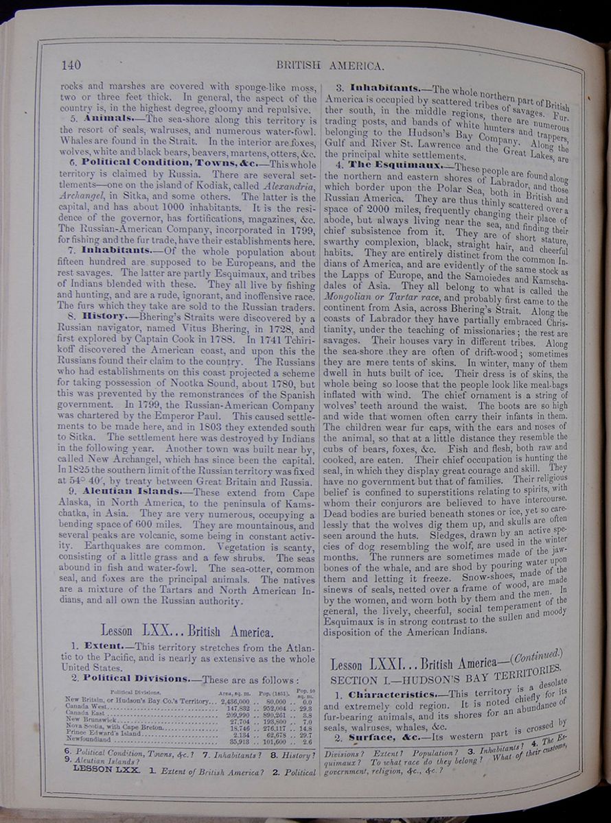 140
THE POLAR REGIONS.
140
THE POLAR REGIONS.
rocks and marshes are covered with sponge-like moss, two or three feet thick. In general, the aspect of the country is, in the highest degree, gloomy and repulsive.
5. Animals.—The sea-shore along this territory is the resort of seals, walruses, and numerous water-fowl. Whales are found in the Strait. In the interior are foxes, wolves, white and black bears, beavers, martens, otters, &c.
6. Political Condition, Towns, &c.—This whole territory is claimed by Russia. There are several settlements—one on the island of Kodiak, called Alexandria, Archangel, in Sitka, and some others. The latter is the capital, and has about 1000 inhabitants. It is the residence of the governor, has fortifications, magazines, &c. The Russian-American Company, incorporated in 1799, for fishing and the fur trade, have their establishments here.
7. Inhabitants.—Of the whole population about fifteen hundred are supposed to be Europeans, and the rest savages. The latter are partly Esquimaux, and tribes of Indians blended with these. They all live by fishing and hunting, and are a rude, ignorant, and inoffensive race. The furs which they take are sold to the Russian traders.
8. History.—Bhering's Straits were discovered by a Russian navigator, named Vitus Bhering, in 1728, and first explored by Captain Cook in 1788. In 1741 Tchirikoff discovered the American coast, and upon this the Russians found their claim to the country. The Russians who had establishments on this coast projected a scheme for taking possession of Nootka Sound, about 1780, but this was prevented by the remonstrances of the Spanish government. In 1799, the Russian-American Company was chartered by the Emperor Paul. This caused settlements to be made here, and in 1803 they extended south to Sitka. The settlement here was destroyed by Indians in the following year. Another town was built near by, called New Archangel, which has since been the capital. In 1825 the southern limit of the Russian territory was fixed at 54° 40´, by treaty between Great Britain and Russia.
9. Aleutian Islands.—These extend from Cape Alaska, in North America, to the peninsula of Kamschatka, in Asia. They are very numerous, occupying a bending space of 600 miles. They are mountainous, and several peaks are volcanic, some being in constant activity. Earthquakes are common. Vegetation is scanty, consisting of little grass and a few shrubs. The seas abound in fish and water-fowl. The sea-otter, common seal, and foxes are the principal animals. The natives are a mixture of the Tartars and North American Indians, and all own the Russian authority.
Lesson LXX... British America.
1. Extent.—This territory stretches from the Atlantic to the Pacific, and is nearly as extensive as the whole United States.
2. Political Divisions.—These are as follows: This table lists the political divisions of British America and includes the area (in square miles), the population (in 1851), and the population to square mile. The political divisions included are as follows: New Britain or Hudson's Bay Co.'s Territory, Canada West, Canada East, New Brunswick, Nova Scotia with Cape Breton, Prince Edward's Island, and Newfoundland.
3. Inhabitants.—The whole northern part of British America is occupied by scattered tribes of savages. Further south, in the middle regions, there are numerous trading posts, and bands of white hunters and trappers, belonging to the Hudson's Bay company. Along the Gulf and River St. Lawrence and the Great Lakes, are the principal white settlements.
4. The Esquimaux.—These people are found along the northern and eastern shores of Labrador, and those which border upon the Polar Sea, both in British and Russian America. They are thus thinly scattered over a space of 2000 miles, frequently changing their place of abode, but always living near the sea, and finding their chief subsistence from it. They are of short stature, swarthy complexion, black, straight hair, and cheerful habits. They are entirely distinct from the common Indians of America, and are evidently of the same stock as the Lapps of Europe, and the Samoiedes and Kamschadales of Asia. They all belong to what is called the Mongolian or Tartar race, and probably first came to the continent from Asia, across Bhering's Strait. Along the coasts of Labrador they have partially embraced Christianity, under the teaching of missionaries; the rest are savages. Their houses vary in different tribes. Along the sea-shore they are often of drift-wood; sometimes they are mere tents of skins. In winter, many of them dwell in huts built of ice. Their dress is of skins, the whole being so loose that the people look like meal-bags inflated with the wind. The chief ornament is a string of wolves' teeth around the waist. The boots are so high and wide that women often carry their infants in them. The children wear fur caps, with the ears and noses of the animal, so that a distance they resemble the cubs of bears, foxes, &c. Fish and flesh, both raw and cooked, are eaten. Their chief occupation is hunting the seal, in which they display great courage and skill. They have no government but that of families. Their religious belief is confined to superstitions relating to spirits, with whom their conjurors are believed to have intercourse. Dead bodies are buried beneath stones or ice, yet so carelessly that the wolves dig them up, and skulls are often seen around the huts. Sledges, drawn by an active species of dog resembling the wolf, are used in the winter months. The runners are sometimes made of the jawbones of the whale, and are shod by pouring water upon them and letting it freeze. Snow-shoes, made of the sinews of seals, netted over a frame of wood, are made by the women, and worn both by them and the men. In general, the lively, cheerful, social temperament of the Esquimaux is in strong contrast to the sullen and moody disposition of the American Indians.
Lesson LXXI... British America—(Continued.)
SECTION I.—HUDSON'S BAY TERRITORIES.
1. Characteristics.—This territory is a desolate and extremely cold region. It is noted chiefly for its fur-bearing animals, and its shores for an abundance of seals, walruses, whales, &c.
2. Surface, &c.—Its western part is crossed by
6. Political Condition, Towns, &c.? 7. Inhabitants? 8. History? 9. Aleutian Islands?
LESSON LXX. 1. Extent of British America? 2. Political Divisions? Extent? Population? 3. Inhabitants? 4. The Esquimaux? To what race do they belong? What of their customs, government, religion, &c., &c.?
[begin surface 533]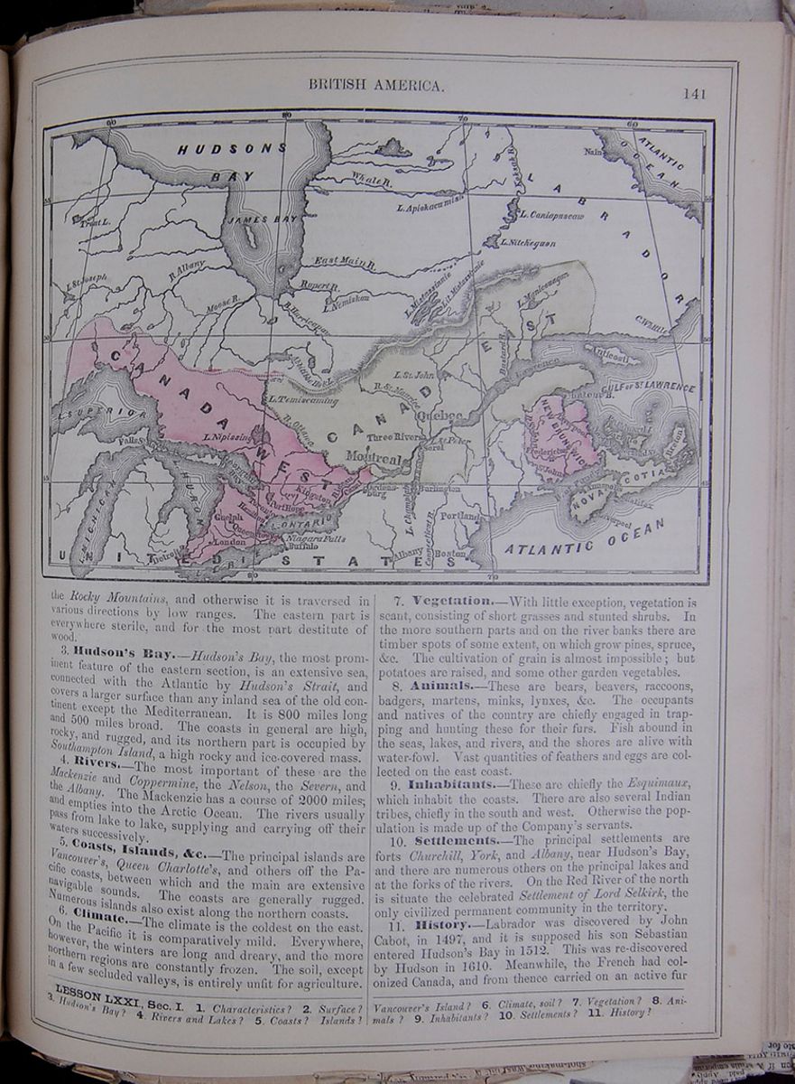 BRITISH AMERICA.
141
A map including Canada West, Canada East, New
Brunswick, the Hudson Bay, the Great Lakes, and
parts of the United States.
BRITISH AMERICA.
141
A map including Canada West, Canada East, New
Brunswick, the Hudson Bay, the Great Lakes, and
parts of the United States.
the Rocky Mountains, and otherwise it is traversed in various directions by low ranges. The eastern part is everywhere sterile, and for the most part destitute of wood.
3. Hudson's Bay.—Hudson's Bay, the most prominent feature of the eastern section, is an extensive sea, connected with the Atlantic by Hudson's Strait, and covers a larger surface than any inland sea of the old continent except the Mediterranean. It is 800 miles long and 500 miles broad. The coasts in general are high, rocky, and rugged, and its northern part is occupied by Southampton Island, a high rocky and ice-covered mass.
4. Rivers.—The most important of these are the Mackenzie and Coppermine, the Nelson, the Severn, and the Albany. The Mackenzie has a course of 2000 miles; and empties into the Arctic Ocean. The rivers usually pass from lake to lake, supplying and carrying off their waters successively.
5. Coasts, Islands, &c.—The principal islands are Vancouver's, Queen Charlotte's, and others off the Pacific coasts, between which and the main are extensive navigable sounds. The coasts are generally rugged. Numerous islands also exist along the northern coasts.
6. Climate.—The climate is the coldest on the east. On the Pacific it is comparatively mild. Everywhere, however, the winters are long and dreary, and the more northern regions are constantly frozen. The soil, except in a few secluded valleys, is entirely unfit for agriculture.
7. Vegetation.—With little exception, vegetation is scant, consisting of short grasses and stunted shrubs. In the more southern parts and on the river banks there are timber spots of some extent, on which grow pines, spruce, &c. The cultivation of grain is almost impossible; but potatoes are raised, and some other garden vegetables.
8. Animals.—These are bears, beavers, raccoons, badgers, martens, minks, lynxes, &c. The occupants and natives of the country are chiefly engaged in trapping and hunting these for their furs. Fish abound in the seas, lakes, and rivers, and the shores are alive with water-fowl. Vast quantities of feathers and eggs are collected on the east coast.
9. Inhabitants.—These are chiefly the Esquimaux, which inhabit the coasts. There are also several Indian tribes, chiefly in the south and west. Otherwise the population is made up of the Company's servants.
10. Settlements.—The principal settlements are forts Churchill, York, and Albany, near Hudson's Bay, and there are numerous others on the principal lakes and at the forks of the rivers. On the Red River of the north is situate the celebrated Settlement of Lord Selkirk, the only civilized permanent community in the territory.
11. History.—Labrador was discovered by John Cabot, in 1497, and it is supposed his son Sebastian entered Hudson's Bay in 1512. This was re-discovered by Hudson in 1610. Meanwhile, the French had colonized Canada, and from thence carried on an active fur
LESSON LXXI., Sec. I. 1. Characteristics? 2. Surface? 3. Hudson's Bay? 4. Rivers and Lakes? 5. Coasts? Islands? Vancouver's Island? 6. Climate, soil? 7. Vegetation? 8. Animals? 9. Inhabitants? 10. Settlements? 11. History?
[begin surface 534] 142
BRITISH AMERICA.
142
BRITISH AMERICA.
trade with the Indians west of Hudson's Bay. In 1668 the English sent a vessel to Hudson's Bay, and erected Fort Charles, on the bank of Rupert's River. In 1670 the Hudson's Bay Company was incorporated, and, sending its agents to this quarter, soon extended its trading posts, and engrossed a large part of the fur trade. Its operations are now on an immense scale, its territories stretching entirely across the continent, and equally one-half of Europe in extent. They claim the exclusive privilege of trading with the Indians for furs throughout this territory. The company is under the direction of a governor, &c., chosen by the proprietors in London. The immense fur sales of the Hudson's Bay Company take place every year, in the month of March, in London. These furs are thence distributed over the Continent.
SECTION II.—CANADA.
1. Characteristics.—Canada is noted for its rare agricultural capacities, its extensive water communications, and the rapid developments of its resources.
2. Extent.—The country presents an approximation to the form of a triangle, with its base on the 50th parallel and its apex, Point Pelée, jutting into Lake Erie. The eastern extremity is Cape Gaspé, and the western confluence of the River Kaministiquia with Lake Superior. The east side of this imaginary triangle comprises Lower Canada, and the west side Upper Canada. The entire length of the territory is 1200 miles, and its average breadth between 200 and 300 miles.
3. Surface of the Country.—Upper Canada is characterized by a general evenness of surface. A table-ridge of considerable hight, however, stretches southeast and northwest, forming a watershed between Lakes Superior and Huron and the south portion of Hudson's Bay. A similar watershed traverses Lower Canada also, as is indicated by the opposite courses of its rivers—one series of which flows southeast toward the St. Lawrence, and another pours into Hudson's Bay. Upper Canada, though much more fertile than Lower Canada, is inferior to is as regards romantic and picturesque scenery. The physical features of the latter, on both sides of the St. Lawrence, are varied and grand, consisting of boundless forests, magnificent rivers and lakes, foaming cataracts, and islands with rich pastures. This beautiful appearance, however, changes to a very different character in the winter, which is extremely severe and inhospitable.
4. Rivers.—The principal rivers of Lower Canada are—The St. Lawrence, the Ottawa, the Saguenay, and the St. Maurice. The Ottawa divides the two sections of the province. The Richelieu, the Chaudière, and the St. Francis are also rivers of Lower Canada. The Richelieu or Sorel is the outlet of Lake Champlain. The principal rivers of Upper Canada, are—the Thames, and the Ouse or Grand. Numberless others of smaller dimensions, and of which the Trent is the principal, drain the Canadian side of Ontario and Erie, which lakes are connected by the Niagara River.
5. Lakes, &c.—The most considerable lakes are Simcoe and Nipissing in the west, and Lake St. John in the east. The larger lakes are Superior, Huron, Erie, and Ontario, which are vast inland seas, and navigable for the largest class of vessels. None of these are exclusively Canadian, but, lying between Canada and the United States, their mid-waters form the dividing line between the two countries.
6. Falls of Niagara.—These stupendous falls occur in the Niagara River, the outlet of Lake Erie, and have a descent of 160 feet, which is the difference of level between lakes Erie and Ontario. (See p. 53.) The river is here crossed by one of the most magnificent suspension bridges in the world, which connects the railroads of New York with those of Upper Canada.
7. Minerals.—Iron is abundant, and lead, tin, and copper occur in several places. The latter abounds most on Lake Superior. Silver and gold are also known to exist. Gold is found chiefly on the Chaudière River. Marble of many beautiful varieties, lithographic stone and gypsum, exist very extensively in the western section, and coal has been found in small measures.
8. Climate.—The climate of Canada is much colder than that of Europe on the same parallels. It is nearly the same with the climates of Norway, Sweden, and Russia, and the south part of Iceland. Both the heat of summer and cold of winter are extreme. In the lake districts, however, the climate is more equable than Lower Canada or in the more remote localities.
9. Vegetation.—The greater portion of the land is thickly wooded with pine, ash, maple, butternut, walnut, cherry, bass, sycamore, button-wood, alder, willow, cedar, tamarack, etc. Of the shrubs, there are many kinds, among which is the sumach. Flowery plants of great beauty abound; and among the wild fruits are cherries, plums, grapes, currants, gooseberries, raspberries, cranberries, strawberries &c. Nuts of various kinds are abundant. Nearly all vegetables and fruits of the temperate climate, indeed, thrive in Canada, particularly in the west, under proper cultivation. In the south part, peaches and apples are produced in great abundance.
10. Animals.—Wild animals, as bears, deer, wolves, boars, beavers, and otters are numerous, and furs form an important product. The humming-bird appears in Canada, and the rattle-snake is not uncommon. Fish is abundant. The principal fisheries are in the Gulf of the St. Lawrence.
11. Inhabitants.—The Indian aborigines are now nearly extinct, and only a very few occupy the outposts of the territory. The present dominant population is of European origin: in Upper Canada chiefly of British and Irish descent, with a considerable mixture of Germans and Norwegians; and in Lower Canada chiefly descendants of the old French settlers, or, as they are locally termed, habitans. Immigration has added largely but unequally (about 40,000 annually) to these during the past few years: in Upper Canada, in 1852, about 400,000 were foreign-born, and in Lower Canada less than 100,000. Hence we find the French of Lower Canada essentially what they were fifty years ago, and for the most part a non-progressive race. The inhabitants of Upper Canada, on the other hand, constantly recruiting from the Old World, are developing its resources rapidly, and with success. The people of the two sections, indeed, are essentially different races, speaking different tongues, and of entirely antagonistic religions. Politically the inhabitants of both sections are on an equality.
Sec. II. 1. Characteristics? 3. Extent? 3. Surface? 4. Rivers—St. Lawrence, &c.? 5. Lakes, etc.? 6. Falls of Niagara? 7. Minerals? 8. Climate? 9. Vegetation? 10. Animals? 11. Inhabitants? 12. Divisions? 13. Agriculture? 14. Manufactures?
[begin surface 535] [begin surface 536]
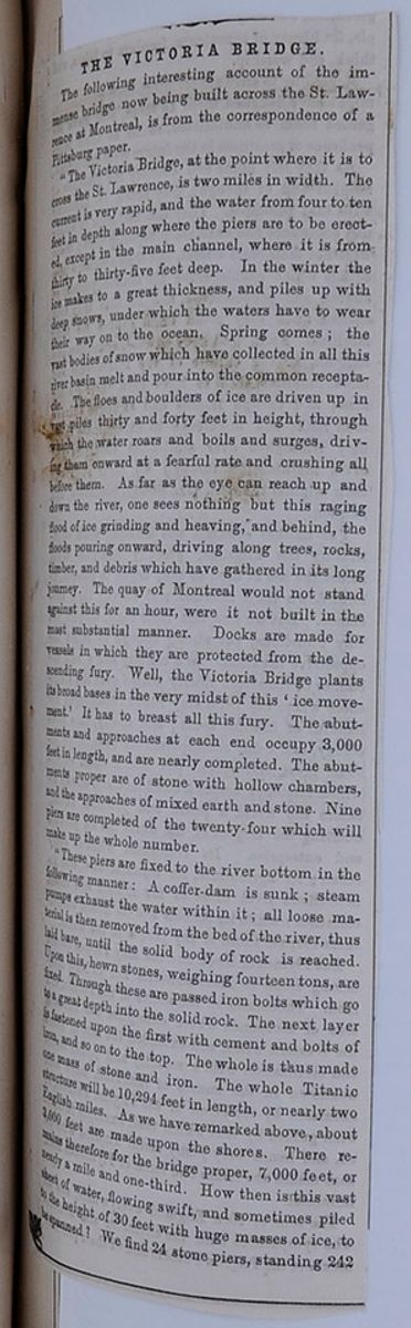
THE VICTORIA BRIDGE.
The following interesting account of the immense bridge now being built across the St. Lawrence at Montreal, is from the correspondence of a Pittsburg paper.
"The Victoria Bridge, at the point where it is to cross the St. Lawrence, is two miles in width. The current is very rapid, and the water from four to ten feet in depth along where the piers are to be erected, except in the main channel, where it is from thirty to thirty-five feet deep. In the winter the ice makes to a great thickness, and piles up with deep snows, under which the waters have to wear their way on to the ocean. Spring comes; the vast bodies of snow which have collected in all this river basin melt and pour into the common receptacle. The floes and boulders of ice are driven up in vast piles thirty and forty feet in height, through which the water roars and boils and surges, driving them onward at a fearful rate and crushing before them. As far as the eye can reach up and down the river, one sees nothing but this raging flood of ice grinding and heaving, and behind, the floods pouring onward, driving along trees, rocks, timber, and debris which have gathered in its long journey. The quay of Montreal would not stand against this for an hour, were it not built in the most substantial manner. Docks are made for vessels in which they are protected from the descending fury. Well, the Victoria Bridge plants its broad bases in the very midst of this 'ice movement.' It has to breast all this fury. The abutments and approaches at each end occupy 3,000 feet in length, and are nearly completed. The abutments proper are of stone with hollow chambers, and the approaches of mixed earth and stone. Nine piers are completed of the twenty-four which will make up the whole number.
"These piers are fixed to the river bottom in the following manner: A coffer-dam is sunk; steam pumps exhaust the water within it; all loose material is then removed from the bed of the river, thus laid bare, until the solid body of rock is reached. Upon this, hewn stones, weighing fourteen tons, are fixed. Through these are passed iron bolts which go to a great depth into the solid rock. The next layer is fastened upon the first with cement and bolts of iron, and so on to the top. The whole is thus made one mass of stone and iron. The whole Titanic structure will be 10,294 feet in length, or nearly two English miles. As we have remarked above, about 3,000 feet are made upon the shores. There remains therefore for the bridge proper, 7,000 feet, or nearly a mile and one-third. How then is this vast sheet of water, flowing swift, and sometimes piled to the height of 30 feet with huge masses of ice, to be spanned? We find 24 stone piers, standing 242
[begin surface 537]
[cutaway]IFE ILLU[cutaway]
[covered]part, perpendicular on three sides, and slop[covered] own to the water's edge. In exception, how[covered]o this general statement, it should be observed [covered] he center span is 339 feet wide, for the pur[covered] of navigation, and is bounded by piers much [covered] than the others. Resting without other sup[covered]n these piers, and running from abutment to [covered]ent, is the bridge, consisting of a great hol[covered]on tube, 22 feet high in the middle by 16 [covered]and descending to 19 feet high at the two [covered] The center span is to be 50 feet above the [covered]e level of the water, thense sinking gradually [covered] either end, 1 foot in 130, thus making the [covered] of the abutment about 37 feet. And so, in [covered]erminal masses of masonry, in these 21 co[covered]piers, breasting for all time the floods of the [covered]wrence, in this enormous tube of iron through [covered] loaded trains will shoot like a weaver's shut[covered]ou have the Victoria Bridge, the wonder of [covered]rld. Statistics can not enhance our admira[covered] still we add, that the estimated cost is over [covered],000, that the weight of iron in the tubes only [covered] 8,000 tons, and that the contents of the ma[covered] will be 3,000,000 cubic feet. The whole will [covered]mplete in the fall of '59 or in the spring of [covered]
[begin surface 539]
12. Divisions, &c.—In 1852, Canada was divided into the following counties: UPPER CANADA. This table lists the counties of Upper Canada along with their population and "Chief Towns." LOWER CANADA. This table lists the counties of Lower Canada along with their population and "Chief Towns."
13. Agriculture.—The principal products are wheat, oats, and rye, for which the climate and soil are well adapted. Live-stock is also abundant. Only about one-sixteenth part of all the land is under cultivation, and yet a large surplus of grain is exported. Wool, butter, and cheese are largely produced. Potatoes, hemp and flax, and tobacco are also considerable crops.
14. Manufactures.—There are no large manufacturing establishments in Canada; but in all the towns the usual mechanic arts are engaged in. In this branch of industry, however, a rapid progress has been made, and from its ample water-power the country has every facility for its development. Mills are numerous.
15. Mining.—In the vicinity of Lake Superior, copper, iron, lead, &c., are mined. In other parts quarries of various materials are open; and mineral discoveries are constantly being made in the progress of the geological survey now being instituted. Among the most recent and valuable are fine marbles, lithographic stones, &c.
16. Commerce.—Canada had from the first been a commercial country. In relation to its population it now stands at the head of American commercial communities, its foreign commerce having largely increased within the past few years, and especially since the introduction of the reciprocity principle between it and the United States. The great bulk of the exports, consisting of lumber, vegetable food, and animal products, with fish, minerals, &c., is sent to Great Britain and the United States. The imports are principally from the same countries. The total value of foreign commerce is about $60,000,000 annually. Internal commerce is greatly facilitated by its vast system of rivers, canals, and railroads. Nearly 3,000,000 tons of shipping pass through its canals annually.
17. Canals.—These are the Welland Canal, uniting the navigation of lakes Ontario and Erie, and several canals improving the navigation of the St. Lawrence. The Rideau Canal extends from the Ottawa at Ottawa City to Lake Ontario at Kingston; and there is a canal uniting the St. Lawrence with Lake Champlain. Most of these are public works, and have cost vast sums of money.
18. Railroads.—Canada has several extensive railroads. At present not less than 1500 miles are open to travel; and with their connections furnish communications with all the northern ports of the United States. The principal of these are the Grand Trunk Railroad, from Montreal and Quebec to Portland; the Great Western, extending across the peninsula of Upper Canada, from Niagara Falls in New York to Detroit in Michigan; the Ontario, Simcoe, and Lake Huron, extending from Toronto, on Lake Ontario, to Collingwood, on Georgian Bay. There are numerous other shorter roads completed; and others, some of great length, are projected or in course of construction. The whole system, when completed, will have a length of upward of 4000 miles.
19. Government.—Canada is a province of the British Empire, and is ruled by a governor appointed by and representing the monarch. The Parliament consists of a Council and House of Representatives. Affairs are administered by a responsible ministry; and, with the exception of the crown having the power to veto legislative acts, which is never exercised, Canada is in reality an independent country. Its military defense is, however, still vested in the imperial government, as are also its relations with foreign states. The expenses of the government are about $5,000,000 a year. It has a debt chiefly contracted for the public works, amounting to about $20,000,000.
20. Education.—In Upper Canada education is in a very satisfactory condition; in Lower Canada less progress has been made, but constant improvement in this respect is witnessed. Schools of every kind are liberally supported by the government. In 1854, out of 269,000 children of school age in Upper Canada, 205,000 were attending school. At the same time there were 8 colleges, 79 county grammar schools and academies, 174 private schools, 3 normal and model schools, and 3127 common schools. Lower Canada had 108,284 children at school and the institutions then established were 2114 elementary schools, 65 model schools, 53 superior girls' schools, 19 preparatory academies, 14 colleges, 44 conventual schools, and 85 independent schools. Recently a system of public libraries has been instituted throughout the province, and through this every district will be possessed of the best works in every department of knowledge.
21. Chief Towns.—The principal cities of Upper Canada are Toronto, Hamilton, and Kingston; in Lower Canada, Montreal and Quebec. Quebec, the provincial capital, is situate partly on a plain on the north bank of the St. Lawrence, and partly on a perpendicular rock, 350 feet high. The two portions are called respectively the upper and lower towns. The place is strongly fortified, and contains many handsome public buildings. Its harbor is accessible to the largest ships, and it is one of the largest lumber ports of the world. Population about
15. Mining? 16. Commerce? 17. Canals? 18. Railroads? 19. Government? 20. Education? 21. Chief Towns?
[begin surface 540] 144
BRITISH AMERICA.
144
BRITISH AMERICA.
50,000. Montreal, on an island of the same name on the St. Lawrence, is the most populous city of the province. The two places are connected by railroad, and both with the railroads of the United States. Population, about 70,000. The other towns of Lower Canada are Three Rivers, with 6000 inhabitants; Sorel, with 4000; St. Hyacinthe, with 3800; St. John's, with 3600; Sherbrooke, with 3500, etc. Toronto, the largest city of Upper Canada, is finely situate on the northwest shore of Lake Ontario, and has a large trade with the opposite American ports. Population, 50,000. Hamilton, at the southwest extremity of the same lake, has about 20,000 inhabitants. Kingston, on the north shore of the lake at its outlet, it connected with the Ottawa by the Rideau Canal, and contains about 15,000 inhabitants. Each of these places has a thriving commerce, and is rapidly progressing. The following are also important towns: Ottawa City (By-Town) has 10,000 inhabitants; London, 8000; Belleville and St. Catharine's, each about 6000; Brantford and Cobourg, each about 5000; Dundas, Niagara, and Brockville, each about 4000; and otherwise, among the principal places may be mentioned Port Hope, Prescott, Chatham, Woodstock, Peterboro', Galt, Perth, Paris, Amherstburg, Guelph, Cornwall, Picton, Goderich, St. Thomas, Preston, Barrie, Chippewa, Thorold, &c., which are towns of from 1500 to 3000 inhabitants.
22. History.—Canada was discovered by Sebastian Cabot in 1497; but the first settlement made by Europeans was in 1544, at St. Croix Harbor, by Jaques Cartier, a French navigator, who sailed up the St. Lawrence. In 1608 a permanent settlement was made upon the present site of Quebec, Canada being then called New France. From this period, till 1759, the French continued to occupy the country, but in that year an English army under General Wolfe captured Quebec, and by September, 1760, all other places within the government were surrendered to the British. In 1774 a Legislative Council was appointed to assist the governor. Seventeen years later Canada was divided into two separate provinces, called Upper and Lower, with distinct Legislatures. In 1840 a re-union of these provinces was effected, and at a still later period the organization of the government has been beneficially modified. In all civil affairs, indeed, the province is now independent of the imperial government.
SECTION III.—NEW BRUNSWICK.
1. Situation.—This province is a compact territory, southeast of Canada, and abuts on the northeastern boundary of the United States. To the southward it is bounded by the Bay of Fundy, and is separated from Nova Scotia by a narrow isthmus between the Bay of Fundy and the Bay of Chaleur, which last, and the Gulf of St. Lawrence bound it on the northeast.
2. Surface, &c.—The surface is generally undulating, and is traversed or bounded by three principal rivers—the St. John, Restigouche, and Miramichi. The soil is fertile and densely wooded, and timber forms one of the most valuable staples of the country. The climate is materially modified by the Gulf Stream, which warms an otherwise cold and inhospitable latitude.
3. Agriculture and Products.—Of these potatoes are the most conspicuous; but wheat and other grains, except Indian Corn, are good crops. The early frosts are unfavorable to the last named. Oats form the largest crop, and next in importance is buckwheat. Cattle and sheep are very numerous. Only about a thirtieth part of the land is yet under cultivation.
4. Minerals.—Mining is a leading interest in the province. Coal, iron, and gypsum abound; and there is a peculiar rock found in New Brunswick which is extensively used for grindstones.
5. Fisheries.—These are also important. Above 500 fishing vessels are employed in the season, and the value of fish annually caught is estimated at half a million dollars. The fish taken are cod, pollack, hake, haddock, and herrings. The great fishing stations are the islands Grand Manan, and Campo Bello, and West Isles, and St. John's Harbor, and Cumberland Bay.
6. Divisions.—Into 14 counties, viz.: This table contains the counties of New Brunswick along with the population (in 1851) and the capital city.
7. Manufactures.—Most of the trades are carried on in the province; but generally the establishments are small. Among enumerated products cloth, boots and shoes, cabinet-ware, hats, and iron castings are conspicuous, and there are nearly 1000 saw and grist mills, and numerous tanneries.
8. Commerce.—Foreign commerce centers chiefly at St. John's, and amounts to about $10,000,000 annually, employing nearly 1,000,000 tons of shipping. Ship-building is extensively engaged in.
9. Railroads, &c.—The means of intercommunication are ample; and several railroads are in progress. The telegraph connects to the principal towns.
10. Government.—The province is, like Canada, almost independent of the mother country. It has an appointed governor and council, and an elective assembly. The annual expenditures amount to about $800,000.
11. Education and Religion.—Each parish has a free school, and there are also numerous grammar and high schools. Upward of 28,000 children attend school. There are colleges at Frederickton and Sackville. The great majority of the people are Protestants, but there is no church distinguished by law.
12. Towns, &c.—Fredericktown, on the St. John River, 85 miles from its mouth, is the provincial capital, and contains some 6000 inhabitants. St. John's, at the mouth of the same river, is the chief trading town. Its population is about 12,000. St. Andrew's, at the mouth of the St. Croix, in Passamaquoddy Bay, is also a place of some trade, and the southern terminus of the St. Andrew's and Quebec railroad. Woodstock, a thriving town on the upper St. John River. Newcastle, on the banks of the Miramichi, is well situated for the export of timber. Douglasstown and Chatham are thriving towns some miles farther down and on the opposite sides of the river. Bathurst is a well-built town on an inlet of the Bay of Chaleur, and depends mostly on ship-building. Dalhousie, at the mouth of Restigouche harbor, and Campbelltown, 16 miles above, are towns of 1200 inhabitants.
Sec. III. 1. Situation? 2. Surface, &c.? 3. Agriculture? 4. Minerals? 5. Fisheries? 6. Divisions, &c.? 7. Manufactures? 8. Commerce? 9. Railroads? 10. Government? 11. Education and Religion? 12. Towns, &c.? 13. History?
[begin surface 541]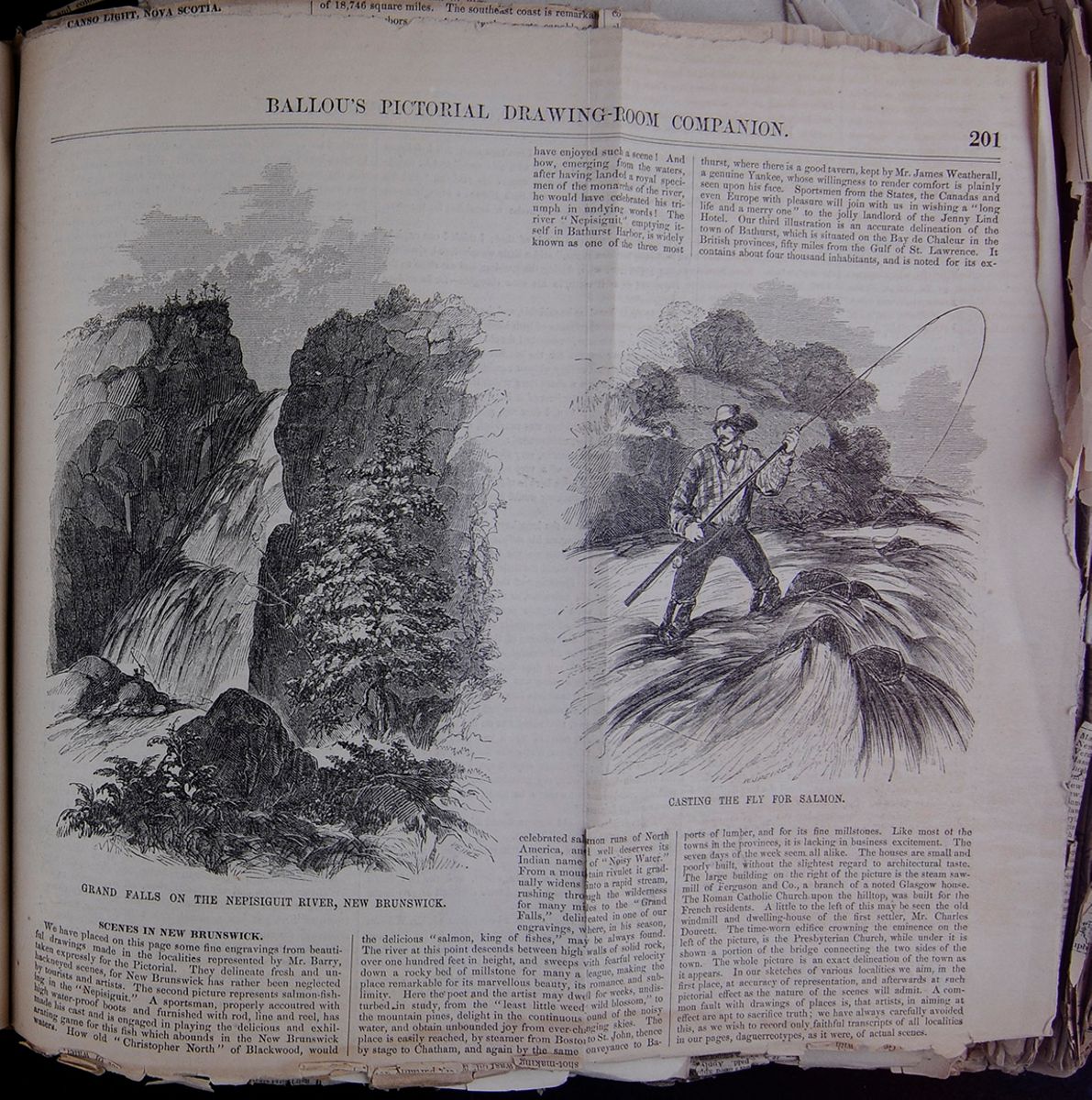
SCENES IN NEW BRUNSWICK.
We have placed on this page some fine engravings from beautiful drawings made in the localities represented by Mr. Barry, taken expressly for the Pictorial. They delineate fresh and unhackneyed scenes, for New Brunswick has rather been neglected by tourists and artists. The second picture represents salmon-fishing in the "Nepisiguit." A sportsman, properly accoutred with high water-proof boots and furnished with rod, line and reel, has made his cast and is engaged in playing the delicious and exhilarating game for this fish which abounds in the New Brunswick waters. How old "Christopher North" of Blackwood, would have enjoyed such a scene! And how, emerging from the waters, after having landed a royal specimen of the monarchs of the river, he would have celebrated his triumph in undying words! The river "Nepisiguit," emptying itself in Bathurst Harbor, is widely known as one of the three most celebrated salmon runs of North America, and well deserves its Indian name of "Noisy Water." From a mountain rivulet it gradually widens into a rapid stream, rushing through the wilderness for many miles to the "Grand Falls," delineated in one of our engravings, where, in his season, the delicious "salmon, king of fishes," may be always found. The river at this point descends between high walls of solid rock, over one hundred feet in height, and sweeps with fearful velocity down a rocky bed of millstone for many a league, making the place remarkable for its marvellous beauty, its romance, and sublimity. Here the poet and the artist may dwell for weeks, undisturbed in study, from the "least little weedy wild blossom," to the mountain pines, delight in the continuous sound of the noisy water, and obtain unbounded joy from ever-changing skies. The place is easily reached, by steamer from Boston to St. John, thence by stage to Chatham, and again by the same conveyance to Bathurst, where there is a good tavern, kept by Mr. James Weatherall, a genuine Yankee, whose willingness to render comfort is plainly seen upon his face. Sportsmen from the States, the Canadas and even Europe with pleasure will join with us in wishing a "long life and a merry one" to the jolly landlord of the Jenny Lind Hotel. Our third illustration is an accurate delineation of the town of Bathurst, which is situated on the Bay de Chaleur in the British provinces, fifty miles from the Gulf of St. Lawrence. It contains about four thousand inhabitants, and is noted for its exports of lumber, and for its fine millstones. Like most of the towns in the provinces, it is lacking in business excitement. The seven days of the week seem all alike. The houses are small and poorly built, without the slightest regard to architectural taste. The large building on the right of the picture is the steam sawmill of Ferguson and Co., a branch of a noted Glasgow house. The Roman Catholic Church upon the hilltop, was built for the French residents. A little to the left of this may be seen the old windmill and dwelling-house of the first settler, Mr. Charles Doucett. The time-worn edifice crowning the eminence on the left of the picture, is the Presbyterian Church, while under it is shown a portion of the bridge connecting the two sides of the town. The whole picture is an exact delineation of the town as it appears. In our sketches of various localities we aim, in the first place, at accuracy of representation, and afterwards at such pictorial effect as the nature of the scenes will admit. A common fault with drawings of places is, that artists, in aiming at effect are apt to sacrifice truth; we have always carefully avoided this, as we wish to record only faithful transcripts of all localities in our pages, daguerreotypes, as it were, of actual scenes.
[begin surface 542]
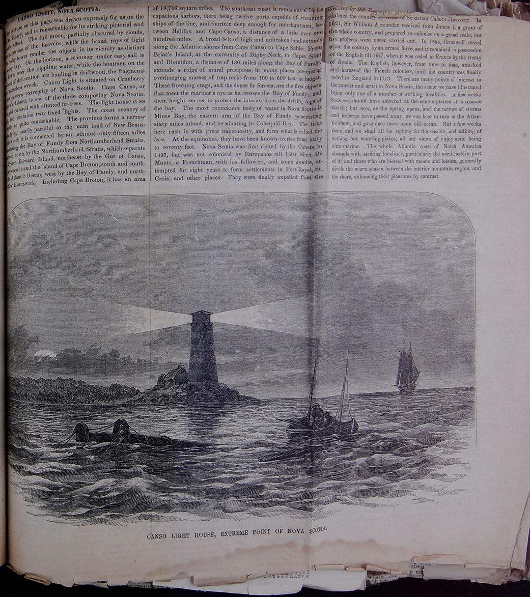
CANSO LIGHT, NOVA SCOTIA.
[covered]e picture on this page was drawn expressly for us on the [covered]Mr. Barry, and is remarkable for its striking pictorial and [covered]eric effect. The full moon, partially obscured by clouds, [covered]s a portion of the heavens, while the broad rays of light [covered]e lofty tower render the objects in its vicinity as distinct as by day. On the horizon, a schooner under easy sail is [covered] down over the rippling water, while the boatmen on the [covered]plane of delineation are hauling in driftwood, the fragments [covered]nameless wreck. Canso Light is situated on Cranberry [covered] the eastern extremity of Nova Scotia. Cap Canso, or [covered]rew's Island, is one of the three composing Nova Scotia. [covered] and covered with stunted fir-trees. The light house is 88 [covered]and contains two fixed lights. The coast scenery of [covered]Scotia is quite remarkable. The province forms a narrow [covered], lying nearly parallel to the main land of New Bruns[covered] which is connected by an isthmus only fifteen miles [covered]parating the Bay of Fundy from Northumberland Straits. [covered]nded north by the Northumberland Straits, which separate [covered] Prince Edward Island, northeast by the Gut of Canso [covered]between it and the island of Cape Breton, south and south[covered] the Atlantic Ocean, west by the Bay of Fundy, and north[covered] New Brunswick. Including Cape Breton, it has an area CANSO LIGHT HOUSE, EXTREME POINT OF NOVA SCOTIA. of 18,746 square miles. The southeast coast is remarkable for its capacious harbors, there being twelve ports capable of receiving ships of the line, and fourteen deep enough for merchantmen, between Halifax and Cape Canso, a distance of a little over one hundred miles. A broad belt of high and unbroken land extends along the Atlantic shores from Cape Canso to Cape Sable. From Briar's Island, at the extremity of Digby Neck, to Capes Slipt and Blomidon, a distance of 130 miles along the Bay of Fundy, extends a ridge of mural precipices, in many places presenting overhanging masses of trap rocks from 100 to 600 feet in height. These frowning crags, and the dense fir forests, are the first objects that meet the mariner's eye as he crosses the Bay of Fundy; and their height serves to protect the interior from the driving fogs of the bay. The most remarkable body of water in Nova Scotia is Mines Bay, the eastern arm of the Bay of Fundy, penetrating sixty miles inland, and terminating in Cobequid Bay. The tides here rush in with great impetuosity, and form what is called the bore. At the equinoxes, they have been known to rise from sixty to seventy feet. Nova Scotia was first visited by the Cabots, in 1497, but was not colonized by Europeans till 1604, when De Monts, a Frenchman, with his followers, and some Jesuits, attempted for eight years to form settlements in Port Royal, St. Croix, and other places. They were finally expelled from the country by the [cutaway] claimed the country by virtue of Sebastian Cabot's discovery. In 1621, Sir William Alexander received from James I. a grant of the whole country, and prepared to colonize on a grand scale, but his projects were never carried out. In 1654, Cromwell seized upon the country by an armed force, and it remained in possession of the English till 1667, when it was ceded to France by the treaty of Breda. The English, however, from time to time, attacked and harassed the French colonists, until the country was finally ceded to England in 1713. There are many points of interest to the tourist and artist in Nova Scotia, the scene we have illustrated being only one of a number of striking localities. A few weeks back we should have shivered at the contemplation of a seaside sketch; but now, as the spring opens, and the terrors of storms and icebergs have passed away, we can bear to turn to the Atlantic shore, and gaze once more upon old ocean. But a few weeks more, and we shall all be sighing for the seaside, and talking of nothing but watering-places, all our views of enjoyment being ultra-marine. The whole Atlantic coast of North America abounds with striking localities, particularly the northeastern part of it; and those who are blessed with means and leisure, generally divide the warm season between the interior mountain region and the shore, enhancing their pleasures by contrast.
[begin surface 544]
 BRITISH AMERICA.
145
BRITISH AMERICA.
145
13. History.—New Brunswick, in common with Nova Scotia, was ceded to England by the treaty of Utrecht in 1713. In 1762 several New England families settled on the St. John, and at the end of the American war thousands of disbanded troops were settled at Frederickton. In 1784 New Brunswick was separated from Nova Scotia and constituted a distinct colony.
SECTION IV.—NOVA SCOTIA.
1. Situation.—This province comprises the peninsula bounded north by Northumberland Strait and the Gulf of St. Lawrence, east and south by the Atlantic Ocean, and west by the Bay of Fundy and New Brunswick.
2. Nova Scotia.—This peninsula is distinguished for great indentations of its coasts; and its harbors, in number, capacity, and safety, are unparalleled. One-third the interior is occupied by lakes. The surface is undulating, and on the north and west coasts are ranges of highlands. Iron, lead, copper, coal, marble, gypsum, etc., abound.
3. Cape Breton.—This is an island almost divided by the inlet called Bras d'Or. In minerals it is almost equally as rich as Nova Scotia.
4. Divisions, &c.—The counties are as follows: This table contains the counties of Nova Scotia along with the population (in 1851) and the capital city.
5. Products.—The chief products are coal, iron, gypsum, lime, etc.; also fine grindstones. The products of agriculture are sufficient for its own wants. Manufactures are rapidly advancing.
6. Fisheries.—These are very valuable, and employ upward of 7000 men and 5000 boats. Cod, shad, salmon, mackerel, and herrings are the principal products.
7. Commerce.—This is large and constantly increasing; and many ships are built. There is owned within the province at least one ton of shipping to each inhabitant. Fish, coal, and gypsum, are the staples of export.
8. Government.—The province is governed by a appointed governor and council. The legislature is composed of the council and an elected house of assembly. In 1851 the revenue amounted to $350,050; and the public debt was $351,559.
9. Towns.—Halifax is the seat of government. It is one of the best of Atlantic ports, is a steam-packet station, and also a naval station of the highest important. The chief trade of the province is conducted here. Population is 20,000. The other principal towns are Annapolis, Liverpool, Pictou, and Windsor, all thriving places. Sidney is the chief place in Cape Breton. Louisbourg was formerly a noted fortress.
10. History.—Nova Scotia was discovered by Cabot in 1497, but was settled by the French. In 1621 it was taken possession of by the English, and in 1623 colonized. In 1667 it was ceded to France, and in 1713 retroceded to the English. Originally its territory included New Brunswick, which in 1784 became a separate province.
SECTION V.—PRINCE EDWARD'S ISLAND.
1. Characteristics.—This island is extremely picturesque, but destitute of those bold features recognized in the neighboring provinces. Without any absolutely flat surface the country has no mountains, and in general the land rises into gentle undulations.
2. Soil and Products.—The soil is light, and in many places impregnated with metallic oxides. The climate is moderate, and wheat and all other grains, and the ordinary culinary vegetables, are produced abundantly.
3. Divisions, &c.—Into three counties, viz.: This table contains the counties of Prince Edward's Island along with the population (in 1851) and the capital city.
4. Industry.—Agriculture and cattle breeding are leading industries, and the fisheries are very valuable. Manufactures are of little consequence.
5. Government.—This is nearly similar to that of the neighboring provinces. The revenue in 1851 amounted to $90,155.
6. Towns.—Charlotte Town is the capital and contains 2000 inhabitants. There are no large towns.
7. History.—This island was originally settled by the French, but in 1763 was ceded to England. In 1768 it was constituted a separate colony.
SECTION VI.—NEWFOUNDLAND.
1. Situation.—This island is located at the entrance to the Gulf of St. Lawrence, and is separated from Labrador by the Strait of Belleisle.
2. Characteristics.—The island stands on an immense bank, and in its neighborhood and connected with it by soundings is the Great Bank. It is greatly indented, and its sea front is rocky and generally wooded.
3. Divisions, &c.—The districts are as follows: This table contains the districts of Newfoundland along with the population (in 1851) and the capital city of each.
4. Occupations.—Agriculture is a subsidiary pursuit; the great industry of the inhabitants being the fisheries, which are the most important in the world. Upward of 10,000 boats are employed in this branch, and 1,000,000 quintals of cod and other fish are exported annually. The French and Americans have also large fisheries off the coast.
5. Commerce.—This is large, and in ordinary years amounts to some $8,000,000. About 1200 vessels arrive and clear annually. The exports are codfish, etc.
6. Government.—Affairs are administered by a governor appointed by the crown. The legislature consists of a council and assembly; and every householder is an elector. The annual expenses are about $300,000.
7. Towns.—St. John is the seat of government; and besides this there are several other small towns. They are, however, little more than fishing stations.
8. History.—France, Portugal, and other nations, established fisheries in its neighboring seas early in the sixteenth century. In 1623 a permanent English settlement was established at Avalon. The French also formed a settlement at Placentia. The treaty of Utrecht dispossessed that nation, and the colony has ever since remained in the hands of the British.
Sec. IV. 1. Situation? 4. Divisions? 5. Products? 6. Fisheries? 7. Commerce? 8. Government? 9. Towns? 10. History?
Sec. V. 1. Characteristics? 2. Soil and products? 3. Divisions? 4. Industry? 5. Governments? 6. Towns? 7. History?
Sec. VI. 1. Situation? 2. Characteristics? 3. Divisions, &c.? 4. Occupations? 5. Commerce? 7. Towns? 8. History?
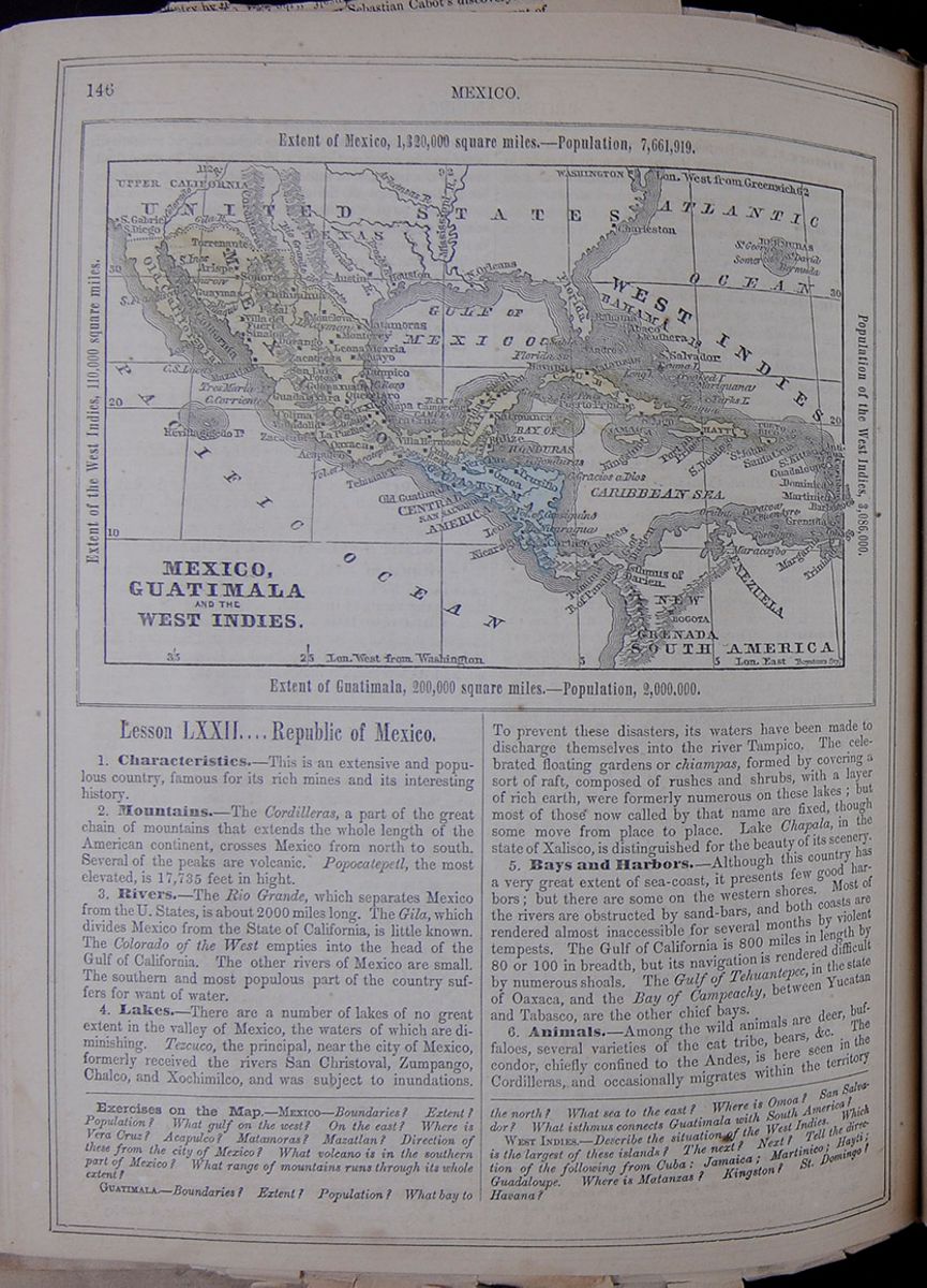 146
MEXICO.
MEXICO, GUATIMALA AND THE WEST INDIES.
Extent of Mexico, 1,320,000 square
miles.—Population, 7,661,919.
Extent of the West Indies, 110,000 square
miles.
Population of the West Indies, 3,086,000.
Extent of Guatimala, 200,000 square miles.—Population,
2,000,000.
146
MEXICO.
MEXICO, GUATIMALA AND THE WEST INDIES.
Extent of Mexico, 1,320,000 square
miles.—Population, 7,661,919.
Extent of the West Indies, 110,000 square
miles.
Population of the West Indies, 3,086,000.
Extent of Guatimala, 200,000 square miles.—Population,
2,000,000.
Lesson LXXII.... Republic of Mexico.
1. Characteristics.—This is an extensive and populous country, famous for its rich mines and its interesting history.
2. Mountains.—The Cordilleras, a part of the great chain of mountains that extends the whole length of the American continent, crosses Mexico from north to south. Several of the peaks are volcanic. Popocatepetl, the most elevated, is 17,735 feet in hight.
3. Rivers.—The Rio Grande, which separates Mexico from the U. States, is about 2000 miles long. The Gila, which divides Mexico from the State of California, is little known. The Colorado of the West empties into the head of the Gulf of California. The other rivers of Mexico are small. The southern and most populous part of the country suffers for want of water.
4. Lakes.—There are a number of lakes of no great extent in the valley of Mexico, the waters of which are diminishing. Tezcuco, the principal, near the city of Mexico, formerly received the rivers San Christoval, Zumpango, Chalco, and Xochimilco, and was subject to inundations. To prevent these disasters, its waters have been made to discharge themselves into the river Tampico. The celebrated floating gardens or chiampas, formed by covering a sort of raft, composed of rushes and shrubs, with a layer of rich earth, were formerly numerous on these lakes; but most of those now called by that name are fixed, though some move from place to place. Lake Chapala, in the state of Xalisco, is distinguished for the beauty of its scenery.
5. Bays and Harbors.—Although this country has a very great extent of sea-coast, it presents few good harbors; but there are some on the western shores. Most of the rivers are obstructed by sand-bars, and both coasts are rendered almost inaccessible for several months by violent tempests. The Gulf of California is 800 miles in length by 80 or 100 in breadth, but its navigation is rendered difficult by numerous shoals. The Gulf of Tehuantepec, in the state of Oaxaca, and the Bay of Campeachy, between Yucatan and Tabasco, are the other chief bays.
6. Animals.—Among the wild animals are deer, buffaloes, several varieties of the cat tribe, bears, &c. The condor, chiefly confined to the Andes, is here seen in the Cordilleras, and occasionally migrates within the territory
Exercises on the Map.—MEXICO—Boundaries? Extent? Population? What gulf on the west? On the east? Where is Vera Cruz? Acapulco? Matamoras? Mazatlan? Direction of these from the city of Mexico? What volcano is in the southern part of Mexico? What range of mountains runs through its whole extent?
GUATIMALA.—Boundaries? Extent? Population? What bay to the north? What sea to the east? Where is Omoa? San Salvador? What isthmus connects Guatimala with South America?
WEST INDIES.—Describe the situation of the West Indies. Which is the largest of these islands? The next? Next? Tell the direction of the following from Cuba: Jamaica; Martinico; Hayti; Guadaloupe. Where is Matanzas? Kingston? St. Domingo? Havana?
[begin surface 547]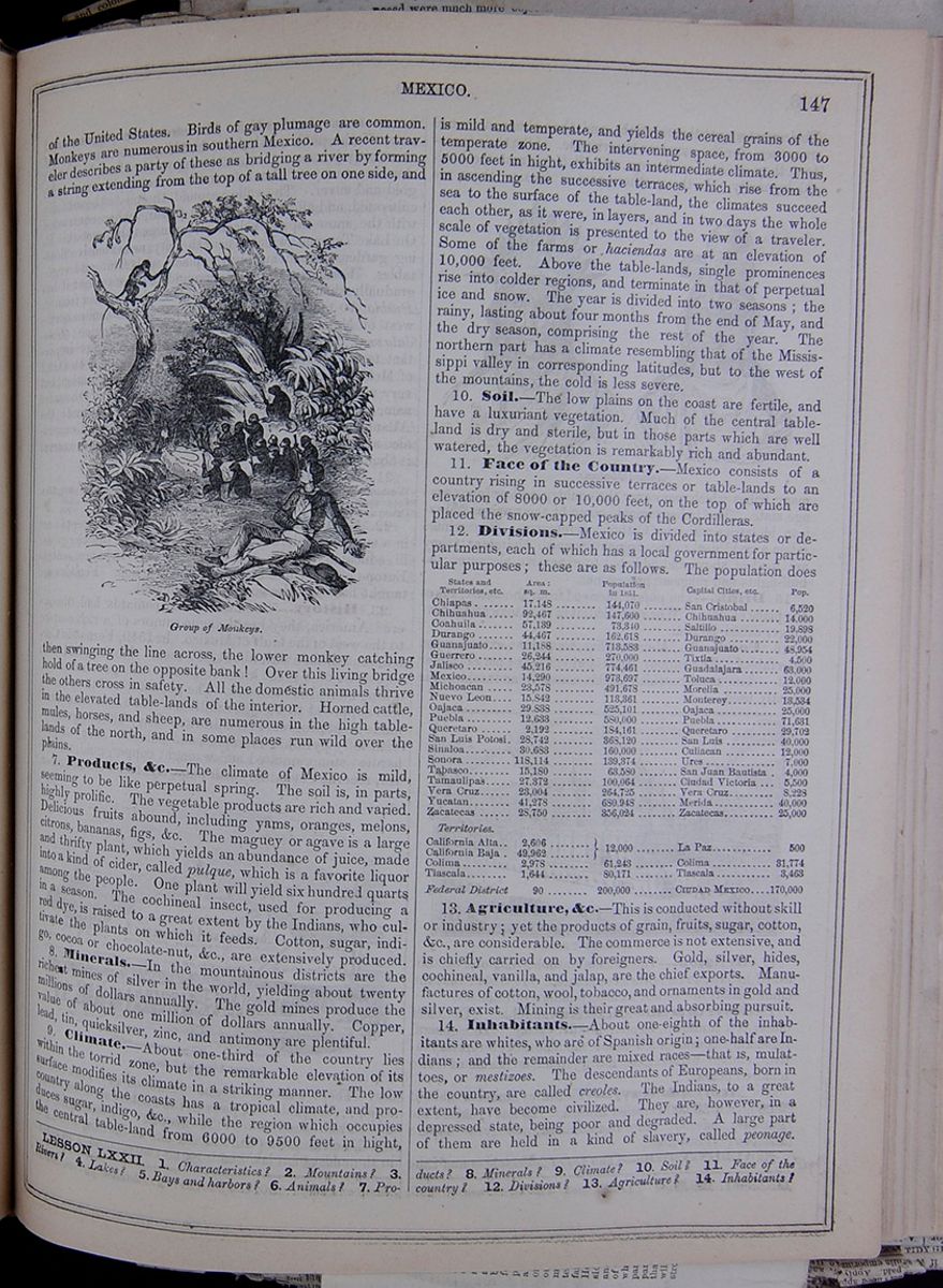 MEXICO.
147
MEXICO.
147
of the United States. Birds of gay plumage are common. Monkeys are numerous in southern Mexico. A recent traveler describes a party of these as bridging a river by forming a string extending from the top of a tall tree on one side, and Group of Monkeys. then swinging the line across, the lower monkey catching hold of a tree on the opposite bank! Over this living bridge the others cross in safety. All the domestic animals thrive in the elevated table-lands of the interior. Horned cattle, mules, horses, and sheep, are numerous in the high table-lands of the north, and in some places run wild over the plains.
7. Products, &c.—The climate of Mexico is mild, seeming to be like perpetual spring. The soil is, in parts, highly prolific. The vegetable products are rich and varied. Delicious fruits abound, including yams, oranges, melons, citrons, bananas, figs, &c. The maguey or agave is a large and thrifty plant, which yields an abundance of juice, made into a kind of cider, called pulque, which is a favorite liquor among the people. One plant will yield six hundred quarts in a season. The cochineal insect, used for producing a red dye, is raised to a great extent by the Indians, who cultivate the plants on which it feeds. Cotton, sugar, indigo, cocoa or chocolate-nut, &c., are extensively produced.
8. Minerals.—In the mountainous districts are the richest mines of silver in the world, yielding about twenty million dollars annually. The gold mines produce the value of about one million of dollars annually. Copper, lead, tin, quicksilver, zinc, and antimony are plentiful.
9. Climate.—About one-third of the country lies within the torrid zone, but the remarkabl elevation of its surface modifies its climate in a striking manner. The low country along the coasts has a tropical climate, and produces sugar, indigo, &c., while the region which occupies the central table-land from 6000 to 9500 feet in hight, is mild and temperate, and yields the cereal grains of the temperate zone. The intervening space, from 3000 to 5000 feet in hight, exhibits an intermediate climate. Thus, in ascending the successive terraces, which rise from the sea to the surface of the table-land, the climates succeed each other, as it were, in layers, and in two days the whole scale of vegetation is presented to the view of the traveler. Some of the farms or haciendas are at an elevation of 10,000 feet. Above the table-lands, single prominences rise into colder regions, and terminate in that of perpetual ice and snow. The year is divided into two seasons; the rainy, lasting about four months from the end of May, and the dry season, comprising the rest of the year. The northern part has a climate resembling that of the Mississippi valley in corresponding latitudes, but to the west of the mountains, the cold is less severe.
10. Soil.—The low plains on the coast are fertile, and have a luxuriant vegetation. Much of the central table-land is dry and sterile, but in those parts which are well watered, the vegetation is remarkably rich and abundant.
11. Face of the Country.—Mexico consists of a country rising in successive terraces or table-lands to an elevation of 8000 or 10,000 feet, on the top of which are placed the snow-capped peaks of the Cordilleras.
12. Divisions.—Mexico is divided into states or departments, each of which as a local government for particular purposes; these are as follows. The population does This table lists the states and territories of Mexico and includes the area (in square miles), population (in 1851), capital cities, and the population of the cities.
13. Agriculture, &c.—This is conducted without skill or industry; yet the products of grain, fruits, sugar, cotton, &c., are considerable. The commerce is not extensive, and is chiefly carried on by foreigners. Gold, silver, hides, cochineal, vanilla, and jalap, are the chief exports. Manufactures of cotton, wool, tobacco, and ornaments in gold and silver, exist. Mining is their great and absorbing pursuit.
14. Inhabitants.—About one-eighth of the inhabitants are whites, who are of Spanish origin; one-half are Indians; and the remainder are mixed races—that is, mulattoes, or mestizoes. The descendants of Europeans, born in the country, are called creoles. The Indians, to a great extent, have become civilized. They are, however, in a depressed state, being poor and degraded. A large part of them are held in a kind of slavery, called peonage.
LESSON LXXII. 1. Characteristics? 2. Mountains? 3. Rivers? 4. Lakes? 5. Bays and harbors? 6. Animals? 7. Products. 8. Minerals? 9. Climate? 10. Soil? 11. Face of the country? 12. Divisions? 13. Agriculture? 14. Inhabitants?
[begin surface 548]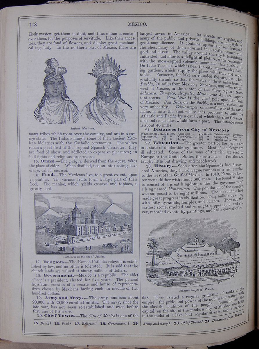 148
MEXICO.
148
MEXICO.
Their masters get them in debt, and thus obtain a control over them, for the purposes of servitude. Like their ancestors, they are fond of flowers, and display great mechanical ingenuity. In the northern part of Mexico, there are Ancient Mexicans. many tribes which roam over the country, and are in a savage state. The Indians mingle some of their ancient Mexican idolatries with the Catholic ceremonies. The whites retain a good deal of the original Spanish character: they are fond of show, and addicted to expensive pleasures; to bull-fights and religious processions.
15. Drink.—The pulque, derived from the agave, takes the place of cider. When distilled, it is an intoxicating beverage, called mexical.
16. Food.—The Mexicans live, to a great extent, upon vegetables. The various fruits form a large part of their food. The manioc, which yields cassava and tapioca, is greatly used.
Cathedral in the city of Mexico.17. Religion.—The Roman Catholic religion is established by law, and no other is tolerated. It is said that the church lands are valued at ninety millions of dollars.
18. Government.—Mexico is a republic. The chief officer is a president, elected for five years. The general legislature consists of a senate and house of representatives, chosen by Mexicans having each an income of two hundred dollars.
19. Army and Navy.—The army numbers about 20,000, with 30,000 enrolled in militia. The navy, since the late war, has not been re-established, and even before that was of little use.
20. Chief Towns.—The City of Mexico is one of the largest towns in America. Its streets are regular, and many of the public and private buildings are in a style of great magnificence. It contains upwards of one hundred churches, many of them adorned in a costly manner with gold and silver. The valley around the city is beautifully cultivated, and affords a delightful picture, when contrasted with the snow-capped volcanic mountains that encircle it. On Lake Tezcuco, which is near the city, are extensive floating gardens, which supply the place with fruit and vegetables. Formerly, the lake surrounded the city, but it has gradually shrunk, so that the water is three miles from it. Puebla, 70 miles from Mexico; Zacatecas, 330 miles northwest of Mexico, in the center of the silver region; Guadalaxara, Tampico, Acapulco, Matamoras, &c., are important towns. Vera Cruz is the chief port upon the gulf of Mexico. San Blas, on the Pacific, is a naval station, but very unhealthy. Tehuantepec, on a small river of the same name, is near the spot where it is proposed to unite the Atlantic and Pacific by a canal, of which the river Coazacualco and some lakes would form a part. The distance across is about 40 miles.
21. Distances from City of Mexico to This table lists the distance from Mexico City of the following cities: Washington, Popocatepetl, Orizava, Acapulco, Vera Cruz, Jalapa, Tehuantepec, Campeachy, and Merida.
22. Education.—The greater part of the people are in a state of deplorable ignorance. Most of the clergy are ill educated. Some of the sons of the rich are sent to Europe or the United States for instruction. Females are taught little but drawing and needlework.
23. History.—Soon after the Spaniards had discovered America, they heard vague rumors of a rich empire to the west of the Gulf of Mexico. In 1519, Fernando Cortez went thither with about 600 men. He found Mexico to consist of a great kingdom, under the government of a king named Montezuma. The population of the country was supposed to be eight millions. The inhabitants had made great progress in civilization. They built large cities, with lofty pyramids, temples, and palaces. They cut the hardest stone, smelted and wrought copper, gold, and silver, recorded events by paintings, and had a correct calendar. Ancient temple of Mexico. There existed a regular gradation of ranks in the empire; the pride and power of the nobles contrasting with the slavish condition of the people. Tenochtitlan, the capital, on the site of the modern city of Mexico, was built in the midst of a lake, had regular streets, and a market-square
15. Drink? 16. Food? 17. Religion? 18. Government? 19. Army and navy? 20. Chief towns? 21. Distances from Mexico?
[begin surface 549]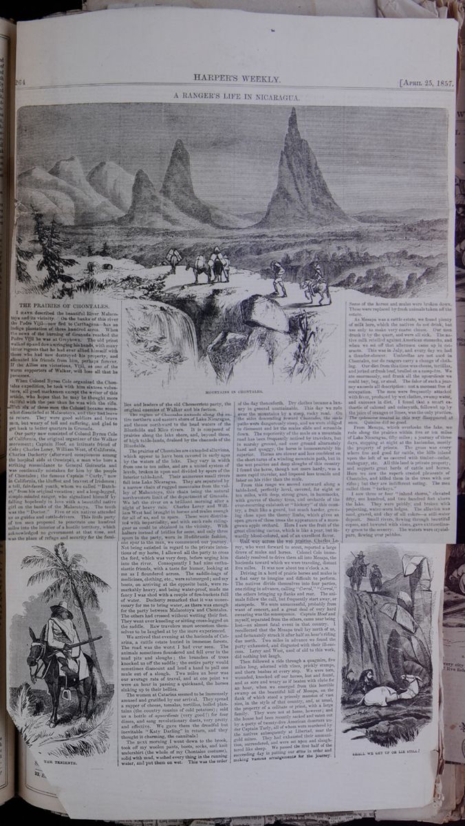
A RANGER'S LIFE IN NICARAGUA.
MOUNTAINS IN CHONTALES.THE PRAIRIES OF CHONTALES.
I HAVE described the beautiful River Malacotoya and its vicinity. On the banks of this river, the Padre Vijil—now fled to Carthagena—has an indigo plantation of three hundred acres. When the news of the burning of Granada reached the Padre Vijil he was at Greytown. The old priest walked up and down wringing his hands, with many bitter regrets that he had ever allied himself with those who had now destroyed his property, and alienated his friends from him, perhaps forever. If the Allies are victorious, Vijil, as one of the warm supporters of Walker, will lose all that possesses.
When Colonel Byron Cole organized the Chontales expedition, he took with him sixteen volunteers, all good marksmen except the writer of this article, who hopes that he may be thought more skillful with the pen than he was with the rifle. With six of these men the Colonel became somewhat dissatisfied at Malacotoya, and they had leave to return. They were good soldiers and brave men, but weary of toil and suffering, and glad to get back to better quarters in Granada.
Our party now consisted of Colonel Byron Cole of California, Charles Docherty (afterward conspicuous among the hospital aids at Ometepé), a man who bore a striking resemblance to General Goicouria and was continually mistaken for him by the people of Chontales; the famous Captain "Curly," now in California, the bluffest and bravest of Irishmen; a tall, fair-faced youth, whom we called "Butcher," from his original vocation; and a long-legged, simple-minded ranger, who signalized himself by falling hopelessly in love with a beautiful native girl on the banks of the Malacotoya. The tenth was the "Doctor." Five or six natives attended us a guides and cattle-drivers. This little party of ten men proposed to penetrate one hundred miles into the interior of hostile territory, which acknowledged no government at that time, and was the place of refuge and security for the families THE TENIENTE. and leaders of the old Chomorristo party, the original enemies of Walker and his faction.
The region of Chontales extends along the entire northern and eastern shore of Lake Nicaragua, and thence northward to the head waters of the Bluefields and Mico rivers. It is composed of prairies along the lake shore, and, beyond these, of high table-lands, drained by channels of Bluefields.
The prairies of Chontales are extended alluvions, which appear to have been covered in early ages by the waters of the lake. They vary in width from one to ten miles, and are a united system of levels, broken in upon and divided by spurs of the interior table-land. Their numerous small rivers fall into Lake Nicaragua. They are separated by a narrow chain of rugged mountains from the valley of Malacotoya, this chain being the natural northwestern limit of the department of Granada. We left the river on a brilliant morning after a night of heavy rain. Charles Leroy and William West had brought in horses and mules enough for all of us, and to spare. These were distributed with impartiality, and with such rude riding-gear as could be obtained in the vicinity. With halters instead of bridles for some, and only three spurs in the party, worn in Hudibrastic fashion, one spur to the man, we commenced our journey. Not being satisfied in regard to the private intentions of my horse, I allowed all the party to cross the ford, which was very deep, before urging him to the river. Consequently I had nine enthusiastic friends, with a taste for humor, looking at me as I floundered across. The saddle-bags of medicines, clothing, etc., were submerged; and my boots, on arriving at the opposite bank, were remarkably heavy, and being water-proof, made me fancy I was shod with a couple of fire-buckets full of water. Docherty remarked that it was unnecessary for me to bring water, as there was enough for the party between Malacotoya and Chontales. The others had crossed without wetting their feet. They went over kneeling or sitting cross-legged on the saddle. Raw travelers must accustom themselves to be laughed at by the more experienced.
We arrived that evening at the hacienda of Catarina, a cattle estate buried in immense forests. The road was the worst I had ever seen. The animals sometimes floundered and fell over in the mud pits and sloughs; the branches of trees knocked us off the saddle; the entire party would sometimes dismount and lend a hand to pull one mule out of a slough. Two miles an hour was our average rate of travel, and at one point we were an hour in passing a quicksand, and the horses sinking up to their bellies.
The women at Catarina seemed to be immensely amused and gratified by our arrival. They spread a supper of cheese, tomalas, tortillas, boiled plantains (the country cousins of cold potatoes); sold us a bottle of aguardiente (very good!) for four dimes, and sang revolutionary duets, very pretty and effective. We gave them the dreadful but inevitable "Katy Darling" in return and they thought it charming, the cannibals!
The next morning I went down to the brook, took off my woolen pants, boots, socks, and knit undershirt (the whole of my Chontales costume), solid with mud, washed every thing in the running water, and put them on wet. This was the order of the day thenceforth. Dry clothes became a luxury in general unattainable. This day we rode over the mountains by a steep rocky road. On the sides descending toward Chontales, the mule paths were dangerously steep, and we were obliged to dismount and let the mules slide and scramble down. The superiority of the mule on a mountain road has been frequently noticed by travelers, but in marshy ground, and over ground alternately hard and quaggy, the horse is immeasurably his superior. Horses are slower and less confident on the short turns of a winding mountain path, but in the wet prairies and deep sloughs of this country I found the horse, though not more hardy, was a more rapid traveler, and imposed less trouble and labor on his rider than the mule.
From this range we moved eastward along a table-land, perfectly level, covered, for eight or ten miles, with deep strong grass, in hummocks, with groves of thorny trees, and orchards of the ever-recurring calabash or "hickory" of the country, a fruit like gourd, but much harder, growing close upon the thorny limbs, which gives an open grove of these trees the appearance of a moss-grown apple orchard. Here I saw the fruit of the great climbing cactus, which is like a pear, but inwardly blood-colored, and of an excellent flavor.
Half way across the wet prairies, Charles Leroy, who went forward to scout, reported a large drove of mules and horses. Colonel Cole immediately resolved to drive them all into Mesapa, the hacienda toward which we were traveling, distant five miles. It was now about ten o'clock A.M.
Driving in a herd of prairie horses and mules is a feat easy to imagine and difficult to perform. The natives divide themselves into four parties, one riding in advance, calling "Corral," "Corral," the other bringing up flanks and rear. The animals follow the call, but frequently start away, or stampede. We were unsuccessful, probably from want of concert, and a great deal of very hard swearing was the consequence. Captain Hoof and myself, separated from the others, came near being lost—an almost fatal event in that country. I recollected that the Mesapa trail lay north of us, and fortunately struck it after half an hour's riding due north. Two miles in advance we found the party exhausted, and disgusted with their ill-success. Leroy and West, used of old to this work, did nothing but laugh.
Then followed a ride through a quagmire, five miles long, adorned with vines, prickly stumps, and thorn bushes at every step. We were torn, wounded, knocked off our horses, lost and found, and as sore and weary as if beaten with clubs for an hour, when we emerged from this horrible swamp on the beautiful hill of Mesapa, on the flank of which stood a princely mansion of vast size, in the style of that country, and, as usual, the property of a celibate or priest, with a large family. They were not at home, however; and the house had been recently sacked and eaten out by a party of twenty-five American deserters under Captain Turly, all of whom were murdered by the natives subsequently at Libertad, near the gold mines. They had exhausted their ammunition, surrendered, and were set upon and slaughtered like sheep. We passed the first half of the succeeding day in putting our arms in order and making various arrangements for the journey. Some of the horses and mules were broken down. These were replaced by fresh animals taken off the estate.
As Mesapa was a cattle estate, we found plenty of milk here, which the natives do not drink, but use only to make very coarse cheese. Our men drank it by the quart, and were all sick. The native milk rebelled against American stomachs, and when we set off that afternoon came up in cataracts. This was in July, and every day we had a thunder-shower. Umbrellas are not used in Chontales, nor do rangers carry a change of clothing. Our diet from this time was cheese, tortillas, and jerked or fresh beef, broiled on a camp-fire. We ate enormously, and drank all the aguardiente we could buy, beg, or steal. The labor of such a journey exceeds all description: not a moment free of occupation. The men were frequently attacked with fever, produced by wet clothes, swamp water, and excesses in diet. I found that a smart cathartic of calomel and colocynth, followed up by the juice of oranges or limes, was the only practice. The ephemerœ treated in this way disappeared at once. Quinine did no good.
From Mesapa, which overlooks the lake, we rode along the prairies within five or ten miles of Lake Nicaragua, fifty miles; a journey of three days, stopping at night at the haciendas, mostly the property of priests. The grass was everywhere fine and good for cattle, the hills inland upon the left of us covered with timber—cedar, mahogany, etc. All this land is private property, and supports great herds of cattle and horses. Here we saw the superb crested pheasants of Chontales, and killed them in the trees with our rifles; but they are indifferent eating. The men called them "turkeys."
I saw three or four "inland shores," elevated fifty, one hundred, and two hundred feet above the lake. They were pebbly, and broken with projecting, water-worn ledges. The alluvion was sand, gravel, and clay of all colors—a still-water deposit. Small rivers, flowing through beautiful copses, and bowered with vines, gave extraordinary grace to the scenery. The waters were crystal-pure, flowing over pebbles.
SHALL WE GET UP OR LIE STILL? [begin surface 550]
During this journey I made a dozen prescriptions for fever in native houses. The entire population appeared to be sick of the fever. There were cases, also, of other maladies, which in Central America are not opprobrious. I think the whole population here is "scrofulous" in the tertiary manner. This people have no idea of modesty, but, strange to say, are not impure in their habits. It is the constitutional taint of the entire Indian and mixed races that renders cholera and other epidemics so destructive. Life is short and feeble.
At the hacienda of San Lorenzo a beautiful young woman was brought in by her father with a pitiful face, to be cured of fissures in the soles of the feet. It was a three-hours' operation to remove the inch-thick callosities and the false membranes from the fissures. The girl called for a cigar, and sat looking steadily at me the whole time without shrinking or groaning, but very pale. The father suffered more than the patient. I should not have ventured upon so serious an operation under such circumstances had it not been for the earnest solicitation of Colonel Cole, whose compassionate heart continually led him into acts of spontaneous kindness and liberality toward the natives. Mistaking the cause of my hesitation, he offered me his horse, the best in the country, and worth at least two hundred and fifty dollars, if I would perform the operation. I hope the reader will not suspect me of having accepted the offer.
The day after leaving San Lorenzo we turned northward, and passed the first range of mountains. Scenery magnificent. Southward the Lake, the Lagoon Mountain, volcano of Massaya, and the Island of Ometepé: before us a sea of hills. On the summit we passed a long low wall, like a New England "stone-fence," the only one of that kind in this region, where the estates are sometimes ten miles in extent, and have no fixed boundaries. In the deep valleys on the other side lay Comalapa, a "county town." Looking down from the hills upon Comalapa, one thousand feet below us, we saw the women and children running in all directions. At San Lorenzo we had been told that a force of one hundred natives, well armed, under the lead of a Chomorro, were awaiting us. Expecting an ambuscade, we capped our rifles, and charging along the winding road at full trot, galloped into the Plaza, and rode up to the house of the Padre. All was still. The inhabitants had left almost to a man. The two alcaldes were off in the woods. The priest, protected by his sanctity, remained, and was too polite by half. After resting an hour to dine we rode on, and crossing two ranges of mountains reached the high table-land of Comapa. On the summit of the first range, five miles from Comalapa, while traveling along the edge of an immense ravine, we saw a company of armed horsemen observing us from the bold summit of the mountains on the left side of the ravine. Our men were violently excited by the view, supposing this to be a portion of a larger force who were riding forward to cut us off in the valley beyond. They closed their ranks and rode forward eagerly for two miles, hoping to see a party in advance, and straining their eyes for the first trace of them. But they did not choose to appear. We had heard the alarm-horns in all directions, raising the country, since we came in sight of Comalapa.
Ascending from one of the most beautiful grassed valleys in the world, we scaled the steep edge of the great table-land which feeds the waters of the Rios Mico and Bluefields; and here, resting our wearied animals, we remained for half an hour, in a silence broken only by exclamations of wonder and delight, gazing upon a prospect that, for extent and magnificence, has not its parallel on the continent. At a distance of twenty-five leagues west and north, rose up against the sunset the wonderful Matagalpa chain, its immensely high, isolated, and bare peaks, like shark's teeth, apparently without foothills, rising from a bed of unbroken forests, undulating and misty. Beyond there was no horizon, or only land and sky blended, seen through the deep jags of these rocky teeth, whose flat tables set up edgewise resembled in shape icebergs, or, rather, flat and broken fields of ice turned upon their edges. The first peak terminating the range was separated form the rest by a low interval. The chain made off to the northeast, blending with the hills of eastern Segovia on the Wanks River Valley.
Before us the grass land stretched fair and level from our feet, sinking gradually on the left, and on the right rising at a distance of four miles, into hills covered with foliage. I do not think we saw less than ten thousand head of cattle from this point, and countless herds of horses. The plain was alive with them, moving in all directions. In the centre of this grassy level we could just discern the Indian village of Comapa buried in orange and mango trees. The alarm-horns sounded as we rode into the village, but the people were not armed. The two alcaldes, dressed in white, and bearing gold-headed canes, the staff of magistracy, came out to meet us at the head of a procession of the citizens, all dressed in loose white jackets and trowsers, with feet bare and a straw hat. The alcalde made a ceremonious speech of welcome; informed us that we were the second party of white men who had ever penetrated so far into the interior. He led us to the "stranger's house," and brought us food with his own hands, attended by a procession of Indian boys, THE PASS OF LABAGISCA. each with a dish. These people were innocent and harmless, strangely ignorant of the outer world, and acknowledging any government that might choose to regard them as its subjects. The village was large enough for eight hundred persons. Two-thirds of the houses had been emptied by the cholera, which desolated the interior of Central America in 1855. There were only about three hundred left in Comapa. The wealth of these broad-featured, flat-nosed Indian tribes is in corn and cattle. They are all rich in the fruits of the earth. The climate is cool at Comapa. It must be at least 2000 feet above the ocean.
That night I had a violent chill. Colonel Cole got up from the ground where he was sleeping, and covered me with coats and blankets. I shook for A TALK WITH SEÑOR ZELAYA. two hours, and the subsequent fever was violent. It was an ephemera, and yielded to cathartic and sour oranges. Riding the next day was like the discipline of a fuller's hammer; every bone ached. In thirty-six hours I was well.
The ride east by south from Comapa to Juigalapa, thirty miles, over two ranges of mountains, separated by green cattle-valleys, offered nothing worthy of remembrance. We followed an obscure trail. The Indians at Comapa knew nothing of Juigalpa; they did not know into which ocean their rivers flowed. Juigalpa, town and district, is the Switzerland of Chontales; but the scenery, though grand, is monotonous. The people, as usual, fled at our approach; but the priests seemed WAITING FOR THE ENEMY AT SAN JOSÉ to think that we should find an army at Acoyapa—the military and civil capital of Chontales, and the home of political refugees.
Remaining only an hour in Juigalpa, we rode on to a hacienda ten miles further, and passed the night. We were now in the heart of the enemy's country, and the utmost vigilance and celerity of movement had become necessary. The party of deserters who had preceded us had excited the inhabitants against the Americans by seizing without ceremony whatever they could carry away. Saddles, bridles, spurs, blankets, clothing, tobacco, rice, ponchos, choice horses and mules, nothing portable had come amiss to these robbers, with whom the least violence or indiscretion on our part would have identified us.
We rode in the low channels of the rivers and along cattle trails, stopping at all the haciendas and hattios belonging to large proprietors. The object of the expedition was accomplished when a written order had been left with the mantador or steward of each estate, requiring a certain number of cattle to be sent to Granada as a contribution for the war against the Leonese.
The gate which leads out from the Aline valleys of the Juigalpa chain is a narrow pass in the mountains, called the "Portal de Labagisca." It looks eastward over the prairie of Acoyapa, which is a continuation of that line of prairie which borders Lake Nicaragua on the north, commencing at Mesapa. The view from the pass of Labagisca is wide and pleasing. About two hundred feet below us, on a small piece of table-land, jutting out from the side of the mountain like a platform, stood the town of Labagisca, with its ancient church of hewn stone—the only one of that material in Eastern Nicaragua. The churches, like the houses, are built of adobé—The Egyptian sun-dried brick, of mud and straw. *
On a still lower level—perhaps three hundred feet down—lay the general surface of the grand prairie, enlivened by groves and herds. Three miles east from the foot of the platform of rock which supports Labagisca was the town of Acoyapa, the bell-towers of its great church and the red tiles of the houses rising above the groves of orange and mango. The town stands upon a bed of diluvium, with a rocky nucleus, a little raised above the general surface of the plain. The rocky strata of Chontales, leaning or dipping downward toward the southwest at various angles, did not seem to me different in age or character from those rocks which compose the foot-hills of the Sierra Nevada, in California. They have a large proportion of argil and iron ore, and disintegrate readily. Their inclinations are in general very slight, the escarpments facing the north and northeast being steep, and tabled like a stairway—sometimes in a remarkable manner—producing natural walls and defenses, over which our men disputed long whether they were natural or artificial; so regularly were the weathered blocks laid along the edge of the natural esplanade above the valleys.
The bells of Labagisca and Acoyapa began to ring the alarm the instant the first horseman of our party made his appearance in the pass. Horsemen were seen galloping over the plain toward Acoyapa. We rode through the silent and deserted streets of Labagisca, and descending the steep mule-path to the prairie, rode at our utmost speed toward Acoyapa, made a detour to the left, and galloped into the Plaza. The inhabitants, a well-dressed and prosperous-looking people, were gathered in knots at the doors, and under the porticos of their houses. It was about noon, and the sun came fiercely down. The Colonel having been informed of the unfriendly disposition of the people, gave orders for every man to be in readiness to mount at a moment's warning, and for no one to leave the portico of the Cabildo, or guard-house, where we had fastened the animals. Opposite the Cabildo, across the clean and lively-looking Plaza, stood the respectable mansion of Señor Zelaya, the chief dignitary of the place, who, with the Alcalde, a fair, smooth-spoken, and very inquisitive gentleman, came over to greet and converse with us. An invitation was immediately extended to Colonel Cole and "the Doctor" to dine with the affable Señor Zelaya. The Colonel, for a reason which I afterward discovered was a very good one, declined the courtesy, and deputed Captain Hoof in his place. The Alcalde ordered a dinner of beef and plantains to be sent to the party, the horses were supplied with sacate (coarse grass), and every body—natives, Señor Zelaya, the padre, Alcalde, and all—appeared to be in the highest possible spirits. A few moments after our entrance, I saw the Alcalde talking apart with the Teniente, or captain of our natives, who regarded him in silence, and with a gloomy frown. This Teniente was a man far above the ordinary class of Indian rangers, or vaqueros, and felt a sincere regard for Colonel Cole and myself. Very soon I saw the Colonel seated at the table with his notebook before him, in the inner room of the Cabildo in earnest conversation with a native who I knew at Granada, a captain, formerly, in the army of Castillon. Captain Hoof and I went over to Zelaya's house. As we passed before the church, I went in, and listened awhile to the glorious music of the mass, supported by violins, violincellos, and hautboys. Soon after I joined the party at Señor Zelaya's, who, having once been in New York, spoke some English, and I a little Spanish. I was introduced to a very handsome woman as his wife. She was surrounded with a family of children, by far the most beautiful I had seen in this country. The dinner was good, the cigars on the portico excellent, the conversation very polite. Señor Zelaya, a tall, handsome man, appeared to be in all respects a gentleman, well educated, and a man of the world. We talked freely of politics. He intimated that Walker could not maintain his ground. Señor Zelaya appeared very anxious to have Colonel Cole join us at his table. He sent three pressing messages to him, was troubled and evidently disturbed in mind because he did not come. We had been there about half an hour, when a message came from the Colonel to us, ordering us instantly to horse. We went rather leisurely, however, and found him stamping with impatience at our slowness. In a moment we were in the saddle, and galloped off in an easterly direction for about a mile; then making a sudden turn to the right, moved as fast as our animals would carry us toward the shore of the lake, and out upon the wide prairie toward Mesapa and San Lorenzo.
At night it rained heavily. About dusk, Colonel Cole informed me privately that "two hundred armed natives and the twenty-five deserters under Turley had been waiting for us at a Chomorro hacienda, two miles from Acoyapa; that Señor
*Adobés cost about $5 a thousand. They are about 20 X 10 X 8 inches—the best material for the climate. [begin surface 552] 266
HARPER'S
WEEKLY.
[APRIL
25,1857.
266
HARPER'S
WEEKLY.
[APRIL
25,1857.
Zelaya and his friends wished to have destroyed us all; that we were now on our way back to Granada by the coast road, to avoid the ambuscades in the mountains, placed there to intercept our return." We rode all that night and the succeeding day in a heavy rain. The two succeeding nights our guide misled us, and we wandered in swamps and thickets in a darkness so profound I could not see the white mule of Captain Hoof, who rode before me. The men frequently fell, or were dragged off their horses by the trees; and at one point we passed a considerable part of the night in extricating ourselves from an extensive quagmire. The last day and night before reaching San Lorenzo, our party were twenty-five hours in the saddle. It was the accident of losing our way that threw our pursuers off the track. They posted themselves in force to cut us off at the Chomorro hacienda, and would have swept off our little party of ten at the first fire, had not Colonel Cole been aware of their plans, and led us away by the lake road. They pursued us across the prairies; but supposing that we had gone into the mountains, were misled, losing the night trail. While crossing the grand prairie beyond the hacienda Candelaria the day after leaving Acoyapa, we saw two horsemen galloping after us at full speed. Colonel Cole rode back to meet them. They informed us that they were on their way to the hills for concealment, and that the Chomorristos were in full force within two hours' ride in hot pursuit. Colonel Cole immediately took possession of the hacienda of San José, which stands on a hill overlooking the prairie in the direction of the advancing party. We waited for them two hours, expecting a fight, then mounted, and rode on. It was a bad movement to remain there, as the place was not tenable; but the men could not bear the idea of a retreat, and simply calculated how many of the natives they could kill before being shot themselves. At San Lorenzo and Mesapa, on the return, we heard that the pursuing party went up to Juigalpa and Comalapa, thinking we would have taken the mountain road. I think they were willing to avoid us, as we were nine good riflemen, and in good position would have killed fifty of them, while they could have dispatched only ten of us, including "the Doctor." The return from Mesapa was simply a journey without incident.
One of the illustrations of this article represents the fall of myself and mule down a steep place into the mire. The mule and I put up our heads and looked at each other to see which was the greatest sufferer, I suppose, and then, after a few struggles, we succeeded in getting out. The artist has made the precipice appear somewhat higher than natural—it was not more than fifteen feet—but the fall was tremendous. We "killed" a great number of mules and horses, but no men, in this expedition.
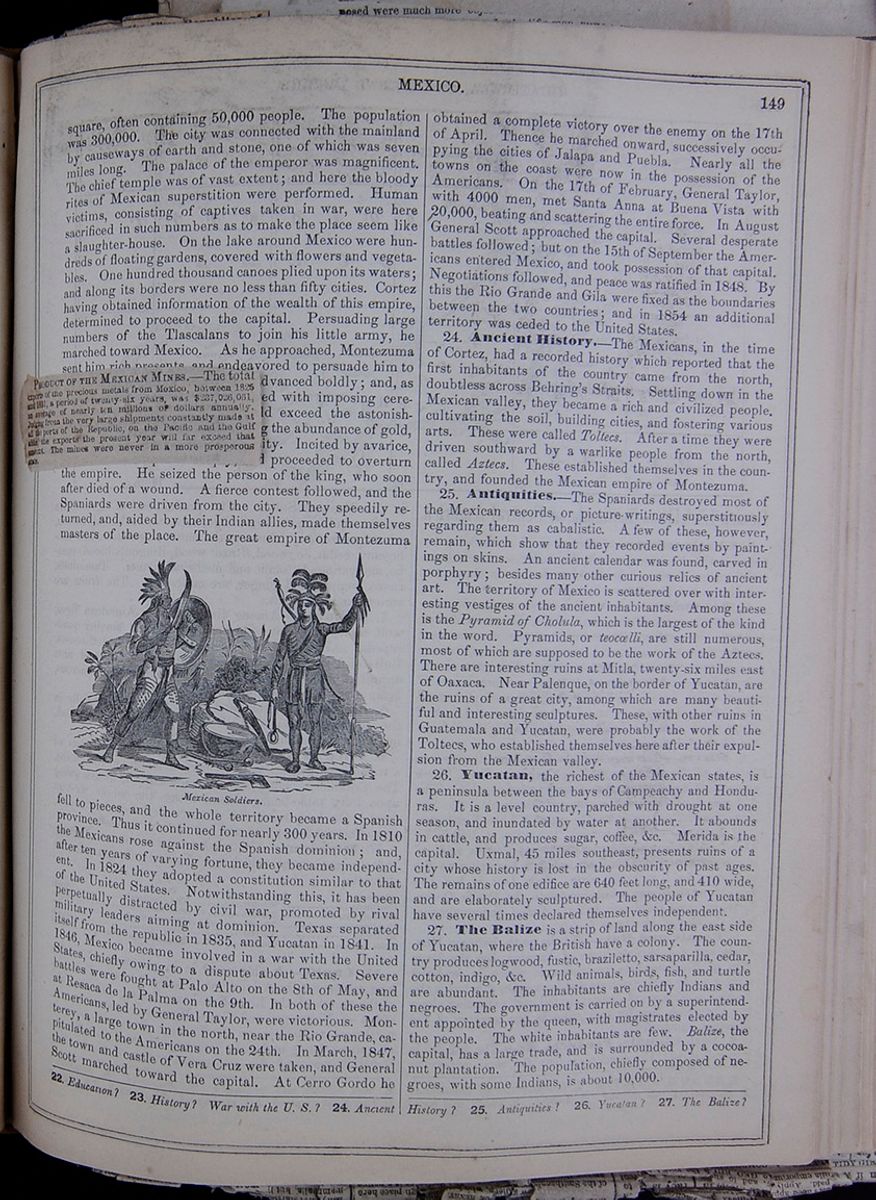
PRODUCT OF THE MEXICAN MINES.—The total exports of the precious metals from Mexico, between 1825 and 1851, a period of twenty-six years, was $237,026,031, an average of nearly ten millions of dollars annually. Judging from the very large shipments constantly made at all the ports of the Republic, on the Pacific and in the Gulf alike, the exports the present year will far exceed that amount. The mines were never in a more prosperous state.
 MEXICO.
149
MEXICO.
149
square, often containing 50,000 people. The population was 300,000. The city was connected with the mainland by causeways of earth and stone, one of which was seven miles long. The palace of the emperor was magnificent. The chief temple was of vast extent; and here the bloody rites of Mexican superstition were performed. Human victims, consisting of captives taken in war, were here sacrificed in such numbers as to make the place seem like a slaughter-house. On the lake around Mexico were hundreds of floating gardens, covered with flowers and vegetables. One hundred thousand canoes plied upon its waters; and along its borders were no less than fifty cities. Cortez having obtained information of the wealth of this empire, determined to proceed to the capital. Persuading large numbers of the Tlascalans to join his little army, he marched toward Mexico. As he approached, Montezuma sent him rich presents, and endeavored to persuade him to quit the country. He, however, advanced boldly; and, as he entered the capital, was received with imposing ceremony by the king. Nothing could exceed the astonishment of the Spaniards at witnessing the abundance of gold, silver, and precious stones in the city. Incited by avarice, Cortez laid his plans deeply, and proceeded to overturn the empire. He seized the person of the king, who soon after died of a wound. A fierce contest followed, and the Spaniards were driven from the city. They speedily returned, and, aided by their Indian allies, made themselves masters of the place. The great empire of Montezuma Mexican Soldiers. fell to pieces, and the whole territory became a Spanish province. Thus it continued for nearly 300 years. In 1810 the Mexicans rose against the Spanish dominion; and, after ten years of varying fortune, they became independent. In 1824 they adopted a constitution similar to that of the United States. Notwithstanding this, it has been perpetually distracted by civil war, promoted by rival military leaders aiming at dominion. Texas separated itself from the republic in 1835, and Yucatan in 1841. In 1846, Mexico became involved in a war with the United States, chiefly owing to a dispute about Texas. Severe battles were fought at Palo Alto on the 8th of May, and at Resaca de la Palma on the 9th. In both of these the Americans, led by General Taylor, were victorious. Monterey, a large town in the north, near the Rio Grande, capitulated to the Americans on the 24th. In March, 1847, the town and castle of Vera Cruz were taken, and General Scott marched toward the capital. At Cerro Gordo he obtained a complete victory over the enemy on the 17th of April. Thence he marched onward, successively occupying the cities of Jalapa and Puebla. Nearly all the towns on the coast were now in the possession of the Americans. On the 17th of February, General Taylor, with 4000 men, met Santa Anna at Buena Vista with 20,000, beating and scattering the entire force. In August General Scott approached the capital. Several desperate battles followed; but on the 15th of September the Americans entered Mexico, and took possession of that capital. Negotiations followed, and peace was ratified in 1848. By this the Rio Grande and Gila were fixed as the boundaries between the two countries; and in 1854 an additional territory was ceded to the United States.
24. Ancient History.—The Mexicans, in the time of Cortez, had a recorded history which reported that the first inhabitants of the country came from the north, doubtless across Behring's Straits. Settling down in the Mexican valley, they became a rich and civilized people, cultivating the soil, building cities, and fostering various arts. These were called Toltecs. After a time they were driven southward by a warlike people from the north, called Aztecs. These established themselves in the country, and founded the Mexican empire of Montezuma.
25. Antiquities.—The Spaniards destroyed most of the Mexican records, or picture-writings, superstitiously regarding them as cabalistic. A few of these, however, remain, which show that they recorded events by paintings on skins. An ancient calendar was found, carved in porphyry; besides many other curious relics of ancient art. The territory of Mexico is scattered over with interesting vestiges of the ancient inhabitants. Among these is the Pyramid of Cholula, which is the largest of the kind in the word. Pyramids, or teocœlli, are still numerous, most of which are supposed to be the work of the Aztecs. There are interesting ruins at Mitla, twenty-six miles east of Oaxaca. Near Palenque, on the border of Yucatan, are the ruins of a great city, among which are many beautiful and interesting sculptures. These, with other ruins in Guatemala and Yucatan, were probably the work of the Toltecs, who established themselves here after their expulsion from the Mexican valley.
26. Yucatan, the richest of the Mexican states, is a peninsula between the bays of Campeachy and Honduras. It is a level country, parched with drought at one season, and inundated by water at another. It abounds in cattle, and produces sugar, coffee, &c. Merida is the capital. Uxmal, 45 miles southeast, presents ruins of a city whose history is lost in the obscurity of past ages. The remains of one edifice are 640 feet long, and 410 wide, and are elaborately sculptured. The people of Yucatan have several times declared themselves independent.
27. The Balize is a strip of land along the east side of Yucatan, where the British have a colony. The country produces logwood, fustic, braziletto, sarsaparilla, cedar, cotton, indigo, &c. Wild animals, birds, fish, and turtle are abundant. The inhabitants are chiefly Indians and negroes. The government is carried on by a superintendent appointed by the queen, with magistrates elected by the people. The white inhabitants are few. Balize, the capital, has a large trade, and is surrounded by a cocoa-nut plantation. The population, chiefly composed of negroes, with some Indians, is about 10,000.
22. Education? 23. History? War with the U. S.? 24 Ancient History? 25. Antiquities? 26. Yucatan? 27. The Balize?
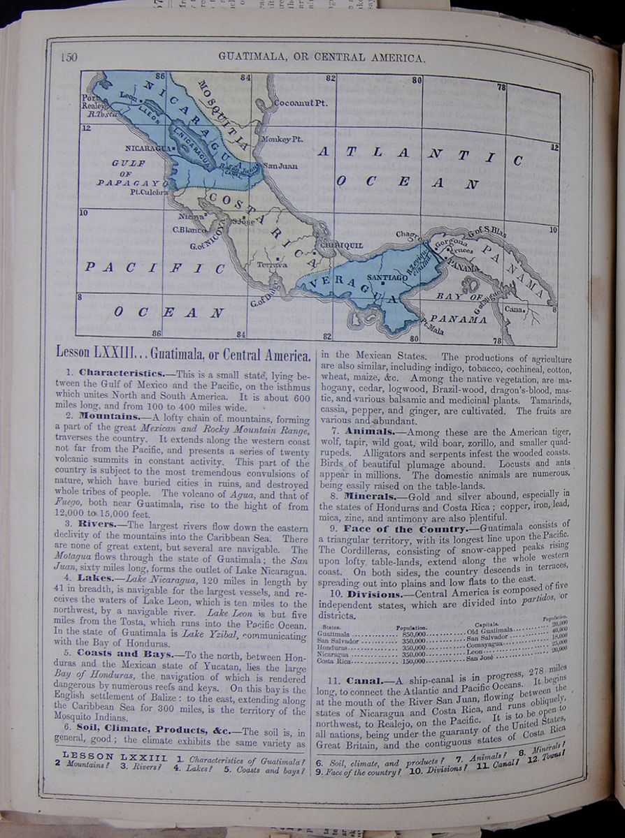 150
GUATIMALA, OR CENTRAL AMERICA.
150
GUATIMALA, OR CENTRAL AMERICA.
Lesson LXXIII... Guatimala, or Central America.
1. Characteristics.—This is a small state, lying between the Gulf of Mexico and the Pacific, on the isthmus which unites North and South America. It is about 600 miles long, and from 100 to 400 miles wide.
2. Mountains.—A lofty chain of mountains, forming a part of the great Mexican and Rocky Mountain Range, traverses the country. It extends along the western coast not far from the Pacific, and presents a series of twenty volcanic summits in constant activity. This part of the country is subject to the most tremendous convulsions of nature, which have buried cities in ruins, and destroyed whole tribes of people. The volcano of Agua, and that of Fuego, both near Guatimala, rise to the hight of from 12,000 to 15,000 feet.
3. Rivers.—The largest rivers flow down the eastern declivity of the mountains into the Caribbean Sea. There are none of great extent, but several are navigable. The Motagua flows through the state of Guatimala; the San Juan, sixty miles long, forms the outlet of Lake Nicaragua.
4. Lakes.—Lake Nicaragua, 120 miles in length by 41 in breadth, is navigable for the largest vessels, and receives the waters of Lake Leon, which is ten miles to the northwest, by a navigable river. Lake Leon is but five miles from the Tosta, which runs into the Pacific Ocean. In the state of Guatimala is Lake Yzibal, communicating with the Bay of Honduras.
5. Coasts and Bays.—To the north, between Honduras and the Mexican state of Yucatan, lies the large Bay of Honduras, the navigation of which is rendered dangerous by numerous reefs and keys. On this bay is the English settlement of Balize: to the east, extending along the Caribbean Sea for 300 miles, is the territory of the Mosquito Indians.
6. Soil, Climate, Products, &c.—The soil is, in general, good; the climate exhibits the same variety as in the Mexican States. The productions of agriculture are also similar, including indigo, tobacco, cochineal, cotton, wheat, maize, &c. Among the native vegetation, are mahogany, cedar, logwood, Brazil-wood, dragon's-blood, mastic, and various balsamic and medicinal plants. Tamarinds, cassia, pepper, and ginger, are cultivated. The fruits are various and abundant.
7. Animals.—Among these are the American tiger, wolf, tapir, wild goat, wild boar, zorillo, and smaller quadrupeds. Alligators and serpents infest the wooded coasts. Birds of beautiful plumage abound. Locusts and ants appear in millions. The domestic animals are numerous, being easily raised on the table-lands.
8. Minerals.—Gold and silver abound, especially in the states of Honduras and Costa Rica; copper, iron, lead, mica, zinc, and antimony are also plentiful.
9. Face of the Country.—Guatimala consists of a triangular territory, with its longest line upon the Pacific. The Cordilleras, consisting of snow-capped peaks rising upon lofty table-lands, extend along the whole western coast. On both sides, the country descends in terraces, spreading out into plains and low flats to the east.
10. Divisions.—Central America is composed of five independent states, which are divided into partidos, or districts. This table lists the five districts of Central America and includes the Population of the District, the capital city, and the population of the capital city.
11. Canal.—A ship-canal is in progress, 278 miles long, to connect the Atlantic and Pacific Oceans. It begins at the mouth of the River San Juan, flowing between the states of Nicaragua and Costa Rica, and runs obliquely, northwest, to Realejo, on the Pacific. It is to be open to all nations, being under the guaranty of the United States, Great Britain, and the contiguous states of Costa Rica
LESSON LXXIII. 1. Characteristics of Guatimala? 2 Mountains? 3. Rivers? 4. Lakes? 5. Coasts and bays? 6. Soil, climate, and products? 7. Animals? 8. Minerals? 9. Face of the country? 10. Divisions? 11. Canal? 12. Towns? [begin surface 557]
NEWS FROM NEW GRANADA.
High Tides Expected at Panama.—Arms for the Peruvian Government—The Panama Massacre—Negotiations at Bogota—Propositions of the United States Minister—The Government Still Refuses Satisfaction—Testimony of the Peruvian Consul—Explanations by the British Consul—General Excitement and Agitation.
Our flies are dated at Panama on the 19th of March, and at Bogota on the 19th of February.On the afternoon of the 27th the highest rise of the tide will take place, and may probably be equalled by that of the 25th, if the N. and N. E. breezes do not abate its force, which is scarcely to be expected. Both high tides will fully reach the limits set down by Capt. Kellett, of H. B. M.'s ship Herald, of twenty two feet rise.
Several lots of rifles shipped for the use of the Peruvian government were still at Panama, the Pacific Steamship Company having refused to carry them lest General Vivanco would seize the vessel.
Very high tides were expected in the bay of Panama The Panama Herald of the 19th instant, publishes the following communication on the subject:—As the sun crosses the equinoxial line on the 20th, and as on the 25th, the day of the new moon, there will be a central eclipse of the sun at almost the hour, of high water at Panama; as, moreover, the moon reaches her perigee on the 26th, and makes one of her nearest approaches to the earth, all these combined will occasion a powerful and unusual tidal motion in the Gulf of Panama, as well as a corresponding one in the atmosphere, proceeding from east to west. It will also most probably produce a revival of the abated northerly breeze, inclining on the north coast of the Gulf to N. E., and even to E. N. E, most likely in gusts from the deep valley comprised between the Altos of Pacora and the high land east of Chepo, over the Chiman district; which, added to the volume of our current sweeping that coast all the year round, will produce a heavy swell, and probably an exceedingly high tide.
THE PANAMA MASSACRE—PROPOSITIONS OF THE UNITED STATES MINISTER.
The Tiempo of Bogota, of 10th ultimo, announces that Mr. Morao had submitted to the Executive the following articles as the basis of his instructions:—
- 1. Two neutral districts, free and with their own governments, shall be made of the interoceanic track, but dependent on New Granada.
- 2. Trial by jury, and religious liberty, is to be guaranteed. The suffrage is to be limited to those who hold certain property and all the inhabitants are to be citizens.
- 3. The government of the districts is to lend strong aid (mano fuerte) to the (railroad) company, and in case of not doing so the North American Consul can raise a police force, and impose temporary contributions, which can even be levied on the railroad or the passengers. In this matter the Consuls will have more authority than the Assembly or the municipality, from whom the transit is exempt from interference.
- 4. They cede the full sovereignty of the islands of Taboga, Taboguilla, Flaminco, Perico and Culebra, near Panama, to the United States, to construct arsenals and a naval depot.
- 5. In case of necessity the districts can be honorably occupied by military forces from the United States.
- 6. The rights over the railroad are ceded to the United States. She will pay for the damages of the 15th of April, and the United States give a large sum of money to New Granada, from which is to be discounted what New Granada ought to pay for the 15th of April.
The sum is not stated.
The Tiempo argues that New Granada is in no way bound to make any reparation for the 15th of April. It however admits that the conduct of Governor Fabrega, in retiring after having given the order to fire on the station, has not been sufficiently explained or inquired into In this we agree with the Tiempo.
We learn that the government has promptly and positively refused Mr. Morse's proposition; that he had requested that they might be reconsidered, but that there was not the least prospect of the decision being altered.
In Congress the bill introduced by the Secretary of State, expressive of the adhesion of New Granada to the points of international law laid down at the Conference of Paris, has been rejected, the House feeling more inclined to adopt the views of the United States government on the subject, as contained in Secretary Marcy's letter of the 28th of July, 1856.
The House of Representatives threw out, on the second reading, the bill proposed by the Secretary of State, declaring citizens of the other Republics of South America entitled to citizenship in New Granada.
The Senate threw out, on the third reading, the bill to make all the ports on the Pacific Coast free, and the treaty of commerce and territorial boundary between New Granada and Ecuador.
The Secretary of State, on being asked by Congress to state whether the propositions published in the Tiempo were made by Mr. Morse, refused to answer the question, and likewise refused to comply with a formal demand of the house to procure copies of the documents.
In the House of Representatives, the bill proposed by the Secretary of State for the settlement of the Mackintosh claims passed the third reading.
NOTHING DEFINITE ACCOMPLISHED—POPULAR EXCITEMENT AND ANXIETY.
Per steamer Dee we are in receipt of Bogota papers to February 19. The most important matter which we find treated of in them is that of the difficulties between the United States and New Granada. At latest dates nothing had been accomplished. The propositions of Mr. Morse, the special Envoy of the United States, were under secret consideration, in conference of him and Mr. Bowita, the Resident Minister of the United States at Bogota, with Srs. Lino de Pombo and Florentino Gonzales, Commissioners Plenipotentiary for the New Granadian government. There seemed to be but little chance of an acceptance of any arrangement that might be made in said conference by the New Granadian Congress; and although nothing was positively known of the propositions of Mr. Morse, the reception of such publication of what was deemed to be the substance of them, as had been made, leaves little room to hope for an amicable arrangement. The tone of the press and of the majority in Congress is of the bitterest opposition.
The position of Mr. Morse and the character of his mission is such that an allowance of unnecessary delay would not be admissible, and he would be compelled to demand an answer peremptorily if the deliberations of the aforesaid conference should be prolonged beyond a reasonable time. During the prevalence of the manifest tone existent there, at our latest advices, such urgency would ensure an answer in the negative. Finally, Mr. Morse's presentations are not, strictly speaking, propositions—they are demands, and as such, have to be speedily acceded to or refused; and a negative answer must be followed by the return of the messenger of demand to the power that sent him. Upon the consequence of such a result we need not suggest or speculate, for they are patent to most of our readers.
We most earnestly hope that Mr. Morse will soon be among us, en route for Washington, with the acceptance or denial of his "propositions" or demands, and that the Isthmus may thus be relieved of the injurious suspense that has seriously retarded our every interest since the opening of the railroad.
If the "propositions" are similar to those published in Bogota, the result of the mission must be highly advantageous to us in any event; for if resolved by concession, nothing less would be accepted, and if resort to the alternative of force should be had, much more would be secured. But this probability does not so much incite us to the desire to see the end of the matter as the anxiety for a determination of our position and a certainty of permanent government.
EXPLANATION OF THE BRITISH CONSUL.
[From the same paper, same day.]We have received the following letter from Mr. Perry, H. B. M.'s Consul, in reference to the remarks made in the Star and Herald of the 5th, about his having refused to take the evidence of two British subjects who went to depose relative to having seen the dead body of an American woman near the railroad station, immediately after the massacre of the 15th of April last:—
BRITISH CONSULATE, Panama, March 6, 1857.In your leading article of yesterday, respecting Sr. Pombo's report to Congress you state that "a respectable British subject went to my office to depose before me that he had seen the body of a murdered woman lying on the track after the massacre of the 15th of April, and that I ordered the said witness out of my office, and returned to take his testimony, and that when another British subject went to confirm the statement, I professed not to think him worthy of credit, and refused his evidence."
Both these statements are incorrect. On the last day of April, Consul Ward sent a Jamaica man, named Clare, with a request that I would take his declaration respecting a woman and child he had seen murdered near the railroad station, between the hours of two and four A. M. of the 10th of April.
I took Clare's declaration, and the document probably forms part of Consul Ward's report on the sad affair,
On the following day Mr. Silvers, a respectable old gentleman, called at this office, and declared he had seen a woman lying murdered in the freight house of the railroad company, about 4 A. M. of the 16th of April.
I considered this matter so important that I immediately addressed the Governor on the subject, recommending that proper steps should be taken to discover the perpetrator of this horrible crime.
Sr. Gambos, the active and worthy Prefect, made a searching inquiry in the matter, and I was assured that there was no truth in the statements of either Clare or Silvera. It is supposed that the latter saw a young man who afterwards recovered, and mistook him for a female.
Respecting Jack Oliver, I can only say that I saw his name mentioned in a California newspaper as having been nearly lynched on his passage to San Francisco for his conduct on the 15th of April. I am, sir, your obedient servant,
REPORT OF THE PERUVIAN CONSUL.
[From the Panama Herald, March 18.]The files of the Gaceta Oficial of Bagota, received by the last mail, contain the statement of Sor. Rubio, the Consul of Peru, in this city, relative to the events of the 15th of April. It is stated that it was overlooked when the report of the Secretary was published.
As this document is much too lengthy to translate and give a place to in our columns, we shall content ourselves by pointing out a few of the errors into which Mr. Rubio has fallen.
Sr. Rubio states that it was a dark night, when every one who remembers that fatal evening knows that it was bright moonlight. Of this fact, at least, Sr. Rubio might easily have convinced himself without being at the scene of the massacre.
All we have to say is, once more to repeat that these consular reports are of no value or importance, as they do not even embody (except in one instance) any evidence officially taken by the gentlemen who make them, and we believe that they will have very little weight with the United States government, whose attempts to obtained a pacific settlement of the question appear to be all in vain, for from the course pursued by New Granada in now denying that any reparation is due for the events of that fatal night, and that no blame rests with any of the people, we should not be surprised to find that in six months (if the negotiations last so long) the executive at Bogota will be found ready to assert that no riot or massacre of any kind took place on the 15th of April, 1856, and that the whole affair is a base invention of the Americans, and a shallow pretext for the United States government to pick a quarrel about the Isthmus.
MISCHIEVOUS REPORTS ON THE ISTHMUS.
[From the Panama Herald, March 14.]Some persons, either through ignorance or mischief, having spread among the lower orders of the population a report that General Mosquera had been compelled by order of the United States government to leave the United States, and that his son was kept as a hostage, pending the settlement of the questions between this country and the United States, we deem it our duty to state that Gen Mosquera's departure from New York arises entirely from mercantile difficulties, in which his house in New York has become involved, and that his son is only detained by order of the Court to answer in certain civil suits brought against the firm. It is impossible to reprobate too strongly the mischievous practice of circulating such rumors at a time when the public mind is so excited.
DISCOVERY OF GOLD NEAR PUEBLO NUEVO.
[Correspondence of Panama Herald.]Please give publicity to the following interesting facts:—During my late stay at David, department of Chiriqui, I met a gentleman from Los Moros, who presented me with an ounce of gold dust, washed in the neighborhood of Pueblo Nuevo, situated near said port. Although it is well known that gold was found there in former periods it seems, according to trustworthy reports, that a rich and hitherto unknown tract of alluvial soil has been latterly discovered.
It has already attracted the attention of the neighboring population, and many persons are by this time occupied in exploring this new auriferous region Should reports continue to be favorable, no doubt many a hardy California miner might feel induced to make a trial, and as persevering intelligence always commands success they will have the best chance of reaping a fair reward for their labor.
Additional from the South Pacific.
RAILROAD PROGRESS IN CHILE—CONSULAR APPOINTMENTS—CASTILLA ABOUT THE IMPORT FILIBUSTERS—DREAD OF THE CONSEUENCES —REVOLUTIONARY SENTENCES IN BOLIVIA—PROGRESS OF THE REVOLUTION IN PERU.
By the arrival of the Illinois we have some additiona news items from the South Pacific. The dates are Valparaiso, Feb. 16, and Caliao, Feb. 26.CHILE.
The most remarkable event during the first fortnight of the month of February is the meeting of the Valparaiso and Santiago Railroad. The line as far as Quilota, a distance of 32 3/4 miles, is almost completely finished, and will be opened to the public at the end of March; the only exception is the San Pedro Tunnel, which excavation has been contracted for in the sum of $160,000, but in the meantime a provisional road will be constructed over the hill, and a stationary engine will be placed there to raise the trains up the ascent. The total sum invested up to the present moment in the portion of the line as far as Quilota, amounts to $4,160,912 11, which is an average cost of $124, 012 25 per mile The Board of Directors gave as their opinion the following advice:—That the present company limit their efforts to the termination of the line as far as Quilota, and from thence to Santiago, the work be continued exclusively at the expense of government, who is empowered to raise a loan for this purpose.
Sr D. Francisco Lianos has been named Consul for chile in Valencia (Spain), and Sr. D. Manuel Antonto Cordovez has obtained the same nomination in Bogota—(New Granada).
Public attention is excited by the report that President Castilla was getting down to Peru a lot of California filibusters to help him defeat Vivanco. They fear it will lead to the seizure of Peru and Chile by the Yankees, as resulted in Nicaragua.
The harvest abundant, but prices low. Copper mining doing well
The British Brig Cuba arrived in port of Valparaiso from Shields in 151 days, reports that the British ship Lord John Bentinck, from Shields for San Francisco, had been lost, going down in 40 degrees, south latitude, and 50 degrees west longitude. Of the crew, sixteen men were saved by the Cuba and taken to the Malvinas Islands.
The price of copper has taken a rise. The mines are worked with more care than ever before.
Freights still keep up, say £4 per ton.
The English iron ship from Don Diego made an extraordinary passage, sixty-four days from Liverpool to Valparaiso
The Monarch arrived at Valparaiso, and on the 7th of February, Admiral Bruce and his secretary proceeded in the steamer Lima to Callao, finding H. B. M. 's steamer Pearl at Chincha Islands; H. B. M.'s ships Tribune, President, and Cockatrice, and French frigate Perseverance flying the admiral's flag, and the French steamer Lavoisier at Callao.
PERU.
LIMA, Peru, Feb. 10, 1857.Posted Communication with Peru—Chilian Progress—Vivanco's Prospects as a Revolutionist—The Naval Skirmish off Callao—Yellow Fever—Guano Decree of Vivanco—Sittings of the Convention.
I am sorry to inform you that it is impracticable for me to continue as correspondent of the HERALD, because we have no mail communication with Lima. Last year the Post Office of Lima received letters for the United States until an order to the contrary was received from the British Consul. Since that time they have refused to receive letters to the United States, saying they do not know why the English Consul gave such an order. Thus the Americans here are compelled to go to Callao and mail their letters.
You may be a little surprised to see that the English Consul has power to refuse American letters in the Post Office of Lima. It certainly presents quite a gloomy picture—a country that is so weak as to let other governments meddle in its domestic affairs. And you may be still more surprised to know that our Minister does not correct our evils. If Peru had a contract with the British line of steamers to carry our mails, or if the United States had such a treaty, and it has expired, our Minister should feel enough interest for his countrymen to have the said contract renewed and save us the trouble and expense of making a journey to mail a letter.
Chili still marches in the road of peace and progress. She has appropriated $1,000 to begin the construction of a telegraph between Santiago and Taica; and in Valparaiso is about to begin a new wharf, to extend far enough into deep water for vessels to come alongside and load or discharge, and also to construct a breakwater before the port to protect the bay from heavy waves.
Bolivia now enjoys peace, an insurrection just being suppressed, and a great many influential men exiled. It is said that Bolivia is aiding Castilla, sending arms and munitions.
The revolution of Peru by Gen. Vivanco is progressing a little. He appears to have decidedly the advantage now. You doubtless knew he has all the steam ships of war, except one, the Ucayali, which is cabled to the wharf in Callao. In December, Vivanco left Islay with his ships of war, and suddenly appeared in the bay before Callao. After staying several days, and capturing two or three sail vessels he sailed for the North, leaving the steamer Apurimac in Callao He sent several armed launches to take possession of the Ucayali; they captured her, under a heavy fire of musketry and cannon from the shore and was towing her off, when a strong breeze sprang up ahead and overpowered them. The Apurimac has since tried to take the Ucayali, but the Apurimac being very large could not get so near shore. In the first engagement about twenty were killed, in the second some ten or fifteen. The Ucayali has several cannon shots entirely through her Vivanco at present is in the north, with a force of 600 or 700 men, and what is a little curious he has more than 800 officers around him, doubtless waiting to organize more forces. He has retaken several places, and the government troops have retreated far in the interior to Caljamarca.
A small body of the revolutionists were defeated at Huaras, but it is believed that the city will be taken soon by the main body of the troops.
The yellow fever is very severe in the North.
Lawless bands of negroes are killing defenceless people and sacking their houses.
In the Chincha Islands Vivanco has a man-of-war stationed to protect the guano against the government. There is little change in the south. The departments of Arequipe, Moquequa, &c, continue for Vivanco, but Gen. San Roman is arming a formidable force in Cuzco to march against these departments. A very strange phenomena has transpired in the south, that is a very heavy rain. In these sandy deserts a drop of water rarely falls, but recently they have had such a heavy rain that it destroyed many houses, the roots being flat, and created such a flood in the valleys as to wash away several houses and destroy many plantations. This frightened the people as much as the shower of earth that fell over the city of Quito from the surrounding volcanoes
Castilla's position is rendered less hopeful by the emptiness of the treasury. To pay the salary of the officers of the government for the last month he had to borrow of the English, so that this month they may expect to go unpaid, which will doubtless produce no little discontent.
The convention has declared free of duty the most important articles of sustenance, so that Castilla has very little resource from commerce.
The convention is still prolonging its session, but doing little. Castilla wanted them to adjourn, and leave him to prosecute the war to his own liking, but they love the far places too well to abandon them.
[Lima (Feb. 24) Correspondence of Panama Herald.]Several vessels from Chile are loading or stealing guano from the Chincha Islands, and, as they say, having bought it from the agents of Vivanco at from $18 to $25 per ton, and, no doubt, much less, as the Vivanco party are hard pushed for money.
The Peruvian frigate Apurimac remains off the fort midway between the Lorenzo and Callao, having taken a few days previous to the 13 gun brig Guise, which was holding out in favor of Castilla; but as a sailing vessel had no chance with a steamer in a calm the captain, officers and crew, in order to make their service available for Castilla, left the brig in the boats and landed at Calloa, leaving the Guise in possession of the Apurimac, which vessel looking in a horrid condition, and apparently was making water, as the pumps were going when the Lima passed her, and being short of provisions, they cannot be in an enviable position.
The Vivanco's party on shore are doing nothing, as a counter revolution sprang up in Lima, which place was attacked on the 25th ult by a General Canacero, the person who has no less than four times the last four years changed his political opinions; on his side were 150 regular troops, to oppose about 300 artisans and mechanics of the town. They were driven back twice, and Canacero "bolted;" but a Colonel being with him, having a little more courage, ordered his troops on, and ultimately took the place, with about forty killed and sixty wounded.
The Los was in Paita, and in want of provisions and seamen. After coaling she will take Canacero to Lambayeque to join Vivanco, where it is their intention to attack and keep Truxillo, when, no doubt, General Laseos on Castilla's part will retire until he is joined by two battalions on the way from Lima, and probably will make themselves again master of the North.
It is generally believed the revolutionary party will not succeed, as every person who has had anything to do with Vivanco begins to see there is not that spirit and energy exercised as is requisite to carry it out. In short, the seamen on board and soldiers on shore, in despair begin to ask themselves what they had accomplished, and what they were likely to, and wanted to do something to drive away the everyday monotony of poor feeding and bad pay.
BOLIVIA.
On account of the last revolutionary attempt many individuals were arrested, and several sentenced to death; but General Cordova commuted their sentences into banishment to the district of Beni. The fever continued its ravages, and in the province of Munecas more than a thousand Indians had perished; it was lately raging in La Paz. The project of a civil code had been presented to government by the committee named for this purpose. The effects of the amnesty decreed on the 26th of October had been suspended, and the Bolivian refugees were disbarred the entrance into the territory,
 THE WEST INDIES.
151
THE WEST INDIES.
151
and Nicaragua. It will extend through Lakes Nicaragua and Leon. This is now a common route of travel across the country.
12. Chief Towns.—New Guatimala, the capital of the defunct republic, is in a fertile valley, which enjoys a delightful climate. It was built in 1774, in consequence of the almost entire destruction of Old Guatimala by an earthquake. The streets are broad, clean, and straight. The houses are generally low, on account of the frequency of earthquakes; they are provided with gardens and fountains. The cathedral, the government house, the archbishop's palace, the mint, and several of the churches are handsome buildings. The commerce and manufactures of the city are extensive. Old Guatimala, capital of the state of Guatimala has been several times destroyed by earthquakes, and lies between the volcanoes of Agua and Fuego. It suffered much from an earthquake in 1830. It formerly contained fifty or sixty churches, and several large convents, which are now in ruins. Its cathedral is one of the largest in America. Chiquimula, in the same state, is a place of large population. San Salvador, the capital of the state of the same name, is agreeably situated in the midst of fine indigo and tobacco plantations, and has an active commerce and extensive manufactures. Comayagua, the capital of Honduras, contains a college. Truxillo and Omoa, in the same state, have good harbors on the Bay of Honduras, but they are sickly. Leon, capital of Nicaragua, is regularly laid out and handsomely built, and contains a university and a cathedral. Nicaragua is the second town in the state. Realejo has an excellent port. San José and Cartago are the principal towns of Costa Rica.
13. Commerce.—Cochineal and indigo are the two staple productions, and furnish the largest articles of export. Gold, silver, cocoa, dogwood, sarsaparilla, hides, tortoise-shell, and balsam of Tolu, are also exported. The trade is carried on chiefly through Balize, by the Americans and English.
14. Inhabitants.—The inhabitants resemble those of the Mexican States; about one-fifth are Creoles, two-fifths mixed, and the remainder Indians, with a few negroes. Slavery is abolished. In the cities, the manners resemble those of Spain. The ladies wear the mantilla, and go abroad veiled. An embroidered veil, costly fan, and valuable jewels, are the pride of the ladies. The men love to ride on horses with rich trappings. The country people are poor, simple, and quiet—consisting mostly of Indians.
15. Religion.—The Catholic religion is established by law.
16. Government.—This was copied from that of the United States; but the General Government has now not even a nominal existence—the several states acting, in most matters, for themselves. Their governments are ostensibly republican.
17. Education.—A few of the upper classes have a tolerable education, but the masses are in the most abject state of ignorance.
18. History.—This country was conquered by Alvarado, who was sent hither immediately after the conquest of Mexico, by Cortez, in 1523. The natives, called Quiches, lived in cities, and some ruins of their works are yet visible. They had advanced nearly as far as the Mexicans in the arts. They made strenuous resistance to the Spaniards, but without avail. The province was erected by the Spaniards into a captain-generalship, by the name of Guatimala, and continued dependent upon Spain until 1821, when it declared itself independent. A constitution was adopted in 1824, but was annulled in 1846.
19. Mosquito Territory, or Mosquitia.—This is an extensive strip of land lying along the southeastern shore of the Bay of Honduras, and extending southward 300 miles along the Caribbean Sea. The people appear to be mostly in a state of barbarism, though the king has treaties with Great Britain, and is under her protection. The government is chiefly administered by the British residents. The land is fertile, and yields logwood, cotton, cacao, sugar, &c. The capital is Blewfields.
Lesson LXXIV... West Indies.
1. Characteristics.—The West Indies consist of numerous islands, lying between the Gulf of Mexico, the Caribbean Sea, and the Atlantic Ocean. They are composed of several clusters, known under the names of the Bahamas, the Greater Antilles (including Cuba, Hayti, Porto Rico, and Jamaica), the Lesser Antilles, and the Caribbee Islands. We shall also include here a view of the Bermudas, lying far to the north.
2. Productions.—The West Indies abound in all the productions of warm climates; the fruits are shaddocks, oranges, lemons, pine-apples, bananas, plantains, &c.; manioc, yams, maize, &c, with sugar, guava, cocoa, cotton, coffee, indigo, tobacco, &c., furnish important articles of food or of commerce. The forests contain mahogany, lignum-vitæ, iron-wood, and other woods useful in the arts.
3. Climate.—The climate of these islands is for a great part of the year mild and pleasant, the heat being in some measure moderated by the uniform length of the nights, and by refreshing sea-breezes. The seasons are divided between the wet and the dry; the former, occurring in May and October, are of short continuance, and during the rest of the year the sky is clear, and the nights remarkable for their brilliancy.
4. Hurricanes.—In the interval between the months of August and October, the islands are visited by those terrible storms, called hurricanes, to which the regions of the torrid zone are liable. They begin in various ways, but are in general preceded by a profound calm; this is soon followed by a chaos of warring elements, lightning and thunder, rain, hail, and impetuous blasts of wind, which move with a swiftness exceeding that of a cannon-ball. Corn, vines, forests, and houses are swept away before their violence, which, however, is but of short duration. These tempests are supposed to be of electric origin, and they serve the purpose of purifying the atmosphere.
5. Animals.—The native quadrupeds of the West Indies, when first discovered, included the agouti, peccary, raccoon, alco, or native Indian dog, and the wild boar. These are nearly extinct. Monkeys and lizards of various kinds are found. Sea-turtle are common along the shores. Macaws, parrots, wild Guinea-fowl, quails, pigeons, water-fowl, the humming-bird, mocking-bird, &c., are common.
6. Inhabitants.—The native races of these islands are now extinct. When first discovered by the Spaniards,
13. Commerce? 14. Inhabitants? 15. Religion? 16. Government? 17. Education? 18. History? 19 Mosquito Territory?
LESSON LXXIV. 1. Characteristics? 2. Productions? 3. Climate? 4. Hurricanes? 5. Animals? 6 Inhabitants?
[begin surface 560]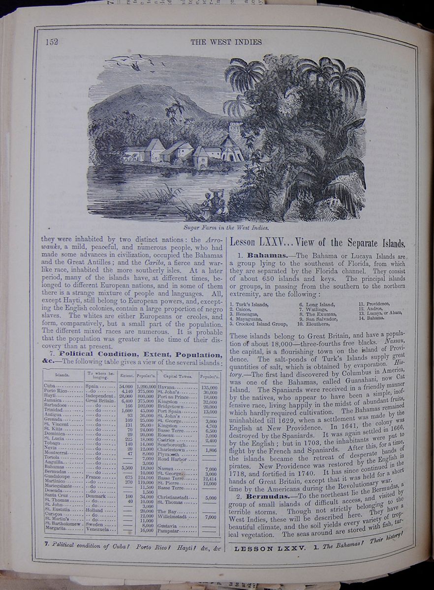 152
THE WEST INDIES
Sugar Farm in the West Indies.
152
THE WEST INDIES
Sugar Farm in the West Indies.
they were inhabited by two distinct nations: the Arrowauks, a mild, peaceful, and numerous people, who had made some advances in civilization, occupied the Bahamas and the Great Antilles; and the Caribs, a fierce and war-like race, inhabited the more southerly isles. At a later period, many of the islands have, at different times, belonged to different European nations, and in some of them there is a strange mixture of people and languages. All except Hayti, still belong to European powers, and, excepting the English colonies, contain a large proportion of negro slaves. The whites are either Europeans or creoles, and form, comparatively, but a small part of the population. The different mixed races are numerous. It is probable that the population was greater at the time of their discovery than at present.
7. Political Condition, Extent, Population, &c.—The following table gives a view of the several islands: This table lists islands, the country that claims the island, extent, population, capital towns and population of capital towns.
Lesson LXXV... View of the Separate Islands.
1. Bahamas.—The Bahama or Lucaya Islands are a group lying to the southeast of Florida, from which they are separated by the Florida channel. They consist of about 650 islands and keys. The principal islands or groups, in passing from the southern to the northern extremity, are the following:
- 1. Turk's Islands,
- 2. Caicos,
- 3. Heneagas,
- 4. Mayaguana,
- 5. Crooked Island Group,
- 6. Long Island,
- 7. Watlings,
- 8. The Exumas,
- 9. San Salvador,
- 10. Eleuthera,
- 11. Providence,
- 12. Andros,
- 13. Lucaya, or Abaco,
- 14. Bahama.
2. Bermudas.—To the northeast lie the Bermudas, a group of small islands of difficult access, and visited by terrible storms. Though not strictly belonging to the West Indies, these will be described here. They have a beautiful climate, and the soil yields every variety of tropical vegetation. The seas around are stored with fish, turtle,
7. Political condition of Cuba? Porto Rico? Hayti? &c., &c
LESSON LXXV. 1. The Bahamas? Their history?
[begin surface 561]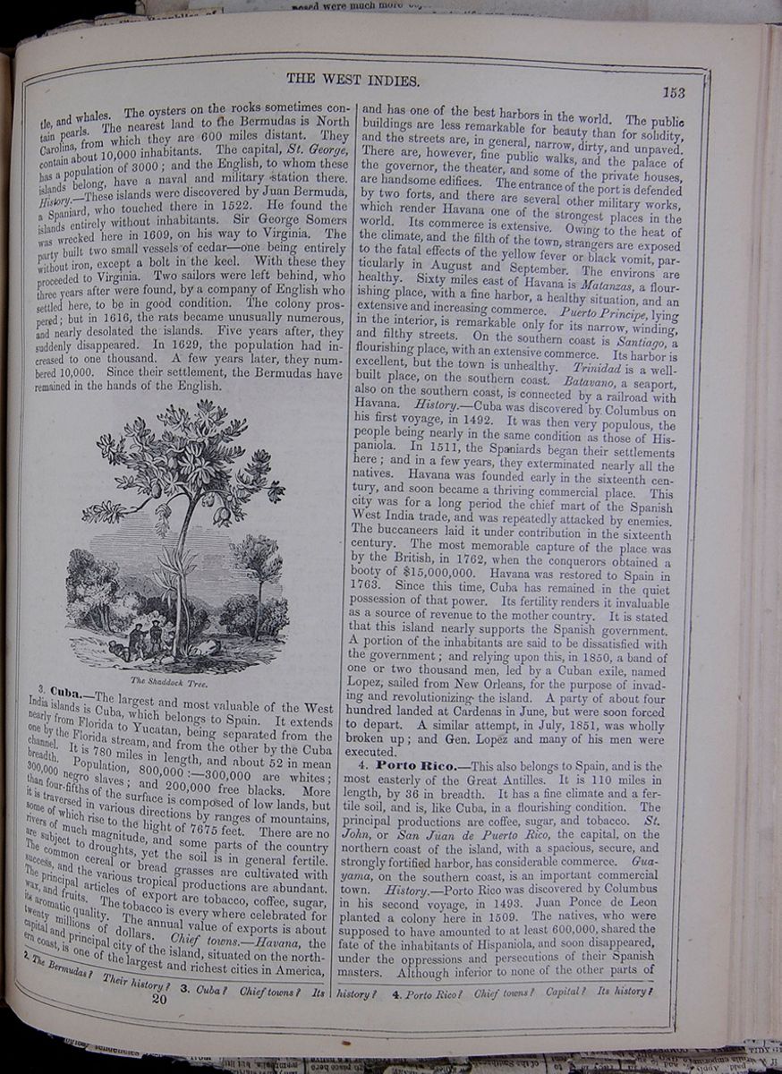 THE WEST INDIES.
153
THE WEST INDIES.
153
and whales. The oysters on the rocks sometimes contain pearls. The nearest land to the Bermudas is North Carolina, from which they are 600 miles distant. They contain about 10,000 inhabitants. The capital, St. George, has a population of 3000; and the English, to whom these islands belong, have a naval and military station there. History.—These islands were discovered by Juan Bermuda, a Spaniard, who touched there in 1522. He found the islands entirely without inhabitants. Sir George Somers was wrecked here in 1609, on his way to Virginia. The party built two small vessels of cedar—one being entirely without iron, except a bolt in the keel. With these they proceeded to Virginia. Two sailors were left behind, who three years after were found, by a company of English who settled here, to be in good condition. The colony prospered; but in 1616, the rats became unusually numerous, and nearly desolated the islands. Five years after, they suddenly disappeared. In 1629, the population had increased to one thousand. A few years later, they numbered 10,000. Since their settlement, the Bermudas have remained in the hands of the English.
The Shaddock Tree.3. Cuba.—The largest and most valuable of the West India islands is Cuba, which belongs to Spain. It extends nearly from Florida to Yucatan, being separated from the one by the Florida stream, and from the other by the Cuba channel. It is 780 miles in length, and about 52 in mean breadth. Population, 800,000:—300,000 are whites; 300,000 negro slaves; and 200,000 free blacks. More than four-fifths of the surface is composed of low lands, but it is traversed in various directions by ranges of mountains, some of which rise to the hight of 7675 feet. There are no rivers of much magnitude, and some parts of the country are subject to droughts, yet the soil is in general fertile. The common cereal or bread grasses are cultivated with success, and the various tropical productions are abundant. The principal articles of export are tobacco, coffee, sugar, wax, and fruits. The tobacco is every where celebrated for its aromatic quality. The annual value of exports is about twenty millions of dollars. Chief towns.—Havana, the capital and principal city of the island, situated on the northern coast, is one of the largest and richest cities in America, and has one of the best harbors in the world. The public buildings are less remarkable for beauty than for solidity, and the streets are, in general, narrow, dirty, and unpaved. There are, however, fine public walks, and the palace of the governor, the theater, and some of the private houses, are handsome edifices. The entrance of the port is defended by two forts, and there are several other military works, which render Havana one of the strongest places in the world. Its commerce is extensive. Owing to the heat of the climate, and the filth of the town, strangers are exposed to the fatal effects of the yellow fever or black vomit, particularly in August and September. The environs are healthy. Sixty miles east of Havana is Matanzas, a flourishing place, with a fine harbor, a healthy situation, and an extensive and increasing commerce. Puerto Principe, lying in the interior, is remarkable only for its narrow, winding, and filthy streets. On the southern coast is Santiago, a flourishing place, with an extensive commerce. Its harbor is excellent, but the town is unhealthy. Trinidad is a well-built place, on the southern coast. Batavano, a seaport, also on the southern coast, is connected by a railroad with Havana. History.—Cuba was discovered by Columbus on his first voyage, in 1492. It was then very populous, the people being nearly in the same condition as those of Hispaniola. In 1511, the Spaniards began their settlements here; and in a few years, they exterminated nearly all the natives. Havana was founded early in the sixteenth century, and soon became a thriving commercial place. This city was for a long period the chief mart of the Spanish West India trade, and was repeatedly attacked by enemies. The buccaneers laid it under contribution in the sixteenth century. The most memorable capture of the place was by the British, in 1762, when the conquerors obtained a booty of $15,000,000. Havana was restored to Spain in 1763. Since this time, Cuba has remained in the quiet possession of that power. Its fertility renders it invaluable as a source of revenue to the mother country. It is stated that this island nearly supports the Spanish government. A portion of the inhabitants are said to be dissatisfied with the government; and relying upon this, in 1850, a band of one or two thousand men, led by a Cuban exile, named Lopez, sailed from New Orleans, for the purpose of invading and revolutionizing the island. A party of about four hundred landed at Cardenas in June, but were soon forced to depart. A similar attempt, in July, 1851, was wholly broken up; and Gen. Lopez and many of his men were executed.
4. Porto Rico.—This also belongs to Spain, and is the most easterly of the Great Antilles. It is 110 miles in length, by 36 in breadth. It has a fine climate and a fertile soil, and is, like Cuba, in a flourishing condition. The principal productions are coffee, sugar, and tobacco. St. John, or San Juan de Puerto Rico, the capital, on the northern coast of the island, with a spacious, secure, and strongly fortified harbor, has considerable commerce. Guayama, on the southern coast, is an important commercial town. History.—Porto Rico was discovered by Columbus in his second voyage, in 1493. Juan Ponce de Leon planted a colony here in 1509. The natives, who were supposed to have amounted to at least 600,000, shared the fate of the inhabitants of Hispaniola, and soon disappeared, under the oppressions and persecutions of their Spanish masters. Although inferior to none of the other parts of
2. The Bermudas? Their history? 3. Cuba? Chief towns? Its history? 4. Porto Rico? Chief towns? Capital? Its history?
20 [begin surface 562]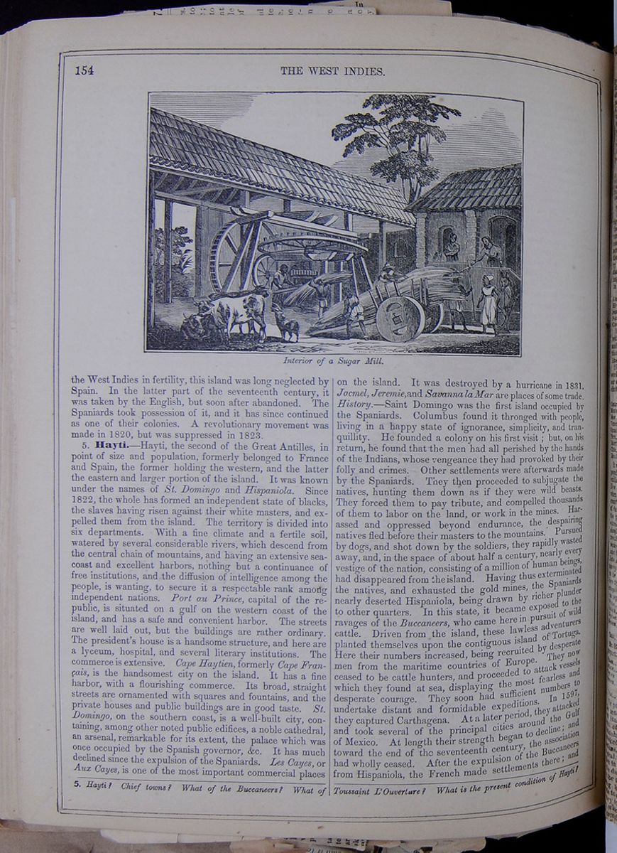 154
THE WEST INDIES
Interior of a Sugar Mill.
154
THE WEST INDIES
Interior of a Sugar Mill.
the West Indies in fertility, this island was long neglected by Spain. In the latter part of the seventeenth century, it was taken by the English, but soon after abandoned. The Spaniards took possession of it, and it has since continued as one of their colonies. A revolutionary movement was made in 1820, but was suppressed in 1823.
5. Hayti.—Hayti, the second of the Great Antilles, in point of size and population, formerly belonged to France and Spain, the former holding the western, and the latter the eastern and larger portion of the island. It was known under the names of St. Domingo and Hispaniola. Since 1822, the whole has formed an independent state of blacks, the slaves having risen against their white masters, and expelled them from the island. The territory is divided into six departments. With a fine climate and a fertile soil, watered by several considerable rivers, which descend from the central chain of mountains, and having an extensive sea-coast and excellent harbors, nothing but a continuance of free institutions, and the diffusion of intelligence among the people, is wanting, to secure it a respectable rank among independent nations. Port au Prince, capital of the republic, is situated on a gulf on the western coast of the island, and has a safe and convenient harbor. The streets are well laid out, but the buildings are rather ordinary. The president's house is a handsome structure, and here are a lyceum, hospital, and several literary institutions. The commerce is extensive. Cape Haytien, formerly Cape Français, is the handsomest city on the island. It has a fine harbor, with a flourishing commerce. Its broad, straight streets are ornamented with squares and fountains, and the private houses and public buildings are in good taste. St. Domingo, on the southern coast, is a well-built city, containing, among other noted public edifices, a noble cathedral, an arsenal, remarkable for its extent, the palace which was once occupied by the Spanish governor, &c. It has much declined since the expulsion of the Spaniards. Les Cayes, or Aux Cayes, is one of the most important commercial places on the island. It was destroyed by a hurricane in 1831. Jacmel, Jeremie, and Savanna la Mar are places of some trade. History.—Saint Domingo was the first island occupied by the Spaniards. Columbus found it thronged with people, living in a happy state of ignorance, simplicity, and tranquillity. He founded a colony on his first visit; but, on his return, he found that the men had all perished by the hands of the Indians, whose vengeance they had provoked by their folly and crimes. Other settlements were afterwards made by the Spaniards. They then proceeded to subjugate the natives, hunting them down as if they were wild beasts. They forced them to pay tribute, and compelled thousands of them to labor on the land, or work in the mines. Harassed and oppressed beyond endurance, the despairing natives fled before their masters to the mountains. Pursued by dogs, and shot down by the soldiers, they rapidly wasted away, and, in the space of about half a century, nearly every vestige of the nation, consisting of a million of human beings, had disappeared from the island. Having thus exterminated the natives, and exhausted the gold mines, the Spaniards nearly deserted Hispaniola, being drawn by richer plunder to other quarters. In this state, it became exposed to the ravages of the Buccaneers, who came here in pursuit of wild cattle. Driven from the island, these lawless adventurers planted themselves upon the contiguous island of Tortuga. Here their numbers increased, being recruited by desperate men from the maritime countries of Europe. They now ceased to be cattle hunters, and proceeded to attack vessels which they found at sea, displaying the most fearless and desperate courage. They soon had sufficient numbers to undertake distant and formidable expeditions. In 1597, they captured Carthagena. At a later period, they attacked and took several of the principal cities around the Gulf of Mexico. At length their strength began to decline; and toward the end of the seventeenth century, the association had wholly ceased. After the expulsion of the Buccaneers from Hispaniola, the French made settlements there; and
5. Hayti? Chief towns? What of the Buccaneers? What of Toussaint L'Ouverture? What is the present condition of Hayti?
Statistical Notices on the Five Republics of Central America.
Without entering into a description of the geographical character of the territory of the five independent States of Guatemala, San Salvador, Honduras, Nicaragua and Costa Rica, which, a few years ago constituted the federal republic of Central America, we shall limit ourselves to stating the extent of the territory which they occupy on the shores of the New World, stretching in a north-easterly direction, and extending to the south, where begins the other great section of the American continent, commonly called South America; we shall then add the most recent facts referring to their population:—
| Superfices in miles. | Population. | Exports piast.& fr. | Imports | Revenue. | |
| Guatemala | 43,388 | 850,000 | 1,880,000 | 2,000,000 | 600,000 |
| Honduras | 39,660 | 350,000 | 745,000 | 1,000,000 | 150,000 |
| San Salvador | 9,590 | 394,000 | 1,200,000 | 1,500,000 | 300,000 |
| Nicaragua | 49,500 | 300,000 | 958,000 | 1,000,000 | 200,000 |
| Costa Rica | 13,590 | 125,000 | 1,350,000 | 1,250,000 | 450,000 |
| Total | 155,664 | 2,012,000 | 6,128,000 | 6,250,000 | 1,700,000 |
It is not possible to establish, agreeably to these figures, any comparison applicable to the whole of these five States; for the relations between their extension, population, commerce and revenues offer such extraordinary differences, depending upon reasons which it would take long to explain. As to the relation between the superfices of the territory and the number of inhabitants which constitute the density of the population, we obtain the following figures, representing the number of inhabitants in proportion to each square mile:—
| Inhabitants. | Sq. Mile. | |
| Guatemala | about 20 for | 1 |
| Honduras | 9 | 1 |
| San Salvador | 44 | 1 |
| Nicaragua | 6 | 1 |
| Costa Rica | About 10 | 1 |
If those figures appear rather small in comparison with those offered by the civilized nations of Europe and the United States, they are nevertheless larger than those furnished for the population of South America.
The following table, taken from the interesting work of Mr. Squier on Central America, confirms our assertion, and is worth publishing, as likely to elicit future researches:—
| Superfices. | Inhabitants. | Proportion. | |
| Central America | 156,000 | 2,019,000 | 13.0 |
| Mexico | 792,000 | 7,853,000 | 10. |
| New Granada | 380,000 | 1,360,000 | 3.58 |
| Venezuela | 410,000 | 887,000 | 2.16 |
| Ecuador | 320,000 | 550,000 | 1.27 |
| Peru | 465,000 | 1,500,000 | 3.70 |
| Bolivia | 380,000 | 1,200,000 | 3.16 |
| Chile | 170,000 | 1,300,000 | 7.65 |
| Brazil | 2,720,000 | 4,450,000 | 1.63 |
It will be perceived that in regard to the relative population the small Central American republics exhibit a better proportion than the larger States of New Granada, Venezuela, Peru and others. But when the numerical relations of the population of a country are examined, not only in a material point of view, but in a moral one, as to their influence upon the progress of civilization, the problem becomes excessively complicated if solved with reference to simple numerical calculations. The considerations resulting from the relation between the main character, habits, religious sentiments, and the degree of mental culture, &c., must be taken into account as indispensable elements. Unfortunately this view of statistics is still much neglected in the States to which we refer, but we will state here the facts in regard to the different elements composing the population of the five Central American republics:—
| Whites | 100,000 | or | 5 | per cent | of the whole | population. |
| Indians | 1,109,000 | or | 55 | " | " | " |
| Negroes | 10,000 | or | 0.5 | " | " | " |
| Mestees | 800,000 | or | 37.5 | " | " | " |
| Total | 2,019,000 | or | 100 | " | " | " |
Mr. Brantz Meyer found for Mexico the following proportions:
| Whites | 1,000,000 | or | 14.25 | per cent |
| Indians | 4,000,000 | or | 57.00 | " |
| Negroes | 6,000 | or | 0.8 | " |
| Mestees | 2,000,000 | or | 38.67 | " |
| Total | 7,015,000 | or | 100 | " |
The preponderance of the indigenous races over the actual population of many Spanish-American States, and, above all, the absorption by them of the European race, which is sensibly diminishing, are remarkable facts, which have provoked, and are still provoking, very serious reflections. Without absolutely accepting the physiological, psychological, and even religious doctrines which in these latter times have been expressed as to the distinctive character, the intellectual inequality, the destiny or social mission of the races composing the human family, we will say only a few words to our brethren of the Spanish-American race. If they do not wish to see the influence of the Latin race, which they represent in America, degraded and completely extinguished—if they hope to over[cutaway]logical tendencies resulting from
[begin surface 564]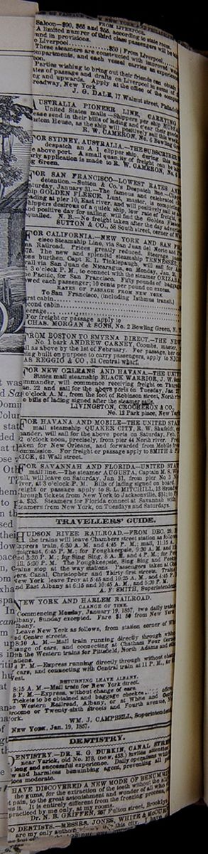
at length, in 1697, the court of Spain ceded to France the western half of the island, the eastern portion continuing to be occupied by the Spanish settlers. Such was the state of things at the commencement of the French revolution. The National Assembly abolished slavery in all the French colonies. Excited by a wild impulse, the slaves of Saint Domingo were thrown into a state of insurrection. A scene of fearful bloodshed and desolation followed. All the whites in the island either fled or were massacred. Toussaint L'Ouverture, who had been a slave, gained an ascendancy, and, for a brief period, maintained a government. He was beguiled by the French, however, and being taken to France, was left to die in prison. A French army of 20,000 men was now sent to conquer the island; but the enterprise proved abortive. Toussaint L'Ouverture. A black leader, named Dessalines, next made himself emperor of the island. It was subsequently divided into two governments—a monarchy, under King Christophe, and a republic, under President Petion. In 1822, the whole country was formed into a republic, under the name of Hayti. Soulouque, a mulatto, who was born a slave, was the last president. In 1849 he caused himself to be proclaimed emperor, under the title of Faustin I.; and the republic was changed into a monarchy.
Earthquake at Jamaica.6. Jamaica.—Jamaica is the largest and most important of the English West India colonies. It is about 150 miles in length, by 50 in breadth. The surface is much diversified. The Blue Mountains, which run through the island from east to west, rise to the hight of 7500 feet. On the north, the acclivity is gentle, and numerous fine vales are interspersed. Here every valley has its rivulet, and every hill its cascade. On the south, the surface is more broken. The soil is in general productive, and is well watered by about one hundred rapid streams, some of which are navigable for boats. The heat is tempered by the sea breezes and the inequalities of surface, and the vegetable productions are various and abundant. Spanish Town, the capital, is on a small river, a few miles from the southern coast. Kingston, the principal town on the island, is well built, with broad, straight streets, handsome houses, and an excellent harbor. Its commerce is extensive. Most of the population are blacks. Port Royal is also a place of extensive commerce, and is remarkable for the strength of its military works. It has suffered much from earthquakes. Population, 15,000. Montego Bay, on the northern coast, has a good harbor and considerable commerce, with about 4000 inhabitants. History.—Jamaica was discovered by Columbus in his second voyage; but the Spaniards not finding any gold here, paid little attention to the island. Oliver Cromwell dispatched an English fleet to invade Hispaniola; but this attempt being unsuccessful, an attack was next made upon Jamaica, and the island was captured by the English. Under their government, Jamaica soon rose to importance. Port Royal, the capital, became a rich mart of commerce. At the close of the seventeenth century, it was, with the exception of Mexico and Lima, the most splendid and opulent city in the western world. In the hight of its prosperity, a dreadful earthquake destroyed the place, burying thousands of its inhabitants in the ruins, and ingulfing millions of wealth in the sea. Since its first acquisition by the English, this island has remained in their power, although its tranquillity has been frequently disturbed by wars with the Maroons, or runaway negroes. In consequence of an act of the British parliament for the abolition of slavery throughout the colonies, taking effect in 1834, the negroes of Jamaica became free in 1838.
Cultivating the Sugar Cane.7. Smaller English Islands.—These are as follows: Trinidad is a fertile and beautiful island near the coast of Venezuela, with a delightful and healthy climate. It is seventy-nine miles long by fifty-six broad. It has a remarkable lake, half a mile across, covered with pitch. Around the edges, this is hard, but softens toward the middle, where it boils up in a liquid state. History.—This island was discovered by Columbus in 1498, when it was very populous. It was colonized by the Spaniards in 1588, taken by the French in 1676, soon after restored, and captured by the British in 1791, who have since retained it. Tobago, a small island to the north of Trinidad, has a fine climate and fertile soil. History.—This island was discovered by Columbus in 1498; was colonized by the Dutch, and next by the Courlanders. Afterward, it came to the French, who
6. Jamaica? Chief towns? Its history? When was slavery abolished in her colonies by Great Britain? 7. Other English islands?
[begin surface 566]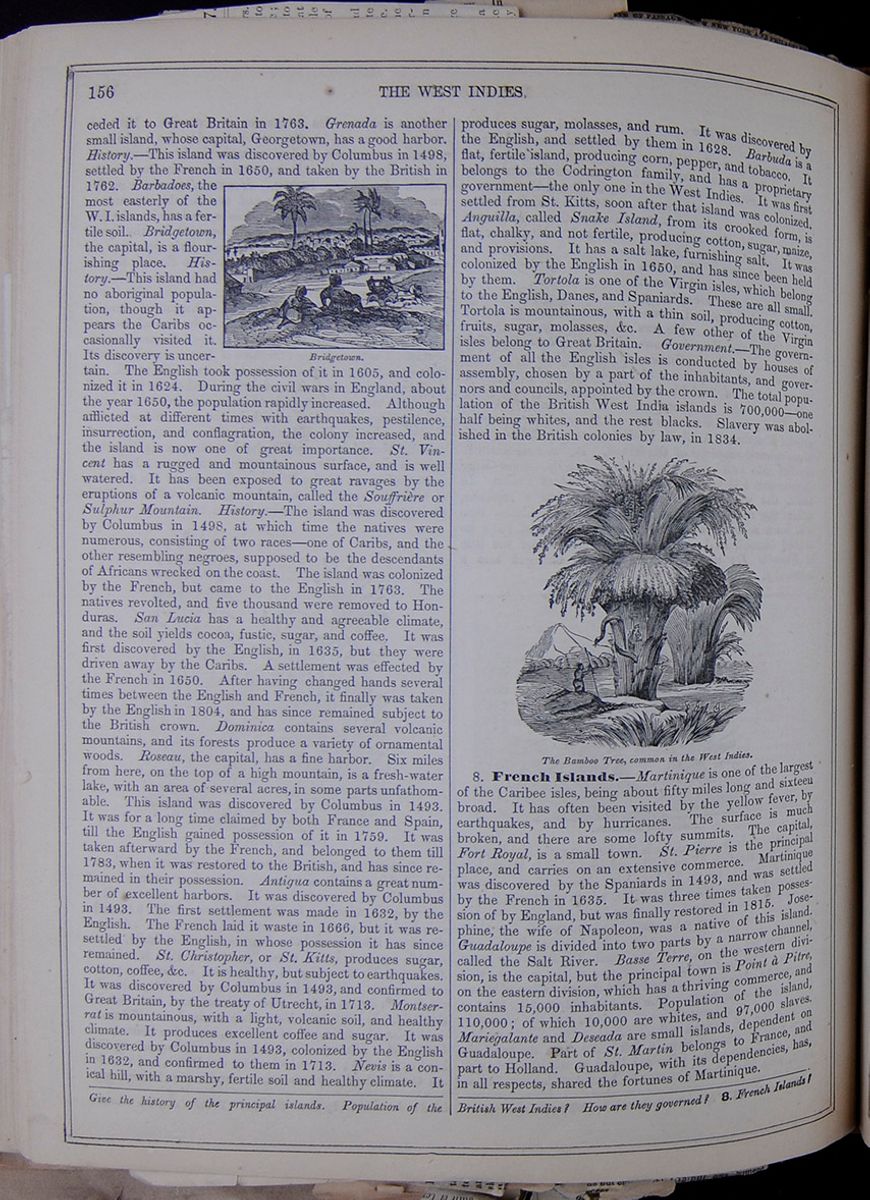 156
THE WEST INDIES
156
THE WEST INDIES
ceded it to Great Britain in 1763. Grenada is another small island, whose capital, Georgetown, has a good harbor. History.—This island was discovered by Columbus in 1498, settled by the French in 1650, and taken by the British in 1762. Barbadoes, the most easterly of the W. I. islands, has a fertile soil. Bridgetown, the capital, is a flourishing place. History.—This island had no aboriginal population, though it appears the Caribs occasionally visited it. Its discovery is uncertain. Bridgetown. The English took possession of it in 1605, and colonized it in 1624. During the civil wars in England, about the year 1650, the population rapidly increased. Although afflicted at different times with earthquakes, pestilence, insurrection, and conflagration, the colony increased, and the island is now one of great importance. St. Vincent has a rugged and mountainous surface, and is well watered. It has been exposed to great ravages by the eruptions of a volcanic mountain, called the Souffrière or Sulphur Mountain. History.—The island was discovered by Columbus in 1498, at which time the natives were numerous, consisting of two races—one of Caribs, and the other resembling negroes, supposed to be the descendants of Africans wrecked on the coast. The island was colonized by the French, but came to the English in 1763. The natives revolted, and five thousand were removed to Honduras. San Lucia has a healthy and agreeable climate, and the soil yields cocoa, fustic, sugar, and coffee. It was first discovered by the English, in 1635, but they were driven away by the Caribs. A settlement was effected by the French in 1650. After having changed hands several times between the English and French, it finally was taken by the English in 1804, and has since remained subject to the British crown. Dominica contains several volcanic mountains, and its forests produce a variety of ornamental woods. Roseau, the capital, has a fine harbor. Six miles from here, on the top of a high mountain, is a fresh-water lake, with an area of several acres, in some parts unfathomable. This island was discovered by Columbus in 1493. It was for a long time claimed by both France and Spain, till the English gained possession of it in 1759. It was taken afterward by the French, and belonged to them till 1783, when it was restored to the British, and has since remained in their possession. Antigua contains a great number of excellent harbors. It was discovered by Columbus in 1493. The first settlement was made in 1632, by the English. The French laid it waste in 1666, but it was resettled by the English, in whose possession it has since remained. St. Christopher, or St. Kitts, produces sugar, cotton, coffee, &c. It is healthy, but subject to earthquakes. It was discovered by Columbus in 1493, and confirmed to Great Britain, by the treaty of Utrecht, in 1713. Montserrat is mountainous, with a light, volcanic soil, and healthy climate. It produces excellent coffee and sugar. It was discovered by Columbus in 1493, colonized by the English in 1632, and confirmed to them in 1713. Nevis is a conical hill, with a marshy, fertile soil and healthy climate. It produces sugar, molasses, and rum. It was discovered by the English, and settled by them in 1628. Barbuda is a flat, fertile island, producing corn, pepper, and tobacco. It belongs to the Codrington family, and has a proprietary government—the only one in the West Indies. It was first settled from St. Kitts, soon after that island was colonized. Anguilla, called Snake Island, from its crooked form, is flat, chalky, and not fertile, producing cotton, sugar, maize, and provisions. It has a salt lake, furnishing salt. It was colonized by the English in 1650, and has since been held by them. Tortola is one of the Virgin isles, which belong to the English, Danes, and Spaniards. These are all small. Tortola is mountainous, with a thin soil, producing cotton, fruits, sugar, molasses, &c. A few other of the Virgin isles belong to Great Britain. Government.—The government of all the English isles is conducted by houses of assembly, chosen by a part of the inhabitants, and governors and councils, appointed by the crown. The total population of the British West India islands is 700,000—one half being whites, and the rest blacks. Slavery was abolished in the British colonies by law, in 1834.
The Bamboo Tree, common in the West Indies.8. French Islands.—Martinique is one of the largest of the Caribee isles, being about fifty miles long and sixteen broad. It has often been visited by the yellow fever, by earthquakes, and by hurricanes. The surface is much broken, and there are some lofty summits. The capital, Fort Royal, is a small town. St. Pierre is the principal place, and carries on an extensive commerce. Martinique was discovered by the Spaniards in 1493, and was settled by the French in 1635. It was three times taken possession of by England, but was finally restored in 1815. Josephine, the wife of Napoleon, was a native of this island. Guadaloupe is divided into two parts by a narrow channel, called the Salt River. Basse Terre, on the western division, is the capital, but the principal town is Point à Pitre, on the eastern division, which has a thriving commerce, and contains 15,000 inhabitants. Population of the island, 110,000; of which 10,000 are whites, and 97,000 slaves. Mariegalante and Deseada are small islands dependent on Guadaloupe. Part of St. Martin belongs to France, and part to Holland. Guadaloupe, with its dependencies, has, in all respects, shared the fortunes of Martinique.
Give the history of the principal islands. Population of the British West Indies? How are they governed? 8. French Islands?
[begin surface 567] [begin surface 568]
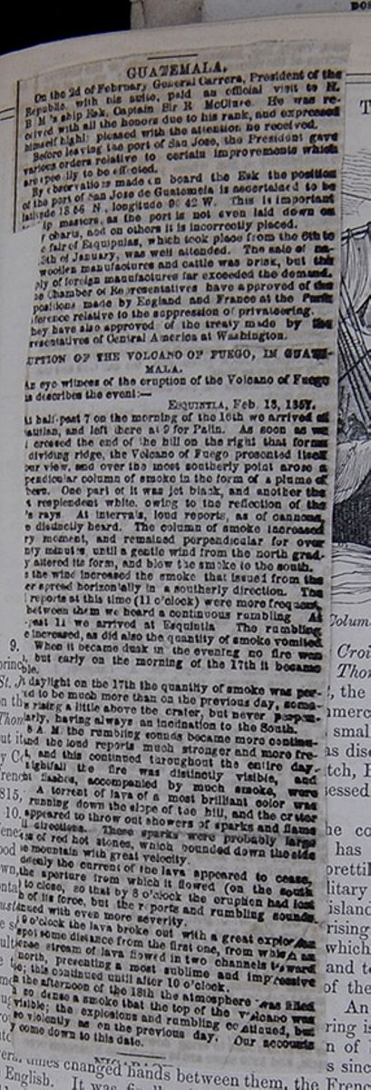
GUATEMALA.
On the 2d of February General Carrera, President of the Republic, with his suite, paid an official visit to H. B. M.'s ship Esk, Captain Sir R McClure. He was received with all the honors due to his rank, and expressed himself highly pleased with the attention he received.
Before leaving the port of San Jose, the President gave various orders relative to certain improvements which are [illegible]pec[illegible]ily to be effected.
By observations made on board the Esk the position of the port of San Jose de Guatemala is ascertained to be latitude 18 56 N, longitude 90 42 W. This is important [cutaway]p masters, as the port is not even laid down on [cutaway]y charts, and on others it is incorrectly placed.
[cutaway]e fair of Esquipulas, which took place from the 6th to [cutaway] 13th of January, was well attended. The sale of [illegible][cutaway] woollen manufactures and cattle was brisk, but this [cutaway]ply of foreign manufactures far exceeded the demand. [cutaway]e Chamber or Representatives have approved of the [cutaway]positions made by England and France at the P[illegible][cutaway]ference relative to the suppression of privateering. [cutaway]hey have also approved of the treaty made by the [cutaway]resentatives of Central America at Washington.
[cutaway]UPTION OF THE VOLCANO OF FUEGO, IN GUATEMALA.An eye witness of the eruption of the Volcano of Fuego [cutaway]s describes the event:—
ESQUINTIA, Feb. 13, 1857.At half-past 7 on the morning of the 16th we arrived at [cutaway]atitian, and left there at 9:00 for Palin. As soon as we [cutaway]crossed the end of the hill on the right that former [cutaway]dividing ridge, the Volcano of Fuego presented itself [cutaway]our view, and over the most southerly point arose a [cutaway]pendicular column of smoke in the form of a plume of [cutaway]bers. One part of it was jet black, and another the [cutaway]s resplendent white. owing to the reflection of the [cutaway]'s rays. At intervals, loud reports, as of cannons [cutaway]s distinctly heard. The column of smoke increased [cutaway]ry moment, and remained perpendicular for over [cutaway]nty minutes until a gentle wind from the north grad [cutaway]y altered its form, and blew the smoke to the south. [cutaway]s the wind increased the smoke that issued from the [cutaway]er spread horizontally in a southerly direction. The [cutaway]l reports at this time (11 o'clock) were more frequent, [cutaway]between them we heard a continuous rumbling. At [cutaway]past 11 we arrived at Esquintia. The rumbling [cutaway]e increased, as did also the quantity of smoke vomited [cutaway]When it became dusk in the evening no fire was [cutaway] but early on the morning of the 17th it became [cutaway]ble.
t daylight on the 17th the quantity of smoke was per[cutaway]ed to be much more than on the previous day, some [cutaway]s rising a little above the crater, but never perpen[cutaway]arly, having always and inclination to the South.
[cutaway]8 A. M. the rumbling sounds became more continu[cutaway]nd the loud reports much stronger and more fre[cutaway]nightfall the fire was distinctly visible, and [cutaway]ht flashes, accompanied by much smoke, were [cutaway] A torrent of lava of a most brilliant color was [cutaway] running down the slope of the hill, and the crater [cutaway] appeared to throw out showers of sparks and flame [cutaway]ll directions. There sparks were probably large [cutaway]s of red hot stones, which bounded down the side [cutaway]e mountain with great velocity.
[cutaway]ddenly the current of the lava appeared to cease, [cutaway]the aperture from which it flowed (on the south [cutaway]) to close, so that by 8 o'clock the eruption had lost [cutaway]h of its force, but the reports and rumbling sounds [cutaway]nued with even more severity.
[cutaway]9 o'clock the lava broke out with a great exploration [cutaway]spot some distance from the first one, from which as [cutaway]ense stream of lava flowed in two channels toward [cutaway]north, presenting a most sublime and impressive [cutaway]e; this continued until after 10 o'clock.
[cutaway]n the afternoon of the 18th the atmosphere was filled [cutaway]so dense a smoke that the top of the volcano was visible; the explosions and rumbling continued, but [cutaway]so violently as on the previous day. Our counts [cutaway]y come down to this date.
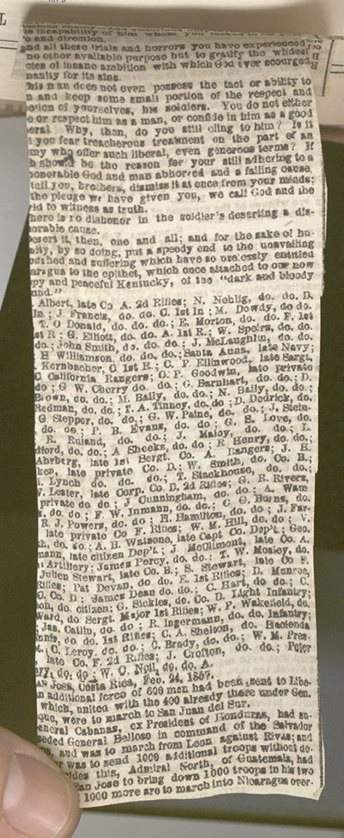 THE WEST INDIES.
157
Columbus discovering Guanahani.
THE WEST INDIES.
157
Columbus discovering Guanahani.
9. Danish Isles.—Santa Cruz, or Sainte Croix, is the principal Danish Island. The small islands of St. Thomas and St. John are its dependencies. Christianstadt, the capital, on the island of Santa Cruz, has an active commerce. St. Thomas, on the island of the same name, is a small town, but its commerce is extensive. Santa Cruz was discovered by Columbus in his second voyage. The Dutch, English, French, Spanish, and Danes alternately possessed it, till 1815, when it was finally ceded to Denmark.
10.Dutch Islands.—Curaçoa, near the coast of Venezuela, produces sugar and tobacco, and has several good harbors. The capital, Wilhelmstadt, a prettily built town, with a commodious harbor and strong military works, contains nearly the whole population of the island. St. Eustatia, near St. Kitt's, is an enormous rock rising out of the sea, and presenting but only one landing place, which is difficult to access, and strongly fortified. Sugar and tobacco are the principal productions. The capital, of the same name, is a small town, with 6000 inhabitants. An active smuggling trade is carried on with neighboring islands, through St. Eustatia. It was taken possession of by the Dutch early in the seventeenth century. It has since then several times changed hands between them, the French, and the English. It was finally given up to Holland in 1814.
11. Swedish Island.—Saint Bartholomew is the only American colony belonging to Sweden. It is small, but highly cultivated, and carries on an extensive commerce. St. Bartholomew was settled by the French in 1648, and ceded by them to the Swedes, in 1784.
Lesson LXXVI... Discoveries of Columbus.
1. Preliminary Remarks.—In the preceding chapters, we have frequently alluded to the discovery of America by Columbus. This great event, as well as the causes which led to it, deserve more particular notice. The fifteenth century is marked as the era in which modern civilization rose from the chaos of the Dark Ages, which had brooded over Europe for a thousand years. Several remarkable circumstances contributed to hasten this development. The art of printing had been recently discovered, and the mariner's compass had only been lately applied to navigation. About this time, a spirit of maritime discovery was engendered and diffused. The ships of Spain and Portugal had visited the Azores and Madeira, and were pushing their investigations along the coast of Africa.
2. Columbus.—At this period, Columbus appeared. He was born at Genoa, in 1447. He was early imbued with the spirit of the times, and made several voyages upon the Mediterranean. He came to Lisbon, and was married there. He became a sea-captain, and frequently visited the north of Europe and the coast of Africa. No one had yet crossed the ocean, and no one had yet dared to penetrate its mysteries. The ignorant believed that it extended its waves without a shore; but Columbus, reasoning from his knowledge of the form of the globe, came to the conclusion that, by proceeding westward, he should meet with land.
3. His Discoveries.—After maturing his views, and having obtained the assistance of Isabella, queen of Spain, he sailed, on the 3d of August, 1492, from Palos, in Spain, with three small vessels. He first made for the south, and touched at the Canaries: thence he steered directly toward the west. After an anxious voyage, on the 12th of October, he had the gratification of discovering an island, called by the natives Guanahani, to which he gave the name of St. Salvador. He took possession of the island in the name of the queen of Spain, and erected a cross upon it, as a symbol that Christianity was to take the place of paganism. After visiting other islands, he returned to Spain. He made two subsequent voyages, and on the third discovered the continent of America. By degrees, discoveries were made along the whole coast of North and South America, and the country was taken possession of by various European powers.
9. Danish islands? 10. Dutch islands? 11. Swedish island?
LESSON LXXVI.1. What was the state of things in Europe in the fifteenth century? 2. What of Columbus? 3. His discoveries? The result of his voyages?
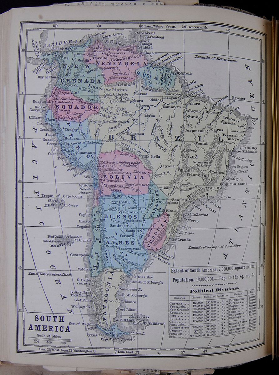 SOUTH AMERICA
Extent of South America, 7,000,000 square miles.
SOUTH AMERICA
Extent of South America, 7,000,000 square miles. Population, 18,000,000.—Pop. to the sq. m., 2.
Political Divisions." This table contains a list of the following countries of South America along with their extent, population, population per square miles, capitals, and populations of capitals: Guayana, Venezuela, New Grenada, Ecuador, Peru, Bolivia, Chili, Patagonia, Buenos Ayres, Uruguay, Paraguay, Brazil, Tierra del Fuego.
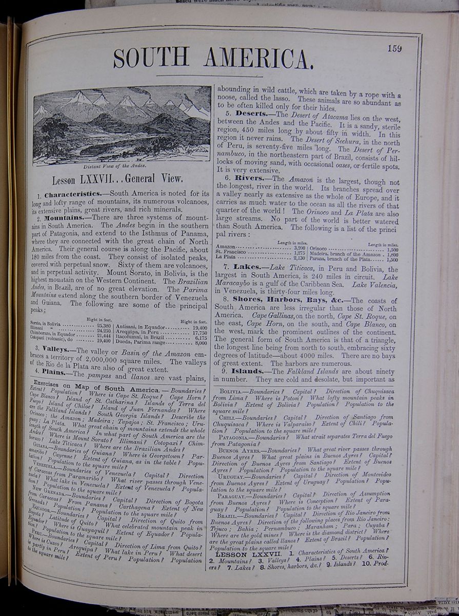
SOUTH AMERICA.
Distant view of the Andes.Lesson LXXVII... General View.
1. Characteristics.—South America is noted for its long and lofty range of mountains, its numerous volcanoes, its extensive plains, great rivers, and rich minerals.
2. Mountains.—There are three systems of mountains in South America. The Andes begin in the southern part of Patagonia, and extend to the Isthmus of Panama, where they are connected with the great chain of North America. Their general course is along the Pacific, about 180 miles from the coast. They consist of isolated peaks, covered with perpetual activity. Mount Sorato, in Bolivia, is the highest mountain on the Western Continent. The Brazilian Andes, in Brazil, are of no great elevation. The Parima Mountains extend along the southern border of Venezuela and Guiana. The following are some of the principal peaks: This table lists the height (in feet) of the following peaks in South America: Sorato (in Bolivia) Illimani (in Bolivia), Chimborazo (in Equador), Cotopaxi (volcano in Ecuador), Antisani (in Equador), Arequipa (in Peru), Itacolumni (in Brazil), and Dueada (Parima range).
3. Plains.—The pampas and llanos are vast plains, abounding in wild cattle, which are taken by a rope with a noose, called the lasso. These animals are abundant as to be often killed only for their hides.
5. Deserts.—The Desert of Atacama lies on the west between the Andes and the Pacific. It is a sandy, sterile region, 450 miles long by about fifty in width. In this region it never rains. The Desert of Sechura, in the north of Peru, is seventy-five miles long. The Desert of Pernambuco, in the northeastern part of Brazil consists of hillocks of moving sand, with occasional oases, or fertile spots. It is very extensive.
6. Rivers.—The Amazon is the largest, though not the longest, river in the world. Its branches spread over a valley nearly as extensive as the whole of Europe, and it carries as much water to the ocean as all the rivers of that quarter of the world! The Orinoco and La Plata are also large streams. No part of the world is better watered than South America. The following is a list of the principal rivers: This table lists the length (in miles) of the following rivers: Amazon, St. Francisco, La Plata, Orinoco, Madeira (branch of the Amazon), Parana (branch of the Plata).
7. Lakes.—Lake Titicaca, in Peru and Bolivia, the largest in South America, is 240 miles in circuit. Lake Maracaybo is a gulf of the Caribbean Sea. Lake Valencia, in Venezuela, is thirty-four miles long.
8. Shores, Harbors, Bays, &c.—The coasts of South America are less irregular than those of North America. Cape Gallinas, on the north, Cape St. Roque, on the east, Cape Horn, on the south, and Cape Blanco, on the west, mark the prominent outlines of the continent. The general form of South America is that of a triangle, the longest line being from north to south, embracing sixty degrees of latitude—about 4000 miles. There are no bays of great extent. The harbors are numerous.
9. Islands.—The Falkland Islands are about ninety in number. They are cold and desolate, but important as
Exercises on Map of South America.—Boundaries? Extent? Population? Where is Cape St. Roque? Cape Horn? Cape Blanco? Island of St. Catharina? Islands of Terra del Fuego? Island of Chiloe? Island of Juan Fernandez? Where are the Falkland Islands? South Georgia Islands? Describe the Orinoco; the Amazon; Madeira; Tapajos; St. Francisco; Uruguay; La Plata. What great chain of mountains extend the whole length of South America? In what part of South America are the Andes? Where is Mount Sorato? Illumani? Cotopaxi? Chimborazo? Lake Titicaca? Where are the Brazilian Andes?
GUIANA.—Boundaries of the Guiana? Where is Georgetown? Paramaribo? Cayenne? Extent of Guiana, as in the table? Population? Population to the square mile?
VENEZUELA.—Boundaries of Venezuela? Capital? Direction of Caraccas from Paramaribo? What river passes through Venezuela? What lake in Venezuela? Extent of Venezuela? Population? Population to the square mile?
NEW GRENADA.—Boundaries? Capital? Direction of Bogota from Caraccas? From Panama? Carthagena? Extent of New Grenada? Population? Population to the square mile?
EQUADOR.—Boundaries? Capital? Direction of Quito from Bogota? Latitude of Quito? What celebrated mountain peak in Equador? Population? Population to the square mile?
PERU.—Boundaries? Capital? Direction of Lima from Quito? Where is Cuzco? Arequipa? What lake in Peru? What desert is partly in Peru? Extent of Peru? Population? Population to the square mile?
BOLIVIA.—Boundaries? Capital? Direction of Chuquisaca from Lima? Where is Potosi? What lofty mountain peaks in Bolivia? Extent of Bolivia? Population? Population to the square mile?
CHILI.—Boundaries? Capital? Direction of Santiago from Chuquisaca? Where is Valparaiso? Extent of Chili? Population? Population to the square mile?
PATAGONIA.—Boundaries? What strait separates Terra del Fuego from Patagonia?
BUENOS AYRES.—Boundaries? What great river passes through Buenos Ayres? What great plains in Buenos Ayres? Capital? Direction of Buenos Ayres from Santiago? Extent of Buenos Ayres? Population? Population to the square mile?
URUGUAY.—Boundaries? Capital? Direction of Montevideo from Buenos Ayres? Extent of Uruguay? Population? Population to the square mile?
PARAGUAY.—Boundaries? Capital? Direction of Assumption from Buenos Ayres? Where is Conception? Extent of Paraguay? Population? Population to the square mile?
BRAZIL.—Boundaries? Capital? Direction of Rio Janeiro from Buenos Ayres? Direction of the following places from Rio Janeiro: Tejuco; Bahia; Pernambuco; Maranham; Para; Cuyaba? Where are the gold mines? Where is the diamond district? Where are the great plains called llanos? Extent of Brazil? Population? Population to the square mile?
LESSON LXXVII. 1. Characteristics of South America? 2. Mountains? 3. Valleys? 4. Plains? 5. Deserts? 6. Rivers? 7. Lakes? 8. Shores, harbors, &c.? 9. Islands? 10. Products?
[begin surface 572]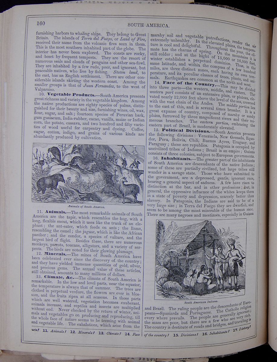 160
SOUTH AMERICA.
160
SOUTH AMERICA.
furnishing harbors to whaling ships. They belong to Great Britain. The islands of Terra del Fuego, or Land of Fire, received their name from the volcanic fires seen in them. This is the most southern inhabited part of the globe. The interior has never been explored. The coasts are rocky, and beset by frequent tempests. They are the resort of numerous seals and clouds of penguins and other sea-fowl. They are inhabited by a few rude, poor, and ignorant, but peaceable natives, who live by fishing. Staten land, to the east, has an English settlement. There are other considerable islands skirting the western coast. Among the smaller groups is that of Juan Fernandez, to the west of Valparaiso.
10. Vegetable Products.—South America presents great richness and variety in the vegetable kingdom. Among the native productions are eighty species of palms, distinguished for their beauty and size, furnishing wines, oil, wax, flour, sugar, and salt; fourteen species of Peruvian bark, gum guaiacum, India-rubber, cacao, vanilla, maize or Indian corn, the potato, cassava, and two hundred and fifty varieties of wood useful for carpentry and dyeing. Coffee, sugar, cotton, indigo, and grains of various kinds are abundantly produced by cultivation.
Animals of South America.11. Animals.—The most remarkable animals of South America are the tapir, which resembles the hog, with a long, flexible snout, which it uses like the trunk of an elephant; the ant-eater, which feeds on ants; the llama, resembling the camel; the jaguar, which is like the African panther; and the condor, a species of vulture, and the largest bird of flight. Besides these, there are numerous monkeys, parrots, toucans, alligators, and a variety of serpents. The birds are noted for their glowing plumage.
12. Minerals.—The mines of South America have been celebrated ever since the discovery of the country; and they have yielded immense quantities of gold, silver, and precious gems. The annual value of these articles, still obtained, amounts to many millions of dollars.
13. Climate, &c.—The climate of South America is remarkable. In the low and level parts, near the equator, the temperature is always that of summer. The trees are clothed in perpetual verdure, the flowers are ever in blossom, and the fruits ripen at all seasons. In those parts which are well watered, vegetation becomes exuberant, animals increase, and reptiles and insects are multiplied without end. Never checked by the return of winter, animals and vegetables go on producing and reproducing, till the whole face of nature seems to be teeming with animal and vegetable life. The exhalations, which arise from the marshy soil and vegetable putrefactions, render the air extremely unhealthy. In the elevated plains, the temperature is cool and delightful. Throughout the year, the climate has the charms of spring. On the mountains it is still colder; and at the hight of 15,000 or 16,000 feet, winter establishes a perpetual dominion. Thus, in the same latitude, and within the compass of a few hundred miles, are three distinct zones, each having its own temperature, and its peculiar classes of trees, plants, and animals. Earthquakes are common at the north and west.
14. Face of the Country.—This may be divided into three parts—the western, middle, and eastern. The western part consists of an extensive plain, or plateau, elevated nearly 12,000 feet above the level of the sea, crowned with the vast chain of the Andes. The middle portion lies to the east of this, and is several times broader. It is a great expanse of country, composed of marshy or sandy plains, furrowed by three magnificent rivers and their numerous branches. The eastern portion, embracing the eastern part of Brazil, is moderately elevated.
15. Political Divisions.—South America presents the following divisions: Venezuela, New Grenada, Equador, Peru, Bolivia, Chili, Buenos Ayres, Uruguay, and Paraguay; these are republics. Patagonia is occupied by uncivilized tribes of Indians; Brazil is an empire; Guiana consists of three colonies, subject to European governments.
16. Inhabitants.—The greater part of the inhabitants of South America are descendants of the native Indians; some of these are partially civilized, but large tribes still wander in a savage state. Those who have submitted to the government, are a depressed, gentle, ignorant race, bearing a general aspect of sadness. A few have risen to distinction at the bar, and in other professions; but, in general, the oppressive influence of the whites keeps them in a state of poverty and depression, scarcely better than slavery. In Patagonia, the Indians are said to be of a very large size; in Terra del Fuego they are dwarfish, and seem to be among the most miserable of the human race. There are many negroes and mestizoes, especially in Guiana South American Indians. and Brazil. The ruling people are the descendants of Europeans—Spaniards and Portuguese. The Catholic religion everywhere prevails. The people are generally ignorant; the mass are poor, but there are a few who are very rich. The country is destitute of roads and bridges, and traveling
11. Animals? 12. Minerals? 13. Climate? 14. Face of the country? 15. Divisions? 16. Inhabitants? 17. History?
 [begin surface 574]
 [begin surface 575]
 [begin surface 576]
 [begin surface 577]
 [begin surface 578]
 [begin surface 579]
 [begin surface 580]
 [begin surface 581]
 [begin surface 582]
 [begin surface 583]
 [begin surface 584]
 [begin surface 585]
 [begin surface 586]
 [begin surface 587]
 [begin surface 588]
 [begin surface 589]
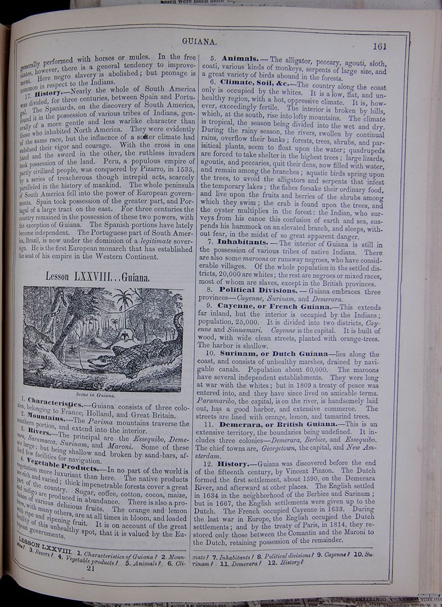
generally performed with horses or mules. In the free states, however, there is a general tendency to improvement. Here negro slavery is abolished; but peonage is common in respect to the Indians.
17. History.—Nearly the whole of South America was divided, for three centuries, between Spain and Portugal. The Spaniards, on the discovery of South America, found it in the possession of various tribes of Indians, generally of a more gentle and less warlike character than those who inhabited North America. They were evidently of the same race, but the influence of a softer climate had subdued their vigor and courage. With the cross in one hand and the sword in the other, the ruthless invaders took possession of the land. Peru, a populous empire of partly civilized people, was conquered by Pizarro, in 1535, by a series of treacherous though intrepid acts, scarcely paralleled in the history of mankind. The whole peninsula of South America fell into the power of European governments. Spain took possession of the greater part, and Portugal of a large tract on the east. For three centuries the country remained in the possession of these two powers, with the exception of Guiana. The Spanish portions have lately become independent. The Portuguese part of South America, Brazil, is now under the dominion of a legitimate sovereign. He is the first European monarch that has established the seat of his empire in the Western Continent.
Lesson LXXVIII... Guiana.
Scene in Guiana.1. Characteristics.—Guiana consists of three colonies, belonging to France, Holland, and Great Britain.
2. Mountains.—The Parima mountains traverse the southern portion, and extend into the interior.
3. Rivers.—The principal are the Essequibo, Demerara, Saramacca, Surinam, and Maroni. Some of these are large; but being shallow and broken by sand-bars, afford few facilities for navigation.
4. Vegetable Products.—In no part of the world is vegetation more luxuriant than here. The native products are rich and varied; thick impenetrable forests cover a great part of the country. Sugar, coffee, cotton, cocoa, maize, and indigo are produced in abundance. There is also a profusion of various delicious fruits. The orange and lemon trees, with many others, are at all times in bloom, and loaded with ripe and ripening fruit. It is on account of the great fertility of this unhealthy spot, that it is valued by the European governments.
5. Animals.—The alligator, peccary, agouti, sloth, coati, various kinds of monkeys, serpents of large size, and a great variety of birds abound in the forests.
6. Climate, Soil, &c.—The country along the coast only is occupied by the whites. It is a low, flat, and unhealthy region, with a hot, oppressive climate. It is, however, exceedingly fertile. The interior is broken by hills, which, at the south, rise into lofty mountains. The climate is tropical, the season being divided into the wet and dry. During the rainy season, the rivers, swollen by continual rains, overflow their banks; forests, trees, shrubs, and parasitical plants, seem to float upon the water; quadrupeds are forced to take shelter in the highest trees; large lizards, agoutis, and peccaries, quit their dens, now filled with water, and remain among the branches; aquatic birds spring upon the trees, to avoid the alligators and serpents that infest the temporary lakes; the fishes forsake their ordinary food, and live upon the fruits and berries of the shrubs among which they swim; the crab is found upon the trees, and the oyster multiplies in the forest : the Indian, who surveys from his canoe this confusion of earth and sea, suspends his hammock on an elevated branch, and sleeps, without fear, in the midst of so great apparent danger.
7. Inhabitants.—The interior of Guiana is still in the possession of various tribes of native Indians. There are also some maroons or runaway negroes, who have considerable villages. Of the whole population in the settled districts, 20,000 are whites; the rest are negroes or mixed races, most of whom are slaves, except in the British provinces.
8. Political Divisions.—Guiana embraces three provinces—Cayenne, Surinam, and Demerara.
9. Cayenne, or French Guiana.—This extends far inland, but the interior is occupied by the Indians; population, 25,000. It is divided into two districts, Cayenne and Sinnamari. Cayenne is the capital. It is built of wood, with wide clean streets, planted with orange-trees. The harbor is shallow.
10. Surinam, or Dutch Guiana—lies along the coast, and consists of unhealthy marshes, drained by navigable canals. Population about 60,000. The maroons have several independent establishments. They were long at war with the whites; but in 1809 a treaty of peace was entered into, and they have since lived on amicable terms. Paramaribo, the capital, is on the river, is handsomely laid out, has a good harbor, and extensive commerce. The streets are lined with orange, lemon, and tamarind trees.
11. Demerara, or British Guiana.—This is an extensive territory, the boundaries being undefined. It includes three colonies—Demerara, Berbice, and Essequibo. The chief towns are, Georgetown, the capital, and New Amsterdam.
12. History.—Guiana was discovered before the end of the fifteenth century, by Vincent Pinzon. The Dutch formed the first settlement, about 1590, on the Demerara River, and afterward at other places. The English settled in 1634 in the neighborhood of the Berbice and Surinam; but in 1667, the English settlements were given up to the Dutch. The French occupied Cayenne in 1633. During the last war in Europe, the English occupied the Dutch settlements; and by the treaty of Paris, in 1814, they restored only those between the Comantin and the Maroni to the Dutch, retaining possession of the remainder.
LESSON LXXVIII. 1. Characteristics of Guiana? 2. Mountains? 3. Rivers? 4. Vegetable products? 5. Animals? 6. Climate? 7. Inhabitants? 8. Political divisions? 9. Cayenne? 10. Surinam? 11. Demerara? 12. History?
21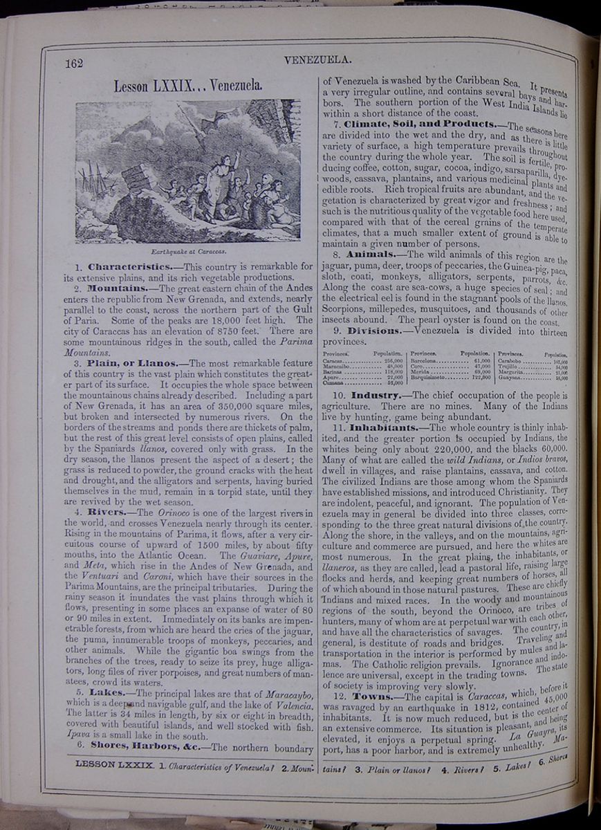 162
VENEZUELA.
162
VENEZUELA.
Lesson LXXIX... Venezuela.
Earthquake at Caraccas.1. Characteristics.—This country is remarkable for its extensive plains, and its rich vegetable productions.
2. Mountains.—The great eastern chain of the Andes enters the republic from New Grenada, and extends, nearly parallel to the coast, across the northern part of the Gulf of Paria. Some of the peaks are 18,000 feet high. The city of Caraccas has an elevation of 8750 feet. There are some mountainous ridges in the south, called the Parima Mountains.
3. Plain, or Llanos.—The most remarkable feature of this country is the vast plain which constitutes the greater part of its surface. It occupies the whole space between the mountainous chains already described. Including a part of New Grenada, it has an area of 350,000 square miles, but broken and intersected by numerous rivers. On the borders of the streams and ponds there are thickets of palm, but the rest of this great level consists of open plains, called by the Spaniards llanos, covered only with grass. In the dry season, the llanos present the aspect of a desert; the grass is reduced to powder, the ground cracks with the heat and drought, and the alligators and serpents, having buried themselves in the mud, remain in a torpid state, until they are revived by the wet season.
4. Rivers.—The Orinoco is one of the largest rivers in the world, and crosses Venezuela nearly through its center. Rising in the mountains of Parima, it flows, after a very circuitous course of upward of 1500 miles, by about fifty mouths, into the Atlantic Ocean. The Guaviare, Apure, and Meta, which rise in the Andes of New Grenada, and the Ventuari and Caroni, which have their sources in the Parima Mountains, are the principal tributaries. During the rainy season it inundates the vast plains through which it flows, presenting in some places an expanse of water of 80 or 90 miles in extent. Immediately on its banks are impenetrable forests, from which are heard the cries of the jaguar, the puma, innumerable troops of monkeys, peccaries, and other animals. While the gigantic boa swings from the branches of the trees, ready to seize its prey, huge alligators, long files of river porpoises, and great numbers of manatees, crowd its waters.
5. Lakes.—The principal lakes are that of Maracaybo, which is a deep and navigable gulf, and the lake of Valencia. The latter is 34 miles in length, by six or eight in breadth, covered with beautiful islands, and well stocked with fish. Ipava is a small lake in the south.
6. Shores, Harbors, &c.—The northern boundary of Venezuela is washed by the Caribbean Sea. It presents a very irregular outline, and contains several bays and harbors. The southern portion of the West India Islands lie within a short distance of the coast.
7. Climate, Soil, and Products.—The seasons here are divided into the wet and the dry, and as there is little variety of surface, a high temperature prevails throughout the country during the whole year. The soil is fertile, producing coffee, cotton, sugar, cocoa, indigo, sarsaparilla, dye-woods, cassava, plantains, and various medicinal plants and edible roots. Rich tropical fruits are abundant, and the vegetation is characterized by great vigor and freshness; and such is the nutritious quality of the vegetable food here used, compared with that of the cereal grains of the temperate climates, that a much smaller extent of ground is able to maintain a given number of persons.
8. Animals.—The wild animals of this region are the jaguar, puma, deer, troops of peccaries, the Guinea-pig, paca, sloth, coati, monkeys, alligators, serpents, parrots, &c. Along the coast are sea-cows, a huge species of seal; and the electrical eel is found in the stagnant pools of the llanos. Scorpions, millepedes, musquitoes, and thousands of other insects abound. The pearl oyster is found on the coast.
9. Divisions.—Venezuela is divided into thirteen provinces.
Table of the populations of Venezuelan provinces: Caracas, Maracaibo, Barinas, Apure, Cumana, Barcelona, Coro, Merida, Barquisimeto, Carabobo, Trujillo, Margarita, and Guayana.10. Industry.—The chief occupation of the people is agriculture. There are no mines. Many of the Indians live by hunting, game being abundant.
11. Inhabitants.—The whole country is thinly inhabited, and the greater portion is occupied by Indians, the whites being only about 220,000, and the blacks 60,000. Many of what are called the wild Indians, or Indios bravos, dwell in villages, and raise plantains, cassava, and cotton. The civilized Indians are those among whom the Spaniards have established missions, and introduced Christianity. They are indolent, peaceful, and ignorant. The population of Venezuela may in general be divided into three classes, corresponding to the three great natural divisions of the country. Along the shore, in the valleys, and on the mountains, agriculture and commerce are pursued, and here the whites are most numerous. In the great plains, the inhabitants, or llaneros, as they are called, lead a pastoral life, raising large flocks and herds, and keeping great numbers of horses, all of which abound in those natural pastures. These are chiefly Indians and mixed races. In the woody and mountainous regions of the south, beyond the Orinoco, are tribes of hunters, many of whom are at perpetual war with each other, and have all the characteristics of savages. The country, in general, is destitute of roads and bridges. Traveling and transportation in the interior is performed by mules and lamas. The Catholic religion prevails. Ignorance and indolence are universal, except in the trading towns. The state of society is improving very slowly.
12. Towns.—The capital is Caraccas, which, before it was ravaged by an earthquake in 1812, contained 45,000 inhabitants. It is now much reduced, but is the center of an extensive commerce. Its situation is pleasant, and being elevated, it enjoys a perpetual spring. La Guayra, its port, has a poor harbor, and is extremely unhealthy. Maracaybo,
LESSON LXXIX. 1. Characteristics of Venezuela? 2. Mountains? 3. Plain or llanos? 4. Rivers? 5. Lakes? 6. Shores
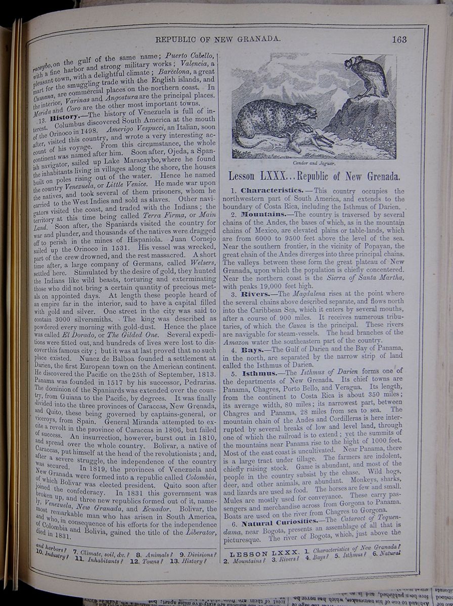
on the gulf of the same name; Puerto Cabello, with a fine harbor and strong military works; Valencia, a pleasant town, with a delightful climate; Barcelona, a great mart for the smuggling trade with the English islands, and Cumana, are commercial places on the northern coast. In the interior, Varinas and Angostura are the principal places. Merida and Coro are the other most important towns.
13. History.—The history of Venezuela is full of interest. Columbus discovered South America at the mouth of the Orinoco in 1498. Amerigo Vespucci, an Italian, soon after, visited this country, and wrote a very interesting account of his voyage. From this circumstance, the whole continent was named after him. Soon after, Ojeda, a Spanish navigator, sailed up Lake Maracaybo, where he found the inhabitants living in villages along the shore, the houses built on poles rising out of the water. Hence he named the country Venezuela, or Little Venice. He made war upon the natives, and took several of them prisoners, whom he carried to the West Indies and sold as slaves. Other navigators visited the coast, and traded with the Indians; the territory at this time being called Terra Firma, or Main Land. Soon after, the Spaniards visited the country for war and plunder, and thousands of the natives were dragged off to perish in the mines of Hispaniola. Juan Cornejo sailed up the Orinoco in 1531. His vessel was wrecked, part of the crew drowned, and the rest massacred. A short time after, a large company of Germans, called Welsers, settled here. Stimulated by the desire of gold, they hunted the Indians like wild beasts, torturing and exterminating those who did not bring a certain quantity of precious metals on appointed days. At length these people heard of an empire far in the interior, said to have a capital filled with gold and silver. One street in the city was said to contain 3000 silversmiths. The king was described as powdered every morning with gold-dust. Hence the place was called El Dorado, or The Gilded One. Several expeditions were fitted out, and hundreds of lives were lost to discover this famous city; but it was at last proved that no such place existed. Nunez de Balboa founded a settlement at Darien, the first European town on the American continent. He discovered the Pacific on the 25th of September, 1813. Panama was founded in 1517 by his successor, Pedrarias. The dominion of the Spaniards was extended over the country, from Guiana to the Pacific, by degrees. It was finally divided into the three provinces of Caraccas, New Grenada, and Quito, these being governed by captains-general, or viceroys, from Spain. General Miranda attempted to ex- cite a revolt in the province of Caraccas in 1806, but failed of success. An insurrection, however, burst out in 1810, and spread over the whole country. Bolivar, a native of Caraccas, put himself at the head of the revolutionists; and, after a severe struggle, the independence of the country was secured. In 1819, the provinces of Venezuela and New Granada were formed into a republic called Colombia, of which Bolivar was elected president. Quito soon after joined the confederacy. In 1831 this government was broken up, and three new republics formed out of it, namely, Venezuela, New Granada, and Ecuador. Bolivar, the most remarkable man who has arisen in South America, and who, in consequence of his efforts for the independence of Colombia and Bolivia, gained the title of the Liberator, died in 1831.
Lesson LXXX... Republic of New Grenada.
1. Characteristics.—This country occupies the northwestern part of South America, and extends to the boundary of Costa Rica, including the Isthmus of Darien.
2. Mountains.—The country is traversed by several chains of the Andes, the bases of which, as in the mountain chains of Mexico, are elevated plains or table-lands, which are from 6000 to 9500 feet above the level of the sea. Near the southern frontier, in the vicinity of Popayan, the great chain of the Andes diverges into three principal chains. The valleys between these form the great plateau of New Granada, upon which the population is chiefly concentered. Near the northern coast is the Sierra of Santa Martha, with peaks 19,000 feet high.
3. Rivers.—The Magdalena rises at the point where the several chains above described separate, and flows north into the Caribbean Sea, which it enters by several mouths, after a course of 900 miles. It receives numerous tributaries, of which the Cauca is the principal. These rivers are navigable for steam-vessels. The head branches of the Amazon water the southeastern part of the country.
4. Bays.—The Gulf of Darien and the Bay of Panama, in the north, are separated by the narrow strip of land called the Isthmus of Darien.
5. Isthmus.—The Isthmus of Darien forms one of the departments of New Grenada. Its chief towns are Panama, Chagres, Porto Bello, and Veragua. Its length, from the continent to Costa Rica is about 350 miles; its average width, 80 miles; its narrowest part, between Chagres and Panama, 28 miles from sea to sea. The mountain chain of the Andes and Cordilleras is here interrupted by several breaks of low and level land, through one of which the railroad is to extend; yet the summits of the mountains near Panama rise to the hight of 1000 feet. Most of the east coast is uncultivated. Near Panama, there is a large tract under tillage. The farmers are indolent, chiefly raising stock. Game is abundant, and most of the people in the country subsist by the chase. Wild hogs, deer, and other animals, are abundant. Monkeys, sharks, and lizards are used as food. The horses are few and small. Mules are mostly used for conveyance. These carry passengers and merchandise across from Gorgona to Panama. Boats are used on the river from Chagres to Gorgona.
6. Natural Curiosities.—The Cataract of Tequendama, near Bogota, presents an assemblage of all that is picturesque. The river of Bogota, which, just above the
and harbors? 7. Climate, soil, &c.? 8. Animals? 9. Divisions? 10. Industry? 11. Inhabitants? 12. Towns? 13. History?
LESSON LXXX. 1. Characteristics of New Granada? 2. Mountains? 3. Rivers? 4. Bays? 5. Isthmus? 6. Natural
[begin surface 592] 164
REPUBLIC OF NEW GRANADA.
164
REPUBLIC OF NEW GRANADA.
fall, is 144 yards in breadth, is contracted, at a crevice in the rock, to a width of twelve yards, and is poured, by two descents, down a depth of 574 feet. The Natural Bridge of Icononzo is a natural arch of stone, fifty feet long and forty wide, stretching over a deep chasm, through which rolls a torrent forming two beautiful cascades. The hight of the bridge above the stream is 318 feet. Sixty-four feet below this bridge is a second, composed of three enormous masses of rock, which have fallen so as to support each other. The cavern below is haunted by thousands of nocturnal birds. At the village of Turbaco, near Carthagena, there is a singular group of air volcanoes, consisting of conical hillocks from twenty to twenty-five feet high, on the summit of which are cavities filled with water. From these issue bubbles of gas, which often project the water to a considerable hight, while a succession of explosions is heard under ground.
7. Climate, Soil, &c.—The low country on the coast is hot and unhealthy, but the table-lands are salubrious. So rapid is the transition, that the eye can see regions of perpetual summer, spring, and winter. The soil is extremely fertile, and produces in great richness and abundance the varied vegetation of its different climates. Among these are braziletto, cedar, mahogany, ipecac, balsam of Tolu, &c.
8. Animals.—Deer of various kinds, wild hogs, jaguars, tapirs, monkeys, parrots, flamingoes, pelicans, and waterfowl are abundant. Immense alligators abound in the rivers. Fish are abundant, and the electrical eel is found in the stagnant pools. Myriads of insects fill the air, and the pearl-oyster is found on some parts of the coast.
9. Minerals.—Rich mines of silver are found in the mountains, but have been little worked. The gold washings, in which platina also occurs, furnish gold of the value of nearly $3,000,000 a year. Copper, iron, tin, lead, and coal are also found. Precious stones of different kinds abound. The emerald mines of Muzo, near Bogota, and those of Somondoco, in the department of Boyaca, have furnished great quantities of emeralds.
10. Face of the Country.—The surface of New Grenada presents a broken and varied aspect. The mountain ranges, resting upon elevated table-lands, overspread the greater part of the country. On the summits of the central mountain ranges are lofty paramos, or table-lands, nearly without vegetation. The other table-lands, generally, are unproductive. The northern and western slopes are fertile, but the lower parts are unhealthy. In the southeast are wide llanos, pasturing vast herds of cattle.
11. Divisions.—New Grenada comprises the territories of the former Spanish province, styled the Viceroyalty of New Grenada, and is divided into 29 provinces, which take their names from the capital cities thereof, viz.:
Table listing the provinces of New Grenada: Antioquia, Azuero, Barbacoas, Bogota, Buenaventura, Cartagena, Cazanare, Cuaca, Choco, Fabreya, Mariquita, Mompox, Neiva, Ocana, Panama, Pamplona, Pasto, Popayan, Rio Hacha, Santa Marta, Santander, Socorro, Soto, Tundama, Tunja, Tuquerres, Upar, Velez, and Veragua.12. Industry.—The farmers are chiefly devoted to the raising of stock. Wheat, maize, tobacco, plantains, cotton, cocoa, and sugar are produced. In general, agriculture is pursued in a rude and languid manner. Coarse woolen and cotton stuffs, for home consumption, are the chief manufactures. The commerce is considerable.
13. Railroad.—A railroad is now in course of construction from Chagres to Panama, a distance of forty-six miles. A grant for this purpose has been secured from the government of New Grenada.
14. Inhabitants.—The population, like that of Mexico, is composed of Creoles, Indians, negroes, and the different mixed races, and bears a general resemblance to that of the Mexican States. The whites are, however, less numerous, and there is a greater proportion of negroes. The great mass are buried in ignorance, indolence, and superstition. Many Indians are subject to peonage. The Roman Catholic religion is established by law. In the cities, the people have a tinge of the old Spanish manners.
15. Chief Towns.—Bogota, the capital of the republic, is situated on the table-land of New Grenada, and is in general well built. The houses are low, consisting of only one or two stories, on account of the frequency of earthquakes. The beautiful plain in which the city stands having an elevation of 8700 feet, it enjoys a mild and healthful climate. Carthagena possesses the finest harbor in the country, and has a thriving commerce. Santa Martha, on the coast to the northeast of Carthagena, has a good harbor, strongly defended, and an active commerce. Porto Bello, on the Isthmus of Panama, celebrated for the great fair formerly held in it, is now much declined, on account of the insalubrity of its climate. Rio Hacha is a small town, but important for its pearl fishery and trade. Popayan, situated at the foot of the great volcanoes of Purace and Sotara, is a handsome and well-built town. Panama, on the south side of the isthmus, and at the head of the bay of the same name, has a thriving and extensive commerce, it having recently acquired importance, being the point at which the travel across the isthmus concentrates. Here will be the terminus of the railroad now building from Chagres. Here also is the stopping-place of the steamers in connection with San Francisco. Chagres is a small, ill-built village, at the mouth of the Chagres River. It is noted as the stopping-place of the vessels which take freight and passengers for Panama, going across the isthmus. East of this is the beginning of the railroad to Panama. Gorgona is a village on the Chagres River, twenty miles northwest of Panama. Cruces, also on the Chagres, is a small village on the isthmus route, about five miles north of Gorgona. (See Map, page 150.)
16. Traveling.—In the interior, there are no roads. In the mountainous parts, travelers are carried in baskets, on the backs of cargueros, or porters. In traversing the Quindiu Mountains, a month's provisions are necessary, as the melting of snow causes frequent interruptions. At night, the porters erect shelters of sticks, covered with broad banana leaves.
17. History.—We have already mentioned the discovery and occupation of this country by Balboa, and have noted its subsequent history in connection with Venezuela. The province of New Grenada declared itself independent of Spain in 1811; and by the memorable victory of Carabobo, in 1821, completed the downfall of the Spanish authority. In 1819, it formed a union with Venezuela, under the title of the Republic of Colombia, and Quito subsequently acceded to the confederacy, as before stated. In 1831, Colombia was divided into the three republics of New Granada, Venezuela, and Ecuador.
curiosities? 7. Climate, soil, &c.? 8. Animals? 9. Minerals? 10. Face of the country? 11. Divisions? 12. Industry? 13. Railroad?
14. Inhabitants? 15. Chief towns? Describe Panama, Chagres, Gorgona, and Cruces. 16. Traveling? 17 History?
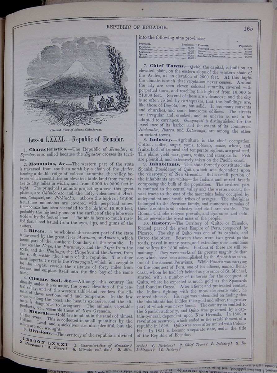 REPUBLIC OF ECUADOR.
165
Distant View of Mount Chimborazo.
REPUBLIC OF ECUADOR.
165
Distant View of Mount Chimborazo.
Lesson LXXXI... Republic of Ecuador.
1. Characteristics.—The Republic of Ecuador, or Equador, is so called because the Equator crosses its territory.
2. Mountains, &c.—The western part of the state is traversed from south to north by a chain of the Andes, forming a double ridge of colossal summits, the valley between which constitutes an elevated table-land from twenty-five to fifty miles in width, and from 9000 to 9500 feet in hight. The principal summits projecting above this great plateau, are Chimborazo and the lofty volcanoes of Antisani, Cotopaxi, and Pichincha. Above the hight of 16,000 feet, these mountains are covered with perpetual snow. Chimborazo has been ascended to the hight of 19,800 feet, probably the highest point on the surface of the globe ever trodden by the foot of man. The air is here so much rarefied that blood issued from the eyes, lips, and gums of the visitors.
3. Rivers.—The whole of the eastern part of the state is traversed by the great river Maranon, or Amazon, which forms part of the southern boundary of the republic. It receives the Napo, the Putumayo, and the Tigre from the north, and the Huallaga, the Ucayale, and the Javari, from the south, within the limits of the republic. The other most important river is the Guayaquil, which is navigable for the largest vessels the distance of forty miles from the sea, and empties itself into the fine bay of the same name.
4. Climate, Soil, &c.—Although this country lies directly under the equator, the great elevation of the central valley, and of the western table-land, renders the climate of these sections mild and temperate. In the low country along the coast, the heat is excessive, and the climate is dangerous to foreigners. The animals, vegetable products, &c, resemble those of New Grenada.
5. Minerals.—Gold is abundant in the sands of almost all the rivers. This is collected in small quantities by the Indians. Lead and quicksilver are also plentiful, but the mines are not wrought.
6. Divisions.—The territory of the republic is divided into the following nine provinces:
Table of the populations of Ecuadorian provinces: Pichincha, Chimborazo, Atacames, Quixos, Manabi, Guayaquil, Cuenca, Loxa, San Jaen de Bracamoros.7. Chief Towns.—Quito, the capital, is built on an elevated plain, on the eastern slope of the western chain of the Andes, at an elevation of 9600 feet. At this hight the climate is such that vegetation never ceases. Around the city are seen eleven colossal summits, covered with perpetual snow, and reaching the hight of from 16,000 to 21,000 feet. Several of these are volcanoes; and the city is so often visited by earthquakes, that the buildings are, like those of Bogota, low, but solid. It has many convents and churches, and some handsome edifices. The streets are irregular and crooked, and so uneven as not to be adapted to carriages. Guayaquil is distinguished for the excellence of its harbor and the extent of its commerce. Riobamba, Ibarra, and Latacunga, are among the other important towns.
8. Industry.—Agriculture is the chief occupation. Cotton, coffee, sugar, yams, tobacco, maize, wheat, and fruits, both of tropical and temperate regions, are produced. The plains yield wax, gums, resins, and sarsaparilla. Fish are plentiful, and extensively taken on the Pacific coast.
9. Inhabitants.—This state formerly constituted the Spanish Presidency of Quito, which was dependent upon the viceroyalty of New Grenada. But a small portion of the inhabitants are whites—the Indians and mixed breeds composing the bulk of the population. The civilized part is confined to the central valley and the western coast, the vast tracts to the east of the mountains being occupied by independent and hostile tribes of savages. The aborigines belonged to the Peruvian family, and numerous remains of their architectural industry and skill are visible. The Roman Catholic religion prevails, and ignorance and indolence pervade the great mass of the people.
10. History.—The Territory of Quito, or Ecuador, formed part of the great Empire of Peru, conquered by Pizarro. The city of Quito was one of its capitals, and Cuzco the other. Between these were two great public roads, paved in many parts, and extending over mountains and valleys for 1500 miles. Portions of these are still remaining. They were works of far greater magnitude than any which have been accomplished by the Spanish successors of the ancient Peruvians. While Pizarro was carrying on the conquest of Peru, one of his officers, named Benalcazar, whom he had left behind as governor of St. Michael, started with a number of followers for the conquest of Quito, where he expected as much gold as the Spaniards had found at Cuzco. After a fierce and protracted contest, the Indians fighting with the most desperate valor, he entered the city. His rage was unbounded on finding that the inhabitants had hidden their gold and silver, the greater part of which was never found. The country submitted to the Spanish authority, and Quito was governed by a captain-general, dependent upon New Grenada. In 1809, a revolution occurred, which ended in the establishment of a republic in 1822. Quito was soon after united with Colombia. In 1831 it became a separate state, under the title of the Republic of Ecuador.
LESSON LXXXI. 1.Characteristics of Ecuador? 2 Mountains? 3. Rivers? 4. Climate, soil, &c.? 5. Minerals?
6. Divisions? 7. Chief Towns? 8. Industry? 9. Inhabitants? 10. History?
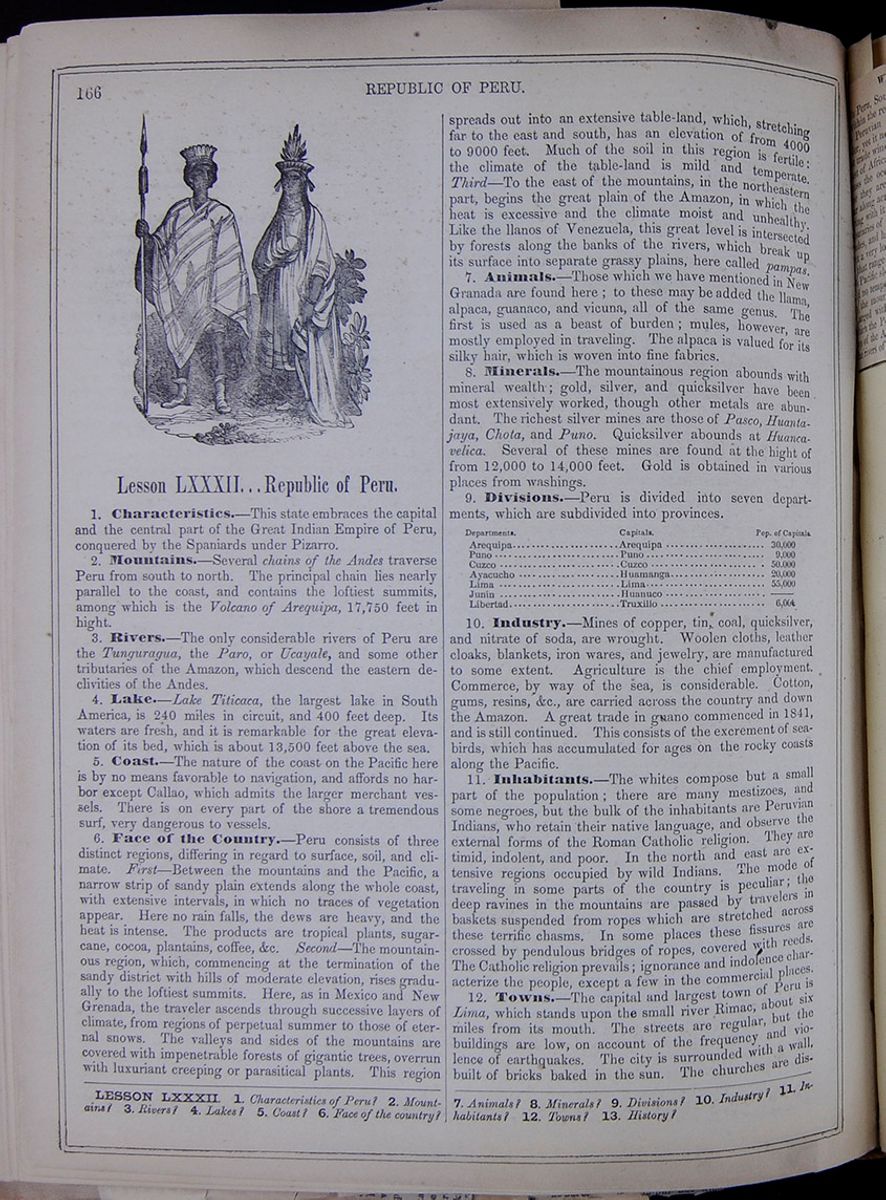 166
REPUBLIC OF PERU.
An illustration depicting two native Peruvian men.
One holds a spear and pears a poncho, while the other
wears robes. Both wear feather headdresses.
166
REPUBLIC OF PERU.
An illustration depicting two native Peruvian men.
One holds a spear and pears a poncho, while the other
wears robes. Both wear feather headdresses.
Lesson LXXXII... Republic of Peru.
1. Characteristics.—This state embraces the capital and the central part of the Great Indian Empire of Peru, conquered by the Spaniards under Pizarro.
2. Mountains.—Several chains of the Andes traverse Peru from south to north. The principal chain lies nearly parallel to the coast, and contains the loftiest summits, among which is the Volcano of Arequipa, 17,750 feet in hight.
3. Rivers.—The only considerable rivers of Peru are the Tunguragua, the Paro, or Ucayale, and some other tributaries of the Amazon, which descend the eastern declivities of the Andes.
4. Lake.—Lake Titicaca, the largest lake in South America, is 240 miles in circuit, and 400 feet deep. Its waters are fresh, and it is remarkable for the great elevation of its bed, which is about 13,500 feet above the sea.
5. Coast.—The nature of the coast on the Pacific here is by no means favorable to navigation, and affords no harbor except Callao, which admits the larger merchant vessels. There is on every part of the shore a tremendous surf, very dangerous to vessels.
6. Face of the Country.—Peru consists of three distinct regions, differing in regard to surface, soil, and climate. First—Between the mountains and the Pacific, a narrow strip of sandy plain extends along the whole coast, with extensive intervals, in which no traces of vegetation appear. Here no rain falls, the dews are heavy, and the heat is intense. The products are tropical plants, sugarcane, cocoa, plantains, coffee, &c. Second—The mountainous region, which, commencing at the termination of the sandy district with hills of moderate elevation, rises gradually to the loftiest summits. Here, as in Mexico and New Grenada, the traveler ascends through successive layers of climate, from regions of perpetual summer to those of eternal snows. The valleys and sides of the mountains are covered with impenetrable forests of gigantic trees, overrun with luxuriant creeping or parasitical plants. This region spreads out into an extensive table-land, which, stretching far to the east and south, has an elevation of from 4000 to 9000 feet. Much of the soil in this region is fertile: the climate of the table-land is mild and temperate. Third—To the east of the mountains, in the northeastern part, begins the great plain of the Amazon, in which the heat is excessive and the climate moist and unhealthy. Like the llanos of Venezuela, this great level is intersected by forests along the banks of the rivers, which break up its surface into separate grassy plains, here called pampas.
7. Animals.—Those which we have mentioned in New Granada are found here; to these may be added the llama, alpaca, guanaco, and vicuna, all of the same genus. The first is used as a beast of burden; mules, however, are mostly employed in traveling. The alpaca is valued for its silky hair, which is woven into fine fabrics.
8. Minerals.—The mountainous region abounds with mineral wealth; gold, silver, and quicksilver have been most extensively worked, though other metals are abundant. The richest silver mines are those of Pasco, Huantajaya, Chota, and Puno. Quicksilver abounds at Huancavelica. Several of these mines are found at the hight of from 12,000 to 14,000 feet. Gold is obtained in various places from washings.
9. Divisions.—Peru is divided into seven departments, which are subdivided into provinces.
Table of populations of Peruvian capitals. The departments are Arequipa, Puno, Cuzco, Ayacucho, Lima, Junin, and Libertad. The capitals are Arequipa, Puno, Cuzco, Huamanga, Lima, Huanuco, and Truxillo.10. Industry.—Mines of copper, tin, coal, quicksilver, and nitrate of soda, are wrought. Woolen cloths, leather cloaks, blankets, iron wares, and jewelry, are manufactured to some extent. Agriculture is the chief employment. Commerce, by way of the sea, is considerable. Cotton, gums, resins, &c., are carried across the country and down the Amazon. A great trade in guano commenced in 1841, and is still continued. This consists of the excrement of seabirds, which has accumulated for ages on the rocky coasts along the Pacific.
11. Inhabitants.—The whites compose but a small part of the population; there are many mestizoes, and some negroes, but the bulk of the inhabitants are Peruvian Indians, who retain their native language, and observe the external forms of the Roman Catholic religion. They are timid, indolent, and poor. In the north and east are extensive regions occupied by wild Indians. The mode of traveling in some parts of the country is peculiar; the deep ravines in the mountains are passed by travelers in baskets suspended from ropes which are stretched across these terrific chasms. In some places these fissures are crossed by pendulous bridges of ropes, covered with reeds. The Catholic religion prevails ; ignorance and indolence characterize the people, except a few in the commercial places.
12. Towns.—The capital and largest town of Peru is Lima, which stands upon the small river Rimac, about six miles from its mouth. The streets are regular, but the buildings are low, on account of the frequency and violence of earthquakes. The city is surrounded with a wall, built of bricks baked in the sun. The churches are distinguished
LESSON LXXXII. 1. Characteristics of Peru? 2. Mountains? 3. Rivers? 4. Lakes? 5. Coast? 6. Face of the country?
7. Animals? 8. Minerals? 9. Divisions? 10. Industry? 11. Inhabitants? 12. Towns? 13. History?
WHY THERE IS NO RAIN IN PERU.
In Peru, South America, rain is unknown. The coast of Peru is within the region of perpetual southeast trade winds, and though the Peruvian shores are on the verge of the great South Sea basin, yet it never rains there. The reason is plain. The southeast trade winds in the Atlantic Ocean first strike the water on the coast of Africa. Travelling to the northwest they blow obliquely across the ocean until they reach the coast of Brazil. By this time they are heavily laden with vapor, which they continue to bear along across the continent, depositing it as they go, and supplying with it the sources of the Rio de la Plata and the southern tributaries of the Amazon. Finally they reach the snow-capped Andes, and here is wrung from them the last particle of moisture that very low temperature can extract. Reaching the summit of that range, they now tumble down as cool and dry winds on the Pacific slopes beyond. Meeting with no evaporating surface, and with no temperature colder than that to which they were subjected on the mountain tops, they reach the ocean before they become charged with fresh vapor, and before, therefore, they have any which the Peruvian climate can extract. Thus we see how the top of the Andes becomes the reservoir from which are supplied the rivers of Chili and Peru.—Brunswick Telegraph.
[begin surface 596]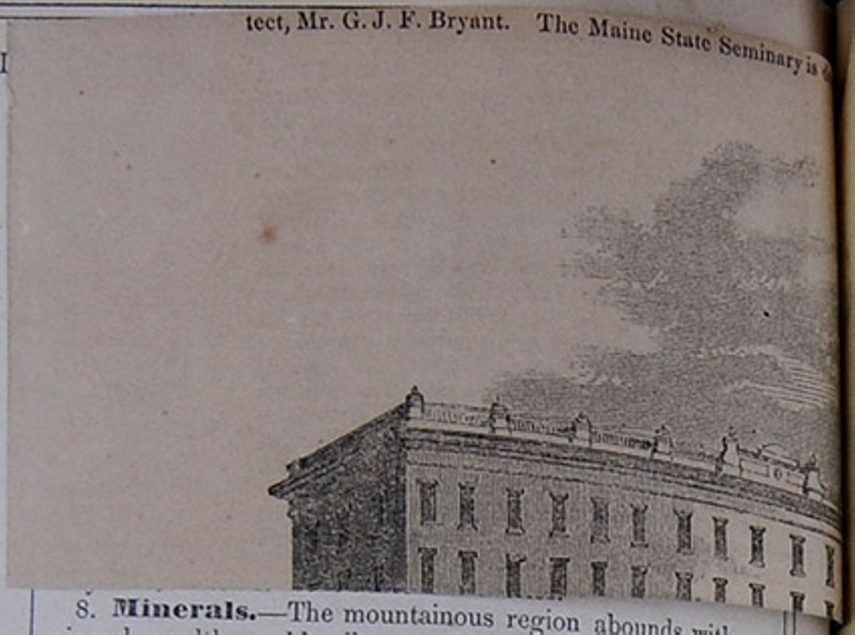
PERU. *
ONE of the most dazzling and romantic scenes in the world's history, is, doubtless, that in which the two richest and most populous empires of the American continents passed under the imperial sway of Spain, adding intense lustre to the glories of the Spanish crown, at a moment when Charles V. was about voluntarily to resign it forever. The two continents of America exhibit evidences of the existence, at some remote period of time, of a powerful, populous, and civilized people, to whose name, numbers, condition and circumstance, neither history nor tradition have preserved the slightest clue. The solitary monuments of their industry occasionally astonish the traveller, as well amid the prairies of the northern as among the luxuriant forests of the southern continent; but the profoundest research and most sagacious conjectures fail to throw light on the authors of the stupendous monuments that excite our surprise. The discoverers of the new world found here a number of nations, of greater or less degree of civilization, and a multitude of tribes altogether in a primitive state.
The two most powerful and civilized of them were fated to become the prey of fanaticism and avarice, enforced by the sword of Spanish adventurers. While the colonists of other European nations sought, in the wilds of the American continent, only a secure home, in which their industry might meet its reward and their religious scruples be unmolested, the Spanish colonists sought empire by conquest, and fate seems to have guided them where those conquests were alone feasible. The subjugation of the vast empire of the Aztecs by a handful of adventurers, impelled, perhaps, mostly by a desire to extend the influence of the cross, seemed to realize, in the greatness of the results and the apparent inadequacy of the means employed, the fabled exploits of the errant-knights of old. The thirst for adventure, which the success of Cortez rather enhanced than quenched, lived in the bosoms of Spanish soldiers, and finally resulted in the invasion and subjugation of the empire of the Incas, the only rival on the American continent to Mexico, in refined social polity and approximate civilization. Nothing could offer greater difficulties for authentic history, than the inroad of a few unlettered soldiers into a barbarian nation; the fraud and violence which the conquered suffered from the invaders, and the strife of the conquerors with each other for spoil and power—spread over a series of years—make it exceedingly difficult for the judicious historian to select from the mass of contradictory statements and highly-colored sketches, emanating from fanaticism, folly, prejudice and pique, such facts as constitute an authentic narrative of events, themselves so marvellous as to tax our credulity to the utmost. Yet this has been performed by Mr. Prescott, under circumstances that enhance our admiration—as if a country, whose discovery and conquest had presented difficulties to be overcome greater than those which ever attended any similar enterprise—should require, even in the narration of the events, that the historian should encounter obstacles, from which the stoutest would have shrunk, unless impelled by the same indomitable fire that carried his heroes to a success, made still
* History of the Conquest of Peru; with a Preliminary View of the Civilization of the Incas. By William H. Prescott, Member of the French Institute, &c. 2 vols. Harper Brothers, New York.
[begin surface 598] 130
Peru.
[August,
130
Peru.
[August,
more glorious by the difficulties they encountered. The nature of these difficulties Mr. Prescott relates in his own unassuming yet touching manner:
"Before closing these remarks I may be permitted to add a few of a personal nature. In several foreign notices of my writings, the author has been said to be blind; and more than once I have had the credit of having lost my sight in the composition of my first history. When I have met with such erroneous accounts, I have hastened to correct them. But the present occasion affords me the best means of doing so; and I am the more desirous of this, as I fear some of my own remarks, in the prefaces to my former histories, have led to the mistake.
"While at the University, I received an injury in one of my eyes, which deprived me of the sight of it. The other soon after was attacked by inflammation, so severely, that for some time I lost the sight of that also; and, though it was subsequently restored, the organ was so much disordered as to remain permanently debilitated; while twice in my life, since, I have been deprived of the use of it for all purposes of reading and writing for several years together.
"It was during one of these periods that I received from Madrid the materials for the ' History of Ferdinand and Isabella,' and in my disabled condition, with my transatlantic treasures lying around me, I was like one pining from hunger in the midst of abundance. In this state I resolved to make the ear, if possible, do the work of the eye. I procured the services of a secretary, who read to me the various authorities; and in time I became so far familiar with the sounds of the different foreign languages (to some of which, indeed, I had been previously accustomed by a residence abroad) that I could comprehend his reading without much difficulty. As the reader proceeded, I dictated copious notes; and when these had swelled to a considerable amount, they were read to me repeatedly, till I had mastered their contents sufficiently for the purposes of composition. The same notes furnished an easy means of reference to sustain the text.
"Still another difficulty occurred in the mechanical labor of writing, which I found a severe trial to the eye. This was remedied by means of a writing-case, such as is used by the blind, which enabled me to commit my thoughts to paper without the aid of sight—serving me equally well in the dark as in the light. The characters thus formed made a near approach to hieroglyphics; but my secretary became expert in the art of deciphering, and a fair copy—with a liberal allowance for unavoidable blunders—was transcribed for the use of the printer. I have described the process with more minuteness, as some curiosity has been repeatedly expressed in reference to my modus operandi under my privations, and the knowledge of it may be of some assistance to others in similar circumstances.
"Though I was encouraged by the sensible progress of my work, it was necessarily slow. But in time the tendency to inflammation diminished, and the strength of the eye was confirmed more and more. It was at length so far restored that I could read for several hours of the day, though my labors in this way necessarily terminated with the daylight. Nor could I ever dispense with the services of a secretary, or with the writing-case; for, contrary to the usual experience, I have found writing a severer trial to the eye than reading—a remark, however, which does not apply to the reading of a manuscript; and to enable myself, therefore, to revise my compositions more carefully, I caused a copy of the 'History of Ferdinand and Isabella' to be printed for my own inspection before it was sent to the press for publication. Such as I have described was the improved state of my health during the preparation of the ' Conquest of Mexico;' and, satisfied with being raised so nearly to a level with the rest of my species, I scarcely envied the superior good fortune of those who could prolong their studies into the evening, and the later hours of the night.
"But a change has again taken place during the last two years. The sight of my eye has become gradually dimmed, while the sensibility of the nerve has been so far increased that, for several weeks of the last year, I have not opened a volume; and through the whole time, I have not had the use of it, on an average, for more than an hour a day. Nor can I cheer myself with the delusive expectation that, impaired as the organ has become—from having been tasked probably beyond its strength, it can ever renew its youth, or be of much service to me hereafter in my literary researches. Whether I shall have the heart to enter,
[begin surface 599] 1847.]
Peru.
131
1847.]
Peru.
131
as I had proposed, on a new and more extensive field of historical labor with these impediments, I cannot say. Perhaps long habit, and a natural desire to follow up the career which I have so long pursued, may make this in a manner necessary, as my past experience has already proved that it is practicable.
"From this statement—too long, I fear, for his patience—the reader, who feels any curiosity about the matter, will understand the real extent of my embarrassments in my historical pursuits. That they have not been very light will be readily admitted, when it is considered that I have had but a limited use of my eye, in its best state, and that much of the time I have been debarred from the use of it altogether. Yet the difficulties I have had to contend with are very far inferior to those which fall to the lot of a blind man. I know of no historian, now alive, who can claim the glory of having overcome such obstacles but the author of 'La Conquete de l'Angleterre par les Normands,' who, to use his own touching and beautiful language, ' has made himself the friend of darkness,' and who, to a profound philosophy, that requires no light but that from within, unites a capacity for extensive and various research that might well demand the severest application of the student."
The materials for the history, we are informed, were drawn mostly from the archives of the Royal Academy of History, at Madrid, and were collected simultaneously with those of the "Conquest of Mexico." Manuscripts and materials have also been collected from other quarters, and altogether worked up, in the manner indicated in our author's Preface, into one of the most splendid works of modern historians.
Mr. Prescott commences with an interesting account of the extent of the Peruvian Empire; the topography of the country; the character of the people, and their condition, social, religious and political. We are presented with a glowing picture of a vast empire of industrious and frugal people, governed by a race of Incas, in a manner at once paternal and absolutely despotic. The people enjoyed plenty and ease, while their industry had accumulated vast national wealth. Of a warlike and sagacious character, their emperors, succeeding each other regularly and uninterruptedly during a period of four centuries, had successively extended the bounds of their empire over neighboring nations, until it absorbed all the Pacific slope of the Andes, from the 2d degree north to the 37th degree south latitude; yet this warlike and powerful chief, at once the supreme ruler of the nation and the object of its religious worship, while at the head of an immense army, amidst the impregnable fastnesses of his native mountains, at the zenith of his power, is suddenly seized by a Spaniard at the head of some 200 marauders, dropped as it were from the clouds, and executed; his army dispersed; his empire subverted; and his people given over to the dominion of strangers forever.
From amidst the variety of traditions and accounts embodied in the unreliable manner of the Spanish ecclesiastics, Mr. Prescott has sought the thread of the origin and descent of the Inca race. Tradition carries their advent back 400 years before the conquest, and some writers have given them a reign of 550 years; but inasmuch as that all accounts agree in the reign of thirteen Inca princes before this conquest, Mr. Prescott is inclined to suppose that two and a half centuries would be nearer the truth. It would appear that the domestic policy of the Peruvians approached the social organization of Fourier more than that of most nations. The lands were held on the plan of equal division, in a manner that must excite the admiration of a National Reformer. All the lands were divided into three services. 1st. For the sun, was set apart a sufficient quantity to support the gorgeous worship of that luminary, which formed the religion of the country. 2d. A sufficient quantity was assigned to support the Inca, his royal state, numerous kindred and household, and the wants of government.
[begin surface 600] 132
Peru.
[August,
132
Peru.
[August,
All the remainder of the lands was distributed per capita among the people, who were subject to a new division every year. Every Peruvian was compelled to marry at a certain age; a lot of land was then assigned to him and his wife, and the district in which he lived furnished him a house. As his family progressed through births, an additional quantity of land was assigned him; or if death diminished his family, his domain was curtailed in proportion. All these three divisions of land were cultivated wholly by the able-bodied people. The lands of the sun were the first attended to; this was in the nature of a church tax. Next, those of the old, the rich, the widow, the orphan, or the soldier on duty; these were "poor rates and war taxes." Next, every man worked his own land, and lastly those of the Inca. By these means all the people were furnished with food. As under such a system there could be none destitute, so could there be none rich. The chief manufacture was the spinning and weaving of wool and cotton. All the sheep were appropriated exclusively to the sun and to the Inca, but were reared by the people. At the proper season they were all sheared, and the wool deposited in the public magazines; from thence it was distributed among the people in quantities sufficient to clothe each family; when that was done, cloth was to be made for the Inca according to orders. The officers appointed to attend to this, were also empowered to compel the labor and see that each family did its share. The mines were the property of the Inca, and worked for his account; all gold and silver were reserved for his use—money being as well unknown as unwanted. The most stupendous public works, roads, bridges and buildings, were also constructed by these people, in a manner to excite the astonishment of the beholder of their remains in the present day. Large magazines of food and clothes, consisting of the surplus proceeds of the general industry, were accumulated in all sections of the country. A solid and well-constructed stone causeway extended throughout the empire, and furnished the means of rapid communication from the most remote quarters, by means of runners, with the central government at Cusco. The mineral resources of Peru were immense, and have, since their development, had great influence upon commercial affairs throughout the world. This empire and these people, bound together by one language, one religion, and a singularly searching and inquisitive government of the most despotic form, had arrived at great prosperity at the commencement of the sixteenth century, but were singularly ignorant of all beyond the limit of their own rule, and were totally unknown to nations that had lived and thrived within a short distance of them. Their industry had drawn large quantities of gold and silver from the mines, and accumulated, to them, more useful wealth in the public magazines. At this period the Inca Huayna Copac came to the throne. He was a warlike and capable prince, and under him the state of Quito, which already rivalled Peru in wealth and refinement, was brought under the sceptre of the Incas. In his latter days, this prince got rumors of singular strangers, endowed with strange powers, having appeared in the north, and in their superior civilization he apprehended the worst to his power. This prince had two favorite sons by different mothers, Huascar and Atahuallpa; to the former he bequeathed Peru, and to the latter his conquest, Quito, when he died, about the year 1525, and for the first time the power of the Inca crown became divided. The two Incas soon quarreled, and Atahuallpa invaded Peru, defeated Huascar, imprisoned him, and slaughtered his kindred with circumstances of great atrocity, and remained master of the empire.
It is remarkable that this populous country, with its warlike chief, great wealth and advanced state of society, should have been as ignorant of the
[begin surface 601] 1847.]
Peru.
133
1847.]
Peru.
133
existence of a similar empire on the northern continent, as were the Mexicans uninformed of their southern neighbors. At the time of the conquest of Mexico, central America and the islands swarmed with Spanish military adventurers, whose chief attraction was the gold with which it was supposed the new world abounded; yet none of these had crossed the land to the Pacific. In 1511, it is related while Balboa, the discoverer of the Southern Ocean, was weighing some gold collected from the natives, a young chief struck the scale with his fist and exclaimed, "If this is what you prize so much that you are willing to leave your homes, and risk even life itself for it, I can tell you of land where they eat and drink out of golden vessels, and gold is as cheap as iron is with you." This was supposed to be the first distinct notice which the Spaniards had of Peru; and shortly after Balboa penetrated across the isthmus and discovered the Pacific. Here further rumors were obtained in relation to the great southern empire, and the colony of Panama was founded. This colony became the focus for adventurers, and many expeditions were fitted out for northern discoveries, and one ineffectually took a southern direction. Repeated disappointment had considerably blunted the credulity of adventurers, and confidence began to be less easily excited in enterprises, where expense, danger, and great hardships were certain, and success very problematical. Three men were found, however, whose indomitable spirit, great courage and experienced life, peculiarly fitted them for conquest, and they became convinced of the existence of a great southern country where gold abounded. Of these, Francisco Pizarro was the chief. He was a native of Spain; had been from his youth up a military adventurer; had served in Italy and in various expeditions in the new world, and was, in 1522, a comparatively destitute and illiterate adventurer in Panama, 51 years of age. The second was Diego de Almagro, a Spanish soldier of fortune, somewhat older than Pizarro; and the third, Hernando de Luque, a clergyman. These three individuals united in the singular business of discovering and conquering empires. The two soldiers contributed what they had to fit out an expedition, but the priest was the capitalist, furnishing most of the funds. Almagro was, as it were, the commissary to fit out the vessels, and Pizarro the commander of the expedition. A small force of about 100 men were recruited among the desperate adventurers at Panama, and in November, 1524, Pizarro sailed. Almagro was to follow in another vessel as soon as possible. This expedition encountered incredible hardships, and met with no success. Pizarro, after being joined by Almagro, was compelled to remain in a dangerous spot, and send the latter back to the Governor for aid. On his arrival at Panama, Almagro could obtain nothing further from the Governor than his sanction to the enterprise. But the associates then entered into a solemn contract, by which de Luque was to advance, in gold, 20,000 pesos, equal perhaps to $200,000 in the present day; and the two captains were to prosecute the undertaking with due diligence, and they pledged themselves to reimburse de Luque if they failed in their contract. On these considerations the whole proceeds of the adventure, lands, treasures, rents, vassals and emoluments of all kinds, were to be divided in equal thirds, one for each partner. This contract was signed by responsible persons on behalf of Pizarro and Almagro, neither of whom could read or write. A new armament was then fitted out and met with but little better success. After the most incredible hardships, and the collection of some specimens of gold from the natives, it was decided that Almagro should again return to Panama, leaving Pizarro with his force to await his return on the Island of Gallo. His followers had become disgusted and wished to return, which he refused; and they sent secretly a letter, complaining that they were detained against their will, to
[begin surface 602] 134
Peru.
[August,
134
Peru.
[August,
perish in the wilderness. This fell into the hands of the Governor, who was so much incensed at the results, that so far from giving the further aid asked, he sent an officer with two vessels to order home Pizarro and his men. This officer found the adventurers in the last stage of destitution and misery. "Half naked, and pining with famine, there were few in that little band who did not feel the spirit of enterprise quenched within them."
Pizarro, however, received advices from his associates, that if he remained firm they could send him aid. It was then that the greatness of his soul burst forth.
"Drawing his sword, he traced a line with it on the sand from east to west. Then turning towards the south, 'friends and comrades,' he said,' On that side are toil, hunger, nakedness, the drenching storm, desertion and death; on this side, ease and pleasure. There lies Peru with its riches; here Panama and its poverty. Choose each man, what best becomes a brave Castilian. For my part I go to the south.'"
Twelve men promptly crossed with him to abide his fortunes, the rest returned. But those thirteen were the conquerors of Peru. They remained, enduring privations for seven months, until the Pilot Ruiz arrived with a small vessel, but without recruits. In this vessel the voyage was prosecuted and the discovery of Peru completed. Pizarro then returned to Panama, where he was greeted by his confederates with joy; but their means were exhausted, and the Governor refused aid. In this extremity Luque proposed that Pizarro should go to Spain, and lay the matter before the imperial government.
This resulted like most such applications, in the liberal grant of title, and the right to do that which, had they possessed the means, would have been done without the government; but no means were bestowed. The "capitulation," as it was styled, with the government, conferred the chief posts and commands on Pizarro, to the exclusion of his confederate Almagro; and this led to dissensions between them, on the return of Pizarro, who endeavored to assure Almagro that the Emperor forced them upon himself; but the opinion is that Pizarro defrauded his companions. The difficulties were, however, healed for a time. The "capitulation" bound Pizarro to raise 250 men, one hundred from the colonies, and sail for Panama in six months; the government to furnish some supplies of artillery and military stores. Having signed the instruments, Pizarro visited his native town, and began to enlist men. Among the first who joined him were his four brothers, Francisco Martin, Juan, Gonzalo and Hernando, who were all very poor and very proud. Great difficulty was encountered in raising the means; and it is said that the aid of Hernando Cortes alone perfected the contract. Ultimately Pizarro sailed with part of the armament for Panama, in January, 1530, to be followed by his brother Hernando, with the remainder. On their arrival in Panama, the old contract was confirmed by the three confederates. After their mutual jealousies were healed, the expedition was forwarded. After raising all the recruits possible in the colonies, the force amounted to 180 men and 27 horses, in three vessels. Although well armed and equipped, one cannot but smile at such a force to conquer a distant empire. The third expedition started January, 1531, and soon came to anchor in the Bay of St. Mathews, in latitude one degree north, where they landed, and sent the vessels along the coast. The advancing Spaniards soon came to a thick settled hamlet, and stormed it at once; the flying people leaving large quantities of gold and precious stones in the hands of the invaders. A considerable quantity of large emeralds fell into the hands of the soldiers, who were porsuaded by one of the missionaries, Father Pedrosa, that real emeralds
[begin surface 603] 1847.]
Peru.
135
1847.]
Peru.
135
could not be broken; and many of them submitted to this test were broken with hammers. As they, therefore, were looked upon as of little value, the good Father was enabled to carry a large number back to Panama on his own account. The largest portion of this plunder Pizarro sent back, in order to tempt recruits by the sight of the gold. The troops then advanced with various success along the coast, and received some supplies from a vessel which arrived under the command of de Soto, who afterwards made a famous exploration of the Mississippi. Pizarro then founded the colony of San Miguel de Piura. During his stay he learned important intelligence in regard to the political condition of Peru. He ascertained the result of the conflict between the brothers; that the victor, Atahuallpa, was encamped with his army at a distance of twelve days march, and he was somewhat startled at the accounts of the power and splendor of the victorious monarch. His force with its reinforcement amounted to 250 men; of these, fifty were required for the new settlement, and there remained 200 wherewith to meet the victorious Inca, and wrest his sceptre from his grasp. Yet he decided to march at once against the Inca. History scarcely presents a parallel to the boldness of this undertaking. To land in the midst of a populous country with a handful of men, and march into the interior to meet a powerful prince at the head of his army, trusting to fortune for the result, was a most desperate stake; and yet its very audacity was probably the only means of its success. After years of toil and hardship, he staked his all upon the cast, and won. The Inca, it would seem, was curious himself to see the wonderful strangers, of whose movements his messengers kept him accurately informed, and he allured them into the heart of the country, that he might be amused with them and crush them at his leisure. They therefore encountered no opposition as they advanced, but were met by the messengers of the Inca with friendly greeting.
On the fifth day's march, Pizarro mustered 110 foot and 67 horse, in good condition. The commander thought, however, that he detected signs of dissatisfaction in a few, and he determined to root it out before it spread. He therefore mustered them, and informed them that a crisis was approaching that required all their courage, and that no man should think of going forward without firmness of purpose; that if any wished to go back they should share the lands and vassals in San Miguel, which he wished to see in a stronger state of defence, &c. Nine men only accepted this remarkable offer and went back. The bold commander, who had thus weeded his corps, advanced with greater confidence. After great hardships and various vicissitudes, the little corps finally confronted the Inca. As the adventurers emerged on the eastern slope of the Andes, their eyes saw for miles in extent the white tents of the opposing troops, and the stoutest bosoms heaved more quickly at the sight. The Christian cavalcade was doubtless a matter of astonishment to the Indians. Pizarro, forming his corps into three divisions, marched down the slopes and entered the city of Caxamalca, amidst a concourse of warriors and astonished natives gazing at the strange soldiers. Here Hernando Pizarro and de Soto, as ambassadors from their commander, had an interview with the Inca, who promised to visit Pizarro on the following day. This was the crisis of the enterprise.
"Taking, then, a respectful leave of the Inca, the cavaliers rode back to Caxamalca, with many moody speculations on what they had seen—on the state and opulence of the Indian monarch—on the strength of his military array—their excellent appointments, and the apparent discipline in their ranks; all arguing a much higher degree of civilization, and consequently of power, than anything they had witnessed in the lower regions of the country. As they contrasted all this with
[begin surface 604] 136
Peru.
[August,
136
Peru.
[August,
their own diminutive force—too far advanced, as they now were, for succor to reach them—they felt that they had done rashly in throwing themselves into the midst of so formidable an empire, and were filled with gloomy forebodings of the result. Their comrades in the camp soon caught the infectious spirit of despondency, which was not lessened as night came on; and they beheld the watch fires of the Peruvians lighting up the sides of the mountains, and glittering in the darkness 'as thick,' says one who saw them, ' as the stars in heaven.'
" Yet there was one bosom in that little host which was not touched with the feeling either of fear or dejection. That was Pizarro's; who secretly rejoiced that he had now brought matters to the issue for which he had so long panted."
After encouraging his troops, this determined man summoned his officers in council, and laid his plan before them, which was to seize the Inca on his visit, and make him prisoner in the face of his army! It became apparent that there was no alternative. To fight, to fly, or to remain long inactive, were alike fatal; and the plan was determined on. The Plaza, occupied by the Spaniards,
"Was defended on its three sides by low ranges of buildings, consisting of spacious halls, with wide doors or vomitories opening into the square. In these halls he stationed his cavalry in two divisions—one under his brother Hernando, and the other under De Soto. The infantry he placed in another of the buildings, reserving 20 men to act with himself as occasion might require. All received orders to wait, at their posts, the arrival of the Inca. After his entrance into the great square, they were still to remain under cover, till the signal was given by the discharge of a gun, when they were to cry their war cries, to rush out in a body from their covert, and putting the Peruvians to the sword, bear off the person of the Inca. * * *
"It was not long before sunset, when the van of the royal procession entered the gates of the city. First came some hundreds of the menials, employed to clear the path from every obstacle, and singing songs of triumph as they came,' which, in our ears,' says one of the conquerors, 'sounded like the songs of hell.' Then followed other bodies of different ranks, and dressed in different liveries. Some wore a showy staff, checkered white and red like the squares of a chessboard; others were clad in pure white, bearing banners or maces of silver or copper; and the guards, together with those in immediate attendance on the prince, were distinguished by a rich azure livery and a profusion of gay ornaments, while the large pendants attached to the ears distinguished the Peruvian noble.
"Elevated high above his vassals came the Inca Atahuallpa, borne on a sedan or open litter, on which was a sort of throne made of massive gold of inestimable value. The palanquin was lined with the richly-colored plumes of tropical birds, and studded with shining plates of gold and silver. The monarch's attire was richer than on the preceding evening. Round his neck was suspended a collar of emeralds of uncommon size and brilliancy. His short hair was decorated with golden ornaments, and the imperial borla encircled his temples. The bearing of the Inca was sedate and dignified; and from his lofty station he looked down on the multitudes below with an air of composure, like one accustomed to command.
"As the leading files of the procession entered the great square, larger—says an old chronicler—than any square in Spain, they opened to the right and left for the royal retinue to pass. Every thing was conducted with admirable order. The monarch was permitted to traverse the Plaza in silence, and not a Spaniard was to be seen. When some five or six thousand of his people had entered the place, Atahuallpa halted, and turning round with an inquiring look, demanded, 'Where are the strangers?'"
At this moment a Dominican friar, Father Valverde, afterwards Bishop of Cusco, coming forward with a Bible in one hand and a crucifix in the other, began to explain the principles of the Christian faith to the Inca. Atahuallpa listened patiently to the discourse, until he began to comprehend
[begin surface 605] 1847.]
Peru.
137
1847.]
Peru.
137
that the drift of it was to persuade him to resign his sceptre and change his religion.
"I will be no man's tributary," said he, "I am greater than any prince upon earth. Your emperor may be a great prince; I do not doubt it, when I see that he has sent his subjects so far across the water! and I am willing to hold him as a brother. As for the Pope, of whom you speak, he must be crazy to talk of giving away countries that do not belong to him. For my faith, I will not change it. Your own God, as you say, was put to death by the very men he created. But mine,' he continued, pointing to his deity, then, alas! sinking in glory behind the mountains, ' my God still lives in the heavens, and looks down on his children.'
"He then demanded of Valverde by what authority he said these things. The friar pointed to the book which he held as his authority. Atahuallpa taking it, turned over the pages a moment; then, as the insult he had received probably flashed across his mind, he threw it down with vehemence, and exclaimed, 'Tell your comrades that they shall give me an account of their doings in my land. I will not go from here till they have made me full satisfaction for all the wrongs they have committed.'
"The friar, openly scandalized by the indignity offered to the sacred volume, stayed only to pick it up, and hastening to Pizarro, informed him of what had been done, exclaiming, at the same time, 'Do you not see, that while we stand here wasting our breath in talking with this dog, full of pride as he is, the fields are filling with Indians? Set on at once—I absolve you.' Pizarro saw that the hour had come. He waved a white scarf in the air, the appointed signal. The fatal gun was fired from the fortress. Then, springing into the square, the Spanish captain and his followers shouted the old war-cry of 'St. Jago, and at them.' It was answered by the battle-cry of every Spaniard in the city, as, rushing from the avenues of the great halls in which they were concealed, they poured into the Plaza, horse and foot, each in his own dark column, and threw themselves into the midst of the Indian crowd."
The results of this terrible onslaught, after half an hour's hard fighting, was the slaughter of from 2,000 to 10,000 Indians, and the capture of the Inca, without the loss of a Spaniard. Thus fell the Indian empire; for it seems to have been a consequence of the singular form of government, that the loss of the Inca totally disorganised the government as well as the army, which dispersed at once, and the conquest was in effect completed. The subsequent events, whereby the power of the Spaniards became consolidated in the country, are fraught with interest and instruction. Almost every man concerned in the scene of violence and rapine was overtaken by a just and terrible retribution, more particularly those concerned in the murder of the unfortunate Inca. After he had engaged to pay, and actually made over, gold and silver to the extent of $15,000,000 or $20,000,000, about the sum recently exacted by England of the Chinese, he perished miserably by the Gerrote, a victim to the policy of his conqueror. The arrival of Almagro with large reinforcements in the camp of Pizarro, soon after the immolation of the Inca, gave the means for prosecuting the plunder of the cities. After attempting, by the installation of Manco Capac as Inca, to control the people and subject them to his will, Pizarro returned to the coast and founded the city of Lima, where he was assassinated in 1541, nine years after the seizure of the Inca. Thenceforth the story is mostly of strife among the Spanish chiefs. A civil war between Almagro and Hernando Pizarro ended in the defeat and execution of the former, who had fallen prisoner to his old enemy; and the return of the latter to Spain, where he was thrown into prison, and remained there twenty years, and when released lived several years, completing the age of one hundred years. He was succeeded in the government of Cusco by Gonzalo Pizarro, who, expelling the incapable viceroy, Nunez, established himself in the government. Gonzalo was, however, inferior
[begin surface 606] 138
Peru.
[August,
138
Peru.
[August,
to his brothers in firmness of purpose and extensiveness of views, being mainly indebted to his lieutenant Carbajal for his success. Carbajal was one of the most remarkable characters drawn out by the peculiar operations of the Spaniards in that age of the world. Although a monster of cruelty, he wins our admiration at his undaunted courage, his great sagacity, knowledge of men, and constancy of purpose. In his early life he entered the army, and served forty years in the Italian wars, where he witnessed the capture of Francis I. at Pavia. With booty obtained at the sack of Rome, he sought the new world, and for services under Pizarro was rewarded with a grant of land in Cusco. When the Viceroy Nunez was sent out to enforce those odious ordinances, which called forth the resistance of the colonists, headed by Gonzalo Pizarro, Carbajal, then eighty years old, joined Gonzalo, and his determined valor, steadiness of purpose, and sagacious advice, were mainly instrumental in placing Pizarro at the head of the government. He was noted for his inexorable severity towards those who, in the continual change of parties among the Spaniards, fell in his hands, as renegades to their party. These were promptly executed. When Pizarro, on the death of the Viceroy Nunez, became master of Peru, Carbajal advised him to cast off his allegiance to Spain, marry Coya, the female representative of the Incas, and proclaim himself king. For enterprise of such a nature, Gonzalo was, however, not capable. Yet it was the only sound policy under the circumstances, standing as they did in the attitude of rebellion to the crown; but he could not divine the future with the undaunted gaze of the veteran Carbajal. The Spanish government soon sent out a most able man, Pedro de la Gasca as viceroy, an ecclesiastic of great mind but humble deportment. He arrived without arms. By the moderation of his conduct, the good sense of his proclamation, and having in the " king's name a tower of strength," he soon won over the adherents of Pizarro, who had been prepared to resist force but not argument and clemency. As soon as Carbajal read the proclamations of de Gasca and witnessed their effect, his sagacious mind rightly estimated their true position, and he counselled Pizarro to accept the terms offered him. As, however, that chief was incapable of carrying out the advices of Cabajal on a previous occasion, so was he incapable of understanding his present position, and he proceeded to arm. Meanwhile, the adherents of Pizarro, affected by the proclamation of de Gasca, deserted in scores. His gallant army, which had been organised at great expense, "melted away like the mist," and he became bewildered by misfortune.
"Carbajal, who made a jest of every thing, even the misfortunes that pinched him sharpest, when told of the desertion of his comrades, amused himself by humming the words of a popular ditty: 'The wind blows the hairs off my head, mother, Two at a time it blows them away.'"
Gonzalo retired into Chili, and having organized a force, he, through the exertions of Carbajal, defeated the royal forces in a great battle, at Huarino, and entered Cusco in triumph. Gasca being joined by Valdivia, one of the best captains of Peru, advanced against Pizarro, and Carbajal advised a retreat; but Pizarro persisted in maintaining his ground, while he rejected until too late the proposal of Carbajal, to defend the bridge by which Gasca was approaching. As Gasca advanced, Pizarro had cause to distrust the fidelity of his followers; and as the armies confronted each other, his chief officers and men began to desert in squadrons, and the army speedily disbanded without fighting.
[begin surface 607] 1847 ]
Peru.
139
1847 ]
Peru.
139
"Pizarro, amidst the general wreck, found himself left with only a few cavaliers who disdained to fly. Stunned by the unexpected reverse of fortune, the unhappy chief could hardly comprehend his situation. 'What remains for us ?' said he to Acosta, one of those who still adhered to him 'Fall on the enemy, since nothing else is left,' answered the iron-hearted soldier,' and die like Romans.' 'Better to die like Christians,' replied his commander; and slowly turning his horse, he rode off in the direction of the royal army.
"In this general wreck of their fortunes, Francisco de Carbajal fared no better than his chief. As he saw the soldiers deserting their posts, and going over to the enemy one after another, he coolly hummed the words of his favorite old ballad—
' The wind blows the hairs off my head, mother!'"When he sound himself alone, the stout old warrior attempted to escape; his aged horse broke down under him, and he was seized by some of his own followers, who hoped to make better terms for themselves by surrendering him; and they hurried him off to the quarters of Gasca.
The convoy was soon swelled by a number of common file from the royal army, some of whom had long arrears to settle with the prisoner; and not content with heaping reproaches and imprecations on his head, they now threatened to proceed to acts of violence, which Carbajal, far from deprecating, seemed rather to court, as the speediest way of ridding himself of life. When he approached the President's head-quarters, Centeno, who was near, rebuked the disorderly rabble, and compelled them to give way. Carbajal on seeing this, with a respectful air demanded to whom he was indebted for this courteous protection. To which his ancient comrade replied, "Do you not know me—Diego Centeno!" "I crave your pardon," said the veteran sarcastically, alluding to his long flight in the Charcas and his recent defeat at Huarino; "it is so long since I have seen anything but your back that I had forgotten your face." Pizarro was condemned to be beheaded, and Carbajal to be drawn and quartered. " No mercy was shown him who had shown none to others." Carbajal, when he heard his doom, remarked, " They can but kill me." Many visited him to upbraid him, and he indulged his caustic humor freely at their expense. One person, whose life Carbajal had formerly spared, was profuse in his professions to serve him. Carbajal cut him short, exclaiming, " and what service can you do me? can you set me free ? If you cannot do that, you can do nothing. If I spared your life, as you say, it was probably because I did not think it worth while to take it." Some pious persons wished him to see a priest and unburthen his conscience. " But of what use would that be ?" asked Carbajal, " I have nothing that lies heavy on my conscience, unless it be, indeed, the debt of half a real to a shopkeeper in Seville, which I forgot to pay before leaving the country !" Hardened as was the old soldier, he was clearly not of a nature sufficiently stern to make a banker of the present day. He was carried to execution in a kind of basket drawn by mules. When thrust into it, he exclaimed, " cradles for infants and a cradle for the old man too, it seems." He died at the age of 84, with the fires of youth glowing fiercely and unquenchably in his bosom. " He looked on life as a farce, though he too often made it a tragedy." Pizarro was shortly after beheaded, at 42 years of age, being the youngest of the Pizarros; and his death closed the fate of the remarkable family that had conquered the country, and given one of its richest jewels to the crown of Spain.
Gasca, after settling the country, leaving it prosperous and tranquil, returns to Spain, and, resigning his command, retired to his episcopal functions.
Thus far the history of that interesting country is brought down by the graphic pen of Mr. Prescott. The story is told in a manner more agreeable
[begin surface 608] 140
Peru.
[August,
140
Peru.
[August,
than is usually encountered in the historic page; and the reader is impressed with the authenticity of the statements contained in the narrative.
By these means detailed, the Spaniards became possessed of a country of great wealth and vast importance. But, like all the rich possessions that have fallen to their lot, it was miserably misused. Its wealth was squandered; its people oppressed; its vast public works allowed to go to decay, and its great natural advantages utterly neglected. Peru, after three centuries of Christian rule of the Spaniards, is in a far worse condition than at the end of three centuries of the Pagan rule of the Incas. Although no accurate or approximate statement of the numbers of the people at the time of the conquest has been given, yet such data as have been handed down show that the population has been frightfully diminished. Probably the whole population, at present 1,500,000, is not one-tenth of the number under the last of the Incas. The chief causes of the depopulation have been the massacres by the Spaniards, suicides of the natives to escape the horrible oppression to which they have been exposed, the deaths produced by the involuntary service called "mita," exacted from the natives beyond their strength, smallpox, scarlet fever, &c. The mita has been supposed to have swept off four times as many as all the other causes together. Its abolition, of late years, has already produced recuperative effects on the population. For two hundred years the Indians submitted with exemplary patience to the horrible tyranny of their oppressors. In 1780 a more oppressive exaction of taxes roused a general opposition, which, headed by Tupac Amaru, threatened seriously the Spanish power, and might have succeeded, but for the treachery of an Indian, who betrayed the chief into the power of the Spaniards, and without a leader the Indians dispersed. This war resulted, however, in the abolition of a most oppressive tax. When the Spanish war of Independence took place, the natives fought occasionally on the side of the patriots, but had no clear idea of the objects of the war. Its effects were to supply them arms and teach them their use, and also the manufacture of gunpowder, with the materials of which the hills abound. The time is now fast approaching when the miserable Spanish race will be scourged from the country they have so long cursed with their presence, and the descendants of the ancient Incas will, after a lapse of three centuries, resume the sway of their fathers. It has only been the diminution of the numbers of the Indians that has thus far saved the Spaniards; and, therefore, in some sense, their very tyranny has been the means of prolonging it.
According to a late traveller, Dr. Von Tschudi, and other authorities, nothing can be more deplorable, in a physical or moral sense, than the present condition of the Spanish population of Peru. The population of Lima, in 1842, is given at 53,000, divided into five classes : 1st. White Creoles, 20,000; 2d. Indians, 5,300; 3d. Mixed races, Negroes, &c., 24,000; 4th. Slaves, 4,700; 5th. Ecclesiastics, 900. Dr. Tschudi gives nineteen different heads of the mixed races, all of whom, although in the lowest depths of degradation, look upon the Indians as " brutes." The white creoles are an effeminate, idle race, and exist there, apparently, but on the sufferance of the Indians.
Events are now transpiring in Mexico which will terminate Spanish dominion there forever; and we may hope that Peruvian disenthralment will follow Mexican emancipation in at least as short a period as its subjugation followed the conquests of Cortez, three hundred years since.
 THE TERMS ANDES AND CORDILLERA.
203
THE TERMS ANDES AND CORDILLERA.
203
CHAPTER XI.
The Cordillera and the Andes—Signification of the terms—Altitude of the Mountains and Passes—Lakes—Metals—Aspect of the Cordillera—Shattered Rocks—Maladies caused by the diminished Atmospheric Pressure—The Veta and the Surumpe—Mountain Storms—The Condor—Its habits—Indian mode of Catching the Bird—The Puna or Despoblado—Climate—Currents of Warm Air—Vegetation—Tuberous Plant called the Maca—Animals of the Puna—The Llama, the Alpaco, the Huanacu and the Vicuña—The Chacu and the Bolas—Household Utensils of the Ancient Peruvians—The Viscacha and the Chinchilla—Puna Birds and Amphibia—Cattle and Pasture—Indian Farms—Shepherds' Huts—Ancient Peruvian Roads and Buildings—Treasure concealed by the Indians in the Puna.
Two great mountain chains, running parallel with each other, intersect Peru in the direction from S.S.W. to N.N.E. The chain nearest the coast of the Pacific is at the average distance of from sixty to seventy English miles from the sea. The other chain takes a parallel direction but describes throughout its whole course a slight curve eastward. These two ranges of mountain are called the Cordilleras, or the Andes: both terms being used indiscriminately. Even the creoles of Peru confound these two terms, sometimes calling the western chain by one name, and sometimes by the other. Nevertheless, a strict distinction ought to be observed:—the western chain should properly be called the Cordillera, and the eastern chain the Andes. The latter name is derived from the Quichua word Antasuyu; Anta signifying metal generally, but especially copper, and Suyu a district; the meaning of Antasuyu, therefore, is the metal district. In common parlance, the word Suyu was dropped, and the termination a in Anta was converted into is. Hence the word Antis, which is employed by all old writers and geographers; and even now, is in common use among the Indian population of Southern
[begin surface 610] 204
TRAVELS IN PERU.
204
TRAVELS IN PERU.
Peru. The Spaniards, according to their practice of corrupting the words of the Quichua language, have transformed Antis into Andes, and they apply the name without distinction to the western and the eastern chain of mountains. *
The old inhabitants of Peru dwelt chiefly along the base of the eastern mountain chain, where they drew from the mines the metal which afforded material for their tasteful and ingenious workmanship: those mountains consequently retained the name of Antis or Andes. In the time of the Incas, both chains were called Ritisuyu (Snow-Districts). The Spaniards, on the invasion of the country, advancing from the sea-coast, first arrived at the western mountains, and to them they gave the name of Cordillera, the term commonly employed in the Spanish language, to designate any mountain chain. Most of the earlier travellers and topographists named the western chain the Cordillera de los Andes, and regarded it as the principal chain, of which they considered the eastern mountains to be merely a branch. To the eastern range of mountains they gave the name of Cordillera Oriental. I will here strictly observe the correct denominations, calling the western chain the Cordillera, or the coast mountains; and the eastern chain the Andes, or the inner Cordillera.
These two great mountain chains stand in respect to height in an inverse relation one to the other; that is to say, the greater the elevation of the Cordillera, the more considerable is the depression of the Andes. In South Peru the ridge of the Cordillera is considerably lower than that portion of the Andes which stretches through Bolivia. The medium height of the Cordillera in South Peru is 15,000 feet above the sea; but here and there particular points rise to a much more considerable elevation. The medium height of the Andes is 17,000 feet above the sea. In central Peru the Cordillera is higher than the Andes. There the altitude of the latter along the body of the chain is 13,000 feet above the sea : on the ridge there are a few points some
* Some derive the word Andes from the people called Antis, who dwelt at the foot of these chains of mountains. A province in the department of Cuzco, which was probably the chief settlement of that nation, still bears the name of Antas. [begin surface 611] METALLIC PRODUCE OF THE
MOUNTAINS.
205
METALLIC PRODUCE OF THE
MOUNTAINS.
205
hundred feet higher. Between Pasco and Loxas the average height of the Cordillera is between 11,000 and 12,000 feet above the sea; and the average elevation of the Andes at the corresponding point is about 2000 feet lower.
The passes do not run through valleys, but always over the ridges of the mountains. The highest mountain passes are the Rinconada (16,452 feet above the sea); the Piedra Parada (16,008 feet); the Tingo (15,600 feet); the Huatillas (14,850 feet); the Portachuelo de la Viuda (14,544 feet); the Altos de Toledo (15,530 feet); and the Altos de los Huesos (14,300 feet). In both chains there are innumerable small lakes; these are met with in all the mountain passes, and most of them are the sources of small rivers.
Both the mountain chains, as well as their lateral branches, are rich in metallic produce; but in the principal mountains gold is rare. Some rich mines on the coast, and in the province of Arequipa, are now nearly exhausted. Wash gold is plentiful in the rivers of North Peru, but it is not carefully collected. Silver, which constitutes the principal wealth of Peru, is found in greatest abundance in the principal chains, viz., in Northern and Central Peru, in the Cordillera; and in Southern Peru in the Andes. It presents itself in all forms and combinations, from the pure metal to the lead-ore mixed with silver. Even in the highest elevations, in parts scarcely trodden by human footsteps, rich veins of silver are discovered. It is scarcely possible to pass half a day in these regions without encountering new streaks. Quicksilver is likewise found, but in such small quantities, that the gain does not pay the labor of the miners. The only quicksilver vein of any magnitude is at Huancavelica. Both mountain chains are very rich in copper-ore; but it is extracted only from the Cordillera, for the distance of the Andes from the coast renders the transport too expensive. The lead and iron mines, though amazingly prolific, are not worked; the price of the metal being too low to pay the labor.
The Cordillera presents an aspect totally different from that of the Andes. It is more wild and rugged, its ridge is broader, and its summits less pyramidical. The summits of the Andes terminate in slender sharp points like needles. The Cordillera
[begin surface 612] 206
TRAVELS IN PERU.
206
TRAVELS IN PERU.
descends in terraces to the level heights, whilst the slope of the Andes is uniform and unbroken. The summits of the calcareous hills which stretch eastward from the great chain of the Cordillera are broken and rugged. Large cubical blocks of stone become detached from them, and roll down into the valleys. In the Quebrada of Huari near Yanaclara, which is 13,000 feet above the sea, I collected among other fragments of rock some of a species which is found at Neufchatel in Switzerland. This disintegration, which is the effect of protracted rain and cold, imparts to the mountain ridges the most singular and beautiful forms; their fantastic outlines appearing like the work of human hands. Imagination may easily picture them to be monuments of the time of the Incas; for viewed from a distance, they look like groups of giants or colossal animals. In former times the Indians viewed these masses of rock with devout reverence, for they believed them to be the early inhabitants of the earth whom Pacchacamac in his anger transformed to stone. I may here notice some very curious forms of rock which have long been a subject of controversy among Peruvian travellers. On the road leading from Ayacucho to Huancavelica, on the level height of Paucara, about a league beyond the village of Parcos, there is a considerable number of sand-stone pyramids from eight to twenty-two feet high. They are of a reddish-white color; but in many places the inclemency of the weather has overspread them with a blackish crust. They are detached one from another. Ulloa, in his Noticias Americanas, after fully describing these pyramids, declares himself doubtful whether they are the work of man or of nature. He inclines to regard them as human creations, and suggests that they may possibly have been the tombs of distinguished curacas and caciques; but he admits that he is not acquainted with any similar monuments in Peru. As each pyramid consists of only one block of stone, and all are very regularly shaped, Ulloa is not indisposed to believe that the Indians possessed the secret art of melting stone. These blocks are, however, of sand-stone, and their fractures are the result of the inclemency of the weather. They are all pyramidal-shaped, and tolerably equal in size. In several of them the points are as sharp and regular as though they had been wrought by the chisel
[begin surface 613] THE VETA.
207
THE VETA.
207
of the sculptor. These curious pyramids cover the plateau along a distance of more than two miles : sometimes standing closely together, and sometimes at considerable distances apart. The whole line of chalk and slate mountains extending from Ayacucho to Huancavelica is shattered, and presents similar, though less regular detritus.
I have, in my last chapter, observed that the Cordillera is the point of partition between the waters of the Pacific and the Atlantic Oceans. All the waters of the eastern declivity of the Cordillera—all those which have their source on the level heights and on the western declivity of the Andes,—flow from thence in the direction of the east, and work their way through the eastern mountain chain. Throughout the whole extent of South America there is not a single instance of the Cordillera being intersected by a river; a fact the more remarkable because in Southern Peru and Bolivia, the coast chain is lower than the Andes. This interesting phenomenon, though it has deeply engaged the attention of geologists, has not yet been satisfactorily explained. I concur in the view taken by Mr. Darwin, who observes that it would be too rash to assign to the eastern chain of Bolivia and Central Chile, a later origin than the western chain, (that nearest the Pacific), but that the circumstance of the rivers of a lower mountain chain having forced their way through a higher chain seems, without this supposition, to be enigmatical. Mr. Darwin is of opinion that the phenomenon is assignable to a periodical and gradual elevation of the second mountain line (the Andes); for a chain of islets would at first appear, and as these were lifted up, the tides would be always wearing deeper and broader channels between them.
In the heights of the Cordillera the effect of the diminished atmospheric pressure on the human frame shows itself in intolerable symptoms of weariness and an extreme difficulty of breathing. The natives call this malady the Puna or the Soroche; and the Spanish Creoles give it the names of Mareo or Veta. Ignorant of its real causes they ascribe it to the exhalations of metals, especially antimony, which is extensively used in the mining operations. The first symptoms of the veta are usually felt at the elevation of 12,600 feet above the sea. These symptoms
[begin surface 614] 208
TRAVELS IN PERU.
208
TRAVELS IN PERU.
are vertigo, dimness of sight and hearing, pains in the head and nausea. Blood flows from the eyes, nose, and lips. Fainting fits, spitting of blood, and other dangerous symptoms, usually attend severe attacks of veta. The sensations which accompany this malady somewhat resemble those of sea-sickness, and hence its Spanish name mareo. But sea-sickness is unaccompanied by the distressing difficulty of breathing experienced in the veta. This disorder sometimes proves fatal, and I once witnessed a case in which death was the result. Inhabitants of the coast and Europeans, who for the first time visit the lofty regions of the Cordillera, are usually attacked with this disorder. Persons in good health and of a spare habit speedily recover from it, but on plethoric and stout individuals its effects are frequently very severe. After an abode of some time in the mountainous regions, the constitution becomes inured to the rarefied atmosphere. I suffered only two attacks of the veta; but they were very severe. The first was on one of the level heights; and the second on the mountain of Antaichahua. The first time I ascended the Cordillera I did not experience the slightest illness, and I congratulated myself on having escaped the veta; but a year afterwards I had an attack of it, though only of a few hours' duration. The veta is felt with great severity in some districts of the Cordillera, whilst in others, where the altitude is greater, the disorder is scarcely perceptible. Thus it would seem that the malady is not caused by diminished atmospheric pressure, but is dependent on some unknown climatic circumstances. The districts in which the veta prevails with greatest intensity are, for the most part, rich in the production of metals, a circumstance which has given rise to the idea that it is caused by metallic exhalations.
I have already described the effect of the Puna climate on beasts of burthen. Its influence on some of the domestic animals is no less severe than on the human race. To cats, it is very fatal, and at the elevation of 13,000 feet above the sea these animals cannot live. Numerous trials have been made to rear them in the villages of the upper mountains, but without effect; for after a few days' abode in those regions, the animals die in frightful convulsions; but when in this state they do not attempt to bite. I had two good opportunities of observing the disease at
[begin surface 615] THE SURUMPE.
209
THE SURUMPE.
209
Yauli. Cats attacked in this way are called, by the natives, azorochados, and antimony is alleged to be the cause of the distemper. Dogs are also liable to it, but it visits them less severely than cats, and with care they may be recovered.
Another scourge of the traveller in the Cordillera, is the disease called the Surumpe. It is a violent inflammation of the eyes, caused by the sudden reflection of the bright rays of the sun on the snow. By the rarefied air and the cutting wind, the eyes, being kept in a constant state of irritation, are thereby rendered very susceptible to the effects of the glaring light. In these regions the sky is often for a time completely overshadowed by snow clouds, and the greenish yellow of the plain is soon covered by a sheet of snow : then suddenly the sun's rays burst through the breaking clouds, and the eyes, unprepared for the dazzling glare, are almost blinded. A sharp burning pain is immediately felt, and it speedily increases to an intolerable degree. The eyes become violently inflamed, and the lids swell and bleed. The pain of the surumpe is the most intense that can be imagined, and frequently brings on delirium. The sensation resembles that which it may be imagined would be felt if cayenne pepper or gunpowder were rubbed into the eyes. Chronic inflammation, swenllig of the eyelids, dimness of sight, and even total blindness are the frequent consequences of the surumpe. In the Cordillera, Indians are often seen sitting by the road-side shrieking in agony, and unable to proceed on their way. They are more liable to the disease than the Creoles, who, when travelling in the mountains, protect their eyes by green spectacles and veils.
Heavy falls of snow in the Cordillera are usually accompanied by thunder and lightning. During five months of the year, from November to March, storms are of daily occurrence. They begin, with singular regularity, about three o'clock in the afternoon, and continue until five or half-past five in the evening. After that time storms of thunder and lightning never occur; but the falls of snow sometimes continue till midnight. As evening approaches, cold mists are drifted from the mountain-tops down upon the plains; but they are dispersed by the rays of the morning sun, which in a few hours melt the snow. The furious tempests in these regions exceed any idea that can be
[begin surface 616] 210
TRAVELS IN PERU.
210
TRAVELS IN PERU.
formed of them, and can only be conceived by those who have witnessed them. Some of these mountain districts have acquired an ominous character for storms; Antaichahua is one of the places to which this sort of fearful celebrity belongs. For hours together flash follows flash, painting blood-red cataracts on the naked precipices. The forked lightning darts its zig-zag flashes on the mountain-tops, or, running along the ground, imprints deep furrows in its course; whilst the atmosphere quivers amidst uninterrupted peals of thunder, repeated a thousandfold by the mountain echoes. The traveller, overtaken by these terrific storms, dismounts from his trembling horse, and takes refuge beneath the shelter of some overhanging rock.
In these sterile heights, Nature withholds her fostering influence alike from vegetable and animal life. The scantiest vegetation can scarcely draw nutriment from the ungenial soil, and animals shun the dreary and shelterless wilds. The condor alone finds itself in its native element amidst these mountain deserts. On the inaccessible summits of the Cordillera that bird builds its nest, and hatches its young in the months of April and May. Few animals have attained so universal a celebrity as the condor. That bird was known in Europe, at a period when his native land was numbered among those fabulous regions which are regarded as the scenes of imaginary wonders. The most extravagant accounts of the condor were written and read, and general credence was granted to every story which travellers brought from the fairy land of gold and silver. It was only at the commencement of the present century that Humboldt overthrew the extravagant notions that previously prevailed respecting the size, strength, and habits of that extraordinary bird.
The full-grown condor measures, from the point of the beak to the end of the tail, from four feet ten inches to five feet; and from the tip of one wing to the other, from twelve to thirteen feet. This bird feeds chiefly on carrion : it is only when impelled by hunger that he seizes living animals, and even then only the small and defenceless, such as the young of sheep, vicuñas, and llamas. He cannot raise great weights with his feet, which, however, he uses to aid the power of his beak. The principal strength of the condor lies in his neck and in his feet;
[begin surface 617] THE CONDOR.
211
THE CONDOR.
211
yet he cannot, when flying, carry a weight exceeding eight or ten pounds. All accounts of sheep and calves being carried off by condors are mere exaggerations. This bird passes a great part of the day in sleep, and hovers in quest of prey chiefly in the morning and evening. Whilst soaring at a height beyond the reach of human eyes, the sharp-sighted condor discerns his prey on the level heights beneath him, and darts down upon it with the swiftness of lightning. When a bait is laid, it is curious to observe the numbers of condors which assemble in a quarter of an hour, in a spot near which not one had been previously visible. These birds possess the senses of sight and smell in a singularly powerful degree.
Some old travellers, Ulloa among others, have affirmed that the plumage of the condor is invulnerable to a musket-ball. This absurdity is scarcely worthy of contradiction; but it is nevertheless true that the bird has a singular tenacity of life, and that it is seldom killed by fire-arms, unless when shot in some vital part. Its plumage, particularly on the wings, is very strong and thick. The natives, therefore, seldom attempt to shoot the condor: they usually catch him by traps or by the laso, or kill him by stones flung from slings, or by the Bolas. A curious method of capturing the condor alive is practised in the province of Abancay. A fresh cow-hide, with some fragments of flesh adhering to it, is spread out on one of the level heights, and an Indian provided with ropes creeps beneath it, whilst some others station themselves in ambush near the spot, ready to assist him. Presently a condor, attracted by the smell of the flesh, darts down upon the cow-hide, and then the Indian, who is concealed under it, seizes the bird by the legs, and binds them fast in the skin, as if in a bag. The captured condor flaps his wings, and makes ineffectual attempts to fly; but he is speedily secured, and carried in triumph to the nearest village.
The Indians quote numerous instances of young children having been attacked by condors. That those birds are sometimes extremely fierce is very certain. The following occurrence came within my own knowledge, whilst I was in Lima. I had a condor, which, when he first came into my possession, was very young. To prevent his escape, as soon as he was able to
[begin surface 618] 212
TRAVELS IN PERU.
212
TRAVELS IN PERU.
fly, he was fastened by the leg to a chain, to which was attached a piece of iron of about six pounds weight. He had a large court to range in, and he dragged the piece of iron about after him all day. When he was a year and a half old he flew away, with the chain and iron attached to his leg, and perched on the spire of the church of Santo Tomas, whence he was scared away by the carrion hawks. On alighting in the street, a Negro attempted to catch him for the purpose of bringing him home; upon which he seized the poor creature by the ear, and tore it completely off. He then attacked a child in the street (a Negro boy of three years old), threw him on the ground, and knocked him on the head so severely with his beak, that the child died in consequence of the injuries. I hoped to have brought this bird alive to Europe; but, after being at sea two months on our homeward voyage, he died on board the ship in the latitude of Monte Video.
Between the Cordillera and the Andes, at the height of 12,000 feet above the sea, there are vast tracts of uninhabited table-lands. These are called in the Quichua language the Puna; and the Spaniards give them the name of the Despoblado (the uninhabited). These table-lands form the upper mountain regions of the South American Highlands. They spread over the whole extent of Peru, from north-west to south-east, a distance of 350 Spanish miles, continuing through Bolivia, and gradually running eastward into the Argentine Republic. With reference to geography and natural history, these table-lands present a curious contrast to the Llanos (plains) of South America, situated on the other side of the Andes to the north-east. Those boundless deserts, full of organic life, are, like the Puna, among the most interesting characteristics of the New World.
The climate of these regions is not less rigorous than that of the high mountain ridges. Cold winds, from the west and south-west, blow nearly all the year round from the ice-topped Cordillera; and for the space of four months these winds are daily accompanied by thunder, lightning, and snow-storms. The average state of the thermometer during the cold season (which is called summer, because it then seldom snows) is, during the night, —5° R.; and at midday, +9° 7ʹ R. In winter
[begin surface 619] STREAMS OF WARM AIR.
213
STREAMS OF WARM AIR.
213
the mercury seldom falls during the night below freezing point, and it continues between +1° and 0° R.; but at noon it ascends only to 7° R. It is, however, quite impossible to determine with precision the medium temperature of these regions. For the space of a few hours the heat will frequently vary between 18° and 20° R. The transition is the more sensibly felt on the fall of the temperature, as it is usually accompanied by sharp-biting winds, so keen, that they cut the skin on the face and hands. A remarkable effect of the Puna wind is its power of speedily drying animal bodies, and thereby preventing putridity. A dead mule is, in the course of a few days, converted into a mummy; not even the entrails presenting the least trace of decomposition.
It frequently happens that, after being long exposed to these cold winds, the traveller enters warm atmospheric currents. These warm streams are sometimes only two or three paces, and at other times, several hundred feet broad. They run in a parallel direction with each other, and one may pass through five or six of them in the course of a few hours. On the level heights between Chacapalpa and Huancavelica, I remarked that they were especially frequent during the months of August and September. According to my repeated observations, I found that these warm streams chiefly follow the direction of the Cordillera; namely, from S.S.W. to N.N.E. I once travelled the distance of several leagues through a succession of these currents of warm air, none of which exceeded seven-and-twenty paces in breadth. Their temperature was 11° R. higher than that of the adjacent atmosphere. It would appear they are not merely temporary, for the mule-drivers can often foretel with tolerable accuracy where they will be encountered. The causes of these phenomena well merit the investigation of meteorologists.
The aspect of the Puna is singularly monotonous and dreary. The expansive levels are scantily covered with grasses of a yellowish-brown hue, and are never enlivened by fresh-looking verdure. Here and there, at distant intervals, may be seen a few stunted Queñua trees (Polylepis racemosa, R. P.), or large patches of ground covered with the Ratanhia shrub * (Krameria
* From the most remote times the Ratanhia has been employed by the [begin surface 620] 214
TRAVELS IN PERU.
214
TRAVELS IN PERU.
triandria, R. P.). Both are used by the Indians as fuel, and for roofing their huts.
The cold climate and sterile soil of the Puna are formidable impediments to agriculture. Only one plant is cultivated in these regions with any degree of success. It is the maca, a tuberous root grown like the potatoe, and like it used as an article of food. In many of the Puna districts the maca constitutes the principal sustenance of the inhabitants. It has an agreeable, and somewhat sweetish flavor, and when boiled in milk it tastes like the chestnut. As far as I am aware this plant has not been mentioned by any traveller, nor has its botanical character yet been precisely determined. Possibly it is a species of Tropæolum, but of this I am uncertain. The root is about the size of a large chestnut. Macas may be kept for more than a year, if, after being taken from the earth, they are left a few days to dry in the sun, and then exposed to the cold. By this means they become shrivelled and very hard. From these dried macas, the Indians prepare a sort of soup or rather syrup, which diffuses a sweet sickly sort of odor, but which, when eaten with roasted maize, is not altogether unpalatable. The maca thrives best at the height of between 12,000 and 13,000 feet above the sea. In the lower districts it is not planted, for the Indians declare it to be flavorless when grown there. Besides the maca, barley is reared in the Puna. I saw there fields of barley 13,200 feet above the sea. It does not, however, attain full maturity, seldom even shoots into ears, and is cut whilst green as fodder for horses.
But poor and scanty as is the vegetation of the Puna, the animal kingdom is there richly and beautifully represented. Those regions are the native home of the great Mammalia, which Peru possessed before horses and black cattle were introduced by the
Indians as a medicine. It is one of their favorite remedies against spitting of blood and dysentery. Most of the Ratanhia exported to Europe is obtained in the southern provinces of Peru, particularly in Arica and Islay. The extract which is prepared in Peru, and which was formerly sent in large quantities to Europe, is now scarcely an object of traffic. For several years past no Ratanhia has been shipped from Callao, and but very little from Truxillo. [begin surface 621] THE LLAMA.
215
THE LLAMA.
215
Spaniards. I allude to the llama and his co-genera the alpaco, the huanacu, and the vicuña. On these interesting animals I will subjoin a few observations. * The two first are kept as domestic animals; the llama perfectly, and the alpaco partially tame.
The llama measures from the sole of the hoof to the top of the head, 4 feet 6 to 8 inches; from the sole of the hoof to the shoulders, from 2 feet 11 inches to 3 feet. The female is usually smaller and less strong than the male, but her wool is finer and better. The color is very various; generally brown, with shades of yellow or black; frequently speckled, but very rarely quite white or black. The speckled brown llama is in some districts called the moromoro.
The young llamas are left with the dam for about the space of a year, after which time they are removed and placed with flocks. When about four years old, the males and females are separated; the former are trained to carry burthens, and the latter are kept in the pastures of the level heights. Most of the flocks of llamas are reared in the southern Puna provinces, viz. : —Cuzco and Ayacucho, and from thence they are sent to the silver mines of North Peru. The price of a strong full-grown llama is from three to four dollars; but if purchased in flocks in the provinces above named, they may be had for one and a half or two dollars each. Shortly after the conquest the price of one of these animals was between eighteen and twenty ducats; but the increase of horses, mules, and sheep, lowered their value. The burthen carried by the llama should not exceed one hundred and twenty-five pounds, and the animal is seldom laden with more than a hundred-weight. When the llama finds his burthen too heavy he lies down, and cannot be made to rise until some portion of the weight is removed from his back. In the silver mines the llamas are of the most important utility, as they frequently carry the metal from the mines in places where the de-
* More lengthened information respecting them may be found in the " Fauna Peruana." I have there noted all their specific varieties, and have corrected the erroneous accounts given of them by some previous travellers. [begin surface 622]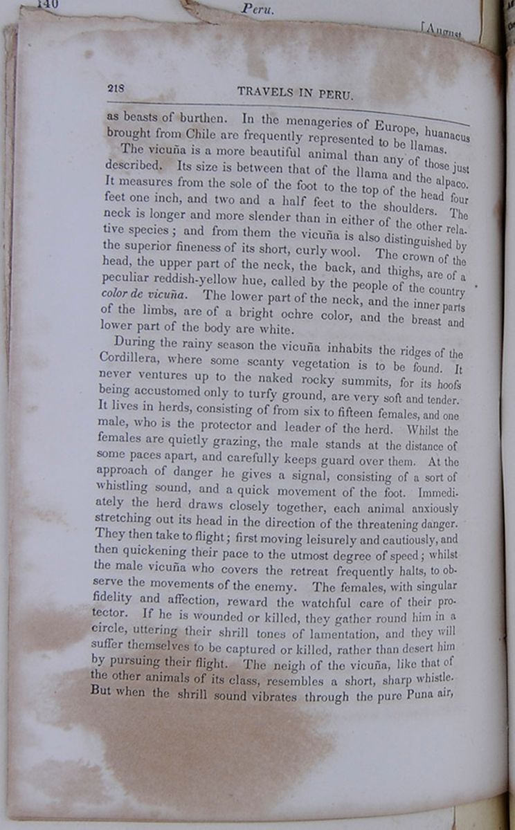 218
TRAVELS IN PERU.
218
TRAVELS IN PERU.
as beasts of burthen. In the menageries of Europe, huanacus brought from Chile are frequently represented to be llamas.
The vicuña is a more beautiful animal than any of those just described. Its size is between that of the llama and the alpaco. It measures from the sole of the foot to the top of the head four feet one inch, and two and a half feet to the shoulders. The neck is longer and more slender than in either of the other relative species; and from them the vicuña is also distinguished by the superior fineness of its short, curly wool. The crown of the head, the upper part of the neck, the back, and thighs are of a peculiar reddish-yellow hue, called by the people of the country color de vicuña. The lower part of the neck, and the inner parts of the limbs, are of a bright ochre color, and the breast and lower part of the body are white.
During the rainy season the vicuña inhabits the ridges of the Cordillera, where some scanty vegetation is to be found. It never ventures up to the naked rocky summits, for its hoofs being accustomed only to turfy ground, are very soft and tender. It lives in herds, consisting of from six to fifteen females, and one male, who is the protector and leader of the herd. Whilst the females are quietly grazing, the male stands at the distance of some paces apart, and carefully keeps guard over them. At the approach of danger he gives a signal, consisting of a sort of whistling sound, and a quick movement of the foot. Immediately the herd draws closely together, each animal anxiously stretching out its head in the direction of the threatening danger. They then take to flight; first moving leisurely and cautiously, and then quickening their pace to the utmost degree of speed; whilst the male vicuña who covers the retreat frequently halts, to observe the movements of the enemy. The females, with singular fidelity and affection, reward the watchful care of their protector. If he is wounded or killed, they gather round him in a circle, uttering their shrill tones of lamentation, and they will suffer themselves to be captured or killed, rather than desert him by pursuing their flight. The neigh of the vicuña, like that of the other animals of its class, resembles a short, sharp whistle. But when the shrill sound vibrates through the pure Puna air,
[begin surface 623]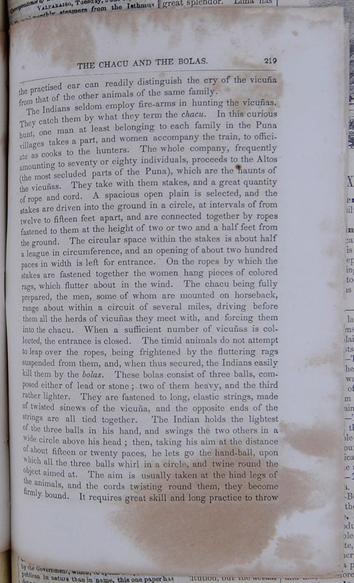 THE CHACU AND THE BOLAS.
219
THE CHACU AND THE BOLAS.
219
the practised ear can readily distinguish the cry of the vicuña from that of the other animals of the same family.
The Indians seldom employ fire-arms in hunting the vicuñas. They catch them by what they term the chacu. In this curious hunt, one man at least belonging to each family in the Puna villages takes a part, and women accompany the train, to officiate as cooks to the hunters. The whole company, frequently amounting to seventy or eighty individuals, proceeds to the Altos (the most secluded parts of the Puna), which are the haunts of the vicuñas. They take with them stakes, and a great quantity of rope and cord. A spacious open plain is selected, and the stakes are driven into the ground in a circle, at intervals of from twelve to fifteen feet apart, and are connected together by ropes fastened to them at the height of two or two and a half feet from the ground. The circular space within the stakes is about half a league in circumference, and an opening of about two hundred paces in width is left for entrance. On the ropes by which the stakes are fastened together the women hang pieces of colored rags, which flutter about in the wind. The chacu being fully prepared, the men, some of whom are mounted on horseback, range about within a circuit of several miles, driving before them all the herds of vicuñas they meet with, and forcing them into the chacu. When a sufficient number of vicuñas is collected, the entrance is closed. The timid animals do not attempt to leap over the ropes, being frightened by the fluttering rags suspended from them, and, when thus secured, the Indians easily kill them by the bolas. These bolas consist of three balls, composed either of lead or stone; two of them heavy, and the third rather lighter. They are fastened to long, elastic strings, made of twisted sinews of the vicuña, and the opposite ends of the strings are all tied together. The Indian holds the lightest of the three balls in his hand, and swings the two others in a wide circle above his head; then, taking his aim at the distance of about fifteen or twenty paces, he lets go the hand-ball, upon which all the three balls whirl in a circle, and twine round the object aimed at. The aim is usually taken at the hind legs of the animals, and the cords twisting round them, they become firmly bound. It requires great skill and long practice to throw
[begin surface 624]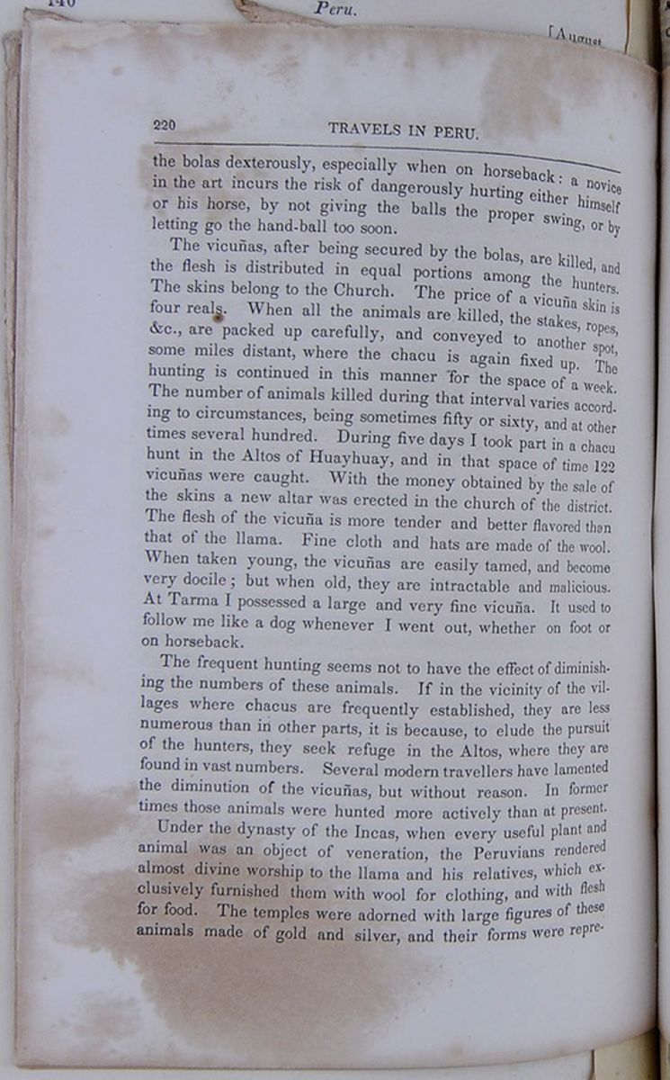 220
TRAVELS IN PERU.
220
TRAVELS IN PERU.
the bolas dexterously, especially when on horseback : a novice in the art incurs the risk of dangerously hurting either himself or his horse, by not giving the balls the proper swing, or by letting go the hand-ball too soon.
The vicuñas, after being secured by the bolas, are killed, and the flesh is distributed in equal portions among the hunters. The skins belong to the Church. The price of a vicuña skin is four reals. When all the animals are killed, the stakes, ropes, &c., are packed up carefully, and conveyed to another spot, some miles distant, where the chacu is again fixed up. The hunting is continued in this manner for the space of a week. The number of animals killed during that interval varies according to circumstances, being sometimes fifty or sixty, and at other times several hundred. During five days I took part in a chacu hunt in the Altos of Huayhuay, and in that space of time 122 vicuñas were caught. With the money obtained by the sale of the skins a new altar was erected in the church of the district. The flesh of the vicuña is more tender and better flavored than that of the llama. Fine cloth and hats are made of the wool. When taken young, the vicuñas are easily tamed, and become very docile; but when old, they are intractable and malicious. At Tarma I possessed a large and very fine vicuña. It used to follow me like a dog whenever I went out, whether on foot or on horseback.
The frequent hunting seems not to have the effect of diminishing the numbers of these animals. If in the vicinity of the villages where chacus are frequently established, they are less numerous than in other parts, it is because, to elude the pursuit of the hunters, they seek refuge in the Altos, where they are found in vast numbers. Several modern travellers have lamented the diminution of the vicuñas, but without reason. In former times those animals were hunted more actively than at present.
Under the dynasty of the Incas, when every useful plant and animal was an object of veneration, the Peruvians rendered almost divine worship to the llama and his relatives, which exclusively furnished them with wool for clothing, and with flesh for food. The temples were adorned with large figures of these animals made of gold and silver, and their forms were represented
[begin surface 625]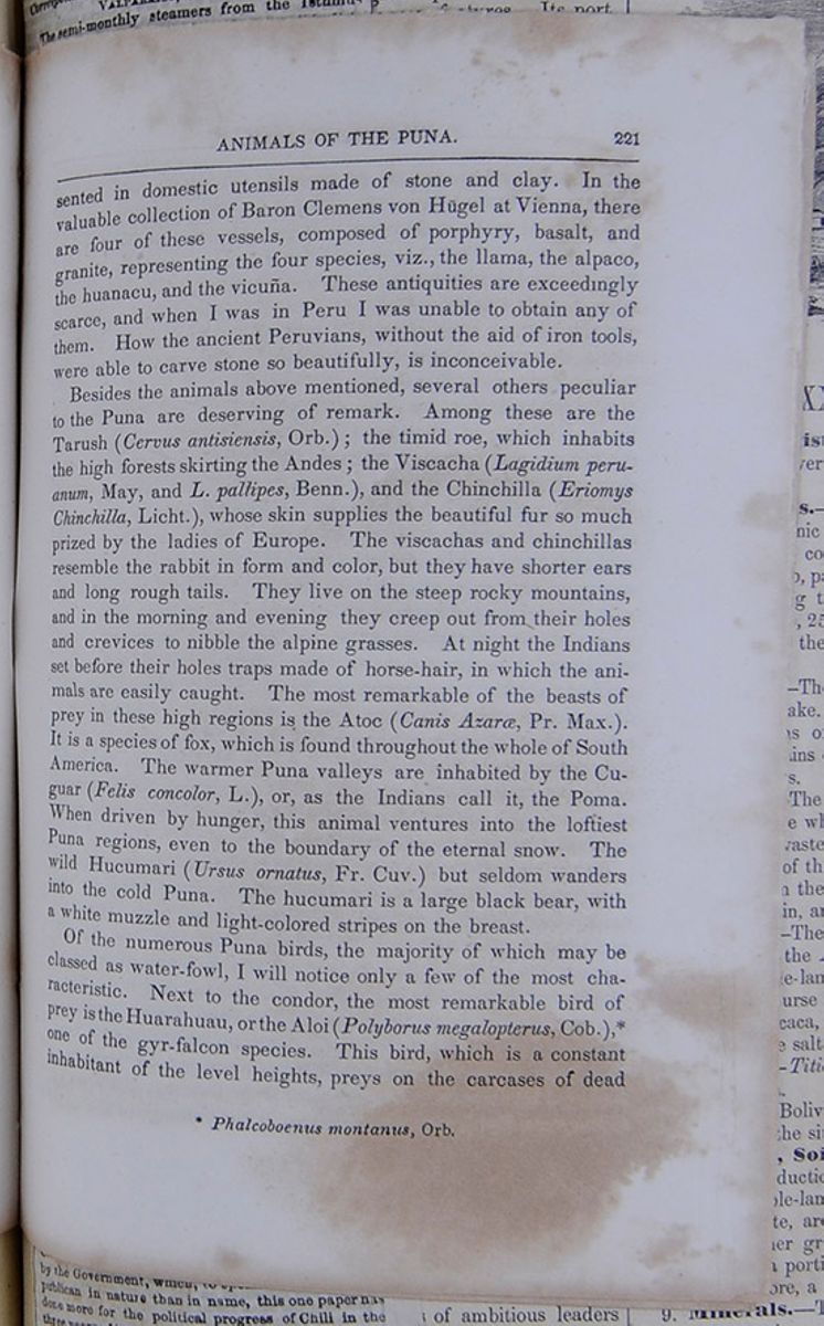 ANIMALS OF THE PUNA.
221
ANIMALS OF THE PUNA.
221
in domestic utensils made of stone and clay. In the valuable collection of Baron Clemens von Hügel at Vienna, there are four of these vessels, composed of porphyry, basalt, and granite, representing the four species, viz., the llama, the alpaco, the huanacu, and the vicuña. These antiquities are exceedingly scarce, and when I was in Peru I was unable to obtain any of them. How the ancient Peruvians, without the aid of iron tools, were able to carve stone so beautifully, is inconceivable.
Besides the animals above mentioned, several others peculiar to the Puna are deserving of remark. Among these are the Tarush (Cervus antisiensis, Orb.); the timid roe, which inhabits the high forests skirting the Andes; the Viscacha (Lagidium peruanum, May, and L. pallipes, Benn.), and the Chinchilla (Eriomys Chinchilla, Licht.), whose skin supplies the beautiful fur so much prized by the ladies of Europe. The viscachas and chinchillas resemble the rabbit in form and color, but they have shorter ears and long rough tails. They live on the steep rocky mountains, and in the morning and evening they creep out from their holes and crevices to nibble the alpine grasses. At night the Indians set before their holes traps made of horse-hair, in which the animals are easily caught. The most remarkable of the beasts of prey in these high regions is the Atoc (Canis Azaræ, Pr. Max.). It is a species of fox, which is found throughout the whole of South America. The warmer Puna valleys are inhabited by the (Felis concolor, L.), or, as the Indians call it, the . When driven by hunger, this animal ventures into the loftiest Puna regions, even to the boundary of the eternal snow. The wild Hucumari (Ursus ornatus, Fr. Cuv.) but seldom wanders into the cold Puna. The hucumari is a large black bear, with a white muzzle and light-colored stripes on the breast.
Of the numerous Puna birds, the majority of which may be classed as water-fowl, I will notice only a few of the most characteristic. Next to the condor, the most remarkable bird of prey is the Huarahuau, or the Aloi (Polyborus megalopterus, Cob.), * one of the gyr-falcon species. This bird, which is a constant inhabitant of the level heights, preys on the carcases of dead
* Phalcoboenus montanus, Orb. [begin surface 626] 222
TRAVELS IN PERU.
222
TRAVELS IN PERU.
horses, mules, &c., but never attempts to meddle with living animals. It is very harmless, and has so little timidity, that it suffers itself to be approached near enough to be knocked down with a stick. The Acacli, or Pito (Colaptes rupicola, Orb.), flutters about the mountains; it is a woodpecker, brown-speckled, with a yellow belly. This bird is seen in very great numbers, and it is difficult to imagine how it procures food in the Puna, where there are no insects. All the other woodpecker species exclusively confine themselves to woody regions.
The thickets of rushy grass are inhabited by the Pishacas, or Yutu, a species of partridge (Tinamotis Pentlandii, Vig.) which the Indians catch by dogs. These dogs of the Puna Indians are a peculiar race (Canis Ingae, Tsch.). They are distinguished by a small head, a pointed muzzle, small erect ears, a tail curling upwards, and a thick shaggy skin. They are in a half-wild state, and very surly and snappish. They furiously attack strangers, and even after having received a deadly wound they will crawl along the ground, and make an effort to bite. To white people they appear to have a particular antipathy; and sometimes it becomes rather a venturous undertaking for a European traveller to approach an Indian hut, for these mountain dogs spring up to the sides of the horse, and try to bite the rider's legs. They are snarlish and intractable even to their masters, who are often obliged to enforce obedience by the help of a stick. Yet these dogs are very useful animals for guarding flocks, and they have a keen sent for the pishacas, which they catch and kill with a single bite.
There is a very curious little bird in the Puna, about the size of a starling. Its plumage is exceedingly pretty, being on the back brown, striped with black; on the throat grey, with two dark stripes, and on the breast white. This bird has the remarkable peculiarity of making a monotonous sound at the close of every hour, during the night. The Indians call it the Ingahuallpa, or Cock of the Inga, (Thinocorus Ingæ, Tsch.), and they associate many superstitious notions with its regular hourly cry. The Puna morasses and lagunas are animated by numerous feathered inhabitants. Among them is the huachua (Chloephaga melanoptera, Eyt.), a species of goose. The plumage of the body
[begin surface 627] CATTLE AND PASTURAGE.
223
CATTLE AND PASTURAGE.
223
is dazzlingly white, the wings green, shading into brilliant violet, and the feet and beak of a bright red. The Licli (Charadrius resplendens, Tsch.) is a plover, whose plumage in color is like that of the huachua, but with a sort of metallic brightness. There are two species of ibis which belong to the Puna, though they are occasionally seen in some of the lower valleys. One is the Bandurria (Theristocus melanopis, Wagl.), and the other is the Yanahuico (Ibis Ordi, Bonap.). On the lagunas swim large flocks of Quiullas (Larus serranus, Tsch.), white mews, with black heads and red beaks, and the gigantic water-hen (Fulica gigantea, Soul.). The plumage of the latter is dark-grey, and at the root of the red beak there is a large yellow botch, in the form of a bean, whence the Indians give this bird the name of Anash sinqui, or bean nose. Among the few amphibia found in these regions one is particularly remarkable. It is a small kind of toad (Leiuperus viridis, Tsch.), and inhabits the boundaries of the perpetual snow.
The grasses of the Puna are used as fodder, and in many of the sheltered valleys there are farms (Haciendas de Ganado), where large herds of cattle are reared. The owners of some of these farms possess several thousand sheep, and from four to five hundred cows. During the rainy season the cattle are driven into the Altos. They graze in those high regions, often at the altitude of 15,000 feet above the sea. When the frost sets in they are brought down to the marshy valleys, and they suffer much from insufficiency of pasture. From the wool of the sheep a coarse kind of cloth, called Bayeta, is made in the Sierra. Some of this wool is exported, and is much prized in Europe. The old black cattle and sheep are slaughtered, and their flesh, when dried, is the principal food of the inhabitants of the Puna, particularly of the mining population. The dried beef is called Charqui, and the mutton is called Chalona. The bulls graze in the remote Altos, and most of them are reserved for the bull fights in the Sierra villages. As they seldom see a human being they become exceedingly wild; so much so that the herdsmen are often afraid to approach them. In the daytime they roam about marshy places, and at nightfall they retire for shelter beneath some overhanging rock. These animals render travelling
[begin surface 628] 224
TRAVELS IN PERU.
224
TRAVELS IN PERU.
in many parts of the Puna extremely dangerous, for they often attack people so suddenly as to afford no time for defence. It is true they usually announce their approach by a deep bellow; but the open plain seldom presents any opportunity for escape. On several occasions a well-aimed shot alone saved me from the attack of one of these ferocious bulls.
The walls of the haciendas are of rough unhewn stone. They are divided into large square rooms, always damp, cold, and uninhabitable. Beneath the straw roofs there usually hang long rows of the stuffed skins of foxes; for every Indian who kills an old fox receives, by way of reward, a sheep, and for a young one a lamb. The Cholos are therefore zealous fox-hunters, and they may possibly succeed in altogether extirpating that animal, which in some districts is so numerous as to be a perfect scourge.
As the sheep, even in the dry season, find pasture more easily than the horned cattle, they are left during the whole year in the higher parts of the Puna, under the care of Indian shepherds. At night they are driven into corales, large square roofless buildings, and are guarded by dogs. The shepherds make a practice of every year burning the dry grass of the Puna, in order to improve the growth of the fodder. A Puna fire does not, however, present the imposing spectacle of the prairie fires, as described by travellers in North America, possibly because the Puna straw is shorter, and is always somewhat damp.
The dwellings of the shepherds are built in the same rude style which characterizes all the huts in the Puna, and they impress the European traveller with a very unfavorable notion of the intelligence of the people. The architecture of these huts consists in laying down some large stones, in a circle of about eight or ten feet in diameter, by way of a foundation. These stones are covered with earth or turf, and then with successive layers of stones and earth, until the wall attains the height of about four feet : at the point most sheltered from the wind, an opening of a foot and a half or two feet high serves as a door. On this low circular wall rests the roof, which is formed in the following manner. Six or eight magay * poles are fastened together,
* The Magay is the stem of the American Agave. It has a sort of spungy [begin surface 629] PUNA HUTS.
225
PUNA HUTS.
225
so as to form a point at the top. Over these poles thin laths are laid horizontally, and fastened with straw-bands, and the whole conical-formed frame-work is overlaid with a covering of Puna straw. As a security against the wind, two thick straw-bands are crossed over the point of the roof, and at their ends, which hang down to the ground, heavy stones are fastened. The whole fabric is then completed. The hut at its central point is about eight feet high; but at the sides, no more than three and a half or four feet. The entrance is so low, that one is obliged to creep in almost bent double; and before the aperture hangs a cow-hide, by way of a door.
Internally these huts present miserable pictures of poverty and uncleanliness. Two stones serve as a stove, containing a scanty fire fed by dry dung (buñegas), and turf (champo). An earthen pot for cooking soup, another for roasting maize, two or three gourd-shells for plates, and a porongo for containing water, make up the catalogue of the goods and chattels in a Puna hut. On dirty sheep-skins spread on the ground, sit the Indian and his wife, listlessly munching their coca; whilst the naked children roll about paddling in pools of water formed by continual drippings from the roof. The other inhabitants of the hut are usually three or four hungry dogs, some lambs, and swarms of guinea-pigs.
From all this it will readily be imagined that a Puna hut is no very agreeable or inviting retreat. Yet, when worn out by the dangers and fatigues of a long day's journey, and exposed to the fury of a mountain storm, the weary traveller, heedless of suffocating clouds of smoke and mephitic odors, gladly creeps into the rude dwelling. Taking up his resting-place on the damp floor, with his saddle-cloth for a pillow, he is thankful to find himself once again in a human habitation, even though its occupants be not many degrees elevated above the brute creation.
In the Puna there are many remains of the great high road of the Incas, which led from Cuzco to Quito, stretching through the
sap; but it is covered externally with a strong tough bast. The Magay supplies the inhabitants of Upper Peru with an excellent kind of light and strong building wood. 11* [begin surface 630] 226
TRAVELS IN PERU.
226
TRAVELS IN PERU.
whole extent of Peru. It was the grandest work that America possessed before European civilisation found its way to that quarter of the world. Even those who are unacquainted with the wise dominion of the ancient Peruvian sovereigns, their comprehensive laws, and the high civilisation they diffused over the whole country, must by this gigantic work be impressed with the highest idea of the cultivation of the age; for well-constructed roads may always be regarded as proofs of a nation's advancement. There is not in Peru at the present time any modern road in the most remote degree comparable to the Incas' highway. The best preserved fragments which came under my observation were in the Altos, between Jauja and Tarma. Judging from these portions, it would appear that the road must have been from twenty-five to thirty feet broad, and that it was paved with large flat stones. At intervals of about twelve paces distant one from another there is a row of smaller stones, laid horizontally and a little elevated, so that the road ascended, as it were, by a succession of terraces. It was edged on each side by a low wall of small stones.
Other remains of ancient Peru, frequently met with in these parts, are small buildings, formerly used as stations for the messengers who promulgated the commands of the Incas through all parts of the country. Some of these buildings are still in a tolerably good state of preservation. They were always erected on little hillocks, and at such distances apart, that from each station the nearest one on either side was discernible. When a messenger was despatched from a station a signal was hoisted, and a messenger from the next successive station met him half-way, and received from him the despatch, which was in this manner forwarded from one station to another till it reached its destination. A constant communication was thus kept up between the capital and the most distant parts of the country. A proof of the extraordinary rapidity with which these communications were carried on is the fact, recorded on unquestionable authority, that the royal table in Cuzco was served with fresh fish, caught in the sea near the Temple of the Sun in Lurin, a distance of more than 200 leagues from Cuzco.
The messenger stations have by some travellers been confounded
[begin surface 631] AN INCA'S RANSOM.
227
AN INCA'S RANSOM.
227
with the forts, of which remains are met with along the great Inca road. The forts were buildings destined for totally different purposes. They were magazines for grain, and were built by the Incas to secure to their armies in these barren regions the requisite supplies of food. Vestiges of these forts are frequently seen in the Altos of Southern and Central Peru. They are broad round towers, usually built against a rocky declivity, and with numerous long apertures for the admission of air.
Even the broad level heights in which no trace of human habitations is discoverable, have been excavated by the mercenary Peruvian mestizos and creoles in search of hidden treasures. Their faith in the existence of concealed riches is founded on the following tradition. When the last reigning Inca, Atabiliba or Atahuallpa, was made prisoner by Don Francisco Pizarro, in Caxamarca, he proposed to ransom himself from the Spanish commander. The price he offered for his liberty was to fill with gold the cell in which he was confined, to the height of a certain line on the wall, which Pizarro marked with his sword. The cell, it may be mentioned, was twenty-two feet long and seventeen broad. A quantity of gold which the Inca ordered to be collected in Caxamarca and its vicinity, when piled up on the floor of the cell, did not reach above halfway to the given mark. The Inca then despatched messengers to Cuzco to obtain from the royal treasury the gold required to make up the deficiency; and accordingly eleven thousand llamas were despatched from Cuzco to Caxamarca, each laden with one hundred pounds of gold. But ere the treasure reached its destination, Atahuallpa was hanged by the advice of Don Diego de Almangra and the Dominican monk Vicente de Valverde. The terror-stirring news flew like wildfire through the land, and speedily reached the convoy of Indians, who were driving their richly-laden llamas over the level heights into Central Peru. On the spot where the intelligence of Atahuallpa's death was communicated to them, the dismayed Indians concealed the treasure, and then dispersed.
Whether the number of the llamas was really so considerable as it is stated to have been, may fairly be doubted; but that a vast quantity of gold was on its way to Caxamarca, and was concealed,
[begin surface 632] 228
TRAVELS IN PERU.
228
TRAVELS IN PERU.
is a well-authenticated fact. That the Indians should never have made any attempt to recover this treasure is quite consistent with their character. It is not improbable that even now some particular individuals among them may know the place of concealment; but a certain feeling of awe transmitted through several centuries from father to son, has, in their minds, associated the hidden treasure with the blood of their last king, and this feeling doubtless prompts them to keep the secret inviolate.
From traditionary accounts, which bear the appearance of probability, it would appear that the gold was buried somewhere in the Altos of Mito, near the valley of Jauja. Searches have frequently been made in that vicinity, but no clue to the hiding-place has yet been discovered.
FROM CHILI.
Affairs in Valparaiso—Commercial and Political Relations of Chili.
VALPARAISO, Tuesday, June 30, 1857.The semi-monthly steamers from the Isthmus bring you perchance an occasional line from this distant coast, informing you of the opening of the Chilian Congress, or of the quiescence of Peru, but I imagin few are aware of the true extent and importance of our commercial and political relations with our sister republics of the southern continent. We are accustomed to speak of Chili and Peru as distant and disregarded nations, whose politics scarcely interest us, and whose commerce is too limited to attract the attention of our merchants, and it will surprise many to learn that the commercial movements of this republic amount to some $70,000,000 per annum.
Chili, a republic of some one and a half millions of inhabitants, is making gigantic strides in the path of progress, and her railroads, telegraphs, municipal improvements and public works are worthy an older and wealthier nation. Some forty miles of the railroad between the port of Valparaiso and the Capital, Santiago, are in profitable operation, and the humanizing and progressive influence of the magnetic wire and the rail, is daily more evident in the history of the country.
Valparaiso, its commercial capital and chief port, a city of some eighty thousand souls, is situated upon the borders of a semi circular bay of two and a half miles in diameter, presenting to the approaching visitor one of the most striking panoramic views of the American coast. The chain of hills, forming its background, rise in graceful curves, broken here and there by huge quebradas, cleaving them to their very centres. Between the bases of these almost perpendicular rocks and the sea, at the west end of the city lies a narrow belt of ground, every foot of which has been economized for building purposes, the very sidewalks being taxed to add to the scanty territory. Hills, quebrada and plain are covered thickly with dwellings, dotting the landscape with a variety of effect at once novel and picturesque. Here, upon the margin of the sea, are the Custom House, with its eight blocks of massive public stores, the Post-Office, the "Palace" or Intendencia, the Telegraph Office, the Exchange, and the wholesale and importing houses, substantial, well-built edifices, that would do honor even to Wall-street. This is "par excellence" the "Port." Turning eastward, threading the crowded and narrow street that follows the curve of the Bay, and passing the Cueva de Chivato or Cape Horn, where the primitive has thrust man and his constructiveness aside, and planted its foot almost within the surf, we come to the Almendral, a broad, triangular plain of sand, a few years since the ocean's bed, whereon now rest a thousand houses, almost exclusively private dwellings, with here and there a church or monastery, lifting its spire or belfry above general uniformity of corrugated roof of tile. This portion of Valparaiso, which some sixty years ago was sold for two thousand dollars, could not now be purchased for millions. The streets are well paved, gas lighted, and a numerous and efficient police force of mounted and foot-soldiers renders it one of the safest and pleasantest cities of this part of the world.
The press of Valparaiso is most worthily represented by the Mercurio and the Diario, the former the opposition sheet; the latter semi-official, and although edited with ability, somewhat non committal and wanting in independence. The Mercurio, edited by Señor NADAL, is a frank, independent and liberal paper, opposed to the centralizing tendencies o the Government—to the union of Church and State—to the growing influence of the Jesuits, and to all that may retard for a single day the forward movement of Chili among nations. At once feared and respected by the Government, which, to speak truly, is less Republican in nature than in name, this one paper has done more for the political progress of Chili in the three years of its present editorship than her legislators in ten. Nor has this been accomplished without
[begin surface 634] [begin surface 635]
toil and prejudice. Prosecution, fine and imprisonment have more than once been the reward of bold opinion, too freely uttered for the refined ear of power; but magna est veritas, and the Mercurio of Valparaiso may be said to have conquered the proud position of the first paper in South America. I regret, however, to remark in its columns occasional letters from New-York, over the signature of P. P. Ortiz, giving one sided and unjust, not to say injurious impressions of our national character and manners. The evident ignorance of the writer is his best apology, yet he at times permits his pen most unwarrantable license. His last letter, published in the Mercurio of June 12, treating of the lately appointed Minister to Chili, Ex-Governor BIGLER, of California, is guilty of the following language: * * * "What may we say of the tigers and wolves charged with missions to South America—of the Bailies and the Peytons? According to reliable authority, Hon. Mr. BIGLER, who is about to replace Mr. STARKWEATHER at Santiago, (who has perhaps been an honorable exception,) is not precisely one of those persons who is called, in American parlance, a political rowdy, one who makes his fortune at the public hustings, not so much by eloquence and character, as by strength of lung and muscle; but his antecedents, if not dishonorable, at least show him to be a man of little culture or social standing." This gratuitous slander upon a very worthy and amiable gentleman, printed and indorsed by so high authority, but a few weeks prior to his arrival at his post, is calculated to produce a most unfavorable impression regarding our representative.
The inefficient mail service of the Pacific Steam Navigation Company cries out to our Government for relief. The British mail steamers between Panama and Valparaiso, bringing the English mails with unfailing regularity, make the connection with the American (California) line from New York so irregularly that it is a common occurrence for the semi-monthly steamer to arrive without a solitary letter or paper from the United States; while the English merchants receive their correspondence punctually the 8th and 23d of each month. To the traveler or the man of leisure this is sufficiently annoying, to the man of business it is an incalculable disadvantage. The evil is too self-evident to need extended comment. It has always received the earnest attention of the Home Government, and we little band of Americans are awaiting with indescribable eagerness for the establishment of the contemplated American Line. Lest I be accused of exaggeration I will mention that since the middle of May we have received but one American mail in place of three due. Let me illustrate the effects of this uncertainty. In advance of the Government statistics I have been favored with the following table of exports for 1856, which I have reduced to dollars for more facile comprehension, using Custom House valuation :
A table listing the monetary value of coin, silver bars, crude silver, silver mixed with copper, copper bars, impure copper, and copper ore exported from Chili to England, France, Germany, and the United States.From whence it will be seen that while England, France and Germany received, thanks to a reliable and punctual steam communication, $3,300,000 in precious metals alone from Chili, not one dollar of coin nor one bar of silver reached the United States, almost the only exports to which being in copper and its ores, which were taken to the amount of some 12,000 tons, rather than return home in ballast. Besides copper, were sent to the United States 1,876,600 pounds of wool, valued at $206,426, and 1,544 packages
[begin surface 636] [begin surface 637]
of rags valued at $3,088, so that our entire receipts from Chili in 1856 amounted to $2,840,194, less than one-fifth of her exports, more than half the balance going to swell the tide of British commerce. What argument more powerful is needed to prove the necessity of a regular, swift and reliable line of American steamers upon this coast. Our geographical position gives us the right, and our eagerness for trade the disposition, for more closely knit commercial ties with our sister Republics of the Western Coast of South America. An energetic opposition to the British monopoly is alone wanting, and with the new mail line once established, not only would our steamers divert the direct trade in precious metals to the United States, but by timing their departure from New York with the arrival of the Collins Line, your City would enjoy the indirect advantage of being the entrépôt of our commerce with the old world, whose very correspondence would soon flow into the swiftest channel of communication.
On the evening of the 24th inst. a severe fire occurred in the Port, destroying the entire row of warehouses known as the Cifuentes block, and situated between Cochrane-street and the sea. The entire Fire Department of Valparaiso, consisting of six companies, including one Hook and Ladder company, were promptly upon the ground, and after many hours of unremitting exertion, succeeded in mastering the flames and saving the surrounding buildings. Had the day not been absolutely without wind, the fire being in the heart of thecommercial portion of the city, the loss would have been fearful. The foreign men-of-war in port and the national steam-frigate, Esmeralda, sent each a launch with fire engine and crew, which, from the water side, rendered efficient service. The total loss amounts to some $300,000 about one-half of which is insured in London and Liverpool.
On the 11th inst., the Senate of Chili, to whom be all honor for the act, passed, unanimously, a bill, affording entire amnesty for all political offences. The announcement was hailed with enthusiasm by the liberal party throughout the nation, and the friends of the banished and the incarcerated rejoiced in the fond hope of promised freedom of thought and expression; but upon its reaching the House, on the 20th, a fierce debate ensued between the Ministerial and Liberal members, resulting in the defeat of the bill by a vote of 30 to 16, the four Cabinet Members present being members of the House and voting against the measure.

THE SCIENTIFIC CONVENTION.
Zodiacal Light—The Holyoke Dam—Coast Survey—The Gyroscope—Troy Weight in Coinage and Commerce—Remarkable Fossils—Coal Fields—Mineral Springs—Coast Subsidence—Observations in New-Jersey—Entertainments.
MONTREAL, Thursday, Aug. 13, 1857.SECOND DAY.
Tempora mutantur. The weather has changed to-day; we have all "seen better days," as CHARLES LAMB had. The rain comes down in torrents, but there is no postponement on account of the weather, and at 10 o'clock the meeting is opened by the Vice-President. The first business was the election of 56 new members proposed by the Standing Committee, which was done at a blow. The Chairman then gave notice that the address of the retiring President, Professor HALL, would be given this evening at Concert Hall, where the soiree of the Natural History Society is also to be. A further notice was given that twenty minutes had been assigned to Dr. HARE at the beginning of the next general meeting, to enable him to present his views in relation to the curves of which he spoke yesterday, which proved to have some connection with the laws of traveling whirlwinds.
The Association then adopted the recommendation of the Standing Committee that the sections should meet from 10 A.M. to 2 P.M., and that there should be a general meeting of the Association at 4 P.M.
The Chairman suggested to the reporters the propriety of submitting their reports of papers on scientific subjects to some member of the Association for revision, but as he did not announce who of them would be always ready to look over reports, his suggestion may not be universally acted upon.
The general meeting then adjourned to to-morrow afternoon.
Mr. Ex-President FILLMORE was present at the
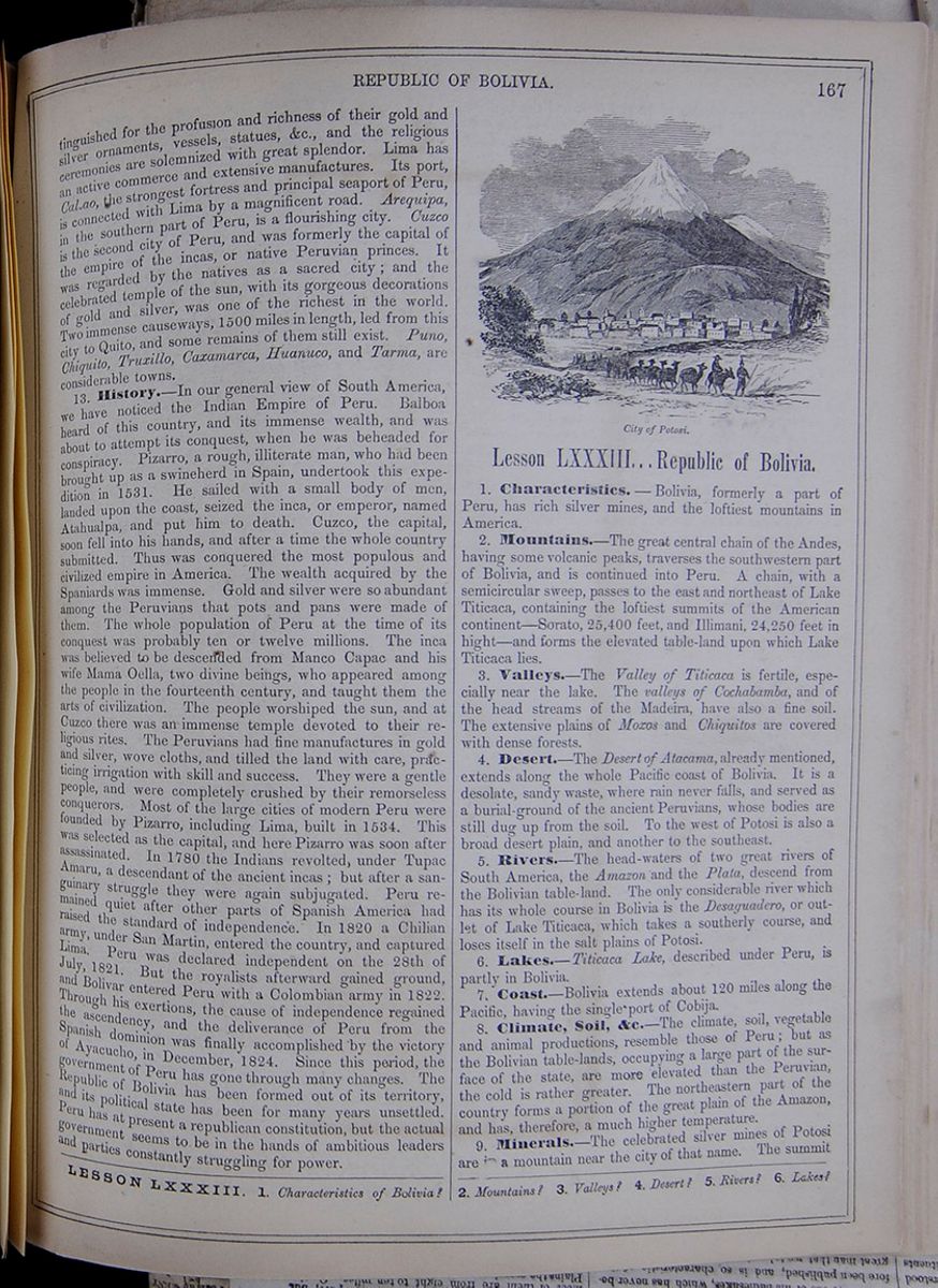 REPUBLIC OF BOLIVIA.
167
REPUBLIC OF BOLIVIA.
167
distinguished for the profusion and richness of their gold and silver ornaments, vessels, statues, &c., and the religious ceremonies are solemnized with great splendor. Lima has an active commerce and extensive manufactures. Its port, Callao, the strongest fortress and principal seaport of Peru, is connected with Lima by a magnificent road. Arequipa, in the southern part of Peru, is a flourishing city. Cuzco is the second city of Peru, and was formerly the capital of the empire of the incas, or native Peruvian princes. It was regarded by the natives as a sacred city; and the celebrated temple of the sun, with its gorgeous decorations of gold and silver, was one of the richest in the world. Two immense causeways, 1500 miles in length, led from this city to Quito, and some remains of them still exist. Puno, Chiquito, Truxillo, Caxamarca, Huanuco, and Tarma, are considerable towns.
13. History.—In our general view of South America, we have noticed the Indian Empire of Peru. Balboa heard of this country, and its immense wealth, and was about to attempt its conquest, when he was beheaded for conspiracy. Pizarro, a rough, illiterate man, who had been brought up as a swineherd in Spain, undertook this expedition in 1531. He sailed with a small body of men, landed upon the coast, seized the inca, or emperor, named Atahualpa, and put him to death. Cuzco, the capital, soon fell into his hands, and after a time the whole country submitted. Thus was conquered the most populous and civilized empire in America. The wealth acquired by the Spaniards was immense. Gold and silver were so abundant among the Peruvians that pots and pans were made of them. The whole population of Peru at the time of its conquest was probably ten or twelve millions. The inca was believed to be descended from Manco Capac and his wife Mama Oella, two divine beings, who appeared among the people in the fourteenth century, and taught them the arts of civilization. The people worshiped the sun, and at Cuzco there was an immense temple devoted to their religious rites. The Peruvians had fine manufactures in gold and silver, wove cloths, and tilled the land with care, practicing irrigation with skill and success. They were a gentle people, and were completely crushed by their remorseless conquerors. Most of the large cities of modern Peru were founded by Pizarro, including Lima, built in 1534. This was selected as the capital, and here Pizarro was soon after assassinated. In 1780 the Indians revolted, under Tupac Amaru, a descendant of the ancient incas; but after a sanguinary struggle they were again subjugated. Peru remained quiet after other parts of Spanish America had raised the standard of independence. In 1820 a Chilian army, under San Martin, entered the country, and captured Lima. Peru was declared independent on the 28th of July, 1821. But the royalists afterward gained ground, and Bolivar entered Peru with a Colombian army in 1822. Through his exertions, the cause of independence regained the ascendency, and the deliverance of Peru from the Spanish dominion was finally accomplished by the victory of Ayacucho, in December, 1824. Since this period, the government of Peru has gone through many changes. The Republic of Bolivia has been formed out of its territory, and its political state has been for many years unsettled. Peru has at present a republican constitution, but the actual government seems to be in the hands of ambitious leaders and parties constantly struggling for power.
Lesson LXXXIII... Republic of Bolivia.
1. Characteristics.—Bolivia, formerly a part of Peru, has rich silver mines, and the loftiest mountains in America.
2. Mountains.—The great central chain of the Andes, having some volcanic peaks, traverses the southwestern part of Bolivia, and is continued into Peru. A chain, with a semicircular sweep, passes to the east and northeast of Lake Titicaca, containing the loftiest summits of the American continent—Sorato, 25,400 feet, and Illimani, 24,250 feet in hight—and forms the elevated table-land upon which Lake Titicaca lies.
3. Valleys.—The Valley of Titicaca is fertile, especially near the lake. The valleys of Cochabamba, and of the head streams of the Madeira, have also a fine soil. The extensive plains of Moxos and Chiquitos are covered with dense forests.
4. Desert.—The Desert of Atacama, already mentioned, extends along the whole Pacific coast of Bolivia. It is a desolate, sandy waste, where rain never falls, and served as a burial-ground of the ancient Peruvians, whose bodies are still dug up from the soil. To the west of Potosi is also a broad desert plain, and another to the southeast.
5. Rivers.—The head-waters of two great rivers of South America, the Amazon and the Plata, descend from the Bolivian table-land. The only considerable river which has its whole course in Bolivia is the Desaguadero, or outlet of Lake Titicaca, which takes a southerly course, and loses itself in the salt plains of Potosi.
6. Lakes.—Titicaca Lake, described under Peru, is partly in Bolivia.
7. Coast.—Bolivia extends about 120 miles along the Pacific, having the single port of Cobija.
8. Climate, Soil, &c.—The climate, soil, vegetable and animal productions, resemble those of Peru; but as the Bolivian table-lands, occupying a large part of the surface of the state, are more elevated than the Peruvian, the cold is rather greater. The northeastern part of the country forms a portion of the great plain of the Amazon, and has, therefore, a much higher temperature.
9. Minerals.—The celebrated silver mines of Potosi are in a mountain near the city of that name. The summit
LESSON LXXXIII. 1. Characteristics of Bolivia? 2. Mountains? 3. Valleys? 4. Desert? 5. Rivers? 6. Lakes? [begin surface 640] 168
REPUBLIC OF CHILI.
168
REPUBLIC OF CHILI.
of this rises to an elevation of 16,300 feet, and the highest mine is upward of 15,000 feet above the level of the sea. From the first discovery of these mines, in 1545, until 1803, they yielded about one thousand million dollars' worth of silver; and since the latter period, though imperfectly and unskillfully worked, have continued to produce about three millions annually.
10. Divisions.—Bolivia is divided into departments, as follows:
A table listing the area in square miles, chief cities, and populations of the departments of Bolivia, including La Paz de Ayacucho, Potosi, Oruro, Chuquisaca, Cochabamba, Beni, Santa Cruz de la Sierra, Tarija, and Cobija.11. Industry.—Agriculture is the chief pursuit. Mining is extensively carried on. There are some manufactures of cotton, glass, and silver. Some of the Indian tribes make fine cloths, furs, parasols, &c. The exports consist of precious metals, wool, woolen goods, hats, drugs, skins, soap, tobacco, &c.
12. Inhabitants.—The population has much the same character with that of the other Spanish-American states. The number of whites is small, the native Indians constituting upward of one-half of the whole mass of inhabitants. The religion is Roman Catholic. Ignorance and indolence prevail among the masses. The Moxos Indians are agricultural; the Chiquitos are nomadic. The tribes on the Beni are wild and savage.
13. Towns.—The capital, Chuquisaca, or La Plata, is situated in a pleasant and fertile plain, at an elevation of 9500 feet. It is well built, and contains, besides other public edifices, numerous convents. The principal city of Bolivia is La Paz. Although it lies in a deep valley, it is elevated 12,400 feet above the sea. Near it rises the colossal summit of Illimani. Potosi was formerly a large and opulent city, with 150,000 inhabitants, but is now so much reduced, as not to contain more than 30,000. It lies in a barren district, at the remarkable elevation of 13,700 feet above the sea. It owed its former splendor wholly to the mineral wealth of its neighborhood. It contains a monument erected in honor of Bolivar. Cochabamba lies in a rich and well-cultivated region, which may be considered the granary of Bolivia. Santa Cruz is an ill-built town, in a vast plain. Oruro lies in the vicinity of rich silver mines. Cobija, or Lamar, is a little village in the desert of Atacama, on the Bolivian coast, and deserves notice as being the only seaport of the republic. It has some ship-building docks, a quay, barracks, &c.
14. History—The Bolivian territories, or, as they are commonly called, the provinces of Upper Peru, were detached from the Spanish viceroyalty of Peru, and annexed to that of the Plata, in 1778. In 1824, the Spanish authority was overthrown by the victory of Ayacucho, and in the succeeding year the people of Upper Peru determined to remain a separate state, under the name of Bolivia. This title was adopted in honor of Bolivar, who aided the people in achieving their independence, and drew up their constitution. By this code, the president is chosen for life, with the power of appointing his successor.
Lesson LXXXIV... Republic of Chili.
1. Characteristics.—This state consists of a long, narrow territory, extending 1200 miles along the Pacific Ocean.
2. Mountains.—The great chain of the Andes traverses the country from north to south, and presents a number of summits, the hight of which has been estimated at upward of 20,000 feet. The roads that lead across these mountains are impassable, except in summer, and the passage is even then difficult and hazardous. Among the Chilian Andes, there are said to be fourteen volcanoes in a state of constant eruption, and a still greater number that discharge smoke at intervals. Earthquakes are common.
3. Rivers.—The rivers are numerous, but small, and have generally a rapid current, as they descend from elevated regions into the Pacific, and have a short course. The Maule and Biobio are navigable for a short distance.
4. Shores.—The line of the coast is very even, extending north and south, and presenting several good harbors.
5. Islands.—The island of Chiloe, and the archipelago of Chonos, in the south, belong to the republic, which also claims the island of Juan Fernandez, at some distance from the coast, celebrated as the residence of Alexander Selkirk, whose adventures furnished the hint for the popular novel of Robinson Crusoe.
6. Climate, Productions, &c.—Chili lies in the temperate zone, and enjoys a fine climate. In the northern provinces it rarely rains, and snow is never seen in the maritime districts. Ice, however, is sometimes formed here. The soil is, in general, highly productive, particularly in the valleys of the Andes; and while the northern provinces yield various tropical productions, the southern produce the cereal grasses. This is the native country of the potato, several varieties of which are cultivated in great perfection. It is found wild on the hills and mountains, as well as in the lower country, and even in the Chiloe Isles. The animals are similar to those of Peru. The lama and guanaco abound in the plains. The chinchilla mouse, celebrated for its soft fur, is also common.
7. Minerals.—The metallic wealth of the country is great. It is rich in mines of gold, silver, quicksilver, tin, copper, and iron. Gold is abundant, and is obtained from mines and washings. The richest mines are in the part of the country now occupied by the Araucanians. Many of the richest silver mines are in the loftiest and coldest parts of the Andes, and have been abandoned in consequence of the difficulty and expense of working them.
8. Face of the Country.—Chili presents a plain, gradually rising in elevation as it recedes from the coast, and approaches the Andes. The country intercepted between the foot of the Andes and the Pacific Ocean is divided into two equal parts, the maritime and midland. The maritime part is intersected by three ridges of mountains, running parallel with the Andes. The midland part is generally level, of great fertility, and enjoying a delightful climate.
9. Industry.—Agriculture is the leading pursuit, all kinds of grain being cultivated. Melons, pumpkins, figs, grapes, pomegranates, oranges, peaches, apples, and olives are abundant. The commerce is considerable. Copper,
7. Coast? 8. Climate, soil, &c.? 9. Minerals? 10. Divisions? 11. Industry? 12. Inhabitants? 13. Towns? 14. History? How did Bolivia obtain its name? LESSON LXXXIV. 1. Characteristics? 2. Mountains? 3. Rivers? 4. Shores? 5. Islands? 6. Climate, productions, &c.? 7. Minerals? 8. Face of the country? 9. Industry? 10. Divisions? [begin surface 641]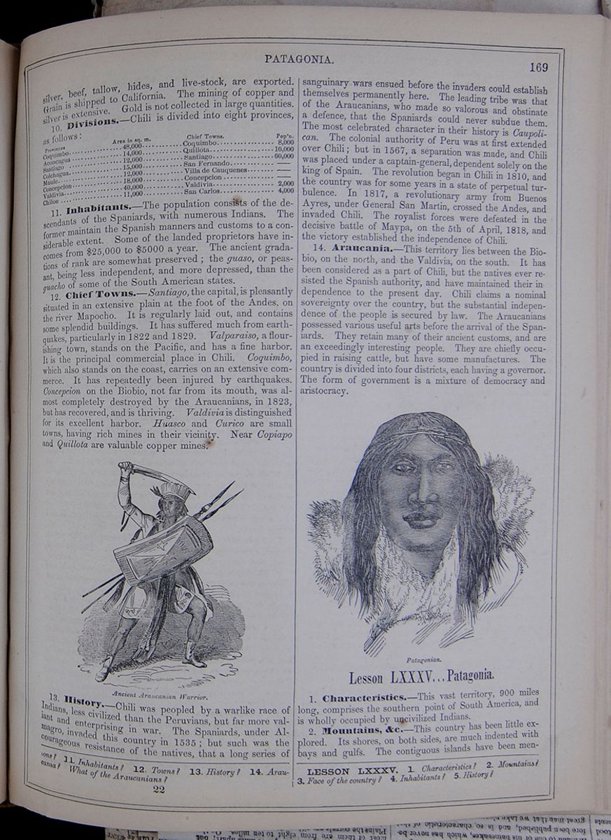 PATAGONIA.
169
PATAGONIA.
169
silver, beef, tallow, hides, and live-stock, are exported. Grain is shipped to California. The mining of copper and silver is extensive. Gold is not collected in large quantities.
10. Divisions.—Chili is divided into eight provinces, as follows:
Table listing the area in square miles of provinces of Chili, including Coquimbo, Aconcagua, Santiago, Colchagua, Maule, Concepcion, Valdivia, and Chiloe. The chief towns are listed as Coquimbo, Quillota, Santiago, San Fernando, Villa de Cauquenes, Concepcion, Valdivia, and San Carlos.11. Inhabitants.—The population consists of the descendants of the Spaniards, with numerous Indians. The former maintain the Spanish manners and customs to a considerable extent. Some of the landed proprietors have incomes from $25,000 to $5000 a year. The ancient gradations of rank are somewhat preserved; the guaso, or peasant, being less independent, and more depressed, than the guacho of some of the South American states.
12. Chief Towns.—Santiago, the capital, is pleasantly situated in an extensive plain at the foot of the Andes, on the river Mapocho. It is regularly laid out, and contains some splendid buildings. It has suffered much from earthquakes, particularly in 1822 and 1829. Valparaiso, a flourishing town, stands on the Pacific, and has a fine harbor. It is the principal commercial place in Chili. Coquimbo, which also stands on the coast, carries on an extensive commerce. It has repeatedly been injured by earthquakes. Concepcion on the Biobio, not far from its mouth, was almost completely destroyed by the Araucanians, in 1823, but has recovered, and is thriving. Valdivia is distinguished for its excellent harbor. Huasco and Curico are small towns, having rich mines in their vicinity. Near Copiapo and Quillota are valuable copper mines.
Ancient Araucanian Warrior.13. History.—Chili was peopled by a warlike race of Indians, less civilized than the Peruvians, but far more valiant and enterprising in war. The Spaniards, under Almagro, invaded this country in 1535; but such was the courageous resistance of the natives, that a long series of sanguinary wars ensued before the invaders could establish themselves permanently here. The leading tribe was that of the Araucanians, who made so valorous and obstinate a defence, that the Spaniards could never subdue them. The most celebrated character in their history is Caupolican. The colonial authority of Peru was at first extended over Chili; but in 1567, a separation was made, and Chili was placed under a captain-general, dependent solely on the king of Spain. The revolution began in Chili in 1810, and the country was for some years in a state of perpetual turbulence. In 1817, a revolutionary army from Buenos Ayres, under General San Martin, crossed the Andes, and invaded Chili. The royalist forces were defeated in the decisive battle of Maypa, on the 5th of April, 1818, and the victory established the independence of Chili.
14. Araucania.—This territory lies between the Biobio, on the north, and the Valdivia, on the south. It has been considered as a part of Chili, but the natives ever resisted the Spanish authority, and have maintained their independence to the present day. Chili claims a nominal sovereignty over the country, but the substantial independence of the people is secured by law. The Araucanians possessed various useful arts before the arrival of the Spaniards. They retain many of their ancient customs, and are an exceedingly interesting people. They are chiefly occupied in raising cattle, but have some manufactures. The country is divided into four districts, each having a governor. The form of government is a mixture of democracy and aristocracy.
Lesson LXXXV... Patagonia.
1. Characteristics.—This vast territory, 900 miles long, comprises the southern point of South America, and is wholly occupied by uncivilized Indians.
2. Mountains, &c.—This country has been little explored. Its shores, on both sides, are much indented with bays and gulfs. The contiguous islands have been mentioned
11. Inhabitants? 12. Towns? 13. History? 14. Araucania? What of the Araucanians? LESSON LXXXV. 1. Characteristics? 2. Mountains? 3. Face of the country? 4. Inhabitants? 5. History? 22 [begin surface 642]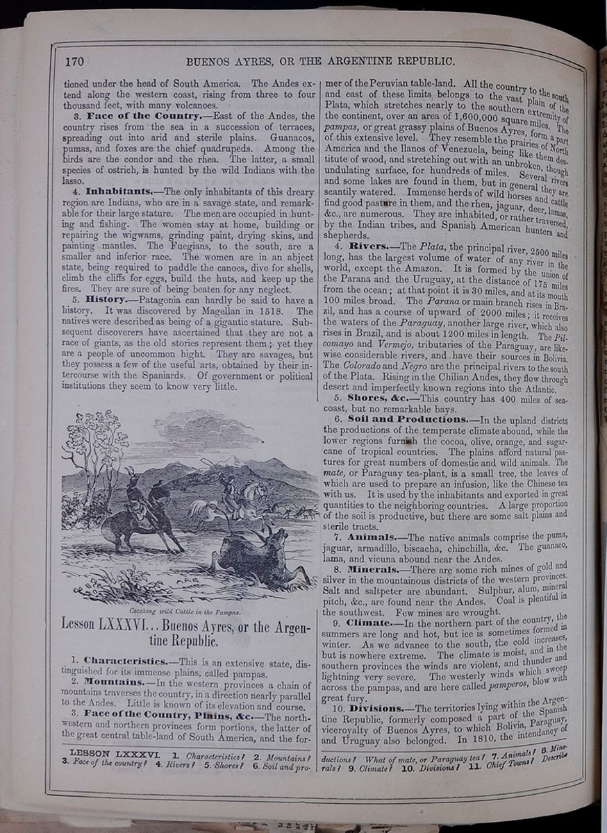 170
BUENOS AYRES, OR THE ARGENTINE REPUBLIC.
170
BUENOS AYRES, OR THE ARGENTINE REPUBLIC.
under the head of South America. The Andes extend along the western coast, rising from three to four thousand feet, with many volcanoes.
3. Face of the Country.—East of the Andes, the country rises from the sea in a succession of terraces, spreading out into arid and sterile plains. Guanacos, pumas, and foxes are the chief quadrupeds. Among the birds are the condor and the rhea. The latter, a small species of ostrich, is hunted by the wild Indians with the lasso.
4. Inhabitants.—The only inhabitants of this dreary region are Indians, who are in a savage state, and remarkable for their large stature. The men are occupied in hunting and fishing. The women stay at home, building or repairing the wigwams, grinding paint, drying skins, and painting mantles. The Fuegians, to the south, are a smaller and inferior race. The women are in an abject state, being required to paddle the canoes, dive for shells, climb the cliffs for eggs, build the huts, and keep up the fires. They are sure of being beaten for any neglect.
5. History.—Patagonia can hardly be said to have a history. It was discovered by Magellan in 1518. The natives were described as being of a gigantic stature. Subsequent discoverers have ascertained that they are not a race of giants, as the old stories represent them; yet they are a people of uncommon hight. They are savages, but they possess a few of the useful arts, obtained by their intercourse with the Spaniards. Of government or political institutions they seem to know very little.
Lesson LXXXVI... Buenos Ayres, or the Argentine Republic.
1. Characteristics.—This is an extensive state, distinguished for its immense plains, called pampas.
2. Mountains.—In the western provinces a chain of mountains traverses the country, in a direction nearly parallel to the Andes. Little is known of its elevation and course.
3. Face of the Country, Plains, &c.—The northwestern and northern provinces form portions, the latter of the great central table-land of South America, and the former of the Peruvian table-land. All the country to the south and east of these limits belongs to the vast plain of the Plata, which stretches nearly to the southern extremity of the continent, over an area of 1,600,000 square miles. The pampas, or great grassy plains of Buenos Ayres, form a part of this extensive level. They resemble the prairies of North America and the llanos of Venezuela, being like them destitute of wood, and stretching out with an unbroken, though undulating surface, for hundreds of miles. Several rivers and some lakes are found in them, but in general they are scantily watered. Immense herds of wild horses and cattle find good pasture in them, and the rhea, jaguar, deer, lamas , &c., are numerous. They are inhabited, or rather traversed, by the Indian tribes, and Spanish American hunters and shepherds.
4. Rivers.—The Plata, the principal river, 2500 miles long, has the largest volume of water of any river in the world, except the Amazon. It is formed by the union of the Parana and the Uruguay, at the distance of 175 miles from the ocean; at that point it is 30 miles, and at its mouth 100 miles broad. The Parana or main branch rises in Brazil, and has a course of upward of 2000 miles; it receives the waters of the Paraguay, another large river, which also rises in Brazil, and is about 1200 miles in length. The Pilcomayo and Vermejo, tributaries of the Paraguay, are likewise considerable rivers, and have their sources in Bolivia. The Colorado and Negro are the principal rivers to the south of the Plata. Rising in the Chilian Andes, they flow through desert and imperfectly known regions into the Atlantic.
5. Shores, &c.—This country has 400 miles of seacoast, but no remarkable bays.
6. Soil and Productions.—In the upland districts the productions of the temperate climate abound, while the lower regions furnish the cocoa, olive, orange, and sugarcane of tropical countries. The plains afford natural pastures for great numbers of domestic and wild animals. The mate, or Paraguay tea-plant, is a small tree, the leaves of which are used to prepare an infusion, like the Chinese tea with us. It is used by the inhabitants and exported in great quantities to the neighboring countries. A large proportion of the soil is productive, but there are some salt plains and sterile tracts.
7. Animals.—The native animals comprise the puma, jaguar, armadillo, biscacha, chinchilla, &c. The guanaco, lama , and vicuna abound near the Andes.
8. Minerals.—There are some rich mines of gold and silver in the mountainous districts of the western provinces. Salt and saltpeter are abundant. Sulphur, alum, mineral pitch, &c., are found near the Andes. Coal is plentiful in the southwest. Few mines are wrought.
9. Climate.—In the northern part of the country, the summers are long and hot, but ice is sometimes formed in winter. As we advance to the south, the cold increases, but is nowhere extreme. The climate is moist, and in the southern provinces the winds are violent, and thunder and lightning very severe. The westerly winds which sweep across the pampas, and are here called pamperos, blow with great fury.
10. Divisions.—The territories lying within the Argentine Republic, formerly composed a part of the Spanish viceroyalty of Buenos Ayres, to which Bolivia, Paraguay, and Uruguay also belonged. In 1810, the intendancy of
LESSON LXXXVI. 1. Characteristics? 2. Mountains? 3. Face of the country? 4. Rivers? 5. Shores? 6. Soil and productions? What of mate, or Paraguay tea? 7. Animals? 8. Minerals? 9. Climate? 10. Divisions? 11. Chief Towns? Describe
The Commerce of the La Plata—Advantages of Capt. Page's Explorations.
The South American explorations of the Water Witch, under the command of Captain PAGE, have scarcely received the attention their importance merits. In the report of the Expedition, recently made to the Secretary of the Navy, a mere sketch is given of the survey of the La Plata States and their principal rivers. We trust that the question will not be allowed to subside, and that Captain PAGE will lay before the public a more detailed account of his explorations than the one brought within the compass of an official report. We trust, too, that the Government, having advanced thus far in opening up a new field to civilization and commerce, will not withdraw its support from so great an enterprise, but will follow up the steps already taken, and secure for our country the honor of having accomplished one of the most important achievements of the day and the advantages to be derived from it.
Capt. PAGE's actual survey, in the States of the La Plata, embraced an extent of 3,600 miles of river, and 4,400 miles of land. The Paraguay, Parana, and Uruguay were severally ascended to points which vessels had never before reached, and the practicability of their navigation was fully demonstrated. The expedition up the Paraguay was attended with the most important results. By the course of the river, the Water Witch steamed a distance of 2,000 miles from the ocean, establishing the fact that a water communication existed between the rich Brazil[cut away] Grasso and [cut away]We have
[begin surface 644] [begin surface 645]
[cut away] Province of Matto [cut away] Atlantic. Nor was this all. [cut away] Capt. PAGE's positive opinion that several western tributaries of the Paraguay could, with small expense, be rendered navigable, and a natural outlet be thus given to the commerce of the Bolivian Republic.
Throughout the vast region of unpeopled territory included in Capt. PAGE's survey, the attractions and advantages held out to the settler are such as no other country in the known world possesses. Gold and precious minerals abound; but these are not the material upon which the emigrant now founds his hopes and fortunes. The glittering dust has decoyed too many to their destruction, and the ancient dream of an el dorado has vanished before the realities of actual experience. Though in the undiscovered mines of the La Plata there were tenfold the wealth that California or Australia has given to the world; yet, to the settler, their agricultural resources offer far more tempting prospects. A land of eternal Summer—a climate, tropical indeed, but breathing no pestilential or infectious disease—a soil well watered, and of unequaled richness;—these are Nature's blessings with which industry will reap her profits of a thousand fold. With the products of these countries we are still imperfectly acquainted; of the full extent of their resources we are profoundly ignorant. We only know that with a soil so fertile, so splendidly watered—with a climate so genial, so salubrious—the country is bound to rival the Indies in its wealth. The exports of Paraguay are still insignificant. They consist of the yerba, tobacco, hides wool, sugar, medicinal drugs and woods o rare value. But, with free navigation, the impetus recently given to trade has amply recompensed the Government for inaugurating a wiser policy than that of closing their rivers to the world's commerce. Some Governments of the La Plata have made the most liberal offers of land and agricultural implements to all those who are disposed to cultivate the soil. The fruits of such a policy are already apparent. Ships, now, are constantly leaving European ports with settlers for these States. Within a very few years, when labor has, in a measure, developed its now hidden resources, we shall have the whole of this vast country pouring out its millions at our feet. [cut away]
[begin surface 646] [begin surface 647]
To the United States the honor belongs of having taken initiatory steps towards opening up this garden of the world to commerce and industrial enterprise. We trust that this honor, and the advantages which, by right of precedence, should be secured for our people, will not be thrown away;—that the important explorations of Captain PAGE will not be altogether lost sight of. They should be followed up promptly and with energy. The Governments of the La Plata States are disposed to be liberal. They know that in peopling their deserts and cultivating their soil lies the true secret of prosperity. They know that these benefits cannot be obtained unless they throw open their territories to foreign immigration, and their rivers to the free navigation of the world. They know that only by a more thickly settled country can stability be given to their Governments, and security to the individual enterprise—without which the wealth of the La Plata would be profitless either to the States themselves or to the world at large. With their eyes opened to these facts, we may well prophesy a brilliant future for such of the Spanish-American Republics as are willing to learn from the experience of other nations. The various people with whom Captain PAGE held communication were well disposed towards the United States, and hailed with joy the presence of a North American vessel in their waters. These are the countries with which our commercial relations should be close—these the people with whom the most friendly feelings should be cultivated. Until now, we have scarcely made an effort to obtain their commerce, or secure any of the advantages which we would be willing and able to reciprocate. Instead of extending the peaceful influences of commerce and civilization among our sister Republics, and, as the stronger power, creating a confidence among weaker neighbors, we have inspired them with such distrust that a generation or more must elapse ere WALKER and his desperadoes will cease to be regarded as types of American citizens.
The expedition of the Water Witch sufficiently proves that the closest commercial relations with the States of the La Plata may be established. [cut away]
[begin surface 648]

Buenos Ayres broke out into an insurrection, and its example was followed by other intendancies of the viceroyalty. In 1817, they declared themselves independent, under the name of the United States of South America, which was afterward changed into that of the Argentine Republic or United Provinces of the Plata. This republic is divided as follows:—
Table listing the populations of the cities of Buenos Aires, including Buenos Aires, Santa Fe, Parana, Corrientes, San Ildefonso, Cordova, Santiago, Tucuman, Salta, Catamarca, La Rioja, San Juan, San Luis, and Mendoza. The states are listed as Buenos Aires, Santa Fe, Entre Rios, Corrientes, Missiones, Cordova, Santiago, Tucuman, Salta, Catamarca, La Rioja, San Juan, San Luis, and Mendoza.11. Chief Towns.—Buenos Ayres, capital of the state of the same name, is one of the principal cities of South America, and is not less distinguished for its literary than for its commercial activity. It is well built, with regular and well-paved streets, and contains many handsome public and private buildings. Although situated near the mouth of one of the largest rivers in the world, its harbor is so much obstructed by sand-banks, that large vessels only come up to Barragan. Corrientes, a small town, situated near the confluence of the Parana and Paraguay, has great natural advantages for inland commerce. Cordova, formerly rendered important by its famous university, which is now sunk into insignificance, enjoys an active internal commerce, and carries on considerable manufactures of woolen and cotton. San Juan, in the state of the same name, produces large quantities of wine and brandy. Mendoza, on the eastern declivity of the Andes, has also an active trade in wine and fruits. Upsallata, a little town in the state of Mendoza, is celebrated for its rich silver-mine. Salta, Tucuman, and Santa Fé are the other principal towns.
12. Industry.—Agriculture is the chief pursuit; but it is very unskillfully conducted. Cotton, tobacco, rice, sugar-cane, indigo, and the various grains, with cochineal, cocoa, cinchona bark, Paraguay tea, and various fruits, are produced. Wine and brandy are made from grapes. Morocco leather and turned wares are manufactured at Cordova. The Indians of the Chaco make yarn, ropes, fishing-nets, saddle-cloths, baskets, and other fabrics, from the fibres of the aloe, which they dye with great skill. The foreign commerce centers entirely in the city of Buenos Ayres.
13. Inhabitants.—The native whites of this country are favorably distinguished among those of the other Spanish colonies for character and cultivation. The blacks are few. The Creole shepherds of the great plains, called Guachos, lead a life of wild independence, passing most of their time on horseback, eating nothing but jerked beef and drinking water; they are rude, but hospitable and generous. Armed with his lasso or leather strap, which he throws at a great distance with unerring aim, the Guacho gallops out into the open plain, hurls it at the wild horse, bull, or rhea, lodging it round the neck of the animal, which by a sudden jerk he throws to the ground, and then secures his prey. The Indians are numerous, and some of the tribes of the south are fierce and warlike. They have learned the use of the horse, and they wander in search of game and pasturage, through the great expanse of the pampas, where they are engaged in constant hostilities with the Guachos.
14. History.—The great stream called Rio de la Plata, or River Plate, was discovered by the Spaniards in 1515. There they first saw the silver of the new world, on which account they gave the river the name it has ever since borne. The city of Buenos Ayres was founded in 1535. The Spanish settlers intermarried with the Indians, which first produced that mixed race called Mestizoes, now so common in South America. This colony was first attached to the government of Peru. The Jesuits established their missions here in the seventeenth century, and met with great success in converting the natives to Catholicism. In 1778, Buenos Ayres was separated from Peru, and erected into a viceroyalty. In 1806, when Spain was at war with Great Britain, the British sent an expedition which captured the city of Buenos Ayres; but they were expelled after holding it fifteen days. In 1810, the inhabitants rose in insurrection against the Spanish authorities, and, after various fluctuations of fortune, an independent government was established. It is now known by the name of the Argentine Republic. Its Spanish name is Buenos Ayres. Its former name of United Provinces is, however, preserved in popular use. The government has never been settled; from 1835 to 1852 it was under the dictatorship of Rosas; but in that year the Liberals, under General Urquiza, drove him from power and inducted a more popular government.
Lesson LXXXVII ... Republic of Uruguay.
1. Characteristics.—This is a small state, formerly belonging to Buenos Ayres, and called the Banda Oriental.
2. Face of the Country.—Along the coast, the surface is level, and bare of wood. In the center, it becomes mountainous, with ravines and hights clothed with forests, and abounding with wild animals. A large portion of the surrounding interior is undulating.
3. Rivers.—The territory is watered by numerous tributaries of the Uruguay. The Rio Negro is the principal, traversing the country from east to west.
4. Climate, Products, &c.—The climate is generally damp, but temperate and healthy. In the winter, heavy rains and cold winds are prevalent; but in the lowlands, frost is said to be unknown. Natural pastures are very extensive and luxuriant. Cattle and horses form the principal wealth of the people; and their products, consisting of hides, skins, hair, jerked beef, and tallow, are the chief exports. Wheat, maize, beans, and melons are produced, and the country is adapted for the culture of most fruits of temperate climates; but at present, no more agricultural produce is raised than is required for home consumption.
5. Minerals.—Granite and limestone rocks prevail in the mountainous region; jasper and chalcedony are met with; but few if any mines are wrought.
6. Inhabitants.—The population is small for the extent of territory. By far the larger part are Indians—some of them civilized, and others in a wild state.
7. Chief Towns.—There are three principal towns—La Colonia, Maldonado, and Monte Video. The last is the capital, has a good port, and, though injured by the
Buenos Ayres? 12. Industry? 13. Inhabitants? Describe the Guachos? 14. History? LESSON LXXXVII. 1. Characteristics of Uruguay? 2. Face of the country? 3. Rivers? 4. Climate, products, &c.? [begin surface 650]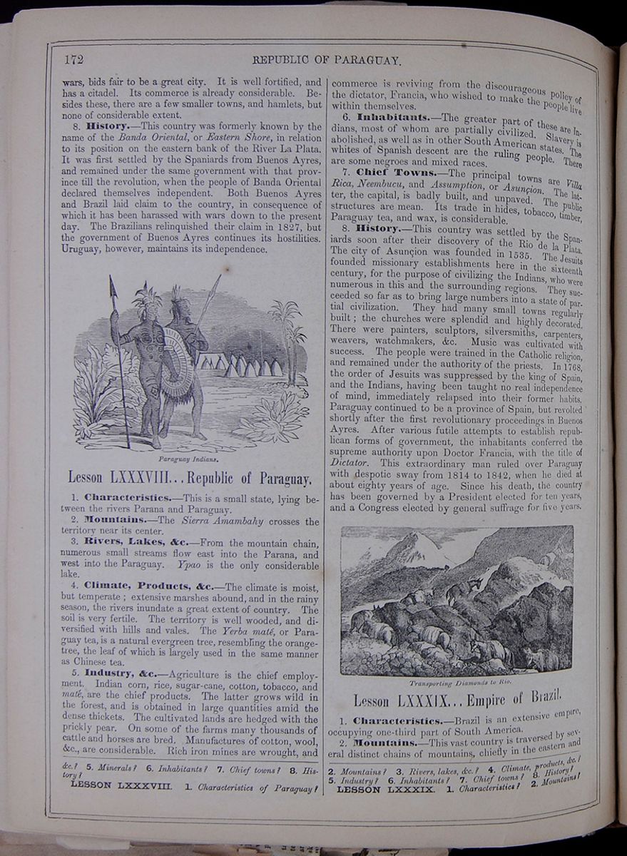 172
REPUBLIC OF PARAGUAY.
172
REPUBLIC OF PARAGUAY.
wars, bids fair to be a great city. It is well fortified, and has a citadel. Its commerce is already considerable. Besides these, there are a few smaller towns, and hamlets, but none of considerable extent.
8. History.—This country was formerly known by the name of the Banda Oriental, or Eastern Shore, in relation to its position on the eastern bank of the River La Plata. It was first settled by the Spaniards from Buenos Ayres, and remained under the same government with that province till the revolution, when the people of Banda Oriental declared themselves independent. Both Buenos Ayres and Brazil laid claim to the country, in consequence of which it has been harassed with wars down to the present day. The Brazilians relinquished their claim in 1827, but the government of Buenos Ayres continues its hostilities. Uruguay, however, maintains its independence.
Lesson LXXXVIII... Republic of Paraguay.
1. Characteristics.—This is a small state, lying between the rivers Parana and Paraguay.
2. Mountains.—The Sierra Amambahy crosses the territory near its center.
3. Rivers, Lakes, &c.—From the mountain chain, numerous small streams flow east into the Parana, and west into the Paraguay. Ypao is the only considerable lake.
4. Climate, Products, &c.—The climate is moist, but temperate; extensive marshes abound, and in the rainy season, the rivers inundate a great extent of country. The soil is very fertile. The territory is well wooded, and diversified with hills and vales. The Yerba maté, or Paraguay tea, is a natural evergreen tree, resembling the orange-tree, the leaf of which is largely used in the same manner as Chinese tea.
5. Industry, &c.—Agriculture is the chief employment. Indian corn, rice, sugar-cane, cotton, tobacco, and maté, are the chief products. The latter grows wild in the forest, and is obtained in large quantities amid the dense thickets. The cultivated lands are hedged with the prickly pear. On some of the farms many thousands of cattle and horses are bred. Manufactures of cotton, wool, &c., are considerable. Rich iron mines are wrought, and commerce is reviving from the discourageous policy of the dictator, Francia, who wished to make the people live within themselves.
6. Inhabitants.—The greater part of these are Indians, most of whom are partially civilized. Slavery is abolished, as well as in other South American states. The whites of Spanish descent are the ruling people. There are some negroes and mixed races.
7. Chief Towns.—The principal towns are Villa Rica, Neembucu, and Assumption, or Asunçion. The latter, the capital, is badly built, and unpaved. The public structures are mean. Its trade in hides, tobacco, timber, Paraguay tea, and wax, is considerable.
8. History.—This country was settled by the Spaniards soon after their discovery of the Rio de la Plata. The city of Asunçion was founded in 1535. The Jesuits founded missionary establishments here in the sixteenth century, for the purpose of civilizing the Indians, who were numerous in this and the surrounding regions. They succeeded so far as to bring large numbers into a state of partial civilization. They had many small towns regularly built; the churches were splendid and highly decorated. There were painters, sculptors, silversmiths, carpenters, weavers, watchmakers, &c. Music was cultivated with success. The people were trained in the Catholic religion, and remained under the authority of the priests. In 1768, the order of Jesuits was suppressed by the king of Spain, and the Indians, having been taught no real independence of mind, immediately relapsed into their former habits. Paraguay continued to be a province of Spain, but revolted shortly after the first revolutionary proceedings in Buenos Ayres. After various futile attempts to establish republican forms of government, the inhabitants conferred the supreme authority upon Doctor Francia, with the title of Dictator. This extraordinary man ruled over Paraguay with despotic sway from 1814 to 1842, when he died at about eighty years of age. Since his death, the country has been governed by a President elected for ten years, and a Congress elected by general suffrage for five years.
Lesson LXXXIX... Empire of Brazil.
1. Characteristics.—Brazil is an extensive empire, occupying one-third part of South America.
2. Mountains.—This vast country is traversed by several distinct chains of mountains, chiefly in the eastern and
5. Minerals? 6. Inhabitants? 7. Chief towns? 8. History?
LESSON LXXXVIII. 1. Characteristics of Paraguay? 2. Mountains? 3. Rivers, lakes, &c.? 4. Climate, products, &c.? 5. Industry? 6. Inhabitants? 7. Chief towns? 8. History?
LESSON LXXXIX. 1. Characteristics? 2. Mountains?
[begin surface 651]
THE BRAZILIAN EMPIRE.
An Ocean Postal Service Between the United States and Brazil—Aggregate Commercial Exchanges—Adverse Balance of Trade—Effect of Steamships and Railroads on Commerce and Travel—Identity of Interests Between the Two Countries—Relative Effect Upon Each Other of the Extension of Their Systems of Internal Distribution, &c.
[From O Correio Mercantil of Rio de Janeiro, June 16, 17 and 20.]As the plan of a direct steam communication between the United States and Brazil was again suggested in the recent session of Congress at Washington, we avail ourselves of the opportunity for discussing certain points connected with the subject.
In the natural state of things, considering only the general progress of both countries, a line of American steamers is a simple question of time. If it can be demonstrated that the actual commerce, combined with what it will be in a very near future, fully justifies the establishing of a steamboat line, it will be easy to agree upon whatever regards points of secondary importance, or the practical way in which that line may be organized. Let us briefly examine this important national subject, starting from two points, viz., founding our observations upon facts and the experience furnished by the general history of commerce, and, above all, taking into account our relations with the United States.
The commercial men of the United States are aware that the monthly steamship line between England and Brazil is a successful and lucrative business, and that from the time of its being established the commerce between the two nations has increased with such a rapidity that this fact cannot be attributed to any other influence than to the impulse given to it by steam navigation. But not only have the commerce and personal relations between Brazil and England and between Brazil and Europe considerably increased, but they are still daily increasing. The movement of passengers is so great that the cabins of the steamers are taken a long time in advance, in spite of the comparatively high prices for passage, which probably will be maintained as long as that line has no competition to encounter.
Although commerce between the United States and Brazil is carried on on a great scale, and increases every year, the movement of passengers between the two countries is very limited, consisting almost exclusively of persons who are in immediate relation with the commercial marine.
ANOMALIES OF THE PRESENT TRADE.There have been few examples in the world of a commerce on so large a scale and of so considerable value having such a development between two civilized nations with so little personal relations between them and so small an acquaintance of each other. Very few Brazilians have been to the United States, either on account of business or for recreation, and during late years the small number of citizens of the United States who have visited Brazil went first over to Europe in order to be sure of a passage in a steamer, in preference to a voyage in a sailing ship. The expense for such a circuitous passage in a steamer is considerably greater than in a sailing ship; but the general taste is for steamers, without even any economy of time. For a first class passage ticket between New York and Rio, via England, the cost is at least $600, whilst the direct passage on board a sailing ship would not be over $200 to $250. As regards time, the steamers are twelve days in going from New York to England and twenty-eight days from England to Rio—in the whole, forty days. This calculation, taking into account all contingencies, is, as an average calculation, rather too low than too high. As to sailing ships, the average time of their passage from New York to Rio is about forty days, whilst from Rio to New York it does not exceed thirty-five days. Thus, in general, there is in the preference given to steamers no advantage as to time; and, nevertheless, no one can deny that everybody is in favor of travelling on board steamers. The evident reason of this fact lies in the regularity and certainty of a steamer line, which enable merchants and passengers to make reliable calculations, that, under most circumstances, may be of great importance to their affairs. Besides, there are people who would not be persuaded to leave land, if, instead of steamers, they had to traverse the ocean on board a sailing ship. Thus the regular service of oceanic steamers invites travel exactly in the same manner as the opening of a railroad, wherever it be, rapidly increases the number of travellers between the places it connects.
The empire of Brazil, having not very long ago been under the rule of a European government, it is natural that its inhabitants should have a special inclination for that country whence they drew their habits, manners, customs, fashions, luxury and literature, to such a degree that even the greatest part of their manufactures are imported from there. Generally speaking, their only relations with foreigners have been and continue to be with Europe. Since the establishment of the constitution Brazil has gradually advanced in population, wealth and civilization, and its commerce has gone on constantly increasing with almost all the civilized maritime nations. Great Britain was for many years its principal purveyor, but the United States is its principal customer. The commerce between Brazil and the United States, which to-day is so considerable, is entirely based upon the exchange of several agricultural productions, the principal of which are coffee and sugar on the part of Brazil, flour and lumber on that of the United States.
EXCHANGES WITH THE UNITED STATES.Let us now present some statistical data of the Brazilian commerce during several years past. For eleven years, viz., from 1847 to 1857, inclusive, the United States imported to Brazil, (Rio de Janeiro) 2,590,676 barrels of flour; in the last three years, viz., 1855, '56 and '57, they imported 884,963 barrels—during the same eleven years they received from Brazil 9,556,325 bags of coffee, and in the last three years, 1855, '56, and '57, 3,209,640 bags.
By estimating the barrel of flour in Brazil at $10 per barrel, and the bag of coffee in the United States at $15 per bag, the value of the imported coffee in the United States during eleven years, was...............
| $143,344,325 | |
| Exported flour | 25,906,160 |
| Exported flour | $117,438,665 |
And during the three years, 1855, '56, and '57, the value of imported coffee was............
| $48,144,460 | ||
| Exported flour | 8,489,630 | |
| Difference | $39,294,830 |
For the last year, 1857, there were imported from the United States to Brazil, 355,858 barrels of flour, and received 901,374 bags of coffee, which, estimated as above, will give the following result:—
| Value of imported coffee | $13,520,610 | |
| Value of imported coffee | 3,558,580 | |
| Difference | $9,962,030 |
Let us now for a moment consider the ratio of increase of the exchange of those staple articles which constitute the principal commerce between the two countries. In 1847 there were shipped from the United States to Brazil, (Rio de Janeiro) 180,848 barrels of flour, and in 1857, 355,858 barrels, which gives an increase of almost 100 per cent. In 1847 the United States received from Brazil 729,742 bags of coffee, and in 1857, 901,374 bags—the latter year being an exceptional one, compared with former ones. The real increase for eleven years was only ten per cent.
Whilst Brazil during the above mentioned years received from the United States, 2,509,676 barrels of flour, it received from Europe and all other countries, 273,110 barrels, viz., scarcely a ninth part of the whole amount. In 1857 Brazil imported from the United States 355,858 barrels, and from Europe, &c., only 15,846, viz., a twenty-third part.
We have stated already that during the three years 1855, '56 and '57 Brazil exported to the United States 3,209,640 bags coffee, and during the same period to Europe and other parts 3,279,909 bags, the quantity shipped for the United States being almost equal to that exported to Europe and all other parts. And whilst in 1857 there were exported to the United States 901,374 bags coffee, England received only 446,996 bags, or less than the half. It is, therefore, beyond any doubt that the United States are eminently the great customer of Brazil. The money transactions resulting from this considerable commercial exchange between Brazil and the United States are transacted almost entirely by way of England. The coffee trade of Brazil is steadily increasing, and has admirably done so, if we take into account the difficulties against which it had to struggle for many years.
Thus, in 1820 the total export from Brazil was 97,500 bags, whilst in 1857 it amounted to 2,065,718. In thirty-seven years it has increased twenty-two times. Had the population and wealth of the United States during this same period not increased in such an enormous proportion, the coffee trade of Brazil would not have given the same result, as, also, should the United States discontinue to be the customer of Brazil, that commerce would almost entirely cease to exist.
HOW TO INCREASE THE TRADE.Now, the time has arrived when the people of the United States have to consider, not how to withdraw their custom, but how to increase their return trade with the country with which they entertain such a considerable commerce. We have traced the movement and actual exchange of flour and coffee. In what position are the people of the United States in reference to other interests, compared with other nations?
During the financial year of 1853 there entered the ports of Brazil, proceeding from foreign ports, 2,222 vessels, with a tonnage of 708,807; 602 vessels, with 281,669 tons, came from Great Britain and her possessions; 343, with 121,871 tons, came from the United States.
The greater part of these 602 British vessels were freighted with merchandise, whilst of the 343 vessels from the United States the greater part were freighted with flour and lumber.
In 1856 Brazil imported from Great Britain to the amount of
| $24,543,000 | |
| From the United States | 3,726,540 |
| Difference | 20,816,460 |
—And whilst Liverpool sent us $7,500,000, New York sent us scarcely $450,000. It is useless to enter here into more minute details on this point. Facts and figures show conclusively that England is the great purveyor and manufacturer in regard to Brazil, and that the United States, up to this date, have contented themselves with being its customer.
If England had not established a steamship line between Southampton and Rio de Janeiro, touching at Pernambuco and Bahia, the United States, although laboring under the great disadvantage of carrying on all their money transactions by way of England, might have been able to gradually gain ground and to secure to themselves a share in the general commerce. But commerce with England since the opening of direct steam communication with Brazil, received such an impulse, and is to-day so well directed, that without a competition supported by steamers on the part of the United States, all efforts whatever for the purpose of obtaining a share in the general commerce will be without hope of success. But let us suppose a steamship line between New York and Rio de Janeiro, touching at Pernambuco and Bahia, and entering into communication with the Brazilian company, being in active exercise: the result of it would probably surpass the most enthusiastic calculations. If the Congress of the United States should extend the support of the government to that enterprise, all secondary points relative to the ports to be touched could be easily settled.
The statistical details and the reasons alleged at the close of the last session of Congress, already too far advanced to allow any discussion of them, are unquestionably in favor of the urgent necessity of establishing steam communication between the two countries. And if such a steam communication by itself is now very desirable, how long will it be before it becomes a necessity?
PARITY OF DEVELOPMENT BRTWEEN THE UNITED STATES AND BRAZIL.If, with a population of thirty millions in one country and of eight millions in the other, it seems to be practicable, how much more will it be so in the United States! There will be fifty millions, and in Brazil twenty millions of people. The two greatest nations in the Western hemisphere cannot for a long time remain without the greatest commercial faculties furnished by modern improvements. The United States have initiated a vast system of internal ameliorations, by means of railroads, which tend to foster and increase not only its interior commerce, but also that with foreign nations. Brazil, also, has made a beginning with its system of railroads in the interior, which must successively extend, and become a great instrument for improving its agriculture, manufactures and commerce. The domestic industry of Brazil will be stimulated by these internal improvements, and thousands of colonists proceeding from the most peopled countries of Europe will find an allurement for fixing their residence in this great Southern empire.
It is not to be expected that the emigration from the United States to Brazil, or vice versa, will ever be as easy as that just mentioned, both countries being similar in their prominent aspects; but if the social, commercial and mechanical relations of the two peoples shall have been rendered more active by the establishment of a regular steam communication, no human power will be able to stop their progress. At the same time, both of them must adopt sensible measures to aid the prosperity of either of them.
The domestic industry of the one will not be prejudiced by that of her neighbor, but, on the contrary, for this very reason, will be advanced. It is in the direct interest of the United States that Brazil should rapidly increase, not only in population, but also in industry and wealth. Wherever a great quantity of goods is produced or manufactured there will always be a facility of disposing of a portion of them in favor of other nations, and thus of increasing reciprocal commerce. The industry of the countries from whence the importation is taking place will thus be stimulated by the sale of commodities given in exchange. It would be weakness to look on this matter from a less liberal point of view. Whatever greater commercial facility may be given to Brazil must necessarily strengthen it and increase its transactions in general; and no country can be more interested in a similar cause than the United States, if we look to the future. Independently of the commercial advantages which evidently must result to either country, there are other considerations of more importance, which cannot fail to strike those who have seriously studied this matter. Politically speaking, it is as much the interest of Brazil as of the United States to support the other and o gradually cultivate the most amicable relations.
With regard to the proposed steam communication, the following may be considered as a brief notice of the general views taken of it in the United States. Figures and facts drawn from the history of the past, and the statistics of the actual commerce, seem to guarantee the success of the enterprise. The most intelligent observers do not discover any plausible reason for not auguring the happiest result, and at the same time the most advantageous occasion is offered to vastly increase the traffic and the means of transport of passengers between the United States and Brazil; the commerce between them and other South American countries will likewise be considerably augmented.
As regards the Empire of Brazil, does it answer its interests to have direct steam communication with the United States? It has been already proved that of all its customers the United States is the best—not only the best, but equal to all the others united. This is a very important fact. If it be evident in itself that in private affairs, by smoothing the ways and augmenting the facilities between purchasers and sellers the quantity of transactions and exchanges will be increased, it will be difficult to prove the contrary with regard to nations; and certainly among private persons a seller would not desire to see his best customer badly served.
PRESENT STATE OF BRAZIL.Brazil is comparatively a new country or nation, possessing a territory of vast extent, greater than that of the United States, a large portion of which is of extreme fertility and abundant in precious woods and mineral wealth, with an extensive coast, provided with fine and safe harbors, and with a climate equal, if not superior, to any other portion of the earth. Already, with a population twice greater than that of the United States in the year 1790, with its system of internal improvements vigorously pursued, and with the rapid development of its resources, which to-day are buried in complete lethargy, its future greatness will be on a far larger scale.
For several years more coffee will continue to form its principal product and first staple article for export commerce; but in proportion as the current of its population pours over its immense interior, other articles will, in their turn, play a more prominent part, and the whole commerce of that country will keep pace with the increase of the population. The natural augmentation of a population of eight to nine millions—its actual state—will be very considerable, to which Europe will add by immigration a great per centage.
By means of a system of land grants properly organized, this government is able to offer great allurements to foreigners to establish themselves there and to cultivate the interior. At the same time, Brazil may hope from the United States, in proportion as the relations between the two countries will have been multiplied, many advantages by the introduction of its improved agricultural instruments and various other articles which, thus far, have not formed any important item in its commerce. England and the United States are great manufacturing nations, and it must be the interest of Brazil to encourage competition between them. England has greatly improved her position with reference to Brazil, since 1850, by the decisive advantages resulting from her steam communication.
The general trade has also much increased between her and Brazil, while between the latter and the United States that commerce has scarcely begun, and, without some new incentive, may remain in its infancy, leaving in the meantime Brazil exposed to the evil influence of monopoly. The proportion in the increase of coffee export to the United States, will, in future, probably be greater than it has been till now, on account of the great impulse communicated to it by the culture of waste lands and the generally improved condition of the planters, in consequence of the introduction of railroads.
The consumption of Brazilian coffee during the last seven years was 964,700 bags yearly, whilst during the seven preceding years it was on an average yearly only 661,670 bags, showing for that short period an increase of forty-six per cent. This answers exactly the period of seven years during which railroads were regularly opened in the interior of the United States; and the greatly increased shipping of coffee to New Orleans and New York—the two principal points which provide the interior—shows the wholesome influence exercised by the establishment of railroads. The demand for an article like coffee will increase in the United States in a greater proportion than that of its increased population, because the railroad, although a mere machine, is at the same time a great civilizer, and soon transforms what at first was luxury, into common wants, and afterwards into necessities.
And for the same reason, if Brazil continues its policy of internal improvements, the demand for those articles which the United States is able to furnish in exchange, at moderate prices, will also increase. It is not possible to fix any limits to the amount of this exchange traffic between the two nations. However, the true policy of Brazil cannot be to put any obstacle in the way of the progress of this traffic; on the contrary, it is its interest to accord to it all possible facility, in order to improve and complete it. Certainly there is every probability that between Brazil and the united States the most amicable relations will continue, if there is taken into consideration the reciprocity of their interests and position with regard to other nations.
NATURAL ALLIANCE BETWEEN THE TWO COUNTRIES.These two countries, governed by liberal constitutions, are destined to be natural allies in the progress of the world; and in truth it is the interest of all nations to be friends to Brazil, not only in consideration of its progressive importance in the rank of nations, but on account of its position on the ocean. Brazil, and in particular its commercial capital—Rio de Janeiro—is placed as if to serve as a central station to the commercial relations of all maritime nations. From Europe to the East Indies, and to the western coast of South and North America, and from the United States to those points, Rio de Janeiro is the great provisioning port. Ships in danger or having suffered damage, merchant craft proceeding from all parts of the globe, may touch at Rio de Janeiro, sure to find there a safe and commodious harbor, with the best opportunity of procuring assistance, of providing themselves with provisions, water, &c. Rio de Janeiro thus occupies a peculiar and imposing position, to which no other port in the world can ever become a rival.
Let us hope that the shores of Brazil will never be visited by any vindictive invader, and it can never be the interest of the United States to play such a part. The United States are to-day the second, and will soon be the first commercial nation of the world. They behold in Brazil another great and young nation, rising in the same hemisphere and pursuing the same general policy, viz.: that of conferring the greatest quantity of well being on the greatest number possible. And if the United States, which have not yet ceased to be a young nation, are already the greatest customer of Brazil, what may be expected within twenty years, when their net of railways, whose length already exceeds 26,000 miles, will be still more extended, especially if Brazil should persevere in the some manner in its domestic improvements, and adopt a liberal policy with regard to foreigners? Here are two young nations, near each other, whose yearly exchanges amount to nearly twenty millions of dollars. In a few years these figures will have doubled; and shall such a considerable commerce, and the money transactions resulting from it, forever continue in their present embarrassing position, because these two countries are forced in their mutual communications to have recourse to an immense circuit? One of the principal reasons of that state of things being continued is that the two nations know very little of each other. Generally the people of the United States entertain a very erroneous and false opinion of the actual state of Brazil. They are not aware of the great improvements which have taken place here during these last ten years; they know little of the progress of its political and social life; and without having more frequent relations they will be unable to duly appreciate the Brazilians. The simplest way of doing away with this inconvenience is to establish a steamship line directly from the United States to Brazil. If the Congress of the United States should extend its protection to a company for the formation of such a line, would it not be also the interest of Brazil and the Brazilians to encourage it as much as possible?
There are many important points which concern the relations of both countries. The character of their institutions, in spite of the few relations existing between them, bears a great resemblance. This may partly be attributed to the fact that the people of both countries enjoy the liberty to procure their well-being in the way they like. The one have a President, the other an Emperor; but the provisions of their respective constitutions are equally enlightened and humane for almost all practical purposes; they accord personal liberty and protection to everybody. There exist small differences; but in Brazil, in its most enlightened districts, life and property are as fully guaranteed as in the United States. Thus, being free, the natural intelligence of the people impels them to cultivate the arts and other branches of knowledge, and with the aid of well directed science the progress of agriculture, industry and commerce may be confidently looked or .
[begin surface 652]
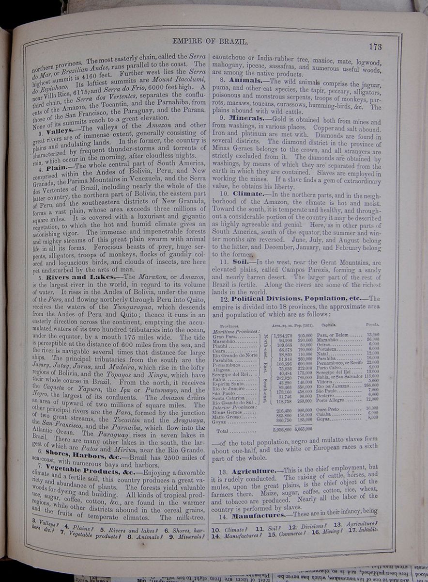 EMPIRE OF BRAZIL.
173
EMPIRE OF BRAZIL.
173
northern provinces. The most easterly chain, called the Serra do Mar, or Brazilian Andes, runs parallel to the coast. The highest summit is 4160 feet. Further west lies the Serra do Espinhaco. Its loftiest summits are Mount Itacolumi, near Villa Rica, 6175, and Serra do Frio, 6000 feet high. A third chain, the Serra dos Vertentes, separates the confluents of the Amazon, the Tocantin, and the Parnahiba, from those of the San Francisco, the Paraguay, and the Parana. None of its summits reach to a great elevation.
3. Valleys.—The valleys of the Amazon and other great rivers are of immense extent, generally consisting of plains and undulating lands. In the former, the country is characterized by frequent thunder-storms and torrents of rain, which occur in the morning, after cloudless nights.
4. Plain.—The whole central part of South America, comprised within the Andes of Bolivia, Peru, and New Granada, the Parima Mountains in Venezuela, and the Serra dos Vertentes of Brazil, including nearly the whole of the latter country, the northern part of Bolivia, the eastern part of Peru, and the southeastern districts of New Granada, forms a vast plain, whose area exceeds three millions of square miles. It is covered with a luxuriant and gigantic vegetation, to which the hot and humid climate gives an astonishing vigor. The immense and impenetrable forests and mighty streams of this great plain swarm with animal life in all its forms. Ferocious beasts of prey, huge serpents, alligators, troops of monkeys, flocks of gaudily colored and loquacious birds, and clouds of insects, are here yet undisturbed by the arts of man.
5. Rivers and Lakes.—The Marañon, or Amazon, is the largest river in the world, in regard to its volume of water. It rises in the Andes of Bolivia, under the name of the Paro, and flowing northerly through Peru into Quito, receives the waters of the Tunguragua, which descends from the Andes of Peru and Quito; thence it runs in an easterly direction across the continent, emptying the accumulated waters of its two hundred tributaries into the ocean, under the equator, by a mouth 175 miles wide. The tide is perceptible at the distance of 600 miles from the sea, and the river is navigable several times that distance for large ships. The principal tributaries from the south are the Javary, Jutay, Jurua, and Madeira, which rise in the lofty regions of Bolivia, and the Topayos and Xingu, which have their whole course in Brazil. From the north, it receives the Caqueta or Yapura, the Iça or Putumayo, and the Negro, the largest of its confluents. The Amazon drains an area of upward of two millions of square miles. The other principal rivers are the Para, formed by the junction of two great streams, the Tocantin and the Araguaya, the San Francisco, and the Parnaiba, which flow into the Atlantic Ocean. The Paraguay rises in seven lakes in Brazil. There are many other lakes in the south, the largest of which are Patos and Miriun, near the Rio Grande.
6. Shores, Harbors, &c.—Brazil has 2500 miles of sea-coast, with numerous bays and harbors.
7. Vegetable Products, &c.—Enjoying a favorable climate and a fertile soil, this country produces a great variety and abundance of plants. The forests yield valuable woods for dyeing and building. All kinds of tropical produce, sugar, coffee, cotton, &c., are found in the warmer regions, while other districts abound in the cereal grains, and the fruits of temperate climates. The milk-tree, caoutchouc or India-rubber tree, manioc, mate, logwood, mahogany, ipecac, sassafras, and numerous useful woods, are among the native products.
8. Animals.—The wild animals comprise the jaguar, puma, and other cat species, the tapir, peccary, alligators, poisonous and monstrous serpents, troops of monkeys, parrots, macaws, toucans, curassows, humming-birds, &c. The plains abound with wild cattle.
9. Minerals.—Gold is obtained both from mines and from washings, in various places. Copper and salt abound. Iron and platinum are met with. Diamonds are found in several districts. The diamond district in the province of Minas Geraes belongs to the crown, and all strangers are strictly excluded from it. The diamonds are obtained by washings, by means of which they are separated from the earth in which they are contained. Slaves are employed in working the mines. If a slave finds a gem of extraordinary value, he obtains his liberty.
10. Climate.—In the northern parts, and in the neighborhood of the Amazon, the climate is hot and moist. Toward the south, it is temperate and healthy, and throughout a considerable portion of the country it may be described as highly agreeable and genial. Here, as in other parts of South America, south of the equator, the summer and winter months are reversed. June, July, and August belong to the latter, and December, January, and February belong to the former.
11. Soil.—In the west, near the Gerat Mountains, are elevated plains, called Campos Parexis, forming a sandy and nearly barren desert. The larger part of the rest of Brazil is fertile. Along the rivers are some of the richest lands in the world.
12. Political Divisions, Population, etc.—The empire is divided into 18 provinces, the approximate area and population of which are as follows: This table lists the capitals and provinces of Brazil, along with their area in square miles and their populations. The capitals and provinces are as follows: Para, or Belem, Grao Para; Maranhão, Maranhão; Oeiras, Piauhi; Portaleza, Ceara; Natal, Rio Grande do Norte; Parahiba, Parahiba; Pernambuco, or Recife, Pernambuco; Porto Calvo, Alagoas; Seregipe del Rei, Seregipe del Rei; Bahia, or San Salvador, Bahia; Vittoria, Espiritu Santo; Rio de Janeiro, Rio de Janeiro; São Paulo, São Paulo; Desterro, Santa Catarina; Porto Allegre, Rio Grande do sul; Ouro Preto, Minas Geraes; Cuiaba, Matto Grosso; Goyaz, Goyaz. —of the total population, negro and mulatto slaves form about one-half, and the white or European races a sixth part of the whole.
13. Agriculture.—This is the chief employment, but it is rudely conducted. The raising of cattle, horses, and mules, upon the great plains, is the chief object of the farmers there. Maize, sugar, coffee, cotton, rice, wheat, and tobacco are produced. Nearly all the labor of the country is performed by slaves.
14. Manufactures.—These are in their infancy, being
3. Valleys? 4. Plains? 5. Rivers and lakes? 6. Shores, harbors &c.? 7. Vegetable products? 8. Animals? 9. Minerals? 10. Climate? 11. Soil? 12. Divisions? 13. Agriculture? 14. Manufactures? 15. Commerce? 16. Mining? 17. Inhabitants? [begin surface 654]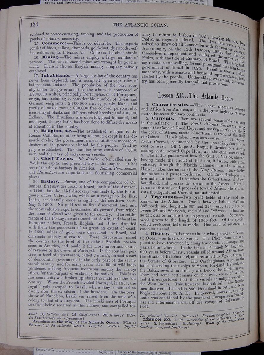 174
THE ATLANTIC OCEAN.
174
THE ATLANTIC OCEAN.
confined to cotton-weaving, tanning, and the production of goods of primary necessity.
15. Commerce.—This is considerable. The exports consist of hides, tallow, diamonds, gold-dust, dyewoods, coffee, cotton, sugar, tobacco, &c. Coffee is the chief staple.
16. Mining.—The mines employ a large number of persons. The best diamond mines are wrought by government. There is also an English mining company actively employed.
17. Inhabitants.—A large portion of the country has never been explored, and is occupied by savage tribes of independent Indians. The population of the part actually under the government of the whites is composed of 1,200,000 whites, principally Portuguese, or of Portuguese origin, but including a considerable number of Swiss and German emigrants; 2,600,000 slaves, partly black, and partly of mixed races; 800,000 free colored persons, also consisting of blacks and different mixed breeds; and 400,000 Indians. The Brazilians are cheerful, good-humored, and intelligent, though little has been done to diffuse the means of education in the country.
18. Religion, &c.—The established religion is the Roman Catholic, no other being tolerated except in the domestic circle; the government is a constitutional monarchy. Justices of the peace are elected by the people. Trial by jury is established. The standing army consists of 17,000 men, and the navy of sixty-seven vessels.
19. Chief Towns.—Rio Janeiro, often called simply Rio, is the capital and principal city of the empire. It has one of the finest harbors in America. Bahia, Pernambuco, and Maranham are important and flourishing commercial places.
20. History.—Pinzon, one of the companions of Columbus, first saw the coast of Brazil, north of the Amazon, in 1499; but the chief discovery was made by the Portuguese, under Cabral, who, while on a voyage to the East Indies, accidentally came in sight of the southern coast, May 3, 1500. No gold was at first discovered here, and the most valuable exports consisted of dyewood, from which the name of Brazil was given to the country. The settlements of the Portuguese advanced but slowly, and the other European nations, French, English, and Dutch, disputed with them the possession of so great an extent of coast. In 1690, mines of gold were discovered in Brazil, and diamonds shortly afterward. These discoveries raised the country to the level of the richest Spanish possessions in America, and made it the most important source of revenue to the crown of Portugal. In the southern portions, a band of adventurers, called Paulists, formed a sort of democratic government in the early part of the seventeenth century, and for many years led a life of wild independence, making frequent incursions among the savage tribes, for the purpose of enslaving the natives. This lawless community was broken up about the middle of the last century. When the French invaded Portugal, in 1807, the royal family escaped to Brazil, where they continued to dwell, after the expulsion of the invaders. On the overthrow of Napoleon, Brazil was raised from the rank of a colony to that of a kingdom. The inhabitants of Portugal testified their discontent at this change, and compelled the
king to return to Lisbon in 1821, leaving his son, Don Pedro, as regent of Brazil. The Brazilians were now resolved to throw off all connection with the mother country. Accordingly, on the 12th October, 1822, they declared themselves independent, and conferred the crown on Don Pedro, with the title of Emperor of Brazil. The king finding resistance unavailing, formally resigned his claim to the government of Brazil in 1825. Brazil is now a limited monarchy, with a senate and house of representatives, both elected by the people. Under this government, the country has been generally tranquil and prosperous.
Lesson XC... The Atlantic Ocean.
1. Characteristics.—This ocean separates Europe and Africa from America, and is the great highway of commerce between the two continents.
2. Currents.—There are several remarkable currents in the Atlantic. 1. The South Atlantic Current, coming round the Cape of Good Hope, and passing northward along the coast of Africa, meets a northern current at the Gulf of Guinea. Here it takes a western course. 2. The Equatorial Current, commenced by the preceding, flows from east to west. Off Cape St. Roque it divides, one stream setting south toward Cape Horn, and the other northward. 3. This latter passes west into the Gulf of Mexico, whence, having made the circuit of that sea, it issues, with great velocity, through the Florida Channel into the Atlantic. Here it takes the name of the Gulf Stream. Its velocity diminishes as it passes northward. Off Cape Henlopen it is five miles an hour. It touches the Grand Banks of Newfoundland, and crosses the ocean to the Azores. Here it turns southward, and proceeds toward Africa, where it assists the Equatorial Current, as just stated.
3. Vegetation.—Two great fields of sea-weed are known in the Atlantic. One is between latitude 25° and 36° north, and longitude 30° and 32° west; the other between 22° and 26° north, and 70° and 72° west. These are so thick as to impede the progress of vessels. Some sea-weed grows to the length of 1000 feet. Of the species called rock-weed, kelp is made. One kind of sea-weed is eaten as a salad.
4. History.—It is uncertain at what period the Atlantic Ocean was first discovered. The Phœnicians are supposed to have traversed it, along the coasts of Europe, 900 years before Christ. In the time of Pharaoh Necho, about 600 years before Christ, vessels sailed around Africa, from the Straits of Babelmandel, and returned to Egypt through the Straits of Gibraltar. The Carthaginians were in the habit of sending their ships to Spain, England, Ireland, and the Baltic, several hundred years before the Christian era. They had some settlements on the west coast of Africa, and it is conjectured that their vessels actually crossed to the West Indies. This, however, is doubtful. The Northmen discovered Iceland in 860, Greenland in 981, and New England about 1000 A. D. In general, however, the Atlantic was considered by the people of Europe as a boundless and interminable sea, till the voyage of Columbus in 1492.
18. Religion &c.? 19. Chief towns? 20. History? When did Brazil declare her independence?
Exercises on the Map of the Atlantic Ocean—What is the extent of the Atlantic Ocean? Length? Width? Depth? The principal islands? Distances? Boundaries of the Atlantic?
LESSON XC. 1. Characteristics of the Atlantic? 2. Currents? 3. Vegetation? 4. History? What of the Phœnicians, Carthaginians, and Northmen?
[begin surface 655]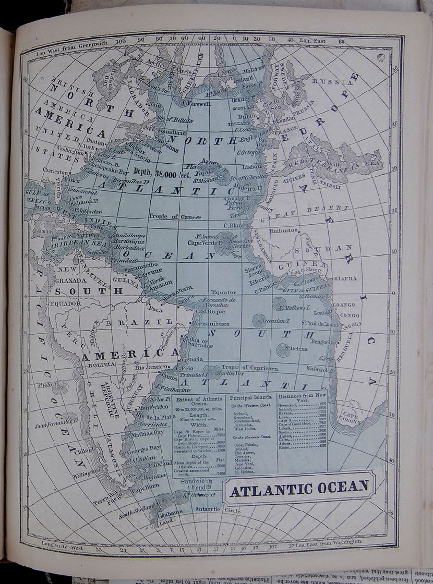 ATLANTIC OCEAN
A map of the Atlantic Ocean, showing how it is
bordered by Europe, Africa, and the Americas.
[begin surface 656]
ATLANTIC OCEAN
A map of the Atlantic Ocean, showing how it is
bordered by Europe, Africa, and the Americas.
[begin surface 656]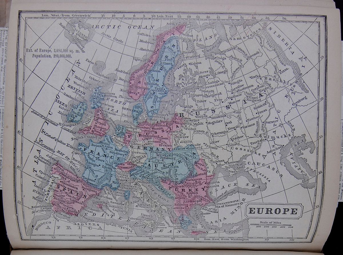 EUROPE
A map of Europe which also lists the extent and
population of Europe.
EUROPE
A map of Europe which also lists the extent and
population of Europe.
THE ROYAL FAMILIES OF EUROPE.
Their Origin, Intermarriages, and Connections.
THE REIGNING LINES OF EUROPE.
There are forty-eight crowned heads in Europe—namely, three Emperors, of France, of Russia, and of Austria; two Queens, of Great Britain and of Spain; thirteen Kings, of Prussia, of Sweden, of Holland, of Belgium, of Sardinia, of Denmark, of Portugal, of Greece, of Bavaria, of Hanover, of Saxe, of Wurtemburg, and of Naples; one Sultan, of Turkey; one Pope, of Rome; one Elector, of Hesse; seven Grand Dukes, of Tuscany, of Baden, of Saxe-Weimar, of Hesse-Darmstadt, of Oldenburg, of Mecklenburg-Schwerin, and of Mecklenburg-Strelitz; nine Dukes, of Parma, of Modena, of Anhalt-Dessau, of Anhalt-Bernburg, of Brunswick, of Nassau, of Saxe-Altenburg, of Saxe-Meiningen, and of Saxe-Coburg Gotha; and ten Princes, of Lippe, of Waldeck, of Hesse-Homburg, of Schwarzburg Londershausen, of Schwarzburg Rudolstadt, of Lichtenstein, of Schamburg-Lippe, of Reuss-Greiz, of Reuss-Schleis, and of Monaco. All these princely personages are sovereign rulers of their respective countries, and as such equal in rank; although the Emperor of Russia is master over a territory of more than seven millions of square miles, and the Princes of Monaco and of Lichtenstein have less than fifty each. Nevertheless, in the eyes of every faithful Royalist, as well as of the Almanach de Gotha, all legitimate princes are "ebenburtig," or equal born, whatever may be their political power or the extent of their dominions. They are in their own order "peers;" and if the eldest daughter of the Czar or of the Austrian Kaiser chose to marry the poorest Prince of Reuss-Greiz, no herald at arms could call it a mesalliance.
There are, however, some other minor differences of rank which determine the position of these forty-eight sovereigns, or rather these forty-six; for two of them, the Sultan and the Pope, must, for obvious reasons be excluded from the "family." In the first instance, a great point with royalty is legitimacy, or length of tenure; and it is tacitly understood that all royal houses whose pedigree does not extend over at least a couple of centuries are non-legitimate. Measured by this standard, the sovereigns of France and of Sweden cannot be said to belong to the circle of "equal born" monarchs, whose number is thus reduced to forty-four. The forty-four, again, may be divided into two classes; namely, princes of German origin and princes of Galic descent; so that altogether the European sovereigns fall under four different divisions:—
1. Sovereigns quite unconnected with the rest—two in number, the Sultan and the Pope.
2. Sovereigns of recent creation—two in number, the rulers of France and of Sweden.
3. Sovereigns of Gallic origin—three in number, the Queen of Spain, and the Kings of Naples and of Portugal, the descendants of Hugh Capet, or the Bourbon family.
4. Sovereins of Teutonic origin—forty-one in number, namely, the rulers of the whole of Europe, with the exception of those of the Iberian peninsula, of a small part of Italy, of France, of Sweden, and of Turkey.
In this concise classification, already a singular fact forces itself on our attention. The inhabitants of Europe number about 260 millions. Of these, 78 millions are Slavonians; 81 millions belong to the Latin, and 83 to the Teutonic races; and, consequently, if every nation were governed by rulers of the same origin as themselves, the proportion of sovereigns of Europe would consist, in about three equal thirds, of monarchs of these three divisions of mankind. But so far is this from being the case that the Slavonic tribes furnish no ruling princes at all to Europe, and that the Latin races contribute but a proportionately small number; so that the sovereign power of the most important quarter of the world is chiefly in the hands of monarchs of Teutonic origin. It was not always so, inasmuch as only about three centuries ago the sovereign rulers belonged more equally to the three dominant races in proportion to their political influence. The present preponderance of German royalty has come about gradually and very steadily, and the tendency of the present state of affairs in Europe is certainly rather towards a further increase of Teutonic kingships, and a further decrease of Latin and Slavonic power, than the contrary. It is curious how race has worked its way in this respect. The house of Stuart, with a few drops of Celtic blood in its veins, had to give way before the German family of Brunswick-Luneburg, which has since received new elements of race by a fresh infusion of Saxon blood. Again, the house of Romanoff, of pure Slavonic origin, made room for the line of Holstein-Gottorp, by birth and by continued alliances completely Teutonic; and before this, the Slavonic families which ruled Austria and Bohemia were unseated by a German prince of very modest fortune, Rudolf von Hapsburg, whose descendants up to this day govern a multitude of foreign tribes, but conclude their matrimonial alliances only in the land of their origin. Nay, even in the classic islands of the Mediterranean, a German king holds the sceptre, and the Iberian peninsula is successfully invaded by the house of Coburg.
These princely German houses, through centuries of matrimonial alliances, have become united into one large family, with greater or lesser grades of consanguinity between the different crowned heads. They all may be traced, however, to six different lines, growing up almost simultaneously in the soil of a country highly favorable in its feudal constitution for the production of kingship. The first of these lines is that of Saxony, the princes of which trace their origin up to Duke Wittekind, a leader of some half-savage tribes on the river Elbe, who was converted to Christianity by the Emperor Charlemagne, about the year 785. The Princes of Savoy, who have become at present Kings of Sardinia, as well as the Kings of Saxony, the Grand Duke of Saxe-Weimar, and the three ducal houses of Saxe Meiningen, Saxe-Altenburg, and Saxe-Coburg Gotha, are reported to be the descendants of this Duke Wittekind. The second line of sovereign German princes is that of Alsace, whose members find their ancestor in one Adelbert, duke of a territory on the Rhine, who lived in the beginning of the eighth century, and whose descendants are the Emperor of Austria, the Grand Dukes of Tuscany and of Baden, and the Dukes of Parma. The third line is that of Oldenburg, founded by a Count of Ringelheim in the eleventh century; and from it springs the kings of Denmark, the deposed kings of Sweden, and the Grand Dukes of Oldenburg, and the Dukes of Holstein. A younger branch of the latter house has filled for the last century the throne of Russia. The fourth line is that of D'Este, founded by Azon I., Margrave d'Este, in the beginning of the eleventh century; and from it the present royal family of Great Britain, the Kings of Hanover, the Dukes of Brunswick and of Modena, and the Princes of Lichtenstein, draw their origin. The fifth line is that of Zollern, or as it is commonly called, Hohenzollern, which has its ancestors in the Counts of Zohlern who lived in the tenth century, and from whom descend the Kings of Prussia. Lastly, the sixth line is that of Nassau, founded in the twelfth century, from which spring the Kings of the Netherlands and the Dukes of Nassau. The rest of the sovereigns of Teutonic origin come all indirectly from these six great sources.
There are, as already said, only three monarchs of the Gallic or Latin race, the Queen of Spain, and the Kings of Naples and of Portugal. They are descendants of Hugo Capet, Count of Paris.
RUSSIA.
The rulers of the vast dominions colloquially included under that name, down to the time of Peter the Great, were natives of the country, descendants of the old chieftains Rurik and Romanoff. Peter, as is well known, married a Livonian peasant girl, Catherine; who brought him two children, Anna and Elizabeth. The first of these, Princess Anna, united herself to a Duke of Holstein-Gottorp, and became in course of time the mother of a little German Prince, called Peter Ulrich, who, after his aunt Elizabeth, by the aid of sundry conspiracies and assassinations, had ascended the throne of the Czars, was named her successor.
The Czars of the house of Holstein-Gottorp are physically a fine body of men.
The present Emperor of Russia is a tall and somewhat stout man, with a pleasing countenance, but a look as if suffering under some hidden malady or sorrow. His eyelids droop over the inner corner of the eye with deep melancholy; and though the mouth is not without sweetness, the whole profile, Grecian in outline, recalls the features of termagant Catherine, the Elizabeth of the North. Czar Alexander was married on his twenty-third birthday to a Princess of Hesse-Darmstadt, the youngest sister of the present Grand Duke.
Czar Alexander has five brothers and sisters. The eldest, Mary, is widow of the Duke Maximilian of Leuchtenberg, a son of Eugene Beuharnois , the adopted child of the Emperor Napoleon I.; the second sister, Olga, is married to the Crown Prince of Wurtemberg. Grand Duke Constantine, the next brother, has united himself to the daughter of the Duke of Saxe-Altenburg. Grand Duke Nicholas has married a Princess of Oldenburg, and Grand Duke Michel, the youngest of the late Czar's children, is husband to a Princess of Baden, a sister of the present reigning Duke. Finally, the mother of the Czar, the Empress Dowager, who is at present living in Italy, is sister of the King and the Prince of Prussia, and, consequently, aunt to Prince Friedrich Wilhelm, whose nuptial knot has been tied last week at St. James' Palace. The imperial family of Russia is, therefore, to sum up the whole, closely related to the Royal houses of Prussia, of Wurtemberg, of Holland, and of Great Britain; and the ducal houses of Hesse-Darmstadt, of Saxe-Altenburg, of Oldenburg, of Saxe-Weimar, and of the two Mecklenburgs. It is among the Protestant princely families of Germany that the Czars of the house of Holstein-Gottorp have always sought and continue seeking wives for themselves and their children.
AUSTRIA.
Next to Russia, Austria is the most important empire on the continent of Europe, in extent as well as in population. The ruler of Austria bears the title of Kaiser-König—(Emperor-King)—Kaiser on
account of the Imperial states, and König for Hungary alone.
The house of Hapsburg is of purely German origin. Rudolf, the founder of the royal family, was the descendant of an old noble line of counts of the "Holy Roman" Empire, who lived in a well fortified castle on the river Aar, the ruins of which all travellers in the north of Switzerland may see at the present day. A hundred years ago, with the death of Kaiser Charles VI. the male line of the house became extinct, but as the Kaiser's only daughter, Maria Theresa, again married a prince of German descent, Teutonic blood may be said to flow in its purest state in the veins of the Austrian Emperors.
No reigning family of Europe has derived so much advantage from successful matrimonial alliances as the house of Hapsburg. The sword of its founder, Rudolf, constructed only the nucleus of the vast possessions which the family afterwards acquired. Next to Rudolf, the greatest man whom the family ever produced, Maximilian I., may be called the founder of the power of the house of Hapsburg, for it was he who, by three lucky marriages—his own, his son's, and his grandson's—consolidated the rising state.
Francis Joseph I. is at present in his twenty-seventh year. He is a pale, sickly-looking young man, with dull, heavy eyes, low forehead, and the hereditary big under lip. He married, about four years ago, a daughter of the Duke of Bavaria, Elizabeth; who has brought him two children, both female, one of whom, however, has already died. This union was brought about by the Emperor's mother, Archduchess Sophia, a princess all powerful at court, who may be regarded as the real ruler of Austria. The Emperor has three brothers, Ferdinand, Charles and Louis, the first and the last of whom are unmarried; but the second, Archduke Charles, was united, about a year ago, to a daughter of the King of Saxony.
The Austrian imperial family is very numerous at the present time. There are three Empresses,—the widow of the late Emperor Francis I., a Bavarian Princess, now in her sixty-sixth year; the Empress Anne, wife of Ferdinand, and, lastly, the consort of the present Emperor. Besides these three Empresses and the two Emperors, there are sixteen Archdukes and seventeen Archduchesses, mostly descendants of the Emperor Francis I., who was married four times, and of his brothers, each of whom had several consorts.
The actual connections by marriage of the Austrian Imperial family do not extend very far, nor are they with very great houses. The princely families of almost the whole of Northern, central, and Western Germany, being Protestant, the choice of the kaisers and Archdukes is restricted to the houses of Bavaria and Saxony; unless they again hazard, which they do not seem inclined to do, fresh matrimonial alliances with the Bourbons of Naples and of Spain,—connections which have proved, in the example of Ferdinand, so nearly fatal to the race of Hapsburg.
FRANCE.
The third Emperor in our list of European sovereigns is Charles Louis Napoleon Bonaparte, Emperor of the French; but we shall not have to say much of him, as of all the monarchs of this quarter of the globe, he—of course with the exception of the Pope and Sultan—is the least connected with the rest by family alliance. He is certainly regarded as non-legitimate by all of them.
The whole, or at least chief connection of the Bonaparte family with the other reigning houses of Europe, is through the uncle and aunt of the Emperor.
The ancienne maison royale de France, the great rival of the new family of Bonaparte, derives its chief power from its connections with European royalty, and has, for this reason alone, a still powerful hold on public opinion in and out of France. Far behind them in the night of time rise their ancestors; their Carolus Magnus (theirs not altogether, yet claimed by them), their Hugo Capet, their Henri Quatre, their Louis "le Grand." Age is their might ally, of whom they boast and to whom they trust. Yet monarchy in France, though it is old enough, has not always been very "legitimate." The descendants of Clovis were robbed of their sovereign rights by Pepin, their major domo; and the right of his progeny again was overruled by the son of Hugh the Great, Lord of the Isle of France. After him, the line of Valois ruled the country of Gauls till Henry IV., of the younger branch of the Hugo Capet family, laid hold of the crown by force of arms. From him down to Louis XVI., who died on the scaffold, the line of legitimate French kings is unbroken.
NAPLES.
The Bourbons have sunk immensely from their former greatness, yet they are still in possession of three crowns, and lay claim to the fourth. The present Queen of Spain, Isabel II., is the sixth Spanish monarch of the house of Bourbon; the kingdom of Naples and Sicily is ruled by the family for the last century and a half, and Portugal for nearly eight hundred years. Ferdinand II., the present King of Naples, has been married twice—the first time to a daughter of Victor Emmanuel, of Sardinia, who died in 1836, and had not been dead many months before the disconsolate widower rushed off to Paris to ask for the hand of a daughter of Louis Philippe. The arrangements between Naples and France were all but concluded, when, one day, at table, the Duke of Orleans uttered a few disrespectful words about the Duchess de Berry, which offended the fraternal feelings of Ferdinand. A quarrel ensued, and the consequence of it was, that King Ferdinand straightway left Paris for Vienna, and was married in January 1837, to Princess Theresa, a daughter of the Archduke Charles, brother to the late Emperor Francis I., of Austria. By this princess the King has eight children; the last of whom, born in 1855, is called Mary Immaculata Louise. By his first marriage with the Princess of Sardinia, Ferdinand had one son, Francis, who is now twenty-two years old, and heir apparent to the throne.
King Ferdinand has ten brothers and sisters. The first is the somewhat ill famed Duchess of Berry; the second, the no less reputed Queen Christina of Spain; the third, Prince Charles, married to a Miss Penelope Smith; the fourth, Prince Leopold, united to a Princess of Savoy; the fifth is Antoinette, Grand Duchess of Tuscany; the sixth and seventh, Amelia and Caroline, are married to Spanish Princes; the eighth, Theresa, is the Empress of Brazil; the ninth, Prince Louis, is married to a daughter of the late Emperor of Brazil; and the tenth, Francis de Paul, has a Princess of Tuscany. The aunt of King Ferdinand is the ex-Queen of the French, now residing at Claremont, a frequent visitor at Windsor Castle; and the niece of the King is married to the Duke d' Aumale, also at Claremont, Surrey. The royal family of Naples is thus related by marriage to the sovereigns of Austria, Spain, Brazil, Portugal, Tuscany, Sardinia and to the exiled house of Louis Philippe.
SPAIN.
The Bourbons of Spain are not so well fortified by family alliances as their friends at Naples. Queen Isabella has married her cousin, Francis Maria Ferdinand, and her sister is united to the Duke of Montpensier. The Queen's mother has married a tall Spanish grenadier, the son of a tobacconist, with whom she is living at present; and all the rest of the Queen's male and female cousins, some two dozen in number, have married among themselves.
PORTUGAL.
The process of amalgamation of the different royal families of Europe, and the ultimate absorption into the Teutonic element, is not visible in Spain, but, as if in opposition, becomes the more apparent in the neighboring Portugal. The young King of this country, behind his array of seventeen Christian names, has the somewhat homely sounding title of "Duke of Saxony;" and his father, also a King, carries this out still more by calling himself Ferdinand, "King of Portugal and Duke of Saxe-Coburg Gotha."
The grandson of Hugo Capet, Count Henry of Bourgogne, came into the Iberian peninsula about the year 1090, and received from King Alphonso IV. permission to fight the Moors, then still inhabiting the western parts of the country. He did so successfully, and got as a reward for his services the whole of the land thus conquered, a fine little lordship extending from the Minho to the Tagus. Henry's son and successor, Alfonso I., completed the work, and, with the help of the fleet of the Crusaders, laid hold of Lisbon, unconquered hitherto, and of a good part of the country south of it; and, having beaten five Moorish Kings in one successful battle, in 1139, he crowned himself king, and, to perpetuate the remembrance of the origin of the crown, put the five shields of the Arab chiefs into the arms of Portugal, where they are seen up to this day. His successors have ruled the country ever since, and even given emperors to a vast trans-Atlantic State.
SARDINIA.
The family of Victor Emmanuel II., King of Sardinia, is originally of German origin, but the founder of the direct line of Princes of Savoy was a Swiss Count, Berthold, who lived in the beginning of the eleventh century. The descendants of Berthold founded themselves a small but compact little principality in the Alps, thence gradually descending into the fertile plains of North Italy.
Victor Emmanuel II. is at present in the thirty-seventh year of his age. He married, in 1842, a daughter of Archduke Renier, of Austria, a brother of that Archduke John who wooed and won a Tryolese innkeeper's child. The Queen died in the beginning of 1855, and the King had not only to deplore this loss, but saw, within a few weeks of it, both his mother and his only brother laid in the grave. His Queen left him five children, the second of whom, Prince Humbert, now fourteen years old, is heir apparent to the throne. The King's late brother, who married a daughter of King John, of Saxony, also left two children, the youngest of whom, now in his fourth year, is called Duke of Genoa. Direct relations the royal house of Sardinia has only with Austria and Saxony, but through the latter its family is connected with the majority of European sovereigns.
PRUSSIA.
What Sardinia is to Italy, Prussia is to Germany, the country of progress and of liberal political institutions. The origin, too, of the two reigning houses of Savoy and Hohenzollern has much similarity, for the founders of both houses had to thank only their own strong arm for what Territory they acquired as the basis of the future power of the family. Unlike the ancient Hapsburgs, neither Zollern nor Savoy ever got a square yard of land through matrimonial calculations.
The reigning family of Prussia is connected by earlier alliances than any other princely line with the sovereign house of Brunswick, now on the English throne. The second King of Prussia, Frederick William I., was married to a daughter of George I., when George was as yet only elector of Hanover. After he came to the English throne, a double marriage between the Prince of Wales and Princess Wilhelmina of Prussia, and Prince Frederick (afterwards Frederick the Great) and the English Princess Amelia, was projected, and was on the eve of being concluded, when secret Austrian machinations first interrupted and finally broke the good understanding between the two sovereigns. Frederick the Great ever afterwards deplored this, and had good reason for doing so, as the wife with which his somewhat despotic father provided him was all but an idiot. Frederick's nephew and successor was so much influenced by the dissolute manners which the absence of refined female society had engendered at the Court of Prussia, that during his reign, down to 1797, royal manners and morals were like those in the time of our Charles II.; and it was not until the accession of Frederick William III., the father of the present king, that a better state of things got the upper hand. The King has six brothers and sisters: the first is the actual Regent of Prussia, who has last week become the father-in-law of our Princess Royal, and who is married to a daughter of the late Grand Duke of Saxe-Weimar; the second is the widow of the late Czar Nicholas, now Empress Dowager of Russia, residing in Florence; the third is Prince Charles, married to another daughter of the late Grand Duke of Saxe Weimar, a sister of the Princess of Prussia; the fourth is the Grand Duchess Dowager of Mecklenburg-Schwerin; the fifth is Princess Louisa, married to the Prince Frederick of the Netherlands; and the sixth is Prince Albert, who was married to Marrianne, a daughter of the late King William I. of Holland, but divorced from her after a union of nineteen years, on account of adultery. There are, besides, some children of the late King's brother, all of them, as also the Princess of Hohenzollern, the elder branch of the family, married to German sovereigns, but of lesser importance. On the whole, the house of Prussia has more extensive and more important family connections than almost any other royal line in Europe. The Hohenzollern sovereigns are nearly related to the reigning houses of Great Britain, of Russia, of Holland, of Bavaria, of Austria, of Saxony, of Hanover, of Baden, and many other reigning families of minor power.
SWEDEN.
The house of Prussia is also, though indirectly, related to the royal family of Sweden, a family interesting in more than one respect. The tenure of the house of Bernadotte is of posterior date to that of the house of Bonaparte, and yet the royal Swedish family is already sufficiently engrafted on the stock of European royalty to find wives and husbands among the class—a thing in which the members of the Corsican house, although their chief is a mighty Emperor, have not as yet succeeded. The reason for this good luck of the Bernadottes may be found in the calm, quiet, diplomatic way in which they settled down on their northern throne, and gradually screwed themselves into the confidence of their brother monarchs. The founder of the house, Jean Bernadotte, the son of a notary in the south of France, acted all his life long in this quiet, unpretending manner; and from a private of marines he worked his way through all the grades of military hierarchy up to the rank of general, under the first Bonaparte.
On the 12th June 1850, Prince Charles, the present Regent of Sweden, married a princess of the ancient house of Orange-Nassau, a daughter of Prince Frederick of the Netherlands, and of Princess Louise of Prussia, the sister of King Frederick William IV.; and now the family of Bernadotte might be said to have entered, on a footing of equality, the great circle of sovereigns of Europe.
SAXONY.
What we now call Saxony is not the country originally so named, which lies further North.
The house of Saxony, chiefly this elder line, now represented in the four ducal families, has been more fertile in members than any other princely house for the last century. The present King of Saxony, John Nepomuk, who is married to a daughter of the late King Maximilian of Bavaria, has no fewer than eight children living, all born at intervals of from eighteen months to two years. Four of them are married already; the Crown Prince to a Princess Wasa; Princess Elizabeth to the brother of the King of Sardinia, whose death we mentioned above; Princess Anne to the Crown Prince of Tuscany; and Princess Marguerite to the second brother of the Emperor of Austria. There are, besides, the widow of the former King Frederick Augustus, a daughter of the King of Bavaria, and several other relations.
The next Saxon Prince in importance, the Grand Duke of Saxe-Weimar, married a daughter of the late King William II. of the Netherlands, and has four children, the eldest of whom, Prince Charles, is not more than thirteen years old. His two sisters are married to two brothers of the King of Prussia; the eldest sister, Maria, to Prince Charles, and the younger sister, Augusta, to the Prince of Prussia. The latter royal lady, who accompanied her son this week at the important ceremony in St. James' Chapel, is at present in her forty-sixth year. Her mother, the Grand Duchess Mary of Russia, is the eldest sister of the late Czar Nicholas.
Lastly, the Dukes of Saxe-Meiningen and Saxe-Altenburg have, both of them, not many children, but numerous cousins, uncles, and aunts. One of the latter, Princess Alexandrine, now called Alexandra-Jossfowna, was married, in 1830, to the Grand Duke Constantine, of Russia, eldest brother of the present Czar.
The last branch of the four ducal houses of Saxony, the house of Saxe-Coburg-Gotha—not consisting of above a dozen members, and the head of which rules over a population of not more than 150,000—about the population of Bradford, in Yorkshire—is undoubtedly the best connected family in Europe. The reigning Duke, Ernest II., married Princess Alexandrina, daughter of the late Grand Duke Leopold of Baden; his brother is Prince Albert, Consort of the Queen of Great Britain; his eldest aunt is the divorced wife of the late Grand Duke Constantine of Russia, the elder brother of Czar Nicholas, who discarded her that he might unite himself to a Polish lady, the Countess of Grudzinska; his other aunt is the Duchess of Kent, mother of Queen Victoria; his uncle is King Leopold of Belgium. One of his cousins is King of Portugal, and another has married the daughter of a king, Princess Clementine, who followed her husband into Coburg when her father, Louis Philippe, was on the throne of France. The house of Saxe-Coburg-Gotha, therefore, is nearly related to the royal families of Great Britain, of Portugal, Belgium, Russia, Holland, Baden, and most of the other reigning houses of Europe.
GREAT BRITAIN.
The present royal family of this country, members of the house of Brunswick Luneburg, trace their origin to the first Margraves of Este, who lived in the beginning of the eleventh century, and who married into the family of the Guelph, German counts, who were living in Suabia, but who had possessions in the north of Italy, then a province of the holy Roman empire.
The family, as well before as after it ascended the English throne, had continually intermarried with German princes and princesses, and with them alone; and it is consequently of pure Teutonic blood. All the matrimonial alliances, with the sole exception of this last of the eldest daughter of Queen Victoria with the presumptive heir of the throne of Prussia, were concluded, too, with the smaller princely houses of Germany.
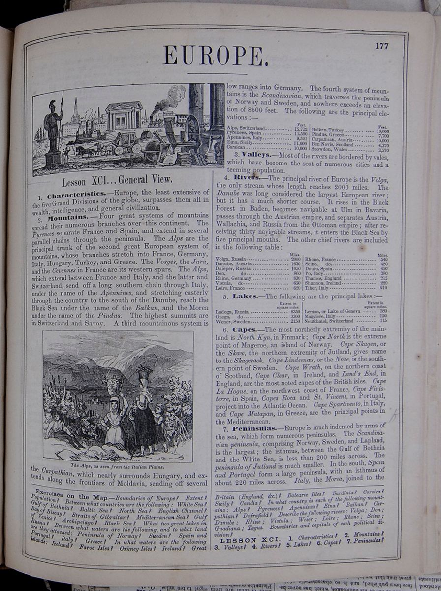 177
177
EUROPE.
A European scene, including a statue of a Roman soldier, a stagecoach, a pile of scientific instruments, a train, and a steamship.Lesson XCI... General View.
1. Characteristics.—Europe, the least extensive of the five Grand Divisions of the globe, surpasses them all in wealth, intelligence, and general civilization.
2. Mountains.—Four great systems of mountains spread their numerous branches over this continent. The Pyrenees separate France and Spain, and extend in several parallel chains through the peninsula. The Alps are the principal trunk of the second great European system of mountains, whose branches stretch into France, Germany, Italy, Hungary, Turkey, and Greece. The Vosges, the Jura, and the Cevennes in France are its western spurs. The Alps, which extend between France and Italy, and the latter and Switzerland, send off a long southern chain through Italy, under the name of the Apennines, and stretching easterly through the country to the south of the Danube, reach the Black Sea under the name of the Balkan, and the Morea under the name of the Pindus. The highest summits are in Switzerland and Savoy. A third mountainous system is
The Alps, as seen from the Italian Plains.the Carpathian, which nearly surrounds Hungary, and extends along the frontiers of Moldavia, sending off several
low ranges into Germany. The fourth system of mountains is the Scandinavian, which traverses the peninsula of Norway and Sweden, and nowhere exceeds an elevation of 8500 feet. The following are the principal elevations:—
This table lists the elevations of the following mountain ranges: Alps, Switzerland; Pyrenees, Spain; Apennines, Italy; Etna, Sicily; Corsican; Balkan, Turkey; Pindus, Greece; Carpathian, Austria; Ben Nevis, Scotland; Snowdon, Wales.3. Valleys.—Most of the rivers are bordered by vales, which have become the seat of numerous cities and a teeming population.
4. Rivers.—The principal river of Europe is the Volga, the only stream whose length reaches 2000 miles. The Danube was long considered the largest European river; but it has a much shorter course. It rises in the Black Forest in Baden, becomes navigable at Ulm in Bavaria, passes through the Austrian empire, and separates Austria, Wallachia, and Russia from the Ottoman empire; after receiving thirty navigable streams, it enters the Black Sea by five principal mouths. The other chief rivers are included in the following table:
This table lists European rivers and their lengths in miles, including: Volga, Russia; Danube, Austria; Dnieper, Russia; Don, Russia; Rhine, Germany; Vistula, Germany; Loire, France; Rhone, France; Seine, France; Douro, Spain; Po, Italy; Thames, England; Shannon, Ireland; Tiber, Italy.5. Lakes.—The following are the principal lakes:—
This table lists the major lakes of Europe and their area in square miles, including: Ladoga, Russia; Onega, Russia; Wener, Sweden; Leman, or Lake of Geneva; Maggiore, Italy; Neufchatel, Switzerland.6. Capes.—The most northerly extremity of the mainland is North Kyn, in Finmark; Cape North is the extreme point of Mageroe, an island of Norway. Cape Skagen, or the Skaw, the northern extremity of Jutland, gives name to the Skagerack. Cape Lindesnæs, or the Naze, is the southern point of Sweden. Cape Wrath, on the northern coast of Scotland, Cape Clear, in Ireland, and Land's End, in England, are the most noted capes of the British isles. Cape La Hogue, on the northwest coast of France, Cape Finisterre, in Spain, Capes Roca and St. Vincent, in Portugal, project into the Atlantic Ocean. Cape Spartivento, in Italy, and Cape Matapan, in Greece, are the principal points in the Mediterranean.
7. Peninsulas.—Europe is much indented by arms of the sea, which form numerous peninsulas. The Scandinavian peninsula, comprising Norway, Sweden, and Lapland, is the largest; the isthmus, between the Gulf of Bothnia and the White Sea, is less than 200 miles across. The peninsula of Jutland is much smaller. In the south, Spain and Portugal form a large peninsula, with an isthmus of about 220 miles across. Italy, the Morea, joined to the
Exercises on the Map.—Boundaries of Europe? Extent? Population? Between what countries are the following: White Sea? Gulf of Bothnia? Baltic Sea? North Sea? English Channel? Bay of Biscay? Straits of Gibraltar? Mediterranean Sea? Gulf of Venice? Archipelago? Black Sea? What two great lakes in Russia? Between what waters are the following, and to what land are they attached: Peninsula of Norway? Sweden? Spain and Portugal? Italy? Greece? In what waters are the following islands: Iceland? Faroe Isles? Orkney Isles? Ireland? Great Britain (England, &c.)? Balearic Isles? Sardinia? Corsica? Sicily? Candia? In what country is each of the following mountains: Alps? Pyrenees? Apennines? Etna? Balkan? Carpathian? Dofrafield? Describe the following rivers: Volga; Don; Danube; Rhine; Vistula; Weser; Loire; Rhone; Seine; Guadiana; Tagus. Boundaries and capitals of each political division?
LESSON XCI. 1. Characteristics? 2. Mountains? 3. Valleys? 4. Rivers? 5. Lakes? 6. Capes? 7. Peninsulas?
[begin surface 660]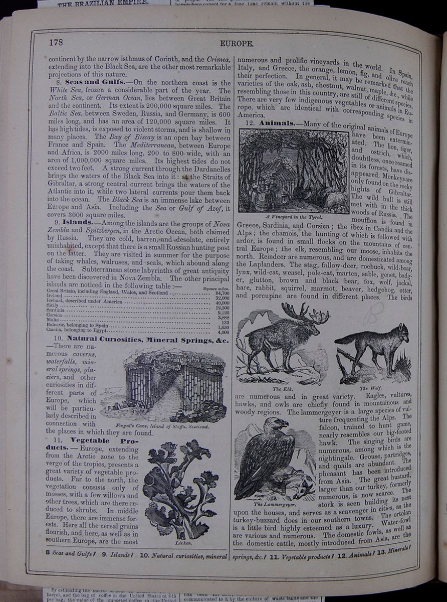 178
EUROPE.
178
EUROPE.
continent by the narrow isthmus of Corinth, and the Crimea, extending into the Black Sea, are the other most remarkable projections of this nature.
8. Seas and Gulfs.—On the northern coast is the White Sea, frozen a considerable part of the year. The North Sea, or German Ocean, lies between Great Britain and the continent. Its extent is 200,000 square miles. The Baltic Sea, between Sweden, Russia, and Germany, is 600 miles long, and has an area of 120,000 square miles. It has high tides, is exposed to violent storms, and is shallow in many places. The Bay of Biscay is an open bay between France and Spain. The Mediterranean, between Europe and Africa, is 2000 miles long, 200 to 800 wide, with an area of 1,000,000 square miles. Its highest tides do not exceed two feet. A strong current through the Dardanelles brings the waters of the Black Sea into it: at the Straits of Gibraltar, a strong central current brings the waters of the Atlantic into it, while two lateral currents pour them back into the ocean. The Black Sea is an immense lake between Europe and Asia. Including the Sea or Gulf of Azof, it covers 3000 square miles.
9. Islands.—Among the islands are the groups of Nova Zembla and Spitzbergen, in the Arctic Ocean, both claimed by Russia. They are cold, barren, and desolate, entirely uninhabited, except that there is a small Russian hunting post on the latter. They are visited in summer for the purpose of taking whales, walruses, and seals, which abound along the coast. Subterranean stone labyrinths of great antiquity have been discovered in Nova Zembla. The other principal islands are noticed in the following table :—
This table lists the principal islands of Europe and their areas in square miles. The islands listed are as follows: Great Britain, including England, Wales, and Scotland, Ireland, Iceland, Sicily, Sardinia, Corsica, Malta, Balearic, and Candia.10. Natural Curiosities, Mineral Springs, &c. —There are numerous caverns, waterfalls, mineral springs, glaciers, and other curiosities in different parts of Europe, which will be particularly described in connection with the places in which they are found.
Fingal's Cave, Island of Staffa, Scotland.11. Vegetable Products. —Europe, extending from the Arctic zone to the verge of the tropics, presents a great variety of vegetable products. Far to the north, the vegetation consists only of mosses, with a few willows and other trees, which are there reduced to shrubs. In middle Europe, there are immense forests. Here all the cereal grains flourish, and here, as well as in southern Europe, are the most
Lichen.numerous and prolific vineyards in the world. In Spain, Italy, and Greece, the orange, lemon, fig, and olive reach their perfection. In general, it may be remarked that the varieties of the oak, ash, chestnut, walnut, maple, &c., while resembling those in this country, are still of different species. There are very few indigenous vegetables or animals in Europe, which are identical with corresponding species in America.
A Vineyard in the Tyrol.12. Animals.—Many of the original animals of Europe have been exterminated. The lion, tiger, and ostrich, which, doubtless, once roamed in its forests, have disappeared. Monkeys are only found on the rocky hights of Gibraltar. The wild bull is still met with in the thick woods of Russia. The moufflon is found in Greece, Sardinia, and Corsica; the ibex in Candia and the Alps; the chamois, the hunting of which is followed with ardor, is found in small flocks on the mountains of central Europe; the elk, resembling our moose, inhabits the north. Reindeer are numerous, and are domesticated among the Laplanders. The stag, fallow-deer, roebuck, wild-boar, lynx, wild-cat, weasel, pole-cat, marten, sable, genet, badger, glutton, brown and black bear, fox, wolf, jackal, hare, rabbit, squirrel, marmot, beaver, hedgehog, otter, and porcupine are found in different places. The birds
The Elk. The Wolf.are numerous and in great variety. Eagles, vultures, hawks, and owls are chiefly found in mountainous and woody regions. The lammergeyer is a large species of vulture
The Lammergeyer.frequenting the Alps. The falcon, trained to hunt game, nearly resembles our big-footed hawk. The singing birds are numerous, among which is the nightingale. Grouse, partridges, and quails are abundant. The pheasant has been introduced from Asia. The great bustard, larger than our turkey, formerly numerous, is now scarce. The stork is seen building its nest upon the houses, and serves as a scavenger in cities, as the turkey-buzzard does in our southern towns. The ortolan is a little bird highly esteemed as a luxury. Water-fowl are various and numerous. The domestic fowls, as well as the domestic cattle, mostly introduced from Asia, are the
8 Seas and Gulfs? 9. Islands? 10. Natural curiosities, mineral springs, &c.? 11. Vegetable products? 12. Animals? 13. Minerals?
[begin surface 661]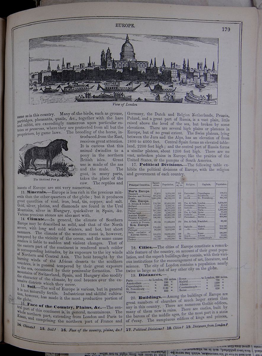 EUROPE.
179
View of London
EUROPE.
179
View of London
same as in this country. Many of the birds, such as grouse, partridges, pheasants, quails, &c., together with the hare and rabbit, are exceedingly numerous upon particular estates or preserves, where they are protected from all but the proprietors, by game laws. The breeding of the horse, introduced from the East, receives great attention. It is curious that this animal dwindles to a pony in the northern British isles. Great use is made of the ass and the mule. The goat, in many parts, takes the place of the cow. The reptiles and insects of Europe are not very numerous.
The Shetland Pon y .13. Minerals.—Europe is less rich in the precious minerals than the other quarters of the globe; but it produces great quantities of coal, iron, lead, tin, copper, and salt. Gold, silver, platina, and diamonds are found in the Ural Mountains, silver in Hungary, quicksilver in Spain, &c. Various precious stones are also met with.
14. Climate.—In general, the climate of Southern Europe may be described as mild, and that of the North severe, with long and cold winters, and hot, but short summers. The climate of the western coast is, however, tempered by the vicinity of the ocean, and the same cause renders it liable to sudden and violent changes. That of the eastern part of the continent is rendered much colder in corresponding latitudes, by its exposure to the icy winds of Northern and Central Asia. The heat brought by the burning winds of the African deserts to the southern countries, is in general tempered by their great exposure to the sea, occasioned by their peninsular formation. The mountains of Switzerland, Spain, and Hungary also modify the character of the climate, by cool breezes over the extensive districts which they cover.
15. Soil.—The soil of Europe is various, but in general it is not naturally fertile. Industrious and skillful cultivation, however, has made it the most productive portion of the globe.
16. Face of the Country, Plains, &c.—The central part of this continent is, in general, mountainous. The whole northern part, extending from London and Paris to Kasan, and comprising the northern part of France and
Germany, the Dutch and Belgian Netherlands, Prussia, Poland, and a great part of Russia, is a vast plain, little raised above the level of the sea, but broken by some elevations. There are several high plains or plateaus in Europe, but of no great extent. The Swiss plateau, lying between the Jura and the Alps, has an elevation of from 1800 to 4000 feet. Central Spain forms an elevated table-land, 2200 feet high; and the central part of Russia forms a similar plateau, about 1200 feet high. There are no vast, unbroken plains in Europe, like the prairies of the United States, or the pampas of South America.
17. Political Divisions.—The following table exhibits the political divisions of Europe, with the religion and government of each country.
This table lists the countries and divisions of Europe, and for each country lists the area in square miles, the population, the population per square miles, the predominant religion, the capital city, and population of the capital.18. Cities.—The cities of Europe constitute a remarkable feature of the country, on account of their great population, and the superb buildings they contain, with their various institutions for the encouragement of art, literature, and science. The city of London contains a population nearly twice as large as that of any other city on the globe.
19. Distances.—
This table lists the distance in miles between London and the following cities: Paris, Amsterdam, Copenhagen, St. Petersburg, Vienna, Rome, Madrid, Athens, Constantinople, and Berne.20. Buildings.—Among the buildings of Europe are great numbers of churches of much larger extent than any in this country. There are numerous Gothic edifices, many of them now in ruins. There are castles, built by the barons of the middle ages, for the most part in a state of decay. The sumptuous edifices of kings and princes,
14. Climate? 15. Soil? 16. Face of the country, plains, &c.? 17. Political Divisions? 18. Cities? 19. Distances from London?
[begin surface 662]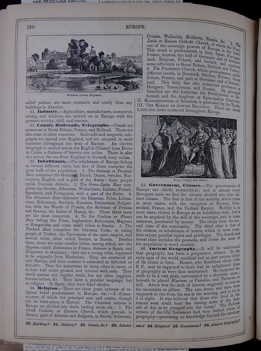 180
EUROPE.
Windsor Castle, England.
180
EUROPE.
Windsor Castle, England.
called palaces, are more extensive and costly than any buildings in America.
21. Industry.—Agriculture, manufactures, commerce, mining, and fisheries, are carried on in Europe with the greatest activity, skill, and success.
22. Canals, Railroads, Telegraphs.—Canals are numerous in Great Britain, France, and Holland. There are also some in other countries. Railroads and magnetic telegraphs are spread over England, and are adopted in most countries throughout the west of Europe. An electric telegraph is carried across the English Channel from Dover to Calais, a distance of twenty-one miles. There is also one across the sea from England to Ireland, sixty miles.
23. Inhabitants.—The inhabitants of Europe belong to twenty different races, but five of these comprise the great bulk of the population. 1. The German or Teutonic Race comprises the Germans, Dutch, Danes, Swedes, Norwegians, English, and a part of the Swiss : these people speak Teutonic dialects. 2. The Greco-Latin Race comprises the Greeks, Albanians, Wallachians, Italians, French, Spaniards, and Portuguese, with a part of the Swiss. 3. The Sclavonic Race embraces the Russians, Poles, Lithuanians, Bohemians, Servians, Bosnians, Dalmatians, Bulgarians, with the Wends of Prussia, the Sorbians of Prussia and Saxony, the Lettes of Russia, &c. These three races are the most numerous. 4. To the Uralian or Finnic Race belong the Finns, Laplanders, Esthonians, Magyars or Hungarians, and some small tribes in Russia. 5. The Turkish Race comprises the Ottoman Turks, or ruling people of Turkey, the Turcomans of the same empire, and several tribes often called Tartars, in Russia. Besides these, there are some smaller tribes, among which are the Gypsies, called Bohemians in France, Gitanos in Spain, and Zingeuner in Germany; they are a roving tribe, supposed to be originally from Hindostan. They are scattered all over Europe, and their number is estimated at 600,000 or 800,000. They live sometimes in tents, often in caves, or in huts half under ground, and covered with sods. They rarely pursue any regular trade, but are often jugglers, fortune-tellers, &c. They have a peculiar language, but no religion. In Spain, they have fixed abodes.
24. Religion.—There are three great systems of religious belief predominant in Europe, viz.:—I. CHRISTIANITY, of which the principal seat and center, though not its birth-place, is Europe. The Christian nations in Europe are divided into three leading sects, viz.: 1. The Greek Catholic, or Eastern Church, which prevails in Greece, part of Albania and Bulgaria, in Servia, Sclavonia,
Croatia, Wallachia, Moldavia, Russia, &c. 2. The Latin or Roman Catholic Church, of which the Pope, one of the sovereign powers of Europe, is the head. This creed is predominant in Italy, Spain, Portugal, France, Austria, the half of Germany and of Switzerland, Belgium, Poland, and Ireland, and numbers some adherents in Great Britain, Holland, and Turkey. 3. The Protestant Church, which predominates, under different creeds, in Denmark, Sweden, Norway, Great Britain, Prussia, and part of Germany and of Switzerland. This faith has also numerous professors in Hungary, Transylvania, and France. Its principal branches are the Lutheran, the Presbyterian or Reformed, and the Anglican or Episcopalian Churches. MAHOMETANISM, or Islamism, is professed by the Turks. III. THE MOSAIC OR JEWISH RELIGION. There are about 2,500,000 Jews scattered throughout Europe.
King, Clergy, and Nobles.25. Government, Classes.—The governments of Europe are chiefly monarchical; and in almost every European state we find the citizens divided into four distinct classes. The first is that of the nobility, which exists in most states, with the exception of Norway, Switzerland, France, and the Turkish Empire. Nobility is, in most cases, viewed in Europe as an hereditary rank; but it can be acquired by the will of the sovereign, and, in some instances, purchased by money. The clergy form the second class of the community. The third class is that of the citizens, or inhabitants of towns, which in most countries enjoys peculiar rights and privileges. The fourth and lowest class includes the peasants, and forms the mass of the population in every country.
26. Ancient Geography.—It will be understood that geography has been a progressive science. In the early ages of the world, mankind had no just notions either of its extent or form. Homer, who flourished about 1000 B. C., may be supposed to have had as enlightened ideas of geography as were then entertained. He supposed the earth to be a vast plain, surrounded by a shoreless ocean; beneath he placed Elysium, or Paradise, and Tartarus, or hell. Above was the arch of heaven, supposed to rest on the mountains as pillars. The sun, moon, and stars were supposed to rise from the sea in the morning, and to set in it at night. It was believed that those who lived in the remote west could hear the hissing noise of the fiery orb of day as he plunged into the ocean! The Hebrew writers of the Old Testament had very limited views of geography—possessing no knowledge beyond the territory
20. Buildings? 21. Industry? 22. Canals, &c.? 23. Inhabitants? 24. Religion? 25. Government? 26. Ancient Geography?
[begin surface 663]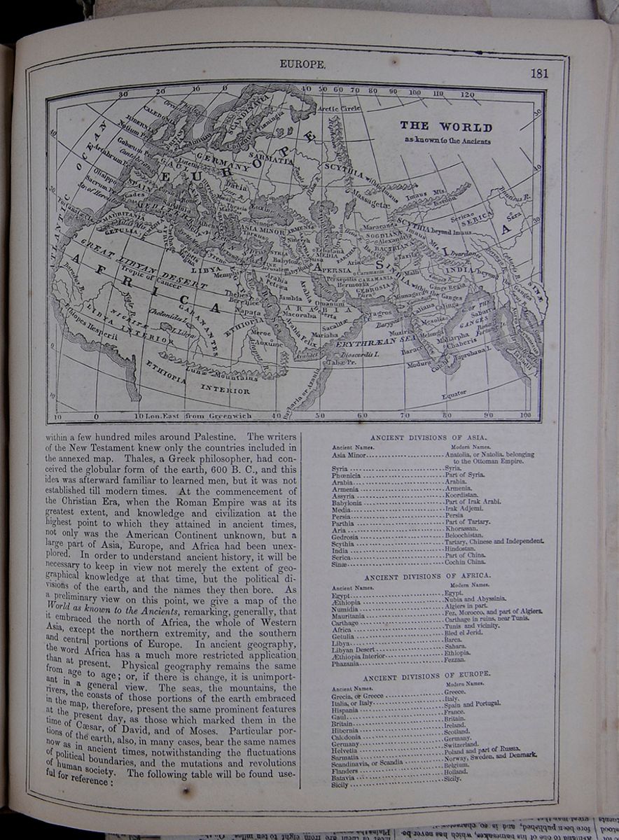 EUROPE.
181
THE WORLD as known to the Ancients
EUROPE.
181
THE WORLD as known to the Ancients
within a few hundred miles around Palestine. The writers of the New Testament knew only the countries included in the annexed map. Thales, a Greek philosopher, had conceived the globular form of the earth, 600 B. C., and this idea was afterward familiar to learned men, but it was not established till modern times. At the commencement of the Christian Era, when the Roman Empire was at its greatest extent, and knowledge and civilization at the highest point to which they attained in ancient times, not only was the American Continent unknown, but a large part of Asia, Europe, and Africa had been unexplored. In order to understand ancient history, it will be necessary to keep in view not merely the extent of geographical knowledge at that time, but the political divisions of the earth, and the names they then bore. As a preliminary view on this point, we give a map of the World as known to the Ancients, remarking, generally, that it embraced the north of Africa, the whole of Western Asia, except the northern extremity, and the southern and central portions of Europe. In ancient geography, the word Africa has a much more restricted application than at present. Physical geography remains the same from age to age; or, if there is change, it is unimportant in a general view. The seas, the mountains, the rivers, the coasts of those portions of the earth embraced in the map, therefore, present the same prominent features at the present day, as those which marked them in the time of Cæsar, of David, and of Moses. Particular portions of the earth, also, in many cases, bear the same names now as in ancient times, notwithstanding the fluctuations of political boundaries, and the mutations and revolutions of human society. The following table will be found useful for reference:
| Ancient Names. | Modern Names. |
| Asia Minor | Anatolia, or Natolia, belonging to the Ottoman Empire. |
| Syria | Syria. |
| Phœnicia | Part of Syria. |
| Arabia | Arabia. |
| Armenia | Armenia. |
| Assyria | Koordistan. |
| Babylonia | Part of Irak Arabi. |
| Media | Irak Adjemi. |
| Persia | Persia. |
| Parthia | Part of Tartary. |
| Aria | Khorassan. |
| Gedrosia | Beloochistan. |
| Scythia | Tartary, Chinese and Independent. |
| India | Hindostan. |
| Serica | Part of China. |
| Sinæ | Cochin China. |
| Ancient Names. | Modern Names. |
| Egypt | Egypt. |
| Æthiopia | Nubia and Abyssinia. |
| Numidia | Algiers in part. |
| Mauritania | Fez, Morocco, and part of Algiers. |
| Carthage | Carthage in ruins, near Tunis. |
| Africa | Tunis and vicinity. |
| Getulia | Bled el Jerid. |
| Libya | Barca. |
| Libyan Desert | Sahara. |
| Æthiopia Interior | Ethiopia. |
| Phazania | Fezzan. |
| Ancient Names. | Modern Names. |
| Grecia, or Greece | Greece. |
| Italia, or Italy | Italy. |
| Hispania | Spain and Portugal. |
| Gaul | France. |
| Britain | Britain. |
| Hibernia | Ireland. |
| Caledonia | Scotland. |
| Germany | Germany. |
| Helvetia | Switzerland. |
| Sarmatia | Poland and part of Russia. |
| Scandinavia, or Scandia | Norway, Sweden, and Denmark. |
| Flanders | Belgium. |
| Batavia | Holland. |
| Sicily | Sicily. |
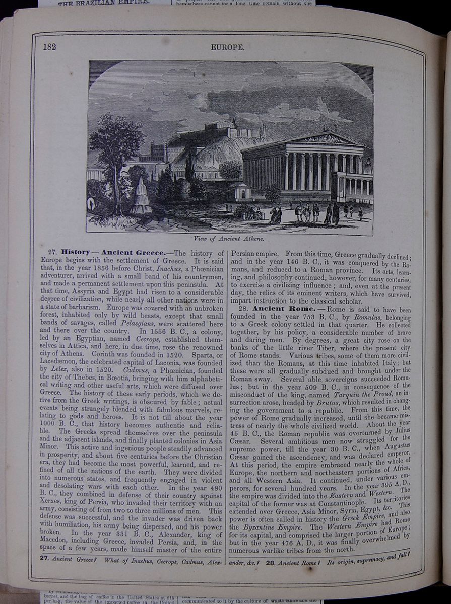 182
EUROPE.
View of Ancient Athens.
182
EUROPE.
View of Ancient Athens.
27. History—Ancient Greece.—The history of Europe begins with the settlement of Greece. It is said that, in the year 1856 before Christ, Inachus, a Phœnician adventurer, arrived with a small band of his countrymen, and made a permanent settlement upon this peninsula. At that time, Assyria and Egypt had risen to a considerable degree of civilization, while nearly all other nations were in a state of barbarism. Europe was covered with an unbroken forest, inhabited only by wild beasts, except that small bands of savages, called Pelasgians, were scattered here and there over the country. In 1556 B. C., a colony, led by an Egyptian, named Cecrops, established themselves in Attica, and here, in due time, rose the renowned city of Athens. Corinth was founded in 1520. Sparta, or Lacedæmon, the celebrated capital of Laconia, was founded by Lelex, also in 1520. Cadmus, a Phœnician, founded the city of Thebes, in Bœotia, bringing with him alphabetical writing and other useful arts, which were diffused over Greece. The history of these early periods, which we derive from the Greek writings, is obscured by fable; actual events being strangely blended with fabulous marvels, relating to gods and heroes. It is not till about the year 1000 B. C., that history becomes authentic and reliable. The Greeks spread themselves over the peninsula and the adjacent islands, and finally planted colonies in Asia Minor. This active and ingenious people steadily advanced in prosperity, and about five centuries before the Christian era, they had become the most powerful, learned, and refined of all the nations of the earth. They were divided into numerous states, and frequently engaged in violent and desolating wars with each other. In the year 480 B. C., they combined in defense of their country against Xerxes, king of Persia, who invaded their territory with an army, consisting of from two to three millions of men. This defense was successful, and the invader was driven back with humiliation, his army being dispersed, and his power broken. In the year 331 B. C., Alexander, king of Macedon, including Greece, invaded Persia, and, in the space of a few years, made himself master of the entire
Persian empire. From this time, Greece gradually declined; and in the year 146 B. C., it was conquered by the Romans, and reduced to a Roman province. Its arts, learning, and philosophy continued, however, for many centuries, to exercise a civilizing influence; and, even at the present day, the relics of its eminent writers, which have survived, impart instruction to the classical scholar.
28. Ancient Rome.—Rome is said to have been founded in the year 753 B. C., by Romulus, belonging to a Greek colony settled in that quarter. He collected together, by his policy, a considerable number of brave and daring men. By degrees, a great city rose on the banks of the little river Tiber, where the present city of Rome stands. Various tribes, some of them more civilized than the Romans, at this time inhabited Italy; but these were all gradually subdued and brought under the Roman sway. Several able sovereigns succeeded Romulus; but in the year 509 B. C., in consequence of the misconduct of the king, named Tarquin the Proud, an insurrection arose, headed by Brutus, which resulted in changing the government to a republic. From this time, the power of Rome gradually increased, until she became mistress of nearly the whole civilized world. About the year 45 B. C., the Roman republic was overturned by Julius Cæsar. Several ambitious men now struggled for the supreme power, till the year 30 B. C., when Augustus Cæsar gained the ascendency, and was declared emperor. At this period, the empire embraced nearly the whole of Europe, the northern and northeastern portions of Africa, and all Western Asia. It continued, under various emperors, for several hundred years. In the year 395 A. D., the empire was divided into the Eastern and Western. The capital of the former was at Constantinople. Its territories extended over Greece, Asia Minor, Syria, Egypt, &c. This power is often called in history the Greek Empire, and also the Byzantine Empire. The Western Empire had Rome for its capital, and comprised the larger portion of Europe; but in the year 476 A. D., it was finally overwhelmed by numerous warlike tribes from the north.
27. Ancient Greece? What of Inachus, Cecrops, Cadmus, Alexander, &c.? 28. Ancient Rome? Its origin, supremacy, and fall?
[begin surface 665]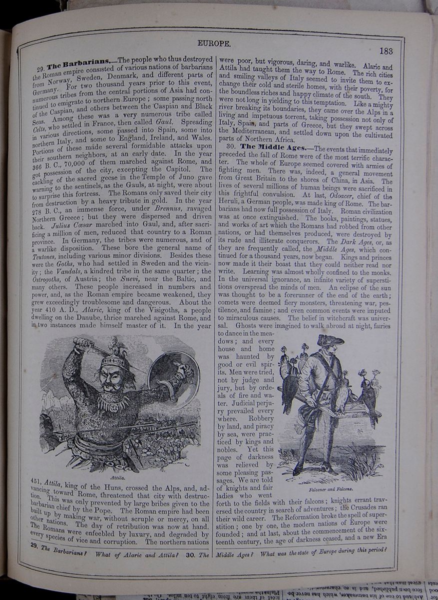 EUROPE.
183
EUROPE.
183
29. The Barbarians.—The people who thus destroyed the Roman empire consisted of various nations of barbarians from Norway, Sweden, Denmark, and different parts of Germany. For two thousand years prior to this event, numerous tribes from the central portions of Asia had continued to emigrate to northern Europe; some passing north of the Caspian, and others between the Caspian and Black Seas. Among these was a very numerous tribe called Celts, who settled in France, then called Gaul. Spreading in various directions, some passed into Spain, some into northern Italy, and some to England, Ireland, and Wales. Portions of these made several formidable attacks upon their southern neighbors, at an early date. In the year 366 B. C., 70,000 of them marched against Rome, and got possession of the city, excepting the Capitol. The cackling of the sacred geese in the Temple of Juno gave warning to the sentinels, as the Gauls, at night, were about to surprise this fortress. The Romans only saved their city from destruction by a heavy tribute in gold. In the year 278 B. C., an immense force, under Brennus, ravaged Northern Greece; but they were dispersed and driven back. Julius Cæsar marched into Gaul, and, after sacrificing a million of men, reduced that country to a Roman province. In Germany, the tribes were numerous, and of a warlike disposition. These bore the general name of Teutones, including various minor divisions. Besides these were the Goths, who had settled in Sweden and the vicinity; the Vandals, a kindred tribe in the same quarter; the Ostrogoths, of Austria; the Suevi, near the Baltic, and many others. These people increased in numbers and power, and, as the Roman empire became weakened, they grew exceedingly troublesome and dangerous. About the year 410 A. D., Alaric, king of the Visigoths, a people dwelling on the Danube, thrice marched against Rome, and in two instances made himself master of it. In the year
Attila.451, Attila, king of the Huns, crossed the Alps, and, advancing toward Rome, threatened that city with destruction. This was only prevented by large bribes given to the barbarian chief by the Pope. The Roman empire had been built up by making war, without scruple or mercy, on all other nations. The day of retribution was now at hand. The Romans were enfeebled by luxury, and degraded by every species of vice and corruption. The northern nations
were poor, but vigorous, daring, and warlike. Alaric and Attila had taught them the way to Rome. The rich cities and smiling valleys of Italy seemed to invite them to exchange their cold and sterile homes, with their poverty, for the boundless riches and happy climate of the south. They were not long in yielding to this temptation. Like a mighty river breaking its boundaries, they came over the Alps in a living and impetuous torrent, taking possession not only of Italy, Spain, and parts of Greece, but they swept across the Mediterranean, and settled down upon the cultivated parts of Northern Africa.
30. The Middle Ages.—The events that immediately preceded the fall of Rome were of the most terrific character. The whole of Europe seemed covered with armies of fighting men. There was, indeed, a general movement from Great Britain to the shores of China, in Asia. The lives of several millions of human beings were sacrificed in this frightful convulsion. At last, Odoacer, chief of the Heruli, a German people, was made king of Rome. The barbarians had now full possession of Italy. Roman civilization was at once extinguished. The books, paintings, statues, and works of art which the Romans had robbed from other nations, or had themselves produced, were destroyed by its rude and illiterate conquerors. The Dark Ages, or, as they are frequently called, the Middle Ages, which continued for a thousand years, now began. Kings and princes now made it their boast that they could neither read nor write. Learning was almost wholly confined to the monks. In the universal ignorance, an infinite variety of superstitions overspread the minds of men. An eclipse of the sun was thought to be a forerunner of the end of the earth; comets were deemed fiery monsters, threatening war, pestilence, and famine; and even common events were imputed to miraculous causes. The belief in witchcraft was universal. Ghosts were imagined to walk abroad at night, fairies to dance in the meadows; and every house and home was haunted by good or evil spirits. Men were tried, not by judge and jury, but by ordeals of fire and water. Judicial perjury prevailed every where. Robbery by land, and piracy by sea, were practiced by kings and nobles. Yet this page of darkness was relieved by some pleasing passages. We are told of knights and fair ladies who went forth to the fields with their falcons; knights errant traversed the country in search of adventures; the Crusades ran their wild career. The Reformation broke the spell of superstition; one by one, the modern nations of Europe were founded; and at last, about the commencement of the sixteenth century, the age of darkness ceased, and a new Era
29. The Barbarians? What of Alaric and Attila? 30. The Middle Ages? What was the state of Europe during this period?
[begin surface 666]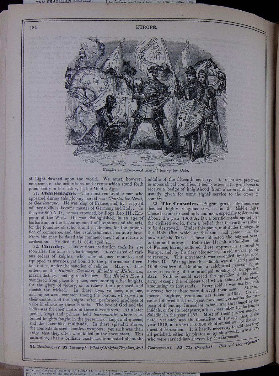 184
EUROPE.
Knights in Armor.—A Knight taking the
Oath.
184
EUROPE.
Knights in Armor.—A Knight taking the
Oath.
of Light dawned upon the world. We must, however, note some of the institutions and events which stand forth prominently in the history of the Middle Ages.
31. Charlemagne.—The most remarkable man who appeared during this gloomy period was Charles the Great, or Charlemagne. He was king of France, and, by his great military abilities, became master of Germany and Italy. In the year 800 A. D., he was crowned, by Pope Leo III., Emperor of the West. He was distinguished, in an age of barbarism, for the encouragement of literature and the arts, for the founding of schools and academies, for the promotion of commerce, and the establishment of salutary laws. From him may be dated the commencement of a return to civilization. He died A. D. 814, aged 71.
32. Chivalry.—This curious institution took its rise soon after the time of Charlemagne. It consisted of various orders of knights, who were at once mounted and equipped as warriors, yet bound to the performance of certain duties, under the sanction of religion. Many of these orders, as the Knights Templars, Knights of Malta, &c., make a distinguished figure in history. The Knights Errant wandered from place to place, encountering other knights, for the glory of victory, or to relieve the oppressed, and punish the wicked. In these ages, violence, injustice, and rapine were common among the barons, who dwelt in their castles, and the knights often performed prodigies of valor in chastising these tyrants. The love of God and the ladies was the chief motto of these adventurers. At a later period, kings and princes held tournaments, where celebrated knights fought in the presence of kings and queens, and the assembled multitude. In these splendid shows, the combatants used pointless weapons; yet such was their ardor, that they often were killed in the encounters. This institution, after a brilliant existence, terminated about the middle of the fifteenth century. Its relics are preserved in monarchical countries, it being esteemed a great honor to receive a badge of knighthood from a sovereign, which is usually given for some signal service to the crown or country.
33. The Crusades.—Pilgrimages to holy places were deemed highly religious services in the Middle Ages. These became exceedingly common, especially to Jerusalem. About the year 1000 A. D., a terrific mania spread over the civilized world, from a belief that the earth was about to be destroyed. Under this panic, multitudes thronged to the Holy City, which at this time had come under the power of the Turks. These subjected the pilgrims to extortion and outrage. Peter the Hermit, a Picardian monk of France, having suffered these oppressions, returned to Europe, and, by his fiery eloquence, stirred up the people to revenge. This movement was seconded by the pope, Urban II. War against the infidels was declared; and in 1096, Godfrey de Bouillon, a celebrated general, led an army, consisting of the principal nobility of Europe, into Asia. Nothing could exceed the splendor of this proud array, except the religious zeal which animated the army, amounting to thousands. Every soldier was marked with a cross; hence these wars derived their name. After immense slaughter, Jerusalem was taken in 1099. Six crusades followed this first great movement, either for the purpose of defending Jerusalem, which was threatened by the infidels, or for its recapture, after it was taken by the famous Saladin, in the year 1187. Most of them proved unfortunate; yet such was the fanaticism of the age, that, in the year 1212, an army of 40,000 children set out for the conquest of Jerusalem. It is hardly necessary to add that they all perished, either by pirates or by shipwreck, save a few, who were carried into slavery by the Saracens.
31. Charlemagne? 32. Chivalry? What of Knights Templars, &c.? Tournaments? 33. The Crusades? How did they originate?
 [begin surface 668]
 [begin surface 669]
 [begin surface 670]
 [begin surface 671]
 [begin surface 672]
 [begin surface 673]
 [begin surface 674]
 [begin surface 675]
 [begin surface 676]
 [begin surface 677]
 [begin surface 678]
 [begin surface 679]
 [begin surface 680]
 [begin surface 681]
 [begin surface 682]
 [begin surface 683]
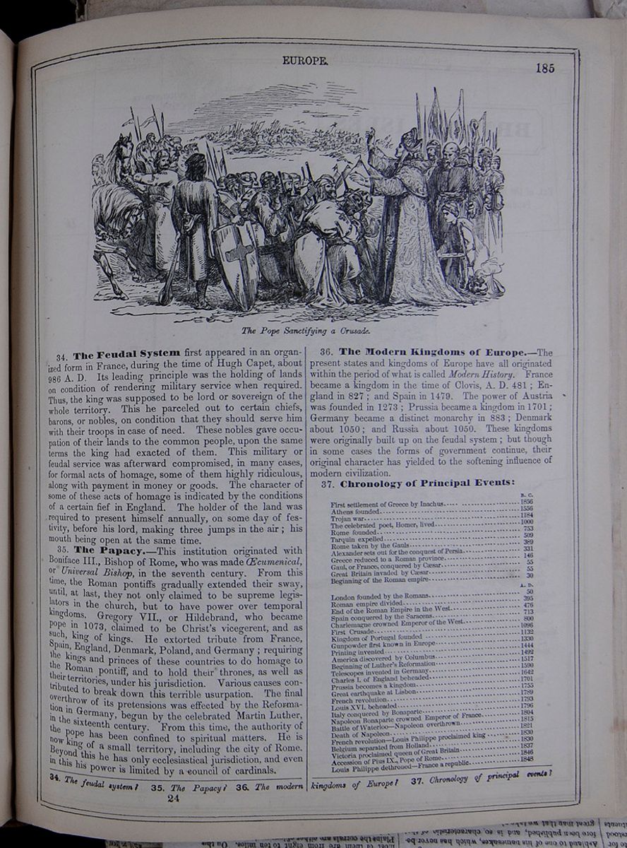
34. The Feudal System first appeared in an organized form in France, during the time of Hugh Capet, about 986 A. D. Its leading principle was the holding of lands on condition of rendering military service when required. Thus, the king was supposed to be lord or sovereign of the whole territory. This he parceled out to certain chiefs, barons, or nobles, on condition that they should serve him with their troops in case of need. These nobles gave occupation of their lands to the common people, upon the same terms the king had exacted of them. This military or feudal service was afterward compromised, in many cases, for formal acts of homage, some of them highly ridiculous, along with payment in money or goods. The character of some of these acts of homage is indicated by the conditions of a certain fief in England. The holder of the land was required to present himself annually, on some day of festivity, before his lord, making three jumps in the air; his mouth being open at the same time.
35. The Papacy.—This institution originated with Boniface III., Bishop of Rome, who was made Œcumenical, or Universal Bishop, in the seventh century. From this time, the Roman pontiffs gradually extended their sway, until, at last, they not only claimed to be supreme legislators in the church, but to have power over temporal kingdoms. Gregory VII., or Hildebrand, who became pope in 1073, claimed to be Christ's vicegerent, and as such, king of kings. He extorted tribute from France, Spain, England, Denmark, Poland, and Germany; requiring the kings and princes of these countries to do homage to the Roman pontiff, and to hold their thrones, as well as their territories, under his jurisdiction. Various causes contributed to break down this terrible usurpation. The final overthrow of its pretensions was effected by the Reformation in Germany, begun by the celebrated Martin Luther, in the sixteenth century. From this time, the authority of the pope has been confined to spiritual matters. He is now king of a small territory, including the city of Rome. Beyond this he has only ecclesiastical jurisdiction, and even in this his power is limited by a council of cardinals.
36. The Modern Kingdoms of Europe.—The present states and kingdoms of Europe have all originated within the period of what is called Modern History. France became a kingdom in the time of Clovis, A. D. 481; England in 827; and Spain in 1479. The power of Austria was founded in 1273; Prussia became a kingdom in 1701; Germany became a distinct monarchy in 883; Denmark about 1050; and Russia about 1050. These kingdoms were originally built up on the feudal system; but though in some cases the forms of government continue, their original character has yielded to the softening influence of modern civilization.
| B. C. | |
| First settlement of Greece by Inachus | 1856 |
| Athens founded | 1556 |
| Trojan war | 1184 |
| The celebrated poet, Homer, lived | 1000 |
| Rome founded | 753 |
| Tarquin expelled | 509 |
| Rome taken by the Gauls | 389 |
| Alexander sets out for the conquest of Persia | 331 |
| Greece reduced to a Roman province | 146 |
| Gaul, or France, conquered by Cæsar | 55 |
| Great Britain invaded by Cæsar | 55 |
| Beginning of the Roman empire | 30 |
| A. D. | |
| London founded by the Romans | 50 |
| Roman empire divided | 395 |
| End of the Roman Empire in the West | 476 |
| Spain conquered by the Saracens | 713 |
| Charlemagne crowned Emperor of the West | 800 |
| First Crusade | 1096 |
| Kingdom of Portugal founded | 1132 |
| Gunpowder first known in Europe | 1330 |
| Printing invented | 1444 |
| America discovered by Columbus | 1492 |
| Beginning of Luther's Reformation | 1517 |
| Telescopes invented in Germany | 1590 |
| Charles I. of England beheaded | 1642 |
| Prussia becomes a kingdom | 1701 |
| Great earthquake at Lisbon | 1755 |
| French revolution | 1789 |
| Louis XVI. beheaded | 1793 |
| Italy conquered by Bonaparte | 1796 |
| Napoleon Bonaparte crowned Emperor of France | 1804 |
| Battle of Waterloo—Napoleon overthrown | 1815 |
| Death of Napoleon | 1821 |
| French revolution—Louis Philippe proclaimed king | 1830 |
| Belgium separated from Holland | 1830 |
| Victoria proclaimed queen of Great Britain | 1837 |
| Accession of Pius IX., Pope of Rome | 1846 |
| Louis Phillipe dethroned—France a republic | 1848 |
34. The feudal system? 35. The Papacy? 36. The modern kingdoms of Europe? 37. Chronology of principal events?
24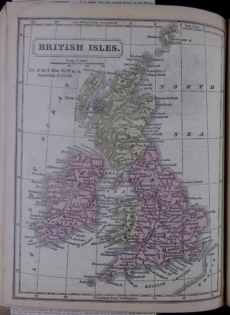 BRITISH ISLES.
A map of the British Isles, including Scotland,
England, Wales, and Ireland. It also lists the extent of
the British Isles as 116,700 square miles, and the
population as 27,452,262.
BRITISH ISLES.
A map of the British Isles, including Scotland,
England, Wales, and Ireland. It also lists the extent of
the British Isles as 116,700 square miles, and the
population as 27,452,262.
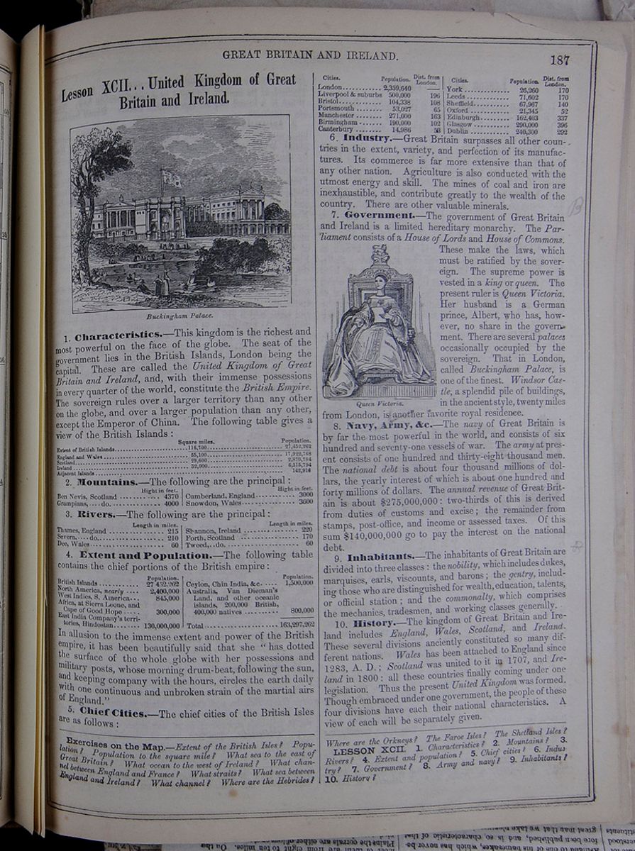
Lesson XCII... United Kingdom of Great Britain and Ireland.
Buckingham Palace.1. Characteristics.—This kingdom is the richest and most powerful on the face of the globe. The seat of the government lies in the British Islands, London being the capital. These are called the United Kingdom of Great Britain and Ireland, and, with their immense possessions in every quarter of the world, constitute the British Empire. The sovereign rules over a larger territory than any other on the globe, and over a larger population than any other, except the Emperor of China. The following table gives a view of the British Islands:
A table listing the square miles and populations of England and Wales, Scotland, Ireland, and the adjacent islands.2. Mountains.—The following are the principal:
A table listing the height in feet of the Ben Nevis, Grampians, Cumberland, and Snowdon mountain ranges.3. Rivers.—The following are the principal:
A table listing the length in miles of the Thames, Severn, Dee, Shannon, Forth, and Tweed rivers.4. Extent and Population.—The following table contains the chief portions of the British empire:
A table listing the populations of the British Islands, North America, West Indies combined with South America, Africa (at Sierra Leone and the Cape of Good Hope), East India Company's territories, Ceylon, and Australia combined with other oceanic islands.5. Chief Cities.—The chief cities of the British Isles are as follows:
A table listing the population and distance from London of London, Liverpool & suburbs, Bristol, Portsmouth, Manchester, Birmingham, Canterbury, York, Leeds, Sheffield, Oxford, Edinburgh, Glasgow, and Dublin.6. Industry.—Great Britain surpasses all other countries in the extent, variety, and perfection of its manufactures. Its commerce is far more extensive than that of any other nation. Agriculture is also conducted with the utmost energy and skill. The mines of coal and iron are inexhaustible, and contribute greatly to the wealth of the country. There are other valuable minerals.
7. Government.—The government of Great Britain and Ireland is a limited hereditary monarchy. The Parliament consists of a House of Lords and House of Commons. These make the laws, which must be ratified by the sovereign. The supreme power is vested in a king or queen. The present ruler is Queen Victoria. Her husband is a German prince, Albert, who has, however, no share in the government. There are several palaces occasionally occupied by the sovereign. That in London, called Buckingham Palace, is one of the finest. Windsor Castle, a splendid pile of buildings, in the ancient style, twenty miles from London, is another favorite royal residence.
Queen Victoria.8. Navy, Army, &c.—The navy of Great Britain is by far the most powerful in the world, and consists of six hundred and seventy-one vessels of war. The army at present consists of one hundred and thirty-eight thousand men. The national debt is about four thousand millions of dollars, the yearly interest of which is about one hundred and forty millions of dollars. The annual revenue of Great Britain is about $275,000,000: two-thirds of this is derived from duties of customs and excise; the remainder from stamps, post-office, and income or assessed taxes. Of this sum $140,000,000 go to pay the interest on the national debt.
9. Inhabitants.—The inhabitants of Great Britain are divided into three classes : the nobility, which includes dukes, marquises, earls, viscounts, and barons; the gentry, including those who are distinguished for wealth,education, talents, or official station; and the commonalty, which comprises the mechanics, tradesmen, and working classes generally.
10. History.—The kingdom of Great Britain and Ireland includes England, Wales, Scotland, and Ireland. These several divisions anciently constituted so many different nations. Wales has been attached to England since 1283, A. D.; Scotland was united to it in 1707, and Ireland in 1800: all these countries finally coming under one legislation. Thus the present United Kingdom was formed. Though embraced under one government, the people of these four divisions have each their national characteristics. A view of each will be separately given.
Exercises on the Map.—Extent of the British Isles? Population? Population to the square mile? What sea to the east of Great Britain? What ocean to the west of Ireland? What channel between England and France? What straits? What sea between England and Ireland? What channel? Where are the Hebrides? Where are the Orkneys? The Faroe Isles? The Shetland Isles?
LESSON XCII. 1. Characteristics? 2. Mountains? 3. Rivers? 4. Extent and population? 5. Chief cities? 6. Industry? 7. Government? 8. Army and navy? 9. Inhabitants? 10. History?
 185
ENGLAND.
185
ENGLAND.
Lesson XCIII... England.
1. Characteristics.—This is the principal division of the British Empire, and is renowned for its splendid cities, its high cultivation, its numerous railroads and canals, and its good institutions.
2. Mountains.—The Cheviot Hills, in the north, approaching within eighteen miles of the sea, and the Cumberland Hills, form a continuous range. The peaks of the latter, Helvellyn and Skiddaw, are 3000 feet high.
3. Valleys.—There are no valleys of great extent. The Basin of the Severn is skirted by the Welsh Mountains on the west, and some lofty eminences on the east. The borders of the rivers are generally crowded with cities, teeming with population.
4. Plains, &c.—The country in England known as the Fens, is a flat, marshy district near the Wash. Salisbury Plain is a kind of table-land, 300 feet above the level of the sea. There are numerous tracts called heaths, which first derived their name from being covered with a plant of that name. They are generally uncultivated, shrubby wastes. The downs are sterile tracts, chiefly used as sheep pastures.
5. Rivers.—The largest, though not the longest river, is the Severn, which rises near Mount Plynlimmon, in Wales, and enters Bristol Channel after a course of 200 miles. The Thames is a little longer than the Severn, and rises near the
The Thames, in London.source of that river. It it navigable from the German Ocean, where it empties, to London—sixty miles. It is quite the most important river of England. The Mersey, navigable thirty-five miles, enters the Irish Sea at Liverpool. The Dee, Trent, Ouse, and Humber, are all small streams.
6. Lakes.—These are small, but celebrated for natural beauty, hightened by cultivation, and the country-seats around. The largest are at the north, in the counties of Cumberland and Westmoreland. Windermere is ten miles long, and one to two broad. Derwentwater, four miles long, is esteemed the most beautiful.
7. Shores, Bays, &c.—The coasts of England are irregular, and abound with inlets. The shores are generally rocky. On the English Channel, there are high chalky cliffs, whose white appearance gave the island the name of Albion in ancient times. The southeastern extremity, comprising the county of Cornwall, is a long cape, terminating in what is called Land's End.
8. Bays and Harbors.—The largest bay is the
Bristol Channel, twenty miles wide and sixty long. The Thames, at its mouth, enlarges to a considerable bay. The Wash is a broad bay on the eastern coast. Small harbors are numerous.
9. Islands.—The Island of Great Britain, 580 miles long, and 270 wide at the broadest part, comprises England, Wales, and Scotland. It is bounded on the north by the Atlantic; on the east by the German Ocean; on the south by the English Channel, separating it from France; on the west by the Irish Sea, separating it from Ireland and the Atlantic. The Isle of Wight is a beautiful and fertile island at the south, containing 270 square miles. Near the southern extremity are the Scilly Isles, 145 in number; six are inhabited, the rest are mere rocks. Numerous druidical monuments are found here. The islands of Guernsey, Jersey, Alderney, and Sark, lying near the French coast, are all inhabited, and belong to England; the largest is twelve miles long.
10. Natural Curiosities.—In Derbyshire there are several curious peaks and caverns. Near Buxton is a vast stalactitic cave, called Pool's Hole, furnishing alabaster and spar, which are wrought into ornaments by the inhabitants. At Castleton, in the same county, is a high rock, crowned with a castle called The Peak. Here, also, are extraordinary caverns and limestone rocks. Near by, are the petrifying wells, lead mines, and caverns of Matlock Dale. At Knaresboro', in Yorkshire, is a celebrated Dropping Well, possessing petrifying qualities.
11. Mineral Springs.—The most famous springs are those of Bath, which were known at the time of the Romans. Those of Bristol, Tunbridge, Buxton, Scarborough, Harrowgate, Epsom, Leamington, and Cheltenham, are celebrated. All are frequented by invalids, and crowds of wealthy and fashionable idlers.
12. Vegetable Products.—But few of the present vegetable products of England are indigenous. The most useful plants have been imported from the Continent. The oak is a native tree, and makes excellent timber.
13. Animals.—The wolf, bear, and some other savage animals have been exterminated. The badger, fox, wildcat, weasel, marten, otter, squirrel, and dormouse remain. The stag and fallow-deer are wholly or partially domesticated on some of the large estates. Hares, pheasants, and rabbits abound in the preserves. The domestic quadrupeds have been brought to the highest perfection by breeding and training. Eagles, hawks, and singing-birds are numerous. The domestic birds are wholly of foreign origin—poultry from Asia, the Guinea-fowl from Africa, peacock from India, pheasant from Colchis, and the turkey from America. The reptiles and insects are few. Turbot, dace, sole, cod, plaice, smelt, shrimp, &c., are found along the coast. Salmon, trout, &c., frequent the rivers. Shell-fish abound.
14. Minerals.—Salt, coal, iron, and tin are abundant. Thousands of persons are occupied in obtaining them, and many thousands more are employed in distributing them over Great Britain, and shipping them to various parts of the world. The resources of the British Isles in their useful minerals surpass those of any other country.
15. Climate.—England has an atmosphere of fog, rain, and perpetual change; yet the climate is mild. The rigors of winter, and the heats of summer, are tempered
LESSON XCIII. 1. Characteristics of England? 2. Mountains? 3. Valleys? 4. Plains, &c.? 5. Rivers? 6. Lakes? 7. Shores, &c.? 8. Bays and harbors? 9. Islands? 10. Natural Curiosities? 11. Mineral springs? 12. Vegetable products?
[begin surface 687]
Foreign Correspondence.
NUMBER 3.
MORAL AND PHYSICAL ASPECTS OF LONDON—LIFE IN PARIS—GARDENS, LIBRARIES, AND ART GALLERIES OPEN TO ALL—COST OF LIVING—INFLUX OF FOREIGNERS—BIRDS' EYE VIEW OF THE CITY.
PARIS, December, 1856.Our stay in London was not as long as we could have wished. Still we saw enough of it to get some very decided impressions in regard to it. Its immense magnitude, the ant-like myriads of its population produce a constant wonderment how they were all supplied with the necessaries of life. There was a much greater appearance of comfort, the people were much better habited, and there was less of beggary than I expected to see—in these respects not surpassed by New York. There is a great deal of fine architecture in the public and private buildings, a great show of wealth in the stores and in the equipages and mansions around Hyde Park. The parks are a noble feature, embracing hundreds of acres, where fashion and beauty and poverty and misfortune may equally, in the heart of the metropolis, breathe the air and rejoice in the trees and verdure of the country. St. James Park in the very heart of the town is a perfect gem. It has not the dimensions, or the drives, or the elevation, or the celebrity of Hyde Park; but its wide walks and shrubbery, and its plantations, and its water, upon which have been introduced all the varieties of water fowl, often drew me in a leisure hour to stroll through it. But there is a dark side to London, much darker than of any place I ever saw—actual and moral. There is no architecture so grand but its effect is marred by the soot which settles upon it. Every thing out doors has a dark, murky appearance, for this reason, on the brightest day; and in a rainy day t is dismal in the extreme. But the moral degradation of London is beyond conception. At night the streets swarm with the vilest characters, and render it utterly impossible for people having a regard to decency to walk out.
We left it with no regrets. A few hours on the railway brought us to Folkstone, where we embarked in the steamer crossing the Straits of Dover to Boulogne. Hardly a ripple was on the sea, and this passage, which ordinarily is attended with so much roughness and consequent sea sickness, was on this occasion as calm and as pleasant as going up the North River on a summer day. The chalky cliffs of Dover soon were out of sight, as the slaty ones of Boulogne came in view. The monument and the cathedral were visible soon after, and in two hours we were landed on the keys of Boulogne amid a crowd of English, who were expecting friends to join them at that celebrated watering place.
"Why do you remain in Paris," said I to a young Frenchman, who had come from the country, and who had no regular employment, and whose wardrobe plainly indicated that he fared badly here. "Ah, Monsieur," he replied, "Paris is the capitol of France," aud vouchsafed no further explanation. But his answer was pregnant with meaning. A Frenchman is content to drag out any kind of an existence in Paris. It is his earthly paradise. Life here, is for the most part, out of doors; and presents always a sunny aspect. Or if some of it be in doors, much of that is public—it is free to all. Not only are the parks and Gardens opened to use free of expense, but they are kept in the finest order, and every accommodation offorded to the visitor to them. The bridges which every few hundred feet span the Seine take no toll. The galleries of the Louvre, whose walls are covered with the choicest paintings, or whose rooms are filled with sculptures of the old and modern masters ; where are deposited the monuments transferred from Phebes and Memphis, sphinxes and sarcophagæ of Egyptian Kings, and statues of Apis, of dates in age long before the Christian era; The Jardin des plantes, with its collection of animated nature, from the unwieldly hippotamus to the smallest reptile; the lecture rooms of the professors in all departments of human knowledge; libraries the most replete with books, all throw back their doors and invite him to enter free of charge. But there is something beyond all this in Paris which captivates the Frenchman. It is the universal and incessant effort here made to give pleasure, to amuse, and, as they say in their language, to distract with novelty. He loves this excitement. He will work hard all day; he will leave the quiet comfortable home in the country; he will deprive himself of many things and submit to great toil, in order to go to his place of amusement in the evening, be it the salon or reception where he is expected, or the cafe where he may sip his coffee and smoke his segar, or play his game of cards or billiards, or the Chateau des Fleurs, or, if it be winter, the Valentino, where he may dance all night, or the theatre, or the ballet, or the opera. His taste is catered to, and what is a very important matter, every amusement is offered at a price, at one place if not at another, to suit his purse. He may ride out to the Bois de Boulogne—the finest promenade, perhaps, in the world—and, whether he be in his coupe hired by the month, or in a cart, a seat in which for the occasion, may have cost him half a franc—he there finds himself in company with all the world, enjoying the same scenes as Eugenie who drives along side of him with the imperial phaeton and outriders.
But it is not Frenchmen alone who are captivated with Paris. All nations and tongues are congregated there, but principally English, Russians and Americans. The number of foreigners constantly here is enormous, the number being computed at from thirty thousand to fifty thousand, two-thirds of which are English.—Americans are less numerous at this moment than usual, in consequence of the financial difficulties at home, which have taken many homeward who otherwise would have wintered here. The consequence of this influx of strangers is, that being generally persons in affluent circumstances, they are charged and pay high for what they get, and hence the prices of living and of articles of purchase have become enormously enhanced. All the more eligible localities in the city are devoted to private hotels which are rented out in floors or suits of apartments at enormous sums to the incomers : the annual receipts in this way from a moderate-sized building in a good situation ou the north side of the Seine, and not on the Boulevards where they are much larger, being from eight thousand to ten thousand dollars per year. A single man may live as he would live at a hotel in New York, for about fifty per cent more. While Paris therefore is the dearest place in the world where a person desirous of living well can reside, it probably furnishes the means of living as cheaply as any other. Either take lodgings in the fifth story or attic, or cross to the south side of the Seine, where you may for the same price have a room in the third story, dine at a restaurant for a franc and a half, as may be done, indulge in no luxuries, or if you smoke let it be a pipe and villainous French tobacco, (good segars are very dear) eschew fire, unless you would have your pocket book soon burnt through, and you may live cheaply enough in Paris,—and not otherwise.
It is a mystery to me why Americans are fond of Paris. For a visit—the novelty of once seeing the place—it is well enough; but there are our countrymen here who consider any other residence intolerable. I asked an American lady of this class why she so liked Paris. She replied, "Because I can be independent." And in a social point of view, the remark is perhaps true.—This arises from the peculiar political condition and extravagant temperament of the people. The watchwords of the Revolution of 1789 —liberty, equality, fraternity—are those of the present day; and are still to be seen in public places,
and are even on the walls of the Palace of Justice; but they have a different meaning now from what they had then. They are held on to now, because the French, under the present regime, affect to be carrying out, to their proper and legitimate results, the principles of the first Revolution. The people are tickled with the idea and are fain to believe it true. Yet while they hold on to the words and are taught that the present is a pure Democratic government, they have undergone a social revolution and have come to regard these words in another sense. Liberty has no such meaning as formerly. It does not imply freedom of political action and opinion. On the contrary it means to be free from all concerns of government, and to have license to do anything they please with themselves and their property, provided they do not meddle with private affairs. Consequently not a word can be said in opposition to the measures of Government. Two newspapers have, by imperial decrees, been suppressed within the last week for publishing what in the United States would be considered the most harmless squibs. On the other hand there is no conduct so licentious, no exhibition so immoral, no fashion so outrageous, but what may be made with perfect impunity and looked upon with indifference. The print shops have their windows filled with voluptuous prints—and men and women look at them with the utmost nonchalance.—Gardens and halls abound in every direction, where resort the courtezans and voluptuaries, and where music by the best bands is discoursed, and old men and young men join in the giddy dance and display the most fantastic figures, while all around, walking or looking on, are numbers of people—men and women, fathers and mothers, esteemed respectable. Government encourages all this, for it has its officials in the shape of policeman all around to prevent an emeute , and that is all. It is indeed painful to walk the streets of Paris by day or night and witness the guards and the bayonets which are displayed everywhere. From fifty to eighty thousand soldiers are all the time in Paris.—They are moving to and fro all the time, in squads of from fifty to a thousand men. The police are everywhere, and they too may be seen at night patrolling in large bodies up and down the Boulevards and other great thoroughfares. At first I was startled by coming in my walks very suddenly upon a soldier on horseback,—the mounted police,—behind some dark corner, waiting apparently to pounce upon some revolutionist. In order that the earliest information of any outbreak may be communicated to the government, the telegraph wires concentrate at the palace of the Tuileries. The people are thus prevented from participating in public affairs if they would. They are permitted and encouraged to act as ridiculously as they will in personal matters, and the consequence is that nobody cares about or observes what his neighbor does.
As long as the French can have their amusements, and the simplest fare, they are satisfied. They want nothing to eat and drink but bread and vin ordinaire. Tobacco is also an indispensable article, not to chew—that they never do—but to smoke. Government, consequently, ever mindful of its supremacy, takes these matters especially in charge. Bread, and wine, and tobacco are all regulated or monopolized by it.—Bread is at a fixed price—never changing. If the crop of grain is short aud the price of flour high, government steps in to pay the difference. The tobacco all goes into its shops and is sold only by its authorized agents. But cheap as these articles are furnished, they would be dear without the means to buy them; consequently government further undertakes to provide work for the turbulent masses. And I suspect that the trouble which recently occurred in New York arose from the same anti-American idea, borrowed from this side of the ocean, that government must find employment for the people. Be that as it may, Paris for such purposes is being rebuilt. Whole streets have been and are being demolished of their houses to make way for wider thoroughfares and more elegant buildings. Stupenduous public buildings have in this manner already been made. Among such are the palaces of the Tuileries and the Louvre—a work ten times the magnitude of the proposed new City Hall in New York,—the laying out and ornamentation of the grand park called the Bois de Boulogne, and the laying out and building up with a series of buildings, forming an arcade over the sidewalk of the street called the Rue de Rivoli, two miles or more in length. As long as the government is thus paternal, as some of its admirers say, it will be secure. The French notion of liberty is fulfilled, for the people have wherewithal to fill their stomachs and indulge their sensualities.
Those other words of revolution—equalit- and fraternity—are potent in France but hardly in the sense in which they were originally employed. There is outside of the Court circle a degree of equality,—an absence of ranks and castes,—a levelling of political positon , quite refreshing, after seeing the rigid demarcations which one observes in England. But there is nevertheless an universal passion for decorations,—a piece of red ribbon in the button hole or some other token, by which a distinction may be made in favor of the possessor. These things are cheap and as they confer no positive advantages, except in social position, they are not otherwise objectionable. Their passion is only equaled ny their self-conceit, which has grown enormously, and thus their ancient politeness toward foreigners is gone, and so is their politeness towards the female sex. They tolerate foreigners for their money, and they will have them know that Paris is the centre of civilization, that French soldiers can whip the world, and that all that is refined and brave is concentrated in a Monsieur. The recent commercial crisis has wonderfully puffed up their self-esteem. While all other countries have been more or less suffering from its effects France wrapped up in itself, like the silkworm in one of its own cocoons, has not felt them. The City of Lyons, from its vast silk trade was in danger, when the government, with a characteristic regard for its own safety, kept the manufactories at work and the workmen employed, by itself becoming the purchaser of the manufactories. Consequently we hear in the common circles of conversation and we see in the address of the Emperor, the reports of his ministers, and the public journals, which, however, breathe only through official nostrils, constant references to the superior wisdom with which the country has been governed and its commercial affairs administered. Foreigners therefore must understand that they are expected to admire and to praise; and they must also experience the brusqueness and rudeness of the equality of which they boast. To jostle you on the sidewalk without apology, to attempt to anticipate your seat in the omnibus, to let a lady sit on the outside in the rain when she desires one inside, are every day occurrences. It must not, however, be understood that there is no merit or civility in French society. They exist as brightly as ever; and you will find in it every virtue which can adorn human life. But it is the general aspect of which I speak, and the outside appearance which is presented to a stranger. Nor is the government to be censured in the wholesale. Although its policy and its principles of action are utterly repugnant to our views, there certainly are regulations which may well be imitated in a country like ours. What is more democratic than to open freely not the schools of primary instruction merely, but the lecture rooms of the professors in every branch of study; and to afford, without expense, to all classes of society, the means of healthful recreation? In Paris, there is no beggary. If a blind man or a cripple seek your bounty, it will be in the porch, where you are taught that the greatest of virtues is charity; or if the street, it will be in the sale of some trifle. The streets too, are kept clean. Every morning before the world is up, the streets are swept and the rubbish and filth removed from the houses. The city, albeit, many of its streets, are narrow and its houses old, always look tidy.
Before proceeding to give an account of the sights of Paris in detail, or rather such of them as may possess some interest or novelty, I will at the risk of being tedious, attempt a bird's eye view of the city.
It is difficult to give a general description of Paris, and at the same time, one succinct and
intelligible. Divided by the Seine, which is a stream about one fourth the width of the East River, it has the larger and most important portion on the North side. The river has keys along both banks, built of cut stone with roads outside, inclined sideways, to the bottom, for the passage of carts. It is spanned by twenty or more bridges, built handsomely of stone or iron, a few hundred feet apart; but it is not navigable except for very small boats, and then only as far as the island between the two hanks where the city was begun. Let us stand on one of these bridges, about the middle of the city—that called the Pont du Carrousel. Looking North, the bridge lauds on the Quai du Louvre, along which, for a length of two thousand feet, stretches the Palaces of the Tuileries and Louvre now joined together. Behind you on the South side of the river, and on your right hand, distant, perhaps, a mile, are the Palace of the Luxembourg, where the so called senate sits, and the Pantheon, an institution in its purposes, but a failure, in execution of Westminster Abbey, and where a few celebrated men—Lagrange and others, are buried : and on the key, is the Institute of France, the seat of its learning, and near it, the Mint; beyond these, is the Jardin des Plantes, and in the river is the island of the city, on which are the Palace of Justice, where the principal Courts are held, and the Church of Notre Dame, where Napoleon I. was crowned, and Napoleon III. was married, and which is founded on the ruins of a Roman temple. On your left hand, also behind you, is the Hotel des Invalides, where repose the remains of the great Napoleon, and facing the river, is the Chamber of Deputies, and further down the river, the Champ des Mars, where the Military reviews and exercises take place. So much for what you have behind you on the South side of the river. It is not the favorite portion of the city. Remains of the old noblesse may be found there, but the life, the gaity , the dissipation and the fashion of modern Paris, is in front of you on the North side of the river. Up the stream to your right on the North side, are the Hotel de Ville—the magnificent City Hall of the municipality of Paris—also, the column erected over the remains of those citizens who were killed in the revolution of 1830, and further in the same direction, on the suburbs of the city, two miles from where you stand, is the famous cemetery,the Pere le Chaise. On your left, stretching from the Tuilleries along the river are its gardens, in which on a fine day, like that on which I am now writing, are more than a thousand nurses with children; then follows the Place de la Concorde, in the centre of which stands the Obelisk brought from Thebes, in Egypt, with inscriptions made fifteen hundred years before Christ, and near it the magnificent fountains, which are always playing;and finally, the Champs Elysees, a large park, uninclosed, through which are broad avenues and where crowd the promenaders, where all sorts of sport is going on, from Punch and Judy to the Imperial Circus, and where also stands the Palace of Industry, the Crystal Palace of the French. Parallel with the river and from the Champs Elysees, on the left, to the Column of July on the right, extending along the interior front of the Touilleries and Louvre, is the Rue de Rivoli, over two miles long, one of those magnificent improvements which the present dynasty has accomplished. It forms, as it were, the string to the bow formed by the Boulevards, the grand promenade of Paris, on which are its most splendid cafes, its richest shops and its multitudinous theatres. The Boulevards form an irregular arc of a circle, sweeping round from the Church de la Madeleine, the finest building in the city, near the Place de la Concorde, through the middle of the northern portion of the city, to the column of July, on our right hand. The Boulevards, which are merely the site of the ancient fortifications of the city, form this arc by stretches of straight lines, and each has its name. They are about one hundred and thirty to one hundred and fifty feet wide. Broadway is not a circumstance to this street as regards the number of people and the life upon it. Crinoline and snow-white skirts and neat ancles and mud, and staring men and omnibuses and cabs, are here the same as in in Broadway, only much more so, except omnibuses, as to the number of which Broadway, it it must be confessed, beats any street in the world. But the fashionable turn-outs—the carriages and American horses, which are just now the rage here for private use—are not to be seen on the Boulevards, except for business. The drive for them is the avenue leading from the Gardens of the Tuilleries through the Place de la Concorde and the Champs Elysees, down the river and over the high elevation on which stands the splendid Arc de Triomphe, celebrating the victories of Napoleon, and thence above the new Ave. de l'Imperatice, three fourths of a mile to the Bois de Bologne. The Boulevards, par excellence form, as I have observed, half a circle on the north side of the Seine, half way between the river and the outer Boulevards, which form another wide street outside of the walls entirely round the city on both sides of the river. This wall which is of stone, ten or fifteen feet high, serves not the purpose of protection in war, but prevents the introduction of articles of food or manufacture without inspection at the gates or barriers as they are called,—which articles are taxed and made to yield a revenue to the city,—whose annual expenses for municipal purposes, I may observe in passing, amount to about ten millions of dollars.
I must reserve for another letter the filling up of this outline. M.
[begin surface 688]
[cut away]DAILY EAGLE.
DECEMBER 11, 1857. ONE CENT.European Correspondence
VOYAGE ACROSS THE ATLANTIC—LAST SIGHT OF AMERICA—LANDING IN LIVERPOOL—ENGLISH LAW COURTS—BIG WIGS AND GOWNS—FERRIAGE—POOR BOATS, THEIR MANAGEMENT AND LANDINGS —THE ART TREASURES EXHIBITION—KENILWORTH ESTATE—WARWICH CASTLE, ETC. ETC.
LEAMINGTON, England.We have stopped here for a few days' recreation after our sea voyage and hurried journey from Liverpool. The place is so conveniently situated, in the midst of localities which are intimately connected with English history and literature, that it must ever be one of the most attractive spots in England. It is a beautiful town, through which flows the little stream called the Leam, from which it takes its name. It presents an aspect foreign to the general appearance of English towns, and is said to be the finest in the kingdom. It owes this distinction undoubtedly to the circumstance of its houses having all been built and the town itself laid out within the present century. Its appearance is therefore more modern than other towns, being handsomely built in modern style and with modern conveniences. Certain springs of water of some medicinal properties came into notice here about the beginning of this century, and it has in consequence since become the resort of many, both for health and pleasure. Rows of noble dwellings, large and commodious hotels, and tasteful places of public amusement have been erected and laid out, and the town itself, by the sanction of Queen Victoria, has assumed the name of the "Royal Leamington Spa." It was not, however, for the waters or the pleasures of Leamington that we came here, but to visit the scenes famous in English story and rendered classical by Shakspeare and Scott; to visit the birth-place and the resting-place—the cradle and the tomb—of the greatest genius of our race; to traverse the ruins renowned in the wars of the two Roses, and for tournaments of the Knights of the Round Tables, and the fetes of Dudley in honor of Elizabeth, and to ramble amid the beautiful scenery of Warwick, its castle grounds, and and those of Grey's Cliff, also of historic fame, but to my eyes both more attractive for their rural charms. But before giving you my impressions of these places, I must tell you somewhat of our journey here.
The voyage in the Baltic was all that we could have wished for, though somewhat longer than usual, owing to the new and untried machinery with which she had just been renewed. No gales or storms occurred, with the exception of a fresh breeze on the second day out, sufficient to let us feel the effects of a cross sea for a few hours, is the way in which they are generally made most sensible to new voyagers. We had abundant opportunity to enjoy the exercise and amusements of the deck by day, and the spinning of long yarns by night, in the spacious saloons of our noble ship. Our captain declared it to be the smoothest of ninety-four passages which he had made across the Atlantic in that vessel. We had a beautiful run, for half a day, close along the coast of Newfoundland, distinctly seeing objects on the shore and passing Cape Race within a mile or two. No fogs or mists as usual on that rock-bound land prevented us from having a view of its dreary hamlets and plains. Still it was, notwithstanding its rugged and barren appearance, pleasant to look upon, as the last of America which we should for a long time, if ever, see. The declining sun flung his robe of gold over the bleak hills, and as they faded from our view, we felt as if we had indeed left a land that was to us all glorious. We kept our course well to the North, with a man on the lookout, in the hopes of meeting the telegraph fleet, whose attempt to lay the wire, as it afterwards appeared, was even then an unsuccessful one. We passed Cape Clear in the night, and in the morning, after running along the Irish coast for a few hours, crossed the channel to the coast of Wales, in view of the peak of Snowden, just as the night closed in. The next morning found us in the Mersey, in one of the thickest and most impenetrable fogs I ever encountered. The ship, however, was going ahead—the pilot giving his orders from the wheel-house and skilfully manœuvering the ship through the fleets of vessels at anchor in the river. At nine o'clock in the morning of the 28th the machinery stopped, and almost instantaneously, like the rising of a curtain at a signal, the mist rose, and Liverpool, abreast of which we were, burst upon the view, presenting a scene of animated natnre , so much in contrast with the solitudes of the ocean which we had just been traversing, as most agreeably to surprise and interest us.
I confess I was quite unprepared for the picture before us. The vast dockage on a narrow river where the tide rises twenty feet or more, formed by a series of docks for an extent of four or five miles along the river, many of them capable of holding as many ships as the Atlantic Deck, and all built of stone in a most substantial manner—and crowded with vessels from every clime; the numerous steamers, large and small, riding at anchor or plying up and down the river; the landing stages crowded with people; the spacious warehouses and the spires of a well built city containing a half a million of people; the activity and bustle upon either side of the river, and on the wharves and docks, presented the proofs of a much more important and prosperous city than I had supposed Liverpool to be, notwithstanding the many favorable descriptions which I had heard of it. A few minutes detention only, by very polite officers of the customs, and we were once more on firm land. I was not less gratified with the interior of the city. Besides the wet docks to which I have referred, and in which the shipping is kept afloat during the ebbing of the tide, by means of closed gates, There are dry docks, or, as they are called here, graving docks, on both sides of the river. There are, on the Liverpool side, at one place, six built side by side, all opening into one wet dock. In one of them at the time of our visit, was the somewhat celebrated iron steamer, Great Britain, which went ashore a few years since at Dundrum Bay, on the coast of Ireland, and whose mishap gave rise to a sharp personal controversy in the newspaper, between Dr. Cox and Capt. Haskins. She had now just returned from Australia and appeared none the worse for her misfortune. Intending to remain but a short time in Liverpool, we visited a few of the more important places, and among them St. George's Hall, a noble pile of modern architecture in the Corinthian style, devoted to the use of the authorities of the city, to public meetings, and the courts, both of civil and criminal jurisdiction. The building is over four hundred feet long on its east side, and the columns extend the whole length of this facade, as well as on the other fronts. I made my way across the spacious hall devoted to public meetings, one hundred and seventy feet long and seventy-five feet high, to the court rooms, to witness for the first time the dignity of the law in gowns and wigs. I failed however to experience any greater veneration for the bench and bar by reason of what I saw. In one of the law courts they were engaged in a jury trial upon a case involving the obligations of common carriers. The
judge appeared to have plenty of room on his elevated seat, but everything else was cribbed and confined. The lawyers were in a kind of stall, in front of the judge, about twelve or fourteen feet square, the jury occupied another box elevated, on the side, and the witnesses on examination, a third, also elevated, on the opposite side. The audience, which was numerous, was ranged in seats on the fourth side, raised one behind the other like an amphitheatre. The lawyers, like gladiators, being in the pit, and the judge, jurors, witnesses, and audience, as spectators looking down upon them. There was, however, no strife, but a very commonplace examination of the witness. In one of the Assize Courts, there was a prisoner on trial for stabbing. The prosecuting counsel opened the case to the jury in a very free and easy conversational tone, but very neatly and succinctly. Feeling no great interest beyond that afforded by a few minutes study of the courts, I soon left. At every step you are reminded of power and regulation. The police of Liverpool are, however, courteous; they are dressed so as to be designated and appear to be intelligent and respectable. I observed that there were no Irishmen among them, and to a remark which I made to a citizen on the exclusion, he replied very decidedly,—"An Irishman, sir, is a bad trade in this country." The police seemed to have enough employment to answer the inquiries of passers by. While in the efficiency of this branch of public accommodation Liverpool exceeds New York and Brooklyn, she is less fortunate in her means of transportation across the river. The ferry boats—the ferriage by the way, in which, is one penny, or two cents of our currency—are small, and in shape and appearance, resemble the better class of small-sized tug-boats in New York, with not much better accommodation or protection from the weather. The cabins are small and below deck. But the landing stages, as they are called, are magnificent. One just completed, several hundred feet long, has cost the sum of seven hundred thousand dollars. It is a large float on which large refreshment and waiting rooms are erected and is connected by several bridges with the wharf to which they are attached by joints something after the manner of our ferry bridges, enabling the float to rise and fall with the tide.
Taking the London and Northwestern Railway, from Liverpool, we reached Manchester, the great mart of English industry in an hour and a quarter; and partaking of the feeling which had drawn thousands of strangers there, we spent our leisure time at the Art Treasures Exhibition. Differing in its design from the Crystal Palaces which had preceded it in other cities, this exhibition was devoted exclusively to the fine arts,—being a collection of the finest paintings, sculptures and other works of genius in the different galleries in the United Kingdom, bringing to view the past as well as the present, and uniting in one galaxy all that is beautiful in art of the old and modern schools. Buckingham Palace and Hampton Court have loaned their treasures, and the example of the sovereign has been followed by the nobility and gentry throughout the country. The building in which these treasures are contained is over seven hundred feet in length, and is made of glass and iron exclusively, and yet large as it is, every portion of it is covered with paintings or other works of art. Of these I will attempt no description, much less offer any criticism. I am no connoisseur. There were specimens of the great Italian, Spanish and Dutch masters for the first time seen by me. One feels bewildered in such a scene of genius and art, especially when thrown for the first time in its midst. Yet to the mere amateur the exhibition had an historical interest.—It was especially rich in portraits. The Madonnas of Raphael, the landscapes of Claude Lorraine or Salvator Rosa, the home views of Teniers or Gerard Dow, were objects of study;—but the portraits by Holbein, and Titian, and Rubens, and Van Dyck, and Kueller, and a host of others, while they were grand as works of art, gave you also the form and feature—the very lineaments of those whose lives have become familiar to us by their historical importance. There were by these eminent hands the life-looks of Henry VIII. and his different queens, Philip II. and the Duke of Alva, and Spinola and Ignatius Loyola, Charles I. and Henrietta, William and Mary, Sir Isaac Newton and sir Christopher Wren, John Hampden and Cromwell, Milton and Pope, and Coleridge fat and jolly—all the beauties, so-called, of the Court of Charles II. There they were just as they appeared to the painter and to their generation,—real personifications of the glory and crimes and frivolity of the world. The only portrait of an American which I saw in the exhibition was that of Prescott. There was no Franklin—no Washington.
To this exhibition all England was wending,—the whole people, nobility and all, and kings and princes from other countries. It has been eminently successful thus far, and reflects great credit upon its projectors and the enterprising gentlemen of Manchester, who pledged their private fortunes for the safe return of the treasures to their owners. Of the thousands of paintings there were a few which one might covet even though he broke the commandment. His own chateau by Teniers, containing portraits of himself and family, and a landscape with cattle on a rising ground, by the same hand, were particularly such to me.
We hurried away from this charmed spot, hardly looking, for want of time, at the paintings by the modern artists; and as the day waned took our seats for Birmingham, and thence through Coventry to Leamington by railway, which route in leaving and entering Manchester is elevated as high as the tops of the houses. What a contrast here again presents itself.—From the contemplation of the conceptions of genius, beautifully executed and perfect in form and life-like in coloring, we were carried by the railway into a region which resembled Erebus more than any other spot on earth, and which let us down from the regions of the imagination where we had been wandering, to the practical and murky workshops of modern utility! We were in the Black Country. No vegetation was to be seen, except here and there a spot snatched from the general purpose for a garden by some fortunate proprietor. Hills of refuse thrown up from the mines were spread all around, and there were furnaces without number, for miles and miles, belching forth black smoke by day—made lurid by flames by night. Here women dressed in men's clothes do men's work, showing a social degradation as frightful as the physical appearance of the country. As the night grew dark the flaming columns were seen on every side shooting up to the sky, while a dense black cloud hung hovering over all. The inhabitants of this district, which is thickly populated, can realize no horrors on earth. Their own homes present all that is direful. We cared not to stop at Birmingham, the depot of all this frightful work, but pressed on to enjoy the green fields and tasteful gardens about Leamington and to have a Sabbath rest.
It were to be wished that the citizens of every city and town of our country could see the Jephson gardens at Leamington. They would have a notable hint how much beauty and how much pleasure can be purchased and perpetuated for a trifling expenditure, and how their towns can be ornamented and rendered not only attractive to strangers, but a source of constant happiness and good influences to the hearts and minds of the people. Here was a spot of not over eight or ten acres in extent, inclosed with an iron railing on the main street, having an entrance, with two small tastefully built lodges on either side, and planted with
trees and shrubs in a manner which the English alone seem to understand how to do. A moment after entering, brod gravel paths shaded with trees and lined with shrubs and flowers, invite you in every direction,—here to an artificial lake—yonder to a pavilion or a piece of of statuary. As you wander you find yourself upon a large piece of open greensward, as soft as velvet to walk upon. This is the archery ground. You cross it and find yourself on a slope which runs down to the Leam, thickly wooded, with winding walks through an apparently wild shrubbery, with grottoes and rock beds, and then a maze, from which came the joyful laugh of children following out its clue. In this delightful spot, thrown open on Sunday after morning service, the people of the town were walking, or sitting on the seats under he trees.
Amidst such beauties of nature, directed and regulated by the hand of taste, how could there be other than an enjoyment as pure as the scene itself. But with all its freshness and neatness and embellishments, Leamington has been merely our sallyport from which to make excursions to the places which I have already named.
Kenilworth is a fine pile of ruins. Its dismantled walls still indicate their historical character, though two centuries have elapsed since they were left uncovered by Cromwell's soldiery. The tower, called Cæsar's Tower, possessed in turn by the houses of York and Lancaster, still stands almost defiant of time and storm; the walls of the banqueting room with its large fretted windows–in good preservation—where were entertained the Knights and ladies who attended the tilts and tournaments, and are still upright.
In the interior of this great hall however was growing an old hawthorn fresh and vigorous as though two hundred years were not its age, and yet it could not have been far from it. All over the walls creeps the ivy not less old. The effect of this shrubbery within and without, covering and twisting around those Gothic doors and windows is picturesque in the extreme. We climed to the top of the donjo, amid the hawthorn and ash, and obtained a fine view of the park and the site of the lake—now a fine meadow, and the plaisance, now an orchard. The only portion of the castle inhabited—which by the way covers a space of some seven acres—is the gateway, which is in good preservation. It is surrounded by hedges of holly of different varieties—the hedge hog, silver edge, yellow edge, and other variegated species,—five I counted, and all of great age, but well trimmed and as vigorous and thrifty as if not over twenty years old. The proprietor, the Earl of Clarendon, who carefully preserves the ruin, has also embellished the ground with new plants, of which I noticed the Chili-pine and Deodar-cedax, which appeared quite hardy. This is the first castellated ruin which I have seen, and connected as it is with the scenes which captivated my youthful fancy in the pages of Scott, it is not likely that I will soon forget it.
About a mile from Warwick is Guy's Cliff, a residence of romantic beauty on a steep bank (hence its name) on the west side of the Avon. Here Guy of Warwick spent the remnant of his days in penance. It is now the seat of the Hon. Mr. Percy.
A more beautiful spot could not be imagined, connected with one so secluded and venerable. As you ride along the road you first catch a view of the house three or four hundred yards distant, through a vista opened through a plantation of fir trees of great age, directly in front. Thrown back at the end of this avenue the house appears more distant perhaps than it really is. You pass, however, beyond, and turning into a path which leads you by a rustic bridge over the Avon, you come to an old mill, embedded in trees—with, perhaps, as there was when we were there—a pic-nic party pleasantly enjoying themselves in the welcome shade, and from this point a prospect presents itself of the beautiful in rural scenery not to be surpassed. There winds the Avon through the grounds the sun beams dancing on the meadows, on the same level as where you are standing, while on the opposite side of the stream is the wooded cliff, in the midst of which is the house, carried down to the very brink of the stream, and mantled with ivy. The mill is at work, the children are gambolling on the sward around you, the river comes smilingly by your feet, and before you, over the stream, is the mansion, but homelike, for it is comparatively small.
What surprises one in England is how each scene presents its separate attractions. Time and labor, and variety of taste have combined to invest each spot with peculiar interest. But of the different places which I have yet seen, Warwick Castle has made the deepest impression on my mind. As a castle, as a well preserved specimen of mediaeval architecture, it is said to be one of the noblest in the country. Along its base, too, flows the Avon, and from the bridge which crosses this stream on the public highway is to be obtained, perhaps, the best view of the castle with its towers. It is the residence of the present Earl of Warwick, and is beautifully furnished and embellished, with all that taste can devise or art invent. There is a magnificent collection of pictures by Van Dyke and Rubens, Salvator Rosa, and others. The portrait of Ignatius Loyola, by Rubens, at the Manchester Exhibition was from this collection. Here is Van Dyke's celebrated painting of Charles I on horseback, attended by his equerry. There is also a library—an armory—a gallery stored with busts and curiosities—noble rooms furnished some in the antique and some in the modern style. But nothing of all this struck me so forcibly as the beauty and magnificence of the approach to the castle, and the grounds connected with it. The castle adjoins the old borough of Warwick, through whose gates the traveler passes. Close to the walls of the castle a large flaming hand-bill, printed in bright red colors, of Clark and Co's. Great American Circus, was posted, inviting the people to the exhibition. As we entered the gates we found ourselves in a road cut out of the solid rock for a distance of several hundred feet, completely shaded with trees and the sides covered with ivy and evergreens.
At the end of this we emerged into an open space beautifully planted, presenting a view of the gateway leading into the outer Court, and where, on our return, we took a lunch somewhat hurried by the entrance of the Duchess de Montpensier and suite. The inner court attained, the scene was still more beautiful. Greensward and flowers, with gravelled walks occupy the inclosed space. The entrance to the castle of modern fashion is opposite; on either side are the great towers, which give character to the pile.
But how can any pen do justice to the grounds in the park. I know not that there is any scene on earth to surpass it. Mount Lebanon undoubtedly in the age, and perhaps number of its cedars, may exceed it—but then the holy hill wants what this has, the undulating ground, the quiet stream winding through it, the variety of plantation, the green sward—so soft that we laid ourselves down upon it, and the embellishments of statuary. The cedars of Lebanon alone of Warwick are worth a visit across the Atlantic for the admirer of nature once to see. Two of them, the oldest in Europe, are five hundred years old. They are close to the Castle walls between them and the river. But through the grounds there are several hundred of them over two hundred years old. There they grow in the greatest luxuriance in groups, and in single trees, throwing their gigantic arms out horizontally on every side. In looking at them one can realise the scene portrayed by Martin in his
[CONTINUED ON 2D PAGE.] [begin surface 690]
scene of the hanging gardens of Babylon. Interspersed was a great variety of splendid evergreens, hollies from thirty to forty feet in height, evergreen, oak, lignum vitae, cypress and yew, besides the beech and other deciduous trees. In the green-house is the celebrated Warwick vase, considered the finest specimen of Roman art in marble yet brought to England. It is twenty-one feet in circumference. In the recollection of scenery such as this, one cares not to speak of what might otherwise be worth a note, and what at all events, the porter's wife impresses upon you as you pass the lodge. She shows the porridge pot of Guy of Warwick, who stood eight feet eleven inches in his stockings, and whose arm, which she also exhibits, weighs over one hundred pounds. Guy's walking stick is about the length and weight of a chestnut rail in an ordinary farm fence.
No person who understands the language in which Shakspeare wrote will fail to make, when possible, the pilgrimage to Stratford. The old town as yet is unaffected by the improvements of the day. No railroad disturbs its quiet. You pass along its silent streets, with its antiquated houses, and at length you are pointed to a small, low, timber framed building on which is inscribed, "The immortal Shakspeare was born in this house." It is the middle one of these into which the building has been divided, about twenty feet wide, two stories high of less than seven feet each, with a wide short window in each in front. You enter at once by the street door into the main room, the floor of which is paved with small stones. A large fire place is on the right hand and a door opposite to you leads into the kitchen from which a dark, narrow, winding staircase conducts to the chamber above, where, it is said, the poet was born.
How many thousands of all ranks have climbed that passage to pay their homage to the mind which entered upon its mortal career in that room. The walls and ceiling are covered with their names,—for the most part very finely written,—and scarcely a place is left for other names. Like as in old burying grounds the remains of the later dead are deposited in the same spot where older ones have been interred, so more modern names have been written over earlier autographs on these walls. The present crowds here as in other instances upon the past. Thus Washington Irving's name, which the old lady in charge of the house said was formerly on the side of the chimney, has disappeared. Sir Walter Scott's, which has been cut upon the window pane, remains uneffaced for the reason that it cannot well be obliterated while the glass remains. Among the more recent names we deciphered that of Harriet Beecher Stowe. Kings and princes, men of science and letters have been proud to leave their mark here, and we modestly followed their example.
Yet strange as it may appear there is not even a tradition that Shakspeare was born in this room. There are other rooms in the house which have equal claims to the honor as far as anything positive is known or has been handed down to us. Even the fact that he was born in the house is conjectural—a mere tradition, slightly sustained by two well authenticated facts—that the house was in the "tenure and occupation" of John Shakspeare, the poet's father in 1596,—some thirty years and more after his birth, and that it remained in the possession of his sister's family—the Harts—until the beginning of the present century. As I have already stated the building has been converted into three tenements. That in which Shakspeare was born was for a time used as a butcher's shop. Another now is a public house with the Ledaic title of the "Swan and Maidenhead." The property has been purchased and is now held by a committee as trustees for the nation at large—for the world.
But whatever of skepticism we may indulge in as to the spot where he was born, we can entertain none as to that where the bard's bones lie interred. The blessing and the curse alike inscribed on his gravestone have seemingly deterred the hand of the careless.
"Blest be the man that spares these stones, And curst be he that moves my bones "There they rest in peace in the Church of the Holy Trinity of Stratford—a noble structure and worthy mausoleum of the greatest dead. An avenue of Linden trees, whose thick dark foilage imparts a still deeper shade to the shadow in the walk conducts to the portal. The lofty spire, the cruciform roof, the old Norman tower, the beautiful windows in the clerstory of the nave, as they appear on your approach, over and above the trees, have prepared you somewhat for the interior; but your expectations are more than realized. Modern taste has carefully renewed and restored its antiquity. Heavy pillars supporting pointed arches divide the aisles from the [illegible]ave and as you walk up the latter—for you have entered at the end opposite to the chancel—and look upwards and around you, the carved timber roof—the stone pulpit—the graceful tracery of the windows above—the lofty chancel—the old choral stalls, all attract your attention. Beyond the chancel is a chapel in which are splendid monuments—with effigies of white marble resting on arches supported by Corinthian pillars, and armorial bearings—of men forgotten save that their names get some remembrance because they are within the halo of Shakspeare's tomb. On the left hand side of the chancel is the monument of Shakspeare fixed on the wall—a simple bust—said to be a resemblance to him. "Stay passenger; why goest thou by so fast, Read if thou canst, whom envious death has past." Beneath your feet are the gravestones of Shakspeare, Anne Hathaway and other members of his family, covering their mortal remains.
Of the other tombs there is one of John-A-Combe, the usurer, who is immortalised in ridicule by the bard. The clerk of the parish, who opened the church to us, informed us that Richard H. Dana, who visited this place a short time ago, claimed descent from John-A-Combe through his mother—a claim which one could think would not been made.
In the vestry room of the church there are other monumental tablets. The sublime and ridiculous are, however, here, as elsewhere, connected together, and I could not help transcribing at length an inscription illustrating the adage in connection with the great monument in the Chancel. It is the epitaph of one Richard Hill. It is particularly rich, as showing the joyful escape of the deceased from his earthly trouble—his two wives—and that though a tailor he would not cabbage. It reads thus:
"Two matrones of good fame he married in Gode's feare, And now releast in joi he reasts from worldlie sorrow. Here lieth intombed the corps of Richarde Hill, A woollen draper being in his time, Whose virtues live, whose fame dooeth florish stil, Though he desolved be to dust and slime. A mirror he and paterne mai be made Ror such as shall suckcead him in that trade. He did not use to sweare to gloze eather faigne, His brother to defraude in bargaininge. He would not strive to get excessive gaine In any clothe or other kind of thinge. His servant I this truthe can testifie, A witness that beheld it with my eie."The drive back to Leamington took us by Charlecote Hall, a fine old mansion and specimen of the Elizabethan style of architecture. Herds of deer were browsing in the park around it, reminding us that it was here that Shakspeare was tried for deer killing before the proprietor, Sir Thomas Lucy, the justice, whom he has immortalised as Justice Shallow. The whole scene was particularly pleasing, exhibiting an old English mansion in all its glory. M.
Discoveries in Central Africa.
TRAVELS AND DISCOVERIES IN CENTRAL AFRICA, being a Journal of an Expedition undertaken under the auspices of Her Britanic Majesty's Government in the years 1849-1855 By Henry Barth, Ph. D., D C. L., &c. 1857; 8 vols. Harper & Brothers, N. Y.
We noticed briefly the first volume of this very important work recently. We have received the second volume. The work cannot be passed by with a few general remarks. It is not only rich in the various and exciting adventures which constitute the chief popularity of the most popular works of travel, but is distinguished by a scientific accuracy and exactness equal to the most grave and precise geography.
It was on the 24th of March, 1850, that our traveller, accompanied by Dr. Overweg, who during a momentary hesitation of Dr. Barth, occasioned by domestic considerations, had volunteered in his place, set out from Tripoli to Mourzouk, the point where the exploration of the country was to begin by the pursuit of a new route into Central Africa.
The principal feature in the road to Mourzouk is the elevated desert steppe called El Hammada, which stretches east and west with a breadth of 130 or 140 miles, and a height above the level of the sea of more than 1,600 feet in some places. In this parched region animal and vegetable life seem almost extinct, except in a few green spots, where the rains which fall in occasional storms have accumulated and allowed small patches of vegetation to spring up, which afford sustenance to the camels of the caravans. In order to take advantage of these, the rate of travelling is, contrary to what a stranger might have expected, considerably reduced. Before reaching the Hammada our travellers had averaged nearly two miles and a half an hour over more difficult ground, while here, although it was level and open, the pace rarely reached two. The wider the ground, the more the camels disperse and straggle, instead of preserving a straight line, and consequently the very circumstances which might be thought favorable to the acceleration of a journey really tend to retard it. Over this elevated plain passes all the traffic between Tripoli and Central Africa. It may be some illustration of its extent, that one of the few living creatures in the desolate region, a small green bird called "Asfir," subsists entirely upon the vermin which it picks from the feet of the camels as they pass. After seven days' march through the Hammada, Dr. Barth descended from the plateau through a rough winding pass of sandstone, so black that at first sight any one would have taken it for bassalt , to a sandy waste in which was the object of anxious hope to man and beast—El Hasi (the well)—the great watering place of all the caravans by this road. There are several wells, in all of which the water is seen bubbling up and constantly at the same level. By the side of one of these the travellers pitched their heavy Tripolitan tent, and enjoyed the luxury of "being able to stretch themselves without being covered with sand." A couple of days' rest was imperiously demanded, the people being all greatly fatigued; and Dr. Barth's readers have profited by the delay in a colored lithograph from a sketch which he made of the scene—a comfortless one enough for a haven of rest.
The elevation of this important halting-place is fixed by Dr. Overweg at 606 feet, and it is here that the dominions of Fezzan commence, and the population becomes decidedly black. The capital Mourzouk, is situated on another plateau, nearly as high as the Hammada, and approached by even more difficult defiles. The travellers reached it on the 6th of May, and remained there till the 13th of June, while making preparations for carrying out their more extended plans. They were anxious to visit Air, or Asben, a country never trodden by any European foot, which lies six or seven degrees to the west of the direct road between Mourzouk and Bornou. There was great difficulty in carrying out this scheme. The chiefs of Ghat—a portion of the race called by the Arabs 'Tuarick,' although they term themselves 'Imoshagh'—were negotiated wlth for the purpose. These Imoshagh are described by Dr. Barth as a sort of rural aristocracy, something like that of the ancient Spartans. They are the descendants of the ancient Berbers, which are mentioned under the various local names of Libyans, Numidians, LibyPhœnicians, Gætulians, &c., by Greek and Roman writers, and formerly covered the whole of Northern Africa. They did not, however, then extend to the very border of the naked desert, and were bounded on the south by a region occupied by Ethiopian races; but in the first half of the eleventh century a numerous immigration of Arab families expelled the Berbers. These, flying southwards, fell upon their southern neighbors, and in some instances reduced them to a condition of prædital servitude. The Imoshagh thus govern the Imghad, a race of a much blacker skin and a different language, whose inferiority is marked by their not being allowed to wear any showy dress, carry an iron spear, or wear a sword. Unfortunately, the ruling class derive a revenue not only from the labour of their dependents, but also from levying a toll upon the various caravans which pass through their country, and, the article of slaves forming a principal part of this traffic, the jealousy of the Ghat chiefs was naturally excited by the untoward production of a letter from the British Government to one of their body, in which direct mention of the abolition of the slave trade was made. They at once refused to execute the agreement which they were on the point of signing; and while the mere fact of making overtures to them excited the irritation of another, and in Dr. Barth's opinion, more powerful protector, one Mohammed Boro, a man of great influence in Central Africa, this blunder effectually put a stop to all chance of rendering them sincere friends. Mohammed Boro, however, who, with the imposing title of "Lord of the Whites," resided in Agades, and had also a home in Sokatoo, and many connexions throughout Negroland, was a really formidable character. Disgusted with the discovery that his importance was not appreciated, he flew into a passion and told the travellers openly before all the caravan that he would take care they should be attacked on the road by some of his people, a promise which was faithfully fulfilled.
From Mourzouk to the oasis of Ghat the route has a westerly direction, but from that point to Agades, the capital of Asben (which is placed by Dr. Barth in lat. 17° N., long. 8° E,) there is a general bearing southward, with only occasional deviations towards the west. The important point in African traveling is, of course, to secure a sufficient supply of water and pasture for the camels. This is effected by keeping as much as possible along the 'wadys,' or river beds.
When rain falls on the elevated plateaux of these regions it is generally in such abundance that the depressions of the ground are rapidly filled, and an overflow takes place which forms the beginning of a broad and shallow torrent.
All along the course of this there will consequently be found some scanty stock of vegetation on which the camel feeds, and here and there pools which sometimes assume the magnitude of lakes, while beyond the limits of the wady nothing meets the eye but the parched surface of the desert. The skilful caravan guide shapes his course as to retain these advantages as long as possible, and to achieve the passage from one wady to another, where the pursuit of his route renders it necessary, in as short a space as he can.
In tropical Africa, however, the rainfall is so great that sometimes the wady is converted into a furious torrent which sweeps away the traveler. By one of these sudden storms the party nearly lost their lives, although, by a singular turn of fortune, the danger which they only just escaped was probably the means of saving them from destruction. It was only two or three days after losing a considerable part of their property by the hands of Mohammed Boro's countrymen, and while waiting for the restitution of the camels, which had been promised by a powerful chief whose friendship they had secured, that they encamped on an elevated in the middle of one of these watercourses:
'We had no antecedents from which to conclude the possibility that in this region, a valley more than half a mile wide might be turned in 24 hours into a stream violent enough to carry away the heaviest things, not excepting even a strong tall animal like the camel; and it was with almost childish satisfaction that in the afternoon of Saturday, we went to look at the stream, which was just beginning to roll its floods along. It was then a most pleasant and refreshing sight; the next day it became a grand and awful picture of destruction, which gave us no faint idea of a deluge. • • • Half an hour after midday the waters began to subside, and ceased to endanger our little island, which, attacked on all sides by the destructive fury of an impetuous mountain torrent, swollen to dimensions of a considerable river, was fast crumbling to pieces, and scarcely afforded any longer space enough to hold our party and our things.'
At this very time a large number of the inhabitants of the country, who had assembled to celebrate a marriage in a neighboring village, appeared on the shore of the wady. They came prepared to make a last effort to obtain possession of the travelers' remaining property before an escort should arrive from Annur, the friendly chief above spoken of. The flood had, however, served as an effective barrier for the preceding night, and now, just as it was beginning to abate and the banditti saw their prey within their grasp, the escort came into view, and the disappointed robbers reluctantly retired. In African adventures a man's foes are very often those of his own household. The plot against the travelers had been matured in the caravan itself, and the afternoon before the incident just related, an attendant of Dr. Barth, who had insolently squatted himself upon his carpet, on being requested by the Doctor to move replied coolly that the next night he should himself lie upon the carpet, and its owner at the bottom of the wady.
It is by mere accident, Dr. Barth says, that Agades has not attracted as much interest in Europe as its sister towu , Timbuctoo. It is said to have been once as large as Tunis, and has from very ancient times enjoyed a kind of protection, like Elis❙ in antiquity, from its commercial importance as a point or rendezvous between nations of the most different character, and having the most varied wants. Mohammed Boro, the merchant whom Mr. Richardson had so unfortunately offended, had been ill with fever since his arrival at Agades, Dr. Barth took the opportunity afforded by the circumstance, and endeavoured to recover his good opinion by a friendly visit. The oxperiment perfectly succeeded. The haughty trader received him in a friendly manner, and when he left accompanied him a long way down the street. This 'Lord of the Whites' rejoiced in no less than 50 sons, all of whom had families; but in spite of domestic and commercial cares—for he was regarded as the wealthiest merchant in Sokatoo. Dr. Barth found him in the year 1854 preparing for another pilgrimage to Mecca. With the important exception of 'Lord of the Whites,' he held no political influence at Agades; but his wealth and intelligence and his wide commercial conuexions appear to have given him great power, similar to that possessed in analogous cases in more civilized countries. But the most curious example of the manner in which a monopoly of ability to minister to the ordinary requirements of society always confers influence is to be found in the circumstance that petty chieftains of Central Africa generally have for their Prime Minister an 'enhad,' or blacksmith. Indeed, the Arabs in Timbuctoo give the confraternity of smiths generally the name of 'mallem,' while the most expert female artificer in leather, who enjoys above all others the confidence of the chief's wife, is honoured with the title of the 'mallema.'
Agades was, iu the opinion of Dr. Barth, a joint settlement made in remote antiquity by five of the Borber tribes, whose names are yet preserved in the different localities of the town. in the earlier part of the 16th century, however, the great conqueror Haj Mohammed Askia expelled the Berber population and established a colony of his own people (the Soughay nation).—This accounts for the character of the language, which is nearly identical with that of Timbuctoo; although that a considerable portion of the Berbers remained behind, and were amalgamated with the conquering race, is evinced both by the multitude of Berber words which are intermixed with the Soughay, and by the appearance of the population, in which the Berber type obviously reappears, especially among the women. At one time the whole town had a circuit of about three miles and a-half, and may have contained a population of 50,000 inhabitants. The numbers are at this time are not more than 7,000, and the inhabited houses between 600 and 700. The commerce was formerly so so great that the Sultan of the Agades was able to pay his feudal chief, the King of Soughay, a tribnte of 150,600 ducats yearly. It is now inconsiderable; but Dr. Barth considers that it might be revived, and that the town would form a good and comparatively healthy place for an European agent, from which to open relations with Central Africa. In an appendix he gives several routes which connect Agades with other places, and serve, as he says, "as rays of light to discover to us districts not yet visited by any European."
On the 30th of October Dr. Barth returned to Tintel-lust, the residence of the friendly sheik Aunur, and there awaited the arrival of the caravan, which he proposed to accompany to Soudan. The salt which is by this means conveyed to Kano, the central mart of Nigritia, is in cakes of regular shape, of which the largest, called kantu, is equal to 20 of the smallest.—They are formed at Bilma, whence the commodity is derived, by pouring it in a fluid state into wooden moulds. A camel carries eight kantus, and the caravan which Dr. Barth accompanied comprised about 2,000 of these animals. The chief duty of the 'lord of the whites'—a title, is may be observed, which is not a native one—it to accompany this salt caravan as far as Sokatoo protect it on the road, and secure it against exorbitant exactions on the part of the natives.—For this trouble he receives an eighth part of the salt; and, as he at the same time trades on his own account, he cannot fail to amass great wealth. Mohammed Boru, whose social importance reminds one of the Fuggers of the middle ages, possessed residences in Kano and Zinde, as well as in Agades and Sokatoo. It was, indeed, unfortunate that so groat a personage should have been alienated by the want of discernment of Mr. Richardson on his first introduction to him at Mourzouk.
The Caravan left Tintel-lust for the south early
in December, but loitered on its way until Christmas-day had passed. The description given of the start is worth extracting:
'Late in the morning we began to move, but very slowly, halting every now and then. At length the old chief (Annur) himself came up, walking like a young man before his meheri which he led by the nosecord, and the varied groups composing the caravan began to march more steadily. It was a whole nation in motion, the men on camels or on foot, the women on bullocks or on asses, with all the necessaries of the little household, as well as the houses themselves, a herd of cattle, another of milk goats, and numbers of young camels running playfully alongside, and sometimes getting between the regular lines of the laden animals.'
It was altogether a jolly time.
'In the evening there was playing and dancing all over the large camp, and the drummers were all vying with each other; and I observed that our drummer, Hassan, who was proud of his talent, and used to call for a little present, was quite outdone by the drummer of that portion of the caravan which was nearest to us, who performed his work with great skill and caused general enthusiasm among the dancing people.'
But this agreeable time was only a sort of prelude to the real journey. The fertile arable zone of Central Africa is bounded to the north by another of the 'hammadas,' or elevated desert plateaux which have been described above. It extends from about 15d. 30 min. to 17d. 15 min., and is a sandy ledge, intersected here and there with low crests of rock, consisting chiefly of gneiss, and is singularly deficient in water, the only well on the road containing but a moderate supply of muddy fluid. Travellers, however, if they would not perish of thirst, must resort to this supply, which is situated in a most dangerous locality, the border robbers being well aware that all caravans must visit it, and accordingly keeping constant watch to cut off any stragglers or parties of insufficient strength to resist an attack. Here our travelers saw the year 1850 out celebrating the event by a supper of two ostrich eggs, which had been found in the sand by the people of the chief Annur. The cold was very severe in the night, and the wind strong, and Dr. Barth had considerable difficulty in avoiding the necessity of presenting a warm bernus which he wore to the donor of the ostrich eggs. From the plateau they descended into a country abounding in cattle, and were visited by the male inhabitants of a village of the Tagama, the licentiousness of whose manners is described as extremely revolting. Even those whose behaviour was least vile did not cease to press their own sisters and wives upon their visitors.
It seems not unlikely that these people are the descendants of the Auses and Machlyes mentioned by Herodotus, who migrated southward on the occasion we have already noticed, for Dr. Barth says that although the women are immensely fat, their features are very regular, and their skin fair. Marco Paulo describes similar customs as prevailing in a part of Thibet, through which caravans passed; and it is curious that while in the African village the dissoluteness of manners was combined with the reputation of peculiar sanctity, the husbands and fathers of the women wearing their hair in long tresses as the distinctive mark of being Merabetin (holy men), in Thibet the offensive practice was sedulously inculcated by the priests as a religious duty, and one especially calculated to secure the favor of the gods of the country. It appears, therefore, possible that both the cases we have a relic of an ancient Aphrodite worship, in which orgies such as those which draw down the Divine judgment on the nations of Canaan found an appropriate place.
The grazing country of the Tagama is succeeded by a rich undulating one—the corn-producing Damerghad, the granary of Air. Here the country presented the appearance of one unbroken stubblefield, and the travellers saw for the first time that peculiar style of architecture which extends through the whole of Central Africa—huts erected almost entirely with the stalks of the Indian corn. Scattered among these were the "stacks" of that article, consisting of enormous baskets made of reeds and placed on a scaffold of wood about two feet high, as a security against the ant and the mouse, and coveeed over with a thatched roof like the huts.
At Tagadel, a village of this country, which belonged to their protector, the chief Annur, the travellers intended to part. They had reached a country in which single individuals could proceed on their way in safety, and their finances were so low that it became desirable to sink the dignity of the mission, and try what could be unostentatiously accomplished by each single-handed until new supplies should arrive from home.
(To be continued.) [begin surface 692]
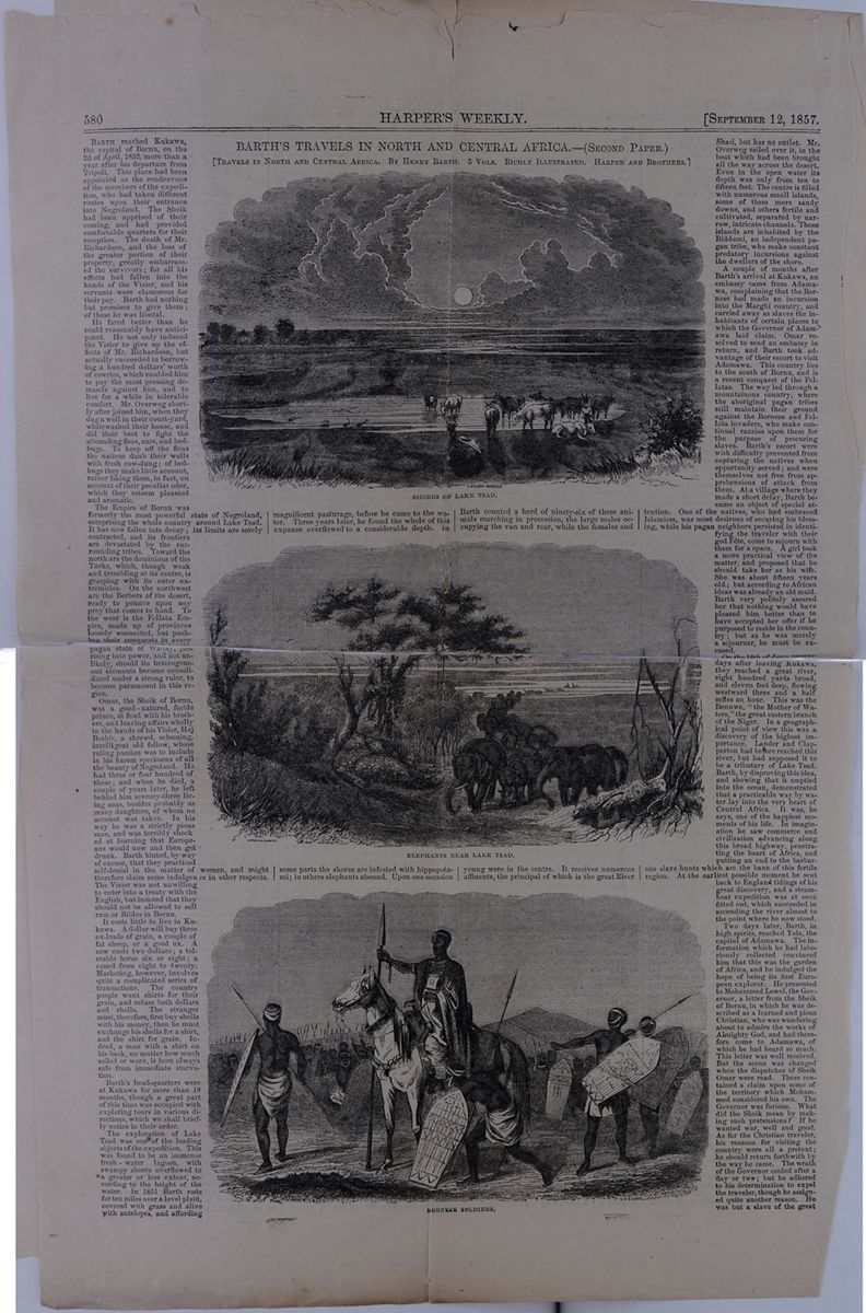 580
HARPER'S WEEKLY.
[SEPTEMBER 12,
1857.
580
HARPER'S WEEKLY.
[SEPTEMBER 12,
1857.
BARTH'S TRAVELS IN NORTH AND CENTRAL AFRICA.—(SECOND PAPER.)
[TRAVELS IN NORTH AND CENTRAL AFRICA. BY HENRY BARTH. 3 VOLS. RICHLY ILLUSTRATED. HARPER AND BROTHERS.]
BARTH reached Kukawa, the capital of Bornu, on the 2d of April, 1852, more than a year after his departure from Tripoli. This place had been appointed as the rendezvous of the members of the expedition, who had taken different routes upon their entrance into Negroland. The Sheik had been apprised of their coming, and had provided comfortable quarters for their reception. The death of Mr. Richardson, and the loss of the greater portion of their property, greatly embarrassed the survivors; for all his effects had fallen into the hands of the Vizier, and his servants were clamorous for their pay. Barth had nothing but promises to give them; of these he was liberal.
He fared better than he could reasonably have anticipated. He not only induced the Vizier to give up the effects of Mr. Richardson, but actually succeeded in borrowing a hundred dollars' worth of cowries, which enabled him to pay the most pressing demands against him, and to live for a while in tolerable comfort. Mr. Overweg shortly after joined him, when they dug a well in their court-yard, white washed their house, and did their best to fight the abounding fleas, ants, and bedbugs. To keep off the fleas the natives daub their walls with fresh cow-dung; of bedbugs they make little account, rather liking them, in fact, on account of their peculiar odor, which they esteem pleasant and aromatic.
The Empire of Bornu was formerly the most powerful state of Negroland, comprising the whole country around Lake Tsad. It has now fallen into decay; its limits are sorely contracted, and its frontiers are devastated by the surrounding tribes. Toward the north are the dominions of the Turks, which, though weak and trembling at its centre, is grasping with its outer extremities. On the northwest are the Berbers of the desert, ready to pounce upon any prey that comes to hand. To the west is the Fellata Empire, made up of provinces loosely connected, but pushing their conquests in every [covered] pagan state of Waday, just rising into power, and not unlikely, should its heterogeneous elements become consolidated under a strong ruler, to become paramount in this region.
Omar, the Sheik of Bornu, was a good-natured, feeble prince, at feud with his brothers, and leaving affairs wholly in the hands of his Vizier, Haj Beshir, a shrewd, scheming, intelligent old fellow, whose ruling passion was to include in his harem specimens of all the beauty of Negroland. He had three or four hundred of these; and when he died, a couple of years later, he left behind him seventy-three living sons, besides probably as many daughters, of whom no account was taken. In his way he was a strictly pious man, and was terribly shocked at learning that Europeans would now and then get drunk. Barth hinted, by way of excuse, that they practiced self-denial in the matter of women, and might therefore claim some indulgence in other respects. The Vizier was not unwilling to enter into a treaty with the English, but insisted that they would not be allowed to sell rum or Bibles in Bornu.
It costs little to live in Kukawa. A dollar will buy three ox-loads of grain, a couple of fat sheep, or a good ox. A cow costs two dollars; a tolerable horse six or eight; a camel from eight to twenty. Marketing, however, involves quite a complicated series of transactions. The country people want shirts for their grain, and refuse both dollars and shells. The stranger must, therefore, first buy shells with his money, then he must exchange his shells for a shirt, and the shirt for grain. Indeed, a man with a shirt on his back, no matter how much soiled or worn, is here always safe from immediate starvation.
Barth's head-quarters were at Kukawa for more than 18 months, though a great part of this time was occupied with exploring tours in various directions, which we shall briefly notice in their order.
The exploration of Lake Tsad was one of the leading objects of the expedition. This was found to be an immense fresh-water lagoon, with swampy shores overflowed to a greater or less extent, according to the height of the water. In 1851 Barth rode for ten miles over a level plain, covered with grass and alive with antelopes, and affording SHORES OF LAKE TSAD. magnificent pasturage, before he came to the water. Three years later, he found the whole of this expanse overflowed to a considerable depth. In ELEPHANTS NEAR LAKE TSAD. some parts the shores are infested with hippopotami; in others elephants abound. Upon one occasion BORNESE SOLDIERS. Barth counted a herd of ninety-six of these animals marching in procession, the large males occupying the van and rear, while the females and young were in the centre. It receives numerous affluents, the principal of which is the great River Shari, but has no outlet. Mr. Overweg sailed over it, in the boat which had been brought all the way across the desert. Even in the open water its depth was only from ten to fifteen feet. The centre is filled with numerous small islands, some of them mere sandy downs, and others fertile and cultivated, separated by narrow, intricate channels. These islands are inhabited by the Biddumi, an independent pagan tribe, who make constant predatory incursions against the dwellers of the shore.
A couple of months after Barth's arrival at Kukawa, an embassy came from Adamawa, complaining that the Bornese had made an incursion into the Marghi country, and carried away as slaves the inhabitants of certain places to which the Governor of Adamawa laid claim. Omar resolved to send an embassy in return, and Barth took advantage of their escort to visit Adamawa. This country lies to the south of Bornu, and is a recent conquest of the Fellatas. The way led through a mountainous country, where the aboriginal pagan tribes still maintain their ground against the Bornese and Fellata invaders, who make continual razzias upon them for the purpose of procuring slaves. Barth's escort were with difficulty prevented from capturing the natives when opportunity served; and were themselves not free from apprehensions of attack from them. At a village where they made a short delay, Barth became an object of special attention. One of the natives, who had embraced Islamism, was most desirous of securing his blessing, while his pagan neighbors persisted in identifying the traveler with their god Fête, come to sojourn with them for a space. A girl took a more practical view of the matter, and proposed that he should take her as his wife. She was about fifteen years old; but according to African ideas was already an old maid. Barth very politely assured her that nothing would have pleased him better than to have accepted her offer if he purposed to reside in the country; but as he was merely a sojourner, he must be excused.
On the 18th of June, twenty days after leaving Kukawa, they reached a great river, eight hundred yards broad, and eleven feet deep, flowing westward three and a half miles an hour. This was the Benuwe, "the Mother of Waters," the great eastern branch of the Niger. In a geographical point of view this was a discovery of the highest importance. Lander and Clapperton had before reached this river, but had supposed it to be a tributary of Lake Tsad. Barth, by disproving this idea, and showing that it emptied into the ocean, demonstrated that a practicable way by water lay into the very heart of Central Africa. It was, he says, one of the happiest moments of his life. In imagination he saw commerce and civilization advancing along this broad highway, penetrating the heart of Africa, and putting an end to the barbarous slave hunts which are the bane of this fertile region. At the earliest possible moment he sent back to England tidings of his great discovery, and a steamboat expedition was at once fitted out, which succeeded in ascending the river almost to the point where he now stood.
Two days later, Barth, in high spirits, reached Yola, the capital of Adamawa. The information which he had laboriously collected convinced him that this was the garden of Africa, and he indulged the hope of being its first European explorer. He presented to Mohammed Lowel, the Governor, a letter from the Sheik of Bornu in which he was described as a learned and pious Christian, who was wandering about to admire the works of Almighty God, and had therefore come to Adamawa, of which he had heard so much. The letter was well received. But the scene was changed when the dispatches of Sheik Omar were read. These contained a claim upon some of the territory which Mohammed considered his own. The Governor was furious. What did the Sheik mean by making such pretensions? If he wanted war, well and good. As for the Christian traveler, his reasons for visiting the country were all a pretext; he should return forthwith by the way he came. The wrath of the Governor cooled after a day or two; but he adhered to his determination to expel the traveler, though he assigned quite another reason. He was but a slave of the great
[begin surface 695]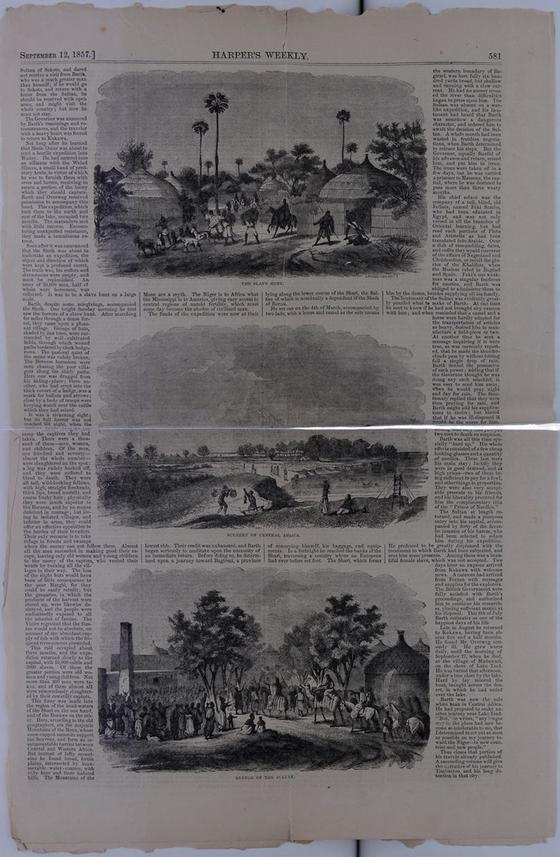 SEPTEMBER 12,
1857.]
HARPER'S WEEKLY.
581
SEPTEMBER 12,
1857.]
HARPER'S WEEKLY.
581
Sultan of Sokoto, and dared not receive a visit from Barth, who was a much greater man than himself; if he would go to Sokoto, and return with a letter from the Sultan, he should be received with open arms, and might visit the whole country; but now he must not stay.
The Governor was unmoved by Barth's reasonings and remonstrances, and the traveler with a heavy heart was forced to return to Kukawa.
Not long after he learned that Sheik Omar was about to send a hostile expedition into Waday. He had entered into an alliance with the Welad Sliman, a small band of predatory Arabs, in virtue of which he was to furnish them with arms and horses, receiving in return a portion of the booty which they should capture. Barth and Overweg received permission to accompany this band. This expedition, which took them to the north and east of the lake, occupied two months. The marauders met with little success. Encountering unexpected resistance, they made a tumultuous retreat.
Soon after it was announced that the Sheik was about to undertake an expedition, the object and direction of which were kept a profound secret. The truth was, his coffers and slave-rooms were empty, and must be replenished. An army of 20,000 men, half of whom were horsemen, was collected. It was to be a slave hunt on a large scale.
Barth, despite some misgivings, accompanied the Sheik. One bright Sunday morning he first saw the horrors of a slave hunt. After marching for miles through a dense forest, they came upon a pleasant village. Groups of huts, shaded by fine trees, were surrounded by the well-cultivated fields, through which wound paths bordered by thick hedgerows. The pastoral quiet of the scene was rudely broken. The Bornese horsemen were seen chasing the poor villagers along the shady paths. Here one was dragged from his hiding-place; there another, who had crept into the thick covert of a hedge, was a mark for bullets and arrows; close by a body of troops were keeping watch over the cattle which they had seized.
It was a sickening sight; but its full horror was not reached till night, when the various bands brought into camp the captives they had taken. There were a thousand of them—men, women, and children. Of the men, one hundred and seventy—almost the whole number—were slaughtered on the spot : a leg was rudely hacked off, and they were suffered to bleed to death. They were all tall, wild-looking fellows, with high, straight foreheads, thick lips, broad nostrils, and coarse bushy hair; physically they were much superior to the Bornese, and by no means deficient in courage; but living in isolated villages, and inferior in arms, they could offer no effective opposition to the hordes of their invaders. Their only recourse is to take refuge in forests and swamps where the enemy can not follow them. Almost all the men succeeded in making good their escape, leaving only old women and young children to the mercy of the captors, who vented their wrath by burning all the villages in their way. The loss of the slight huts would have been of little consequence to the poor Marghi, for they could be easily rebuilt; but the granaries, in which the products of the harvest were stored up, were likewise destroyed, and the people were undoubtedly exposed to all the miseries of famine. The Vizier regretted that the famine would not be absolute, on account of the abundant supply of fish with which the frequent river-courses abounded.
This raid occupied about three months, and the expedition returned slowly to the capital, with 10,000 cattle and 3000 slaves. Of these the greater portion were old women and young children. Not more than 300 men were taken, and of these almost all were remorselessly slaughtered by their cowardly captors.
This foray was made into the region of the head-waters of the Shari on one hand, and of the Benuwe on the other. Here, according to the old geographers, are the majestic Mountains of the Moon, whose snow-capped summits support the heavens, and form an insurmountable barrier between Central and Western Africa. But instead of lofty mountains he found broad, fertile plains, intersected by innumerable water-courses, with only here and there isolated hills. The Mountains of the THE SLAVE HUNT. Moon are a myth. The Niger is to Africa what the Mississippi is to America, giving easy access to central regions of untold fertility, which must some day become the abodes of civilized man.
The funds of the expedition were now at their SCENERY OF CENTRAL AFRICA. lowest ebb. Their credit was exhausted, and Barth began seriously to meditate upon the necessity of an immediate return. Before doing so, he determined upon a journey toward Bagirmi, a province RETURN OF THE SULTAN. lying along the lower course of the Shari, the Sultan of which is nominally a dependent of the Sheik of Bornu.
He set out on the 4th of March, accompanied by two lads, with a horse and camel as the sole means of conveying himself, his baggage, and equipments. In a fortnight he reached the banks of the Shari, traversing a country where no European had ever set foot. The Shari, which forms the western boundary of Bagirmi, was here fully six hundred yards broad, but shallow and running with a slow current. He had no sooner crossed the river than difficulties began to press upon him. The Sultan was absent on a warlike expedition, and his lieutenant had heard that Barth was somehow a dangerous character, and ordered him to await the decision of the Sultan. A whole month had been wasted in fruitless negotiations, when Barth determined to retrace his steps. But the Governor, equally fearful of his advance and return, seized him, and put him in irons. The irons were taken off in a few days, but he was carried a prisoner to Massena, the capital, where he was destined to pass more than three weary months.
His chief solace was the company of a tall, blind, old Fellata, named Faki Sambo, who had been educated in Egypt, and was not only versed in all the branches of Oriental learning, but had read such portions of Plato and Aristotle as had been translated into Arabic. Over a dish of rice-pudding, dates, and coffee they would converse of the affairs of Negroland and Christendom, or recall the glories of the Khalifate, when the Moslem ruled in Bagdad and Spain. Faki's one weakness was a singular fondness for emetics, and Barth was obliged to administer them to him by the dozen, besides supplying all his family.
The lieutenant of the Sultan was evidently greatly puzzled what to make of Barth. At one time he sent to know if he had not brought any cannon with him; and when reminded that a camel and a horse were hardly adapted for the transportation of articles so heavy, desired him to manufacture a field-piece or two. At another time he sent a message inquiring if it were true, as was currently reported, that he made the thunderclouds pass by without letting fall a single drop of rain. Barth denied the possession of such power; adding that if the Governor thought he was doing any such mischief, it was easy to send him away, when he would pray night and day for rain. The functionary replied that they were then praying for rain, and Barth might add his supplication to theirs; but hinted that if he was ill-disposed it would be the worse for him, adding that they had just put two men to death on suspicion.
Barth was all this time specially "hard up." His whole effects consisted of a few cheap looking-glasses and a quantity of needles. These last were his main stay; luckily they were in good demand, and at high prices—two of them being sufficient to pay for a fowl, and other things in proportion. They were also very acceptable presents to his friends, and his liberality procured for him the complimentary title of the "Prince of Needles."
The Sultan at length returned, and made a pompous entry into his capital, accompanied by forty of the favorite inmates of his harem, who had been selected to solace him during this expedition. He professed to be greatly displeased with the treatment to which Barth had been subjected, and sent him some presents. Among these was a beautiful female slave, which was not accepted. Two days later an express arrived from Kukawa with welcome news. A caravan had arrived from Fezzan with messages and supplies for the explorers. The British Government were fully satisfied with Barth's proceedings, and authorized him to continue his researches, placing sufficient means at his disposal. This 6th of July Barth estimates as one of the happiest days of his life.
Late in August he returned to Kukawa, having been absent five and a half months. He found Mr. Overweg seriously ill. He grew worse daily, until the morning of September 27, when he died, at the village of Maduwari, on the shore of Lake Tsad. He was buried that afternoon, under a tree close by the lake. Hard by lay moored the boat, brought across the desert, in which he had sailed over the lake.
Barth was now the sole white man in Central Africa. He had proposed to make another journey near Lake Tsad. "But," he writes, "any longer stay in the place had now become so intolerable to me, that I determined to set out as soon as possible on my journey toward the Niger—to new countries and new people."
Thus closes that portion of his travels already published. A succeeding volume will give the narrative of his journey to Timbuctoo, and his long detention in that city.
[begin surface 696]
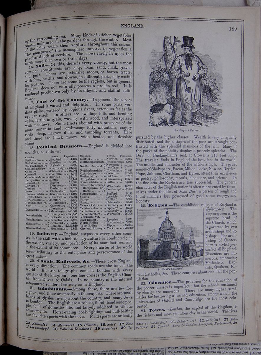 ENGLAND.
189
ENGLAND.
189
by the surrounding sea. Many kinds of kitchen vegetables remain uninjured in the gardens through the winter. Most of the fields retain their verdure throughout this season. The moisture of the atmosphere imparts to vegetation a peculiar depth of verdure. The snows rarely lie upon the earth more than two or three days.
16. Soil.—Of this, there is every variety, but the most common constituents are clay, loam, sand, chalk, gravel, and peat. There are extensive moors, or barren tracts, with fens, heaths, and downs, in different parts, only useful for pasture. There are some fertile regions, but in general England does not naturally possess a prolific soil. It is rendered productive only by its diligent and skillful cultivation.
17. Face of the Country.—In general, the aspect of England is varied and delightful. In some parts, verdant plains, watered by copious rivers, extend as far as the eye can reach. In others are swelling hills and bending vales, fertile in grain, waving with wood, and interspersed with meadows. Some tracts abound with prospects of the more romantic kind, embracing lofty mountains, craggy rocks, deep, narrow dells, and tumbling torrents. Here and there are black moors, wide heaths, and desolate plains.
18. Political Divisions.—England is divided into counties, as follows:
| Counties. | Towns. | Population. |
| Bedfordshire | Bedford | |
| Berkshire | Reading | |
| Buckinghamshire | Aylesbury | |
| Cambridgeshire | Cambridge | |
| Cheshire | Chester | |
| Cornwall | Bodmin | |
| Cumberland | Carlisle | |
| Derbyshire | Derby | |
| Devonshire | Exeter | |
| Dorsetshire | Dorchester | |
| Durham | Durham | |
| Essex | Chelmsford | |
| Gloucestershire | Gloucester | |
| Herefordshire | Hereford | |
| Hertfordshire | Hertford | |
| Huntingdonshire | Huntingdon | |
| Kent | Canterbury | |
| Lancashire | Lancaster | |
| Manchester | ||
| Leicester | Liverpool | |
| Leicester | ||
| Lincolnshire | ||
| Middlesex | Brentford | |
| London | ||
| Monmouthshire | Monmouth | |
| Counties | Towns | Population |
| Norfolk | Norwich | |
| Northamptonshire | Petersborough | |
| Northumberland | Newcastle-on-Tyne | |
| Nottinghamshire | Nottingham | |
| Oxfordshire | Oxford | |
| Rutlandshire | Oakham | |
| Shropshire | Shrewsbury | |
| Somersetshire | Bath | |
| S'thamptonshire, Hampshire, or Hants | Winchester | |
| Southampton | ||
| Staffordshire | Stafford | |
| Suffolk | Ipswich | |
| Surrey | Guilford | |
| Sussex | Chichester | |
| Warwickshire | Coventry | |
| Westmoreland | Appleby | |
| Wiltshire | Salisbury | |
| Worcestershire | Worcester | |
| Yorkshire viz | ||
| East Riding | Beverly | |
| North Riding | Northallerton | |
| West Riding | Ripon | |
| City and Ainstey | York |
19. Industry.—England surpasses every other country in the skill with which its agriculture is conducted; in the extent, variety, and perfection of its manufactures, and in the extent of its commerce. Every quarter of the world seems tributary to the enterprise and perseverance of this great nation.
20. Canals, Railroads, &c.—These cross England in every direction. The common roads are the best in the world. Electric telegraphs connect London with every quarter of the kingdom; one line crosses the English Channel from Dover to Calais. In no country is the internal intercourse rendered so easy as in England.
21. Inhabitants.—Among these, there are few foreigners, and these are mostly in the seaports. There are small bands of gipsies roving about the country, and many Jews in London. The English are a robust, florid, handsome people, fond of domestic life, and largely addicted to athletic amusements. Horse-racing, cock-fighting, and bull-baiting are favorite sports with the mass. Field sports are ardently
An English Peasant.pursued by the higher classes. Wealth is very unequally distributed, and the cottages of the poor are strongly contrasted with the splendid mansions of the rich. Many of the parks of the nobility display a princely splendor. The Duke of Buckingham's seat, at Stowe, is 916 feet long. The traveler finds in England the best inns in the world. The intellectual character of the nation is high. The great names of Shakspeare, Bacon, Milton, Locke, Newton, Dryden, Pope, Johnson, Chatham, and Byron, attest their excellence in poetry, philosophy, morals, eloquence, and science. In the fine arts the English are less successful. The general character of the English nation is often represented by themselves under the idea of John Bull, a person of rough and blunt manners, but possessed of good sense, energy, and honesty.
St. Paul's Cathedral.22. Religion.—The established religion of England is Episcopacy. The king or queen is the supreme head of the Church, which is governed by two archbishops and 25 bishops. The archbishop of Canterbury is styled primate of all England. Dissenters are numerous, embracing Methodists, Baptists, Quakers, Roman Catholics, &c. These comprise about one-half the population.
23. Education.—The provision for the education of the poorer classes is imperfect; but the schools sustained by charity are numerous. There are many higher seminaries for bestowing a learned education, among which the universities of Oxford and Cambridge are the most celebrated.
24. Towns.—London, the capital of the kingdom, is the richest and most populous city in the world. The river
13. Animals? 14. Minerals? 15. Climate? 16. Soil? 17. Face of the country? 18. Political Divisions? 19. Industry? 20. Canals, railroads, &c.? 21. Inhabitants? 22. Religion? 23. Education? 24. Towns? Describe London, Liverpool, Portsmouth, &c.
[begin surface 698]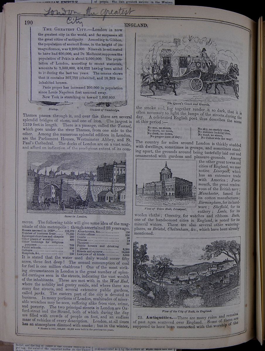 190
ENGLAND.
[begin surface 699]
190
ENGLAND.
[begin surface 699]
THE GREATEST CITY.—London is now the greatest city in the world, and far surpasses all the great cities of antiquity. According to Gibbon, the population of ancient Rome, in the height of its magnificence, was 2,200,000. Nineveh is estimated to have had 600,000, and Dr. Medhurst supposes the population of Pekin is about 2,000,000. The population of London, according to recent statistics, amounts to 2,500,000, 404,622 having been added to it during the last ten years. The census shows that it contains 307,722 inhabited, and 16,389 uninhabited houses.
Paris proper has increased 200,000 in population since Louis Napoleon first assumed sway.
New York is stretching on toward 1,000,000.
Thames passes through it, and over this there are several splendid bridges of stone, and one of iron. The largest is 1239 feet in length. There is a passage, called the Tunnel, which goes under the river Thames, from one side to the other. Among the numerous splendid edifices in London, are the Parliament Houses, Westminster Abbey, and St. Paul's Cathedral. The docks of London are on a vast scale, and afford an indication of the prodigious extent of its commerce. Scene in London. The following table will give some idea of the magnitude of this metropolis: though ascertained 23 years ago. A table listing the number of houses * , business firms, Episcopal churches and chapels, other places of worship, other buildings for religious purposes, public schools, colleges, hospitals, alms-houses, public offices, courts, prisons, theatres, public houses and drinking places, streets and squares, and lawyers in London. It is stated that the water used daily would cover fifty acres, three feet deep ! The annual consumption of coal for fuel is one million chaldrons ! One of the most striking circumstances in London is the great number of splendid carriages seen in the streets, indicating the vast wealth of the inhabitants. These are met with in the West End, where the nobility and gentry reside, and where there are many fine streets, and several extensive public gardens, called parks. The eastern part of the city is devoted to business. In many portions of London, multitudes of miserable wretches may be seen, suffering alike from vice, crime, and poverty. The two principal streets in London are Oxford-street and the Strand, both of which during the day are filled with crowds of people on foot, and an endless maze of vehicles of every description. London, at all times has an atmosphere dimmed with smoke; but in the winter, The Queen's Coach and Guards. the smoke and fog together render it so dark, that it is often necessary to light the lamps of the streets during the day. A celebrated English poet thus describes the scene at this period:—
No sun, no moon, No morn, no noon, No dusk, no dawn, No proper time of day; No sky, no earthly view, No distance looking blue, No road, no street, No t'other side the way! View of Town Hall, Liverpool.The country for miles around London is thickly studded with dwellings, sometimes in groups, and sometimes standing apart, the grounds around being tastefully laid out and ornamented with gardens and pleasure-grounds. Among the other great towns and cities of England, we may notice Liverpool, which has an extensive trade with America; Portsmouth, the great rendezvous of the British navy; Manchester, famed for its cotton manufactures; Birmingham, for its hardware; Sheffield, for its cutlery; Leeds, for its woolen cloths; Coventry, for watches and ribbons. Bath, one of the handsomest cities in England, is noted for its mineral waters. There are also several other watering-places, as Bristol, Cheltenham, &c., which have been already mentioned.
View of the City of Bath, in England.25. Antiquities.—There are many ruins and remains of past ages scattered over England. Some of these are supposed to have been connected with the worship of the
* Houses in 1851, 329,428 : 62,286 were built in the previous ten years.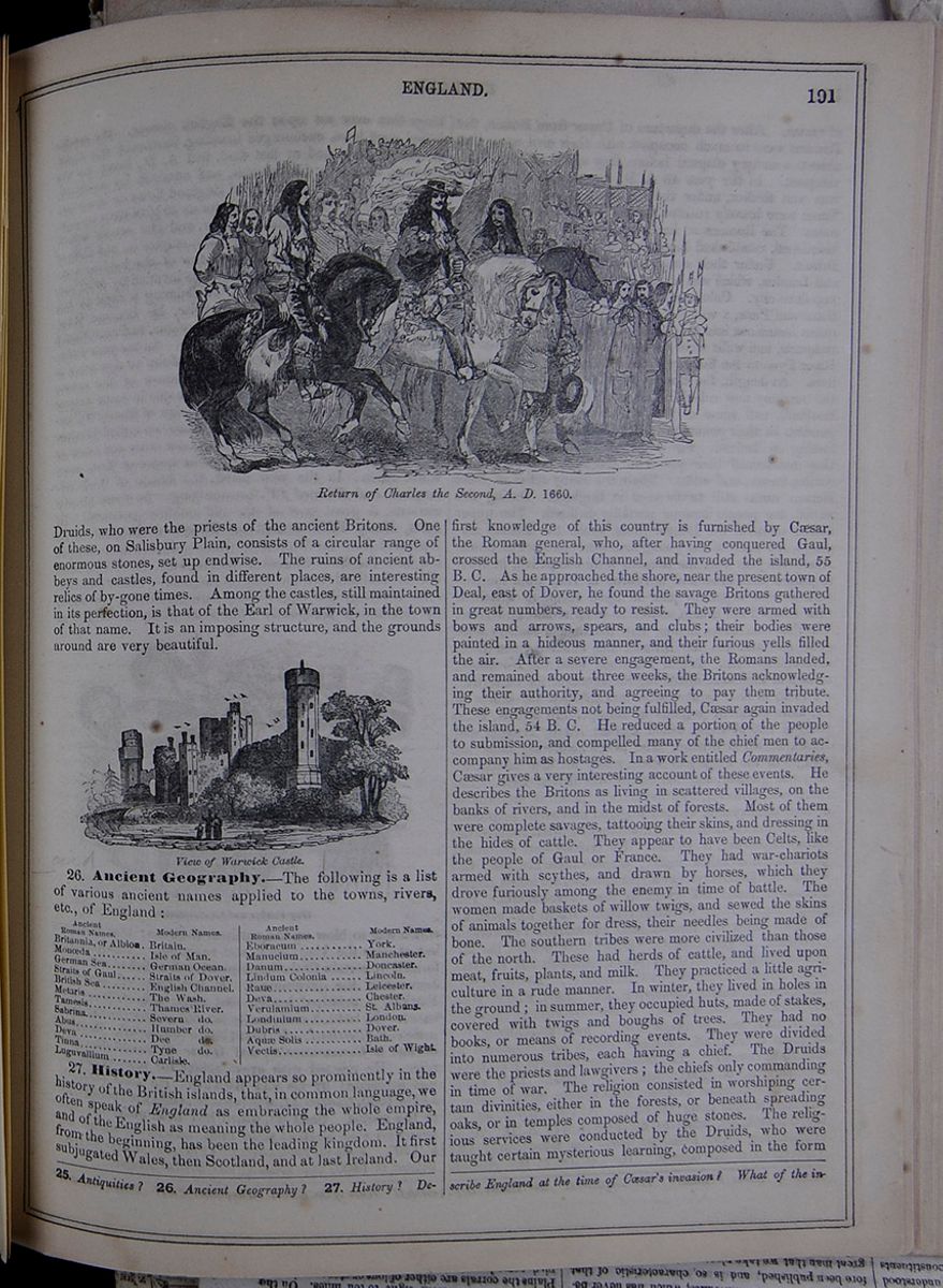
Druids, who were the priests of the ancient Britons. One of these, on Salisbury Plain, consists of a circular range of enormous stones, set up endwise. The ruins of ancient abbeys and castles, found in different places, are interesting relics of by-gone times. Among the castles, still maintained in its perfection, is that of the Earl of Warwick, in the town of that name. It is an imposing structure, and the grounds around are very beautiful.
View of Warwick Castle.26. Ancient Geography.—The following is a list of various ancient names applied to the towns, rivers, etc., of England:
A table listing the ancient Roman names of the following modern locations: Britain, Isle of Man, German Ocean, Straits of Dover, English Channel, The Wash, Thames River, Severn River, Humber River, Dee River, Tyne River, Carlisle, York, Manchester, Doncaster, Lincoln, Leicester, Chester, St. Albans, London, Dover, Bath, Isle of Wight.27. History.—England appears so prominently in the history of the British islands, that, in common language, we often speak of England as embracing the whole empire, and of the English as meaning the whole people. England, from the beginning, has been the leading kingdom. It first subjugated Wales, then Scotland, and at last Ireland. Our first knowledge of this country is furnished by Cæsar, the Roman general, who, after having conquered Gaul, crossed the English Channel, and invaded the island, 55 B. C. As he approached the shore, near the present town of Deal, east of Dover, he found the savage Britons gathered in great numbers, ready to resist. They were armed with bows and arrows, spears, and clubs; their bodies were painted in a hideous manner, and their furious yells filled the air. After a severe engagement, the Romans landed, and remained about three weeks, the Britons acknowledging their authority, and agreeing to pay them tribute. These engagements not being fulfilled, Cæsar again invaded the island, 54 B. C. He reduced a portion of the people to submission, and compelled many of the chief men to accompany him as hostages. In a work entitled Commentaries, Cæsar gives a very interesting account of these events. He describes the Britons as living in scattered villages, on the banks of rivers, and in the midst of forests. Most of them were complete savages, tattooing their skins, and dressing in the hides of cattle. They appear to have been Celts, like the people of Gaul or France. They had war-chariots armed with scythes, and drawn by horses, which they drove furiously among the enemy in time of battle. The women made baskets of willow twigs, and sewed the skins of animals together for dress, their needles being made of bone. The southern tribes were more civilized than those of the north. These had herds of cattle, and lived upon meat, fruits, plants, and milk. They practiced a little agriculture in a rude manner. In winter, they lived in holes in the ground; in summer, they occupied huts, made of stakes, covered with twigs and boughs of trees. They had no books, or means of recording events. They were divided into numerous tribes, each having a chief. The Druids were the priests and lawgivers; the chiefs only commanding in time of war. The religion consisted in worshiping certain divinities, either in the forests, or beneath spreading oaks, or in temples composed of huge stones. The religious services were conducted by the Druids, who were taught certain mysterious learning, composed in the form
25. Antiquities? 26. Ancient Geography? 27. History? Describe England at the time of Cæsar's invasion? What of the invasion
[begin surface 701]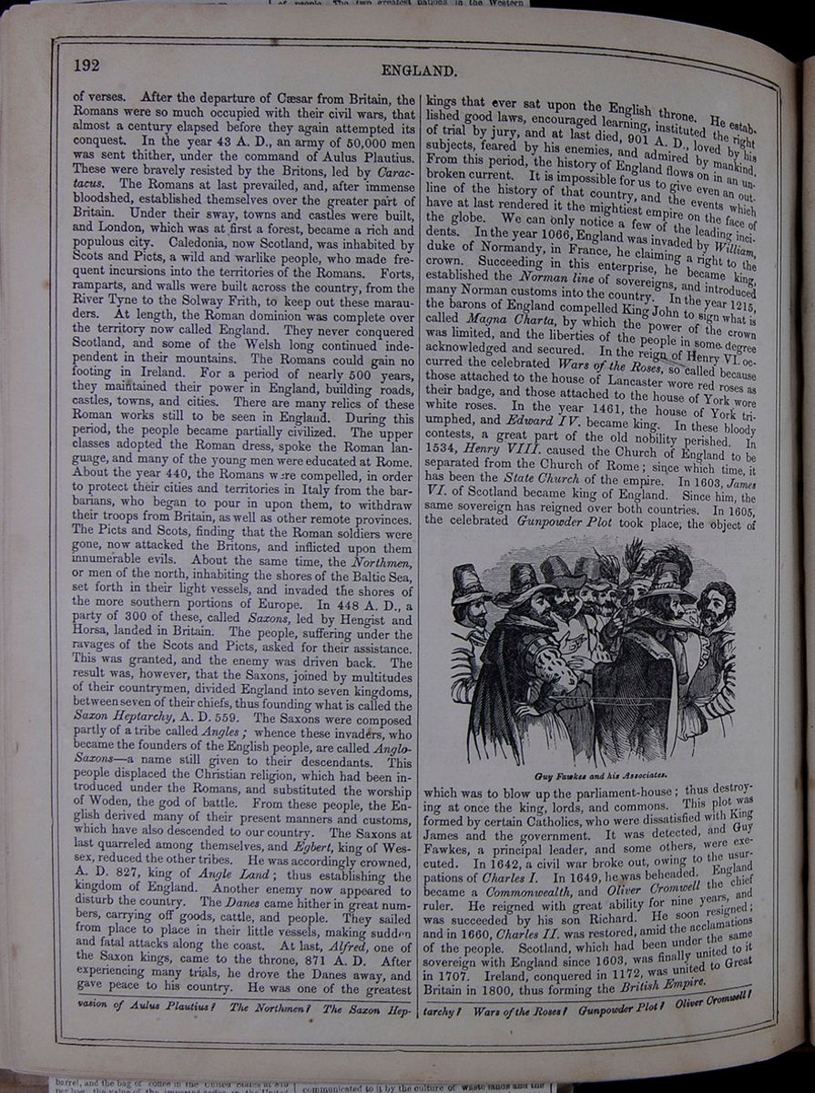 192
ENGLAND.
192
ENGLAND.
of verses. After the departure of Cæsar from Britain, the Romans were so much occupied with their civil wars, that almost a century elapsed before they again attempted its conquest. In the year 43 A. D., an army of 50,000 men was sent thither, under the command of Aulus Plautius. These were bravely resisted by the Britons, led by Caractacus. The Romans at last prevailed, and, after immense bloodshed, established themselves over the greater part of Britain. Under their sway, towns and castles were built, and London, which was at first a forest, became a rich and populous city. Caledonia, now Scotland, was inhabited by Scots and Picts, a wild and warlike people, who made frequent incursions into the territories of the Romans. Forts, ramparts, and walls were built across the country, from the River Tyne to the Solway Frith, to keep out these marauders. At length, the Roman dominion was complete over the territory now called England. They never conquered Scotland, and some of the Welsh long continued independent in their mountains. The Romans could gain no footing in Ireland. For a period of nearly 500 years, they maintained their power in England, building roads, castles, towns, and cities. There are many relics of these Roman works still to be seen in England. During this period, the people became partially civilized. The upper classes adopted the Roman dress, spoke the Roman language, and many of the young men were educated at Rome. About the year 440, the Romans were compelled, in order to protect their cities and territories in Italy from the barbarians, who began to pour in upon them, to withdraw their troops from Britain, as well as other remote provinces. The Picts and Scots, finding that the Roman soldiers were gone, now attacked the Britons, and inflicted upon them innumerable evils. About the same time, the Northmen, or men of the north, inhabiting the shores of the Baltic Sea, set forth in their light vessels, and invaded the shores of the more southern portions of Europe. In 448 A. D., a party of 300 of these, called Saxons, led by Hengist and Horsa, landed in Britain. The people, suffering under the ravages of the Scots and Picts, asked for their assistance. This was granted, and the enemy was driven back. The result was, however, that the Saxons, joined by multitudes of their countrymen, divided England into seven kingdoms, between seven of their chiefs, thus founding what is called the Saxon Heptarchy, A. D. 559. The Saxons were composed partly of a tribe called Angles; whence these invaders, who became the founders of the English people, are called Anglo-Saxons—a name still given to their descendants. This people displaced the Christian religion, which had been introduced under the Romans, and substituted the worship of Woden, the god of battle. From these people, the English derived many of their present manners and customs, which have also descended to our country. The Saxons at last quarreled among themselves, and Egbert, king of Wessex, reduced the other tribes. He was accordingly crowned, A. D. 827, king of Angle Land; thus establishing the kingdom of England. Another enemy now appeared to disturb the country. The Danes came hither in great numbers, carrying off goods, cattle, and people. They sailed from place to place in their little vessels, making sudden and fatal attacks along the coast. At last, Alfred, one of the Saxon kings, came to the throne, 871 A. D. After experiencing many trials, he drove the Danes away, and gave peace to his country. He was one of the greatest kings that ever sat upon the English throne. He established good laws, encouraged learning, instituted the right of trial by jury, and at last died, 901 A. D., loved by his subjects, feared by his enemies, and admired by mankind. From this period, the history of England flows on in an unbroken current. It is impossible for us to give even an outline of the history of that country, and the events which have at last rendered it the mightiest empire on the face of the globe. We can only notice a few of the leading incidents. In the year 1066, England was invaded by William, duke of Normandy, in France, he claiming a right to the crown. Succeeding in this enterprise, he became king, established the Norman line of sovereigns, and introduced many Norman customs into the country. In the year 1215, the barons of England compelled King John to sign what is called Magna Charta, by which the power of the crown was limited, and the liberties of the people in some degree acknowledged and secured. In the reign of Henry VI. occurred the celebrated Wars of the Roses, so called because those attached to the house of Lancaster wore red roses as their badge, and those attached to the house of York wore white roses. In the year 1461, the house of York triumphed, and Edward IV. became king. In these bloody contests, a great part of the old nobility perished. In 1534, Henry VIII. caused the Church of England to be separated from the Church of Rome; since which time, it has been the State Church of the empire. In 1603, James VI. of Scotland became king of England. Since him, the same sovereign has reigned over both countries. In 1605, the celebrated Gunpowder Plot took place, the object of Guy Fawkes and his Associates. which was to blow up the parliament-house; thus destroying at once the king, lords, and commons. This plot was formed by certain Catholics, who were dissatisfied with King James and the government. It was detected, and Guy Fawkes, a principal leader, and some others, were executed. In 1642, a civil war broke out, owing to the usurpations of Charles I. In 1649, he was beheaded. England became a Commonwealth, and Oliver Cromwell the chief ruler. He reigned with great ability for nine years, and was succeeded by his son Richard. He soon resigned; and in 1660, Charles II. was restored, amid the acclamations of the people. Scotland, which had been under the same sovereign with England since 1603, was finally united to it in 1707. Ireland, conquered in 1172, was united to Great Britain in 1800, thus forming the British Empire.
of Aulus Plautius? The Northmen? The Saxon Heptarchy? Wars of the Roses? Gunpowder Plot? Oliver Cromwell?
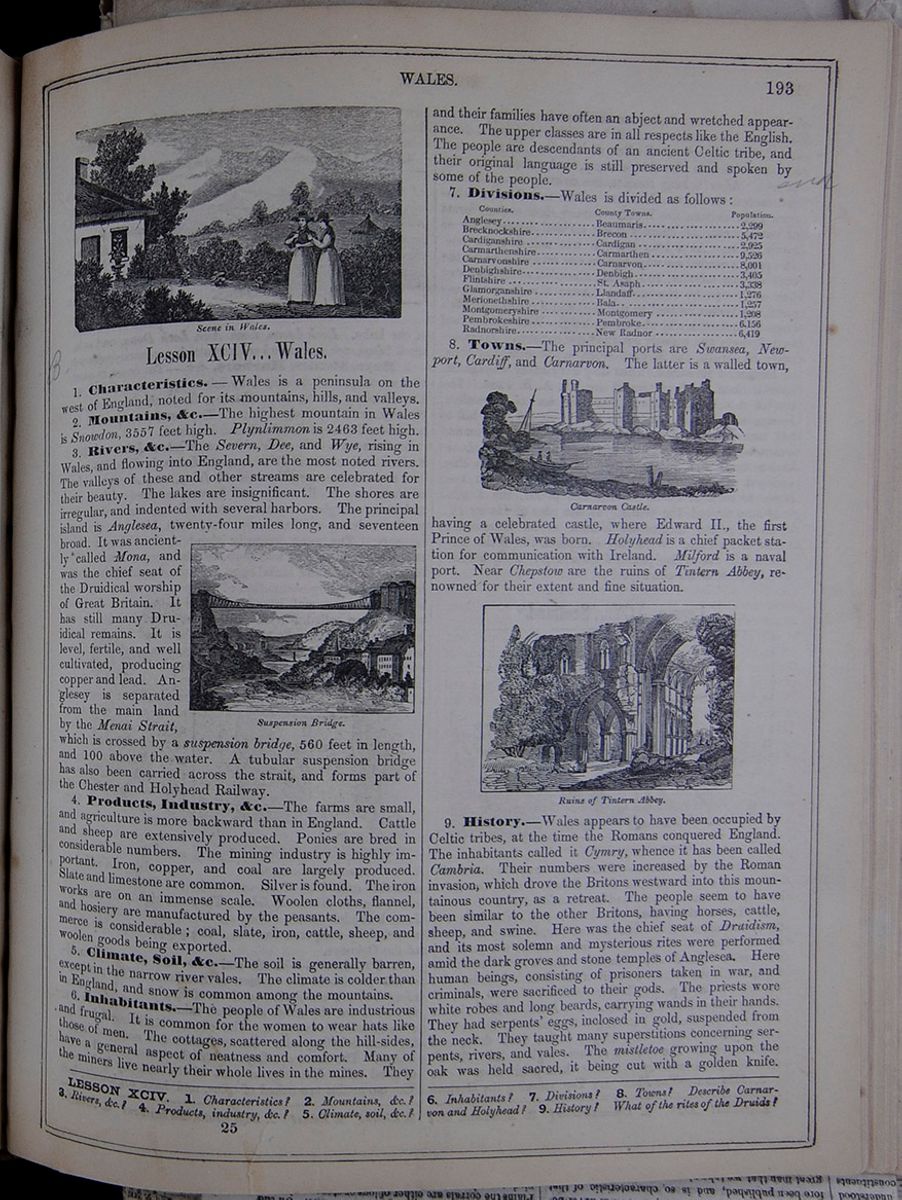 WALES.
193
Scene in Wales
Two women converse in front of a house with
mountains behind it.
WALES.
193
Scene in Wales
Two women converse in front of a house with
mountains behind it.
Lesson XCIV... Wales.
1. Characteristics.—Wales is a peninsula on the west of England, noted for its mountains, hills, and valleys.
2. Mountains, &c.—The highest mountain in Wales is Snowdon, 3557 feet high. Plynlimmon is 2463 feet high.
3. Rivers, &c.—The Severn, Dee, and Wye, rising in Wales, and flowing into England, are the most noted rivers. The valleys of these and other streams are celebrated for their beauty. The lakes are insignificant. The shores are irregular, and indented with several harbors. The principal island is Anglesea, twenty-four miles long, and seventeen broad. It was anciently called Mona, and was the chief seat of the Druidical worship of Great Britain. It has still many Druidical remains. It is level, fertile, and well cultivated, producing copper and lead. Anglesey is separated from the main land by the Menai Strait, which is crossed by a suspension bridge, 560 feet in length, and 100 above the water. A tubular suspension bridge has also been carried across the strait, and forms part of the Chester and Holyhead Railway.
4. Products, Industry, &c.—The farms are small, and agriculture is more backward than in England. Cattle and sheep are extensively produced. Ponies are bred in considerable numbers. The mining industry is highly important. Iron, copper, and coal are largely produced. Slate and limestone are common. Silver is found. The iron works are on an immense scale. Woolen cloths, flannel, and hosiery are manufactured by the peasants. The commerce is considerable; coal, slate, iron, cattle, sheep, and woolen goods being exported.
5. Climate, Soil, &c.—The soil is generally barren, except in the narrow river vales. The climate is colder than in England, and snow is common among the mountains.
6. Inhabitants.—The people of Wales are industrious and frugal. It is common for the women to wear hats like those of men. The cottages, scattered along the hill-sides, have a general aspect of neatness and comfort. Many of the miners live nearly their whole lives in the mines. They and their families have often an abject and wretched appearance. The upper classes are in all respects like the English. The people are descendants of an ancient Celtic tribe, and their original language is still preserved and spoken by some of the people.
7. Divisions.—Wales is divided as follows:
A table listing the divisions of Wales, including the counties, county towns, and populations.8. Towns.—The principal ports are Swansea, Newport, Cardiff, and Carnarvon. The latter is a walled town,
Carnarvon Castle.having a celebrated castle, where Edward II., the first Prince of Wales, was born. Holyhead is a chief packet station for communication with Ireland. Milford is a naval port. Near Chepstow are the ruins of Tintern Abbey, renowned for their extent and fine situation.
Ruins of Tintern Abbey.9. History.—Wales appears to have been occupied by Celtic tribes, at the time the Romans conquered England. The inhabitants called it Cymry, whence it has been called Cambria. Their numbers were increased by the Roman invasion, which drove the Britons westward into this mountainous country, as a retreat. The people seem to have been similar to the other Britons, having horses, cattle, sheep, and swine. Here was the chief seat of Druidism, and its most solemn and mysterious rites were performed amid the dark groves and stone temples of Anglesea. Here human beings, consisting of prisoners taken in war, and criminals, were sacrificed to their gods. The priests wore white robes and long beards, carrying wands in their hands. They had serpents' eggs, inclosed in gold, suspended from the neck. They taught many superstitions concerning serpents, rivers, and vales. The mistletoe growing upon the oak was held sacred, it being cut with a golden knife.
LESSON XCIV. 1. Characteristics? 2. Mountains, &c.? 3. Rivers, &c.? 4. Products, industry, &c.? 5. Climate, soil, &c.? 6. Inhabitants? 7. Divisions? 8. Towns? Describe Carnarvon and Holyhead? 9. History? What of the rites of the Druids?
25 [begin surface 703]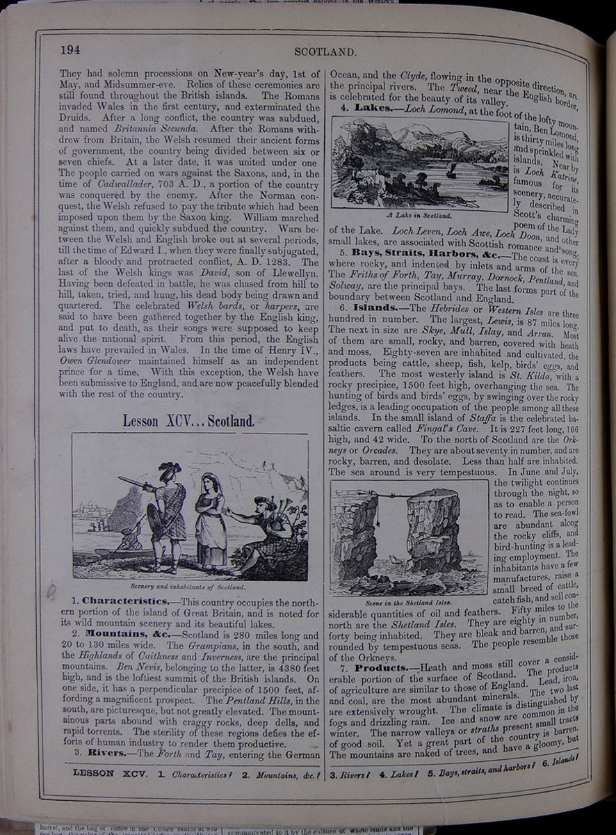 194
SCOTLAND.
194
SCOTLAND.
They had solemn processions on New-year's day, 1st of May, and Midsummer-eve. Relics of these ceremonies are still found throughout the British islands. The Romans invaded Wales in the first century, and exterminated the Druids. After a long conflict, the country was subdued, and named Britannia Secunda. After the Romans withdrew from Britain, the Welsh resumed their ancient forms of government, the country being divided between six or seven chiefs. At a later date, it was united under one The people carried on wars against the Saxons, and, in the time of Cadwallader, 703 A. D., a portion of the country was conquered by the enemy. After the Norman conquest, the Welsh refused to pay the tribute which had been imposed upon them by the Saxon king. William marched against them, and quickly subdued the country. Wars between the Welsh and English broke out at several periods, till the time of Edward I., when they were finally subjugated, after a bloody and protracted conflict, A. D. 1283. The last of the Welsh kings was David, son of Llewellyn. Having been defeated in battle, he was chased from hill to hill, taken, tried, and hung, his dead body being drawn and quartered. The celebrated Welsh bards, or harpers, are said to have been gathered together by the English king, and put to death, as their songs were supposed to keep alive the national spirit. From this period, the English laws have prevailed in Wales. In the time of Henry IV., Owen Glendower maintained himself as an independent prince for a time. With this exception, the Welsh have been submissive to England, and are now peacefully blended with the rest of the country.
Lesson XCV... Scotland.
Scenery and inhabitants of Scotland.1. Characteristics.—This country occupies the northern portion of the island of Great Britain, and is noted for its wild mountain scenery and its beautiful lakes.
2. Mountains, &c.—Scotland is 280 miles long and 20 to 130 miles wide. The Grampians, in the south, and the Highlands of Caithness and Inverness, are the principal mountains. Ben Nevis, belonging to the latter, is 4380 feet high, and is the loftiest summit of the British islands. On one side, it has a perpendicular precipice of 1500 feet, affording a magnificent prospect. The Pentland Hills, in the south, are picturesque, but not greatly elevated. The mountainous parts abound with craggy rocks, deep dells, and rapid torrents. The sterility of these regions defies the efforts of human industry to render them productive.
3. Rivers.—The Forth and Tay, entering the German Ocean, and the Clyde, flowing in the opposite direction, are the principal rivers. The Tweed, near the English border, is celebrated for the beauty of its valley.
A Lake in Scotland.4. Lakes.—Loch Lomond, at the foot of the lofty mountain, Ben Lomond, is thirty miles long and sprinkled with islands. Near by is Loch Katrine, famous for its scenery, accurately described in Scott's charming poem of the Lady of the Lake. Loch Leven, Loch Awe, Loch Doom, and other small lakes, are associated with Scottish romance and song.
5. Bays, Straits, Harbors, &c.—The coast is every where rocky, and indented by inlets and arms of the sea. The Friths of Forth, Tay, Murray, Dornock, Pentland, and Solway, are the principal bays. The last forms part of the boundary between Scotland and England.
6. Islands.—The Hebrides or Western Isles are three hundred in number. The largest, Lewis, is 87 miles long. The next in size are Skye, Mull, Islay, and Arran. Most of them are small, rocky, and barren, covered with heath and moss. Eighty-seven are inhabited and cultivated, the products being cattle, sheep, fish, kelp, birds' eggs, and feathers. The most westerly island is St. Kilda, with a rocky precipice, 1500 feet high, overhanging the sea. The hunting of birds and birds' eggs, by swinging over the rocky ledges, is a leading occupation of the people among all these islands. In the small island of Staffa is the celebrated basaltic cavern called Fingal's Cave. It is 227 feet long, 166 high, and 42 wide. To the north of Scotland are the Orkneys or Orcades. They are about seventy in number, and are rocky, barren, and desolate. Less than half are inhabited. The sea around is very tempestuous. In June and July, the twilight continues through the night, so as to enable a person to read. The sea-fowl are abundant along the rocky cliffs, and bird-hunting is a leading employment. The inhabitants have a few manufactures, raise a small breed of cattle, catch fish, and sell considerable quantities of oil and feathers. Fifty miles to the north are the Shetland Isles. They are eighty in number, forty being inhabited. They are bleak and barren, and surrounded by tempestuous seas. The people resemble those of the Orkneys.
7. Products.—Heath and moss still cover a considerable portion of the surface of Scotland. The products of agriculture are similar to those of England. Lead, iron, and coal, are the most abundant minerals. The two last are extensively wrought. The climate is distinguished by fogs and drizzling rain. Ice and snow are common in the winter. The narrow valleys or straths present small tracts of good soil. Yet a great part of the country is barren. The mountains are naked of trees, and have a gloomy, but
LESSON XCV. 1. Characteristics? 2. Mountains, &c.? 3. Rivers? 4. Lakes? 5. Bays, straits, and harbors? 6. Islands?
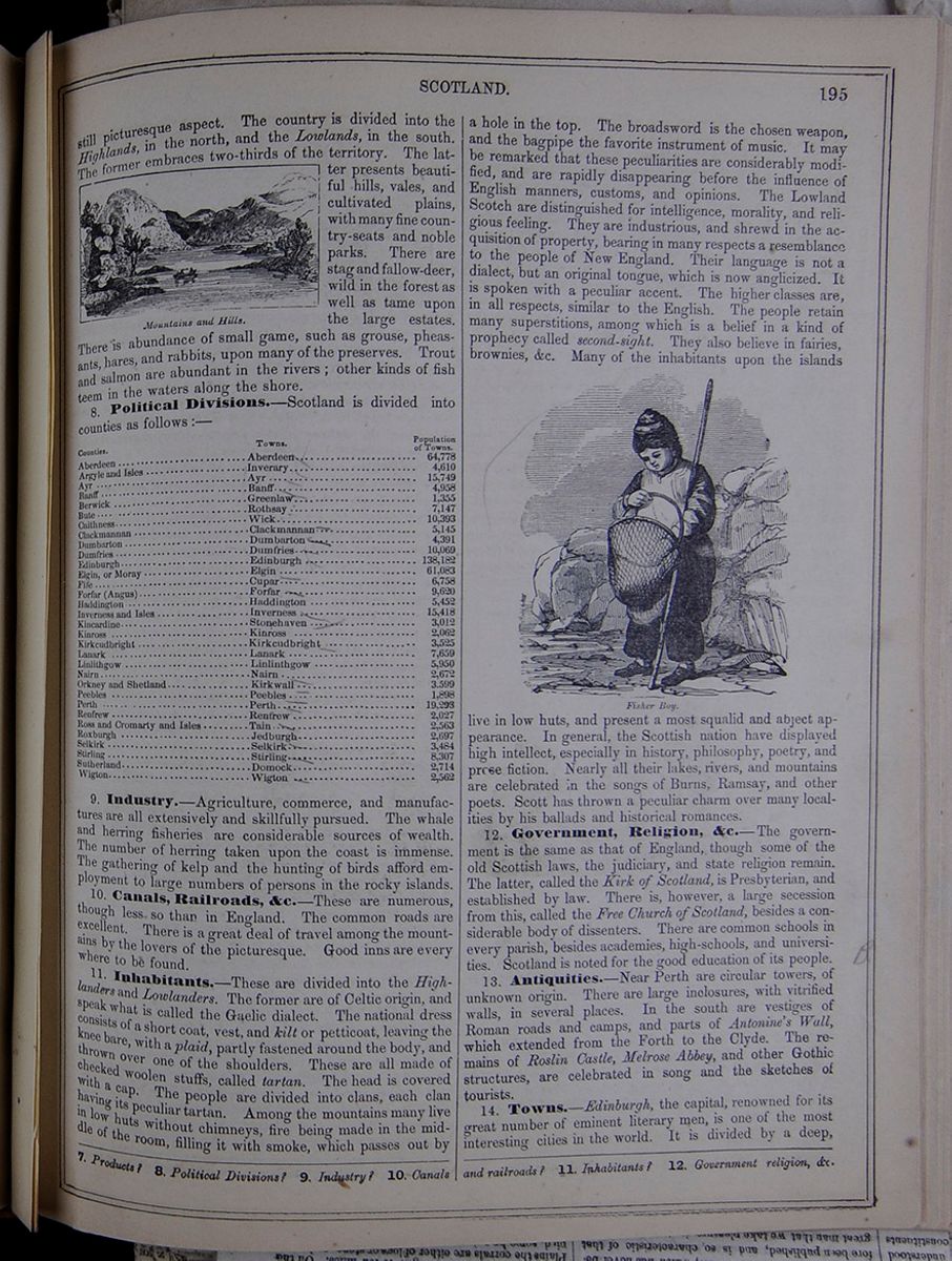 SCOTLAND.
195
SCOTLAND.
195
still picturesque aspect. The country is divided into the Highlands, in the north, and the Lowlands, in the south. The former embraces two-thirds of the territory. The latter presents beautiful hills, vales, and cultivated plains, with many fine country-seats and noble parks. There are stag and fallow-deer, wild in the forest as well as tame upon the large estates. There is abundance of small game, such as grouse, pheasants, hares, and rabbits, upon many of the preserves. Trout and salmon are abundant in the rivers; other kinds of fish teem in the waters along the shore.
Mountains and Hills.8. Political Divisions.—Scotland is divided into counties as follows :—
| Counties. | Towns. | Populations of Towns. |
| Aberdeen | Aberdeen — | 64,778 |
| Argyle and Isles | Inverary — | 4,610 |
| Ayr | Ayr — | 15,749 |
| Banff | Banff — | 4,958 |
| Berwick | Greenlaw | 1,355 |
| Bute | Rothsay | 7,147 |
| Caithness | Wick | 10,393 |
| Clackmannan | Clackmannan — | 5,145 |
| Dumbarton | Dumbarton — | 4,391 |
| Dumfries | Dumfries — | 10,069 |
| Edinburgh | Edinburgh — | 138,182 |
| Elgin, or Moray | Elgin | 61,083 |
| Fife | Cupar — | 6,758 |
| Forfar (Angus) | Forfar — | 9,620 |
| Haddington | Haddington | 5,452 |
| Inverness and Isles | Inverness — | 15,418 |
| Kincardine | Stonehaven — | 3,012 |
| Kinross | Kinross | 2,062 |
| Kirkcudbright | Kirkcudbright — | 3,525 |
| Lanark | Lanark | 7,659 |
| Linlithgow | Linlinthgow | 5,950 |
| Nairn | Nairn — | 2,672 |
| Orkney and Shetland | Kirkwall — | 3,599 |
| Peebles | Peebles — | 1,898 |
| Perth | Perth — | 19,293 |
| Renfrew | Renfrew | 2,027 |
| Ross and Cromarty and Isles | Tain — | 2,563 |
| Roxburgh | Jedburgh | 2,697 |
| Selkirk | Selkirk — | 3,484 |
| Stirling | Stirling — | 8,307 |
| Sutherland | Domock | 2,714 |
| Wigton | Wigton — | 2,562 |
9. Industry.—Agriculture, commerce, and manufactures are all extensively and skillfully pursued. The whale and herring fisheries are considerable sources of wealth. The number of herring taken upon the coast is immense. The gathering of kelp and the hunting of birds afford employment to large numbers of persons in the rocky islands.
10. Canals, Railroads, &c.—These are numerous, though less so than in England. The common roads are excellent. There is a great deal of travel among the mountains by the lovers of the picturesque. Good inns are every where to be found.
11. Inhabitants.—These are divided into the Highlanders and Lowlanders. The former are of Celtic origin, and speak what is called the Gaelic dialect. The national dress consists of a short coat, vest, and kilt or petticoat, leaving the knee bare, with a plaid, partly fastened around the body, and thrown over one of the shoulders. These are all made of checked woolen stuffs, called tartan. The head is covered with a cap. The people are divided into clans, each clan having its peculiar tartan. Among the mountains many live in low huts without chimneys, fire being made in the middle of the room, filling it with smoke, which passes out by a hole in the top. The broadsword is the chosen weapon, and the bagpipe the favorite instrument of music. It may be remarked that these peculiarities are considerably modified, and are rapidly disappearing before the influence of English manners, customs, and opinions. The Lowland Scotch are distinguished for intelligence, morality, and religious feeling. They are industrious, and shrewd in the acquisition of property, bearing in many respects a resemblance to the people of New England. Their language is not a dialect, but an original tongue, which is now anglicized. It is spoken with a peculiar accent. The higher classes are, in all respects, similar to the English. The people retain many superstitions, among which is a belief in a kind of prophecy called second-sight. They also believe in fairies, brownies, &c. Many of the inhabitants upon the islands
Fisher Boy.live in low huts, and present a most squalid and abject appearance. In general, the Scottish nation have displayed high intellect, especially in history, philosophy, poetry, and prose fiction. Nearly all their lakes, rivers, and mountains are celebrated in the songs of Burns, Ramsay, and other poets. Scott has thrown a peculiar charm over many localities by his ballads and historical romances.
12. Government, Religion, &c.—The government is the same as that of England, though some of the old Scottish laws, the judiciary, and state religion remain. The latter, called the Kirk of Scotland, is Presbyterian, and established by law. There is, however, a large secession from this, called the Free Church of Scotland, besides a considerable body of dissenters. There are common schools in every parish, besides academies, high-schools, and universities. Scotland is noted for the good education of its people.
13. Antiquities.—Near Perth are circular towers, of unknown origin. There are large inclosures, with vitrified walls, in several places. In the south are vestiges of Roman roads and camps, and parts of Antonine's Wall, which extended from the Forth to the Clyde. The remains of Roslin Castle, Melrose Abbey, and other Gothic structures, are celebrated in song and the sketches of tourists.
14. Towns.—Edinburgh, the capital, renowned for its great number of eminent literary men, is one of the most interesting cities in the world. It is divided by a deep,
7. Products? 8. Political Divisions? 9. Industry? 10. Canals and railroads? 11. Inhabitants? 12. Government religion, &c.
[begin surface 705]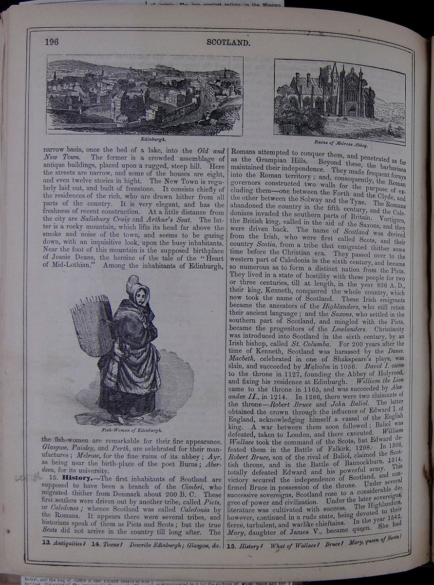 196
SCOTLAND.
Edinburgh.
Ruins of Melrose Abbey.
196
SCOTLAND.
Edinburgh.
Ruins of Melrose Abbey.
narrow basin, once the bed of a lake, into the Old and New Town. The former is a crowded assemblage of antique buildings, placed upon a rugged, steep hill. Here the streets are narrow, and some of the houses are eight, and even twelve stories in hight. The New Town is regularly laid out, and built of freestone. It consists chiefly of the residences of the rich, who are drawn hither from all parts of the country. It is very elegant, and has the freshness of recent construction. At a little distance from the city are Salisbury Craig and Arthur's Seat. The latter is a rocky mountain, which lifts its head far above the smoke and noise of the town, and seems to be gazing down, with an inquisitive look, upon the busy inhabitants. Near the foot of this mountain is the supposed birthplace of Jeanie Deans, the heroine of the tale of the "Heart of Mid-Lothian." Among the inhabitants of Edinburgh,
Fish-Woman of Edinburgh.the fish-women are remarkable for their fine appearance. Glasgow, Paisley, and Perth, are celebrated for their manufactures; Melrose, for the fine ruins of its abbey; Ayr, as being near the birth-place of the poet Burns; Aberdeen, for its university.
15. History.—The first inhabitants of Scotland are supposed to have been a branch of the Cimbri, who migrated thither from Denmark about 200 B. C. These first settlers were driven out by another tribe, called Picts, or Caledones; whence Scotland was called Caledonia by the Romans. It appears there were several tribes, and historians speak of them as Picts and Scots; but the true Scots did not arrive in the country till long after. The Romans attempted to conquer them, and penetrated as far as the Grampian Hills. Beyond these, the barbarians maintained their independence. They made frequent forays into the Roman territory; and, consequently, the Roman governors constructed two walls for the purpose of excluding them—one between the Forth and the Clyde, and the other between the Solway and the Tyne. The Romans abandoned the country in the fifth century, and the Caledonians invaded the southern parts of Britain. Vortigern, the British king, called in the aid of the Saxons, and they were driven back. The name of Scotland was derived from the Irish, who were first called Scots, and their country Scotia, from a tribe that emigrated thither some time before the Christian era. They passed over to the western part of Caledonia in the sixth century, and became so numerous as to form a distinct nation from the Picts. They lived in a state of hostility with these people for two or three centuries, till at length, in the year 836 A. D., their king, Kenneth, conquered the whole country, which now took the name of Scotland. These Irish emigrants became the ancestors of the Highlanders, who still retain their ancient language; and the Saxons, who settled in the southern part of Scotland, and mingled with the Picts, became the progenitors of the Lowlanders. Christianity was introduced into Scotland in the sixth century, by an Irish bishop, called St. Columba. For 200 years after the time of Kenneth, Scotland was harassed by the Danes. Macbeth, celebrated in one of Shakspeare's plays, was slain, and succeeded by Malcolm in 1056. David I. came to the throne in 1127, founding the Abbey of Holyrood, and fixing his residence at Edinburgh. William the Lion came to the throne in 1165, and was succeeded by Alexander II., in 1214. In 1286, there were two claimants of the throne—Robert Bruce and John Baliol. The latter obtained the crown through the influence of Edward I. of England, acknowledging himself a vassal of the English king. A war between them soon followed; Baliol was defeated, taken to London, and there executed. William Wallace took the command of the Scots, but Edward defeated them in the Battle of Falkirk, 1298. In 1306, Robert Bruce, son of the rival of Baliol, claimed the Scottish throne, and in the Battle of Bannockburn, 1314, totally defeated Edward and his powerful army. This victory secured the independence of Scotland, and confirmed Bruce in possession of the throne. Under several successive sovereigns, Scotland rose to a considerable degree of power and civilization. Under the later sovereigns, literature was cultivated with success. The Highlanders, however, continued in a rude state, being devoted to their fierce, turbulent, and warlike chieftains. In the year 1542, Mary, daughter of James V., became queen. She had
13. Antiquities? 14. Towns? Describe Edinburgh; Glasgow, &c. 15. History? What of Wallace? Bruce? Mary, queen of Scots?
[begin surface 706]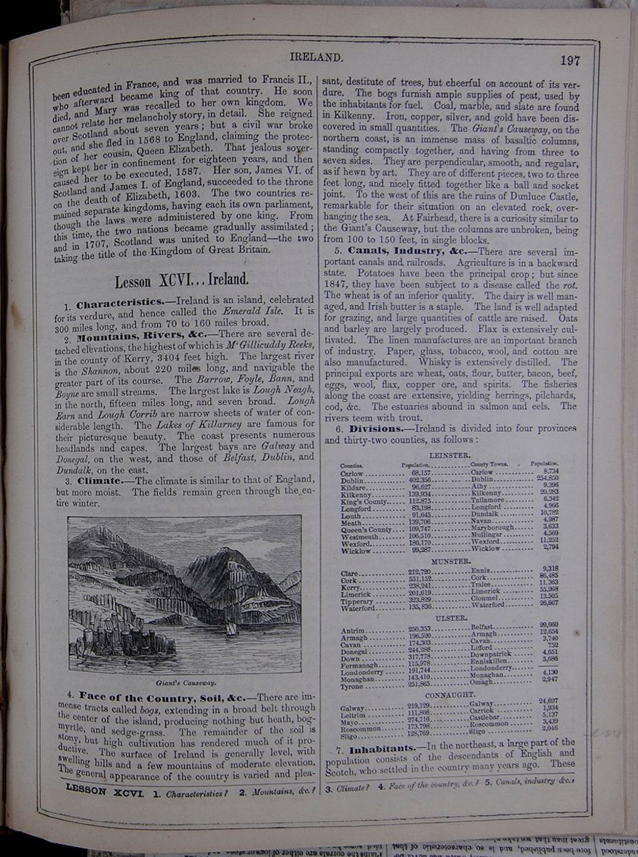 IRELAND.
197
IRELAND.
197
been educated in France, and was married to Francis II., who afterward became king of that country. He soon died, and Mary was recalled to her own kingdom. We cannot relate her melancholy story, in detail. She reigned over Scotland about seven years; but a civil war broke out, and she fled in 1568 to England, claiming the protection of her cousin, Queen Elizabeth. That jealous sovereign kept her in confinement for eighteen years, and then caused her to be executed, 1587. Her son, James VI. of Scotland and James I. of England, succeeded to the throne on the death of Elizabeth, 1603. The two countries remained separate kingdoms, having each its own parliament, though the laws were administered by one king. From this time, the two nations became gradually assimilated; and in 1707, Scotland was united to England—the two taking the title of the Kingdom of Great Britain.
Lesson XCVI... Ireland.
1. Characteristics.—Ireland is an island, celebrated for its verdure, and hence called the Emerald Isle. It is 300 miles long, and from 70 to 160 miles broad.
2. Mountains, Rivers, &c.—There are several detached elevations, the highest of which is M'Gillicuddy Reeks, in the county of Kerry, 3404 feet high. The largest river is the Shannon, about 220 miles long, and navigable the greater part of its course. The Barrow, Foyle, Bann, and Boyne are small streams. The largest lake is Lough Neagh, in the north, fifteen miles long, and seven broad. Lough Earn and Lough Corrib are narrow sheets of water of considerable length. The Lakes of Killarney are famous for their picturesque beauty. The coast presents numerous headlands and capes. The largest bays are Galway and Donegal, on the west, and those of Belfast, Dublin, and Dundalk, on the east.
3. Climate.—The climate is similar to that of England, but more moist. The fields remain green through the entire winter.
Giant's Causeway4. Face of the Country, Soil, &c.—There are immense tracts called bogs, extending in a broad belt through the center of the island, producing nothing but heath, bog-myrtle, and sedge-grass. The remainder of the soil is stony, but high cultivation has rendered much of it productive. The surface of Ireland is generally level, with swelling hills and a few mountains of moderate elevation. The general appearance of the country is varied and pleasant, destitute of trees, but cheerful on account of its verdure. The bogs furnish ample supplies of peat, used by the inhabitants for fuel. Coal, marble, and slate are found in Kilkenny. Iron, copper, silver, and gold have been discovered in small quantities. The Giant's Causeway, on the northern coast, is an immense mass of basaltic columns, standing compactly together, and having from three to seven sides. They are perpendicular, smooth, and regular, as if hewn by art. They are of different pieces, two to three feet long, and nicely fitted together like a ball and socket joint. To the west of this are the ruins of Dunluce Castle, remarkable for their situation on an elevated rock, overhanging the sea. At Fairhead, there is a curiosity similar to the Giant's Causeway, but the columns are unbroken, being from 100 to 150 feet, in single blocks.
5. Canals, Industry, &c.—There are several important canals and railroads. Agriculture is in a backward state. Potatoes have been the principal crop; but since 1847, they have been subject to a disease called the rot. The wheat is of an inferior quality. The dairy is well managed, and Irish butter is a staple. The land is well adapted for grazing, and large quantities of cattle are raised. Oats and barley are largely produced. Flax is extensively cultivated. The linen manufactures are an important branch of industry. Paper, glass, tobacco, wool, and cotton are also manufactured. Whisky is extensively distilled. The principal exports are wheat, oats, flour, butter, bacon, beef, eggs, wool, flax, copper ore, and spirits. The fisheries along the coast are extensive, yielding herrings, pilchards, cod, &c. The estuaries abound in salmon and eels. The rivers teem with trout.
6. Divisions.—Ireland is divided into four provinces and thirty-two counties, as follows :
A table listing the counties, towns, and populations of Ireland.7. Inhabitants.—In the northeast, a large part of the population consists of the descendants of English and Scotch, who settled in the country many years ago. These
LESSON XCVI. 1. Characteristics? 2. Mountains, &c.? 3. Climate? 4. Face of the country, &c.? 5. Canals, industry &c.?
[begin surface 707]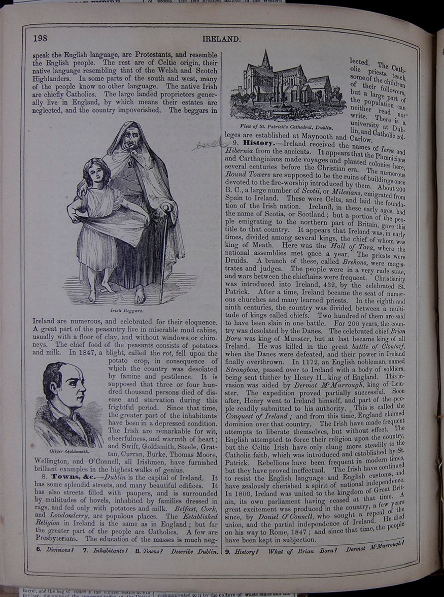 198
IRELAND.
198
IRELAND.
speak the English language, are Protestants, and resemble the English people. The rest are of Celtic origin, their native language resembling that of the Welsh and Scotch Highlanders. In some parts of the south and west, many of the people know no other language. The native Irish are chiefly Catholics. The large landed proprietors generally live in England, by which means their estates are neglected, and the country impoverished. The beggars in
Irish Beggars.Ireland are numerous, and celebrated for their eloquence. A great part of the peasantry live in miserable mud cabins, usually with a floor of clay, and without windows or chimneys. The chief food of the peasants consists of potatoes and milk. In 1847, a blight, called the rot, fell upon the potato crop, in consequence of which the country was desolated by famine and pestilence. It is supposed that three or four hundred thousand persons died of disease and starvation during this frightful period. Since that time, the greater part of the inhabitants have been in a depressed condition. The Irish are remarkable for wit, cheerfulness, and warmth of heart; and Swift, Goldsmith, Steele, Grattan, Curran, Burke, Thomas Moore, Wellington, and O'Connell, all Irishmen, have furnished brilliant examples in the highest walks of genius.
Oliver Goldsmith.8. Towns, &c.—Dublin is the capital of Ireland. It has some splendid streets, and many beautiful edifices. It has also streets filled with paupers, and is surrounded by multitudes of hovels, inhabited by families dressed in rags, and fed only with potatoes and milk. Belfast, Cork, and Londonderry, are populous places. The Established Religion in Ireland is the same as in England; but far the greater part of the people are Catholics. A few are Presbyterians. The education of the masses is much neglected. View of St. Patrick's Cathedral, Dublin. The Catholic priests teach some of the children of their followers, but a large part of the population can neither read nor write. There is a university at Dublin, and Catholic colleges are established at Maynooth and Carlow.
9. History.—Ireland received the names of Ierne and Hibernia from the ancients. It appears that the Phœnicians and Carthaginians made voyages and planted colonies here, several centuries before the Christian era. The numerous Round Towers are supposed to be the ruins of buildings once devoted to the fire-worship introduced by them. About 200 B. C., a large number of Scotii, or Milesians, emigrated from Spain to Ireland. These were Celts, and laid the foundation of the Irish nation. Ireland, in these early ages, had the name of Scotia, or Scotland; but a portion of the people emigrating to the northern part of Britain, gave this title to that country. It appears that Ireland was, in early times, divided among several kings, the chief of whom was king of Meath. Here was the Hall of Tara, where the national assemblies met once a year. The priests were Druids. A branch of these, called Brehons, were magistrates and judges. The people were in a very rude state, and wars between the chieftains were frequent. Christianity was introduced into Ireland, 432, by the celebrated St. Patrick. After a time, Ireland became the seat of numerous churches and many learned priests. In the eighth and ninth centuries, the country was divided between a multitude of kings called chiefs. Two hundred of them are said to have been slain in one battle. For 200 years, the country was desolated by the Danes. The celebrated chief Brian Boru was king of Munster, but at last became king of all Ireland. He was killed in the great battle of Clontarf, when the Danes were defeated, and their power in Ireland finally overthrown. In 1172, an English nobleman, named Strongbow, passed over to Ireland with a body of soldiers, being sent thither by Henry II., king of England. This invasion was aided by Dermot M'Murrough, king of Leinster. The expedition proved partially successful. Soon after, Henry went to Ireland himself, and part of the people readily submitted to his authority. This is called the Conquest of Ireland; and from this time, England claimed dominion over that country. The Irish have made frequent attempts to liberate themselves, but without effect. The English attempted to force their religion upon the country, but the Celtic Irish have only clung more steadily to the Catholic faith, which was introduced and established by St. Patrick. Rebellions have been frequent in modern times, but they have proved ineffectual. The Irish have continued to resist the English language and English customs, and have zealously cherished a spirit of national independence. In 1800, Ireland was united to the kingdom of Great Britain, its own parliament having ceased at that time. A great excitement was produced in the country, a few years since, by Daniel O'Connell, who sought a repeal of the union, and the partial independence of Ireland. He died on his way to Rome, 1847; and since that time, the people have been kept in subjection.
6. Divisions? 7. Inhabitants? 8. Towns? Describe Dublin. 9. History? What of Brian Boru? Dermot M'Murrough?
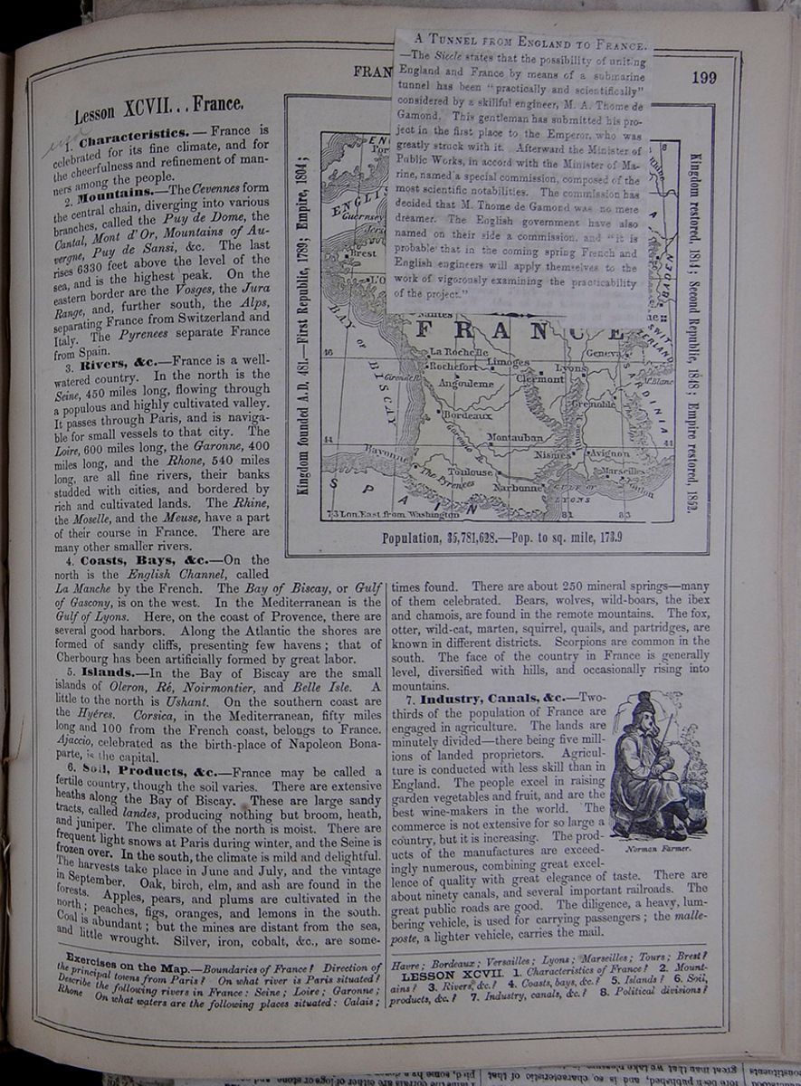 FRANCE.
199
FRANCE.
199
Lesson XCVII... France.
1. Characteristics.—France is celebrated for its fine climate, and for the cheerfulness and refinement of manners among the people.
2. Mountains.—The Cevennes form the central chain, diverging into various branches, called the Puy de Dome, the Cantal, Mont d' Or, Mountains of Auvergne, Puy de Sansi, &c. The last rises 6330 feet above the level of the sea, and is the highest peak. On the eastern border are the Vosges, the Jura Range, and, further south, the Alps, separating France from Switzerland and Italy. The Pyrenees separate France from Spain.
3. Rivers, &c.—France is a well-watered country. In the north is the Seine, 450 miles long, flowing through a populous and highly cultivated valley. It passes through Paris, and is navigable for small vessels to that city. The Loire, 600 miles long, the Garonne, 400 miles long, and the Rhone, 540 miles long, are all fine rivers, their banks studded with cities, and bordered by rich and cultivated lands. The Rhine, the Moselle, and the Meuse, have a part of their course in France. There are many other smaller rivers.
4. Coasts, Bays, &c.—On the north is the English Channel, called La Manche by the French. The Bay of Biscay, or Gulf of Gascony, is on the west. In the Mediterranean is the Gulf of Lyons. Here, on the coast of Provence, there are several good harbors. Along the Atlantic the shores are formed of sandy cliffs, presenting few havens; that of Cherbourg has been artificially formed by great labor.
5. Islands.—In the Bay of Biscay are the small islands of Oleron, Ré, Noirmontier, and Belle Isle. A little to the north is Ushant. On the southern coast are the Hyéres. Corsica, in the Mediterranean, fifty miles long and 100 from the French coast, belongs to France. Ajaccio, celebrated as the birth-place of Napoleon Bonaparte, is the capital.
6. Soil, Products, &c.—France may be called a
fertile country, though the soil varies. There are extensive
heaths along the Bay of Biscay. These are large sandy
tracts, called landes, producing nothing but broom, heath,
and juniper. The climate of the north is moist. There are
frequent light snows at Paris during winter, and the Seine
is frozen over. In the south, the climate is mild and
delightful. The harvests take place in June and July, and
the vintage in September. Oak, birch, elm, and ash are found
in the forests. Apples, pears, and plums are cultivated in
the north; peaches, figs, oranges, and lemons in the south.
Coal is abundant; but the mines are distant from the sea,
and little wrought. Silver, iron, cobalt, &c., are
sometimes
7. Industry, Canals, &c.—Two-thirds of the population of France are engaged in agriculture. The lands are minutely divided—there being five millions of landed proprietors. Agriculture is conducted with less skill than in England. The people excel in raising garden vegetables and fruit, and are the best wine-makers in the world. The commerce is not extensive for so large a country, but it is increasing. The products of the manufactures are exceedingly numerous, combining great excellence of quality with great elegance of taste. There are about ninety canals, and several important railroads. The great public roads are good. The diligence, a heavy, lumbering vehicle, is used for carrying passengers; the malleposte, a lighter vehicle, carries the mail.
Exercises on the Map.—Boundaries of France? Direction of the principal towns from Paris? On what river is Paris situated? Describe the following rivers in France : Seine; Loire; Garonne; Rhone On what waters are the following places situated : Calais; Havre; Bordeaux; Versailles; Lyons; Marseilles; Tours; Brest?
LESSON XCVII. 1. Characteristics of France? 2. Mountains? 3. Rivers, &c.? 4. Coasts, bays, &c.? 5. Islands? 6. Soil, products, &c.? 7. Industry, canals, &c.? 8. Political divisions?
[begin surface 709]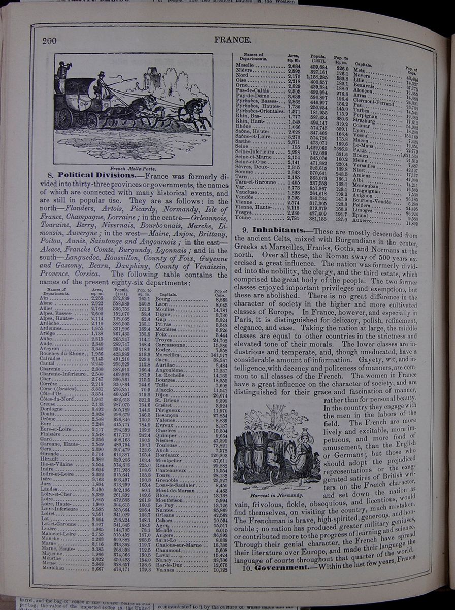 200
FRANCE.
French Malle-Poste.
200
FRANCE.
French Malle-Poste.
8. Political Divisions.—France was formerly divided into thirty-three provinces or governments, the names of which are connected with many historical events, and are still in popular use. They are as follows : in the north—Flanders, Artois, Picardy, Normandy, Isle of France, Champagne, Lorraine; in the centre—Orleannois, Touraine, Berry, Nivernais, Bourbonnais, Marche, Limousin, Auvergne; in the west—Maine, Anjou, Brittany, Poitou, Aunis, Saintonge and Angoumois; in the east—Alsace, Franche Comte, Burgundy, Lyonnais; and in the south—Languedoc, Roussillon, County of Foix, Guyenne and Gascony, Bearn, Dauphiny, County of Venaissin, Provence, Corsica. The following table contains the names of the present eighty-six departments:
A table listing the departments of France along with their areas, populations, and populations per square mile, and capitals.9. Inhabitants.—These are mostly descended from the ancient Celts, mixed with Burgundians in the center, Greeks at Marseilles, Franks, Goths, and Normans at the north. Over all these, the Roman sway of 500 years exercised a great influence. The nation was formerly divided into the nobility, the clergy, and the third estate, which comprised the great body of the people. The two former classes enjoyed important privileges and exemptions, but these are abolished. There is no great difference in the character of society in the higher and more cultivated classes of Europe. In France, however, and especially in Paris, it is distinguished for delicacy, polish, refinement, elegance, and ease. Taking the nation at large, the middle classes are equal to other countries in the strictness and elevated tone of their morals. The lower classes are industrious and temperate, and, though uneducated, have a considerable amount of information. Gayety, wit, and intelligence, with decency and politeness of manners, are common to all classes of the French. The women in France have a great influence on the character of society, and are distinguished for their grace and fascination of manner, rather than for personal beauty. In the country they engage with the men in the labors of the field. The French are more lively and excitable, more impetuous, and more fond of amusement, than the English or Germans; but those who should adopt the prejudiced representations or the exaggerated satires of British writers on the French character, and set down the nation as vain, frivolous, fickle, obsequious, and licentious, would find themselves, on visiting the country, much mistaken. The Frenchman is brave, high-spirited, generous, and honorable; no nation has produced greater military geniuses, or contributed more to the progress of learning and science. Through their genial character, the French have spread their literature over Europe, and made their language the language of courts throughout that quarter of the world.
Harvest in Normandy.10. Government.—Within the last few years, France
 [begin surface 711]
 [begin surface 712]
 [begin surface 713]
 [begin surface 714]
 [begin surface 715]
 [begin surface 716]
 [begin surface 717]
 [begin surface 718]
 [begin surface 719]
 [begin surface 720]
 [begin surface 721]
 [begin surface 722]
 [begin surface 723]
 [begin surface 724]
 [begin surface 725]
 [begin surface 726]
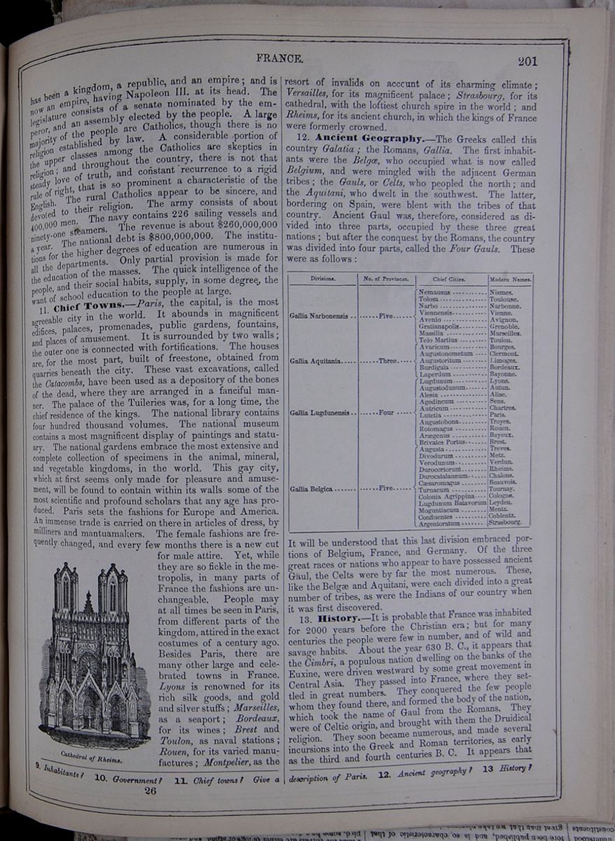
has been a kingdom, a republic, and an empire; and is now an empire, having Napoleon III. at its head. The legislature consists of a senate nominated by the emperor, and an assembly elected by the people. A large majority of the people are Catholics, though there is no religion established by law. A considerable portion of the upper classes among the Catholics are skeptics in religion; and throughout the country, there is not that steady love of truth, and constant recurrence to a rigid rule of right, that is so prominent a characteristic of the English. The rural Catholics appear to be sincere, and devoted to their religion. The army consists of about 400,000 men. The navy contains 226 sailing vessels and ninety-one steamers. The revenue is about $260,000,000 a year. The national debt is $800,000,000. The institutions for the higher degrees of education are numerous in all the departments. Only partial provision is made for the education of the masses. The quick intelligence of the people, and their social habits, supply, in some degree, the want of school education to the people at large.
11. Chief Towns.—Paris, the capital, is the most agreeable city in the world. It abounds in magnificent edifices, palaces, promenades, public gardens, fountains, and places of amusement. It is surrounded by two walls; the outer one is connected with fortifications. The houses are, for the most part, built of freestone, obtained from quarries beneath the city. These vast excavations, called the Catacombs, have been used as a depository of the bones of the dead, where they are arranged in a fanciful manner. The palace of the Tuileries was, for a long time, the chief residence of the kings. The national library contains four hundred thousand volumes. The national museum contains a most magnificent display of paintings and statuary. The national gardens embrace the most extensive and complete collection of specimens in the animal, mineral, and vegetable kingdoms, in the world. This gay city, which at first seems only made for pleasure and amusement, will be found to contain within its walls some of the most scientific and profound scholars that any age has produced. Paris sets the fashions for Europe and America. An immense trade is carried on there in articles of dress, by milliners and mantuamakers. The female fashions are frequently changed, and every few months there is a new cut for male attire. Yet, while they are so fickle in the metropolis, in many parts of France the fashions are unchangeable. People may at all times be seen in Paris, from different parts of the kingdom, attired in the exact costumes of a century ago. Besides Paris, there are many other large and celebrated towns in France. Lyons is renowned for its rich silk goods, and gold and silver stuffs; Marseilles, as a seaport; Bordeaux, for its wines; Brest and Toulon, as naval stations; Rouen, for its varied manufactures; Montpelier, as the Cathedral of Rheims. resort of invalids on account of its charming climate; Versailles, for its magnificent palace; Strasbourg, for its cathedral, with the loftiest church spire in the world; and Rheims, for its ancient church, in which the kings of France were formerly crowned.
12. Ancient Geography.—The Greeks called this country Galatia; the Romans, Gallia. The first inhabitants were the Belgæ, who occupied what is now called Belgium, and were mingled with the adjacent German tribes; the Gauls, or Celts, who peopled the north; and the Aquitani, who dwelt in the southwest. The latter, bordering on Spain, were blent with the tribes of that country. Ancient Gaul was, therefore, considered as divided into three parts, occupied by these three great nations; but after the conquest by the Romans, the country was divided into four parts, called the Four Gauls. These were as follows: A table listing the divisions of France with their number of provinces, chief cities, and modern names.
It will be understood that this last division embraced portions of Belgium, France, and Germany. Of the three great races or nations who appear to have possessed ancient Gaul, the Celts were by far the most numerous. These, like the Belgæ and Aquitani, were each divided into a great number of tribes, as were the Indians of our country when it was first discovered.
13. History.—It is probable that France was inhabited for 2000 years before the Christian era; but for many centuries the people were few in number, and of wild and savage habits. About the year 630 B. C., it appears that the Cimbri, a populous nation dwelling on the banks of the Euxine, were driven westward by some great movement in Central Asia. They passed into France, where they settled in great numbers. They conquered the few people whom they found there, and formed the body of the nation, which took the name of Gaul from the Romans. They were of Celtic origin, and brought with them the Druidical religion. They soon became numerous, and made several incursions into the Greek and Roman territories, as early as the third and fourth centuries B. C. It appears that
9. Inhabitants? 10. Government? 11. Chief towns? Give a description of Paris. 12. Ancient geography? 13. History?
26 [begin surface 727]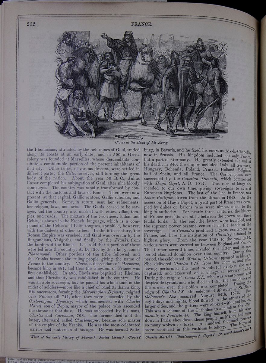 202
FRANCE.
Clovis at the Head of his Army.
202
FRANCE.
Clovis at the Head of his Army.
the Phœnicians, attracted by the rich mines of Gaul, traded along its coasts at an early date; and in 590, a Greek colony was founded at Marseilles, whose descendants constitute a considerable portion of the present inhabitants of that city. Other tribes, of various descent, were settled in different parts; the Celts, however, still forming the great body of the nation. About the year 50 B. C., Julius Cæsar completed his subjugation of Gaul, after nine bloody campaigns. The country was rapidly transformed by contact with the customs and laws of Rome. There were now present, at that capital, Gallic orators, Gallic scholars, and Gallic generals. Rome, in return, sent her refinements, her religion, laws, and arts. The Gauls ceased to be savages, and the country was marked with cities, villas, temples, and roads. The mixture of the two races, Italian and Celtic, is shown in the French language, which is a compound of the Celtic and Latin tongues, sprinkled, however, with the dialects of other tribes. In the fifth century, the Roman Empire was crushed, and Gaul was overrun by the Burgundians, Visigoths, and finally by the Franks, from the borders of the Rhine. It is said that a portion of these were led into the country, A. D. 420, by their king, named Pharamond. Other portions of the tribe followed, and the Franks became the ruling people, giving the name of France to the country. Clovis, a descendant of Meroveus, became king in 481, and thus the kingdom of France was first established. In 496, Clovis was baptized at Rheims, and thus Christianity was established in the country. He was an able sovereign, but he passed his whole time in the midst of soldiers—more like a chief of banditti than a king. His successors, forming the Merovingian Dynasty, reigned over France till 741, when they were succeeded by the Carlovingian Dynasty, which commenced with Charles Martel, son of Pepin, mayor of the palace, who ascended the throne at that date. He was succeeded by his sons, Charles and Carloman, 768. The former died, and the latter, afterward called Charlemagne, became sole master of the empire of the Franks. He was the most celebrated warrior and statesman of his age. He was born at Saltzburg, in Bavaria, and he fixed his court at Aix-la-Chapelle, now in Prussia. His kingdom included not only France, but a part of Germany. He greatly extended it; and at his death, in 840, the empire included Italy, all Germany, Hungary, Bohemia, Poland, Prussia, Holland, Belgium, half of Spain, and all France. The Carlovingians were succeeded by the Capetian Dynasty, which commenced with Hugh Capet, A. D. 1017. This race of kings descended to our own time, giving sovereigns to several European kingdoms. The last of the line, in France, was Louis Philippe, driven from the throne in 1848. On the accession of Hugh Capet, a great part of France was occupied by dukes or barons, who were almost equal to the king in authority. For nearly three centuries, the history of France presents a contest between the crown and these feudal lords. In the end, the latter were humbled, and the supreme power became centered in the hands of the sovereign. The Crusades produced a great excitement in France, and here the institution of Chivalry attained its highest glory. From the year 1328 to the year 1430, various wars were carried on between England and France. The former several times invaded the latter, and at one period claimed dominion over that country. During this period, the celebrated Maid of Orleans appeared in history. She delivered Charles VII. from his enemies, and after having performed the most wonderful exploits, she was captured, and executed on a charge of sorcery, 1430. During the reign of Louis XI., who was a suspicious and despicable tyrant, and who died in 1483, the ascendency of the crown over the nobles was completed. During the reign of Charles IX., the celebrated Massacre of St. Bartholomew's Eve occurred, August 24th, 1572. For eight days and nights, blood flowed in the streets of the larger cities, and the gutters were choked with dead bodies. This was a scheme of the Catholics to annihilate the Huguenots, or Protestants. The king himself, from his window, in Paris, shot down these people, as if they had been so many wolves or foxes. A hundred thousand persons were sacrificed in this ruthless butchery. The Pope of
What of the early history of France? Julius Cæsar? Clovis? Charles Martel? Charlemagne? Capet? St. Bartholomew's Eve?
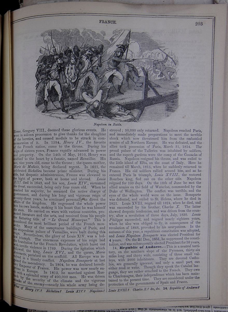
Rome, Gregory VIII., deemed these glorious events. He went in solemn procession to give thanks for the slaughter of the heretics, and caused medals to be struck in commemoration of it. In 1594, Henry IV., the favorite of the French nation, came to the throne. During his reign of sixteen years, France rapidly advanced in power and prosperity. On the 14th of May, 1610, Henry was stabbed to the heart by a fanatic, named Ravaillac. His son, nine years old, came to the throne; the queen-mother, Marie de Medicis, being declared regent. In 1621, the celebrated Richelieu became prime minister. During his able, but despotic administration, France was elevated to the hight of power, both at home and abroad. Louis XIII. died in 1642, and his son, Louis XIV., surnamed the Great, succeeded, being only four years old. When he reached his majority, he assumed the active charge of government, and during his long and vigorous reign of seventy-three years, he continued personally to direct the affairs of the kingdom. He engrossed the whole power into his own hands, making it his boast that he was himself the state. He carried on wars with various countries, promoted literature and the arts, and received from his people the flattering title of " Le Grand Monarque." This is considered the most brilliant period of the French monarchy. Many of the sumptuous buildings of Paris, and the stupendous palace of Versailles, were built during this reign. Nevertheless, the glory of Louis XIV. was a hollow triumph. The enormous expenses of his reign laid the foundation for the French Revolution, which burst out with terrific violence in 1789. During the agitation which followed, the king, Louis XVI., and the queen, Marie Antoinette, perished on the scaffold. All Europe was involved in a bloody conflict. Napoleon Bonaparte at last gained the ascendency. In 1804, he was declared hereditary Emperor of France. His power was now nearly supreme in Europe. In 1812, he marched against Russia with a splendid army of 400,000 men. He was driven back by the severity of the climate and the vigorous attacks of the enemy—nearly his whole army being destroyed; 50,000 only returned. Napoleon reached Paris, and immediately made preparations to meet the terrible shock which now threatened him from the embattled armies of all Northern Europe. He was defeated, and the allies took possession of Paris, March 31, 1814. The proud palace of the Tuileries was inhabited by soldiers, and the superb gardens were the camp of the Cossacks of Russia. Napoleon resigned his throne, and was exiled to the little island of Elba, on the coast of Italy. Here he remained till March, 1815, when he suddenly returned to France. His old soldiers rallied around him, and as he entered Paris in triumph, Louis XVIII., the restored Bourbon king, fled out on the other side. Napoleon reigned for 100 days. On the 18th of June he met the allied armies on the field of Waterloo, commanded by the Duke of Wellington. The conflict was terrible, and the eyes of the whole world were on the issue. Bonaparte was defeated, and exiled to St. Helena, where he died in 1821. Louis XVIII. reigned till 1824, when he died, and was succeeded by his brother, Charles X. The latter showed despotic tendencies, and was driven from the country, after a revolution of three days, July, 1830. Louis Philippe succeeded, and reigned nearly eighteen years, when he also was obliged to fly, in consequence of the revolution of 1848, provoked by his usurpations. In the autumn of this year, a republican constitution was adopted, and Louis Napoleon Bonaparte was elected President for 4 years. On the 2d Dec., 1851, he suppressed the constitution, and was subsequently elected President for 10 years.
14. Republic of Andorre.—This is a neutral territory, on the southern slope of the Pyrenees, thirty-six miles long and thirty wide, consisting of three small valleys, with 2000 inhabitants. They are devoted Catholics, are generally ignorant, and only a small part can either read or write. Though they speak the Catalan language, they are rather attached to the French. They owe to Charlemagne, their independence which has been maintained to the present time. They are considered under the protection of the governments of Spain and France.
What of Henry IV.? Richelieu? Louis XIV.? Napoleon? Louis XVIII.? Charles X.? &c., &c. 14. Republic of Andorre?
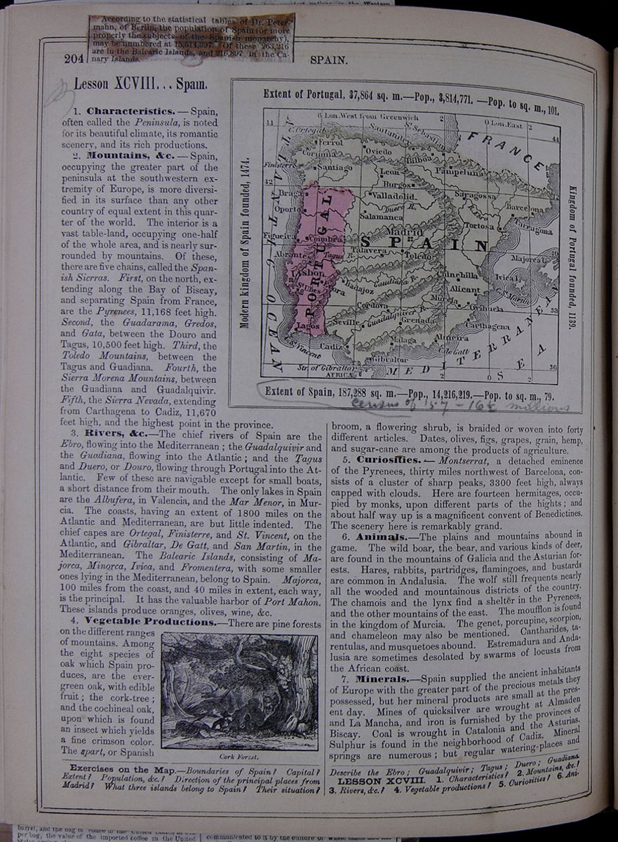 204
SPAIN.
[begin surface 730]
204
SPAIN.
[begin surface 730]
According to the statistical tables of Dr. Petermann, of Berlin, the population of Spain (or more properly the subjects of the Spanish monarchy), may be numbered at 15,514,397. Of these, 263,216 are in the Balearic Islands, and 216,397 in the Canary Islands.
Lesson XCVIII... Spain.
1. Characteristics.—Spain, often called the Peninsula, is noted for its beautiful climate, its romantic scenery, and its rich productions.
2. Mountains, &c.—Spain, occupying the greater part of the peninsula at the southwestern extremity of Europe, is more diversified in its surface than any other country of equal extent in this quarter of the world. The interior is a vast table-land, occupying one-half of the whole area, and is nearly surrounded by mountains. Of these, there are five chains, called the Spanish Sierras. First, on the north, extending along the Bay of Biscay, and separating Spain from France, are the Pyrenees, 11,168 feet high. Second, the Guadarama, Gredos, and Gata, between the Douro and Tagus, 10,500 feet high. Third, the Toledo Mountains, between the Tagus and Guadiana. Fourth, the Sierra Morena Mountains, between the Guadiana and Guadalquivir. Fifth, the Sierra Nevada, extending from Carthagena to Cadiz, 11,670 feet high, and the highest point in the province.
3. Rivers, &c.—The chief rivers of Spain are the Ebro, flowing into the Mediterranean; the Guadalquivir and the Guadiana, flowing into the Atlantic; and the Tagus and Duero, or Douro, flowing through Portugal into the Atlantic. Few of these are navigable except for small boats, a short distance from their mouth. The only lakes in Spain are the Albufera, in Valencia, and the Mar Menor, in Murcia. The coasts, having an extent of 1800 miles on the Atlantic and Mediterranean, are but little indented. The chief capes are Ortegal, Finisterre, and St. Vincent, on the Atlantic, and Gibraltar, De Gatt, and San Martin, in the Mediterranean. The Balearic Islands, consisting of Majorca, Minorca, Ivica, and Fromentera, with some smaller ones lying in the Mediterranean, belong to Spain. Majorca, 100 miles from the coast, and 40 miles in extent, each way, is the principal. It has the valuable harbor of Port Mahon. These islands produce oranges, olives, wine, &c.
4. Vegetable Productions.—There are pine forests on the different ranges of mountains. Among the eight species of oak which Spain produces, are the evergreen oak, with edible fruit; the cork-tree; and the cochineal oak, upon which is found an insect which yields a fine crimson color. The spart, or Spanish Cork Forest. Extent of Portugal, 37,864 sq. m.—Pop., 3,814,771.—Pop. to sq. m., 101. Modern kingdom of Spain founded, 1474. Kingdom of Portugal founded, 1139. Extent of Spain, 187,288 sq. m.—Pop., 14,216,219.—Pop. to sq. m., 79. A map of Spain and Portugal, labeling major cities and bodies of water. Portugal is colored pink. broom, a flowering shrub, is braided or woven into forty different articles. Dates, olives, figs, grapes, grain, hemp, and sugar-cane are among the products of agriculture.
5. Curiosities.—Montserrat, a detached eminence of the Pyrenees, thirty miles northwest of Barcelona, consists of a cluster of sharp peaks, 3300 feet high, always capped with clouds. Here are fourteen hermitages, occupied by monks, upon different parts of the hights; and about half way up is a magnificent convent of Benedictines. The scenery here is remarkably grand.
6. Animals.—The plains and mountains abound in game. The wild boar, the bear, and various kinds of deer, are found in the mountains of Galicia and the Asturian forests. Hares, rabbits, partridges, flamingoes, and bustards are common in Andalusia. The wolf still frequents nearly all the wooded and mountainous districts of the country. The chamois and the lynx find a shelter in the Pyrenees, and the other mountains of the east. The moufflon is found in the kingdom of Murcia. The genet, porcupine, scorpion, and chameleon may also be mentioned. Cantharides, tarentulas , and musquetoes abound. Estremadura and Andalusia are sometimes desolated by swarms of locusts from the African coast.
7. Minerals.—Spain supplied the ancient inhabitants of Europe with the greater part of the precious metals they possessed, but her mineral products are small at the present day. Mines of quicksilver are wrought at Almaden and La Mancha, and iron is furnished by the provinces of Biscay. Coal is wrought in Catalonia and the Asturias. Sulphur is found in the neighborhood of Cadiz. Mineral springs are numerous; but regular watering-places and
Exercises on the Map.—Boundaries of Spain? Capital? Extent? Population, &c.? Direction of the principal places from Madrid? What three islands belong to Spain? Their situation? Describe the Ebro; Guadalquivir; Tagus; Duero; Guadiana.
LESSON XCVIII. 1. Characteristics? 2. Mountains, &c.? 3. Rivers, &c.? 4. Vegetable productions? 5. Curiosities? 6. Animals?
[begin surface 731]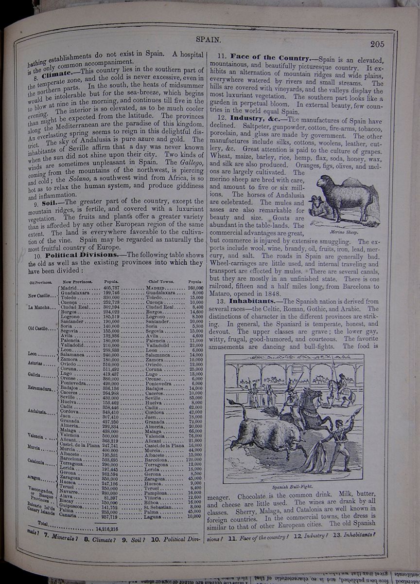 SPAIN.
205
SPAIN.
205
bathing establishments do not exist in Spain. A hospital is the only common accompaniment.
8. Climate.—This country lies in the southern part of the temperate zone, and the cold is never excessive, even in the northern parts. In the south, the heats of midsummer would be intolerable but for the sea-breeze, which begins to blow at nine in the morning, and continues till five in the evening. The interior is so elevated, as to be much cooler than might be expected from the latitude. The provinces along the Mediterranean are the paradise of this kingdom. An everlasting spring seems to reign in this delightful district. The sky of Andalusia is pure azure and gold. The inhabitants of Seville affirm that a day was never known when the sun did not shine upon their city. Two kinds of winds are sometimes unpleasant in Spain. The Gallego, coming from the mountains of the northwest, is piercing and cold; the Solano, a southwest wind from Africa, is so hot as to relax the human system, and produce giddiness and inflammation.
9. Soil.—The greater part of the country, except the mountain ridges, is fertile, and covered with a luxuriant vegetation. The fruits and plants offer a greater variety than is afforded by any other European region of the same extent. The land is everywhere favorable to the cultivation of the vine. Spain may be regarded as naturally the most fruitful country of Europe.
10. Political Divisions.—The following table shows the old as well as the existing provinces into which they have been divided: A table listing the old and new provinces of Spain, the populations of the new provinces, the chief towns of each province, and the population of those towns.
11. Face of the Country.—Spain is an elevated, mountainous, and beautifully picturesque country. It exhibits an alternation of mountain ridges and wide plains, everywhere watered by rivers and small streams. The hills are covered with vineyards, and the valleys display the most luxuriant vegetation. The southern part looks like a garden in perpetual bloom. In external beauty, few countries in the world equal Spain.
12. Industry, &c.—The manufactures of Spain have declined. Saltpeter, gunpowder, cotton, fire-arms, tobacco, porcelain, and glass are made by government. The other manufactures include silks, cottons, woolens, leather, cutlery, &c. Great attention is paid to the culture of grapes. Wheat, maize, barley, rice, hemp, flax, soda, honey, wax, and silk are also produced. Oranges, figs, olives, and melons are largely cultivated. The merino sheep are bred with care, and amount to five or six millions. The horses of Andalusia are celebrated. The mules and asses are also remarkable for beauty and size. Goats are abundant in the table-lands. The commercial advantages are great, but commerce is injured by extensive smuggling. The exports include wool, wine, brandy, oil, fruits, iron, lead, mercury, and salt. The roads in Spain are generally bad. Wheel-carriages are little used, and internal traveling and transport are effected by mules. There are several canals, but they are mostly in an unfinished state. There is one railroad, fifteen and a half miles long, from Barcelona to Mataro, opened in 1848.
Merino Sheep.13. Inhabitants.—The Spanish nation is derived from several races—the Celtic, Roman, Gothic, and Arabic. The distinctions of character in the different provinces are striking. In general, the Spaniard is temperate, honest, and devout. The upper classes are grave; the lower gay, witty, frugal, good-humored, and courteous. The favorite amusements are dancing and bull-fights. The food is Spanish Bull-Fight. meager. Chocolate is the common drink. Milk, butter, and cheese are little used. The wines are drank by all classes. Sherry, Malaga, and Catalonia are well known in foreign countries. In the commercial towns, the dress is similar to that of other European cities. The old Spanish
7. Minerals? 8. Climate? 9. Soil? 10. Political Divisions? 11. Face of the country? 12. Industry? 13. Inhabitants?
[begin surface 732]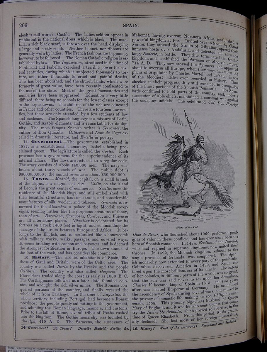 206
SPAIN.
206
SPAIN.
cloak is still worn in Castile. The ladies seldom appear in public but in the national dress, which is black. The mantilla, a rich black scarf, is thrown over the head, displaying a large and costly comb. Neither bonnet nor ribbons are generally worn by ladies. The French fashions are beginning, however, to be followed. The Roman Catholic religion is established by law. The Inquisition, introduced in the time of Ferdinand and Isabella, exercised a terrible power for several centuries, during which it subjected thousands to torture, and other thousands to cruel and painful deaths. This has been abolished, and the church lands, which were formerly of great value, have been recently confiscated to the use of the state. Most of the great monasteries and nunneries have been suppressed. Education is very little diffused, there being no schools for the lower classes except in the larger towns. The children of the rich are educated in France and other countries. There are fourteen universities, but these are only attended by a few students of law and medicine. The Spanish language is a mixture of Latin, Gothic, and Arabic elements, and is remarkable for its dignity. The most famous Spanish writer is Cervantes, the author of Don Quixote. Calderon and Lope de Vega excelled in dramatic literature, and Ercilla in poetry.
14. Government.—The government, established in 1837, is a constitutional monarchy, Isabella being proclaimed queen. The legislature is called the Cortes. Each province has a government for the superintendence of its internal affairs. The laws are reduced to a regular code. The army consists of about 140,000 men. The navy embraces about thirty vessels of war. The public debt is $800,000,000; the annual revenue is about $50,000,000.
15. Towns.—Madrid, the capital, on a small branch of the Tagus, is a magnificent city. Cadiz, on the island of Leon, is the great center of commerce. Seville, once the residence of the Moorish kings, and still embellished with their beautiful structures, has some trade, and considerable manufactures of silk, woolen, and tobacco. Granada is renowned for the Alhambra, a palace of the Moorish sovereigns, seeming rather like the gorgeous creations of fancy, than of art. Barcelona, Saragossa, Cordova, and Valencia are all interesting places. Gibraltar is celebrated for its fortress on a rock 1400 feet in hight, and commanding the passage of the straits between Europe and Africa. It belongs to the English, and is perforated like a honeycomb with military works, walks, passages, and covered ways. It seems bristling with cannon and bayonets, and is deemed the strongest fortification in Europe. The town stands at the foot of the rock, and has considerable commerce.
16. History.—The earliest inhabitants of Spain, like those of Gaul and Britain, were of the Celtic race. The country was called Iberia by the Greeks, and the people Celtiberi. The country was also called Hesperia. The Phœnicians traded along the coast as early as 1000 B. C. The Carthaginians followed at a later date, founded colonies, and wrought the rich silver mines. The Romans conquered portions of the country, and finally wrested the whole of it from Carthage. In the time of Augustus, the whole territory, including Portugal, had become a Roman province; the people quietly submitting to the government, and adopting the Roman language, manners, and customs. Prior to the fall of Rome, several tribes of Goths rushed into the kingdom. The Gothic monarchy was founded by Ataulph, 419 A. D. The Saracens, the successors of Mahomet, having overrun Northern Africa, established a powerful kingdom at Fez. Invited over to Spain by Count Julian, they crossed the Straits of Gibraltar, spread their immense hosts over Andalusia, and defeated and slew the king, Roderic, in battle. They thus terminated the Gothic kingdom, and established the Saracen or Moorish empire, 714 A. D. They now crossed the Pyrenees, and appeared about to overrun all Europe, when they were met upon the plains of Aquitaine by Charles Martel, and defeated in one of the bloodiest battles ever recorded in history. Thus checked in their progress, they still remained in occupation of the finest portions of the Spanish Peninsula. The Spaniards continued to hold parts of the country, and, under a succession of able chiefs, maintained a constant war against the usurping infidels. The celebrated Cid, Don Rodrigo Wars of the Cid. Diaz de Bivar, who flourished about 1060, performed prodigies of valor in these conflicts, and has ever since been the hero of Spanish romance. In 1474, Ferdinand and Isabella, who had reigned in separate kingdoms, now united their thrones. In 1492, the Moorish kingdom, reduced to the single province of Granada, was conquered. The Spanish monarchy now extended to every part of the peninsula. Columbus discovered America in 1492, and Spain entered upon the most brilliant era of its annals. The extent of her colonies, in different parts of the world, was so great, that the sun was said never to set upon her dominions. Charles V. became king of Spain in 1615; and two years after, was elected Emperor of Germany. He maintained the ascendency of Spain during several wars, and retired to the privacy of monastic life, making his son Philip his successor, 1558. This gloomy bigot was husband of Queen Mary of England, and it was he who sent against that country the Invincible Armada, which proved so abortive, in the time of Queen Elizabeth. From this period, Spain gradually declined. She lost most of her foreign possessions,
14. Government? 15. Towns? Describe Madrid; Seville, &c. 16. History? What of the Saracens? Ferdinand and Isabella
and now holds only Cuba, Porto Rico, and a few smaller islands in different parts of the world. In 1808, Napoleon seized upon the crown, and placed it upon the head of his brother Joseph. The Spaniards, aided by the British under Lord Wellington, compelled the French to withdraw, and Ferdinand VII. became king in 1814. He died in 1833, and his daughter Isabella, an infant, was proclaimed queen. The country was disturbed by civil war, but this ceased in 1839; since which period it has enjoyed tranquillity.
Lesson XCIX... Portugal.
1. Characteristics.—Portugal is a small kingdom, lying between Spain and the Atlantic.
2. Mountains.—The territory is traversed by several mountain ranges, of which the Serra Estrella and the Serra Monchique are the principal. Their loftiest peaks are 7865 feet high. Both north and south of these are fine plains watered by the rivers Minho, Douro, Tagus, and Guadiana, which enter the country from Spain, and flow west to the Atlantic. There are no lakes, but several salt marshes. The coast line, of 500 miles, presents several fine harbors.
3. Climate, &c.—The climate is mild and healthy. Earthquakes occur in the south, near Lisbon. The soil is naturally rich, and the country picturesque. Husbandry is conducted in a slovenly manner, and there are few passable roads. Grain, hemp, rice, olives, oranges, lemons, and figs are cultivated with success. The making of wine is the most important branch of industry. The produce of the vineyards watered by the Upper Douro, termed port wine, is a staple product. There are extensive forests of oak, chestnut, and cork. Mules and asses are the chief beasts of burden. Cattle, sheep, goats, and hogs are numerous. Iron, marble, and salt are the chief mineral products. There are a few manufactures of arms, porcelain, wool, cotton, jewelry, glass, paper, and silks. The commerce is chiefly carried on by the English through Lisbon and Oporto.
4. Political Divisions.
A table listing the political divisions of Portugal, including the old and new provinces, and the chief towns of those provinces. The populations of the provinces and towns are also provided.5. Inhabitants.—The Portuguese are of the same origin as the Spaniards; but they formed an independent nation and a distinct language. There is a university at Coimbra, and two or three colleges. Elementary schools are numerous. The chief name in Portuguese literature is that of Camoens, the poet, author of the Lusiad.
6. Government, &c.—The government is a constitutional monarchy. The army consists of 28,000 men; the navy of 36 small vessels. Revenue, $12,000,000; debt, $80,000,000. The established religion is Catholic.
7. Towns.—Lisbon, the capital, is situated at the mouth of the Tagus. On approaching it, it appears like a splendid city, but the streets are, in fact, narrow and ill-paved, and the houses gloomy. Every part is so filthy that the air is filled with the most disgusting effluvia. Various kinds of vermin, musquetoes, scolopendra, and red ants torment the inhabitants. In 1755, the city was nearly destroyed by an earthquake, in the midst of which it took fire, presenting a scene of indescribable horror. Thirty thousand inhabitants perished during this convulsion. The environs of the city are exceedingly beautiful. The other principal towns of Portugal are Coimbra, celebrated for its university; Oporto, renowned for its trade in wine, oranges, and lemons; Setubal , or St. Ubes, Braga, Lamego, Evora , Braganza , and Batalha.
8. History.—The early inhabitants of Portugal were of the same stock as those of Spain. The country was considered by the ancients as a part of Spain. The Carthaginians early traded to the coast, where they planted several colonies. It was conquered by the Romans about 200 B. C., who formed a province under the name of Lusitania. It remained quietly under the Roman dominion till the fifth century, when it was overrun by the Suevi, Visigoths, &c. It was conquered by the Arabs in 715, and afterward fell under the dominion of the Spanish kings. In 1139, Alphonse I. won a victory over the Moors, and was crowned king of Portugal by his soldiers on the field of battle. In 1348, one-half of the inhabitants died of the plague. During the fifteenth century, under John I. and his sons, the Portuguese excited the admiration of the world by their military, maritime, and commercial achievements. They discovered the greater part of the southern and western portions of Africa. The Cape of Good Hope was discovered by Diaz, in 1483, and in 1498 Vasco de Gama sailed around it with a Portuguese fleet, and reached India. Here the Portuguese founded several splendid colonies, which brought immense riches to the mother-country. Brazil was discovered in 1550. At this point, Portugal was one of the richest and most powerful kingdoms in Europe. Owing to the incompetence of its sovereigns, it now speedily declined. In 1580, it was conquered by Philip II. of Spain, and annexed to that country. It recovered its independence in 1668, but has since continued an inferior kingdom. In 1807, the French invaded the country, and the royal family escaped to Brazil. The French were expelled with the aid of the British, after a bloody conflict, and the king, Pedro, returned in 1821, Brazil becoming independent under his son in 1822. Pedro died in 1826, and the crown was usurped by Don Miguel, his brother. The Emperor of Brazil, who was now regent of Portugal, caused him to be expelled, and placed his daughter Maria on the throne, A. D. 1834. The country has since continued in rather a disturbed state. The vast colonies of Portugal are reduced to some small settlements in India, and the Pacific islands of Solor, Timor, and Midoro, on the coast of Guinea; Senegambia, Cape Verde, and Mozambique, with Prince's and St. Thomas Islands, in the West Indies.
Exercises on the Map (p. 204).—Boundaries of Portugal? Extent? Population? Population to square mile? Capital? Describe the Tagus. Where is Oporto? St. Ubes?
LESSON XCVII. 1. Characteristics? 2. Mountains? 3. Climate? 4. Political Divisions? 5. Inhabitants? 6. Government? 7. Towns? 8. History?
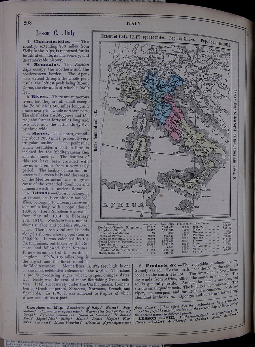 208
ITALY.
208
ITALY.
Lesson C... Italy
1. Characteristics.―This country, extending 700 miles from Sicily to the Alps, is renowned for its beautiful climate, its fine scenery, and its remarkable history.
2. Mountains.—The Rhetian Alps occupy the northern and the northwestern border. The Apennines extend through the whole peninsula, the loftiest peak being Mount Corno, the elevation of which is 9500 feet.
3. Rivers.—There are numerous rivers, but they are all small except the Po, which is 500 miles long, and drains nearly the whole northern part. The chief lakes are Maggiore and Como; the former forty miles long and two wide, and the latter thirty-five by three wide.
4. Shores.—The shores, extending about 2000 miles, present a very irregular outline. The peninsula, which resembles a boot in form, is inclosed by the Mediterranean Sea and its branches. The borders of this sea have been crowded with towns and cities from a very early period. The facility of maritime intercourse between Italy and the coasts of the Mediterranean was a great cause of the extended dominion and immense wealth of ancient Rome.
5. Islands.—Corsica, belonging to France, has been already noticed. Elba, belonging to Tuscany, is seventeen miles long, with a population of 18,000. Here Napoleon was exiled from May 3d, 1814, to February 26th, 1815. Sardinia has a mountainous surface, and contains 9000 sq. miles. There are several small islands along its shores, whose population is 550,000. It was colonized by the Carthaginians, but taken by the Romans, and followed their fortunes. It now forms part of the Sardinian kingdom. Sicily, 185 miles long, is the largest and the finest island in the Mediterranean. Mount Etna, 10,872 feet high, is one of the most celebrated volcanoes in the world. The island is prolific, producing sugar, wheat, grapes, oranges, dates, &c. Sicily was the seat of many flourishing Greek colonies. It fell successively under the Carthaginians, Romans, Goths, Greek emperors, Saracens, Normans, French, and Spaniards. In 1736, it was annexed to Naples, of which it now constitutes a part.
Rome founded 753 B. C. Extent of Italy, 116,479 square miles. Pop., 24,711,785. Pop to sq. m., 212.2. Roman Empire destroyed by the Barbarians 476 A. D. A map of Italy, including a table listing the states of Italy with their areas in square miles, populations, populations to square miles, and chief towns.6. Products, &c.—The vegetable products are extremely varied. To the north, near the Alps, the climate is cool; to the south it is hot. The sirocco and libeccio, burning winds from Africa, afflict the south in summer. The soil is generally fertile. Among the animals are deer, and various small quadrupeds. The buffalo is domesticated. The viper, asp, scorpion, and tar ntula are common. Fish are abundant in the rivers. Sponges and corals are taken along
Exercises on the Map.—Boundaries of Italy? Extent? Population? Population to square mile? Where is the Gulf of Venice? Genoa? Pyrenees mountains? Island of Corsica? Sardinia? Elba? Lipari Isles? Sicily? Malta? Rome? Naples? Florence? Syracuse? Mount Vesuvius? Direction of principal towns from Rome? What object does the peninsula of Italy resemble?
Let the pupil be asked questions on the ancient map of Italy, giving the ancient names to different places.
LESSON XCVIII. 1. Characteristics? 2. Mountains? 3. Rivers and lakes? 4. Shores? 5. Corsica? Elba? Sardinia?
[begin surface 735]
ITALIAN TRAVEL.
Condition of Rome—The Journey from Rome to Naples.
NAPLES, March.Here we are in the gayest city in the world,—gay in its white houses, its laughing skies, its dancing bay, its harlequin costumes, its cheerful, careless inhabitants—the home of maccaroni and punchinello. But let us first say farewell to Rome—the mournful, the eternal.
And why is Rome mournful? Is it not in the centre of favored Italy, upon the banks of the classic Tiber, and on the seven hills, each crowned with deathless fame? Certainly, and yet who could visit it without feeling his mind oppressed and saddened by the monuments of decay and death, which overshadow the modern city? Who can look on the Coliseum, the Forum, the Palace of the Cæsars, the Baths of Caracalla, the Aqueduct of CLAUDIUS, the Arch of CONSTANTINE, the boastful yet beautiful column of TROJAN—the scenes of Roman luxury, the symbols of Roman pride, the vestiges of Roman glory, the witnesses to the retribution of Roman crime, all now mingled or mingling with the vulgar earth, and not feel the heart clothed in sackcloth and ashes? Who can look on Pagan and Papal Rome, side by side, the one in its decay, the other in its pride, and not feel rebuked by the grandeur of the first and the littleness of the last? What a mighty spirit was that—savage, cruel and barbarian though it was—which reared these works, awful even in their ruins, and how like owls, and bats, and jackdaws—things of darkness and of evil omen—is the Papacy, with its flocks of monks and priests, performing their mummeries in the dark nooks of ancient temples and tottering shrines,—thus seeking to derive to their fictitious saints and madonnas a divinity, a sanctity from wrecks of objects once consecrated to Venus and Jove! How pitiful does it seem, to see the Coliseum converted into a shop for selling indulgences, (200 days of bliss for each kiss upon the central cross;) to see the Capitoline Hill become the residence of the Most Sacred Wooden Baby; to see St. Peter's itself not only pretending to hold the bones of the crucified Apostle, but actually containing a brass Jupiter, whose great toe diffuses beatitude on all who touch it with the lips!
Is it not calculated to disturb the reason, to unsettle our faith, and lead us to doubt even Providence and Christianity, when we see the centre of what claims to be the only true religion—the residence of its head, of him who assumes to be the vicegerent of Christ on earth—thus the seat of superstitions, impostures, and hypocrisy, while it is behind all the rest of the world in the spirit of improvement, intelligence, and progress? Is it not fearful to think that here, in the very metropolis, the focus of Christianity, liberty of thought and worship, liberty of body, mind and soul, are proscribed? Is it not mournful to think that Christ's successor is tolerated in Rome, only because he has four thousand French bayonets to protect him from his own subjects? Is it not sad to reflect that he who is at the head of 200,000,000 of Christians, whose word is law for earth and heaven—for time and eternity—dare not permit a free press, well knowing that the liberty of discussion would drive him into exile, and explode his whole system? Is it not mournful thus to see the might, majesty, and dominion of Paganism succeeded and superseded by the littleness of Popery?
And why is Rome Eternal? Of all spots on earth, Rome teaches most emphatically the transitory nature of earthly things. Nowhere is the battle of life, ever ending in death, so fearfully, so visibly set before the mind. Old Rome is gone. Notwithstanding the grandeur of some of its ruins, they are still so few, so scattered and so decayed, that the imagination with difficulty recalls their uses, and but dimly and feebly repeoples the scenes they occupy with the Cæsars and Ciceros who once strode so proudly amongst them. The lapse of time is so great—the signs of decay are so impressive, that old Rome never can live again, even in the mind's eye. It is dead and sepulchred, and all but faint traces of its history is forever buried. Modern Rome reflects not its image; it does not even cover its site. The Pope is no more CÆSAR than is the Corso of the Forum. PIUS IX., who runs away before his own worshipers, and only comes back at the heels of his French deliverers, will not fill the niche of NUMA POMPILIUS, nor of ADRIAN, in the Pantheon; the miraculous baby of the Ara Cæli is a poor substitute for the Capitoline Jupiter, though it occupy its place. The present pitiful statesmen of Rome, who fear to light its streets with gas, who dread the telegraph, who tremble at railroads, are not even shadows of the mighty men who spread the broad Campagna with aqueducts, and bound the world together by their imperishable roads. Rome is not eternal; ancient Rome is gone, and modern Rome is its semblance only in name. Even the spiritual dominion which it wields, becomes daily more attenuated, and must ere long vanish before the light of a purified and regenerated Christianity. The time cannot be far distant when mankind will prefer to read Christ's Sermon on the Mount, from the simple and beautiful text, rather than receive it through Latin breviaries, mummed over by priests, and embellished with crossings, kneelings, turnings, bendings, marchings, risings, fallings, and interludes of incense and bell-ringings.
And so farewell to Rome—the Ancient and the Modern—the Mighty, yet the Little—the Majestic, yet the Mournful. On the 15th of March, at 10 o'clock in the morning, we took our departure—six of us in a Vettura, with four horses, and ANTONIO BARONTE for a vetturino. We crept across the Campagna—the tall broken arches of the Claudian aqueduct on our left, appearing against the Northern sky like a drove of gigantic mastodons marching on Rome. On our right, along the Appian Way, rose the shapeless ruins of villas, palaces and tombs—the spectres of departed glory. The whole Campagna—the belt surrounding Rome—presents a slightly-undulating level, without trees, and generally without present cultivation—rendered desolate, as I have before explained, by the invisible calamity known as malaria. Here and there a huge mass of crumbling brick shows the site of former dwellings; but there are no dwellings now, save, from time to time, a shelter for cattle and horses, which graze in large flocks upon the plain. The fields are alive with sheep; but as far as the eye can reach no human beings are met upon the waste except shepherds and herdsmen, and even these do not sleep in the infected tract. A few patches of wheat are seen, but all the rest is pasturage, or a dead, wild waste.
Behind us was Rome, imbedded deep in the valley, and before us, high in the range of the Appenines, was Albano. The [illegible]ter we soon reached, and while the horses [illegible]eathed, we climbed the heights and looked dow[illegible]on the lake. On our way we were attended by [illegible] troop of beggars, among whom was a boy, dri[illegible]ing with rags, who played a very jolly sort of [illegible]ka on his under jaw. An occasional pop fro[illegible]is inflated cheeks added a very droll accompaniment. The Lake of Albano is set deep in a bow-sh[illegible]ed valley, the hills rising steeply around, 460 f[illegible] above its level. It is very beautiful, though it [illegible]d not put me into the raptures set forth by the Hand[illegible]ok MURRAY as due to the occasion. The P[illegible]e's palace is a plain building, finely situated, and [illegible]resenting beautiful views. The outlet or emiss[illegible]y, built by the old Romans to prevent the lake fro[illegible] bursting its borders, is the great curiosity of t[illegible]s region. It is a subterranean canal, a mile and a half in length.
By nightfall we reached Cisterno, where by new contract with the vetturino, we were to lodge. This is an indifferent place of 1,500 inhabitants, which has the honor of being near the site of a people called Little Frogs by CICERO. The next morning the vetturino paid the bill, we having decided to try the plan of being cared for by him at a price fixed before starting. ANTONIO BARONTE, being an honest man, and in every way a good fellow, we lived well and at a very reasonable rate too. We started at five, for the day's work was a long one. As we rolled merrily up and down the hills we saw the gradual passage from night to morning, always a cheering and elevating spectacle in fine weather, and to those who, like ourselves, had long dwelt in cities, possessing the startling effect of novelty. The first gray tint of dawn, as it came over the Appenines to the left—the invisible passing of the dun mist into azure along the skirts of the mountains—the gathering of a few feathery clouds in the horizon, and their sudden glow as the sun rose full upon them; the hoary breath of the valley, which now seemed like an outspreading lake—the gradual hum of men and birds and cattle saluting the day—all passed before us with that surprise and delight which incense-breathing-morn brings to the laggard children of towns. A little girl of our party, about nine years old, watched the whole march of nature with great interest, and an apparent appreciation of its real sublimity, as if the event now occurred for the first time.
As the sun climbed the Appenines, and shone fairly upon us, we entered the Pontine Marshes, so strongly associated in the minds of travelers with malaria, wild boars, buffaloes, and water-snakes It is a dead level, formed by the deposit of the mountain torrents, and extends a distance of thirty miles. It is from six to twelve miles wide, and touches the Appenines on the east and the Mediterranean on the west. In the great days of Rome, its mountain borders, and a portion of its bosom, were occupied by populous cities : now, owing to long neglect, it is almost without human inhabitants. A good road runs through it in a direct line. For the most part, this is bordered by elms, whose arching branches form a kind of tunnel, terminating in a small circle of blue sky, in the distant horizon. Here and there is a lonely post-house, inhabited by pictures of woe, seeming to bear in their livid countenances the hues of death. As I looked into one of these dwellings I saw a man a woman and a child crouching over a few coals of fire, the very images of hopeless, helpless misery. Their beds were heaps of straw, their clothes a mass of rags. Yet all around animal life was abundant. The marshes were filled with various kinds of ducks, who quacked and muddled in all the conscious joy of abundance and security. Large flocks of birds were seen wheeling northward to their breeding-places, along the sky. The magpies chattered in the open grounds, and blackbirds and thrushes glanced through the underwood. The plains teemed with troops of the Tuscan ox, many of them so fat that their dewlaps swept the ground. Droves of domesticated buffaloes, a mile in length, followed their leaders to the pastures. The wild looks of these beasts, contrasting strongly with the common ox, is very striking. The latter holds his head aloft, and tosses his spreading horns boldly, as if accustomed to welcome, and conscious of dignity. The buffalo carries his head low, and his drooping horns add to the rather mean and cowering aspect he presents. His black hide, his sinister eye, and his savage countenance, give him an Ishmaelitish look, even when he is drudging in the yoke.
The absence of man in this paradise of brutes, lent a sort of wild charm to the scene. Our vetturino was merry, and the horses pulled untiringly. In due time we reached the Foro Appio, which, however, is only a demolished farm house, with symptoms of a deserted church. This is the spot where St. Paul met his countrymen from Rome, on his way thither. It is a desolate spot, and here we only saw, of living things, a ragged boy and a starved staring cat.
Passing by numerous places of high historical interest, we at last emerged from the Pontine Marshes, and came to Terracina. Alike from its geological character, its picturesque beauties, and its poetic scenery, this spot is one of the most interesting in the universe. Nowhere is the imagination more profoundly stirred. It is here that the lofty Volscian range of mountains meets the sea and which seems to have said to it, Hitherto mays't thou come, but no further. You seem here to read the very history of the primeval world, in the mountain and the deep. That awful battle between fire and water, of which the geologists tell us, seems to have been waged and settled here. It is the valley of a past Megiddon, in which the candescent earth was quelled and conquered by its great rival element. The mountain is a ridge of rocks, bristling with twisted and contorted masses of every imaginable form, writhing serpents, demons, horrid monsters, griffins, iguanadous , icthyosauri , the hideous things of the past, present and future.
We climbed to the top of this grisly peak, a thousand feet above the level of the ocean. At its foot, on the narrow margin between the sea and the mountain, lay Terracina. The blue water spread out to the western sky, and came rippling to the wharves of the city. The contrast between the smiling bay and the scowling precipice was indeed most striking. The scene derived additional interest from our recollections of the past. It is at this spot that the Volscians, Greeks, Romans, Goths, have struggled for empire. The depths of the bay, as well as the circling land, are paved with the bones of past generations. BYRON has embodied the history and poetry of the scene in the famous stanza commencing:
"Thy shores are empires, changed in all save thee."Our ascent of the mountain presented some curious incidents. Half way up we came to a colony of the most squalid creatures ever beheld. It comprised seven or eight wigwams, each consisting [illegible] twelve in diameter, thatched with a conical sheaf of reeds. In each burrow was a family of eight or ten persons, consisting mostly of children under nine years of age. The parents were tawny as bacon, and shaggy as bears. The children were half clad in rags, the nether parts having pretty free play. Some of the younger children were absolutely naked. A stream, or rather a torrent of these Vandals poured out upon us and followed us up and down the mountain, begging most vociferously. We got tired of them at last, and ANTONIO BARONTE drove them back. They retreated to a distance and hurled stones at us. I never saw such a set of spontaneous brigands, without distinction of sex.
The shingling sides of this precipice are covered with ruins—the vestiges of Roman and mediæval fortifications, villas and palaces. We passed over a large space, yawning with deep, dark caves and vaults—the wrecks of ancient edifices. These hideous dens were formerly used by the bandits as burial-places for the bodies of their victims. One of them we now found to be a pen for sheep. What mutations!—a palace of the Cæsars becomes successively a brigand's Golgotha and a shepherd's fold.
The higher parts of the cliff are absolutely wild and desolate, except that here and there is a lonesome man, wrapped to the chin in a butternut-colored cloak, tending sheep, or goats, or pigs. He is always a dark, silent, moody-looking person, glowering out of his black eyes, beneath black, shaggy brows. He has, invariably, a half-lordly and half-vassal-like look, and, as he begs, he does it with a brigand air. We have met a youth of sixteen years, with his cloak thrown, as usual, over his left shoulder, and hiding the lower part of his face. He was the master of some twenty black pigs. His mien was stately, and his
face eminently handsome. At first he looked dark, sallow, wild and fierce, but when he smiled, all the ladies of the party were captivated. A pig-herd he is, and a pig-herd he will probably always remain; but I could not but feel that he only needed opportunity, like his predecessor, PIZARRO, to make a noise in the world. On the top of the mountain we found the ruins of the castle of THEODORIC, the Goth.
After a most interesting survey of the curiosities of Terracina, we departed, and followed the Appian Way along the narrow space between the mountains and the sea. The change in this quarter in the climate and the scenery was remarkable. We had entered the Neapolitan territory, and seemed suddenly to have come into the land of oranges, palms, pomegranates and prickly pears—the rich products of tropical climes. The sky was sunny, and the air full of balme. It was impossible not to notice that, in exact proportion, the people became mo ragged, languid, pallid and poverty stricken.
We soon plunged, somewhat suddenly, into the heart of the little town of Fondi. It was four in the afternoon. The public square was filled with people, some three or four hundred in number. They were generally occupied in the national trade of letting time slide, though I saw a few men and women, here and there, engaged in the no less national occupation of looking into each other's heads. The rest were sitting or lying on the steps of the church, along the doorsills of the houses, or against the walls of the gardens. Though the day was warm, the men were clothed in the universal long butternut colored cloak, reaching down to the heels, while the big cape was thrown across the shoulder, muffling the face and showing only the eyes. This place is the capital of Italian brigandage, and the faces of the people seem to indicate that they only need occasion to resume their trade—now repressed by the Government—the whole line of travel in this quarter being guarded at regular points by stations of soldiers.
A rough and dreary pass, guarded by wild ravines, filled with steepling rocks and dingy forests, brought us to Itri, situated on a lofty isolated hill. It is a small mean town, but is renowned in the history of banditism. It is the birthplace of MICHELE PEZZA, better known as "Fra Diavolo," famous alike in history, romance and song. This monster, as well as MAMMONE, no less infamous, were largely paid by England and covered with honors by the Neapolitan Court for their operations against the French in 1799. When they were captured, English money was found in their pockets, and instructions in the handwriting of Sir SIDNEY SMITH. Yet the history of these desperadoes is a history of nothing but wholesale murders.
At sunset we reached Gaeta. This place abounds in historical interest, and it was here that the Pope found refuge when he fled from the Republic in 1849. Among the legends of the place is one to the effect that he and the King of Naples, who had come to visit him in his exile, went on board of an American frigate. The commander welcomed them in these terms: "Pope, how are you? King, how d'ye do?" "Here, Lieutenant JONES, you speak French; parley vous with the Pope, while the King and I go down and have a drink. King, come on."
The next day by noon we reached Capua, sixteen miles from Naples, and communicating with it by railroad; we preferred to continue however, in our vettura. Several miles before entering the city, our approach to it was announced by unmistakable signs. The broad paved road was covered with vehicles of new forms, with harnesses of peculiar fashion. There were oxen yoked together with horses and asses—a triumvirate exclusively Neapolitan. There was a droll mixture of negligence and display, of don't care and care-a-good-deal in everything we saw. Portions of the vehicles were painted fiery red, while other parts were torn, worn and dilapidated. The harnesses and saddles of carts and wagons were glowing with [illegible] flannel, while old ropes, rags and jagged strings, dangled here and there, to supply rents and repair damages.
As we drew closer to the great city everything became intense; the crowds of people thickened, the vehicles multiplied, the gardens became more sumptuous, the villas more imposing, the beggars more importunate. It seemed as if all the cripples and monsters of the place had come forth to meet us. Never have I seen such skill of costume as in some of these creatures—playing poverty. Several were so absolutely thatched with rags, and so well glazed and grimed with grease and dirt, as to surpass the descriptive power of words. Some of the young suppliants had a wailing plaint, and some a wooing, smiling, seductive one. We saw one young couple, a boy and a girl—almost in nature's nankeen—who sang an air, with words pertinent to the occasion.
Thus attended, we at last reached the gate of Naples, and for the fifth and last time, underwent the ceremony of spunging from the police, on the pretence of examining our baggage; which, however, was always averted by giving a few pieces of silver to the chief, and of copper to the underlings. Finally, after a journey of two hundred miles in three days, with one set of horses, we took lodgings in the capital of the Two Sicilies, and the residence of King Bomba.
DICK TINTO.
Correspondence of the Free
Press.
LETTERS FROM EUROPE.
NO. XXXV.
Excursions to Pompeii.
NAPLES.―Of course we did not fail to visit Pompeii. Indeed I should not have thought of visiting Naples at all, had I not felt that I could not visit Italy and leave it without seeing the ruins of Pompeii—and to it we devoted one of our earliest days in Naples. We started early in the morning, and took the cars for Pompeii—some 10 or 12 miles. We moved without much rapidity, as the train stops frequently at the small towns along the road. The course is along the shore of the Bay, and around the base of Vesuvius, whose smoking crater is all the while in sight, and everything visible is volcanic. The houses in the little cities are hardly ten feet high, and have flat roofs, and the streets are wonderfully narrow,—the whole constructed evidently so as not to be toppled down by earthquakes. The excavations and embankments reveal the hills of crumbling scoria and the cliffs of solidified lava. The lava rock crops out all along, looking like a sort of green-stone trap, and in some places they are quarrying it, evidently for use.
In there little cities and villages, scattered along this ten miles, there are some 75,000 people, and they are so often shaken by earthquakes, and scorched by lava, and showered by cinders, that it is no wonder that they build so lowly and inexpensively. I believe they are as virtuous as it is possible for the cheating race of Italians to be on such a highway and thoroughfare of sight-seers.—Torre del Annunziata is the largest of these towns. It is called Torre for brevity. The Neapolitans have an idle saying, Naples sins, and Torre pays for it, intending thus to suggest the innocence of Torre, as well as the wickedness of Naples, Naples having never suffered by volcanic eruptions, and Torre often.
We had no time to give to these little towns—curious indeed in themselves—and hurried on to Pompeii. After a few moments rest, while we secured a guide, we betook ourselves to the devoted city resurrected after a burial of 1800 years duration, and with a constantly renewed interest we wandered through its ancient streets and its deserted and roofless shops and houses and temples and theatres.—Nothing was at all as I had expected to see it, furnishing but another instance of the utter inadequacy of verbal description to convey a just idea of scenes so strange and peculiar, which speak only to the eye.
The railroad depot and hotel are on what was a part of the ancient excellent harbor (water) of Pompeii—the shore having gained upon the Bay a long distance.
It is only a step from the hotel to within the walls of the city. We first made our way about 3-4 of a mile through open fields of corn, showing a poor soil and worse husbandry, to the great amphitheatre, which is at about that distance from the other excavations.
The early history of Pompeii is lost in the fable that ascribes its establishment to the Phenician Hercules. The first we know of it really, historically, is about the beginning of the Christian era, or a little before, although it was then spoken of as a celebrated city. It was built on the shore of the Bay, at the mouth of the Sarno, and had a magnificent deep water harbor, which made it at the same time a Naval Station and the Emporium of a great Commerce. Etymologists, indeed, derive its name from pompeion, the Greek word for emporium. It has about three miles of circuit, and although originally on the shore of the Bay, it is now a mile from the water. It had a military "colony" under Sylla, and became a Municipium under Augustus, and under Nero it was Colonia romana. Some of the inscriptions speak of it as " the Colony." It was a favorite resort for distinguished Romans. Its situation and surrounding view was of surpassing beauty. Seneca resided there. Cicero often spoke of its beauties. He had a favorite villa there. There he is said to have written his "Offices," and in one year to have written there his "Nature of the Gods," "Old Age," "Friendship," "Glory and Topics." His Tusculan and Pompeian residences were his special delight. "Tusculanum et Pompeianum valde me delectant."
Pompeii, in the midst of its prosperity, (A. D. 63,) was shattered by an earthquake of great power and terror. Then, for the first time, Vesuvius was recognized as an active volcano, by those who dwelt about its base. Herculaneum and Pompeii were almost destroyed. During that year, and often, up to A. D. 79, the shocks of repeated earthquakes shattered the walls and prostrated the colonnades of the temples, the forums, and the Basilicas of the city, and frightened the peodle away. They, however, soon returned and commenced to rebuild the city with much more magnificence, to take the place of the ancient Oscan, Etrurian and Samnitic ruder structures, erected by its earlier inhabitants. It was in the midst of the satisfactions derived from seeing their city renovated and beautified by the new constructions, that the first eruption of Vesuvius, with its indescribable terrors, opened upon the devoted cities situated near its southern and south-eastern base—Herculaneum, Pompeii and Stabia. Stabia is now Castellamare, a modern village with no signs of its ancient building. Herculaneum, about 100 feet below the surface, has but a few and limited excavations in its subterranean darkness. Pompeii is entirely laid open upon the surface, so far as it is excavated, which is only about one quarter of the town, after more than 100 years digging.
In the midst of the ruins of this extraordinary eruption, the often told story of the fate of Pompeii has come to my mind again with a deeper interest in the whole of the dreadful scene, and with an emphasis upon some of the scenes and incidents, which induces me to bring them again before you, familiar as the unique phenomenon, a city raised from the grave of near 2000 years, must be.
We are indebted to the younger Pliny for the only account of an eye-witness of the scene. He was at Misenum, some 20 miles from Vesuvius, but in full view, as the waters of the Bay alone intervened. His uncle, the elder Pliny, was then in command of the Roman fleet; the nephew was with him, devoting himself to his studies. At the commencement of the eruption, which was acompanied by earthquake shocks, the old Admiral determined to cross the bay for a better and near view of the novel spectacle. There does not appear to have been any alarm in the minds of these Romans, to whom the scene was only a novelty, and the young man stayed with his mother, at Misenum, and the father in a galley crossed the bay in the afternoon, taking his tablets with him to record the phenomena. He arrived at Stabia, in the midst of showers of falling ashes and pumice stones and flint crumbled by the heat, and went to the house of a friend, not at all alarmed. He took a bath, ate his supper and went quietly to sleep after his fatigue, that with the morning light he might make his observations; but the ashes and scoria falling so fast, and the rocking of the earthquake being so terrible, his friend's family, whose fears kept them constantly excited, resolved to awake him. He joined them, and after a brief consultation, all agreed that there was no safety in the houses shaken by such convulsions, and, perhaps, hardly more in the open fields, where the falling stones and cinders threatened destruction. They, however, tied pillows on their heads with napkins, and took to the fields, in a darkness perfectly impenetrable except by the occasional flashes of lurid volcanic light. Soon a blast of sulphurous and mephitic air passed over the old Admiral, and he fell down dead. It was then day-light by the clock, but there was no light, and for three days there was a darkness like that of a closed room, where not a ray enters.
The young man and his mother, at Misenum, 15 miles off, rose in the high morning, to find but a dim and murky twilight and the awful throes of the earthquake, and they, too, determined to quit the city, and the frightened populace crowded after them. Once out of the way of falling buildings, they halted, when the earthquake seemed to gain new force. Their carriages in the open fields could not be kept in their places, but rolled back and forth, although the wheels were blocked, and the sea seemed to double upon itself and suddenly retreat from the shore, while toward the mountain hung a black and horrible cloud, now and then lighted up by internal flashes, and rendered more dreadful by what seemed immense tongues of fire. The cloud swept on toward Misenum, bringing with it a slight shower of ashes and increasing darkness, and finally that utter darkness which destroyed all vision. Then this flying multitude, in unfamiliar places, became be-bewildered . They had but the voice and the ear by which to recognize each other and keep together. Then, oh, that wild confusion and shrieking of human voices—the plaints of the women, the shouts of the men and the cries of the children—one calling his father, another his son, another his wife—in a hurrying, affrighted and stifled crowd ! If this was the case at Misenum, what was it at Pompeii? where this darkness and earthquake were of three days duration—where was the centre of the lightnings and flames and terrible convulsions—where the showers of volcanic dust and ashes, fine and black, like pulverized coal, fell to the depth of ten inches—then the peltings of the pitiless and irritating storm of pumice-stone, gravel mixed with large stones, to the depth of seven feet—and thus in alternating showers of ashes and stones and hot water, during these three days was the city filled in its lowest cellars, and covered above its highest buildings—the hot stones setting fire—the weight crushing the roofs—the earthquake shaking down the walls—the lulling ashes and gravel filling all the passages and streets. It is said that the loss of life was small, because so few bones have been found; doubtless, almost all left the city—that would be almost the first impulse among the tumbling ruins; and the streets, dark as it was, would easily guide the fleeing populace to the fields without the walls; but who that has floundered through snows three feet deep, even in the light of a winter night, can fail to see what was the probable fate of a large portion of those panic stricken and crowding thousands in that smothering dust and sand and heat and drifting ashes, which covered all the fields to the depth of many feet, and the darkness more than Egyptian. Those fields have never been excavated, and they tell no tales of that fearful night of 60 hours ! Even in the city, in the open places and in the broad streets, many skeletons are found, of persons, perhaps struck down by falling stones, perhaps strangled by deadly gases. How much may be inferred from a single group ? They found the skeleton of a mother with the bones of her little baby in her arms, and those of her two larger children, evidently embracing her. In despair they had sat down to die together; her ear-drops, in the form of a balance with pearls suspended by threads of gold, showed a family, perhaps, of the better class. Indeed, this is true of many of the skeletons found in the city. They have rings with finely engraved stones, and bracelets and armlets and eardrops and necklaces, tasteful in form and rich in character. At the house of Diomede, situated near the bay, he with his servant, was found in the yard, near the gate toward the water, his key in his hand and his servant with a bag of money. It is common to say that he was leaving his family to their fate and saving himself. I more charitably suppose that he had the price with him with which he hoped to procure the means to transport them by water. His family were in the cellar. We went through the cellar to see his pots, still standing there—and the scene of the family death. It was dimly lighted, (as with us,) by small cellar windows half buried; and it was through these windows that a more frightful death than starvation overtook them. After a while, by some strange cause, the volcanic ashes was forced in through these windows and mixed with water—perhaps torrents belched from the burning crater; perhaps the water of the bay (for the sea rushed frantically back and forth)—and there, perhaps by a steady rise, may be by fitful swells,—that subterranean refuge filled higher and higher. They retreated to the highest part of the cellar near one of the doors—it might be opened! desperate hope!—and there they were strangled in its filthy ooze. You see there now, on the cellar wall where they stood crowded together, a slight discoloration like their shadows When the lapse of 1800 years had dried that mud, and the flesh had wasted and gone, and the bones had fallen together, there were the casts of the heaving bosoms and round, graceful forms of high-bred ladies—even the print of the fabric of surpassing fineness, with which they were clad, and the draperies which after the manner of the ancients, in their last moments they had drawn over their faces. Their tresses still hung about their fleshless skulls, and their teeth were entire—and upon their bones hung collars and hoops of gold and rings and pins and engraved stones, emeralds and amethysts, &c., &c., and by them was a magnificent candelabra which they had brought down to light up their solemn and desolate hiding-place—while doubtless they were waiting for the return of Diomed to open the door to deliver them,—They were 18 in all. In other houses they had doubtless retreated to upper rooms. In the chambers of the forum nundinarium were 63 skeletons.
In one of the chambers of the temple of Isis was the skeleton of a priest still at the table, evidently determined to live out his life—his table was covered with egg shells and chicken bones and ham bones—his wine pot and goblet were broken on the ground, probably in desperation, after he had drained them. In another room, close by, was another skeleton of a priest, braced as it were against the wall, where, with an axe in his hand, he had apparently broken through
two walls in his desperate efforts to escape, but the third was too much for his exhausted powers, and they both died there in the secret and mysterious recesses of that cheating temple—perhaps there was their laboratory and machine room where the[illegible] wrought out the liquefactions and touch[illegible] the springs of the winking madonnas a[illegible] other trickery of the Isiac worship.
Pope Pius IX, during his exile in [illegible] visited the ruins of Pompeii, and is the [illegible] Pope who has ever visited them. In the [illegible] ficial account of that visit it is stated [illegible] the attention of His Holiness was singu[illegible] fixed by the temple of Isis. Well it m[illegible] be—for there was laid open the rooms their mysteries, the private doors and sta[illegible]r cases by which the priests wrought their pretended miracles, and through the statue of the Goddess pronounced their cheating oracles. Much in the Roman Catholic rites and ceremonies and practices is easily traced to the more ancient similar practices of the heathen idolatries which Christianity supplanted.
If ever the remaining three-fourths of the city shall be excavated, thousands of the dead may be found instead of the hundred or two already discovered, and still other and greater objects of interest may be revealed. The digging has now gone on more than 100 years, always slowly. To finish it at the same rate will take 300 years more, before which, it may be buried again. Vesuvius has lost none of its activity in 1800 years. These excavations show eight distinct strata, varying in thickness from two inches to seven feet, and exhibit the strongest evidence of the action of water as well as of fire—and yet the whole was the work of three days only—a fact never to be forgotten when we would infer great lapse of time from great physical changes. Yours, E. C.
[begin surface 738]

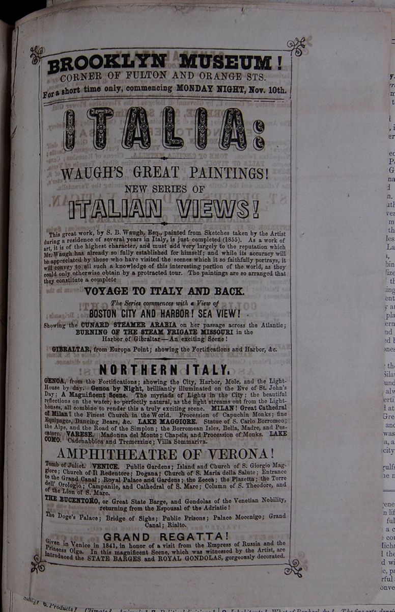 BROOKLYN MUSEUM!
 CORNER OF FULTON AND ORANGE STS.
For a short time only, commencing MONDAY NIGHT, Nov. 10th. ITALIA: WAUGH'S GREAT PAINTINGS!
NEW SERIES OF
ITALIAN VIEWS!
This great work, by S. B. Waugh, Esq., painted from Sketches taken by the Artist during a residence of several years in Italy, is just completed (1855). As a work of art, it is of the highest character, and must add very largely to the reputation which Mr. Waugh has already so fully established for himself; and while its accuracy will be appreciated by those who have visited the scenes which it so faithfully portrays, it will convey to all such a knowledge of this interesting portion of the world, as they could only otherwise obtain by a protracted tour. The paintings are so arranged that they constitute a complete
VOYAGE TO ITALY AND BACK.The Series commences with a View of
BOSTON CITY AND HARBOR! SEA VIEW!
Showing the CUNARD STEAMER ARABIA on her passage across the Atlantic;
BURNING OF THE STEAM FRIGATE MISSOURI in the
Harbor of Gibraltar—An exciting Scene!
GIBRALTAR, from Europa Point; showing the Fortifications and Harbor, &c. NORTHERN ITALY.
GENOA, from the Fortifications; showing the City, Harbor, Mole, and the Light-House by day. Genoa by Night, brilliantly illuminated on the Eve of St. John's Day; A Magnificent Scene. The myriads of Lights in the City; the beautiful reflections on the water, so perfectly natural, as the light streams out from the Lighthouses, all combine to render this a truly exciting scene. MILAN! Great Cathedral of Milan! the Finest Church in the World. Procession of Capuchin Monks; fine Equipages, Dancing Bears, &c. LAKE MAGGIORE. Statue of S. Carlo Borromeo; the Alps, and the Road of the Simplon; the Borromean Isles, Bella, Madre, and Pescatore. VARESE. Madonna del Monte; Chapels, and Procession of Monks. LAKE COMO. Cadenabbica and Tremezzine; Villa Sommariva.
AMPITHEATRE OF VERONA!
Tomb of Juliet. VENICE. Public Gardens; Island and Church of S. Giorgio Maggiore; Church of Il Redentore; Dogana; Church of S. Maria della Salute; Entrance to the Grand Canal; Royal Palace and Gardens; the Zecca; the Plazetta; the Torre dell' Orologio; Campanile, and Cathedral of S. Marc; Column of S. Theodore, and of the Lion of S. Marc.
THE BUCENTORO, or Great State Barge, and Gondolas of the Venetian Nobility, returning from the Espousal of the Adriatic!
The Doge's Palace; Bridge of Sighs; Public Prisons; Palace Mocenigo; Grand Canal; Rialto.
GRAND REGATTA!
Given in Venice in 1841, in honor of a visit from the Empress of Russia and the Princess Olga. In this magnificent Scene, which was witnessed by the Artist, are introduced the STATE BARGES and ROYAL GONDOLAS, gorgeously decorated. [begin surface 741]
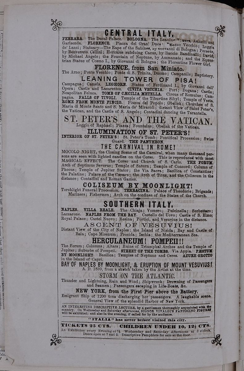 CENTRAL ITALY.
FERRARA. The Ducal Palace. BOLOGNA. The
Leaning Towers, Asinelli and Garisenda. FLORENCE.
Piazza del Gran' Duca [illegible]
Vecchio; Loggia de' Lanzi; Statuary—The Rape
of the Sabines, by Giovanni di Bologna; Perseus,
by Benvenuto Cellini; Hercules subduing Cacus, by
Baccio Bandinelli; David, by Michael Angelo; the
Fountain of Neptune, by Ammanato; and the
Equestrian Statue of Cosmo I., by Giovanni di
Bologna; the Florentine Flower Girl.
FLORENCE, from San Miniato.
CENTRAL ITALY.
FERRARA. The Ducal Palace. BOLOGNA. The
Leaning Towers, Asinelli and Garisenda. FLORENCE.
Piazza del Gran' Duca [illegible]
Vecchio; Loggia de' Lanzi; Statuary—The Rape
of the Sabines, by Giovanni di Bologna; Perseus,
by Benvenuto Cellini; Hercules subduing Cacus, by
Baccio Bandinelli; David, by Michael Angelo; the
Fountain of Neptune, by Ammanato; and the
Equestrian Statue of Cosmo I., by Giovanni di
Bologna; the Florentine Flower Girl.
FLORENCE, from San Miniato.
The Arno; Ponte Vecchio; Ponte di S. Trinita, Duomo; Campanile; Baptistery.
LEANING TOWER OF PISA! Campagna; Camels. LEGHORN. Statue of Ferdinand I., by Giovanni dell' Opera; Castle and Lazarettos. CIVITA VECCHIA. Port; Dogana; Castle; Neapolitan Feluca. TOMB OF CÆCILIA METELLA. Circus of Romulus; Campagna. FALLS OF TIVOLI. Temple of the Tiburtine Sibyl; Temple of Vesta. ROME FROM MONTE PINCIO. Piazza del Popolo; Obelisk; Churches of S. Maria di Monte Santo and S. Maria de' Miracoli; distant View of Saint Peter's, the Vatican, and the Castle of S. Angelo; Contadini dancing the Tarantella. ST. PETER'S AND THE VATICAN.
Loggio of Raphael; Piazza; Fountains; Obelisk of the Vatican.
ILLUMINATION OF ST. PETER'S!
INTERIOR OF ST. PETER'S! St. Peter's Tomb; Pontifical Procession; Swiss Guard. THE PANTHEON.
THE CARNIVAL IN ROME! MOCOLO NIGHT, the Closing Scene of the Carnival, when many thousand persons are seen with lighted candles on the Corso. This is reproduced with most MAGICAL EFFECT. The Corso and Church of S. Carlo. THE FORUM. Arch of Septimus Severus; Temple of Saturn; Temple of Concord; Column of Phocus; Temple of Jupiter Stator; the Via Sacra; Basilica of Constantine; the Palatine; Palace of the Cæsars; the Arch of Titus, and the Coliseum in the distance; Contadini and Roman Games. COLISEUM BY MOONLIGHT!
Torchlight Funeral Procession. TERRACINA. Palace of Theodoric; Brigands;
Mariners; Fishermen; Arch on the confines of the States of the Church. SOUTHERN ITALY. NAPLES. VILLA REALE. The Chiaja; Vomero; Pulcinella; Sorbettaro; Lazzarone. NAPLES FROM THE BAY. Castello del Uovo; Castle of S. Elmo; Royal Palace; Castel Nuovo; Resina; Portici, and Vesuvius in the distance. ASCENT OF VESUVIUS!
Distant View of the City of Naples; the Island of Nisida; Bay and Castle of Baia; Cape Misenum; Procida; Ischia; the Mediterranean Sea.
HERCULANEUM! POMPEII!! The Forum; Columns; Altars; Ruins of Triumphal Arches and the Temple of Jupiter; Suburbs of Pompeii. STREET OF THE TOMBS. Via Appia. PÆSTUM BY MOONLIGHT. Basilica; Temples of Neptune and Ceres. AZURE GROTTO in the Island of Capri. BAY OF NAPLES BY MOONLIGHT, & ERUPTION OF MOUNT VESUVIUS!
A. D. 1839, from a sketch taken by the Artist at the time.
STORM ON THE ATLANTIC.
Thunder and Lightning, Rain and Wind; Shipwreck; Drowning of Passengers and Seamen; Passengers escaping in Life-Boats, &c.
NEW YORK, from the First Pier above the Battery.
Emigrant Ship of 1200 tons discharging her passengers. A laughable scene.
General View of the splendid Harbor of New York. AN INTERESTING DESCRIPTIVE LECTURE, by a gentleman thoroughly acquainted with the country. On Wednesday and Saturday afternoons, SIGNOR VIVALDI'S FANTOCINO FIGURES will be exhibited; and also in the evening, if called for by the audience. "ITALIA" has never before visited this city. TICKETS 25 CTS. CHILDREN UNDER 10, 12 ½ CTS.
An Exhibition every Evening at 7 ½. Wednesday and Saturday Afternoons at 3 o'clock.
Doors open at 7 and 2. Descriptive Pamphlets for sale at the door.
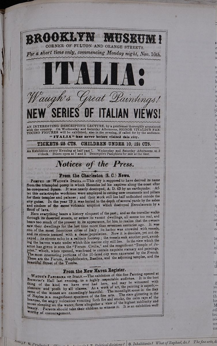 BROOKLYN MUSEUM!
 CORNER OF FULTON AND ORANGE STREETS.
For a short time only, commencing Monday night, Nov. 10th. ITALIA: Waugh's Great Paintings!
NEW SERIES OF ITALIAN VIEWS! AN INTERESTING DESCRIPTIVE LECTURE, by a gentleman thoroughly acquainted with the country. On Wednesday and Saturday Afternoons, SIGNOR VIVALDI'S FANTOCINO FIGURES will be exhibited; also in the evening, if called for by the audience.
"ITALIA" has never before visited this city. TICKETS 25 CTS. CHILDREN UNDER 10, 12½ CTS. An Exhibition every Evening at half past 7. Wednesday and Saturday Afternoon at 3 o'clock. Doors open at 7 and 2. Descriptive pamphlets for sale at the door. Notices of the Press. From the Charleston (S. C.) News.
POMPEII IN WAUGH'S ITALIA.—This city is supposed to have derived its name from the triumphal pomp in which Hercules led his captives along the coast after he conquered Spain. It was nearly destroyed, A. D. 63 by an earthquake. After this catastrophe workmen were employed in cutting new ornaments and pillars for their temples and palaces; and their work still lies half unfinished outside the city gates. In the year 79 it was buried to the depth of several yards by the ashes and cinders of the same volcanic eruption which destroyed Herculaneum by a flood of lava.
Here everything bears a history eloquent of the past; and as the traveller walks through its deserted streets, or enters its vacant dwellings, all seems too real, and bears too much of the present in its appearance, for him to realize that the owners saw their dwellings for the last time more than seventeen centuries ago. It was one of the most licentious cities of Italy; its harbor was crowded with vessels, and its streets teemed with a dense population. Now it is desolate, yet not decayed; its streets echo to a solitary footstep; the vessels seek another port, avoiding the barren waste under which this marine city still lies. In the view which the artist has given is seen the "Forum Civilia," and the magnificent "Temple of Jupiter," which, when opened, was found to contain exquisite statuary and paintings. The most interesting portions of the ill-fated city were excavated by the French. These are the Forum, Amphitheatre, Basilica, and the adjoining temples, and the beautiful Street of the Tombs.
From the New Haven Register.WAUGH'S PANORAMA OF ITALY.—The exhibition of this fine Painting opened at Brewster's Hall last evening, to a highly respectable audience. It is the best thing of the kind we have ever had here, and may be witnessed with pleasure and profit by all classes. As a work of art, the painting is superb,—some of the scenes are exceedingly beautiful. The moonlight scene in the Bay of Naples is a magnificent specimen of the fine arts. The stars glittering in the heavens, the angry volcanoes vomiting forth fire and smoke, the calm rays of the moon sleeping on the water, form altogether a view of the highest sublimity and beauty. Parents should take their children to witness it. It is an exhibition well worthy of encouragement.
[begin surface 743]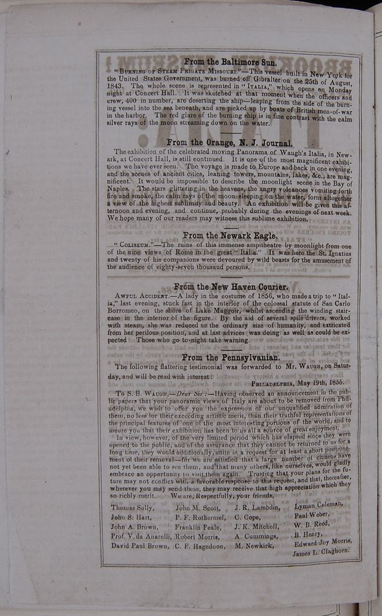 From the Baltimore Sun.
"BURNING OF STEAM FRIGATE MISSOURI."—This vessel built in New York for the United States Government, was burned off Gibralter on the 25th of August, 1843. The whole scene is represented in "ITALIA," which opens on Monday night at Concert Hall. It was sketched at that moment when the officers and crew, 400 in number, are deserting the ship—leaping from the side of the burning vessel into the sea beneath, and are picked up by boats of British men-of-war in the harbor. The red glare of the burning ship is in fine contrast with the calm silver rays of the moon streaming down on the water.
From the Orange, N. J. Journal.The exhibition of the celebrated moving Panorama of Waugh's Italia, in Newark, at Concert Hall, is still continued. It is one of the most magnificent exhibitions we have ever seen. The voyage is made to Europe and back in one evening, and the scenes of ancient cities, leaning towers, mountains, lakes, &c., are magnificent. It would be impossible to describe the moonlight scene in the Bay of Naples. The stars glittering in the heavens, the angry volcanoes vomiting forth fire and smoke, the calm rays of the moon sleeping on the water, form altogether a view of the highest sublimity and beauty. An exhibition will be given this afternoon and evening, and continue, probably during the evenings of next week. We hope many of our readers may witness this sublime exhibition.
From the Newark Eagle."COLISEUM."—The ruins of this immense ampitheatre by moonlight from one of the nine views of Rome in the great "Italia." It was here the St. Ignatius and twenty of his companions were devoured by wild beasts for the amusement of the audience of eighty-seven thousand persons.
From the New Haven Courier.AWFUL ACCIDENT.—A lady in the costume of 1856, who made a trip to "Italia," last evening, stuck fast in the interior of the colossal statute of San Carlo Borromeo, on the shore of Lake Maggoir, whilst ascending the winding staircase in the interior of the figure. By the aid of several spile drivers, worked with steam, she was reduced to the ordinary size of humanity, and extricated from her perilous position, and at last advices was doing as well as could be expected Those who go to-night take warning.
From the Pennsylvanian.The following flattering testimonial was forwarded to Mr. WAUGH, on Saturday, and will be read with interest:
PHILADELPHIA, May 19th, 1855.To S. B. WAUGH,—Dear Sir :—Having observed an announcement in the public papers that your panoramic views of Italy are about to be removed from Philadelphia, we wish to offer you the expression of our unqualified admiration of them, no less for their exceeding artistic merit, than their truthful representations of the principal features of one of the most interesting portions of the world, and to assure you that their exhibition has been to us all a source of great enjoyment.
In view, however, of the very limited period which has elapsed since they were opened to the public, and of the assurance that they cannot be returned to us for a long time, they would additionally, unite in a request for at least a short postponement of their removal—for we are satisfied that a large number of citizens have not yet been able to see them, and that many others, like ourselves, would gladly embrace an opportunity to visit them again. Trusting that your plans for the future may not conflict with a favorable response to this request, and that, thereafter, wherever you may send them, they may receive that high appreciation which they so richly merit. We are, Respectfully, your friends,
Thomas Sully, John M. Scott, J. R. Lambdin, Lyman Coleman,John S. Hart, P. F. Rothermel, C. Cope, Paul Weber,
John A. Brown, Franklin Peale, J. K. Mitchell, W. B. Reed,
Prof. V. da Anarelli, Robert Morris, A. Cummings, B. Henry,
David Paul Brown, C. F. Hagedoon, M. Newkirk, Edward Joy Morris,
James L. Claghorn.
Ancient Geography.—We here give an outline of the geography of ancient Italy, the ancient and modern maps facing each other, so that they may be readily compared.
Ancient Italy comprised three great divisions : CISALPINE GAUL, in the north, ITALY PROPER, in the center, and MAGNA GRÆCIA, in the south.
Cisalpine Gaul was divided by the river Padus, now called the Po, into two separate territories, called Gallia Transpadana, and Gallia Cispadana. Venetia was in the northeast, and Liguria in the southeast, of this region.
Italy Proper extended southward from Gallia Cispadana to the rivers Silaurus and Trento, comprehending modern Tuscany, the Papal States, and the northern part of the kingdom of Naples. The ancient divisions were Etruria, Latium, Umbria, Picernum, Campania, Samnium, and the territory of the Sabines.
Etruria was a highly civilized country at an early date. Many of their sculptured gems, vases, and paintings still exist. The walls of their ancient cities are to be seen at the present day at Cortona, Perugia, Fiesole, and other places.
Latium lay on the western coast of Italy, between the Tiber and the Liris. In early times it was inhabited by various tribes, called Latins, Ausones, Rutuli, Sabines, Volsci, &c.
Campania extended along the western coast from the Liris to the Silaurus, and comprised the territory around the city of Naples. This country has always been famous for its beauty and fertility.
Magna Græcia was settled at an early period by colonies from Greece, who brought with them the arts and institutions of that country. It was divided into Apulia, Calabria, Lucania, and Bruttium. The most important city in Magna Græcia was Tarentum.
The ancient names of the gulfs, rivers, seas, &c., will be found in the map.
the coast of Sicily. Rice, the vine, olive, orange, fig, silk, cotton, cattle, goats, and swine, are among the products of agriculture. The manufactures include woolens, silk, gauze, porcelain, artificial flowers, paper, parchment, and musical instruments. Iron, lead, salt, sulphur, and other volcanic products abound. The exports embrace silk, wool, oil, honey, straw hats, Parmesan cheese, sulphur, &c.; the commerce has greatly declined.
7. Political Divisions, &c.—These have been given in the preceding table. The governments are mostly monarchical. The Roman Catholic religion prevails everywhere.
8. Inhabitants.—There is some diversity among the inhabitants of the different states; but, in general, the masses are miserably poor, and the value of human life seems reduced to its lowest scale; yet the people are full of genius, excelling in the fine arts, and endowed with a capacity for vocal music beyond any other nation. The country is the depository of the great works of Raphael, Michael Angelo, Canova, and other artists, who have filled the world with their fame. The fine arts are still cultivated with success; and the common people are judges of music, painting, and sculpture. All classes are more fond of cheerful amusements than thrifty toil. Music, dancing, and conversation are leading sources of pleasure.
Sicily? 6. Products? Climate? Animals? 7. Political divisions? 8.Inhabitants? What of Raphael, &c.? The fine arts, dancing, &c ?
27 [begin surface 744]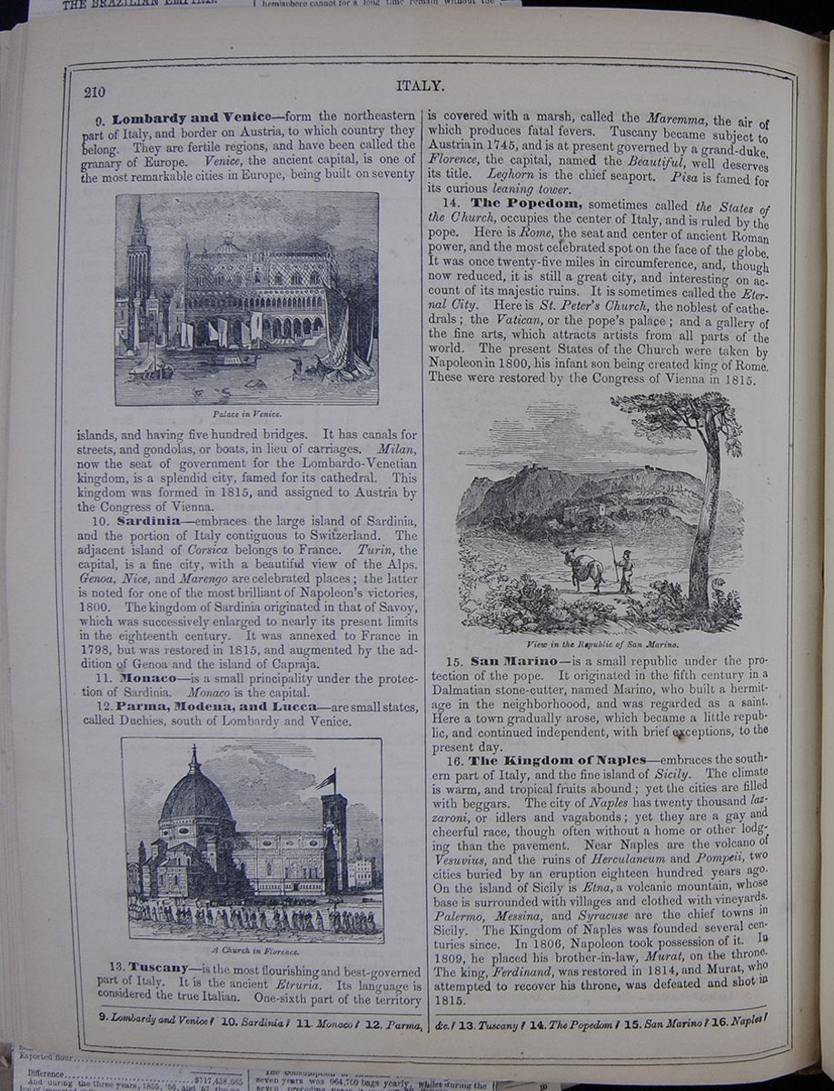 210
ITALY.
210
ITALY.
9. Lombardy and Venice—form the northeastern part of Italy, and border on Austria, to which country they belong. They are fertile regions, and have been called the granary of Europe. Venice, the ancient capital, is one of the most remarkable cities in Europe, being built on seventy Palace in Venice. islands, and having five hundred bridges. It has canals for streets, and gondolas, or boats, in lieu of carriages. Milan, now the seat of government for the Lombardo-Venetian kingdom, is a splendid city, famed for its cathedral. This kingdom was formed in 1815, and assigned to Austria by the Congress of Vienna.
10. Sardinia—embraces the large island of Sardinia, and the portion of Italy contiguous to Switzerland. The adjacent island of Corsica belongs to France. Turin, the capital, is a fine city, with a beautiful view of the Alps. Genoa, Nice, and Marengo are celebrated places; the latter is noted for one of the most brilliant of Napoleon's victories, 1800. The kingdom of Sardinia originated in that of Savoy, which was successively enlarged to nearly its present limits in the eighteenth century. It was annexed to France in 1798, but was restored in 1815, and augmented by the addition of Genoa and the island of Capraja.
11. Monaco—is a small principality under the protection of Sardinia. Monaco is the capital.
12. Parma, Modena, and Lucca—are small states, called Duchies, south of Lombardy and Venice.
A Church in Florence.13. Tuscany—is the most flourishing and best-governed part of Italy. It is the ancient Etruria. Its language is considered the true Italian. One-sixth part of the territory is covered with a marsh, called the Maremma, the air of which produces fatal fevers. Tuscany became subject to Austria in 1745, and is at present governed by a grand-duke. Florence, the capital, named the Beautiful, well deserves its title. Leghorn is the chief seaport. Pisa is famed for its curious leaning tower.
14. The Popedom, sometimes called the States of the Church, occupies the center of Italy, and is ruled by the pope. Here is Rome, the seat and center of ancient Roman power, and the most celebrated spot on the face of the globe. It was once twenty-five miles in circumference, and, though now reduced, it is still a great city, and interesting on account of its majestic ruins. It is sometimes called the Eternal City. Here is St. Peter's Church, the noblest of cathedrals; the Vatican, or the pope's palace; and a gallery of the fine arts, which attracts artists from all parts of the world. The present States of the Church were taken by Napoleon in 1800, his infant son being created king of Rome. These were restored by the Congress of Vienna in 1815.
View in the Republic of San Marino.15. San Marino—is a small republic under the protection of the pope. It originated in the fifth century in a Dalmatian stone-cutter, named Marino, who built a hermitage in the neighborhoood, and was regarded as a saint. Here a town gradually arose, which became a little republic, and continued independent, with brief exceptions, to the present day.
16. The Kingdom of Naples—embraces the southern part of Italy, and the fine island of Sicily. The climate is warm, and tropical fruits abound; yet the cities are filled with beggars. The city of Naples has twenty thousand lazzaroni, or idlers and vagabonds; yet they are a gay and cheerful race, though often without a home or other lodging than the pavement. Near Naples are the volcano of Vesuvius, and the ruins of Herculaneum and Pompeii, two cities buried by an eruption eighteen hundred years ago. On the island of Sicily is Etna, a volcanic mountain, whose base is surrounded with villages and clothed with vineyards. Palermo, Messina, and Syracuse are the chief towns in Sicily. The Kingdom of Naples was founded several centuries since. In 1806, Napoleon took possession of it. In 1809, he placed his brother-in-law, Murat, on the throne. The king, Ferdinand, was restored in 1814, and Murat, who attempted to recover his throne, was defeated and shot in 1815.
9. Lombardy and Venice? 10. Sardinia? 11. Monaco? 12. Parma, &c.? 13. Tuscany? 14. The Popedom? 15. San Marino? 16. Naples?
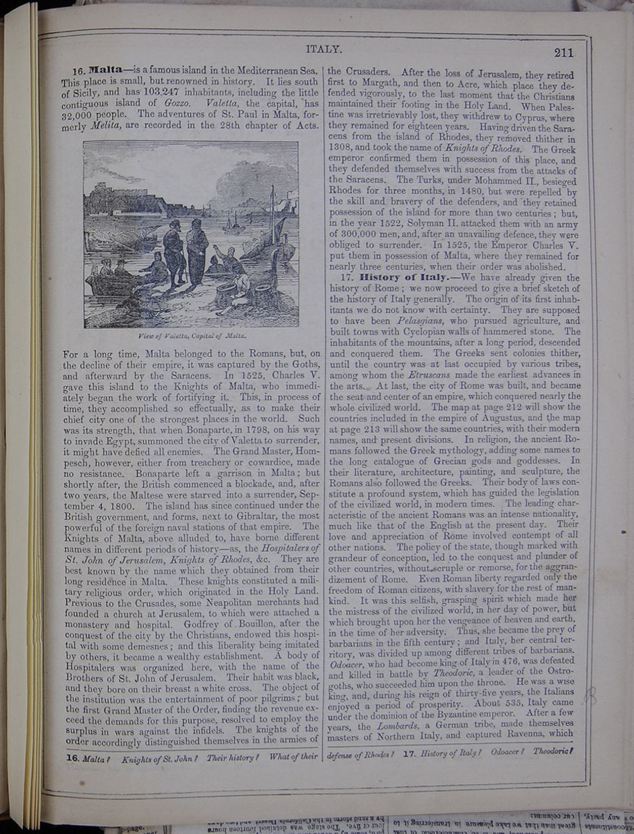
16. Malta—is a famous island in the Mediterranean Sea. This place is small, but renowned in history. It lies south of Sicily, and has 103,247 inhabitants, including the little contiguous island of Gozzo. Valetta, the capital, has 32,000 people. The adventures of St. Paul in Malta, formerly Melita, are recorded in the 28th chapter of Acts. View of Valetta, Capital of Malta. For a long time, Malta belonged to the Romans, but, on the decline of their empire, it was captured by the Goths, and afterward by the Saracens. In 1525, Charles V. gave this island to the Knights of Malta, who immediately began the work of fortifying it. This, in process of time, they accomplished so effectually, as to make their chief city one of the strongest places in the world. Such was its strength, that when Bonaparte, in 1798, on his way to invade Egypt, summoned the city of Valetta to surrender, it might have defied all enemies. The Grand Master, Hompesch, however, either from treachery or cowardice, made no resistance. Bonaparte left a garrison in Malta; but shortly after, the British commenced a blockade, and, after two years, the Maltese were starved into a surrender, September 4, 1800. The island has since continued under the British government, and forms, next to Gibraltar, the most powerful of the foreign naval stations of that empire. The Knights of Malta, above alluded to, have borne different names in different periods of history—as, the Hospitalers of St. John of Jerusalem, Knights of Rhodes, &c. They are best known by the name which they obtained from their long residence in Malta. These knights constituted a military religious order, which originated in the Holy Land. Previous to the Crusades, some Neapolitan merchants had founded a church at Jerusalem, to which were attached a monastery and hospital. Godfrey of Bouillon, after the conquest of the city by the Christians, endowed this hospital with some demesnes; and this liberality being imitated by others, it became a wealthy establishment. A body of Hospitalers was organized here, with the name of the Brothers of St. John of Jerusalem. Their habit was black, and they bore on their breast a white cross. The object of the institution was the entertainment of poor pilgrims; but the first Grand Master of the Order, finding the revenue exceed the demands for this purpose, resolved to employ the surplus in wars against the infidels. The knights of the order accordingly distinguished themselves in the armies of the Crusaders. After the loss of Jerusalem, they retired first to Margath, and then to Acre, which place they defended vigorously, to the last moment that the Christians maintained their footing in the Holy Land. When Palestine was irretrievably lost, they withdrew to Cyprus, where they remained for eighteen years. Having driven the Saracens from the island of Rhodes, they removed thither in 1308, and took the name of Knights of Rhodes. The Greek emperor confirmed them in possession of this place, and they defended themselves with success from the attacks of the Saracens. The Turks, under Mohammed II., besieged Rhodes for three months, in 1480, but were repelled by the skill and bravery of the defenders, and they retained possession of the island for more than two centuries; but, in the year 1522, Solyman II. attacked them with an army of 300,000 men, and, after an unavailing defence, they were obliged to surrender. In 1525, the Emperor Charles V. put them in possession of Malta, where they remained for nearly three centuries, when their order was abolished.
17. History of Italy.—We have already given the history of Rome; we now proceed to give a brief sketch of the history of Italy generally. The origin of its first inhabitants we do not know with certainty. They are supposed to have been Pelasgians, who pursued agriculture, and built towns with Cyclopian walls of hammered stone. The inhabitants of the mountains, after a long period, descended and conquered them. The Greeks sent colonies thither, until the country was at last occupied by various tribes, among whom the Etruscans made the earliest advances in the arts. At last, the city of Rome was built, and became the seat and center of an empire, which conquered nearly the whole civilized world. The map at page 212 will show the countries included in the empire of Augustus, and the map at page 213 will show the same countries, with their modern names, and present divisions. In religion, the ancient Romans followed the Greek mythology, adding some names to the long catalogue of Grecian gods and goddesses. In their literature, architecture, painting, and sculpture, the Romans also followed the Greeks. Their body of laws constitute a profound system, which has guided the legislation of the civilized world, in modern times. The leading characteristic of the ancient Romans was an intense nationality, much like that of the English at the present day. Their love and appreciation of Rome involved contempt of all other nations. The policy of the state, though marked with grandeur of conception, led to the conquest and plunder of other countries, without scruple or remorse, for the aggrandizement of Rome. Even Roman liberty regarded only the freedom of Roman citizens, with slavery for the rest of mankind. It was this selfish, grasping spirit which made her the mistress of the civilized world, in her day of power, but which brought upon her the vengeance of heaven and earth, in the time of her adversity. Thus, she became the prey of barbarians in the fifth century; and Italy, her central territory, was divided up among different tribes of barbarians. Odoacer, who had become king of Italy in 476, was defeated and killed in battle by Theodoric, a leader of the Ostrogoths, who succeeded him upon the throne. He was a wise king, and, during his reign of thirty-five years, the Italians enjoyed a period of prosperity. About 535, Italy came under the dominion of the Byzantine emperor. After a few years, the Lombards, a German tribe, made themselves masters of Northern Italy, and captured Ravenna, which
16. Malta? Knights of St. John? Their history? What of their defense of Rhodes? 17. History of Italy? Odoacer? Theodoric?
[begin surface 746]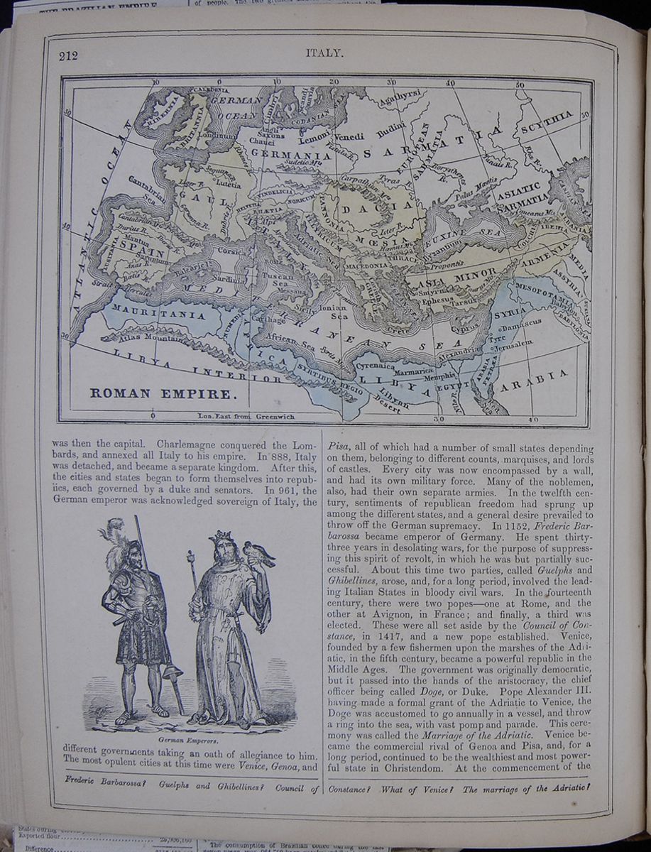 212
ITALY.
ROMAN EMPIRE
212
ITALY.
ROMAN EMPIRE
was then the capital. Charlemagne conquered the Lombards, and annexed all Italy to his empire. In 888, Italy was detached, and became a separate kingdom. After this, the cities and states began to form themselves into republics, each governed by a duke and senators. In 961, the German emperor was acknowledged sovereign of Italy, the German Emperors. different governments taking an oath of allegiance to him. The most opulent cities at this time were Venice, Genoa, and Pisa, all of which had a number of small states depending on them, belonging to different counts, marquises, and lords of castles. Every city was now encompassed by a wall, and had its own military force. Many of the noblemen, also, had their own separate armies. In the twelfth century, sentiments of republican freedom had sprung up among the different states, and a general desire prevailed to throw off the German supremacy. In 1152, Frederic Barbarossa became emperor of Germany. He spent thirty-three years in desolating wars, for the purpose of suppressing this spirit of revolt, in which he was but partially successful. About this time two parties, called Guelphs and Ghibellines, arose, and, for a long period, involved the leading Italian States in bloody civil wars. In the fourteenth century, there were two popes—one at Rome, and the other at Avignon, in France; and finally, a third was elected. These were all set aside by the Council of Constance, in 1417, and a new pope established. Venice, founded by a few fishermen upon the marshes of the Adriatic, in the fifth century, became a powerful republic in the Middle Ages. The government was originally democratic, but it passed into the hands of the aristocracy, the chief officer being called Doge, or Duke. Pope Alexander III. having made a formal grant of the Adriatic to Venice, the Doge was accustomed to go annually in a vessel, and throw a ring into the sea, with vast pomp and parade. This ceremony was called the Marriage of the Adriatic. Venice became the commercial rival of Genoa and Pisa, and, for a long period, continued to be the wealthiest and most powerful state in Christendom. At the commencement of the
Frederic Barbarossa? Guelphs and Ghibellines? Council of Constance? What of Venice? The marriage of the Adriatic?
[begin surface 747]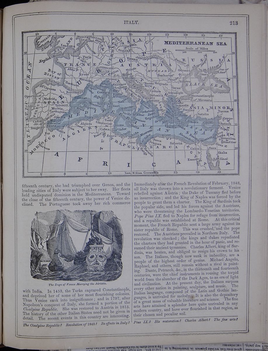 ITALY.
213
MEDITERRANEAN SEA
ITALY.
213
MEDITERRANEAN SEA
fifteenth century, she had triumphed over Genoa, and the leading cities of Italy were subject to her sway. Her fleets held undisputed dominion in the Mediterranean. Toward the close of the fifteenth century, the power of Venice declined. The Portuguese took away her rich commerce The Doge of Venice Marrying the Adriatic. with India. In 1453, the Turks captured Constantinople, and deprived her of some of her most flourishing colonies. Thus Venice sunk into insignificance; and in 1797, after Napoleon's conquest of Italy, she formed a portion of the Cisalpine Republic. She was restored to Austria in 1815. The history of the other Italian States need not be given in detail. The recent events in this country are interesting. Immediately after the French Revolution of February, 1848, all Italy was thrown into a revolutionary ferment. Venice rebelled against Austria; the Duke of Tuscany fled before an insurrection; and the King of Naples was forced by the people to grant them a charter. The King of Sardinia took the popular side, and led his forces against the Austrians, who were threatening the Lombardo-Venetian territories. Pope Pius IX. fled to Naples for refuge from insurrection, and a republic was established at Rome. At this critical moment, the French Republic sent a large army against its sister republic of Rome. This was crushed, and the pope restored. The Austrians prevailed in Northern Italy. The revolution was checked; the kings and dukes repudiated the charters they had granted in the hour of panic, and resumed their ancient tyrannies. Charles Albert, king of Sardinia, was beaten, and obliged to resign his crown to his son. The Italians, though now sunk in imbecility, are a people of the highest order of genius. Michael Angelo, Raphael, and others, still remain without a rival in painting. Dante, Petrarch, &c., in the thirteenth and fourteenth centuries, were the chief instruments in rousing the torpid world from the slumber of the Dark Ages, to an era of light and civilization. At the present day, the Italians surpass every other nation in painting, sculpture, and music. The Italian language, composed of the Latin and Gothic languages, is unrivaled for melody. It is also the depository of a great mass of valuable literature and science. The fine arts have attained a splendor here quite unrivaled in any modern country, and have ever flourished in that region, as their chosen and peculiar soil.
The Cisalpine Republic? Revolution of 1848? Its effect in Italy? Pius IX.? His restoration? Charles Albert? The fine arts?
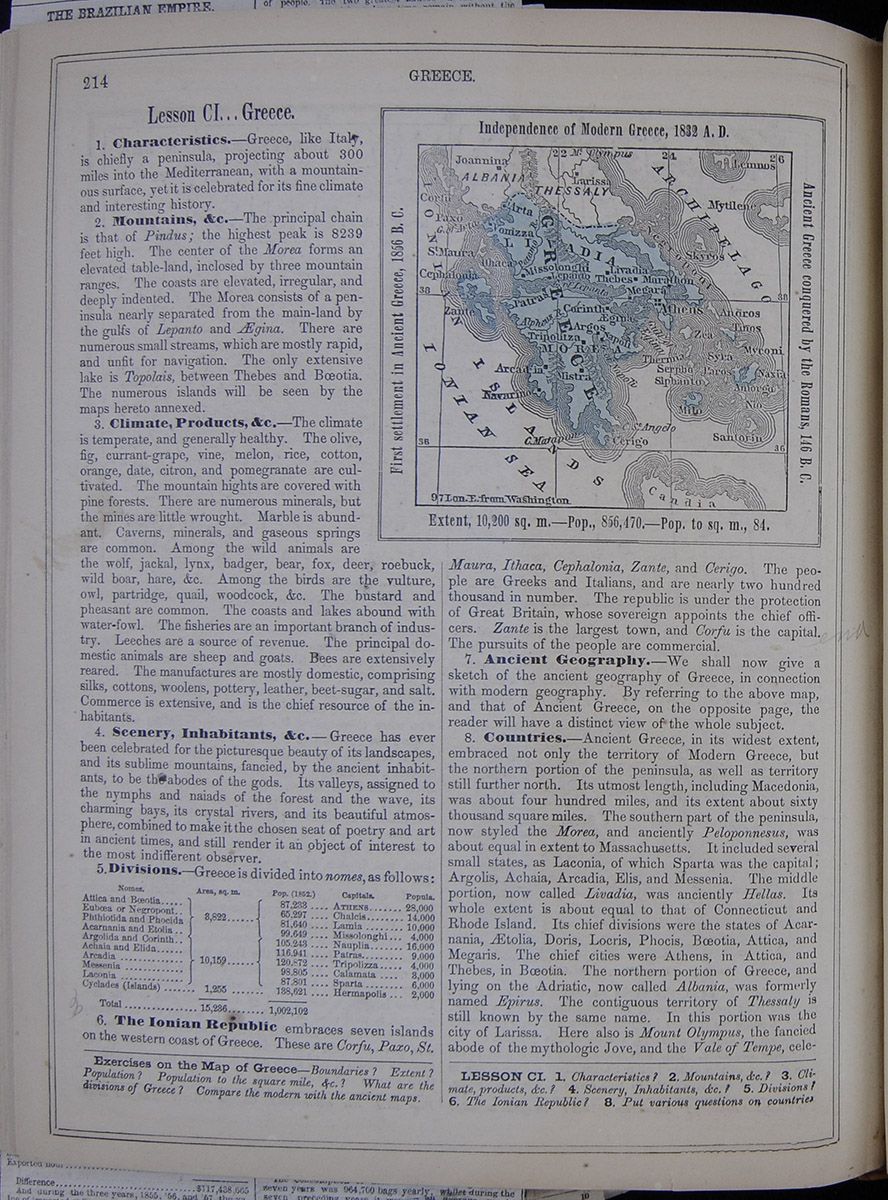
Lesson CI... Greece.
1. Characteristics.—Greece, like Italy, is chiefly a peninsula, projecting about 300 miles into the Mediterranean, with a mountainous surface, yet it is celebrated for its fine climate and interesting history.
2. Mountains, &c.—The principal chain is that of Pindus; the highest peak is 8239 feet high. The center of the Morea forms an elevated table-land, inclosed by three mountain ranges. The coasts are elevated, irregular, and deeply indented. The Morea consists of a peninsula nearly separated from the main-land by the gulfs of Lepanto and Ægina. There are numerous small streams, which are mostly rapid, and unfit for navigation. The only extensive lake is Topolais, between Thebes and Bœotia. The numerous islands will be seen by the maps hereto annexed.
3. Climate, Products, &c.—The climate is temperate, and generally healthy. The olive, fig, currant-grape, vine, melon, rice, cotton, orange, date, citron, and pomegranate are cultivated. The mountain hights are covered with pine forests. There are numerous minerals, but the mines are little wrought. Marble is abundant. Caverns, minerals, and gaseous springs are common. Among the wild animals are the wolf, jackal, lynx, badger, bear, fox, deer, roebuck, wild boar, hare, &c. Among the birds are the vulture, owl, partridge, quail, woodcock, &c. The bustard and pheasant are common. The coasts and lakes abound with water-fowl. The fisheries are an important branch of industry. Leeches are a source of revenue. The principal domestic animals are sheep and goats. Bees are extensively reared. The manufactures are mostly domestic, comprising silks, cottons, woolens, pottery, leather, beet-sugar, and salt. Commerce is extensive, and is the chief resource of the inhabitants.
4. Scenery, Inhabitants, &c.—Greece has ever been celebrated for the picturesque beauty of its landscapes, and its sublime mountains, fancied, by the ancient inhabitants, to be the abodes of the gods. Its valleys, assigned to the nymphs and naiads of the forest and the wave, its charming bays, its crystal rivers, and its beautiful atmosphere, combined to make it the chosen seat of poetry and art in ancient times, and still render it an object of interest to the most indifferent observer.
5. Divisions.—Greece is divided into nomes, as follows:
A table listing the nomes of Greece with thier areas in square miles, populations, and capitals.6. The Ionian Republic embraces seven islands on the western coast of Greece. These are Corfu, Paxo, St. A map of modern Greece. First settlement in Ancient Greece, 1856 B. C. Independence of Modern Greece, 1832 A. D. Ancient Greece conquered by the Romans, 146 B. C. Extent, 10,200 sq. m.—Pop., 856,470.—Pop. to sq. m., 84. Maura, Ithaca, Cephalonia, Zante, and Cerigo. The people are Greeks and Italians, and are nearly two hundred thousand in number. The republic is under the protection of Great Britain, whose sovereign appoints the chief officers. Zante is the largest town, and Corfu is the capital. The pursuits of the people are commercial.
7. Ancient Geography.—We shall now give a sketch of the ancient geography of Greece, in connection with modern geography. By referring to the above map, and that of Ancient Greece, on the opposite page, the reader will have a distinct view of the whole subject.
8. Countries.—Ancient Greece, in its widest extent, embraced not only the territory of Modern Greece, but the northern portion of the peninsula, as well as territory still further north. Its utmost length, including Macedonia, was about four hundred miles, and its extent about sixty thousand square miles. The southern part of the peninsula, now styled the Morea, and anciently Peloponnesus, was about equal in extent to Massachusetts. It included several small states, as Laconia, of which Sparta was the capital; Argolis, Achaia, Arcadia, Elis, and Messenia. The middle portion, now called Livadia, was anciently Hellas. Its whole extent is about equal to that of Connecticut and Rhode Island. Its chief divisions were the states of Acarnania, Ætolia, Doris, Locris, Phocis, Bœotia, Attica, and Megaris. The chief cities were Athens, in Attica, and Thebes, in Bœotia. The northern portion of Greece, and lying on the Adriatic, now called Albania, was formerly named Epirus. The contiguous territory of Thessaly is still known by the same name. In this portion was the city of Larissa. Here also is Mount Olympus, the fancied abode of the mythologic Jove, and the Vale of Tempe, celebrated
Exercises on the Map of Greece—Boundaries? Extent? Population? Population to the square mile, &c.? What are the divisions of Greece? Compare the modern with the ancient maps.
LESSON CI. 1. Characteristics? 2. Mountains, &c.? 3. Climate, products, &c.? 5. Divisions? 6. The Ionian Republic? 8. Put various questions on countries
New-York Daily Tribune.
Bayard Taylor in Southern Europe.
No. LX.
GREECE, ITS PEOPLE AND GOVERNMENT.
ATHENS, April 27, 1858.
Two days ago, I returned from an excursion in Rumelia, or Northern Greece. My route was through Bœotia to Parnassus, and thence northward to Thermopyl æ and the frontier of Thessaly, whence I crossed to the Island of Eubœa and returned by way of Chalsia to Athens. Except Acarnania, Etolia and some of the Cyclades, I have therefore visited all parts of Modern Greece, and, so far as personal observation and inquiry can accomplish in the space of four months, may consider myself tolerably familiar with the condition of the country and its inhabitants. In summing up my impressions and throwing them together in the form of a general statement, I shall endeavor to be just, believing myself to be unprejudiced. I have lately looked over several recent works on Greece, and have been surprised to find so much of a partisan spirit in them—as if the position and character of Greece and the Greeks were a question to be debated rather than a picture to be drawn. One author is too favorable, another too severe, and I foresee that, inasmuch as my path lies between the two extremes, I shall be, to some extent, discredited by both sides.
The fact is, a few deeds of splendid heroism have thrown a deceitful halo over the darker features of the Greek War of Independence, and most of those who bend in reverence to the name of Marco Bozzaris do not know that his uncle Nothi stole supplies from his own troops to sell to the Turks—that, while Canaria and Miaulis were brave and incorruptible, Colocotroni filled his purse and made cowards of his men—that, while Karaïskakis was honorable, others broke the most solemn oaths of their religion, and murdered the captives they had sworn to spare. One can say that the Greeks are what the Turks made them—that we should not expect to find in slaves the virtues of freemen; but treachery and perjury were never characteristics of the Moslem. It is the corrupt leaven of the Lower Empire which still ferments in the veins of this mixed race. I have already said, and I repeat it, that not one-fifth of the present population can with justice be called Greeks. The remainder are Slavonians, Albanians and Turks, with a slight infusion of Venetian blood. Only in Mains, on the slopes of Parnassus and in parts of Doris, did I find the ancient type in any considerable amount. In the war, the Albanian blood—the Suliotes, Hydriotes and Spetziotes—achieved the greatest distinction.
Owing to this admixture—when not always of race, yet still of character and association—there is a great diversity in the nature of the modern Greeks, and their number is still so small that one must be cautious in stating general characteristics. Some features of the ancient race are still preserved: they are vain, talkative, fond of argument, and fond of display. Their appreciation of Art, however, has utterly perished. Most of them profess a leaning toward democratic principles, yet they are pleased as children at the tawdry pomp which surrounds a throne. They are passionately fond of gain, yet, with the most elastic temperament in the world, dislike manual labor. One of their best general traits is their eagerness to learn, but, unfortunately, it ceases as soon as they are capable of obtaining an office under Government. Official corruption is as prevalent in Greece as—as—as in the United States, but there is no means of preventing it here. There is not an honest society sufficiently large, to brand the genteel pickpockets, and so the great bulk of the population are in no better condition than the Christian subjects of the Sultan, while a horde of leeches, military, naval and civil, thrive and fatten upon them. More than one prominent man here, with whom I have conversed on the state of the country, has said to me: " We want more people. What can we do "with a million of inhabitants?" Yet at this moment numbers of Greeks are emigrating from Acarnania into Turkey! There might have been, long ago, a considerable influx of German emigrants, yet the Government refused to permit it.
The Greeks have three leading virtues, which, alone, form a basis of good almost sufficient to redeem them. They are remarkably chaste, for a southern race; they are probably the most temperate people in the world; and they are most unselfish and devoted in their family relations. Their vanity, also, while it retards their progress in many respects, is a chord which may nevertheless be touched to their advantage. Being very sensitive to the judgment pronounced upon them by others, they sometimes become better for the sake of being thought better. Hence, nothing injures them so much as injudicious praise. I know a family who have acted on this principle in their treatment of servants, and their confidence has never been abused. In this case, however, an unfavorable sentence would have been a lasting misfortune, and the incitement to honesty was proportionately greater. Some Greek servants, I have reason to know, are great scamps, and the reputation of the whole class is none of the best. The honesty of the country Greeks, I think, is quite up to the average of people in their condition—in fact, I am not sure that they do not deserve credit for not being worse, seeing that the most outrageous arts of cheating are taught them by those above them.
For instance, the agriculturist is not taxed by assessment upon the value of his property, but by a tithe of what his land produces. The abominable Turkish system prevails, of farming out the entire tithes of the country to a pack of contractors, who pay a certain sum to the Government, and then make the most of their bargain. In measuring the grain, the law requires that it shall be poured lightly into the measure, and the top scraped off level, but the contractors are in the habit of shaking and settling it repeatedly, and then heaping the measure. This is only one example of their practices, and the tithes are only one form in which the people are taxed. Frequently there are special taxes levied for special objects. The money is always collected, and that is the last of it. Even the sum contributed by Government for the relief of the sufferers at Corinth melted away in passing through different hands, until less than the half of it reached its destination.
The Greeks are patriotic enough in principle, but in practice no enemy could injure Greece more than they do. There is not one who does not see the abuses under which the land is groaning, but I have yet to find the first man actively opposed to these abuses. One hears only such laments as these: " What can we do with such narrow means? We " are not responsible for our condition. The Great " Powers took away from us Crete, Chios, Epirus
" and Thessaly, to which we were justly entitled, and which would have given the basis for a strong and successful kingdom. We are hopelessly weak, and more could not be expected of us." But when I have said in reply: "If you do not achieve the most possible with the resources you have, you will never be in a situation to command greater resources. You talk of poverty, yet spend more upon your Court, proportionately, than any country in Europe. Your revenues are large enough, if properly applied, not only to meet all really necessary expenditures, but to open means of communication for the want of which the industry of your country languishes"—I have more than once heard the feeble plea: "Our Court must be suitably kept up. There cannot be a throne without a large expenditure. We Greeks are democratic, but the Great Powers gave us a throne, and since we have accepted it, the country would be disgraced if the usual accessories of a throne were wanting."
The Royal Palace at Athens cost two millions of dollars. For this sum the Greeks have an immense, ugly pile of Pentelic marble, as large as Buckingham, or the Residenz at Berlin. One fourth of the money would have built a beautiful structure, proportioned to the size and means of the country. The King has a salary of one million of drachmas ($166,666) per annum, which, to his credit, he spends in and about Athens. The Court alone swallows up about one-twelfth of the entire revenues. Then there is a list of salaried and pensioned officials—civil, military and naval—such as no country in Europe, relatively, exhibits. In the Navy there is just about one officer to every two-and-a-half men; in the Army, which numbers 9,000, all told, there are no less than seventy generals! The revenues of the country amount to something more than $3 000,000 annually, which, for a population of 1,100,000, is a sum sufficient not only for the machinery of Government; but the rapid development of the present neglected resources, yet it is easy to see how, between useless expenditure and official venality, the whole of it is swallowed up. Norway, with a smaller revenue and a larger population, supports her roads, schools, colleges, steamship lines, army, navy and police, and keeps out of debt.
The absurd jealousy of the Greeks tends still further to retard anything like Progress. There might have been a large immigration of German farmers to the uncultivated lands of the Isthmus and the Morea, but no! the pure Hellenic stock must not be corrupted by foreign grafts. The first thing the Legislative Assembly did, after Greece received a Constitution, was to pass a law, depriving all heterochthones (Greeks born in Crete, Chios, Constantinople, or anywhere outside the limits of the present kingdom) of equal civil rights. Yet the greatest private benefactors of Greece—Arsakis, Rhizari, Sina, and others, who have founded or supported her institutions of learning, science and charity—are heterochthones! This shameful law has since been repealed, but the same selfish policy prevails, and instead of making Greece a rallying point for the pride and national feeling of the entire Hellenic race, the result has been to alienate its scattered fragments. The Greeks dream of a restoration of the Byzantine Empire, rather than of the ancient republics or confederacies. They are itching to grasp Thessaly and Macedonia. Constantinople, more or less distant, lies in the plans and hopes of every Greek—and they will never get it.
Some travelers point to the Constitution of Greece, and by enumerating some sounding features, such as suffrage, free speech, a free prees, religious liberty, education, &c., give the impression that the Government is strongly Democratic in its character. But the fact is, the King does not understand a representative government—he does not even comprehend its first principles; and ever since he was compelled to sign away a portion of his power, at the canon's month, his whole study has been to recover it again. Thanks to the facilities afforded him by the Constitution itself, he has succeeded. The Senate is not only named by the King, but the Nomarchs also, and he has the right of choosing the Demarchs out of the three candidates who have the largest vote. One of these three is sure to be in the interest of the Court, and thus the whole government of the country is thrown back into his own hands. A distinguished citizen of Athens once said to me: "It is hopeless to expect anything like a just and decent administration of Government under the present system. We once, here in Athens, after great labor, and not a little intrigue, succeeded in presenting three candidates for the Demarchy, two of whom were just, enlightened men, of our own party. The third was a stupid ass, whom we prevailed upon the Court party to select, believing it to be morally impossible that he would obtain the office. But it was all in vain; the King appointed the ass." A few days ago, a Court favorite was appointed to the chief rank in the Navy over the head of the venerable Canaris, whose name will be remembered as long as the world honors a deed of splendid heroism. The true old man immediately resigned, and sent back to the King every order or token of Honor he had received at the hands of the Government.
It is a wearisome task to wade through the long list of abuses, which are kept alive by the indolence and apathy, no less than the corruption of the Greeks, nor can I refer to them without the humiliating consciousness that my Hellenic friends have the right to ask, referring to our own legislators: " Are you without sin, that you should cast stones at us?" The rapid decline of political morality at home (I speak without reference to party) makes every honest American abroad blush with shame and mortification. But our Government was comparatively pure in its early days, and either the swindler nor the traitor, the briber nor the bribed, retained his social position after conviction, as he does now.
The avidity of the Greeks for learning has often been referred to, and justly, as one of their most hopeful traits. It is general, pervading all classes, and the only qualification to be made with regard to it is that in a great many instances it arises from the desire of escaping manual labor, and obtaining the consideration which place under Government affords. Hence Greece abounds with half-educated men, who cease their studies, satisfied, at a certain point. There have been no scholars produced since the Liberation equal to Coray, or Æsopios, who still lives. The Kleptic songs are still the best poetry of Modern Greece. In History and Law something has been done: in Art, nothing at all. Nevertheless, this thirst for education promises well, and to the honor of the Greeks be it said that the first thing they did on becoming free was to make provision for schools. At present the total number of scholars in the kingdom amounts to nearly 45,000, or about 1 in 24. The University of Athens is in a very flourishing condition, the Arsakeion (under the charge of Madame Mano, a sister of Alexander Mavrocordato), numbers three hundred
[begin surface 750]
female pupils, and the well-known school of Mr. and Mrs. Hill, nearly four hundred. There are also excellent seminaries at Syra, Patras, Nauplia and other places.
No persons have done more for Free Greece than our two countrymen, just named, and few things pleased me more during my journeys through the country than to notice the deep and abiding gratitude which the Greeks feel for them. They are now teaching the second generation—the children of those they taught from twenty to thirty years ago. I have had every opportunity of witnessing the plan and operations of their school, and I know of no institution of the kind which is doing a better work. I have frequently had occasion to speak of the inadequate and unsatisfactory results of American Missions in foreign lands—results attributable, in many instances, to an excess rather than a lack of zeal. Mr. and Mrs Hill have confined their efforts to educating for Greece a body of virtuous, refined, intelligent and pious women, and they have fully succeeded. Proselytism is prohibited by the law of Greece, and they have not attempted it. They therefore enjoy the love and confidence of the whole Greek people, and continue to plant the seeds of a better, purer, more enlightened life, leaving them to ripen in their own good time, and as God shall direct. Dr. King, who has been American Consul for the last seven years, occupies himself principally with the conversion of the Armenians. He has, besides, printed a great number of Greek tracts and school-books, some of which are extensively used in the schools of the country.
The principal progress which Greece has made since her liberation, has been in her commerce. The blue cross now floats, not only in every port in the Mediterranean and Black Seas, but in most of the ports of Europe. The trade carried on at Constantinople by Greek vessels is larger than that of all other nations combined. Greek houses are now common, not only in Trieste, Vienna, Marseilles, London, Paris and Manchester, but are also springing up in the United States. In spite of what is said concerning the commercial dishonesty of the Greek merchants in the Orient, those who settle in the Occident bear, generally, as good a character as their Frank brethren. The race has a natural aptitude for trade, and upon this feature one might also build a hope for the future of Greece. But what that future will be we cannot even conjecture. I do not yet believe that the Hellenic race will regenerate the Orient. A Grecian Empire, with Constantinople for its capital, is as far off as the moon. Whether the present kingdom will continue to drag along a weak existence as a petty independent power, or whether it will ultimately become the limb of a more powerful body, is a matter upon which I shall not speculate. It is significant, however, that until quite recently, the political factions in Greece bore the name of the English, Russian and French parties. Of these three, the Russian naturally was the strongest.
As the King and Queen are childless, the people are in great uncertainty as to their future ruler. According to the Constitution, the next monarch must belong to the National Church. Prince Luitpold of Bavaria, Othe's brother, has renounced his right of succession rather than change his religion. Adalbert, the youngest brother, is willing to comply, after he has possession of the throne—not before. But the son of Luitpold has a prior claim, and, in addition, the Queen is intriguing with might and main to make capital for her brother, the Protestant Prince of Oldenburg. In all these nice little plans and counter-plans, Greece is the last thing thought of. The Queen is thoroughly selfish, but it is not to be denied that she is popular, and possesses considerable influence. The King is a truly amiable man, and I believe desires to do what he can for the good of Greece; but so long as he lives, he will never realize her actual condition and necessities. The best men of Greece at present—Mavrocordato, Psyllas, Argyropoulos, and Kalerges—are not in a position to make their influence felt as it deserves, and so the country goes on in a blind way, heedless of the Future so long as it can bear the weight of the Present without breaking down.
I write these things in sorrow, and wish that my impressions were of a more cheering character. I should hail the success of Greece with as sincere a joy as any of her citizens; I should be glad to know that more of the ancient blood and the ancient genius was still extant—but I must not give you what I cannot find. Is there really no resurrection of a dead nation ? No enduring vitality in those qualities of the old race, which triumphed for a thousand years? Cannot those "arts of war and peace" which sprang from Greece and the Grecian Isles flourish again in the arms of a purer religion and a more enlightened law ? The answer may be given a century hence, but not now. B. T.
[begin surface 752]
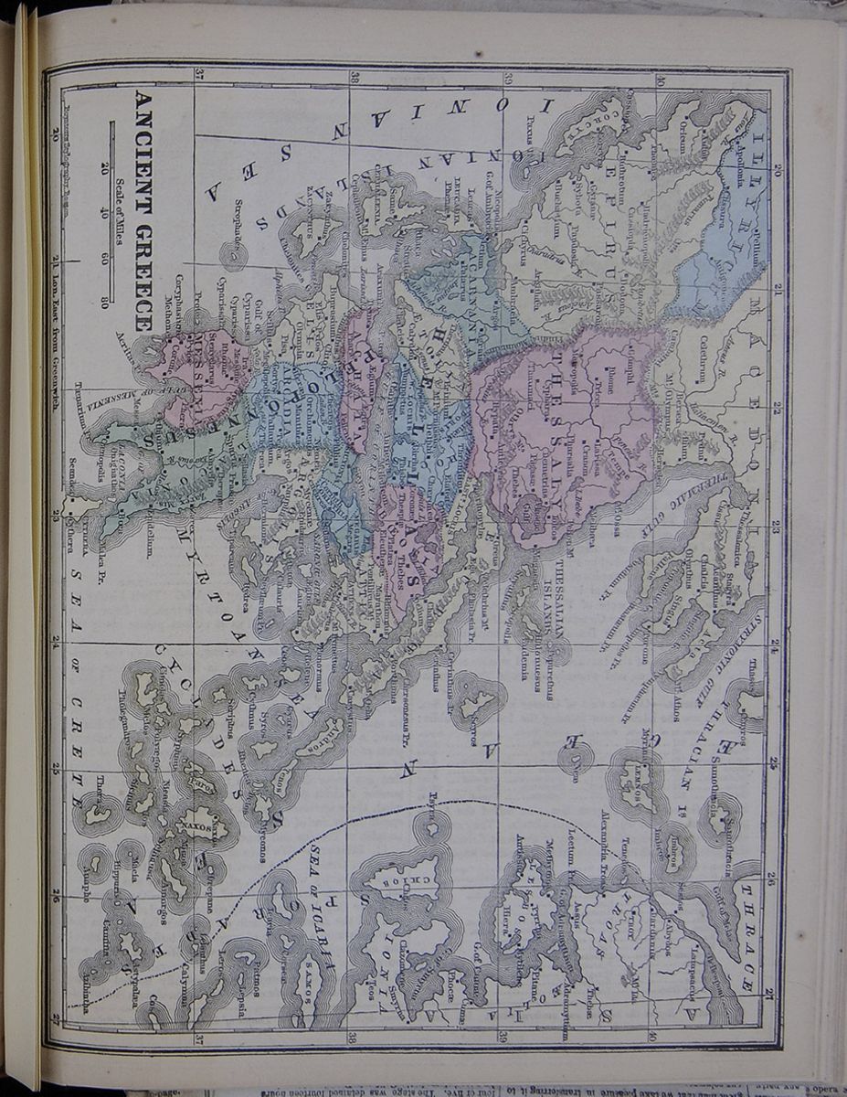
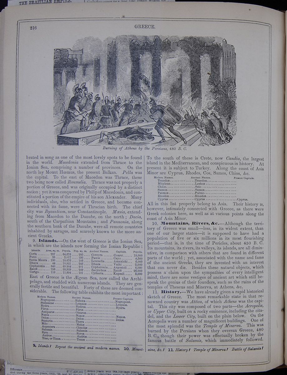 216
GREECE.
Burning of Athens by the Persians, 480 B. C.
216
GREECE.
Burning of Athens by the Persians, 480 B. C.
in song as one of the most lovely spots to be found in the world. Macedonia extended from Thrace to the Ionian Sea, comprising a number of provinces. On the north lay Mount Hœmus, the present Balkan. Pella was the capital. To the east of Macedon was Thrace, these two being now called Roumelia. Thrace was not properly a portion of Greece, and was originally occupied by a distinct nation; yet it was conquered by Philip of Macedonia, and constituted a portion of the empire of his son Alexander. Many individuals, also, who settled in Greece, and became connected with its fame, were of Thracian birth. The chief city was Byzantium, near Constantinople. Mœsia, extending from Macedon to the Danube, on the north; Dacia, south of the Carpathian Mountains; and Pannonia, along the southern bank of the Danube, were all remote countries inhabited by savages, and scarcely known to the more ancient Greeks.
9. Islands.—On the west of Greece is the Ionian Sea, in which are the islands now forming the Ionian Republic :
A table listing the islands that form the Ionian Republic, along with their areas in square miles, populations, populations to square miles, ancient names, and capitals.East of Greece is the Ægean Sea, now called the Archipelago, and studded with numerous islands. They are generally fertile and beautiful. Forty of these are deemed considerable. The following table exhibits the most important :
A table listing the most important islands in the Greek Archipelago.To the south of these is Crete, now Candia, the largest island in the Mediterranean, and conspicuous in history. At present it is subject to Turkey. Along the coast of Asia Minor are Cyprus, Rhodes, Cos, Samos, Chios, &c.
A table listing the modern and ancient names of islands in the Mediterranean.All in this list properly belong to Asia. Their history is, however, intimately connected with Greece, as there were Greek colonies here, as well as at various points along the coast of Asia Minor.
10. Mountains, Rivers, &c.—Although the territory of Greece was small—less, in its widest extent, than one of our larger states—it is supposed to have had a population of five or six millions in its most flourishing period—that is, in the time of Pericles, about 450 B. C. Its mountains, its rivers, its valleys, its islands, are all diminutive, in comparison with others that are found in different parts of the world; yet, associated with the name and fame of the ancient Greeks, they are invested with an interest that can never die. Besides these natural objects, which possess a claim upon the sympathies of every intelligent mind, there are some vestiges of ancient art which still bespeak the genius of their founders, such as the ruins of the temples of Theseus and Minerva, at Athens, &c.
11. History.—We have already given a rapid historical sketch of Greece. The most remarkable state in that renowned country was Attica, of which Athens was the capital. This city was composed of two parts—the Acropolis, or Upper City, built on a rocky eminence, including the citadel, and the Lower City, built on the plain below. On the Acropolis were a number of magnificent buildings. One of the most splendid was the Temple of Minerva. This was burned by the Persians when they overran Greece, 480 B. C., though their power was effectually broken by the famous battle of Salamis, which immediately followed.
9. Islands? Repeat the ancient and modern names. 10. Mountains, &c.? 11. History? Temple of Minerva? Battle of Salamis?
 [begin surface 756]
 [begin surface 757]
 [begin surface 758]
 [begin surface 759]
 [begin surface 760]
 [begin surface 761]
 [begin surface 762]
 [begin surface 763]
 [begin surface 764]
 [begin surface 765]
 [begin surface 766]
 [begin surface 767]
About the year 445, Athens having been rebuilt, Pericles caused the Parthenon to be restored. Its majestic and beautiful ruins remain to the present day, and form an object of the highest interest to the beholder. Athens continued, for several centuries, to be the center of art, philosophy, learning, and refinement. To this place, the principal philosophers, poets, orators, &c., were drawn. Here Socrates, Plato, Diogenes, Zeno, and others, spent the greater part of their lives. The population of Athens, including the little state of Attica, was about half a million, three-fourths of whom were slaves. Sparta was the capital of Lacedæmon. The people here despised the elegance, vivacity, and social refinement of the Athenians, and shaped their institutions exclusively with a view to make good soldiers. They became very powerful as a military state, but the people, generally, were hard, barbarous, and selfish. Individual liberty was completely surrendered to the state. While the Athenians have never ceased to instruct mankind by their genius, as displayed in arts, science, and philosophy, Sparta has left almost nothing but the record of its stern achievements in war. After the conquest of Greece by the Romans, in 146 B. C., it continued under the dominion of that empire for several centuries. In 328 A. D., the Emperor Constantine transferred the seat of empire to the ancient town of Byzantium, in Thrace, where he had built a new city, by the name of Constantinople. From the division of the Roman Empire, 395, Constantinople continued to be the capital of the Eastern Empire, which afterward received the name of the Greek or Byzantine Empire. While the Western Empire was overthrown in 476, the Eastern continued for nearly a thousand years later. At first, it embraced Greece, Macedonia, and Thrace in Europe, the greater part of Western Asia, Egypt, and Northern Africa. The capital was ravaged by the Crusaders, and, for a time, the empire passed into the hands of a new line of sovereigns. During this period, which continued for fifty-six years, it is called the Latin Empire. Michael Palæologus recovered the throne in 1260. Toward the close of the fourteenth century, the Turks had gained possession of Egypt, and the greater part of Asia Minor. The Sultan Amurath captured Adrianople, 1366, and gained a permanent footing in Europe. The Greek Empire was now almost reduced to the single city of Constantinople. In 1453, the celebrated Mohammed II. captured that city by assault, after a long and vigorous siege. Thus fell the Greek Empire; and upon its ruins arose the Ottoman Empire, occupying, for about four centuries, nearly the same territories in Europe, Asia, and Africa, as those which had constituted the Byzantine kingdom. The Turks speedily became formidable to their northern neighbors. They conquered some portions of the German Empire, and, under Solyman the Magnificent, laid siege to Vienna in 1529. He was, however, compelled to retire, with the loss of 80,000 men. For a long period, the Ottoman Empire continued to be distinguished for wealth, intelligence, enterprise, and military power. Many of the master-spirits of Christendom were drawn into its army and navy, and contributed to increase its energy and power. Toward the close of the seventeenth century, it began to decline, and finally sunk into indolence and imbecility. Within the last thirty years, it has lost Egypt and the Barbary States. In 1821, the Greeks, who had been under the harsh dominion of the Turks for four hundred years, rose in rebellion, and, after a protracted struggle, established their independence. In October, 1827, a Turkish fleet of one hundred sail was completely destroyed by the allied British and French squadron, in the battle of Navarino. From this fatal blow the Ottoman Empire has not yet recovered. In 1832, Greece was acknowledged as an independent kingdom; Otho, a Bavarian prince, being selected as king. By the constitution, promulgated in 1844, the government consists of a king, senate, and house of representatives. Since this period, Greece seems to have gradually risen from the depression occasioned by long ages of ignominious slavery.
Lesson CII... Turkey in Europe.
1. Characteristics.—This country is remarkable as being the seat and center of the Ottoman Empire.
2. Mountains, &c.—Most of the surface is an undulating region of hills and valleys, with mountains and tablelands of little elevation. It is crossed in the center, nearly from east to west, by the Balkan Range, the ancient Hœmus. To the north are the Carpathians, extending into Hungary; the Pindus Range extends southward into Greece. It is watered by numerous rivers, the chief of which is the Danube.
3. Climate, &c.—The climate at the north is severe, snow lying upon the higher mountains the greater part of the year. South of the Balkan, the climate is delicious. Earthquakes and destructive storms occur in some parts. A large portion of the territory is covered with forests of firs and deciduous trees. The olive, vine, rice, cotton, maize and other grains, are the products of agriculture. The bear, wolf, wild boar, chamois, and stag are common in the forests. The domestic animals comprise the sheep, a small breed of horses, the mule, ass, domesticated buffalo, hog, &c. Fish abound in the rivers, and leeches in the marshes. There are mines of iron, lead, salt, and marble; but none are worked to advantage. The manufactures are almost entirely domestic—comprising saddles, fire-arms, swords, coarse woolens, linen and cotton spinning, copper and tin utensils, rich carpets, tanneries, and embroideries. Printing exists only at Constantinople and four other places. The commerce is chiefly in the hands of the Greeks, Armenians, and Jews.
4. Political Divisions.—The following are the divisions of Turkey in Europe: A table listing the provinces and chief cities of Turkey in Europe.
Besides these, there are the three provinces of Moldavia, Wallachia, and Servia, north of the Danube, of which Jassy, Bucharest, and Belgrade are the capitals. These are tributary to the Porte, but are otherwise independent, except that Russia exercises over them a controlling influence. The people are of various races. Christianity is the leading religion. The inhabitants are in a rude state, but it is said they are improving.
5. Government, &c.—The emperor, who is styled
Exercises on the Map (p. 220).—Boundaries of Turkey? Describe the Balkan Mountains. The Danube. Where is Constantinople? Adrianople? Jassy? Salonica? Mount Olympus?
LESSON CII. 1. Characteristics of Turkey? 2. Mountains, &c.?
[begin surface 768]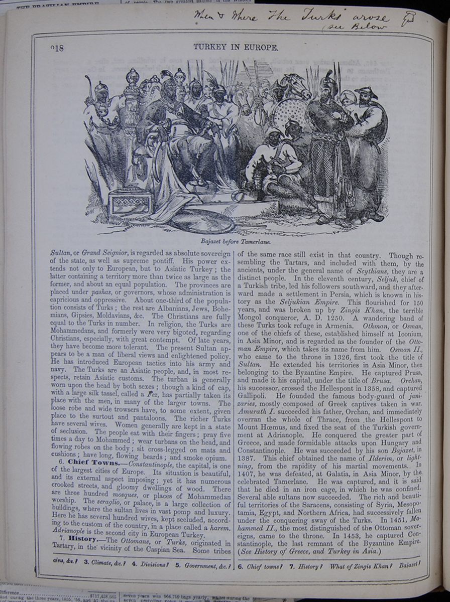 218
TURKEY IN EUROPE.
Bajazet before Tamerlane.
218
TURKEY IN EUROPE.
Bajazet before Tamerlane.
Sultan, or Grand Seignior, is regarded as absolute sovereign of the state, as well as supreme pontiff. His power extends not only to European, but to Asiatic Turkey; the latter containing a territory more than twice as large as the former, and about an equal population. The provinces are placed under pashas, or governors, whose administration is capricious and oppressive. About one-third of the population consists of Turks; the rest are Albanians, Jews, Bohemians, Gipsies, Moldavians, &c. The Christians are fully equal to the Turks in number. In religion, the Turks are Mohammedans, and formerly were very bigoted, regarding Christians, especially, with great contempt. Of late years, they have become more tolerant. The present Sultan appears to be a man of liberal views and enlightened policy. He has introduced European tactics into his army and navy. The Turks are an Asiatic people, and, in most respects, retain Asiatic customs. The turban is generally worn upon the head by both sexes; though a kind of cap, with a large silk tassel, called a Fez, has partially taken its place with the men, in many of the larger towns. The loose robe and wide trowsers have, to some extent, given place to the surtout and pantaloons. The richer Turks have several wives. Women generally are kept in a state of seclusion. The people eat with their fingers; pray five times a day to Mohammed; wear turbans on the head, and flowing robes on the body; sit cross-legged on mats and cushions; have long, flowing beards; and smoke opium.
6. Chief Towns.—Constantinople, the capital, is one of the largest cities of Europe. Its situation is beautiful, and its external aspect imposing; yet it has numerous crooked streets, and gloomy dwellings of wood. There are three hundred mosques, or places of Mohammedan worship. The seraglio, or palace, is a large collection of buildings, where the sultan lives in vast pomp and luxury. Here he has several hundred wives, kept secluded, according to the custom of the country, in a place called a harem. Adrianople is the second city in European Turkey.
7. History.—The Ottomans, or Turks, originated in Tartary, in the vicinity of the Caspian Sea. Some tribes of the same race still exist in that country. Though resembling the Tartars, and included with them, by the ancients, under the general name of Scythians, they are a distinct people. In the eleventh century, Seljuk, chief of a Turkish tribe, led his followers southward, and they afterward made a settlement in Persia, which is known in history as the Seljukian Empire. This flourished for 150 years, and was broken up by Zingis Khan, the terrible Mongol conqueror, A. D. 1250. A wandering band of these Turks took refuge in Armenia. Othman, or Osman, one of the chiefs of these, established himself at Iconium, in Asia Minor, and is regarded as the founder of the Ottoman Empire, which takes its name from him. Osman II., who came to the throne in 1326, first took the title of Sultan. He extended his territories in Asia Minor, then belonging to the Byzantine Empire. He captured Prusa, and made it his capital, under the title of Brusa. Orchan, his successor, crossed the Hellespont in 1358, and captured Gallipoli. He founded the famous body-guard of janizaries, mostly composed of Greek captives taken in war. Amurath I. succeeded his father, Orchan, and immediately overran the whole of Thrace, from the Hellespont to Mount Hœmus, and fixed the seat of the Turkish government at Adrianople. He conquered the greater part of Greece, and made formidable attacks upon Hungary and Constantinople. He was succeeded by his son Bajazet, in 1387. This chief obtained the name of Ilderim, or lightning, from the rapidity of his martial movements. In 1407, he was defeated, at Galatia, in Asia Minor, by the celebrated Tamerlane. He was captured, and it is said that he died in an iron cage, in which he was confined. Several able sultans now succeeded. The rich and beautiful territories of the Saracens, consisting of Syria, Mesopotamia, Egypt, and Northern Africa, had successively fallen under the conquering sway of the Turks. In 1451, Mohammed II., the most distinguished of the Ottoman sovereigns, came to the throne. In 1453, he captured Constantinople, the last remnant of the Byzantine Empire. (See History of Greece, and Turkey in Asia.)
3. Climate, &c.? 4. Divisions? 5. Government, &c.? 6. Chief towns? 7. History? What of Zingis Khan? Bajazet?
Lesson CIII... Empire of Austria.
1. Characteristics.—This kingdom, comprising several distinct nations, is one of the most extensive and populous in Europe.
2. Divisions.—The following table embraces the divisions of the Austrian empire:— A table listing the provinces and capitals of Austria with their respective populations. The latter kingdom has been already described under Italy, and its population is there included.
3. Austria Proper—part of the ancient Noricum, is an archduchy and the seat and center of the Austrian empire. It is divided into Upper and Lower Austria. Its southern border is skirted by a branch of the Alps, and is the country traversed from west to east by the Danube. It has numerous mountain lakes, and highly picturesque scenery. It is fertile, and admirably cultivated, though there are extensive forests. Grapes are produced, and twenty-five million gallons of wine, annually. Gold, silver, lead, iron, arsenic, alum, &c., are found. The weaving and spinning of flax, cotton, and wool are the main branches of manufacturing industry. Vienna, the capital, is one of the most splendid cities in Europe. Here the emperor resides. The government of the Austrian empire, as a monarchy, is nearly absolute, there being local governments, however, in the several divisions. The army of the empire is about 400,000 men. The fortifications are very numerous. The navy comprises 65 vessels, mostly small. The annual revenue is $70,000,000. The public debt is $475,000,000. The history of Austria proper goes back to the time of Charlemagne, who conquered it in 791. In 1156, it became a duchy. Rodolph of Hapsburg was the founder of its subsequent greatness. He was elected emperor of Germany in 1272, and from this time, the house of Austria became prominent in Europe. In 1516, the Austrian empire, under Charles V., surpassed any other European power that had existed since the days of Charlemagne. On the death of Charles, his empire was dismembered. The Emperor of Austria, however, was generally Emperor of Germany, till the German empire was overthrown by Napoleon, in 1806. During the subsequent wars with the French, Austria suffered severely; but in 1815 her territory was restored. In 1848, extensive insurrections broke out in northern Italy and Hungary, but they were suppressed in 1849.
4. The Tyrol—part of the ancient Rhœtia, is a small country among the eastern Alps. It is mountainous, with numerous lakes, and greatly resembles Switzerland. The several grains are cultivated. Wine and silk are produced in the south. Cattle form the chief wealth of the rural inhabitants. Most parts of Europe are supplied with canaries
and other singing birds from the valley of the Inn. Wolves, bears, wild-boars, marmots, chamois, &c., inhabit the mountain districts. Coal, iron, and salt are the principal minerals. The manufactures are considerable. The climate is cold at the north, and mild at the south, especially in the valleys. The people are hardy and brave, with great simplicity of character. They are devout ^Roman Catholics, but not intolerant. They have a local government, which, however, is subservient to Austria, to which the people are strongly attached. This country came into the possession of the House of Hapsburg in the thirteenth century. Innsprück is the capital.
5. Styria—anciently a part of Pannonia, was conquered by Charlemagne, and annexed to Austria in the twelfth century. It consists principally of a valley, divided by a branch of the Alps. The surface is much broken. The inhabitants raise various grains, hemp, flax, tobacco, cattle, and sheep. The mining of iron, copper, salt, alum, and coal, forms a chief branch of industry. The inhabitants are mostly Roman Catholic. There is an annual pilgrimage to the shrine of the Virgin Mary at Mariazell, consisting of persons from nearly all parts of the Austrian dominions. The pilgrims are mostly of the poorer classes, the larger part being women. They go in regular procession, most of them being barefoot. Grätz, the capital, is an important town, picturesquely situated on the Mur. It has extensive fortifications, and communicates with Vienna and Trieste by railways.
6. Illyria.—This kingdom, anciently Illyricum, is a mountainous country, with a mild climate and good soil. It yields wine, olive-oil, wheat, maize, and cattle. Its mines produce gold, silver, mercury, lead, copper, and iron. The chief manufactures are woolen cloths and glass. The commerce centers at Trieste. The greater part of the population belongs to the Slavonic race. Trieste, the capital, is the principal seaport of the Austrian empire. The harbor is small but convenient. The commerce is extensive. In the Middle Ages it was the capital of a republic. The kingdom of Illyria was formed by Napoleon in 1809, making part of the French empire. It assumed its present form in 1822.
7. Bohemia—the seat of the ancient Boii, is styled a kingdom. It is an elevated plateau, nearly encircled by lofty mountains. It is crossed by the river Elbe. The climate is cold in the mountains, but mild and delightful in the valleys. It is alike rich in its mineral, agricultural, and manufacturing products. The transit trade is considerable. The Elbe and the Moldau are navigated by steam-packets. The Roman Catholic is the religion of the state. The people are hardy and cheerful, fond of travel, and possess high musical talent. They are inclined to superstition, and pay great reverence to images. The peasants are much oppressed by their masters. Prague, the capital, is a large and flourishing city on the Moldau. It is the center of Bohemian commerce. The university here is much celebrated. Bohemia came into the possession of Austria, A. D. 1526. The Emperor of Austria bears the title of the King of Bohemia, and is crowned at Prague.
8. Moravia—anciently inhabited by the Quadi and Marcomanni, is an elevated table-land, with a fertile soil and a very mild climate. Its agriculture is thriving, and its vineyards are very extensive. Its agriculture and mining industry are highly productive. Brunn, the capital, is an important town, and is connected with Vienna by a railroad.
Exercises on the Map (p. 220).—Boundaries of Austria? Capital? Describe the Danube. Boundaries of Hungary? Moravia, &c.? What mountains in the west and north of Hungary? Where is Trieste? Prague? Innsprück? Buda? Hermanstadt?
LESSON CIII. 1. Characteristics? 2. Divisions? 3. Austria Proper? 4. The Tyrol? 5. Styria? 6. Illyria? 7. Bohemia?
[begin surface 770]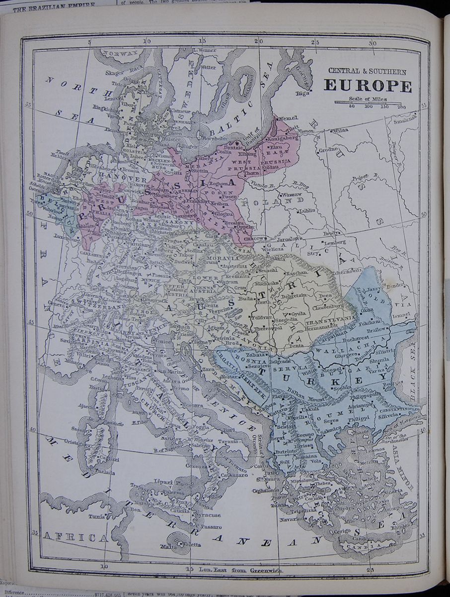 A map of central and southern Europe, highlighting
Austria, Turkey, Denmark, Belgium, and
Prussia.
CENTRAL & SOUTHERN EUROPE
[begin surface 771]
A map of central and southern Europe, highlighting
Austria, Turkey, Denmark, Belgium, and
Prussia.
CENTRAL & SOUTHERN EUROPE
[begin surface 771]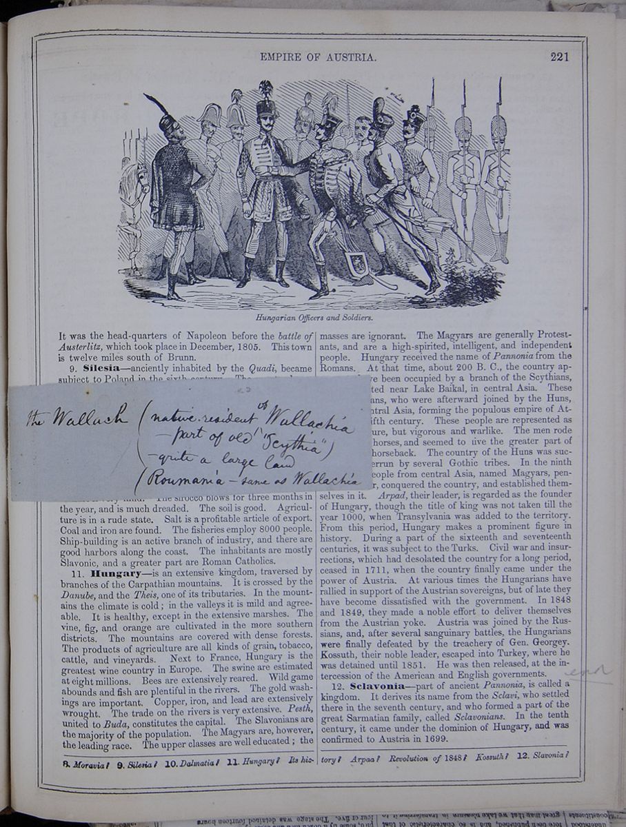
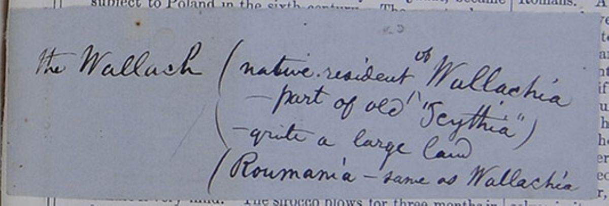 the Wallach
native
resident ^of Wallachia
the Wallach
native
resident ^of Wallachia —part of old "Scythia")
—quite a large land
Roumania —same as Wallachia [begin surface 773]
It was the head-quarters of Napoleon before the battle of Austerlitz, which took place in December, 1805. This town is twelve miles south of Brunn.
9. Silesia—anciently inhabited by the Quadi, became subject to Poland in the sixth century. The country has a rough surface, with extensive forests. The agricultural and mineral products are very considerable. This Austrian district is only the southern part of Silesia, conquered from Austria by Frederick the Great, in 1742. It is annexed to the government of Moravia.
10. Dalmatia—anciently a part of Illyria, belonged to Hungary till the fifteenth century, when, for a long period, it became the seat of war between the Austrians and Turks. It was annexed to Austria in 1797. It is traversed by branches of the Alps, running parallel to the coast. The climate is very mild. The sirocco blows for three months in the year, and is much dreaded. The soil is good. Agriculture is in a rude state. Salt is a profitable article of export. Coal and iron are found. The fisheries employ 8000 people. Ship-building is an active branch of industry, and there are good harbors along the coast. The inhabitants are mostly Slavonic, and a greater part are Roman Catholics.
11. Hungary—is an extensive kingdom, traversed by branches of the Carpathian mountains. It is crossed by the Danube, and the Theis, one of its tributaries. In the mountains the climate is cold; in the valleys it is mild and agreeable. It is healthy, except in the extensive marshes. The vine, fig, and orange are cultivated in the more southern districts. The mountains are covered with dense forests. The products of agriculture are all kinds of grain, tobacco, cattle, and vineyards. Next to France, Hungary is the greatest wine country in Europe. The swine are estimated at eight millions. Bees are extensively reared. Wild game abounds and fish are plentiful in the rivers. The gold washings are important. Copper, iron, and lead are extensively wrought. The trade on the rivers is very extensive. Pesth , united to Buda, constitutes the capital. The Slavonians are the majority of the population. The Magyars are, however, the leading race. The upper classes are well educated; the masses are ignorant. The Magyars are generally Protestants, and are a high-spirited, intelligent, and independent people. Hungary received the name of Pannonia from the Romans. At that time, about 200 B. C., the country appears to have been occupied by a branch of the Scythians, who originated near Lake Baikal, in central Asia. These were the Alans, who were afterward joined by the Huns, also from central Asia, forming the populous empire of Attila in the fifth century. These people are represented as of small stature, but vigorous and warlike. The men rode small hardy horses, and seemed to live the greater part of the time on horseback. The country of the Huns was successively overrun by several Gothic tribes. In the ninth century, a people from central Asia, named Magyars, penetrated hither, conquered the country, and established themselves in it. Arpad, their leader, is regarded as the founder of Hungary, though the title of king was not taken till the year 1000, when Transylvania was added to the territory. From this period, Hungary makes a prominent figure in history. During a part of the sixteenth and seventeenth centuries, it was subject to the Turks. Civil war and insurrections, which had desolated the country for a long period, ceased in 1711, when the country finally came under the power of Austria. At various times the Hungarians have rallied in support of the Austrian sovereigns, but of late they have become dissatisfied with the government. In 1848 and 1849, they made a noble effort to deliver themselves from the Austrian yoke. Austria was joined by the Russians, and, after several sanguinary battles, the Hungarians were finally defeated by the treachery of Gen. Georgey. Kossuth, their noble leader, escaped into Turkey, where he was detained until 1851. He was then released, at the intercession of the American and English governments.
12. Sclavonia—part of ancient Pannonia, is called a kingdom. It derives its name from the Sclavi, who settled there in the seventh century, and who formed a part of the great Sarmatian family, called Sclavonians . In the tenth century, it came under the dominion of Hungary, and was confirmed to Austria in 1699.
8. Moravia? 9. Silesia? 10. Dalmatia? 11. Hungary? Its history? Arpaa? Revolution of 1848? Kossuth? 12. Slavonia?
[begin surface 774] 222
KINGDOM OF PRUSSIA.
222
KINGDOM OF PRUSSIA.
13. Croatia—inhabited in early times by Pannonians, is divided between Austria and Turkey. Austrian Croatia has a fertile soil, producing grains and vines. The climate is mild. The inhabitants are a branch of the Sclavonic family. The country has been in the hands of various masters. This, as well as Sclavonia , has been for a long time attached to the kingdom of Hungary. In the late war, the Croats assisted Austria against the Hungarians.
14. Transylvania—part of the ancient Dacia, has been a principality since 1765. It is covered with branches of the Carpathian range. The climate is cold among the mountains, but very mild in the valleys. The soil is various; the forests are extensive. There are bears, wolves, and abundance of game. There is an immense bed of rock-salt, extending into Wallachia and Galicia. The mineral products are valuable. Agriculture is the chief employment. The inhabitants comprise fourteen distinct races. The Catholic and Greek religions prevail.
15. The Military Frontier—consists of a narrow strip of territory, extending for nearly 1000 miles along the Turkish frontier, from the Gulf of Venice to Galicia. It was long since established by the Austrian government as a barrier against the Turks. The present inhabitants are at the same time soldiers and cultivators of the soil, but ready for the defense of the country. The present system for its government was organized in 1807.
16. Galicia—formerly belonging to Poland, came to Austria in the partitions of 1772 and 1795. It was at one period comprised in what is called Red Russia. It includes the ancient principality of Lodomeria. Bukovina was formerly one of the divisions of East Galicia. Galicia mostly consists of wide plains. The climate is rigorous. Cattle, horses, and bees are extensively reared. The inhabitants are of Sclavonic origin, and speak the Polish language. Jews are numerous. The Roman Catholic and Greek religions prevail. Education is in a backward state.
17. General Remarks on Austria.—It will be perceived that the Austrian empire, consisting originally of the small central portion which is inhabited by Germans, has been gradually built up by getting possession of the various countries around it, mainly lying to the south and east. Thus, it exercises dominion over a great number of nations of different origin, history, religion, manners, and customs. The emperors of Austria were also emperors of Germany the greater part of the time, for the space of nearly 500 years, till the German empire was overthrown by Napoleon in 1806. The general tenor of the government has been despotic, and adverse to improvement. Hence the Austrian dominions are behind most portions of Germany in every species of progress.
18. Republic of Cracow.—This consisted of the city of that name, the second capital of Poland, with its territory, lying upon the Vistula. In 1815, the Congress of Vienna, in plundering Poland for the last time, could not agree whether Cracow should belong to Russia, Prussia, or Austria. They therefore guarantied its neutrality and inviolability as a republic. It flourished for 30 years as the center of a valuable commerce. But Austria, under pretence that Cracow was the resort of political agitators, crushed this republic in 1846, and took the territory to herself, France, England, and Russia quietly submitting.
Lesson CIV... Kingdom of Prussia.
1. Characteristics.—This is an important kingdom of Central Europe, consisting of two distinct territories—one portion bordering on Russia, the other traversed by the Rhine. Between these are several small German states.
2. Face of the Country, &c.—The surface of Prussia is generally flat, except in the province of Saxony, which is crossed by the Hartz Mountains. It has 500 miles of coast upon the Baltic. The Rhine, celebrated for its beautiful valley, is navigable for large vessels and steamers to a considerable distance. The Prussian territories bordering on this river have a fine climate, are highly cultivated, and occupied by numerous towns and cities. The region around Magdeburg, on the Elbe, is called the garden of Berlin. The eastern provinces have numerous lakes, and a cold and humid climate, with many fertile tracts The territory of Prussia is highly productive. Agriculture, the chief source of the national wealth, is carefully conducted. The Rhenish wines are very celebrated. The lynx, beaver, badger, otter, wild-boar, stag, fallow-deer, marten, and wild-goose, are common in some of the provinces. The manufactures are important. The commerce is very active, and has been recently much increased by the system called Zollverein, or commercial customs-union.
3. Political Divisions.— A table listing the provinces and chief cities of Prussia with their populations. Posen was formerly a part of Poland: Posen, its capital, was the metropolis of ancient Poland. It was assigned to Prussia by the Congress of Vienna, in 1815. Pomerania is a large province, in a backward and barbarous state. Silesia was taken from Austria in 1742. Brandenburg is a province in the center of the kingdom, and forms its nucleus. Saxony is a province contiguous to the Kingdom of Saxony, and taken from that kingdom, and given to Prussia, in 1815. Westphalia was part of the kingdom of that name established by Napoleon, his brother Jerome being king. This was dismembered in 1815, the province being then given to Prussia.
4. Government, &c.—This is an hereditary monarchy; the authority of the king was formerly absolute, but is now modified by the constitution of 1847. The roads are good. The canals, railroads, and telegraphic lines are numerous, radiating from Berlin. The population consists of two-thirds Germans and one-third Sclavonians. The state religion is Protestant, but all creeds are tolerated. Education has been made nearly universal by the government. There are 24,000 elementary schools. There are, also, numerous universities of high standing, and many celebrated literary and learned societies. The standing army is 137,000, and the men capable of bearing arms 837,000. Prussia has no navy, but the mercantile marine is under the control of the government. The public revenue is $88,566,380; the public debt, $162,861,444. Berlin, the
13. Croatia? 14. Transylvania? 15. The military frontier? 16. Galicia? 17. General remarks on Austria? 18. Republic of Cracow?
Exercises on the Map (see p. 220).—Boundaries of Prussia? Capital? Describe the Elbe; the Oder; the Rhine. What sea at the north? Where is Brandenburg? Silesia? Posen?
LESSON CIV. 1. Characteristics? 2. Face of the country?
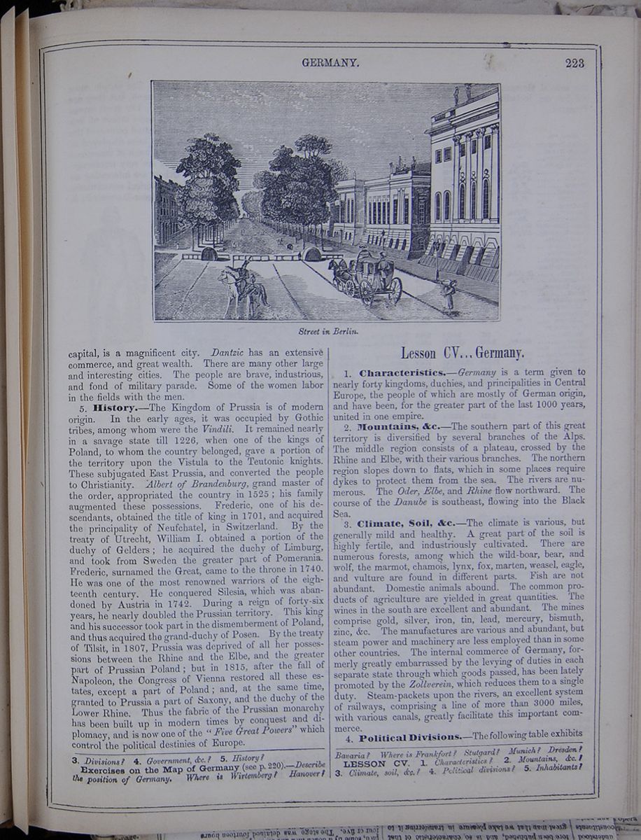
capital, is a magnificent city. Dantzic has an extensive commerce, and great wealth. There are many other large and interesting cities. The people are brave, industrious, and fond of military parade. Some of the women labor in the fields with the men.
5. History.—The Kingdom of Prussia is of modern origin. In the early ages, it was occupied by Gothic tribes, among whom were the Vindili. It remained nearly in a savage state till 1226, when one of the kings of Poland, to whom the country belonged, gave a portion of the territory upon the Vistula to the Teutonic knights. These subjugated East Prussia, and converted the people to Christianity. Albert of Brandenburg, grand master of the order, appropriated the country in 1525; his family augmented these possessions. Frederic, one of his descendants, obtained the title of king in 1701, and acquired the principality of Neufchatel, in Switzerland. By the treaty of Utrecht, William I. obtained a portion of the duchy of Gelders; he acquired the duchy of Limburg, and took from Sweden the greater part of Pomerania. Frederic, surnamed the Great, came to the throne in 1740. He was one of the most renowned warriors of the eighteenth century. He conquered Silesia, which was abandoned by Austria in 1742. During a reign of forty-six years, he nearly doubled the Prussian territory. This king and his successor took part in the dismemberment of Poland, and thus acquired the grand-duchy of Posen. By the treaty of Tilsit, in 1807, Prussia was deprived of all her possessions between the Rhine and the Elbe, and the greater part of Prussian Poland; but in 1815, after the fall of Napoleon, the Congress of Vienna restored all these estates, except a part of Poland; and, at the same time, granted to Prussia a part of Saxony, and the duchy of the Lower Rhine. Thus the fabric of the Prussian monarchy has been built up in modern times by conquest and diplomacy, and is now one of the "Five Great Powers" which control the political destinies of Europe.
Lesson CV... Germany.
1. Characteristics.—Germany is a term given to nearly forty kingdoms, duchies, and principalities in Central Europe, the people of which are mostly of German origin, and have been, for the greater part of the last 1000 years, united in one empire.
2. Mountains, &c.—The southern part of this great territory is diversified by several branches of the Alps. The middle region consists of a plateau, crossed by the Rhine and Elbe, with their various branches. The northern region slopes down to flats, which in some places require dykes to protect them from the sea. The rivers are numerous. The Oder, Elbe, and Rhine flow northward. The course of the Danube is southeast, flowing into the Black Sea.
3. Climate, Soil, &c.—The climate is various, but generally mild and healthy. A great part of the soil is highly fertile, and industriously cultivated. There are numerous forests, among which the wild-boar, bear, and wolf, the marmot, chamois, lynx, fox, marten, weasel, eagle, and vulture are found in different parts. Fish are not abundant. Domestic animals abound. The common products of agriculture are yielded in great quantities. The wines in the south are excellent and abundant. The mines comprise gold, silver, iron, tin, lead, mercury, bismuth, zinc, &c. The manufactures are various and abundant, but steam power and machinery are less employed than in some other countries. The internal commerce of Germany, formerly greatly embarrassed by the levying of duties in each separate state through which goods passed, has been lately promoted by the Zollverein, which reduces them to a single duty. Steam-packets upon the rivers, an excellent system of railways, comprising a line of more than 3000 miles, with various canals, greatly facilitate this important commerce.
4. Political Divisions.—The following table exhibits
3. Divisions? 4. Government, &c.? 5. History?
Exercises on the Map of Germany (see p.220).—Describe the position of Germany. Where is Wirtemberg? Hanover? Bavaria? Where is Frankfort? Stutgard? Munich? Dresden?
LESSON CV. 1. Characteristics? 2. Mountains, &c.? 3. Climate, soil, &c.? 4. Political divisions? 5. Inhabitants?
[begin surface 776]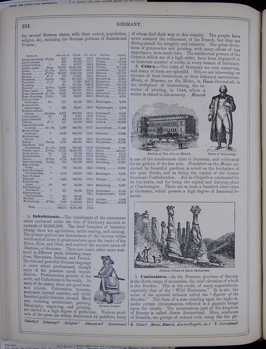 224
GERMANY.
224
GERMANY.
the several German states, with their extent, population, religion, &c., including the German portions of Austria and Prussia: A table listing the states of Germany with their areas in square miles, populations, populations to square miles, capitals, and populations of capitals.
5. Inhabitants.—The inhabitants of the numerous states embraced under the title of Germany amount to upwards of 45,000,000. The chief branches of industry among them are agriculture, cattle rearing, and mining. The greater portion are descendants of the various tribes which settled down in great numbers upon the banks of the Rhine, Elbe, and Oder, and received the ancient name of Teutones, or Germans. There are many other races scattered in different parts, including some Jews, Slavonians, Italians, and French. The rich and powerful German language is every where predominant, though many of the peasants speak impure dialects. Protestantism prevails in the north, and Catholicism in the south. In many of the states, there are good common schools. Universities, lyceums, academies, learned societies, and richly furnished public libraries, abound. Many arts, including architecture, painting, lithography, engraving, and printing, are carried to a high degree of perfection. Various products of the press are widely distributed by peddlers, many German Peddler. of whom find their way to this country. The people have never attained the refinement of the French, but they are distinguished for integrity and industry. The great inventions of gunpowder and printing, with many others of less importance, were made here. The intellectual powers of the German which are of a high order, have been displayed in an immense number of works, in every branch of literature.
6. Cities.—The cities of Germany are very numerous, and many of them are splendid. Others are interesting on account of their institutions, or their historical associations. Mentz, or Mayence, on the Rhine, in Hesse-Darmstadt, is the birthplace of Guttenberg , the inventor of printing, in 1344, where a statue is raised to his memory. Munich Gallery of Fine Arts at Munich. Statue of Guttenberg . is one of the handsomest cities in Germany, and celebrated for its gallery of the fine arts. Frankfort-on-the-Maine, encircled by beautiful gardens, is noted as the birthplace of the poet Goethe, and as being the capital of the former Germanic Confederation. Aix-la-Chapelle is celebrated for its hot-baths, and for being the capital and burying-place of Charlemagne. There are at least a hundred other cities in Germany, which possess a high degree of historical interest.
Natural Pillars in Saxon Switzerland.7. Curiosities.—In the Prussian province of Saxony is the Hartz range of mountains, the chief elevation of which is the Brocken. This is the cradle of many superstitions, especially that of the " Wild Huntsman." It is also the scene of the spectral delusion called the " Specter of the Brocken." The form of a man standing upon the hight is, under certain circumstances, reflected in a gigantic image upon the clouds. The mountainous part of the kingdom of Saxony is called Saxon Switzerland. Here, southeast of Dresden, are groups of natural rock, rising like the pillars
Industry? Language? Religion ' Education? Inventions? 6. Cities? Mentz, Munich, Aix-la-Chapelle, &c.? 7. Curiosities?
 [begin surface 778]
 [begin surface 779]
 [begin surface 780]
 [begin surface 781]
 [begin surface 782]
 [begin surface 783]
 [begin surface 784]
 [begin surface 785]
 [begin surface 786]
 [begin surface 787]
 [begin surface 788]
 [begin surface 789]
 [begin surface 790]
 [begin surface 791]
 [begin surface 792]
 THE BROOKLYN DAILY
EAGLE.
VOL. 17.—NO. 242.
BROOKLYN, TUESDAY, OCTOBER 12,
1858.
ONE CENT.
THE BROOKLYN DAILY
EAGLE.
VOL. 17.—NO. 242.
BROOKLYN, TUESDAY, OCTOBER 12,
1858.
ONE CENT.
BROOKLYN DAILY EAGLE.
I. VAN ANDEN.PUBLISHER AND PRORIETOR .
EAGLE BUILDINGS—30 AND 32 FULTON STREET, BROOKLYN.
Delivered to City Subscribers every evening, at six and a quarter cents per week, payable to the carriers. ☞ THIS PAPER has the LARGEST CIRCULATION of any evening paper published in the United States, and as a medium for business and general advertising, is not surpassed by any other journal.
☞ TERMS—Invariably cash in advance. PRINTING OF EVERY DESCRIPTION,
PROMPTLY AND NEATLY EXECUTED.
☞ A great reduction from former rates. ☜
European Correspondence of the Eagle.
NUMBER FOURTEEN.
AMSTERDAM, September 8th.The fetes celebrated in this old city in honor of he Prince of Qrange ,—the heir presumptive to the throne, on occasion of his attaining the age of eighteen,—have just been concluded; and I having attended them in pursuance of an invitation which I was not at liberty to disregard, I have spent several days here amusing myself quite as much in studying the place and the people as in participating in the diversions of the Court. Amsterdam has the swing of a large, rich and business-like city. You see at once that it is an important place. Those unmistakeable signs of greatness—enormous wealth and abject poverty—extremes between which run all the grades of worldly condition—strike your eye every where within its borders. Houses, plain to be sure in their architecture and characteristic, in their substantial construction, of the people, but large, and even grand, are observed on the wider and more leading streets, while alleys and lanes abound where the poor and squallid live, huddled together in tall and narrow buildings. The cafes are large and lively. The stores are well supplied. The warehouses are spacious. The docks are enormous. The canals are not like those in the rest of Holland, comparatively narrow, but are wide and capacious. The exchange is as bustling as wall street, and you will see much gouty wealth hobbling on crutches from its carriages to the interior room where it studies only bonds and stocks as its daily occupation. In fine, opulence and indigence, activity and idleness, churches and dance-houses, religion and vice, indicate the population of a large metropolitan and commercial city. But it is the most astonishing of all the capitals of Europe. It is built on piles in what was once a marsh, and is only preserved from almost daily inundation from the waters of the Y, on which it is situated—an inlet of the Zuider Zee —by strong and expensive dykes along the water's edge. You marvel as you look upon the splendid stores and warehouses, the churches, the palace, and other public buildings, how the industry and art, and perseverance of this people could have accomplished all this, and could have rescued from the mud a city of some ten miles in circumference, confined the oozing waters within a score of channels, and made them the streams upon whose banks is deposited more wealth than is possessed by any other city of its size in the world. In shape Amsterdam forms a semicircle, the Y being the diameter. Besides other smaller canels , four larger ones, called grachts, each two miles or more in length, run through it parallel with the outer arc. Fronting on these large canals are the best buildings. The shipping, which is extensive, goes into docks on the lower side of the city. The trade of Holland with America is, however, not carried on at this port. The average number of American ships which have arrived here for the last few years is eighteen only, and these have not come generally direct from America, but have been freighted at some intermediate country where they had previously gone on a voyage. Rotterdam is a more convenient port for the American trade, which is consequently, for the most part, carried on with that port.
It is a remarkable fact that with all the enterprise of our countrymen there is not a single American established in Amsterdam or, indeed, more than one in all the provinces of the Netherlands, except those who have been sent there officially; and, what is more, there never has been any such in Amsterdam within the memory of man. If there have been any the tradition of it is lost. Good reasons may perhaps be given for this—the solitariness of the language, the out-of-the-way position of the country, and others; but it is undeniably the truth that the Dutch have an aversion to such strangers as do not come among them very highly accredited; and, besides being exceedingly suspicious of adventurers, are clannish among themselves. They regard it their first duty to help their own kith and kin. They trade among their family relations and connexions in preference to others, even when it is attended with much inconvenience; and so extensive and ramified oftentimes are these relationships that it is not an unusual circumstance to have a doctor and a lawyer, a butcher, a baker, a grocer, a tailor and other tradesmen and shop-keepers within the family circle, in a nearer or remote degree, sufficiently numerous to supply almost any want without going beyond it, so that if there were no other barriers in the way, there would be from this cause alone a great obstacle in the way of a Yankee's success among them. Certain it is that his inventive faculties would be put to the severest test here of any place in the world; but, it may be added, if he once succeeded in breaking the line, his fortune would be made for the same steadfastness of character which the Dutch observe towards themselves, they also exhibit to all who once obtain their confidence.
A large portion of the population is composed of Jews who live in a quarter by themselves. Every where you encounter that peculiar physionomy which marks the chosen people of God. Their ancestors fled to Holland in great numbers during the early days of the republic when its free institutions and maritime power made it an asylum for the persecuted of all creeds of the other so-called Christian nations of Europe. While the English puritans fled here from the intolerance of the Protestant church, and the French Huguenots from the massacrees of the Catholics, the Jews of Germany and Portugal and other countries, also found a like protection and a home. They retain the religion of their forefathers although in their costume and manners they have become identified with the rest of the people of the city. They exercise a proportionate degree of influence in the public affairs. They are exceedingly jealous of their right and tenacious of their privileges. They molest nobody with their religious views, and are unmolested in them; but a circumstance happened this summer which through the imprudent zeal of one of our own countrymen had well nigh produced the most serious consequences. He was a gentleman from New York, and had put up, on a traveling tour, at the Hotel des Pays Bas. He was well supplied both with tracts and money, and evidently believed in the mightiness of the dollar as a concomitant of the truth in producing conversion.—It is undoubtedly true here, as elsewhere, that the persecutions which the Jews have undergone, and the social exclusion with which they are treated even where they are tolerated, make them very anxious after money; and they look after guilders here with quite as great a desire as they do elsewhere. Our American gentleman, accompanied by a companion, accordingly entered one of the synagogues of Amsterdam on one of their days of worship and set about distributing his papers to the incoming congregation; and when they were, naturally enough, refused, money was offered as an inducement for them to take them. There is nothing, however, that a Jew considers more scandalous than the use of money in their temples, and the consequence of this conduct was that a row was soon created, and our American zealots barely escaped with whole bones. But the sequel was not here. On a Christian Sabbath following, while the congregation of one of the Christian churches of the city was engaged in worship, and at the actual moment when they were engaged in prayer, a young fanatical Jew, a son of one of the Rabbis, walked up to the pulpit, seized the minister by the back of the neck as he was bent over in the particular devotion, and with a dagger, inflicted upon him several blows before he could be arrested, which, however, have fortunately not proved mortal. The reason given by the young man for this act of violence was the attack made upon his his own religion in the manner just related. It is difficult to decide which was the more insane party of the two—the American or the Jew; but both exhibited the lengths to which fanaticism will lead both Jew and Gentile.
There is great wealth in Amsterdam, and it is prudently managed, The exact value of our American securities is as well known here as in the market of our own country. But as a general rule they are not liked. When they are bought it is only at a great discount, and then with something like the feeling which a man may be supposed to have who risks at gambling. The failure of the United States Bank produced here effects which are not easily forgotten. The capitalists, therefore, prefer their own stocks at a low rate of interest. Much of the debt of Holland bears no higher rate than two and a half and three per cent, and is all owned in the country.—Even the improvements of the country are carried on generally by English capital. Gas, telegraphs, water for the cities, railroads and the like are for the most part introduced through the instrumentality of English companies. The inventive genius of the world travels too fast for the Dutch capitalist. He is doubtful of these innovations and is willing that his British neighbors should take the profit with the risk, rather than engage in them himself. Thus the works by which Amsterdam is supplied with gas, water and news are owned in England, yielding a handsome return to the capitalists there, while the capitalists at home are realizing not more than half the amount in consequence of their excessive caution.
Although the Hague is the residence of the Court, and the place of meeting of the Chambers, Amsterdam is nevertheless called the capital of the kingdom. It has a palace, the most magnificent in the country, and once a year, in recognition of the right of the city as the capital, the king honors it with a visit, and is entertained for a period, not exceeding eight days, at its expense. During this period no limit is prescribed to his expenses, but if he stays longer, then they must be paid by himself. William I., grandfather of the present king, was a prudent, money-making man, who embarked in various commercial and monetary enterprises, and, imitating the calculating policy of the worthy burgomasters and councilmen of the city, always limited the duration of his visit to the eight days, and thus established it as a custom on the part of the king which is rarely departed from. The annual visit of the king was, this year, very considerately made contemporaneously with the birth day of the Prince of Orange, and consequently the rich burghers put themselves out to do the thing up handsomely. But before attempting to describe this fete, something may be said of the king and court as well here as at any other time.
It will be borne in mind that the Republic of the Netherlands, consisting of the same territory as the present government, and divided into the seven provinces of Holland, Zealand, Utrecht, Friesland, Overyssel , Groningwen and Guelderland, had, from the period of its independence in 1581, down to the Bonapartean regime, a stadholder, as he was styled, as its head. Bonaparte created it a kingdom, placing his brother, Louis Napoleon, father of the present Emperor of the French, over it as King. On his fall in 1813 the kingdom was continued by the allies, who restored the old family of Orange as sovereigns instead of stadholders, and added to the territory the provinces of Belgium, which, however, rebelled in 1830, and now constitutes a separate kingdom.
The royal dynasty of the Netherlands is known by the name of Orange—Nassau, distinguishing it from another ruling branch of the same stock called Weilburg—Nassau, whose dominions embrace the Duchy of Nassau, of which mention has been made in the letters from the Rhine. The term Orange is derived from a district of that name in Provence, which came into the possession of the house of Nassau by the marriage of the grandfather of the first stadholder with the sister of John of Orange. The term Nassau is similarly derived from another district within the limits of the present Duchy of Nassau lying on the river Lahu, where Gebhard, the first count of that name had his castle. Thus it will be observed that both the family and the name are neither of them the early Dutch, that is, Frisiau or Batavia.
The first stadholder was William, Prince of Orange, called the Silent, the father of the Republic.—His descendants ran out upon the death of William III., who married Mary of England, when the Stadholdership devolved upon a collateral branch of the family proceeding from John, a brother of William, the first stadholder. It continued in this branch until its abolition in the person of William V., the last stadholder, who resigned in consequence of the troubles consequent upon the French Revolution. His son was however called to the throne on the downfall of Bonaparte, under the title of William I., thus beginning a line of kings. The present King William III. is the grandson of this William I. It will be observed that there are two dynasties in the history of the Netherlands, commencing with the name of William, both of the same family, and all of their number princes of the house of Orange-Nassau. For nearly three centuries, with but slight interruptions, has this house been at the head of the government. The country achieved its independence under the prudent counsels and management of William the Taciturn. It acquired its highest renown and prosperity under his successors; it has always in every strait in which it has been placed after those revolutions occurring in its history when the stadholder has been displaced, fled back to the House of Orange for a Chief; and at Waterloo it maintained its ancient glory under the lead of the Prince of Orange, afterwards William II., father of the present king. The house of Orange is therefore inseparably connected with the national traditions. The mass of people have a superstitious belief in its superiority. Orange is their rallying word; and whatever the personal merits or demerits of the chief, his hold on their loyalty is perhaps without a parallel among the kingdoms of Europe. The patriotism and courage of the family they never doubt.
The present king, who is now in his forty-second year, has had no occasion of developing any military traits. On the other hand the constitution of the country as it was modified in 1848, gives the king little or no opportunity for the exhibition of the qualities of a civil ruler. He is forced to seek occupation and amusement as he may. While Prince of Orange and until within two or three years, falconry at his place at Loo where a society of gentlemen from England congregated together, afforded him diversion, but that is now abandoned. He pursues at one time one hobby and at another time another. He is rather averse to audiences and public displays. In stature he is "six feet high and well proportioned." He travels occasionally into the neighboring States, when he takes one of the minor titles of his family, that of Count Van Buren—a title which the house of Orange acquired by the marriage of the father of William the first stadholder with Anna Van Egmond and Buren. So that a Prince Van Buren is no figure of speech; and in fact the stadholder William III. was also a Prince John Van Buren. The King intermarried with the daughter of the King of Wertemberg, the present queen, a daughter of great accomplishments, fine manners, and of much personal grace and dignity. From this marriage has been born the present Prince of Orange, whose fete has just been celebrated, a young man of great promise.
There have been learned debates and academical discussions upon the question whether the Prince of Orange was of age at eighteen or not. By the constitution of the country he is eligible at that age to ascend the throne in case of a vacancy; but the rule of law is that a young man does not attain his majority until he becomes twenty-three, and cannot make a binding contract until that age. Heretofore no notice has been taken of the Prince of Orange's attaining eighteen, but as the world would stagnate if there were not new questions to agitate the waters, this one has been started, and, as might be expected, has practically received a decision in the affirmative. Dinners and balls and illuminations and displays, have been so many unanswerable points on that side of the question. It was a good excuse for an excitement; and thus while the laying of the Atlantic Telegraph Cable has put you all in an ecstacy, which the monarchists here do not understand, especially as the cable is altogether under the control of a European government of which you claim to be very independent, so the transpiring of an event so unimportant as the doubtful majority of a Crown Prince, has produced here a demonstration among the sober and calculating people of Holland, which is equally intelligible to Republicans. And indeed speaking dispassionately at the actual condition of both propositions, it does seem as if there had been a little too much tallow and powder expended on both sides. What perhaps added to the excitement here was that feeling which exists all the world over to forestal the favor of an incoming administration of power.—Different parties always struggle to get on the right side of the future King. It is the rising and not the setting sun which is worshipped in aristocracies as well as democracies, and the lively anticipation of favors to be bestowed always gives a powerful impulse to the public honors, which are made in behalf of those who have either decorations and positions at court, or simply fat jobs and appointments to office, to bestow in the future. It has been even said that the thing has been driven a little too far into the ground in the estimation of the King himself, who undoubtedly feels a great pride in his son, but who has declined some of the honors proposed, such as that as an escort of honor for the Prince from the Hague to Amsterdam by a body of gentlemen. Indeed there is such a thing as being too kind; and it is to be presumed that the King is no more in a hurry for his children to step into his shoes and shove him off his seat than any other man.
The Queen-dowager, mother of the King, is a sister of the late Czar of Russia. She maintains her court with much dignity, and is considered the extreme of the aristocracy. Her entertainments certainly are among the most pleasant which are given. Conversation, private theatricals and elegant suppers occupy at them the time which the royal soirees is taken up with dancing mostly. She is well informed on American matters and speaks enthusiastically of our railways and steamships.—She is the same person from whom, while Princess of Orange, jewels amounting to some half a million of dollars in value, were stolen by a Belgian, taken to America, and finally recovered through the instrumentality of Mr. Seely and others of New York. Brooklyn people will recollect that a large portion of these jewels were found buried in South Brooklyn, the thief having lodged a day or two at the hotel of Mr. Duflon, known as the Military Garden, opposite the City Hall. This was twenty-seven years ago. The then young Princess of Orange is now a fine old lady, who on such occasions as this at Amsterdam, throws all the other dames of the court into the shade by the magnificence of her toilette, resplendent as it always is with pearls and diamonds. The Uncle of the King, Prince Frederick, is one of the most amiable men whom I have met abroad. He is possessed of unbounded wealth, having large estates both in Holland and Silesia, and also numerous investments in the funds. Besides the balls which he gives in town, he makes hunting parties on his estates lying between the Hague and Leiden, where the game is almost too abundant for sport. He married a daughter of the late King of Prussia. Another member of the Royal family is Prince Henry, the brother of the King, who is also Governor of Luxenburg, which is an appanage of the crown of the Netherlands. He has been in America, and speaks in high terms of admiration of New York. He married a daughter of Duke Bernard of Saxe Weimar, who travelled in our country, and published an account of his journey some thirty years ago or more. The Duke resides at the Hague, an agreeable old gentleman.—The persons thus mentioned, together with the ladies of honor, the chamberlains, masters of ceremonies, ministers of the State, members of the diplomatic corps and their families, and a few others, comprising between two and three hundred persons, form the body of that circle known as the Court. There is a good deal of old fashioned ceremony about it. The reigning family are no parvenus, and as already observed, going back almost three hundred years, they throw most of the sovereigns of the present day far behind them in point of family. The people have always been fond of show and pomp. The court of the Stadholder in the days of the republic was even more stiff and ceremonious than it is now. In order to maintain it they allow the King a salary of four hundred thousand dollars a year, and give the Prince of Orange forty thousand dollars a year on his attaining eighteen years of age, and double it when he gets married. There are some who like the endless round of dinners and parties and fetes, and for them the Hague is a pleasant Court. It has, however, other attractions more desirable to me. This was the Court which was assembled at Amsterdam in favor of the King's visit and the majority of the Prince of Orange.
The city was gaily decked for four days during which it lasted. The national banner, which is a tricolor of red, white and blue—the stripes being placed lengthwise with the staff, was suspended from the upper windows of all the houses in the principal streets. Where they had no flags the shopkeepers displayed their gaudiest store stuffs, and in some lanes bunting was hung out in the shape of skirts, but whether to dry or to honor the occasion, I will not undertake to say. And it may be remarked here, bythe way, that there is never any thing grand in this country but what there is a funny side to it somewhere. There is a thick substratum of broad humor in the people, and in cases where that does not have vent, the natural simplicity of the less cultivated classes is sure to manifest itself in some amusing exhibition. A red flannel petticoat would serve as well at a bull bait as a red flag, and why not at a civic decoration? The principal retail business street of Amsterdam is Kalver straat , which might be called its Broadway, only that it is so narrow that two carriages just manage to pass each other,—and it was thus hung with banners, and in addition every house was covered on the lower story with evergreens, dotted with dahlias and other bright flowers, while crowns and other devices were displayed upon particular houses. As you passed through this street it seemed as if it were an avenue through some city of fairy land, instead of the old Dutch city of Amsterdam. The sky above was shut out by the flags, and the brick and stone fronts of the houses on either side were stuccoed as it were with evergreens and flowers. On the first night the grand illumination took place, the lights being for the most part disposed in colored glasses and Chinese lanterns. But a casual glance showed you that most of the frames had not been brought out for the first time. They had probably served the same purpose, some of them, twenty or thirty years ago. The principal canals were festooned with burning lights, producing a fine effect upon the water. Little barges decorated with lights and filled with lively parties danced over the waters. But in the smaller streets, as usual, were the ridiculous sights. Illuminated figures of ladies, in prodigious crinoline, and various other burlesque forms were lowered up and down by means of a tackle fixed to a pole running across the street from the top of one house to another, exciting shouts of laughter among the spectators. The crowd in the streets was immense. The whole country had poured into Amsterdam, making a perfect jam of men and women, in all the varied costumes of the land. On they went, generally in coupanies of a dozen or more, skipping and singing, forcing themselves through the crowds in the greatest good humor, boisterous and noisy it is true, but not quarrelsome. They had come for a good time, and meant to let everybody else have the same. They jostled against each other without complaining. There was no police. The ordinary police stand aside on these occasions; and the people have an entire license,—a license which they do not abuse. In our country such an occasion would require the presence of the police more than any other, but here it is not permitted or required. One reason of this absence of rowdyism is undoubtedly the presence of the women. Fully one half of the people in the streets were of that sex, and each one had her beau or husband with her. They were as boisterous as the men, and went capering along with them all night. There was no place for many of them to sleep. They had come in from the country for an all night sport; and among the last tunes which I heard before I got asleep, which was near four o'clock in the morning, was the old familiar one which the merrymakers were singing under my window, of "We won't go home till morning"
Public amusements were provided by the city.—The square called the Butter-market, where ordinarily the sellers of old books have their stalls,—was devoted to this purpose. Of the various amusing scenes going on here during the day the most diverting was that of mast-climbing. Poles sixty or seventy feet high were erected and made as slippery as possible with grease and softsoap so as to render them difficult to climb. On the top of these poles was suspended a hoop around which were hung different articles as prizes, such as watches, coats, boxes of segars and the like, any one of which the successful climber was at liberty to remove and take to himself. There were at least thirty thousand people looking upon this scene. Not only was the square full but the windows and platforms of all the surrounding houses and the streets which opened into the square were crowded. I like to see the people thus congregated, as it affords a good opportunity to observe the national character. Some traits of it were shown on the present occasion. When a climber succeeded without much effort the crowd was listless. When one failed and slid down they showed their displeasure not by laughing and ridicule but by reproaches and groans. One youngster greatly excited them. He was not more than fifteen or sixteen years of age, and he made an effort for the last and only prise remaining. His strength however gave out when about two-thirds of the way up, but he did not, like the unsuccessful ones before him, slide down again and give it up. He held on tight to where he was for ten minutes or more in order to rest himself, and then started again. He made several halts of this kind before he got to the top, but when he reached it he could not disengage the prize and halting again he slid down several feet of the pole in spite of himself. The crowd had watched him patiently for half an hour and now began to show great anxiety for his success. The men speculated about it; the women looked anxiously for the boy. Upward he went again, but still he could not get the prize. The pluck and determination of the boy, however, pleasured the multitude. It was an example of perseverance and patience,—such as is stamped upon the face of the country itself. Finally he accomplished his object, he waved the prize over his head and descended amid as loud and enthusiastic a shout as ever greeted an Olympic victor. He evidently had in the estimation of the throng, vindicated the character of the country.
The entertainments of the court consisted of a grand dinner on the first day, of free theatricals on the third (the second day was Sunday) and a ball in the evening of the fourth day of the fete. The dinner and ball took place in the great hall of the palace.—Upon this room Amsterdam lavished her wealth two hundred years ago. The building was originally the Stadhaus or City Hall. The ceiling of this room is one hundred feet high. The walls are of fine marble. Over the main entrance in the middle of the wall is a niche in which there is a large figure of Atlas supporting an enormous globe—twenty feet in diameter—on his shoulders. Around the room, drooping on their ancient staves, hang the trophies won from the Spaniards during their war of independence, and from the English in the palmy days of the Republic, and the tattered banner which waved over the Citadel of Antwerp in the Belgian revolution. It was calculated to awaken home thoughts in the mind of an American, as his eye caught these relics of the history of the people, and the magnificence of the burghers of the olden time, while the viands and the wines of modern luxury were spread before him, and the band played the choicest morceaux of Italian opera. Proud as the people of Amsterdam may be of their palace and its trophies, I could not but think how much reason they had to be proud that their ancestors had coeval with it, laid the foundations of a city in the Western World which has already double the population of the mother emporium, and which in position and beauty of construction, in intelligence and in prospects yields to no city in all Europe; and how great a trophy for them it was to have first discovered the commercial advantages of New Amsterdam.
I should not forget to add before concluding this letter that our distinguished countryman and historian of the Dutch Republic, Mr. Motley, attended the ball, honoring it and being honored by the most flattering attentions of the Assembly. M.
[begin surface 794]
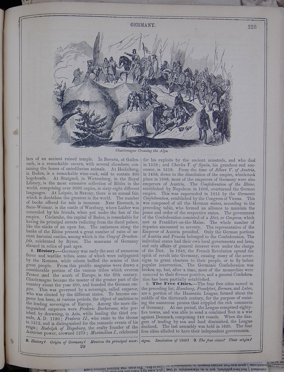 GERMANY.
225
Charlemagne Crossing the Alps.
GERMANY.
225
Charlemagne Crossing the Alps.
of an ancient ruined temple. In Bavaria, at Gailenruth, is a remarkable cavern, with several chambers, containing the bones of antediluvian animals. At Heidelberg, in Baden, is a remarkable wine-cask, said to contain 800 hogsheads. At Stutgard , in Wirtemberg, in the Royal Library, is the most extensive collection of Bibles in the world, comprising over 8000 copies, in sixty-eight different languages. At Leipsic, in Saxony, there is an annual fair, which is doubtless the greatest in the world. The number of books offered for sale is immense. Near Eisenach, in Saxe-Weimar, is the castle of Warzburg, where Luther was concealed by his friends, when put under the ban of the empire. Carlsruhe, the capital of Baden, is remarkable for having its principal streets radiating from the ducal palace, like the sticks of an open fan. The eminences along the banks of the Rhine present a great number of ruins of ancient baronial castles, among which is the Crag of Drachenfels, celebrated by Byron. The museums of Germany abound in relics of past ages.
8. History.—Germany was early the seat of numerous fierce and warlike tribes, some of which were subjugated by the Romans, while others baffled the armies of that great people. From this prolific magazine were drawn a considerable portion of the various tribes which overran France and the south of Europe, in the fifth century. Charlemagne became the master of the greater part of the country about the year 800, and founded the German empire. This was governed by a sovereign, called emperor, who was elected by the different states. To become emperor has been, at various periods, the object of ambition to the leading sovereigns of Europe. Among the more distinguished emperors were Frederic Barbarossa, who perished by drowning, in Asia, while leading the third crusade, A. D. 1190; Frederic II., who came to the throne in 1212, and is distinguished for the romantic events of his reign; Rodolph of Hapsburg, the crafty founder of the Austrian power, crowned 1273; Maximilian I., celebrated for his exploits by the ancient minstrels, and who died in 1519; and Charles V. of Spain, his grandson and successor, in 1519. From the time of Albert V. of Austria, in 1438, down to the dissolution of the empire, which took place in 1806, most of the emperors of Germany were also emperors of Austria. The Confederation of the Rhine, established by Napoleon in 1806, overturned the German empire. This was superseded in 1815 by the Germanic Confederation, established by the Congress of Vienna. This was composed of all the German states, according to the preceding table, who formed an alliance to maintain the peace and order of the respective states. The government of the Confederation consisted of a Diet, or Congress, which met at Frankfort-on-the-Maine. The whole number of deputies amounted to seventy. The representative of the Emperor of Austria presided. Only the German portions of Austria and Prussia belonged to the Confederation. The individual states had their own local governments and laws, and only affairs of general interest were under the charge of the Diet. In 1848, the French Revolution spread the spirit of revolt into Germany, causing many of the sovereigns to grant charters to their people, or to fly before popular insurrection. The Germanic Confederation was broken up, but, after a time, most of the monarchies were restored to their former position, and a general Confederation has been partially established.
9. The Free Cities.—The four free cities named in the preceding list, Hamburg, Frankfort, Bremen, and Lubec, are a portion of the Hanseatic League, formed about the middle of the thirteenth century, for the purpose of resisting the numerous pirates that crippled the rich commerce of Germany. At one period, the League comprised eighty-five towns, and was able to send a combined fleet in a war against Denmark, comprising 248 vessels. When the dangers of trading by sea and land diminished, the League declined. The last assembly was held in 1630. The four free cities alluded to have their independent governments.
8. History? Origin of Germany? Mention the principal sovereigns. Revolution of 1848? 9. The free cities? Their origin?
29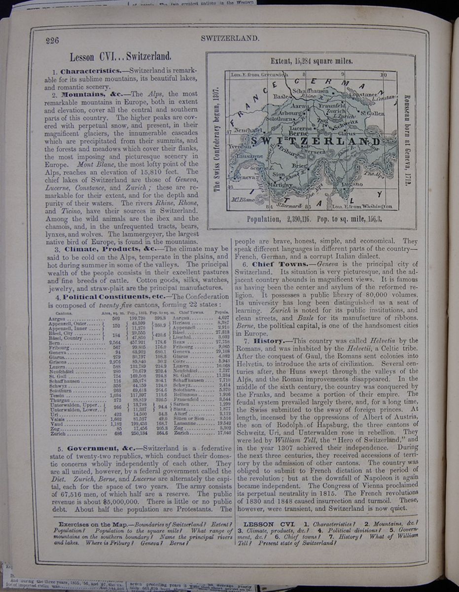 226
SWITZERLAND.
226
SWITZERLAND.
Lesson CVI... Switzerland.
1. Characteristics.—Switzerland is remarkable for its sublime mountains, its beautiful lakes, and romantic scenery.
2. Mountains, &c.—The Alps, the most remarkable mountains in Europe, both in extent and elevation, cover all the central and southern parts of this country. The higher peaks are covered with perpetual snow, and present, in their magnificent glaciers, the innumerable cascades which are precipitated from their summits, and the forests and meadows which cover their flanks, the most imposing and picturesque scenery in Europe. Mont Blanc, the most lofty point of the Alps, reaches an elevation of 15,810 feet. The chief lakes of Switzerland are those of Geneva, Lucerne, Constance, and Zurich; these are remarkable for their extent, and for the depth and purity of their waters. The rivers Rhine, Rhone, and Ticino, have their sources in Switzerland. Among the wild animals are the ibex and the chamois, and, in the unfrequented tracts, bears, lynxes, and wolves. The lammergeyer, the largest native bird of Europe, is found in the mountains.
3. Climate, Products, &c.—The climate may be said to be cold on the Alps, temperate in the plains, and hot during summer in some of the valleys. The principal wealth of the people consists in their excellent pastures and fine breeds of cattle. Cotton goods, silks, watches, jewelry, and straw-plait are the principal manufactures.
4. Political Constituents, etc.—The Confederation is composed of twenty-five cantons, forming 22 states:
A table listing the cantons of Switzerland with their areas, populations, populations to square mile, and chief towns.5. Government, &c.—Switzerland is a federative state of twenty-two republics, which conduct their domestic concerns wholly independently of each other. They are all united, however, by a federal government called the Diet. Zurich, Berne, and Lucerne are alternately the capital, each for the space of two years. The army consists of 67,516 men, of which half are a reserve. The public revenue is about $5,000,000. There is little or no public debt. About half the population are Protestants. The A map of Switzerland. The Swiss Confederacy begun, 1308. Extent, 15,284 square miles. Rousseau born at Geneva, 1712. Population, 2,390,116. Pop. to sq. mile, 156.3. people are brave, honest, simple, and economical. They speak different languages in different parts of the country—French, German, and a corrupt Italian dialect.
6. Chief Towns.—Geneva is the principal city of Switzerland. Its situation is very picturesque, and the adjacent country abounds in magnificent views. It is famous as having been the center and asylum of the reformed religion. It possesses a public library of 80,000 volumes. Its university has long been distinguished as a seat of learning. Zurich is noted for its public institutions, and clean streets, and Basle for its manufacture of ribbons. Berne, the political capital, is one of the handsomest cities in Europe.
7. History.—This country was called Helvetia by the Romans, and was inhabited by the Helvetii, a Celtic tribe. After the conquest of Gaul, the Romans sent colonies into Helvetia, to introduce the arts of civilization. Several centuries after, the Huns swept through the valleys of the Alps, and the Roman improvements disappeared. In the middle of the sixth century, the country was conquered by the Franks, and became a portion of their empire. The feudal system prevailed largely there, and, for a long time, the Swiss submitted to the sway of foreign princes. At length, incensed by the oppressions of Albert of Austria, the son of Rodolph of Hapsburg, the three cantons of Schweitz, Uri, and Unterwalden rose in rebellion. They were led by William Tell, the "Hero of Switzerland," and in the year 1307 achieved their independence. During the next three centuries, they received accessions of territory by the admission of other cantons. The country was obliged to submit to French dictation at the period of the revolution; but at the downfall of Napoleon it again became independent. The Congress of Vienna proclaimed its perpetual neutrality in 1815. The French revolutions of 1830 and 1848 caused insurrection and turmoil. These, however, were transient, and Switzerland is now quiet.
Exercises on the Map.—Boundaries of Switzerland? Extent? Population? Population to the square mile? What range of mountains on the southern boundary? Name the principal rivers and lakes. Where is Friburg? Geneva? Berne?
LESSON CVI. 1. Characteristics? 2. Mountains, &c.? 3. Climate, products, &c.? 4. Political divisions? 5. Government, &c.? 6. Chief towns? 7. History? What of William Tell? Present state of Switzerland?
Lesson CVI... Belgium.
1. Characteristics.—The Kingdom of Belgium may be noted as being the most thickly settled country in Europe, and as having been the scene of numerous celebrated battles within the last 300 years.
2. Face of the Country, &c.—The coasts are flat, requiring dikes to protect them from the sea. The center is undulating; the south mountainous—being crossed by the Ardennes Mountains. The chief rivers are the Meuse and Scheldt. The climate is cool and humid; the soil generally fertile, especially in Flanders. The mountains are covered with thick forests, and having rich mines of iron, coal, copper, zinc, &c.
3. Industry, &c.—Twice as much grain is raised as is needed for home consumption. Flanders is especially famous for its agriculture. The country resembles England—being fenced by hedges. Horned cattle are numerous; colts are exported; and immense numbers of hogs are raised in the forests. Horticulture is an important branch of industry. The mining operations, especially in iron and coal, are very extensive. The fisheries in the open sea, and along the coast, are productive. The manufactures, however, are the chief source of wealth. Four hundred thousand persons are employed in spinning and weaving. The products of the manufactures embrace woolen cloths, cottons, stockings, &c. Eleven million yards of linen fabrics are made annually. Silks, laces, embroideries, ribbons, hats, leather, &c., are extensively manufactured. Much of the fine paper imported into this country comes from Belgium. The iron-forges at Liege and the vicinity are on a vast scale. Steam-engines, firearms, &c., are made there. Thirteen thousand persons are employed in making nails. The commerce is considerable: many of the articles imported pass through into Germany.
4. Railroads, &c.—The railroads centering at Mechlin, radiate in all directions, forming a complete system, the only one in Europe. The whole country is intersected by canals, many of which admit merchant vessels. The main roads are excellent.
5. Government, &c.—This is a constitutional monarchy, with a senate and house of representatives elected by the people. The punishment of death has been abolished. Religious toleration, freedom of the press, and trial by jury are established. The population are mainly Roman Catholics. The clergy of all sects are supported by the state. Each province has a local government. There are universities at Ghent, Liege, Louvain, and Brussels. Inferior seminaries are numerous, but a large part of the people are uneducated. The public revenue is $20,000,000; the debt $180,000,000. The army consists of 90,000 men; the navy is small.
6. Chief Towns.—Brussels, the capital, on the little river Senne, is a beautiful city, and many English people choose it as a residence. The public buildings, parks, squares, promenades, and fountains, present a fine appearance. Ten miles south of this, on the border of the forest of Soigny, is the village of Waterloo, where Napoleon was fatally defeated by the allied army under Wellington and Blucher, in September, 1815. Antwerp, on the Scheldt, is noted for its fine Gothic cathedral, with a beautiful spire, 441 feet high. It has several of the master-pieces of the painter Rubens, who lived a great part of his life in this city. Ghent has one of the largest citadels in Europe. Liege, on the Meuse, is noted for its manufactures.
7. Political Divisions.—These are as follows:
A table listing the provinces of Belgium with their areas, populations, populations per square mile, and capitals.8. Inhabitants.—The Belgians are in part Flemings, of German origin, and in part Walloons, descendants of the ancient Belgæ. The latter live along the borders of France, and resemble the people of that country. The language of the higher classes is French. The lower classes generally speak Flemish, which is a dialect of the low German. The Walloons speak a kind of French patois. The manners of the country are a compound of those of France and Holland. The people are distinguished for honesty and independence, with a mixture of gayety, politeness, and love of show. The Catholics are very strict in their religious observances. The middle and lower classes spend the afternoons and evenings of Sundays in tea-gardens and ball-rooms. Beer-drinking is carried to a great extent. Music is cultivated with enthusiasm. Chimes of bells are so numerous, that in the larger towns they are almost constantly to be heard. A good bell-ringer is sure of a high salary.
9. History.—When Cæsar invaded Gaul, the provinces of East and West Flanders and Antwerp were partially overflowed by the ocean. The soil was so marshy that an inundation or a tempest overturned whole forests, which are still found embedded in the soil. The sea and rivers had no defined limits, and the earth no solidity. Many of the inhabitants of this low plain lived in huts upon the mounds of sand, or elevated above the reach of the tides, on stakes. The southern and southwestern portions, forming the present Walloon country, were covered with immense forests, inhabited by numerous tribes, who lived by hunting and rude agriculture. They had cities inclosed by high stone walls, with fortified gates of great strength. The armies contained troops of cavalry; the country produced supplies of corn and abundance of cattle. The tribes combined against Cæsar, levying 120,000 fighting men. In one battle, near Namur, he reduced an army of 60,000 to 500. After capturing the town of Tongres, he sold 53,000 of the inhabitants for slaves. The highland country just described being subjugated by the Romans, was included in Belgic Gaul, and the people became amalgamated with the Romans, adopting their manners and language. The Belgic soldiers became celebrated for their strength and courage; and Cæsar's victory of Pharsalia was decided by the Belgic cavalry and light-infantry. The lowland people, on the contrary, continued faithful to their ancient manners and customs, pursuing commerce, and assimilating with the inhabitants of Holland. In the fifth century, the Belgic population was a good deal changed by
Exercises on the Map (see p. 220.)—Boundaries of Belgium? Capital? What is its principal seaport? Where is Waterloo? Antwerp? Ypres? Ostend? Direction of the principal towns from Brussels?
LESSON CVII. 1. Characteristics? 2. Face of the country, &c.? 3. Industry, &c.? 4. Railroads, &c.? 5. Government &c.? 6. Chief towns? 7. Political divisions? 8. Inhabitants? 9. History?
[begin surface 798]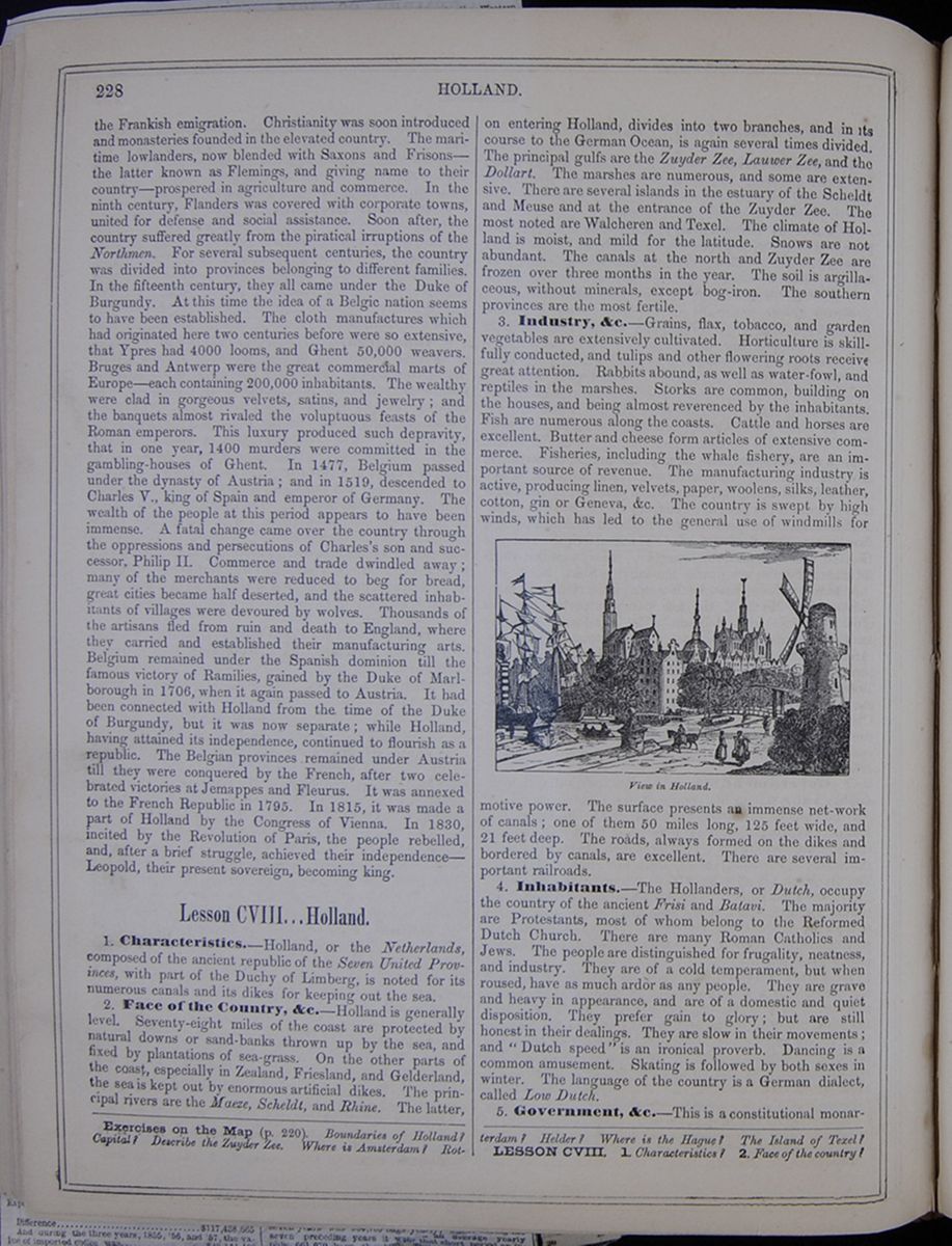 228
HOLLAND.
228
HOLLAND.
the Frankish emigration. Christianity was soon introduced and monasteries founded in the elevated country. The maritime lowlanders, now blended with Saxons and Frisons—the latter known as Flemings, and giving name to their country—prospered in agriculture and commerce. In the ninth century, Flanders was covered with corporate towns, united for defense and social assistance. Soon after, the country suffered greatly from the piratical irruptions of the Northmen. For several subsequent centuries, the country was divided into provinces belonging to different families. In the fifteenth century, they all came under the Duke of Burgundy. At this time the idea of a Belgic nation seems to have been established. The cloth manufactures which had originated here two centuries before were so extensive, that Ypres had 4000 looms, and Ghent 50,000 weavers. Bruges and Antwerp were the great commercial marts of Europe—each containing 200,000 inhabitants. The wealthy were clad in gorgeous velvets, satins, and jewelry; and the banquets almost rivaled the voluptuous feasts of the Roman emperors. This luxury produced such depravity, that in one year, 1400 murders were committed in the gambling-houses of Ghent. In 1477, Belgium passed under the dynasty of Austria; and in 1519, descended to Charles V., king of Spain and emperor of Germany. The wealth of the people at this period appears to have been immense. A fatal change came over the country through the oppressions and persecutions of Charles's son and successor, Philip II. Commerce and trade dwindled away; many of the merchants were reduced to beg for bread, great cities became half deserted, and the scattered inhabitants of villages were devoured by wolves. Thousands of the artisans fled from ruin and death to England, where they carried and established their manufacturing arts. Belgium remained under the Spanish dominion till the famous victory of Ramilies, gained by the Duke of Marlborough in 1706, when it again passed to Austria. It had been connected with Holland from the time of the Duke of Burgundy, but it was now separate; while Holland, having attained its independence, continued to flourish as a republic. The Belgian provinces remained under Austria till they were conquered by the French, after two celebrated victories at Jemappes and Fleurus. It was annexed to the French Republic in 1795. In 1815, it was made a part of Holland by the Congress of Vienna. In 1830, incited by the Revolution of Paris, the people rebelled, and, after a brief struggle, achieved their independence—Leopold, their present sovereign, becoming king.
Lesson CVIII... Holland.
1. Characteristics.—Holland, or the Netherlands, composed of the ancient republic of the Seven United Provinces, with part of the Duchy of Limberg, is noted for its numerous canals and its dikes for keeping out the sea.
2. Face of the Country, &c.—Holland is generally level. Seventy-eight miles of the coast are protected by natural downs or sand-banks thrown up by the sea, and fixed by plantations of sea-grass. On the other parts of the coast, especially in Zealand, Friesland, and Gelderland, the sea is kept out by enormous artificial dikes. The principal rivers are the Maeze, Scheldt, and Rhine. The latter, on entering Holland, divides into two branches, and in its course to the German Ocean, is again several times divided. The principal gulfs are the Zuyder Zee , Lauwer Zee , and the Dollart. The marshes are numerous, and some are extensive. There are several islands in the estuary of the Scheldt and Meuse and at the entrance of the Zuyder Zee . The most noted are Walcheren and Texel. The climate of Holland is moist, and mild for the latitude. Snows are not abundant. The canals at the north and Zuyder Zee are frozen over three months in the year. The soil is argillaceous, without minerals, except bog-iron. The southern provinces are the most fertile.
3. Industry, &c.—Grains, flax, tobacco, and garden vegetables are extensively cultivated. Horticulture is skillfully conducted, and tulips and other flowering roots receive great attention. Rabbits abound, as well as water-fowl, and reptiles in the marshes. Storks are common, building on the houses, and being almost reverenced by the inhabitants. Fish are numerous along the coasts. Cattle and horses are excellent. Butter and cheese form articles of extensive commerce. Fisheries, including the whale fishery, are an important source of revenue. The manufacturing industry is active, producing linen, velvets, paper, woolens, silks, leather, cotton, gin or Geneva, &c. The country is swept by high winds, which has led to the general use of windmills for
View in Holland.motive power. The surface presents an immense net-work of canals; one of them 50 miles long, 125 feet wide, and 21 feet deep. The roads, always formed on the dikes and bordered by canals, are excellent. There are several important railroads.
4. Inhabitants.—The Hollanders, or Dutch, occupy the country of the ancient Frisi and Batavi. The majority are Protestants, most of whom belong to the Reformed Dutch Church. There are many Roman Catholics and Jews. The people are distinguished for frugality, neatness, and industry. They are of a cold temperament, but when roused, have as much ardor as any people. They are grave and heavy in appearance, and are of a domestic and quiet disposition. They prefer gain to glory; but are still honest in their dealings. They are slow in their movements; and " Dutch speed" is an ironical proverb. Dancing is a common amusement. Skating is followed by both sexes in winter. The language of the country is a German dialect, called Low Dutch.
5. Government, &c.—This is a constitutional monarchy,
Exercises on the Map (p. 220). Boundaries of Holland? Capital? Describe the Zuyder Zee . Where is Amsterdam? Rotterdam? Helder? Where is the Hague? The Island of Texel?
LESSON CVIII. 1. Characteristics? 2. Face of the country?
[begin surface 799] DENMARK.
229
DENMARK.
229
the king residing at the Hague. The standing army is fourteen regiments, two squadrons of cavalry, and three battalions of artillery. The navy consists of 105 vessels. The public revenue is $30,000,000; the debt, $500,000,000. The colonies of Java, Sumatra, Borneo, Celebes, Moluccas, and other Asiatic islands, with Surinam and Curaçoa in America, and settlements on the Guinea coast in Africa, comprise a territory of 760,000 square miles, and 27,000,000 of people. Education is well conducted and generally diffused. There are three respectable universities.
6. Political Divisions.—These are as follows :—
A table listing the provinces of Holland with their areas in square miles, populations, populations per square mile, and capitals.7. Towns.—Amsterdam, once the greatest commercial city in Europe, and still a large and important place, is celebrated for its wealth, its state-house, built on thirteen thousand piles, and its canals, separating it into nearly a hundred islands. Rotterdam, on the Meuse, is next to Amsterdam in commercial importance. The Hague, the capital of Holland, is renowned for its beauty. Haarlem is famed for its stupendous organ of eight thousand pipes.
8. History.—In the time of the Romans, Holland was inhabited chiefly by the Batavi and Frisii, the former of whom, after the conquest of Belgium by Julius Cæsar, concluded an alliance with the Romans. This was afterward silently changed into subjection to Rome. In the reign of Vitellius, the Batavians endeavored unsuccessfully to throw off the Roman yoke. In the second century their country was overrun by the Saxons; in the eighth it was conquered by Charles Martel; and it subsequently formed a part of the dominion of Charlemagne. From the tenth to the fourteenth century, the Netherlands were divided into many petty sovereignties, under the Dukes of Brabant, the Counts of Holland and Flanders, &c. In 1388, however, by marriages and otherwise, the whole, with the Belgian provinces, passed into the hands of the Duke of Burgundy; thence to the House of Austria; and finally, in 1548, under the rule of the Emperor Charles V., king of Spain. The union with the latter country was a most unfortunate event for Holland. The Dutch had long been in the enjoyment of many political rights and privileges. They had extensive fisheries and trade; and they had for the most part embraced the doctrines of the early reformers. Philip II., who regarded the privileges enjoyed by the Dutch as usurpations on his own prerogative, and who detested the reformed faith, resolved to recover the former, and to suppress or extirpate the latter. To accomplish this purpose, he sent, in 1567, Ferdinand de Toledo, Duke of Alva, with a powerful army into the Low Countries. But the proscriptions and massacres with which this sanguinary though able soldier filled the country, failed of their object. The Dutch, instead of being subdued, were driven into open rebellion. The malcontents captured the Briel in 1572, and after a struggle unequaled for duration, for the sacrifices it imposed on the weaker party, and for the importance of its results, the independence of the republic—styled the Seven Provinces—was acknowledged by Spain in 1609. Except that it was occasionally darkened by internal feuds, the half century that succeeded this event is the brightest in the Dutch annals. The commerce of Holland attained to an unrivaled magnitude; and while she extended her colonies and conquests over some of the most valuable provinces in the East and West Indies, she successfully resisted the attacks of Louis XIV., contended with England for the empire of the sea, and was justly regarded as one of the bulwarks of the Protestant faith. From the death of Louis XIV. down to the French revolution, the influence of Holland gradually declined, not so much from any decay of her own resources, as from the growth of commerce and manufactures in other states, especially in England. The policy of Holland had long been peaceful; but that could not protect her from being overrun by revolutionary France. In 1806, she was erected into a kingdom for Louis, a brother of Napoleon; and on the downfall of the latter, she was united with Belgium, and formed into a kingdom under the family of Orange, the founders of her liberties. But the union was never cordial. The Dutch and Belgians are, in fact, dissimilar in their religion, character, and pursuits; and the connection between them was dissolved by the revolt of the Belgians soon after the French revolution of 1830. Holland has now nearly the same limits as before her occupation by the French in 1795. In 1840, the king, William I., abdicated the throne in favor of his eldest son, William II., who is still on the throne.
Lesson CIX... Denmark.
1. Characteristics.—Denmark is a small kingdom, lying at the entrance of the Baltic, and comprising the peninsula of Jutland, with some contiguous islands, and the duchies of Schleswig, Holstein, and Lauenburg.
2. Face of the Country, &c.—The coasts are greatly indented, and the country is perfectly flat—some parts being below the level of the sea, and defended by dikes. To the east, it rises gradually, the highest point being 500 feet. The Elbe makes the southern boundary. The river Eider, in connection with a canal, forms the boundary between Holstein and Schleswig, and opens a communication between the Baltic and the German Ocean. The climate is humid and cloudy, though mild for its latitude. The soil is alluvial, and excellent for pasturage. Marshes occupy one-third of the surface of the peninsula.
3. Islands, &c.—Seeland, or Zealand, is the largest and the most important of the Danish islands—its extent being 2675 square miles. Copenhagen is on the east side. Funen contains 1123 square miles. Laland , or Lolland, one of the most fertile of the Danish islands, contains 462 square miles. The peninsula of Jutland, including the duchies, is about 350 miles long.
4. Industry.—Agriculture has been greatly improved of late. The grains are extensively cultivated. Cattle and horses are reared on a great scale. Game and fish are abundant. The mineral products are insignificant. There being no coal and no water-power, the manufactures are
3. Industry, &c.? 4. Inhabitants? 5. Government? 6. Political divisions? 7. Towns? 8. History?
Exercises on the Map (see p. 220).—Boundaries of Denmark? Capital? What sea to the east? To the west? Where is the island of Funen? Laland?
LESSON CIX. 1. Characteristics? 2. Face of the country,
[begin surface 800]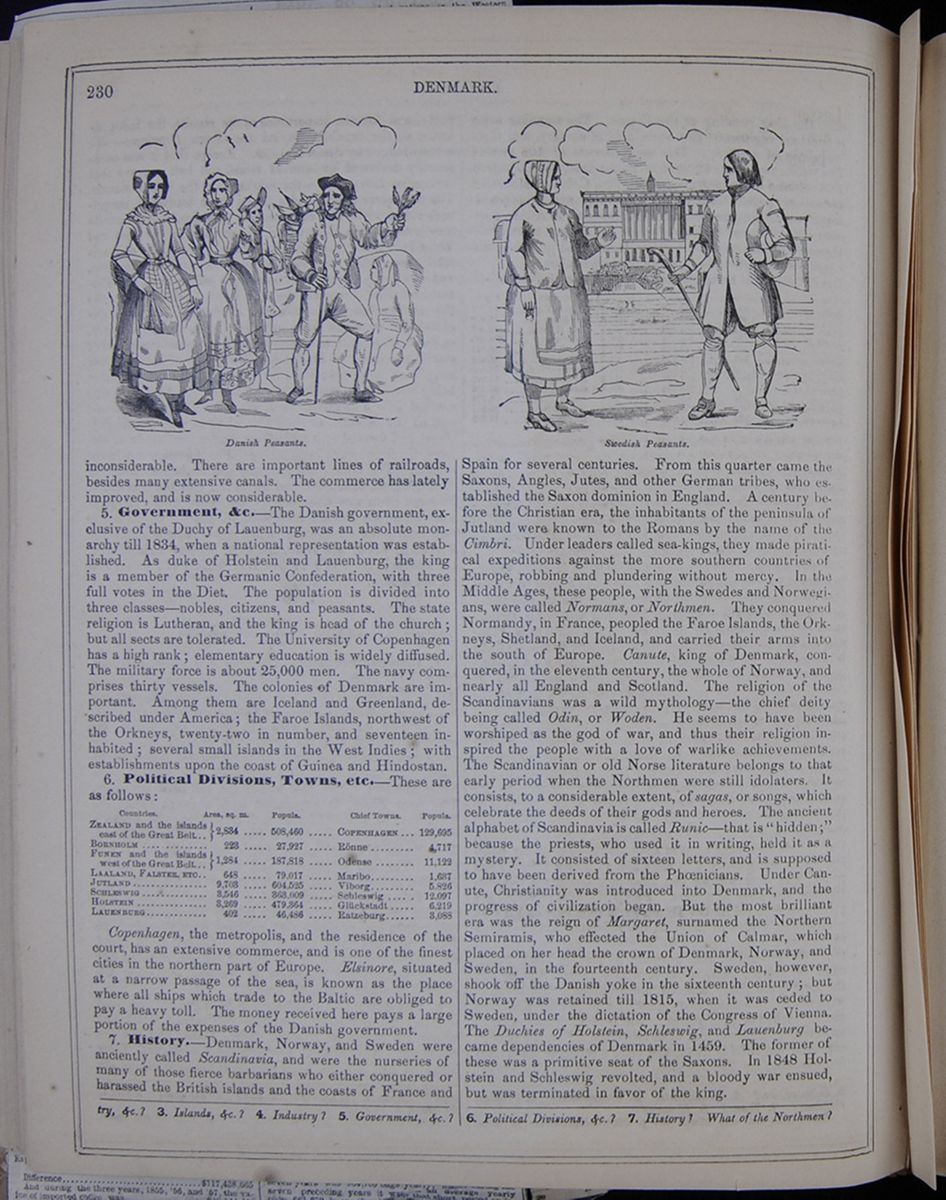 230
DENMARK.
Danish Peasants.
230
DENMARK.
Danish Peasants.
inconsiderable. There are important lines of railroads, besides many extensive canals. The commerce has lately improved, and is now considerable.
5. Government, &c.—The Danish government, exclusive of the Duchy of Lauenburg, was an absolute monarchy till 1834, when a national representation was established. As duke of Holstein and Lauenburg, the king is a member of the Germanic Confederation, with three full votes in the Diet. The population is divided into three classes—nobles, citizens, and peasants. The state religion is Lutheran, and the king is head of the church; but all sects are tolerated. The University of Copenhagen has a high rank; elementary education is widely diffused. The military force is about 25,000 men. The navy comprises thirty vessels. The colonies of Denmark are important. Among them are Iceland and Greenland, described under America; the Faroe Islands, northwest of the Orkneys, twenty-two in number, and seventeen inhabited; several small islands in the West Indies; with establishments upon the coast of Guinea and Hindostan.
6. Political Divisions, Towns, etc.—These are as follows:
A table listing the countries of Denmark with their areas in square miles, populations, and chief towns.Copenhagen, the metropolis, and the residence of the court, has an extensive commerce, and is one of the finest cities in the northern part of Europe. Elsinore, situated at a narrow passage of the sea, is known as the place where all ships which trade to the Baltic are obliged to pay a heavy toll. The money received here pays a large portion of the expenses of the Danish government.
7. History.—Denmark, Norway, and Sweden were anciently called Scandinavia, and were the nurseries of many of those fierce barbarians who either conquered or harassed the British islands and the coasts of France and
Swedish Peasants.Spain for several centuries. From this quarter came the Saxons, Angles, Jutes, and other German tribes, who established the Saxon dominion in England. A century before the Christian era, the inhabitants of the peninsula of Jutland were known to the Romans by the name of the Cimbri. Under leaders called sea-kings, they made piratical expeditions against the more southern countries of Europe, robbing and plundering without mercy. In the Middle Ages, these people, with the Swedes and Norwegians, were called Normans, or Northmen. They conquered Normandy, in France, peopled the Faroe Islands, the Orkneys, Shetland, and Iceland, and carried their arms into the south of Europe. Canute, king of Denmark, conquered, in the eleventh century, the whole of Norway, and nearly all England and Scotland. The religion of the Scandinavians was a wild mythology—the chief deity being called Odin, or Woden. He seems to have been worshiped as the god of war, and thus their religion inspired the people with a love of warlike achievements. The Scandinavian or old Norse literature belongs to that early period when the Northmen were still idolaters. It consists, to a considerable extent, of sagas, or songs, which celebrate the deeds of their gods and heroes. The ancient alphabet of Scandinavia is called Runic—that is " hidden;" because the priests, who used it in writing, held it as a mystery. It consisted of sixteen letters, and is supposed to have been derived from the Phœnicians. Under Canute, Christianity was introduced into Denmark, and the progress of civilization began. But the most brilliant era was the reign of Margaret, surnamed the Northern Semiramis, who effected the Union of Calmar, which placed on her head the crown of Denmark, Norway, and Sweden, in the fourteenth century. Sweden, however, shook off the Danish yoke in the sixteenth century; but Norway was retained till 1815, when it was ceded to Sweden, under the dictation of the Congress of Vienna. The Duchies of Holstein, Schleswig, and Lauenburg became dependencies of Denmark in 1459. The former of these was a primitive seat of the Saxons. In 1848 Holstein and Schleswig revolted, and a bloody war ensued, but was terminated in favor of the king.
&c.? 3. Islands, &c.? 4. Industry? 5. Government, &c.? 6. Political Divisions, &c.? 7. History? What of the Northmen?
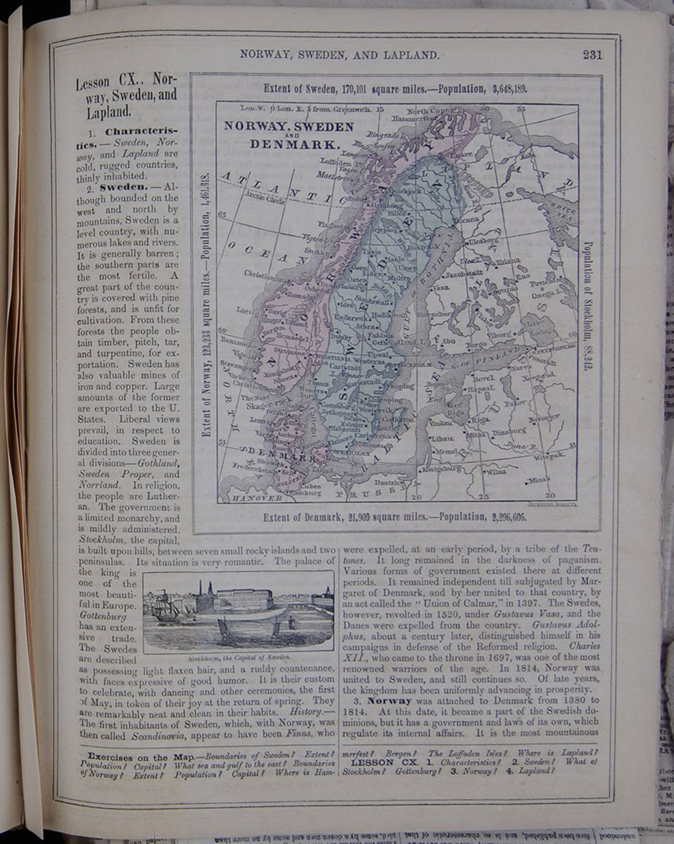
Lesson CX.. Norway, Sweden, and Lapland.
1. Characteristics.—Sweden, Norway, and Lapland are cold, rugged countries, thinly inhabited.
2. Sweden.—Although bounded on the west and north by mountains, Sweden is a level country, with numerous lakes and rivers. It is generally barren; the southern parts are the most fertile. A great part of the country is covered with pine forests, and is unfit for cultivation. From these forests the people obtain timber, pitch, tar, and turpentine, for exportation. Sweden has also valuable mines of iron and copper. Large amounts of the former are exported to the U. States. Liberal views prevail, in respect to education. Sweden is divided into three general divisions—Gothland, Sweden Proper, and Norrland. In religion, the people are Lutheran. The government is a limited monarchy, and is mildly administered. Stockholm, the capital, is built upon hills, between seven small rocky islands and two peninsulas. Its situation is very romantic. The palace of the king is one of the most beautiful in Europe. Gottenburg has an extensive trade. The Swedes are described
Stockholm, the Capital of Sweden.as possessing light flaxen hair, and a ruddy countenance, with faces expressive of good humor. It is their custom to celebrate, with dancing and other ceremonies, the first of May, in token of their joy at the return of spring. They are remarkably neat and clean in their habits. History.—The first inhabitants of Sweden, which, with Norway, was then called Scandinavia, appear to have been Finns, who
A map of Norway, Sweden, and Denmark. Extent of Norway, 123,233 square miles.—Population, 1,461,318. Extent of Sweden, 170,101 square miles.—Population, 3,648,189. Population of Stockholm, 88,242. Extent of Denmark, 21,909 square miles.—Population, 2,296,606.were expelled, at an early period, by a tribe of the Teutones . It long remained in the darkness of paganism. Various forms of government existed there at different periods. It remained independent till subjugated by Margaret of Denmark, and by her united to that country, by an act called the "Union of Calmar," in 1397. The Swedes, however, revolted in 1520, under Gustavus Vasa, and the Danes were expelled from the country. Gustavus Adolphus, about a century later, distinguished himself in his campaigns in defense of the Reformed religion. Charles XII., who came to the throne in 1697, was one of the most renowned warriors of the age. In 1814, Norway was united to Sweden, and still continues so. Of late years, the kingdom has been uniformly advancing in prosperity.
3. Norway was attached to Denmark from 1380 to 1814. At this date, it became a part of the Swedish dominions, but it has a government and laws of its own, which regulate its internal affairs. It is the most mountainous
Exercises on the Map.—Boundaries of Sweden? Extent? Population? Capital? What sea and gulf to the east? Boundaries of Norway? Extent? Population? Capital? Where is Hammerfest? Bergen? The Loffoden Isles? Where is Lapland?
LESSON CX. 1. Characteristics? 2. Sweden? What of Stockholm? Gottenburg? 3. Norway? 4. Lapland?
[begin surface 802]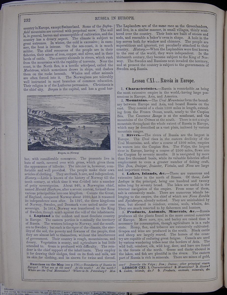 232
RUSSIA IN EUROPE.
232
RUSSIA IN EUROPE.
country in Europe, except Switzerland. Some of the Dofrafield mountains are covered with perpetual snow. The soil is, in general, barren and unsusceptible of cultivation, and the country has a dreary aspect. The climate is subject to great extremes. In winter, the cold is excessive; in summer, the heat is intense. On the sea-coast, it is much milder. The chief resources of the people are in their fisheries, their mines of iron, copper, and silver, and in their herds of cattle. The country abounds in rivers, which rush from the mountains with the rapidity of torrents. Near the coast, in the North Sea, is a terrific whirlpool, called the Maelstrom, which sometimes draws in ships, and dashes them on the rocks beneath. Whales and other animals are often forced into it. The Norwegians are tolerably well instructed in most branches of common education. Their religion is of the Lutheran persuasion. Christiania is the chief city. Bergen is the capital, and has a good harbor, Bergen, in Norway. with considerable commerce. The peasants live in huts of earth, covered over with grass, which gives them the appearance of hillocks. The interior is, however, comfortable and well provided. The people make their own articles of clothing. They are frank, brave, and independent. History.—Little is known of the history of Norway till the tenth century, at which time it was divided into a number of petty sovereignties. About 940, a Norwegian chief, named Harold Harfagre , after a severe contest, formed these various principalities into one kingdom. Canute the Great, of England, conquered Norway about 1030, but it resumed its independence soon after. In 1397, the three kingdoms of Norway, Sweden, and Denmark were united under one sovereign. In 1814, Norway was transferred to the King of Sweden, though much against the will of the inhabitants.
4. Lapland is the coldest and most desolate country in Europe. The eastern portion is nominally the territory of Russia. The western belongs to Norway, and the southern to Sweden; but such is the rigor of the climate, the sterility of the soil, the poverty and fewness of the people, that they are almost left to themselves, without the interference of government. Their country is rough, mountainous, and dreary. Vegetation is scanty, and agriculture is but little attended to. Grain is produced with difficulty. The reindeer is the chief support of the inhabitants. They employ it for drawing their sledges, feed on its flesh and milk, use its skin for clothing, and its sinews for twine and thread.
The Laplanders are of the same race as the Greenlanders, and live, in a similar manner, in small villages, thinly scattered over the country. Their huts are built of stones and sods, and resemble a baker's oven in shape. A hole in the top serves both for window and chimney. The people are superstitious and ignorant, yet peculiarly attached to their country. History.—When the Laplanders were first known to the rest of the world, they were independent. In the thirteenth century, they became subject to the King of Norway. The Swedes and Russians next invaded the territory, and at present the country is subject to the governments of Sweden and Russia.
Lesson CXI... Russia in Europe.
1. Characteristics.—Russia is remarkable as being the most extensive empire in the world, having large possessions in Europe, Asia, and America.
2. Mountains.—The Ural Mountains form the boundary between Europe and Asia, and bound Russia on the east. They consist of a chain 1200 miles in length, extending from the Frozen Ocean, south, nearly to the Caspian Sea. The Caucasus Range is at the southeast, and the mountains of the Crimea at the south. There is not a single mountain throughout the whole extent of Russia in Europe, which may be described as a vast plain, inclosed by various mountain ranges.
3. Rivers.—The rivers of Russia are the largest in Europe. The Ural rises in the eastern declivity of the Ural Mountains, and, after a course of 1300 miles, empties its waters into the Caspian Sea. The Volga, the largest river in Europe, having a course of 2500 miles, flows into the Caspian by seventy mouths. It is navigated by more than five thousand boats, while its valuable fisheries afford employment to even a greater number of fishing craft. The Don, Dnieper, Dniester, Vistula, and Neva are large and important rivers.
4. Lakes, Islands, &c.—There are numerous and extensive lakes in the north of Russia. Of these, Lake Ladoga is the principal, being one hundred and twenty miles long by seventy broad. The lakes are useful in the internal navigation of the empire. From some of them, salt is extensively made. There are numerous islands belonging to the empire, the chief of which are Nova Zembla and Spitsbergen, already noticed. They are uninhabited by man, but abound in reindeer, ermine, seals, whales, &c. They are much resorted to by fishermen and hunters.
5. Products, Animals, Minerals, &c.—Russia produces all the plants found in the more central countries of Europe. More corn, rye; and barley are raised than is necessary for consumption, though agriculture is in a rude state. Hemp, flax, and tobacco are extensively cultivated. Grapes and wine are produced in the south. Black cattle and sheep are largely reared. The horses of the country are capable of enduring great fatigue. Camels are used by various wandering tribes near the borders of Asia. The wild bull, reindeer, elk, wild hog, deer, and hare are found in the forests of the north. Geese and ducks abound in the lakes, and fish are plentiful in the rivers. The eastern part of Russia is rich in minerals. There are mines of gold,
Exercises on the Map (see p. 176).—Boundaries of Russia in Europe? What sea at the west? At the south? At the north? Where are the Ural Mountains? Where is St. Petersburg? Moscow? Describe the Volga; Don; Dwina; other principal rivers.
LESSON CXI. 1. Characteristics? 2. Mountains? 3. Rivers? 4. Lakes, islands, &c.? 5. Products, animals, minerals, &c.
Our Stockholm Correspondence.
STOCKHOLM, August 19, 1857.Constitution of the Scandinavian Kingdoms—The Administration of Justice in Norway—The Swedish Diet—The Swedish Public School System—Temperance Societies—Political Reforms Contemplated by the King, &c , &c.
The governments of the United Kingdoms of Norway and Sweden are so very different from all others in Western Europe that it may not be amiss to say a few words respecting them. This I propose to do in the present communication.
There two countries, which constitute the great Scandinavian peninsula, as I stated in my last, are under the dominion of one and the same monarch, Oscar I., as he is called; but in almost all respects they are separate and independent kingdoms. Each has its own legislature, judiciary treasury, army, navy, and even currency.
The Norwegians pay a part of the salary of the King, and a part of the salaries of the ambassadors of the United Kingdom of Sweden and Norway. It is only since 1814 that they have been united to Sweden. Before that epoch they were under the sway of Denmark ever since the treaty of Calmar, in the latter part of the fourteenth century.
Although no more than a million and a half in number, the Norwegians have an excellent government, and are by far the best prepared people in Europe for a republican form of government. In fact they have what is substantially a republic, but without the name. Their connection with Sweden is almost nominal. The King of Sweden appoints a Viceroy, who resides—or usually does—at Christiana, which is the capital of the country and has some 40,000 inhabitants. I visited it a few years ago and found it to be a very pleasant place. There is a vacancy in this office at present, and it has been doubted whether the King will appoint another soon; for the Norwegians believe that they ran do as well without one as with.
The legislature of Norway meets once in three years, which is the term for which its membe s are chosen. It consists of one hundred men, who, when they assemble at the opening of the session, put their names in an urn, from which twenty-five are drawn by lot. These constitute the upper house, or Senate, which is called the Lagthing . The remainder (seventy-five) constitute the lower house, or Oedelsthing ; and the two together constitute the Storthing .
The Storthing makes the laws of Norway, but the King of Sweden has the right to veto the acts of the Storthing if he should think proper. But if the Storthing should pass a vetoed act at three successive sessions of the body by a simple majority in each house, then it becomes a law despite the King of Sweden's veto. Nor is this provision of the Norwegian constitution, which was formed after the model of ours in many of its features, a dead letter. On the contrary, it has of en been acted upon. It is an admirable provision against the abuse of the veto. The only objection which I have to it is, that it requires too long a time. Three Storthing demand too much time; two would be enough, for here would be time enough in which to consult the will of the nation. As it is, the people certainly have ample time in which to consider the acts in question.
In my opinion, the Norwegians have taught us a lesson in this matter. Wi h us the President may veto an act of Congress if he thinks proper. This is well enough as a safeguard against hasty legislation. But let the President give his reasons to Congress for exercising his veto; let that body reconsider the subject, and then if they should pass the act a second time during the same session, and pass it again in the next new Congress—which could in no case be a delay of longer than two years—that done the act ought to stand as the law of the nation, for there has been time enough in which to hear the voice of the nation. As the veto now stands with us, it puts too much power in the hands of the President. Too great a vote is required to overthrow that veto; nor is there as direct and decided reference of the question to the people as there should be. Until the time President Pierce, as far as my recollection serves, not one veto of a President had been voted down by Congress—for the simple reason that it was always easy for the President to command a minority sufficiently large to defeat the will of the majority, so that with the help of a minority he could defeat acts most important to the best interests of the country. The Norwegians have managed this matter better than we have.
There are some things very striking in the administration of justice in Norway. As in Denmark, there is in every parish a judge, chosen for three years by the people, before whom all civil cases must be brought in the first instance. He hears both sides, and gives his opinion or decision. If the parties agree to abide by it, very well. But if one party is unwilling, and insists upon going into a law court, the case must go thither; but should it be decided against the party that thus insisted, he must bear the costs of the trial in the law court.
There is another excellent thing in the administration of justice in Norway—it is the fact that the decision of the inferior courts are reviewed by higher ones, and if a wrong decision has been made and discovered, the case is sent down again to the court that made it, with instructions to decide otherwise.
And then, too, the judges are accountable for their decisions, and if found incapable, are dismissed from office; and, in some cases, if negligent, are fined. Only think of that! Would it not be well if we had some such provision with us, to guard us against having incompetent and unprincipled judges? I think decidedly that it would.
As to Sweden, it has a diet, which is a legislative body that consists of not less than four houses or branches. In the first place there is the House of the Nobles. They meet in one end of a large building on the northern side of the island, on which the palace of the king stands; the other end is devoted to holding of courts. The hall in which the nobles meet is a fine large room, and its walls are covered over with the coats of arms of the several members, painted on pieces of tin about fourteen inches long by ten wide. The number of the heads of noble families who have the right to a seat in this body is about 1,150, but seldom do more than 500 attend, who sit on plain benches, covered with black cloth, and without backs. The presiding officer and two clerks occupy a platform on one side of the hall. The members sit with their hats on, as do the members of the House of Lords in England This body contains a considerable number of able men; but the greater part are not men of much note, although proud of their noble origin. Sweden is full of noble families, some of which possess a good deal of property in lands and mines; but by far the greater part are poor; and if it were not for positions in the civil government or in the army, they would starve. The Hall of the Nobles has witnessed many turbulent scenes in days gone by.
The next house of the diet which I would mention is that of the clergy, consisting of sixty members, (at least they told me so yesterday, when I was in it,) of whom the Archbishop of Upsala and the other bishops, are twelve. The other members are chosen by the diocesses to which they belong. They are paid also by the diocesses.
The third house is that of the burgesses or representatives of the cities and boroughs. They are, in the present diet, sixty-six in number, and are by far the most enlightened body of the whole
The fourth and last house is that of the farmers or peasants, which contains about one hundred and twenty members—plain, but sensible men—rather slow in their deliberations. They have a striking appearance, dressed in the various costumes which prevail in different parts of the country. As there is not a lawyer among them, the King appoints, at the commencement of every session, a distinguished jurist, whose duty it is to give proper shape to the bills which the body wish to pass; and also to inform them, as their legal advisor, when he sees that they are about to do something which would be unconstitutional. He sits by the side of the presiding officer of the body, but has no vote.
Such, in few words, is the diet of Sweden. As the vote on any question is by houses, it of course requires the vote of three of them to pass any law or act; and on questions touching the constitution, unanimity is required. Legislation with such a body must be slow enough. The diet meets once in three years, and the sessions are sometimes a year and a half in length.
The burgesses and farmers are paid each by his constituents. Some get more than others, but none of them get as much as three dollars of our money per day. This would be considered poor pay in our country; but in Sweden living is far cheaper than with us.
A few years ago the King, who is one of the most enilghtened monarchs in Europe, proposed to the diet a change in the constitution, so as to have a diet of two houses, like the Parliament of England. But only one of the four houses was in favor of the change; that was the House of the Burgesses, a fact which speaks volumes in regard to the question. Which portion of the population of any country is most likely to take the lead whenever the subject demands intelligence and freedom of speech? It is, as all history proves, the inhabitants of the cities and large towns where opinions circulate more readily, where knowledge is most easily brought together to discuss, to resolve, to act.
But Sweden is waking up. A system of public schools has been established by law, and is gradually going into efficient operation. Railroads are beginning to be made. There is a large number of steamboats running along the coasts and on the lakes and rivers. The temperance societies are doing much good, especially in the rural districts. The country is out of debt, the navy is quite largh enough for the protection of the commerce of the nation. The army of Sweden contains 36,000 officers and men, and is in a good state of discipline.
Norway is also advancing steadily. Both countries are in a very prosperous condition. The question of religious liberty is much discussed in both countries. On this question Norway is ahead of Sweden; but the question is now agitating the diet of the latter country. The House of Burgesses is all right, as, too, for a wonder, is the House of the Nobles. I fear the House of Farmers will not come up to the mark, though they are prepared to do something. But I am ashamed to say that the House of the Clergy will hold back. The King is ready for any measure of religious liberty, however large. On this subject, as well as on almost every other, he has been greatly in advance of the people over whom he reigns. Alas! I amy sorry to say that I fear he is near the end of his reign. He is very unwell. At this time he is at the sea shore, near Gottenberg, for the purpose of bathing, but is expected in town in a few days. The Crown Prince, I regret to say, is by no means as promising as could be desired.
To-morrow I must leave for St. Petersburg, by way of Abo and Helsingfors, the chief towns in Finland.
[begin surface 804]
Our Copenhagen Correspondence.
COPENHAGEN, August 11, 1857.The Tour of Europe with the Part of Hamlet Left Out—The Scandinavian Regions—The True Sources of Anglo-Saxon Blood and Enterprise—Scandinavia the Stronghold of the Reformation—Refinement and Intellectual Culture of the Modern Danes—Universities of Copenhagen and Kiel—The Thorwaldsen Museum—Antiquarian Collections—Royal Morals—The Protestant Scandinavian Synod—The Sound Dues Question, &c., &c.
An unexpected detention in this good old city of Kjobenhavn enables me to send you another letter before I leave for Gottenburg and Stockholm, which I purpose to do in a few hours.
It is extraordinary that so few Americans come to these Scandinavian countries, notwithstanding that they are so full of interesting things, to say nothing of their historical associations and the interesting character of the people. Our people, when they come to Europe, travel about England, Ireland, Scotland, visit Paris, Brussels, Waterloo, perchance go up or down the Rhine, go as far as Geneva and Mont Blanc, and some of them as far as Rome, Naples and Vesuvius, and then return home, entertaining the idea that they have seen Europe. Just so it was with the English until later times. Many went over to Paris, Lyons, Marseilles, down into Italy as far as Rome and Naples, and then returned through Switzerland, down the Rhine into Belgium, and so back to England. And this was making the "tour of Europe," in their estimation. Few of them diverged into Germany to see the vast stores of art and knowledge which are there. It was hardly once in an age that one of them adventured into Spain—or nearer to it than the rock of Gibraltar—even to see a bull fight, although one would think that from their own name of "John Bull," and their insatiable fondness for the beastly amusement of the "ring," they would certainly have been attracted to both Spain and Portugal. But as to coming up to these Scandinavian regions, to whose bold ancestors and the transmission of a portion of their blood in the veins of the English to this day, they owe all the energy and strength that is in them, they never thought of doing such a thing. Talk of Saxon blood and Saxon character! It was the Norman energy and character that made the English race what they are. We have had enough of Anglo Saxon glorification. Nonsense, the whole of it.
Yes, it was the men of these Northern regions, the sons of Odin; it was the Harolds, the Sigurds, the Claps, the Haarfagers, the Canutes, the Svends, the powerful jarls of old Norse, and Scone, and Danske, whose descendants in England have dwindled down into the earls of that country, who made the English race what it is. What a people the children of Odin were ! For ages heathen of the most ferocious character, whose chief happiness on earth was found in war, or in the marauding expedition, and whose bliss in heaven was to be hoped for in drinking mead out of the skulls of their enemies in the 354 halls of Valhalla, in Godheim, the land whence they supposed their ancestors to have come to Manheime or these Scandinavian countries. But Christianity conquered them, and commenced the work of their civilization.
The best thing that Charlemagne ever did was to plant a missionary station, more than a thousand years ago, at Ham, near where Hamburg now stands, in order that the light might shine up from that focal point into all these hyperborean regions; and it did shine; and when the Reformation came and brought to these people a purer Christianity than they had before possessed, these inhabitants received it, even their kings and nobles taking the lead.
The fact is, these brave people of the North did not know much about Rome; and the little they knew did not particularly dispose them to obey an old man in that city whom, when they went there, they saw dressed up like an old woman and surrounded by "Cardinals," as they were called, who also resembled old women. This was too much for these Scandinavian folk, and so at the first blast from the trumpet of Martin Luther they pricked up their ears, and as a goodly number of their younger clergy, and among them such men as Claus and Laurentius Petri, had been disciples of the Wittemburg Doctor, they went over in mass to the ranks of the reformers, their kings, and especially the immortal Gustavus Vasa, marching at their head. At that day Finland belonged to Sweden, and Norway belonged to Denmark. And so the whole four Scandinavian countries, now numbering about eight millions of inhabitants, became so universally Protestant, that even at this day the Pope has almost no foothold at all in these parts. Think of that, Dr. Hughes. I suppose that there may be three, possibly four, Roman Catholic churches in Denmark, very insignificant ones; none at all in Norway, that I know of, nor even a priest, unless it be some skulking Jesuit, who is trying to get into that rocky realm—land of froids and fjelds (I have heard something of the sort)—whose constitution positively forbids, or did a few years ago, a Jesuit or a Jew to set foot in that country. Think of that, I repeat, Dr. Hughes. In Sweden there is one small Roman Catholic church, and two priests at Stockholm. And there is, I believe, one Roman Catholic church and one priest in Finland. So you see how things stand in these parts. I am quite sure that you will find, on inquiry, that the above given statistics are substantially correct.
I am always pleased to visit Copenhagen. The Danes are a civil and well disposed people. They are also well educated; and among the higher classes there is a great deal of refinement and superior culture. They resemble the English and Americans more than other people on the continent, not even excepting the Hollanders. The Norwegians and Swedes, on the other hand, resemble more the Scotch, who are evidently a kindred race.
There are two universities in this Kingdom—one at Copenhagen for the Danish students, those from the "islands" and Jutland; the other at Kiel, for the Germans of Holstein and Schleswig. The literature of this Kingdom is of the most respectable order, both as to character and quantity. Some of their writers have a world-wide reputation. And as to the fine arts, their own Thorwaldsen has shown that there is genius in these cold regions. One of the most interesting objects in this city is the Thorwaldsen Museum, close by the great Christianborg Palace, where you will see the models of all the works which that great artist made, and the originals or copies in marble of many of them. There, too, you will see his library, his collection of coins and antiques, paintings, &c., all bequeatehd by him to this museum or gallery; another is the group of Christ and the Apostles, also made by Thorwaldsen , and presented to the True Kirke, or Church of Our Lady—in other words, the Church of Mary—the real Notre Dame of Copenhagen.
The number of objects to be seen in this city and its vicinity is immense. There are the ramparts, the Navy Yard—on Amager island, on which the city partly stands, but mainly on Zealand—the great fortress called the Castle or Citadel, and the Freknother, also a strong fort, nearly opposite and nearly a mile distant, that gave Lord Nelson in the battle of Copenhagen (April 2, 1801) so much trouble. Then there are three palaces in the city, and one in the neighborhood, which ought to be seen. One of them, the Rantenberg palace, contains one of the finest collections of coins, medals, &c., in the world. I went through it yesterday, and was assured that it has 100,000. The garden attached to this palace is the most beautiful spot for promenading in Copenhagen. But to my mind the most interesting thing in this city is a collection of antiquities belonging to the Northern Antiquarian Society. It is admirably arranged in an old palace. There is nothing like it in all the world. It is a great book, as it were, where one may study the progress of civilization in the Scandinavian countries, from the first down till modern times; and one of the greatest "curiosities" in it, though not an antiquity, is the famous Professor Thomson, who is the chief curator, or superintendent.
The environs of Copenhagen are charming at this season. The entire "coast," up to Elsinore—eighteen or twenty miles—is beautifully studded with fine country houses of rich Danes, in the midst of noble parks and forests.
Denmark is not well governed. King Frederick VII. is an unworthy successor of a long line of monarchs. He was divorced from two wives in earlier life, and is now living (married it is true) with a woman of no pretentions to beauty, who was once the mistress of an editor here, and is now mistress, it is reported, of the Chief Chamberlain, and at the same time wife of the King. The creature must have some talent, for she was once a mantua maker or milliner (I forget which), and a lady of my acquaintance informs me that she has often visited her shop. As the English say, she is certainly very "clever." Of course no Danish lady of distinction sets her foot in the palace.
One of the most interesting events which have occurred here lately has been the holding of a sort of Synod of Protestant ministers from all the Scandinavian countries. About one hundred were present. This is an important movement. It is a sign? I shall speak of it again perhaps.
I conclude by saying our country has been ably represented here the last four years by the Hon. Mr. Barringer, from Virginia. It is to his wise, prudent and able management that the "Sound Dues question," as it is called, has been so well settled. The Danes themselves are now convinced that it was one of the best things which could have occurred for them, and Mr. B receives many thanks. Of the $25,000,000 (of Spanish dollars) our share is less than $400,000. But, mark this fact, and proclaim it to the world: Whilst all the other ambassadors have been elevated in rank or otherwise honored, Mr. Barringer is recalled, to make place for some aspirant to office.
[begin surface 806]
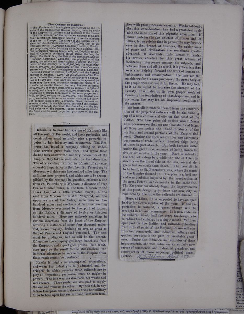 [begin surface 808]
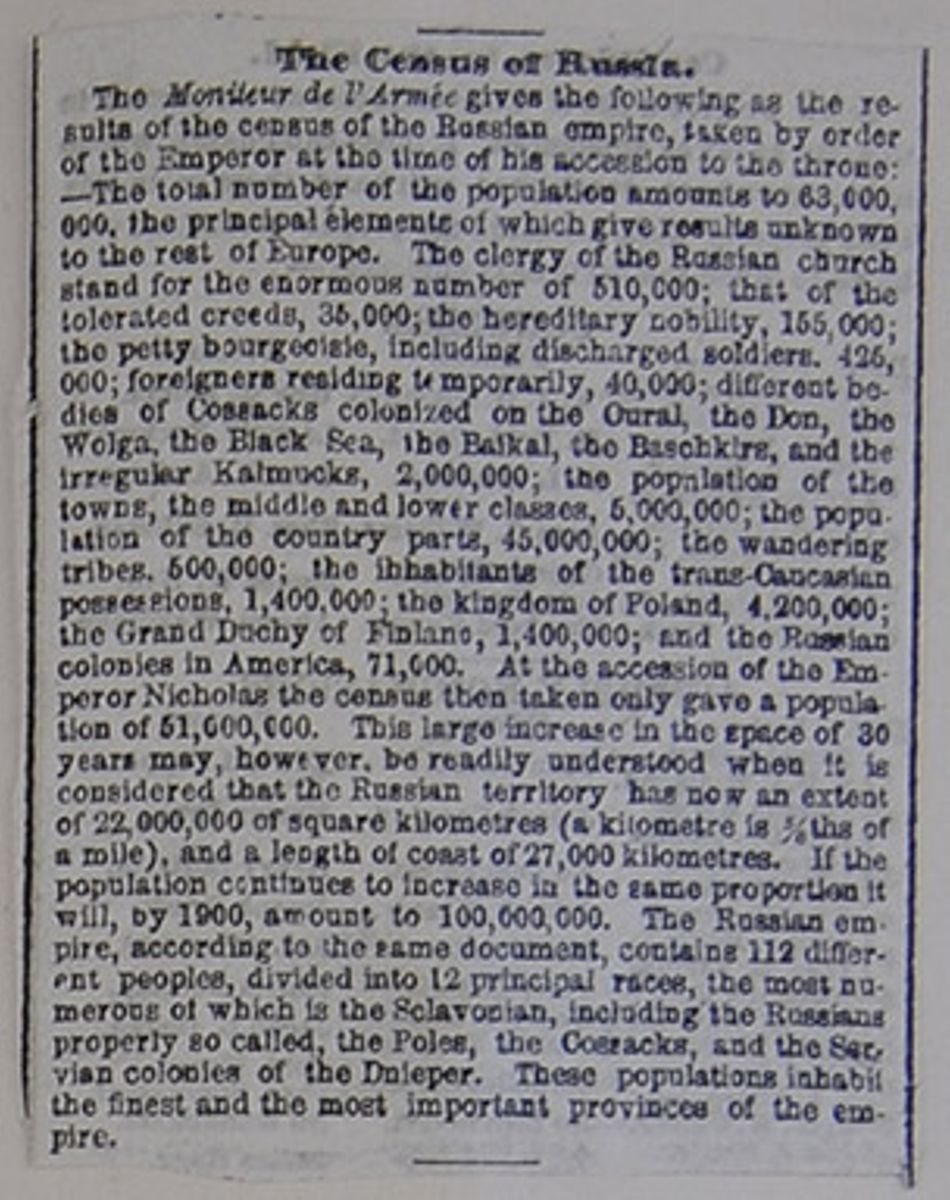
The Census of Russia.
The Moniteur de l'Armée gives the following as the results of the census of the Russian empire, taken by order of the Emperor at the time of his accession to the throne:—The total number of the population amounts to 63,000,000, the principal elements of which give results unknown to the rest of Europe. The clergy of the Russian church stand for the enormous number of 510,000; that of the tolerated creeds, 35,000; the hereditary nobility, 155,000; the petty bourgeoisie, including discharged soldiers. 425,000; foreigners residing temporarily, 40,000; different bodies of Cossacks colonized on the Oural, the Don, the Wolga, the Black Sea, the Baikal, the Baschkirs , and the irregular Kalmucks, 2,000,000; the population of the towns, the middle and lower classes, 5,000,000; the population of the country parts, 45,000,000; the wandering tribes. 500,000; the inhabitants of the trans-Caucasian possessions, 1,400,000; the kingdom of Poland, 4,200,000; the Grand Duchy of Finland, 1,400,000; and the Russian colonies in America, 71,000. At the accession of the Emperor Nicholas the census then taken only gave a population of 51,000,000. This large increase in the space of 30 years may, however, be readily understood when it is considered that the Russian territory has now an extent of 22,000,000 of square kilometres (a kilometre is ⅝ths of a mile), and a length of coast of 27,000 kilometres. If the population continues to increase in the same proportion it will, by 1900, amount to 100,000,000. The Russian empire, according to the same document, contains 112 different peoples, divided into 12 principal races, the most numerous of which is the Sclavonian, including the Russians properly so called, the Poles, the Cossacks, and the Servian colonies of the Dnieper. These populations inhabit the finest and the most important provinces of the empire.
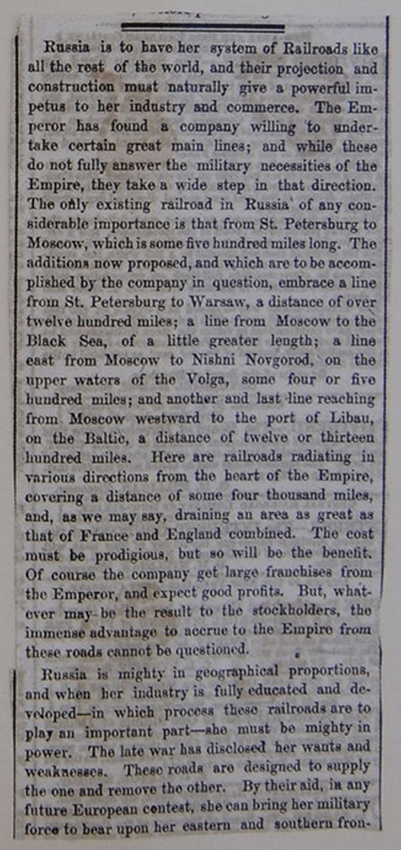
Russia is to have her system of Railroads like all the rest of the world, and their projection and construction must naturally give a powerful impetus to her industry and commerce. The Emperor has found a company willing to undertake certain great main lines; and while these do not fully answer the military necessities of the Empire, they take a wide step in that direction. The only existing railroad in Russia of any considerable importance is that from St. Petersburg to Moscow, which is some five hundred miles long. The additions now proposed, and which are to be accomplished by the company in question, embrace a line from St. Petersburg to Warsaw, a distance of over twelve hundred miles; a line from Moscow to the Black Sea, of a little greater length; a line east from Moscow to Nishni Novgorod, on the upper waters of the Volga, some four or five hundred miles; and another and last line reaching from Moscow westward to the port of Libau, on the Baltic, a distance of twelve or thirteen hundred miles. Here are railroads radiating in various directions from the heart of the Empire, covering a distance of some four thousand miles, and, as we may say, draining an area as great as that of France and England combined. The cost must be prodigious, but so will be the benefit. Of course the company get large franchises from the Emperor, and expect good profits. But, whatever may be the result to the stockholders, the immense advantage to accrue to the Empire from these roads cannot be questioned.
Russia is mighty in geographical proportions, and when her industry is fully educated and developed—in which process these railroads are to play an important part—she must be mighty in power. The late war has disclosed her wants and weaknesses. These roads are designed to supply the one and remove the other. By their aid, in any future European contest, she can bring her military force to bear upon her eastern and southern frontier
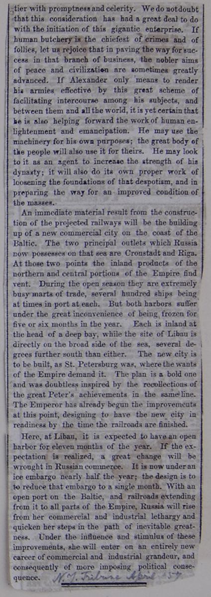
with promptness and celerity. We do not doubt that this consideration has had a great deal to do with the initiation of this gigantic enterprise. If human butchery is the chiefest of crimes and of follies, let us rejoice that in paving the way for success in that branch of business, the nobler aims of peace and civilization are sometimes greatly advanced. If Alexander only means to render his armies effective by this great scheme of facilitating intercourse among his subjects, and between them and all the world, it is yet certain that he is also helping forward the work of human enlightenment and emancipation. He may use the machinery for his own purposes; the great body of the people will also use it for theirs. He may look to it as an agent to increase the strength of his dynasty; it will also do its own proper work of loosening the foundations of that despotism, and in preparing the way for an improved condition of the masses.
An immediate material result from the construction of the projected railways will be the building up of a new commercial city on the coast of the Baltic. The two principal outlets which Russia now possesses on that sea are Cronstadt and Riga. At those two points the inland products of the northern and central portions of the Empire find vent. During the open season they are extremely busy marts of trade, several hundred ships being at times in port at each. But both harbors suffer under the great inconvenience of being frozen for five or six months in the year. Each is inland at the head of a deep bay, while the site of Libau is directly on the broad side of the sea, several degrees farther south than either. The new city is to be built, as St. Petersburg was, where the wants of the Empire demand it. The plan is a bold one and was doubtless inspired by the recollections of the great Peter's achievements in the same line. The Emperor has already begun the improvements at this point, designing to have the new city in readiness by the time the railroads are finished.
Here, at Libau, it is expected to have an open harbor for eleven months of the year. If the expectation is realized, a great change will be wrought in Russian commerce. It is now under an ice embargo nearly half the year; the design is to to reduce that embargo to a single month. With an open port on the Baltic, and railroads extending from it to all parts of the Empire, Russia will rise from her commercial and industrial lethargy and quicken her steps in the path of inevitable greatness. Under the influence and stimulus of these improvements, she will enter on an entirely new career of commercial and industrial grandeur, and consequently of more imposing political consequence.
 [begin surface 812]
 [begin surface 813]
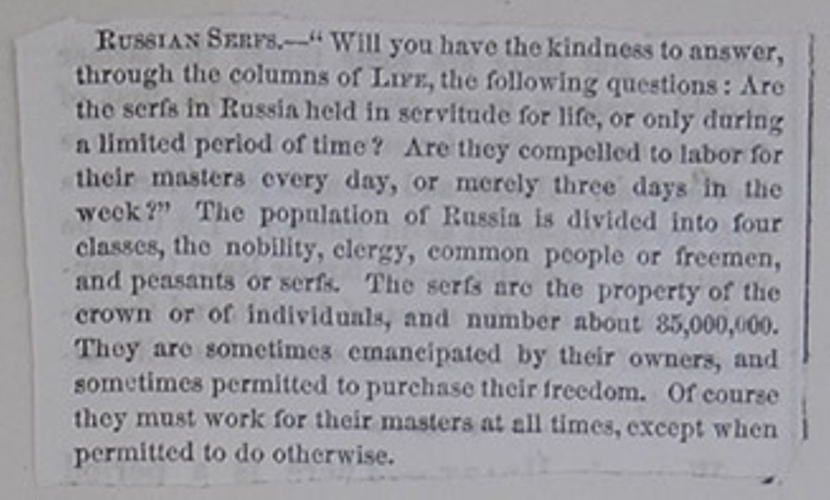
RUSSIAN SERFS.—"Will you have the kindness to answer, through the columns of LIFE, the following questions: Are the serfs in Russia held in servitude for life, or only during a limited period of time? Are they compelled to labor for their masters every day, or merely three days in the week?" The population of Russia is divided into four classes, the nobility, clergy, common people or freemen, and peasants or serfs. The serfs are the property of the crown or of individuals, and number about 35,000,000. They are sometimes emancipated by their owners, and sometimes permitted to purchase their freedom. Of course they must work for their masters at all times, except when permitted to do otherwise.
 [begin surface 815]
BAYARD TAYLOR IN NORTHERN EUROPE.
No. LXX.
RAILROADS IN
RUSSIA.
ST. PETERSBURG, July, 1858.
On leaving Moscow for this place, we were obliged to take out fresh passports, giving up those which we had obtained in Warsaw. As one is required to appear personally, this formality is a little troublesome, but we were subjected to no questioning, and the documents were ready at the time promised. After paying the fees, we were about to leave, when the official whispered: "You have forgotten my tea-money." The readiness with which he changed a note, while the subordinates looked the other way, proved to me that this system of gratuities (to use a mild term) is not only general, but permitted by the higher authorities. Many of the civil officers have salaries ranging from six to ten rubles a month—barely enough to clothe them—so that without this " tea-money," the machinery of government would move very slowly.
I also went to the office of the Censor, to inquire concerning the fate of the books taken from me on the Polish frontier. Here I was very politely received, and was informed that the books had not arrived. The Censor seemed a little embarrassed, and I half suspected that the books might be on the prohibited list. Kohl's work, I have been informed, belongs to this class, although I saw, in the shop-windows, books which I should have supposed were much more objectionable than his. It is permitted to all literary and scientific men, however, to import freely whatever works they choose. The list of foreign newspapers admitted into Russia has recently been much enlarged, but they also pass through the Censor's hands, and one frequently sees paragraphs or whole columns either covered with a coating of black paste, or so nicely erased that no sign of printer's ink is left.
During our stay in Moscow, we lodged at the Hotel de Dresde, which I can conscientiously recommend to future travelers. It is a large, low building on the Government square, at the corner of the Tverskaia Onlitza, and convenient to the Kremlin. The only discomfort, which it shares in common with the other hotels, is that the servants are all Russian. We obtained a large, pleasant room for two rubles a day, and a dinner, cooked in the most admirable style, for a ruble each. Other charges were in the same proportion; so that the daily expense was about $3. As there is no table d'hôte, the meals being served in one's own room, this is rather below New-York prices. A German author, who resided two years in Moscow, gave me $1,000 as a fair estimate of the annual expense of living for a bachelor. House-rent and the ordinary necessaries of life are cheap; but luxuries of all kinds, clothing, &c., are very dear.
On the northern side of the city, just outside the low earthen barrier, stands the great Railroad Station. The principal train for St. Petersburg leaves daily at noon, and reaches its destination the next morning at eight—600 versts, or 400 English miles, in twenty hours. The fares are respectively 19, 13 and 9 rubles, for the first, second and third class. The station building is on the most imposing scale, and all the operations of the road are conducted with the utmost precision and regularity, although perhaps a little slower than in other countries. The first-class carriages are divided into compartments, and luxuriously cushioned, as in England: the second-class are arranged exactly on the American plan (in fact, I believe they are built in America), except that the seats are not so closely crowded together. The entrance is at the end, over a platform on which the brakeman stands, as with us. As the day of our departure happened to be Monday, which is considered so unlucky a day among the Russians that they never travel when they can avoid it, there was just a comfortable number of passengers. We bade adieu to our obliging friend, Col. Claxton, whose kindness had contributed so much to the interest of our visit, and, as the dial marked noon, steamed off for St. Petersburg.
Straight as sunbeams, the four parallel lines of rail shoot away to the north-west, and vanish far off in a sharp point on the horizon. Woods, hills, swamps, ravines, rivers, may intersect the road, but it swerves not a hair from the direct course, except where such deflection is necessary to keep the general level between Moscow and the Volga. After passing the Valdai Hills, about half-way to St. Petersburg, the course is almost as straight as if drawn with a ruler for the remaining two hundred miles. The Russians say this road is only to be looked upon as an article of luxury. The Emperor Nicholas consulted his own convenience and the facility of conveying troops rather than the convenience of the country and the development of its resources. By insisting upon the shortest possible distance between the two cities, he carried the road for hundreds of versts through swamps where an artificial foundation of piles was necessary; while, by bending its course a little to the south, nearer the line of the highway, not only would these swamps have been avoided, but the cities of Novgorod, Valdai and Torshok, with the settled and cultivated regions around them, would have shared in the advantages and added to the profits of the road.
In its construction and accessories, one can truly say that this is the finest railway in the world. Its only drawback is an occasional roughness, the cause of which, I suspect, lies in the cars rather than the road itself. There are thirty-three stations between Moscow and St. Petersburg. At the most of these, the station-houses are palaces, all built exactly alike, and on a scale of magnificence which scorns expense. A great deal of needless luxury has been wasted upon them. The bridges, also, are models of solidity and durability. Every thing is on the grandest scale, and the punctuality and exactness of the running arrangements are worthy of all praise. But at what a cost has all this been accomplished! This road, 400 miles in length, over a level country, with very few cuts, embankments and bridges, except between Moscow and Tver (about one-fourth of the distance), has been built at an expense of 120,000,000 of rubles ($90,000,000), or $225,000 per mile. When one takes into consideration the cheapness of labor in Russia, the sum becomes still more enormous.
The work was not only conducted by American engineers, but Mr. Winans, the chief-engineer, is at present escrying on the running business under a contract with the Government. His principal assistants are also Americans. This contract, which was originally for ten years, has yet three years to run, at the end of which time Mr. Winans will be able to live upon what he has earned. His annual profit upon the contract is said to be one million rubles. Some idea of its liberal character may be obtained from the fact that his allowance for grease alone is three silver copecs a verst for each wheel—about 3½ cents a mile; or, with on ordinary train, some $700 for the run from Moscow to St. Petersburg. His own part of the contract is faithfully and admirably discharged, and he is of course fairly entitled to all he can make. It is not to be wondered at, however, that the receipts of the road last year exceeded the expenditures by a few thousand rubles only.
The fact is, even yet, the road does not appear to be conducted with a view to profit. The way traffic and travel which railroad companies elsewhere make it a point to encourage, is here entirely neglected. There are none but through trains, and but a single passenger train daily. Beside this, no freight is taken at the way stations, unless there should happen to be a little room to spare, after the through freight is cared for. Tver, through which the road passes, is at the head of navigation on the Volga, and, after Nijni Novgorod, the chief center of trade with the regions watered by that mighty river, as far as the Caspian Sea; yet, I am informed, there is no special provision made for affording the facilities of communication which this place so much needs.
Russia, however, is soon to be covered with a general system of railroad communication, which, when completed, must exercise a vast influence on her productive and commercial activity. A road from Moscow to Nijni Novgorod on the Volga, where the grand annual fair is held, has been commenced, and will probably be finished in from three to five years. The distance is about 250 miles, and the estimated expense $50,000 per mile. The road from St. Petersburg to Warsaw—a little over 700 miles in length—has been in progress for some years past, and will be finished, it is said, by the close of the year 1860. In September it will be opened as far as Pskov (German, "Pleskow"), at the head of Lake Peipus, and to Dwinaburg, whence a branch road to Riga is now building, in the course of next year. Near Kovno it will be intersected by another branch from Königsburg, via Tilsit and Gumbinneu , whereby there will be a direct communication between St. Petersburg and Berlin.
The other projected roads, the building of which has been contracted for by a French company, but not yet commenced, are from Libau, on the Baltic, easterly through Witepsk and Smolensk to the large manufacturing town of Tula, 112 miles south of Moscow; and another from the latter city to Charkoff, in the Ukraine, with branches to Odessa and the Crimea. The former of these will be nearly 700 miles in length, and the latter at least 1,000. The cheapest plan for the Russian Government to build railroads, would undoubtedly be, to permit the formation of private companies for that purpose. In Middle and Southern Russia, the cost of construction would certainly be no greater than in Illinois, where, if I remember rightly, the roads are built for half the amount of the lowest estimate I have heard here. The effect of these improvements upon the internal condition of Russia can hardly be overvalued. They are in fact but the commencement of a still grander system of communication, which, little by little, will thrust its iron feelers into Asia, and grapple with the inertia of four thousand years.
—To return to our journey. The halts at the way stations were rather long—five, ten, fifteen minutes, and at Tver, where we arrived at 5 o'clock, half an hour for dinner. In this respect, as in every other, the arrangements were most convenient and complete. We had a good meal at a reasonable price, and were allowed a rational time to eat it. At every one of the other stations there was a neat booth provided with beer, qvass, soda water, lemonade, cigars and pastry. Most of the passengers got out and smoked their cigarettes at these places; as the practice is not allowed inside the cars. There is a second-class carriage especially for smokers, but one is obliged to take out a license to smoke there, for which he pays ten rubles. The Russians are nearly all smokers, but the custom is very strictly prohibited in the streets of cities, and even in the small country villages.
The country, slightly undulating in the neighborhood of Moscow, becomes level as you approach the Volga. The monotony of which I have spoken in a previous letter, is its prevailing characteristic Great stretches of swamp or of pasture ground, fields of rye and barley, and forests of fir and birch, succeed one another, in unvarying sameness. Now and then you have a wide sweep of horizon—a green sea, streaked with rosy foam-drifts of flowers—a luxuriant Summer-tangle of copse and woodland, or a white village church, with green domes, rising over a silvery lake of rye; and these pictures, beautiful in themselves, do not become less so by repetition. The Volga is certainly the most interesting object in the whole course of the journey. Tver, a city of 20,000 inhabitants, on its right bank, is conspicuous from the number of its spires and domes. Along the bank lie scores of flat-bottomed barges, rafts and vessels of light draft. The river here is scarcely so large as the Hudson at Albany, flowing in a sandy bed, with frequent shallows. But, like the Danube at Ulm, it is not the smallness of the stream which occupies your thoughts. You follow the waters, in imagination, to the old towns of Yaroslav and Nijni Novgorod, to the Tartar Kazan and the ruins of Bulgar, through, the steppes of the Cossacks and Kirghizes, to the Caspian Sea and the foot of ancient Caucasus.
The sky was heavily overcast, so that, in spite of our high latitude, the night was dark. I therefore did not see the Valdai hills, which we passed toward midnight—the only real hills in Russia proper, west of the Ural Mountains. It was among these hills that Alexander I. intrenched himself, to await Napoleon. When the morning twilight came, we were in the midst of the swampy region, careering straight forward, on and on, over the boundless level. The only object of note was the large and rapid river Volchoff, flowing from the Ilmea Lake at Novgorod northward into Lake Ladoga. The road crosses it by a magnificent American bridge.
Some fifty or sixty versts before reaching St. Petersburg, we passed through a large estate belonging to the rich Russian, Kokoreff, who has lately been distinguishing himself by the prominent part he has taken in all measures tending to the improvement of his country—the emancipation of the serfs, the steamboat companies of the Dnieper and Dniester, the formation of a moneyed association for encouraging manufactures, &c. This Kokoreff was the son of a common peasant, and commenced life by keeping a cheap brandy-shop. He gradually prospered, and, being a man of much natural shrewdness and energy, took the contract for the brandy revenue of the whole Empire, which is farmed out. He is worth about seven millions of rubles, much of which he has invested in landed property. He has now set himself to work to introduce improvements in agriculture, and his estate presents a striking contrast to that of his neighbors.
Neat, comfortable houses for the laborers, spacious barns for the grain, forests trimmed and protected, meadows drained, rough land cleared and prepared for culture—these were some of the features which struck my eye, as we rushed along. Kokoreff is charged by some with being extravagant and fantastic in his views, and therefore an unsafe example to follow; but a man who makes such an employment of his means, cannot do otherwise than work real andl asting good for his country.
By and by vegetable gardens succeeded to the swamps, villages became more frequent, houses, smoking factories and workshops on our right, then a level, uniform mass of buildings, over which towered some golden-tipped spires, and at eight o'clock, precisely, we landed in the station at St. Petersburg. B. T.
[begin surface 816]
 [begin surface 818]
 [begin surface 819]
 [begin surface 820]
International Copyright.
We are glad to be informed that there is some prospect of an International Copyright agreement between the United States and Great Britain. As our readers know, we have steadily opposed the scheme advocated by British publishers, and seconded by a few Utopian American authors, viz.: a mutual extension of full copyright privileges, without limitation of any sort, to the authors of both countries. We have opposed this because it would sacrifice to British interests, and especially to the interests of British publishers, the important and multiplied interests of our printers, paper-makers, type-founders, book-binders, stereotypers, &c., &c., without any equivalent in return.
At last, however, as it appears, more practical views are beginning to be entertained on both sides of the water in reference to this subject. Mr. GOODRICH may claim the credit of having suggested, in his late work—Recollections of a Lifetime—a scheme which has met the approval of the leading publishers in New-York, who have appointed a Committee for the purpose of giving effect to its provisions. Mr. GOODRICH'S proposition, substantially adopted by the leading publishers of this City, is as follows :
1. An author, being a citizen of Great Britain, shall have copyright in the United States for a period not exceeding fourteen years, on the following conditions:
2. He shall give due notice in the United States of his intention to secure his copyright in this country three months before publication of his book, and this shall be issued in the United States within thirty days after its publication in Great Britain.
3. His work shall be published by an American citizen, who shall lodge a certificate in the office of the Clerk of the Court of the District where he resides, stating in whose behalf the copyright is taken, and this shall be printed on the back of the title page.
4. The work shall be printed on American paper, and the binding shall be wholly executed in the United States.
5. This privilege shall be extended only to books, and not to periodicals.
6. The arrangement thus made in behalf of the British authors in America to be extended to American authors in Great Britain, and upon similar conditions.
Without meaning to say that this schedule, in all respects, meets our views, we may remark that, in the main, it conforms to what we have always advocated. It gives substantial protection and remuneration to authors, British and American, and that, too, with due regard to the industrial interests of this country involved in the question. It will satisfy, or at least appease, that claim of justice on the part of authors which has been the chief argument in favor of International Copyright, and it will do this in a manner to stimulate authorship, without materially increasing the cost of books, even those of foreign origin.
In connection with this question of International Copyright, Mr. GOODRICH has given us some exceedingly curious and interesting statistics on the subject of the book trade, showing its growth from 1820 to 1856. These have a very important bearing, as it appears from them that the element of British authorship in American publications is not over twenty per cent., and is constantly diminishing. Hence he infers that the time cannot be very remote when the tables may be turned upon us, and the republication of American books in Great Britain may be even greater than the republication of British books in this country.
Whether this is a matter to be adjusted by treaty or legislation, we do not now attempt to discuss. We only notice the subject to suggest that, if the parties interested will limit their views to some such practical scheme as is indicated above, we may have International Copyright with Great Britain. If, however, not satisfied with this, either British authors or publishers insist upon more, they will get nothing.
AN AUSTRIAN CONSUL IN TROUBLE.—Austrian consuls seem to be rather unfortunate just at this time. While one is trying to heal with golden salve the wounds inflicted on his honor by an American newspaper in New-York, another is greatly distressed in Genoa, because a Piedmontese mob would not break his windows. On the 10th of December, which is the anniversary of the Expulsion of the Austrians from Genoa, in 1746, the auspicious event in the Sardinian history, was celebrated very much as Evacuation Day is celebrated in New-York by a procession and concourse of people, a number of whom, on their way home from the services of the morning, took it into their heads to make a demonstration against the house of the Austrian Consul-General. They marched up to the street in which the unpopular functionary resides, and were apparently on the point of doing something riotous when the city authorities came up with a handful of soldiers, and quietly dispersed them. The chagrin of the Austrian official is represented as being very severe at this ineffectual result. He had relied, like Dodson and Fogg in " Pickwick," on being seriously maltreated, that he might have a handsome case against the " free" Government of Sardinia, and was proportionately disappointed at the quiet supremacy of those laws of liberty which make
Sardinia at once the hope of Italy and the avenging terror of Austria.
American Missionaries in India.
ELIZABETH, N.J., Jan. 2, 1858.To the Editor of the New-York Times:
MY DEAR SIR: In your paper of Thursday last, you quote an article from another paper which states that I had received a letter from India giving an exact account of the death of Rev. Mr. FREEMAN and his wife, by the hand of the Sepoys.
While we are led to fear the worst as to these beloved Missionaries, we have as yet no positive information as to the place, the time, or the manner of their death. And you will confer a favor upon me, and upon many of the relatives and friends of Mr. and Mrs. FREEMAN by stating that no such letter as that described in the extract has been received by me, or by them. N. MURRAY.
Academy of Music.
ROSSINI'S sparkling opera of the "Barber of Seville"—the best comic opera ever written—will be played here to-night. The caste is altogether the strongest ever given in this country: Rosina, Mme. LA GRANGE: Figaro, Signor GASSIER: Almavia, Signor LABOCETTA: Basilio, Herr Formes: Bartoio, Signor Rocco. In addition to ROSSINI'S opera an act will be given from the "TROVATORE," with "carradori" D"ANGRI, BIGNARDI, ARDAVANI, &c. This is surely enough for an ordinary entertainment.
BENEFIT.—On Saturday, Mrs. HOEY, the most charming and talented lady on the New-York stage, takes her benefit at Wallach's Theatre. Mrs. HOEY will appear, for the first time, in the comedy of "Anne Blake," also in an afterpiece. The friends of the lady, and their name is legion, will surely remember the occasion.
The royal mail steamship Niagara, Capt. Leitch, from Liverpool about 10 A. M. on Saturday, the 16th inst., arrived here at 8:45 this evening.
The steamship Hermann sailed from Southampton for New York on the 13th inst., and the City of Manchester left Liverpool for Philadelphia on the same day, with 150 passengers.
The screw steamship Canadian, from Quebec, arrived at Liverpool on the 14th. A lamentable accident occurred on board the Canadian on the homeward passage. The Rev. Wm. Marsh drank, in mistake, a quantity of disinfecting fluid, and notwithstanding every care it proved fatal. His body was taken to Liverpool, and an inquest held upon it.
The Cunard steamship Persia, from New York on 6th of August, arrived off the bar at the entrance to the river Mersey at 5:15 P. M. on Friday, the 15th, the passage being called 8 days 23 ½ hours, mean time.
General La Marmora, has, in the name of the King of Sardina , invited Gen. Canrobert, who is at the Sardinia watering place, to visit Turin.
According to Italian correspondence, the Neapolitan army is greatly dissatisfied with the government.
The concessions made by the Russian government professedly to facilitate the imports of foreign goods amount to very little, and relate to such matters as abridging the time allowed between the delivering in of a decision of contents and the deposit of the goods in the bonding warehouses at St. Petersburg.
GREAT BRITAIN.
From every part of the United Kingdom the harvest reports are of a favorable character, and but little doubt is now entertained that the grain-crops will be at least a fair average in quantity and quality. In Scotland the crops are very heavy. With respect to potatoes there is a general concurrence of evidence that the crops, though not entirely free from disease on some parts of England, Ireland and Scotland, promise to be abundant and excellent. The late rains have been very beneficial to green crops. Harvest operations are now general, and so much labor is wanted, that farmers have outbid railway contractors, who find themselves compelled to suspend for the present all but their pressing contracts on the public works. Sir Morton Pete, in a letter, suggests that the government would act most wisely if it would permit the regiments stationed in the rural districts to imitate the example of the French soldiers and earn wages by helping to get in corn.
In the political world there is nothing worth reporting.
Miss Nightingale has returned to her home in Derbyshire, avoiding all public demonstrations of welcome.
FRANCE.
Friday, the 15th instant, the Emperor's fete took place. Salutes were fired at six o'clock in the morning, and at 6 o'clock in the evening. At midday mass was celebrated in Notre Dame, in the presence of the dignitaries of the State. The Te Deum was sung in all the churches of France. The afternoon, from 2 o'clock to 6, was devoted to dramatic representations of military events, balloon ascents and various kinds of games. There was an evening concert in the garden of the Tuileries, and other gardens and the Place Concorde were illuminated with colored lanterns. At 9 o'clock there was a display of fireworks at the Barriere de L'Etolie and the Barrier du Trone.
A private despatch from Hamburg states that there is some movement going on among the Orleanists. The Duchess of Orleans, the Duke of Chartres, with M. Thiers and their suites, had left that city for Ostend, in consequence of a despatch received from England.
The Moniteur publishes a decree opening a credit of five hundred and twenty-two thousand francs for the payment of the interest and sinking fund of the share guaranteed by France on the Greek loan of 1838.
Marshal Pelissier's title is Duke of the Malakoff, with a pension of one hundred thousand francs per annum.
M. Rouland has been appointed Minister of Public Instruction.
SPAIN.
The news from Spain is wholly uninteresting. We have a report in the Gazette de France, but which requires confirmation, that disturbances had arisen at Cadiz in disarming the National Guard, but with this exception the general disarming is everywhere being carried out without resistance. The fears entertained of scarcity were diminishing.
PORTUGAL.
Government has sent the war steamer Mindello to Madeira with a cargo of provisions and medical stores. Cholera was increasing at Lisbon.
ITALY.
A report was circulated in the Paris Bourse that there had been an attempt at insurrection in Naples. It was not, however, true; and from the precautions taken to repress, any attempt at rising is unlikely. The secret liberal press has, however, just issued another proclamation to the people, calling on them to agitate firmly and quietly. Garribaldi publishes in a Genoa paper a letter saying he has just discovered that the gallant Roman, Ceceruacchio, his two young sons, and five other victims, who were reported to have escaped, were shot in cold blood by the Austrians in 1849 at La Contarina, and that the massacre was concealed. This statement has created great excitement throughout Italy.
It was reported that the submarine cable, from Sardinia to Algiers, was broken and lost in the laying. The accident, however, it was subsequently stated was not so serious.
The following is the latest telegraphed to our correspondent :—
BONIFACHA, August 12, 1856.We have commenced raising the cable in the hope of continuing our route to Algeria. Everything is ready for to-morrow.
BONIFACHA, August 13, 1856.We are successfully proceeding with the raising of the cable to make the junction and advance towards Algeria.
BRETT.THE BLACK SEA.
The English war steamer Gladiator has returned from the Isle of Serpents to Constantinople, and reports on the island fifty Turkish and Eight Russian soldiers.
There was no armed seizure of the island, as was reported. The island is nothing but a bare rock, of very limited size, and contains only one building, with the Turks and Russians living together, and the latter are treated by the former as their guests.
The Gladiator had left again for the Black Sea, with new instructions of a more positive nature. The English press protest strongly against the indifference expressed by the French government as to whether the Isle of Serpents belongs to Russia or Turkey. The proof that the Isle of Serpents—called also Fidonisi—is very valuable is that all the allied fleets made it a rendezvous before landing the army at Eupateria.
The remainder of the fleet have not yet left, and France and Turkey having no disposable ships, four English ships have joined Admiral Steward's squadron, now cruising before Baltschik.
The evacuation of Turkish territory by French troops terminated on the 15th, and on the 18th Tekeddin Pasha is appointed Governor of Kars.
The International Commission, which has removed to Jassy, persists in requiring that Russia shall give up the town of Belgrade.
The Archbishop of Kherson and Talorda has formally consecrated the South side of Sebastopol, preparatory to its being rebuilt.
Quarantine regulations are re-established in the Russian parts of the Black Sea and the Sea of Azef, the same as before the war.
It is confirmed that Russia is contracting a first class naval arsenal on the Island of Kasko, in the Gulf of Bothnia.
The harvest in Asia is reported bad, but considerable stores remain from last year.
The French In Central America.
A NEW VIEW OF THE CENTRAL AMERICAN QUESTION—AMERICAN INFLUENCE IN SPANISH AMERICA—WHO ARE THE REAL FILIBUSTERS—PLANS OF THE EMPEROR NAPOLEON IN HONDURAS.
NEW YORK, Aug. 25,1856. TO THE EDITOR OF THE HERALD.An article appearing in a late issue of the HERALD embodies some extremely sensible ideas in relation to the gradual decay of the Latin races in Spanish America, and has excited extensive comment among those who have become interested in the progress of the Anglo-Saxon race in the South, from the justness of its views and the ability with which the subject is handled. There are few who are not really convinced that the southern republics have not been marked out by Providence as the field upon which, ere many years have elapsed, the energetic races of North America will have spread and instituted the laws and civilizing customs of the United States. The fiat has gone forth, and no solution to the long rule of anarchy in that portion of the world presents itself, beside the establishment, by the arts of industry and the will of enterprise, of the Anglo-Saxon sway in Mexico and Central America.
The experiment of self-government, commenced with the overthrow of the Spanish colonial rule in Central America, after thirty years has proved a failure. Various kinds of republican systems have sprung up and disappeared, and a generation has passed away in the futile attempt to unite forms of government with political theories, while between them only repelling forces have existed.
In the vain endeavor to supply radical defects by a reorganization of the social system, violent and frequent changes in this respect have taken place, until we see the country enervated and politically extinct from no other cause more than the indiscriminate amalgamation of the white, Indian and negro races. The events of the past three years can be but the foreshadowing of the inevitable destiny of the Latin races, who, in vainly endeavoring to imitate the progress of their Northern neighbors, seem already merging into a portion of the great republic. Sectional strife in our own country may for a while blind us as to the true direction of our national march, but with the step of the westward progress of the American people on the Pacific coast, they are certain to seek the sunny countries southward, where dissolving communities and impracticable theories of government have opened the way to the spread of the Anglo Saxon race.
The Spanish Americans themselves, as the means of communication between their countries and the north are becoming more facilitated, are beginning to regard the superiority of our institutions and the social and political condition of the United States with wonder and admiration. The infusion of American enterprise among these decadent Latin races has in every nstance proved beneficial to their country at large, and though frequent strife has been engendered between the naturally jealous, ignorant classes and the pioneers of American progress, the most intelligent of the people admit the increased prosperity and thrift attendant upon the introduction of northern capital and industry.
The inter-oceanic railroad at Panama, and the modernizing of the decaying town of that name, the magical rise of Aspinwall, the opening of the canal from Carthagena to the interior, the employment thus given to thousands of laborers, and the general improvement throughout the State consequent upon American enterprise, are now recognized in New Granada as the reviving elements in that republic.
Nicaragua points to the establishment of the Transit route through her territories, and the attendant trade extending through the State. Towns have been built, capital invested, and many of the conveniences of civilized life introduced from the United States.
In Honduras equally energetic measures have been taken by American citizens for the developement of her vast mineral and agricultural resources. The surveying of an inter-oceanic route of communication, the opening of gold placers hitherto passed heedlessly over by the indolent natives, the crowning result of the efforts of American citizens, the restoration to her of the Bay Islands by England, and the actual increase of trade and commerce between her Atlantic and Pacific coasts and the United States—those are all substantial benefits resulting from the association of her people with Americans.
With the vastly improved condition of Mexico following her nearer association with the Anglo-Saxon the world is better acquainted. A revolution in machinery, agricultural implements, household comforts, ocean and land travel, and the introduction of many useful arts and inventions have been gradually progressing. The commercial enterprise which has made her occluded Pacific and Atlantic ports the touching points of ocean steamship lines, and thrown open to the world's capital two feasible routes of Atlantic and Pacific communication—those of Tehuantepec and the proposed one between Vera Cruz and Acapulco—may be traced almost exclusively to the adventurers of the United States.
In a word, all Spanish America north of the Equator feels the vivifying effects of American enterprise, aud the time cannot be far distant when these countries will voluntarily join the march of human progress exampled in the United States. The "destiny of the Anglo-Saxon race" to gradually overspread the whole North American continent is only another name for the natural and inevitable sway of industry and intelligence over ignorance, laziness and decay.
The future annexation of the Spanish American States to the Union is a question certain to be presented to the American people during the present generation. Such is the opinion of our greatest statesmen, and especially of those whose attention for any length of time has been turned towards these countries. Of the expediency or safety of adding such a population to the United States the future must decide: but that this is eventually to become a " living issue," few who have watched the progress of events in the neighboring republics will deny.
European Powers are interesting themselves to a greater extent than is generally supposed in the events transpiring in Mexico, Cuba and especially in Central America. In France the American people are to find their great contending rival for supremacy in these countries. The three great gold-producing countries of the world are now in the possession of as many principal Powers. Russia points to the gold regions of the Ural Mountains, producing $14,000,000 per annum; the United States include those of California and Oregon, yielding annually $70,000,000; and England is enriching herself from the yearly $90,000,000 extracted from the soil of Australia. France alone is without her El Dorado, and Louis Napoleon is industriously balancing this deficiency by pursuing in all directions the great policy of Bonaparte in extending her commercial iuterests . Not in England need the United States fear a rival in the acquisition of Cuba, but in the policy of the French government, foreshadowed in the acquisition of Madagascar, Algiers, the Society Islands, and the "annexation" of territory in all parts of the globe.
The attempt on the part of France, in 1846, to revolutionize Mexico and place one of the Bourbon princes on the imperial throne, and its frustration by the American government, in allowing Santa Anna to pass unmolested into the country through our fleet at Vera Cruz, are well known. The subsequent plans for colonizing the country with French adventurers, under the famous Count Raousette de Boulbon and the part taken by M. Dillon, the French Consul at San Francisco, in that and similar expeditions, are yet fresh in the public mind.
A few months since the French Commissioner at Comayagua, the capital of Honduras, delivered to President Guardiola, of that republic, a letter signed by the Emperor Napoleon, proffering aid to the Central American States against " the American filibusters." This was subsequently published in full in La Gaceta Oficial of Honduras, and recently a considerable emigration of French, under the special direction of French authorities, has entered Costa Rica. Many other instances illustrative of the intentions of the French government respecting portions of Spanish America could be cited, of which the above are not the most prominent.
It is with these facts in view that the question of American interests in the several "highways of nations" across the Central American Isthmus should be considered; divested of our own political issues, it assumes a real importance second to none in the future policy of the United States. The only present practicable routes of communication with our Pacific States are liable, by a change in the political relations between the Central American republics and any great European Power, to pass beyond our control, notwithstanding treaties, one of the most solemn of which was violated and afterwards mutually abrogated by the contracting parties. The recent discovery of extensive gold placers on the rivers taking their rise in the Honduras cordillera, and discharging in the Caribbean Sea, has already excited the keen attention of the French government.
Here appears a fourth gold producing country, healthy, accessible and open to European colonization. French capital has already been largely invested in the proposed inter-oceanic railroad through Honduras, and an eagerness is manifested among Parisian capitalists to embark in speculations in that country. An avant guarde of some hundreds of workmen from before Sebastopol have been engaged to open the works along the railroad line, and in " French filibusters" may be found our future competitors for a permanent foothold in Central America. The policy of France is acquisition of colonial territory, not in the English style, with years of diplomatic craft, but after the Walker method of the strong arm—private enterprise, secretly aided by the government, proffers of assistance against " filibusters," resulting in actual occupancy and permanent settlement of the healthy uplands by armed colonists.
France has everything to gain in making a bold strike for the possession of Central America. It ensures to her, in case of success, that chance to rival the commercial supremacy now held by England, which she has always coveted; and it must be admitted that she has of late lost no opportunity to push her interests there. Her fleet (no inconsiderable one) hovers along the Central American coast, and the tone of the Parisian press, (at all times more or less a reflex of the government views ) indicates a strong disapprobation of the advancing interests of the United States in Central America.
Should we not, then, adopt every reasonable precaution to secure to ourselves the exclusive right of transit across the Isthmus, which, once in the possession of a European Power, could only be recovered—if at all—by a contest for commercial rule involving thousands of lives and millions of treasure?
Honduras is the seductive gold region to which the eyes of the French are now turned. Their agents, more active and talented than the English phalanx headed by Mr. Chatfield, of unsavory memory, are now in the field pursuing scientific investigations. The value of the gold region about to become the scene of American as well as foreign labor, is yet unappreciated by our leading men, and unknown, save by a few who have passed single and alone through the country referred to, and returned with the glittering evidences of its mineral wealth. With a firm foothold of the French in Honduras by colonial settlement, we shall find in the cold and impassive Napoleon a subject less easily moulded than my Lord Palmerston, hard as he died on the Central American imbroglio. There are additional facts, en route from Truxillo, which may find their way into the HERALD. It is even thought among parties entitled to respect, that in the approaching battle to take place between Walker and the combined Central American forces, the French marines of the fleet off the coast will not be inactive spectators. Time will develope the facts. W. V. W.
Impressions of the United States and Canada.
By a Russian Lady.
TO THE EDITOR OF THE HERALD.
QUEBEC, Aug. 17, 1756Two months ago I arrived in New York from St. Petersburg, Russia. I had several years since a great desire to see the United States, but I could never find a fit companion for my voyage. At last I made up my mind to start alone, without listening any longer to my friends, who did their best in persuading me to remain at home. It was, perhaps, folly in me, a woman of forty-five years of age, to go on such an expedition, without a friend, and without even being well-acquainted with the English language. I took an old, faithful servant with me, and came over to the great land of progress. In my younger days I had travelled almost constantly. There is hardly a city in Europe or Asia which I have not seen, and when I am not travelling I feel out of my sphere. During the last ten years I lived in St. Petersburg, and I became weary and tired of everything around me. Now, since I am in my element again, I am another being. The constant exercise, the beautiful climate, the change of scenes around me, have made me feel ten years younger, and I think I am strong enough to go through California and South America.
On my arrival in New York I found it a little too warm for me, and without seeing much of that city, I went to Canada, in order to escape the hot summer season in New York. I passed across the suspension bridge to Canada, and visited the Niagara Falls. It would be in vain for me to attempt giving a description of the impression which this wonder of the world made on me. I think I could not find words in my own language to give this description, and therefore I would not know where to look for the proper English words in the dictionary.
After I have become better acquainted with the English language I shall take great pleasure in informing you about everything worth noticing which I may see in the West. I intend to go as far West as possible, and where I find no more railroads and no more splendid steamboats, I shall travel on mules.
At St. Catherine's, in Canada, I took great interest in the mineral wells of that place. The water tastes like salt water, and contains large quantities of iodine. I should think that the external use of this water must be an excellent remedy for diseases of the skin, and I am sure that if these wells were in my country they would be visited by thousands. Here in St. Catherine's I found about twenty patients, but they all praise the water highly.
Hamilton, Toronto and Kingston are very fine cities, but there is by far not that life and enterprise in the people as in those of the State of New York. There are very few, hardly any, factories in either of these places, and business in general appears very slow. Montreal is beautifully located, and has many handsome buildings. The French cathedral is an immense building—a mass of stones without any ornaments. The scenery on the St. Lawrence, between Kingston and Montreal, is grand, and I believe no other nation in the world but the Americans would ever have dared to run steamboats up and down this wild river, with its fearful rapids. Quebec is, when seen from the river, a beautiful picture, but its narrow streets and miserable houses make it as unpleasant as almost all fortified cities in the world. The scenery around Quebec is very romantic, and reminded me much of the mountains in Norway.
All through Canada I had the pleasure of meeting many American families, travelling for the benefit of their health and for pleasure. I also met many artists, who were travelling professionally through Canada. Amongst them I was happy to meet my esteemed friend, Madame de la Grange, and her husband, Count Stankovich, a countryman of mine. Being alone and without friends, except those I make at the different hotels, I visit in the evenings every place of amusement, and I am told that nearly all the artists who give concerts here in Canada, or who act the principal parts at the theatres, are from New York. I saw Mr. Wallack in Montreal; but as I hear he is the favorite of New York, I need not dwell on his merits. I think he is the best actor I have seen for some time. I visit every museum and gallery, every library, theatre and exhibition, and so, as a matter of course, I see much which is not worth going after. Sometimes, however, I find something new, and in Toronto I saw a great specimen of natural curiosity, a being which they call the " bear woman." This poor creature looks exactly like an ourang outang, and her head is completely animal; her entire face is covered with black hair, so much so that she can hardly look out of her eyes. At first sight I thought she was an animal, but she talks so sensibly, both in English and Spanish, that I cannot deny her to be at least half human. I think she is the greatest living natural curiosity I ever saw.
But I am afraid that you think me very tiresome for writing about things with which you are acquainted already. When I am far West I may perhaps be able to send you something new; and as I expect you have good translators in your establishment, I will send you some notices of my travels in my own language. Until then, I sign myself, yours very respectfully, SISINSKA.
Theatrical, Musical, &c.
NIBLO'S GARDEN.—The Ravels will open the entertainments this evening with their charming ballet pantomime entitled "The Elopement." Young Hengler and assistants follow with their extraordinary feats on the tight rope. The whole closes with Jerome Ravel's popular fairy comicality styled "Asphodel," which is having a fine run.
BOWERY THEATRE.—Th[illegible]e great hits of the day, "Po-ca-hon-tas" and "Life in New York," are again announced for tonight. The sensation originally created by the production of these plays is still undiminished, they being nightly applauded from beginning to end by about as many spectators as the building can accomodate .
GEO. CHRISTY AND WOOD'S MINSTRELS, judging from their programmes for this evening, are determined to maintain their high reputation as melodists and jokers. "Ye-Loafer-Torye" is their afterpiece.
BUCKLEY'S SERENADERS issue another fine bill for tonight. It embraces quite a number of original and exceedingly funny songs and the new operatic burlesque on "Trovatore."
EPH. HORN AND WHITE'S MINSTRELS, though last in the Ethiopian field are determined not to be last in the estimation of lovers and merriment. Eph. is as full of fun as ever, and would make a stoic laugh.
THE CAMPBELLS.—This famous band of minstrels, with Dan. Bryant and Ben. Mallory at their head, give another of their amusing entertainments at the Williamsburg Odeon this evening.
MISS BRAINERD, the pleasing young vocalist, is to give a concert at Birmingham, Conn., to-night. She will be assisted by a number of gentlemen of high musical reputation.
MADAM PATANIA'S CONCERT AT THE PAVILLION HOTEL, ROCKAWAY. L. I.—This elegant and recherche affair came off according to notice, on Saturday evening last, to a fashionable and delighted audience, among whom were some of New York's fairest and stateliest dames. Madame P. and Signor Morelli, of the Academy, were repeatedly encored, while little Paul Julien, as usual, astonished everybody. The programme was excellent and the attendance large.
MOBILE.—Mr. Duffield has engaged the following people for the Mobile theatre:—Messrs. Pauncefort, C. Wallis, J. Huntley (stage manager), J. B. Fuller, Wentworht, Dougherty, Gabay, Caterson, Ward, Campbell, Thompson; Mesdames Pauncefort, Carlotta Pozzoni, Wallis, Mcintish, Wentworth; Misses Woodward, Fanny Hudson, and Kate Anderson. Among the stars engaged are Mrs. Farren, Maggie Mitchell, and Mr. and Mrs. Conway.
ST. LOUIS—Mr. George Wood opens the People's theatre August 25. Company:—McVicker, (stage manager,) P. C. Cunningham, C. Wallis, Leighton, W. W. Allen, Dubois, Leeson, Lawrence, Barrett, Collier, Graver. Uhl. Matthews, Thorpe, W. Jamison; Mesdames Cunningham, Wallis, Leighton, Collier, W. W. Allen, Dyke; Misses Williams, Peters and Pearson. Mr. and Mrs. T. B. Conway were the stars at the St. Louis theatre, under De Barr's management, and acted in "Macbeth" on the 19th.
BUFFALO—Mr. J. W. Walleck, Jr., is announced to commence an engagement here August 25.
SAN FRANCISCO.—Mrs. Julia Dean Hayne met with great success at the Metropolitan theatre, and on July 22 had a complimentary benefit tendered by some of the principal citizens. Mr. Charles Pope, who supported her, was much liked. Mr M'K[illegible] Buchanan was playing at the Union to very bad houses.
Our Vera Cruz Correspondence.
VERA CRUZ, Aug. 7, 1856.Pilfering of Newspapers from the Mails—Complaints of the Herald's Subscribers—Ravages of the Yellow Fever at Vera Cruz, &c., &c.
In my name, and in the name of several friends, subscribers to the NEW YORK WEEKLY HERALD, I beg leave to inform you of the very irregular arrival of that paper in this place; and I subjoin, for the purpose of comparison, the arrivals of the weekly New York Staats Zeitung, of the same numbers and dates with the WEEKLY HERALD:—
A table comparing the number of issues of the New York Herald versus the Staats Zeitung received by steamer on certain dates.You will observe that of thirteen numbers of your paper more than seven did not arrive, and of these only seven in due time; and you will find it as much to your interest as to that of your subscribers to obviate this inconvenience.
The vomito has been very fatal in this place during the whole of July. A great number of foreigners, most of them Frenchmen and Spaniards, and many Mexicans from the interior, died on the third or fifth day of their sickness. On the 19th we buried thirty-seven.
Our Sierra Leone Correspondence.
SIERRA LEONE, July 15, 1856.Attempts of the French to Monopolize Trade.
Trade is dull; very little produce coming in. Palm oil and hides particularly sought after and caught up at any price immediately they are offered; indeed, their arrival is anticipated and cash or bills on England used for their purchase. The French appear to be or endeavoring to monopolize the trade lately done by the Americans. They use cash or bills in most of their transactions, and have bought the bulk of American cargoes offered this season. One or two American vessels have been exceedingly lucky in getting hides principally through sales to the French; they having purchased to assort themselves until direct importations could be got out from New Orleans, which are now daily expected. One, a French ship, 500 tons or more, loaded with tobacco, rum, lumber, &c., enough to supply us and ports between this and Senegal for a year or more. Both palm oil and hides are paying well in France. Frenchmen do their business in a very cheap manner, living on a very little, and a few thousand francs quite exalts them. They appear shrewd—oftentimes a little too much so for strict probity. One vessel, the brig Trenton, was excedingly lucky in procuring a cargo of hides, principally through this source, and which we learn here, is likely to do well; a repetition could hardly be eqpected by persons of experience. The French will now ship all their own produce, and should this direct importation continue, your countrymen can hardly expect to compete.
The health here is generally pretty good, for the season, with reasonable state of peace with surrounding tribes, where war existed a year since.
Grand Revival of the Colored Native American Opera.
We—that is, those of us who are musically inclined—are supposed to be anxiously awaiting the reopening of the Italian Opera House, in Fourteenth street, under the baton of Max Maretzek; but, as a sort of scattering fire from the outposts before the heavy artillery is put in play, we had a great and glorious revival of the colored native American opera last night. In the first place, the Buckleys, long time fixtures at Chinese Hall, have moved a little further up town, and erected a splendid temple, which was last night consecrated with all the honors of the muse of Ethiopian minstrelsy; said muse being, we presume, a sort of mulatto Calliope. The new house is a perfect bijou, in its way, with a neat stage, excellent accommodations for an audience of eighteen hundred persons, and convenient entrances on Broadway and Mercer street. It is located at No. 585 Broadway, directly opposite the Metropolitan Hotel, and has been built at a cost of thirty thousand dollars. Last night it was crowded to excess, an [illegible]hundreds were obliged to go away without getting a sight at the new house. All the old favorites, the messrs. Buckley, Percival, Carroll and others, were received with great applause. The first part of the programme included several new songs, and as an addenda was given a new burlesque on Verdi's "Trovatore." The names of the [cutaway] admixture of Verdi's score with the most popular negro melodies. The finale is an improvement on the opera, as everything ends pleasantly to the air of "Pop Goes the Weasel." Everything was couleur de rose at this house, and the Buckleys have every reason to be satisfied with their initial night in the new hall.
There was another great crowd at Wood's new hall, No. 444 Broadway, which was re-opened for the season last evening. The artists attached to this establishment—one of the most elegant music halls in the world—have been giving the people in the rural districts a taste of their quality for the past six weeks, more or less, and have come back with lots of new songs and fresh jokes. How glad their old friends were to see them was made apparent by the fact that the house was crowded long before the performance commenced. The programme was full of novelty and variety, and the performance was highly satisfactory to all those who got within hailing distance of it.
Yet another opening took place at the Chinese Hall, No. 539 Broadway, where White's Serenaders have taken up their quarters for a short season, awaiting the redecoration of their pleasant house in the Bowery. There was a full house here. The chief attraction was the eappearance of Mr. E. Horn, an exceedingly clever (African) buffo parlante. Mr. Horn is a most excellent comedian, and is unsurpassed in his delineations of negro eccentricity.
Well, that is doing pretty well for one night, is it not? Four or five thousand people assembled to hear the colored native American opera, is a good sign. Let us see if they can do as well in Fourteenth street.
 [begin surface 826]
 [begin surface 827]
AMUSEMENTS.
NIBLO'S GARDEN
Doors open at 7½ to commence at 8 o'clock. Tickets...................Fifty cents. Unparalleled success of THE WONDERFUL RAVELS. who will appear this evening, with the renowned YOUNG HENGLER, in their glorious entertainments. TUESDAY EVENING, AUGUST 26, 1856. THE ELOPEMENT. With eight beautiful Tableaux Vivants. Characters..........by the..........Ravel Family EVOLUTION ON THE TIGHT ROPE, by the talented Young Hengler, Mme. Axel and A. Lehmann. The whole to conclude with the grand fairy comic passemime of ASPHODEL, OR THE MAGIC PEN. By the Wonderful Ravels and the double company. Wednesday—Mr. Burton, as Toodle and John Thomas. ThursdayThe Wonderful Ravels. MR. BURTON'S NIGHTS—Mondays, Wednesdays and Fridays. THE RAVEL NIGHTS—Tuesdays, Thursdays, and Saturdays.GEORGE CHRISTY AND WOOD'S MINSTRELS, 444 Broadway.—
The managers of this highly favored place of amusement, while they are conscious of having used every proper endeavor to gain the public regard, yet feel themselves constrained to make some public acknowledgement of thanks for the unprecedented support which they have received. To prove that they are not unmindful of what is due to their patrons, they think they make mention of some few improvements which they have made, without laying themselves open to the charge of self conceit or egotism. In the first place, then, they found it necessary, some time since, in view of their increasing patronage, to beautify and enlarge the dimensions of the Temple of Negro Minstrelsy, located at No. 444 Broadway, by increasing its capacity for seating visitors from sixteen to eighteen hundred, as well as introducing a new plan of ventilation, which rendered it the coolest place of amusement in this city, if not in the world. Previous to these latter improvements they had introduced a feature in their hall which was not less novel than necessary to the safety of the audiences frequenting their place. They allude to the placing of a hydrant in the centre of the hall, so arranged as to be perceptible to the all, with hose attached, so that a full head of water could at any time be turned on by any one in its vicinity. Th managers have no idea that it will ever be necessary to bring this latter improvement into requisition, for it is needless to say they have taken every precaution to guard against fire, but they think it best to avoid the bare possibility of such a contingency. In this connection we may also mention the pains taken by us in securing "ample room and verge enough" for ingress and egress from the hall, so that all danger from a crush in case of accident is obviated—a matter to which too little attention is paid in the planning of public buildings. Add to these improvements the tasty drawing room, which has been magnificently fitted up for the accommodation of ladies, and we think may fairly challenge the world to produce the equal to our establishment. We start anew in he for public approval. HENRY WOOD, Business Manager.
NIBLO'S GARDEN—GERMAN OPERA
The public are respectfully informed that the first representation of the NEW GERMAN OPERA TROUPE will take place September 16, 1856. Particulars in future advertisementsMADAME LOVARNY, THE CELEBRATED VOCALIST,
after a successful engagement at Keller's Hall, intends to give a series of vocal engagement at Keller's Hall, intends to give a series of vocal and instrumental concerts through the principal cities of the Union, assited by M'lle Zella Erne, the celebrated American cantatrice; M'lle Agnes Stoepel, the favorite prima donna; and Herr F. and A Stoepel, with a host of eminent artistes. The first concert will take place in Williamburgs on the 29th inst., under the direction of Herr Frans Stoepel.NOTICE TO STRANGERS.—FRANKLIN MUSEUM,
137 Grand street, up stairs, one door from Broadway.—The afternoon performance is always concluded by half past 5, thereby enabling all to leave by the cars and boats. Stages always waiting to convey passengers to the different starting places.GURNEY'S PALACE OF ART, 349 BROADWAY CON
tains the largest collection of photographs and daguerreotypes on exhibition in the world, and is always open for the inspection of the public.CRYSTAL PALACE.—THE CRYSTAL PALACE IS STILL
open to the public, and contains many works of genius and art. Nearly 100 pieces of statuary are still on exhibition. Carew's great work, "The Descent from the Cross," is alone with the price of admission, which is only 25 cents.WONDERFUL—SEEING IS BELIEVING.—IF WHAT
Mons. Gregoire represents to do, is not done to the entire satisfaction of the audience, the money will be refunded; he is, without any exception, the most powerful man in the world. Come to the Franklin Museum, 127 Grand street, and see him.PROVIDENCE, R. I., THEATRE—W. C. FORBES, LES
see and manager.—The company will meet in the green room Aug. 28, at 11 A. M., to prepare for the opening on Sept. 1. E. VARREY, Stage manager.ENTIRELY DIFFERENT TO ANY OTHER AMUSEMENT
open in New York. The Franklin Museum, 127 Grand street, is an original establishment, defies competition, and has been established over 10 years. Humbugs come and go at intervals, but the public know where to patronize talent.IF YOU DESIRE COMFORT, IF YOU WISH TO BE
amused, if you wish to be astonished, if you wish to be made happy, if you have hte blues, if you want to keep cool, if you want to see lots of beautiful women, come to the Franklin Museum, 127 Grand street.TO LET—THE NEW YORK ACADEMY OF MUSIC, FOR
one year, from the first day of October next, with the privilege of another year, for OPERAS, CONCERTS, LECTURES AND BALLS. The Academy is well stocked with scenery, painted by Allegri; also, the ball room floor, and splendid decorations for balls, to which will be added a new saloon, one hundred and ten feet long, for ball purposes. To an enterprising Empressario, this house offers great inducements. It can be demonstrated by the experience of the present reason, that the house can be let for balls, concerts and lectures, on the nights when there is no performance of Opera, for at least one half of the amount of the yearly rent required by the Directors. For terms, apply by letter to the subscriber, 41 Wall street. JAMES PHALEN, President.AMUSEMENTS.
BROUGHAM'S BOWERY THEATRE.
PRICES OF ADMISSION Dress Circle and Orchestra Seats............50 cents Boxes..........25 cents | Pit and Gallery............12.5 cents Private Boxes............Five Dollars Doors open at a quarter past 7: to commence at three quarters past 7. Tuesday evening, August 25 will be noted PO-OA-BON-TAS Dancing, by............Ernestine and Annie Henrarde, and LIFE IN NEW YORK; OR, TOM AND JERRY ON A VISIT. Corinthian Tom.............Mr. Fisher Bob Logie..........Mr. O[illegible] Tom Smith............Captain the Hon. Fitzgammon Bolingreen...Mr. Brougham Corinthian Kate............Madame P[illegible] Sue Hawthorn............Miss Kate Seignaldo
WALLACK'S THEATRE
SUMMER GARDEN. BENEFIT OF MRS. AGNES ROBERTSON Miss Agnes Robertson begs respectfully to announce that her benefit comes off to-night, on which occasion will be produced the new play of VICTOR AND HORTENSE received last evening with enthusiastic applause. To be followed by the brilliant afterpiece of THE YOUNG ACTRESS. Tuesday, August 26, 1856, the new drama of VICTOR AND HORTENSE. written by Dion Boucicault, author of "London Assurance," and produced for the first time last night. Hortense............Miss Agnes Robertson Victor............Mr. Dion Boucicault To be followed by THE YOUNG ACTRESS, in which Miss Agnes Robertson personaies four characters, interspersed with song and dance. Performances commence at 7¾ o'clock, and terminate as nearly as 10½ o'clock as possible.BUCKLEY SERENADERS—
Grand opening of their NEW HALL 585 BROADWAY All this week will be produced the grand original Opera of TROVATORE, in three sets—with a new programme of ETHIOPIAN MINSTRELSY. Doors open at 7 o'clock; Concert commences at 8 o'clock. Admission.......25 cents | Orchestra Seats......50 centsBELLEVUE GARDENS, FOOT OF EIGHTIETH STREET.
Kast river.—Shelton's American brass and string bands are engaged for the season. On Wednesday, next, 27th [illegible] and every following Wdnesday throughout the season, will be given a concert and ball, to commence at 2 P. M. For the convenience of those who wish to leave early in the evening, the ball and concert will be carried on alternately, "id[illegible]"—An opera[illegible] piece will be performed between each dance. Admission one shilling, half of which will be returned in refreshment at any of the bars on the grounds. Part of the hotel, and about fifty square yards of the plaza, are especially reserved for ladies and families. N. H.—Take Second or Third avenue cars. S. WARD, Proprieter.GEO. CHRISTY
AND WOOD'S MINSTRELS Opera on 25th August.CROWDED EVERY AFTERNOON AND EVENING—
To see the [illegible] plastiques of the Model Artistes; to hear the singing of the Female Opera troupe; to see the wonderful feats of strength of Mons. Gregoire, with a host of other attractions, to be seen only at the Franklin Museum, 127 Grand Street.JOHN NEUMANN'S SHEET COPPER STATUE OF GE
neral Washington is now on exhibition at the Church of Divine Unity, No. 245 Broadway, between Spring and Prince streets. Open from 9 A. M. [illegible] 10 P. M. Admission [illegible] cents. Season tickets, 50 cents.THE WONDER OF THE WORLD AT THE FRANKLIN
Museum, No. 127 Grand street, up stairs, one door from Broadway. Mons. Gregoire, just arrived from France, the strongest man in the world, breaks bars of iron with ease, shivers the hardest stones with his fist, lifts 2,500 pounds weight, carries ten men on his back, &c.FRANKLIN MUSEUM, NO. 127 GRAND STREET, UP
stairs, one door from Broadway.—Open every afternoon at 3 and every evening at 9 o'clock, by Madame WARTON'S troupe of model artistes, (27 in number)DON'T BELIEVE IT—CHALLENGE TO ANY PERSON.
—Franklin Museum, 127 Grand street.—Mons. Gregoire, who has received medals from all the potentates of France and Europe, and declared to be the strongest man in the world, challenges, for five hundred dollars, any person to excel him in lifting or carrying weight of any description.ORIGINAL DUSSELDORF GALLERY,
497 Broadway, containing 200 of the finest paintings ever put on exhibition, OPEN DAY AND EVENING. Single admission......25 cents | Season tickets.....50 centsANTHENÆUM, 654 BRAODWAY—THIS NEW AND
splendid Hall will open on Monday, September 1, with an attractive series of new and beautiful entertainments.STRANGERS SHOULD NEVER LEAVE THE CITY
without visiting the Franklin Museum, 127 Grand street, one door from Broadway, and see the magnificent living pictures of the Model Artistales, together with other performances, which can be seen at no other place of amusement in New York.TEHATRE, CHARLESTON, S. C., JOHN SLOAN, MA
nager.—Ladies and gentlemen wishing engagements at the above theatre, [illegible] to commence on or about the 13th of October, will please address John Sloan. Highlands of Navesink, Monmouth county, New Jersey, N. H.—Stars wishing to visit Charleston will please address as above. [covered]ty weeks
THE SCIENTIFIC CONGRESS.
American Association for the Advancement of Science.
INTERESTING REPORTS ON ZOOLOGY AND LANGUAGES.
&c., &c., &c.,
Our Special Correspondence.
ALBANY, Aug. 24—A. M.THE COINAGE.
On Saturday morning the Association assembled in general meeting, nominally for the reception of Dr. Blatchford, who represented the American Medical Association. You have published that gentleman's speech, which explains itself. But while the members were assembled, Dr. Gibbon, of the mint, took the opportunity of making a vigorous effort to rescue the subject of coinage from the hands of the committee which has it in charge. When this committee was appointed, they were directed to consider the subjects of the weights, measures and coinage together. Dr. Gibbon thought the coinage deserved a separate special committee. His arguments were of a general character. He thought the time had come to make a vigorous effort, not only to regulate the subject in this country, but to endeavor to persuade all foreign nations to agree upon a uniform coinage. He pointed out the loos of labor and art which was occasioned by the re-coinage abroad of American coin after exportation; and the method he proposed to expedite the remedy was the appointment of a special committee. This was resisted by the leading member of the committee, Prof. Bache, who argued that the present committee would do the work as well as any new one. In this view he was sustained by a majority of the house.
I have no intention of questioning the propriety of this decision, but I hope Dr. Gibbon's effort will have the effect of stirring up the committee to active exertion. The subject cries for settlement. In Great Britain and in Germany, many legislators are busily engaged in reviewing it, and within a very short period there is every prospect that a new metal currency will be established in both these countries. Now, should the Scientific Association embrace this opportunity of bringing forward a philosophical and comprehensive scheme for a general uniform currency for the whole commercial world, I have no hesitation in saying that its chances of adoption would be quite considerable. No one can glance at the subject for a moment without being satisfied that such a reform would be a signal advantage to commercial interests; it would largely facilitate exchanges, and would promote international trade, and consequently international good feeling, is a very marked degree. I repeat, therefore, I hope the committee—and when I say the committee I refer more especially to Professors Alexander and Bache—will bestir themselves actively in the matter.
THE CONSTITUTIONAL FIGHT.
The point settled the great contest on the constitution was renewed, Prof. Dewey taking the lead on the side of the constitutionalists. After a few manœuvres on either side, Prof. Bache made a bold movement, by saying, with a half disguised sneer, that he hoped the constitution makers would not consume the time which the lovers of science wished to devote to scientific exercises. This was effective; it produced a loud laugh, and the constitutionalists looked some what sheepish. But in the midst of the merriment up rose the slender form of Prof. Rogers, grave and calm, and very distinct of utterance. He said that it did not seem to him that the efforts of those who were not only engaged in the duty of fulfilling a mission entrusted to them by the association, but who were striving with all their strength to restore harmony to this body, were a proper subject of ridicule. As this the laughers became very quiet, indeed, and the scale regained the level. In closing, Professor rogers retaliated upon the foe by alluding forcibly to those who had wilfully violated the constitution. This turned the scale again, and brought Professor Agassiz to his feet who observed with his usual bonhomie that if Professor Rogers and his friends would settle the constitution to their liking, he would be bound that he and his friends would agree to whatever they wanted. Professor Bache again spoke, and raised a slight laugh against Professor Rogers, by alluding to the fact that the constitution which Professor R. was so anxious to amend, was in fact the work of his brother, Professor Henry D. Rogers. There was a legislator of old, said Professor Bache, who, when he had made a constitution, obliged the people of his country to take an oath to observe it during the whole period of his absence on a journey; then went off and killed himself. We order things differently now, it seems.
I fear I have given you but a meagre sketch of this very interesting contact. I can assure you that the struggle between such athletes as Professor Bache, Professor Agassiz and Professor Rogers was well worth watching. As happened the other day, the discussion was postponed. Professor Rogers seemed to wish to continue it then and there; but the house took a different view, and the Chair, Professor Hall, whose bias in favor of the Standing Committee was very obvious, carried out the decision with rigor.
GEOLOGY—FOSSIL MASTODONS.
The exercises in the Geological Section during the day were for the most part reports of local surveys, possessing no general interest. The only important paper was that read by Colonel Foster on the fossil elephant in America. This was exceedingly interesting, and I trust you have already laid as much of it before your readers as the capacities of a daily newspapers will allow. You are aware that this branch of paleontology has been but slightly touched by scientific men; we know very little—or rather we knew very little before Colonel Foster read his paper—of the local habitation and characteristics of those gigantic creatures who renamed the American wilds before Jersey was dry land, and when Niagara (if it existed at all) pour itself directly into the foaming bosom of Lake Ontario. There is, in one view, something awful in thus carrying the range of science back through the dark night of time and invading the haunts of these mysterious pre-Adamite creatures to measure their bones, disturb their ashes, and examine their food; one shudders at finding oneself so near an age when man was yet an unrealized problem, and fearful monsters shared the universe with exually monstrous plants, and the Creator of all.
Toward the close of the evening Mr. Blake, a young geologist of some mark, I am given to understand, began to read a paper on the orography (by which you will understand the geography of mountains) of the country lying between the Mississippi and the Pacific. It does not appear from the paper that Mr. Blake has visited the country he describes, though he may have done so. It is a sort of résumé of the discoveries made by the various exploring expeditions sent out to trace the line for the Pacific Railroad, and uses copiously the valuable material gathered by the great explorer, Colonel Fremont. Mr. Blake proposes three new names for the three ranges lying parallel to the Pacific coast. He proposes to call them the Anahuacian range, the Californian range, and the Aztecian range. Atlas makers will take notice.
THE SUN AND PLANETS.
The proceedings in the Physical Section were not at all of a popular character. First, Professor Mitchell, of Cincinnati, explained his new methods of observation in his observatory; they were wholly unintelligible to all but practical astronomers and would certainly not amuse your readers. Then Professor Pierce explained the tidal currents in Saturn's rings, which were, as he showed, the means of keeping them together. In closing, Prof. Pierce made a graceful allusion to the price which mathematicians set upon the results of their abstruse calculations, and deprecated the impatience with which others—who had no idea of the labour they involved—were disposed to regard them. I have been informed that this remark was occasioned by the notice I made of Prof. Pierce's paper on Potential Arithmetic. I do not think it was.. Most assuredly I had no intention of turning Prof. Pierce's valuable labors into ridicule, though I must say that they appeared for the most part unintelligible to all but adepts in transcendental mathematics. I am well aware that the abstruse exercises, though they do not now appear to be of practical benefit, are quite likely to contain within them the germinal speck of future usefulness which a mental microscope of sufficient power might discover; and if there be a man in the Association upon whom shafts of ridicule would fall harmlessly, most certainly Professor Pierce is such a one.
In the afternoon Professor Alexander continued from last year his investigations into the bulk of planetoids, or asteroids; you will find a brief sketch of his views in the report.
Lastly, two papers were read on the heat of the sun's rays, by Mr. Elisha Foote, and Mrs. Elisha, or, as I am requested to call her, Eunice, Foote. The latter was read by Professor Henry, who prefaced it with a few remarks in reference to the lady. She must be a charming person if only a quarter of what the learned chief of the Smithsonian said be true, graced with every virtue, and adorned with every accomplishment. The papers were instructive, as you may gather from the brief sketch of that by the lady, but they would hardly interest your readers.
ANIMALS' NAMES AND BIRTHPLACES.
But by far the most interesting of the three sections, on Saturday, was that of Zoology, which was severed from the two others in the morning. It might be called Agassiz section, for his is the soul of it. This alone will satisfy you that it must have been worth attending. The first business was the reading of a paper with the names of animals with reference to ethnology, by Dr. Weinland—Prof. Agassiz's assistant in the publication of his great work—a young German of very remarkable attainments. The gist of his paper was to show, by tracing the name of animals to their root, where certain languages, and consequently the races which invented them, had taken their rise. The argument rested upon the assumption that all animals were natives, and always had been residents of certain specific regions of the earth. Now, if it was found that in any language the name of a certain animal was the root name, that is to say, was not derived from that the race speaking that language had originated in the region peculiar to the animal. You will at once perceive the vast importance of this argument to the study of ethnology. If we can get a table of all the root names of animals, we obtain at once an insight into the birthplace of all the races in whose language these root names occur; and some of the most difficult questions in ethnology are solved directly.
The paper led to a long discussion, as was natural. Some gentlemen rose and made a feeble attempt to bring the theory into direction collision with the Mosaic account of the creation and the deluge, and the priestly theories of the a general diffusion of animal life from the ark. But Professor Agassiz very quickly reduced them to silence. There was no instance within his knowledge of any animals having ever overstepped the bounds which nature seemed to have set their habitation—save only in the case of those domestic animals which had been removed by man. The subject was a delicate one, and the learned Professor did not venture to state in so many words the legitimate deductions from his premises. But was plain to every one there that the inference from modern sciencewas, that when the earth was prepared for animal life, animals came—came upon all parts of the earth that were prepared for them, simultaneously, and in such numbers, with but slight variations, as they exist in at present; and that this rule applied not only to the brute creation (to use a vulgar term), but likewise to the highest of mammals, man. It is well known that these theories are no novelty. They have been the belief of the leaders of science—of such men, as Humboldt, Muller, Agassiz, Vivian, Arago, &c., for years, and nothing has prevented their empathetic enunciation but the dread of ecclesiastical bigotry. Even here, in this country, only a few years since, some narrow-minded bigots, who make a living by turning the religious prejudices of the masses to account in the publication of what are called religious newspapers, fell upon Professor Agassiz with tooth and nail, and with the imprudence of ignorance assailed him with foul names. They would have had him cease his noble labors, for fear that their vocation might be injured; they would have stopped his mouth, lest the palpable ignorance of many of the Protestant clergy, whose science dates from the fifteenth century, should chance to be discovered. Let us rejoice that the Professor combines moral courage with philosophical discrimination; that he suffered these pests to revile him week after week, until an outraged public vindicated American character, and taught the slanderers that there were bounds even to clerical indecency.
EGGS.
Passing over two shorter papers—one by the name of Dr. Weinland, on a curious worm called acanthocephala, the other by the great linguist, Prof. Haldeman, on the relations between the Chinese and the Indo European languages, I came to Prof. Agassiz' great communication on animal developement , of which he gave us the first section on the egg. I refer you and your readers to the report of this highly important communication, in another column. The point of it was to show that all animal and all vegetable life originated in the egg; that the vegetable egg was at some stage of its progress precisely like the animal egg; and that all animal eggs, though deviating from each other as their development advanced, were also precisely similar in their origin. Thus there is a point where the human embryo is identically the same in appearance as the germ of the humblest type of sea weed. You perceive the absorbing importance of the reflections which this view presents. One is lost in contemplation of the fact; and one is taught, I may add, a valuable lesson of humility. This human form, which has been the boast of mankind ever since the first expression of man's thoughts in oriental imagery, and in virtue of which we claim the sovereignty of the earth as of right, is, after all, nothing more than a peculiar developement of a globule of fat and albumen, which under different circumstances might have become a marine plant or an unclean fowl.
I do not think I am doing any injustice to the many able men who have read papers here, when I say that this one is hitherto the supreme effort of the association. I forbear, in this place, from entering into any argument of the subject; when I shall have reported the whole, no argument will be needed.
SOCIETY—THE SPIRITS.
The rooms on Saturday were visited from time to time by many distinguished persons, who sat and listened to a paper or two. I noticed Bishop Potter, of New York, Senator Cooley, Commodore Wilkins, of the Exploring Expedition, ex-Governor Seymour—all looking much interested, and so far as they are personally concerned, flourishing like the green bay tree. Mr. Chauveau, the Superintendent of Education in Canada, I also perceived, in conversation with Prof. Agassiz. I hope he has not come to steal him away. What with these visitors and the hospitable people of Albany, the philosophers spend their evenings very pleasantly. Most of them have brought their wives with them, some their daughters, and the drawing rooms of the Delavan, the Congress Hall, and other houses, were never so gay as at present.
There is too mournful spectacle in the midst of this gaiety—that is Professor Hare, who is usually to be seen in the drawing room of Congress Hall of an evening, surrounded by an admiring tribe of young ladies, and conversing with the spirit. I listened to him on Saturday, as he conversed, as he said, with the spirit of a general, who may have been Washington, by the aid of a machine, like a perpendicular dial, with moveable needle, and I turned away from the pitiable sight with feelings more sad than I can readily describe. To see that poor old man, who in his day has been the pride and the ornament of American science, now at the age of seventy five, serving as the unconscious jester for this group of children—to watch men, who, I trust, were no members of the Association, gathering round him and making cruel sport of his heavy infirmity—it was very melancholy. I know that Dr. Hare, in the meetings of the Association, is very trying to the patience at times; and I am aware that so far from having any scruples of delicacy in talking about his hobby, he talks about nothing else, and is never so happy as when in communication with "my dear General;" but still, I think there are sights from which persons of right feeling ought to avert their eyes. This is a calamity over which a man of true humanity would throw a kindly veil.
Yesterday there were sermons in some of the churches having a bearing on the proceedings of the Association. In the Episcopal church geology was reviewed from the scriptural point of view, and the usual remarks which are familiar to every attendant upon places of worship were freshly uttered. I confess that for my own part I found a greater attraction in the music of the Roman Catholic cathedral; which, both in respect of vocalism and accompaniment, appears to me to be unequalled in the State. The performance at Grace church is not to be compared with it for a moment.
To continue the sketches contained in my last letters, I must say a word of
PROFESSOR HENRY,
of the Smithsonian Institute, who holds a high place here among the votaries of science. The Professor is a native of Albany, where, I believe, he was educated, and spent the earliest years of his manhood. While here his vocation declared itself. He began a series of experiments in electricity, with a view to the discovery of the then unsolved problem of the electric telegraph. These, and papers contributed by him to scientific periodicals, gained for him so high a reputation that he was chosen to fill a professional chair at Princeton, where he remained for several years, extending his reputation, and advancing in science. From thence he was translated to the Smithsonian Institute. The active part which he took in the disputes which arose with regard to the proper disposition of Mr. Smithson's bequest, and the ultimate victory he won over his opponents, has led to his being regarded as the master spirit of the institution. His office is that of Secretary Director. Professor Henry is an industrious worker; has constantly some scientific question on hand, and rarely fails to make several valuable communications to the public, in some shape or other, in the course of the year. His paper on acoustics (which was published in the HERALD last week) is one of the most valuable scientific papers ever presented to the association; every builder and architect should procure and preserve a copy of it. Professor Henry is a man of about fifty years of age. He is tall and stout, with the face of a fine old gentleman, and a bold, manly carriage. His style of elocution is dignified and gentlemanly.
PROFESSOR BACHE,
who naturally follows Professor Henry, is, as everyone knows, the great-grandson of Benjamin Franklin. He graduated at West Point, and left it a second lieutenant in the corps of Engineers. A short while afterwards, he received an offer of a professorship in the University of Pennsylvania, which he accepted. After filing this office for some years, he passed to Girard College, of which he became the President, and from thence was taken to superintend the Coast Survey. His labors in connection with this great work are well known; they have probably never been paralleled in any country. It has been remarked, without very much exaggeration, that the coast survey, now proceeding under Professor Bache's directions, is the greatest American work in progress at the present time. Professor Bache is of the medium height, stoutly built; his features and his brain are large; his face wears a good humored expression; his voice, which is very deep and powerful, is no sooner heard than silence pervades the room, for—(let it not be whispered in Gath)—Professor Bache, who writes those horridly tough papers on cotidal lines and such things, is understood to be one of the "funniest" men of his day.
PROFESSOR PIERCE,
of Cambridge, has long been known as one of the first mathematicians, if not the first in America. His life, so far as I am aware, has been uneventful: the solution of an abstruse problem, or the discovery of a mathematical truth, have been, I presume, the milestones in his career. He gained some distinction at the period of the discovery of the planet Neptune; and since, on various occasions, he has been referred to as a final authority on the highest questions of mathematics. His appearance consists with his calling. Of the middle height, and somewhat broadly built, his attitude is that of a reasoner; his face is hard and cold, and stern; over it often falls his long iron gray hair, which is evidently used to feel itself tossed aside when it gets in the way of a + b.
PROFESSOR PETERS,
the gentleman who, as you remember, was said in a certain letter, published about three weeks ago in the HERALD, to be taking observations in the Dudley Observatory, is a native Altona, in Denmark, and a man about thirty-eight years of age. He embraced science as his profession, and was employed for some years in topographical surveys of Sicily, and similar work at Constantinople. In the year 1846 he accidentally discovered the comet, which if it should reappear, as it ought, in the year 1846 he accidentally discovered the comet, which, if it should reappear, as it ought, in the year 1859, will probably bear the dame of Peters' comet. He also published a series of papers on astronomy, which are regarded by scientific men as excellent authority. About two years since he came to this country, where he has pursued his profession with unremitting ardor. He is now engaged as Dr. Gould's assistant in the Dudley Observatory, in arranging the instruments, &c, and is also employed in connection with Bache's coast survey. He is a slight, spare man, with a very German cast of face, a light colored moustache, and trained to glue themselves to telescopes.
Fourth Day's Proceedings.
AFTERNOON SESSION.
ALBANY, Aug. 23, 1856.The members assembled as usual at four, and divided into sections.
GEOLOGICAL SECTION.
Prof. TUOMEY in the chair.A FOSSIL SHELL.
Prof. HITCHCOCK read a short paper in behalf of his son, describing a fossil shell found in the sandstone of the Connecticut river valley, which seemed to excite a good deal of interest among the geologists. It seems to be the lower valve of the sharulite. In Europe it is always found above the chalk, but in this instance it was in the midst of a thick mass of sandstone.
A discussion arose, in which Profs. Rogers, Foster, Hall and others took part.
OROGRAHY .
Prof. BLAKE commenced to read a paper on the orography of the western portion of the United States, but before it was finished the members thinned out, and an adjournment was moved till Monday morning.
PHYSICAL SECTION.
Prof. ALEXANDER read a paper explaining a new method of estimating the bulk of the asteroids.
Mr. VAUGHAN took some exceptions to the remarks which fell from the Professor, who defended his position.
THE SUN'S RAYS.
A paper was then read on "the heat of the sun's rays" by Mr. ELISHA FOOTE. In was an account of some experiments of no general interest.
Prof. HENRY then announced that he was commissioned to read a paper by a lady, the kindliness of whose heart was only equalled by the extent of her acquirements and the grasp of her mind. This was Mrs. Eunice Foote, wife of Prof. Foote, and the paper was on the heat of the sun's rays. Her investigations had for their object the determination of the different circumstances that affect the thermal action of the rays of light that proceed from the sun. Her experiments were made with an air pump and two cylindrical receivers of the same size—about four inches in diameter and thirty in length. In each were placed two thermometers. The air was exhausted in the one and condensed the other, and placed in the sun, which affected each differently. The paper was a scientific exposition of the subject, creditable to the lady and beneficial to science.
The section then adjourned.
ZOOLOGICAL SECTION.
Prof. WILSON in the chairACANTHOCEPHALA.
Prof. WEINLAND read a paper on the organization of acanthocephala. He said, in substance:—
The anatomy of a worm would seem a matter of not very great importance. But those who have followed the developement of science have seen that many little parts in the animal kingdom, and particularly observations made in the so called lower animals, are just those upon which rests a great part of all physiology, and also that of man. In those lower animals, in a worm, for instance, we have all the so-called physiological systems, the reproductory as well as the digestive and respiratory organs, in the most simple form. There we must study first all those processes which go on in what we call a living being. Two years since a very strange discovery was made, in an intestinal worm in relation to its reproduction; and now this strange fact has become a law throughout the animal kingdom, including mankind. This, I think, is the true view of these so-called lower animals. I intend to speak to day on the digestive apparatus of the acanthocephala a sub order of the helmintha, which apparatus I discovered last winter. There have, in zoology, remained still a large number of animals, which are said to have no distinct digestive apparatus. And this is certainly true of the rhisopodes, a family of infusoria—the lowest animal which we know. Let us look at such a rhizopod, of perhaps 1-400th of a line in diameter—a mucous matter, which may now have the shape of a round ball, now that of a star, without any skin around it, but with some globules in its body, which are swallowed as food balls. We remark near its margin a reddish dot—this reddish dot is a heart, for it contracts once every minute. Now how does this animal feed? There is no mouth, no intestinal canal. A friend of mine, Mr. Capaside, has seen it eating. When another infusorium (for these are the food of the rhizopodes) comes into its neighborhood we see the rhizopod at once throwing all its body over it, and in the next second we see the prey in the centre of the rhizopod. A motion begins in the body, and a minute after, the eaten infusorium is a shapeless food ball. I have seen this myself once—a rare chance, for it eats only once in about ten hours. But there are said to be many other animals which rank much higher than the infusoria, who feed without mouth and digestive apparatus by a mere imbibition through the skin. Among others, till lately, all the suborder of the acanthocephalous worms have been considered as having no mouth, no intestine. But last winter I found a mouth and two intestinal ears, starting from it and hanging down into the body, in four different species of this suborder; and we can state, from analogy, that all this suborder has a digestive apparatus like that other suborder, trematoda. Its generally being found empty may account for its being overlooked for so long a time by naturalists. Dr. Weinland then exhibited the drawings of his observations on helmintha generally.
The reading of this paper led to some remarks from Professor BROCKLESBY, who took that opportunity of introducing a specimen which he had discovered, and which he explained with drawings.
Professor AGASSIZ paid Professor Weinland a high compliment on the value of his researches and generalizations.
ANIMAL DEVELOPEMENT .
The next subject in order was the communication of Professor AGASSIZ, on Animal Developement . The learned professor does not write, but speaks without a single note.
He said that he purposed to present a brief sketch of his researches upon the all important subject of animal developement , which, as was known had engaged his attention to a very large extent. And for the better understanding of what he would say, he would divide the subject into three parts:—1st. The egg; 2d. The germ; 3d. One celled animals.
The general result of all investigation into the subject of animal developement had led to the establishment of the broad fact that all animals sprung in their origin from eggs. From the lowest order of creatures, through all the varied types of animal life, to the highest order of vertebrate animals, and man himself the rule was invariably the same—the beginning of life was an egg. The principle might be carried further. The egg was in all cases similar in appearance at some state of its developement . It was microscopic at first; so infinitessimally small that it required a microscope of a magnifying power of two thousand fold to recognize its structure. At this stage it was a mere yolk back containing within itself another bag, which was the germinalvesicle; and in all cases this vesicle, when closely observed, was observed to be marked with dark dots. Now, such being the facts disclosed by physical observation, the questions suggested themselves: what was the Egg? How did it originate? Our investigations hav led us to determine a striking analogy between the various eggs which are the sources of animal life, at an elementary point in their developement . But we must not stop here. Though twenty-eight years have elapsed since Prof. Bair (H. E. Von Bair) first startled the world by the discovery of eggs in mammalia, but little progress has been made. This was not however, by any means a final result; it was only the first step in the ppath. We must make further investigations, and ascertain, if we can, how the egg originates,what its materials are, how it germinates, and whether there be a period when it contains no germ.
The learned Professor the proceeded to show on the blackboard how one of the simplest forms of seaweed was propagated. He drew a sketch of a weed, somewhat similar in shape to an elongated pea pod. This was the adult plant. Then he showed that this plant was divided by partitions into different cells thought the whole of its length. In these cells there were, as he showed, small dark specks, which at first could only be detected by the microscope: some of these—sometimes one, sometimes two or more—woulg grow and enlarge till they isolated themselves fromthe plant and assumed the responsibility of a separate existence. They were then a single cell, like all the others, marked within by dark specks. After a time this embryonic plant wouldenlarge and spread, in this instance, longitudinally; it would grow to double the length it had when it cut itself adrift from the parent weed. But the cellular system was maintained: the moment it grew to a certain length, a partition—ad afterwards several partitions—divided it into several cells, within each of which the reproducing agent in the shape of dark specks was distinctly visible with the microscope. This was the plan of reproduction in this order of organic structure.
To pass to a higher order. TheProfessor took a common hen's egg, as a familiar illustration of this. At first, the egg is only visible with the aid of a powerful microscope; it is a mere yolk in a bag, and marked, as before, with certain dots. After a time a nebulous fluid appears to surround it; the casing of fluid thethickens, and it, in its turn, is protected by a casing of more resisting substance. In short while it becomes the egg with which the breakfast table is so familiar: with itsround yolk in the middle, protected by an elastic skin, and beautifully suspended by cords to either end of the egg: with the white fluid outside of this, and the outer coating or shell covering all. It was impossible to watch this process of developement without being struck by the analogy between the fowl's egg and the granule in the vegetable.
Then the question returns, how is this egg made? Take a bottle, half fill it with oil, and put a little albumen into it; shake it well, and you have eggs. The oil will form round gloubules, and these will be coated with albumen. There is nothing more in the egg. The contents of the peculiar appropriate receptables in the bodies of animals are nothing but fat or oily matter, and albumen which is deposited and accumulated there. There is no doubt but eggs may be formed in various ways; and he was far from asserting that this was the only pan by which they were made. But, for the most part, eggs are mere globules of fat coated with albumen: a combination in the living being of these substances uncommonly like the oil and albumen in the bottle. The first process is the isolation of the oil from the surrounding parts, as when the bottle is shaken; the second is the gradual deposit of albumen on the exterior surface.
All cellular structures, which isolate themselves form the parent animal in order that life may be given to new individuals of the same species, are in fact eggs, and these eggs are identically the same through the animal kingdom. There are incidental and immaterial differences. For instance, the egg of bird is still an egg when it has acquired a considerable mass; whereas the egg of a mammal has ceased to be an egg at all before it ceases to be microscopic. When it can be distinguished by the naked eye it is something else—an embryo, a fœtus. Then, again, the colors vary—some eggs are white, others are of various colors. Eggs differ in respect of the hardness of the shell—some are brittle, some flexible. The eggs of vertebrated animals again present peculiarities wholly their own. In short, the egg of each particular type presents characteristics peculiar to itself, and which quite justify the expectations that material differences will exist in the animals which are to spring from each separate type. The eggs being thus identical in their essential, though different in their particular, features, can it be assumed that they all originate under like circumstances? This question must be answered at another time. The identity between them does not interfere with the fact that the eggs of each will end in the production of an animal, differing from the others, but resembling, in every characteristic feature, the creature from which the egg proceeded. There is a principle that is not embraced or reached in an examination of the form of the egg. We may build a body of fat and albumen, but the principle which is the essence of the animal will still be wanting.
Professor Dawson rose to thank Professor Agassiz for his very interesting and valuable paper.
The discussion was prolonged, and ultimately turned upon the paper read by Professor Weinland, in the morning, on animals.
CREATION OF ANIMALS
Professor AGASSIZ entered upon the subject of animals, and said that so far as his knowledge went, there was no being on the face of the earth whose habitation was not defined by precise limits. Some roamed a larger sphere, some a smaller; some were widely, some narrowly distributed; but all had their spheres clearly and unmistakably marked out. This arose, is this local limitation, this domiciliation within certain boundaries, a specific and essential characteristic of animals? How far is this circumscription within positive limits, which cannot be transcended, a primitive and necessary condition of their existence? If it be primitive and necessary, we are forcibily led to a conclusion that is frightful to contemplate, namely, that all animals originated within their present limits, and were produced in the harmonious numerical profusion with which we now observe them.
In reply to Dr. Robertson, who seemed to think that animals had on some occasion enlarged their sphere by migration, Prof. Agassiz said that he was not aware of a single instance of the kind, except where the animals had been removed by the hand of man. He also observed that science did not lead one to the conclusion that the number of animals on the earth had ever been smaller than it is now. Men had occasionally overfed animals and killed them, just as they manured their fields and made them yield more than usual; but these were interferences with the order of nature.
After some further discussion, in which Prof. Agassiz supplied Dr. Robertson with more information on the subject, the section adjourned.
PAPERS READ IN THE ZOOLOGICAL SECTION, IN THE MORNING OF SATURDAY.
ON THE NAMES OF ANIMALS WITH REFERENCE TO ETHNOLOGY, BY DR. DAVID F. WEINLAND.
He started from the fact that the Anglo Saxon race did not form new names for the new animals of this country, but use nearly throughout English names, which mean in England European animals, for the American animals are entirely different from the European ones.
In looking over the names in other languages, which were familiar to him, he found the same fact with all of them, namely, that every nation has true names, that is, true roots of words for its native animals only, as well as for its native plants; and that no nation has our own true name for a foreign animal or plant, but that it uses for those either the name of other languages or merely artificial names, (guineapig, for instance.)
He proved this statement by many examples. He showed that the lione, for instance, has no own name in the Teutonic languages; but has one, viz: leon, in the Pelasgic Greek, and another, ari, in the Semitic languages. The fact is known in zoology that the lion has never lived in Central Europe, the native country of the Teutonic languages. Therefore, he has no own name there; but he lived once in Greece, therefore he has an own name there. He lived and lives in Arabia, the native country of the Semitic languages; therefore he has another true name, while the Teutonic languages have borrowed his name from the Greek, the nearest nation, which had the lion
The tiger, an animal as typical as the lion, has no original name in any European language. The root "tiger" is borrowed from an Asiatic root, and there the animal is native.
The name camel is Semitic (gaomael). All European languages have borrowed the name. The camel is a native of Arabia; therefore the Semitic languages have a true name for it; but it never lived in Europe; therefore all European languages had to borrow it from the Hebrew. The name "ass," is another example of exactly the same kind as the camel.
Now, one might think that this shows nothing else than that the European nations all came from Asia, and naturally kept the first human (Adamitic) names for the animals mentioned above. But the name lion, which has a Pelasgic root name, and again another in the Semitic languages, has shown the impossibility of this supposition; and I will now bring some examples more, which show that this common conclusion involves a great philosological mistake. For the hare, a species of animal spread all over Europe and temperate Asia, we know three different root names given by different nations, "har," "hare," in Teutonic; lepus, in Pelasgicl and "arnaebaelt," in Semitic.
The hart has two different root names in Europe, because he occurs within the boundaries of two different nations; "hart," "hirsch," in the Teutonic, and "clevus" in the Pelasgic. There is no name for this ruminant in the Semitic Region, because he does not live there.
Exactly the same is the case with the roe. And so we could go on. The name of every typical animal shows the truth of the statement, that nations have true names only for their native animslas. And the same is the case with plants; and if ever a nation forms a name for a foreign animal, it is always a merely comparative artificial name like riverhorse, guineapig, but never a true root name.
But let us now take a broader view of this law. Only in the infancy of a nation, while forming her language, can she originate root-words.
No philologist will object to this. Moreover, it is very probable that these root names of animals were among the first words of the language of every nation, (Adam named the animals even before he spoke a word to a human being, Genesis ii, 19), for the attention of man thus in the state of nature would naturally be drawn to the animals, those beings around him animated like himself.
From this follows immediately the law, that wherever we find a language of a nation having root names for all the typical animals of a particular country, in that country originated the language of that nation, and that in this country also was passed the infancy of the nation itself.
Let us now show by an example how striking this law is and how important for ethnography. There is hardly a language so rich in names for the animals of her country as the high German. I do not know ten among all (perhaps fifty) fresh water fishes of Southern Germany which have not their own root name; neither is there to be found one typical mammal, or bird, or reptile, which has of its own root name. And this language has no names of the sea animals of those very seas which border upon Lower Germany. All those sea animals have merely artifical and comparative names, as seehund (seadog) for seal; seschwein, (sea hog), for dolphin; seetevfel (sea devil), for that curious fish, sophius.
From this fact we conclude that the infancy of the German nation, the time when she formed her language, was passed in the mountain regions of Southern Germany; while the Anglo-Saxon nation, as far as I know her language till now, seems to be more an oceanic nation, like the Scandinavians, whose languages are remarkable for their richness in names for sea animals belonging to oceanic nations.
Thus, however closely allied the different nations of the Teutonic family may be, still they seem to have been divided already in their infancy when they formed their language.
Mr. WEINLAND said he wished to add a merely philological view of those names of animals. I see the Hebrew and other dictionaries spent much labor in deriving all the names of animals from abstract nouns, for instance, the Hebrew name for the serpent, "barath," which means "to fly away quickly;" or the Anglo Saxon name for the horse, "heste," derived from the abstract very "hesty," which means "to be in a hurry." Now, I ask the philologist which is more natural, that a nation notices first the abstract and then the concrete, or that she first notices and names the concrete, and then makes an abstract of it; that is to say, that she first makes a name for an animal—for instance for the serpent—and then uses this name for expressing quickness? He thought the latter, and would therefore derivate "hesty," to be in a hurry, from "heste," horse. He thought that this reflection was fully justified and illustrated by the Egyptian hieroglyphics, which express, by the forms of animals, abstract thoughts.
ON THE RELATIONS BETWEEN THE CHINESE AND THE INDO EUROPEAN LANGUAGES, BY PROFESSOR S. S. HALDEMAN, COLUMBIA, PA.
Those who seek for analogies between the Chinese and the languages of Europe usually endeavor to find words which have an identity of form and meaning; and if they find a dozen such words, they think the analogy is proved. But this, under the peculiar circumstances of the case, is not a reliable test. Chinese is limited to a few hundred monosyllabic words, while there are fifteen hundred such words in English. Chinese words must consequently have many meanings, and among them some corresponding with English words. It has fifty different characters, which are read sun, and the several meanings of many of them are very diverse, as believe, read; think, liberal; but none of these numerous meanings agree with the English syllable, sun, or seen. This resembles the language of children learning to speak, in which the same word may be used for duck, dog, cake, take, stick.
In Chinese, "Batavia" is cut down to "Pa," and if Latin were treated similarly, ICTUS, a blow. might become IC; and PICOR, I pray, might become LEC or SEC, R being absent; and we must reduce Latin to such possible Chinese forms before we can compare them propoerly.
The lecturer assumed certain Chinese words like LEC, SEC, &c, to be compounds, in wich EC is the root; and that the Greek word "ech-o" appears in the Latin VO-X voice, LOQVR to speak, PRECOR to pray, &c., and the contends that if this root (which is essentially the same in Chinese, Greek, Latin and Welsh, both in form and meaning,) is enlarged by the same prefixes, in the same manner, with the same result as to meaning, we have made an advance in the direction of the primitive iidentity of the whole.
A series of examples was then cited, in which the Chinese root was varied by the prefixes s, t, b, in which they agreed with European forms. Thus, the Chinese word ek means the noise of splitting; Greek, AGO, I break; Latin, IC-tus, a knock. With the prefix s we get Chinese sek, to cut off, to split wood; Heb., sahhaph to scrape; Latin, SECO I cut off; Greek, rhogas, split; Welsh, sig a shatter; rechio, to hackney; Hebrew, rehheh, a millstone.
With the prefix t, Chinese teuk to hack, a hoe; tok, to scrape, to hack; tek, anything made shorter. Welsh, toc, what is abrupt; toc-io, to dock; twc, a cut.
With the prefix l,—Chinese lok, a sabre wound; lek, to cut, scrape; Latin, LIGO, a hoe; and with k, Chinese, kek, a spear. Other examples, in sufficient number, were cited to show that this uniformity could not be accidental.
TELEGRAPHIC.
FIFTH DAY—MORNING SESSION.
ALBANY, Aug. 25, 1856.At the meeting of the Scientific Congress this morning, the Standing Committee reported in favor of holding the next meeting at Montreal. Commodore Wilkes moved an amendment to the report, substituting Baltimore. Amendment lost by 17 to 60; whereupon Dr. Steiner, of Baltimore, moved to make the adoption of the report fo the committee unanimous. Carried. Professor Dawson, of Canada, returned thanks on behalf of the Historical Society of Canada and the citizens of Montreal. A discussion of the constitution was fixed for the afternoon. Among the papers read in sections was a notice of observations to determine the cause of the increase of Sandy Hook, made by the Coast Survey for the Commissioners on the Harbor Encroachments on New York, by A. D. Bache. Professor Agassiz continued his interesting lecture on annual developements . A grand reunion at the Geological rooms takes place to-night.
AFTERNOON SESSION.
The association was occupied all the afternoon discussing the constitutional question. No other business done.
 [begin surface 830]
 [begin surface 831]
 [begin surface 832]
 [begin surface 833]
 [begin surface 834]
 [begin surface 835]
 [begin surface 836]
 [begin surface 837]
 [begin surface 838]
 [begin surface 839]
 [begin surface 840]
 [begin surface 841]
platina, and copper in the Ural Mountains, though principally on the Asiatic side. There is no silver in European Russia. Coal-beds were discovered near Moscow, in 1844.
6. Climate, Soil, &c.—From its vast extent, Russia has a great diversity of climate. In the extreme north, the temperature is always below the freezing point, and the surface of the country continually frozen. In the interior, it is milder, and south and west winds prevail. The country is generally level, and consists chiefly of immense plains, partly covered with forests. The soil comprises every variety, and much of it is unfit for cultivation. To the north is an immense region, which is a swamp in summer, and covered with ice during nine months of the year. It produces only moss. The southern region is more fertile, and affords much good pasturage.
7. Political Divisions.—Russia is divided into six geographical sections, as follows, each being subdivided into numerous circles:
A table listing Russia's sections, chief towns, and their populations.Besides these, Russia possesses the Caucasian countries and Siberia, in Asia, which will be described under that head. Russian America has been already noticed.
8. Industry.—The agriculture of Russia is, as we have stated, imperfect, though immense quantities of grain are annually produced. The raising of cattle is the chief object of the husbandman. The commerce of the country is very extensive. Corn, hemp, tallow, hides, furs, timber, pitch, and copper are largely exported. The staple manufactures are woolens, silks, cottons, metal wares, soap, and candles; besides which, the manufactures of glass, paper, porcelain, jewelry, morocco, &c., rival the products of the best European establishments. The mining districts of the Ural present a scene of great activity. Forests are cleared, marshes drained, and the gorges of mountains are filled with artificial lakes, water being the chief moving power.
9. Canals and Railroads.—The commerce of Russia is greatly facilitated by its vast and excellent system of canals. By means of these, the Baltic and the White Seas communicate with the Caspian and Black Seas, and the lakes and principal rivers are united into a complete system of internal navigation. Attention is given to internal improvements by constructing railroads : those completed in 1851 are, from St. Petersburg to Moscow, and from Warsaw to Kosel, where it joins the Austrian and German lines.
10. Government.—The government of Russia is a stern despotism, but it is conducted with vigor, and its military power is great. The chief is called Czar, or Emperor. There is no parliament, and the senate of sixty-two members merely registers and promulgates the ukases or decrees of the Czar. The army of Russia consists of about 700,000 men, but is capable of almost indefinite increase. The established religion is the Greek Catholic. The mass of the people are serfs, bought and sold with the soil. They consist of Lapps, Samoiedes, gipsies, Jews, and Cossacks. To these we must add 3,000,000 Finns. Two-thirds of the entire population are of the Slavonic stock. The Cossacks are famous horsemen, and are a branch of the Tartars of Asia, living upon the river Don. The Bashkirs are numerous along the borders of Siberia. The language of Russia is formed upon the Slavonic. At least 10,000 works have been printed in it, and it is spoken by about forty millions. The great body of the people are ignorant and degraded. The nobles are wealthy, and some have five hundred retainers in their palaces. The general spirit of the nobility is despotic, and that of the people slavish and cringing. The punishments inflicted by government are barbarous. The exile of political offenders to Siberia is a peculiar feature in this harsh policy.
11. Chief Towns.—St. Petersburg, built by order of Peter the Great, is the seat of the court. It surpasses every other city in Europe for the general splendor of its streets and edifices. Moscow, the ancient capital, was burnt in 1812, by the Russians, to prevent its being an asylum for Bonaparte and his army, who had invaded the country. It has now recovered from this conflagration. There are many other large and important cities in this country.
12. History.—The ancients had very little acquaintance with the vast country included in the Empire of Russia. It forms a portion of what was called Sarmatia. Its first inhabitants appear to have been wandering tribes of Tartars, of the Slavonic race. These constitute the basis of the present Russian nation. The monarchy is usually regarded as having been founded by Ruric, a Norman pirate, about the year 862, his dominions comprising Novgorod and the surrounding country. Toward the close of the tenth century, Christianity was introduced; but from this period down to 1237, when the country was overrun by the Tartars, Russia was the scene of civil war. In 1328, the seat of government was transferred to Moscow; and in 1481, the Tartars were finally expelled. In 1613, the house of Romanoff, which still keeps possession of the throne, acquired the supreme authority, and the power of Russia began to be felt and feared by all her neighbors. In 1696, Peter the Great ascended the throne, and the destinies of Russia and the north of Europe were immediately changed. He conquered large provinces in the Baltic, laid the foundation of the city which bears his name, caused a fleet to be built, and introduced among the people the arts, literature, and laws of the more civilized European nations. From this period, Russia has continually advanced in power. The attempt of Napoleon to dictate a peace to the Emperor Alexander, led to the overthrow of his colossal power, and gave a great increase of influence to Russia, which has been maintained and extended under Nicholas, the present emperor.
13. Finland was an independent country till the twelfth century, when it was conquered by the Swedes, who introduced Christianity. A portion of it was conquered and annexed to Russia by Peter the Great. The remainder became part of the Russian dominions in 1809. The Crimea is a rich peninsula in the Black Sea, called Taurida by the ancient Greeks. It was formerly the seat of a small kingdom. In 1783, it was ceded to Russia by the Turks. The Ukraine was an ancient division, of which Kiev was the capital.
14. Poland.—This country was once an independent and powerful kingdom. In the year 1794, provoked by repeated interferences on the part of Russia and Austria, the Poles, headed by Kosciusko, rose in rebellion. They were entirely defeated, and their territory was dismembered the ensuing year. Russia took much the larger share, and Poland was finally obliterated from the map of Europe.
Climate, soil, &c.? 7. Political divisions? 8. Industry? 9. Canals and railroads? 10. Government? 11. Chief towns? St. Petersburg? Moscow? 12. History? Ruric? Peter the Great? 13. Finland? The Crimea? The Ukraine? 14. Poland? What of Kosciusko?
30 [begin surface 842]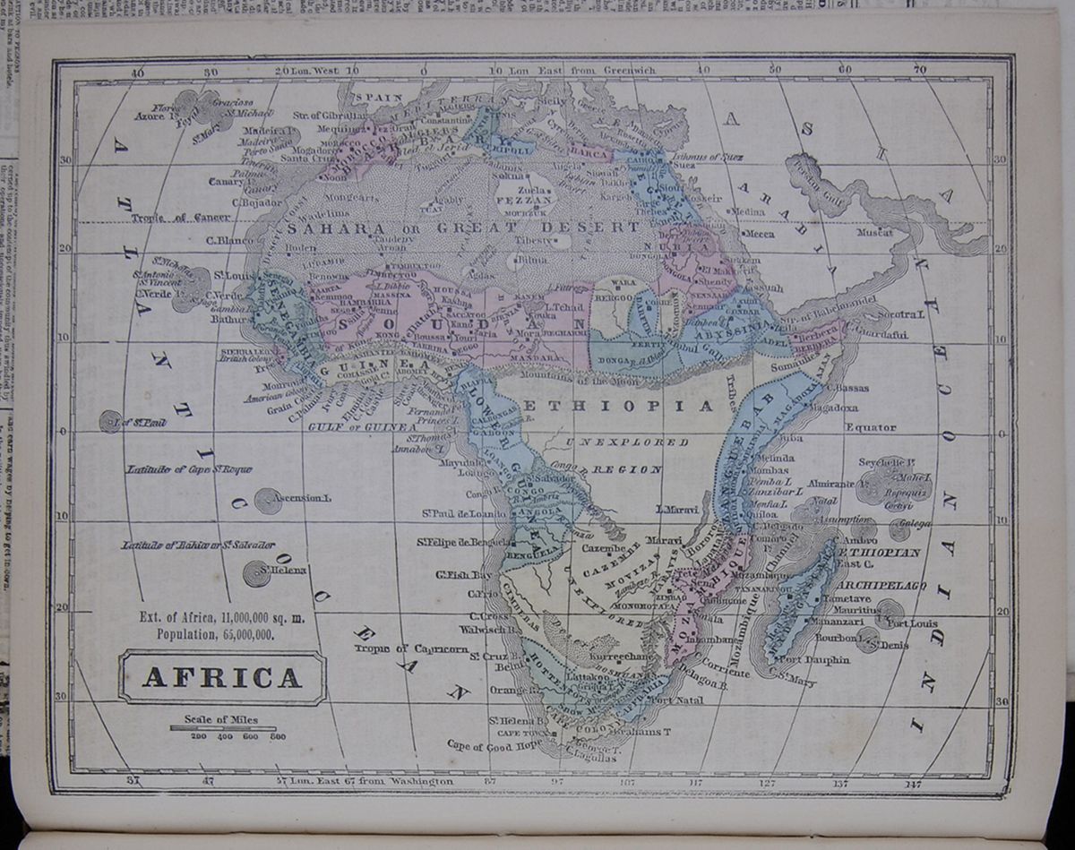 A map of the continent of Africa.
So little has India been hitherto a subject of interest with the readers of newspapers, that probably much the greater part of the current Indian news is more or less unintelligible to a large proportion of them, for want of a correct idea of the existing civil divisions of India.
The English possessions in India are included in three provinces, each of which has its Governor or Deputy-Governor, the whole being under the Governor-General, who, as well as the Deputy-Governor of Bengal, has his residence at Calcutta. These three provinces are Bengal (to which are attached the North-Western Province, the Punjaub and the prinvinces of Chin India), Bombay and Madras. Of these provinces, the richest and most populous and most extensive is that of Bengal, which is itself made up of three, or rather four great sub-divisions. Bengal proper, including the lower course and fertile delta of the Ganges and the adjacent districts from Calcutta to Benares, with a population of more than fifty millions, and a Deputy-Governor of its own, is the chief seat and center of the British power in India. Notwithstanding the revolts which took place at some of the military stations, and an attempt made on Benares, the authority of the British, both civil and military, over this entire province has continued undisturbed. It is the newly constituted North-Western Province, attached to the Bengal Presidency, of which Agra is the seat of government, and Delhi the arsenal and fortress, embracing the provinces on the Upper Ganges, with a population of some twenty-five millions, that constitutes the chief seat of the rebellion. Almost the whole of this province, except a few military fortresses held by feeble garrisons, and surrounded by rebels, appears to be in the hand of the Sepoys, including the Kingdom of Oude on its northern border, and recently added to it.
The portion of India next to Bengal in fertility and productive value, whether agricultural or financial, is the Punjaub , or the region of the five rivers, which converge together like the sticks of a fan to form the Irdus. It is but recently that this valuable region—of which, however, the population does not exceed five millions—has been added to the English territory, having been for many years under the government of the Sikhs. They are but an insignificant portion of the population, but their religious fanatacism—the Sikhs constituting a new sect by which Hindoo and Mohammedan ideas were combined—and their military organization and the talents of their leader, made them for some time one of the most formidable native powers. The Sikhs themselves and the native population of the Punjaub do not appear to have taken any part in the revolt, though symptoms of it appeared among the Bengal regiments stationed in this province. These, however, were repressed by Sir John Lawrence commanding in this district, with great decision and energy. The Sikh regiments have remained faithful, and a considerable part of the forces now operating against Delhi have been drawn from the Punjaub . To these three divisions of the Bengal Presidency (Bengal proper, the North-Western province and the Punjaub ) are to be added the territory on the east shore of the Bay of Bengal, including the recent acquisitions from Burmah . These districts are quiet and have furnished a regiment or two of British troops to operate on the Ganges.
The entire population of the Presidency of Bengal is not less than seventy-six millions, without including the native States subordinate to it.
The Presidency of Bombay, which, as well as that of Madras, has a distinct civil and military establishment of its own, has, including Sinde (the territory that is on the lower course of the Indus) and the recently annexed territory of the dethroned Rajah of Sattara, and embracing the north-western coasts of India, a population of ten millions; while the Presidency of Madras, including the eastern coasts and the southern portion of the Peninsula, has a population of some twenty-two millions. Hitherto, the Bombay and Madras native armies have remained faithful, the insurrectionary spirit being limited to that of Bengal, of which almost the whole is either in revolt or has been disbanded and dispersed.
Each of these three provinces, beside the districts immediately subject to British rule, has attached to it a number of kingdoms, in which native princes continue to enjoy a greater or less extent of authority. We refer not here to mere titular princes like the Nabob of Bengal, the Emperor of Delhi, the Rajah of Benares, and the families of the late Peishwa and of Tippoo Saib, and many others in the same condition, who, beside their titles, have only a pension; but to princes who to a greater or less extent are actual rulers, keeping up armies of their own and furnishing a contingent for the British service. These princes have in the aggregate a population of not less than fifty millions under their authority, they furnish contingents to the British of not less than 30,000 men, and their feeling and disposition at the present moment becomes a question of no small importance.
By far the most important of these dependent kingdoms is that of the Nizam, of which the capital is Hyderabad, the principal remaining fragment of the old Mohammedan empire. It has a population of ten millions, and includes the central district of Southern India. It is indeed in Central India that most of these dependent rulers are to be found. Until the last mail, this district was reported quiet. By that mail came some disagreeable accounts of disorders at Hyderabad, which, though reported to be suppressed, were calculated to alarm. The situation of the Nizam's territories is such, with respect both to Bombay and Madras, between which they interpose, as to make his fidelity of the greatest importance.
Nagpoor or Berar, also situated in Central India, to the north of Hyderabad, with a population of about five millions, is governed by a Hindoo prince. There had been some disturbances there also, but the English had succeeded in putting them down. The various Rajpoot States of Bundelcund , lying north of Berar, and with an aggregate population of five millions, appear to have joined the rebels, as have also the adjoining Mahratta States on the south-west, though the movement appears to have originated rather with the soldiery than with the princes. The dominions of Gwalior, situated in the same region of central upper India, with a population of three millions, are in a dubious state. Nor can the fidelity of any of the numerous Rajpoot States, situated in the same region, and with a population in the whole of eight or nine millions, be implicitly relied upon. It is otherwise with the Sikh States, and those along the mountainous north-eastern frontier. The ruler of Cashmere had arrested and sent back some of the mutineers who had escaped into his territories, and Sir John Lawrence was enlisting auxiliaries among the Ghoorkas, or mountaineers of Nepaul , of whose fidelity no doubts were entertained.
The States dependent on the Bombay Presidency, so far as heard from, had all remained quiet, though the French newspapers pretend to have received accounts of disturbances in the dominions of the Guicowar, who is a near neighbor to Bombay. The States dependent on the Madras Presidency, remote from the scene of conflagration, do not appear to have given any signs of disturbance. On the whole, the rebellion must be considered as confined to the districts surrounding the great cities of Delhi, Agra, Lucknow and Cawnpore; and of these four cities the last has been reoccupied by the English force moving up the river from Calcutta, while the citadels of Agra and Lucknow, though hard pressed, were still held by British garrisons.
[begin surface 844]
LECTURE ON INDIA.—LEONARD WRAY, Esq., delivered, last night, before the Mercantile Library Association, the second of his course upon "India." He last night discussed, and in a familiar and very satisfactory manner explained, the Hindoo castes and Mohamedan divisions of Hindostan. He traced the Brahminical, Budhist and Jainist branches of Hindooism, and explained the peculiar religious tenets of each. The Jainists worshipped an unknown god. The Brahminical religions, originally pure, and based on the worship of one god, on personal expiation for sin, repentance, prayer and good works, as shown by the Vedas, or sacred books, written 1400 years before CHRIST, became corrupt, and then for the interest of priestcraft, caste was established. The four original castes were priests, warriors, merchants and agriculturists, and vulgar. There is now an infinity of castes, and the members of each adhere to it with wonderful tenacity. To lose it is to lose family, station, wife and children, and property, and to become an outcast, despised by everybody. There were originally five castes of Brahmins as Tawarees, Coolims, Opadeas, Takoors and Misseers. The fighting castes are the Chuttrees and the Rajpoots. Showing how caste was lost by eating of the sacred cow, the abominable fowl, and the filthy swine, the lecturer pointed out peculiar traits of character in the different castes. He alluded to the difficulties between Hindoos and Mahomedans, the growth of Mahomedanism from persons losing caste, and the four castes into which this great religion is divided. Each of these points was well illustrated. The audience, which was larger than on the preceding evening, applauded several times during the lecture, which concluded by a reference to the ten Missionary Associations at work in India, and the $500,000 spent yearly in similar educational institutions.
[begin surface 846]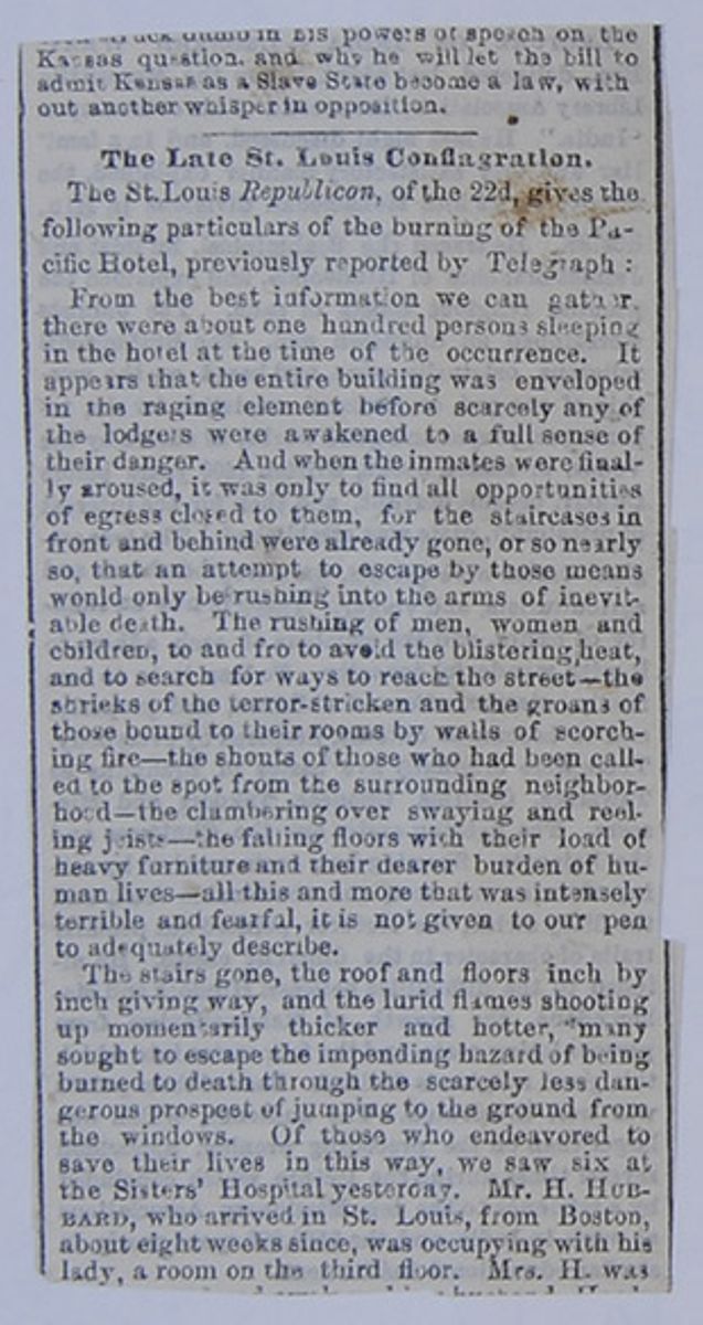
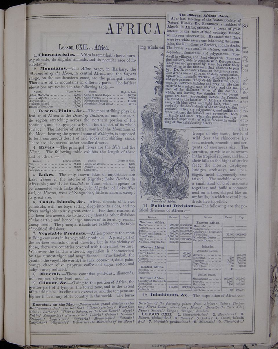
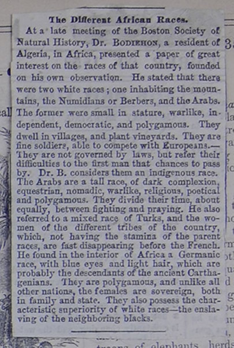 The Different African Races.
At a late meeting of the Boston Society of Natural History, Dr. BODIEHON, a resident of Algeria, in Africa, presented a paper of great interest on the races of that country, founded on his own observation. He stated that there were two white races; one inhabiting the mountains, the Numidians or Berbers, and the Arabs. The former were small in stature, warlike, independent, democratic, and polygamous. They dwell in villages, and plant vineyards. They are fine soldiers, able to compete with Europeans.—They are not governed by laws, but refer to their difficulties to the first man that chances to pass by. Dr. B. considers them an indigenous race. The Arabs are a tall race, of dark complexion, equestrian, nomadic, warlike, religious, poetical and polygamous. They divide their time, about equally, between fighting and praying. He also referred to a mixed race of Turks, and the women of the different tribes of the country, which, not having the stamina of the parent races, are fast disappearing before the French. He found in the interior of Africa a Germanic race, with blue eyes and light hair, which are probably the descendants of the ancient Carthagenians. They are polygamous, and unlike all other nations, the females are sovereign, both in family and state. They also possess the characteristic superiority of white races—the enslaving of the neighboring blacks.
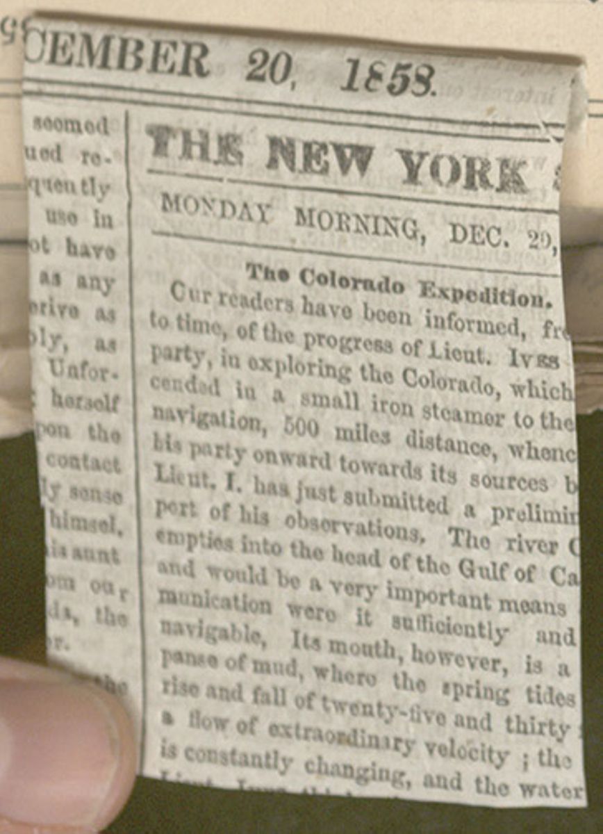
AFRICA.
Lesson CXII... Africa.
1. Characteristics.—Africa is remarkable for its burning climate, its singular animals, and its peculiar race of inhabitants.
2. Mountains.—The Atlas range, in Barbary, the Mountains of the Moon, in central Africa, and the Lapata range, on the southeastern coast, are the principal chains. There are other mountains in different parts. The loftiest elevations are noticed in the following table:—
A table listing the names and heights of Africa's most elevated places.3. Deserts, Plains, &c.—The most striking physical feature of Africa is the Desert of Sahara, an immense sterile region stretching across the northern portion of the continent, and occupying nearly one-fourth part of its whole surface. The interior of Africa, south of the Mountains of the Moon, bearing the general name of Ethiopia, is supposed to be a continuous desert of arid rocks and shifting sands. There are also several other smaller deserts.
4. Rivers.—The principal rivers are the Nile and the Niger. The following table exhibits the length of these and of others :—
A table listing the names and length in miles of various rivers in Africa.5. Lakes.—The only known lakes of importance are Lake Tchad, in the interior of Nigritia; Lake Dembea, in Abyssinia; and Lake Loudieh, in Tunis, which appears to be connected with Lake Melgig, in Algeria; of Lake Nyassi , or Maravi , west of Zanguebar, little is known, except its great size.
6. Coasts, Islands, &c.—Africa consists of a vast peninsula, with no bays setting deep into its sides, and no rivers navigable to any great extent. For these reasons, it has been less accessible to discovery than the other divisions of the earth; and hence large masses of its territory remain unexplored. The principal islands are exhibited in the table of political divisions.
7. Vegetable Products.—Africa presents the most striking contrasts in its vegetable products. A great part of the surface consists of arid deserts; but in the vicinity of these, there are countries covered with the richest verdure. Wherever the land is watered, vegetation is characterized by the utmost vigor and magnificence. The baobab, the giant of the vegetable world, the teak, cocoa-nut, date, palm, orange, citron, olive, papyrus, coffee and sugar, cotton and indigo, are produced.
8. Minerals.—These comprise gold-dust, diamonds, iron, copper, silver, lead, and tin.
9. Climate, &c.—Owing to the position of Africa, the greater part of it lying in the torrid zone, and to the extent of its arid plains, its climate is excessive, and the temperature higher than in any other country in the world. The burning winds called khamseen in Egypt and Barbary, and harmattan in Guinea, often blast the vegetation, and destroy animal life. The soil is various; vast tracts consisting of barren sands, and other portions being exceedingly fertile.
Animals.—The giraffe, the tallest of animals; the hippopotamus, an enormous beast, resembling a hog; the chimpanzee, a large ape, formed more like a man than any other creature; the zebra and quagga, beautifully striped, and resembling the horse; the gnu, or horned horse—are all peculiar to Africa. This country also, in common with Asia, has troops of elephants, herds of wild deer, the rhinoceros, hyena, ostrich, crocodile, and serpents of enormous size. The termites, or white ants, swarm in the tropical regions, and build their hills to the hight of twelve feet; the interior displaying bridges, archways, and passages, most ingeniously contrived. The sociable weavers, a small kind of bird, associate together, and build a common nest on a tree, shaped like an umbrella, in which several hundreds live together.
11. Political Divisions.—The following are the political divisions of Africa:—
A table listing the name, extent, and population of each division of Africa.12. Inhabitants, &c.—The population of Africa consists
Exercises on the Map.—Between what grand divisions is the Mediterranean Sea? The Red Sea? Where is Barbary? What four cities in Barbary? Where is Sahara, or the Great Desert? Egypt? Nubia? Senegambia? Sierra Leone? Liberia? Guinea? Soudan? Ethiopia? Cape Town? Caffraria ? Mozambique? Cazembe ? Zanguebar? Abyssinia? Where are the Mountains of the Moon? Direction of the following places from Algiers: Cairo; Timbuctoo; Sierra Leone; Jerusalem; Mecca? Describe the River Nile; Niger; Senegal; Congo; Orange; Zambeze .
LESSON CXII. 1. Characteristics? 2. Mountains? 3. Deserts, plains, &c.? 4. Rivers? 5. Lakes? 6. Coasts, islands, &c.? 7. Vegetable productions? 8. Minerals? 9. Climate, &c.?
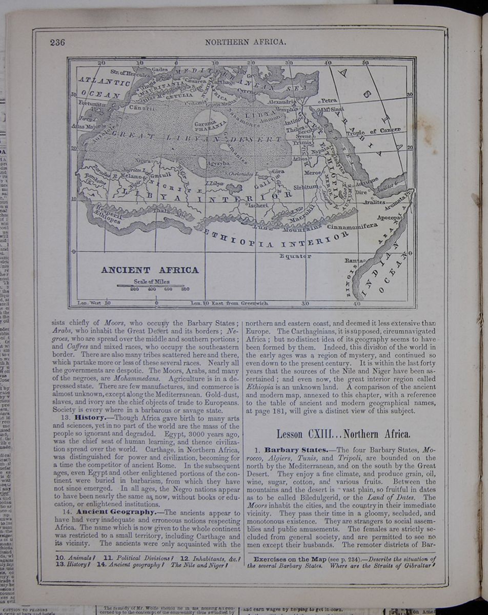 236
NORTHERN AFRICA.
A map of Ancient Africa. Only the northern part of the
continent is shown.
236
NORTHERN AFRICA.
A map of Ancient Africa. Only the northern part of the
continent is shown.
chiefly of the Moors, who occupy the Barbary States; Arabs, who inhabit the Great Desert and its borders; Negroes, who are spread over the middle and southern portions; and Caffres and mixed races, who occupy the southeastern border. There are also many tribes scattered here and there, which partake more or less of these several races. Nearly all the governments are despotic. The Moors, Arabs, and many of the negroes, are Mohammedans. Agriculture is in a depressed state. There are a few manufactures, and commerce is almost unknown, except along the Mediterranean. Gold-dust, slaves, and ivory are the chief objects of trade to Europeans. Society is every where in a barbarous or savage state.
13. History.—Though Africa gave birth to many arts and sciences, yet in no part of the world are the mass of people so ignorant and degraded. Egypt, 3000 years ago, was the chief seat of human learning, and thence civilization spread over the world. Carthage, in Northern Africa, was distinguished for power and civilization, becoming for a time the competitor of ancient Rome. In the subsequent ages, even Egypt and other enlightened portions of the continent were buried in barbarism, from which they have not since emerged. In all ages, the Negro nations appear to have been nearly the same as now, without books or education, or enlightened institutions.
14. Ancient Geography.—The ancients appear to have had very inadequate and erroneous notions respecting Africa. The name which is now given to the whole continent was restricted to a small territory, including Carthage and its vicinity. The ancients were only acquainted with the
northern and eastern coast, and deemed it less extensive than Europe. The Carthaginians, it is supposed, circumnavigated Africa; but no distinct idea of its geography seems to have been formed by them. Indeed, this division of the world in the early ages was a region of mystery, and continued so even down to the present century. It is within the last forty years that the sources of the Nile and Niger have been ascertained; and even now, the great interior region called Ethiopia is an unknown land. A comparison of the ancient and modern map, annexed to this chapter, with a reference to the table of ancient and modern geographical names, at page 181, will give a distinct view of this subject.
Lesson CXIII... Northern Africa.
1. Barbary States.—The four Barbary States, Morocco, Algiers, Tunis, and Tripoli, are bounded on the north by the Mediterranean, and on the south by the Great Desert. They enjoy a fine climate, and produce grain, oil, wine, sugar, cotton, and various fruits. Between the mountains and the desert is a vast plain, so fruitful in dates as to be called Biledulgerid, or the Land of Dates. The Moors inhabit the cities, and the country in their immediate vicinity. They pass their time in a gloomy, secluded, and monotonous existence. They are strangers to social assemblies and public amusements. The females are strictly secluded from general society, and are permitted to see no men except their husbands. The remoter districts of Barbary
10. Animals? 11. Political Divisions? 12. Inhabitants, &c.? 13. History? 14. Ancient geography? The Nile and Niger? Exercises on the Map (see p. 234).—Describe the situation of the several Barbary States. Where are the Straits of Gibraltar?
[begin surface 851]
THE NILE.
Nubia—HagarSilsibs, the Rock of the Chain—Egyptian Travel.
EGYPT, March.Below Assouan the aspect of the Nile changes. Nubia, I have before remarked, is very narrow. The mountains rise abruptly from the river's edge, and the cultivated land on each side is but a few rods in width. The overflow of the river, which is so sensible a blessing below the first cataract, which is indeed the life and soul of the land, produces very little effect between the first and second cataract, covering no land except the sloping banks of the stream, which recede a few feet on each side. But having passed Assouan, at a distance of a few miles below that point the luxuriant land of Egypt begins to attract the eye, waving fields of corn and grain, and glorious visions of the vast valley, rich in all the products of this willing soil, rest the eye that is weary of the yellow sand and rocks of the upper country. The alternation of groves of palm, and barren wastes of golden sand, immediately below Assouan, makes these twenty miles among the most beautiful on the river, and with a fresh breeze and a strong current in our favor, it was unspeakably delicious to lie on deck, and see the fast-changing landscape.
We ran from Assouan to Koum Ombos in about twelve hours, and then the wind forsook us and we slept and drifted on all night down the grand old river.
It was a glorious morning of January when we approached Hagar Silsibis, the Rock of the Chain. I went on shore early in the morning and walked down the east bank of the river, attended by MOHAMMED HASSAN, the most faithful of our sailors, and whom we had promoted to be a general attendant on us instead of a workman at the oars. We were climbing among the rocks on the east bank after rabbits or hares, of which we had gotten two or three, when I was startled by hearing bim cry "Howaggi, Howaggi," in a tone of voice that indicated either great delight or great surprise, I could not tell which. Hastening around a corner of the rock I found him most violently at work among the few green bushes that grew in the soil among the rocks, tearing them up as if he were crazy. As I approached he ran to me for my knife and said, pointing at the bush, "It is Yasmeen." I found that he was correct and that he had discovered a plantation of Jessamine, which to the Turk is like a mine of gold. The long stem of this plant makes the most expensive and highly-valued pipe stick, and MOHAMMED had found twenty most excellent sticks. Meantime the boat came drifting down the stream and the Reis, who was on deck, shouted to know what we were about. At the magical word, "Yasmeen," he tumbled into the small boat and hastened on shore, when he proceeded to help himself to all that we had left, and while he was doing so, having secured a few of the best sticks and a bunch of the sweet blossoms for the ladies, I strolled on down the river and soon lost myself in the vast quarries of sandstone which are here, and from which Karnak and all the glories of Thebes were cut out into long-gone ages. Here were vast channels cut in the rock a hundred feet deep and not more than twenty in width, extending from the shore far back into the heart of the mountain, where they widened into the quarries of which I speak. Many temples were left in the rock, many grottoes hewn out and adorned with paintings and sculpture, and many tomb-like recesses carved with the names of kings and princes and priests of three thousand years ago. More ancient memorials of art nowhere exist, more interesting to the antiquarian none can be found. Hailing the boat I had the small boat sent for me and crossed the river to the western bank, where there are fewer quarries and more temples or grottoes, and the large boat swung in to the land just under the entrance to one of these which bears the name of the great REMESES III the SESOSTRIS of the Greek historians.
I have already said that I should not weary the readers of these letters with description of places and ruins in Egypt. It is but my design to give passing sketches of our own travel. I would like well to linger on these scenes and sketch the places that my readers might understand better our daily life and studies; but it must suffice here to say that the west bank of the river is lined with rocks rising more or less abruptly from the river, and that in the faces of these rocks are cut cavernous tomb-like rooms, some small, some large, all more or less ornamented with paintings and sculpture, and many of great interest to the Egyptian scholar, as dating far back in the history of this oldest of nations It is vain for any man of ordinary mind to resist the feelings that come over him in such places. Whether tomb or temple, if he stands in the place hollowed out or built by human hands three thousand years ago, he will bow down in awe before that memorial of antiquity. We are too short-lived, too evanescent, too much the creatures of a day to dare resist, or be able to resist the demand for respect which a monument of thirty centuries makes on us. Nor can we ever accustom ourselves to it by ordinary travel. Six months in Egypt produces no diminution in this respect though every day of those six months brings with it another of the grand relics of the world close after the flood. We live years in days, months—nay, I might well say years in hours. We pass, by an effort of thought that becomes no less startling and painful from its frequency, we pass from the presence of this age and time into the presence of the men of those old ages and times—grasp their thin, dark fingers in our fleshy hands, gaze into their dim, vacant eyes, and question them; and when they reply not, we look up at the walls of their sepulchres and read the lines they carved, and seem thus to hear their voices.
The evening came on as we were leaving Hagar Silsibis, but as there was yet an hour or two to spare before dark, I walked on down the west side of the river while the boat drifted. A few moments brought me out of the narrow pass and into the open cultivated plain below, where the sound of my gun, as I shot two or three pigeons, brought some of the natives around me, out of the cornfields, in which they were now gathering the ripe corn. They asked me if I wanted a timsa—that is, a crocodile—and I, not knowing whether they intended one dead or alive, told them I did, and directed them to bring it. While I strolled along the side of the river, a man and a woman overtook me, trotting along, each one carrying a crocodile on the top of his or her head. They were dead and stuffed. One of them a sailor bought for a few piastres, which afterward graced the front door of an Egyptian house in Cairo, where it hangs to keep off evil spirits.
[begin surface 852]
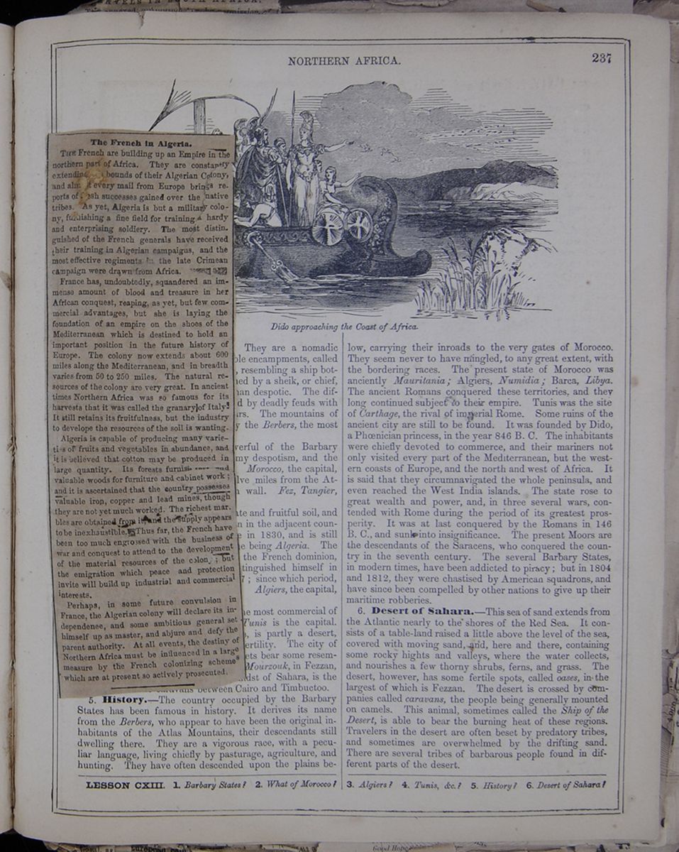
The French in Algeria.
THE French are building up an Empire in the northern part of Africa. They are constantly extending the bounds of their Algerian Colony, and almost every mail from Europe brings reports of rash successes gained over the native tribes. As yet, Algeria is but a military colony, furnishing a fine field for training a hardy and enterprising soldiery. The most distinguished of the French generals have received their training in Algerian campaigns, and the most effective regiments in the late Crimean campaign were drawn from Africa.
France has, undoubtedly, squandered an immense amount of blood and treasure in her African conquest, reaping, as yet, but few commercial advantages, but she is laying the foundation of an empire on the shoes of the Mediterranean which is destined to hold an important position in the future history of Europe. The colony now extends about 600 miles along the Mediterranean, and in breadth varies from 50 to 250 miles. The natural resources of the colony are very great. In ancient times Northern Africa was so famous for its harvests that it was called the granary of Italy. It still retains its fruitfulness, but the industry to develope the resources of the soil is wanting.
Algeria is capable of producing many varieties of fruits and vegetables in abundance, and it is believed that cotton may be produced in large quantity. Its forests furnish [illegible] and valuable woods for furniture and cabinet work; and it is ascertained that the country possesses valuable iron, copper and lead mines, though they are not yet much worked. The richest marbles are obtained from it, and the supply appears to be inexhaustible. Thus far, the French have been too much engrossed with the business of war and conquest to attend to the development of the material resources of the colony; but the emigration which peace and protection invite will build up industrial and commercial interests.
Perhaps, in some future convulsion in France, the Algerian colony will declare its independenee , and some ambitious general set himself up as master, and abjure and defy the parent authority. At all events, the destiny of Northern Africa must be influenced in a large measure by the French colonizing schemes which are at present so actively prosecuted.
[begin surface 855]
are inhabited by the Arabs. They are a nomadic race, and dwell in a species of movable encampments, called douars. These are broad, low tents, resembling a ship bottom upward. Each douar is governed by a sheik, or chief, whose authority is more paternal than despotic. The different communities are often animated by deadly feuds with each other, which lead to bloody wars. The mountains of the Atlas range are still occupied by the Berbers, the most ancient inhabitants of the country.
2. Morocco is the most powerful of the Barbary States. The government is a gloomy despotism, and the people are in a barbarous condition. Morocco, the capital, is situated in a fine plain, about twelve miles from the Atlantic, and is surrounded by a high wall. Fez, Tangier, and Mogadore are noted places.
3. Algiers has a charming climate and fruitful soil, and the people have more refinement than in the adjacent countries. It was conquered by France in 1830, and is still held by that country, its present name being Algeria. The Arabs made a powerful resistance to the French dominion, and Abd-el-Kader, their leader, distinguished himself in these wars. He was captured in 1847; since which period, the country has been more submissive. Algiers, the capital, is a large town, strongly fortified.
4. Tunis, &c.—Tunis is one of the most commercial of the Barbary states. The city of Tunis is the capital. Tripoli, including Barca and Fezzan, is partly a desert, while some portions are famed for fertility. The city of Tripoli has a good harbor, and its streets bear some resemblance to those of European towns. Mourzouk, in Fezzan, which is situated in an oasis in the midst of Sahara, is the great mart of the caravans between Cairo and Timbuctoo.
5. History.—The country occupied by the Barbary States has been famous in history. It derives its name from the Berbers, who appear to have been the original inhabitants of the Atlas Mountains, their descendants still dwelling there. They are a vigorous race, with a peculiar language, living chiefly by pasturage, agriculture, and hunting. They have often descended upon the plains below, carrying their inroads to the very gates of Morocco. They seem never to have mingled, to any great extent, with the bordering races. The present state of Morocco was anciently Mauritania; Algiers, Numidia; Barca, Libya. The ancient Romans conquered these territories, and they long continued subject to their empire. Tunis was the site of Carthage, the rival of imperial Rome. Some ruins of the ancient city are still to be found. It was founded by Dido, a Phœnician princess, in the year 846 B. C. The inhabitants were chiefly devoted to commerce, and their mariners not only visited every part of the Mediterranean, but the western coasts of Europe, and the north and west of Africa. It is said that they circumnavigated the whole peninsula, and even reached the West India islands. The state rose to great wealth and power, and, in three several wars, contended with Rome during the period of its greatest prosperity. It was at last conquered by the Romans in 146 B. C., and sunk into insignificance. The present Moors are the descendants of the Saracens, who conquered the country in the seventh century. The several Barbary States, in modern times, have been addicted to piracy; but in 1804 and 1812, they were chastised by American squadrons, and have since been compelled by other nations to give up their maritime robberies.
6. Desert of Sahara.—This sea of sand extends from the Atlantic nearly to the shores of the Red Sea. It consists of a table-land raised a little above the level of the sea, covered with moving sand, and, here and there, containing some rocky hights and valleys, where the water collects, and nourishes a few thorny shrubs, ferns, and grass. The desert, however, has some fertile spots, called oases, in the largest of which is Fezzan. The desert is crossed by companies called caravans, the people being generally mounted on camels. This animal, sometimes called the Ship of the Desert, is able to bear the burning heat of these regions. Travelers in the desert are often beset by predatory tribes, and sometimes are overwhelmed by the drifting sand. There are several tribes of barbarous people found in different parts of the desert.
LESSON CXIII. 1. Barbary States? 2. What of Morocco? 3. Algiers? 4. Tunis, &c.? 5. History? 6. Desert of Sahara?
[begin surface 856]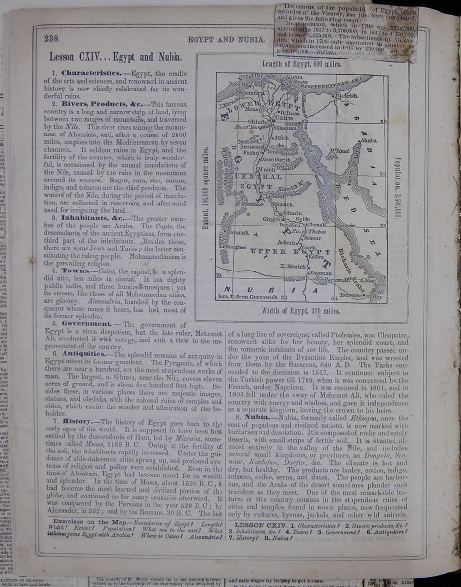 238
EGYPT AND NUBIA.
[begin surface 857]
238
EGYPT AND NUBIA.
[begin surface 857]
The census of the population of Egypt, taken by order of the Viceroy, has just been completed, and gives the following result:
The population, which in 1798 was 2,500,000, amounted in 1817 to 3,700,000, in 1847 to 4,250,000, and is now 5,125,000, The inhabitants in Alexandria, which in 1798 only amounted in number to 30,000. and increased in 1817 to 230,000, are now near 400,000.—Bulletin.
Lesson CXIV... Egypt and Nubia.
Characteristics.—Egypt, the cradle of the arts and sciences, and renowned in ancient history, is now chiefly celebrated for its wonderful ruins.
2. Rivers, Products, &c.—This famous country is a long and narrow strip of land, lying between two ranges of mountains, and traversed by the Nile. This river rises among the mountains of Abyssinia, and, after a course of 2400 miles, empties into the Mediterranean by seven channels. It seldom rains in Egypt, and the fertility of the country, which is truly wonderful, is occasioned by the annual inundations of the Nile, caused by the rains in the mountains around its sources. Sugar, corn, rice, cotton, indigo, and tobacco are the chief products. The waters of the Nile, during the period of inundation, are collected in reservoirs, and afterward used for irrigating the land.
3. Inhabitants, &c.—The greater number of the people are Arabs. The Copts, the descendants of the ancient Egyptians, form one-third part of the inhabitants. Besides these, there are some Jews and Turks; the latter constituting the ruling people. Mohammedanism is the prevailing religion.
4. Towns.—Cairo, the capital, is a splendid city, ten miles in circuit. It has eighty public baths, and three hundred mosques; yet its streets, like those of all Mohammedan cities, are gloomy. Alexandria, founded by the conqueror whose name it bears, has lost most of its former splendor.
5. Government.—The government of Egypt is a stern despotism, but the late ruler, Mehemet Alt, conducted it with energy, and with a view to the improvement of the country.
6. Antiquities.—The splendid remains of antiquity in Egypt attest its former grandeur. The Pyramids, of which there are near a hundred, are the most stupendous works of man. The largest, at Ghizeh, near the Nile, covers eleven acres of ground, and is about five hundred feet high. Besides these, in various places there are majestic images, statues, and obelisks, with the colossal ruins of temples and cities, which excite the wonder and admiration of the beholder.
7. History.—The history of Egypt goes back to the early ages of the world. It is supposed to have been first settled by the descendants of Ham, led by Mizraim, sometimes called Menes, 2188 B. C. Owing to the fertility of the soil, the inhabitants rapidly increased. Under the guidance of able statesmen, cities sprung up, and profound systems of religion and policy were established. Even in the time of Abraham, Egypt had become noted for its wealth and splendor. In the time of Moses, about 1520 B. C, it had become the most learned and civilized portion of the globe, and continued so for many centuries afterward. It was conquered by the Persians in the year 529 B. C; by Alexander, in 332; and by the Romans, 30 B. C. The last Map of Egypt Length of Egypt, 600 miles. Extent, 186,000 square miles. Population, 2,500,000. Width of Egypt, 300 miles. of a long line of sovereigns, called Ptolemies, was Cleopatra, renowned alike for her beauty, her splendid court, and the romantic incidents of her life. The country passed under the yoke of the Byzantine Empire, and was wrested from them by the Saracens, 640 A. D. The Turks succeeded to the dominion in 1517. It continued subject to the Turkish power till 1799, when it was conquered by the French, under Napoleon. It was restored in 1801, and in 1806 fell under the sway of Mehemet Ali, who ruled the country with energy and wisdom, and gave it independence as a separate kingdom, leaving the crown to his heirs.
8. Nubia.—Nubia, formerly called Ethiopia, once the seat of populous and civilized nations, is now marked with barbarism and desolation. It is composed of rocky and sandy deserts, with small strips of fertile soil. It is situated almost entirely in the valley of the Nile, and includes several small kingdoms, or provinces, as Dongola, Sennaar, Kordofan, Darfur, &c. The climate is hot and dry, but healthy. The products are barley, cotton, indigo, tobacco, coffee, senna, and dates. The people are barbarous, and the Arabs of the desert sometimes plunder such travelers as they meet. One of the most remarkable features of this country consists in the stupendous ruins of cities and temples, found in waste places, now frequented only by vultures, hyenas, jackals, and other wild animals.
Exercises on the Map.—Boundaries of Egypt? Length? Width? Extent? Population? What sea to the east? What isthmus joins Egypt with Arabia? Where is Ciro? Alexandria?
LESSON CXIV. 1. Characteristics? 2. Rivers, products, &c.? 3. Inhabitants, &c.? 4. Towns? 5. Government? 6. Antiquities? 7. History? 8.Nubia?
Our Vienna Correspondence.
VIENNA, Oct. 10, 1858.Death of the Chevalier Negrelli—The Regency of the Prince of Prussia Looked upon as Favorable to Austrian Policy—Projected Meeting of the German Creditors of American Railroads—Murder of the French Consul at the Island of Koz—Increasing Animosity of the Turks towards Europeans, &c., &c.
Chevalier Negrelli de Modelbe, the great Austrian engineer, and member of the Suez Canal Commission, died after a short illness, and left the field to his rival, Mr. Stephenson, against whom he had recently discharged one of his tremendous philippics. Chevalier Negrelli was an unpretending but devoted servant to the house of Austria, and the first practical engineer who, from practical observations made on the spot, pronounced the project of uniting the Mediterranean and Red Sea by a ship canal, without a single lock, perfectly feasible. This opinion prevailed in the first commission, composed of R. Stephenson on the part of England, Paulin Talbot on the part of France and Chevalier Negrelli on the part of Austria. Negrelli sounded the port of Pelusium, re-examined the levelling of Bourdalon and pronounced for conducting the canal through the lakes of Timsah and Menzahleh to the roadstead of Pelusium. The French member of the commission embraced the view of the Chevalier; and Stephenson has since been exposed to the severest attacks of the continental press. He chose to answer some of these from his seat in Parliament; but was boldly charged by Negrelli with never having seen and examined the localities in regard to which he had published his opinions. In 1855 Lesseps, the French engineer, at the head of a new commission, examined the same subject, and came to the same conclusion; and the international commission of 1856 only corroborated what its predecessors had done. England, naturally enough, does not wish a canal to be built across the Isthmus of Suez, because this would give the States of the Mediterranean the coastwise trade to India; but if the project is really feasible it will be executed in spite of her opposition, as has repeatedly been suggested by France, Russia and Australia. On this subject the report of Mr. Stephenson is not an offset to those Lesseps and Negrelli. The Chevalier Negrelli will not easily be replaced by Austria; but the result of his labors is, nevertheless, a lasting one, and will not be changed by his successor. The money required for the enterprise, not the physical obstacles to be overcome, render the task a difficult one.
[cutaway]
[begin surface 859]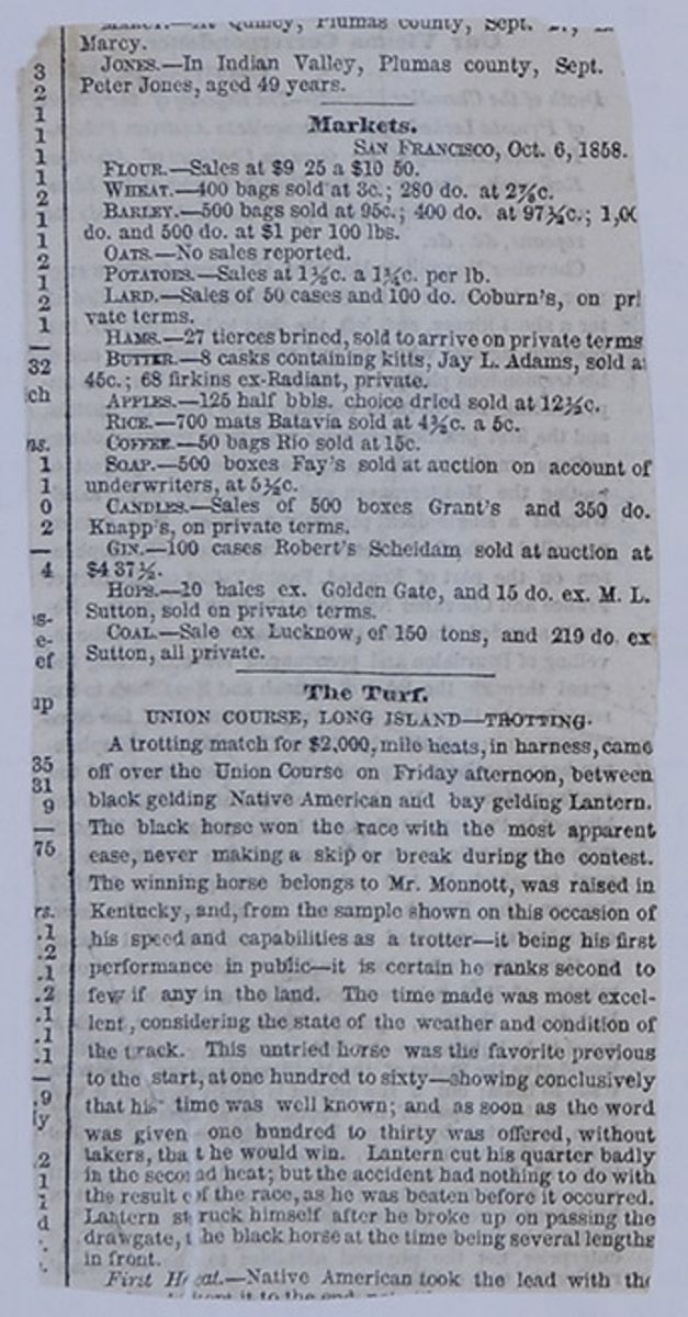
Two hours later we were well located in the Hotel d'Europe on the grand square of Alexandria, and looking out of our windows at hte Oriental and mixed picture before us. Alexandria is composed of all nations. It is not Egyptian in any sense. Turks, Arabs and Copts abound; but so
also do French, Italians, Maltese and English, as well as Greeks and Germans. The donkey boy and his donkey, the camel and his driver, if there were no other means of locomotion, would indeed be Eastern; but the splendid carriage and showy turn-out of the Parisian resident takes precedence here, and camel and donkey must give way to them. But the carriage is not wholly European in its equipment, for the narrow streets and crowded squares are so difficult of passage that each carriage has before it a runner who precedes it at the swiftest speed, crying aloud to all that his master is following him. The speed and bottom of these runners is beyond belief until you have seen them. I have seen a man run a hundred yards before a carriage for an hour without resting an instant, and when the horses were nearly blown he seemed as fresh as when he started. I tried one of them with my donkey from Pompey's pillar to the grand square, a distance of more than a mile. The donkey was a fast one, and I ran him every step of the way, and the faster I ran him the closer to him kept the boy, and the more furiously did he ply his whip in aid of my endeavors to get up more speed, while he shouted steadily with every breath "O—ah, O—ah, out of the way for the Howadji, to the right, to the left, out of the way you small boy, take care there, woman," and similar warnings to foot-passengers.
The ladies were fatigued. The previous night was a wakeful one to all of us. While they lay down and slept, Jacques and myself started out for our first donkey ride in Egypt, and of course went first of all to Pompey's pillar. The city was crowded with strangers,—the passengers in our steamer, as well as the passengers from India, who were waiting our arrival. Hence the price of donkeys was up, and the animals were not plenty at any price. But we were fortunate in our selection of three for ourselves and our servant, and we went up the square at a rattling American gallop.
Groves of lofty palm trees, loaded with their fruit just now ripe. Dense masses of banana, fig trees, and prickly pear, and occasional orange and lemon trees attracted our attention at the first, and we slackened the pace; but the sun was hot and we hastened on, and so our walk became a trot and the trot a gallop and the gallop a tremendous run. We overtook some ten or fifteen English gentlemen, who recognized us as their fellow-travelers on the Nubia, and fell into our wake, so that by the time we reached the gate of the city we had no small retinue, and the pace at which we were going, the cloud of dust we raised, the outcries of twenty donkey boys, shouting the praises of their respective employers, and withal the unshaven faces and shouts of laughter of the two Americans who led the sortie, might well have excused the guard at the gate for imagining an attempt to take it. But they imagined no such thing, or had no objection to it if they did, for we caught them napping. There was a camel loaded with stone, followed by four like himself, entering the gate from without as we entered it from within. The gate, be it known, is an archway some thirty feet through. Our pace left us but one alternative. To be over-run by the heavy camels who would unquestionably have the advantage of us in a collision, or to run over the janissaries and guard who sat on the side of the roadway half dozing in the shadowy arch. There was no choice whatever. We went over them. I shall never forget the horrible fate of one poor wretch of a Turk. He had just spread his carpet for noonday prayer, and having finished the ablutions was in the fifth, sixth, or seventh posture prescribed by the Koran. I don't recollect the number, but you will recollect the posture. It is that in which he kneels towards Mecca with the top of his head on the ground between his knees. Mecca is to the south-eastward of Alexandria. We were going out of the south gate. You understand? The next posture was one not mentioned in the Koran, if my recollection is correct. It was on the back, head toward Mecca, feet toward the sun; next on the head, feet elevated and back toward Mecca, and next head, feet and body undergoing an ablution in a stream of mill water, flowing from an elevation just outside the gate. It was all over in an instant. The expression of his countenance was that of abject despair, as he vanished in the water, and we disappeared out of the next gateway which stands a hundred feet or so beyond the first and dashed out into the market-place of beeves buffalo and donkeys.
Pompey's Pillar, I call it by the name it is best known by, stands on a barren sand-hill, over the great cemetery of modern Alexandria; and a more melancholy spectacle than it presents, the world cannot show. Grand, majestic and solitary, it is the relic and the monument it once adorned. From its capital, gray with the winds of two thousand years, the eye of the visitor falls slowly to the pedestal, and to the ground, where thousands of miserable fellahs lie shoulder to shoulder in the dust of the hills, and looking on their tombs, he scarcely dares lift his gaze again, lest the vision many have departed. He cannot believe that he will see above those vile sepulchres that majestic, that almost holy spectacle. He looks and it is there. Calm, lofty, motionless, and he remembers that this dust at its foot may be the dust of ALEXANDER, of BERENICE, of the Apostles of the Lord, of the stern CYRIL, or of the beautiful HYPATIA, and he forgets the Moslems and their accursed graves in the monument he beholds of departed, but unforgotten glories.
Livingstone's Travels and Researches in Southern Africa.
In our previous notice we referred to the early life of Dr. Livingstone. We now turn to the scenes in his life which have made him famous—his African career.
The second African journey of Dr. Livingstone, which was commenced in June, 1852, will be ever regarded as a marvel of enterprise. Proceeding in a northeasterly direction from the Cape of Good Hope, and not, as on the former journey, from Angola Bay, he made his way to the tribes in the interior. These he found generally friendly to the white man; hospitable, simple and childlike in their tastes and habits. Passing, in January, 1853, Mr. Gordon Cumming's furthest station north, Dr. Livingstone takes occasion to corroborate, to a certain extent, the accuracy of that gentleman's marvellous narrations. 'For those who love that sort of thing,' he tells us, 'Mr. Cumming's book conveys a truthful idea of South African sport. Some things in it require explanation, but the numbers of animals said to have been met with and killed are by no means improbable, considering the amount of large game then in the country. Two other gentlemen hunting in the same region destroyed in one season no fewer than seventy-eight rhinoceroses alone.' Properly enough, the Doctor protests against the cruelty of these wholesale hunters or wholesale butchers. Not only are inoffensive animals shot down by these Nimrods from wantonness, and without the slightest intention of applying either the flesh, skins, or horns to any useful purpose; but, especially in night shooting, they are more frequently wounded than killed. Tormented by the extreme thirst caused by the loss of its blood, the maimed eland often ventures in desperation to the muddy waterpools, although he may well expect to meet a deadly enemy, and comes slowly up to drink in spite of the danger: 'I must drink, though I die." Civilised man, it may, however, be observed, though not distinguished for humanity, uniformly displays greater bravery in his contests with wild and ferocious animals than the native races. The latter hunt the elephant with dogs, and only venture to fire at the safe distance of a hundred yards, whilst the Englishman will walk coolly up to within 30 yards of the huge quadruped and dispatch him with a single bullet.
On the 23d of May, 1852, Dr. Livingstone reached, for the second time, the town of Linyanti, the chief town of the Makololo tribe, which he had visited in 1851. The chieftainship of this people had then been conferred on [cutaway]oung man 18 years of age, named Sekeletu, [cutaway]dark yellow, or coffee-and-milk color, [cutaway]e Makololo are so proud, because it [cutaway]es them considerably from the black [cutaway]on the rivers.' Whilst sojourning with [cutaway]endly race, the traveller was prostrated [cutaway]African fever, of which, during his subsequent journeys he was often the victim.
As soon as he recovered strength, he proceeded to ascend the magnificent river called the Iseambye, for which purpose the chief of the Makololo furnished him with a fleet of 33 canoes. He was now in a region entirely new to him, and hitherto unvisited by the white man; but it was no sterile and barren wilderness, such as the interior of Africa has generally been depicted, but a rich and luxurious landscape which met his eye. The river is studded with Islands, and the attractive character of the scenery is thus depicted:—
RIVER SCENERY IN THE INTERIOR OF AFRICA.
We proceeded rapidly up the river, and I felt the pleasure of looking on lands which had never been seen by any European before. The river is, indeed, a magnificent one, often more than a mile broad, and adorned with many islands, of from three to five miles in length. Both islands and banks are covered with forest, and most of the trees on the brink of the water send down roots from their branches like the banian, or Ficus Indica. The islands at a little distance seem great rounded masses of sylvan vegetation reclining on the bosom of the glorious stream. The beauty of the scenery of some of the islands is greatly increased by the date-palm, with its gracefully curved fronds and refreshing light-green color, near the bottom of the picture, and the lofty palmyra towering far above, and casting its feathery foilage against a cloudless sky. It being winter, we had the strange coloring on the banks which many parts of the African landscape assume. The country adjacent to the river is rocky and undulating, abounding in elephants and all the other large game, except leches and nakongs, which seem generally to avoid stony ground. The soil is of a reddish color, and very fertile, as is attested by the great quantity of grain raised annually by the Banyeti. A great many vilages of this poor and very industrious people are situated on both banks of the river, they are expert hunters of the hippopotami and other animals, and very proficient in the manufacture of articles of wood and iron. The whole of this part of the country being infested with the tsetse, they are unable to rear domestic animals. This may have led to their skill in handicraft works. Some make large wooden vessels with very neat lids and wooden bowls of all sizes; and since the idea of sitting on stools has entered the Makololo mind, they have shown great taste in the different forms given to the legs of these pieces of furniture.
As the traveller proceeded, the dispiriting prospect presented itself of low banks without trees, and he then came to forests down to the water's edge infested with the destructive tsetse, described in our previous notice. It cannot be marvelled at, that at this stage of his undertaking he was seized with some despondency; but it was some consolation to him that he was amongst a friendly people, and even the wild animals in these regions were not distinguished for ferocity, or regarded with much apprehension. He thus describes the character and prodigious quantity of "large game" he met with in the very centre of the continent:
AFRICAN GAME
The numbers of large game near Libonta are prodigious, and they proved remarkably tame. Eighty-one buffaloes defiled in slow procession before our fire one evening within gun-shot; and herds of splendid elands stood by day without fear at two hundred yards distance. They were all of the striped variety, and with their forearm markings, large dewlaps and sleek skins, were a beautiful sight to see. The lions here roar much more than in the country near the lake, Zouga and Chobe. One evening we had a good opportunity of hearing the utmost exertions the animals can make in that line. We had made our beds on a large sand-bank, and could be easily seen from all sides; a lion on the opposite shore amused himself for hours by roaring as loudly as he could, putting, as is usual in such cases, his mouth near the ground to make the sound reverberate. The river was too broad for a ball to reach him, so we let him enjoy himself, certain that he durst not have been guilty of the impertinence in the Bushman country. Wherever the game abounds, these animals exist in proportionate numbers. Here they were very frequently seen, and two of the largest I ever saw seemed about as tall as common donkeys; but the mane made their bodies appear rather larger.
Returning to Linyanti, in the autumn of 1853, Livingstone prepared to prosecute his great adventure, that of penetrating through the interior or to the western or gold coast. The Makololo being desirous of trading to the seaboard were not averse to his project, and a band of 27 men were selected to accompany him on his perilous route. His own outfit was simple enough, and he took but small store of provision, as he was anxious not to embarrass his expedition with 'impediments,' and trusted wherever he went to meet with a plentiful supply of game.
As the traveller approached the desired goal, he found the native tribes more menacing, dangerous and difficult to deal with. Greedy of plunder, they resorted to many threats and artifices to procure from the English traveller every article of value which he carried with him. More than once was violence threatened, and it was only by resolute courage and the most unerring tact that the Doctor preserved himself and his little band from destruction. The demands made for presents became very embarrassing, when nearly everything worth offering had been parted with.
At length, to his great relief, Livingstone reached the Portuguese settlement on the western coast of the continent, and having arrived, weary, sick, and famishing, at the town of St. Paul de Loanda, he was hospitably entertained by the only English resident, Mr. Gabriel. During his brief sojourn in this place, the poor Makololo who accompanied him were thus astounded at some of the wonders of civilization:
A SAVAGE'S NOTIONS OF HOUSES AND SHIPS.
Every one remarked the serious deportment of the Makololo. They viewed the large stone houses and churches in the vicinity of the great ocean with awe. A house with two stories was, until now, beyond their comprehension. In explanations of this strange thing, I had always been obliged to use the word for hut; and as huts are constructed by the poles being let into the earth, they could never comprehend how the pole of one hut could be found upon the roof of another, or how men could live in the upper story with the conical roof of the lower one in the middle. Some Makololo, who had visited my little house at Kolobeng, in trying to describe it to their countrymen at Linyanti, said, 'it is not a hut; it is a mountain with several leaves in it.' Commander Bedingfeld and Captain Skene invited them to visit their vessels, the Pluto and Philomel. Knowing their fears, I told them that no one need go if he entertained the least suspicion of foul play. Nearly the whole party went; and when on deck, I pointed to the sailors, and said, 'Now these are all my councrymen , sent out by our Queen for the purpose of putting down the trade of those that buy and sell black men.' They replied, "Truly! they are just like you!' and all their fears seemed to vanish at once, for they went forward amongst the men, and the jolly tars, acting much as the Makololo would have done in similar circumstances handed them a share of the bread and beef which they had for dinner. The commander allowed them to fire off a cannon; and having the most exalted ideas of its powers, they were greatly pleased when I told them, 'That is what they put down the slave trade with.' The size of the brig-of-war amazed them. 'It is not a canoe at all: it is a town!' The sailors' deck they named the 'Kotla;' and then, as a climax to their description of this great ark, added, 'and what sort of town is it that you must climb up into with a rope.'
Disdaining the offer of proceeding from Loanda to St. Helena, and thence to England, Dr. Divingstone returned with his Makololo people to their tribe, and then accomplished the remaining object of his journey by proceeding to the eastern coast of the continent, thus having entirely crossed the terra incognita of South Africa.
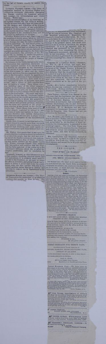
 [begin surface 865]
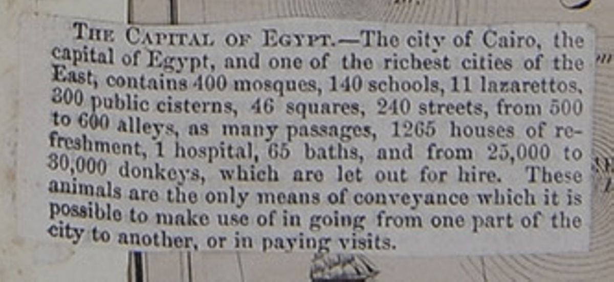
THE CAPITAL OF EGYPT.—The city of Cairo, the capital of Egypt, and one of the richest cities of the East, contains 400 mosques, 140 schools, 11 lazarettos, 300 public cisterns, 46 squares, 240 streets, from 500 to 600 alleys, as many passages, 1265 houses of refreshment, 1 hospital, 65 baths, and from 25,000 to 30,000 donkeys, which are let out for hire. These animals are the only means of conveyance which it is possible to make use of in going from part of the city to another, or in paying visits.
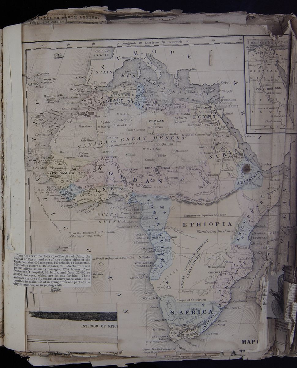
 Persia. Capital, (1856) Teheran—Ruler [covered] called the
"Shah."
Persia. Capital, (1856) Teheran—Ruler [covered] called the
"Shah."
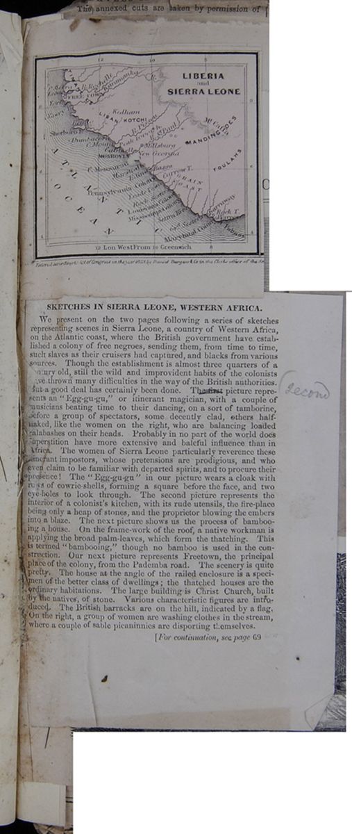 [begin surface 869]
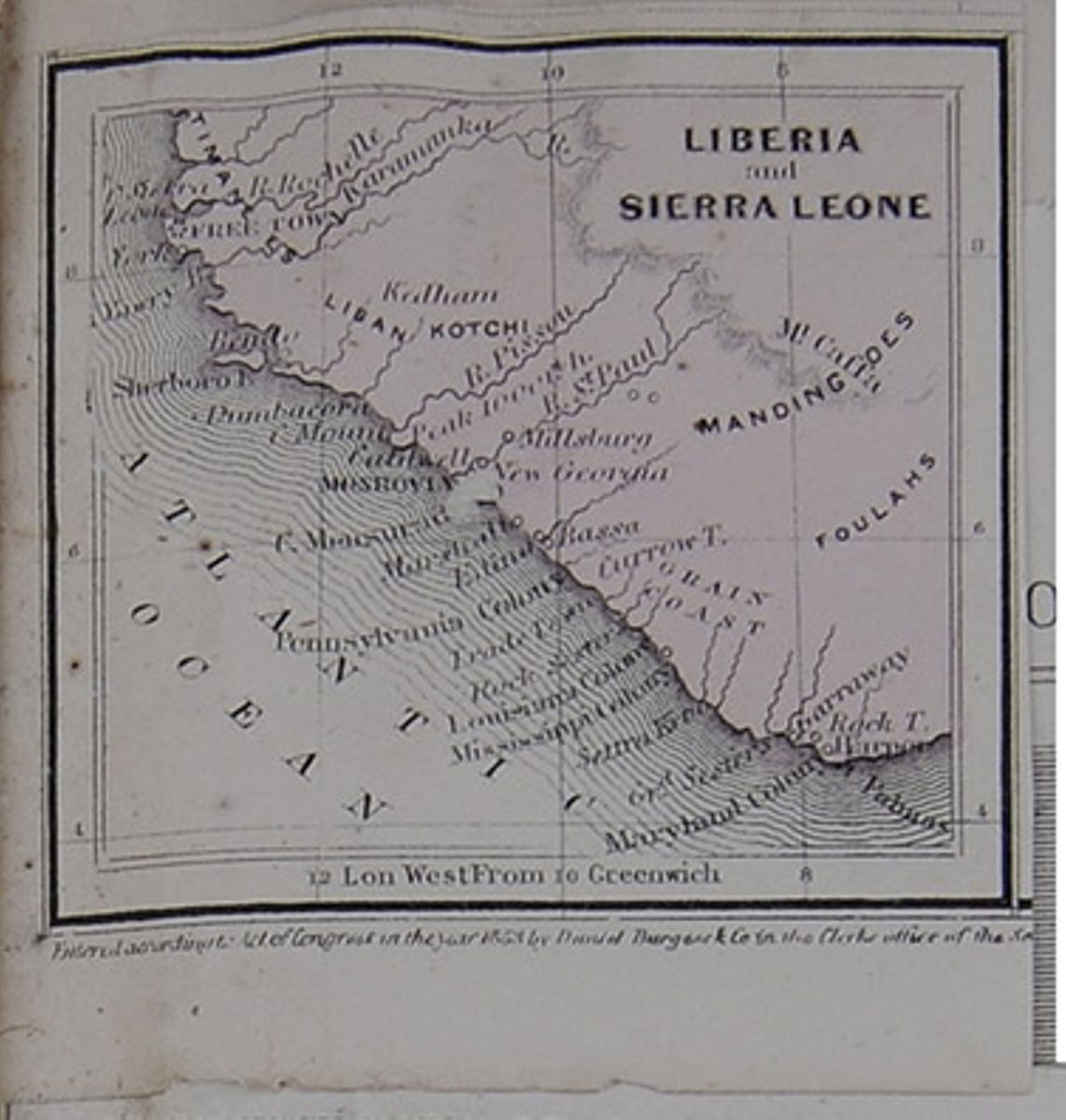
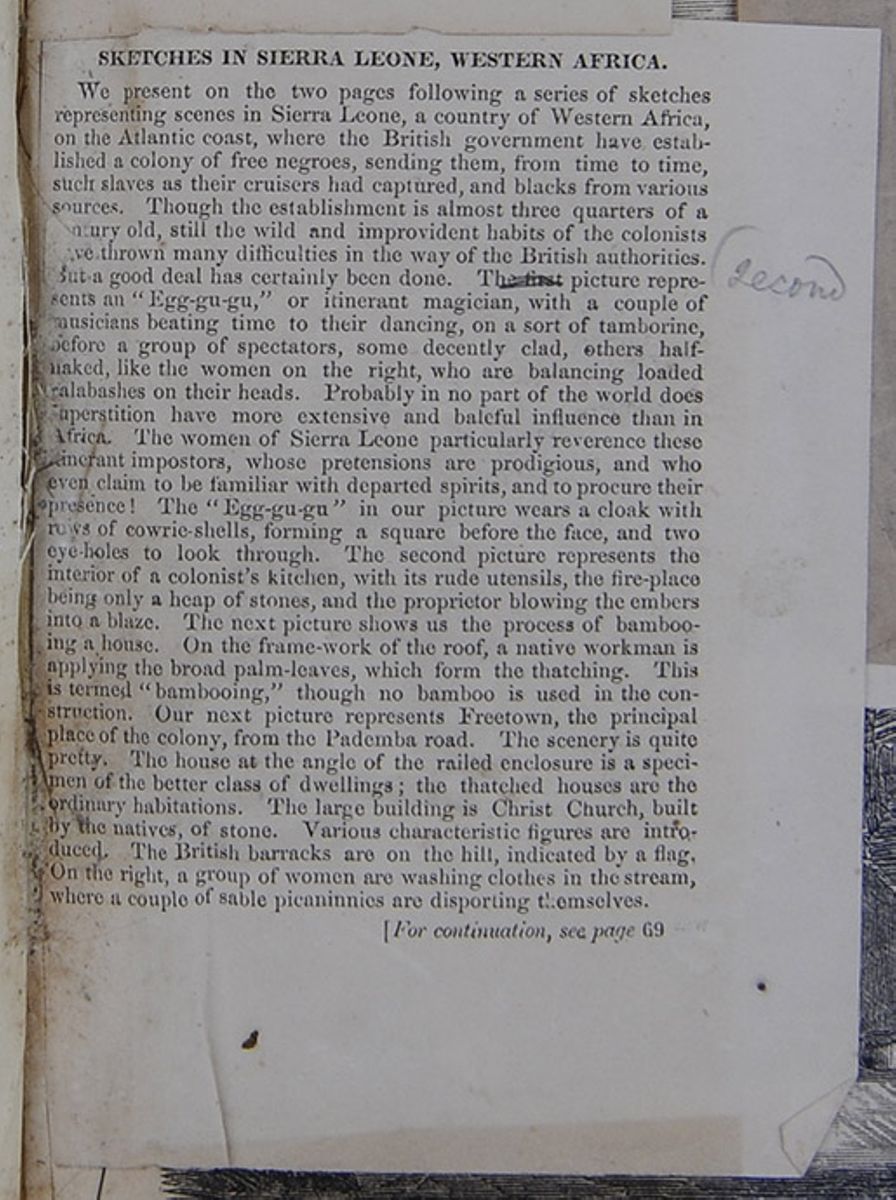
SKETCHES IN SIERRA LEONE, WESTERN AFRICA.
We present on the two pages following a series of
sketches representing scenes in Sierra Leone, a
country of Western Africa, on the Atlantic coast,
where the British government have established a
colony of free negroes, sending them, from time to
time, such slaves as their cruisers have captured,
and blacks from various sources. Though the
establishment is almost three quarters of a
century old, still the wild and improvident habits
of the colonists have thrown many difficulties in
the way of the British authorities. But a good
deal has certainly been done. The first
picture represents an "Egg-gu-gu," or itinerant
magician, with a couple of musicians beating time
to their dancing, on a sort of tamborine, before a group of spectators, some
decently clad, others half-naked, like the women
on the right, who are balancing loaded calabashes
on their heads. Probably in no part of the world
does superstition have more extensive and baleful
influence than in Africa. The women of Sierra
Leone particularly reverence these itinerant
imposters whose pretensions are prodigious, and
who even claim to be familiar with departed
spirits, and to procure their presence! The
"Egg-gu-gu" in our picture wears a cloak with rows
of cowrie-shells, forming a square before the
face, and two eye-holes to look through. The
second picture represents the interior of a
colonist's kitchen, with its rude utensils, the
fire-place being only a heap of stones, and the
proprietor blowing the embers into a blaze. The
next picture shows us the process of bambooing a
house. On the frame-work of the roof, a native
workman is applying the broad palm-leaves, which
form the thatching. This is termed "bambooing,"
though no bamboo is used in the construction. Our
next picture represents Freetown, the principal
place of the colony from the Pademba road. The
scenery is quite pretty. The house at the angle of
the railed enclosure is a specimen of the better
class of dwellings; the thatched houses are
ordinary habitations. The large building is Christ
Church, built by the natives of stone. Various
characteristic figures are introduced. The
British barracks are on the hill, indicated by a
flag. On the right a group of women are washing
clothes in the stream, where a couple of sable
picaninnies are disporting themselves.
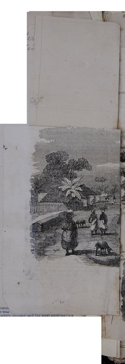 Partial image of women walking down a
village street in Sierra Leone.
[begin surface 872]
Partial image of women walking down a
village street in Sierra Leone.
[begin surface 872]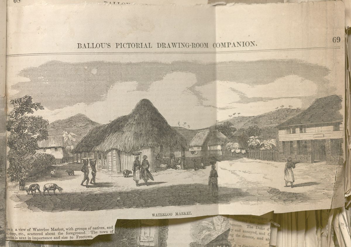
[covered]ve is a view of Waterloo Market, with groups of natives, and [covered]gs, sheep, etc., scattered about the foreground. The town of [covered]aterloo is next in importance and size to Freetown.
[begin surface 873]
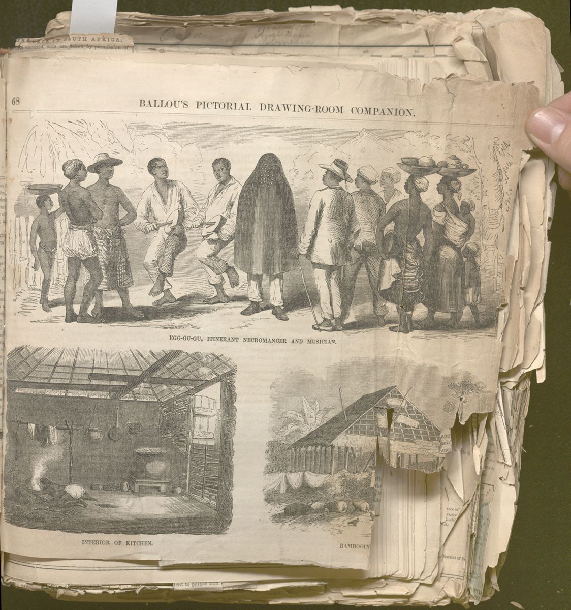
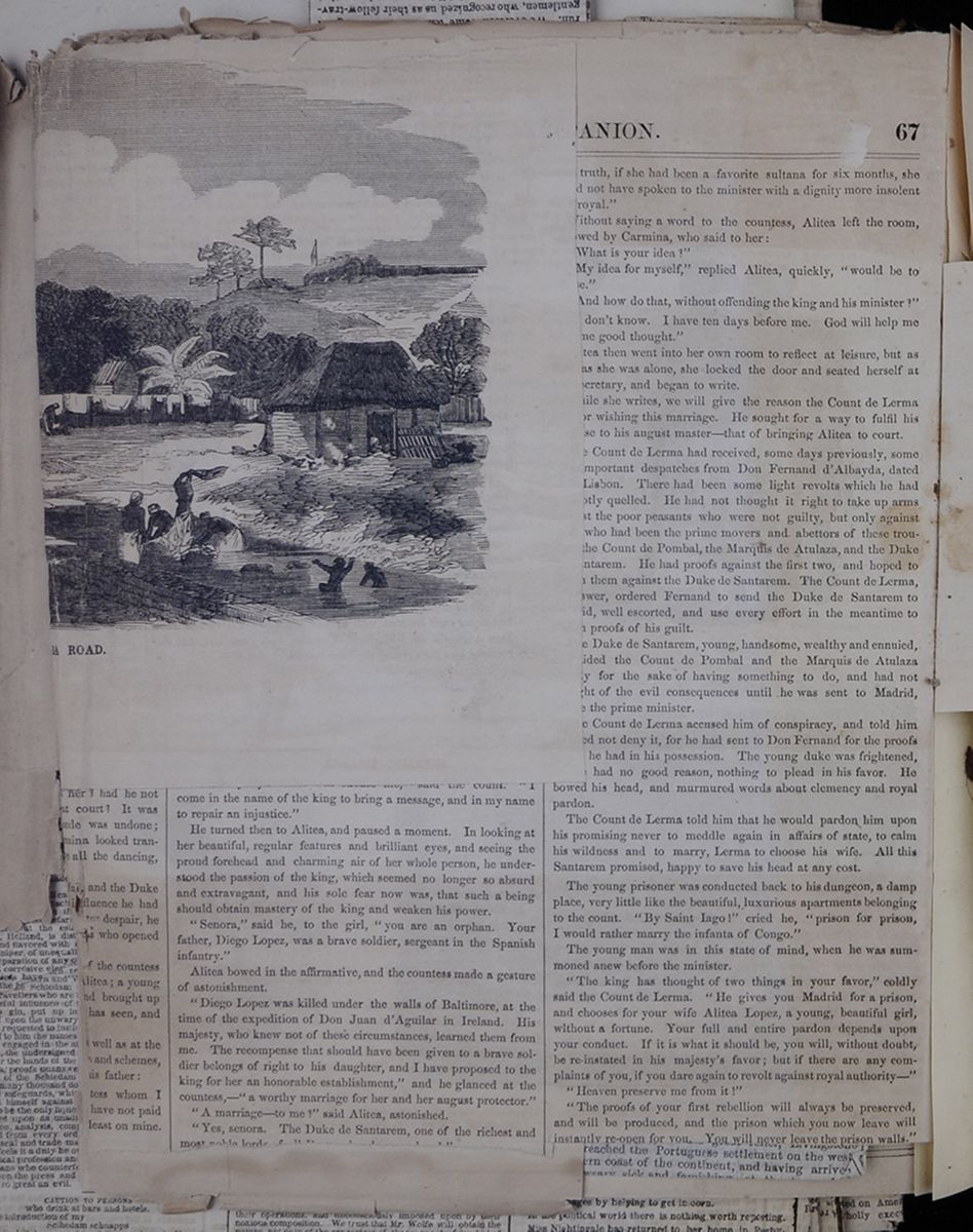 [begin surface 876]
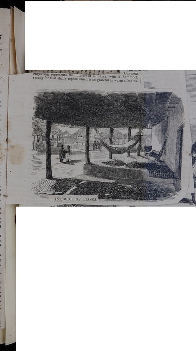
Our next engraving represents the interior of a piazza, with a hammock swung for that shady repose which is so grateful in warm climates.
INTERIOR OF PIAZZA. [begin surface 877] [begin surface 878]
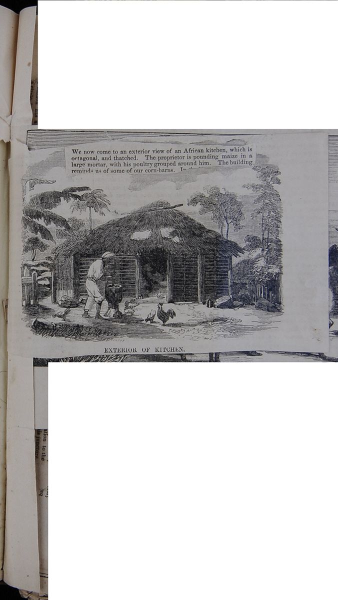
 We now come to an exterior view of an African
kitchen, which is octagonal, and thatched. The
proprietor is pounding maize in a large mortar, with
his poultry grouped around him. The building reminds
us of some of our corn-barns. I[cutaway]
[begin surface 880]
We now come to an exterior view of an African
kitchen, which is octagonal, and thatched. The
proprietor is pounding maize in a large mortar, with
his poultry grouped around him. The building reminds
us of some of our corn-barns. I[cutaway]
[begin surface 880] [begin surface 881]
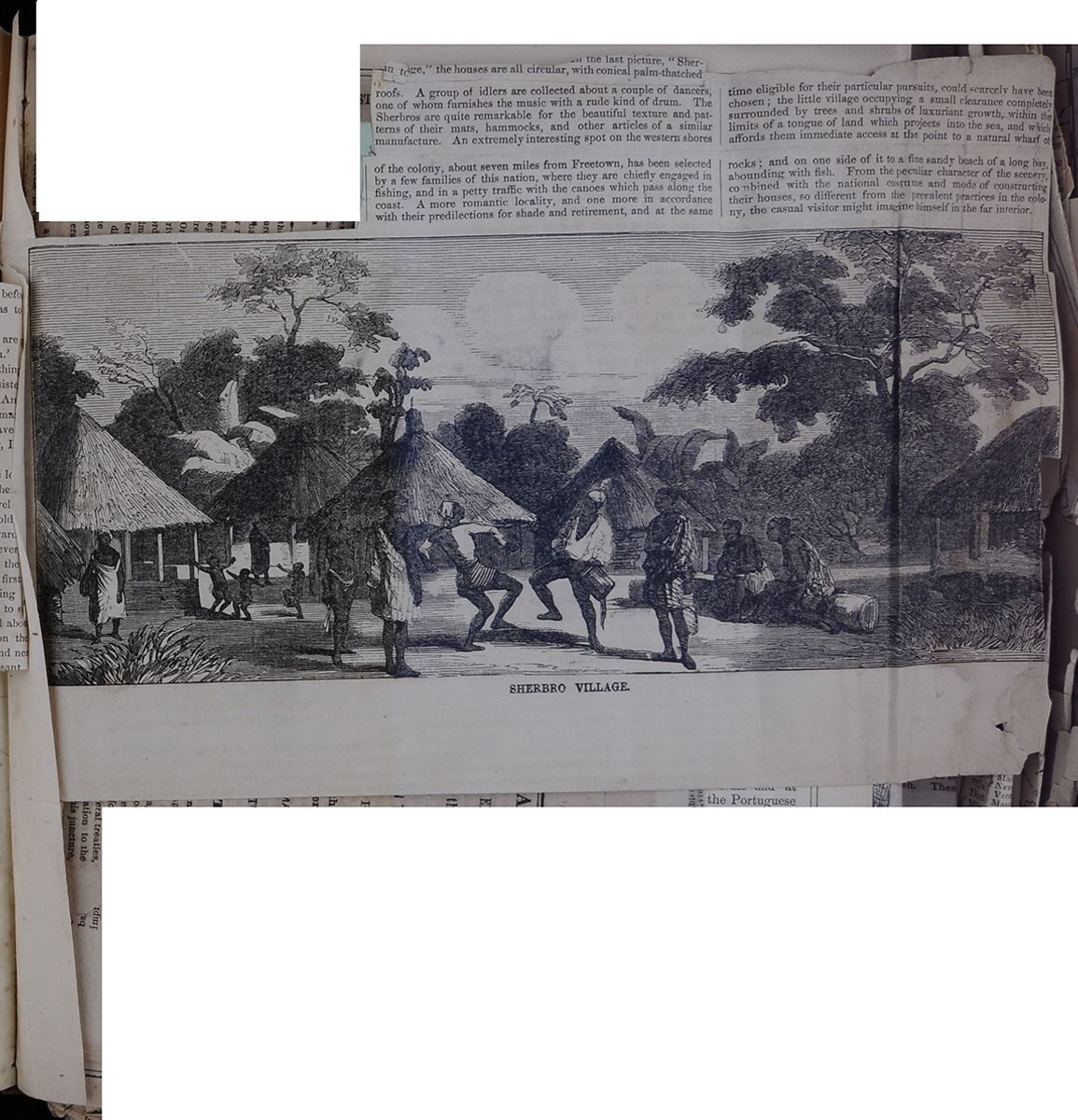
 [begin surface 883]
CHINA.
HISTORY OF THE ALLIED EXPEDITION.
Policy and Movements of the American Commissioner.
THE DIPLOMATIC CAMPAIGN IN THE NORTH.
ARRIVAL AT THE PEI-HO.
Interview of Mr. Reed with the Imperial Commissioner.
THREE DAYS WITH THE MANDARINS.
DELIVERY OF THE PRESIDENT'S LETTER.
Bombardment of the Ta-koo.
SHANGHAE, Tuesday, April 13, 1858.The attention of Christendom, which was for a time absorbed by the bloody tragedies of India, is again riveted on China. The occupation of Canton by the allied forces, and the movement northward of the Envoys of the four powers, for the purpose of renewing their several treaties, have naturally excited public expectation to the highest pitch of intensity. Just at this juncture, having the privilege of accompanying our squadron to the north, and possessing the additional advantages of a long residence in China, and some acquaintance with the Chinese language, I obey your instructions by preparing for your columns a series of letters, which will keep your readers informed of the important events now occurring in this part of the world. The task is somewhat onerous, but provided you and your readers will agree to receive, with indulgence, such hasty sketches as I may have leisure to put down in the intervals of other duties, I shall not decline it. And it appears to me, that for the commencement of such a correspondence, no date could be more opportune than the present, which marks an era in the history of our relations with China. After long delay and hesitation the Rubicon is passed. Yesterday our Plenipotentiary steamed for the mouth of the Pei-ho in the Mississippi, the Minnesota having been detained for the purpose of repairing her rudder.
This movement is in concert with the other Plenipotentiaries, and was suddenly resolved on in consequence of the Emperor's refusal to treat with them at the time and place which they had designated. Baron GROS, the French minister, sailed this morning. Lord ELGIN and Count PUTIATINE, the Envoys of Great Britain and Russia, have gone several days in advance, and the representatives of the four powers have all, by this time passed the mouth of the Yangtszekiang, which has hitherto constituted, but must henceforth cease to be the northern boundary of our trade with China. They will muster the forces at some port in the Gulf of Pechelee, perhaps at Yientsing, the Canton of the north, and the entrepôt of the capital.
It is not yet known with certainty what vessels are to compose the several squadrons. But that of Great Britain will, of course, far out-number the others. It will probably consist of one ship of the line, two or three fifty-gun men-of-war, eight or ten heavy war steamers, and a flotilla of a score or more steam gun-boats, designed for service in the shallow rivers and corals of the interior. This formidable armament will be commanded by the brave old Admiral who, in 1856, made a gate in the walls of Canton in such an extempore manner, and, escorted by three hundred marines, marched in to pay his compliments to the insolent Viceroy. He is just the man to add a few, if needed, to the portals of the many-gated capital and to open for our ambassadors a way of access to the presence of the son of Heaven. Their Gallic Allies with characteristic avidity for glory [obscured] their part in storming the fortress of Chinese exclusiveness.
The Russians, like ourselves, will have a pacific squadron in both senses. It will not be numerous when all assembled, but will be large enough to introduce them as a maratime power to the Chinese, who have long dreaded them as a formidable neighbor.
In numbers the United States squadron will of course be inferior to those of the belligerent powers; but I reflect with pride, that among that congress of European navies in Asiatic waters, the vessels adorned with our own starry banner will ride triumphantly as the noblest achievements of naval architecture. It will be composed of those magnificent steam frigates, the Minnesota, the Powhatan and the Mississippi, the sloop of war Germantown, and the Antelope, a small merchant steamer, chartered expressly for this expedition. Commodore TATNALL will transfer his broad pennant to the mast head of the Powhatan as soon as she arrives. By our last news she was daily expected at Hong Kong, and is now probably on her way up the coast.
The irregular manner in which the scattered vessels of the diplomatic armada are moving towards their trysting-place, has been censured by some as impolitic. For had they, say these critics, been required to rendezvous in the harbor of Shanghae, and then, after astonishing the natives of that region with the spectacle of a grand naval review, spread canvas to the breeze, and proceeded in battle array towards the imperial city, perhaps some celestial bard seized with a Homeric afflatus might have compared them to a "flock of cranes, flying over the Strymonian marsh, and bearing destruction to whole tribes of pigmies." The effect would have been overpowering. But these wiseacres, methinks, have hardly fathomed the policy of our Plenipos, which, under the appearance of disorder conceals a vast profound of strategem. For had the combined squadrons arrived at one and the same time, the first impression made on the minds of the natives might have been deep, but every day would have contributed to lesson their awe and to familiarize them with their strange visitors. Familiarity might even breed contempt, when they should see some of our stately men-of-war wallowing in the mire of their shallow gulf.
By the present arrangement, however, the exaggerating power of the imagination will be wrought upon in the highest degree. Dame Rumor will have time to direct her multiplying glass at each vessel as they arrive in succession. The first she will make ten, and fly away to the Emperor with the startling intelligence. The next she will make a score, and so on in an increasing ratio until it will be a wonder if the terrified BOGDOI KHAN does not seek an asylum on the further side of the Great Wall.
If he does not, it will not be because he is reassured by the pacific addresses of the several Ambassadors, but either because he confides in the inaccessible situation of his capital, or resolves to perish with it. For, immured as he is in the recesses of his palace, where no one dares to give him a view of the outside world, but through the medium of an inverted telescope, incased too in an Ajax shield of prejudice—(for he has had six predecessors, all of whose prejudices filial duty requires him to adopt in addition to his own)—it would be altogether marvelous if he were able to comprehend his present position. Indeed, viewing them from his stand-point, how can he be expected to put confidence in any protestation of a peaceful character when he sees them contradicted by such gigantic preparations for war? And how should he learn to regard the combined action of the four Powers as a pledge of moderation and stability instead of a portent of conquest and dismemberment? In fact what else could his astrologers make of it, if in their star-gazing they should discover Ursa Major, Leo and Aquila all glaring on their devoted country—yes, and Electryon, the game-cock, too, who is certainly a bellicose,
[begin surface 884] 2
The New-York Times, Friday, August
20 1858.
2
The New-York Times, Friday, August
20 1858.
if not a voracious fowl? The observance of neutrality during the Canton war, was not enough to inspire the Emperor with confidence in the peaceful disposition of America and Russia, and he doubtless beholds in their present attitude only the lowering of "A double tempest of the West and North."
For how should he know that the commands of the President and the Czar have reduced those mposing armaments to a "vox et prœtereanihil?"—that though they have power to force their way they are required respectfully to ask admission, and, if refused, are not authorized to fire a gun.
Happily for the real interests of China, as well as for ourselves, Lord ELGIN and Baron GROS are independent of this embarrassing alternative. They are in a position to dictate terms to his Celestial Majesty, and when they bring the southern key of the Empire to open the gates of the northern capital, they are not likely to be kept out. To their honor, they have resolved to place "vox', before "vis;" but if the "open sesame" have lost its talismanic virtue, the battle axe of RICHARD CŒUR DE LION still retains its weight. That HEIN-FUNG will yield to the former before he is coerced by the latter, there is scarcely any room to hope. He has trifled with both friend and foe, and played the stolid game of Chinese finesse until his antagonists are weary of delay, and forbearance has well nigh ceased to be a virtue. For more than a year he regarded the war raging between one of his provinces and his British tributaries, with the same sublime indifference with which, as XENOPHON tells us, a Persian King treated the feud between the younger CYRUS and TISAPHERNES, a border satrap. ARTAXERXES was at length aroused from his security by the irruption of an army into the province of Babylon, and HEIN-FUNG now beholds with amazement the conquerors of YEH threatening to disturb the dreams of his Empress in the gardens of "Earth's Repose."
By a very trifling concession he might have kept them at a distance, at least until diplomacy should have sheathed the sword. For no sooner had the belligerent Plenipotentiaries made provision for the security of Canton, than, joined by those of the neutral powers, they forwarded to his Majesty proposals for negotiation. Declining to present themselves at Pekin lest they should be regarded as coming merely to refer their affairs to the decision of the Emperor, or to do homage to his august person, they wisely fixed on Suchou as the place of conference. Besides being easily accessible, and at present the first city in the Empire for commercial importance, it possessed the further advantages that while it saved their dignity by its distance from the coast, it would also give their negotiations an aspect of national importance which they must have lacked had they been conducted at Canton.
They accordingly sent avant-courriers to the Governor at Suchou, with dispatches for the first Minister of the Imperial Cabinet, proposing to meet H. I. M.'s Commissioners at that city. The cunning Mandarin, getting wind of this movement, rode out of the city to welcome the dispatches of the Foreign Plenipotentiaries. His real object was, however, to receive them as privately as possible, and at once conceal from the public the fact of their being forwarded through his hands, and also prevent their bearers from entering a city the streets of which are guarded from the pollution of barbarian feet almost as zealously as those of Canton. This was a clever trick, but the "barbarians," more clever still, had foreseen and suspected the ruse, and giving his Excellency a wide berth, entered the city by a different gate. Going straight to the Gubernatorial palace, they sent messengers to inform his Excellency of their arrival, and compelled him to receive the dispatches in the most public manner. This was a victory which, if not superseded by the great events now taking place, would have been more important in its results than many a hard-fought battle. It was, in more than one sense the taking of a city, for it was establishing a precedent which would authorize foreigners ever after to present in person to the Governor at Suchou [obscured] Emperor, the Governor was chagrined at his defeat—the Viceroy stormed and threatened to report him to their Master, and it is currently rumored in Shanghae that the poor Governor, in dread of the Imperial ire, has tendered his resignation.
But to return to the dispatches. They flew towards Pekin at the rate of 600 lé a day, and were opened by the Premier, who, not deigning to communicate with foreign envoys, commanded the viceroy of Psangnan to make them acquainted with the Imperial pleasure. His Imperial Majesty had appointed HWANT-TSUNG-HAN to supersede YEH in administering the Government of the two Kwant, and the English and French must hasten down to Canton to have their grievances adjusted by him. The Russians were to repair to the Amoor, where they would find an officer deputed with special powers to settle all their difficulties. And the Americans, having neither grievances nor difficulties, might, if they chose, renew their treaty where it was made—at the village of Wanghea.
Vain stratagem! Armed squadrons are not to be scattered like the bauble fleets which boys construct on fish-ponds. The Barbarians grow contumacious, and perversely resolved to present themselves at the gates of the capital, "beseiging not beseeching." Steamers were ordered to prepare for sea. No secret was made of their destination. All Shanghae was in ferment. The alarmed Mandarins dispatched a fleet courier to warn the Emperor of the impending blow. His Majesty was just dreaming of the time when YAOU and SHUN displayed their embroidered vestments, and the sight of the sacred symbols held the world in awe—when the great YU bade his minstrels tune their harps to Celestial harmonies, and civil discord yielded to the subduing influence. But the unlucky courier disturbed his reverie—brought him back to a consciousness that his is not the golden age, and made him aware that however he may be a Monothelite in creed, he cannot in practice ignore the fact that the world does actually contain more wills than one.
Had he the sagacity to understand the exigencies of the present crisis—to yield a timely submission to the mandates of necessity, and even anticipate the demands of the Four Powers in the spirit of progress, he might make the present reign the most glorious epoch in the history of his dynasty. But no! With his light he cannot but regard the concession of their demands as tantamount to the abdication of his throne, and he can hardly do otherwise than resist. In case he does, it becomes a question of much interest how far the conflict will extend.
It will probably be confined to the Northern coast, and be of very short duration. The bombardment of Pekin by floating batteries is utterly impracticable. It stands at the distance of twelve miles from the banks of the Pei-ho, and to march a land force through the swarms of Tartars who surround the capital, and carry it by storm, could not be accomplished without an immense sacrifice of life. But there is happily a less expensive way of bringing the Emperor to his senses; that is, to treat him like a refractory school-boy, and oblige him to do penance by fasting. His capital is a great measure dependant on supplies conveyed by sea. To stop these by blockading his seaports would soon compel him to cry for quarter. The thankless task of carrying into effect his method of coercion belongs to the British and French. We are precluded from taking any part in offensive measures, and our English friends are forever reproaching us with standing ready to pail the milk though we refuse to take the cow by the horns. That our neutrality indicates no decay of the martial spirit, they have abundant proof in the terrible satisfaction exacted for an insult offered to the American flag by the Barrier Forts at Canton and Capt. FOOTE rising in his light gig and flashing his pistol at those batteries as an earnest of a future reckoning, while the shot rained thick around him, was an illustration of American courage which is not eclipsed by the exploits of their own dashing KEPPEL.
In the present contest, American chivalry is displayed to better advantage by standing aloof from a quarrel in which the honor to be gained is too small to admit of the Allies sharing any with a third party. For my own part, the only laurels which I desire my countrymen to win on the present arena are those which crown the achievements of able statesmanship; and the only impression which I wish our magnificent squadron to produce on the Chinese mind is that of respect for the American name, and admiration for the magnanimity which has withheld it from coöperating with the strong against the weak. Americans need to entertain no fears lest their officers be induced to abandon the honorable and dignified policy which they have hitherto pursued with reference to the complicated affairs of China. The maintenance of this policy is sufficiently guaranteed by the character of Plenipotentiary. The President confided our national honor to safe keeping when he appointed the Hon. WM. B. REED to conduct our negotiations with the Chinese Empire. The task of treating with a people proverbially proud and perfidious—who know nothing of our history or national character, and whom we cannot meet on the ground of a common faith, or the acknowledged principles of political science—is obviously one of great difficulty. In the results of his mission he may not realize the expectations of the over-sanguine, but it is satisfactory to know that he will not fail to accomplish all that is attainable by legitimate diplomacy. To the sagacity which comprehends our wants he adds the discrimination to perceive the rights of the Chinese and while, with a truly progressive spirit, he appears to take for his motto "Nulla vestigia retrorsum," he will endeavor to realize in the discharge of his honorable mission, that line of HORACE which places the "justum" first, and the "tenacem propositi virum" afterwards.
His Excellency has added to his suite, with a special view to the present expedition, the Rev. W. A. P. MARTIN and Mr. F. JENKINS, as interpreters, and also Dr. C. W. BRADLEY, our Consul at Ningpo, whom he holds in high estimation for his experience and judgment.
I write this hasty view of Anglo-Americo-Russo-Franco-Chinese politics while waiting for the Antelope to take in coal. She will be ready for sea by the 17th inst., when I expect to proceed in her to rejoin our squadron in the North. Arrived off the Pei-ho, I hope to resume this narrative of current events, and keep your readers informed, not only of the movements of our own legation, but also of those of the other Powers, as far as they may come to my knowledge.
At 9½ A. M. we dropped anchor in this harbor—if harbor that may be called which neither allows vessels of ordinary draught to approach near enough to get sight of the shore, nor presents anything better than a few low sand-banks as a protection from the violence of the waves. We were just four days from Shanghae. The weather has been good, with the exception of a sudden gale this A. M. , and our voyage so happily uneventful, that I propose to condense the history of it into a few lines.
On the 6th inst. I received, per U. S. chartered steamer Antelope, Captain LYNCH, my invitation to join the expedition to the North, and before 2 o'clock the same day I was on board, and the Antelope again bounding over the billows. Ningpo, the city of the "gentle waves," with its crumbling pagoda, its imposing granite walls, and its busy population of 300,000 souls, soon faded from sight; and Chinhae, the "Guardian of the Sea"—a large town at the mouth of the river, twelve miles distant—rose to view. Above it looms a rocky height, crowned with what resembles a castle of the olden time, but which a closer inspection shows to be a fortified monastery of the Buddhist religion. On the opposite bank rises another peak of equal elevation, the summit of which is also distinguished by a corresponding object—a battery erected for the defence of the river against the English in their first war. Emerging from this gateway, we come in view of Silver Island, one of the most beautiful of the Chusan group, and glide over the waters of what the Chinese believe [obscured] to them, the ghost of a submerged city is seen to rise to the surface. Mandarins, with crimson canopies and gorgeous retinues, move in funeral silence and troops of soldiers perform their noiseless evolutions on the liquid plain. The poet SUTUNGPO, of the Sung dynasty, came all the way from Hongchow, the provinical capital to witness the apparition of this phantom city. His lyre, however, was not sufficiently potent to evoke the spirits from the vasty deep, and he returned both disappointed and incredulous. It is hardly necessary to add that the phenomenon which has wrought so powerfully on the imagination of this superstitious people, is that of mirage, or the lata morgana, by which, in certain states of the atmosphere, the city of Chinhae becomes visible from the shores of the opposite island.
From this point a succession of low, rugged islands, some of them volcanic in their origin, stretches away, like a line of beacons, as far as the mouth of the Yangtsekiang. This great river is one of the wonders of China. Rising among the Himalayas, and augmented by the innumerable tributaries which it receives in its winding course, it irrigates with its waters, and enriches by its commerce, a valley nearly equal in extent and ten times greater in population than that of the Mississippi. Debouching just to the north of Shanghae, it disputes empire with the ocean; and by the immense volume of fresh water which it pours forth, admonishes the navigator, long before he sees its banks, that he is approaching the Amazon of Asia. The voyager to Shanghae is unable to obtain a distinct view of this noble stream as he enters the Whangpoo, the last of its affluents, before it has contracted its width sufficiently to bring both banks within the same horizon. In 1853, however, I had an opportunity for making myself acquainted with it, as far up as Chankeang, 'the Guardian of the River," which is situated at the transit of the Grand Canal, about 120 miles above the Moosung. I was in a small boat, navigated by three natives, and after a week's absence, during which we were exposed to be swallowed up by the waves, which at times rose like those of the sea—captured by pirates, a fleet of whom we were very near running into at night—or apprehended and caged by the garrisons of the Imperial batteries, I returned to Shanghae, richly rewarded for all my discomfort, and deeply impressed with the importance of having this highway of internal commerce open to the enterprise of the West. This I understand is one of the advantages expected to result from the pending negotiations, and one which, though it appears to be undervalued by Lord ELGIN, our American Minister is wisely resolved to insist on.
The Antelope being detained a few days at Shanghae, I employed the interval in taking sketches by proxy of the finest buildings and most striking views in the vicinity of this world-renowned emporium. Possessing no skill in drawing, I brought with me a Chinese artist, who, notwithstanding the defects of the native style, I thought would be able to supply me with pretty accurate views of the palaces and fortifications of Pekin. Before starting I assured him that I should only be allowed to take him in the capacity of a body-servant. This, however, was no obstacle in his mind. Being an enthusiast in his art, he readily consented to undergo a temporary degradation for the sake of enriching his portfolio with original views in the Northern Capital. His first duty in the quality of valet was not indeed much to his liking. This was the blackening of a pair of boots. A little logic, however, removed every objection. I assured him that it legitimately constituted a part of his profession—in fact what was a brush but a combination of pencils, or the blacking but a species of pigment, or its application but a speedier method of producing a landscape, which would not fail to appear after a few strokes of the polishing-brush.
Leaving Shanghae on the 18th, we put out to sea, so that we had no opportunity for extending our acquaintance with the Northern Coast, as the only point which we sighted on our passage was the Shantung promontory—a part of the Taishan, or Eastern Mountains. Early on the morning of the 22d we were greeted by a blinding shower of Manchu sand; and the wind at the same time blowing a gale, and the tides having falsified our reckoning, we were for a while in a situation of considerable peril. The captain sent up rockets and fired guns, in hopes of being answered by the Squadron. No answer came, but the cloud breaking away, the captain corrected his reckoning, and the breeze lulling, we came to anchor in this roadstead, hereafter to be celebrated as the scene of the first diplomatic skirmishing preliminary to cur advance upon the Capital. In fact, an uninitiated stranger could hardly observe the broadsides of the Chinese official envelopes, which are daily exchanged, without discovering that an important warfare is being waged, and suspecting that all the ink shed in the contest would be sufficient to discolor the waters of the Pei-ho, or White River.
APRIL 24.—I have this day witnessed a spectacle which somewhat relieves the monotony of lying at anchor out of sight of shore, and gives us an earnest of something more stirring in store for us. Thls was the simultaneous delivery to Mandarins, at the shore, of dispatches from the several plenipotentiaries, to be fowarded to the Capital. The contents of the others I have not heard, except that they agree in demanding an early interview with some Imperial Commissioner.
It is understood, however, that our American Minister has tendered his good offices as mediator in the disputes at issue with England and France. This offer, if accepted, will not only exalt the character of our country in the estimation of the Chinese, but also promote our material interests, by securing their confidence and good will. His Excellency, nevertheless, demanded in firm and dignified terms, the appointment of a Commissioner to meet him at a specified time and place, and warned the Imperial Cabinet that the refusal of this request, or neglect of compliance with it, might subject them to the consequences of constructive hostility.
The bearers of the dispatches, in four barges, bearing the flags of their respective nations, were towed by the gunboat Slaney as far as the bar near the entrance of the river, whence they pulled in to shore in front of a rude fortification. This consisted of three small forts, flanked by batteries of wood and brick, covered with earth. They mounted about a hundred guns, and were occupied by, perhaps, two thousand men, and, together with a somewhat smaller one on the opposite bank, constitute the entire defences of a passage, on which the security of the Capital from foreign invasion so much depends. Further defended by a broad, muddy tide-beach, it was accessible to us only by a kind of scaffolding of piles and rough timbers, for the construction of a landing-place. To this we drew our flotilla, augmented by three boats, which were already in the river, and bearing the flags of four nations,—a rare spectacle in these parts,—naturally excited no small sensation in the fortress and its vicinity. Disorderly crowds of soldiers darkened the batteries, and troops of laborers waded knee-deep in mud to get a view of the "red-haired barbarians." Just as we were preparing to land, a Mandarin, decorated with a blue button and a peacock's feather, came clambering over the scaffolding. After much chin-chin-ing, and some hesitation, he was persuaded to descend into one of the boats, where the dispatches were presented by their several bearers. At first he wished to decline receiving them, as two Imperial Commissioners would arrive, he said, the next day who would meet the foreign Ambassadors and listen to their proposals, or receive their papers. Being assured that the case would admit of no delay, he took them, and when asked for a written receipt, näively replied: "I am a soldier, and unaccustomed to writing." Choosing to accept this excuse, rather than consume time by waiting for a receipt from the commander of the fort, we pushed off to the Slaney, and were again towed out to the squadron.
APRIL 30.—Our Minister and suite, in the Antelope, by the help of the Russian paddle-wheel [obscured] formidable barrier to our app[obscured]the bar which stretches across the mouth of this river. The metropolis of exclusivism could not have a more suitable situation. Its outer and strongest defence is this natural entrenchment, which at the ebb, is only covered by three feet of water. At best, it is accessible only for the smallest class of war-vessels, and a few hours of loading and sinking junks would secure it from all the navies in the world. This important precaution the Chinese have utterly neglected; and yesterday five gunboats—two English and three French—quietly crossed the bar, and took up a commanding position just in front of the batteries. Their officers and crews, ever on the qui vive for promotion, were itching to be fired on; but Count PUTIATINE, Russian Minister, humanely admonished the officers of the garrison that to discharge a shot would be to provoke their own destruction. They had the wisdom to take his advice, and will probably offer the "Allies" no molestation unless they attempt to pass the bend of the river in blank of the batteries, when they will most certainly pour upon them at least one round. Our officers think they would not stay to discharge a second, as the explosion of a few shells among their feet, would scatter them like a flock of pigeons.
But weak as they are, the Chinese have not abated a jot of their ancient pride. But only two days ago we had a ludicrous exhibition of their national vanity in the style of a dispatch received from the High Commissioner. Two Commissioners, both Manchus, one named TSUNG, a Superintendent of the Granaries, and the other named Woo, a Secretary of the Council of the State, had already some days before arrived at the sea-board to meet the deputies of the Barbarian Kings! A third Commissioner was wanted to complete the corps of Imperial diplomats. In selecting this important functionary, if we may judge by the pompous array of titles by which his name is preceded, the Emperor had no intention to show disrespect to the envoys of the Four Powers, "A Great Minister and Imperial Commissioner of the Great Pure Dynasty, Governor-General of the Province of Chihlè, Superintendent of the Revenue, Inspector of Canals, Commander of the Fortresses of Mihyuin and Tszeking, Inspector of the Capital, and Imperial Censor" is the sounding proem with which he introduces every proclamation and dispatch. It means that somebody is coming, and then the little monosyllable FAN, the name of this important personage, comes on to close the procession But little as it is, it is far from insignificant, and its signification in analysis is found to be of the most auspicious character. It consists in Chinese of three parts. The left is "words," and the top of the right is "west," while the bottom is "early," and the whole may be construed as "early words with the west." Surely this man was born for the post which he now fills as chief negotiator with the Four Great Powers of the West. But to return from this digression. His Excellency TSEEN, or FANTA-JIN, (the Great Man,) as his countrymen call him, had no sooner arrived at the Takoo forts, than he addressed a communication to each of the Foreign Plenipotentiaries, announcing his appointment as chief negotiator, to meet the envoys of the Four Powers. His language was faultlessly courteous, and even complimentary, but his dispatches gave great umbrage and were indignantly returned unanswered. Why? Simply because in the vertical lines in which they were written, the name of China was elevated threes paces above those of the other powers. This was, according to Chinese notions, exalting the Celestial Empire to the third heaven of dignity in comparison with "outside" Kingdoms, and acceptance of the document would have made way for further insults. This morning the same paper was sent in with the name of our country on a level with that of the Great Pure Dynasty; while an apologetic postscript blamed the informality of the precedlng dispatch on the inexperience of the Commissioner's Secretaries.
Count PUTIATINE has had an interview with the Imperial Commissioners, the result of which has not transpired, except that it is understood to have been altogether amicable and highly satisfactory. Our minister is expecting to meet them on the 4th inst. The Chinese Commissioners appear desirous of holding the first conferences with the ministers of the neutral Powers, probably with the hope of securing their good offices with England and France. Lord ELGIN and Baron GROS question the powers of the High Commissioner, and object to meeting him. The Chinese are obstinate and the Allies pertinacious. Mutual suspicion is fast ripening into hostility, and it is doubtful whether in my next I shall have to record a cordial interview between the Imperial Commission and the United States Minister, or a bloody collision wiih the Allied Squadron.
This date has been signalized by an event. The first tilt in the long-expected tournament between the champions of America and China came off this afternoon. It commences a series of meetings which will furnish matter for the historian; and though the spectacle displayed little of the oriental magnificence, and less of occidental pomp and power, your readers perhaps will not object to hear the prologue, if I may vary the figure, of what is not unlikely to be succeeded by several acts of thrilling interest.
This morning a party, of which I was one, was sent ashore to convey a dispatch for the High Commissioner, and to arrange the preliminaries for the interview, i. e., to ascertain whether the place of meeting would be decent and commodious, and the landing safe and convenient. Nor was this by any means a superfluous precaution; for here it was that our late Commissioner, Dr. PARKER, the Secretary of Legation, complains of having to flounder through an appalling expanse of miry mud, when sent ashore with dispatches by Mr. MCLANE in 1854.
By dint of climbing and leaping we succeeded without fractures, though not without bruises, in making our way over a succession of junks that lay on the strand, and, after sinking through a stratum of mud, were glad to find ourselves on soundings. We were beset by a swarm of red-capped soldiers, who sought to stay our progress, but we still advanced until we were surrounded by a phalanx of blue and white-buttoned mandarins, who insisted that we should stand still until CHIN-LAONZIA should appear to receive our dispatch. We protested loudly against the discourtesy of compelling the messengers of a friendly nation to stand out of doors, and in the mud. This hint supplied them with a stratagem. Chairs and a table were placed on the soft mud—tea was brought, and we were invited to seat ourselves until the Lieutenant-Colonel should make his appearance. We were aware, however, that to take seats there would be to fix the meeting of our Committee of Arrangements in that unseemly spot, and thus subject ourselves to the derision of the soldiery. We accordingly took our tea standing, and then we continued our march. The mandarins seeing we were not to be deterred from our purpose withdrew their opposition—the long lines of infantry drawn up on the margin of the fosse parted to give us ingress, and we were ushered into a spacious tent, hung with blue. Soon the soldiers about the tent began to form into ranks, and the Lieutenant-Colonel entered between their files. He shook our hands cordially, caused tea and sweetmeats to be set before us, assured us that nothing should be lacking for the proper reception of the distinguished visitor, received the dispatch for the Commissioner, and accompanied us to our boat.
It was not long until a Major was sent off with a verbal message from the High Commissioner, that the hour named in the dispatch he would be in waiting.
At 4 o'clock P. M. our Minister, with his cortége, landed in front of the batteries, and, preceded by the United States flag, advanced to the centrafort. As he approached, a military band struck up an oriental salute. He was received by the High Commissioner and his assistants, at the door of a large tent, erected for the occasion. The tent was hung with crimson, and the ground carpeted with the same color, which is that used by the Chinese on all festive occasions. The interior was occu[obscured] furnished with fruits and confectionery.
Mr. REED was placed in the seat of honor on the left of the High Commissioner, with Mr. MARTIN, who acted as interpreter, between and a little in the rear of the two high functionaries. The two assistant Commissioners, Dr. WILLIAMS, Secretary of Legation, Captain DUPON, of the United States steamer Minnesota, the Treasurer of the Province, the Manchu General in command of the garrison, and a Tontai, or Circuit Judge, completed the company at the long table. The other members of the Legation, and several officers of the Navy, were seated at the side tables, while numbers of blue and white-buttoned mandarins, who would have been great men in some situations, were compelled to stand in the presence of their superiors. I may remark here that the rank of a mandarin is indicated by a precious stone, of a globular shape, commonly called a button, attached to the top of his cap. The highest are the red, and the blue and white next in order; and each of these is sub-divided into two or three classes. All who sat at the long table with the Commissioner wore red buttons, except a Circuit Judge, who, though he wore a blue one, was also decorated with the plume of extraordinary merit.
The Assistant Commissioners, both Manchus, appear to be men of a very ordinary stamp, and one of them gives evidence of being under the influence of opium. The person of the High Commissioner, short and rather corpulent, is in all points uninteresting. With a countenance so opaque that scarcely a ray of intellect beams through it, a dull eye, and a bullet head, he would be ranked according to his physiognomy, below the mediocrity of Mandarins, were it not that his high position gives evidence that he is a man of tried abilities. He is a native of Shaon-hing, near Ningpo—a place which, owing it is believed, to the virtues of its "wind and water," is celebrated for the legal acumen of its inhabitants. In fact, the most distinguished counsellors at law throughout the Empire, are natives of Shaon-hing. FANTA-JIN's voice has a disagreeable twang, but the speaker of Mandarin soon forgets this blemish in admiration of his language, which is fluent, elegant and pure, without any trace of provincialism.
The Shoan-hing lawyer, by a singular coincidence, has for his antagonist a Philadelphia lawyer, and "when Greek meets Greek, then comes the tug of war." In the discussion, Mr. REED's diction was concise and perspicuous, and well chosen for accurate translation into a foreign language. He exhibited, too, such skill in availing himself of any incidental developments, parrying the thrusts of his adversary, and guarding American interests at every point, as to prove that whatever his past experience may have been, he is, unquestionably, a master of diplomatic fencing.
For a moment the representatives of the two sovereign powers surveyed each other in dignified silence. It was the first time the opposite shores of the Pacific had shaken hands for fourteen years. Nor was the present a mere display of international comity. Great interests were suspended on the pending negotiations, and their good or ill success was to be augured from the tone of the opening interview. The question at issue, to sum all in one sentence, was nothing less than to decide whether the tide of western influence which now laves the shores of this Empire, shall be permitted to diffuse its fertilizing streams through the vast regions of the interior, or whether an impassable barrier shall be erected against it, and the voice of both nations unite in saying "Thus far shalt thou come, and no further." It was not surprising, therefore, that the concourse of distinguished auditors listed with breathless expectation for the first words that were to sound the march of progress, or to beat the retreat of civilization.
Mr. REED opened the Conference by assuring the Imperial Commissioners of the friendly disposition of the United States, and the desire of our Government to perpetuate the relations of amity existing between our two countries. In reply, the High Commissioner, who also spoke for his colleagues, expressed in strong terms his reciprocation of the sentiment, and begged to assure the United States Envoy of the distinguished estimation in which our country was held by his Imperial master, particularly on account of the neutral policy maintained by our Government in regard to the war at Canton. This last was a sore point to which the High Commissioner was perpetually recurring. He often launched into a high flown eulogy on the United States, and never failed to introduce as a foil the perfidious and disorderly conduct of the British and French. Indeed, so frequently did he allude to this subject, and with such acrimony, that Mr. REED felt compelled to check him repeatedly, and with a frankness which I hope will be appreciated, assure him of the high character of Lord ELGIN and Baron GROS for integrity and moderation.
Excepting this sore point, to which Mr. REED applied the emollient unction of a common friendship, nothing else occurred to ruffle the feelings of either party. The interview lasted for two hours and was wholly occupied in arranging the bases for negotiations. But little time was spent in exchanging compliments, and still less in gratifying the palate with the tempting fruits and confectionery spread out before us. Mr. REED and Commissioner FAN scarcely allowed themselves leisure to moisten their lips with tea. No wine was brought on the table and I note this as the first Chinese entertainment I ever saw given without the presence of that universal beverage. It was not wanted, however, for there was no room for mirth and humor. Earnest business absorbed the attention of the high diplomatic functionaries; and, though the utmost good feeling prevailed, there was not an individual of either nation among those who were admitted to the interview, who was not impressed with the solemnity of the occupation. After agreeing to the proposition of the Imperial Commissioners, to ascertain the will of their master on an important preliminary, the United States Minister and his cortegé took leave, and returned to the Antelope. From all that I saw and heard on this occasion, I would have gathered the inference, if I had not drawn it from other premises long ago, that while a Chinese junk is contemptible in comparison with our splendid steamers, and a Chinese fort pitable when exposed to the artillery of our floating batteries, a Chinese diplomat is not to be despised by the most accomplished statesmen we can select for our negotiators. Ignorant of other countries, he is not deficient in acquaintance with the affairs of his own; and schooled in an unyielding conservatism, it is his chief duty to defend its ancient policy against aggression,—while our envoy has the harder task of carrying by dint of argument the entrenchments of hereditary prejudice. Before dismissing the subject of this interview, I may remark that an observer could hardly fail to be struck with the grave dignity of the high Chinese officials, while to my taste, perverted perhaps by long residence among them, their long silken robes, embroidered breast-plates, and caps decorated with sparkling rubies and flashing feathers, contrasted rather favorably with the plainer attire of their western guests.
Just as we were retiring, we met the French Commodore coming up to the batteries to deliver a dispatch. To avail himself of such a pretext, just on the eve of a hostile collision, to acquaint himself with the strength or weakness of his adversary, I cannot but regard as a violation of military ethics not very consistent with the reputation of the French for chivalrous generosity.
Those miserable fortifications are decorated with as many flags as moved on the field of Waterloo, and their fluttering, for they are all small scolloped triangles, not inaptly represent the trembling hearts of their defenders. The garrison on both sides of the river, including all the encampments in the vicinity, numbers by this time probably 10,000 men; and the French Admiral, I have heard, doubts whether the force of the Allies is sufficient to carry the place by storm, and is waiting the arrival of more gun-boats before making any warlike demonstration. A gallant British Captain, however, who distinguished himself in the late bombardment of Canton, and whose war-steamer, the Nimrod, now lies close under the batteries, thinks that he and the Cormorant, which lies still further in, could silence them in a few minutes. He deprecates the consequences of delay, and says that the Chinese are day and night strengthening their defences, and mounting fresh guns—not a few of which are brass. Within the last fortnight they have thrown up a pretty well constructed abattis of sand, or rather mud, bags; flanking their forts, and drawn hawsers across the river, with a view to stopping ingress. This last is the most puerile contrivance I ever heard of, as it would not take long for a little boy to cut them in pieces with his jack-knife. I have taken occasion to represent to the Chinese officers the inevitable consequences of a conflict with the Allies. They admit the superiority of western artillery, but appear to confide in their superior numbers. "We are preparing," they say. "You are our friend and we whisper it to you confidentially, but we don't want you to tell them, that we're ready for them." Poor misguided people, how little they know of the power they are provoking! When I was at the batteries this morning, and surrounded by that "turba imbellis," I could hardly restrain such tears as XERXES shed, when reviewing his troops at Abydos, to think how soon the shell and shot of the Allied squadron might strew that field with carnage.
MAY 8—Last evening I went with a party to the landing to bear a dispatch to the Imperial Commissioners. There was nobody at the water's edge of sufficient rank to receive it, as it would be thought by the Chinese derogatory to the dignity of our Minister that a communication from him should be delivered by any officer below the rank of Major. We would have gone in search of CHIN and CHONG, the two to whom we had formerly given dispatches, but for the entreaties of the poor sergeants on guard, who declared, accompanying their words with a very significant gesture, that if they should allow us to pass they would suffer decapitation. We consented to wait if they would send immediately for the Lieutenant-Colonel or Major. One of them scampered off as fast as the mud would let him, and two others waded into the water between us and the shore. It was ludicrous to see officers with silk caps and gilt buttons wading bare-legged in the mire. After an immoderate length of time the Lieutenant-Colonel, who had been absent on some duty, came and received the paper.
This morning I learn that the Russian Missionaries resident at Pekin, have at the request of Count PUTIATINE, been allowed to come down and visit their friends on the Russian steamer America. The Imperial rescript desired by our Minister has been received, and is, I understand, altogether favorable. He expects to resume conference with the Imperial Commissioners on the 10th inst., and if the threatened hostilities are averted or delayed, I hope I shall have, in my next, to report the peaceful victories of diplomacy.
Under this date I resume my journal of passing events. As yet we have too much dialogue and too little action to make my letters very entertaining. Your readers may, however, console themselves for the want of any dramatic element, by reflecting that the record of a conversation is more instructive than the description of a battle. From the latter they would only learn (what they know already, though the Chinese still require to be taught it,) the superiority of the European arms; while the former will make them acquainted with the intellectual condition of the more influential classes. For myself, I can say, that for improvement in that which is admitted to be "the proper study of mankind," I would prefer three days' contact with the ruling minds among a population of four hundred millions to whole months on the tented field.
Mr. Reed came in this morning from the Minnesota, having an engagement to meet the Imperial Commissioners at 11 A. M. Proceeding to the landing, he sent a messenger on shore to ascertain whether suitable arrangements had been made for his reception. The answer returned was, that landing was out of order, the sedan not in waiting, and more than all, that the Commissioners had not arrived. Hearing this, Mr. REED, not without some feelings of indignation, gave orders to return to the Antelope.
Mr. MARTIN, however, who, in the meantime had gone ashore, ascertained that the report of the first messenger was incorrect in its most essential feature. The three Commissioners were already in waiting: "and I confess," said Lieutenant Colonel CHIN, sinking his voice to a whisper while giving the information, "that though it may be sacrificing their dignity to say so, those high officers have actually been on the ground, waiting the arrival of the American Minister, since the hour of 9 o'clock." Mr. MARTIN, inquiring for one of the higher authorities to whom he might explain the mistake, TS'IEN-TANJIN, the Treasurer of the Province, presented himself. Mr. MARTIN suggested, that while the sedan and waders were being got in readiness, an officer should be dispatched to the Antelope with the card of the three Commissioners, to assure Mr. REED that they had been on the ground from an early hour, and were still expecting his arrival. This was instantly complied with, and Mr. MARTIN spent the hour which intervened before the arrival of the Minister and suite, in a blue tent, near the tabernacle of audience, surrounded by a group of Mandarins, who expressed their opinions without restraint, and exposed their ignorance without shame.
They inquired the distinctions of official costumes in use amongst us; asked many questions relating to the geography and history of our country, and inquired particularly as to the principle by which official appointments are regulated. They heard with unrestrained admiration, that with us, the Chief Magistracy, and nearly all other civil offices, are at the disposal of the people, and expected to be bestowed on those who merit popularity by integrity and abilities; that we have classics in three languages more ancient than those of CONFUCIUS: that while the books of the Jews are the foundation of our religion and ethics, those of Greece and Rome are the basis of our belles lettres. Nor did anything surprise them more than to learn that we, "barbarians" as we are, actually have grades of literary merit, and competitive examinations in some respects answering to their own. They inveighed without reserve against the conduct of England and France in carrying on the present war; and, when told that the "Allies" are desirous of peaceful negotiation, provided the High Commissioner will exhibit credentials of his full powers, such as KEYING exhibited in 1842, they exclaimed, "Those of KEYING were a forgery, manufactured for the occasion, but our present High Commissioner is incapable of so base an act, and our Emperor is not accustomed to issue such documents." From this they proceeded to discuss the characters of the British and Russian interpreters. Learning that Mr. MARTIN was personally acquainted with Mr. WADE and the senior Russian interpreter, they very considerately spared them. They, however, censured Mr. L. in no measured terms, for his violent and uncourteous bearing, and criticised the scholarship of MING-LAON-YIA, the junior Russian interpreter.
Mr. REED and suite were received and greeted as on the former occasion, when Mr. R. introduced the business of the day by inquiring for the summary of topics of discussion which he had sent to the High Commissioner on the previous Saturday. FAN-TU-JIN produced a copy.
"But, where is the original paper I sent you?" asked Mr. R.
"This is a true copy," said FAN, "and will answer just as well."
"But, I would like to see the original documents," said Mr. REED.
Commissioner FAN—"The original is reserved for the inspection of His Majesty. I was afraid of soiling it, and took a copy for my own use. It is a true one, you may rest assured. I would not dare to falsify it."
Mr. REED—"Is the original within reach, or at hand?"
Commissioner FAN—"It is."
Mr. Reed—"Can you send for it?"
Commissioner FAN—"It is not convenient."
Mr. REED—"Now, tell me the truth have you not sent it to Pekin?"
Commissioner FAN—"I have."
Mr. REED—"But, did you not say it was at hand?"
Commissioner FAN—"It may as truly be said to be on hand at Pekin as if it were here, for I can obtain it, if desired."
At this puerile subterfuge Mr. REED lost patience, and cautioned the High Commissioner against resorting to such prevarication in the future as it would inevitably undermine that mutual confidence so necessary to successful negotiation. Commissioner FAN renewed his protestations of veracity and sincerity, and, had he been required to swear by Styx itself, it is probable that he would not have declined the oath.
The importance attaching to this apparently trifling preliminary may not at once be apparent to your readers. Mr. REED had the sagacity to suspect that Commissioner FAN had already violated his engagement to agree upon the whole treaty before asking the Imperial sanction to any part of it, by submitting in advance the programme of points, which must embarrass all further negotiations, if not check them in limine. Commissioner FAN, too, had sense enough to discover Mr. REED's object by his very first inquiry, and hence his desire to elude a direct answer.
All the proposed amendments then passed in review. The champions of conservatism and of progress exerted all their powers. The auditors of both nations were held in breathless suspense. The contest was kept up until near night. Particular advantages were gained and lost, but no important or permanent result was achieved.
After agreeing to resume the subject on the next day, at noon, in case the Imperial rescript, a copy of which was to be sent in the morning, should prove satisfactory, His Excellency and suite took leave and returned to the Antelope. Before parting, however, Commissioner Fan, though so reluctant to concede even the most moderate demands, or to satisfy the most just claims, such as those of indemnity for American property destroyed by the Cantonese, had the face, nevertheless, to beg Mr. REED to "enlighten the English on the principles of justice," and also to "employ his influence, with the Russian Minister towards the settlement of the boundary question."
The opinion which I had formed of Commissioner FAN from the first interview was confirmed by this, and amongst our party it was declared by one acclaim, that he had attained his high position by his talents, and that the Emperor could not have entrusted to the defence of the old régime to an abler champion.
MAY 11.—Before breakfast CHONG, the Major, and RIEN,
Secretary to the high Commissioner, came off with the
dispatch containing the promised copy of the Imperial
rescript, The character of this document, Mr. REED had
inferred from the fact, that the cunning Commissioner had,
in a previous communication only referred it to in general
terms, and not offered to furnish a copy until it was
directly demanded. The perusal confirmed his conjecture. His
Majesty graciously condescended to receive the President's
letter by way of Teentsing instead of Canton, but dropped
not even a hint of any intention to answer it at
all—much less on equal terms. The conditions of the
proposed interview were not fulfilled, and Mr. REED sent Mr.
MARTIN and two other gentlemen on shore to say that a
written reply to the communication of this morning might be
expected by 11 A.M. to-morrow. They were conducted to the
"blue tent," where they delivered their message, and were
soon surrounded by a group of Mandarins, bearing the
sounding title of "Yalaonyia," great old fathers, or
patricians. The official interview not taking place, these
men were disengaged, and entered into conversation sans
cerimoniè. Fruits and confectionery were placed before
us, and the delightful aroma of our smoking tea, the calumet
of China, and next to the unadulterated fountain, the best
beverage that earth affords, relaxed the frigid fetters of
suspicion and warmed
[begin surface 885] The New-York Times, Friday,
August 20 1858.
3 into life the
better feelings of our hearts. Classic jests and high-flown
compliments passed round the circle, and as a proof of the
extent to which this kindly feeling prevailed, I may say
that one of the Mandarins, the Prefect of Chaon-Chow,
actually invited me to allow myself a few days of
relaxation, to visit him at the chief city of his
Prefecture. There was no danger of my accepting, as the
place was two hundred and fifty miles distant; but in an
exclusive country like this the very thought was treason,
and, if reported to his superiors, might have been visited
upon the unwary officer in the shape of degradation, if not
a graver punishment. Some
Christian almanacs, which Mr. MARTIN distributed among the
company, attracted much attention. WANG YALAONYIA, the same
who had invited me into his house, turned over the leaves
until he came to the Ten Commandments, and ran his eye
hastily over them until it rested on the tenth, when he
exclaimed, "Admirable! this is, indeed, equal to the
teachings of our Holy Sage CONFUCIUS. If all men would obey
this precept how happy the world would be." Mr. MARTIN, not
forgetting his function as an interpreter of the Divine Law,
took this for a text, and, recapitulating the whole
Decalogue, discoursed to an attentive audience of the first
minds in the Province concerning their relations as the
creatures of God, and members of the human family.
The New-York Times, Friday,
August 20 1858.
3 into life the
better feelings of our hearts. Classic jests and high-flown
compliments passed round the circle, and as a proof of the
extent to which this kindly feeling prevailed, I may say
that one of the Mandarins, the Prefect of Chaon-Chow,
actually invited me to allow myself a few days of
relaxation, to visit him at the chief city of his
Prefecture. There was no danger of my accepting, as the
place was two hundred and fifty miles distant; but in an
exclusive country like this the very thought was treason,
and, if reported to his superiors, might have been visited
upon the unwary officer in the shape of degradation, if not
a graver punishment. Some
Christian almanacs, which Mr. MARTIN distributed among the
company, attracted much attention. WANG YALAONYIA, the same
who had invited me into his house, turned over the leaves
until he came to the Ten Commandments, and ran his eye
hastily over them until it rested on the tenth, when he
exclaimed, "Admirable! this is, indeed, equal to the
teachings of our Holy Sage CONFUCIUS. If all men would obey
this precept how happy the world would be." Mr. MARTIN, not
forgetting his function as an interpreter of the Divine Law,
took this for a text, and, recapitulating the whole
Decalogue, discoursed to an attentive audience of the first
minds in the Province concerning their relations as the
creatures of God, and members of the human family.
"But what nations," asked WANG, "besides your honorable country, profess the Christian faith?"
"Russia, France, England, and ——
"No," interrupted WANG; "not England. They can't profess the Christian faith, for if they did they would observe the tenth commandment, and not covet our cities or lands, and the sixth, too which they would not violate as they do, by vending opium, and diffusing death and misery throughout our Provinces."
It was not without a feeling of sadness that we took leave of this interesting group. Many of them were men of strong minds, polished manners, and genial disposition. Several days of frequent intercourse had obtained them a place in our kindly regards, and we could not think without pain o the approach of that tempest, now almost inevitable, which would probably stretch their bodies on the very ground so lately consecrated on the rites of hospitality. Mr. MARTIN, in preaching to them of God and the soul, was administering a viaticum which they might require only too soon.
May 12—Dr. WILLIAMS, Secretary of Legation, and Mr. MARTIN, interpreter, were sent to the forts with the communication promised yesterday, I having as usual the privilege to be one of the party. Dr. WILLIAMS was received in the "Yellow Tent," or "Tabernacle of Audience," according to previous arrangement, by TSIEN-TA-JIN, Treasurer of the Province, a red-buttoned Mandarin of the second grade, whose name, by a happy coincidence with the office which he holds, signifies money. The ceremony of reception was the same as in the case of our Minister, except that the musical salute was omitted. The troops were drawn up in files in front of the tent, partly for display and partly as a demonstration of respect. I must say here, that on arrival of the commissioners yesterday, we saw all the troops drop on their knees and remain in that posture until the three magnates had entered the "Yellow Tent."
On this occasion the tables were arranged much as in the interviews with the Imperial Commissioners, excepting that several blue and white buttoned Mandarins who had been compelled to stand in the presence of those great officers, were now allowed to sit and join in the conversation as well as partake of the repast.
Dr. WILLIAMS referred to the foreign trade existing at other ports than the five acknowledged in the treaty.
TSIEN-TA-JIN—That illegal trade is productive of more evil than benefit; for example, opium, notwithstanding Sir J. BOWRING, in an interview I had with him in 1855, maintained that it is as harmless as tea, is destroying multitudes of our people.
Dr. WILLIAMS—For that they have themselves to blame.
TSIEN—The English have grown rich by trade with us.
Dr. WILLIAMS—It has been mutually beneficial, and the advantages would be increased if our Ministers were admitted to the Northern capital like those of Siam and Cochin-China.
TSIEN—They are vassals and you are brethren. We are afraid you might be offended by the manner of your reception, (alluding to the requisition of the Zotow, or prostration.)
Dr. WILLIAMS—Does any man when visited by his brethren keep them standing outside of his door?
TSIEN—But when brethren choose to separate, (a thing which never takes place in China without a quarrel,) it may be best for them not to come together again lest they should disagree.
After this topic had been considered in several aspects, TSIEN stopped the discussion by saying that "We might as well drop the subject, as it had been tabooed by the High Commissioner."
Dr WILLIAMS attempting to show the reasonableness of the demand made by the Allies that the High Commissioner shall exhibit credentials of full powers before they meet him for negotiation the Treasurer interrupted him by appealing to his knowledge of the Chinese classics, if the very idea of a Minister Plenipotentiary would not be inconsistent with the genius of an absolute empire? and if in all his reading of Chinese history he had ever met with an instance of the Emperor conferring full powers on a subject?
When Dr. W. referred to the difficulty with the French, and asserted that the massacres of their missionaries and co-religionists had given them a just cause for war, the Treasurer replied that those native Christians had been put to death for taking the lives of their countrymen, and that the "martyred CHAPEDELAIN" had suffered not for his faith, but for his numerous and atrocious crimes. He further added that he had always treated the French missionaries with kindness and that he had caused three of them to be conveyed to their places of destination, which were Shanghae, Shansi and Moukden, the capital of Manchouria. One of the Mandarines charged Sir JOHN BOWRING and Commissioner YEH with being the authors of the Canton war. TSIEN said Mr. Consul PARKS was, in his opinion, the cause of it.
Throughout the whole interview WANG sat with the almanac which he had received yesterday open before him, and, with his hand on the Decalogue, reasserted his conviction that "England cannot be a Chritian nation."
Several topics of a more agreeable character were touched on in the course of this interview, and Dr. WILLIAMS before taking leave expressed the sentiment that frequent meetings of the kind between the officers of China and the United States would be alike pleasant and profitable. To this WANG responded by hoping that his Excellency the Treasurer might be promoted to the Governorship of Canton, where Dr. WILLIAMS could conveniently call at his Yamun, and PIEN supplemented the sentiment in the true style of Chinese adulation, by hoping that WANG would be appointed Taontai of Shanghae where he and Mr. MARTIN could have the pleasure of frequent meetings.
The events of the next few days baffle conjecture. If the United States do not obtain, before the renewal of hostilities by the Allies, all the privileges desired in the revision of our treaty, it will not be for the want of well-directed and strenuous efforts on the part of her diplomatic representative. And if the Allies are compelled to a fresh exhibition of their power, it will not be for want of effort on his part to avert such a calamity from this feeble and distracted empire.
It appears, indeed, that the Chinese are so perversely blind to their own interests that they refuse to be enlightened by anything but the glare of gunpowder, and so fixed in their adherence to hereditary policy that nothing but the roar of artillery can wake them from the sleep of ages.
Your readers may perhaps remember that a letter form President PIERCE to the Emperor of China, conveyed to this country by our late Minister, was returned with the seal broken and unanswered, because it had not been forwarded by way of Canton, as in previous cases, but by Foochow which is also admitted in the treaty as a proper channel for communication. Our present Minister, warned by this indignity, has taken every precaution that the letter of which he is the bearer shall be received with due respect and acknowledged in becoming terms. He has not, however, sought to secure this by transmitting it through "the customary channel," or even through one of those others specified in our treaty. But on extraordinary concurrence of events calling for extraordinary measures, he has come to this, the entrepôt of the Capital, and properly introduced negotiations by the presentation of that document. Though a formal paper, it was important as a guage of international feeling. The High Commissioner first pledged his word that it should be treated like its predecessor. His word was not a sufficient guarantee. He then proposed referring it to the colonial office, but that was declined on the ground that the United States is not a dependency of China. He finally proposed to ask for an Imperial rescript respecting it; and Mr. REED acccordingly withheld the letter until the Imperial will should be known. In a few days he was furnished with a copy of the edict, giving assurance that the letter should be received with due respect, but preserving a studied silence as to the question of an answer. It was regretted that the subject should be again laid before His Majesty, and an explicit answer be obtained as to the terms in which he would reply to it. This was done, and this morning a second rescript has been received, which is well worth all the pains taken to obtain it, as it admits what the "Son of Heaven" never before admitted of any foreign country, that the United States is not a dependency of China, and that he would reply to the President's letter without making use of any haughty or offensive expressions. Nothing could be more satisfactory. Mr. REED consented to deliver the long-talked of letter, and assigned the presentation of it to Captain DUPONT, as a mark of regard for that distinguished officer. At 3 P. M., the Captain, preceded by a page bearing the letter, under an escort of marines, and followed by several members of the Legation and a number of naval officers, in full uniform, proceeded to the "Yellow Tent." He was received at the door by the High Commissioner and associates, and taking the casket containing the letter from the hands of the page, placed it on a table covered with yellow silk. The High Commissioner, advancing, touched the casket reverentially with the tips of his fingers, and then seated his western guests at a separate table on the left, while he and his Manchu and Chinese friends occupied one on the right. The meeting was one of ceremony, and no topic of business was discussed, but several matters of interest were broached, which may at no distant day become important items in our relations with this empire. The principal of these was the appointment of a Chinese Minister to reside at Washington, and of Chinese Consuls to look after the interests of their countrymen in California.
MAY 19.—Dr. WILLLIAMS, Secretary of Legation, and TSEEN, Treasurer of PSCHELE, met for a discussion of amendments proposed in our treaty preparatory to a final revision by our Minister and the Imperial Commissioners. The last articles were under review when a messenger arrived with a note from Mr. REED, informing Dr. WILLIAMS that the Allies had resolved to storm the forts on to-morrow morning. Dr. W. accordingly took leave, merely agreeing to give notice when it might be convenient to ave another interview. Our negotiations are nearly completed, and if the threatened hostilities were only delayed for a few days, we should have "the Treaty of Takoo" on its way to Washington, with many improvements on that of Wanghae, and with that saving provision, that whatever privilege may hereafter be granted to any other nation shall ipso facto be conceded to us. A renewal of hostilities by the Allies will, however, oblige us to renew our negotiations at another time and place, and perhaps too with another Board of Commissioners. But whatever may be the result, our Minister is no longer liable to be charged with merely following in the wake of the Allied arms. For while he has in the main agreed in policy with the representatives of the other Powers, he has vindicated his independence of judgment by differing from Lord ELGIN and Baron GROS as to the powers of the Imperial Commissioners, and commencing negotiations in advance of them. In this the Russian Minister agrees with him; and both had well nigh accomplished the object of their missions, when this startling announcement not only arrests the progress of their officers, but virtually nullifies what has been already done. Still I cannot but think that the collision was inevitable, and what is more, indispensable to the right adjustment of our relations with China. Nothing but force will humble the pride or break down the prejudices of these conceited Asiatics. In the first war Ningpo and Shanghae were occupied by British troops, and in both those cities any well-dressed European may pass through the streets, not only free from insult, but everywhere treated with respect and deference. Fuchow was not even approached by the British troops, and the ransom of Canton passed current for a successful defence. The inhabitants of these places, and especially of the latter, have been distinguished for their insolent bearing, until the late bombardment, since which they have been seen to doff their caps obsequiously to marines and blue-jackets.
The bombardment was to have taken place on the 14th inst; but a communication from the High Commissioner to the effect that he had memorialized the Emperor to grant their claims, and particularly to admit them to the capital, induced them to postpone it in hopes of obtaining their ends without having recourse to arms. It is now known that the Emperor has refused his consent; and the Allies, after long forbearance, are again compelled to appeal to the ultima ratio.
The Chinese know from the refusal of the Emperor what they have to expect. They are not dismayed, however, but ignorant of the foe they are to meet, they even appear eager for the contest. Some officers to whom I casually remarked that the allied forces were disappointed when the prospect of peaceful negotiation prevented the proposed bombardment, replied that the disappointment was equally great in their own camp! Poor fellows! little can they conceive in the firy tempest that is to rain upon them before the setting of tomorrow's sun.
MAY 20.—Those tongue-doughty Mandarins, who so lately boasted of their prowess, and warned us to retire from the river lest we should be involved in the destruction of the Allies, are no longer to be seen unless among the slain. Last evening six steam gun-boats entered the river towing twenty-one launches filled with marines and blue-jackets. It was a gay pageant, and such an one as the dwellers on the Pei-ho have never witnessed: As the flotilla moved up to their position in front of the batteries, I fully expected the Chinese would open fire. But all continued quiet, and no harsher sound than the sailor's song was heard to break the stillness of the night. By early dawn the hum of activity began in the fleet, indicating preparation for the day's work. At 5 o'clock Lord ELGIN and Baron GROS sent in their last communication to the Commissioners, informing them that they had committed the prosecution of their claims to the military authorities, and at 8 o'clock the two Admirals summoned the forts to surrender within two hours or abide the result of a bombardment. The Chinese, though not the bravest people in the world, never surrender. No matter to what extremity a garrison may be reduced, or how tearful the odds against them, they are required to fight. Victory or death is the only alternative for the more responsible officers; and in the case of defeat they must die in one of three ways. They must either fall in battle, commit suicide, or perish by the hand of the executioner. In the first case they are deified, in the second their disgrace is expiated, in the last their name is infamous, and their property confiscated. What wonder then that 10 o'clock should come and bring no reply to the summons? At this hour the whole available squadron, consisting of four French and two English steamers, and eight English gunboats, weighed anchor and approached the batteries. Her Britannic Majesty's steamer Cormorant, Captain SAUMAREZ, led the van, and steamed boldly up between the batteries on either bank. A succession of flashes, running along the front of the principal battery, followed by a long waving cloud of smoke, and a series of reports told that the great guns of the fortress were pouring their contents on the dauntless vessel. Still she steamed steadily on, while volley after volley of round-shot, canister and grape were poured around her, without returning a shot, until within four hundred yards of one fort and two hundred of the other, when she commenced dealing out her shell. Almost every shot took effect, and walls perforated, guns dismounted, and houses in conflagration attested their fearful energy. The other boats, as they came up, opened their fire, and were responded to by the batteries. The engagement was now general, and the fourteen steamers, exposed to the cross-fire of above a hundred guns, the explosion of bombs and the Congreve rockets describing their fiery arcs, constituted a spectacle of rare grandeur. Nor was that which BURKE maintains to be a necessary element of the sublime altogether wanting. The Antelope lies fairly within range, scarcely three quarters of a mile from the nearest battery. A great many 32-pounders dropped in the water close to our starboard bow, and the whiz of an occasional shot, as it flew past us, made even veteran officers dodge their heads, and admonished us that though we were not in the fight, we were not out of danger.
The Chinese stood to their guns with a degree of courage which prove that they want nothing but discipline to make good soldiers. Instead of running as had been predicted after the first fire, they kept up a brisk cannonade for over an hour, and were not completely silenced until after an hour more of bombardment. In fact, it was no the shell which silenced them, for the central fort still continued to reply after scores of those terrible engines had burst within its walls; and it was not until the storming parties mounted their batteries, and treated them to a volley of musketry, that they betook themselves to fight.
Next to the Cormorant, which led the squadron, H. B. M.'s steamer Nimrod, Capt. Dow, occupied the most conspicuous position, and gallantly confronted the enemy's strongest forts. The gunboat Salney, with both Admirals on board, and two broad pennants floating in the thickest of the smoke, was a fine emblem of the entente cordiale which is supposed to exist between the allied nations. The storming parties of both (amounting to about 1,800 in all) behaved with equal valor, and it was impossible to distinguish whose banner first waved on the ramparts of the enemy.
The casualties were not numerous, and though I have not heard any accurate return, it is understood that the loss of the Allies was not above thirty or forty in killed and wounded. The heaviest loss was on the part of the French, owing to the explosion of a mine in the central fort. It was an awful sight. I saw the column of flame, and heard its deep toned thunder, and some of our party, who had glasses to their eyes, saw the unhappy victims as they fell to the earth, after having been blown high in the air. Eight Chinese were caught on the spot, who confessed that they had fired the train. Poor wretches! they only obeyed order in doing so, and will probably suffer no punishment further than a brief detention as prisoners They are most likely condemned felons, who, according to Chinese custom, have been promised pardon as an inducement to perform this desperate part. Nor was this the only casualty of the kind. An English officer was blown up by incautiously entering one of the magazines, and above twenty mines and magazines were exploded in the course of the day either by the Allies or the Chinese.
In the afternoon I went to survey the battleground. The scene was shocking, and one could only endure it by banishing reflection. There lay the mangled remains of men who had been torn to fragments by the bursting of a bomb; and, more horrid still, the naked bodies of others who were roasting among the timbers of the burning forts. The number of the dead was, however, less than we expected to see, and I am inclined to think that many must have been carried away by their flying comrades. The total loss of the Chinese, on both sides of the river, was, perhaps four or five hundred. A paper, which I picked from the ground, gives the number of troops at the three forts on the right bank as 2,547; and a wounded man with whom I fell in stated the total on both sides as 3,200. There were, doubtless, additional companies of cavalry and militia in the neighborhood; but the Chinese were probably trying to work on the fears of their enemies, when they reported their whole force at 30,000. If they had been 100,000, however, the result of the day would not have been different, though the carnage would have been fearfully increased. The Allies must always be victorious where they can bring their floating batteries to bear.
The yellow tent of audience was still standing just as it was yesterday, except that its covering had been perforated in sundry places. The table was loaded with refreshments in expectation of the same guests who had been present at the interview yesterday; but it was no longer watched by a guard of Chinese. British muskets were stacked in front, and British sentinels patrolling around it.
MAY 21—This morning I was shown through the principal encampment of the left bank by Captain SAUMAREZ, of the Cormorant, who deserves to be styled the "hero of Takoo." We were everywhere greeted by the same sickening spectacles we had witnessed on the opposite banks. As these batteries were nearer to the water, the destruction of life was proportionally greater. Here I saw a large brass cannon with half a bomb-shell buried in the solid metal. Another large brass gun, which Captain S. was removing, was highly finished, and bore the following inscription: "The victory—commanding great general—cast in the sixth year of HIEN-FUNG, under the command of WEITSING-WANG, a prince of the blood, and SANGKIHLINGSING, a Mongol prince; weight, 12,000 pounds; charge of powder, 12 pounds; ball, 36 pounds." The brass guns taken from the various batteries, fifty or sixty in all, are a valuable prize, and worth between one and two hundred thousand dollars. Only two of the large ones were on wheels, and a few of the lesser on pivots; the rest were on immovable carriages, some of which were rotten with age, and crushed by their weight—a striking symbol of the unwieldiness of this decaying empire. The bombs which unship these ponderous guns are perhaps the only power that can move this huge Government from the rotten basis on which it has so long been resting. A blue-buttoned Mandarin of high rank was found, with his own sword drawn across his throat. Many others doubtless died in the same manner.
The Chinese have sent to ask a truce of three days, in order to communicate with the Court. Whether it will be granted, I have not heard, but feel assured that nothing less than the loss of Tientsing, a city of seven or eight hundred thousand inhabitants, will induce the Emperor to make any concession; and it is by no means certain that his infatuation may not expose Pekin to the miseries of a siege. In that case, the Allies must wait for reinforcements, and it is possible that in the meantime the increasing differences between the courts of London and Paris may turn their arms against each other.
Victor Considerant.
To the Editor of the New York Times.
Sir: I observe that the Tribune denies your statement that M. Considerant has dropped out Fourrierism from his programme of colonization. In a late number of Galignani I find a paragraph, that I think, gives your neighbor the lie. I furnish it:
"M. Victor Considerant, the well known apostle of the species of socialism called Fourrierism, who has made attempts to colonize on Fourrierist principles in America, has arrived from that country in Europe, and announces the failure of all his plans. He, nevertheless, proposes to capitalists of Paris nnd London to establish a new Phalasterium in Texas, but freed all from the ideas of Fourrier. It may be remarked that if Fourrier's pecular notions—which were remarkable for their immorality—be abandoned, the projected establishment would be simply an ordinary attempt at civilization.
As the point is, what M. Considerant says in Europe, where Fourrierism is under a cloud, and where he is seeking the aid of capitalists; and not what he says in the Tribune's sanctum, where, if not in the Tribune's columns, Fourrier is still worshiped, and his infidel principles cherished, I for one beg to be forgiven for accepting the testimony of the Paris in preference to the New-York print.
ANTI-FREE LOVE.
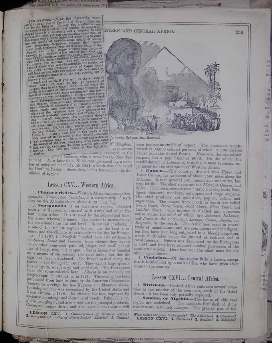
THE SPHYNX.—Near the Pyramids, more awful than all else in the land of Egypt, there sits the lonely Sphynx. Comely the creature is, but the comeliness is not of this world; the once-worshiped beast is a deformity and a monster to this generation, and yet you can see that those lips, so thick and heavy, were fashioned according to some ancient mould of beauty—some mould of beauty now forgotten—forgotten because that Greece drew forth Cytherea from the flashing foam of the Ægean, and in her image created new forms of beauty, and made it a law among men that the short and proudly-wreathed lip should stand for the sign and the main condition of loveliness, through all generations to come. Yet still there lives the race of those who were beautiful in the fashion of the elder world; Christian girls of Coptic blood who will look on you with the sad, serious face, and kiss your charitable hand with the big, pouting lips of this very Sphynx.
Laugh and mock, if you will, at the worship of stone idols; but mark ye this, ye breakers of images, that in one regard the stone idol bears the awful semblance of Deity—unchangefulness in the midst of change—the same seeming will and intent forever and ever inexorable! Upon ancient dynasties of Ethiopian and Egyptian kings—upon Greek and Roman, upon Arab and Ottoman conquerors—upon Napoleon dreaming of an Eastern empire—upon battle and pestilence—upon the ceaseless misery of the Egyptian race—upon keen-eyed travelers—Herodotus yesterday, and Warburton today—upon all, and more, this unworldly Sphynx has watched like a Providence, with the same earnest eyes, and the same sad, tranquil mien. And we—we shall die, and Islam will wither away; and the Englishmen, leaning far over to hold his loved India, will plant a firm foot on the banks of the Nile, and sit in the seats of the faithful; and still that sleepless rock will lie watching and watching the works of the new, busy race, with those same sad, earnest eyes, and the same tranquil mien everlasting. You dare not mock at the Sphynx.—Eothen.
[begin surface 889]
Nubia was anciently an independent and powerful kingdom, and, 800 B. C., conquered Egypt. Its history is, however, very obscure. A portion of the country belonged to the kingdom of Queen Candace, who is named in the New Testament. At a later date, Nubia was governed by a number of independent chiefs, till 1821, when it was conquered by Ibrahim Pasha. Since then, it has been under the dominion of Egypt.
Lesson CXV... Western Africa.
1. Characteristics.—Western Africa, embracing Senegambia, Guinea, and Cimbebas, is a narrow strip of territory on the Atlantic shore, about 4000 miles long.
2. Senegambia is an extensive region, inhabited mostly by Negroes, intermixed with Arabs and other Mohammedan tribes. It is watered by the Senegal and Gambia rivers, whence its name. The interior is mountainous; the coast-lands are low and level. In natural products, it is one of the richest regions known; but the heat is intense, and the climate is extremely unhealthy for Europeans. In 1787, the English founded here the settlements of Sierra Leone and Gambia, from whence they export teak-timber, camwood, palm-oil, ginger, and small quantities of ivory, rice, and pepper. Sierra Leone was founded as a means of suppressing the slave-trade; but this design has been abandoned. The French settled along the banks of the Senegal in 1637. They export large quantities of gum, wax, ivory, and gold-dust. The Portuguese have also some colonies here. Liberia is an independent Negro republic, established in 1821. The country has been purchased from time to time, by the American Colonization Society, as a refuge for free Negroes and liberated slaves. Its independence was recognized by the United States and Great Britain in 1848. Its climate has been improved by systematic drainage and clearance of woods. Palm-oil, ivory, gold-dust, ginger, and arrow-root are the principal products. Cocoa and sugar thrive, and it is expected that cotton will soon become an article of export. The population is estimated at 80,000 colored persons, of whom 10,000 are free blacks from the United States. Monrovia, the capital and seaport, has a population of 9000. On the whole, the establishment of Liberia is, thus far, a most successful experiment for the civilization of Western Africa.
3. Guinea.—This country, divided into Upper and Lower Guinea, has an extent of about 2500 miles along the Atlantic. It is in general low, humid, and unhealthy, but very fertile. The chief rivers are the Niger, or Quorra, and Zaire. The forests contain vast numbers of elephants, lions, tigers, rhinoceri, monkeys, antelopes, and huge serpents. The chief products are gold-dust, pepper, cotton, and sugar-cane. The coasts from north to south are called Grain Coast, Ivory Coast, Gold Coast, Slave Coast, and Calabar Coast. The interior is divided into numerous native states, the chief of which are Ashantee, Dahomey, and Benin, in the north, and Loango, Congo, Angola, and Benguela, in the south. The Ashantees excel in several kinds of manufacture, and are courageous and intelligent; but they have been long subjected to a bloody despotism, whole multitudes being slaughtered at festivals and at royal funerals. Guinea was discovered by the Portuguese in 1487, and they have retained nominal possession of the southern districts. Here has been the chief mart for the obtaining of slaves.
4. Cimbebas.—Of this region little is known, except that it is inhabited by a native tribe, who have given their name to the country.
Lesson CXVI... Central Africa.
1. Divisions.—Central Africa embraces several countries in the interior of the continent, south of the Great Desert: it has been only partially explored.
2. Soudan, or Nigritia.—The limits of this vast region are undefined. The accounts furnished of it by travelers are extremely meager. The greater part of the
LESSON CXV. 1. Characteristics of Western Africa? 2. Senegambia? What of Sierra Leone? Liberia? 3. Guinea? What names are given to the coasts? The Ashantees? 4. Cimbebas?
LESSON CXVI. 1. Divisions? 2. Soudan? 3. Ethiopia?
[begin surface 890]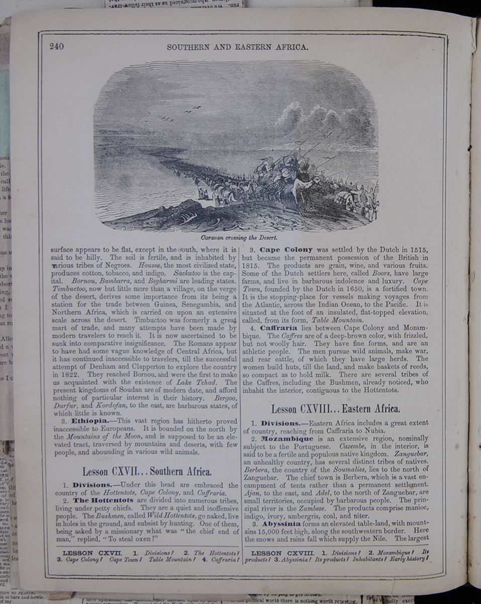 240
SOUTHERN AND EASTERN AFRICA.
Caravan crossing the Desert.
240
SOUTHERN AND EASTERN AFRICA.
Caravan crossing the Desert.
surface appears to be flat, except in the south, where it is said to be hilly. The soil is fertile, and is inhabited by various tribes of Negroes. Houssa, the most civilized state, produces cotton, tobacco, and indigo. Sackatoo is the capital. Bornou, Bambarra, and Begharmi are leading states. Timbuctoo, now but little more than a village, on the verge of the desert, derives some importance from its being a station for the trade between Guinea, Senegambia, and Northern Africa, which is carried on upon an extensive scale across the desert. Timbuctoo was formerly a great mart of trade, and many attempts have been made by modern travelers to reach it. It is now ascertained to be sunk into comparative insignificance. The Romans appear to have had some vague knowledge of Central Africa, but it has continued inaccessible to travelers, till the successful attempt of Denham and Clapperton to explore the country in 1822. They reached Bornou, and were the first to make us acquainted with the existence of Lake Tchad. The present kingdoms of Soudan are of modern date, and afford nothing of particular interest in their history. Bergoo, Darfur, and Kordofan, to the east, are barbarous states, of which little is known.
3. Ethiopia.—This vast region has hitherto proved inaccessible to Europeans. It is bounded on the north by the Mountains of the Moon, and is supposed to be an elevated tract, traversed by mountains and deserts, with few people, and abounding in various wild animals.
Lesson CXVII... Southern Africa.
1. Divisions.—Under this head are embraced the country of the Hottentots, Cape Colony, and Caffraria.
2. The Hottentots are divided into numerous tribes, living under petty chiefs. They are a quiet and inoffensive people. The Bushmen, called Wild Hottentots, go naked, live in holes in the ground, and subsist by hunting. One of them, being asked by a missionary what was "the chief end of man," replied, "To steal oxen!"
3. Cape Colony was settled by the Dutch in 1515, but became the permanent possession of the British in 1815. The products are grain, wine, and various fruits. Some of the Dutch settlers here, called Boors, have large farms, and live in barbarous indolence and luxury. Cape Town, founded by the Dutch in 1650, is a fortified town. It is the stopping-place for vessels making voyages from the Atlantic, across the Indian Ocean, to the Pacific. It is situated at the foot of an insulated, flat-topped elevation, called, from its form, Table Mountain.
4. Caffraria lies between Cape Colony and Mozambique. The Caffres are of a deep-brown color, with frizzled, but not woolly hair. They have fine forms, and are an athletic people. The men pursue wild animals, make war, and rear cattle, of which they have large herds. The women build huts, till the land, and make baskets of reeds, so compact as to hold milk. There are several tribes of the Caffres, including the Bushmen, already noticed, who inhabit the interior, contiguous to the Hottentots.
Lesson CXVIII... Eastern Africa.
1. Divisions.—Eastern Africa includes a great extent of country, reaching from Caffraria to Nubia.
2. Mozambique is an extensive region, nominally subject to the Portuguese. Cazembe, in the interior, is said to be a fertile and populous native kingdom. Zanguebar, an unhealthy country, has several distinct tribes of natives. Berbera, the country of the Soumalies, lies to the north of Zanguebar. The chief town is Berbera, which is a vast encampment of tents rather than a permanent settlement. Ajan, to the east, and Adel, to the north of Zanguebar, are small territories, occupied by barbarous people. The principal river is the Zambeze. The products comprise manioc, indigo, ivory, ambergris, coal, and niter.
3. Abyssinia forms an elevated table-land, with mountains 15,000 feet high, along the southwestern border. Here the snows and rains fall which supply the Nile. The largest
LESSON CXVII. 1. Divisions? 2. The Hottentots? 3. Cape Colony? Cape Town? Table Mountain? 4. Caffraria?
LESSON CXVIII. 1. Divisions? 2. Mozambique? Its products? 3. Abyssinia? Its products? Inhabitants? Early history?
Livingstone's Travels and Researches in Southern Africa.
HARPER & BROTHERS.
In our previous notice we referred to the early life of Dr. Livingstone. We now turn to the scenes in his life which have made him famous—his African career.
Dr. Livingstone sailed for South Africa in 1840, and, after a brief sojourn in Cape Town, commenced an exploration of the interior of the continent by going round to Algoa Bay. From that period, until the past year, he had lived continuously amongst the wild tribes of Africa, occupied "in medical and missionary labors, without cost to the inhabitants." A glance at his travelling route, as traced out on the map which accompanies his volume, will show that he has traversed regions hitherto entirely unknown to the European; through fair and fertile countries, where the race of the white man had never been seen; over deserts formerly deemed impassable; across and along the course of mighty rivers; exposed at every step to dangers which might appal the stoutest. His first expedition was brought to a close in 1852, when he returned with his family to the Cape, after eleven years wandering and residence in the interior, whilst his last and longest, and, we may add, his most important, journey was commenced alone in June, 1852, and finished in July, 1856, when he sailed from the Eastern coast of the continent to the Mauritius, having been with the exception of a short interval, three years and a half without speaking or hearing a word of his native tongue.
In the record of such labors and wanderings we meet, as might be expected, with many terror-moving incidents and 'hair-breadth escapes.' In no part of the world is animal life so superabundant as in the interior of Africa, and the most formidable members of the brute creation often cross the traveller's path, and render constant vigilance necessary for his protection. At the outset of his career Dr. Livingstone was exposed to an alarming encounter with a lion, which might have very prematurely terminated his African labors. His narrative of the event is very curious, on account of the physiological fact to which he refers, and which for humanity's sake, we should like to accept as a general ruth :
AN ENCOUNTER WITH A LION AND ITS CONSEQUENCES.
It is well known that if one in a troop of lions is killed the others take the hint and leave that part of the country. So the next time the herds were attacked, I went with the people in order to encourage them to rid themselves of the annoyance by destroying one of the marauders.—We found the lions on a small hill about a quarter of a mile in length, and covered with trees. A circle of men was formed round it, and they gradually closed up, ascending pretty near to each other. Being down on the plain below, with a native schoolmaster, named Mebalwe, a most excellent man, I saw one of the lions sitting on a piece of rock within the now closed circle of men. Mebalwe fired at him before I could, and the ball struck the rock on which the animal was sitting. He bit at the spot struck, as a dog does at a stick or stone at him; then leaping away, broke through the opening circle and escaped unhurt. The men were afraid to attack him, perhaps on account of their belief in witchcraft, When the circle was re-formed, we saw two lions in it; but we were then afraid to fire lest we should strike the men, and they allowed the beasts to burst through also. If the Bakatla had acted according to the custom of the country, they would have speared the lions in their attempt to get out. Seeing that we could not get them to kill one of the lions, we bent our footsteps towards the village; in going round the end of the hill, however, I saw one of the beasts sitting on a piece of rock as before, but this time he had a little bush in front. Being about 30 yards off, I took a good aim at his body through the bush, and fired the two barrels into it. The men then called out, 'He is shot, he is shot.' Others cried, 'He has been shot by another man too; let us go to him.' I did not see any one else shoot at him, but I saw the lion's tail erected in anger behind the bush, and, turning to the people, said, 'Stop a little till I load again.' When in the act of ramming down the bullets I heard a shout.—Starting, and looking half round, I saw the lion just in the act of springing upon me. I was on a little height; he caught my shoulder as he sprang, and we both came to the ground below together. Growling horribly close to my ear, he shook me as a terrier dog does a rat. The shock produced a stupor similar to that which seems to be felt by a mouse after the first shake of the cat. It caused a sort of dreaminess, in which there was no sense of pain nor feeling of terror, though qui'e conscious of all that was happening; it was like what patients partially under the influence of chloroform describe, who see all the operation, but feel not the knife.
This singular condition was not the result of any mental process. The shake annihilated fear and allowed no sense of horror in looking round at the beast. This peculiar state is produced in all animals killed by the carnivora; and if so, is a merciful provision by our benevclent Creator for lessening the pain of death.—Turning round to relieve myself of the weight, as he had one paw on the back of my head, I saw his eyes directed to Mebalwe, who was trying to shoot him at a distance of ten of fifteen yards. His gun, a flint one, missed fire in both barrels; the lion immediately left me, and, attacking Mebalwe, bit his thigh. Another man, whose life I had saved before, and after he had been tossed by a Buffalo, attempted to spear the lion while he was biting Mebalwe. He left Mebalwe and caught this man by the shoulder, but at that moment the bullets he had received took effect and he fell down dead. The whole was the work of a few moments, and must have been his paroxysm of dying rage. In order to take out the charm from him, the Bakatla on the following day made a huge bonfire over the carcase, which was declared to be that of the largest lion they had ever seen. Besides crunching the bone into splinters, he left 11 teeth wounds on the upper part of my arm.
Dr. Livingstone's first place of settlement was at a place called Chonuane, under the protection of a tribe of Africans denominated by the Bakwains who had for their head an intelligent and well-disposed chieftain, named Sechele. A leading superstition is a belief in rain doctors, who are supposed to possess the power of calling down showers on the thirsty earth. During the period of the missionary's sojourn at this spot, the country was visited by one of these droughts so common in Africa and so calamitous in their results. The first year no rain fell, and in the second the parched earth still remained unrefreshed by a single shower. The poor Africans in vain invoked the skill of the rain-makers, notwithstanding the missionary's rebukes; Schele himself being a noted rain-doctor. This terrible drought was, indeed, hard to bear as one of the incidents recorded by Dr. Livingstone fully prove;
AN AFRICAN DRAUGHT.
In the third the same extraordinary drought followed. Indeed, not 10 inches of water fell during these two years, and the Kolobeng ran dry; so many fish were killed that the hyænas from the whole country round collected to the feast, and were unable to finish the putrid masses. A large old alligator, which had never been known to commit any depredations, was found left high and dry in the mud among the victims. The fourth year was equally unpropitious, the fall of rain being insufficient to bring the grain to maturity. Nothing could be more trying. We dug down in the bed of the river deeper and deeper as the water receded, striving to get a little to keep the fruit-trees alive for better times, but in vain. Needles lying out of doors for months did not rust; and a mixture of sulphuric acid and water, used in a galvanic battery, parted with all its water to the air instead of imbibing more from it, as it would have done in England.
The leaves of indigenous trees were all drooping, soft and shrivelled, though not dead; and those of the mimosæ were closed at midday, the same as they are at night. In the midst of this dreary drought it was wonderful to see those tiny creatures, the ants, running about with their accustomed vivacity. I put the bulb of a thermometer three inches under the soil in the sun at midday, and found the mercury to stand 132 deg. to 134 deg; and if certain kinds of beetles were placed on the surface, they ran about a few seconds and expired. But this broiling heat only augmented the activity of the long-legged black aunts: they never tire; their organs of motion seem endowed with the same power as is ascribed by physiologists to the muscles of the human heart, by which that part of the frame never becomes fatigued, and which may be imparted to all our bodily organs in that higher sphere to which we fondly hope to rise.
On the 1st of June, 1849, Dr. Livingstone, accompanied by two amateur adventurers, named Oswell and Murpay, started through an unknown country, in search of Lake Ngami, situated in the very centre of the continent. Like Gordon Cumming, the Doctor's companions were eager sportsmen; but their achievements were regarded with little respect by the Africans. The greatest triumphs of the English sportsman were thus estimated by the latter:
AN AFRICAN'S NOTIONS OF ENGLISH SPORT.
I sometimes felt annoyed at the low estimation in which some of my hunting friends were held; for, believing that the chase is eminently conducive to the formation of a brave and noble character, and that the contest with wild beasts is well adapted for fostering that coolness in emergencies, and active presence of mind, which we all admire, I was naturally anxious that a higher estimate of my countrymen should the formed in the native mind. "Have these hunters, who come so far and work so hard, no meat at home?'—'Why, these men are rich, and could slaughter oxen every day of their lives'—'And yet they come here, and endure so much thirst for the sake of this dry meat, none of which is equal to beef?' 'Yes, it is for the sake of play besides,' (the idea of sport not being in the language) This produces a laugh, as much as to say, 'Ah, you know better;' or, 'Your friends are fools.' When they can get a man to kill large quantities of game for them, whatever he may think of himself or of his achievements, they pride themselves in having adroitly turned to good account the folly of an itinerant bucher .
On the 1st day of August Lake Ngami was reached and "for the first time this fine sheet of water was beheld by Europeans." From the lake, the travellers followed the course of the river Zouga, the banks of which are described as surpassingly beautiful. In this district wild animals of all kinds abound, herds of elephants included.—The latter were objects of especial attraction to the English sportsmen, being, in fact, most valuable prizes. Mr. Oswell was eminently successful in this new department of sport, and it is due to him to state that he was generous as he was brave:—
AN ENGLISH ELEPHANT HUNTER.
Some mistake had happened in the arrangement with Mr. Oswell, for we met him on the Zouga on our return, and he devoted the rest of this season to elephant-hunting, at which the natives universally declare he is the greatest adept that ever came in the country. He hunted without dogs. It is remarkable that this lordly animal is so completely harrassed by the presence of a few yelping curs as to be quite incapable of attending to man. He makes awkward attempts to crush them by falling on his knees and sometimes places his forehead against a tree 10 inches in diameter; a glancing on one side of the tree and then on the other, he pushes it down before him, as if he thought therefore to catch this enemies. The only danger the huntsman has to apprehend is the dogs running towards him, and thereby leading the elephant to their master. Mr. Oswell has been known to kill four large old elephants a day.
The value of the ivory in these cases would be one hundred guineas. We had reason to be proud of his success, for the inhabitants received from it a very high idea of English courage, and when they wished to flatter me would say, "If you were not a missionary you would just be like Oswell; you would not hunt with dogs either.' When, in 1852, we came to the Cape, my black coat 11 years out of fashion, and without a penny of salary to draw, we found that Mr. Oswell had most generously ordered an outfit for the half naked children, which cost about £200, and presented it to us saying he thought Mrs. Livingston had a right to the game of her own preserves.
The most disagreeable and dangerous inhabitant of the district is a small insect called the Tsetse. 'Its peculiar buzz,' we are told, 'can never be forgotten by the traveller whose means of locomotion are domestic animals; for it is well known that the bite of this poisonous insect is certain death to the ox, horse and dog.'—Of the bite of this creature and its consequences, our traveller gives the following account.
THE TSETE POISON.
A most remarkable feature in the bite of the tsetse is its perfect harmlessnes in man and wild animals, and even calves, so long as they continue to suck the cows. We never experienced the slightest injury from them ourselves, personally, although we lived two months in their habitat, which was in this case as sharply defined as many others, for the south bank of the Chobe was infected by them, and the northern bank, where placed, only 50 yards distant, contained not a single specimen. This was the more remarkable, as we often saw natives carrying over raw meat to the opposite bank with many tsetse settled upon it. The poison does not seem to be injected by a sting, or by ova placed beneath the skin, for when one is allowed to feed freely on the hand, it is seen to insert the middle prong of three portions, into which the proboscis divides, somewhat deeply into the true skin; it then draws it out a little way, and it assumes a crimson color as the mandibles come into brisk operation. The previously shrunken belly swell out, and, if left undisturbed, the fly quietly departs when it is full. A slight itching irritation follows, but not more than in the bite of a mosquito.
In the ox this same bite produces no more immediate effects than in man. It does not startle him as the gad-fly does; but a few days afterwards the following symptoms supervene: the eye and nose begin to run, the coat stares as if the animal were cold, a swelling appears under the jaw, and sometimes at the navel; and, though the animal continues to graze, emaciation commences, accompanied with a peculiar flaccidity of the muscles, and this proceeds unchecked until, perhaps months afterwards, purging comes on, and the animal no longer able to graze, perishes in a state of extreme exhaustion. Those which are in good condition often perish soon after the bite is inflicted with staggering and blindness, as if the brain were affected by it. Sudden changes of temperature, produced by falls of rain, seem to hasten the progress of the complaint; but in general the emaciation goes on uninterruptedly for months, and, do what we will, the poor animals perish miserably.
[begin surface 892]
REV. DR. LIVINGSTONE.—This eminent explorer has withdrawn from the service of the London Missionary Society, and returns shortly to Africa, in the employ and under the patronage of the British government. Five thousand pounds were lately voted by Parliament to Dr. Livingstone, to enable him to prosecute the exploration of the river Zambesi and the Southern portion of the African Continent.
[begin surface 894]
 [begin surface 896]
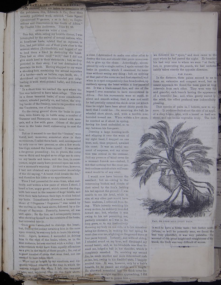
TRAVELS IN SOUTH AFRICA.
The annexed cuts are taken by permission of the publishers, Dix, Edwards & Co., from this recently published work, entitled, "Lake Ngami (pronounced N´-ga-mee, a as in far); or, Explorations and Discoveries in the South of Africa." By Charles John Andersson. Price $1 25.
ADVENTURE WITH A LION.
One day, when eating my humble dinner, I was interrupted by the arrival of several natives, who, in a breathless haste, related that an ongeama, or lion, had just killed one of their goats close to the mission station (Richterfelt), and begged of me to lend them a hand in destroying the beast. They had so often cried "wolf," that I did not give much heed to their statements; but as they persisted in their story, I at last determined to ascertain its truth. Having strapped to my waist a shooting-belt, containing the several requisites of a hunter—such as bullets, caps, knife, etc., I shouldered my trusty double-barreled gun (after loading it with steel pointed ball), and followed the men.
In a short time we reached the spot where the lion was believed to have taken refuge. This was in a dense tamarisk brake, of some considerable extent, situated partially on, and below the sloping banks of the Swakop, near to its junction with the Omutenna, one of its tributaries.
On the rising ground above the brake in question, were drawn up, in battle array, a number of Damaras and Namaquas, some armed with assegais, and a few with guns. Others of the party were in the brake itself, endeavoring to oust the lion.
But as it seemed to me that the "beaters" were timid, and, moreover, somewhat slow in their movements, I called them back; and accompanied by only one or two persons, as also a few worthless dogs, entered the brake myself. It was rather dangerous proceeding; for, in places, the cover was so thick and tangled as to oblige me to creep on my hands and knees, and the lion, in consequence, might easily have pounced upon me without a moment's warning. At that time, however, I had not obtained any experimental knowledge of the old saying, "A burnt child dreads the fire," and therefore felt little or no apprehension.
Thus I proceeded for some time, when suddenly, and within a few paces of where I stood, I heard a low, angry growl, which caused the dogs, with hair erect in the manner of hogs' bristle, and with their tails between their legs, to slink behind my heels. Immediately afterward, a tremendous shout of "Ongeama! Ongeama!" was raised by the natives on the bank above, followed by a discharge of fire-arms. Presently, however, all was still again; for the lion, as I subsequently learnt, after showing himself on the outskirts of the brake, retreated into it.
Once more I attempted to dislodge the beast; out, finding the enemy awaiting him in the more open country, he was very loth to leave his stronghold. Again, however, I succeeded in driving him to the edge of the brake, where as in the first instance, he was received with a volley; but a broomstick would have been equally efficacious as a gun in the hands of these people; for, out of a great number of shots that were fired, not one seemed to have taken effect.
Worn out at length by my exertions, and disgusted beyond measure at the way in which the natives bungled the affair, I left the tamarisk brake, and, rejoining them on the bank above, [obscured]red to char[obscured]with[obscured]my pro[obscured]asl, as[obscured] a close, I determined to make one other effort to destroy the lion, and should that prove unsuccessful, to give up the chase. Accordingly, accompanied by only a single native, I again entered the brake in question, which I examined for some time without seeing any thing; but on arriving at that part of the cover we had first searched, and when in a spot comparatively free from bushes, up suddenly sprung the beast within a few paces of me. It was a black-maned lion, and one of the largest I ever remember to have encountered in Africa. But his movements were so rapid, so silent and smooth withal, that it was not until he had partially entered the thick cover (at which time he might have been about thirty paces distant) that I could fire. On receiving the ball, the wheeled short about, and, with a terrible roar, bounded toward me. When within a few paces, he couched as if about to spring, having his head embedded, so to say, between his fore-paws.
Drawing a large hunting-knife and slipping it over the wrist of my right hand, I dropped on one knee, and, thus prepared, awaited this onset. It was an awful moment of suspense, and my situation was critical in the extreme. Still my presence of mind never for a moment forsook me—indeed I felt that nothing but the most perfect coolness and absolute self-command would be of any avail.
I would now have become the assailant; but as—owing to the intervening bushes, and clouds of dust raised by the lion's lashing tail against the ground—I was unable to see his head, while to aim at any other part would have been madness, I refrained from firing. While intently watching his every motion, he suddenly bounded toward me; but, whether it was owing to his not perceiving me, partially concealed as I was in the long grass, or to my instinctively throwing my body on one side, or to his miscalculating his distance, in making his last spring he went clear over me, alighting on the ground three or four paces beyond. Instantly, and without rising, I wheeled round on my knee, and discharged my second barrel; and, as his broadside was then toward me, lodged a ball in his shoulder, which it completely smashed. On receiving my second fire, he made another and more determined rush at me, but, owing to his disabled state, I happily avoided him. It was, however, only by a hair's breadth, for he passed me within arm's length. He afterward scrambled into the thick cover beyond where, as the night was then approaching, I did [obscured]dent to pursue him.[obscured] we followed his "spoor," and soon came to the spot where he had passed the night. He breathed his last very near to where we were "at fault," but, in prosecuting the search, we had unfortunately taken exactly the opposite direction.
FAN PALMS
In the distance, these palms seemed to us to form an extensive and compact wood, but on nearer approach we found the trees grew at long intervals from each other. They were very tall and graceful, each branch having the appearance of a beautiful fan; and, when gently waved by the wind, the effect produced was indescribably pleasing.
This species of palm is, I believe, new to science. It produces fruit about the size of an apple, of a deep brown color, with a kernel as hard as a stone, and not unlike vegetable ivory. The fruit FAN, OR VEGETABLE IVORY PALM. is said to have a bitter taste; but farther north (where, as will be presently seen, we found the tree very plentiful), it was very palatable. On account of the great height and straightness of the trunk, the fruit was very difficult of access.
[begin surface 897] [begin surface 898]
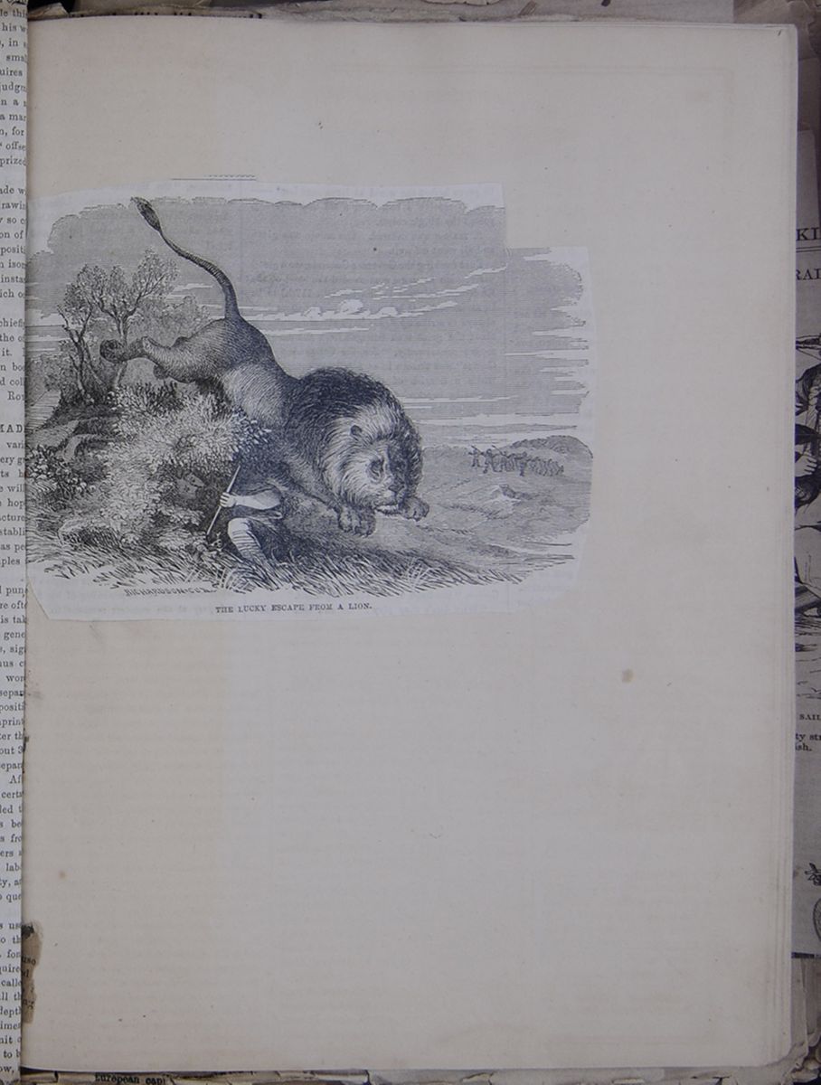 THE LUCKY ESCAPE FROM A LION.
An engraving of a man dodging a lion's pounce.
[begin surface 899]
THE LUCKY ESCAPE FROM A LION.
An engraving of a man dodging a lion's pounce.
[begin surface 899]
 [begin surface 901]
 [begin surface 902]
 [begin surface 903]
 [begin surface 904]
 [begin surface 905]
 [begin surface 906]
 [begin surface 907]
 [begin surface 908]
 [begin surface 909]
 [begin surface 910]
 [begin surface 911]
 [begin surface 912]
 [begin surface 913]
 [begin surface 914]
 [begin surface 915]
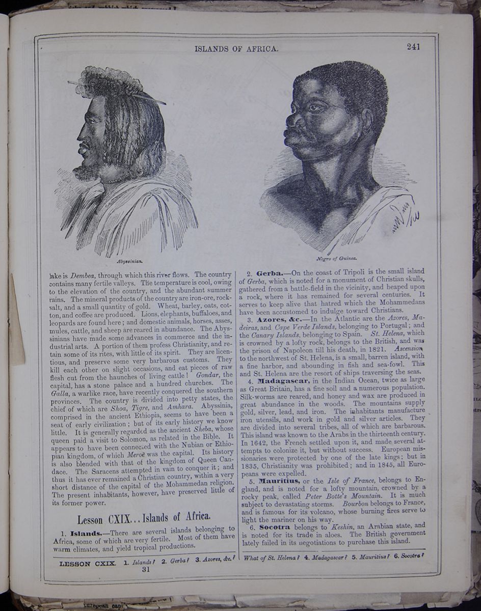
lake is Dembea, through which this river flows. The country contains many fertile valleys. The temperature is cool, owing to the elevation of the country, and the abundant summer rains. The mineral products of the country are iron-ore, rock-salt, and a small quantity of gold. Wheat, barley, oats, cotton, and coffee are produced. Lions, elephants, buffaloes, and leopards are found here; and domestic animals, horses, asses, mules, cattle, and sheep are reared in abundance. The Abyssinians have made some advances in commerce and the industrial arts. A portion of them profess Christianity, and retain some of its rites, with little of its spirit. They are licentious, and preserve some very barbarous customs. They kill each other on slight occasions, and eat pieces of raw flesh cut from the haunches of living cattle! Gondar, the capital, has a stone palace and a hundred churches. The Galla, a warlike race, have recently conquered the southern provinces. The country is divided into petty states, the chief of which are Shoa, Tigre, and Amhara. Abyssinia, comprised in the ancient Ethiopia, seems to have been a seat of early civilization; but of its early history we know little. It is generally regarded as the ancient Sheba, whose queen paid a visit to Solomon, as related in the Bible. It appears to have been connected with the Nubian or Ethiopian kingdom, of which Meroë was the capital. Its history is also blended with that of the kingdom of Queen Candace. The Saracens attempted in vain to conquer it; and thus it has ever remained a Christian country, within a very short distance of the capital of the Mohammedan religion. The present inhabitants, however, have preserved little of its former power.
Lesson CXIX... Islands of Africa.
1. Islands.—There are several islands belonging to Africa, some of which are very fertile. Most of them have warm climates, and yield tropical productions.
2. Gerba.—On the coast of Tripoli is the small island of Gerba, which is noted for a monument of Christian skulls, gathered from a battle-field in the vicinity, and heaped upon a rock, where it has remained for several centuries. It serves to keep alive that hatred which the Mohammedans have been accustomed to indulge toward Christians.
3. Azores, &c.—In the Atlantic are the Azores, Madeiras, and Cape Verde Islands, belonging to Portugal; and the Canary Islands, belonging to Spain. St. Helena, which is crowned by a lofty rock, belongs to the British, and was the prison of Napoleon till his death, in 1821. Ascension, to the northwest of St. Helena, is a small, barren island, with a fine harbor, and abounding in fish and sea-fowl. This and St. Helena are the resort of ships traversing the seas.
4. Madagascar, in the Indian Ocean, twice as large as Great Britain, has a fine soil and a numerous population. Silk-worms are reared, and honey and wax are produced in great abundance in the woods. The mountains supply gold, silver, lead, and iron. The inhabitants manufacture iron utensils, and work in gold and silver articles. They are divided into several tribes, all of which are barbarous. This island was known to the Arabs in the thirteenth century. In 1642, the French settled upon it, and made several attempts to colonize it, but without success. European missionaries were protected by one of the late kings: but in 1835, Christianity was prohibited; and in 1845, all Europeans were expelled.
5. Mauritius, or the Isle of France, belongs to England, and is noted for a lofty mountain crowned by a rocky peak, called Peter Botte's Mountain. It is much subject to devastating storms. Bourbon belongs to France, and is famous for its volcano, whose burning fires serve to light the mariner on his way.
6. Socotra belongs to Keshin, an Arabian state, and is noted for its trade in aloes. The British government lately failed in its negotiations to purchase this island.
LESSON CXIX. 1. Islands? 2. Gerba? 3. Azores, &c.? What of St. Helena? 4. Madagascar? 5. Mauritius? 6. Socotra?
31 [begin surface 916]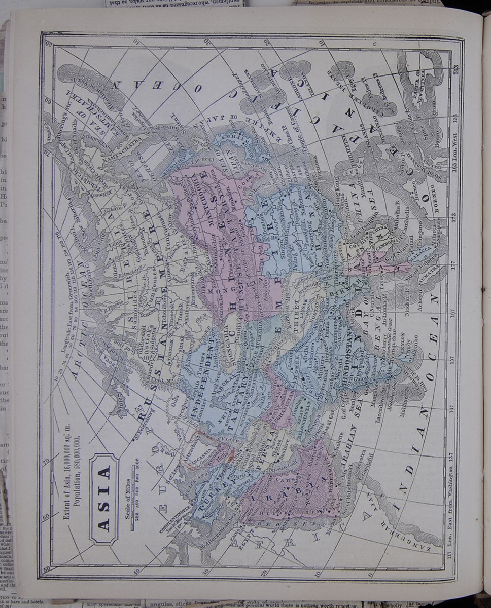 Map of Asia.
ASIA.
Extent of Asia, 16,000,000 sq. m.
Population, 580,000,000.
Map of Asia.
ASIA.
Extent of Asia, 16,000,000 sq. m.
Population, 580,000,000.
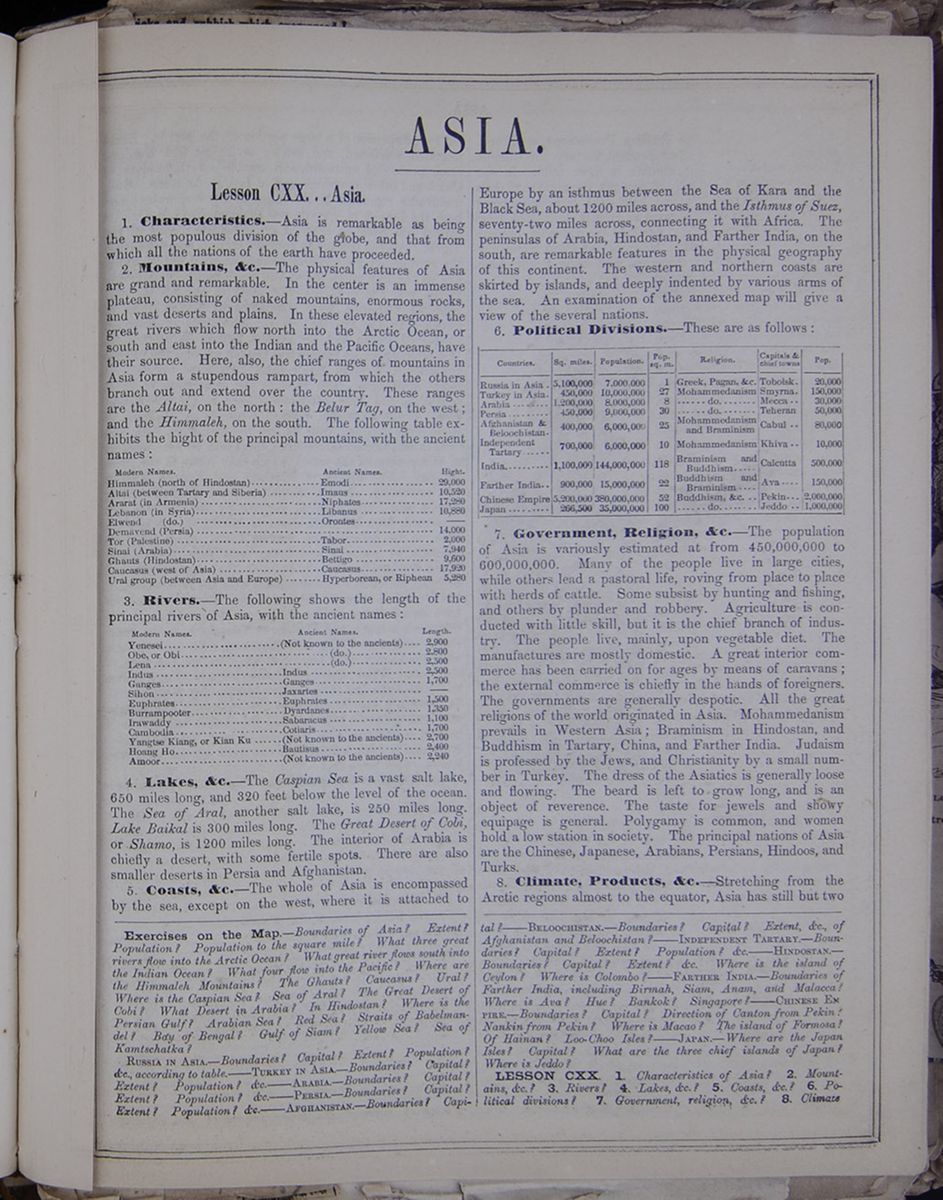
ASIA.
Lesson CXX... Asia.
1. Characteristics.—Asia is remarkable as being the most populous division of the globe, and that from which all the nations of the earth have proceeded.
2. Mountains, &c.—The physical features of Asia are grand and remarkable. In the center is an immense plateau, consisting of naked mountains, enormous rocks, and vast deserts and plains. In these elevated regions, the great rivers which flow north into the Arctic Ocean, or south and east into the Indian and the Pacific Oceans, have their source. Here, also, the chief ranges of mountains in Asia form a stupendous rampart, from which the others branch out and extend over the country. These ranges are the Altai, on the north: the Belur Tag, on the west; and the Himmaleh, on the south. The following table exhibits the hight of the principal mountains, with the ancient names: This table lists the heights of the highest mountains in Asia and lists both the modern and ancient names of the ranges.
3. Rivers.—The following shows the length of the principal rivers of Asia, with the ancient names: This table lists the lengths of the principal rivers of Asia and includes the modern and ancient names of each.
4. Lakes, &c.—The Caspian Sea is a vast salt lake, 650 miles long, and 320 feet below the level of the ocean. The Sea of Aral, another salt lake, is 250 miles long. Lake Baikal is 300 miles long. The Great Desert of Cobi or Shamo, is 1200 miles long. The interior of Arabia is chiefly a desert, with some fertile spots. There are also smaller deserts in Persia and Afghanistan.
5. Coasts, &c.—The whole of Asia is encompassed by the sea, except on the west, where it is attached to Europe by an isthmus between the Sea of Kara and the Black Sea, about 1200 miles across, and the Isthmus of Suez, seventy-two miles across, connecting it with Africa. The peninsulas of Arabia, Hindostan, and Farther India, on the south, are remarkable features in the physical geography of this continent. The western and northern coasts are skirted by islands, and deeply indented by various arms of the sea. An examination of the annexed map will give a view of the several nations.
6. Political Divisions.—These are as follows: This table lists the countries of Asia and the following data about each: square miles, population, population to the square mile, religion, capitals/chief towns, and population of the capital/town.
7. Government, Religion, &c.—The population of Asia is variously estimated at from 450,000,000 to 600,000,000. Many of the people live in large cities, while others lead a pastoral life, roving form place to place with herds of cattle. Some subsist by hunting and fishing, and others by plunder and robbery. Agriculture is conducted with little skill, but it is the chief branch of industry. The people live, mainly, upon a vegetable diet. The manufactures are mostly domestic. A great interior commerce has carried on for ages by means of caravans; the external commerce is chiefly in the hands of foreigners. The governments are generally despotic. All the great religions of the world originated in Asia. Mohammedanism prevails in Western Asia; Braminism in Hindostan, and Buddhism in Tartary, China, and Farther India. Judaism is professed by the Jews, Christianity by a small number in Turkey. The dress of the Asiatics is generally loose and flowing. The beard is left to grow long, and is an object of reverence. The taste for jewels and showy equipage is general. Polygamy is common, and women hold a low station in society. The principal nations of Asia are the Chinese, Japanese, Arabians, Persians, Hindoos, and Turks.
8. Climate, Products, &c.—Stretching from the Arctic regions almost to the equator, Asia has still but two
Exercises on the Map.—Boudaries of Asia? Extent? Population? Population to the square mile? What three great rivers flow into the Arctic Ocean? What great river flows south into the Indian Ocean? What four flow into the Pacific? Where are the Himmaleh Mountains? The Ghauts? Caucasus? Ural? Where is the Caspian Sea? Sea of Aral? The Great Desert of Cobi? What Desert in Arabia? In Hindostan? Where is the Persian Gulf? Arabian Sea? Red Sea? Straits of Babelmandel? Bay of Bengal? Gulf of Siam? Yellow Sea? Sea of Kamtschatka?
RUSSIA IN ASIA.—Boundaries? Capital? Extent? Population? &c., according to table.——TURKEY IN ASIA.—Boundaries? Capital? Extent? Population?——ARABIA.—Boundaries? Capital? Extent? Population?——PERSIA.—Boundaries? Capital? Extent? Population?——AFGHANISTAN.—Boundaries? Capital? ——BELOOCHISTAN.—Boundaries? Capital? Extent, &c., of Afghanistan and Beloochistan?——INDEPENDENT TARTARY.—Boundaries? Capital? Extent? Population? &c.——HINDOSTAN.—Boundaries? Capital? Extent? &c. Where is the island of Ceylon? Where is Colombo?——FARTHER INDIA.—Boundaries of Farther India, including Birmah, Siam, Anam, and Malacca? Where is Ava? Hue? Bankok? Singapore?——CHINESE EMPIRE.—Boundaries? Capital? Direction of Canton from Pekin? Nankin from Pekin? Where is Macao? The island of Formosa? Of Hainan? Loo-Choo Isles?——JAPAN.—Where are the Japan Isles? Capital? What are the three chief islands of Japan? Where is Jeddo?
LESSON CXX. 1. Characteristics of Asia? 2. Mountains, &c.? 3. Rivers? 4. Lakes, &c.? 5. Coasts, &c.? 6. Political divisions? 7. Government, religion, &c.? 8. Climate
[begin surface 918]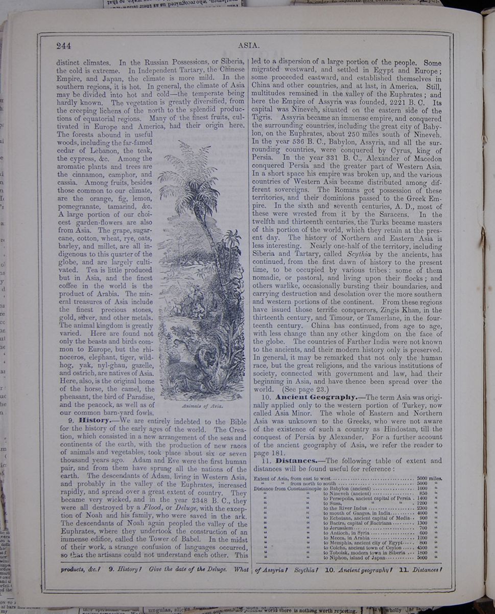 244
ASIA.
244
ASIA.
distinct climates. In the Russian Possessions, or Siberia, the cold is extreme. In Independent Tartary, the Chinese Empire, and Japan, the climate is more mild. In the southern regions, it is hot. In general, the climate of Asia may be divided into hot and cold—the temperate being hardly known. The vegetation is greatly diversified, from the creeping lichens of the north to the splendid productions of equatorial regions. Many of the finest fruits, cultivated in Europe and America, had their origin here. The forests abound in useful woods, including the far-famed cedar of Lebanon, the teak, the cypress, &c. Among the aromatic plants and trees are the cinnamon, camphor, and cassia. Among fruits, besides those common to our climate, are the orange, fig, lemon, pomegranate, tamarind, &c. A large portion of our choicest garden-flowers are also from Asia. The grape, sugar-cane, cotton, wheat, rye, oats, barley, and millet, are all indigenous to this quarter of the globe, and are largely cultivated. Tea is little produced but in Asia, and the finest coffee in the world is the product of Arabia. The mineral treasures of Asia include the finest precious stones, gold, silver, and other metals. The animal kingdom is greatly varied. Here are found not only the beasts and birds common to Europe, but the rhinoceros, elephant, tiger, wild-hog, yak, nyl-ghau, gazelle, and ostrich, are natives of Asia. Here, also, is the original home of the horse, the camel, the pheasant, the bird of Paradise, and the peacock, as well as of our common barn-yard fowls.
Animals of Asia.9. History.—We are entirely indebted to the Bible for the history of the early ages of the world. The Creation, which consisted in a new arrangement of the seas and continents of the earth, with the production of new races of animals and vegetables, took place about six or seven thousand years ago. Adam and Eve were the first human pair, and from them have sprung all the nations of the earth. The descendants of Adam, living in Western Asia, and probably in the valley of the Euphrates, increased rapidly, and spread over a great extent of country. They became very wicked, and in the year 2348 B. C., they were all destroyed by a Flood, or Deluge, with the exception of Noah and his family, who were saved in the ark. The descendants of Noah again peopled the valley of the Euphrates, where they undertook the construction of an immense edifice, called the Tower of Babel. In the midst of their work, a strange confusion of languages occurred, so that the artisans could not understand each other. This led to a dispersion of a large portion of the people. Some migrated westward, and settled in Egypt and Europe; some proceeded eastward, and established themselves in China and other countries, and at last, in America. Still, multitudes remained in the valley of the Euphrates; and here the Empire of Assyria was founded, 2221 B. C. Its capital was Nineveh, situated on the eastern side of the Tigris. Assyria became an immense empire, and conquered the surrounding countries, including the great city of Babylon, on the Euphrates, about 250 miles south of Nineveh. In the year 536 B. C., Babylon, Assyria, and all the surrounding countries, were conquered by Cyrus, king of Persia. In the year 331 B. C., Alexander of Macedon conquered Persia and the greater part of Western Asia. In a short space his empire was broken up, and the various countries of Western Asia became distributed among different sovereigns. The Romans got possession of these territories, and their dominions passed to the Greek Empire. In the sixth and seventh centuries, A. D., most of these were wrested from it by the Saracens. In the twelfth and thirteenth centuries, the Turks became masters of this portion of the world, which they retain at the present day. The history of Northern and Eastern Asia is less interesting. Nearly one-half of the territory, including Siberia and Tartary, called Scythia by the ancients, has continued, from the first dawn of history to the present time, to be occupied by various tribes: some of them nomadic, or pastoral, and living upon their flocks; and others warlike, occasionally bursting their boundaries, and carrying destruction and desolation over the more southern and western portions of the continent. From these regions have issued those terrific conquerors, Zingis Khan, in the thirteenth century, and Timour, or Tamerlane, in the fourteenth century. China has continued, from age to age, with less change than any other kingdom on the face of the globe. The countries of Farther India were not known to the ancients, and their modern history only is preserved. In general, it may be remarked that not only the human race, but the great religions, and the various institutions of society, connected with government and law, had their beginning in Asia, and have thence been spread over the world. (See page 23.)
10. Ancient Geography.—The term Asia was originally applied only to the western portion of Turkey, now called Asia Minor. The whole of Eastern and Northern Asia was unknown to the Greeks, who were not aware of the existence of such a country as Hindostan, till the conquest of Persia by Alexander. For a further account of the ancient geography of Asia, we refer the reader to page 181.
11. Distances.—The following table of extent and distances will be found useful for reference: This table lists the extent of Asia as well as the distance from Constantinople of the following places: Babylon (ancient), Nineveh (ancient), Persopolis, Susa, the River Indus, the mouth of the Ganges, Ecbatana, Bactra, Jerusalem, Antioch, Mecca, Memphis, Colcha, Tobolsk, and Niphon.
products, &c.? 9. History? Give the date of the Deluge. What of Assyria? Scythia? 10. Ancient geography? 11. Distances?
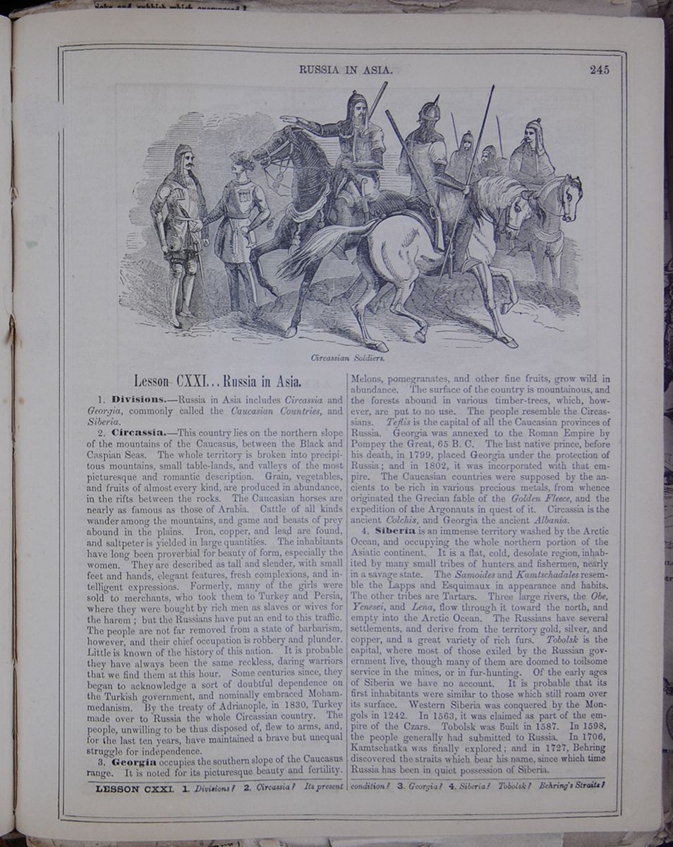 RUSSIA IN ASIA.
245
Circassian Soldiers.
RUSSIA IN ASIA.
245
Circassian Soldiers.
Lesson CXXI... Russia in Asia.
1. Divisions.—Russia in Asia includes Circassia and Georgia, commonly called the Caucasian Countries, and Siberia.
2. Circassia.—This country lies on the northern slope of the mountains of the Caucasus, between the Black and Caspian Seas. The whole territory is broken into precipitous mountains, small table-lands, and valleys of the most picturesque and romantic description. Grain, vegetables, and fruits of almost every kind, are produced in abundance, in the rifts between the rocks. The Caucasian horses are nearly as famous as those of Arabia. Cattle of all kinds wander among the mountains, and game and beasts of prey abound in the plains. Iron, copper, and lead are found, and saltpeter is yielded in large quantities. The inhabitants have long been proverbial for beauty of form, especially the women. They are described as tall and slender, with small feet and hands, elegant features, fresh complexions, and intelligent expressions. Formerly, many of the girls were sold to merchants, who took them to Turkey and Persia, where they were bought by rich men as slaves or wives for the harem; but the Russians have put an end to this traffic. The people are not far removed from a state of barbarism, however, and their chief occupation is robbery and plunder. Little is known of the history of this nation. It is probable they have always been the same reckless, daring warriors that we find them at this hour. Some centuries since, they began to acknowledge a sort of doubtful dependence on the Turkish government, and nominally embraced Mohammedanism. By the treaty of Adrianople, in 1830, Turkey made over to Russia the whole Circassian country. The people, unwilling to be thus disposed of, flew to arms, and, for the last ten years, have maintained a brave but unequal struggle for independence.
3. Georgia occupies the southern slope of the Caucasus range. It is noted for its picturesque beauty and fertility. Melons, pomegranates, and other fine fruits, grow wild in abundance. The surface of the country is mountainous, and the forests abound in various timber-trees, which, however, are put to no use. The people resemble the Circassians. Teflis is the capital of all the Caucasian provinces of Russia. Georgia was annexed to the Roman Empire by Pompey the Great, 65 B. C. The last native prince, before his death, in 1799, placed Georgia under the protection of Russia; and in 1802, it was incorporated with that empire. The Caucasian countries were supposed by the ancients to be rich in various precious metals, from whence originated the Grecian fable of the Golden Fleece, and the expedition of the Argonauts in quest of it. Circassia is the ancient Colchis, and Georgia the ancient Albania.
4. Siberia is an immense territory washed by the Arctic Ocean, and occupying the whole northern portion of the Asiatic continent. It is a flat, cold, desolate region, inhabited by many small tribes of hunters and fishermen, nearly in a savage state. The Samoides and Kamtschadales resemble the Lapps and Esquimaux in appearance and habits. The other tribes are Tartars. Three large rivers, the Obe, Yenesei, and Lena, flow through it toward the north, and empty into the Arctic Ocean. The Russians have several settlements, and derive from the territory gold, silver, and copper, and a great variety of rich furs. Tobolsk is the capital, where most of those exiled by the Russian government live, though many of them are doomed to toilsome service in the mines, or in fur-hunting. Of the early ages of Siberia we have no account. It is probable that its first inhabitants were similar to those which still roam over its surface. Western Siberia was conquered by the Mongols in 1242. In 1563, it was claimed as part of the empire of the Czars. Tobolsk was built in 1587. In 1598, the people generally had submitted to Russia. In 1706, Kamtschatka was finally explored; and in 1727, Behring discovered the straits which bear his name, since which time Russia has been in quiet possession of Siberia.
LESSON CXXI. 1. Divisions? 2. Circassia? Its present condition? 3. Georgia? 4. Siberia? Tobolsk? Behring's Straits?
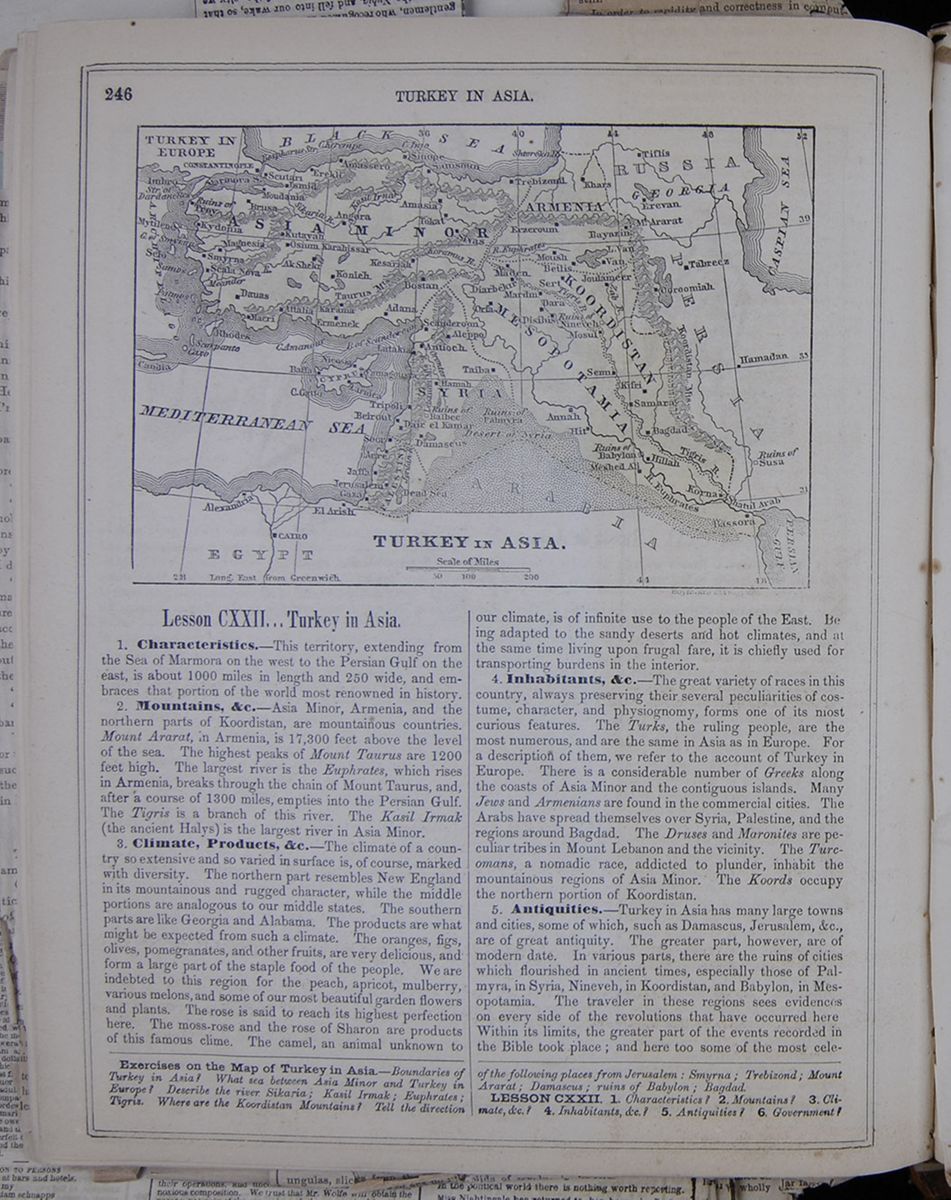 246
TURKEY IN ASIA.
Map of Turkey.
TURKEY IN ASIA.
246
TURKEY IN ASIA.
Map of Turkey.
TURKEY IN ASIA.
Lesson CXXII... Turkey in Asia.
1. Characteristics.—This territory, extending from the Sea of Marmora on the west to the Persian Gulf on the east, is about 1000 miles in length and 250 wide, and embraces that portion of the world most renowned in history.
2. Mountains, &c.—Asia Minor, Armenia, and the northern parts of Koordistan, are mountainous countries. Mount Ararat, in Armenia, is 17,300 feet above the level of the sea. The highest peaks of Mount Taurus are 1200 feet high. The largest river is the Euphrates, which rises in Armenia, breaks through the chain of Mount Taurus, and, after a course of 1300 miles, empties into the Persian Gulf. The Tigris is a branch of this river. The Kasil Irmak (the ancient Halys) is the largest river in Asia Minor.
3. Climate, Products, &c.—The climate of a country so extensive and so varied in surface is, of course, marked with diversity. The northern part resembles New England in its mountainous and rugged character, while the middle portions are analogous to our middle states. The southern parts are like Georgia and Alabama. The products are what might be expected from such a climate. The oranges, figs, olives, pomegranates, and other fruits, are very delicious, and form a large part of the staple food of the people. We are indebted to this region for the peach, apricot, mulberry, various melons, and some of our most beautiful garden flowers and plants. The rose is said to reach its highest perfection here. The moss-rose and the rose of Sharon are products of this famous clime. The camel, an animal unknown to our climate, is of infinite use to the people of the East. Being adapted to the sandy deserts and hot climates, and at the same time living upon frugal fare, it is chiefly used for transporting burdens in the interior.
4. Inhabitants, &c.—The great variety of races in this country, always preserving their several peculiarities of costume, character, and physiognomy, forms one of its most curious features. The Turks, the ruling people, are the most numerous, and are the same in Asia as in Europe. For a description of them, we refer to the account of Turkey in Europe. There is a considerable number of Greeks along the coasts of Asia Minor and the contiguous islands. Many Jews and Armenians are found in the commercial cities. The Arabs have spread themselves over Syria, Palestine, and the regions around Bagdad. The Druses and Maronites are peculiar tribes in Mount Lebanon and the vicinity. The Turcomans, a nomadic race, addicted to plunder, inhabit the mountainous regions of Asia Minor. The Koords occupy the northern portion of Koordistan.
5. Antiquities.—Turkey in Asia has many large towns and cities, some of which, such as Damascus, Jerusalem, &c. are of great antiquity. The greater part, however, are of modern date. In various parts, there are the ruins of cities which flourished in ancient times, especially those of Palmyra, in Syria, Nineveh, in Koordistan, and Babylon, in Mesopotamia. The traveler in these regions sees evidences on every side of the revolutions that have occurred here. Within its limits, the greater part of the events recorded in the Bible took place; and here too some of the most celebrated
Exercises on the Map of Turkey in Asia.—Boundaries of Turkey in Asia? What sea between Asia Minor and Turkey in Europe? Describe the river Sikaria; Kasil Irmak; Euphrates; Tigris. Where are the Koordistan Mountains? Tell the direction of the following places from Jerusalem; Smyrna; Tebizond; Mount Ararat; Damascus; ruins of Babylon; Bagdad
LESSON CXXII. 1. Characteristics? 2. Mountains? 3. Climate, &c.? 4. Inhabitants, &c.? 5. Antiquities? 6. Government?
 [begin surface 922]
 [begin surface 923]
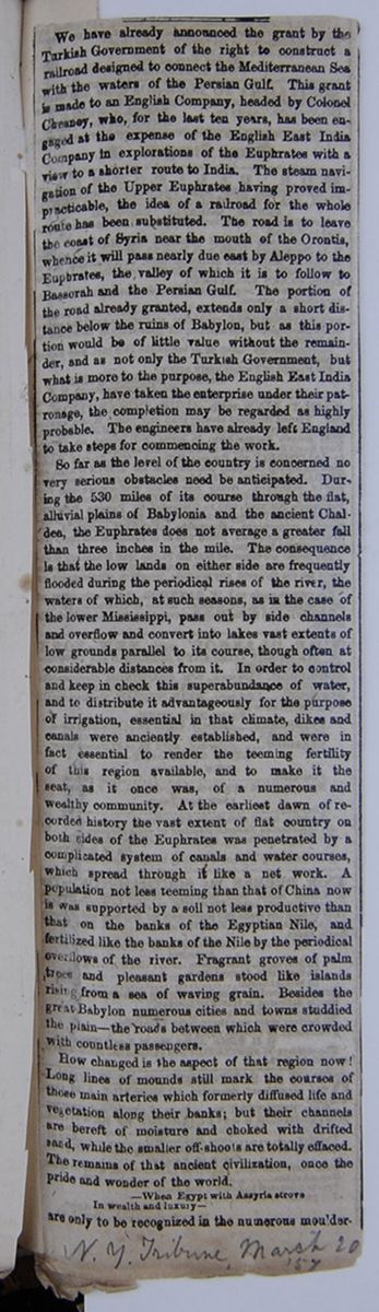
We have already announced the grant by the Turkish Government of the right to construct a railroad designed to connect the Mediterranean Sea with the waters of the Persian Gulf. This grant is made to an English company, headed by Colonel Cheaney, who, for the last ten years, has been engaged at the expense of the English East India Company in explorations of the Euphrates with a view to a shorter route to India. The steam navigation of the Upper Euphrates having proved impracticable, the idea of a railroad for the whole route has been substituted. The road is to leave the coast of Syria near the mouth of the Orontis, whence it will pass nearly due east by Aleppo to the Euphrates, the valley of which it is to follow to Bassorah and the Persian Gulf. The portion of the road already granted extends only a short distance below the ruins of Babylon, but as this portion would be of little value without the remainder, and as not only the Turkish Government, but what is more to the purpose, the English East India Company, have taken the enterprise under the patronage, the completion may be regarded as highly probable. The engineers have already left England to take steps for commencing the work.
So far as the level of the country is concerned no very serious obstacles need be anticipated. During the 530 miles of its course through the flat, alluvial plains of Babylonia and the ancient Chaldea, the Euphrates does not average a greater fall than three inches in the mile. The consequence is that the low lands on either side are frequently flooded during the periodical rises of the river, the waters of which, at such seasons, as in the case of the lower Mississippi, pass out by side channels and overflow and convert into lakes vast extents of low grounds parallel to its course, though often at considerable distances form it. In order to control and keep in check this superabundance of water, and to distribute it advantageously for the purpose of irrigation, essential in that climate, dikes and canals were anciently established, and were in fact essential to render the teeming fertility of this region available, and to make it the sea, as it once was, of a numerous and wealthy community. At the earliest dawn of recorded history the vast extent of flat country on both sides of the Euphrates was penetrated by a complicated system of canals and water courses which spread through it like a net work. A population not less teeming than that of China now is was supported by a soil not less productive than that on the banks of the Egyptian Nile, and fertilized like the banks of the Nile by the periodical overflows of the river. Fragrant groves of palm trees and pleasant gardens stood like islands rising from a sea of waving grain. Besides the great Babylon numerous cities and towns studdied the plain—the roads between which were crowded with countless passengers.
How changed is the aspect of that region now! Long lines of mounds still mark the courses of those main arteries which formerly diffused life and vegetation along their banks; but their channels are bereft of moisture and choked with drifted sand, while the smaller off-shoots are totally effaced. The remains of that ancient civilization, once the pride and wonder of the world. —When Egypt with Assyria strove In wealth and luxury— are only to be recognized in the numerous mouldering
[begin surface 924] [begin surface 925]
heaps of bricks and rubbish which overspread the surface of the plain, and buried for the most [illegible]in heaps of drifting sand. Instead of the luxuriant fields, groves and gardens, nothing now meets the eye but an arid waste. Instead of the hum of many voices, and the sound of active industry, silence reigns profound, except where a few passing travelers or roving Arabs flit across the scene, or the roar of the lion disturbs the night.
The insecurity of property under the Turkish rule, as exercised for centuries, has tended from year to year still further to depopulate this country, of which the only remaining inhabitants are a few miserable Arabs, partly shepherds and partly cultivators, whom, in spite of the vivacity and activity natural to them, the oppression and exactions of their Turkish masters have sunk into lassitude, indolence and beggary. They live in frail dwellings of reads, or in tents, which at the time of the inundations are often swept away by the rising floods. Upon a few elevated spots small mud forts serve as citadels for refuge, in case of inundation or attack, while the rice-fields are protected from complete overflow by dams constructed of stakes and reed-matting. The only power they possess of resisting injustice is that of flooding their fields; but this is only temporary, as they and their families cannot subsist without cultivation.
It is in that part of the course of the Euphrates, below the termination of the section of railroad already granted, viz., from about 32 degrees of north latitude to its mouth, that these overflows and their consequences are most formidable. During the Spring and Summer the greater part of the country is a continuous marsh, quite impassable except by canoes, by means of which the natives keep up in a communication between the elevated spots that rise like islands above the inundation. In Autumn these inundations subside, but the resultant malaria is such as to make it exceedingly dangerous for strangers to enter the country. The only season of the year in which this region is free from water and fever is the Winter; but then other obstacles are to be encountered. The great alternations of temperature to which this region is subject are scarcely credible. No sooner does the ardent heat of the Autumn abate than cold breezes begin to blow from the north; and as the soil of the marshes, a comparatively recent deposit from the retiring waters of the Persian Gulf, is strongly impregnated with [covered]arine salts, the wind in its passage across them [covered] rendered intensely cold. Traversing those places [covered] the Winter is complained of by a recent traveler [covered] like being shut up in a refrigerator, and worse, so [covered] as suffering from cold is concerned, than that [covered]ssage of the Alps or the Taurus. Nor is this [covered] only difficulty. A very large portion of the [covered]ntry, which a few months previously was cov[covered]d with inundation, is now waterless, sometimes [covered]an extent of two or three days' journey. The [covered] tribes are perfectly wild, and, being migratory [covered]eir habits, little under control.
[covered]ch is the present condition of the valley of the [covered]rates—not holding out much promise, one [covered]d say, for a paying railroad. Yet there is no [covered]cal reason why it should not be as productive [covered]s thickly inhabited as in ancient times. A [covered]care and labor bestowed on the ancient canals [covered] again restore its fertility. It would require [covered]mense expenditure to clear the channels of [covered]ose sands which have accumulated in them, [covered] render them navigable for the shallow ves[covered] the country. Let but the Turkish Govern[covered]ive security to property, and substitute a [covered]le payment instead of the endless exactions [covered]cers, and European capi[covered]
[begin surface 926]
warriors of antiquity performed their achievements. Here Semiramis and Cyrus, Abraham and Melchisedec, David and Solomon, lived and died. Here Christ was born, and here he was crucified. Here the apostles began to spread the gospel; and here Cambyses, Darius, Alexander, Pompey, Tamerlane, and Saladin, marched at the head of their armies.
6. Government, &c.—Turkey in Asia is subject to the Sultan of Constantinople, and forms the most extensive portion of his dominions. The present political divisions are as follows:— This table lists the political divisions of Asia Minor, the major cities of each area and the population of these cities. We shall now proceed to describe the several portions of this interesting territory, according to the following arrangement, which coincides with history and popular geography:
- ASIA MINOR, or ANATOLIA
- ARMENIA—a part only of ancient Armenia.
- SYRIA—including ancient Syria, Phœnicia, and Palestine.
- MESOPOTAMIA—the ancient Babylonia and Chaldea.
- KOORDISTAN—the ancient Assyria.
7. Asia Minor—called Anatolia, and sometimes the Levant, is a peninsula forming the western extremity of Asia. Its length is about 500 miles; its width, 260; its extent, 100,000 square miles. In the north, along the Black Sea, the climate is cold. In the south, it resembles that of Georgia, the country producing corn, wine, oil, honey, coffee, myrrh, figs, oranges, &c. The soil is various; some parts being barren, and others exceedingly fertile. The southern range of mountains is called Taurus, and the northern, Anti-Taurus. There are numerous lakes, some of which are fresh, and some salt. Among the mineral treasures are gold, copper, and lead. At this day there are few roads in the country, and the interior is but little known. Its present population is supposed to be 4,000,000 or 5,000,000. In early ages, Asia Minor appears to have been occupied by various tribes. In the year 450 B. C., no less than thirty distinct nations were embraced within its territory. It appears that the Greeks made settlements here at a very early date. About the year 1190 B. C., the several states of Greece combined to make war upon the Trojans, whose chief city, Troy, lay at the western extremity of Asia Minor. After a siege of ten years, the city was taken and razed to the ground, most of the inhabitants being slain. The event is celebrated in Homer's famous poem of the Iliad. Mysia, a celebrated division of Asia Minor, lay at its western extremity. Here was Troy, which we have already noticed; and at a later date, Pergamos and Thyatira, mentioned by the Evangelist. Ionia was a small peninsula, within the boundaries of Lydia. The people were Greeks; and at one time it contained twelve cities, the inhabitants of which were celebrated for their commerce, arts, and refinement. Lydia, under Crœsus, became a powerful kingdom, 550 B. C. He conquered a great part of Asia Minor, and even entered into
Give the principal divisions of Turkey in Asia. 7. Asia Minor? Products. &c. Its present state? Trojan war? Mysia? Ionia?
[begin surface 928]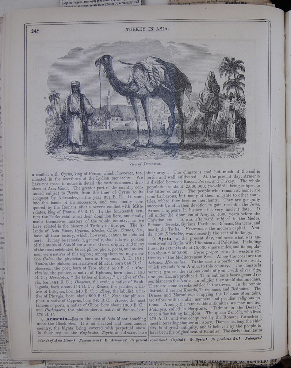 248
TURKEY IN ASIA.
View of Damascus.
248
TURKEY IN ASIA.
View of Damascus.
a conflict with Cyrus, king of Persia, which, however, terminated in the overthrow of the Lydian monarchy. We have not space to notice in detail the various ancient divisions of Asia Minor. The greater part of the country continued subject to Persia, from the time of Cyrus to its conquest by Alexander, in the year 331 B. C. It came into the hands of his successors, and was finally conquered by the Romans, after a severe conflict with Mithridates, king of Pontus, 63 B. C. In the fourteenth century the Turks established their dominion here, and finally made themselves masters of the whole country, as we have related in the history of Turkey in Europe. The islands of Asia Minor, Cyprus, Rhodes, Chios, Samos, &c, have all their history, which, however, cannot be detailed here. It may be remarked, generally, that a large portion of the states of Asia Minor were of Greek origin; and many of the most celebrated Greek philosophers, poets, and statesmen were natives of this region; among them we may mention Galen, the physician, born at Pergamos, A. D. 131; Thales, the philosopher, a native of Miletus, born 646 B. C.; Anacreon, the poet, born at Teos, about 550 B. C.; Parrhasius, the painter, a native of Ephesus, born about 450 B. C.; Herodotus, "the father of history," a native of Caria, born 484 B. C.; Diogenes, the cynic, a native of Paphlagonia, born about 414 B. C.; Zeuxis, the painter, a native of Bithynia, born 540 B. C.; Æsop, the fabulist, a native of Phrygia, born about 600 B. C.; Zeno, the philosopher, a native of Cyprus, born 346 B. C.; Homer, the most famous of poets, a native of Chios, born about 1000 B. C.; and Pythagoras, the philosopher, a native of Samos, born 570 B. C.
8. Armenia—lies to the east of Asia Minor, touching upon the Black Sea. It is an elevated and mountainous country, the hights being covered with perpetual snow. In these regions, the Euphrates, Tigris, and Araxes, have their origin. The climate is cool, but much of the soil is fertile and well cultivated. At the present day, Armenia is divided between Russia, Persia, and Turkey. The whole population is about 2,000,000, two-thirds being subject to the latter country. The people who remain at home, are semi-barbarous, but many of them migrate to other countries, where they become merchants. They are generally successful, and in their devotion to gain, resemble the Jews. Armenia appears in history at a very ancient date. It fell under the dominion of Assyria, 1000 years before the Christian era. It was afterward subject to the Medes, Persians, Greeks, Syrians, Parthians, Romans, Saracens, and finally the Turks. Erzeroum is the modern capital. Amida, now Diarbekir, was anciently the seat of its kings.
9. Syria—at the present day, embraces what was anciently called Syria, with Phœnicia and Palestine. Including these, its extent is about 70,000 square miles, and its population about 2,000,000. Syria proper lies at the western extremity of the Mediterranean Sea. Along the coast are the Lebanon Mountains. To the west is a portion of the desert, which extends from Arabia to this country. The climate is warm; grapes, the various kinds of grain, with olives, figs, oranges, &c., are produced. The inhabitants bear a general resemblance to the Arabs. In religion they are Mohammedans. There are some Greeks settled in the towns. In the remote districts, there are Koords, Turcomans, and Bedouins. The Druses and Maronites, occupying the Lebanon Mountains, are tribes with peculiar manners and peculiar religious notions. Among the remarkable antiquities, we may mention Palmyra, called in Scripture, "Tadmor in the Desert," once a flourishing kingdom. The queen Zenobia, who lived 272 A. D., and was conquered by the Romans, furnishes a most interesting chapter in history. Damascus, long the chief city, is of great antiquity, and is believed by the people to have been the original seat of Paradise. The early inhabitants
Islands of Asia Minor? Famous men? 8. Armenia? Its present condition? Capital? 9. Syria? Its products, &c.? Palmyra?
SECT. CXXXV.—REMARKS ON JERUSALEM.
1 JERUSALEM is a considerable place. 2 The most beautiful building within its wall is the Mosque of Omar; which stands on the site of Solomon's temple. The Turks have a singular 3 reverence for this Mosque´; and will not permit a Christian even to set his foot in the large grassy area which surrounds it.
4 The walks which I most frequent are those that lead down the valley of Jehoshaphat, by the fountains of Siloah; 5 or those that run along the side of Olivet. From the side of Olivet you have a very commanding view of Jerusalem. 6 The Mosque of Omar appears particularly fine from this 7 situation. The greater part of the surrounding country is most desolate and dreary. Hills of white parched rock, dotted, here and there, with patches of cultivated land, everywhere meet and offend the eye.
9 In the north of Palestine are many beautiful and fertile 10 spots; but not so in Judea. The breath of Jehovah's wrath seems in a peculiar manner to have blasted and withered the 11 territory of the Daughter of Zion! What change has been wrought in the land, once flowing with milk and honey!
[begin surface 931]
The Narrative of the United State Expedition to the River Jordan and the Dead Sea. By Lieut. W. S. LYNCH, U. S. N.—Philadelphia: Lea & Blanchard.
THE publication of this work has been looked for with so much interest, that we expect to gratify many readers by giving it an extended notice. Indeed, the intrinsic merits of the work claim for it more than ordinary attention and examination. The scene of exploration is hallowed by historic associations, and possesses other and peculiar features of interest. The river Jordan and the Dead Sea—the one made sacred by the presence of Deity incarnate, and the other terrible by the manifestation of divine wrath—must be regarded with deep emotion wherever the records of those wonderful events are read and accredited: and it is quite natural that every intelligent Christian and philanthropist should await with eager curiosity a narrative of personal observation of the present appearance of those interesting localities. Such a one will be glad of the assurance that in Lieut. Lynch's book he will find a succinct, direct, pleasing account of those scenes which, under shelter of our national flag, he successfully explored.
The volume is a handsome octavo of five hundred pages, embellished with about thirty engravings and two outline or sketch maps; one of the course of the Jordan, and the other of the Dead Sea. The drawings for all the engravings were made upon the spot, by two members of the expedition, Lieut. Dale and Passed-Midshipman Aulick, the former of whom unfortunately did not live to see the full fruit and proud result of the expedition. He died near Beirut, prostrated by sickness and the exhaustion consequent upon the toils of the journey, when the party were passing from the ruins of the Baalbec to the sea-coast.
The expedition, it is generally known, sailed from New York in
the storeship Supply, Lieut. Lynch commanding, in November,
1847; reached the Mediterranean in the following month, arrived
at Smyrna in February, and almost immediately embarked in an
Austrian steamer for Constantinople, the slave market and other
peculiarities of which city the author very fully and pleasantly
describes. Lieut. Lynch's style is altogether agreeable. It has
an imaginative glow and a high poetic tinge, without verboseness
or exaggeration—faults which too commonly accompany those
qualities. Some of the descriptions of scenes and incidents at
sea are exceedingly beautiful, and minister to a healthy mental
excitement. From Constantinople they passed to the coast of
[begin surface 932] 158
U. S. EXPEDITION TO THE RIVER
JORDAN AND THE DEAD SEA. Syria, and disembarked the
expedition at Haifa, not far from St. Jean d'Acre; thence they
conveyed their boats overland, having them drawn by camels to
Tiberias, on the Sea of Galilee, whence they again embarked,
descending the Jordan to the Dead Sea.
158
U. S. EXPEDITION TO THE RIVER
JORDAN AND THE DEAD SEA. Syria, and disembarked the
expedition at Haifa, not far from St. Jean d'Acre; thence they
conveyed their boats overland, having them drawn by camels to
Tiberias, on the Sea of Galilee, whence they again embarked,
descending the Jordan to the Dead Sea.
The narrative of their entrance upon this part of the expedition commences at the eighth chapter of the book, and from this point the reader, to speak nautically, may take a fresh "departure." Hitherto the scenes through which the expedition's party passed were not strictly new; though incidents occurred with sufficient frequency to give novelty and freshness to the narration. Now, the enterprising travellers approach the main design of the expedition. They begin to meet with wandering Arabs, and have other indications of the perils and toils of the journey. Now, too, the reader begins to find in Lieut. Lynch's journal reference to localities and rivers and scenes mentioned in Sacred Writ—the hills of Gilead, the river Jabok, the land of the Ammonites, the spot where Jacob wrestled with the angel—and a thousand interesting associations and memories crowd upon the mind. Finally, the author having encountered difficulties in the navigation of the Jordan which he did not anticipate, and which were only overcome by the most vigorous and persevering exertions, he reached the borders of the Dead Sea. We shall now let the adventurous traveller speak for himself. Under date of April 18, 1848, after describing the bathing of the pilgrims in the Jordan, he says:—
At 3 25, passed by the extreme western point, where the river is 180 yards wide and three feet deep, and entered upon the Dead Sea; the water, a nauseous compound of bitters and salts.
The river, where it enters the sea, is inclined towards the eastern shore, very much as is represented on the map of Messrs. Robinson and Smith, which is the most exact of any we have seen. There is a considerable bay between the river and the mountains of Belka, in Ammon, on the eastern shore of the sea.
A fresh north-west wind was blowing as we rounded the point. We endeavored to steer a little to the north of west, to make a true west course, and threw the patent log overboard to measure the distance; but the wind rose so rapidly that the boats could not keep head to wind, and we were obliged to haul the log in. The sea continued to rise with the increasing wind, which gradually freshened to a gale, and presented an agitated surface of foaming brine; the spray, evaporating as it fell, left incrustations of salt upon our clothes, our hands and faces; and while it conveyed a prickly sensation wherever it touched the skin, was, above all, exceedingly painful to the eyes. The boats, heavily laden, struggled sluggishly at first; but when the wind freshened in its fierceness, from the density of the water it seemed as if their bows were encountering the sledge-hammers of the Titans, instead of the opposing waves of an angry sea.
At 3 50, passed a piece of drift-wood, and soon after saw three swallows and a gull. At 4 55, the wind blew so fiercely that the boats could make no headway, not even the Fanny Skinner, which was nearer to the weather shore, and we drifted rapidly to leeward; threw over some of the fresh water to lighten the Fanny Mason, which labored very much, and I began to fear that both boats would founder.
At 5 40, finding that we were losing every moment, and that with the lapse of each succeeding one the danger increased, kept away for the northern shore, in the hope of being yet able to reach it; our arms, our clothes and skins coated with a greasy salt; and our eyes, lips and nostrils smarting excessively. How different was the scene before the submerging of the plain, which was "even as the garden of the Lord!"
At times it seemed as if the Dread Almighty frowned upon our efforts to navigate a sea, the creation of his wrath. There is a tradition among the Arabs that no one can venture upon this sea and live. Repeatedly the fates of Costigan and Molyneau had been cited to deter us. The first one spent a few days, the last about twenty hours, and returned to the place from whence he had embarked without landing upon its shores. One was found dying upon the shore; the other expired in November last, immediately after his return, of fever contracted upon its waters.
But, although the sea had assumed a threatening aspect, and the fretted mountains, sharp and icinerated, loomed terrific on either side, and salt and ashes mingled with its sands, and fœtid sulphurous springs trickled down its ravines, we did not despair. Awestruck, but not terrified; fearing the worst, yet hoping for the best, we prepared to spend a dreary night upon the dreariest waste we had ever seen.
At 5 58, the wind suddenly abated, and with it the sea as rapidly fell; the water, from its ponderous quality, settling as soon as the agitating cause had ceased. Within twenty minutes from the time we bore away from a sea which threatened to engulf us, we were pulling away, at a rapid rate, over a placid sheet of water, that scarcely rippled beneath us; and a rain-cloud, which had enveloped the sterile mountains of the Arabian shore, lifted up, and left their rugged outlines basking in the light of the setting sun. At 6 10, a flock of gulls flew over, while we were passing a small island of mud, a pistol shot distant from the northern shore, and half a mile west of the river's mouth. At 6 20, a light wind sprang up from S. E., and huge clouds drifted over, their western edges gorgeous with light, while the great masses were dark and threatening. The sun went down, leaving beautiful islands of rose-colored clouds over the coast of Judea; but above the yet more sterile mountains of Moab all was gloomy and obscure.
The northern shore is an extensive mud flat, with a sandy
plain beyond, and is the very type of desolation; branches
and trunks of trees lay scattered in every direction; some
charred and blackened as by fire; others white with an
incrustation of salt. These were collected at high water
mark, designating the line which the water had reached prior
to our arrival. On the deep sands of this shore was laid the
scene of the combat between the Knight of the Leopard and
Ilderim the Saracen. The north-western shore is an unmixed
bed of gravel, coming in a gradual slope from the mountains
to the sea. The eastern coast is a rugged line of mountains,
bare of all vegetation—a continuation of the Hauran
range, coming from the north, and extending south beyond the
scope of vision, throwing out three marked and seemingly
equi-distant promontories from its southeastern extremities.
At 6 25, passed a gravelly point, with many large stones
upon it. It is a peninsula, connected with
[begin surface 933] U. S. EXPEDITION TO THE RIVER
JORDAN AND THE DEAD SEA.
159
the main by a
low, narrow isthmus. When the latter is overflowed, the
peninsula must present the appearance of an island, and is
doubtless the one to which Stephens, Warburton and Dr.
Wilson allude.
U. S. EXPEDITION TO THE RIVER
JORDAN AND THE DEAD SEA.
159
the main by a
low, narrow isthmus. When the latter is overflowed, the
peninsula must present the appearance of an island, and is
doubtless the one to which Stephens, Warburton and Dr.
Wilson allude.
We were, for some time, apprehensive of missing the place of rendezvous; for the Sheikh of Huteim, never having been afloat before, and scarce recovered from his fright during the gale, was bewildered in his mind, and perfectly useless as a guide. The moon had not risen; and in the starlight, obscured by the shadow of the mountains, we pulled along the shore in some anxiety. At one moment we saw the gleam of a fire upon the beach, to the southward; and, firing a gun, made for it with all expedition. In a short time it disappeared; and while resting on the oars, waiting for some signal to direct us, there were the flashes and reports of guns and sounds of voices upon the cliffs, followed by other flashes and reports far back upon the shore which we had passed. Divided between apprehensions of an attack upon our friends and a stratagem for ourselves, we were uncertain where to land. Determined, however, to ascertain, we closed in with the shore, and pulled along the beach, sounding as we proceeded.
A little before 8 P. M. we came up with our friends, who had stopped at Ain el Feshka, fountain of the stride.
The shouts and signals we had heard had been from the scouts and caravan, which had been separated from each other, making mutual signals of recognition. They had likewise responded to ours, which, coming from two points some distance apart, for a time disconcerted us. It was a wild scene upon an unknown and desolate course—the mysterious sea, the shadowy mountains, the human voices among the cliffs, the vivid flashes and the loud reports reverberating along the shore.
Unable to land near the fountain, we were compelled to haul the boats upon the beach, about a mile below; and, placing some Arabs to guard them, took the men to the camp, pitched in a cane-brake beside a brackish spring, where, from necessity, we made a frugal supper, and then, wet and weary, threw ourselves upon a bed of dust, beside a fœtid marsh—the dark, fretted mountains behind—the sea, like a huge caldron, before us—its surface shrouded in a lead-colored mist.
Toward midnight, while the moon was rising above the eastern mountains, and the shadows of the clouds were reflected wild and fantastically upon the surface of the sombre sea; and everything, the mountains, the sea, the clouds, seemed spectre-like and unnatural, the sound of the convent bell of Mar Saba struck gratefully upon the ear; for it was the Christian call to prayer, and told of human wants and human sympathies to the wayfarers on the borders of the Sea of Death.
On his return Lieut. Lynch "went up to Jerusalem," crossed the country to Baalbec, and embarked at Beirut. The work concludes with an account of the death of Lieut. Dale, already referred to, and a brief mention of the places touched at on the homeward passage. Early in December of 1848 the toil-worn but successful party "were greeted with the heart-cheering sight of their native land," their commander having conducted them safely through novel dangers and toils. The record he has given of the scenes through which they passed will be eagerly perused by his countrymen, and will be a lasting memorial of a great national enterprise skilfully consummated.
A noble volume of 500 beautifully printed pages is this, adorned with several excellent maps and well-drawn and well-executed engravings. Lieut. Lynch has evidently put his whole soul into his book, as in time past he put his whole soul into the "expedition," and finally obtained success, after a long course of delays, difficulties, hardships and dangers. Lieut. Lynch has evidently "done his possible" for his volume; and if one looks to the matter only—to what some people, doubtless, would call the only essential—the reader will be pleasantly satisfied. The volume is interesting and instructive, and its author would seem to have been well fitted for his command, in respect both to officer-like and scholar-like qualities. There is a vast deal of learning scattered through the volume—old legends, historical allusions, and poetical quotations—which, if not picked out of the "handy" chambers of the brain, it must have been terribly hard work to gather together. But with the matter of the work we have no quarrel, and only refer to the learning sown upon it, to show that Lieut. Lynch has really "laid himself out," to use a common expression, in dressing up the record of his voyages and travels to the sea of Sodom and Gomorrah.
But with the style of the composition there is some fault to find, for it is both grandiloquent and bombastic. The first fifty pages contain many funny specimens of what is ironically termed "fine writing;" and sorry were we to see them thus emanate from one of genuine ability, large information and abundant knowledge of all parts of his profession. They show bad taste, or, as foreigners are pleased to call it, American taste, in writing, and we regret that such stuff should be seen in what may be called a national work, inasmuch as it is the record of an expedition undertaken by order of government. An insane desire to use long words and to invest the most common occurrences with adjectives and pomposity, seems to be Lieut. Lynch's trouble throughout what may be termed the introduction to the work. After getting fairly started for the Jordan, his "ohs and ahs," and descriptions, are simply trite and verdant. But before giving a few proofs of the correctness of our assertions, we must copy the following specimens of grammar. On page 49 our author says, "With their feet drawn beneath them, they were squatted, like tailors (those who have them) upon rugs, with their baggage piled around them," &c., &c.—This is the exact printing in the volume, but what the sentence means is matter for dispute.
On page 19, the two metallic boats taken by the expedition are thus described: "The boats 'Fanny Mason' and 'Fanny Skinner,' of nearly equal dimensions, were named after two young and blooming children, whose hearts are as spotless as their parentage is pure. Their prayers, like
[begin surface 934] 160
U. S. EXPEDITION TO THE RIVER JORDAN
AND THE DEAD SEA.
160
U. S. EXPEDITION TO THE RIVER JORDAN
AND THE DEAD SEA.
guardian spirits, would shield us in the hour of peril; and I trusted that, whether threading the rapids of the Jordan or floating on the wondrous sea of death, the 'Two Fannies' would not disgrace the gentle and artless beings whose names they proudly bore."
The above was well meant, we suppose, but it sounds to us fudge-like.
"A maddened street, instinct with desperation," as applied to the ocean—"the multitudinous waters infringing against the western continent," in describing the course of the Gulf Stream—accelerated by the current half a mile an hour"—"the sea exhibiting in magnificent confusion its toppling waves"—"whales, blowing volumes of water from their capacious nostrils," and "a distinct and prohibitory line of foam"—are expressions found among others not quite so tremendous, on pages 19, 20 and 21.
On page 23, Lieut. Lynch describes the departure of his vessel from Gibraltar for Port Mahon, one of the officers having fallen sick with the small-pox:—
"The sick man knew, however, that before it could be reached, he must pass the ordeal. His feelings can be better imagined than described. Prostrate with a disease as malignant as it is loathsome; with a body inflamed and swollen, and a mind so racked with fever, that reason, from time to time, fairly tottered on her throne; he must naturally have longed to exchange his hard and narrow berth and the stifling atmosphere of a ship, soon to be tossed about, the sport of the elements, for a softer and more spacious couch, a more airy apartment, and, above all, the quiet and the better attendance of the shore."
We agree with Lieut. Lynch that the sick officer "must naturally have longed," &c., &c. But we also think that the above is one of the clearest examples of bathos, common-place and downright twattle extant.
But it is useless to cite more instances of the defects to which we have alluded. They exist throughout this long work in any quantity, but not in the average of grossness, perhaps, of the above quotations. And yet, as before remarked, the book is really interesting and instructive, and is really and obviously the work of an able, well educated and enlightened man. How such silly defects of style should coëxist with the more essential merits of the text is almost unintelligible; and, indeed, were we upon oath for our opinion at this moment, we should say that one man must have written the twattle, the triteness, the bad grammar and the bad taste, while another furnished the learning and narrated the facts.
IN this volume, Lieut. Lynch presents a graphic and lively description of his adventures, as chief of the expedition appointed by the United States government to explore the Dead Sea, and trace the river Jordan to its source. This was a commission involving great difficulties and danger; perhaps more than were warranted by its anticipated results for the benefit of science; and, hitherto, the curiosity and zeal which have prompted a few bold spirits to similar researches, have been exercised at a sacrifice out of proportion to their value. Lieut. Lynch engaged in the enterprise with a distinct perception of its perils and cost; but, inspired by a genuine enthusiasm for its objects, he devoted himself to its accomplishment with an energy and perseverance that have overcome every obstacle, and enabled him to attain a degree of success of which no previous traveller in the same regions can boast.
He sailed from New York in November, 1847, arrived at Constantinople in the ensuing February, and, after obtaining the protection of the Sultan for his journeyings through the Turkish dominions in Syria, came to the Sea of Galilee in April. The passage down the Jordan was attended with the greatest peril, and a less determined spirit would have shrunk back in dismay. The progress of the light metallic boats, which had been constructed expressly for the expedition, was frequently retarded by rapids, cataracts and whirlpools in the river; at the most dangerous falls, the channel had to be opened by removing large stones; and it was only by dint of incredible exertions by the whole party, that the difficult voyage was at last accomplished.
Our course down the stream was with varied rapidity. At times we were going at the rate of from three to four knots the hour, and again we would be swept and hurried away, dashing and whirling onward with the furious speed of a torrent. At such moments there was excitement, for we knew not but that the next turn of the stream would plunge us down some fearful cataract, or dash us on the sharp rocks that might lurk beneath the surface. For the reasons I have before stated, the Fanny Mason always took the lead, and warned the Fanny Skinner when danger was to be shunned or encountered. When the sound of a rapid was distinct and near, the compass and the note-book were abandoned, and, motioning to the Fanny Skinner to check her speed, our oars began to move like the antennae of some giant insect, to sweep us into the swiftest, which is ever the deepest, part of the current; when it caught us, the boat's crew and our Arab friend Jumach leaped into the angry stream, accoutred as they were, and clinging to her sides, assisted in guiding the graceful Fanny down the perilous descent. In this manner she was whirled on, driving between rocks and shallows with a force that made her bend and quiver like a rush in a running stream; then, shooting her through the foam and the turmoil of the basin below, where, in the seething and effervescing water, she spun and twirled, the men leaped in, and with oars and rudder, she was brought to an eddying cove, whence, by word and gesture, she directed her sister Fanny through the channel.
The great depression between the Sea of Galilee and the Dead Sea
is caused by the singularly tortuous course of the river Jordan.
In a space of 60 miles of latitude and 4 or 5 of longitude, it
traverses the distance of at least 200 miles. Not less than 27
dangerous rapids were encountered
[begin surface 935] U. S. EXPEDITION TO THE RIVER JORDAN
AND THE DEAD SEA.
161
by Lieut. Lynch and his party, besides a great number of less
consequence. The sinuous course of the Jordan is not exceeded
even by that of the Mississippi. On approaching the Dead Sea,
they perceived nauseous smells, which proceeded from small
streams on each side of the Jordan; birds were seen on the
wing—pigeons, a heron, bulbul, snipe, and many wild ducks;
the river was 70 yards wide; the left bank very low, covered
with tamarisk, willow, and cane; the right bank 15 to 18 feet
high, red clay, with weeds and shrubs, the mal a insana, spina
Christi, and some of the agnus castus, a few tamarisk at the
water's edge. When it enters the sea, the Jordan is 180 yards
wide and three feet deep, and inclined toward the eastern shore.
It is represented with great exactness on the map of Messrs.
Robinson and Smith, which, according to Lieut. Lynch, is
superior to any others.
U. S. EXPEDITION TO THE RIVER JORDAN
AND THE DEAD SEA.
161
by Lieut. Lynch and his party, besides a great number of less
consequence. The sinuous course of the Jordan is not exceeded
even by that of the Mississippi. On approaching the Dead Sea,
they perceived nauseous smells, which proceeded from small
streams on each side of the Jordan; birds were seen on the
wing—pigeons, a heron, bulbul, snipe, and many wild ducks;
the river was 70 yards wide; the left bank very low, covered
with tamarisk, willow, and cane; the right bank 15 to 18 feet
high, red clay, with weeds and shrubs, the mal a insana, spina
Christi, and some of the agnus castus, a few tamarisk at the
water's edge. When it enters the sea, the Jordan is 180 yards
wide and three feet deep, and inclined toward the eastern shore.
It is represented with great exactness on the map of Messrs.
Robinson and Smith, which, according to Lieut. Lynch, is
superior to any others.
The party found great difficulty in making the entrance. A fresh north-west wind was blowing as they rounded the extreme western point; they endeavored to make a true west course; but the wind rose so rapidly that the boats could not keep head to the wind. The sea rose with the breeze, which increased to a gale, and presented a rough surface of foaming brine; the spray evaporated as it fell, and incrusted the clothes, hands and faces with salt, producing a prickly sensation wherever it touched the skin, and causing a severe pain to the eyes. The boats struggled sluggishly at first, but as the wind grew fiercer, it seemed, says Lieut. Lynch, "as if their bows were encountering the sledge-hammers of the Titans, instead of the opposing waves of an angry sea."
At length, finding that we were losing every moment, and that with the lapse of each succeeding one, the danger increased, we kept away for the northern shore, in the hope of being able yet to reach it; our arms, our clothes and skins coated with a greasy salt; and our eyes, lips and nostrils smarting excessively. How different was the scene before the submerging of the plain, which was "even as the garden of the Lord!" At times, it seemed as if the Dread Almighty frowned upon our efforts to navigate a sea, the creation of his wrath. There is a tradition among the Arabs that no one can venture upon this sea and live. Repeatedly the fates of Costigan and Molyneaux, had been cited to deter us. The first one spent a few days, the last about twenty hours, and returned to the place whence he had embarked, without landing upon its shores. One was found dying upon the shore; the other expired in November last, immediately after his return, of fever contracted upon its waters. But—although the sea had assumed a threatening aspect, and the fretted mountains, sharp and incinerated, loomed terrific on either side, and salt and ashes, mingled with its sands, and fetid, sulphurous streams, trickled down its ravines—we did not despair; awestruck, but not terrified—fearing the worst, yet hoping for the best—we prepared to spend a dreary night upon the dreariest waste we had ever seen.
In less than half an hour, however, the wind abated instantaneously; the sea fell as rapidly as it had risen; and instead of bearing away from a sea which threatened to engulf them, the party were gliding at a rapid rate over a placid sheet of water, that scarcely rippled beneath them; and a rain cloud, which had enveloped the sterile mountains of the Arabian shore, lifted up, and left their rugged outlines basking in the light of the setting sun.
The next day they made an excursion along the base of the mountain, where they gathered specimens of conglomerate and some fresh-water shells in the bed of the stream. The shore was covered with small angular fragments of flint, but there were no round stones or pebbles on it. Two partridges of a beautiful stone color were started up, so much like the rocks that they could only be distinguished when in motion. They heard the notes of a solitary bird in a cane-brake, which they could not identify. This disproves the common opinion, that nothing can live on the shores of the Dead Sea. For though, as Lieut. Lynch observes, "the home and the usual haunt of the partridge may be among the cliffs above, the smaller bird they heard must have his nest in the thicket."
The scene was one of unmingled desolation. The air, tainted with the vapors of the stream, gave a tawny hue even to the foliage of the cane, which is elsewhere of so light a green. Except the cane-brakes, there was no vegetation; barren mountains, fragments of rocks, blackened by sulphur, and an unnatural sea, with low, dead trees on its margin, bore a sad and sombre aspect.
As they approached the southern extremity of the sea, they came in sight of the salt mountain of Usdum; the beach was bordered with innumerable dead locusts; there was also bitumen in occasional lumps, and incrustations of salt and lime. The bitumen presented a bright smooth surface when fractured, and looked like a consolidated fluid. Near a ravine, on an eminence, they discovered the ruins of a building, with square cut stones—the foundation walls alone remaining, and a line of low wall running down to the ravine; near it was a rude canal. There were many remains of terraces. Here Costigan thought that he had found the ruins of Gomorrah. Sounding cautiously along the coast, they passed the extreme point of Usdum, which is a broad, flat, marshy delta coated with salt and bitumen, and soon after discovered on its eastern side a lofty, round pillar, apparently detached from the general mass, at the head of a deep, narrow and abrupt chasm. Proceeding to the shore to examine this new phenomenon, they found the beach a soft, slimy mud encrusted with salt, and at a short distance from the water, covered with saline fragments and bleaks of bitumen. The pillar was of solid salt, capped, with carbonate of lime, cylindrical in front and pyramidal behind. The upper part was about 40 feet high, resting on an oval pedestal from 40 to 60 feet above the level of the sea. A similar pillar is mentioned by Josephus, by Clement of Rome, and by Irenaeus, who do not hesitate to express the belief of its being the identical one into which Lot's wife was transformed. Lieut.
CCLXXI. LIVING AGE. VOL. XXII. 11 [begin surface 936] 162
MOURNER, WEEP.—ODE UPON
CONTENT.
162
MOURNER, WEEP.—ODE UPON
CONTENT.
Lynch, with a more modest reserve, contents himself with describing what he saw, but offers no opinion on the subject.
The southern shore presented a desolate mud flat, terminated by a range of lofty hills.
On one side, rugged and worn, was the salt mountain of Usdum, with its conspicuous pillar, which reminded us at least of the catastrophe of the plain; on the other were the lofty and barren cliffs of Moab, in one of the caves of which the fugitive Lot found shelter. To the south was an extensive flat, intersected by sluggish drains, with the high hills of Edom semi-girdling the salt plain where the Israelites repeatedly overthrew their enemies; and to the north was the calm and motionless sea, curtained with a purple mist, while, many fathoms deep in the slimy mud beneath it, lay embedded the ruins of the ill-fated cities of Sodom and Gomorrah. The glare of light was blinding to the eye, and the atmosphere difficult of respiration. No bird fanned with its wing the attenuated air through which the sun poured his scorching rays upon the mysterious element on which we floated, and which alone, of all the works of its Maker, contains no living thing within it.
Lieut. Lynch very properly named the northern extremity of this peninsula "Point Costigan," and its southern one "Point Molyneaux," as a tribute to the memories of the two gallant Englishmen who lost their lives in attempting to explore this sea.
The party spent twenty-two days on the Dead Sea, during which time they had carefully sounded it through its whole extent, determined its geographical position, taking the exact topography of its shores, ascertained the temperature, width, depth and velocity of its tributaries, collected specimens of every kind, and noted the winds, currents, changes of the weather and all atmospheric phenomena.
After an extensive tour in Palestine and Syria, which is described in a forcible and interesting manner, the expedition returned to this country in December last, a little more than a year from the time of its departure.
Our thanks are due to Lieut. Lynch for the gratification and instruction we have derived from the perusal of his very able volume, which bears the most emphatic testimony to his diligence, energy, fertility of invention, and devoted fidelity in the conduct of the expedition, as well as to the modesty, conscientiousness, and religious humanity of his personal character.
of Syria are supposed to have been descendants of Aram, the youngest son of Shem. Here arose a kingdom, as early as 1100 B. C, which is frequently mentioned in Scripture. Under Seleucus, one of the successors of Alexander, it became the center of a powerful kingdom, Antioch being its capital. It afterward fell under the Romans, the Saracens, and finally the Turks, who are its present masters.
10. Palestine.—This celebrated country, lying at the eastern extremity of the Mediterranean Sea, and being 175 miles long by 75 wide, has borne various names at different periods. Its earliest title was Canaan, from the son of Shem of that name, whose posterity settled here. It was called the Promised Land, because it was promised to Abraham and his descendants. It was called the Land of the Hebrews, from Eber, the ancestor of Abraham. It was called the Land of Israel, from Israel, or Jacob; the Holy Land, it being the residence of God's chosen people; Judea, from the tribe of Judah; and Palestine, from a portion of its ancient inhabitants, the Philistines. The country is covered over with mountains, hills, and valleys, most of which are celebrated in the Scriptures. The principal river is the Jordan, which rises at the foot of Mount Hermon, and empties into the Dead Sea. The latter is 1400 feet below the level of the Mediterranean, has salt, bitter waters, and is surrounded by desolate hills and rocks, seeming the wreck of ancient volcanoes. In former times, Palestine was a prolific country, its pastures teeming with flocks, its hill-sides clothed with vineyards, and its valleys covered with rich fields of grain. At present, the greater part of the country is utterly barren. A few valleys and districts only are productive. The ancient cities have mostly passed away, many of them being converted into heaps of ruins or squalid villages. Jerusalem is an inferior town, containing 15 to 20,000 inhabitants. The people at the present day consist of Arabs, Turks, and a few Jews. The latter race have almost wholly disappeared from the land of their fathers. They are now scattered in various countries, always living apart, maintaining their ancient religion, and perpetuating the physical peculiarities of their nation. Abraham migrated from Mesopotamia, and settled in Canaan about 1921 B. C. At that time, the country was occupied by various tribes. When the Israelites entered from Egypt, under the command of Joshua, about 1450 B. C, the country was populous, and the inhabitants, considerably advanced in the arts, had large cities. King David, 1020 B. C, raised the nation to its highest pitch of glory. In 975 B. C, the Israelites were divided into two kingdoms, Judah and Israel. The country was conquered successively by the Assyrians, Persians, Greeks, Egyptians, Romans, Saracens, and finally the Turks, to whom it is still subject. (See pages 211 and 218.)
11. Phoenicia.—The country which anciently bore this name was a strip of territory 120 miles wide by 20 broad, lying between the Lebanon Mountains and the Mediterranean Sea. The soil is good, and the climate agreeable. It is now mainly inhabited by Arabs; the splendid cities of ancient days being for the most part replaced by miserable fishing towns. The first inhabitants of this country were called Canaanites, being descendants of Canaan, the youngest son of Shem. The oldest city was Sidon, which seems to have originated maritime commerce. Tyre, which afterward eclipsed Sidon, lay twenty-five miles to the south. In the time of King David, Hiram was upon its throne, and entered into friendly relations with him. At least 1000 years before the Christian era, these cities had extended their commerce throughout the Mediterranean and beyond the Straits of Gibraltar. The country flourished to such a degree, that for 100 miles along the sea-coast, towns and villages were so numerous as to appear almost like a continuous city. In the eighth century before Christ, a princess named Dido fled from Tyre, and established a colony on the coast of Africa, which afterward became renowned in history under the name of Carthage. The Phoenicians also established colonies on the coasts of Spain, Ireland, and probably other countries of Northern Europe. In the south, they formed settlements on the coasts of the Red Sea, and their fleets sailed to India as far as the island of Ceylon. Various manufactures were carried on with success. The colored garments of Sidon are mentioned with praise by Homer, and the Tyrian purple is spoken of in Scripture. Glass was invented by the Phoenicians; and trinkets, jewelry, and carvings in wood and ivory, were executed with great skill. The richest trade was carried on with Spain, which was the California of the Old World. It is mentioned in Scripture under the name of Tarshisk. In the year 351 B. C., Sidon was taken and destroyed by the Persians. Tyre was captured after a siege of seven months by Alexander. In a rage for its brave defense, he caused it to be destroyed. He afterward commanded it to be rebuilt, and called himself the founder of Tyre. The Phoenician cities shared the fate of the other countries in this quarter. Tyre became subject, successively, to the Romans, Saracens, and lastly the Turks, who still retain it. Its ancient name has passed away. The old city of Sidon is a mere heap of ruins, in the vicinity of a modern town called Saida, with 7000 inhabitants. Tyre, now called Soor, presents only a miserable village of low scattered buildings, with heaps of splendid ruins in its vicinity. Berytes, or Beyrout, is at present the most flourishing town in this region. It is fifty-seven miles from Damascus, of which city it is the port. Pop. 12,000.
12. Mesopotamia.—The country lying between the Tigris and the Euphrates has borne a variety of names, as Babylonia, Chaldea, and Mesopotamia—the latter being descriptive, and meaning between the rivers. Its present title is Irak Arabi. The greatest width of this territory is about 100 miles. Its whole extent may be 2300 square miles, or half that of the State of New York. It is a level plain. The lower portion, being annually overflowed by the Euphrates, is exceedingly fertile. Its middle portions are naturally barren, but, by means of irrigation, were anciently very productive. The present inhabitants neglect agriculture, and live in a state of barbarism. The ancient towns have vanished. Babylon, a city that goes back to Nimrod for its founder, and continued long to be the wonder of the world, on account of its wealth and magnificence, has crumbled into ruins. Deserted by the Euphrates, which once flowed through its center, it is now a heap of unsightly bricks, earth, and stone, surrounded by a marsh, and the abode of bats, owls, and jackals.
| Distances from Babylon to Nineveh, capital of ancient Assyria | - - - | miles, 250 |
| " " " " " " " " " " " " " " " " " " " Persepolis, in Persia | - - - | " " " " 400 |
| " " " " " " " " " " " " " " " " " " " River Indus, in India | - - - | " " " " 1,500 |
| " " " " " " " " " " " " " " " " " " " Mouth of River Ganges | - - - | " " " " 2600 |
| " " " " " " " " " " " " " " " " " " " Ecbatana, capital of ancient Media | - - - | " " " " 250 |
| " " " " " " " " " " " " " " " " " " " Jerusalem, capital of the Jews | - - - | " " " " 420 |
| " " " " " " " " " " " " " " " " " " " Damascus, in Syria | - - - | " " " " 360 |
| " " " " " " " " " " " " " " " " " " " Antioch, in Syria | - - - | " " " " 420 |
| " " " " " " " " " " " " " " " " " " " Memphis, in Egypt | - - - | " " " " 800 |
| " " " " " " " " " " " " " " " " " " " Byzantium, now Costantinople, Europe | - - - | " " " " 1000 |
| " " " " " " " " " " " " " " " " " " " Greece | - - - | " " " " 1500 |
| " " " " " " " " " " " " " " " " " " " Rome, in Italy | - - - | " " " " 2500 |
10. Palestine? Its various names? History of the Jews? 11. Phoenicia? Sidon? Tyre? 12. Mesopotamia? Babylon
32 [begin surface 938]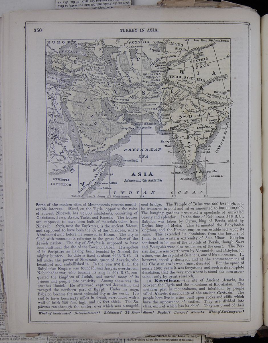 250
TURKEY IN ASIA.
A map of Asia "as known to the Ancients"
250
TURKEY IN ASIA.
A map of Asia "as known to the Ancients"
Some of the modern cities of Mesopotamia possess considerable interest. Mosul, on the Tigris, opposite the ruins of ancient Nineveh, has 35,000 inhabitants, consisting of Christians, Jews, Arabs, Turks, and Koords. The houses are supposed to have been built of materials taken from Nineveh. Orfa, near the Euphrates, is the ancient Edessa, and supposed to have been the Ur of the Chaldees, where Abraham dwelt before he removed to Haran. The city is filled with monuments referring to the great father of the Jewish nation. The city of Babylon is supposed to have been built near the site of the Tower of Babel. It is spoken of in Scripture as having been founded by Nimrod, the mighty hunter. Its date is fixed at about 2236 B. C. It fell under the power of Semiramis, queen of Assyria, who beautified and embellished it. In the year 876 B. C, the Babylonian Empire was founded, and Assyria overthrown. Nebuchadnezzar, who became its king in 604 B. C., conquered the kingdom of Judah, and carried many of its princes and people into captivity. Among these was the prophet Daniel. He afterward captured Jerusalem, and ravaged the northern part of Egypt. Under his reign, Babylon became the most splendid city in the world. It is said to have been sixty miles in circuit, surrounded with a wall of brick 350 feet high, and 87 feet thick. The Euphrates ran through the center, over which was a magnificent bridge. The Temple of Belus was 600 feet high, and its treasures in gold and silver amounted to $600,000,000. The hanging gardens presented a spectacle of unrivaled beauty and splendor. In the time of Belshazzar, 536 B.C., Babylon was taken by Cyrus, king of Persia, aided by Darius, king of Media. This terminated the Babylonian kingdom, and the Persian empire was established upon its ruins. This extended its dominions from the borders of India to the western extremity of Asia Minor. Babylon continued to be one of the capitals of Persia, though Susa and Persepolis were also residences of the court. The Persian Empire was overthrown by Alexander; and Babylon, for a time, was the capital of Seleucus, one of his successors. It, however, speedily decayed, and at the commencement of the Christian era it was almost deserted. For the space of nearly 1500 years it was forgotten; and such is its complete desolation, that the very spot where it stood has been ascertained only by great research.
13. Koordistan—the site of Ancient Assyria, lies between the Tigris and the mountains of Koordistan. The northern part is mountainous, and inhabited by people called Koords, descendants of the ancient Carduehi. The people here live in cities built upon rocks and cliffs, which have the appearance of castles. They are divided into clans, each of which has its chief. They are proud of their
What of Semiramis? Nebuchadnezzar? Belthazzar? 13. Koordistan? Bagdad? Bassora? Nineveh? What of Sardanapalus?

central point of an active and industrious population, which has a talent for business and an instinct for its speculations. To see the somber galleries of this edifice, its narrow shops, its warehouses without luxury and without display, one would easily believe that this bazaar is open only to a few modest traffickers, yet it contains entrepots where the most valuable merchandise is piled up by tons and quintals. There are here whole generations of buyers and sellers, who have, like the Dutch, sucked in the love for figures with their mother's milk. This man whom you see with the long beard like a moujik, clad in a ragged surtout, walking backward and forward before his shop, as if he was seeking an opportunity to sell an old pair of boots, transacts business with the entire world, receives cargoes of the products of Persia and China, England and France. This other, who is leaning over his desk, and laboring from morning till evening like a poor servant who fears to displease his master, owns ten houses in the city, and places millions in the bank. Here is one who is going modestly into a neighboring cabaret to smoke his pipe and take a cup of tea, and while he counts one by one, with a close hand, the fifteen or twenty kopecks, which he must pay for these, five hundred men are at work for him in one of his factories, and two hundred masons are constructing, at great expense, a new one.
Prodigious stories are related of the fortune of these merchants, of their industrious spirit and habits of economy. Only at Amsterdam are to be found at once so much wealth and such habits. Nevertheless, some of those merchants, heirs of the fortunes of their fathers, or enriched by their own labors, are beginning to emerge from the obscure regions of the Gastinoi-Dvor. They have built elegant houses in the finest quarters of Moscow, or bought the hotels of great noblemen, sometimes to taste in their turn the joys of opulence, often, also, to make of them objects of speculation. Aristocratic fortunes are crumbling, and industry building on their ruins. At the same time, science and literature are advancing with rapid steps.
There exist at Moscow a hundred and twenty presses, several rich foreign libraries, and many scientific societies. The university founded by the Empress Elizabeth in 1755, reorganized by Alexander in 1804, numbers a thousand pupils, and many of its professors are distinguished men. One of them, M. Schewireff, has for several years published a monthly review entitled the Moscovite, whose success is daily increasing. I remember a delightful hour passed with him and some of his friends. I could tell them nothing of our present literature or our principal writers. One evening we assembled in the country at the house of a young author. In the middle of a green lawn, under the shade of flowering lime-trees, the Russian poets related to me by turns their studies, their labors, their thoughts. One of them, M. Kamekoff, read us these verses, which he allowed me to transcribe. It was a singular thing for one to hear Napoleon thus spoken of at a few leagues from the city which had been burned in his presence, and to listen in the heart of Russia, to this dithyrambic addressed to England, at the moment the English ships were about to invade its shores.
"NAPOLEON.
"It was not the people who elevated thee, or a foreign will which crowned thee. Thou hast reigned, fought, won victories, trampled the earth beneath thy iron foot, placed on thy head the diadem formed by thy hands, crowned thy brow by thine own power.
"It was not the strength of the people which overthrew thee—thou hast never had a rival; but He who has set bounds to the ocean, He broke thy sword in the combat, melted thy crown in a holy conflagration, and covered with snow thy legions.
"It is eclipsed, the star of the heavens obscured. Human grandeur has fallen into the dust. Tell me, will not a new morning dawn on the horizon? Will not a new harvest spring from thy ashes? Reply; the world awaits with fear and eagerness a powerful thought and word."
"TO ENGLAND.
"Isle of pomp, isle of wonders, thou art the ornament of the universe, the finest emerald in the diadem of the seas.
"Formidable guardian of liberty, destructor of all adverse force, the ocean spreads around thee the immensity of its waves.
Country of holy liberty, fortunate and blessed land! what life in thine innumerable people! what beauty in thy rich fields!
"How brilliant is the crown of science on thy brow! How noble and sonorous are the songs which thou hast made the universe to hear!
"Resplendent with gold, radiant with thought, thou art happy, thou art rich, thou art full of wealth and strength!
"And the most distant nations, turning toward thee their timid looks, ask what new laws thou wilt prescribe for their destiny.
"But because thou art perfidious, because thou art proud, because thou placest terrestrial glory above divine justice;
"Because with a sacrilegious hand thou hast chained the Church of God at the feet of a terrestrial and transitory throne:
"A day will come, O Queen of the Seas, and that day is not far off, when thy splendor, thy gold, thy people, shall disappear like a dream.
"The thunder shall depart from thy hands; thy sword shall cease to gleam, and the gift of luminous thoughts shall be withdrawn from thy children.
"And, forgetting thy royal flag, the waves of ocean shall again be free.
"And God shall choose a humble nation, full of faith and of miracles, to confide to it the destinies of the universe, the thunder of earth, and the voice of Heaven!"
Need I say that this "humble nation, full of faith and of miracles," of which the poet speaks, is the Russian. It is a thought which I have often heard expressed in Russia, in saloons as well as in societies. The Russians do not hesitate to attribute to themselves a mission of social regeneration and the empire of the world. At Petersburg they look toward the future with the confidence which the rapid and prodigious development of their young capital and the halo of power impart. At Moscow, the very heart of the nation, which feeds itself with gigantic hopes in the sanctuary of its faith and of its history, is the inclosure of the walls which arrested the sword of the Tartars and the thunders of Napoleon.
[begin surface 940]

☞The Chinese are scattering themselves over different parts
of the world to an astonishing extent. They have recently
emigrated in large numbers to the Sandwich Islands, as laborers
on the sugar, coffee, and other plantations. Two thirds of these
came from the neighborhood of Amoy. It seems as though the
he[illegible] characteristics of the eastern
world was about to be abolished.
ART. VIII.—CHINA AND THE CHINESE
1. Papers relating to the Proceedings of her Majesty's Naval Forces in Canton; with Appendix.
2. Correspondence respecting Insults in China.
That fact is often more incredible than fiction, is a remark that time frequently endorses. Were it gravely stated in a romance that one of the most powerful nations in the world was affected in its government, its opinions, and even its feelings, by a kingdom removed from it by the diameter of the globe, that events occurring in a single city of that kingdom vibrated through every corner of Britain, exasperated parties, and divided statesmen hitherto friendly to one another, we might concede to the novelist his privilege of invention, but might justly complain of his attachment to the marvellous.
Yet the fact is before us authenticated by dispatches, supported by blue-books, debated in the legislature, and shortly to be discussed at the hustings. A dispute at Canton has suspended the public business of Great Britain and Ireland, and terminated unexpectedly the present session of Parliament. Commissioner Yeh has performed a feat which Lord Derby and his adherents have for three years been occasionally attempting; they have carried a vote of want of confidence against Ministers, and made it advisable for them to appeal to the sense or the passions of the country. "Tantæne animis cœlestibus iræ:" what share have the inhabitants of the celestial kingdom in this commotion? Is it their strength, their duplicity, or their perversity which has thus imperiled, or, it may be, strengthened the hands of Lord Palmerston, and filled the columns of our journals with professions of self-devotion and zeal for the public interest?
Into the state of parties at home, the possible results of the approaching elections, and the chances of the present Ministry for a new lease of office, or a prompt dismissal from it, we do not propose to inquire. We leave these "domestica facta" for others to celebrate, and propose devoting a few minutes to the people who, directly or indirectly, has called from their hiding- places the banners, the colors, and the manifestoes of candidates, and will shortly inflict more noise and turmoil upon our capital and provincial towns than the Chinese themselves create with their periodical hubbub of gongs, tom-toms, and fire-works.
If we do look to the number of books which have been written about China since our permanent establishment at Canton, we have no reason to complain of the scantiness of our information. On the contrary, we feel the embarrassment arising from riches. But the labor and the opus are to construct from the materials in hand a clear and consistent picture of the nation with whom we are now exchanging shots. The inquiry is by no means unimportant. We may be engaged in a duel with the city of Canton alone, or we may be drawn into collision with an empire more formidable than any we have hitherto encountered in the East. If pro-consul, the conflict will be a short one; but if it adopt his prejudices against the "outside barbarians," we may perhaps have begun a contest that will be costly in its process, however triumphant to ourselves in the end.
Nor are the revolutions of Asia by any means objects of indifference to England. We do not hold, with dreamers of the Coningsby school, that the fate of the civilized world has always been, and ever will be, determined from the land of the Orient, or that revolutions from that quarter may again renovate or destroy our systems of religion and society. Yet neither is it possible to deny the fact, with the pages of history before us, that the compact masses of eastern tribes have at many epochs affected powerfully the civilization of the West, or that it was a horde from Central Asia which consummated the ruin of the Roman empire. It may be well, accordingly, to consider the social and physical aspects of an empire on whose skirts we are at this moment at war, and the probability or improbability of its rising against us in mass, and, if not assailing our outposts, yet at least inflicting on our trade and progress in the East a blow which will be felt both in our colonies and at home.
In contemplating a country which we may be called upon to assail
on some more vulnerable point than its extreme border, we must
take into account all its resources of defense or
aggression—its climate, since heat and cold are among the
implements of war; its wealth and population, since these are
the sinews of war; the physical character of the land, since
mountains, and rivers, and plains are often the strongest
[begin surface 944] 290
China and the Chinese.
April,
bulwarks of a
kingdom; and the degree and kind of its civilization, for this,
more even than its numerical force, is often the measure of its
resisting power. It may be useful also to inquire whether there
be any element in the national character of the Chinese people
likely to inspire them with the strength of enthusiasm or union,
or whether the days of its empire are numbered, and the epoch
has arrived for breaking down its long isolation from the great
human family.
290
China and the Chinese.
April,
bulwarks of a
kingdom; and the degree and kind of its civilization, for this,
more even than its numerical force, is often the measure of its
resisting power. It may be useful also to inquire whether there
be any element in the national character of the Chinese people
likely to inspire them with the strength of enthusiasm or union,
or whether the days of its empire are numbered, and the epoch
has arrived for breaking down its long isolation from the great
human family.
Our survey of the Chinese empire must be brief, and accordingly we can afford to trace in the following sketch such features only as appear most important to our present inquiry. We shall presume, indeed, since the means of information are so abundant and easy of access, that our readers are in some measure acquainted with the subject, and shall attempt merely to generalize what is commonly known.
The climate of China may be described as one of extremes, and
presents some curious anomalies. The general temperature of the
country is very low for its geographical position. At Pekin,
which is one degree farther south than Naples, the mean
temperature is nearly that of Brittany, and while the winters
are as rigorous as those of Sweden, the summer heats are more
intense than those of Cairo. But in a territory ranging from the
twenty-sixth to the forty-second degree of north latitude, the
variations of the climate are necessarily great. In the maritime
provinces—and the sea-coast extends nearly 2500
miles—both heat and cold are much modified by the sea. At
Canton, which is under the tropic, the heat during the months of
July, August, and September is excessive, and is accompanied, at
least in the neighborhood of the city, with frequent and
destructive typhoons. At the close of the hot season, the
transition to cold is sudden, and the entire province is
overspread at night, for weeks together, with dense and chilling
fogs. The climate of the interior is, however, generally exempt
from the extremes of Canton and Pekin. The province of Kiang-se
is the most favored; but the central provinces generally enjoy a
happy mean between the rigor of the north and the enervating
heats of the south. In no one, indeed, of its numerous sections
is the climate of China decidedly unhealthy or ill-suited to the
development of vegetable or animal life. Even in the north, the
summers are genial, and the winters, though cold, are dry. The
least salutary portion of the country is in the western frontier
districts of Gun-nan and Sze-che-se, and [cut away] numerous population in every quarter of
the empire; and accordingly we may generally ascribe to its
climate the properties which conduce to the conservation and
comfort of life. The wealth and population of China are
difficult to ascertain accurately, since our accounts of them
are often suspicious, and the standard of wealth is differently
estimated by native and European economists. Many a retail
shopkeeper in England enjoys or expends a larger annual income
than a Chinese country gentleman; and many an English country
gentleman could defray, without much inconvenience to himself,
the annual expenditure of a dozen mandarins. But goods, rather
than money, are the symbol of wealth or competence in the Middle
Kingdom, and a proprietor of lands is opulent in proportion to
the amount of grain and rice in his barns, and not of the money
in his purse. There are indeed no large estates, since the lands
of the father are divided, after his decease, equally among his
sons; and if any one holds more land than he can cultivate
conveniently, he lets it to another on the metayer principle, or
on condition of receiving half the produce. The Government, in
some measure, fares in this respect like its subjects.
Consistently with the patriarchal system of the Chinese, the
Emperor is the universal landlord, and takes the tithes or taxes
of his vast estate. He receives them both in money and in kind;
and he distributes them, in like manner, among his civil and
military officials, signing for some of them a cheque on the
treasury, for others an order for so many quarters of rice or
grain. The annual revenue paid into the imperial exchequer is
£10,000,000; but this sum by no means represents the produce of
the taxes, the excise, and customs; since at least two millions
more are paid in kind, and the provincial governors deduct their
departmental expenditure, and forward to the treasury only the
balance remaining. The imperial treasury, before the close of
the late war between England and China, contained perhaps one of
the most curious collections of coins in the world. For the
native wares of their country, the luxuries or the necessaries
of Europe, the Chinese venders were content to take any
currency, provided it were in good silver; and there had
gradually found its way to Pekin, through the most devious
channels, the specie of Venice and the Greek empire, the tokens
of the Flemish and Hanse towns, shillings and
[begin surface 945] 1857.
China and the Chinese.
291
angels stamped
with the effigies of our Edwards and Henrys, dollars which bore
the castles of Castile, and crowns which may have paid the
mousquetaires of the Bourbons. In fact, so small in value, or so
debased as metals are the native coins, that these solid pieces
of the barbarians were hoarded as ingots by a succession of
imperial chancellors. The wealth of China, therefore, as
contained in a circulating medium, would give a very imperfect
idea of the actual or comparative resources of the country.
These must be sought in its universal industry and its minute
agriculture. The sternest of our political economists has not a
greater theoretical aversion for vagrants and beggars than John
Chinaman has practically. Mendicants are usually found in the
immediate vicinity of Buddhist temples; and the only endowed
religion in China—the religion, however, of a sect, and
not of the state—lies under the discredit of alone
encouraging paupers in idleness. The orthodox Chinese are mostly
in the condition, as to worldly goods, which the wise man
aspired to when he prayed for "neither poverty nor riches." He
can not subsist without work, and there is no kind of work which
he will not cheerfully undertake. And the opportunities for
labouring with his hands or feet are indefinitely multiplied by
the rudeness of his implements and machinery. He despises, and
he has always despised, the substitutes of the "Western devils"
for manual labor. When the Jesuit priests displayed to the
Emperor some of the most delicate instruments of European art or
science, his Celestial Majesty viewed them with open
indifference and secret contempt, observing that they would
amuse the inmates of his nursery. The Chinese, at no period of
their history, have been enslaved by the bondage of castes, like
the Hindoos or ancient Egyptians: yet they have suffered from
many of the inconveniences of that institution. It was forbidden
by law to the Egyptians to improve upon or depart from the
pattern of the saws, hammers, and chisels of the craftsmen who
wrought for Menes and Rameses, even though the handy Greeks
exhibited before them at Alexandria their own lighter and more
efficient tools. Custom in China has been nearly as prohibitory
as law in Egypt, and the artisan performs the most delicate
operations of weaving, upholstery, carving, and inlaying, with
implements that an English carpenter or cobbler would disdain to
use. The economy of labor is therefore almost unknown; and among
its minute and manifold subdivision, every one finds his work
and his wages. The pittance of a Dorsetshire laborer has
become almost proverbial for its scantiness in England; but his
weekly pay would seem a fortune to the Spanish peasant or
olive-dresser. The miserable earnings of the English
sempstresses have drawn to them the attention and indignation of
the humane, although it might be a rash policy in the
legislature to interfere between the employer and the employed;
but the weekly pittance on which the Dorsetshire laborer and the
London sempstress manage barely to exist, would keep a Chinese
artisan for six months in rice, and even enable him to indulge
in the occasional luxury of a rat or cat ragout. Acquiescence in
low diet is usually and justly esteemed as a mark of low
civilization: but the remark is not very pertinent to the
Chinese, whose civilization, although comparatively with that of
Europe imperfect, yet is advanced in comparison with that of
Asiatics generally. They are, as a rule, a plump, unctuous, and
muscular race, capable of enduring fatigue, and the coolies or
goodsporters of the great towns especially are remarkable for
their powers of lifting and carrying enormous burdens. Their
strength is, in some measure, the reward of their ordinary
temperance: for though in the purlieus of Canton the Europeans
have corrupted them with alcohol and evil example, drunkenness
is rarely seen in the interior. It is impossible not to see that
among so many myriads of able-bodied men there is a vast
"seminarium militum," —a native depot of effective
soldiers, should any emergency call for a levée en masse. The
occupations of the artisan who is employed within doors, and
restricted to a similar posture of the body during many hours of
the day, are unfavorable to muscular strength and development,
and the recruiting sergeant derives his supplies of " tall young
men," not from the streets of Manchester or London, so much as
from the athletic youth of the rural districts. The rule is
indeed not without its exceptions, since few of our grenadiers
are culled from Suffolk, but many from Lancashire. The army of
the middle kingdom is dependent for its supplies neither upon
the sedentary trades of the weaver and the tailor, nor upon the
active occupations of the ploughman and the herdsman, since both
the ordinary legions and the prætorian guards of the empire are
levied from the resident or migratory Tartars. The land and
water population, however, are qualified both by their strength
and stature to become soldiers at least as good as the sepoys of
Hindostan; VOL. LXVII. 20
[begin surface 946]
1857.
China and the Chinese.
291
angels stamped
with the effigies of our Edwards and Henrys, dollars which bore
the castles of Castile, and crowns which may have paid the
mousquetaires of the Bourbons. In fact, so small in value, or so
debased as metals are the native coins, that these solid pieces
of the barbarians were hoarded as ingots by a succession of
imperial chancellors. The wealth of China, therefore, as
contained in a circulating medium, would give a very imperfect
idea of the actual or comparative resources of the country.
These must be sought in its universal industry and its minute
agriculture. The sternest of our political economists has not a
greater theoretical aversion for vagrants and beggars than John
Chinaman has practically. Mendicants are usually found in the
immediate vicinity of Buddhist temples; and the only endowed
religion in China—the religion, however, of a sect, and
not of the state—lies under the discredit of alone
encouraging paupers in idleness. The orthodox Chinese are mostly
in the condition, as to worldly goods, which the wise man
aspired to when he prayed for "neither poverty nor riches." He
can not subsist without work, and there is no kind of work which
he will not cheerfully undertake. And the opportunities for
labouring with his hands or feet are indefinitely multiplied by
the rudeness of his implements and machinery. He despises, and
he has always despised, the substitutes of the "Western devils"
for manual labor. When the Jesuit priests displayed to the
Emperor some of the most delicate instruments of European art or
science, his Celestial Majesty viewed them with open
indifference and secret contempt, observing that they would
amuse the inmates of his nursery. The Chinese, at no period of
their history, have been enslaved by the bondage of castes, like
the Hindoos or ancient Egyptians: yet they have suffered from
many of the inconveniences of that institution. It was forbidden
by law to the Egyptians to improve upon or depart from the
pattern of the saws, hammers, and chisels of the craftsmen who
wrought for Menes and Rameses, even though the handy Greeks
exhibited before them at Alexandria their own lighter and more
efficient tools. Custom in China has been nearly as prohibitory
as law in Egypt, and the artisan performs the most delicate
operations of weaving, upholstery, carving, and inlaying, with
implements that an English carpenter or cobbler would disdain to
use. The economy of labor is therefore almost unknown; and among
its minute and manifold subdivision, every one finds his work
and his wages. The pittance of a Dorsetshire laborer has
become almost proverbial for its scantiness in England; but his
weekly pay would seem a fortune to the Spanish peasant or
olive-dresser. The miserable earnings of the English
sempstresses have drawn to them the attention and indignation of
the humane, although it might be a rash policy in the
legislature to interfere between the employer and the employed;
but the weekly pittance on which the Dorsetshire laborer and the
London sempstress manage barely to exist, would keep a Chinese
artisan for six months in rice, and even enable him to indulge
in the occasional luxury of a rat or cat ragout. Acquiescence in
low diet is usually and justly esteemed as a mark of low
civilization: but the remark is not very pertinent to the
Chinese, whose civilization, although comparatively with that of
Europe imperfect, yet is advanced in comparison with that of
Asiatics generally. They are, as a rule, a plump, unctuous, and
muscular race, capable of enduring fatigue, and the coolies or
goodsporters of the great towns especially are remarkable for
their powers of lifting and carrying enormous burdens. Their
strength is, in some measure, the reward of their ordinary
temperance: for though in the purlieus of Canton the Europeans
have corrupted them with alcohol and evil example, drunkenness
is rarely seen in the interior. It is impossible not to see that
among so many myriads of able-bodied men there is a vast
"seminarium militum," —a native depot of effective
soldiers, should any emergency call for a levée en masse. The
occupations of the artisan who is employed within doors, and
restricted to a similar posture of the body during many hours of
the day, are unfavorable to muscular strength and development,
and the recruiting sergeant derives his supplies of " tall young
men," not from the streets of Manchester or London, so much as
from the athletic youth of the rural districts. The rule is
indeed not without its exceptions, since few of our grenadiers
are culled from Suffolk, but many from Lancashire. The army of
the middle kingdom is dependent for its supplies neither upon
the sedentary trades of the weaver and the tailor, nor upon the
active occupations of the ploughman and the herdsman, since both
the ordinary legions and the prætorian guards of the empire are
levied from the resident or migratory Tartars. The land and
water population, however, are qualified both by their strength
and stature to become soldiers at least as good as the sepoys of
Hindostan; VOL. LXVII. 20
[begin surface 946] 292
China and the Chinese.
April, and the fields,
rivers, and canals of China would afford an almost inexhaustible
supply of recruits. Field labour throughout the country is
chiefly performed by the thews and sinews of man himself, for
his plough would have been deemed antiquated by Cincinnatus, and
his spade and hoe are ponderous and unwieldy. The works which he
executes with these primitive implements are alike onerous and
diversified; they tax his strength and try his patience. The
land available for tillage in China bears a very small
proportion to the area of the country itself. Much of it is
extremely fertile, and much not naturally productive is rendered
so by irrigation. But the mountains and hilly districts of China
occupy about half its extent: and although terraces of
artificial soil are laboriously formed on the hill-sides, the
flanks of the mountains are either sterile rock or clothed with
primeval forests. Even its enormous plains are by no means all
pervious to the plough. The northern portion of the Great
Plain—which, according to the census of 1813, feeds no
fewer than 170,000,000 of "mouths," as the Chinese say not
inappositely—is dry and sandy; while, on the eastern side,
where it borders on the sea, it is low, swampy, and studded with
lakes. The waters, indeed, of China, as we shall presently see,
abstract considerably from the land; and if they contribute
largely to some species of the people's food, they diminish also
its area for grain and legumes. The agriculture of China has
been sometimes commended by foreigners, and is the theme of
wonder and applause to native writers. In France it might pass
muster; but an English or a Belgian farmer would vouchsafe small
commendation to Chinese tillage. We have already spoken of the
implements in husbandry: to their defects must be added a
general scarcity of manure, and an obstinate adherence to the
rules of sowing and planting that sufficed for the aborigines of
the soil. The scarcity of manure proceeds from the absence of
dairy and sheep-farms—for the Chinese, unctuous as they
are in their diet, neither drink milk nor eat butter or cheese.
Their horses are small, and unimproved, by foreign breeds: their
sheep are lean, and derive a precarious subsistence from the
casual herbage of the fallows or canal banks, and to employ
artificial manure would be regarded by those sturdy
protectionists as reproaching heaven. The bullock, useful for
the plough, is the only animal that finds much favour with the
bucolical class of the "flowery kingdom." The sight of a well
compounded dunghill, so full of hope to the British
farmer, is unknown to the Chinese hind: he goes forth into the
highways and to the borders of canals with his sons and his
slaves to pick up the offal which chance throws in his way: the
trimmings of his hair and beard, and of those of his household,
are added to the heap: he hoards the refuse and offscouring of
all things as a miser hoards his gold; and feeds his glebe with
supplies which an English cottager would leave on the roadside.
Water, indeed, is the principal manure employed by the Chinese;
and since the rivers fortunately bring down a turbid mass of
alluvial soil, the harvests generally correspond to the
expectations of the husbandman.
292
China and the Chinese.
April, and the fields,
rivers, and canals of China would afford an almost inexhaustible
supply of recruits. Field labour throughout the country is
chiefly performed by the thews and sinews of man himself, for
his plough would have been deemed antiquated by Cincinnatus, and
his spade and hoe are ponderous and unwieldy. The works which he
executes with these primitive implements are alike onerous and
diversified; they tax his strength and try his patience. The
land available for tillage in China bears a very small
proportion to the area of the country itself. Much of it is
extremely fertile, and much not naturally productive is rendered
so by irrigation. But the mountains and hilly districts of China
occupy about half its extent: and although terraces of
artificial soil are laboriously formed on the hill-sides, the
flanks of the mountains are either sterile rock or clothed with
primeval forests. Even its enormous plains are by no means all
pervious to the plough. The northern portion of the Great
Plain—which, according to the census of 1813, feeds no
fewer than 170,000,000 of "mouths," as the Chinese say not
inappositely—is dry and sandy; while, on the eastern side,
where it borders on the sea, it is low, swampy, and studded with
lakes. The waters, indeed, of China, as we shall presently see,
abstract considerably from the land; and if they contribute
largely to some species of the people's food, they diminish also
its area for grain and legumes. The agriculture of China has
been sometimes commended by foreigners, and is the theme of
wonder and applause to native writers. In France it might pass
muster; but an English or a Belgian farmer would vouchsafe small
commendation to Chinese tillage. We have already spoken of the
implements in husbandry: to their defects must be added a
general scarcity of manure, and an obstinate adherence to the
rules of sowing and planting that sufficed for the aborigines of
the soil. The scarcity of manure proceeds from the absence of
dairy and sheep-farms—for the Chinese, unctuous as they
are in their diet, neither drink milk nor eat butter or cheese.
Their horses are small, and unimproved, by foreign breeds: their
sheep are lean, and derive a precarious subsistence from the
casual herbage of the fallows or canal banks, and to employ
artificial manure would be regarded by those sturdy
protectionists as reproaching heaven. The bullock, useful for
the plough, is the only animal that finds much favour with the
bucolical class of the "flowery kingdom." The sight of a well
compounded dunghill, so full of hope to the British
farmer, is unknown to the Chinese hind: he goes forth into the
highways and to the borders of canals with his sons and his
slaves to pick up the offal which chance throws in his way: the
trimmings of his hair and beard, and of those of his household,
are added to the heap: he hoards the refuse and offscouring of
all things as a miser hoards his gold; and feeds his glebe with
supplies which an English cottager would leave on the roadside.
Water, indeed, is the principal manure employed by the Chinese;
and since the rivers fortunately bring down a turbid mass of
alluvial soil, the harvests generally correspond to the
expectations of the husbandman.
The amount of the population of China has been differently stated
in the course of the recent debates upon the Canton question,
and a facetious contemporary has suggested that Mr. Gladstone
and Mr. Cobden should be sent to the celestial kingdom, and not
allowed to return before they had ascertained whether it
amounted to two or to three hundred millions. The absence of
these gentlemen might be indefinitely protracted, if their
restoration to home depended upon their ability to confute or
verify their respective assertions. The census in China is drawn
up in obedience to a paternal mandate of the emperor, commanding
his children, well and truly to inform him of the number of free
persons in their households. This mandate is addressed, in the
first instance, to the chief mandarin of a province, and by him
circulated, on a descending scale, through a long avenue of
officials. But the national vanity of the Chinese people is said
to interfere greatly with the accuracy of the returns. Sons,
inasmuch as they remain always under the patria potestas, are
valuable commodities in China, where Professor Malthus has not a
single follower. The pater familias accordingly is rather apt to
exaggerate than underrate the number of his male olive-branches.
Next, a village or township is justly vain of reporting to the
father of all its superiority in population to the next hamlet,
and thus is also under a temptation to make the most of its most
masculine contents. A district, a province—there being no
capitation-tax in China—share in this patriarchal
emulation; and the emperor, when the account is laid before him,
perhaps rejoices in the appearance rather than the reality of
his wealth in children. There can be no hesitation in estimating
the population of China at between 200 and 300 millions: and in
describing it, in spite of the practice of frequent
[begin surface 947] 1857.
China and the Chinese.
293
child murder, and
of occasional dearth, as one of the most thickly peopled regions
of the globe. The government of a family, or a tribe, by the
eldest representative of their original proprietor, is one of
the earliest facts in history, and has been the occasional dream
of the philosopher. That a few score of persons, whose
avocations were those of herdsmen, and who had no fixed property
in land, might harmoniously combine under a single chieftain,
the priest of their simple worship, and the arbiter of their
temporary disputes, can readily be conceived. No political
rivalry, no conflicting claims of property, beyond an occasional
controversy about rights of pasturage or watering, could ruffle
the surface of such a community. But from the moment when fields
began to be divided by boundary-stones, or fenced cities to be
built, the society of the desert became an impossibility, and
more stringent rules of government were required to protect the
weak, and keep the strong in awe. The household has been well
defined by Aristotle as the germ of all political institutions;
but it was, in his conception, their ultimate analysis, and not
their proper condition. In the vast steppes of Asia the
patriarchal form of society has subsisted the longest, because
there the circumstances in which it began and flourished
continued to exist. That the government of China was originally
imported from the tribes on its north-western frontier there
seems no reason to doubt; and when we come to consider the
cities, we shall see that they still reflect, in many
particulars, their prototype—a Tartar camp. But the
anomaly in China is, that that country alone has preserved, in
form and pretensions, at least, the patriarchal system, although
for more than two thousand years its inhabitants have ceased to
be herdsmen or shepherds, and developed an extremely artificial
system both in social and political life. The fiction is
ludicrously inconsistent with the facts of Chinese society. From
the humblest head of a family to the emperor himself, the idea
of the patria potestas universally prevails. The sons of the
house are never emancipated; the jus paternum expires only with
the patriarchal life. But the chief or head-borough of a village
is also the reputed father of all its inhabitants; and he, in
his turn, is in loco filii to the next officer of the district.
The heads of the districts look up to the provincial governor
as their father, the provincial governor to his mandarin, and
the mandarins stand in the relation of eldest sons to the
supreme father of the nation. Such is the theory—and
as a theory it wears an aspect of proportion and benevolence
which entitle it to the highest respect. But such is not the
fact. Virtually, the father of two and a half or three hundred
millions of men sits above them as a conqueror, is of foreign
extraction, is guarded by aliens, and like the Cïsars of Rome
and Byzantium, depends for his throne, and even his personal
security, upon the awe which he inspires, upon the jealousies he
foments among his subjects, upon the activity of his spies, upon
the force of habit, upon nearly every motive except that of
filial or paternal love. Perhaps the system of government under
which China has subsisted, and indeed flourished, is the most
astounding monument of conscious duplicity on record. It by no
means follows that if the rebellion which so recently raged, and
perhaps still rages in its interior, be finally triumphant, and
terminate in the restoration of a native dynasty, the
patriarchal theory will be abolished. Exempt as China has been
from foreign invasion, except by the kindred tribes of Central
Asia, it has been frequently the arena of sanguinary civil wars.
On its plains have been again and again acted tragedies of as
deep a dye as the wars which destroyed the empire of
Charlemagne, as the civil furies of the Jacquerie and the
Anabaptists, or as the struggles which during thirty years tore
in pieces the old German empire. But whether the Mongols or the
Mantchous established themselves at Nan-king, or whether native
pretenders ascended the vacant throne, the reigning emperor of
China has uniformly assumed the benign attributes of a father,
and governed his people as an Arab Schiek governs his tribe.
There seems, indeed, to have been, in all ages, a remarkable
energy in the native Chinese character, enabling it to overcome
its conquerors, and to compel or persuade them to adopt its own
maxims and prejudices. The isolation and arrogance of the
Chinese people are perhaps the results of its success in thus "
taming the proud." Situated at nearly the eastern extremity of
the old continent, it has always been inviolate by sea, and
sundered by chains of mountains and inhospitable wastes from the
civilized races of India and the West. They have, in fact, had
no standard by which to measure themselves. They have
invariably tamed the strong by their superior civilization; the
rumours of the civilized West, which reached them through
travellers like the Venetian, Marco Polo, or the Jesuit
missionaries of later date, would inspire them with more
contempt than respect for what they heard of
[begin surface 948]
1857.
China and the Chinese.
293
child murder, and
of occasional dearth, as one of the most thickly peopled regions
of the globe. The government of a family, or a tribe, by the
eldest representative of their original proprietor, is one of
the earliest facts in history, and has been the occasional dream
of the philosopher. That a few score of persons, whose
avocations were those of herdsmen, and who had no fixed property
in land, might harmoniously combine under a single chieftain,
the priest of their simple worship, and the arbiter of their
temporary disputes, can readily be conceived. No political
rivalry, no conflicting claims of property, beyond an occasional
controversy about rights of pasturage or watering, could ruffle
the surface of such a community. But from the moment when fields
began to be divided by boundary-stones, or fenced cities to be
built, the society of the desert became an impossibility, and
more stringent rules of government were required to protect the
weak, and keep the strong in awe. The household has been well
defined by Aristotle as the germ of all political institutions;
but it was, in his conception, their ultimate analysis, and not
their proper condition. In the vast steppes of Asia the
patriarchal form of society has subsisted the longest, because
there the circumstances in which it began and flourished
continued to exist. That the government of China was originally
imported from the tribes on its north-western frontier there
seems no reason to doubt; and when we come to consider the
cities, we shall see that they still reflect, in many
particulars, their prototype—a Tartar camp. But the
anomaly in China is, that that country alone has preserved, in
form and pretensions, at least, the patriarchal system, although
for more than two thousand years its inhabitants have ceased to
be herdsmen or shepherds, and developed an extremely artificial
system both in social and political life. The fiction is
ludicrously inconsistent with the facts of Chinese society. From
the humblest head of a family to the emperor himself, the idea
of the patria potestas universally prevails. The sons of the
house are never emancipated; the jus paternum expires only with
the patriarchal life. But the chief or head-borough of a village
is also the reputed father of all its inhabitants; and he, in
his turn, is in loco filii to the next officer of the district.
The heads of the districts look up to the provincial governor
as their father, the provincial governor to his mandarin, and
the mandarins stand in the relation of eldest sons to the
supreme father of the nation. Such is the theory—and
as a theory it wears an aspect of proportion and benevolence
which entitle it to the highest respect. But such is not the
fact. Virtually, the father of two and a half or three hundred
millions of men sits above them as a conqueror, is of foreign
extraction, is guarded by aliens, and like the Cïsars of Rome
and Byzantium, depends for his throne, and even his personal
security, upon the awe which he inspires, upon the jealousies he
foments among his subjects, upon the activity of his spies, upon
the force of habit, upon nearly every motive except that of
filial or paternal love. Perhaps the system of government under
which China has subsisted, and indeed flourished, is the most
astounding monument of conscious duplicity on record. It by no
means follows that if the rebellion which so recently raged, and
perhaps still rages in its interior, be finally triumphant, and
terminate in the restoration of a native dynasty, the
patriarchal theory will be abolished. Exempt as China has been
from foreign invasion, except by the kindred tribes of Central
Asia, it has been frequently the arena of sanguinary civil wars.
On its plains have been again and again acted tragedies of as
deep a dye as the wars which destroyed the empire of
Charlemagne, as the civil furies of the Jacquerie and the
Anabaptists, or as the struggles which during thirty years tore
in pieces the old German empire. But whether the Mongols or the
Mantchous established themselves at Nan-king, or whether native
pretenders ascended the vacant throne, the reigning emperor of
China has uniformly assumed the benign attributes of a father,
and governed his people as an Arab Schiek governs his tribe.
There seems, indeed, to have been, in all ages, a remarkable
energy in the native Chinese character, enabling it to overcome
its conquerors, and to compel or persuade them to adopt its own
maxims and prejudices. The isolation and arrogance of the
Chinese people are perhaps the results of its success in thus "
taming the proud." Situated at nearly the eastern extremity of
the old continent, it has always been inviolate by sea, and
sundered by chains of mountains and inhospitable wastes from the
civilized races of India and the West. They have, in fact, had
no standard by which to measure themselves. They have
invariably tamed the strong by their superior civilization; the
rumours of the civilized West, which reached them through
travellers like the Venetian, Marco Polo, or the Jesuit
missionaries of later date, would inspire them with more
contempt than respect for what they heard of
[begin surface 948] 294
China and the Chinese.
April, distant lands. The
little republics of Italy, which the Venetian envoy might
describe to their learned men, would appear to them in the light
of petty towns, of little more consequence than the lesser
cities that lined the banks of the Yellow River; and the might
of France and Spain, which the Jesuit missionaries might recount
to them, would confirm their self exaltation, since their armies
were the more numerous, their advance in the arts at least
equal, and the area of their land would contain both of
these vaunted kingdoms, and leave room and verge to spare. From
the complacency with which they regarded themselves, as well as
the contempt or incuriosity with which they listened to the
accounts of things unseen, the Chinese imbibed the obstinate
conservatism of their character. A great and an understanding
people, they argued, were our ancestors. They won the good land
which we inhabit; they purged it of wild beasts, and drained off
its superfluous waters; they planted the wilderness with corn;
they lined the rivers with chains of flourishing cities; and
they invented, centuries ago, arts, of which the barbarians are
only now becoming cognizant. The maxims by which they ruled
themselves we will abide by; they have made and they will keep
us powerful and prosperous. Surely we shall do well to depart
from them neither to the right-hand nor to the left.
294
China and the Chinese.
April, distant lands. The
little republics of Italy, which the Venetian envoy might
describe to their learned men, would appear to them in the light
of petty towns, of little more consequence than the lesser
cities that lined the banks of the Yellow River; and the might
of France and Spain, which the Jesuit missionaries might recount
to them, would confirm their self exaltation, since their armies
were the more numerous, their advance in the arts at least
equal, and the area of their land would contain both of
these vaunted kingdoms, and leave room and verge to spare. From
the complacency with which they regarded themselves, as well as
the contempt or incuriosity with which they listened to the
accounts of things unseen, the Chinese imbibed the obstinate
conservatism of their character. A great and an understanding
people, they argued, were our ancestors. They won the good land
which we inhabit; they purged it of wild beasts, and drained off
its superfluous waters; they planted the wilderness with corn;
they lined the rivers with chains of flourishing cities; and
they invented, centuries ago, arts, of which the barbarians are
only now becoming cognizant. The maxims by which they ruled
themselves we will abide by; they have made and they will keep
us powerful and prosperous. Surely we shall do well to depart
from them neither to the right-hand nor to the left.
Externally contemplated, the administrative system of China is entitled to high respect, and is indeed as laudable and specious as any system of pure centralization can be. Neither is it any demerit that public opinion is entirely excluded from it, since the interference or even the existence of public opinion is an idea alien from the Asiatic mind. If the emperor be a roi fain#éant, his indolence or imbecility is never permitted to transpire, for a mayor of the palace or a regency would be equally shocking and incomprehensible to his filial subjects. Deception, however, is easy, since the father of his people is impenetrably veiled from their sight; or, if revealed to them on some solemn festival, is beheld from such a distance and with such awe as effectually to disguise his lineaments. From him radiate power, honour, and instruction; and to him return obedience, homage, and information. In theory, the emperor is accessible to the petition of the meanest of his subjects; for as he is assumed to be the universal redresser of wrongs, it is needful he should be made acquainted with every grievance. In theory also, as he is the fountain of wisdom, he must be pre-eminent in knowledge; his daily studies are in the book of the learned, and the words of his lips are reputed to be taken down by his attendants, and stored up for the instruction of his successors. As the patron of useful arts, he is supposed to be versed in the crafts and mysteries of his subjects; and as the tillage of the ground is, in Chinese conceptions, the queen of arts, the emperor annually inaugurates the seed-time of the year by opening the first furrow. He is, moreover, chief priest as well as king; and while he tolerates the sectaries of Buddh, or smiles at the superstition of the multitude, he is the only mediator between earth and heaven whom the state recognises. With all these attributes, he is not beyond the voice of admonition or reproof. A board of censors is selected from the gravest men of his kingdom to watch his actions and demeanour; and when these deviate from the rules of the sacred books, or the practice of his imperial ancestors, it is the bounden duties of his monitors, even if it be at peril of their lives, to reprehend his errors. The office of censor has not always been a sinecure. We read one emperor rebuked for consorting with players, another for his intemperate habits, a third for his predilection for the company of foreigners, and several for aspiring to be more wise than their forefathers. A pattern emperor, who gives no handle to rebuke, has no easy life of it; he must live by rule, must never act without a precedent; at certain hours be grave, at certain hours merry; and, in short, entirely forego his volition in order that he may infringe upon no one of the recorded or accredited practices of the ancients.
Some of the inconveniences of eastern despotism have been avoided
by the sagacity of those who planned the monarchical system of
China. There is no hereditary succession to the throne, but the
emperor chooses one among the members of the royal house to fill
his place when he abdicates or dies. The choice of a successor
has generally been creditable to the chooser; and if now and
then honours have changed manners, yet, unless flattery has
obscured their actions, the proportion of good emperors has
predominated. Generally, however, the direct and collateral
scions of the imperial houses are a rude and worthless set, whom
it is often expedient to disperse and ventilate in the frontier
provinces, or even seclude, for a term of years, or for life,
from the court. Occasionally we find the Tartar colonels
investing a member of the royal family with a yellow robe, as
the
[begin surface 949] 1857.
China and the Chinese.
295 prætorians of
Rome arrayed a Caesar with the purple. But these deviations from
the ordinary mode of appointment are rare; nor has the Chinese
court, though by no means unstained with crime, ever presented
such bloody scenes as have so frequently disgraced the
Mahommedan seraglios at Bagdad, Ispahan, or Constantinople. It
was the boast, and not altogether an empty one, of the first
French revolutionists, that they abolished the aristocracy of
rank, and substituted for it the aristocracy of talents. In so
doing, however, they merely introduced into Europe the long
established practice of China. It is, perhaps, essential to the
complete isolation of a paternal despotism that it alone shall
be exalted, and all beneath it depressed to a common level.
Whatever may have been the cause of a practice so specious in
seeming, the effect of it has been for many centuries to secure
for the state the services of the ablest and most learned
persons in the realm. Indeed, but for such avenues to
preferment, the literati of China would either be few in number,
or puzzled for their livelihood. There are no barristers and no
clergymen, and the medical profession has never been in much
repute. A government, however, which manages all the affairs of
its subjects, has occasion for an immense staff of employés;
and numerous as the learned class has ever been in China, it has
seldom been neglected or starved. Education is common, and
cheap; books are plentiful, and easily obtained; and as every
student may present himself for examination in the Civil Service
department with the certainty, if he be not plucked, of getting
some post or other, no one can reasonably complain of the
hardships of the scholar's life. "The outside barbarians" are
indeed only now taking a leaf out of Chinese books in their
competitive examinations for public employments. From the
learned class, and from such members of it as have highly
distinguished themselves at the examinations, the Ministers of
Justice, Finance, Police, and Public Instruction are selected,
nor is any preference displayed for birth or rank, even though
the blood of Confucius flow in a candidate's veins. The order
and constitution of the various governmental boards imply a
well-organised system of administration, by which the privileges
of the ruler are secured, while the claims of the people are not
overlooked. The supreme direction of affairs is entrusted to
what may be termed the Cabinet of Pekin. It is designated the "
Inner Court," and forms the Cabinet Council, the members
of which are the Tu-hyosi, or ministers of states. The Privy
Council, like that of England, is never assembled except on very
urgent occasions. It consists of the members of the "Inner
Court," and the presidents of the Supreme Tribunals, with their
assessors and secretaries. The Supreme Tribunals are six in
number:—1. Li-yu, the Board of Banks and
Dignities—the Heralds' College taking precedence in China,
where politeness is an art, and precedence a grave
consideration, over every other department of government. 2.
Ha-pu, the Board of Revenue. 3. Li-pu, the Board of Forms and
Ceremonies—not less important or less occupied, in a
nation so formal and ceremonious as the Chinese, than the Home
Office in Downing-street. 4. Hingpu, the Board of Penal Law. 5.
Kong-pu, the Board of Public Works. The Sinensian Sir Benjamin
Hall has no sinecure, for the roads and canals, i.e., a fifth of
the area of the empire, come within his department, not to speak
of the imperial " woods and forests," and some hundreds of
fortified towns. 6. Ping-pu, the Military Board, for which
Commissioner Bowring seems likely to cut out some extra work.
Our limits forbid us to enter more at length upon the particular
functions of these boards, and we must pass on to some general
remarks upon the character of Chinese administration. Much looks
well on paper, which in practice works wretchedly; and fair as
is the aspect of centralization, in substance it is often the
most grinding of tyrannies. "Let a man," says Sir Edward Coke, "
consider the office of Justice of the Peace, and the world hath
not wherewith to compare with it in dignity." Nevertheless, in
practice a Justice of the Peace is often, as is noted in "
Hudibras," "an owl," and commits himself in signing the
commitment of others. This deeply-organised system is not
trusted by its employers. Divide et impera is a maxim of
government as familiar to the Chinese as it was to the Roman
Cæsars. In the higher departments, power is divided equally
between the ruling Tartars and the subjugated Chinese. Each of
the administrative bodies is made a check upon the others, and
all are subject to the open or secret supervision of censors,
who address their reports directly to the emperor. The same
principle of division extends to the inferior offices in the
capital, and to the provinces. Each province has its Tsong-to,
or Viceroy, and its San-fa, or Governor, who are equal in
authority though not in rank, since precedence is always
accorded to the Tartars. In all differences, appeal must be made
to
[begin surface 950]
1857.
China and the Chinese.
295 prætorians of
Rome arrayed a Caesar with the purple. But these deviations from
the ordinary mode of appointment are rare; nor has the Chinese
court, though by no means unstained with crime, ever presented
such bloody scenes as have so frequently disgraced the
Mahommedan seraglios at Bagdad, Ispahan, or Constantinople. It
was the boast, and not altogether an empty one, of the first
French revolutionists, that they abolished the aristocracy of
rank, and substituted for it the aristocracy of talents. In so
doing, however, they merely introduced into Europe the long
established practice of China. It is, perhaps, essential to the
complete isolation of a paternal despotism that it alone shall
be exalted, and all beneath it depressed to a common level.
Whatever may have been the cause of a practice so specious in
seeming, the effect of it has been for many centuries to secure
for the state the services of the ablest and most learned
persons in the realm. Indeed, but for such avenues to
preferment, the literati of China would either be few in number,
or puzzled for their livelihood. There are no barristers and no
clergymen, and the medical profession has never been in much
repute. A government, however, which manages all the affairs of
its subjects, has occasion for an immense staff of employés;
and numerous as the learned class has ever been in China, it has
seldom been neglected or starved. Education is common, and
cheap; books are plentiful, and easily obtained; and as every
student may present himself for examination in the Civil Service
department with the certainty, if he be not plucked, of getting
some post or other, no one can reasonably complain of the
hardships of the scholar's life. "The outside barbarians" are
indeed only now taking a leaf out of Chinese books in their
competitive examinations for public employments. From the
learned class, and from such members of it as have highly
distinguished themselves at the examinations, the Ministers of
Justice, Finance, Police, and Public Instruction are selected,
nor is any preference displayed for birth or rank, even though
the blood of Confucius flow in a candidate's veins. The order
and constitution of the various governmental boards imply a
well-organised system of administration, by which the privileges
of the ruler are secured, while the claims of the people are not
overlooked. The supreme direction of affairs is entrusted to
what may be termed the Cabinet of Pekin. It is designated the "
Inner Court," and forms the Cabinet Council, the members
of which are the Tu-hyosi, or ministers of states. The Privy
Council, like that of England, is never assembled except on very
urgent occasions. It consists of the members of the "Inner
Court," and the presidents of the Supreme Tribunals, with their
assessors and secretaries. The Supreme Tribunals are six in
number:—1. Li-yu, the Board of Banks and
Dignities—the Heralds' College taking precedence in China,
where politeness is an art, and precedence a grave
consideration, over every other department of government. 2.
Ha-pu, the Board of Revenue. 3. Li-pu, the Board of Forms and
Ceremonies—not less important or less occupied, in a
nation so formal and ceremonious as the Chinese, than the Home
Office in Downing-street. 4. Hingpu, the Board of Penal Law. 5.
Kong-pu, the Board of Public Works. The Sinensian Sir Benjamin
Hall has no sinecure, for the roads and canals, i.e., a fifth of
the area of the empire, come within his department, not to speak
of the imperial " woods and forests," and some hundreds of
fortified towns. 6. Ping-pu, the Military Board, for which
Commissioner Bowring seems likely to cut out some extra work.
Our limits forbid us to enter more at length upon the particular
functions of these boards, and we must pass on to some general
remarks upon the character of Chinese administration. Much looks
well on paper, which in practice works wretchedly; and fair as
is the aspect of centralization, in substance it is often the
most grinding of tyrannies. "Let a man," says Sir Edward Coke, "
consider the office of Justice of the Peace, and the world hath
not wherewith to compare with it in dignity." Nevertheless, in
practice a Justice of the Peace is often, as is noted in "
Hudibras," "an owl," and commits himself in signing the
commitment of others. This deeply-organised system is not
trusted by its employers. Divide et impera is a maxim of
government as familiar to the Chinese as it was to the Roman
Cæsars. In the higher departments, power is divided equally
between the ruling Tartars and the subjugated Chinese. Each of
the administrative bodies is made a check upon the others, and
all are subject to the open or secret supervision of censors,
who address their reports directly to the emperor. The same
principle of division extends to the inferior offices in the
capital, and to the provinces. Each province has its Tsong-to,
or Viceroy, and its San-fa, or Governor, who are equal in
authority though not in rank, since precedence is always
accorded to the Tartars. In all differences, appeal must be made
to
[begin surface 950] 296
China and the Chinese.
April, Cæsar alone;
and his imperial mind is accordingly the general depository of
the fears and jealousies of his deputies and
representatives.
296
China and the Chinese.
April, Cæsar alone;
and his imperial mind is accordingly the general depository of
the fears and jealousies of his deputies and
representatives.
It might be thought, indeed, that Jeremy Bentham derived his idea of a panopticon prison from the theoretical position of the Chinese autocrat. In Bentham's penitentiaries, some one man was to be so placed as to discern from a centre, whence every cell radiated, the occupations and even the countenances of all the prisoners. The "sun of heaven" is in like manner supposed able to discern whatever is passing in any part of his vast dominions. In theory he reads every petition, and examines every report; in theory he returns the answer, and supplies the marginal correction. In theory also he is the Grand Inquisitor of the kingdom, the Head of the Police, the Master of the Ceremonies, the Chancellor of the Exchequer, and the Lord Chief Justice, since he is supposed—fingunt simul creduntque—to inspect the journals of every one of his administrative boards. The circumstances of his position recommend to the Chinese emperor the jealous policy of Tiberius. Every three years he changes the posts of all his officers of state, summons them to his presence at the commencement and the close of their appointments, detains their sons as hostages in their absence, requires from them a true and faithful account of their administration, and surrounds them with spies so long as they are in office. These endless precautions are indeed a corollary from the patriarchal form of government. Sufficient for a tribe, it is not extensive enough for a province, much less for an empire; and the shortness of the royal hands is supplied by a complicate machinery of check and counter-check.
We have now rapidly glanced at the agricultural population, the learned class, and the administrative system of the Chinese empire: but our review of its industrial resources would be incomplete without a survey of its rivers, its canals, and the myriads who occupy their business beside those inland waters. To her rivers, China is chiefly indebted for her vast population and general fertility. Among a number of important streams, some of which exhaust themselves in vast lakes, while others flow onward to the sea, the "Yellow River" (Hoang-hn) and the "Son of the Ocean" (Yang-tse-kiang) bear preeminence. These two magnificent streams, whose rise and destination are nearly similar, descend rapidly from the great tableland of Asia, are presently forced by the mountain-ranges to describe two immense and opposite semicircles, are separated at one point of their course by an interval of 1100 miles, and appear destined to lose themselves respectively, the latter in the tropical seas, the former in the icy deserts of Mongolia. But suddenly recalled, as if by an irresistible remembrance of their original brotherhood, from their wide gyrations, they converge from the north and south, and terminate their long wanderings in the eastern sea, only 110 miles apart from each other. These, its natural arteries, aided as they are by innumerable tributaries and satellites, would alone confer upon China, an almost unrivalled chain of water-communication. But the hand of man has seconded the bounty of nature, and connected by a network of canals the rivers and their feeders. In this respect, nor "Babylon," with its artificial rivulets, nor "great Al-Cairo," with its Nile-sluices, is worthy to compete with China. The greatest of these canals, including its bends and elbows, is more than 720 miles in length. For the first three hundred miles, it flows through a level waste, which presents few obstacles to the engineer, but as it approaches, and after it proceeds northwards of Nankin, it pierces hills, it is borne over undulating plains upon substructions of earth and brickwork, it passes through a chain of lakes, and intersects innumerable rivulets. Its original purpose was to connect the "Son of the Ocean" with the "Yellow River," but as the empire extended its limits, it became necessary to elongate the great connecting link of its provinces. In contemplating this artificial highway, it is hardly possible to avoid comparison of it with the great roads which under the Caesars ran almost in a straight line from Syene in the south of Egypt, and York in the north of Britannia Romana, to the Milliarium in the Forum, grasping, as it were, in one wide embrace, the Celts of Thule and the "dusk faces" of " Nilotic Meroe."
Nor needs China to shrink from the comparison, although hitherto
her "Regina viarum" has remained uncelebrated. Apart from the
engineering difficulties that have been surmounted in their
construction, her canals are a proud monument of useful as well
as arduous toil. They convey the produce of the empire from one
province to another; redeem from absolute or partial sterility
may hundred thousand acres of productive soil; connect her
present remote capital with the very heart of the realm; afford
employment to a dense population; and transport swiftly and
economically the heralds or the troops of the central
[begin surface 951] 1857.
China and the Chinese.
297 government. Nor,
although their course is generally uniform, is the spectacle
from their banks void of interest, or even at times of
picturesque beauty.
1857.
China and the Chinese.
297 government. Nor,
although their course is generally uniform, is the spectacle
from their banks void of interest, or even at times of
picturesque beauty.
"At certain periods of the year all Egypt is on the water," is the remark of an historian, who had just witnessed the great Saitic festival of Isis. Had he visited China, Herodotus might have said that many hundred thousand of its inhabitants rarely set foot on dry land. The amount of river-craft employed by the government alone, in the collection of taxes in kind, is enormous. Ten thousand imperial barges ply up and down the imperial canal and its lateral branches, receiving and depositing in the public granaries the rice and grain due to the exchequer. The salt-trade, a government monopoly, requires nearly as many; a vast number is also occupied in conveying from one place to another the copper currency, as well as the lighter or more luxurious articles of commerce which pay tithes—cotton, silks, &c., raw and manufactured. A boat in China as in some parts of Holland, is frequently the house of the family, in which its members are born, brought up, arrive at man's estate, marry, and die in old age. An infinite number of trades is carried on in these floating workshops; and in ascending or descending the rivers and canals, it is no unusual thing to meet the blacksmith's forge and the carpenter's yard amid a flotilla of fishermen, fowlers, and washermen. This water-population is, indeed, among the causes of the general indisposition of the Chinese, until a comparatively recent period, to emigrate. The habitable area of the country is nearly doubled; the land not overburthened by occupants is left free for tillage, and some of the inconveniences of a dense population are avoided by the facility of moving easily from place to place. The occupations of the fishermen and fowlers of China, as well as of the numerous class which attends the droves or flocks of domestic water-fowl for the market, are described in the most trivial works on China; but the attraction of its towns and cities to the banks of its canals and rivers has not been so generally noticed Towards the central parts of the country, near the points where the Hoang-ho and the Yang-tse-kiang intersect the great canal, the shores on either side are covered, as far as the eye can reach, with cities, towns, and villages, which, from a little distance, seem to form one uninterrupted avenue of streets. The picturesque character of the scene is enhanced by the vast number of light stone bridges, of one, two, or three arches, and on certain festivals of the year these long vistas of buildings, brilliantly illuminated, cast upon the intervening waters the various hues of myriads of coloured lanterns.
As seen from without, the aspect of a Chinese city, although
strange or grotesque to European eyes, is by no means
unpicturesque, since the inhabitants delight in brightly-painted
houses, and the forms of their domestic architecture are not
ungraceful. Within the gates, however, three of the senses are
offended by the disorder and often the dilapidation of the
houses and thoroughfares, by the incessant and discordant din of
the multitude, and by the universal filth and evil smells. The
original type of a Chinese city was the nomade camp of their
ancestors, and to this day the great cities—Pekin, Nankin,
and Canton—reflect the image of an extemporary encampment.
The houses are low, with carved, overhanging roofs; no chimneys
or mansions of three or four stories high break the monotonous
line of the streets; while from nearly every dwelling, as from
the booths in a fair, protrude poles, flags, and gaily-coloured
streamers or placards. The eye is pained and bewildered by the
glare of the gilding, the varnish, and the painting of the
shop-fronts; by the bright colours of the lanterns of horn,
muslin, silk, and paper, that adorn the houses or span the
streets; and by the numberless pictorial inscriptions which,
parading the articles on sale, assure the passengers that "we
don't cheat here." The ear is equally tortured and confused by
the universal hubbub that prevails "from morn to dewy eve;" by
the indescribable noise of tinkers, cobblers, and blacksmiths,
plying their several trades in little portable shops, and
proclaiming shrilly (for the Chinese, not less than the Arabs,
are peuple criard) their superior skill and their low charges.
Buying, selling, and bartering, are all and each conducted in
soprano tones; and the sotto voce composure of customer and
shopman across an English counter would seem to a Chinese
tradesman utterly unbusiness-like. In joy or in sorrow they are
equally clamorous. Nothing is so noisy as a wedding, unless it
be a funeral; and it is hard to say whether carrying home a
bride or a corpse causes the greater turmoil or obstruction in
the streets. The Chinese policemen are not deficient in
vigilance, and the prompt punishments which the sitting
magistrates inflict is of a kind seldom received in silence. But
neither the officers nor the ministers of justice are potent
enough to clear the streets, or to impose even momentary calm on
the passengers. A dead lock, indeed, is often
[begin surface 952] 298
China and the Chinese.
April, more than a daily
occurrence. A string of camels encounters a drove of
heavily-laden bullock-wains, or a line of mules bending under
pack-saddles. At the same instant there is a shout of "room" for
a magistrate and his lictors, not unattended with the cracking
of whips and a hail of bamboos. A funeral and a marriage
procession have got mixed together, and the squalling music of
the bridal party is not inappropriately accompanied by the
dismal howling of the mourners. Jugglers, conjurors,
mountebanks, quack-doctors, musicians, and players,—all
contribute their several quotas to a Babel, which might justify
a second dispersion of mankind; and in the midst of this
wilderness of discord is constantly heard the twanging noise of
the barber's tweezers, like the jarring sound of a cracked
Jew's-harp. It is fortunate for the senses of the inhabitants
that the setting sun terminates this chaos. The Chinese are not
minions of the moon. "Tired nature's sweet restorer" is duly
appreciated by them; and as soon as the evening shades prevail,
the silence of the streets is broken only by the tramp of
watchmen, or the howling of importunate dogs.
298
China and the Chinese.
April, more than a daily
occurrence. A string of camels encounters a drove of
heavily-laden bullock-wains, or a line of mules bending under
pack-saddles. At the same instant there is a shout of "room" for
a magistrate and his lictors, not unattended with the cracking
of whips and a hail of bamboos. A funeral and a marriage
procession have got mixed together, and the squalling music of
the bridal party is not inappropriately accompanied by the
dismal howling of the mourners. Jugglers, conjurors,
mountebanks, quack-doctors, musicians, and players,—all
contribute their several quotas to a Babel, which might justify
a second dispersion of mankind; and in the midst of this
wilderness of discord is constantly heard the twanging noise of
the barber's tweezers, like the jarring sound of a cracked
Jew's-harp. It is fortunate for the senses of the inhabitants
that the setting sun terminates this chaos. The Chinese are not
minions of the moon. "Tired nature's sweet restorer" is duly
appreciated by them; and as soon as the evening shades prevail,
the silence of the streets is broken only by the tramp of
watchmen, or the howling of importunate dogs.
The strength of the Chinese empire consists in the ability of its people to labour, in their industrial habits, and their aptitude for organization; and we might, perhaps, altogether omit from our survey a notice of its military and naval forces. In regular warfare we have probably little or nothing to apprehend from any forces which they can at present bring against us, either on the land or the ocean; yet it must not be forgotten that, although undisciplined and ill-armed, they are not deficient in personal courage; that they are blindly attached to their own country and institutions; that, in case of a general war, they will be contending on their own soil, and with the zeal inspired by their fanatical hatred of strangers, against a handful of enemies; and that their reserves of men and magazines will be out of all proportion to our numbers or resources. Because a speedy termination of our present quarrel is probable, it should not be overlooked that a tedious and obstinate war is not impossible. Neither have we any right to account among our advantages the accidental circumstance that at this moment China is an empire divided against itself. It is one thing to have taken up arms against a reigning dynasty: but it does not follow that the rebels will therefore be our allies. The doom of the Greek empire was more than once averted by the returning loyalty of the provincials on the approach of a common enemy; and though the prefectures of Thrace and Illyricum resisted the imperial rescripts, and even profaned by defeats the majesty of the Comneni, they rallied around their emperor as soon as the crescent actually menaced the safety of the cross. Whatever may be the present weakness of China, it has not yet arrived at the final estate of the Greek empire. The obedience of some of its provinces may be suspended for a while, but they have not been violently torn from it, and apportioned among aliens. The Tartar dynasty may be approaching its dissolution, but the integrity of the Chinese empire, as regards adverse possession against foreigners, remains intact. We are too imperfectly informed of the causes of the Chinese rebellion to pronounce a judgment upon its origin, or to speculate upon its issue. But whatever these may have been—whether one of the religious movements which at certain eras have shaken the thrones of the East, or mere impatience of misgovernment, or a revival of loyality to the race of Ming—there is no symptom that either the Chinese people are more ready than formerly to amalgamate with strangers, or instigated to rebel by any leaven of discontent infused into them by Christian missionaries. If the rebels, indeed, as has been sometimes surmised, have attained to a dim knowledge of the faith of the West, they more probably regard it as an auxiliary to their own sacred books than as a motive for raising the banner of Christ against the orthodox followers of Confucius.
Sir Dugald Dalgetty, who was so scandalized by the bows and
arrows of the Children of the Mist among the civilized weapons
of Montrose's host, would have been still more shocked by the
appearance of a Chinese army. The matchlocks now in use among
them are the old Portuguese matchlock of the sixteenth century,
which bears about the same relation to our "old Brown Bess,"
that "Brown Bess" bears to the minié rifle. The Tartars,
mostly cavalry, are soldiers by profession. Their arms are bows
and broad scimitars; and in comparison with the cumbrous and
uncertain matchlock, the bow is not to be despised. The scimitar
is worn on the left side, like a gentlemanly and christian
sword; but it does not, like that appendage, dangle at the hams
of its wearer; neither is it ever carried jauntily upon his arm,
but protrudes forward shockingly, and is drawn by carrying the
right hand behind the back, for the prudent Tartar is of opinion
that to draw
[begin surface 953] 1857.
China and the Chinese.
299 it from the front
of his body would expose his arm to an adversary. Of these
Tartar forces, which are the elite of the Chinese army, there
are eight brigades, or "banners." The native soldiers are for
the most part a militia, who perform many of the functions of a
garde civique; and as they are permitted to follow their
peaceful avocations during at least two-thirds of the year, they
possess about as military an aspect as citizen soldiers usually
wear. Their ordinary employments are to guard the city gates, to
carry government expresses, to act as custom-house officers at
the military stations along the roads, rivers, and canals; and
to aid the civil magistracy as policemen. In dress and
appearance they resemble the valiant supernumeraries who
represent in provincial theatres the armies of Richard or Bolla.
Their helmets are made of paper; their boots of a coarse satin;
and their uniform consists of a wadded gown and a quilted
petticoat. Instead of a military salute, they acknowledge the
presence of an officer by falling on their knees; and in warm
weather they ply their fans as assiduously as any dowager
duchess in an opera box in July. The government has occasionally
betrayed misgivings of the effect of these military phenomena
upon barbarians. There was great anxiety that Lord Amherst
should report favourably to his Britannic Majesty of the martial
bearing of the "celestial host." "Through the whole route,"
proclaimed an imperial rescript, "take care that the soldiers
have their armour fresh and shining, and their weapons disposed
in a commanding style, and that their attitude be dignified and
formidable." The authorities, however, cannot be accused of
indifference to the feelings of the soldiers, at least if they
have the luck to fall in battle. The body of an officer is
burnt, and his ashes, with his armour and a pompous eulogy, are
sent to his friends; the bow and sword of a common soldier are
transmitted to his family; rewards are distributed; and
honourable mention of the deceased made in the Pekin
Gazette.
1857.
China and the Chinese.
299 it from the front
of his body would expose his arm to an adversary. Of these
Tartar forces, which are the elite of the Chinese army, there
are eight brigades, or "banners." The native soldiers are for
the most part a militia, who perform many of the functions of a
garde civique; and as they are permitted to follow their
peaceful avocations during at least two-thirds of the year, they
possess about as military an aspect as citizen soldiers usually
wear. Their ordinary employments are to guard the city gates, to
carry government expresses, to act as custom-house officers at
the military stations along the roads, rivers, and canals; and
to aid the civil magistracy as policemen. In dress and
appearance they resemble the valiant supernumeraries who
represent in provincial theatres the armies of Richard or Bolla.
Their helmets are made of paper; their boots of a coarse satin;
and their uniform consists of a wadded gown and a quilted
petticoat. Instead of a military salute, they acknowledge the
presence of an officer by falling on their knees; and in warm
weather they ply their fans as assiduously as any dowager
duchess in an opera box in July. The government has occasionally
betrayed misgivings of the effect of these military phenomena
upon barbarians. There was great anxiety that Lord Amherst
should report favourably to his Britannic Majesty of the martial
bearing of the "celestial host." "Through the whole route,"
proclaimed an imperial rescript, "take care that the soldiers
have their armour fresh and shining, and their weapons disposed
in a commanding style, and that their attitude be dignified and
formidable." The authorities, however, cannot be accused of
indifference to the feelings of the soldiers, at least if they
have the luck to fall in battle. The body of an officer is
burnt, and his ashes, with his armour and a pompous eulogy, are
sent to his friends; the bow and sword of a common soldier are
transmitted to his family; rewards are distributed; and
honourable mention of the deceased made in the Pekin
Gazette.
The numerical force of the military and naval establishment of China is, like its population, enormous, since all males are enrolled for service at a certain age. This levy en masse, indeed, is rarely, if ever, called for; and extraordinary contingencies, such as insurrection in the provinces, or the suppression of bands of robbers, are met by extraordinary levies in the immediate or adjoining districts. The present rebellion has summoned more men into the field than at any former period of the reigning dynasty; yet, on the other hand, the imperial army has been greatly thinned by desertion to the banners of the insurgents. With that care for family life which distinguishes the Government, many exemptions are granted from military service. An only son, or a son who supports his infirm parents, are both exempt; and the jus liberûm also prevails, since the father of a numerous family of sons is deemed to have discharged his share of duty to the commonwealth. In a country where the means of living are cheap and abundant, and the simple accoutrements of war are of home fabric, and of an ordinary kind, the cost of arming and maintaining a numerous militia is comparatively slight; and without seriously taxing his finances, the emperor can bring into the field a host at least as numerous as the kingdoms of France and Prussia united. But number would be the only point of resemblance, since in action a few European regiments would be able to discomfit the largest army of the celestial empire.
To an invader from Europe the naval force of China is less
formidable even than its army. In nothing, indeed, has the
conservative spirit of the people displayed itself more
strikingly than in its naval architecture. With a coast
extending nearly 2500 miles—with a few capacious, and with
the aid of art almost impregnable harbours—and with an
unsurpassed inland water-communication, the Chinese have made
little or no progress in navigation since the fourteenth
century. Five hundred years after Marco Polo described their
marine, Lord Macartney saw in their ports the very same kind of
awkward, antiquated, and unwieldy vessels; and the accounts of
recent travellers confirm the description of Lord Macartney.
Their anchors are still of wood; their ropes and sails of
bamboo; and law or unalterable prejudice still prescribes the
form of the stern and the rudder, and the number of compartments
in the hold. Their military navy is indeed unworthy of the name;
it is a mere flotilla, whoso principal occupation is that of
transports for soldiers, or revenue cutters—and the
Admiralty at Pekin has frequently been brought to the
disgraceful necessity of taking into its pay a few serviceable
pirate schooners, or submit to the blockading and pillage of its
own harbours. The boats and barges built for internal commerce
are, however, although sufficiently antiquated and heavy
sailers, commodious when compared with the Government navy.
Their form is also in some measure attributable to the purposes
[begin surface 954] 300
China and the Chinese.
April, which they serve, and to the peculiar waters on which they ply. For, inasmuch as a barge is often a dwelling-house, its deck and hold must be adapted to the purposes of housekeeping,
and contain a kitchen and numerous sleeping apartments, besides
coops for poultry and pens for cattle. The passage-boats on the
Grand Canal afford the best specimens of Chinese naval
architecture: and these are built after a pattern suited to the
depth and velocity of the stream, and the width of the locks and
flood-gates that regulate its level. As the activity and
material wealth of China are most advantageously seen at the
point where its two great rivers intersect the canal, so this is
also the most favourable point from whence to contemplate its
large and small, and infinitely varied river-craft. For here may
be seen, in motion or at rest upon the waters, a forest of masts
and an almost inextricable maze of vessels, from the imperial
junk to the tiny pleasure-boat, gliding with the stream or
working up against it by oars, sails, and wheels, adorned with
grotesque effigies of dragons, lions, and heraldic monsters, and
decorated with the profusion of gilding and bright paint so dear
to the eyes of every born Cathaian. As this point of
intersection, where the multitudes of river-loving China most do
congregate, is by no means inaccessible to English steamers, we
suspect that an English Plenipotentiary, who should present his
credentials there, backed by a few gunboats and a reserve in the
offing of a man-of-war or two, would have a much better chance
of obtaining a soft answer and substantial concession from the
Government, than if he wend his way to Pekin, and demand a
conference with the "Yellow King."
300
China and the Chinese.
April, which they serve, and to the peculiar waters on which they ply. For, inasmuch as a barge is often a dwelling-house, its deck and hold must be adapted to the purposes of housekeeping,
and contain a kitchen and numerous sleeping apartments, besides
coops for poultry and pens for cattle. The passage-boats on the
Grand Canal afford the best specimens of Chinese naval
architecture: and these are built after a pattern suited to the
depth and velocity of the stream, and the width of the locks and
flood-gates that regulate its level. As the activity and
material wealth of China are most advantageously seen at the
point where its two great rivers intersect the canal, so this is
also the most favourable point from whence to contemplate its
large and small, and infinitely varied river-craft. For here may
be seen, in motion or at rest upon the waters, a forest of masts
and an almost inextricable maze of vessels, from the imperial
junk to the tiny pleasure-boat, gliding with the stream or
working up against it by oars, sails, and wheels, adorned with
grotesque effigies of dragons, lions, and heraldic monsters, and
decorated with the profusion of gilding and bright paint so dear
to the eyes of every born Cathaian. As this point of
intersection, where the multitudes of river-loving China most do
congregate, is by no means inaccessible to English steamers, we
suspect that an English Plenipotentiary, who should present his
credentials there, backed by a few gunboats and a reserve in the
offing of a man-of-war or two, would have a much better chance
of obtaining a soft answer and substantial concession from the
Government, than if he wend his way to Pekin, and demand a
conference with the "Yellow King."
A land so permeated by navigable waters may be not difficult to assail, but it is also proportionally easy to defend. Across every canal, every river and its tributaries, a boom, a chain, or a strong breastwork of boats may be drawn, and a succession of tedious, if not very formidable, obstacles erected against an invader. But the impediments to be overcome would not always be such as may be directly confronted. The flanks and rear of an advancing armament would be incessantly harassed from every point where a cutting or a natural stream enters the great highway of the waters; and indifferent as Chinese naval gunnery may be, it is not quite innocuous, and would atone in some measure for defective skill by overwhelming numbers. It is possible, indeed, that the population of Canton may be peculiarly arrogant and averse to foreigners. But the whole mass of the nation is leavened with hatred and jealousy of strangers, and convinced that "the peculiar people," protected as it has been by the isolation of centuries, has nothing to gain, and much to lose from the advent and innovations of the outside barbarians. The very prejudices of the Chinese would render them capable of war to the knife.
The defences of a country are natural or artificial; and China,
in some degree, combines the physical advantages of a
mountainous region with the native resources of a fen-land. In
the long line of internal navigation between Canton and the
capital, the traveller encounters every variety of surface
disposed in vast homogeneous masses. For many days his course
will be through an unbroken plain, stretching on all sides to
the horizon, and diversified only by tall pagodas, or by the
artificial mounds where the dead repose. For as many days he
will be encircled by lofty and barren rocks, and descend through
their passes upon lakes, swamps, and morasses. It is doubtful,
so little is really known of the interior of this vast country,
whether the population be equally diffused over its surface, or
collected in masses around the great lines of communication
between the south and north. The accounts of the Jesuit
missionaries, and of the Dutch envoy, Van Braam, are so
dissimilar to each other that they might be supposed to relate
to two opposite regions. The Dutch embassy set out in winter,
when the canals were frozen, and it was necessary for them to be
carried overland in small bamboo chairs. For eight or ten miles
together there was no visible trace of culture, nor habitation
of any kind. Huge shallow lagoons covered the greater part of
the soil; until they had crossed the Yellow River no tracks of
wheel-carriages marked out the roads; the streams when not
fordable were crossed on bamboo rafts; the few towns and
villages which they passed were crumbling to decay; and an
indignant and oppressed people possessed neither the means nor
the wish to be hospitable. The Jesuits saw the land at a more
favourable season, or visited happier districts of it. They
described the dry plains of Petcheli and Shantung as abounding
with cotton, and many kinds of grain and pulse; the more varied
surface of Xiang-nan as fertile in wheat and millet, in the
yellow cotton-plant and mulberry trees, and yielding abundant
supplies of the luxuries as well as the necessaries of life.
Even the swamps and morasses sustained
[begin surface 955] 1857.
China and the Chinese.
301 a numerous
population of fowlers and fishermen; while the porcelain
manufactories of Kiang-see attracted as much busy life as the
English potteries. A redundant population was an universal
feature of these diversified scenes. Had an ancient traveller
passed cursorily through them, he would probably have imagined
himself in the land of the Amazons, since, although he would
have beheld thousands of men, and hardly one woman, the long
gowns and petticoats of the masculine gender might have been
easily mistaken by him for the habiliments of the opposite
sex.
1857.
China and the Chinese.
301 a numerous
population of fowlers and fishermen; while the porcelain
manufactories of Kiang-see attracted as much busy life as the
English potteries. A redundant population was an universal
feature of these diversified scenes. Had an ancient traveller
passed cursorily through them, he would probably have imagined
himself in the land of the Amazons, since, although he would
have beheld thousands of men, and hardly one woman, the long
gowns and petticoats of the masculine gender might have been
easily mistaken by him for the habiliments of the opposite
sex.
Such a country is easily defended, provided the inhabitants of it be averse from change and well-affected towards their rulers. Every mountain-pass, every dyke and morass, may be rendered a formidable barrier, and even winter and artificial dearth become auxiliaries against invasion. But, as the Tartar incursions have repeatedly proved, China can place little or no reliance in its military strength. Twice since the Christian era they have conquered the whole country, and changed the ruling dynasty. And once conquered it is easily retained, since it hardly possesses any fortress capable of protracting a war or affording refuge to fugitives. From the Great Wall on the northern and northwestern frontier to the mouth of the Bocca Tigris near Canton, there is nothing that merits the name of a fortress. All the military architecture of China, indeed, is one of form. It consists of mounds of earth cased on each side with brick, and flanked with square towers at bow-shot distance from one another, resembling closely the vallum, with which the Romans at first defended their provinces on the banks of the Danube or the Rhine. The best defences of China are its rugged mountains, its sandy deserts, and stormy seas; the power which it has, in common with Holland, of inundating its plains; the hostility of its people to strangers—with their congeners Tartars they easily fraternised; and its remoteness from the civilized West.
There are many other aspects under which we should desire, if our limits permitted, to regard China, its people, and institutions. But we can now afford space only for two phases of them in which national character is usually most instructive and expressive—the earnest feelings which it embodies in religion, and the sportive feelings which it displays in its popular amusements. Under the head of religion, we shall include a glimpse at its philosophy; and under that of its amusements, the ceremonial usages that adorn or encumber its social life.
During the latter half of the eighteenth century, when the philosophers of France pervaded Europe with theories of government and social science, it was the fashion to appeal to the East for precedents in ethics and legislation, and to cite the precepts of Brahma and Confucius as oracles of wisdom. The writings of Chinese sages were liberally, though uncritically, cited by Helvetius and Montesquieu; the obscurity which then hung over the Middle Kingdom favoured the exercise of fancy, and its civilization was magnified to the scale of a Utopia or a New Atlantis. The frame-work of European society was then on the eve of a mighty change: wearied with their old and effete doctrines, secular or spiritual, men sought for examples of order and truth in regions remote from Christendom; and because, of all the civilized realms of the East, China was then the least accessible to Europeans, speculative men invested it with attributes as extravagant as they were groundless. These twilight fancies have disappeared before clearer and more authentic knowledge; and we now behold in China a region which, so far from outstripping other nations, has lagged behind them in the race of civilization. The two inventions which have most affected Europe—the discovery which, above all others, has extended our acquaintance with the globe, were known in China earlier than in Europe, yet printing has not awakened or guided among them public opinion; gunpowder has but slightly changed the character of their armies; and the use of the compass has neither made them skilful mariners nor inspired them with the spirit of maritime adventure. The effects of a blind and obstinate conservatism are nowhere so palpable as among the Chinese. The general barriers which have in all ages severed the eastern from the western man are the power of the priesthood and the bondage of castes. Voluntarily or unconsciously, the votaries of Brahma surrendered their free will and action to those ancestral corporations which claimed to speak with the voice and to administer the mandates of Heaven. Before he came into it, the place of every man on earth was fixed by inscrutable decree; and since he had no power to rise above it, he had no motive for ambition or self-improvement. But these metaphysical restrictions have not pressed upon the Chinese. Castes have never existed among them, and the State religion at least has never been swayed or clogged by an established priesthood.
[begin surface 956] 302
China and the Chinese.
April,
302
China and the Chinese.
April,
It does not enter into our present purpose to examine the creeds or even the peculiar distinctions of the Chinese sects, but to confine ourselves to religion so far as it is a State machine. Religion in China stands apart from every known form of Oriental faith, inasmuch as it lays no claim to a Divine origin. Another peculiarity of it is—and in this respect, again, it differs from all other Eastern systems—that the civil and religious institutions of China are almost independent of each other. The State rarely, if ever, appeals to the authority of religion, and seems nearly to realize Bayle's famous, though almost now forgotten hypothesis, of the possibility of a commonwealth of atheists. Three sects are recognised as legitimate by the Government, but it gives preponderance to none of them. The faith professed by the learned may, in some degree, indeed, be designated as the religion of the State, because from the learned class are taken the officials of the governing body. Moreover, of the three recognised sects, that of Ju-kyao, or the learned, is the most conservative, and accordingly most in unison with the national adherence to custom and precedent. Of the Ju-kyao, Confucius, who lived about four centuries and a half before the Christian era, is the reputed founder. The philosopher and his followers profess to retain unaltered the primitive faith and institutions of their forefathers. It is, however, a philosophic as much as a religious creed; its more abstruse doctrines are reserved for sages; while it condescends to provide for the vulgar a sufficient, and not altogether an unimaginative system of belief. Confucius, like Plato and the Sophists, believed the multitude incapable of enduring the exposition of mere truth. For the learned, therefore, he reserved the metaphysical enigmas of the eternity of matter, the indivisible and indestructible nature of the Creator, his effluences and emanations. To the vulgar he conceded a mythology capable, as he deemed, of fixing in their minds, by means of visible objects or their symbols, general notions of good and evil, and of future responsibility. From the primitive religion which he proposed to revive, he derived the adoration of the earth and sky—the one as the common parent and nurse of man, the other as a visible emblem of the Supreme Being. To these simple personifications he added the genii or tutelary spirits of the soil, of grain, of the hills, rivers, forests, winds, and fire. The spirit of the ocean he typified by a dragon-king; his god Terminus, the Guardian of Borders, was a deified hero; the lights of the firmament were worshipped under the symbol of the Queen of Heaven; and articulate speech, which divides man from beasts, he commemorated under that of the Genius of Eloquence. The doctrines of Confucius, however, appeal less to the heart than the senses or understandings of their votaries, and demand rather a calm acquiescence than a lively or zealous faith.
For nearly five hundred years after the death of Confucius no innovations were made in his system, or in the earlier and more metaphysical doctrines of Lao-Tse. In the latter half of the first century before the Christian era a third sect sprang up, which—a modification of Buddhism—is the religion of the present dynasty, but not, therefore, the religion of the State; for the Chinese Government, except for political motives, has never been guilty of intolerance,—and though it has frequently punished schismatics with excessive and scandalous severity, they have suffered for their rebellion rather than their dissent. Religion, in the eyes of these politic statesmen, is not a divine law which it is the duty of every man to obey, but an engine of policy to be dexterously employed. The present rebellion is surmised to be the effect of the formation of a new religious element, and to derive its strength from the faith or fanaticism of the insurgents. But all accounts of it are so vague and contradictory, that we are quite unable to determine, at present, whether secular or spiritual discontent has raised the banner of revolt. The general latitudinarianism of the Chinese is, however, less doubtful; the indifference of the Government is partaken by the learned, and in some measure by the people also; and they look with equal apathy upon the asceticism of the priests and monks of Fo, and the exertions of the Christian missionaries in the work of conversion. A religious war, or even a partial outbreak of zeal, like that of the Iconoclasts of the Greek Empire, or the Anabaptists in the fifteenth century, is apparently not likely to accelerate the decline or fall of the Celestial Empire.
The philosophic indifference of the learned and the upper classes
has not, however, checked the growth and practice of
superstition among the people. Their credulity is unbounded; the
objects of their fears and supplications are innumerable, and
the ceremonies by which they hope to avert the wrath of evil
spirits, or secure the favour of good ones, would amaze even a
Neapolitan lazzarone. Evil spirits, not content with their own
hideous forms, assume the shape of frogs, apes, or foxes, and
[begin surface 957] 1857.
China and the Chinese.
303 plague their
victims with ill luck in their fields and shops, and with
disease in their bodies. Luckily, the demons have a rooted dread
of noise and incantations; and since the priests of China are
the noisiest of ecclesiastics, and very ingenious in devising
charms, they chant, howl, smoke, and drum away the foul fiend
with very general success. Candles and strips of gilt paper are
deemed pleasing to the spirits of the woods and fields; and the
ploughman deducts from his scanty wages a portion in order that
he may gratify these rural deities. The Chinese calendar is as
well stocked as that of ancient Rome itself with Dies Fasti et
Nefasti; and whereas we reckon it a wholesome practice to begin
our work in the early morning, the Chinese account midnight the
more auspicious season, because then, according to the
Buddhists, the world was created. No prudent paterfamilias will
hire or build a house until he has ascertained its aspect, as
well as the aspect of its several rooms, and the ability of the
dragon on its roof and the screens within doors to scare away
evil spirits. Amid such a population, the astrologer drives a
profitable trade; although these star-gazers are mostly blind
musicians, in good correspondence with sharp-sighted
Bonze-priests.
1857.
China and the Chinese.
303 plague their
victims with ill luck in their fields and shops, and with
disease in their bodies. Luckily, the demons have a rooted dread
of noise and incantations; and since the priests of China are
the noisiest of ecclesiastics, and very ingenious in devising
charms, they chant, howl, smoke, and drum away the foul fiend
with very general success. Candles and strips of gilt paper are
deemed pleasing to the spirits of the woods and fields; and the
ploughman deducts from his scanty wages a portion in order that
he may gratify these rural deities. The Chinese calendar is as
well stocked as that of ancient Rome itself with Dies Fasti et
Nefasti; and whereas we reckon it a wholesome practice to begin
our work in the early morning, the Chinese account midnight the
more auspicious season, because then, according to the
Buddhists, the world was created. No prudent paterfamilias will
hire or build a house until he has ascertained its aspect, as
well as the aspect of its several rooms, and the ability of the
dragon on its roof and the screens within doors to scare away
evil spirits. Amid such a population, the astrologer drives a
profitable trade; although these star-gazers are mostly blind
musicians, in good correspondence with sharp-sighted
Bonze-priests.
The moral character of a nation is a more profitable subject of
inquiry than either its philosophy or superstitions, and on this
head it is scarcely possible to decide between the disagreements
of the doctors. We shall not attempt to reconcile them, but
request our readers to "look on this picture and on this." Their
enemies aver that for hypocrisy and pride, meanness and
frivolity, cruelty and fraud, lying and sensuality, the Chinese
have not their equals on earth. Their friends maintain them to
be a lively, cheerful, and contented people, urbane in the
highest degree, ready to oblige, and uniformly civil and
respectful. The truth, as usual, lies between these extremes.
Their vices may be traced to the baneful influence of a paternal
Government, which allows of no liberty of speech or action,
carries its system of espionage through every grade of society,
and controls even demeanour by a strict code of etiquette. The
ceremonial law of the Chinese is indeed ten times more
burdensome than that of the Jews, exaggerated as it was by the
traditions of the Pharisees. They are born, they live, and die
under a system of perpetual coercion, and from their earliest
infancy are taught to dissemble the buoyant spirits and lively
emotions natural to youth. A Chinese boy is as priggish as
a rigid Quaker; a Chinese youth is as grave and stately as a
lord in waiting; and a Chinese man is better acquainted with the
forms of address, congratulation, condolence, and farewell, than
all the court-chamberlains in Europe. There is no nearer road to
systematic duplicity than unrelieved restraint; and since, owing
to the predominance of etiquette, the suspicious temper of the
Government, and the total absence of public opinion, it is
scarcely possible to find an occasion for speaking truth, the
Chinese lies heartily and universally in self-defence. With his
numerous defects, however, some virtues are mixed up; and if the
yoke that now weighs him down should ever be exchanged for the
lighter pressure of laws evenly administered and forms regulated
by reason, there is no cause why the most civilized and
industrious nation of the East should not acquire some of the
hardier virtues of its Western brethren. The Chinese might,
indeed, on his part, read them some useful lessons on the score
of sobriety, for he is rarely intoxicated,—of frugality,
for he is seldom a spendthrift,—and of obedience to elders
and superiors, for he is usually courteous and respectful. And,
after all, it must be owned that we view him through a somewhat
uncertain medium—the accounts of strangers, whom he
abhors, and who, in their turn, detest his modes of life. It
requires no great strength of the fancy to suppose a Chinese
turning the tables on his describers. A periodical humourist,
some years since, proposed the scheme of a strictly impartial
history. It was after the following fashion. He collected the
discrepancies of various narratives, and arranged them in the
order of contradiction. From this novel species of concordance
it appeared that Richard III. was a handsome and hump-backed
personage, and among the best and bloodiest of rulers. The
execution of Charles was represented as the most scandalous and
sublime of deeds, and Cromwell as the most pious and profligate
of mankind. It would not be difficult to portray the Chinese
under equally conflicting phases. On the authority of variorum
commentators, we might well describe them as obeying the
precepts of a mild and rational philosophy, and practising the
most odious and atrocious vices. The Son of Heaven might be
adorned with all the virtues of a benevolent patriarch, ruling a
household of nearly 300,000,000 of souls according to the laws
of primeval justice, and at the same time sowing divisions and
fostering corruption among them, branding their
foreheads, slitting their ears and noses,
[begin surface 958] 304
China and the Chinese.
April, and nine-tailing
their backs. His ministers and mandarins might be impartially
represented as the befitting satellites of so dubious a planet,
carrying out his paternal or his tyrannical behests, and
regarded by the grateful or oppressed provincials as the most
beneficial or the most baneful of vicegerents. The mass of the
people, again, might, with equal fairness, be delineated as
grateful and obedient to the powers that be, dutiful to parents,
decorous in manners, sober as if they lived in the State of
Maine, and thrifty as if they had by heart "Poor Richard's
Almanac." We might then go on to speak of them as the most
incorrigible liars and thieves, as the most gross and sensual of
nations, and produce a voucher for every one of our statements.
An extremely difficult people are the Chinese to describe; and
the perplexed disputants on "the China question" are really
deserving of compassion, since, like the irascible travellers in
the fable, they who maintain the cameleon to be blue are in the
right, and they who affirm it to be green are not in the
wrong.
304
China and the Chinese.
April, and nine-tailing
their backs. His ministers and mandarins might be impartially
represented as the befitting satellites of so dubious a planet,
carrying out his paternal or his tyrannical behests, and
regarded by the grateful or oppressed provincials as the most
beneficial or the most baneful of vicegerents. The mass of the
people, again, might, with equal fairness, be delineated as
grateful and obedient to the powers that be, dutiful to parents,
decorous in manners, sober as if they lived in the State of
Maine, and thrifty as if they had by heart "Poor Richard's
Almanac." We might then go on to speak of them as the most
incorrigible liars and thieves, as the most gross and sensual of
nations, and produce a voucher for every one of our statements.
An extremely difficult people are the Chinese to describe; and
the perplexed disputants on "the China question" are really
deserving of compassion, since, like the irascible travellers in
the fable, they who maintain the cameleon to be blue are in the
right, and they who affirm it to be green are not in the
wrong.
But perchance a minister of the Board of Foreign Affairs in Pekin might feel a similar difficulty in speaking of the English people. From the report in his hands, he might justly say that the outside barbarians profess to regulate their actions by a book nearly as ancient as the writings of Confucius. The authors of this book—the sages and the prophets of the West,—although not always in unison with one another, yet agree generally in preferring poverty to riches, in applauding abstinence and self-denial, and decrying the pomps and vanities of the world. But he might proceed, I learn from another report prepared by a mandarin of great experience in the ways of the English, and who enjoyed in the junk at Blackwall unusual advantages for observing them, that the great distinction between one Englishman and another rests upon his worldly substance, lie who rides on horseback is more esteemed than he who trudges on foot; and ho who is drawn by horses in a painted box is reputed greater than him who bestrides a saddle. A rich man may, by a sure though costly process, rid himself of a wife who has been faithless to his bed; but a poor one must retain his erring and inseparable spouse. A fortune that would purchase a thousand acres of the best rice meadows in our happy country is lavished upon the education of the wealthy while the poor, to whom learning in civilized China is wealth and station, are, in barbarous England, shut out from all the better schools, and myriads of them pass from the cradle to the grave in ignorance of letters. Moreover, the sages of the West inculcate upon their disciples the duty of neglecting this world, and of preparing daily and hourly for another; but so indocile are their hearers that for the most part they are occupied either in amassing riches or in procuring for themselves pleasures on earth alone, and regard the prospect of another and a better world with as much indifference as they regard their own dreams or their neighbours' interests. An extremely difficult people are the English to describe.
To a foreigner acquainted with the language and the manners of
the English, there can hardly be a more perplexing phrase than
that of "merry England,"—since in whatever quarter his
observations are made, whether at an "at home" in Belgravia, the
taproom of the "Three Cranes," a horticultural fete at Chiswick,
or a village wake in Lancashire, he would detect few symptoms of
mirth, ordinary or extraordinary. The amusements with which the
Chinese recreate themselves are of a similar sober character,
unless, indeed, noise and glare be the tokens of mirth. As
regards noise, the drum of the Chinese ear must be of perdurable
toughness to endure the incessant and discordant din it is in
the habit of receiving; and as regards glare, his eye should be
a well-constructed machine, since it everywhere and on all
occasions is called upon to encounter bright colours, and very
frequently the blaze of fireworks and illuminations. No people,
not even the Flemish burghers of the fourteenth century, are
fonder of processions than the Chinese. This kind of
entertainment, indeed, combines their love of ceremony with
their love of show. Their Nathans, and Swans, and Edgars, have
their lines set in pleasant places, since both marriages and
funerals are celebrated with great pomp and cost. In every city
and town there are numerous livery establishments, where
processions are arranged and supplied with all accoutrements
required for mirth or mourning. The contractor furnishes
everything,—boxes for carrying the bride's trousseau,
biers for the deceased, pavilions for idols—sedans for the
ladies, and for the gentlemen also (for it is ungenteel to
walk)—banners, tables, articles of vertù;—in short,
all the furniture of a drawing-room. The men and boys who carry
the flags and the furniture resemble in their garb the
attendants on a collection of wild beasts in England, since over
dirty under-garments they throw uniforms blazing
[begin surface 959] 1857.
China and the Chinese.
305 with scarlet and
gold. The processions of the guilds in honour of their
respective patron saints recal to us the very similar festivals
at Florence or Ghent four hundred years ago. Among these guilds
that of the carpenters is the most famous for its splendour.
Their hero Lupan, the Tubal Cain of Chinese legend, is borne in
a shrine along the streets, followed by the members of the
corporation, dressed in holiday robes. Silken banners
embroidered with the most brilliant and hideous symbols wave
before his shrine; young girls, bedizened with paint and
flowers, perched on high seats under artificial trees, are
carried upon men's shoulders; bands of music, trays of
sacrificial meats and fruits, succeed; and the whole scene is not
less gorgeous and grotesque than the final glories of a London
pantomime.
1857.
China and the Chinese.
305 with scarlet and
gold. The processions of the guilds in honour of their
respective patron saints recal to us the very similar festivals
at Florence or Ghent four hundred years ago. Among these guilds
that of the carpenters is the most famous for its splendour.
Their hero Lupan, the Tubal Cain of Chinese legend, is borne in
a shrine along the streets, followed by the members of the
corporation, dressed in holiday robes. Silken banners
embroidered with the most brilliant and hideous symbols wave
before his shrine; young girls, bedizened with paint and
flowers, perched on high seats under artificial trees, are
carried upon men's shoulders; bands of music, trays of
sacrificial meats and fruits, succeed; and the whole scene is not
less gorgeous and grotesque than the final glories of a London
pantomime.
In our own land theatrical entertainments have seldom the sanction of the Church, and even a benefit-night for an hospital or for distressed weavers is viewed with alarm and suspicion by divines. But in China the stage and the temple are upon better terms. The reverend gentlemen themselves hire a company of players, and send their neophytes round with a subscription-paper for the pit and boxes. We regret to add that the purlieus of the theatres are let as gaming-houses, with considerable profit to the managers. The art of puffing is well understood. One company is announced by its locataire as the "Happy," another as the "Blessed," another as the "Glorious Appearing," and the bills of performance are as gorgeous as our own in red, blue, and cabalistic decorations. But the theatres are extemporary sheds of wood, often capacious enough, however, to contain two thousand persons. The Chinese are a more enduring audience than even the Germans. The latter will sit seven or eight hours without manifesting any more impatience than a few whiffs of their meerschaums will allay; but a Chinese endures performances that extend through three entire days, requiring only an occasional interval for eating and sleeping. The Chinese stage is as good a school of archaeology as the Princess's Theatre itself, since the dresses, which are costly and gorgeous, afford the best samples of the ancient national costume. The Cathaian Theatre, however, requires and would repay a separate notice, and we must now pass on to the out-door amusements of this singular people.
Strength rather than skill is displayed by the athletic, and they have few sports corresponding to the manly exercises of Europe. They hurl iron bars, and lift beams heavily weighted with stones, to prove their muscles. But such strenuous pastimes are not the most popular. Able-bodied gentlemen will spend half a day in kicking shuttlecocks with their heels, in flying kites, carrying birds on perches, rocking in boats, or simply sauntering hand-in-hand through their gardens. Gaming, however, is the "universal passion." A Chinese will stake his house, his family, his gown and petticoats, even his own personal freedom, everything except the graves of his fathers, on the hazard of the die. "Crabbed age and youth" are equally addicted to this vice. No place is sacred —no grade is free from it. The clergy gamble in the temple-porch; the soldiers gamble in their sentry-boxes; porters in the streets gamble for the chance of the next customer; and boys gamble for their cakes and toys with the shopman who vends them. Gaming-houses are, indeed, prohibited by the Government; but they afford the local authorities so fertile a source of revenue, that the prohibition is null, and justice is blind and enriched. These temples of fortune are often stained with violence and murder. Suicides are committed openly in them; and so cheap is life in this redundantly peopled empire, that nothing is more ordinary than for the corpse of a loser to lie unregarded amid an eager crowd of dicers and card-players. Even the ceremonies of this universally polite nation are laid aside in these receptacles of vice; and the gamesters of Nankin and Canton are as rude and reckless of good manners as if they carried bowie knives at their girdles, and did homage to Stars and Stripes instead of the Green Dragon.
In the foregoing sketches of China as it has been, or perhaps
more properly, is—for a score of centuries has scarcely
introduced a single change in the people and their
habits—we have endeavoured to exhibit a few of the more
striking features of a race which, apparently, has the power to
exert more influence upon England than England has, at present,
been able to exercise upon them. From a squabble in the port of
Canton has proceeded a temporary suspension of the public
business of Great Britain; from a positive or a technical
infraction of a local law has issued a dispute that has already
cost many lives, and laid in ashes a considerable portion of one
of the most populous and busy cities of the East. Our empire is,
indeed, so widely extended, that an event which occurs at the
antipodes may vibrate even in the heart of Downing-street; and
we
[begin surface 960] 306
China and the Chinese.
April, may undergo one of
our peaceful revolutions—a change of
administration—because an Eastern pro consul has obeyed or
exceeded the orders of a despotic master. We do not apprehend
any very serious disaster from collision with China: yet the
arms of the undisciplined Germans more than once or twice caused
every cheek in imperial Rome to turn pale, and the barbarians of
Cabool have inflicted a temporary disgrace on the military
reputation of England. It is well to count the cost of a contest
with the Chinese. It is very likely that we may overturn a
dynasty, or even break up the cohesion of one of the most
ancient empires in the world. We may easily, with our might, our
science, and our resources, inflict incalculable suffering upon
myriads of men. We may also undergo considerable calamities
ourselves in the assault of a kingdom so strongly entrenched by
nature, and so fortified against invasion by the prejudices of
its inhabitants. For these causes, we have seen with sincere
regret the mere party aspect with which our present relations
with China have been invested, and the want of philosophic
calmness which has marked every debate upon them.
306
China and the Chinese.
April, may undergo one of
our peaceful revolutions—a change of
administration—because an Eastern pro consul has obeyed or
exceeded the orders of a despotic master. We do not apprehend
any very serious disaster from collision with China: yet the
arms of the undisciplined Germans more than once or twice caused
every cheek in imperial Rome to turn pale, and the barbarians of
Cabool have inflicted a temporary disgrace on the military
reputation of England. It is well to count the cost of a contest
with the Chinese. It is very likely that we may overturn a
dynasty, or even break up the cohesion of one of the most
ancient empires in the world. We may easily, with our might, our
science, and our resources, inflict incalculable suffering upon
myriads of men. We may also undergo considerable calamities
ourselves in the assault of a kingdom so strongly entrenched by
nature, and so fortified against invasion by the prejudices of
its inhabitants. For these causes, we have seen with sincere
regret the mere party aspect with which our present relations
with China have been invested, and the want of philosophic
calmness which has marked every debate upon them.
In a few days the people of Britain will have determined by its suffrages whether, in its opinion, we have right on our side, or whether we have intentionally or inadvertently done wrong in committing ourselves to a war with the local authorities of Canton. The determination will probably be influenced more by the passions of the moment, and the representations of interested parties, than by any broad or comprehensive view of the question at issue. We have endeavoured to supply within our brief limits a few facts, independent of the immediate debate, which may serve to explain and illustrate the character of the people with whom we are now at variance. From these facts it will be seen that China stands in some degree apart from the ordinary type of Oriental man; that, from its ancient and subtilely-organized civilization, it occupies a middle position between Europe and Asia. From the examination of its physical and political circumstances, it appears that, although vulnerable, it is not necessarily decrepit; and although oppressed by it, not generally disaffected towards its native government. The course of our conquests or our peaceful acquisitions in India will be no precedent here. In the Chinese, we have to deal with a nation crafty enough to meet on equal terms our ablest diplomatists; strong enough to offer an obstinate resistance; and sagacious enough, if once its sectarian prejudices can be overcome, to learn from its opponents how to fight or how to elude fighting. In our estimation, these are infinitely more subjects for consideration than the dispute whether Sir John Bowring has or has not exceeded his commission; whether his law be bad, or his discretion be worse. And in this belief, accordingly, we venture to recommend to our law-makers and our readers the study of the Chinese people rather than of the Chinese question; for the latter is for the moment, while the former may involve us in responsibilities even more various and weighty than any we have incurred already by our gigantic acquisitions in Hindostan.
While drawing attention to these points, we have endeavoured also to keep it view the historical, no less than the commercial, aspect of China and the Chinese. It is erroneous to esteem this ancient and highly-civilized people merely as the potters and tea-dealers of the world. It is equally erroneous to derive our impressions of them from their few points of contact with our traffic and interests, where native and European vices encounter and exasperate one another, and to leave out of sight that infinitely larger portion of the country where the native laws and customs still retain much of their pristine integrity. The Chinese empire, indeed, is not so much contemporary with the Europe of the nineteenth century, as with the despotism of Justinian and the formal court of Alexius Comnenus. Between these and the institutions of China, if our space permitted of the comparison, a minute and instructive parallel might be drawn. Neither bluebooks nor Sir John Bowring, however, will afford a just or probable picture of this great stationary empire. For such a portrait we must revert to the writings of much earlier observers, who beheld the "seat of Cathaian Khan" six centuries ago, and gauged, in a more comprehensive spirit than more recent travellers have done, the outer and inner life of China and the Chinese.
ABOUT MOSCOW, IN RUSSIA.
PART IV.
It is from the top of the mountain called the Mountain of Sparrows that one should see Moscow, in order to comprehend its true beauty and enjoy a perfect view of it. You traverse the long street in which stands the splendid hospital founded by Prince Galitzin, at an epoch when the chiefs of the Russian nobility were still so rich that they could build dwellings as magnificent as those of kings. Then comes the gate of Kalouga, through which the greater part of the French army passed on leaving Moscow. This is another sacred gate—a gate before which every Frenchman ought to bow as the Russians do before that of the Kremlin, and address from their inmost hearts a souvenir of respect to the dead, a sympathetic prayer for the survivors.
Hardly are we beyond the barrier when the pavement suddenly ceases, and we find only a rough road cut up by deep ruts, in which our frail droschky every instant threatens to upset. This is one of the contrasts we meet in Russia alone—a rich and splendid city, and at a few paces from its finest streets a road which the poorest French village would not dignify with that title.
The Mountain of Sparrows is not a mountain. It is simply an arid and barren plateau, bordered here and there with a few groups of trees, sufficiently elevated for one to embrace, with one glance, the plain which surrounds Moscow, and the old city of the czars, with its immense piles of houses, its hundreds of churches, palaces, and convents, its steeples like minarets, its sparkling globes, its tan crosses radiating in the air, its gilded cupolas which reflect the sun, its blue and starry domes, and its broad roofs painted green. What a city! One would think it a sea of edifices; the austere tints of the North, the brilliancy of the East, the arrowy spires of the Middle Ages, the terraces of Italy, walls and curtains of verdure mingle, cross each other, and on every side attract and charm the eye.
This city, so richly adorned by man, and so well endowed by Nature, has, nevertheless, one serious disadvantage—the insufficiency of water. "How wise and foreseeing is Providence," said a simple observer of human things; "wherever there is a great city, he has caused a great river to pass by it." Providence has not been so liberal toward Moscow; it has given it but three rivers, two of which might be called streamlets, and the third, the Moskowa, is nothing in proportion to the innumerable buildings which line its banks. These three water-courses do not suffice even for the daily wants of the three hundred thousand inhabitants of Moscow. It has been necessary, in order to fill daily their tea kettles and barrels of kvass, to dig aqueducts and build vast reservoirs.
At the foot of this plateau, whence we thus contemplate this city with its olden memories, the Emperor Alexander intended to have built a colossal temple as a souvenir of the campaign of 1812. The spot chosen for this commemorative work was a marsh interspersed with large fissures, and surrounded with sand. Before venturing to undertake there the slightest work of masonry, it was necessary to expend considerable sums in leveling this unequal soil, rendering it firm, and giving it some consistency. The workmen thought the choice of the site a very poor one; but the architect had seen in a dream, as by a species of revelation, the plan of his edifice, and the place where it was to be built. Situation, construction, ensemble, details, every thing on the exterior aspect of this monument, in the disposition of its pillars, its windows, and its steps, was to have a symbolic character. Alexander, who, as is well known, had a decided penchant for whatever presented itself with a certain tinge of poetic mysticism or religion, adopted the plan of the architect, and came himself with great pomp to place the first stone of the new temple in the ravine which had been indicated. After two or three years of labor, the physical impossibility of establishing in such a place such an edifice as had been projected, was at last recognized. The architect was put in prison, and condemned to remain there until a new revelation should aid him to render an account of the considerable sums whose use had been confided to him, and, as it was absolutely necessary to erect a temple as a memorial of 1812, another spot was chosen for that purpose, less symbolic perhaps, but much more suitable.
At the moment we were about to quit the Mountain of Sparrows, we saw coming toward us, in a light droschky, a man with a grave and pleasant countenance, wearing the costume in which notaries and doctors of the last century are usually represented: a while cravat, black frock, breeches, and silk hose. "Look," said my guide; "that is M. Hasse, the physician of the prison; you will find in him a remarkable man, and I will ask him to conduct us among the poor people of whom he is the pastor and protector. We approached the venerable doctor, who cordially pressed our hands and immediately led us toward that fatal inclosure where he daily dispenses the treasures of a truly evangelical charity. It is here that from the twenty-two governments arrive, every week, the unfortunates condemned to take the journey to Siberia, whether destined to hard labor or to be detained as exiles. They pass a week in this central prison. On Sunday they are clothed in a particolored jacket, half of the head shaved, and placed, their feet chained, on the open carts which convey them from station to station to the place of their exile. The doctor was about to assist at one of these departures. We passed a rank of soldiers in full uniform, the inevitable ornament of every dungeon; we entered a large court, where these unfortunates, destined for the most part to die six hundred leagues from this, were gazing once more on the sky which canopied their birthplace, and perhaps thinking of the paternal dwelling they were to enter no more. The men were walking backward and forward, dragging their heavy chains on the pavement; the women were sitting on the ground, with their heads drooping on their breasts; the children, who shared the fate of their parents, and were ignorant of its bitterness, were laughing in their mothers' laps, or playing with the children of the jailer. Many of these poor people, condemned thus to leave for a long time, perhaps forever, their home, native soil, and friends, have in their hearts neither the leprosy of vice nor the stains of crime. Some submit to this chastisement for a political fault, others for an instant of revolt against an inexorable master: others, alas! are the victims of an error or a cruel caprice. Every Russian noblemen has a right to send his serfs to Siberia—he has but to point them out to justice and they are imprisoned, their heads shaved, and [cut away] dispatched to Tobolsk. He who delivers [cut away] up to this punishment has only to pay a certain sum annually for their support. Is this an obligation sufficiently strong to arrest an impulse of anger? Is this a sufficient means of repressing injustice and cruelty? There is here a frightful error in Russian legislation, and, by the tears of those who have been its victims, by the sufferings to which they have been subjected, by the law of God, entire humanity demands that it be repaired.
On our arrival in the court, a number of the condemned threw themselves at the feet of the doctor; they addressed to him their supplications, they spoke to him with earnestness, they kissed his hands. It is he alone who has truly pity on the prisoners in this house of police-agents and jailers; it is he who cures their diseases, gives them consolations and encouragements, distributes to them alms. The condemned can not carry money with them; but all they possess, and all that pious charity gives them, is sent in their name to the place where they are to live, and on arriving they find at least this pecuniary assistance to aid in softening the rigor of their captivity.
We entered a large hall of wood, dreary and somber. Before a little table covered with registers was seated a jailer—a sharp, stern man—placed here to make the prisoners feel the weight that iron balance which is so genereously called the balance of justice. The doctor sat down modestly opposite him, and there took place between these two men of a character so different one of the most affecting debates imaginable.
The condemned presented themselves one after another to make a demand or express a desire. One had his leg so galled by the chains, and suffered so much that he could hardly move it—he solicited permission to remain there until it was healed. This one was waiting for his wife, who wished to share his exile, and asked a week's delay. The judge coldly opened his register and showed them that, having arrived at the prison on such a day, they must be sent to Siberia on such a day; that every demand or petition was, consequently, useless. The doctor became the advocate of these unfortunates, and intervened with his medical authority, sometimes sending them to the infirmary, and taking the responsibility. I left the prison blessing him as they do, and admiring the inexhaustible goodness of God, who softens the sentences of man by the tenderness of man; the sufferings of the prison by charity.
Does not the scene which transpires every week in this prison of the exiles resemble those often seen in countries subjected to an absolute monarchy? There, an authority imperious, stern, severe, like that of the jailer, speaks in the name of the law—a law often just in its principles, but vicious in its consequences, and cruel in its applications; then there is a public opinion, indulgent, honest, which, like the good doctor, takes pity on the unfortunate, and interests itself even in the guilty; which, like him, defends them and intercedes for them. Moscow has for a long time exercised this empire of opinion. When Petersburg was still in its first development; when the autocratic system, founded by Peter the Great, had not yet conquered all resistances, nor subjected all ambitions, there was at Moscow a rich and powerful aristocracy which, in its magnificent chateaux, surrounded by its thousands of serfs and its groups of courtiers, set itself up against the absolute royalty of the czars, and often protested against it by its silence or its epigrams. More than once the attitude which this aristocracy would assume in circumstances of importance preoccupied the masters of this new capital. More than once did Paul I, in the infantine joy of his military parades; more than once did Catherine, in the splendor of her glory, ask: "What do they say at Moscow?"
Now Moscow has witnessed the disappearance one after another of her proudest escutcheons; the autocratic regime has subjugated and absorbed all. The sons of the old boyards confide their peasants to the surveillance of their starostas; abandon their chateaux to the administration of a steward, and go to mount guard at the Winter Palace or at Peterhoff. Some need a place to repair the breaches made in their fortunes; others, still very rich, solicit a title—an office which shall give them more authority than their riches or secular name. The law of Peter the Great is formal, and is executed to the letter. It requires that all the Russian noblemen should serve at least three years, either at court, as gentlemen or chamberlains, in the administration, or the army; and, in order to serve with more advantage, they wish to be near the sovereign, who is the supreme judge of merit, the arbiter of all favors.
Those among them who return to Moscow, whether as public officers or as private individuals, bring with them that spirit of submission which they have acquired in the atmosphere of the court, and protest no more. But a great number of these emigrant nobles do not return, and the beautiful houses which they occupied in the finest quarters the city, remain deserted or change their destination. This has been purchased by government, which has transformed it into a public edifice, that by a merchant, who has established his counting-room there; the other by a club. The tapestry when formerly decorated these [cut away] has been replaced by paper-hangings; the rich French editions of the 18th century by Brussels editions, and the full length portraits of a long succession of ancestors by lithographs and engravings representing the Passage of Mont St. Bernard or the Adieu to Fontainebleau. Each evening the saloons of the club summon their habitués around the billiard or card-table. Twice a week a great dinner is served, half Russian and half French, watered with kvass and champagne.
After the dinner, a dozen gipsy young men and girls, with bronze complexions and black eyes, ascend the platform and sing their national songs. These songs have a singular and wild melody; now they ring like a harsh and sardonic laugh; now like the cry of independence of an unconquerable tribe: now like the accent of a passionate love or frenzied joy. Then suddenly this impetuous tide of song pauses—a young girl takes the guitar, and sings in a sweet and plaintive voice a romance with the most tender inflections and the gentlest accents. The others repeat in chorus, in the same tone, the strophe she has just sung, and, at sight of these women, who still bear on their countenances the unalterable imprint of their distant origin; at the fire which sparkles in their ardent and melancholy glance; at the sigh which escapes their lips, one might think himself transported into those Oriental regions where a warm air, impregnated with perfumes, subjugates every sense; where every thing invites to love and to repose—the stream by its murmur, the bird by its melodies, the palm-tree by the freshness of its solitary branches. The romance is finished, and we are listening still. The young girl hands the guitar to the leader of the troop, who advances with high head to the edge of the platform, with his blue jacket fastened by a silver girdle, touches with a rigorous hand these chords just now so softly caressed, and chants a spirited song—a song which resounds through the saloon like the noise of a cascade or the whistling of the storm; then he stamps his foot, extends his arms, summons to him, like the hero of an adventurous horde, all whom he wishes to follow him; the men and women who surround him rise at his appeal, agitate, dance, waltz; then are cries, laughter, transports which inspire all the spectators.
This gipsy colony, which has long been established at Moscow, which perpetuates itself among the Russians without losing the originality of its customs and the type of its physiognomy by the neighborhood, possess alone the secret of its traditional songs, of its national dances, and preserves it carefully. Many gipsies have inspired serious passions in the great city of Moscow. Every time they appear in a saloon or public garden, a group of young people are seen thronging around them soliciting a look, imploring a smile. One among them has become the legitimate spouse of a rich gentleman; others have sold dearly an avowal of love. Almost all have had their romance; one of these romances inspired Pouschkin with the idea of one of his best poems.
But whatever be the seductions which surround them, the gipsies
never separate from their tribe, or, if they quit it for some
time, they return to it, as soon as they are free, like sheep to
their fold; and, to see them gayly resume the guitar and dance
on the platform with their companions, one feels that they prize
nothing so much as the joys of an independent life, the pride of
parading a platform like bayaderes, and singing songs which they
alone know. In my simplicity, I had desired to carry to France
some of these singular melodies. I caused myself to be
introduced to the chief of the troop, and respectfully asked him
if he could not give me the notes of a few. He looked at me from
the height of his grandeur, like a sovereign who speaks to an
audacious subject, and replied by this laconic phrase:
"What the soul has felt, the hand can not write."
Then he
turned his back upon me, and went away to receive the
congratulations of his courtiers.
All the guests of the ball, young and old, to the number of more than two hundred, had been present at this musical scene with lively interest, and repeatedly applauded with enthusiasm. Though the gipsies often appear in the public assemblies of Moscow, every time they are seen, with their purple mantles and turbans, every time they chant their singular songs, they excite around them a new sentiment of curiosity and lively emotion.
The city of Moscow, large as it is, has already the appearance of a provincial city. The supreme power is not there; all eyes are turned in the direction of St. Petersburg; people ask news of the emperor and princes, and tell little stories about the courtiers and officers of the palace. Unoccupied with affairs of state, the city gives itself up to amusements, and, to escape ennui, throws itself into a whirlpool of fètes and balls. After Vienna, I do not know a city where society is so absorbed in the thoughts of enjoyment. Every anniversary is enthusiastically celebrated, every religious or political solemnity brings with it some epicurean joy. In this way the Greek religion wonderfully seconds the instincts for pleasure of this population. The [cut away] retained myriads of Christian heroes, miraculous apostles, palms, and halos. The calendar of the Church has not yet been touched by a profane hand; it indicates more than a hundred and fifty fètes annually, and when the morning of three holidays has been employed in prayers and pilgrimages in the churches, the afternoon and evening may be, without remorse, consecrated to joyous promenades and to the dolce far niente. On these days the quarters of Moscow are depopulated like the cities of Germany on a fine summer's day; everybody goes wandering gayly about in the environs, under the green branches of the park of Petrowski, among the tufted pines of Sagolnik. The fashionable ladies ride, full-dressed, in elegant carriages with four horses; the good citizens are seated on the turf with their wives and children. The forest is full of little tables covered with porcelain cups; on every side rises the fragrant smoke of the samovar. One might think himself in the midst of an emigrant population making a halt about the middle of the day. Then the musicians enter their pavillion; then this forest of the North resounds by turns with the most beautiful Italian melodies, some old national song, which is a large tea-urn in muse—a piece of furniture essentially popular and national—moves all hearts, and the air of the mazurka, which sets the young people to dancing.
The crowd increases, rich equipages turn from the graveled avenues in constant succession; the whole populace is here, walking about, singing, contemplating in silence the luxury of Parisian modes, renewed every season in its old city, and the pomp of its aristocracy. The Prater is not more smiling, and Longchamps, in its cloudless days, not more splendid.
Yet I should do great injustice to the city of Moscow if, in thus attempting to describe its amiable manners, I should convey the idea that it thinks only of promenades and brilliant reunions. There is here, on the contrary, a commercial and industrial movement, which is increasing yearly, and a very characteristic and distinguished literary movement.
The Gastinoi-Dvor, an immense bazaar, still more vast and rich than that of Petersburg, is the
[begin surface 962]
The Rivalry Existing Between England and Russia in Asia.
[Translated for the New York Herald from La Patrie, of Paris, of April 2, 1857.]
The barriers which nature and political jealousy have interposed between the civilized nations of the West and the richest countries of the world in the East are daily seen to be gradually falling down. The Pacific Ocean is at the present day become a rendezvous and point of meeting for all nations. The Japanese, of their own accord, begin to relax the severity of their exclusive policy; China too, will soon be obliged to make similar concessions to Western commerce, by dint of force, while the wandering populations of Central Asia, the tribes which lead a pastoral and unsettled life are being gradually disciplined and civilized by Russia. Thus it is that Europe seems in the present age to be directing all her energies and activity towards the Eastern world. It may, therefore, very possibly happen that two at least of the great Powers of Europe will begin again in Asia the fierce struggle which was terminated for a time in Europe by the treaty of Paris. The question arises, whether England has any reason to fear for her Indian possessions? Whether any danger from Russia is to be apprehended on her part? Will the opposing forces of England and Russia ever meet together in hostile array on the plains of the East? These are questions into which we will inquire, and for the purpose of aiding us in their solution we shall avail ourselves of the information derived from Mons. Ferrier, a French officer, the first who has ever travelled through these countries of Asia, by which the English and Russian possessions are separated from each other.
The continent of India forms an immense triangle, two sides of which are watered by the ocean, while the base of the triangle is formed by the mountains of Thibet, in an insurmountable chain. Thus it will be perceived that nature has provided for the defence of India by means of the strongest barriers. There is only one point at which this vast region may be said to be vulnerable, and that is the northwest point of the triangle. There it is that a succession of plains, called steppes, placed one above the other successively, rise like a gigantic staircase, each stair being a vast plain of country, extending from the shores of the Gulf of Persia as far as the Himalaya mountains. Here the great river Indus, receiving in its course all the streams by which Central Asia is watered, rushes into the ocean with a power and rapidity exceeding that of all other rivers. Ever since the time of Alexander the Great this has always been the corner at which foreign people have penetrated into India with their invading forces. The Indus, notwithstanding its great breadth, and the rapidity of its current, has never interposed a barrier adequate to arrest the invading hordes of Central Asia.
The English, who are the only people who have conquered India by an invasion made on the side of the sea, have never entertained any serious fears of the Hindoo population of this country. These people enervated by the climate, and weakened as to national unity by the system of castes, could not be excited to revolt against their conquerors even by their religion. While such is the case with the Hindoo population, it is quite different with the Mussulman race inhabiting India, who are chiefly settled in the northwest region of the country, and are the descendants of the ancient Mahometan conquerors of Hindostan. These men, who are much stronger and more warlike than the Hindoos, hate the English, whom they regard both as the spoilers of their inheritance and as the enemies of their religion. In them the English have always found rebellious subjects and doubtful allies. Besides all this, these Mussulman tribes, living as they do at the foot of the Himalayas and on both banks of the Indus, hold, as it were, in their hands, the keys of the country, and could at any time deliver them up to an invader. Now, let it be supposed that there should suddenly arise in Central Asia a power such as that of the Tartars or of the Mongols, or suppose that Persia was to have a revival of the days of Nadir Shah—then, in either case, if any conqueror, unfurling the flag of Islam, should appear on the banks of the Indus and proclaim a holy war, a war of religion, he would behold millions of Mussulmans flocking his standard, and would make the empire of the English totter to its foundation. The immense difficulties which the conquest of Scinde and of the Punjab presented to the English within the last few years, is proof enough how much more terrible the struggle would have been if there had been some invader in the country who had rallied round him against the English the Mussulman population, uniting them together into one band. It has ever been the policy of England, from the commencement of the present century, to guard against a danger of the kind we have here intimated.
In accordance with such a policy separate treaties of peace and amity have been made with Persia, and with the Afghans, by the British, at a great cost, without any stint whatever in the distribution of gold for the purpose. These two nations have been played against each other. If the Affghans invaded India, then Persia was bound by treaty to invade Affghanistan, and thus to make a diversion in favor of the English. On the other hand, if Persia invaded India, the Affghans were bound by treaty to bar the passage to that Power. But if the two Powers should happen to quarrel and make war against each other, in that case England was not bound to meddle, but left them alone mutually to destroy each other.
This system answered the purpose very well, and was a two-fold security to England against the invasion of India, until lately, when Persia was to be feared, as being likely to become a tool in the hands of Russia. Now it was the former Power, having lost so much on its northern frontier, was seen making an effort to compensate itself by new acquisitions on its southern. Persia now desired to extend her empire over Affghanistan, in order to make up for the territory which she had ceded to Russia. The Suddozy family, which formerly reigned over the whole country, had no other possession than Herat. A new family, the Barukizy, ruled over all the other parts of the land. Dost Mohammed, belonging to this family, reigned over Caboul; and Jellalabad Kohen-di-Khanm his half brother, reigned over Candakar; while other brothers of this family were lords over the other secondary cities and places of the country. Persia made an offer to all these princes to guarantee to them their several States and sovereignities, provided they would acknowledge her as the nominal sovereign Power. At the same time she offered to drive out the Suddozy family from Herat as being the common enemy of the princes of the Barukizy family. In conformity with these propositions on the part of Persia, a secret treaty was concluded between Kohen-di-Khan and Persia, under the special guarantee of the Russian Ambassador, the condition of which orders that Kohen-di-Khan should do homage to the Shah of Persia as his vassal, and that in return the Shah should give him the possession of Herat. It was in the execution of this treaty that the Persian army marched upon Herat in the year 1838, and laid siege to that city.
But this intermeddling on the part of Persia in the family affairs of the princes and rulers of Affghanistan completely upset all the plans of the English East India Company and the policy handed down to it by its predecessors. This policy was to oppose the Persians reciprocally. The English naturally reasoned thus: If Russian intrigue succeeds in uniting Persia and Affghanistan, and in constituting the latter vassals of the Persian empire, what is to hinder Russia, in process of time, from bringing all the Mahometan States of the northwest of India into a similar alliance with Persia, thus forming a mighty Musulman confederation, embracing all the countries situated between the Caspian Sea and the banks of the Indus and the Sutledj? It was foreseen that the day might come when an army of two hundred thousand Mussulmans, officered by Europeans, might show itself on the banks of the Indus. Such being the view of the case, fear seized upon the English government of India, and drove it into the adoption of the most disastrous measures. Sir Alexander Barnes, however, who was at that time in Affghanistan, was far from participating in these fears. This gentleman possessed such a perfect knowledge of the country, and such just and sensible political views, that he was fully capable of forming a correct judgement upon the matter in question. He knew that Dost Mahommed, the sovereign of Cabul, who was the most intelligent as well as the most powerful of the Barukizy family, was altogether opposed to the new Persian alliance.
The principal motive which induced the other individuals of this family to enter into such an alliance was the strong desire which each had of being separately confirmed in the possession of the province he had seized upon. Now, then, the proper course for the English to pursue would have been to fall in with this desire of these princes—to guarantee to each one of them the possession of his territory—and by the liberal offer of subsidies in the event of any war with Persia, to draw all of them into an English alliance. If they should only be made sure of keeping their own States, severally each one for himself, all further motive for placing the independence of their country at the feet of Persia would be at once removed; then also the religious sectarian differences which divide the Affgans from the Persians would have regained all their force, and the covetousness for which the Affghans are so notorious would have bound them for ever to the English. Such would have been the proper course; the wisdom of such a policy has since been fully acknowledged. But its extreme simplicity caused it to be rejected as not efficacious or operative enough. Hence the negotiations entered into by Sir A. Barnes with the princes of Affghanistan did not receive the sanction of the authorities at Calcutta. These men were resolved not to modify in the least degree whatever the traditional course and old policy of the East India Company. They, therefore, persisted in the purpose of making Affghanistan a single power, to act as such as a counterpoise to Persia. For this reason, while a fleet was despatched up the Persian Gulf to intimidate the Shah by a demonstration made in the very heart of his kingdom, and then to oblige him to abandon the siege of Herat, the company determined at the same time to send an army into Affghanistan, in order to establish there the sole legitimate authority of the hereditary Shah, who was named Soojah, over all the provinces of this vast country. The unfortunate results of this famous expedition against Caboul are too well known, as also what tremendous efforts it cost the English subsequently to revenge the destruction of their army. After all the English could not succeed in attaining the object they aimed at, namely: to form Affghanistan into a single empire. They were obliged to content themselves with merely raising the siege of Herat. They afterwards made separate treaties with the Affghan princes, whom they had sought to divest of their powers. Dost Mohammed retained his dominion in Caboul, and Kohen-di-khan continued to reign in Candahar, subject only to the condition of engaging to relieve Herat if Persia should again attempt to obtain possession of that place.
At the same time, however, that an English army was destroyed by the Affghans in Caboul, an expedition made by the Russians against Khiv met with the same fate. This counter defeat gave new spirits and fresh courage to the English. It seemed now to be proved by terrible facts and disasters that these two European Powers could never succeed when they attempted to go beyond the limits assigned by nature. Tartary seemed to be a certain and unavoidable grave for the Russians, and Affghanistan for the English. Between these two countries moreover a vast region of country extended, nearly a thousand miles in breadth, over which no European foot had ever passed. All accounts concurred in representing this vast region as consisting only of sand deserts and uninhabitable plains, which even the few hordes of wandering Tartars scarcely ever ventured to traverse. Between the Affghans on the one side, and the people of Bukaria on the other side of these vast deserts, there never had existed any relations of commerce or any kind whatever, which was taken to be a manifest proof of the barrenness of all the countries situated between Herat and the Sea of Aral. Thus then it seemed as if nature herself had undertaken to plant large and impassable barriers between the several possessions of the English and Russians in Asia, rendering any hostile collision between these two great European Powers impossible in Asia. Such being the case, England had no cause to entertain fear of any Power whatsoever except Persia, and to secure her against Persia all that was necessary was to watch over and preserve the independence of Affghanitsan. England felt still more confident in her security after the conquest of Seinde and of the kingdom of Lahore. The river Indus was not a secure line of defence. It was not quite certain that an enemy could be prevented from crossing some point or another a river the whole length of which was nearly five hundred miles. Even the presence of an enemy on the left bank of the Indus would of itself alone be sufficient to make the world call in question the high pretensions and character of the English Power, and a single battle lost would place the whole northern part of the Indian peninsula in the power of the invaders. We may be convinced of this when we remember the effect produced throughout Hindostan by the defeat Sir Henry Gough at Chillianwalluh, by the Sikhs. The conquest, therefore, of Seinde and of the kingdom of Lahore, while it made the English masters of the whole course of the Indus, from its rise in India to its mouths in the Gulf of Persia, enabled them to advance their line of defence forward beyond the river, behind which they could safely retire and reorganize their troops in case of a defeat. Parallel with the Indus from Hindon Koush to the Gulf of Persia there extends a long chain of mountains, forming the boundary of Affghanistan. This long mountain range can only be crossed at two places, one on the north, opposite the country of Caboul, at the place where the Indus leaves Thibet and enters India; the other at the south of Affghanistan, opposite Candahar, which are called the passes of Bolon. Behind these forts are bridges erected over the Indus, one at Attokj, where the river Caboul falls into the Indus, the other at Baruk on the lower Indus. In case of any reverse the English are thus enabled to fall back upon the left bank, while they also have by these bridges the means of pouring troops at any time into the country from the right bank of the river. It is therefore not to be denied that the recent conquests of the English have been the means of giving to their empire a much stronger frontier than it previously possessed, while at the same time their system of defence, organized on the plan it is at present, presents insurmountable obstacles in the way of any Asiaticarmy. Would it be so, however, if they had a European army to contend with? And, first of all, let us ask, could a Russian army ever penetrate into the country so far as the river Indus? Ever since the expedition against Caboul, the opinion has prevailed almost universally that the very idea of the advance of a Russian army across Central Asia is to be regarded as an absolute chimera. Such has been the general opinion; it is, however, a deception which a more perfect knowledge of the progress already made by Russia will dissipate. We shall now proceed to prove satisfactorily how unfounded this opinion is.
We have shown where the vulnerable points of the Anglo-Indian empire are to be found, and also what are the defensive resources of the English on that continent. Let us now inquire into and ascertain the means of aggression which are in the power of Russia.[cut away]Within the course of the last [cut away]become sole and sovereign master of the whole Caspian Sea. The pirates, by whom it was previously infested, have been wholly exterminated; the freedom of navigation on its waters has been taken entirely away from Persia; a large fleet of ships of war and transport ships has been constructed, and, lastly, a great military and commercial port has been created by Russia on the southern extremity of this ocean at Ashounadeh, opposite Asterabad. Every time Russia has a quarrel with Persia she always threatens to seize upon the latter fortress and occupy it as a pledge of good behavior. This fort commands the celebrated Caspian ports, and Russia has frequently endeavored by negotiation to obtain the cession of it whenever that Power, whether by fair means or by foul, shall become master of Asterabad. The independence of Persia will thenceforth no longer be possible. Russia will then be able to penetrate into the heart of Persia by Asteraqad, and march against Teheran on two sides at one and the same time. This she could do, inasmuch as the south is already open to her invasion by her Caucasian provinces. Let us now then inquire into the possibility of the march of a Russian army to the Indus. First, let us suppose it to be under the shadow of an offensive and defensive alliance with Persia, and, next, which is, however, a very doubtful contingency on the supposition of her respecting the neutrality of Persia in a war with England, in which the former Power would remain neutral, let it be supposed that a Russian army is collected at Moscow or at Kesar; that it is embarked upon the Volga, which it will descend in eight or ten days days and arrive at Astracan. At the latter place a fleet is in waiting to receive the army on board. After five days sailing this army will be landed at Ashbournadeh. Thus then a Russian army could be concentrated at Asterabad and be poured into Khorasan within fifteen days after leaving Moscow. If it should be a small army it would be able to follow the highway of the caravans as far as Meshed, then turning suddenly southward it could ascend the Heri-rood as far as Herat. This road passes through a fertile century, in which are rich and populous cities. The caravan with which Mons. Ferrier travelled, and which went at the rate of ten or fifteen miles a day, completed the journey along this highway in twenty days. But if, on the other hand, it happened to be a very large army, and it was wished not altogether to exhaust the country through which it passed, it would be easy to march it in three columns, each taking a different route. The first column might, on leaving Asterabad, follow the course of the river Gonghan by that route which was explored by Mons. Mowrariex. In its march it would cross over the territory inhabited by the Kurdes, and would strike the river Heri rood at the place where it is lost in the sands. From this point the columns would ascend the river to Herat. The second column might pursue the Meshed route; and the third, marching more to the right, might proceed in a straight direction to Herat, through Tourshiz Kaff and Gourian. There would be no necessity for such an army to bring the artillery required for a siege all the way from Europe, for there are in the arsenal at Teheran 500 pieces of artillery of the largest calibre, which have been cast and mounted by European engineers, and also there are abundant means of transport. As respects the victualling of such an army, the immense plain of Khorasan would supply abundantly every kind of provision, notwithstanding it has been represented by Burnes and Kinneard as being nothing but a desert. The Shah of Persia has repeatedly marched armies of 30,000 or 40,000 men across the plains of Khorasan, without taking any provisions with his army or providing magazines. In these cases, the armies have never suffered for want of provisions, although, at their approach, the population whom they plundered without mercy, always fled away, and carried off with them all that they could remove. In 1838, during all the nine months that the seige of Herat lasted, the Persian army, according to the account of Sir John McNeil, subsisted almost entirely upon the resources supplied from the neighborhood of Herat and Gourian, without having recourse to the neighboring districts of Furrah and Subzar, which are far more productive. A Russian army, which would pay for what it required to consume, would be sure to see the whole population of the surrounding country flocking in crowds to dispose of their provisions, allured by the prospect of the smallest gain.
While one division of the army might be left to carry on the siege of Herat, the remainder of the Russian forces, continuing their march, would arrive under the walls of Candahar, where they would not be long detained, this city not being in a condition to maintain a siege. From Candahar to the Indus the army would follow the road which the English took when they invaded Affghanistan, with this difference, that instead of having to climb up the heights of the Pass of Bolan, which the English had to do, they will have the more easy task of descending those mountain heights. Sir John McNeil, though he has been treated as a Pessimist and an alarmist, was perfectly justified in writing to Lord Palmerston, after the events of 1838, as follows: "The country comprised between the frontiers of Persia and the Indus is much richer and more fertile that I had any idea of. I can assure your lordship that neither the configuration of the soil nor the lack of subsistence would be found to present any obstacles whatever to the march of a large army from the borders of Georgia as far as Candahar, nor even according to my view of the case, as far as the Indus. So far indeed from the nature of the various countries which an invading army would have to pass through presenting any guarantee for the security of India against invasion, I am of opinion that, on the contrary, it would be remarkably favorable to such an undertaking. I feel myself more especially called upon to express this opinion in the most decided and positive terms, inasmuch as it is a contradiction of what I formerly considered to be the case, and is contrary to the opinion I more than once expressed, at a time when I formed my judgement upon information which I have since discovered to be inaccurate."
Now this very route which Sir John M'Neil considered practicable for an army has been travelled over by Mons. Ferrier in its whole extent, from the borders of the Caspian Sea to the walls of Candahar. What he says therefore on the subject has all the weight and authority of an eyewitness, and is perfectly in accordance with the opinion of Sir John.
Let us now go upon the supposition of the neutrality of Persia in a war between the English and Russians. Let us inquire in this view of the matter whether a meeting of the hostile armies on the Indus would in this case be impossible.
That which caused the failure of the first Russian expedition against Khiva, fifteen years ago, was the fact that the Russians ventured into the desert without a sufficient number of troops, and without having a sustaining place, or point d'appui. But they have learned wisdom by experience, and have fixed upon the Sea of Aral as the basis of their line of operations. Having already for some time had a considerable establishment at the mouth of the Ourel, on the Caspian Sea, viz., Gowrieff, they have now established another at the mouth of the Embah, which is the most considerable of the streams by which the country lying between the Caspian Sea and the Sea of Aral is watered. They now navigate the Embah to a considerable extent from its mouth. From the point at which the Embah is no longer navigable, they have dug a series of wells, reaching to the northern extremity of the Sea of Aral. They have settled here in this country military colonies of Cossacks, whose business it is to take charge of those wells of water. These colonists have also been required to cultivate the ground in the neighborhood, and having done so, it has been found that the land is more productive and fertile than it had been before imagined. It is therefore evident that a Russian army would be able to march from the mouth of the Embah on the Caspian to the Sea of Aral without suffering for want of water or provisions. On the Sea of Aral, a flotilla has been constructed and every island of the sea has been taken possession of, so that this flotilla can disembark and land a Russian corps d'armeé at the mouths of the Oxus, a few days' journey from Khiva, having all necessary provisions and supplies at its command.
But the Russians have not remained contented with doing all this. On the Caspian Sea, 150 miles south of the Embah, they have founded a new city called Alexandrof, and from this city to the southern extremity of the Sea of Aral they have established another line of wells of water, under the care of other military colonists. Ten whole years were spent, and an entire corps d'armeé was employed in the execution of this great work, by which Russia has secured to herself the possession of all that part of Tartary comprised between the Caspian Sea and the Sea of Aral.
By means of this work she can now make herself master of Khiva whenever she pleases. Furthermore, since the year 1853, the Khan of Khiva has been a mere vassal of the Czar of Russia. For, whatever power holds in its hands the mouths of the Oxus, that power has all the Tartars at his feet, the Oxus being the great artery of the whole of Tartary—indeed, it may be said to be the only one.
It is evident, therefore, that a Russian army, starting from Astracan, may be disembarked at Alexandrof, and in a week's time may be transported to the mouths of the Oxus. It would then be able to ascend this great river, followed by the flotilla of the Sea of Aral, carrying its artillery and all the necessary supplies. The Oxus is navigable as far up as Balkh and Khulm, the army would be at the foot of the chain of mountains called by the ancients Paropamisus, and by the moderns Hindon-Koush. The army would then cross these mountains at the gorge or opening of Bamian, when it would arrive at Caboul. After this all it would have to do would be to follow the couse of the river Caboul, which falls into the Indus, in order to arrive on the banks of the latter river. This is the route by which Alexander the Great arrived on the Indus. By this same road Nadir Shah, a century ago, penetrated into India and advanced as far as Delhi.
No serious obstacle, therefore, would be able to arrest the march of a Russian army from the mouth of the Oxus to the banks of the upper Indus, unless it should happen that the English, instead of waiting for him under the walls of Peshaner, should go to meet the approaching enemy, and prepare against his approach by occupying Caboul and its territory.
But the Russians would not confine themselves to demonstrations threatening the upper Indus; they would follow the example given them by the conquering Tartars. We have before stated that the chain of the Affghanistan mountains runs parallel with the course of the Ladus. Now there is a long line of fortresses and fortified cities which extend parallel with this chain of mountains, and command the whole plain or plateau of Central Asia. Commencing with them from the north and proceeding southward, their names are in that order as follows:—Khulm, Balkh, Shibberghan, Meimara, Kalenough, Herat, Subzar and Furrah. Military force, or more probably and more effectively, gold, would soon open the gates of any one of these fortified places to the Russians. There they would find ample stores and provisions, and the means of re-equipping their cavalry and repairing their carriages and wagons. Once masters of Herat, they would be in a condition to march against Candahar and the lower Indus. This road to the Indus, by way of Herat and Candahar, and across the mountain pass of Belon, has this great advantage: that it leads straight to the Indus below the point where that river receives into its streams the waters of its last tributary; whereas the road by the gorge and passes of Bamran and Caboul only leads to the Punjab, and in order to penetrate into India by this way, the five large rivers which water the country of the Sikhs have first to be crossed in succession. If we suppose, therefore, that the Russians made their principal demonstrations to the south, by way of Herat, still it would be of advantage for them to occupy the more northern route, if it were for no other purpose than that of making a diversion, and of preventing any division of the English army from marching out upon Caboul, and thereby placing themselves in the rear of the Russian line of operations. Military and scientific men will take great pleasure in examining into all these details, which will be found in the work of Mons. Ferrier in relation to the different roads an army might take to go from Herat to Caboul, or to Candahar; how such an army would have to be supplied with provisions and forage; how artillery, &c., would be transported, &c., &c., but we abstain from entering upon them in this article. It is the first time that the topography of Central Asia has been studied in a military point of view. Mons. Ferrier has done more: he is the first European who has penetrated into the country of the Emaks, of the Hazarahs, of the Taymounis, tribes of Tartar descent, who are in continual warfare with the Affghans. The latter never traverse the territory of these people, but take long circuits to avoid them, certain as they are to meet either with death or captivity if caught among them. These tribes would be sure to join any conqueror who would subject the Affghans by force or oblige them to submit by negotiation.
We leave it to those who are fond of conjectures to guess what would be the effect which the appearance of an army of 30,000 Russians and 50,000 Persians on the banks of the Indus would have upoon the rulers and people of Hindostan, and to endeavor to make out on which side the chances of success would preponderate. The English East India Company would, it strikes us, have great difficulty to bring together an army of more than twenty thousand English and forty or fifty thousand Sepoys. They could not assemble a larger force without weakening too much the garrisons of the fortified places. Hence the forces on both sides would be pretty equally balanced. It is quite sufficient for us, without seeking to penetrate into the secrets of futurity, to have proved by the new light which we possess at the present day upon the geography of Central Asia, that the idea of a Russian army going some day or other to knock at the gates of India is not a dream nor a chimera, as some of the wisest men have hitherto thought that it was.
Another conclusion also naturally flows from what has predeped, and it is this;—If Caboul and Herat command the two several routes which lead from Central Asia to India—the one on the north and the other on the south of Affghanistan—it is manifestly most essential for the safety and security of the Anglo-Indian empire that both these strong places should be held by those who are faithful and firm friends of the English. Perhaps there are some persons who may be inclined to go a little further, and who will be of the opinion that it is for the interest of the English to possess and occupy themselves the only two points by which an entrance can be made into their empire. They may think that the English ought to keep the keys of their own house themselves, founding such a conclusion upon the principle that it is always better to meet a danger half way and in advance, rather than to wait till it comes home to one's doors.
[cut away] [begin surface 964]
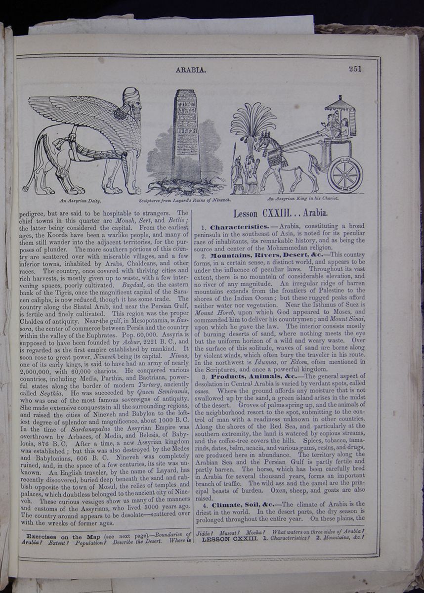
pedigree, but are said to be hospitable to strangers. The chief towns in this quarter are Moush, Sert, and Betlis; the latter being considered the capital. From the earliest ages, the Koords have been a warlike people, and many of them still wander into the adjacent territories, for the purposes of plunder. The more southern portions of this country are scattered over with miserable villages, and a few inferior towns, inhabited by Arabs, Chaldeans, and other races. The country, once covered with thriving cities and rich harvests, is mostly given up to waste, with a few intervening spaces, poorly cultivated. Bagdad, on the eastern bank of the Tigris, once the magnificent capital of the Saracen caliphs, is now reduced, though it has some trade. The country along the Shatul Arab, and near the Persian Gulf, is fertile and finely cultivated. This region was the proper Chaldea of antiquity. Near the gulf, in Mesopotamia, is Bassora, the center of commerce between Persia and the country within the valley of the Euphrates. Pop. 60,000. Assyria is supposed to have been founded by Ashur, 2221 B. C., and is regarded as the first empire established by mankind. It soon rose to great power, Nineveh being its capital. Ninus, one of its early kings, is said to have had an army of nearly 2,000,000, with 60,000 chariots. He conquered various countries, including Media, Parthia, and Bactriana, powerful states along the border of modern Tartary, anciently called Scythia. He was succeeded by Queen Semiramis, who was one of the most famous sovereigns of antiquity. She made extensive conquests in all the surrounding regions, and raised the cities of Nineveh and Babylon to the loftiest degree of splendor and magnificence, about 1000 B. C. In the time of Sardanapalus the Assyrian Empire was overthrown by Arbaces, of Media, and Belesis, of Babylonia, 876 B. C. After a time, a new Assyrian kingdom was established; but this was also destroyed by the Medes and Babylonians, 606 B. C. Nineveh was completely ruined, and, in the space of a few centuries, its site was unknown. An English traveler, by the name of Layard, has recently discovered, buried deep beneath the sand and rubbish opposite the town of Mosul, the relics of temples and palaces, which doubtless belonged to the ancient city of Nineveh. These curious vestiges show us many of the manners and customs of the Assyrians, who lived 3000 years ago. The country around appears to be desolate—scattered over with the wrecks of former ages.
Lesson CXXIII... Arabia.
1. Characteristics.—Arabia, constituting a broad peninsula in the southeast of Asia, is noted for its peculiar race of inhabitants, its remarkable history, and as being the source and center of the Mohammedan religion.
2. Mountains, Rivers, Desert, &c.—This country forms, in a certain sense, a distinct world, and appears to be under the influence of peculiar laws. Throughout its vast extent, there is no mountain of considerable elevation, and no river of any magnitude. An irregular ridge of barren mountains extends from the frontiers of Palestine to the shores of the Indian Ocean; but these rugged peaks afford neither water nor vegetation. Near the Isthmus of Suez is Mount Horeb, upon which God appeared to Moses, and commanded him to deliver his countrymen; and Mount Sinai, upon which he gave the law. The interior consists mostly of burning deserts of sand, where nothing meets the eye but the uniform horizon of a wild and weary waste. Over the surface of this solitude, waves of sand are borne along by violent winds, which often bury the traveler in his route. In the northwest is Idumea, or Edom, often mentioned in the Scriptures, and once a powerful kingdom.
3. Products, Animals, &c.—The general aspect of desolation in Central Arabia is varied by verdant spots, called oases. Where the ground affords any moisture that is not swallowed up by the sand, a green island arises in the midst of the desert. Groves of palms spring up, and the animals of the neighborhood resort to the spot, submitting to the control of man with a readiness unknown in other countries. Along the shores of the Red Sea, and particularly at the southern extremity, the land is watered by copious streams, and the coffee-tree covers the hills. Spices, tobacco, tamarinds, dates, balm, acacia, and various gums, resins, and drugs, are produced here in abundance. The territory along the Arabian Sea and the Persian Gulf is partly fertile and partly barren. The horse, which has been carefully bred in Arabia for several thousand years, forms an important branch of traffic. The wild ass and the camel are the principal beasts of burden. Oxen, sheep, and goats are also raised.
4. Climate, Soil, &c.—The climate of Arabia is the driest in the world. In the desert parts, the dry season is prolonged throughout the entire year. On these plains, the
Exercises on the Map (see next page).—Boundaries of Arabia? Extent? Population ? Describe the Desert. Where is Jidda? Muscat? Mocha? What waters on three sides of Arabia? LESSON CXXIII. 1. Characteristics? 2. Mountains, etc.?
[begin surface 966]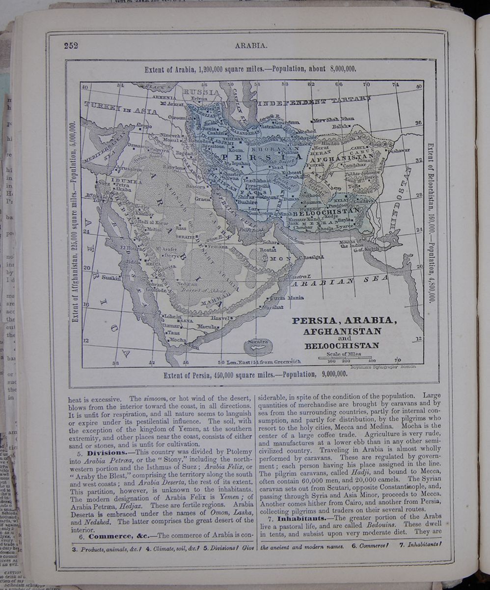 252
ARABIA.
Persia, Arabia, Afghanistan and Belochistan
Extent of Arabia, 1,200,000 square
miles.—Population, about 8,000,000.
Extent of Afghanistan 225,000 square
miles—Population 5,000,000.
Extent of Belochistan 160,000—Population
4,800,000.
Extent of Persia, 450,000 square
miles.—Population 9,000,000.
A map of Persia, Arabia, Afghanistan and
Belochistan
252
ARABIA.
Persia, Arabia, Afghanistan and Belochistan
Extent of Arabia, 1,200,000 square
miles.—Population, about 8,000,000.
Extent of Afghanistan 225,000 square
miles—Population 5,000,000.
Extent of Belochistan 160,000—Population
4,800,000.
Extent of Persia, 450,000 square
miles.—Population 9,000,000.
A map of Persia, Arabia, Afghanistan and
Belochistan
heat is excessive. The simoom, or hot wind of the desert, blows from the interior toward the coast, in all directions. It is unfit for respiration, and all nature seems to languish or expire under its pestilential influence. The soil, with the exception of the kingdom of Yemen, at the southern extremity, and other places near the coast, consists of either sand or stones, and is unfit for cultivation.
5. Divisions.—This country was divided by Ptolemy into Arabia Petroea, or the "Stony," including the northwestern portion and the Isthmus of Suez; Arabia Felix, or "Araby the Blest," comprising the territory along the south and west coasts; and Arabia Deserta, the rest of its extent. This partition, however, is unknown to the inhabitants. The modern designation of Arabia Felix is Yemen; of Arabia Petraea, Hedjaz. These are fertile regions. Arabia Deserta is embraced under the names of Omon, Lasha, and Nedshed. The latter comprises the great desert of the interior.
6. Commerce, &c.—The commerce of Arabia is considerable, in spite of the condition of the population. Large quantities of merchandise are brought by caravans and by sea from the surrounding countries, partly for internal consumption, and partly for distribution, by the pilgrims who resort to the holy cities, Mecca and Medina. Mocha is the center of a large coffee trade. Agriculture is very rude, and manufactures at a lower ebb than in any other semi-civilized country. Traveling in Arabia is almost wholly performed by caravans. These are regulated by government; each person having his place assigned in the line. The pilgrim caravans, called Hadji, and bound to Mecca, often contain 60,000 men and 20,000 camels. The Syrian caravan sets out from Scutari, opposite Constantinople, and, passing through Syria and Asia Minor, proceeds to Mecca. Another comes hither from Cairo, and another from Persia, collecting pilgrims and traders on their several routes.
7. Inhabitants.—The greater portion of the Arabs live a
pastoral life, and are called Bedouins. These dwell in
tents, and subsist upon very moderate diet. They are
3. Products, animals, &c.? 4. Climate, soil,
&c.? 5. Divisions? Give the ancient and
modern names. 6. Commerce? 7.
Inhabitants?
[begin surface 967]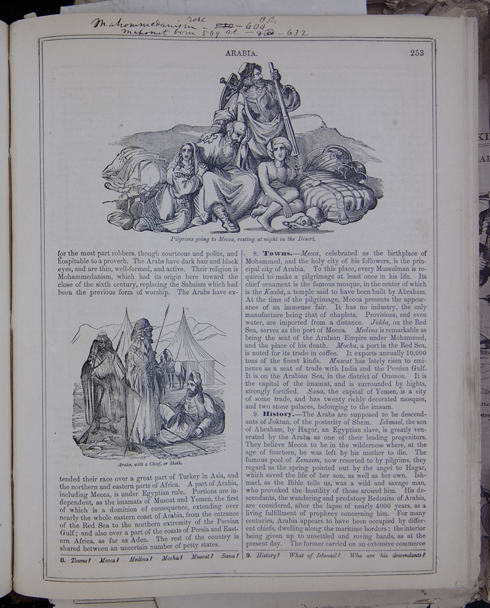 253
ARABIA.
Pilgrims going to Mecca, resting at night in
the Desert.
Pilgrims in the desert.
for the most part robbers, though courteous and
polite, and hospitable to a proverb. The Arabs have dark
hair and black eyes, and are thin, well-formed, and active.
Their religion is Mohammedanism, which had its origin here
toward the close of the sixth century, replacing the Sabaism
which had been the previous form of worship. The Arabs have
extended
Arabs, with a Chief, or Sheik.
Image of Arabs, horses, and tents, in a
desert.
their race over a great part of Turkey in Asia,
and the northern and eastern parts of Africa. A part of
Arabia, including Mecca, is under Egyptian rule. Portions
are independent, as the imamats of Muscat and Yemen, the
first of which is a dominion of consequence, extending over
nearly the whole eastern coast of Arabia, from the entrance
of the Red Sea to the northern extremity of the Persian
Gulf; and also over a part of the coasts of Persia and
Eastern Africa, as far as Aden. The rest of the country is
shared between an uncertain number of petty states.
253
ARABIA.
Pilgrims going to Mecca, resting at night in
the Desert.
Pilgrims in the desert.
for the most part robbers, though courteous and
polite, and hospitable to a proverb. The Arabs have dark
hair and black eyes, and are thin, well-formed, and active.
Their religion is Mohammedanism, which had its origin here
toward the close of the sixth century, replacing the Sabaism
which had been the previous form of worship. The Arabs have
extended
Arabs, with a Chief, or Sheik.
Image of Arabs, horses, and tents, in a
desert.
their race over a great part of Turkey in Asia,
and the northern and eastern parts of Africa. A part of
Arabia, including Mecca, is under Egyptian rule. Portions
are independent, as the imamats of Muscat and Yemen, the
first of which is a dominion of consequence, extending over
nearly the whole eastern coast of Arabia, from the entrance
of the Red Sea to the northern extremity of the Persian
Gulf; and also over a part of the coasts of Persia and
Eastern Africa, as far as Aden. The rest of the country is
shared between an uncertain number of petty states.
8. Towns.—Mecca, celebrated as the birthplace of Mohammed, and the holy city of his followers, is the principal city of Arabia. To this place, every Mussulman is required to make a pilgrimage at least once in his life. Its chief ornament is the famous mosque, in the center of which is the Kaaba, a temple said to have been built by Abraham. At the time of the pilgrimage, Mecca presents the appearance of an immense fair. It has no industry, the only manufacture being that of chaplets. Provisions, and even water, are imported from a distance. Jidda, on the Red Sea, serves as the port of Mecca. Medina is remarkable as being the seat of the Arabian Empire under Mohammed, and the place of his death. Mocha, a port in the Red Sea, is noted for its trade in coffee. It exports annually 10,000 tons of the finest kinds. Muscat has lately risen to eminence as a seat of trade with India and the Persian Gulf. It is on the Arabian Sea, in the district of Ommon. It is the capital of the imamat, and is surrounded by hights, strongly fortified. Sana, the capital of Yemen, is a city of some trade, and has twenty richly decorated mosques, and two stone palaces, belonging to the imaum.
9. History.—The Arabs are supposed to be descendants of
Joktan, of the posterity of Shem. Ishmael, the son of
Abraham, by Hagar, an Egyptian slave, is greatly venerated
by the Arabs as one of their leading progenitors. They
believe Mecca to be in the wilderness where, at the age of
fourteen, he was left by his mother to die. The famous pool
of Zenzem, now resorted to by pilgrims, they regard as the
spring pointed out by the angel to Hagar, which saved the
life of her son, as well as her own. Ishmael, as the Bible
tells us, was a wild and savage man, who provoked the
hostility of those around him. His descendants, the
wandering and predatory Bedouins of Arabia, are considered,
after the lapse of nearly 4000 years, as a living
fulfillment of prophecy concerning him. For many centuries,
Arabia appears to have been occupied by different chiefs,
dwelling along the maritime borders; the interior being
given up to unsettled and roving bands, as at the present
day. The former carried on an extensive commerce
8. Towns? Mecca? Medina? Mocha? Muscat? Sana?
9. History? What of Ishmael? Who are his
descendants?
[begin surface 968]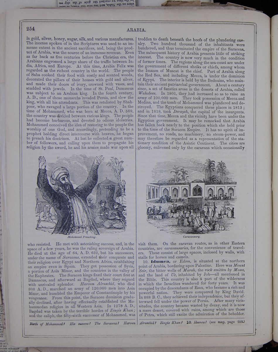 254
ARABIA. in gold, silver,
honey, sugar, silk, and various manufactures. The incense
spoken of in the Scriptures was used to an immense extent in
the ancient sacrifices, and, being the product of Arabia,
was the source of an immense revenue. Even as far back as
five centuries before the Christian era, the Arabians
engrossed a large share of the traffic between India,
Africa, and Europe. At this time, Arabia Felix was regarded
as the richest country in the world. The people of Saba
cooked their food with costly and scented woods, decorated
the pillars of their houses with gold and silver, and made
their doors of ivory, crowned with vases, and studded with
jewels. In the time of St. Paul, Damascus was subject to an
Arabian king. In the fourth century, A.D., one of these
monarchs invaded Persia, and slew the king, with all his
attendants. This was retaliated by Shahpoor, who ravaged a
large portion of the country. In the time of Mohammed, who
was born at Mecca, A.D. 569, the country was divided between
various kings. The people had become barbarous, and devoted
to odious idolatries. Mohammed conceived the idea of
restoring to the people the worship of one God, and
accordingly, pretending to be a prophet holding direct
intercourse with heaven, he began to preach his doctrines.
At last he collected a great number of followers, and
calling upon them to propagate his religion by the sword, he
and his armies made war upon all
Mohammed Preaching.
Image of Mohammed with raised hands
who resisted. He met with astonishing success,
and, in the space of a few years, he was the ruling
sovereign of Arabia. He died at the age of 64, A.D. 632, but
his successors, under the name of Saracens, extended their
conquests and their religion over Egypt and Northern Africa,
establishing an empire even in Spain. They got possession of
Syria, a portion of Asia Minor, and the countries in the
valley of the Euphrates. The Saracen kings fixed their court
first at Damascus, and afterward at Badgad, where they
reigned with unrivaled splendor. Haroun Alraschid, who died
808 A.D., marched an army of 120,000 men into Asia Minor,
and humbled the Emperor of Constantinople by his vengeance.
From this point, the Saracen dominion gradually declined,
after having effectually established the Mohammedan religion
in all Western Asia. In 1278 A. D., Bagdad was taken by the
terrible hordes of Zingis Khan; and the caliph, the
fifty-sixth successor of Mohammed, was trodden to
death beneath the hoofs of the plundering cavalry. Two
hundred thousands of the inhabitants were butchered, and
thus terminated the empire of the Saracens. The subsequent
history of Arabia presents little of striking interest. The
country is now very much in the condition of former times.
The regions along the sea-coast are under the government of
different sheiks or chiefs, among whom the Imaum of Muscat
is the chief. Part of Arabia along the Red Sea, and
including Mecca, is under the dominion of Egypt. The
interior is held by the Bedouins, who maintain their ancient
patriarchal government. About a century since, a set of
fanatics arose in the desert of Arabia, called Wahabees. In
1801, they had increased so as to raise an army of 100,000
men. They took possession of Mecca and Medina, and the tomb
of Mohammed was plundered and destroyed. The Egyptians
conquered these places in 1813; and in 1818, took Derayeh,
the capital of the insurgents. Since that time, Mecca and
the vicinity have been under the Egyptian government. It may
be remarked that Arabia has fallen back nearly to the
position which she held prior to the time of the Saracen
Empire. It has no spirit of improvement, no roads, no
machinery, no steam-power, and may therefore be regarded as
a representation of the stationary condition of the Asiatic
Continent. The cities are gloomy, enlivened only by the
caravans which occasionally
Caravansary.
Caravans in the desert.
visit them. On the caravan routes, as in other
Eastern countries, are caravansaries, for the convenience of
travelers. These consist of large spaces, inclosed by walls,
with stalls for horses and camels.
254
ARABIA. in gold, silver,
honey, sugar, silk, and various manufactures. The incense
spoken of in the Scriptures was used to an immense extent in
the ancient sacrifices, and, being the product of Arabia,
was the source of an immense revenue. Even as far back as
five centuries before the Christian era, the Arabians
engrossed a large share of the traffic between India,
Africa, and Europe. At this time, Arabia Felix was regarded
as the richest country in the world. The people of Saba
cooked their food with costly and scented woods, decorated
the pillars of their houses with gold and silver, and made
their doors of ivory, crowned with vases, and studded with
jewels. In the time of St. Paul, Damascus was subject to an
Arabian king. In the fourth century, A.D., one of these
monarchs invaded Persia, and slew the king, with all his
attendants. This was retaliated by Shahpoor, who ravaged a
large portion of the country. In the time of Mohammed, who
was born at Mecca, A.D. 569, the country was divided between
various kings. The people had become barbarous, and devoted
to odious idolatries. Mohammed conceived the idea of
restoring to the people the worship of one God, and
accordingly, pretending to be a prophet holding direct
intercourse with heaven, he began to preach his doctrines.
At last he collected a great number of followers, and
calling upon them to propagate his religion by the sword, he
and his armies made war upon all
Mohammed Preaching.
Image of Mohammed with raised hands
who resisted. He met with astonishing success,
and, in the space of a few years, he was the ruling
sovereign of Arabia. He died at the age of 64, A.D. 632, but
his successors, under the name of Saracens, extended their
conquests and their religion over Egypt and Northern Africa,
establishing an empire even in Spain. They got possession of
Syria, a portion of Asia Minor, and the countries in the
valley of the Euphrates. The Saracen kings fixed their court
first at Damascus, and afterward at Badgad, where they
reigned with unrivaled splendor. Haroun Alraschid, who died
808 A.D., marched an army of 120,000 men into Asia Minor,
and humbled the Emperor of Constantinople by his vengeance.
From this point, the Saracen dominion gradually declined,
after having effectually established the Mohammedan religion
in all Western Asia. In 1278 A. D., Bagdad was taken by the
terrible hordes of Zingis Khan; and the caliph, the
fifty-sixth successor of Mohammed, was trodden to
death beneath the hoofs of the plundering cavalry. Two
hundred thousands of the inhabitants were butchered, and
thus terminated the empire of the Saracens. The subsequent
history of Arabia presents little of striking interest. The
country is now very much in the condition of former times.
The regions along the sea-coast are under the government of
different sheiks or chiefs, among whom the Imaum of Muscat
is the chief. Part of Arabia along the Red Sea, and
including Mecca, is under the dominion of Egypt. The
interior is held by the Bedouins, who maintain their ancient
patriarchal government. About a century since, a set of
fanatics arose in the desert of Arabia, called Wahabees. In
1801, they had increased so as to raise an army of 100,000
men. They took possession of Mecca and Medina, and the tomb
of Mohammed was plundered and destroyed. The Egyptians
conquered these places in 1813; and in 1818, took Derayeh,
the capital of the insurgents. Since that time, Mecca and
the vicinity have been under the Egyptian government. It may
be remarked that Arabia has fallen back nearly to the
position which she held prior to the time of the Saracen
Empire. It has no spirit of improvement, no roads, no
machinery, no steam-power, and may therefore be regarded as
a representation of the stationary condition of the Asiatic
Continent. The cities are gloomy, enlivened only by the
caravans which occasionally
Caravansary.
Caravans in the desert.
visit them. On the caravan routes, as in other
Eastern countries, are caravansaries, for the convenience of
travelers. These consist of large spaces, inclosed by walls,
with stalls for horses and camels.
10. Idumea, or Edom, is situated at the northern point of Arabia, bordering upon Palestine. Here was Mount Seir, the bitter wells of Marah, the rock smitten by Moses, and the land of Uz, inhabited by Job—all mentioned in the Bible. This country is also a part of the wilderness in which the Israelites wandered for forty years. It was occupied by the descendants of Esau, who became a rich and powerful nation. They were conquered by King David. In 888 B. C., they achieved their independence, but they afterward fell under the power of Persia. After many vicissitudes, the country became wasted by decay, and it is now a mere desert, covered with ruins, among which are those of Petra, which still excite the admiration of the beholder. Birth of Mohammed? His success? The Saracens? Haroun Alraschid? Zingis Khan? 10. Idumea? (see map, page 252.)
 and
and
[illegible]HE ROYAL FAMILY OF PERSIA.—The present [illegible]reign, Nassr-ed-din Shah, ascended the [illegible]ne in April, 1849. He was then sixteen [illegible]rs of age, and lived away from the court with [illegible]ne of his uncles, the governor of Tabriz. He suc[illegible]he throne in virtue of his being the [illegible]of kin in the collateral line of the cele[illegible]bra [illegible] th ah Shah, or Baba-Khan. Nassr ed[illegible]din [illegible]s the fourth sovereign of the Turco[illegible]ty of the Kadjars, the origin of whom [illegible]is curious. The dynasty which preceded that of the Kadjars was founded in the following manner: Under the reign of the Sophis there lived a camel driver whose bravery procured for him the obedience of a number of his companions, who formed themselves into a band, and under his direction crowned several most successful expeditions with the conquest of the province of Khorassan. Their leader, Nadiz, usurped the throne of Persian the death of Abas III, and caused himself to be proclaimed Shah, or Sovereign of Persia.
Nadir Shah brought under subjection Candahar, Cabul and several provinces of the Mogul Empire. He was killed in 1747 by his first lieutenant, whose eyes he had the intention of putting out. His successor, Thamasp-Kouli Khan II, reigned only a few years. Fearful disorders broke out at his death in Persia, and several pretenders to the throne arose. Among these was a member of the tribe of Kadjars, which signifies fugitives, named Mohammed Hacan Khan, who conquered Mazandaran and other provinces, and captured Ispahan; he was on the point of conquering all Persia when he fell into the hands of a rival, who beheaded him in 1758. His son, Aga Mohammed Khan, succeeded in proclaiming himself Shah of Persia in 1794, and he founded the present dynasty. Since 1705 the Court of Persia resides at Teheran; formerly Ispahan had been the capital of the Kingdom.
In Summer the Court is driven away from Teheran by the heat, and encamps from June[illegible]to September 30, at the foot of the Elboorz moun tains, in the valley of Goolahek. The embassadors and great authorities, with the richest in habitants of the town accompany the Court, and form a magnificent canvas town. The present Shah is of a very mild disposition, and is deeply attached to his mother, who governs his private household. She is only thirty-seven years of age, and is still beautiful. She has for a secretary a French woman, who married in Paris a Persian nobleman, and accompained her husband to his native home after having embraced his religion. The Shah has five children, to whom he is greatly attached. His eldest son died a few weeks ago.
[begin surface 971]
THE HOLY LAND. [Extract from a Private Letter.]
Cairo and the Desert—Gaza and the Plains of Askelon—The Jaffa Route to Jerusalem—Approach to the City—Pilgrims to the Holy Sepulchre—Multiplicity of Shrines and Relicts—Gethsemane.
We have at length reached the farthest point of our journeyings, and our faces will be from hence homeward turned. It has been thus far a journey replete with interest, and fortunately without any untoward occurrence to mar its pleasure.
A. has written you in regard to the Nile trip, and our stay in Cairo, that city of curious medley, where Europe, Asia, Africa and America meet much more on a system of perfect equality than in our land of freedom. Blacks of a hue darker than the raven's wing hold many stations which enable them to indulge their natural tendency to insolence and tawdry show, and above all, indolence—facts with which every traveller soon becomes acquainted.
There is a good deal in Cairo to interest, yet one tires of it; and it was with a feeling of great relief that I mounted my dromedary and turned his head for a voyage across the desert. We went quietly on from day to day, with little variety and no accident, but much enjoyment of the clear, pure atmosphere and patriarchal mode of life, and in sixteen days reached Jerusalem, having been fortunate enough not be quarantined at Gaza. From Gaza we visited the interesting ruins of the ancient city of Askelon, and from the height overlooking its site, formerly crowned by a watch-tower, we obtained a splendid view over the land of the Philistines, stretching away, dotted with olive groves and covered with luxuriant crops of grain, to the bases of the distant purple mountains of Judah, on the one side, while on the other, at our feet, lay the ruins of the stronghold of the Crusaders, its massive walls slowly crumbling to decay, and a few columns remaining, the sole memorials of its ancient magnificence. High hills of bright yellow sand, far to the north and south, girt the waters of the bright, but treacherous Mediterranean; a slight wind stirred its surface, and the voice of its waves came to us like a requium as we sat on the mouldering walls. Continuing our ride to Ashdod, where we encamped on the site of another of the Philistine cities, our way for two hours lay along the beach, which was strewn with countless numbers of beautiful shells, forming a perfect mosaic beneath our feet.
I have been much surprised by the richness and culture of the country we passed, immediately upon leaving the desert, and until we reached Ramleh. My reading had led me to suppose that it was waste and desolate, with only a patch of cultivation here and there: on the contrary, the vale of the brook Eshcol, (now dry) and the valley stretching for miles north from Gaza, are covered with most luxurious crops of wheat, barley, &c., and olive orchards hundreds of acres in extent.
From Ramleh to Jerusalem our way lay through the tribe of Dan, and over the "ne plus ultra" of bad roads; a worse one I am sure cannot be found, except perhaps among the Rocky Mountains or Andes. The country is very mountainous; and though it once no doubt produced abundance of olives, figs and grapes, having here, as everywhere else that we have since been, the appearance of having been once carefully terraced, the hills are now very bare and rugged, the soil having been washed away by the rains during centuries of neglect.
Through this region of sterility, relieved only here and there by an ancient olive tree yet clinging to the rocks, we ascended and descended hill after hill and mountain after mountain for nine weary hours, during the last two or three which we constantly supposed that from the next eminence we should catch sight of Jerusalem; and when we did finally see it, an hour before the sun set, I must confess to a feeling of entire disappointment. By the approach from Jaffa you get no impressive view of the city. As you reach an eminence about a mile from it you get your first view, which is merely of the tops of some of the Church of the Holy Sepulchre, and a short space of the wall between the Jaffa and Damascus gates. All the mass of the city and its prominent objects of attraction, the Mosque of Omar, lie spread over lower hills beyond.
It seems to you a city built on a slope, and not crowning the mountains, so often spoken of in the Psalms and elsewhere. The only really fine and impressive view is from the Mount of Olivet. From Ramleh we came up with some hundreds of pilgrims, who are flocking here this year from all quarters in numbers heretofore unparalleled. It is estimated there will be more than 15,000 and that there are now about 8,000 in this city. A more rag tag, desperate, ill-looking set of vagabonds I never saw; most of those now here are Armenians and Greeks from the Ionian Islands; and, though they have great need of the wash in the Jordan to wash away the outward impurities, I fear it will have little effect upon the inward, and should be very sorry, unarmed, to meet any of them among their own hills.
Jerusalem, consequently, is crowded to overflowing; the streets are thronged, and numbers of noisy miscreants are to be met with at all hours in places to which one would desire to go alone, thus taking away the feeling with which one naturally expects to be filled amidst scenes made sacred by the life and death of the Redemeer. Every spot, too, with which history or tradition can by any possibility, or impossibility, connect an incident in the life, teachings or death of Christ or the Virgin Mary, is covered by a chapel or church, and one cannot visit it without witnessing the mummeries of Greek or Roman Catholicism, (I put them together, for priest power is the sum total of both,) with their tawdry trappings and bare-faced impositions. The Mount of Calvary and the reported place of the sepulchre are covered by a large and very fine building, called the Church of the Holy Sepulchre. The spot where the body was washed is marked by a marble slab; the holes in the rock where the cross of Christ and those of the thieves stood are marked by a broad ring of gold or brass, as also the rent in the mountains, at the place where he was scourged, is an altar, and in the sepulchre where he was laid is a marble sarcophagus, with lights constantly burning around it and a priest in attendance. At all these places the pilgrims repeat Aves, and kneeling on their knees kiss them; some few, with an outward appearance of feeling, but most with careless levity and indifference, often laughing and joking. The same is the case with the tomb of the Virgin Mary, where, during the time that it is open, mass is constantly said.
The only place about Jerusalem, at present, possessing any degree of seclusion, is Gethsemane, and even that is often crowded. For the city itself, it has no beauty; the streets are all narrow and filthy to a degree beyond belief, making the air very bad; and as we have seen all the interesting localities in the neighborhood, we intend leaving to-morrow morning for Damascus and Beyrout.
[begin surface 973]
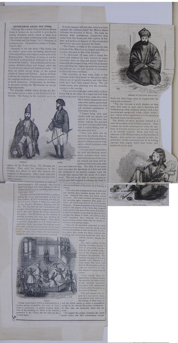
SECTARIANISM AMONG THE TURKS
[Through the courtesy of the publishers, Messrs. Derby & Jackson, we are enabled to give the following illustrated article, which is taken from their new and highly entertaining book, entitled, "The Sultan and His People," by C. Oscanyan, of Constantinople. Illustrated by a native of Turkey. Price $ 1.25.]
Oscanyan, in his late work, "The Sultan and his People," gives some interesting illustrations of the superstitions and religious ceremonies of the Mohammedans. The Koran, it seems, is not the book which is recognized as authority by the followers of the Prophet. The productions of his successors, Abubekir, Omer, and Osman, called the Sonnah, are also sacred and traditional books. To these are added several works of the ancient caliphs of Egypt and Babylon. And as all these books are the subjects of numerous commentaries, the religious literature of the country is a source of much dissention. Sectarianism is, therefore, as prevalent among the Mussulmans as among other religionists.
The principal schism which divides the Mohammedan nation is that of the Sünnees and the Sheyees. The former is the orthodox party, to PERSIAN. TURK. Figure of a Persian man and figure of a Turkish man, with traditional clothes. which all the Turks belong. The Persians are Sheyees. They reject the translations of the Prophet, and adhere to Aali, who married the daughter of Mohammed. These sects differ but little in the essentials of their faith, but hate each other intensely.
Their mutual curses are ingenious as well as most vituperative. For example, "May your fatigued and hated soul, when damned to Berzak (purgatory), find no more rest than a Giavour's hat enjoys upon earth."
The very meaning of the word Islam, or resignation to the service and commands of God, has been a source of much contention, and has produced a variety of sects, of which the most noted are the Hanefees, Mevlevees, Rifayees, and Abdals. The Hanefees are the contemplative philosophers, Oriental spirituals, or trascendentalists; and to this class belong the Sultan and most of the people. The Mevlevees are the dancing or whirling dervishes, and they may, therefore, be considered as the Oriental Shakers. Their object is practical resignation to God, which state of mind they think they attain by whirling round and round until their senses are lost in the dizzy motion. Their religious edifices are called Tekkés, which are open every Friday, and are frequently visited by the Sultan and Europeans in general. TEKKE. Scene of a Tekke, with dancers.
A large square space, which is surrounded by a circular railing, constitutes the scene of their ritual or ceremonies. A gallery occupies three sides of the building, in which is the latticed apartment of the Sultan, and the place for the Turkish ladies.
In every mosque, and here also, there is a niche opposite the entrance, called the Mihrab, which indicates the direction of Mecca. The walls are adorned with entablatures, ornamented with verses from the Koran, and with ciphers of Sultans, and mottoes in memory of other benevolent individuals who have endowed the Tekké.
"The Sheikh, or leader of the community, sits in front of the Mihrab, on an Angora goat skin, or a carpet, attended by two of his disciples.
"An attenuated old man, with a visage furrowed and withered by time, bronzed by many successive suns, his long and grizzly beard witnessing to the ravages of age, while his prominent eyes sparkling like lightnings amid the surrounding darkness, are the only symbols of animation or life in his worn-out frame.
"The dervishes, as they enter, make a low obeisance with folded hands to this patron saint, with an air of mystic veneration, and take their stand with their faces toward Mecca. The old sheikh arises, and presiding over the assembly commences the services.
"Their peculiar head-gear, called sikké, of thick brown felt, in the shape of a sugar loaf, and long and flowing robes of varied hues, make them seem like fantastic representations of some other sphere, particularly when they commence the slow and measured prostrations of Mussulman worship.
"Prayers being over, each dervish doffs his mantle, and appears in a long white fustanella, trailing the polished floor, and of innumerable folds, with a tightly-fitting vest of the same pure color.
"They now defile two by two before the skeikh, who, extending his hand toward them, seems to diffuse a sort of magnetism, which irradiates every countenance.
"As they stand immovable, the wild and thrilling music slowly pervades every sense, until suddenly one of the number extends his arms, and begins to revolve noiselessly, with slow and measured step. The folds of his ample skirt now open like the wings of a bird, and with the swiftness of his motion, expand, until the dervish only appears like the center of a whirlwind. The rest are all alike in motion, arms extended, eyes half closed as in a dream, the head in [illegible] the measured time of the music, as if floating in ecstasy.
"The calm and unimpassioned chief, with slow and stealthy step, wanders among their evolutions. Suddenly they cease, and march around the circle. The music increases its measure, and the dervishes again commence their giddy motions; old and young seem to be in a visionary rhapsody. Perhaps transported in the bewildering whirl to the regions of the blest, they languish with rapture in the arms of the houris of Paradise; or lose their earthly senses amid the glories which surround the throne of Allah; till suddenly they stand transfixed, their outspread and snowy drapery folding around them like the marble investment of an antique statue.
"They are all prostrated exhausted by their ecstasies, and immovable, until the sheikh recalls them to the realities of time by his holy benediction, when they slowly rise again, compass the building, and enveloping themselves with their cast-off mantles, silently disappear."
The rapid motions of the whirling dervishes produce a kind of pleasurable intoxication, but the horrible ceremonies of the Rifayees are distressing to the beholder. The fanatical disciples of this sect assemble every Thursday in a long, empty hall, much like that of the Inquisition, as its walls are adorned by an infinite variety of instruments of torture.
"Their sheikh takes his stand before the Mihrab facing the assembly, and three or four of the members furnishing themselves with instruments of music, place themselves in the center of the hall.
"The performance then begins by a monotonous chant, accompanied with music, and the waving of their heads to and fro, which seems to create a sympathetic vertigo in the devout Mussulman bystanders—for they often are irresistibly drawn into the ranks.
"By degrees the motion increases, the chant grows louder, and their countenances become SHEIKH OF HOWLING DERVISHES. Figure of sheikh. livid, and their lungs seem to expand with the noise and excitement.
"The line becomes a solid phalanx as they place their arms on each other's shoulders, and withdrawing a step, suddenly advance with a tremendous and savage yell, Allah—Allah—Allah—hoo! which divine appellative is to be repeated a thousand times uninterruptedly."
The Abdals, or stoics, generally pretend to a total renounciation of all worldly compacts. They commit the worst extravagances under the pretense of heavenly raptures, and are even supposed to be divinely inspired. Idiots and fools are esteemed by the Mohammedans as the favorites of Heaven; their spirits are supposed to have deserted their earthly tenements, and to be holding converse with angels, while their bodies still wander about the earth. ABDAL OR STOIC. Figure of Abdal.
[begin surface 975]
Lesson CXXIV... Persia.
1. Characteristics.—Persia is renowned for its ancient history, and its superiority to other Asiatic nations in literature and refinement of manners.
2. Mountains, &c.—The central part of Persia is table-land, about 3000 feet above the sea; traversed, however, by mountain ranges, extending to the north. Here are many fertile tracts, irrigated by rivers. In this region is the beautiful valley of Shiraz. The western portion is covered over with irreclaimable salt deserts. In the north, the climate is cool and delightful. Along the Persian Gulf, the country is parched by extreme heat in summer. In general, Persia is deficient in water. In the north, it is covered with fine pastures, orchards, and vineyards. Grain, cotton, tobacco, silk, madder, opium, assafoetida, wool, wine, rose-water, saffron, and dates are among the products. There are mines of copper, turquoise—peculiar to Persia—salt, coal, iron, naptha, and garnets. The camel, ass, argali, and gazelle, are natives of Persia. The horses are very superior. Sheep and cattle are abundant, especially with the wandering tribes in the remote provinces. The principal manufactures are silks, shawls of goats' hair, carpets, felts, cottons, cutlery, arms, glass, &c. The commerce is extensive—transportation being performed by mules. There are no good roads.
3.Government, &c.—The government is despotic; the king is called Shah; the governors of provinces, usually royal princes, are named beglerbegs. The annual revenue is $10,000,000. The army consists of 80,000 men.
4. Political Divisions.
| Provinces. | Chief Towns. | |
| Azerbijan | ... | Tabreez. |
| Irak Adjemi | ... | Teheran. |
| Ardelan | ... | Senbah. |
| Khuzistan | ... | Shuster. |
| Fars | ... | Shiraz. |
| Laristan | ... | Lar. |
| Kerman | ... | Kerman. |
| Ghilan | ... | Reshd. |
| Mazanderau | ... | Balfroosh. |
| Astrabad | ... | Astrabad. |
| Khorasan | ... | Nishapoor. |
| Yezd | ... | Yezd. |
5. Inhabitants.—The population is much mixed. The Parsees, of the ancient Persian stock, are few in number, but retain their ancient fire-worship. The inhabitants consist mostly of the descendants of Turks, Tartars, Arabs, Armenians, &c. They are a handsome, active, warlike people, of a quick imagination, agreeable address—versatile and pliable, but insincere and immoral in their habits. They are fond of poetry and imaginative literature. Their religion is Mohammedan, of the Shiah sect. In the remote districts are many nomadic tribes of Arabs, Turcomans, Tartars, &c. These live in tents, and subsist by pasturage and plunder.
6. History.—Modern Persia, or Iran, embraces Persia
Proper, with the ancient Media, Susiana, and Carmania.
Ancient Persia was much more extensive, embracing Hyrcania,
Parthia, Bactriana, and Sogdiana, in Tartary, with Arachosia
and Gedrosia, the present Afghanistan and Beloochistan. The
Persian Empire was still more extensive. (See map, p. 250.)
The early history of the country is obscured with fables.
Cyrus became master of Media, which had long been a powerful
kingdom. He conquered Babylon and the adjacent countries,
538 B.C., and established the ancient Persian Empire. In
480, Xerxes, one of his successors, invaded Greece, with an
army of 3,000,000. He was totally defeated at the battle of
Salamis. Alexander, the Macedonian, defeated Darius III, 331
B.C., in the celebrated battle of Arbela, forty miles east
of the present town of Mosul—thus conquering the
Persian Empire. Seleucus, Alexander's successor, reigned
over it for 500 years. About the year 600 A.D., the country
had declined into a state of comparative barbarism. The
ancient Persian Empire may be considered as at an end, at
this point; and here the history of modern Persia begins.
This has been subject to many vicissitudes. In 638 A.D.,
Exercises on the Map (p. 252).—Boundaries of
Persia? Extent? Population ? Where is Teheran?
Ispahan? Shiraz? What a gulf to the south of Persia?
What sea to the north? Where are the ruins of
Persepolis? Of Susa? What mountains in the
north?
LESSON CXXIV. 1. Characteristics of Persia?
2. Mountains, &c.? 3. Government, &c.?
4. Political Divisions? 5. Inhabitants? 6. History?
What of Cyrus? Xerxes? The Parthians? Shah Abbas?
Nadir Shah?
[begin surface 977] 256
AFGHANISTAN AND
BELOCHISTAN.
Ancient Medians.
depiction of Ancient Medians.
it was conquered by the Saracens, who forced it to
adopt the Mohammedan religion. About the year 1000, it
became subject to Mahmoud, whose capital was at Ghizni, in
the present Afghanistan, sixty miles south of Cabul. He
conquered various countries, including a portion of
Hindostan, and established a dynasty which continued for
nearly two centuries. The Seljukian Turks succeeded. The
country was conquered and desolated about the year 1220, by
Zingis Khan; and by Timour, about 1320 A.D. Shah Abbas, the
Great, who came to the throne in 1527, raised the country to
a high degree of power and prosperity. Nadir Shah, who
became king in 1736, extended and established his dominion.
Since his time, no important events have taken place
here.
256
AFGHANISTAN AND
BELOCHISTAN.
Ancient Medians.
depiction of Ancient Medians.
it was conquered by the Saracens, who forced it to
adopt the Mohammedan religion. About the year 1000, it
became subject to Mahmoud, whose capital was at Ghizni, in
the present Afghanistan, sixty miles south of Cabul. He
conquered various countries, including a portion of
Hindostan, and established a dynasty which continued for
nearly two centuries. The Seljukian Turks succeeded. The
country was conquered and desolated about the year 1220, by
Zingis Khan; and by Timour, about 1320 A.D. Shah Abbas, the
Great, who came to the throne in 1527, raised the country to
a high degree of power and prosperity. Nadir Shah, who
became king in 1736, extended and established his dominion.
Since his time, no important events have taken place
here.
Lesson CXXV... Afghanistan and Beloochistan.
1. Afghanistan.—This is a mountainous country, intersected by valleys and wide plains. Some of these are fertile and well watered. Agriculture is in a rude state, through rice, cotton, sugar-cane, and maize are raised. Sheep and goats are abundant, the latter producing a fine wool, much used in the manufacture of shawls. The exports consist of madder, tobacco, horses, fruits, furs, shawls, turbans, and indigo. The transit trade is wholly conducted by means of camels and horses, the employment of wheeled vehicles being impracticable. Cabul, the capital, is a fortified city, and has an active trade. The streets are intricate and often too narrow for two horsemen to pass each other. The houses are built of sun-dried bricks and wood, with flat roofs. Candahar, Peshawur, and Ghizni are large towns. The ruins of the latter bespeak its magnificence when it was the metropolis of the Gaznevide empire. The population comprises Beloochees, Usbeks, Persians, and Hindoos; but the chief source of the present Afghan nation is the original Afghan tribe, which forms an ancient and peculiar race. Schools are common in the country, and a taste for poetry is general. The people are spirited and intelligent, but very fond of show. They resemble the Persians, though somewhat less refined. The country includes the Paromisus, Aria, Arachosia, and Drangiana of the Greeks. The early history of this people is little known. The country belonged early to Persia, and in the eleventh century was the seat of the Gaznevide empire, which extended over Persia and Hindostan. It afterward fell under the power of the Mogul empire, Cabul being the capital and residence of Baber, one of the most famous monarchs of that race. In 1708 the country became independent. In 1838, Dost Mohammed, the king, was conquered by the British; but at a subsequent period, they retired from the territory, having lost several thousand men in their wars with this high-spirited people. The country continues to be independent.
2. Beloochistan.—This country may be described as having a rugged and barren soil, and as being deficient in water, which is absorbed by the deserts. The rivers are very insignificant; the largest, the Dustee, though one thousand miles long, being at its mouth only twenty inches deep and twenty yards wide. The pastures are poor, and the cattle few; but a good many sheep and goats are kept, the pursuit of the people being mostly pastoral. The trade of the country is small, consisting in prepared skins, woolen felt, carpets, and tent-covers of goats' or camels' hair. It is chiefly monopolized by Hindoos. The Bactrian, or two-humped camel, and dromedary are used as beasts of burden. Kelat, the capital, has a population of 12,000, with some manufactures. The people are little known, but are said to be in a barbarous state, fond of gaming and warlike exercises, martial songs, and rough music. In the west, they are freebooters by profession. The country was anciently called Gedrosia, and till a late period was deemed a portion of Persia, and afterward a part of Afghanistan. Its history is little known. It appears that Alexander's army, in crossing the Gedrosian desert, suffered greatly from fatigue and thirst.
Exercises on the Map (see p. 252). Boundaries of Afghanistan? Extent? Population? Where is Cabul? Ghizni? Boundaries of Beloochistan? Extent? Population? Where is Kelat? What sea to the south? What river forms its eastern boundary?
LESSON CXXV. 1. Afghanistan? Principal towns? Its history? 2. Beloochistan? The people? What of Kelat?
 [begin surface 979]
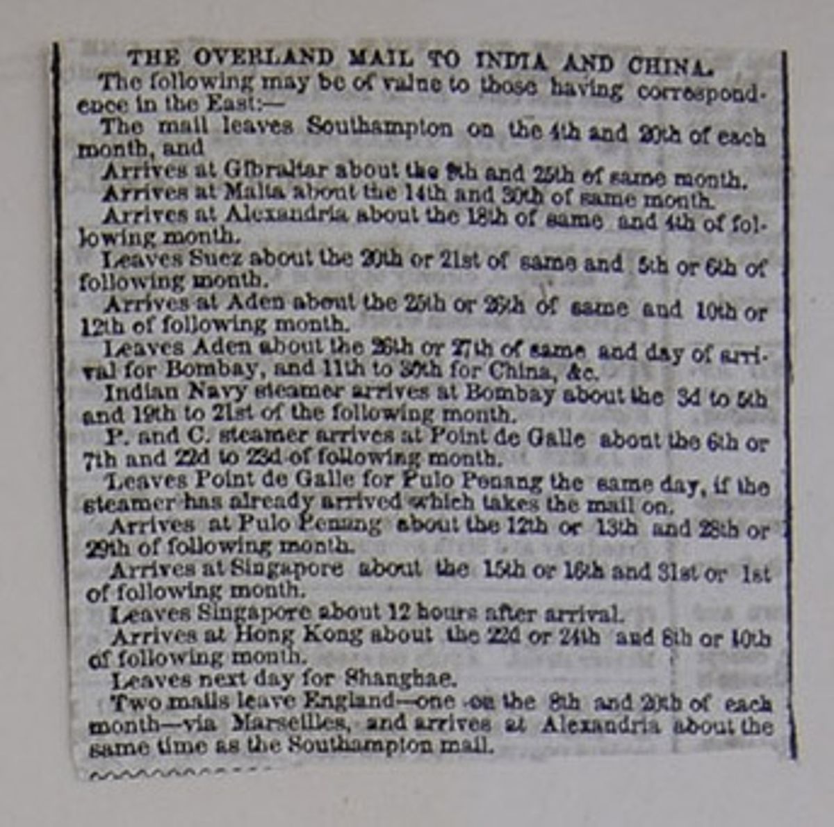
THE OVERLAND MAIL TO INDIA AND CHINA.
The following may be of value to those having correspondence in the East:—
The mail leaves Southampton on the 4th and 20th of each month, and
Arrives at Gibraltar about the 9th and 25th of same month.
Arrives at Malta about the 14th and 30th of same month.
Arrives at Alexandria about the 18th of same and 4th of following month.
Leaves Suez about the 20th or 21st of same and 5th or 6th of following month.
Arrives at Aden about the 25th or 26th of same and 10th or 12th of following month.
Leaves Aden about the 26th or 27th of same and day of arrival for Bombay, and 11th to 30th for China, &c.
Indian Navy steamer arrives at Bombay about the 3d to 5th and 19th to 21st to 23d of following month.
P. and C. steamer arrives at Point de Galle about the 6th or 7th and 22d to 23d of following month.
Leaves Point de Galle for Pulo Penang the same day, if the steamer has already arrived which takes the mail on.
Arrives at Pulo Penang about the 12th or 13th and 28th or 29th of following month.
Arrives at Singapore about the 15th or 16th and 31st or 1st of following month.
Leaves Singapore about 12 hours after arrival.
Arrives at Hong Kong about the 22d or 24th and 8th or 10th of following month.
Leaves next day for Shangae.
Two mails leave England—one on the 8th and 20th of each month—via Marseilles, and arrives at Alexandria about the same time as the Southampton mail.
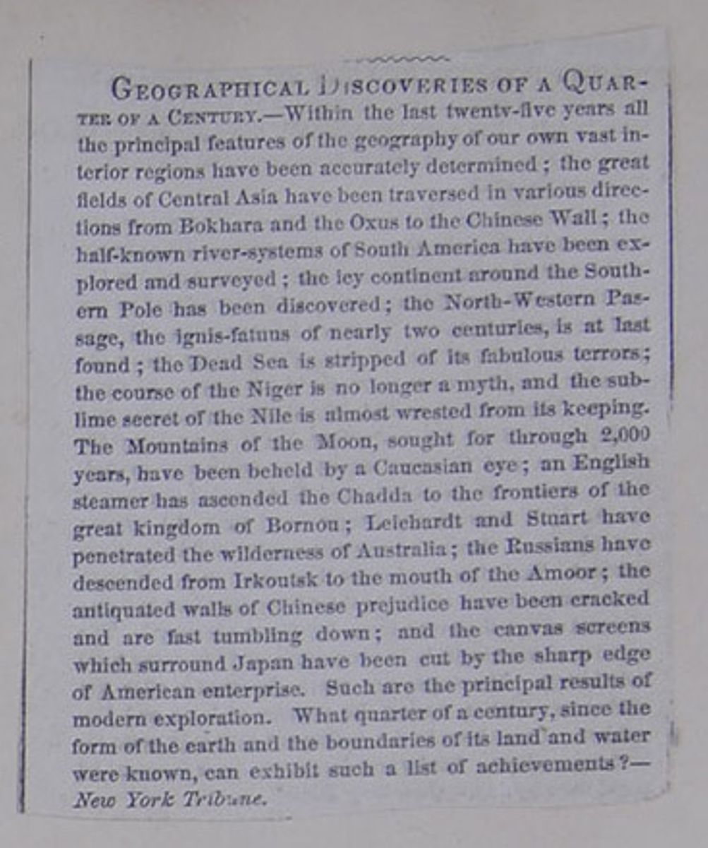
GEOGRAPHICAL DISCOVERIES OF A QUARTER OF A CENTURY.
—Within the last twenty-five years all the principal features of the geography of our own vast interior regions have been accurately determined; the great fields of Central Asia have been traversed in various directions from Bokhara and the Oxus to the Chinese Wall; the half-known river-systems of South America have been explored and surveyed; the icy continent around the Southern Pole has been discovered; the North-Western Passage, the ignis-fatuus of nearly two centuries, is at last found; the Dead Sea is stripped of its fabulous terrors; the course of the Niger is no longer a myth, and the sublime secret of the Nile is almost wrested from its keeping. The Mountains of the Moon, sought for through 2,000 years, have been beheld by a Caucasian eye; an English steamer has ascended the Chadda to the frontiers of the great kingdom of Bornou; Leichardt and Stuart have penetrated the wilderness of Australia; the Russians have descended from Irkoutsk to the mouth of the Amoor; the antiquated walls of Chinese prejudice have been cracked and are fast tumbling down; and the canvas screens which surround Japan have been cut by the sharp edge of American enterprise. Such are the principal results of modern exploration. What quarter of a century, since the form of the earth and the boundaries of its land and water were known, can exhibit such a list of achievements?—New York Tribune.
 [begin surface 982]
 [begin surface 983]
 [begin surface 984]
 [begin surface 985]
 [begin surface 986]
 [begin surface 987]
 [begin surface 988]
 [begin surface 989]
 [begin surface 990]
 [begin surface 991]
 [begin surface 992]
 [begin surface 993]
 [begin surface 994]
 [begin surface 995]
 [begin surface 996]
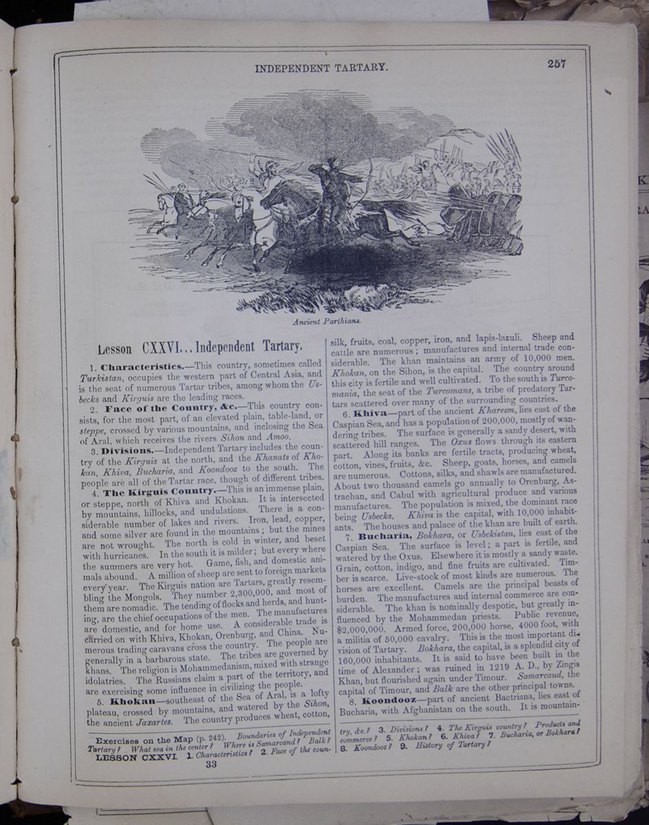
Lesson CXXVI... Independent Tartary.
1. Characteristics.—This country, sometimes called Turkistan, occupies the western part of Central Asia, and is the seat of numerous Tartar tribes, among whom the Usbecks and Kirquis are the leading races.
2. Face of the Country, &c.—This country consists, for the most part, of an elevated plain, table-land, or steppe, crossed by various mountains, and inclosing the Sea of Aral, which receives the rivers Sihon and Amoo.
3. Divisions.—Independent Tartary includes the country of the Kirguis at the north and the Khanats of Khokan, Khiva, Bucharia, and Koondooz to the south. The people are all of the Tartar race, though of different tribes.
4. The Kirguis Country.—This is an immense plain, or steppe, north of Khiva and Khokan. It is intersected by mountains, hillocks, and undulations. There is a considerable number of lakes and rivers. Iron, lead, copper, and some silver are found in the mountains; but the mines are not wrought. The north is cold in the winter, and beset with hurricanes. In the south it is milder; but every where the summers are very hot. Game, fish, and domestic animals abound. A million of sheep are sent to foreign markets every year. The Kirguis nation are Tartars, greatly resembling the Mongols. They number 2,300,000, and most of them are nomadic. The tending of flocks and herds, and hunting, are the chief occupations of the men. The manufacturers are domestic and for home use. A considerable trade is carried with Khiva, Khokan, Orenburg, and China. Numerous trading caravans cross the country. The people are generally in a barbarous state. The tribes are governed by khans. The religion is Mohammedanism, mixed with stange idolatries. The Russians claim a part of the territory, and are exercising some influence in civilizing the people.
5. Khokan—southeast of the Sea of Aral, is a lofty plateau, crossed by mountains, and watered by the Sihon, the ancient Jaxartes. The country produces wheat, cotton, silk, fruits, coal, copper, iron, and lapis-lazuli. Sheep and cattle are numerous; manufactures and internal trade considerable. The khan maintains an army of 10,000 men. Khokan, on the Sihon, is the capital. The country around this city is fertile and well cultivated. To the south is Turcomania, the seat of the Turcomans, a tribe of predatory Tartars scattered over many of the surrounding countries.
6. Khiva—part of the ancient Kharesm, lies east of the Caspian Sea, and has a population of 200,000, mostly of wandering tribes. The surface is generally a sandy desert, with scattered hill ranges. The Oxus flows through its eastern part. Along its banks are fertile tracts, producing wheat, cotton, vines, fruits, &c. Sheep, goats, horses, and camels are numerous. Cotton, silks, and shawls are manufactured. About two thousand camels go annually to Orenburg, Astrachan, and Cabul with agricultural produce and various manufactures. The population is mixed, the dominant race being Usbecks. Khiva is the capital with 10,000 inhabitants. The houses and palace of the khan are built of earth.
7. Bucharia, Bokhara, or Usbekistan, lies east of the Caspian Sea. The surface is level; a part is fertile, and watered by the Oxus. Elsewhere it is mostly a sandy waste. Grain, cotton, indigo, and fine fruits are cultivated. Timber is scarce. Live-stock of most kinds are numerous. The horses are excellent. Camels are the principal beasts of burden. The manufactures and internal commerce are considerable. The khan is nominally despotic, but greatly influenced by the Mohammedan priests. Public revenue, $2,000,000. Armed force, 200,000 horse, 4000 foot, with a militia of 50,000 cavalry. This is the most important division of Tartary. Bokhara, the capital, is a splendid city of 160,000 inhabitants. It is said to have been built in the time of Alexander; was ruined in 1219 A. D., by Zingis Khan, but flourished again under Timour. Samarcand, the capital of Timour, and Balk are the other principal towns.
8. Koondooz—part of ancient Bactriana, lies east of Bucharia, with Afghanistan on the south. It is mountainous
Exercises on the Map (p. 242). Boundaries of Independent Tartary? What sea in the center ? Where is Samarcand? Balk?
LESSON CXXVI 1. Characteristics? 2. Face of the country, &c.? 3. Divisions? 4. The Kirguis country? Products and commerce? 5. Khokan? 6. Khiva? 7. Bucharia, or Bokhara? 8. Koondooz? 9. History of Tartary?
[begin surface 997]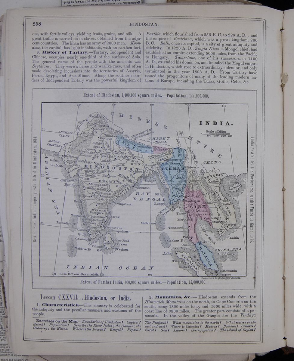 HINDOSTAN.
258
HINDOSTAN.
258
with fertile valleys, yelding fruits, grains, and silk. A great traffic is carried on in slaves, obtained from the adjacent countries. The khan has an army of 2000 men. Koondooz, the capital, has 1500 inhabitants, with an earthen fort.
9. History of Tartary.—Tartary, Independent and Chinese, occupies nearly one-third of the surface of Asia. The general name of the people with the ancients was Scythians. They were a fierce and warlike race, and often made desolating incursions into the territories of Assyria, Persia, Egypt, and Asia Minor. Along the southern borders of Independent Tartary was the powerful kingdom of Parthia, which flourished from 256 B.C. to 226 A.D.; and the empire of Bactriana, which was a great kingdom, 200 B.C. Balk, once its capital, is a city of great antiquity and celebrity. In 1226 A.D., Zingis Khan, a Mongol chief, had established an empire extending 5000 miles, from the Pacific to Hungary. Tamerlane, one of his successors, in 1400 A.D., extended his dominion, and founded the Mogul empire in Hindostan, which rose to extraordinary splendor, and only terminated in the year 1803 A. D. From Tartary have issued the progenitors of many of the leading modern nations of Europe, including the Turks, Goths, Celts, &c.
Extent of Hindostan, 1,100,00 square miles.—Population 144,000,000. British East India Company established in Hindostan, 1614. India Visited by the Portuguese, under Vasco de Gama, 1498. Extent of Farther India, 900,000 square miles.—Population, 15,000,000. A map of Persia, Arabia, Afghanistan, and Belochistan.Lesson CXXVII... Hindostan, or India.
1. Characteristics.—This country is celebrated for the antiquity and the peculiar manners and customs of the people.
2. Mountains, &c.—Hindostan extends from the Himmaleh Mountains on the north, to Cape Comorin on the south, being 1800 miles long, and 1600 miles wide, with a coast line of 3300 miles. The greater part consists of a peninsula. In the valley of the Ganges are the Vindhya
Exercises on the Map.—Boundaries of Hindostan? Capital? Extent? Population? Describe the River Indus; the Ganges; the Godavery; the Kistna. Where is the Deccan? Bengal? Nepaul? The Punjaub? What mountains to the north? What waters to the east and west? Where is Calcutta? Madras? Bombay? Benares? Surat? Goa? Lahore? Seringapatam? The island of Ceylon?
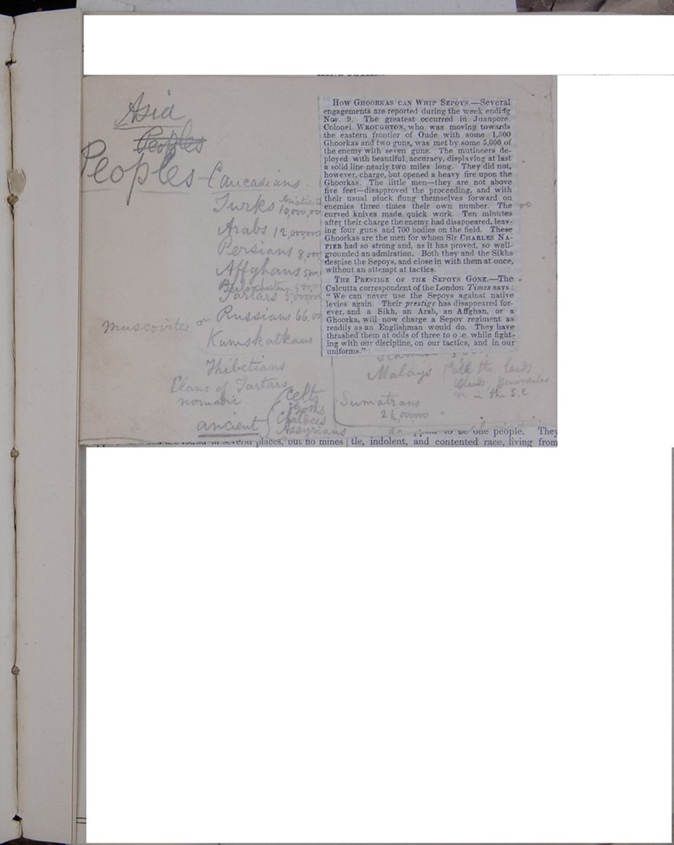 [begin surface 999]
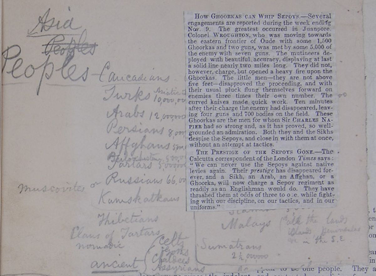
- Asia
Peoples- Peoples—Caucasians
- Turks Asiatic T[covered] 10,000,00[covered]
- Arabs 12,000,000
- Persians 8,000,[covered]
- Affghans 5,000,0[covered]
- Beiloochistans 5,00,00[covered]
- Tartars 5,000,000
- Moscovites or Russians 66,00
- Kamskatkans
- Thibetians
- Clans of Tartars
- nomadic
-
ancient
- Celts
- Goths
- Chaldees
- Assyrians
- Scan[covered]
- Malays (of all the lands islands, peninsulas &c in the S.E.
- Sumatrans 2½000,000
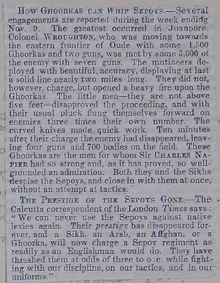
HOW GHOORKAS CAN WHIP SEPOYS.—
Several engagements are reported during the week ending Nov. 9. The greatest occurred in Juanpore. Colonel WROUGHTON, who was moving towards the eastern frontier of Oude with some 1,500 Ghoorkas and two guns, was met by some 5,000 of the enemy with seven guns. The mutineers deployed with beautiful accuracy, displaying at last a solid line nearly two miles long. They did not, however, charge, but opened a heavy fire upon the Ghoorkas. The little men—they are not above five feet—disapproved the proceeding, and with their usual pluck flung themselves forward on enemies three times their own number. The curved knives made quick work. Ten minutes after their charge the enemy had disappeared, leaving four guns and 700 bodies on the field. These Ghoorkas are the men for whom Sir CHARLES NAPIER had so strong and, as it has proved, so well-grounded an admiration. Both they and the Sikhs despise the Sepoys, and close in with them at once, without an attempt at tactics.
THE PRESTIGE OF THE SEPOYS GONE.—
The Calcutta correspondent of the London Times says: "We can never use the Sepoys against native levies again. Their prestige has disappeared forever, and a Sikh, an Arab, an Affghan, or a Ghoorka, will now charge a Sepoy regiment as readily as an Englishman would do. They have trashed them at odds of three to one, while fighting with our discipline, on our tactics, and in our uniforms."
 [begin surface 1002]
moral law " "
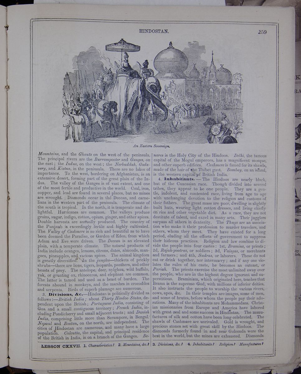
Mountains, and the Ghauts on the west of the peninsula. The principal rivers are the Burrampooter and Ganges, on the east; the Indus, on the west; the Nerbuddah, Godavery, and Kistna, in the peninsula. There are no lakes of importance. To the west, bordering on Afghanistan, is an extensive desert, forming part of the great plain of the Indus. The valley of the Ganges is of vast extent, and one of the most fertile and productive in the world. Coal, iron, copper, and lead are found in several places, but no mines are wrought. Diamonds occur in the Deccan, and carnelians in the western part of the peninsula. The climate of the south is tropical. In the north, it is temperate and delightful. Hurricanes are common. The valleys produce grains, sugar, indigo, cotton, opium, ginger, and other spices. Double harvests are annually produced. The country of the Punjab is exceedingly fertile and highly cultivated. The Valley of Cashmere is so rich and beautiful as to have been deemed the Paradise, or Garden of Eden, from which Adam and Eve were driven. The Deccan is an elevated plain, with a temperate climate. The natural products of India include oranges, lemons, citrons, dates, almonds, mangoes, pineapples, and various spices. The animal kingdom is greatly diversified. In the jungles—thickets of prickly shrubs—there are lions, tigers, leopards, panthers, and other beasts of prey. The antelope, deer, nylghau, wild buffalo, yak, or grunting ox, rhinoceros, and elephant are common. The latter is tamed and used as a beast of burden. The forests abound in monkeys, and the marshes in crocodiles and serpents. Birds of superb plumage are numerous.
3. Divisions, &c. —Hindostan is politically divided as follows:—British India; about Thirty Hindoo States, dependent upon the British; Portuguese India, consisting of Goa and a small contiguous territory; French India, including Pondicherry and small adjacent tracts; and Danish India, comprising little more than Serampore, in Bengal. Nepaul and Bootan, on the north, are independent. The cities of Hindostan are numerous, and many have a large population. Calcutta, the capital, and principal residence of the British in India, is on a branch of the Ganges. Benares is the Holy City of the Hindoos. Delhi, the famous capital of the Mogul emperors, has a magnificent mosque, and other superb edifices. Cashmere is famed for its shawls, made of the hair of the Thibet goat. Bombay, on an island, is the western capital of British India.
4. Inhabitants.—The Hindoos are nearly black, but of the Caucasian race. Though divided into several tribes, they appear to be one people. They are a gentle, indolent, and contented race, living from age to age with unchanging devotion to the religion and customs of their fathers. The great mass are poor, dwelling in slightly built huts, wearing light cotton dresses, and living chiefly on rice and other vegetable diet. As a race, they are not destitute of talent, and excel in many arts. Their jugglers surpass all others in dexterity. The Thugs are an association who make it their profession to murder travellers, and others, whom they meet. They have existed for a long period, eluding all the efforts of government to suppress their hideous practices. Religion and law combine to divide the people into four castes: 1st, Bramins, or priests; 2d, Rajah-pootras, or soldiers; 3d, Vaisgas, or merchants and farmers; and 4th, Sudras, or laborers. These do not eat or drink together, nor intermarry; and if any one violates the rules of his caste, he becomes an outcast, or Pariah. The priests exercise the most unlimited sway over the people, who are in the highest degree ignorant and superstitious. Braminism, which originated here, teaches that Brama is the supreme God, with millions of inferior deities. It also instructs the people to worship the various rivers, cows, apes, &c. In their temples are images, some of men, and some of brutes, before whom the people pay their adorations. Many of the inhabitants are Mohammedans. Christian missionaries from Europe and America have labored with great zeal and some success in Hindostan. The manufactures of silk and cotton have been long celebrated. The shawls of Cashmere are unrivaled. Gold is wrought, and precious stones set with great skill by the Hindoos. The diamonds formerly found in and near Golconda were the best in the world, but the mines are exhausted. Diamonds
LESSON CXXVII. 1. Characteristics? 2. Mountains, &c.? 3. Divisions, &c.? 4. Inhabitants? Religion? Manufactures?
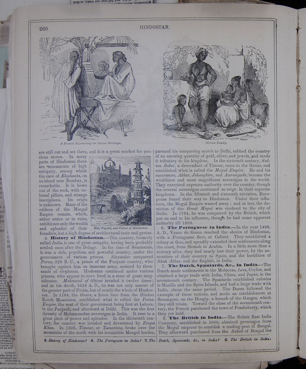
are still cut and set there, and it is a great market for precious stones. In many parts of Hindostan there are monuments of high antiquity, among which the cave of Elephanta, on an island near Bombay, is remarkable. It is hewn out of the rock, with colossal pillars, and strange inscriptions. Its origin is unknown. Many of the edifices of the Mongol Empire remain, which, either or in ruins, exhibit not only the wealth and splendor of their founders, but a high degree of architectural taste and genius.
Hut, Pagoda, and Palace of Hindostan. Figure of three prominent architectural types.5. History of Hindostan.—This country, formerly called India, is one of great antiquity, having been probably settled soon after the Deluge. In the time of Semiramis, it was a rich, populous, and powerful country, under the government of various princes. Alexander conquered Porus, 328 B.C., a prince of the Punjaub country, who brought against him an immense army, assisted by thousands of elephants. Hindostan continued under various princes, who appear to have lived in a state of great magnificence. Mahmoud of Ghizni invaded it twelve times; and at his death, 1028 A.D., he was not only master of the greater part of Persia, but of nearly the whole of Hindostan. In 1194, the Gaurs, a fierce race from the Hindoo Koosh Mountains, established what is called the Patan Empire, the seat of their government being first at Lahore, in the Punjaub, and afterward at Delhi. This was the first dynasty of Mohammedan sovereigns in India. It rose to a great pitch of power and splendor. In the thirteenth century, the country was invaded and devastated by Zingis Khan. In 1396, Timour, or Tamerlane, broke over the mountains of the north with his irresistible Mongol hordes, pursued his conquering march to Delhi, robbed the country of an amazing quantity of gold, silver, and jewels, and made it tributary to his kingdom. In the sixteenth century, Sultan Baber, a descendant of Timour, came to the throne, and established what is called the Mogul Empire. He and his successors, Akbar, Jehanghire, and Aurungzebe, became the wealthiest and most magnificent sovereigns in the world. They exercised supreme authority over the country, though the several sovereigns continued to reign in their separate kingdoms. In the fifteenth and sixteenth centuries, Europeans found their way to Hindostan. Under their influence, the Mogul Empire wasted away; and at last, the dominion of the Great Mogul was confined to the city of Delhi. In 1764, he was conquered by the British, which put an end to his influence, though he had some apparent authority till 1803.
6. The Portuguese in India.—In the year 1498, A. D., Vasco de Gama reached the shores of Hindostan, with a Portuguese fleet, at Calicut. They established a colony at Goa, and speedily extended their settlements along the coast, from Birmah to Arabia. In a little more than a century after, they had nearly lost their power, by the annexation of their country to Spain, and the hostilities of Shah Abbas, and the English, in India.
7. The Dutch, Spaniards, &c., In India.—The Dutch made settlements in the Moluccas, Java, Ceylon, and obtained a large trade with India, China, and Japan, in the seventeenth century. The Spaniards established colonies in Manilla and the Spice Islands, and had a large trade with India, about the same period. The Danes followed the example of these nations, and made an establishment at Serampore, on the Hoogly, a branch of the Ganges, which they still retain. Toward the close of the seventeenth century, the French purchased the town of Pondicherry, which they yet hold.
8. The British in India.—The British East India Company, established in 1600, obtained permission from the Mogul emperor to establish a trading-post in Bengal. They afterward purchased from the Subah of Bengal the
5. History of Hindostan? 6. The Portuguese in India? 7. The Dutch, Spaniards, &c., in India? 8. The British in India?
[begin surface 1005]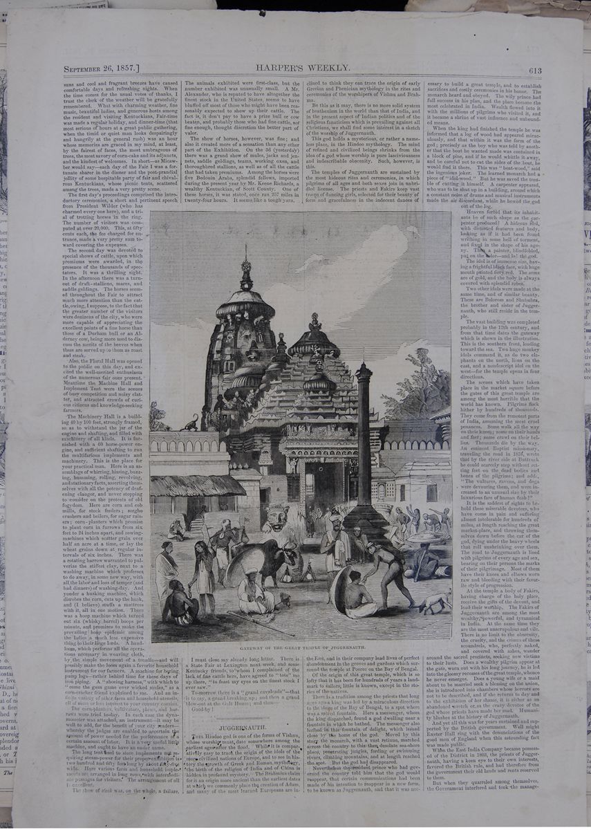 September 26, 1857.
HARPER'S WEEKLY.
613
GATEWAY OF THE GREAT TEMPLE OF
JUGGERNAUTH.
figure of temple of
Juggernauth.
September 26, 1857.
HARPER'S WEEKLY.
613
GATEWAY OF THE GREAT TEMPLE OF
JUGGERNAUTH.
figure of temple of
Juggernauth.
JUGGERNAUTH.
THIS Hindoo god is one of the forms of Vishnu, whose worship must date somewhere among the earliest ages after the flood. While it is comparatively easy to trace the origin of the idols of the more civilized nations of Europe, and to see in history the growth of Greek and Roman mythology, the birth of the religion of India and of China is hidden in profound mystery. The Brahmins claim for it an origin more ancient than the earliest dates at which we commonly place the creation of Adam, and many of the most learned Europeans are inclined to think they can trace the origin of early Grecian and Phenician mythology in the rites and ceremonies of the worshipers of Vishnu and Brahma.
Be this as it may, there is no more solid system of heathenism in the world than that of India, and in the present aspect of Indian politics and of the religious fanaticism which is prevailing against all Christians, we shall find some interest in a sketch of the worship of Juggernauth.
This god holds a mysterious, or rather a nameless place, in the Hindoo mythology. The mind of refined and civilized beings shrinks from the idea of a god whose worship is pure lasciviousness and indescribable obscenity. Such, however, is this.
The temples of Juggernauth are sustained by the most hideous rites and ceremonies, in which pilgrims of all ages and both sexes join in unbridled license. The priests and Fakirs keep vast troops of dancing girls, selected for their beauty of form and gracefulness in the indecent dances of the East, and in their company lead lives of perfect abandonment in the groves and gardens which surround the temple at Pooree on the Bay of Bengal.
Of the origin of this great temple, which is so lofty that it has been for hundreds of years a landmark to sailors, little is known, except in the stories of the natives.
There is a tradition among the priests that long ages ago a king was led by a miraculous direction to the shore of the Bay of Bengal, to a spot where was a sacred fountain. Here a messenger, whom the king dispatched, found a god dwelling near a fountain in which he bathed. The messenger also bathed in this fountain of delight, which issued close by the home of the god. Moved by this story the monarch, with a vast retinue, marched across the country to this then desolate sea-shore place, penetrating jungles, fording or swimming rivers, climbing mountains, and at length reached the spot. But the god had disappeared.
Nevertheless the resident prince who had governed the country told him that the god would reappear, that certain communications had been made of his intention to reappear in a new form, to be known as Juggernauth, and that it was necessary to build a great temple, and to establish sacrifices and costly ceremonies in his honor. The monarch heard and obeyed. The wily prince had full success in his plan, and the place became the most celebrated in India. Wealth flowed into it with the millions of pilgrims who visited it, and it became a shrine of vast influence and unbounded means.
When the king had finished the temple he was informed that a log of wood had appeared miraculously, and that within it was the form of the god; precisely as the boy who was told by another that the boat he wanted made was contained in a block of pine, and if he would whittle it away, and be careful not to cut the sides of the boat, he would find it there. This was "boat-wood," said the ingenious joker. The learned monarch had a piece of "idol-wood." But he was saved the trouble of cutting it himself. A carpenter appeared, who was to be shut up in a building, around which a constant noise of drums and musical instruments made the air discordant, while he hewed the god out of the log.
Heaven forbid that its inhabitants be of such shape as the carpenter produced! A hideous idol, with distorted features and body, looking as if it had been found writhing in some hell of torment, and fixed in the shape of his agony. Then a painter, blindfolded, put on the color—and lo! the god.
The idol is of immense size, having a frightful black face, with huge mouth painted fiery red. The arms are of gold, and the body is always covered with splendid robes.
Two other idols were made at the same time, and of similar beauty. These are Bolorom and Shububra, the brother and sister of Juggernauth, who still reside in the temple.
The vast building was completed probably in the 12th century, and from that time dates the gateway which is shown in the illustration. This is the southern front, leading toward the sea. Two huge monkey idols command it, as do two elephants on the north, lions on the east, and a nondescript idol on the west— for the temple opens in four directions.
The scenes which have taken place in the market square before the gates of this great temple are among the most horrible that the world has known. Pilgrims flock hither by hundreds of thousands. They come from the remotest parts of India, assuming the most cruel penances. Some walk all the way on their knees; some on their hands and feet; some crawl on their bellies. Thousands die by the way. An eminent Baptist missionary, traveling the road in 1834, wrote that by the river side at Buttruck he could scarcely step without setting feet on the dead bodies and bones of the pilgrims; and adds, "The vultures, ravens, and dogs were devouring them, and were increased to an unusual size by their luxurious fare of human flesh!"
It is the saddest of sights to behold these miserable devotees, who have come in pain and suffering almost intolerable for hundreds of miles, at length reaching the great market-place, and throwing themselves down before the car of the god, dying under the heavy wheels that roll unshrinking over them. The road to Juggernauth is lined [illegible] bearing on their persons the marks of their pilgrimage. Most of them have their knees and elbows worn raw and bleeding with their favorite style of progression.
At the temple a body of Fakirs, having charge of the holy place, receive the gifts of the devout, and lead their worship. The Fakirs of Juggernauth are among the most wealthy, powerful, and tyrannical in India. At the same time they are the most unscrupulous and vile. There is no limit to the obscenity, the cruelty, and the crimes of these scoundrels, who, perfectly naked, and covered with ashes, wander around the sacred precincts, seeking new victims to their lusts. Does a wealthy pilgrim appear at the gate, worn out his long journey, he is led into the gloomy recesses of the great temple, whence he never emerges. Does a young wife or a maid about to be married seek a blessing on the union, she is introduced into chambers whose horrors are not to be described, and if she returns to day and to the exhibition of her shame, it is either as an abandoned wretch or as the crazy devotee of the god whose priests have made her mad. Humanity blushes at the history of Juggernauth.
And yet all this was for years sustained and supported by the British government. Well might Exeter Hall ring with the denunciations of the good men of England when this astounding fact was made public.
When the East India Company became possessed of the District in 1803, the priests of Juggernauth, having a keen eye to their own interests, favored the British rule, and had therefore from the government their old lands and rents reserved to them.
But when they quarreled among themselves, the
Government interfered and took the management
[begin surface 1006] of the temple into its own hands.
They took all the revenues, paid the temple about
$25,000 a year, established a tax on pilgrims, out
of which they devoted part to improving the roads
and making them easier for the knees and elbows of
the devout, and part to building inns and
resting-places for the devotees along their
painful routes. The indignation of the religious
people in England put a stop to this pilgrim tax
in a few years. But the Government continued to
hold part of the lands of the temple and pay a
part of the annual revenue, about $12,000, until
within two years, when (in 1856) they finally made
over the lands to the temple, and left the Hindoos
to support Juggernauth on their own account.
of the temple into its own hands.
They took all the revenues, paid the temple about
$25,000 a year, established a tax on pilgrims, out
of which they devoted part to improving the roads
and making them easier for the knees and elbows of
the devout, and part to building inns and
resting-places for the devotees along their
painful routes. The indignation of the religious
people in England put a stop to this pilgrim tax
in a few years. But the Government continued to
hold part of the lands of the temple and pay a
part of the annual revenue, about $12,000, until
within two years, when (in 1856) they finally made
over the lands to the temple, and left the Hindoos
to support Juggernauth on their own account.
Some of our readers will remember the surprise and amusement caused by the fact appearing that Hindoo idols were manufactured in England and exported for sale in India. But the fact that vast revenues were received by the East India Company, and through them by the people of England, from the pilgrim taxes of various temples in India, was most judiciously hushed.
The huge idols which stand before the gateway of the temple face the sea, which is a half mile distant. The surf is always heavy, for there is no harbor at Pooree, the town where the temple stands. The people believe these idols to have power over the sea, especially to forbid its approach any hearer to their temple. The group of men and women represented in the foreground are devotees, Fakirs and Fakirnees, male and female alike naked, drunk with hemp and with fanaticism, resting a while in the open air after the orgies in which they have taken part within the temple.
The chief temple, which is surrounded by fifty smaller ones, stands at the head of the street leading down to the sea, on both sides of which are religious buildings. The great temple is built of red granite, and inclosed within a high wall. But it is always open to the public, and the idol is daily exhibited to their wondering eyes. It is a wooden figure of immense size with distorted features. The other two original images we have spoken of remain. They are worshiped as the brother and sister of Juggernauth. The shrine is under the great dome which is visible in the picture.
The ceremonies of the idol are daily washings, conducted with much ceremony. The great idol is washed and anointed and reclothed six times a day, each time in splendid robes. Immediately after the dressing, fifty-six Brahmins attend before it with various kinds of food which are offered to the god. It has been said that the food offered daily in the temple was in former times enough to feed twenty thousand persons. The offering over, the priests close the temple, admitting only the initiated and the dancing girls and Fakirnees (female Fakirs), and celebrate their orgies in the secret chambers. This ended, they retire to the cool groves which surround the temple and await the hour for the next lustration.
The car of Juggernauth is the great carriage in which the image of the god is drawn from this to another temple at the time of the annual festival. Of course the chief procession is at the grand temple in Pooree. This occurs in July. But every district of Bengal has its Juggernauth and its car, and the same hegira is accomplished in every large town, with similar ceremonies.
The car at Pooree is about sixty feet high, and runs on sixteen wheels, which press deep in the ground with their vast superincumbent weight. The people believe that whoever assists in drawing it obtains remission of all sins, and hence there are provided six immense cables for all to seize on. The rush, crush, and fury to get hold of the ropes results in the trampling on many, who are over- run by the wheels; thus dying gloriously, while the priests, of whom many stand on the car, shout their wild triumph—"Juggernaut Piritay! Hooree —Hooree—Bol!"
[begin surface 1007] [begin surface 1008]
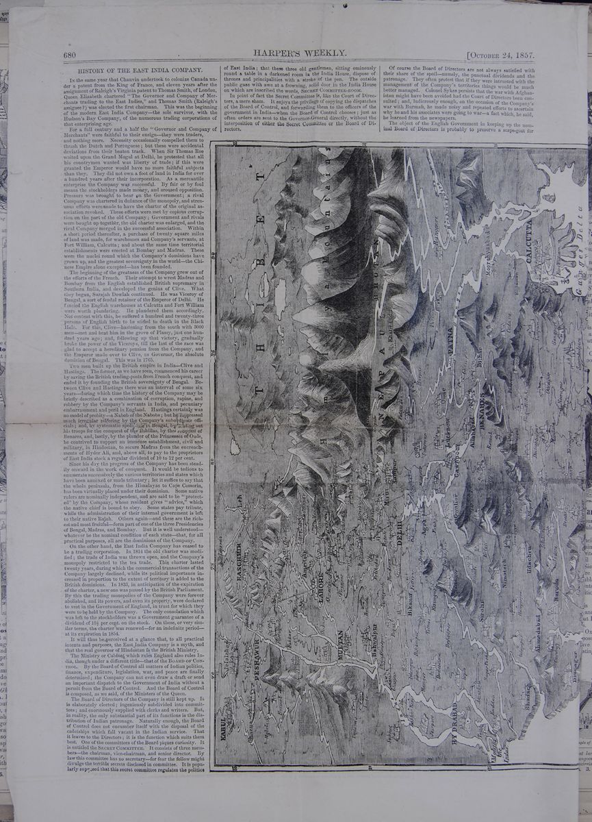
HISTORY OF THE EAST INDIA COMPANY.
IN the same year that Chauvin undertook to colonize Canada under a patent from the King of France, and eleven years after the assignment of Raleigh's Virginia patent to Thomas Smith, of London, Queen Elizabeth chartered "The Governor and Company of Merchants trading to the East Indies," and Thomas Smith (Raleigh's assignee?) was elected the first chairman. This was the beginning of the modern East India Company—the sole survivor, with the Hudson's Bay Company, of the numerous trading corporations of that enterprising age.
For a full century and a half the "Governor and Company of Merchants" were faithful to their ensign—they were traders, and nothing more. Necessity occasionally compelled them to thrash the Dutch and Portuguese; but these were accidental deviations from their beaten track. When Sir Thomas Roe waited upon the Grand Mogul at Delhi, he protested that all his countrymen wanted was liberty of trade; if this were granted the Emperor would have no more faithful subjects than they. They did not own a foot of land in India for over a hundred years after their incorporation. As a mercantile enterprise the Company was successful. By fair or by foul means the stockholders made money, and aroused opposition. Pressure was brought to bear on the Government; a rival Company was chartered in defiance of the monopoly, and strenuous efforts were made to have the charter of the original association revoked. These efforts were met by copious corruption on the part of the old Company; Government and rivals were bought up together, the old charter was enlarged, and the rival Company merged in the successful association. Within a short period thereafter, a purchase of twenty square miles of land was made, for warehouses and Company's servants, at Fort William, Calcutta; and about the same time territorial establishments were erected at Bombay and Madras. These were the nuclei round which the Company's dominions have grown up, and the greatest sovereignty in the world—the Chinese Empire alone excepted—has been founded.
The beginning of the greatness of the Company grew out of the efforts of the French. Their attempt to wrest Madras and Bombay from the English established British supremacy in Southern India, and developed the genius of Clive. What they began, Surajah Dowlah continued. He was Viceroy of Bengal, a sort of feudal retainer of the Emperor of Delhi. He fancied the English warehouses at Calcutta and Fort William were worth plundering. He plundered them accordingly. Not content with this, he suffered a hundred and twenty-three persons of English birth to be stifled to death in the Black Hole. For this, Clive—hastening from the south with 3000 men—met and beat him in the grove of Plassy, just one hundred years ago; and, following up that victory, gradually broke the power of the Viceroys, till the last of the race was glad to accept a hereditary pension from the Company, and the Emperor made over to Clive, as Governor, the absolute dominion of Bengal. This was in 1765.
Two men built up the British empire in India—Clive and Hastings. The former, as we have seen, commenced his career by saving the British trading-posts from French conquest, and ended it by founding the British sovereignty of Bengal. Between Clive and Hastings there was an interval of some six years—during which time the history of the Company may be briefly described as a combination of corruption, rapine, and robbery by the Company's servants in India, and pecuniary embarrassment and peril in England. Hastings certainly was no model of probity—a Nabob of the Nabobs; but he suppressed much irregular pilfering by the Company's subordinate officials; and, by systematic spoliation in Bengal, by lending out his troops for the conquest of the Rohillas, by the conquest of Benares, and, lastly, by the plunder of the Princesses of Oude, he contrived to support an immense establishment, civil and military, in Hindostan, to secure Madras from the encroachments of Hyder Ali, and, above all, to pay to the proprietors of East India stock a regular dividend of 10 to 12 per cent.
Since his day the progress of the Company has been steadily onward in the work of conquest. It would be tedious to enumerate successively the various territories and states which have been annexed or made tributary; let it suffice to say that the whole peninsula, from the Himalayas to Cape Comorin, has been virtually placed under their dominion. Some native rulers are nominally independent, and are said to be "protected" by the Company, whose resident gives "advice," which the native chief is bound to obey. Some states pay tribute, while the administration of their internal government is left to their native Rajah. Others again—and these are the richest and most fruitful—form part of one of the three Presidencies of Bengal, Madras, and Bombay. But it is well understood—whatever be the nominal condition of each state—that, for all practical purposes, all are the dominions of the Company.
On the other hand, the East India Company has ceased to be a trading corporation. In 1814 the old charter was modified; the trade of India was thrown open, and the Company's monopoly restricted to the tea trade. This charter lasted twenty years, during which the commercial transactions of the Company largely declined, while its political importance increased in proportion to the extent of territory it added to the British dominions. In 1833, in anticipation of the expiration of the charter, a new one was passed by the British Parliament. By this the trading monopolies of the Company were forever abolished, and its powers, and even its property, were declared to vest in the Government of England, in trust for which they were to be held by the Company. The only consolation which was left to the stockholders was a Government guarantee of a dividend of 10½ per cent. on the stock. On these, or very similar terms, the charter was renewed—for an indefinite period—at its expiration in 1854.
It will thus be perceived at a glance that, to all practical intents and purposes, the East India Company is a myth, and that the real governor of Hindostan is the British Ministry.
The Ministry or Cabinet which rules England also rules India, though under a different title—that of the Board of Control. By the Board of Control all matters of Indian politics, finance, expenditure, legislation, war, and peace are finally determined; the Company can not even draw a draft or send an important dispatch to the Government of India without a permit from the Board of Control. And the Board of Control is composed, as we said, of the Ministers of the Queen.
The Board of Directors of the Company is still kept up. It is elaborately elected; ingeniously subdivided into committees; and enormously supplied with clerks and writers. But, in reality, the only substantial part of its functions is the distribution of Indian patronage. Naturally enough, the Board of Control does not encumber itself with the disposal of the cadetships which fall vacant in the Indian service. That it leaves to the Directors; it is the function which suits them best. One of the committees of the Board piques curiosity. It is entitled the SECRET COMMITTEE. It consists of three members—the chairman, vice-chairman, and senior director. By law this committee has no secretary—for fear the fellow might divulge the terrible secrets disclosed in committee. It is popularly supposed that this secret committee regulates the politics of East India; that these three old gentlemen, sitting ominously round a table in a darkened room in the India House, dispose of thrones and principalities with a stroke of the pen. The outside public gaze with awe at a frowning, solid door in the India House on which are inscribed the words, SECRET COMMITTEE-ROOM.
In point of fact the Secret Committee is, like the Court of Directors, a mere sham. It enjoys the privilege of copying the dispatches of the Board of Control, and forwarding them to the officers of the government in India—when the Board of Control chooses; just as often orders are sent to the Governor-General directly, without the interposition of either the Secret Committee or the Board of Directors.
Of course the Board of Directors are not always satisfied with their share of the spoil—namely, the punctual dividends and the patronage. They often protest that if they were intrusted with the management of the Company's territories things would be much better managed. Colonel Sykes persists that the war with Afghanistan might have been avoided had the Court of Directors been consulted; and ludicrously enough, on the occasion of the Company's war with Burmah, he made noisy and repeated efforts to ascertain why he and his associates were going to war—a fact which, he said, he learned from the newspapers.
The object of the English Government in keeping
up the nominal Board of Directors is probably to
preserve a scape-goat for
Map of India
A CHART, IN RELIEF, OF BRITISH
INDIA.
[begin surface 1009] OCTOBER 24,1857.]
HARPER'S
WEEKLY.
681
Continuation of map from previous
page.
A CHART, IN RELIEF, OF BRITISH
INDIA.
their Indian blunders. The most obvious
effect of the duplex arrangement is an immense
complication of business details. With the
exception of the important matters which are
decided by the Board of Control, and not
communicated to the Board of Directors, all
dispatches between the Indian and the Home
government are copied and re-copied, sent from
bureau to bureau, and from committee to committee,
in true Circumlocution Office style. Some of these
dispatches are of fabulous length. A financial
dispatch of 1855 contained 13,511 folios; one from
the revenue department, 16,263 pages; and another
from the same department, in 1845, the enormous
number of 46,000 pages. Of such dispatches,
between 2200 and 3000 are exchanged annually at
the India House; so that one learns without
surprise that the dispatches from 1793 to 1813
comprise 9094 great folio volumes, and those from
1814 to 1829, 12,414. Just fancy such dispatches
passing from committee to committee and from board
to board, and an idea may be formed of the manner
in which business must be transacted by such a
method!
OCTOBER 24,1857.]
HARPER'S
WEEKLY.
681
Continuation of map from previous
page.
A CHART, IN RELIEF, OF BRITISH
INDIA.
their Indian blunders. The most obvious
effect of the duplex arrangement is an immense
complication of business details. With the
exception of the important matters which are
decided by the Board of Control, and not
communicated to the Board of Directors, all
dispatches between the Indian and the Home
government are copied and re-copied, sent from
bureau to bureau, and from committee to committee,
in true Circumlocution Office style. Some of these
dispatches are of fabulous length. A financial
dispatch of 1855 contained 13,511 folios; one from
the revenue department, 16,263 pages; and another
from the same department, in 1845, the enormous
number of 46,000 pages. Of such dispatches,
between 2200 and 3000 are exchanged annually at
the India House; so that one learns without
surprise that the dispatches from 1793 to 1813
comprise 9094 great folio volumes, and those from
1814 to 1829, 12,414. Just fancy such dispatches
passing from committee to committee and from board
to board, and an idea may be formed of the manner
in which business must be transacted by such a
method!
The fortunate individuals who own East India stock vary from 2500 to 4000 in number. The aggregate amount of the stock—which was £30,000 in 1600—is now £6,000,000. The arrangements for voting are ingenious and complicated. The ownership of £1000 of stock entitles a holder to one vote, £3000 confers two votes, £6000 three, and so on. We are distinctly informed, in the by-laws of the Company, that even women and foreigners may vote. All which is very interesting, as the votes of the Board are never of the least consequence.
It is, however, considered a grand thing to be an East India Director, as the title implies wealth and a certain amount of political consideration. So people who have served in India, and made a fortune, aspire ardently for the distinction. Colonel Sykes says he spent seven years and £2280 in the attempt. How he laid out the money one can not imagine. Surely East India proprietors do not sell their votes. Let us charitably suppose he invested the twelve thousand dollars in persuasive turtle and port.
The public have lately read a petition from certain inhabitants of Calcutta, praying the British Government to take the country out of the hands of the Company, and administer it like other British colonies. As to the future administration of the government of Bengal, we suspect it will be found necessary to consult a third party, as well as the British Government and the Anglo-Indians—namely, the natives; and, as to the past, we have already shown that the real government of the country has been as fully in the hands of the British Ministry as it could be under any new arrangement. The merchants of Calcutta are therefore likely to take little by their motion.
So far as appears, the Indian Government is tainted with the faults which invariably mark proconsular governments in wealthy countries at a distance from home. The general rule of the Indian service is that a young man who enters at twenty, and serves twenty-five years faithfully, shall, after that term (during which he shall live in comfort, and perhaps in splendor), retire with a fortune of not less than $100,000. Add to this that the Company—though for years it has been financially a losing concern, with a steadily increasing deficit—has been able to support a Governor-General in imperial state, three Lieutenant-Governors with their Councils, an immense array of officials, and an army of near a quarter of a million of men, and it will be seen at a glance that extortion and plunder must have been carried on in India to an extent unparalleled in modern history. We are far from wishing to plead for the Sepoys, whose brutalities have aroused the just indignation of every civilized human being; but it is quite obvious that something more than the change proposed by the Anglo-Indians of Calcutta is needed to restore stability and peace to the British empire in India.
The following account of the Sepoys by an old Indian officer will throw some light on their condition and history:
"When factories and residences were first established over different parts of India, the rajahs, or native chieftains ruling in those districts, afforded protection to the foreign traders, and usually supplied a guard of honor composed of native foot-soldiers of Sepoys, whose duty it was to watch over the interests of these strangers, and guard them from plunder or insult. Though, strictly speaking, these Sepoys were supposed to be under the command of the European resident, in many cases they in reality were masters, watching every movement of the English with intensest jealousy. The exact period when Sepoys were first embodied under English officers and received British pay, I have been unable to ascertain. What greatly facilitated such a step was undoubtedly the petty feuds and imbroglios which were continually breaking out between the various independent rajahs and princes that, in those days, abounded in India. Those who had become thoroughly acquainted with the English character and English bravery at once enlisted us as their allies; and such men as Clive and Wellington consolidated upon a firmer basis a system which was originally little better than an irregular and contingent force, till, step by step, we changed positions, and, from being the tolerated, became the tolerant—the rulers, instead of the ruled, of India.
"Physically, nothing could have proved more acceptable to the East India Company than the enrollment into their service of a number of native Sepoys. Though not averaging the usual height or muscular strength of English soldiers, they were admirably adapted in every other sense to the climate that required their services; moreover, they were cheap, and their requisitions on a march easily supplied, as they could subsist entirely upon rice and ghee, with the addition of an occasional curry, while their sole beverage consisted of water. The last remark applies more particularly to the Hindoos; for the Mussulman Sepoy occasionally indulges in meat and poultry, though he can for months content himself without them. In this respect it will be perceived what an evident superiority and advantage the Sepoy possessed over the European soldier; with the former, the commissariat department was almost a farce; with the latter, it is an incubus upon a march or in a battle-field, entailing enormous additional expense and inconvenience; for the English soldier, wherever he goes, must have his meat, coffee, tea, sugar, biscuit or bread, spirits, etc., and the transport and procuring of these are no easy matter in an enemy's country. Moreover, nothing lacking in activity or daring, when stimulated by the example of undaunted Englishmen that fought side by side with them, the Sepoys could better resist fatigue and heat, and were less subjected to those fatal fevers and other maladies which have generally proved the deadliest foe that an English army has to encounter in India. Officered by Englishmen, and led on by British commanders, they soon proved themselves generally worthy of trust and confidence.
"In the course of time the Sepoy regiments were thoroughly organized, till eventually they became, as it may be, composed of lineal descendants, serving as soldiers from father to sons, through several generations. The old and the worthy retired on what was to them an ample pension, to enjoy their otium cum dignitate in the bosom of families from whom they had been separated for years: some as native commissioned officers, some as sergeants and corporals, and some few as privates. Many also, from ill health, were transferred to invalid battalions; and the worthiest among this latter class were chosen to guard the travelers' bungalows, established all over India, where, in addition to their income, they reaped no small harvest in the shape of black-mail, levied upon the generosity of travelers."
In order that our readers may be the better able to use the accompanying map in studying the war in India, we subjoin the following list of distances between the principal cities: TABLE OF DISTANCES. This table lists the distance to Calcutta, Bombay, and Madras from the following cities: Agra, Allahabad, Agmeer, Benares, Bombay, Cashmir, Cabul, Calcutta, Delhi, Goa, Hydrabad, Lahore, Madras, Multan, Patna, Peshawur, Seringapatam, Trinkomali.
[begin surface 1010]
Annexation in India
Fifty years ago, the Court of Directors of the Honorable East India Company sent out dispatches to their agents, urging them to enforce the laws against "adventurers." There might have been wisdom in such dispatches at that time, but now they would be considered as the embodiment of foolishness. For the Honorable Company has itself become a great adventurer; or, to use the modern term, a great fillibuster—whose habitual state is war, and whose perpetual care is to defend, by strong military power, a constantly extending frontier. A century ago, the English possessions in India consisted only of a few square miles of adjacent territory. Now they embrace two-thirds of the great Indian peninsular, while the remaining third, though nominally ruled by native sovereigns, pays tribute to their power. But even this tributary relation cannot much longer exist; for the question, continually forced upon the English Government of India, is: What territory shall we now conquer or annex? In 1844, it was the territory of Scinde; in 1849, it was the territory of the Punjaub; in 1853, it was the territory of Pegu beyond the Ganges; in 1856, it was the territory of Oude; and present events already foretell what the next annexation will be.
In the summary of intelligence brought by the last India mail, was this brief announcement: "The Nizam of the Deccan is dead." Some of our readers have probably asked—Who is the Nizam of the Deccan? and, what if he is dead? The individual whose death has thus been proclaimed to the world, was the sovereign ruler of the Deccan, the largest native State of India; whose area is as large as the areas of the States of New-York, New-Jersey and Pennsylvania united, and whose population numbers about eleven millions of Brahmins and Mahommedans. The first tributary alliance which the East India Company formed with any Indian State, was concluded with the Nizam in 1800. Since that date the Nizam's dominions have remained subsidiary to the British; for whose benefit he has maintained a subsidary army of English and Indian regiments, numbering about 40,000 men, at an annual expense of one million pounds sterling—or about two-thirds of his annual revenue.
The late Nizam died at Hyderabad, his capital city, on Saturday, the 16th day of May last. On Sunday, the next day, his son was proclaimed successor to the throne, and was acknowledged as Nizam of the Deccan by the British Minister resident at the Capital, who honored the young monarch with a royal salute. The new Nizam, whose name is AFZOOL-OOD-DOWLAH, is about thirty years old, and, as a Madras paper informs us, is deplorably ignorant—being unable to read or to write. Ignorance may be the prerogative of royal potentates in India as well as elsewhere. But an inability to read and write argues no weakness in an Indian prince, if we may judge from the history of RUNJEET SINGH, the celebrated Rajah of Lahore and Cashmere, who during many successive years ruled twenty millions of men with a rod of iron, and whose word was law to princes, and who yet was as deplorably ignorant of letters as the new Nizam is said to be.
It was formerly the opinion of British statesmen, that to acknowledge the tributary native princes of India, increased the stability of the English power in that country. These princes were, therefore, allowed, so long as they paid tribute to the English Government, to perpetuate their succession according to the Hindoo or Mahommedan laws and usages. But of late years it has been the policy of the India Government to annex, summarily, that native state where there is a failure of male descendants to the throne, or a political disturbance for any act of misgovernment. As a legitimate successor to the Nizam's throne has been acknowledged, the first of these pretexts will not avail for an immediate annexation of the Deccan to the English territory. But we suspect that one of the other pretexts, in such cases made and provided, will not long be wanting for this consummation, which is so devoutly desired by the great fillibuster of the east. The thunders of that royal salute, with which the Government of India welcomed the new Nizam to the throne of his ancestors, have hardly died away before the English press in India have tried and condemned the young sovereign. The Madras Spectator, of May 19, declares that "His Highness" is morally and intellectually unfitted for his new position, and that his accession to the throne cannot result in the slightest benefit "to the unhappy country of which he has just been declared sovereign." The Bombay Times, of May 27, fears that the mutinies of the Sepoys may create a dangerous excitement in Hyderabad; and that there will be a popular outbreak, in the Nizam's Dominions, against the supremacy of "our rule in India." These kind friends caution "His Highness" to act discreetly, and they advise him to take counsel in all things of the British representative at his Court, or Annexation, that fate of Indian States, will speedily absorb his territories, leaving him but a local habitation and a name.
The value of this advice may be understood when it is known that in the Treasury of the Nizam is a celebrated diamond of Golconda, weighing 1,108 grains; which would make a brilliant companion to the famous Khoh-i-noor, that was stolen from the Treasury of RUNJEET SINGH, to adorn the brow of Queen VICTORIA. But we presume it will not make much difference, in the end, whether AFZOOL-OOD-DOWLAH heeds the advice of his English friends or not. England has both the will and the ability to take possession of his territories and of his diamonds. Her power has not yet reached its limits in India. The annexation of Oude was the last step in its advancement to the universal dominion of the Peninsula; the annexation of the Deccan will be the next. Then will follow, in the triumphal train, Cashmere—that Happy Valley, framed in commerce and in poetry—whose tributary sovereign, GHOLAB SINGH, is reported to be at the point of death. Then will come the Provice of Ulwar, whose Rajah lies prostrate under a paralytic stroke, while at his side stands the political agent of the British Government, ready to pounce upon the principality as soon as the breath is out of the old lion. Thus England is rapidly fulfilling what she calls her "mission" in the East.
But, whether this unlimited annexation of the East Indian territories—this steady absorption of the East Indian races—benefits the Hindoo as much as the Briton, is a question about which there cannot be two opinions outside of the East India Company. As long as the great Brahmin engine for perpetuating the reign of caste, and, under the idea of religious toleration, for nurturing the theories and superstitions of Paganism, so long will the balance in this annexation account lie against the Hindoo. Annexation in India, under the present system, benefits the few who get Staff appointments. It provides for those exiles of England who cannot be provided for at home, while it demoralizes and impoverishes the people under a system of double government, the very worst form of which is represented by the East India Company.
[begin surface 1012]
THE INDIAN EMPIRE.
Its History and People—The Mogul Dynasty—The Portuguese—East India Company; its Rise and Progress; Commercial, Military and Political Power—The Indo-British Army, its Constitution—Causes of Revolt—The "Ryots"—Land and Salt Tax—Mode of Governing—Bishop Heber's Remarks, &c.
Lying between the eighth degree and thirty-fifth degree north latitude, covering an area of 1,280,000 square miles, and jutting out in a triangular shaped peninsular into the Indian Ocean, lies Hindostan, India, or the East Indies. Here rises in all their majestic proportions, 25,000 feet above the level of the sea, the snow-capped Himalaya mountains; and here too roll the waters of the "Sacred Ganges," into which many a fair victim has plunged to rise no more, amid the applause of a superstitious multitude. One hundred and fifty-five millions of people inhabit this diversified and extensive tract of country, as mixed in manners, language and physiognomy as can be found in any equal portion of the world.
The Hindoos, whose history stretches into the realms of fable, were the original inhabitants. They seem to have been a simple, industrious and ingenuous people, scrupulously adhering to their system of castes, and besides morning and evening purification in the Ganges (a practice worthy of imitation by Christian people in less sacred rivers), appeasing Seeb, the destroyer of all, and looking after 330,000,000 of inferior gods and goddesses, they appear to have cared but little who ruled, provided they were left in peace to pray. The Hindoos fell an easy prey to the Mahommedan Afghans, a warlike tribe on the northwest of India; and they in their turn to the Moguls or Tartars, who, in 1526, established their seat of authority at Delhi. This once magnificent city covered a space of twenty square miles, and the ruins of its ancient splendor excite the wonder of the modern traveller. The Mogul dynasty was almost subverted by the Persians, and numerous dependent Nabobs, taking advantage of the distracted state of the country, set up for themselves, to be in turn subdued by more crafty and powerful adventurers.
In 1498 the Portuguese, under Vasco De Gama, who was the first to discover the route to India around the Cape of Good Hope, established themselves on the coast of Malabar, and for a century maintained the exclusive trade of the whole commerce of the East. Trying to reconcile God and Mammon, they were supplanted by the Dutch, who devoted themselves entirely to the service of the latter; and these were rapidly acquiring riches, power and territory when, in the year 1600, the East India Company was formed in England. From that time to the present this great and wealthy corporation has swayed the destinies of India; and as late events have called public attention to this part of the globe, a brief history of its rise and progress will not be uninteresting.
The only object this Company had in view at first was to secure a share in the commerce of the country, and by their craftiness and perseverance they obtained the "lion's share"—having, step by step, become masters of the entire resources of Hindostan. They first asked permission to buy the products of India, and to sell those of Europe; then to build factories, which they soon converted into armed garrisons, and in order to carry the blessings of civilization among this benighted people, they fostered native jealousy, set Nabob against Nabob, and in the end took advantage of both. They disguised their ulterior views so well that in 1715 we find them granted liberty to purchase in Bengal thirty-seven townships, in addition to what they held in Calcutta, besides important commercial privileges which they possessed, and had gradually been extended. Thirty-three years after, seeing their position so firm, and finding through the native jealousy, carefully fomented, a favorable opportunity to still further strengthen and extend their dominion, they assumed military and political power. In this struggle for ascendancy they had a competitor in France; and then commenced on the part of both of these civilized and Christian nations a series of aggressions, exactions and butcheries that have no parallel in history. It was then for the first time that the sepoys were instructed in European tactics, and as country had no hold on their affections they fought for whoever paid them best. Finally the English conquered, and by the sword, bribery, treachery and confiscation ruled supreme, accused by their own countrymen "of having sold every monarch, prince and State in India, broken every contract, and ruined every State that trusted them."
In 1749 the Nabob of Tanjore was, on a flimsy pretext, driven out for the purpose of getting some of his territory, and restored on making still further concessions. They deposed in 1757 the Nabob of Bengal, and stripped him of large and rich provinces, and from that period down to the presentation of the Koh-i-noor to the Queen of England, in 1850, the government of the East India Company has been a continuous scene of spoliation, deception and oppression, squeezing out of one hundred and thirty millions of the unfortunate natives the enormous annual revenue of over $100,000,000, and whose enslavement they perpetuate by an army of 302,000 men. They have reduced the population to the condition of Pariahs; the better class and Indo-British they have grossly outraged by their brutal and bullying demeanor (see Bishop Heber's correspondence): and those of the natives, who compose the "bone and sinew" of their immense army, they have treated so despotically, it is no wonder we see "the right arm of England," from time to time, paralysed.
Upon the Indian army depends the possession of British India. It is composed of three distinct armed corps, the army of Bengal, the army of Madras, the army of Bombay; the component parts of which may be seen from the following summary:—
- Artillery.......... 15,782
- Native cavalry..........26,094
- Native infantry..........234,412
- Engineers..........4,575
- Queen's troops..........21,984
- Total.......... 302,797
The cost of maintaining this enormous force amounts annually to over $50,000,000.
It will be seen from the above that the sepoys, or native Indian troops, compose the bulk of the Indo-British army. They are brave, obstinate and superstitious, clinging with irremovable tenacity to their peculiar practices of religion, and resenting any injustice or affront offered to their prejudices with more than ordinary vindictiveness. Their frequent mutinies have left the British Indian possessions not worth a year's purchase; and from late accounts it may be that before this, they have taken summary vengeance on those they look upon as "aliens in blood, language and religion," and whose persecutions towards their ancestors are keenly remembered.
It is not alone the effort made to force the sepoy to bite off the end of "greased" cartridges, which in itself is insulting to his caste prejudices, the strongest feeling of the native Indian, but the conduct of the British officers and East India Company has been such, as to foment the general revolt. That the former have acted dishonorably and with unbecoming hauteur towards the troops, and the latter with undue severity towards the native population, is to be seen from the debates in Parliament and the many published statements of travellers; and we may expect a continuation of revolts as long as injustice and tyranny are practised. Slavery exists to a large extent, and so great is the distress of the natives, they are frequently obilged to sell their offspring to preserve them from starvation. The "Ryots," or cultivators of the soil are reduced to the lowest starving point, and between unbearable taxation and official exactions, have scarcely wherewithal to feed and cover their bodies. Here is a picture of one of that class drawn by the author of "Ancient and Modern India." "The Bengal Ryot is described in England as 'feeding on rice and wearing a slight cotton frock,' but the fact is he lives upon coarse rice and dall (vetches), for good vegetables or fish would be luxuries to him. His dress consists of a bit of a rag around his loins, and a slender sheet called chudder. His bed is a coarse mat and pillow; his dwelling a low thatched roof; his only property an uncouth plough and two badly fed bullocks, and one or two waterpots called lotahs, with a little seed called beej dhan. From early morn to noon, and from noon till sunset he toils, and still he is in appearance a haggard, poverty smitten, wretched creature, often fasting for days and nights without, or having only one miserable meal in the twenty-four hours. The East India Company once had the power of preventing much of this misery; but instead of doing so, have only rivetted the chains on the Ryots." And this is the condition of over 100,000,000 of people, in a land flowing with milk and honey.
No wonder that millions of families in England have been enriched by the slavery of the unfortunate natives, and no wonder they should try to rid themselves of so inhuman a degradation. Besides the land tax, which in Hindoo times was fixed at one-sixth, but which under English domination has been raised to one half, there is the salt monopoly, which raises the price of this primary necessity to three times its value, thereby forcing the natives to use the most unhealthy substitutes.
The affairs of the East India company are regulated by twenty-four Directors with a Chairman and a Board of control sitting in London: the English government appointing the Governor General, under whose control are the presidencies of Calcutta, Bombay, Madras and Agra. The relations which subsist between the company and the tributary and dependent States are thus described:—"The company undertake the defence of the dependent princes' territories against all enemies, domestic or foreign. He is bound, on the other hand, to enter into no alliance with other sovereigns or States without the company's consent, and he pays them a certain annual subsidy out of his revenues for their protection, while he generally keeps up an army at the same time for the maintainance of internal tranquility. In some cases, in place of paying a subsidy, the prince cedes a portion of his territories, of which the company draw the entire taxes. The company keep a resident at the prince's court, who is entitled to demand an audience at any time; and by this agent the company do, in fact, interfere pretty regularly in the internal concerns of the State, particularly in settling the succession to the throne." These dependent princes are mere puppets of the company; they are used as tax gatherers, and pensioned off and dethroned at pleasure.
We shall conclude this sketch with a few remarks from Bishop Heber and others, to show the social character of this extraordinary people. "This remarkable people have preserved their national character, their religion, manners, customs and habits of life for thousands of years, under the dominion of foreigners. They are a temperate, frugal and hospitable, generally of a brownish complexion, except the higher classes, who are almost as white as Europeans." The most extraordinary peculiarity in the Hindoos is their division into castes. There are four castes, and it is strictly enjoined by the Hindoo religion that no transition from one to another shall take place; no connection between them by marriage or any other way is allowed, and no individual of the one class can assume the habits or engage in the occupation of another. Even the difference of food is precisely marked out. The three higher classes are prohibited altogether the use of flesh; the fourth is allowed all kinds except beef; all others are outcasts and may eat "what they please." From this may be inferred the obstinacy of the sepoys, who belong to the higher classes, in not touching "greased" cartridges. Bishop Heber thus writes of them:—"To say that the Hindoos or Mussulmans are deficient in any essential feature of a civilized people, is an assertion which I can scarcely suppose to be made by any who have lived with them; their manners are at least as pleasing and courteous as those in the corresponding stations of life among ourselves; their houses are larger, and full as convenient as ours; their architecture is at least as elegant; nor is it true that in the mechanic arts they are inferior to the general run of inferior nations. Their goldsmiths and weavers produce as beautiful fabrics as our own; they are most successful imitators of our patterns and products, and the ships built by native artists at Bombay are notoriously as good as any which sail from London or Liverpool." Another writer says,"The Mohommedans of India are more intelligent and possess greater strength and courage than the Hindoos; they are also more proud, jealous, revengeful and rapacious, and their fidelity is much less relied on by the British government. In some districts the Mohommedan population is nearly as numerous as that of the Hindoos; and both seem to live in a state of mutual amity." Speaking of the arrogance of the British settlers towards the natives, Bishop Heber remarks: "Of this foolish, surly, national pride, I see but too many instances daily. We are not guilty of injustice or willful oppression, but we shut out the natives from our society, and a bullying, insolent manner is continually assumed in speaking to them."
[begin surface 1014]
THE REVOLT IN INDIA.—Delhi, the seat of the present Sepoy insurrection in India, is situated in the presidency of Bengal, about seven hundred miles from Bombay, a thousand from Madras, and eight hundred from Calcutta. In the presidencies of Bombay and Madras, which occupy the greater part of the coast, English authority is perfectly established. Calcutta, the commercial capital of that part of Bengal which lies along the sea, is one of the oldest possessions of the English India. The southern portion of Hindostan, therefore, and the country along the whole sea coast, being quiet and in the hands of the government, the insurrection is limited to a few inland provinces in the vicinity of Delhi. The British troops in India numbered in 1856, 50,000; the sepoys, (or native troops,) 240,000. Of these last, so far as is known, full 200,000 are untouched by the spirit of mutiny. There is little sympathy between the people of the different districts, and the means of communication are all in the hands of the government. Children of many princes and influential persons from all parts of India, are in English schools. Such are some of the considerations on which are founded hopes of the speedy suppression of the revolt.
[begin surface 1016]
The Mutiny in India
We publised in our Wednesday's issue an editorial article from the London Times in regard to the mutiny in India, which contains some remarkable developements of the policy the British government intends to pursue toward the mighty empire it holds in the East. If it be true, as there is reason to suppose it is, that the Times of times draws its inspiration from sources high in the confidence of the present government, there would be no great danger in prophecying that Exeter Hall is to be let loose in India. For thus saith the Times:— Now, when conquest has ceased, conversion, not merely religious, but of morals, habits, and manners, must begin. Now that we have conquered India, from the Indus to the frontiers of Siam, it is our interest to establish in it a homogeneity which it has never before possessed. To retain power in India we must sweep away every political establishment and every social usage which may prevent our influence from being universal and complete.
To the reflecting mind there is something terrible in these utterances. One hundred and fifty millions of people are to be suddenly remoulded, not only in religious belief, but in the manners and habits they had practised from earliest childhood, and in the morals that have been inculcated, generation after generation, for a period longer than recorded time has chronicled. Long before Manetho stood upon the ridge of time, and told us what was passing among the nations in its valleys beyond our ken, society in India was as it exists at the present day. The song of Veda had even then been sung by countless millions already gone to eternal rest, and established its priesthood and its soldiers, its castes and its pariahs. Thousands of years before Europe had emerged from barbarism into the twilight of civilization, the social forms of India had become sacred with their hoary antiquity. Yet now the dread fiat has gone forth, and Exeter Hall, in its self-righteousness, is to be permitted to immolate millions under the holy cry, "I am better than thou."
[begin surface 1018]
THE NUCLEUS OF THE INDIAN MUTINY.
Delhi, the Ancient Capital of the Mogul Empire.
As the fate of England's Indian empire is to all appearance involved in the successful resistance or capture of this city—the ancient capital of the Patan and Mogul dynasties—a description of it may not be unacceptable to our readers. We have, therefore, compiled from the most reliable sources the following interesting sketch of it;—
The city of Delhi is situated in the centre of a sandy plain, upon a rocky ridge, rising to an altitude of 120 feet on the right bank of the Jumna here a deep and broad river at all seasons of the year, in north latitude 28 deg. 41 min , and east longitude 77 deg. 5 min.; 956 miles from Calcutta by the Birbhum road, and 880 miles from Bombay by Ahmedabad. According to tradition this city was founded 300 years B. C. by Delu. It formerly stood on the left bank of the river, and is supposed to have covered a space of 20 square miles. Major Rennell mentions 2,000,000 as the number of inhabitants which Delhi was supposed to contain at the end of the 17th century; and the extent of the ruins seems to justify this estimate. The Emperor, Shah Jehan, built a new city in 1681 on the right bank of the Jumna, and gave it the name of Shahjehanabad, by which only the Moslem part of the population continue to call it. This is the modern Delhi, which is about five miles in circumference, and is seated on a range of rocky hills, and surrounded by walls constructed of large blocks of gray granite, and fortified with a good loop-holed parapet. Several gateways and bastions occur in the walls at intervals, and the whole has been strengthened and put in repair by the English government. The gateways are magnificent buildings, and are named after the provinces and cities to which they point. The city has seven gates, and contains the remains of several fine palaces—the former dwellings of the chief omrahs of the empire. These palaces are each of considerable extent, and surrounded by high walls, enclosing baths, stabling, and numerous outbuildings. The modern city contains many good houses, chiefly brick, and of various styles of architecture. The streets are in general narrow, as in other Eastern cities, but the principal ones, Bishop Heber says, are really wide, handsome, and, for an Asiatic city, remarkably cleanly, and the bazaars have a good appearance. There are two fine streets, one called the Chandery-choke, 90 feet broad and 1,500 yards long; the other 120 feet wide and one mile long. Down the middle of the first of these streets runs an aqueduct, which is shaded by fine trees and supplied with water from Ali Merdan Khan's canal. The other streets are narrow, but contain many good brisk houses. The crowd of an Indian city, always picturesque, is here particularly rich in showy figures of men and animals. Elephants, camels and horses, gaily caparisoned, parade through the streets, jingling their silver ornaments and the many colored tufts and fringes with which they are adorned. The suwarri of a great personage sweeping along the highways, little scrupulous of the damage it may effect in its progress, forms a striking spectacle when it can be viewed from some safe corner or from the back of a tall elephant. The coup d'œil is magnificent; but to enter into details might destroy the illusion; for, mingled with mounted retainers, richly clothed and armed with glittering helmets, polished spears, and shields knobbed with silver, crowds of wild-looking, half-clad wretches on foot are to be seen, increasing the tumult and the dust, but adding nothing to the splendor of the cavalcade. No great man—and Delhi is full of personages of pretension—ever passes along in state without having his titles shouted out by the stentorian lungs of some of his followers. The cries of the venders of different articles of food, the discordant songs of itinerant musicians screamed out to the accompaniment of the tom-tom, with an occasional bars volanteered by a cheetah, grumbling out in a sharp roar his annoyance at being hawked about the streets for sale, with the shrill distressful cry of the camel, the trumpetings of the elephants, the neighing of horses, and the rumbling of cart wheels, are sounds which assail the ear from sunrise to sunset in the streets of Delhi. The multitude of equipages is exceedingly great, and more diversified, perhaps, than those of any other city in the world. English carriages, altered and improved to suit the climate and the peculiar taste of the possessor, are mingled with the palanquins and bullock carts, open and covered, the chairs, and the cage-like and lanthorn-like conveyances of native construction.
There are several fine mosques in Delhi in good preservation, with high minarets and gilded domes. The largest of these, the Jumna Murjid, was built by Shah Jehan. It is a splendid and enormous edifice, built of white marble and red granite, and is considered the largest and handsomest place of Mussulman worship in India. Bishop Heber thought the ornamental architecture of this mosque less florid and the general effect less picturesque than the splendid group of the Imambaurah and its accompaniments at Lucknow; but its situation, he says, is far more commanding, and the size, solidity, and rich materials of the edifice impressed him more than anything of the sort he had seen in India.
The Mogul's palace, built by Shah Jehan, on the west bank of the Jumna, is surrounded on three sides by an embattled wall 30 feet high, and more than one mile in circumference. It is a place of no strength, the walls being adapted only for bows and arrows, or musketry; "But, as a kingly residence," Bishop Heber says, "it is one of the noblest that I have seen. It far surpasses the Kremlin, but I do not think that, except in the durability of is materials, it equals Windsor. Sentries in red coats—sepoys of the company's regular army—appear at its exterior; but the internal duties, and indeed most of the police duties at Delhi, are performed by the two provincial battalions raised in the Emperor's name, and nominally under his orders. These are disciplined very much like Europeans, but have matchlock guns and the oriental dress, and their commanding officer is considered as one of the domestics of the Mogul, and has apartments in his palace." The chief hall of audience is an open quadrangular terrace of white marble, richly ornamented with mosaic work and sculptures in relieve; and the chapel of Aurenzebs, also of white marble, although small, is of beautiful workmanship; altogether the building, even in its present neglected state, attests the magnificence of its former occupants. The gardens, which were formed by Shah Jehan, are said to have cost £1,000,000. Their original character has long been completely lost, and they now present the appearance of a small neat park, with some charming groves of orange trees. The circuit of the walls finishes at the east and west sides of this palace, which forms the river face in their line.
Among the remarkable edifices of Delhi are the Tykunas or underground houses, which are formed under ground, having outlets for light above, and ingress at one place only. They are handsomely arranged and furnished; and, possessing a temperature of 12 deg. or even 14 deg. below that of rooms at the surface, furnish a pleasant retreat in the hot months of April, May and June. One of the most generally useful works of the Emperor Shah Jehan in this city is a well, excavated out of the solid rock upon which the Jumna Musjid is built. The water is raised from a great depth by complicated machinery to a succession of reservoirs and fills a pond from which the inhabitants obtain a supply. The principal wheels having been broken, and the whole machinery out of repair, it was restored by the English a few years after they obtained possession of the city.
Among the ruins of the ancient city, on the east side of the river, are some mausoleums in good preservation: those of the Emperors Homaion and Mahommed Shah, and of Jehanara Begun, daughter of Shah Jehan, are the most remarkable. The tomb of Homaion, who died in 1555, is a square with an immense central dome, and four small domes at the corners. Shere Shah's fort is on a large scale, with high bastions, and lofty and solid walls. The togluckabad is also an immense fort, five or six miles in circumference, with a high and commanding citadel. The Katub Minar is an enormous column in the centre of the old city, supposed to have been built by a monarch of the name, who reigned about 1208. It is a round tower rising from a polygon of 52 feet in diameter and 27 sides, in five stages, gradually diminishing in circumference to the height of 242 feet. A spiral staircase of 384 steps leads to the summit. "It is really," says Bishop Heber, "the finest tower I have ever seen, and must, when its spire was complete, have been still more beautiful." These Patans built like giants, and finished their work like jewellers; yet the ornaments, florid as they are in their proper places, are never thrown away, or allowed to interfere with the general severe and solemn character of their edifices. The palace of the present imperial family is a large but paltry building, in a bad style of Italian architecture, and with a public road actually leading through its courtyard. "From the gate of Agra to Homaion's tomb," says Bishop Hever, "is a very awful scene of desolation: ruins—tombs after tombs—fragments of brickwork, freestone, granite and marble—scattered everywhere over a soil naturally rocky and barren, without cultivation, except in one or two small spots, and without a single tree. I was reminded of Caffa in the Crimea; but this was Caffa on the scale of London, with the wretched fragments of a magnificence such as London itself cannot boast" The cantonments are three miles north of the city, couched under a range of sandstone rocks.
Delhi is well situated for carrying forward the trade between the peninsula of India and the countries to the north and west; the inhabitants consequently exhibit a considerable degree of industry and commercial activity, and the shops are crowded with all sorts of European products and manufactures. Cotton cloths and shawls are manufactured in the city, and indigo is produced in the surrounding country. The trade of Delhi is very extensive in shawls, for which it is a grand mart. A constant intercourse is kept up between this city and Cashmere, whence the splendid fabrics so much prized all over the civilized world are brought in immense quantities, some plain to have borders sewed upon them, others to be embroidered in silk or gold, whence they derive the name of Delhi shawls. Nothing can exceed the beauty of the Delhi needlework, which is in the highest esteem throughout Asia, and eagerly coveted by the rich of both sexes, the caftans of the men being often of velvet edged with rich embroidery. The goldsmiths of Delhi are also celebrated beyond those of any other Indian city, and eminently merit their high reputation. It is difficult for persons best acquainted with the chef d'œuvres of European artisans, to imagine the suprising beauty of the Delhi work—the champac necklaces in particular, so called from the flower whose petals it resembles. They do not succeed so well in cutting and arranging precious stones, though they are improving very fast, from the instructions native workmen now obtain when in the employment of English jewellers at Calcutta. There are a great many carvers of stone and ivory in Delhi, but they have not attained to anything approaching perfection in their art. A considerable trade is also carried on in precious stones, and large black and red cernelians. Since the completion of the canal from Rair to Delhi, four mills and saw mills have been erected in and about the city. The Jumna, like the other great rivers of this country, overflows during the rains a wide extent; but, unlike the Ganges, does not confer fertility at Delhi. In this part of its course it is so strongly impregnated with natron, extensive beds of which abound in all the neighborhood, that its waters destroy instead of promoting vegetation; and the whole space between the high banks and the river, in its present low state, is loose and perfectly barren sand, like that of the sea shore. The bridge of boats across the Jumna at this city is necessarily an important line of traffic. The subjoined statement of the number of laden animals and conveyances paying toll which crossed the bridge during 1852, with the weight of goods is curious and important:— This table lists the number of animals and conveyances that crossed the aforementioned bridge and the weight of goods they carried.
The above table shows that nearly 100,000 tons of goods crossed the bridge during the year, making an average of about 8,500 tons every month. This is equal to the cargoes of seven or eight first class ships monthly. About half as many unladen animals and conveyances of all descriptions also crossed, likewise paying toll, and a great quantity of government stores and military officers' baggage was passed over free. The returns for the year 1853 were expected to be much larger, as certain improvements in the roads in that quarter only came into operation in August, 1852. This Delhi bridge of boats is stated to be excellently constructed, and has approaches of substantial masonry. With facilities of transit such as are attainable from a good system of cross roads and railways, the traffic of Upper India would probably be immense. It has been proposed to connect Delhi with Calcutta by means of a line of railroad passing Mirzspore, crossing the Jumna at Allahabad, and then taking a direct line by Mynpuri to Delhi; or, as an alternative, proceeding from Cawnpore, by Shuckabad, to Agra; crossing the Jumna at that city, and then pursuing a nearly direct course through Muttra to Delhi. Should such a line ever be executed, it will doubtless be ultimately pushed forward to Kurnal, and the highest navigable point on the Sutledge, and thus connect the two great rivers, the Indus and the Ganges.
The population of Delhi amounted in 1847 to 137,977 besides 22,302 in the suburbs. A committee of public instruction, which was planned and brought into operation between 1823 and 1825, established a college at Delhi, and funds were assigned for its support by the central government; in addition to which a sum equal to £17,000 was presented to the college by Nawab Islamaid-ood-Dowlah, Minister of the King of Oude. In June, 1827, there had been opened 247 schools in Delhi and its immediate vicinity, for the instruction of poor children. The number of pupils at the college, which in 1829 was 152, had increased in the following year to 257. More recently another school has been instituted, at which the children of the native gentry are taught the English language, and as many as 68 scholars attended in the first year of its establishment.
The Emperor of Delhi, the representative of the great Timur, though still recognized by the British government as a sovereign prince, has long been shorn of all his grandeur, and except within his own palace exercises no attribute of royalty, though looked up to and regarded by all the Mahommedan population on India with respect and attachment. Lord Wellesley, on the destruction of Scindiah's power, assigned to Shah Allum the great palace of Delhi as a residence, and for the support of himself and the royal family he made over to him certain districts in the neighborhood, which were to be placed under British management, but the Emperor was to be allowed to check the accounts of revenue received from them. It is said that the revenue of these districts has now reached £300,000 a year, while the Emperor's allowance does not exceed £130,000, and that much of this latter sum is in reality spent in his name by the British Resident.
[begin surface 1020]
BRITISH EMPIRE IN INDIA.
Its Foundation, Rise and Progress, Political and Commercial—The Rise and Progress of the Great Rebellion—How the Fall of India May Affect the United States—Chronological account of India.
India was known to ancient Egypt and to Tyre, and was partially conquered by Alexander the Great, 327 B. C. The Romans carried on an extensive overland trade with India. The commerce of India with Europe was conducted by way of the Red Sea, and by the Persia Gulf and the Euphrates to the Mediterranean, until the discovery of the passage around the Cape of Good Hope by Vasco da Gama, in 1497. The regular history of India is reckoned from the conquest of Mahmud Gunzi, A. D. 1,000.
The British territory in India is equal to all continental Europe, Russia excepted. All Germany, France, Spain, Holland, Denmark, Italy and Sweden do not exceed in extent of territory or population British India. The trigonometrical survey, not long since laid before Parliament, gives its total area at 1,368,113 square miles, and the total population at about 158,774,065.
The British Indian empire is distributed into four governments or Presidencies, viz.: Bengal, Madras, Bombay and Agra. The first is the seat of the Governor General and the supreme Council. The army before the late rebellion consisted—of Queen's troops, 29,480; East India Company's European troops, 19,928; Company's native troops, 240,121; total, 289,529. The native troops commanded by British officers and available under treaties; numbered 32,000 Total at the disposal of the Governor General, 321,529.
In the native regiments about half the officers were Europeans and half natives, but no native officers could rise higher than a sort of captain or major, and even then was under the youngest European ensign. Bengal, Madras and Bombay, have three distinct armies and three commanders-in-chief.
In one sense India has made itself felt throughout the world—the origin of the cholera has been traced to the banks of the Ganges and the humid soil of its miasmatic jungles. It is supposed that since the year 1817, when this fell disease appeared as a malignant and fatal epidemic at Jessore, in India, from whence it spread over the world, no less than about eighteen millions of the human family have fallen victims to it, about fifteen or sixteen millions of whom have died in India and other parts of Asia, and the remainder in Europe and America. It continues to this day the most formidable enemy to all troops engaged in the Eastern service. It generally travels north and west from India with caravans, and enters Europe through the countries bordering on Asia.
CHRONOLOGY
- A. D. 1000.—Irruption of the Mahometans under Mahmud Gasni.
- 1227.—Reign of Ghenghis Khan, one of the most bloody conquerors of the world. 14,000,000 of the human race perished by his sword, under the pretence of establishing the worship of one God.
- 1398.—The Mogul Tartars, under the conduct of the celebrated Timour, or Tamerlane, invaded Hindostan.
- 1399—Tamerlane takes the city of Delhi, defeats the Indian army, makes a conquest of Hindostan, and butchers 100,000 of its inhabitants.
- 1497.—The passage to India discovered by Vasco da Gama.
- 1525.—Conquest of the country completed by the Sultan Baber, founder of the Mogul empire.
- 1555—Reign of the illustrious Akbar, the greatest prince of Hindostan.
- 1660.—Reign of Aurungzebe—his dominions extending from ten to thirty-five degrees in latitude, and nearly as much in longitude, and his revenue amounting to £82,000,000, or to about $160,000,000.
- 1738.—Invasion of the Persian, Nadir Shah, or Kanli Khan.
- 1738.—At Delhi he orders a general massacre, and 150,000 persons perish.
- 1739—He carries away treasure amounting to £125,000,000 or to about $605,000,000.
- 1749—Defeat of the last imperial army by the Rohillar.
- The Mogul empire now became merely nominal, distinct and independent sovereignties being formed by numerous petty princes—the emperors being from this period of no political consequence.
BRITISH POWER IN INDIA.
- 1528.—Attempt made to reach India by the northeast and northwest passages.
- 1579.—Sir Francis Drake's expedition.
- 1589.—Levant Company make a land expedition to India.
- 1591.—First adventure from England.
- 1600.—First charter to the London Company of Merchants, two years before the death of Queen Elizabeth.
- 1609.—Second charter to the East India Company.
- 1698.—Calcutta purchased.
- 1756.—Calcutta captured by Serajah Dowla.
- 1756.—He imprisons 146 British subjects of whom 128 perish in one night in a confined room, known as the Black Hole of Calcutta, May 19.
- The battle of Plassy won by the energy oand courage of Lord Clive, was fought on the 20th June, now a little over 100 years since, which laid the foundation of the British empire in India. The Hindoos have had a prophecy current amoung them that British rule in India and was terminate on the one hundredth anniversary of the battle of Plessy, or the 20th of last June. Hence the virulence and sanguinary character of the rebellion which broke cut about that time.
- 1772—Warren Hastings becomes Governor of Bengal, April 18.
- 1773—India bill passed, June 16.
- 1778—Supreme Court established.
- 1778—Pondicherry taken, October 11.
- 1778.—The strong fort of Gwalior taken by Major Popham, August 8.
- 1780.—Syder Ali overruns the Carnatic and defeats the British, Sept. 10.
- 1780.—He takes Arcot, Oct. 31.
- 1781.—Lord Macarthy arrives as Governor of Madrass, June 22.
- 1781.—Hyder Ali signally defeated by Sir Enyo Coste, July 1.
- 1782.—Death of Hyder Ali and accession of his son, Tippoo Saib, Dec. 11.
- 1788.—Trial of Warren Hastings, Feb 13.
- 1792.—Definitive treaty with Tippoo, his two sons held as hostages, March 19
- 1798.—Government of Lord Mornington, afterwards Marquis of Wellesley, May 17.
- 1799.—Seringapitam stormed and Tippoo Saib killed, May 4.
- 1800.—Victories of the British, by which the Carnatic was conquered.
- 1803—Victory of Sir Arthur Wellesley.
- 1805.—Marquis of Cornwallis resumes the government, July 30.
- [This distinguished nobleman was the well known Lord Cornwallis of the American Revolution, who fought General Greene at Guilford, North Carolina, and afterwards surrendered to General Washington at Yorktown]
- 1813.—Act by which the trade of India was thrown open, (that to China remaining with the company,) July 31.
- 1823.—Lord Amherst's government, August 1.
- 1828—Lord William Bentinck arrived, as Governor General, July 4.
- 1833—Act opening trade to India and the tea trade to China, &c, forming a new era in British commerce August 28.
- 1835—Lord Auckland Governor General. He leaves England in September.
- 1839.—Battle of Ghizny, victory of Sir John, now Lord Kean, July 23.
- 1839.—Shah Sonjah restored to his sovereignty; and he, accompanied by the British army, enters Cabul, August 7.
- 1840.—English defeat Dort Mahomed, Oct 18
- 1840.—Kurrack Singe, King of Lahore, dies; at his funeral his successor is killed by accident; and Dort Mohamed, next heir, surrenders to England, Nov. 5.
- 1841.—General rising against the British at Cabul; Sir Alexander Burns and other officers murdered, Nov 2.
- 1840.—An extensive experiment commenced by the East India Company to improve and extend the cultivation of cotton in India. Seven American planters were engaged for five years each, and an American improver of the cotton gin employed to superintend the construction of suitable machinery in England to be sent to India to be used in the cleaning of cotton, &c. While the best selections of American cotton seed were shipped to India by Captain Baylis, the Company's agent, the planters reached England in June, and proceeded to India via the overland route in August.
- 1841—Lord Ellenborough appointed Governor General of India, October 13.
- 1841.—Sir William McNaughten treacherously assassinated October 13.
- 1842.—The British, under convention, evacuated Cabul, placing Lady Sale and others in the hands of Akbar Khan; afterwards a dreadful massacre ensued, January 6.
- 1843.—The Ameers of Scinde defeated by Sir Charles Napier. Scinde is afterwards annexed to the British Empire, February 17....Battles of Marajpoor and Punniar. The strong fort of Guali, or the Gibraltar of the East, was taken Dec. 29.
- 1844.—Sir Henry Hardinge appointed Governor General May 2....Late war between the Sikhs and the British.
- 1845.—The Sikhs cross the Sutlej river and attack the British post at Ferezapore, which was held by Sir John Littler, Dec 14.
- 1846.—Battle of Aliwal. The Sikhs defeated, Jan 28.
- 1846.—Battle of Sobraon. The enemy defeated with immense loss in killed and wounded, Feb. 10. The Sikhs lost 10,000 men, and the British 2,338 in killed and wounded....The citadel of Lahore is occupied by the British, under command of Sir Hugh Gough, and the war terminates, Feb. 20.
- 1848.—Lord Dalhousie appointed Governor General of India....Great battle between the British, under Lord Gough, and the Sikhs, under Sheere Sing, at Rambuggar, Nov. 22.
- 1849.—Moulton taken after a long siege, January 3....Sheere Sing defeated by Lord Gough, February 21....At took taken by the Affghans, January 10....Defeat of the Sikhs by Lord Gough at Chillian Wallah, January 13....Ram Singh defeated by General Wheeler, at Barse Doab, January 16....Affghans evacuate Attock, January 22....Annexation of the Punjab, January 29....Sir Charles Napier takes command in India, May 6.
- 1850—The Punjab formally annexed to the British Crown, March 29....The Koh-i-noor diamond, the symbol of Indian empire, shipped to England, April....Napaul, Ambassador, arrives in England, April.
BURMESE WAR.
- 1851—Commodore Lambert arrives before Rangoon with the British fleet, November 27.
- 1852.—Batteries of Rangoon destroyed by the British, January 10....Burmese fortress of Marzaban stormed April 5....British forces advance from Rangoon and take Bassein, May 9....Pegu taken June 14.... Battle of Danbew, in Burmah. Sir John Sharpe defeats Mea Toon British loss 102—March 19....Burmese evacuate and burn Prome, Sept. 10....Prome taken by General Godwin, with loss of 30 men, November 21....Pegu annexed to British Empire under governorship of Earl Dalhousie December 20.
- [Nothing of importance occurs in India for some years after the termination of the Burmese war, and the Court of Directors had their attention drawn to the construction of railroads and telegraphs, with endeavors to improve the resources of the country.]
- 1856.—Viacount Canning was appointed Governor General of India, who succeeded Earl Dalhousie, and remains in office up to the present time.
The RECENT REBELLION, WHICH, AT LAST ACCOUNTS, REMAINED UNSUBDUED.
The immediate pretext for the outbreak was the distribution among the Sepoys of grease or tallow cartridges for the use of the Enfield rifles. This fact was used by the native Hindoo papers to inflame the fanatical prejudices of the Mahomedan and Hindoo troops, who were told that the English designed their forcible conversion to Christianity by compelling them to eat, in the use of cartridges, pig and beef fat, which was an abomination to their religious principles. The Governor General was forced to issue his proclamation denying the charge. The use of greased cartridges was discontinued and glazed paper substituted, when the native papers declared that grease was mixed with the paper in its manufacture, and which gained credit, in spite of all the authorities could do to remove the impression. Gen Wheeler had given color to the charge of an attempt at forcible conversation by actively circulating religious tracts among the Sepoys, which met the disapproval of the Governor General. Joined to this fanatical excitement there was no doubt to be added long and strong discontent on the part of the Hindoo and Mahomedan population against a foreign government which was considered oppressive in its measures and antagonistic in its religious principles.
The plan for a revolt was no doubt extensively laid, and was probably to have taken place over the entire Presidency of Bengal on a given day, and the designs of the rebels were to have included Calcutta and the murder of all Europeans in the country.
This we also judge to have been the case from the fact that the hundredth year of British rule in India had arrived, when the Brahmins predicted it was to come to an end, and from the additional fact that the mutiny of Sepoys occurred simultaneously at different stations on the same day. The chronology of the mutiny may be set down as follows:—
1857.—Mutiny of native troops appeared at Barrackpore, and were disbanded April 3....Mutiny of native 34th infantry at Barrackpore, who were disbanded April 5....Mutiny appeared at Meerut, May 10....Mutiny appeared at Delhi, May 12....Mutiny appeared at Ferezapore, May 13....Mutiny appeared at Meanmeer (Punjab.) May 14....Mutiny appeared at Boorkee, May 18....Mutiny appeared at Poshawar, May 22....Mutiny appeared at Alaghur, Mynporee and Umbaliah, May 23; Mundaun, May 25; Naseerabad, May 29; and on the same day as Agra, Lucknow, Bareilly and Moradabad, May 31....Mutiny appeared on the same day at Neemuch, (Gwalior,) Azengur, and at Aboozaid, June 3....Mutiny appeared at Henaras and St. Alahabad, June 4....Mutiny appeared the same day at Ihanai, Cawnpore, and at Mooltan, June 5....Mutiny appeared at Syzabad, June 7....Mutiny appeared at Inlundur, (Punjab,) June 8....Mutiny appeared at Shahjibumpoo, June 8....Mutiny appeared before Delhi, June 13....Mutiny appeared at Gwalior and Calcutta, June 14....Mutiny appeared at Inbulpore, June 19....Mutiny appearad on the same day at Najpore, Sunfor, Nowgong, Futtegbur and Jaunpore, June 23....Mutiny appeared at Indore, July 1....Mutiny appeared on the same day at Mhow and Nowsheree, July 5.
Of the Bengal native Sepoy troops in Northern India, it is said not more than nineteen regiments of infantry and six of cavalry remained in arms under British control.
At a number of stations, as soon as the troops mutined they proceeded to Delhi, where they swelled the number of the rebels who held the town, and who proceeded to organize a sort of government with a Moghul Prince or King—after having assassinated all the Europeans who fell in their way, and committed acts of cruelty and barbarity on women and children, exceeding in atrocity the most fiendish acts recorded in the annals of history, many of which are too revolting for recital. In the massacre England has lost many of her bravest officers, while others have fallen by pestilence, including Generals Anson and Barnard Northeastern India was mostly in open rebellion, which Sir Henry Lawrence was endeavoring to subdue into order, but at last accounts he was wounded and besieged at Lucknow; Cawnpore had been recaptured; confidence continued to be maintained at Agra, Alahabad and at Calcutta. Delhi remained the headquarters of the rebels, with the fall of which it was supposed the rebellion would be crushed.
EXPENSES OF CONDUCTING THE INDIAN GOVERNMENT.
We have not space to go into details, but may be permitted to remark that in no other part of the world are public functionaries as well paid. The Governor General receives an annual salary of £25,000, or about $100,000, with allowance for extra expenses, which in 1850 amounted to the large sum of £45,000 to about $225,000. His members of council receive £9,600 each annually. The Governors of Madras and Bombay receive £12,000 per annum each, and the members of council £6,000 each. The Puisne Judge of India receives 83,347 rupees. (The Company's rupee is equivalent to 2s 5d., or about 50 cents federal money.) There are also thirty judges, who each receive from 30,000 up to 52,000 rupees each; and there are a large number of civil officers who receive from 5,000 to 6,000, 8,000, up to 12,000 and 15,000 rupees.
THE RELIGIOUS ESTABLISHMENT OF INDIA IS ALSO ON A GRAND SCALE OF EXPENSE.
The Bishop of Calcutta receives a salary of about $25,000 per annum, besides an allowance of £1,200 per annum for extra expenses.
The Bishops of Bombay and Madras receive £2,500, or about $10,000 to $12,000 each, besides a pension of £800 each, and £700 for fees and the performance of other duties.
Surgeons receive salaries varying from $1,500 up to $10,000 a year.
INTEREST OF AMERICA IN THE RISE OR FALL OF INDIA.
It is well known that one of the largest markets in the world for the cotton cloths and yarns manufactured in England from American grown cotton is in British India.
The value of cotton fabrics annually exported to India vastly exceed in amount the cotton sent from India to England, and hence leaving a large margin for the consumption of American cotton.
This may be seen from a statement of the exports of cotton goods sent from England to Bombay alone in 1845–46. (See McGregor's Commercial Statistics.)
For ten years ending in 1845—46, the imports of cotton goods into Bombay, consisting of plain cloths, printed and dyed, amounted to about £10,000,000, or about $50,000,000, averaging about $5,000,000 per annum. For other ports in India we may safely double or treble this amount. Hence the sale of cotton goods in India probably reaches from $10,000,000 to £15,000,000 per annum to produce which requires large annual consumption of American cotton.
Should India fall, this market for the consumption, indirectly, for American grown cotton, must be cut off and its effects be felt over the whole Union.
Our direct trade with India, as will be seen from the annexed tabular statements is important and rapidly growing, and especially so since the gold discovereies in California and Australia.
We proceed to give tabular statements of American direct commerce with India in 1848, before the discovery of gold in California and Australia, in 1851 after its development, and in 1856, the period of the latest returns:—
COMMERCE OF THE UNITED STATES WITH INDIA.
| Exports. | Imports. | |
| 1848 | $666,999 | $2,069,632 |
| 1851 | 688,390 | 3,336,335 |
| 1856 | 767,629 | 7,005,911 |
There are large indirect shipments made to India in American bottoms, which do not appear in our export returns. Our direct exports to India were larger under the monopoly of the East India Company, than they are now, as the following table will show:—
| Exports. | Imports. | |
| 1821 | $1,966,279 | $1,530,799 |
| 1822 | 2,036,044 | 3,272,3217 |
The total trade of Bengal, or the disturbed Presidency of that name, was as follows:—
| 1851–52. | Exports. | Imports. |
| In rupees | 9,24,77,924 | 11,04,69,706 |
The chief articles of export to the United States are from Calcutta, and consist of flaxseed, gunny cloth and bags, saltpetre, indigo, hides, spices, &c
Of the 11,04,69,706 rupees imported into Bengal in 1851–52, about 10,00,00,000 consisted of treasure and cotton manufactured goods.
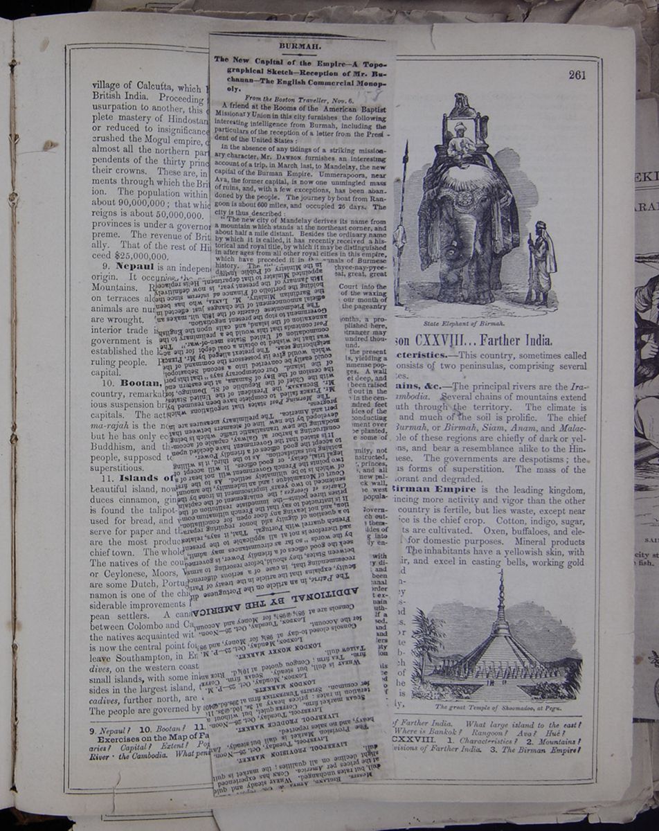 [begin surface 1024]
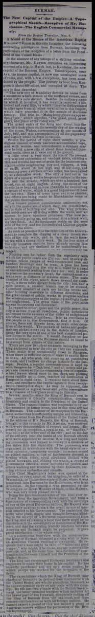
BURMAH. The New Capital of the Empire—A Topographical Sketch—Reception of Mr. Buchanan—The English Commercial Monopoly.
From the Boston Traveller, Nov. 6
A friend at the Rooms of the American Baptist Missionary Union in this city furnishes the following interesting intelligence from Burmah, including the particulars of the reception of a letter from the President of the United States:
In the absence of any tidings of a striking missionary character, Mr. DAWSON furnishes an interesting account of a trip, in March last, to Mandelay, the new capital of the Burman Empire. Ummerapoora, near Ava, the former capital, is now one unmingled mass of ruins, and, with a few exceptions, has been abandoned by the people. The journey by boat from Rangoon is about 600 miles, and occupied 26 days. The city is thus described:
"The new city of Mandelay derives its name from a mountain which stands at the northeast corner, and about half a mile distant. Besides the ordinary name by which it is called, it has recently received a historical and royal title, by which it may be distinguished in after ages from all other royal cities in this empire, which have preceded it in the annals of Burmese history. The title is, 'Maha-bong-ghyee-nay-pyeedau-ghyee,' which signifies, 'The great, great, great glory, and place of the rising sun.'"
The grand entry of the King and Court into the new city took place on the seventh day of the waxing of the moon, Wahso, corresponding to our month of July, 1857, and was accompained by all the pageantry and display usual on State occasions.
Within the period of eight short months, a prodigious amount of work has been accomplished here, and with wonder and astonishment a stranger many now behold a new city of about three hundred thousand souls, risen as it were out of the ground.
A little over a year since the site of the present city was one succession of verdant fields, yelding a rich and fruitful harvest of grain for the immense population of the neighboring city and villages. A wall of earth, about 16 feet high and 20 feet deep, and spreading over a surface of two miles, has been raised up as a defensive work. The city is laid out in the figure of a square, with a temporary palace in the centre, and the streets, which are over a hundred feet broad, run at right angles. Along the sides of the streets have been cut narrow channels for conducting a stream of water, which is a great improvement over the late city. Rows of trees have yet to be planted, and efforts are being made to Macadamize some of the public thouroghfares.
The houses present considerable uniformity, not only in the materials of which they are constructed, but in style of building and size. The king, princes, and noblemen are all living within the walls, and all appear to have spacious premises. The new palace is rapidly going up, and around it is a brick wall, six feet thick. All the foreigners reside on the west side of the city, and the domesticated Chinese population of the south.
As soon as possible it is the intention of the Government to complete the digging of a deep trench outside of the city walls, and to face the walls themselves with a strong brick-work. On the four sides of the city immense suburbs have already sprung into existence, and are destined to be considerably enlarged.
Nothing can be better than the regularity with which the public roads are laid out; and in every direction whole ranges of well-constructed teak and bamboo buildings may be seen. A plan has been adopted for supplying the city with water by a canal or embankment leading from the river; and, in order to procure the necessary level, the embankment extends over a distance of sixteen miles. The main channel of the river, which flows toward the southward, is three miles distant from the city; but, half a mile nearer, a smaller branch has to be crossed. Countless numbers of carts are hauling bricks and other building materials in different directions, and the great extent of public works in progress renders the whole atmosphere of the region exceedingly dusty and unpleasant. The great mass of the population appear industrious and contented.
In regard to order, quiet and the public peace, this city is as free from all rowdyism, public turbulence and street broils as many of the cities of enlightened Christian nations, if not freer. It is as creditable to the people as to the Government, that it is so. Of course, there are thieves here, as in all other countries of the world. The pockets of ladies and gentlemen are picked everyday in the streets of London, under the very eyes of one of the best constituted police forces in the world. It would therefore be too much to expect, that the Burmese should be found to be exempt from crimes of that nature.
There are now two river-steamers belonging to the king anchored as near the city as they can approach. These make trips occasionally down to Rangoon, where there is sufficient depth of water to enable them to do so. All who wish can come up as passengers in them, and I believe no charge is made for the passage. Besides, a regular communication is kept up with Rangoon by "Dak boat," and all letters and papers are conveyed for the community free of expense. A boat leaves about once in ten days, and pushing along rapidly as it does, reaches its destination at Rangoon in eight days. It remains there about three days, and returns to the capital again in from twenty-two to twenty-five days. As may be supposed, this arrangement is a great favor and public convenience to all classes of foreigners residing in this city.
Several months since the King of Burmah sent to this country a friendly communication, desiring friendship and comity, to the President of the United States. The communication was responded to by our Government in fitting terms, and in due time arrived in Burmah. The manner of its reception by the Burmese authorities is sufficiently unique and interesting.
"The letter from the President of the United States to the address of His Majesty, the King of Burmah, brought to this country by MR. KINCAID, was received with every demonstration of respect and honor. Expressly for its reception, a royal zayat, or "thauday," was built at the lower end of the city; and on the day of its delivery into the hands of the Burmah officers who were appointed to receive it, a long and imposing procession was formed to convey it a distance of five miles into the royal city. The procession was organized in accordance with the usual style of oriental splendor, comprising mounted horsemen seated on gilded saddles, a line of fan-bearers dressed in flowing white robes, royal elephants decked with gilded howdahs, and, closing the whole, a crowd of government officials, some mounted on ponies, and others walking and attended by their followers, carrying various umbrellas and utensils.
The Chief Magistrate's letter was opened at the zhootau, or royal court of the kingdom, by order of a Woonduk, or Under-Secretary of State, where it was translated into Burmese by the Kullowoon, who is an Armenian. In the evening it was presented by the Woongyee, or Great Minister of State, to His Majesty, who was very much pleased with it.
Being the first communication of the kind ever received from the American Government, and from a functionary of corresponding rank with the sovereign of any of the great European nations, His Majesty was apparently anxious to mark the event as one of unusual interest to his Government. The contents of the letter were plain, simple and straight-forward, alluding to the receipt of a Burmese communication from the king, and expressing a hope that there might be no diminution in the sovereignity or dominions of His Majesty, and that the existing friendly relations between America and Burmah might be perpetual. It gave great satisfaction to the whole court."
In a subsequent interview with the missionaries, the King of Burmah intimated a strong wish to have an American Consul residing at his capital. He requests that a man might be sent of "talent and good temper," who might, if he chose, engage in mercantile pursuits, and, at the same time, be a medium of communication between himself and the President of the United States.
The king has encouraged European mechanics and engineers to make their home in his capital. He has recently purchased and set up a steam engine, by which pumps are worked for the irrigation of the fields.
The expectations which the King of Burmah may cherish of benefit to be derived from intercourse with the United States, are wholly gratuitous, inasmuch as he cannot possibly carry on any trade with this country. By the last treaty made with the British Government, the latter obtained territory which includes all the lower part of the Irrawadi, completely cutting off the King of Burmah from the sea coast, and from commercial intercourse with all foreign nations. He cannot export a pound of rice nor import a gross of American screws without the permission of the British Government.
[begin surface 1025] 261
FARTHER INDIA
State Elephant of Birmah.
Figure of the state elephant of Birmah.
The great Temple of Shoomadoo, at Pegu.
Figure of temple.
261
FARTHER INDIA
State Elephant of Birmah.
Figure of the state elephant of Birmah.
The great Temple of Shoomadoo, at Pegu.
Figure of temple.
village of Calcutta, which has since become the capital of British India. Proceeding from one step of aggression and usurpation to another, this company has obtained the complete mastery of Hindostan. They have either driven out or reduced to insignificance the rival European colonies, crushed the Mogul empire, obtained the entire possession of almost all the northern part of India, and made mere dependents of the thirty princes who are permitted to retain their crowns. These are, in fact, the mere tools and instruments through which the British sustain and exercise dominion. The population within the actual British territories is about 90,000,000; that which is under the dependent sovereigns is about 50,000,000. The government of the British provinces is under a governor-general, whose authority is supreme. The revenue of British India is $75,000,000 annually. That of the rest of Hindostan is supposed not to exceed $25,000,000.
9. Nepaul is an independent nation, chiefly of Mongol origin. It occupies the southern slope of the Himmaleh Mountains. Rice, grains, cotton, and sugar are cultivated on terraces along the sides of the declivities. Domestic animals are numerous. Copper, iron, lead, and zinc mines are wrought. The manufactures are chiefly domestic. The interior trade is considerable. Braminism prevails. The government is administered by a Rajah. The Ghorkas established the kingdom about a century since, and are the ruling people. Population, 1,500,000. Khatmandoo is the capital.
10. Bootan, lying east of Nepaul, is a mountainous country, remarkable for its numerous castles, and its ingenious suspension bridges. Tassisudon and Punakka are the capitals. The actual chief is called Deb-rajah. The Dharma-rajah is the nominal sovereign, and is esteemed divine; but he has only ecclesiastical power. The state religion is Buddhism, and the country swarms with priests. The people, supposed to be about a million, are barbarous and superstitious.
11. Islands of Hindostan.—Ceylon, a rich and beautiful island, now in the possession of the British, produces cinnamon, ginger, pepper, sugar, cotton, &c. Here is found the talipot-tree, a species of palm, whose pith is used for bread, and whose leaves are made into fans, and serve for paper and thatch. The pearl fisheries of Ceylon are the most productive in the world. Colombo is the chief town. The whole population is estimated at 1,250,000. The natives of the country are of various tribes, Singalese, or Ceylonese, Moors, Veddahs, &c. Besides these, there are some Dutch, Portuguese, and English colonists. Cinnamon is one of the chief products of the country. Considerable improvements have been introduced by the European settlers. A canal and river communication exists between Colombo and Calpentyn. Missionaries are making the natives acquainted with religion and civilization. Ceylon is now the central point for the Oriental mail-packets, which leave Southampton, in England, every month. The Maldives, on the western coast of Hindostan, are forty or fifty small islands, with some inhabitants, under a chief, who resides in the largest island, three miles in circuit. The Laccadives, further north, are a group of shoals and islands. The people are governed by a chief, subjected to the British.
Lesson CXXVIII... Farther India.
1. Characteristics.—This country, sometimes called Chin India, consists of two peninsulas, comprising several barbarous states.
2. Mountains, &c. —The principal rivers are the Irawaddy and Cambodia. Several chains of mountains extend north and south through the territory. The climate is generally hot, and much of the soil is prolific. The chief divisions are Burmah, or Birmah, Siam, Anam, and Malacca. The people of these regions are chiefly of dark or yellow complexions, and bear a resemblance alike to the Hindoos and Chinese. The governments are despotisms; the religion, various forms of superstition. The mass of the people are ignorant and degraded.
3. The Birman Empire is the leading kingdom, the people evincing more activity and vigor than the other nations. The country is fertile, but lies waste, except near the towns. Rice is the chief crop. Cotton, indigo, sugar, and various fruits are cultivated. Oxen, buffaloes, and elephants are used for domestic purposes. Mineral products are numerous. The inhabitants have a yellowish skin, with coarse black hair, and excel in casting bells, working gold and silver, and some other manufactures. They are of a gay disposition, and fond of amusements. The emperor keeps a white elephant superbly dressed, which is an object of reverence to the people. Ava is on the Irawaddy,
9. Nepaul? 10. Bootan? 11. Islands of Hindostan? Ceylon?
Exercises on the Map of Farther India (see p. 258).—Boundaries? Capital? Extent? Population? Describe the Irawaddy River the Cambodia. What peninsula to the south? Give the principal divisions of farther India. What large island to the east? To the south? Where is Bankok? Rangoon? Ava? Hue?
LESSON CXXVIII. 1. Characteristics? 2. Mountains? Give the chief divisions of Farther India. 3. The Birman Empire?
[begin surface 1026]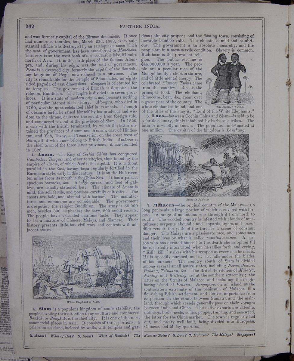 262
FARTHER INDIA
262
FARTHER INDIA
and was formerly capital of the Birman dominions. It once had numerous temples, but, March 23d, 1839, every substantial edifice was destroyed by an earthquake, since which the seat of government has been transferred to Monchobo. This city is on the west bank of a considerable lake, 27 miles north of Ava. It is the birth-place of the famous Alompra, and, during his reign, was the seat of government. Pegu is a decayed city, formerly the capital of the flourishing kingdom of Pegu, now reduced to a province. The city is remarkable for the Temple of Shoomadoo, an eight-sided pagoda of vast dimensions. Rangoon is celebrated for its temples. The government of Birmah is despotic; the religion, Buddhism. The empire is divided into seven provinces. It is a state of modern origin, and presents nothing of particular interest in its history. Alompra, who died in 1760, was the most celebrated chief in its annals. Though of obscure birth, he raised himself by his prudence and wisdom to the throne, delivered the country from foreign rule, and conquered several of the provinces of Siam. In 1826, a war with the British terminated, by which the latter obtained the provinces of Assam and Aracan, east of Hindostan, and Yeh, Tavoy, and Tenasserim, on the coast west of Siam, all of which now belong to British India. Amherst is the chief town of the latter three provinces; it was founded in 1826.
4. Anam.—The King of Cochin China has conquered Cambodia, Tonquin, and other territories, thus founding the empire of Anam, of which Hue is the capital. It is without parallel in the East, having been regularly fortified in the European style, early in this century. It is on the Hue river, ten miles from its mouth in the China Sea. It has a palace, spacious barracks. &c. A large garrison and fleet of galleys are usually stationed here. The climate of Anam is mild, the soil fertile, and portions carefully cultivated. The coasts are bold, and abound with harbors. The manufactures and commerce are considerable. The government is despotic: the religion Buddhism. The army is 50,000 men, besides 800 elephants; the navy, 800 small vessels. The people have a decided maritime taste. They appear to be a mixture of Chinese, Malays, and Siamese. Their history presents little but civil wars and contests with adjacent states.
White Elephant of Siam.5. Siam is a populous kingdom of some stability, the people devoting their attention to agriculture and commerce. Bankok, or Bangkok, is the chief city. It is one of the most commercial places in Asia. It consists of three portions: a palace on an island, inclosed by walls, with temples and gardens; the city proper; and the floating town, consisting of movable bamboo rafts. The climate is mild and salubrious. The government is an absolute monarchy, and the people are in a most servile condition. Slavery is common. Buddhism is the prevalent religion. The public revenue is $15,000,000 a year. The people are a peculiar race of the Mongol family; short in stature, and of little mental energy. The celebrated Siamese Twins came from this country. Rice is the principal food. The elephant, rhinoceros, bear, &c., roam over a great part of the country. The white elephant is found, and one of the titles of the king is, "Lord of the White Elephants."
The Siamese Twins.6. Laos.—between Cochin China and Siam—is said to be a fertile country, thinly inhabited by barbarous tribes. The interior is wholly unknown. The population is estimated at one million. The capital of the kingdom is Lanchang.
Scene in Malacca.7. Malacca—the original country of the Malays—is a long peninsula, a large portion of which is covered with forests. A range of mountains runs through it from north to south. The wooded country is infested with clouds of musquitoes; serpents abound; and leopards, tigers, and crocodiles render the path of the traveler a scene of constant danger. The Malays are a passionate race, and sometimes end their lives by what is called running a muck. A person who has devoted himself to this death chews opium till he is partially intoxicated, when he sallies forth, and crying, "Kill! kill!" strikes with his weapon at everyone he meets. He is speedily pursued, and at last falls under the blades of his pursuers. The country south of Siam is divided among several small native states, including Perak, Johore, Pahan, Tringanu, &c. The British territories of Malacca Naning, and Wellesley, are at the southern extremity; the latter on the Straits of Malacca, and including the neighboring island of Penang. Singapore, on an island at the southern extremity of the peninsula of Malacca, is a flourishing British settlement, and derives importance from its position on the straits between Sumatra and the mainland, through which vessels generally pass on their voyages between India and China. The native exports are catechu, nutmegs, birds'-nests, coffee, pepper, trepang, and sea-weed, the latter for the China market. The town is regularly laid out, and pretty well built, being divided into European, Chinese, and Malay quarters.
4. Anam? What of Hue? 5. Siam? What of Bankok? The Siamese Twins? 6. Laos? 7. Malacca? The Malays? Singapore?
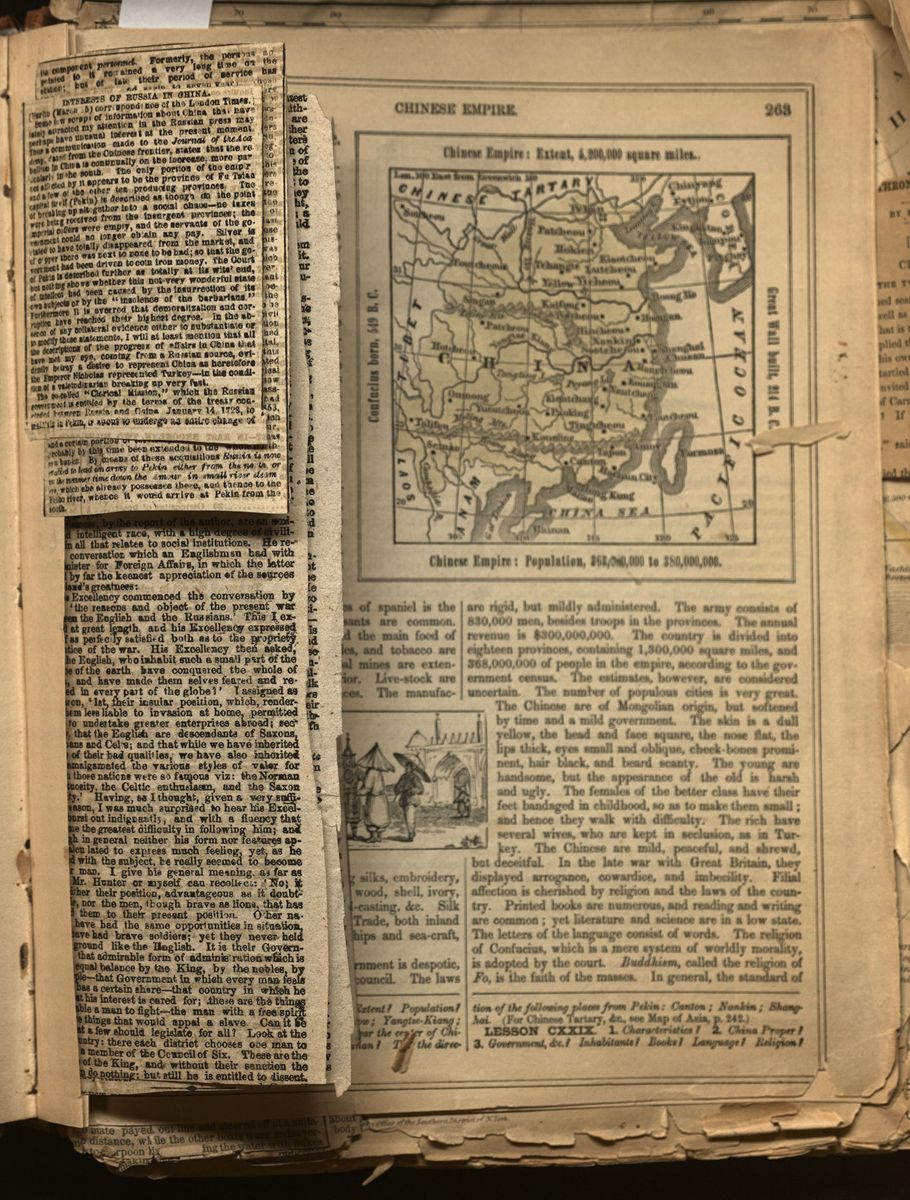

INTERESTS OF RUSSIA IN CHINA.
Some few scraps of information about China that have lately attracted my attention in the Russian press may perhaps have unusual interest at the present moment. Thus a communication made to the Journal of the Academy, dated from the Chinese frontier, states that the rebellion in China is continually on the increase, more particularly in the south. The only portion of the empir not affected by it appears to be the province of Fu Tsian and a few of the other tea producing provinces. The capital itself (Pekin) is described as though do the point of breaking up altogether into a social chaos—no taxes were being received from the insurgent provinces; the imperial coffers were empty, and the servants of the government could no longer obtain any pay. Silver is stated to have totally disappeared from the market, and of copper there was next to none to be had; so that the government had been driven to coin iron money. The Court of Pekin is described further as totally at its wits' end, but nothing shows whether this not very wonderful state of intellect had been caused by the insurrection of its own subjects or by the "insolence of the barbarians." Furthermore it is averred that demoralization and corruption have reached their highest degree. In the absence of any collateral evidence either to substantiate or to modify these statements, I will at least mention that all the descriptions of the progress of affairs in China that have met my eye, coming from a Russian source, evidently betray a desire to represent China as heretofore the Emperor Nicholas represented Turkey—in the condition of a valetudinarian breaking up very fast.
The so-called "Clerical Mission," which the Russian government is entitled by the terms of the treaty concluded between Russia and China, January 14, 1728, to maintain in Pekin, is about to undergo an entire change of
[begin surface 1029]
its component personnel. Formerly, the persons appointed to it remained a very long time on the station; but of late their period of service has been reduced to ten, and again to seven years. Those who are now about to be relieved by the new comers have been out there since 1849. The ostensible object of the "clerical" mission is the preservation of the prawsslaunaja wers (orthodox faith) in the bosoms of the descendants of certain Russians who were taken prisoners in 1685 at Albasin on the Amour, and carried to Pekin, where they were formed into a body guard for the Bogdekban. The mission consists of an Archimaudrite, together with both secular and clerical officials. On this occasion, as well as on all others, certain men of letters and of science are attached to the mission. Of the results of its labors the public has had within the last three years an opportunity of judging by the publication in St. Petersburg of several volumes of its transactions. In the course of November last inquiries were made in Kiachta as to the expense of forwarding the luggage, &c., of the fresh mission from that place to Kalgan. Its weight was stated to be 1,500 pouds, or 60,000 lbs. among which it was understood was a considerable quantity of silver. The town of Kiatchta has of late become an important place in consequence of the greatly increased traffic between Russia and China. It has been selected to be the capital of that part of the frontier region, and is to be honored by having a military commandant and a civil governor. A direct and regular postal communication for official despatches has lately also been established between that frontier town and the Chinese capital, which is distant 2830 li, or about 900 English miles; this postal communication seems to have been necessitated by the official intercourse between Russia and its clerical and diplomatic missions in Pekin, which are just now making a rich harvest of advantages from the embarrassments of the Chinese government. The insurrection has hardly shown itself to be of importance in 1853, when Russia began to apply for concessions, which consisted eventually in the free navigation of the Amour, and a certain portion of territory at its mouth which has probably by this time been extended to the whole northern banks. By means of these acquisitions Russia is now enabled to lead an army to Pekin either from the north or in the summer time down the Amour in small river steamers, which she already possesses there, and thence to the Feiho river, whence it would arrive at Pekin from the south.
[begin surface 1031]
THE TWO KINGS OF SIAM.
Sir John Bowring, in the account of his mission to Siam, gives an interesting description of the two kings—for there are two—of that country. Persons who know little of the state of this fine country will be surprised to learn that the First King is well versed in the works of Euclid and Newton; that he writes and speaks English with tolerable accuracy; that he is a proficient in Latin, and has acquired the Sanscrit, Cingaese and Pagan languages; that he can project and calculate eclipses of the sun and moon and occultations of the planets; that he is fond of all branches of learning and science; that he has introduced a printing press with Siamese and English types; that his palace and table are supplied with all the elegancies of European life. He lived twenty-seven years in retirement before he came to the throne, and during that time he acquired the accomplishments which make his reign a memorable and most beneficial era in Siamese history. He was born in 1804, and is now consequently fifty-three.
The second King (his brother) appears to be equally estimable:
"My intercourse with the second King was in all respects most agreeable. I found him a gentleman of very cultivated understanding—quiet, even modest in manners—willing to communicate knowledge, and earnest in the search of instruction. His table was spread with all the neatness and order that are found in a well-regulated English household. A favorite child sat on his knee, whose mother remained crouched at the door of the apartment, but took no part in the conversation. The King played to his guests very prettily on the pipes of the Laos portable organ. He had a variety of music; and there was an exhibition of national sports and pastimes, equestrian feats, elephant combats, and other amusements. But what seemed most to interest the King was his museum of models, nautical and philosophical instruments, and a variety of scientific and other curiosities. These kings reign, each in prescribed limits, in perfect harmony. This double monarchy is an old institution of Siam, and is popular with the people."
The Siamese, by the report of the author, are an amiable and intelligent race, with a high degree of civilization in all that relates to social institutions. He relates a conversation which an Englishman had with the Minister of Foreign Affairs, in which the letter showed by far the keenest appreciation of the sources of England's greatness:
"His Excellency commenced the conversation by asking 'the reasons and object of the present war' between the English and the Russians.' This I explained at great length and his Excellency expressed himself as perfectly satisfied both as to the propriety and justice of the war. His Excellency then asked, how the English, who inhabit such a small part of the 'surface of the earth have conquered the whole of 'India, and have made them selves feared and re 'spected in every part of the globe!' I assigned as the reason, '1st, their insular position, which, render 'ing them less liable to invasion at home, permitted ' them to undertake greater enterprises abroad; sec 'ondly, that the English are descendants of the Saxons, 'Normans and Celts; and that while we have inherited 'many of their bad qualities, we have also inherited 'and amalgamated the various styles of valor for 'which those nations were so famous viz: the Norman 'impetuosity, the Celtic enthusiasm, and the Saxon 'solidity.' Having, as I thought, given a very sufficient reason, I was much surprised to hear his Exellency burst out indignantly, and with a fluency that gave me the greatest difficulty in following him; and althrough in general neither his form nor features appear calculated to express much feeling, yet, as he warmed with the subject, he really seemed to become another man. I give his general meaning as far as either Mr. Hunter or myself can recollect: 'No; it 'is neither their position, advantageous as it doubt 'less is, nor the men, though brave as lions, that has 'raised them to their present position. Other na 'tions have had the same opportunities in situation, 'and have had brave soliders; yet they never held 'their ground like the English. It is their Govern 'ment, that admirable form of administration which is held in equal balance by the King, by the nobles, by the people—that Government in which every man feels that he has a certain share—that country in which he feels that his interest is cared for; these are the things that enable a man to fight—the man with a free spirit will dare things that would appal a slave. Can it be good that few should legislate for all? Look at the Laos country: there each district chooses one man to become a member of the Council of Six. These are the advisers of the King, and without their sanction the King can do nothing; but still he is entitled to dissent.
 [begin surface 1034]
Consider the consequences. The King and Cou[cutaway] vote for war; every man hastens to be the first to sh[cutaway] his faith in the opinions of the Council. There you [cutaway] sleep without thinking of shutting or barring a do[cutaway] while here you must watch everything with the greatest care, and even then you are not safe. We have hitherto given all the power to the nobles, and what are we? Let us give a little to the people and trywhether we shall not improve. Let us not have our ministers appointed for life; let them be elected for a term of years, and let their election depend upon the voice of the people. The more we mix with the English, the sooner will our people feel that they have a right to have some voice in the framing of laws by which they are to be governed. And if they do assert that right, who will oppose them? We have no regular army; a few slaves of the King take that name, but they would not fight against their fellows."
The people profess the faith of Buddah, and seem affectionately, though not bigotedly, attached to it. They are willing to engage in controversy with our missionaries, and show much acuteness in their arguments. The author relates:
"I found no indisposition among the Siamese to discuss religious questions; and the general result of the discussions was: 'Your religion is excellent for you, and ours is excellent for us. All countries do not produce the same fruits and flowers, and we find various religions suited to various nations.' The present King is so tolerant that he gave 3,000 slaves (prisoners of war) to be taught religion by the Catholic missionaries, saying: 'You may make Christians of these people.' Pallegoix, the Catholic Bishop, who is a great favorit, with his majesty, reports several conversations with the First King, which does honor to his liberal spirit. 'Persecution is hateful,' he said; 'every man ought to be free to profess the religion he prefers; and he added: 'If you convert a certain number of people anywhere let me know you have done so, and I will give them a Christian governor, and they shall not be annoyed by Siamese authorities. I have a letter from the King in which he says that in the inquiries into the abstruse subject of the Godhead, 'We cannot tell who is right and who is wrong, but I will pray my God to give you his blessing, and you must pray to your God to bless me; and so, blessings may descend upon both.'"
The First King is favorable to the extension of commerce in his dominions. Peter Plymley could not have better illustrated the advantages of commerce than did his Majesty in a few pithy sentences; "He illustrated his view by the following allegory: Two men start from the jungle loaded with the coarse article it produces—the fibres of the hemp for example—they move onward and come to a place where there is more valuable material, as cotton. The foolish and unimprovable man persists in carrying his coarse and unprofitable burden of hemp; his wiser companion exchanges his hemp for the finer and more valuable material. They still move on, and come to a silk district. The fool sticks to his hemp, the wise barters his cotton for silk; and thus they reach the end of their journey, one exhausted with carrying an almost worthless and heavy load, the other having brought with ease a profitable and valuable investment."
THE IMAUM OF MUSCAT.—The Moniteur de la Flotte gives the following details respecting the late Imaum of Muscat, whose Arab name is Saio-Ebne-Sultan:
"The power of the Imaum of Muscat extends in the first place on the coasts of Africa, from Querimbe to Guadafui, and then along the shore of the Indian Sea and the Persian Gulf, that is to say, over a population of nearly 10,000,000. The island of Zanzibar, in the capital of which, Sawoychel, the Imaum usually resides, has 500,000 inhabitants. His revenue amounts to 100,000,000 francs. His navy is composed of 40 vessels of war, and his army of 20,000 men, with the facility of being increased to 200,000 in case of need. The vessels of the Imaum have been built either at Cochin, Bombay, or Zanzibar. In general, their guns are not all on board, but all are kept ready on shore. The late Imaum of Muscat has left no legitimate heirs, but he had a great number of natural sons and daughters. The eldest son, called Hilal who is now about 42, visited England in 1845; he is active, intelligent, and courageous, and has among his partisans many young and vigorous men. The second son, called Kaled, is four years younger than Hilal. He is afflicted with a kind of erisypelas, which prevents him from using much exercise. He is engaged in trade, and fond of money. Tosneni is still younger by two years, and is a warrior like his eldest brother. It is he who appeared to have the best chance of succeeding his father, but his chance has been put aside by the success of Tew Mejim, another son, who has ascended the throne as already stated."
 [begin surface 1036]
 [begin surface 1037]
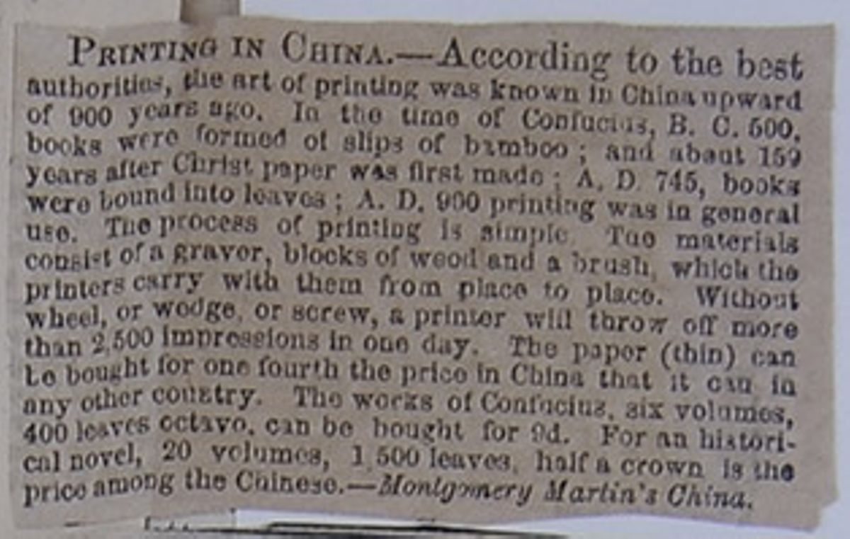
PRINTING IN CHINA.—According to the best authorities, the art of printing was known in China upward of 900 years ago. In the time of Confucius, B. C. 500, books were formed of slips of bamboo; and about 159 years after Christ paper was first made; A. D. 745, books were bound into leaves; A. D. 900 printing was in general use. The process of printing is simple. The materials consist of a graver, blocks of wood and a brush, which the printers carry with them from place to place. Without wheel, or wedge, or screw, a printer will throw off more than 2,500 impressions in one day. The paper (thin) can be bought for one fourth the price in China that it can in any other country. The works of Confucius, six volumes, 400 leaves octavo, can be bought for 9d. For an historical novel, 20 volumes, 1,500 leaves, half a crown is the price among the Chinese.
—Montgomery Martin's China. [begin surface 1038]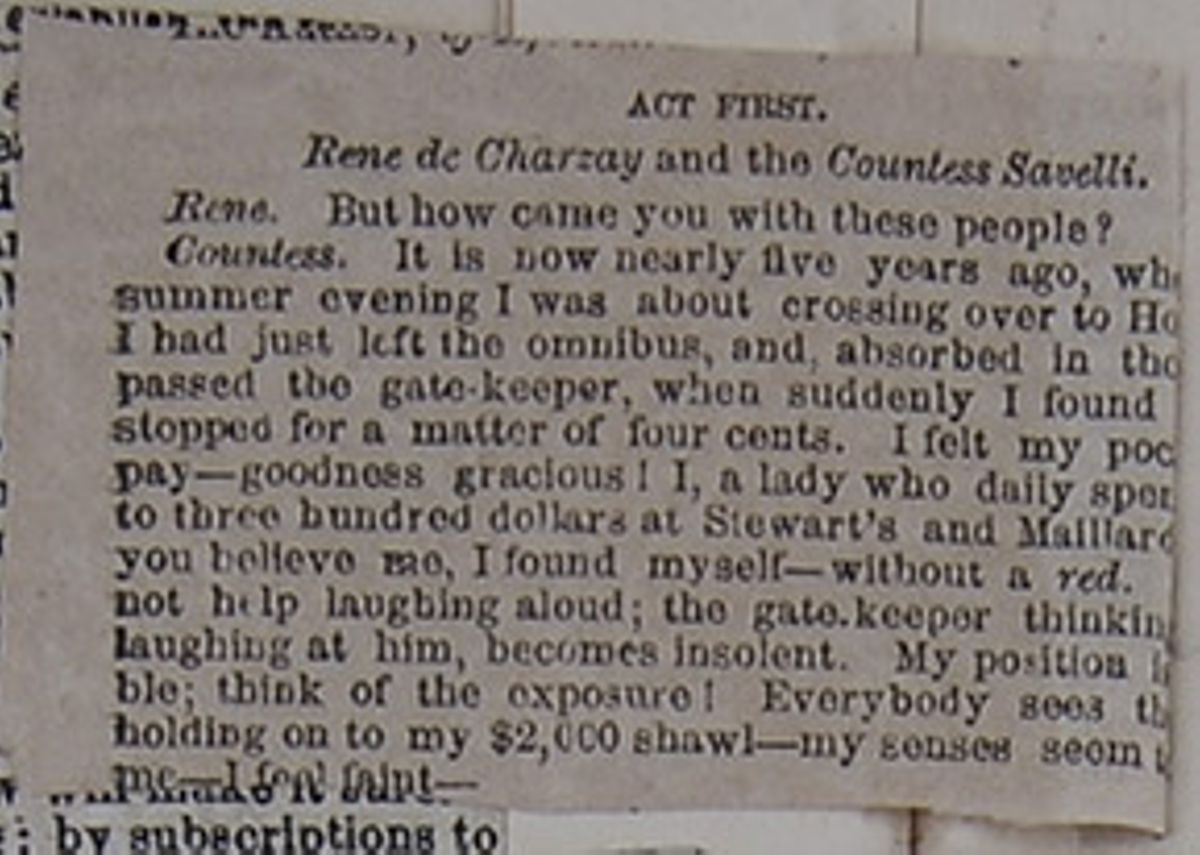
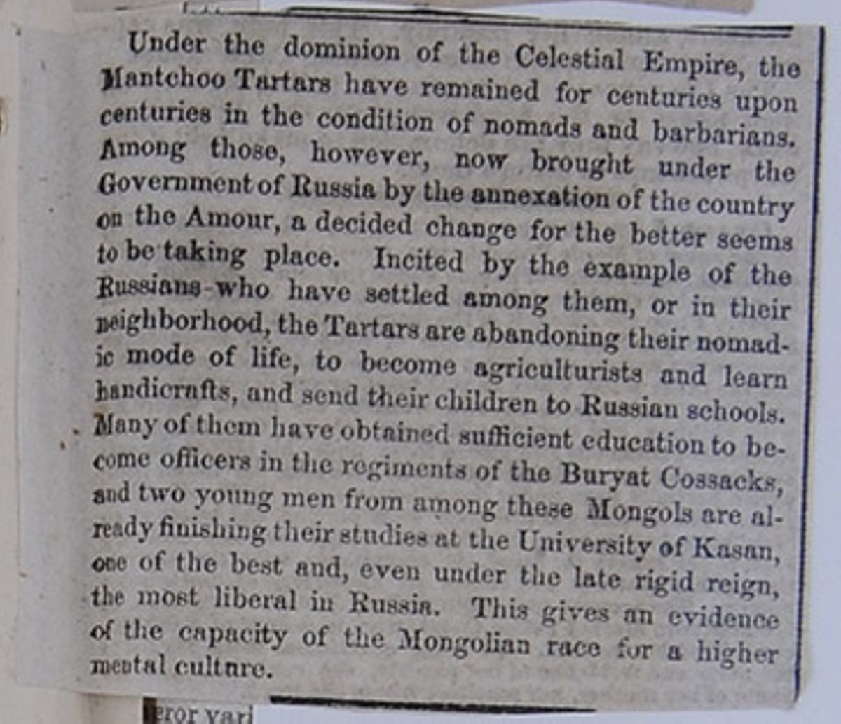
Under the dominion of the Celestial Empire, the Mantchoo Tartars have remained for centuries upon centuries in the condition of nomads and barbarians. Among those, however, now brought under the Government of Russia by the annexation of the country on the Amour, a decided change for the better seems to be taking place. Incited by the example of the Russians who have settled among them, or in their neighborhood, the Tartars are abandoning their nomadic mode of life, to become agriculturalists and learn handicrafts, and send their children to Russian schools. Many of them have obtained sufficient education to become officers in the regiments of the Buryat Cossacks, and two young men from among these Mongols are already finishing their studies at the University of Kasan, one of the best and, even under the late rigid reign, the most liberal in Russia. This gives an evidence of the capacity of the Mongolian race for a higher mental culture.
[begin surface 1040]
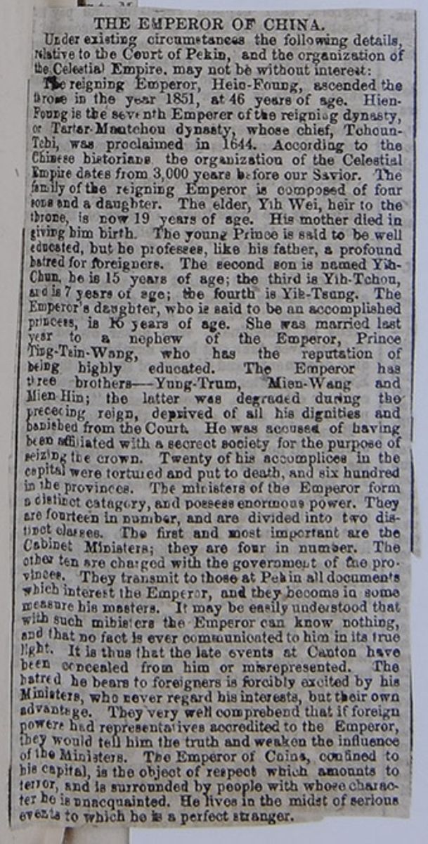
THE EMPEROR OF CHINA
Under existing circumstances the following details relative to the Court of Pekin, and the organization of the Celestial Empire, may not be without interest:
The reigning Emperor, Hein-Foung, ascended the throne in the year 1851, at 46 years of age. Hien-Foung is the seventh Emperor of the reigning dynasty, or Tartar-Mantchou dynasty, whose chief, Tchoun-Tchi, was proclaimed in 1644. According to the Chinese Historians, the organization of the Celestial Empire dates from 3,000 years before our Savior. The family of the reigning Emperor is composed of four sons and a daughter. The elder, Yih Wei, heir to the throne, is now 19 years of age. His mother died in giving him birth. The young Prince is said to be well educated, but he professes, like his father, a proufound hatred for foreigners. The second son is named Yih-Chun, he is 15 years of age; the third is Yih-Tchou, and is 7 years of age; the fourth is Yih-Tsung. The Emperor's daughter, who is said to be an accomplished princess, is 15 years of age. She was married last year to a nephew of the Emperor, Prince Ting-Tsin-Wang, who has the reputation of being highly educated. The Emperor has three brothers—Yung-Trum, Mien-Wang and Mien Hin; the latter was degraded during the preceding reign, deprived of all his dignities and banished from the Court. He was accused of having been affiliated with a secrect society for the purpose of seizing the crown. Twenty of his accomplices in the capital were tortured and put to death, and six hundred in the provinces. The ministers of the Emperor form a distinct catagory, and possess enormous power. They are fourteen in number, and are divided into two distinct classes. The first and most important are the Cabinet Ministers; they are four in number. The other ten are charged with the government of the provinces. They transmit to those at Pekin all documents which interest the Emperor, and they become in some measure his masters. It may be easily understood that with such ministers the Emperor can know nothing, and that no fact is ever communicated to him in its true light. It is thus that the late events at Canton have been concealed from him or misrepresented. The hatred he bears to the foreigners is forcibly excited by his Ministers, who never regarded his interest, but their own advantage. They very well comprehend that if foreign powers had representatives accredited to the Emperor, they would tell him the truth and weaken the influence of the Ministers. The Emperor of China, confined to his capital, is the object of respect which amounts to terror, and is surrounded by people with whose character he is unacquainted. He lives in the midst of serious events to which he is a perfect stranger.
[begin surface 1042]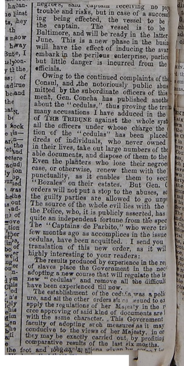
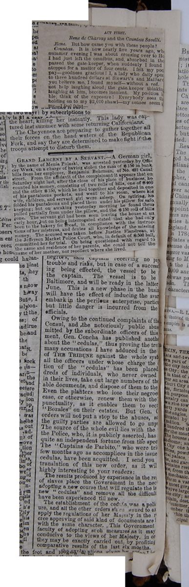 [begin surface 1044]
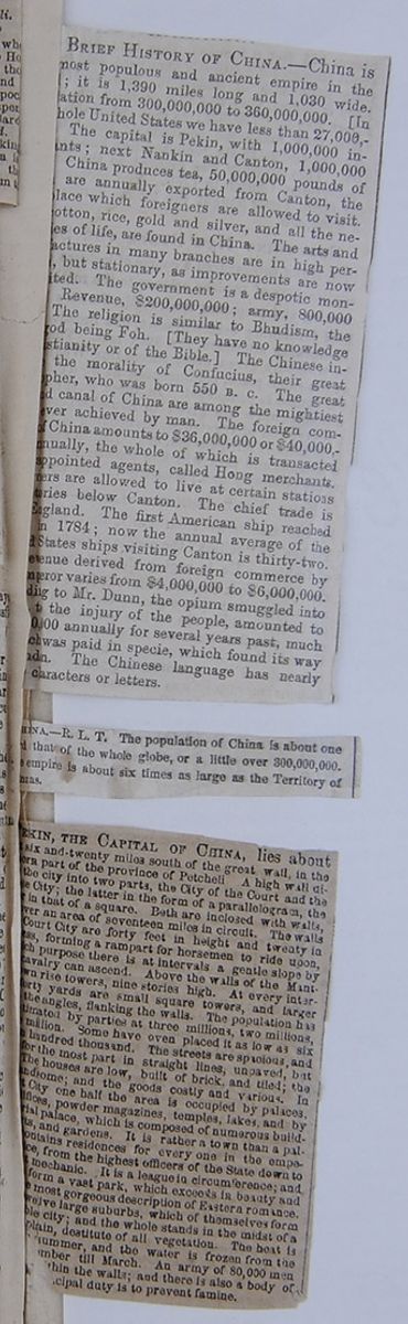 [begin surface 1045]
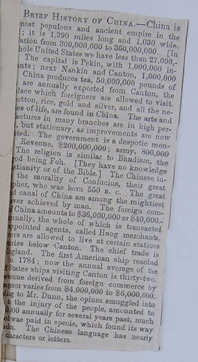
BRIEF HISTORY OF CHINA.—China is [covered] most populous and ancient empire in the [covered]; it is 1,390 miles long and 1,030 wide. [covered]ation from 300,000,000 to 360,000,000. [In [covered]hole United States we have less than 27,000-[covered] The capital is Pekin, with 1,000,000 in[covered]; next Nankin and Canton, 1,000,000 [covered] China produces tea, 50,000,000 pounds of [covered]are annually exported from Canton, the [covered]lace which foreigners are allowed to visit. [covered]otton, rice, gold and silver, and all the ne[covered]es of life, are found in China. The arts and [covered]actures in many branches are in high per[covered], but stationary as improvements are now [covered]ited. The government is a despotic mon[covered] Revenue, $200,000,000; army. 800,000[covered] The religion is similar to Bhudism, the[covered]god being Foh. [They have no knowledge [covered]stianity or of the Bible.] The Chinese in[covered] the morality of Confucius, their great [covered]pher, who was born 550 B. C. The great [covered]d canal of China are among the mightiest[covered] ever achieved by man. The foreign com[covered] of China amounts to $36,000,000 or $40,000,-[covered]nnually, the whole of which is transacted [covered]appointed agents, called Hong Merchants. [covered]ers are allowed to live at certain stations [covered]tories below Canton. The chief trade is [covered] England. The first American ship reached [covered] in 1784; now the annual average of the [covered]d States ships visiting Canton is thirty-two. [covered]evenue derived from foreign commerce by [covered]mperor varies from $4,000,000 to $6,000,000. [covered]ding to Mr. Dunn, the opium smuggled into [covered]to the injury of the people, amounted to [covered]0,000 annually for several years past, much [covered]ch was paid in specie, which found its way to[covered]d[covered]n. The Chinese language has nearly [covered]characters or letters.
[begin surface 1046]
[covered]HINA.—R. L. T. The population of China is about one [covered]d that of the whole globe, or a little over 300,000,000. [covered]e empire is about six times as large as the Territory of [covered]nzas.
[begin surface 1048]
[covered]EKIN, THE CAPITAL OF CHINA, lies about [covered]six and twenty miles south of the great wall, in the [covered]ern part of the province of Petcheli A high wall di[covered] the city into two parts, the City of the Court and the [covered]e City; the latter in the form of a parallelogram, the [covered]r in that of a square. Both are inclosed with walls, [covered]ver an area of seventeen miles in circuit. The walls [covered]Court City are forty feet in height and twenty in [covered]ess, forming a rampart for horsemen to ride upon, [covered]ch purpose there is at intervals a gentle slope by [covered]cavalry can ascend. Above the walls of the Mant[covered]wn rise towers, nine stories high. At every inter[covered]forty yards are small square towers, and larger [covered]the angles, flanking the walls. The population has [covered]timated by parties at three millions, two millions, [covered]million. Some have even placed it as low as six [covered] hundred thousand. The streets are spacious, and [covered]for the most part in straight lines, unpaved, but [covered]The houses are low, built of brick, and tiled; the [covered]andsome; and the goods costly and various. In [covered]t City one half the area is occupied by palaces, [covered]ifices, powder magazines, temples, lakes, and by [covered]rial palace, which is composed of numerous build[covered]ts, and gardens. It is rather a town than a pal[covered]ontains residences for every one in the empe[covered]ce, from the highest officers of the State down to [covered]t mechanic. It is a league in circumference; and [covered]form a vast park, which exceeds in beauty and [covered]e most gorgeous description of Eastern romance. [covered]welve large suburbs, which of themselves form [covered]ble city; and the whole stands in the midst of a [covered]plain, destitute of all vegetation. The heat is [cutaway]summer, and the water is frozen from the [cutaway]mber till March. An army of 80,000 men [cutaway]hin the walls; and there is also a body of [cutaway]cipal duty is to prevent famine.
[begin surface 1050]
 [begin surface 1052]
COMMERCIAL RELATIONS WITH SIAM.
It will be remembered that a treaty of commerce was concluded on the 15th of August last between this government and the Kingdom of Siam. The French Board of Trade, Agriculture and Public Works have published, in the Annales du Commerce Exterieur, some interesting information on the resources of this part of Eastern Asia, from which we extract the following facts:
"Until lately the kingdom of Siam has had commercial relations only with China, Japan, Malay and India. The Siamese mission to the Court of Louis XIV., in 1680, having failed of any satisfactory result, the commerce of this country with Europe, accordingly, dates only from 1854, and the capital, Bangkok, is now annually visited by about sixty European ships.
"However numerous the natural productions may be, the country is comparatively poor, the natives being, like the Asiatics in general, extremely indolent; and as in such a genial climate they have but few wants, they scarcely know the resources of the country, and never dream of investigating them.
"The forests of Siam, Laos and Cambodid abound in fibrous woods, medicinal plants and drugs, colors, dyes, resins of all sorts, lac, caoutchouc and other gums, oils, ivory, horns, bones, skins and leather, beeswax, honey, frankincense, ornamental woods and timber, minerals of every kind, and precious stones. In equal abundance are found rice, maize and vegetables, tobacco, cotton, raw silk, hemp and flax, pepper, spices, sugars, cocoa nuts and tallow. M. de Montigny, the French envoy, was struck with astonishment at the numerous sorts of grain, of which it is no exaggeration to say there are nearly thirty unknown in Europe, twenty-two samples of which he has sent to France. Three species of grain form the principal food of the natives, and are sold at a very low price. Laborers are paid from fifteen to thirty cents a day in Bangkok, and much less in the interior. One product which could be usefully employed in Europe and America is the bark of a tree called the Khai, with which the Siamese make a good paper at a trifling expense. The tobacco of Siam is of an excellent aroma and good quality.
"In examining the primeval forests and jungles, grains, plats, fruits and woods, containing colors and dyes, have been found in great abundance. One of the most valuable products, however is the celebrated teak-wood, which is so abundant and cheap that it could be imported into France at a less rate than almost any other foreign wood. It forms a sort of monopoly for the benefit of the king's brother, who at the request of M. de Montigny, promised to lend every assistance in his power to the French engineers and agents in preparing this article of merchandise for the market. It seems that good carpenters are to be found at Siam at from two to three francs a day, everything included. There is also a red wood so hard that the English and Americans employ it instead of iron or copper, or for wedges.
"The Siamese people, as we have observed, have but few wants, though the better classes love elegance and luxury, and are fond of wearing European costumes. They make use of the dress of the time of Louis the XIV., the forms and ornaments of which are known and preserved among them. The uniform of their soldiers is an imitation of the European. In short, this nation has taste and industrial products which will ensure for it an advantageous commerce. To these details it is important to add that the custom-house arrangements are remarkably simple, there being but one duty to pay, viz: three per cent. on the value of the merchandise. Thus a new source of trade is opened to the speculative and industrious world."
[begin surface 1053]
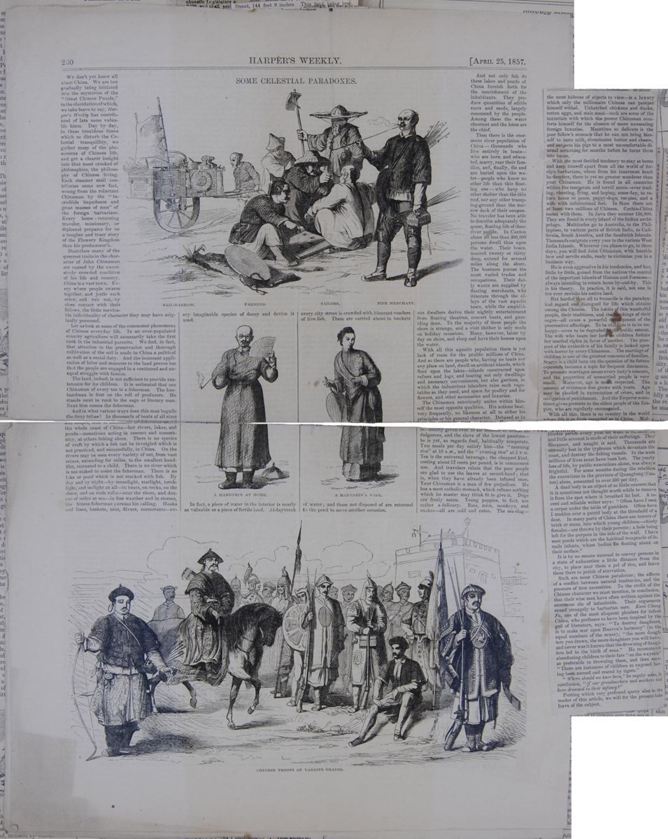
SOME CELESTIAL PARADOXES.
SAIL-BARROW. FARMERS. SAILORS. PIPE MERCHANT. A MANDARIN AT HOME. A MANDARIN'S WIFE. CHINESE TROOPS OF VARIOUS GRADES.We don't yet know all about China. We are but gradually being initiated into the mysteries of the "Great Chinese Puzzle," to the elucidation of which, we take leave to say, Harper's Weekly has contributed of late some valuable hints. Day by day, in these troublous times which so disturb the Celestial tranquillity, we gather more of the phenomena of Chinese life, and get a clearer insight into that most crooked of philosophies, the philosophy of Chinese living. Each steamer mail contributes some new fact, wrung from the reluctant Chinaman by the "incredible impudence and great masses of men" of the foreign barbarians. Every home-returning traveler, missionary, or diplomat prepares for us a tougher and truer story of the Flowery Kingdom than his predecessor's.
Doubtless many of the queerest traits in the character of John Chinaman are caused by the excessively crowded condition of his life and country. China is a vast town. Every where people swarm together, and jostle each other, and rub out, by close contact with their fellows, the little inevitable individuality of character they may have originally possessed.
Let us look at some of the commoner phenomena of Chinese everyday life. In an over-populated country agriculture will necessarily take the first rank in the industrial pursuits. We find, in fact, that attention to the preservation and thorough cultivation of the soil is made in China a political as well as a social duty. And the incessant application of labor and manures to the land proves too that the people are engaged in a continued and unequal struggle with famine.
The land, indeed, is not sufficient to provide sustenance for its children. It is estimated that one Chinaman of every ten is a fisherman. The husbandman is first on the roll of producers. He stands next in rank to the sage or literary man. Next him comes the fisherman.
And in what various ways does this man beguile the finny tribes! In thousands of boats of all sizes and shapes, tens of thousands of fishermen crowd the whole coast of China—her rivers, lakes, and ponds—sometimes acting in concert and community, at others fishing alone. There is no species of craft by which a fish can be inveigled which is not practiced, and successfully, in China. On the rivers may be seen every variety of net, from vast seines, extending for miles, to the smallest hand-filet, intrusted to a child. There is no river which is not staked to assist the fisherman. There is no lake or pond which is not stocked with fish. By day and by night—by moonlight, starlight, torch-light, and no light at all—in boats, on rocks, on the shore, and on rude rafts—near the shore, and dozens of miles at sea—in fine weather and in storms, the Chinese fisherman pursues his calling. Hooks and lines, baskets, nets, divers, cormorants—every imaginable species of decoy and device is used.
In fact, a piece of water in the interior is nearly as valuable as a piece of fertile land. At daybreak every city street is crowded with itinerant venders of live fish. These are carried about in buckets of water; and those not disposed of are returned to the pond to serve another occasion.
And not only fish do these lakes and ponds of China furnish forth for the nourishment of the inhabitants. They produce quantities of edible roots and seeds, largely consumed by the people. Among these the water chestnut and the lotus are the chief.
Then there is the enormous river population of China—thousands who live entirely in boats—who are born and educated, marry, rear their families, and, finally, die and are buried upon the water—people who know no other life than this floating one—who have no other shelter than the thin roof, nor any other tramping-ground than the narrow deck of their sampan. No traveler has been able to describe adequately the queer, floating life of these river people. In Canton alone no less than 300,000 persons dwell thus upon the water. Their boats, moored twenty or thirty deep, extend for several miles along the shore. The boatmen pursue the most varied trades and occupations. Their daily wants are supplied by floating merchants, who itinerate through the alleys of the vast aquatic town, while the amphibious dwellers derive their nightly entertainment from floating theatres, concert boats, and gambling dens. To the majority of these people the shore is strange, and a visit thither is only made on holiday occasions. Many, however, labor by day on shore, and sleep and have their homes upon the water.
With all this aquatic population there is yet lack of room for the prolific millions of China. And so there are people who, having no boats nor any place on land, dwell on artificial islands, which float upon the lakes—islands constructed upon rafters and logs, and bearing not only dwellings and necessary conveniences, but also gardens, in which the industrious islanders raise such vegetables as they need, and space for poultry and for flowers, and other necessaries and luxuries.
The Chinaman notoriously unites within himself the most opposite qualities. His actions bear, very frequently, no likeness at all to either his principles or his general character. Debased as he is—utterly given over to all manner of brutal indulgences, and the slave of the lowest passions—he is yet, as regards food, habitually temperate. Two meals per day satisfy him—the "morning rice" at 10 A.M., and the "evening rice" at 5 P.M. Tea is the universal beverage; the cheapest kind, costing about 12 cents per pound, is in commonest use. And travelers relate that the poor people are glad to use the leaves at second-hand; that is, when they have already been infused once. Your Chinaman is a man of few prejudices. He has a most catholic stomach, which refuses nothing which its master may think fit to give it. Dogs are freely eaten. Young puppies, in fact, are rather a delicacy. Rats, mice, monkeys, and snakes—all are sold and eaten. The sea-slug—
[begin surface 1055]
the most hideous of objects to view—is a luxury which only the millionaire Chinese can pamper himself withal. Unhatched chickens and ducks, rotten eggs, and stale meat—such are some of the materials with which the poorer Chinaman comforts himself for the absence of more nauseating foreign luxuries. Meantime so delicate is the poor fellow's stomach that he can not bring himself to taste milk, abominates butter and cheese, and subjects his pigs to a most uncomfortable diurnal scrubbing for months before he turns them into bacon.
With the most decided tendency to stay at home and keep himself apart from all the world of foreign barbarians, whom from his innermost heart he despises, there is yet no greater wanderer than your Chinaman. He is found in all countries within the temperate and torrid zones—ever trading, cheating, lying, and hoping, some day, to return home to peace, puppy-dogs, rat-pies, and a wife with infinitesimal feet. In Siam there are at least two millions of Chinese. Cochin-China teems with them. In Java they number 136,000. They are found in every island of the Indian archipelago. Multitudes go to Australia, to the Philippines, to various parts of British India, to California, South America, and the Sandwich Islands. Thousands emigrate every year to the various West India Islands. Wherever you please to go, in these days, you will find John Chinaman, with humble bow and servile smile, ready to victimize you in a business way.
He is even aggressive in his tendencies, and has, little by little, gained from the natives the control of the important islands of Hainan and Formosa—always intending to return home by-and-by. This is his theory. In practice, it is said, not one in ten ever revisits his native land.
But harder than all to reconcile is the paradoxical regard and disregard for life which obtains among the Chinese. The habits of this wonderful people, their traditions, and the teachings of their sages—all cause a powerful development of the procreative affections. To be childless is to be unhappy—even to be degraded in the public esteem. The wife who bears her lord no children forfeits her marital rights in favor of another. The prospect of the extinction of his family is looked upon with horror by every Chinaman. The marriage of children is one of the greatest concerns of families. Scarce is a child born ere the question of its future espousals becomes a topic for frequent discussion. To promote marriages seems every body's concern, and the proportion of unmarried people is very small. Moreover, age is much respected. The amount of reverence due grows with years. Age may be pleaded in extenuation of crime, and in mitigation of punishment. And the Emperor sometimes gives presents to the oldest people of the Empire, who are regularly enumerated.
With all this, there is no country in the world where life is so little regarded as in China. Multitudes perish every year for want of sustenance, and little account is made of their sufferings. They disappear, and naught is said. Thousands are annually lost in the typhoons which devastate the coast, and destroy the fishing vessels. In the wars millions of lives must have been lost. The yearly loss of life, by public executions alone, was always frightful. For some months during the rebellion the executions in the province of Quangtung (Canton) alone, amounted to over 500 per day.
A dead body is an object of so little concern that it is sometimes not thought worth while to remove it from the spot where it breathed its last. A recent and reliable writer says: "Often have I seen a corpse under the table of gamblers. Often have I trodden over a putrid body at the threshold of a door. In many parts of China there are towers of brick or stone, into which young children—chiefly females—are thrown by their parents; a hole being left for the purpose in the side of the wall. I have seen ponds which are the habitual receptacle of female infants, whose bodies lie floating about on their surface."
It is by no means unusual to convey persons in a state of exhaustion a little distance from the city, to place near them a pol of rice, and leave them there to perish of starvation.
Such are some Chinese paradoxes; the effects of a conflict between natural tendencies, and the pressure of iron necessities. To the credit of the Chinese character we must mention, in conclusion, that their wise men have often written against the enormous sin of infanticide. Their arguments sound strangely to barbarian ears. Kwei Chung Fu, one of the most eloquent pleaders for infant China, who professes to have been inspired by the god of literature, says: "To destroy daughters, is to make war upon Heaven's harmony" (in the equal numbers of the sexes); "the more daughters you drown, the more daughters you will have; and never was it known that the drowning of daughters led to the birth of sons." He recommends abandoning children to their fate "on the wayside" as preferable to drowning them, and then says: "There are instances of children so exposed having been nursed and reared by tigers."
"Where should we have been," he sagely asks, in conclusion, "if our grandmothers and mothers had been drowned in their infancy?"
Putting which very profound query also to the reader of this article, we will for the present take leave of the subject.
[begin surface 1056]
 [begin surface 1058]
THE CENTRAL NATION. *
THE unwillingness of a nation to be known does not diminish our anxiety to know her, as a studied concealment only awakens and concentrates the closer scrutiny. The unsocial position of China to the rest of mankind, the consciousness of self-perfection in which she separates herself from the world, are, indeed, long-standing and extraordinary traits; styling her Emperor "The Son of Heaven," and herself "The Flowery Central Nation," "The Celestial Empire," she sincerely imagines that whatever is great and good in human history have arrived at their highest possible summits in the past developments of China; and in the feeling common to perhaps the larger share of prosperous nations, if not to the larger divisions of men every where, she looks down upon all other portions of the human family with a self-satisfying contempt, honestly enough regarding them as barbarians. A gentleman in China loses caste somewhat by traveling into foreign lands, as this seems silently to imply an insufficiency in the excellence of the Celestial Empire.
This national egotism is not uncommon in history, and in the observation of the extensive traveler, but not in the same excess; for the nations who frequently are obliged to measure themselves against their equals and superiors in policy, enterprise, and physical vigor, must arrive at a more correct estimate of their powers than a people so isolated as the Chinese. It is as true of nations as of individuals, that the proper self-estimate is never made until their respective forces are antagonistically measured by the forces of others with whom they are to be compared. The Chinese standard of comparison being wholly within themselves, they are, from position, doomed to be the nation of egotism.
The oldest nation now living is the Chinese. With a civilization as old as Egypt, and perhaps older; with a literature as early as Greece in its primitive blossoms; with a form of government the most ancient, founded on the patriarchal idea of ruling society, it now stands an unbroken, united, massive structure, defying time, as if its basis and structure were each of solid granite. Nor can it be doubted that the thoroughly Conservative character of this people, which forbids innovation, and which retires from intercourse with the modes of thought and action adopted in other parts of the world, has powerfully assisted in retaining through so many ages the unity of this colossal empire. From the common susceptibility of man to be influenced by his neighbor, it is safe to say that the action of the ideas of enterprising nations, under a free and unrestrained intercourse, would have proved too strong for the deep originality of this unique people to have resisted. They could never have kept the same ideas in the perpetual ascendent, whilst the winds of thought from different parts of the world were bravely stirring. Their reserved isolation has therefore assisted to strengthen their union, and to perpetuate their nationality; an isolation growing out of egotism, assisted by the consciousness that every physical want common to man may be supplied in the resources of their productive art and soil.
Of late years, China has been the centre of new interest from abroad. The mystery which hangs over its internal affairs, the great antiquity of its origin, the commercial importance it sustains in the traffic
* Souvenirs d'un Voyage dans la Tarlaire, le Thibet, et la Chine, pendant les Annés 1844, 1846 et 1846. Par M. Huc, Prêtre Missionnaire de la Congregation de St. Lazare. 2 vols. Paris: 1850. On the Kawi Language in the Island of Java: with an Introduction on the Difference of Structure observable in the Languages of Mankind, and its Influence on the Intellectual Development of the Human Race. By William Von Humboldt. 8 vols. Berlin: 1836. A Sketch of Chinese History, Ancient and Modem. By Rev. Charles Gutzlaff. 2 vols. The Middle Kingdom. A Survey of the Geography, Government, Education, Arts, Religion, &c., of the Chinese Empire and its Inhabitants. By S. W. Williams. 2 vols. China and the English. By J. Abbott. New-York: William Holdredge. 1852. VOL IX. NO. IV. NEW SERIES. 21 [begin surface 1059] 318
The Central Nation.
April,
318
The Central Nation.
April,
of nations, the many fine thoughts its ethical literature has already given, the renown of the national sage, Confucius, who, in the firmament of superior genius, shines a light of first magnitude, have combined to inspire the world of civilization and of letters with a fresh interest in every additional manifestation of intelligence concerning this secluded race. The United States, which has heretofore sustained the second greatest commercial relation with China, must very soon hold the first, as a glance at the position of San Francisco on the map of the world, and the rapidly increasing population of California, clearly indicate. The Chinese are one third part of the human race. Every way is this vast pyramid of empire, whose top and base are white with antiquity, well worthy of thoughtful examination.
Situated on the far limits of Eastern Asia, it lay safely beyond the circles of Greek and Roman conquests. In the remotest time, the same unambitious trait not to be known abroad, by conquest or other means, belonged to them; for in ancient literature there are but a few obscure hints that may be referred to them. The Greeks and Romans wore their beautiful silks, long before they knew of the country whence they came, receiving them at first from Western Asia; and the failure of Marcus Antoninus in 161, and also that of the other Roman embassy in 284, to establish with them direct commercial relations, prove that their disrelish of intimate connections with the rest of mankind is of long standing. Indeed, what people ever so faithfully, so perseveringly obeyed the rough maxim of "Mind your own business," as this nation of Odd Fellows, the Chinese? None other, we think. How they dispose of the question of human brotherhood, and how they speculate on the unity of our race, we know not; but nothing is more certain than that they would wish for ever to remain a sort of Masonic lodge in the world's centre, without intermission or adjournment.
China Proper, situated mostly in the temperate zone, with its southern extremity resting on the tropic of Cancer, has great variety of climate and temperature. The culture of the Old World is eastern and western, China and Japan being the highest at the former, and Europe at the latter extremity. The scenery of this country is exceedingly various; and, though inaccessible to travelers, its geography is as exact as that of any country. Its area of 1,297,000 square miles is rich in the scenery of noble rivers and of mountain ranges. Within its confines are four principal ranges, some of which rise to lofty elevations, usually, however, falling below the limit of perpetual snow.
The first summits of the Altai range, which takes several names during its long course of two thousand miles, forms the northern limit of the table-land of Central Asia, as well as the boundary between China and Russia, The Belur-tag mountains, (Tsung-ling,) which lie in the southwest of Songaria, and separate it from Badakshan, commence in latitude 50 deg. N., nearly at right angles with the Celestial Mountains, and, extending in a southerly direction, rise to a great height. The Celestial Mountains, Tien-Shan, begin at the northern extremity of the Belur-tag, in 40 deg. N., which, extending from west to east, between longitudes 76 and 90 deg. east, and generally along the 22d deg. of northern latitude, divides Ili into Songaria and Turkestan. A high glacier above the snow line projects its summit, in longitude 79 deg. east, to the east of which rise the highest peaks of Central Asia, called Bogdoula, traces of volcanic action appearing at the eastern end. Between the glacier and the Bogdo-ula, is the Pi-Shan, the only active volcano known in Continental China. Indeed, the extensive mountain scenery of this empire forbids that I should speak of all its larger details. The Himalaya range, one of whose peaks surpasses all other colossal elevations of the earth, bounds Thibet on the south, whilst the Kwanlun defines it on the north.
The Chinese are justly proud of their noble rivers, which, for natural facilities of inland navigation, eclipse the glory of all other countries. The four largest are the Yellow river, the Yangtsz'-kiang, the Amour, and the Tarim. The largest and most useful is the Yangtsz'-kiang. The Yellow river is the most celebrated. Along the course of these magnificent streams appears elegant scenery, amid the most beautiful of which it is said the Chinese poets have chosen their residence.
The entire surface of China naturally divides itself into two parts, which are the great plain, and the mountainous country,
[begin surface 1060] 1852.
The Central Nation.
319
1852.
The Central Nation.
319
the latter comprising more than half of the whole; and the former, lying in the northeast, forming the richest part of the empire, supports by its productions a greater mass of human beings than are sustained on the same area of surface any where else on the globe.
But, dismissing for the present the physical aspects of China, let us inquire into what is of far more importance in the history of any country, namely, the character of its people, its men, women, literature, religion, customs.
Unlike the civilization of Greece, and of Europe generally, it bears every mark of originality, borrowing nothing, as it would seem, from other renowned nations; its literature, arts, and customs, having been, more than those of any other distinguished people, a self-development. What nation have they imitated in language or in law? Owing no debt to Egypt, India, Palestine, or the renowned culture of our classical antiquity, the Chinese structure of government stands in its own time-worn and original wisdom; and, though egotism and contempt of others are not the proof of the highest power, they are likewise never the attributes of utter weakness, as the individual or the nation that always relies on its own sufficiency, asking no foreign counsel or help, is far from being imbecile.
The Chinese, first of all, are a conservative race. They have a grand paradise in the past; and to its imagined brightness they turn as benighted travelers to the Eastern sun. Confucius himself, the moral colossus of the empire, took his stand in the past, through whose sages and rulers he instructed and reproved his own age, and also future ages. The religious sentiment, every where mighty and eternal, universally looks to the past in the worship of ancestors. Firmness is implied in the very fixedness and permanence of their institutions. I should say they are not a skeptical race, but a people of reverence. Hence the general loyalty to the ruling sceptre. The emperor is reverenced as the paternal sovereign. All his messages are received with prostration, and three times does the loyal auditor bow himself before his majestic presence, as a reverential honor becoming his personal presentation. * Though masses of citizens are capable of temporary, violent outbreaks, they are incapable of any revolution which may radically change the ideas and frame-work of the government. This conclusion fairly springs, not only from the uninterrupted sameness of the governmental machinery, but from the fact that the thorough conquest of the Tartars, which, though it brought a new race to the throne of the Perpetual Empire, did not in any degree change the theory of government or the long-established social usages of the country.
The absence of the military skill and energy common to Europe and America, if chosen as the measure of their civilization, will doubtless leave them at a very inferior point of observation. That they should have greater skill in the making of silk than in the conducting of war, may, after all, result more from circumstances than from natural incapacity. Any people who care not to be glorious, except in their own eyes, and who decide that they will work out the problems of life by peaceful industry on that area of territory which Providence has assigned as their fatherland, cannot be expected to carry the science of war any farther than is supposed to be necessary for self-defense; and, in forming an idea of the extent of this necessity, the warlike ability of surrounding powers, and not of the more distant and superior nations, would, of course, be the measure of their aspiration. The ambition of conquest, and of glory in the eyes of the world, are a needed stimulus to the development of military genius in a people. That individual men may have greatness and energy, without being able to fight much with club or rapier, I suppose may be conceded; and to such as may have leisure to think upon it, I could offer the problem, whether the same may not be true of a nation. But evident injustice is done to this peace-loving race, should we omit to state that their history, here and there, is dotted with some noble victories; as, for instance, in the time of Vespasian and Domitian, a great Chinese expedition was headed by the general Pantschab, under the Emperor Mingti, of the dynasty of Han, which subdued the Hiungnu, levied tribute from the territory of Khotan and Kaschgar, and carried its conquering arms as far as the eastern shores of the Caspian; and, according to the Chinese writers, the expedition would have attacked the Roman empire but for the admonitory
* The Dutch Ambassador was required to perform this ceremony nine times whenever food was sent him from the imperial table, because he was a barbarian envoy. [begin surface 1061] 320
The Central Nation.
April,
320
The Central Nation.
April,
counsel they received from the Persians. But, with its nominal army of more than a million of soldiers, which seeks to inspire the necessary awe in all the barbarian states around them, as well as to promote the subordination of the citizens generally; with the word valor painted (so significantly) on the back of their jackets, as is usual in several corps; with an arrangement of officers not unlike those adopted by Western tactics; with their bows, arrows, and clumsy matchlocks; and with their navy of a thousand sail, small and large included, we are obliged to regard them as mere effigies of power, when thought of in comparison with the military genius of England, America, or France.
It is the industry, the useful arts, and, above all, the ethical literature of the Chinese we are to regard, if we would see them in their principal worth. If we may judge of them from their literature, we should say that their moral ideas were their noblest wealth. It is not the intellectuality of the Chinese that mostly distinguishes them, for their intellect does not appear to rise expansively and vigorously into the form of reason. They have perception, far more than reason; and, in our estimation, the Chinese nature is in no direction so rich as in its affections and moral feeling. This fact constantly unfolds itself in Confucius, in Mencius, and in all their proverbial philosophy.
The very framework of their government bears testimony to this view. Loyalty there is filial. The emperor is viewed as the sovereign father of his people. Each ruler in the kingdom is supposed to bear the paternal relation of sympathy and care to those he governs. Throughout the whole of Chinese politics, the idea of domestic relation, of a happily constituted family, is the favorite symbol for good government, which is applied to all departments of ruling, from the ordinary magistrate to the august emperor himself. It is indeed remarkable that ideas and words most sacred to the affections should be thus expanded into all the massive forms of empire!
In the same direction of thought, the worship of ancestors, so general in China, leads us. Why worship departed fathers? Why offer incense upon their graves? Conceding the great distance from the highest truth, which these acts of homage imply, the inference cannot be suppressed that the cause of this wide-spread devotion takes deep root in the social affections. They love their homes. And in the literature of what country, let me ask, is the moral sentiment more centrally enthroned than in China? Where else is the precedence of right in all things more frequently and decidedly expressed? He who has read their classical books, or perused any of the collected sayings of their kings and sages, cannot have failed to notice the constant predominance of the ethical over every other element. That some credit is now generally, and justly conceded to the larger principles of phrenology, will not be denied; and in unison with the conclusion drawn from their literature, is the fact, that the moral brain of the Chinese is far more full and prominent than the intellectual. It is to be regretted that a people so decidedly ethical should be circumstanced under such an overpowering sway of absolutistical opinions and forms, as not to possess more individual independence and energy of character. Mildness and politeness are the natural qualities of the Chinese. It is to be doubted whether a true view of their character is to be derived from the hasty opinions formed on their manners, as seen at the outposts of trade, especially since their education causes them to look upon barbarians with so much contempt. In the new and heterogeneous population which the golden mines of California drew together, under circumstances where the accustomed restraints of older society were freely thrown off, we were not surprised to hear of the sobriety, honesty, and marked uprightness of the Chinese. Marvelousness and imitation belong to them in considerable fulness; and in the sphere of their artistic genius, they are very dexterous and ingenious.
But the credit of some large discoveries of science is due the Chinese intellect. They closely observed the operations of the heavenly bodies; and, in point of accuracy and richness, their observations of nature are of more worth than those made by the Greeks and Romans. Even at this late day of victorious science, the most enlightened naturalists find their astronomical tables of value to them. "While the so-called classical nations of the West," says A. Van Humboldt, "the Greeks and Romans, although they may occasionally have indicated the position in which a comet first appeared, never afford any information regarding its apparent path; the copious literature of the
[begin surface 1062] 1852.
The Central Nation.
321
1852.
The Central Nation.
321
Chinese, who observed nature carefully, and recorded with accuracy what they saw, contains circumstantial notices of the constellations through which each comet was observed to pass. These notices go back to more than five hundred years before the Christian era, and many of them are still found to be of value in astronomical observations. *
Fracastoro and Peter Apian first made it generally known in Europe during the sixteenth century, that the tails of comets are always turned away from the sun, so that their line of prolongation passes through its centre, whilst the same fact was observed by the Chinese astronomers as early as 837. Their annals record great falls of shooting stars, dating earlier than the second Messenian war; two streams of these they describe as belonging to the month of March, one of which is 687 years before the Christian era. Out of fifty-two phenomena which M. Biot collected out of those annals, those of most frequent recurrence, he observed, were recorded at periods corresponding to the 20th and 22d of July, O. S., and might therefore be identical with the stream of St. Lawrence's day, not omitting to notice that it has advanced since the epochs alluded to. In 134 B.C., the Chinese records of Matuanlin record the appearance of a new star in Scorpio, which Sir John Herschel supposes may have been the new star of Hipparchus, which, according to the statement of Pliny, induced him to commence his catalogue of the stars. The new star which appeared in A.D. 123, in Ophiuchus; the singular large star that appeared in Centaurus in 173; that in Sagittarius in 389; that of 393 in Scorpio; that of 1203, which, as the record alleges, was "of a bluish-white color, without luminous vapor, and resembled Saturn;" the one of 1230 in Ophiuchus; that of 1578; that in July of 1584 in Scorpio, with many others, are so accurately described, and agree so well with other observations, that the care and accuracy of Chinese observation seem to be illustrated before us. Nor is it any ordinary praise to Chinese invention, that, more than one thousand years before our era, they had in active use magnetic carriages, on which the movable arm of the figure of a man continually pointed to the south, and served as their guide in conducting them across the immense grass plains of Tartary; nor should it be forgotten that, in the third century of our era, which is 700 years earlier than the use of the mariner's compass in European seas, the Chinese * vessels navigated the Indian Ocean, under the guidance of magnetic needles that pointed to the South, which indeed was the direction of navigation mostly at those early times. The Greeks and Romans, less intelligent of the uses of the magnetic needle, never knew the true direction of the Apennines and the Pyrenees.
The government of China is wonderfully systematic, and in its parts most closely linked. Its chief idea has been already expressed. Tho doctrines of Confucius, which refer so constantly to the state, exalting virtue above all things, as being the greatest of national glories, do very much toward securing the good order they commonly enjoy; for upon his teachings the government may be said to rest, since the thorough study of his writings is required of all persons who expect to be honored with office. Yan and Shun, the two most celebrated kings of the remote antiquity, are the most glorious samples of perfection; on them Confucius himself lavished extraordinary praise. Though an hereditary and absolute sovereign, there are censors appointed over his conduct, with a view of curbing somewhat his immense authority; and it is expected of him, when a law is once established, that he will be governed by it in the administration of justice. But one dash of his red pencil may, at any time, degrade the loftiest stations under him. Yearly confessions, supplications, and offerings to Heaven he makes for his people, the state religion which he wields on such occasions being not a doctrine, but a sacred ritual. His dress is plain, and the general appearances by which he surrounds himself are quite free from the gorgeousness of many oriental princes. He is regarded as the vicegerent of Heaven. His laws are often severe, having penalties beyond the intent of justice, thereby furnishing opportunity on the part of his Majesty to exhibit mercy. The officers who administrate are frequently false and cruel, whilst hundreds of them aim at justice and the happiness of the country. Somewhat touching are the lines
* Cosmos, vol. i., p. 99. * Humboldt, Examen Critique de l'Histoire de la Geographi, t. iii., p. 36. [begin surface 1063] 322
The Central Nation.
April,
322
The Central Nation.
April,
of Chu, the very popular and aged officer; addressed to the people on resigning his charge: "Untalented, unworthy, I withdraw, Bidding farewell to this windy, dusty world; Upwards I look to the supremely good— The Emperor—to choose a virtuous man To follow me. Henceforth it will be well; The measures and the merits passing mine. But I shall silent stand and see his grace Diffusing blessings like the genial springs."
The history of the Chinese extends back into a night of wonder and of fable. They imagine the universe sprang from the masculine and feminine principles Yang and Ying. "Heaven was formless, an utter chaos," says one of their authors, "and the whole mass was nothing but confusion. Order was first produced in pure ether, and out of it the universe came forth; the universe produced air, and the air the milky-way." Another author said, "Reason produced one, one produced two, two produced three, three produced all things." Pwanku is the Chinese Adam, who, however, instead of finding a beautiful nature, and a paradise to receive him, was obliged to react upon the chaos that gave him birth, and to chisel out the earth to his liking. The Rationalists picture him with chisel and mallet in hand, splitting and shaping the vast masses of granite floating through space, whilst behind the openings made by his powerful efforts, the sun, moon and stars gleam forth, the brilliant monuments of his order-causing labors; and on his right stand the significant emblems of the animal kingdom, the dragon, the phœnix, and the tortoise.—At last Pwanku died, and mountains arose from his head, winds and clouds from his breath, thunder from his voice, the four poles from his limbs, the rivers from his veins, the undulations of the earth from his sinews, the fruitful fields from his flesh, the stars from his beard, the metals and rocks from his bones; his falling sweat became rain, and the insects of his body became people! Beneath this myth of several nations, that nature is formed of the man-giant, is there not a meaning concealed? It is this: that nature every where is a symbol of humanity. It is through the beauty, order, virtue, joy of the mind that the creation is beautiful, orderly, innocent and joyous. The three celestial, terrestrial, and human sovereigns that succeeded Pwanku, one of whom brought down fire from heaven, thereby becoming the first Prometheus, held a reign of eighteen thousand years, it is said, in which sleep was invented, and many useful arts established.
Though much cloudiness rests on the extreme horizon of Chinese history, which they themselves regard as mythology, there is a real period, commencing with Fuhhi, five hundred and eight years before the deluge. Chronology at best is a dim shadow from the past; and in the present state of our acquaintance with Chinese history, and the paucity of our means to compare its dates with other national histories, we should not deride its ancient pretensions, nor blindly extol, as the French may have done, its remote chronology. We are satisfied in the belief that no civilization can claim an earlier date; not even that of Egypt, Babylon, Nineveh, Iran, or Cashmir.
Education in China was carefully inculcated in the early ages; and now Mr. Davis affirms that among her millions comparatively few can be found unable to read and to write. * "Bend the mulberry tree while it is young!" is a maxim of the state; and the universal habit of calling the educated to posts of public responsibility, of requiring that all persons who are to be crowned with official honors shall be versed in the classics, books in which the ethics and the wisdom of ruling are fully unfolded; their careful public examinations of all aspirants with reference to mental qualification, tend to exalt culture, and to make education an important object. Before the voice of Confucius was heard in the empire, the necessity of public schools was taught. I quote from the Book of Rites: "For the purpose of education among the ancients, villages had their schools, districts their colleges, and principalities their universities." And I am happy to learn from Mr. Davis, that in the government of schools, great reliance is placed upon persuasion, and that corporal punishment is but seldom inflicted. †
The language of the Chinese is purely original, and as unique in the languages of the earth as they who speak it are among
* Mr. Williams supposes a large number unable to read. †Mr. Williams gives a contrary opinion. [begin surface 1064] 1852.
The Central Nation.
323
1852.
The Central Nation.
323
its nations. * It is a language of monosyllables. Only four hundred and fifty distinct sounds are found in the language, which, by the additions of tones and accents, are multiplied to a little more than twelve hundred; so that this number of sounds, not admitting of combination,as in compound words, (these not being in the Chinese united in sound,) limits the spoken language of China to about the number of words just stated. This would seem insufficient for free oral expression, were it not for the ample service rendered to the meaning by gesticulation, repetition, and the like. In written language, they increase the means of complicated and complete expression by adding to the original sound-signs other conventional signs, † which, though not expressive of sound, are suggestive of particular meaning. Relation is expressed not by particles, but by the positions of the words employed. It is a language wholly without inflexions, bearing evidence of having originated in a sort of picture-writing. What a word means, depends very much on its place in the sentence. The high degree of excellence belonging to the language, the consistency of its structure, the copiousness of its expression, and the complete success it achieves in designating different formal relations without the use of significant sounds, are freely admitted by those who have thoroughly learned it. Yet how unlike the languages of India and of Europe! The scholars, in various styles, write it elegantly. An original language, well studied, must reveal the soul of a people; for how can the life, the genius of a nation remain unexpressed in the methods it creates for a free self-utterance?
The national literature of China is mostly pure, a better moral element prevailing in it than existed in Greek and Roman poets, and probably far better than circulates in the most popular reading of our own country and time. The Chinese are a reading people, and had in use, much earlier than other Asiatic nations, the art of printing. Prominent in their literature are the Four Books and the Five Classics, which, containing the ideas of their sublime Confucius, and of many other renowned authors, and being studied for public reasons, have an unequaled influence over the people of China. Elsewhere, literature far superior in genius, and in enlivening variety, may easily be found; but where can a national literature be found, whose higher forms are more free from every taint of moral impurity, both in thought and expression; and where can a living literature be pointed out, whose active hold on the reverence and moral practice of millions is so deep and efficient as theirs? It fades before the self-luminous orbs of ancient Greece, so far as the mental excellences are concerned; but in chastity of utterance, the Chinese classics, and, indeed, all their highly prized works, put the best classical teachers of Europe to the blush; nor is it with any partial bias that we hazard the opinion, that no literature on earth is so practically efficient as the Chinese, notwithstanding original writers are not the common fruits of their peculiar culture.
Poetry, drama, and romance, of their kind, exist in massive abundance. Myriads of novels and tales have been sent forth, which are there, as elsewhere, the most popular books, since no door to the human mind is so free, easy, and happy of entrance as the imagination. Though demoralizing tendencies may be traced in many works of fiction, many also are written in the purest style. Of the drama, and of theatrical exhibition, the Chinese are exceedingly fond, and, under the control and direction of the priests, they depend wholly on voluntary contributions for support. The bewitching power of acted drama is particularly observable over the villagers, to whom the more stirring amusements are seldom known. Tragedy and comedy are variously mixed; unity of time and place is but carelessly regarded; and the scenery is very simple, never subserving the ideas intended, by lending a rich and yielding variousness of appearance to the senses, though the costume of the actors is splendidly fine. * In strong confirmation of the view I have taken of the striking ethical richness of the Chinese literature over the intellectual, I would urge the fact, that while the deficiencies of scenery, plot, and management, are to European intellect often conspicuous, the tendency of the plays is strongly on the side of virtue and morality.
Players there, as elsewhere, are an itinerant
* North British Review, Nov., 1851, p. 119. † Of these there are about 50,000. * So testifies a Russian Ambassador, as early as 1692. [begin surface 1065] 324
The Central Nation.
April,
324
The Central Nation.
April,
band, and the audiences are usually quiet and orderly. The Orphan of Chau, as translated by Primère, is the groundwork of one of Voltaire's best tragedies, L'Orphelin de la Chine, which rests upon an event a century previous to the birth of Confucius. The Heir of Old Age, and the Chalk Circle, are celebrated pieces of mental China-ware. Bazin names five hundred and sixty-four plays, all belonging to the Mongol dynasty. The East India Company have two hundred volumes of plays, in one work, spread out into forty volumes. Their literature is like their wall, a huge pile of ancient, massive labor; and whatever it may be in worth, it is their own, woven, like spider's webs, from interior resource.
Poetry is a pastime of the Chinese scholar: a piece is always handed in at public examinations. A few translations have come to us. Of course they have neither a Homer nor a Shakspeare. But two sons of song, brighter, greater than all others, they celebrate, in the poems of Li Taipeh and Su Tungpo; poets, these, combining the three traits of the bard—love of flowers, wine, and song. The former, from the precocious development of his tenth year, was styled the "Exiled Immortal," but, from another taste in himself, he assumes to be known as the "Retired Scholar of the Blue Lotus." But, after a stormy and eventful life, he is said to have sought an escape from the plots of his enemies by death in drowning, exclaiming, as he leaped into the water, "I am going to catch the moon in the midst of the sea!"
On education, we offer these lines: "Men at their birth are radically good; In this, all approximate, but in practice widely diverge. If not educated, the natural character is changed; A course of education is made valuable by close attention To bring up and not educate, is a father's error; To educate without rigor, shows a teacher's indolence. Gems, unwrought, can nothing useful form; So men, untaught, can never know the proprieties." *
Anatomy, as yet, is unknown to Chinese physicians. Their theory of medicine, therefore, so far as it has value, must be founded mostly on experience. Their practice it is said outstrips their theory. Valuable books are spoken of, but the truly skilful practitioners are far the fewer number. It is certain that medicine, with them, can never be a science until the human organism, in its many parts and functions, is clearly understood. They even make no distinction between venous and arterial blood, and apply the same word to tendons and to nerves.
The legal profession there, alone and by itself, cannot secure a livelihood. Whether this historical fact should be taken as a hint in favor of general order and social soundness, I pause not to inquire.
Chemistry, as a science, is but very imperfectly known. A complete course of mathematics is contained in the Fang Sho Hioh, 36 vols., 8vo. But the Chinese mind is not mathematical, like the European, the science not being usually regarded beyond the business demands of their vocations. In astronomy, higher claims are made; but how these claims should be settled, as yet, does not in all respects appear. The fact that astronomy is connected with astrology and divination, even at the Imperial College of Pe King, shows that the profound laws of the science are uncomprehended, however accurate they may be in their observation of the course of planets, and the appearance of new stars and of comets. They need a Novum Organon to clear away their superstitions, and to teach them the reign of law in the depths of immensity. We know the Chinese have carried a few arts to great perfection; but we believe that they lack the power to arrive at great scientific generalizations.
But let us come to their Ethics, which is the great wealth of this people. This is not to be judged of by their daily lives, though in this respect it will not be denied that they have more virtues than most pagan nations, probably more than any other. Indeed, what man, what country has a daily practice that fulfils its best ideas? Some few most flagrant vices, that are too often intruded upon the social peace of families under our western civilization, are seldom known in China; and no where are life and property more strongly protected, and industry more justly rewarded, than among the millions of the "Celestial Empire."
Confucius is the summit of Chinese morality, though Mencius and other writers abound
* Middle Kingdom, vol. i., p. 428. [begin surface 1066] 1852.
The Central Nation.
325
1852.
The Central Nation.
325
in great truths. He has no idiosyncrasy, but is China in colossal representation. The moral element in his character and teaching absorbs every other. Born 550 * years before the dawn of the Christian era, he shed his light on this vast portion of the race not far from the time that Pythagoras kindled such ennobling fires of light in Athens, and Zoroaster in Persia. Three self-luminous suns! And whatever superiority, in purely intellectual power, may be accorded to the glorious Hellenic sage, Confucius is first of the three in effective moral splendor, for his influences have gone farther, and awakened more virtue in all classes, than may be claimed for the works of both his illustrious rivals.
Confucius did not announce himself in dogmas. Hence no narrowing creed belongs to his thoughts, and none, through any subsequent folly of his disciples, has yet sprung out of his writings. He was the grand expounder of duty, of the eternal ethics sown in the soul, and every where somewhat developed. He claimed no inspiration; yet there is a steady moral brilliancy constantly falling upon his theme. He claimed no originality, but professedly drew from the remote wisdom of an ancient paradise of rulers, sages, and people. But there was central light in him; he was the man of fine nature and culture. His sentiments are now styled Joo-kiau, the religion of scholars. Though in a nation of local tendency and prejudice, he taught universal doctrines. Many were the disciples that attended him when living, but the chief power he has wielded has been through his written words, as set in order by his learners. How true is this latter fact of the world's most immortal teachers! Jesus, Socrates, Confucius are of this number.
This teacher put mighty stress upon sincerity, as being the very "origin and consummation" of things, as that without which nothing could exist. He says that, but for sincerity, the universe would be empty nothingness! And why not? It is real, and exists for truth; all its purposes are earnest; and what less than the heart of the creation is lost in the total absence of sincerity? "One sincere wish," affirms the Confucian wisdom, " would move heaven and earth." Heaven is only thus moved.
He builds upon the filial relation, carries a deep reverence into every family, unites brother and brother, parent and child, in loving, reverential concord. Finally, the state is a family, and all mankind are brothers. Deeply has this nation drunk of the reverence which elsewhere said, "Honor thy father and thy mother, that thy days may be long in the land which the Lord thy God giveth thee." And have not their days been long? For a nation, I say, wonderfully long. Do we feel the width and the ethical greatness of this relation? Nature and education have much to say of it, through the constitutional indebtedness of soul, body, condition, and culture of all persons to their paternal sources. Wise government is necessarily paternal. The earth is our mother, and heaven our father, in the use of appropriate symbols. The universe is a revelation of masculine force and feminine loveliness, and these unite in the blessing of all spirits. What is religion in its last and finest expression? It is reverence to the infinite Father; the homeward movement of heart-sick prodigals. Then had not the sage some eternal rock to stand on, when unfolding his truth and duty under this social symbol? Evidently he stood on a God-appointed and an eternity-enduring basis.
What is most beautifully worthy in these ethics is the reverence that pervades them; and without reverence there is no profound beauty of character, no sacredness, no deep worth. It is right to honor the superior, and it is wrong to withhold the deference. The superior man, in the eye of Confucius, has sincerity and benevolence; he practises his words before he speaks them! Asked once if any one word could express what is most fitting a whole life, he answered, "Will not the word shu serve?" which he explains by saying, "Do unto others as you would have them do to you." * Some have said Confucius only announced this grand law of true religion in its negative forms, merely prohibiting the doing of that to others which we would not wish that others should do to us. Be it even so: the negative precept implies the perception of the positive law. This is a great truth; and many have seen and felt it originally, and from within. The very relations of life impose
* Socrates was nine years of age when Confucius died, which was 479 B.C. * Middle Kingdom, vol. 1. p. 519-20. Also Mr. Davis. [begin surface 1067] 326
The Central Nation.
April,
326
The Central Nation.
April,
the thought upon us; and it bottoms the complaints even which men bring against each other. "You would not wish me to have dealt with you thus:" how often is this said! and what bases the plea? In substance, the golden rule. Attraction as a law rests in nature, not in Newton. So this princely truth of ethics depends not on personal authorities, nor can it lose in force because several may have, either intuitively or logically, discovered its being and its beauty.
"The perfect man," said the sage," loves all men; he is not governed by private affection or interest, but only regards the public good or right reason." Retribution is certain. "How can a man be concealed?" We say, how can he? The deepest secret shall see the light. "The perfect man is never satisfied with himself." "Knowledge produces pleasure clear as water." "Complete virtue brings happiness solid as a mountain." "Without virtue, both riches and honor seem to me like a passing cloud." As a whole, he is elaborate, and his high ideals of character are beautifully wrought. He had a noble public zeal, though conscious of the derision and ingratitude that came to reward his large solicitude. In some of his life-jeopardies he compared himself to a dog driven from his home. "I have the fidelity of that animal, and I am treated like it; but what matters the ingratitude of men? They cannot hinder me from doing all the good that has been appointed me." The same nation now chants the following pæan:
"Confucius! Confucius! How great is Confucius! Before Confucius there never was a Confucius! Since Confucius there never has been a Confucius! Confucius! Confucius! How great is Confucius!"
There can be no doubt that the moral ideal of perfection in China is far higher than the practical realizations of that country or of this. The fact, however, in one regard is highly joyous, as it attests the moral wealth of human nature to arrive at much light, to receive by intuition, by reason, great truths. The social nature must develop itself in social forms; the intellectual nature in intellectual forms; and the moral nature must also yield its ideas in moral forms. The soul cannot be hid. But Confucius dwelt almost wholly on the moral; he did not reach after the invisible, did not awaken that feeling that yearns after the infinite, that rushes upward to the embrace of Deity. Hence, and for other reasons, the voice of Christianity must yet give them life. Confucius is rightly to them the First Saint, and Mencius the A-Shing, or Second Saint. There is reason in the pride felt by the people of Shantung, that the tomb of the glorious man is with them, whose majestic monument, in the midst of forest oaks and gloomy shades, rears high a reverential symbol of his moral greatness.
Buddhism, transplanted from India, flourishes in China. The Rationalists, or sect of Tau, are quite numerous. No religious caste, however, has ever arisen to political power, so as to engraft itself on the state, and China has never had an ecclesiastical hierarchy. Nor are they intolerant, since many Catholics are still in the empire; Mohammedans, half a million, * who make a Sabbath of Thursday, and some of whom hold important offices in the government; and Jews, who refuse to marry with the natives, who worship no idols, take no oaths in heathen temples, honor Confucius, like the Chinese, and, in their synagogue worship, translate Adonai by Tien. These incarnate permanences still pray westward towards Jerusalem.
But this entire nation needs, most of all things, to be stirred up by the activity of western intellect. That this isolation is eternal, cannot for one moment be believed. Antiquity, however incarnated, cannot remain forever on its own strength, with a sea of mental progress dashing against its walls. The merchants of China, even now, desire free intercourse with the world. A part of the world cannot successfully isolate itself from the whole. Issolation is against the dependency and unity of parts, observable in both the physical and the moral universe. Somehow, in the commerce and conflicts of nations, this eastern extremity of civilization in the old world will one day freely answer back to the western; and the unity of the human race, which has been so slow in its dawn upon human conviction, will be seen and felt in China, to the overthrow of its powerfully cemented exclusiveness.
* The computation of the early part of the last century.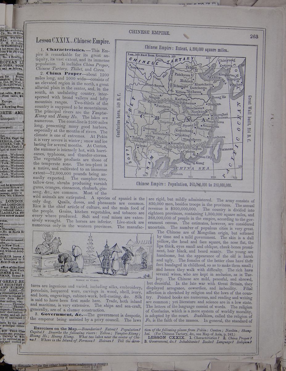 [begin surface 1069]
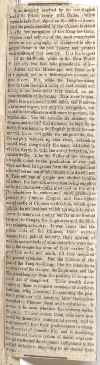
In the summary received by the last English mail of the British treaty with China, (which appears to have been signed on the 26th of June), one of the points conceded by the Chinese is stated to be the free navigation of the Yang-tse-kiang. This river is not only one of the most remarkable features in the geography of China—it is also a principal feature in the past history and present social condition of that country. It is the longest [covered]r of the Old World, while in the New World t[covered]e are only two that make precedence of it—the Amazon and the Mississippi, and those only in a physical, not in a historical or economical point of view. For, while the Yang-tse-kiang flows like them through a valley of vast extent and fertility, it can boast what they cannot, an immense population on its banks. This river is computed to have a source of 2,800 miles, and it serves in an eminent degree, not only for navigation, but for what in that climate is still more important, for irrigation also. The tide ascends its channel for 400 miles, and for half that distance, as high up as Nankin, it was found by the English in their former war with China, navigable for ships-of-the-line. The vast plain watered by this river, extending east and west along nearly the same latitudes in which lies Egypt, is, with the aid of irrigation, remarkable fertile. Like the Valley of the Ganges, it is equally suited to the production of rice and wheat, and these two grains form the principal food of the hundred million of inhabitants who dwell upon it. These millions of people are clothed in silks and cottons, the raw silk and cotton being supplied and the manufactured cloths produced on the spot. This is doubtless the richest and most productive portion of the Chinese Empire, and the original seat and cradle of Chinese civilization, which goes back like the civilizations which sprung into existence on the somewhat similar but far more limited valleys of the Ganges, the Euphrates and the Nile, to an unknown antiquity. It was hence that the peculiar ideas of the Chinese, their written language, their patient industry, their system of social life and methods of administration were carried by the conquering arms of their earlier Emperors both north and south, till they acquired their present extension. But the Chinese of the plain of the Yang-tse-Kiang, like the inhabitants on the banks of the Ganges, the Euphrates and the Nile, passed long ago from the position of conquerors to that of conquered. Their wealth drew down upon them successive invasions of northern barbarians, who, however, in assuming the position of governors and masters, have themselves succumbed to Chinese ideas and institutions. It remains to be seen whether the western barbarians, as the Chinese esteem them, who have now secured for themselves commercial access, will be more successful than their predecessors in changing the current of domestic life, and in modifying the ancient and curious system of social organization and intellectual development indigenous to the soil, and hitherto so unyielding to all shocks from without.
[begin surface 1070]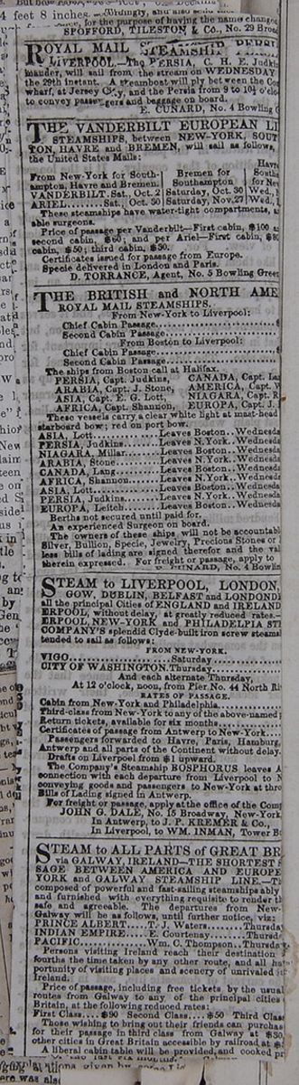
Lesson CXXIX... Chinese Empire.
1. Characteristics.—This Empire is remarkable for its great antiquity, its vast extent, and its immense population. It includes China Proper, Chinese Tartary, Thibet, and Corea.
2. China Proper—about 1200 miles long, and 1000 wide—consists of an elevated region in the north, a great alluvial plain in the center, and, in the south, an undulating country, interspersed with broad valleys and lofty mountain ranges. Two-thirds of the country is supposed to be mountainous. The principal rivers are the Yangtse-Kiang and Hoang Ho. The lakes are numerous. The coast-line is 2500 miles long, presenting many good harbors, especially at the mouths of rivers. The climate is one of extremes. At Pekin it is very severe in the winter; snow and ice lasting for several months. At Canton, the summer is intensely hot, with hurricanes, typhoons, and thunder-storms. The vegetable products are those of the temperate zone. The tea-plant is a native, and cultivated to an immense extent—72,000,000 pounds being annually exported. The camphor-tree, tallow-tree, shrubs producing varnish gums, oranges, cinnamon, rhubarb, ginseng, &c., are common. Most of the wild animals are extirpated. A species of spaniel is the only dog. Quails, doves, and pheasants are common. Rice is the chief article of culture, and the main food of the people. Grains, kitchen vegetables, and tobacco are every where produced. Salt and coal mines are extensively wrought. The horses are inferior. Live-stock are numerous only in the western provinces. Scenes in China. The manufactures are ingenious and varied, including silks, embroidery, porcelain, lacquered ware, carvings in wood, shell, ivory, and horn, engravings, cabinet-work, bell-casting, &c. Silk is said to have been first made here. Trade, both inland and maritime, is very extensive. The ships and sea-craft, generally, are of a clumsy construction.
3. Government, &c.—The government is despotic, the emperor being assisted by a privy council. The laws Chinese Empire: Extent, 5,200,000 square miles; Confucius born, 549 B.C.; Great Wall built, 214 B.C.; Chinese Empire: Population, 363,000,000 to 380,000,000. are rigid, but mildly administered. The army consists of 830,000 men, besides troops in the provinces. The annual revenue is $300,000,000. The country is divided into eighteen provinces, containing 1,300,000 square miles, and 368,000,000 of people in the empire, according to the government census. The estimates, however, are considered uncertain. The number of populous cities is very great. The Chinese are of Mongolian origin, but softened by time and a mild government. The skin is a dull yellow, the head and face square, the nose flat, the lips thick, eyes small and oblique, cheek-bones prominent, hair black, and beard scanty. The young are handsome, but the appearance of the old is harsh and ugly. The females of the better class have their feed bandaged in childhood, so as to make them small; and hence they walk with difficulty. The rich have several wives, who are kept in seclusion, as in Turkey. The Chinese are mild, peaceful, and shrewd, but deceitful. In the late war with Great Britain, they displayed arrogance, cowardice, and imbecility. Filial affection is cherished by religion and the laws of the country. Printed books are numerous, and reading and writing are common; yet literature and science are in a low state. The letters of the language consist of words. The religion of Confucius, which is a mere system of worldly morality, is adopted by the court. Buddhism, called the religion of Fo, is the faith of the masses. In general, the standard of
Exercises on the Map.—Boundaries? Extent? Population? Capital? Describe the following rivers: Yellow; Yangtse-Kiang; Hoang Ho; Hoang Kiang. What two lakes near the center of China? Where is the Island of Formosa? Hainan? Tell the direction of the following places from Pekin: Canton; Nankin; Shanghai. (For Chinese artary, &c., see map of Asia, p. 242.)
LESSON CXXIX. 1. Characteristics? 2. China Proper? 3. Government, &c.? Inhabitants? Books? Language? Religion?
[begin surface 1071]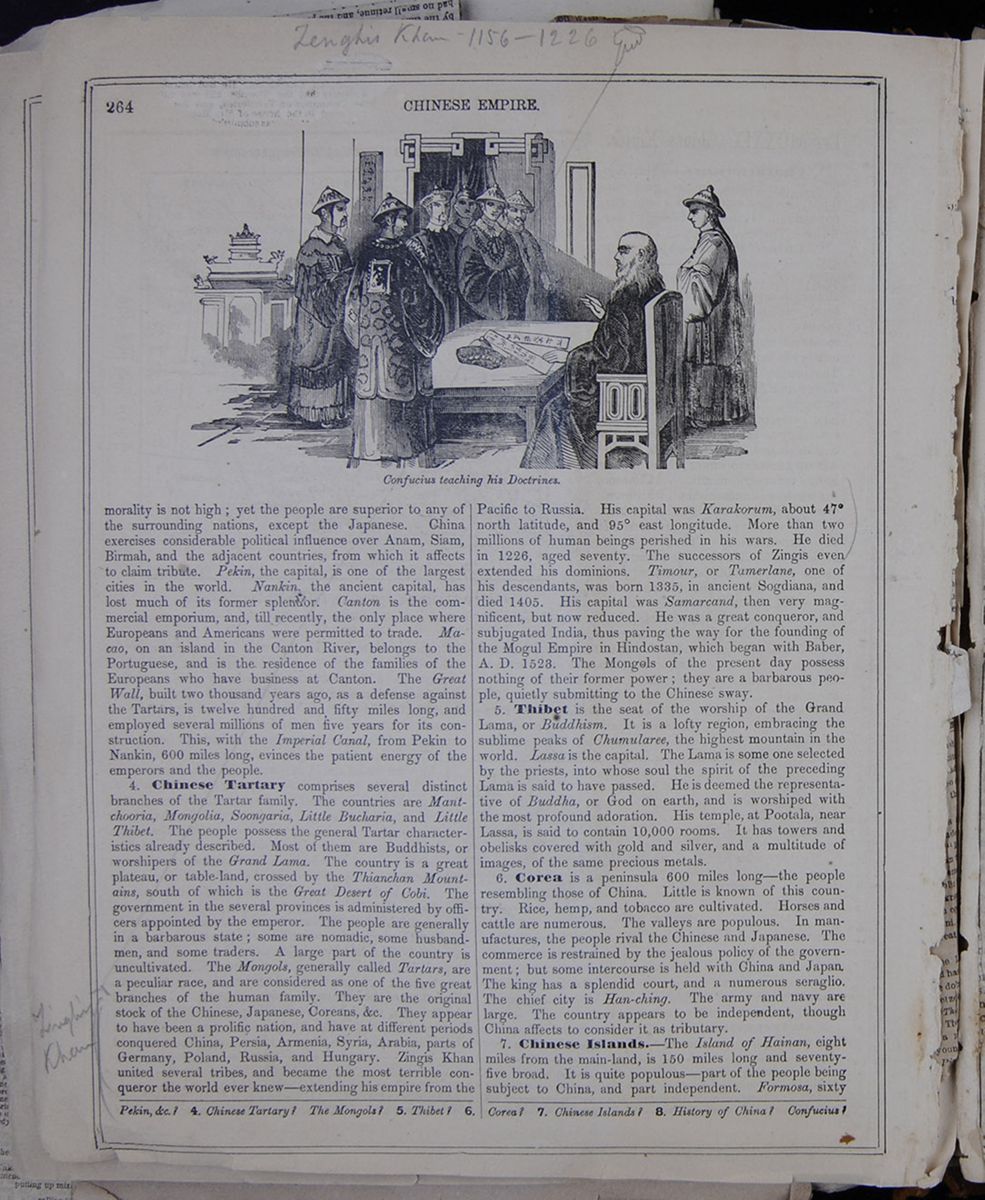 264
CHINESE EMPIRE.
Confucius teaching his Doctrines.
264
CHINESE EMPIRE.
Confucius teaching his Doctrines.
morality is not high; yet the people are superior to any of the surrounding nations, except the Japanese. China exercises considerable political influence over Anam, Siam, Birmah, and the adjacent countries, from which it affects to claim tribute. Pekin, the capital, is one of the largest cities in the world. Nankin, the ancient capital, has lost much of its former splendor. Canton is the commercial emporium, and, till recently, the only place where Europeans and Americans were permitted to trade. Macao, on an island in the Canton River, belongs to the Portuguese, and is the residence of the families of the Europeans who have business at Canton. The Great Wall, built two thousand years ago, as a defense against the Tartars, is twelve hundred and fifty miles long, and employed several millions of men five years for its construction. This, with the Imperial Canal, from Pekin to Nankin, 600 miles long, evinces the patient energy of the emperors and the people.
4. Chinese Tartary comprises several distinct branches of the Tartar family. The countries are Mantchooria, Mongolia, Soongaria, Little Bucharia, and Little Thibet. The people possess the general Tartar Characteristics already described. Most of them are Buddhists, or worshipers of the Grand Lama. The country is a great plateau, or table-land, crossed by the Thianchan Mountains, south of which is the Great Desert of Cobi. The government in the several provinces is administered by officers appointed by the emperor. The people are generally in a barbarous state; some are nomadic, some husbandmen, and some traders. A large part of the country is uncultivated. The mongols, generally called Tartars, are a peculiar race, and are considered as one of the five great branches of the human family. They are the original stock of the Chinese, Japanese, Coreans &c. They appear to have been a prolific nation, and have at different periods conquered China, Persia, Armenia, Syria, Arabia, parts of Germany, Poland, Russia, and Hungary. Zingis Khan united several tribes, and became the most terrible conqueror the world ever knew—extending his empire from the Pacific to Russia. His capital was Karakorum, about 47° north latitude, and 95° east longitude. More than two millions of human beings perished in his wars. He died in 1226, aged seventy. The successors of Zingis even extended his dominions. Timour, or Tamerlane, one of his descendants, was born 1335, in ancient Sogdiana, and died 1405. His capital was Samarcand, then very magnificent, but now reduced. He was a great conqueror, and subjugated India, thus paving the way for the founding of the Mogul Empire in Hindostan, which began with Baber, A. D. 1523. The Mongols of the present day possess nothing of their former power; they are a barbarous people, quietly submitting to the Chinese sway.
5. Thibet is the seat of the worship of the Grand Lama, or Buddhism. It is a lofty region, embracing the sublime peaks of Chumularee, the highest mountain in the world. Lassa is the capital. The Lama is some one selected by the priests, into whose soul the spirit of the preceding Lama is said to have passed. He is deemed the representative of Buddha, or God on earth, and is worshiped with the most profound adoration. His temple, at Pootala, near Lassa, is said to contain 10,000 rooms. It has towers and obelisks covered with gold and silver, and a multitude of images, of the same precious metals.
6. Corea is a peninsula 600 miles long—the people resembling those of China. Little is known of this country. Rice, hemp, and tobacco are cultivated. Horses and cattle are numerous. The valleys are populous. In manufactures, the people rival the Chinese and Japanese. The commerce is restrained by the jealous policy of the government; but some intercourse is held with China and Japan. The king has a splendid court, and a numerous seraglio. The chief city is Han-ching. The army and navy are large. The country appears to be independent, though China affects to consider it as tributary.
7. Chinese Islands.—The Island of Hainan, eight miles from the main-land, is 150 miles long and seventy-five broad. It is quite populous—part of the people being subject to China, and part independent. Formosa, sixty
Pekin, &c.? 4. Chinese Tartary? The Mongols? 5. Thibet? 6. Corea? 7. Chinese Islands? 8. History of China? Confucius?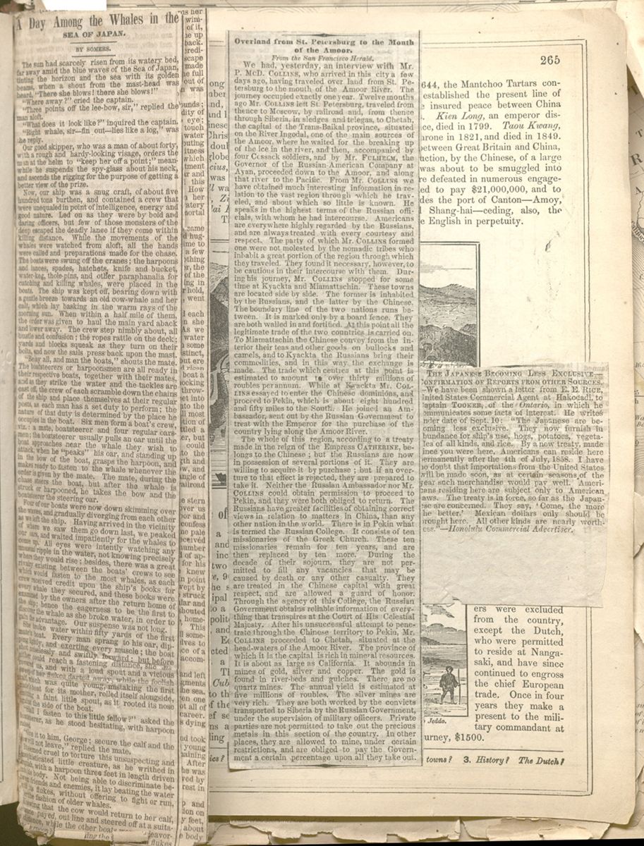 [begin surface 1073]
A Day Among the Whales in the SEA OF JAPAN.
The sun had scarcely risen from its watery bed, far away amid the blue waves of the Sea of Japan, tinting the horizon and the sea with its golden beams, when a shout from the mast-head was heard, "There she blows! there she blows!"
"Where away?" cried the captain.
"Three points off the lee-bow, sir," replied the man aloft.
"What does it look like?" inquired the captain.
"Right whale, sir—fin out—lies like a log," was the reply.
Our good skipper, who was a man of about forty, with a rough and hardy-looking visage, orders the man at the helm to "keep her off a point:" meanwhile he suspends the spy-glass about his neck, and ascends the rigging for the purpose of getting a better view of the prize.
Now, our ship was a snug craft, of about five hundred tons burthen, and contained a crew that were unequaled in point of intelligence, energy and good nature. Led on as they were by bold and daring officers, but few of those monsters of the deep escaped the deadly lance if they come within killing distance. While the movements of the whales were watched from aloft, all the hands were called and preparations made for the chase. The boats were swung off the cranes; the harpoons and lances, spades, hatchets, knife and bucket, water-keg, thole-pins, and other paraphanalia for catching and killing whales, were placed in the boats. The ship was kept off, bearing down with a gentle breeze towards an old cow-whale and her calf, which lay basking in the warm rays of the morning sun. When within a half mile of them, the order was given to haul the main yard aback and lower away. The crew step nimbly about, all bustle and confusion; the ropes rattle on the deck; yards and blocks squeak as they turn on their bolts, and now the sails press back upon the mast.
"Belay all, and man the boats," shouts the mate. The boatsteerers or harpoonsmen are all ready in their respective boats, together with their mates, and as they strike the water and the tackles are cast off, the crew of each scramble down the chains of the ship and place themselves at their regular posts, as each man has a set duty to perform; the nature of that duty is determined by the place he occupies in the boat. Six men form a boat's crew, viz.: a mate, boatsteerer and four regular oarsmen; the boatsteerer usually pulls an oar until the boat approaches near the whale they wish to attack, when he "peaks" his oar, and standing up in the bow of the boat, grasps the harpoon, and makes ready to fasten to the whale whenever the order is given by the mate. The mate, during the chase steers the boat, but after the whale is struck or harpooned, he takes the bow and the boatsteerer the steering oar.
Four of our boats were now down skimming over the waves, and gradually diverging from each other as we left the ship. Having arrived in the vicinity of where we saw them go down last, we peaked our oars, and waited impatiently for the whales to come up. All eyes were intently watching any unusual ripple in the water, not knowing precisely where they would rise; besides, there was a great rivalry existed between the boats' crews to see which would fasten to the most whales, as each crew received credit upon the ship's books for every whale they secured, and these books were examined by the owners after the return home of the ship; hence the eagerness to be the first to discover the whale as she broke water, in order to gain the advantage. Our suspense was not long.
She broke water within fifty yards of the first mate's boat. Every man sprang to his oar, dipping lightly, and exerting every muscle; the boat shot noiselessly and swiftly forward: but before either could reach a fastening distance, she discovered us, and with a lout spout and a vicious sweep of her flukes darted away, while the foolish calf, which was quite young, mistaking the first mate's boat for its mother, rolled itself alongside, emitting a faint little spout, as it rooted its nose against the side of the boat.
"Shall I fasten to this little fellow?" asked the boatsteerer, as he stood hesitating, with harpoon raised.
"Give it to him, George; secure the calf and the cow will not leave," replied the mate.
It seemed cruel to torture this unsuspecting and unsophisticated little creature, as he writhed in anguish, with a harpoon three feet in length driven into his body. Not being able to discriminate between friends and enemies, it lay beating the water with its flukes, without offering to fight or run, after the fashion of older whales.
Knowing that the cow would return to her calf, [covered] mate payed out line and steered off at a situable distance, while the other boats were endeavor[covered] to harpoon her. Lashing the water with flukes[cutaway] making [cutaway]m, and shouting[cutaway]—loud[cutaway]
[begin surface 1074]
she started off on a circular course towards her progeny, alternately diving under water, and swimming on the surface, till within a few yards of it, when she went down, and immediately came up directly under the calf, landing it on her back. She now struck away from the boats with incredible speed, imagining, perhaps, that her escape with her young was certain; but she was made aware of her mistake when she had run the full length of the slack-rope that had been payed out of the mate's boat, for her precious burthen was pulled from her back.
It seemed now as if her anger knew no bounds; with the suppleness of an eel, and the rapidity of thought, she swept her fluke from eye to eye; then raising it over her back, so as to nearly touch the top of her head, threw it back upon the water with astonishing force, in the meanwhile spouting most furiously. It is truly frightful to witness those ferocious and threatening attitudes, which seemed to evince so much wrath, disappointment and chagrin. A mingled feeling of awe, fear, and insignificance came over me, as I beheld this mighty monster make its mad gestures. How easy it would have been for her, while in her dreadful anger, to have consigned us all to a watery grave! Fortunate indeed, for man, their mortal enemy, that they know not their power!
Again she made another circuit, and as she came alongside the calf, threw her fin over it, and hugging it to her side, sped away the second time to make good her escape; but the distance of a few yards straightened the rope. However, nothing daunted, she kept on, taking the boat after her, the line having been made fast to the loggerhead of the boat. Seeing at length that she gained nothing in distance from her enemy, she relinquished her hold, and with an ominous sweep with her flukes, went down.
The boats now formed nearly a circle, and each one prepared to give her a harpoon when she came up, if there was an opportunity. As we were waiting I chanced to look down into the water by the side of the boat, and could just discern some object deep down. It rapidly grew more distinct, and was apparently rising to the surface, but ere the word of warning could be given, she had risen under us, striking the bottom of our frail boat a little forward of midships with her head, knocking a hole through the thin bottom boards, and throwing the bow oarsman some six or seven feet into the air. Fortunately, he came down into the stern sheets of the boat, where we were all most unceremoniously piled by the unusual motion of our shattered craft. The whale now settled a little, and the boat rested fairly on the water, but commenced filling rapidly, and ere we could thrust a coat or some loose garment into the breach, she had shot ahead about her length and thrown a corner of her flukes up into the bow, and elevating that portion of the boat to an angle of about thirty degrees, started off with us at railroad speed.
We were promiscuously thrown into the stern end of the boat, and the water rushed over us through the breach, while a cloud of vapor and foaming spray covered the boat. I must confess that among us by this time there were some pale lips and livid visages, or my visual organs deceived me; although there was one among our number who, I am inclined to believe, had no kind of appreciation of danger, and that solicitude for his personal safety was something which he knew nothing of. Even now he was not lacking in point of good humor and recklessness, for as we swept by one of the boats, the crew of which were struck with fear and astonishment at our singular and dangerous situation, he swung his had and shouted at the top of his voice, "Here we go, boys, homeward bound, free passage—jump aboard!" This sally had the effect of breaking the spell somewhat, although we could not bring ourselves to the belief that it was all a joke. A distance of a quarter of a mile or so and our journey was accomplished.
On letting us down, a sweep to the right and left with her flukes, gave us nothing but the fragments of a wreck to buoy us from the depths of the sea. Fortunately she left us then, for had she given one more with that powerful weapon, some, if not all of us, would then and there have ended our career. She now returned to her calf, which was dying from the effects of its wounds.
One of the boats hastened to our relief, and took us aboard the ship: in the meantime, the young whale died and sunk, and one of the remaining boats succeeded in fastening to the old one. After a severe struggle of about three hours she was made to spout blood, which was soon followed by the death struggle, a point of no small interest in the capture of whales.
Our prize was towed alongside the ship and made fast with stout ropes, ready for dissection the morrow. Her length was about ninety feet, and the flukes from one corner to the other about eighteen feet, with the other portions of the body as large in proportion.
As he had furled[covered]ght sails and coiled up [cutaway] rope, the sun had sunk again into the [cutaway]
[begin surface 1076]
Overland from St. Petersburg to Mouth of the Amoor.
We had, yesterday, an interview with Mr. P. McD. COLLINS, who arrived in this city a few days ago, having traveled over land from St. Petersburg to the mouth of the Amoor River. The journey occupied exactly one year. Twelve months ago Mr. COLLINS left St. Petersburg, traveled from thence to Moscow, by railroad and, from thence through Siberia, in sledges and telegas, to Chetah, the capital of the Trans-Baikal province, situated on the River Ingodal, one of the main sources of the Amoor, where he waited for the breaking up of the ice in the river, and then, accompanied by four Cossack soldiers, and by Mr. FULHELM, the Governor of the Russian-American Company at Ayan, proceeded down to the Amoor, and along that river to the Pacific. From Mr. COLLINS we have obtained much interesting information in relation to the vast region through which he traveled, and about which so little is known. He speaks in the highest terms of the Russian officials, with whom he had intercourse. Americans are everywhere highly regarded by the Russians and are always treated with every courtesy and respect. The party of which Mr. COLLINS formed one were not molested by the nomadic tribes who inhabit a great portion of the region through which they traveled. They found it necessary, however, to be cautious in their intercourse with them. During his journey, Mr. COLLINS stopped for come time at Kyackta and Miamattschin. These towns are located side by side. The former is inhabited by the Russians, and the latter by the Chinese. The boundary line of the two nations runs between. It is marked only by a board fence. They are both walled in and fortified. At this point all the legitimate trade of the two countries is carried on. To Miamattschin the Chinese convey from the interior their teas and other goods on bullocks and camels, and to Kyackta the Russians bring their commodities, and in this way the exchange is made. The trade which centres at this point is estimated to amount to over thirty millions of roubles per annum. While at Kyackta Mr. COLLINS essayed to enter the Chinese dominions, and proceed to Pekin, which is about eight hundred and fifty miles to the South. He joined an Ambassador, sent out by the Russian Government to treat with the Emperor for the purchase of the country lying along the Amoor.
The whole of this region, according to a treaty made in the reign of the Empress CATHERINE, belongs to the Chinese; but the Russians are now in possession of several portions of it. They are willing to acquire it by purchase; but if an overture to that effect is rejected, they are prepared to take it. Neither the Russian Ambassador nor Mr. COLLINS could obtain permission to proceed to Pekin, and they were both obliged to return. The Russians have greater facilities of obtaining correct views in relation to matters in China, than any other nation in the world. There is in Pekin what is termed the Russian College. It consists of ten missionaries of the Greek Church. These ten missionaries remain for ten years, and are then replaced by ten more. During the decade of their sojourn, they are not permitted to fill any vacancies that may be caused by death or any other casualty. They are treated in the Chinese capital with great respect, and are allowed a guard of honor. Through the agency of this College, the Russian Government obtains reliable information of everything that transpires at the Court of His Celestial Majesty. After his unsuccessful attempt to penetrate through the Chinese territory to Pekin, Mr. COLLINS proceeded to Chetah, situated at the head-waters of the Amoor River. The province of which it is the capital is rich in mineral resources. It is about as large as California. It abounds in mines of gold, silver and copper. The gold is found in river-beds and gulches. There are no quartz mines. The annual yield is estimated at five millions of roubles. The silver mines are very rich. They are both worked by the convicts transported to Siberia by the Russian Government, under the supervision of military officers. Private parties are not permitted to take out the precious metals in this section of the country. In other places, they are allowed to mine, under certain restrictions, and are obliged to pay the Government a certain percentage upon all they take out.
[begin surface 1078]
THE JAPANESE BECOMING LESS EXCLUSIVE—CONFIRMATION OF REPORTS FROM OTHER SOURCES.—We have been shown a letter from E.E. Rice, United States Commercial Agent at Hakodadi, to Captain TOOKER, of the Ontario, in which he communicates some facts of interest. He writes under date of Sept. 10: "The Japanese are becoming less exclusive. They now furnish in abundance for ship's use, hogs, potatoes, vegetables of all kinds, and rice. By a new treaty, made since you were here, Americans can reside here permanently after the 4th of July, 1858. I have no doubt that importations from the United States will be made soon, as at certain seasons of the year such merchandise would pay well. Americans residing here are subject only to American laws. The treaty is in force, so far as the Japanese are concerned. They say, 'Come, the more the better.' Mexican dollars only should be brought here. All other kinds are nearly worthless."—Honolulu Commercial Advertiser.
[begin surface 1080]
miles from the coast, is 240 miles long and sixty wide. The inhabitants are 600,000 in number. The Loo-Choo Islands, 400 miles from the main-land, are thirty-six in number, and are occupied by a gentle and hospitable people.
8. History of China.—The Chinese records go back several thousand years before the Christian era. These are mostly fabulous; but there is no doubt that China is the oldest existing dominion on the globe. After several dynasties had passed away, Confucius, the celebrated moralist, philosopher, and lawgiver, was born, 549 B. C. In the year 214 B. C., the Great Wall was built, as a defense against the Tartars. Kublai Khan, his grandson, subjected the country in 1280. The Tartars were driven out in 1368. In 1644, the Mantchoo Tartars conquered the country, and established the present line of sovereigns, which has since insured peace between China and its northern provinces. Kien Long, an emporer distinguished for his intelligence, died in 1799. Taou Kwang, his grandson, came to the throne in 1821, and died in 1849. In 1840, a war broke out between Great Britain and China, in consequence of the destruction, by the Chinese, of a large quantity of opium, which was about to be smuggled into Canton. The Chinese were defeated in numerous engagements, and were compelled to pay $21,000,000, and to open to foreign trade, besides the port of Canton—Amoy, Foutcheou, Ning-po, and Shang-hai—ceding, also, the island of Hong-kong to the English in perpetuity.
Scene in Japan. The image depicts a bucolic settlement, replete with hills and small structures, nestled next to a body of water. There are boats on the water and a road alongside it.LESSON CXXX...Empire of Japan.
1. Characteristics.—Japan is a populous, insular empire, resembling China in its people and institutions.
General Description.—It includes the island of Niphon, 800 miles long and fifty-two broad; Kiusiu, 150 miles long, and 120 wide; Sikoke, 90 by 80 miles; with Jesso, the Kurile Islands, and the southern part of Saghalien. The country of the principal islands is highly cultivated, and many arts are carried to a considerable degree of perfection. The people are polite and ceremonious. A high sense of honor, integrity, and devoted friendship, are characteristics of the people. Education receives much attention, and females are instructed with great care. Buddhism prevails extensively; but a native religion, called Singo, is the faith of the mass. The Dairi is the spiritual ruler of the country, but the Cubo is the political ruler, paying only nominal obedience to the Dairi. Jeddo, the capital, is one of the great cities of the world. Meaco is the residence of the Dairi, and chief seat of literature. Nangasaki is the only place Europeans are permitted to visit—the same exclusive policy prevailing here as in China. 3. History.—The history of Japan is obscure. The people are probably of Chinese origin. About the year 1550 A. D., the Portuguese sent Jesuit missionaries here, who converted a considerable portion of the people to Christianity. One Jesuit priest baptized 70,000 persons in two years—about 1579. In 1587, the Catholic religion was forbidden, and some priests and converts were executed. Those who continued to be Christians, were persecuted. In 1640, all foreigners were excluded, except the Dutch, who were permitted to reside at Nangasaki, and have since continued to engross the chief European trade. Once in four years they make a present to the military commandant at Jeddo, costing, with the journey, $1500.
LESSON CXXX. 1. Characteristics? 2. General description? Religion? Chief towns? 3. History? The Dutch? [begin surface 1081] PACIFIC OCEAN.
Map of the Pacific Ocean
[begin surface 1082]
PACIFIC OCEAN.
Map of the Pacific Ocean
[begin surface 1082]
The Cruise of the Sloop-of-War John Adams.
UNITED STATES SHIP JOHN ADAMS,VALPARAISO, Chili, Jan. 16, 1857.
Visit to Honolulu—Marriage of King Kamchamcha—The Polynesian Isles—The Kanakas—Crossing the Line—The Marquesas Islands—The American Missions—Murder of Two American Seamen by the Islanders—The Society Islands—A picture of Social Habits at Tuhiti—Commercial Resources of the Island—Arrived at Valparaiso, &c. &c.
The United States ship John Adams sailed from San Francisco, bound to the Sandwich Islands, on the eve of the 18th August last, and after a remarkably good run of twelve days, arrived at Honolula, on the Island of Oahu. A brief description of that place, the island home of Kamehameha the Fourth, the Hawaiian King, I forwarded you from California, and to which I now beg reference. Since our last visit to these islands the marriage of His Majesty to the beautiful and accomplished Miss Emma Rooke, had been solemnized. The event was universally hailed with delight, and as a preliminary measure, the Hawaiian Legislature accompanied its appreciation of the forthcoming event, by the appropriation of $2,500 for the marriage, and $2,000 per annum as the Queen's salary. The 19th June was set apart for the solemnization of the rite. It was a charming day. The stores and shops were closed, and holiday scenes were every where apparent. Crowds thronged the church, and many could not gain admittance. The palace, recently adorned in a most sumptuous manner, was filled in the evening by invited guests assembled to pay their respects to the royal party.
The morning of the 11th of September broke from its balmy quiet, and with it broke the sleep of the slumbering crew of the corvette John Adams, as the matatinal whistle of the boatswain's call summoned all hands "to up anchor and make sail" for the Marquesas Islands—a group situated on the eastern boundary of the Polynesia of the South Pacific. Bidding adieu by a nautical courtesy, namely, dipping of our flag, to the armed representative of Queen Victoria, the frigate Havana, and the representative of Napoleon III., the brig of war Alcibiades (at anchor in the harbor) our noble ship, the buccaneer of Feejeean notoriety, stood out to sea, and when outside the coral reef which surrounds the shores of the island, lay to discharge our pilot, which being done, we filled away again and stood on our course for the isles of Polynesia. The morn was lovely, the zephyr breezes from the perfumed vales of the island wafted us slowly to sea; the sun resplendent in its glory, shone a welcome to us from old Neptune; the barracuda sported gracefully in the water; the flying-fish chased by its relentless pursuer, the dolphin, darted from the tranquil deep and flew on its winged path to fancied security. During the afternoon we sighted and passed the islands of Molokai and Maui, and the following day the large and magnificent island of Hawaii, or Owhyhee. At this island the celebrated English Navigator, Captain Cook, was killed by the natives. The scene of this much to be lamented and sanguinary deed, named Korakehua bay, lies to the southward and westward of the island, and is a sight truly remarkable. Although seventy seven years have passed since this event transpired, objects yet remain to mark the time and recall to the mind of the voyager his schoolboy days, when the travels of this noted mariner formed part of his exercises.
Owhyhee boasts of several ports, the principal of which is Hilo, situated on the eastern coast, a beautiful harbor and the favorite resort for the whaling fleet of the Pacific Hilo Bay is certainly a desirable anchorage, and the surrounding scenery is unsurpassed by any of the Polynesian Isles. This island is noted for its volcanoes, the principal of which, Mauna Loa and Mauna Roa, rise to a tremendous height, and tower high above the sea to an elevation of sixteen thousand feet, their summits being perpetually capped with snow, and which, as you approach the island seaward, present a remarkably romantic and novel appearance.
My sojourn at these islands was passed very pleasantly and I should evince a want of gratitude did I omit to express my sentiments for the friendly treatment received by me from the Hawaiians. Their disinterested endeavors to cater for their guests commands the admiration of all, especially strangers; and though orally unable to hold converse with you, yet every wish, every desire is anticipated. The females in particular evince an earnest desire to promote your comfort, and omit no opportunity of doing so. While on shore at Honolulu, being suddenly attacked with a slight indisposition, I was removed by an acquaintance to the house of a friendly Kanaka, situated in the valley of Nuuanau. During my indisposition, and while suffering from the malady, the attentions of mine host and his daughters were unremitting, and when convalescent, many happy hours I have passed in their pleasing society, beguiling the time strolling through the banana groves close to the house, or roaming throughout the valley of Nuuanau, my entertainers caroling some ditty in the Hawaiian tongue; the beautiful scenery on every side luring us onward until the approach of night intimated the necessity of a timely return. The proverbial reputation for hospitality of the Sandwich Islanders is undoubtedly well merited and although their larders are not overstocked, nevertheless the stranger is always welcome to their contents. Their houses are always open to the needy, and the crust of peace is rarely denied to the wayfarer.
The daughters of my entertainer, two good looking, good tempered, but somewhat volatile girls, pleased me much; and the elder having manifested much kindness towards me, I presented her with a book, which appeared to please her highly. Our missionaries have yet a wide field before them, but it is to be hoped that their noble endeavors to penetrate this people with the knowledge of the one and true God may result in a total reformation in those islands.
During my stay in the dominions of the Hawaiian King and the homes of his people, I contracted the friendship of many of the worthy Islanders, and in after years I shall cling to the many sweet reminiscences of my visit to the Sandwich Islands, fondly cherishing the remembrance of hospitalities tendered me when prostrate on a sick bed. The delightful walks I enjoyed in the beautiful and picturesque valley of Nunanau; the delicious rambies through orange groves in company with two, among the most charming of brunettes; the exhillarating rides on horseback over mountain, hill and dale, emitting the most fragrant perfumes from their floral couches, the vocal entertainments given on my special behalf, as seated in front of the house, the voice of holy song wafted its seraphic strain to holier climes; and as the unlifted voice echoed its intonations, out came the moon and shone brightly as if delighted with the cantatrice. These will ever be remembered.
After our departure from the Islands the winds proved very favorable and the weather pleasant, and we were led to believe that we were to enjoy a pleasing and exhilarating passage, but rude Boreas soon convinced us to the contrary. Threatening clouds, precursors of bad weather, began to crowd upon us, and we were doomed to a succession of wet days and windy nights, very uncomfortable companions for the mariner. As we advanced towards the Equatorial line the northeast trades returning to accompany us further on our cruise, gave us a parting puff and returned to waft some other craft to her destined haven. Crossing the line the clouds, which for several days previous had threatened to wet our jackets, now opened upon us, and for some time poured down so heavily as to leave us in doubt as to whether there was more water above or below us. But as everything must have an end, so had the rain, which was succeed by a series of calms, puffs, catspaws and hot sultry weather. Nothing I belive is so truly wearying as a calm at sea. A gale is a refreshment in comparison.
The Marquesas Islands, situated on the eastern boundary of the Southern Polynesia, are three in number, named Munhiva, Fatuhiva, and Nukubiva—the principal of which is Nukubiva. At this island are located two American missionaries, who reside at the valley of Omoa, one of the most romantically gorgeous and wild places eye ever dwelt on. The valley of the same name over looks a splendid bay with a vista of the noble Pacific, extending as far as eye can reach—a truly splendid sight, to be seen to be appreciated. The scenery around is wild and romantic, and the islands evince a decided want of agricultural labor. Previous to the French taking possession of them were governed by a chief named Pakehs, and who still exercises considerable power over the natives. The Marquesians are a fierce and barbarous race of savages, totally uncivilized; and for barbarity beat the Feejeeans. They wear no clothing, not even the primative robe of Adam; and the females eschew even the fig leaf adornment. Male and female visit ships totally unabashed, and appear to derive much pleasure from the arrival of vessel at their island. They are of the Malay race, having straight hair, broad noses, and wide mouths are of a light copper color, with remarkable features, in which the animal passions predominate. The females of noble block are tatooed under the eyelid and on the lips. The men exercise unlimited control over the women, the latter being but little better than slaves to their chiefs. Polygamy is permitted, and each chief boasts of the possession of a seraglio. All are cannibals, eating human flesh when their wars furnish victory. A chief, when angry with one of his wives, thinks but little of ordering her instant death, and after having her well cooked, eating her, and this after the poor creature's having shared his couch for years.
To like, to love, and then to woo and win a damsel fair, and not give your hand as well as heart, is bad, but to woo and win, to love and wed, and then to eat, beats all law and swallows all crime. The missionaries located at this group have thus far made but little progress, and the work of reformation is tedious and unpleasant; but the never ceasing labors of the gentlemen engaged in this important mission will, it is to be hoped, be productive of much good. This refractory nature of the Indians inhabiting this group causes the numerous whale ships cruising in the Southern Pacific to give them a wide berth. Others more courageous having ventured into some of the ports, have suffered severely thereby. A case is now pending by our government, and under examination at home, for the murder of two American seamen, who went on shore to procure supplies for a ship at anchor in one of the harbors. The criminals were arrested, and are now on board of a ship, under the charge of the French authorities. The inhabitants are much in want of many of the necessaries of life, and a ship freighted with a cargo of asorted merchandise, such as cotton and woolen goods, axes, knives, iron and large and small hatchets, would make a good voyage. These islands produce the sweet potato, yam, tarro, and many tropical fruits. Pigs, poultry, &c. can be procured, and ships can be supplied with wood and water at a moderate cost. The French have troops stationed there and a company had just arrived from the Crimea, via Marseilles, for the defence of the island.
The Society islands are eleven in number, namely: Tahiti, Eimeo, Ratatea, Borabora, Tahao, Maupiti, Motu Itl, Auanhine, Matau, Tetuaroa, and Maltia. The chief island is Tahiti, and the principal port Papeete. Approaching the town from the sea, the principal objects are French improvements, consisting of Government house, barracks, arsenal, workshops, &c., and neat stone jetties. To give a general idea of the town and harbor of Papeete, let the reader imagine a sheet of water a mile and a half in length and a half mile in breadth, bounded on one side by a reef of coral and on the other by a semi-circular shore, a mile and three-quarters in extent from Pont Faveu to Point Hotuanea on the West. The houses are chiefly wooden structures; two or three are occupied by the foreign Consuls, the English, American and Swedish, the remainder are used as stores. Some are delightfully situated, and around which are gardens of plants both native and exotic, among which I noticed the aloe, vanilla, ebony, and a variety of others. The town boasts of a market, a very primitive structure, consisting merely of two thatched sheds open on all sides. The natives supply it with various commodities, which they offer for sale according to the Tahitian law, and which generally consist of bread fruit, [illegible], bananas, oranges, coccanuts, pigs and fish. Oranges abound and can be purchased for a mere trifle. A little way out of town is located the Bethel, where many who fell during the war are buried. Close to the French arsenal stands the palace, the royal residence of Queen Pomare, the Tahitan sovereign, which cannot be described as meriting much attention. This, together with her majesty's residence at Papoca, is all that the once powerful Queen of the Society Islands can boast of. Her possessions have passed into French hands, and her power is nominal.
The Society Islanders are a mild and peaceful people, and not at all extravagant in dress, the shirt being the universal costume. The royal family walk the streets shoeless, and the royal consort appears on the promenades without shoes or stockings, his loins girded with a few yards of fancy cotton goods, a regatta shirt being tastefully thrown over. The females attire themselves according to the generosity of their admirers, and some among them must be devotedly loved as they display costly silks in profusion. While sauntering along the principal thoroughfare I could not but admire the many pretty native girls I there encountered. Their glossy black hair perfumed with the sweet scented manoe and ornamented with the white flower of the jessamine, fastened negligently among the braids. In the evening groups assemble on the shore and the streets are promenaded until dark. At 8 P. M., the alarum sounded by the military bugler attached to the regiment, warns the islander of the hour, when all wend their way homeward, and any person being found in the streets after that hour in arrested, and subjected to a fine. This is the French law. At this island are spacious residences, delightfully located, beneath the umbrageous foliage of fragrant trees that never fade, and scenes equally attractive in the humbler sphere of life, and the lattice hut with its drooping thatch [illegible]andanas, embowered amid groups of the broad leafed plaintain, deserve a share of the admiration nature's prodigality voluntarily calls forth. The island abounds with scenes of the most picturesque description, and numerous pleasing and exhilirating rides and promenades. The commercial resources of the islands are chiefly centred in Tahiti. The pearl fishery commands special attention. Schooners are employed in the trade, which bring their cargoes from Pamotu, in the lower Archipelago. The trade is carried on by barter, merchandise being given to the natives in exchange for pearls. The employment is hazardous, and one of the fatigue and danger. On coming to the surface the blood frequently streams from their noses, while the eyes are bloodshot. They appear to be well acquainted with their value, and will not part with them unless satisfied they are well paid.
I was somewhat surprised to find such an extensive trade being transacted between these islands, California, Sydney and the South American coast. Vessels arrive and depart almost daily. During our stay at Papeote upwards of twenty large vessels engaged in foreign trade arrived at the islands, all with cargoes, some with government stores, and others with assorted merchandise for consumption on the island. There are several American merchants established here, who speak encouragingly of the prospects of things at the islands.
After a stay of one month we sailed for this port, where we arrived on the 8th ult., leaving behind us several vessels, amongst which were the brig Valdiva and ship Glendower, the former for Sandwich Islands, the latter for Valparaiso, to sail at an early day. Affairs at this port are quiet; business dull. A new steam frigate called the Victoria Gloria Esmeralda has just arrived from England, having been purchased by the Chilian government as the flag ship of Admiral Simpson, commander-in-chief of the naval forces of Chili.
There are now in port the English steam frigates Brisk and Alarm, the former from San Francisco and the latter from the Sandwich Islands. The Monarch, 74, Admiral Bruce, is daily expected from the northward, also the John Adams's relief. The latter is most anxiously looked and prayed for. The cruise has been an arduous and exacting one, both officers and crew being fagged out. Already the John Adams, since leaving Boston, has oversailed any ship of war in our navy, having in four hundred and twenty-six days travelled sixty one thousand and odd miles, per log, during which time she has combatted with many storms, gales and hurricanes, with vicissitudes of weather from the burning heat of the sun of Equador to the frigid and cold blasts of the Icy Cape. Her officers are gentlemen who, when the clarion note of war resounds, will be found deserving of their trust, and and a finer crew never reefed a topsail or pointed a gun. Sickness, caused by the fatiguing nature of the cruise, has compelled the return home or some of our officers, and the highest in command took his departure by the last steamer. As the steamer which conveyed our late commander passed this ship on her way to sea, the crew gave three hearty cheers, and the fourth sent its echo through the Andes. All our talk is of home, of absent friends, and the society of the honored and beloved.
When the long hidden shores of Columbia's happy land shall greet our eye, then shall the echo of our joy raise a breeze to waft the ship to her destined haven.
On the arrival of each steamer the NEW YORK HERALD is anxiously inquired for. I find that it is hard to be got—more readers than HERALDS. The last mail I offered a dollar for one, but obtained it afterwards as a present. It was a treat, I can assure you. Any quantity of your journal would sell here, and even on board, an issue of two hundred by each steamer could be disposed of.
[begin surface 1083]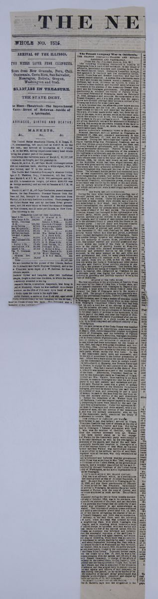
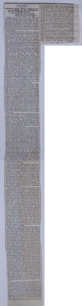
JAPAN
Appearance of the Country—Manners, Customs, Dwellings, &c., of the Inhabitants—The American consul-General.
UNITED STATES SHIP PORTSMOUTH,HAKODADI, Japan, October, 1857.
Japan is a country, about the history of which there hangs so much of strange and half-mysterious interest, and which has had, for a few years past, and still has, so many claims upon the attention of the Western nations, and especially of the United States, that I cannot but congratulate myself that I have had the opportunity of visiting it, although but hurriedly, and observing, though to a very limited extent, the character of the country and people. * * *
We had hardly dropped our anchor in the harbor of Simodia, when a boat, bearing the black and white Japanese flag, pulled off from the town bringing to the ship three or four officers, who came to bid us welcome in the name of the Governor, and in very good English. The boatmen were stout, muscular fellows, strongly built and well proportioned, and with a general appearance of intelligence and respectability. I would describe their costume if they had costume to describe, but costume they had none, save only a narrow rag, which served to make their nakedness more apparent. And this seems to be the case with all the common people—day laborers, artisans, mechanics, farmers, almost every body beyond the rank which would entitle him to wear one sword—all go naked—the small children frequently without a rag. In the most torrid part of the tropics that I have ever seen, the common people are much more dressed than they are here in Japan, in the same latitude (it should be remembered) with Richmond, with Philadelphia, with New-York and Boston. In Winter, I suppose they must clothe themselves, or they would perish with cold. Indeed, the bracing autumnal weather of October, and the thermometer at 50°, has already begun to increase the amount of dry goods which we meet with in our daily walks. Loose gowns of coarse brown fabrics, fastened by a girdle at the waist, are worn by those who would have considered them quite superfluous a month ago. The perfection of absurdity in costume, however, I saw in Simoda. A little, fat, dusky urchin, of four years old, without a rag of clothing, without even a thread to tie his hair with, walking about, in a shower of rain, with an umbrella open!
The officers were handsomely dressed in light-colored silks, of native manufacture; their upper garments were loose and flowing; and their trowsers were of an amplitude quite unspeakable. They wore thick stockings of blue cloth, and sandals of wood or straw. Like all the Japanese, their heads were shaven on top, from the forehead back to the crown—the hair on the back and sides of the skull being gathered into a queue, plastered together with grease, so that it is a solid mass and capable of standing alone, tied with a string, and then by a dexterous curve brought up into a horizontal position so that the end of it shall point forward in a direction parallel with that of the nose. Each of them wore two swords in elegantly lacquered scabbards—one of them a longer two-handled sword, and the other shorter, like a dirk. What with their flowing robes, their enormous trowsers and their long projecting swords, the figures of these gentlemen presented a very remarkable outline.
I was glad to avail myself of the first opportunity for a stroll on shore. Our landing place was at a substantial stone jetty, in front of a Custom-House or Police-office, from which the black and white flag was flying. The road lead us under the brow of a steep hill, green with vegetation and blooming with autumnal flowers,—beneath the shadow of grand old pine trees,—across the well-built wooden bridge that spanned a mountain brook,—and so into the town.
Only two weeks before I had walked about the streets of Shanghae, which are fearfully narrow, crowded, dirty, and like most of the Chinese streets, full of foulest stenches; it was therefore a very delightful contrast to find here streets broad enough for carriages, smooth, well-swept and clear and free from any odorous abominations. They are regularly laid out, at right angles to one another, and some of them are paved with cobble stones. Not less remarkable is the extreme cleanliness of the dwelling-houses and stores. These are flimsily built of thin boards upon a light frame work, with low roofs and paper windows, and are never more than one-story high. They are constructed with special reference to earthquakes, which would seem to occur as often as at the rate of a dozen or so a month. The houses are rarely painted, either inside or out, and must therefore, after a few years, become browned and begin to decay from exposure to the weather. None of those in Simoda presented such appearances, because they have all been built since the year 1854, when the whole down was destroyed by an earthquake of unusual violence, and the Russian frigate Diana, in harbor at the time, was wrecked at her anchorage.
Inside, the houses consist of one or two rooms, divided by their partitions; the floor is raised about eighteen inches from the ground, and a portion of it is covered with thick matting—sometimes in two or three layers—of remarkable cleanliness and elasticity; and upon this the family sit in the daytime and sleep at night; and it is just as much a matter of course to remove the sandals before treading upon this matting, as, in New-Haven, to take off one's hat before entering a parlor. The scrupulous neatness and cleanliness in which the houses are kept, would delight the heart, if it did not move the envy, of an American Shaker. I was reminded again and again of a visit which I once made to the settlement of the remarkable fraternity at Enfield.
We produced considerable sensation in our walk through the streets of Simoda. Workmen rested from their labors to stare at us; women rushed to the doors and gazed after us; small children followed us; cats ran from us and hid themselves; dogs howled at us and fled impetuously, with abject tails. At last we passed out of the more public streets, and found our way to where a handsome temple stood, close under the shadow of green hills. It was a building of much more elegant and substantial architecture than we had seen before, and the carved and ornamental work of the cornices were really beautiful. Passing under a high gateway, in which hung a large and sweet-toned bell, we entered a court crowded with monuments of the dead, and so came into the temple. At first it seemed to be vacant, but, by and by, we discovered the shining bald pate of the priest, who was stretched out at full length behind the altar, with its array of gilded toys and tinsel, enjoying his after-dinner nap. The autumnal breeze that rustled the leaves on the hill sides all around us was so pleasant, and the matting on the floor of the temple so soft and clean, that I felt half disposed to participate in the repose of the somnolent ecclesiastic.
The American flag flying from a large temple a mile distant from the town indicated the residence of our Consul-General, Mr. HARRIS. This gentleman, in the lonely year that he has spent among the Japanese, has not been idle; not only has he secured to himself the respect of all with whom he came in contact, but he has secured to his countrymen important privileges in addition to those provided for by the treaty; the currency is equitably established; the right of a permanent residence in Japan, on the part of American citizens, is acknowledged; and all cases of Americans charged with crime are to be tried by the Consul, and not by the Japanese authorities. Indeed, it seems not altogether improbable that before another year our Consul-General will be publicly received at Jeddo.
I have described, at as much length as the brief nature of the subject would permit, the costume of the men of Simoda, and have remarked upon their intelligent and healthy appearance, but have not yet introduced the women to the readers of the Journal and Courier. Many of the younger ones—(I mean the Japanese women, and not the readers of the Journal and Courier,)—if not really beautiful, have such an appearance of cheerful good nature and robust health as compensates for the absence of beauty; and if the matrons of Simoda would put a stop to the disgusting custom of staining their teeth a dirty black,—a custom which they adopt immediately upon entering the state of matrimony,—I should be able to compliment them, also, with a clear conscience; until then however, I forbear. The women are generally dressed neatly and modestly; and their hair, twisted into a knot on the top of the head, is frequently adorned with gay colored flowers or ribbons.
I was so happy as to make one of the party who accompanied the Captain of the Portsmouth at his official call on the Governors of Simoda—two dignitaries of high rank and of nearly equal authority, and expected, according to the whole theory of Japanese politics, to act as spies and checks upon each other. The house at which their Excellencies received us, was not very different from the other houses of the town, except that it was larger, more elegantly furnished, and, if possible, more exquisitely clean. On one side of the room (the walls of which were handsomely papered, and the floor of which was covered with matting so fine and soft that I almost feared to tread on it,) sat the Governors and their suite,—and on the other side sat the Consul-General and the Captain and officers of the Portsmouth. In front of each person was a table, on which were tea, pipes and tobacco, and confectionery—all of excellent quality, and in elegantly lacquered trays. Nothing important, beyond the mutual adulation customary on such occasion, occurred at our interview, except that once or twice the Governors gave expression to more liberal and progressive ideas than I had expected to hear. When, at the close of half an hour, or thereabouts we rose to go, the Governors rose also from the singular position in which they had been squatting with their legs bent under them, and bowed us out, informing us that what remained of our refreshments would be sent after us on board the ship, according to Japanese custom—a custom which I was disposed decidedly to applaud, because I had found the confectionery exceedingly toothsome. Sure enough, that same evening, although it was blowing half a gale of wind in the harbor, off came a two-sworded officer, bringing, in a box, the remnants of our refection, which he delived to us with much solemnity and amiability of demeanor.
[begin surface 1085]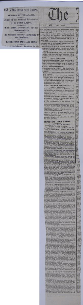
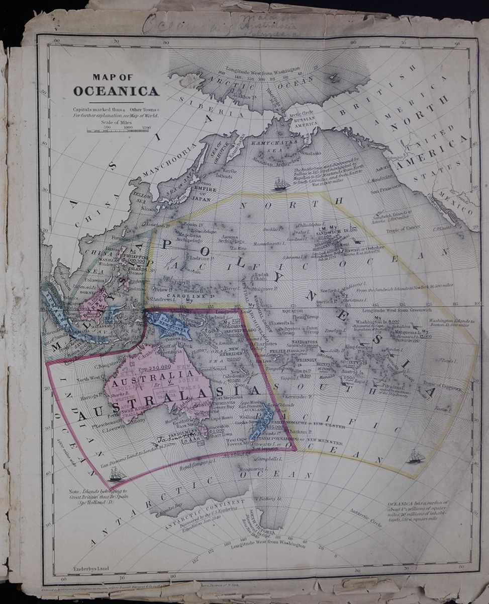
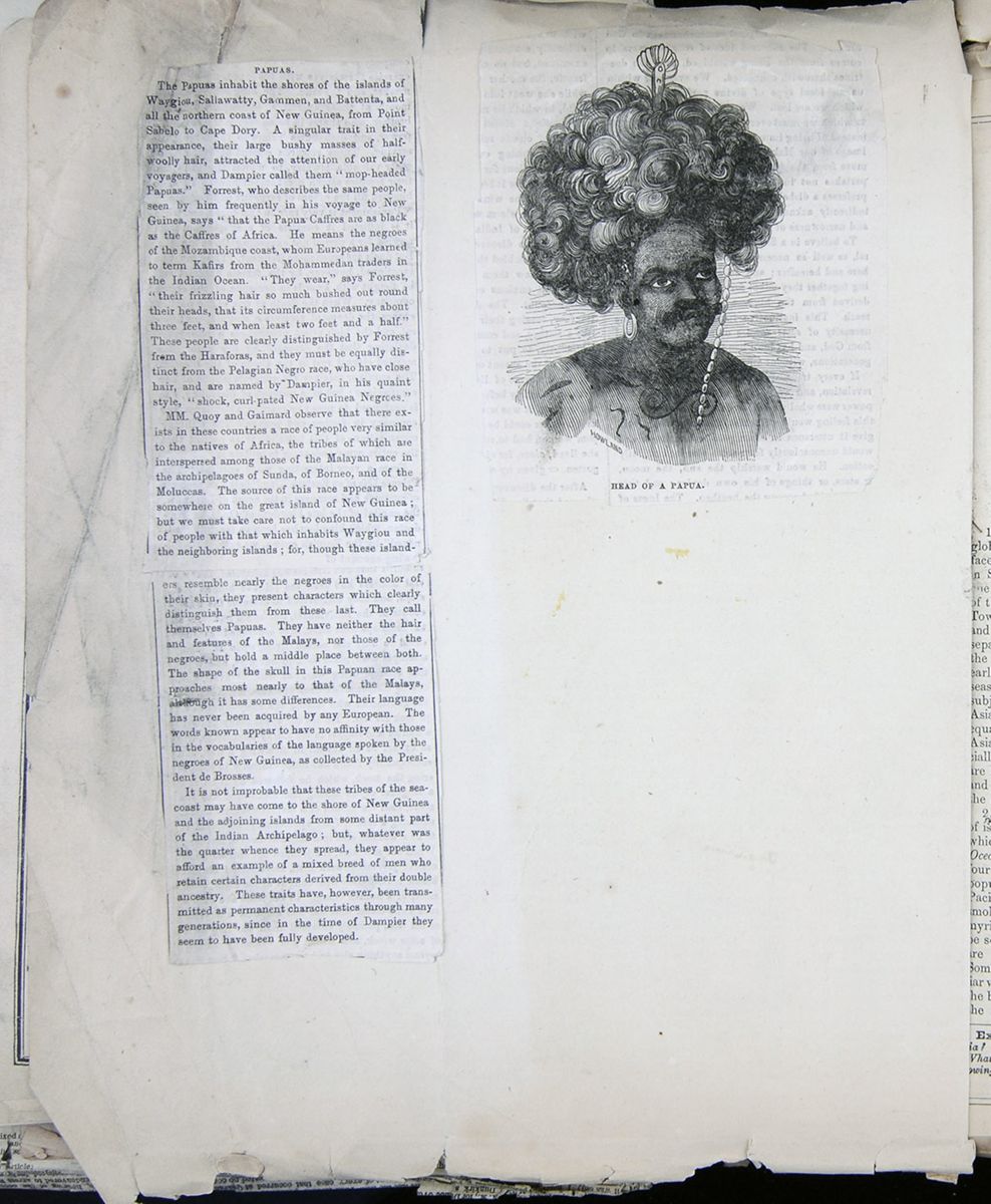 [begin surface 1088]
PAPUAS.
The Papuas inhabit the shores of the islands of Waygiou, Sallawatty, Gammen, and Battenta, and all the northern coast of New Guinea, from Point Sabelo to Cape Dory. A singular trait in their appearance, their large bushy masses of half-woolly hair, attracted the attention of our early voyagers, and Dampier called them "mop-headed Papuas." Forrest, who describes the same people, seen by him frequently in his voyage to New Guinea, says "that the Papua Caffres are as black as the Caffres of Africa. He means the negroes of the Mozambique coast, whom Europeans learned to term Kafirs from the Mohammedan traders in the Indian Ocean. "They wear," says Forrest, "their frizzling hair so much bushed out round their heads, that its circumference measures about three feet, and when least two feet and a half." These people are clearly distinguished by Forrest from the Harafores, and they must be equally distinct form the Pelagian Negro race, who have close hair, and are named by Dampier, in his quaint style, "shock, curl-pated New Guinea Negroes."
MM. Quoy and Gaimard observe that there exists in these countries a race of people very similar to the natives of Africa, the tribes of which are interspersed among those of the Malayan race in the archipelagoes of Sunda, of Borneo, and of the Moluccas. The source of this race appears to be somewhere on the great island of New Guinea; but we must take care not to confound this race of people with that which inhabits Waygiou and the neighboring islands; for, though these islanders
resemble nearly the negroes in the color of their skin, they present characters which clearly distinguish them from these last. They call themselves Papuas. They have neither the hair and features of the Malays, nor those of the negroes, but hold a middle place between both. The shape of the skull in this Papuan race approaches most nearly to that of the Malays, although it has some differences. Their language has never been acquired by any European. The words known appear to have no affinity with those in the vocabularies of the language spoken by the negroes of New Guinea, as collected by the President de Brosses.
It is not improbable that these tribes of the seacoast may have come to the shore of New Guinea and the adjoining islands from some distant part of the Indian Archipelago; but, whatever was the quarter whence they spread, they appear to afford an example of a mixed breed of men who retain certain characters derived from their double ancestry. These traits have, however, been transmitted as permanent characteristics through many generations, since in the time of Dampier they seem to have been fully developed.
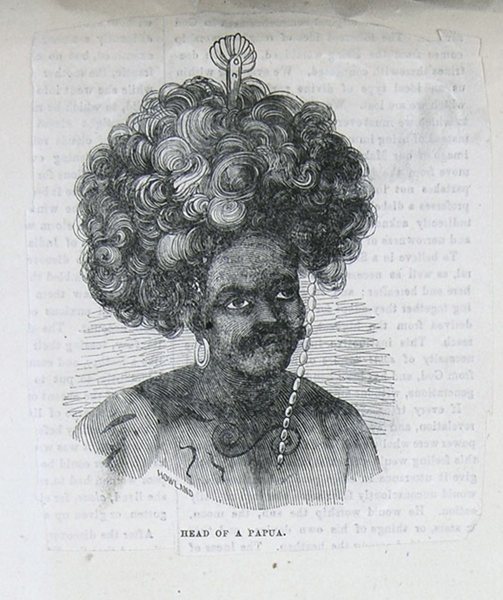
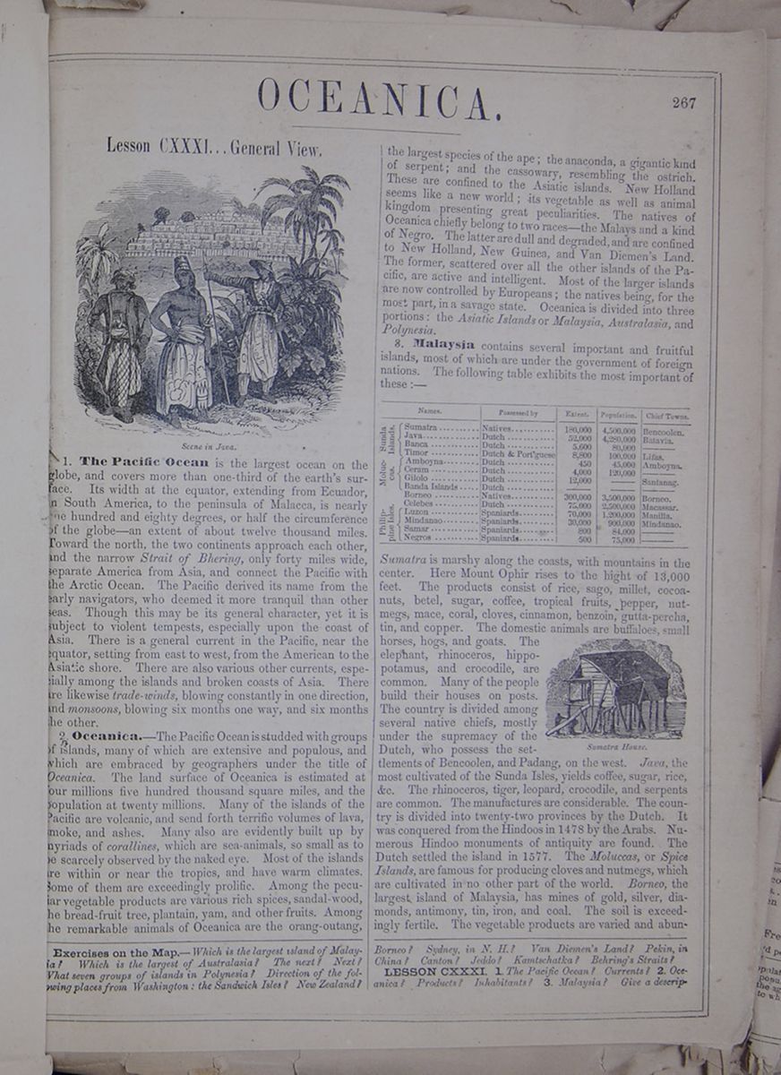
OCEANICA.
Lesson CXXXI... General View.
Scene in Java.1. The Pacific Ocean is the largest ocean on the globe, and covers more than one-third of the earth's surface. Its width at the equator, extending from Ecuador, in South America, to the peninsula of Malacca, is nearly one hundred and eighty degrees, or half the circumference of the globe—an extent of about twelve thousand miles. Toward the north, the two continents approach each other, and the narrow Strait of Bhering, only forty miles wide, separate America from Asia, and connect the Pacific with the Arctic Ocean. The Pacific derived its name from the early navigators, who deemed it more tranquil than other seas. Though this may be its general character, yet it is subject to violent tempests, especially upon the coast of Asia. There is a general current in the Pacific, near the equator, setting from east to west, from the American to the Asiatic shore. There are also various other currents, especially among the islands and broken coasts of Asia. There are likewise trade-winds, blowing constantly in one direction, and monsoons, blowing six months one way, and six months the other.
2. Oceanica.—The Pacific Ocean is studded with groups of islands, many of which are extensive and populous, and which are embraced by geographers under the title of Oceanica. The land surface of Oceanica is estimated at four millions five hundred thousand square miles, and the population at twenty millions. Many of the islands of the Pacific are volcanic, and send forth terrific volumes of lava, smoke, and ashes. Many also are evidently built up by myriads of corallines, which are sea-animals, so small as to be scarcely observed by the naked eye. Most of the islands are within or near the tropics, and have warm climates. Some of them are exceedingly prolific. Among the peculiar vegetable products are various rich spices, sandal-wood, the bread-fruit tree, plantain, yam, and other fruits. Among the remarkable animals of Oceanica are the orang-outang, the largest species of the ape; the anaconda, a gigantic kind of serpent; and the cassowary, resembling the ostrich. These are confined to the Asiatic islands. New Holland seems like a new world; its vegetable as well as animal kingdom presenting great peculiarities. The natives of Oceanica chiefly belong to two races—the Malays and a kind of Negro. The latter are dull and degraded, and are confined to New Holland, New Guinea, and Van Diemen's Land. The former, scattered over all the other islands of the Pacific, are active and intelligent. Most of the larger islands are now controlled by Europeans; the natives being, for the most part, in a savage state. Oceanica is divided into three portions: the Asiatic Islands or Malaysia, Australasia, and Polynesia.
3. Malaysia contains several important and fruitful islands, most of which are under the government of foreign nations. The following table exhibits the most important of these:— This table lists various features of islands in Oceanica. Sumatra is marshy along the coasts, with mountains in the center. Here Mount Ophir rises to the hight of 13,000 feet. The products consist of rice, sago, millet, cocoa-nuts, betel, sugar, coffee, tropical fruits, pepper, nutmegs, mace, coral, cloves, cinnamon, benzoin, gutta-percha, tin, and copper. The domestic animals are buffaloes, small horses, hogs, and goats. The elephant, rhinoceros, hippopotamus, and crocodile, are common. Many of the people build their houses on posts. The country is divided among several native chiefs, mostly under the supremacy of the Dutch, who possess the settlements of Bencoolen, and Padang, on the west. Java, the most cultivated of the Sunda Isles, yields coffee, sugar, rice, &c. The rhinoceros, tiger, leopard, crocodile, and serpents are common. The manufactures are considerable. The country is divided into twenty-two provinces by the Dutch. It was conquered from the Hindoos in 1478 by the Arabs. Numerous Hindoo monuments of antiquity are found. The Dutch settled the island in 1577. The Moluccas, or Spice Islands, are famous for producing cloves and nutmegs, which are cultivated in no other part of the world. Borneo, the largest island of Malaysia, has mines of gold, silver, diamonds, antimony, tin, iron, and coal. The soil is exceedingly fertile. The vegetable products are varied and abundant,
Exercises on the Map.—Which is the largest island of Malaysia? Which is the largest of Australasia? The next? Next? What seven groups of islands in Polynesia? Direction of the following places from Washington: the Sandwich Isles? New Zealand? Borneo? Sydney, in N. H.? Van Diemen's Land? Pekin, in China? Canton? Jeddo? Kamtschatka? Behring's Straits?
LESSON CXXXI. 1. The Pacific Ocean? Currents? 2. Oceanica? Products? Inhabitants? 3. Malaysia? Give a description
[begin surface 1091]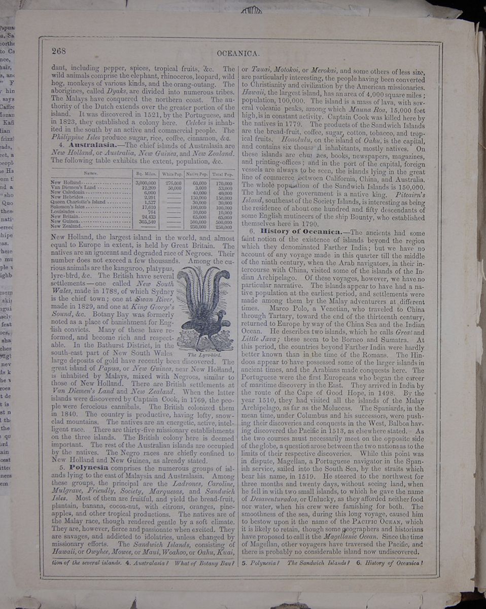 268
OCEANICA.
268
OCEANICA.
including pepper, spices, tropical fruits, &c. The wild animals comprise the elephant, rhinoceros, leopard, wild hog, monkeys of various kinds, and the orang-outang. The aborigines, called Dyaks, are divided into numerous tribes. The Malays have conquered the northern coast. The authority of the Dutch extends over the greater portion of the island. It was discovered in 1521, by the Portuguese, and in 1823, they established a colony here. Celebes is inhabited in the south by an active and commercial people. The Philippine Isles produce sugar, rice, coffee, cinnamon, &c.
4. Australasia.—The chief islands of Australasia are New Holland, or Australia, New Guinea, and New Zealand. The following table exhibits the extent, population, &c. This table lists various features of islands in Australasia. New Holland, the largest island in the world, and almost equal to Europe in extent, is held by Great Britain. The natives are an ignorant and degraded race of Negroes. Their number does not exceed a few thousands. Among the curious animals are the kangaroo, platypus, lyre-bird, &c. The British have several settlements—one called New South Wales, made in 1788, of which Sydney is the chief town; one at Swan River, made in 1829, and one at King George's Sound, &c. Botany Bay was formerly noted as a place of banishment for English convicts. Many of these have reformed, and become rich and respectable. The Lyre-bird. In the Bathurst District, in the south-east part of New South Wales large deposits of gold have recently been discovered. The great island of Papua, or New Guinea, near New Holland, is inhabited by Malays, mixed with Negroes, similar to those of New Holland. There are British settlements at Van Diemen's Land and New Zealand. When the latter islands were discovered by Captain Cook, in 1769, the people were ferocious cannibals. The British colonized them in 1840. The country is productive, having lofty, snow-clad mountains. The natives are an energetic, active, intelligent race. There are thirty-five missionary establishments on the three islands. The British colony here is deemed important. The rest of the Australian islands are occupied by the natives. The Negro races are chiefly confined to New Holland and New Guinea, as already stated.
5. Polynesia comprises the numerous groups of islands lying to the east of Malaysia and Australasia. Among these groups, the principal are the Ladrones, Caroline, Mulgrave, Friendly, Society, Marquesas, and Sandwich Isles. Most of them are fruitful, and yield the bread-fruit, plantain, banana, cocoa-nut, with citrons, oranges, pine-apples, and other tropical productions. The natives are of the Malay race, though rendered gentle by a soft climate. They are, however, fierce and passionate when excited. They are savages, and addicted to idolatries, unless changed by missionary efforts. The Sandwich Islands, consisting of Hawaii, or Owyhee, Mowee, or Maui, Woahoo, or Oahu, Kuai, or Tauai, Motokoi, or Merokai, and some others of less size, are particularly interesting, the people having been converted to Christianity and civilization by the American missionaries. Hawaii, the largest island, has an area of 4,000 square miles; population, 100,000. The island is a mass of lava, with several volcanic peaks, among which Mauna Roa, 15,000 feet high, is in constant activity. Captain Cook was killed here by the natives in 1779. The products of the Sandwich Islands are the bread-fruit, coffee, sugar, cotton, tobacco, and tropical fruits. Honolulu, on the island of Oahu, is the capital, and contains six thousand inhabitants, mostly natives. On these islands are churches, books, newspapers, magazines, and printing-offices; and in the port of the capital, foreign vessels are always to be seen, the islands lying in the great line of commerce between California, China, and Australia. The whole population of the Sandwich Islands is 150,000. The head of the government is a native king. Pitcairn's Island, southeast of the Society Islands, is interesting as being the residence of about one hundred and fifty descendants of some English mutineers of the ship Bounty, who established themselves here in 1790.
6. History of Oceanica.—The ancients had some faint notion of the existence of islands beyond the region which they denominated Farther India; but we have no account of any voyage made in this quarter till the middle of the ninth century, when the Arab navigators, in their intercourse with China, visited some of the islands of the Indian Archipelago. Of these voyages, however, we have no particular narrative. The islands appear to have had a native population at the earliest period, and settlements were made among them by the Malay adventurers at different times. Marco Polo, a Venetian, who traveled to China through Tartary, toward the end of the thirteenth century, returned to Europe by way of the China Sea and the Indian Ocean. He describes two islands, which he calls Great and Little Java; these seem to be Borneo and Sumatra. At this period, the countries beyond Farther India were hardly better known than in the time of the Romans. The Hindoos appear to have possessed some of the larger islands in ancient times, and the Arabians made conquests here. The Portuguese were the first Europeans who began the career of maritime discovery in the East. They arrived in India by the route of the Cape of Good Hope, in 1498. By the year 1510, they had visited all the islands of the Malay Archipelago, as far as the Moluccas. The Spaniards, in the mean time, under Columbus and his successors, were pushing their discoveries and conquests in the West, Balboa having discovered the Pacific in 1513, as elsewhere stated. As the two courses must necessarily meet on the opposite side of the globe, a question arose between the two nations as to the limits of their respective discoveries. While this point was in dispute, Magellan, a Portuguese navigator in the Spanish service, sailed into the South Sea, by the straits which bear his name, in 1519. He steered to the northwest for three months and twenty days, without seeing land, when he fell in with two small islands, to which he gave the name of Desaventurados, or Unlucky, as they afforded neither food nor water, when his crew were famishing for both. The smoothness of the sea, during this long voyage, caused him to bestow upon it the name of the PACIFIC OCEAN, which it is likely to retain, though some geographers and historians have proposed to call it the Magellanic Ocean. Since the time of Magellan, other voyagers have traversed the Pacific, and there is probably no considerable island now undiscovered.
of the several islands. 4. Australasia? What of Botany Bay? 5. Polynesia? The Sandwich Islands? 6. History of Oceanica?
CATALOGUE OF J.H. COLTON & COMPANY'S PUBLICATIONS.
OFFICE, 172 WILLIAM STREET, CORNER OF BEEKMAN, NEW YORK.
Map of the World:
On Mercator's Projection, exhibiting the recent Arctic and Antarctic Discoveries and Explorations, etc. 6 sheets. Size, 80 by 60 inches. Price, mounted, $10 00.Map of the World:
On Mercator's Projection, exhibiting the recent Arctic and Antarctic Discoveries and Explorations, etc. 2 sheets. Size 44 by 36 inches. Price, mounted, $3 00.Map of the World:
On Mercator's Projection, etc. 1 sheet. Size, 28 by 22 inches. Price, mounted, $1 50.Missionary Map of the World:
On a Hemispherical Projection, each hemisphere being six feet in diameter, and both printed on one piece of cloth at one impression. Size, 160 by 80. Price, mounted, $10 00.Colton's Outline Maps:
A MAP OF THE WORLD, in two hemispheres, each 80 inches in diameter, and separately mounted. A MAP OF THE UNITED STATES, 80 by 62 inches. A MAP OF EUROPE, 80 by 62 inches, on the same plan with that of the United States, will complete the series. Price, each, $5 00.A Book of the World:
Being an account of all Republics, Empires, Kingdoms, and Nations, in reference to their Geography, Statistics, Commerce, etc., together with a brief historical outline of their Rise, Progress, and Present Condition, etc. By Richard S. Fisher, M.D. In two volumes, pp. 632, 727. Illustrated with maps and charts. Price, $5 00.A Chronological View of the World:
Exhibiting the leading events of Universal History; the origin and progress of the Arts and Sciences, etc.; collected chiefly from the article "Chronology," in the new Edinburgh Encyclopedia, edited by Sir David Brewster, LL.D., F.R.S., etc.; with an enlarged view of important events, particularly in regard to American History, and a continuation to the present time, by Daniel Haskell, A.M., American Editor of McCulloch's Universal Gazetteer, etc. 12mo., pp. 267. Price, 75 cents.Stream of Time:
Or Chart of Universal History. From the original German of Strauss. Revised and continued by R. S. Fisher, M.D. Size, 43 by 32 inches. Price, mounted, $3 00.The Nations of the World:
Being a general Description of all Nations and Countries, their Geography, Resources, Industries, and Institutions; together with a brief history of their Rise, Progress, and Present Condition. By Richard S. Fisher, M.D., author of the "Book of the World," and other statistical works. 2 vols. 8vo., pp. 672, 680. (not yet complete.) Price, bound, $5 00.Mountains and Rivers:
A Combined View of the Principal Mountains and Rivers in the World, with Tables showing their Relative Heights and Lengths. 1 sheet. Size, 32 by 25 inches. Price, mounted, $1 50.A Chart of National Flags:
Each represented by its appropriate colors. 1 sheet. Size, 28 by 22 inches. Price, mounted, $1 50.Map of North and South America:
With Enlarged Plans of the Isthmus of Panama, the Isthmus of Tehuantepec, and the Nicaragua Route; showing the Projected and Completed Lines of Inter-Oceanic Communication; also, Plans of the Bermuda Islands, the Harbor of San Juan de Nicaragua, and the Cities of Rio de Janeiro, Panama, and Aspinwall City; also, Tables of Distances from the principal ports of the United States to all parts of the world, etc. 2 sheets. Size, 45 by 52 inches. Price, mounted, $5 00.The Book of America:
Being an Account of the Geography, Resources, Industries, Institutions, and other interests pertaining to the several Governments and nations thereof. By Richard S. Fisher, M.D., author of the "Nations of the World," and other statistical works. 1 vol. 8vo., pp. 672. (Nearly ready.) Price, bound, $2 50.Map of North America:
Compiled from the latest authorities. 1 sheet. Size, 29 by 26 inches. Price, mounted, $1 25; in cases, 75 cents.Topographical Map of the West Indies:
With the adjacent Coasts; compiled from the latest authorities 1 sheet. Size, 32 by 25 inches. Price, mounted, $1 50; in cases, 75 cents.Map of South America:
Carefully compiled from the latest maps and charts, and other geographical publications. 2 sheets. Size, 44 by 31 inches. Price, mounted, $4 00Map of South America.
Compiled from the latest authorities, and accompanied with Statistical Table of the Area, Population, etc., of the several States 1 sheet. Size, 32 by 25 inches. Price, mounted, $1 50.Map of Europe.
Carefully compiled from the latest maps and charts, and other geographical publications. 4 sheets. Size, 58 by 44 inches. Price, mounted, $5 00.Map of Europe.
Compiled from the latest authorities, etc.; with Statistical Tables, exhibiting the Area, Population, Form of Government, Religion, etc., of each State. 1 sheet. Size, 32 by 25 inches. Price, mounted, $1 50The European Battle Fields:
Map of Europe; together with a large Plan of the Black Sea and Danubian Provinces. 1 sheet. Size, 30 by 24 inches. Price, mounted, $1 25; in cases, 50 cents; in sheets, 37 cents.Map of Asia:
Carefully compiled from the latest maps and charts, and other geographical publications. 4 sheets. Size, 58 by 44 inches. Price, mounted, $5 00.Map of Asia:
Compiled from the most recent authorities; together with Statistical Tables of the Area, Population, etc., of each State. 1 sheet. Size, 32 by 25 inches. Price, mounted, $1 50.Map of Africa:
Carefully compiled from the latest maps and charts, and other geographical publications. 4 sheets. Size, 58 by 44 inches. Price, mounted $5 00. 2
CATALOGUE OFF J. H. COLTON &
COMPANY'S PUBLICATIONS.
2
CATALOGUE OFF J. H. COLTON &
COMPANY'S PUBLICATIONS.
Map of Africa:
Compiled from the latest authorities, and accompanied with Statistical Tables of the Area, Population, etc., of each States. 1 sheet. Size, 32 by 25 inches. Price, mounted, $1 50.New Testament Map:
A Map of the Countries mentioned in the New Testament, and of the Travels of the Apostles, with Ancient and Modern Names, from the most authentic sources. 1 sheet. Size, 32 by 25 inches. Price, mounted, $1 50.Map of Palestine:
From the latest authorities—chiefly from the Maps and Drawings of Robinson & Smith, with Corrections and Additions furnished by the Rev. Dr. E. Robinson, and with Plans of Jerusalem and of the Journeyings of the Israelites. 4 sheets. Size, 80 by 62 inches. Price, mounted, $6 00.Map of Palestine:
From the latest authorities—chiefly from the Maps and Drawings of Robinson & Smith, with Corrections and Additions furnished by the Rev. Dr. E. Robinson. 2 sheets. Size, 43 by 32 inches. Price, mounted, $2 50.Map of Egypt:
The Peninsula of Mount Sinai, Arabia Petræa, with the southern part of Palestine. Compiled from the latest authorities. Showing the Journeyings of the Children of Israel from Egypt to the Holy Land. 1 sheet. Size, 32 by 25 inches. Price, mounted, $1 50.An Illustrated Map of Human Life:
Deduced from Passages of Sacred Writ. 1 sheet. Size, 25 by 20 inches. Price, mounted, 75 cents.Map of the United States, the British Provinces, Mexico,
AND THE WEST INDIES; showing the country from the Atlantic to the Pacific Ocean. 4 sheets. Size, 62 by 55 inches. Price, $5 00.Map of the United States and the Canadas:
Showing the Base, Meridian, and Township Lines of the United States Surveys; the Lines of Counties, Districts, and Parishes; the Location of Cities, Villages, and Post-offices; all Railroads, Canals, Post, and other Roads; also, the District and Town Lines of the Canadas; the whole being compiled from the latest surveys, and other authentic sources. 9 sheets. Size, 82 by 68 inches. Price, mounted, or in portable form, $10 00.Map of the United States, the British Provinces, Mexico,
THE WEST INDIES, AND CENTRAL AMERICA, with parts of NEW GRENADA AND VENEZUELA; exhibiting the country from the Atlantic to the Pacific, and from 50° N. lat. to the Isthmus of Panama and the Oronoco River. 2 sheets. Size, 45 by 36 inches. Price, mounted, $2 50; in cases, $1 50.Guide-Book through the United States, etc.:
Travelers' and Tourists' Guide-Book through the United States of America and the Canadas. Containing the Routes and Distances on all the great lines of travel by Railroads, Canals, Stage Roads, and Steamboats; together with Descriptions of the several States, and the principal Cities, Towns, and Villages in each; accompanied with a large and accurate Map. Price, bound, $1 00.Route-Book through the United States, etc.:
Travelers' and Tourists' Route-Book through the United States of America and the Canadas. Containing the Routes and Distances on all the great lines of travel by Railroads, Stage Roads, Canals, Rivers, and Lakes, etc.; accompanied with a large and accurate Map. Price, bound, 75 cents.Map of the United States, the Canadas, etc.:
Showing the Railroads, Canals, and Stage Roads, with the Distances from place to place. Size, 28 by 32 inches. Price, in cases, 63 cents.A New and Complete Statistical Gazetteer of[covered]
STATES OF AMERICA; formed on and compiled [covered] Federal and State Returns, and the Census of 1850. [covered] Swainson Fisher, M.D., author of the "Book of the Wor[covered]ress of the United States," a "Statistical Account o[covered] etc.; also, literary editor of "Colton's American Atlas, [covered]of the "American Railway Guide." 1 vol., pp. 960. [covered]P[covered].American Statistical Annual for the Year 1854–5[covered]
Compiled from the most authentic sources. By Richar[covered] M.D., and Charles Colby, A.M. 1 vol., pp. 537. Price, in [covered]Progress of the United States:
Geographical, Statistical, and Historical. By Richard [covered] M.D., author of the "Book of the World," the "Statistic [covered] of the United States of America," literary editor of Col[covered] of the World," and editor of the "American Railway [covered] 1 vol. royal 8vo., pp. 432. Price, bo[covered]Map of England:
With portions of the State of New York and the Britis[covered] Size, 64 by 56 inches. Price, mounted, colored in coun[covered] " " " town[covered]Map of the States of New England and New Yor[covered]
With parts of Pennsylvania, New Jersey, the Canadas, [covered] the Railroads, Canals, and Stage Roads, with Distances [covered] to place. 1 sheet. Size, 30 by 23 inches. Price, mou[covered]Guide-Book through the New England and Middl[covered]
Travelers' and Tourists' Guide-Book through the New [covered] Middle States, and the Canadas. Containing the Rou[covered]tances on all the great lines of travel, by Railroads, [covered]Roads, and Steamboats, together with Descriptions of [covered]States, and the principal Cities, Towns, and Villages in [covered]panied with a large and accurate Map. Price, bou[covered]Map of the Western States:
Viz., Ohio, Indiana, Michigan, Illinois, Kentucky, Mi[covered]and the Territories, exhibiting the Base, Meridian, [covered]Lines of the United States Surveys, the Lines of t[covered] the general Geography of the Country, the Railroads, [covered] other roads, the Location of Cities, Villages, and Post-[covered] compiled from the most recent and accurate sources. [covered] steel. Size, 48 by 36 inches. Price, mounted, $3 00; and in portable[covered]Map of the Western States:
Viz., Ohio, Michagan, Indiana, Illinois, Missouri, Iowa, [covered]sin, and the Territory of Minnesota, showing the Town[covered]the United States Surveys, Location of Cities, Towns, [covered] Hamlets, Canals, Railroads, and Stage Roads. By J. [covered] 1 sheet. Size, 28 by 24 inches. Price, mounted, $1 25; in cas[covered]The Western Tourist:
And Emigrant's guide through the States of Ohio, Mi[covered]ana, Illinois, Missouri, Iowa, and Wisconsin, and the T[covered]Minnesota, Missouri, and Nebraska, being an accurate[covered] Description of each State and Territory, and containin[covered] and Distances on the great lines of travel; accompanied and minute Map, exhibiting the Township Lines of the [covered] Surveys, the Boundaries of Counties, and the Position of [covered]lages, and Settlements, etc. Price, bou[covered]Western Portraiture:
And Emigrant's Guide. A description of Wisconsin, [covered] Iowa, with Remarks on Minnesota and other Territories [covered]S. Curtiss. In 1 vol. 12mo., pp. 360 (illustrated with [covered]Map). Price, b[covered] [begin surface 1095]
 [begin surface 1096]
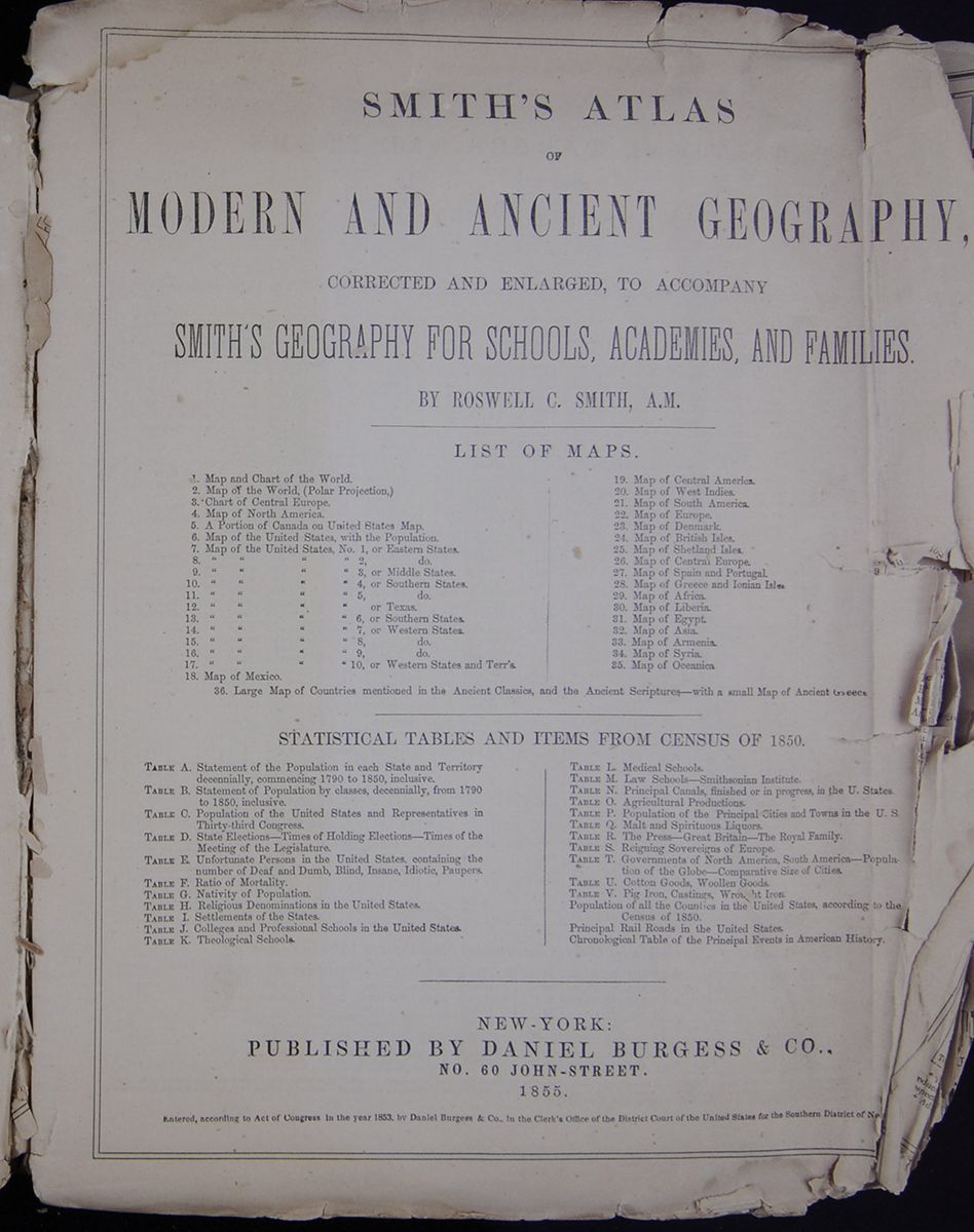
SMITH'S ATLAS OF MODERN AND ANCIENT GEOGRAPHY, CORRECTED AND ENLARGED, TO ACCOMPANY SMITH'S GEOGRAPHY FOR SCHOOLS, ACADEMIES, AND FAMILIES.
LIST OF MAPS. This table lists the maps published in the atlas. STATISTICAL TABLES AND ITEMS FROM CENSUS OF 1850. This table is a list of tables included in Smith's Atlas. NEW-YORKPUBLISHED BY DANIEL BURGESS & CO.,
NO. 60 JOHN-STREET.
1855. Entered, according to Act of Congress in the year 1853, by Daniel Burgess & Co., In the Clerk's Office of the District Court of the United States for the Southern District of Ne[cutaway] [begin surface 1097]
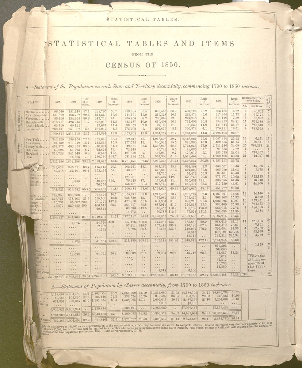 STATISTICAL TABLES
 STATISTICAL TABLES AND ITEMS
FROM THE
CENSUS OF 1850. A.—Statement of the Population in each State and Territory decennially, commencing 1790 to 1850 inclusive. This table lists the population in each state every ten years from 1790 to 1850. At each interval, there is also a "Ratio of Increase." It also includes the representatives of each state, broken into the number of representatives, "fractions," and "present No. of Reps." Each state receives its own row, but is also grouped into a region; the two visible regions are "New England States" and "Middle States" (the rest are torn away). Each region has a line that sums its states' populations and ratio of increase at the bottom of each region's section. B.—Statement of the Population by Class decennially, from 1790 to 1850 inclusive. This table has its left column cut away, which makes it difficult to decipher. However, the table appears to count the number and percentage of people in five different economic groups.
[cutaway]California is set down at 165,000 as an approximation to the real population, which may be essentially varied by complete returns. Should the returns vary from our estimate so far as to[cutaway] of California 30,000, South Carolina will be entitled to a member additional, as being next above on the list of fractions. The official returns of California will slightly affect the calculation[cutaway] increase of the free population for the year 1850. Ratio of representation, 93,731.
[cutaway]opulation.
[begin surface 1098] STATISTICAL TABLES
C.—Population of the United States, and
Representation in the Thirty-third Congress. State Elections,
&c.
This table lists each state and territory. Its first
task is to list the population of each state by race. First
it counts Whites and Free Colored of each state, as well as
the "Total Free Population"; then it counts slaves and the
"Total Population." It then calculates the "Aggregate
population of the United States" by those categories and the
Representative Population for each state. After counting the
population, it lists each state's or territory's seats of
government, times of holding election, and one final column
that is partly cut away but appears to read "Times of the
Meeting...Legislature."
STATISTICAL TABLES
C.—Population of the United States, and
Representation in the Thirty-third Congress. State Elections,
&c.
This table lists each state and territory. Its first
task is to list the population of each state by race. First
it counts Whites and Free Colored of each state, as well as
the "Total Free Population"; then it counts slaves and the
"Total Population." It then calculates the "Aggregate
population of the United States" by those categories and the
Representative Population for each state. After counting the
population, it lists each state's or territory's seats of
government, times of holding election, and one final column
that is partly cut away but appears to read "Times of the
Meeting...Legislature."
*"Apprentices" by the "Act to abolish slavery," passed 18th April, 1846.
E.—Unfortunate Persons in the United States. This table counts the number of people living with disabilities in the United States. It records the number of people who are "Deaf and Dumb," "Blind," "Insane," "Idiotic," and "Paupers," as well as the total number. Each state and territory has its own line, counting each group with the disability by male, female, and agreggate. The final row counts the aggregate of each state's and territory's aggregate to show the total number of people living with a disability. The final column is titled "Amount" and gives a dollar figure for the "Annual Cost of Paupers."It will be seen by the foregoing Table, that the ratio of the Deaf and Dumb is one to every 2,385 persons in the United States; of the blind, one to every 2390; of the Insane, one to every 1,470; of the idiotic, one to every 1,476; of Paupers, one to every 440.
F.—Ratio of Mortality.For general estimates, adopting current clas[cutaway]the States, the American Census exhibits the foll[cutaway]of mortality, disregarding the ages at death:
The only visible column of this table breaks the States into five regions—New England States; Middle States, with Ohio; Central slave States, Coast planting States, and Northwestern States—as well as the total. However, it can be inferred from the title that this table then offers the ratio of mortality for each region.It will be seen that the values for the three[cutaway]strikingly agree with the average for the Un[cutaway]whole, representing 1 death to 73 living, and[cutaway]tially the ratio stated by Noah Webster for[cutaway]1805. "The annual deaths," he observes, "[cutaway]one in seventy or seventy-five of the populatio[cutway]
G.—Nativity of Popula[cutaway]One of the most interesting results of the[cutaway] classification of inhabitants according to the[cutaway]birth, presented in an authentic shape in the[cutaway]Table.
The countries whence have been derived t[cutaway]tions of these additions to our population appe[cutaway] ing statement"
The only visible column of this table breaks the people of the United States into eight groups depending on their native country—Natives of Ireland, Germany, England, British America, Scotland, France, Wales, and Other countries. However, it can be inferred from the title that this table then counts how many of those people live in the United States. [begin surface 1099]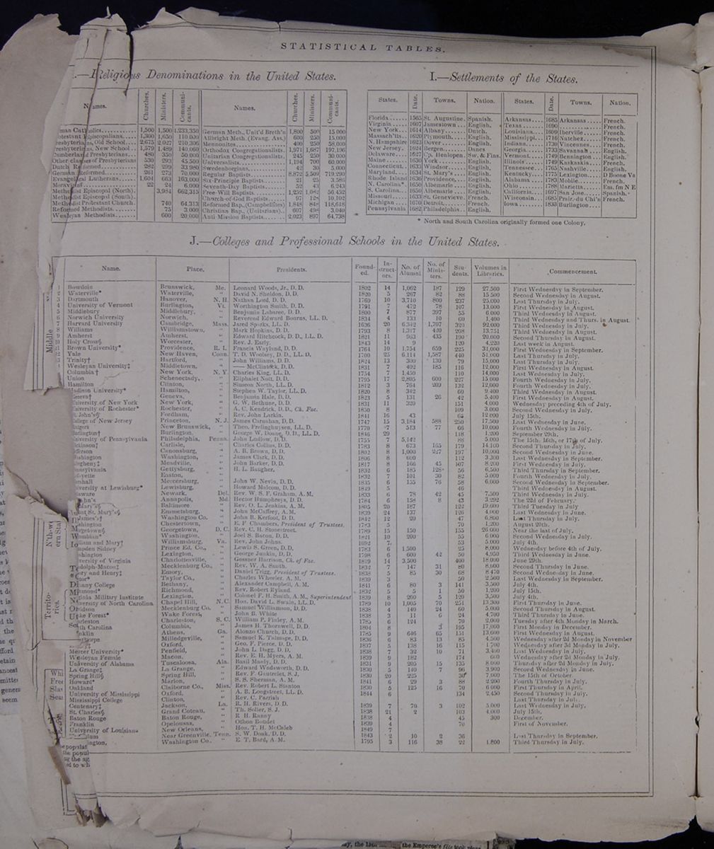 STATISTICAL TABLES
H.—Religious Denominations in the United
States.
This table lists religious denominations in the United
States along with the number of churches, ministers and
communicants in each.
I.—Settlements of the States.
This table lists the States in the U.S. with their date
of settlement, major city, and nation.
J.—Colleges and Professional Schools in the United
States.
This table lists names of the Colleges and Professional
Schools in the U.S., their locations, presidents, year
founded, number of instructors, number of alumni, number of
ministers, number of students, books in the school library,
and day of commencement.
[begin surface 1100]
STATISTICAL TABLES
H.—Religious Denominations in the United
States.
This table lists religious denominations in the United
States along with the number of churches, ministers and
communicants in each.
I.—Settlements of the States.
This table lists the States in the U.S. with their date
of settlement, major city, and nation.
J.—Colleges and Professional Schools in the United
States.
This table lists names of the Colleges and Professional
Schools in the U.S., their locations, presidents, year
founded, number of instructors, number of alumni, number of
ministers, number of students, books in the school library,
and day of commencement.
[begin surface 1100]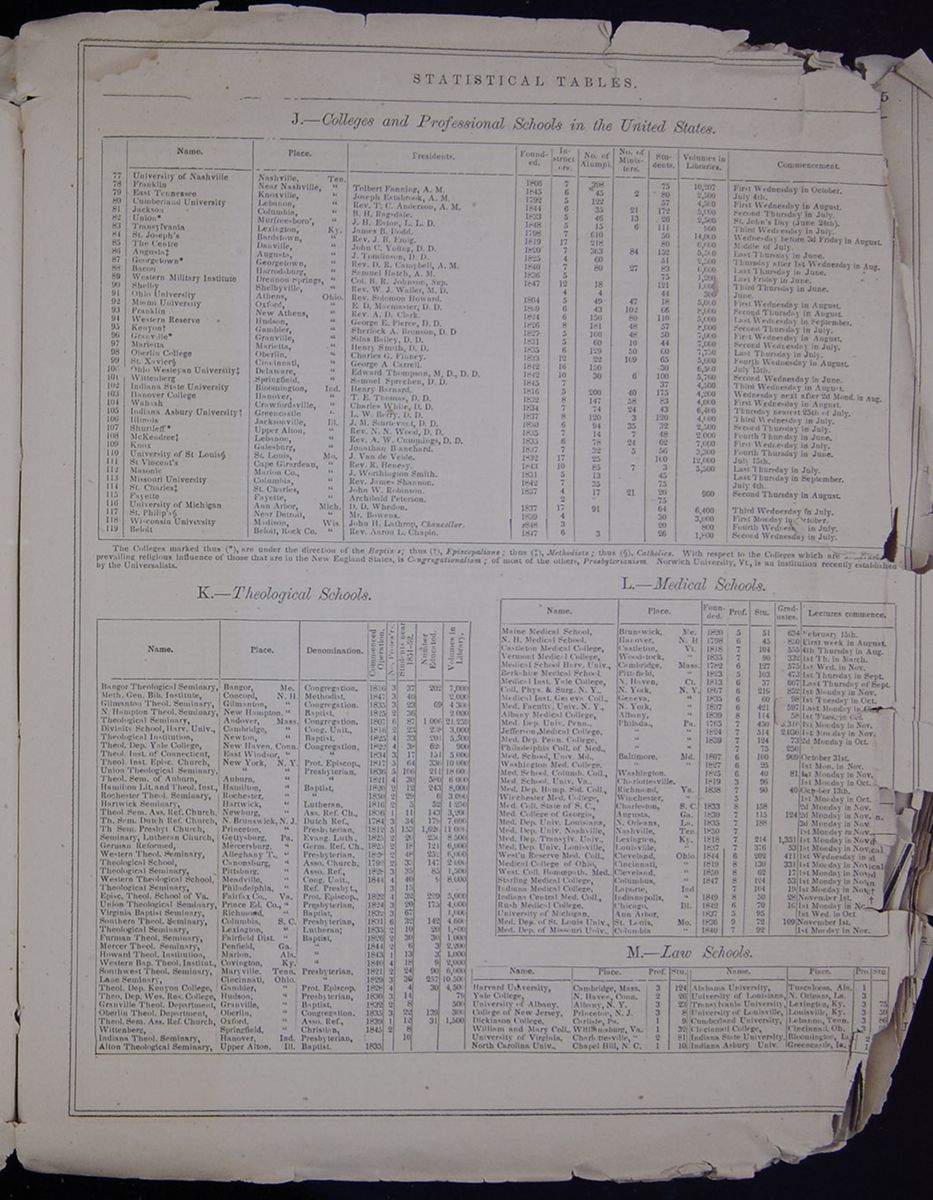 STATISTICAL TABLES
A continuation of Table J from the previous
page.
K.—Theological Schools.
This table lists the Theological Schools in the United
States, their location, denomination, date of foundation,
number of professors, numbers of students, and books in the
library.
L.—Medical Schools.
This table lists the Medical Schools in the United
States, their location, denomination, date of foundation,
number of professors, numbers of students, number of
graduates, and day lectures commence.
M.—Law Schools.
This table lists the Law Schools in the United States,
their location, number of professors, and numbers of
students.
[begin surface 1101]
STATISTICAL TABLES
A continuation of Table J from the previous
page.
K.—Theological Schools.
This table lists the Theological Schools in the United
States, their location, denomination, date of foundation,
number of professors, numbers of students, and books in the
library.
L.—Medical Schools.
This table lists the Medical Schools in the United
States, their location, denomination, date of foundation,
number of professors, numbers of students, number of
graduates, and day lectures commence.
M.—Law Schools.
This table lists the Law Schools in the United States,
their location, number of professors, and numbers of
students.
[begin surface 1101]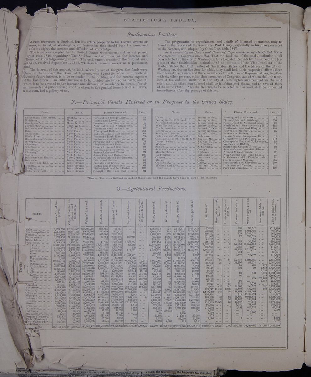 STATISTICAL TABLES
Smithsonian Institute.
[cutaway] JAMES SMITHSON, of England, left his entire property to the UNITED STATES OF [cutaway]ERICA, to found at Washington, an Institution that should bear his name, and [cutaway]e for its object the increase and diffusion of knowledge.
The trust was accepted by the United States Government, and an act passed [cutaway]gust 19th, 1846, organizing "The Smithsonian Institution, for the increase and [cutaway]usion of knowledge among men." The endowment consists of the original sum, [cutaway]15,169, received September 1, 1838, which is to remain forever as a permanent [cutaway]nd.
The interest of this amount, to 1846, when by act of Congress the funds were placed in the hands of the Board of Regents, was $242,129; which sum, with all accruing future interest, is to be expended in the building, and the current expenses of the Institution. The entire income is to be divided into two equal parts, one of which is to be devoted to the increase and diffusion of knowledge by means of original research and publications; and the other, to the gradual formation of a library, a museum, and a gallery of art.
The programme of organization, and details of intended operations, may be found in the reports of the Secretary, Prof. Henry; especially in his plan presented to the Regents, and adopted by them Dec. 13th, 1847.
Be it enacted by the Senate and House of Representatives of the United States of America in Congress assembled, That the business of the said Institution shall be conducted at the city of Washington by a Board of Regents by the name of the Regents of the "Smithsonian Institution" to be composed of the Vice President of the United States, the Chief Justice of the United States, and the Mayor of the city of Washington, during the time for which they shall hold their respective offices; three members of the Senate, and three members of the House of Representatives, together with six other persons, other than members of Congress, two of whom shall be members of the National Institute in the city of Washington, and resident in the said city; and the other four thereof shall be inhabitants of States, and no two of them of the same State. And the Regents, to be selected as aforesaid, shall be appointed immediately after the passage of this act.
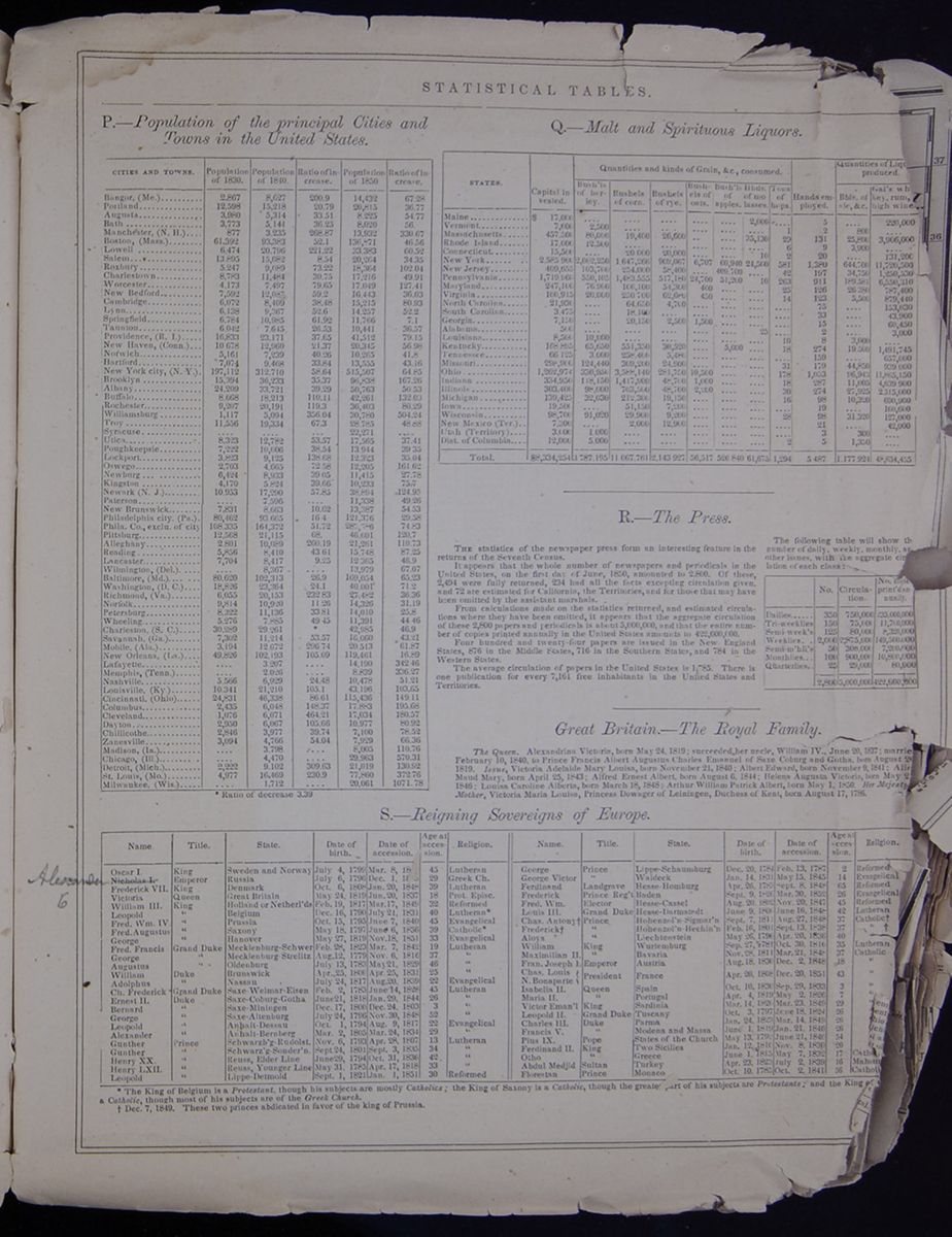 STATISTICAL TABLES
R.—The Press.
THE statistics of the newspaper press form an interesting feature in the returns of the Seventh Census.
It appears that the whole number of newspapers and periodicals in the United States, on the first day of June, 1850, amounted to 2,800. Of these 2,494 were fully returned, 234 had all the facts excepting circulation given, and 72 are estimated for California, the Territories, and for those that may have been omitted by the assistant marshals.
From calculations made on the statistics returned, and estimated circulations where they have been omitted, it appears that the aggregate circulation of these 2,800 papers and periodicals is about 5,000,000, and that the entire number of copies printed annually in the United States amounts to 422,600,000.
Four hundred and twenty-four papers are issued in the New England States, 876 in the Middle States, 716 in the Southern States, and 784 in the Western States.
The average circulation of papers in the United States is 1,785. There is one publication for every 7,161 free inhabitants in the United States and Territories.
The following table will show the number of daily, weekly, monthly and other issues, with the aggregate circulation of each class.
This table lists the number of different types of newspapers and periodicals printed, the circulation of each, and the number of copies printed per year.Great Britain.—The Royal Family.
The Queen. Alexandrina Victoria, born May 24, 1819; succeeded her uncle, William IV., June 20, 1837; Married February 10, 1840, to Prince Francis Albert Augustus Charles Emanuel of Saxe Coburg and Gotha, born August 2[cutaway] 1819. Issue, Victoria Adelaide Mary Louisa, born November 21, 1840; Albert Edward, born November 9, 1841; Alice Maud Mary, born April 25, 1843; Alfred Ernest Albert, born August 6, 1844; Helena Augusta Victoria, born May 2[cutaway] 1846; Louisa Caroline Alberta, born March 18, 1848; Arthur William Patrick Albert, born May 1, 1850. Her Majesty Mother, Victoria Maria Louisa, Princess Dowager of Leiningen, Duchess of Kent, born August 17, 1786.
| Name | Title | State. | Date of birth. | Date of accession. | Age at accession. | Religion. |
| Oscar I. | King | Sweden and Norway | July 4, 1799 | Mar. 8, 18[covered] | 45 | Lutheran |
|
|
Emperor | Russia | July 6, 1796 | Dec. 1, 18[covered] | 29 | Greek Ch. |
| Frederick VII. | King | Denmark | Oct. 6, 1808 | Jan. 20, 1848 | 39 | Lutheran |
| Victoria | Queen | Great Britain | May 24, 1819 | Jun. 20, 1837 | 18 | Prot. Episc. |
| William III. | King | Holland or Netherl'ds | Feb. 19, 1817 | Mar. 17, 1849 | 32 | Reformed |
| Leopold | " | Belgium | Dec. 16, 1790 | July 21, 1831 | 40 | Lutheran * |
| Fred. Wm. IV. | " | Prussia | Oct. 15, 1795 | June 7, 1840 | 45 | Evangelical |
| Fred. Augustus | " | Saxony | May 18,1797 | June 6, 1836 | 39 | Catholic * |
| George | " | Hanover | May 27, 1819 | Nov. 18, 1851 | 33 | Evangelical |
| Fred. Francis | Grand Duke | Mecklenberg-Schwer | Feb. 28, 1823 | Mar. 7. 1842 | 19 | Lutheran |
| George | " | Meclenburge-Strelitz | Aug. 12, 1779 | Nov. 6, 1816 | 37 | " |
| Augustus | " | Oldenburg | July 13, 1783 | May 21, 1829 | 46 | " |
| William | Duke | Brunswick | Apr. 25, 1806 | Apr. 25, 1831 | 25 | " |
| Adolphus | " | Nassau | July 24, 1817 | Aug. 20. 1839 | 22 | Evangelical |
| Ch. Frederick | Grand Duke | Saxe-Weimar-Eisen | Feb. 2, 1783 | June 14, 1828 | 45 | Lutheran |
| Ernest II. | Duke | Saxe-Coburge-Gotha | June 21, 1818 | Jan. 29, 1844 | 26 | " |
| Bernard | " | Saxe-Miningen | Dec. 17, 1800 | Dec. 24, 1803 | 3 | " |
| George | " | Saxe-Altenburg | July 24, 1796 | Nov. 30, 1848 | 52 | " |
| Leopold | " | Anhalt-Dessau | Oct. 1, 1794 | Aug. 9. 1817 | 22 | Evangelical |
| Alexander | " | Anhalt-Bernberg | Mar. 2, 1805 | Mar. 24,1834 | 29 | " |
| Gunther | Prince | Schwarzb'g-Rudolst. | Nov. 6, 1793 | Apr. 28, 1807 | 13 | Lutheran |
| Gunther | " | Schwarz'g-Sonder'n | Sept. 24, 1801 | Sept. 3, 1835 | 34 | " |
| Henry XX | " | Reuss, Elder Line | June 29, 1794 | Oct. 31, 1836 | 42 | " |
| Henry LXIL | " | Reuss, Younger Line | May 31, 1785 | Apr. 17, 1818 | 33 | " |
| Leopold | " | Lippe-Detmold | Sept. 1, 1821 | Jan. 1, 1851 | 30 | Reformed |
| George | Prince | Lippe-Schaumburg | Dec. 20, 1784 | Feb. 13, 1787 | 2 | Reformed |
| George Victor | " | Waldeck | Jan. 14. 1831 | May 15, 1845 | 14 | Evengelical |
| Ferdinand | Landgrave | Hesse-Homburg | Apr. 26, 1783 | Sept. 8, 1848 | 65 | Reformed |
| Frederick | Prince Reg't | Baden | Sept. 9, 1826 | Marc. 30, 1852 | 26 | Evangelical |
| Fred. Wm. | Elector | Hesse-Cassel | Aug. 20, 1802 | Nov. 20, 1847 | 45 | Reformed |
| Louis III. | Grand Duke | Hesse-Darmstadt | June 9, 1806 | June 16, 1848 | 42 | Lutheran |
| Chas. Antony † | Prince | Hohenzol'n-Sigmar'n | Sept. 7, 1811 | Aug. 27, 1848 | 37 | Catholic † |
| Frederick † | " | Hohenzol'n-Hechin'n | Feb. 16, 1801 | Sept. 13, 1838 | " † | |
| Aloys | " | Liechtenstein | May 26, 1796 | Apr. 20, 1836 | 40 | " |
| William | King | Wurtemburg | Sept. 27, 1781 | Oct. 30, 1816 | 35 | Lutheran |
| Maximilian II. | " | Bavaria | Nov. 28, 1811 | Mar. 21, 1848 | 37 | Catholic |
| Fran. Joseph 1. | Emperor | Austria | Aug. 18, 1830 | Dec. 2, 1848 | 18 | " |
| Chas Louis N. Bonaparte | President | France | Apr. 20, 1808 | Dec. 20, 1848 | 43 | " |
| Isabella II. | Queen | Spain | Oct. 10, 1830 | Sep. 29, 1833 | 3 | " |
| Maria II | " | Portugal | Apr. 4, 1819 | May 2, 1826 | 7 | " |
| Victor Eman'l | King | Sardinia | Mar. 14. 1820 | Mar. 23, 1849 | 29 | " |
| Leopold II. | Grand Duke | Tuscany | Oct. 3, 1797 | June 18, 1824 | 26 | " |
| Charles III. | Duke | Parma | Jan. 24, 1823 | Mar. 14, 1849 | 26 | " |
| Francis V. | " | Modena and Massa | June 1, 1819 | Jan. 21, 1846 | 26 | " |
| Pius IX. | Pope | States of the Church | May 13, 1792 | June 21, 1846 | 45 | " |
| Ferdinand II. | King | Two Sicilies | Jan 12, 1816 | Nov. 8, 1830 | 20 | " |
| Otho | " | Greece | June 1, 1815 | May 7, 1832 | 17 | Catholic |
| Abdul Madjid | Sultan | Turkey | Apr. 23, 1823 | July 2, 1839 | 16 | Mahom[cutaway] |
| Florestan | Prince | Monaco | Oct. 10, 1785 | Oct. 2, 1841 | 56 | Catholic |
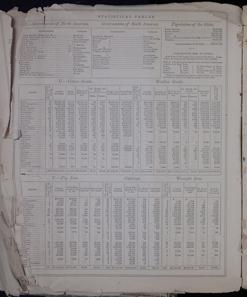 STATISTICAL TABLES
 [begin surface 1105]
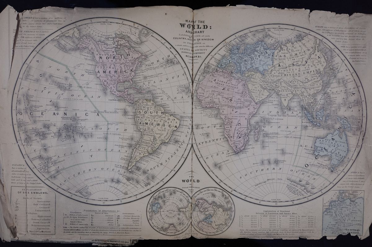 MAP OF THE WORLD AND CHART Exhibiting SIZE of each
COUNTRY, NATION OR KINGDOM, its population as a whole and to
the square mile also the different STATES OF SOCIETY FORMS
OF GOVERNMENT RELIGION &c.
This map represents the whole world and includes
statistical and interpretive information about many lands
[begin surface 1106]
[begin surface 1107]
MAP OF THE WORLD AND CHART Exhibiting SIZE of each
COUNTRY, NATION OR KINGDOM, its population as a whole and to
the square mile also the different STATES OF SOCIETY FORMS
OF GOVERNMENT RELIGION &c.
This map represents the whole world and includes
statistical and interpretive information about many lands
[begin surface 1106]
[begin surface 1107] [begin surface 1108]
 [begin surface 1109]
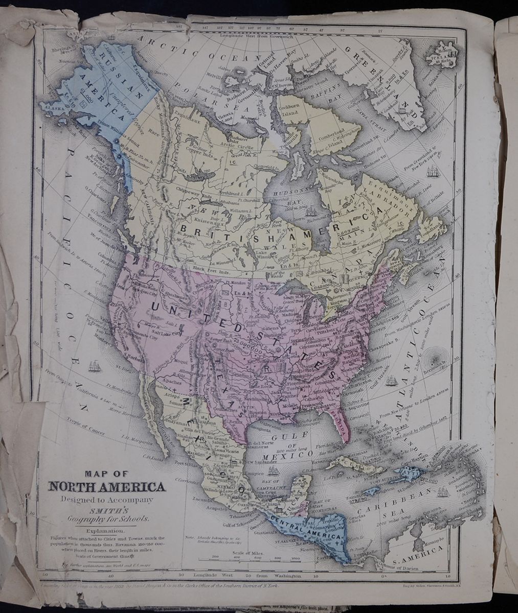 MAP OF NORTH AMERICA Designed to Accompany SMITH'S
Geography for Schools
Map of North America.
[begin surface 1110]
MAP OF NORTH AMERICA Designed to Accompany SMITH'S
Geography for Schools
Map of North America.
[begin surface 1110] [begin surface 1111]
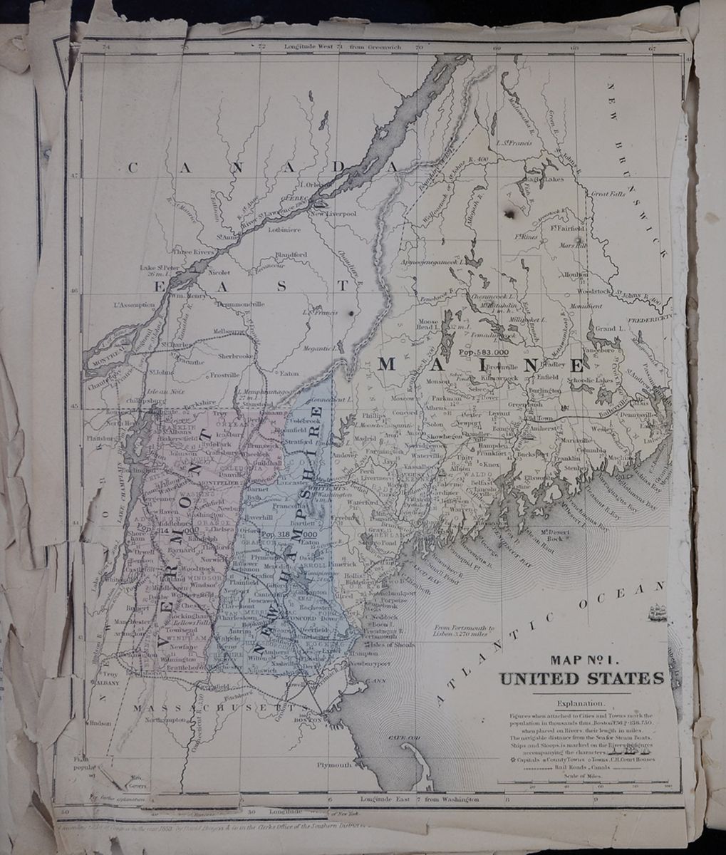 MAP No 1. UNITED STATES.
Map of Maine, New Hampshire and Vermont.
[begin surface 1112]
MAP No 1. UNITED STATES.
Map of Maine, New Hampshire and Vermont.
[begin surface 1112] [begin surface 1113]
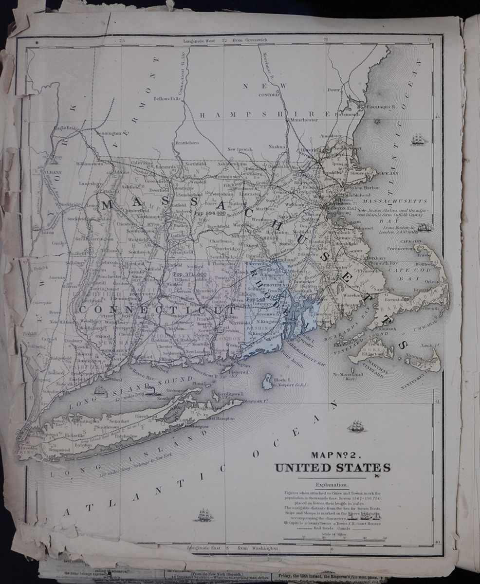 MAP No 2. UNITED STATES.
Map of Massachusetts, Connecticut, Rhode Island,
and Long Island.
[begin surface 1114]
MAP No 2. UNITED STATES.
Map of Massachusetts, Connecticut, Rhode Island,
and Long Island.
[begin surface 1114] [begin surface 1115]
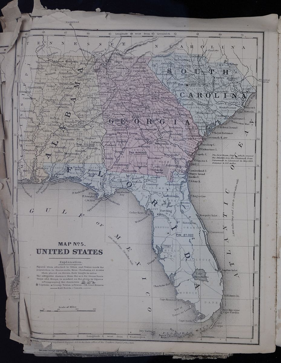 MAP No 5. UNITED STATES.
Map of Alabama, Georgia, South Carolina, and
Florida.
[begin surface 1116]
MAP No 5. UNITED STATES.
Map of Alabama, Georgia, South Carolina, and
Florida.
[begin surface 1116]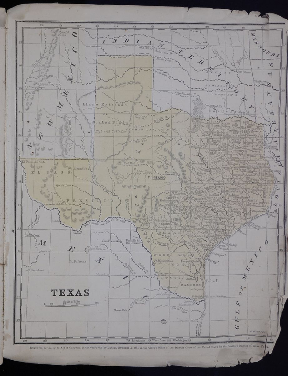 TEXAS.
Map of Texas.
[begin surface 1117]
TEXAS.
Map of Texas.
[begin surface 1117] [begin surface 1118]
 [begin surface 1119]
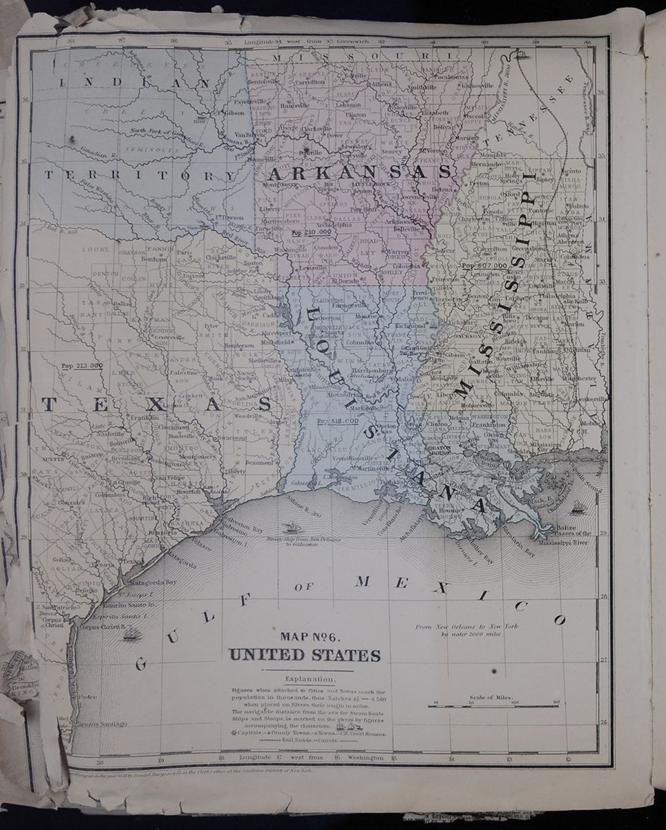 MAP NO. 6. UNITED STATES
A map of the states of Arkansas, Louisiana, and
Mississippi, as well as parts of Texas, Missouri, Tennessee,
Alabama, and part of "Indian Territory" (present day
Oklahoma).
[begin surface 1120]
MAP NO. 6. UNITED STATES
A map of the states of Arkansas, Louisiana, and
Mississippi, as well as parts of Texas, Missouri, Tennessee,
Alabama, and part of "Indian Territory" (present day
Oklahoma).
[begin surface 1120] [begin surface 1121]
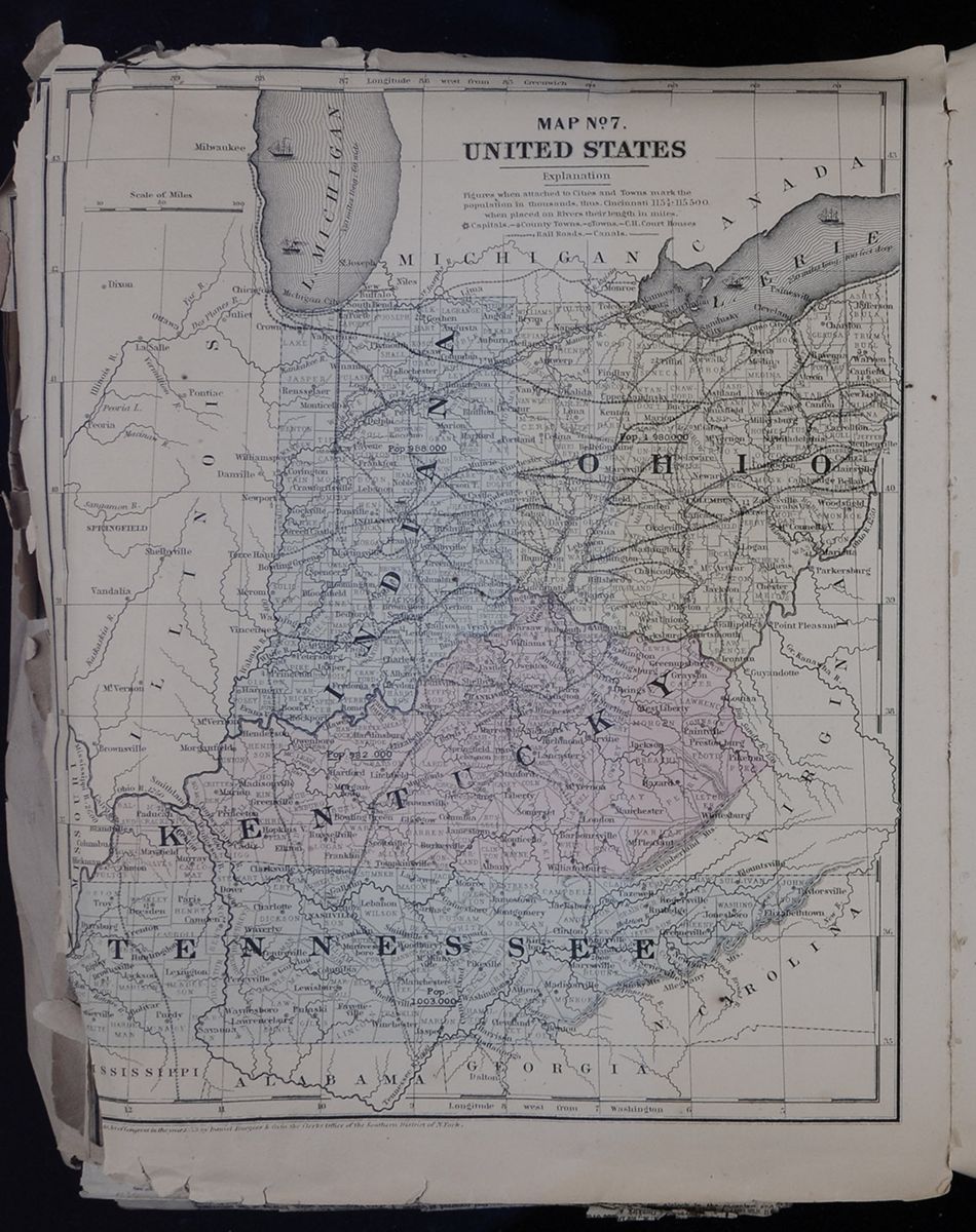 MAP NO. 7. UNITED STATES
A map of the states of Indiana, Ohio, Kentucky, and
Tennessee, as well as parts of Illinois, Michigan, Virginia,
North Carolina, Georgia, Alabama, and Mississippi.
[begin surface 1122]
MAP NO. 7. UNITED STATES
A map of the states of Indiana, Ohio, Kentucky, and
Tennessee, as well as parts of Illinois, Michigan, Virginia,
North Carolina, Georgia, Alabama, and Mississippi.
[begin surface 1122] [begin surface 1123]
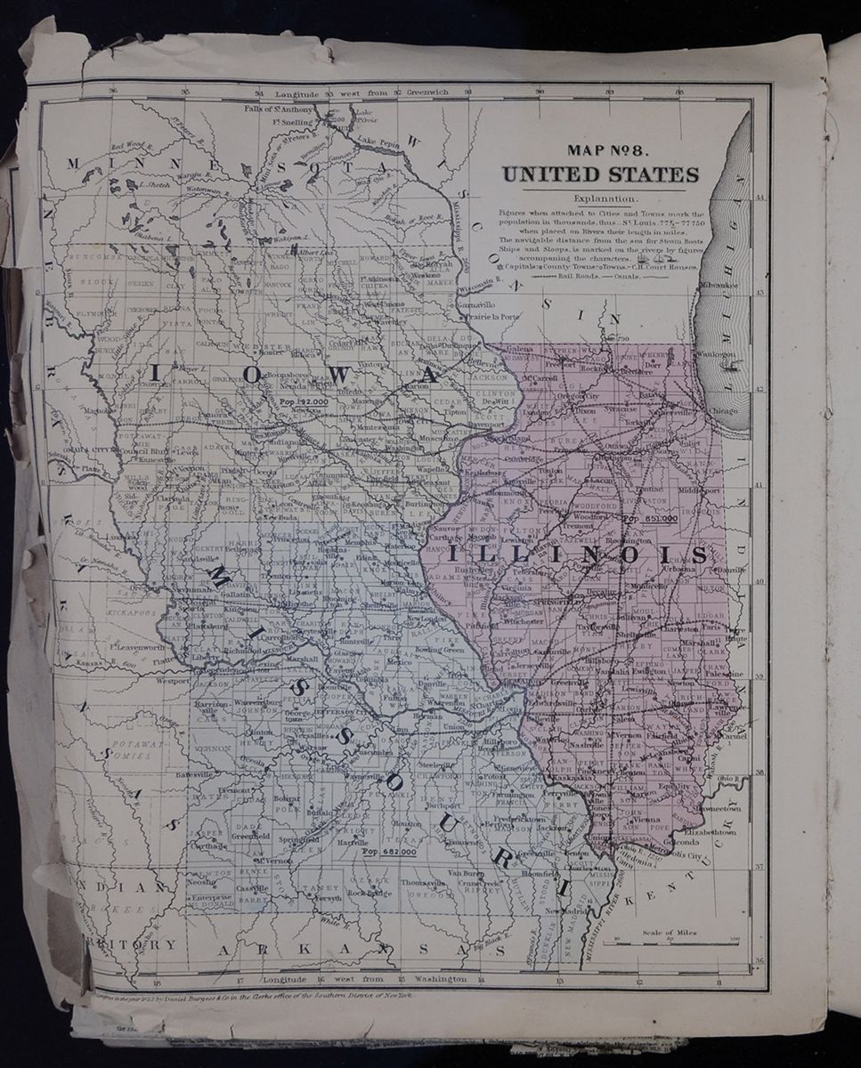 MAP NO. 8. UNITED STATES
A map of the states of Iowa, Illinois, and Missouri, as
well as parts of Minnesota, Wisconsin, Indiana, Kentucky,
Arkansas, "Indian Territory" (present day Oklahoma), and the
territories of Nebraska and Kansas.
[begin surface 1124]
MAP NO. 8. UNITED STATES
A map of the states of Iowa, Illinois, and Missouri, as
well as parts of Minnesota, Wisconsin, Indiana, Kentucky,
Arkansas, "Indian Territory" (present day Oklahoma), and the
territories of Nebraska and Kansas.
[begin surface 1124] [begin surface 1125]
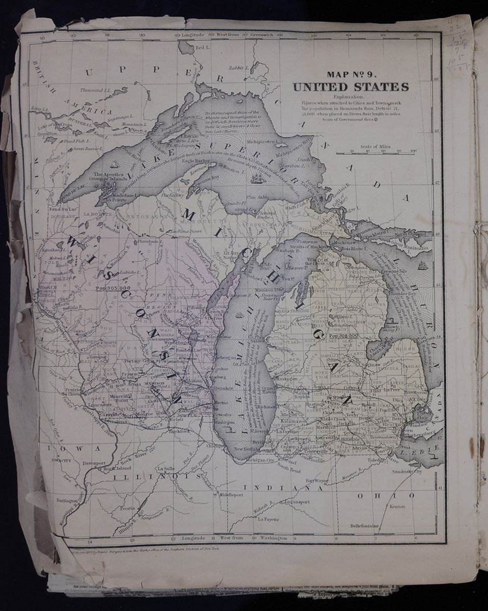 MAP NO. 9. UNITED STATES
A map of the states of Wisconsin and Michigan, as well
as parts of Iowa, Illinois, Indiana, Ohio, and
Canada.
[begin surface 1126]
MAP NO. 9. UNITED STATES
A map of the states of Wisconsin and Michigan, as well
as parts of Iowa, Illinois, Indiana, Ohio, and
Canada.
[begin surface 1126] MAP NO. 10. UNITED STATES
A map of the state of California, the
Washington, Oregon, and Utah territories, as well as parts
of the New Mexico, Nebraska, and Kansas
territories.
[begin surface 1127]
MAP NO. 10. UNITED STATES
A map of the state of California, the
Washington, Oregon, and Utah territories, as well as parts
of the New Mexico, Nebraska, and Kansas
territories.
[begin surface 1127] [begin surface 1128]
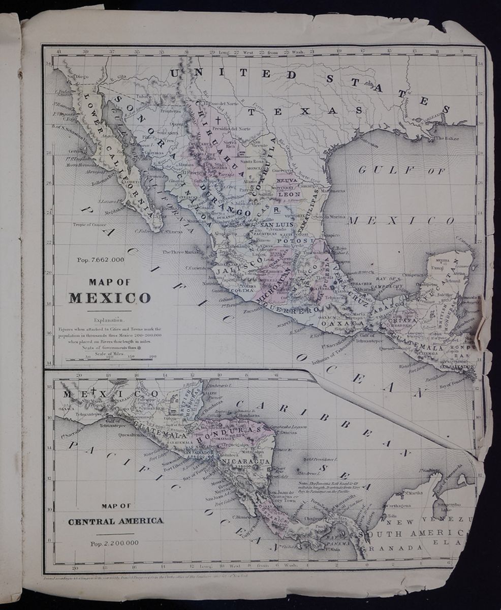 MAP OF MEXICO
A map of Mexico, with all of its constituent
states.
MAP OF CENTRAL AMERICA
A map of countries of Central America.
[begin surface 1129]
MAP OF MEXICO
A map of Mexico, with all of its constituent
states.
MAP OF CENTRAL AMERICA
A map of countries of Central America.
[begin surface 1129] [begin surface 1130]
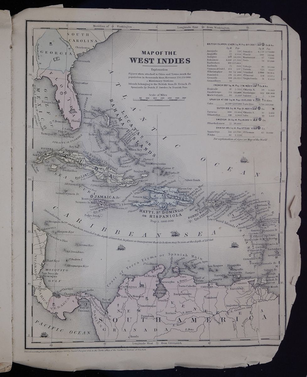 MAP OF THE WEST INDIES
A map of countries of the Caribbean, and portions of
the southern UNITED STATES and northern South
America.
[begin surface 1131]
MAP OF THE WEST INDIES
A map of countries of the Caribbean, and portions of
the southern UNITED STATES and northern South
America.
[begin surface 1131] [begin surface 1132]
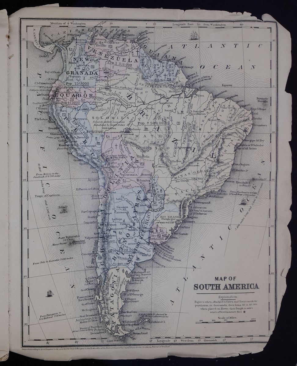 MAP OF SOUTH AMERICA
A map of the full South American continent.
[begin surface 1133]
MAP OF SOUTH AMERICA
A map of the full South American continent.
[begin surface 1133]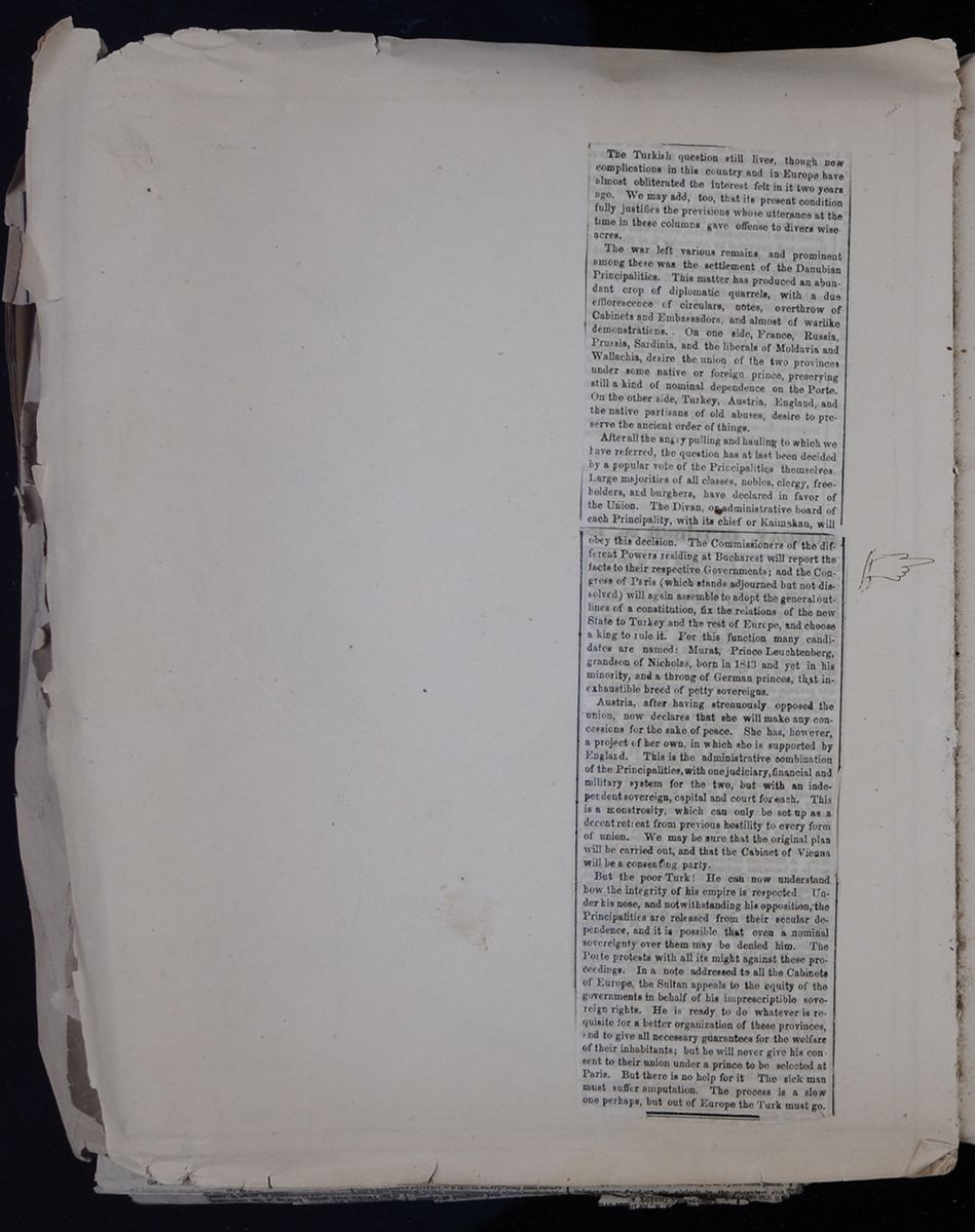 [begin surface 1134]
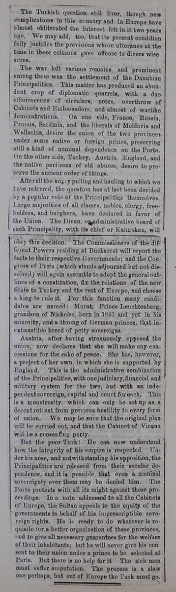
The Turkish question still lives, though new complications in this country and in Europe have almost obliterated the interest felt in it two years ago. We may add, too, that its present condition fully justifies the previsions whose utterance at the time in these columns gave offense to divers wiseacres.
The war left various remains and prominent among these was the settlement of the Danubian Principalities. This matter has produced an abundant crop of diplomatic quarrels, with a due efflorescence of circulars, notes, overthrow of Cabinets and Embassadors, and almost of warlike demonstrations. On one side, France, Russia, Prussia, Sardinia, and the liberals of Moldavia and Wallachia, desire the union of the two provinces under some native or foreign prince, preserving still a kind of nominal dependence on the Porte. On the other side, Turkey, Austria, England, and the native partisans of old abuses, desire to preserve the ancient order of things.
After all the angry pulling and hauling to which we have referred, the question has at last been decided by a popular vote of the Principalities themselves. Large majorities of all classes, nobles, clergy, freeholders, and burghers, have declared in favor of the Union. The Divan, or administrative board of each Principality, with its chief or Kaimakan, will
obey this decision. The Commissioners of the different Powers residing at Bucharest will report the facts their respective Governments; and the Congress of Paris (which stands adjourned but not dissolved) will again assemble to adopt the general outlines of a constitution, fix the relations of the new State of Turkey and the rest of Europe, and choose a king to rule it. For this function many candidates are named: Murat, Prince Leuchtenberg, grandson of Nicholas, born in 1843 and yet in his minority, and a throng of German princes, that inexhaustible breed of petty sovereigns.
Austria, after having strenuously opposed the union, now declares that she will make any concessions for the sake of peace. She has, however, a project of her own, in which she is supported by England. This is the administrative combination of the Principalities, with one judiciary, financial and military system for the two, but with an independent sovereign, capital and court for each. This is a monstrosity, which can only be set up as a decent retreat from previous hostility to every form of union. We may be sure that the original plan will be carried out, and that the Cabinet of Vienna will be a consenting party.
But the poor Turk! He can now understand how the integrity of his empire is respected. Under his nose, and notwithstanding his opposition, the Principalities are released from their secular independence, and it is possible that even a nominal sovereignty over them may be denied him. The Porte protests with all its might against these proceedings. In a note addressed to all the Cabinets of Europe, the Sultan appeals to the equity of the governments in behalf of his imprescriptible sovereign rights. He is ready to do whatever is requisite for a better organization of these provinces, and to give all necessary guarantees for the welfare of their inhabitants; but he will never give his consent to their union under a prince to be selected at Paris. But there is no help for it. The sick man must suffer amputation. The process is a slow one perhaps, but out of Europe the Turk must go.
[begin surface 1135]
 MAP OF EUROPE
A map of the full European continent.
[begin surface 1136]
MAP OF EUROPE
A map of the full European continent.
[begin surface 1136] [begin surface 1137]
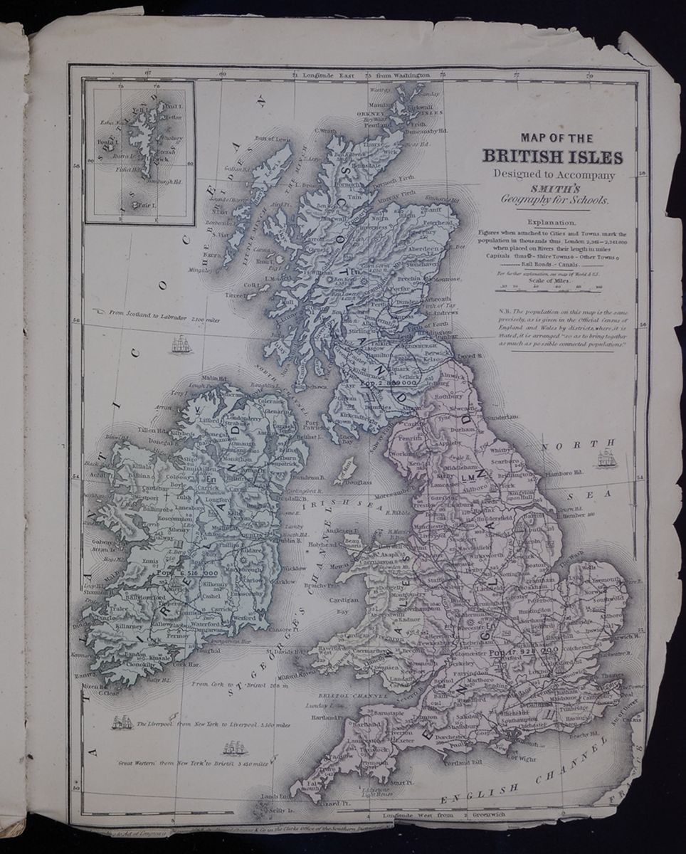 MAP OF THE BRITISH ISLES
A map of England, Scotland, Wales, and
Ireland.
[begin surface 1138]
MAP OF THE BRITISH ISLES
A map of England, Scotland, Wales, and
Ireland.
[begin surface 1138] [begin surface 1139]
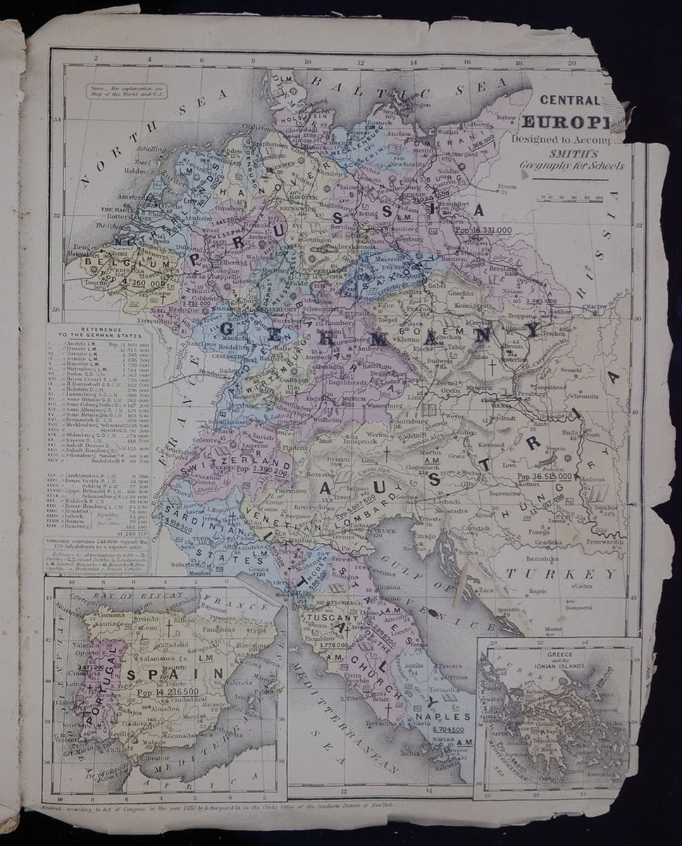 CENTRAL EUROPE
A map of Central Europe, which includes Prussia,
Germany, Austria, Italy, Greece, Spain, and Portugal, in
addition to other, smaller states and countries.
[begin surface 1140]
CENTRAL EUROPE
A map of Central Europe, which includes Prussia,
Germany, Austria, Italy, Greece, Spain, and Portugal, in
addition to other, smaller states and countries.
[begin surface 1140] [begin surface 1141]
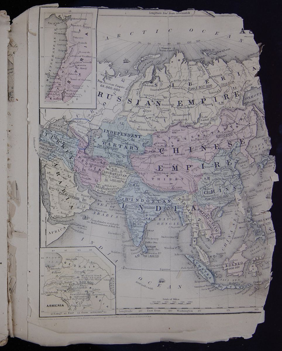 A map of the Middle East, the "Russian Empire," and
Asia.
[begin surface 1142]
A map of the Middle East, the "Russian Empire," and
Asia.
[begin surface 1142] [begin surface 1143]
 [begin surface 1144]
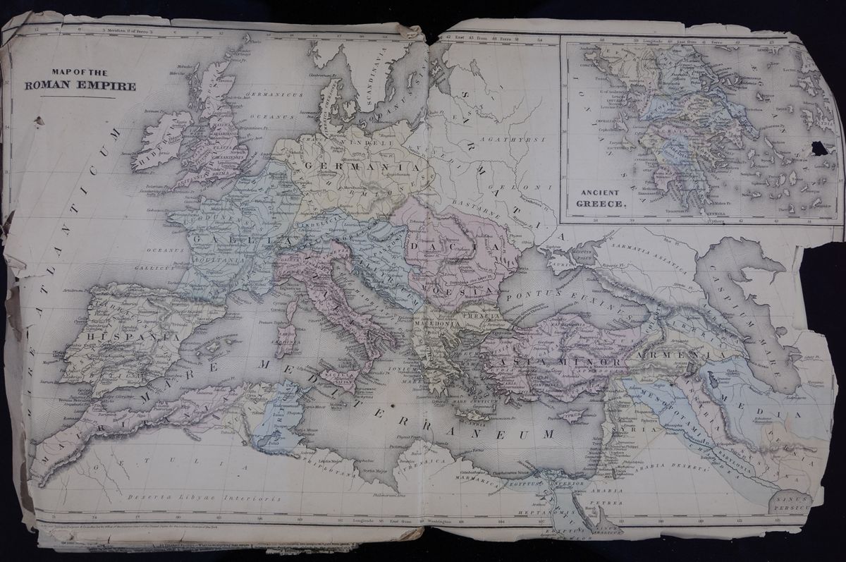 MAP OF THE ROMAN EMPIRE
A map of the Roman Empire, stretching from present-day
England and Spain in the West to the Middle East.
[begin surface 1145]
MAP OF THE ROMAN EMPIRE
A map of the Roman Empire, stretching from present-day
England and Spain in the West to the Middle East.
[begin surface 1145]
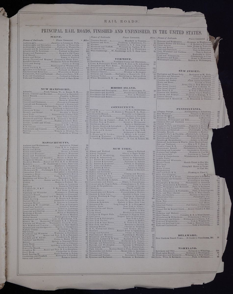
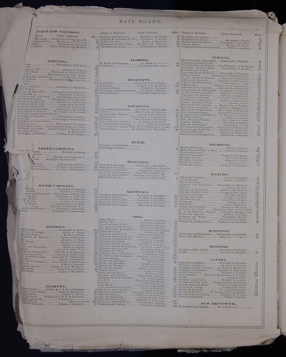 RAIL ROADS.
A continuation of the rail road table from the previous
page, listing principal railroads in the United States, grouped
by state and containing the name of the line, the places it
connects, and the distance between those places.
[begin surface 1148]
RAIL ROADS.
A continuation of the rail road table from the previous
page, listing principal railroads in the United States, grouped
by state and containing the name of the line, the places it
connects, and the distance between those places.
[begin surface 1148]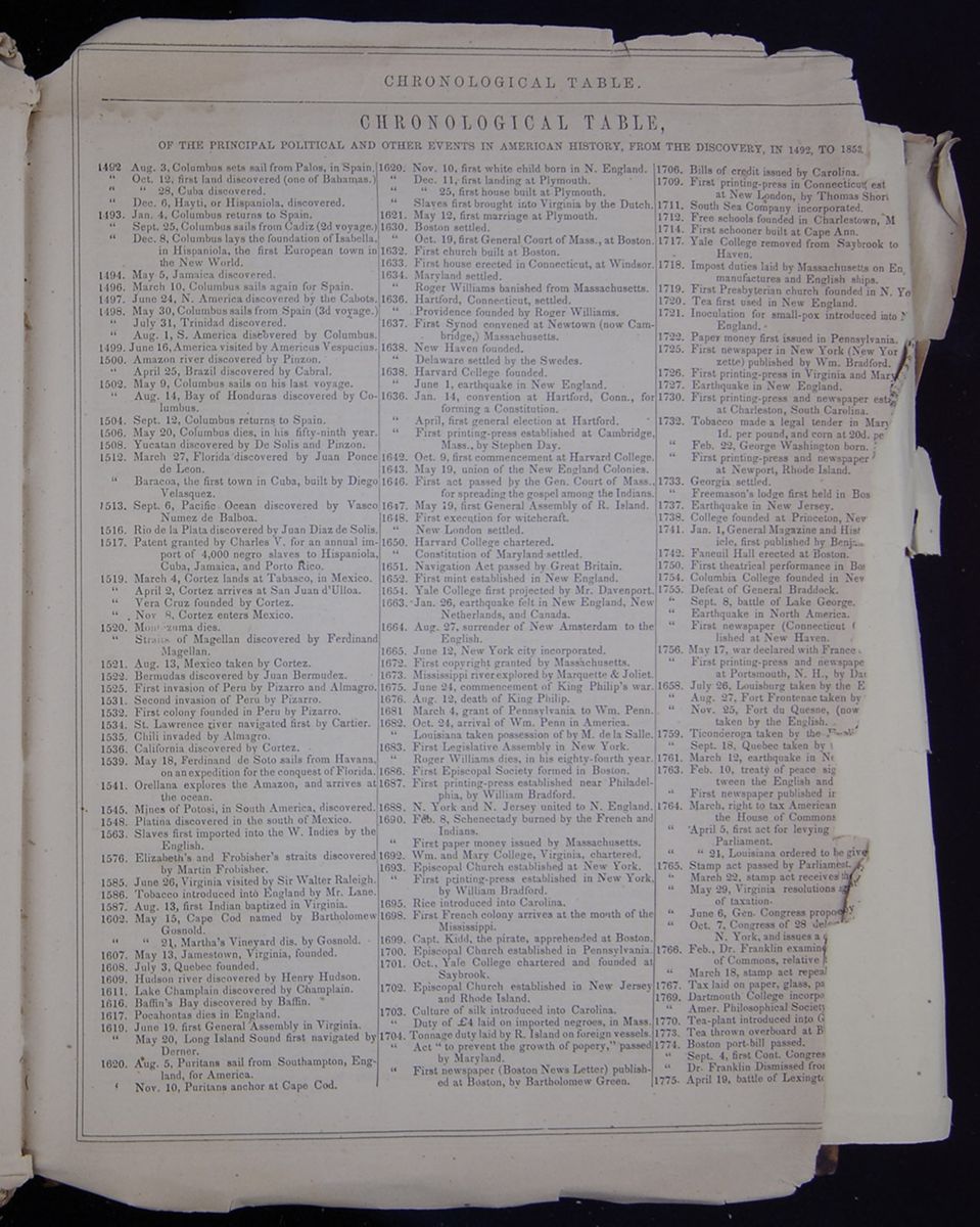 CHRONOLOGICAL TABLE.
CHRONOLOGICAL TABLE,
OF THE PRINCIPAL POLITICAL AND OTHER EVENTS IN AMERICAN HISTORY, FROM THE DISCOVERY, IN 1492, TO 1853.
- 1492 Aug. 3, Columbus sets sail from Palos, in Spain.
- " Oct. 12, first land discovered (one of Bahamas.)
- " " 28, Cuba discovered.
- " Dec. 6, Hayti, or Hispaniola, discovered.
- 1492. Jan. 4, Columbus returns to Spain.
- " Sept. 25, Columbus sails for Cadiz (2d voyage.)
- " Dec. 8, Columbus lays the foundation of Isabella, in Hispaniola, the first European town in the New World.
- 1494. May 5, Jamaica discovered.
- 1496. March 10, Columbus sails again for Spain.
- 1497. June 24, N. America discovered by the Cabots.
- 1498. May 30, Columbus sails from Spain (3d voyage.)
- " July 31, Trinidad discovered.
- " Aug. 1, S. America discovered by Columbus.
- 1499. June 16, America visited by Americus Vespucius.
- 1500. Amazon river discovered by Pinzon.
- " April 25, Brazil discovered by Cabral.
- 1502. May 9, Columbus sails on his last voyage.
- " Aug. 14, Bay of Honduras discovered by Columbus.
- 1504. Sept. 12, Columbus returns to Spain.
- 1506. May 20, Columbus dies, in his fifty-ninth year.
- 1508. Yucatan discovered by De Solis and Pinzon.
- 1512. March 27, Florida discovered by Juan Ponce de Leon.
- " Baracoa, the first town in Cuba, built by Diego Velasquez.
- 1513. Sept. 6, Pacific Ocean discovered by Vasco Numez de Balboa.
- 1516. Rio de la Plata discovered by Juan Diaz de Solis.
- 1517. Patent granted by Charles V. for an annual import of 4,000 negro slaves to Hispaniola, Cuba, Jamaica, and Porto Rico.
- 1519. March 4, Cortez lands at Tabasco, in Mexico.
- " April 2, Cortez arrives at San Juan d'Ulloa.
- " Vera Cruz founded by Cortez.
- " . Nov 8, Cortez enters Mexico.
- 1520. Montezuma dies.
- " Straits of Magellan discovered by Ferdinand Magellan.
- 1521. Aug. 13, Mexico taken by Cortez.
- 1522. Bermudas discovered by Juan Bermudez.
- 1525. First invasion of Peru by Pizarro and Almagro.
- 1531. Second invasion of Peru by Pizarro.
- 1534. St. Lawrence river navigated first by Cartier.
- 1535. Chili invaded by Almagro.
- 1536. California discovered by Cortez.
- 1539. May 18, Ferdinand de Soto sails from Havana, on an expedition for the conquest of Florida.
- 1541. Orellana explores the Amazon, and arrives at the ocean.
- 1545. Mines of Potosi, in South America, discovered.
- 1548. Platina discovered in the south of Mexico.
- 1563. Slaves first imported into the W. Indies by the English.
- 1576. Elizabeth's and Frobisher's straits discovered by Martin Frobisher.
- 1585. June 26, Virginia visited by Sir Walter Raleigh.
- 1586. Tobacco introduced into England by Mr. Lane.
- 1587. Aug. 13, first Indian baptized in Virginia.
- 1602. May 15, Cape Cod named by Bartholomew Gosnold.
- " " 21, Martha's Vineyard dis. by Gosnold.
- 1607. May 13, Jamestown, Virginia, founded.
- 1608. July 3, Quebec founded.
- 1609. Hudson river discovered by Henry Hudson.
- 1611. Lake Champlain discovered by Champlain.
- 1616. Baffin's Bay discovered by Baffin.
- 1617. Pocahontas dies in England.
- 1619. June 19, first General Assembly in Virginia.
- " May 20, Long Island Sound first navigated by Derner.
- 1620. Aug. 5, Puritans sail from Southhampton, England, for America.
- " Nov. 10, Puritans anchor at Cape Cod.
- 1620. Nov. 10, first white child born in N. England.
- " Dec. 11, first landing at Plymouth.
- " " 25, first house built at Plymouth.
- " Slaves first brought into Virginia by the Dutch.
- 1621. May 12, first marriage at Plymouth.
- 1630. Boston settled.
- " Oct. 19, first General Court of Mass., at Boston.
- 1632. First church built at Boston.
- 1633. First house erected in Connecticut, at Windsor.
- 1634. Maryland settled.
- " Roger Williams banished from Massachusetts.
- 1636. Hartford, Connecticut, settled.
- " Providence founded by Roger Williams.
- 1637. First Synod convened at Newtown (now Cambridge,) Massachusetts.
- 1638. New Haven founded.
- " Delaware settled by the Swedes.
- 1638. Harvard College founded.
- " June 1, earthquake in New England.
- 1636 . Jan. 14, convention at Hartford, Conn., for forming a Constitution.
- " April, first general election at Hartford.
- " First printing-press established at Cambridge, Mass., by Stephen Day.
- 1642. Oct. 9, first commencement at Harvard College.
- 1643. May 19, union of the New England Colonies.
- 1646. First act passed by the Gen. Court of Mass., for spreading the gospel among the Indians.
- 1647. May 19, first General Assembly of R. Island.
- 1648. First execution for witchcraft.
- " New London settled.
- 1650. Harvard College chartered.
- " Constitution of Maryland settled.
- 1651. Navigation Act passed by Great Britain.
- 1652. First mint established in New England.
- 1654. Yale College first projected by Mr. Davenport.
- 1663. Jan. 26, earthquake felt in New England, New Netherlands, and Canada.
- 1664. Aug. 27, surrender of New Amsterdam to the English.
- 1665. June 12, New York city incorporated.
- 1672. First copyright granted by Massachusetts.
- 1673. Mississippi river explored by Marquette & Joliet.
- 1675. June 24, commencement of King Philip's war.
- 1676. Aug. 12, death of King Philip.
- 1681. March 4, grant of Pennsylvania to Wm. Penn.
- 1682. Oct. 24, arrival of Wm. Penn in America.
- " Louisiana taken possession of by M. de la Salle.
- 1683. First Legislative Assembly in New York.
- " Roger Williams dies, in his eighty-fourth year.
- 1686. First Episcopal Society founded in Boston.
- 1687. First printing-press established near Philadelphia, by William Bradford.
- 1688. N. York and N. Jersey united to N. England.
- 1690. Feb. 8, Schenectady burned by the French and Indians.
- " First paper money issued by Massachusetts.
- 1692. Wm. and Mary College, Virginia, chartered.
- 1693. Episcopal Church established at New York.
- " First printing-press established in New York, by William Bradford.
- 1695. Rice introduced into Carolina.
- 1698. First French colony arrives at the mouth of the Mississippi.
- 1699. Capt. Kidd, the pirate, apprehended at Boston.
- 1700. Episcopal Church established in Pennsylvania.
- 1701. Oct., Yale College chartered and founded at Saybrook.
- 1702. Episcopal Church established in New Jersey and Rhode Island.
- 1703. Culture of silk introduced into Carolina.
- " Duty of £4 laid on imported negroes, in Mass.
- 1704. Tonnage duty laid by R. Island on foreign vessels.
- " Act "to prevent the growth of popery," passed by Maryland.
- " First newspaper (Boston News Letter) published at Boston, by Bartholomew Green.
- 1706. Bills of credit issued by Carolina.
- 1709. First printing-press in Connecticut, est[cut away] at New London, by Thomas Shor[cut away]
- 1711. South Sea Company incorporated.
- 1712. Free schools founded in Charlestown, M[cut away]
- 1714. First schooner built at Cape Ann.
- 1717. Yale College removed from Saybrook to [cut away] Haven
- 1718. Impost duties laid by Massachusetts on En[cut away] manufactures and English ships.
- 1719. First Presbyterian church founded in N. Yo[cut away]
- 1720. Tea first used in New England.
- 1721. Inoculation for small-pox introduced into N[cut away] England.
- 1722. Paper money first issued in Pennsylvania.
- 1725. First newspaper in New York (New Yor[cut away]zette) published by Wm. Bradford.
- 1726. First printing-press in Virginia and Mary[illegible]
- 1727. Earthquake in New England.
- 1730. First printing-press and newspaper est[cut away] at Charleston, South Carolina.
- 1732. Tobacco made a legal tender in Mary[cut away] 1d. per pound, and corn at 20d. pe[cut away]
- " Feb. 22, George Washington born.
- " First printing-press and newspaper [cut away] at Newport, Rhode Island.
- 1733. Georgia settled.
- " Freemason's lodge first held in Bos[cut away]
- 1737. Earthquake in New Jersey.
- 1738. College founded at Princeton, New[cut away]
- 1741. Jan. 1, General Magazine and Hist[cut away]icle, first published by Benja[cut away]
- 1742. Faneuil Hall erected at Boston.
- 1750. First theatrical performance in New[cut away]
- 1755. Defeat of General Braddock.
- " Sept. 8, battle at Lake George.
- " Earthquake in North America.
- " First newspaper (Connecticut [cut away]lished at New Haven.
- 1756. May 17, war declared with France [cut away]
- " First printing-press and newspape[cut away] at Portsmouth, N. H., by Da[cut away]
- 1658 . July 26, Louisburg taken by the E[cut away]
- " Aug. 27, Fort Frontenac taken by [cut away]
- " Nov. 25, Fort de Quesne, (now [cut away] taken by the English.
- 1759. Ticonderoga taken by the [cut away]
- " Sept. 18, Quebec taken by [cut away]
- 1761. March 12, earthquake in Ne[cut away]
- 1763. Feb. 10, treaty of peace sig[cut away]tween the English and [cut away]
- " First newspaper published in [cut away]
- 1764. March, right to tax American [cut away] the House of Commons[cut away]
- " April 5, first act for levying [cut away] Parliament.
- " " 21, Louisiana ordered to be give[cut away]
- 1765. Stamp act passed by Parliament.
- " March 22, stamp act receives the [cut away]
- " May 29, Virginia resolutions ag[cut away] of taxation.
- " June 6, Gen. Congress propo[cut away]
- " Oct. 7, Congress of 28 de[cut away] N. York, and issues a [cut away]
- 1766. Feb., Dr. Franklin examin[cut away] of Commons, relative [cut away]
- " March 18, stamp act repea[cut away]
- 1767. Tax laid on paper, glass, pa[cut away]
- 1769. Dartmouth College incorpo[cut away]
- " Amer. Philosophical Society [cut away]
- 1770. Tea-plant introduced into G[cut away]
- 1773. Tea thrown overboard at B[cut away]
- 1774. Boston port-bill passed.
- " Sept. 4, first Cont. Congres[cut away]
- " Dr. Franklin Dismissed fro[cut away]
- 1775. April 19, battle at Lexingt[cut away]
-
[begin surface 1149]

- CHRONOLOGICAL TABLE.
- [cut away]0, Ticonderoga taken by the provincials.
- [cut away]17, battle of Bunker's Hill
- [cut away]2, Gen. Washington arrives at Cambridge.
- [cut away]13, resolution of Congress to fit out a navy [cut away] of thirteen ships.
- [cut away], assault on Quebec, and death of General Montgomery.
- [cut away][cut away]. 3, battle near Princeton.
- [cut away]arch 17, Boston evacuated by the British.
- [cut away]uly 4, Declaration of Independence.
- [cut away] Sept. 11, battle of Brandywine.
- [cut away] " 15, the British take possession of N. York.
- [cut away] " 27, the British take possession of Philadel.
- [cut away] Oct. 4, battle of Germantown.
- [cut away] " 22, battle of Red Bank.
- [cut away] " 28, battle of White Plains.
- [cut away]Nov. 16, capture of Ft. Washing'n by the British.
- [cut away] Dec. 26, battle of Trenton.
- [cut away] Sept. 19, battle near Stillwater.
- [cut away] June 28, battle at Monmouth Court-house.
- [cut away] Dec. 29, Savannah taken by the British.
- [cut away] May 19, great eclipse, or dark day.
- [cut away] Aug. 16, battle near Camden.
- [cut away]ank of North America established.
- [cut away]n, 17, battle of Cowpens.
- [cut away]arch 15, battle of Guilford.
- [cut away]pt. 5, Fort Trumbull, Conn., taken by Arnold, and New London burnt.
- [cut away], battle at Eutaw.
- [cut away] 19, surrender of Lord Cornwallis.
- [cut away]ch 4, resolution of the House of Commons [cut away] in favor of peace.
- [cut away]19, independence of the United States acknowledged by Holland.
- [cut away]acuation of Savannah.
- [cut away]evacuation of Charlestown.
- [cut away], cessation of hostilities agreed on.
- [cut away]5, independence of U. S. acknowledged [cut away] Sweden; Feb. 25, by Denmark; March [cut away], by Spain; July, by Russia.
- [cut away]1, proclamation of peace by Congress.
- [cut away] peace proclaimed in the army by Wash[cut away]ton
- [cut away] definite treaty of peace signed at Paris.
- [cut away] proclamation for disbanding the army.
- [cut away], Washington's farewell orders.
- [cut away] New York evacuated by the British.
- [cut away] first voyage to China from New York.
- [cut away], and Aug. 5, treaty with Prussia.
- [cut away] insurrection in Massachusetts.
- [cut away]0, insurrection in New Hampshire.
- [cut away], Fed. Con. agreed on by convention.
- [cut away]itution adopted.
- [cut away]o. Washington elected President.
- [cut away]uguration of George Washington.
- [cut away]mbia ceded by Virginia & Maryland.
- [cut away]stitution adopted by Rhode Island.
- [cut away]rmont admitted into the Union.
- [cut away]United States established.
- [cut away]ible printed by Worcester, of Mass.
- [cut away]tucky admitted into the Union.
- [cut away]ington re-elected President.
- [cut away]of John Hancock.
- [cut away]rrection in Pennsylvania.
- [cut away]1, Tennessee admitted into the Union.
- [cut away], Washington's last speech to Congress.
- [cut away]ch 4, John Adams inaugurated President.
- [cut away]shington re-appointed commander-in-chief.
- [cut away] George Washington.
- [cut away]ment removed to Washington.
- [cut away]ding of the provisional army.
- [cut away] Jefferson inaugurated President.
- [cut away]iana ceded by France to Spain.
- [cut away] admitted into the Union.
- [cut away]isiana purchased by the U. States.
- [cut away]dore Preble bombards Tripoli.
- [cut away] of peace with Tripoli.
- [cut away] Lewis and Clark to the mouth of [cut away]mbia.
- [cut away]k on the frigate Chesapeake.
- [cut away]ict to armed British vessels.
- [cut away]ish orders in council.
- 1807. Dec. 17, Milan decree.
- " " 22, embargo laid by the Amer. government.
- 1808. Jan 1., slave-trade abolished.
- " Bayonne decree.
- 1809. March 1, embargo repealed.
- " " 4, James Madison inaugurated President.
- 1810. March 23, Ramboillet decree.
- 1811. May 16, engagement between the frigate President and Little Belt.
- " Nov. 7, battle of Tippecanoe.
- 1812. April 3, embargo lain for ninety days.
- " June 19, proclam'n of war. War declared June 18.
- " " 23, British orders in council repealed.
- " Aug. 15, surrender of General Hull.
- " Action between frigates Constitut'n & Guerriere.
- " Nov., defeat at Queenstown.
- " Action between the Frolic and Wasp.
- " Action between the U. States and Macedonian.
- " April 8, Louisiana admitted into the Union.
- 1813. April 27, capture of York, Upper Canada.
- " May 27, battle of Fort George.
- " June 1, Chesapeake captured by the Shannon.
- " Sept. 10, Perry's victory on Lake Erie.
- " Oct. 5, battle of the Thames.
- " Dec. 13, Buffalo burnt.
- 1814. March 28, action between the frigates Essex and Phœbe.
- " July 5, battle at Chippewa.
- " " 25, battle of Bridgewater.
- " Aug., Washington city captured, & capitol burnt.
- " " 9, 11, Stonington bombarded.
- " " 11, M'Donough's victory on Lake Champlain.
- " Sept. 12, battle near Baltimore.
- " Dec. 24, treaty of Ghent signed.
- 1815. Jan. 8, battle of New Orleans.
- " Feb. 17, treaty of Ghent ratified by the President.
- " March, war declared with Algiers.
- 1817. March 4, James Monroe inaugurated President.
- " Dec. 10, Mississippi admitted into the Union.
- 1818. Dec. 3, Illinois " "
- 1819. Dec. 14, Alabama " "
- " May, first steamship sailed for Europe.
- 1820. March 15, Maine admitted into the Union.
- 1821. July 1, Jackson takes possession of Florida.
- " Aug. 10, Missouri admitted into the Union.
- " First settlement of Liberia.
- 1824. March 13, convention with Great Britain, for the suppression of the slave-trade.
- " April 5, convention with Russia in relation to the north-west boundary.
- " Aug. 13, arrival of General La Fayette.
- 1825. Mar. 4, John Q. Adams inaugurated President.
- " Sept. 7, departure of General La Fayette.
- 1826. July 4, death of Presidents Adams & Jefferson.
- 1829. Feb. 20, resolutions passed by the Virginia H. of Delegates, denying the right of Congress to pass the tariff bill.
- " March 4, Andrew Jackson inaugurated Presi'nt.
- " May 2, hail fell in Tuscaloosa, Alabama, to the depth of twelve inches.
- " " 17, death of John Jay, at Bedford, N. Y.
- " Sept. 15, slavery abolished in Mexico.
- " Nov. 9, Separation of Yucatan from Mexico and union with the republic of Cen. Amer.
- " Dec. 4, revolution commences in Mexico.
- 1830. Jan. 20, Gen. Bolivar resigns his military and civic commissions.
- " " 27, city of Guatimala nearly destroyed by earthquakes.
- " April 4, Yucatan declares its independence.
- 1831. Jan. 12, remarkable eclipse of the sun.
- " July 4, death of James Monroe.
- " Oct. 1, free-trade convention in Philadelphia.
- " " 26, tariff convention in New York.
- 1832. Feb. 6, attack on Qualla Battoo, in Sumatra, by U. S. frigate Potomac.
- " June 8, cholera breaks out in Qubec , in Canada, being its first appearance in America.
- 1832. August 27, capture of Black Hawk.
- " Sept. 26, University of New York organized.
- " Nov., union and state-rights convention of South Carolina.
- 1832. Dec. 28, J. C. Calhoun resigns as V. President.
- 1833. Mar. 1, new tariff-bill signed by the President.
- " " 4, Andrew Jackson inaugurated President for a second term.
- " " 11, state-rights convention in S. Carolina.
- " " 29, Santa Anna elected President of Mexico.
- " May 16, " inaugurated "
- " Oct. 1, public deposites removed from the bank of the U. S., by order of Gen. Jackson.
- " Nov. 13, remarkable meteoric showers in U. S.
- 1834. Mar. 28, vote on censure by the Senate against Gen. Jackson, for removing the deposites. [soon after expunged.]
- 1835. April 18, French indemnity-bill passes the Chamber of Deputies.
- " Dec. 16, great fire in New York.
- 1836. April 21, battle of San Jacinto, in Texas.
- " June 14, Arkansas admitted into the Union.
- " Dec. 15, burning of the General Post Office and Patent Office, Washington.
- 1837. Jan. 26, Michigan admitted into the Union.
- " Mar. 4, Martin Van Buren inaugurated Presid't.
- 1840. Jan. 19, Antarctic Continent discovered by the U. S. Exploring Expedition.
- " June 30, sub-treasury bill becomes a law.
- 1841. Mar. 4, Wm. H. Harrison inaugurated Presid't.
- " April 4, death of President Harrison.
- " Aug. 9, sub-treasury bill repealed.
- " " 18, bankrupt act becomes a law.
- 1842. March 3, bankrupt act repealed.
- 1843. June 17, Bunker Hill Monument celebration.
- 1845. March 1, Texas annexed to the United States.
- " " 3, Florida admitted into the Union.
- " " 4, James K. Polk inaugurated President.
- " June 18, death of Andrew Jackson.
- " July 19, second great fire in New York.
- " Dec. 24, Texas admitted into the Union.
- " Treaty of China.
- 1846. May 13, proclamation of war existing with Mexico.
- " May 8, battle of Palo Alto.
- " " 9, battle of Resaca de la Palma.
- " June 18, the Oregon Treaty with G. Britain settling the North Western Boundary signed at London.
- " Sept. 19 to 24, storming in Monterey, and surrender of the city.
- " December, Iowa admitted into the Union.
- 1847. Feb. 23, battle of Buena Vista.
- " March 27, Vera Cruz taken by General Scott.
- " April 16, battle of Cerro Gordo.
- " Aug. 20, battle of Contreras and Churubusco.
- " Sept. 13, battle of Chapultepec.
- " " 14, American troops, under Scott, entered the city of Mexico, and on the 15th took full possession of the city.
- " Dec., Wisconsin admitted into the Union.
- 1848. Feb. 23, death of John Quincy Adams, in the capitol at Washington.
- " May 30, treaty of peace with Mexico ratified at Querretaro, in Mexico.
- " Dec. 8, first deposite of California gold in the mint
- 1849. June 15, death of James K. Polk, at Nashville, Tennessee.
- 1850. March 31st, death of John C. Calhoun, at Washington.
- " July 9, death of Zachary Taylor, at Washington.
- " Millard Filmore, Vice President U. S., becomes President on the death of General Taylor.
- " Feb. 12, Original manuscript copy of Washington's farewell address sold at auction in Phila.
- " Sept. 7, California admitted into the Union, and Utah and New Mexico organized Territories.
- " Sept. 16, slave-trade abolished in Dis. Columbia.
- 1851. Principal room of library of Congress destroyed by fire, with about 35,000 volumes of books.
- 1852. June 29, the Hon. Henry Clay dies at Washington, D. C., aged 75.
- Oct. 24, the Hon. Daniel Webster dies at Marshfield, Mass., aged 70.
- 1853. March 4, Franklin Pierce is inaugurated President of the United States.
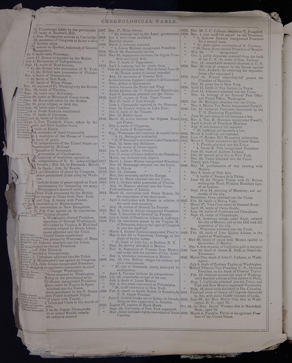
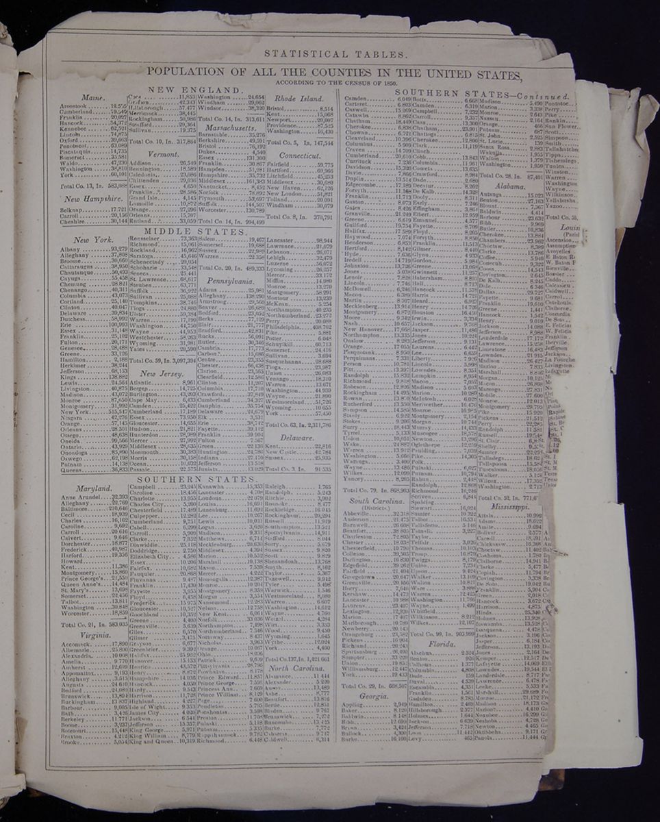 STATISTICAL TABLES.
POPULATION OF ALL THE COUNTIES IN THE UNITED
STATES,
ACCORDING TO THE CENSUS OF 1850.
A table of the populations of all of the counties in
the United States, divided by region ("New England," "Middle
States," "Southern States," "Western States," and
"Territories") and then state.
[begin surface 1151]
STATISTICAL TABLES.
POPULATION OF ALL THE COUNTIES IN THE UNITED
STATES,
ACCORDING TO THE CENSUS OF 1850.
A table of the populations of all of the counties in
the United States, divided by region ("New England," "Middle
States," "Southern States," "Western States," and
"Territories") and then state.
[begin surface 1151] STATISTICAL TABLES.
A continuation of the table from the previous page,
which is a table of the populations of all of the counties
in the United States, divided by region ("New England,"
"Middle States," "Southern States," "Western States," and
"Territories") and then state.
[begin surface 1152]
STATISTICAL TABLES.
A continuation of the table from the previous page,
which is a table of the populations of all of the counties
in the United States, divided by region ("New England,"
"Middle States," "Southern States," "Western States," and
"Territories") and then state.
[begin surface 1152] [begin surface 1153]
 [begin surface 1154]
 [begin surface 1155]
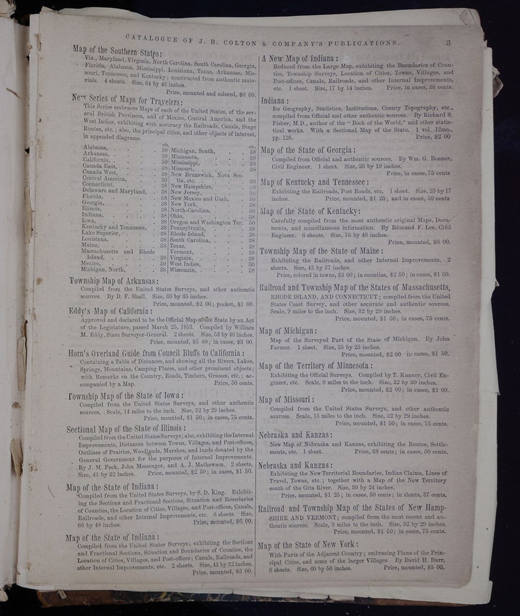
Map of the Southern States:
Viz., Maryland, Virginia, North Carolina, South Carolina, Georgia, Florida, Alabama, Mississippi, Louisiana, Texas, Arkansas, Missouri, Tennessee, and Kentucky; constructed from authentic materials. 4 sheets. Size, 64 by 43 inches.
Price, mounted and colored, $6 00.
New Series of Maps for Travelers:
This Series embraces Maps of each of the United States, of the several British Provinces, and of Mexico, Central America, and the West Indies, exhibiting with accuracy the Railroads, Canals, Stage Routes, etc.; also, the principal cities, and other objects of interest, in appended diagrams.
A list of maps and their costs. Most of the maps are of single states.Township Map of Arkansas:
Compiled from the United States Surveys, and other authentic sources. By D. F. Shall. Size, 30 by 35 inches.
Price, mounted, $2 00; pocket, $1 00.
Eddy's Map of California:
Approved and declared to be the Official Map of the State by an Act of the Legislature, passed March 25, 1853. Compiled by William M. Eddy, State Surveyor-General. 2 sheets. Size, 53 by 40 inches.
Price, mounted, $5 00; in cases, $3 00.
Horn's Overland Guide from Council Bluffs to California:
Containing a Table of Distances, and showing all the Rivers, Lakes, Springs, Mountains, Camping Places, and other prominent objects; with Remarks on the Country, Roads, Timbers, Grasses, etc.; accompanied by a Map.
Price, 50 cents.
Township Map of the State of Iowa:
Compiled from the United States Surveys, and other authentic sources. Scale, 14 miles to the inch. Size, 32 by 29 inches.
Price, mounted, $1 50; in cases, 75 cents.
Sectional Map of the state of Illinois:
Compiled from the United States Surveys; also, exhibiting the Internal Improvements, Distances between Towns, Villages, and Post-offices, Outlines of Prairies, Woodlands, Marshes, and lands donated by the General Government for the purposes of Internal Improvements. By J. M. Peck, John Messenger, and A. J. Mathewson. 2 sheets. Size, 43 by 32 inches.
Price, mounted, $2 50; in cases, $1 50.
Map of the State of Indiana:
Compiled from the United States Surveys, by S. D. King. Exhibiting the Sections and Fractional Sections, Situation and Boundaries of Counties, the Location of Cities, Villages, and Post-offices, Canals, Railroads, and other Internal Improvements, etc. 6 sheets. Size, 66 by 48 inches.
Price, mounted, $6 00.
Map of the State of Indiana:
Compiled from the United States Surveys; exhibiting the Sections and Fractional Sections, Situation and Boundaries of Counties, the Location of Cities, Villages, and Post-offices; Canals, Railroads, and Other Internal Improvements, etc. 2 sheets. Size, 43 by 32 inches.
Price, mounted, $3 00.
A New Map of Indiana:
Reduced from the Large Map, exhibiting the Boundaries of Counties, Township Surveys, Location of Cities, Towns, Villages, and Post-offices, Canals, Railroads, and other Internal Improvements, etc. 1 sheet. Size, 17 by 14 inches.
Price, in cases, 38 cents.
Indiana:
Its Geography, Statistics, Institutions, County Topography, etc., compiled from Official and other authentic sources. By Richard S. Fisher, M.D., author of the "Book of the World," and other statistical works. With a Sectional Map of the State. 1 vol. 12mo., pp. 128.
Price, $2 00
Map of the State of Georgia:
Compiled from Official and authentic sources. By Wm. G. Bonner, Civil Engineer. 1 sheet. Size, 20 by 19 inches.
Price, in cases, 75 cents
Map of Kentucky and Tennessee:
Exhibiting the Railroads, Post Roads, etc. 1 sheet. Size, 25 by 17 inches.
Price, mounted, $1 25; and in cases, 50 cents
Map of the State of Kentucky:
Carefully compiled from the most authentic original Maps, Documents, and miscellaneous information. By Edmund F. Lee, Civil Engineer. 6 sheets. Size, 70 by 48 inches.
Price, mounted, $6 00.
Township Map of the State of Maine:
Exhibiting the Railroads, and other Internal Improvements. 2 sheets. Size, 43 by 37 inches.
Price, colored in towns, $3 00; in counties, $2 50; in cases, $1 50.
Railroad and Township Map of the States of Massachusetts,
RHODE ISLAND, AND CONNECTICUT; compiled from the United States Coast Survey, and other accurate and authentic sources. Scale, 9 miles to the inch. Size, 32 by 29 inches.
Price, mounted, $1 50, in cases, 75 cents,
Map of Michigan:
Map of the Surveyed Part of the State of Michigan. By John Farmer. 1 sheet. Size, 35 by 25 inches.
Price, mounted, $2 00; in cases, $1 50.
Map of the Territory of Minnesota:
Exhibiting the Official Surveys. Compiled by T. Knauer, Civil Engineer, etc. Scale, 6 miles to the inch. Size, 32 by 30 inches.
Price, mounted, $2 00; in cases, $1 00.
Map of Missouri:
Compiled from the United States Surveys, and other authentic sources. Scale, 15 miles to the inch. Size, 32 by 29 inches.
Price, mounted, $1 50; in cases, 75 cents.
Nebraska and Kanzas:
New Map of Nebraska and Kanzas, exhibiting the Routes, Settlements, etc. 1 sheet.
Price, 38 cents; in cases, 50 cents.
Nebraska and Kanzas:
Exhibiting the New Territorial Boundaries, Indian Claims, Lines of Travel, Towns, etc.; together with a Map of the New Territory south of the Gita River. Size, 30 by 24 inches.
Price, mounted, $1 25; in cases, 50 cents; in sheets, 37 cents.
Railroad and Township Map of the States of New Hamp-
SHIRE AND VERMONT; compiled from the most recent and authentic sources. Scale, 9 miles to the inch. Size, 32 by 29 inches.
Price, mounted, $1 50; in cases, 75 cents.
Map of the State of New York:
With Parts of the Adjacent Country; embracing Plans of the Principal Cities, and some of the larger Villages. By David H. Burr. 6 sheets. Size, 60 by 50 inches.
Price, mounted, $5 00.
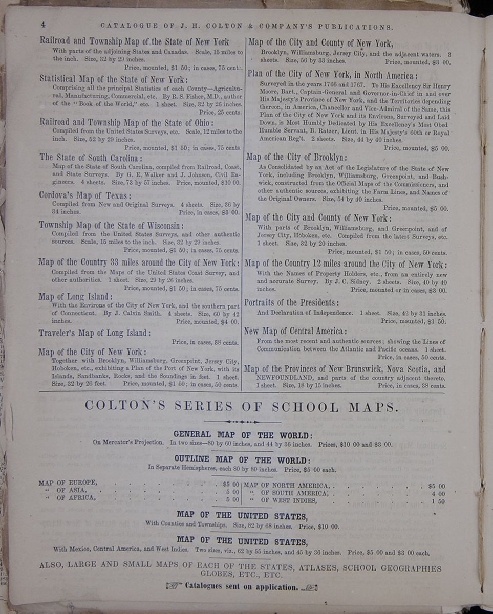 4
CATALOGUE OF J. H. COLTON &
COMPANY'S PUBLICATIONS.
4
CATALOGUE OF J. H. COLTON &
COMPANY'S PUBLICATIONS.
Railroad and Township Map of the State of New York
With parts of the adjoining States and Canadas. Scale, 15 miles to the inch. Size, 32 by 29 inches.
Price, mounted, $1 5O; in cases, 75 cents.
Statistical Map of the State of New York:
Comprising all the principal Statistics of each County—Agricultural, Manufacturing, Commercial, etc. By R. S. Fisher, M.D., author of the "Book of the World," etc. 1 sheet. Size, 32 by 26 inches.
Price, 25 cents.
Railroad and Township Map of the State of Ohio:
Compiled from the United States Surveys, etc. Scale, 12 miles to the inch. Size, 52 by 29 inches.
Price, mounted, $1 50; in cases, 75 cents
The State of South Carolina:
Map of the State of South Carolina, compiled from Railroad, Coast, and State Surveys. By G. E. Walker and J. Johnson, Civil Engineers. 4 sheets. Size, 73 by 57 inches.
Price, mounted, $10 00.
Cordova's Map of Texas:
Compiled from New and Original Surveys. 4 sheets. Size, 36 by 34 inches.
Price, in cases, $3 00.
Township Map of the State of Wisconsin:
Compiled from the United States Surveys, and other authentic sources. Scale, 15 miles to the inch. Size, 32 by 29 inches.
Price, mounted, $1 50; in cases, 75 cents.
Map of the Country 33 miles around the City of New York:
Compiled from the Maps of the United States Coast Survey, and other authorities. 1 sheet. Size, 29 by 26 inches.
Price, mounted, $1 50; in cases, 75 cents.
Map of Long Island:
With the Environs of the City of New York, and the southern part of Connecticut. By J. Calvin Smith. 4 sheets. Size, 60 by 42 inches.
Price, mounted, $4 00.
Traveler's Map of Long Island:
Price, in cases, 88 cents.
Map of the City of New York:
Together with Brooklyn, Williamsburg, Greenpoint, Jersey City, Hobokcn, etc., exhibiting a Plan of the Port of New York, with its Islands, Sandbanks, Rocks, and the Soundings in feet. 1 sheet. Size, 32 by 26 feet.
Price, mounted, $1 50; in cases, 50 cents.
Map of the City and County of New York,
Brooklyn, Williamsburg, Jersey City, and the adjacent waters. 3 sheets. Size, 56 by 33 inches.
Price, mounted, $3 00.
Plan of the City of New York, in North America:
Surveyed in the years 1760 and 1767. To His Excellency Sir Henry Moore, Bart., Captain-General and Governor-in-Chief in and over His Majesty's Province of New York, and the Territories depending thereon, in America, Chancellor and Vice-Admiral of the Same, this Plan of the City of New York and its Environs, Surveyed and Laid Down, is Most Humbly Dedicated by His Excellency's Most Obed Humble Servant, B. Ratzer, Lieut, in His Majesty's 60th or Royal American Reg't. 2 sheets. Size, 44 by 40 inches.
Price, mounted, $5 00.
Map of the City of Brooklyn:
As Consolidated by an Act of the Legislature of the State of New York, including Brooklyn, Williamsburg, Greenpoint, and Bushwick, constructed from the Official Maps of the Commissioners, and other authentic sources, exhibiting the Farm Lines, and Names of the Original Owners. Size, 54 by 40 inches.
Price, mounted, $5 00.
Map of the City and County of New York:
With parts of Brooklyn, Williamsburg, and Greenpoint, and of Jersey City, Hoboken, etc. Compiled from the latest Surveys, etc. 1 sheet. Size, 32 by 20 inches.
Price, mounted, $1 50; in cases, 50 cents.
Map of the Country 12 miles around the City of New York:
With the Names of Property Holders, etc., from an entirely new and accurate Survey. By J. C. Sidney. 2 sheets. Size, 40 by 40 inches.
Price, mounted or in cases, $3 00.
Portraits of the Presidents:
And Declaration of Independence. 1 sheet. Size, 42 by 31 inches.
Price, mounted, $1 50.
New Map of Central America:
From the most recent and authentic sources; showing the Lines of Communication between the Atlantic and Pacific oceans. 1 sheet.
Price, in cases, 50 cents.
Map of the Provinces of New Brunswick, Nova Scotia, and
NEWFOUNDLAND, and parts of the country adjacent thereto. 1 sheet. Size, 18 by 15 inches.
Price, in cases, 38 cents.
COLTON'S SERIES OF SCHOOL MAPS.
GENERAL MAP OF THE WORLD:
On Mercator's Projection. In two sizes—80 by 60 inches, and 44 by 36 inches. Prices, $10 00 and $8 00.
OUTLINE MAP OF THE WORLD:
In Separate Hemispheres, each 80 by 80 inches. Price, $5 00 each.
- MAP OF EUROPE . . . . . . . . . $5 00
- " OF ASIA, . . . . . . . . 5 00
- " OF AFRICA, . . . . . . . . 5 00
- MAP OF NORTH AMERICA, . . . . . . . $6 00
- " OF SOUTH AMERICA, . . . . . . 4 00
- " OF WEST INDIES, . . . . . . . 1 60
MAP OF THE UNITED STATES,
With Counties and Townships. Size, 82 by 68 inches. Price, $10 00.
MAP OF THE UNITED STATES,
With Mexico, Central America, and West Indies. Two sizes, viz., 62 by 55 inches, and 45 by 86 inches. Price, $5 00 and $3 00 each.
ALSO, LARGE AND SMALL MAPS OF EACH OF THE STATES, ATLASES, SCHOOL GEOGRAPHIES GLOBES, ETC., ETC.
☞ Catalogues sent on application. ☜
PROSPECTUS OF
COLTON AND FITCH'S
AMERICAN SCHOOL
GEOGRAPHY.
Now in Press, and soon to be Published, by J. H. COLTON AND COMPANY, No. 172 William, cor. of Beekman Street, New York.
J. H. Colton and Co. respectfully announce to the public, and particularly to parents, teachers, and school committees, that they have in press, and will shortly publish, A NEW SCHOOL GEOGRAPHY.
In making this announcement, they deem it advisable to present, very briefly, the plan of the book, and to notice such of its features as will, in their opinion, distinguish it from the school geographies in general use, and commend it to the approbation of teachers. They have aimed to prepare an improved work-, a work, which, while it embodies the more important facts in geographical science, including those which recent discovery has made known, shall be arranged so as to accord with the more improved methods of teaching.
FORM AND SIZE.—THE AMERICAN SCHOOL OF GEOGRAPHY will be of a quarto form, numbering 88 pages, each page to be 94 inches in width, by 12 inches in length. The pages will thus be nearly two inches wider and longer than those of any existing school geography. Numerous advantages result from this enlargement. It allows more space for pictorial illustration, and for large and plain print, so essential in a school book; and it admits maps drawn on a larger scale, and with greater clearness and accuracy. An additional point gained by this enlargement of the pages consists in its affording room for projecting the maps of adjacent countries on a uniform scale, so that in referring from one to the other the mind may with correctness carry throughout the same ideas of relative magnitude and dimension.
MAPS.—Considering that the excellence of a geography depends very much upon the character of the maps which illustrate it, the Publishers are determined to make the work every way superior in this respect. The introductory part will embrace the following Maps on wood engraved in the very best style:
- 1. The World on an Equatorial Projection, to illustrate the Zones.
- 2. The World on the Polar Projection, and
- 3. The World projected on the plane of the horizon of London, to illustrate the unequal distribution of land.
- 4. The World on Mercator's Projection, to illustrate the distribution of the human races.
The maps, on steel, will occupy not less than thirty pages, and will illustrate all the principal countries in the world. They have been drawn by Mr. GEORGE W. COLTON, and are being engraved by the most competent artists under his immediate supervision. It is the intention to make great improvement in the maps generally, but particularly in those of the British Provinces in North America, Mexico, Central America, and the West Indies—an improvement demanded by the commercial and political relations which subsist between those countries and the United States, and which are constantly Increasing in importance.
The facilities which the Publishers enjoy of producing first-rate maps are unequaled. In the preparation of their Atlas of the World (now nearly completed), they have expended labor and money without stint in obtaining the most reliable geographical information, and especially in procuring the results of all the most recent voyages of discovery which have added so much to our knowledge of different parts of the world. They are constantly receiving charts and maps published in this country and in Europe, showing the latest discoveries and surveys, and exhibiting the present territorial arrangements, works of internal improvement, etc. Having such ample means, they will employ it in the production of this work, and furnish such a positive and real delineation of ihe earth's surface as fully comes up to the present slate of geographical knowledge.
PHYSICAL GEOGRAPHY.—The maps of the five grand divisions, North America, South America, Europe, Asia, and Africa, are to represent Physical Geography. They will be colored so as to distinguish the elevated regions from the low-land plains and valleys, and thus enable the eye to take, at a glance, a view of the surface with reference to its elevations and depressions. The Publishers believe that the utility of these maps will be acknowledged by all enlightened teachers. Physical Geography forms the acknowledged basis of all kinds of Descriptive Geography, since the natural features of the earth exert an abiding influence over the division and distribution of nations, and have, in every country, given their strong impress to the pursuits, habits, and character of the inhabitants.
PICTORIAL ILLUSTRATIONS.—THE AMERICAN SCHOOL OF GEOGRAPHY will be very fully illustrated with wood engravings prepared expressly for it. The greatest care has been taken to give truthful illustrations, and, accordingly, they are drawn from most reliable sources, not a few being from original sketches taken expressly for this book. It will be conceded, the Publishers think, that the cuts to illustrate the races of mankind, taken in connection with the descriptions and the map to show the distribution of the races, will give, in a simple and intelligible manner, a fuller exposition of the subject of ethnography than is contained in any other school book on Geography. The border views, on the pages facing the maps of the five grand divisions, are composed of subjects, and arranged in a style which must command admiration. It is unnecessary to particularize further respecting the pictorial illustrations. They have been drawn by such well-known artists as Darley, Herrick, Döpler, Parsons, Hitchcock, Rabuske, and others, and engraved by Messrs. Whitney, Jocelyn & Annin, whose fame, as engravers, is a sufficient guarantee that their part of the work will give satisfaction.
CLASSIFICATION AND ARRANGEMENT.—The Author (Mr. G. W. FITCH) has endeavored to arrange the several parts according to the maxim, "A place for every thing, and every thing in its place." A simple and natural arrangement is of primary importance in any school book; but it is particularly needed in a Geography, which comprehends a great variety of subjects. "Classification," says a distinguished writer, "is the great instrument of judgment. The more we can simplify and generalize things, the more easily will they be comprehended." It is impossible to carry out, in the brief limits of a school book on Geography, so complete a system of classification as is admissible in a larger work; but is it practicable, and highly desirable, to distinguish the facts of Physical Geography from those of Political, so that the relations which the latter sustain to the former can be pointed out and comprehended. The Author has attempted to do something to this end, by devoting the maps of the five grand divisions to a delineation of their natural features, and by introducing, into the pages facing those maps, such exercises and descriptive information as relate exclusively to Physical Geography.
The Introductory Definitions have been arranged with particular care, and in a manner, it is hoped and believed, that will be generally approved. They are placed under those heads which the Author deemed most appropriate; us, FORM and MAGNITUTDE OF THE EARTH; MOTIONS OF THE EARTH; CIRCLES; ZONES; LATITUDE AND LONGITUDE; LAND; DIVISIONS OF THE LAND; DIVISIONS OF THE WATER; RACES OF MEN; ANIMALS; PLANTS; FORMS OF GOVERNMENT; INDUSTRIAL PURSUITS, ETC.
TYPOGRAPHY.—Large and clear print are nowhere more necessary than in a school book; and the Publishers have been careful to make their work faultless in this respect. By having large pages they are enabled to include a sufficient amount of letterpress without using too fine type, and without crowding the matter too closely together. The questions on the maps, instead of being in close, dense columns, like those common in other geographies, are in large print, so as readily to catch the eye of the scholar while he is learning his lessons. It has been remarked by experienced teachers, that a pupil will learn a lesson in good plain print twice as well, and with twice as much delight, as he will one in fine.
At the commencement of the undertaking, the Publishers were in hopes of issuing the AMERICAN SCHOOL GEOGRAPHY early in the present year; but the vast amount of labor requisite in drawing and engraving the maps and pictorial illustrations will prevent its appearance at so early a season; they, however, considering its present state of forwardness, can safely promise that it will be ready in the course of a few months. They trust that teachers and school committees, contemplating a change in their school geographies, will await the publication of this work, as they confidently believe that it will possess merits far surpassing those of any similar book.
OUTLINES OF PHYSICAL GEOGRAPHY
FOR THE USE OF
SCHOOLS.
BY GEORGE W. FITCH.
WITH SIX MAPS AND NUMEROUS ENGRAVINGS.
The Publishers would also announce that they have nearly ready, and will shortly Issue, a new and beautifully illustrated Treatise on Physical Geography for the Use of Schools. It will be of a 12mo form, and contain about 275 pages.
Teachers have long felt the want of a book on Physical Geography adapted for the use of schools. Excepting the work of Mr. WOODBRIDGE, first published nearly twenty years ago, no book on this subject, that the Publishers are aware of, has ever been published in this country at all suited to the requirements of our system of instruction. Since the time of Mr. WOODBRIDGE, great advancement has been made in this department of Geography—indeed, it is safe to say, that the science which relates to the physical condition of the globe has been more rapidly advanced during late years than any other. In confirmation of this statement, it is only necessary to allude to the recent discoveries in the Arctic and Antarctic regions, and in the interior of North and South America, to the investigations respecting the Winds and Currents of the ocean, its depth, etc.
THE OUTLINES OF PHYSICAL GEOGRAPHY will be illustrated by six very superior maps on steel, as follows:
- 1. THE WORLD, illustrating the Principal Features of the Land.
- 2. " " illustrating the Divisions and Movements of the Waters of the Globe.
- 3. " " illustrating the Geographical Distribution of some of the Principal Phenomena of Meteorology.
- 4. " " showing the Geographical Distribution and Limits of Cultivation of some of the Principal Plants useful to Mankind.
- 5. " " showing the Geographical Distribution and Range of some of the Principal Members of the Animal Kingdom.
- 6. " " Illustrating the Productive Industry of various Countries, and exhibiting the Principal Localities of Commerce and Navigation.
COLTON'S
AMERICAN ATLAS,
ILLUSTRATING
PHYSICAL AND POLITICAL GEOGRAPHY.
CONSTRUCTED FROM
OFFICIAL SURVEYS AND OTHER AUTHENTIC MATERIALS.
THESE Atlases, the one illustrating the geography of America, and the other that of the whole world, have been compiled with the view of supplying the public with an authentic system of maps and a recapitulation of the present condition of geographical knowledge.
The "American Atlas" contains separate maps of every State and Country of North and South America and the West Indies—in all about 90 maps and plans, on about 55 sheets.
The "Atlas of the World" includes, besides the series of maps contained in the "American Atlas," about an equal number representing the states and countries of Europe, Asia, Africa, and Oceanica—in all about 160 maps and plans, on about 110 sheets.
The maps of these two Atlases exhibit, besides the usual geographical and topographical information forming their groundwork, true representations of all works of public improvement, completed or projected, such as lines of railroads, canals, plank-roads, and other means of intercommunication, the public surveys made under the authority of European and American governments, and a great mass of other pertinent information, valuable to all who are interested in the development of the countries delineated. The artists employed in engraving these are competent in their several departments, and the most talented and skillful among those whose productions have challenged the admiration and confidence of their countrymen.
Each Atlas is illustrated with letter-press descriptions of the countries delineated, exhibiting a full account of their geography, resources, commerce, and general interests, and the statistics relative to the several subjects treated upon.
The maps have been drawn by, or under the superintendence of, Mr. GEORGE W. COLTON, well known as an accurate and accomplished geographer.
The letter-press descriptions and statistics accompanying each map have been written by RICHARD S. FISHER, M.D., author of the "American Statistical Annual," the "Progress of the United States," etc.
Works such as the above designated have long been demanded by the enlightened portion of the general public. For many years extraordinary advances have been made in geographical science; discoveries of the highest importance have been effected; regions before comparatively unknown have been explored, and their physical characteristics ascertained, and on every side man has been actively engaged in acquiring information whereby to extend the sphere of civilization and commerce. Few of the important facts developed by these movements are to be found in the Atlases hitherto published; and hence the enterprise of the Publishers of these new and complete works, embracing all the results that have been obtained from the sources indicated, becomes the only standard of truthful information, and the only satisfactory reference respecting geographical knowledge. These Atlases, moreover, supply a pressing necessity. In their maps and descriptions, the world, as known at the present time, is represented with faithfulness and accuracy, and the vast amount of information collected by explorers, travelers, and others, existing hitherto in forms accessible only to the few, is now for the first time made available to all. Every effort, indeed, has been made by the Publishers to furnish, both in reference to artistic excellence and literary merit, works creditable alike to the genius, talent, and skill of America, and much superior in every respect to any former productions of a like nature. The utility of such works is not limited to any class, but is co-extensive with the sphere of civilized humanity, and while they meet the wants of the man of science, the navigator, the traveler, and the merchant, they are of especial value in the family circle and the school-room. No library, in fact, whether public or private, can be complete without these works; and from no other source can the multiplicity of information they contain be derived. To remunerate them for the vast expense and labor in the compilation and execution of these truly national works, the Publishers rely solely on their intrinsic merits and the patronage of a discerning public.
The SIZE of the Atlases is that known as imperial folio, each map being about 19 by 16 inches, and much larger and on a more extended scale than any previous Atlases.
The PAPER on which the Atlases are printed is of the finest quality, heavy and durable, and has been specially manufactured for these works.
The COLORING is elegantly executed, and individual subscribers can choose between the plain, lined, and full colored styles, as per specimen.
The BINDINGS will be varied to suit individual taste; but in all cases of a substantial and elegant description.
The PRICES of each Atlas, with or without letter-press, and in the several descriptions of binding and edging, are as follows:
PRICES OF THE "AMERICAN ATLAS."
- Style of Binding. Marbled Edges.
- Embossed cloth and leather, with letter-press . . . . . . . . . . . . . . . . . . . . . . . . $15 00
- " " " without letter-press . . . . . . . . . . . . . . . . . . . . . . . . 12 50
PRICES OF THE "ATLAS OF THE WORLD."
- Style of Binding. Marbled Edges. In 1 vol. In 2 vols.
- Embossed cloth and leather, with letter-press . . . . . . . . . . . . . . . . . . . . . . . . $24 00 . . . . $27 00
- " " " without letter-press . . . . . . . . . . . . . . . . . . . . . . . . 20 00 . . . . 22 50
The "ATLAS OF THE WORLD" will also be published in Numbers, each containing at least Four Maps and the accompanying Letter-press Descriptions. The Publishers intend to issue a Number on the 1st and 15th of each month—the Numbers not to exceed twenty-seven. The price of each Number will be ONE DOLLAR, payable on delivery. On completion of the work a handsome embossed cloth, leather-back, cover will be furnished gratis to Subscribers.
PUBLISHED BY J. H. COLTON AND COMPANY, No. 172 WILLIAM STREET. NEW YORK, AND TRUBNER AND COMPANY, NO. 12 PATERNOSTER ROW, LONDON. ☞SUBSCRIPTIONS ARE SOLICITED BY SPECIAL AGENTS ONLY.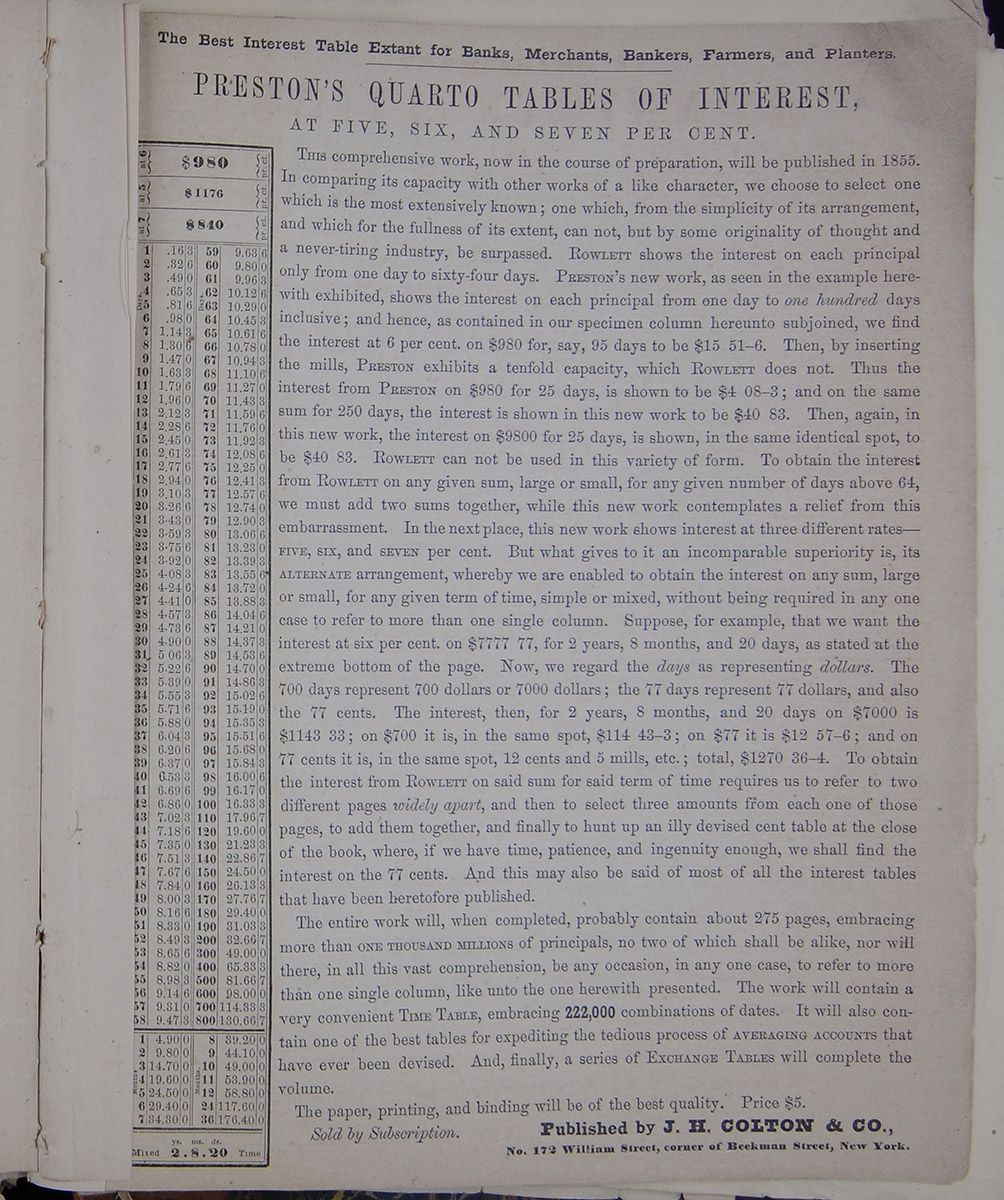
PRESTON'S QUARTO TABLES OF INTEREST, AT FIVE, SIX, AND SEVEN PER CENT.
An interest table, extending the length of the page, on the left-hand side.THIS comprehensive work, now in the course of preparation, will be published in 1855. In comparing its capacity with other works of a like character, we choose to select one which is the most extensively known; one which, from the simplicity of its arrangement, and which for the fullness of its extent, can not, but by some originality of thought and a never-tiring industry, be surpassed. ROWLETT shows the interest on each principal only from one day to sixty-four days. PRESTON's new work, as seen in the example herewith exhibited, shows the interest on each principal from one day to one hundred days inclusive; and hence, as contained in our specimen column hereunto subjoined, we find the interest at 6 per cent, on $980 for, say, 95 days to be $15 51–6. Then, by inserting the mills, Preston exhibits a tenfold capacity, which ROWLETT does not. Thus the interest from PRESTON on $980 for 25 days, is shown to be $4 O8–3; and on the same sum for 250 days, the interest is shown in this new work to be $40 83. Then, again, in this new work, the interest on $9800 for 25 days, is shown, in the same identical spot, to be $40 83. ROWLETT can not be used in this variety of form. To obtain the interest from ROWLETT on any given sum, large or small, for any given number of days above 64, we must add two sums together, while this new work contemplates a relief from this embarrassment. In the next place, this new work shows interest at three different rates— FIVE, SIX, and SEVEN per cent. But what gives to it an incomparable superiority is, its ALTERNATE arrangement, whereby we are enabled to obtain the interest on any sum, large or small, for any given term of time, simple or mixed, without being required in any one case to refer to more than one single column. Suppose, for example, that we want the interest at six per cent, on $7777 77, for 2 years, 8 months, and 20 days, as stated at the extreme bottom of the page. Now, we regard the days as representing dollars. The 700 days represent 700 dollars or 7000 dollars; the 77 days represent 77 dollars, and also the 77 cents. The interest, then, for 2 years, 8 months, and 20 days on $7000 is $1143 33; on $700 it is, in the same spot, $114 43–3; on $77 it is $12 57–6; and on 77 cents it is, in the same spot, 12 cents and 5 mills, etc.; total, $1270 36–4. To obtain the interest from ROWLETT on said sum for said term of time requires us to refer to two different pages widely apart, and then to select three amounts from each one of those pages, to add them together, and finally to hunt up an illy devised cent table at the close of the book, where, if we have time, patience, and ingenuity enough, we shall find the interest on the 77 cents. And this may also be said of most of all the interest tables that have been heretofore published.
The entire work will, when completed, probably contain about 275 pages, embracing more than ONE THOUSAND MILLION of principals, no two of which shall be alike, nor will there, in all this vast comprehension, be any occasion, in any one case, to refer to more than one single column, like unto the one herewith presented. The work will contain a very convenient TIME TABLE, embracing 222,000 combinations of dates. It will also contain one of the best tables for expediting the tedious process of AVERAGING ACCOUNTS that have ever been devised. And, finally, a series of EXCHANGE TABLES will complete the volume.
The paper, printing, and binding will be of the best quality. Price $5.
Sold by Subscription.
Published by T. B. COLTON & CO.,
No. 172 William
Street, corner of Beekman Street, New York.
Brooklyn Daily Eagle.
This Paper has the Largest Circulation of any Evening Paper published in the United States. Its value as an Advertising Medium s therefore apparent.
TO CORRESPONDENTS.
o notice can be taken of annonymous Communications. Whatever is intended for insertion must be authenticated by the name and address of the writer—not necessarily for publication, but as a guarantee of his good faith.
We cannot undertake to return rejected Communications.
WEDNESDAY EVENING, MARCH 16.
The English Reform Bill
Mr. Disraeli has introduced his new measure of Reform in the House of Commons. The Derby Ministry assumed the reins of power under such very peculiar circumstances, that though strongly Tory they were under the necessity of laying aside their own principles and adopting the legacy of Reform bequeathed to them by their predecessors. The result is what might have been expected. A Bill which has neither the sympathy of their hearts nor the approval of their judgements, which goes far enough to exasperate Tory prejudice and stops far short of the popular demands, has been introduced, and has met with opposition from all quarters and cordial support in none. It caused a difference of opinion in the Cabinet, in consequence of which two members have retired—Mr. Walpole, the Home Secretary, and Mr. Henley, the President of the Board of Trade. Mr. Estcourt, the President of the Poor-law Board, is to take the place of Mr. Walpole, and Lord Donoughmore, the Vice President of the Board of Trade, is to succeed Mr. Henley as President. On the other hand the Bill is warmly assailed by the Liberals and popular leaders in the House.
The Bill is not to recognize population as a basis for Parliamentary representation. "The object of representation," Mr. Disraeli stated in his speech, "was to present a mirror of the the mind of the country, its agriculture, its manufacturing industry, its commerce, its professional ability."
Having laid before the House the character of the proposed electoral body, he next proceeded to state how it was proposed they should be registered, and how they were to vote. On this point we quote—
The House is aware that under the present system there is a difference in the registration of boroughs and counties. In counties an elector makes his own claim to be placed on the list; in boroughs it is made out by a public officer. It is well known that great difficulty attends the county registration; nothing proves it more than the facts that, notwithstanding the increase in the wealth and population, the county representation is a decaying one. (Hear.) This must always be the case if you surround it with every obstacle. We propose to amend the system entirely—we propose, in fact, that there shall be a self-acting registry; the overseer in every parish will make out a list of owners, as well as occupiers. If any one is omitted from the list, whether owner or occupier, he may make his claim, and in a supplementary list his name will be inserted.
It was proposed, he said, not to alter the limit of the borough franchise, but to introduce into boroughs a new kind of franchise, founded upon personal property, and to give a vote to persons having property to the amount of $50 a year in the Funds, Bank Stock, and East India Stock; a person having $300 in a savings-bank would, under the Bill, be an elector for the borough in which he resided, as well as the recipients of pensions in the naval, military, and civil services, amounting to $100 a year. Dwellers in a portion of a house whose aggregate rent was $100 a year would likewise have a vote. The suffrage would also be conferred upon graduates of the Universities, ministers of religion, members of the legal profession, and the medical body, and certain schoolmasters. In considering the county franchise, the Government proposed to recognize the principle of identity of suffrage between the counties and the towns The effect of giving to counties a $100 franchise would be, according to the estimate of the Government, to add to the county constituency 200,000.
It was proposed that the number of polling places should be greatly increased, that every parish having 200 electors should be a polling place; that every voter should vote in the place where he resided, and that those who liked it might vote by polling-papers, instead of going to the hustings, precautions being provided against fraud and personation. A complete representation, he proceeded to observe, did not depend upon the electoral body; it also depended upon whether the different interests of the country were adequately represented. Discarding the principle of population, and accepting as a truth that the function of that House was to represent not the voice of a numerical majority or the influence of a predominant property, but the various interests of the country, the Government had felt it to be their duty to see whether there were interests not represented, and whether the general representation of the country could not be matured and completed, and therefore a number of places which now send two members to Parliament are to return but one, while in other places members are added. Such is the proposed measure of the Ministry. Lord John Russell, Messrs. Bright, Boebuck and other popular leaders attacked it because it did not give an iota of power to the working classes, and that the provision by which freeholders in towns are prevented from voting for the county would create dissatisfaction and be an evil in itself. The measure will undoubtedly fail, and may oust the Ministry that introduced it.
A CORRUPTION STORY SIMMERED DOWN.—
A committee of three was appointed at the last meeting of the Board of Supervisors to investigate a rumor that money had been offered to members of that Board, to influence them in the matter of the purchase of the Crooke farm. That committee met yesterday, and the result of the investigation was as follows:—Supervisor Sneeden swore that Supervisor Stryker, of Gravesend, todl him that he (Stryker) had been offered $500. Mr. Stryker said that he not been offered $500, but had been offered $200, and finally said that Sheriff Remsen had made the offer. Sheriff Remsen was placed on the stand. He said that he met Supervisor Stryker in an eating-saloon one day, and the conversation turned upon the proposed purchase of the Crooke farm, and he jocosely remarked that there was money in it, and something to the effect that a vote was worth one or two hundred dollars. Mr. Remsen said that he had no interest in the matter, and had not been approached on the subject to use his influence; that the remark was made in a jocular way, as such remarks are often made in loose conversation. This was the whole basis of the rumor.
LATER FROM EUROPE.
Arrival of the City of Washington.
THE WAR QUESTION IN EUROPE.
THE NEW REFORM BILL IN THE BRITISH PARLIAMENT.
&c., &c., &c., &c.,
The steamship City of Washington arrived this morning. The news is of an important and interesting character.
She brings Liverpoool dates of the morning of the 2d instant. Passed at noon on the 2d, ships Timor and E. Morse, bound in, and the same evening, ship T. F. Chapman. Also, on the 9th, lat. 46, long. 38.40, a steamer supposed to be the Africa. 14th, passed the City of Baltimore. Has had a constant succession of westerly gales almost the entire passage. She brings 170 passengers.
The Derby Ministry had introduced their new Reform Bill in Parliament. It is discussed in another column.
It is explained that the ground for supposing the French and Austrians will evacuate the papal States is because the Pope has invited them to do so. Nothing transpired to indicate how either power proceed, but rumors from Paris say the French will withdraw.
War preparations continued actively, and funds which were so buoyant on the departure of the Arabis, had become depressed. French threes closed 67—50.
Lord Cowley reached Vienna and had an interview with the Emperor.
Disraelis' reform bill confers franchise upon all members of learned professions, and upon parties having small investments in funds and Savings Banks.
Representatives of fifteen small boroughs is reduced from two to one member each, and vacated seats are given to counties and new boroughs.
The bill is strongly attacked by reformers, but at a large meeting of conservatives, some two hundred strong, at Lord Derby's, pledged their unanimous support to the measure.
Walpole, the Home Secretary and Henley, President of the Board of Trade, retired from the Cabinet on account of the differences of opinion on reform.
Mr. Sotheron Escourt succeeds the former and Lord Lononghmore the latter.
Lord March replaces Escourt as President of the Poor Law Board.
There are rumors of further seccessions from the Cabinet, including Earl Salisbury and Mr. Cidderley.
British exports show an enormous increase over last year.
Latest Paris letters say the chances of war or peace continue still the same.
The war fever ran high in Germany.
Late news from Brazil says that President Lopez of Paraguay accepted mediation from the Brazilian government in the difficulty with America.
LATEST.—London, Wednesday morning. Daily News says:—Gloom once more overshadows Stock Exchange—the most reasuring portions of statements made by ministers on Friday having been officially explained away. Prospect ministerial crisis had likewise same effect. On Paris Bourse yesterday, rates fell half per cent. Money continues in fair demand, at two and a half per cent. Exchange at Austria further advanced.
At a meeting yesterday of Conservatives, to consider D'Israeli's Reform Bill.
Lord Derby stated that if, on the second reading, or upon any of the main clauses of the bill in committee, they found themselves in the minority, he should unhesitatingly advise the Queen to dissolve Parliament. This is a challenge to Lord John Russell.
THE LATESTThere is a rumor that Count Cavour is expected at Paris.
The Sardinian loan of two millions has not been negociated at Paris by M. Fould, as was at one time supposed. This is looked upon as an unfavorable symptom, since M. Fould, as Minister of State, must have opportunities of foreseeing if events are at hand which might render the speculation hazardous.
Advices from Rio Janeiro, Feb. 7th, received at Lisbon, say that Lopez had accepted the offered mediation of the Brazilian Government in the difficulty with the United States.
Calcutta mails of January 22d, and China mails of Jan. 15th, had reached England.
Private letters confirm the news previously received of the pacification of Oude.
Lord Elgin's expedition up the Yang-tse-Kiang extended as far as Hang-kow and is reported successful.
The Powhattan was at Hong Kong.
The Mississippi was in Canton River.
THE WAR QUESTION.
Lord Cowley has arrived in Vienna, and in a few days probably we shall learn the result of his important mission. Letters from the city, written before his lordship's arrival, intimate that the Austrian Government is not likely to make any concession beyond the evacuation of Ferrara and Bologna, and, consequently, inspire little hope that the reputed demands of France will be assented to. The "evacuation" question, ostensibly put forth as something like a settlement of the pending differences, is now generally regarded, in France and elsewhere, as a dexterous "dodge" on the part of Austria, and as a project which is not at all likely to be carried out.
The 'Moniteur' contains the following paragraph:
"His Eminence Cardinal Antonelli announced on the 22d inst., by order of his Holiness, to their Excellencies the Ambassadors of France and Austria near the Holy See, that the Holy Father, full of gratitude for the succor given him up to the present by their Majesties the Emperor of the French and the Emperor of Austria, thought it his duty to inform them that henceforth his Government was strong enough to suffice its own security, and to maintain peace in its States; and that, consequently, the Pope declared himself ready to enter into the arrangements with the two powers with a view to combine within the shortest possible delay the simultaneous evacucation of his territory by the French and Austrian arms.'"
The 'Patrie' which is supposed to be also inspired by the Emperor, however, says, in reference to the debate in the English Parliament:
"We have certainly no desire to diminish the importance of the fact announced by Lord Malmesbury and still less to diminish the hopes which appear to attach to it; but we must observe that if in the question of Italy the evacuation of the Pontificial States is one of the elements of its solution, it is far from being the solution itself. By sending to Vienna a political personage so experienced as Lord Cowley, England as shown all the importance she attaches to it. 'The mission with which the noble Lord is charged,' observed Mr. Disraeli, 'is a mission of confidence—a mission of conciliation.' Will he succeed in it? We most earnestly desire it, but the announced evacuation of the Pontificial States is in our eyes only the commencement of a solution, which would probably be sterile if the other interests were not satisfactorily settled."
The other interests are, doubtless, those relating to the independent Italian States, where Austria has long acquired a predominance contrary to treaties as it is hardly thought that any one will propose to her the abandonment of the Lombardo-Venitian territory. As to the chances of Lord Cowley's success at Vienna opinion is divided, or, to speak more strictly, there are but few who hope much from it.
A letter from Egypt, describing the reception of Prince Alfred, shows that, in consequence of orders from home, the English residents abstained f om their contemplated demonstrations in honor of his royal highness.
News has come from Naples of a conspiracy in the the fleet there, not quite so alarming as the mutiny at the Nore in 1798, but of sufficient dimensions to occasion the seizure of twenty naval officers, who have taken the berths lately vacated by Poerio and his companions.
FLOOD AT PATCHOGUE.—
The village of Patchogue has experienced a regular deluge, and has been under water for a few days past, through the giving way of a damn of a pond, known as the Upper Lake. A great deal of damage was done to property, the loss being estimated as high as $30,000. Furniture and other moveables were carried away and destroyed, and several persons had narrow escapes with their lives, as the flood came upon them in the night.
Our Albany Correspondence.
ALBANY, March 14, 1859.A bare quorum of Senators was in attendance this morning and the session was dull enough. The only occurrence of information to Brooklyn was the introduction of the following bill by Mr. Ely, on behalf Senator Spinola, who is absent to-day.
AN ACT to authorize the laying of a Railroad in Grand st. and other streets and avenues in the City of Brooklyn and County of Kings.
Sec. 1. It shall be lawful for Henry J. Hull and Andrew B. Hodges, and their associates and assigns to lay a Railroad with double track, commencing at the foot of South Seventh street in Brooklyn; thence through Grand street as far as the same now is or may hereafter be extended; thence from Grand street through Bushwick avenue to Meeker avenue; thence through Meeker avenue to the city line. Also a double track from the corner of Bushwick and Metropolitan avenues, through Metropolitan avenue to the city line, with the privilege to lay tracks for the necessary switches and turnouts.
Sec. 2. The tracks shall be laid with grooved rails, flush with the surface of the streets, and shall conform to the grade of the streets as the same is now or shall be from time to time established or altered.
Sec. 3. The said Railroad shall be completed as far as Bushwick avenue within one year from the passage of this act, and shall be taxed in the city of Brooklyn: and no car shall be run as often as the public convenience may require, and be subject to such reasonable rules and regulations in respect thereto as the Common Council of Brooklyn may from time to time prescribe—and to the payment to the city of the same license fee annually for each car run thereon as is now paid by other city railroads in said city.
Sec. 4. In the construction, operation, and use of the Railroad hereby authorised, should it be necessary or proper to run upon, intersect or use any part or portion of other city railroad tracks now laid upon any of the streets or avenues above named, they are hereby authorised to run upon, intersect or use the same; and in case they cannot agree with the owner or owners thereof respecting the compensation or payment to be made therefor, then the amount of such compensation shall be determined in the manner provided by subdivision six of the 28th section of the act entitled "An act to authorise the formation of railroad companies, and to regulate the same," passed April 2, 1850.
Sec. 5. It shall be lawful for the said persons named in the first section of this act and their associates or assigns, to organize under an act of the Legislature, entitled "An act to authorize the formation of Railroad Companies and to regulate the same," passed April 2, 1850, and in the event of such organization all the provisions of said last mentioned act, except the provision of sec. 27, and except the number or persons designated in the first section thereof, shall apply to said grantees, their associates or assigns.
Sec. 6. The said associates or company shall have power to issue their bonds or obligations for the constructing, equipping and running said roads to the amount of $60,000 and no more, which bonds if issued shall be secured by a first mortgage upon said road and its appurtenances.
IN ASSEMBLY, the bill noticed by Mr. Andrus to "alter the Commissioner's map of the city of Brooklyn," provides for the opening of a new street, to be called "Spencer Place," 60 feet wide, and running parallel with and two hundred feet westerly from Bedford avenue, and extending from Hancock street to Fulton avenue.
A LONGENBELT FOR THE BLOOMERS.
The women must vote, must serve on Juries, have a trial by her peers, &c. That is the purport of a concurrent resolution to amend the Constitution offered to-day by Mr. Longenbelt, of Otsego Co. He is a persevering champion of that particular portion of the "fair sex" known as "ye strong-minded." We have now four propositions to tinker the Constitution, viz; this just alluded to, one in regard to the use of money at elections, one for free nigger suffrage, and one to reorganize the Court of Appeals, so as to make all the Judges elective to that office, without drawing from the Supreme Court as now. The last three will probably be passed by this and referred to the next Legislature.—They have all three been made special orders of.
We had two or three more propositions to-day to create Grinding Committees. To that complexion it must evidently come at last, since there are several hundred bills on the general orders, and the House hardly disposes of three a day on an average. Every little thing is most pertinaciously debated. Never was the cacoethes loquendi more prevalent.
The Water bills are to be taken up by the Committee on Cities and Villages in the House to-morrow evening, and an opportunity afforded for the friends and opponents of the measure to make known their views. Whatever of interest may transpire I will endeavor to furnish the EAGLE for Friday.
SPINOLA'S POLICE REPORT.
The anticipated breeze between Mr. Spinola and Mr. Noxon (his colleague in the police investigating committee) came off in the Senate this morning.
Mr. Spinola moved to take from the table the report of the select committee relative to the Metropolitan Police and that it be printed.
Mr. Noxon hoped that the report would not be taken from the table until the testimony shall be furnished the committee, and the minority has an opportunity to submit a report.
Mr. Spinola stated that the minority had been in possession of the testimony and had made extracts therefrom.—Hence, that was no excuse for delay.
Mr. Noxon said that the chairman of the committee (Mr. Spinola) refused to allow him to take the testimony, in order that he might make up his report.
Mr. Spinola asked if the testimony had not been placed in his hands, and whether he did not hold it until he returned it of his own volition.
Mr. Noxon replied in the affirmative, but said that he then merely run through it for the purpose of moving to strike out a portion. Subsequently, he (Mr. N.) applied for the testimony, as a guide for his report, and then it was refused him, unless he gave the assurance that nobody else should see it.
Mr. Spinola denied this and inquired whether the Senator was not in possession of a note from him, tendering him the testimony, and only asking the assurance that it should not go into other hands. The Senator from the 22d, (Mr. Noxon) when applying for it the second time, said he wanted it to place in the hands of an attorney, to draw up a report. He did not consider himself authorised to countenance the placing of the testimony in the hands of an outside party entirely disconnected with the committee and with the Legislature. The Senator had said that he desired to place it in the hands of an attorney, and leave it with him over Sunday, while he went home. Such attorney could not have been other than no irresponsible party, and he appealed to the Senator whether he was not right in withholding the testimony.
Mr. Noxon replied that he merely wanted to place the testimony in the hands of an attorney to make extracts, on which to base his report. It was strange that the chairman should be so careful with the testimony as towards a member of the committee, while he has permitted copious extracts to be made for publication, and has in his possession a copy. He claimed that it was simply his right to be placed in possession of the testimony, as he had requested, and that it was not the privilege of the chairman to exact assurances.
Mr. Spinola remarked that the Senate and people would have thought very strangely of him had he parted with the testimony as requested by the Senaotr, and allowed it to go into irresponsible hands. Such a course would justify suspicion, to say the least, even though the evidence came back as it went from the hands of the committee. But, after all, this question has little to do with his motion. He simply wanted the report printed. It had been on the table for about two weeks, and he submitted that it would be injustice to him to keep it there longer. The press had charged him with dilatoriness, while the fact was that his hands were tied, by the delay occasioned by the Senator from the 22d.
Mr. Noxon emphatically denied having been the cause of any delay.
Mr. Spinola, in refutation of this disclaimer, pointed to the fact that the report of the committee had already been on the table two weeks, awaiting the pleasure of that Senator. He would present the testimony to-morrow, and the Senate could then do with it as they pleased.
The vote was then taken, and the motion to take up the report and order it to be printed, was lost, by the following party vote:
Ayes—Messrs. Brandreth, Burhans, Ely, Johnson, Mandeville, Mather, Sched, Scott, Sloan, Spinola, O. B. Wheeler, John D. Willard—12
Nays—Messrs. Ames, Boardman, Darling, Diven Foote, Halsted, Hubball, Laflin, Loveland, Noxon, Paterson, rosser, Truman, W. A. Wheeler, J. A. Willard, Williams—16
The following is the correspondence that passed between the two on Saturday:
Senator SPINOLA,—As one of the committee appointed at the last season to take testimony in relation to the Metropolitan Police, I desire the testimony to be placed in my hands forthwith, in order that I may examine the same for the purpose of making a report at an early day.
Respectfully yours, JAMES NOXON.
March 12, 1859.
Senator NOXON,—As one of the committee appointed at the last session to take testimony in relation to the Metropolitan Police, I am pleased to inform you that the testimony taken by the committee is now and has always been at your service and control, as much as any other member of the committee; but I do not acknowledge the right of single member of the committee to take the testimony for the purpose of putting it in the hands of parties not connected with the committee or the Legislature, unless some member of the committee shall be present, as I deem it highly important that the testimony should not come under the control of the Police Commissioners or their agents or employees before it is presented to the Senate.
Yours truly, F. B. Spinola.
March 12, 1859.
MR. SPINOLA,—If the testimony is at my service, please send me an order for it, and I will send an officer to your rooms for it.
Yours, JAMES NOXON.
March 12, 1859.
MR. NOXON,—I cannot send an order as your request, unless I have your assurance that the testimony will not go out of your hands.
Yours, F. B. Spinola.
March 12, 1859.
ASSEMBLY—
There has been laid on the table of members within a day or two, a small pamphlet, entitled "Pestilential Diseases, and the laws which govern their propagation. A letter from Elisha Harris, M D., late physician in chief of the New York Quarantine Hospital, in reply to inquiries adopted by the Quarantine Commissioners." This writer mentions that neither small pox, typhus or ship fever, cholera or yellow fever, are communicable from the Quarantine enclosure to the surrounding neighborhood, and that, of the three diseases first named, the greatest distance to which their infection can ever extend, is 300 yard. He argues, also, that yellow fever has never been communicated from the Quarantine enclosure to the district around, though admitting that it is wafted by currents of air from the vessels to the shore. The letter concludes by a strong recommendation of Sandy Hook as the future location of Quarantine.
The people who are opposed to the Atlantic street steam removal bill, fired another paper at the other side to-day. The friends of the bill—some of them at least—still think they can pass it.
Rev. Mr. Scudder's Lecture.
INDIA—ITS PHYSICAL FEATURES, RACES, LANGUAGE, PHILOSOPHY AND LITERATURE.
The Rev. Henry M. Scudder delivered a lecture last evening at Plymouth Church, under the auspices of the Brooklyn Young Men's Christian Association. A large audience was present, the church being comfortably filled. The subject was "India," one so vast, the lecturer said, that it was difficult in treating of it in a single lecture to know where to begin or where to end; the most he would attempt to do was to touch the salient point of the subject—to draw a miniature picture—an outline to be filled up by their future reflection. He would first speak of the Physical features of India,—a country 2,000 miles long by 1,600 wide—he traced on the large map before him its boundaries, and alluded to the beautiful and fertile island of Ceylon—the lecturer's own birth-place. He spoke of the Himyela mountain—not always pronounced correctly with us—and meaning, when translated the "Snow place;" it crowns the country like a diadem; vast rivers seem to hang from it; clouds wreath themselves into misty shapes about its summit; angels might make it their resting place in their vistas between earth and heaven, but no mortal foot has ever trodden there. Of the mighty Ganges—worshipped as a goddess, and regarded with reverence,—whose waters are bottled up and carried over India, that the sacred drops may be possessed by those who shall never look upon the river. Many rivers of Hindostan appear to dry up in the warm season, and their beds appear but sandy ravines—but underneath the sand the pelucid water is making its way, and when in the rainy season it unites with what falls from the heavens, it makes a stream so violent and rapid that oxen, elephants, men, though seeing its approach are unable to get out of the way of its fury. The soil is generally fertile; in Mysore it was 100 feet in depth. To secure irrigation was the great difficulty. For this purpose tanks were provided by the government. Every village has its tank—upon it its existence depended; these tanks were filled by the Monsoon rains. A more recent course adopted was to dam the source of the river and from the water thus collected irregate the country in the warm season. Much of it is arid and desolate—but much is sublime and beautiful. The lotus and the citern bloom there; the cinnamon plant sheds its perfume; the pomegranate is on every side; and the orange blushes through its foliage of green. Higher up yet the bamboo tree raises its majestic head 200 feet—And the argon tree which raises to a majestic height and then dies in giving birth to a blossom 30 feet in height—and that other tree—the Banyan—which, in Milton's language,
"Branching so broad and long, that in the ground The bending twigs take root, and daughters grow About the mother tree, a pillar'd shade."Flocks of birds and tribes of monkeys find a home there, and an army might encamp beneath its shade. In these woods roam the tiger and the elephant, the peacock spreads his golden plumage in the summer sun and answers shrilly the chattering of the baboon below.
The aboriginal element in India bear about the same proportion to the Brahmins that the red did to the white race on this continent. Three hundred and twenty-five years before Christ Alexander the Great led his force far enough to look upon India, but left no trace there of his power.
In the 8th century the Mogul Tartars made their way into India and in time became masters of the kingdom, which was later lost to a stronger race—the Anglo-Saxon. There were in India 30,000,000 Mahomedans. Their influence upon the people was under estimated. They were a wicked race, and hated with a bitter hate those who differed from them. On the Malabar coast was a tribe of these people of the most fanatic and v ndictive disposition, who solely from religious hatred will readily sacrifice their life. They have been known to cut a man at a stroke from the shoulder blade to the loins; when writhing on the bayonet of their opponets they will twist and try to get near enough to strike; before them the Sepoy will never stand to fight. There was a nomadic tribe existing in the hills, noted for several singular customs; the women had each several husbands, the plan being for her to marry all the brothers—or if there was but one brother, to take him with some other relative. To support this practice the female children were all destroyed. This was put a stop to by the English. Their mode of salutation is thus—the woman kneels reverently and the man raises his foot and places it upon her head. They believed that the milk of the buffalo is needed for their relatives in the next world, and as many as fifty of these animals were slaughtered at a time to accompany the dead. The English have interposed also, and prohibited more than two being sacrificed for one person. The people wear nothing but a blanket, which they never clean or change until it falls off them with rottenness. It is full of vermin and smells horribly—Singularly enough they have a useful German Missionary among them, all whose senses are perfect save that of smell, of which he is totally deprived. Accordingly he does not distinguish the odor of his bearers, and a more essential quality than this negative one he could hardly possess. The East India Company were chartered in 1600. The lecturer thought that whatever were their conduct formerly, latterly their rule was benificent for India. Their fault was that they bartered Christianity for rupees, and retributive justice was brought down upon them in the late rebellion there; but much was to be hoped from the new system inaugurated by the transfer of the government direct to the Queen—it was the dawning of a better day for India.
The Sanscrit language—the queen of Oriental tongues—holds about the same relation to the Hindoo language that Greek and Latin does to English. In the districts where the Brahmins first settled the vernacular bear the proportion of one to ten to the Sanscrit. The Brahmins came, and brought their language, from Central Asia. They were of the same stock with ourselves. Their color generally was olive, but become darker as they were more exposed to the sun; he could tell a man's occupation by his complexion. Were we to dwell there we would darken in color like them. On the Malabar cost were Jews almost black though they intermarried only with themselves. How strong the contrast between us and those people whose ancestors spoke the same language and were of the same blood as ours. On the remnant of the truth they carried with them they built a degrading religion, while ours—though forsaking the truth for a while returned to it again, and they now stand out the dominent race of the globe, the monarchs of the world, before whom the senile races of India must give way. But the day of recognition was at hand, and Christianity would bring about the universal brotherhood. [The lecturer read several verses in the Hindoo tongue, illustrative of its wonderful prescision, flexibility, copiousness and power.]
The theology of the Hindoos was dwelt upon at considerable length. The Hindoo religion however it changed its form was always Pantheism. In its oldest shape the father of the family was the priest, and the sun, moon, stars, etc., were worshipped. They believed in a Supreme Being, but the idea of an Omnipotent Will, a Personal God, was not understood in India. This system was swept away and its place taken by the present one, with its millions of gods, its gorgeous show, its childish pomp, its grovelling and bloodstained rites. He warned his audiences against the insidious approach which Pantheism was making here, under various guises, and named Emerson, Parker and others as its teachers. They never miss an opportunity to inculcate it in their lectures, and certain literature was impregnated with it. Transcendentalists they call themselves, as if they were better than others, but they drive their little tinsel go-cart in the ruts of the great Car of Juggernaut, which they would have us follow. This subject was dwelt upon at considerable length, and created some evidence of disapprobation in the audience, caused less by favor for Pantheism, we presume, than a feeling that it was not altogether incidental to the occasion. The lecturer said he regarded these hisses as complimentary. He intended to make these remarks wherever he spoke. These men never let by an opportunity to gibe and sneer at the truths which our fathers came here and suffered to establish, and shall we be permitted to make no allusion in its defence? They had written some fine things to be sure, and they glistened like the slimy web that may be seen woven round the flowers in the meadow under the summer sun. Many a moth was caught up in this candle light of Pantheism.
The literature of Hindoostan was so vast as to at once encourage and discourage the student. Of the beauty of its versification he gave many examples, translating as he went. We give a sentence or two: "Sweet is the pipe, sweet is the lute say they who never heard the prattle of their own children." "When the water of the sea rises up into the clouds it becomes fresh, so does the soul when lifted up to God."
Of the character of the Hindoo he would now speak. The influence of "caste" was of all others the most terrible and baneful. It shuts out the Gospel; it destroys all unity and nationality. There are four "castes;" likened to the parts of the human body, the Brahmin is the mouth—the priest; the Rajah-pootra is the arm—the warrior; the Vaisyas is the abdominal parts—the farmer; the Sundras is the foot—the menial. They live entirely distinct, neither eat together, associate, nor intermarry. The condition of the Sudras is more abject than it is easily to imagine. He is beneath the beast; lives apart from the settlemen, can own but dogs and decorate his wife but in adornments of rusty tin. The Brahmin detests him, and would let him die or die himself in turn before he would be polluted by his presence.
The plaquin bearers are among the most athletic people in India; their fortitude and swiftness was astonishing; 60, 70 miles a night was not an usual length to carry the traveller with his luggage. The professed athlete's strength is incredible, but more wonderful than all are the feats of the jugglers of India, who naked in the noonday sun, without the accessories of gas light or stage accompaniments perform tricks not safe to tell except to very willing listeners. The Hindoos were a proud people, the Brahmins the proudest in the world. They were fond of sophistry of which this is a fair specimen: "God is the word; God is not the word; God is and is not the word." They were as quick witted as a Damascus blade; they were polite and affable. Illustrative of these qualities he told several annecdotes of his mission in India. Once when preaching from the text, can anything clean come out of an unclean thing, he was asked by a polite Brahmin if the lotus—the most beautiful flower in India—did not spring from the mud? Again, a cook called upon him who had been in the habit of stealing four annees of every rupee of his master's that passed through his hands, when told that this would not do for a Christian, he owned that four annees was rather much, but thought he could conscientiously keep one annee, fortifying his opinion by the text—the ox that treadeth out the corn shall not be muzzled. Finally, the Hindoos were a cowardly race, (as their conduct of late had shown) and would fight only when behind wall; lying was universal, licentiousness general, as well as vices of this character that are nameless. Woman are degraded and addressed as dogs by their husbands. Still they are not without their influence, which they obtain pretty much as they do in more civilized countries—by 'lingual flexibility.' He longed for the day when the Sun of Righteousness should rise upon India, and concluded by recommending the project of spreading the Gospel there to their prayers and efforts.
A DOUBLE TRAGEDY.—
Sunday afternoon, about 1 o'clock, Christopher C. Colson, a fish dealer well well known in this city, deliberately murdered his former wife, at the house of his brother, James Colson, at 54 South Hudson street. The particulars are these:
Colsom formerly carried a good business as fish dealer, but drinking and gambling reduced him to a common loafer and drunkard, who peddled fish in a basket about town. He was of an ugly disposition, and when intoxicated absued his wife and children, so that she had obtained a divorce. Since she assumed her maiden name of Sarah Burns, keeping the children—two boys, aged 15 and 7—at the house of her brother, Allen Burns, No. 79 Hudson st., where she resided with her mother and sister. Another son, aged 14, is living in Massachusetts. Colson, since the divorce, has repeatedly sworn revenge and menaced her life, and it is said she has been in pursuit of an opportunity for some time past. It is said that Mrs. Colson often feared fatal violence before the divorce.
Saturday night Chris. Colson staid at the house of his brother, James Colson, baker, No. 54 South Hudson street; he went away in the morning but returned for breakfast, and staid during the afternoon. Just before 1 o'clock he was in conversation with John S. Barker, bookbinder, in the basement kitchen, when his former wife came in to look at some of the back numbers of the New York Ledger. On seeing him she started back, but soon came in, passed through the room and up stairs into the sitting room, where Mrs. James Colson and her husband, and Miss Laura Wheeler, were sitting. Barker asked Colston jokingly, "Who was that?" He replied, cooly and quietly, "She was once my wife;" and soon followed her up stairs. James Colson and Mr. Barker then withdrew, thinking they might wish to converse together. His wife was much agitated, and seemed to fear him; she said to Miss Wheeler, "Don't leave me—I want you to stay with me.'
A conversation ensued. Colson said: "I want you to speak to me." She replied: "I have got nothing to say to you; I've said all I'm going to; you've pulled up and left me, and I thought 'twas about time to leave you." He asked her if she had ever told the children not to speak to me." "They are fatherless," he said. "They are not motherless,' she replied, "but they will be fatherless." Colson then took her by the hand, and said he wanted to talk to her. She said: "What do you want of my hand? it's my hand now, and I mean to keep it," and pulled her hand from him; he then took hold of her by the back, and she endeavored to get away from him. He followed her, and while he had one arm around her neck, took out a sharp, two-edged fish knife, with the other hand and drew it twice across her throat, and then threw the knife under the table. She fell to the floor by the stove and died in a few minutes, her throat cut from ear to ear, and carotied artery severed, and the windpipe partially so.
In the general consternation which followed, no attempt was made to arrest the murderer, who went to the pantry and ate what he wanted and left the house. He proceeded to the house 79 Hudson st., where his wife had been living. Colson's bloody hands held some bread and butter which he was eating, and he asked for a glass of water, which his eldest son gave him. He inquired for and seemed very anxious to see his other boy.
Colson left here and and went to Sear's Hotel; inquired if his son was there, and called for something to drink, remarking that he would drink once more; that he might as well spend what money he had, as he should not want it any more. In his liquor he had, as he now says, dropped a large dose of opium, unperceived, and drank it off. No attention was paid to these remarks, as he was in the habit of talking wildly. He accounted for the blood on his hands by saying that he "had been dressing fish." From here he proceeded up Ferry street a few rods, when he was arrested by officers Carroll and Tinkham. The opium soon took effect, and he was taken to the jail in a helpless stupor.
At the inquest Colson was forced reluctantly forward in view of the dead body, and in reply to a question if the deceased was his wife, said, "There's no doubt ofit; she's my wife; I know what's been done, and I done it!" He was then remanded to jail, where he is now in close confinement.
At the examination at the Police Court the testimony clearly proved his guilt, and he was remanded to prison.
The closing act of the tragedy is described as follows:
Christopher C. Colson, the murderer, died in his cell at five minutes before two o'clock this (Monday) afternoon. At one o'clock Dr. Wilcox thought he was doing well. A few minutes before he died Mr. O. E. Williams called in to see him; the prisoner recognized him, and talked about various matters. Mr Martin, the keeper, was also with him. Colson asked for brandy; thought he ought to have some once an hour, so he might "taper off." Mr. Martin gave him some medicine left by the physician, but he still asked for brandy. Suddenly his breathing became hard, his flesh turned a purplish hue; Mr. Martin got some brandy, but Colson died almost instantly with nervous spasms and convulsions.
His death was doubtless caused more immediately by the opium. Colson told the physician that the piece he took yesterday was as big as the end of his thumb.
Thus ends this horrible affair. Rum began it—murder and sudden death was the end.—Hartfod Evg. Press, 11th.
THRILLING SCENE AT THE WRECK OF THE SHIP
ADONIS.—A correspondent of The Monmouth Democrat gives the following account of the wreck of the ship Adonis, at Long Branch, at 11 o'clock on the night of the 7th inst. Mr. Green, the station keeper, was on the spot the following morning with a crew of wreckers. They launched the surf boat, boarded the ship, and brought the captain ashore. The captain insisted upon returning to the ship, but the wind breezing up, it was found impossible to do so, as upon the second attempt the surf boat was filled. All haste was then made to shoot a line over the vessel; the first attempt the line did not reach the ship; the second the line parted, and the third was successful. A larger line was then secured to the ship, and then a hawser, which was properly made fast to the mainmast head. The crew soon undertook the working of the life car upon the hawser, and five of them landed the first voyage to the shore.
The life-car again dispatched upon its errand of mercy; this time, better satisfied, six of them got into the car, but, when within about thirty yards of the shore, the line attached to the shore end of the car gave way. Then there was a universal shout of agony, the men on the beach running to and fro; there was quite a number of ladies present, who, as they looked upon the scene, turned from it with shudder. Thus the car was at one moment upon the top of a large wave, and at another in the through of the sea. The daring and impulsive boat's crew could not stand tamely by and see a car-load of human beings in this doubtful condition, but rushed in up to their arm-pits, seized the car, and brought it ashore. The name of Joseph West and his crew should be written in letters of gold upon the record of the Life Saving Association. Upon examination, it was found that the ring-bolt on the end of the life-car, to which the shore end of the lines was attached, was imperfect, and thus the breakage was easily accounted for. The damage was repaired, and again the car was dispatched, and the remaining seven were soon upon the beach.
The Water and Sewage Bills.
CITIZEN'S MEETING.
An adjourned meeting of the citizens opposed to the passage of the Water and Sewage acts now before the Legislature was held last evening at the City Hall. The meeting was called to order by Mr. D. P.Barnard. He attributed the sparse attendance to the fact that but limited notice of the meeting had been given. He said the meetings hitherto held had produced this good effect, that they had attracted the attention of our Legislators at Albany, who have become aware that there are two sides to the question, and they had concluded to give them a hearing.
Mr. Barnard then traced the beginning and progress of the water works, the constitution of the present Commission and referred to their present attempt to perpetuate their power, and obtain unlimited control of these works. If the men who had signed the petition to the Legislature to pass this bill, were sure that they expressed the views of the people, who did they not call a meeting of the citizens and take a vote upon it. It was dangerous to trust any men, no matter how pure and honest they may be, with such absolute power. Were they angels sent from Heaven, he would be afraid to place them in such a position of temptation, lest they might succumb, and fall. He thought the Common Council elected by the people was as worthy of being trusted as members of the Legislature, who likewise chosen by the people, or an irresponsible commission. The Water and Sewage bills had been introduced into the Legislature, sent to a committee and reported back and placed in the general order, where they could be passed at any time before any public notice was given of them. Fortunately, however, the Bills were referred back to the committee on Cities and Villages on Friday last; and forthwith comes a notice from this citizen's committee of twelve, who seem to have this matter in charge, to Ald. Blackhouse to appear before the committee at Albany on Monday evening, when it was his duty to be at the Common Council. This, however, was rather too strong a dose, and a postponement until to-morrow evening was agreed upon. He urged upon the people to unite and take effective means to guard their municipal rights, which were endangered. He recommended the formation of a Municipal Rights Association, with organizations in each ward. The present was the time to begin, on the eve of the election, when the people were to choose officers who would have greater responsibility than was ever confided in these officers before if the Bills were passed, the Mayor, Comptroller and City Treasurer, who had control of the issue of bonds. Let these candidates be questioned whether they will obey the law, and issue bonds, or stand up for municipal rights, and issue no bonds until compelled by the courts of law. He should support any candidate, no matter what his party predilictions might be, who would stand by municipal rights. This was of far greater moment to the people, than party politics, and should be made issue at the coming election.
A gentlemen suggested that an expression of the opinion of the meeting should be taken, and a delegation sent to Albany to represent them. Also to ascertain the views of each of the Brooklyn representatives at Albany, that the people might mark them.
Mr. Barnard said the committee appointed at a previous meeting had taken the water and sewage bills into consideration, and had prepared amendments to them, which while they preserved all that was good and necessary in the bills, leaves the control over the expenditures vested in the Common Council.
Mr. Shepherd being called, came forward and made some remarks respecting the construction of the works. He said the city was indebted to one man for having these works placed beyond their control. That man was Mr. Lowber.
Mr. Dayton being called, observed that this meeting was called for action; enough had already been said for the present. They had now to prepare to go before the Legislative Committee to-morrow evening, and he hoped Mr. Gilbert, Chairman of the committee on resolution, would now present the report.
Mr. Gilbert then came forward and stated that owing to the shortness of the time allowed to have the amendments engrossed to send to Albany to-morrow evening, he handed them to a copying clerk, and could give them only the substance of these amendments. The bill as prepared by the committee retains large powers to the Commissioners, as they believe that the Common Council are not as a body adapted to carrying on these works. The Water Board have sole administrative power, but the Common Council have a check and control over the financial affairs of the works. The law substituted provides that the Commissioners shall be nominated by the Mayor and confirmed by a two-third vote of the Common Council; the Mayor to designate the President of the Water Board, and upon him shall devolve the superintendence and the executive management of the works. The second section of the bill providing for the construction of a covered conduit in place of an open canal, is stricken out entirely. The provision for the issue of bonds to an unrestricted amount for water privileges, land &c., is amended by the words, "to such an amount as the Common Council may deem necessary," and no more. Another amendment was to the clause vesting the Commissioners with power to levy assessments &c., which is so altered to read that the Commissioners are to estimate assessments and submit them to the Common Council, subject to their approval.
Similar amendments to the sewerage bill to place the matter under a supervisory control of the Common Council were prepared by the committee.
Mr. Dayton asked if it was provided when the present Water Commissioners should cease to exist.
Mr. Gilbert said, that according to the terms of the contract, the works were to be completed by the 1st of July next. When the Commissioners certify to the Common Council that the works have been completed according to contract, then their official term ends. Should they not do so before the 1st of July next, at that date their term of office then expires, and works pass into the control of the new Board, to be chosen as provided in the Act.
These amendments were unanimously approved.
In reply to a question by Col. Jack, the chairman said he had not yet been able to name all the members of the Vigilence Committee of two from each ward.
Ald. Blackhouse moved that the committees of two from each ward be authorized to add their number. Carried.
The Secretary, by request, read the following remonstrance, prepared by signature:
To the Hon. the Legislature of the State of New York:
We, the undersigned, citizens of the City of Brooklyn, respectfully remonstrate against the passage of the Water and Sewerage bills, introduced by the Hon. H. B. Duryea, relating to our City, and now upon general orders from your Honorable body, believing that they would, if passed, greatly increase the taxes of our citizens, and deprive our Municipal government of its legitimate functions, by placing the same in the hands of THREE PERSONS, to be appointed without the consent of the tax payers or their representatives. We would also respectfully represent to your Honorable body, that these bills were not publicly known to the citizens of Brooklyn before they were submitted to the Assembly.
Mr. Gilbert said there was a member of the Citizen's Committee who had forwarded these bills to Albany, present, and he should be glad to hear from that side of the question.
Mr E. W. Fiske in reply said he was one of the citizens who went to Albany with these bills, and he had desired they should be printed at once that the citizens of Brooklyn might see them, and expected they would be, and he had no design of keeping it secret. He believed that a covered conduit was essential to make the works complete and lasting. He thought the works should be placed in the charge of a Board; also the Sewerage; but he had no objection to its going to the Common Council for appointment; he thought they could select good enough men. He was not aware that the present Water Commissioners had taken any active measures to have these bills enacted—he thought they had not. So far as lay in his power, Mr. Fiske said, he should insist upon holding the contractors to the strict letter of their contract. (Applause.)
The meeting then adjourned.
RICH PAPER HANGINGS
W. & H. MUMFORD,201 ATLANTIC STREET, 2d door from Court,
BROOKLYN, Are now prepared to exhibit their Spring Stock of
DECORATIVE AND PLAIN PAPER HANGINGS,
suitable for Parlors, Halls, Dining Rooms, Libraries, &c., together with an extensive stock of WINDOW SHADES, CURTAIN MATERIALS, GILT CORNICES, &c., forming the argest stock to be found in this city at lowest prices for cash. mh15 till May 1s
100 PIECES LADIES' CLOTH
FOR FRENCH SACS, RAGLANS, &c,100 pieces CASHMERE,
Suitable for Men and Boys' wear, cheap for cash. HORTON & SONS,
279 Fulton street. m14 3t
City News and Gossip.
WEDNESDAY EVENING MARCH 16.To Residents of the 9th Ward.
Persons residing in the 9th Ward, wishing to be served with the EAGLE can leave their address either at this office or at Baylis' drug store, corner Classon and Fulton avs. We have made arrangement to have this route better served than it been heretofore.
Mr. Tucker's communication and several other matters are unavoidably postponed.
The first of the course of lectures by Rev. Dr. Kennedy, at the Washington street M. E. Church, will take place on the 24th inst.
HIGH PRICE FOR FIRE-WOOD.—
Patrick McGlen stole a stick of pine wood, worth three cents, for which he was sent to jail for ten days by Justice Cornwell.
DIED OF HIS INJURIES.—
The little boy who was burned by the explosion of a fluid lamp, at the corner of Myrtle avenue and Schenck street, died last evening. Coroner Horner held an inquest on the body this morning.
SUDDEN DEATH.—
A glove maker, named Lewis Triebe, residing in the 16th ward, while going home last night, dropped down dead in Stagg street. His body was conveyed to the 6th Precinct station-house, and Coroner Snell notified to hold an inquest, Disease of the heart was the cause of his death.
THE ST. PATRICK'S SOCIETY of Brooklyn celebrate the anniversary of their Patron Saint tomorrow by a dinner at Montague Hall. We understand that the tickets have commanded a lively sale and judgig from the number disposed of there will be a larger assemblage than on any former occasion. The celebrated piper, Mr. Ferguson, will be present and enliven the proceedings with his inimitable strains.
ASSAULT ON A WIFE.—
The attention of the 2d district police was attracted last night to a house No. 91 Front street, where they found an infuriated brute named Dennis Sullivan, savagely beating his wife. The poor woman was covered with bruises, and had a severe cut on her head. Sullivan was taken to the station house, and Dr. Ball called to attend the woman. This morning the accused was brought before Justice Joerhies, who committed him to the Penetentiary for sixty days.
LECTURE ON SPENCER H. CONE.—
By reference to our advertising columns it will be seen that a lecture will be delivered in the Central Baptist Church, Bridge st., by Rev. A. Kingman Nott, pastor of the 1st Baptist church, N. York, on the life and character of the above distinguished divine. Mr. Cone for a number of years previous to his death was pastor of the church now occupied by Mr. Nott. The lecture will no doubt be very interesting. The proceeds are to be applied towards the erection of a new church for those who now worship in the Atlantic street Baptist church.
THE AMERICAN PRIMARIES.—
Pursuant to a call of the American General Committee, delegates were elected to the American City Nominating Convention, to be held on Thursday next; also Ward Committees in the several wards of the city. The following were the delegates elected to the City Convention as far as we could obtain them:—
2d Ward—Daniel T. Leveridge, Philander Thompson, Alex W. Russell.
4th Ward—Henry D. Peck, R. S. Thomas, Alfred Dorian.
5th Ward—Andrew Dezendorf.
6th Ward—Winchester Britton,——Williamson.
7th Ward—Henry W. Mahan, Wm. H. Gardiner, Henry Merrill.
8th Ward—James A. Van Brunt, J. Q. Adams, John L. Spader.
11th Ward—A. H. Hurder,——Winchester, George Weeks.
13th Ward—William Wall, Thomas Willetts, Albert Miller.
14th Ward—E. Haight, J. P. Teale, Jas. Thayer.
16th Ward—A. Wessels, S. T. Waterhouse, Herman Cox.
THE PLYMOUTH CHURCH ENTERPRISE.—
We stated some time since that several lots at the junction of Montague and Columbia streets, on the Heights, had been purchased as a site for a new church for Rev. Beecher and his congregation. A great difference of opinion existed as to the eligibility of this site. Many thought a central position would be better and proposed to locate it in the vicinity of the City Hall. Others, including the pastor, desired to have it on the Heights, on account of the proximity of that location to New York, as a very large proportion of the attendance is drawn from that city and the transient visitors who desire to hear the celebrated preacher. It is also said that this site was advocated because the Church, if built there, will not only be near New York, but will be conspicuously visible across the river. At the same time, in order that the selection might meet the concurrence and approval of the society at large, Rev. Mr. Beecher gave notice on Sunday last that a meeting of the society would be held last night at a lecture room of the church, to approve or reject the selection. The meeting was largely attended. Henry C. Bowen was called to the chair, and Mr. Abbott appointed temporary secretary. Mr. Claflin reported on behalf o the trustees, that he had purchased twelve lots of ground on Montague street, for $49,400, and in order to obtain the twelve lots he was compelled to take two more, for which he paid $8000. Mr. Gibson made some remarks, alluding to the selection, and giving reasons why the Trustees had unanimously concurred upon it. Mr. Bowen remarked that at the outset a large variety of opinions existed on the subject with the trustees as with the congregation; but having convassed every consideration and every locality, and concluding with unanimity as they did, the Trustees expected the selection confirmed. But he hoped the Society would act at its pleasure, and if they did not want the lots, they could be sold at auction by the first of May, and the full cost obtained.
Mr. Studwell said that the Schenck property in Military Gardens could be got for $50,000, and that it would be 150 feet on Livingston street, 225 toward Fulton, and a front on street of 25 feet. Mr. Claflin said he had been with Mr. Studwell to look at that property, but that he understood Mr. Studwell to say that $75,000 was asked for it. Mr. Studwell said Mr. Claflin was mistaken; he had never stated that the property would cost $75,000. He made some remarks about the railroad interest, and thought if the church was on the Military Garden property, their interest would influence them to give something. Mr. Claflin replied, saying he would not give $40,00, nor half that, for the Schenck property.
Mr. Beecher said that three-fourths of all the property owners of the church lived west of the Fulton line, and that that fact should prevent the church being taken to the other side of Fulton street. He objected to taking the church to the Military Gardens, because the locality was such as to annoy ladies going to and from church; not did he like to bring a church in the "belly of a lot," as some would propose on the Schenck property, without a full entrance on Livingston street, approaching the church from Fulton street through a narrow passage way.
Mr. Tilton then preposed a resolution authorizing the trustees to go forward, and construct a church on the site purchased, capable of containing 6,000 persons, as early as possible. An amendment was then offered by Mr. Ball, proposing that the matter be laid over, and that the trustees be instructed to look further, and to give a greater consideration to the Military Garden property. The amendment was lost. The question of Mr. Tilton's motion was put and carried with but one dissenting voice—Mr. Studwell's. The meeting then adjourned.
LADIES, BUY YOUR SKIRTS OF WHITE, he is selling the best Steel Spring Skirts cheaper than any other house—88 Main street, Brooklyn, and 98 Division street, N. Y.
mh15 2t*NEW YORK CITY NEWS.
THE STEPHENS CASE.—
The further cross-examination of Mrs. Hannahs, and some other testimony, was taken this morning. No new facts of seeming importance were elicited. Testimony will be offered, it is said, to try and effect the chemical analysis.
SEVEN THOUSAND COMPLAINTS AGAINST LICQUOR DEALERS—
The Commissioners of Excise at their last meeting placed in the hands of Robert D. Holmes, one of their number, 7000 complaints against liquor sellers for violating the license ordinance. The complaints were being filed in Justice Welch's court to-day.
THE BOSTON PUBLIC SCHOOLS—CATHOLIC CHILDREN WHIPPED AND EXPELLED FOR REFUSING TO READ THE PROTESTANT VERSION OF THE SCRIPTURES.—
Yesterday a difficulty occurred in the Eliot School for boys, on account of the refusal of a portion of the scholars, whose parents are Catholics, to recite the Ten Commandments and the Lord's Prayer as they are written in the Protestant version of the Bible. The circumstances are these, as we understood them from Mr. M. F. Cook, submaster in the school:
A custom prevails in the various schools in the city, under the sanction of the School Committee, of reading from the Bible daily and or repeating the Ten Commandments and chanting the Lord's Prayer more or less frequently, in some cases not more often than once a week, as is the case in the Eliot school. In accordance with this usage, on Monday of last week, Miss Shepard, a teacher in the school, was conducting this exercise, when she observed several of the scholars vary the usual form to agree with the Douay or authorized Catholic version of the Scriptures. Although the difference is very slight, it was sufficient to render the exercise dissonant and confused. On inquiring into the cause of the change, she was told by the scholars that their parents objected to the common version, and told them to repeat the Catholic.
As the matter was confined to two or three, it was compromised and passed lightly over. Yesterday, in attempting to go through the same exercise, Miss Shepard found, instead of two or three, the majority of her class utterly refused to comply with the general usage in this respect, although they were willing to repeat and chant the Catholic versions. The reason assigned was that thus they had been instructed to do by Father Wiget, of St. Mary's Church, of whose parish their parents were members. She spoke to Mr. Cook, the sub-master, whose room is adjoining, concerning the difficulty. He immediately told the fact to Mr. Mason, the master, by whom he was referred to a member of the School Committee, then present on some business connected with the building. The member of the Committee went to Miss Shepard's room and inquired into the matter more deeply. He found the boys unyieldingly persistent in their position.
Two he called to his side, one of whom, Thomas Ward, a lad of thirteen, took the lead in the difficulty the week previous. After some time Mr. Cook, on going into the room, found matters entirely unchanged, upon which he remarked that "they had better be turned over to his ratta" The Committee gave young Ward into the hands of the sub-master with direction to enforce obedience. Mr. Cook says he found it necessary to punish the boy severely, which he did with a common rattan, striking him upon his hand, but that he used no more severity than was absolutely necessary to enforce obedience, knowing that the boy was disobeying his religious instructors in complying with his demands; nevertheless, his hands were so much swollen and inflamed at the end of the punishment, that Mr. Cook bathed them in cold water, and used other means to soothe the irritation.
During the chastisement, which was frequently remitted, the boy expressed a willingness to comply, but for the explicit instructions of his father and the priest. He was told by Mr. Mason, who came into the room at this time, that his father had told him he desired that the boy should repeat the common version. (It appears that there was a misunderstanding in regard to this between Mr. Ward and Mr. Mason.) He at length yielded, however.
It was thought that this example would deter others from further disobedience; but they still remained firm. Of course chastisement was then out of the question, and further punishment was abandoned. The Committee had meanwhile found, by going from room to room, that out of 930 scholars in the entire school, upward of 300 had been instructed in this manner.
In the afternoon, Mr. Dyer, chairman of the District Committee, came into the school and sent away about 100 who still refused compliance with this rule. Thirty-six were sent away from Miss Shepard's room, and about thirty each from two other rooms.—Boston Courier, March 15.
A Public Market for Brooklyn
To the Editor of the Daily Eagle:SIR: I perceive several plans have been proposed for the erection of a wholesale market in place of the wretched on in James street, and I beg to submit my ideas on the subject. It is well known that at this time real estate can be purchased cheap, and as some in that vicinity is now in market, I propose that a company be formed, with a capital of $150,000 or $200,000, in shares of $50.00 each; purchase all the buildings running down from Market street on Fulton and James streets, as far as the Atlantic Bank; build a large, spacious market, suitable for the produce of our Long Island farmers, retails dealers, and for all kinds of traffic usually carried on at public markets, with large Assembly Rooms on top, suitable for concerts, public meetings, and other purposes; and my life for it, such a stock would pay better than any other now held in Brooklyn. We have our gas, our water, and, I hope, soon a better police force, and with a good market we could truly claim Brooklyn to be a city—nay, the second in the Union. I hope some of our prominent citizens may move in this important matter, call a public meeting to adopt suitable measures for the furtherance of this desirable object, and their exertions will retail a blessing on generations yet unborn. I will resume this subject hereafter, and agitate the question till all who desire the welfare of Brooklyn are made alive to their own interest.
VERITAS.Miss DENVIL respectfully announces her benefit at the Bowery Theatre, FRIDAY, March 18. She will appear as "Martha G bbs" in the drama of "All is not Gold that glitters," and as "Nancy Sikes" in the drama of "Oliver Twist." Mr. G. L. Fox in one of his best Pantomines, and as "Our English Cousin," making a well selected and attractive entertainment.
m16 3t*ST MICHAELS CHURCH, High street, (Seats Free)—The Rev D. V. M. Johnson will preach in this Church this even ng at 7½ o'clock. Service every Wednesday evening during Lent.
FOR THE LADIES ONLY—GENTLEMEN WILL PLEASE NOT READ THIS ARTICLE.—Are you using HOLDER'S CREAM SOAP? It is particularly recommended for all kinds of washing and scouring purposes. We have used it in our family, and can speak very highly of it. It is sold at the astonishing low price of FIVE CENTS per pound, and EIGHT HOURS' WASHING BY ITS USE CAN BE DONE IN TWO HOURS AND A HALF. Our grocers all sell it. Try it! Try it! You can do so at a trifling expense.
NEILLOGRAPH LIKENESSES.—Minitures in this beautiful style are taken by E. M. DOUGLASS, to send in letters to any part of the world without extra postage. Likenesses including a neat morocco case, only twenty-five cents, at the Temple of Art, 345 Fulton street, opposite Montague Hall, Old Daguerreotypes and Ambrotypes copied.
LADIES LEGHORN AND STRAW BONNETS.—The subscriber would respectfully inform the ladies of Brooklyn that he is now ready to receive orders for the cleaning and pressing of Ladies' Leghorn Bonnets in the most fashionable style. Having entered into an arrangement with Mr. R. Mein, the celebrated Leghorn manufacturer, in Bleecker street, New York, for the above purpose, he feels assured that all order will be attended to with unusua care.
J. North, 190 Fulton st.FLOWERS! FLOWERS!! FLOWERS!!! FLOWERS!!!!
At NORTH'S, NORTH'S, NORTH'S, NORTH'S,
190 Fulton, 190 Fulton, 190 Fulton, 190 Fulton.
LESS THAN WHOLESALE PRICE.
NOW IS THE TIME TO BUY
A TAPESTRY OR INGRAIN CARPET CHEAP! All must be sold thirty days to make room for the extension of our
CLOAK, MANTILLA AND SHAWL DEPARTMENT which will be a dedicated SPECIALITY the coming season. HORTON & SONS, 279 Fulton street. m14 3t
HOLLOWAY'S OINTMENT is a mighty healer.—The angry wounds and inflamed and irritating ulcer that cause continuous agony to the sufferer are removed, and the pain assuaged, by the application of this great healing remedy!—It eradicates the poisonous particles from the flesh, and effects a perfect and permanent cure. Sold at the Manufactory, No. 80 Maiden lane, New York, and by all Druggists, at 25c, 63c and $1 per box.
s22 tfLIST OF LETTERS.
REMAINING IN THE POST-OFFICE, AT
BROOKLYN,
MARCH 16, 1859.
ORDERED PUBLISHED IN THE BROOKLYN EAGLE, AS HAVING THE
LARGEST CIRCULATION.
"All letters from Foreign Countries, including those from the British North American Provinces, are sent to the Post Office Department at Washington as Dead Letters, if not called for within one month after being advertised."
☞Persons calling for the following letters WILL SAY "ADVERTISED," or they are not looked for.
LADIES' LIST.
Albree Jane C Anderson Lucinda Addington Lillian Albertson Kate Adams Mrs Wm Ayres Hannah husband of—2 Adams Susan D Annable Hattie A Bradford Alford his wife Bowen Mrs Barber Mrs A Black Mrs Bolle Miss Blanchard Mrs Calvin Berdel Claudin Briggs Mrs Caro Barney Mrs D H Bayler Eliz Bloomfield Mrs Flora Burgess Mrs H E Booge Harriet Burroughs Kate Bailey Mrs Lucy Brady Mary Brill Mrs Mary Bliss Pheby Brooks Mrs Sarah—2 Burr Mrs T W—2 Baylis Wm John his wife Conboy Bridt Crowell Benj his wife Cordevan Benj his wife Collins Char Carns Cath Congdon Cath Crane Char Cornise Eliz Coales Mrs Hy Curtis Isabella Cote Jo C his wife Christian Jos A his wife Carter Mrs Jas M Clark Luthera Carrebine Mary Chapman Mrs Martha Collins Mary Clancy Mary & Ellen Cad[illegible]u Rebecca Caller Mrs Rosina Canbry Wm his wife Crosby Thos his wife Clark Mary Cordes Mrs Julia Dodd Mrs Duffy Mrs Delebunty Annie Donahue Mrs D[illegible]voe Addie Dudly Annie Dyer Margt Delmar Mrs B Drummond Mrs Caroline Dany Eliz Dooley Pane—2 Drinkwater Mrs Levi Dennis Lizz[illegible]e Davidson Mrs Mary A Demar Frances T Denam Mrs Mary De'gnan Mary Duffey Mrs Mary D Deitz Mrs Mary Y Dillingham Mrs N A Dilager Maria Dunne Rosy Donaldson arah C Davis Wm his wife Donahoe Ann Earle Mrs Emory Mrs Martha E Sarah E Elliot Mrs Sarah J Finn Ann Fonntain Adelaide Flanagan Bridgt Feit Emeline E Fox Henry J his wife Fuly Margt Flaherty Mrs O Fuller Rho[illegible]ie Fulton Saml his wife F[illegible]be[illegible] Mrs Wm Flyn Agnew Glennan Ann Gabriel Mrs G[illegible]lagan Mrs Gillen Bridgt Gil[illegible] Mrs Elzt Gore Elina M Grey Harri t Griswold Mrs H V r g nia GOodman Kate G llernan Mary Gordman Helen G i ure Marg Gifford Mrs Mary J Green Mrs Susan Gardiner Mrs Warren B Goodrich Mattie Grogan Mrs Alice Halbrock Adeline Higgins Mrs B Hadden Mrs Cordelia B Hall Char Harlow Eleanor R Hagel Edwd F his wife Hunter Francis H lmes Mrs H Hamilton Mrs Harle Howe Mary Isabel Harrington Jennie R Hornbrown John A his wife Hatch Mrs Lucy W Harley mrs Lydia Halsey Marion Harie Mary E Hull Mrs Mary A Hanley Mary H ll Margt G Hefferson Mrs M A Henry Mary A Harpprecht O[illegible]tille H[illegible]geboom Peter his wife H[illegible]hm Mrs Peter Hughes Rossana Hunt Ralph his wife Humey Rosey Higerty Susan Hall Mrs Stephen Hargan Mrs Cath Ingham Addie Johnston Mrs Jones Mrs Elena J hnson Mrs Eliz Johnson Eliz Jackson L[illegible]zzie Jackson Margt Johnston Mrs John Kuhn Mrs King[illegible]e Mrs Kane Annie K lmst Mrs Kearney Bell Kilein Bridgt Kealay Catn Knachel Simon his wife Kiernan Cath Kelogg Mrs E F Keeler Eug nne M Kennedy Mrs Isabella Kennedy Mrs Mar ha Kennally Mary King Mrs Mary Lacham Mrs Cath C Lockwood Mrs D B Lacey Eliz Leguire Geo E his wife Large Joshua his wife Lathrop Iainia Lawrence Nennettie—3 Lee Mrs Millisent Y Lucas Philip his wife Lepper Phebe Lase Racibe Ladd Mrs Sarah A Large Mrs Theodore Lyon Mrs T S Lengam Bessie Moyniham Arthur S his wife Megerett Mrs Alice Mallory Bessie Morgan Caroline Muldown Eliza M[illegible]hers Mrs [illegible]z M[illegible]lin[illegible]eaux Mrs Esther Mulry Frances Moon Hurbert T his wife Mann Harriet T Mobery Mrs John Maraden J Magman John J his wife Mills John his wife M[illegible]w John R Morton [illegible] H Martin Ka[illegible]e M[illegible]l[illegible]s Mrs Pliny S Mathews P M Malcom Phineas his wife Morgan Susan Marshall Thos his wife Murphy Mrs W C Mary [illegible]u[illegible]t Mc Neili his wife McGeve Mrs McDermott Cath McManus Ellen M[illegible]h[illegible]n John his wife McM[illegible]n[illegible]gle Mary McCoy Mary McGunnigle S McGovern Susan McDonald Wm his wife Noyelles Deborah D Newton Emily Newell James Q his wife Norton Mary Newton M W Newton P Gay Newman Mrs W E Nobity Mary O'Donnell Eliz O'Neill Kate O'Loughlin Mary Olmstead Martha J Owen Robert his wife Oluer Sarah E Purcell Anne Pruyer Benja his wife Pierce Mrs Eherlind[illegible] Perry Mrs E P Power John his wife Peterkin John jr his wife Powell Lizzie Prentice Marion May Maria Quinn Mrs Richd Roa[illegible]ke Ann Reynolds Ann Rogers Mrs Bu[illegible]l Bigby Henry T his wife Riverton Isabella Ralph Joseph his wife Richardson Jane E R[illegible]derg[illegible]es Jose his wife Rowanth Joseph his wife Reeve Maria Ryan mrs Patk Richardson Saml B his wife Ricards Mrs Susan Ranlet Mrs Sarah G Sanders Miss Seprcot Mrs Styles Clara Smith Chas his wife Smith Cornelia A Smith Dolly Smith Eliza Skoehan Ellen Semmens Ellen Sowden mrs Elizath Sandford Mrs Frances A Sherman Mrs G W Smith Libbie Seymour Mrs Laura A St George Mrs Margt Shallver Mrs Mary Suehan Mary Shea Mary Smyth Rosannah Slocum Mrs Sarah J Strong Mrs Sarah C[illegible] Smith Sylvanus L his wife Stuart Wm H his wife Sawyer Mrs W B Taylor Mrs Ti[illegible]dale Annie C Tru[illegible]ble Ellen Taylor Fannie E Traver Helen M Terry Mrs J R T[illegible]ham L L Thomson N Currie Turner Sarah Tuttle Mrs Smith Thornton Mary Terry Mrs [illegible]anl T Van[illegible]lugen Grace Vischer Mary Williams Mrs Wilson A C Washw man Williams Mrs Wood Mrs Winchester A R Walker Ada West Mrs B C Wainworth mrs De[illegible]ns Wilmot Eliza E Wood Mrs Eliza Winslow Mrs Ellie S We[illegible]h Mrs Wood John his wife Walls Jh[illegible]n his wife Weston Lucy Wood Mrs L[illegible]d[illegible]a Wur[illegible]ha Lucy Wharter Mary Whaler Mary T Wharton Mary White SarahGENTLEMEN'S LIST.
Ascoles Achille widow of Ammerman Mr Augus[illegible]ib Adolphus Armitage B P Adams C L Adams J Aitken John Adams John widow of Achristian Jos A Adams Jno Ascoles A[illegible]h[illegible]lle Bradford A[illegible]fred—2 Brown Alex Baldwin Mr Braunlich Albert E Bris o A[illegible]onzo Bodd Chas P Barlow Chas M Baird Daniel D Boyd David Brown Dederick Brannan Edward Baker Francis Brooks Francis B[illegible]ck F H Bivens Granville Biers B[illegible]rd[illegible]n Burstleim Geo Bland Geo Brown Henry Blanchard Rev H—2 Burgess H E Boyle Jno T Burnham J W Birmingham Jas B[illegible]w[illegible]er Lemuel Be[illegible]man O kely Burke Park B[illegible]ooks Saml C wife or widow of Brooks Saml C Battersley T C Betnett Junius Brady Thos Brown Wm Bayns Wm J Brown T B Bonner W Blackett Wm C Blackett Wm C wife or widow of Bayer Benj Cooper Mr Copen Ajbert G Casser[illegible]y Barnard C[illegible]d van Benj Cr[illegible]well Ben Cobb Caleb Chapin Rev E H Chapin E H Curtis Edwd Collins Edwd Caton Geo Clarke Geo P Crown Geo Calbe Geo Coe Isaac Cook Jas H Co[illegible]e Jos C Crocker Jas Converse Jultus P Casgrove capt Jas Cox Jas P Crofis J Franklin Clarke J D Caride Jas Creech Jno P Crocker Jos Campbell Jno Ca[illegible]ton Sas Cropsey J E Conway Michl Cusack Michl Cook Dr M D Clark P M Carasus Pedro Conian Patk Craige R H Cr[illegible]mmey Thos Crosley Thos C[illegible]ff[illegible]ey Thos Cain Thomas Chidester Wm F Chalmers Wm Carruthers Wm Ch[illegible]is[illegible]o[illegible]m Wm Cawley Wm Collens Mich Duryen A Duges Antonio D[illegible]c vel [illegible] Walker Dee[illegible]y Antony Dan Edwd H Dickinson EJ Dingee Edwd J Demar Frances T husband of Devoe Giles Gor O M De Wolf Harlin M D[illegible]les Henry D Dav[illegible]s I[illegible]a B Demonic J A Dods Dr Jno B—2 Devaney Jno DeBevoise Jas D[illegible]herty Jno Deze[illegible]dorf Jno Dykeman J S DeCamp Jas L P Duffy Jno Doyle Johnson Degraw [illegible] Duggan John Deye Lewis Del[illegible]goo Maria husband of Dolan Pa[illegible]k Davis R G Davis Wm Dodge Wm M Dick Chas L—2 Eaton Chas E Erickson David Everett Hhn Edwd 2 Emerson H F Eddy Lathrop Evans Wm H El[illegible]ff Wm L Emerson Harry Front st No 220 Finn Ann husband of Frazer Alex—2 Ferguson Hon Fen[illegible]er—6 Fox Henry J Fruin John Foster Jno Farr[illegible]ll Jno Foote Jno Foote Jno Frost Lot Fox Matthew Fulton Saml French W G—2 Gordon A Greenwool Chris Gordon Fred Greene Gilbert A Gi[illegible]by G Gibbs Geo E Glidden J W Girau[illegible] Jas Gorman Jas Gardiner J Gilimore Lient Q A Gleeson Pat[illegible] Gilbert Thos H Godfrey F C Goury Mons H S B Hosiery store 255 Adams st Henry Mr Hasmer Burr G Hurman Chas Hine Chas D Hyde E Henlow Eleanor R husband of Hagilt Edwd F Haight Fredk Halberle Fredk Hagg Geo Harkness Gey Hoop Henry H—3 Harris By A Hall Jas Hawkins Jos Hayes Jonathan W Honeyman Jas Hearsey J R Hewl[illegible]t J Augustus Ha Halleck Capt Jas Ha[illegible] Jos J Hughes Jno Harnblower Jno A Ha[illegible]kins Jos Hask[illegible]ll Mr Holl[illegible]rman Michl Holman O[illegible]s H Hegeo[illegible]om Peter Haskell M[illegible]be[illegible]re of Hunt Ralph Hussey [illegible]h [illegible] Howell Wm Humphrey W C Hal[illegible]oway W Johnston Alexandria Johnson Chauncey Jewett Eagan Johnston S A Johnson Eliza husband of Jenkins Hen[illegible]y W—2 James J W[illegible]be[illegible]s of Johnson Jas P Jackson Jas P Jackson Jas L Jackson Mingant Jennings S D Johnson Wm F Jackson Wm E Kidder & Abby Koempf Chas L Kimbal E Koll Edwd Knoblanch Geo Kettner H G Koeningsburg Jno Krack Hy Kusel M Keegan Patk Keine Patk Kingett Dr T R Leay A G Linton A W—3 Lyren Mr Lindan Benj Livingston Cornelius Ladd Geo F L[illegible]quire Geo E Lunis Hy Lust Jno Leeds J Lynch Jas Large Joshua Langley Jas W Lanen Jas—2 Lyons Lawrence Leonard L M Lucas Philip Lomgan Patk Large Mrs Theodore Husband of Murray Alex C—2 Mognihan Arthur S Marien Alfred C Mil[illegible]r & Tuthill Mullan A Mead Rev A P Moriarty Bros Mott Cyrus H—4 Moore Chas H Markham Caas Ma[illegible]tin Geo Maitland Geo Morgan Geo Myers J T Mason J G Matthews Jno Miller Jno Madden Jno Miller Jno Magnan Jno F Mi[illegible]s Jno Moon Jno R Mofat Jos Mitchell Jos S Milne Peter Manning Patk Mi[illegible]liken R Malcom Hinrick Manion Thos Mullan Thos Marshall Thos Miller Capt Wm Moore Wm T Milledoller Wm G Mossep Wm Mc Neill Alex McCarty Hy O McKennie Hy G McElroy Hy McGuire Jas McCaffrey Jes McShane Rev Jno McL[illegible]uglin Jno McMahon Jno McGregor Jas McCrea Kenneth McMullan Patk McLaughlin Patk McGlough Patk McCarty Thos McBurnie Thos McDonald Wm Ninemo Alex Newman Ira Newell Jas Q Nestor Patk Nichols Whitmore O'[illegible]onnell Danl O'Connor Danl Osgood Hy C Owens Robt Pf[illegible]ender Andreas P[illegible]ke—2 Peck Alfred Poindexter E C Penn[illegible]man Emery—3 Peters Frank Palmer Geo R Packard Jas Power Jno P[illegible]erkin Jno jr Pet[illegible]i T Pa[illegible]rick Nelson Phelan Richd Palmer Wm Pinckney Wm Pierson Wm Quinn Peter Reegan Mr Rico A Richards A L Roker Chas[illegible]r Reeve D W R[illegible]nd[illegible]d F Robinson H R Rig[illegible]ey Hy T Ra[illegible]berdy Jas Rogers Jas Ralph Jos Richardson Jane E Husband of Rodreiques Jose Rowor[illegible]n Jas L Ryan Ja Russell Jno E Ryan Lawrence Rider P P Rowland Richd Richardson Saml B Rawlings T Roche T H Robed[illegible]e Wm—2 Ray W Swif[illegible] and Robinson Schulihus Aug Stager Abm Sara[illegible]oga Sho[illegible]well B Smith Chas Smith Corn'a Husband of Sammelro[illegible]h Chas Stansbury Chas T Storm Danl N Stadge Ezra C Smith Frank Sallsbery F H Stephenson F R—2 Sivingman Frank Sanders Geo Soyer H—2 Soyer Jnlius A Sommerfield Hy Smith Isaac B Smith Jos W jr Shand Jno B Sheele Jno Scott J W Shoncknessen Jas Steward L P Sawyer Lemuel Stillwell M F Skelly Mich S[illegible]mpson Peter Smyth Patk Short P J Simpson R G Smith Saml J Smith Sylvanus L Shuttleworth Thos Stuart Wm H Symmes Wm A Savage W P Sulam Wm Thorn Mr Thompson Alf Tiffany Chas S Telgraph H Turner J R Tra[illegible]hen Jas Tompkinson Jos Tinken Jno H Tucker Jno H Taylor J B Tyson Jno E L Tompkins W M Trevitt Wm Van Duzen Claudius Vishian Hy Vanderca[illegible]er H B Varick Dr J R Van Buren Hon Jno Vail Jos Van Sayck Lieut J T Warner A F Works Atlantic Salt Wheeler Andw Waiden C C—2 Wunder Carl Walker E A Wild Fred Warren Geo Wessen Geo M Werner J J Wood Jno Wells Jno Wallace Jas Williams J P Welsh Jas Wood Lydia Husb'd of Whitlow Patk Went Robt Williamson Remsen Ward Saml R Walsh Thos Whitcomb V Wallace Wm Whittemor C Young Jno L NAVY. Wilson Frank Plunkett M H Gallard Wm Dolv[illegible]n Jno Sanford Jas WM. H. PECK, P. M.WANTS
LOST AND FOUND
LECTURES.
POLITICAL.
DEMOCRATIC PARTY ELECTION——
At an adjourned meeting of the Democratic City Committee held at Montague Hall on Tuesday, the 15th inst., the Constitution adopted by the Convention was agreed to, after which the following resolutions were submitted and unanimously adopted.
R solved That the Democratic Electors of the several wards be requested to hold Primary Elections in their various wards on TUESDAY, the 22d inst., for the purpose of electing three delegates to the City Convention, and also to nominate candidates for Ward officers, by voting direct for the c ndidates.
Resolved, That the Inspectors of Election who were appointed to act at the primary election which took place on the 3d day of February last, together with one inspector appointed by the delegates to the City Committee, from each ward, for their respective wards, be requested to act at the primary election hereby called; to fill all vacancies that may occur in the respective wards; appoint their own clerks, and turnish the delegates elected with credentials according to the form furnished by this Committee, with affidavit attached.
Resolved, That it be the duty of the Poll Clerk to keep a correct list of the names of all the persons voting, and furnish this Committee with the Poll list and a copy of the Inspectors' returns, with affidavit of Inspector attached.
Resolved, That the delegates elected at the Primary Election hereby called, be requested to assemble in the Convention on WEDNESDAY, the 23d inst., at 2 o'clock PM, at Montague Hall, and nominate candidates for Mayor, City Treasurer, Auditor, and Comptroller, and also a candidate for Justice of the Peace to fill vacancy in the 5th Judicial District.
Resolved, That the Polls be opened at 4 o'clock P M, and close at 7 o'clock, P.M., and the palces for holding the polls be as follows:
1st ward—John Hinchy's, 235 Columbia st. Inspectors—Lawrence Hanly, Wm Atkinson, Jas Mulligann, D Hinchy.
2d ward—Patrick Ward's. No 1 York st. Inspectors—Edwd Pell, Michael Campbell, Hugh McLaughlin
3d—Eagle Hotel, Fulton st. Inspectors—Peter Constant, Peter O'Hare, Thos McCarthy
4th ward—White House, corner of Concord and Jay sts. Inspectors—Hugh McLaughlin John Angus D D Miller
5th ward—Neil Doherty's cor Bridge and York sts. Inspectors—Jas Lynch Chas Kerrigan, Edw Cadley, Chas Turner.
6th ward—Patrick Murphy's, 453 Columbia st. Inspectors—Mathew Murphy, Patrick Ke[illegible]a[illegible].
7th ward—Democratic Club House. Myrtle near Franklin av. Inspectors—Henry Dobson, Wm Van Voorhees, Seth D[illegible]sendorf, Thomas Plunket.
8th ward—Hatfields Hotel. cor 27th st and 3d av. Inspectors—Jas Dorney, Chas Martin, Michael Degan, Jas Mahan.
9th ward—Ninth Ward Hotel, cor Classon and Atlantic avs. Inspectors—Jas Keenan Owen Folley, G G Herman.
10th ward—Hoyt st, between Wyckoff and Warren sts. Inspcetors—James Murtagh, Smith Fancher, E B Shaw Patrick Branagan.
11th ward—Giddings' Hotel. Raymond st and Myrtle av. Inspectors—Danl McCabe, J Killamore, Thomas Giddings, Duke Cannon.
12th ward—James Grady's. Hamilton av, cor Hicks st. Inspectors—John McNamara, Thos Kinney, James McCormick, Miles Sweeney.
13th ward—No 16 First st. Inspectors—A R Hetfield, John Hanford, Chas O'Contrell, Saml K Hoggett.
14th ward—J Browns, 77 North 6th st. Inspectors—Wm Stact Barton, Wm A Brown, Philip Brady.
15th ward—Union Hotel, cor Grand and Union av. Inspec-John Thomson, Abram Remsen, Thos Goodwin, Danl Baxter.
16th ward—National Hall, cor Union and Meserole avs. Inspectors—Michl Dolan, John A Saal, John M Gillelt, John Cunningham
17th ward—Josiah Terry's, Greenpoint av and Washington st Inspectors—Jas Snow, Chas Ostrander, Jas R Dodge.
18th ward—Sei[illegible]z's, Remsen st. Inspectors—John Martin, Jas Reynolds, Danl Luyster.
19th ward—O'Reilly's, cor Clymer st and Kent Av. Inspectors—Chas N Black, Z Coorhees, J J Conklin, E Lawrence.
THOMAS FITZSIMONS, President. ISAAC BADEAU, Secretary. m16tdELECTION NOTICE—CHARTER ELECTION
—April 5th, 1859, CITY CLERK'S OFFICE.Brooklyn, March 16th, 1859
Notice is hereby given that an election under the charter, will be held in the City of Brooklyn on TUESDAY, the fifth day of April, 1859, at which the following officers are to be chosen:
- Mayor
- City Treasurer.
- Comptroller.
- Auditor.
- A Supervisor in and for each Ward of the City.
- An alderman in and for the First, Third, Fifth, Seventh, Ninth, Eleventh, Thirteenth, Fifteenth, Seventeenth, and Nineteenth Wards.
- An Assessor in and for the Second, Fourth, Sixth, Eighth, Tenth, Twelfth, Fourteenth, Sixteenth and Eighteenth Wards.
- A Constable in and for each Ward in the City.
SIXTH WARD—
AT A LARGE AND ENthusiastic meeting of the National Democracy of this ward opposed to packed primaries, the following ticket was nominated: FOR SUPERVISOR,D. M. JONES.
FOR ASSESSOR,
PETER SMITH,
FOR CONSTABLE,
THOMAS MCGUIRE. m16 till el
7TH WARD—
THERE WILL BE A MEETing of the Seventh Ward REGULAR DEMOCRATC CLUB at the House of Neil Mulheron, Bedford av. near Van Buren st, on WEDNESDAY EVENING, March 16th, 7 ½ o'clock. Democrats attend. W. H. VAN VOORHIS, President C. B. WYLIE, Secretary. m15 2*POLITICAL—
THE THIRTEENTH WARD Democratic Republican Association of the City of Brooklyn, will meet at their room, No. 145 Grand street, on Wednesday EVening, the 16th of March, at 7 1-2 o'clock. Democrats in the Ward desirous of joining the Association can make application to either of the following gentlemen Peter F. Remsen, James Henry, Wm. H Butler, En[illegible]n Driggs, Isaac D Reeder, William Runcie, Alfred B. Hetfield, Henry C Boswell W. C. Bouck Robert W Allen, George Thompson, Edmond Driggs, Chas. Hooper, C. C. Contr[illegible]l, John Hanford John T. Runcie, Jos. E Palmer, J. D. Hasbrock, Wm H Fredenburgh, N. T. Rossiter. By order of ISAAC D. REEDER, Secretary. m15 2*SIXTH WARD—
THE NATIONAL DEMOCRATS of the 6th ward are requested to meet at thei corner of Congress and Columbia streets, on Tuesday evening at 7½ o'clocl. All National Democrats are invited to attend. JAMES BELL Chairman J. MCDERMOTT, Secretary. m14 3tBUSINESS NOTICES.
Postscript.
BROOKLYN DAILY EAGLE OFFICE, 2½ P. M. By Telegraph to the Daily Eagle. BY AMERICAN TELEGRAPH COMPANY'S LINE.OFFICES:
21 Wall st., N. Y.—Montague, cor. Court st., Broklyn. N.Y. STATE LEGISLATURE. ALBANY March 16. ASSEMBLY.
The Speaker presented a memorial from the Chamber of Commerce of New York, remonstrating against the action of the House in strikig out the general appropriation bill $10,000 for the Pilot Commissioners, and asking its restoration. Referred to the Committee on Ways and Means.
Mr. Hall reported a prohibitory law bill, which with the several propositions to amend the license law, was made the special order for Wednesday evening.
AMUSEMENTS.
C. H. RIVER'S GRAND EXHIBITION BALL
AT GOTSIC HLL,Adam street, Brooklyn, on
TUESDAY EVENING, March 29th, 1859. On which occasion will be introduced a great variety of most beautiful Dances, in full costume and character, representing the different style peculiar to every nation.
PROGRAMEE:
- 1. Rob Roy Reel.
- 2. High and Fling.
- 3. Double Fling
- 4. Medley Dance.
- 5. Pas De Trois.
- 6. Hornpipe.
- 7. La Cracovienne.
- 8. La Grenadiers.
- 9. Hornpipe.
- 10. La Comique,
- 11. Hornpipe.
- 12. Tamborine Dance
- 13. Searf Dance.
- 14. La Flora.
- 15 Pas De Soleure.
- 16 La Zanella
- 17. La Byadere.
- 18. La Cachuca
- 19. La Fluer d'Amour.
- 20. Pas Pauline.
- 21. Rory O'More.
- 22. Kim Ka
- 23. Chinese Comique.
- 24. Dew Drop.
- 25. La Tyrolienne.
- 26. Polka National.
- 27. Skipping Rope.
- 28. La Gittana.
- 29. Pas De Matelot.
- 30. Pas Styrienne.
- 31. La Favorite.
- 32. Double Irish Lilt.
- 33. Sailor's Hornpipe.
- 34. Morris Dance.
- 35. La Flilenle Des Fees
- 36. Grand Complex-Symbolical Festival Divertisment.
The exhibition will commence at 8 o'clock. At the conclusion of the Fancy Dances the seats will be removed and the company join in the dances of the evening—to be continued until 4 o'clock A. M.—interrupted only by an excellent supper to be prepared by Mr. Edward Arents
An efficient Reception and Floor Committee will be in attendance. Music by Wallace's Band.
Tickets One Dollar. Tickets may be obtained of the pupils, or of Mr. C H. Rivers, at the Academy, 355 Fulto street, and at James E. Lent's Music store, 359 Fulton st.
T C PHILLIPS, Secretary m15 2wLADIES' FAIR—
THE LADIES OF BUSHwick avenue Baptist Church intend holding a FAIR for the benefit of the Church, on WEDNESDAY and THURSDAY afternoon and evening, March 16th and 17th, at Bebee's Hall, Myrtle avenue plank road. The Myrtle avenue cars go within few steps of the Hall. m14 3t*MUSICAL HALL, BROOKLYN—
TEN STAR PERFORMERS.TWO ENTERTAINMENTS IN ONE!
FOR A FEW NIGHTS LONGER.
THE NEW ORLEANS AND METROPOLITAN BURLESQUE OPERA TROUPE,
COMBINED, Respectfully announce that owning to their great success they will continue AT MUSICAL HALL, until further notice. (Previous to their departure for their Southern tour) COMMENCING ON MONDAY EVENING, March 14th Introducing an entire change of programme each night. Admission 15 cents. Reserved seats 25 cents. Doors open at 6½—Concert to commence at a ¼ to 8 o'clock. The Photographs of this celebrated Company can be seen at the Music Stores and Post Office GRAND SELECT ENTERTAINMENT.
ON WEDNESDAY AND SATURDAY AFTERNOON. Expressly for te accommodation of Families and School Children, to which the price of admission will be reduced to 5 cents for school Children. Adults 10 cents. Afternoon only. Manager and Business Agent. CHAS H. DUPREE. For particulars see programmes. m14 1w*
FOR SALE & TO LET.
SUPREME COURT, COUNTY OF KINGS—
William H Peck and Curtis Peck, junior, executors of the last will and testament of Curtis Peck, senior, deceased, plaintiffs against John A Hughes and Mary Ann Hughes, his wife; Albert Regers and Eliza, his wife; Edward Y. Williams and Sarah, his wife; John Darrow, Nathaniel H Powers, Henry G Powers, John Firth, William K Pond, John Mayell, Edward Copeland, President of the Central Bank of Brooklyn; John Vanderbilt, Charles G Sanford, Daniel Sanford, Charles H. Benedict, Walter P. Smith, Philip C Stoughton, The Niagara Fire Insurance Company, Ebenezer Cauldwell, and Jane Colgate, executor and executrix of the last will and testament of George Colgate, deceased, defendants.—Summons for relief. To the defendant, John Darrow:
You are hereby summoned and required to answer the complaint in this action, which has been filed in the office of the Clerk of Kings County, in the City Hall of the city of Brooklyn, in said county of Kings, and in the State of New York, of which a copy is herewith served upon you, and to serve a copy of your answer to the said complaint on the subscriber at his office, No. 67 Chatham street, in the City of New York, within twenty days after the service hereof, exclusive of the day of such service; and if you fail to answer the said complaint within the time aforesaid, the plaintiffs in this action will apply to the Court for the relief demanded in the complaint.—Dated February 25, 1859.
J. W. C. LEVERIDGEPlaintiffs' Attorney.
The complaint in the above entitled action was filed in the office of the Clerk of Kings County, in the City Hall of the City of Brooklyn in said County of Kings, and in the State of New York, on the 28th day of February, 1859.
J. W. C. LEVERIDGE, Plaintiffs' Attorney. mh16 1aw6WSUPREME COURT.--
William Mackey against Ann Glassey. STERLING & THAYER, Plffs Atty.In pursuance of a judgment order of this Court, made in the above mentioned action. Bearing date the 16th day of February, 1859, I will sell by Public Auction, at the City Sales Rooms, N. 343 Fulton street, opposite the City Hall, in the City of Brooklyn, on the 23d day of March 1859, at 12 o'clock, noon, the following described land and pramises: All that certain lot, piece or parcel of land, with the building erected thereon, situate, lying and being in the Ninth Ward of the City of Brooklyn, in the County of Kings, and State of New York, bounded and described as follows, viz: Beginning at a point on the southerly side of Bergen street distant two hundred and fifty feet easterly from the southeasterly corner of Bergen street and Grand avenue; running thence easterly along the southerly side of Bergen street twenty-five feet; then southerly and parallel with Grand avenue one hundred and thirty-one feet to the centre line of the block between Bergen street and Wyckoff street; running thence westerly along said centre line and parallel with Bergen street twenty-five feet; thence northerly and parallel with Grand avenue one hundred and thirty-one feet to the point of beginning.
And also all that certain other lot, piece or parcel of land, with the buildings erected thereon, situate, lying and being in the Eleventh Ward of the City of Brooklyn, in the County of Kings and State of New York, and bounded and described as follows, to wit: Beginning at a point on the westerly side of Adelphi street distant four hundred and twenty-two feet seven inches southerly from the southwesterly corner of Adelphi street and Fulton avenue and running thence westerly at right angles to said Adelphi street one hundred feet; thence southerly and parallel with said Adelphi street twenty feet; thence easterly at right angles to said Adelphi street one hundred feet to Adelphi street; and thence northerly along the westerly side of Adelphi street twenty feet to the point or place of beginning. Dated Brooklyn, Feb. 26, 1859.
GEO REMSEN. Sheriff. mh1 2w3wTu (641)AUCTION SALES
WM. M. LITTLE, Auctioneer.
Will sell on TUESDAY, March 22, At 12 o'clock at the Merchant's Exchange, N. Y. Carlton Avenue—A neat frame cottage house with extension; lot 25x100 feet; No 84 Carlton av—11 rooms. Adelphi street—3 story and basement, sub cellar, brick house with 2 lots; gas, marble mantels, enclosed plazza, No 354 Adelphi street, about 50 feet from Fulton av; house 22x35; lots 45 ft front by 100 ft deep; 2 story, brick stable on rear, 70x45. Park Avenue—A two story, attic and extension frame house; lot 21x50 feet on the south side Park avenue, about 100 feet east of Clermont av. Ryerson street—3 story, basement and sub cellar brick house; lot 25x100 feet; house 21x36 feet; 13 rooms, grates, W side of Ryerson st, 175 ft N of Willoughby av. Nostrand Avenue—3 lots 20x80 on the SE corner of Nostrand av and Kosciuske st. 11th and 12th streets—4 lots 25x100 feet (2 on each street) about 200 ft from 5th avenue. For maps, terms, particulars, &c., apply to Wm. M. Little, Auctioneer, 337 Fulton st, Brooklyn. m16 5t*E. H. LUDLOW, Auctioneer.
Great Sale of Sixty-Five Valuable Lots in th the 17th Ward, Brooklyn, E. D., at Auction, being part of the large Meserole Estate.E. H. Ludlow and Co., will sell at public auction on Wednesday, March 23, 1859, at 12 o'clock, at the Merchant's Exchange, New York, 65 Desirable Building Lots, 25x100 each, situated on Guernsey, Lorimer, Orchard, Leonard, Eckford, Oakland, Newell, Diamond, Jewell and Dobin streets, Nassau and Norman avenues, about midway between the 10th and Grand street ferries, in 17th Ward, Brooklyn, late Williamsburgh.
This property is beautifully situated and rapidly advancing, being in the vicinity of many improvements. The streets surrounding are built on and lighted with gas. To persons seeking profitable and permanent investments this sale offers great inducement, as 60 per cent of the purchase money can remain on mortgage, and every lot put up will be positively sold without reserve to the highest bidder.
Maps of the property and full particulars can be, had at the Auctioneer's Office, No. 14 Pine street, New York; or of Meade Brothers, 233 Broadwaay , N. Y.
mh15 tds*BOARDING.
SPECIAL NOTICES.
CHARLES CLARK. Brooklyn March 16, 1859 m16 1t*
LARDER & MILLS
MERCHANT TAILORS. No. 13 CLINTON ST, 6th Store from Fulto st., Brooklyn. The undersigned, respectfully inform their friends and the citizens of Brooklyn, that they have located themselves at No. 3 Clinton street, and solicit their patronage and support, Conducting business on the strictly Cas principle, they will be enabled to combine moderate charges with such QUALITY SINCE AND FIT, as shall not be excelled by any firm in New York or Brooklyn. Satisfaction guaranteed to all purchasers. WILLIAM LARDER,JOHN MILLS. mb16 2m*
Fine do 18 & 20
Best do 26 WM. KINNERSLEY. 176 Myrtle avenue. mh12 tf
 [begin surface 1165]
 [begin surface 1166]
 [begin surface 1167]
 [begin surface 1168]
 [begin surface 1169]
 [begin surface 1170]
 [begin surface 1171]
 [begin surface 1172]
 [begin surface 1173]
 [begin surface 1174]
 [begin surface 1175]
 [begin surface 1176]
 [begin surface 1177]
 [begin surface 1178]
 [begin surface 1179]
 [begin surface 1180]
 [begin surface 1181]
 [begin surface 1182]
 [begin surface 1183]
 [begin surface 1184]
 [begin surface 1185]
 [begin surface 1186]
 [begin surface 1187]
 [begin surface 1188]
 [begin surface 1189]
 [begin surface 1190]
 [begin surface 1191]
 [begin surface 1192]
 [begin surface 1193]
 [begin surface 1194]
AMERICAN ASSOCIATION FOR THE ADVANCEMENT OF SCIENCE.
SESSION OF 1856
FIFTH DAY—MORNING SESSION.—(Continued).
From Our Own Reporters.
ALBANY, Monday, Aug. 25, 1856.
Prof. Agassiz then gave his second lecture on Animal Development. He said: I attempted yesterday to show, that, having once ascertained the conformity that exists between the eggs of all animals, having found that they have a common general structure, having shown that their structure corresponds to the [illegible]features of the body of full-grown animals and to the elementary tissues of the body of full-grown animals and plants, we have obtained a basis which has been already at our hand for several years. It was then time to make another step, and that step was to know how these eggs originate, and whether, notwithstanding their similarity, there were any material differences between them. To-day I propose to show how the egg passes into the condition of an embryo, into the condition of germ, into the beginning of the new individual being. In order to appreciate, perhaps, the course I am taking, and to make it plain, we must consider that we are going in reverse order from what has been done in other branches of natural history. I would allude to what has taken place in animals living. Fishes, reptiles, birds, mammalia have been known, studied, compared with one another, and all their differences brought out prominently, long before it was understood that they had characters in common to such an extent, that, between their organizations, in all their parts, there was absolute identity, that is, strict homology throughout. This broad generalization has been the second step in the investigation. In the study of the egg it has been just the reverse. Embryologists, studying the egg, have recognized the uniformity of the egg throughout the animal kingdom before they been able to distinguish the eggs of different classes of animals. That this should have been naturally the case is plain from this fact, that the egg being a microscopic object, requiring high magnifying power, only its general features have been first distinguished, that is, those features which are common to all. As we now proceed more and more minutely in the microscopic analysis of the details of the structure of the egg, we begin to discover differences between the details of the egg of different classes. I have already carried on the investigation far enough to be able to state that there are still homologies which will unite the eggs of all vertebrates, similar to the structural homologies which unite the four classes of vertebrates into one great type. At this moment I will undertake to distinguish an ovarian egg of an articulate from the ovarian egg of an mollusc, if it is placed on the microscope without my seeing it before. The type structure of the mollusc differs from the type of the articulates, and also from that of the radiates and vertebrates. Having a common character, these eggs correspond to the conditions of structure which maintain life in grown animals, and we have further modifications, or rather types, of this character, which characterize the great structure types of the animal kingdom. And when we proceed to examine the character of the cells which are developed in the egg of different classes, we can go further and designate class differences, and here and there family differences, though I must confess the family differences which I have observed have not been very extensive. Yet I have seen enough to say that there is a fair prospect of our being able in due time to classify different animals even by the peculiarities of structure of their primitive egg. Now that primitive egg, as I have said, may grow to any size in different individuals of the different classes and families. And there are only structural differences but not essential between the microscopic egg of the chick and the large egg of the parent hen. The membranes are identical; the differences in the contents and their structure are differences which have been brought about by the successive growth of those intermediate structures which are observed during these successive stages of the egg. When we see our hens lay eggs the first year they are themselves born, we are at once led to the conclusion that eggs are formed very rapidly. So it is with hens, but not with turtles. Eggs of our turtles laid this Spring, and out of which the young turtles will be hatched during this month, or in September, have taken seven years to grow to that state. It takes seven years for the ovarian egg of the turtle to grow to the condition when it is ready to be laid. We have, therefore, in that egg a history of seven years to investigate, changes to investigate which are as important as the changes which take place in any animal which, after seven years, has not yet completed its growth. The changes, for instance, which take place in the growth of a child up to the period of seven years from its birth, are not more expensive nor structurally more important than the changes which take place in the egg of the turtle. There opens, therefore, [cutaway] new branch of inquiry. Phyg[cutaway]with the germ as [cutaway]pon the egg. I am now going [cutaway]that this is not true. The egg is the animal [illegible]self; the embryo is never separate and distinct from the egg. It is as much the egg as the butterfly is the caterpillar. The caterpillar is only the young butterfly—the butterfly which has not yet developed its wings. These changes are brought about by modifications of structure which are continuous in the same being. The germ is nothing new in the egg; it is only the egg itself assuming a new condition; it is only the egg itself growing into new forms; it is the egg itself, the constitutive parts of which present a greater difference between themselves than they do at an earlier period. That this should be fully understood, I must refer to some investigations I made upon the egg of the hen and upon the egg of the turtle. But perhaps it may be more easily traced in the hen, and so I will present the fact with reference to the internal structure of the egg in the hen. The yolk of a hen's egg, when full grown, presents an internal mass which is entirely composed of large oil globules, and these oil globules come up in a sort of channel to near the surface. [Prof. Agassiz figured a globe with a bottle in it, the bottle representing the internal mass of oleaginous cells and the glob the entire yolk.] This internal mass has been called a cavity; but it is not a cavity; it is not more limited [separated] from the substance of the yolk than the stone of the young peach is distinguished from the flesh when they are but one uniform green mass. Cut across the young peach and you see that they are one mass. Now here we have not an internal cavity but a portion of the egg more oily and the outer portion in which the albuminous cells are more numerous. On the lower side of the egg (always keeping the nose of the bottle up) these albuminous cells are larger and on the upper side smaller. They are not to serve as food for the embryo; they are an organic structure. There is as much structure here as there is in any cellular plant. It has only not an intestinal canal; it has only not a heart and blood vessels. It is a cellular structure such as we find for instance in the fungi, in the champignon, which are nothing but cells of different form, containing different elements in different parts of their body. So is the egg composed of different elements of different quality and character. [Professor Agassiz figured cells around the bottle in the glob, drawing them quite large in the lower part around the base of the bottle, and much smaller in the upper portion; they were also larger near the outside than near the bottle.] Now here toward the surface and toward the base we see that the cells are not only smaller but of a peculiar character. The interior is more oleaginous; the exterior is more albuminous. It is this internal unequal arrangement which causes the yolk of the hen's egg, suspended as it is within the albumen, to remain in exactly the same identical condition. Whatever be the position given to the egg, the yolk will remain with that part uppermost [pointing to the nose of the bottle]. I have often been asked how I knew in opening the egg on which side the germ was. It was no great merit in one to know. It is only natural that the organs of the chick should be uppermost nearest to the setting hen. [Prof. Agassiz inverted a plate in the upper portion of his globe, resting it on the nose of the bottle, which he said represented the condition fo the egg after slight incubation]. It must be obvious then that the egg passed bodily into a condition where one region of its surface appears more marked than the other, more limited than it was before, and then it is called embryo or germ. Now let us see how that embryo increases in size and in substance to see whether there is anything to substantiate what I have said, that the egg itself is the body of the new animal. The margin of this parcel of cells [the edges of the plate] extends gradually lower and lower down, and we have then a more and more animate portion of the yolk passing without interruption into that portion which has not undergone such extension and such marked changes. Presently the periphery extends completely round the yolk. This is the outline of the animal itself, and all the organs are formed in this case. We cannot consider the embryo as something special, but only as a portion of the yolk which is raised to a greater intensity of life with changes of substance which only gradually are shared by the other parts of the york and in proportion as the lower and central portion of the yolk shares these transformations, the embryo grows. It is something similar to what we call the formation of bone; that may illustrate the case. The bone is first marked out in the frame the young animal as cartilage. This is the basis of the bone; there are not yet those calcareous cells which give the bone solidity and make it to be a bone. First it is only, as it were, the skeleton of a bone, the outline of which is not distinctly marked from the surrounding substances. The paw of an animal which is very young is a sort of fin, in which we observe here and there only some points which are not definitely limited. As these denser points become more solid by the deposition of lime-stone cells, then we have bone arising there, joints are formed between the centers of solidification, and at a later time these different series of bones become so intimately connected together that the whole forms distinct fingers. In the same manner is formed from the yolk substance the successive parts of the animal. This upper portion [the plate] is composed of the same matter as the yolk, and is a part of it. Successively the distinctions become more and more marked, and finally we have an animal which seems to stand out from the yolk when the yolk is encased in it. From this has arisen the error of physiologists that the yolk is inclosed in the alimentary canal to give sustenance to the animal. I can state that, at no time, is a single particle of that yolk digested in the alimentary canal, as it would be if it were introduced into the cavity of digestion. It is not digested; it is gradually transferred into the system by immediate absorption. When the germ has surrounded the yolk, we see within it streaks where the yolk becomes liquid. To illustrate this liquefication of the yolk, I will make a comparison. Suppose that in a meadow there should be an absorption of liquid from the atmosphere; such that in certain places pools would be formed, and that these pools would increase, and when having acquired a certain dimension, the fluid of these pools would begin to run from one pool to the other, and, perhaps, follow a regular course, reaching a central position from which they diverge again. Suppose that this takes place organically, this is what takes place in the egg. Streaks of fluid yolk run from the periphery toward the interior, and again diverge and radiate into other parts. There is a complete system of circulation. This was discovered by John Hunter, and plates of it were published; but there was no letter-press, and the discovery died with him. It is only after I have discovered the circulation that, while looking over the plates, I see that he must have known it; for his figures could not have been made so had he not known it. This circulation is nothing but fluid albumen; it is fluid yolk; and that it passes by a regular current into the center of the embryo, and then outward, is seen by the fact that, the yolk granules being decomposed, their minute dots become free, and these dots, with their dark appearance, are constantly seen streaming through the fluid, so that the direction of these currents can be seen if we take care to watch their passage. In this way the yolk resolves itself into a substance which assimilates itself to that portion of the embryo which already stands out in more animate form. That goes on to the last moment, and the yolk which seems to have become the content of the intestine of the animal, that yolk I have seen, step by step, all pass into the embryo through a regular sascular system. Now this is not the way in which food is absorbed into our system. It is first digested, and it is only after it has been changed into a new fluid that it is absorbed by the lacteals and taken into the system. Are we, then, not justified to consider all these successive changes as only the gradual transformation of one mass in which animal forms are not yet seen, into another in which animal forms are gradually more and more distinct? Is it not the natural condition that the egg is already the body of the new animal? It is only its body in that simplest condition when the substance has not undergone those changes by which the different parts of the body become distinct.
MONDAY AFTERNOON—GENERAL SESSION.
The meeting being called to order at 4 o'clock, Prof. HALDEMAN made bis report on the study of languages as an aid in the study of races. He remarked that he should restrict himself to language as spoken, to the elements of speech without reference to the grammar or literature of the language. He spoke of the difficulties of the subject, of the difficulties of pronouncing a foreign language properly, and said that there were so many sources of error that we must be very cautious in forming our conclusions. We cannot even trust an observer who claims to have a good ear. Take such a simple word as when; it contains sounds which few, even, of English speakers recognize, or can give separately. Prof. Haldeman confesses that he has changed some of his own opinions, and therefore acknowledges that he is fallible. He illustrates further the difficulties of the subject, but a statement of the confusion of writers upon the sounds which are represented in different languages by the letters b and w. These letters are sometimes used to represent a sound like that of a v, produced without retracting the under lip against the teeth; and yet very few writers fail to confound it with one of the three sounds, b, w or v. He spoke of the difficulties of appreciating a sound which is seldom heard in the language. The whispered w in the word when, is in some languages prefixed to other consonants, and then an Englishman calls it a singular whistle. The difficulties may be further illustrated by diphthongs. A diphthong is not properly a combination of two sounds; the last element must always be of consonantal power, a semi y or w. Such questions are not trifling. The examinations of minute differences in men's speech is in fact a most delicate examination into the conformation, flexibility, and adaptation of their organs of [cutaway]Frenchman or Italian has any proper idea of a diphthong, although he may write about it as though he had knowledge. A similar case of deception occurs with double consonants. An Englishman or American does not know what a double consonant is. Indeed, of all grammarians, Prof. H. only knew of a few Russians who have attended to it. When in Latin a vowel is long before a double consonant, it is because the time pronouncing the first consonant is actually added to that of pronouncing the vowel. In English we have no consonants double in speech except in compound words, as unnecessary, but seldom there; and Frenchmen have so little idea of what a double consonant means that one of them speaks of certain final consonants as being double, when the fact is they have only added to the first consonant a whispered y. The nasalized vowels are another difficult class of sounds, affording data for ethnological study. Germans and Americans add ng to a common vowel, instead of nasalizing it. In the Dacotah language, both nasalized vowels and nasalized gutturals occur. A further proof of the differences of races, as well as of the difficulties of the questions involved, was found in a review of several works on the elements of speech published within a few years, by men of various nations. Among them was the Essentials of Phonetics, by Alexander John Ellis, which the Professor pronounced a conscientious and valuable work—the best work in the English language on the subject; the only objection to it being that it is printed in a peculiar alphabet. After mentioning several other works, he gave a long review of the book and alphabet of Lepsius—an alphabet which the reputation of the author is bringing too rapidly into use. The Berlin Academy had sanctioned it and had types cut for printing works in it. It claims to be a physiological system founded on the physiological researches of Johann Müller, and yet it is full of errors. He calls p an asperate. He says that when two consonants come together the half of each is lost; according to which three consonants could never come together, for the middle one would be wholly lost. He gives many examples from the English language, which show that he cannot pronounce English—nay, he does not even know the sounds of his own German j and ch. The hour being late, Prof Halderman closed the reading of his report without entering directly upon the subject of ethnology. The whole paper will of course be printed in the proceedings of the Association.
The SECRETARY then read the following communication to the President of the Association from Mayor Wood of New-York:
MAYOR'S OFFICE, New York, Aug. 28, 1856.
Dear Sir: I regret that official engagements will prevent my acceptance of the invitation to be present at the tenth anniversary of the American Association for the advancement of Science. I had earnestly desired to do so not only because the occasion is one of deep interest, but that I might in person call the attention of the Association to the propositions made by me to the Common Council of this city for the establishment of a great University of Science and Arts of a higher standard than any similar institution in this country.
Without desiring to attach undue importance to my own opinions, or to ask any portion of the time allotted to your Association at its present session to a consideration of other subjects than those already before it, permit me to express the hope, that among so many able and distinguished savans, this vital subject of public education of a more exalted grade than is now obtained in the United States, may not escape notice and discussion.
Very truly yours,
FERNANDO WOOD.
To Prof. James Hall, President of the American Association for the Advancement of Science.
This communication was referred to the Standing Committee.
Prof. Bache reported the Constitution, as printed and distributed among the members, remarking that there would be a minority report upon the phraseology of the sixth rule, relating to the powers of the Standing Committee. [This rule provides for the addition of six members to those who ex officio compose the body of the Standing Committee, which six members, for some years past, have been nominated by the rest of the Committee.] The clause of the rule in question upon which the diversity of opinion arose was reported by Prof. Bache as follows: "And six members present "from the Association at large, who shall have attended any of the previous meetings, to be elected upon nomination by the Standing Committee."
This clause, as reported by Prof. Rogers in behalf of the minority, read thus: "And six members present from the Association at large, who shall have attended any of the previous meetings, to be elected upon open nomination by ballot; it being understood that in no case shall the Standing Committee make the nominations."
Prof. Rogers expressed his willingness not to argue the matter if those on the other side would agree to the same.
Col. Foster moved to substitute the report of the minority for that of the majority.
A scene of droll confusion followed, which, on finally being straightened out, resulted in striking out the majority report by a vote of 65 to 41.
On motion of Prof. McCay, the concluding clause, "it being understood," &c., was stricken out, and, thus amended, the clause, as reported by the minority, was unanimously adopted [Applause].
The Constitution, thus amended, was then adopted without dissent.
A former member being forbidden to vote by the Chairman, on the ground that his annual payments had not been made, he was no longer connected with the Association, a scene of confusion for some minutes ensued, and a variety of motions were made, but at length, on motion of Prof Davies, the whole subject was laid upon the table; after which,
President Hall explained that the gentleman in question had been reported to him as being delinquent, and by the rule of the Association it necessarily became his duty to call upon him to refrain from joining in the business of the meeting. He had intended no disrespect to that gentleman, and if he had been really guilty of any departure from the courtesy due him and to the Association, he sincerely asked pardon.
The explanations of Prof. Hall were received with general and hearty applause. Adjourned.
Tuesday Morning—General Session.
Prof. Hall called the meeting to order at 10½ a.m., and requested Prof. Caswell to take the chair, as ill health forbade him from the exertion of speaking and presiding.
It was evident to the most careless eye that something unusual had occurred. The members before the opening of the meeting had been present in full force, collected into groups, discussing matters eagerly, all wearing a more or less subdued and anxious air. This could hardly have been owing to the effects of the "revels" of last evening, as these consisted in attending a lecture from Prof. Dana, inaudible from the confusion in the halls; the destruction of ice creams and cake, with an occasional frozen "smile," and promenading the large empty rooms and galleries of the building. The trouble, as we heard it explained, arose from a whispered rumour of an intent[illegible]on the part of the majority of yesterday to declarethe present officers of the Association unconstitutionally appointed, and to select an entirely new Board. We made careful inquiry as to the truth of this rumor, but were unable to find any foundation for it whatsoever.
After the usual voting upon admissions of new members and the reception of an adverse report from the Standing Committee upon the matter of printing the scientific sermons of Sunday last,
Prof. Davies rose and presented two resolutions, which allayed the excitement at once:
Resolved, That for the remainder of the present meeting the old Constitution be continued in force, and that the revised Constitution go into effect on the opening of the next meeting:
Resolved, That the Vice-President of the Association for the next meeting be appointed during the present, according to the same mode which applies under the old Constitution to the other general officers.
The adoption of these resolutions, unanimously, was like oil upon the waves, and general good humor once more reigned.
Dr. Hare rose and requested permission to make a personal explanation in regard to his belief in supernatural agency in the production of noises and motions of bodies. He stated that the fact of such movements rests upon testimony which cannot be controverted nor denied without destroying all confidence in human evidence. He argued that the Association is in duty bound to inquire whether these things take place through spiritual or physical agency. If they are not from physical agency, then, of course, the Association has nothing to do with the subject; but it is bound to inquire into and decide this question. He also gave some account of his own experience, and how his own observations had convinced him of the reality of the so-called spiritualism.
Prof. Peirce rose and began to speak, but was called to order, there being 10 question before the meeting.
A member moved that a committee be appointed to look into this subject, to meet in the first lunatic Asylum [Loud expressions of disapprobation].
Prof. Mitchel moved, for the purpose of bringing the subject before the meeting, that the Standing Committee appoint one hour of sixty minutes' length, during which Dr. Hare shall have the opportunity of explaining his views and giving the reasons upon which they are founded.
Prof. Peirce, with no wish to treat Dr. Hare disrespectfully, would say, these phenomena must either be due to spiritual influences, in which case every one will admit they do not come within the scope of the investigations of this Association, or else if they are due to physical influences, they must be referred to jugglery or deceit; in which case they are also manifestly not within our proper sphere of labor. He wished it to be distinctly understood that he was not now pronouncing a judgment upon the phenomena, but simply taking Dr. Hare's own judgment, and affirming that on either supposition, whether they are spiritual manifestations or not, they were equally excluded from the objects of scientific research. He confessed that, in the form in which Dr. Hare had entered his paper, they would have been obliged to hear it; but, as the Doctor has now reduced it to the question of miracle or jugglery, he himself has e[cutaway]uded it from the sphere of our studies.
[cutaway]ceeded in making these remarks, owing to the continual interruptions of Dr. Hare.
Prof. Mitchel agreed fully with Prof. Peirce, but thought it due to the Doctor that he should have an hour for his object.
Prof. Davies was utterly opposed to the introduction of any topic of discord into these meetings, and argued against granting the hour proposed.
The question was called for, and the Nays had it most decidedly.
Prof. Rogers then invited the members of the Association to attend a meeting which Dr. Hare would address in full upon his favorite topic.
An invitation was read from Mrs. Dudley to a soiree at her house this evening.
Prof. Dewey spoke of the celebrated cedars of California—trees found nowhere else upon earth's surface—and which it is most desirable should be preserved, and concluded with a motion to appoint Prof. Henry as a Committee to correspond with the Government of California, or that of the United States, and request that such steps be taken as will save these magnificent specimens of the power of nature, which motion was agreed to unanimously. Adjourned.
GEOLOGICAL SECTION.
Some remarks were made by Prof. Emmons and others upon the topics of Mr. Hunt's papers, read yesterday.
Mr. A. H. Worthen read a paper upon the occurence of fish remains in the carboniferous limestones of Illinois. The occurrence of these remains has up to the present time been considered extremely rare in the mountain limestones of the Western States; and except in thin bands of limestone about to be described, they are among the rarest of the several beds that compose the sub-carboniferous series of the region under consideration. Several years since, while engaged in collecting the fossils of this formation near Warsaw, Ill., Mr. W. observed a thin band of gray crinoidal limestone, which contained the palate bones of fish in considerable numbers, and subsequent research has revealed two more of these "platforms of death" lower down in the series, densely filled with these remains. The upper fish bed is situated in the upper part of what Mr. W. calls, for the want of a better name, the Lower Archimedes Limestone, since it is the lowest bed at present known to contain fossil corals of the genus Archimedipors. The remains from this bed, with one or two exceptions, consist entirely of palate teeth, associated with cyathophylla-formed corals, spirifer oralis and spirifer cuspidatus. The middle fish-bed is situated at the base of this Archimedes limestone and near its junction with the cherty beds below. This bed has proved by far the most prolific in these remains, and from it Mr. W. obtained more than five hundred well-preserved teeth at a single locality, and on a surface not exceeding ten feet square. The fossils from this bed are mostly jaw-teeth, with comparatively few palate-teeth and spines. The matrix in which they are embedded is a coarsely granular crinoidal limestone, not above four inches thick, and sometimes so friable as to be easily crumbled between the fingers. This character of the matrix enables the collector to obtain these delicate and beautiful fossils in a rare state of preservation. Beside the cyathophylla-formed corals in the upper bed, we have an interesting caralline form occurring in equal abundance and belonging to a genus which he did not know. He also obtained the head of one species of Actinocrinous from this stratum. This bed is separated from the ore above by the limestones and marlites of the Keokuk quarries, from 25 to 30 feet in thickness. The lower fish bed is situated near the top of the Burlington crinoidal limestone, and the stratum in which the fish remains occur does not differ materially, either in its lithological or paleological character, from the associated strata. This crinoidal limestone forms the base of the mountain limestone series in this region, and rests directly upon rocks equivalent to the Portage and Chemung groups of New-York. This lower bed has yielded a great number of teeth, though they are usually of smaller size than in the upper beds. This stratum was first observed at Quincy, Ill., and has since been recognized in Henderson County, in the same State, and at Augusta, in Iowa, points nearly one hundred miles distant from the one first named, showing that these fish beds are not local. This bed has also afforded one well-marked bone nearly four inches long. From these specimens it seems that the fishes of the sub-carboniferous era increased in size from the beginning to the end of that period, and that by far the greater portion of them were cartilaginous, only two well-marked bones having been obtained from at least one thousand well-preserved teeth. The Pentremita and Archimedes limestones of Southern Illinois have afforded several very fine specimens of fish remains, but a very careful examination has not yet revealed any strata in which they occur in such profusion as in the lower beds. Going south through Tennessee and Northern Alabama, though this formation attains a thickness of more than one thousand feet in the valley of the Tennessee River, these remains are exceedingly rare, and a careful research of several days yielded only three or four specimens of this class of fossils. An interesting inquiry arises to the causes which destroyed such great numbers of the vertebrated inhabitants of the ocean during the deposit of the thin bands of limestone in which their remains are entombed in such numbers. Unlike the Ichthyolites of the Old Red Sandstone below, and the Lias and Chalk above, those of the mountain limestone, now before us, only occur in the fragmentary condition of isolated teeth and spines, affording in themselves no clue to the causes which may have operated in their destruction, and leaving us to conjecture whether they fell victims to disease, or to an injection of heated water or noxious gases into the ocean in which they lived. For the want of authorities and foreign specimens, Mr. W. has not attempted to identify these fossils with similar ones of Europe. Still we may reasonably expect that when all these collections have been fully collated, many new species will be added to those already known to occur in the upper paleozoic. The fossils presented were only a small part of those which had been collected in that region.
Prof. Agassiz rose to speak upon the fossils exhibited by Mr. Worthen. He spoke of the fact that two varieties of fish remains are found belonging to the same geological period. The differences found in these proves to him the fact that they must have lived in waters of a different nature—in other words, that one variety belonged to fresh or brackish water and the other to salt. These specimens brought by Mr. Worthen are precisely like those of Ireland. Those brought here by Mr. Newberry yesterday are like those found near Glasgow in Scotland. Mr. Worthen's he holds to be truly marine; it is now to be found alive only as a marine fish, and in certain parts of the Pacific. These fishes have no skeleton, and of course after death, unless preserved by some extraordinary conjuncture of circumstances, will entirely decay excepting the teeth, and possibly a bone or two, and the two hard spines of the dorsal fin. Of these spines he found two specimens among these remains. Though he had studied the best collection of fossil fishes in Europe, yet this one affords the means of beginning the study anew and gaining new information upon the subject. These fragments will enable the naturalist to go further in reconstructing the animal than all the others. In one of these specimens he finds two teeth, connected in such a manner as to show him that marks which he has formerly published as proving the existence of two specimens are in fact those of a single one. He thought this collection so fine and valuable as to be worth having every specimen carefully depicted. The Lepidosterus of this collection is now found alive only in the rivers of Senegal, and as it there never descends into the salt water, he infers that these must also have been fresh-water fish.
Dr. Newberry mentioned that in his collection shown yesterday, and the one under consideration, there is but one specimen common to both, and that the geological positions of the two are such as fully to confirm the ideas of Prof. Agassiz.
Dr. Newberry followed with "Generalities of the "Geology of Oregon and Northern California."
Prof. Agassiz said that when he studied the Irish fossil fishes, the divisions in the carboniferous serpentines had not been made; but now we are learning from the discoveries in America that different species of fish belonged to different geological horizons.
Prof. Dawson read a short paper describing a piece of fossil wood found in Gaspe, in which the original structure was still visible, and urged the importance of preserving every such specimen found as a means of finally arriving to a knowledge of the arborescence of ancient geological eras. This specimen was stated as being allied to cone-bearing trees, and was especially interesting from having been found in a rock of the Devonian period, and being the first specimen of wood with structure found in rocks of that age in America.
Mr. Arthur Schott closed the session with a paper of Geological Observations on the Philo-volcanic slope of the Mountains of Sonora, near the boundary.
Section of Zoology, Botany and Ethnology.
Pres. Anderson in the chair.
Mr. H. R. Schoolcraft read a paper on the structure of the Algonquin language, in which he dwelt upon its extent, its word-building power, and its lack of abstractions. They piled up sentences into words, and the definiteness of the language was so imperative that an Indian could not say "I love" only; he must add to it the particular object of his passion. They generally built their verbs from nouns. Oratory was the great accomplishment for which the aspiring Indian strove.
Dr. Gibbon observed that the English and Greek capital alphabets were formed of a line found in the I, an angle which we had in the A, and a circle which appeared in the O. The word eternal in Greek was aei, the Hebrew word for God was a succession of vowels. Was there anything like this in the Indian language?
Mr. Schoolcraft said that they had a word, used only on the holiest occasions; it was ahee-aw, and only the priests gave it.
[cutaway]a paper on so-called Human Petrifactions. He said that adipocea which was formed by the change of fibrine was sometimes mistaken for petrifaction. Adipocea was so much lighter than water that it floated if the grave were filled with water, and when bodies were found turned after burial it might generally be referred to this cause.
Prof. Horsford gave another explanation of the formation of adipocea. The fibrine was dissolved and washed away, leaving nothing but the fatty matter. He heard last Winter of an instance in which the bones of an infant had been changed into phosphorus, the lime and oxygen of the phosphate of lime, of which bones were in great measure composed, being extracted, leaving only the phosphorus. The professor attributed this, however, to another cause.
Dr. Gibbon noticed a case in which the body of a lady was so admirably petrified that her own relatives exhibited it, and another in which the ring of the skull was metallic.
Prof. Agassiz then gave his third lecture on Animal Development. He said that hardly thirty years ago, Schwan ascertained that the tissues of the animal body were identical with those of plants, and that all organized beings were made up of cells. The investigation of these cells had been the chief object of the physicologists ever since that discovery. Some twelve years ago, the possibility was suggested of there being animals as well as plants composed of but one cell. Nothing could be of more importance than an insight into the true character of cells. If it could be shown that a single cell might be an organized being, capable of reproducing itself and having as precise characters as any other being of a higher structure, the importance of cells in the development of animals which grow to be composed of a large number of cells, must be considered as much greater than it had been thus far. Botanists have proved that there are one celled plants. An English botanist whose name is almost unprounceable for me, Dwight, has shown this very beautifully. Alex. Brown, of Berlin, has published another paper upon the same subject, and it is no longer a matter of doubt. Similar investigations have been traced by others in the animal kingdom, but they have gone only so far as to prove that there are animals which exhibit phenomena similar to one-celled plants. Unfortunately the investigations of Siebold and others who have made this a study, ahve been confined to beings which are still not ascertained to be plants or animals definitely. The investigations of Brown have shown that a vast number of the beings which we call infusorias belong to one of the four classes of animate nature. All the Anentera of Ehrenberg have been shown by Brown to be one-celled Algæ. Only those are left which have a mouth and an alimentary canal. But I have ascertained that some of these were the embryos of Plaxaria and Disstoma, which make them the embryos of worms, and the presumption is that all of them are the embryos of worms. This took away all the infusonia, as the Roxiferæ ahd been shown to be crustacea by Liebig and Dana in this country from embryologicla evidence. What then were the one-celled animals left? They were the Enterodela. We must recur to the egg. In some animals the yolk divides first in halves, and then by a continued process of subdivision become cells, embryonic cells. In other animals this segmentation was confined to a portion of the egg. In some of these, as in the frog, this segmentation revolved upon itself. It was so in the gasteropeds. This motion was that of the young animal itself. It was like the revolution of solar bodies. The first motion of the animal was simliar to that of the celestial spheres. In some others, however, the body adhered so strongly to the surface of the yolk that it could not move. When in the hen's egg the nose of the bottle, described in Professor Agassiz's last lecture, began to form the inverted plate over it, it absorbed the albumen through the yolk membrane from the white of the egg. He had seen in an egg just beginning to be developed a perfect funnel left by the absorption of the albumen. In the turtle the whole white of the egg was absorbed by the yolk in a few hours. The little chick was a one-celled animal. The same membrane which coated the single cell of the original egg, covered the chick until he was hatched. We had evidence that one cell would have the most complicated conditions, containing the most complicated substances, and yet be circumscribed by a wall which at first was but the wall of a microscopic cell. He held, therefore, that all animals at some period of their existence might be considered as one-celled animals, and must be so as long as they were the substance contained in the bag, which could be carried down to the birth of the animal. Cells were very different, different in form. In the lining of the membrane of the intestine they were angular, and in nerve and fibre they were needle-shaped. One-celled animals were so as long as they wore the structure which was homologous to the walls of the egg.
Mr. Jas. Dascomb then read a paper on the influence of light and water on the plumule and radicle in the germination of plants. The theory heretofore held had been that the plumule followed the light and the radicle avoided it. Schultz, of Berlin, had made an experiment in which by reflecting light upward from a mirror to the mold containing the seed, the plumule grew down and the radicle upward. Mr. Dascomb detailed several carefully conducted experiments, the results of which did not tend to confirm the old theory. The plumage invariably grow upward and the radicle grew downward rather than upward.
Prof. Agassiz said that for a number of years he had been making analogous experiments. His were to ascertain whether the direction of the plumule and radicle was not determined by something within the seed, in order to obtain some analogy to the wings, arms, and other extremities of the bodies of animals. He sowed creases in flower-pots, in different positions, and the plumule always grew up while the radicle always grew down, into empty space if there was nothing there.
Prof. Agassiz then gave a disquisition on Viviparity and Oviparity, which his researches in Embryology have thrown great light on. At one time it was believed that those animals which brought forth their young alive, had peculiarities which indicated exclusive relationship. The progress of embryology had proved that there was no such relationship, and no radical differences between viviparous and oviparous animals. In the family of snakes there were viviparous and oviparous genera. The vipers brought forth their young alive, but they were no more like quadrupeds for all that. Among quadrupeds too, the marsupials, when first born, were carried about by the mother, attached to the nipple, until they were capable of being born again and standing on their own legs. Placental connection between mother and young was of no considerable consequence. Sharks showed that —some oviparous, though sharks had not many eggs like most fishes, but few and large in proportion to their size, as those of a hen; some viviparous without placental connection—and some with. Yet the mode of development in all three was precisely the same, and was a shark development. There was nothing in it which was allied to that of birds in animals. This had a decided influence on classification. There was no reason for separating the marsupials from other mammals. In each group and different class the relation between the modes of development indicated the real relations of the animals. Animals which were developed in the same manner were sure to be found in the end to belong to the same general division. He would maintain this, that the distinctions founded on complications of structure must be given up for general classification, and confined to the minor distinctions. This was a modification of the system of Cuvier, but he trusted that we should not much longer be compelled to depend on complications of structure for general divisions, but have a principle over which there should be no possibility of discussion.
Prof. Haldeman had been very highly gratified with the remarks of Prof. Agassiz. What would he do with the Ovparians and Viviparians now?
Prof. Agassiz said, that among oviparous animals, there was a great variety of types, some of which were oviparous, and vice versa.
Prof. Haldeman asked if Prof. Agassiz would put the marsupials in the class Carnivora.
Prof. Agassiz said that he would.
Mr. Daniel Vaughan then spoke on the absence of trees from prairies. Wood, he said, grown on land subject to drouth was far less durable than that grown on moist land. He supposed that this degeneracy might extinguish a race of trees. Pruning diminished the power of plants to resist drouth. In the dry season of 1854, those grape-vines which were pruned least bore most. Dry winds were favorable to the formation of wood, and the north sides of trees were so much firmer on this account, they being more exposed to dry winds, that wood cutters much preferred the south side, when two were cutting at one tree, as it was more soft and spongy.
The Section of Physics.
While waiting for a room into which the chemists and meteorologists could swarm, were organized by the permanent Chairman calling to the chair Pres. F. A. P. Barnard (now President of the University of Mississippi, in place of Judge Longstreet, but heretofore Professor of Mathematics and Astronomy in that institution). Prof Peirce also appointed Prof. Horsford Chairman of the Sub-Section when the Section should be divided.
Mr. E. B. Elliot of Boston then gave an account of his labors upon the Prussian mortality and other tables, comprising part of a series of tables that are prepared, or being prepared, at the request of the New-England Mutual Life Insurance Company of Boston, from official returns made to the English, Swedish, Prussian, and Belgian Governments, and from such reliable American statistics as can be obtained. In several of the United States, while the returns of the living are sufficiently trustworthy, those of the numbers dying are sadly deficient. The present Secretary of State in Massachusetts has consented to a change in the registration report for 1855, which will afford better material for the satisfactory construction of a life-table for the larger part of the population of that common- [cutaway]indicated the nature of the tables presented and the formula and process for construction. He described the more common methods of calculating life-tables, and contrasted them with improved methods of his own, illustrating the difference by diagrams, representing the intensity of mortality in various communities by curves. He discussed different methods for deducing from the ratio of the dying, withing certain intervals of age, the probability that one living at the earlier age will attain the later, and indicated an accurate method for accomplishing that object, whether the deaths for the period be variable or uniformly distributed throughout the period. He also gave an abridged method for computing the average duration of life, life annuities, and other useful tables, from population and mortality returns, which reduces the labor of weeks to hours, but giving results almost identical with those obtained by the tedious modes of interpelation in common use; the average duration of life, for example, calculated by the short method, seldom differing three weeks from that calculated by the usual mode.
The Section then took up the discussion of La Place's Nebular hypothesis, and Prof. Peirce gave a full interpretation of his views upon the question. He thought that by starting with present phenomena, deducing from them the required modifications of the Nebular hypothesis, and then seeing whether those modifications were possible or probable, we should obtain a very strong confirmation of the theory itself. Among other illustrations of his argument, he instanced the eccentricity of the planets. By the Nebular hypothesis there should be at first but little eccentricity, and in nature Neptune has scarce any. But Neptune would produce a slight perturbation in the next ring, and Uranus would have, as it has, a slightly more eccentric orbit. When we came to Jupiter, his immense mass would produce tidal currents in the next ring of an extraordinary character, and we have there the group of asteriods with their eccentric orbits. Mars being smaller would perturb the Earth's ring but little, and the Earth has a small eccentricity. But again, Venus being so large in proportion to Mercury, would give that body the highly eccentric orbit it has.
Prof. Peirce gave other arguments in support of his position, and a conversation followed, in which Mr. Vaughan and others took part.
Prof. Bache and Mr. Hilgard then read a paper, entitled a Discussion of the Terrestrial Magnetic Elements for the United States, and the Section adjourned.
In the Subsection of Physics, Chemistry and Meteorology, Dr. Wolcott Gibbs read extracts from a very long paper, giving the results of those researches which he and Dr. F. A. Genth of Philadelphia had been conducting for several years into the nature of those peculiar bases formed by the union of ammonia with the sesquichloride of cobalt. He read and spoke with great rapidity, but with great clearness, giving first a notice of the results of previous investigators, and then passed to an account of their own researches. In passing he alluded to the value of the chromolithographed scales of color, devised by Chevreul, and also to the value of Hardinger's dichroscopic laws, which brought out among other valuable results the very singular result that in compound cobalt salts the ordinary image always partakes of the peculiar rosy or purple tint of cobalt salts, while the extraordinary image is of another tint, perhaps that of the other bodies present; the salts being examined by reflected light. These investigations are of the highest interest to scientific men, as they involve the question of compounds of organic with inorganic bodies, that is, for example, ammonia with metal, or the radical of alcohol with a metal; thus ultimately affecting medical chemistry, and chemistry applied to agriculture and manufactures; and of the highest interest to the theory of chemistry, and thus of forces in general, inasmuch as they involve questions of atomic constitution. The details of the paper would of course be unintelligible to any but chemists. Dr. Gibbs alluded to a series of substances which he had discovered, from their containing sulphurous acid. He closed by acknowledging the great value of the assistance which he had derived from his assistant, Mr. Brant, without whose help the completion of the memoir must have been delayed at least two years longer.
Prof. T. S. Hunt of Canada, making some remarks upon the great value of this paper, thought that the thanks of chemists were especially due to Dr. Gibbs for directing their attention to a new mode of looking at salts, from the basic rather than the acid side. Prof. Gibbs had shown that one form of ammonia cobalt combined with two equivalents of acid, another with three, and had called them bi-acid, tri-acid, &c., bases. In a conversation which followed, Prof. Gibbs remarked that in cases where the supposition of a new compound radical would simplify and group the facts, he spoke of that radical as existing even where he could not obtain it in separate form. In such case, that theory is best which most simply combines all the facts. Prof. Hunt also spoke of the value of investigating, as Prof. Gibbs had done, the action of acid vapors—such as those obtained by treating saw-dust with nitric acid.
Prof. J. H. C. Coffin then distributed waste sheets of the tabulated meteorological observations made for the Smithsonian Institution in various parts of the country, consisting of observations on temperature, barometer, wind, rain, vapor, &c.
After some conversation, in which Mr. Redfield took the most prominent part, the Subsection adjourned.
[begin surface 1195] [begin surface 1196]
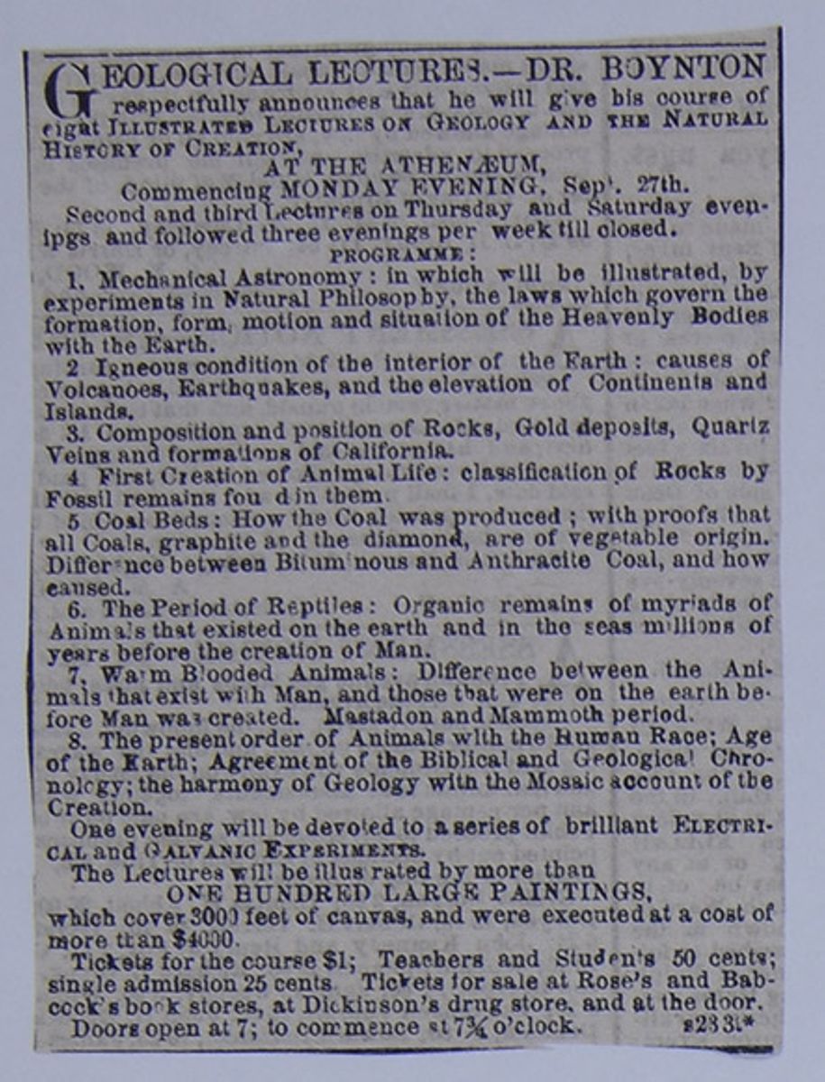
1. Mechanical Astronomy: in which will be illustrated, by experiments in Natural Philosophy, the laws which govern the formation, form, motion, and situation of the Heavenly Bodies with the Earth.
2. Igneous condition of the interior of the Earth: causes of Volcanoes, Earthquakes, and the elevation of the Continents and Islands.
3. Composition and position of Rocks, Gold deposits, Quartz Veins and formations of California.
4. First Creation of Animal Life: classification of Rocks by Fossil remains fou d in them.
5. Coal Beds: How the Coal was produced; with proofs that all Coals, graphite and the diamond, are of vegetable origin. Difference between Bituminous and Anthracite Coal, and how caused.
6. The Period of Reptiles: Organic remains of myriads of Animals that existed on the earth and in the seas millions of years before the creation of Man.
7. Warm Blooded Animals: Difference between the Animals that exist with Man, and those that were on the earth before Man was created. Mastadon and Mammoth period.
8. The present order of Animals with the Human Race; Age of the Earth; Agreement of the Biblical and Geological Chronology; the harmony of Geology with the Mosaic account of the Creation.
One evening will be devoted to a series of brilliant ELECTRICAL and GALVANIC EXPERIMENTS.
The Lectures will be illustrated by more than ONE HUNDRED LARGE PAINTINGS, which cover 3000 feet of canvas, and were executed at a cost of more than $4000.
Tickets for the course $1; Teachers and Students 50 cents; single admission 25 cents. Tickets for sale at Rose's and Babcock's book stores, at Dickinson's drug store, and at the door.
Doors open at 7; to commence at 7¾ o'clock.
s233t* [begin surface 1197]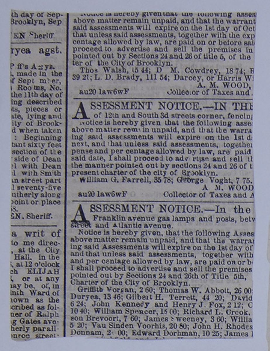
THE GILA GOLD MINES.—One of the passengers by the Overland route from San Francisco informs The St. Louis Republican thus:
"Comparatively little excitement exists in San Francisco concerning them, although from along the road for hundreds of miles on both sides of the mines, there is an immense emigration pouring into them, and the emigrants are eager to test their productiveness. This gave ample evidence of the interest which rumors from the auriferous region had excited throughout the country. There is much excitement at Los Angeles about the mines, and many people are leaving for them. The statement of our informant is corroborative of previous accounts concerning the extent and richness of the diggings. He adds, however, that later prospects made 150 miles up the Gila River, on both sides of that stream, have revealed new deposits.
"Provisions at the regular diggings are scarce, but large supplies are being brought in from various directions. The greatest difficulty arises from an inadequate supply of water for mining operations. Many miners are compelled to carry the dirt on their backs a distance of a mile and a half to the river. Proper mining implements are also difficult to be obtained in sufficient quantities to meet the increasing demand. None of the regular employees of the Overland Company have deserted the stations for the mines, but some of them are very sick with the gold fever. Quite a number of the supernumeraries, such as grooms and side-drivers, have left for the diggings."
[begin surface 1199]
PHYSICAL CONSTITUTION OF THE SUN.—The opinion has long prevailed that the sun is a dark globe, invested with two immense envelopes, the inner one being an atmosphere of sombre clouds, and the outer one a gaseous, self-luminous source of light and heat. External to these is supposed to be a third envelope, formed of an accumulation of roseate clouds. The spots so frequently seen on the solar disc, have been attributed to openings through the exterior coverings, exposing the dark atmosphere within them. M. Leverrier, in his report on the recent solar eclipse, expresses the opinion that the greater part of these envelopes are only fictions. The sun he regards as a luminous body, liquid or solid, covered by an atmosphere of roseate matter, and possessing a very high temperature, thus falling within the law common to the constitution of celestial bodies. M. Fage and Baron Feilitzsch, in their reports to the French Academy, state, however, that the eclipse of 1860 furnishes the most decisive evidence that the corona and luminous clouds are optical illusions, and are not due to the essential constitution of the sun, or of his atmosphere. The former of these eminent physicists even goes so far as to affirm, that a comparison of the results of various observers seems to confirm the opinion, that the central luminary of our system has no atmosphere whatever, and that the appearances recorded are purely optical.
[begin surface 1201]
THE INDIANS IN OREGON AND WASHINGTON.
ADVENTURES OF THE WAR.
Soon after the defeat of Col. Steptoe by the Indians on the Spokane River, Major Owen was appointed by Col. Nesmith, Indian Superintendent in Oregon and Washington Territories, to proceed to the Spokane country to hold a council with the Indians, and endeavor to ascertain the causes of the attack upon Col. Steptoe. Being at that time on my way through that part of the country, I accompanied Major Owen, and as an account of our adventures may be of interest to your readers, I send you this letter.
We left the Dallas, on the Columbia River, on the 17th of June, reached Walla Walla, 150 miles distant, in five days, and from thence proceeded to Fort Colville, on the Upper Columbia, a short distance below the junction of Clark's Fork, where we arrived on the morning of the 4th of July. We here joined Major Owen's camp, consisting of two white men and about seventy-five animals—horses and mules. Fort Colville is an old post, which the Hudson's Bay Company have occupied for some thirty years, and is the center of a settlement. There is a fine valley lying back of the Fort, which is one of the best farming regions that one could wish to see. In the immediate vicinity of the Fort the scenery is quite wild, there being a high hill between it and the valley beyond, and the face of the country on the opposite side of the river being very ragged and broken and the river itself, although very wide, is also deep and rapid. The trade of the Fort is abou $12,000 per annum, mostly with the Indians, although the settlers participate in it to some extent.
On our arrival we found a band of Coeur d'Alene Indians who were with the party that attacked Col. Steptoe, occupying a room in the Fort. They had a great number of horses and mules, which they had taken in that fight, and which the agent of the Hudson's Bay Company, in charge of the Fort, readily purchased, although he was well aware of the mode in which they had been obtained; indeed the Indians themselves boasted loudly of the fact.
On the 7th of July we left for the chutes of the Spokane River, where we arrived on the 17th, and found a camp of about 1,500 Indians, consisting of Pelouses, Spokanes, Coeur d'Alenes, Yakamas and Colvilles. They were all in their war-paint, and in a state of great exultation over their recent victory, riding about on the captured animals, and boastfully "showing off" the various articles they had taken from the troops. They all seemed to think that the U.S. Government could not send troops enough into the field to whip them; and when told that such would certainly be the case, they only laughed, and said—"the more they send, the more we will kill." They were a fine-looking set of men, and some of them acknowledged that they were led into the war much against their own will, but that, being in, they were determined to fight it out.
Our party consisted of five men, all well mounted and armed. Major Owen is the agent for the Flat Head tribe, in the Bitter Root valley, where he has passed the last ten years, and had many a warm personal friend among the Indians in camp. George Mantour, our guide and interpreter, is a half-breed, well known throughout the Territory, about six feet in hight, weighing over two hundred pounds, and as brave and true as steel; the other members of our party were like myself, merely spectators of the scene.
On riding into the camp, we went to the great Council Lodge and dismounted, but no one came out to welcome us. As long-established custom has made it almost a duty for the chief of a tribe to welcome any one that comes to his camp, be he friend or foe, the present neglect was considered a mark of great hostility, and, in the words of one of the party, "made the hair feel quite loose on the tops of our heads." After some little time, however, we were sent for, and told to come into the Lodge and smoke, and have a talk.
As we entered the Lodge, the chiefs in council all stood up till we were seated, and then began to talk. Scal Hault and The Fool's Son, two of the principal chiefs present, deserve a special notice. The first mentioned is a large, fine-looking man, one of the great braves of the Spokane nation, a firm friend of Major Owen's, but a bitter foe of the troops. He was opposed to the attack upon Steptoe, but says "that since his young men have disregarded his counsels and commenced the war, they must now stand up to that position, to which their own foolishness has brought them; and that he, for one, will never desert them, but will fight to the last, and die with his face to the enemy." The Fool's Son, another of the Spokane Indians, is one of the men most to be dreaded in this war. He literally had our lives in his hands, for one word from him, and our whole party would have been scalped. Fortunately for us he did not give that word, but why he did not we were unable to say, for he is one of the most deadly enemies of the white man in the Territory, and says "that he will fight and die by the graves of his fathers." Some inferior chiefs were present, but the burden of the talk fell upon these two.
The most of the time during the interview was taken up by the Indians, who asked what the white men intended doing about the fight? whether they would try to come again? whether Major Owen would tell the Great Father all that he saw and heard at the council, or only part of it? what led us up into their country? when we would go away? how many men Col. Steptoe could muster? whether the Volunteers would turn out again? whether Major Owen had anything to say to them about making peace? &c. &c. They said they did not wish to make peace, but meant to fight and die; but hoped the Volunteers would not turn out, for they knew how to fight. To all their questions Major Owen could give but scanty replies, as he had no authority to treat with them, but was sent specially to ascertain their disposition. After being in the council for five hours we were dismissed, and walked out into the open air.
[begin surface 1203]
As we stepped upon the green in front of the Lodge, such a scene burst upon our sight as would baffle abler pens than mine to describe as it deserved. The Spokane, in full view, breaks through the mountains with a beautiful succession of falls. The camp is at the bottom of a valley of about a hundred acres, smooth and almost without vegetation, as it has for a long time been used as a camp ground at this season of the year. On all sides the valley is surrounded by high hills, densely wooded to their summits, by the lofty pines and cedars of Oregon. The deep green of the pines would be monotonous, were it not for the boldness of the general features of the scenery, the immense cliffs of white and red granite, that appear here and there, sparkling like diamonds in the sunlight, and the small streams that send their waters dashing and glistening like a thread of silver down the mountain side into the river below. Farther down are the Falls of the Spokane, where a large body of water comes bounding down from above, one complete mass of foam, with the heads of the black rocks, now appearing and now disappearing, like the heads of some huge monsters sporting in the sunshine. Then right at our feet the village spread out before us, and the Indians—some riding about, some dancing the scalp dance, some seated on the ground cleaning their arms—the squaws bringing salmon from the river where they had been caught, the horses and cattle wandering about and browsing at the foot of the hill, before being sent higher up for the night. Taking this all in at a glance—on the hill-side all pleasant and peaceful—in the valley below, the barking of dogs, the howling of the Indians, the firing of guns, and the sound of the war drum—made us all feel that this was a sight to be seen but once in a man's lifetime.
[begin surface 1205]
UTAH AND THE GRAND BASIN.
NEVADA CITY, Cal., Jan. 1, 1859.As you take a decided interest in the cattle and the grazing resources of the Union, I send you the following notes on Utah Territory, gleaned from personal knowledge and inquiry for the last eight years. There is a chain of valleys, fertile in grass, extending along the whole eastern slope of the Sierra Nevada, some of them containing from two to five hundred square miles—such as Carson, Sierra and Haney Lake. There is a desert extending along the eastern base of the mountains, from Oregon to Sonora, from fifty to one hundred miles in width. There are many fertile meadows in this desert, occasioned by the sinking of the streams which flow from the Sierra. East of this desert the rain seems to gradually increase to the Rocky Mountains. There is much good grass on the Humboldt, on the tributaries of Green River, and on the streams which fall into Salt Lake. The lake is bordered in places by a fringe of grass for miles. There is a chain of fertile valleys, extending from Salt Lake south to San Bernardino.
Fertile valleys may be found more or less on the Rio, Virgin, the Mohave, and throughout the western portion of the Great Basin. I once passed through the Basin to the south of Salt Lake. That region is traversed by low mountain ranges, from ten to twenty miles apart—all, like the Sierra Nevada, running north and south. There are many valleys between them, clothed with high grass. We passed a valley about two hundred miles due west from Salt Lake City, some sixty miles in length and twenty in breadth, which I should think contained as much good land as Salt Lake Valley itself. The southwest part of the Basin is its most barren portion. Winter grazing is little interrupted by snow. Wherever you see sage, you find bunch grass. It is well adapted to sheep, and there is arable land enough for a pastoral population. I believe the deserts of Utah and the adjoining tributaries afford as much feed as the deserts between Palestine and the Red Sea, on which the vast flocks and herds of the Israelites grazed for forty years.
The eastern border of the Rocky Mountains, with New-Mexico, Utah, East Oregon and Washington Territory, are destined to become the great grazing field of the nation, while the Mississippi Valley will grow the grain for stall feeding; and much of the wool may yet find its nearest market in the manufactories of California. A vast field for the consumption of woolen fabrics must yet open in South America, Japan, Northern China and the eastern portion of the Russian Empire.
[begin surface 1207]
Dr. De Hass on American Antiquities.
MURAL REMAINS—FORTIFICATIONS, ENCLOSURES, AND OTHER EARTHEN STRUCTURES.
Dr. DE HASS delivered the second lecture on his course on "American Antiquities," last evening, before the Ethnological Society, in the Lecture-room of the Historical Society. Dr. FRANCIS introduced the lecturer, who said that these Mural Remains were found in the territory between New York and the Mississippi. They prevail over twelve degrees of longitude, and the same number of degrees of latitude. Now what is the origin of these works—who were their architects? Centuries have passed since the ancients of America flourished in their power, but their works still remain in all their grandeur. How they reached this continent; how they perished—whether by famine or disease—will ever remain a mystery. The defences they built were exceedingly strong. Their forts had parapets and inclosures which communicated with one another by covered ways. Parapets of great height enabled the people to communicate with one another by signal fires, &c. All these inclosures may be considered as designed for defence, and, what is particularly remarkable, they are all constructed with geometrical accuracy, the circles being perfect circles and the squares perfect squares. They are not all by any means built of earth; stone enters largely into their construction. Fort Hill, on the Ohio, deserves a more particular description. It occupies an eminence, and its walls have thirty-two openings. Three miles south of Newark there is another fortress. It embraces two and a half acres. Hill forts, such as there are found all over the East. Of the inclosures connected with the mound, the number cannot be estimated. In Raleigh County, Va., there is one of these structures built of walls filled in with pebbles. In many locations time and man's destructive agency, have demolished nearly every wall of these embankments. The highest wall yet found is twenty-seven feet. Within some of the circular lines are found tumuli, which probably were temples. This custom of inclosing the sacred buildings has prevailed from the greatest antiquity. In the Aztec Empire they are found thus constructed. Some of these inclosures, as Mr. SCHOOLCRAFT suggests, may have been employed in games. Paralell walls from fifty to five hundred feet apart are found throughout the West. They evidently answered the same purpose as similar old Roman fortifications. These are entirely distinct from the earthworks in the valley of the Ohio. Passing West to the Mississippi and through Illinois, we find these structures in great numbers. The lecturer gave a sketch of a fortified city 100 miles southeast of Salt Lake. The party which observed it followed Captain GUNNISON'S track. They found the ruins of villages scattered over a space 49 miles by 25. All the buildings showed evident signs of having been built for defence. In Tennessee there are several very interesting works. There is one fort which embraces nearly 40 acres. It is supposed by some to have been constructed by DESOTO's men, and it is even said that documents have been discovered at Seville which establish the fact. This is all pure fiction. The trees around it prove its aboriginal origin, as does the location of the different mounds. It is well to ask whence came the builders of these fortifications? No question is involved in so much doubt. A favorite opinion is that they came from the North by Behring's Straits, and that thus they worked down the Mississippi Valley. Others suppose they worked up from the South. But we must conclude that America was first inhabited not by one, or two, but by many nations. Dr. MORTON supposed these people were one and indigenous. Another inuestigator supposed they belonged to two classes: the inhabitants of Mexico, Central America and Peru comprising one division, and the barbaric tribes another. But these fortifications could not have been constructed by a strictly savage race, for there is no instance in the world's history where a people have become civilized by their own efforts. The lecturer then spoke of ancient races who went from the North southward. Among them were the Aztecs and the Toltecs, Phœnician characters have been discovered in one of these Western mounds, and it is the opinion of HUMBOLDT that this people knew of the existence of the Canary Islands. His idea is that there was an emigration from the northeastern parts of Asia during the fifth century, but the fact that no similarity has yet been detected between the languages, used by these widely separated people involves this supposition in doubt. It will require long and laborious research before the question can be settled. Indications point unerringly to more than one race, for those who erected the works of the Scioto Valley were different from those who built the other fortifications. Strange indeed, is it, that not one of these busy workers remain—that there is not a single national song to indicate their origin. Every individual of those innumerable masses who swarmed around and on these fortifications has passed away.
The lecturer then described some of the numerous diagrams which illustrated different points of his discourse.
[begin surface 1209]
Russia is the most extraordinary country on the globe, in the four most important particulars of empire—its history, its extent, its population, and its power.
It has for Europe another interest,—the interest of alarm, the evidence of ambition which has existed for a hundred fifty years, and has never paused; an increase of territory which has never suffered the slightest casualty of fortune; the most complete security against the retaliation of European war; and a government at once despotic and popular; exhibiting the most boundless authority in the sovereign, and the most boundless submission in the people; a mixture of habitual obedience, and divine homage: the reverence to a monarch, with almost the prostration to a divinity.
Its history has another superb anomaly: Russia gives the most memorable instance in human annals, of the powers which lie within the mind of indivual man. Peter the Great was the restorer, or the reformer of Russia; he was its moral creator. He found it, not as Augustus found Rome, according to the famous adage, "brick, and left it marble:" he found it a living swamp, and left it covered with the fertility of laws, energy, and knowledge: he found it Asiatic, and left it European: he removed it as far from Scythia, as if he had placed the diameter of the globe between: he found it not brick, but mire, and he transformed a region of huts into the magnificence of empire.
Russia first appears in European history in the middle of the ninth century. Its climate and its soil had till then retained it in primitive barbarism. The sullenness of its winter had prevented invasion by civilized nations, and the nature of its soil, one immense plain, had given full scope to the roving habits of its half famished tribes. The great invasions which broke down the Roman empire, had drained away the population from the north, and left nothing but remnants of clans behind. Russia had no Sea, by which she might send her bold savages to plunder or to trade with Southern and Western Europe. And, while the man of Scaudinavia was subduing kingdoms, or carrying back spoil to his northern crags and lakes, the Russian renamed, like the bears of his forest, in his cavern during the long winter of his country; and even when the summer came, was still but a melancholy savage, living like the bear upon the rocts and fruits of his ungenial soil.
It was to one of those Normans, who, instead of steering his bark towards the opulence of the south, turned his dreary adventure to the north, that Russia owed her first connexion with intelligent mankind. The people of Novgorod, a people of traders, finding themselves over-powered by their barbarian neighbours, solicited the aid of Ruric, a Baltic chieftain, and, of course, a pirate and a robber. The name of the Norman had earned old renown in the north. Ruric came, rescued the city, but paid himself by the seizure of the surrounding territory, and founded a kingdom, which he transmitted to his descendants, and which lasted until the middle of the sixteenth century.
In the subsequent reign we see the effect of the northern pupilage; and an expedition, in the style of the Baltic exploits, was sent to plunder Constantinople. This expedition consisted of two thousand cauoes , with eighty thousand men on board. The expedition was defeated, for the Greeks had not yet sunk into the degeneracy of the later times. They fought stoutly for their capital, and roasted the pirates in their own canoes by showers of the famous "Greek fire."
Those invasions, however, were tempting to the idleness and poverty, or to the avarice and ambitiou , of the Russians; and Constantinople continued to be the great object of cupidity and assault, for three hundred years. But the city of Constaintine was destined to fall to a mightier conqueror.
Still, the northern barbarian had now learned the road to Greece, and the intercourse was mutually beneficial. Greece found daring allies in her hold plunderers, and in the eleventh century she gave the Grand-duke Vladimir a wife, in the person of Anna, sister of the emperor Basil II.; a gift made more important by its being accompanied by his conversion to Christianity.
A settled succession is the great secret of royal peace: but among those bold riders of the desert, nothing was ever settled, save by the sword; and the first act of all the sons, on the decease of their father, was, to slaughter each other; until the contest was settled in their graves, and the last survivor quietly ascended the throne.
But war, on a mightier scale than the Russian Steppes had ever witnessed, was now rolling over Central Asia. The cavalry of Genghiz Khan, which came not in squadrons, but in nations, and charged, not like troops, but like thunderclouds, began to pour down upon the valley of the Wolga. Yet the conquest of Russia was not to be added to the triumphs of the great Tartar chieftan: a mightier conqueror stopped him on his way, and the Tartar died.
His son Toushi, in the beginning of the thirteenth century, burst over the frontier at the head of half a million horsemen. The Russian princes, hastily making up their quarrels, advanced to meet the invader; but their army was instantly trampled down, and, before the middle of the century, all the provinces, and all the cities of Russia, were the prey of the men of the wilderness. Novgored alone escaped.
The history of this great city would be highly interesting, if it were possible now to recover its details. It was the chief depot of the northern Asiatic commerce with Europe; it had a government, laws, and privileges of its own, with which it suffered not even the Khan of the Tartars to interfere. Its population amounted to four hundred thousand—then nearly equal to the population of a kingdom. In the thirteenth century it connected itself still more effectively with European commerce, by becoming a member of the Hanseatic League; and the wonder and pride of the Russians were expressed in the well-known half-profane proverb, "Who can resist God, and the great Novgorod?"
There is always something almost approaching to picturesque in the triumphs of barbarism. The turk, until he was fool enough to throw away the turban, was the most showy personage in the world. The Arabs, under Mahomet, were the most stately of warriors, and the Spanish Moors threw all the pomp, and even all the romance, of Europe into the shade. Even the chiefs of the "Golden Horde" seemed to have had as picturesque a conception of supremacy as the Saracen. Their only city was a vast camp, in the plains between the Caspian and the Wolga; and while they left the provinces in the hands of the native princes, and enjoyed themselves in the manlier sports of hunting through the plains and mountains, they commanded that every vassal prince should attend at the imperial tent to receive permission to reign, or perhaps to live; and that, even when they sent their Tartar collectors to receive the tribute, the Russian princes should lead the Tartar's horse by the bridle, and give him a feed of oats out of their cap of state!
But another of those sweeping devastators, one of those gigantic executioners, who seem to have been sent from time to time to punish the horrible profligacies of Asia, now rose upon the north.—Timour Khan, the Tamerlane of European story, the Invincible, the Lord of the Tartar World, rushed with his countless troops upon the sovereignties of Western Asia. This universal conqueror crushed the Tartar dynasty of Russia, and then burst away, like an inundation, to overwhelm the other lands. But the native Russians again made head against their Tartar masters, and a century and a half of sanguinary warfare followed, with various fortunes, and without any other result than blood.
Without touching on topics exclusively religious, it becomes a matter of high interest to mark the vengeances, furies, and massacres, of heathenism, in every age of the world. Yet while we believe, and have such resistless reason to believe, in the Providential government, what grounds can be discovered for this sufferance of perpetual horrors? For this we have one solution, and but one: stern as the inflictions are, may they not be in mercy? may not the struggles of barbarian life be permitted, simply to retard the headlong course of barbarian corruption? may there not be excesses of wickedness, extremes of national vice, an accumulation of offences against the laws of moral nature (which are the original laws of Heaven,) actually incompatible with the Divine mercy? Nothing can be clearer to the understanding, than that there are limits which the Divine Being has prescribed doubtless for the highest objects of general mercy; as there are offences which, by human laws, are incompatible with the existence of society.
*Secret history of the Court and Government of Russia, under the Emporers Alexander and Nicholas. By H. Schuitzler. Two vols. Bentley: London Vol. LXIII.The crimes of the world before the flood were evidently of an intense iniquity, which precluded the possibility of purification; and thus it became necessary to extinguish a race, whose continued existence could only have corrupted every future generation of mankind.
War, savage feuds, famines, and pestilences, may have been only Divine expedients to save the world from another accumulation of intolerable iniquity, by depriving nations of the power of utter self-destruction, by thinning their numbers, by compelling them to feel the misteries of mutual aggression, and even by reducing them to that degree of poverty which supplied the most effective antidote to their total corruption.
Still, those sufferings were punishment, but punishments fully earned by their fierce passions, savage properties, remorseless cruelties, and general disobedience of that natural law of virtue, which, earlier even than Judaism or Christianity, the Eternal had implanted in the heart of his creatures.
In the fifteenth century Russia began to assume a form. Ivan III. broke off the vassalage of Russian to the "Golden Horde." He had married Sophia, the niece of the Greek emperor, to which we may attribute his civilization; and he received the embassies of Germany, Venice, and Rome, at Moscow. His son, Ivan IV, took Novogorod, which he ruined, and continued to fight the Poles and Tartars until he died. His son Ivan, in the middle of the sixteenth century, was crowned by the title of the Czar, formed the first standing army of Russia, named the Strelitzes, and established a code of laws. In 1598, by the death of the Czar Feodor without children, the male line of Ruric, which had held the throne for seven hundred and thirty-six years, and under fifty-six sovereigns, became extinct.
Another dynasty of remarkable distinction ascended the throne in the beginning of the seventeeth century. Michael Romanoff, descended from the line of Ruric by the female side, was declared Czar. His son Alexis was the father of Peter the Great, who, with his brother Ivan, was placed on the throne at the decease of their father, but both under the guardianship of the Princess Sophia. But the princess, who was the daughter of Alexis, exhibiting an intention to seize the crown for herself, a revolution took place in 1689, in which the Princess was sent to a convent. Ivan, who was imbecile in mind and body, surrendered the throne, and Peter became the sole sovereign of Russia.
The accession of Peter began the last and greatest period of Russian history. Though a man of fierce passions and barbarian habits, he had formed a high conception of the value of European arts, chiefly through an intelligent Genevese, Lefort, who had been his tutor.
The first object of the young emperor was to form an army; his next was to construct a fleet. But both operations were too slow for his rapidity of conception; and, in 1697, he travelled to Holland and England for the purpose of learning the art of ship-building. He was forced to return to Russia after an absence of two years by the revolt of the Sterlitzes in favour of the Princess Sophia. The Strelitzes were disbanded and slaughtered, and Peter felt himself a monarch for the first time.
The cession of Azof by the Turks, at the peace of Carlowitz in 1690, gave him a port on the Black Sea. But the Baltic acted on him like a spell; and, to obtain an influence on its shores, he hazarded the ruin of his throne.
Sweden, governed by Charles XII., was then the first military power of the north. The fame of Gustavus Adolphus in the German wars, had given the Swedes the example and the renown of their great king; and Charles, bold and reckless, and half lunatic,despising the feebleness of Russia, had turned his arms against Denmark and Poland. But the junction of Russia with the "Northern League" only gave him a new triumph. He fell upon the Russian army, and broke it up on the memorable field of Narva, in 1700.
Peter still proceeded with his original vigour. St. Petersburg was founded in 1703. The war was prosecuted for six years, until the Russian troops obtained a degree of discipline which enabled them to meet the Swedes on equal terms. In 1708, Charles was defeated in the memorable battle of Pultowa. His army was utterly ruined, and himself forced to take refuge in Turkey. Peter was now at the head of northern power. Frederic Augustus was placed on the throne of Poland by the arms of Russia, and from this period Poland was under Russian influence.
Peter now took the title of "Emperor and Autocrat of all the Russias." In 1716 he again travelled to Europe. In 1723, he obtained the provinces on the Caspian, by an attack on Persia. But his vigorous, ambitous, and singularly successful career was now come to a close. The death of a Russian prince is seldom attributed to the course of nature; and Peter died at the age of fifty-two, a time when the bodily powers are still undeca[illegible]and the mental are in the highest degree of[cutaway]The day, still recorded by the Russians[cutaway]interest due to his extraordinary career, was the 28th of January, 1725. In thirty six years he had raised Russia from obscurity to a rank with the oldest powers of Europe.
We hasten to the close of this sketch, and pass by the complicated successions from the death of Peter to the reign of the Empress Catherine.
The Russian army had made their first appearance in Germany, in consequence of a treaty with Maria Theresa; and their bravery in the "Seven Years' War," in the middle of the last century, established their distinction for soldiership.
Peter III. withdrew from the Austrian alliance, and concluded peace with Prussia. But his reign was not destined to be long. At once weak in intellect, and profligate in habits, he offended and alarmed his empress, by personal neglect, and by threats of sending her to a convent. Catherine, a German, and not accustomed to the submissiveness of Russian wives, formed a party against him. The people were on her side; and, what was of more importance, the Guards declared for her.—An insurrection took place; the foolish Czar, after a six months' reign, was dethroned, July, 1762, was sent to a prison, and within a week was no more. The Russians assigned his death to poison, to strangulation, or to some other species of atrocity. Europe talked for a while of the "Russian Tragedy!" but the emperor left no regrets behind him; and "Catherine, Princess of Anhalt Zerbst," handsome, young, accomplished, and splendid, ascended a throne of which her subjects were proud; which collected round it the elite of Germany, its philosphers and soldiers; which the empress connected with beaux esprits of France, and the orators and statesmen of England; and which, during her long, prosperous, and ambitious reign, united the pomp of Asia with the brilliancy and power of Europe. The shroud of the Czar was speedily forgotten, in the embroidered robe which Catherine threw over the empire.
But the greatest crime of European annals was committed in this bold and triumphant reign.—Russia, Prussia, and Austria, tempted by the helplessness of Poland, formed a league to seize upon portions of its territory; and the partition of 1772 took place, to the utter astonishment of Europe, but with scarcely a remonstrauce from its leading powers.
Poland had so long been contented to receive its sovereign from Russia, its religious disputes had so utterly weakened the people, its nobility were so profligate, and its peasantry were so poor, that it had lost all the sinews of national defence. It therefore fell an easy prey; and only waited, like a slave in the market, till the bargain for its sale was complete.
In 1793, a second partition was effected. In the next year, the Polish troops took up arms under the celebrated Kosciusko; but the Russians advanced on Warsaw with a force which defied all resistance. Warsaw was stormed, twenty thousand gallant men were slain in its defence, Suwarroff was master of the unfortunate capital; and, in 1795, the third and last partition extinguished the kingdom.
Having performed this terrible exploit, which was to be as terribly avenged, the carer of Catherine was closed. She died suddenly in 1796.
Paul, her, son ascended the throne, which he held for five years, a mixture of the imbecility of his father, and the daring spirit of his mother.—Zealous for the honour of Russia, yet capricious as the winds, he first made war upon the French Republic, and then formed a naval league to destroy the maritime supremacy of England. This measure was his ruin; England was the old ally of Russia,—France was the new enemy. The nation hated the arrogance and the atheism of France, and resolved on the overthrow of the Czar. In Russia the monarch is so far removed from his people, that he has no refuge among them in case of disaster. Paul was believed to be mad, and madness, on a despotic throne, justly startless a nation. A band of conspirators broke into his palace at midnight, strangled the master of fifty millions of men, and the nation, at morning, was in a tumult of joy.
His son, Alexander, ascended the throne amid universal acclamation. His first act was peace with England. In 1805, his troops joined the Austrian army, and bore their share in the sufferings of the campaign of Austerlitz. The French invasion of Poland, in two years after, the desperate drawn battle of Elylan, and the disaster of Friedland, led to the peace of Tilsit. Alexander then joined the Continental system of Napoleon; but this system was soon found to be so ruinous to Russian commerce, as to be intolerable. Napoleon, already marked for downfall, was rejoiced to take advantage of the Russian reluctance, and instantly marched across the Polish frontier, at the head of a French and allied army amounting to the astonishing number of five hundred thousand men.
Infatuation was now visible in every step of his career. Instead of organizing Poland into a kingdam , which would have been a place of retreat in case of disaster; and, whether in disaster or victory, would have been a vast national fortification against the advance of Russia, he left it behind him; and instead of waiting for the return of spring, commenced his campaign on the verge of winter, in itself, and madly ran all the hazards of invading a boundless empire of which he knew nothing, of which the people were brave, united, and attached to their sovereign; and of which, if the armies had fled like deer, the elements would have fought the battle.
Napoleon was now infatuated in all things, infatuated in his diplomacy at Moscow, and infatuated in the rashness, the hurry, and the confusion of his retreat. His army perished by brigades and divisions. On the returning spring, three hundred thousand men were found buried in the snow; all his spoil was lost, his veteran troops were utterly destroyed, his fame was tarnished, and his throne was shaken.
He was followed into France by the troops of Russia and Germany. In 1814, the British Army under Wellington crossed the Pyrenees, and liberated the southern provinces of France. In the same year, the Austrian, Prussian, and Russian armies marched to Paris, captured the capitol, and expelled Napoleon. The battle of Waterloo, in the year after, destroyed the remnant of his legions in the field, threw him into the hands of the British government, and exiled him to St. Helena, where he remained a British prisoner until he died.
Alexander died in 1825, at the age of forty-eight, and, leaving no sons, was succeeded by his brother Nicholas, the third son of Paul—Constantine having resigned his claims to the throne. We pass over, for a moment, the various events of the present imperial reign. Its policy has been constantly turned to the acquisition of territory; and policy has been always successful. The two great objects of all Russian cabinets, since the days of Constantine, have been the possession of Turkey and the command of the Mediterranean. Either would inevitably produce a universal war; and while we deprecate so tremendous a calamity to the world, and rely on the rational and honorable qualities of the Emperor, to rescue both Russia and Europe from so desperate a struggle, we feel that it is only wise to be prepared for all the coutingencies that may result from the greatest mass of power that the world has ever seen, moved by a despotic will, and that will itself subject to the common caprices of the mind of man.
The volumes to which we shall now occasionally refer, are written by an intelligent observer, who began his study of Russia by an office under her government, and who has, since that period, been occupied in acquiring additional knowledge of her habits, finances, population, and general system of administration. A Frenchman by birth, but a German by descent, he in a very considerable degree unites the descriptive dexterity of the one with the grave exactness of the other. His subject is of the first importance to European politicians, and he seems capable of giving them the material of sound conclusions.
The author commences with the reign of Alexander, and gives a just panegyric to the kindliness of his disposition, the moderation of his temper, and his siucere desire to promote the happiness of his people. Nothing but this disposition could have saved him from all the vices of ambition, profligacy, and irreligion; for his tutor was La Harpe, one of the savans of the Swiss school, a man of accomplishment and talent, but a scoffer. But the English reader should be reminded, that when men of this rank and ability are pronounced hostile to religion, their hostility was not to the principles of Christianity but to the religion of France; to the performance of national worship to the burlesque miracles wrought at the tomb of the Abbe Paris, and to that whole system of human inventions and monkish follies, which was as much disbelieved in France as it was disdaided in England.
In fact, the religion of the gospel had never come into their thoughs; and when they talked of revelation they thought only of the breviary. The Empress Catharine, finding no literature in Russia, afraid or ashamed of being known as a German,[cutaway]and extravagantly fond of fame, attached herself to the showy pamphleteers of France, and courted every gale of French adulation in return. She even corresponded personally with some of the French litterateurs, and was French in everything except living in St. Petersburg, and wearing the Russian diadem. She was even so much the slave of fashion as to adopt, or pretend to adopt, the fantasies in government which the French were now beginning to mingle with their fantasies in religion.
She wrote thus to Zimmerman, the author of the dreamy and dreary work on "Solitude;" "I have been attached to philosophy, because my soul has always been singularly republican. I confess that this tendency stands in strange contrast with the limited power of my place."
If the quiet times of Europe had continued, and France had exhibited the undisturbed pomps of her ancient court, Alexander would probably have been a Frenchman and a philosophe on the banks of the Neva; but stiring times were to give him more rational ideas, the necessities of Russia reclaimed him from the absurdities of his education.
La Harpe himself was a man of some distinction, a Swiss, though thoroughly French and revolutionary. After leaving Russia, he became prominent, even in France, as an abettor of republican principles, and was one of the members of the Swiss Directory. La Harpe survived the Revolution, the Empire, and the Bourbouns, and died in 1838.
The commencement of Alexander's reign was singularly popular, for it began with the treaties on every side. Paul, who had sent a challenge to all the sovereigns in Europe to fight him in person, had alarmed his people with the prospect of a universal war. Alexander was the universal pacificator; he made peace with English, peace with France, and a commercial treaty with Sweden. He now seemed resolved to avoid all foreign wars, to keep clear of European politics, and to devote all his thoughts to the improvement of his empire. Commencing this rational and meritorious task with zeal, he narrowed the censorship of the press, and enlarged the importation of foreign works. He broke up the system of espionage—formed a council of State—reduced the taxes—abolished the punishment by torture—refused to make grants of peasants—constituted the Senate into a high court of justice divided into departments, in order to remedy the slowness of law proceedings—established universities and schools—allowed every subject to choose his own profession; and, as the most important and characteristic of all reforms, allowed his nobility to sell portions of land to their serfs, with the right of personal freedom: by this last act laying the foundation of a new and free race of proprietors in Russia.
The abolition of serfdom was a great experiment whose merits the serfs themselves scarcely appreciated, but which is absolutely necessary to any elevation of the national character. It has always been oposed by the nobles, who regard it as the actual plunder of their inherritance ; but Alexander honorably exhibited his more humane and rational views on the subject, whenever the question came within his decision.
A nobleman of the highest rank had requested an estate "with its serfs," as an imperial mark of favor. Alexander wrote to him in this style: "The peasants of Russia are for the msot part slaves. I need not expatiate on the degredation, or on the misfortune of such a condition. Accordingly, I have made a vow not to increase the number; and to this end I have laid down the principle not to give away peasants as property."
The Emperor sometimes did striking things in his private capacity. A princess of the first rank applied to him to protect her husband from his creditors, intimating that "the emperor was above the law."
Alexander answered, "I do not wish, madam, to put myself above the law, even if I could, for in all the world I do not recognise any authority but that which comes from the law. On the contrary, I feel more than any one else the obligation of watching over its observance, and even in cases where others may be indulgent, I can only be just."
The French war checked all those projects of improvement, and the march of his troops to the aid of Austria in 1805, commenced a series of hostilities, which, for seven years occupied the resources of the empire, and had nearly subjected his throne. But he behaved bravely throughout the contest. When Austria was beaten and signed a treaty, Alexander refused to join in the negotiation. When Prussia, under the influence of couucils at once rash and negligent—too slow to aid Austria, and too feeble to encounter France—was preparing to resist Napoleon in 1805, Alexander, Frederic William; and his queen Louisa, made a visit by torchlight to the tomb of Frederick the Great in Potsdam; and there, on their knees, the two monarchs joined their hands over the tomb, and pledged themselves to stand by each other to the last.
When Prussia was defeated, Alexander still fought two desperate battles; and it was not until the advance of the French made him dread the rising of Poland in his rear, that he made peace in 1802.
At this peace, he was charged with bartering his principles for the extension of his dominions by the seizure of Turkey, and even of the extravagance of dividing the world with Napoleon. But these charges were never proved.
We, too, have our theory, and it is, that the fear of seeing Poland in insurrection alone compelled Alexander to submit to the treaty of Tilsit; but that he felt all the insolence of the French Emperor, in demanding the closing of the Russian ports against England; and felt the treaty as a chain, which he determined to break on the first provocation. We think it probable that the knowledge of the "secret articles" of that treaty was conveyed from the Russian Court to England; and, without pretending to know from what direct hand it came, we believe that the seizure of the Danish fleet, which was the immediate result of that knowledge, was as gratifying to Alexander as it was to the English cabinet, notwithstanding the diplomatic wrath which it pleased him to affect on that memorable occasion.
But other times were ripening. It has been justly observed that the Spanish war was the true origin of Napoleon's ruin. He perished by his own perfidy. The resistance of Spain awoke the resistance of Europe. All Germany, impoverished by French plunder, and indignant at French insults, longed to rise in arms. The Russians then boldly demanded the emancipation of their commerce, and issued a relaxed tariff in 1811. British vessels then began to crowd the Russian ports. Napoleon was indignant and threatened. Alexander was offended and remonstrated. The French Emperor instantly launched one of his fiery proclamations; declared that the House of Romauoff was undone; and, on the 24th of June, 1812, threw his mighty army across the Niemen.
We pass over the events of that memorable war as universally known; but justice is not done to the Russian Emperor, unless we recollect how large a portion of the liberation of Europe was due to his magnanimity. To refuse obedience to the commercial tyranny of Napoleon, where it menaced the ruin of his people, was an act of personal magnanimity, for it inevitably exposed his throne and life to the hazards of war with an universal conqueror. On the declaration of war, he determined to join his armies in the field, another act of magnanimity, which was prevented only by the remonstrance of his generals, who represented to him the obstacles which must be produced by the presence of the emperor. But, when the invasion of France was resolved on, and negotiations might require his presence, he was instantly in the camp, and was of the highest importance to the final success of the campaign. He threw vigour into the councils of the Austrian generalissimo, and, with the aid of the British ambassador, actually urged and effected the "March to Paris."
In Paris, however, his magnanimity was unfortunate, his generosity was misplaced, his chivalric feelings had to deal with craft, and his reliance on the pledges of Napoleon ultimately cost Europe one of the bloodiest of its campaigns. A wiser policy would have given Napoleon over to the dungeon, or sent him before a military tribunal, as he had sent the unfortunate Duc d'Enghien, with not the thousandth part of the reason or the necessity, and the peace of the Continent would thus have been secured at once. But a more theatric policy prevailed. The promises of a man who had never kept a promise were taken; the stimulant of an imperial title was kept up, when he ought to have been stripped of all honors; an independent revenue was issued to him, which was sure to be expended in bribing the officials and soldiery of France; and, by the last folly of a series of generous absurdities, Napoleon was placed in the very spot which he himself would have chosen, and probably did choose, for the center of a correspondence between the corruption of Italy and the corruption of France.
The result was predicted by every politician of Europe, except the politicians of the Tuileries.—[cutaway]revolt; the army[cutaway]his own talents [cutaway]had their tricoloured cockades in their knapsacks. The Bourbons, who thought that the world was to be governed by going to mass, were forced to flee at midnight. Napoleon drove into the capital, with all the traitors of the army and the councils clinging to his wheels, cost France another "March to Paris," the loss of another veteran army, and himself another exile, where he was sent to linger out his few wretched and humiliated years in the African Ocean.
The Holy Alliance was the first conception of Alexander on the return of peace. It died too suddenly to exhibit either its good or its evil. It has been calumniated, because it has been misunderstood. But it seems to have been a noble conception. France, which laughs at everything, laughed at the idea of ruling Europe on principles of honour. Germany, which is always wrapped in a republican doze, reprobated a project which seemed to secure the safety of thrones by establishing honour as a principle. And England, then governed by a cabinet doubtful of public feeling, and not less doubtful of foreign integriiy , shrank from all junction with projects which she could not control, and with governments in which she would not confide. Thus the Holy Alliance perished. Still, the conception was noble. Its only fault was, that it was applied to men before men had become angels.
The author of the volumes now before us is evidently a republican one—of the "Movement,"—one of that class who would first stimulate mankind into restlessness, and then pronounce the restlessness to be a law of nature. Metternich is, of course, his bugbear, and the policy of Austria is to him the policy of the "kingdom of darkness."—But, if there is no wiser maxim than "to judge of the tree by its fruits," how much wiser has that great statesman been than all the bustling innovators of his day, and how much more substantial is that policy by which he has kept the Austrian empire in happy and grateful tranquility, while the Continent has been convulsed around him!
No man knows better than Prince Metternich the shallowness, and even the shabbiness, of the partisans of overthrow, their utter incapacity for rational freedom, the utter perfidy of their intentions, and the selfish villany of their objects. He knows, as every man of sense knows, that those Solons and Catos of revolution are composed of lawyers without practice, traders without business, ruined gamblers, and the whole swarm of characterless and contemptible idlers, who infest all the cities of Europe. He knows from full experience that the object of such men is, not to procure rights for the people, but to compel governments to buy their silence; that their only idea of liberty, is liberty of pillage; and that, with them, revolution is only an expedient for rapine and a license for revenge. Therefore he puts them down; he stifles their declamation by the scourge, he curbs their theories by the dungeon, he cools their political fever by banishing them from the land; and thus governing Austria for nearly the last forty eyars, he has kept it free from popular violence, from republican ferocity, from revolutionary bloodshed, and from the infinite wretchedness, poverty, and shame, which smites a people exposed to the swindling of political impostors.
Thus, Austria is peaceful and powerful, while Spain is shattered by conspiracy; while Portugal lives, protected form herself only under the guns of the British fleet; while Italy is committing its feeble mischiefs, and frightening its opera-hunting potentates out of their senses; while every petty province of Germany has its beer-drinking conspirators; and while the French king guards himself by bastions and batteries, and cannot take an evening's drive without fear of the blunderbuss, or lay his head on his pillow without the chance of being wakened by the roar of insurrection. These are the "fruits of the tree;" but it is only to be lamented that the same sagacity and vigour, the same determination of character, and the same perseverance in the principle, are not to be found in every cabinet of Europe. We should hear no more of revolutions.
To be continued.
[begin surface 1211]
The life of the Russian emperor was a cloudy one. The external splendour of royalty naturally captivates the eye, but the realities of the diadem are often melancholy. It would be scarcely possible to conceive a loftier preparative for human happiness than that which surrounds the throne of the Russias. Alexander married early. A princess of Baden was chosen for him, by the irresistible will of Catherine, at a period when he himself was incapable of forming any choice. He was married at sixteen, his wife being one year younger. He never had a son, but he had two daughters, who died. And the distractions of the campaign of Moscow, which must have been a source of anxiety to any man in Russia, were naturally felt by the emperor in proportion to the immense stake which he had in the safety of the country.
For some years after the fall of Napoleon, Alexander was deeply engaged in a variety of anxious negotiations in Germany, and subsequently, he was still more deeply agitated by the failing constitution of the empress. The physicians had declared that her case was hopeless if she remained in Russia, and advised her return to her native air. But she, in the spirit of romance, replied, that the wife of the Emperor of Russia must not die but within his dominions. The Crimea was then proposed, as the most genial climate. But the emperor decided on Taganrog, a small town on the sea of Azof, but at the tremendous distance of nearly fifteen hundred miles form St. Petersburg.
The present empress has been wiser, for, abandoning the romance, she spent her winters in Naples, where she seems to have recovered her health.—The climate of Taganrog, though so far to the south, is unfavourable, and in winter it is exposed to the terrible winds which sweep across the desert, unobstructed from the pole. But Alexander determined to attend to her health there himself, and preceded her by some day to make preparations. A strange and singularly depressing ceremony preceded his departure. For some years he had been liable to the melancholy impressions on the subject of religion. The Greek church, which differs little from the Romish, except in refusing allegiance to the bishop of Rome, abounds in formalities, some stately and some severe. Alexander, educated under the Swiss, who could not have taught him more of Christianity than was known by a French [cutaway]phe, and having only the dangerous morals of the Russian court for his practical guide, suffered himself, when in Paris, to listen to the mystical absurdities of well-known Madame de Krudener, and from that time became a mystic. He had the distorted dreams and heavy reveries, and talked the unintelligible theories which the Germans talk by the fumes of their meerschaums, and propagate by the vapours of the swamps. He lost his activity of mind; and if he had lived a few years longer, he would probably have finished his career in a cell, and died, like Charles V., an idiot, in the "odour of sanctity."
The preparation for his journey had the colouring of that superstition which already began to cloud his mind.
It was his custom, in his journeys from St. Petersburg, to start from the cathedral of "Our Lady of Kasan." But on this occasion, he gave notice to the Greek bishop, that he should require him to chant a service at four o'clock in the morning, at the monsastery of St. Alexander Newski in the full assembly of ecclesiastics, at which he would be present.
On this occasion everything took an ominous shape, in the opinion of the people. They said that the service chanted was the service for the dead, though the official report stated that it was the Te Deum. The monastery of St. Alexander Newski is surrounded by the chief cemetery of St. Petersburg, where various members of the reigning family, who had not woruworn the crown, were interred, and among them the two infant daughters of the emperor. The popular report was, that the ecclesiastics wore mourning robes; but this is contradicted, whether truly or not, by the official report; which states that they wore vestures of crimson worked with gold.
Just at dawn the emperor came along in his caleche, not even attended by a servant. The outer gates were then carefully reclosed, the mass was said, the old prelate gave him a crucifix to accompany him on his journey, the priests once more chanted their anthem, they then conducted him to the agate, and the time ceremonial closed.
But the more curious feature of the scene was to follow.
Seraphim, the old prelate, invited the emperor to his cell, where, when they were alone, he said, "I know your Majesty feels a particular interest in the schimnik." (These are monks who live in the interior of the convents in the deepest solitude, following strictly all the austerities[cutaway]and are venerated as saints.) "We for some time have had a Schimnik within the walls of the Holy Lavra. Would it be the pleasure of your majesty that he should be summoned?"—"Be it so," was the reply, and a venerable man, with an emaciated face and figure, entered. Alexander received his blessing, and the monk asked him to visit his cell. Black cloth covered the floor, the walls were painted black, a colossal crucifix occupied a considerable portion of the cell.—Benches painted black were ranged around, and the only light was given by the glimmer of a lamp, which burned night and day before the pictures of saints! When the emperor entered, the monk prostrated himself before the crucifix, and said, "Let us pray." The three men knelt and engaged in silent prayer. The emperor whispered to the bishop, "Is this his only cell? where is his bed?" The answer was, "He sleeps upon this floor, stretched before the crucifix." "No, sire," said the monk, "I have the same bed with every other man; approach, and you shall see." He then led the emperor into a small recess, screened off from the cell, where placed upon a table, was a black coffin, half open, containing a shroud and surrounded by tapers. "Here is my bed," said the monk, " a bed common to man; there, sire, we shall all rest in our last long sleep."
The emperor gazed upon the coffin, and the monk gave him an exhortation on the crimes of the people, which, he said, had been restrained by the pestilence, and the war of 1812, but when those two plagues had passed by, and grown worse than ever.
But we must abridge this pious pantomine, which seems evidently to have been got up for the occasion, and which would have been enough to dispirit any one who had left his bed at four in the morning in the chill of a Russian September.
The emperor at length left the convent, evidently dejected and depressed by this sort of theatrical anticipation of death and burial, and drove [cutaway]ff with his eyes filled with tears.
On his journey he was unattended. He took [cutaway]sh him but two aides-de-camp, and his physician, [cuataway]r James Wylie, a clever Scotsman, who had [cutaway]een thirty years in the imperial service. The journey was rapid, and without accident, but his mind was still full of omens. A comet had appeared. "It presages misfortune," said the emperor; "but the will of Heaven be done."
The change of air was beneficial to the empress, who reached Taganrog after a journey of three [cutaway]ks; and the emperor remained with her pay [cutaway]er great attention and constantly accompany[cutaway] her in her rides and drives. The season happened to be mild, and Alexander proposed to visit the Crimea, at the suggestion of Count Woronzoff, governor of the prince. This excursion, with all its agreeabilities, was evidently a trying one to a frame already shaken, and a mind harassed by its own feelings. He rode a considerable part of the journey, visited Sebastopol, inspected fortifications in all quarters, received officers, dined with governors, visited places where endemics made their [cutaway]nt; ate the delicious, but dangerous fruits of the [cutawy]untry; received Muftis and Tartar princes; in short did everything that he ought not to have done, and finally found himself ill.
He remarked to Sir James Wylie, that his stomach was disordered, and that he had had but little sleep for several nights. The physician recommended immediate medicine, but Alexander was obstinate. "I have no confidence," said he, "in potions; my life is in the hands of Heaven; nothing can stand against its will." But the illness continued, and the emperor began to grow lethargic, and slept much in his carriage. With a rashness which seems to be the prevalent misfortune of sovereigns, he still persisted in defying disease, and suffered himself to be driven everywhere, visiting all the remarkable points of the Crimea, yet growing day by day more incapable of feeling an interest in anything. He was at length shivering under intermittent fever, and he hurried back to the empress. On being asked by Prince Volkonski, whom he had left as the manager of his household, what was the state of his health,—"Well enough," was the answer, "except that I have got a touch of fever of the Crimea." The prince entreated him to take care of his health, and not to treat it as he "would have done when he was twenty years old." On the next day, his illness had assumed a determined character, and was declared to be dangerous, and a typhus.
Unfortunately, at this period, an officer of rank arrived with details of one of those conspiracies which had been notoriously on foot for some time. His tidings ought to have been concealed; but sovereigns must hear everything, and the tidings were communicated to the emperor. He was indignant and agitated. The empress exhibited the most unwearied kindness; but all efforts were now hopeless. On the 1st of December he sank and died.
The blow was felt by the whole empire; during the long journey of four months, from Taganrog to St. Petersburg, where the body was interred in the church of St. Peter and St. Paul, the people crowded from every part of the adjoining country to follow the funeral; and troops, chiefs, nobles, and the multitude gave this melancholy ceremonial all the usual pomp of imperial funeral rites, and more than the usual sincerity of national sorrow.
Europe had been so often started by the assassination of Russian sovereigns, that the death of Alexander was attributed to conspiracy. Ivan, Peter III., and Paul I., had notoriously died by violence. It is perfectly true, that the life of Alexander was threatened, and that his death by typhus alone saved him from at least attempted assassination. It was subsequently ascertained that his murder had been resolved on; and one of the conspirators, a furious and savage man, rushed into their meeting, exclaiming at the delay which had suffered Alexander to die a natural death, and thus deprived him of the enjoyment of sheding the imperial blood.
The origin of those conspiracies is still among the problems of history. Nothing could be less obnoxious than the personal conduct and character of Alexander. His reign exhibited none of the banishments or the bloodshed of former reigns. He was of a gentle disposition; his habits were manly; and he had shared the glory of the Russian victories. The assassinations of the former sovereigns had assignable motives, though the act must be always incapable of justification. They had perished by intrigues of the palace: but the death of Alexander was the object of a crowd of conspirators widely scattered, scarcely communicating with each other, and united only by the frenzy of revolution.
In the imperfection of the documents hitherto published, we should be strongly inclined to refer the principle of this revolutionary movement to Poland. The unhappy country had been the national sin of Russia: and though Moscow had already paid a severe price of its atonement, from Poland came that restless revenge, which seemed resolved, if it could not shake Russia, at least to embitter the Russian supremacy.
The death of Alexander had disappointed the chief conspirators. But the conspiracy continued, and the choice of his successor revived all its determination.
The house of Romanoff had received the diadem by a species of election. Michael Romanoff, a descendant of the House of Ruric only by the female line, had been chosen by all the heads of the nation. The law of primogeniture was declared.—But Peter the Great, disgusted by the vices or the imbecility of his son Alexis, had changed the law of succession, and enacted, that the sovereign should have the choice of his successor, not even limiting that choice to the royal line. Nothing is so fatal to the peace of a country as an unsettled succession; and this rash and prejudiced change produced all the confusions of Russian history from 1722 to 1797, when the Emperor Paul restored the rights of primogeniture, in the male line, in failure of which alone was the crown to devolve on the female line. In which case, the throne was to devolve on the princess next in relation to the deceased emperor; and, in case of her dying childless, the other princesses were to follow in the order of relationship. Alexander, in 1807, confirmed the act of Paul, and strengthened it by an additional act in 1820; stating, that the issue of marriages, authorized by the reigning emperor, and those who should themselves contract marriages, authorized by the reigning emperor, should alone possess the right of succession.
Alexander left three brothers—the Grand-duke Constantine, born in 1779; the Grand-duke Nicholas, born in 1797; and the Grand-duke Michael, born in 1798: two of his surviving sisters had been married, one to the Grand-duke of Saxe Weimar, and the other to the King of Holland.—Thus, according to the law of Russia, Constantine was the next heir to the throne.
The singular commotion which gave so melancholy a prestige of the reign of Nicholas, receives a very full explanation from this author. The Grand-duke Constantine had the countenance of [cutaway]those were the countenance and manners of his father Paul. The other sons resembled their mother, the Princess of Wirtemberg, a woman of striking appearance and of commanding mind. Constantine was violent, passionate, and insulting; and in his viceroyalty of Poland rendered himself unpopular in the extreme. The result was, that Alexander dreaded to leave him as successor to the throne. Constantine, when scarcely beyond boyhood, had been married to one of the princesses of Saxe Cobourg, not yet fifteen. They soon quarrelled, and at the end of four years finally separated. In two years after, proposals were made to her to return. But she recollected too deeply the vexations of the past, and refused to leave Germany. Constantine now became enamoured of the daughter of a Polish count, and proposed to marry her. The Greek Church is stern on the subject of divorce, but its sternness can give way on due occasion. The consent of the emperor extinguished all its scruples, and Constantine divorced his princess, and married the Polish girl; yet by that left-handed marriage, which precludes her from inheriting titles or estates. But the emperor shortly after conferred on her the title of Lowictz from an estate which he gave to her, and both which were capable of descending to her family.
It was subsequently ascertained that, at this period, Alexander had proposed to Constantine the resignation of his right to the throne; either as the price of his consent to divorce, or from the common conviction of both, that the succession would only bring evil on Constantine and the empire. That Alexander was perfectly disinterested is only consonant with his manly nature, and that Constantine had come to a wise decision, is equally probable. He knew his own failings, the haste of his temper, his unpopularity, and the offence which he was in the habit of giving to all classes. He probably, also, had sufficient dread of the fate of his father, whom, as he resembled in everything else, he might also resemble in everything else, he might also resemble in his death. His present position fulfilled all the wishes of a man who loved power without responsibility, and enjoyed occupation without relinquishing his ease. The transaction was complete, and Alexander was tranquillized for the fate of Russia.
When the intelligence of the emperor's death reached St. Petersburg, Nicholas attended the meeting of the Senate, to take the oath of allegiance to Constantine. But they determined that their first act should be the reading of a packet, which had been placed in their hands by Alexander, with orders to be opened immediately upon his deceases. The president broke the seal, and found documents dated in 1822 and 1823, from Constantine, resigning the right of succession, and from Alexander accepting the resignation. Constantine's letter stated thus: "Conscious that I do not possess the genius, the talents, or the strength, necessary to fit me for the divinity of sovereign, to which my birth would give me a right, I entreat your imperial majesty to transfer that right to him to whom it belongs, after me; and thus assure forever the stability of the empire.
"As to myself, I shall add, by this renunciation, a new guarantee and a new force to the engagement which I spontaneously and solemnly contracted on the occasion of my divorce from my first wife. All the circumstances in which I find himself strengthen my determination to adhere to this resolution, which will prove to empire and to the whole world the sincerity of my sentiments."
Another of those documents appointed Nicholas as the heir to the throne. The Senate now declared that Nicholas was emperor. But he refused that title, until he had the acknowledgement from Constantine himself, that he had resigned. The suspense continued three weeks. At length the formal renunciation of Constantine was received, Nicholas was emperor, and the day was appointed to receive the oath of allegiance of the great functionaries of the army and of the people. The emperor dated his accession from the day of the death of Alexander, December the 1st, 1825.
The interregnum was honorable to both the brothers; but it had nearly proved fatal to Russia: it unsettled the national feelings, it perplexed the army, and it gave sudden hopes to the conspirators against the throne.
The heads of the conspiracy in St. Petersburg were, Sergius, Prince Troubetskoi; Eugene, Prince Obalenskoi, and Conrad Ryleieff. The first was highly connected and highly employed, colonel of the Etat Major, and military governor of Kief. The second was a lieutenant in the imperial guard, poor, but a man of talent and ambition. In Russia all the sons of a prince are princes, which often leaves their rental bare. The third was simply a noble, educated in the corps of cadets, but who had left the army, and had taken the secretaryship of the American company. He was a man of letters, had written some popular poems, and was an enthusiastic republican. Connected with those were some general officers and colonels, whose revolutionary spirit might chiefly be traced to their expulsion from employment military disgrace, or disappointed ambition. The Russian campaigns in France, and the residence of the army of occupation, under the command of the great English general, had naturally given the Russian troops an insight into principles of national government, which they could not have acquired within the Russian frontier. The pretext of the conspirators was a constitutional government, which the talkers of St. Petersburg seemed to regard as the inevitable pouring of sudden prosperity of all kinds into the empire. The old illusion of all the advocates of change is, that everything depends on government, and that government can do everything. There cannot be a greater folly, or a more great glaring fiction. Government can do nothing more than prevent the existence of obstacles to public wealth. It cannot give wealth, it cannot create commerce, it cannot fertilize the soil, it cannot put in action any of those great instruments by which a nation rises superior to its contemporaries. Those means must be in the people themselves, they cannot be the work of cabinets; governments can do no more than give them their free course, protect them from false legislation, and leave the rest to Providence.
The Russian conspirators called themselves patriots, and professed to desire a bloodless revolution. But to overthrow a government at the head of five hundred thousand men, must be a sanguinary effort; and there can be no doubt that the establishment of a revolutionary government in Russia would have been the signal for a universal war.
On the 24th and 25th of December, the conspirators met in St. Petersburg, and as Nicholas was to be proclaimed on the next day, they determined to lead the battalions to which they respectively belonged, into the great square, seize on the emperor, and establish two legislative chambers, and proclaim liberty to Russia. The question next arose, what was to be done with the members of the imperial family after victory. It was answered significantly, that "circumstances must decide." At this anxious moment one of the members told them that information had been given to the emperor. "Comrades," said he, "you will find that we are betrayed, the court are in possession of much information; but they do not know our entire plans, and our strength is quite sufficient." A voice exclaimed, "the scabbards are broken, we can no longer hide our sabres."
Reports of various kinds now came crowding on them. An officer arrived to say that, in one of the armies, one hundred thousand men were ready to join them. A member of the Senate came to tell them that the council of the empire was to meet at seven o'clock the next morning, to take the oath to the emperor. The time for action was now fixed, The officers of the guard were directed to join their regiments, and persuade them to refuse the oath. Then all kinds of desperate measures were proposed. It was suggested that they should force open the spirit shops and taverns, in order to make the soldiery and populace drunk, then begin a general pillage, carry off banners from the churches, and rush upon the winter palace. This, the most mischievous, of all the measures was also the most feasible, for the number of unemployed peasants and idlers of all kinds was computed at seventy thousand and upwards, and from their poverty and profligacy together, there could be little doubt that, between drunkenness and the prospect of pillage, they would be ready for any atrocity. "When the Russians break their chains," says Schiller, "it will not be before the freeman, but before the slave, that the community must tremble."
It must be acknowledged that some were not equally ferocious. But when a military revolt has once begun, who shall limit it to works of wisdom moderation or security? If the revolt had succeeded, St. Petersburg must have been a scene of massacre.
We shrink from all details on this painful subject. The conspirators remained in deliberation all night. As the morning dawned, they went to the barracks of their regiments, and told the soldiers that Constantine was really their emperor, that he was marching to the capital at the head of the army from Poland, and that to take the oath to Nicholas would consequently be treason. In several instances they succeeded, and collected a considerable body of troops in the Great Izaak square. But there they seem to have lost their senses. An insurrection which stands still, is an insurrection ruined. They were rapidly surrounded by the garrison. Terms were offered, which they neither accepted nor refused. The gallant Milarodowitch, the hero of the Russian pursuit of the French, advancing to parley with them, was brutally shot. When all hope of submission was at an end, when the day was declining, and alarm was excited for the condition of the capital during the night, artillery was brought to bear upon them; and, after some firing on both sides, the mutineers dispersed. The police were then let loose, and numerous arrests were made.
In five months after, a high court was constituted for the trial of the leaders. A hundred and twenty-one were named in the act of accusation, many of them belonging to first families, and in the highest ranks of civil and military employment. But the sentence was the reverse of sanguinary. Only five were put to death in St. Petersburg, the remainder were chiefly sent to Siberia. But Siberia is now by no means hte place of horrors which it once was. It is now tolerably peopled, it has been partially civilized; the soil is fertile; towns have sprung up; and, though the winter is severe, the climate is healthy. Many of the families of the exiles were suffered to accompany them; and probably, on the whole, the exchange was not a calamitous one, from the anxieties of Russian life, the pressure of narrow circumstances in Europe, and the common disappointments to which all the competitors for distinction, or even for a livelihood, are exposed in the crowded and struggling population of the west, to the undisturbed existence and sufficient provision, which were to be found in the east of this almost boundless empire.
Among the anecdotical parts of these volumes, is a slight account of the appearance of the Duke of Wellington as ambassador to Russia, in the beginning of the new reign. Count Nesrelrode, on the accession of the Czar, had sent a circular to the European courts, stating his wishes for amicable relations with them all. But England dreaded to see a collision with Turkey, and Canning selected the Duke as the most important authority on the part of England. The Duke took with him Lord Fitzroy Somerset as his secretary. On his arrival at Berlin, he was treated with great distinction by Frederic William. Gueisenau, at the head of the Prussian general officers, paid him a visit in his hotel; and he was feted in all directions. General officers were sent from St. Petersburg to meet him on the Russian frontier. The emperor appointed a mansion for him, beside the palace of the Hermitage, paid him all the honors of a Russian field-marshal (he was then the only one in the service,) placed him on a footing with the princes of the imperial family, and was frequently in his society. The people were boundless in their marks of respect.
But the Duke is evidently not a favorite with the Frenchman—and we do not much wonder at this feeling in a Frenchmon, poor as it is. Without giving any opinion of his own, he inserts a little sneer from the work of Lacretelle on the "Consulate and the Empire." On this authority, Wellington is "a general of excellent understanding, phlegmatic and tenacious, proceeding not by enthusiasm, but by order, discipline and slow combinations, trusting but little to chance, and employing about him all the popular and vindictive passions, from which he himself is exempt." By all which, M. Lacretelle means, that the Duke is a dull dog, without a particle of genius; simply a plodding, positive man, who, by mere toil and time, gained as well, and which any Frenchman would have scorned to gain. With this French folly we have not sufficient time, nor have we sufficient respect for the national failing, to argue.
But the true view of Willington's character as a soldier would be, brilliancy of conception. What more brilliant conception than his first great battle, Assaye, which finished the Indian war? What more brilliant conception than his capture of Badajoz and Cindad in the face of the two armies of Masseua and Soult advancing on him from the South and North, and each equal to his own force; while he thus snatched away the prize in the actual presence of each, and left the two French generals the mortification of having marched three hundred miles a piece, only to be lookers on? What more brilliant conception than his march of four hundred miles, without a stop, from Portugal to Vittoria; where he crushed the French army, captured one hundred and fifty pieces of cannon, and sent the French King and all his courtier flying over the Pyrenees? What, again, more brilliant conception, than his storming the Pyrenees, and being the first of the European generals to enter France? and, finally, his massacre of the French army, with Soult, Ney, and Napoleon at their head, on the crowning day of Waterloo?
But all this was mere "pugnacity and tenacity," and sulkiness and stupidity because it was not done with a theatrical programme, and with the air of an opera-dancer. Yet M. Cacretelle's sketch, invidious as he intends it to be, gives, involuntarily the very highest rank of generalship to its object. For, what higher qualities can a general have, than trusting nothing to chance, being superior to enthusiasm—which, in the French vocabulary, means extravagance and giddiness—and acting by deep and effective combinations, which, as every man knows, are the most profound problems and the most brilliant triumphs of military genius? Let it be remembered, too, that in the seven years' war of the Peninsula, Wellington never had twentyfive thousand English bayonets in the field; that the Spanish armies were almost wholly disorganized, and that the Portuguese were raw troops; while the French had nearly two hundred thousand men constantly recruited and supplied from France:—Yet, that Wellington never was beaten, that he met either six or seven of the French field-marshals and beat them all; and that at Waterloo, with a motley army of recruits, of whom but thirty thousand were English—and those new troops—and ten thousand German, he beat Napoleon at the head of seventy-two thousand Frenchmen, all veterans; trampled his army in the field, hunted him to Paris, took every fortress on the road, captured Paris, destroyed his dynasty, dissolved the remnant of the French army on the Loire; and sent Napoleon himself to expiate his guilt and finish his career, under an English guard, in St. Helena.
We need not envy the Frenchman his taste for "enthusiasm," his scorn of "science," his disdain of "profound combinations," and his passion for winning battles by the magic of a village conjuror.
M. Schnitzler disapproves even of the physiognomy of the Duke. "His nose was too aquiline, and stood out too prominently on his sunburnt countenance, and his features, all strongly marked, were not devoid of an air of pretension." He objects to his appearing "without a splendid military costume, to improve his appearance!" And yet, all this foolery is the wisdom of foreigners. No man, however renowned, must forget "the imposing" Hannibal, or Alexander the Great, would have been nothing in their eyes, except in the uniform of the "Legion of Honor." His walking, and walking without attendants, through the streets, was a horror, rendered worse and worse by his "wearing a black frock-coat and round hat." Even when he appeared in uniform on state occasions, "he was equally luckless:" for the costume of a Russian field-marshal, which had been given to him by Alexander, did not fit him, and was too large for his thinness. On the whole, the Duke failed, as we are told, to "gain any remarkable success in the Russian salons." The countesses could make nothing of him; the princesses smiled on him without returning the smile; the courtiers told him bon mots without much effect; and the politicians were of opinion that a Duke so taciturn had no tongue.
Still the emperor's attentions to him continued; and, on this day of distributing medals to the army, he gave Wellington the regiment of Smolensk, formed by Peter the Great, and of high reputation in the service.
But he succeeded in his chief object, which referred to Greece; and which ultimately, in giving independence to a nation, the classic honors of whose forefathers covered the shame of their descendants,—and by a succession of diplomatic blunders, has turned a Turkish province an European pensioner, enfeebling Turkey without benefitting Europe, and merely making a new source of contention between France, Russia, and England.
The career of Nicholas has been peaceable; and the empire has been undisturbed but by the guilty Circassian war, which yet seems to be carried on rather as a field of exercise for the Russian armies, than for purposes of conquest.
But all nations now require something to occupy the public mind; and an impression appears to be rising in Russia, that the residence of the sovereign should be transferred to Moscow. Nothing could be more likely to produce a national convulsion, and operate a total change on the European policy of Russia, and the relations of the northern courts. Yet it is by no means improbably, that the singular avidity of the Russian court to make Poland not merely a dependency, but an integral part of the empire, by the suppression of its very name, the change of its language, and the transfer of large portions of its people to other lands, may have for its especial purpose the greater security of Russia on the West, while she fixes her whole interest on a vigorous progress in the South.
There are some problems which still perplex them for many an age; and among those are, the good or evil predominant in the Crusades, the use of a Pope in Italy (where he obviously offers, and must always offer, the strongest obstacle to the union of the Italian States into a national government,) the true character of Peter the Great, and the true policy of placing the capital of Russia in the extremity of the empire.
It appears to be now at least approaching to a public question,—Whether Peter showed more of good sense, or of savage determination, in building a magnificent city in a swamp, where man had never before built anything but a fisherman's hut; and in condemning his posterity forever to live in the most repulsive climate of Europe? Some pages in these volumes are given to the inquiry into the wisdom of deserting an ancient, natural, and superb seat of empire in the south, for a new, unnatural, and decaying seat of sovereignty in the vicinage of the Arctic circle; of retarding the progress of civilization by the insuperable difficulties of a climate, where the sea is frozen up for six months in the year, and the rivers and land are frozen up for nine! The question now is, Whether Peter had not equally frozen up the Russian energies, impeded the natural prosperity of the empire, and flung the people back into the age of Ivan I.?
Of course, no one doubts that the Russian empire is of vast extent and substantial power; but its chief power is in its central provinces, and in its faculty of expansion into the south. Its northern provinces defy improvement, and can be sustained only by the toil of government.
The probably view of the case is, that Peter was deluded by his passion for naval supremacy. He had seen the fleets of Western Europe trained in their boisterous abut ever-open seas; and he determined to have a fleet in a sea which, throughout the winter, is a sheet of ice, and where the ships are imbedded as if they were on dry ground. He had then no Black Sea for his field of exercise, and no Sebastopol for his dockyard. He touched upon no sea but the Baltic; and, under the infatuation of being a naval power, he threw the Russian government as far as he could towards the North Pole.
Moscow should have remained the Russian capital. With an admirable climate, at once keen enough to keep the human frame in its vigor, and with the warm summer of the south, to supply all the vegetable products of Europe; its position commanding the finest provinces of Western Asia, Russia would have been mistress of the Black Sea a century earlier, have probably been in possession of Asia Minor, and have fixed a Viceroy in the city of the Sultans.
The policy of Catherine II. evidently took this direction; she made no northern conquests; she withdrew her armies on the first opportunity from the Prussian war, in which Russia had been involved by the blunders of her foolish husband; and though she engaged in that desperate act by which Poland was partitioned—an act which, though perfidious, was originally pacific—the whole force of her empire was thrown into southern war.
This policy is still partially maintained. The war of the Caucasus, an unfortunate and unjustifiable war, now exhibits only the hostilities on which Russia expends any portion of her power. The success of that war would evidently put the eastern, as well as the northern shore of the Black Sea, in her possession. The southern shore could then make no resistance, if it were the will of Russia to cast an eye of ambition on the land of the Turk. We by no means infer that such is her will; we hope that higher motives, and a sense of national justice, will rescue her reputation from an act of such atrocity. But Asia Minor, on the first crash of war, would be open to the squadrons of the Scythian. This policy was interrupted in the reign of Alexander only by the French war.—When the providential time was come for the destruction of Napoleon, his rage of conquest acted the part for him when the false prophets were accustomed to act for the kings of Judah and Israel. It urged him headlong to his ruin, and all his distinguishing qualities were turned to his overthrow. His ardor in the field became precipitancy; his sagacity became a fierce self-dependence; the old tactics which had led him to strike the first blow at the capitals of Europe, urged him into the heart of the wilderness; his diplomatic confidence there exposed him to be baffled by the plain sense of Russia, and his daring reliance on his fortune stripped him of an army and a throne.
But, when Russia had recovered from this invasion, her first efforts were pointed in the old direction. She recommenced the Turkish war, seized Moldovia and Wallachia, crossed the Balkan threatened Constantinople, and, with the city of Constantine in her grasp, retired only on the remonstrances of the European powers.
M. Schnitzler imagines that the direction of Russian conquest will be towards Germany, and contemplates the all-swallowing gluttony which is to absorb all the states from the Vistula to the Rhine. We wholly differ from those views. The condition of Europe must be totally changed before the policy of Russia will attempt to make vassals of these iron tribes. It would have too many battles to fight, and too little to gain by them. To attempt the absorption of any one leading German power would produce a universal war. Poland is still a thorne in its side; and it would take a century to convert its intense hostility into cordial obedience. Prussia and Austria are the political "Pillars of Hercules" which no invader can pass; and if Germany can but secure herself from the restless and insatiable ambition of France, she need never shrink from the terrors of a Tartar war.
If war should inflame the Continent again, the Russian trumpets will be heard, not on the Elbe, but on the shores of the Propoutis Asia Minor and Syria will be a lovelier and more lucrative prey: which will draw to the waters of the Mediterranean the maritime force of the world.
On the whole, the volumes of this Franco-German are intelligent, and may be studied with advantage by all who desire to comprehend the actual condition of an empire, which extends from the Baltic to the Sea of Kamschatka, which soon contains seven millions of square miles, nearly sixty millions of souls, is capable of containing ten times the number, and which is evidently intended to exercise a most important influence on the globe.
[begin surface 1213]
CENTRAL AMERICA.—The geographical situation of Central America must render it, for years to come, a subject of interest to the United States. Occupying, as it does, a half-way position between our Atlantic sea board and California, the course of travel must lie directly across it, until the Pacific railroad is built, an event not likely to occur for a generation at least.
E. G. Squier, in his late work, estimates the area of Central America at 158,000 square miles or about equal to that of New England and the Middle States combined. The population is two millions, divided among the five states of which the confederation is composed, as follows:—Guatemala, 850,000; San Salvador, 394,000; Honduras, 350,000; Nicaragua, 390; and Cost Rica, 125,000. Of these two millions, only one hundred thousand or one twentieth are whites. The pure Indians number at least a million; the mixed blood is about eight hundred thousand, and there are ten thousand negroes. Both the white and mixed races are steadily declining in numbers, while the Indian race is rapidly increasing. Statistics, collected during the last three generations, verify a well known law of races, which is, that there is a tendency towards the absorption of the foreign in the indigenous blood. Colonization alone can save Central America from sinking back into the exclusive possession of the aborigines.
The climate embraces within itself almost every range of temperature. This is the result partly of the country being a peninsula between two seas, and partly of the varied elevations of the surface. Generally speaking the ranges of mountains lie nearer to the Pacific coast than to that of the Gulf of Mexico, so that the land there is more elevated, and therefore more temperate. The prevailing winds are the north-east trades. These reach the Cordilleras heavily charged with moisture, and the cold mountain ridges precipitating the vapor, heavy rains are the consequence on the eastern slopes; while on the western, rain is less frequent, the north-east trade being there a dry wind, and the breezes from the Pacific being irregular, and rarely bringing more than temporary showers. From these, and other causes, while the low, marshy shores of the Mosquito coast are fatal to Europeans, the elevated table-lands of the interior, or the valleys looking towards the Pacific, are quite salubrious. At Rivas, in Nicaragua, the mean range of the thermometer has been found not to exceed fifteen degrees. The month of May exhibits the greatest vicissitudes in temperature, the mean range being 23 degrees, or from 68 degrees of Fahrenheit to 91 degrees. In the interior, April, May and June are the hottest months. Except on the coast, it is never as warm in Central America as it frequently is in summer in New York or Philadelphia. In November, December and January it is positively cool, so that fires are often necessary.
Central America is rich in minerals, in valuable forest trees, and in the capacity of its soil to yield not only cereal grains, but cotton, coffee and the sugar cane. Making every allowance for the exaggeration of travellers, naturally interested in describing it coleur de rose, it seems to be one of those rare tropical regions in which the maximum productiveness goes hand in hand with the minimum of insalubrity. Yet even Central America, comparatively temperate as it is, does not appear to be a country in which white labor can be permanently carried on.—What with the relaxing influence of the luxurious climate, and the extraordinary fruitfulness of the soil, the white colonist, the second generation, if not even after a residence of a few years sinks into habits of indolence.
[begin surface 1215]
Inauguration of Dudley Observatory.
Oration of Hon Edward Everett
INTERESTING PROCEEDINGS.
$50,000 MORE FROM MRS. DUDLEY.
Special Correspondence of the N. Y. Daily Times.
ALBANY, Thursday, Aug. 28, 1856.Again, in the same tent as on Wednesday, and with the same unequaled arrangements and the same propitious weather, except simply a cloud over head, that threatened nothing but wind, an immense throng gathered. This time the occasion was the inauguration of the DUDLEY OBSERVATORY. To the audience we noticed one remarkable addition. Directly in front of the speaker sat Mrs DUDLEY, the venerable lady to whose munificence the world is indebted for the Observatory. She was dressed in an antique, olive-colored silk, with a figure of a lighter color, a heavy, red broché shawl, and her bonnet, cap &c, after the strictest style of the old school. Her presence added a new point of interest to those who could see where she sat, and the vision of so much health and worth united with so much age was a great refreshment. At a little past 3 o'clock the procession of savans arrived from the Assembly Chamber, escorted by the Burgesses Corps, and to the music of Cook's Band. Rev. Dr. SPRAGUE offered an appropriate prayer.
Mr. OLCOTT introduced to the meeting Gov. WASHINGTON HUNT.
Governor HUNT, rising amid much applause, said substantially: The inauguration of two such institutions as yesterday and to-day, is no common occurence. Taken in connection with the history of the past week, it marks an era in science. The Governor glanced at the history of the scientific and literary enterprises which have distinguished New-York. He spoke of the prospects of the great University which had been already laid in Albany.
But his chief object was to offer a tribute to the memory of Mr. CHARLES E. DUDLEY, a man who would have stood among the noble men of Greece and Rome in the virtuous age of either of those countries. He spoke of him as the friend of his youth, from whom he had received much most serviceable counsel. In his youth, Mr. DUDLEY enjoyed the benefit of much foreign travel. He gave much time to the study of commerce. When he retired from business, he came to live in Albany. Gov. HUNT then spoke of him as a Mayor of Albany, and a State and United States Senator.
Mr. RANKIN introduced Dr. B. A. GOULD, who read a description of the Observatory.
ANOTHER MAGNIFICENT DONATION FROM MRS. DUDLEY.
After remarks by Superintendent BACHE, Judge HARRIS read the following letter from Mrs. DUDLEY:
ALBANY, Thursday, Aug. 14, 1856. To the Trustees of the Dudley Observatory:GENTLEMEN: I scarcely need refer in a letter to you to the modest beginning and gradual growth of the Institution over which you preside, and of which you are the responsible guardians. But we have arrived at a period in its history when its inauguration gives to it and to you some degree of prominence, and which must stamp our past efforts with weakness and inconsideration, or exalt those of the future to the measure of liberality necessary to certain success.
You have a building erected and instruments engaged of unrivaled excellence, and it now remains to carry out the suggestion of the Astronomer Royal of England, in giving permanency to the establishment. The very distinguished Professors, BACHE, PIERCE and GOULD, state in a letter which I have been permitted to see, that to expand this Institution to the wants of American Sciences, and the honors of a national character, will require an nvestment which will yield annually not less than $10,000. And these gentlemen say, in the letter referred to:
"If the greatness of your giving can rise to this occassion, as it has to all our previous suggestions, with such unflinching magnanimity, we promise you our earnest and hearty cooperation, and stake our reputation that the scientific success shall fill up the measure of your hopes and anticipations."
For the attainment of an object so rich in scientific reward and national glory—guaranteed by men with reputations as exalted and enduring as the skies upon which they are written—contributions should be general, and not confined to an individual or a place.
For myself, I offer as my part of the required endowment, the sum of $50,000, in addition to the advances which I have already made. And trusting that the same which you have given to the Observatory may not be regarded as an undeserved compliment, and that it will not diminish the public regard
by giving the Institution a seemingly individual character
I remain, gentlemen, Your obedient servant, BLANDINA DUDLEY.Judge HARRIS then introduced the Orator of the occasion, Hon. EDWARD EVERETT. The announcement was hailed with round upon round of applause. When order was restored, Mr. EVERETT spoke as [cut away]llows:
THE USES OF ASTRONOMY.
[cut away]ou[cut away] settle s[cut away] ing theorie[cut away]lections of o[cut away] hundred thousand [cut away] time when it noticed, [cut away] the Earth in its nascent s[cut away] or mist of fluid flame, att[cut away] moon as a minor or secondary [cut away]
It might then skip all menti[cut away] imperceptible, changes which o[cut away]ing some 50,000 of its trips into sp[tore away] celestials; and might dislike the state [tore away] it saw at the end of this series of its vast cycles [tore away] earth may then have so far advanced as to hav[tore away] come a globe of liquid fire, a melted ball of white-hot lava, thin as water, yet, under the steady balance of its own attraction and centrifugal force, maintaining in perfect and unchanging equilibrium its spheroidal figure as it spun "asleep on its axis." The moon might by that time have cooled down so far as to have already a hard crust, with a warm sea fairly condensed and flowing upon its surface.
Twenty-five thousand more circumnavigations of its long orbit might bring its seventy-five thousandth visit to earth about the secondary epoch, and it would witness a wonderful change which had come over sublunary things in the interval. It would see the fiery ball so cooled as to allow the waters to rest peaceably upon it, its ragged surface worn off over and over by their perpetual flow and washing; the rough scoria-like expanse of the primeval land replaced by smooth slopes and level river deltas; and a heavy growth of foliage covering all the temperate and arctic zones. The very poles are warm, palms and tree ferns have not yet disappeared where Melville Island is now, "chilly Britain" is half smothered in a jungle of rank vegetation, and has strange reptiles crawling on its shores or swimming in its rivers. The tropics we may presume to be yet too hot for habitation, though the cooler corners of its seas may hold a few trilobites, their lobster-like shells half reddened by the warm brine, or some corals, more patient of heat than those even of our Caribbean.
And our moon; what of her at that time? Quite advanced in refrigeration, and feeling most uncomfortable monthly alternations of blazing Summer and frozen Winter.
Twenty thousand more circuits might bring our comet back to earth in time to see at its full force the Tertiary period of the world we live in. Its mountain chains—Andes, Himalaya, Hindoo Mosh, and most of their big brotherhood, nearly full grown, their heads well aloft, though their lower slopes be yet under water, swum and sailed over by reptiles, fishes and nautili innumerable. The older forms, seen on Cometary-round-of-inspection No. 75,000, are tightly locked up in the strata, where also lie Ichthyosaurus and most of his long-tailed and longer-named contemporaries, done gone forever. The vast vegetation of old is consolidated into the coal-beds, which are well laid away for future use, though a few northern regions like Russia have unaccountably missed obtaining their fair share of these thrifty stores of fuel. These beds are sadly doubled and twisted up already by the Allegany-crumplings of the earth's crust settling to her diminished nucleus. The face of the dry land begins to approach the outlines of our modern maps; it bears herds of huge beasts and cattle after their kind, and even the snakes and monkeys are crawling in the grass or climbing the nut-trees.
Our most faithful satellite is almost entirely cold. There is a little warmth yet at her heart, but its central fire is "smouldering, faint and low," her volcanoes burn and smoke lazily and dully; her atmosphere has dropped every cloud in a shower of frost crystals and spangles, which lie on the surface scarcely more moved by her 336 hours of continuous sunshine than by the equally long period of cold earth-shine with which it alternates. There she rolls and sails through the sky, a bark without a crew, a snug little world without a tenant.
Whirl away again, fantailed sky-sweeper, past the little asteroids (just fit for the exclusive and comfortably retired abodes of German princes or English landlords, were they only warm enough)—past the cold, watery, cloudy spheres of outer-darkness which we call fitly after those remotest myths of time, Saturn and Ouranos, away to Orion or Bootes, or the star Bear's Tail, wherein Hillhouse's fallen angel came to tempt Tamar of old, perhaps even to the misty nebulæ or clouds of Megellan, and back again, ten thousand times, to your last appearance on earth but three.
It is B. C. 5552. In about eight cometary months, or just 1,548 of our years, by Archbishop Usher's computation, man is to be here. But not yet. Earth is all ready for him; the banana ripens in the tropics, the acorn in the cooler zone; the Irish elk and mastodon are indeed dead, but better cattle are prepared for his use; the urus roams in Lithuania, the elephant in India, the horse in the East, all idle as yet—the sheep wanders unsheared on the slopes, the dog scents through the wood, looking in vain for his companion and master. Others of our poor relations are here also, expectant of Homo as of one from whom they will get something; not only lions on the plains and alligators in the rivers, hoping for a good morsel, but bugs and musketoes ready to bite, and rats and mice prepared to billet themselves on his stores, as soon as he becomes "forehanded" enough to fill a granary or a root-heap. All is prepared, but the future sovereign is not yet arrived.
[begin surface 1219]
Brooklyn Daily Eagle
WEDNESDAY EVENING, OCT. 24.
Pre-Adamite Man.
We referred incidentally in our late notice of Blackwood's Magazine to a discovery recently made in the north-east of France and adjacent border of England, of flints, fashioned into various implements by human hands and lying embedded in a stratum containing relics of the Mastodon and extinct pachyderms, hitherto regarded as having disappeared off the earth before the creation of man. Indeed it has been held that the atmospheric conditions necessary to the existence of these creatures were incompatible with the existence of the human race. The implements discovered are of the nature of rudely chipped lumps of chalk flint, fashioned to serve the functions of hatchets, knives, and other tools, and, it is conjectured, of instruments of war likewise. They occur in not inconsiderable numbers in the gravel quarries or sand pits of Abbeville and Amiens, and also at a few other spots bordering the wide valley of the River Somme, more sparsely on the Seine, at Paris, and at one locality in England, namely, Hoxne in Suffolk. It is estimated that the total number of these 'worked flints,' exhumed since their first detection by their eminent discoverer, M. Boucher de Perthes. of Abbeville, some twenty years ago, exceeds 1500, and may even exceed 2,000 specimens.
The first recognition of these interesting relics was not an affair of chance, but the result, as M. de Perthes assures us, of a systematic search for traces of antedilvian man, undertaken by him subsequently to the year 1838, at which date he published a learned work, entitled 'De la Creation,' in which he stated his conviction that sooner or later such traces would be found. For ten years he examined with scrupulous care and diligence every exposure and excavation in the so-called diluvium throughout the Departments of the Somme, the Seine, and the Lower Seine; and though he failed to discover any actual remains of man himself, he found many specimens of artificially shaped flints, showing marks of a human origin.
The indefatigable Dr. Falconer—at present so zealous an explorer of the kindred problem of the antiquity of the human remains lately found in some British and other caves—first pointed out to some of the members of the Geological Society of London, the high importance of M. Boucher de Perthes's researches. Thereupon, Mr. Joseph Prestwich, already well known for his successful examinations of the superficial deposits of many parts of England, addressed himself to a scientific study of these French ones containing the 'worked flints.' This able geologist submitted a paper on the subject to the Royal Society of London in 1859, in which, abstaining from theoretical considerations, he expressed his belief that the flint implements are the work of man, were found in undisturbed ground, and are associated with the remains of extinct mammalia; adding, as his opinion, that the period was a late geological one, but anterior to that at which the surface assumed some of its minor features.
The writer in Blackwood takes up the doubts naturally awakened by the discovery. First—Whether these things are unequivocally the work of human hands, and if so: Second—Whether the men who formed them were actually contemporaries of the extinct, gigantic quadrupeds whose bones lie entombed in the same gravel, and if so: Third—Whether such cotemporiety would establish a past duration for the human race on the earth for transcending the commonly believed age of man. With regard to the first query the writer, after an inspection of the relics, says:
I am warranted in asserting that the most sceptical visitor to M. de Perthes's museum will go away a convert to the opinion that the many hundred specimens there assembled bear the plainest traces of human skill, and are genuine vouchers of the existance of man in the age of the fossil elephant and other gigantic animals entombed in the diluvium of geologist.
The generic character of the wrought flints, whatever their specific pattern, may be best described as consisting in a certain unity of feature in the splintering by which the original nodule of fragment was reduced to the pattern we behold. If the specimen belong to that very common type which rudely resembles in form a spindle root or rather a much elongated pear, the flat conchoidal surfaces left by the successive flaking down of the mass are all manifestly so directed as to result in a single blunt point, and in a rudely hemispherical end for the hand to grasp. If, again, the specimen appertains to the group called Hatchets by M. Boucher de Perthes—the normal shape of which is very nearly the solid which would be enclosed be the bowls of two equal and large tablespoons united at their margins—the chippings by which the lump has been trimmed down to this pattern concur, with remarkable accord, in producing an edge round the implement, which is generally beautifully straight when the specimen is looked at edgewise, but serrated, by the alternation of the chipping, into a very efficient saw. These have almost invariably a sharply oval and a bluntly oval end, as our resembling it to the bowl of a spoon when viewed flatwise intimates. One of the plainest indications of their having been fashioned by man, is their beautiful oval symmetry of outline; another is the balance of their two sides, or what a zoologist would call their bilateral symmetry. Surely it is not an admissible supposition that native nodules of flint, which, let it be remarked, do not affect a regular elliptical contour, could, in a single gravel bank, acquire by mere mechanical abtasion or collision a shape so symmetrical, yet so out of that spherical pattern which promiscuous rubbing or splintering invariably tends to approach in a homogeneous substance like flint.
With regard to the second query, whether the fossil animals and the framers of the implements existed at the same time, the writer gives his views: Assuming it to be demonstrated that the flint-implements have been shaped by human hands, the interesting question immediately arises, how long ago lived the men who fashioned them, and who have left behind them no other as yet discovered traces of even their existence? As these antediluvian relics are unassociated with the faintest clue to the historic human time, it is obviously impossible to assign to them a definite epoch in the scale of centuries. But before approaching this, the main point of the communication it is needful to consider an objection respecting the genuineness of the introduction or imbedding of the implements within the stratum containing them, which is frequently offered by persons uninitiated in geology, and who have not examined the diluvium and superficial gravels. They sceptically ask, may not the wrought flints belong to historic times, and have insinuated themselves downwards from the soil into the stratum which nowentombs them, by mere force of incessantly acting gravity, either through chinks in the over-resting deposits, or between their fragments and particles? Preposterous as this question seems to the geologist or to the practical excavator of the subsoil, it is so often and so constantly advanced, that it demands an answer, and our reply is, that a few minutes' inspection of the beds containing and overlaying the flint-implements of the Somme will assure any observer that they are entirely destitute of the imagined crevices, and are moreover altogether too compact and immovable to admit of any such insinuation or percolation of surface objects. The gravel is indeed so firm, hat a live mole, with all his admirable appliances for burrowing, could not possibly enter it—so firmly imbedded, that the workmen use heavy iron picks to disintegrate the half-cemented materials.
The writer sums up the whole question in the following words:
1. To the question, Are the so-called flint implements of human workmanship or the results of physical agencies? My reply is, they bear unmistakably the indications of having been shaped by the skill of man.
2. To the inquiry, Does the mere association in the same deposit of the flint implements and the bones of extinct quadrupeds prove that the artificers of the flint tools and the animals coexisted in time? I answer, that mere juxtaposition of itself is no evidence of contemporaneity, and that upon the testimony of the fossil bones the age of the human relics is not proven.
3. To the query, What is the antiquity of the Mammalian bones with which the flint implements are associated? My answer is, that, apart from their mixture with the recently discovered vestiges of an early race of men, these fossils exhibit no independent marks by which we can relate them to human time at all. The age of the Diluvian which embeds the remains of the extinct mammalian animals must now be viewed as doubly uncertain—doubtful from the uncertainty of its coincidence with the age of the flint implements—and again doubtful, if even this coincidence were established, from the absence of any link of connection between those earliest traces of man and his historic ages.
Upon the special question involved in this general query, what time must it have required for the physical geography adapted to the Pachyderms of the antediluvian perion to have altered into that now prevailing, suited to wholly different races? the geological world is divided between two schools of interpretation—the Tranquillists, who recognize chiefly nature's gentler forces and slower mutations, and the paroxysmist, who appeal to her violent subterranean energies and her more active surface-changes.
4. To the last interrogation, How far are we entitled to impute a high antiquity to these earliest physical records of mankind from the nature of the containing and overlaying sedimentary deposits? My response again is, that as the two schools of geologists now named differ widely in their translation into geologic time of all phenomena of the kind here described, this question, like the yreceding , does not admit, in the present state of the science, of a specific or quantiative answer.
In conclusion, then, of the whole inguiry , condensing into one expression my answer to the general question, whether a remote prehistoric antiquity for the human race has been established from the recent discovery of specimens of man's handiwork in the so-called Diluvium, I maintain it is not proven, by no means asserting that it can be disproved, but insisting simply that it remains—Not proven.
[begin surface 1221]
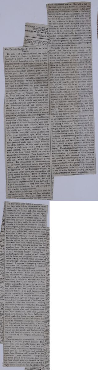
The Pacific Railroad—Overland to California.
The subject of a Pacific Railroad has again been thrown overboard in Congress. The Senate, by a vote of 25 to 20, voted to postpone it until December next, upon the plea that they could not agree upon a route. The leading friends of the Administration were the active advocates of the postponement. So this most important question goes over to another year. But as communication with the Pacific increases, the subject of overland mail transportation is again attracting public attention and interest. It will be remembered that the TIMES discussed the question quite fully last Summer when the great overland mail contract was about to be let. We then expressed the conviction that the route from Memphis, Tenn, viâ Preston, Ark., El Paso, &c., would not satisfy the public interest, and predicted that if selected the enterprise would be a failure. A few months have passed, and our prediction is upon the point of realization. The Postmaster-General had become convinced that, all things considered, the route named was the most eligible one; and he let the contract for mail service over it to several responsible gentlemen who were supposed to represent a combination of the great Express Companies of the Union. It has since transpired that the Express Companies have nothing to do with the mail contract, which was taken by the contractors as a private speculation, and in aid of which, therefore, they do not combine the capital, energy and facilities of the great companies upon which reliance for its successful execution was chiefly based.
The contractors have been at Washington during several weeks past, seeking a modification of the contract, so as to make a material change in their route; and if they have not asked already, they soon will, for an extension of the time within which the contract service shall commence. They thus acknowledged that their contract route is not a favorable one. We still believe it will prove a total failure. The stipulations of the contract can not be fulfilled, because of the natural obstructions which render fulfillment impossible: and with the opposition of the Postmaster-General to any change of the route, the contractors will hardly secure the latter. There is reason to fear that they bid off the contract without any definite idea of its responsibilities, but with the general impression that it was the basis of a good speculation. If they have thus trifled with the public interest, they will probably be left to suffer the consequences.
There is no satisfactory evidence that the contractors expect to carry out their undertaking in good faith. They are bound to call for the mails for transportation on and after the 15th September next, and it is notorious that they have made little or no preparation for the work. They may have concluded arrangements for a few coaches and other articles of equipment which can readily be sold again, but they have provided no stations on the route, sunk none of the needed wells, nor effected any purchases of grain and other subsistence for their cattle in the far interior. Already it is too late to remedy the last-mentioned neglect, for the entire year's crop of the interior west of the Mississippi has been sold in advance, and the Mail Company have no resource but to haul corn from three to eight hundred miles, which is out of the question. The contractors, therefore, cannot be ready to take the mail on the 15th September, nor, if they were, could they perform the service between the terminal points in anything like the stipulated time. We are aware that they talk of using steam carriages, but that is impossible in a wilderness country, wherein heavy sands alternate with patches of soft marsh, and the brush and chapparel—close enough almost to strip the clothes from a horseman in riding through—alternate with mountains and streams. It requires little sagacity to foresee that on the 15th September next the contract will be forfeited for non-fulfillment.
Fortunately the public will gain rather than lose by this failure. Since the contract of last September was made, for service by a route which—in consequence of the conflict between rival and distant sections—was most unnaturally located, the enterprise of Postmaster-General BROWN has given us an overland mail between the great Northwest and the Pacific viâ Salt Lake. This we have every reason to believe is in good hands, and the service commences immediately. In a few weeks, at least, this Northern route will constitute the great highway of travel and correspondence, overland, for all of the Union except the far South and Southwest. Nothing could more perfectly accommodate five-sixths of those who have any practical interest in the subject. On the other hand, the pioneer overland mail route—that from San Antonio, Texas, viâ Arizona to San Diego, California,—which was let less than a year ago, has been in practical operation now for nine months, running with remarkable regularity. It has not only demonstrated the practicability of an overland mail service, but also that there is a far southern route easily accessible to and convenient for the people and businesses of the South and Southwest,—one, too, which can be availed of by the emigrant during the entire year.
These two routes accommodate the whole country in the best possible manner. They have both been thoroughly tested, are the natural overland highways of the two sections, and can be relied upon. What necessity is there now for the tortuous and extended route from Memphis viâ Preston &c. to San Francisco? None whatever. Emigration will never seek it, for it requires a long journey from almost anywhere to reach its Eastern terminus, and then the traveler has a longer march before him than by either of the other established routes. Nor will a line of vigorous settlements follow it through the wilderness, for the same reasons. It has quite lost its importance now that its twin rivals have been created; and no considerable number of men in Congress or out of it, will in the future be found to take much interest therein. If we are mistaken in these views, the error will do no harm to the Memphis contractors. They have their contract, and if prepared to execute it, cannot be deprived of its emoluments. In the reasonable anticipation, however, of their failure, and in the earnest desire that the overland mail service shall be made as perfect as is possible, we suggest the propriety of hearty coöperation by men of all sections in developing, strengthening, and perfecting the Northern and Southern routes.
The mode of doing this seems to us very simple. The Northern route needs to be liberally encouraged by the Government, so that its managers can promptly establish numerous and permanent stations all the way across the Continent, at which the emigrant may obtain refreshment and supplies. Settlements on the line are necessary also for the protection of the route from Indian depredations. The mail stations will become the nuclei of such settlements, and thus a few years will relieve the Government from every dollar of expense in providing a military force for the protection of the route. The same argument applies with equal force to the Southern route. The service over the latter is now semi-monthly only. It should be made a weekly line, with New-Orleans and San Francisco as its terminal points, in order that the Southern portions of the Confederacy may have equal facilities with the Northern. This done, the respective schedules should be so arranged that the Northern overland mail would start from St. Joseph, say on Saturdays, and that from New Orleans on Wednesdays of each week. This would give us in fact a semi-weekly overland communication between the Atlantic and Pacific Oceans.
To speculate upon the advantages of such an arrangement would be superfluous. Great as they are they can probably be secured without adding a dollar to the sum already provided for the purpose, by diverting the $600,000 per annum to be paid under the failing Memphis Contract, and applying it to the two successful routes already described. That sum employed to increase the quantity and improve the quality of service viâ the St. Louis and Salt Lake, and the New-Orleans and Arizona routes, would be amply sufficient to make the two latter everything that the country would desire. We submit the suggestion for the consideration of the Postmaster-General, whose administration is destined to make its mark in connection with overland routes. We do not know that further legislation will be necessary to the carrying out of the plan: but if so, Governor BROWN would probably have no difficulty in procuring the passage of a provisional act enabling him, in the event of a forfeiture of the Memphis Contract, to apply the appropriation therefor as already suggested.
[begin surface 1223]
LIFE IN THE PACIFIC TERRITORIES.
In a former article we gave an account of our interview with the Spokanes, and of our subsequent journey to the crossing of the Pend d'Oreille, or Clark's Fork of the Columbia. After remaining there two days, we raised camp, in company with about 18 Indians, for the foot of the Pend d'Oreille Lake, where the Indians were to take our goods, together with the women and children, and carry them to the head of the lake in canoes, while the men were to drive the horses around by land. Then came the tug of war; for two thirds of the time the horses were belly deep in mud, and for the other third, they were climbing over fallen logs, through thick brush and deep ravines, swimming rivers and having a hard time generally. In spite of all this, however, as we now considered ourselves comparatively safe from the hostile Indians, our spirits rose a good many degrees, and we began to see a great deal of fun in the ludicrous incidents continually occurring, which before would have passed unnoticed.
Some idea of the independent manner of our Far West people may be gathered from an inventory of the equipment of one of the party (an old man in action, though really a young man in years) for a journey of about 1,200 miles: Twenty-five pounds of flour, twenty-five pounds of cammash and kouse, one old iron pot, his blankets, coat, and himself, all packed upon one old horse, completed his outfit. At every river that had to be swum, he would get off, send his horse over with the band, then spring in all dreesed as he was, swim over, take off his clothes and wring them dry, put them on again, catch his horse, mount and be all ready to start. This plan suited his horse very well, and the first time that we came to a mud-hole, he quietly stopped, threw his rider off, jumped the hole, and went to eating on the other side, now and then turning his head to look at our friend lying in the mud. After this he concluded to let the horse have his own way, and that it was best to dismount and walk at all such places.
The valley is here quite narrow, and the trail runs along the bank of the river all the way, although a short distance up the side of the mountain there is a bench that could easily be made into a much better road; but the present one has been used by tbe Hudson's Bay men and other traders for a long time, and those now engaged in the business say, "the old traders followed this trail, and we will do the same." In some places the face of the country is much broken, though the most of it consists of rich bottoms, with a heavy growth of timber.
On arriving at the foot of the lake, the Indians cached their things, and made preparations for taking ours. The operation of cacheing has been so often described that I will only say that in this instance it was so well done that one of our men, returning to the place for something that had been left, could not find the spot till one of the Indians went with him and pointed it out.
We had thirteen packs, each consisting of two bales weighing 96 lbs the bale, which, with the pack-saddles, were put into five canoes, the women and children using two others. The canoes were made of pine bark, sewed over a willow framework, and had to be used very carefully, as there was great danger of putting the foot through them. At night we all camped together on the shores of the lake, the canoes going in a few hours as far as the horses could by traveling all day.
These Indians (the Pend d'Oreilles) are nominally Christians, having been converted by the Jesuits, and to some extent their condition has certainly been improved. They now cultivate some of their land, raising considerable quantities of grain, potatoes, onions, and other vegetables, while formerly they depended for food upon fishing and the chase, so that they are in much less danger of starvation; but still the questions arise in the minds of all that give this subject any thought, Are the Indians any more happy ? Are they any better, and do they live any longer ? I am sorry to say that save in very few cases, these questions must be answered in the negative. The Pend d'Oreilles, the most civilized among the North-Western tribes, are far from happy. They are very restless, and cannot relinquish the roaming habits of their youth. At stated times they must go to the hunting ground; no matter how much their crops may suffer, go they must, and go they will.
After seven days' hard work, we made the head of the lake. There we paid the chief for the use of his canoes, and the men for guarding our horses, and then packed our goods again and started, feeling at last in complete safety, after having for forty-five days been in constant fear of being killed. One of the projected railroad routes crosses the river a short distance below, and runs along the shore of the lake. For nearly all the way, the natural grade is such as to require but little cutting, and the construction of the road will be very easy.
At our second night's camp, I prospected and found a very good color of gold. The soil looks very much like that of the gold region of California, and, from what I could see of the formation and character of the rocks (talcose slate, mixed with quartz), I think this will prove a rich mining country, not only for gold, but for lead. I saw some of the latter in the hands of the Indians, and they told me that there was plenty in the hills.
Traveling on through a finely-wooded country, crossing many small streams and beautiful bottoms, we came to a place called Bad Rock, and truly it is rightfully named. The trail winds up a steep ascent of about 1,000 feet, over loose and sharp rocks, at an angle of about 60°. All hands had to dismount, and each taking a mule, or a horse, drive it up and over this place. It would be quite easy to make a road around the foot of this ascent, but it is not much traveled by white men, and until the country is settled by Americans it will not be done. The Hudson's Bay men who settle here have too much of the old country feeling to make many improvements. The difficulty of the ascent is well compensated for by the beauty of the view, which is one of the finest in the whole North-West. Deep down in the valley below, for miles and miles, the eye follows the wanderings of the river, sometimes seeing it sparkling for a moment, then losing it again amid the giant trees of the forest. Far below we see the lake dotted with its islands, and immense flocks of water-fowl, especially swans, whose graceful movements are equaled by no other bird. On the south side the shores of the lake are so bold and high as to make it seem to lie much deeper than it actually does; on the north they slope away more gradually. The waters abound with fine trout and other fish—the trout often weighing from three to five pounds. So far on our journey, Bad Rock is the only place where I think there can be any difficulty in building the road from Fort Benton, on the head waters of the Missouri, to the mouth of Snake River, on the Columbia.
On the tenth day from the lake, we arrived at the mission of the Jesuit Fathers, under the charge of Father Hoken. Here we received a most hospitable welcome, and found all that we could wish for in the way of provisions. It is unnecessary for me to say anything about the place, as it is most vividly described by my friend Dr. George Sukely, in his report, made to Gov. Stevens in 1853–54; but I cannot pass over these men, who have given up all the comforts of civilization for the great and glorious task of converting the Indians, and of trying by practice, as well as by precept, to instill into their minds that there is a hereafter, and that they are something better than brutes. Their universal kindness to all whites who wander into that region has become proverbial. The Father Superior, Father Hoken, received us with their usual kindness. He killed a pig for us, and supplied us with vegetables, milk, butter, cheese and flour, for all which he would take no pay. He also invited us to dine with him at the Mission Buildings, and after dinner walked about the place with us, and we saw that they have all the necessaries of life around them. They have a carpenter, a blacksmith and a millwright, and also a small flouring mill and saw mill in operation all the year. Their crops have been unusually fine this year; the wheat crop so large that their barns would not hold it; two thousand bushels of potatoes, and their other crops in like proportion. They occupy the most beautiful situation for a farm in the whole valley.
On Saturday morning we raised camp, and started for Fort Owen, 70 miles distant, and arrived there about noon on Sunday. A part of the Flathead tribe was camped around the fort awaiting us, and such a scene of rejoicing I never saw elsewhere. The old chief Victor embraced us all in the most cordial manner, and said that if we had not come in a few days more he should have sent some of his young men down on the trail to find out what had become of us, and that if any accident had occurred to us he would have taken the most signal vengeance on the Spokanes and other lower Indians. At the time these latter attacked Col. Steptoe, Mr. Irving, who was in charge here during Major Owen's absence, did not feel safe so far from the settlements, and expressed an intention of abandoning the fort and retreating to Cantonment Young. Old Victor heard this reported while in the buffalo ground hunting, and instantly raised his whole camp and started for the fort. He sent an express in advance, directing him if he found the fort abandoned to follow the fugitives and tell them to return, for he was coming to the fort as fast as he could, and that he and his tribe would protect them with their lives. This chief is very old and infirm, and very well recollects Clark, the great explorer, who, in fact, speaks very kindly of him in his narrative.
This Bitter-Root Valley is one of the most beautiful places on the west side of the Rocky Mountains, and contains thousands and thousands of acres of the finest agricultural and grazing lands on this Continent. The timber is mostly pine, fir and larch, although there is some oak. The Indians have large herds of cattle, which graze all the year round, the climate being so mild that there is no necessity of feeding them during the so-called Winter months. Now think of this, you young farmers of the East, who have to work all Summer, from Spring to Fall, for the purpose of keeping your stock from starving in the Winter. Think of this, I say again; think of these thousands of acres of the finest soil the sun ever shone upon, well wooded, well watered, and needing nothing but the energy and enterprise of American farmers to develop its resources and make it one of the most productive, as it already is one of the most beautiful, regions on the whole Western Continent. This valley, again, is destined to become the great half-way station between the East and the West, the Atlantic and the Pacific. The Indians are anxious for the whites to come in and settle among them, and Fort Owen is sure to become one of the most flourishing settlements on that slope of the mountains. The route surveyed by Gov. Stevens in 1853 and '54, for a railroad from St. Paul on the Mississippi to Puget Sound, passes through this valley, and here will be the great central depot for the road. From this point the Southern Oregon Road will run south to Fort Hall, and there branch off to California; and here, also, the northern route to the Fraser River country will turn off from the main route, which will keep on to the west by the mouth of the Pelouse and Fort Walla Walla to Puget Sound. These things may not take place for some few years, but they are looked forward to with great impatience by the people on the Pacific side, who are determined to have these overland routes in our own control, and not under that of our friend John Bull. The success of the more southern route recently established, gives us strong ground for hope that the northern line will be put into operation in the course of the coming Summer. In a very few years the connection between the navigable waters of the Atlantic and those of the Pacific will be made, via the Missouri on the one side and the Columbia on the other. This connection must be made through the Bitter-Root Valley by steam to Fort Benton on the Atlantic side, and by the same means to the Pelouse on the Pacific side, leaving the short distance of 500 miles only for land travel. At Fort Owen there are already a flouring mill, with two runs of stone, and a saw mill, both running nearly all the year. Once more, I would call the attention of the young men of the East to the great inducements offered, not by this valley alone, but by two-thirds of the whole area of Oregon and Washington Territories.
After remaining here five days, we started for Fort Benton, on the headwaters of the Missouri, our party consisting of Major Owen, Mr. Maillet and myself—Mr. Maillet and myself intending to pass down the river in a small boat, of one could be procured. The distance between Forts Benton and Owen is about 280 miles, through a country abounding in every inducement to settlement. The approach to the mountains is quite easy, commencing about 60 miles from the summit, and the grade being, according to Gov. Stevens’s survey, about 30 feet to the mile. I should hardly have known that I was ascending, had it not been for the mountains before me seeming to become continually lower and lower. On a little stream emptying into the Blackfoot we found a gentleman from Massachusetts, just from college. It seemed very strange to meet any one fresh from the East right in the heart of the Rocky Mountains. He had a guide with him, and intended going on to the Bitter-Root Valley, and then returning. He said that he thought by the time he got home again, he should have something to talk about.
About 2 o’clock on that day, we came to the last ascent of that great dividing ridge of this continent—the Rocky Mountains. Drinking from a small spring, I bade farewell to the Pacific, and in something less than two hours was drinking from the waters of the Atlantic side. Cadotte's Pass, through which we crossed, is in 47° 15' north latitude, and has been used for years by the Indians, not only singly, but whole tribes and villages, men, women and children, passing through in the depth of Winter, as well as in Summer, going to and from the buffalo hunt.
On the eastern slope the face of the country is much more broken than on the western, and the grass is not so plentiful, although we saw great numbers of antelope and deer. We first made the head of a branch of Dearborn River, a branch of the Missouri, and after traveling down this a short distance, struck across the country for Sun River, another branch of the Missouri. On the fifth day from Fort Owen, about noon, we rode into Fort Benton. With the exception of the bottom lands on the branches of the Missouri, the country on this side is not worth much for farming, although Major Vaughan, the Indian Agent for the Blackfoot nation, informed me that he intended establishing a farm on Sun River, at the place we crossed. We found the herds-grass knee high, and the soil, although light, apparently rich, and a good grain soil; the bottom is also well timbered. Fort Benton is on the Missouri, about 2,700 miles from St. Louis. It belongs to the American Fur Company, who have occupied it about thirty years, doing an extensive business with the Indians, collecting that almost indispensable article in our cold climate, the buffalo robe. On the same flat stands Fort Campbell, owned by Messrs. Frost, Todd & Co., of St. Louis. The gentlemen of both forts received us in the warmest and most hospitable manner, and did all that lay in their power to make our short stay pleasant to us.
[begin surface 1225]
The Proposed Territory of Arizona.
The following abstract of Lieutenant Mowry's memoir of the Territory of Arizona—which is to be presented to Congress on the application of the people of the Territory—will be read with much interest at this particular time. It contains, as will be seen, much valuable information in regard to the nature and resources of a country for which we paid ten millions of dollars, but more especially because the President in his message particularly calls the attention of Congress to Arizona, in recommending the organization of a Territorial government, and for the construction of a railroad to connect California with the Atlantic States through it.
Lieutenant Mowry will present this memoir to Congress at the earliest day possible, and expects to be admitted as the delegate of Arizona, agreeable to the election of the people who have sent him.
The new Territory of Arizona, better known as the Gadsden purchase, lies between the thirty-first and thirty-third parallels of latitude, and is bounded on the north by the Gila river, which separates it from the Territory of New Mexico; on the east by the Rio Bravo del Norte (Rio Grande,) which separates it from Texas; on the south by Chihuahua and Sonora, Mexican provinces; and on the west by the Colorado River of the West, which separates it from Upper and Lower California. This great region is six hundred miles long by about fifty miles wide, and embraces an area of about thirty thousand square miles. It was acquired by purchase from Mexico, during the mission of General Gadsden, at a cost of ten millions of dollars. In the original treaty, as negotiated by General Gadsden, a more southern boundary than the one adopted by the Senate of the United States in confirming the treaty, was conceded by Santa Anna.
The proposed boundaries of the Territory of Arizona are the thirty fourth parallel of latitude, with New Mexico on the north, from the 103d meridian west to the Colorado; Texas on the east; Texas and the Mexican provinces of New Mexico and Sonora on the south, and California on the west. The new Territory would thus contain within its borders the three largest rivers on the continent west of the Mississippi—the Rio Grande, Gila, and Colorado of the West, and embrace 90,000 square miles.
The Gadsden purchase is attached by act of Congress to the Territory of New Mexico. At the time of its acquisition there was scarcely any population except a few scattering Mexicans in the Mesilla valley, and at the old town of Tucson, in the centre of the territory. The Apache Indians, superior in strength to the Mexican, had gradually extirpated every trace of civilization, and roamed uninterrupted and unmelested , sole possessor of what was once a thriving and populous Spanish province.
The missions and settlements established by the Jesuits and Spaniards were repeatedly destroyed by the Apaches, and the priests and settlers massacred or driven off. As often were they re-established. The Indians, at length, thoroughly aroused by the cruelties of the Spaniards, by whom they were deprived of their liberty, forced to labor in the silver mines with inadequate food, and barbarously treated, finally rose, joined with the tribes who had never been subdued, and gradually drove out or massacred their oppressors.
Every exploration within the past few years has confirmed the statements of the ancient records in regard to the mineral wealth of the Territory. The testimony of living Mexicans, and the tradition of the country, all tend to the same end. Col. A. B. Gray, Col. Emory, Lieutenant Michler, Lieutenant Parke, the Hon. John R. Bartlett, late of the United States Boundary Commission, all agree in the statement that the Territory has immense resources in silver and copper. Col. Emory says, in his report.—
On account of the gold mania in California I kept the search for gold and other precious metals as much out of view as possible, scarcely allowing it to be a matter of conversation much less of actual search. Yet enough was ascertained to convince us that the whole region was teeming with the precious metals. We everywhere saw the remains of mining operations conducted by the Spaniards, and more recently by the Mexicans.
The agricultural resources of Arizona are sufficient to sustain a large mining population, and afford abundant supplies for the great immigration which will follow the developement of its mineral resources. The whole valley of the Gila, more than four thousand miles in length, can be made, with proper exertion, to yield plentiful crops. The Pimos Indians, who live in villages on the Gila, one hundred and seventy miles from its mouth, raise large crops of cotton, wheat and corn, and have for years supplied the thousands of emigrants who traverse the Territory en route to California. A town will probably grow up just above the Pimos villages, as there is a rich back country, and the streams afford a valuable water power for running mills.
The valley of the Santa Cruz traverses the Territory from south to north, sinking near the town of Tucson, and probably finding its way to the Gila, as a subterranean stream. This valley, of the richest land, is about one hundred miles long, in many places of great width, and has on each side of it many rich valleys of limited extent, watered by streams from the mountains, which flow into the Santa Cruz. The valleys and ranches of Arivaca, Sopori, Calabazas and Tucson, are those at present most thickly settled. These produce all the fruits known to a southern climate—grapes, wheat, corn, and cotton in great abundance. The San Pedro river valley is also one of great richness, and is reported by Lieutenant [illegible]rke as capable of sustaining a large population [illegible]e de Sauz, still farther east, more limited than the San Pedro or Santa Cruz, can be made available for a considerable population. The Mimbres river also can, by a small outlay, be made to irrigate a large surface and supply a moderate settlement. The various springs laid down by Gray, Emory, Parke and Bartlett will all afford water for small settlements, and their supply can be much increased by a judicious outlay of money. The Rio Grande valley is very rich, and in places of great width. The Mesilla valley already contains a population of about five thousand souls, and there is ample room for many more.
The greater portion of the lands on the Santa Cruz and San Pedro are covered by Mexican titles—and many of these again by squatter claims. It is absolutely necessary that Congress should by some wise and speedy legislation settle, upon some definite basis, the land titles of Arizona. Until this is done disorder and anarchy will regin supreme over the country.
The yield of the silver mines of Mexico, as computed by Ward and Humboldt, from the actual official returns to the government, from the conquest to 1803, amounts to the enormous sum of $2,027,955,000, or more than two billions of dollars.
No protection, either civil or military, is extended over the greater portion of Arizona. This checks the developement of all her resources—not only to her own injury, but that of California and the Atlantic States—by with-holding a market for their productions, and the bullion which she is fully able to supply to an extent corresponding to the labor employed in obtaining it.
The population of the new Territory of Arizona is at present not far from eight thousand, and is rapidly increasing. The Mesilla Valley and the Rio Grande are probably the most thickly populated, containing about five thousand people. A majority of the Mesilla inhabitants are Mexicans, but they will be controlled by the American residents, whose number and influence are constantly on the increase. The Santa Cruz Valley, in which are situated the towns of Tucson, Tubac, Tumacacari, and the mining settlement of Sopori and others, is, next to Mesilla, the most thickly settled. Tucson was formerly a town of three thousand inhabitants; but the majority have been driven off by the Apache Indians. It is fast becoming a thriving American town, and will before long be a place of more importance than ever before. Real estate is already held at high rates, and the erection of buildings shows that American energy is about to change the face of the last half century. Tubac had been completely deserted by the Mexicans. It has been re-occupied by the Sonora Exploring and Mining Company, and now boasts a population of several hundred. The Calabazas valley is also fast filling up with an American population, and another year will see the whole centre of the Territory dotted with settlements. Many of the fine claims on the San Pedro river have already been located by emigrants under the general pre-emption law, but until protection is afforded to the settlers but little progress will be made in agricultural pursuits. The Apache Indian regards the soil as his own, and having expelled the Spanish and Mexican invader, he feels little inclination to submit to the American. A small settlement of Americans is growing up at Colorado city, opposite Fort Yuma, at the junction of the Gila and Colorado rivers. This point is destined to be one of great commercial and pecuniary importance. Situated at the present head of navigation, at the point where the overland mail route crosses the Colorado, and where the Southern Pacific Railroad must bridge the stream, it is a necessary stopping place for all travel across the country. Here are transhipped all the ores coming from the Territory, which find their way to market down the Colorado to the Gulf of California thence by steamer or sailing vessel to their destination. Here all supplies of merchandise for the Territory are landed, and from this point forwarded to their various owners. A thriving commerce has already spung up between Arizona and San Francisco. In almost any daily paper in San Francisco may be seen vessels advertised for the mouth of the Colorado. Two steamers find active employment in transporting government stores from the head of the Gulf of California to Fort Yuma, and goods to Colorado city for the merchants of Tucson, Tubac, Calabazas, and for the mining companies.
The Mormon war has closed for years the great emigrant road to California and Cregon over the South Pass and Salt Lake valley, leaving open only the route along the 32d parallel of latitude, through Arizona. This route is by far the most practicable at all seasons of the year, and the closing of the South Pass route by the Mormon difficulty is an additional and urgent argument in favor of the early organization of this Territory. Fifty thousand souls will move towards the Pacific early in the spring, if the route is opened to a secure passage.
The present condition of Arizona Territory is deplorable in the extreme. Throughout the whole country there is no redress for crimes or civil injuries; no courts, no law, no magistrates. The Territory of New Mexico, to which it is attached by an act of Congress, affords it neither protection nor sustenance.
The establishment of a firm government in Arizona will extend the protection of the United States over American citizens resident in the adjoining Mexican provinces. This protection is most urgently demanded. Englishmen in Sonora enjoy not only perfect immunity in the pursuit of business, but also encouragement. Americans are robbed openly by Mexican officials, insulted, thrown into prison, and sometimes put to death. No redress is ever demanded or received.
The state of things has so long existed that the name of American has become a by word and a reproach in Northern Mexico, and the people of that frontier believe that we have neither the power nor the inclination to protect our own citizens. The influence of a Territorial government, with the tide of American emigration which will surely follow it, must entirely change the tone and temper of these Mexican States.
[begin surface 1227]
AN ORATION, DELIVERED AT ALBANY, ON THE 28TH OF JULY, 1856, BY EDWARD EVERETT, ON OCCASION OF THE INAUGURATION OF THE DUDLEY ASTRONOMICAL OBSERVATORY.
FELLOW CITIZENS OF ALBANY: Assembled as we are, under your auspices, in this ancient and hospitable city, for an object indicative of a highly advanced stage of scientific culture, it is natural, in the first place, to cast a historical glance at the past. It seems almost to surpass belief, though an unquestionable fact, that more than a century should have passed away, after CABOT had discovered the coast of North America for England, before any knowledge was gained of the noble river on which your city stands, and which was destined by Providence to determine, in after times, the position of the commercial metropolis of the Continent. It is true that VERAZZANO, a bold and sagacious Florentine navigator, in the service of France, had entered the Narrows in 1524, which he describes as a very large river, deep at its mouth, which forced its way through steep hills to the sea. But, though he, like all the naval adventurers of that age, was sailing westward in search of a shorter passage to India, he left this past of the coast without any attempt to ascend the river; nor can it be gathered, from his narrative, that he believed it to penetrate far into the interior.
VOYAGE OF HENDRICK HUDSON.
Near a hundred years elapsed, before that great thought acquired substance and form. In the Spring of 1609, the heroic but unfortunate HUDSON, one of the brightest names in the history of English maritime adventure, but then in the employment of the Dutch East India Company, in a vessel of eighty tons, bearing the very astronomical name of the Half Moon, having been stopped by the ice in the Polar Sea in the attempt to reach the East by the way of Nova Zembla, struck over to the coast of America in a high northern latitude. He then stretched down southwardly to the entrance to Chesapeake Bay, (of which he had gained knowledge from the charts and descriptions of his friend, Captain SMITH,)—thence returning to the north, entered Delaware Bay,—standing out again to sea, arrived on the 2d of September in sight of the "high hills" of Neversink, pronouncing it "a good land to fall in with, and a pleasant land to see," and on the following morning, sending his boat before him to sound the way, passed Sandy Hook, and there came to anchor, on the 3d of September, 1609; two hundred and forty-seven years ago, next Wednesday. What an event, my friends, in the history of American population, enterprise, commerce, intelligence and power,—the dropping of that anchor at Sandy Hook!
DISCOVERY OF THE HUDSON RIVER.
Here he lingered a week, in friendly intercourse with the natives of New Jersey, while a boat's company explored the waters up to Neward Bay. And now the great question. Shall he turn back like VERAZZANO, or ascend the stream? HUDSON was of a race not prone to turn back, by sea or by land. On the 11th of September he raised the anchor of the Half Moon, passed through the Narrows, beholding on both sides "as beautiful a land as one can tread on;" and floated cautiously and slowly up the noble stream, the first ship that ever rested on its bosom. He passed the Palisades, nature's dark basaltic Malakoff, forced the iron gateway of the Highlands, anchored, on the 14th, near West Point; swept onward and upward the following day by grassy meadows and tangled slopes, hereafter to be covered with smiling villages;—by elevated banks and woody heights, the destined site of towns and cities,—of Newburg, Poughkeepsie, Catskill;—on the evening of the 15th arrived opposite, "the mountains which lie from the river side," where he found "a very loving people and very old men;" and the day following sailed by the spot, hereafter to be honored by his own illustrious name. One more day wafts him up between Schodac and Castleton, and here he landed and passed a day with the natives,—greeted with all sorts of barbarous hospitality,—the land "the finest for cultivation he ever set foot on," the natives so kind and gentle that, when they found he would not remain with them over night, and feared that he left them,—poor children of nature,—because he was afraid of their weapons, he, whose quarter-deck was heavy with ordinance, they "broke their arrows in pieces, and threw them in the fire." On the following morning, with the early flood-tide, on the 19th of September, 1609,—the Half-moon "ran higher up two leagues above the Shoals," and came to anchor in deep water, near the site of the present city of Albany. Happy, if he could have closed his gallant career on the banks of the stream which so justly bears his name, and thus have escaped the sorrowful and mysterious catastrophe which awaited him the next year.
CHAMPLAIN'S VOYAGE AND THE GROWTH OF COLONIES.
But the discovery of your great river and of the site of your ancient city is not the only event which renders the year 1609 memorable in the annals of America and the world. It was one of those years in which a sort of sympathetic movement toward great results unconsciously pervades the races and the minds of men. While HUDSON discovered this mighty river and this vast region for the Dutch East India Company, CHAMPLAIN, in the same year, carried the lilies of France to the beautiful lake which bears his name on your northern limits;—the languishing establishments of England in Virginia were strengthened by the second Charter granted to that colony;—the little church of ROBINSON removed from Amsterdam to Leyden, from which, in a few years, they went forth, to lay the foundation of New-England on Plymouth Rocks;—the seven United Provinces of the Netherlands, after that terrific struggle of forty years, (the commencement of which has just been embalmed in a record worthy of the great event by an American historian,) wrested from Spain the virtual acknowledgement of their independence in the Twelve Years' truce;—and JAMES the Ist, in the same year, granted to the British East India Company their first permanent Charter; corner-stone to an Empire destined in two centuries to overshadow the East.
GALILEO'S DISCOVERIES.
One more incident is wanting to complete the list of the memorable occurences which signalize the year 1609, and one most worthy to be remembered by us on this occasion. Contemporaneously with the events which I have enumerated—eras of history, dates of empire, the starting point in some of the greatest political, social and moral revolutions in our annals, an Italian astronomer, who had heard of the magnifying glasses which had been made in Holland, by which distant objects could be brought seemingly near, caught at the idea, constructed a telescope, and pointed it to the heavens. Yes, my friends, in the same year in which HUDSON discovered your river and the site of your ancient town, in which ROBINSON made his melancholy Hegira from Amsterdam to Leyden, GALILEO GALILEI, with a telescope, the work of his own hands, discovered the phases of Venus and the satellites of Jupiter; and now, after the lapse of less than two centuries and a half, on a spot then embosomed in the wilderness—the covert of the least civilized of all the races of men—we are assembled—descendants of the Hollanders, descendants of the Pilgrims, in this ancient and prosperous city, to inaugurate the establishment of a first-class Astronomical Observatory.
EARLY DAYS OF ALBANY.
One more glance at your early history. Three years after the landing of the Pilgrims at Plymouth, Fort Orange was erected, in the centre of what is now the business part of the city of Albany, and a few years later, the little hamlet of Beverswyck began to nestle under its walls. Two centuries ago, my Albanian friends, this very year, and I believe this very month of August, your forefathers assembled, not to inaugurate an observatory, but to lay the foundations of a new church, in the place of the rude cabin which had hitherto served them in that capacity. It was built at the intersection of YONKER'S and HANDELAAR'S, better known to you as State and Market streets. Public and private liberality co-operated in the important work. The authorities at the fort gave fifteen hundred guilders; the paroon of that early day, with the liberality coeval with the name and the race, contributed a thousand; while the inhabitants, for whose benefit it was erected, whose numbers were small and their resources smaller, contributed twenty beavers "for the purchase of an oaken pulpit in Holland." Whether the largest part of this subscription was bestowed by some liberal benefactors, tradition has not informed us.
NEW-AMSTERDAM.
Nor is the year 1656 memorable in the annals of Albany alone. In that same year, your imperial metropolis, then numbering about three hundred inhabitants, was first laid out as a city by the name of New-Amsterdam.* In eight years more, New-Netherland becomes New-York; Fort Orange and its dependant hamlet assumed the name of Albany;—a century of various fortune succeeds;—the scourge of French and Indian War is rarely absent from the land,—every shock of European policy vibrates with electric rapidity across the Atlantic, but the year 1756 finds a population of 300,000 in your growing province. Albany, however, may still be regarded almost as a frontier settlement. Of the twelve
*These historical notices are for the most part abridged from Mr. BRODHEAD'S excellent history of New-York.Friday, August 29, 1856
counties into which the province was divided a hundred years ago, the county of Albany comprehended all that lay north and west of the city; and the city itself contained but about three hundred and fifty houses.
TWO HUNDRED YEARS.
One more century; another act in the great drama of empire; another French and Indian War beneath the banners of England; a successful Revolution, of which some of the most momentous events occurred within your limits; a union of States; a Constitution of Federal Government; your population carried to the St. Lawrence and the great Lakes, and their waters poured into the Hudson; your territory covered with a net-work of canals and railroads,—filled with life and action, and power,—with all the works of peaceful art and prosperous enterprize,—with all the institutions which constitute and advance the civilization of the age,—its population exceeding that of the Union at the date of the Revolution;—your own numbers twice as large as those of the largest city of that day, you have met together, my friends, just two hundred years since the erection of the little church of Beverswyck, to dedicate a noble temple of science and to take a becoming public notice of the establishment of an institution destined, as we trust, to exert a beneficial influence on the progress of useful knowledge at home and abroad, and through that on the general cause of civilization.
SCIENTIFIC PROGRESS.
You will observe that I am careful to say the progress of science "at home and abroad;" for the study of Astronomy in this country has long since, I am happy to add, passed that point where it is content to repeat the observations and verify the results of European research. It has boldly and successfully entered the field of original investigation, discovery and speculation; and there is not now a single department of the science in which the names of American observers and mathematicians are not cited by our brethren across the water, side by side with the most eminent of their European contemporaries.
This state of things is certainly recent. During the colonial period and in the first generation after the revolution, no department of science was, for obvious cases, very extensively cultivated in America—astronomy perhaps as much as the kindred branches. The improvement in the Quadrant, commonly known as HADLEY'S, had already been made at Philadelphia by GODFREY in the early part of the last century, and the beautiful invention of the collimating telescope was made at a later period by RITTENHOUSE, an astronomer of distinguished repute. The transits of Venus of 1761 and 1769 were observed and orreries were constructed in different parts of the country, and some respectable scientific essays are contained and valuable observations are recorded in the early volumes of the transactions of the Philosophical Society at Philadelphia and the American Academy of Arts and Sciences at Boston and Cambridge. But in the absence of a numerous class of men of science to encourage and aid each other without observatories and without valuable instruments, little of importance could be expected in the higher walks of astronomical life.
AMERICAN OBSERVATIONS.
The greater the credit due for the achievement of an enterprise commenced in the early part of the present century, and which would reflect honor on the science of any country and any age—I mean the translation and commentary of Laplace's Mécanique Celeste, by BOWDITCH; a work of whose merit I am myself wholly unable to form an opinion, but which I suppose places the learned translator and commentator on a level with the ablest astronomers and geometers of the day. This work may be considered as opening a new era in the history of American science. The country was still almost wholly deficient in instrumental power; but the want was generally felt by men of science, and the public mind in various parts of the country began to be turned towards the means of supplying it. In 1825, President JOHN QUINCY ADAMS brought the subject of a National Observatory before Congress. Political considerations prevented its being favorably entertained at that time; and it was not till 1842, and as an incident of the exploring expedition, that an appropriation was made for a dépôt for the charts and instruments of the Navy. On this modest basis has been reared the National Observatory at Washington—an institution which has already taken and fully sustains an honorable position among the scientific establishments of the age.
Besides the Institution at Washington, 15 or 20 observatories have, within the last few years, been established in different parts of the country, some of them on a modest scale, for the gratification of the scientific taste and zeal of individuals, others on a broad foundation of expense and usefulness. In these establishments, public and private, the means are provided for the highest order of astronomical observation, research, and instruction. There is already in the country an amount of instrumental power, (to which addition is constantly making,) and of mathematical skill on the part of our men of science adequate to a manly competition of their European contemporaries. The fruits are already before the world in the triangulation of several of the States, in the great work of the coast survey, in the numerous scientific surveys of the interior of the Continent, in the astronomical department of the exploring expedition, in the scientific expedition to Chili; in the brilliant hydrographical labors of the observatory at Washington; in the published observations of Washington and Cambridge; in the journal conducted by the Nestor of American Science, now in its eighth lustrum, in the Sidereal Messenger, the Astronomical Journal, and the National Ephemeris; in the great chronometrical expeditions to determine the longitude of Cambridge, better ascertained than that of Paris was till within the last year; in the prompt rectification of the errors in the predicted elements of Neptune, in its identification with LALANDE'S missing star, and in the calculation of its ephemeris; in the discovery of the satellite of Neptune, of the eighth satellite of Saturn, and of the innermost of its rings; in the establishment both of observation and theory of the non-solid character of Saturn's rings; in the separation and measurement of many double and triple stars, amenable only to superior instrumental power, in the immense labor already performed in preparing Star Catalogues, and in numerous accurate observations of standard stars; in the diligent and successful observation of the meteoric showers; in an extensive series of magnetic observations; in the discovery of an asteroid and ten or twelve telescopic comets; in the resolution of nebulæ, which had defied everything in Europe but Lord ROSSE'S great Reflector; in the application of electricity to the measurement of differences in longitude; in the ascertainment of the velocity of the electro-magnetic fluid, and its truly wonderful uses in recording astronomical observations. These are but a portion of the achievements of American astronomical science within fifteen or twenty years, and fully justify the most sanguine anticipations of its further progress.
How far our astronomers may be able to pursue their researches, will depend upon the resources of our public institutions, and the liberality of wealthy individuals in furnishing the requisite means. With the exception of the observatories at Washington and West Point, little can be done or be expected to be done by the government of the Union or the States; but in this as in every other department of liberal art and science, the great dependence, and may I not add the safe dependence, as it ever has been, must continue to be upon the bounty of enlightened, liberal and public-spirited individuals.
THE DUDLEY OBSERVATORY.
It is by a signal exercise of this bounty, my friends, that we are called together to day. The munificence of several citizens of this ancient city, among whom the first place is due to the generous lady, whose name has with great propriety been given to the institution, has furnished the means for the foundation of the Dudley Observatory at Albany. On a commanding elevation, on the northern edge of the city, liberally given for that purpose by the head of a family in which the patronage of science is hereditary, a building of ample dimensions has been erected, upon a plan which combines all the requisites of solidity, convenience, and taste. A large portion of the expense of the structure has been defrayed by Mrs. BLANDINA DUDLEY, to whose generosity, and that of several other public spirited individuals, the institution is also indebted for the provision which has been made for an adequate supply of first-class instruments, to be executed by the most eminent makes in Europe and America; and which, it is confidently expected, will yield to none of their class in any Observatory in the world. (Prof. LOOMIS in Harper's Magazine for June, p. 49)
With a liberal supply of instrumental power; established in a community to whose intelligence and generosity its support may be safely confided and whose educational institutions are rapidly realizing the conception of a university; countenanced by the gentleman who conducts the United States coast survey with such scientific skill and administrative energy; committed to the immediate supervision of an astronomer to whose distinguished talent had been added the advantage of a thorough scientific education in the most renowned universities of Europe, and who, as the editor of the American Astronomical Journal, has shown himself to be fully qualified for the high trust;—under these favorable circumstances, the Dudley Observatory at Albany takes its place among the scientific foundations of the country and the world.
WONDERS OF ASTRONOMY.
It is no affected modesty which leads me to express the regret that this interesting occasion could not have taken place under somewhat different auspices. I feel that the duty of addressing this great and enlightened assembly, comprising so much of the intelligence of the community ad of the science of the country, ought to have been elsewhere assigned; that it should have devolved upon some one of the eminent persons, many of whom I see before me, to whom you have been listening the past week, who, as observers and geometers, could have treated the subject with a master's power; astronomers, whose telescopes have penetrated the depths of the heavens, or mathematicians, whose analysis unthreads the maze of their wondrous mechanism. If, instead of commanding, as you easily could have done, qualifications of this kind, your choice has rather fallen on one, making no pretensions to the honorable name of a man of science,—but whose delight it has always been to turn aside from the dusty paths of active life, for an interval of recreation in the green fields of sacred nature in all her kingdoms,—it is, I presume, because you have desired on an occasion of this kind, necessarily of a popular character, that these views of the subject should be presented which address themselves to the general intelligence of the community, and not to its select scientific circles. There is perhaps, no branch of science, which to the same extent as astronomy, exhibits phenomena which, while they task the highest powers of philosophical research, are also well adapted to arrest the attention of minds barely tinctured with scientific culture, and even to teach the sensibilities of the wholly uninstructed observer. The profound investigations of the chemist into the ultimate constitution of material nature, the minute researches of the physiologist into the secrets of animal life, the transcendental logic of the geometer clothed in a notation, the very sight of which terrifies the unitiated , are lost on the common understanding. But the unspeakable glories of the rising and the setting sun; the serene majesty of the moon, as she walks in full-orbed brightness through the heavens; the soft witchery of the morning and the evening star; the imperial splendors of the firmament on a bright unclouded night; the comet, whose streaming banner floats over half the sky, these are objects which charm and astonish alike the philosopher and the peasant;—he mathematician who weighs the masses and defines the orbits of the heavenly bodies, and the untutored observer who sees nothing beyond the images painted upon the eye.
WHAT IS AN ASTRONOMICAL OBSERVATORY?
An astronomical observatory, in the general acceptation of the world, is a building erected for the reception and appropriate use of astronomical instruments, and the accommodation of the men of science employed in making and reducing observations of the heavenly bodies. These instruments are mainly of three classes, to which I believe all others of a strictly astronomical character may be referred.
1. The instruments by which the heavens are inspected, with a view to discover the existence of those celestial bodies which are not visible to the naked eye, (beyond all comparison more numerous than those which are,) and the magnitude, shapes and other sensible qualities, both of those which are and those which are not thus visible to the un-aided sight. The instruments of this class are designated by the general name of Telescope, and are of two kinds,—the refracting telescope, which derives its magnifying power from a system of convex lenses, and the reflecting telescope, which receivers the image of the heavenly body upon a concave mirror.
2d. The second class of instruments consists of those which are designed principally to measure the angular distances of the heavenly bodies from each other, and their time of passing the meridian. The transit instrument, the meridian circle, the mural circle, the heliometer, and the sextant belong to this class. The brilliant discoveries of astronomy are for the most part made with the first class of instruments;—its practical results wrought out by the second.
3d. The third class contains the clock, with its subsidiary apparatus for measuring the time and making its subdivisions, with the greatest possible accuracy; indispensible auxiliary of all the instruments, by which the positions and motions of the heavenly bodies are observed, and measured, and recorded.
THE TELESCOPE.
The telescope may be likened to a wondrous cyclopean eye, endued with superhuman power, by which the astronomer extends the reach of his vision to the further heavens, and surveys galaxies and universes compared with which the solar system is but an atom floating in the air. The transit may be compared to the measuring rod which he lays from planet to planet and from star to star, to ascertain and mark off the heavenly spaces, and transfer them to his note-book—the clock is that marvelous apparatus by which he equalizes and divides into nicely measured parts a portion of that unconceived infinity of duration, without beginning and without end, in which all existence floats as on a shoreless and bottomless sea.
In the contrivance and the execution of these instruments, the utmost stretch of inventive skill and mechanical ingenuity has been put forth. To such perfection have they been carried, that a single second of magnitude or space is rendered a distinctly visible and appreciable quantity. "There are of a circle," says Sir. J. HERSCHELL, "subtended by one second, is less than the 200,00th part of the radius, so that on a circle of six feet in diameter, it would occupy no greater linear extent than 1-5700 part of an inch, a quantity requiring a powerful microscope to be discerned at all." (Outlines, § 131) The largest body in our system, the sun, whose real diameter is 882,000 miles subtends, at a distance of 95,000,000 miles, but an angle of little more than 32; while so admirably are the best instruments constructed, that both in Europe and American a satellite of Neptune, an object of comparatively inconsiderable diameter, has been discovered at a distance of 2,850 millions of miles.
UTILITY OF ASTRONOMICAL OBSERVATIONS.
The object of an Observatory, erected and supplied with instruments of this admirable construction and at proportionate expense, is, as I have already intimated, to provide for an accurate and systematic survey of the heavenly bodies, with a view to a more correct and extensive acquaintance with those already known, and as instrumental power and skill in using it increase, to the discovery of bodies hitherto invisible, and in both classes to the determination of their distances, their relations to each other, and the laws which govern their movements.
Why should we wish to obtain this knowledge? What inducement is there to expend large sums of money in the erection of Observatories, and in furnishing them with costly instruments, and in the support of the men of science employed in making, discussing and recording, for successive generations, these minute observations of the heavenly bodies?
In an exclusively scientific treatment of this subject, an inquiry into its utilitarian relations would be superfluous—even wearisome. But on an occasion like the present you will not, perhaps, think it out of place, if I briefly answer the question what is the use of an observatory, and what benefit may be expected from the operations of such an establishment in a community like ours?
1. In the first place, then, we derive from the observations of the heavenly bodies, which are made at an observatory, our only adequate measures of time and our only means of comparing the time of one place with the time of another. Our artificial time-keepers—clocks, watches, and chronometers, however ingeniously contrived and admirably fabricated, are but a transcript, so to say, of the celestial motions, and would be of no value without the means of regulating them by observation. It is impossible for them under any circumstances to escape the imperfection of all machinery, the work of human hands;—and the moment we remove with our time-keeper east or west, it fails us. It will keep home time alone, like the fond traveler who leaves his heart behind him. The artificial instrument is of incalculable utility, but must itself be regulated by the eternal clock-work of the skies.
RELATIONS BETWEEN NATURAL PHENOMENA AND DAILY LIFE.
This single consideration is sufficient to show how completely the daily business of life is affected and controlled by the heavenly bodies. It is they and not our main-springs, our expansion balances and our compensation pendulums, which give us our time. To reverse the line of POPE:
'Tis with our watches as our judgements;—none Go just alike, but each believes his own;—But for all the kindreds and tribes and tongues of men,—each upon their own meridian,—from the Arctic pole to the equator, from the equator to the Antarctic pole, the eternal sun strikes twelve at noon, and the glorious constellations, far up in the everlasting belfries of the skies, chime twelve at midnight;—twelve for the pale student over his flickering lamp, twelve amid the flaming glories of Orion's belt, if he crosses the meridian at that fated hour;—twelve by the weary couch of languishing humanity, twelve in the star paved courtyards of the Empyrean;—twelve for the heaving tides of the ocean; twelve for the weary arm of labor; twelve for the toiling brain, twelve for the watching, waking, broken heart; twelve for the meteor which blazes for a moment and expires; twelve for the comet whose period is measured by centuries; twelve for every substantial, for every imaginary thing, which exists in the sense, the intellect, or the fancy, and which the speech or thought of man, at the given meridian, refers to the lapse of time.
Not only do we resort to the observation of the heavenly bodies for the means of regulating and rectifying our clocks, but the great divisions of day and month and year are derived from the same source. By the constitution of our nature the elements of our existence are closely connected with celestial times. Partly by his physical organization, partly by the experience of the race from the dawn of creation, man as he is, and the times and seasons of the heavenly bodies are part and parcel of one system. The first great division of time, the day-night, (nychthemerum,) for which we have no precise synonym in our language, with its primal alternation of waking and sleeping, of labor and rest, is a vital condition of the existence of such a creature as man. The revolution of the year, with its various incidents of Summer and Winter, and seed-time and harvest, is not less involved in our social, material and moral progress. It is true that at the poles, and on the equator, the effects of these revolutions are variously modified or wholly disappear, but as the necessary consequence, human life is extinguished at the poles, and on the equator attains only a languid or feverish development. Those latitudes only in which the great motions and cardinal positions of the earth exert a mean influence, exhibit man in the harmonious expansion of his powers. The lunar period, which lies at the foundation of the month, is less vitally connected with human existence of every age and race to be eminently conducive to the progress of civilization and culture.
But indispensable as are these heavenly measures of time to our life and progress, and obvious as are the phenomena on which they rest, yet owing to the circumstance that, in the economy of nature, the day, the month and the year are not exactly commensurable, some of the most difficult questions in practical astronomy are those by which an accurate division of time, applicable to the various uses of life, is derived from the observation of the heavenly bodies. I have no doubt that, to the Supreme Intelligence which created and rules the Universe, there is a harmony hidden to us in the numerical relation to each other of days, months and years; but in our ignorance of that harmony, their practical adjustment to each other is a work of difficulty. The great embarrassment which attended the reformation of the calendar, after the error of the Julian period, had, in the lapse of centuries, reached ten (or rather twelve) days, sufficiently illustrates this remark. It is most true that scientific difficulties did not form the chief obstacle. Having been proposed under the auspices of the Roman Pontiff, the Protestant world, for a century and more, rejected the new style. It was in various places the subject of controversy, collision and bloodshed. (STERN'S "Himmelskunde," p. 72.) It was not adopted in England till nearly two centuries after its introduction at Rome; and in the country of Struve and the Pulkova equatorial, they persist at the present day in adding eleven minutes and twelve seconds to the length of the tropical year.
GEOGRAPHICAL SCIENCE.
2. The second great practical use of an Astronomical Observatory is connected with the science of Geography. The first page of the history of our continent declares this truth. Profound meditation on the sphericity of the earth was one of the main reasons which led COLUMBUS to undertake his momentous voyage, and his thorough acquaintance with the astronomical science of that day was, in his own judgment, what enabled him to overcome the almost innumerable obstacles which attended its prosecution. (Humboldt, Historie de la géographie, &c., Tom. 1. p. 77.) In return, I find that COPERNICUS in the very commencement of his immortal work (de Revolutionibus orbium cælestium Fol. 2) appeals to the discovery of America as completing the demonstration of the Sphericity of the earth. Much of our knowledge of the figure, size, density, and position of the earth as a member of the Solar system is derived from this science, and it furnishes the means of performing the most important operations of practical Geography. Latitude and longitude which lie at the basis of all descriptive Geography are determined by observation. No map deserves the name, on which the position of important points has not been astronomically determined. Some even of our most important political and administrative arrangements depend upon the coöperation of this science. Among these I may mention the land system of the United States, and the determination of the boundaries of the country. I believe that till it was done by the Federal Government, a uniform system of mathematical survey had never in any country been applied to an extensive territory. Large grants and sales of public land took place before the Revolution and in the interval between the peace and the adoption of the Constitution; but the limits of these grants and sales were ascertained by sensible objects, by trees, streams, rocks, bills, and by reference to adjacent portions of territory, previously surveyed. The uncertainty of boundaries thus defined was a never-failing source of litigation. Large tracts of land in the Western country granted by Virginia, under this old system of special and local survey, were covered with conflicting claims, and the controversies to which they gave rise formed no small part of the business of the Federal Court after its organization. But the adoption of the present land-system brought order out of chaos. The entire public domain is now scientifically surveyed before it is offered for sale; it is laid off into ranges, townships, sections and smaller divisions with unerring accuracy, resting on the foundation of base and meridian lines;—and I have been informed that under this system scarce a case of contested location and boundary has ever presented itself in Court. The General Land Office contains map and plans, in which every quarter section of the public land is laid down with mathematical precision. The superficies of half a continent is thus transferred in miniature to the bureaus of Washington;—while the local Land Offices contain transcripts of these plans, copies of which are furnished to the individual purchaser. When we consider the tide of population annually flowing into the public domain, and the immense importance of its efficient and economical administration the utility of this application of Astronomy will be duly estimated.
I will here venture to repeat an anecdote which I heard lately from a song of the late HON. TIMOTHY PICKERING. Mr. OCTAVIUS PICKERING, on behalf of his father, had applied to Mr. DAVID PUTNAM of Marietta, to act as his legal adviser, with respect to certain land claims in the Vrrginia Military district, in the State of Ohio. Mr. PUTNAM declined the agency. He had had much to do with business of that kind and found it beset, with endless litigation. "I have never," he added, "succeeded but in a single case, and that was a location and survey made by General WASHINGTON before the Revolution, and I am not acquainted with any surveys, except those made by him, but what have been litigated."
At this moment, a most important survey of the coast of the United States is in progress, an operation of the utmost consequence, in reference to the commerce, navigation, and hydrography of the country. The entire work, I need scarce say, is one of practical astronomy. The scientific establishment which we this day inaugurate is looked to for important coöperation in this great undertaking, and will no doubt contribute efficiently to its prosecution.
Astronomical observation furnishes by far the best means of defining the boundaries of States, especially when the lines are of great length and run through unsettled countries. Natural indications, like rivers and mountains, however indistinct in appearance, are in practice subject to unavoidable error. By the treaty of 1783, a boundary was established between the United States and Great Britain, depending chiefly on the course of rivers and highlands dividing the waters which flow into the Atlantic Ocean from those which flow into the St. Lawrence. It took twenty years to find out which river was the true St. Croix, that being the starting point. England then having made the extraordinary discovery that the Bay of Fundy is not a part of the Atlantic Ocean, forty years more were passed in the unsuccessful attempt to re-create the Highlands, which this strange theory had annihilated; and just as the two countries were on the verge of a war, the controversy was settled by compromise. Had the boundary been accurately described by lines of latitude and longitude, no dispute could have arisen. No dispute arose as to the boundary between the United States and Spain, and her successor, Mexico, where it runs through the untrodden deserts and over pathless mountains along the 42d degree of latitude. The identity of rivers may be disputed as in the case of the St. Croix; the course of mountain chains is too broad for a dividing line; the division of steams, as experience has shown, is uncertain, but a degree of latitude is written on the Heavenly sphere, and nothing but an observation is required to read the record.
QUESTIONS OF BOUNDARY.
But scientific elements, like sharp instruments, must be handed with scientific accuracy. A part of our boundary between the British Provinces ran up on the forty-fifth degree of latitude; and about forty years ago, an expensive fortress was commenced by the Government of the United States at Rouse's Point, on Lake Champlain, on a spot intended to be just within our limits. When a line came to be more carefully surveyed, the fortress turned out to be on the wrong side of the line; we had been building an expensive fortification for our neighbor. But in a general compromise of the Treaty of Washington by the Webster and Ashburton Treaty in 1842, the fortification was left within our limits.*
Errors still more serious had nearly resulted a few years since in a war with Mexico. By the treaty of Guadalupe Hidalgo, in 1848, the boundary line between the United States and that country was in part described by reference to the town of El Paso, as laid down on a specified map of the United States, of which a copy was appended to the treaty. This boundary was to be surveyed and run by a joint commission of men of science. It soon appeared that errors of two or three degrees existed in the projection of the map. Its lines of latitude and longitude did not conform to the topography of the region; so that it became impossible to execute the text of the treaty. The famous Mesilla Valley was part of the debatable ground, and the sum of $10,000,000 paid to the Mexican Government, for that and for an additional strip of territory on the southwest, was the smart-money which expiated the inaccuracy of the map; the necessary result perhaps of the want of good materials for its construction.
It became my official duty, in London, a few years ago, to apply to the British Government for an authentic statement of their of their claim to jurisdiction over New-Zealand. The official Gazette for the 2d of October, 1840, was sent me from the Foreign Office, as affording the desired information. This number of the Gazette contained the Proclamations issued by the Lieut. Governor of New-Zealand "in pursuance of the instructions he received from the Marquis of NORMANBY, one of Her Majesty's principal Secretaries of State," asserting the jurisdiction of his Government over the Island of New-Zealand and declaring them to extend "from 34° 30' North, to 47° 10' South latitude." It is scarcely necessary to say, that South latitude was intended in both instances. This error of 69° of latitude, which would have extended the claim of British jurisdiction over the whole breadth of the Pacific, had apparently escaped the notice of the Government.
COMMERCE AND NAVIGATION.
It would be easy to multiply illustrations in proof of the great practical importance of accurate scientific designations drawn astronomical observations, in various relations connected with boundaries, surveys, and other geographical purposes. But I must hasten to
3d. A third important department, in which the services rendered by astronomy are equally conspicuous. I refer to commerce and navigation. It is mainly owing to the results of astronomical observation that modern commerce has attained such a vast expansion, compared with that of the ancient world. I have already reminded you that accurate ideas in this respect contributed materially to the conception in the mind of COLUMBUS of his immortal enterprise, and to the practical success with which it was conducted. It was mainly his skill in the use of astronomical instruments, imperfect as they were, which enabled him, in spite of the bewildering variation of the compass, to find his way across the ocean.
With the progress of the true system of the universe toward
general adoption, the problem of finding the longitude at sea
presented itself. This was the avowed object of the foundation
of the observatory at Greenwich, (Grant's Physical Astronomy p.
46,) and no one subject has received more of the attention of
astronomers than those investigations of the lunar theory, on
which the requisite tables of the navigator are founded. The
pathways of the ocean are marked out in the sky above. The
sternal lights of the Heavens are the only Pharos
whose beams never fail; which no tempest can snake from its
foundation. Within my recollection, it was deemed a necessary
qualification for the master and the mate of a Merchant-ship,
and even for a prime
[begin surface 1231] [begin surface 1232]
 hand, to be able to "work a lunar," as it was called. The
improvements in the chronometer have in practice, to a great
extent, superseded this laborious operation, but observation
remains, and unquestionably will forever remain, the only
dependence for ascertaining the ship's time and deducting the
longitude from the comparison of that time with the
chronometer.
hand, to be able to "work a lunar," as it was called. The
improvements in the chronometer have in practice, to a great
extent, superseded this laborious operation, but observation
remains, and unquestionably will forever remain, the only
dependence for ascertaining the ship's time and deducting the
longitude from the comparison of that time with the
chronometer.
It may, perhaps, be thought that astronomical science is brought already to such a state of perfection that nothing more is to be desired, or at least that nothing more is attainable, in reference to such practical applications as I have described. This, however, is an idea which generous minds will reject, in this as in every other department of human knowledge. In astronomy, as in everything else, the discoveries already made, theoretical or practical, instead of exhausting the science, or putting a limit to its advancement, do but furnish the means and instruments of further progress. I have no doubt we live on the verge of discoveries and inventions, in every department, as brilliant as any that have ever been made; that there are new truths, new facts, ready to start into recognition on every side; and it seems to me there never was an age, since the dawn of time, when men ought to be less disposed to rest satisfied with the progress already made, than the age in which we live; for there never was an age more distinguished for ingenious research, for novel result and bold generalization.
That no further improvement is desirable in the means and methods of ascertaining the ship's place at sea, no one I think will from experience be disposed to assert. The last time I crossed the Atlantic, I walked the quarter deck with the officer in charge of the noble vessel, on one occasion, when we were driving along before a leading breeze and under a head of steam, beneath a starless sky at midnight, at the rate certainly of ten or eleven miles an hour. There is something sublime, but approaching the terrible, in such a scene;—the rayless gloom, the midnight chill,—the awful swell of the deep,—the dismal moan of the wind through the rigging, the all but volcanic fires within the hold of the ship;—I scarce know an occasion in ordinary life in which a reflecting mind feels more keenly its hopeless dependence on irrational forces beyond its own control. I asked my companion how nearly he could determine his ship's place at sea under favorable circumstances:—theoretically, he answered, I think, within a mile;—practically and usually within three or four. My next question was, how near do you think we may be to Cape Race;—that dangerous headland which pushes its iron-bound unlighted bastions from the shore of Newfoundland far into the Atlantic,—first land-fall to the homeward-bound American vessel. We must, said he, by our last observations and reckoning, be within three or four miles of Cape Race. A comparison of these two remarks, under the circumstances in which we were places at the moment, brought my mind to the conclusion, that it is greatly to be wished that the means should be discovered of finding the ship's place more accurately, or that navigators would give Cape Race a little wider berth. But I do not remember that one of the steam packets between England and America was ever lost on that formidable point.
It appears to me by no means unlikely that, with the improvement of instrumental power, and of the means of ascertaining the ship's time with exactness, as great an advance beyond the present state of art and science in finding a ship's place at sea may take place, as was effected by the invention of the reflecting quadrant, the calculation of lunar tables, and the improved construction of chronometers.
BABBAGE'S DIFFERENCE MACHINE.
In the wonderful versatility of the human mind, the improvement, when made, will very probably be made by paths where it is least expected. The great inducement of Mr. BABBAGE to attempt the construction of an engine, by which astronomical tables could be calculated and even printed by mechanical means and with entire accuracy, was the errors in the requisite tables. Nineteen such errors, in point of fact, were discovered in an edition of TAYLOR'S logarithms printed in 1796; some of which might have led to the most dangerous results in calculating a ship's place. These nineteen errors, (of which one only was an error of the press,) were pointed out in the Nautical Almanac for 1832. In one of these errata the seat of the error was stated to be in cosine of 14° 18' 3". Subsequent examination showed that there was an error of one second in this correction, and according in the Nautical Almanac of the next year, a new correction was necessary. But in making the new correction of one second, a new error was committed of ten degrees. Instead of cosine 14° 18' 2" the correction was printed cosine 4° 18' 2", making it still necessary, in some future edition of the Nautical Almanac, to insert an erratum of the errata in TAYLOR's logarithms.—Edinburg Review, Vol. LIX., 282.
In the hope of obviating the possibility of such errors, Mr. BABBAGE projected his calculating, or, as he prefers to call it, his difference machine. Although this extraordinary undertaking has been arrested, in consequence of the enormous expense attending its execution, enough has been achieved to show the mechanical possibility of constructing an engine of this kind, and even one of far higher powers, of which Mr. BABBAGE has matured the conception, devised the notation, and executed the drawings—themselves an imperishable monument of the genius of the author.
I happened on one occasion to be in company with this highly distinguished man of science, whose social qualities are as pleasing as his constructive talent is marvellous, when another eminent savant, Count STEZELECKI, just returned from his Oriental and Australian tour, observed that he found among the Chinese a great desire to know something more of Mr. BABBAGE's calculating machine, and especially whether, like their own swampan, it could be made to go into the pocket. Mr. BABBAGE good-humoredly observed that, thus far, he had been very much out of pocket with it.
INCREASED COMMAND OF INSTRUMENTAL POWER.
Whatever advances may be made in astronomical science, theoretical or applied, I am strongly inclined to think that they will be made in connection with an increased command of instrumental power. The natural order in which the human mind proceeds in the acquisition of astronomical knowledge is minute and accurate observation of the phenomena of the heavens, the skillful discussion and analysis of these observations, and sound philosophy in generalizing the results.
In pursuing this course, however, a difficulty presented itself, which for ages proved insuperable—and which to the same extent has existed in no other science, viz: that all the leading phenomena are in their appearance delusive. It is indeed true that in all sciences superficial observation can only lead except by chance to superficial knowledge,—but I know of no branch in which, to the same degree as in astronomy, the great leading phenomena are the reverse of true; while they yet appeal so strongly to the senses, that men who could foretell eclipses, and who discovered the precession of the equinoxes, still believed that the earth was at rest in the centre of the Universe, and that all the hosts of heaven performed a daily revolution about it as a centre.
It usually happens in scientific progress, tha when a great fact is at length discovered, it approves itself at once to all competent judges. It furnishes a solution to so many problems and harmonizes with so many other facts,—that all the other data, as it were, crystallize at once about it. In modern times, we have often witnessed such an impatience, so to say, of great truths, to be discovered, that it has frequently happened that they have been found out simultaneously by more than one individual; and a disputed question of priority is an event of very common occurrence. Not so with the true theory of the heavens. So complete is the deception practiced on the senses, that it failed more than once to yield to the suggestion of the truth; and it was only when the visual organs were armed with an almost preternatural instrumental power, that the great fact found admission to the human mind.
THE COPERNICAN SYSTEM.
It is supposed that in the very dawn of science, PYTHAGORAS or his disciples explained the apparent motion of the heavenly bodies about the earth, by the diurnal revolution of the earth on its axis. But this theory, though bearing so deeply impressed upon it the great seal of the truth, simplicity, was in such glaring contrast with the evidence of the senses, that it failed of acceptance in antiquity or the middle ages. It found no favor with minds like those of ARISTOTLE, ARCHIMEDES, HIPPARCHUS, PTOLEMY, or any of the acute and learned Arabian or mediæval astronomers. All their ingenuity and all their mathematical skill were exhausted in the development of a wonderfully complicated and ingenious but erroneous theory. The great master truth, rejected for it simplicity, lay disregarded at their feet.
At the second dawn of science, the great fact again beamed into the mind of COPERNICUS. Now, at least, in that glorious ago which witnessed the invention of printing, the great mechanical engine of intellectual progress, and the discovery of America, we may expect that this long hidden revelation, a second time proclaimed, will command the assent of mankind. But the sensible phenomena were still too strong for the theory; the glorious delusion of the rising and the setting sun could not be overcome. TYCHO DE BRAHE furnished his Observatory with instruments superior in number and quality to all that had been collected before; but the great instrument of discovery, which, by augmenting the optic power of the eye, enables it to penetrate beyond the apparent phenomena and to discern the true constitution of the heavenly bodies, was wanting at Uranienburg. The observations of TYCHO as discussed by KEPLER, conducted that most fervid, powerful and sagacious mind to the discovery of some of the most important laws of the celestial motions, but it was not till GALLILEO , at Florence, had pointed his telescope to the sky, that the Copernican system could be said to be firmly established in the scientific world.
THE HOME OF GALILEO.
On this great name, my friends, assembled as we are to dedicate a temple to instrumental Astronomy, we may well pause for a moment.
There is much, in every way, in the city of Florence to excite the curiosity, to kindle the imagination and to gratify the taste. Sheltered on the north by the vine-clad hills of Fiesolé, whose Cyclopean walls carry back the antiquary to ages before the Roman, before the Etruscan power, the flowery city (Fiorenza) covers the sunny banks of the Arno with its stately palaces. Dark and frowning piles of mediæval structure; a majestic dome the prototype of St. Peter's; basilicas which enshrine the ashes of some of the mightiest of the dead; the stone where DANTE stood to gaze on the campanile; the house of MICHAEL ANGELO, still occupied by a descendant of his lineage and name, his hammer, his chisel, his dividers, his manuscript poems, all as if he had left them but yesterday; airy bridges, which seem not so much to rest on the earth as to hover over the water they span; the lovliest creations of ancient art, rescued from the grave of ages again to enchant the world; the breathing marbles of MICHAEL ANGELO, the glowing canvas of RAPHAEL and TITIAN, museums filled with medals and coins of every age from CYRUS the younger, and gems and amulets and vases from the sepulchres of Egyptian Pharaohs coeval with JOSEPH, and Etruscan Lucumons that swayed Italy before the Romans—libraries stored with the choicest texts of ancient literature,—gardens of rose and orange and pomegranate, and myrtle,—the very air you breathe languid with music and perfume.—such is Florence. But among all its fascinations addressed to the sense, the memory and the heart, there was none to which I more frequently gave a meditative hour during a year's resdence , than to the spot where GALILEO GALILEI sleeps beneath the marble floor of Santa Croce; no building on which I gazed with greater reverence, than I did upon the modest mansion at Arcetri, villa at once and prison, in which that venerable sage, by command of the Inquisition, passed the sad closing years of his life. The beloved daughter on whom he had depended to smooth his passage to the grave laid there before him; the eyes with which he had discovered worlds before unknown, quenched in blindness:
Ahime! quegli occhi si son fatti oscuri, Che vider più di tutti i tempi antichi, E luce fur dei secoli futuri.That was the house, "where," says MILTON, (another of those of whom the world was not worthy,) "I found and visited the famous GALILEO, grown old—a prisoner of the Inquisition, for thinking on astronomy, otherwise than as the Dominican and Franciscan lisencers thought." (Prose works, vol. 1, p. 313.) Great heavens! what a tribunal, what a culprit, what a crime! Let us thank God, my friends, that we live in the nineteenth century. Of all the wonders of ancient and modern art—statues and paintings, and jewels and manuscripts—the admiration and the delight of ages—there was nothing which I beheld with more affectionate awe than that poor rough tube, a few feet in length—the work of his own hands—that very "optic glass"—through which the "Tuscan Artist" viewed the moon, "At evening from the top of Fesolé Or in Valdarno, to descry new lands, Rivers or mountains, in her spotty globe." that poor little spy-glass (for it is scarcely more) through which the human eye first distinctly beheld the surface of the moon—first discovered the phases of Venus, the satellites of Jupiter, and the seeming handles of Saturn—first penetrated the dusky depths of the heavens—first pierced the clouds of visual error, which, from the creation of the world involved the system of the Universe.
There are occasions in life in which a great mind lives years of rapt enjoyment in a moment. I can fancy the emotions of GALILEO, when, first raising the newly constructed telescope to the heavens, he saw fulfilled the grand prophecy of COPERNICUS, and beheld the planet Venus crescent like the moon. It was such another moment as that when the immortal printers of Mentz and Strasburg, received the first copy of the Bible into their hands, the work of their divine Art; like that when COLUMBUS, through the gray dawn of the 12th October, 1492, (COPERNICUS, at the age of 18, was then a student at Cracow) beheld the shores of San Salvador—like that when the law of gravitation first revealed itself to the intellect of NEWTON—like that when FRANKLIN saw by the stiffening fibres of the hempen cord of his kite, that he held the lightning in his grasp—like that when LEVERRIER received back from Berlin the tidings that the predicted planet was found.
Yes, noble GALILEO, thou art right, E pur si muove. "It does move." Bigots may make thee recant it; but it moves nevertheless. Yes, the earth moves, and the planets move, and the mighty waters move, and the great sweeping tides of air move, and the empires of men move, and the world of thought moves, ever onward and upward to higher facts and bolder theories. The inquisition may seal thy lips, but they can no more stop the progress of the great truth propounded by COPERNICUS and demonstrated by thee, than they can stop the revolving earth.
Close now, venerable sage, that sightless, tearful eye; it has seen what man never before saw—it has seen enough. Hang up that poor little spy-glass—it has done its work. Not HERSCHELL nor ROSSE have comparatively done more. Franciscans and Dominicans deride thy discoveries now, but the time will come when from two hundred observatories in Europe and America the glorious artillery of science shall nightly assault the skies, but they shall gain no conquests in those glittering fields before which thine shall be forgotten. Rest in peace, great Columbus of the Heavens, like him scorned, persecuted, broken-hearted, in other ages, in distant hemispheres, when the votaries of science, with solemn acts of consecration shall dedicate their stately edifices to the cause of knowledge and truth, thy name shall be mentioned with honor.
NEW PERIODS IN ASTRONOMICAL SCIENCE.
It is not my intention, in dwelling with such emphasis upon the invention of the Telescope, to ascribe undue importance, in promoting the advancement of science, to the increase of instrumental power. Too much, indeed, cannot be said of the service rendered by its first application in confirming and bringing into general repute the Copernican system; but for a considerable time, little more was effected by the wondrous instrument, than the gratification of curiosity and taste by the inspection of the planetary phases, and the addition of the rings and satellites of Saturn to the Solar family. NEWTON prematurely despairing of any further improvement in the refracting telescope, applied the principle of reflection, and the nicer observations now made, no doubt hastened the maturity of his great discovery of the law of gravitation; but that discovery was the work of his transcendant genius and consummate skill.
With BEADLEY, in 1741, a new period commenced in instrumental astronomy, not so much of discovery as of measurement. The superior accuracy and minuteness with which the motions and distances of the heavenly bodies were now observed, resulted in the accumulation of a mass of new materials, both for tabular comparison and theoretical speculation. These materials formed the enlarged basis of Astronomical Science between NEWTON and Sir WILLIAM HERSCHELL. His gigantic reflectors introduced the astronomer to regions of space before unvisited, extended beyond all previous conception the range of the observed phenomena, and with it proportionably enlarged the range of constructive theory. The discovery of a new primary planet and its attendant satellites was but the first step of his progress into the labyrinth of the heavens. Contemporaneously with his observations, the French astronomers, and especially LA PLACE, with a geometrical skill scarcely, if at all, inferior to that of its great author, resumed the whole system of NEWTON, and brought every phenomenon observed since his time within his laws. Difficulties of fact with which he struggled in vain, gave way to more accurate observations, and problems that defied the power of his analysis yielded to the modern improvements of the calculus.
HERSCHELL'S NEBULAR THEORY.
But there is no ultima Thule in the progress of science. With the recent augmentations of telescopic power, the details of the Nebular theory proposed by Sir W. HERSCHELL with such courage and ingenuity have been drawn in question. Many—most—of those milky patches in which he beheld what he regarded as cosmical matter, as yet in an unformed state,—the rudimental material of worlds not yet condensed,—have been resolved into stars, as bright and distinct as any in the firmament. I well recall the glow of satisfaction, with which on the 22 of September, 1847, being then connected with the University of Cambridge, I received a letter from the venerable director of the Observatory there, beginning with these memorable words: "You will rejoice with me that the great nebula in Orion has yielded to the power of our incomparable telescope! * * * It should be borne in mind that this nebula and that of Andromeda [which has been also resolved at Cambridge] are the last strongholds of the nebular theory." (Annals of the Observatory of Harvard College, p. cxxi)
But if some of the adventurous speculations built by Sir WILLIAM HERSCHELL on the bewildering revelations of his telescope have been since questioned, the vast progress which has been made in sidereal astronomy, to which, as I understand, the Dudley Observatory will be particularly devoted, the discovery of the parallax of the fixed stars, the investigation of the interior relations of binary and triple systems of stars, the theories for the explanation of the extraordinary, not to say fantastic, shapes discerned in some of the nebulous systems,—whirls and spirals radiating thorough spaces as vast as the orbits of Neptune,‡ the glimpses at systems beyond that to which our sun belongs,—these are all splendid results, which may fairly be attributed to the school of HERSCHELL, and will forever insure no secondary place to that name in the annals of science.
RELATIONSHIP OF THE LIBERAL ARTS.
In the remarks which I have hitherto made, I have had mainly in view the direct connection of astronomical science with the uses of life and the service of man. But a generous philosophy contemplates the subject in higher relations. It is a remark as old at least as PLATO, and is repeated from him more than once in CICERO, that all the liberal arts have a common bond and relationship. (Archias I; de Oratore III, 21.) The different sciences contemplate as their immediate object the different departments of animate and inanimate nature; but this great system itself is but one; and its various parts are so interwoven with each other, that the most extraordinary relations and unexpected analogies are constantly presenting themselves; and arts and sciences seemingly the least connected, render to each other the most effective assistance.
The history of electricity, galvanism, and magnetism, furnishes the most striking illustration of this remark. Commencing with the meteorological phenomena of our own atmosphere, and terminating with the observation of the remotest heavens, it may well be adduced on an occasion like the present. FRANKLIN demonstrated the identity of lightning and the electric fluid. This discovery gave a great impulse to electrical research, with little else in view but the means of protection from the thundercloud. A purely accidental circumstance led the Physician GALVANI, at Bologna, to trace the mysterious element, under conditions entirely novel both of development and application. In this new form it became, in the hands of DAVY, the instrument of the most extraordinary chemical operations; and earths and alkalis, touched by the creative wire, started up into metals that float on water, and kindle in the air. At a later period, the closest affinities are observed between electricity and magnetism, on the one hand; while on the other the relations of polarity are detected between acids and alkalis. Plating and gilding henceforth become electrical processes. In the last applications of the same subtle medium, it has become the messenger of intelligence across the land and beneath the sea; and is now employed by the astronomer to ascertain the difference of longitudes, to transfer the beats of the clock from one station to another, and to record the moment of his observations with automatic accuracy. How large a share has been borne by America in these magnificent discoveries and applications, among the most brilliant achievements of modern science, will sufficiently appear from the repetition of the names of FRANKLIN, HENRY, MORSE, WALKER, MITCHELL, LOCK and BOND.
VERSATILITY OF GENIUS.
It has sometimes happened, whether from the harmonious relations to each other of every department of science, or from rare felicity of individual genius, that the most extraordinary intellectual versatility has been manifested by the same person. Although NEWTON's transcendant talent did not blaze out in childhood, yet as a boy he discovered a great aptitude for mechanical contrivance. His water-clock, self-moving vehicle, and mill, were the wonder of the village; the latter propelled by a living mouse. Sir DAVID BREWSTER represents the accounts as differing, whether the mouse was made to advance "by a string attached to its tail," or by "its unavailing attempts to reach a portion of corn placed above the wheel." It seems more reasonable to conclude that the youthful discoverer of the law of gravitation intended by the combination of these opposite attractions to produce a balanced movement. It is consoling to the average mediocrity of the race to perceive in these sportive essays, that the mind of NEWTON passed through the stage of boyhood. But emerging from boyhood, what a bound it made as from earth to heaven! Hardly commencing Bachelor of Arts, at the age of twenty-four, he untwisted the golden and silver threads of the solar spectrum, simultaneously or soon after conceived the method of fluxions, and arrived at the elemental idea of universal Gravity before he had passed to his master's degree. Master of Arts, indeed! That degree, if no other, was well bestowed. Universities are unjustly accused of fixing science in stereotype. That diploma is enough of itself to redeem the honors of academical parchment from centuries of learned dullness and scholastic dogmatism.
But the great object of all knowledge is to enlarge and purify the soul, to fill the mind with noble contemplations, to furnish a refined pleasure, and to lead our feeble reason from the works of nature up to its great Author and Sustainer. Considering this as the ultimate end of science, no branch of it can surely claim precedence of Astronomy. No other science furnishes such a palpable embodiment of the abstractions which lie at the foundation of our intellectual system; the great ideas of tie, and space, and extension, and magnitude, and number, and motion, and power. How grand the conception of the ages on ages required for several of the secular equations of the solar system; of distances from which the light of a fixed star would not reach us in twenty millions of years, (Nichol's Architecture of the Heavens, p. 160;) of the magnitudes compared with which the earth is but a foot-ball: of starry hosts—suns like our own—numberless as the sands on the shore; of worlds and systems shooting through the infinite spaces, with a velocity compared with which the cannon-ball is a way-worn, heavy-paced traveler.
THE SPECTACLE OF THE HEAVENS.
Much, however, as we are indebted to our observatories for elevating our conceptions of the heavenly bodies, they present, even to the unaided sight, scenes of glory which words are too feeble to describe. I had occasion, a few weeks since, to take the early train from Providence to Boston; and for this purpose rose at 2 o'clock in the morning. Everything around was wrapped in darkness and hushed in silence, broken only by what seemed at that hour the unearthly clank and rush of the train. It was a mild, serene midsummer's night; the sky was without a cloud—the winds were whist. The moon, then in the last quarter, had just risen, and the stars shone with a spectral lustre but little affected by her presence; Jupiter, two hours high was the herald of the day; the Pleiades, just above the horizon, shed their sweet influence in the East; Lyra sparkled near the Zenith; Andromeda veiled her newly discovered glories from the naked eye in the South; the steady pointers, far beneath the Pole, looked meekly up from the depths of the North to their Sovereign.
Such was the glorious spectacle as I entered the train. As we proceeded, the timid approach of twilight became more perceptible; the intense blue of the sky began to soften, the smaller stars, like little children, went first to rest; the sister-beams of the Pleiades soon melted together; but the bright constellations of the West and North remained unchanged. Steadily the wondrous transfiguration went on. Hands of angels hidden from mortal eyes shifted the scenery of the Heavens; the glories of night dissolved into the glories of the dawn. The blue sky now turned more softly gray; the great watch stars shut up their holy eyes; the East began to kindle. Faint streaks of purple soon blushed along the sky; the whole celestial conclave was filled with the inflowing tides of the morning light, which came pouring down from above in one great ocean of radiance; till at length, as we reached the Blue Hills, a flash of purple fire blazed out from above the horizon, and turned the dewy teardrops of flower and leaf into rubies and diamonds. In a few seconds the everlasting gates of the morning were thrown wide open, and the lord of day, arrayed in glories too severe for the gaze of man, began his course.
I do not wonder at the superstition of the ancient Magians, who in the morning of the world went up to the hill tops of Central Asia, and ignorant of the true God, adored the most glorious work of his hand. But I am filled with amazement, when I am told that in this enlightened age, and in the heart of the Christian world, there are persons who can witness this daily manifestation of the power and wisdom of the Creator, and yet say in their hearts, "There is no God."
UNDISCOVERED BODIES.
Numerous as are the heavenly bodies visible to the naked eye, and glorious as are their manifestations, it is probable that in our own system there are great numbers as yet undiscovered. Just two hundred years ago this year, HUYGHENS announced the discovery of one satellite of Saturn, and expressed his opinion that the six planets and six satellites then known, and making up the perfect number of twelve, composed the whole of our planetary system. In 1729 an astronomical writer expressed the opinion that there might be other bodies in our system, but that the limit of telescopic power had been reached, and no further discoveries were likely to be made. (Memoirs of A. A. S., vol. iii. 275.) The orbit of one comet only had been definitively calculated. Since that time the power of the telescope has been indefinitely increased; two primary planets of the first class, ten satellites, and forth-three small planets revolving between Mars and Jupiter have been discovered, the orbits of six or hundred comets, come of brief period, have been ascertained;—and it has been computed that hundred of thousands of these mysterious bodies wander through our system. There is no reason to think that all the primary planets, which revolve around the sun, have been discovered. An indefinite increase in the number of asteroids may be anticipated; while outside of Neptune, between our sun and the nearest fixed star, supposing the attraction of the sun to prevail through half the distance, there is room for ten more primary planets succeeding each other at distances increasing in a geometrical ratio. The first of these will, unquestionably be discovered as soon as the perturbations of Neptune shall have been accurately observed; and with maps of the heavens, on which the smallest telescopic stars are laid down, it may be discovered much sooner.
THE VASTNESS OF CREATION.
But it is when we turn our observation and our thoughts from our own system, to the systems which lie beyond it in the heavenly spaces, that we approach a more adequate conception of the vastness of Creation. All analogy teaches us that the sun which gives light to us is but one of those countless stellar fires which deck the firmament, and that every glittering star in that shining host is the centre of a system as vast and as full of subordinate luminaries as our own. Of these suns—centres of planetary systems—thousands are visible to the naked eye, millions are discovered by telescope. Sir JOHN HERSCHELL, in the account of his operations at the Cape of Good Hope, (p. 381,) calculates that about five and a half millions of stars are visible enough to be distinctly counted in a twenty foot reflector in both hemispheres. He adds that "the actual number is much greater, there can be little doubt." His illustrious father, estimated on one occasion that 125,000 stars passed through the field of his forty foot reflector in a quarter of an hour. This would give 12,000,000 for the entire circuit of the heavens, in a single telescopic zone; and this estimate was made under the assumption that the nebulæ were masses of luminous matter not yet condensed into suns.
These stupendous calculations, however, form but the first column of the inventory of the Universe. Faint white specks are visible even to the naked eye of a practiced observer in different parts of the heavens. Under high magnifying powers, several thousand of such spots are visible,—no longer however, faint white specks, but many of them resolved by powerful telescopes into vast aggregations of stars, each of which may, with propriety, be compared with the milky way. Many of these nebulæ, however, resisted the power of Sir WM. HERSCHELL'S great reflector, and were, accordingly, still regarded by him as masses of unformed matter, not yet condensed into suns. This, till a few years since, was, perhaps, the prevailing opinion;—and the nebular theory filled a large space in modern astronomical science. But with the increase of instrumental power, especially under the mighty grasp of Lord ROSSE's gigantic reflector and the great refractors at Pulkova and Cambridge, the most irresolvable of these nebulæ have given way; and the better opinion now is, that every one of them is a galaxy, like our own milky way, composed of millions of suns. In other words, we are brought to the bewildering conclusion that thousands of these misty specks, the greater part of them too faint to be seen with the naked eye, are, not each a universe like our Solar system, but each a "swarm" of universes of unappreciable magnitude. (Humbodlt Cosmos III. 44) The mind sinks overpowered by the contemplation. We repeat the words, but they no longer convey distinct ideas to the understanding.
CONCEPTIONS OF THE UNIVERSE.
But these conclusions, however, vast their comprehension, carry us but another step forward in the realms of sidereal astronomy. A proper motion in space of our sun and of the fixed stars as we call them has long been believed to exist. Their vast distances only prevent its being more apparent. The great improvement of instruments of measurement within the last generation has not only established the existence of this motion, but has pointed to the region in the starry vault, around which our whole solar and stellar system with its myriad of attendant planetary worlds, appears to be performing a mighty revolution. If then, we assume that outside of the system to which we belong and in which our sun is but a star like Aldebaran or Sirius, the different nebulæ of which we have spoken, thousands of which spot the heavens—constitute a distinct family of Universes, we must, following the guide of analogy, attribute to each of them also, beyond all the revolutions of their individual attendant planetary systems, a great revolution, comprehending the whole; while the same course of analogical reasoning would lead us still further onward, and in the last analysis, require us to assume a transcendental connection between all these mighty systems,—a universe of universes, circling round in the infinity of space, and preserving its equilibrium by the same laws of mutual attraction, which bind the lower worlds together.
It may be thought that conceptions like these are calculated rather to depress than to elevate us in the scale of being; that, banished as he is by these contemplations to the corner of creation, and there reduced to an atom, man sinks to nothingness in this infinity of worlds. But a second thought corrects the impression. These vast contemplations are well calculated to inspire awe, but not abasement. Mind and matter are incommensurable. An immortal soul, even while clothed in "this muddy vesture of decay," is in the eye of God and reason, a purer essence than the brightest sun that lights the depths of heaven. The organized human eye, instinct with life and soul, which, gazing through the telescope, travels up to the cloudy speck in the handle of Orion's sword, and bids it blaze forth into a galaxy as vast as ours, stands higher in the order of being than all that host of luminaries. The intellect of NEWTON, which discovered the law that holds the revolving worlds together, is a nobler work of God than a universe of universes of unthinking matter.
If still treading the loftiest paths of analogy, we adopt the supposition,—to me I own the grateful supposition,—that the countless planetary worlds which attend these countless suns, are the abodes of rational beings like man, instead of bringing back from this exalted conception a feeling of insignificance, as if the individuals of our race were but poor atoms in the infinity of being, I regard it on the contrary, as a glory of our human nature, that it belongs to a family which no man can number of rational natures like itself. In the order of being they may stand beneath us, or they may stand above us; he may well be content with his place who is made "a little lower than the angels."
CONTEMPLATION OF THE HEAVENS.
Finally, my friends, I believe there is no contemplation better adapted to awaken devout ideas than that of the heavenly bodies,—no branch of natural science which bears clearer testimony to the power and wisdom of God than that to which you this day consecrate a temple. The heart of the ancient world, with all the prevailing ignorance, of the true nature and motions of the heavenly orbs, was religiously impressed by their survey. There is a passage in one of those admirable philosophical treatises of CICERO composed in the decline of life, as a solace under domestic bereavement and patriotic concern at the impending convulsions of the State, in which, quoting from some lost work of ARISTOTLE, he treats the topic in a manner which almost puts to shame the teachings of Christian wisdom.
"Praeclar ergo Aristoteles, 'si essent,' inquit, qui sub terra semper habitatavissent, bonis et illustribus domiciliis quae essent ornata signis atque picturis, instructaque rebus iis omnibus, quibus abundant ii qui beati putantur, nec tamen exissent unquam supra terram; accepissent autem fama et auditione,[covered]
There is much by day to engage the attention of the Observatory; the Sun, his apparent motions, his dimensions, the spots on his disc, (to us the faint indications of movements of unimagined grandeur in his luminous atmosphere,) a solar eclipse, a transit of the inferior planets, the mysteries of the Spectrum; all phenomena of vast importance and interest. But night is the Astronomer's accepted time; he goes to his delightful labors when the busy world goes to its rest. A dark pall spreads over the resorts of active life; terrestrial objects, hill and valley, and rock and stream, and the abodes of men disappear; but the curtain is drawn up which concealed the heavenly hosts. There they shine and there they move, as they moved and shone to the eyes of NEWTON and GALILEO, of KEPLER and COPERNICUS, of PTOLEMY and HIPPARCHUS; yes, as they moved and shone when the morning stars sang together, and all the sons of God shouted for joy. All has changed on earth; but the glorious heavens remain unchanged. The plow passes over the site of mighty cities,—the homes of powerful nations are desolate,—the languages they spoke are forgotten; but the stars that shone for them are shining for us;—the same eclipses run their steady cycle; the same equinoxes call out the flowers of Spring, and send the husbandman to the harvest;—the sun pauses at either topic as he did when his course began; and sun and moon, and planet and satellite, and star and constellation and galaxy, still bear witness to the power, the wisdom and the love, which placed them in the Heavens, and upholds them there.
Cicero de Natura Decorum Lib. II§ 30. [begin surface 1234]
THE GILA EXPEDITION.
Interesting Discoveries of Ancient Settlements—A New and Fertile Territory—Punishment of the Apaches, &c., &c.
Sometime since, immediately on the reception of the news of the battle between Col. Bonneville's expedition and the Coyotero Apache Indians, in the Gila country, we gave a brief notice of the result of the rencontre. This expedition was probably the most arduous, trying and dangerous ever projected since New Mexico has been a Territory of the United States; and it was also successful, having fully accomplished the end contemplated in its organization. Not only this, but it has resulted in obtaining information of a valuable portion of our territory, which otherwise might have remained hidden from us for years to come. We regret that our limited space will not permit us to enter into the details of this campaign as fully as our desire would lead us and its importance deserves. We can only glean over the face of the reports, and endeavor, in a very general manner, to give our readers an idea of the progress of the expedition and its happy termination.
The depot of the expedition was established on the west bank of the Gila river, nearly west from the "Adobe Wall," on the Rio Grande, and about twelve miles northwest from the San Lucien springs. The northern column was under command of Col. Loring, consisting of Major Shepherd's infantry, composed of Lieut. Alley, company B, 3d infantry, and a detachment of another company from 3d infantry; Capt. Hatch, company I, rifles; Lieut Howland, detachment of company C, rifles; Lieut McNally, detachment of company D, rifles; Dr. Letherman, Assistant Surgeon U.S.A.; Lieut. Roge Jones, Adjutant rifles; Lieut. Bonnean's 3d infantry, with a party of trailers, and Capt. Chavez's spy company. In the canon of San Vicente, this command struck a trail of about 2,000 sheep, and a party of Indians. Following it through and over the San Vicente mountans, (which had been set fire to by the Indians,) and to the valley of the Safo river, they on the 24th came fresh upon the trails ascending a slight elevation between two ridges. Indians and sheep were discovered in the canon, and the approach of the troops was a complete surprise. On seeing them they commenced flight. Pursuit was made, and eight Indian men killed—among them the celebrated Chief Cuchillo Negro—and one squaw accidentally. Five squaws and five children were captured. Also, all their camp equipage, a large quantity of packed meat, about 1,000 sheep, several oxen, and other animals. The command instantly commenced pursuit of another small party, who hod about five hundred sheep, discovered in a neighboring canon. These, however, made good their escape, after a warm race, leaving most of their sheep behind.
Colonel Loring proceeded on his trail, through a very rough and mountainous country, with but little grass or water. The country over which he travelled seemed to be barren and deserted. He encountered many hardships, but his men and the officers endured them with the most unflinching fortitude.
The Southern column was under command of Col. Miles, and was organized as follows:—Capt. Ewell, with Lieutenants Moore, Chapman and Davis, and B, G and K companies of 1st dragoons, Capt. Claiborne, Lieutenants Edson and Dubois, with B, G and K companies of Mounted Rifles; Lieutenants Whipple and Steen in command of C and F companies 3d infantry; Lieutenants Jackson and Cook in command of B and J companies 8th infantry; Lieut. McCook, in command of Pueblo Indians, and Capt. Blas Lucero, in command of Mexican guides and spies; Lieut. Lazelle, adjutant, and Dr. Harden, medical officer—making in all 44s. This column was divided into two wings, Col. Miles in command of the right, and Capt. Ewell in command) of the left, (Col. Bonneville was with this column. On the 13th of June they started to the Coyotero country. They marched south and southwest from the depot. On the first came to extensive ruins, supposed to be of Aztec origin. There were also evidences that the Coyoteros had farmed there in former years. The ruins seemed to indicate that a population of 2,000 or 3,000 must at one time have resided there—probably 200 years back. On the 24th the spies discovered an Indian camp a short distance ahead. Captain Ewell, with 20 infantry and 40 mounted dragoons, with all the officers under his command except Lieut. Edson, endeavored to surround the camp. The guides and spies captured a woman, but the command was discovered. In this march Captain Ewell's company suffered much, having to sustain itself by killing some of the Indian ponies they had captured. On the 27th Capt. Ewell's wing, in advance, proceeded towards Rio Gila—the Pueblo spies in advance. About three o'clock of that day the spies reported Indians about, and told Captain E. to "go on with his people." They proceeded but a short distance when they came upon the Apache camp. Col. Miles was in the rear, when Captain E. commenced the attack, We copy from his report to Colonel Bonneville:—"So soon as musketry was heard by us the order was given to gallop and the charge was made by all, you (Colonel B.) leading the van to the field of battle. When I arrived, which was not until Lieut. Debois had passed with his company, my first object was to ascertain how the field lay, what the disposition of the troops and how the enemy was placed. I soon found that Captain Ewell, under his heavy charge of dragoons, had broken the Apaches—they had taken cover in the thick underwood—and that it was the work of infantry to pick them out; that the dragoons were occupying the left bank of the Gila, cutting off the retreat of the enemy to Mount Turnbull, and that Captain Claiborne and Lieut. Dubois had very properly charged on the right bank and prevented them from reaching the mountains on that side. My object, then, was to bring into action as soon as possible the 8th Infantry, and recrossed the river from where Lieutenants Whipple and Steen were engaged to give this order, but found, to my great surprise, that Lieutenants Jackson and Cook, with their companies, were already up and actively engaged in the place where they were most needed. It was then a primary object to so regulate the firing that our troops should not injure each other, which could easily be done, when all were so anxious to destroy our enemy in a narrow valley covered by a dense undergrowth of willow. When I recrossed the river again, I found Lieut. Steen had been driven out of the bushes by a rally from the dragoons, and Lieut. Moore actively rallying his men to prevent their firing. When this was accomplished, the Infantry dashed into the thicket and soon captured many prisoners. The battle field extended for a mile on both sides of the Gila, and was covered with a thick undergrowth. The battle commenced at half-past four o'clock and lasted till sundown." There were forty warriors engaged in the conflict, two of whom only are known to have escaped. There were but twenty-four found dead on the field. Two women were killed—one while fighting with a bow and arrow. There were twenty-four women and children taken prisoners.
The wounded of the troops were Lieutenants Davis and Steen, and five or six of the soldiers and one Pueblo Indian. None of them fatally.
The conduct of every officer and the soldiers during the battle is mentioned in the most flattering terms by Col. Miles.
Besides the havoc among this party of Indians, the troops destroyed about 600 acres of corn, and captured a large number of sheep, horses, &c.
Lieut. Whipple's report of a scout to the head waters of the Gila is very interesting, and we are sorry that with this, as with the entire expedition, we have to deal so sparingly. He describes the country as rough generally, with an occasional fertile valley, and mentions the appearance of bear, a large number of eagles and turkeys, the latter being so unaccustomed to the sight of man, that when shot at they would not fly. Fish were caught in great abundance out of the Gila River. His march was exceedingly difficult, and many of his men, including himself, poisoned by a poisonous plant. He captured in this scout about 250 sheep from the Indians. He was accompanied by Lieut. Steen.
Captain Ewell gives a very interesting report of a scout under his command to the Cheiceehue Mountains. After giving an account of a skirmish with some Indians, in which some of them were wounded and probably killed, he says:—"I reached the Gila in the valley, the lower end of which was out of sight, but evidently from twenty-five to thirty miles long, and from three to five wide. The soil is rich and lies well for irrigation. There was enough arrable land passed through to support 20,000 people, surrounded by fine prairie for grazing. Broken pottery was everywhere so plenty that it amounts to a puzzle. A great many ruins, some of large villages or pueblos, are to be seen, and at points the marks of what must once have been a noble acequia, cut through such hard, strong banks that it is difficult to believe no iron was used in the construction. The Pimo Indians say these were the homes of their ancestors." This scouting and exploring trip of Captain Ewell was effected without any guides, and consequently did not accomplish as much as he desired.
Under date of May 12 Colonel Bonneville writes:—"We are now in the middle of the Jornado country with the Burro mountains thirty miles due south o us, the San Vicente at the same distance to the east a low range of bold hills to the west, and the lofty Mogollon fifteen miles to the north, cut in two by an immense canon, through which the river Gila issues. The bottom lands are extensive. Canon and hills of a fertility I have never met with before. Every one is in admiration of this beautiful region. No doubt this country has been inhabited, for we find evidences of a population more industrious, more civilized and more docile than the rascally Apaches who now infest it."
This expedition has resulted most successfully, not only in bringing to notice this heretofore unexplored country, but in teaching the Apache a most salutary lesson. The prisoners and stock captured were take to Fort Thorn. Shorlly after the arrival of the command there, three of the Coyotero Apaches came into the fort to negotiate for their women and children, who were held in captivity. They asked why it was they had been attacked, stating that they had always been friendly with the whites, and knew they were not able, even did they feel disposed, to fight them. They were told they they had killed Agent Dodge and stolen stock. They acknowledged that one of their men had committed the murder, and that he was in the camp and killed in the battle of the 27th. They brought to their very useful agent, Dr. Steck, large lumps of what they thought was gold from the Coyotero gold mountain to prove the sincerity of their desire for peace. (The specimen proved to be pyrites—so those who have visions of this gold mountain can take the hint.) They said they would give their lands, their sheep, horses and everything they possessed for peace. They were told that the whites did not want these—that they must behave themselves hereafter and there would be no trouble. They left very much delighted with their reception, to bring in the balance of their people and what Mexican captives they may have. The captive women and children have been ordered to be turned over to their people.
Thus it is, the good fruits of this expedition are already being seen.
Col. Bonneville, and the entire officers and soldiers of the northern and southern commands, deserve great credit for the energy, perseverance, endurance and bravery displayed in this campaign. Some of their risks were imminent, and marches almost incredible—climbing steep mountains, crossing deep ravines, and marching over sandy deserts without water for twenty-four hours sometimes, and all without a murmur from a single officer or soldier. If our space would allow it, it would afford us great pleasure to more fully allude to this expedition. At is is, our, readers will have to rest contented with this very partial and imperfect notice.
Since writing the above we have received the following very interesting letter from Col. Bonneville, which we take the liberty of laying before our readers:—
SANTA FE, N. M., Sept. 22, 1857
DEAR COLONEL—Returning a few days since from the depot on the Gila, I met your friend and agent, Dr. Steck. He made much inquiry respecting the Gila country—whether your views in regard to locating the Apache Indians in Pueblos could be effected on the waters of the Gila. He appeared desirous that I should converse with you on the subject, believed any information in relation to this hitherto unknown region would be deeply interesting, and perhaps some day might be useful in assisting the operations of your superintendency with this people.
We were operating in what has been known as the Gila country for more than four months; had detachment of troops scattered in every direction, bringing on their return sketches of the country and information from every quarter. I established my depot on the east bank of the Gila river—a beautiful spot about fifteen miles from the Mogollan Mountains. This valley is about twenty-five miles by forty, basined by the Mogollon to the north, San Vicente to the east, the Burro and Almoque to the south, and to the west by the Patos and San Francisco. These mountains enclose one of the most fertile and healthy spots on earth, beautiful to perfection. So much was it the admiration of all who saw it that our employés, every one, would have remained to have made it their homes had it been safe to have done so.
Lieutenants Whipple and Steen were sent into the Mogollon Mountains. They remained in them near twenty days—united the head waters of the Gila, and describe it as a most elevated and tumbled up region, perfectly worthless, except a limited space on the northwestern slope of the mountain. The maps, made from frequent readings of the compass, I look upon as very correct. Every detachment furnished me with a map of the country traversed. These I have transmitted, with my reports, to the Department headquarters, to which I have no doubt the General will readily give you access.
After passing the Depot valley, the river continues its course south, and enters the canones of a low range of lava mountains connecting the Burro and Almoque mountains. Lost, as it were, for about twenty miles in these canones, it falls into a large open country, extending from the Burro Mountains on the east to the Almoque on the west; it continues westerly till it meets the Sierrita Jornado, a long range of canones from the south, forces the river among the issues and precipices of its northern extremity; when, seeking again its western direction, it flows for from 70 to 100 miles through a valley about 40 miles wide. This valley was remarked by all as most fertile—extensive bottom lands, a rolling country on either side, offering the finest grazing to the very foot of the mountains. This valley, like every other capable of being cultivated, gives evidence of a former people, agricultural in their pursuit, and no doubt far more civilized than the present race who desolate it. We find to the north the Almoque and Patos mountains, with a basaltic range of low mountains connecting these with the Penal range. To the west the south span of the Penal mountains stand as a barrier to all egress. To the south we have the mountain ranges of Turnball and Graham, and to the east the Sierra Jornada. Within these boundaries we have a spot, large, fertile, healthy and well watered by the Gila, bedded in the mountains, distant from all roads and pass ways, and without a probability of any ever being made through it—a country, as it were, isolated. This appears to me to be most admirably adapted for the homes of the Indians. Here, established in his pueblo, his fertile planting grounds at his door, good water, and healthy climate, with his flocks, herds and stock fattening on the mountain slopes, he would be well situated. The maquery, the favorite food of the Indian, is here found in adundance. I am aware that objection may be urged to assigning such fertile countries to the Indians; but this valley, with all its health, its delicious water, and rich lands, is not such as I fancy would be desirable for the settlement of our people, who seek the great thoroughfares and reject what so completely isolates them from the busy world. Here, indeed, a man may live and grow fat, and have nothing to disturb the quiet of a whole year; but this is not in sympathy with busy, active and enterprising American citizens. So that the fact of its great isolation is an additional recommendation to its Indian adaptability, where under the parental care of his agent, he may easily secure all his wants, with the certainty that his improvement, though slow, will be constant. To the north of the Gila, the country is broken, rising as you go north into high mountains of lava, &c. Small streams rise in these mountains, and running through the canones, at times open out into small valleys of the greatest fertility. On the south the country is rolling to the mountains, without tributaries. It is a peculiarity to this, as to all the Gila region, that springs commence in all the mountains, so as to afford abundance of water for all stock purposes, and sometimes even for irrigation, but these springs lose themselves in the loose soils of the valley, and find the river under ground.
I made a rough sketch of the subject, desiring simply to draw your attention to it, and if it should have the merit of any usefulness I shall be satisfied. The Sierita Jornada, I omitted to mention, is about one hundred miles due west from Fort Thorn.
B. L. E. BONNEVILLE, U.S.A.
Col. James Collins, Superintendent Indian Affairs, Santa Fe, New Mexico.
[begin surface 1235] [begin surface 1236]
Interesting Account of the Russian Settlements on the Amoor River.
Our San Francisco Correspondence.
SAN FRANCSICO, Dec. 21, 1857.Account of Mr. P. McD. Collins' Journey through Siberia—The Trade and Resources of the Country—The Hospitality of the People—The Amoor River—Description of the Country—Prospects for Trade with San Francisco—Kyackta and Miamattschin—Interesting Slave Case—Judge Morton Decides that a Slave Cannot Recover Wages without a Special Agreement—Product of Breadstuffs for the Year—What Decreased the Expenses of the Local Government—The Vigilance Committee versus the Democratic Legislature—The Libel Suit against the "Morning Call"—The Jury Disagree—Colonel Fremont's Land Claim for Sale to Pay Taxes—Population of California, &c., &c.
Mr. P. McD. Collins, who has just arrived in San Francisco from the Amoor river, has furnished some very interesting information to the Herald, of this city, concerning his journey from St. Petersburg through Siberia and along the borders of China to the Pacific. The notes taken by Mr. Collins have formed material for a number of articles in the Herald, and are certainly valuable, inasmuch as they communicate to the public important information concerning the vast region through which he travelled and about which so little is known. Mr. C. held the position of United States Commercial Agent, and the object of his visit was to obtain knowledge in relation to the trade and resources of Siberia, as it is believed that before long a profitable traffic will open between this port and that country. His journey occupied just twelve months, and he speaks in the highest terms of the Russian officials with whom he had intercourse. Americans are everywhere highly regarded by the Russians, and are always treated with kindness and respect. Mr. Collins states that Siberia is a very different country from what it is generally supposed to be. Some of its principal cities are really beautiful, and in them as fine stores and as well regulated streets can be found as in any city in the United States. The general impression is that perpetual winter prevails in Siberia, and that its only inhabitants are convicts and the Russian military authorities; but this is a mistake. The population is upwards of four millions, and a large commercial business is transacted. In relation to the Amoor country Mr. C. has obtained much valuable information. The whole of that vast country, as well as Siberia, is supplied from St. Petersburg—which is about 6,000 miles from Irskutsh, the capital of Siberia—with silks, cottons, liquors and luxuries of all kinds. The goods are carried overland, and six months are consumed in the transportation. San Francisco is the natural point from which this vast portion of the Arctic continent should receive those articles of commerce of which it stands in need. Mr. Collins is of the opinion that the Amoor river is navigable for steamboats from its mouth to Chetah, situate at its headwaters, a distance of about 2,500 miles. From Chetah to Lake Baikal is about 300 miles, over a good mountain road, now travelled by post. Lake Baikal is about fifty miles across, and out of it flows the river which runs by Irkutsh, which is about forty miles distant from the lake. A steamboat now plies on Lake Baikal, and the river that runs by it from the lake is also navigable for steamboats. It will be thus seen how much easier the people of Siberia could obtain the articles of commerce they require from San Francisco than St. Petersburg. Between them and us there is only 300 miles of land carriage, and for the establishment of this trade all that is necessary is to obtain from the Russian government a decree declaring the Amoor river open to our traffic. Mr. Collins believes that if such a decree was issued before the expiration of four years our exports to that region would amount to more than ten millions of dollars annually. Mr. C. is the first foreigner who has ever traversed the countries belonging to Russia on this side of the globe. His notes, as published, give full and undoubtedly accurate descriptions of the people, climate, topography, religion and social condition of the population in those hitherto unknown regions. The information contributed will form a most interesting addition to the geography of the continent. When the attention of the United States government is drawn to the advantages to be acquired by opening the Amoor river to commerce, it is to be hoped measures will be adopted to induce the Russian government to accede to the request. California and the Atlantic States would be vastly served by the new channel of trade thus acquired.
During his journey Mr. Collins stopped for some time at Kyackta and Miamattschin. These towns are located side by side. The former is inhabited by the Russians, and the latter by the Chinese. The boundary line of the two nations runs between. It is marked only by a board fence. They are both walled in and fortified. At this point all the legitimate trade of the two countries is carried on. To Miamattschin the Chinese convey from the interior their teas and other goods on bullocks and camels, and to Kyackta the Russians bring their commodities, and in this way the exchange is made. The trade which centres at this point is estimated to amount to over thirty millions of roubles per annum. While at Kyackta Mr. Collins essayed to enter the Chinese dominions, and proceed to Pekin, which is about eight hundred and fifty miles to the south. He joined an ambassador sent out by the Russian government to treat with the Emperor for the purchase of the country lying along the Amoor river. The whole of this region, according to a treaty made in the reign of the Empress Catherina, belongs to the Chinese; but the Russians are now in possession of several portions of it. They are willing to acquire it by purchase; but if an overture to that effect is rejected, they are prepared to take it. Neither the Russian Ambassador nor Mr. Collins could obtain permission to proceed to Pekin, and they were both obliged to return. The Russians have greater facilities of obtaining correct views in relation to matters in China than any other nation in the world. There is in Pekin what is termed the Russian College. It consists of ten missionaries of the Greek church. These ten missionaries remain for ten years, and are then replaced by ten more. During the decade of their sojourn they are not permitted to fill any vacancies that may be caused by death or any other casualty. They are treated in the Chinese capital with great respect, and are allowed a guard of honor. Through the agency of this college the Russian government obtains reliable information of everything that transpires at the court of his Celestial Majesty. After his unsuccessful attempt to penetrate through the Chinese territory to Pekin, Mr. Collins proceeded to Chetah, situated at the headwaters of the Amoor river. The province of which it is the capital is rich in mineral resources. It is about as large as California. It abounds in mines of gold, silver and copper. The gold is found in river beds and gulches. There are no quartz mines. The annual yield is estimated at five millions of roubles. The silver mines are very rich. They are both worked by the convicts transported to Siberia by the Russian government, under the supervision of military officers. Private parties are not permitted to take out the precious metals in this section of the country. In other places they are allowed to mine, under certain restrictions, and are obliged to pay the government a certain per centage upon al they take out.
[begin surface 1237] [begin surface 1238]
EXPLORATION OF THE AMOOR.
The Valley of the Amoor covers from west to east about 40 deg. of longtitude and 13 deg. of latitude from north to south, having for its northern and western boundaries the mountains of Altai and Toblonoy, which divide the waters of Siberia proper from it—all of the Siberian waters falling into the Frozen Ocean; the head branches of the Amoor interlocking with the land, with Lake Baikal, the feeder of the Angara and Yenisaisk, and with the head branches of the Yenesaisk west and south of Baikal, far into Mongolia. On the south the head waters of the Hon-gah-ree, the Ou-su-ree, the Son-gah-ree, the Albasin and the Argoon, pushing in different directions, reach towards Corea and Seotoong, including nearly the whole of southern Mandshuria, and westward and southwest a large slice of Mongolia, being, in fact, situated relatively to southern Asia as the St. Lawrence and its waters is to southern North America, admitting that the Hudson, the Ohio with its tributaries, the Wabash and the Illinois emptied into the lakes instead of running up to the south and west.
Within this vast area, sufficient for one of the first empires of the globe, will be found every natural requisite for the habitation of fifty millions of human beings, with climate, soil, productions, minerals and forests proper to their wants. Game is found in the greatest abundance, and the most valuable of fur animals are found amid its wilds; the rivers teem with fish and fowl, while its mountains yield silver, gold, copper and iron.
The whole course of the Amoor, with its tributaries, as recently explored, reach to about four thousand versts, the whole of which is susceptible of steam navigation; boats of proper construction can, by its most considerable southern branch, reach to within six hundred versts of Pekin, from which point Pekin could be united by a railroad, bringing it within ten days of the mouth of the Amoor; from whence to San Francisco could be accomplished with steamers (touching at Japan) in fifteen days more, while Shanghae and Hong Kong could be reached in five to seven days; Hakodadi (Japan) in three days.
From Chetah, at the head of steam navigation on the waters of the Amoor, a railroad will connect with Kyackta and Miamattschin to Irkutsch, the capital of Eastern Siberia, at which point the overland trade to Nijni-Novogorod, Moscow and St. Petersburg will be concentrated; opening up a country the wealth and natural resources of which have been heretofore unknown to American enterprise. This extensive country, if united under the government of Russia, with a liberal commercial system, and open to emigration on a proper and judicious basis, would soon become one of the most interesting in Asia, and of great and rapidly increasing importance to the commercial world, and open up to Russia a field, an epoch of her history, worthy the present century. Let her forget Sebastopol, and by this greatest stroke of policy—if she will—checkmate her late foe in Indian annexation.
The Amoor, or Sack-hah-lin, as it is universally [begin surface 1239] [begin surface 1240]
 called by the natives inhabiting its shores, as well as by the
Mandschurs and Chinese, is a river of great beauty, though
probably not unequalled, because all rivers, to some extent,
have a certain sameness of beauty, if they traverse mountainous
districts; but the Amoor proper, in a distance of two thousand
miles, combines many, if not all of the varieties of the
picturesque, the beautiful and the grand, of such streams as the
Hudson of New York, the Connecticut, the Ohio and the
Mississippi, with the San Joaquin and Sacramento of California.
As to its size and navigable qualities, it may be compared with
the Mississippi (leaving out the Missouri), Red and Arkansas
river, with their waters. The Amoor is formed by the union of
the Argoon and the Schilkah, in about fifty-three degrees thirty
minutes north latitude, and longitude east from Greenwich one
hundred and twenty-one degrees forty minutes. The Argoon flows
from the south and west, and forms the boundary for some six or
seven hundred versts between Russia (Siberia) and China
(Mongolia), while the Schilkah and Ingodah pass more directly to
the west, through the great silver region of Ner-schinsk,
draining that portion of the province of Traus-Baikal east of
the mountains.
called by the natives inhabiting its shores, as well as by the
Mandschurs and Chinese, is a river of great beauty, though
probably not unequalled, because all rivers, to some extent,
have a certain sameness of beauty, if they traverse mountainous
districts; but the Amoor proper, in a distance of two thousand
miles, combines many, if not all of the varieties of the
picturesque, the beautiful and the grand, of such streams as the
Hudson of New York, the Connecticut, the Ohio and the
Mississippi, with the San Joaquin and Sacramento of California.
As to its size and navigable qualities, it may be compared with
the Mississippi (leaving out the Missouri), Red and Arkansas
river, with their waters. The Amoor is formed by the union of
the Argoon and the Schilkah, in about fifty-three degrees thirty
minutes north latitude, and longitude east from Greenwich one
hundred and twenty-one degrees forty minutes. The Argoon flows
from the south and west, and forms the boundary for some six or
seven hundred versts between Russia (Siberia) and China
(Mongolia), while the Schilkah and Ingodah pass more directly to
the west, through the great silver region of Ner-schinsk,
draining that portion of the province of Traus-Baikal east of
the mountains.
The main course of the Amoor is nearly east, but in its middle or central section it makes an immense sweep to the south, where the comparative mildness of the climate is evidenced by the production of Indian corn and the indigenous growth of the grape. From the Ham-ga-ree to its entrance into the straits of Tartary in about north latitude 63 degrees and east longitude 140 degrees, its course is nearly north; all the generally received maps of the Amoor are incorrect. The current of the river will average in its whole course about three and a half miles per hour; in many parts it is extremely sinuous, and contains hundreds of islands, with many lakes, bays and island clusters. The reaches are often grand and extensive, while snow capped mountains, ragged sierras and smoking volcanoes give beauty and grandeur to the scenery.
THE NATIVE TRIBES.
The Amoor down to the river Za is inhabited by a tribe of Indians who bear the name of Mana-gres. They exhibit many of the characteristics of the Tonguse of Northern Siberia, and differ from them very litle even in language. In the vast extent of country lying along the shores of the Amoor from the Za to the Hingan Mountains dwell the Mandsehurs and Chinese. By both these races the soil is cultivated. Along the Hingan Mountain ridge wander a nomadic race, or tribe, having horses, and called So-lon-see. This tribe belongs exclusively to the Tongusean stock. From a point about two hundred versts above the river Len-gah-ree down to the Gah-rin is the country of the Gal-dee. The language of this latter tribe is a mixture of Mandschur, Tartar and Tonguse, in which the first mentioned dialect, however, largely predominates. Like most of the tribes inhabiting the Amoor river country, the Gal-dee live chiefly upon fish—which are found in great abundance in the waters of this noble river. They are of an exceedingly fine flavor, and of various species. The catching and curing of fish appear to be the chief occupation of this tribe during the summer. In winter, however, they forsake the shores of the Amoor, and proceed to the distant mountains to hunt for fur animals. These mountains lie to the north of the Amoor, and in them are found the richest sable and ermine. They remain frequently during the whole winter in these mountains, and the spring is sometimes far advanced before the return ofthe hunters to the villages. It is only between the San-gah-ree and the Ou-su-ree that signs of cultivation are observable; and here, also, horses are found. From the Gah-rin to the Bo-go-roi-skoy dwell the Mangoon—a tribe very closely allied to the Gal-dee in language and habits. Between the Amoor, Ou-su-ree and the sea-coast, south of De Castries, dwell a semi-nomadic people, calling themselves O-roch-cha; and from the Russian village of Bo-go-roi-skoy, along the shores of the Amoor to its mouth, and along the coast of Leman to De Castries and Tetrapskoy, and along the coast of Sack-hah-lin, dwell the Ge-lack, or Ge-lan, a powerful tribe, entirely different in language and social customs from any of the above mentioned people. In Southern Sack-hah-lin are the I-nee, or Rour-el-see; and in the mountains of the same island a tribe of nomads, with reindeer, calling themselves O-ro-ka-te. They belong, probably, to the Tongusean tribe, are shy, and consequently very little is known of them.
The traits common to all the tribes enumerated are idolatry and scamanism, independence of every male person, polygamy and female oppression. The wife is purchased from the parents, and she is obliged to perform all the drudgery incident to savage life. The men spend their time in hunting, fishing and trade. The Gal-dee and the tribes allied by consanguinity with them rank above the Gil-yacks, and those tribes which have little or no intercourse with the Mandschurs or Chinese. From their intercourse with the latter, the Gal-dee have acquired at least some crude ideas of a God as the Supreme Ruler of the Universe; yet they worship representatives of the tiger, panther, a large snake, and anthropophagus fish, which they regard as the embodiment of certain evil spirits. The schamans or priests are looked upon as powerful mediators between the people and the evil spirits, while the true God is adored or worshipped without their assistance. This latter ceremony is only performed once a year. The time set apart is the autumn, and the whole community unite in the performance of the solemn rites observed on the occasion. Their religion is quite novel in its way, and it must be admitted to be decidedly comfortable. They hold that the soul of the dead, passing into the interior of the earth, which is lighted by its own sun and moon, continues in the same occupation as when in this life. There is no hell for the people, but for the unfaithful schamans there is, for if they have abused or misused their power over the evil spirits in order to make a fellow creature unfortuante, they go to their own hell, which is dark and damp, and filled with gnawing reptiles. The dead body among the Gal-dee and Mangoons is placed in a coffin, which is then put into a low frame on the ground, or as among the O-rock-ah, upon three posts sunk in the ground. So soon as the relatives of the deceased are able to provide the means, offerings (po-im-kee) are made and prayers are delivered over the tomb of the dead. On such occasion all indulge heartily in eating and drinking, and make presents to their friends. In character the Gal-dee, the most important and interesting of all these tribes, resembles the Northern Tonguse, viz:—They are cheerful, but timid and lazy, inclined to civilzation, but not to enterprise. They live in houses like those of the Mandschurs. In each house there are generally four families. In the spring they remove into bark huts, situated in places convenient for fishing. The O-rock-ah live constantly in bark huts.
The Gil-yack it appears has no idea of the true God—at least they worship only idols, representing evil spirits, which they endeavor to bribe with the aid of their schamans; unlike the Gal-dee, they consider the bear as a personified evil spirit, having soul and reason, with great power of harm; they keep it alive, feed and raise it to full size, and finally kill it with great forms, dancings, and ceremonies. This curious custom prevails also among the Mangoons and I-nees on Lack-hah-lin. The Gil-yacks have the same idea of life hereafter as the Gal-de. They, however, burn their dead on funeral pyres, and build a low house over their ashes. The ceremonies on the tomb differ in some respects from those of the Gal-dee; these, after the death of relations, make a wooden idol, under the belief that the soul of the deceased enters it, placing before it food, and besmearing its face with oil, when they deliver prayers and other ceremonies on the tomb after the service of the schamans, when it is supposed the soul of the deceased has departed from the idol to its paradise; the idol is then broken and thrown away. The Gil-yack, on the contrary, take the favorite dog of the deceased, feed it with care on choice food for some time, and then kill it on the tomb after the prayers have been delivered, when the soul of deceased, supposed up to this time to have been living in the dog, departs whence it properly belongs.
The character of the Gil-yack is harsh and austere; they are active and fond of gain, enterprising and disposed to trade. On Lack-hah-lin they are quite in a primitive state, inclined to pillage, stealing and murder; they live in conical huts, half buried in the ground, with an opening in the top for the escape of smoke; the fire is made in the centre. On the Amoor the houses of the Gil-yacks resemble those of the Gal-dee; in the summer they are exclusively occupied in fishing, but in winter they make trading voyages to Lack-hah-lin, to the I-nees and Japanese, and to the tribes of the coast of Tartary. Occasionally they also proceed by the Amoor river to the Mandschurs in order to buy their merchandise, which they barter in trade with the above mentioned tribes with great profit.
The population of the shores of the Amoor may be calculated on the following basis:—On the first two hundred and thirty versts, inhabited by Gil-yacks, there are on the right bank twenty-six, on the left thirteen villages, containing in all about one hundred and forty houses; give to each house four families (the usual number), and to each family three persons. It is true that in some houses you will find as many as twenty-five souls, but in others only five or six. Taking then twelve as the ratio, we have in all one hundred and forty houses, and twelve hundred and sixty as the population. In the distance of three hundred versts, occupied by Mangoons, we find forty villages, thirty-six on the right, and four on the left shore. With one hundred and ten houses, we have thirteen hundred and twenty inhabitants. The Gal-dee, in a distance of eight hundred versts, have thirty-seven villages on the left, and seventy-seven on the right shore, containing three hundred and twenty houses. Their houses being smaller, we will give the population at ten to each, which will make thirty-two hundred as the total. Most of the other tribes are scattered and nomadic, but supposed to be in numbers about two thousand.
As to the Mandschur and Chinese population on the Amoor only a very rough estimate can be given. Igoon is said to contain fifteen thousand—if this be the case, from the number of villages seen and visited on the shores, there must be, including those on the Za, north of the Amoor, forty to sixty thousand. The whole population of Mandschuria is reckoned by the most intelligent Greek missionaries who have resided in Pekin at from five to fifteen millions. The Mongols are so essentially nomadic that no reasonable figure can be arrived at.
 [begin surface 1242]
Beyond the present Western border States and Territories of the Mississippi valley proper we pass out of an American country, as we understand it, and enter into an Asiatic region—purely Asiatic in all its hard, barren, rugged and desolate aspects. Thus our great Western plains may be aptly compared with the steppes of Tartary; and the Great Salt Lake and its principal affluents to the Dead Sea and the river Jordan, with all their natural surroundings. Indeed, the many striking features of resemblance between the great Salt Lake and the Dead Sea, and in the physical peculiarities of the conntrycountry surrounding the one and the other, are so very remarkable that they have contributed not a little to give a peculiar charm of sanctity to the New Jerusalem of the Mormons. We might enlarge upon this incidental branch of our subject by the column, but our limits recall us to the main question—our overland communication with the Pacific. We must have some method of intercommunication; and what shall it be?
Provided that this Asiatic division of our country affords nothing except rocks with which to build a railroad; that, except a scanty margin of arable soil here and there, it is unfit for and uninhabitable by an agricultural people; that, with the projected railroad already built it could "never be made to pay," what does common sense suggest we should do? Clearly, that we should open one, two or three good common national high roads from the Mississippi Valley to the Pacific. With some improvements in the mountains and at other points the present overland trails would do well enough for a time, with the indispensable additions of safety from the Indians, and security from starvation, or death from a want of water. In this view, these overland national highways should be provided with watering stations, at intervals of twenty-five or thirty miles, all the way through. This would require a number of wells over the desert at intervals, and to secure these wells against the Indians, at every alternate one—to begin with—a little military settlement should be provided for and protected by the government.
Next bring in the Asiatic and African "ship of the desert," the camel, and colonize him liberally at these military highway stations, and your work of a convenient, speedy, wholesome, safe and inviting overland trip to the Pacific is secured. The camels, from the two ends of the route, would supply all the stations with the necessary provisions for any quantity of horses, men and mules going through, and the tavern fees of the station
[begin surface 1243] [begin surface 1244]
THE FISHERIES OF PUGET SOUND AND VICINITY.
SAN FRANCSICO, Oct. 1, 1858.The fisheries of the Pacific—save the whale fishery—are in their infancy, and the piscatory resources of our coast are but little known. The scant information which we have, however, may be of value, if laid before the Eastern public, to attract to our shores those who may build up this branch of industry on the Pacific. The best fishing ground on the Pacific coast of the United States is undoubtedly in and about Puget Sound. There the cod, halibut, herring, salmon, smelt, sturgeon are abundant, and are easily caught, while a large market is ready to buy them at high prices.
The cod is the most important of the fishes on this as well as on the other side of the continent. Two kinds of codfish visit Puget Sound, and both are better than the cod of the east. One species, called the "regular" cod, resembles the Labrador cod; the other is like the cusk, and has a streak of fat running through the meat on each side of the backbone, which gives a yellow and oldish look to the meat, when dried, but does no harm to its taste or durability. This species is called Tooshcow by the Indians, The regular cod is not so large as in the east, nor more than half the size of the Bank cod, but is very abundant. Its meat has the same color and taste with its Atlantic relative. It is caught on this coast from September till April, while upon your side of the continent the cod fishery lasts from April till November. The Pacific cod are supposed to come in the Spring, moving southward from the coast along the Russian possessions, in search of food. They enter the Straits of Fuca in dense schools, and thence penetrate to all the bays, sounds and inlets connected with the Straits. Not much has been done in catching them, and the little that has been done, has been mostly with the net. In Port Madison, Scuttle Bay and Pugallup Bay there are flats with from six to ten fathoms depth of water, where a thousand cod can often be taken at a haul with a fifty-fathom net. The climate of Washington Territory is too moist even in midsummer for drying fish profitably, so pickling must be resorted to. A few pickled codfish from Puget Sound have come into the San Francisco market, and command a higher price than a similar article from Massachusetts. The Indians do not like cod, and seldom fish for them, except when employed by whites. Sometimes they catch them in the Straits of Fuca and Hood's Canal with a hook and line, in water from twenty to thirty fathoms deep, using the same bait as is used on the banks of Newfoundland, such as herring, clams, salmon, &c.
There is a bank fifteen or twenty miles off the mouth of the Straits of Fuca where cod might be caught to advantage, and perhaps there are other banks but they are not known. Our coast is not yet sufficiently explored for us to know what its advantages are. The greater portion of the water communicating with the Straits of Fuca, are too deep for cod fishing, the fish staying near the bottom, and the depth of the water being such that too much time would be required to haul the line up.
About 200 barrels of codfish have been put up yearly in Washington Territory since 1855, when the first attempt was made.
The salmon has hitherto been the most important fish of the coast, and as long as the fishing is done chiefly by the Indians will continue to be so. The fish-eating savages on the sound depend on the salmon for most of their provision. The salmon comes in schools, and is caught first at Cape Flatteey, and afterward in all the interior water and river of the Territory. Their season is from July to November. They are caught with seines, speaks and hooks. In rivers off points where the ground is good for seining the nets are often used, and large "hauls" are made. The spears are resorted to in rivers; and along the banks of the sound, in water too deep for net or the spear, the hook has to do. The act of catching salmon with the hook is called "trailing," and requires great skill, so much that it is said no white man has ever learned it. The Indian baits his hook with boned herring or capelem (a small fish which abounds in the Sound), and allowing the line to trail out ten fathoms behind him he holds it in his right hand, while he paddles gently over the water' scarcely making a ripple. At every motion of his hand, as he moves it to manage the paddle, the bait has a corresponding motion, and the salmon which sees it is very apt to swallow hook and all before he suspects danger. But let a white man try it, and all his labor is vain. He may see the fish playing in the crystal water behind him, but they pay no attention to the bait as it drags about before them. The best trailing grounds are points where there are strong currents. The salmon caught in the Straits of Fuca and Puget Sound are excellent, the best in the world, perhaps, with the exception of those caught at the mouth of the Columbia. They are abundant in all the large rivers of our coast, but they lose their delicacy of taste as they leave the ocean, and when caught, as they sometimes are, nearly a thousand miles from the sea, they are almost as insipid as if they had been boiled for a week. The Indians dry and smoke salmon for their use during Winter and Spring. Several hundred barrels are pickled annually on Puget Sound by the whites, for exportation—most of them being purchased fresh from the savages.
The halibut is, after the cod and salmon, the most valuable of our fishes. Its average weight is 60 pounds—the largest weighing about 200. They are caught with a hook and line, from March till August, in the Straits of Fuca and off Cape Flattery—never in Puget Sound or Hood's Canal. Herring, salmon and clams are used as bait. The fresh halibut is a great delicacy, and the parts known as the "napes" and "fins," when pickled, are also very good. All save the "napes" and "fins" is dried. The meat keeps well, both dried and pickled. The halibut is smaller, but more abundant, in the Pacific than in the Atlantic. The Indians at Cape Flattery, who dry many for their own us, catch from ten to thirty fish in four or five hours, averaging 1,200 pounds to a person in that time; and so much as they do not wish to keep they find a ready sale for at ten cents a pound at the fish-curing establishment of Strong & Webster, in Neah Bay, near the Cape. About 100 barrels of dried and pickled halibut were put up by that house in 1857. The halibut is abundant along the coast to the northward as far as Sitka.
Herring are found in Puget Sound and the adjacent waters, but they are neither so abundant, so large, so fat, nor so good as those caught in the Atlantic. They are taken only with the seine, and there are few places where that can be used to advantage. They might be caught at all seasons of the year, but they are most abundant from June to November, which is called the herring season. The herring of the North Pacific are too small to be taken with gill nets, as is done in the Atlantic.
A small fish called the "sardine," supposed by many to be a species of herring, is abundant, but not much value is commonly attached to it.
Clams are so abundant in and about Puget Sound that perhaps a business might be made of "catching" them. Some of them are very large—their shells being eight inches across, and their meat weighing three pounds. This large species is called the Quohog. The best of the family is the small blue clam, which is very tender and has a delicate flavor, preferred by many to that of the Washington oyster. Then there is a white clam; not larger than half a dollar, but very good. These clams are found in all the tide-waters of Washington Territory in such plenty that no one need ever suffer for food near them. Salt-water mussels are also plentiful, but rather tough for eating. The oyster is also found in abundance in all the tide-waters adjacent to the Straits of Fuca; but it is small, inferior in flavor to the Eastern oyster, and no business has been made of fishing for it.
THE GEOGRAPHY OF WASHINGTON TERRITORY.
SAN FRANCISCO, Sept. 15, 1858.Having just returned from a trip through Washington Territory—a trip undertaken for the purpose of learning its resources and probable future—I propose to write you some of the information I have collected. It is the most hopeful of all our present Territories, is destined to become the greatest State, and perhaps to have the most rapid development. In case a Northern railroad be built by either the British or Americans, the chief Western terminus must be on Puget Sound; and if the Fraser River mines prove rich, Washington Territory will secure a large portion of the profit from them. But its development and wealth do not depend on Fraser River or the Pacific Railroad; its advantages for commerce, lumbering and fishing, will suffice to make it rich. It must be the hoe of many of the disappointed Fraser River adventurers, and its resources should be known by those hardy sons of the East who may be thinking of seeking a home in the West.
The Territory in general size is 200 miles from north to south by 500 from east to west, and in shape is pretty near what in vulgar language is called a long square—its northern boundary being the 49th parallel of latitude, and its southern boundary following the Columbia River up from its mouth to a point where the 46th parallel crosses it, and thence with the parallel to the summit of the Rocky Mountains, which serve as the eastern boundary, and the Pacific Ocean for the western boundary. The Territory is cut into two main divisions by the Cascade Mountains, which run through it, nearly due north and south in course—the summit of the range being about 125 miles distant from the Pacific.
The two divisions are very different from each other in soil, climate, vegetation, present condition and future prospects. The Cascade Mountains cut off the rains of the coast from reaching the eastern division, which has a dry climate, few streams, little timber, and a soil only a very small portion of which is fit for tillage; while the western division has a very wet climate, numerous water-courses, and a good soil, nearly all of which is covered by a thick growth of very large trees, between which is a dense growth of bushes, briers and ferns. The eastern division is in the power of the Indians; the western division, of the white man; the eastern is the seat of an Indian war, the western is the abode of peace; the eastern division is rich in gold, the western is not.
Near the coast of the Pacific is a range of mountains which are much broken, but they may be considered portions of the coast range, which follows the sea coast from Santa Barbara, California, to the straits of Fuca. Between the Coast range and the Cascade, in Washington Territory, is a high plain, varying in hight from 200 to 600 feet above the level of the sea. This plan is from twenty to forty miles wide, and extends from the Columbia River to the 49th parallel. It is drained for a distance of thirty miles form the Columbia by its tributary, the Cowlitz; north of that, all the water flows into Puget Sound, save so much as is taken by the Chehalis River, which rises near the middle of the plain and runs west, in latitude 47°, to the Pacific, breaking through the coast mountains, and forming at its mouth a considerable bay, known as Gray's Harbor.
The great feature of the country is Puget Sound, which runs along the central line of the western division of the Territory, 75 miles southward from the Straits of Fuca, in latitude 48°, its length, however, being over a hundred miles if we follow its bends. Near the mouth of the sound an arm, called Hood's Canal, breaks off and runs south-westward a distance of forty miles, then turns and runs eastward fifteen miles, to within two miles of one of the arms of Puget Sound. The lower part of what is now called "Puget Sound," in the common usage of the Territory, is put down on the maps as "Admiralty Inlet;" but that name is never used in the country. Puget Sound is from one to three miles wide; Hood's Canal is from one to two miles wide, and both throughout their entire length have from forty feet to an unmeasured depth of water. These great natural canals are full of deep, secure harbors, and not less than fifty could be found to accommodate the Leviathan, which can find only half a dozen harbors on our Atlantic coast and in Europe. From the mouth of the sound westward to the ocean is sixty miles by the Straits of Fuca, which are twelve miles wide. Northward from the mouth of the sound, extending nearly to latitude 49°, is an archipelago, containing about fifty islands, the largest—Whidberg's Island—being thirty miles long by three wide.
A very small part of the western division of the Territory is drained by the Columbia, the only tributary stream of any size being the Cowlitz, which rises near Mount St. Helens, runs sixty mile eastward, and then turning due south, runs thirty miles to the Columbia. Northward and westward of the bend of the Cowlitz several streams arise which form the Chehalis (improperly called "Chickeeles" by Wilkes) River, which flows west and empties into the Pacific. The only other large streams are those which flow down from the snows of the Cascade Mountains and empty into Puget Sound, on the eastern side of the principal of which, commencing at the southern end of the sound and going northward, are the Nisqually, Peyallup, Dwamish, Snohomish, and Skaget.
The coast range is low, except in the northern part of the peninsula, west of Hood's Canal, where a considerable portion of the Olympian range is said to rise to near the limit of perpetual snow. Along the Columbia is a range of hills never exceeding 800 feet in hight. The ordinary hight of the Cascade Mountains in Washington Territory is 5,000 feet, or one mile, the ridge being very little below the snow limit. In the range, however, there are four peaks of volcanic origin, all covered with eternal snow. They are Mounts Baker, Rainier, St. Helens and Adams. Wilkes says Rainier is 12,330 feet high, and St. Helens 9,550. Blodgett, in his Climatology, says St. Helens is 12,800 feet high, and Baker 11,900. Mount Adams does not exceed 9,000 feet in hight. All rise abruptly and solitary from the mass of lower mountains. Baker and St. Helens are active volcanoes; that is, they smoke a little.
The greater portion of the soil of the Territory is poor, only a little of it being fit for tillage. In the western division, there are, in round numbers, about 500 townships (each 6 miles square) of land, of which only 10 townships, or 230,000 acres are prairie land. There may be 90 townships of alder and vine maple land, very good for tillage, but needing to be cleared. The other 400 townships are covered with dense fir forests, which could not be cleared now for $60 an acre, and, if cleared, would not offer a good soil to the cultivator. Sixty townships have been surveyed, extending from the sound southward to Vancouver; and contracts have been made for surveying 75 other townships, chiefly in the valleys of the Chehalis and Willapah, and along the lower sound.
Most of the soil about the head of the sound is gravelly and poor—very poor, not fit for cultivation, but furnishing the best natural road to be found in the world. The largest body of rich soil is in the vicinity of Seattle, but it is covered with heavy timber, and exposed to the depredation of hostile Indians. There is also a considerable amount of good land in the valleys of the Chehalis, the Cowlitz, and Willapah, Skokomish, and in the bottoms of all the streams east of Puget Sound.
The climate of Puget Sound is marked by an even temperature and a large amount of rain. The following figures show the average temperature at Steilacoom, a latitude of 47° 10′, as compared with New-York, in 40° 42′:
| Spring. | Summer. | Autumn. | Winter. | Year. | |
| Steilacoom.......... | 49 | 62 | 51 | 39 | 1850 |
| New-York.......... | 48 | 72 | 54 | 31 | 1851 |
Steilacoom, though six and a half degrees further north, has warmer Winters than New-York. The heat of Summer is not so intense. There is seldom an oppressively hot day, and the nights are always cool.
The rain figures stand thus:
| Spring. | Summer. | Autumn. | Winter. | Year. | |
| Steilacoom.......... | 11 | 3 | 15 | 22 | 1853 |
| New-York | 11 | 11 | 9 | 10 | 1843 |
There is only one-third as much rain at Steilacoom as at New-York during the Summer, twice as much during the Winter, and ten inches more in the entire year.
The chief tree of the Territory is the yellow fir. It grows to be 275 feet high and six feet through, and is found in great abundance. It is the chief supply of the saw-mills. Its wood is strong and durable, but not fine grained, and the lumber made from it is only used for rough purposes. It is good for ship building, except that it does not bend well, but is liable to break. The red fir is abundant, and is usually larger than the common run of the yellow fir; but it is not of much value because of the roughness of its grain. White fir is abundant, but its wood is of no value. Spruce is abundant on the coast. Its wood is not so good as that of the yellow fir. Red cedar of a large size is found on the river bottoms, and it is the chief material used in finishing houses in the Territory. Near the mouth of Puget Sound good white pine is found. Yellow fir lumber is worth $15 per thousand in Olympia; clear cedar, $25; white pine, $30. Alder is a common tree and grows on moist, rich soil; and the "alder land" is reckoned to be the best in the Territory. The vine maple is a peculiar tree or bush—which, it is hard to determine. It is a species of maple that grows about twenty feet high, with stems and boughs that intertwine with each other like vines. Oak is rare; the tree grows neither large, tall, nor straight; but its wood is very tough. Ash is found along the streams, and cottonwood or "Balm of Gilead," as it is called, is abundant in the bottoms of the Cowlitz, and the Columbia above the mouth of the Cowlitz. Most of the prairies are covered with fern, which is also very common in the cultivated fields. Sorrel is also abundant, and the two are great obstacles in the way of the farmers, who are unable with their system of management to kill them out. The other plants of the territory are not of much importance to the farmer or mechanic, though they may be of interest to the botanist.
CALIFORNIA MINING AND MINING ITEMS.
SAN FRANCISCO, Oct. 19, 1858.The business of mining in California has been declining constantly since 1851—at least as a source of profit for most of the miners. The total gold yield per month is as large now as it was then, and the average product per day to the man is as great, if not greater, but the main profits now go into the hands of a few who are in possession of rich claims, whereas in 1851 the profits were much more equally divided. Then no capital was required by the miner, and little experience; the best diggings were in the easily-obtained gravel in the beds of brooks and ravines, and on the bars of creeks and rivers, and the best miner was usually he who was the strongest and steadiest to wield the pick and shovel, or rock the cradle. But now the cradle can be used with profit in very few places, and the shallow surface diggings are well-nigh cleaned out, and success in mining has come to depend usually on qualities far different from the willingness and ability to work. Our gold comes now from deep down in the bowels of the earth, from tunnels, quartz veins, shafts and hydraulic claims, and when found near the surface, a large proportion of it must go to pay ditch companies for the water used in washing. In 1851 labor pocketed all the profit of the mines; in 1858 capital pockets most of it.
As to the prospects of mining as a business for the future, the general impression among intelligent miners is, that its course for the next ten years will be, if the tenure of the mining lands be not changed, a mere continuation of its course from '48 to the present time—labor losing and capital gaining ground every year, and the gross yield of gold remaining about the same. As time passes and the country grows older, wages must fall, the price of provisions must be reduced, roads must be improved, the cost of transportation will decrease, the interest of money will fall, and with these changes the expense of mining will be reduced, and claims which are now worthless will be workable at a profit, and will become valuable. If the price of labor were reduced fifty per cent, the amount of valuable mining ground would be more than doubled. There are now hundreds, yes, thousands, of auriferous quartz claims in the State which have ust enough gold in them not to pay; but if the cost of working them were only half of the present cost, they would yield almost as much gold as the present total product of the State. There are many known veins or sheets of gold-bearing quartz a foot thick and of unknown depth extending ten or fifteen miles, none of which are rich enough to pay now, though all the rock is considered valuable, because the time cannot be very far distant when it can be worked with a profit. The very rich quartz is very rare, while the poorer qualities are very abundant. Where there is one lead that will average $100 of gold to the tun of rock, there are dozens that will average $10. A ten dollar lead, however, will not pay unless very favorably situated, the cost of crushing and amalgamating alone being from $4 to $7 per tun, leaving from $3 to $6 to pay for quarrying and transportation, which, at most of the veins now worked, average more than $6. The consequence of this state of affairs is, that many of the poorer quartz veins are claimed, but not worked, the claimants hoping that, by a reduction of the price of labor, or by improvements in mining machinery or processes, their claims will, at some time, make them wealthy.
Many quartz mils are building, but they are often put up to work veins which, though rich near the surface, prove to be barren at a depth of 15 or 20 feet. The Mariposa Gazette remarks very justly:
"Quartz Mills, which at present are our main resources of a productive character, are being put up quite as often perhaps as is warrantable. It is to be feared that many of these improvements are made without a substantial and reliable basis, and that in the end will but embarrass and distress their constructors. It is often the case that a debt incurred in building one-forth the coast, has proven the pecuniary ruin of all concerned."
The discoverers and owners of quartz leads are usually men who have no experience in quartz mining, and when they find a rich spot they are too apt to suppose that a large portion of the vein must be the same character, and that they must have a will of their own to work it to advantage.
I shall now descend from generals to particulars. While the mining generally has been becoming less and less profitable to most of those engaged in it, there have been great ups and downs in the prosperity of different mining camps, bearing no relation to the general profit of the business. For instance, the Town of Oroville, which was only commenced in 1855, had grown in 1857 to have 1,500 voters, but now it has fallen back to 800. Michigan City began in 1852, and was for three years a very prosperous place, but it is now decaying again. Iowa Hill was laid out in 1852; in 1855 it had 800 voters, now it has not half so many. Georgetown had 850 voters in 1855, and now has 350. The greatest changes, however, are in the smaller camps, which rise and fall in prosperity and population almost as greatly and as irregularly, though not so often, as the mountain torrents. None of the mining towns are growing much now, except Poverty Bar, in Calaveras County. The San Andres Independent, referring to the growth of the place, says:
"Business is lively and the camp is thronged with strangers and miners—all enjoying regular '49 times, amid the general saturnalia of profligacy and its attending excitements. The cause of this is the recent discovery of rich and extensive diggings at Poverty Bar, Lancha Plana, and vicinities, followed by the sudden assemblage of great numbers of people of all classes. new buildings are going up in every direction, and many permanent improvements being made."
The great Eape Claim at Oroville, which yielded $371,725 during the Summer and Fall of '57, about $200,00 of which was clear profit to the owners, has not paid expenses this year. The Allison quartz vein near Grass Valley continues to yield its $40,000 a month. Nothing has been said lately in the papers about the Soulsby quartz lead in Tuolumne County, which promised at one time to outdo every other claim in the State. The great antediluvian river beds under Table Mountain in Tuolumne County and in Sierra County still yield abundantly.
The Supreme Court of the State rendered a decision, week before last, in the case of Fremont agt. Crippen, in which judgment was rendered for the plaintiff, thus restoring to him the possession of the valuable Josephine quartz vein on his Mariposa ranch. Col. Fremont's attempt to recover the Josephine vein, by offending the squatters, led them to attempt to dispossess him of the Pine Tree vein, and the riot on that occasion.
The Mariposa Gazette of the 9th inst. says:
"The Bear Valley Mill (Fremont's) running eight stamps, yields weekly an average of about $2,500.
The Eureka Quartz Mills near Jamison City, in Sierra County, have crushed 3,300 tuns of rock during the last twelvemonth, and have obtained $80,000 from it. The profits were $28,000, of which half was paid in dividends, and the remainder expended in improvements.
A suspension flume, 3,300 feet long, hung on wire, supported by ten towers, most of which are 180 feet high, has been erected at Tunnel Hill, Amador County. The body of water which it carries is three feet wide, and fifteen inches deep, running at a speed of six miles per hour.
A good word for the much-abused Chinamen. The Weaverville Journal says:
Chinamen on the Trinity have done some admirable work—fluming and wing-damming. They make up in numbers of workmen what they lack in invention and strength. At Point Bar a company of them are building a dam, carrying dirt in sacks some 200 years. They remind one of a string of workers at an ant-hill, going at a brisk trot back and forth, and keeping a constant avalanche of earth pouring into the water. A little below they have completed the best-constructed wing-dam we ever saw, at which they have an ungainly, querulous wheel pumping, but it does the work. At State Bar they have flumed the cañon, and have made a most complete and workman-like job of it. Few Americans would have cared to undertake the work. But labor omnia vincet, which John translates, 'Hi yah! welly good.'"
The Sacramento Union writes:
"At the junction of the North and Middle Forks of the American River a company of twenty-five Chinamen are at work with a wing dam. They have three pump wheels fixed with buckets to raise the water high enough for sluicing. They are making about $5 per day to the hand. Just above, on the Middle Fork, is another large company of Chinamen. Their flume is 3,800 feet long and 16 feet wide. They have 25 wheels for pumping, and five for raising water for washing. There are at work in all 250 Chinamen upon this claim, and they are taking out about $1,500 per day to all hands. They work from fifteen to thirty feet deep. The Chinamen are getting to be pretty good miners. This company paid on the 3d inst, $700 to the foreign Tax Collector of the county."
The miners have their fun as well as their work. A gold seeker on the banks of the Yuba River has petted a lot of toads, and taught them to catch the troublesome yellow jackets, which abound in the mines. He puts a piece of fresh beef on the edge of his claim, puts the toad round it, and amuses himself by watching them snap up the yellow jackets as they alight on the beef. Occasionally a toad gets stung, and at once he buries his sorrows by a plunge into the water, but he soon forgets the pain, and comes back to be avenged by destroying more of the sharp-tailed insects.
 [begin surface 1246]
AMERICAN ASSOCIATION FOR THE ADVANCEMENT OF SCIENCE.
SESSION OF 1856
THIRD DAY—AFTERNOON SESSION.
ALBANY, Friday, Aug 22, 1856.SECTION OF GEOLOGY AND NATURAL SCIENCE.
J. W. FOSTER in the chair. The meeting having been called to order at 4. p. m., the first business in order was the discussion on the paper of Prof Rogers. On motion, the Section voted to close the discussion, and
Prof. E. EMMONS spoke upon the Permian and Triassic systems of North Carolina. The Permian rocks in North Carolina are sandstones, slates, and shales, which occupy a through nearly in the central portion of the State, and extending from Oxford, hear the northern boundary, to a point some six miles across the boundary of South Carolina. There is another small belt, similar in structure and conformation, in the north-western part of the State. Red, gray, and drab sandstones alternate with calcareous shales, bituminous slates and coal seams. Beginning at the lowest in the series they occur in the following order: The stratum on which they rest is a bed of conglomerate so hard that it is used for millstones. The pebbles of which this is composed are mostly of quartz, derived from the Taconic series below. In the County of Chatham this bed of conglomorate attains a thickness of at least sixty feet. Upon this immediately rests the first of the Permian rocks a red sandstone occurring in belts from one to three feet thick, separated by marls. The aggregate thickness of this stratum reaches in some spots 1,800 feet. The next series consists of shales, calcareous and bituminous, interspersed with belts of softer materials. Among these shale are found beds of bituminous coals of a very fine quality. This coal has 4½ per cent of volatile matter, makes 2 per cent of ash, and forms excellent coke. The thickness of this series was given at 800 feet. The third series consists of beds of hard and soft sandstone—the latter properly called marls. His object was now to state facts which will show the position of these rocks. They rest upon sandstones which contain carboniferous fossils, and must, therefore, be more recent than these. There is evidently a great hiatus between the rocks underlying and the series under contemplation. Now what are the ages of this series? The Mermian and Triassic. What is the evidence of this? Facts derived from the peculiar characters of the fossils found in them. The most important of these fossils are Saurians, and that type which is considered characteristic, namely, the Thecodont Saurians of Europe—those which are found in the Bristol conglomerate of England belonging to the lower part of the Permian system. The teeth of these Saurians are in sockets, the vertebrae are peculiar in being concave at both ends, and constricted at the sides, which are characteristic of the Bristol Saurians. The ribs are double-headed, and in the specimens new exhibited of the vertebræ the impression of this double-head of the rib was distinctly visible. It is clear that these Saurians were highly organized, though this was matter not now to be considered. He called attention again to the fact that the teeth were in sockets, and of these teeth he had three or four species, all of which he considered as being the same with the Clepsyasaurus Pennsylvanicus, first discovered and named by Issac Lea, Esq. These specimens were found, some imbedded in the coal and some in rock, so hard that acids were necessary to extract them. In one of the specimens two vertebræ are in their natural position. One tooth he considered that of the Palæosaurus; another specimen he considered to be plates of the head of the Archægosaurus, now found for the first time in this country. The only specimens found hitherto are from the Saarbrack beds. This, though of the same genus, is probably of a different species. The other fossils are a minute Cypris, which occurs in the slates of Saxony similar in character and age. Drawings of a variety of plants found in these coal measures were shown. Leaving this series of shales we come to drab-colored sandstone, variable in thickness, but attaining a maximum of one thousand two hundred feet. Above this in another belt of conglomerate, marking the commencement of another era. Above this, again is a plant-bed, entirely without animal remains, consisting mainly of ferns and Cycades. One of these is a true Cycas, and the first, he thought, which had been found in the United States, though it exists as a living species in New-Holland. He mentioned also specimens of Voltzia and Walchia. Next comes another sandstone, in color red, and containing Posidonia, and at the very top some remarkable bones, which he exhibited, but which he was unable to name. With these bones were found Coprolites containing scales of fishes. This sandstone is eight hundred or one thousand feet thick, and was referred by him to the age of the Keuper of Europe. A bone was also exhibited encased in rock from a position below the plant-bed. He spoke of the difficulty of making out all these strata, owing to the great quantity of debris; but he trusted that he had proved that the upper conglomerate is separate from the lower, and should be recognized as different, both for paleontological and lithological reasons. The New Red Sandstone of Connecticut, New-Jersey and Pennsylvania probably belongs to one of these series, and that the upper, for the lower sandstone he can prove disappears upon advancing north, while the upper can be traced. Thus the Richmond coal field is separated from that of the Deep River in North Carolina, which he considers as of the Permian age, while that at Richmond he refers to the Triassic.
Prof. AGASSIZ said that there was not in any of our geological cabinets a series of fossils so important as that laid before them by Prof. Emmons. His conclusions were formed from but a few moments, examination, but certainly we had here fossils all the way from the Upper Jura to the Lower Triassic. he did not see anything which he could refer to the Permians. There were fossils here which he recognized as occurring only in Portland stone and on the Purbeck beds. He had found also a well-authenticated Labyrinthodon [A bone was here handed to him.] I take this bone in my hand for the first time, and I remember that there is a figure of it in the work of Herman von Mayer as occurring in Muschel Kalk.
Mr. ISAAC LEA expressed his gratification at seeing this beautiful collection.
Prof J. D. Dana then read a paper, applying the principles elucidated in his Presidential address delivered last Winter to the geological history of North America. Considering the map of the world, the general axis of the Pacific Ocean was that of the groups of South Sea Islands. The hights of the mountains were in proportion to the extent of their opposite oceans. The coasts also faced, not the opposite continent, but the opening of the oceans which washed them, and volcanic action was in proportion to the size of the adjacent oceans. Metamorphic rocks and volcanoes were near the ocean; the nearer the water the hotter the fire; the nearer the water, too, the more numerous were the plications of the mountains. From that he argued that the grand features of land and water have been the same since geological times. The great agencies of the earth's development were, crystallization, heat, water and life. The contraction of the earth's crust in cooling would necessarily wrinkle it. Areas of greatest subsidence would in that case produce greatest wrinkles at their edges; the largest oceans would be surrounded by the highest mountains, in which would be the greatest exhibition of heat. From these general principles, he proceeded to deduce the growth of North America. The Azoic Rocks had been above water ever since they were deposited. A band of them stretched from the Great Lakes parallel with the St. Lawrence, and another swept off toward the Arctic nearly parallel to the Rocky Mountains—an area shaped like a harrow, with the head toward the south, and the left side only half length. Prof. DANA treated of the growth of the continent from this old nucleus as the successive strata were deposited and elevated. During the Carboniferous period the Rocky Mountains were in shallow water, while the Appalachian chain was commenced in the Siluvian age, two or three formations before. So late as the Cretaceous period the Gulf of Mexico covered the post where St. Louis now stands. Since that period the country adjacent to the Pacific had been elevated some 2,000 feet, while there was a corresponding subsidence in what are now the coral islands of the Pacific. After the tertiary period there was however a great change; the Arctic regions, which had scarcely been touched since their first emergence, were submerged, and post-tertiary deposits to a great extent had been deposited there. There were evidences of diluvial action far transcending anything known at present; he could account for it only on the supposition of the melting of glaciers. Prof. Dana concluded by noticing the finishing touches which polished off the world, fitting it for the residence of man.
Col. FOSTER expressed his great satisfaction at the paper.
Prof. AGASSIZ wished to asked Prof. Dana whether he maintained that there had not been any of the changes from mountain to deep sea, which were generally supposed to have taken place.
Prof. DANA thought there had been but slight oscillations.
Prof. AGASSIZ said that that was his view. He supposed that was necessary for the similarity of paleozoic life on the different continents. He spoke of the beauty of the development of the system, which resulted in bringing us all together here; he meant the succession of development which, beginning with the lowest members, ended with the most perfect of the animal creation.
A GENTLEMAN from Missouri wished to place an island in one of Prof. Dana's seas. There was an island of azoic rock in Southern Missouri and Northern Arkansas, and he thought their iron mountain was the oldest land of the Continent.
The section then adjourned.
SECTION OF PHYSICS AND MATHEMATICS.
The meeting having been called to order by the Chairman of the day, Professor McCay, the first paper was read by Professor W. B. ROGERS, on the history and theory of the toys called Gyroscopes. These instruments have lately attracted a good deal of attention; and the form of them is probably familiar to our readers. They consist essentially of a wheel which may be made to rotate very rapidly at the end of an axis, which is balanced on a swivel joint at the top of a vertical post. If, while the wheel is rotating, the axis is thrown out of balance, by means of a sliding weight, the axis begins to rotate in a horizontal direction around the post. This is the simplest form, but others more complicated are to be found. They were first made by Professor R. W. Johnson of Philadelphia, and had recently been revived in France. The French mathematicians acknowledge Professor Johnson as the inventor. He published an article in Silliman's Journal about twenty-five years ago describing his apparatus. Professor Rogers then explained the cause of the secondary rotation by the method of the combination of rotations, and by the doctrine of couples of forces. He wished to divest the theory, if possible of the forms of the calculus, and present it in the beautiful geometrical manner in which the theory of the parallelogram of rotation enables it to be stated. But even in this form the question required far too much technicality to allow us to report Professor Roger's reasoning. In all strictly scientific papers there must be a large proportion of matter which can be clothed only in the peculiar language of the science; and it is especially so in matters of mechanics and mathematics.
Upon the conclusion of this paper a debate sprang up, which consumed a very disproportionate time of the meeting. Prof. BARTLETT gave an explanation of the toy, starting from a different foundation; and some of the members supposing—as Prof. Rogers himself appeared to do—that Prof. Bartlett doubted the theory advanced in the paper, many needless words were uttered upon the subject. At length Prof. Rogers acknowledge the truth of several of the views which he had at first supposed were contradictory to his own, and Prof. PIERCE, who had not yet spoken, closed the discussion by a simple statement of the real points of the case. He observed that Prof. Lovering had recently presented a complete discussion of the question to the American Academy; that the whole theory of it was in fact contained in that of the common top; and as for the antiquity, the same theory was long ago presented by one Isaac Newton [Laughter]. Prof. ROGERS said that he was aware of this similarity of the theory of the Gyroscope to that of the top, and of the precession of the equinoxes, and had prepared diagrams to illustrate these subjects, and also the experiments of Foucault on the pendulum, which he would have shown to the Association as illustrations of his paper, had he thought that there would be time. Prof. HENRY remarked that the same problem was found in gunnery, when a rotary motion—as in the rifle—is given to the ball. As long as the ball flies nearly horizontal, it will remain nearly in one vertical plane, but when it begins rapidly to deflect from a level it will also have a sensible horizontal deflection.
After a few more words, the CHAIRMAN called upon Prof. Bache for some account of his discussion of the tides in the Gulf of Mexico. Prof. BACHE feared lest the lateness of the hour should prevent the Section from seeing clearly the diagrams by which he was about to illustrate his remarks. At successive meetings of the Association he had presented approximate cotidal lines for the Atlantic and Pacific coasts of the United States, drawn from the tidal observations of the Coast Survey, and he now presented similar lines for our coast on the Gulf of Mexico. The tides on the Atlantic coast are of the regular semi-diurnal class, easily discussed by the forms of Lubbock and Whewell. Those of the Pacific coast, though containing the diurnal as well as semi-diurnal wave, are remarkably regular. In the Gulf the tides are small, easily affected by extraneous circumstances, and the semi-diurnal tides sometimes lost in the diurnal tide. The character of the tidal phenomena in the Gulf, the peculiarities in the configuration and depth of the basin, the limited extent over which their researches spread, and various other circumstances, had contributed to render their work less satisfactory here than on the ocean coasts. Some of these difficulties, those arising from an imperfect knowledge of the Gulf, will hereafter disappear. At present, they had no observation of the tides on the coasts of Cuba or Yucatan. But the results already obtained he thought were such as to be greatly serviceable to navigators. The credit to the investigations, he wished again to say, was partly due to his able assistants, especially Mr. Pourtales. The diurnal wave is the principal feature in the tides of the Gulf, amounting in most places to more than a foot in hight. The semi-diurnal tides are, on a part of the coast, greater than the diurnal. Prof. Bache then went into an explanation of the mode in which they had endeavored from their numerous observations to detect both the horizontal and vertical form of the wave, as it rolls round the northern coast of the Gulf of Mexico; but as this was of a technical character it cannot well be reported. The discussion of the semi-diurnal tides in those waters is peculiarly difficult, as may readily be conceived from the statement of Prof. Bache, that one of the waves which they had the boldness to attempt to trace in its course along those 1,500 miles of coast, was scarcely more than one inch in hight. The results show that the waters in the center of the Gulf must be deeper than those along the northern coast; but for more accurate knowledge we must wait until we have the means of knowing something concerning the tide-wave that comes in between Cuba and Yucatan, of which we are at present entirely ignorant. The general results of the computation are shown in a series of diagrams or charts which we understood were to be published in such form as to show the navigators at once the hight and character of the tide at any point along the coasts. Prof. Bache being obliged by the lateness of the hour to hurry rapidly through his paper, closed with the assurances that this question of the tides, bearing so directly upon the interests of commerce, and no less directly upon the most intricate questions of physical philosophy, should continue to receive the attention of the Coast Survey. He should continue to collect observations bearing upon the facts discussed in this paper, and to have them worked up so as to amend the imperfections of the approximate results now presented. The interference problems will be taken up when more extended data give better hopes of a satisfactory solution of them. All his inquiries only confirmed the result which he had already announced—that we have no observations whatever upon the real tide-wave in the ocean. All that has been observed is the secondary littoral or shore wave.
At the conclusion of Prof. Bache's paper to the Section adjourned.
In the evening it was understood that an entertainment was given by Mr. Robert Townsend.
 [begin surface 1248]
AMERICAN ASSOCIATION FOR THE ADVANCEMENT OF SCIENCE.
SESSION OF 1856.
FOURTH DAY—MORNING SESSION.
ALBANY, Saturday, Aug. 23, 1856.The meeting came to order at 10½ a. m., President HALL in the chair.
An invitation was extended from the New York State Agricultural Society to the Association to visit its new building and examine its collections. It was voted to accept this invitation with the thanks of the Association. The Secretary then read a list of gentlemen proposed for admission to membership, all of whom were elected.
The presentation of the report of Prof. HALDEMAN upon Linguistical Ethnology was deferred until Monday afternoon next.
Dr. GIBBON moved the Committee upon Weights, Measures and Coinage be relieved from the consideration of the latter subject, and that a special Committee be appointed, to whom it shall be referred.
Prof. BACHE remarked that the Committee on Weight and Measures had been granted full powers; that it was devoting full share of its time to the subject, having already held two meetings; that it was fully sensible of the importance of this subject of Coinage, and preferred to have the subject remain in its hands.
Dr. GIBBON repeated his request for a special Committee, and urged immediate action, in consideration of the constant drain of coin from this country to Europe, and of the action already taken by a Committee of the English House of Commons.
Prof. BACHE replied that the members of the Committee were so willing to accommodate Dr. Gibbon that they listened to his proposals with great attention; but finding that he proposed to found coinage upon a national system of weights and measures, they thought the subject belonged to them. They were ready to memoralize the Secretary of the Treasury or Congress, or do anything that Dr. Gibbon would suggest. They had no desire to dodge the subject or to treat Dr. Gibbon with any disrespect; on the contrary, they had heard his paper twice and his discussion once, and one member of the Committee had made coinage a special study, and had written more upon it than Dr. Gibbon himself. It was due to Mr. Alexander to treat his opinions with as much respect as those of Dr. Gibbon. Other gentlemen on the Committee were also familiar with the topic. Did Dr. Gibbon wish a new Committee because he knew this the present Committee did not agree with him? He hoped not; but if he did, for that very reason the Association should not grant his request.
Dr. HARE took the opportunity to say that he thought no one consideration had been given to the necessity of minute weights for analyses and essays, and that the had himself devised an admirable instrument for this purpose, which was at the service of any society which would make good use of it.
Dr. GIBBON remarked that this was no personal matter. Jefferson and J. Q. Adams had both made reports upon the subject, and still our system remains bad, being founded upon our weights and measures.
Mr. McCULLAH stated that our standard troy pound weight at Washington, upon which our coinage is founded, is not equal to the English standard—at all events, it does not agree with British copies of their original, which was lost in the burning of the Houses of Parliament.
A desultory debate followed, after which the resolution of Dr. Gibbon was lost.
Prof. DEWEY moved that the revised Constitution be considered at the general meeting on Monday next, at 10 o'clock, a. m.
Prof. BACHE suggested that there might be section meetings for scientific purposes at the same time with the meeting for the revision of the Constitution, so that those who prefer constitution-making to science may attend the one, and those who prefer science to constitution-making the other.
Prof. ROGERS thought that though we meet as scientific en, yet we must have rules to govern us, and it is time that the long vexed question be finally adjusted, both to save our time in future, and because the matter was referred specially to this meeting.
Prof. AGASSIZ said he cared nothing for constitutions, and if those who do care for such things would only meet and come to any conclusions, he doubted not that all others would willingly accede to any propositions that might be made. In Europe, all matters of business are referred to a committee, and the plan has always worked well enough.
An irregular discussion followed, which was interrupted by a motion from Prof. Bache to postpone the subject to Monday, which after a division was carried by a vote of 88 to 22.
Dr. BLATCHFORD, of Troy, returned thanks in behalf of the Medical Association for the invitation extended to them to attend this meeting.
Dr. STEINER moved that a committee of three be appointed to attend the meeting of the Chemical Association, next year, at Nashville, Tenn.
SECTION OF PHYSICS AND MATHEMATICS.
Prof. PEIRCE, the permanent Chairman of the Section, called the Section to order, and after the reading of the minutes of yesterday's proceedings, called Prof. BARTLETT to the chair.
Prof. MITCHELL of Cincinnati then gave an account of new methods of observation now in use at his observatory in that city. He commenced by observing that if our observations in astronomy were only as accurate as the methods of calculation are perfect, we should obtain a marvelous power of astronomical prediction and a marvelous power in the applications of astronomy. If we could only point a telescope and tell exactly where it points, it would be all that we could require. His attention had therefore been directed to new methods of determining the position or direction of his telescope. The first point to be determined is to know with what accuracy he can determine the right ascension of a star—in other words, the exact moment of its passing the meridian. In order to do this he attached to the rim of the revolving disc of his chronograph narrow strips of white paper at irregular distances. Close to the rim he placed a narrow bar to hide or occult the strips as they pass. His assistant and himself then noted the times of their occultation with an accuracy that showed an uncertainty of only eighteen of the thousandths of a second. The Professor then went into a very minute, but very clear and intelligible account of his experiments to decide whether they could note the passage of stars over the wires of his telescope with as much accuracy as they could note the passage of these paper strips behind the bar. He and his assistant decided that they could note it with even more accuracy. Taking many observations upon various stars at unequal distances from each other, he had devised means by which be determined the probability of the errors arising from individual peculiarities in the observer's temperament or physical adaptation, and from the effects of variable and unsteady refraction in the atmosphere. Then he passed to the consideration of the errors which may arise from the irregularity of the motions of even the best clocks. There had heretofore been no method by which we could determine the absolute accuracy of the motion of the clock for short intervals of time—no way to determine whether a clock did not hasten for a few seconds, and then move a few seconds too slow, keeping on the average true time. He wished to devise a simple measure by which he could determine, on the chronograph the absolute rate of the clock for each second of time, and had made some partially successful essays toward it. Prof. Mitchell then recurred to the subject of personal equation—that is, to the error arising from the imperfect working of human nervous organization. He had devised this plan of determining the personal equation: Under the little strip of paper on the rim of the chronograph, he would place a metal point, which should at the instant of passing the occulting bar, pass through a globule of mercury, completing the circuit, and making thus the strip of paper record, by the magnetic pen its own occultation with infallible and perfect accuracy. If then an observer note the passage with another magnetic pen, he has at once the mode of determining his personal equation or personal accuracy. Passing next to errors of leveling, Prof. Mitchel described a model by which through the means of cups of mercury places on each pier of the transit instrument connected by a tube of mercury, he can at each moment of observation determine the level error of the axis of his transit. This will also give him the means of a perpetual determination of his azimuth error and collineation. Passing next to modes of determining declination or polar distance, Prof. Mitchel spoke of the value of the micrometer screw, and gave an account of his experiment by which he demonstrated the practical liability to error involved in measurements dependent upon a screw, and which had led him to the conclusion that he would henceforth never rely upon micrometric measurement. He must have more perfect instruments. An attempt has been made to make such an instrument, it had been in use in his observatory, and he would now present to the Section some of the results. These results show that his present instrument give him the means of recording the right ascension and declination of each star of a group at one single passage of the group over the meridian, with an accuracy unsurpassed, nay unequaled in the working of any observatory. After giving us these results the Professor described the simple machinery of the instrument by which he gives a mechanical multiplication to the motion of the great telescope, so that the motion of a needle over a graduated arc gives the means of reading by the naked eye, the motion of the telescope to the tenth of a second of arc. He detailed the careful experiments by which he proved that the needle was absolutely and invariably obedient to the motion of the telescope. He had also the best witness to the accuracy of the machinery in the delicacy of his astronomical results. A double star, for example, of the sixth magnitude, the components being of equal size, about 18" apart, but offering only nine-tenths of a second in declination. This pair having often been observed on different nights, it occurred to him to mak a comparison of the differences on different nights, and he found to his delight light that none of the observations differed one-tenth of a second of arc from the mean of nine-tenths. No micrometric work of any observatory is supposed to give such results. Prof. Mitchel closed by an account of many delicate experiments to show the changes of figure produced by the changes of temperature, moisture, &c., in the air surrounding the instruments.
There was no discussion upon this paper, and the second paper was taken up.
Prof. PEIRCE in commencing his remarks upon the tides of Saturn, observed that this subject was apparently of small importance even in regard to Saturn's own system. But a knowledge of this subject must lead to a thorough revision of all that has been done upon the subject of the constitution of Saturn's reigns. The tides of the ring are therefore important to be considered. Briefly alluding to the main points of the previous discussions, and giving credit to Laplace for a paper on the subject which appeared lately to have been forgotten, he called upon the physicists of the Section to listen carefully, and criticise freely the physical assumptions which he should be obliged to take as the basis of his calculations. The Professor then proceeded to discuss his abstruse problem, stepping occasionally from the blackboard to a desk in the hall to pick up a hat, by whose brim he illustrated the question, warning us to remember that the ring of Saturn itself was thinner in proportion to its size than the hat brim, the thickness being only one-thousandth of its breadth. Saying at one point of his remarks that he should omit the calculations by which he had arrived at some of his results, he playfully added that they were a part of that humbug of science, of that unintelligible matter which had been so strongly objected to by some members of the Association. He would apologize for having brought at any time such papers before the Association, but they are the pebbles such as he had been able to collect and offer to the Association as additions to their collection of treasures. They might be uninviting in appearance, but they were of great price in his eyes, since he estimated them by the cost of their production rather than by their market value [Applause]. No jewels in the crown of the poet are more valuable to their possessor than these are to those who would offer them in the most sincere and humble manner as their contributions to the cabinet of Science [Applause].
The paper itself was a deeply interesting one to those familiar with mathematical and physical inquiries, but was too technical to admit of a report. The interesting points in the theory of Saturn's ring, to the general read, are that the ring is fluid, and that it is held up from collision with the planet by the action of the satellites. These points have been announce before, but Prof. Peirce, in the present paper, had given a much fuller and more complete investigation of the whole phenomena, as well as theory of the subject.
SECTION OF GEOLOGY AND PALÆONTOLOGY.
Prof. TUOMEY, President, took the chair.
Col. J. W. FOSTER, of Massachusetts then read a paper on the geological position of the deposits in which occur the remains of the fossil elephants of North America, and other mammalia. The true position in the geological series of these remains is still a mooted point among American geologists. Many maintain that the introduction of the elephant was subsequent to the glacial or drift epoch; and there are those even who assert that their extinction has taken place since the advent of man. I am disposed to refer their origin to a far higher antiquity, when the earth was tenanted with different forms of life, and when different physical conditions prevailed from what we now behold. I shall proceed, with some minuteness, to adduce the evidence on which this opinion is based; and in the accomplishment of the task, it will be necessary to inquire into the origin and age of the superficial deposits in which these remains are entombed. From the borders of the Arctic ocean, and extending as low down as latitude 40° N. we meet with accumulations of clay, sand, and gravel, interspersed with bowlders of Northern origin, and angular blocks derived from no great distance. In the basins of the great Lakes, these deposits consist of marly clays variously colored, overlaid by coarse pebbles and watercrown bowlders. Intermingled with these clays are the remains of vegetables, consisting so far as identified, of red and white cedar, pine, spruce, and cranberry, indicating at that time the existence of a sub-Arctic vegetation. Thus far, throughout the entire area occupied by these deposits few remains of shells have been found; but these are of fresh-water origin. These materials are sometimes mingled together pell mell, but more frequently distributed in stratified beds. The bowlders occupy no fixed position; but sometimes rest upon the surface, and at others are found deep down in the clay. We are too apt to regard the drift agency by which these materials have been dispersed, as of short continuance, but it may be presumed that a long interval intervened between the first grooving and planting down the rocks, and the cessation of the bowlder transportation, which observers have thus far failed to indicate by distinct geological monuments. There are other phenomena intimately connected with the close of the drift epoch, to which I shall proceed to advert; and these are the terraces. To those who have investigated the terraces which border the Northern Lakes and the rivers of our country, it must appear evident that they have not resulted from the bursting of the barriers at their outlets, but from the gradual rise of a portion of the continent, with sufficient pauses in the movement to admit of their formation. The oldest river terraces appear to have been formed toward the termination of the drift period, since we find that they contain angular and erratic blocks which could not have been transported to their present positions by existing agencies. This might not necessarily follow in all instances, for the drift might have been subsequently modified by fluviatile agency, but we have no means of distinguishing between primitive and modified drift. Even those terraces, composed of finely-assorted materials, might have been formed at a time when the summits of the country were above the effects of the drift agency, while the depressed portions were exposed to the full force of its ravages. On the whole, it is reasonable to infer that the most ancient terraces are intimately connected with the drift phenomena, and that their formation is due to those elevatory movements by which the continents were made to assume their present outlines. When we witness the present operation of rivers in eroding their channels and forming alluvial deposits, we may well suppose that the more recent even of the terraces have a far higher antiquity then that ordinarily assigned to the origin of man. It is pretty well agreed among geologists that ice was the agent by which the rocks were planed down and striated and the bowlders were transported, but it is not agreed whether this agent was in the form of glaciers or icebergs. For the production of glaciers these conditions are necessary: The country must be broken by high mountains and deep valleys, the difference in the Summer and Winter temperature must be marked, and the atmosphere so charged with moisture as to send down much snow and rain. Hence, as De Beaumont has remarked in the tropical regions we have, at the present day, mountains which rise above the snow-line, but the variableness of the climate is not such as to cause the snow to accumulate in the form of glaciers. In Arctic America we have all the conditions for the formation of glaciers except the elevations and depression for the soil. The hight of land, according to Sir John Richardson, between Lake Superior and the Arctic Ocean, does not exceed fifteen hundred and forty feet above the lake. Suppose before the drift period the country was elevated a few thousand feet higher than now, the summits of the Adirondack and White Mountains would be within the limits of perpetual snow, and glaciers might be formed, which, descending into the valleys, would groove and polish the rocks and leave long lines of rocky fragments, known as moraines. But at the West, where from the southern line of the drift to the Arctic Ocean there is no elevation above twenty-five hundred feet, no glaciers could be formed, whatever were the conditions of the climate. Ice would accumulate in immense quantities in the Polar Regions, and a sub-arctic vegetation would cover the plains and slopes of the hills where now we meet with deciduous trees. A great variety of facts prove that the climate of both continents was much colder than now before the human epoch. Buried timber is almost exclusively of the sub-arctic character. The moluscs of that period are said by Professor Forbes to indicate the same thing. The thick wool and hair of the fossil elephant of Europe adapted him to a cold climate, and the structure of his teeth adapted him to feed mainly upon the woody fiber of trees. The habits of the mastadon were the same, as is proved by the contents of his stomach—found in several instances to have been twigs and branches of coniferous trees which now grow in northern latitudes, and are identical with those buried in the drift. Assume now that the country was submerged, as is proved by drift 2,000 feet above the ocean-level, the ice in the polar regions would float away in the form of bergs carrying fragments of rock and finer materials, taken from their resting places on land. The general courses of these bergs would be south, being driven by the currents of cold water towards the equator, and little influenced by the wind, because above seven-eights of their masses were submerged. Melting away they would leave long lines of bowlders in their progress, visible when the continent rose again strewn about the land or imbedded in the drift. The substances thrown down, in deep water or in currents, would be assorted and stratified, and when icebergs became stranded upon a reef or shoal coast the rocks would be scratched and grooved and long lines of pebbles and bowlders thrown up; and as the country rose again slowly, with occasional pauses in the movements, summits would occasionally emerge; the ocean would recede, and a series of coast lines and beaches would be left to record its former levels; estuaries would becomes lakes, rivers would increase their capacity and excavate new channels, bearing into the pools the silt and sand of a former sea bottom. Terraces would be formed along the margin of the valleys, and the waters would cut away the barriers which obstructed them. These lakes and waters might soon become the home of numerous fresh-water moluscs, whose remains now constitute beds of shell marl. As the lakes shoaled, by filling up or by deepening their outlets, their bottoms would become clothed with water plants flourishing so long as they had sufficient moisture.
Hence many of the swamps and peat beds in which the mastodon has been found, may have been formed at a period very remote, when compared with the advent of man, although the associated shells belong to still existing species. Our evidence is incontestible, of an augmentation of cold producing barriers of ice, of the depression of a vast area in the northern part of this continent, of the dispersion of bowlders, of the formation of terraces and beaches, and of the deposition of detrital materials enveloping the remains of terrestrial and moluscous animals.
There are two facts which militate against this hypothesis: 1. The entire absence of marine slides; and 2d. With a depressed continent, we should look for an equable climate, and a vegetation conorming to that of the tropics. Having thus sketched the peculiarities of drift deposits, I turn to their connection with the remains of the elephant. Col. Foster first spoke of the mains of this animal found in the Muskingum Valley. The foundation of this valley consists of the coal measures rising on either side to the hight of 200 to 300 feet. The soil is clayey and contains no bowlders or granite pebbles. Within the basin, skirting the flanks of these hights, on each side is a terrace rising sixty feet above the Muskingum, composed of the valley drift, and resting up on the rocks. The river bottom between these terraces of fine sand or clay, is fresh from loose blocks and bowlders. [A minute description of the strata and topography of this portion of the Muskingum Valley, near Zanesville, illustrated by drawings, was introduced to show the application of the principles of drift in the early part of this paper.] Recurring now to the remains of the mastodon found in this valley, and which was a specimen of uncommon size and well preserved, the speaker showed that they were entirely confined to the oldest of these terraces. He then analyzed the character of the deposits in Southern Ohio, and Western Virginia, Kentucky, Vermont, Canada, and the Southern States, where similar remains have been found. He next instituted a comparison between these deposits and those of Europe, which contain the Elephas primogenius.
From all the facts in the case the author believed that the fossil elephant of America commenced his existence before the drift agencies had entirely ceased—when the waters stood at a higher level—when the contour of the continent were different, when a different climate prevailed, and when a sub-arctic vegetation stretch far toward the tropics—at a time when the valleys were excavated by the retiring waters and the streams assumed nearly their present direction. It was a period of erosion which ought to be marked by distinct geological monuments; he could designate it as the Fluviatile Period. Contemporary, probably, with the elephant was the mastodon of a more ponderous frame but of an inferior hight; the fossil beaver tenanted the streams and lakes; the ox and the bison roamed over the plain, while the tapir wallowed in the swamps, all belonging to extinct species. In the milder regions of the South, visited by the elephant and mastodon in their migrations, lived the great leaf eating megatherium, the mylodon, the megalonyx, the hippopotamus, the elk, the deer, also belonging to extinct species; while at the head of the carnivora stood the colossal lion, which then, as now, was the monarch of the wilderness.
Upon the conclusion of Mr. Foster's paper,
Prof. SILLIMAN spoke of part of a skeleton of a Mastodon found by some Irishmen at New-Britain, Conn., some years since, which discovery has been followed since by finding the entire skeleton. Nearer New-Haven, at a subsequent period, some find specimens of teeth have been found in the gravel formed by decaying red sandstone. These are the only instances he knew of finding these remains in New-England. It is very curious that so great a number of mastodons should have been found in the eastern part of New-York and in New-Jersey, and so few on the other side of the Hudson. Can any reason by given why this was the case?
Prof. HITCHCOCK expressed his obligations to Col. Foster for this communication, which is the first attempt to fix the true age of the Mastodon and Fossil Elephant. If Mr. Foster be correct in his description of the terraces in which the remains have been found—and he has no doubt of this—the antiquity of those animals is much greater than has heretofore been suspected. He has studied terraces many years, and is convinced that since the Mastodon lived Niagara must have receded seven miles.
Prof. SILLIMAN remarked that Dr. Warren's specimen of the Mastodon was remarkable from the fact that the gelatine of the bones had not been lost, so that the bones required no insertion of glue to supply the want and prevent them from falling to pieces. He did not need to do as Dr. Buckland is said to have done—boil the bones for geological soap [Laugher].
Papers were read on some points in the Geology of the Upper Mississippi Valley by Prof. HALL, and on the Geology of the Broad Top Coal Region by J.P. LESLEY.
SECTION OF ZOOLOGY, BOTANY AND ETHNOLOGY.
Prof. WILSON was elected to the chair, and Dr. Hawley Secretary.
The first paper was on the Names of Animals with reference to Ethnology, by Dr. WEINLAND. He said that we were struck by the fact that in America the Anglo-Saxon race, instead of devising new names for the animals of America, had applied to them the names of corresponding animals in Europe. He had found that in the Pelagic, Teutonic and Shemitic languages the names of animals were the same radically. The lion was originally a native of Greece; and the Greek Leon was the original name from which the Teutonic names were derived. The name of tiger was not original to any of the European languages. So, too, with the camel. This might seem to prove only that the European nations came from Asia, and brought the names with them. But it was not so. The lion had three Shemitic names, radically different. The hare, which occurred throughout Europe, had three radically distinct names. So, too, with the fox which had no name in Asia, where he was not found. Sometimes nations gave names to foreign animals, as guineapig and hippopotamus. But these only indicated some peculiarity of the animal, and the desire of nations to describe foreign animals by reference to native. There was hardly a nation which was so rich in root-names for animals as the German. In the High-German language there were root-names for nearly all the animals of Southern German, while the fishes of the Baltic were called by relative names. This showed that the High-German language had been evolved in Southern Germany; and the same rule might be applied to other languages with beneficial ethnological results.
Prof. HALDEMAN said that the word scorpion was applied to a lizard in Virginia. Buzzard was applied to a vulture in this country. Gopher we owed, according to Le Conte, to the Mandangoes who had emigrated to this country. It was applied to a rodent in the west and to a tortoise in the south. Herring he thought to be from the German word heere, many, multitude. A Guinea pig was neither a pig nor did he come from Guinea. Tiger and the Tigris were from the same root, signifying an arrow.
Dr. WEINLAND supposed that men felt their relation to animals much more deeply in the old times, when they named them, than they do now. He had heard a Kaffir in Berlin, when he first saw the hippopotamus in the museum, burst out with a word which was far more description of the animal than any detail.
Prof. HALDEMAN said that the Penobscots called the horse the animal with one toe, hitting upon the zoological distinction. The Chippewa called it the animal who had its paws reversed. Prof Agassiz he said was well acquainted with the Maskinonge, a fish in the great lakes.
Prof. AGASSIZ—"O, I know it very well; it is written Muskealoangee; its nothing but Masque Alonger;" and he figured the animal with its long, slender pointed jaws and snout.
Prof. HALDEMAN said that it was Indian, meaning longest pike.
Dr. GIBBON gave some account of the descriptive names given by deaf mutes.
Mr. H. R. SCHOOLCRAFT said that the Indian derivation was right. The French dressed up Indian words, and had changed the n to l.
Prof. AGASSIZ alluded to the bearing of the paper. It seemed very limited, but it was a basis for the broadest generalization. It was curious how names were transplanted from on part of the world to another. The humming-bird, so marked a peculiarity of the American continent, bore a good Anglo-Saxon name. But in England, humming-bird was a butterfly, which appeared on its wing at dawn, and had in its movement such a striking similarity to the birds of this country, that the first settlers called it humming-bird. In the main, the different stocks of humanity call the animals of countries where they live by names peculiar to their language; and when an animal has a geographical distribution wider than the stocks of men speaking the same language, we find the animal to have several names—as many names as there are disconnected nationalities in the habitat of the animal. I think that this shows that the stocks of men have originated in the same places where the animal which they have christened originated.
The PRESIDENT thought that a very large proportion of the names of birds were imitative. These new names originated in the most primitive ways. Such names were even given to the races of men. The word Hottentot was an imitation of the rude talk of that nation.
Prof. AGASSIZ hoped there would be a conversation or discussion
of the probabilities of the different views upon the unity of
the race. He would like to have an
[begin surface 1249] [begin surface 1250]
 examination of the original condition of human existence.
Mr. SCHOOLCRAFT would like this very much. He thought that language was made on very principles, and gave some Indian examples.
Pres. ANDERSON of Buffalo asked Mr Schoolcraft if he had given his attention to the Indian names of headlands.
Mr. SCHOOLCRAFT said that he had.
Pres. ANDERSON said that there were in this State a layer of Indian names, and then another of Dutch beneath the Anglo-Saxon. Were all to perish but these names, it would be possible for a philologist to say that three races had successively inhabited the country.
Prof. S. S. HALDEMAN commenced his paper on the Relations of the Chinese and Indo-European Languages, by adverting to the fanciful derivations which arose from the accidental concurrences of sound and sense. He would show, by what he called a system of prefixes, that the Chinese was related to the Indo-European. He would begin with O. In Irish we had Och, an interjection. With the prefix K it was strengthened, and might be found in the root C-line, a strengthened form of Can. [The strengthened forms Ker-chug and Ker-slam may be mentioned in the same connections.] Prof. Haldeman went on from Welsh, Greek and Latin to adduce words which may be derived from this primal O by prefixing consonants. He then built up Chinese words in the same way by literal prefixes. Some imitative words were clearly brought out. He claimed that the Chinese language had prefixes which had the force of prefixes, as in the Western languages, and that the same letters prefixed had the same force.
Prof. AGGASIZ wished to say one word on the spiritless, meaningless way in which languages were spoken, taught and studied. It was like the old surgery, nothing but butchery, until Comparative Anatomy gave life to dissections. Comparative Philology was as much required to give life to the study of language. He had for years been collecting all the information he could on a subject which he considered valuable in an investigation of the early condition of the human race as well as to Comparative Philology. He had come to the conviction that every natural family of animals, scattered though they might be all over the globe, yet uttered a system of sounds which was internally related. All the members of the canine family, for instance the wolves, foxes, jackals, whether inhabiting Europe, Asia or America, as well as the dingo in New-Holland, all barked. They were of the barking family. The wolves barked one way, the foxes another, the jackals another, the dingos another, but they all barked. So the feline family. The roaring of the lion, the deep and loud sound of the tiger, and the more pleasant and familiar mewing of the cat were different intonations of the same utterance. So too with the bovine and equine families. Among birds, the cackling of hens and other Gallinacea was very different from the quacking of the ducks and other Anatidea. Each particular system of intonations is circumscribed to a particular family of animals. We had, too, for humanity in all its forms one system of intonations by which men communicated with their fellow-men. A question arises here: Is there between the different modes of communicating a similarity or difference of the same degree as exists between the intonations of the different species of different families of animals? and when he came to America, he recognized the voice of birds by their family resemblance.
Pres. ANDERSON asked if there were any animals who changed their language?
Prof. AGASSIZ said that they did to some extent.
Pres. ANDERSON wished to know if classes of animals ever developed a speech or changed their language when their circumstances were changed. He hoped Prof. Agassiz would give a paper on that subject. He wished to know if the wolves spoke a better language now than they did when the race was comparatively uncivilized?
Dr. GIBBON said that among the Spanish flocks the mother knew the voice of her lamb among a thousand, and a nice ear could discover a perfect accord between the bleating of the two.
Prof. AGASSIZ said that in connection with these researches we must consider the moral, intellectual, and mental faculties of animals; we must consider what was under their skulls and what they had to say. We knew that the chimpanzee did not talk, simply because it had nothing to say. All these things must be divided among observers, and twenty years of investigation would hardly be enough to furnish sufficient data for a good understanding of the subject. He supposed that man, when first created, had the power of expressing all the feelings which he had to express.
Dr. GIBBON said that animals knew their language as soon as they were born. He had heard the first chirp of a brood of chickens. As he approached, the mother uttered a chirp, and every chicken held his tongue. He went nearer and the old hen gave another chirp, whereupon they all drew their heads under her feathers. These chickens knew two words at least as soon as they were born.
Prof. HALL begged to be excused from entering into the subject of his paper at length—on the Geology of some Points of the Upper Mississippi—on account of the state of his health. He exhibited a geological map of the Middle and Western States, which was the first attempt made by him in 1841 to represent the geological formations of the East, and their prolongation in the West. At that time he was led into some errors, which subsequent investigators have set right. The Cliff Limestone of Owen and the Western geologists embraces strata belonging to the Lower Silurian, the Upper Silurian and the Upper Helderberg groups, as is now known. One of the difficulties in the way of identifying the Western formations in the Eastern was the supposed absence of the Hudson River group at the West. In 1850, in company with Mr. Whitney, he traced this group around the north sides of Lake Huron and Lake Michigan to Pointe aux Baies, and thence along the eastern shore of Green Bay to Lake Winnebago. The washing away of the softer shales of the Hudson River group has given Green Bay its present configuration. This group should make its appearance on the Mississippi if continuous in a western direction, but up to the last year it had not been recognized in that region. In the Autumn of 1855, however, he had, in company with Mr. Whitney, while engaged in the Iowa survey, examined several localities where shales may be observed lying between the Galena or lead-bearing limestone, the upper member of the Trenton group, and the Niagara limestone. These shales are filled with organic remains of the age of the Hudson River group of New-York, and thus furnish evidence that the sequence of the rocks as observed in this State is the same, or nearly the same, in this part of the Mississippi Valley. The "mounds" of Iowa and Wisconsin are made up in part of these shales, overlaid by the harder beds of the Niagara limestone, and a fine section of nearly the whole series may be obtained at Seale's Mound near Galena. Owing to the soft and easily decomposing nature of these beds, they are usually covered by soil and vegetation, but the peculiar shape of the mounds as well as other circumstances would lead to the conclusion that such beds as these would be found in them. He had also ascertained that the Onondaga Salt Group existed with a thickness of 100 feet on the Mississippi, distinguished by the same lithological character as in New-York. A thick bed of limestone above the Niagara might probably be referred to the age of the limestone of Galt, Canada, since its fossils and other characters were similar; and perhaps a portion of the rocks of the north shore of Lake Michigan, hitherto supposed to be of the Niagara age, might be referred to the same age as the Galt limestone.
Mr. DANIELS remarked that he had noticed the Hudson River shales described by Prof. Hall in Wisconsin, and had given them in his late report the name of Nuoula beds. He had also called Mr. Hall's attention to the section of these rocks exhibited at Scale's Mound by a recent cut on the Illinois Central Railroad.
Mr. WHITNEY remarked that he had noticed the blue shale in the geological position of the Hudson River group at the Blue Mound in Wisconsin, in 1852, but could not obtain a good section of them, so as to ascertain its real importance.
Col. FOSTER made some remarked on the continuation of these rocks further west, and the strike of the coal measures in Illinois, which he had found to be N. 30 deg. W., coinciding with the line of elevation of the Rocky Mountain system of Foster and Whitney, and instituted a comparison between the Appalachian and Illinois coal fields, showing that they were different in their mode of occurrence, associated rocks, &c., contrary to the prevailing idea that they were once continuous.
Mr. J. P. LESLEY read a paper on the Broadtop Coal Basin in Central Pennsylvania. The first descriptions published of this small, isolated, semi-bituminous coal field, were necessarily very imperfect, mere notices of the fact of the existence of coal at several points within radius of eight or ten miles and of the reason why, namely: the existence of a deep synclinial in the heart of the Upper Silurian region, between Huntingdon, on the Juniata, and Bedford Springs. After an examination of two months or more by Mr. Alexander McKinley, some twenty years since, a short statement of the general outline and supposed subdivision of the field into small parallel troughs, was engrossed by Prof. H. D. Rogers in one of the Annual Reports of the Geological Survey of the State; but it was impossible to say at that time even how many beds of goal it contained, in what way the dynamic geology would develop itself, or what were the actual relations existing between the carboniferous formation in this outline and in the main body of the bituminous coal field, the edge of which extends along the summit of the Alleghany Mountains, about forty miles distant. In this condition the author took up its study, in the Spring of 1855, and has made a nearly complete survey of the seventy or eighty square miles which it covers. The levels of over nine thousand points upon the mountain have been obtained, and the structure made out with a fair approximation to accuracy. In another season the economical operations upon the mountain will be so multiplied that the minutest features of structure will become known, and a complete discussion of the fossils be possible. The present paper is intended to present only the fact and method of my survey, with its principal results. First, it has determined that the succession of the measure is not different from the system made out in Western Pennsylvania and Eastern Ohio. There is a base of carboniferous conglomerate lying upon the red shale, from one to two hundred feet thick, massive, homogeneous, ferruginous, seldom conglomeratic except as a whole, but always in certain of its layers much of it oblique in deposition, and presenting magnificent expressions of a cleavage nearly vertical which often completely masks the stratification. Over this is the series of Lower Coal Bed, then the Barren Measures, and over all the Pittsburgh Coal Bed, the beginning of the Upper Series. The purple shales of the barren measures are, however, wanting—their place being supplied by ferruginous sandy shales. The coal beds are mostly identified with those of the head waters of the Ohio; not by limestone companions, for these are almost entirely absent, nor by beds of iron ore, which are rare, and on which, at any rate, little reliance can be placed—but by their order in the series, by certain general characters, and by their relations to the two conglomerates—the one at the base of the whole system, and the other at the base of the middle member of the barren measures—a rock as widespread as the true conglomerate, and known as the Mahoning Sandstone. In the heart of this rock is a workable bed, and between it and the lower conglomerate are two others with four or five small beds—the larger beds from five to ten feet thick, the lesser ones from one to three. In the Barren Middle series, which are 400 feet thick, are several very small seams of carbonaceous matter. The Pittsburgh coal and 200 feet of the upper coal series, with no workable beds as yet known, but with one thin limestone, the representative of the limestone of Greensburg (there 80 feet thick), occupy the four geologically highest summits of the basin, the whole thickness of coal measures in which is about 900 feet. The structural results of the survey are interesting, for they exhibit in cross section the whole basin seven or eight miles wide, divided by a main anticlinal into two principal troughs, and these subdivided into numerous narrow synclinals or swamps, by a system of horsebacks, nor parallel to it, but traversing the basins at a low angle with their sides, and issuing, as in the Wyoming and other coal fields, into the red shale valleys through the walls of conglomerate. The larger of these synclinals form north eastward normal terminal knobs overlooking the great valley of Trough Creek, but south-westward flatten out along the crest of conglomerate which runs very obliquely across them. Their strength, however, in the red shale, has yet to be determined, and I suggest here that I know of no point of detail in structural geology more worthy of elaboration than this very difficult problem of determining by a sufficient number of thoroughly worked-out examples the law of the changers undergone by our numerous systems of small anticlinals wherever they pass out from the massive sands into the equally massive, but more plastic, clay formations. I well remember certain very curious geometrical speculations upon this point of Mr. Jas. D. Whelpley nearly twenty years ago, which he was led into by his development of the geology of the Pennsylvania anthracite coal fields, but which there was at that time no possibility of demonstrating, nor has there been since. I believe that the discovery of this law will be in a good degree the settlement of the question, whether the wave theory of Rogers or the pressure theory of De Beaumont is to be adopted. In this connection the curves of a Broadtop cross-section are very significant. In this cross-section it will be perceived that the steep slopes are commonly opposed to the normal direction—that is, face the south-east instead of the north-west—and, to my eyes, present every evidence of an origin purely compressive, and not of an origin due to fluid progression in either direction. In the Terrace Mountain alongside we have the only instance of overturn to the east which I remember to have seen. I believe that in this matter of the normal curve we have been much misled by making our sections too large—by not measuring them carefully enough, by omitting the smaller flexures, or fusing them into the larger ones, and by allowing the eye to be captured by the grander features of the waved line which has thus fallen fancifully into rhythmical sequences and series of advancing waves. Every continuous Appalachian cross section should be not only carefully measured in all its dimensions, but reduced to so small a scale that the genesis of its curves from end to end can pass at once under inspection, and be discussed without prejudice. The abruptness of some of these Broadtop anticlinals, compared with the general flatness and repose, is remarkable, and is to be explained, so far as I can see, by nothing but side pressure. No faults have yet been discovered exceeding a foot or two, but crushes, etc., are numerous along the horsebacks. The coal is universally slipped, but seldom crushed, and hitherto has been found not only hardest but thickest in the steep dips. A very interesting fact connected with the formation of coal requires more positive proof than I can at present give it, viz: that the sulphuret of iron abounds in the synclinals. Miners and engine-drivers insist upon its truth, that where the bed is inclined steeply the coal is purer, and where it lies flat the coal is soft and comparatively rich in sulphur. The protocarboniferous coal measures beneath the red shale are represented in this region by one or more beds of black slate containing a little coal. The subcarboniferous limestone and iron are also present, but not in much force. I hope to be able to present at the next meeting of the Association a perfect map of the region, and at least on very large specimen of a vegetable plume, not from the red shale but from the conglomerate, and some statement of the paleontology of the basin.
AFTERNOON SESSION.
SECTION OF GEOLOGY AND PALEONTOLOGY.
Prof. HITCHCOCK, in place of his son, spoke of a shell found in the sandstone of the Connecticut Valley, in the midst of a stratum of immense thickness. This shell appears to be the lower valve of a Sphæculite. In Europe it is only found above the chalk. He also spoke of a remarkable example of pressure in the sandstone in the quarries at Newark, New Jersey, which led to some discussion of other instances, by Prof. James Hall, Col. Foster and others.
Mr. WM. P. BLAKE followed with a paper upon the Orography of the Western portions of the United States.
Owing to the small number of persons present, on motion of Mr. WHITNEY, the Association vote that the further reading be dispensed with until Monday.
SECTION OF ZOOLOGY, BOTANY AND ETHNOLOGY.
Dr. WEINLAND read a paper showing, what has heretofore been denied, that the Acantho-cephala have intestinal canals. This proves that they imbibe their food through the mouth, and not, as had been supposed, through the surface of the body generally.
Prof. BROCKLESBY made a few remarks on the discovery, and Rhizopods were mixed up with the dissertation.
Prof. AGASSIZ said that he could hardly believe that the Rhizopods were animals, although what was supposed to be their heart beat every ten minutes, and their food was taken through a mouth. The cells in the surface of the skin had fifteen or twenty distinct pulsations per minute, and they could not be supposed to have hearts in them.
Dr. WEINLAND could not suppose that they were not animals. The time of the heart-beat was once a minute. He had watched them hour after hour, and they seemed to him to have an animal motion.
Prof. AGASSIZ said that the spores of some plants had a rapid motion through the water, and that they evaded obstacles, but still they were only seeds.
Prof. AGASSIZ then took the platform and said: I propose to present to this Association a paper embracing the result of some of my investigation upon the development of animals; and in order to allude more methodically to the different points to be examined, I have divided the paper into three parts. In the first part I shall consider the egg only; in the second part I shall consider the germ which arises in the egg during its earlier developments; and in the third part I shall consider the question of one-celled animals, which is intimately connected with the appreciation of the relations of the germ to the egg. In order to be able fully to present my subject in its proper connection, I am reluctantly obliged to allude to several points in the inquiry which are generally known to investigators, but which may not be present to those of my hearers interested in the subject, and which are necessary to the appreciation of what I have to say. I would, therefore, state that the general result of the investigations which have been made during this century upon animal development is, that all animals without exception originate from eggs. From the lowest polyp, the lowest worm, through all the types of Articulates and Mollusks, Radiates and Vertebrates, from fish to man, the beginning of the new individual is the same everywhere; it is everywhere an egg, and that egg has the same appearance in all. It is microscopic in its beginning, and viewed under high magnifying power, it appears as a bag, which is the yolk bag containing another which is called germinative vesicle, within which are one or many dots which have been called germinative dots, and at some period in their development of eggs we find all animals exhibiting this beginning. Now the question arises, what is an egg and how does it originate? Our investigations thus far have led us to recognize a conformity in the elementary organization from which arises a new individual being. But we should not stop there, though it is perhaps one of the most brilliant results of modern investigations to have come to this broad generalization. Though it is not more than twenty-eight years since Bahr discovered the egg in the mammal and made show by that discovery that men and quadripeds and the highest animals did not differ in that respect from the lowest, yet this result, instead of being considered as a final result, must only encourage us to further investigation, and brings before us these questions: How does that egg originate, what are its conditions, how does it grow, and how does a germ originate out of it? For the egg is not a germ. There is a period when in that egg there is no sign of a distinct animal, and there is a period when that germ is developed, and when in the development of that germ are introduced those processes of structure and development out of which those functions of the most complicated organism are induced. One generalization beyond the mere fact of the similarity of the egg has been obtained in the comparison which has been made between the egg and the elements of the structure of organized bodies in general. All plants, for instance, all parts of plants, are easily seen under moderate magnifying powers all to consist of nothing but cells, and these cells are bags similar to those primitive eggs. So that we may say that an egg is only a cell, and although the cellular structure of animals is not so plain as that of vegetables, those who have directed their study to this are well aware that animal tissues are in reality only multiple cells. So, then, the egg may be viewed as a cell, and we come to this generalization, that not only is there a conformity between the eggs of all animals, at some period of their growth, but that this body—the primitive egg—is nothing but a cell, and that the cell does not essentially differ from the cells out of which are built up the bodies of plants and animals. Here, then, we have reached a point at which we can say that all organic structures, and all beginnings of new individuals belonging to organic kingdoms, are cells. To approach the question of the formation or origin of egg: We may, perhaps, best begin by a glance at the mode of multiplication of cells in animals, or at the multiplication of cells in plants. Suppose we have one single cell, cast from sea-weed which is moving through the water, and this simple cell is that shape. [Prof. Agassiz drew the parent sea-weed by a figure like the rim of a slender boat, divided by seats across it, and the cell by a little elliptical bag inclosing another, as the white of an egg incloses the yolk.] That cell after revolving for a time in water assumes a more elongated shape, and when it has become much longer than broad, by a transverse partition thrown across from the two opposite walls, it is divided into two cells. Here we have an increase by division. These cells are again divided, still adhering together, and so on they grow until, an indefinite number of them having been formed, we have what we had before, a parent—another vegetable thread with chambers dividing its body. What takes place then? That original cell contains excessively minute granules; the inner nucleus disappears, and nothing but granules are left. These granules have a motion in the cells; they all rotate, and that motion increases, until in some a regular circulation is established with a determinate direction as in the genus Chara, in which the adjoining cells have different circulation. Some of these granules increase, and if we examine them we find that they are hollow bags. The compact grain has swelled into a bag, which is enlarged by absorbing more substance from outside; and as it enlarges the same process is repeated within it, and some one of its granules forms a nucleus, and here we have the original bag. So here we have two ways of multiplication of cells, on by division, and the other by formation within cells. These two ways have been observed both in plants and animals. Now, let us examine how the egg grows. Perhaps we shall find a similarity between the growth of an egg and the growth of a cell. We may have laid a foundation to approach the question of the origin of an egg, among the structure of animals. Let us consider the egg, with its yolk, envelope, sitellian membrane, its germinative vesicle, and germinative dots. [Professor Agassiz sketched them on the blackboard, as he named them.] Let the egg be a hen's egg, and suppose that in the folds of the ovary I select an egg so small that it is invisible to the unassisted eye, and requires a microscope to see it. Then the yolk-membrane will contain a perfectly transparent and oleaginous fluid; the germinative vesicle will be transparent, and the germinative dots will be a few faint specks. Now, that egg, compared with the egg as we have them at breakfast, is a very different thing, and yet it is the same animal [Laughter and applause]. Here it is a calcareous case [drawing an egg about ten thousand times as large as the microscopic dot which represented the other], lined with a membrane protecting the internal surface of the shell; a second membrane covers the white of the egg; then comes the white, suspending the yolk by a string of white, more tenacious than any other part; then the yolk membrane, and the yolk, which rotates so that a certain part is always uppermost. Now, what part of that can be compared to the microscopic egg? The yolk only. All the other parts are accessory only, and destined to protect the young in its peculiar mode of development in the bird, and are so unessential to the egg, as egg, that these parts are not found at all in many other animals. The shell is entirely wanting in several of our snakes, and the egg is covered by the membrane only; in other these membranes disappear; in others the white which surrounds the egg disappears, and we find eggs plenty in the animal kingdom which only consist of the yolk with a surrounding case. Now that surrounding case may consist of several layers; the innermost only is essential. The innermost alone is the yolk-membrane; you may recognize it when breaking a hen's egg—that thin membrane which prevents the yolk from flowing out. You can take away all the egg so that the yolk only is left. That yolk membrane is an inch in diameter, and contains a vast mass of yolk. It is so opaque that you can see nothing through it. Now what difference between that yolk, an inch in diameter, and the other, which appears as a dot under a magnifying power of 2,000 diameters. The transparent bag of the dot and the opaque membrane of the yolk, an inch in diameter, are one and the same. The little bag has enlarged and thickened into the complete yolk membrane. How has that taken place? In this way: This transparent fluid has seemed to become nebulous. It is, when compared to a transparent fluid, somewhat similar to a nebula—to a Milky Way in the heavens, when it seems only a dim streak of light, or like some parts when seen under the magnifying power of the telescope. In this nebulosity we see the granules, few of them, and as the egg grows larger they do, so as to keep the proportion to that size. For instance: these dots will be like this [figuring a plain circle on the blackboard], and some of them will even appear hollow; and when the egg has grown larger, so that under the same power it may seem as large as that [an inch in diameter], then we find distinct vesicles, and in these vesicles is repeated what we saw take place in the egg itself. We have genuine animal cells formed in a transparent liquid, which by their multiplication produce the yolk as it appears, an inch in diameter, in the adult egg. So the growth of this egg, the formation of the yolk, may therefore be compared to the formation of the granule in the vegetable cell, and we see that this enlargement of this cell called egg is identical with the enlargement which the animal cell undergoes during its growth. So here we have a conformity. Now let us go to the beginning of the formation of the cell. Suppose we take a mass of oil—any oil, no matter whether it is animal or vegetable, will do—and we shake it in a vial, we reduce it to little globules by shaking. Suppose that, in addition to the oil, we introduce into the vial a certain amount of albumen—white of an egg—and shake the two together, we shall not only obtain little globules, but we shall little globules around which there shall be an albuminous coating—we shall have a fat mass incased in an albuminous coating. Now the body of animals consists in the ovary and its protractions of accumulations of fat and deposits of albumen. I have actually seen microscopic globules of oil substance formed in the ovary which presented all the character of single oil-globules, except the dark outline which all oily globules present at the edges when placed on glass under the microscope. Increase the thickness of the albuminous coating, and the globule becomes more transparent about the edges; increase it still further, and let the egg grow larger, and you see two edges, one of the oil and the other of the albumen, and it becomes more transparent. We have now a sort of organic soap inclosed in an albuminous coating, which has become transparent, and in process of time there is a nebulosity developed, which passes into the appearance of distinct granules. They swell, and some of them assuming the mastery over the others, they appear sailing in a more or less transparent yolk. But the egg is not yet complete; I call it egg now. Presently we see dots, one, two, several, equal, unequal, increasing in number; and in fact all possible combinations which have been observed in structional cells, may be observed in what was at the beginning but a microscopic egg, so small as hardly to be distinguished under the highest magnifying power of the microscope. There can be no mistake. The cells out of which the ovary is formed, may be very well distinguished by their peculiar appearance from such an oil globule. Suppose that I had structural cells of the ovary of that size, I have yet seen in turtles an egg which among the structural cells was not larger than that. [Prof. Agassiz among large structural cells figured an egg of about one-sixth their diameter.] I am not yet prepared to say that all eggs are made in that way. On the contrary, I am inclined to believe that they may be formed in different ways. An egg is properly only a combination of oil and albuminous substances, the oil substance being the first to be isolated, and that to be coated by an albuminous layer afterward, and then to undergo a succession of combinations of albumen and fat which lead to the formation of a genuine egg, an ovarian egg. I have called it an ovarian egg, and yet I should not call it an ovarian egg, because it may lead to a misapprehension. That egg which is formed in the ovary may even within the ovary undergo all the changes which eggs undergo after they have left the ovary, and the separation of the egg from the ovary does not coincide with any necessary change in its structure. There are animals and many fishes, a great number, in which the egg remains in the ovary during the whole period necessary for not only the formation, but even the development of the young, from the germ up to the time when it is hatched. I would, therefore, call this egg simply the egg, and consider as eggs among animals all those cellular structures which are isolated from the parent in such a manner that out of them may grow, through a succession of transformations, a new individual, and I would call that an egg as long as [in as much as] changes have been in reduced in the cell which lead to the formation of the germ. Eggs have been represented as I say, as identical in their structure throughout the animal kingdom. Yet this identity is more difficult than real, that is, it is the dogmatic representation of the egg which agrees but in the manner in which that dogma is actually represented in the living animal. There are differences. The egg of the bird is yet an egg when it is a large bulky mass; the egg of the mammal has already ceased to be an egg when it is microscopically small. Egg in some cases remains transparent, in others it becomes opaque, and in some the yolk is yellow, in others it is some other color. So that there are material differences which are very prominent, and the object of investigation now to be carried on with reference to the egg ought to tend toward establishing what are the peculiar characteristics of the eggs of the different classes of animals. Without entering into details which would lead us much too far on this occasion, I would mention that the egg of a vertebrate originates in such connection with the parent that it may be said to have peculiarities not to be observed again among eggs of any another type, and the egg of different classes of any type presents peculiarities in its material structure which justifies the expectation that notwithstanding the difficult identity between the primitive eggs there will be found a material difference between the eggs of different classes of animals. And now may this not lead to a false view of the case? May it not appear as if eggs, being so identical, so many of them being carried back to a single molecule of oily substance, it could be assumed that these eggs might originate from whatever fatty matter will be combined with albuminous matter? I do not think that view would at all meet the case on account of this great fact, that whatever be the similarity of all these eggs, and whatever be their differences, each type of animals, so constituted as described, yet ends in the formation of a new being which is identical with that one from which the egg originated. There is a higher principle which goes beyond the material constitution of the egg; that principle develops by and with these materials which we have traced thus far. It builds its body with fat and albumen, and yet it is a principle which is as immutable as the essence of the animal within which it originates [Applause].
Prof. LE CONTE moved that the discussion broken off this morning be continued. Agreed to.
Dr. WEINLAND figured the division of an Articulate Egg into four eggs, which he had observed himself.
Prof AGASSIZ proposed that the discussion upon the earliest information in relation to the condition of man be commenced by an inquiry into the actual state of our knowledge on that subject. As no one seemed inclined to speak, he was called upon to do so, and said: Our object is to approach the original conditions of existence. This investigation into the formation of the germ of the egg is something, but yet all that has reference only to the maintenance, preservation, increase and multiplication of the animals inhabiting the surface of the earth, which have been from unknown time the inhabitance of this globe. But while we proceed in that line of investigation, there is yet another before us—when, where and how those animals, the growth and reproduction of which we are tracing, originated? Can we approach that? I believe it. I am confident that there is nothing in the world which man was not made to understand [Applause]. Does he not feel in his bosom that he can appeal to his Maker, that he partakes of that Divine Spirit which places him so high above the animals, and that while he recognizes his origin, his relation to his fellow creatures, his dependence upon that which he knows to be the source of his existence? Why, then, should he not hope to get an insight into the mode of formation and development of his fellow-creatures on earth? I trust we shall learn it. I cannot believe that this aspiration was given us only to tantalize us. So much has already been obtained that is gratifying, so much that is soothing for our aspirations, that I hope we will be gratified if we proceed in the proper spirit. I think if we enter here upon investigation on the right method, we may get results which will be satisfactory. The method, in my eye, is this: Let us inquire of the different kinds of animals where they live, how they live, in what connection they live; then by what boundaries they are circumscribed, for what is natural to them as a distinct species must be one of the conditions assigned to them when they originated. Here in this larger investigation every one can take a share, whether he be a philosopher or only a candid discoverer; for every one could by patience, and without the slightest desire even to enter into our discussion, inform his fellow-investigators of the natural boundaries within which every species is circumscribed. And if it be found of every species that it is located within definite limits, we should already have something to go by. We should know that there are natural limits assigned to all living creatures, whether animals or plants. From that we could proceed to the investigation of possible changes in these boundaries, and reach some indication as to what may have been the primitive location of any species. And if we reach that location, then we may say: "Here is the home of that animal; here is its birth-place. Let us look around and see under what circumstances it existed in its cradle." Then we should approach the conditions under which organized b beings have originated. Now in that line there are already a few results satisfactorily obtained. One is this: There is no living being which is not found to be limited in its extent upon the surface of the globe—not man even. It is true there are men all over the globe. But they are not the same; they are different races. I do not say that they did not have the same origin. I state the fact that there is not an organized being upon earth, from man to the lowest plant, the distribution of which is not confined within definite limits. The limits within which different kinds of animals and plants are circumscribed differ one from the other. There are those which have a wide distribution; others have a limited distribution. Now what are we to conclude from that? Perhaps I would narrate rather in what way I have been approaching the subject, rather than to present any result. When we find that different kinds of animals, and, in fact, every kind, is circumscribed within limits which differ from the limits within which other animals are circumscribed, it appears at once that the boundary is one of the specific characters of the animal, and I take that as true; I should now consider it a character of a species to be circumscribed within a definite specific boundary. The facts with which I am familiar justify that one conclusion. If that be true, you see at once where it leads. It leads to the question of how far that circumscription must be considered as primitive, and a necessary circumscription. And if the facts warrant us in concluding that the circumscription is not only the primitive, but the necessary circumscription, we jump to the conclusion, which may frighten some, that animals must have originated within limits which they occupy, and in the proportions which constitute the present harmonious distribution of organized being. This is a frightful distance from the point at which we start, but it may be followed out by careful investigation. Toward the following of this I would make an appeal to all who wish to know where we came from.
President ANDERSON asked if there were any animals whose habit was not now in process of enlargement.
Prof. AGASSIZ—Not one which is not under the influence of man. And there are no great fluctuations in numbers. When he manures his lands so as to maintain more animals, that is not normal. There has been a great diminution of the animals which man has wanted. But where the lions are extinguished, the deer on which they fed have not increased.
President ANDERSON spoke of the southern migration of wolves, and asked if there were any well-authenticated observations of any such migration.
Prof. AGASSIZ said that the Norway rat had followed the armies of Europe into Western Germany and France, and they had not retreated with the Allies. The Leming moved from the north in great numbers, and then disappeared suddenly. Naturalists must, like astronomers, examine their observations and scrutinize them before they proceed to generalize upon them. Thus far we had fallen into the mistake of considering all things as equally telling.
SECTION OF PHYSICS AND MATHEMATICS.
The Section of Physics and Mathematics being opened, Prof. S. ALEXANDER went into a discussion of the form, the magnitude, the mass and the orbit of the planets by whose rupture he supposed the asteroids were formed. He had attempted to discover the physical characteristics of this planet and its ancient motions by a variety of independent paths, and was led by every path to similar results, namely, that the old planet revolved about the sun in about 1,732 days, rotating in three and one-third of our days, and having a diameter about nine times that of the earth, but being excessively flattened at the poles. The orbit of his supposed planet he also shows was very nearly circular. In some of his investigations he had made great use of the remarkable analogy first discovered by Mr. Kirkwood and presented to the Association at the Cambridge meeting.
When Prof. S. Alexander had finished this intricate mathematical discussion, Mr. VAUGHAN rose, and asking Prof. Alexander how he could account for the great inclination to the ecliptic of some of the orbits of the asteroids, commenced arguing against Mr. Alexander's conclusions. Prof. Alexander interrupted him to say that we do not know the inclination of the supposed planet's equator to its ecliptic, and cannot therefore tell in what precise direction the rotary force of the planet threw the fragments. Mr. Vaughan continued his remarks, and spoke against Bode's law, but Prof. Alexander replied that he had not used Bode's law. Mr. Vaughan continued his remarks, and said that his conclusions had convinced him and he could in five minutes convince the Section of the error of recent conclusions of Saturn's rings.
Prof. PEIRCE made a remark on the industry of Prof. Alexander, and the remarkable coincidences, to say the least, which he had brought to light. He then observed that the analogy between the ring of Saturn and the belt of the asteroids, was worthy of notice. It was to be remembered that in order to have Saturn's ring remain continuous and flattened into so thin a sheet, the radial or vertical tide in the ring produced by the satellites must be neither too large nor too small. But if the solar system were formed according to the nebular hypothesis, the tides in the remaining mass, after the formation of Jupiter, must have been, from his great size, extraordinarily great, and have produced a different sort of ring at the distance of the asteroids from those produced for the other planets.
Mr. VAUGHAN observed that the orbits of interior planets render those of exterior ones circular, as grinding a stopper in the neck of a jar rendered it circular.
A paper was next read by ELISHA FOOTE on the heat of the sun's rays, as determined by experiment. Judge Foote began by a discussion of the proper mode of measuring the heating power of the ray. He had repeated some of the experiments of Cavendish, and had come to the conclusion that the true measure could be obtained by adding to the difference of temperature in the sunlight and in the shade a correction for increased temperature in the air. His first result was that the heating power of the sun's rays is not uniform, but varies constantly with the temperature of the place into which the rays fall. He then gave an account of experiments with a burning-glass which confirmed this result—the heating power of the focus not varying with the temperature of the glass, but of the place where the focus formed. Furthermore, he thought he had proved that the temperature of air is raised by sunshine passing through it. He found that, of two jars of heated air, one placed in the sunlight would retain its heat the longer. Heat did not come from the sun, but light capable of exciting heat. Mrs. Foote had carried the experiment further, and her results would be given by Prof. Henry.
Prof. HENRY then read a paper by Mrs. Eunice Foote, prefacing it with a few words, to the effect that science was of no country and of no sex. The sphere of woman embraces not only the beautiful and the useful, but the true. When he once had the honor of calling on Mrs. Somerville, he found her at work in her garden, and he saw upon her parlor wall a painting from her own hands in which she had combined all the beauties of several views which had pleased her among the Alps. Her rambles in the Alps of Science had given her also the power to blend into one word—picture the beauties of truth. Mrs. Foote had determined, first, that the action of the rays increases with the density of the air. She had taken two glass cylinders of the same size, containing thermometers. Into one the air was condensed, and from the other the air was exhausted. When they were of the same temperature the cylinders were placed side by side in the sun, and the thermometers in the condensed air rose more than twenty degrees higher than those in the rarified air. This effect of rarefaction must contribute to produce the feebleness of heating power in the sun's rays on the summit of lofty mountains. Secondly, the effect of the sun's rays is greater in moist than in dry air. In one cylinder the air was saturated with moisture, in the other dried with chloride of lime; both were placed in the sun and a difference of about twelve degrees was observed. This high temperature of sunshine in moist air is frequently noticed, for instance in the intervals between summer showers. The isothermal lines on the earth's surface are doubtless affected by the moisture of the air giving power to the sun, as well as by the temperature of the ocean yielding the mountains. Thirdly, a high effect of the sun's rays is produced in carbonic acid gas. One receiver being filled with carbonic acid, the other with common air, the temperature of the gas in the sun was raised twenty degrees above that of the air. The receiver containing the gas became very sensibly hotter than the other, and was much longer in cooling. An atmosphere of that gas would give to our earth a much higher temperature; and if there once was, as some suppose, a larger proportion of that gas in the air, an increased temperature must have accompanied it, both from the nature of the gas and the increased density of the atmosphere. Mrs. Foote had also tried the heating effect of the sun's rays on hydrogen and oxygen, and found the former to be less, the latter more susceptible to the heating action of the sunlight.
Prof. HENRY, on concluding the paper, made some gallant remarks in regard to the ladies, and to Mrs. Foote in particular, and added, that although the experiments were interesting and valuable, there were many difficulties encompassing any attempt to interpret their significance. It was a very delicate and intricate inquiry, well worthy the attention of investigators. With regard to the experiment which Judge Foote had suggested of producing the highest effects on the sun-glass by throwing its focus upon a very highly heated object, it had already been tried by Dupret, who had thrown the light of a sun-glass and burning mirror upon a point heated with a galvanic "flame," and had thus produced a very intense artificial heat.
The other members whose papers had been assigned to this afternoon being necessarily absent, the Section adjourned.
 [begin surface 1252]
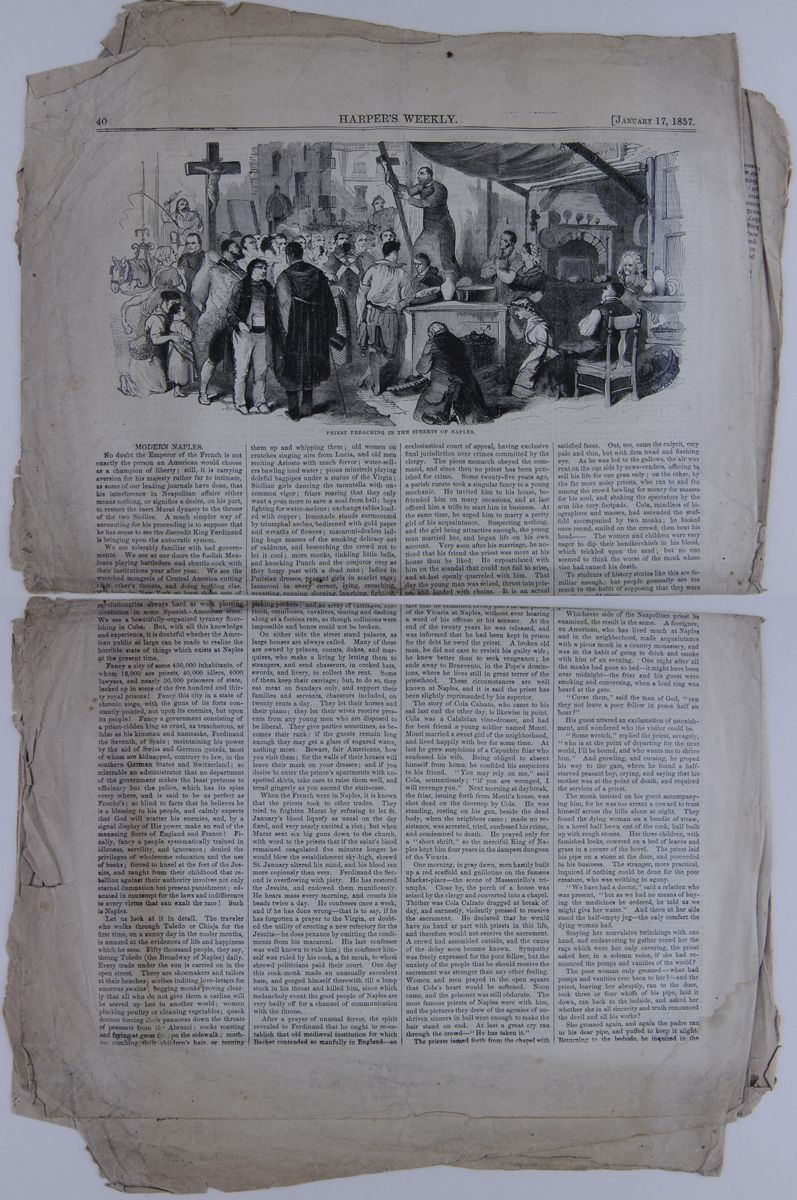
MODERN NAPLES.
No doubt the Emperor of the French is not exactly the person an American would choose as a champion of liberty; still, it is carrying aversion for his majesty rather far to intimate, as some of our leading journals have done, that his interference in Neapolitan affairs either means nothing, or signifies a desire, on his part, to restore the inert Murat dynasty to the throne of the two Sicilies. A much simpler way of accounting for his proceeding is to suppose that he has sense to see the discredit King Ferdinand is bringing upon the autocratic system.
We are tolerably familiar with bad governments. We see at our doors the foolish Mexicans playing battledore and shuttle-cock with their institutions year after year. We see the wretched mongrels of Central America cutting each other's throats, and doing nothing else. We have in New York at least three sets of revolutionaries always hard at work plotting revolution in some Spanish-American state. We see a beautifully-organized tyranny flourishing in Cuba. But, with all this knowledge and experience, it is doubtful whether the American public at large can be made to realize the horrible state of things which exists at Naples at the present time.
Fancy a city of some 450,000 inhabitants, of whom 18,000 are priests, 40,000 idlers, 4000 lawyers, and nearly 30,000 prisoners of state, locked up in some of the five hundred and thirty royal prisons! Fancy this city in a state of chronic siege, with the guns of its forts constantly pointed, not upon its enemies, but upon its people ! Fancy a government consisting of a priest-ridden king as cruel, as treacherous, as false as his kinsman and namesake, Ferdinand the Seventh, of Spain; maintaining his power by the aid of Swiss and German guards, most of whom are kidnapped, contrary to law, in the southern German States and Switzerland; so miserable an administrator that no department of the government makes the least pretense to efficiency but the police, which has its spies every where, and is said to be as perfect as Fouché's; so blind to facts that he believes he is a blessing to his people, and calmly expects that God will scatter his enemies, and, by a signal display of His power, make an end of the menacing fleets of England and France! Finally, fancy a people systematically trained in idleness, servility, and ignorance; denied the privileges of wholesome education and the use of books; forced to kneel at the feet of the Jesuits, and taught from their childhood that rebellion against their authority involves not only eternal damnation but present punishment; educated in contempt for the laws and indifference to every virtue that can exalt the race! Such is Naples.
Let us look at it in detail. The traveler who walks through Toledo or Chiaja for the first time, on a sunny day in the cooler months, is amazed at the evidences of life and happiness which he sees. Fifty thousand people, they say, throng Toledo (the Broadway of Naples) daily. Every trade under the sun is carried on in the open street. There are shoemakers and tailors at their benches; scribes inditing love-letters for amorous swains, begging monks proving clearly that all who do not give them a carline will be served up hot in another world; women plucking poultry or cleaning vegetables; quack doctors forcing their panaceas down the throats of peasants from the Abruzzi; cooks roasting and frying at great fires on the sidewalk; mothers combing their children's hair, or turning them up and whipping them; old women on crutches singing airs from Lucia, and old men reciting Ariosto with much fervor; water-sellers bawling iced water; pious minstrels playing doleful bagpipes under a statue of the Virgin; Sicilian girls dancing the tarantella with uncommon vigor; friars roaring that they only want a gran more to save a soul from hell; boys fighting for water-melons; exchange tables loaded with copper; lemonade stands surmounted by triumphal arches, bedizened with gold paper and wreaths of flowers; macaroni-dealers ladling huge masses of the smoking delicacy out of caldrons, and beseeching the crowd not to let it cool; more monks, tinkling little bells, and knocking Punch and the conjuror over as they hurry past with a dead man; ladies in Parisian dresses, peasant girls in scarlet rags; lazzaroni in every corner, lying, crouching, squatting, running, sleeping, laughing, fighting, picking pockets; and an array of carriages, corricoli, omnibuses, cavaliers, tearing and dashing along at a furious rate, as though collisions were impossible and bones could not be broken.
On either side the street stand palaces, as large houses are always called. Many of these are owned by princes, counts, dukes, and marquises, who make a living by letting them to strangers, and send chasseurs, in cocked hats, swords, and livery, to collect the rent. Some of them keep their carriage; but, to do so, they eat meat on Sundays only, and support their families and servants, chasseurs included, on twenty cents a day. They let their horses and their piano; they let their wives receive presents from any young men who are disposed to be liberal. They give parties sometimes, as becomes their rank: if the guests remain long enough they may get a glass of sugared water, nothing more. Beware, fair Americans, how you visit them; for the walls of their houses will leave their mark on your dresses; and if you desire to enter the prince's apartments with unspotted skirts, take care to raise them well, and tread gingerly as you ascend the stair-case.
When the French were in Naples, it is known that the priests took to other trades. They tried to frighten Murat by refusing to let St. January's blood liquefy as usual on the day fixed, and very nearly excited a riot; but when Murat sent six big guns down to the church, with word to the priests that if the saint's blood remained coagulated five minutes longer he would blow the establishment sky-high, shrewd St. January altered his mind, and his blood ran more copiously than ever. Ferdinand the Second is overflowing with piety. He has restored the Jesuits, and endowed them munificently. He hears mass every morning, and counts his beads twice a day. He confesses once a week, and if he has done wrong—that is to say, if he has forgotten a prayer to the Virgin, or doubted the utility of erecting a new refectory for the Jesuits—he does penance by omitting the condiments from his macaroni. His last confessor was well known to rule him; the confessor himself was ruled by his cook, a fat monk, to whom shrewd politicians paid their court. One day this cook-monk made an unusually succulent ham, and gorged himself therewith till a lump stuck in his throat and killed him, since which melancholy event the good people of Naples are very badly off for a channel of communication with the throne.
After a prayer of unusual fervor, the spirit revealed to Ferdinand that he ought to re-establish that old mediæval institution for which Becket contended so manfully in England—an ecclesiastical court of appeal, having exclusive final jurisdiction over crimes committed by the clergy. The pious monarch obeyed the command, and since then no priest has been punished for crime. Some twenty-five years ago, a parish curate took a singular fancy to a young mechanic. He invited him to his house, befriended him on many occasions, and at last offered him a trifle to start him in business. At the same time, he urged him to marry a pretty girl of his acquaintance. Suspecting nothing, and the girl being attractive enough, the young man married her, and began life on his own account. Very soon after his marriage, he noticed that his friend the priest was more at his house than he liked. He expostulated with him on the scandal that could not fail to arise, and at last openly quarreled with him. That day the young man was seized, thrust into prison, and loaded with chains. It is an actual fact that he remained twenty years in the prison of the Vicaria at Naples, without ever hearing a word of his offense or his accuser. At the end of the twenty years he was released, and was informed that he had been kept in prison for the debt he owed the priest. A broken old man, he did not care to revisit his guilty wife; he knew better than to seek vengeance; he stole away to Benevento, in the Pope's dominions, where he lives still in great terror of the priesthood. These circumstances are well known at Naples, and it is said the priest has been slightly reprimanded by his superior.
The story of Cola Calzato, who came to his sad last end the other day, is likewise in point. Cola was a Calabrian vine-dresser, and had for best friend a young soldier named Monti. Monti married a sweet girl of the neighborhood, and lived happily with her for some time. At last he grew suspicious of a Capuchin friar who confessed his wife. Being obliged to absent himself from home, he confided his suspicions to his friend. "You may rely on me," said Cola, sententiously; "if you are wronged, I will revenge you." Next morning at daybreak, the friar, issuing forth from Monti's house, was shot dead on the doorstep by Cola. He was standing, resting on his gun, beside the dead body, when the neighbors came; made no resistance, was arrested, tried, confessed his crime, and condemned to death. He prayed only for a " short shrift," so the merciful King of Naples kept him four years in the dampest dungeon of the Vicaria.
One morning, in gray dawn, men hastily built up a red scaffold and guillotine on the famous Market-place—the scene of Massaniello's triumphs. Close by, the porch of a house was seized by the clergy and converted into a chapel. Thither was Cola Calzato dragged at break of day, and earnestly, violently pressed to receive the sacrament. He declared that he would have no hand or part with priests in this life, and therefore would not receive the sacrament. A crowd had assembled outside, and the cause of the delay soon became known. Sympathy was freely expressed for the poor fellow, but the anxiety of the people that he should receive the sacrament was stronger than any other feeling. Women and men prayed in the open square that Cola's heart would be softened. Noon came, and the prisoner was still obdurate. The most famous priests of Naples were with him, and the pictures they drew of the agonies of unshriven sinners in hell were enough to make the hair stand on end. At last a great cry ran through the crowd—"He has taken it."
The priests issued forth from the chapel with satisfied faces. Out, too, came the culprit, very pale and thin, but with firm tread and flashing eye. As he was led to the gallows, the air was rent on the one side by news-venders, offering to sell his life for one gran only; on the other, by the far more noisy priests, who ran to and fro among the crowd bawling for money for masses for his soul, and shaking the spectators by the arm like very footpads. Cola, mindless of biographers and masses, had ascended the scaffold accompanied by two monks; he looked once round, smiled on the crowd, then bent his head——The women and children were very eager to dip their handkerchiefs in his blood, which trickled upon the sand; but no one seemed to think the worse of the monk whose vice had caused his death.
To students of history stories like this are familiar enough; but people generally are too much in the habit of supposing that they were peculiar to old times.
Whichever side of the Neapolitan priest be examined, the result is the same. A foreigner, an American, who has lived much at Naples and in the neighborhood, made acquaintance with a pious monk in a country monastery, and was in the habit of going to drink and smoke with him of an evening. One night after all the monks had gone to bed—it might have been near midnight—the friar and his guest were smoking and conversing, when a loud ring was heard at the gate.
"Curse them," said the man of God, "can they not leave a poor fellow in peace half an hour?"
His guest uttered an exclamation of astonishment, and wondered who the visitor could be.
"Some wretch," replied the priest, savagely, "who is at the point of departing for the next world, I'll be bound, and who wants me to shrive him." And growling, and cursing, he groped his way to the gate, where he found a half-starved peasant boy, crying, and saying that his mother was at the point of death, and required the services of a priest.
The monk insisted on his guest accompanying him, for he was too arrant a coward to trust himself across the hills alone at night. They found the dying woman on a bundle of straw, in a hovel half hewn out of the rock, half built up with rough stones. Her three children, with famished looks, cowered on a bed of leaves and grass in a corner of the hovel. The priest laid his pipe on a stone at the door, and proceeded to his business. The stranger, more practical, inquired if nothing could be done for the poor creature, who was writhing in agony.
"We have had a doctor," said a relation who was present, "but as we had no means of buying the medicines he ordered, he told us we might give her water." And there at her side stood the half-empty jug—the only comfort the dying woman had.
Staying her convulsive twitchings with one hand, and endeavoring to gather round her the rags which were her only covering, the priest asked her, in a solemn voice, if she had renounced the pomps and vanities of the world?
The poor woman only groaned—what had pomps and vanities ever been to her?—and the priest, leaving her abruptly, ran to the door, took three or four whiffs of his pipe, laid it down, ran back to the bedside, and asked her whether she in all sincerity and truth renounced the devil and all his works ?
She groaned again, and again the padre ran to his dear pipe, and
puffed to keep it alight. Returning to the bedside, he inquired in
the
[begin surface 1253]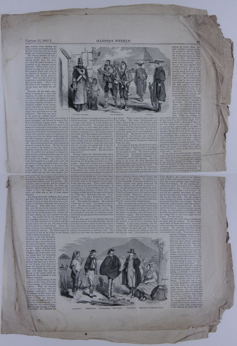 same solemn voice, whether the dying creature was certain that she
had put away from her all carnal desires and criminal
indulgences?
same solemn voice, whether the dying creature was certain that she
had put away from her all carnal desires and criminal
indulgences?
The hideous mockery of such a question elicited a motion of indignant protest from the stranger, which the priest mistaking, he grumbled, as he supposed sympathetically, "Why, in the name of fortune, do they not wait till the last moment before they send for us, instead of keeping us here shivering and saying paternosters?" Just then the old woman turned over, stretched herself, and gave up her spirit. "Now," said the priest to his companion, "we can go home and finish our bottle."
Funerals tell the same story. When la Signora S——died, after lingering for years in imbecility, and leaving her family in beggary, in order to give all her property to the priests, over one thousand ecclesiastics assisted at the funeral. It was impossible to squeeze one's self into the church of St. Ferdinand, where the burial-service was performed. The body was borne to the grave in a gilded hearse, preceded by a regimental band, and a string of grand equipages, and followed by several hundred torch-bearers, singing dirges. When the son of a poor widow was beaten to death by his master for having stolen some grapes, his mother was found clasping her dead boy in her arms, and almost crazy from grief; for she had not the twenty-five cents required to pay for a burial-service, and knew not how her darling would obtain the last office humanity requires. A charitable foreigner gave her the money, and watched the result. About an hour afterward, a fat young monk sauntered toward the house. He did not enter it, or speak to the mother, or see the corpse. Standing before the door, in a nonchalant attitude, he gabbled and muttered to himself for some minutes, crossing himself at intervals, then lazily walked away. Toward evening a peasant arrived with a basket. Into this the boy's body, half wrapped in a rough cloth, which did not cover the legs, was hastily thrust; the peasant jogged with his burden to the grave-yard, where there was a large hole, staring open, and a priest beside it. He canted the corpse out of the basket into the hole, and chalked one! Next minute another peasant, also with a basket, arrived; out of his basket he tossed the naked body of a female, and chalked two! Other corpses were rolled in every few minutes. After a time, when it was late, and the prospect of more arrivals seemed slender, the priest galloped through the burial-service, praying for the corpses en bloc; the diggers shoveled in the earth, and there was an end of those human creatures.
In judging the people of Naples, these priests and their influence must be well remembered. It must be borne in mind that they enjoy a monopoly of education, and keep all the schools in the kingdom. Some time since, a Neapolitan lady sent her son to be educated in Sardinia. The Jesuits insisted on his return to Naples, in order that he should attend their schools, and the lady refusing, she was banished the kingdom. Her mother fell ill soon afterward, and she besought permission to attend her death-bed; she only obtained it on condition that she should return with her son, who should forthwith be placed at a Jesuit school. Again, the King endorses every priestly mummery in the most emphatic manner. The latest miracle is the growth of hair on the Christ in the Church of Santa Maria del Carmini. Every year, on the 26th December, the King goes to this church in state, and clips a lock of hair from the head of the figure; next year the hair has grown again as long as ever. Add to this, that there are, so to speak, no books at all at Naples, and no free press; that the priests favor the dedication of children to "the service of God," so that there are very few families who have not a relation in the Church, while friars four years old, and pretty little nuns of ten and twelve, are constantly seen; and some idea may be formed of the power which the priesthood has acquired in this unhappy kingdom.
A true understanding of the position of the clergy is the key to a knowledge of all Neapolitan questions. What the lazaroni are, priests and their allies, the kings have made them. It is said they number 40,000, nearly one-tenth the population of the city. Some of them are fishermen, some porters, some hawkers of fruit; but as a general rule, none of them have any settled calling. Their average earnings it is hard to ascertain; but doubtless the larger part of them do not gain over five cents a day the year round. On this they feed and clothe in rags their family, go to the theatre, and speculate at the lottery. In summer they may be seen lying in every shady spot within and without the city, sleeping, arguing with fierce vehemence, or playing morra; the women, married and single, following strangers the livelong day, begging. Were it not that dirt is a characteristic of the best society at Naples, and that young ladies of high birth and rich families cannot always wash their faces, or comb their hair when they are at home, the squalid filth of the lazaroni—especially the female part of them—might be a subject of remark. But who teaches them better?
Nothing depicts the despotism under which these poor people have grown up better than their habit of talking on their fingers, and by signs. Intuitively the Neapolitan avoids the use of the tongue. Some have ascribed this to laziness. It is more likely to arise from a proper fear of spies. When the foreigner is first accosted by a Neapolitan, who crosses his mouth with his outstretched thumb and forefinger, he supposes, naturally, that the polyglot character of the sign is the secret of its general use; but a little more observation teaches him that the same signs are invariably used by the lazaroni in their intercourse with each other. Thus, a blow with the open hand on the back of the head means, "I am cheated;" a circle described with the hand bent downward, signifies, "I don't care;" the forefinger pressed against the upper eyelid stands for "Take care;" against the lower one, "I understand." You ask a Neapolitan a question. He wags his forefinger to and fro before his nose. You repeat the question. He twists his tongue into his cheek. You persist in the inquiry. He throws his head back with a shrug. You reiterate your question once more. He flies into a rage, calls you a fool, and asks you if you mean to mock him, by repeating a question which he has already thrice answered in the negative?
It has been said of the lazaroni that they wear their jackets when they have any thrown over their shoulders, simply because they are too lazy to thrust their arms into the sleeves. They certainly prefer going without dinner, under ordinary circumstances, to walking a mile. But there is a time when the lazaroni are aroused to energy. That is, when they have a stake in the lottery. The lottery office-keepers give credit; that is to say, if a man deposit a penny in their hands, they will allow him to the end of the week to find the remaining pence necessary to purchase a share in the lotto; and this spur moves the energy of the poor Neapolitan to a frightful pitch. His natural bent is to steal the sum required; but if he have not a chance of doing this, he will actually work consecutively for many hours under a broiling sun rather than forego the ticket.
It is supposed that the shortest way of exciting a revolution at Naples would be to suppress the lottery offices. That peril his present Majesty is careful to avoid. The lotto is a pet institution of his. Government agents assist the sale of tickets. Government telegraphs communicate the result of the drawings. By every means in his power the King stimulates the gambling mania, which is one of the most ruinous propensities of the Neapolitan people. On the day fixed for the drawing, the commissary of police gets into a pulpit in the hall where the ceremony is performed, and behind him stations a party of soldiers; four judges and two priests (nothing at Naples without priests) take their seats on the platform; the audience a motely assemblage of lazaroni, mechanics, foreigners, mothers with babies, blear-eyed old women, children, and officers is called to order. An official steps forward, shakes the ticket-box in sight of the crowd, and a boy from the Foundling Hospital puts in his hand and draws out five numbers. These win; as they are proclaimed to the crowd, the sensation is overpowering; men shout, women cry, many faint away from the excess of their disappointment.
Once, some years ago, a poor girl whose lover was in prison for a small debt, and who had vainly exhausted her energies in endeavoring to raise the sum for his release by working, put her two last pennies in the lotto, and went home overwhelmed by despair. She had forgotten to reserve the means to provide herself with food; that night she lay down supperless, and went out in the morning to beg a gran to purchase some breakfast. It was a rainy morning; few foreigners were in the streets; she trudged up and down through the mud and rain, weak from hunger, and found no one willing to give her the alms she asked. Toward mid-day, she was passing the lottery office. Her stake suddenly occurred to her; she pressed in with the throng, was borne into the room where the drawing took place, and sank upon the floor. She was unconscious of what took place till a great shout aroused her. Some one by her side inquired what number had won? She no sooner heard it than she uttered a piercing shriek, held up her ticket, cried, "My Ludovico!" and fainted away. She had won the great prize. But her feeble frame, worn away by want and suffering, could not support the shock. She was carried out lifeless. Having no heirs, the proceeds of the prize went, of course, to the Church, which buried her with much pomp and praying, and Ludovico remained in jail.
The only competitor of the lotto for the lazaroni's earnings is the theatre. Not San Carlo, of course; but Pulcinello and Pantaleone, of world-wide fame, and the sacred puppet-shows, the only surviving relics of the old Moralities, which once delighted Europe. There are, perhaps, the most curious places of amusement in Naples. At the door of a hovel which might well be a robber's den, stands a ferocious-looking fellow, who bellows to every passer-by, "Come in, good people, come in and see the Birth of Our Saviour, the Holy Virgin, and the Twelve Apostles, likewise the Devil, all for two grans!" A sorry magic lantern produces, on a dirty canvas, something which passes for the scene described by the proprietor of the show; while the latter accompanies each view with a commentary which might be accurately rendered: "See, gentlemen, the Birth of our Lord ! Admire, gentlemen, the beauty of the Holy Virgin, and the rage of the Devil, yonder in the corner, a-biting of his nails!" and so on.
To say that these people are idle, dishonest, and revengeful, is only to assert that well-known causes have produced their necessary consequences. Ever since our countryman was stabbed in the street in daylight for trying to apprehend a pickpocket, the fraternity whose trade is relieving gentlemen of their pocket-books and handkerchiefs have pursued it undisturbed. It is believed to be very flourishing at the present time. The police is only efficient against political offenders; the vendetta is an effectual check to their zeal in other matters. Only the other day, a poor constable made fearful experience of its danger. He had apprehended a well-known thief: the mother of the prisoner had been heard to say, "Let him never leave his house after set of sun, or woe to him!" So well did the constable understand the threat that for two whole years he never ventured outside his door after dusk. One hot summer's night, feeling very thirsty, he asked his wife to get up and bring him a cup of water. The wife replied that a jug stood just outside the window; he could reach it without going out. He rose, opened the shutter, thrust his arm out to grasp the jug; but that moment a ball directed with unerring aim passed through his temple. Had the avenger lain in wait every night for two years? It would seem so.
But, in truth, the richer classes at Naples are no better than the
lazaroni. We have heard much lately of female misdirection; those
who wish to see how low woman can sink should go to Naples. The
well-bred Neapolitan female is probably the worst variety of her
race and sex to be found in the world. Social habit, and the
practice ot keeping religion a thing apart from morality, so that
the most pious woman may be really the most depraved, have entirely
eradicated even the idea of virtue from most female minds at Naples.
The girls learn nothing that can be of use to them. They are not
even good musicians, and can not make their own clothes, or give any
assistance in the management of the household. The only work they
are ever seen to do is embroidering a virgin or a saint for some
church or monkery. Usually they spend their time in staring out of
window; too lazy to dress decently, and much given to shawls as
hiding a multitude of deficiencies. When the hour for promenade
comes, they are pretty butterflies enough; but the married women do
all the flirting. A few years ago, it used to be very delightful to
walk through the Villa Reale, the great promenade, and see the
pretty faces and bright dresses; this enjoyment has been somewhat
checked by the fiendish outrages practiced upon ladies there a year
or two ago. Our readers may remember that several ladies, among
others one or two beautiful girls of well-known families, were
burned to death while promenading in the evening, by brutes who
contrived
[begin surface 1254] to set fire to their skirts in passing them on the walk.
King Ferdinand—or King Bomba, as the English call him—is, of course, no favorite with the people, especially since his unexampled treachery to Poerio, Barberini, and the other liberal leaders and his scandalous violations of the constitution he promised to observe. We have read of kings who were treacherous before, and kings who loved despotic power, and kings who enjoyed the exercise of cruelty; but it is doubtful whether any king whom history embalms ever combined such abominable cruelty with such abhorrence of liberty, and such dastardly meanness as Ferdinand of Naples. One instance of the last-mentioned vice. It is usual at Naples for painters to exhibit their works once a year: the King visits the exhibition and chooses the pictures he likes; but he puts his own price upon them, and invariably cheats the artist. Not long since a promising young artist painted a picture that was decidedly the gem of the exhibition. He had numerous offers for it; more than one American desired to have it in this country. He was notified that the King intended to do him the honor of taking it, and would pay him so much—about one-third the price he had been offered. To the horror of the official he refused to agree to the bargain. He was warned of the folly of resisting the King; being firm, he was requested to state his views in writing, as no servant of his Majesty would venture to state them verbally. He wrote: " I refuse to surrender my picture for one-third its value. Either pay my price or return it." The picture was returned, but the artist was invited to leave the kingdom.
For all his shortcomings, Ferdinand does not seem to fear his people. He drives about in his carriage, sitting on the box, and staring at the strangers, most of whom take him for the royal coachman. He has filled all the forts at Naples with Swiss troops, on whom he fancies he can rely; the Neapolitan soldiers are stationed in the country parts. The latter are well understood to be ripe for rebellion; when the lazaroni rise they will join them, and there will be a terrible fight with the Swiss, who will do their duty.
The question suggests itself when will the revolution come off? This is not easily answered. French revolutions can be predicted with some certainty. It may be said that, all things being equal, and each successive government having a man of sense at its head, there will be a revolution every generation till the French settle in their assiette—each generation earning experience enough not to repeat the experiment. But at Naples it is a very different affair. The lazaroni are rather conservative than otherwise, and revolutions are usually begun, if not achieved by, the populace of capitals. A spark thrown into the combustible elements by England and France might create an explosion; but neither could afford to go so far. Possibly the executions which are taking place among the soldiery may lead to an outbreak. The feud between the Jesuits and the other Catholic sects may serve as a nucleus for a conspiracy. But this is vague conjecture. The worst of bad governments is, that after a time they unfit their subjects for the sacred duty of insurrection and self-rule; it is a melancholy truth that no nation, once enslaved, ever completely and permanently recovered its liberty.
[begin surface 1255] [begin surface 1256]
THE SCIENTIFIC CONGRESS.
American Association for the Advancement of Science.
PROFESSOR HARE ON SPIRITUALISM
Interesting Geological Observations on the Sierra Madre.
&c., &c., &c.,
Sixth Day's Proceedings.
GENERAL SESSION
ALBANY, Aug. 26, 1856.The meeting was called to order at twenty minutes past ten.
The usual list of new members was read, and all were admitted unanimously.
Professor Hall vacated the chair, in consequence of the bad state of his lungs, and called to his place Professor Caswell.
A resolution was read from the Standing Committee, recommending that no action be taken with regard to the geological sermons. Carried unanimously.
Professor DAVIES, of West Point, moved that for the remainder of the present session the old constitution should remain in force, and that the revised constitution should go into force on the beginning of the next session; also that the Vice president to serve for the next term should be elected at this meeting. He moved this to avoid the confusion that would arise from a period of transition.
Prof ROGERS seconded the motion, and was unanimously adopted.
DR. HARE ON SPIRITUALISM
Dr. Hare rose to demand, as a right, the privilege of being allowed to explain his views on the subject of spiritualism. He had no doubt whatever that noises were produced and objects moved without contact with any mortal hand. He disired that they form the subject of formal inquiry. If, said he, the Association decline to inquire into them on the ground that the agency, being a spiritual one, does not fall within the scope of the Association, which only inquires into physical phenomena, then the Association bears testimony to the truth of spiritualism. If, on the other hand, the Association deny the spiritual agency which I assert effects these results, then they are physical phenomena, into which we are bound by the title and character of this body, to inquire. He would leave the members their choice of the horns of the dilemma. All that he desired was an opportunity of being heard. There were facts he could state. For instance, on 26th February last he went into a room where there was a mother and daughter; no one else. On his appearance a large dining table began to dance. (Great merriment.) Well, he got up upon the dining table; it danced still. He took it out and examined it. It was an ordinary table, with which it was impossible to perform any tricks or legerdemain. How was this to be explained? Here was both mind and physical force wholly without a mortal cause. There was another reason why he sought an opportunity of explaining how he now came to differ from those with whom he had hitherto acted on the subject of science. For the first three months after he had begun the study of the subject he had remained an unbeliever, and had published his opinion in that view. He now desired to show that he had not lightly given up that opinion. He thought that it was due to him and due to the subject that he should have a hearing before this body.
Prof. PIERCE said that every one had admired the manly way in which Prof. Hare had called for a discussion on the subject. He had known Prof. Hare for years, and esteemed and respected him, as they all did, though he differed from him on this particular subject. He regretted very much to be obliged to oppose him.
The CHAIR here interposed to say that there was no motion before the house, and asked some member to put one.
Some confusion followed, Dr. Hare and other members speaking together. The Chair at last recognized.
Dr. WINSLOW, who moved that a committee be appointed to consider the subject of spiritualism, and that they meet in the nearest insane asylum. (Tremendous confusion and general hisses and groans.)
Prof. AGASSIZ, with great warmth, rose and said that it was shameful that an old and venerated member like Dr. Hare should be insulted in this American Association. (Deafening applause.)
Dr. WINSLOW rose and begged to say a word.
The CHAIR—Make it short, then, sir.
Dr. WINSLOW apologized.
Prof. PIERCE continued his argument, to the effect that these spiritual manifestations must either be spiritual—in which case they were no concern of the Associations—or jugglery, which was equally beyond the scope of that body.
[cutaway]to interrupt Prof. Pierce protested against the unfairness of this mode of putting the question.
Prof. MITCHELL moved that one hour be allowed to Prof. Hare to explain his theory. He differed entirely from his views, and he would not vote for a discussion of the subject, but he, for one, would listen to Prof. Hare for an hour or so, and he thought the Association would do the same.
Prof. DAVIES, of West Point, said that no man in that Association had more respect for the mover of this matter than he. He had known him longer than most members, and yielded to none in consideration for his character ang services. But as a member of this Association he would allow no personal consideration to sway his vote. His time and that of the other members belonged to the Association; though they might be willing to give one or several hours of their own time through personal consideration for Dr. Hare—
Prof. HARE—I ask no consideration, sir.
Professor DAVIES—As a member of this association he must oppose the occupation of its time by the subject. He was opposed to the bringing of exciting popular topics before this Association. He had always endeavored to avoid the exciting topics of the day in his career as a teacher of youth, and he thought the same principle should govern this Association.
The question on Professor Mitchell's motion was then called for, and lost.
Professor ROGERS rose, and said that his venerable friend, who was very earnest in his belief on the point acquiesced in the decision of the meeting, though he believed that it did him injustice; but he had requested him (Professor Rogers) to invite the members to meet him individually, at the time most convenient to them, for a close examination of the experiments he had made.
Mr. WOOLWORTH, on behalf of the Local Committee, invited the members to a reception to be given that evening by Mrs. Dudley.
A letter was presented by an ambrotypist, who desired the Association to inspect his pictures.
Professor DEWEY said that he was informed that the fir trees in California, which were supposed to be 3,000 years old were in danger of being extirpated. He moved that Professor Henry be a committee to communicate with the government with a view to the preservation of these trees.
Professor ROGERS seconded the motion, and it was carried unanimously.
Professor CHAMENET moved that auditors be appointed to audit the accounts of the Association. Carried.
The CHAIR appointed Professors J. L. Le Conte and J. H C. Coffin.
The meeting then adjourned, to meet in sections.
SECTION OF GEOLOGY.
President Hitchcock in the chair.
The first papers read were:—
An exhibition of fossil fish remains from the carboniferous limestones and coal measures of Illinois, by A. H. Worthen, which led to a technical discussion, in which Professor Agassiz and other members took part.
Generalities of the geology of Oregon and Northern California, by J. S. Newberry.
On fossil wood, with structure, found by Sir W. E. Logan in the Devonian rocks of Gaspe, C. E., By Professor J. W. Dawson. This paper also led to some discussion. The learned Professor showed how it was allied in its structure to the conifers.
The next paper was:—
GEOLOGICAL OBSERVATIONS ON THE PLUTO-VOLCANIC SLOPE OF THE SIERRA MADRE ALONG THE AZIMUTH BOUNDARY LINE THROUGH NORTHWESTERN SONORA, MADE UNDER THE DIRECTION, AND COMMUNICATED WITH THE PERMISSION, OF THE UNITED STATES COMMISSIONER, MAJOR W. H. EMORY. BY ARTHUR SCHOTT, WASHINGTON, D. C.
SITUATION OF THE GROUND.—An airline drawn southeastward, from the left bank of the Rio Colorado del Oeste, twenty miles below the mouth of the Gila, to the intersection of the meridian of 101 degress longitude of Greenwich and the parallel 31 deg. 20 min. north lat., comprises the western portion of the new boundary between the two republics—of the United States and Mexico—which was lately surveyed and established under the provisions of the so called Gadsden treaty. Geographical terms for this section of the boundary would be Sonorian or Pimerian line, for it runs through that northwestern part of Sonora, which also bears the old Spanish name "Pimerio Alta," (High Pimeria). A geodetic name for the same would be the "Azimuth line," because it intersects in an oblique direction from southeast towards northwest all the meridians and parallels fallen in with. This line then distinguishes itself from the eastern portion, which whilst running congruent to parallels and meridians, crosses northeastern Sonora and northern Chihuahua, in which State it terminates on the banks of the Rio Bravo del Norte.
Our Azimuth line, then, for its entire length, takes its course over the eastern slope of the basin of the Californian gulf, following the divorein aquarum between the Gila and those streams of northwestern Sonora, which by a southwesterly course, drain the adjacent country, finally emptying into the Gulf of California. From one extremity of the line to the other —that is, from the heights of the Sierra del Pajarito, in the upper part of the Santa Cruz river valley, to the initial point on the banks of the Colorado (del Oesta), the line measures 233 English miles (round numbers).
As for values to express the hypsometric and general geological features of the country along the lines, we will have to be content with but approximate figures, for circumstances prevented actual measurements to that end.
An imaginary airline drawn from the most elevated point of the Sierra Pajarito, about 200 or 300 yards south from the southeastern terminus of the line to the initial point on the Colorado, exhibits a dip of about 22.1´ to one mile, or an equivalent of 0.41´ to 100´.
The point of elevation of the Sierra before named is supposed to be about five thousand feet above the waters of the Colorado, next to the initial point. Adding the difference of elevation between this point and the level of the ocean, we may put [illegible],780 feet for the highest part of the Sierra del Pajarito next to the southeastern terminus of the Azaimuth line. This point does not seem to reach the pine region, which in these latitudes may be considered as about 6,000 feet above the ocean.
The surface of Northwest Sonora is characterized by a monotonous simplicity of features; and but for closer examination even a more scrupulous observer would not be able to discover more than a mere dualism of diluvial drift and plot-volcanic rocky mountains. Along a very considerable portion of the line the former has covered almost to the top those ranges of the latter which approach the bottom lands of the Colorado. Indeed the northwestern section of our Azimuth line is running over what may be properly styled a veiled country; for of mountains only the tops or crests are to be seen, occasionally sticking out from the desolate sandflats which have filled up the entire valley of the lower Colorado. This river winds its course through these forsaken barrens of drifting sand, like a serpentining oase, bordered by comparatively but narrow strips of timbered bottom land.
The mountains ranging across that drift form the frame or skeleton of the geological edifice of the country, whilst the diluvial main may be looked at as the sinew and muscle. If we go further in comparing the alluvial deposits, with a tegument, or even a geognostical epidermis, we find the latter most poorly represented. This natural deficiency, however, facilitates the observations of the geologist who may look upon this country as upon some object already prepared and laid open for analytic investigation.
THE ALLUVIUM.—As the uppermost stratum we first take sight of the alluvium, of which very little is met with over the whole country, except at the extremities of the line. The larger share of course is confined to the bottom lands of the Colorado and next to those comes the region of the higher mountains; whilst strange to say, the plains, in this respect, are last in order.
The slopes, and generally the more or less inclined planes on the mountains, are sufficiently rough to form crevices, dells and small valleys, with obstructed outlets to prevent entire deprivation of alluvial alluvial deposits, the condition of primary importance for the developement of vegetable life, of which the almost naked plains suffering under the sway of climate severities, and under the devastating sweep of an almost continually moving sand, are nearly wholly deprived. Few traces of alluvial soil may be looked for at the so called "playas" in the plains. These are depressions of ground which are at the greatest vertical distance from the summits and crests of the mountain ranges. Into these basins the aqueous deposits of the atmosphere, together with the lighter parts of the surrounding soil, are carried. In many cases the traveller may find here a more developed vegetation, consisting, however, more of a mass of equals than of a diversity of species and genera. Frequently this seemingly premature attempt of nature to promote vegetable life in such places is sadly counterbalanced by the saline character of the soil, and this a prevalence of corresponding forms, as obion, salsola, salicornia, batis and others, take the place of algarobia, prosapis, or even salix, in corresponding places.
THE DILUVIAL MAIN.—The mainland filling up the space between the various mountain ranges which cross the Azimuth line from southeast towards northwest is constituted by a more or less uniform deposit of loose diluvial sand, a compound not essentially differing from the material the mountains are constituted of. So we may call it without hesitation the debris of the adjacent mountains and the underlying firmer parts of the land. As to the mode in which it may have been formed and placed to its present appearance, we firmly believe it to be the residue of a once intermediate ocean, at the time a link combining the Atlantic and the Pacific oceans.
Changes in the composition of this deposit certainly occur, but they appear more of a local nature and a certain uniformity pervades the whole. Fragments of quartz, mica, felspar, and other crystalline and igneous rocks, together with calcareous particles, combine this almost unbounded stratum, forming a vast region of deserts between the eastern foot of the Californian Cordilleras and the table lands bordering the eastern shore of the Rio Bravo del Norte. So we look at as upon a diluvial ocean thousandfold intersected by those gigantic walls, dykes and reefs, which we know as those mountain ranges already mentioned.
In the immediate vicinity of the latter banks and isolated beds of pebbles are visible, the character of which answers to the lithologic feature of those mountain parts whence they derived. These pebbles, however are not to be confounded with other similar pebble banks appearing occasionally right in the centre of those desert basins, especially along certain water beds, which at present may have served out their purpose, or still may be the dry channels through which sometimes rain water currents pass off. Pebble beds of the first mentioned class are the result of the disintegrating forces of the air upon the faces of the mountains, deposited not far from the place where they originated, whilst those of the second class seem to be the gatherings of an immense area, consisting of the most different pieces dislocated from the most diverse and often very remote geographical quarters. A wide spreading medium must have collected a compound of so heterogeneous constituents. So we find in the sand loose pieces of limestone of different geological age, as there are, for instance, represented the carboniferous, cretaceous, tertiary, and even traces of fresh water lime. We also find agath, chalcedony, opal, semi-opal, jasper, slates, and all sorts of silicious or silicified forms, breccias, conglomerates, crystalline and amorphous. There lie, thrown together, silicified, agathized or opalized fragments of wood side by side with mere incrustations of wood, either metamorphosed or unchanged, and quite of late date. On another spot we ma observe a semi-opal, consisting entirely of shells, the age of which is readily recognized by numerous munulites associated with them, With the other hand we may take up an agath abounding in the neatest fragments of encrinitic or coraline form [cutaway]a piece of jasper or hornstone, upon which, by means of a common lent glass, texture and grain of some coniferous wood can be discovered. Not uncommon are also large fragments of wood opal, exhibiting traces of the structure of fossil wood with annuar concentric rings, though with the marks of grain vanished away; also glass opal, or hyalith, containing [illegible]asts or traces of some forms of the coralage, pisolits, either unchanged or metamorphic, as if indicating the making of a toadstone.
The deserts on both sides of the Colorado and along the Gila abound in such pebble beds, surrounded by that same above described uniform sand, by which they become occasionally entirely buried, or from under which they are redeemed again by the play of the ærial currents.
For the scientific observer fragments of the mentioned character are the pearls for this vast terrestrial ocean, which once must have formed the bottom of an aqueous waste of the same dimensions, and under the sway of which these pebble beds must have been collected. Since the waters have receded from this area another ocean of a more subtle character sweeps over it. Now the ærial currents are driving the shifting sand about as once the currents of the ocean must have done. At present only local alterations take place on these plains, moving the sand about from one place to another. The level of these deserts must, undoubtedly, have been disturbed since their deposition. Besides the general declination of the western slope of the sierra Madre towards the Gulf of California, an increased declination of stratum is perceptible round the base of the intersecting mountains. These deviations form the angle of general ascent from the Colorado towards the Sierra del Pajarito, respective the Sierra Madre, do not affect the angle of inclination of the mainland, and we may ascribe them solely to the deposition of debris from the mountains. The angle formed by the rising of the diluvial deposits and the horizontal base of the mountains in the Santa Cruz river valley was measured to be =2,5°.
The general ascent of country is a more essential proof of the upheaving of country since the deposition of the quaternary or diluvial drift. A line drawn upon its plane from the valley of the Colorado to that point on the foot of the Sierra del Pajarito, where diluvial deposits cease—that is, about 1,100 feet below the highest point of elevation of said Sierra, rises to about 3,900 feet—that is, 12.44 feet to one mile, or 0.23':100'.
Some valleys may exist, heading on the slopes of the Sierra del Pajarito, through which diluvial deposits rise still higher, but such exceptions do not affect the angle of the general ascent of this stratum. The relative and absolute elevation to which this diluvial main rises in its approach to the Sierra Madre forms a striking peculiarity in the features of the country. With a gradual ascent it furnishes a natural bridge almost over the entire height of those rocky mountains, the rugged crests and summits of which otherwise would have remained inaccessible. Whilst offering, however, such advantage, it infers otherwise very serious evils, by covering, like a thick veil, all that portion of country which for its level character, or at least very little inclined plane, should form the proper field for those higher faculties of nature by which the latter promotes the developement of vegetable and subsequently of animal life. Instead of that it now lies prostrate, a geological sisyphos, having water at its base and seeing it treasured up in clouds without being able to receive and apprize the benefit of either. Even those few rains which fall upon it are instantly swallowed up by the bottomless sand, leaving no traces of having done some good.
The few periodical water streams descending from the mountain slopes share the same fate with the scanty gatherings of the clouds falling upon this driftland. Immediately after reaching it they disappear from the surface, sinking to unknown depths, leaving only in the vicinity of the mountains but slight marks of a rudimentary drainage in bunches of shrubbery and trees, with border the dry water beds of the country. Thus, the blessings of water are lost upon these plains, as ill trusted alms in the bottomless pocket of an unworthy beggar.
The objection peculiar to the surface of this diluvial main ins much like that of the corresponding regions on the other side of the Sierra Madre, or on the west side of the Colorado river. Besides, a number of smaller and more inconspicuous forms, the larrea Mexicanan, tonguiera splendens, several obions and other chenopodiaceous shrubs, and also quite a number of leguminous herbs, shrubs and trees, and various members of the order of cacti are here the desert plants familiar to every one who once travelled over this ground.
THE SKELETON OF THE COUNTRY.—Above we have pointed to the simple plan upon which nature constructed the more solid parts—that is, the rocky frame or skeleton of the geological edifice of the country. To come to the underlying strata upon which the diluvial deposits are placed we will have to step at once very deep, for constituents of the secondary age seem to be lacking. Crystalline rocks, of primary and transition age, more or less metomorphic, constitute the vast bed upon which the upper strata are placed. This bottom, however, does not form an even plane, more or less inclined, but its surface appears manifoldly broken and protruded by eruptive rocks, which forced with themselves the broken edges of the former above the level of the diluvial main. Thus were formed at the time those mighty sierras now the framework of our geological edifice. In regard to their petrographic character we may distinguish them as pluto-volcanic.
With the hypsometric features of these sierras, or better to say Cordilleras, two important peculiarities are connected. These are —1. Parallelism among themselves and to the ranging of the Californian Gulf respective to the coast of the Pacific; 2. Articulation; and 3. General petrographic relationship.
The parallelism of the various mountain ranges among each other as also their striking reference to the bearing of the shores of the Pacific, is a fact already and better known that the laws under which nature has effected it. Whether the linear extension of the axis of these mountains was caused by the combined action of electro-magnetic forces and the tidal currents of the ocean, and perhaps also influenced by the isothermal, isoclenic and isodynamic currents we are not able to decide, and so we offer the following as a mere theory, founded on the observations made in the field. Perhaps after the first onset of that peculiar reef or dyke formation, probably a primary response of volcanic forces to the action of positive and negative electro-magnetism, the formation of sedimentary deposits has commenced. At this time igneous forces have prevailed, and therefore the strata of that era exhibit a crystalline character. Gradually, and by the increase of volcanic debris and sedimentary material aqueous forces gained, and whilst substratafied transition rocks were formed, ejected igneous masses were confined already to certain fissures. The crust having become more and more firm and heavy above, these fissures of ejection compelled the igneous forces to seek other outlets, which may have been conditioned by the stratification, lamination and clearage of sedimentary rocks. To this circumstance we may ascribe the formation of those long mountain ranges and dykes. The former are mostly onesided upheavings of metamorphic strata, the latter truly eruptive masses. Thus we arrive at a very much diversified combination of volcanic, plutonic and neptunic rocks, as they really are represented by the orographical system along our Azimuth line. There we have sienitic and granitic lavas, trachyte and trap exhibiting still clear traces of cleavage lamination and stratification, and also granite, gneiss, sienite, and various kinds of transition slates.
To what degree our theory may agree with the observed geonostrical dates, a special survey of the mountains along our Azimuth line will show. Before entering, however, on this subject, we propose some remarks on a few Spanish terms, which, identify their object with so much precision that we would not like to part with them lest we should be compelled to use in their place other scarcely answering their purpose We refer to the words cordilleras sierra, cuchillo, picacho, puerto, loma, mesea, cienaga, charco and pinaja.
CORDILLERA.—Cordillera means a long mountain range, composed of several parallel running integrating ranges, which, however, can be occasionally intersected by passes or narrow cross valleys. The essential characteristic of the term is, that a cordillera is formed by two or more ranges, forming one orographical body, as a cord consists of several strings twisted together. The words cord and cordillera are formed upon one stem.
SIERRA.—Sierra, in Spanish, is a saw, or a mountain range with a serrated crest, and of a reef, dyke, or wall shape. The cross diameter of both the sierra and the cordillera is very small compared with its longitudinal axis.
CUCHILLO.—Cuchillo is a branch, or outrunner, of a sierra, partaking in its physiography with the latter. Its sharp edge crest probably caused the name cuchillo, which is also a knife.
PICACHO.—Picacho means a sharply tapering peak, pinnacle, or horn, the vertical height of which shows a similar proportion to its cross section, as the longitudinal axis of a sierra to its cross diameter.
PUERTO.—Puerto, a gate, or post; in its topographical application a pass over or through a mountain ridge not of any length, as, for instance, a causeway or canon.
CANON.—Canon, a mountain range, or defile, with no outlets on either of the sides.
LOMA.—Loma is a long mountain or hill ridge, with a more smooth horizon. Lomita is the same on a smaller scale.
MESA.—Mesa, a table land, table mountain, or table ridge, the top of which is of larger horizontal extension. Mesilla is the diminutive form of the same.
MAL PAIS.—Bad land, or mauvais tierras of the French. In Sonora it is exclusively applied to mesas, lomas, or any table land constituted by large beds of igneous rock, mostly compact, or vesicular trap or basalt.
CIENAGA.—Cienaga is a valley or mountain basin with an obstructed outlet, and all round hemmed in by hills or mountains. Thus cienaga abounds in miry and boggy places.
CHARCO.—Water pool formed in lower and level regions, either in a strata of rock or washed out in a bed of clay.
PINAJA.—Water hole in solid rocks, and met with in the crevices and ravines of rocky mountains. Pinaja originally means an earthen jar not glazed, burnt so as to allow exudation, by which means the water inside remains cool.
After this we may proceed with the consideration of the various sierras which we shall have to cross by following our Azimuth line from southeast towards northwest.
SIERRA DEL PAJARITO.—The southeastern terminus of our Azimuth line on the northern slope of the Sierra del Pajarito, (little bird or birdling), shows crystalline transition rocks, metamorphic or unchanged, also trachytic strata, or metamorphic forms of granitic and sienitic strata. Some of the more elevated portions exhibit a rough cellular surface, whilst the lower are more dense and smooth. The color is dull red or light pink. These rocks abound in crystals of glassy felspar, and occasionally particles of angite; thus answering to the frequent occurrence of sienitic granite. The foot of this sierra shows on the north side on some of its cuchillos a very fine grained white metamorphic sienite, consisting of minute particles of hornblende and white felspar. On the lower parts of the west slope, talcose, argillaceous and quarzose slates are met with, though trachytic rocks are ranging through in every direction. One of the aroyos there is cutting through a solid mass of trachyte, forming a puerto through vertical walls on both sides of perhaps fifty feet in diameter. The mountains on both sides slope towards this puerto under an angle of 35 or 40 feet. This and other localities on the lower portion of this sierra abound also in pudding stone, volcanic breccia, felspatic porphyry and trappitic amygdaloid rocks. Some of the waterbeds round the foot of this sierra are lined with a singular formation, and apparently of a later age than that formerly mentioned. At first sight we looked upon it as if it were a fresh water deposite, overlying or placed alternately with a certain volcanic breccia. In some places, especially where it occurs of a greater height, some traces of stratification, and even cleavage, are visible. It forms throughout its lower portions one solid cemented mass, embedding between vertical walls of some 30 and 40 feet high a torrent, which at the time we passed here in most places was dry. The color of these rocks was light brown or dark ash gray. Its outer crust as formed by a process of calcination, was quite loose in some places, and then a mealy, marble like powder, like chalk, could be scratched out . There was no reagent at hand to prove this rock as to its containing carbonate of lime, but we do not doubt it contained such, even when we incline at the same time to refer this remarkable mass to volcanic products, and perhaps with good reason to that very cement which forms the matrix of the volcanic treccia before mentioned. We found here and every where trappitic and amygdaloid rock, no matter at what elevation it was taken, adhering carbonate of lime, as if it had been precipitated there by water. Every basaltic or trachytic boulder exhibited the same in their empty vesicular cavities. The fissures between these rocks and the dells where they laid embedded show a similar precipitate of a similar calcareous substance. On the east slope of the sierra, in a valley called Los Nogales (the walnuts), similar strata line the course of the water there, sometimes forming a continuous winding low bank or terrace on both sides, and sometimes covering, even to some extent, the slopes of the surrounding mountains, constituted by crystalline rocks. On these hillsides the same mass forms inclined shelvelike beds, dipping towards the valley and exhibiting by decurrent lines a shaly, laminated texture. East of this valley, along the easternmost outlayers of the sierra, the same formation, still more boldly developed, is met with, as every traveller going form here to Santa Cruz may observe. Farther to the south, and towards the southwesternmost link of the same cordillera that is on the strike side of the Sierra Santa Barbara, and still farther downwards into Sonora, strata of the same character abound in all the valleys drained by running water.
The volcanic breccia occurring also in most of the water leading valleys and ravines of the Sierra del Pajarito, rises from 40 to 50 feet under an angle from upwards of 450 to vertical walls. Some pieces of it were tried, heated in a large log fire, and then thrown into cold water, upon which they showed much effervescence, though without breaking.
SIERRA JANOS.—To the north and northwest of this mountain range, with its bearing from east to west, the Sierra Janos is rising up in bold terraces of dark read brown amygdaloid trap and porphyry, the broadest terraces being along its lower regions. The edge of each of these gigantic shelves is bordered with outstanding rocks, dykes, and rocky horns, in the most phantastic manner. All these terraces are falling back towards the main body of the sierra, joining it by means of deep and rugged lateral valleys, on the other side of which they rise the higher and steeper. The most elevated part—the central stock—forms a huge table block, exhibiting on its south and west side gigantic walls, showing distinct stratification and cleavage, the lines of which cross each other vertically. This gives to these igneous rocks a very singular appearance, as if they were veritable masonwork. The rectilinear fissures are visible at a distance of ten to fifteen English miles. The vernacular name Janos has no reference to the petrographic charter of the sierra. It signifies in the language of the Papayo Indians, an arborescent shrub of the givnoniaceous order (Chilopsis), which grows abundantly through the dry rocky and stony water beds all over the country and also in this neighborhood. The striking resemblance of the centre block of this sierra to masonwork, would certainly justify the more appropriate name "de los ladrillos" (sierra of the brickstones,) for that lefty centrepart agrees very much to Humboldt's description of portion of the Peruvian volcano Pichincha, where also a similar orographical phenomenon is mentioned. On that volcano it is constituted by a kind of pitchstone, cleaving in thin vertical slabs or layers, which, at a distance, gives to it also the appearance of mason work, and is therefore called by the inhabitants of Anito "Prio de los ladrillos."
SIERRA ATASCOSA.—On the northern slope of the Sierra Janos another group is arranged, placed with both the former upon one longitudinal axis, and having, at the same time, with the Sierra Janos a similar bearing from southwest towards northeast—that is, toward the valley of the Santa Cruz river. The three links of the cordillera they belong to have dip and strike alike towards the Santa Cruz river. In its petrographic character the Sierra Atascosa is like that of Janos, and being closely connected, they may both be considered as twins. The cordillera of these three sierras terminates in the northwestern slope of the latter, where a wide valley intersects their junction with the northwestern Sierra del Babuquibari. This valley is of some importance, as constant water occurs there. The deserted settlement of Ariback or Aribaca is situated here. The northwestern or upper end of the Sierra Atascosa is formed by igneous rocks and peaks towering up in the most grotesque forms. This region also bears the name of "Mal Pais." Atoscosa means "the miry." We do not know whether this Spanish name refers to the appearance of these mountains, which, indeed, is much as if they once had risen out of a hot, boiling volcanic pool. The absolute elevation above the Santa Cruz river valley seems to be pretty much the same with these three sierras, though to me the highest points of Sierra Janos looked as if they overlooked all others.
All round the Sierra del Pajorito smaller and larger springs seem to abound, but their course is more or less concealed, for which reason it needs an expert eye to look for them during the latter part of the dry season—that is, April, May, June and part of July. On all sides of this sierra, from below to its highest top, vegetation is very well developed. All the slopes and valleys abound in good grazing, ad a dense growth of shrubbery and trees cover the rough surface of its sides. Three or four different oaks are met with, and towards the top a cedar appears, though apparently without fully touching the pine region. A few years ago the rich fauna was characterized by hundreds of head of wild cattle roaming about here, but since entirely exterminated. In all its physiographical features this sierra partakes in the good things of the Sierra di Santa Cruz, and all the various links of the Sierra Madre further east. Even in regard to metals the Sierra del Pajarito is not left behind. Whilst in camp at Los Nogales, Major W. H. Emory, United States Commissioner, received several fine pieces of promising silver ores, obtained from the immediate neighborhood of the place. Standing on the Sierra del Pajarita, we find ourselves on the very vortex of a fine dividing ridge, sending water by the Santa Cruz river northwest to the Gila, and southwest towards Presido del Altar and other places in that direction.
We dwelt intentionally longer on the features of this sierra because of its being hypsometrically and geognostically best developed among all the sierras from here west towards the California Gulf. It forms a type and scale for considering and comparing the rest.
MOUNTAIN RELIEF.—Viewing the country towards the Gulf from the western peaks of this sierra, a wild and rugged set of mountains are spread out. Though constituted also by similar crystalline metamorphic rocks, the single sierras do not rise so high; but places close side by side, they form an inclined planea bold mountain relief—the grandeur of which consists in its horizontal extension. These plains dip towards southwest, leading the waters in a more or less straight course towards the wastes bordering the California Gulf. At a distance of about sixteen English miles another cordillera of igneous rocks in visible. Between this and the sierra we just treat upon, very little drift is seen, and where it occurs it is always confined to valleys, until we come half way between both sierras. There, by the action of water currents, mesas and lomas are formed rising from forty to fifty feet in height.
SIERRA DE LA ESCONDIDA.—The waters taking their course southwest join those coming from the east slope of the Sierra Escondida, a small distance south of the line, near a place where, in a hidden deep cleft between the igneous and amygdaloid rocks of this sierra, permanent water is found. This, however, seems not to be a spring, but a tinaja, supplied by the trickling down of the water from above situated tinajas and water holes. The character of this place caused its name, Escondida, meaning here the concealed water, which name was also applied to the whole sierra. In its orographical condition this range is but a gigantic volcanic dyke, here towering up with an isolated, rugged crest of igneous rocks, (amygdaloid and porphyritic,) here and there intercepted or overlaid by overthrown and contorted crystalline strata of a course grained felspathic sienite. The latter appears in many places metamorphic, and in others unchanged, in other places again with prevailing felspar, and in others more quarzose, imperfectly mixed with large scales of a silvery mica.
The cross diameter of this sierra, where it is intersected by the line, is scarcely more than one mile. It is bordered, however, on both sides by the quaquaversal upheavals of those crystalline beds just mentioned.
Near the locality where these singular looking peaks mark the mentioned water place, de la Escondida, we visited the top of the sierra, which in barrenness supersedes the sierras of Pajarito, Janos or Atascosa. Some portions of the table like plains on the slopes and top are covered by large patches of chalcedony, investing them almost scoria-like. The southern portion this sierra exhibits a more horizontal arrangement, as if its formation had been effected under water. Its whole vicinity is lined and traversed by extensive table lands and ridges, lomas and mesas, partly constituted by beds of black trap, partly by real diluvial banks. The topography of the country seems to indicate here the junction of quite a number mountain streams and torrents.
The line crossing the Sierra de la Escondida passes over its crest a little to the north of a conspicuous peak the highest point of the whole range, which, belonging to the State of Sonora, for this reason received the boundary name El Cerro di Sonora.
SIERRITA DEL GRANIZO.—A low group of granite hills on the west side of the Sierra de la Escondida furnishes several waterfalls well known to the natives of the country—the Papago Indians and Apaches. Some of them are mere tinajas, others seem to be springs. The latter are sometimes liable to go dry before the setting in of the rainy season. A very heavy hale and thunderstorm our party encountered there occasioned the name, "Del Granizo," by which this granite group is designated on the maps of the boundary survey. This same meteoric incident furnished a proof what little time it requires to submerge the valleys all round under the most terrible sweep of rain water currents. Our camp at the tie was near the head of a ravice, and, not withstanding a very short range, after an elapse of five minutes, hail and rain had created a torrent of five feet average depth, filling the rocky bed to its top instantly.
SIERRA VERDE.—A broad, flat valley, nine miles wide separates the Sierra de la Escondida and the adherent Sierrita del Graniza from the Sierra Verde, which seems not to be more or less than a southern spur or branch of the Sierra del Babuquibari to the north of the line. The plains bordering the various dry water courses of this valley are well furnished with good grass, and seem to be the resort of plenty of game. The borders of the water courses, though usually dry, exhibit a rich growth of trees (oak). The Sierra Verde—so called from the beautiful verdure encountered in the shelter of its rocky valleys—seems to be entirely formed by the same felspathic granite which was mentioned on the east slope of the Sierra de la Escondida. The strike is on the west side. The cross diameter, scarcely more than a mile does not incur any petrographical novelties. Its longitudinal axis ranges from southeast towards northwest, where it joins the bold igneous walls of the Sierra Gabuquibari, which is here at a distance from the line of about fifteen English miles. The whole length of the Sierra Verde scarcely exceeds fifteen miles. Round its southern end some trappitic hills and mounds are crossing out for the diluvial main. At the same locality, right under the steep slopeside of the sierra, a spring finds its way to the surface, fitting this place to a general camping ground for roaming Indians, or travelling Mexicans. The locality itself is generally known to the inhabitants of the country under the name "Pozo Verde."
EL BABUQUIBARI.—Almost due north from the surveying stations established upon the crest of this sierra, the Picacho of the Sierra del Babuquibari is situated. This is one of those orographical phenomena of the country the singularity of which could not fail to raise the attention of the red man. In fact, the Papago nation considers this huge mountain obelisk their palladium, taking there refuge in times of famine, scarcity or war. "Pabuquibari," we are told, signifies, in the language of these Indians, "water on the mountain." and is formed from babu (water), and ari (rock or mountain.) The increased height of the main body of this sierra, and especially the obelisk-like rock on the top of it, probably exercise an increased power of attraction towards the aqueous deposits of the clouds, which more copiously gather round its head. At the same time the more inaccessible recesses of the sierra secure a preservation of the water stores in those higher regions.
Viewing the country westward from the heights of the Sierra Verde another wide plain is visible, which, at a distance of about from twelve to fifteen miles, is bordered by another mountain range, traversing the country in that unvariable bearing, southeast and northwest.
The eastern half of the intermediate plain seems to favor more the developement of a vegetable cover than the western portion, which, especially in its lower regions, is almost entirely deprived of floral life. The eastern part abounds in grass and dense brushwood, besides a considerable growth of musquitewood whilst the western portion seems to have been at first, divested of all vegetables by the destroying tooth of small trogloditic quadrupeds. It is a very singular fact that both parts of these plains had been a few days ago benefitted by copious rains, and notwithstanding the western portion remained still naked coursed flat. Through the thickets of the slope under the Sierra Verde we saw flocks of the black-tail deer, which seems to have here its boundary, whilst on the western barren half, numbers of shy antelopes freely ranged over the level, unhidden before the traveller. No doubt the physiography of the country here commences to take a turn to its disadvantage, of which we shall see more after reaching the next mountain range, which is, unlike the others we had passed until now, but a short detached group, budding out from the diluvial main like a mountainous island.
SIERRA DE LA UNION.—Not withstanding of lesser extension, it presents still the same petrographic character by being a dualistic compound of igneous and crystalline rocks, the latter taking, I believe, the larger portion. In the east slope similar felspatic granite rocks, in a whitened, somewhat metamorphic state, occur, whilst the west slope shows a similar quargose quatemary granite. A similar one was mentioned at the Sierrita del Granizo. The centre part or the spine of the whole is formed by igneous amygdaloid and porphyritic rocks, hither and thither overlaid and concealed by the crystalline strata not having fully protruded the former. The northern end of his sierra is occupied by its highest peak, which, falling north of the line, received the name Cerro de la Union.
From the surveying station established in the puerto of the Sierra de la Union, we look, as from a dividing ridge, upon the surrounding country. Through that part we just had passed over, mountains and mountainous stretches prevailed, leaving but a small share for the diluvial deposits; but from here to the west the flats and levels of drifting sand prevail, and consequently sterility and desolation become a ruling feature. This change seems to be based upon the gradual submersion of the mountain ranges under the level of the diluvial main; thus they lose body and length above ground. Sierras ranging to the east uninterrupted for thirty or forty miles, now appear but detached, abrupt parts or ranges, which can be traced only by their general bearing. Cordilleras and sierras, as we shall see afterwards, are of a more open texture, by a prevalent interspersion of drift sand. Whilst the country behind resembled a narrow straight along the coast, lined by long mountain reefs, the land ahead begins to widen and become like the outside of shallow coast waters, all over spotted with small rocky islands and pieces of reefs and dykes. The more open country now is influenced by the climate of the Gulf coast. Certain plants, apparently real desert forms, appear first in the west slope of the Sierra de la Union, among them two ligumious trees—the palo verde and palo hierro of the Mexican; also certain cactreene, especially three large cerei and two of the boldest forms of the echino cacti.
SIERRA DE LOS CINDEROS.—The line crosses, at a distance of nearly seventeen miles of desert, a comparatively narrow and low sierra, chiefly constituted by porphyritic and amygdaloid rocks. The point of crossing is marked by a natural monument, a fork formed by two bold, vertical rocky horns. This sierra is a northerly continuation of the sierra or cordillera Cobota, so named by the Papago Indians, holding here several settlements. About three quarters of a mile to the south a canon intersects the sierra of the Cinderos, where the western side is easily gained. In this pass a great deal of crystalline and transition rocks appear, but the ruling features are constituted by the igneous masses. The name, De los Cinderos, was given to this sierra on account of those fork forming cliffs which are separated by the line; one peak falling north, the other south. Cindero in Spanish means a boundary or landmark—therefore the name.
SIERRA DE LA NARIZ.—Another desert plain, from seventeen to eighteen miles wide, separates the Sierra de los Cinderos from that of de la Nariz. Though both of these sierras appear very nearly related by their petrographic character, there exists one striking difference between them. The Sierra de los Cinderos, at least at our point of crossing, s a real volcanic dyke, in some places at its base bordered by the upheavals of crystaline strata. Its crests of ejected lava, forced through a mass of fantastically contorted partly shattered walls and dykes of volcanic rocks, resemble a group of Titans turned into stone whilst being engaged in the very assault they had undertaken against the heavens. On the other hand, the Sierra de la Nariz also consisting of nothing else but trachtyic and porphyritic masses, appears more to be the result of simple upheaving. Its crest, comparatively even, is nothing but the turned up edge of a vast bed of volcanic or volcanized rock, dipping towards northeast, whilst its strike, at an absolute height of 3,400 feet, faces the west under angle of from 60 to 70 degrees. The surface of its easterly slope is thickly covered by a thick layer of loose boulders, of a black vesicular trap. On this strike stratification is visible even from some distance, the layers being of various thickness, from five feet and less to twenty and twenty-five feet. The Sierra de la Nariz, ranges in a slightly curved line from southeast towards northwest, where it joins, at a distance of about eight miles, the Sierra del Ajo, of which it appears to be but a southeastern ray. Next to the joint where both sierras are connected the one of the de la Nariz is divided into two sub=parallel running branches, of which the western is but short, not exceeding ten miles in length, whilst the eastern range continues for twenty miles. Near the intersection of the line, a little to the north, quite a depression occurs, where the range does not rise over fifty feet absolute height. In this vicinity it is also traversed by two or three open passes, hardly rising over twenty feet above the level of the diluvial main.
SIERRA DE LA LAGUNA (de la Esperanza).—To the north of this sierra another one is visible at a distance of about fifteen miles—that is the width of the intermediate valley. It seems to be perfectly analogous in its petrographic character to the one of de la Nariz, having strike dip and stratifications like with the former. Little tapponorinds accompany also both these sierras, budding out along their base from the level of the valley, but not rising higher than from thirty to forty feet.
Springs are not to be found on any of these mountain ranges, and the few animals and the wild Indians and travellers depend on those holes, ponds or lagunas, which, being washed out in beds of solid clay, preserve rain water for some time. Such pools are by the Mexican called "charcos" As we had been fortunate enough to finding this neighborhood such charcos the name de la Laguna del Esperanza was given to this sierra, which seems to be also an eastern branch of the Sierra del Ajo.
SIERRA DEL AJO.—From the heights of the Sierra de la Nariz to the northwest, a bold and high range stands in sight. It appears rather like and compound of sierras forced together by the consolidation of various branches. This mountain group bears the Spanish name, del Ajo, which means garlic. The reason for this not very poetical name is founded, as we were informed, in the structure of this orographical monument. Though probably constituted by similar volcanic rocks to the others, its structure is different. As it is seen from the southwest a huge centre block of metamorphic crystalline or volcanic rock seems to constitute the strike. This block, exhibiting traces of horizontal stratification, is divided in two by the protrusion of a mass of rocks, which, though lithologically almost alike, show, instead of traces of disturbed horizontal divisions, a sort of a columnar masses. On the sides and at the foot of this sierra a large number of independent volcanic peaks are towering up, one superviewing the other, but all standing undoubtedly upon the same volcanic foundation, though some of them appear above ground quite detached. Thus the main body of the sierra resembles in its shape the bulbous head of a garlic. A comparison like this, though rather keen and parabolic, may be somewhat justified, as it implies at the same time the endogenous growth of both the sierra and the garlic. The mountain range of del Ajo also forms a kind of subdividing ridge between the waters of Sonoyta, running in a westerly course direct towards the gulf, and the waters turning in an easterly direction, and then south towards the settlements of northwestern Sonora, joining each other before reaching their end in the wastes of the coast.
THE CIRNAGA OF SONOYTA.—On the western foot of the sierra del Ajo, a wide valley is spread out, which by being hemmed in all round by mountain ranges, and having but one obstructed outlet, is what the Spanish call a cienaga. Its southern border is formed by the sierra Inchibabi, a Papago name of unknown meaning. As the sierras just before spoken of strike the eye by their dark brown, almost black color, the sierras to the south and west are constituted by metamorphic crystalline rocks, with prevailing felspar. The color of these mountain, especially under the rays of a Sonorian sun, is a glaring white. So we find the often somewhat fabulous sounding stories of general travellers well founded, when they speak about the pass between a black and a white mountain, or something like it. On the foot of the eastern end of the sierra Inchibabi, near the old mission of Sonoyta, chloritic slates and green come to sight. They appear, however, but locally, and a branch of the same sierra ranging due north shows throughout that same white or light colored felspatic crystalline rock. This branch being the lowest in elevation, and but short until it is absorbed by the western outrunners of the Sierra del Ajo, was named Sierrita di Sonoyta. The eastern part of the ciénaga is open for travellers to Presidio de Altar. There the dividing ridge is nothing but a slight well of the diluvial plain.
Besides the abundance of deep charcos and lagoons through its lower portion, this ciénaga is blessed with the origin of a small river, fed in its very outset by a number of little springs, undoubtedly originating from a great depth. Their water is beautifully clear, of a bluish hue, somewhat of higher temperature, and slightly brackish. Notwithstanding the rich supply by which the little river of Sonoyta is nourished at its birth it cannot hold itself as a running stream. Before running a mile it disappears, and regains daylight several times. The water, however, is constant enough to justify any settlement in its vicinity. Thus the Roman church had once established on of her missions of Pimeria alto in this remote and desolate quarter of Sonora. However, like the little river of Sonoyta, the well intended establishment did not develope much vitality. Some poor pieces of ruined miserable walls are the whole of what is left to recognize the spot, which is now the outlet of the valley. This is occupied now by a group of a few Mexican and Indian huts, the inhabitants of which are irrigating some tillable ground. The proportion of the latter is indeed very small, and scarcely enough to satisfy some twenty or thirty Papago families.
In the physiography of the country the Sierra del Ajo forming the northeastern corner of the Cienaga di Sonoyta seems to be a remarkable monument establishing the real boundary between the coast and the interior. It is also in the northwestern portion of the same where rich argentiferous and auriferous copper ores abound, containing, as it is said, sufficient gold and silver to defray the expenses of mining and assaying. These ores were discovered some years ago, and are worked now by a Californian mining association, called the "Arizona Company." This same company, besides exploring the stretch from here direct to the Gila river, first opened also, with considerable expense and labor, a road through the mountain passes, and provided, by means of artificial tanks, for the preservation of rain water, which annually falls upon these regions.
Following the bed of the river of Sonoyta, a narrow pass leads, without any difficulty, into another cienaga, which being less well watered than the one of sonoyta bears again the common desert character. Its diametrical extension is about the same with the former, and may be stated as being 15 miles across and along. The Sonoyta stream winds its bed through it, but forms only in the upper half, in two or three places, small shallow ponds, where during the dry season water must be dug.
Mountain and hill ranges formed by the same felspathic crystalline rocks border this cienaga all round. The more open west end is limited by a swell of the diluvial beds, leaving but an opening for the occasional surplus of water of the Sonoyta river. This cienaga, which may be called Quitobaquita, partakes still more in the physiography of the California desert.
Quitobaquita signifies, in the Papago language, a small mountain gap or pass, which in reality is formed here by low mountain ridges, spurs of the Sierras del Ajo, di Quitobaquita and Inchibabi. Upon the rising ground on the west end of this cienaga, a wealthy Mexican established a cattle rancho. The inhabitants here depend on spring water, which flows in abundance from some 12 to 15 small springs, all rising in one line upon a bank which apparently has been formed by the same material they themselves had precipitated. The substance itself seems to be some form of carbonate of lime. The water of these springs resembles in its appearance and mode of issue that of Sonoyta, and we believe it no mistake to place the phenomenon of both upon one physiographical base, and considering them as mineral or thermal waters.
Leaving Quitobaquita the line passes over a very broad ridge, dipping east and west, and forming a kind of yoke (jugum) between the Sierra of Quitobaquita and a mountain group to the south, called Los Cerros de la Salada. All round the same crystalline felspathic rocks prevail. The structure of the Cerros de la Salada indicates a general geognostical disturbance under which these hills and mounds once have been grouped together. They are of different absolute height, and their rocky parts very much interspersed or covered with debris. In general the entire arrangement and ranging of the sierras between this place and Sonoyta proves a deviation of the established rule of the parallelism among all the sierras of northwestern Sonora. The mountain ranges of Quitobaquita, del Ajo and Inchibabi appear like three gigantic rows of waves after overreaching each other and partly discharging their contents, forming a net of irregularly ranging mountain meshes.
The water of the river of Sonoyta leaves its course above ground for the last time at Quitobaquita, to follow its terrestrial doom. Two miles below, on the southeast side of the Cerros de la Salada, fresh, palatable water can be got in its bed by digging to a depth of two or three feet. One mile farther below, the water of the same stream is so extremely saline that not even starving mules will touch it. This salt water occasioned the name de la Salada, applied to that mountain group place next to it. From here the country opens entirely in a southerly direction towards the coast, leaving free sight to a pretty bold, but entirely isolated sierra, which is called Penacate. This singular name, which signifies a beetle, we are not able to account for, it has no reference to any peculiarity of this sierra, and so we believe its application to be caused by some particular occurrence. This sierra, about twenty-five miles distant from the lie is almost entirely inaccessible for want of water; but it is renowned through all Sonora for its wonderful and inexhaustible layers of rock salt. It is stated that this precious material is stored up in immense masses, and arranged under a variety of strata, varying in all tints and colors. The group of the Cerros de la Salada is most probably connected with the salt region of Pinacate.
Leaving the Salada mountains behind, a wide waterless desert stretches out, studded with a number of isolated little peaks and mounds, formed partly by our well known crystalline felspathic rocks, and partly be igneous masses, either trappitic, amygdoloid, or porphyritic. Southward this desert is bounded by low ridges, and gradual rising of the diluvial main, and to the north and west by bold sierras alternately constituted by the before mentioned volcanic and plutonic rocks. Westward. at a distance of thirty four or thirty-five English Miles, a very rugged cordillera, called Sierra del Tule, limits this desert, but only to connect it by an intermediate narrower strip of desert, with the great Colorado waste. Few insects and reptiles, and fewer birds and less quadrupeds, animate scantily those horrid regions, which deal still seems to hold under seal. No reliable water places invite to traveller on these plains to a short stop to recreate his worn out or starving animals. Either fly or die stands before his mind, and also before the instinct of the animals, and both man, horse, and mule exert their best to escape. A number of graves and skeletons and numberless dried up carcasses along the road bear witness how many have failed to reach the other side.
MAL PAIS.—The western portion of the desert, between the Salada peaks and the Sierras del Tule, rises towards the latter. This rise, together with an immense bed of vesicular black trap, commences in the playas at those chacos in the centre of the plains, where sometimes water may be found. From here little black mounds and small white peaks increase in number, acquiring gradually a more elongated shape, turning finally into low and abrupt sierritas. Drawing nearer towards the Sierra del Tule, the sierritas increase in size and number, and form parallel outworks of the Sierra del Tule itself.
SIRRA DEL TULE.—The huge crest masses of this range appear like the white and black heads of long ocean waves, suddenly arrested and crystalized when in the midst of chaotic uproar; they thus tell now their mythic tales of past eras. The upheaving forces employed in the structure of these cordilleras left but one uniform, but nevertheless very eloquent mark on the face of these mountains. The combination of rocks is also very simple consisting only of those black and white masses, in one place closely pressed together, and in another towering up, each one taking a separate shoot. Dip and strike, or cleavage and lamination are here obscure and contorted, or there to be traced for hundreds of yards or even a mile. Thus we are able to mark one mountain block, formed by the upheaved corner or edge of one solid bed of felspathic sienite or granite, changed into sienitic or granitic lava or regular trachyte, containing copious and large crystals of glassy felspar. A singular aspect, too, is presented by mountains of such crystalline rocks, which had protruded an old bed of black vesicular trap, which now stand as giants, clothed in the torn coat of dwarfs, which now hang ragged garments around their bodies. The morphological features of these gigantic stone walls have much resemblance to the ice formations of the polar oceans. Similar causes effected similar results in the formation and crystallization of here of pluto-volcanic rocks, and there of a consolidated aqueous mass. In their outlines, perfectly alike, we observe on one side the icefields, hummocks, packs and icebergs; and on the other vast beds of trappitic lava, contorted peaks and pinnacles of porphyritic or amygdaloid rocks, or the upheaved edges of gigantic beds of metamorphic rocks, or the bell shaped cones of trachyte, all together, forced upon each other, broke, crushed, shattered and formed over again, and the whole of both the icy and rocky world, each one floating half submerged upon an ocean—the one upon the salt waters and the other upon the residue of a diluvial sea. The moving medium of both is somewhat like, and adequate to the masses to be worked upon. There are the oscillatory movements of the sea with one and the vibrations of the earth with the other.
SIERRA DE LAS TINAJAS ATLAS.—Much like to this sierra is one "des las Tinajas Atlas." Also more a Cordillera like the former, consisting of various parallel running sierras. The petrographic features of both are also alike, and there cannot be much doubt but that both are placed upon one focus. The intermediate flats separating them are also of the same often described desert character. The same dead silence and the same dreary desolation pervades the desert chamber placed between two sierras.
The Sierra de las Tinajas Atlas is the last mountain row traversing northwestern Sonora towards the Colorado del Oeste. From its crest but a few little peaks, reefs and rocks are visible next to the sierra, forming the eastern coast of the Colorado desert. After this the ocean of drifting sand is perfectly open. These orographical studs are, in all probability, but the crests and peaks of a submerged sierra, deeply overlaid by that same drift, which extends as an open desert from here to the foot of the Californian Cordilleras, a distance of from 130 to 140 miles. The direct distance from the Sierra de las Tinajas Atlas to the Colorado may be set down at 45 miles.
One sheet of desert then stretches down to the banks of the Colorado unbroken, only traversed in its middle by a light swell of the same forsaken sand. We incline to consider this rising in the midst of the desert as the half grown bud of an underground sierra, waiting for nature's command to rise to the surface.
After having examined the geological relief of Northwestern Sonora, we arrived at the conclusion that such a state of country cannot be considered as having reached its physiological point of culmination, because its far larger portion lies buried under a thick veil, not only concealed from man's eye, but also impenetrable for the more benefiting agents of creation, which alone would develope organic life on the surface of this vast area—at present condemned, if the expression is admissible, to a terrestrial existence.
Looking back over the passed mountain ranges, we see them almost invariably dipping east, and their strike facing west; and so we consider each range, sierra, or cordillera of one sheet of the great book of geogony. Few of them have been opened so as to allow some reading of its page, whilst their large number still remained closed, just with the edge a little turned up. Our belief is, that, whenever time for further revelation shall come, these mysterious sheets will be turned from west to east.
The Sierras Madre, St. Cruz, Pajarito, St. Barbara, and others of that region have exhibited some part of their geological history, whilst the western hardly have commenced to do so.
Earthquakes are not uncommon through the basin of the Gulf; a mud volcano on the eastern foot of the Cordilleras of Lower California is still in continuant activity; the lower Colorado, almost day and night busy to change not only its bed but also its innumerable bends, of which, below the mouth of the Sila, exists only one retaining its shape among all these changes, is named, therefore, by the navigators of that river the "Permanent Bend."
Considering such facts, we cannot doubt that this country has not yet passed through all its phases. We do not, however, believe that nay great and violent catastrophe should be indispensible to bring the things to pass. A long continuant, perhaps imperceptible, rise of the country, the simple increase of elevation, and especially the enlargement of the angle of inclination, to which the level of these deserts would be subjected, could aid the torrents of the mountains and the sweeping winds to clear the surface of the land form its terrible burden, which is adverse to the purposes of man and to the still higher ends of nature.
The section then adjourned.
[begin surface 1257]
 [begin surface 1259]