The History of Long Island
Key
| Textual Feature | Appearance |
|---|---|
| Whitman's hand | blue double overline and underline |
| Highlighting | yellow background with top and bottom border |
| Paste-on | gray box with black borders |
| Laid in | white box with black borders |
| Erasure | white text with dark gray background |
| Overwritten | brown with strikethrough |
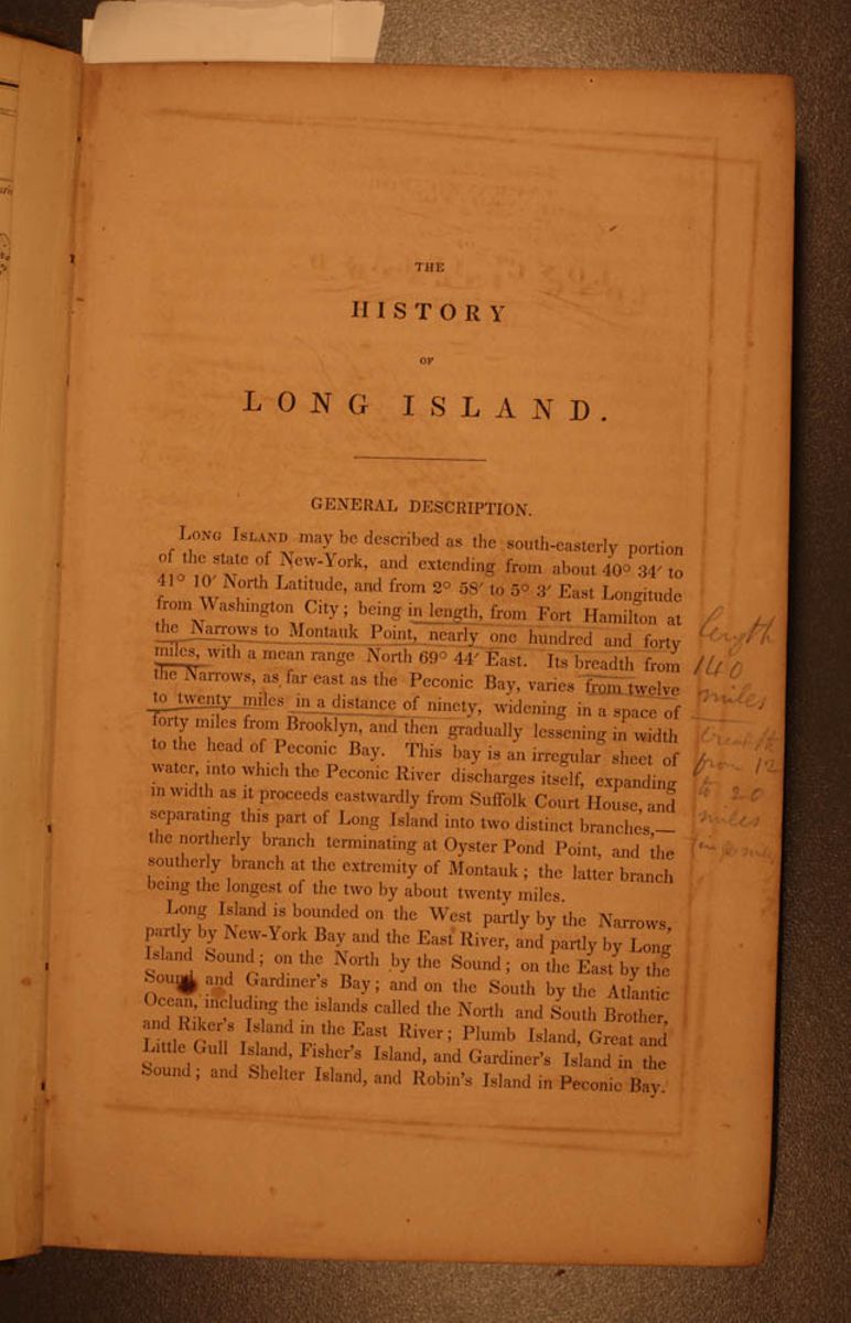
THE HISTORY OF LONG ISLAND.
GENERAL DESCRIPTION.
LONG ISLAND may be described as the south-easterly portion of the state of New-York, and extending from about 40˚ 34´ to 41˚ 10´ North Latitude, and from 2˚ 58´ to 5˚ 3´ East Longitude from Washington City; being in length, from Fort Hamilton at the Narrows to Montauk Point, nearly one hundred and forty miles, with a mean range North 69ª 44´ East. Its breadth from the Narrows, as far east as the Peconic Bay, varies from twelve to twenty miles in a distance of ninety, widening in a space of forty miles from Brooklyn, and then gradually lessening in width to the head of Peconic Bay. This bay is an irregular sheet of water, into which the Peconic River discharges itself, expanding in width as it proceeds eastwardly from Suffolk Court House, and separating this part of Long Island into two distinct branches,— the northerly branch terminating at Oyster Pond Point, and the southerly branch at the extremity of Montauk; the latter branch being the longest of the two by about twenty miles.
Long Island is bounded on the West party by the Narrows, partly by New-York Bay and the East River, and partly by Long Island Sound; on the North by the Sound; on the East by the Sound and Gardiner's Bay; and on the South by the Atlantic Ocean, including the islands called the North and South Brother, and Riker's Island in the East River; Plumb Island, Great and Little Gull Island, Fisher's Island, and Gardiner's Island in the Sound; and Shelter Island, and Robin's Island in Peconic Bay.
[begin surface 2]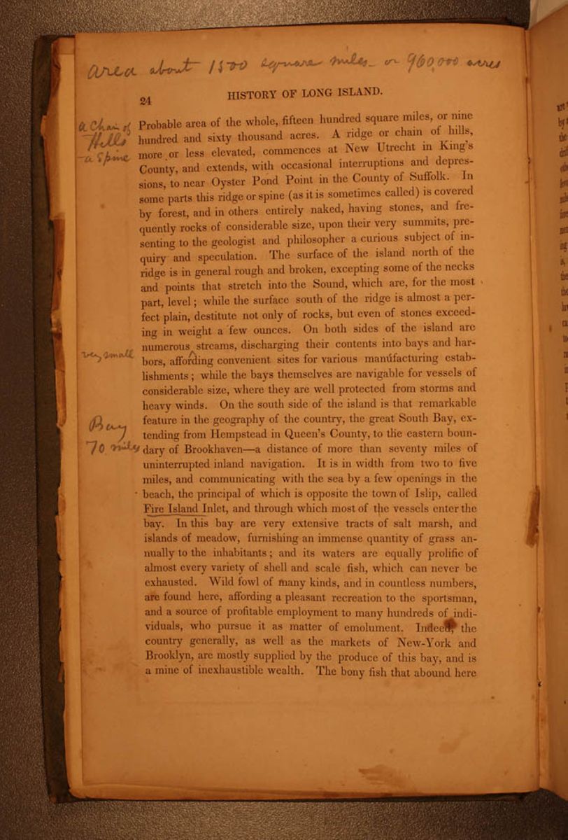 24
HISTORY OF LONG ISLAND.
24
HISTORY OF LONG ISLAND.
Probable area of the whole, fifteen hundred square miles, or nine hundred and sixty thousand acres. A ridge or chain of hills, more or less elevated, commences at New Utrecht in King's County, and extends, with occasional interruptions and depressions, to near Oyster Pond Point in the County of Suffolk. In some parts this ridge or spine (as it is sometimes called) is covered by forest, and in others entirely naked, having stones, and frequently rocks of considerable size, upon their very summits, presenting to the geologist and philosopher a curious subject of inquiry and speculation. The surface of the island north of the ridge is in general rough and broken, excepting some of the necks and points that stretch into the Sound, which are, for the most part, level; while the surface south of the ridge is almost a perfect plain, destitute not only of rocks, but even of stones exceeding in weight a few ounces. On both sides of the island are numerous ^very small streams, discharging their contents into bays and harbors, affording convenient sites for various manufacturing establishments; while the bays themselves are navigable for vessels of considerable size, where they are well protected from storms and heavy winds. On the south side of the island is that remarkable feature in the geography of the country, the great South Bay, extending from Hempstead in Queen's County, to the eastern boundary of Brookhaven—a distance of more than seventy miles of uninterrupted inland navigation. It is in width from two to five miles, and communicating with the sea by a few openings in the beach, the principal of which is opposite the town of Islip, called Fire Island Inlet, and through which most of the vessels enter the bay. In this bay are very extensive tracts of salt marsh, and islands of meadow, furnishing an immense quantity of grass annually to the inhabitants; and its waters are equally prolific of almost every variety of shell and scale fish, which can never be exhausted. Wild fowl of many kinds, and in countless numbers, are found here, affording a pleasant recreation to the sportsman, and a source of profitable employment to many hundreds of individuals, who pursue it as matter of emolument. Indeed, the country generally, as well as the markets of New-York and Brooklyn, are mostly supplied by the produce of this bay, and is a mine of inexhaustible wealth. The bony fish that abound here
[begin surface 3]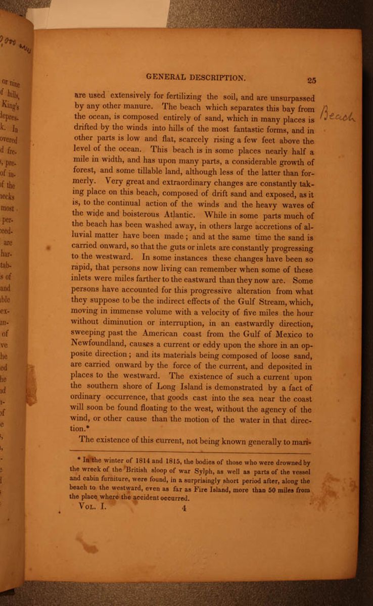 GENERAL DESCRIPTION.
25
GENERAL DESCRIPTION.
25
are used extensively for fertilizing the soil, and are unsurpassed by any other manure. The beach which separates this bay from the ocean is composed entirely of sand, which in many places is drifted by the winds into hills of the most fantastic forms, and in other parts is low and flat, scarcely rising a few feet above the level of the ocean. This beach is in some places nearly half a mile in width, and has upon many parts, a considerable growth of forest, and some tillable land, although less of the latter than formerly. Very great and extraordinary changes are constantly taking place on this beach, composed of drift sand and exposed, as it is, to the continual action of the winds and the heavy waves of the wide and boisterous Atlantic. While in some parts much of the beach has been washed away, in others large accretions of alluvial matter have been made; and at the same time the sand is carried onward, so that the guts or inlets are constantly progressing to the westward. In some instances these changes have been so rapid, that persons now living can remember when some of these inlets were miles farther to the eastward than they now are. Some persons have accounted for this progressive alteration from what they suppose to be the indirect effects of the Gulf Stream, which, moving in immense volume with a velocity of five miles the hour without diminution or interruption, in an eastwardly direction, sweeping past the American coast from the Gulf of Mexico to Newfoundland, causes a current or eddy upon the shore in an opposite direction; and its materials being composed of loose sand, are carried onward by the force of the current, and deposited in places to the westward. The existence of such a current upon the southern shore of Long Island is demonstrated by a fact of ordinary occurrence, that goods cast into the sea near the coast will soon be found floating to the west, without the agency of the wind, or other cause than the motion of the water in that direction. *
The existence of this current, not being known generally to mariners,
*In the winter of 1814 and 1815, the bodies of those who were drowned by the wreck of the British sloop of war Sylph, as well as parts of the vessel and cabin furniture, were found, in a surprisingly short period after, along the beach to the westward, even as far as Fire Island, more than 50 miles from the place where the accident occurred. VOL. I. 4 [begin surface 4]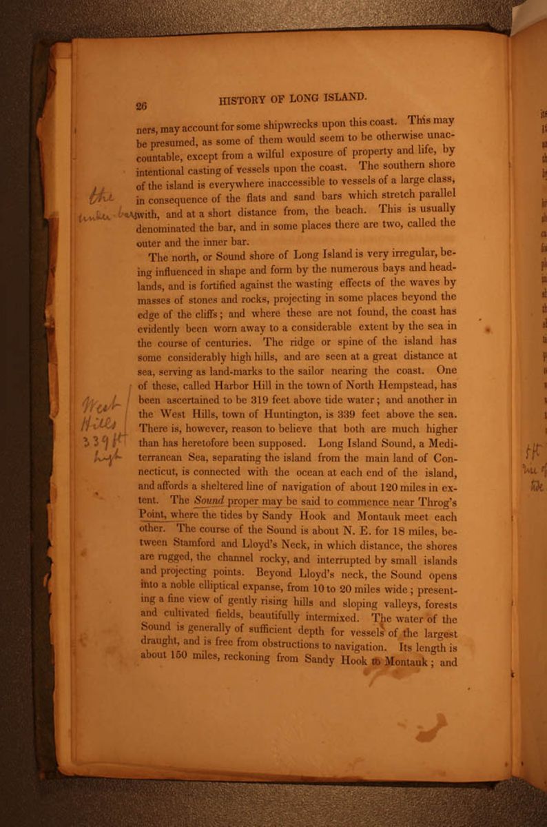 26
HISTORY OF LONG ISLAND.
26
HISTORY OF LONG ISLAND.
may account for some shipwrecks upon this coast. This may be presumed, as some of them would seem to be otherwise unaccountable, except from a wilful exposure of property and life, by intentional casting of vessels upon the coast. The southern shore of the island is everywhere inaccessible to vessels of a large class, in consequence of the flats and sand bars which stretch parallel with, and at a short distance from, the beach. This is usually denominated the bar, and in some places there are two, called the outer and the inner bar.
The north, or Sound shore of Long Island is very irregular, being influenced in shape and form by the numerous bays and headlands, and is fortified against the wasting effects of the waves by masses of stones and rocks, projecting in some places beyond the edge of the cliffs; and where these are not found, the coast has evidently been worn away to a considerable extent by the sea in the course of centuries. The ridge or spine of the island has some considerably high hills, and are seen at a great distance at sea, serving as land-marks to the sailor nearing the coast. One of these, called Harbor Hill in the town of North Hempstead, has been ascertained to be 319 feet above tide water; and another in the West Hills, town of Huntington, is 339 feet above the sea. There is, however, reason to believe that both are much higher than has heretofore been supposed. Long Island Sound, a Mediterranean Sea, separating the island from the main land of Connecticut, is connected with the ocean at each end of the island, and affords a sheltered line of navigation of about 120 miles in extent. The Sound proper may be said to commence near Throg's Point, where the tides by Sandy Hook and Montauk meet each other. The course of the Sound is about N. E. for 18 miles, between Stamford and Lloyd's Neck, in which distance, the shores are rugged, the channel rocky, and interrupted by small islands and projecting points. Beyond Lloyd's neck, the Sound opens into a noble elliptical expanse, from 10 to 20 miles wide; presenting a fine view of gently rising hills and sloping valleys, forests and cultivated fields, beautifully intermixed. The water of the Sound is generally of sufficient depth for vessels of the largest draught, and is free from obstructions to navigation. Its length is about 150 miles, reckoning from Sandy Hook to Montauk; and
[begin surface 5] GENERAL DESCRIPTION.
27
GENERAL DESCRIPTION.
27
its breadth in some places more than 20; average breadth about 12 miles. The force of the current between Oyster Pond Point and Plumb Island is very great, yet it is exceeded by that called the Race in the vicinity of the Gull Islands, which, when increased by a N. E. storm, is tremendous.
The Bay of New-York being about 9 miles in length and 5 in breadth, has a communication with the Atlantic through a strait of about a mile broad between Long and Staten Islands. This is called the Narrows, and on each side, as well as in the channel, are forts for protecting the harbor. This magnificent bay is completely sheltered from the stormy Atlantic by Long Island, forming a noble basin, and offering a spacious and safe anchorage for shipping to almost any extent; while the quays which encompass the town, afford facilities for loading and discharging cargoes. The shipping in the harbor of New-York, therefore, without the erection of breakwaters or covering-piers, is, in all states of the wind, protected from the roll of the Atlantic. Without the aid of docks, or even dredging, vessels of the largest class lie afloat during low water of spring-tides, moored to the quays which bound the seaward sides of the city; and, by the erection of wooden jetties, the inhabitants are enabled, at a small expenditure, to enlarge the accommodations of their port, and adapt it to their increasing trade.
The perpendicular rise of tide is only 5 feet. The tidal wave, however, increases in its progress northward along the coast, till at length in the Bay of Fundy, it attains the maximum of 90 feet. A bar extends from Sandy Hook to the shore of Long Island, across the entrance to the harbor, over which is a depth of 21 feet at low water, which is sufficient to float the largest class of merchant vessels. Proceeding easterly from the city of New-York, the river has a tortuous course for a distance of 16 miles. From the battery to the mouth of Harlaem River, 8 miles, the course is N. N. E., and from thence to Throg's Point, E., nearly 8 more. At the bend, situated opposite Harlaem River, is the noted pass or strait called Hell Gate, which is crooked; and from the numerous rocks, islands, eddies, and currents, is somewhat difficult and dangerous, particularly for vessels of large size; and many serious accidents have occurred at this place. The danger, how-
[begin surface 6] SOIL AND CLIMATE.
29
SOIL AND CLIMATE.
29
the aid of a scanty soil, sufficient fertility to yield a rich pasture for thousands of cattle and sheep, for seven months in the year. With lime or ashes, it is rendered quite productive. Along the north side of this immense heath, in the region of Queen's county court house, and the settlement of Westbury, are some of the best farms in the county, and if the whole of this open waste was disposed of and inclosed in separate fields, the agricultural products of this portion of the island would be nearly doubled. A stupid policy, consequent upon old prejudices, has hitherto prevented any other disposition of it, than as a common pasturage. It is hoped the time is not far distant, when this extensive tract shall abound in waving fields of grain, yielding not only support, but profit, to thousands of hardy and industrious citizens.
Eastward from this plain and extending to near the head of Peconic Bay, is a vast tract of barren land, so entirely composed of sand, as to be unsusceptible of profitable cultivation, by any process at present known.
The soil of Kings county is in the aggregate possessed of a greater natural fertility than most other parts of Long Island; yet the lands about Newtown and Flushing, as well as those upon Little Neck, Great Neck, Cow Neck, and portions of Oyster Bay, are wonderfully prolific.
The numerous and extensive tracts of salt meadows and marshes, in various places, and upon the south side of the island particularly, produce an almost inexhaustible quantity of food for cattle and horses, of a nutritious quality.
The immense shell banks which heretofore existed on the sites of ancient Indian villages, have in many instances been removed, and their contents applied for fertilizing the soil with eminent advantage. Upon the southerly side of the island, as well as in the towns of Riverhead and Southold, the bony fish have been principally used for manure, and with great success. The profusion of this species of fish and the consequent cheapness of the article, will probably always insure its use in those parts of the island where they abound. It is probable that at least 100,000,000 are annually taken for this purpose
There is reason to believe that the farmers of Long Island furnish yearly for market a surplus of beef, pork, hay and grain,
[begin surface 7]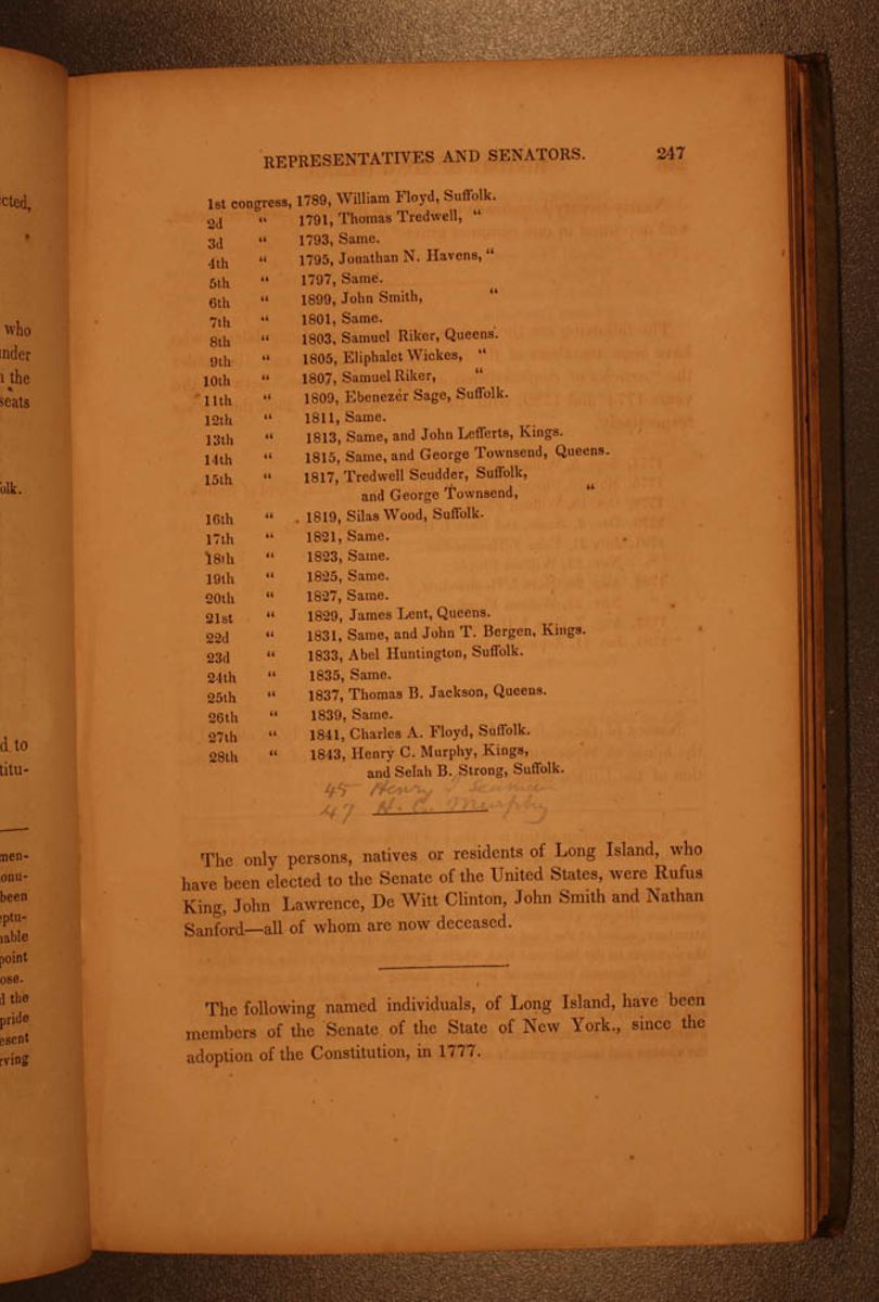 REPRESENTATIVES AND SENATORS.
247
REPRESENTATIVES AND SENATORS.
247
- 1st congress, 1789, William Floyd, Suffolk.
- 2d " 1791, Thomas Tredwell, "
- 3d " 1793, Same.
- 4th " 1795, Jonathan N. Havens, "
- 5th " 1797, Same.
- 6th " 1899, John Smith, "
- 7th " 1801, Same.
- 8th " 1803, Samuel Riker, Queens.
- 9th " 1805, Eliphalet Wickes, "
- 10th " 1807, Samuel Riker, "
- 11th " 1809, Ebenezer Sage, Suffolk.
- 12th " 1811, Same.
- 13th " 1818, Same, and John Lefferts, Kings.
- 14th " 1815, Same, and George Townsend, Queens.
- 15th " 1817, Tredwell Scudder, Suffolk, and George Townsend, "
- 16th " 1819, Silas Wood, Suffolk.
- 17th " 1821, Same.
- 18th " 1823, Same.
- 19th " 1825, Same.
- 20th " 1827, Same.
- 21st " 1829, James Lent, Queens.
- 22d " 1831, Same, and John T. Bergen, Kings.
- 23d " 1833, Abel Huntington, Suffolk.
- 24th " 1835, Same.
- 25th " 1837, Thomas B. Jackson, Queens.
- 26th " 1839, Same.
- 27th " 1841, Charles A. Floyd, Suffolk.
- 28th " 1843, Henry C. Murphy, Kings, and Selah B. Strong, Suffolk.
47 H. C. Murphy
The only persons, native or residents of Long Island, who have been elected to the Senate of the United States, were Rufus King, John Lawrence, De Witt Clinton, John Smith and Nathan Sanford—all of whom are now deceased.
The following named individuals, of Long Island, have been members of the Senate of the State of New York., since the adoption of the Constitution, in 1777.